Sacred Monuments in Spain
A guide to 2038 Sacred Monuments in Spain — with descriptions, photos and traveler visits from the NextOnTrip community. Locations spread across 1060 cities and towns. Most visited by the community: Basilica of the Most Holy True Cross, Sant Salvador d’Artà, Iglesia y muralla del Tozal del Muro.
-
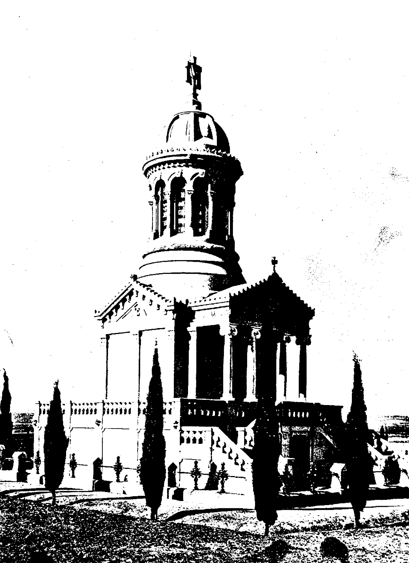
Cementerio Municipal de Guadalajara
Guadalajara
Cementerio Municipal de Guadalajara is the historic municipal cemetery of Guadalajara, Spain, established in the first half of the 19th century and still serving as the city's main burial ground today. It sits on Calle Dos de Mayo, in an area that lay outside the built-up city when it was founded but is now effectively an urban "island" surrounded by streets in the northwestern part of Guadalajara. Why was the cemetery built outside the city? The city council of Guadalajara first decided to build a new municipal cemetery in 1814. The move responded to a practical problem: the parish churches and the old city cemetery were by then completely full. It also reflected a broader European trend of the late 18th and early 19th centuries, when cemeteries were increasingly relocated away from city centers for public health reasons. When was the current cemetery actually built? Construction itself did not begin until 1830, on land near what was then known as the camino del Osario. The works were overseen by the municipal architect José María Guallart. Difficult ground conditions slowed progress considerably, and building was even halted completely for a period. The cemetery was finally inaugurated on 31 October 1840. How did the cemetery grow over time? The original layout proved insufficient as the city grew, so from 1890 onward the council carried out further expansion and improvement works. These included a third internal courtyard, completed in 1898. That same year, the municipal council formally named the cemetery's three main courtyards: Nuestra Señora de la Antigua, Nuestra Señora de la Soledad, and Santa Ana. What can visitors see on the grounds? These three historic courtyards date from the turn of the 20th century and still retain the distinctive atmosphere of a Romantic-era cemetery. They house a considerable number of elaborate tombs and mausoleums of notable architectural value, reflecting the wealth and taste of Guadalajara's bourgeois families of the period. The spatial layout, the carved stonework, and the surrounding vegetation together create a place with a clearly 19th-century, sentimental character, quite different from a modern municipal cemetery. Who is this cemetery worth visiting for? Cementerio Municipal de Guadalajara is of particular interest to visitors drawn to local history, funerary architecture, and 19th-century stonemasonry. Walking through the oldest courtyards makes it possible to trace stylistic changes in grave art over nearly a century, as well as to encounter the names of families that have been tied to the city for generations. Frequently asked questions When did the cemetery open? It was officially inaugurated on 31 October 1840, although the decision to build it dates back to 1814. Who designed the cemetery? The construction works were supervised by municipal architect José María Guallart. How many historic courtyards does the cemetery have? The three oldest courtyards are named Nuestra Señora de la Antigua, Nuestra Señora de la Soledad, and Santa Ana, with their names formally established in 1898. Where exactly is the cemetery located? On Calle Dos de Mayo No. 3, in the northwestern part of Guadalajara, in an area now surrounded on all sides by streets.
-
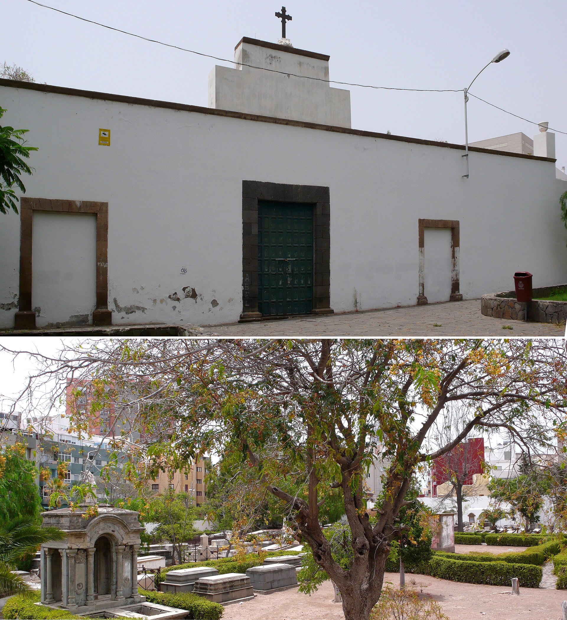
Cemetery of San Rafael y San Roque
Santa Cruz na Teneryfie
The Cemetery of San Rafael y San Roque is the oldest surviving burial ground in Santa Cruz de Tenerife, located in the Cuatro Torres neighborhood, on land once situated between the old hermitages of La Regla and San Sebastián. It stands today as both an architectural landmark and a physical record of one of the darkest chapters in the city's history. Why was this cemetery built? Until the early 19th century, burials in Santa Cruz de Tenerife followed the traditional Spanish practice of interring the dead near churches, inside the city itself. As early as 1799, King Charles IV had already ordered the creation of cemeteries outside city limits across Spain, aiming to reduce the risk of contagion from decomposing bodies buried within religious buildings. Santa Cruz, however, felt no urgent need to change its customs until disaster struck. In 1810, a yellow fever epidemic, introduced by ships arriving from Cádiz, killed 1,332 residents of the city. The scale of the tragedy forced local authorities into swift action: by 1811, the boundaries and layout of a new civil cemetery had been drawn up, designed to hold as many as 20,000 burials. Construction took over a decade, and the cemetery was officially completed on March 4, 1823. How is the cemetery divided? One of the site's most distinctive features is its division into two separate sections: Catholic and Protestant. The Protestant section was added later than the Catholic one — its construction was authorized by the Santa Cruz Council on November 13, 1831, invoking the Treaty of Utrecht, which governed the religious rights of foreign nationals in the Canary Islands. This arrangement allowed non-Catholic residents to be buried on consecrated ground, a rare accommodation in Spain at the time and one that reflected the international character of a port city frequented by merchants and sailors from across Europe. When did the cemetery stop being used? The cemetery of San Rafael y San Roque served the city for nearly a century. Burials ceased on January 27, 1916, when a new cemetery opened at Montaña de Hoya Fría, better suited to the growing needs of an expanding Santa Cruz de Tenerife. From that point on, the old cemetery gradually lost its role as an active burial site, while gaining new significance as a historical witness to earlier times. What is the site's current status? The historical and architectural value of the cemetery was formally recognized on October 27, 2004, when it was declared a Site of Cultural Interest in the Monument category (Bien de Interés Cultural, categoría Monumento). This legal protection shields the site from deterioration and obliges local authorities to preserve it for future generations. Today, the Cemetery of San Rafael y San Roque is a quiet place that draws visitors interested in the history of Santa Cruz de Tenerife, 19th-century funerary architecture, and the traces left by the epidemics that shaped the city's development. It also offers a rare opportunity to see, within a single enclosed space, the coexistence of two distinct religious traditions spanning several decades. Frequently Asked Questions Why was the cemetery built in this particular location? The site was chosen outside the city's boundaries at the time, between the old hermitages of La Regla and San Sebastián, following the sanitary regulations of the period that required cemeteries to be kept away from residential areas. How many burials was the cemetery designed to hold? It was designed with a capacity for 20,000 burials. What is the difference between the Catholic and Protestant sections? The Catholic section was built first, as part of the original 1811–1823 project, while the Protestant section was added in 1831 following municipal approval, allowing burials of people of other Christian denominations. Is the cemetery still in use today? No, burials ended in 1916 when a new cemetery opened at Montaña de Hoya Fría.
-
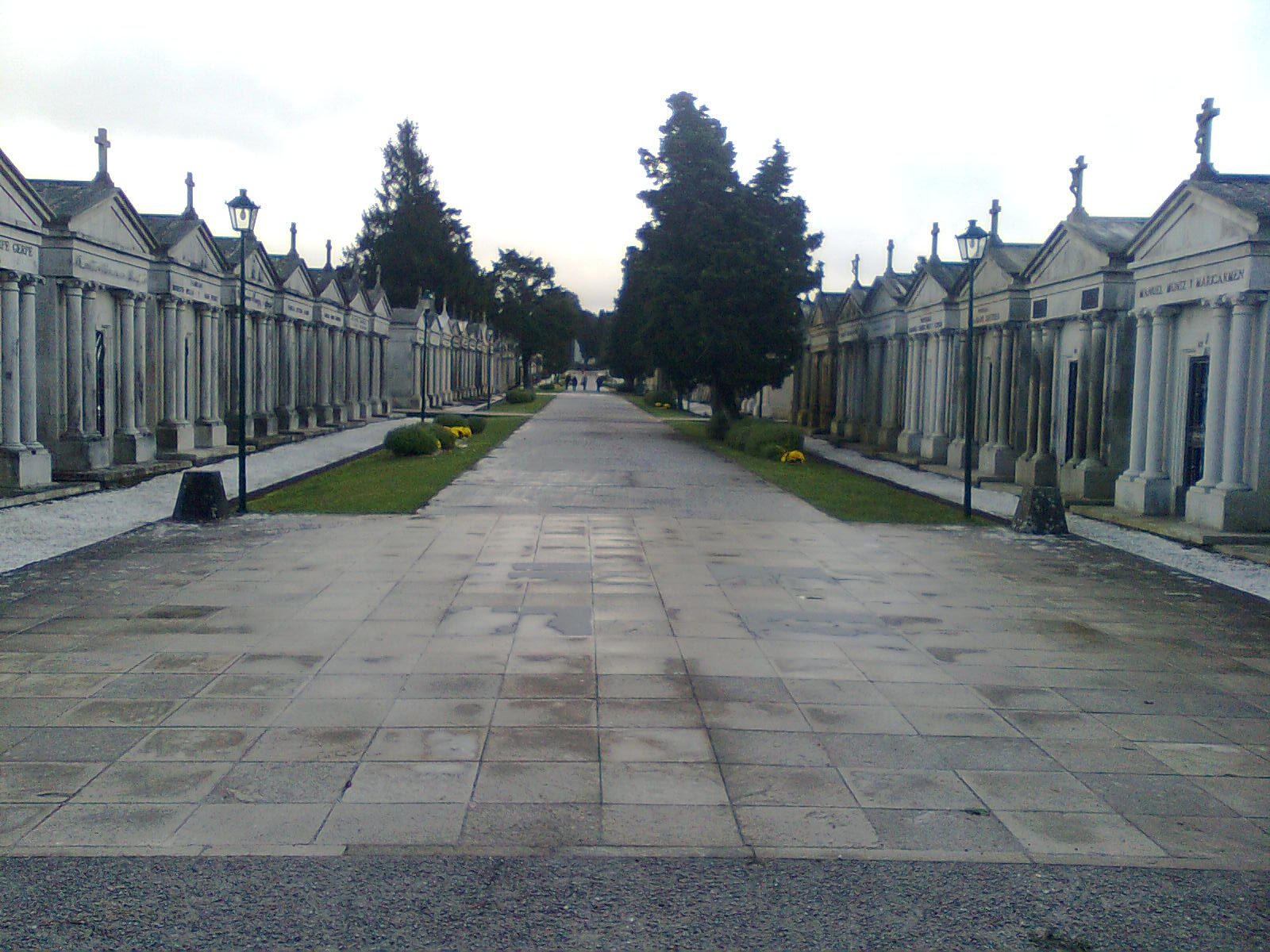
Cemetery of Boisaca
Santiago de Compostela
Boisaca Cemetery is the main municipal cemetery of Santiago de Compostela, located north of the historic centre near the Tambre industrial estate and the N-550 road. It covers roughly 66,000 square metres and holds close to 12,000 burial places, combining ground graves, columbarium niches, and family pantheons. Rather than a simple burial ground, it was laid out with a genuine urban plan, complete with a main avenue and side lanes organising the different sections. Why was a new cemetery needed in the first place? In the early 20th century, Santiago de Compostela was struggling with the consequences of the Spanish flu pandemic, which caused heavy casualties and exposed how little space remained in the city's existing burial grounds. That public health crisis was the direct trigger for planning a much larger cemetery outside the old town, in the area known as Boisaca. Who designed it, and how long did construction take? The project was commissioned to municipal architect Mariano Fernández Ragel, who drew up the design in 1919. Construction moved forward over the following years, and by 1923, coinciding with the start of the Primo de Rivera dictatorship, the cemetery was largely finished. Despite that, its formal inauguration didn't take place until much later — the site was officially opened in March 1939, under a very different political regime from the one in which it had first been conceived. What happened at Boisaca during the Spanish Civil War? The cemetery also carries a darker chapter of Spanish history. During the opening months of the Civil War, the grounds were used as a site of executions, where people targeted by the new authorities were shot. That history is now marked by a memorial plaque on one of the cemetery walls, dedicated to the victims of those reprisals. Because of this, Boisaca is not only a resting place for the city's dead, but also a point of reference for the historical memory of the Francoist period in Galicia. How is the cemetery laid out? One of the most distinctive features of Boisaca is its spatial composition, designed with the kind of ambition typical of larger European cemeteries from the early 20th century. A main avenue acts as the central axis, with side corridors branching off toward the different burial sections. This layout makes it easier to navigate such a large site and gives the cemetery an orderly, almost city-like character — which is why local descriptions sometimes refer to it as a small "city of the dead." Is there anything architecturally notable on the grounds? Beyond the burial plots themselves, the site includes a funerary chapel (tanatorio) that has been the subject of dedicated architectural studies examining how spaces of mourning and silence are shaped in buildings of this kind. This shows that, while Boisaca is first and foremost a working cemetery, it is also regarded as having architectural value and is discussed in the context of memorial-space design. Frequently asked questions Where exactly is Boisaca Cemetery located? It lies north of central Santiago de Compostela, in the Boisaca area, close to the Tambre industrial estate and the N-550 road. When did the cemetery officially open? Although construction was largely complete by the 1920s, the formal inauguration only took place in March 1939. Why was this particular site chosen for a new cemetery? The immediate reason was the Spanish flu epidemic in the early 20th century, which revealed that the city's existing cemeteries no longer had enough capacity. Does Boisaca have historical significance beyond being a burial site? Yes — it was used as an execution site during the early months of the Spanish Civil War, a history now commemorated with a plaque on one of its walls.
-
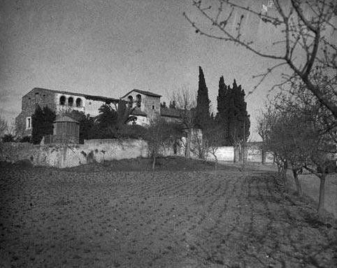
Church de Sant Genís de Plegamans
Palau-solità i Plegamans
The Church of Sant Genís de Plegamans is the parish church of Palau-solità i Plegamans, a town in the Vallès Occidental comarca, Barcelona province. Built in exposed brick in the mid-twentieth century, it replaced a much older Romanesque church that did not survive the civil war. Today it stands as one of the town's landmarks and a worthwhile stop for anyone curious about twentieth-century Catalan religious architecture. Why was the church rebuilt? The original church, dedicated to Saint Genesius, had medieval roots but was destroyed in 1936 during the Spanish Civil War. Its replacement was designed by architect Isidre Puig i Boada, who raised the new building between 1942 and 1944, essentially from scratch. The result reflects the architectural language of its era: exposed brick as the dominant material, a compact volume, and clear geometric lines. What does the building look like? The church follows a single-nave plan, closed at the east end by a seven-sided polygonal apse encircled by an internal ambulatory — an unusual feature for a parish church of this size. The main façade is dominated by a circular rose window, and the entrance is set within a narrow pointed-arch doorway. The roof is covered in the terracotta tiles typical of the region, with slender moldings running along the eaves. The exterior walls are enlivened by blind pointed arches, small rosette openings, and clusters of triangular window openings. The bell tower, added only in 1992, is polygonal in plan and rises in three tiers pierced by elongated windows, capped by a pitched roof. In 1998, a porch was added at the entrance, formed by three round arches — today the first architectural element visitors see as they approach the church square. What is inside? The apse is decorated with frescoes by the painter Jaume Busquets, completed in the 1950s, around the same time as the rose window on the façade. Above the entrance, the tympanum bears an image of the face of Christ, a detail that draws the eye of anyone stepping into the church square. The building is listed on Catalonia's Inventory of Architectural Heritage (IPAC), confirming its recognized value as part of local heritage despite being less than a century old. Where is it and how do you get there? The church stands on Plaça de Sant Genís, in the centre of Palau-solità i Plegamans, a town belonging to the Diocese of Terrassa. Palau-solità i Plegamans lies within the Vallès Occidental comarca, close enough to the Barcelona metropolitan area to make it an easy stop for visitors exploring the region around the Catalan capital. A visit works well combined with a walk through the town centre, where the church serves as a natural landmark. Frequently Asked Questions Is the current church the original medieval building? No. An earlier Romanesque church with the same dedication was destroyed in 1936 during the Spanish Civil War. The present building was constructed from scratch between 1942 and 1944. Who designed the church? The architect was Isidre Puig i Boada. What is most distinctive about the church's architecture? The seven-sided polygonal apse with its internal ambulatory, the exposed brick construction, and the circular rose window on the main façade. When were the bell tower and entrance porch built? The bell tower was added in 1992, and the entrance porch in 1998 — both considerably later than the main body of the church.
-
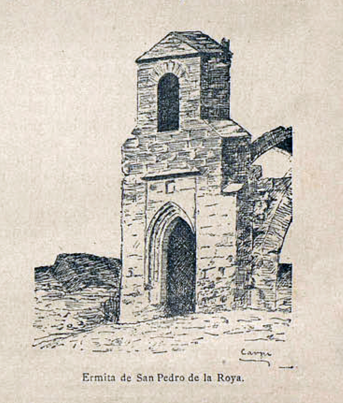
Church of San Pedro
San Miguel del Cinca
The Church of San Pedro (Spanish: Iglesia de San Pedro de Larroya, also recorded as Iglesia de San Pedro de Santalecina) is a ruined medieval church in the municipality of San Miguel del Cinca, in the Cinca Medio district of Huesca province, Aragón. No intact building remains on site — the appeal for visitors lies in a single surviving architectural fragment and the layered history behind it. Where exactly are the ruins located? The remains stand in an area known as La Roya (or Larroya), the site of a former "pardina" — a self-contained rural farmstead — roughly midway along an old track that once connected the villages of Santalecina and Castelflorite. Historical boundary records describe the land here as bordering the territories of Alcolea de Cinca, Castelflorite and Santalecina, which is how the exact location within the Cinca river valley has been pinpointed. What survives of the original building? Only one element of the church has come down to us: a pointed Gothic arch dated to the 14th century. Stonemasons' marks are still visible cut into its stones, left by the craftsmen who worked on it. No walls, vaulting or interior furnishings remain, and heritage records officially list the site as a church ruin in ruinous condition. Does the site have any heritage protection? Yes. The ruins are registered as a Bien Inventariado del Patrimonio Cultural Aragonés (an asset catalogued in Aragón's cultural heritage inventory), under SIPCA reference 1-INM-HUE-008-903-018. That listing protects the surviving arch and the ground of the former church, even though the building itself has largely disappeared. How far back does the church's history go? The earliest written reference to the site dates to 1493, when a boundary document names the "Pardina de La Roya". The location sat along an old route linking Monzón and Zaragoza by way of Villanueva de Sijena and Candasnos, a road used by both travelers and pilgrims crossing this part of Aragón during the medieval period. Why is it called San Pedro de Larroya? The church was dedicated to Saint Peter (San Pedro), which explains the name that has outlived the building itself. The suffix "de Larroya" refers to the district where it stood, distinguishing it from other churches with the same dedication in the surrounding area — the municipality of San Miguel del Cinca has more than one site historically named after Saint Peter. Frequently Asked Questions Can the Church of San Pedro still be visited today? There is no standing building to tour — only a 14th-century Gothic arch remains on site, so a visit means viewing a historical ruin rather than entering a church. Where precisely are the ruins located? In the area known as La Roya (Larroya), between the villages of Santalecina and Castelflorite, within the municipality of San Miguel del Cinca in Huesca province. How old is the surviving fragment? The pointed arch is Gothic in style and dates to the 14th century, while the earliest written mention of the site itself — as "Pardina de La Roya" — goes back to 1493. Is the site legally protected? Yes, it is listed in Aragón's cultural heritage inventory as a Bien Inventariado del Patrimonio Cultural Aragonés, under SIPCA record 1-INM-HUE-008-903-018.
-
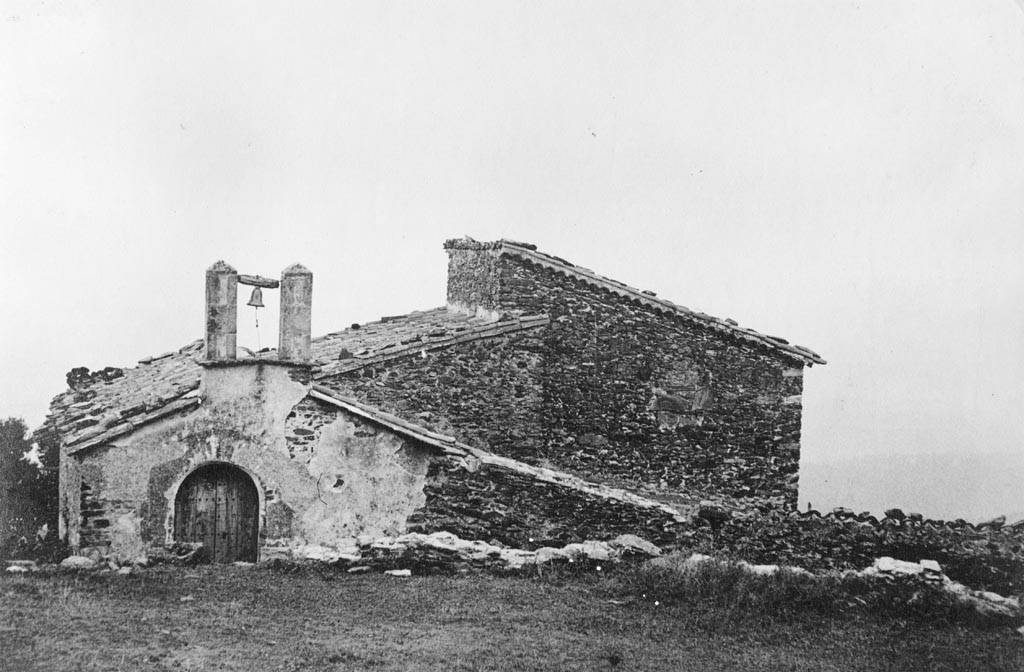
Sant Joan de Cavallar
Sant Pere de Vilamajor
Sant Joan de Cavallar is a small pre-Romanesque chapel in the municipality of Sant Pere de Vilamajor, in the Vallès Oriental region of Catalonia, at the foot of the Montseny massif. Though it now stands in ruins, it ranks among the oldest surviving religious buildings in this part of Catalonia and is a notable reference point for anyone interested in early medieval architecture. Where is the chapel located? The building sits at roughly 569 metres above sea level, near the site of the former farmhouse Can Nadal, in the Santa Susanna area of Sant Pere de Vilamajor. It lies within the Refugis del Montseny holiday settlement, surrounded by woodland and hiking paths that lead further into the Montseny massif. Both driving and walking access are relatively straightforward, though the chapel itself sits on private land. Where does the name come from, and what is its history? The name "Cavallar" already appears in mid-10th-century records — in the 950 property survey (polyptych) of Vilamajor, where it designated the surrounding land. The chapel, dedicated to Saint John the Evangelist, originally stood as an annex to the old farmhouse known as mas Cavallar, from which the later Can Nadal estate developed. It resurfaces repeatedly in ecclesiastical and notarial documents across the Middle Ages, with mentions recorded in, among others, the 11th, 13th and 14th centuries. Its architectural features — herringbone-pattern masonry (opus spicatum), a rectangular nave with a narrower, square apse, and a barrel-vaulted sanctuary built with irregularly placed voussoirs — allow architectural historians to date the structure to the pre-Romanesque period, most likely the first half of the 10th century. These traits make it one of the oldest surviving religious buildings identified in the Vallès area. What happened to the chapel afterward? The building was rebuilt more than once, first in 1610 and again during the 20th century. The most significant intervention came in 1975, when it was converted for use as a restaurant; a small arched bell tower was added at the time but has since disappeared. In 1983, a 16th-century plateresque altarpiece was stolen from inside. What condition is the chapel in today? Its state of preservation today is very poor: the roof has collapsed, and the building stands abandoned and exposed to vandalism. It remains privately owned and currently serves no function. Even so, it is listed in the municipality's heritage catalogue (the 2011 POUM plan), with a 30-metre archaeological protection zone around it. What should visitors know before going? Sant Joan de Cavallar is a point of interest for history and architecture enthusiasts rather than a conventional tourist attraction — there is no ticket office, no marked visitor route, and no guaranteed access to the interior. It's worth pairing a visit with a walk along the surrounding Montseny trails, for instance toward Santa Susanna or deeper into the massif. Because "Sant Joan" is an extremely common dedication across Catalonia, it's worth double-checking that any information found refers specifically to this chapel in Sant Pere de Vilamajor, rather than to a different building sharing the name (such as Sant Joan de Vilamajor or Sant Joan de Vilatorrada). Frequently Asked Questions Can visitors enter Sant Joan de Cavallar? The chapel is privately owned and structurally unsound, with a collapsed roof, so there is no regular organised access to the interior. It can, however, be viewed from the outside by anyone passing through the area. How old is the chapel? Its architectural features point to the pre-Romanesque period, most likely the first half of the 10th century, although the place name itself is documented as early as 950 and the chapel appears in church records across several later centuries. How do you get there? It stands near the former Can Nadal farmhouse, in the Santa Susanna district of Sant Pere de Vilamajor, at around 569 metres above sea level, within the Refugis del Montseny recreational area. Access is relatively easy, though it's best to plan the route using local Montseny trail maps.
-
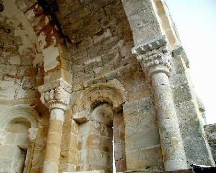
Hermitage of Bárcena de Pienza
Merindad de Montija
The Hermitage of Bárcena de Pienza (Spanish: Iglesia de Nuestra Señora de la Asunción) is the Romanesque ruin of a former parish church standing at the edge of Bárcena de Pienza, a small village within the municipality of Merindad de Montija, in the province of Burgos, in the Las Merindades region of northern Castile and León. Of the church that once served this settlement of roughly 45 residents, only part of the nave walls and a single, richly carved apse have survived — and it's that apse, dated to the close of the 12th century, that draws visitors interested in Romanesque stonework. Where exactly does the ruin stand? The remains sit in a quiet, somewhat isolated spot surrounded by farmland on the outskirts of Bárcena de Pienza, a village belonging to the municipality of Merindad de Montija, within the Las Merindades comarca in the northern reaches of Burgos province, close to the border with Cantabria. The ground around the ruin now serves as the village cemetery, so access is straightforward and unhurried, much like visiting any small rural churchyard. Why did a parish church end up abandoned? The building was originally the civic and religious heart of the settlement, before the village itself relocated further southeast — local tradition points to repeated flooding from the nearby Trueba river as the reason people moved. Left behind, the church, dedicated to Nuestra Señora de la Asunción (Our Lady of the Assumption), gradually lost its parish status and came to be known locally as a hermitage, a lasting marker of where the original village once stood. The name Bárcena de Pienza is itself said to echo an early medieval settlement called Pienza, which reportedly also lent its name to two nearby villages, Quintanilla and Revilla. What actually survives of the original building? What remains today is a stretch of the nave walls together with a semicircular apse, built from dressed sandstone ashlar toward the end of the 12th century. The exterior of the apse is divided into five bays separated by four engaged columns, each bay pierced by a window. The central window stands out for its archivolt, carved with a band of anthropomorphic heads — a decorative touch found in other Romanesque churches across Las Merindades, suggesting the same workshop of stonemasons was active in the wider area at the time. What do the carved capitals show? The most valuable surviving feature is the set of limestone capitals inside the apse, still legible after eight centuries. They depict unicorns, armed soldiers, and a scene identified as "the departure of the knight," a motif that turns up in other Romanesque churches of the region. Other capitals are carved with scrollwork and human heads wearing a variety of headgear, all consistent in style with the apse's late-12th-century date. Has anything been done to protect the ruin? During the 1990s the site underwent restoration work, funded largely through private contributions, with the local community chipping in toward a new roof to help shield the remaining structure from further decay. The building is still, by any definition, a ruin — but its most valuable part, the apse with its full set of carved capitals, has been preserved well enough to keep the site relevant for anyone tracing the Romanesque art of Las Merindades. Frequently asked questions Is it a hermitage or a church? It was built as the parish church of Bárcena de Pienza, dedicated to Nuestra Señora de la Asunción; once it lost its parish role, locals began calling it a hermitage. How old is the apse? It dates from the late 12th century and is built in the Romanesque style, using dressed sandstone ashlar. What can visitors see on site today? Sections of the nave walls and a semicircular apse with windows and carved capitals showing unicorns, soldiers, and a knight's departure scene; the surrounding ground now functions as the village cemetery. Why did the original village move away? Local tradition attributes the move to repeated flooding from the Trueba river, which pushed residents to resettle further southeast.
-
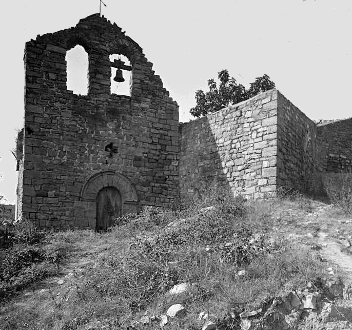
Sant Pere de la Goda
Argençola
Sant Pere de la Goda is a ruined Romanesque church in the municipality of Argençola, in the Anoia comarca of Barcelona province, Catalonia. It stands beside a track that branches off the road linking Igualada and Santa Coloma de Queralt, near its fifteenth kilometre, inside what was once the hamlet of la Goda — a settlement abandoned long ago. What is the history behind the church? Records place a parish here as early as the 11th and 12th centuries, although the structure still standing today was largely built in the 13th century. The church once belonged to the lands controlled from the castle of la Goda, a fortification of which no visible trace survives above ground. When the surrounding hamlet was abandoned, the church lost its role and slowly fell into disrepair; the foundations and broken walls of the former houses are still scattered around it, overtaken by scrub and undergrowth. What does the building look like today? The church consists of a single nave without an apse, roofed with a pointed barrel vault. At the end of the nave, a double-splayed window originally faced a house that stood right against the chapel — that house is now a ruin as well. The main doorway is formed by a round arch built from cut voussoirs, framed on its outer edge by an extra archivolt. Above the façade rises a restored bell-gable with two openings for bells, one of the few parts of the building that has kept a clearly readable shape. How do you get there? Access follows a path leaving the Igualada–Santa Coloma de Queralt road near its fifteenth kilometre marker. There is no paved approach and no visitor facilities; the final stretch has to be covered on foot or by mountain bike, in the same way as the hiking and biking routes that already cross this stretch of countryside around Argençola. The site sits at coordinates 41.56234 N, 1.45113 E, and visitors should expect overgrown ground and an unmarked, informal approach. What else is worth seeing nearby? Argençola municipality holds several other rural medieval churches scattered across small, partly deserted settlements, a pattern that is common in this part of inland Catalonia. The landscape here is one of low rolling hills and shallow valleys, where scattered ruined chapels and wall remains are often the clearest surviving evidence of medieval rural settlement. Frequently Asked Questions Can you drive directly to the church? No. The last stretch has to be walked or cycled along a path off the Igualada–Santa Coloma de Queralt road. Is the church still used for worship? No, it stands abandoned inside the deserted hamlet of la Goda and has no active religious use. How old is the building? A parish is documented here from the 11th and 12th centuries, but the surviving structure dates mostly from the 13th century. What has survived in the best condition? The restored double bell-gable and the round-arched entrance portal with its extra archivolt are the most recognisable surviving features.
-
Santa Maria de Lavaix
el Pont de Suert
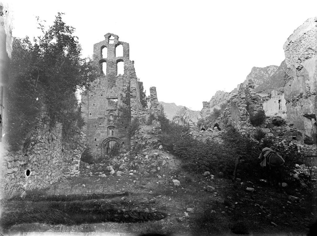
Santa Maria de Lavaix is what remains of a Romanesque Benedictine monastery, tucked along the shore of the Pantà d'Escales reservoir in the municipality of El Pont de Suert, in the Alta Ribagorça comarca of Catalonia. It's a stop for travelers drawn to the Pyrenees who want a thousand-year backstory rather than another fully restored monument with a gift shop. Where are the monastery ruins located? The site sits within El Pont de Suert, the administrative center of Alta Ribagorça, one of the most mountainous and sparsely populated comarcas of the Catalan Pyrenees. The ruins lie right at the edge of the Pantà d'Escales reservoir, and that proximity to open water is not incidental — it's the very reason the monastery looks the way it does today. What is the history behind Santa Maria de Lavaix? The monastery is first documented in the 10th century, making it one of the older monastic foundations in this stretch of the Pyrenees. Its fortunes were tied to the region's feudal powers for centuries: by the 13th century, Lavaix had come under the authority of the Barony of Erill, an important noble house in the area. A turning point came in 1223, when the community adopted the Cistercian rule and the monastery became a Cistercian abbey — part of a broader wave of reform that swept through many previously Benedictine houses across the Iberian Peninsula during that period. Why did the monastery disappear? From the early 19th century onward, Lavaix followed a familiar pattern of decline. The community lost standing until 1835, when the monastery was finally shut down as part of the Ecclesiastical Confiscations of Mendizábal, the Spanish government's sweeping seizure and sale of monastic property nationwide. The building's fate, however, was sealed by engineering rather than politics: in June 1955, construction of the Escales Dam was completed, and the reservoir that formed behind it flooded the old monastery grounds. That moment permanently changed the site's character — from an abandoned but still-standing structure to a partially submerged archaeological remnant. What can still be seen today? Of the once-functioning monastic complex, only fragments of the walls and traces of the northeast corner of the church's nave survive. That's a modest footprint compared with the original establishment, but for visitors interested in regional history and industrial-era archaeology — since it was the Escales Dam project that ultimately shaped the site's present-day form — the remains of Lavaix offer tangible evidence of how 20th-century hydroelectric development reshaped the Pyrenees' cultural landscape. Who is this site for? Santa Maria de Lavaix isn't built for mass tourism. It suits travelers exploring Alta Ribagorça who, alongside better-known regional draws such as the Romanesque churches of the Boí Valley, want to encounter a less obvious chapter of local history: an abbey that survived nearly a thousand years of shifting fortunes only to end up beneath the waters of a man-made reservoir. Frequently asked questions What was Santa Maria de Lavaix? A Romanesque Benedictine monastery, later a Cistercian abbey, located in the municipality of El Pont de Suert in Alta Ribagorça. When was the monastery founded? It is first mentioned in historical records from the 10th century. Why was the monastery closed? It was finally shut down in 1835 during the Ecclesiastical Confiscations of Mendizábal, following a period of decline that began in the early 19th century. What happened to the monastery buildings? In June 1955, after the Escales Dam was completed, the resulting reservoir flooded the monastery site. Today only fragments of the walls and traces of the nave's northeast corner remain.
-
Sant Miquel de la Infermeria
Sant Joan de les Abadesses
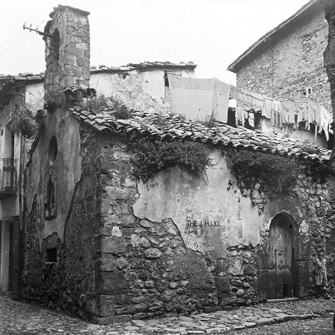
Sant Miquel de la Infermeria is the ruined Romanesque chapel of the former infirmary attached to the monastery of Sant Joan de les Abadesses, in the Ripollès region of Catalonia, Spain. Little of the original building survives, but the site is listed in Catalonia's inventory of architectural heritage, and its name still points to its original purpose: caring for the sick within the monastic community. Where did the chapel stand? The chapel stood inside the monastic precinct, tucked behind the abbot's palace, on the side facing away from the square in front of the monastery's main façade. Sant Joan de les Abadesses itself is a small town on the Ter river, its historic core built up over centuries around one of Catalonia's most significant medieval monasteries. The infirmary chapel occupied a separate structure, deliberately set apart from the strictly cloistered part of the complex — it served people who were not monks but were housed and cared for by the community. Where does the chapel come from? The building was commissioned by abbot Ponç de Monells, who by the time it was built was already serving as bishop of Tortosa rather than abbot of Sant Joan. It was consecrated on 2 November 1164, in a ceremony attended by the bishop of Vic, Pere Gausfred, and the bishop of Girona, Guillem de Monells — Ponç's own brother. The presence of two bishops, one a close relative of the founder, reflects how tightly local noble families and church hierarchy were interwoven in 12th-century Catalonia. What did the building look like? Sant Miquel de la Infermeria was a single-nave chapel on a rectangular plan, closed at the east end by a semicircular apse narrower than the nave — a common layout for small Romanesque churches in this part of Catalonia. Only a section of the north-western wall has survived, later incorporated into a house built on the site. Everything else disappeared over the centuries, so what remains today reads more as a trace embedded in later construction than as a recognizable church. Why does it matter to visitors? The chapel is a reminder that a major medieval monastery like Sant Joan de les Abadesses was more than its main church and cloister — it also ran a facility for the poor and infirm, kept at a physical remove from the monks' own quarters. For anyone visiting the town, it adds a lesser-known layer to a trip built mainly around the monastery church and its museum, hinting at the everyday welfare work carried out behind the abbey walls. Its listing in the Inventari del Patrimoni Arquitectònic de Catalunya confirms its recognized historical value despite the fragmentary remains. When to visit? Since only fragments of the chapel survive, built into a private house, the best approach is to combine a look at the site with a visit to central Sant Joan de les Abadesses and its monastery. Spring and summer make for pleasant walking weather in town, while autumn brings fewer visitors and a quieter pace. It is worth checking with the local tourist office beforehand about which parts of the remaining wall can be viewed from the outside. Frequently asked questions What was Sant Miquel de la Infermeria? A Romanesque chapel attached to the infirmary of the monastery of Sant Joan de les Abadesses, built to serve the sick and elderly cared for by the community. Who founded the chapel, and when was it consecrated? Abbot Ponç de Monells commissioned it while already serving as bishop of Tortosa; it was consecrated on 2 November 1164. What survives of the original building? Only part of the north-western wall remains, reused in the construction of the house that now occupies the site. Can the chapel be visited today? The remains form part of a private property, so viewing is generally limited to the visible wall fragments as part of a wider visit to Sant Joan de les Abadesses.
-
Monastery of Santa Cruz de Ribas
Ribas de Campos
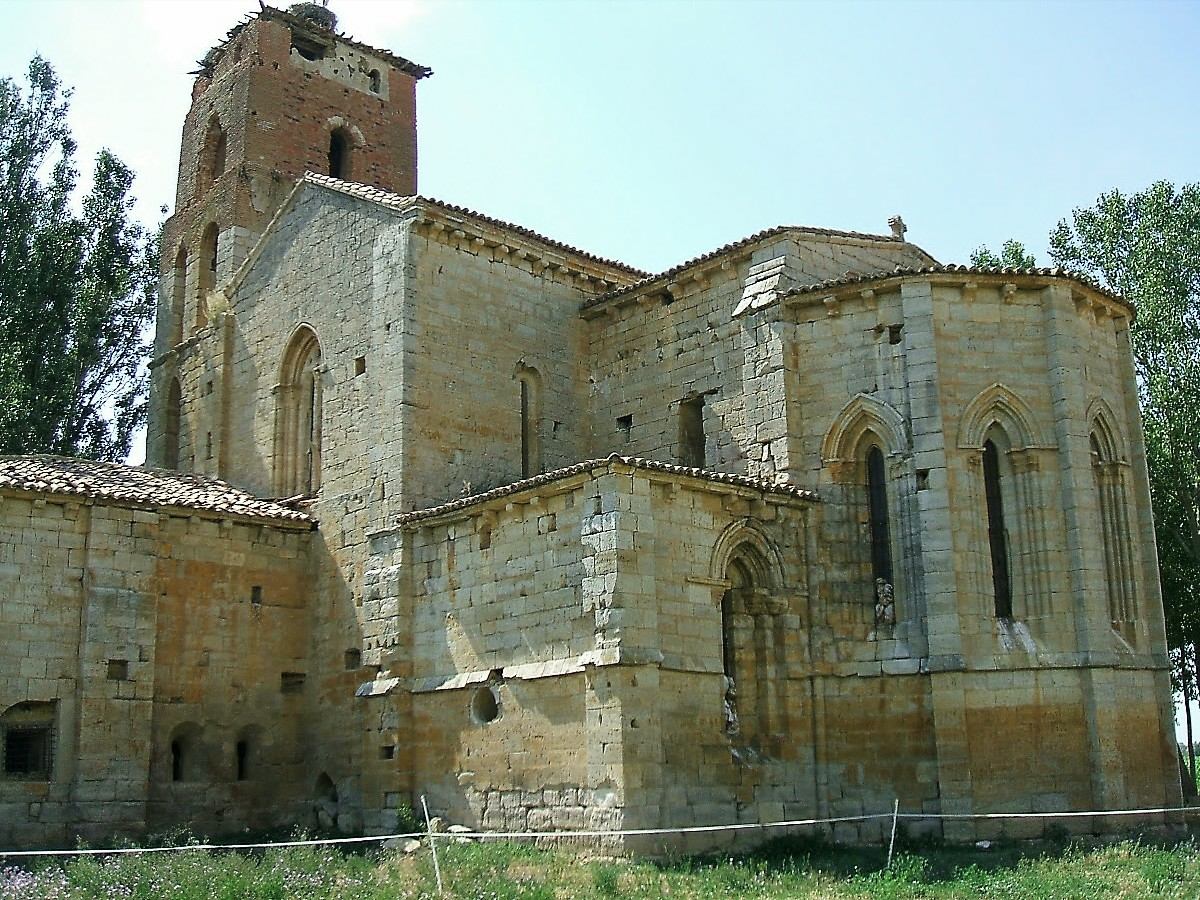
Monastery of Santa Cruz de Ribas (also known as Santa Cruz de la Zarza) is a partly ruined Premonstratensian monastery standing in the Carrión river valley, roughly midway between Monzón de Campos and Ribas de Campos, within the Tierra de Campos district of Palencia province, in Castile and León. Where is it and how do you get there? The ruins sit on the open plain of Tierra de Campos, in the low-lying stretch of the Carrión valley, a short drive north of the provincial capital, Palencia. The two neighboring villages — Monzón de Campos on one side, Ribas de Campos on the other — flank the site, making it an easy stop for anyone exploring the area by car. Tierra de Campos is known for its vast wheat fields and dense concentration of Romanesque and Mudejar churches, and the Camino de Santiago passes through nearby towns along the same river, including Carrión de los Condes a little further downstream — a detail that turns the whole valley into a natural route for travelers interested in medieval religious architecture. What order built the monastery? The monastery belonged to the Premonstratensian order, also called the Norbertines after its founder, St. Norbert of Xanten, who established the order in France in the 12th century before it spread rapidly across Europe, including the Iberian Peninsula. Like the Cistercians, Premonstratensian communities favored austere, unadorned buildings, a restraint still visible in the surviving structure above the Carrión. What architectural style does the building show? Santa Cruz de Ribas was raised in a transitional style bridging Romanesque and Gothic — a period when thick walls and rounded arches, hallmarks of Romanesque building, began giving way to the pointed arches and lighter structural solutions associated with Gothic architecture. This blend is common among Castilian monasteries built around the turn of the 12th and 13th centuries, when masons kept older, proven techniques while gradually absorbing new ideas arriving from France. Why is the monastery in ruins today? Available sources do not point to a single event behind the site's current condition, but its description as "semi-ruined" points to a long, gradual decline, a fate shared by many Spanish monastic houses abandoned following the 19th-century disentailment and secularization of church property. Even so, the surviving walls still let visitors make out the building's original layout and scale. Is the site protected as heritage? Yes. The monastery is listed in Spain's heritage register as a Bien de Interés Cultural (BIC), under reference number RI-51-0000811. This is the highest level of cultural heritage protection in Spain, reserved for sites of outstanding historical and architectural value, and it covers both the structure itself and its immediate surroundings. When is the best time to visit? Given the open, rural setting, spring and early summer are the most rewarding seasons, when the fields of Tierra de Campos turn green and mild weather makes walking the Carrión valley more comfortable. Autumn offers a quieter alternative, with fewer visitors on the surrounding country roads. The site works well as part of a longer route through Palencia province, paired with a stop in each of the neighboring villages, Monzón de Campos and Ribas de Campos. Frequently asked questions What was the Monastery of Santa Cruz de Ribas? A Premonstratensian monastery built in the Carrión river valley, today preserved only in part, as a ruin. Where exactly are the ruins located? Roughly midway between Monzón de Campos and Ribas de Campos, within the Tierra de Campos district of Palencia province, in Castile and León. What architectural style does the building represent? A style that bridges Romanesque and Gothic, combining the massive walls typical of Romanesque construction with pointed-arch elements associated with Gothic building. Is the monastery listed as a protected heritage site? Yes, as a Bien de Interés Cultural under reference number RI-51-0000811 — Spain's highest category of heritage protection.
-
Church of Nuestra Señora de Yanguas, Ágreda
Ágreda
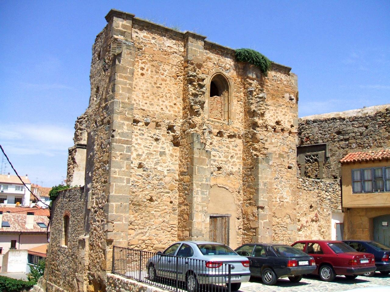
The Church of Nuestra Señora de Yanguas is a ruined Gothic church standing on Plaza de Castejón in Ágreda, a town in the province of Soria, in the Castile and León region of northeastern Spain. Only part of its chancel survives today, but the site carries a layered history tied to medieval settlement and later noble patronage in Ágreda. Where is the church located? Ágreda sits near the eastern edge of Soria province, close to the borders with Aragón and La Rioja, in a historic region once dotted with fortified towns guarding routes between Castile and its neighbors. The ruins of the Church of Nuestra Señora de Yanguas stand in the Barrio de la Peña neighborhood, on Plaza de Castejón, one of the notable squares of Ágreda's old quarter. The town is also known for its association with Sor María de Ágreda, a 17th-century nun and mystical writer remembered for her correspondence with King Philip IV, adding another layer of historical interest to the area. What is the history behind the church? The church's origins go back to the 12th century, when it was built by settlers who had arrived from the town of Yanguas and established themselves in what became Ágreda's Barrio de la Peña. It was originally dedicated to Saint Martin (San Martín), a name it kept for several centuries. The turning point came in the first quarter of the 16th century, when the building was substantially rebuilt in the late Gothic style. The reconstruction was funded by the Castejón family, specifically Diego González de Castejón and his wife Catalina del Río. It was at this time that the church's dedication also changed, from San Martín to Nuestra Señora de Yanguas, honoring the memory of the settlers who had given the neighborhood its name. The church eventually lost its central religious role when devotion to the Virgen de los Milagros (Our Lady of Miracles) was transferred to the more sumptuous church of Ágreda's Augustinian convent, which today is known as the Basílica de Nuestra Señora de los Milagros. Once that shift took place, the church of Yanguas gradually fell into disuse and decay, a state it remains in today. What can visitors see today? The best-preserved part of the structure is its chancel, covered by a ribbed Gothic vault — a detail that, five centuries on, still hints at the quality of the late Gothic stonework and the original proportions of the building. The rest of the church is in ruins, though the outline of its walls and overall layout remain visible to visitors. The site makes for an interesting stop for anyone exploring Ágreda's historic center, particularly alongside nearby landmarks such as the town walls, its other churches and convents, and Plaza de Castejón itself, one of the characteristic public spaces of the old town. The contrast between the modest ruin visible today and its layered past — from 12th-century settlement, through noble patronage, to the eventual transfer of Marian devotion elsewhere in town — makes it a worthwhile addition to any tour of Ágreda's heritage sites. Frequently asked questions What was the Church of Nuestra Señora de Yanguas originally? It began in the 12th century as a church dedicated to Saint Martin, built by settlers from Yanguas, before being rebuilt in the late Gothic style in the early 16th century and rededicated to Nuestra Señora de Yanguas. Why was the church's dedication changed? The new dedication honored the settlers from Yanguas who established the Barrio de la Peña neighborhood in the 12th century, where the church stands. Who funded the 16th-century reconstruction? The late Gothic rebuilding was funded by the Castejón family, namely Diego González de Castejón and his wife Catalina del Río. Why is the church in ruins today? Devotion to the Virgen de los Milagros was moved to the grander church of Ágreda's Augustinian convent, and the abandoned church of Yanguas gradually fell into ruin afterward. What remains of the original building? The best-preserved element is the chancel, covered by a late Gothic ribbed vault; the rest of the structure survives only as ruins.
-
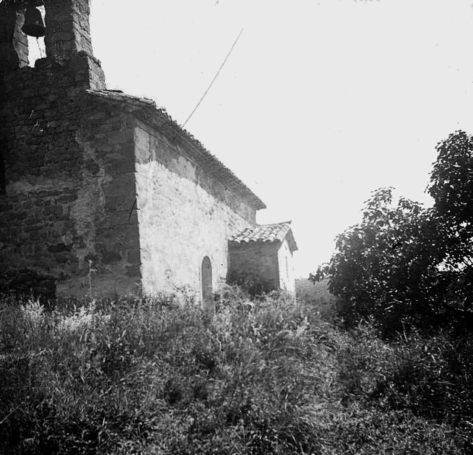
Església de Sant Quintí de Montclar
Montclar
Església de Sant Quintí de Montclar is a Romanesque church in the municipality of Montclar, in the Berguedà region of Catalonia. Today it stands partly in ruins, but its surviving walls still trace the outline of the original 12th-century building. Where is it located? The church sits within the municipality of Montclar, in the northern part of the Berguedà comarca, Barcelona province. Its coordinates are 42.044161, 1.807066. The surrounding landscape belongs to the Pyrenean foothills, an area dotted with small medieval chapels and churches historically tied to nearby defensive castles. What can you see on site? The building follows a single-nave plan typical of rural Romanesque architecture in the region. The nave is covered by a barrel vault and closed off by a semicircular apse roofed with a quarter-sphere vault. The entrance sits on the south side, framed by a voussoired semicircular arch cut from dressed stone. At the west end, a damaged espadanya — a thin bell wall with openings for bells, common to Catalan rural churches — still stands. The roof, originally double-pitched, was covered with Arab-style tiles. In 1982, the vault over the nave collapsed, and the building has not been used for worship since. What remains today are mostly the perimeter walls; the church is listed in the Inventory of Architectural Heritage of Catalonia as a site in a semi-ruined state. What is known about its history? Researchers date the building to around the 12th century. Because of its proximity to the former Montclar castle, a connection between the two is often assumed, but no surviving documents confirm any administrative or founding link. Until the 18th century, the church was subordinate to the parish of Sant Martí de Montclar, functioning as its dependency rather than as an independent parish. A small, rather plainly made reliquary, known as a lipsanoteca, originating from Sant Quintí is kept today at the Diocesan Museum of Solsona, under inventory number 295 — one of the few portable objects that can be directly linked to this place of worship. When is the best time to visit? Since the church is an open-air ruin without ongoing conservation staff on site, spring and early autumn are the best times to visit, when the weather in the Pyrenean foothills is well suited to walking the surrounding hills. A visit pairs well with other Romanesque sites in Berguedà, as well as a stop at the Diocesan Museum of Solsona to see the reliquary mentioned above. Frequently asked questions Can visitors go inside the church? The building has been partly ruined since its vault collapsed in 1982 and no longer hosts services — mainly the perimeter walls remain standing. How old is the church? It is dated to around the 12th century and represents the Romanesque style typical of rural churches in Berguedà. Was the church linked to Montclar castle? Its proximity to the castle suggests a connection, but no documents confirm one; until the 18th century the church was a dependency of the parish of Sant Martí de Montclar. Where can related artifacts be seen? A reliquary (lipsanoteca) from this church is held at the Diocesan Museum of Solsona.
-
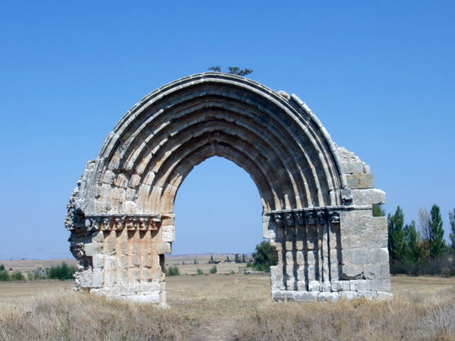
arco de San Miguel de Mazarreros
Sasamón
Arco de San Miguel de Mazarreros is a solitary stone portal standing in open farmland northwest of Sasamón, in the province of Burgos, Castile and León. This imposing arch is the only surviving piece of the church that once served the settlement of San Miguel de Mazarreros, a village that vanished from the map at the end of the 15th century. Where exactly is it located? The arch stands in open agricultural countryside, close to the Brullés river — a tributary of the local Odra river — a few kilometers from the center of Sasamón, a small town roughly fifteen to twenty kilometers west of Burgos. The easiest way to reach it is by car along local roads northwest of Sasamón; there is no parking area or marked trail on site, so it's worth checking the route in advance, for instance at a local tourist information point. Why does this arch stand here alone? Until the end of the 15th century, an independent settlement called San Miguel de Mazarreros existed on this spot, with its own parish church built in the 12th century in the late Romanesque style. When the village depopulated and was administratively absorbed into neighboring Sasamón, most of its buildings, including the church itself, were destroyed or dismantled. Only the church's entrance portal survived, which is why it is now known simply as "the arch" (arco) — the last physical trace of an entire vanished village. What does the arch look like? It is a large pointed portal built from seven archivolts — concentric, decorated arches framing the church's former entrance, a design typical of Romanesque architecture around the turn of the 12th and 13th centuries. Even though the rest of the building disappeared long ago, the portal itself has kept a legible form, letting visitors appreciate the craftsmanship of the medieval stonemasons who built it. Why was the arch at risk of being lost? For decades, the free-standing portal deteriorated without any conservation care or the protective surroundings the church walls once provided. In 2014, Hispania Nostra, an organization that documents endangered heritage sites across Spain, added the arch to its Red List of monuments at risk, drawing attention to the ongoing decay of the stone structure and the lack of funding for its preservation. What has changed in recent years? In 2019, the municipality of Sasamón approved a rehabilitation project for the monument, and the actual conservation work was carried out the following year, in 2020. That intervention stabilized and consolidated the arch's structure, halting further deterioration of the stone. Today the portal, while still standing alone amid the fields, is no longer in immediate danger of collapse. When is the best time to visit? Given its exposed, rural setting, the arch is best visited in spring or autumn, when milder temperatures make the surrounding fields pleasant to walk through, away from the peak heat of the Castilian summer. There is no tourist infrastructure on site — no ticket booth or refreshment stands — so it's worth treating a visit as a brief stop on a longer trip through the region, for example combined with a visit to Sasamón itself and its other landmarks. Frequently asked questions What exactly is the Arco de San Miguel de Mazarreros? It is the only surviving part — a stone entrance portal — of the former parish church of the vanished settlement of San Miguel de Mazarreros, built in the 12th century in the late Romanesque style. Why did the settlement of San Miguel de Mazarreros disappear? The village depopulated at the end of the 15th century and was absorbed into neighboring Sasamón; over time, its buildings, apart from the church portal, were destroyed. What does the arch look like architecturally? It is a pointed portal made up of seven archivolts — concentric, decorated arches surrounding the former entrance, characteristic of late Romanesque design. Is the monument protected today? Yes. After being added to Hispania Nostra's Red List in 2014, the municipality of Sasamón carried out conservation work in 2020 that consolidated the ruin and stopped its further decay.
-
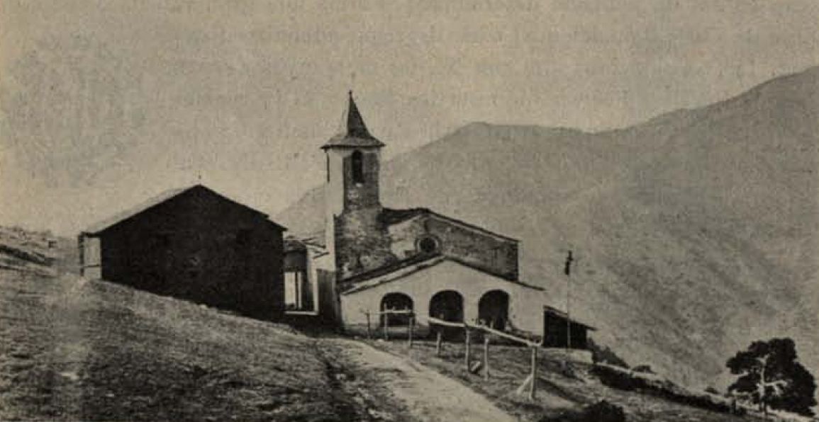
Sant Joan de l'Erm Vell
Montferrer i Castellbò
Sant Joan de l'Erm Vell is the ruined remains of an old mountain sanctuary and travelers' refuge in the municipality of Montferrer i Castellbò, in the Alt Urgell comarca of Lleida province, Catalonia. Perched above 1,700 metres, right on the old route linking Alt Urgell with the neighboring Pallars Sobirà valley, only stone walls remain today of a place that for centuries served as a lifeline for people crossing this stretch of the Pyrenees. Where are the ruins? The site sits high in the mountainous part of Montferrer i Castellbò, on the pass separating Alt Urgell from Pallars Sobirà, close to the small settlements of Romadriu and Montenartró. It's a remote corner of the Pyrenees, now surrounded by forest belonging to the Alt Pirineu Natural Park. A modern village of the same name lies a few kilometres away, reached by a forest track — hence the suffix "Vell" (old) in the ruin's name, distinguishing it from the newer Sant Joan de l'Erm Nou. A sanctuary and a lifeline for travelers The origins go back to the Middle Ages, when a chapel dedicated to Saint John the Baptist stood here under the protection of the viscounts of Castellbò, who ruled this part of the Pyrenees. Because it sat directly on the route between two valleys, a hospice grew up around the chapel — a place where shepherds, merchants, and pilgrims crossing the high pass could rest and get help. Given the harsh climate and altitude, such a stopping point was essential to the safety of anyone traveling through these mountains. From chapel to small settlement Over time, the site grew into a small service settlement in its own right. As late as 1905, records show it had an inn with several dozen rooms, a butcher's shop, a bakery, a small cellar, and a grocery store — a clear sign of how significant this remote spot had become despite being far from any larger town. Destruction and the new Sant Joan de l'Erm The settlement's fate changed abruptly in the 1930s, in the turbulent years leading up to the Spanish Civil War, when a fire tore through the sanctuary and inn buildings, ending centuries of continuous activity. The surrounding mountains later saw fighting during the war itself. Years afterward, in 1959, a new church was built a few kilometres from the ruined site, and today's village of Sant Joan de l'Erm grew up around it. A decade later, in 1969, a mountain refuge and a Nordic ski station opened there — one of the first of its kind in Spain, still drawing cross-country skiers through the forest today. What can you see today? At the old site, only ruins survive — sections of wall, the outline of what was once the settlement's main street, and remnants of individual buildings, including a facade that still preserves its arched doorway. The area is now protected as a local heritage site, and the municipality, together with the natural park authority, has installed information panels at the ruins explaining the site's history. It's a destination for hikers and history enthusiasts more than a conventional sightseeing stop — reaching it means walking a forest track from the modern village of Sant Joan de l'Erm. Frequently asked questions What was Sant Joan de l'Erm Vell? A medieval sanctuary dedicated to Saint John the Baptist, around which a hospice and small settlement grew to serve travelers crossing the pass between Alt Urgell and Pallars Sobirà. Why are there only ruins left today? The buildings burned down in the 1930s, in the period leading up to the Spanish Civil War, and were never rebuilt on the same site. How is it different from today's Sant Joan de l'Erm? The modern village of that name was built a few kilometres away, around a church erected in 1959 and a mountain refuge with a Nordic ski station that has operated since 1969. What will you find at the ruins? Wall fragments, the outline of the old settlement's main street, and a surviving facade with an arched doorway, along with information panels describing the sanctuary's history.
-
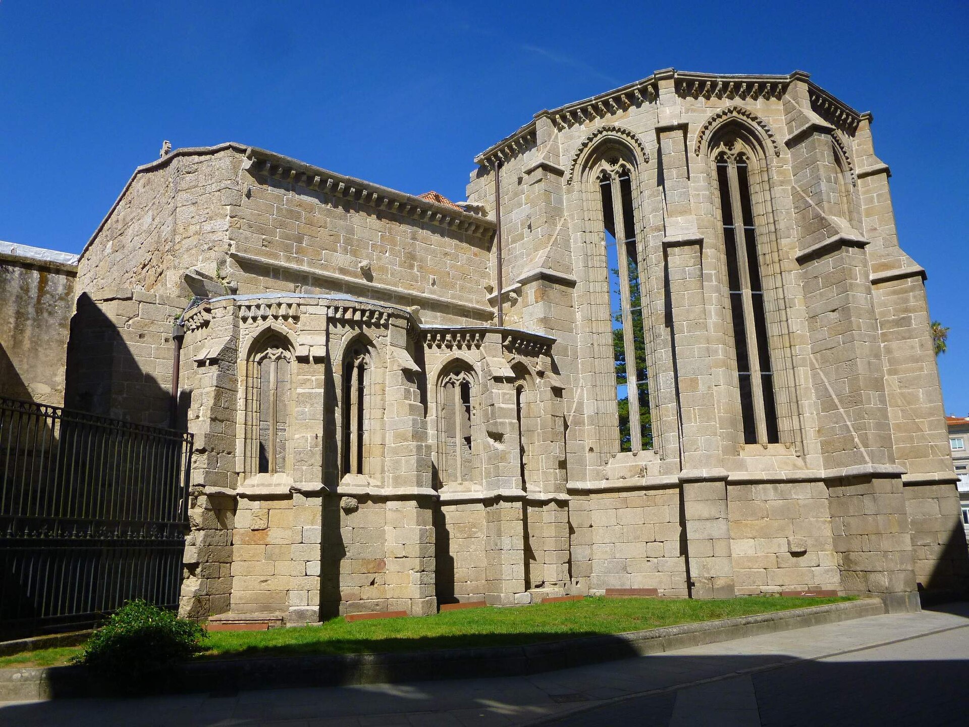
Ruins of San Domingos Convent
Pontevedra
Ruins of San Domingos Convent — known locally as the Ruinas de Santo Domingo — are the roofless remains of a Gothic Dominican convent in Pontevedra, in Spain's Galicia region. Today the shell of the old church forms one of the city's best-known landmarks and doubles as an open-air annex of the Pontevedra Provincial Museum. How did the convent come to exist? The Dominican order reached Pontevedra toward the end of the 13th century. Its first convent was founded around 1281 in the A Moureira district, right against the walls of the medieval town. The site proved impractical, and within three years the friars relocated to where the ruins stand today. Construction of the new church began in 1295, with work on the chancel starting around 1304-1305. Building continued in stages over the following decades, stretching into the 15th century, so the surviving structure reflects more than a century of Gothic construction. War changed the site's fate. In 1719, during clashes with English forces, the church suffered severe damage. It was never fully rebuilt, and over time the abandoned shell became the permanent ruin visitors see now. What makes these ruins stand out? The convent's most valuable surviving feature is its chancel, closed off by five polygonal apses. The central apse rises higher than the rest, its verticality emphasized by tall, paired windows, and the whole chancel is covered by ribbed vaulting. This five-apse arrangement is considered unique within Galician Gothic architecture — no comparable example survives elsewhere in the region. Recognition of that value came early: the ruins were declared a protected heritage site back in 1895, one of the earliest such designations in the area. Today the open floor of the former church functions as an outdoor lapidary. Stone tombstones, heraldic shields, and other carved fragments gathered from Pontevedra and its surroundings are arranged among the standing walls and columns, effectively turning the ruins into an open-air museum of funerary and heraldic stonework. How should visitors plan a stop here? The ruins sit right in central Pontevedra, close to the Alameda gardens, making them an easy stop on a walk through the old town. Since the structure has no roof and only partial walls, visiting on a clear day works best — daylight brings out the tracery of the windows and vaulting most clearly. Seeing the ruins themselves typically takes fifteen to thirty minutes, though it's worth allowing extra time to look over the displayed tombstones and coats of arms at a relaxed pace. The site fits naturally into a broader tour of Pontevedra's historic center, since several other churches and squares of the old town lie within easy walking distance — worth treating San Domingos as one stop among several on a longer walk through the city. Frequently Asked Questions When was the San Domingos convent in Pontevedra built? Dominicans founded an earlier convent around 1281, then began building the present church at its current site in 1295, with construction continuing into the 15th century. Why is the convent in ruins today? The church was heavily damaged in 1719 during fighting with English forces and was never fully rebuilt afterward. What is the most notable feature of the ruins? The chancel, with its five polygonal apses and ribbed vaulting, regarded as a unique example within Galician Gothic architecture. What can visitors see inside the ruins? The open floor of the former church serves as an outdoor lapidary, displaying historic tombstones and heraldic shields from Pontevedra and the surrounding area.
-
Chapel of the Saints of Mollavao
Pontevedra
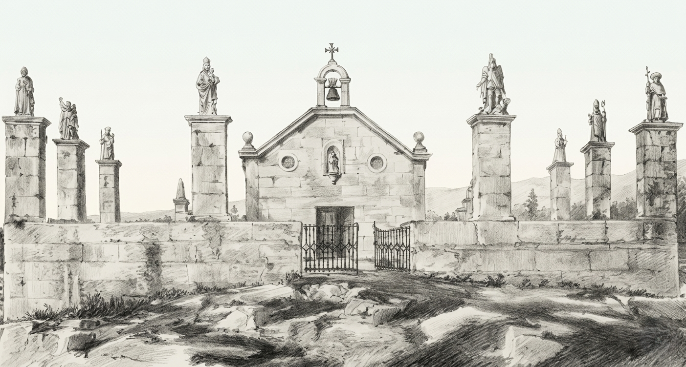
The Chapel of the Saints of Mollavao (Capela dos Santos de Mollavao) in Pontevedra is a Baroque shrine that no longer stands, yet its story and scattered stone saints can still be traced across the city today. It makes for an unusual stop for anyone who enjoys uncovering history hidden beneath modern buildings. What happened to the chapel? Construction was commissioned in 1737 by Juan de Marzoa and finished four years later, in 1741. The result was a small Baroque temple with a clear Portuguese architectural influence, a style that traveled easily across the nearby border into Galicia at the time. A stone statue of Saint Francis stood in a niche on the façade, while the building itself was ringed by columns crowned with ten separate saint figures: Saint James, Saint Joseph, Saint John, Saint Peter, Saint Michael, Saint Anthony, Saint Martin, Saint Lupus, the Virgin Mary and the Guardian Angel. A full set of ten statues on the surrounding columns was an unusually elaborate touch for a chapel of this size, hinting at the ambition of whoever paid for it. The building lasted a little over a century. By the mid-1800s it had been abandoned and left to decay. Rather than vanishing without a trace, though, its stonework and statues were carefully moved elsewhere — to the cemetery of Salcedo, to the cemetery of Santo Amaro, and to the chapel of San Brais. That scattering is the reason the chapel's legacy survives at all, just not in one single place. The final change came in 1927, when the Mollavao power plant was built directly on the old chapel site, part of Pontevedra's push to bring electricity to the city in the early twentieth century. That industrial building is what now occupies the ground where the Baroque chapel once stood. What will you actually see there? At the exact spot where the chapel used to stand, visitors today find the former Mollavao power station, a piece of early-twentieth-century industrial architecture rather than a religious monument. City officials have discussed giving the building a new public use, so a visit here is really an encounter with Pontevedra's electrical history, not with a surviving chapel — there is no chapel building left to walk into. To get closer to the original artwork, the trail continues elsewhere. In the Santo Amaro cemetery, inside the Sánchez Cantón family pantheon, the stone statue of Saint Francis that once watched over the chapel's façade has been preserved — the most tangible piece of the original decoration still on public display. The remaining statues and architectural fragments can be traced to the Salcedo cemetery and to the chapel of San Brais. How do you get there? Mollavao is a neighborhood within Pontevedra itself, so no separate trip out of the city is needed. The compact, pedestrian-friendly historic center lies close by, and the area is easiest to reach on foot or by local bus. It's worth combining a stop in Mollavao with visits to the Salcedo and Santo Amaro cemeteries and the San Brais chapel — together they form an unusual walking route that follows the pieces of a single vanished building across the city. When should you visit? Since this is a historical and industrial site rather than an active place of worship with fixed opening hours, it can be visited at any time of year. Spring and autumn suit Galicia's mild, walkable climate best, and the lighter tourist traffic in those seasons makes it easier to explore Mollavao and the nearby cemeteries at a relaxed pace. Frequently asked questions Does the Chapel of the Saints of Mollavao still exist? No. The building was abandoned in the mid-1800s, and in 1927 the Mollavao power plant was built on its former site, where it still stands today. Who built the chapel, and when? Juan de Marzoa commissioned it in 1737, with construction finished in 1741. It was a Baroque chapel with noticeable Portuguese architectural influence. Where can the chapel's original elements be seen now? The statue of Saint Francis is preserved in the Sánchez Cantón family pantheon at the Santo Amaro cemetery. The remaining statues and stonework were moved to the Salcedo cemetery and the chapel of San Brais. What stands on the chapel's original site today? The former Mollavao electric power plant, built in 1927 — an industrial landmark that the city has considered repurposing for public use.
-
Sant Martí de Puigcercós
Tremp
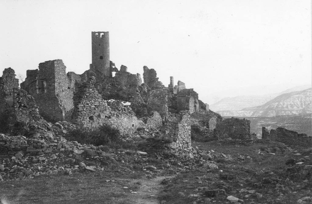
Sant Martí de Puigcercós is a former Romanesque parish church in the municipality of Tremp, in the Pallars Jussà region of Lleida province, Catalonia. Perched on a hilltop, it marks the spot where the old village of Puigcercós once stood — a place whose story is less about the building itself than about the landslide that erased the community around it. Where was the old church of Puigcercós located? The remains sit on top of a hill that once carried the entire settlement of old Puigcercós, an enclave that belonged to the former term of Palau de Noguera and today forms part of the Tremp municipality. The church shared this high ground with the medieval castle that once defended the village, making the hilltop the historic core of the community. What did the Romanesque church look like? Sant Martí was a single-nave building covered by a barrel vault reinforced with transverse arches, closed off by a semicircular apse facing east — a layout typical of rural Romanesque churches across Pallars Jussà. Among the surviving fragments, visitors could once make out carved details such as beveled corbels supporting the structure. Today the ruins are heavily overgrown and difficult to spot, so tracking them down takes patience and a good sense of the terrain. Why did the village have to be abandoned? The story of Puigcercós is really a story of a losing battle against unstable ground. Starting in 1863, a new village began to be built in a safer spot, as the old hilltop settlement was increasingly threatened by ground movement. The decisive blow came on 13 January 1881, when a major landslide sent most of the old town sliding down the mountainside. Residents lost their homes, and with them, the centuries-old role the hilltop church had played for the community. What replaced the destroyed parish church? In response to the disaster, a new church was built at the relocated village and consecrated in 1891, taking over as the parish's place of worship. The new building is far more modest in scale — a single-nave structure with a raised profile, reinforced by lateral buttresses, with an annex housing a wooden bell tower. The contrast between the original medieval church and its 19th-century successor is a vivid illustration of how much a single natural disaster reshaped both the landscape and the architecture of this corner of Pallars Jussà. What else is worth seeing nearby? The hill carrying the ruins of the old church and castle offers wide views over the Pallars Jussà valley, a region known for its rugged pre-Pyrenean landscape, the Terradets reservoir, and its proximity to the celebrated Mont-rebei gorge. The story of Puigcercós — a village forced to relocate after a landslide — is often cited as an example of the dramatic upheavals that reshaped mountain settlements across Catalonia during the 19th century. Frequently Asked Questions Can visitors reach the ruins of the old Sant Martí church? The remains stand on the hilltop but are heavily overgrown and hard to see, making this more a destination for those interested in local history than a fully equipped tourist site. Where is the current parish church of Puigcercós? It stands in the relocated village that residents moved to after the 19th-century landslides, and it was consecrated in 1891. What caused the disappearance of the old village of Puigcercós? A series of landslides, the most severe of which struck on 13 January 1881 and sent most of the old settlement sliding down the hillside. Which region is Puigcercós part of? It is an enclave within the municipality of Tremp, in the Pallars Jussà region of Lleida province, in northwestern Catalonia.
-
Frómista town hall
Frómista
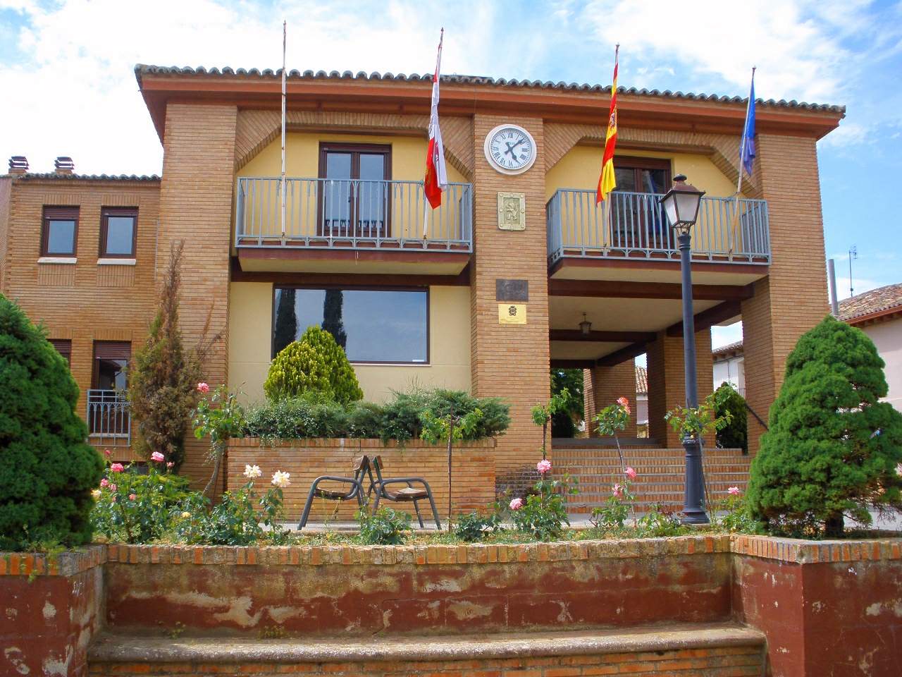
Frómista town hall is the seat of local government for a small town in the province of Palencia, in Castile and León, sitting directly on the Camino de Santiago pilgrim route. The building stands at Plaza de Tuy, right in the historic centre, just a short walk from the town's best-known landmark, the Romanesque church of San Martín de Tours. Where exactly is the town hall? Frómista has around 800 residents and sits on the Camino Francés, the main branch of the pilgrimage road to Santiago de Compostela. The town hall is located at Plaza de Tuy 6, next to the old Plaza Mayor, right in the heart of a compact historic centre where the church, the Castile Canal and the former Jewish quarter are all within easy walking distance. What's the story behind the town? Frómista's history goes back to 1066, when Countess Doña Mayor of Castile founded a Benedictine monastery around the church of San Martín de Tours. Built in the second half of the 11th century, the church is considered one of the purest examples of Romanesque architecture in Spain and is listed as a UNESCO World Heritage Site as part of the Routes of Santiago de Compostela. For centuries the town also had a sizeable Jewish community — by the late 15th century roughly 200 families, about a quarter of the population. The 1492 expulsion of Jews from Spain hit the local economy hard, with effects felt for generations afterward. Frómista is sometimes called "Villa del Milagro" (Town of the Miracle), a name tied to a Eucharistic miracle that, according to local tradition, took place there in 1453. What happened on the main square? The Plaza Mayor, where the town hall stands, has its own local legend. Tradition holds that in the 13th century Pedro González Telmo — later canonised as San Telmo — fell from his horse there and, mocked by the crowd that gathered, chose to abandon worldly ambitions for a life of religious service. The story is still part of the town's identity and comes up around local festivities. How do you get to Frómista? The town sits directly on the Camino Francés, making it a natural stop for pilgrims walking or cycling toward Santiago de Compostela. It's also close to Carrión de los Condes and Villalcázar de Sirga, two other well-known waypoints on the same route. By car, Frómista is reachable via local roads connecting it to Palencia, the provincial capital, and it's also served by regional bus lines. What's worth seeing near the town hall? A short walk from Plaza de Tuy leads straight to the church of San Martín de Tours, the town's main attraction and a magnet for both tourists and pilgrims. Close by runs the Canal de Castilla, an 18th-century engineering project originally built for grain transport, now a popular route for walking and cycling. When is the best time to visit? Spring and early autumn bring the most comfortable conditions for exploring Castile, with mild temperatures and a steady flow of pilgrims that keeps the town lively along the Camino. Summers can turn hot, while winters are cold and windy, so it's worth planning outdoor time accordingly. Frequently asked questions Where exactly is Frómista's town hall? It's at Plaza de Tuy 6, in the historic centre, close to the church of San Martín de Tours and the main square (Plaza Mayor). Can I combine a visit to the town hall with the church of San Martín? Yes — both are only a few hundred metres apart, easily covered on the same walk through the centre. Is Frómista on the Camino de Santiago? Yes, it's a stop on the Camino Francés, the principal pilgrimage route to Santiago de Compostela. Why is Frómista called "Villa del Milagro"? The name refers to a Eucharistic miracle that local tradition says took place in the town in 1453.
-
Church of la Santísima Trinidad
Alcaraz
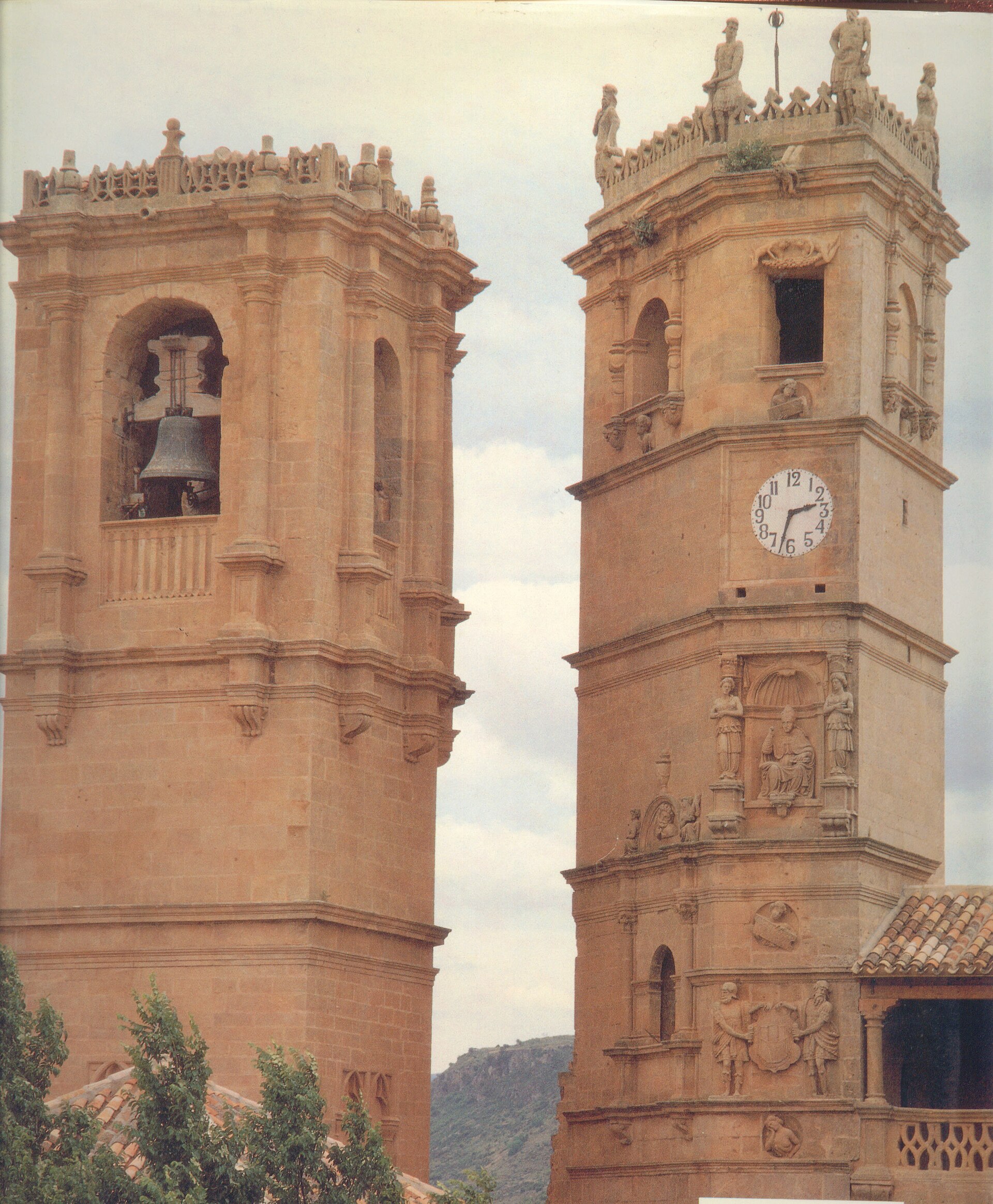
The Church of la Santísima Trinidad in Alcaraz is a Roman Catholic church that has held Bien de Interés Cultural protection since 1982, marking it as a site of recognized cultural value within the Castilla-La Mancha region. Where is the church located? The church sits in the historic core of Alcaraz, a small hilltop town in the province of Albacete. Alcaraz's old town has kept much of the street layout and building fabric from the period when the town served as an important administrative center for the surrounding area. The Church of la Santísima Trinidad forms part of this historic fabric, standing among other notable landmarks such as the town hall, the old grain exchange (Lonja del Corregidor), and the distinctive Torre del Tardón clock tower. How do you get there? Alcaraz has no train station, so arriving by car is the most practical option — the town sits along the road connecting Albacete with Andalusia, roughly an hour's drive from Albacete itself. Regional bus services also run between Albacete and Alcaraz for travelers relying on public transport. Once you arrive, it's best to park at the edge of the old town and continue on foot, since the historic center is compact and its narrow streets are not always suited to car traffic. What can you see there? The church's Bien de Interés Cultural status reflects its recognition as part of Alcaraz's cultural heritage, a designation reserved for sites the regional authorities consider significant to the area's history and identity. Visitors can take in the building's position within the old town and its relationship to the surrounding historic structures. Because several other landmarks stand nearby, a stop at the church fits naturally into a broader walking route through Alcaraz's protected historic center. When should you visit? Spring and autumn bring the most comfortable temperatures for exploring Alcaraz on foot, since summers in the Albacete region can turn quite hot, making longer walks through the old town less pleasant. Morning visits are a good strategy for avoiding both the midday heat and the busiest hours in the historic center. It's worth checking Alcaraz's local calendar of festivals and services before traveling, since access to the church's interior can depend on the schedule of religious services. Practical information Alcaraz is small enough that a visit to the old town, including the Church of la Santísima Trinidad, typically takes one to two hours depending on pace and how many nearby sites you include. Comfortable footwear is recommended, as the historic center has uneven, partly cobbled surfaces. The town is not a major tourist hub, so dining and accommodation options are limited — worth factoring in when planning a longer stay in the area. Frequently asked questions Is the Church of la Santísima Trinidad open to visitors? Interior access can be limited to service hours, so it's worth checking current local information or asking at the tourist information office in Alcaraz before visiting. Why does the church have Bien de Interés Cultural status? This designation is granted to sites that regional authorities recognize as culturally significant — in this case, the protection has been in place since 1982. Is it worth combining the visit with other sights in Alcaraz? Yes, the church stands within the town's historic center, close to other landmarks, making it easy to see several sites on a single walking route. What's the best way to reach Alcaraz? Driving from Albacete is the most straightforward option, though regional bus services are also available — the town has no railway connection.
-
Convento Trinitario de los Padres Gracia
Kordoba
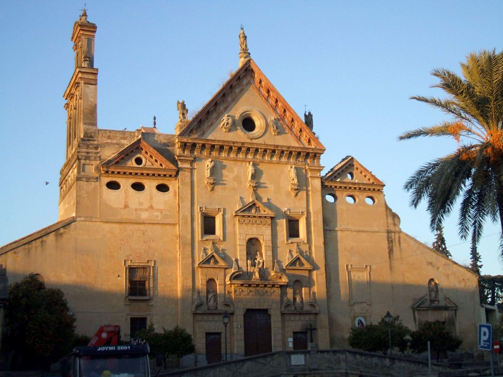
Convento Trinitario de los Padres Gracia is a historic Trinitarian church and convent tucked away on the small Plaza Cristo de Gracia in the old town of Córdoba. Construction began in 1680, and the church itself was consecrated six years later, in 1686. The complex remains an active convent and parish church to this day, and it has long doubled as a charitable institution, at times running a school and a dining hall for the city's poorest residents. What can you see inside? The church follows a basilical plan: a wide central nave flanked by two narrower side aisles, giving the interior the balanced proportions typical of monastic churches from this period. The symmetrical façade draws the eye to a triangular portal set in the central section, framed by two lateral wings that lend the whole front a calm, unified composition. Inside the convent, a closed Renaissance-style cloister has survived largely intact — sober and unadorned, in keeping with the Trinitarian order's spirit of restraint. It's in the quiet of this courtyard that the building's centuries-old rhythm of prayer and community life is easiest to sense. The single most important object inside the church is the image of Christ known as "Nuestro Padre Jesús Rescatado" (Our Father Jesus Rescued). The figure is held in deep devotion by residents of Córdoba and ranks among the most venerated religious images in the city, drawing crowds especially during Holy Week processions. How do you get there? The convent sits within Córdoba's historic centre, within easy walking distance of the city's major landmarks, including the Mezquita-Catedral. The most practical way to reach it is on foot, threading through the narrow streets of the old town — a way of moving through Córdoba that is itself part of the city's appeal. Visitors arriving from outside the centre can head first toward Plaza de las Tendillas, from where a short walk through the old lanes leads straight to the convent. When is the best time to visit? Because this is first and foremost a working place of worship, it makes sense to plan around service times rather than assume free access at any hour. Weekday mornings tend to be the quietest, with soft light filling the nave and few other visitors around. Anyone interested in Córdoba's religious traditions should consider timing a visit for Holy Week, when the image of Christ leaves the church in procession and becomes one of the focal points of the city's celebrations. Frequently asked questions What is the Convento Trinitario de los Padres Gracia? It is a Trinitarian convent and church in Córdoba, built starting in 1680 and consecrated in 1686, which still serves both religious and charitable purposes today. What is the main highlight of the building? The venerated image of Christ known as "Nuestro Padre Jesús Rescatado," together with the convent's Renaissance-style cloister. Is entry to the convent free? As an active place of worship, the church is generally open without charge during service hours, though it's worth checking locally since opening times can vary. Is it worth combining a visit with other Córdoba landmarks? Yes — its location inside the historic centre makes it easy to add a short stop here to a route that also takes in the Mezquita-Catedral and the rest of the old town.
-
Paleochristian basilica of Son Bou
Alaior
The Paleochristian basilica of Son Bou is one of the most important archaeological sites on Menorca, standing right by Son Bou beach on the island's south coast, in the municipality of Alaior. What is this site? The ruins belong to an early Christian basilica, uncovered by chance in the 1950s during work on the coastal dunes. Experts date its construction to the late 5th century, and it stayed in use into the 6th and possibly 7th century. The building was destroyed by a fire in the 18th century, and what remains today is a ruin — though the original floor plan is still clearly readable. What will you see? The basilica has a rectangular plan and was originally oriented southeast. Inside, three naves separated by rows of columns lead toward a portico at the entrance. At the far end of the central nave sits an apse with a three-part termination — a design typical of early Christian sacred architecture in this part of the Mediterranean. One of the site's most striking features is the baptismal font, carved from a single block of stone in the shape of a four-leafed clover, echoing a Greek cross. After the excavations it was placed back in its original spot, so visitors can see it exactly where it served the community more than 1,500 years ago. Along the side naves and outside the building, archaeologists found graves dug directly into the ground and lined with flat stone slabs, showing that the site served a funerary role alongside its liturgical one. Walking the outline of the ruins gives a real sense of how the early Christian community on Menorca lived and worshipped in late antiquity. How do you get there? The basilica sits right beside Son Bou beach, the longest beach on Menorca, within the municipality of Alaior. Driving from Alaior or from Maó (Mahón) takes roughly fifteen to twenty-five minutes, since Son Bou lies on the south coast and is well connected by local roads to the rest of the island. It's easy to combine a visit with a walk along the beach or a stroll through the nearby resort area, as the ruins sit right at the edge of the sand. When should you visit? Early morning or late afternoon works best — the site is open-air with no shade structures, so it gets hot under a midday sun, and photos come out better in softer, angled light. Outside the peak summer months (spring or early autumn), Son Bou beach itself is quieter, which makes it easier to explore the ruins at a relaxed pace without crowds. Frequently asked questions Is there an entrance fee? The ruins are an open-air archaeological site with free access and no ticket booth at the entrance itself, though it's worth checking current signage on site, since access rules for heritage sites on the island can change. How much time do you need? Walking the whole site takes about 20-30 minutes — it's a compact area, but it's worth setting aside time to look closely at the baptismal font and the layout of the naves. Can you combine it with the beach? Yes, the basilica sits literally next to Son Bou beach, so visiting the ruins pairs naturally with time on Menorca's longest beach. Why is the basilica in ruins? The building was used from the late 5th century through the 7th century, and a fire destroyed it in the 18th century. What survived were the foundations and a partially preserved layout, which stayed buried until it was rediscovered in the 1950s.
-
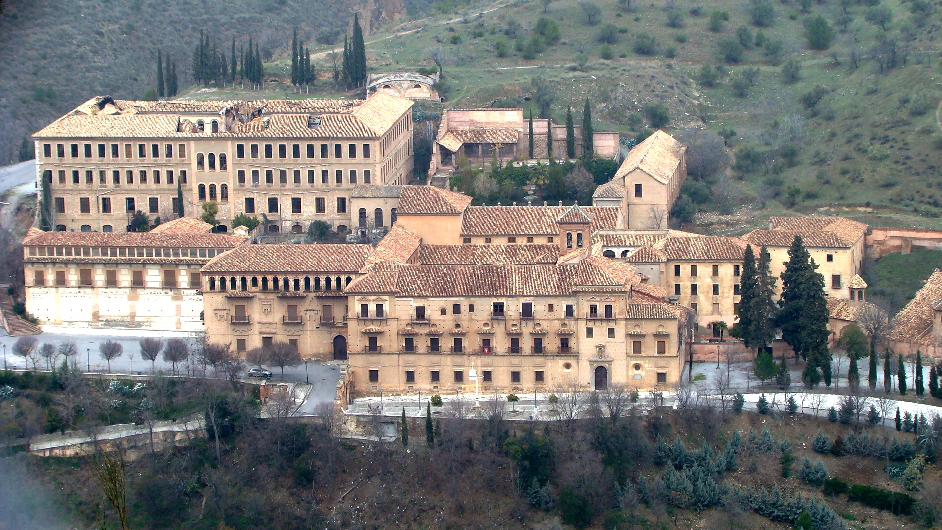
Abadía del Sacromonte
Grenada
Abadía del Sacromonte is a historic abbey complex in Granada, built on the Valparaíso hill in the Sacromonte neighbourhood. Together with the Alhambra and Granada's cathedral, it forms one of the three key sites for understanding the city's layered history. How did the abbey come about? The story begins on 18 March 1588, when a parchment written in three languages, a canvas, an image of the Virgin Mary, and bones attributed to the Apostle Saint James were discovered in the Torre Turpiana. Seven years later, in 1595, excavations of old Roman kilns on the hill uncovered the remains of the martyr Saint Cecilius, patron saint of Granada and, according to tradition, a disciple of Saint James. Archbishop Pedro de Castro considered the finds significant enough to order an abbey built on the spot, and construction of the complex began in the 17th century, continuing into the following one. What will you see inside? The site brings together four parts: the Santas Cuevas (Holy Caves), the abbey building itself from the 17th–18th centuries, a 17th-century college, and a seminary. Part of the complex still houses resident canons and functions as a parish, while another wing operates as an ecclesiastical museum displaying liturgical objects and documents tied to the late-16th-century discoveries. Because the abbey sits high above the Sacromonte quarter, the grounds open onto sweeping views over Granada and the surrounding hills — reason enough on its own to make the climb. How do you get there? The abbey stands above Sacromonte, one of Granada's most distinctive neighbourhoods, known for its cave houses and flamenco tradition. Walking up from the city centre is possible but involves steep, narrow streets, so allow extra time and wear comfortable shoes. Local buses running toward Sacromonte are an alternative, though you'll still need to climb the final stretch on foot to reach the abbey itself. When is the best time to visit? Given the steep approach and limited shade along the way, mornings or late afternoons work best, especially in the warmer months. Opening hours and which parts of the interior are open to visitors can vary with the season and with church events, so it's worth checking before setting out. Frequently asked questions What is the Abadía del Sacromonte? A monastic-church complex in Granada comprising the Santas Cuevas, the abbey building, a college and a seminary, built after 16th-century discoveries linked to Saint Cecilius and the Apostle Saint James. Where exactly is it located? On the Valparaíso hill above the Sacromonte neighbourhood in Granada, close to the Albaicín and the Alhambra. What can visitors see today? An ecclesiastical museum with liturgical items and historical documents, plus panoramic views over the city from the grounds around the abbey. Is it worth combining with other sights? Yes — the abbey's location makes it easy to pair with a walk through Sacromonte and Albaicín's historic lanes.
-
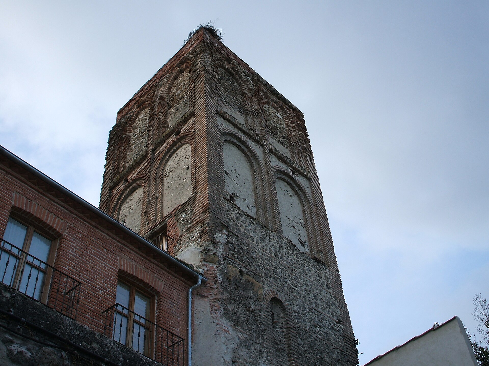
Iglesia de Santa Marina
Cuéllar
Iglesia de Santa Marina is a lone Mudéjar brick tower standing in Cuéllar, a small town in the province of Segovia, known as the only surviving brick church tower in the town. What can you actually see here? Of the original 13th-century church, only the tower has survived — the rest of the building was pulled down in the 19th century following the church-property confiscations (desamortización) that swept through Spain. The tower itself, though, rewards a close look: it keeps its full Mudéjar brickwork decoration, with blind arcades set into panelled frames and brick stringcourses running across the masonry — a technique typical of church building around Segovia at the time. It's this layered brickwork, with no plaster or stone carving covering it, that marks the hand of Mudéjar builders working for Christian patrons. What's the story behind it? The church was built in the 13th century in the Mudéjar style, blending Islamic building techniques with a Christian religious program, a combination common across this part of Castile. It functioned as a parish church for centuries, and among those buried there was the chronicler Antonio de Herrera y Tordesillas, known for his historical accounts of the Spanish Indies. During the 19th-century desamortización, the new owners of the property demolished most of the church, leaving only the tower standing — likely because its solid construction made full demolition impractical. Before that destruction, the tower had already been drawn by the 19th-century painter Francisco Javier Parcerisa, giving today's visitors a way to compare its historic and current appearance. Because of its ongoing deterioration, the tower was added in 2009 to the Red List of Endangered Heritage kept by the Spanish heritage organization Hispania Nostra. How do you get there? Cuéllar sits in the province of Segovia, in the northwestern part of the Castile and León region, making it a convenient stop for anyone touring the area around Segovia or Valladolid. The tower stands within the town's historic center, so the easiest way to reach it is on foot, combining the visit with Cuéllar's other landmarks — the town is known for several Mudéjar churches as well as its castle, which makes it easy to fold into a single walking route. When is the best time to visit? Since the main draw is the tower's exterior architecture, spring and autumn are the best times to come, when temperatures in Castile are milder and the light brings out the texture of the brick detailing well. It's worth avoiding the height of summer, when the region can get very hot, and checking local information beforehand given the tower's status as an endangered monument, in case any conservation work is underway. Frequently asked questions Can you go inside the church? No — only the tower survives from the original building, so there's no church interior to visit; the attraction is the structure and its brickwork detail from the outside. Why did only the tower survive? During the 19th-century desamortización, the new owners tore down the main body of the church but left the more solidly built tower standing. What is the Mudéjar style visible on the tower? It's a building technique rooted in the tradition of Islamic builders working for Christian patrons, seen here in the tower's blind brick arcades and decorative stringcourses. Does Cuéllar have other similar landmarks? Yes — the town is known for several Mudéjar-style churches and a castle, so a visit to Santa Marina pairs easily with exploring the rest of the historic center.
Earn badges for the places you visit
Download NextOnTrip, discover new places and check off your trails.