Monuments in Spain
A guide to 4655 Monuments in Spain — with descriptions, photos and traveler visits from the NextOnTrip community. Locations spread across 2240 cities and towns. Most visited by the community: castle of Chulilla, Castle of Pioz, castell de la Todolella.
-
SS Exodus
Sète
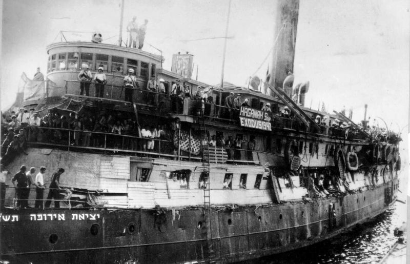
SS Exodus marks one of the most significant memorial sites in Sète, a port city on France's Mediterranean coast, from which a ship departed in July 1947 that would become a symbol of the struggle for the creation of Israel. Commemorative plaques now stand on the Môle Saint-Louis, one of the breakwaters guarding the harbor, recalling those events. What happened here? On the night of July 10 to 11, 1947, the vessel President Warfield, previously sailing under a Panamanian flag, left the port of Sète. On board were 4,554 people — men, women and children who had survived the Holocaust and were hoping to reach Palestine, then under British mandate. The voyage was organized and chartered by the Haganah, the Jewish paramilitary organization responsible for the entire clandestine operation. A few days after leaving French territorial waters, the ship was renamed Exodus 1947, and its Panamanian flag was replaced with an Israeli one. As the vessel approached the coast of Palestine, British reconnaissance aircraft tracked its course, and shortly afterward Royal Navy warships intercepted it on international waters. On July 18, a violent confrontation broke out between British sailors and the passengers. The ship was forced to dock at Haifa, where British soldiers removed the refugees from board. After Britain failed to persuade France to accept them, the passengers were sent back to displaced-persons camps in Germany. Who was responsible for the ship's safe departure? Commissioner Leboutet was in charge of port security in Sète in July 1947. It was his decision to organize the ship's departure under calm and controlled conditions, relying on the goodwill and solidarity of the local population toward the refugees. What can visitors see today? The Môle Saint-Louis in Sète today holds several commemorative plaques dedicated to this history. One bears the name "Exodus 1947," another honors Commissioner Leboutet, and a more recent one includes a QR code linking to the full story of the voyage. City authorities unveiled part of this memorial on the seventieth anniversary of the events, underscoring the importance of preserving the memory of this episode in both Sète's history and the story of Israel's founding. How to get there? The Môle Saint-Louis lies within the port area of Sète, in an easily accessible part of the city, close to the quays and the main tourist attractions. It can be reached on foot from the town center — walking along the canals and harbor front is one of the most popular ways to explore Sète. When to visit? The site can be visited year-round, though spring and autumn offer the most pleasant conditions for a walk along the breakwater and harbor, with mild temperatures and fewer crowds than in midsummer. Visiting in July, around the anniversary of the 1947 departure, is worthwhile too, since Sète occasionally holds commemorative events at that time. Frequently asked questions What was the Exodus ship? It was the vessel President Warfield, chartered by the Haganah to carry Holocaust survivors to Palestine. During the voyage it was renamed Exodus 1947, giving its name to the entire historic episode. How many people were on board? The ship carried 4,554 passengers — men, women and children who had survived the war and the Holocaust. Why did the ship depart from Sète specifically? Sète was a port where the departure could be organized under relatively calm conditions. A key role was played by Commissioner Leboutet, responsible for port security, who agreed to allow the vessel to sail. What happened after the British intercepted the ship? On July 18, 1947, British warships stopped the Exodus in international waters, a clash with passengers followed, and the ship was forced into Haifa. The refugees were sent to displaced-persons camps in Germany after France declined Britain's request to accept them.
-
Luis Carrero Blanco
Santoña
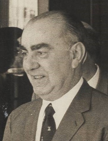
The Luis Carrero Blanco monument in Santoña stands on the seafront promenade beside the river estuary, and it is one of the town's most recognizable — and most contested — landmarks. Rising roughly twenty meters, it has sparked debate for decades over how Santoña should remember its most famous native son. Where is the monument and what does it look like? The monument sits on the promenade along the river mouth (paseo de la ría), in plain view of visitors walking the waterfront. Its shape is that of a giant ship's helm, topped by a figure of an angel offering tribute alongside a compass rose. At the base of the stone monolith stand figures representing the four cardinal virtues, accompanied by plaques and bas-reliefs honoring Carrero Blanco as Santoña's "favorite son" (hijo predilecto). Who designed it and when was it built? The stone monument was created by Spanish sculptor Juan de Ávalos, known for several large-scale works from the Francoist era. It was built in 1976, but only formally inaugurated in 1996 — well after Franco's death and Spain's transition to democracy, a timing detail that is itself part of the ongoing controversy surrounding the piece. Who was Luis Carrero Blanco? Luis Carrero Blanco was born in Santoña in 1904. He rose to become a Navy admiral and the closest, longest-serving confidant of dictator Francisco Franco, and from 1973 served as President of the Spanish Government, the equivalent of prime minister. He was killed that same year in a bomb attack carried out by the terrorist group ETA in Madrid, one of the most notorious political killings of the late Franco era. Why is the monument controversial today? Because Carrero Blanco remains a symbol of the Francoist power structure, the presence of a monument to him on public land in Santoña has long drawn objections from advocates of democratic memory. In May 2026, Spain's Ministry of Territorial Policy and Democratic Memory formally opened proceedings to add the monument to the official catalog of symbols contrary to democratic memory, a step that could ultimately require its removal or alteration. At the same time, local groups — including part of the town council — argue that Carrero Blanco should be recognized as a victim of terrorism, and point to that status as grounds for preserving the monument. The dispute remains unresolved, and the site still appears in the town's own tourism materials as a point of interest. Is it worth visiting while in Santoña? Political context aside, the monument is a fixed landmark on the riverside walking route and a piece of local history that is hard to miss along the promenade. For visitors interested in twentieth-century Spanish history and the country's ongoing reckoning with the dictatorship's legacy, it offers a concrete, physical example of that unresolved debate. Frequently Asked Questions Where exactly is the Carrero Blanco monument located? On the seafront promenade in Santoña, along the river estuary (paseo de la ría), in an easily accessible spot for pedestrians. Who designed the monument? Sculptor Juan de Ávalos, known for numerous large-scale works from Spain's Francoist period. Will the monument be removed? As of May 2026, Spanish authorities have opened a procedure to list it as a symbol contrary to democratic memory, but no final decision has been made — it remains a live political dispute at both local and national level. Is there an entry fee? No — the monument stands on an open public promenade and can be viewed free of charge at any time.
-
Puerta de Bejanque
Guadalajara
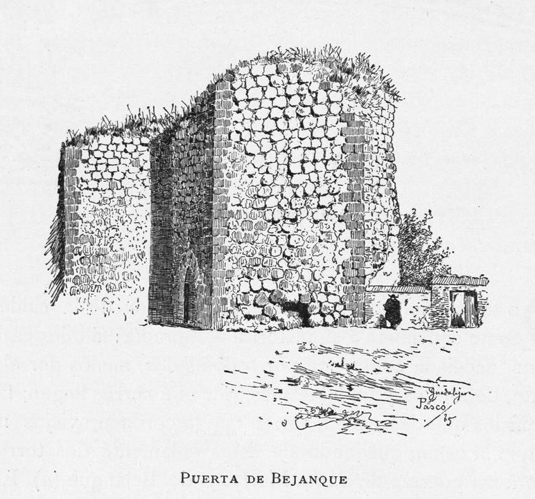
Puerta de Bejanque is a medieval city gate in Guadalajara, Spain, and the most recognizable surviving fragment of the walls that once enclosed the old town. It stands on Plaza de Bejanque and is one of only three remaining pieces of the fortification, alongside the Torreón de Alvar Fáñez and the Torreón del Alamín. Where did this gate come from? Guadalajara's city walls date back to the early medieval period, but the Puerta de Bejanque as it stands today was built in the 14th century. It was one of the main gates along the defensive perimeter that protected the city from military attack, and local tradition also credits it with a role in controlling movement into the city during outbreaks of disease. The structure was raised from flint and large dressed limestone blocks, materials typical of Castilian defensive architecture of the period. How was it built to withstand an attack? Bejanque is considered one of the strongest gates in the entire city wall system. It was guarded by a tower on a pentagonal plan, and the passage itself ran through two arches set in a zig-zag arrangement — a layout known as a "bent gate," designed to slow down attackers and prevent a straight charge into the city. This kind of staggered entrance appears in many medieval Spanish towns and was meant to buy defenders extra time during a siege. What happened once it lost its defensive role? Once the walls stopped serving a military purpose, the gate was repurposed as a municipal storage building. In 1884 most of the monumental structure was torn down, leaving only the arch that can still be seen today. Over the following decades the site fell into neglect, hemmed in by commercial buildings, including a scrap metal yard that sat right against the monument. How was it brought back? The turning point came in 1989, when the Guadalajara city council decided to reclaim the monument — the adjacent scrapyard was demolished and restoration work rescued the gate from decades of neglect. As part of the redevelopment of the square, previously known as Plaza de la Olma, the surrounding area was cleared and turned into a quiet public space with the Puerta de Bejanque as its centerpiece. Today the gate is protected under Spain's historical heritage law (Ley 16/1985). What can you see on site today? At Plaza de Bejanque, visitors can inspect the surviving arch up close, note the contrast between the flint and limestone used in its construction, and trace the rough line the old walls once followed toward the city's other remaining towers. It makes a good starting point for exploring medieval Guadalajara further, including the nearby Torreón de Alvar Fáñez. Frequently Asked Questions How old is the Puerta de Bejanque? The gate in its current form dates to the 14th century, though the city wall system it belonged to has earlier, early-medieval roots. Has the gate survived in its original form? Not entirely — most of the structure was demolished in 1884, and only the distinctive arch has survived, restored in 1989. Why is it called a "bent gate"? Because the passage ran through two arches arranged in a zig-zag, a defensive design meant to slow attackers and a common feature of medieval city walls. What else is worth seeing nearby? The route along Guadalajara's old walls also includes the Torreón de Alvar Fáñez and the Torreón del Alamín, other surviving fragments of the city's medieval fortifications.
-
monument to Daniel Carballo
A Coruña
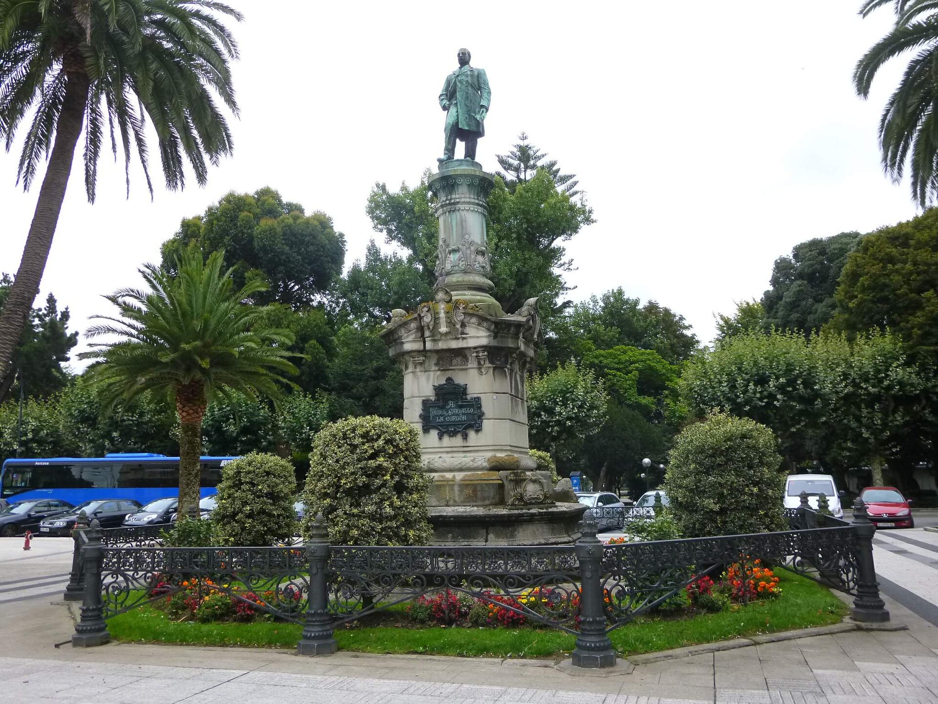
The Monument to Daniel Carballo stands in the Jardines de Méndez Núñez, the main park in the heart of A Coruña, right along one of its principal avenues. It is one of the city's most recognizable monuments and a common landmark for anyone strolling through the park. Who was Daniel Carballo? Daniel Carballo Cousido (1824–1889) was a politician, journalist, and nobleman born in A Coruña. Although he spent much of his life in Madrid, he stayed closely tied to his home city, serving as a deputy for the A Coruña district and other municipalities in the province. Locals remember him mainly as a civic benefactor: he founded the Escuela Normal de Maestras, a training school for female teachers, which was a meaningful step forward for local education in 19th-century Spain. What does the monument look like? The monument consists of a full-length bronze figure of Carballo set on a granite pedestal. The figure was designed by the Catalan sculptor Agustín Querol, one of the leading Spanish monumental sculptors of the turn of the 20th century. The pedestal itself was designed by architect Pedro Mariño and carved by sculptor Baltasar Escudero — a smooth granite column topped with a capital and base decorated with floral motifs and scallop shells, a nod to traditional Galician ornamentation. Work on the monument ran from 1894 to 1896. It was formally unveiled on 30 August 1896, drawing a crowd of more than 10,000 people — a remarkable turnout for the era, reflecting how highly Carballo was regarded by the city's residents. What will you see there? The monument itself is modest in scale, but the pedestal's carved details — the floral decoration and scallop-shell motifs — reward a closer look. The surrounding setting is a classic 19th-century city park: well-kept paths, benches, mature trees, and ongoing conservation work; the local council has carried out restoration work on the sculpture in recent years to preserve its condition and historic value. Jardines de Méndez Núñez is one of the most popular parks in the city center, so the monument is easy to combine with a walk through the surrounding historic area, home to several other A Coruña landmarks. How do you get there? The park sits right in the center of A Coruña, within walking distance of the city's main sights and public transport stops. It's easily reached on foot by anyone exploring downtown, with no need for a car. When should you visit? The monument can be seen year-round, as it stands in an open, freely accessible public park. Early morning or late afternoon are the most pleasant times to visit, when the light flatters the bronze figure and granite pedestal and the park is quieter. Frequently asked questions Who designed the Monument to Daniel Carballo? The bronze figure was designed by Catalan sculptor Agustín Querol, while the pedestal was designed by architect Pedro Mariño and carved by sculptor Baltasar Escudero. When was the monument unveiled? On 30 August 1896, in front of a crowd of more than 10,000 people. Who was Daniel Carballo and why does he have a monument? He was a politician and benefactor of A Coruña, a regional deputy best known as the founder of the Escuela Normal de Maestras, a school for training female teachers. Is there an entrance fee for the park? No, Jardines de Méndez Núñez is a free, publicly accessible city park open every day.
-
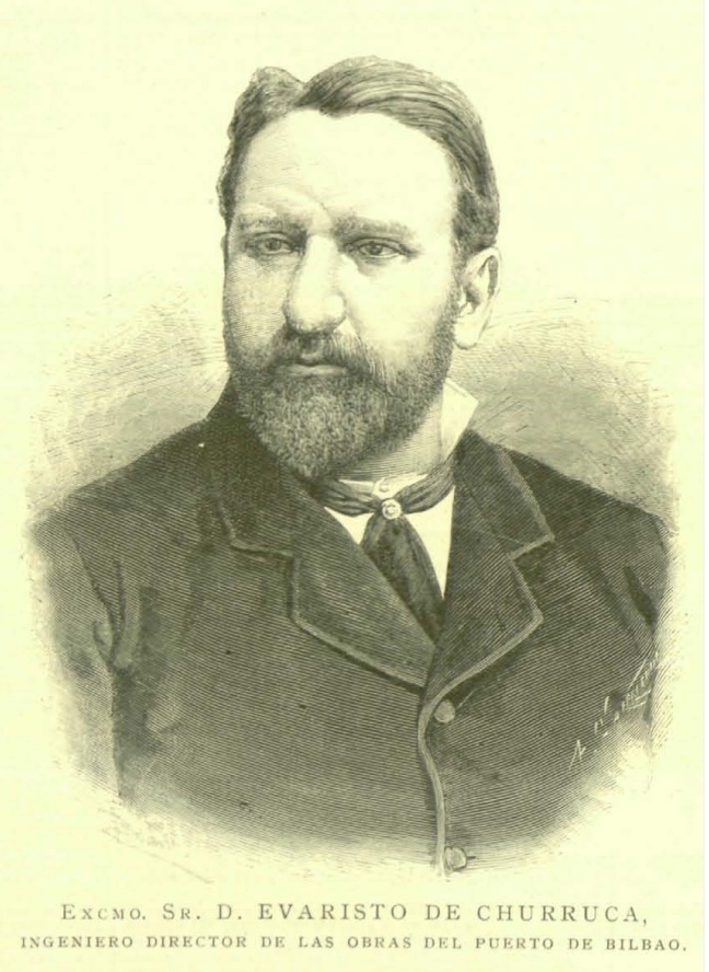
Evaristo de Churruca
Getxo
The Monument to Evaristo de Churruca stands at the mouth of the Nervión River in Getxo, honoring the engineer whose work reshaped the region's economy. It's one of the town's most recognizable landmarks, blending Art Deco architecture with a dramatic bronze sculptural group. Who was Evaristo de Churruca? Churruca directed construction works in Murcia and Biscay before being transferred to Puerto Rico, where he oversaw the installation of the island's telegraphic network and produced a study for improving the port of San Juan. Back in Spain, he took charge of the works on the exterior Port of Bilbao and the canalization of the Nervión River — a project that transformed the river mouth into the engine behind the region's iron and shipbuilding industries. What does the monument look like? The monument was designed in 1919 by sculptor Miguel García de Salazar, though it wasn't formally inaugurated until 1939. Its centerpiece is a slender, lighthouse-like tower in Art Deco style, designed by architect Ignacio M. Smith. Around it unfolds a powerful bronze sculptural group symbolizing humanity's struggle against the sea. The main statue depicts a seated Evaristo de Churruca, standing 2.75 meters tall and dominating the composition. Two flanking bronze figures personify "Industry" and "Navigation" — the two forces that, thanks to the river's canalization, turned the Nervión estuary into an economic engine. The scene is completed by a striking detail: a figure straining to push a massive stone block, barely propped up by the leg of Neptune, the mythological god of the waters — a visual metaphor for the constant struggle between people and the sea. Where is it and how do you get there? The monument sits in a landscaped, tree-lined enclosure right on the Getxo waterfront (muelle de Getxo), close to where the Nervión meets the sea. It's a natural stop along the waterfront promenade, easily combined with a walk toward the historic Puerto Viejo quarter or Ereaga beach. Getxo connects to Bilbao via metro line 1, making the monument an easy addition to a day trip around the area. What else is worth seeing nearby? The surrounding stretch is one of Getxo's most scenic areas. Walking along the waterfront in one direction leads to Puerto Viejo, the old fishing quarter with its colorful houses; in the other direction lies Las Arenas, known for its grand Belle Époque mansions. Watching ships pass at the river mouth makes it easy to understand why the port and its engineers hold such an important place in local history. When is the best time to visit? The monument is an open-air public site, so it can be visited year-round. Spring and summer are especially pleasant, when longer days make it easy to pair a visit with a walk along the promenade and time at Ereaga beach. Late afternoon light tends to bring out the texture of the bronze figures and the Art Deco tower particularly well. Frequently asked questions Who designed the monument? The 1919 design is the work of sculptor Miguel García de Salazar, with the Art Deco tower designed by architect Ignacio M. Smith. It was formally inaugurated in 1939. Why does the monument feature Neptune? Neptune, the mythological god of the waters, represents the sea itself — his leg props up a stone block pushed by the central figure, symbolizing the ongoing struggle between humans and the ocean. What do the side figures represent? They personify "Industry" and "Navigation," the two sectors that grew rapidly once the Nervión estuary was canalized and the Port of Bilbao expanded. Can I combine this with other sights? Yes — the monument sits directly on the walking route between Puerto Viejo and Ereaga beach, so it fits naturally into a longer stroll along the Getxo waterfront.
-
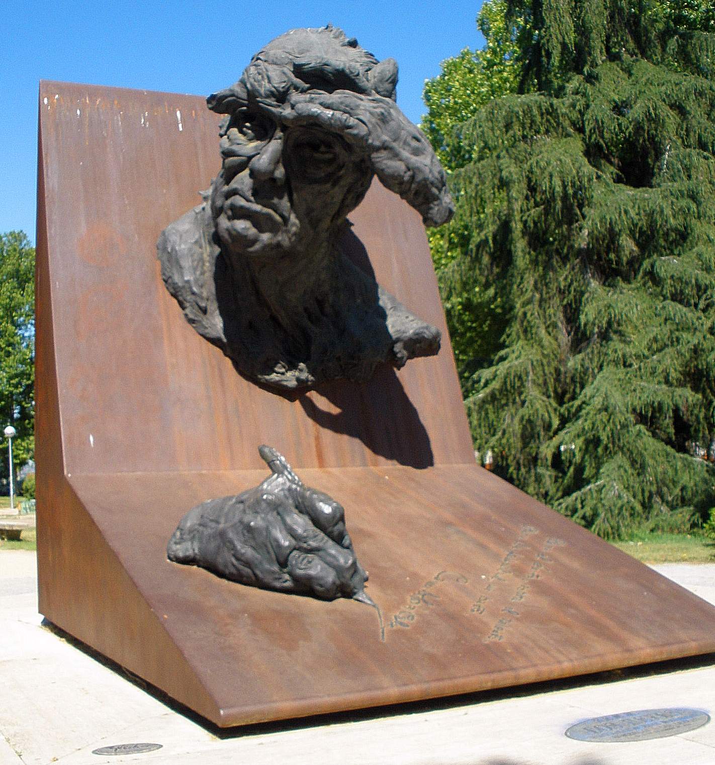
Camilo José Cela
Madryt
The Camilo José Cela monument in Madrid honors one of the most recognized Spanish writers of the twentieth century and makes for a worthwhile stop for visitors tracing the city's literary history. Who does this monument commemorate? Camilo José Cela, 1st Marquess of Iria Flavia, was a Spanish novelist, poet, story writer and essayist. Sources link him to a generation of Spanish writers who shaped the country's twentieth-century literature, though the exact generational label varies between references. His title as Marquess of Iria Flavia points to a status that reached beyond literary circles into Spain's honorary aristocracy. Where exactly is the monument located? The monument stands in Madrid, at the location marked by the coordinates 40.449698, -3.730081. This kind of placement is typical of the Spanish capital, where tributes to writers and cultural figures are often woven into the everyday urban fabric — squares, junctions and small plazas frequently double as informal landmarks for residents and visitors tracking down the city's literary footprints. Why is this spot worth a stop? For travelers exploring Madrid with an interest in Spanish literature, the Cela monument offers a chance to slow down and connect a well-known name with an actual point on the map. Madrid is dotted with similar markers — plaques, statues and small squares dedicated to writers who left a lasting cultural mark. A visit here works best as part of a broader walk through the surrounding area, since these monuments rarely stand isolated; they tend to sit near cafés, bookshops or parks that reinforce the capital's literary atmosphere. How should you plan a visit? Because the monument occupies open public space, there are no fixed opening hours restricting access — it can be seen at any time of day. It's still worth checking current conditions before heading over, since public spaces in a busy city center can change temporarily due to construction work or local events. Frequently Asked Questions Who was Camilo José Cela? Camilo José Cela, 1st Marquess of Iria Flavia, was a Spanish writer — a novelist, poet and essayist regarded as one of the notable figures in twentieth-century Spanish literature. Is there an admission fee to see the monument? No — the monument sits in public space in Madrid and can be visited free of charge, without the opening-hour restrictions typical of museums or ticketed attractions. Is it worth combining this visit with other Madrid attractions? Yes. Monuments dedicated to writers in Madrid tend to sit close to other cultural landmarks, so it makes sense to fold a stop here into a longer walk around the neighborhood. Does the monument include information for visitors? Sites like this in Madrid usually carry at least a minimal marker with the person's name, but it's best not to assume a detailed information panel will be present — visitors wanting fuller historical context should look into it beforehand.
-
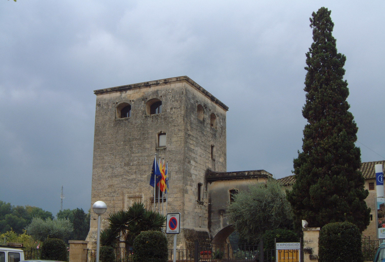
Torre Vella de Salou
Salou
Torre Vella de Salou is a 16th-century defensive tower standing right in the heart of Salou, today repurposed as a small cultural venue. For visitors, it's one of the few spots in this seaside resort town where the region's history of pirate raids and coastal watchtowers is still tangible. When was the tower built, and why? The tower was commissioned in 1530 by the Archbishop of Tarragona, Pere de Cardona. The reason was purely practical: Salou and the surrounding coastline were regularly targeted by Sardinian and Saracen corsairs, so a watchtower was needed to spot approaching boats early and warn the population, protecting the old settlement of Salauris, the predecessor of today's town. How has the tower changed over the centuries? The original structure was strictly military in purpose — meant to warn and deter, not to impress. Over time it was expanded: extra rooms were added, and a bridge eventually linked the tower to an adjoining building, turning the small, functional fortress into a more practical complex without stripping away its plain, defensive character. The facade still carries the heraldic coat of arms of the Cardona family, a reminder of who financed the project. What can visitors see inside Torre Vella today? The tower no longer serves any defensive purpose. It now houses a municipal art centre with a permanent collection of contemporary enamel art, featuring work by artists from several countries, alongside rotating painting exhibitions and other cultural events held throughout the year. The building also doubles as a venue for civil wedding ceremonies, giving this centuries-old landmark an unexpectedly festive second life. Where exactly is the tower, and how do you visit? Torre Vella stands on Carrer Arquebisbe Pere de Cardona, close to Salou's seafront promenade, making it an easy stop on a walk through town. Admission is free. It's open Monday to Saturday: from April to October between 6pm and 9pm, and from October to April between 6pm and 8pm. It's closed on Sundays and public holidays, so an early evening on a weekday is the best time to plan a visit. Frequently Asked Questions How old is Torre Vella de Salou? The tower dates back to 1530, making it nearly five centuries old — and for most of that time it served as a coastal defence outpost rather than the cultural space it is today. Who built the tower, and why this particular spot? It was commissioned by the Archbishop of Tarragona, Pere de Cardona. Its seafront location was deliberate, chosen to give early warning of corsair boats threatening the old settlement of Salauris. Is there an entrance fee? No, admission to Torre Vella is free, though opening hours are limited to weekday and Saturday evenings, and the site is closed on Sundays. What's inside the tower now? The interior functions as a cultural centre, holding a permanent enamel art collection and changing painting exhibitions; the tower is also occasionally used as a venue for civil wedding ceremonies.
-
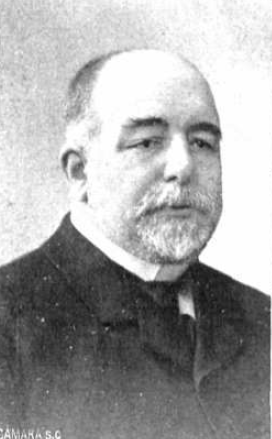
Diego Arias de Miranda
Aranda de Duero
Diego Arias de Miranda is a monument and small square right in the center of Aranda de Duero, dedicated to a politician who left a real mark on the town's development around the turn of the 20th century. Who was Diego Arias de Miranda? Diego Arias de Miranda y Goytia was born in Aranda de Duero on 1 December 1845 and died in Madrid on 28 June 1929. A member of the Liberal Party, he held two ministerial posts during the reign of Alfonso XIII: Minister of the Navy in the Canalejas cabinet (9 February 1910 to 3 April 1911) and Minister of Justice (12 March to 31 December 1912). Before his national career, he had already served his hometown directly, working as civil governor, general manager of public works, and mayor of Aranda de Duero — which explains why his name is still so closely tied to the town. Why is there a monument here? After his death in 1929, the people of Aranda decided to honor their fellow townsman with a monument. A national competition was held for the design, won by sculptor Emiliano Barral (1896–1936), one of the notable Spanish sculptors of the period. The monument was unveiled in 1930, and its construction was largely funded through public subscription among local residents — a sign of how significant a figure Arias de Miranda was for the community. The square where the monument stands is now known as the Jardines de Don Diego. What will you see there? The monument combines three types of stone: the surrounding structure is built from Sepúlveda stone, the figure itself from gray stone, and the reliefs decorating the pedestal from marble. The pedestal was designed by Alberto Barral. An inscription on the back of the monument commemorates Arias de Miranda's contribution to the region's infrastructure, crediting him with promoting road building and other public works meant, according to the text, to stand as an example for future generations. The overall setting is a quiet, well-kept corner surrounded by greenery — a fairly typical layout for a Spanish town square built around a central monument. How do you get there? Jardines de Don Diego sits right in the center of Aranda de Duero, close to the main sights of the historic old town. The easiest way to reach it is on foot as part of a walk through the center — it doesn't require a separate trip or any transport, since it naturally falls along the route between other landmarks downtown. When is the best time to visit? The square can be visited year-round with no set opening hours, since it's an open public space. Spring and autumn are the most pleasant seasons, when temperatures in Aranda are mild and the greenery around the monument looks its best. Frequently Asked Questions Who was Diego Arias de Miranda? A Liberal Party politician born in Aranda de Duero in 1845. Under Alfonso XIII he served as Minister of the Navy and Minister of Justice, having earlier been civil governor and mayor of his hometown. Who designed the monument? Sculptor Emiliano Barral, chosen through a national competition after the politician's death in 1929. The pedestal was made by Alberto Barral, and the monument was unveiled in 1930. Where exactly is the monument located? In the Jardines de Don Diego square, in the center of Aranda de Duero, near the historic old town. Is there an entrance fee? No, it's a public square, open to everyone free of charge at any time.
-
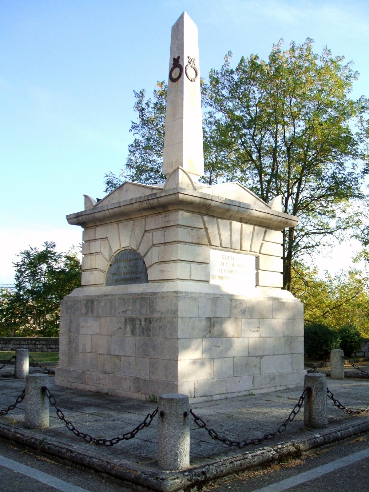
El Empecinado
Burgos
The Monument to El Empecinado stands on Calle Fernán González in Burgos, right in the heart of the historic old town, and ranks among the city's most notable tributes to a hero of the Spanish War of Independence. Who was El Empecinado? The monument honors Juan Martín Díez, nicknamed "El Empecinado," one of the most famous guerrilla leaders who fought against Napoleon's forces during the Peninsular War. He was born in 1775 in Castrillo de Duero, in the province of Valladolid, and died in 1825 in Roa, in the province of Burgos. His nickname — roughly translating to "the stubborn one" — eventually became a family surname: his son, who petitioned for the monument's construction, signed himself Juan Martín Empecinado. Where did this monument come from? The story begins in 1837, when the Spanish Cortes approved a resolution to build a monument following a petition from the guerrilla leader's son. The monument itself, a plain monolithic obelisk, was formally unveiled in 1848. His remains were placed inside, which makes the site both a monument and a mausoleum. What will you see there? The monument follows a neoclassical style — a stark, geometric obelisk with little ornamentation, typical of mid-19th-century tributes to national heroes. Inscriptions on the base recall his role in resisting the French occupation. The site offers a quiet moment of reflection, standing in contrast to the Gothic cathedral and medieval streetscape that dominate this part of Burgos. How do you get there? The monument sits on Calle Fernán González, right in the old town, just a few minutes' walk from Burgos Cathedral and the other main landmarks of the historic center. It's a natural stop while exploring downtown — no special trip is needed, just a walk through the old quarter. When should you visit? Since the monument stands in an open public space, it can be seen year-round at any hour. Spring and autumn offer the best conditions for photography and quiet sightseeing, with milder temperatures and fewer crowds than midsummer. Consider pairing your visit with an afternoon stroll through the old town, when the light works best for photographing the stone obelisk. Why is this monument worth seeing? El Empecinado symbolizes Spanish resistance to the Napoleonic occupation and forms part of the broader story of the War of Independence, which left a deep mark on the history of the Burgos region. For anyone interested in 19th-century history and the Peninsular War campaigns, this is a small but meaningful stop — easy to fit into a walk without needing a dedicated excursion. Frequently asked questions Is there an entrance fee for the monument? No, the monument stands in an open public space and can be visited free of charge at any time of day. Are El Empecinado's remains actually inside the monument? Yes, following its unveiling in 1848, Juan Martín Díez's remains were placed inside, making the site both a monument and a mausoleum. How much time should I set aside? It's a compact site — a few minutes are enough to read the inscriptions and view the obelisk. It works well as a brief stop on a walking route through the old town. Should I combine this with other attractions in Burgos? Yes, the monument is close to the cathedral and the main sights of the historic center, so it fits naturally into a route through the old part of the city.
-
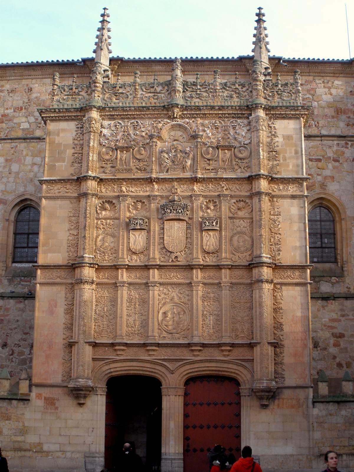
Fachada de la Universidad de Salamanca
Salamanka
The Facade of the University of Salamanca is the ornate stone screen framing the entrance to Spain's oldest university, and one of the most photographed architectural details in the city. What exactly are you looking at? The facade went up in the early 16th century, right at the height of Plateresque style — an ornamental Spanish trend named after platero, the word for silversmith, because its dense carving recalls silverwork. The wall behind it is still structurally Gothic, but the entire surface is layered with Renaissance decoration woven together with flamboyant Gothic flourishes and Moorish-inspired patterns. The composition is arranged in three horizontal tiers, each separated by a decorative frieze. On the central axis of the lowest tier sits a medallion showing the Catholic Monarchs, Isabella of Castile and Ferdinand of Aragon, holding a scepter. Beside them runs a Greek inscription that translates roughly as: the kings to the university, and the university to the kings — a tribute to the monarchs under whose reign the institution rose to prominence. The upper tiers are packed with medallions, coats of arms, plant motifs, and small figures, forming one of the densest decorative compositions of the Spanish Renaissance. Art historians consider this facade a defining work of the Plateresque style, with some calling it the foundation stone of the early Spanish Renaissance itself. Why does everyone hunt for a frog here? The facade hides one of Salamanca's best-known secrets: a small frog carved into the stonework, tucked among the surrounding ornamentation and genuinely hard to spot without a hint. Local tradition holds that finding it unaided brings good luck, especially to students ahead of exams. The tiny figure has turned into an unofficial symbol of the city, and it's where visitors linger longest, scanning the hundreds of carved details for that one frog. How do you get there? The facade faces Patio de Escuelas, a small square right in the historic core of Salamanca, a short walk from Plaza Mayor. The old town is closed to car traffic, so walking is the natural way to arrive — the square sits directly on the route between the cathedral and the other university buildings. The plaza itself is compact, so give yourself a few minutes to view the facade from different distances and angles. When should you visit? The facade can be viewed from outside year-round, at any hour, free of charge — it's an exterior wall, not a ticketed exhibit. Early morning or late afternoon light rakes across the stone at an angle that brings out the depth of the carving. During summer and holiday periods, Patio de Escuelas fills with tour groups, so an early start makes for a much quieter visit. Frequently asked questions Do you need a ticket to see the facade? No, the square and the facade itself are free and open at all times. Tickets are only required to enter the university's interior spaces, such as the lecture halls and library. Is the hidden frog really hard to find? Yes — most visitors miss it entirely without a tip. It's small and blends into the dense carving, so it helps to scan slowly or ask a local guide to point out roughly where to look. How much time should I set aside? Simply standing in front of the facade takes 10 to 15 minutes, but with time spent hunting for the frog and photographing the detail, half an hour is a reasonable plan. Is the facade part of a larger university visit? Yes, it forms the entrance to the historic University of Salamanca complex, which includes the Fray Luis de León lecture hall and the old library — those interior spaces require a separate paid ticket.
-
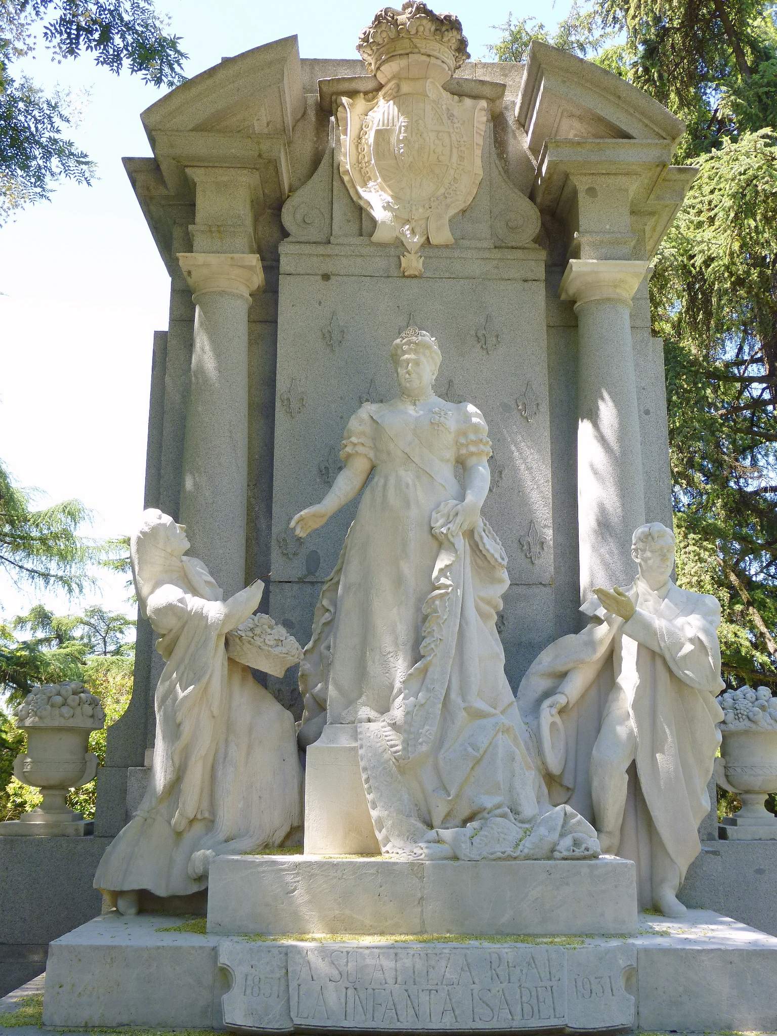
Monumento a la infanta Isabel de Borbón, Madrid
Madryt
The Monument to Infanta Isabel de Borbón stands in Madrid's Parque del Oeste, right next to Paseo del Pintor Rosales. It honors Infanta Isabel de Borbón, one of the best-known members of Spain's royal family in the 19th and early 20th centuries, and one of the most genuinely beloved by ordinary Madrileños. Who was Infanta Isabel de Borbón? Isabel de Borbón was the daughter of Queen Isabella II and the sister of King Alfonso XII. She held the title of Princess of Asturias twice — first as the reigning queen's firstborn, and again later after her father's line was restored to the succession. What made her stand out in Madrid's collective memory, though, wasn't her royal rank but her closeness to everyday people. Locals affectionately called her "La Chata," and she was famous for her passion for bullfighting, regularly attending corridas and earning a reputation as one of the warmest, most approachable royals of her time. That popular affection is the whole point of the monument. What does the monument look like? The central sculptural group is carved in white stone. It shows the Infanta standing on a pedestal while two figures pay tribute to her: a flower seller and a Madrid local wrapped in a cape that nods to bullfighting tradition. The choice of figures is deliberate — the composition is built around the bond between the Infanta and ordinary Madrileños, casting her as a popular, down-to-earth figure rather than a distant aristocrat. Who designed it, and when was it built? The idea for the monument came from the Royal Academy of Fine Arts of San Fernando in 1951, to mark the centenary of the Infanta's birth. Funding came from a public subscription organized and promoted by the newspaper ABC — itself a sign of how much affection she still commanded decades after her death. The architectural design was the work of García Lomas, while the sculpture itself was created by Alejandro Zaragoza. The monument was unveiled in 1955. Where is it, and how do you visit? The monument sits inside Parque del Oeste, one of central Madrid's larger green spaces, right along Paseo del Pintor Rosales, a popular tree-lined promenade that runs along the park's eastern edge. It's an easy stop to fold into a longer walk through the area — the Templo de Debod and several viewpoints over the Manzanares valley are all nearby. There's no ticket or booking required; you can visit any time while strolling through the park. Frequently Asked Questions Who was Infanta Isabel de Borbón? The daughter of Queen Isabella II and sister of Alfonso XII, twice Princess of Asturias, known to Madrileños as "La Chata" for her popularity and her love of bullfighting. Where exactly is the monument located? In Madrid's Parque del Oeste, next to Paseo del Pintor Rosales. When was the monument built? The project was proposed in 1951 for the centenary of the Infanta's birth, and the monument was unveiled in 1955. Who created the monument? García Lomas designed it and Alejandro Zaragoza sculpted it; construction was funded through a public subscription organized by the newspaper ABC.
-
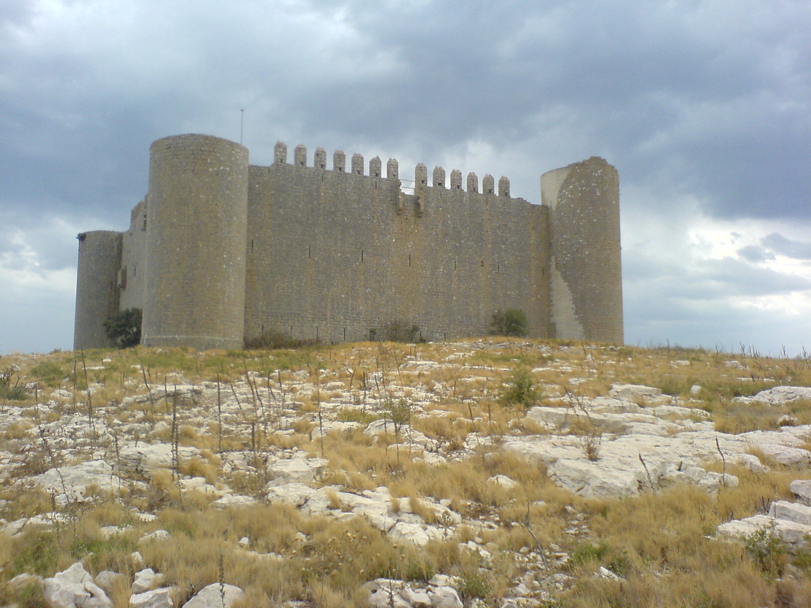
Montgrí Castle
Torroella de Montgrí
Montgrí Castle stands high above Torroella de Montgrí, perched on a rocky massif that's visible for miles along the Costa Brava coastline. It's one of those landmarks that grabs your attention immediately — a stark stone silhouette against the sky, surrounded by pale limestone hills. Why was it built here? Construction ran between 1294 and 1301, and the castle's origin is tied directly to the power struggles of medieval Catalonia. At the time, the counts of Empúries controlled most of the surrounding territory, but the counts of Barcelona were the dominant force in Catalonia and held considerable sway over Mediterranean affairs as well. Montgrí was built as part of that rivalry — a defensive stronghold meant to reinforce Barcelona's grip on land that had previously fallen under Empúries' influence. How do you get there? Torroella de Montgrí sits in Girona province, close to some of the Costa Brava's best-known coastal towns. The castle occupies the summit above the town, so reaching it means walking — the trail typically starts from the town center or from parking areas at the base of the massif. It's a short but demanding climb over rocky, occasionally steep ground, so sturdy shoes and water are worth bringing, especially in summer. What will you find at the top? The structure itself is defined by thick stone walls and a tower, reflecting its purely defensive purpose — Montgrí was never a residence, but a strategic lookout point. The real draw, though, is the view: from the terrace at the castle's base and the area around the summit, you can take in the entire Empordà plain, the coastline toward L'Estartit and the Illes Medes islands, and on clear days, stretches of the wider Costa Brava. It's a spot where the landscape does most of the talking. When's the best time to visit? Spring and autumn offer the most comfortable conditions, with mild temperatures and a trail that isn't baking in direct sun. Summer hikes can be tough given the heat and the lack of shade along most of the route — an early morning start is a good idea if you're visiting that season. Winter brings cooler, windier conditions at the top, but visibility tends to be excellent and the trail much quieter. What else fits into the day? Torroella de Montgrí itself is a medieval town worth wandering through, with its old town core still intact, and nearby L'Estartit serves as the gateway to the Illes Medes archipelago, popular for diving and glass-bottom boat trips. The castle pairs naturally with a day that mixes history with outdoor activity. Frequently asked questions Is there an entry fee for the castle? The trail and approach to the castle are open access, though local rules for entering the structure itself can vary by season — it's worth checking current details at the tourist information office in Torroella de Montgrí. How long does the hike take? Depending on the route and pace, the climb to the top usually takes between 45 minutes and an hour and a half one way. Is the trail suitable for kids? It's short but rocky and steep in places, so it works better for older children used to hiking than for very young ones. Is it worth the climb just for the view? Absolutely — even without going into the structure itself, the panorama over the Empordà plain and the coastline ranks among the best viewpoints in the region.
-
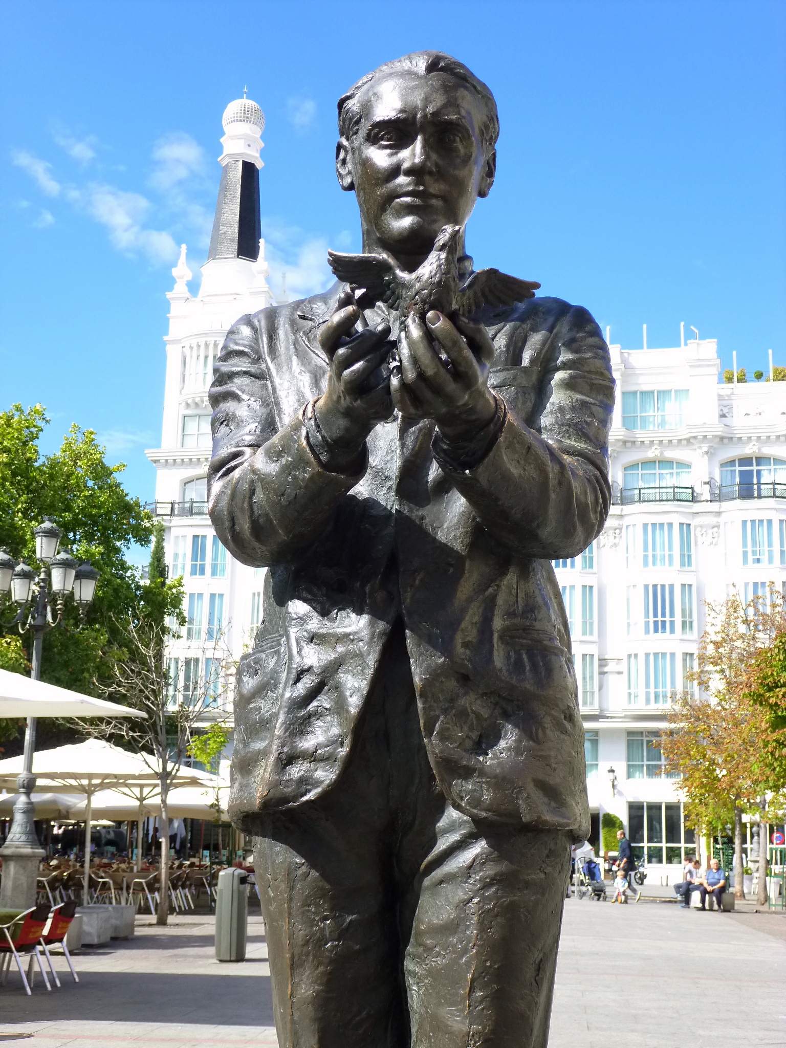
Monument to Federico García Lorca, Madrid
Madryt
The Monument to Federico García Lorca stands on Plaza de Santa Ana in the heart of Madrid, right in front of the Teatro Español. The bronze figure honors the Spanish poet and playwright, one of the most significant Spanish-language writers of the 20th century, and it's the kind of landmark visitors often stumble upon while wandering through Barrio de las Letras, the writers' quarter just a few minutes from Puerta del Sol. Who was Federico García Lorca? Lorca (1898–1936) wrote "Blood Wedding," "The House of Bernarda Alba," and the poetry collection "Romancero gitano" — works still staged in theaters worldwide, including the very Teatro Español standing a few steps from the statue. He was executed in the opening weeks of the Spanish Civil War, and his death turned him into a symbol of the repression faced by artists and intellectuals during that period. Placing the statue directly across from the theater tied to his professional life is no coincidence — it's a tribute rooted in a place connected to his actual work. How to get there? Plaza de Santa Ana sits right in central Madrid, so walking is usually the simplest option. From Puerta del Sol it's a walk of just a few minutes — head toward Calle de la Cruz or Calle del Príncipe. The nearest metro stops are Sol (lines 1, 2, and 3) and Antón Martín (line 1), both five to seven minutes on foot. The square is fully pedestrian, so there's no need to hunt for parking nearby — car access in Barrio de las Letras is heavily restricted anyway. What will you see there? The monument itself is a quiet, contemplative figure that contrasts with the buzz surrounding the square most of the day. Plaza de Santa Ana is one of the liveliest spots in Madrid's Barrio de las Letras — cafés, tapas bars, and historic hotels line its edges, and by evening it fills with locals and visitors looking for a drink. It's worth pairing the visit with a stroll through the surrounding streets, where quotes from Spanish writers are still engraved into the pavement — a distinctive touch of this part of the city. The Teatro Español itself, facing the statue, has a facade worth a brief look even without going in for a show. When should you visit? The square operates year-round, and the monument is accessible at all hours, free of charge — it's public space, not a ticketed attraction. During the day, especially in the morning, things are quieter, making it easier to photograph the statue without crowds in the frame. Afternoons and evenings bring the most energy to the plaza — if the goal is soaking up an authentic slice of Madrid life, that's the time to come despite the busier crowds. In summer, the square can get warm at midday due to limited shade, so morning or evening hours tend to be more pleasant. Frequently asked questions Is there an admission fee for the monument? No. It sits in an open public square and can be seen at any time, with no fees or opening hours to work around. Why was the monument placed on Plaza de Santa Ana? Because of its proximity to the Teatro Español, a theater closely tied to Lorca's work, making the location a natural spot to honor the writer. How much time should I set aside for a visit? Seeing the monument itself takes just a few minutes, but it's worth lingering to explore the surrounding Barrio de las Letras — a walk through the area with a coffee stop usually takes 30 to 60 minutes. Are there other attractions nearby worth visiting? Yes — Puerta del Sol, Plaza Mayor, and the literary Barrio de las Letras with its pavement quotes are all within a short walk.
-
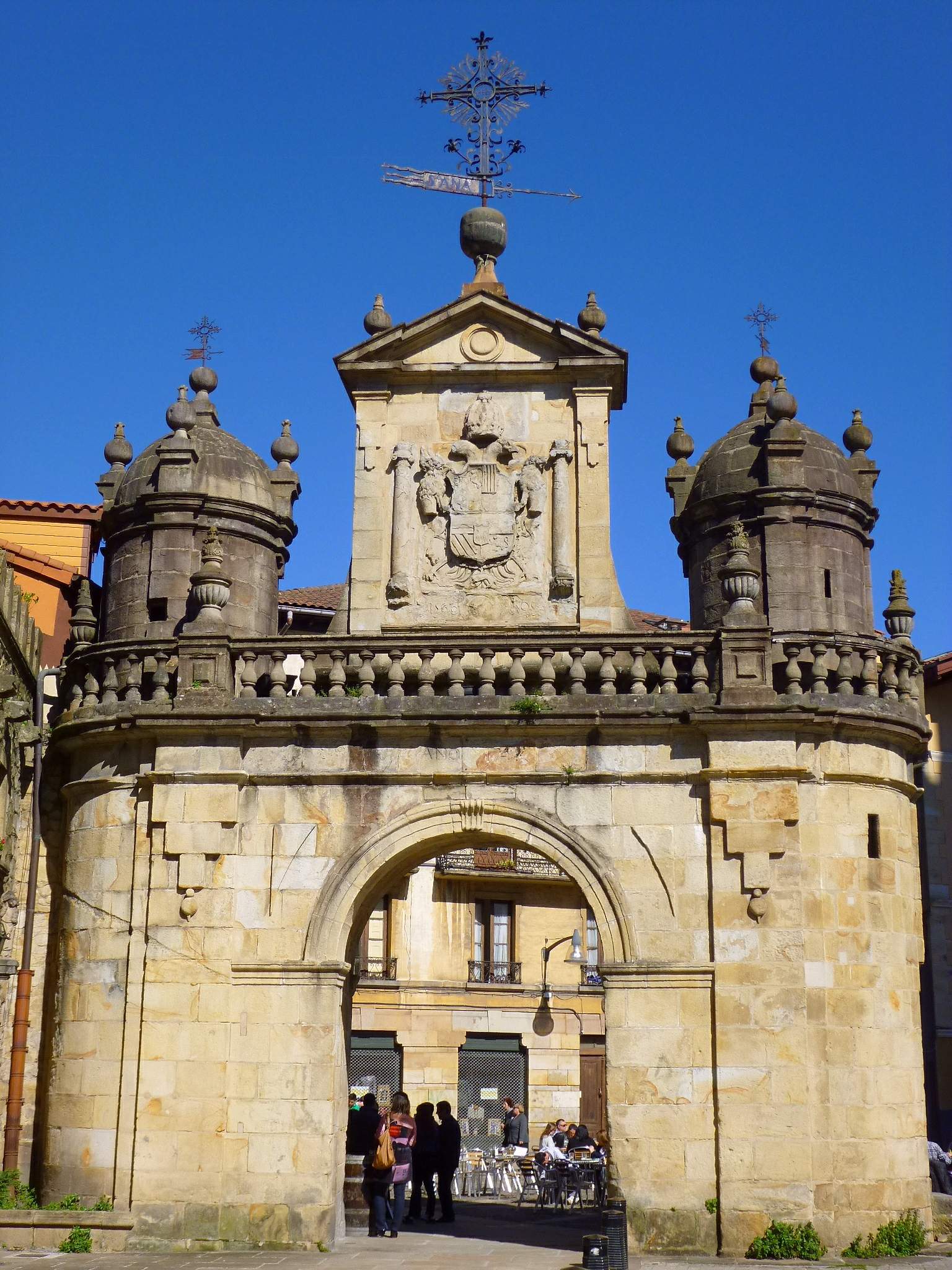
Puerta de Santa Ana, Durango
Durango
Puerta de Santa Ana in Durango is the sole survivor of the six gates that once pierced the medieval town walls of this Basque town in the Duranguesado area of Bizkaia. It stands on Plaza de Santa Ana, marking the symbolic entrance to the old quarter, today protected as a Conjunto Monumental (listed historic ensemble). What does the gate look like today? The structure you see now is not the original one. The first gate went up in 1566 in Renaissance style, but by the 1740s (1743-1744) the town council decided it no longer matched the times and replaced it with a new Baroque construction — the version still standing on the square today. The gate takes the form of a grand, two-storey triumphal arch, its passage closed by a semicircular arch. The facade carries an imperial-style coat of arms, and a niche above the passage holds a statue of a female saint. The scale and ornamentation were meant to signal the town's status and prosperity, not just serve a defensive purpose. What role did it play historically? Despite the name evoking Saint Anne's patronage, the gate's real importance was economic. It was formerly known as the Puerta del Mercado — the Market Gate — because goods supplying the town's residents passed through it on their way in. For centuries it served as the main checkpoint for trade and foot traffic entering the walled centre. Of the original ring of six town gates, the rest disappeared over time as Durango grew and the walls lost their defensive purpose. Puerta de Santa Ana is the only one that has survived intact, making it today the most recognisable remnant of the town's medieval fortification system. Where is it and what else is nearby? The gate stands at the heart of the old town, on the square that bears its name, surrounded by stone buildings typical of Basque townscapes. It's a natural starting point for exploring Durango's historic centre — from here, narrow streets lead on to other landmarks of the old quarter, including nearby churches and 17th-century town houses. Durango's old town, with its medieval street layout, is itself the main reason visitors linger here rather than passing straight through. When is the best time to visit? Since it's an outdoor urban landmark open at all hours and free to visit, the gate can be seen any time of year or day. Early morning and late afternoon light tends to work best for photos, catching the coat of arms and the niche statue at a flattering angle. It's also worth timing a visit around market days or local festivals, when the square in front of the gate comes alive and its original role as a trading entrance feels easier to picture. Frequently asked questions Is Puerta de Santa Ana the original medieval gate? Not entirely. The first gate was built in 1566, but the Baroque structure standing today dates from 1743-1744, when it replaced the older Renaissance-style version. How many of Durango's town gates still exist? Just one. Of the six historic entrances through the town walls, Puerta de Santa Ana is the only one that has survived to the present day. Why was it once called the Market Gate? Because goods supplying the town passed through it — it functioned as the main commercial entry point into Durango. Is there an entrance fee? No, it's a public urban landmark, freely accessible at any time with no admission charge.
-
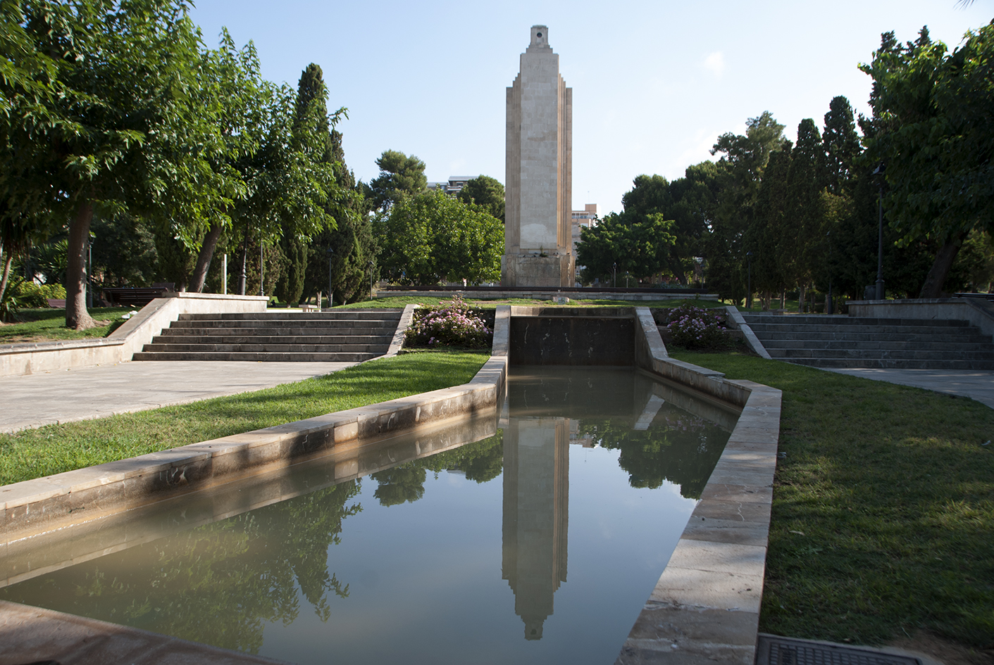
Monument to the victims of the cruiser Baleares
Palma
The Monument to the Victims of the Cruiser Baleares stands in Parc de la Feixina in Palma, right along the seafront promenade, and remains one of the city's most visible — and most disputed — memorials. What is this monument? The structure takes the shape of a lighthouse: a tall white tower visible from a distance, set in a small park near the port. It was designed by architects Francesc Roca and his son Antoni Roca, with the sculptural work carried out by Josep Ortells. The monument was unveiled on 16 May 1947, a few years after the end of the Spanish Civil War. It commemorates the crew of the cruiser Baleares, a warship sunk on 6 March 1938 by torpedoes fired by Republican forces. Almost 800 sailors died in the sinking — most sources cite a figure close to 786–788 victims. Among them was a Royal Navy officer who happened to be aboard as an observer. Why is it controversial? The Baleares fought on the Francoist side during the Civil War, which is why the monument has been a source of political tension for decades. Under Spain's law on democratic memory, which aims to remove symbols associated with the Franco dictatorship from public spaces, authorities decided to dismantle the monument. The decision was made in 2026 and sparked debate among Palma residents and historians alike — some view it as a tribute to ordinary war casualties, others as a symbol of the regime. If you're planning a visit, it's worth checking locally whether the monument is still standing in its original form, since removal could be carried out in the near future. How to get there? Parc de la Feixina sits right in the heart of Palma, at the junction of the old town and the waterfront. From La Seu cathedral, it's a relaxed 15–20 minute walk along the Passeig Marítim promenade. The spot is also easy to reach by city bike or local bus lines running along the coast. Driving is possible, but parking nearby can fill up quickly during summer — leaving the car a bit further away and walking in is often simpler. What else is worth seeing nearby? The park itself is a pleasant place for a short break, with greenery, benches, and views over Palma Bay. From here it's a short walk to the marina and to the promenade leading toward the cathedral and the old town. It works well as a stop during a longer seafront walk, especially in the evening when the setting sun lights up the monument's tower. When to visit? Early morning or late afternoon are the best times, when temperatures are milder and the light works better for photos. During the day the area gets a lot of direct sun with little shade, which can make a longer stop uncomfortable in midsummer. Frequently asked questions What does the monument represent? It commemorates the crew of the cruiser Baleares, sunk in 1938 during the Spanish Civil War. Why is the monument being removed? Because the ship fought on the Francoist side, and Spain's law on democratic memory requires the removal of symbols tied to the dictatorship. Is the monument still standing? The removal decision was made in 2026, so it's worth checking the current status before visiting. How long does a visit take? It's a small viewpoint — 10–15 minutes is enough, unless you combine it with a longer walk along the promenade.
-
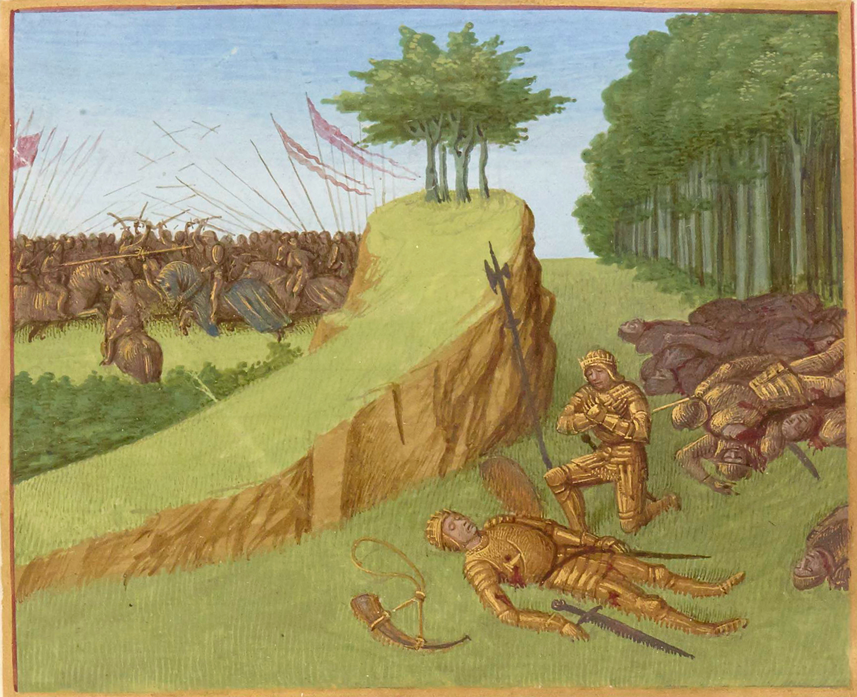
Battle of Roncevaux Pass
Luzaide
The Battle of Roncevaux Pass took place on 15 August 778 in the mountain pass of Roncevaux, on the Spanish side of the Pyrenees, right next to what is today the border town of Luzaide/Valcarlos in Navarre. It is one of the most storied historical sites along the Camino Francés — the legend of Count Roland, who died here with Charlemagne's rearguard, has echoed through Europe for over a thousand years. What happened here? Charlemagne was withdrawing his army through the Pyrenees after a campaign on the Iberian Peninsula. As his rearguard crossed the narrow, hard-to-defend pass, it was ambushed by Basque highlanders who knew the terrain intimately and used the high ground to their advantage. The clash ended in disaster for the Franks — nearly the entire rearguard was wiped out, including its commander, Count Roland. Historical sources describe the event only briefly, yet a few centuries later it became the seed of one of the great works of medieval literature, the "Song of Roland," which expanded the skirmish into a sweeping tale of chivalric heroism, complete with treachery and a climactic battle against Saracen forces. Why does this place matter to pilgrims and travelers? For centuries, Roncevaux Pass has served as a gathering point on the road to Santiago de Compostela — it lies on one of the main branches of the Camino Francés, the route that crosses into the Iberian Peninsula from the French side of the Pyrenees. Pilgrims and hikers walking this stretch today follow the same mountain paths that Charlemagne's troops once crossed. The very name Roncevaux (Spanish: Roncesvalles, Basque: Orreaga) has become shorthand in European culture for heroic defeat. What will you see in the area? The landscape remains rugged and mountainous — dense beech forests, steep slopes and narrow valleys that make it easy to understand why this terrain favored an ambush against a retreating army. On the Navarrese side, a short distance from the border, stands the monastery and collegiate church of Roncesvalles, a major pilgrim waypoint with centuries of tradition in sheltering travelers. Luzaide/Valcarlos, closer to the French border, has kept the feel of a traditional Basque mountain village, with stone houses and a pastoral rhythm of life. How do you get there? The pass sits on the route connecting Saint-Jean-Pied-de-Port in France with Roncesvalles in Spain, one of the busiest stretches of the Camino Francés. It can be walked, as thousands of pilgrims do each year, or reached by car along the local border road. Allow plenty of time — the terrain is mountainous and calls for sturdy footwear and proper preparation, especially outside the summer season. Frequently Asked Questions Are there any physical remains of the battle at Roncevaux? No — after more than 1,200 years, no visible material traces of the clash survive on site. The site's value today is mainly historical and symbolic, amplified by its literary legend. How does the historical battle differ from the "Song of Roland"? Historical sources describe a brief, localized Basque attack on a retreating army's rearguard. The medieval epic poem expanded this considerably, adding betrayal, miracles and a full-scale battle against Saracen forces, turning Roland into a legendary figure. Are Roncevaux and Roncesvalles the same place? Yes — they are the French and Spanish names for the same border pass area. Luzaide/Valcarlos lies closer to the French border, while Roncesvalles is a few kilometers further, on the Navarrese side. Is the pass worth visiting if you're not walking the Camino? Yes — it is a site of significant scenic and historical value in its own right, accessible by car as well, with striking views over the Pyrenean slopes.
-
Molí de la Sal
Burjassot
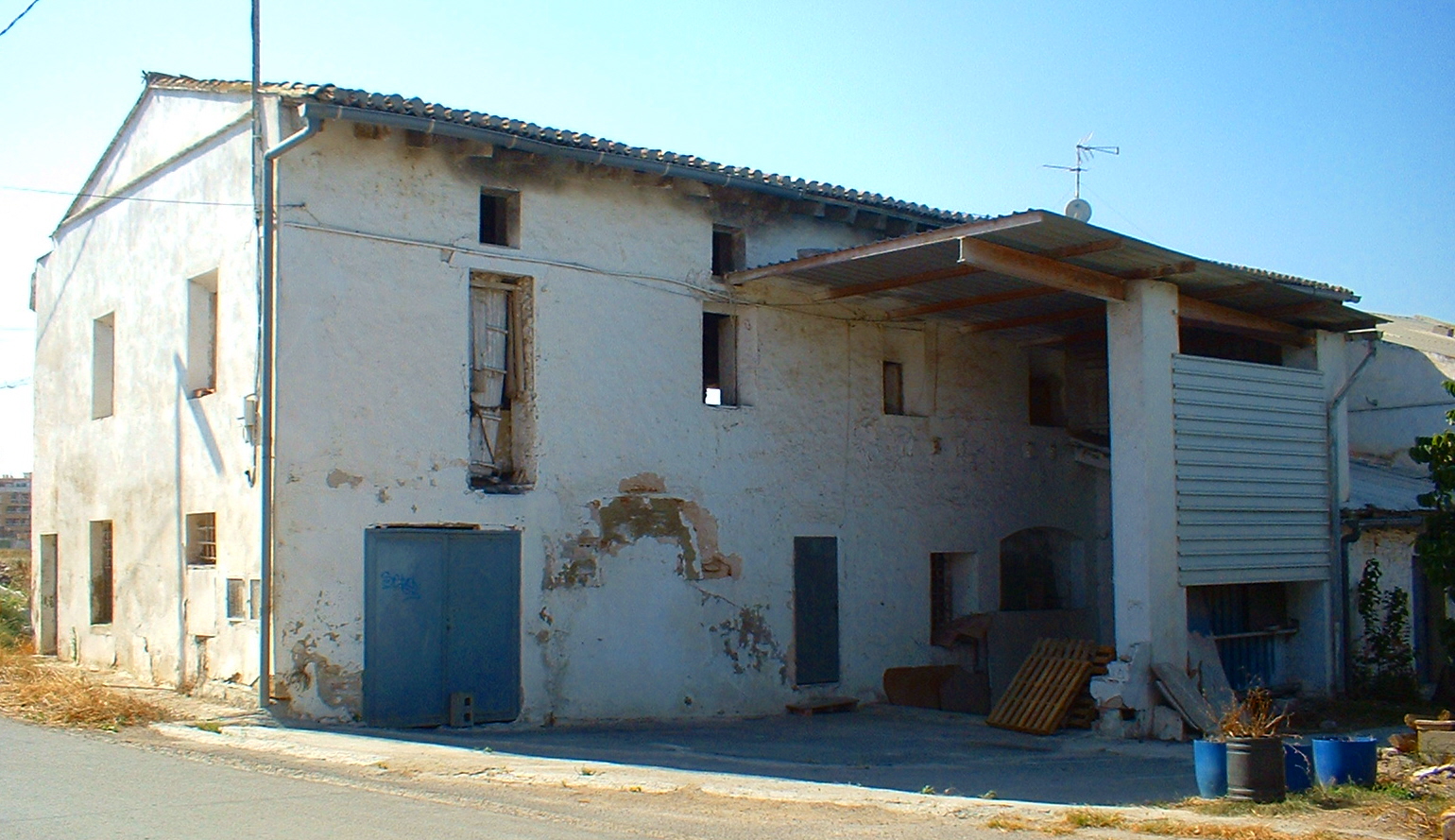
Molí de la Sal is a historic water mill in Burjassot, a small town right next to Valencia, tucked among the fields and irrigation canals of the historic Huerta de Burjassot. The building stands on the Tormos canal, one of the seven waterways overseen by the famous Tribunal de las Aguas de la Vega de Valencia — a water court that has settled irrigation disputes without interruption since medieval times. The mill itself drew on this canal system for eight centuries, making it one of the most enduring witnesses to the region's agricultural past. Where does the site's history come from? Traces of a mill on this spot go back to the 13th century and an even earlier Andalusian mill from the days of the Burjassot alqueria. According to historical research, King Jaime I granted the property to Guillem de Bell-lloc in 1240 — one of the oldest documented facts tied to this location. The structure visible today dates in practice to the 17th century, though the horizontal-wheel water-mill function stayed essentially unchanged for centuries. The name "de la Sal" and its alternative "del Salt" trace back to the local history of how water was used and channelled at this point of the canal. What will you actually see there? Molí de la Sal is a good example of the hydraulic architecture typical of the Valencian huerta: a stone mill building built around a horizontal-wheel system, sitting directly on the route of an irrigation canal. The site has been listed as a Bien de Relevancia Local (an asset of local relevance), confirming its cultural value as a witness to centuries of water management in the region. It's worth knowing, though, that the mill is currently in an advanced state of neglect — more of an authentic, weathered landscape feature than a restored monument, reflecting the broader ongoing degradation of heritage across the Huerta de Valencia. Research is underway on how to give it new value, including proposals to turn it into a small museum with historic machinery on display and ethnographic collections. How do you get to Molí de la Sal? Burjassot sits right next to Valencia, well connected to the city center by metro and bus — making it one of the more accessible heritage sites in the Huerta de Valencia. The mill stands among fields irrigated by the Tormos canal, so reaching it means walking through a classic huerta landscape: vegetable plots, irrigation channels and dirt tracks linking the smallholdings. When should you visit? Spring and autumn are the best times, when temperatures around Valencia are mild and the huerta fields are in full cultivation. Summer heat can make longer walks across open ground uncomfortable, while in winter the canals tend to be quieter outside the main irrigation season. Since the site has no formal visitor infrastructure, it's worth timing a visit for daylight hours with good light, so you can properly take in the canal layout and the mill's construction. Frequently asked questions Can you go inside Molí de la Sal? The building is in a neglected state and isn't set up as a staffed, guided attraction — it's mainly viewed from the outside, as part of the historic huerta landscape. How old is the mill? The site's history goes back to the 13th century and an earlier Andalusian mill, with a documented grant from King Jaime I dating to 1240. The structure standing today is essentially a 17th-century building. What is the Tribunal de las Aguas connected to the mill? It's a historic water court overseeing eight irrigation canals of the Huerta de Valencia — Tormos is one of them — that has resolved farmers' water disputes since medieval times and still operates today. Why is the mill in such poor condition? It reflects a wider pattern of heritage decline across the Huerta de Valencia. Researchers are currently studying proposals to restore and revalue the site, including turning it into a small museum space.
-
Molí de Llobateres
Sant Quirze Safaja
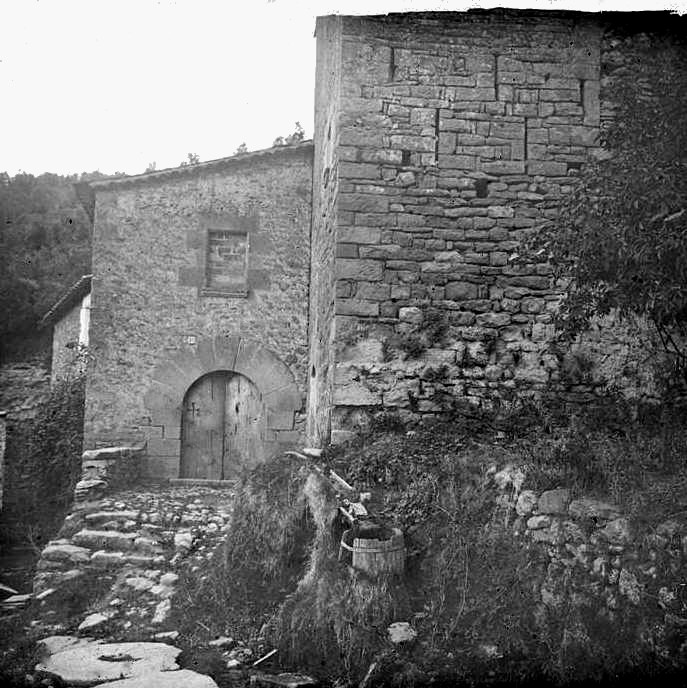
Molí de Llobateres is a medieval fortified mill in the municipality of Sant Quirze Safaja, in the Moianès region of Catalonia. It stands on the right bank of the Tenes river, at the southern edge of the municipal area, near the settlements of les Clotes and les Torres. The mill has been listed as a Cultural Property of National Interest (Bé Cultural d'Interès Nacional) since 1949, making it one of the region's most notable pieces of industrial heritage. What will you see there? The oldest part of the structure is a stone tower dating from the 13th century, which gives the mill its fortified appearance and explains why it is also known as molí de la Torre. The rest of the buildings were added later, though the whole complex still follows a medieval layout. Historical records also refer to the mill as molí de Centelles and molí de Fontubal, the latter name coming from the Font Tubal spring that once rose right beside it. One particularly interesting detail is how the mill was powered: rather than drawing directly on the Tenes river, it originally ran on water from that abundant tributary spring next to the building. Today the same water source is used as an intake point supplying drinking water to the municipalities of Sant Quirze Safaja and Sant Feliu de Codines, a reminder of how centuries-old hydraulic infrastructure can still serve a practical purpose. How do you get to Molí de Llobateres? The mill sits along a well-known hiking route of roughly 10 kilometres that starts in the centre of Sant Quirze Safaja. The trail passes the Bauma de l'Espluga rock shelter, skirts the L'Illa campsite, reaches Molí de Llobateres, and continues on to the nearby Molí de Baix. The walk is rated easy, though some stretches are poorly marked, so carrying a map or GPS track is advisable. By car, visitors can reach Sant Quirze Safaja itself, then continue on foot along the Tenes riverbed. What else is worth seeing nearby? Following the trail downstream from the mill leads to Salt del Molí, a small waterfall, and then to Gorg Negre, a natural rock pool considered one of the most attractive spots in the Tenes valley. It's a popular summer destination, though swimmers should be careful of the cold water and uneven bottom. Combining the mills, the waterfall, and the pool into one walk makes it possible to take in both the industrial and natural history of this part of Moianès in a single afternoon. When is the best time to visit? Spring and autumn are the best seasons for the walk, when water levels in the Tenes stay steady and temperatures are comfortable for several hours of hiking. In summer, an early morning start is recommended, especially for anyone planning to swim at Gorg Negre. In winter, the river often carries more water, adding to the scenery around the mill, though the paths can be more demanding. Frequently asked questions Can you go inside the mill? The building is privately owned or subject to heritage-protection restrictions, so visits are generally limited to viewing it from the outside, along the hiking trail. How long does it take to reach the mill from Sant Quirze Safaja? The stretch to Molí de Llobateres is part of a longer, roughly 10-kilometre route; walking there from the village centre usually takes one to one and a half hours, depending on pace. Is the route suitable for children? The trail is rated easy, but sections are poorly marked and run alongside the river, so caution is advised with young children, particularly near Salt del Molí and Gorg Negre. What do the mill's other names mean? Molí de Centelles refers to the area's historical landowners, molí de la Torre points to its distinctive defensive tower, and molí de Fontubal comes from the Font Tubal spring that originally powered its machinery.
-
Windmill of Lajares
La Oliva
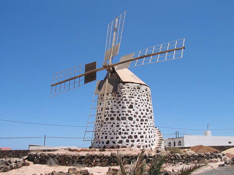
The Windmill of Lajares stands as a quiet landmark in this small village in the municipality of La Oliva, on Fuerteventura, an island long associated with windmills and traditional craftsmanship. It rises on flat, volcanic ground in the island's north, where steady trade winds were historically harnessed to grind grain into gofio, the roasted-grain flour still central to Canarian cooking. Where does this windmill actually come from? The story behind the structure is more unusual than it looks. The sails and internal machinery were not originally built in Lajares — they were bought in 1951 from Andrés Fernández Fránquiz, a resident of Tiscamanita, for 5,000 pesetas, then transported and reassembled in Lajares. This kind of relocation was not unusual on the island: a working milling mechanism was valuable enough that moving one made more sense than starting from scratch. Andrés later passed the windmill on to his son, José Luis, who carried out its first restoration. Ownership eventually passed to the Fernández Martín family, who took on a full, ground-up rehabilitation without any public subsidy. The work was a family effort: Marisol, the owner's wife, together with their children Andrés and Leticia, handled the restoration themselves. The cap was fitted in early November, and the sails were "crowned" on November 21 and 22 — a moment that marked, for the family and the wider village, the completion of the project. How did windmills end up on Fuerteventura in the first place? Windmills are not native to the island's landscape — they were introduced by settlers in the 18th century. The technology spread quickly, especially through the central and northern parts of Fuerteventura, where consistent winds and grain farming created ideal conditions. Over time, windmills became more than agricultural tools: alongside the island's traditional lime-and-stone houses, they turned into one of the visual markers of Fuerteventura's identity. Why is Lajares linked with windmills and crafts? Lajares is one of the villages where the milling tradition lasted longest and is now actively preserved as part of local heritage. The village is also known for its handicrafts — a weekly artisan market draws visitors looking for locally made goods, and the windmill itself serves as both a landmark and a physical reminder of the region's agrarian past. Unlike larger, museum-style milling complexes such as the one in Tiscamanita, the Lajares windmill has kept a more private, family character: it is the result of one household's effort rather than an institutional reconstruction. What should visitors look out for on site? The structure itself — a stone tower topped with wooden sails — follows the typical Fuerteventura windmill design, built to handle the island's strong, dry winds. Worth noticing are the mechanical details: the rotating cap that lets the sails be turned to face the wind, and the sails themselves, which kept their traditional look after restoration. The surrounding landscape, with volcanic hills in view and the Corralejo dunes not far away, reinforces the raw, open character typical of this part of the island. Frequently Asked Questions Was the windmill always located in Lajares? No. Its sails and mechanism originally came from Tiscamanita — they were purchased in 1951 and moved to Lajares, where they were reassembled. Who restored the windmill? The first restoration was carried out by José Luis, son of the original buyer. A full, comprehensive rehabilitation, done without public funding, was later completed by the Fernández Martín family. Is the windmill still used for milling grain? Available sources don't indicate ongoing commercial milling. Today the structure mainly stands as a restored heritage piece and a visual landmark within the village. Why does Fuerteventura have so many windmills? Windmills were brought to the island by settlers in the 18th century. Steady winds and grain cultivation in the central and northern areas made the technology spread quickly, turning it into a defining feature of the local economy.
-
Molí de les Canes
Centelles
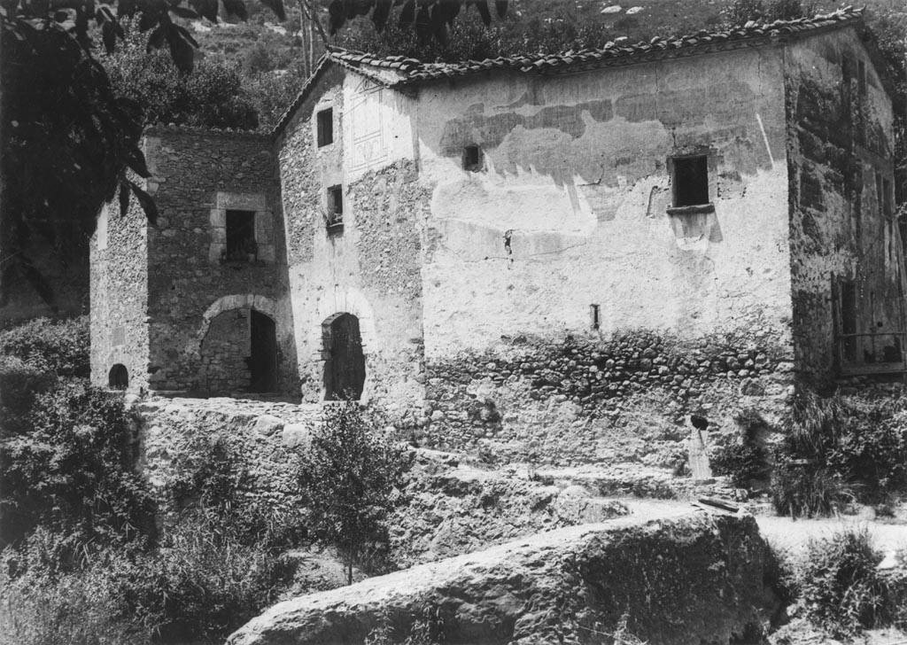
Molí de les Canes is the ruin of an old water mill standing next to the former Mas de les Canes farmhouse, within the municipality of Centelles, in the Osona region of Catalonia. Set beside the Congost river at roughly 438 metres above sea level, it's not a site you tour in the usual sense, but it's one of the more intriguing stops for anyone following the local trail of historic water mills. Where exactly is Molí de les Canes? The ruins sit right along the C-17 road, around kilometre 42.3, close to the Aiguafreda exit — one of the first turnoffs on that road if you're driving from Vic toward Barcelona. Administratively the site falls within Centelles, though geographically it's closer to Aiguafreda than to the Centelles town centre. It lies in the Congost valley, a corridor that has connected the Osona and Vallès areas for centuries. What's the history behind the mill? Two mills were once linked to Mas de les Canes: one further upstream near Les Codines, the other downstream, right by the farmhouse itself. Both show up in records as early as 1538, and in 1552 they were leased by Joan Canes — the family whose name the site still carries. Like most mills strung along the Congost, they used the river's flow to turn their grinding wheels. The most unexpected find at the site, though, wasn't mill machinery at all. Late in the 19th century, Roman milestones (mil·liaria) turned up here, proof that an imperial Roman road once ran through this exact spot, linking Auso (present-day Vic) with Barcino (Barcelona) along the Congost valley. In other words, people were moving through this valley long before anyone built a mill on it. How do you get there? By car, the approach is via the Aiguafreda exit off the C-17, followed by local roads into the Congost valley. Worth knowing up front: reaching the ruins themselves is genuinely difficult. The land is privately owned, and there's no maintained path leading straight to the mill. For most visitors, the realistic option is viewing the site from a nearby hiking trail rather than walking right up to the ruins. What will you actually see? Conservation is poor. The remains of the lower mill — the one closer to the farmhouse — are barely visible on the ground anymore, worn down by vegetation and erosion over the years. The site is listed on the immovable heritage register (reference 08067-243) and has carried local cultural-asset protection since 1995, but without archaeological work its condition is expected to keep declining; it remains private land with no active use today. When's the best time to visit? Spring and autumn make the most sense, when walking the network of mill trails around Centelles is easiest — no summer heat, no winter chill settling into the Congost valley. Treat Molí de les Canes as one stop on a longer walk past the area's other mills rather than a destination on its own. Frequently Asked Questions Can you go inside the mill ruins? No. The land is private and the structure is in poor condition, so access is essentially impossible and not safe to attempt. What's the most interesting fact about this site? The discovery of Roman milestones here, confirming that an ancient road linking Vic and Barcelona once ran straight through the Congost valley at this point. Is it worth a trip on its own? Not really by itself — it's best combined with a walk covering other mills in Centelles, such as Molí de la Llavina or Molí del Rossell. What's the easiest way to reach it? Drive to the Aiguafreda exit on the C-17, then continue on local roads and paths along the Congost river toward the site.
-
Molí del Plomall
Abella de la Conca
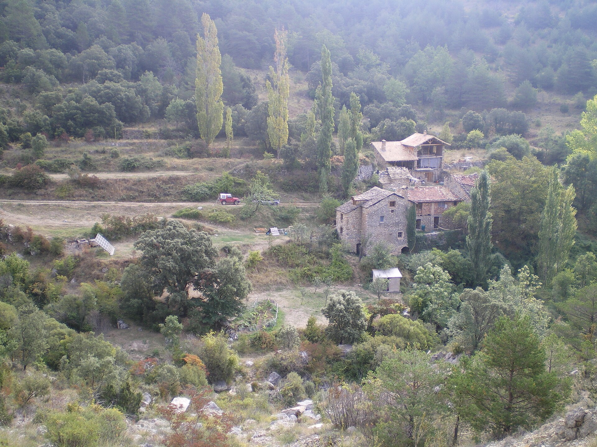
Molí del Plomall is a historic water mill in the municipality of Abella de la Conca, in the Pallars Jussà region of Catalonia. It sits at the bottom of the Rialb river valley, south of the village of Bóixols, to which this part of the municipality administratively belongs. Where exactly is Molí del Plomall located? The mill lies in the northeastern part of the municipality of Abella de la Conca, surrounded by the rugged mountain landscape typical of Pallars Jussà, cut through by the course of the Rialb river. Right next to it stands the masia (traditional Catalan farmhouse) of Cal Plomall, which gave the mill its name — the toponym simply denotes the mill closest to that farmhouse. Nearby stands a Romanesque bridge known as Pont del Plomall, and a little further on lies the rock formation called Forat de Bóixols. How do you get to the mill? Access starts from highway L-511, at kilometre point 14.5, where the Camí del Plomall path branches off. The walking route first crosses the aforementioned bridge, then passes through the Cal Plomall farmhouse grounds before finally reaching the mill itself. This means a single walk combines the bridge, the farmhouse and the mill building, making it an appealing option for visitors looking for a quiet route through mountain terrain. What is the history and role of the mill? Molí del Plomall served local farmers from the area south of Bóixols, with its catchment reaching at least as far as the village of La Rua. Like most water mills across the Pyrenees and Pre-Pyrenees, it harnessed the flow of the Rialb river to grind grain for households in the surrounding villages, functioning for generations as one of the central points of the local rural economy. The mill's name is purely descriptive and topographic, tying it directly to the neighbouring Cal Plomall farmhouse. What else is there to see nearby? Visitors walking the Camí del Plomall pass the Romanesque Pont del Plomall bridge — a stone structure characteristic of the old communication routes in this region — as well as the Forat de Bóixols rock gorge. The village of Bóixols itself, to which this area administratively belongs, is a small mountain settlement typical of Pallars Jussà, with its buildings clustered around the church and its rural character intact. The whole route makes a good starting point for hikes through the Rialb river valley. Can you stay overnight there? The mill today also operates as a tourist accommodation property, allowing visitors to stay overnight in the historic building and use it as a base for exploring the Pallars Jussà region — including nearby villages, mountain trails and the Romanesque heritage scattered across the wider Conca de Tremp area. Frequently asked questions What does the name Molí del Plomall mean? The name is descriptive: it refers to the mill closest to the Cal Plomall farmhouse (masia), from which it takes its designation. Which valley is the mill located in? It sits at the bottom of the Rialb river valley, south of the village of Bóixols. How do you reach the site? The best way is from the L-511 road (kilometre 14.5), following the Camí del Plomall path, which crosses the Pont del Plomall bridge and passes through the Cal Plomall farmhouse. What else is worth seeing along the way? Along the route you'll pass the Romanesque Pont del Plomall bridge and the Forat de Bóixols rock formation, with the village of Bóixols itself serving as a good base for further hikes. Can the mill be visited independently? Yes, it's accessible on foot from the road mentioned above, and it also functions as overnight accommodation for tourists visiting the Pallars Jussà region.
-
Hypogeum of Cala Sant Vicenç
Cala Sant Vicenç
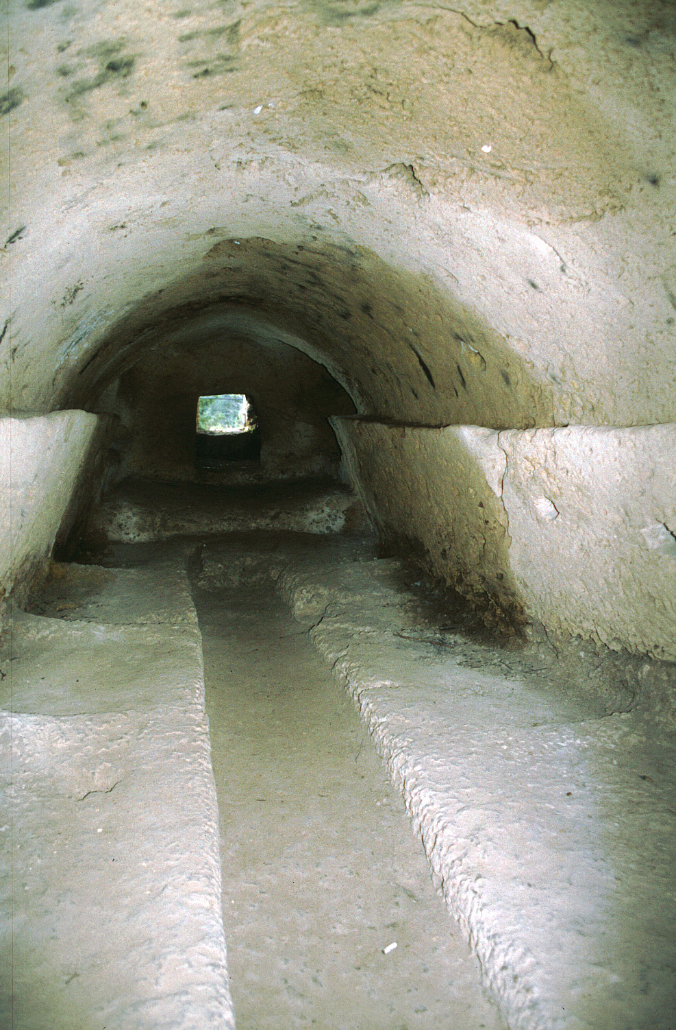
Hypogeum of Cala Sant Vicenç is a group of prehistoric rock-cut burial chambers located in Cala Sant Vicenç, within the municipality of Pollença on Mallorca. What exactly is a hypogeum? A hypogeum is a tomb carved directly into solid rock rather than a structure built above ground. At this site, several such burial chambers survive, dating back to the Bronze Age. Visitors today can see eight visible caves, though when the British archaeologist Wilfrid James Hemp studied the site, fifteen were recorded. The difference reflects how the site has changed over time, with erosion and shifting terrain making some of the original chambers harder to identify or reach today. How old is this site? The chambers date to the Bronze Age, placing them thousands of years before written history on the Balearic Islands. That makes the hypogeum one of the older traces of settlement and burial practice on Mallorca, predating the Talaiotic culture that later left the island its distinctive stone towers and megalithic structures. Is everything at the site original? No. Some features visible at the site are modern additions rather than prehistoric remains. The clearest example is a stone statue resembling a taula — the T-shaped stone element typical of Talaiotic architecture — placed at the entrance to the site. This statue does not date from the Bronze Age; it is a modern piece styled to echo prehistoric forms, but it is not part of the original burial complex. Worth knowing before assuming everything on site is an authentic artifact. Where exactly is it located? The site sits within Cala Sant Vicenç, a popular coastal town on Mallorca's northern coast, administratively part of the municipality of Pollença. Its coordinates are roughly 39.9153 N, 3.0485 E. Cala Sant Vicenç is best known for its turquoise-water coves, and the hypogeum offers a rarer archaeological counterpoint to the area — a stop for travelers who want to pair beach time with traces of earlier settlement. Is it worth visiting? If prehistoric archaeological sites interest you, the hypogeum of Cala Sant Vicenç is a worthwhile addition to a visit, especially combined with time at the cove itself. It is a more niche stop than Mallorca's larger Talaiotic sites, so visitors shouldn't expect extensive tourist infrastructure or crowds — it's more of a discovery for those looking beyond the standard beach itinerary. Frequently Asked Questions How does a hypogeum differ from other Bronze Age tombs on Mallorca? A hypogeum is a tomb carved directly into rock, rather than a structure built above ground or arranged as stone circles. Rock-cut burial chambers like these were one of the burial methods used in the Balearics during the Bronze Age. How many chambers can be seen today? Eight chambers are currently visible. When Wilfrid James Hemp studied the site, fifteen were documented, showing how the site has changed over time. Is the statue at the entrance a genuine Bronze Age artifact? No. The taula-style stone statue at the entrance is a modern addition, not an original prehistoric object. Where on Mallorca is this site located? It's located in Cala Sant Vicenç, within the municipality of Pollença, on the island's northern coast.
-
Alcalalí Tower
Alcalalí Tower stands on a hilltop above the small town of Alcalalí, in the Marina Alta region of Alicante province. It is one of the area's most recognizable landmarks, visible from a distance thanks to the glass-and-steel viewing platform added to its top during a modern restoration. How do you get there? Alcalalí sits inland in Marina Alta, between Xàbia and Benissa, roughly a 30–40 minute drive from the coast (Calpe, Xàbia, Dénia). Driving is the easiest option, since the town is small and the tower stands on a rise near its centre — park at the foot of the hill and walk up the last stretch. The nearest major airport is Alicante, about an hour away by car. What will you see? The tower has an almost square, battered base measuring roughly 6 by 8 metres, built from rubble masonry reinforced with ashlar stone at the corners. Inside, a spiral staircase links its five floors. It was raised at the turn of the 14th and 15th centuries on the orders of Mosén Pedro de Castellví, then lord of Alcalalí and Jalón, and his wife Yolanda Pardo — built as a watchpoint and last refuge for residents against pirates and bandits entering through the Coll de Rates pass. In 1599 a new owner, Eiximen Ruiz de Lihory, acquired the estate and added a palatial residence next to the tower, linked to it by a drawbridge, creating the complex now known as the Torre y Palacio de los Rois de Liori. During a 1992 restoration the tower was topped with a contemporary steel-and-glass lookout that deliberately contrasts with the original defensive stonework and today serves as a viewpoint over the valley and surrounding hills. When should you visit? Spring and autumn bring the most comfortable temperatures for exploring this inland part of Marina Alta, when the countryside around the Coll de Rates turns green after rain. Summer midday heat can be intense, especially on the shadeless walk up to the tower, so mornings or late afternoons are the better choice — that's also when the light does the most for the valley view from the lookout. Why is it worth visiting? Alcalalí Tower pairs centuries of genuine defensive history with an unusual architectural gesture: a glass lookout that doesn't hide the past but sets it in clear contrast with the present. It's a rare case of a watchtower still doing what it was built for — letting people look far into the distance, only now for the view instead of for pirates. Frequently asked questions Can you go inside the tower? The tower has five floors connected by a spiral staircase, but access depends on locally set opening hours — check with the Alcalalí town hall or tourist office before your visit. Where does the tower come from, and who built it? It was built at the turn of the 14th and 15th centuries by Mosén Pedro de Castellví and his wife Yolanda Pardo, as a defensive point protecting residents from pirates and bandits who entered through the Coll de Rates pass. What is the glass lookout on top? It's a modern steel-and-glass structure added during the tower's 1992 restoration, replacing the original crown and now functioning as a viewing platform. Is there anything else to see nearby? Yes — in 1599 a palatial residence was built next to the tower and linked to it by a drawbridge, forming the Torre y Palacio de los Rois de Liori complex. Alcalalí itself sits in the scenic Marina Alta region, at the foot of the Coll de Rates, a favourite spot for cyclists and hikers.
-
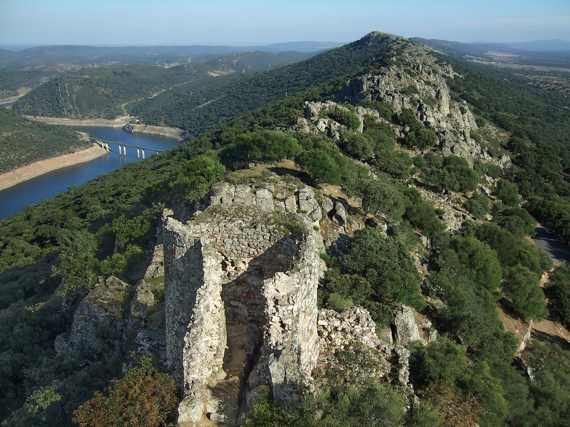
castle of Monfragüe
Torrejón el Rubio
Monfragüe Castle stands above the Tagus River right next to the small town of Torrejón el Rubio, inside Monfragüe National Park in Extremadura, Spain. How do you get there? A signposted road branches off the main route through the park and leads to a small parking area at the foot of the hill. From there it's only a short walk to the entrance, followed by a climb up stone steps to reach the top - comfortable shoes are a good idea. Entry to the castle grounds and the tower is free. What will you see once you're up there? Long before any fortress stood here, Celtic and Roman lookouts already used this hilltop for its sweeping view over the Tagus valley - a natural vantage point that made it strategically valuable for centuries. The current structure was raised by the Moors in the 9th century on top of earlier fortifications; they named it Al-Monfrag and used it to guard the river crossing below. After the Reconquista brought the site into Christian hands, the castle went through several rebuilds, and in the 15th century it gained its most recognizable feature: the Torre del Homenaje, a keep that still dominates the summit and doubles as the main viewpoint today. An Arab-era cistern survives on site, along with a small hermitage dedicated to the Virgin of Monfragüe near the top of the hill. At one point the Trejo family took over part of the complex and converted it into a private residence. At the base of the hill sits the Abrigo del Castillo, a rock shelter with Paleolithic-era paintings - proof that people were using this spot long before any castle walls went up. From the keep, the view stretches over the Tagus and the surrounding dehesas, the open pastureland dotted with holm oaks that defines much of the Extremaduran countryside. When is the best time to visit? Spring and autumn offer the most comfortable conditions for the climb and the greenest surrounding landscape. Extremadura summers can get brutally hot, so an early-morning visit is worth planning for. After 7pm, visitors can drive up to the upper parking area, which shortens the walk considerably for anyone who'd rather skip most of the stairs. What else is worth seeing nearby? In Torrejón el Rubio itself, the Monfragüe Legends Interpretation Centre tells the stories that have grown up around the castle over the centuries - tales of wolf-monks, Christian knights and Moorish princesses. It's a good stop before heading up the hill, giving some historical context to what you're about to see. Frequently Asked Questions Is there an entrance fee for Monfragüe Castle? No, access to the castle grounds and the tower is free. How far is the walk from the parking area to the castle? It's a short distance, but the path climbs a set of stone steps, so expect a brief but fairly steep ascent. Can you drive closer to the top? After 7pm you can drive up to the upper parking area, cutting down the walking distance significantly. What's at the bottom of the hill? The Abrigo del Castillo, a rock shelter with Paleolithic paintings, which can typically be visited as part of a guided tour.
Earn badges for the places you visit
Download NextOnTrip, discover new places and check off your trails.