Monuments in Spain
A guide to 4655 Monuments in Spain — with descriptions, photos and traveler visits from the NextOnTrip community. Locations spread across 2240 cities and towns. Most visited by the community: castle of Chulilla, Castle of Pioz, castell de la Todolella.
-
Torre de Fornells
es Mercadal
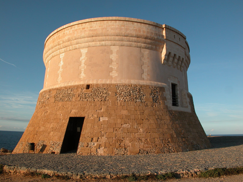
Torre de Fornells is a coastal defence tower guarding the entrance to Fornells bay, in the municipality of es Mercadal on Menorca. Built at the turn of the 19th century during the last period of British rule on the island, it remains one of the most recognisable reminders of that era along the northern coast. What is the history behind the tower? The British built the tower between 1801 and 1802, during a period when Menorca was once again under their control. Its purpose was straightforward: watch over the entrance to Fornells port, prevent enemy ships from landing troops on the shore, and back up the defence of the nearby Sant Antoni fort. Together these fortifications were meant to seal the bay off from any attack coming from the sea. Once the British period ended, the tower lost its military role and stood abandoned for decades. It was finally bought by the Ajuntament des Mercadal in 1994, and handed over to the Consell Insular de Menorca two years later. Following restoration work, the tower opened to visitors in 2000 and has been open as a heritage site ever since. What will you see inside? The tower has a distinctive tapering, truncated-cone shape - it is one of the largest structures of its kind built by the British on Menorca. The walls were raised using a dry-stone technique, with the exterior reinforced by sandstone blocks, giving the tower a rugged yet solid appearance. Inside, the structure is divided into four levels, each with its own purpose. At the bottom sits a cistern, used to collect rainwater - a vital resource for a garrison cut off from the rest of the island. Above it were the stores for food and weapons, while the next floor served as living quarters for the soldiers stationed there. At the very top, on the open terrace, artillery pieces were mounted, and from here the garrison kept watch over the surrounding area - the view takes in both the port entrance and a wide stretch of coastline. How do you get there? The tower stands right by the port in Fornells, so the easiest way to reach it is on foot from the village centre, walking along the waterfront. Fornells sits within the es Mercadal municipality, in the northern part of Menorca, reached via a local road connecting the coast to the island's main route. For visitors touring Menorca by car, it's an easy stop to pair with a walk around the village itself, known for its fish restaurants and bay views. When is the best time to visit? Fornells and its surroundings come alive mainly during the summer season, when the bay fills with sailing boats and windsurfers, and the weather makes waterfront walks pleasant at any time of day. Spring and early autumn, by contrast, are quieter, letting you take in the view from the tower over the bay and the surrounding hills without the crowds. Frequently Asked Questions When was Torre de Fornells built? The tower was built between 1801 and 1802, during the last period of British rule on Menorca. What was the tower used for? It watched over the entrance to Fornells port, prevented enemy ships from landing troops, and supported the defence of the nearby Sant Antoni fort. Can you visit the tower today? Yes, after restoration it opened to the public in 2000 and has functioned as a heritage site open to visitors since then. Where exactly is the tower located? It stands right next to the port in the village of Fornells, within the es Mercadal municipality on Menorca's northern coast.
-
Torre de los perdigones
Sewilla
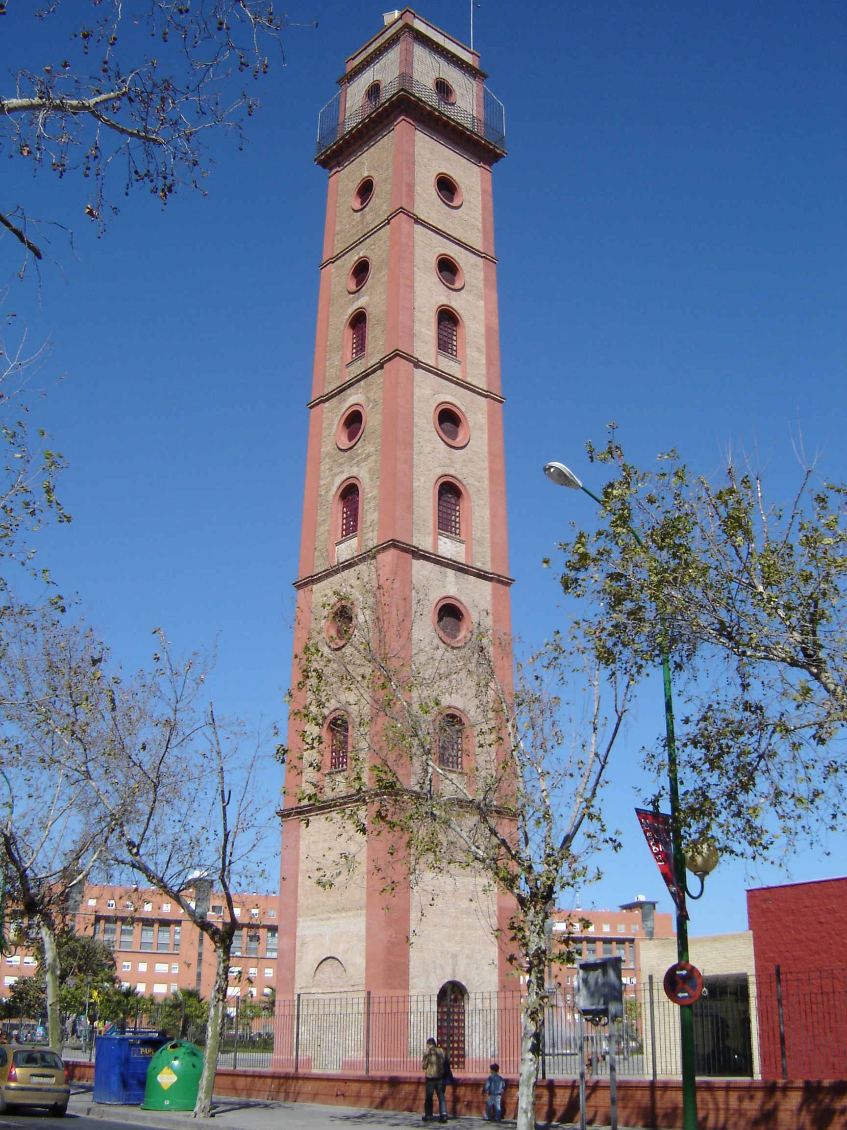
Torre de los Perdigones is a 19th-century industrial tower in Seville, one of the few surviving witnesses to the city's manufacturing past. It stands in the San Gil district on Calle Resolana, right next to the Puente de la Barqueta bridge, north of the historic centre. Where does this tower come from? Construction began in 1885 and finished in 1897, designed by Seville architect José Balbontín de Orta and financed by Manuel Mata. The tower was part of the San Francisco de Paula factory, popularly known as the Fábrica de Perdigones — a plant producing lead shot for hunting ammunition. "Perdigones" is Spanish for shot pellets, and the manufacturing method was as simple as it was dramatic: molten lead was poured from a platform at the top, and as the droplet fell through the air it cooled into a perfectly round pellet before landing in a water basin at the base. The taller the tower, the longer the fall and the rounder the pellet — which is why the structure reaches 46 metres, making it for a long time one of the tallest buildings in Seville. The factory ran continuously until the 1950s. After it closed, the industrial complex fell into disrepair and most of the surrounding factory buildings and warehouses were demolished. The tower itself survived as one of the last physical traces of Seville's industrial era. What can you see inside? After years of neglect, the tower was restored and reopened to the public as a cultural space. Inside, a permanent exhibition explains the history of shot production and the old factory, showing how the manufacturing process worked and why this particular tower shape was necessary. At the top there's a viewing platform with panoramic views over Seville, including the Guadalquivir river and the neighbouring Barqueta bridge. The building also houses a camera obscura — an optical device that projects a live image of the city onto an interior screen, a rare feature among Spain's tourist attractions. How do you get there and when should you visit? The tower sits north of the historic centre, an easy walk, bike ride, or short bus trip from the Alameda de Hércules area. It's open Wednesday to Sunday, in the morning and early-afternoon hours — it's worth checking the current schedule before visiting, since opening days can be limited. Admission is charged but it's one of the cheapest tickets among the city's attractions. Given the tower's small footprint, a visit typically takes between 30 and 45 minutes. The best time to head up to the viewing platform is late afternoon, when the sun is lower and the light flatters the rooftops of old Seville and the line of the river. In summer, morning visits are advisable to avoid the heat on the open-air platform. Frequently asked questions What does "perdigones" mean, and why is the tower named after it? It's Spanish for lead shot — small pellets used in hunting ammunition. The tower was built to produce them by dropping molten metal from height. Is there an elevator inside? Visiting the tower involves climbing stairs to reach the viewing platform, so it's worth factoring in if you're travelling with someone who has limited mobility. Is it worth combining with other nearby sights? Yes, the tower is close to the Puente de la Barqueta bridge and the San Gil district, from where it's an easy walk to the Alameda de Hércules and on into the historic centre. How long does a visit take? Usually 30 to 45 minutes, depending on how much time you spend at the viewing platform and the exhibition.
-
Tossal de la Cala
Benidorm
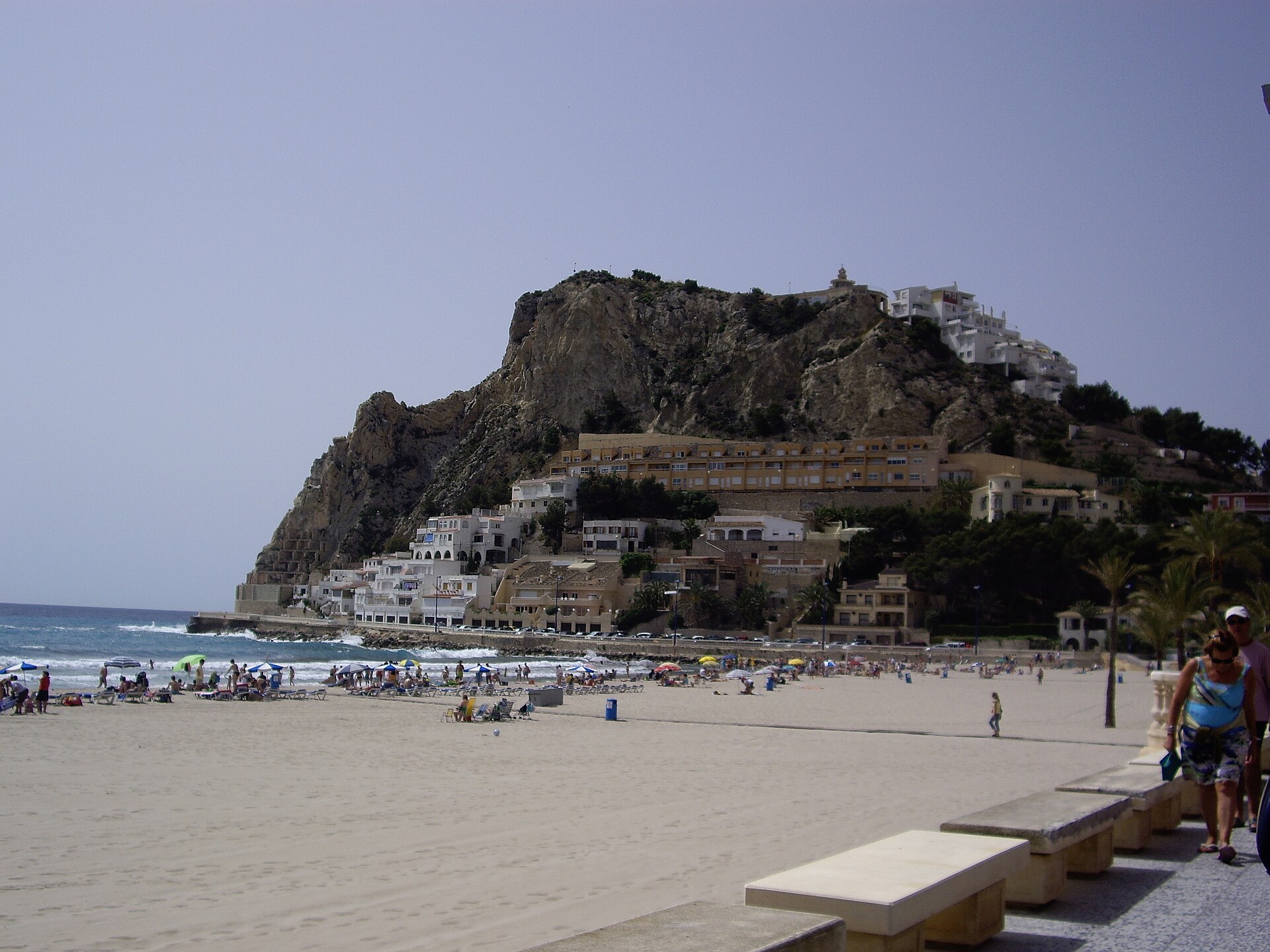
Tossal de la Cala is a hill at the south-western edge of Benidorm, rising between Poniente beach and the neighbouring Finestrat cove. At its summit, 80 to 103 metres above sea level, sits one of the most important archaeological sites in the province of Alicante — a Roman castellum protected as a Cultural Heritage Asset. What will you actually see up there? The ruins are the remains of a Roman fortress, most likely built around 77 BC during the Sertorian Wars, when General Quintus Sertorius established a chain of coastal fortifications along northern Alicante to control land and sea routes. Excavated walls, room foundations and pottery fragments confirm a military presence and date the site to the 2nd and 1st centuries BC. Visitors can walk among the defensive wall remains and the outlines of rooms that once stood alongside them. How was the site uncovered? The first excavation took place in 1943, led by Father Belda, who uncovered 27 rooms attached to the fortress wall. Professor M. Tarradell resumed the work in 1965. In 1956, part of the site was damaged during construction of the access road to the hilltop, and it wasn't until the University of Alicante ran a systematic dig between 2013 and 2019 that the full layout and timeline of the castellum were properly established. Why climb up here besides the history? Beyond its archaeological value, Tossal de la Cala is one of the best viewpoints in Benidorm. In 1960 the town council built a mirador at the summit, and from there the panorama stretches over Poniente beach, Benidorm Island, and — on a clear day — as far as the Peñón de Ifach rock formation in Calpe. It's a spot that combines a short walk, a history lesson, and a view many visitors rate as the finest in the city. How do you get there? The hill is within walking distance from the western part of Benidorm, close to Poniente beach. The path up is relatively short but climbs steadily, so allow a relaxed 30 to 40 minutes for the ascent. There's no built-up tourist infrastructure at the top — this is an open-air archaeological site without ticket booths or shops. When is the best time to visit? Entry to the site is free, and the light and temperature are most pleasant early in the morning or shortly before sunset, especially during the hot summer months. If you want to go beyond the visual experience, guided archaeological tours run on set days of the week in small groups — it's worth checking the current schedule in advance, since spots are limited. Frequently asked questions Is there an entrance fee for Tossal de la Cala? No, both the archaeological remains and the viewpoint are free and open to all visitors. What exactly will I find on site? The remains of a Roman fortress (castellum) from the 2nd–1st century BC — sections of defensive wall and room foundations — plus a viewpoint overlooking Benidorm and the surrounding coastline. Do I need a guide to visit? Not necessarily — the site can be explored independently, but a guided archaeological tour helps make sense of the fortress layout and the history of the Sertorian Wars. How long does a visit take? Walking the site and viewpoint typically takes 30 to 45 minutes, plus the time needed to reach the hill from Poniente beach.
-
Torre des Moros
Tossa de Mar
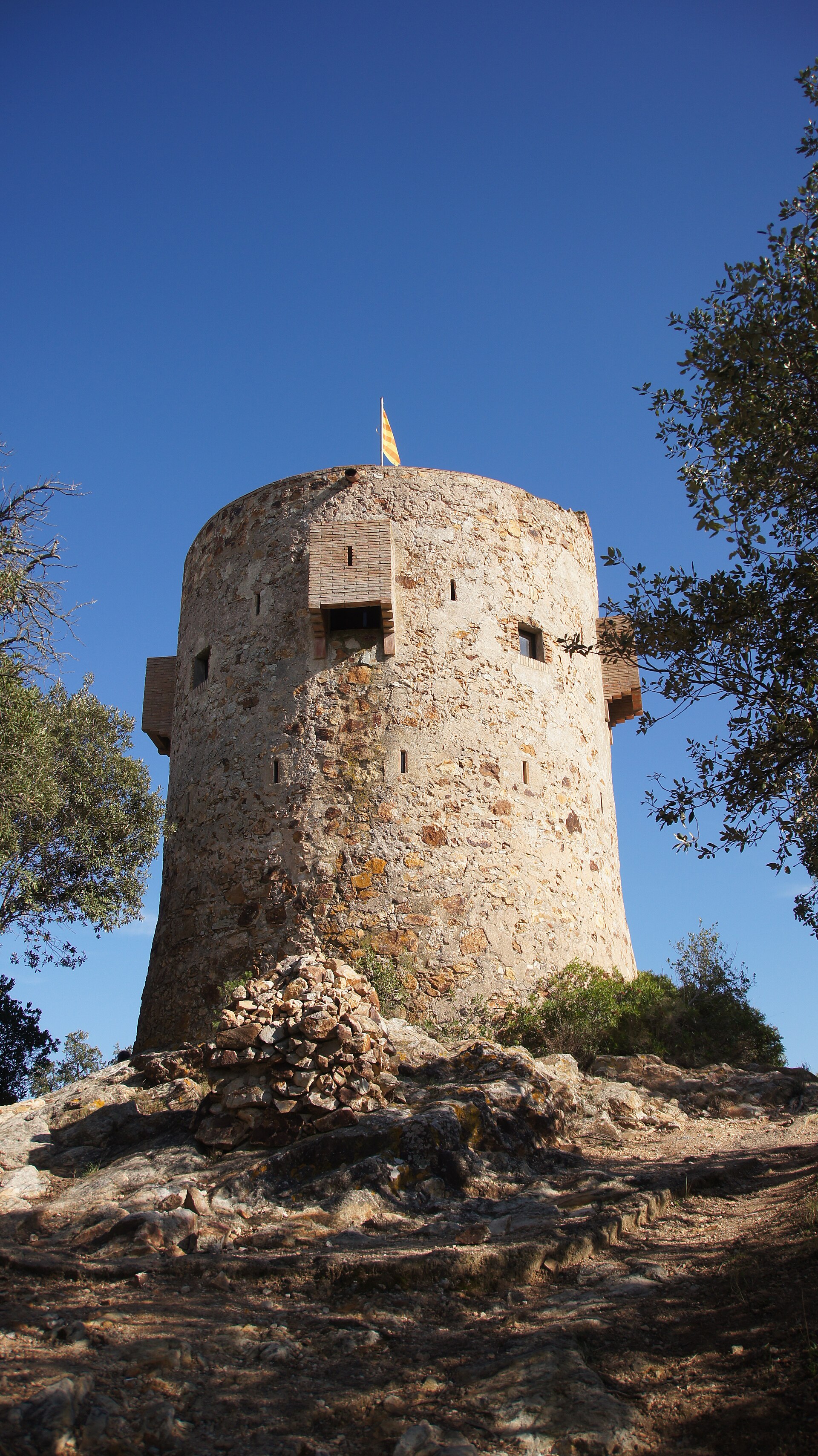
Torre des Moros is a stone watchtower crowning Can Magí hill in Tossa de Mar, one of the most recognisable viewpoints on the Costa Brava. This round, two-storey structure sits above the cliffs that frame the town's bay and has kept watch over the coastline for centuries. What will you see there? The tower itself is modest in scale: a cylindrical stone structure of two levels, roofless and free of decoration. Its real draw isn't the architecture but the setting — perched on the highest cliffs of Can Magí, it offers one of the finest panoramas over the bay of Tossa de Mar, its beaches, and the rugged Costa Brava shoreline. Photographers and travellers looking for a quieter vantage point away from the town centre come here specifically for the view. What's the history behind it? The tower was built in the 16th century as part of a coastal defence network. At the time, the Costa Brava faced repeated raids from pirates, including Saracen corsairs who used the area's hidden coves to land unnoticed. From its position on Can Magí, lookouts had a clear line of sight over the bay and the paths leading up from the beaches, allowing them to spot approaching danger and warn the residents of Tossa in time. The tower stayed in use until the end of the 18th century, when the threat of piracy along the coast subsided and its military role became obsolete. Left without maintenance, the structure began to deteriorate, and toward the end of the 19th century a lightning strike badly damaged its western side, leaving it in ruins for decades. It wasn't until 1997 that a restoration project brought the tower back to the condition visitors see today. How do you get to Torre des Moros? The tower stands on Can Magí hill, within the natural area surrounding Tossa de Mar, and is reached on foot via the coastal paths that trace the shoreline. The route crosses rocky terrain with sea views, so comfortable footwear is worth packing. Many visitors combine the walk with a visit to the walls of the old town (Vila Vella) and the nearby beaches, turning it into a longer walking tour of Tossa's landmarks. When is the best time to visit? Spring and autumn bring the most comfortable conditions, with mild temperatures and noticeably fewer visitors on the trails than in peak summer. Early morning or late afternoon light works best for photographs of the bay and the cliffside coast. In summer, an early start is worth the effort — it beats both the heat and the midday crowds along the path. Frequently asked questions What was Torre des Moros used for? It was a 16th-century stone watchtower built to monitor the coastline and warn the residents of Tossa de Mar of approaching pirate raids. Why is it called "des Moros"? The name refers to the threat of Saracen corsairs — locally called "Moros" — against whom the tower was meant to defend the surrounding coast. Can you go inside the tower? The structure is small and functions mainly as a viewpoint; its main appeal is the panorama over the bay rather than the interior of the tower itself. How long does it take to walk there? It depends on the trail you choose, but reaching the tower from the coastal paths around Tossa de Mar typically takes anywhere from a short walk to around half an hour, depending on your starting point.
-
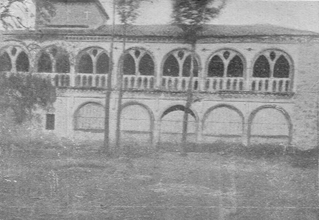
Granja de Valdefuentes
Guadalupe
Granja de Valdefuentes is a former summer palace built by Jeronymite monks, tucked into the hills of the Villuercas range a few kilometres from Guadalupe in the province of Cáceres. It blends the history of one of medieval Spain's great monasteries with residential architecture, and its scale still surprises visitors expecting a modest rural building. What is this place? The Granja began as a summer retreat for the monks of the Monastery of Our Lady of Guadalupe, one of the most important religious centres in medieval Spain. The original structure dates back to the time of Father Yáñez, who died in 1412, but most of what visitors see today comes from a major renovation carried out between 1551 and 1554, commissioned by Philip II. The king wanted the complex to also serve as his own residence, so the works went far beyond the building's modest origins. The building follows the so-called "Guadalupense" style — brick construction covered in mortar, typical of structures raised by the Jeronymite order in this region. Architectural historian Vicente Lampérez y Romea classified it as Gothic, though Renaissance elements are just as prominent. What will you see there? The entrance leads through a portico topped by a loggia, immediately giving the building a stately presence. Behind it lies a rectangular courtyard framed by two-storey Renaissance arcades, around which the various wings of the complex are arranged. Inside, look out for the chapel with its wooden artesonado ceiling in Gothic-Mudéjar style — one of the most valuable decorative elements of the whole complex, combining carpentry techniques inherited from Muslim craftsmen with Christian iconography. The remaining service rooms are a reminder that the Granja was not purely residential — it also functioned as a working farm supplying the monastery with produce. The building was specifically designed for use in autumn and winter, when the climate in the lower valley was milder than in Guadalupe itself, which sits higher in the mountains. Why is it worth visiting? The site also carries an interesting chapter of Spanish history: Granja de Valdefuentes was one of the places where Queen Isabella the Catholic rested during her stays in Extremadura. That adds a layer of symbolic weight beyond the architecture itself. For travellers visiting Guadalupe, the Granja makes a natural addition to a visit to the monastery — it reveals the lesser-known, secular side of the order's activity, centred on farming and rest rather than liturgy and pilgrimage. How do you get there? Granja de Valdefuentes sits within the Villuercas-Ibores-Jara Geopark, a few kilometres from the centre of Guadalupe. The most convenient way to reach it is by car, along local roads that wind through the region's scenic hills — the drive itself is part of the appeal, with views over the surrounding valleys and olive terraces. When should you visit? Spring and autumn are the best times to visit, when temperatures in Extremadura are milder and the landscape around the building is at its most picturesque. Summers in this part of Spain can be quite hot, which is worth factoring into your plans. Frequently asked questions What was Granja de Valdefuentes? A summer residence and working farm belonging to the Jeronymite monks of Guadalupe monastery, remodelled in the 16th century on the orders of Philip II. What is worth seeing inside? The Renaissance arcaded courtyard and the chapel with its Gothic-Mudéjar artesonado ceiling. Does the site have any royal history? Yes — Queen Isabella the Catholic stayed here during her visits to Extremadura. How close is it to the Guadalupe monastery? It lies just a few kilometres from the town, within the Villuercas-Ibores-Jara Geopark.
-
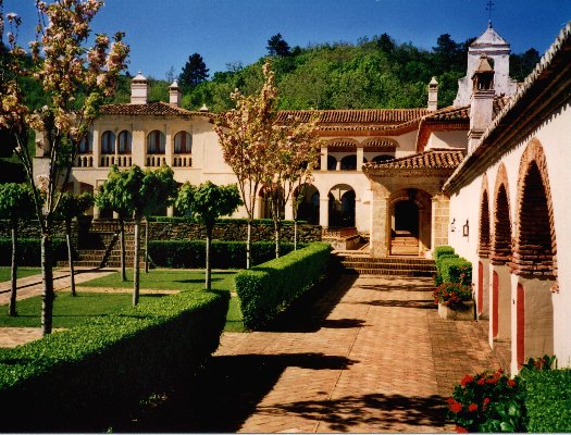
Granja de Mirabel
Guadalupe
Granja de Mirabel is a former monastic palace located about 5 km southwest of Guadalupe, in the province of Cáceres, at the foot of the Villuercas mountain range. The building sits in a valley between Valdegracia and Infierno, surrounded by chestnut forests, and holds protected cultural heritage status. How to get there? The easiest way to reach Granja de Mirabel is by car from Guadalupe — the drive is under 5 km along a local road that winds through the hilly Villuercas terrain. It works well as part of a longer trip through the Extremadura region, paired with a visit to Guadalupe itself, famous for its monumental monastery. Parking is available near the building, and the final stretch of road passes through a scenic, wooded landscape. What will you see? Construction began in the 14th century. In the 15th century the estate was handed over to the monks of the Guadalupe monastery, and it was at that point that the building took on the form it needed to serve as a residence for the Catholic Monarchs and their children. It was here, in 1504, that Juan de Zúñiga, the last grand master of the Order of Alcántara, died. After years of hosting kings and nobles visiting nearby Guadalupe, the property passed into the hands of the Marquis of La Romana during the Mendizábal disentailment, when church lands across Spain were confiscated and sold off. The most valuable architectural feature is the 15th-century Mudéjar façade, along with a cloister centered on the so-called cold-water fountain. Inside stands the Chapel of Mary Magdalene, dating from the late 15th century, which houses the most important collection of Gothic frescoes anywhere in Extremadura. Those frescoes are the main draw for visitors interested in sacred art and wall painting from the period, offering a chance to see it in its original architectural setting. Walking the grounds, it's worth noting how defensive, residential, and religious functions come together in a single complex — a pattern typical of estates owned by religious orders in medieval Spain. When to visit? Spring and autumn are the best times to visit, when temperatures in the Villuercas area are mild and the surrounding chestnut forests are at their most striking — especially in autumn, when the leaves turn color. Summers in Extremadura can be quite hot, which makes extended walking around the site less comfortable. It's also worth checking local opening hours in advance, since access to some parts of the monument can be limited. Why visit? Granja de Mirabel carries several centuries of layered history — from a medieval monastic building, to a royal residence, to aristocratic property after church estates were secularized. For anyone exploring Guadalupe and its surroundings, it's a natural extension of the visit, offering a look at a lesser-known but historically significant site tied to the same royal and religious circles as the famous monastery nearby. Frequently asked questions Where exactly is Granja de Mirabel located? About 5 km southwest of Guadalupe, in the province of Cáceres, at the foot of the Villuercas mountains, between the Valdegracia and Infierno valleys. What was Granja de Mirabel used for in the past? A monastic palace handed to the monks of Guadalupe in the 15th century, later used as a residence for the Catholic Monarchs and their children, and eventually as an aristocratic estate. What is the site's main highlight? The late-15th-century Chapel of Mary Magdalene, home to the most important collection of Gothic frescoes in Extremadura, along with the Mudéjar façade and cloister. Is it worth combining with a visit to Guadalupe? Yes — its proximity (under 5 km) and shared history with the Guadalupe monastery make it a natural addition to a visit to the region.
-
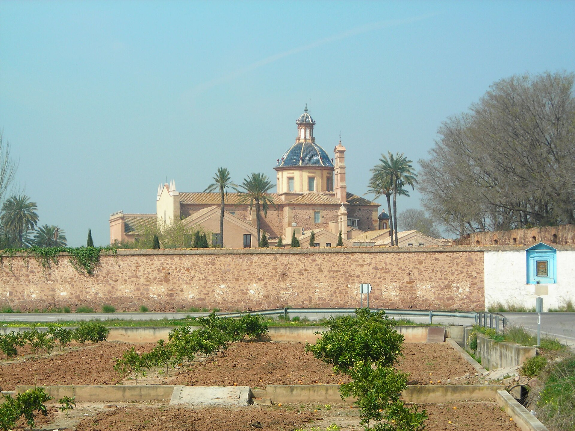
Ara Christi Charterhouse, El Puig
el Puig de Santa Maria
Ara Christi Charterhouse is a former Carthusian monastery located just outside the town of el Puig de Santa Maria, in the province of Valencia, Spain. The building has kept its historic monastic character, but today it serves a very different purpose — the complex now operates as a hotel that makes use of the old monastic spaces for weddings, conferences and other events. What makes this place special? A charterhouse, home to the Carthusian order, is a type of monastic complex known for its austere architecture and a layout built around inner courtyards and individual cells where monks lived a life of solitude and contemplation. Ara Christi fits squarely into this tradition — the complex was built as a place of quiet retreat away from the bustle of nearby Valencia, surrounded by fields and the typical countryside of the region. Its conversion into a hotel has preserved the shape and atmosphere of the old monastic grounds while opening the site to visitors looking for an unusual place to stay or to host a celebration. How do you get there? El Puig de Santa Maria sits north of Valencia city, close enough for a comfortable drive of well under half an hour. The easiest way to reach the site is by car or taxi, since the surrounding area has a semi-rural, suburban character where public transport runs less frequently than in the city centre. It's worth planning the trip ahead of time, especially if you're heading there for an event hosted at the venue. What will you see on site? The architectural character of the former charterhouse is the main draw — thick stone walls, an internal courtyard, vaulted ceilings and the kind of stone detailing typical of monastic buildings. The green, quiet surroundings contrast with the proximity of the wider Valencia metropolitan area, making Ara Christi an interesting stop for anyone curious about religious architecture repurposed for secular use. It's a place where the old religious function blends with a modern commercial one. When is the best time to visit? The Valencia region enjoys a Mediterranean climate, with mild winters and hot summers. Spring and early autumn bring the most comfortable temperatures, both for exploring the surrounding countryside and for attending outdoor events at venues like Ara Christi. Summer can get quite hot, which is worth keeping in mind when planning a longer stay. Who is this place for? Ara Christi Charterhouse appeals mainly to travellers looking for a blend of history and a functioning hotel-and-events venue. It suits couples planning a wedding in an unusual setting as well as travellers who'd rather stay somewhere architecturally distinctive than in a standard hotel in central Valencia. Frequently asked questions What is Ara Christi Charterhouse? It's a former Carthusian monastery now converted into a hotel that uses the historic buildings for weddings and other events. Where exactly is it located? The site sits just outside the town of el Puig de Santa Maria, in the province of Valencia, not far from the Mediterranean coast. Can you stay overnight there? Yes, part of the former monastic complex now operates as a hotel, so guests can spend the night within the historic walls. What's the best way to get there from Valencia? Driving or taking a taxi is the most convenient option — the trip from the city centre usually takes well under half an hour.
-
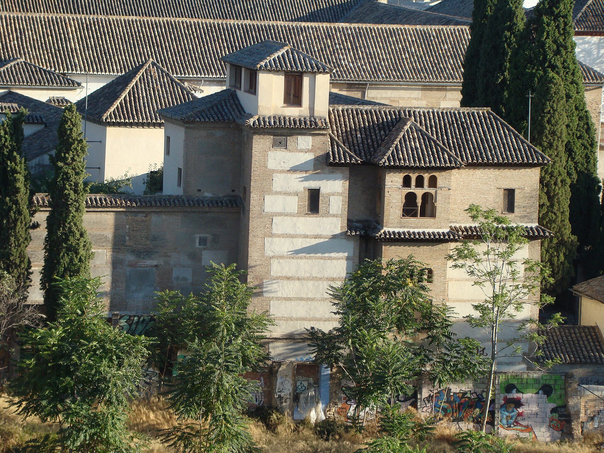
Palacio de Dar-Al-Horra
Grenada
Palacio de Dar-Al-Horra is a compact but historically significant Nasrid palace tucked away in the Albaicín quarter of Granada. Unlike the crowded Alhambra just across the valley, this quiet monument offers a genuine feel for 15th-century Moorish Granada without the queues. What is this place? The palace was most likely built during the reign of Sultan Yusuf III, between 1408 and 1417, on the foundations of an even older Zirid-era palace from the 11th century. Its name, "Dar al-Horra," translates roughly as "house of the honest woman" or "house of the free woman," a reference to its most famous resident, Aixa al-Horra, mother of Boabdil, the last Nasrid sultan of Granada. Aixa was the legitimate wife of Sultan Muley Hacén, but she lost his favor when he fell for a Christian slave, Isabel de Solís, who converted to Islam and took the name Zoraya. To defuse the tension this caused at court, Aixa was moved from the Alhambra to this palace, which became the effective political center of the last Nasrid kingdom during that turbulent period. What will you see inside? The building has two floors and a tower, arranged around a central courtyard with a rectangular reflecting pool at its heart — a classic feature of Andalusian domestic architecture that served both a decorative and cooling purpose in Granada's hot climate. Surviving fragments of stucco work and wooden ceilings show the geometric ornamentation typical of Nasrid design. From the upper terrace, visitors get one of the best lesser-known views over the Alhambra hill and the rooftops of the Albaicín, rivaling the more famous viewpoints nearby but with far fewer people around. What happened after the conquest? After the Catholic Monarchs took Granada in 1492, the palace was granted to Hernando de Zafra, secretary to the royal court. It later became part of the Santa Isabel la Real convent complex, and in the 20th century passed into state ownership. Today it is managed by the Patronato de la Alhambra y Generalife, the same body that oversees the Alhambra itself. How do you get there? The palace sits in the heart of the Albaicín, among the narrow lanes of Granada's old Moorish quarter, a UNESCO World Heritage site. The most pleasant way to arrive is on foot — it's roughly a 15–20 minute uphill walk from Plaza Nueva in the city center. Local buses on lines C1 and C2 also climb the steep, winding streets of the neighborhood if you'd rather skip the walk. When should you visit? Early morning or late afternoon are the best times, when the sun is gentler and the Albaicín's narrow streets are quieter. Spring (April–May) and autumn (September–October) bring comfortable temperatures for exploring the hilly neighborhood on foot. In summer, it's worth avoiding the midday heat. Frequently asked questions Is there an entrance fee? Yes, there's a small admission charge, considerably lower than an Alhambra ticket. Check opening hours before visiting, as they can be limited. How long does a visit take? Given its modest size, a visit typically takes 30–45 minutes, making it an easy addition to a longer walk through the Albaicín. Should I combine it with other Albaicín sights? Definitely — the neighborhood's famous Alhambra viewpoints and its maze of old lanes are right nearby, so it's worth setting aside a whole afternoon to explore the area. Is the palace connected to the Alhambra? Yes, both monuments date from the same Nasrid era and are managed by the same institution today, though Dar-Al-Horra remains a far quieter and lesser-known site.
-
Hospital de la Pasión
Ciudad Rodrigo
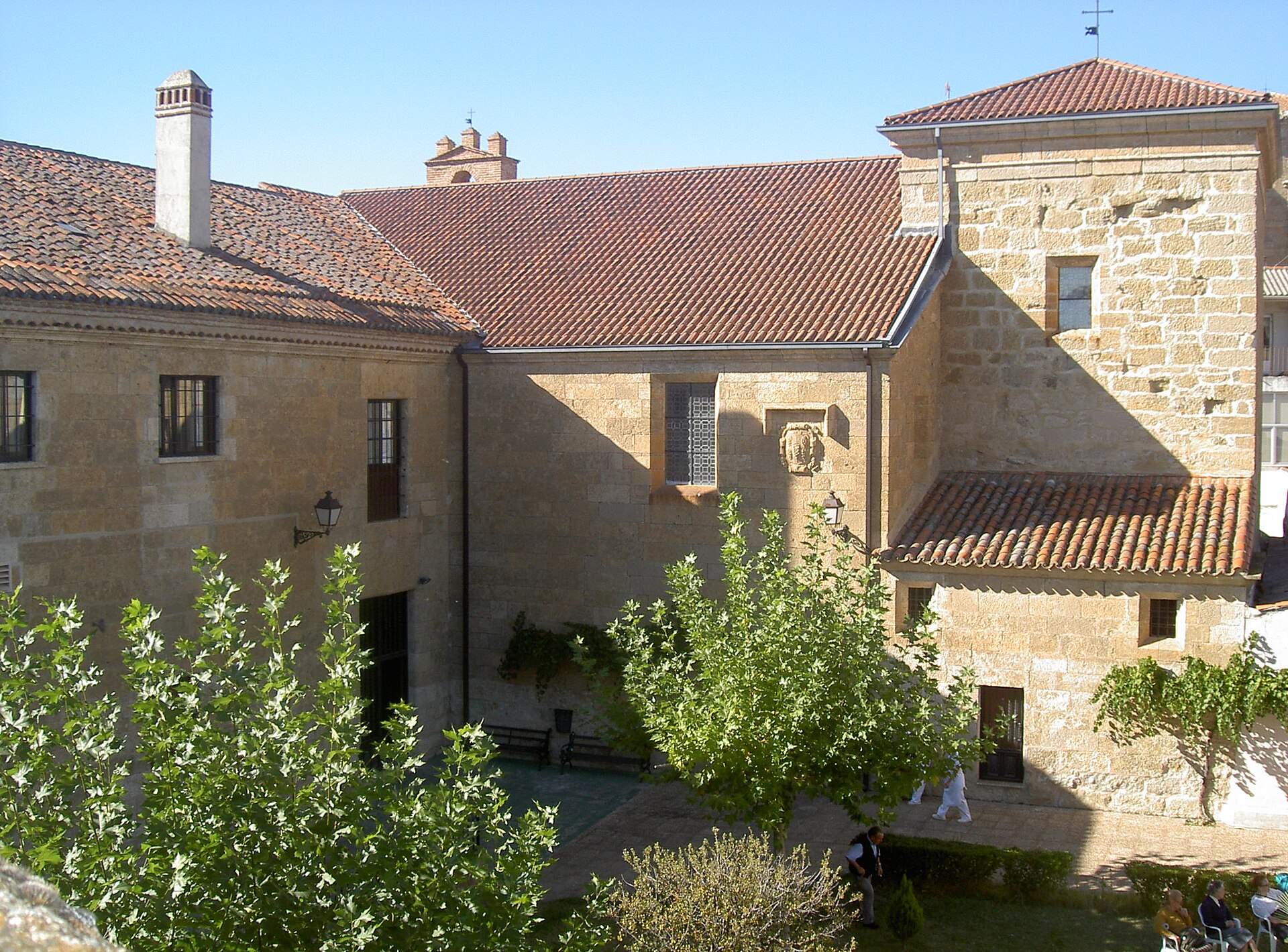
Hospital de la Pasión is a historic hospital complex at the heart of Ciudad Rodrigo, one of the best-preserved walled towns in the Salamanca province. Despite its name, the building no longer operates as a medical facility, but it remains a living testament to nearly five centuries of care for the sick and the poor. Where does the name come from? The story begins in 1479, when twelve knights gathered in a church on the Plaza Mayor to found a charitable brotherhood — the Brotherhood of the Blood of Christ, also known as the Brotherhood of the Passion. Its mission was to look after the poor and sick of the town. Thirteen years later, in 1492, the Catholic Monarchs granted the brotherhood plots of land that had belonged to courtyards and to the synagogue of the recently expelled Jewish community, and it was on this ground that the hospital building was raised. That royal grant is the reason the building still stands on what is now Calle Sinagoga. What is worth knowing about the former hospital? The institution operated continuously as a hospital until 1984 — nearly five hundred years of uninterrupted medical care under one roof, making it one of the longest-running charitable institutions in the region. When the hospital closed, the building was not abandoned or repurposed for something unrelated: it was adapted into a residence for the elderly, carrying the original charitable mission forward in a new form. What can you see today? Today the Hospital de la Pasión is a well-regarded care residence, considered one of the benchmark facilities of its kind in the entire province of Salamanca. It offers 144 places in total — 60 for assisted care and 80 for independent residents. Visitors who come across the building tend to appreciate it mostly for its historical context: its location inside the old town, close to the Plaza Mayor, and the continuity of a charitable function stretching back to the era of the Catholic Monarchs. The building itself, standing on the site of the town's former Jewish quarter, makes for an interesting stop for anyone curious about the social history of Ciudad Rodrigo, beyond the city walls the town is best known for. How to get there and when to visit? Hospital de la Pasión sits within the walls of Ciudad Rodrigo, near the Plaza Mayor, so it is best reached on foot while exploring the old town. The town lies roughly 90 km from Salamanca, which is connected by regular bus and road links. Since the building currently functions as a residence for senior citizens rather than a visitor attraction with rooms open to the public, the best approach is simply to view the façade and its surroundings as part of a wider walk through the historic centre, without planning a dedicated visit or checking opening hours. Frequently asked questions Is Hospital de la Pasión still a hospital? No. It operated as a hospital from the 15th century until 1984, and today it functions as a care residence for the elderly. Why is the building located on Calle Sinagoga? Because in 1492 the Catholic Monarchs granted the charitable brotherhood land that had belonged to the synagogue of the expelled Jewish community, and the hospital was built on that ground. Can visitors go inside? The building is an active residence for senior citizens, not a museum, so in practice visits are limited to viewing the exterior while walking through the old town. How long did it operate as a hospital? From the brotherhood's founding in 1479 and construction after 1492 until 1984 — nearly five centuries of continuous medical and charitable activity.
-
Pazo de Donfreán
Lalín
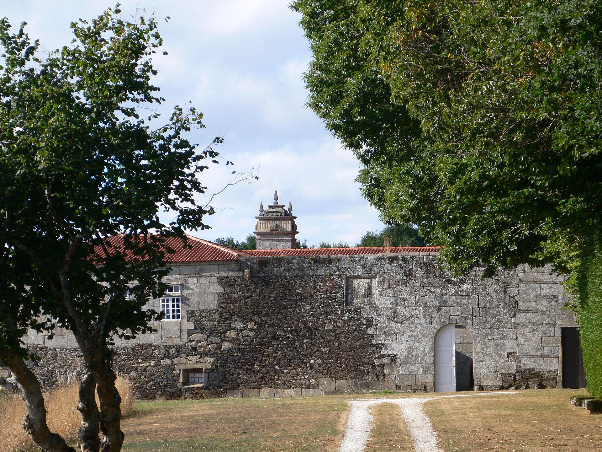
Pazo de Donfreán is a Baroque manor house standing in the hamlet of Donfreán, within the parish of Santiago de Catasós, about 2 km from the town centre of Lalín in the province of Pontevedra, Galicia. What will you see on site? The manor was raised in the mid-18th century in Baroque style. Its floor plan is U-shaped, made up of three connected wings enclosing a courtyard. A stone wall runs around the property, and its entrance is marked by a distinctive semicircular arched gateway — one of the building's most recognisable features. The pazo sits on raised ground, so the surrounding area offers views over the rural countryside of the Deza district. Keep in mind that the building is privately owned and, according to available records, is in need of restoration work, so access to the interior may be limited. It's worth checking the current status with the local tourist office in Lalín before planning a visit. What's the history behind it? The estate at Donfreán originally belonged to the Taboada family. In 1625 it passed to the Gómez Oxea de Albán family, and later — following a family dispute and marriage ties — ownership moved to the Montenegro family. Records name Pedro Joseph Montenegro as owner of the house of Donfreán and its lands, a resident of Santiago de Catasós. Pazo de Donfreán ranked among the great manor houses of the Deza region, alongside estates such as Pazo de Liñares and Pazo de Bendoiro, whose owners typically held high military rank and commanded their own resources. How do you get there? The easiest way is by car, since the pazo lies roughly 2 km from central Lalín. Travellers relying on public transport can use Lalín's bus station, about 2.5 km away, while the Lalín train station is just under 6 km from the site. The setting is rural, so it's worth planning transport in advance, especially without a private vehicle. What else is worth seeing nearby? The parish of Catasós, where the pazo stands, brings together several sites of interest. Close by is the Fraga de Catasós, a historic forest protected as a natural monument and linked to the writer Emilia Pardo Bazán. The area also holds the remains of the Celtic hillforts (castros) of Catasós and Quintela, along with the Casa de Quintela and the local parish church. Together they make a good base for a day trip combining history, architecture, and nature in the Deza region. When should you visit? Given the rural setting and open surroundings, spring or autumn are the best times to come, when Galician temperatures are mild and the landscape around the pazo — including the nearby Fraga de Catasós forest — looks its most attractive. If visiting in summer, remember that the manor's interior may not be open to the public. Frequently asked questions Can you visit the inside of Pazo de Donfreán? The building is privately owned and reportedly needs restoration work, so interior access can be limited. Contact the local tourist information point in Lalín before your visit. How far is Pazo de Donfreán from central Lalín? It's about 2 km away, reachable by car in a few minutes or on foot in good weather. When was the building constructed? The pazo was built in the mid-18th century in Baroque style. Which families owned the Donfreán estate over the years? Ownership passed from the Taboada family to the Gómez Oxea de Albán family in 1625, and eventually to the Montenegro family.
-
Casa Montañés, San Cristóbal de La Laguna
La Cuesta
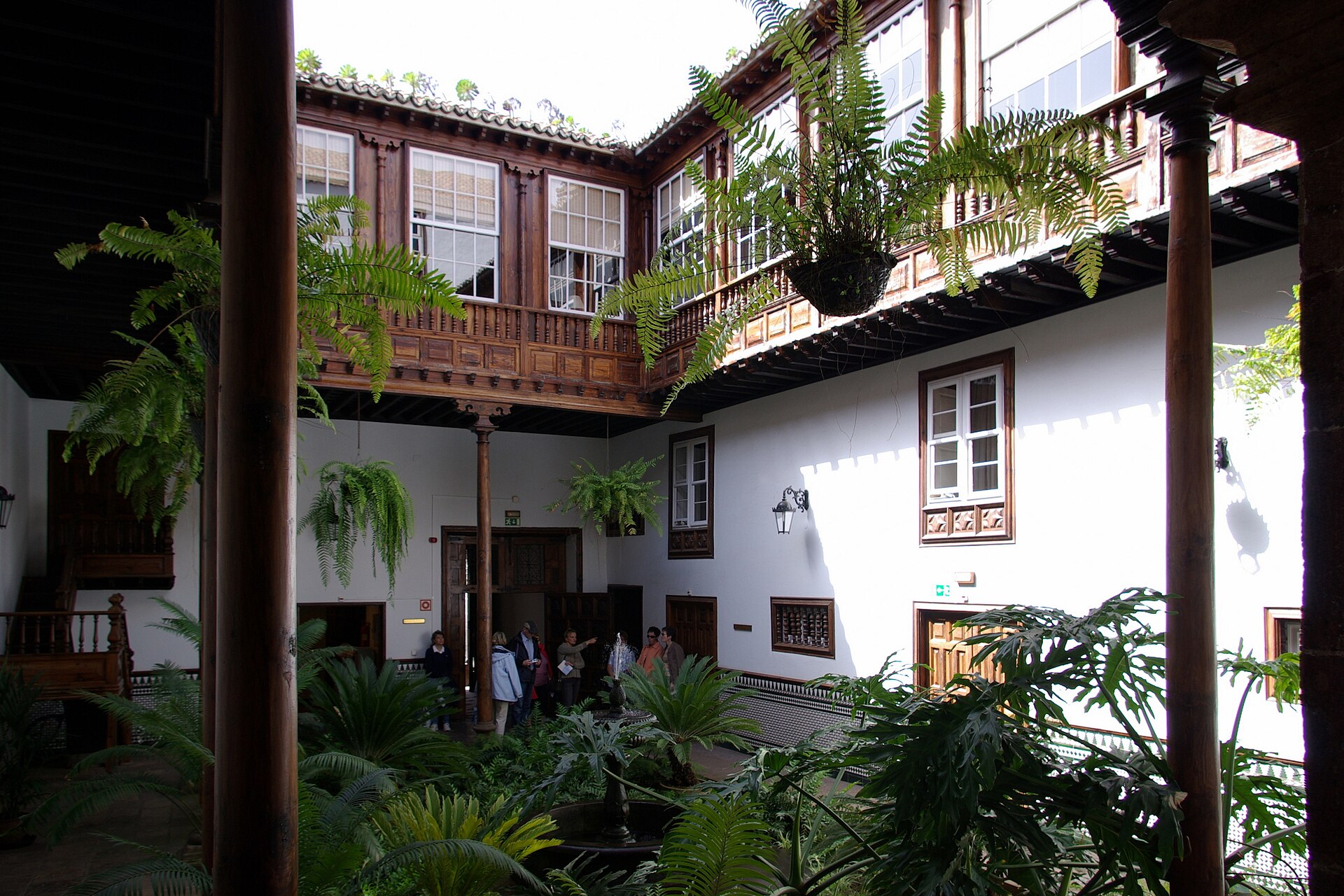
Casa Montañés is an 18th-century townhouse on Calle San Agustín in San Cristóbal de La Laguna, Tenerife, one of the Canary Islands' best-preserved historic towns and a UNESCO World Heritage Site. The building was raised in 1746 by Francisco Montañés, a cavalry sergeant major, whose family name it has carried ever since. What can you see there? Above the entrance, the Montañés family coat of arms sits carved into the lintel — an immediate clue that this was the home of a wealthy family rather than an ordinary town house. Behind the door, the entrance hall is wide enough for a cart to have once driven straight through and unloaded goods next to the ground-floor storerooms. The heart of the building is a square, Andalusian-style courtyard set within the layout of a traditional Castilian stately home. A stone fountain stands at its centre, ringed by wooden balconies with an Italian flavour and windows built in the English style — a mix that says a lot about how colonial-era Tenerife architecture borrowed from several European traditions at once. The house rises three floors plus a mezzanine, and the floor plan mirrors the old social order of the household: the ground floor held storerooms and servants' quarters, the family lived on the floor above, and the top floor was used to store grain. How do you get there? Casa Montañés sits right in the historic core of La Laguna, inside the UNESCO-protected old town, so the easiest way to reach it is on foot from the city centre — it's only a few minutes' walk from the cathedral or Plaza del Adelantado. La Laguna is well connected to Santa Cruz de Tenerife by tram, and most of the old quarter is closed to cars, which makes exploring on foot the natural choice. Can you go inside? Since 1986 the building has served as the headquarters of the Consejo Consultivo de Canarias, the regional government's consultative council. The property passed into the ownership of the Autonomous Community of the Canary Islands in 1985. Because of this administrative role, the interior isn't open as a museum-style attraction, but the façade, courtyard and overall architecture make it a worthwhile stop on a walk through La Laguna's historic centre. When is the best time to visit? La Laguna enjoys mild weather year-round, and spring and autumn are the most pleasant seasons for wandering the old town, with comfortable temperatures and fewer visitors than in summer. It's worth pairing a stop at Casa Montañés with a visit to the nearby cathedral and other period townhouses, since the historic centre packs many similar residences into just a few hundred metres. Frequently asked questions Who built Casa Montañés and when? The house was built in 1746 for Francisco Montañés, a cavalry sergeant major, who gave the building its name. Can you visit the inside of Casa Montañés? The building has housed the Consejo Consultivo de Canarias, the Canary Islands' consultative council, since 1986, so the interior serves an administrative rather than a museum function. Visitors mainly view the façade, the coat-of-arms entrance and the exterior architecture. What's the most distinctive architectural feature? The square Andalusian courtyard with its stone fountain, combined with a Castilian stately-home layout, Italian-style wooden balconies and English-style windows. Where exactly is Casa Montañés located? On Calle San Agustín in San Cristóbal de La Laguna, within the historic centre listed as a UNESCO World Heritage Site.
-
Palacio de Luna
Jerez
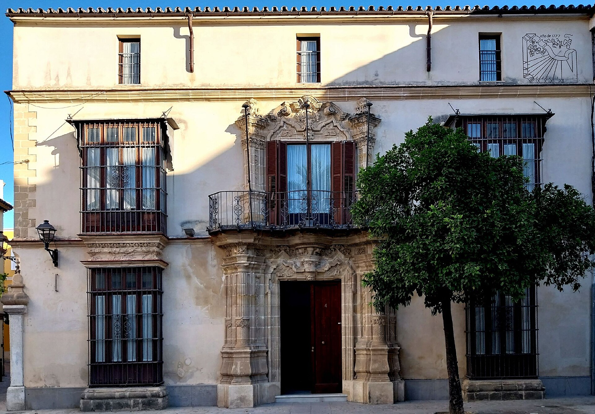
Palacio de Luna is an 18th-century urban palace standing on Plaza Rafael Rivero, one of the most striking squares in the old town of Jerez de la Frontera. Also known as Palacio de los Pérez-Luna, it stands out for its Baroque facade and belongs to a group of historic mansions that give this Andalusian city its aristocratic character. What is the history behind the palace? The building was constructed in 1777 in the Baroque style typical of residential architecture in Jerez during that period. Among its former residents was José Antonio Menchaca, a canon of the local Collegiate Church, reflecting the palace's ties to the city's ecclesiastical and bourgeois elite. Over the following decades ownership and use of the building changed several times, though it remained in private hands and largely closed to visitors for a long time. In the 21st century the palace briefly opened for public use, housing the headquarters of the Teresa Rivero Foundation. After the foundation closed, the property was transferred to Building Center, a real estate company belonging to the CaixaBank group, as part of bankruptcy proceedings involving the previous owner. This ownership history illustrates how the fate of historic townhouses in Spanish city centers is intertwined with modern economic processes. What will you see standing in front of the palace? The facade draws the most attention: an ornate portal leads the eye up to a projecting, richly decorated balcony, a classic feature of Baroque architecture in Jerez. A distinctive detail is the sundial mounted on the facade, a rare feature that sets Palacio de Luna apart from other palaces in the city. Stone window and door frames, the building's proportions, and its restrained color palette together create a coherent picture of an 18th-century bourgeois-aristocratic residence. The square itself, Plaza Rafael Rivero, is one of the most atmospheric spaces in old Jerez. It is surrounded by other historic townhouses, and its proximity to the Collegiate Church and other palaces makes the area ideal for a quiet walk through the architecture of the city's golden age of wine and horses. How to get there and when to visit? Palacio de Luna sits right in the historic center of Jerez de la Frontera, within walking distance of the city's main landmarks, including the Cathedral and the Alcázar. The best way to reach it is on foot — the old town is compact, and its narrow streets and squares are best explored without a car. The city is accessible by train or bus from Seville or Cádiz, and Jerez airport handles domestic and some European connections. Since the palace is currently privately owned and serves purposes other than a museum, plan your visit around admiring the facade from the outside and combine it with a look at the neighboring monuments. Spring and autumn are the best times for walking, as temperatures in Andalusia are milder than during the hot summer months. Frequently asked questions Can you go inside Palacio de Luna? The building currently belongs to a private entity and does not operate as a museum, so visits are usually limited to viewing the facade from outside. What is the most distinctive feature of the palace's appearance? The ornate balcony above the entrance portal and the sundial on the facade, a rare detail among the historic palaces of Jerez. When was the palace built? It was constructed in 1777 in the Baroque style. How can you best combine a visit with other Jerez attractions? Plan a walk through the old town covering Plaza Rafael Rivero, the Collegiate Church, and nearby historic palaces — all within a short walking distance of each other.
-
Pazo de Cornoces
Amoeiro
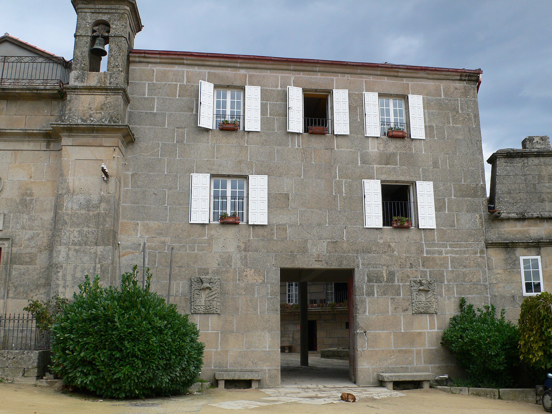
Pazo de Cornoces is an 18th-century Galician manor house in the parish of Cornoces (San Martiño), within the municipality of Amoeiro, in the province of Ourense. The estate sits on a broad, fertile plain long farmed for corn, rye and wheat, ringed by oak woodland and hillside pastures once grazed by cattle, sheep and goats. How did the pazo get its name, and what's its history? The house was founded in 1779 by Juan de Porras. It was originally known as Pousa de Cornoces or Pousa dos Viandantes — roughly "the travelers' inn" — because it stood right beside an old Roman road, where passing wayfarers would stop to rest. Through successive inheritances the property passed to the Reinoso family, owners of the nearby Pazo de Canedo. The estate took its current name, Pazo Santa Catalina de Cornoces, in 1882. That year its last private owner, Ramona Villar Taboada, dedicated the house to Saint Catherine, a change that coincided with the founding of an Asilo-Escuela — an asylum-school — for local children on the grounds. What will you actually see there? The building is built in solid, finely cut ashlar stone, in the sober but stately style typical of Galician pazos. Its floor plan is irregular and polygonal, arranged around a rectangular courtyard, with a chapel and two towers attached to the main residence. Surrounding the manor house, a full set of outbuildings survives — barns, byres and processing sheds — once essential to running the estate's farming and livestock operations. What is the social history behind the walls? Over the years Pazo de Cornoces served purposes well beyond a family residence. The Sisters of Charity of Saint Vincent de Paul ran classes here for local boys and girls, continuing the school-asylum tradition established in the 19th century. In the 1970s the estate took on a very different role: it became a kind of "laboratory" for the social reintegration of young offenders sent here from various parts of Spain. It's a lesser-known chapter that shows just how many functions a Galician pazo could accumulate across two centuries. How do you get there, and when should you go? Cornoces lies within the municipality of Amoeiro, a short drive from the city of Ourense, in the Ribeiro-Carballiño area. A car is the most practical option — the route runs through classic Galician countryside of cultivated fields and oak groves. Visitors can pair a stop here with the "Andaina dos Pazos de Amoeiro" walking route, which links several of the municipality's historic manor houses. Spring and early autumn are the best seasons: the surrounding fields and woodland look their finest, and temperatures are ideal for walking. Can you go inside Pazo de Cornoces? No — the pazo remains private property and its interior is closed to visitors. You can, however, view the building's exterior, its towers and its rural setting by walking around the Cornoces area. Frequently asked questions When was Pazo de Cornoces built? It was founded in 1779 by Juan de Porras; before that, the site was known as an inn on the old Roman road. Where does the name Santa Catalina de Cornoces come from? From 1882, when the last owner, Ramona Villar Taboada, dedicated the estate to Saint Catherine as an asylum-school was founded there. Can visitors go inside the pazo? No, it's private property and not open to the public — you can only view it from outside. What's the best way to reach Cornoces? By car from Ourense, a short drive through the Amoeiro countryside; a local walking trail linking the area's pazos is also an option.
-
Palacio del Marqués de Villamarta
Jerez
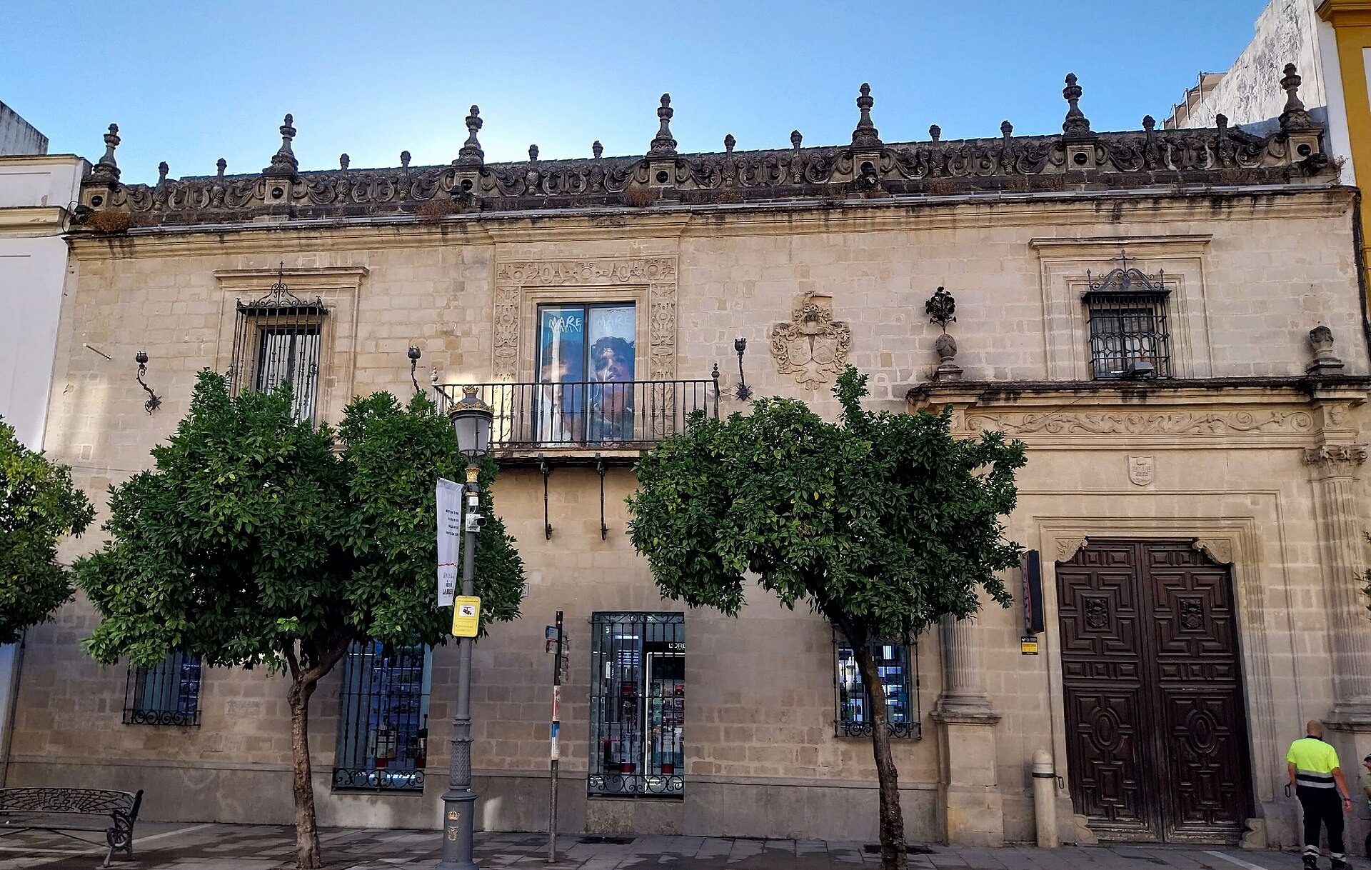
Palacio del Marqués de Villamarta is a historic city palace in the heart of Jerez de la Frontera, in the province of Cádiz, Andalusia. For centuries it served as the residence of the aristocratic Villamarta-Dávila family, doubling as the administrative base for the family's livestock estates and their service to the city of Jerez. Where does the palace's name come from? The building takes its name from the Marquesado de Villamarta-Dávila, the noble family that owned it. Its history is also tied to the Pérez de Grandallana line, which produced several notable seamen from Jerez. One of them, Francisco Pérez de Grandallana, was described by the writer Fernán Caballero as a poet of "genuine, noble, elevated and energetic" character. What does the palace look like today? The building's present appearance largely dates from a major 1923 restoration carried out by architect Hernández Rubio, commissioned by Álvaro Dávila y Agreda, then Marqués de Villamarta-Dávila. The facade is marked by a heraldic coat of arms, an imposing entrance and a distinctive crest that catches the eye from the street. Inside, the layout still reflects the typical scheme of an aristocratic residence of the period: a wide carriage entrance, a patio with a double arcade, and a sequence of long, formal rooms covered by Renaissance-style coffered ceilings (artesonados). These features — the arcaded patio, the coffered ceilings and the heraldic facade — are the main reasons to step inside, or at least pause in front of the building. What is inside the palace now? The palace is not a museum but a working building. Until 2018 it housed a branch of the fashion retailer Mango, and today it is occupied by the perfumery chain Primor. That means visitors can glimpse at least part of the historic interior while shopping, with no ticket or booked tour required. How do you get there? The palace sits right in the historic centre of Jerez de la Frontera, within walking distance of the city's main landmarks, including the Alcázar de Jerez and the cathedral. Jerez is easiest to reach by train or bus from Seville (about an hour's journey) or from Cádiz, and the local airport serves a number of European connections. The old town is compact and best explored on foot. When is the best time to visit? Jerez has a mild Mediterranean climate, so the palace and its surrounding streets can be visited comfortably at almost any time of year. Spring and autumn bring the most pleasant temperatures, while summer midday heat can be intense. It's also worth checking the city's festival calendar — Jerez is known for its flamenco and equestrian events, which bring extra life to the historic centre around the palace. Frequently asked questions Can you go inside the Palacio de Villamarta? Yes. The building currently houses a Primor store, so part of the interior — including the arcaded patio and rooms with original architectural features — is open to shoppers during store hours, with no separate admission ticket. How is this palace different from other landmarks in Jerez? It's a rare example of an aristocratic town palace that has survived in active use rather than becoming a closed-off museum, combining historic architecture — arcades, coffered ceilings, a heraldic facade — with a present-day commercial function. Who commissioned the 20th-century restoration? The 1923 restoration was commissioned by Álvaro Dávila y Agreda, Marqués de Villamarta-Dávila, and carried out by architect Hernández Rubio. Is it worth combining a visit with other Jerez attractions? Yes — the palace is close to the Alcázar and the cathedral, so it fits easily into a walking route through the historic centre.
-
Palacio de Fernán Núñez
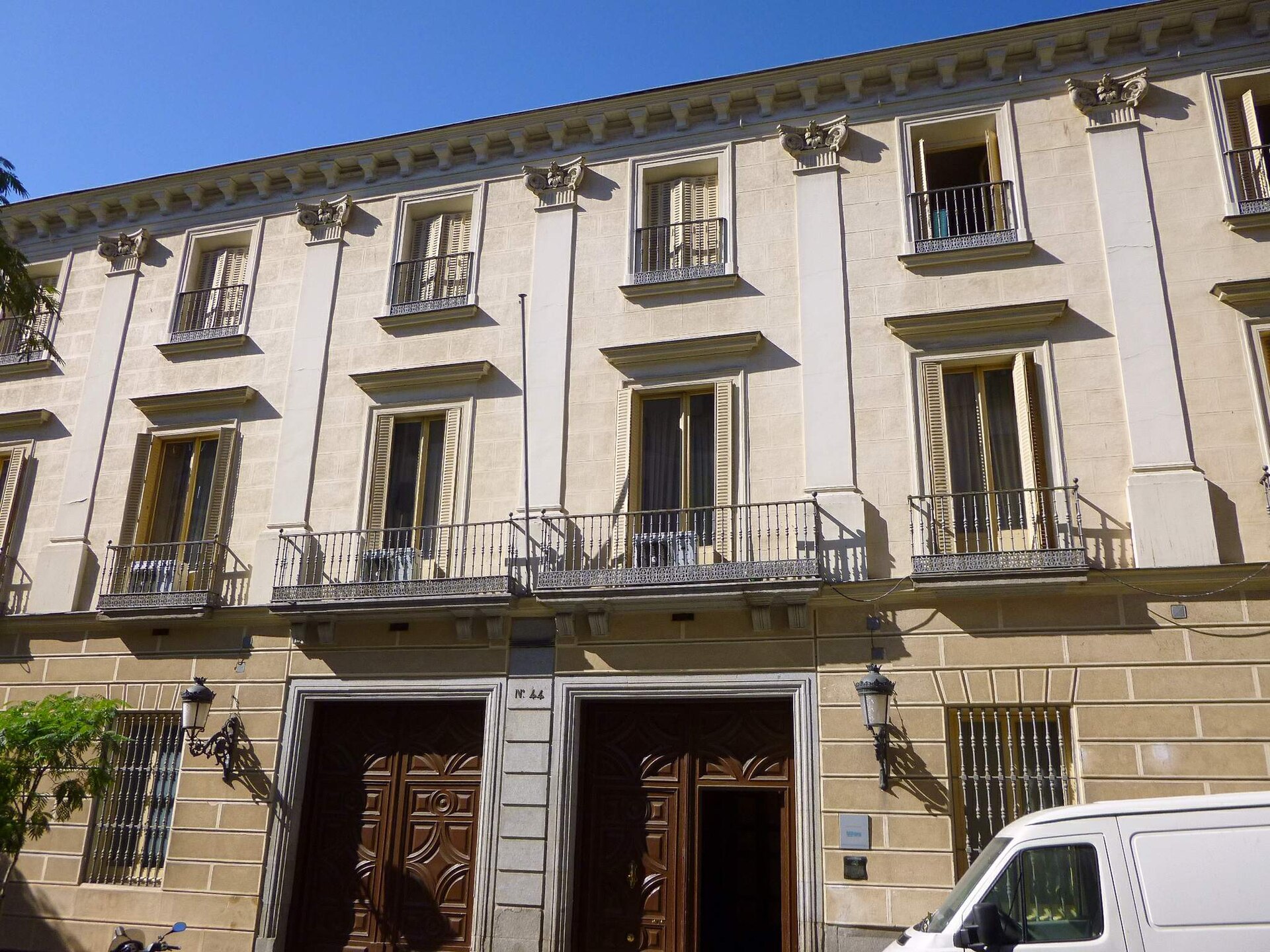
Palacio de Fernán Núñez is an 18th-century palace tucked away on Calle Santa Isabel in Madrid's Barrio de las Letras, just steps from Atocha station. It's the kind of quietly impressive building that most visitors walk right past — which is a shame, since it holds one of the city's finest examples of romantic-era interior design outside the royal palaces. Where did the palace come from? The building's story starts in 1753, when Blas Jover, a member of King Ferdinand VI's council, built his residence here on land parceled out from the gardens of the Convent of Santa Isabel. The property changed hands several times until 1769, when Miguel José María de la Cueva, 13th Duke of Alburquerque, acquired it and turned it into a grand aristocratic estate. The palace owes its current romantic look to a later renovation: between 1847 and 1849, Felipe María Osorio, who had inherited the estate, commissioned architect Martín López Aguado to carry out a thorough remodel. The interiors visitors can glimpse today date from that period. What's inside? The palace preserves its 19th-century splendor — grand reception rooms, an ornate staircase, and architectural details typical of Madrid's romantic style, an era when the aristocracy liked to pair classical form with richer, more decorative flourishes. It isn't a museum in the traditional sense, but it does open its doors occasionally for heritage days and events organized by its current occupant. Who runs the palace today? Since 1985, Palacio de Fernán Núñez has housed the headquarters of the Fundación de los Ferrocarriles Españoles (Spanish Railway Foundation). The building itself came into railway hands much earlier — in 1941, it was purchased by the Compañía de los Caminos de Hierro del Oeste de España, the company that operated Spain's western rail network. Today the foundation uses the space for exhibitions, conferences, and cultural events tied to the history of Spanish railways. How do you get there? The palace sits at Calle Santa Isabel 44, right in the heart of Barrio de las Letras — Madrid's old literary quarter, known for its cafés and small galleries. It's a short walk from Atocha station and from the Prado and Reina Sofía museums, making it an easy add-on while touring Madrid's "art triangle." The nearest metro stops are Atocha (Line 1) and Antón Martín (Line 1). When should you visit? Because the palace functions mainly as an institutional headquarters rather than a standing tourist attraction, it's worth checking ahead for open days or scheduled events — these usually coincide with Madrid's heritage-days calendar. Outside of that, the façade and surrounding streets are worth a look any time of year, and the quiet Barrio de las Letras is especially pleasant in spring and autumn, when Madrid's temperatures are milder. Frequently asked questions Can you visit Palacio de Fernán Núñez? It isn't a permanent tourist attraction — it serves as a foundation's headquarters. Access to the interior is occasionally possible during cultural events and Madrid's heritage open days. Who uses the building today? Since 1985 it has housed the Fundación de los Ferrocarriles Españoles, an institution dedicated to documenting and promoting the history of Spain's railways. How far is it from the Prado Museum? The palace sits in Barrio de las Letras, a few minutes' walk from the Prado, Reina Sofía, and Atocha station — a convenient stop while exploring Madrid's art triangle. Who built the palace? The original residence was built in 1753 by Blas Jover; the palace gained its current romantic-style appearance during a renovation commissioned by Felipe María Osorio between 1847 and 1849.
-
Pazo da Pena
Manzaneda
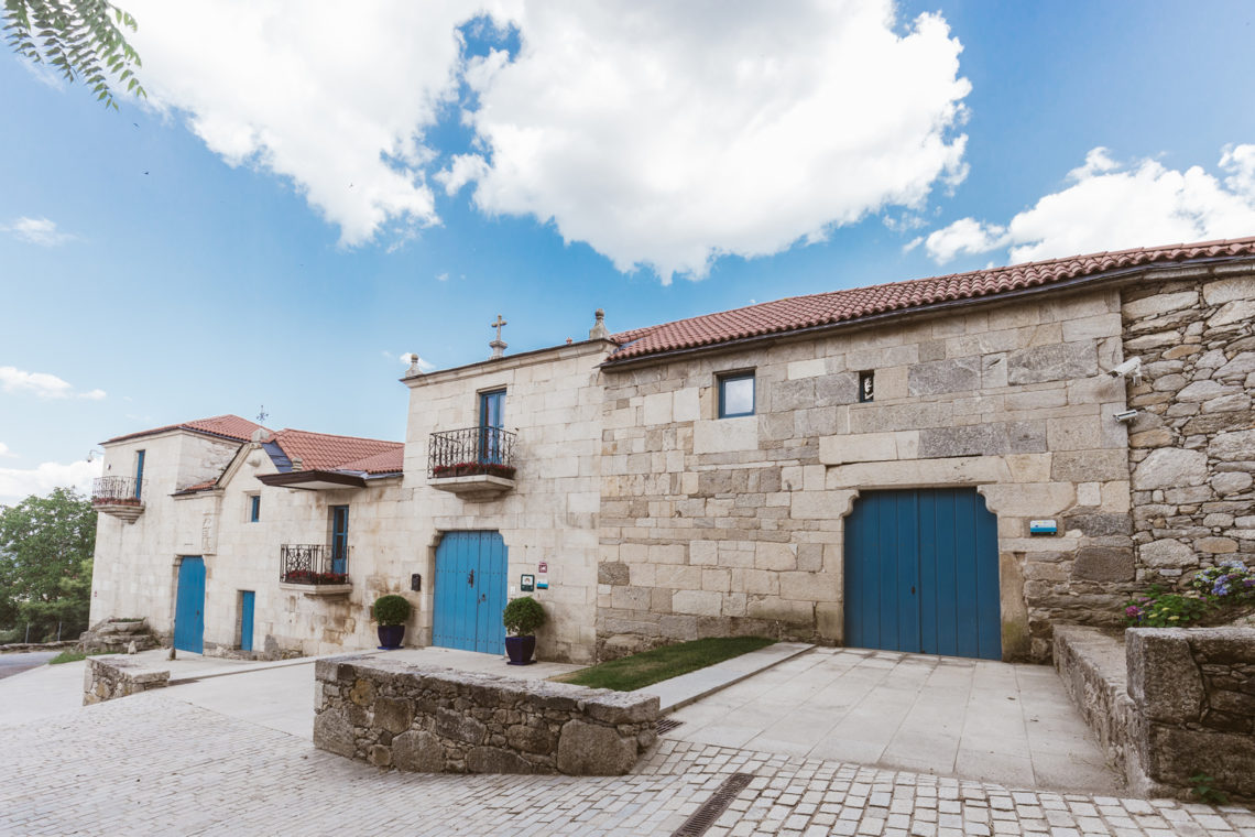
Pazo da Pena is a 16th-century Galician manor house in the village of Rozavales, within the municipality of Manzaneda, in the province of Ourense, right in the heart of the Ribeira Sacra region. The building sits directly on a natural rock outcrop, which explains its name: "pena" means a large rock in Galician, while "pazo" refers to the traditional stately houses built by Galician nobility. Today the estate operates as an upscale rural hotel, having preserved much of its historic character. Where does the name come from, and what's the history behind it? The name Pazo da Pena comes from the rocky promontory that supports the building's gallery on its eastern side. Above the entrance sits a coat of arms combining the four family surnames of the manor's founders: Gaioso, Lousada, Quiroga and Domínguez — a common way for Galician noble families to display their lineage and alliances. For centuries the estate served as an economic hub for the surrounding area. Its lands supported agriculture, a carpentry workshop operated on site, and local production included wine and textiles. Rather than just a residence, the pazo functioned as a productive center for the region, making it one of the most notable examples of civil architecture in this part of Ourense. After a long period of decline, the building underwent a full restoration, completed around 2012, blending original features such as stone walls and wooden ceilings with the comfort expected of a modern hotel. What will you see when you visit? The interior still carries the atmosphere of an old manor: a spacious lounge with wooden floors, a fireplace and comfortable sofas invites guests to unwind after a day exploring the region. Outside, extensive gardens surround the property, anchored by an impressive oak tree said to be among the largest in all of Galicia. The stone gallery resting on the rock, the coat of arms above the entrance, and the overall silhouette of the building make it easy to picture how Galician nobility once lived here. How do you get there, and what else is nearby? Pazo da Pena sits in the heart of Ribeira Sacra, a region famous for its terraced vineyards overlooking the canyons of the Sil and Miño rivers, as well as its historic monasteries. The most practical way to reach Manzaneda is by car — the nearest major city, Ourense, is roughly an hour's drive away. The property is about a 15-minute drive from the Cabeza de Manzaneda ski resort, the highest ski area in Galicia, which makes Pazo da Pena a solid base year-round, not just in winter. During the rest of the year, the surrounding Serra de San Mamede mountains draw hikers and cyclists, while nearby wine routes take visitors through the local vineyards. When is the best time to visit? Winter, from December through March, is ski season thanks to the proximity of Cabeza de Manzaneda. Spring and autumn are ideal for hiking and wine tasting, with mild temperatures and especially striking scenery in Ribeira Sacra when the terraced vineyards change color in the fall. Summer suits longer mountain excursions and exploring the surrounding villages. Frequently Asked Questions What is a pazo, and where does the name Pazo da Pena come from? A pazo is a traditional Galician manor house. Pazo da Pena takes its name from the large rock ("pena") that supports the building's gallery. Can you stay overnight at Pazo da Pena? Yes. Following its restoration, the property operates as a rural hotel with rooms, gardens and common areas, while retaining the character of the original manor house. How far is it from the ski slopes? The Cabeza de Manzaneda ski resort is about a 15-minute drive from Pazo da Pena. What else is worth doing nearby? The Ribeira Sacra region offers hiking and cycling trails, wine routes through local vineyards, and dramatic river canyon scenery along the Sil and Miño — all easy additions to a visit to the manor itself.
-
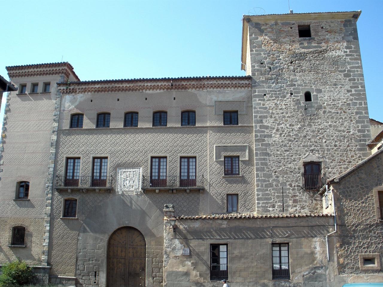
Casa de los Marqueses de Moya
Segowia
Casa de los Marqueses de Moya is a medieval fortified house in Segovia, also known as Casa de las Cadenas (House of the Chains). It stands on Plaza del Conde de Cheste, right against the city walls at the eastern edge of the Caballeros quarter, and once guarded the northeastern flank of Segovia together with the neighboring Casa de los Cáceres. How do you get there? The house sits inside Segovia's old walled town, an easy walk from the cathedral and the Alcázar. The simplest approach is on foot from Plaza Mayor, heading toward the Caballeros quarter in the direction of where the Puerta de San Juan once stood (the gate itself was demolished in 1888, though its name survives locally). There is no dedicated parking at the site — visitors leave cars outside the old town and walk the last stretch through steep, narrow streets. What will you see? What survives today reflects two distinct building phases. The first, from the 13th century, gave the structure its clearly military character: the outer enclosure, with a round tower and crenellated battlements, still reads as rugged defensive architecture. The second phase, in the 15th century, converted the fortress into a palatial residence built around an inner courtyard, adding a square tower. The building follows a roughly square floor plan with towers at every corner except the northeast one, where the Puerta de San Juan — one of the city's gates — used to stand before its demolition. Above the main doorway, a stone coat of arms is carved into the wall. It belongs to Andrés Cabrera and Isabel de Bobadilla, the couple who acquired the house around 1500. Both were notable figures in Spanish history: Andrés Cabrera served as alcaide (warden) of the nearby Alcázar, and Isabel de Bobadilla was one of the closest confidantes of the future Isabel the Catholic — their support allowed the princess to prepare safely in Segovia for her eventual accession to the Castilian throne. Before that, the house belonged to the Counts of Chinchón and Marquises of Moya, from whom it takes its name. Casa de los Marqueses de Moya is privately owned today and used as a residence, so the interior is not open to visitors. The draw is the exterior itself — the walls, towers, and carved details best appreciated from the plaza and surrounding lanes. When should you visit? Morning or late-afternoon light works best for photographing the façade, when it rakes across the stonework and highlights the carved coat of arms. Segovia gets busy in summer with visitors heading to the Alcázar and the Roman aqueduct, but the Caballeros quarter, where this house stands, stays noticeably quieter — a good reason to pair a visit here with a walk along the nearby stretch of city walls. Spring and autumn are the most comfortable seasons for exploring the old town's steep streets on foot. Frequently Asked Questions Can you go inside Casa de los Marqueses de Moya? No. The building is privately owned and used as a residence, so the interior is closed to the public. It can only be viewed from the outside. Why is it also called Casa de las Cadenas? The name "House of the Chains" refers to an old Spanish tradition of marking buildings connected to legal immunity or the special status of their owners with chains at the entrance. Who were Andrés Cabrera and Isabel de Bobadilla? They were the married couple who acquired the house around 1500. Andrés Cabrera managed Segovia's Alcázar as its warden, while Isabel de Bobadilla was a trusted lady-in-waiting to the future Isabel the Catholic and played a key role in the events leading up to her coronation. What else is worth seeing nearby? The house borders Segovia's city walls and sits close to the Caballeros quarter, putting it within easy reach of the Alcázar and other surviving fortified houses in the city, such as Casa de los Cáceres and Casa de Lozoya.
-
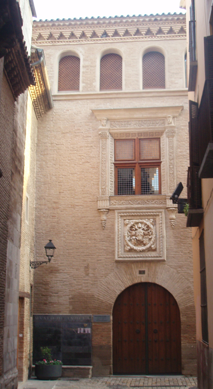
Palacio Decanal, Tudela
Tudela
Palacio Decanal is a late 15th-century Gothic-Mudéjar brick palace standing in the heart of Tudela's old town, on La Merced street, right next to the Santa María Cathedral. For centuries it served as the residence of the dean, the city's leading church figure, and during periods when Tudela had its own bishop, it also functioned as the episcopal palace of the diocese. What is the history behind the building? Construction began in the second half of the 15th century, and the palace went through further work in the 16th, 18th and 19th centuries, which explains the mix of styles visible on its exterior today. Its most striking feature is the Renaissance facade, restored in 1515 under Dean Villalón. Carved in alabaster, it displays the dean's own coat of arms alongside that of Pope Julius II, a detail that signals both the personal prestige of its patron and the palace's ties to Rome. The palace hosted Spanish monarchs travelling through Navarre, but its most notable guest was Pope Adrian VI, who stayed here shortly after his election, on his way to Rome for the official proclamation. Few buildings outside major cities can claim a papal visit tied to such a specific moment in church history. What will you find inside? The palace now houses the Museo de Tudela, run by the diocese. The permanent collection focuses on the region's religious art: sculptures, paintings, altarpiece fragments, liturgical vestments and objects, and goldwork gathered from churches across Tudela and the surrounding area. A separate section is dedicated to regional archaeology, covering finds from the wider Ribera de Navarra area. A visit also unlocks something invisible from the street: access to the Romanesque cloister of the Santa María Cathedral. The cloister connects directly to the museum building, and it's one of the strongest reasons to spend more than a passing glance on this corner of Tudela's old town. How do you get there, and when's the best time to visit? Palacio Decanal sits within the old town, right beside the cathedral, so it's best explored on foot as part of a walk through Tudela's historic centre. Like most monuments in this part of town, it has no dedicated parking, but there are places to stop within easy walking distance of the main streets of the old quarter. Since the building operates as a diocesan museum, entry depends on the museum's opening hours rather than being available around the clock like an exterior-only monument. Timing your visit for when the museum is open is worth it, since the cathedral cloister can only be reached through the museum itself. Frequently Asked Questions What is the Palacio Decanal in Tudela? It's a late 15th-century Gothic-Mudéjar palace that served as the dean's residence and the episcopal palace of the Tudela diocese, and today houses the Museo de Tudela. Why is the palace's facade so distinctive? The Renaissance facade was restored in 1515 under Dean Villalón and carries alabaster coats of arms of both the dean and Pope Julius II. Who stayed at the palace historically? Spanish monarchs lodged here, and its best-known guest was Pope Adrian VI, who stopped at the palace after his election on his way to Rome. What can you see inside the museum? Collections of religious art (sculpture, painting, altarpieces, goldwork), a regional archaeology display, and the Romanesque cloister of the Santa María Cathedral, reachable only from inside the museum.
-
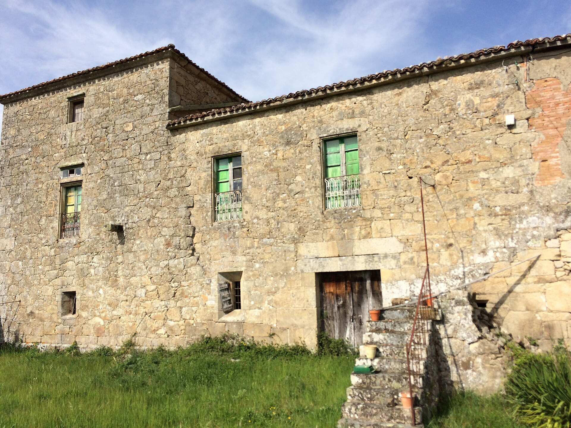
Torre do Mouro
O Castro de Ferreira
Torre do Mouro is a medieval defensive tower overlooking the Ferreira River, standing on a rise in O Castro de Ferreira, in the parish of Sirvián (municipality of Guntín, province of Lugo, Galicia). Also known as Torre de Sirvián or O Castelo dos Mouros, it is one of the few surviving physical traces of the network of fortifications that once guarded the Ferreira valley. Where is the tower located? Torre do Mouro sits in the Ribeira Sacra region, within the municipality of Guntín, a short drive from the city of Lugo. It occupies a small hill rising above the Ferreira River, a position that gave it a natural defensive advantage and a wide view over the surrounding land. The name of the settlement, O Castro de Ferreira, points directly to this hill: before the stone tower was built, the site held an earlier hillfort, or castro. What is the history behind it? The tower was raised in the 12th or 13th century as part of a wider chain of fortifications that local feudal lords used to control their lands and watch over the routes running along the river. It belonged to the Camba lineage, descendants of Count Ero and Countess Laura, who founded the monastery of Ferreira de Pallares in Guntín back in 909. That family connection underlines how important this stretch of the Ferreira valley already was between the 10th and 13th centuries, sitting at the crossing point of secular and monastic power. Over time the tower lost its military purpose. Successive owners reworked the structure for residential use, and this is still visible today in the way the old defensive walls blend into later farmhouse-style additions. What can you see on site? The tower has a quadrangular, almost cubic footprint, typical of Galician defensive towers of the period. Solid stone foundations and sections of the original walls remain standing, though the upper levels no longer reach their original height. During later rebuilding, a carved granite piece from an earlier phase of construction was set into the walls; it bears a chalice with a host and a wheel motif, a clearly religious detail that hints at the site's close ties to nearby monastic life. The surrounding countryside rewards a slow walk too: this stretch of the Ferreira valley has kept a rustic, largely unchanged character, with stone footbridges and old mills scattered along the riverbanks. How do you get there, and when is the best time to visit? Sirvián lies along the old pilgrim route to Santiago de Compostela, which passes through San Román, Santa Cruz, Sirvián, Entrambasaugas, Sear, Pereiro, Eirexe and Penela before reaching Guntín — a path still walked today and a fitting way to approach the tower on foot. From the village of Guntín, a riverside trail also follows the Ferreira toward A Mota castle, bringing walkers close to Torre do Mouro along the way. Spring and early autumn are the best seasons to visit, when the Ferreira valley is at its greenest and temperatures suit longer walks. In summer, morning hours are preferable, since the surrounding area offers little shade during the hottest part of the day. Frequently Asked Questions Is Torre do Mouro the same tower as Torre de Sirvián? Yes. Torre do Mouro is the popular local name for Torre de Sirvián, also referred to as O Castelo dos Mouros. How old is the tower? It dates to the 12th or 13th century, built as part of a defensive system controlling the Ferreira river valley. Can visitors get close to the tower? The surviving walls and foundations are visible from the outside; the site consists of historical ruins partly absorbed into later farm buildings. Are there other historical sites nearby? Yes — the municipality of Guntín holds several other medieval towers, such as Torre de Francos and Torre de Quintela, as well as A Mota castle, reachable via a trail that follows the Ferreira River.
-
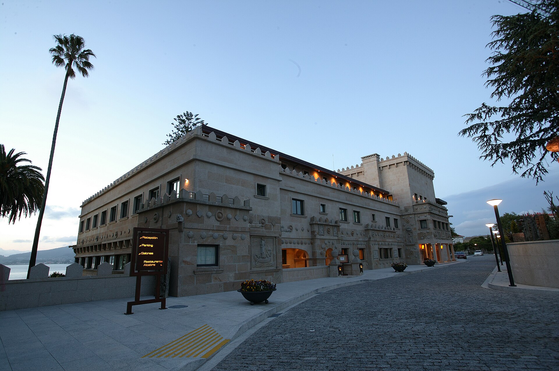
Hotel Pazo Los Escudos
Vigo
Hotel Pazo Los Escudos is a five-star property in Vigo, set directly on the shoreline of the Ría de Vigo, just a short walk from Carril Beach. The hotel combines two buildings: a 19th-century pazo (a traditional Galician manor house) with a stone façade decorated with reliefs, and the more contemporary Los Escudos wing. That mix of historic architecture and modern comfort is the hotel's main draw, appealing to travelers who want a beachfront stay without giving up easy access to the city. How do you get there? The hotel sits roughly a 10-minute drive from downtown Vigo, making it a practical base whether you plan to explore the city or spend most of your time by the water. Vigo Airport (Peinador) is within reasonable reach, and the coastal location makes arrival straightforward from both the city center and the surrounding shoreline roads. Carril Beach is close enough to reach on foot in a few minutes, no transport needed. What will you see? Rooms at Pazo Los Escudos vary in style — some keep a classic look, others lean modern — but they share parquet floors, furnished terraces, and views over the sea, the ría, or the hotel gardens. Marble bathrooms with a bathtub and complimentary toiletries reinforce the property's upscale positioning. The centerpiece for relaxation is the Club de Agua Spa, which includes a spa bath, sauna, heated indoor pool, and hammam. The spa menu extends to massages, body treatments, manicures, and pedicures, making it easy to spend an entire afternoon there regardless of the weather outside. Dining is split across three venues: Alcabre restaurant, focused on local Galician cuisine; Piacere, serving Italian dishes; and The Escudo's Cafeteria, a lighter option for a quick coffee or meal with a view. Beyond the hotel grounds, the coastal setting opens up several nearby attractions: the Ría de Vigo itself, area beaches, the Museo do Mar (Sea Museum), which covers the region's fishing heritage, and the Beade Botanical Park. Vigo's historic old town, with its port-city character, is within the same short drive. For those who want to get out on the water, boat trips to the Cíes Islands — a nature reserve known for clear water and white-sand beaches — depart from the area. When should you visit? Given the beachfront setting, spring and summer are the best months to visit, when temperatures suit swimming and day trips to the Cíes Islands. The hotel operates year-round, though, and the spa's heated pool and hammam make it a good option outside beach season too — for instance, as a base for exploring Galicia in autumn or winter. Frequently Asked Questions How far is the hotel from downtown Vigo? About a 10-minute drive. The hotel sits outside the city center, directly on the ría's shoreline. Does the hotel have a spa? Yes. The Club de Agua Spa includes a spa bath, sauna, heated indoor pool, hammam, and treatments such as massages, manicures, and pedicures. What restaurants are on site? Three: Alcabre for Galician cuisine, Piacere for Italian food, and The Escudo's Cafeteria for lighter options. Can you reach the Cíes Islands from the hotel? Yes. The hotel's location on the Ría de Vigo makes it a convenient starting point for boat trips to the Cíes Islands, one of the region's most notable nature reserves.
-
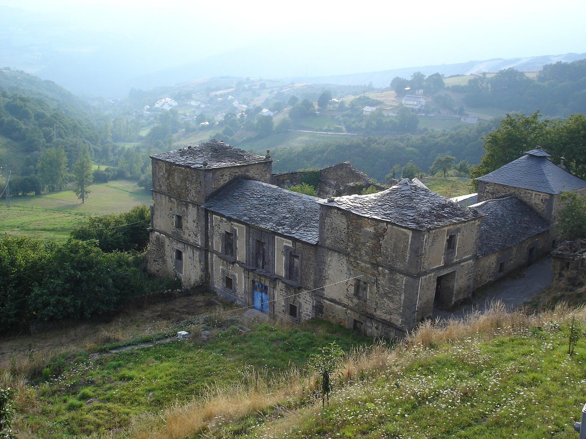
Palace of Tormaleo
Ibias
Palacio de Tormaleo is an 18th-century rural palace standing in the village of Tormaleo, in the municipality of Ibias, in the far west of Asturias near the border with Galicia. It ranks among the region's most notable examples of noble residential-defensive architecture, though today the building is struggling with ongoing deterioration. What is this place? The palace as it stands was built in the 18th century, but its oldest section — the western tower together with the wing attached to it — dates from an earlier period and formed the original core around which the rest of the residence was later expanded. The property belonged to local rural nobility and served as a visible marker of their standing within the Tormaleo community. On December 30, 1993, it was declared a Bien de Interés Cultural (Asset of Cultural Interest), the Spanish designation confirming its historical and architectural significance. What will you see? The building follows a roughly square plan, but its different sections rise to different heights, giving it an irregular, layered silhouette. The composition is built from three towers and three wings, with a perimeter wall closing off the fourth side and visually completing the quadrangle. The oldest surviving element is the western tower: a small, square-sectioned, single-story structure covered by a false vault, with no ventilation openings at all despite housing a fireplace inside. This austere, defensive design contrasts sharply with the rest of the complex. The main facade, facing south, speaks a completely different architectural language. Its central section rises two stories and is flanked by two three-story towers, forming a striking, symmetrical composition. This is where all the decorative work is concentrated: an elaborately carved entrance portal, window openings, and balconies dressed with molded frames, pilasters, and other Baroque details. The contrast between the plain, defensive tower and the ornate southern facade tells the story of how the residence grew over the centuries — from a modest watchtower into a full-fledged noble palace. What condition is the palace in today? Despite its legal protection status, Palacio de Tormaleo has stood abandoned for years and continues to deteriorate. The lack of use and maintenance has caused structural damage, compounded by the theft of stones and architectural elements from its walls. As a result, the building's condition can differ noticeably from one visit to the next. Even so, it remains the foremost example of rural palatial architecture in the entire municipality of Ibias and a key reference point for anyone interested in the region's history. How do you get there? Tormaleo sits deep within the municipality of Ibias, in a mountainous, sparsely populated corner of western Asturias. Driving is by far the most practical option — the approach winds through rural countryside, among the valleys and ridgelines typical of this part of the region. It is worth planning the trip ahead of time, since the area has limited tourist infrastructure, and the nearest towns with fuller services lie in the central part of the municipality. When is the best time to visit? Spring and early autumn are the best seasons to visit, when the mountain landscape around Tormaleo turns green and moderate temperatures make exploring the surrounding area more comfortable. Summers can get warm, though the region's elevation tempers the heat, while winter in this part of Asturias can bring difficult conditions on the local roads. Frequently Asked Questions Can visitors go inside the palace? The building is abandoned and in a deteriorated state, so visits are essentially limited to viewing it from the outside. Why does the palace have such an irregular shape? It reflects its construction history — the residence expanded in stages around an older tower, blending different heights and styles into a single composition. What does the Bien de Interés Cultural status mean? It is a Spanish legal protection category granted to sites of exceptional historical or architectural value; the palace received it in 1993. Are there other attractions nearby? The municipality of Ibias, with its mountainous landscape and traditional rural architecture, offers additional points of interest worth combining with the same trip.
-
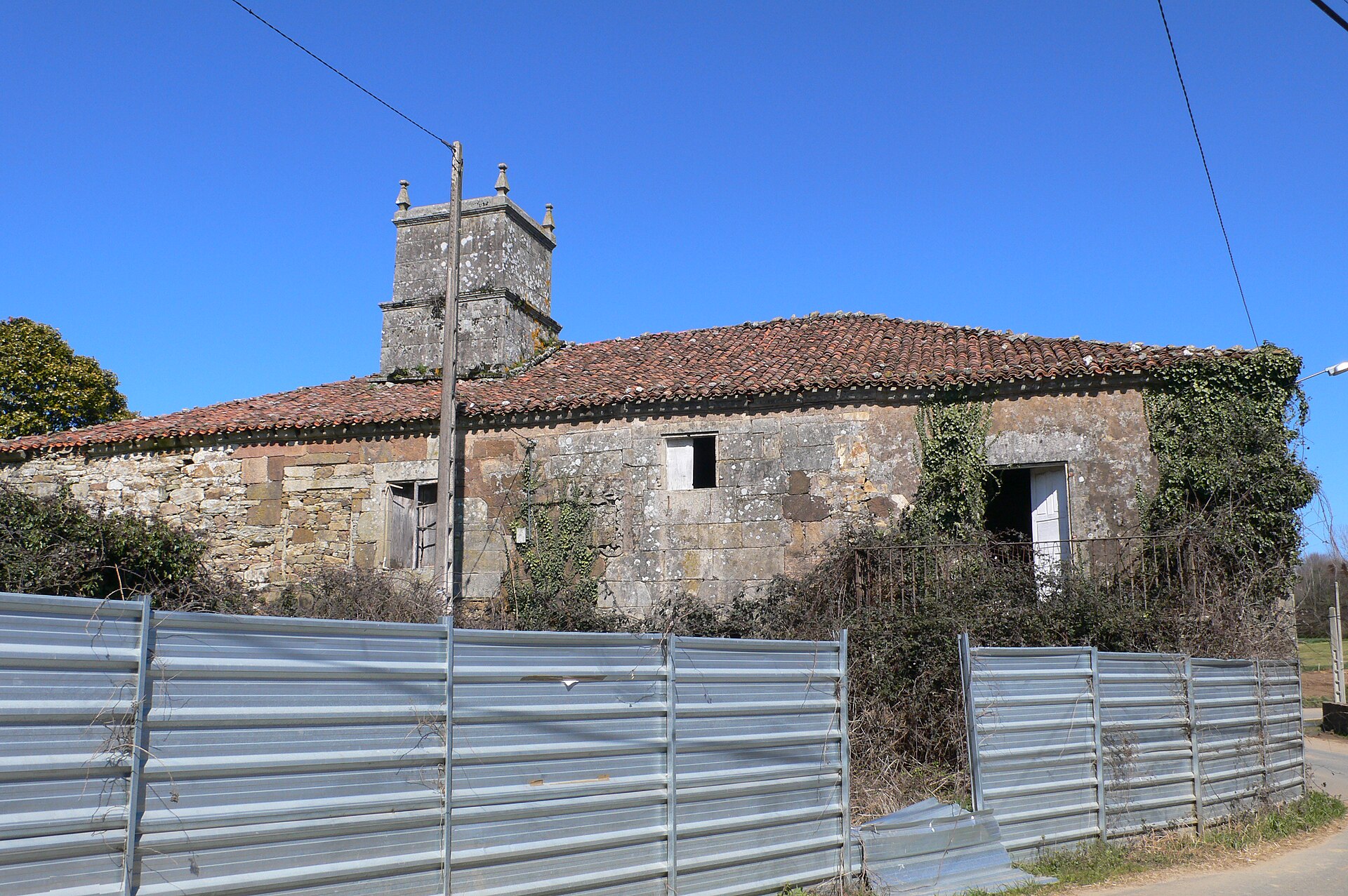
Pazo de Cardexía
Lalín
Pazo de Cardexía is a Galician noble manor house standing in the parish of Santa María de Filgueira, roughly 3.5 km south of the town centre of Lalín, in the province of Pontevedra. How do you get to Pazo de Cardexía? The manor sits directly on two pilgrim routes to Santiago de Compostela: the Camino de Invierno (Winter Way) and the Vía de la Plata. Walkers and cyclists following either route pass close to Cardexía, making the pilgrim path the most natural way to reach it. Drivers should head for the parish of Filgueira, from where local lanes lead to the small hamlet that gives the pazo its name. The nearest town with regular public transport connections is Lalín itself, a road hub for the wider Deza district. What will you see there? Pazo de Cardexía is a good example of Galician noble-house architecture. It was built on a rectangular plan using small stone masonry, a construction style typical of manor houses in the Deza-Tabeirós area. The main façade features a balcony resting on three stone columns, a detail shared with several other pazos in the region, together with a substantial chimney that once served the house's traditional kitchen. Above the entrance and windows, carved coats of arms record four noble families tied to the property's past: Taboada, Deza, Salgado and Gil — a visible trace of the estate passing through several prominent lineages over the centuries. The building remains private property. Photographs taken in recent decades show visible deterioration: after the last heir passed away, the estate was left without regular upkeep, and the façade and surrounding grounds have suffered as a result. Visitors should expect to view the pazo from the outside, as a landmark along the pilgrim route, rather than as a house open for interior tours. What is the history behind the manor? The Cardexía estate belongs to the story of Trasdeza's landed families — a region where most surviving pazos went up during the 17th and 18th centuries, at the height of the Baroque period. On 10 July 1861, the house saw the birth of Cesar Augusto Velón Pardo, son of Javier Velón and Eduarda Pardo. He went on to build a career in colonial administration, and in October 1889 he left the family pazo in Cardexía on a long journey to the Philippines to take up a judgeship in the town of Misamis. His route ran through Madrid, Barcelona, Port Said, Suez, Aden, Colombo, Singapore and Manila — a itinerary typical for colonial officials of the era, when travel between Spain and the Philippines took several weeks. The pazo is listed as a civil heritage asset in the Galician cultural heritage catalogue, a designation that confirms its historical value regardless of its current physical condition. When is the best time to visit? Because Cardexía lies on an active pilgrim route, spring and summer are the best times to pass by, when both the Camino de Invierno and the Vía de la Plata see the most foot and bicycle traffic and nearby rest stops are fully open. Autumn and winter bring a quieter, greener landscape but also the frequent rain typical of inland Galicia, so waterproof gear is worth packing. Frequently Asked Questions Can you go inside Pazo de Cardexía? No — it is private property currently in a state of disrepair, so visits are limited to viewing the exterior, usually while walking one of the pilgrim routes that pass nearby. Where exactly is Cardexía located? In the parish of Santa María de Filgueira, in the municipality of Lalín, about 3.5 km south of the town centre. What does the manor's architecture look like? A rectangular stone building with a balcony supported on three columns, a large chimney, and carved coats of arms of the Taboada, Deza, Salgado and Gil families above the entrance. What is the manor's connection to the Philippines? Cesar Augusto Velón Pardo, born at Cardexía in 1861, left the family home in 1889 to take up a judgeship in Misamis, in the Philippines, during the period of Spanish colonial administration.
-
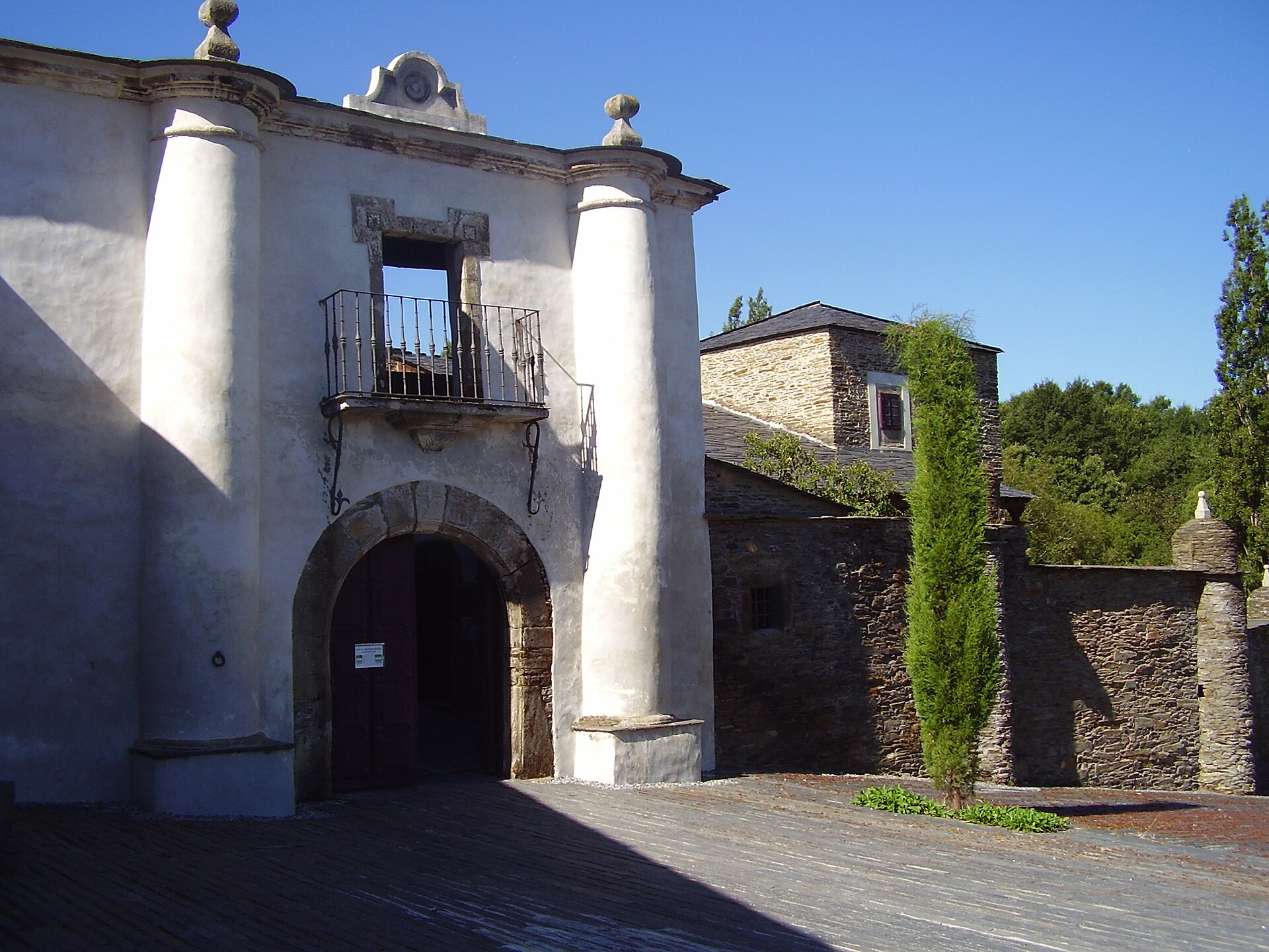
Fortified house in Lusio
Samos
Casa Forte de Lusío (Fortified house in Lusio) is a fortified rural manor in the hamlet of Lusío, in the parish of San Cristovo do Real, municipality of Samos, province of Lugo, Galicia. The building sits just off the Camino Francés, one of the main pilgrim routes to Santiago de Compostela, and has served travelers on the Way of St. James as a resting point for years. What kind of building is this? Casa Forte de Lusío is a classic example of a Galician pazo — a fortified country residence combining domestic living quarters with defensive features typical of the region's minor nobility. The original structure dates back to 1551, and the house remained in the hands of local landed families for centuries. Among its notable residents was the mathematician Vicente Vázquez Queipo (1804–1893), a detail that hints at the intellectual standing of the family once connected to the estate. Today the property belongs to the Monastery of Samos, while day-to-day management falls to the regional government of Galicia, the Xunta. How do you get there? Lusío lies roughly 400 meters off the main Camino Francés route, on the stretch between Triacastela and Samos, near the villages of Renche and San Cristovo do Real. This section of the Way of St. James is one of the most walked in Galicia, crossing the green, hilly countryside of Lugo province. The easiest way to reach it is on foot or by bike, following the yellow arrows and scallop-shell markers of the Camino. Driving is possible via local roads connecting Samos with the surrounding villages, though the area itself remains distinctly rural and only loosely connected to larger towns. What will you see on site? The building retains the layout typical of a Galician pazo: solid stone walls, an austere, functional architectural form, and defensive elements that once protected residents from raids. The interior has been partially adapted to serve as a pilgrim hostel, but the exterior still reflects the house's historic, noble origins. The surrounding landscape is classic rural Galicia — stone houses, pastures, and small farms scattered along the Camino. Where can you stay? The building operates as an albergue de peregrinos — a pilgrim hostel run by the Xunta de Galicia. It offers four dormitories: two smaller rooms with eight beds each and two larger ones with twenty-two beds each, for sixty beds in total. Check-in starts at 13:00, and the hostel closes for the night at 22:00. It's a popular stopping point for pilgrims walking from Triacastela to Samos, where the next major landmark on the route is the imposing Monastery of Samos. When is the best time to visit? Spring and autumn are the best seasons to visit, when foot traffic on the Camino Francés is moderate and Galicia's weather is comfortable for walking. Summer brings the heaviest crowds on the route, meaning more company on the trail but also fuller hostels. Winter on this stretch tends to be cold and damp, in line with the region's typical Atlantic climate. Frequently Asked Questions Can you stay overnight at Casa Forte de Lusío? Yes, the building functions as an albergue de peregrinos with four dormitories and sixty beds in total. Check-in begins at 13:00 and the hostel closes at 22:00. How do you reach Lusío without a car? The simplest way is on foot or by bicycle along the Camino Francés, on the stretch between Triacastela and Samos — the site lies about 400 meters off the main route. Who manages the building? The property belongs to the Monastery of Samos, while its day-to-day operation as a pilgrim hostel is handled by the Xunta de Galicia. Is it worth combining a visit with the Monastery of Samos? Yes, the Monastery of Samos is a short distance further along the same Camino route and is a natural, important stop for pilgrims staying overnight in Lusío.
-
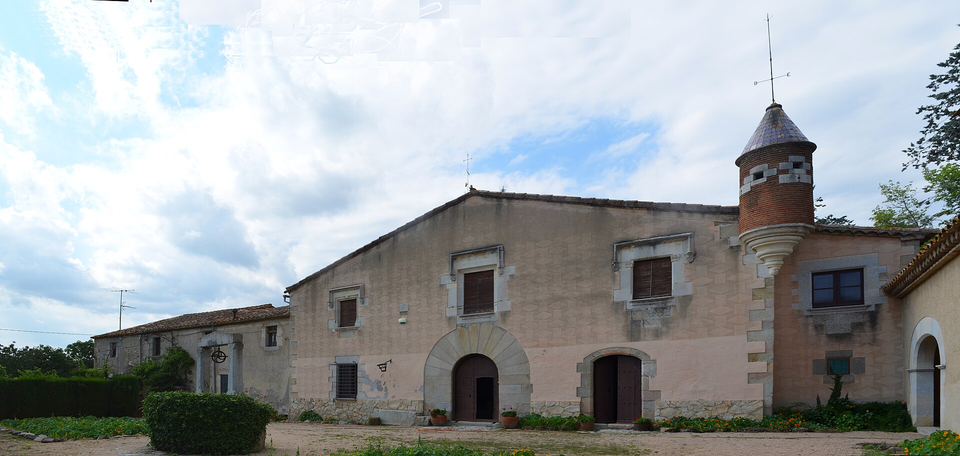
Torre Albertí
Llagostera
Torre Albertí is a fortified masia — a traditional Catalan farmhouse with a defensive tower — standing on the edge of Llagostera, in the Gironès county. For centuries the tower has shaped the skyline of this corner of the Girona region. Where does the name come from? The name traces back to the Albertí family, recorded in Llagostera as early as the 15th century, when they worked as tenant farmers on the Riudaura estate. In 1541 Pere Albertí was knighted by Martí Grau de Cruïlles, eighth baron of Llagostera. Seven years later, in 1548, he bought up the surrounding land and received the baron's permission to build a defensive tower — the structure that gave the estate its present name. What will you see on site? The complex is built around two main elements: a stone watchtower and a Gothic chapel dating from 1588. Albertí had the chapel raised in memory of his son, who died in 1581; it still stands as a small sanctuary attached to the main building. Together they form a textbook layout for a 16th-century masia owned by a wealthy landed family — a defensive tower, a family chapel, and farm buildings gathered around a courtyard. Look closely at the contrast between the two structures: the tower's plain, heavy stonework versus the chapel's more ornamented Gothic front. Pairing a defensive function with a sacred one inside a single rural compound is typical of Catalan countryside architecture from this period. What is the history behind it? Between the 16th and 17th centuries, Torre Albertí served as the residence of the Procurator General of the Batllia — the local bailiff's administrative office — of Llagostera. That made it more than a family home: it was also a seat of local authority for several generations of the Albertí line. The estate's fortunes shifted in the 18th century. In 1718, Caterina d'Albertí i Pallarés married Ramon de Manresa i de Sala, joining the Albertí property to the Manresa family. Their heir, Joan de Manresa i d'Albertí, married twice, first in 1741 to Antònia Andreu i Fontdevila. Ownership continued to pass down through the combined lines of these two families in the generations that followed. Today Torre Albertí is listed in Catalonia's Inventory of Architectural Heritage, a recognition of its historical and architectural value for the region. How to get there and when to visit? Llagostera sits in the Gironès county, a short drive from the city of Girona and within easy reach of the Costa Brava coastline, making Torre Albertí a convenient stop while exploring the Girona area or heading toward the coast. Spring and early autumn are the best seasons to visit: the mild Mediterranean climate makes for comfortable walks around the grounds without the summer heat. Parts of the estate sit on private land, so it is worth checking current access details with local tourism sources before planning a visit. Frequently asked questions What is Torre Albertí? It is a historic masia with a defensive tower and a Gothic chapel, built in the 16th century by the Albertí family in Llagostera, in the Gironès region. When was the tower built? Pere Albertí received permission to build the tower in 1548, and the accompanying chapel was consecrated in 1588. What was the estate used for historically? Between the 16th and 17th centuries it served as the seat of the Procurator General of the Batllia of Llagostera, combining a family residence with a local administrative role. Is Torre Albertí a protected heritage site? Yes, it is listed in Catalonia's Inventory of Architectural Heritage as an example of a 16th-century masia belonging to a major landowning family.
Earn badges for the places you visit
Download NextOnTrip, discover new places and check off your trails.