Monuments in Spain
A guide to 4655 Monuments in Spain — with descriptions, photos and traveler visits from the NextOnTrip community. Locations spread across 2240 cities and towns. Most visited by the community: castle of Chulilla, Castle of Pioz, castell de la Todolella.
-
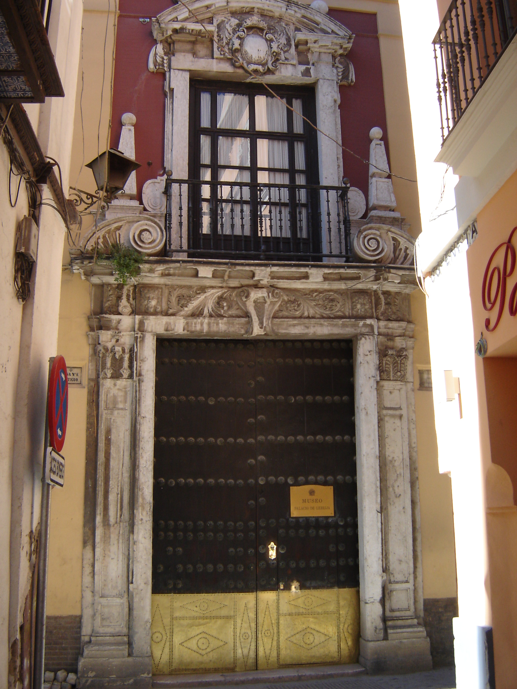
Palacio de la Condesa de Lebrija
Sevilla
Palacio de la Condesa de Lebrija is a 16th-century house-museum in Seville, celebrated for one of the largest private collections of Roman mosaics in the world. The building stands on Calle Cuna, one of the busiest streets in the historic center, running parallel to the famous Calle Sierpes. Where does the palace's name come from? The name comes from Regla Manjón Mergelina, Countess of Lebrija, who bought the family house in 1901 and spent the following thirteen years remodeling it to her own vision. A passionate archaeologist, she became the first woman admitted to the Real Academia de Bellas Artes de Santa Isabel de Hungría and to the Real Academia de Bellas Artes de San Fernando in Madrid. It was her decision to turn the ground floor into a showcase for ancient mosaics. What makes this building so unusual? The ground floor is covered by roughly 580 square meters of Roman floor and wall mosaics, which is why the palace is often described as the best-paved house in Europe. The countess assembled the collection at the turn of the 19th and 20th centuries, combining pieces bought from antique dealers with mosaics excavated on her own estates. What should visitors look for in the central patio? The heart of the palace is a patio ringed by arches on marble columns, decorated with elaborate Mudéjar plasterwork (yeserías). The patio floor holds a mosaic dated to the 2nd-3rd century AD, found on former olive-grove land near Itálica, the Roman city just outside Seville. Its central medallion shows the god Pan playing his flute for Galatea, with whom he is in love. Eight surrounding medallions depict the amorous adventures of Zeus, while the corners hold personifications of the four seasons. How is the palace organized for visitors? The palace still operates as a house-museum, so its rooms keep the character of a private residence from a century ago, filled with furniture, ceramics and objects gathered by the Lebrija family. A visit to the mosaic-covered ground floor can be paired with the upper floor, where further pieces of the collection are displayed. Its location in the very center of Seville, close to Plaza Nueva and the cathedral, makes it easy to fit into a walk through the old town. Why is Palacio de la Condesa de Lebrija worth a visit? It offers a rare chance to see authentic Roman mosaics not behind museum glass but in their original use, as the floors of a lived-in residence. The mix of Mudéjar architecture, Renaissance-era elements and ancient mosaics creates an interior unlike anything else in the city. Frequently Asked Questions Where exactly is the palace located? On Calle Cuna in Seville's historic center, parallel to Calle Sierpes, within easy walking distance of the cathedral and Plaza Nueva. Where do the mosaics in the palace come from? Most of the collection was assembled by the Countess of Lebrija around the turn of the 19th and 20th centuries; some mosaics came from excavations on her own estates, others from antique dealers. The central patio mosaic was found near the Roman city of Itálica. What does the mosaic in the central patio depict? The god Pan playing his flute for Galatea at the center, eight medallions showing the amorous adventures of Zeus, and personifications of the four seasons in the corners. Does the palace still function as a museum? Yes, it operates as a house-museum, displaying both the Roman mosaics on the ground floor and the Lebrija family's residential interiors upstairs.
-
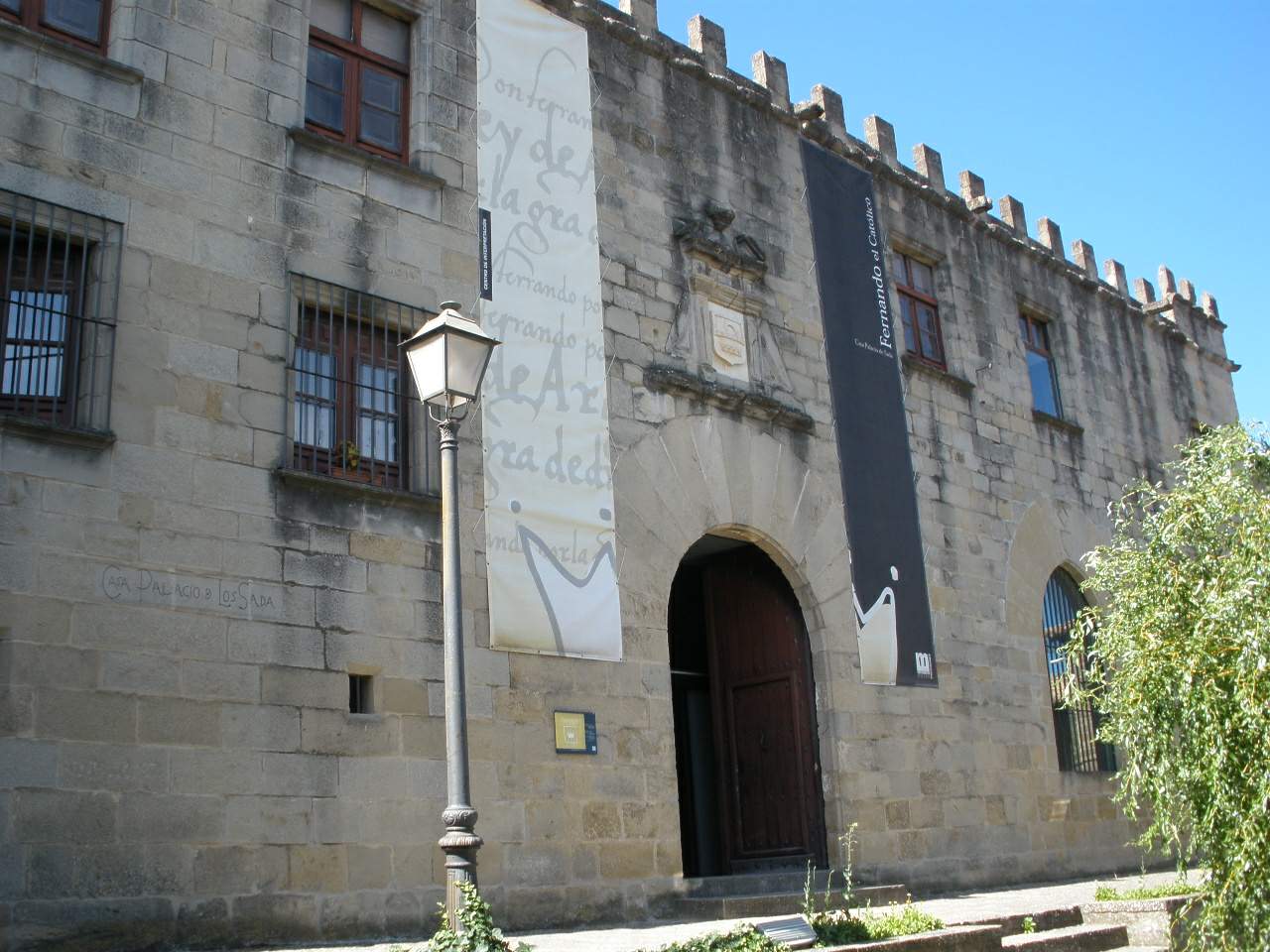
Palacio de los Sada
Palacio de los Sada is a fortified hilltop mansion in Sos del Rey Católico, a hilltop town in the province of Zaragoza, in Aragón, Spain. On 10 March 1452, this building witnessed the birth of Ferdinand II of Aragon — Ferdinand the Catholic, the king whose marriage to Isabella I of Castile forged the union that would become modern Spain. Why does this palace matter? The house belonged to the Sada family, aristocrats holding the title of Marquises of Campo Real. When Juana Enríquez, wife of King John II of Navarre, needed urgent shelter to give birth, the Sada family opened their home to her. That single event turned a small fortified town on the Aragón–Navarre border into the birthplace of one of Spain's most consequential monarchs. The Sada coat of arms still marks the façade today, a direct link to the family that once owned the house. What will you find inside? The building is an ashlar-stone structure raised in the late 15th century, combining austere military architecture with early touches of Renaissance style — a physical record of the shift from medieval stronghold to noble residence. Thick walls and narrow window openings reflect an age when defense mattered as much as status. Today the palace houses a museum dedicated to Ferdinand the Catholic, tracing his life and his role in unifying Spain, alongside displays explaining why Sos del Rey Católico became tied to his birth. The town's municipal tourist office also operates from inside the building, making it a natural first stop for visitors gathering maps and information on the rest of the old town. How do you get there? Sos del Rey Católico sits in the northern part of Zaragoza province, close to the Navarre border, and is counted among Spain's most beautiful villages. There's no direct rail link, so arriving by car is the most practical option — local roads connect the town to Pamplona and Zaragoza, winding through the hilly Aragonese countryside along the way. The palace itself stands at the very top of the old town, within its historic street layout, so it's best to park below and walk the last stretch on foot. When is the best time to visit? Because the town sits on a hill and its streets are built largely of stone, spring and autumn offer the most comfortable conditions, avoiding the peak summer heat. Check the opening hours of the museum and tourist office before visiting, so your trip includes the interior of the palace and not just the exterior view. Frequently Asked Questions Who was born in the Palacio de los Sada? Ferdinand II of Aragon, known as Ferdinand the Catholic, was born here on 10 March 1452. Who were the Sada family? An aristocratic family holding the title of Marquises of Campo Real; they owned the palace at the time of Ferdinand's birth and sheltered his mother, Juana Enríquez. What can visitors see inside today? A museum dedicated to Ferdinand the Catholic and the town's municipal tourist information office. What architectural style is the palace built in? A late-15th-century fortified palace blending military architecture with early Renaissance elements.
-
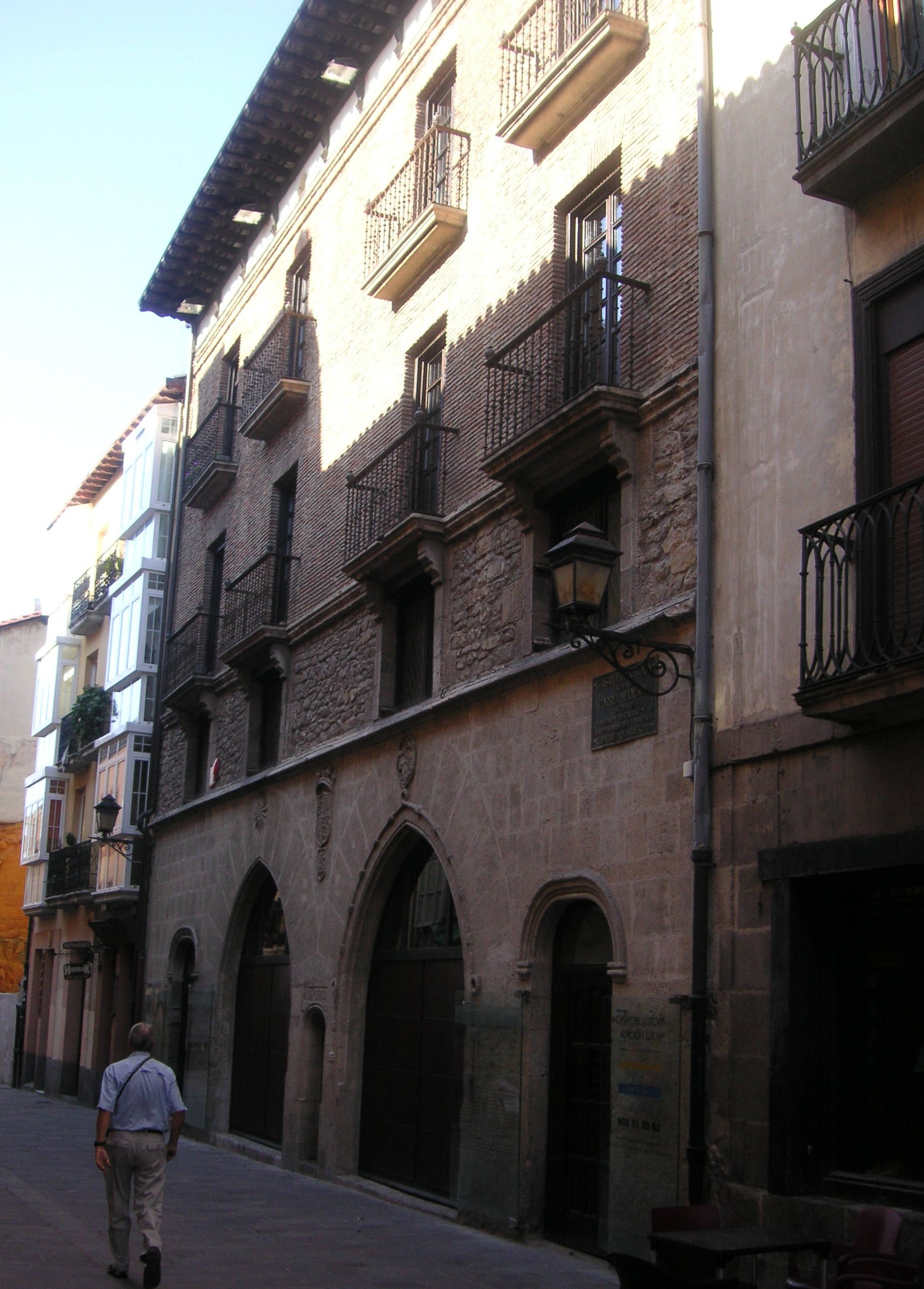
House of Cordón
Vitoria-Gasteiz
House of Cordón (Casa del Cordón) is one of the most recognizable historic buildings in Vitoria-Gasteiz, the capital of the Basque Country. It stands right in the heart of the medieval old town and is a natural stop on any walk through the city's historic center. What is this building? The house was built in the 15th century for Juan Sánchez de Bilbao, a converso and wealthy townsman, who raised it around an earlier defensive tower house — a torre-casa, a fortified residential tower typical of prosperous merchant families of the period. Because the newer residence was built wrapping around the older tower, the structure combines elements of medieval defensive architecture with the more representative style of a later urban mansion. In 1984, House of Cordón was declared a Bien de Interés Cultural (BIC), Spain's highest category of heritage protection. That designation is an official recognition of the building's historical and architectural value within the Basque Country's cultural heritage. Today, since 2022, the building houses the headquarters of Fundación Vital, a banking foundation that is part of the Kutxabank group. That means House of Cordón is not a museum with regular public opening hours in the classic sense, but rather an institutional building that remains a key architectural landmark of the old town. How to get there? Vitoria-Gasteiz is well connected by train and bus to other Basque cities and to northern Spain more broadly, including Bilbao, San Sebastián and Pamplona. From the train station and bus station, the historic center where House of Cordón stands is reachable on foot in roughly fifteen to twenty-five minutes, or by local city bus. The old town has a characteristic almond-shaped layout of streets rising concentrically around a hill, so walking is the natural way to explore it once you're in the center — you won't need transport within the old quarter itself. What else is worth seeing nearby? House of Cordón sits within a dense network of historic streets that make up the Casco Medieval, close to other period townhouses and churches. The building itself is best appreciated from the outside, where you can take in how the older defensive tower and the later merchant-house façade sit together in one structure. It's a good starting point for a longer walk through the old town, where further houses and squares tell the story of the city's role as a significant urban center in the medieval Basque Country. When to visit? Spring and early autumn are the best times to explore Vitoria-Gasteiz's old town, offering mild temperatures and fewer visitors than peak summer. Summer also brings a number of local festivals and cultural events to the city, which can be an appealing reason to combine sightseeing with the city's seasonal atmosphere. Frequently asked questions Can you visit the inside of House of Cordón? The building currently serves as the headquarters of the banking foundation Fundación Vital, so it does not operate as a regular tourist attraction with scheduled interior visits — it's worth checking current access information locally or with the city's tourist information office. Who uses the building today? Since 2022, House of Cordón has housed Fundación Vital, a banking foundation belonging to the Kutxabank group. Is the building legally protected? Yes — it was declared a Bien de Interés Cultural in 1984, Spain's top category of heritage protection. How much time should you set aside to see it? Since the building is mainly viewed from the outside, a short stop of about ten to fifteen minutes is enough to appreciate its architecture — it pairs well with a longer walk through Vitoria-Gasteiz's old town.
-
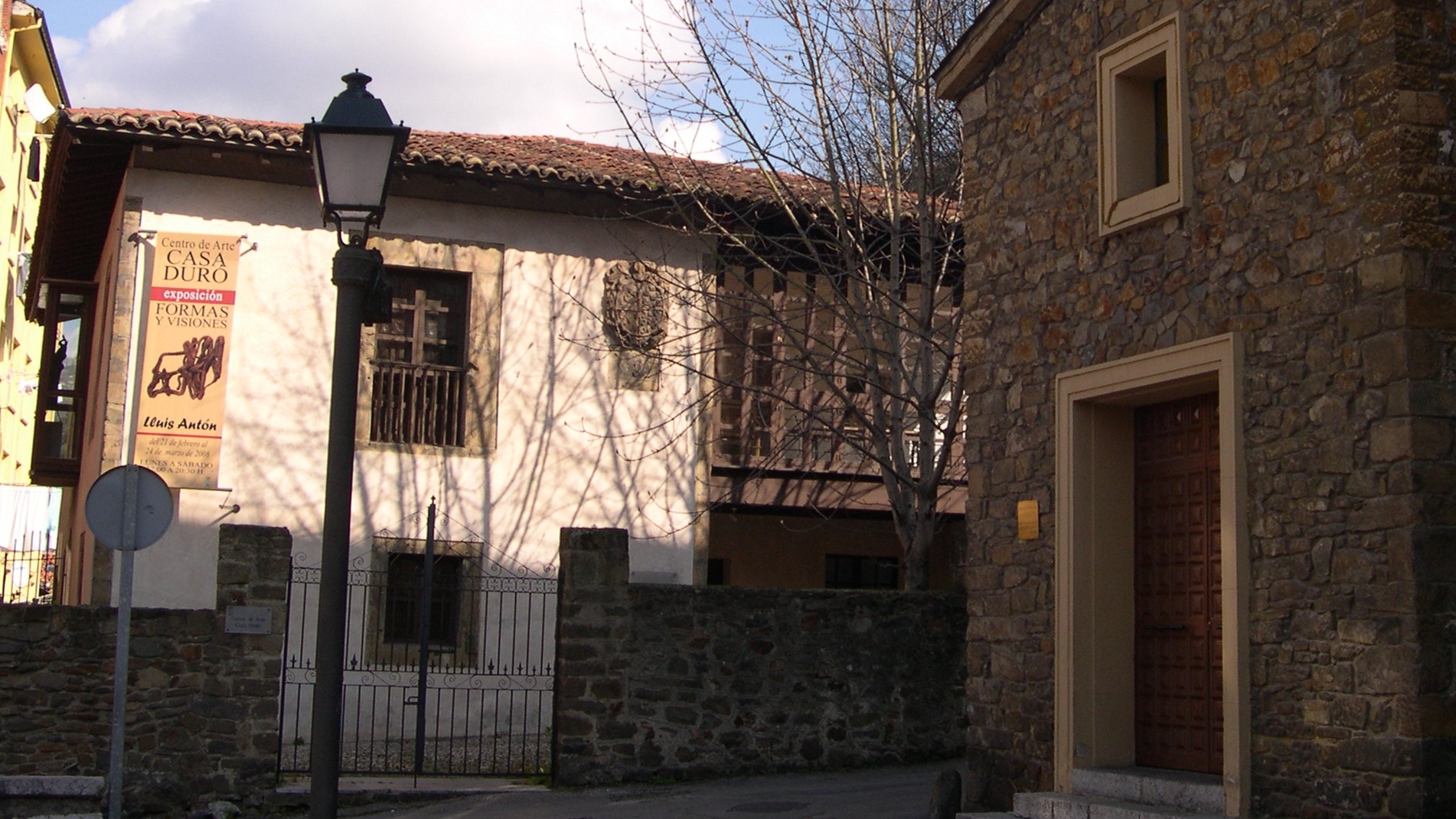
Casa Duró
Mieres
Casa Duró is the oldest civil building in Mieres, a small town in Asturias, northern Spain. It stands on Plaza del Carmen, in the Villa de Arriba neighbourhood, and has long served as a landmark of the town's history. Where does the name come from and who built it? The house is also known as Casa de los Álvarez Castañón or Palacio de los Álvarez Castañón, after the family that raised and later rebuilt it. An inscription beneath the coat of arms on the façade records that Fernando Álvarez Castañón Argüelles had the house rebuilt in 1689, with the heraldic shield added in 1700. The structure itself is older still, dating most likely from the 17th century, though its side façades have been reworked several times since. What does Casa Duró look like? The building has a square floor plan and a hipped roof with a wide, deeply overhanging eave. Its main façade splits into two clearly different sections: a compact one pierced by two lintelled window openings, and an open one with a ground-floor arcade and a glazed gallery above. The walls are built of rubble masonry, while sandstone ashlar frames the window openings and reinforces the corners. On the upper part of the façade, the carved family crest survives as the building's most recognisable feature. What role has the building played in the town's history? Casa Duró went through several major overhauls — during the Baroque period and again in the 19th and 20th centuries — which explains the mix of styles still visible on its façades today. The house also has a darker chapter: during the 1934 Asturian miners' revolution and the Spanish Civil War it was used as a prison. In 1997 it underwent a thorough restoration led by architects Macario González Astorga and Rogelio Ruiz Fernández, which brought back much of its historic appearance. Given its architectural and historical value, Casa Duró is listed in the Inventory of Architectural Heritage of Asturias, and on 30 March 1995 it was declared a Cultural Property of Interest (Bien de Interés Cultural) in the Monument category — a decision published in the regional official gazette BOPA (issue 90) on 20 April 1995. Can visitors go inside today? For years the building housed the Casa Duró Centre for Modern Art (Centro de Arte Moderno / Centro de Arte y Exposiciones), where the town council staged temporary exhibitions; admission was free and the centre opened to the public on weekday and Saturday afternoons. In July 2012 Mieres town hall closed the centre permanently, and the interior has not been open to visitors since. The façade and coat of arms, however, remain fully visible from the street, and the building still stands as a key reference point in the town's historic quarter. How to get to Casa Duró? The building sits right in the centre of Mieres, on Plaza del Carmen, within easy walking distance in the Villa de Arriba district. Mieres lies on the rail and road route linking Oviedo with central Asturias, making it a convenient stop for exploring the region's mining heritage. Walking through the old town, including past Casa Duró, typically takes under an hour. Frequently asked questions Can you go inside Casa Duró? No — the building has been closed to visitors since July 2012, when the town council shut down the art centre that once operated there. The façade and coat of arms remain visible from outside. How old is the building? The structure most likely dates from the 17th century; an inscription on the façade records that the house was rebuilt in 1689 and the coat of arms added in 1700. Why is the building protected? Casa Duró is listed in the Inventory of Architectural Heritage of Asturias and has held the status of Cultural Property of Interest in the Monument category since 1995. What notable events took place here? During the 1934 miners' revolution and the Spanish Civil War the building served as a prison, and after its 1997 restoration it housed a contemporary art centre for many years.
-
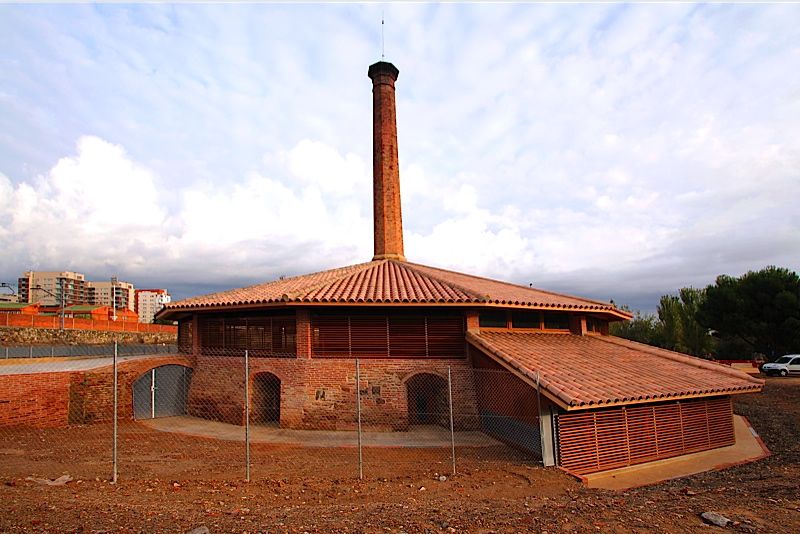
Bòbila del Sugranyes
Reus
Bòbila del Sugranyes is a former brick and tile kiln in Reus, Catalonia, and one of the best-preserved pieces of industrial heritage in the Baix Camp region. What is this place? The Bòbila del Sugranyes is a historic kiln built in 1848 by Josep Sugranyes for firing bricks, roof tiles, and other ceramic building materials. It operated almost continuously until the 1960s, with production interrupted only during the Spanish Civil War. For well over a century it supplied bricks and tiles used across the Baix Camp area, making it a direct witness to the industrialization of Reus in the 19th and 20th centuries. Today the kiln is legally protected as an asset of local cultural interest and is listed both in Catalonia's Inventory of Architectural Heritage and on the Map of Catalan Industrial Heritage. What does the kiln look like? The structure has a circular ground plan roughly 23 metres in diameter, built from adobe and fired brick. Its most striking feature is the central chimney, about 19 metres tall, square at the base and octagonal higher up, rising above a partly sunken firing chamber where the ceramics were actually baked. Circular kilns of this kind were once common across Catalonia's brick-making industry, but very few examples of this scale and design have survived to the present day. Why is it worth a visit? In the 1990s, the Association of the Museum of Science and Technology and Industrial Archaeology of Catalonia included the Sugranyes kiln on a list of one hundred outstanding elements of the country's industrial heritage, noting it as one of the very few kilns of this type still standing in Catalonia. For visitors to Reus, it offers a rare close-up look at nearly two centuries of ceramic-building-material production, without needing to visit a large industrial museum. How do you get there? The Bòbila del Sugranyes stands in the city of Reus, in the Baix Camp comarca, Tarragona province. The kiln is now municipally owned and is opened to the public through guided tours organized by local cultural institutions, including the Museu de Reus. Because access is limited to these organized visits, it is worth checking the current tour schedule with the city's cultural venues before arriving. When should you visit? Since the interior of the kiln can only be seen on guided tours, planning ahead around Reus's cultural events calendar is the most reliable approach. The exterior of the kiln, including its distinctive chimney, can be viewed year-round from the surrounding area. Spring and autumn are the most comfortable seasons for exploring Reus generally, avoiding the summer heat and larger crowds. Frequently Asked Questions What is the Bòbila del Sugranyes? It is a former kiln for firing bricks, roof tiles, and ceramic building materials, built in 1848 by Josep Sugranyes and operated continuously until the 1960s. Is the kiln a protected heritage site? Yes — it is registered as an asset of local cultural interest and appears in Catalonia's Inventory of Architectural Heritage and its Map of Industrial Heritage. How large is the kiln? It measures about 23 metres in diameter, with a central chimney reaching roughly 19 metres in height. Can visitors go inside? Yes, the site is owned by the city of Reus and can be visited through guided tours run by local cultural institutions.
-
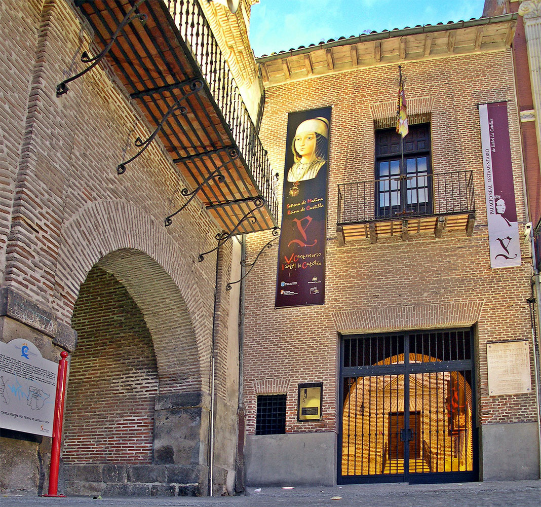
Palacio Testamentario
Medina del Campo
Palacio Testamentario is a historic palace in Medina del Campo, in the province of Valladolid, remembered as the place where Queen Isabella the Catholic died in 1504. The building was originally raised in the 14th century in the Mudéjar style and became one of the queen's favourite residences — she felt particularly at home in Medina del Campo. It was here, on 26 November 1504, that Isabella dictated her last will and codicil, and died only hours later. That event gave the palace its name: Testamentario, "of the testament." Very little of the original medieval structure survives today. The current building is largely a didactic reconstruction, the result of a thorough restoration and museum-design project. Work was completed on 26 November 2003 — the anniversary of the queen's death — when the palace opened to the public as an interpretation centre dedicated to the figure of Isabella the Catholic. What will you see inside? The interior is arranged as an educational space that walks visitors through the queen's life and historical significance. Films, interactive screens and other multimedia exhibits cover different chapters of her biography: her childhood and youth, her rise to power, the years of her reign, and her religious devotion. The centrepiece of the exhibition is a facsimile of Isabella's original will and codicil, which visitors can explore through an interactive display explaining its contents. One room also recreates the painting "The Testament of Isabella the Catholic" by Eduardo Rosales, a 19th-century work depicting the queen dictating her final wishes — the original hangs in Madrid's Museo del Prado. How do you get there? Palacio Testamentario stands in the centre of Medina del Campo, a town roughly 45 km south of Valladolid. The easiest way to arrive is by car along the A-6 or A-62 motorways, or by train — Medina del Campo sits on an important rail junction with good connections to Valladolid, Salamanca and Madrid, served by both AVE high-speed and regional lines. From the train station it's usually a short walk of around fifteen minutes through the historic town centre to reach the palace. When should you visit? Spring and autumn are the best times to come, when temperatures across Castile are mild and the summer heat doesn't get in the way of exploring. Since the visit is mostly indoors, weather matters less here than at open-air sites, though the surrounding squares and streets of Medina del Campo are more pleasant to wander outside the hottest hours of the day. Many visitors combine the palace with other landmarks tied to Castilian history nearby, such as La Mota Castle. How long does a visit take? Given the compact but content-rich multimedia programme, a full visit to the interpretation centre typically takes between 45 minutes and an hour and a half, depending on how much time you spend with the audiovisual displays. Frequently asked questions Why is the palace called "Testamentario"? The name refers to the events of 26 November 1504, when Queen Isabella the Catholic dictated her will and codicil inside the building and died that same day. Is the original building from Isabella's time still standing? Not entirely — very little remains of the original medieval Mudéjar structure. The current building is largely a reconstruction completed as part of a restoration finished in 2003. What can you see at the interpretation centre? A multimedia exhibition on the life of Isabella the Catholic, a facsimile of her will and codicil with an interactive explanation of its contents, and a recreation of Eduardo Rosales's painting showing the moment she dictated her testament. How far is Medina del Campo from Valladolid? About 45 km; the trip by car or train usually takes under an hour.
-
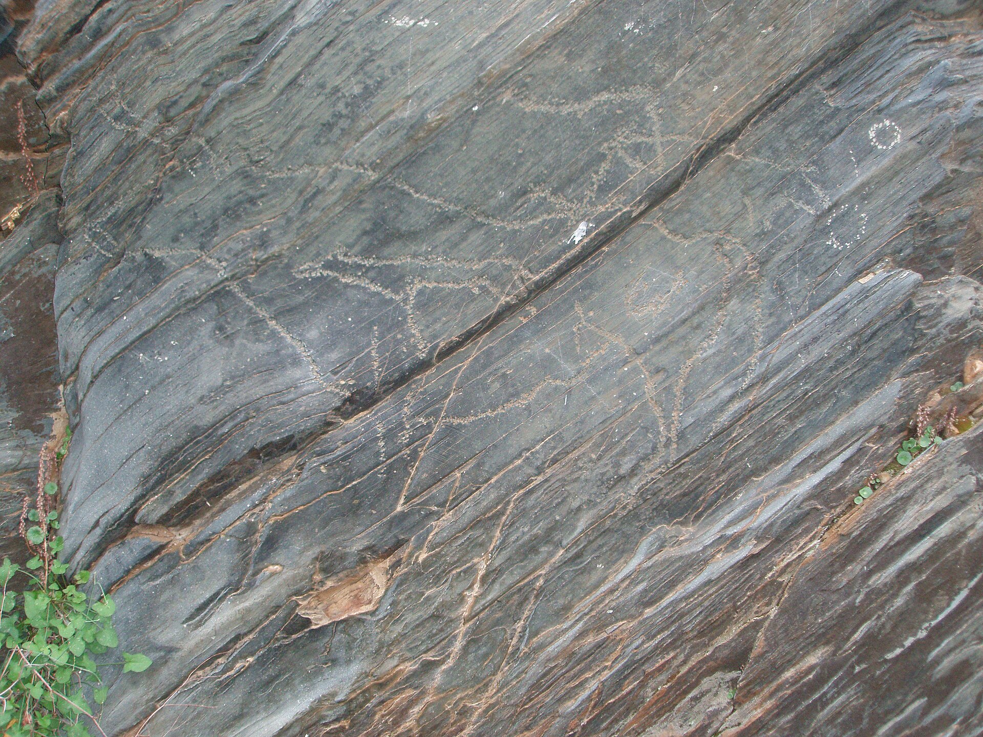
Siega Verde
Villar de la Yegua
Siega Verde is a rock art site near Villar de la Yegua, in the province of Salamanca, right on the border with Portugal. Together with the Côa Valley on the Portuguese side, it forms a single transboundary UNESCO World Heritage property — one of the rare cases where two countries share a listing built around the same prehistoric heritage. What will you see there? Along the river valley, rock surfaces carry engravings made by prehistoric people. These carvings — not buildings or ruins — are the reason the site exists as a destination. What makes Siega Verde significant is its scale and continuity: similar motifs recur across dozens of rock panels scattered through the valley, making it one of the most important open-air rock art complexes on the Iberian Peninsula. Its joint listing with the Côa Valley reflects the idea that both locations belong to the same story of prehistoric communities living along what is now the Spanish-Portuguese border. The surrounding landscape is rugged and sparsely developed — a river valley flanked by rocky slopes and small rural settlements. It is easy to picture why early communities chose exactly these places to leave their marks. How do you get there? Siega Verde lies within the municipality of Villar de la Yegua, in the western part of Salamanca province, close to the Portuguese border. Given its remote, border location and rocky terrain, driving is by far the most practical way to reach it, since public transport in the area is limited. Most visitors set out from the city of Salamanca, following roads that lead toward the province's western edge. When should you visit? Because the site is entirely outdoors, weather matters. Spring and autumn offer the most comfortable conditions, avoiding both the intense summer heat typical of this part of Spain and the colder, wetter winter months. It's worth checking access arrangements in advance — sites with this kind of rock art are often visited only through guided tours, a measure meant to protect fragile rock surfaces from erosion and damage. Why is it worth visiting? Siega Verde appeals to travelers drawn to archaeology and deep history rather than conventional monument-hopping. There are no grand structures here — instead, visitors get a direct encounter with marks left by people thousands of years ago, in a landscape that has changed remarkably little since then. Its connection to the Côa Valley across the border also makes it easy to build a longer trip around prehistoric rock art on both sides of the frontier. Frequently Asked Questions What is Siega Verde? It is a rock art site in Salamanca province, listed as a UNESCO World Heritage Site jointly with Portugal's Côa Valley as a single transboundary property. Where exactly is it located? In the municipality of Villar de la Yegua, in the western part of Salamanca province, close to the Spain-Portugal border. What can I expect to see on site? Engravings carved into rock surfaces along the river valley — traces of art left by prehistoric communities. Do I need a guide to visit? Access to many of the rock panels is regulated to protect them, so it's best to check local visiting rules and guided-tour requirements before you go.
-
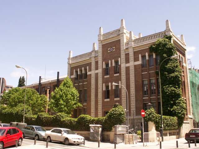
Pacífico Power Plant
Madrid
Pacífico Power Plant is a former power station of the Madrid Metro, tucked away next to Pacífico station in the eastern part of the city. Since April 2013 the building has held the status of Bien de Interés Cultural, Spain's highest form of heritage protection, granted by the Community of Madrid's Directorate General of Historical Heritage. What was this power plant for? The station was built to supply electricity to the earliest lines of the Madrid Metro, which opened in the 1920s. At a time when the city's public electricity grid was neither extensive nor reliable enough, the metro needed its own independent power source. The solution came in the form of three massive diesel engines originally built for ships — and it's these engines that gave the building its lasting identity. Marine engines of this scale rarely survive intact in a single location, making this a genuinely unusual piece of industrial heritage in a European capital. Why visit? This is more than a historical curiosity — it's a record of an era when urban transport and energy infrastructure had to grow together, often improvising solutions out of necessity. The building takes its name from the neighboring Pacífico metro station, with which it shares both its location and its original purpose. For anyone drawn to industrial architecture or the history of urban transport, the site offers a rare look at the technical backbone that once kept a major European capital's transit system running. What will you see there? The main attraction is the trio of enormous ship diesel engines that once drove the plant's generators. Their scale and design are striking even for visitors with no particular interest in engineering — these were machines built for maritime duty, relocated inland and repurposed for an entirely different job. The building retains the layout typical of early 20th-century industrial power stations, reinforcing its value as a piece of technical heritage. How do you get there? The easiest way is by metro to Pacífico station, just a few minutes' walk from the building. The location is convenient, sitting in eastern Madrid within easy reach of both the city center and the surrounding residential neighborhoods. When should you go? Since this is a technical heritage site rather than a purpose-built tourist attraction with extensive visitor infrastructure, it's worth checking current access hours in advance. Visiting outside the busiest hours at the nearby metro station tends to make for a quieter, more relaxed look at the area. Frequently asked questions What is the Pacífico Power Plant? It's a former power station that supplied electricity to the first lines of the Madrid Metro, built around three large marine diesel engines. Is the building legally protected? Yes. In April 2013 the Community of Madrid's Directorate General of Historical Heritage declared it a Bien de Interés Cultural. Where does the name come from? The name comes from the adjacent Pacífico metro station, to which the power plant is directly and functionally connected. How do I reach the power plant? The simplest way is by metro, getting off at Pacífico station, which leaves just a short walk to the building.
-
Castillos de Valderas y Museo de Arte en Vidrio de Alcorcón
Alcorcón
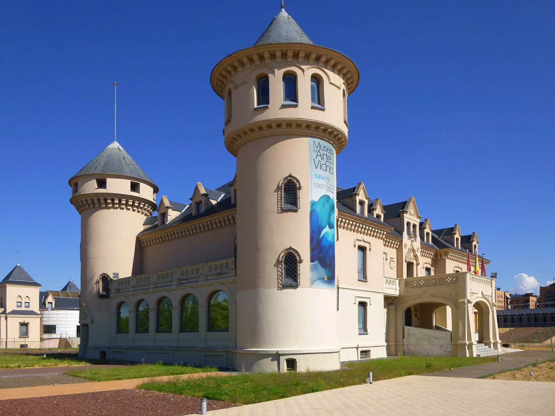
Castillos de Valderas y Museo de Arte en Vidrio de Alcorcón is an unusual combination in Alcorcón, just outside Madrid — a public park built around two early 20th-century "castles," one of which now houses a glass art museum. It brings together local aristocratic history and one of the region's more distinctive art collections. Why are there castles in Alcorcón? Despite appearances, these buildings are not medieval. Construction began in 1917 under José Sanchiz de Quesada, Marquis of Valderas, who commissioned three structures in a style echoing English country-house architecture rather than genuine defensive fortifications. Only two survive today: one was destroyed by fire in the 1950s, and another was demolished in 1991 after falling into disrepair. The main building, known locally as the Castillo Grande, still shows its original architectural character. The city of Alcorcón acquired the site in 1988, and restoration work was completed in 1991, when the grounds opened as a public park. Covering roughly 14 hectares in the San José de Valderas neighborhood in the northeast of Alcorcón, the park now functions as one of the city's cultural focal points. What is there to see? The Castillo Grande is the centerpiece of the site: inside its roughly 2,200 square meters, the Museo de Arte en Vidrio de Alcorcón (MAVA) has operated since 1997. The museum was founded on the initiative of sculptor Javier Gómez, who wanted a dedicated space to demonstrate what glass can do as a contemporary art medium. The permanent collection now holds more than 200 pieces — sculptures, installations and objects made using blown, cast and flat glass techniques. A large part of the collection comes from a donation by collector Takako Sano, supplemented by pieces given directly by artists from a range of countries. Outside the museum building, the park's grounds are worth a walk in their own right. Along the main avenue stands "El Refugio de la Vida," a set of sixteen concrete sculptures created by artist Carlos Armiño in 2005. The contemporary, geometric forms make a deliberate contrast with the older, more classical castle architecture nearby. It's also worth knowing that the city once planned to expand the site with a further arts venue, CREAA, but the project was shelved during Spain's 2008–2014 economic crisis and was never completed. How to get there? The park sits in the San José de Valderas neighborhood of Alcorcón. The easiest way to arrive is by metro: Joaquín Vilumbrales station is about a nine-minute walk from the park entrance. Bus lines 2, 450, 514 and 560 also serve the area, making it a straightforward trip from central Alcorcón or from Madrid itself. When should you visit? As an open-air park, the site can be visited year-round, though a walk among the historic buildings and outdoor sculptures is most comfortable in spring and autumn, when temperatures in the Madrid region are milder. The MAVA museum interior is a weather-independent option, useful on days when conditions don't favor a longer stroll outside. Frequently Asked Questions Are the castles in Alcorcón genuine medieval fortifications? No — they are early 20th-century constructions, built from 1917 by the Marquis of Valderas in a style inspired by English residential architecture rather than actual defensive castles. How many of the original buildings still stand? Of the three original structures, two remain. One was lost to fire in the 1950s, and another was demolished in 1991 due to its poor condition. What can you see inside the Museo de Arte en Vidrio? More than 200 glass artworks — sculptures, installations and objects by artists from several countries, including a substantial collection donated by Takako Sano. What is the best way to reach the park? By metro to Joaquín Vilumbrales station (about a nine-minute walk), or by bus lines 2, 450, 514 and 560.
-
Juliobriga
Campoo de Enmedio
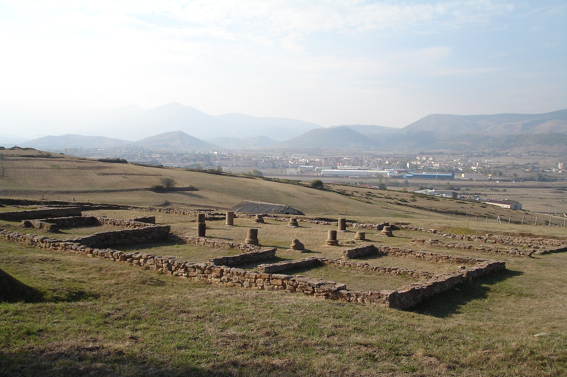
Juliobriga is the most significant Roman archaeological site in Cantabria, located in the municipality of Campoo de Enmedio, near the village of Retortillo. The remains of the ancient town also extend into the neighbouring Villafría district, together forming one of the best-preserved traces of Roman presence in northern Spain. What is this place? Juliobriga was described by numerous Latin authors, including Pliny the Elder, as the leading urban centre of Roman Cantabria. The town served as an administrative and economic hub for the region, controlling routes that linked the Atlantic coast with the interior of the Iberian Peninsula. Today the site of the ancient town is open as an archaeological area, where visitors can trace an urban layout nearly two thousand years old. How do you get to Juliobriga? The site lies within the municipality of Campoo de Enmedio, in the Cantabria region, on the grounds of the village of Retortillo. This is an inland, upland part of the region, well away from the coast, which makes it a convenient stop when combined with other attractions in inland Cantabria. Travelling by car is the most practical option, following local roads that connect the smaller towns of Campoo de Enmedio. It is worth planning the trip ahead of time and checking current connections from larger regional towns such as Reinosa or Santander. What will you see on site? Visitors can see the remains of urban structures belonging to the ancient centre, long identified with the ruins uncovered in Retortillo and its Villafría district. Archaeologists and historians have for years pointed to this location as the site of historic Juliobriga, basing their conclusions on the accounts of ancient authors together with excavation findings. A visit here makes it possible to picture the scale and importance of a town that, in Roman times, served as a reference point for the entire Cantabrian region. When should you visit? Like most open-air sites in this part of Spain, the archaeological area is best visited in spring or early autumn, when weather conditions in inland Cantabria favour longer walks without the summer heat or winter chill. The region's upland setting means the weather can be changeable, so it is worth packing clothing suited to varying conditions. Why is Juliobriga worth visiting? This site holds particular importance for understanding the history of Roman presence in northern Spain. Unlike many towns in the south of the peninsula, the lands of Cantabria were conquered by Rome relatively late, and Juliobriga stands as direct evidence of how Roman administration organised urban life in a difficult, mountainous terrain. For anyone interested in archaeology and ancient history, it is one of the key sites on the regional map. Frequently asked questions Where exactly is Juliobriga located? The site is in the municipality of Campoo de Enmedio in Cantabria, around the village of Retortillo and its Villafría district. What was Juliobriga in Roman times? It was the leading urban centre of Roman Cantabria, mentioned by ancient Latin authors including Pliny the Elder. Can the site be visited? Yes, the remains of the ancient town lie on grounds open to visitors in Retortillo and Villafría. Is it worth combining a visit with other Cantabria attractions? Yes, the inland location of Campoo de Enmedio makes it easy to pair a visit to the site with trips around other towns in the Campoo area.
-
Palacete del Embarcadero
Santander
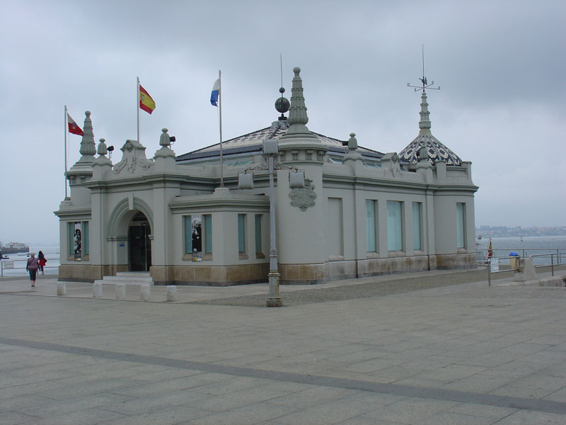
Palacete del Embarcadero is a small Art Nouveau pavilion on the waterfront of Santander, and one of the city's most recognisable architectural landmarks. It sits on the Calderón dock, right along the seafront and next to the Pereda Gardens, making it an easy stop to combine with a walk through the city's most scenic stretch. Where does this building come from? The pavilion was designed by architect Javier González de Riancho, with construction running from 1920 to 1932. It originally served as a royal landing stage, used by King Alfonso XIII during his summer stays in Santander, when the royal family would come to the city to spend the season by the Bay of Biscay. Its role changed dramatically over the following decades — for a period the building even housed barracks for the armed police. It wasn't until 1985, after a thorough refurbishment, that the Palacete reopened as an exhibition venue, a role it has kept ever since. What will you see inside? The building's most distinctive features are a portico facing the sea and corner turrets that give it a slightly fairy-tale, eclectic look. On its south-facing facade, three large openings work like picture frames: standing inside, each one frames a different piece of the Santander landscape — the bay, the mountain, and the port. That architectural idea, a building doubling as a viewpoint framed into three "pictures," is part of what draws visitors regardless of whatever exhibition happens to be on display. Since reopening in 1985, the Palacete has hosted close to 350 exhibitions and cultural events, with annual visitor numbers usually topping 50,000. The programme typically includes art and photography exhibitions along with events tied to Cantabria's history and culture, which has turned the building into a recognised cultural symbol well beyond the local scene. How do you get there? The Palacete del Embarcadero stands right in the centre of Santander, along the harbour promenade, within walking distance of the city's main landmarks, including the Pereda Gardens. The most convenient way to reach it is on foot, following the bay-front walk — the building's distinctive shape and turrets make it hard to miss from a distance. When should you visit? Given its seafront setting and the open spaces surrounding it, a walk around the area is most enjoyable during the warmer months, when you can also comfortably sit in the nearby gardens. Keep in mind that what you'll find inside depends on the current exhibition, so it's worth checking the programme ahead of time if a specific show is the reason for your visit. Frequently Asked Questions What was the Palacete del Embarcadero originally used for? It served as a royal landing stage used by King Alfonso XIII during his summer stays in Santander. Who designed the building? It was designed by architect Javier González de Riancho, with construction lasting from 1920 to 1932. What can you see there today? Since 1985 the building has functioned as an exhibition hall, hosting art shows and cultural events on a programme that changes throughout the year. Where exactly is it located? On the Calderón dock, along Santander's harbour front, next to the Pereda Gardens, right in the city centre.
-
Bank of Spain building in Vitoria
Vitoria-Gasteiz
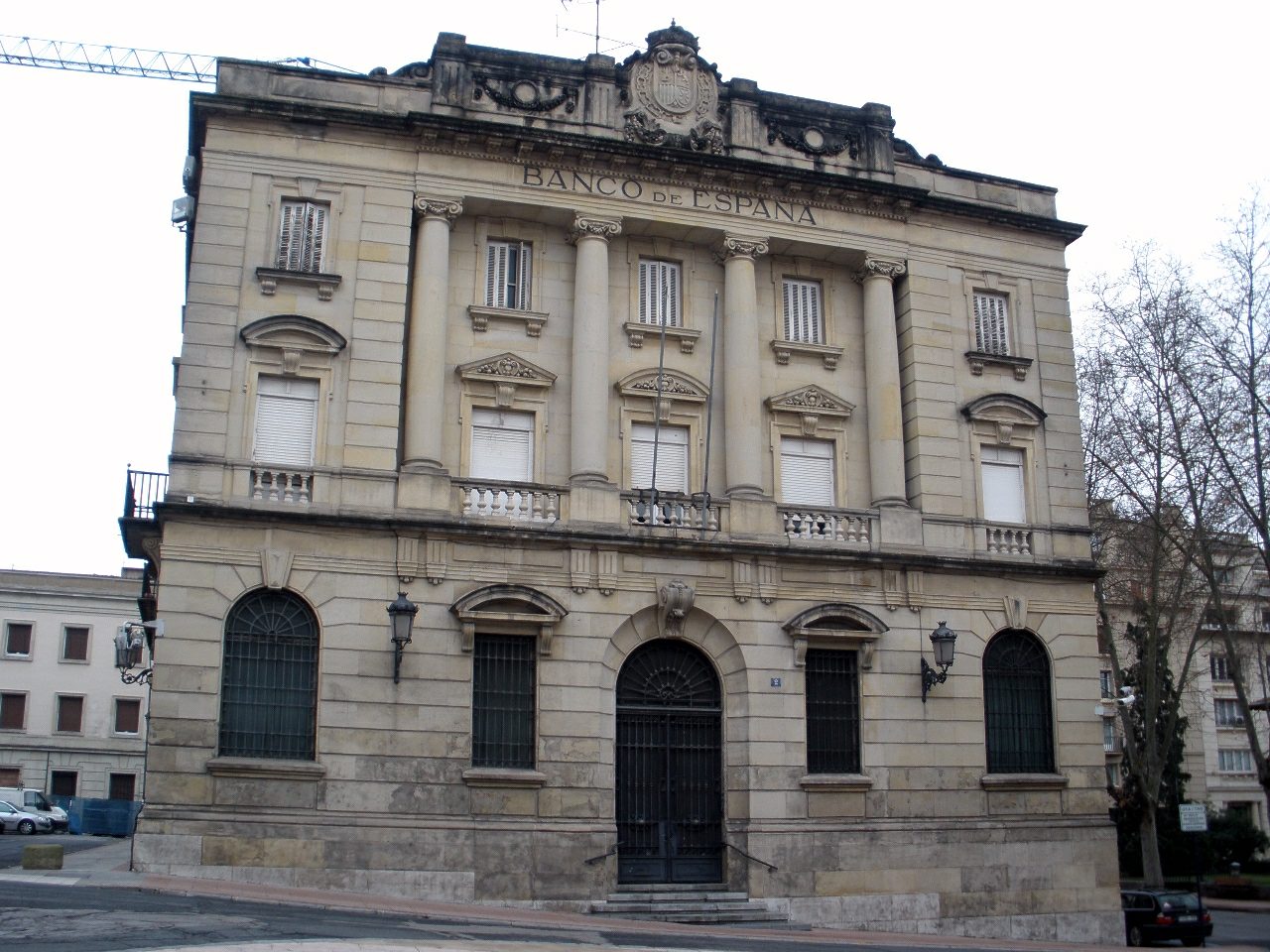
The Bank of Spain building stands in the heart of Vitoria-Gasteiz, capital of the Basque Country, a former banking hall that has quietly become one of the city's most meaningful sites of memory. How do you get there? The building sits right in the compact historic centre of Vitoria-Gasteiz, so walking is by far the easiest way to reach it — the old town is small, well signposted, and built for pedestrians. The city has train and bus connections to Bilbao, San Sebastián and Madrid, and from the main station it's only a short walk to the former bank. Drivers will find parking around the edges of the old town, from which the building is reachable within a few minutes on foot. What will you see? The building was designed by architect José Yárnoz Larrosa, who worked on several Bank of Spain branches across the country in a similar style: solid, dignified early-20th-century banking architecture built to project stability as much as to serve daily operations. Behind the imposing façade lies a layout shaped by the practical needs of a working bank — vaults and strongboxes in the basement, and a central courtyard that once organised the flow of customers being served. It was in this very courtyard that many residents of Vitoria-Gasteiz queued at the turn of 2001 and 2002 to exchange their pesetas for euros during the currency changeover — for a good number of locals, this is the last vivid memory tied to the building's life as an active bank. Once its banking operations ended, the building stood empty for roughly a decade while the city and national authorities looked for a new purpose for it. Eventually, an initiative led by Spain's Interior Ministry together with the city's local government converted the interior into a memorial dedicated to victims of terrorism, principally those affected by ETA and by the so-called GAL (Grupos Antiterroristas de Liberación). The renovation reshaped the inside almost entirely while carefully preserving the historic façade, so from the street the building still reads as the old bank it once was, even though its interior now serves a very different, reflective purpose. For visitors, this makes for an unusual combination: the functional architecture of a former financial institution now housing a memorial space that addresses, calmly and without spectacle, one of the most difficult chapters in recent Spanish and Basque history. When should you visit? Because the building now functions as a memorial rather than a conventional tourist attraction, it's worth planning a visit for a quieter part of the day, when there's time to take it in properly. Vitoria-Gasteiz is pleasant to explore year-round, though spring and early autumn bring the most comfortable weather for walking the old town and combining a stop here with the surrounding historic sites. Check current opening hours and access rules before you go, since as a memorial site its schedule can differ from that of typical tourist attractions. Frequently Asked Questions What was this building originally used for? It served as a local branch of the Bank of Spain, designed by architect José Yárnoz Larrosa, functioning as a working bank for most of the 20th century. Why does this building matter to the city's history? It's where residents of Vitoria-Gasteiz lined up to exchange pesetas for euros during the currency changeover, and after standing empty for years it became a memorial to victims of terrorism. What is the building used for today? Its interior has been converted into a memorial dedicated to the victims of ETA and GAL, while the historic bank façade has been preserved. Can visitors go inside? As a memorial site, it is generally open to visitors, but it's best to check current hours and access rules locally or with the tourist information office before visiting.
-
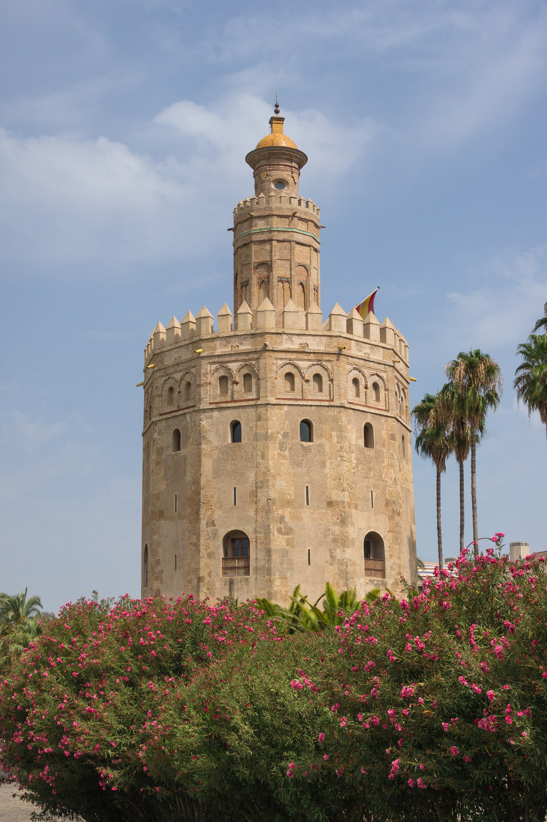
Torre del Oro
Sewilla
Torre del Oro is a 13th-century watchtower standing on the bank of the Guadalquivir River in Seville, one of the city's most recognizable landmarks. Its twelve-sided shape and golden-toned walls — once even more striking thanks to a lime-and-straw render — have caught the eye of travelers arriving by river or strolling along Paseo de Cristóbal Colón for centuries. How do you get to Torre del Oro? The tower sits right in the heart of Seville, on the riverfront, just a short walk from the cathedral and the Alcázar. Walking is by far the easiest way to reach it — following the promenade from the bullring, Plaza de Toros de la Real Maestranza, or crossing over from the Puente de Isabel II bridge. If you prefer public transport, several bus and tram stops are within a few minutes' walk, and the main train station, Santa Justa, is roughly a twenty-minute taxi or bus ride away. Seville's city center gets quite hot in summer, so it's worth timing your walk for the cooler parts of the day. What will you see there? Torre del Oro was built by Seville's Muslim rulers as part of the fortifications guarding the city's access from the river. Its main purpose was military: controlling boat traffic on the Guadalquivir. Over the centuries it also served as a landmark for sailors, functioning much like a beacon marking the entrance to the port. Its distinctive twelve-sided form sets it apart from the simpler square towers typical of the region's defensive architecture. Today the tower houses a small maritime museum dedicated to the history of navigation and Seville's role as a trading port that connected Spain with the Americas for centuries. Visitors can see exhibits on navigation, ship models, and material covering the history of the building itself. The upper level offers a view over the river and the waterfront, which is an attraction in its own right. The tower is also a popular photo subject from the outside — its golden walls against the blue sky and the river's surface create one of the most iconic images of Seville, especially at sunset. When should you visit? Spring (March to May) and autumn (October to November) are the best times to visit, with milder temperatures than the peak of summer. Seville can get extremely hot in summer, which makes long walks along the riverfront uncomfortable. Early morning, right after opening, is a good time to avoid crowds and the strongest sun. In the evening, the area around the tower takes on a special atmosphere as the illuminated structure reflects in the river and the promenade fills with people out for a stroll. Frequently Asked Questions What was Torre del Oro originally used for? It was a defensive watchtower, built by Seville's Muslim rulers to control access to the city from the Guadalquivir River. Where does the name "Golden Tower" come from? The name refers to the golden hue the walls took on from a render once applied to them, especially striking in sunlight. What can you see inside? A small maritime museum with exhibits on the history of navigation and Seville's seafaring, port-based past. Is it easy to visit as part of a short stay in Seville? Yes — it's centrally located, close to the cathedral and the Alcázar, so it's easy to combine with visits to the city's other major landmarks.
-
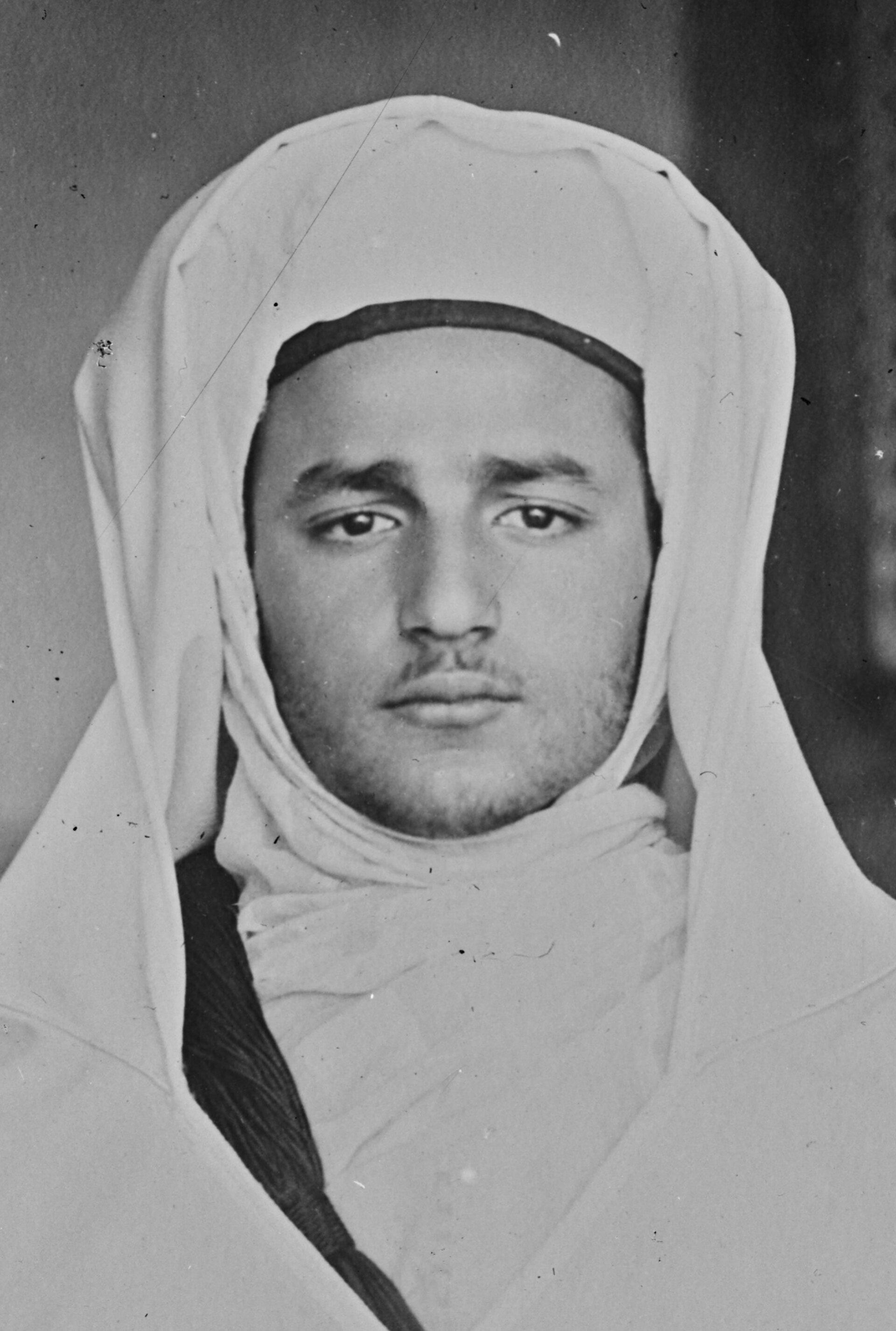
Mohammed V of Morocco
Rabat
The Mausoleum of Mohammed V in Rabat is one of Morocco's most significant landmarks and a must-see stop on any visit to the capital. Perched on a hilltop above the Bouregreg River, right beside the unfinished Hassan Tower, it holds the tombs of King Mohammed V and his son, King Hassan II. What is this place, and why does it matter? Construction began in the 1960s and finished in 1971, after Mohammed V's death in 1961. The building was designed by architect Éric Vo Toan, who blended traditional Moroccan craftsmanship with a modern structural approach. The mausoleum itself is part of a small complex: alongside the tomb stand a mosque and a modest museum dedicated to the history of the Alaouite dynasty, which still rules Morocco today. The interior impresses from the first step inside. White marble walls are covered in finely carved plasterwork and zellige mosaics arranged in geometric patterns. Above the sarcophagi rises a coffered cedar-wood ceiling finished in gold leaf. The roof is topped with green tiles, a hallmark of Moroccan religious architecture. Royal Guard soldiers in traditional, brightly colored uniforms stand watch at the entrance every day — a favorite subject for visitors' photos. What else is there to see — the Hassan Tower? The mausoleum sits next to the Hassan Tower, the unfinished minaret of the Hassan Mosque. Construction started in 1195 under the Almohad sultan Yacoub al-Mansour, who planned a tower 60 meters tall — one of the tallest in the world at the time. Work stopped when the sultan died in 1199, and the mosque itself was never completed. What remains today is a field of stone columns and the tower itself, standing at roughly 44 meters. The square in front of both structures forms one shared esplanade, and visitors typically explore the mausoleum and the tower together in a single walk. How do you get there? The complex sits in central Rabat, on a scenic hill overlooking the river. The easiest way to arrive is by tram line 1 to the Place Al Joulane stop, just a short walk from the entrance. By taxi from the city center, the ride takes about 8 minutes. The site pairs naturally with a visit to the nearby Kasbah of the Udayas or the old medina. When should you visit, and how long does it take? The mausoleum is open daily from 8 a.m. to 6:30 p.m., and admission is free. Plan on one to one-and-a-half hours to see the mausoleum, the tower, and the surrounding esplanade at a comfortable pace. Arriving shortly after opening helps you avoid both the crowds and the heat, especially in summer. Frequently Asked Questions Is there an entrance fee? No, entry to both the mausoleum grounds and the Hassan Tower is free year-round. Can visitors go inside where the tombs are? Yes, visitors can access the upper-level balcony overlooking the sarcophagi and the richly decorated interior. The tomb level itself is closed to the public. How long does a visit take? Most visitors need one to one-and-a-half hours to cover the mausoleum, the Hassan Tower, and the surrounding esplanade. What's the best way to get there from central Rabat? Tram line 1 to the Place Al Joulane stop is the simplest option, or a taxi, which takes about 8 minutes.
-
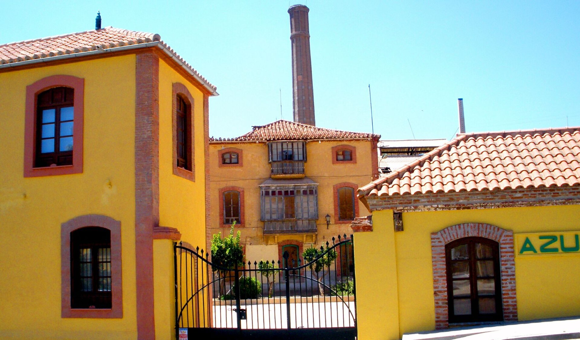
Fábrica Azucarera Nuestra Señora del Pilar
Fábrica Azucarera Nuestra Señora del Pilar is a former sugar factory in Motril, on the Granada coast, and one of the best-preserved 19th-century industrial complexes in Andalusia. It stands on a hill known as Rambla de las Brujas, on the eastern edge of the city, right at the edge of the fertile Vega of Motril-Salobreña, an area that supplied sugar cane to this stretch of coast for generations. How did a sugar factory end up here? Construction ran from 1881 to 1883 under the design of Granada-born architect Francisco Jiménez Arévalo. The manager's house and storage buildings went up first, followed a year later by four industrial halls housing steam-driven machinery. The factory operated continuously from 1883 to 1984 — more than a century — making it one of the longest-running plants of its kind in the region. Its construction coincided with the wave of mechanization that transformed sugar cane processing across the Guadalfeo valley, an area now recognized as home to the greatest concentration of preserved steam engines and industrial heritage in Europe. What is there to see? The centerpiece is the old machine hall, referred to locally as the "tren de molienda" (milling train) — a set of 19th-century steam machines considered technically unique on a European scale. This machinery was the main reason the site was declared a Bien de Interés Cultural (Cultural Heritage Asset) in 1991, Spain's highest level of heritage protection. Beyond the machine hall, the complex includes several separate buildings, each repurposed for a different use today. The former sugar warehouse now houses an exhibition space covering the history of Motril's sugar industry and its production technology. The old stables have become a restaurant, the manager's house now holds the city's heritage department, and another warehouse serves as the visitor reception point. The site is often referred to informally as the Museo del Azúcar (Sugar Museum), a name that captures its character even though it is technically a heritage complex rather than a single-building museum. How do you get there? The factory sits on the eastern side of Motril, a port town on the Costa Tropical, roughly an hour's drive from Granada city and under thirty minutes from Salobreña. Arriving by car is the most practical option — parking is available nearby, and the hilltop location on Rambla de las Brujas is visible from the main roads leading into town. Travelers relying on public transport can take a bus to central Motril and continue on foot or by taxi to the site. When is the best time to visit? Given its indoor, machinery-focused exhibits, the site works well year-round and offers welcome shelter from the summer heat typical of this coastline. It is still worth checking local opening hours before visiting, since the site is municipally managed and may run a reduced schedule outside peak season. Pairing a visit here with time in nearby Salobreña or on Motril's beaches makes for a natural full day on the Costa Tropical. Frequently Asked Questions Is the factory still producing sugar? No. Production ended in 1984 after more than a century of continuous operation. The site now serves a cultural and museum function. What does the Bien de Interés Cultural status mean? It is Spain's highest heritage protection category, granted to this factory in 1991 because of its 19th-century steam machinery, considered unique in Europe. Can you walk through the buildings on your own? The complex includes several buildings with different roles — some, like the old warehouse exhibition space and the machine hall, are open to visitors, while others, such as the heritage department offices, serve administrative purposes. Is there anywhere to eat nearby? Yes, the former factory stables have been converted into a restaurant operating within the complex grounds.
-
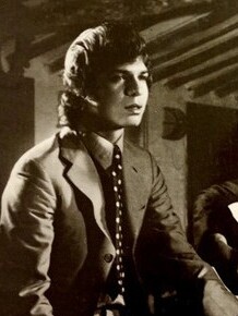
Camarón de la ciudad
San Fernando
Camarón de la Isla is a monument and heritage trail dedicated to José Monje Cruz, the legendary flamenco singer born in San Fernando, near Cádiz, who performed under this stage name. What will you see there? The centerpiece is a bronze sculpture on Plaza de Juan Vargas, created by sculptor Antonio Mota. It shows the seated singer facing a listening child, with both figures and a traditional woven cane chair cast together as a single solid block. The statue stands 1.75 metres tall. Work began in June 1991, the casting was finished in 1992 — the year of Camarón's death — and the piece was permanently installed in July 1993, on the first anniversary of his passing. The monument marks the starting point of a wider walking route through the city, known as the Ruta de Camarón. It links several sites tied to his life: the house where he was born (Casa Natal), the forge called La Fragua where he spent part of his youth, the Venta Vargas tavern associated with his early performances, the headquarters of the Peña Camarón cultural association, and the mausoleum at the local cemetery where he is buried. A separate stop worth planning for is the Centro de Interpretación, a modern exhibition space of roughly 1,200 square metres built with sustainability in mind. Its displays are organised into three sections — Origen, Leyenda and Revolución — combining archival footage and audiovisual material that trace his career. How do you get there? San Fernando sits a short distance from Cádiz and is well connected by regional train and bus services from both Cádiz and Seville. Plaza de Juan Vargas, home to the statue, is centrally located and an easy walk from the main shopping streets. The other stops on the route are spread across town but remain within comfortable walking distance of one another — the full Ruta de Camarón can realistically be covered in a few hours. When should you visit? Spring and autumn offer the most comfortable temperatures for walking around Andalusian towns. It's worth checking the local events calendar: on 2 July, the anniversary of Camarón's death, San Fernando holds commemorative events and flamenco concerts, which draw larger crowds but add an extra layer of atmosphere for genre enthusiasts. Who is this stop for? The route appeals to flamenco fans and music-history travellers, but also to anyone visiting Cádiz who wants a less obvious, locally rooted cultural detour. San Fernando often works as a day-trip stop, and the memory of Camarón is woven visibly into the town — from murals to street names. Frequently asked questions Is there an entrance fee for the monument? The statue on Plaza de Juan Vargas stands in an open public square and can be viewed free of charge at any time. A fee may apply only if you visit the Centro de Interpretación exhibition. How long does the full route take? Walking the entire Ruta de Camarón — the monument, Casa Natal, La Fragua, Venta Vargas and the mausoleum — typically takes between two and four hours, depending on pace and how much time you spend at the exhibition centre. Do you need to know Camarón's music to appreciate it? Not really — the site carries historical and artistic value on its own, and the information panels and displays give enough context even for visitors unfamiliar with flamenco beforehand. Are there other attractions nearby in San Fernando? Yes, the town has a historic centre worth exploring and is close to the bay and traditional salt flats, making it easy to pair a visit to the monument with a longer stop in the area.
-
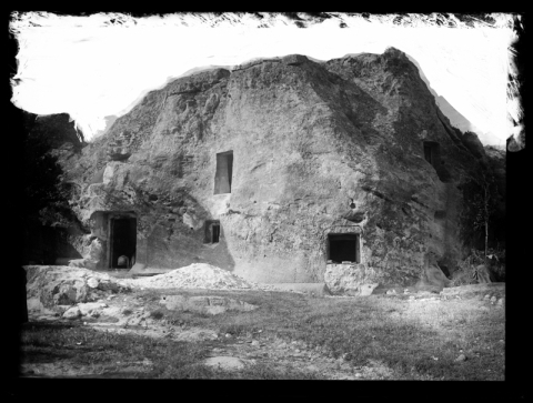
Casa de Piedra (Alcolea del Pinar)
Alcolea del Pinar
Casa de Piedra is a house carved entirely out of solid rock in Alcolea del Pinar, a small village in the province of Guadalajara, and it has been drawing curious visitors for decades thanks to the sheer scale of a single man's effort. Who built Casa de Piedra, and why? The house was the work of Lino Bueno, a local farm laborer from Alcolea del Pinar. He began digging into the sandstone outcrop in 1907, originally intending only to carve out a single room for his family. What started as a modest goal turned into a project spanning more than two decades: Bueno kept working night after night, once his day's farm work was done, gradually enlarging the excavation year by year. The result was a full residential complex hollowed out entirely by hand, using only basic hand tools. What is inside the house? The original one-room idea eventually grew into a much larger layout. Over the years, Bueno added a kitchen, a dining room, connecting hallways, and even a stable and a pigsty for livestock. Every one of these spaces was cut directly into the same rock formation, with no external building materials used for walls, ceilings, or partitions — they are all part of the same continuous stone mass. Because of this, the interior keeps a naturally stable temperature and a distinctive raw, rock-hewn texture that sets it apart from ordinary houses. Why does Casa de Piedra hold a Guinness World Record? The house is recognized as the largest building ever carved out of solid rock by a single person. It's precisely the scale of the undertaking — an extensive, multi-room dwelling built without a construction crew, machinery, or modern equipment — that earned Lino Bueno's creation international attention and its record-holding status. What happened to the house after its builder died? Lino Bueno died in 1935, shortly before the outbreak of the Spanish Civil War. During the conflict, the building took on a very different role: it was used as a powder magazine and as a shelter for local residents, which likely helped protect it from destruction during those turbulent years. Once the war ended, Bueno's family reclaimed the house and began restoring it for future use. Can visitors tour Casa de Piedra today? Yes. The house now operates as a museum open to the public, showcasing both the story of its construction and the rock-cut rooms Lino Bueno carved by hand. Over the years it has attracted a steady stream of visitors intrigued by its unusual architecture and local history — reportedly including King Juan Carlos I among its guests. Casa de Piedra remains one of the more distinctive stops on the tourist map of the Guadalajara region, combining a compelling historical story with an architectural experience that is genuinely rare: an entire home shaped by human hands out of a single block of stone. Frequently asked questions How long did it take to build Casa de Piedra? Construction spanned more than two decades. Lino Bueno started digging in 1907 and kept adding to the house steadily for years, working mostly in the hours left after his regular day job. Did a construction crew build the house? No. The entire structure was carved by one person, without help from a building crew or specialized machinery, which is the main reason for its record-holding status. What rooms does the house contain? Beyond the original single room, the house includes a kitchen, a dining room, connecting hallways, and farm outbuildings — a stable and a pigsty — all cut into the same rock. Is Casa de Piedra open to tourists? Yes, it operates as a house museum open for visits, presenting the history of its construction along with the original rooms carved by Lino Bueno.
-
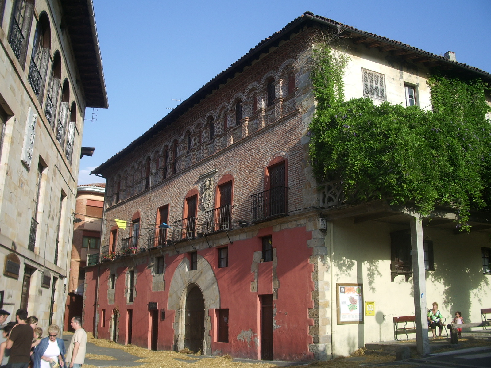
Arrue jauregia
Segura
Arrue jauregia is a historic palace — jauregia meaning "palace" in Basque — in the small town of Segura, in the province of Gipuzkoa, Basque Country. The building stands on Lardizabal kalea and is registered as a Bien de Interés Cultural, Spain's designation for property of special cultural significance. Where exactly is Arrue palace located? Segura sits in the Goierri region, in the northern part of the Basque Country, an area known for its tightly packed medieval town centers and stone noble houses. Arrue jauregia stands in Segura's historic core, on Lardizabal kalea, close to several other listed buildings. Its coordinates are roughly 43.0077°N, -2.2534°W. What makes the building's architecture distinctive? The façade is topped by an arch in Aragonese style, which gives the whole building a Mudejar flavor — an unusual influence for this part of Gipuzkoa. On the uppermost section of the elevation, terracotta medallions carved with cherub heads decorate the stonework, underlining the social standing of the family that built it. These details point to stylistic influences reaching beyond the local Basque building tradition and were typical of noble residences from that period. What is a "jauregia," and why does Segura have several of them? In Basque, jauregia refers to a palace or manor house — usually a stone residence built by a wealthy family and often bearing a coat of arms. Segura, one of Goierri's historic towns, still holds onto a handful of these houses, including the palaces of Guevara, Lardizabal, Jauregui, and Arrue. Their survival reflects the town's former economic and social weight, when Segura was an important seat of the local nobility during the medieval and early modern periods and gathered several noble families within a small area. Can visitors see the palace when touring Segura? The building sits within Segura's historic center, which is compact enough to explore entirely on foot, with no need for transport between sights. Like the town's other stone residences, Arrue jauregia forms part of a walking route through the old town — a short stroll through its narrow streets brings visitors past several such façades in a matter of minutes. Because of its Bien de Interés Cultural status, the building is legally protected, which secures the preservation of its original appearance and rules out unauthorized changes to the façade. Frequently asked questions What does the name "Arrue jauregia" mean? "Jauregia" is the Basque word for palace or manor house, while "Arrue" is most likely the surname of the family that built or owned it. Where exactly does the palace stand? On Lardizabal kalea, in the historic center of Segura, a town in the Goierri region of Gipuzkoa. Is the palace a legally protected monument? Yes, it holds Bien de Interés Cultural status, Spain's designation for sites of special cultural significance. What is the most distinctive architectural feature? An Aragonese-style arch that gives the façade a Mudejar look, along with terracotta medallions of cherub heads on the top section of the elevation.
-
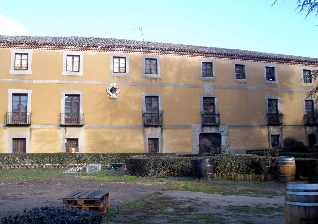
Palacio de Don Diego del Águila
Ávila
Palacio de Don Diego del Águila is a 16th-century palace built directly into the city walls of Ávila, one of Spain's best-preserved medieval towns. Standing along the eastern stretch of the walls near the San Vicente gate, the building has for centuries combined the role of a noble family residence with that of a guardian post for the city's fortifications. How do you get there? The palace sits within Ávila's walled old town, in an easily reachable part of the historic center. The simplest approach is on foot from the San Vicente gate, one of the main entrances into the historic quarter. From Ávila's train station it's roughly a 15–20 minute walk to the walls, and Ávila itself is under an hour from Madrid by train, making it a popular day-trip destination. Drivers will find parking near the walls, just a short walk from the palace itself. What will you see? Palacio de Don Diego del Águila is an example of the defensive-residential architecture typical of Castilian nobility at the close of the Middle Ages. The palace was the seat of the Águila family, descendants of Sancho de Estrada, one of the settlers who accompanied Don Raimundo of Burgundy in resettling the region after the Reconquista. The whole complex takes its name from this family and is also known as Palacio de los Águila. Members of the Águila family bore responsibility for defending one of the most important sections of the city's fortifications: access through the San Vicente gate, the entire eastern wall as far as the Torreón de la Mula, and a significant stretch of the wall's northern slope. The building was therefore not only a home but a strategic defensive point, fortified against potential attacks. In the 16th century, Diego del Águila offered buildings on Sofraga Square as a temporary home for the Poor Clare nuns before they found a permanent site in Ávila — an episode that still recalls the palace's ties to the city's religious life. The structure and gardens as they appear today date from a restoration carried out in the late 19th century, when both the palace itself and its surrounding grounds were renovated. Today the complex operates as Palacio Sofraga, a hotel and restaurant, allowing visitors to do more than admire the historic architecture from outside — they can step inside and experience the atmosphere of a noble residence built into the city's defensive walls. When should you visit? Ávila is best explored in spring (April–June) or early autumn (September–October), when temperatures are mild and the town sees fewer crowds than at the height of summer. Summers can turn hot, especially at midday, making long walks along the walls uncomfortable. In winter, Ávila — sitting at over 1,100 meters above sea level — turns quite cold, but offers a quieter, more atmospheric visit, particularly when frost settles on the walls. Frequently asked questions How does Palacio de Don Diego del Águila differ from other Águila family palaces in Ávila? This was the family's main historic seat along the city walls, closely tied to defending the stretch from the San Vicente gate to the Torreón de la Mula, unlike the family's other residences scattered around the city. Can you visit the inside of the palace? Yes. The building now houses the Sofraga hotel and restaurant, so visitors can step inside and experience its historic atmosphere rather than only viewing the facade from the street. What was the Águila family's significance in Ávila's history? The Águila family, descended from Sancho de Estrada, was responsible for defending one of the key sections of the city walls and ranked among the most important noble families of medieval Ávila. How much time should you set aside for the palace and its surroundings? Viewing the palace's exterior and the adjoining stretch of wall takes about 20–30 minutes, but it's worth combining with a visit to the full circuit of Ávila's walls, for which 2–3 hours is a good allowance.
-
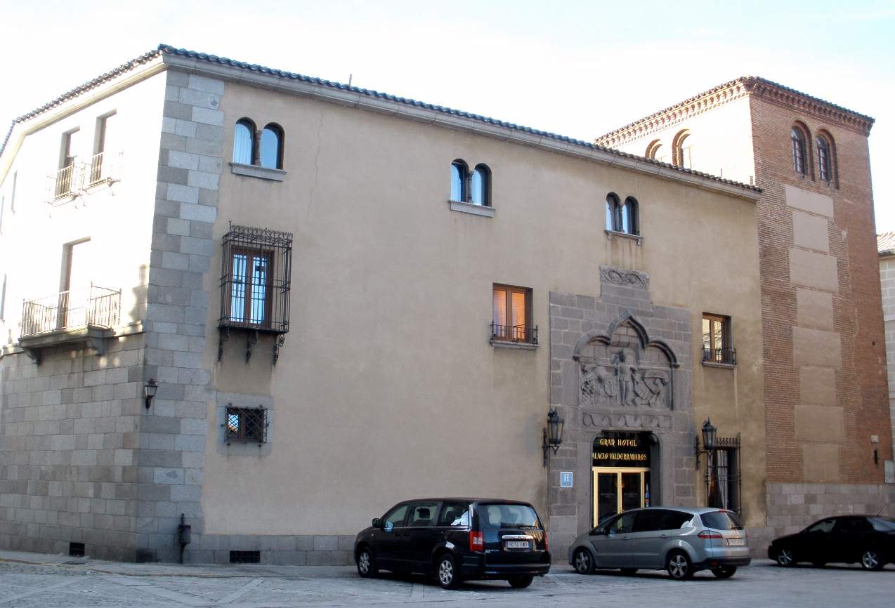
Palacio de Valderrábanos
Ávila
Palacio de Valderrábanos is a 14th-century palace standing right next to the cathedral of Ávila, today converted into an intimate hotel set within the walls of the medieval city. Where exactly does the palace stand? The building occupies one of the most prominent spots in the city — the square beside Ávila's cathedral, part of the UNESCO World Heritage listing that covers the entire walled old town. It's a location impossible to miss: the palace's stone façade sits almost flush against the cathedral's apse, forming one of the most photographed corners of the historic centre. Walking the main street that runs from the Alcázar Gate toward the cathedral, visitors come across it almost inevitably. Who built it? The building's history goes back to the 14th century and is tied to Gonzalo Dávila de Ágreda, a knight who served as master of ceremonies at the court of the Catholic Monarchs, governor of the Order of Calatrava, and magistrate in Jerez. The residence was raised for him in the very heart of medieval Ávila, a city that was then one of the key centres of Castilian nobility. The founder's social standing explains why the palace was built in such a prominent spot, right beside the city's main church. What survives from the original structure? Despite centuries of history and later alterations, the façade still preserves a distinctive relief above the entrance, showing a young figure supporting the composition beneath a trefoil arch — a detail typical of Gothic ornamentation from the period and one of the few elements that still let visitors read the building's medieval origins today. The original wooden ceilings and beam-work (known as alfarje) that once decorated the palace's interiors, however, didn't stay on site: after the renovation they were moved to the Ávila Museum, where they can be seen separately as an example of period woodcarving. How did the palace become a hotel? The building underwent a full renovation adapting it for use as a hotel, while keeping its medieval character and its location right in the heart of the old town. A symbolic moment in this new chapter came with its first guest after the renovation: Adolfo Suárez, at the time a politician who would later become Spain's first democratic prime minister, stayed in room 126 in 1971. That episode is often mentioned today alongside the building's medieval roots as part of its story. What's nearby? Standing at the palace entrance puts Ávila's defensive walls, the cathedral, and the dense web of narrow old-town streets all within easy reach. It's an ideal base for exploring on foot, close both to the main city gates and to the viewpoints along the walls that look out over the Castilian countryside surrounding the city. When's the best time to visit? Ávila sits at over 1,100 metres above sea level, so summers here tend to be pleasantly cooler than in much of the rest of Spain, while winters bring low temperatures and occasional snow. Spring and early autumn offer the most stable weather for walking the walls and old town on foot, without the crowds typical of high summer. Frequently asked questions Can you visit Palacio de Valderrábanos, or is it hotel-only? The building currently operates as a hotel, so access to the interior is mainly reserved for guests. The façade with its preserved relief, however, is fully visible from the cathedral square, which is open to everyone. Where can you see the palace's original decorative elements? The historic wooden ceilings and beam-work from the palace were moved to the Ávila Museum, where they're displayed as a separate exhibit showcasing period craftsmanship. How far is it from here to Ávila's cathedral? The palace stands directly beside the cathedral, practically wall to wall — one of the shortest possible distances between a landmark and a place to stay anywhere in the city. Who was the hotel's first guest after it opened? Adolfo Suárez, who stayed in room 126 in 1971, several years before becoming Spain's prime minister.
-
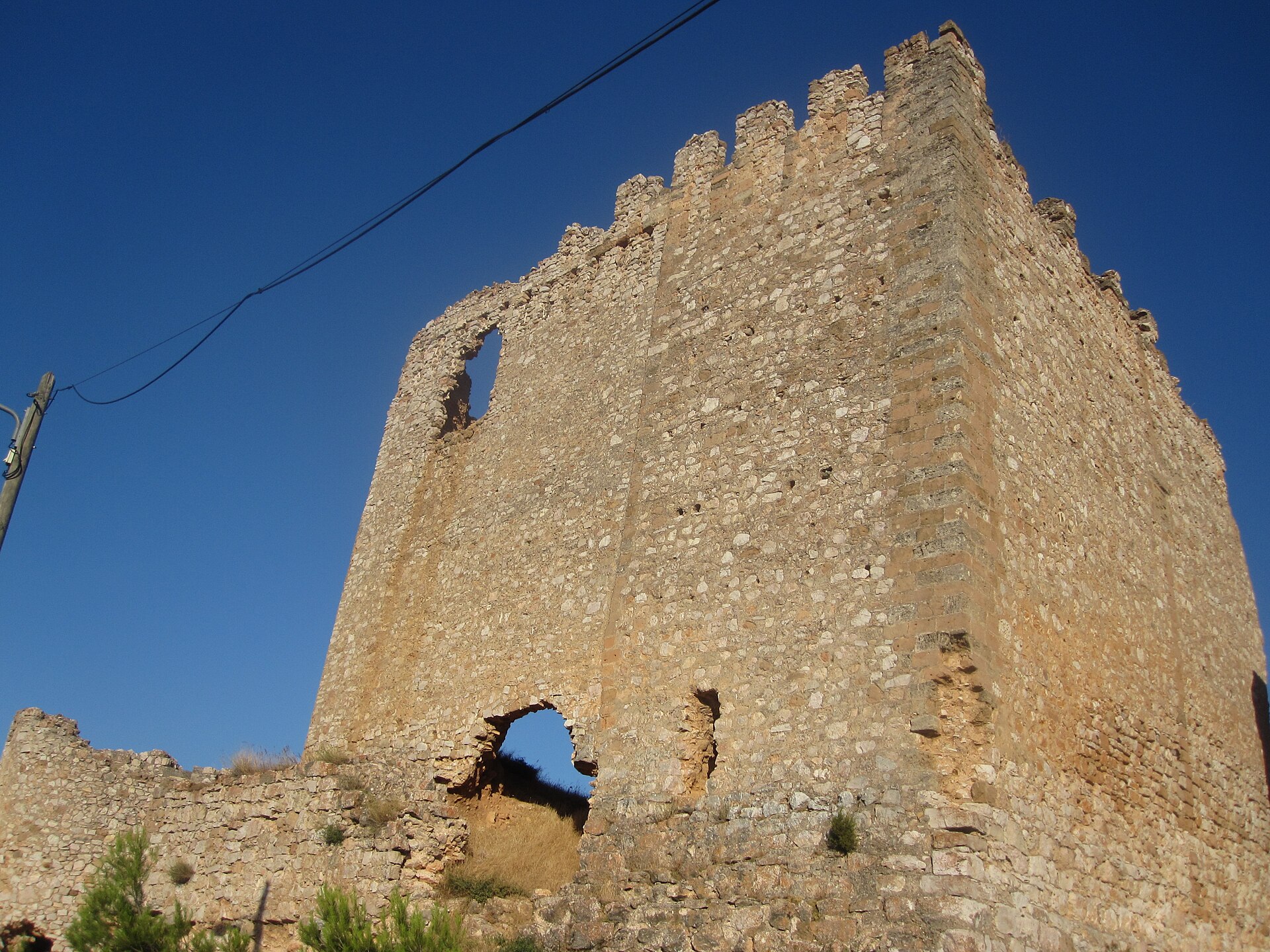
Castillo de Sisamón
Sisamón
Castillo de Sisamón is a medieval castle ruin in the village of Sisamón, in the province of Zaragoza, Aragón, Spain. Where is Sisamón and why does it matter? Sisamón sits on a hilltop at 1,051 meters above sea level, right on the boundary between the provinces of Guadalajara and Zaragoza, making it one of the highest villages in Zaragoza province. The Moncayo massif forms a dramatic backdrop to the village, which belongs to the Comunidad de Calatayud district. That frontier position — close to the old border between the kingdoms of Aragón and Castile — is exactly what made the local castle strategically important for centuries. What is the history behind the castle? According to the town's founding charter of 1147, Sisamón belonged to the Señorío de Molina, a lordship only two kilometers from the border with Castile. Molina had functioned for a time as an independent territory sitting between the crowns of Aragón and Castile. In 1321, Molina was permanently absorbed into Castile, while Sisamón remained part of Aragón — right in a stretch of frontier running from Tarazona to Torralba de los Frailes that stayed fiercely contested for generations. The castle rose to prominence in the 14th century during the War of the Two Pedros between Castile and Aragón. In 1357, with war looming, its garrison was reinforced and an attempted assault was successfully repelled. Soon after, King Pedro IV granted the castle as a lordship to the family of Sancho González de Heredia, relatives of Juan Fernández de Heredia, Grand Master of the Order of the Hospital. Chronicler Jerónimo Zurita recorded that in 1452 a duel broke out between the lord of Sisamón, Juan Fernández de Heredia, and the lord of Cetina, Alfonso de Liñán — a dispute serious enough to require royal intervention. Armed rivalry between the two noble houses continued until March 10, 1509, when Juan Fernández de Heredia, then lord of Sisamón, married Jerónima de Liñán, heiress to the lordships of Cetina and Contamina. The marriage united both houses, pacified the region, and laid the groundwork for the future County of Contamina. What will you actually see there? Of the 14th-century structure, only two walls survive, meeting at a right angle. The original building had a square floor plan roughly 12 meters to a side. Castillo de Sisamón is listed among the castles recognized as Bienes de Interés Cultural (Assets of Cultural Interest) under Aragón's regional heritage law 3/1999, a list published in the Official Gazette of Aragón on May 22, 2006. Right in front of the castle, remnants of an older Roman wall are still visible, pointing to much earlier settlement on the site. It's worth extending the visit to the nearby Church of San Martín (15th–16th century), whose architecture blends Gothic, Renaissance, Baroque, and Mudéjar elements. On the village outskirts stands the Torre del Moro, a defensive tower of Muslim origin. For the best panoramic view of Sisamón, climb up to the hermitage of the Virgen de la Carrasca, and don't miss the Renaissance-style fountain at the village entrance. How do you get there and when should you go? Sisamón is a small village with little in the way of public transport, so the easiest way in is by car via the local roads of the Comunidad de Calatayud. The surrounding countryside — grain fields, holm oak groves, and ravines — offers hiking and cycling routes into the neighboring hills. Clear weather is best for taking in the Moncayo views from the village's lookout points. There's no restaurant in Sisamón, so bring your own food and water. Local patronal festivals fall in August (San Pascual Bailón) and September (San Pedro Arbués and the Virgen de la Carrasca) — a good time to pair a castle visit with the village's local traditions. Frequently asked questions How much of the castle in Sisamón still stands? Only two walls remain, meeting at a right angle, from what was originally a square structure roughly 12 meters per side. Can you go inside the castle ruins? The ruins are open and unfenced but have no visitor infrastructure — you view them from the outside, and should take care given the state of the remaining walls. What else is there to see in Sisamón besides the castle? The nearby Roman wall remains, the Church of San Martín, the Torre del Moro, the hermitage of the Virgen de la Carrasca with its village panorama, and a Renaissance fountain at the entrance to the village. Is there anywhere to eat in Sisamón? No, the village has no restaurant, so it's best to bring provisions before you arrive.
-
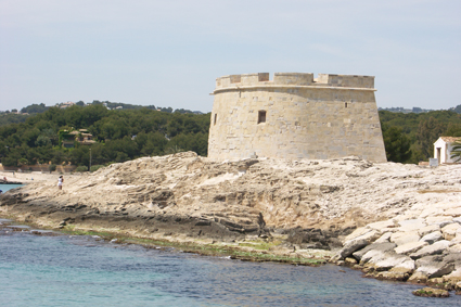
Castell de Moraira
Moraira
Castell de Moraira is a small 18th-century coastal fort perched on a rocky outcrop right above the harbour in Moraira, a seaside town within the municipality of Teulada in the province of Alicante. One of the town's most recognisable landmarks, it once guarded the coastline against North African corsairs and today works as a lookout point and a small museum dedicated to the sea and piracy. Why was this fort built? The fortification went up in the mid-18th century as part of a chain of coastal defences along the Costa Blanca, built to fend off raids by Barbary corsairs operating out of ports in Morocco, Algeria and Tunisia. Above the entrance sits the royal coat of arms of the House of Bourbon, carved with the date 1742 — widely taken to mark the year construction was finished. The fort's original life was short: on 29 July 1801, during the Napoleonic Wars, English troops destroyed it. What visitors see today is the result of a thorough reconstruction carried out in the early 1980s, closely following the building's original layout. What does it look like, and what's inside? Castell de Moraira has an unusual horseshoe-shaped floor plan, with a semicircular façade facing south and a single entrance on the north side, set directly beneath the Bourbon coat of arms. Inside, the space is divided into three naves — a central one of roughly 200 square metres, flanked by two smaller side naves. The fort now houses a permanent exhibition on the watchtowers built during the reign of Philip II, along with a multilingual audiovisual presentation on the sea and Mediterranean piracy. The real highlight, though, is climbing up to the rooftop, which opens onto a full panorama of Moraira bay and the open sea — on clear days you can even make out the Penyal d'Ifac rock in nearby Calpe. How to get there, and when to visit? The castle sits right by Moraira's harbour, on the same stretch of coast as l'Ampolla beach, so the easiest way to reach it is on foot along the harbourside promenade — a route popular with locals and visitors alike. The harbour itself dates back to 1935, originally built to shelter boats from storms, and makes a natural stop to pair with the castle visit. Afternoons tend to be the best time to come, when the sun lights up the sea-facing façade, and spring or autumn are more comfortable than the height of summer on the Costa Blanca. It's worth combining the visit with an evening stroll around the harbour and the nearby beaches. Frequently asked questions Is there an entrance fee? Opening hours and access rules vary by season, so it's best to check current details with the Teulada-Moraira tourist office before planning a visit. How long does a visit take? Given its modest size, seeing the castle — including the rooftop and the exhibitions — usually takes about 30 to 45 minutes. Are there other attractions nearby? Yes — the castle sits right next to the 1935 fishing and yacht harbour and l'Ampolla beach, and Moraira's main promenade, lined with restaurants, is just a short walk further on. Is the castle original or rebuilt? The structure you see today is largely a reconstruction from the early 1980s, carried out after the 1801 destruction, but it faithfully follows the 18th-century original, including the horseshoe layout and the original coat of arms above the entrance.
-
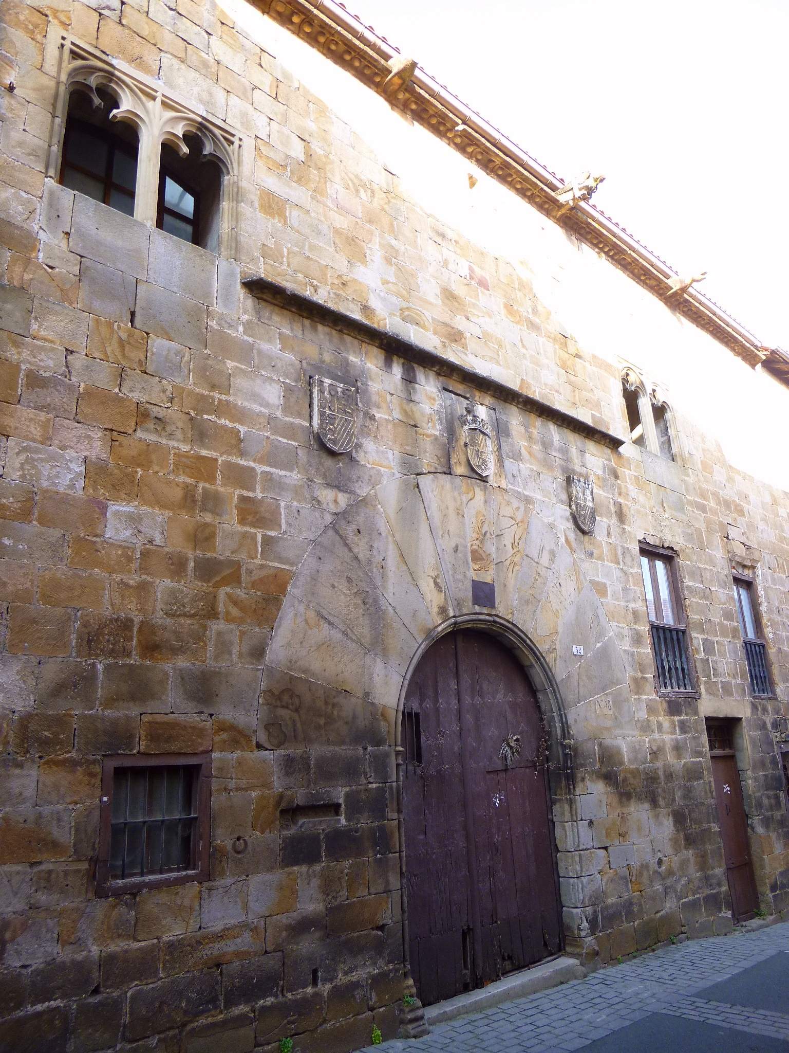
Gebara jauregia
Segura
Gebara jauregia is a Gothic town palace standing in the historic center of Segura, a small town in Gipuzkoa, in the Basque Country. Raised in the second half of the 15th century, it remains one of the finest surviving examples of late medieval urban palace architecture in the region. Who built it, and why here? The palace was commissioned by Nikolas Gebara, a member of one of the most influential noble lineages in Gipuzkoa at the time. The Gebara family already owned a medieval defensive tower nearby, and its members held positions at the court of the Catholic Monarchs, Isabella of Castile and Ferdinand of Aragon. Choosing to build a new residence right in the center of Segura, against the town walls, was a deliberate statement: rather than staying isolated in a fortified tower outside town, the family wanted its presence felt at the heart of civic life. The builders fitted the palace into the existing street layout, sharing party walls with neighboring houses — giving it a compact, urban character quite different from a freestanding ancestral tower. Architectural historians describe Gebara jauregia as a transitional building, still carrying the austerity of the medieval tower while anticipating the elegance of the Renaissance palace, with a composition that echoes contemporary Castilian urban mansions. What will you see on the façade? The most distinctive feature is the entrance portal: an arched doorway built with large, wedge-cut voussoirs, characteristic of secular Gothic construction of the period. Above it sits a twin window divided by a slender stone mullion, which once lit the reception rooms on the upper floor. Three heraldic shields are prominently displayed on the façade, a clear signal to passersby of the family's noble standing. The same gesture — carving coats of arms into a house front — recurs on several other patrician homes in Segura, reflecting the prestige rivalry among families who had grown wealthy on the iron trade and ironworking crafts. Given its historical and architectural value, the palace has been listed as a Monumento Histórico-Artístico (Historic-Artistic Monument). How do you get to Segura? Segura sits inland in Gipuzkoa, at the foot of the Aizkorri mountain range, along the old royal road that once connected Gipuzkoa with Álava — a historically important trade and pilgrimage route. The town borders Zegama, a popular starting point for hikes into the Aizkorri-Aratz range. The easiest way to arrive is by car, since Segura lies close to the main roads linking the Gipuzkoa coast with Álava and Navarre. The historic center itself is small and best explored on foot. What else is worth seeing nearby? Gebara jauregia is just one piece of Segura's remarkably well-preserved historic ensemble. Within the line of the old town walls stand several other imposing noble houses, built on fortunes made in the iron industry, along with two surviving town gates. Segura is often called the "cradle of Gipuzkoa" — it was here, in 1256, that the town received its founding charter, making it one of the oldest urban settlements in the province. When should you visit? Given its mountain setting, spring and summer are the most pleasant seasons for exploring the historic center on foot and combining the visit with a trip into the nearby Aizkorri range. Autumn and winter tend to be cold and rainy here, though the stone architecture of Segura takes on a particularly austere, atmospheric character in that weather. Frequently asked questions Can you go inside the Gebara palace? The building serves a private or administrative function and is not open to the public as a museum — visits are generally limited to admiring the façade and portal from the street. How long does it take to see Segura's historic center? Walking through the compact old town, taking in the Gebara palace, the other noble houses and the town gates, typically takes one to two hours. Does Segura work as a day trip from the coast? Yes — the town lies within easy reach of Gipuzkoa's main roads and pairs well with a trip to the Aizkorri mountains or neighboring Zegama. Why does the façade display three coats of arms? It reflects the prestige of the Gebara lineage — displaying multiple shields was a way of asserting the founders' noble standing among Segura's other patrician families.
-
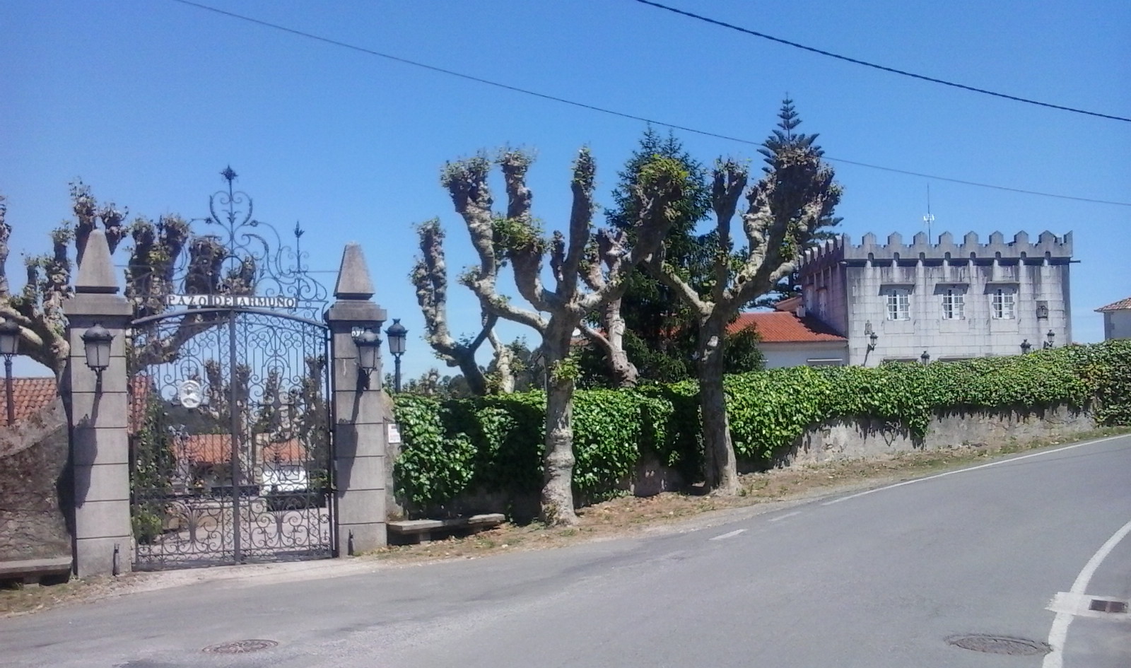
Pazo de Armuño
Bergondo
Pazo de Armuño is a noble manor house in Bergondo, in the province of A Coruña, at the heart of Galicia's Rías Altas. A "pazo" is the Galician term for a country manor house, roughly equivalent to a Spanish "palacio," and while dozens of such estates survive across the A Coruña area, few pair such a well-preserved defensive tower with as rich a family history as Armuño. Where is Pazo de Armuño located? The manor sits in the parish of Lubre, part of the municipality of Bergondo, roughly 15 kilometers from the city of A Coruña. Like most Galician pazos, it lies away from the main tourist trail, surrounded by the rural landscape of the Rías Altas — close enough to A Coruña, though, to fit easily into a day trip around the area. What is the history behind it? The building's current form dates from the 18th century, though it underwent later renovations. The oldest and most distinctive feature is the tower, of medieval origin and originally built for defense — now restored, it forms the visual centerpiece of the estate. The façade bears the coats of arms of three noble families tied to the property's history: Bermúdez, Figueroa, and Boado, reflecting the successive changes of ownership and marriage alliances typical of Galician nobility. The pazo is also the setting of a local legend known as "Peito Bordel," or the "tribute of the hundred maidens." According to the story, the daughters of Fernán Pérez de Acuña, then lord of Armuño, were nearly abducted by attackers — until the girls' brothers defeated the assailants armed with nothing more than fig-tree branches. The tale is still told today as part of Bergondo's local identity and remains a favorite among area guides. What will you see on site? The main building rises across three levels — ground floor, first floor, and second floor — built around the medieval tower and a two-story residential wing. Several outbuildings surround it, along with a carefully tended garden. The plot on which the pazo stands covers roughly 9,300 square meters and is enclosed by a stone wall, with an additional nearly 61,000 square meters of adjoining land. Pazo de Armuño remains privately owned, so the interior is not open to the public. Free access is granted, however, to the gardens and exterior grounds. Today the estate serves three purposes: hosting institutional events, functioning as a training center, and housing a small museum dedicated to the pazo's own history. When is the best time to visit? Spring and summer are the best seasons to visit, when the gardens are at their most vivid and the Rías Altas weather is well suited to exploring the surrounding countryside. Because the estate is privately managed, it's worth checking current access hours for the grounds beforehand, as they can vary depending on events being hosted there. Frequently asked questions Can you visit the inside of Pazo de Armuño? No — the building is privately owned, and public access is limited to the gardens and exterior grounds, which can be visited free of charge. Where does the tower at Pazo de Armuño come from? The tower is of medieval origin and was originally built for defense; it is the oldest part of the estate and has since been restored. What is the "Peito Bordel" legend tied to this pazo? It's a local tale about an attempted abduction of the daughters of Fernán Pérez de Acuña, lord of Armuño, thwarted by their brothers armed only with fig-tree branches. How far is Pazo de Armuño from A Coruña? The manor lies in the parish of Lubre, in the municipality of Bergondo, about 15 kilometers from the city of A Coruña.
Earn badges for the places you visit
Download NextOnTrip, discover new places and check off your trails.