Monuments in Spain
A guide to 4655 Monuments in Spain — with descriptions, photos and traveler visits from the NextOnTrip community. Locations spread across 2240 cities and towns. Most visited by the community: castle of Chulilla, Castle of Pioz, castell de la Todolella.
-
Torreón de Don Juan de Austria y Museo de la Orden de San Juan
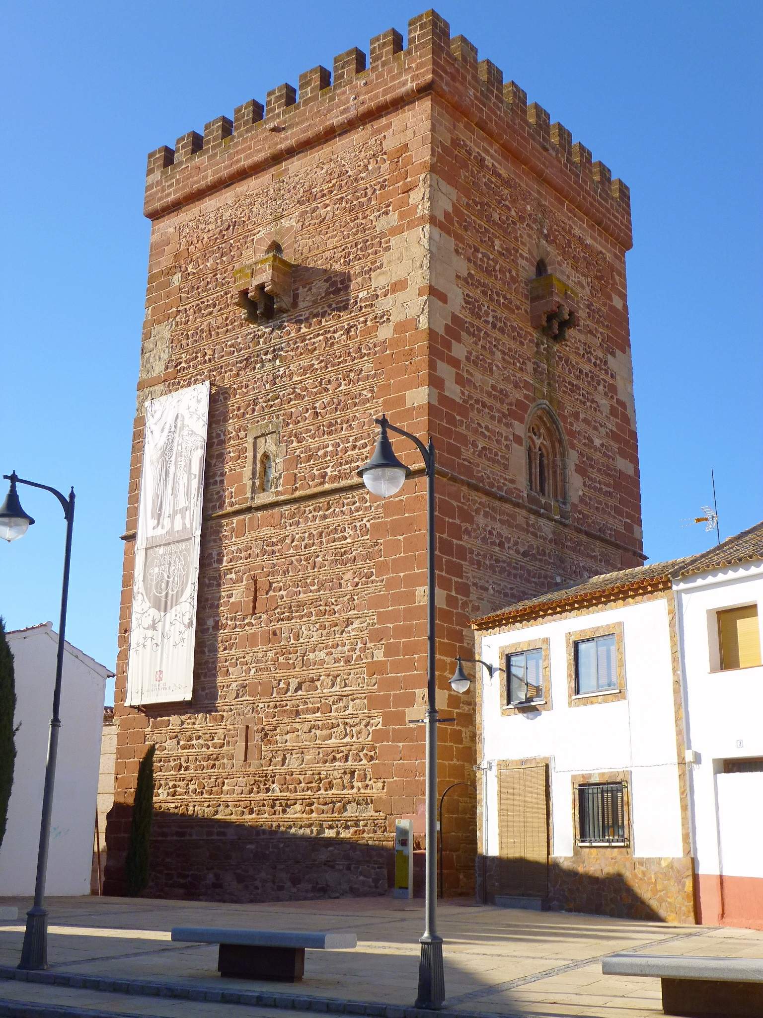
Torreón de Don Juan de Austria y Museo de la Orden de San Juan is a medieval defensive tower in Alcázar de San Juan, in the province of Ciudad Real, right in the heart of Castilla-La Mancha. Built from distinctive reddish stone, it is the best-preserved surviving piece of the former palace of the Grand Priors of the Order of Saint John (the Knights Hospitaller). Inside, a small museum tells the story of this military-religious order. How did this place come to be? The stronghold's history stretches back to the Reconquista, when the area passed into Christian hands under Alfonso VIII. Toward the end of the 13th century, in 1292, the site and its adjoining buildings were granted to the Order of Saint John, which turned it into one of its key priory seats on the Iberian Peninsula. The tower itself, known as the Torreón, was built in 1386 and underwent a major rebuild in the 16th century that gave it its current form. Gothic architectural details, especially visible in the stonework, reflect how significant the site was for the order. What will you see inside? The tower now houses an interpretation center devoted to the history of the Order of Saint John — its origins, its hospital and military work, and its presence across the lands of present-day Castilla-La Mancha. The exhibition traces how a small religious-military community grew into one of medieval Europe's most important chivalric orders, later established on Rhodes and Malta. From the outside, look for the tower's massive walls and solid mass, the last remaining piece of what was once a much larger palace complex. How to get there? The Torreón sits right in the historic center of Alcázar de San Juan, a town well connected by rail and road to Madrid and other towns across La Mancha, making it a convenient base for exploring a region famous for its windmills and wine tradition. Since the tower stands among the town's historic streets, the easiest way to reach it is on foot, taking in the surrounding old quarter along the way. When should you visit? The museum is open to visitors Thursday through Sunday, so it's worth planning a trip around those days. For exact opening hours and any seasonal changes, it's best to check directly with the Alcázar de San Juan town council before your visit. Frequently asked questions What is the Torreón de Don Juan de Austria? It's a medieval defensive tower, the surviving core of the former palace of the Grand Priors of the Order of Saint John, now home to a museum on the order's history. When was the tower built? It was built in 1386 and significantly rebuilt in the 16th century. On which days can you visit the museum? The site is open to visitors from Thursday to Sunday. Where exactly is it located? In the center of Alcázar de San Juan, in the province of Ciudad Real, in the Castilla-La Mancha region of Spain.
-
Pazo das Covadas
Arteixo
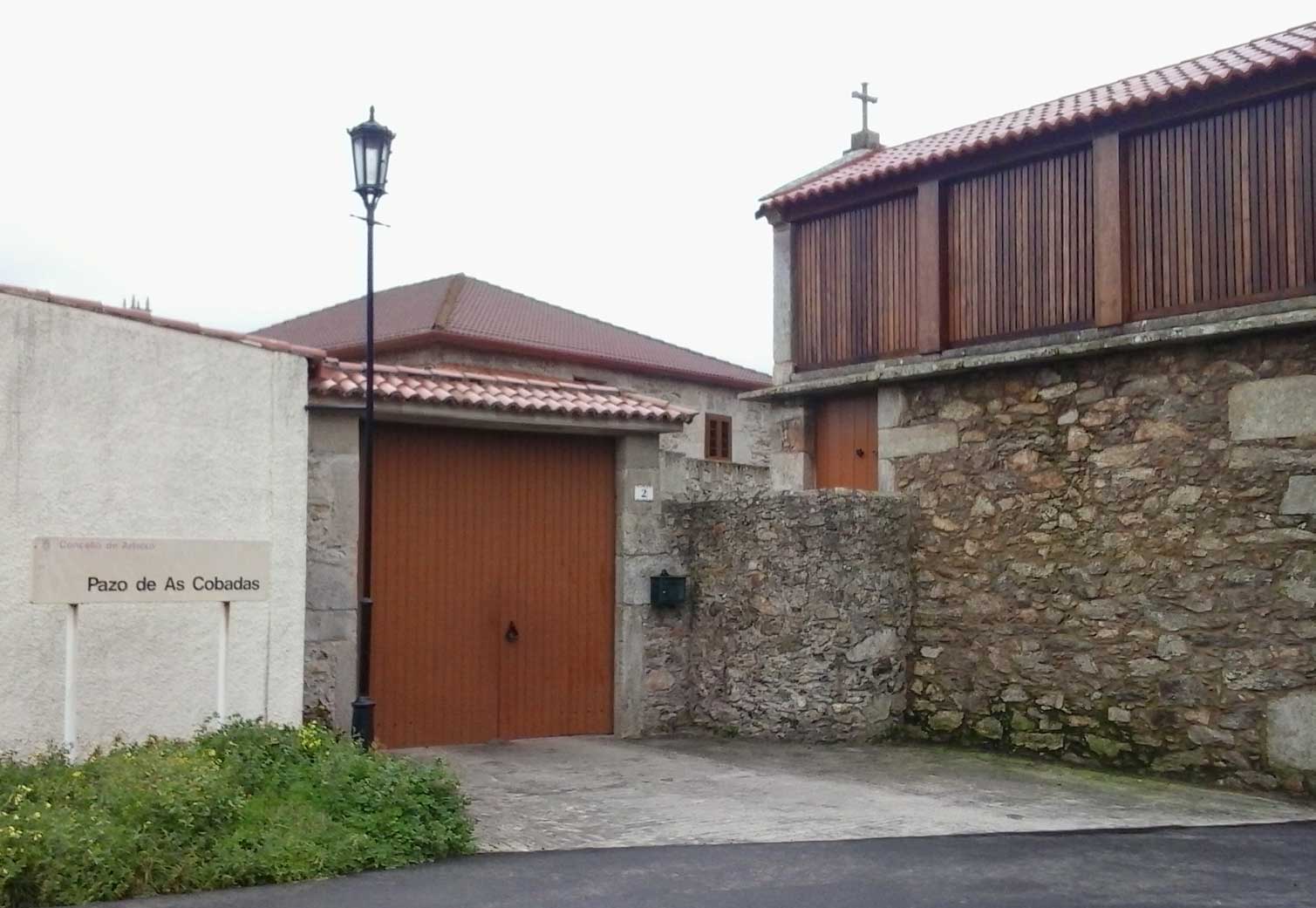
Pazo das Covadas is a 17th-century Galician manor house (pazo) standing in the parish of Sorrizo, in the municipality of Arteixo, province of A Coruña, close to the Costa da Morte coastline. What is a pazo, and why does this one stand out? A pazo is the classic Galician stone manor house, a building type that blends a family residence with the representative flourishes of Baroque architecture. Pazo das Covadas belongs squarely to this tradition and is one of several surviving pazos within the Arteixo municipality. The structure is made up of two wings joined by a gateway topped with a semicircular arch, and its most striking feature is a corner balcony resting on richly carved corbels. What is the history behind the manor? The estate's first owner was Pedro Rioboo Vilardefrancos, son of Gómez Rioboo Vilardefrancos, lord of Allo, and Francisca de Castro, of the House of Montaos. Two heraldic shields survive on the façade. The older one bears the arms of the Rioboo, Vilardefrancos, Castro and Figueroa families, while the newer, Baroque-style shield combines the arms of the Bermúdez, Castro, Lobera, Caamaño, Andrade, Vilardefrancos and Varela families. Stacking multiple coats of arms on a single façade like this was a common way for Galician noble families to record marriage alliances and inheritance as a property passed between family lines. How do you get there? Pazo das Covadas sits in a valley close to the coast, at the edge of the property along the road that borders it, within the parish of Sorrizo. Arteixo lies just a few kilometres west of A Coruña, so the most convenient way to reach it is by car, either from the city or from nearby coastal towns along the Costa da Morte. It's worth building the visit into a broader route around Arteixo's civil architecture, since the municipality preserves several other pazos and manor houses of a similar character. What should you know before visiting? Pazo das Covadas is private property and its interior is not open to the public. You can, however, admire the building from outside, from the public road running alongside the estate — enough to take in its distinctive layout, the arched gateway and the eye-catching corner balcony with its coats of arms. Photographing the façade from the public road is generally not an issue, but it's worth being discreet given that the grounds themselves are private. When is the best time to visit? Spring and summer are the best seasons for exploring the area, since longer days and milder weather make it easier to spend time touring Arteixo's rural roads. That said, the Costa da Morte region has its own charm year-round — misty autumn mornings can lend the pazo's stone walls an especially atmospheric look. What else is worth seeing nearby? The parish of Sorrizo and the wider municipality of Arteixo offer a varied landscape: proximity to the Atlantic coast, traditional Galician rural architecture, and other examples of pazo-style manors. It makes a good base for anyone interested in Galician noble history and regional architecture, and a convenient starting point for further exploration of the Costa da Morte coastline. Frequently asked questions Can you visit the interior of Pazo das Covadas? No. The building is privately owned and not open to visitors — you can only view it from outside, from the public road. What period does the building date from? Pazo das Covadas dates to the 17th century and represents the Baroque style typical of Galician manor-house architecture of that era. Which noble families are linked to the pazo's history? The building is associated with the Rioboo, Vilardefrancos, Castro, Figueroa, Bermúdez, Lobera, Caamaño, Andrade and Varela families, whose arms appear on the two heraldic shields on its façade. What's the best way to reach Pazo das Covadas? By car is most convenient — the pazo sits in the parish of Sorrizo in the municipality of Arteixo, a few kilometres from A Coruña, along the road bordering the estate.
-
Alcazaba (Bujalance)
Bujalance
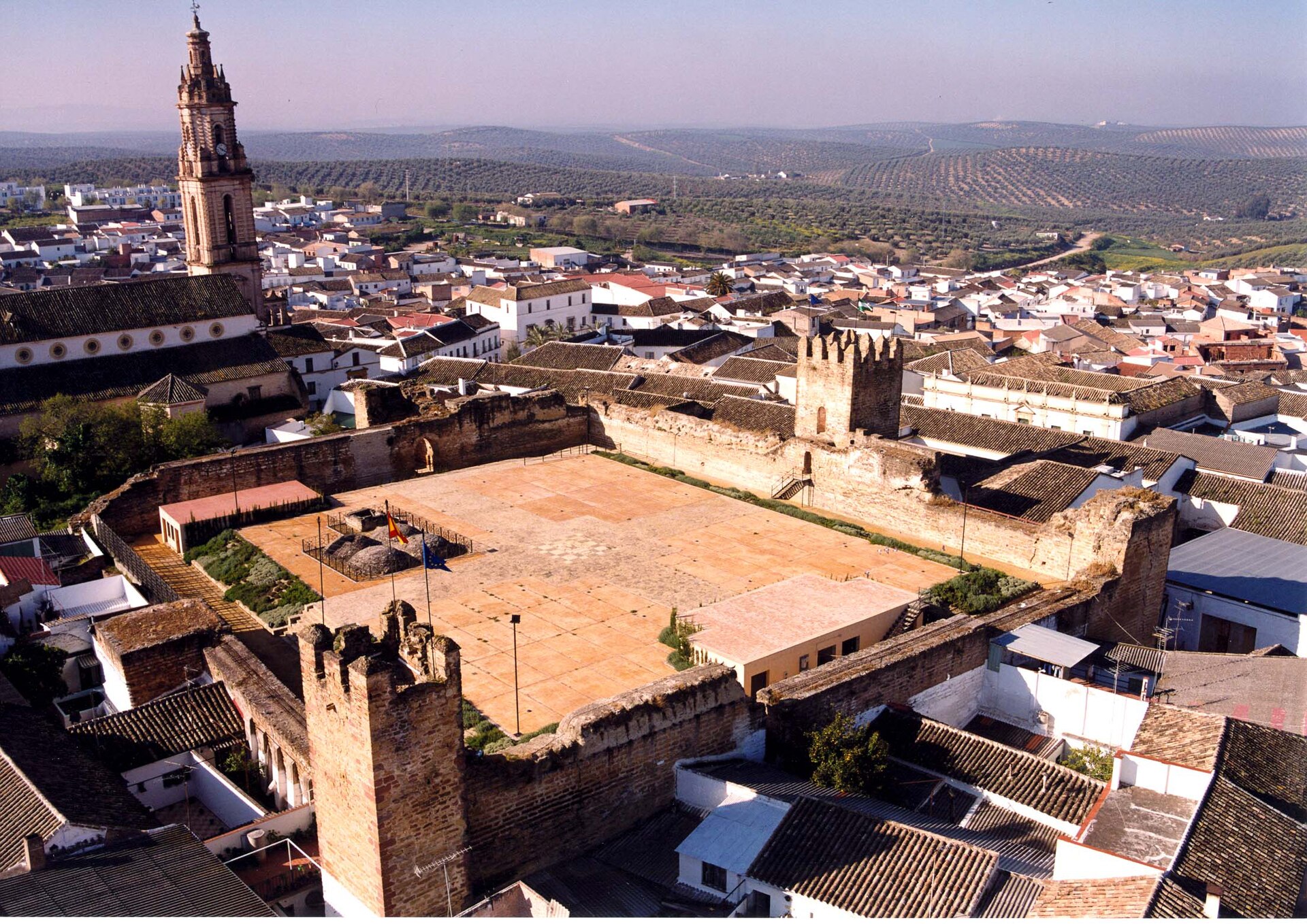
The Alcazaba of Bujalance is a medieval fortress overlooking the small town of Bujalance in the province of Córdoba, right in the heart of Andalusia. Only fragments of walls and two towers survive from the original defensive complex, yet the site still conveys the scale of the fortification and the long history behind it, stretching back to the Caliphate era. Where did the fortress come from? The stronghold was raised in the 10th century on the orders of Abd al-Rahman III, at a time when Córdoba was the capital of a powerful caliphate and a network of fortifications guarded the farmland and communication routes of al-Andalus. The old Arabic name of the settlement, from which the modern name Bujalance derives, referred to a serpent — a motif that still appears on the town's coat of arms today. After the Christian conquest the fortress kept its military role, simply changing hands and purpose. How did it change over the centuries? A turning point came in 1227, when King Ferdinand III took Bujalance during the Reconquista and placed the castle under the command of the knight Álvar Pérez de Castro. In the following century the structure was expanded and reinforced to keep pace with evolving siege warfare. In the 15th century the fortress became caught up in a feud between powerful noble houses — the counts of Cabra and the House of Aguilar — and King Henry IV even ordered its demolition. The order was never carried out, and a century later, under Queen Joanna I of Castile, further repairs were funded from the royal treasury. What can visitors see today? Of the original seven defensive towers, only two remain standing: the Torre de la Mazmorra (Dungeon Tower) and the Torre de las Palomas (Dovecote Tower). The whole complex followed a rectangular layout and covered roughly 3,000 square metres, giving a sense of how large the original garrison must have been. The surviving walls, though worn by time, still let visitors trace the outline of the old courtyard and defensive perimeter. How do you get there? Bujalance sits in the province of Córdoba, an easy drive from both Córdoba city and Jaén. The fortress dominates the old quarter of the town, so heading toward the hill at its centre is enough to find it — local signage takes care of the rest. It makes a good stop for travellers exploring the quieter corners of Andalusia, easily combined with a drive between Córdoba and other towns in the region. When is the best time to visit? Spring and early autumn are the most comfortable seasons for walking around the exposed hilltop site, with the late afternoon light flattering the old stone walls. In summer the castle courtyard comes alive with a festival of theatre, music and dance, along with an open-air Andalusian dinner event — a chance to experience the fortress in a completely different, festive mood. In 1963 the site was declared a Monumento Histórico-Artístico, Spain's historic-artistic monument status, confirming its value to the region's heritage. Frequently asked questions Is entry to the fortress free? Access to the grounds and courtyard is generally free, though the summer cultural events may require a ticket. How long does a visit take? Walking around the walls and towers usually takes 30–45 minutes, longer if you attend a cultural event. Can you go inside the towers? Access to the interior of the Torre de la Mazmorra and Torre de las Palomas can be limited and depends on current conservation work and scheduled events — it's worth checking locally or with the tourist information office. What else is worth combining with a visit to Bujalance? The town lies close to several other historic settlements in the province of Córdoba, making it easy to build a longer route through sites tied to the old Caliphate of Córdoba.
-
Castle of Ucero
Ucero
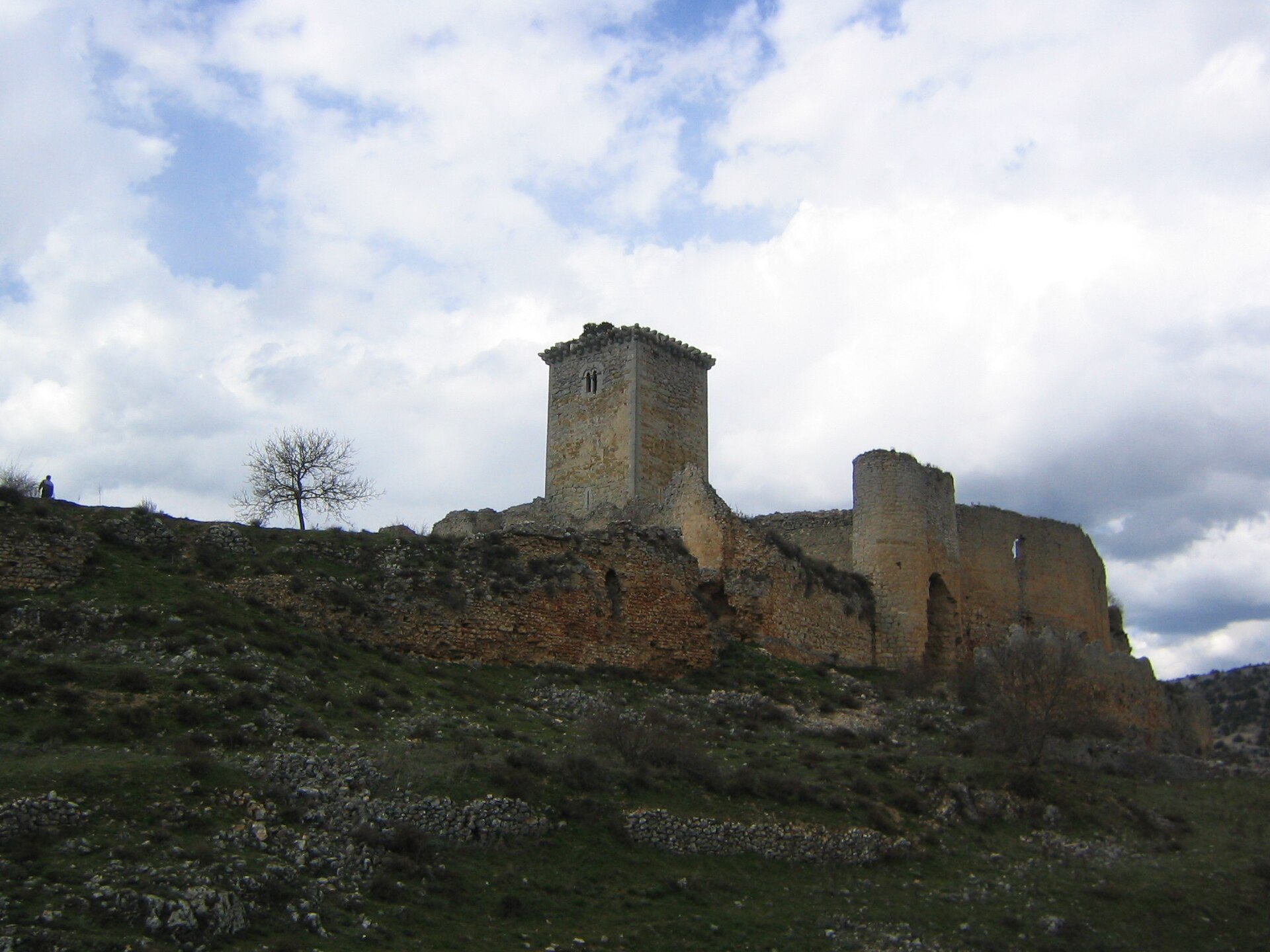
Castle of Ucero is a medieval defensive structure standing in the village of Ucero, in the province of Soria, in Spain's Castile and León region. It belongs to that category of lesser-known landmarks that reward the effort of getting there precisely because you won't be sharing the view with crowds. Where exactly is the castle located? The structure sits within the municipality of Ucero, a small village in Soria province. Its coordinates (41.719232, -3.045661) place it on raised ground typical of this part of central Spain — dry, rocky, and gently undulating terrain characteristic of the Castilian plateau. Building on elevated points like this was the norm for medieval defensive structures across the Iberian Peninsula, since height gave defenders control over the surrounding routes and farmland. How do you get there? Ucero lies deep in Soria province, away from Spain's major motorways — part of what gives the area its quiet, off-the-beaten-path character. Driving is by far the most practical option: Soria province has a sparse rail and bus network, so a car gives you the freedom to actually explore the surrounding countryside. Plan your route from the city of Soria, the provincial capital, from where local roads lead to Ucero. What should you expect on site? This is a genuine medieval fortification, built for defense rather than comfort or display. Visitors should come prepared to engage with historic military architecture rather than a furnished palace interior. Soria province is known for scattering structures like this across its territory — a landscape where medieval towers and watch-walls still trace the old borders and trade routes of the region. When is the best time to visit? Inland Castile has a continental climate: summers are hot and dry, and winters can turn surprisingly cold for Spain. Spring and autumn offer the most comfortable conditions for exploring, along with better light for photographing the surrounding landscape. Wear sturdy footwear, since the ground around structures like this tends to be uneven and rocky. What else is worth seeing nearby? A trip to Ucero is a good excuse to explore Soria province more broadly — a region rarely visited by mass tourism but appreciated by travelers looking for an authentic, uncrowded corner of Spain. It's worth setting aside time to explore the surrounding villages and landscapes of Castile and León before or after visiting the castle itself. Frequently asked questions Is the Castle of Ucero open to the public? It's a historic structure within the village of Ucero — check current access information locally before your visit, since conservation status and visiting rules for this kind of site can vary. Are there other attractions nearby? Soria province holds many lesser-known but worthwhile historical and natural sites, so it's worth combining a stop in Ucero with a wider look at the region. What's the best way to plan the trip? Given the province's out-of-the-way location, a car is the most practical way to get around and explore the neighboring villages at your own pace. Is this a good stop for families with children? The ground around medieval fortifications like this can be uneven, so keep an eye on younger visitors and bring appropriate footwear for everyone.
-
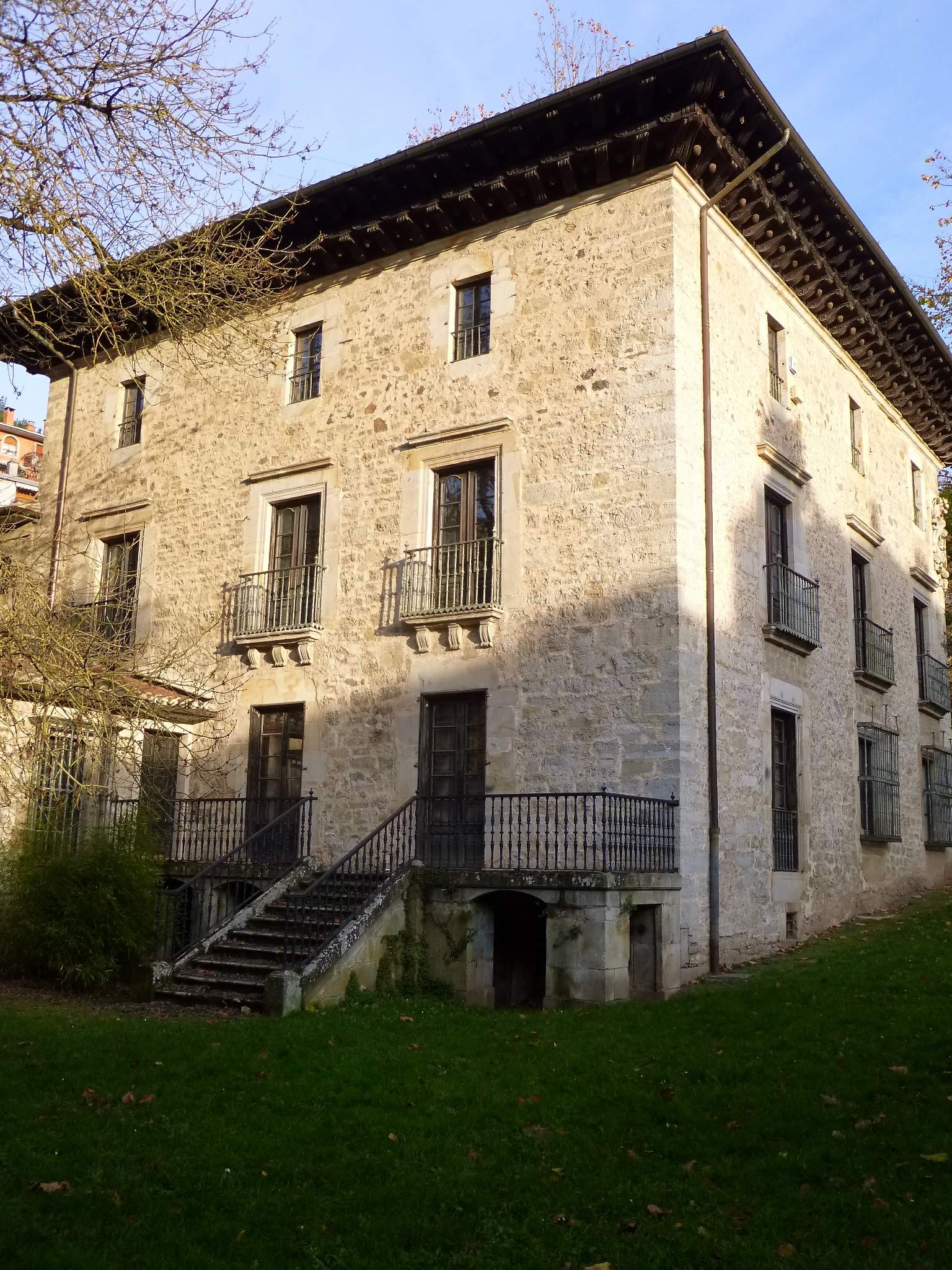
Errotalde Jauregia
Bergara
Errotalde Jauregia is a historic palace in Bergara, a small town in the Basque Country, set inside Santa Ana park right next to the old quarter. Over the centuries the building has served as a noble residence, a school, municipal swimming pools, and now a cultural center and public library. How do you get to Errotalde Jauregia? The palace sits in the heart of Bergara, inside Santa Ana park, which borders the historic old town (Alde Zaharra). From the old quarter it's only a short walk through the park grounds to reach the building. Bergara lies inland in Gipuzkoa, so the easiest way in is by car or local bus from Donostia-San Sebastián or Bilbao — both under an hour's drive away. What's the history behind the building? Construction began between 1598 and 1604 by a branch of the Aroztegi family, who built the palace on the site of an earlier defensive tower. Around 1615 the interiors were enriched with remarkable woodwork — carved ceilings, beams, staircases, and roof elements — that still define the building's heritage value today. The name "Errotalde" comes from an old mill that once stood beside the estate: in Basque, "errota" means mill and "alde" means area or place. In 1661 the property was bought by Captain Martín de Murua Elorregi, who reshaped the façade by adding his family's coat of arms, enlarging the windows, and fitting them with the wrought-iron grilles and balustrades still visible on the exterior. Over the following decades the palace took on different roles — a culture center, a secondary school, even municipal swimming pools on its grounds — before settling into its current use as the town's cultural hub. What can you see on site? Errotalde's main draw is how its architecture sits within its setting: the palace stands inside the well-kept Santa Ana park, which also contains a small hermitage and the former mill lands known as Bolu, the source of the estate's name. Walking around the building, look for the Murua family's coat of arms on the façade and the wrought-iron window details dating back to the 17th century. Inside, as the seat of the culture center and library, parts of the building open to visitors during cultural events and exhibitions organized by the town. When's the best time to visit? Santa Ana park looks its best in spring and summer, when the greenery around the palace is at its fullest and a walk through the grounds becomes an attraction in itself. This is also when Bergara hosts most of its outdoor events, some of which take place right around the palace. In autumn and winter the building keeps its atmosphere, but it's worth checking the library and culture center's opening hours in advance, since access to the interior is more limited outside scheduled events. What's happening with the palace now? As of November 2025, Errotalde Jauregia formally passed into the ownership of Bergara's Town Council, having previously belonged to the now-dissolved Murua Balzola Foundation. Along with the palace itself, the town also took over the surrounding Santa Ana garden, the hermitage on the grounds, and the former Bolu mill lands. The change of ownership paves the way for future restoration and adaptation work aimed at modernizing the building while preserving its historic character. Frequently asked questions Is Errotalde Jauregia open to visitors? The palace operates as a public library and culture center, so parts of it are accessible during the institutions' opening hours and during organized events. Where does the palace's name come from? From an old mill that once stood next to the estate — in Basque, "errota" means mill and "alde" means area or place. Who built the palace, and when? A branch of the Aroztegi family began construction between 1598 and 1604, on the site of an earlier family tower. Is there anything else to see near the palace? Yes — Santa Ana park, where the palace stands, also includes a small hermitage and the former Bolu mill lands, and it's a short walk from Bergara's historic old town.
-
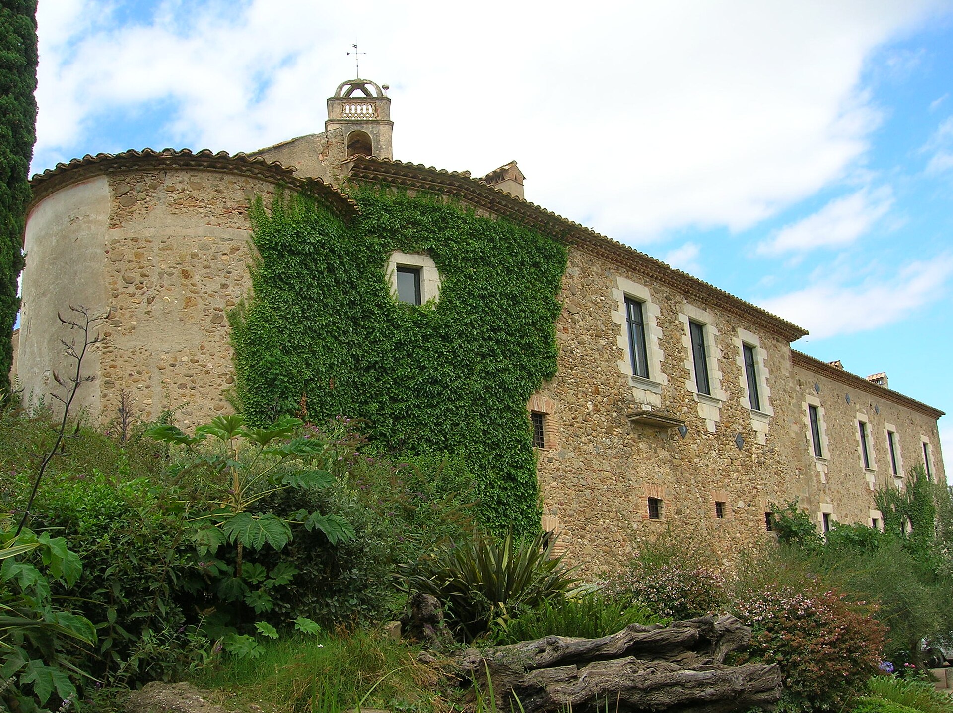
Castell d'Empordà
la Bisbal d'Empordà
Castell d'Empordà is a medieval castle standing on the edge of la Bisbal d'Empordà, in the heart of the Costa Brava hinterland. The building now operates as a boutique hotel, yet its walls carry seven centuries of history, and the twelve-hectare estate around it, dotted with oak and olive trees, still feels like open Empordà countryside rather than a manicured hotel garden. Where does the castle's history begin? The oldest surviving document mentioning Castell d'Empordà is dated 18 March 1301, making it one of the older fortified estates in the Empordà region. Through marriage, the property passed to the Margarit family, whose most notable member, Pere Margarit, sailed under Christopher Columbus and is credited with discovering the island of Margarita off the coast of present-day Venezuela. The family's prestige shaped the castle's standing for generations afterward. One detail visitors often ask about dates to 1973: Salvador Dalí, who lived nearby in Púbol at the time, tried to buy the castle as a gift for his wife, Gala. The deal never went through, but the story has become a permanent part of how the place is told. Listed as part of Catalonia's architectural heritage, the castle underwent a full restoration and reopened its doors to guests as a hotel in 2001. What is there to see on site? At the center of the estate stands the 14th-century castle itself, surrounded by twelve hectares of grounds planted with mature oaks and olive trees. Walking the property gives a real sense of rural Empordà, away from the coastal crowds, even though the Costa Brava's beaches are only a short drive away. Right beside the castle sits the chapel of Maria del Remei, built as a place of worship for people from the surrounding villages. Every year, on the second Sunday of October, a local religious festival brings together residents of la Bisbal d'Empordà and nearby towns — a good moment to experience the castle as a living part of local tradition rather than just a historic building. The hotel's interiors, while reserved for guests, are worth knowing about as part of the estate's story: rooms mix silk fabrics imported from India with furniture from Italy, Morocco, and China, an eclectic decorating choice that echoes the castle's long history of attracting travelers and collectors. How do you get to Castell d'Empordà? The castle sits on the outskirts of la Bisbal d'Empordà, a town known for its ceramics tradition. The easiest way in is by car, roughly 30 minutes from Girona, or from Costa Brava coastal towns such as Palamós or Begur. It makes a convenient base for exploring both the inland Empordà region and the nearby coast. When is the best time to visit? Spring and early autumn show off the surrounding landscape of olive groves and gentle hills at their best, with temperatures comfortable enough for walking the grounds. The second Sunday of October is a particularly notable date because of the annual festival at the Maria del Remei chapel, though it's worth keeping in mind that this is primarily a local, religious occasion rather than a tourist event. Frequently asked questions Can you visit Castell d'Empordà without booking a room? Since the castle operates as a hotel, free access to the interiors is generally limited to guests. The grounds around the Maria del Remei chapel do open up during local celebrations, especially on the second Sunday of October. What's the connection to Salvador Dalí? In 1973, Dalí, who lived nearby in Púbol, attempted to purchase the castle as a gift for his wife, Gala. The sale never went through, but the anecdote remains a fixture of the castle's history. How far is the castle from the Costa Brava beaches? Coastal towns like Palamós are only a short drive away, making Castell d'Empordà a practical base for combining beach time with inland sightseeing. What sets Castell d'Empordà apart from other castles in the area? Its 14th-century architecture, now home to a boutique hotel, is backed by documented history going back to 1301, plus the notable connection to the Margarit family, one of whom is credited with discovering the island of Margarita.
-
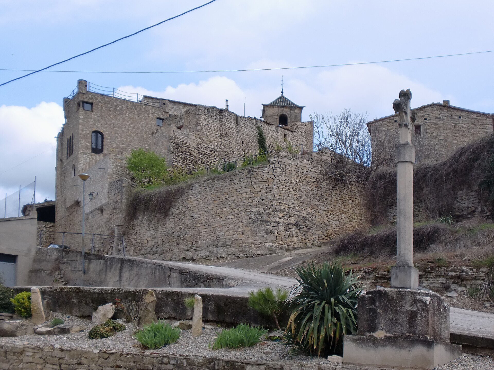
Castell de Vallfogona
Vallfogona de Riucorb
Castell de Vallfogona is a medieval fortress standing above the small town of Vallfogona de Riucorb, in the Conca de Barberà region of Catalonia. Listed as a Catalan cultural asset of national interest (Bé Cultural d'Interès Nacional), the castle carries nearly a thousand years of layered history — from a Romanesque frontier stronghold to a residence of two military-religious orders. What is the history behind the castle? The fortress was most likely built around the mid-11th century, right as the surrounding lands were being reclaimed from Muslim rule. Concrete documentary evidence, however, only appears from the 12th century onward, with the earliest surviving record dating to 1116. At that time the castle belonged to the Oluja family and formed part of a chain of strongholds guarding the frontier of the county of Manresa against Saracen incursions. A turning point came in 1191, when Gombau d'Oluja and his wife Ermessenda granted the castle and the entire town of Vallfogona to the Knights Templar. From then until the 19th-century Madoz disentailment, the building served as the seat of a religious-military commandery — first under the Templars (1191–1212), and then, after the order's suppression, under the Knights Hospitaller (1318–1855). This more than six-century presence of chivalric orders left a lasting mark on the building's character and its regional importance. What will you see on site? The castle's present appearance is the result of centuries of rebuilding: the original Romanesque structure was largely absorbed into a later, much larger residence that replaced the austere defensive fortress. Despite these many alterations, elements dating back to the Romanesque period can still be traced within the building, hinting at its original defensive purpose. Visiting Vallfogona de Riucorb, it's worth seeing the castle not just as an isolated monument but as part of the town's wider historic layout, which grew for centuries in the shadow of the commandery. The view over the surrounding hills of the Conca de Barberà from the castle's hilltop terrace is reason enough to linger. How do you get to Vallfogona de Riucorb? The town sits deep in Catalonia's interior, in the province of Tarragona, within the Conca de Barberà comarca. The easiest way to reach it is by car — the nearest larger towns are Montblanc and Tàrrega, from which local roads lead up into the hills. Public transport in this area is sparse, so having your own vehicle makes it much easier to explore the surroundings, including nearby villages known for their Cistercian monasteries and rural architecture. When is the best time to visit? Spring (April–June) and early autumn (September–October) are the best times to come, when temperatures in Catalonia's interior are mild and the landscape around the castle is at its most scenic. Summers here can get quite hot, which may make longer walks up the hill less comfortable. Frequently asked questions Can you go inside the castle? The building now functions as a private residence built on the base of the former castle, so access to the interior may be limited. It's worth checking locally or with tourist information beforehand. Who built the castle in Vallfogona de Riucorb? The original fortress was built around the mid-11th century, and its earliest documented owners were the Oluja family, first recorded in a source from 1116. Why is the castle associated with the Knights Templar? In 1191, Gombau d'Oluja granted the castle to the Knights Templar, who made it the seat of a commandery — a role it kept until the mid-19th century, first under the Templars and later under the Knights Hospitaller. What else is worth seeing nearby? Vallfogona de Riucorb lies in the Conca de Barberà region, known for its Cistercian monasteries (including Poblet and Vallbona de les Monges) and picturesque stone villages, making it a good base for a longer trip through Catalonia's interior.
-
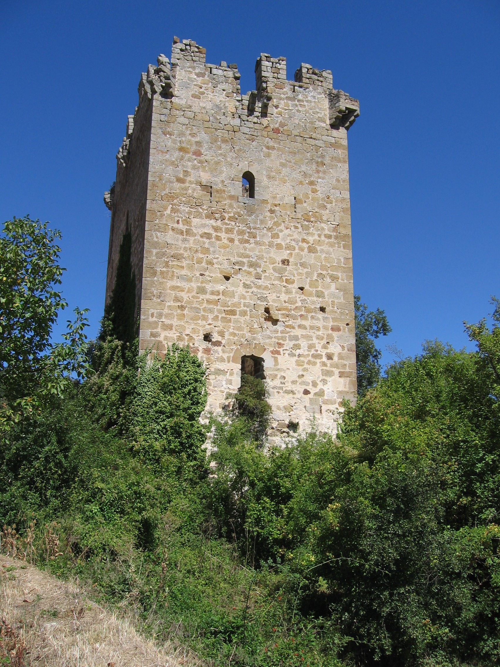
Casa Torre de Calderones y Salazares
Valdegovía / Gaubea
Casa Torre de Calderones y Salazares is a medieval fortified tower standing in Nograro, a village within the municipality of Valdegovía / Gaubea, in the province of Álava, Basque Country. The building is more than six hundred years old and ranks among the best-preserved examples of defensive architecture in the region. What is this tower? The structure was built at the turn of the 14th and 15th centuries as a tower-house — a fortified noble residence combining a family home with a defensive stronghold. Buildings of this kind formed the backbone of the social and military structure of Valdegovía in the late Middle Ages: local lineages raised these fortified seats to control the surrounding land and defend their interests against rival families. The tower passed successively through the hands of the Calderón, Salazar and Salcedo families, which is why its name today strings together all three surnames. Its facades still stand, along with remains of the original crenellated parapet and machicolations — openings projecting from the upper wall that allowed defenders to drop stones or other objects on attackers below. What will you see on site? The walls are pierced by a series of defensive openings, ranging from narrow arrow slits to more modest loopholes that let defenders strike attackers from cover. The main floor features a distinctive opening closed with a concave arch, while other parts of the building show pointed-arch openings, a detail typical of the Gothic influence that filtered into military architecture of the period. The tower did not originally stand alone. On its north, east and south sides it was protected by a barbican — an outer fortification set forward from the main defensive line to slow down and complicate any direct assault on the building. Remains of the walls that once enclosed the whole fortified complex still survive, giving visitors a sense of the scale of the original stronghold. One of the more intriguing traces of daily life inside the tower is what remains of an oratory dedicated to Saint James (Santiago) — a small private chapel where the residents could carry out their religious practices without ever leaving the fortified compound. How do you get there? Nograro sits within the municipality of Valdegovía / Gaubea, in the western part of the province of Álava. This is a rural, sparsely built-up area, set among the valleys and hills typical of this part of the Basque Country. A car is by far the most practical way to get there — local roads connect Nograro with the neighboring villages of the municipality and with the province's main routes. When should you visit? Given the nature of the site — a stone, open-air structure with no roofed visitor interiors — spring and autumn make for the best visiting months, offering mild temperatures and the most scenic surrounding countryside. Summers here can bring the higher temperatures typical of Spain's interior, while winters tend to be cooler and damper, in keeping with the climate of northern Spain. Frequently asked questions What's the difference between a tower-house and a full castle? A tower-house (Spanish: casa torre) is a smaller, more compact type of fortified noble residence, combining living quarters and military defense within a single vertical structure — unlike sprawling castle complexes with multiple courtyards and outbuildings. Who owned the tower? The building belonged in turn to the Calderón, Salazar and Salcedo families, a history reflected directly in its present-day name. What is a barbican and why was it built? A barbican is an outer fortification surrounding the main building, designed to slow and complicate an attack before it could reach the tower's actual walls. Can you go inside the tower? The site survives mainly as an exterior architectural shell, with visible defensive features — facades, arrow slits and the remains of its surrounding walls — making it a place best appreciated from the outside as a witness to the region's medieval architecture.
-
Tower of Torrecitores
Avellanosa de Muñó
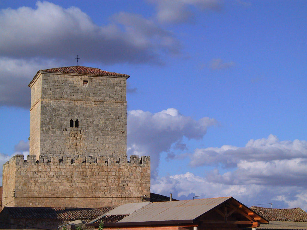
Tower of Torrecitores rises above the tiny hamlet of Torrecitores del Enebral, part of the municipality of Avellanosa de Muñó in the province of Burgos, in the historic Arlanza region of Castile and León. It's one of those forgotten corners of rural Spain where a medieval defensive tower still dominates a cluster of houses now home to only a few dozen people. What will you see on site? The main draw is a massive square stone tower built from rough-hewn rubble masonry (sillarejo), with corners reinforced by carefully dressed ashlar blocks. The structure rises to roughly 30 metres, making it one of the more imposing defensive towers in this part of Burgos province. Inside, the original layout was divided into three levels separated by pointed barrel vaults, further subdivided by timber flooring — a configuration typical of Castilian noble towers from the turn of the 14th and 15th centuries. Walking around the building, look for traces of later alterations. In the second half of the 15th century, a wall was added that blocked several of the original arrow slits, likely a response to the changing defensive needs of the family controlling the estate. The deepest transformation came in the 16th century, when the top floor was raised, costing the tower its original crenellations, replaced by a four-sloped roof — a solution more typical of a residence than a fortress, and a sign of how the building evolved from a military stronghold into a more representational seat. What's the history behind it? The village and its surrounding lands once belonged to the Torquemada family, one of the most powerful lineages in the Burgos of their time. In the 15th century, the Catholic Monarchs granted the estate to their trusted servant Juan de Ortega, who later became the first bishop of Almería — an episode linking this small settlement to major figures of Spanish history. The Torquemada line, later joined with the Cerezo family, held lordship over the village until 1709, when the title's heiress, María Bibiana Cerezo, married Fernando de la Cerda Dentí, Marquis of La Rosa. The place name itself has an interesting origin: "Torrecitores" combines the word for "tower" with an archaic Castilian form of "hawks" (halcones), while the later addition "enebral" points to a nearby grove of juniper trees — a name that captures the landscape well, a defensive tower among the dry, juniper-covered hills of northern Castile. The settlement has long been sparsely populated. In the mid-19th century it counted only a few dozen residents, and in 1856 it was formally absorbed into the municipality of Avellanosa de Muñó. Population briefly climbed above a hundred in the mid-20th century, but today only a few dozen people live here — one of many Castilian villages shaped by rural depopulation. How to get there and when to visit? Torrecitores del Enebral sits well off the main tourist routes, roughly 50 kilometres from Burgos, the provincial capital. A visit really requires your own car, since public transport links to such small villages are minimal. It's best planned as part of a wider tour of the Arlanza region, known for its Romanesque architecture and the open landscapes of the Castilian plateau. Spring and early autumn are the most comfortable seasons, when temperatures on the plateau are milder than in the scorching summer or the cold winter months. Bring a camera — the tower photographs particularly well in the morning and late afternoon, when low sunlight brings out the texture of the stone walls. Frequently asked questions Can you go inside the tower? The building sits in a very small, quiet village, so it's worth checking current access information with the local Avellanosa de Muñó municipal authorities before visiting — regular opening hours for visitors are not widely published. How much time should I set aside? Seeing the tower and walking around the hamlet usually takes 30–45 minutes, but factor in extra travel time given the distance from Burgos and the rural access roads. Are there other attractions nearby worth combining with this stop? The Arlanza region is known for numerous Romanesque monuments and historic villages, so it's a good idea to pair a visit to Torrecitores with a loop around the other settlements in the Avellanosa de Muñó municipality. Do I need a car to get there? Yes — given the tiny population and the peripheral location, driving is by far the most practical, and effectively the only sensible, way to reach the site.
-
Pazo de Tor
Monforte de Lemos
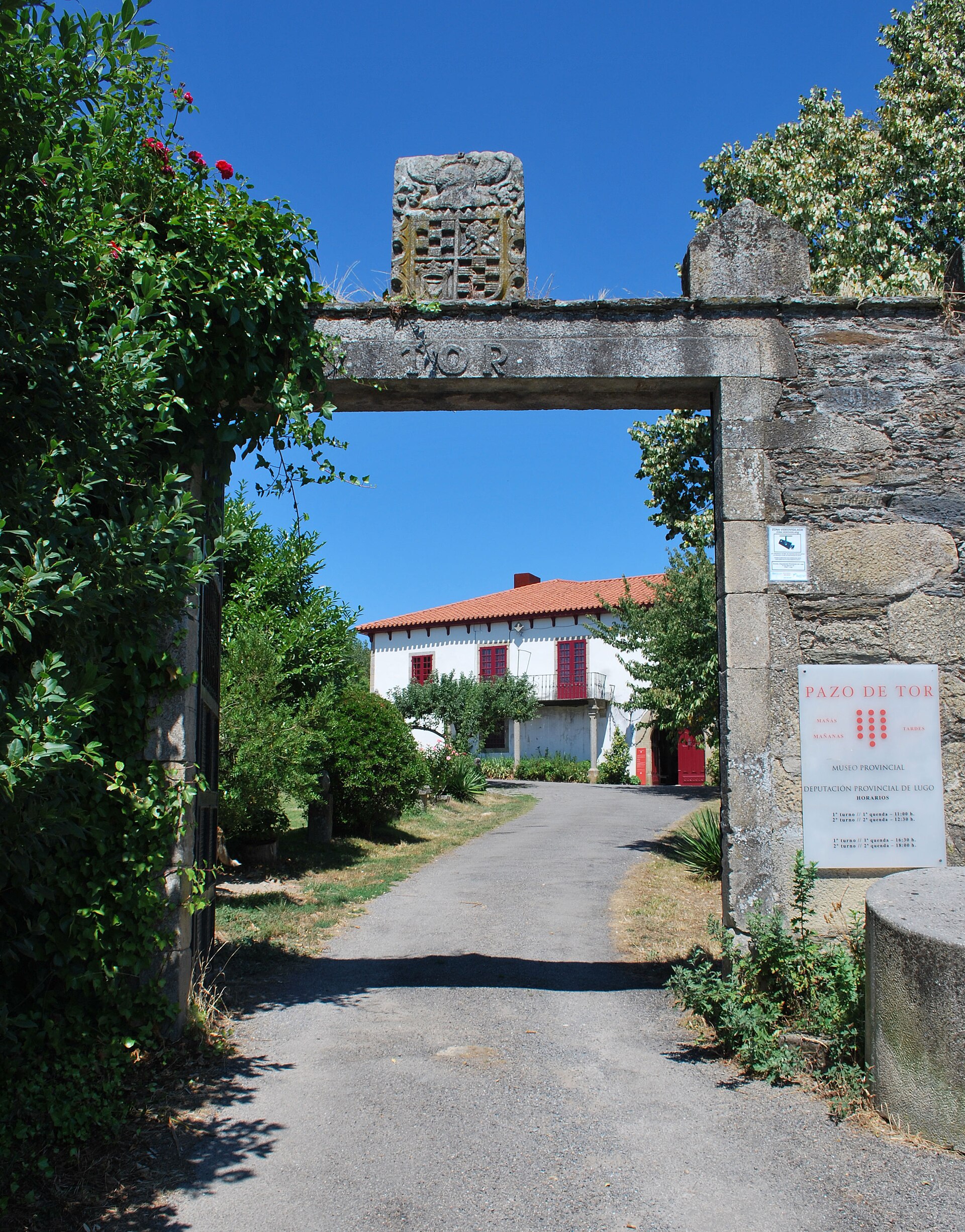
Pazo de Tor is a baroque manor house in the village of Tor, in the municipality of Monforte de Lemos, in the province of Lugo, Galicia. It now operates as an ethnographic museum, offering a rare look at how the Galician nobility lived on their country estates in the 18th century. Where did this manor come from? The original house on this site dates back to the 14th century and belonged to the Garza de Castrillón lineage. Most of the building standing today, however, was constructed in the final third of the 18th century — the earlier structure was destroyed by fire after the estate was attacked by French troops during the Peninsular War. The pazo was rebuilt afterward, though some traces of the oldest parts of the estate survive. The house changed hands for the last time in the 20th century, when its final owner, María de la Paz Taboada de Andrés y Zúñiga, donated it to the Provincial Council (Diputación) of Lugo. Her one condition: the house had to remain open free of charge to residents and visitors alike, with its interiors and layout kept exactly as she had left them. Today the property belongs to the Provincial Museum Network of Lugo. What is there to see inside? A visit to the pazo is a walk through the private world of an 18th-century noble household. The highlight is the library, holding close to 3,000 volumes spanning the 16th through the 20th century — one of the more remarkable private book collections preserved in the region. The house also contains a chapel, whose altarpiece dates from the early 20th century. Furniture, everyday objects and interior decoration have been left almost untouched, which is why Pazo de Tor is considered one of the best-preserved examples of a Galician noble residence — not a sanitized display case, but a house that still looks lived-in. What about the grounds? The gardens surrounding the pazo hold a surprise that younger visitors in particular tend to love: a stone maze. It's one of the most popular spots on a walk around the estate and a nice place to pause after touring the interior. How to get there and when to visit? Pazo de Tor sits in the village of Tor, within the municipality of Monforte de Lemos, inland in the province of Lugo. The easiest way to reach it is by car, since it's a small village with limited tourist infrastructure — plan the trip ahead of time. Visits are guided only, running Tuesday to Sunday at fixed times: 11:00, 12:30, 16:30 and 18:00. Admission is free, but because group sizes are limited, it's worth booking a slot in advance by phone or through the museum network's website. Frequently asked questions Is admission to Pazo de Tor free? Yes, guided tours are free of charge, though each group has a limited number of spots. What time do the tours run? Tuesday through Sunday at 11:00, 12:30, 16:30 and 18:00. The house is closed on Mondays. Do I need to book in advance? Yes, booking ahead is recommended — either by phone (982 16 55 34) or through the Provincial Museum Network of Lugo's website. What is the highlight of the pazo? Its historic library of nearly 3,000 volumes and the stone maze in the gardens, alongside the remarkably well-preserved interiors of the house itself.
-
Castell de Cruïlles
Aiguafreda
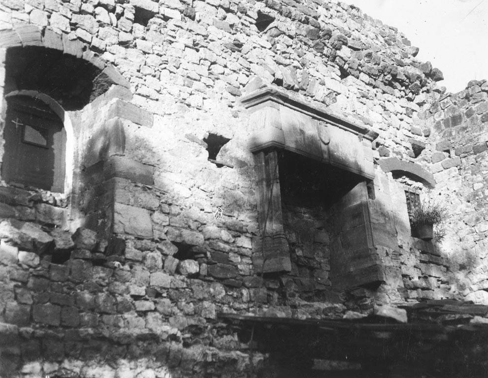
Castell de Cruïlles is a fortified manor house in the town of Aiguafreda, in the Vallès Oriental region, listed as a cultural property of national interest. Despite the word "castell" (castle) in its name, the building is really a fortified noble residence rather than a classic defensive stronghold — a distinction that makes it an intriguing stop off Catalonia's beaten path. Where does the name come from? The site itself has a documented history stretching back to at least 898, when the estate was mentioned in the consecration act of the nearby church of Sant Martí. For centuries the residence belonged to the Aiguafreda lineage and served as the jurisdictional seat of the surrounding lands, before the territory was elevated to a barony in 1577. The building's current name dates to a mid-15th-century marriage: Aldonça de Basella wed Guerau Gilabert de Cruïlles i de Cervelló, a nobleman from a powerful family originating in Baix Empordà — the same region where a much better-known castle bearing the identical name still stands today. It was this couple who rebuilt the manor, giving it the form whose traces remain visible now. What will you see on site? Parts of the walls from the original late-medieval fortification survive, along with the remains of two towers. Until recently, the grounds also included extensive ruins of a large 14th–15th-century manor complex, partly inhabited as a working farmhouse. Between 1989 and 1990, the owning family carried out a thorough reconstruction, converting the property into a place of temporary residence — so today the building can be seen in far better condition than a few decades ago, though this is a private restoration rather than a museum-style reconstruction. How do you get there? Aiguafreda sits in Vallès Oriental, close to the C-17 road linking Barcelona and Vic, which makes the drive fairly straightforward from central Catalonia. Keep in mind that the manor remains private property, so visits are generally limited to viewing the exterior and walking the surrounding area rather than entering the building itself. When should you visit? Spring and autumn are the best times to come, when temperatures in Vallès Oriental are mild and the surrounding hills and woodland look their most attractive. Summers can get hot in the region, but lower humidity than on the coast still makes shaded walks pleasant. Frequently asked questions Is the Castell de Cruïlles in Aiguafreda the same castle as the famous Castell de Cruïlles in Baix Empordà? No. These are two different buildings that happen to share a name. The one in Aiguafreda took its name from a 15th-century marriage into the Cruïlles family, while the original Cruïlles castle stands in the municipality of Cruïlles, Monells i Sant Sadurní de l'Heura, in a completely different part of Catalonia. Can you go inside the castle? The building is privately owned and used as a residence, so visiting the interior is generally not possible. You can, however, admire it from the outside and learn about its history while walking around the surrounding area. How old is the site? The land the manor stands on has a documented history going back to at least 898, though the current structure dates mainly from the 14th and 15th centuries, with a later restoration carried out between 1989 and 1990. What else is worth seeing nearby? Aiguafreda and the wider Vallès Oriental region are dotted with small towns, hiking trails, and views toward the Montseny mountain range, so a visit to the manor pairs well with a longer walk through the surrounding hills.
-
Silla del Moro
Grenada
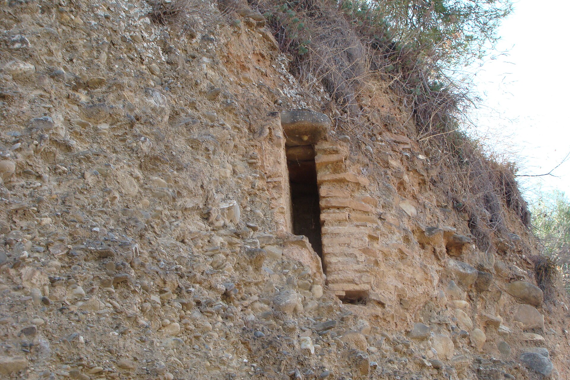
Silla del Moro is a small hilltop fortress in Granada, widely regarded as one of the best viewpoints over the Alhambra and the Generalife. What is Silla del Moro? Silla del Moro — literally "the Moor's chair" — refers to the ruins of a small Nasrid-era defensive castle standing on the slope of Cerro de Santa Elena, roughly 853 metres above sea level. Built in the 13th century, it formed part of the fortified perimeter protecting the Generalife and its orchards, with its main role being to oversee the distribution of water carried by the Royal Acequia (irrigation channel) to the palaces and gardens of the Alhambra complex. From the 17th century the site was officially known as Castillo de Santa Elena, but the popular nickname Silla del Moro, in use since the early 1800s, is the name that stuck with locals and visitors alike. The structure itself is a typical Andalusian watchtower built with lime-mortar masonry, with a roughly rectangular footprint of about 46 by 33 metres, once linked by walls to the nearby palace grounds. A local legend ties the fortress to Boabdil, the last Nasrid sultan of Granada, said to have retreated here during an uprising in the city to sit in silence and watch his rebellious capital from above. The castle fell into ruin in the 17th century and remained abandoned for centuries until a 2011 restoration turned it into a public viewpoint, now managed as part of the Alhambra and Generalife monumental site. How do you get to Silla del Moro? The easiest way in is by city bus lines C30 or C32, which terminate at the Alhambra ticket office next to car park number 1; from there it's roughly a ten-minute uphill walk to reach Silla del Moro. The site is also reachable by car or on foot via several hiking paths that circle the hill. An easier approach starts near the cemetery, while a steeper, more demanding route begins at the Fuente del Avellano spring. These same trails are popular with hikers and cyclists continuing on toward Llano de la Perdiz. What will you see there? From the walls of the old fortress, the view opens onto the Alhambra and Generalife below, the historic Albaicín and Sacromonte quarters, the Cerro de San Miguel hill, the Darro river valley, and the wide Vega plain ringed by mountains. It's precisely this elevated, side-on vantage point — looking down over the palace rooftops rather than up at them — that leads many visitors to rate Silla del Moro above the better-known miradores in the city centre. The ruins themselves are modest, but the surrounding scenery and the sweep of the view are the real draw. When should you visit? Entry is free. The site is fenced and locked every evening, so it's worth timing a visit to the opening hours: from 15 October to 31 March it's open 8:30am to 6pm, and from 1 April to 14 October, 8:30am to 8pm. Even outside those hours, the view can still be enjoyed from the path running alongside the fence. Early morning tends to bring the softest light for photos, while the hour before sunset draws the biggest crowds for the view over the Alhambra. Frequently asked questions Is there an entrance fee for Silla del Moro? No, admission is completely free, unlike the ticketed entry required for the Alhambra itself. How long is the walk from the Alhambra car park? The uphill walk from the ticket office and car park number 1 takes about ten minutes. Is it a good spot for sunset? Yes — the open, unobstructed panorama to the west makes it one of Granada's favourite spots for watching the sun go down over the Alhambra. Can it be combined with other sights nearby? Yes. Trails from Silla del Moro continue through the Dehesa del Generalife toward Sacromonte and Albaicín, making it easy to plan a longer walk linking several of the city's viewpoints.
-
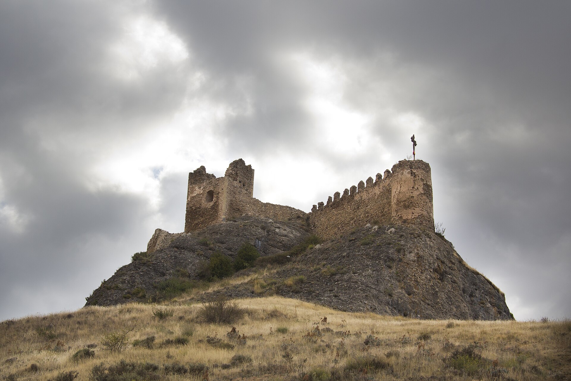
Castle of Clavijo
Clavijo
Castle of Clavijo is a medieval fortress perched on a rocky outcrop above the village of Clavijo, in the La Rioja region, roughly 15 kilometres from Logroño. The ruins tower over the surrounding valley and are visible from a considerable distance, a legacy of the site's long history as a natural defensive stronghold. Why visit Castle of Clavijo? The site is closely tied to the legend of the Battle of Clavijo in 844, in which — according to tradition — Saint James appeared on a white horse to aid Christian forces against Muslim troops. While historians debate whether the battle itself actually took place, the legend became deeply embedded in Spanish national identity and gave rise to the cult of Santiago Matamoros. The fortification on this site traces its origins to the period of Muslim rule on the Iberian Peninsula, and after the territory was reclaimed by Christian forces, it was expanded as a defensive outpost along the frontier between Christian kingdoms. Today, what remains are mainly sections of defensive walls and the remnants of a tower, but the setting itself is striking regardless of how much stonework has survived. The rocky spur on which the castle sits offers sweeping views over the agricultural landscape of La Rioja — a patchwork of vineyards and fields stretching to the horizon. How do you get there? The most convenient starting point is Logroño, the capital of La Rioja, less than 15 kilometres from Clavijo. The drive typically takes around 20–25 minutes along local regional roads. Clavijo itself is a small village, and the castle ruins rise directly above the built-up area, making them hard to miss. A marked footpath leads from the village centre up to the hilltop. The climb is short but steep and rocky, so sturdy walking shoes are recommended — especially in summer, when the exposed rock heats up quickly under the sun. What will you see on site? Beyond the ruins themselves, the view from the upper terrace is one of the highlights — among the better vantage points in this part of La Rioja. From here you can trace the layout of the surrounding hills and the terraced vineyards characteristic of the region. The village of Clavijo also has a parish church worth a brief stop while wandering through the settlement. When is the best time to come? Spring (April–June) and early autumn (September–October) are the best times to visit, with milder temperatures making the climb far less demanding than in the height of summer. In summer, plan your visit for early morning or late afternoon to avoid the hottest part of the day. In winter, the exposed ruins can be windy, so warmer clothing is worth packing. Frequently asked questions Is there an entrance fee for the castle? No — the ruins are freely accessible at all times, as this is an open historical site rather than a ticketed museum. How long does a visit take? Walking up to the ruins and back, including time to take in the views, usually takes 45–60 minutes, depending on your pace. Is it easy to reach without a car? Public transport to Clavijo is limited, so the most practical options are driving yourself or joining an organised tour from Logroño. Is the site suitable for children? Yes, though the steep, rocky path calls for extra care with younger children, and it's best avoided in wet weather when the trail can become slippery.
-
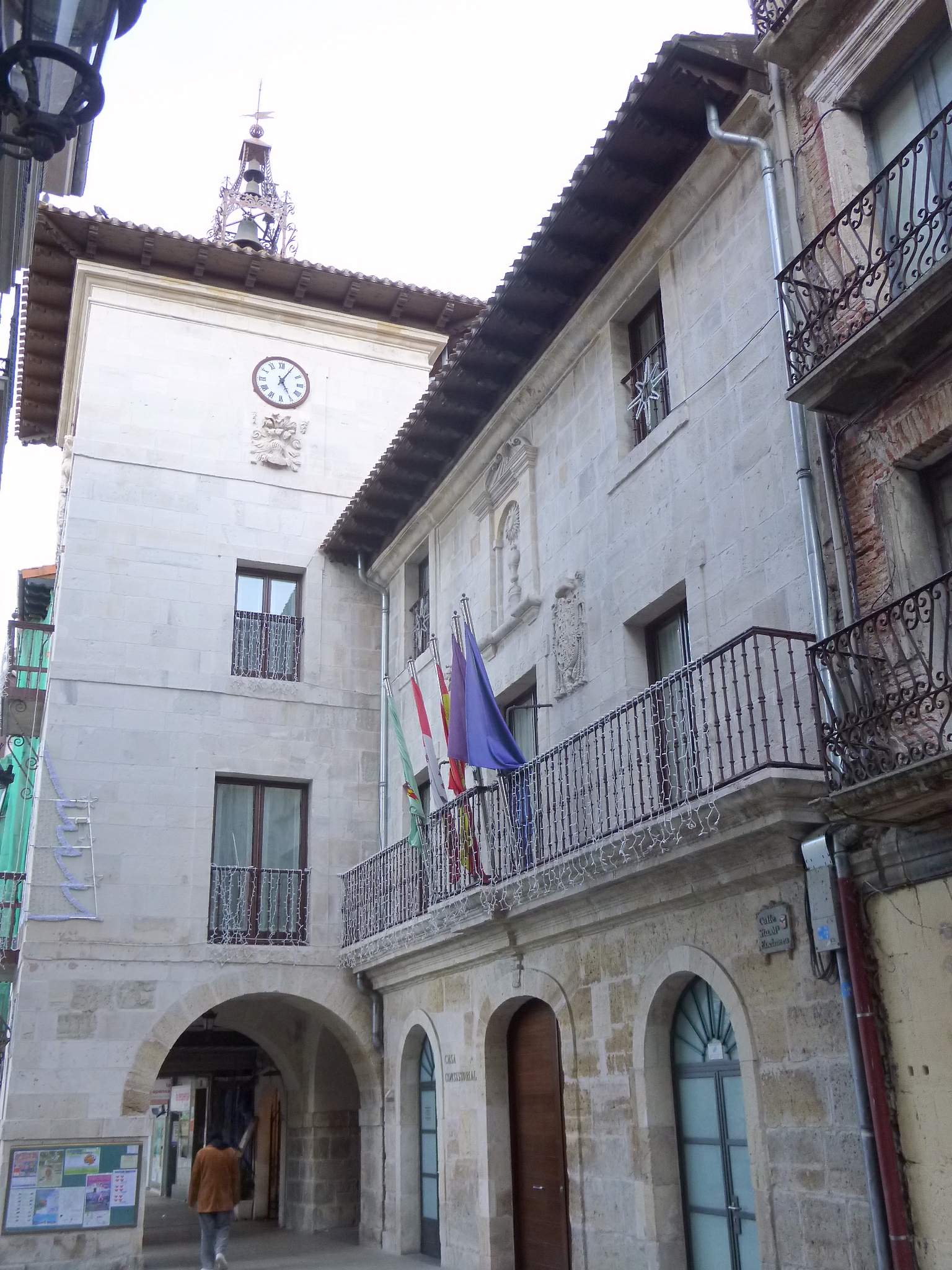
Briviesca town hall
Briviesca
Briviesca Town Hall (Ayuntamiento de Briviesca) houses the local municipal government inside a historic Baroque palace, making it one of the most distinctive buildings in this small town in the province of Burgos, Castile and León, Spain. What is this building? The town hall occupies the former Palacio de Soto Guzmán, built in the 17th century for a noble Castilian family. The building retains hallmarks of aristocratic architecture from the period: a stone facade, a formal entrance portal, and a carved heraldic shield (blasón) mounted above the doorway, a reminder of the family that once owned it. Because of its historical and architectural value, the palace is protected as part of the region's cultural heritage. Today it continues to serve its original civic purpose, functioning as the seat of Briviesca's municipal administration. How do you get there? The town hall sits right in the historic center of Briviesca, next to the Plaza Mayor, the town's main square. Briviesca lies on the A-1 motorway between Madrid and Irún, roughly 40 km east of Burgos, making it a convenient stop for drivers travelling between central Castile and the Basque Country or Cantabria. Regional buses also connect the town with Burgos and nearby villages. Once you're in the center, the old town is compact enough to explore entirely on foot — it's just a short walk from the bus station to the Plaza Mayor. What will you see nearby? The building is best appreciated from the Plaza Mayor itself, a classic Castilian square lined with arcaded galleries (soportales) on two sides. At its center stands a small pavilion, or templete, built in 1909 and thoroughly restored in 1983 and again in 2009 for its centenary. The square is where daily life in Briviesca unfolds — cafés under the arcades, local markets, and town celebrations. Briviesca is well known among urban historians for its unusually regular street plan: the town was laid out along four main longitudinal axes and four cross axes, framing a spacious central square — an arrangement rarely seen in medieval Castile. This clarity of design earned the town the nickname "la bien trazada" ("the well-laid-out one"), and it's still cited today in urban geography textbooks. Near the town hall, it's worth walking to the Casa de los Torre, a mid-17th-century house with a rectangular tower and a balconied gallery, and a little further on, to the Convent of Santa Clara, which holds an octagonal chancel with star vaulting and a striking 16th-century altarpiece. When should you visit? Spring (April to June) and early autumn (September to October) offer the mildest weather in this part of Castile and the quietest streets. Summer can get hot, but it's also when most local festivals and events take place on the Plaza Mayor. In winter, Briviesca keeps its calm, authentic feel as a small Castilian market town. Frequently asked questions Can you go inside the town hall? The building is in active administrative use, so interior access is generally limited to office hours and may require prior arrangement — it's best to check current opening times locally or at the tourist information point. How much time do you need around the town hall? The square and its immediate surroundings can be seen in 30–45 minutes, but exploring Briviesca's old town in full, including the Casa de los Torre and the Convent of Santa Clara, comfortably takes 2–3 hours. Is there somewhere to eat or stay in Briviesca? Yes, the Plaza Mayor and its arcades are lined with bars and restaurants serving traditional Castilian food, and the town has several small hotels and guesthouses. What makes Briviesca different from other towns in the region? Its exceptionally regular, geometric old-town layout and its protected status as a historic ensemble set it apart from most towns of its size in Castile.
-
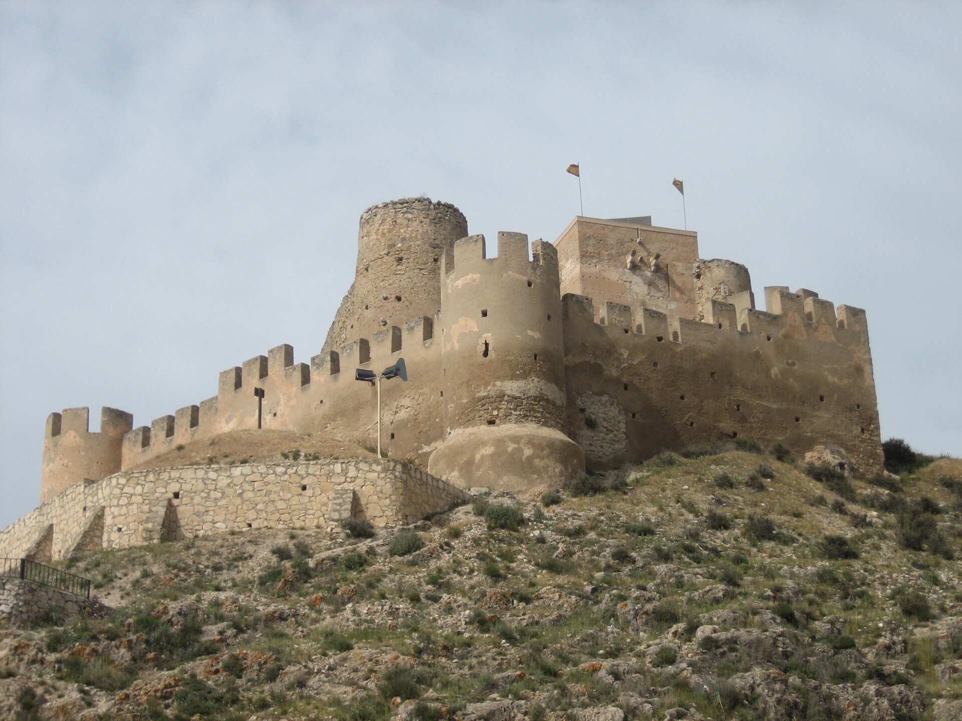
Castle of Biar
Biar
Castle of Biar occupies the hilltop above the town of Biar, in the Alt Vinalopó comarca, in the province of Alicante in eastern Spain. It's the kind of landmark you spot long before you reach it — a silhouette perched on the highest point of the surrounding countryside, set against the dry, rolling terrain typical of inland Alicante. Where is the castle located? Biar sits in the Alt Vinalopó comarca, part of the province of Alicante within the Valencian Community, on Spain's eastern side. This is an inland stretch of the region, away from the coast, marked by a landscape of low hills and shallow valleys. The castle itself sits on the highest ground right next to the town, a position that immediately explains its original purpose: watching over the surrounding land and the routes running through the comarca. What will you see there? The setting itself is the main draw. From the hilltop, the view opens over the rooftops of Biar and the ridgelines that ring the town — the same commanding position that once made this an effective defensive site. Getting to the top means walking through the older, higher part of town first, along narrow streets that climb steadily upward. It's worth giving yourself time once you reach the summit; this is somewhere best taken slowly, pausing every so often as the panorama shifts with each turn. How do you get there? The castle sits within the town of Biar itself, so the simplest approach is on foot from the centre, following the streets uphill toward the high point visible from almost anywhere in town. Travelling by car, Biar is easily reached from the larger towns of the Alt Vinalopó comarca; parking near the centre and continuing on foot is the most practical way to start the visit. Given the incline, comfortable walking shoes make a real difference. When is the best time to visit? The Alicante province has a Mediterranean climate, with hot summers and milder shoulder seasons. Since the walk up is exposed with little shade, spring and autumn are the most comfortable times to take it slowly and enjoy the views without the summer heat working against you. Morning visits also tend to offer the softest light for photos across the surrounding hills. Frequently Asked Questions Is it a steep walk up to the castle? Yes — the castle sits on the highest point in Biar, so reaching it means climbing narrow, sloped streets through the older part of town. Comfortable shoes are a good idea. Is it worth combining with a walk through the town itself? Definitely. The route up passes through Biar's historic quarter, so a visit to the castle naturally doubles as a walk through the town. Where's the best viewpoint? The summit where the castle stands gives the widest panorama, taking in the rooftops of Biar and the surrounding hills of the Alt Vinalopó comarca. Is there somewhere to park nearby? The town centre is the most convenient starting point — from there, the rest of the route to the castle is on foot.
-
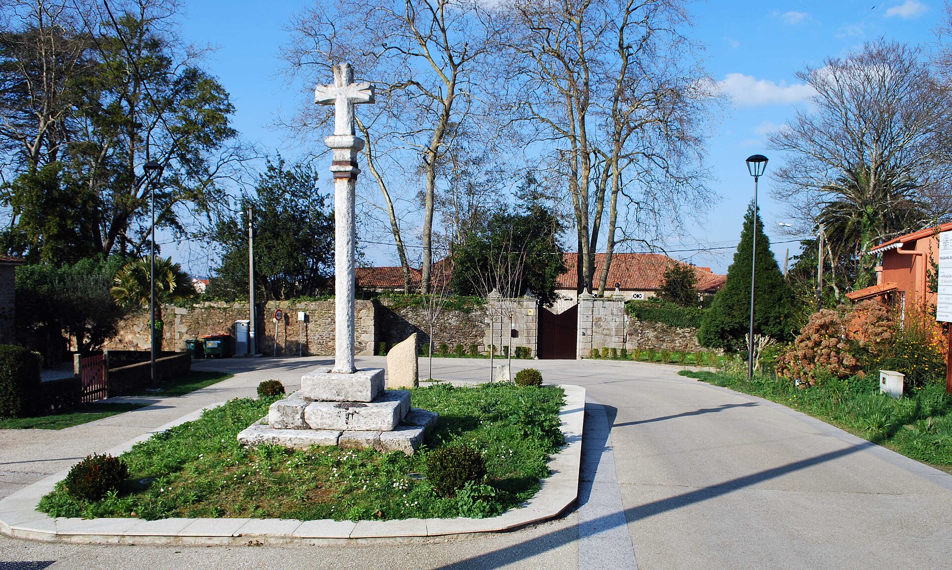
Pazo de Anceis
Cambre
Pazo de Anceis is a 17th-century Galician manor house standing in the parish of Anceis, in the municipality of Cambre, province of A Coruña. The building was raised in the late 17th century, likely on the former site of a property belonging to the Piñeyro and Becerra families, on the initiative of the Bermúdez de Castro lineage. Its facade still displays an elaborate stone coat of arms combining the emblems of three families tied to the estate's history: the roeles of the Bermúdez de Castro, an arm holding a banner from the Vilardefrancos, and a thorn-encircled castle representing the Riobóo family. That heraldic record of successive ownership is the single most distinctive feature of the whole property. What can you see from outside? The pazo has a U-shaped floor plan, completed with 18th-century additions, with a chapel occupying one wing (the left one) and a covered porch, known locally as a patín, leading into the main hall. A stone wall encloses the whole estate, which sits on a hillside sloping gently from south to north down toward a small tributary of the Mero river. In front of the building lies a wooded section of the grounds with old statues and a fountain, while behind it stretches a park crossed by a maple-lined avenue — a recurring feature in the gardens of this kind of Galician manor. How do you get there? Pazo de Anceis stands in the rural parish of Anceis, close to the hamlet of O Drozo and the Santuario Mariano de Altamira shrine. Cambre borders A Coruña directly, so driving from the city typically takes somewhere between fifteen and thirty minutes. It's worth pairing the visit with a short walk through the surrounding villages of the Anceis parish, where a handful of other pazos still survive. Can you go inside? No. Pazo de Anceis is privately owned and its interior is not open to visitors. The building can still be admired from the outside, though — the facade with its coat of arms and a stretch of the boundary wall are clearly visible from the road. This is the common situation for many Galician pazos, which have stayed in the same families for generations and function as private residences rather than tourist attractions. When should you go? Spring and early autumn are the best times to see the surrounding area, when the greenery of the park looks its fullest and Galicia's temperatures stay mild. Since the property is only viewed from the outside, the season mainly affects how pleasant the walk along nearby roads is and how good the facade and greenery look in photographs. Frequently asked questions Can you visit Pazo de Anceis? No, it's a private estate. The interior and gardens are closed to visitors, but the facade and outer wall can be seen from the public road. How old is the building? It was built in the late 17th century and took on its current U-shaped form after 18th-century additions. What does the coat of arms on the facade represent? It combines the emblems of three families linked to the property's history — Bermúdez de Castro, Vilardefrancos, and Riobóo — reflecting successive changes in ownership over the centuries. How far is Pazo de Anceis from A Coruña? Cambre borders A Coruña directly, so the drive usually takes about 20 to 30 minutes depending on the starting point in the city.
-
Castle of Sabiote
Sabiote
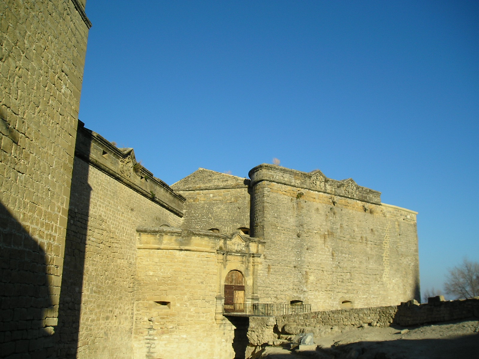
The Castle of Sabiote stands guard over the small town of Sabiote in the province of Jaén, in Andalusia, Spain. Historians rank it as the most important 16th-century military structure in the entire province and as the oldest surviving example in Spain of a Renaissance castle-bastion. Why was a fortress built here? The hilltop has been used strategically since the Bronze Age, offering commanding views over the Guadalimar river valley and the mountain ranges of Sierra Morena and Sierra Mágina. During the Caliphate of Córdoba an Arab fortification already stood on the site, recorded in sources as the Castillo de Sabiyuta, part of the district of Úbeda within the Jaén region. The first documented mention of the settlement dates to around 1137, when troops of Alfonso VII laid siege to it without success. The turning point came in 1257, when King Alfonso X granted Sabiote to the military Order of Calatrava. The order's knights built a new stronghold here, which helped defend the Christian-Muslim frontier through the 13th and 14th centuries. In 1537 the estate passed to Francisco de los Cobos, the powerful secretary of Emperor Charles V, opening the way for the castle's transformation in Renaissance style. What can you see on site? The most striking feature is the monumental Renaissance façade of dressed stone, decorated with the coats of arms of the castle's founding families. Equally distinctive are the massive pentagonal towers — an unusual shape that sets Sabiote apart from classic medieval defensive castles and reflects an innovative approach to fortification design for its era. The ramparts offer sweeping views over the surrounding valleys and mountain ranges, making the site as rewarding a viewpoint as it is a historical monument. It's also worth strolling through the town of Sabiote itself, whose street layout still largely reflects the Renaissance character it acquired during the castle's heyday. How do you get to the Castle of Sabiote? Sabiote sits in the province of Jaén, close to the better-known heritage town of Úbeda. The most convenient way to reach it is by car via the local roads connecting the town to the region's larger centres. The castle itself occupies a rise within the town, so it's an easy walk once you're in the centre. When is the best time to visit? Given the Andalusian climate, spring (March–May) and autumn (September–November) are the most pleasant seasons for a visit, offering milder temperatures than the hot summer months. It's worth checking local opening hours in advance, as they can change seasonally. Frequently asked questions What makes the Castle of Sabiote stand out among Andalusian castles? It is considered the oldest surviving example in Spain of a Renaissance castle-bastion and the most important 16th-century military structure in the province of Jaén. Who built the castle as it stands today? The fortress in its present form is linked to the period after 1537, when the estate belonged to Francisco de los Cobos, though earlier fortifications on the site were raised by the Order of Calatrava starting in 1257. Was there an earlier defensive structure in Sabiote? Yes — the site was already fortified during the Caliphate of Córdoba as the Arab Castillo de Sabiyuta, and the first documented reference to the settlement dates from 1137. What is the castle's main attraction? Its Renaissance ashlar façade decorated with founders' coats of arms, its distinctive pentagonal towers, and the panoramic views over the Guadalimar valley and the Sierra Morena and Sierra Mágina ranges.
-
Santa Gadea del Cid Castle
Santa Gadea del Cid
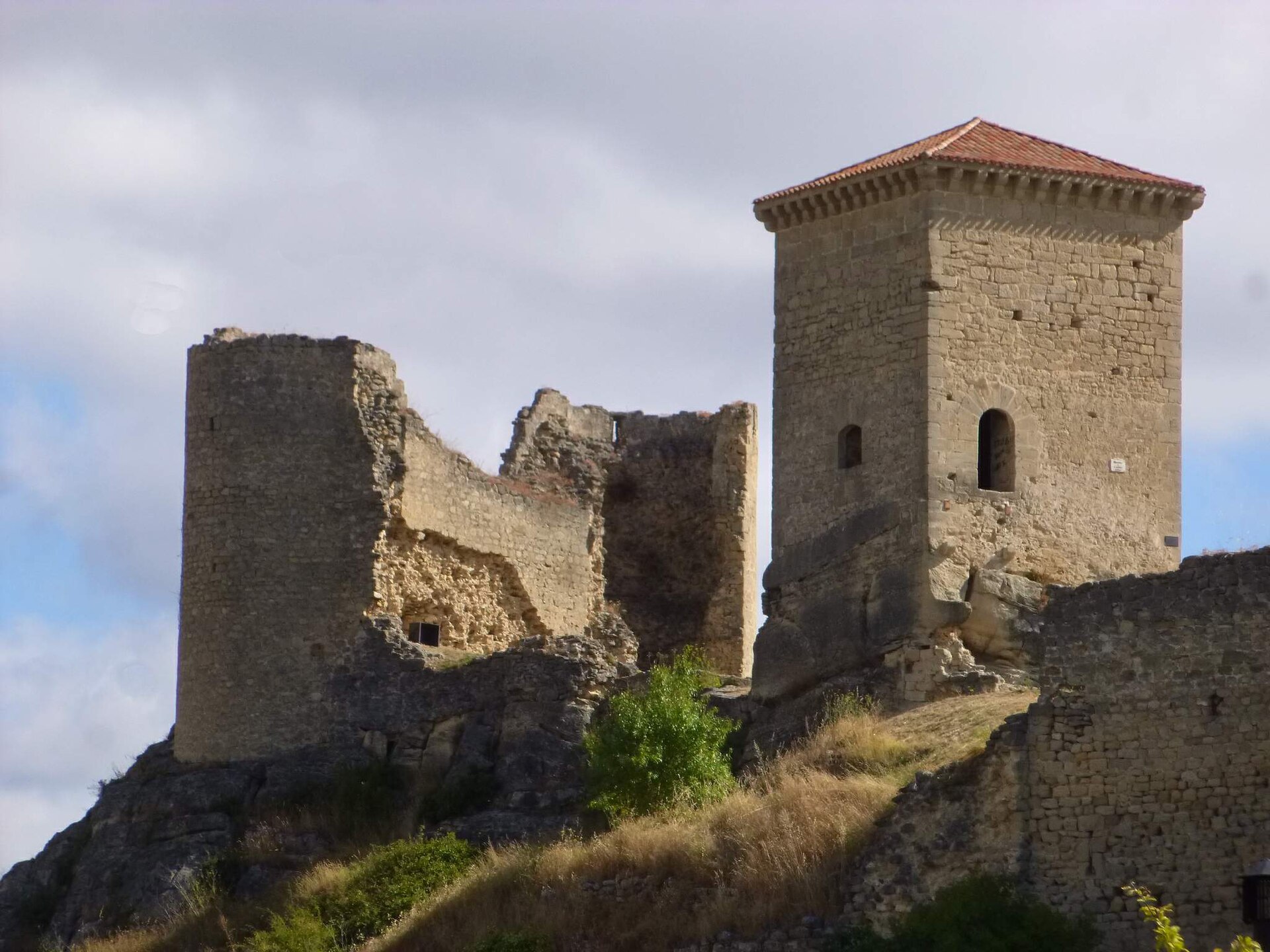
Santa Gadea del Cid Castle stands as a weathered ruin above the small town of Santa Gadea del Cid, in the province of Burgos, Castilla y León. Its crumbling stone walls and half-collapsed towers draw travelers looking for a quiet slice of medieval Spain away from the crowds. What is the history behind the castle? The structure visible today dates to the 15th century, but it was raised over an earlier fortification from the 11th century. The site's origins go back even further, tied to defenses built by Count Rodrigo in the 10th century, when this stretch of land marked the frontier with the Kingdom of Navarre. The earliest written references to the fortress appear in 11th-century records. During the 15th century, the Padilla and Manrique families carried out a major rebuild, giving the castle much of the shape that still partly survives. Toward the end of that same century, the fortress was stormed and captured by the Count of Salinas, an episode that reflects the region's turbulent past. Ownership passed through several noble hands over the centuries: the castle belonged to the Padilla family, then to the Duke of Lerma — son of the last Padilla heir — and by the 17th century it had come under the Dukes of Medinaceli. What will you see on site? Surviving remains include sections of the outer walls and towers left in a semi-ruined state. The centerpiece is the keep (torre del homenaje), which underwent a full restoration. That conservation work is precisely why the castle was removed from the Red List of endangered heritage sites in 2018, having been added to it back in 2010 due to ongoing structural decay. The ruins hold the legal status of a Site of Cultural Interest, granted by a decree dated May 5, 1949, which protects the fortress as a heritage asset of special value. Walking among the ruins gives a real sense of the fortification's original scale and its commanding hilltop position, with views stretching over the valley and the surrounding hills of the Obarenes area. How do you get there? Santa Gadea del Cid sits in the northern part of Burgos province, in an area known as Territorio Obarenes, close to the borders with the Basque Country and La Rioja. Arriving by car is the most practical option, following local roads that connect Burgos with the Ebro valley. The castle occupies a hill right above the town, so reaching it from the center takes only a short walk, though the final stretch is a steep climb. When is the best time to visit? Spring and autumn offer the most comfortable conditions, with mild temperatures and the Obarenes landscape at its most scenic. Summers can get quite hot around midday, so morning or late-afternoon visits work best. In winter, the path up can turn damp and slippery, making the approach to the ruins trickier. Frequently asked questions Can you visit the castle? Yes, the ruins can be freely explored from the outside; given the condition of some sections, it's worth taking care while walking around. How long does a visit take? Exploring the ruins and viewpoints typically takes between 30 and 60 minutes, depending on your pace. Is there an entrance fee? Access to the castle ruins is free, making it an easy addition to any regional itinerary. What else is worth seeing nearby? The town of Santa Gadea del Cid itself and the surrounding Territorio Obarenes offer hiking trails and views of the area's distinctive limestone formations, making it easy to pair the castle with a short walk through the countryside.
-
Castle of the Marquises of the Vélez
Vélez-Blanco
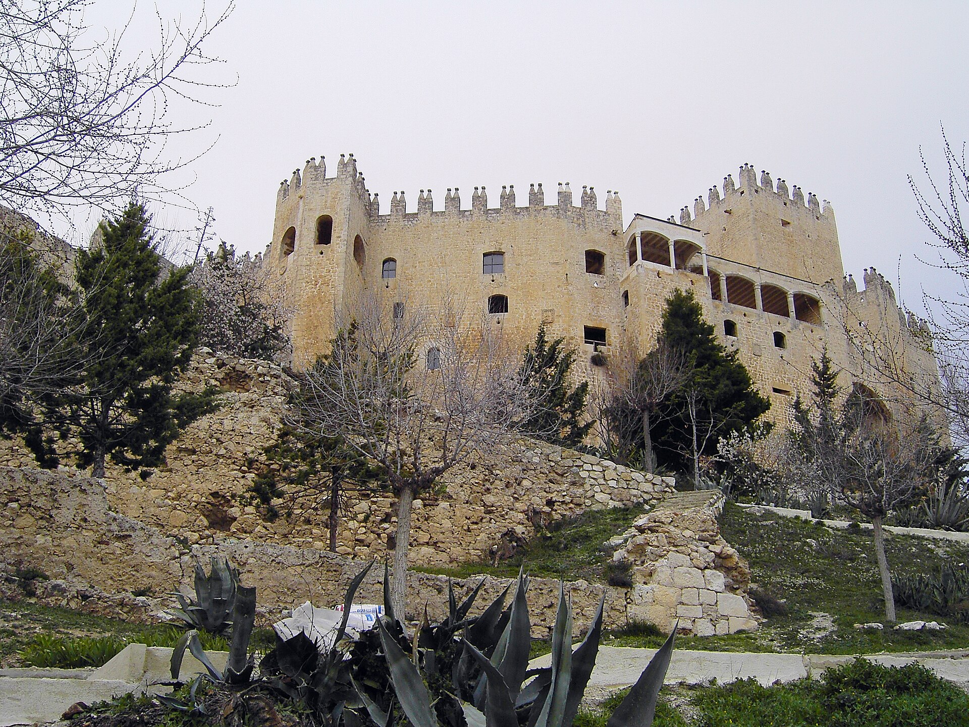
Castle of the Marquises of the Vélez stands on a rocky spur above Vélez-Blanco, a small town at the edge of the Sierra María-Los Vélez mountains in Almería province — one of the finest Renaissance fortress-palaces in southeastern Spain. Where does the castle come from? Construction began in 1506 on the order of Pedro Fajardo y Chacón, first Marquis of Los Vélez, on the site of an earlier Moorish stronghold. Work was finished within roughly a decade, around 1515. The original plan called for a Gothic building, but after the marquis visited La Calahorra Castle in Granada province, he switched course and commissioned an Italian Renaissance design instead — an unusual choice for a Spanish defensive fortress of its time. What can you actually see there? The most recognizable feature is the keep (torre del homenaje), roughly 25 metres tall, visible from a long distance and built as a clear statement of the Fajardo family's authority over the surrounding lands. The castle pairs a rugged, stone military exterior with an interior courtyard that was once richly decorated with marble facades and Renaissance-style relief carvings. One detail surprises most visitors: the original courtyard is no longer inside the castle. In 1903, before Spain had any heritage-protection laws, the property's owner at the time, the Duke of Medina Sidonia, sold the carved marble courtyard and the relief panels from the state rooms. They left the country and today form part of a major art museum's collection in New York. What visitors see on site now is mainly the defensive walls, a reconstructed courtyard space, and rooms stripped of their original decoration — still striking for its scale and hilltop position, but noticeably bare compared to old photographs. How do you get there? The castle sits directly above the town of Vélez-Blanco, in the northeastern corner of Almería province, close to the border with the Region of Murcia. A car is the most practical option: the drive from the city of Almería takes roughly two hours, while Murcia or Lorca are considerably closer. From the town centre, a short but steep road climbs to the entrance, with parking available nearby. When is the best time to visit? The area sits above 1,000 metres of elevation, so summers here are milder than on the Almería coast, while winters can turn cold and windy. Spring (April to June) and early autumn (September to October) offer the most comfortable conditions and the clearest views from the ramparts. In summer, aim for a morning visit before temperatures climb. Anything else worth knowing? Since 2005 the castle has belonged to the regional government of Andalusia, which purchased it from private owners for 3 million euros and opened it to the public during set visiting hours. It's a key stop for anyone exploring the Sierra María-Los Vélez area, tying together late-medieval and Renaissance history with the natural park landscape surrounding the town. Frequently asked questions Can you visit the castle without a guided tour? Yes, the site is open to independent visitors during scheduled hours, though it's worth checking the current timetable before you go, since access can vary seasonally. Why does the courtyard look different from historic photos? The original marble courtyard elements were sold in the early 20th century and now sit in a foreign museum collection. What remains on site is a reconstructed version without the original ornamentation. How long does a visit take? Walking through the castle and along its defensive walls typically takes between 45 minutes and an hour and a half, depending on pace. Are there other attractions nearby? Yes, Vélez-Blanco lies within the Sierra María-Los Vélez Natural Park, which offers hiking trails and scenic viewpoints across the mountainous landscape of northern Almería.
-
Casa de los Balcones
La Orotava
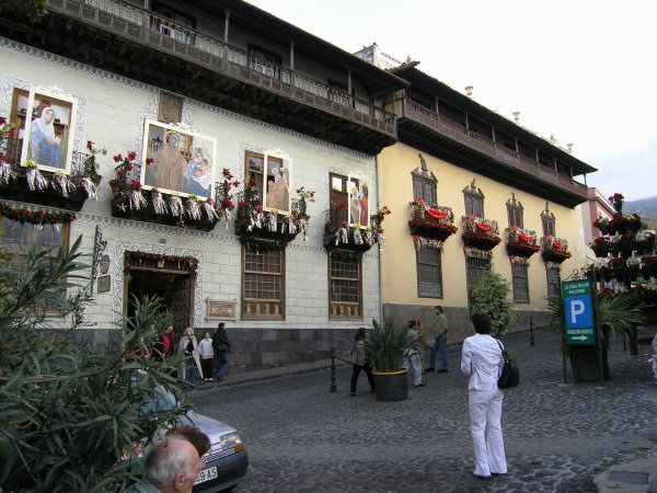
Casa de los Balcones is one of the most recognizable landmarks in La Orotava, a town in the north of Tenerife in the Canary Islands. Its name — literally "House of the Balconies" — tells you exactly what to expect: the timber balconies running along the façade and the inner courtyard are what catch every passerby's eye. Today the building operates as a historic house museum, open to visitors curious to see how a well-to-do Canarian residence looked centuries ago. How do you get to Casa de los Balcones? La Orotava sits in northern Tenerife, close to Puerto de la Cruz and not far from Tenerife North Airport (Los Rodeos). A taxi or rental car from the airport takes roughly 15–20 minutes, and the TF-5 motorway connects the area directly with the island's capital, Santa Cruz de Tenerife. Travelers without a car can rely on the regular TITSA bus network linking Puerto de la Cruz with La Orotava — one of the most frequently used tourist routes on the island. The house itself stands in the historic town center, within walking distance of the main squares and churches of the old quarter, so it's easiest to park in the center and continue on foot. What can you see inside? The interior follows the layout typical of traditional Canarian bourgeois architecture: a central courtyard surrounded by rooms, with the signature wooden balconies on the upper floor built from local Canary pine. It's precisely this construction style — blending Spanish and Portuguese influences with local craftsmanship — that turned Casa de los Balcones into one of the architectural symbols of the whole island. The museum displays period furnishings and everyday objects that help visitors picture life inside such a residence, while the planted courtyard offers a calm contrast to the bustle of the street outside. When is the best time to visit? Tenerife enjoys mild weather year-round, so Casa de los Balcones can realistically be visited in almost any month. Keep in mind that La Orotava is also a common stopover for travelers heading up to nearby Teide National Park, so the town center tends to get busier during peak season in spring and summer. Morning hours are a good window for a quieter look at the interior and façade before the crowds arrive, and it's worth pairing the visit with a short stroll past the colorful historic houses nearby in the old town. Frequently asked questions Is Casa de los Balcones a museum or a private home? It now functions as a historic house museum open to visitors, not a private residence. Where does the house's name come from? The name comes directly from the carved wooden balconies decorating the façade and courtyard, a hallmark feature of traditional Canarian architecture. Is it worth combining the visit with other sights in La Orotava? Yes — the house sits in the historic town center, close to other period buildings and squares, making it a natural stop on a short walk through the old quarter. What's the easiest way to get there from Puerto de la Cruz? The TITSA bus or a short drive are both convenient — the distance is small, and this is one of the most common tourist routes in the north of the island.
-
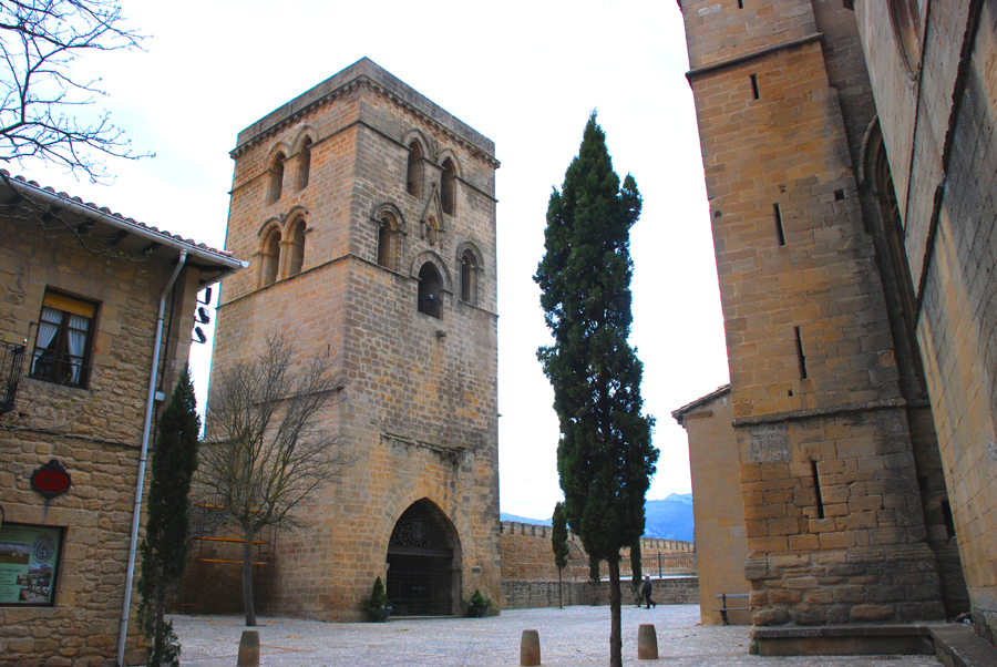
Torre Abacial
Laguardia
Torre Abacial is a medieval defensive tower built into the old town walls of Laguardia, in the wine region of Rioja Alavesa (Álava, Basque Country). It stands on Plazuela de Santa María, right at the entrance to the Church of Santa María de los Reyes, forming one of the town's most recognisable historic ensembles. What is the history behind the tower? The tower was built at the turn of the 12th and 13th centuries, in a transitional style between late Romanesque and early Gothic, as part of the fortifications guarding Laguardia's western flank — opposite the great castle that once protected the northern stretch of the walls. Built from square-cut ashlar stone on a square plan, it served for centuries as a purely military structure. Its name — "abacial," meaning "of an abbot" — comes from a carved image of Saint Benedict visible in the first-floor windows, a detail pointing to a historic link with a monastery or abbey, even though the tower's original purpose was defensive rather than religious. Over time its military role faded and it was absorbed into the adjoining church, taking on a new life as its bell tower. What will you see inside and at the top? The tower rises through four levels. The two lower ones are solid and largely closed off, typical of a structure built to resist attack. The two upper levels, by contrast, are pierced with openings on all four sides — a clear stylistic break from the base that reflects a later remodelling for use as a bell tower and lookout point. Inside, a stone spiral staircase climbs to the top level. From there, the view stretches across the vineyards of Rioja Alavesa, the Sierra de Cantabria mountain range, and the rooftops and walls of Laguardia itself — one of the best vantage points in the area. How do you get there and visit the tower? Torre Abacial sits inside the old town walls, right next to Laguardia's main church, so reaching it is simply a matter of walking through the historic centre — no extra transport needed. Climbing to the top requires prior arrangement with the local Tourism Office, which organises visits and grants access to the upper viewing terrace. When is the best time to visit? Because the main draw is the panoramic terrace, clear days give the best visibility toward the Sierra de Cantabria. Spring and autumn are particularly rewarding, when the surrounding vineyards look their best — in bloom in spring, and during the grape harvest in autumn — adding extra character to the view from the top. In summer, mornings or late afternoons are the most comfortable times to climb, avoiding the peak midday heat. Frequently asked questions Do you need to book to climb the tower? Yes, visits are arranged through Laguardia's Tourism Office, which sets the schedule and access to the upper terrace. Why is it called the "Abbot's Tower"? The name comes from a carved image of Saint Benedict in the first-floor windows, suggesting a historic connection to an abbey or monastery. Does the tower still function as a bell tower? Yes, it currently serves as the bell tower for the neighbouring Church of Santa María de los Reyes, although it was originally built as part of the town's defensive walls. What can you see from the top? The terrace offers views over the vineyards of Rioja Alavesa, the Sierra de Cantabria mountain range, and Laguardia's historic centre and walls.
-
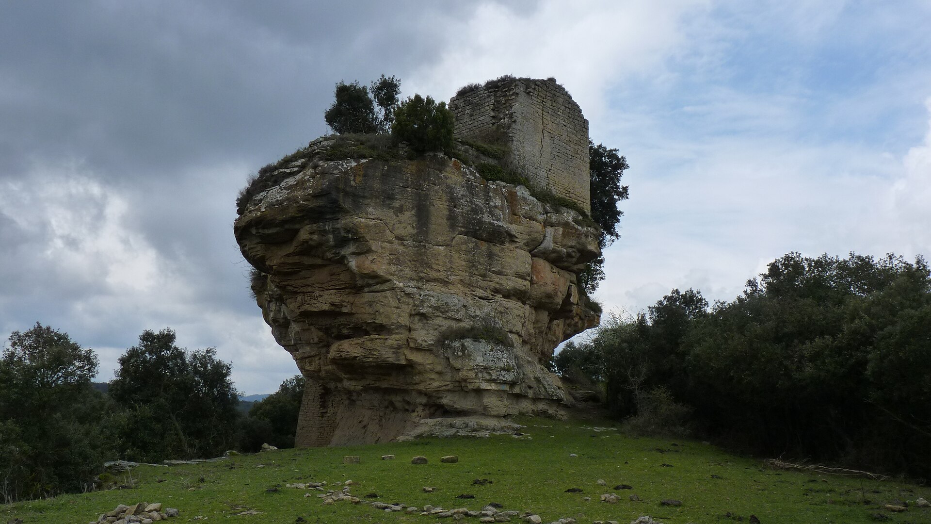
Castell de Castellcir
Castellcir
Castell de Castellcir is a Romanesque castle ruin perched above the village of Castellcir, in the Moianès region east of Barcelona. It crowns a narrow rocky ridge shaped like a ship's stern, locally known as "la Popa," right where two streams — the riera de Castellcir and the torrent de Centelles — meet below the slopes. That confluence explains why this spot was chosen for a stronghold in the first place: steep drops on nearly every side made it easy to defend. How do you get there? Moianès is a hilly, stone-village region best explored by car — the drive from Barcelona takes roughly an hour along local roads winding through the countryside. From the center of Castellcir a marked footpath climbs to the ruins; depending on your pace it takes somewhere between fifteen minutes and half an hour. The last stretch runs over uneven, rocky ground, so sturdy shoes are a good idea. What will you find on site? The remaining structures cover a modest footprint of about 570 square meters, which makes for an intimate rather than monumental visit. The earliest written record of the castle dates to 1014, though the site was already known centuries earlier — in the 9th and 10th centuries — under the name castell de Tenes. From the tower remains and surviving wall sections, the view opens onto the valley and surrounding hills, which is part of what draws hikers here as much as history buffs. What history is tied to these walls? In the 12th century the castle's fate became entangled with the local church: between 1113 and 1120, Bertran de Castellcir transferred lordship over the fortress to the monastery of Santa Maria de l'Estany, accompanying the move with several donations. That kind of arrangement — a feudal lord tying his holdings to a religious institution — was common practice at the time. Another documented turning point came in 1383, when the infant Joan sold the castle for 3,000 sous to Ramon de Planella, a transaction recorded in Catalan archives that illustrates how the fortress changed hands amid the political and financial dealings of the period. Is it worth the detour? For travelers looking for a quieter, less-visited corner of Catalonia, this is a solid pick — no crowds, just a genuinely medieval ruin set into a raw, hilly landscape. The site holds national heritage protection, listed both in Catalonia's register of Béns Culturals d'Interès Nacional and in Spain's Bienes de Interés Cultural registry, under code RI-51-0005246 — official recognition that outweighs its small physical size. When is the best time to visit? Spring and autumn are ideal: temperatures are comfortable for the exposed, rocky approach, and the views from the ridge are at their clearest. Summers in this part of Catalonia can get uncomfortably hot, and the ruins offer little to no shade. Frequently asked questions Is the castle open to the public? Yes, the ruins sit on open, unrestricted land and can be visited freely, with no entrance fee. How long does a visit take? Walking up, exploring the ruins, and heading back usually takes about an hour in total. Are there other sights nearby? Moianès is dotted with similar Romanesque remains and hiking trails, so it's easy to combine several stops into one outing. Is it suitable for children? The uneven, rocky terrain and unguarded edges call for caution and close supervision of younger visitors.
-
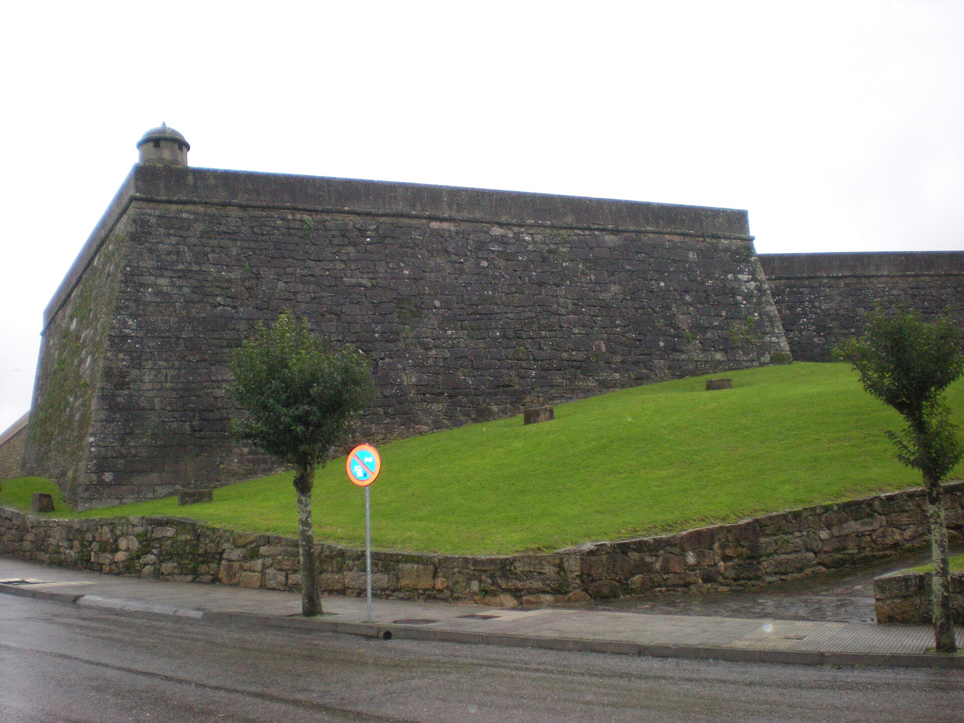
Salvaterra Castle
Salvaterra de Miño
Salvaterra Castle, also known as the fortress of Doña Urraca, rises above the Miño river in the town of Salvaterra de Miño, in the province of Pontevedra, right on the Galician side of the border with Portugal. Where does the fortress come from? The stronghold was built in the 12th century on the orders of King Fernando II, who wanted to secure this stretch of the border against raids from neighboring Portugal. The site quickly gained strategic weight — in 1121, Queen Urraca of Galicia, León and Castile used it as her base to lead a campaign, backed by Archbishop Diego Gelmírez, against her half-sister Teresa, who had proclaimed herself Queen of Portugal. That episode is the reason locals still refer to the site as the castle of Doña Urraca. Another decisive chapter unfolded in the 15th century, when Pedro Madruga, one of the most powerful Galician noblemen of his time, took refuge here in 1479 while defending himself against troops sent by Archbishop Alonso II de Fonseca. The real test for the castle came in the 17th century, during the Portuguese Restoration War. Between 1642 and 1659 the fortress actually fell under Portuguese control, and once it was recovered it was reinforced with modern bastioned walls designed by the French engineer Carlos de Lessar — most of what still stands today dates from that rebuilding. What will you see on site? Very little survives of the original 12th-century walls. What visitors encounter today is mainly the 17th-century bastioned fortification, with sentry boxes lining the ramparts. Inside the enclosure stand a Baroque chapel dedicated to the Virgin of Oliveira and the 17th-century Casa del Conde, the former residence of the family entrusted with guarding the stronghold. The castle was listed as a Site of Cultural Interest (Bien de Interés Cultural) in 1949 and underwent a thorough restoration in 2008, led by the Salvaterra town council. Within its walls you can also find a Wine Museum dedicated to the winemaking tradition of the Condado area, home to albariño and other local varieties. From the ramparts and sentry boxes, the view opens onto the Miño valley and the Portuguese bank on the opposite shore — a panorama that explains why this spot was a flashpoint for both kingdoms for centuries. When should you visit? Summer is the best time to come, when the Festa do Viño do Condado takes place inside the walls — a wine festival combining tastings, concerts and shows set against the backdrop of the castle towers. It's also the season when the weather is most pleasant for walking the surrounding hills and riverside paths. How do you get there? Salvaterra de Miño sits on the main road linking Vigo and Ourense, and a bridge over the Miño leads straight to the Portuguese town of Monção — one of the oldest and most scenic border crossings in the region. The castle itself stands in the town center, within easy walking distance of the main square. Frequently asked questions Can you go inside the castle walls? Yes, the fortified enclosure is open to visitors, and it houses a Wine Museum dedicated to the winemaking traditions of the Condado area. Why is it also called the castle of Doña Urraca? Because in 1121 Queen Urraca used it as her base to lead a campaign against her sister Teresa, who had proclaimed herself Queen of Portugal — an episode significant enough that the fortress carries her name to this day. How much of the original medieval castle remains? Very little. Most of the walls and sentry boxes visible today date from the 17th-century bastioned rebuilding that followed the period of Portuguese control. What's the main draw around the castle? The summer Festa do Viño do Condado held inside the walls, plus the view over the Miño river and the border bridge to Monção, Portugal.
-
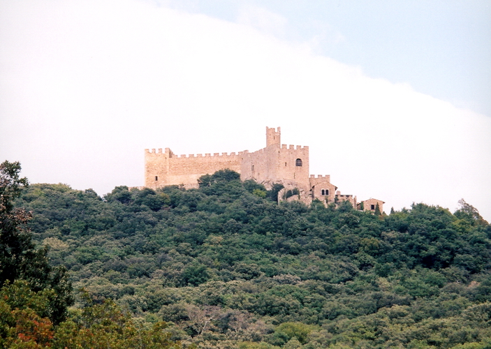
Requesens Castle
la Jonquera
Requesens Castle stands on a hilltop above the southern valleys of the Neulós massif, roughly 7 km east of the Requesens hamlet, within the municipality of la Jonquera. For centuries the stronghold guarded the passage between France and Spain, watching over one of the key communication corridors in this part of the Eastern Pyrenees, in Catalonia. Where exactly is it located? The ruins sit off the beaten path, well away from la Jonquera's main roads and built-up areas. The closest reference point is the hamlet of Requesens itself, from which the castle is separated by several kilometres of hillside. The location isn't arbitrary — from this spot the natural passage between the valleys is clearly visible, which is precisely why the site held strategic value for so long. How do you get there? No paved road runs all the way up to the walls — driving access typically ends near Requesens or nearby forest parking areas, and the rest of the way is on foot along a trail climbing the slope. The path crosses hilly, partly wooded terrain typical of the Neulós foothills, so sturdy footwear and enough water are worth packing, especially in summer. This is a destination for hikers rather than for anyone hoping for an easy, drive-up viewpoint. What will you see on site? Today the castle survives as a ruin — surviving wall fragments and the outline of the former structures let visitors picture the scale of the original stronghold, though nothing here has been fully reconstructed. The site's biggest draw is its setting: the hilltop opens onto views over the valleys south of Neulós, and the surroundings stay quiet and far less crowded than the region's more popular sights. It suits travellers who value history woven into landscape over a polished, rebuilt monument. What role did the castle play in the region's history? Requesens has long been associated with controlling the border route between Catalonia and France, its hilltop position giving a clear observation advantage over the valley below. The castle's name matches that of the old settlement of Requesens, itself part of the la Jonquera municipality — confirming that fortress and village functioned for centuries as a single defensive-settlement unit. When is the best time to visit? Given the nature of the approach — an uphill climb across terrain with little shade in places — spring and autumn offer the mildest conditions, more comfortable than the height of summer. Winter can make the trail trickier, with damp or icy patches on the rockier stretches, so it's worth checking conditions before setting out. What can you pair the visit with? The area around la Jonquera and the Neulós range holds further hiking trails in a similar setting, so it's worth treating Requesens as one stop on a longer route through the border hills rather than a single stand-alone destination — the drive and the climb already take up a fair amount of time on their own. Frequently asked questions Can you drive all the way up to the castle? Not entirely — driving access ends near Requesens or the nearby parking areas, and the final stretch has to be covered on foot along a mountain trail. Is the castle restored, or just a ruin? It's a ruin — wall fragments and the outline of the former structures survive, with no full reconstruction of the interiors. How far is the castle from central la Jonquera? It lies several kilometres into the hills beyond the Requesens hamlet, so at some distance from the municipality's own centre. Is the route suitable for children or less fit visitors? The uphill climb and rocky terrain call for a basic level of fitness — plan an unhurried pace and wear proper footwear.
Earn badges for the places you visit
Download NextOnTrip, discover new places and check off your trails.