Monuments in Spain
A guide to 4655 Monuments in Spain — with descriptions, photos and traveler visits from the NextOnTrip community. Locations spread across 2240 cities and towns. Most visited by the community: castle of Chulilla, Castle of Pioz, castell de la Todolella.
-
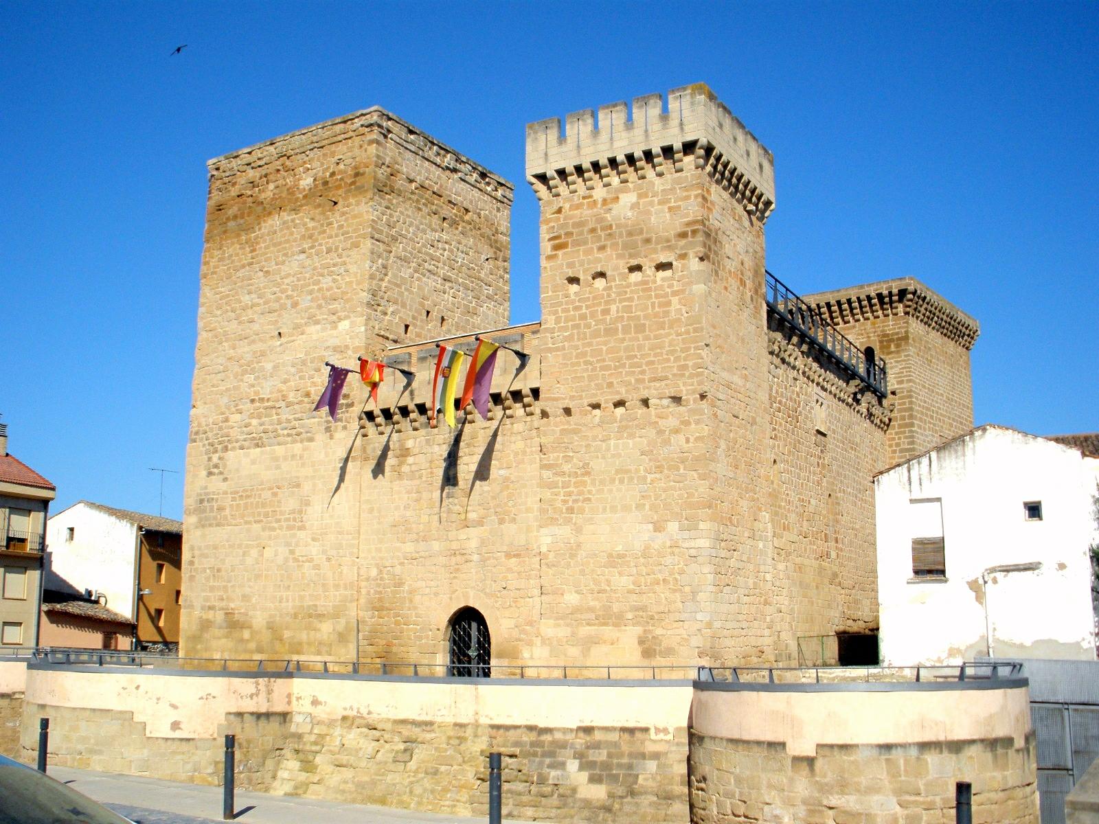
Castle of Aguas Mansas
Agoncillo
Castle of Aguas Mansas stands in the town of Agoncillo, in Spain's La Rioja region, and ranks among the best-preserved medieval fortresses of the area. When was it built? Construction unfolded gradually across the 13th and 14th centuries, using ashlar stone that gives the walls their sturdy, well-cut appearance even today. In 1983 the site was granted the status of National Historic Artistic Monument, formally recognizing its place in the region's heritage. What does the layout look like? The fortress follows a rectangular plan, with a tower rising at each of the four corners and curtain walls linking them into a single defensive perimeter. This corner-tower arrangement was a common medieval solution: it let defenders cover every approach to the walls while keeping the whole structure compact and hard to breach. How do you get there? The castle sits right at the heart of Agoncillo, a small town in La Rioja. You reach it from the town square, directly across from the parish church of Nuestra Señora La Blanca, which makes an easy landmark for finding your way. Because the two buildings face each other, a visit to the castle pairs naturally with a short walk through the town's historic core. What can you see on site? The main draw is the defensive architecture itself: the squared outline of the walls, the four corner towers, and stone facades that have held up remarkably well across the centuries. Few sites let you take in a medieval fortification laid out this clearly, without later additions blurring its original shape. When is the best time to visit? La Rioja has a continental climate with Mediterranean touches, so spring and autumn bring the mildest, most comfortable conditions for exploring, while summers run hot and dry. Given the town's modest size, the castle works best as one stop on a longer route through La Rioja, a region equally known for its wine-growing tradition. Frequently Asked Questions When was the Castle of Aguas Mansas built? It went up gradually across the 13th and 14th centuries, constructed in ashlar stone. Where exactly is the castle located? In the town of Agoncillo, La Rioja, right on the square facing the parish church of Nuestra Señora La Blanca. Is it a protected heritage site? Yes, it was declared a National Historic Artistic Monument in 1983. What is distinctive about its design? A rectangular floor plan with four corner towers joined by curtain walls, a classic medieval defensive layout.
-
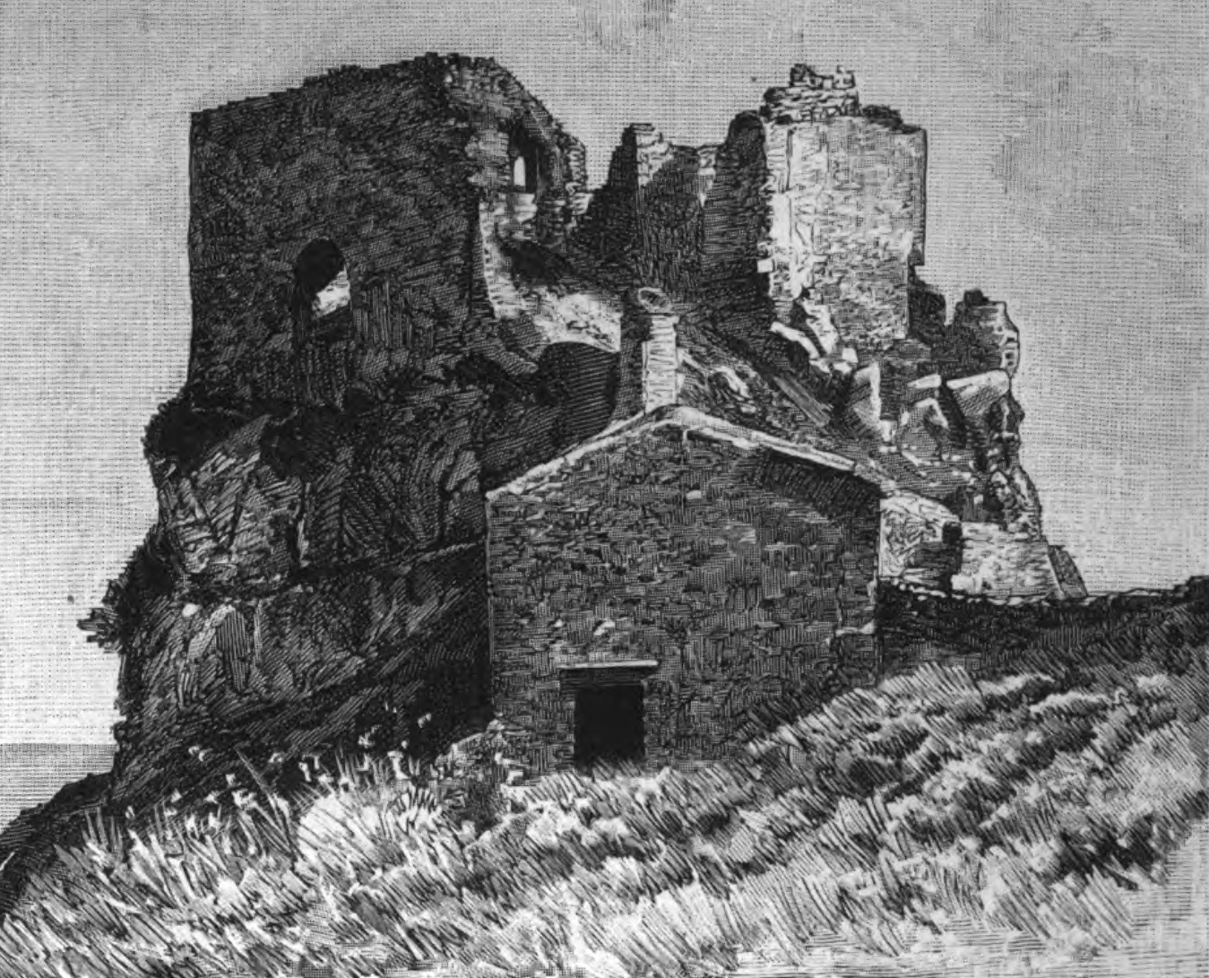
Castillo de Allendelagua
Castro-Urdiales
Castillo de Allendelagua (also known as Castillo de San Antón) is a medieval fortification in the village of Allendelagua, part of the municipality of Castro-Urdiales in Cantabria, Spain. Perched on a rocky hilltop above the coast, the ruins today are little more than fragments of wall foundations scattered among boulders — yet the site still draws history enthusiasts and coastal walkers alike. What is this place? The castle was built between the 14th and 15th centuries as a watchtower guarding the shoreline against threats from the sea. Historians believe it may also have served a devotional role, offering protection to pilgrims walking the coastal branch of the Camino de Santiago. The dedication to San Antón supports this second theory. The Templar legend — fact or fiction? Local legend credits the Knights Templar with building the fortress, but the timeline rules this out entirely. The Templar order was dissolved in 1312, while the castle's construction dates to the 14th and 15th centuries — well after the order had ceased to exist. Castle scholars reject the Templar connection outright, citing a complete lack of supporting documentation; the fortress is now understood as a piece of local coastal defense, unrelated to any military religious order. What will you see on site? The state of preservation is modest. Only faint outlines of walls survive, barely distinguishable among the large rocks covering the hilltop. This is not a restored attraction with visitor infrastructure — it is an authentic, weathered ruin left largely as time found it. For many visitors, that is precisely the appeal: a wild, uncrowded spot with sweeping views over the Bay of Biscay and no admission gates. The site has held official Monument status since a resolution dated April 3, 2002. Despite that legal protection, the ruins have continued to deteriorate, and in 2024 Castillo de Allendelagua was added to the Red List of endangered heritage sites maintained by the Spanish association Hispania Nostra. How do you get there? Allendelagua sits within the municipality of Castro-Urdiales, on the eastern edge of Cantabria near the border with the Basque Country. A walking trail across the coastal hills leads to the ruins, popular with local hikers and connected to nearby paths along the Bay of Biscay. The easiest starting point is Castro-Urdiales itself: drive to Allendelagua, then cover the final stretch on foot over uneven, rocky ground. When is the best time to visit? Because there is no shelter and the terrain is rocky, a dry, sunny day is the best choice — spring or early autumn offer mild temperatures and the clearest coastal views. Strong wind and rain are worth avoiding, since the ground around the ruins can turn slippery. Frequently asked questions Is the castle open to visitors? Yes, freely and without tickets or staff — it's an open outdoor site, not a museum. Did the Knights Templar really build it? No. Construction dates to the 14th–15th centuries, decades after the Templar order was dissolved in 1312. How much time should you plan for a visit? Seeing the ruins themselves takes about 20–30 minutes, but allow extra time for the approach on foot and for taking in the coastal views. Is it worth combining with a visit to Castro-Urdiales? Yes — it makes a natural add-on to a day in town, especially for visitors who enjoy pairing history with an outdoor walk.
-
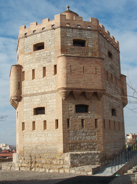
Torre Monreal, Tudela
Tudela
Torre Monreal is a medieval watchtower standing on a hilltop southwest of the city of Tudela, in Spain's Navarre region. It is the only tower of its kind to survive in the city, and since 1985 it has held protected cultural-heritage status under the reference code RI-51-0012361. Where does the tower come from? The earliest written references to the building date back to the 13th century, when it was recorded as "Torre del Mont Real." For a long time it was assumed to be of Arab origin, but archaeological digs carried out in 1984 and 1985 told a different story: most of the pottery unearthed on site dates to the 12th and 13th centuries, pointing instead to a Christian-era origin. The original structure had a rectangular footprint measuring roughly 9.85 by 8.20 metres. What was it built for? The tower functioned as an atalaya, a lookout post whose garrison scanned the Ebro valley and the approach road from the southwest, ready to warn Tudela of any approaching threat. Of the original construction, only an underground water cistern has survived in good condition. How has it changed over time? The tower has been rebuilt more than once. The most visible transformation dates to 1883, during the Carlist Wars, when it was given the octagonal brick shape still visible today. A further renovation in 2007 added interpretive panels covering the Muslim, Jewish and Christian communities that have shaped Tudela over the centuries, plus an optical periscope-style device on the roof that turned the tower into Navarre's first camera obscura. What can visitors see inside? Through the camera obscura, a system of mirrors and lenses projects a live 360-degree image of Tudela onto an indoor screen — streets, rooftops and passers-by appear in real time, like a natural, electronics-free cinema. A session lasts about 20 minutes and combines the visual show with a guide's account of the city's history. From the outdoor viewpoint, visitors also get a classic panorama of the Santa María Cathedral, the Ebro river and the surrounding hills — a view that is especially striking at sunset. How should you plan a visit? The tower opens Tuesday through Sunday, though hours shift with the season, so it is worth checking the current schedule before setting out. Booking ahead for the camera obscura session is a good idea, particularly on weekends, since each screening admits only a limited number of visitors. The climb follows a steep, partly paved path, and there are stairs inside as well, so the site has limited accessibility for visitors with reduced mobility. Parking is available at the foot of the hill. Frequently Asked Questions Is Torre Monreal the only surviving defensive tower in Tudela? Yes. It is the sole watchtower of its kind still standing in the city in recognisable form, even though its appearance has changed several times over the centuries. Does the tower really have Arab origins? That was the long-held assumption, but excavations from 1984–1985 point instead to a Christian origin dating from the 12th–13th centuries. What exactly is the camera obscura inside the tower? It is an optical installation added during the 2007 renovation that projects a live, panoramic image of Tudela onto an interior screen using mirrors and lenses — no electronics involved. Do you need to book a visit in advance? Access to the tower and its outdoor viewpoint usually doesn't require booking, but the camera obscura session — especially on weekends — is best reserved ahead of time, since each screening admits only a limited number of visitors.
-
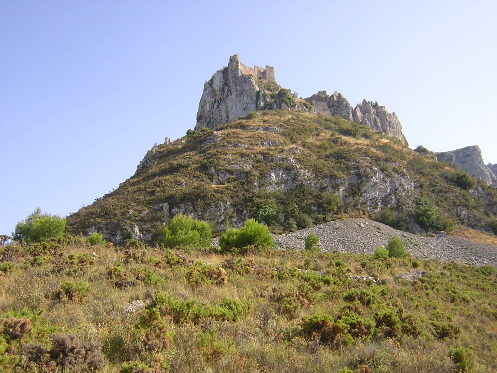
Castell d'Alfofra
Benifato
Castell d'Alfofra is a medieval hilltop fortress in the municipality of Benifato, in the province of Alicante, widely considered the highest-standing castle in the entire province. Its ruins sit on a steep ridge at roughly 1,100 metres above sea level, straddling the boundary with the neighbouring municipality of Confrides, and command a sweeping view stretching over the whole Guadalest valley down to the coastline. Where does the name come from and what is the castle's history? The site's name traces back to a Muslim alquería (farming settlement) linked to the ruler Al-Azraq, out of which the present-day village of Benifato eventually grew. The fortress served as a watchpost controlling the passage between the Marina Baja coast and the interior of the province towards Foia d'Alcoi, which explains its strategic weight during the period of Muslim rule. After King Jaume I conquered the area in 1264, the castle passed into the hands of Vidal de Sarrià, who turned it into one of the region's key defensive strongholds. Over the following centuries ownership changed several times, passing through the Sarrià family, the infante Pedro, and later the Cardona and Ariza families. The fortification also underwent substantial rebuilding as defensive needs evolved. Who does the castle belong to today? One curious detail is the ongoing administrative dispute over the site: the lower enclosure formally falls within the municipality of Confrides, while the upper enclosure belongs to Benifato. This long-standing split is often cited as one of the reasons the castle has never undergone a full restoration and remains in a ruined state. What survives of the original fortification? Of the outer wall, only scattered sections remain, including a square tower and a round tower. The inner wall is better preserved — larger in scale, still showing traces of its crenellated battlements, with a north-facing gate set beneath a semicircular arch and flanked by two further towers. Within the complex visitors can also make out a cistern and the remains of arched gateways. Despite the damage, enough elements survive to give a fairly clear sense of how the fortress was once laid out. How do you get to the castle? Castell d'Alfofra is a popular hiking destination in the Sierra de Aitana. The most common route starts directly from Benifato, while another begins at the Font de Partagat recreational area, often combined with a visit to the nearby Font de Forata spring. The climb demands a reasonable level of fitness — the terrain is steep and the final stretch runs along a rocky ridge — but the reward is one of the widest panoramas in the province of Alicante, taking in the Guadalest valley and a stretch of coastline. Frequently asked questions Is Castell d'Alfofra the highest castle in the province of Alicante? Yes, the ruins sit at around 1,100 metres above sea level, making it the highest-standing fortress in the whole province. Which municipality does the castle belong to — Benifato or Confrides? Formally the site is split: the lower section lies within Confrides and the upper section within Benifato. The dispute over ownership has persisted for years and has hampered conservation work. How long does it take to reach the castle? It depends on the route and starting point, but hikes from Benifato or from Font de Partagat are typically multi-hour mountain walks of moderate to demanding difficulty. What else can visitors see besides the ruins themselves? Beyond the walls, towers and cistern, the view over the Guadalest valley is a highlight, and the route is often combined with a visit to the nearby Font de Forata spring.
-
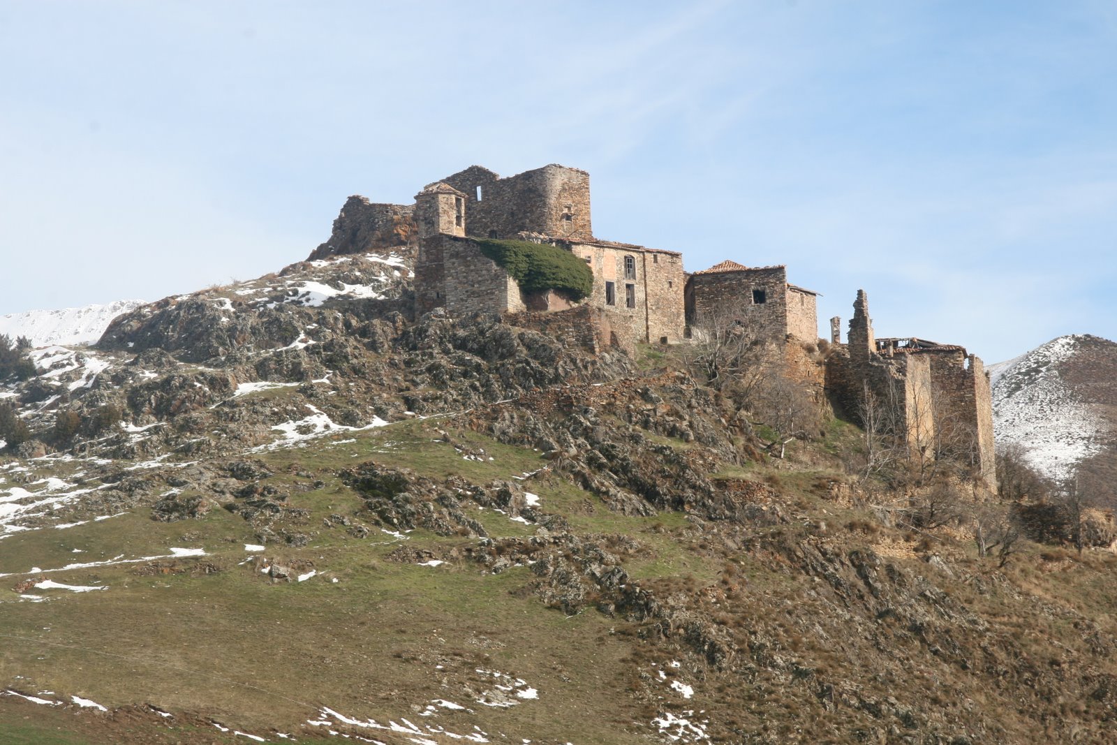
Castell d'Erillcastell
el Pont de Suert
Castell d'Erillcastell is a medieval castle site in the municipality of el Pont de Suert, in the Alta Ribagorça region of the Spanish Pyrenees. It is listed as a Cultural Asset of National Interest, though only fragmentary traces of the original fortress survive today, absorbed into the fabric of an abandoned mountain village. Where exactly is the castle located? Erillcastell sits at roughly 1,441 metres above sea level, just south of the Pic Redó summit, overlooking the right bank of the Peranera stream. This remote, elevated position explains the defensive logic behind the original settlement: it commanded the approach to the valley and the surrounding routes, much like the other fortified sites scattered across Alta Ribagorça. What is the history behind this site? The name of both the village and the castle comes directly from the Erill family, one of the oldest and most influential noble houses in the region. One of the earliest known documentary references dates to 1022, in a deed recording a donation of land to the monastery of Santa Maria de Lavaix, where the place is described as "castro Erilli." Erillcastell was the original seat of the barons of Erill, later raised to the rank of counts — making this modest mountain site the historical seed of Alta Ribagorça as a territorial entity. Over the centuries the family's importance grew well beyond this original stronghold, and the castle itself gradually shifted from a defensive role to that of a symbolic ancestral seat. In time, the remains of the fortification were absorbed into later construction — most notably Casa Montgai, a substantial manor house built at the highest point of the village, reusing the site and likely some of the material of the earlier defensive walls. What can visitors actually see there today? The village of Erillcastell itself is now completely uninhabited and abandoned, a typical case of a high-Pyrenean settlement emptied out as mountain populations declined through the 20th century. No standing towers or intact walls remain from the original fortress; what survives is visible mainly in the layout of the village and in the structure of Casa Montgai, which took over the location and much of the physical footprint of the old castle. Despite this modest state of preservation, the whole ensemble — village and castle remnants together — is protected as a Cultural Asset of National Interest, a status that reflects the site's historical weight rather than any dramatic ruins. Who is this site suited for? Erillcastell appeals to visitors interested in medieval history and Pyrenean noble lineages, as well as travelers who value quiet, half-forgotten mountain corners over polished monuments. Reaching the village means walking through classic Alta Ribagorça scenery — steep slopes, stone terraces, and views over the Peranera valley — making it a natural addition to a tour of the other fortified sites recorded around Pont de Suert. Frequently asked questions Does anyone still live in Erillcastell today? No. The village is entirely abandoned and uninhabited, like many other settlements in the higher reaches of Alta Ribagorça. What actually remains of the castle? Only traces survive, absorbed into the village layout and into Casa Montgai, a manor house built on the site of the original fortress walls. Where does the village's name come from? It comes from the Erill family, one of the region's oldest noble houses, whose original seat was this castle — hence the name Erillcastell. How far back do historical records of the site go? One of the earliest documented references dates to 1022, recording a land donation to the monastery of Santa Maria de Lavaix.
-
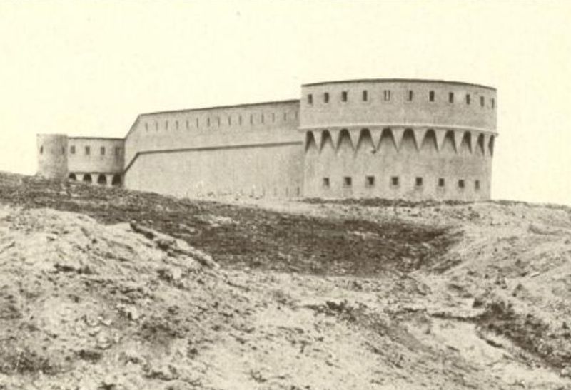
Fuerte de María Cristina
Melilla
Fuerte de María Cristina is an abandoned defensive fort standing on Monte María Cristina hill in Melilla, one of Spain's autonomous cities on the northern coast of Africa. It belongs to the ring of outer forts that protected the city from inland attacks starting in the late 19th century, and today it holds protected status as an Asset of Cultural Interest. When was the fort built and who designed it? The fort was designed in 1890 by military engineer Eligio Souza, with construction carried out between 1893 and 1895. Work began even before the outbreak of the Margallo War (1893–1894), an armed conflict between Spain and local Rif tribes that shaped the further expansion of Melilla's fortifications for years to come. Why was the fort built in the first place? The fort's core purpose was defending the Polígono neighborhood, which was being established from 1893 onward to house the growing number of workers arriving from southern Spain, along with the nearby María Cristina agricultural colony. In other words, it guarded not the city center but the newly forming settlement and farming zone on its outskirts. How is the fort constructed? The structure combines stone walls with solid brick used for the arches and vaults. The building has a basement plus two above-ground floors — a layout typical of 19th-century garrison forts, where the lower levels held storage and technical spaces while the upper floors served as barracks and observation posts. How did the fort's role change over time? Initially the fort functioned as an infantry position, securing the approaches to the areas it was meant to protect. In later years it was converted into a temporary military hospital for garrison troops. Its final military role was as a prison: the building served as a military jail for enlisted soldiers until 1989, when it was closed in that capacity by ministerial order. What is the fort's condition today? Since the prison closed, Fuerte de María Cristina has stood unused and has continued to deteriorate. Despite being abandoned, it enjoys legal protection under the generic heritage decree of 22 April 1949 and Spain's historical heritage law (Ley 16/1985). The fort remains one of the more significant surviving examples of 19th-century defensive architecture in Melilla, though it is not currently open to the public as a museum. Where exactly is the fort located? The fort sits on Monte María Cristina hill in the northern part of Melilla, at coordinates 35.299241, -2.944698. Given its structural condition, visits in practice are limited to viewing the fort from the outside. Frequently Asked Questions Can you go inside Fuerte de María Cristina? No — the fort is abandoned and structurally deteriorated, so entering the interior is neither normally possible nor safe. It is viewed from the outside, from around Monte María Cristina hill. Who designed the fort and when was it built? It was designed in 1890 by engineer Eligio Souza, with construction taking place between 1893 and 1895, just before the Margallo War broke out. What was the fort used for over the years? It began as an infantry position protecting the Polígono neighborhood and the María Cristina agricultural colony, later served as a military hospital, and eventually functioned as a military prison for enlisted soldiers until 1989. Is the fort legally protected? Yes, it falls under generic protection through the 1949 heritage decree and Spain's 1985 historical heritage law, and it is officially classified as an Asset of Cultural Interest.
-
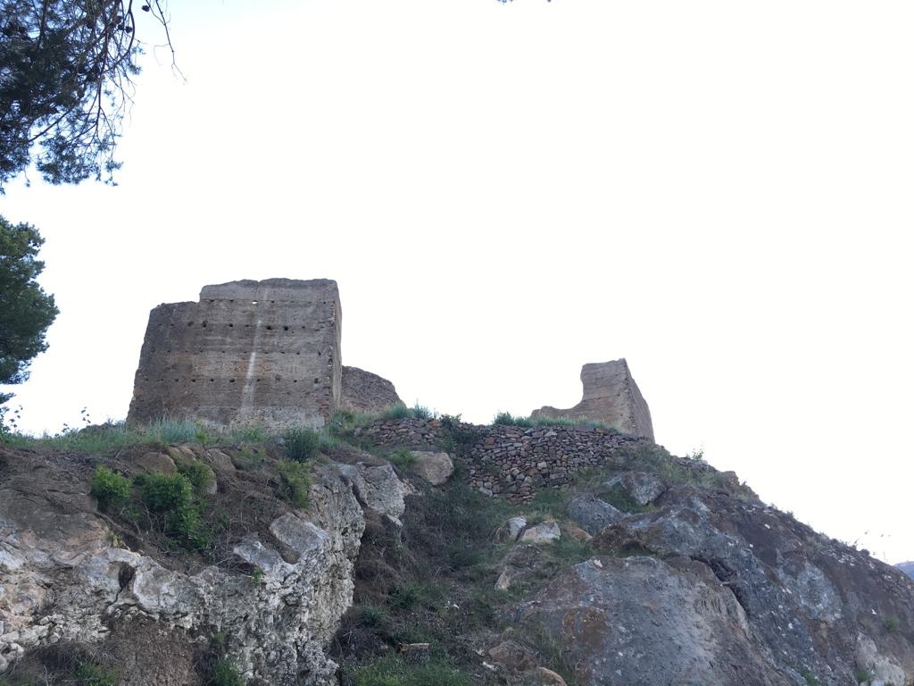
Segart Castle
Segart
Segart Castle stands on a hilltop above the small village of Segart, in the province of Valencia, within the Camp de Morvedre area. Where is the castle and how do you get there? The ruins occupy the summit right above the village of Segart, a small settlement set inland from the Costa del Azahar coastline. From up here the whole valley and surrounding hills open up, which makes the climb a favourite short but demanding walk for anyone interested in views rather than crowds. A steep path leads up from the village centre — sturdy footwear is worth packing, since the ground is rocky and uneven the whole way. Who built the fortress at Segart? The stronghold was raised during the period of Muslim rule, most likely in the 13th century, as a defensive post controlling access to the valley below. It belonged to a wider network of similar fortifications built along the eastern coast of the Iberian Peninsula at the time, whose purpose was to protect farmland and travel routes from raids. How did ownership of the castle change hands? Christian forces took the castle around 1238, when King James I of Aragon conquered it. He first granted it to the Bishop of Vic, and by 1248 the property had passed to Adam de Paterna. Later, King Peter the Ceremonious handed the castle to Bernardo Ripax, and in time it was folded into the jurisdiction of Sagunto — it only regained independent status in 1535. This long chain of owners shows how strategically valuable Segart was considered by successive rulers of the region. What happened after the expulsion of the Moriscos? A turning point for both the village and the castle came with the expulsion of the Moriscos in 1609, a decree that left the settlement nearly empty. The task of repopulating the area fell to Juan de Villarrasa, then lord of the barony covering Segart and Albalat. He brought in Old Christian settlers from Catalan lands, who resettled the surrounding countryside. From that point on, the castle steadily lost its military role and began to fall into disrepair. What survives at the site today? Visitors can still make out stretches of the old defensive walls and part of a square-shaped water cistern. Two rammed-earth (tapial) towers also remain, standing on the northern side of the complex — each with a roughly trapezoidal footprint, about 6 metres along the outer face and reaching close to 10 metres in height. A third tower, built from stone and mortar, stands nearby. The whole site is in a state of ongoing decay, which gives it a raw, unrestored character — better suited to history enthusiasts and landscape photographers than to visitors expecting a fully restored monument. Why visit Segart? Beyond the castle itself, the Camp de Morvedre area offers a quiet, largely uncrowded alternative to the busier coastline nearby. Segart makes a good base for anyone wanting to combine a short hike with a slice of layered history — Muslim, Aragonese and post-Morisco periods all overlap within this one small site. Frequently asked questions When was Segart Castle built? The fortress dates from the period of Muslim rule, most likely the 13th century, before Christian forces conquered it in 1238. Can the castle be visited? Yes, the ruins are reachable on foot via a path from the village of Segart, though the site is unrestored and continues to deteriorate, so caution is advised. What remains of the original structure? Sections of the walls, part of the cistern, and three towers — two built of rammed earth on the northern side and one built of stone. Why did the castle lose its importance? The expulsion of the Moriscos in 1609 emptied the settlement, after which the fortress lost its defensive role and gradually fell into ruin.
-
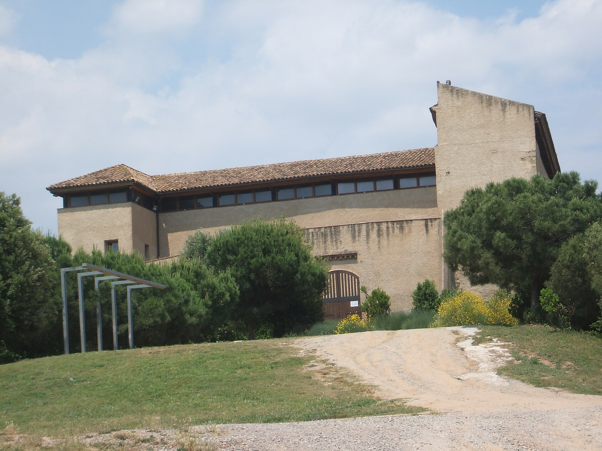
Castell de Rubí
Rubí
Castell de Rubí is a medieval castle standing on a low hill above a stream in Rubí, a town in the Vallès Occidental region roughly 20 km from Barcelona. Today it houses the town's municipal history museum. Where does the site's history begin? The land where the castle now stands appears in written records as early as 1002, when Pope Sylvester II confirmed the possessions of the Sant Cugat del Vallès monastery, which included the surrounding lands. An earlier stronghold, predating the present building, stood elsewhere near the hermitage of Sant Genís, forming part of a defensive line protecting the county of Barcelona from incursions to the south. By the 13th century, that first fortress had fallen into decline. Who built the castle that stands today? On 9 August 1233, King James I the Conqueror granted the knight Berenguer de Rubí permission to build a fortified house — a domus or casa forta — on a hill roughly 143 metres high, right beside the stream bed. That structure, reshaped many times since, forms the core of the castle visible today. Its purpose was both defensive, protecting its owner and the surrounding population, and residential, serving as the family seat. How did the castle change over the centuries? In 1361, the estate passed to the Torrelles family, who converted the fortified house into their family castle — after this point, the older stronghold near Sant Genís was abandoned for good. By the 15th century the building had lost its military role and was remodeled into a lordly residence, gaining Gothic windows and stone portals that survive to this day. The structure grew in stages: an L-shaped wing enclosed by a defensive wall came first, then the northern section was widened with a gallery, and a tower was added at the western corner, giving the whole complex its final U-shaped layout. What happened to the castle in modern times? In the 1980s, the building was acquired by Rubí's town council, which carried out its restoration. In 1996, it opened as an urban ecomuseum, and since 2000 it has operated as the Museu Municipal Castell (MMUC) — one of the larger regional museums in Catalonia, with a permanent exhibition tracing the history of Rubí from the Middle Ages to the present. What can visitors see on site? Visitors can explore the surviving wings of the old residence — west (the noble quarters), north, and east — arranged around a courtyard on the south side. Notable features include Gothic windows, stone portals, and the corner tower that marks the castle's final building phase. The interiors now serve as exhibition halls for the town museum. Frequently asked questions When was Castell de Rubí built? The building seen today dates from after King James I's authorization on 9 August 1233, though the site and an earlier stronghold nearby are documented as far back as 1002. Who commissioned the castle? The knight Berenguer de Rubí received permission to build it; in later centuries it passed to the Torrelles family, who took possession in 1361. Did the castle have a defensive purpose? Yes — it began as a fortified house (casa forta) protecting the area, but from the 15th century onward it gradually shifted toward a residential, seigniorial role. What is there to see inside the castle today? The building houses the Museu Municipal Castell (MMUC), with a permanent exhibition on the history of Rubí, alongside preserved Gothic architectural features such as windows, portals, and a tower.
-
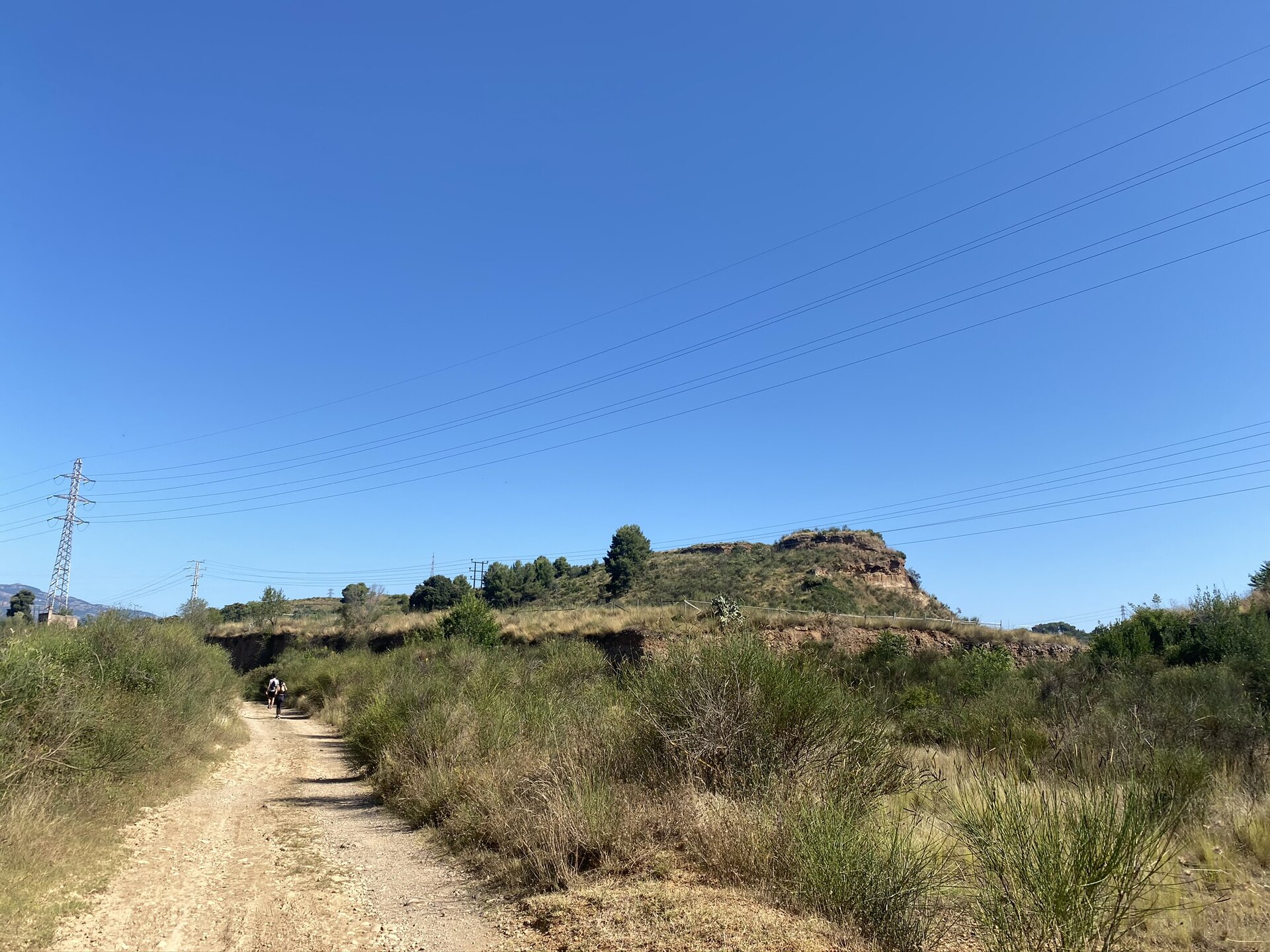
Turó del Castell d'Arraona
Sabadell
Turó del Castell d'Arraona is a modest hill in Sabadell, in the Catalan region of Vallès Occidental, crowned by the ruins of a medieval castle. Standing 212 metres above sea level, the hill blends into the landscape on the edge of the city today, yet it marks the very starting point of Sabadell's history. Where exactly is the hill located? The hill sits at the tip of a spur formed where the Tort stream meets the Ripoll river, just north of the Salut bridge. This was no accidental spot: from here, whoever held the high ground could watch over a stretch of the old road considered a successor to the Roman route linking Cádiz and Rome. Controlling the hill meant controlling traffic along that corridor. Where does the name Arraona come from? The name Arraona already appears in written sources from the mid-10th century, and the castle itself is documented from 1049 onward. For centuries it served as the seat of feudal authority exercised on behalf of the Count of Barcelona over this part of Vallès. The lords of Arraona managed the surrounding land, property and population, and it was they who promoted the market of Sabadell — the very market that grew into the nucleus of today's city. How did the castle lose its importance? From the 14th century the fortress passed into royal patrimony, but as the neighbouring town of Sabadell grew and prospered, the castle steadily faded in significance. That decline continued over the following centuries until, by the 18th century, the building stood in ruins and was largely forgotten by locals. What remains of the old fortress today? A small stretch of wall still survives on the steepest, hardest-to-reach part of the hill — practically the only visible trace of the original defensive structure. The rest of the buildings were lost or scattered over the centuries, and the hill today functions more as a spot for a short walk or hike than as a site with preserved architecture to explore. Why is it worth a visit? Turó del Castell d'Arraona combines a quiet, small-scale landscape on the city's edge with a history that reaches back to the origins of Sabadell. It suits visitors who want to understand where the city came from, take in a viewpoint over the Tort and Ripoll valleys, and step away from the urban bustle without leaving Sabadell at all. The short climb to the top requires no special preparation and works well as an add-on to a walk through the city. Frequently asked questions How high is Turó del Castell d'Arraona? The hill reaches 212 metres above sea level and lies within the city limits of Sabadell, in the Vallès Occidental region. Since when has a castle stood on the hill? The castle is documented from 1049, although the name Arraona already appears in sources from the mid-10th century. Can the castle ruins still be seen on site? Yes, though only to a limited extent — a small section of wall survives on the steepest part of the hill, while the rest of the structure has not survived to the present day. What is the castle's connection to the founding of Sabadell? The lords of Arraona promoted the market that eventually grew into today's city, which is why the hill is regarded as the place where Sabadell's history began.
-
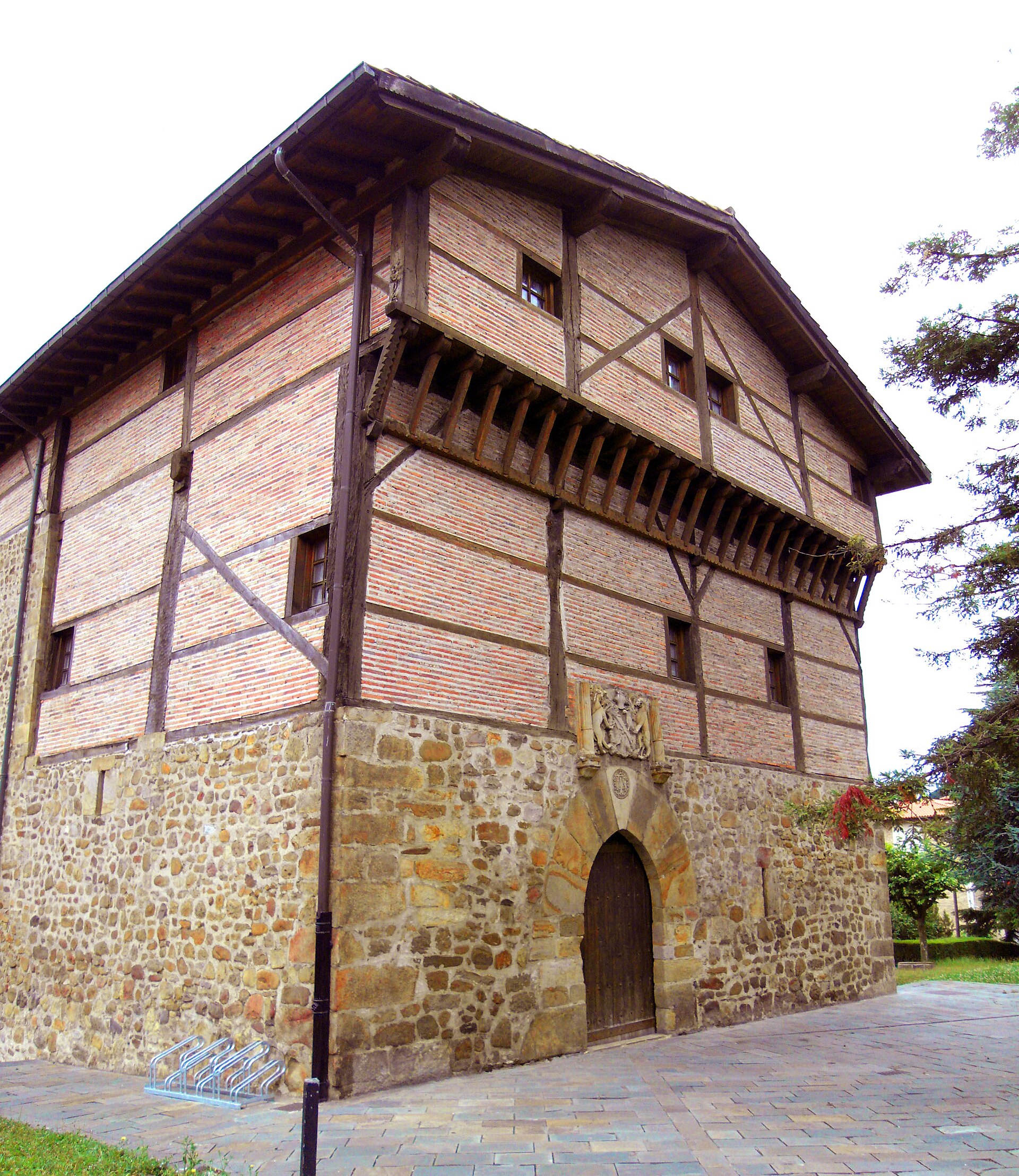
Legazpi dorrea
Zumarraga
Legazpi Tower is a medieval tower house in Zumarraga, in the Basque Country, standing right across from the town's RENFE train station in the Urola Garaia region of Gipuzkoa. What kind of building is this? Legazpi dorrea, also known as Casa-Torre de Legazpi, combines two clearly distinct architectural phases. The lower section is a cubic stone structure with two floors plus a semi-basement dug into the sloping terrain — a textbook example of Gothic defensive architecture from Gipuzkoa dating to the 13th or 14th century. In the 17th century, an upper section was added on top of this stone base: a timber-framed body filled with brick, projecting outward beyond the lower walls and covered by a double-pitched roof. The result is a building with an unusual, manor-house silhouette — a stark medieval defensive tower crowned by a lighter, more residential addition from a later era. Why does the tower carry the Legazpi name? The building was inhabited from the start by the Legazpi family, one of the most influential lineages in the social, political, and ecclesiastical life of Zumarraga during the late Middle Ages. It is this family that gives the tower its most famous connection: Miguel López de Legazpi, the navigator and conquistador, whose life story is tied to this building as the family seat. That link is why Legazpi dorrea is regarded today not only as an architectural landmark but also as a reference point for the history of a family whose most notable member left his mark on the history of Spanish colonial expansion. What is the history behind the tower? The tower house was built in the 13th or 14th century, at a time when Basque noble families constructed this type of fortified residence to protect both their property and their standing amid local power struggles. Legazpi dorrea was directly caught up in the rivalry between the Gamboa and Oñaz factions — two opposing noble camps that split the Basque Country for decades during the late medieval period. As the seat of a family entangled in that conflict, the tower shared the fate of many similar buildings: it was partially dismantled by order of King Henry IV of Castile. When Pedro de Legazpi returned from exile, he rebuilt the family seat, this time using brick as the construction material — a change still visible today in the upper part of the building. What is worth seeing on site? The main appeal of Legazpi dorrea lies in the contrast between its two building phases: the austere stone defensive core and the lighter timber-and-brick residential addition above it. This layout — a defensive tower with a later residential section added on top — is typical of many Basque tower houses (dorretxe) in Gipuzkoa, but it rarely survives in such a clearly legible, two-part form. Standing directly opposite the train station, the tower is easy to reach for travelers exploring Zumarraga and the surrounding towns of the Urola Garaia region. Frequently asked questions Where exactly is Legazpi Tower located? The tower stands in Zumarraga, in the Urola Garaia region of the Gipuzkoa province, directly across from the town's RENFE train station. Who was Miguel López de Legazpi? He was a navigator and conquistador connected to the Legazpi family, whose story is tied to this tower as the family's ancestral seat. From which period does the building date? The stone section of the tower dates to the 13th or 14th century, while the upper timber-and-brick addition was built in the 17th century. Why was the tower partially demolished? Legazpi dorrea became entangled in the conflict between the Gamboa and Oñaz factions, and King Henry IV ordered its demolition; after returning from exile, Pedro de Legazpi rebuilt the seat using brick.
-
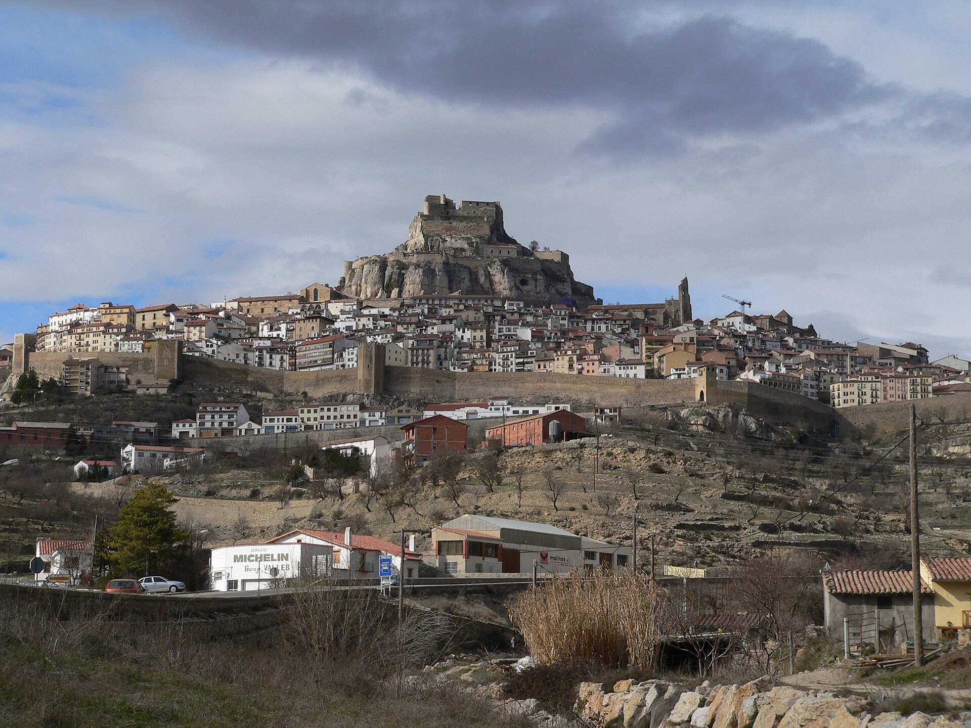
Morella Castle
Morella Castle crowns the hilltop above the town of Morella, in the province of Castellón, in the Valencian Community. It is one of the most recognizable fortresses in northern Spain — visible from many kilometers away, long before the walls of the town itself come into view. Where does the castle stand, and why this spot? Morella sits in the historic Maestrazgo (Els Ports) region, on a hill that dominates the surrounding landscape. The choice of location was strategic — the height allowed control over routes connecting the Mediterranean coast with the interior of the Iberian Peninsula. The castle occupies the very summit of this hill, rising above the town, which has been enclosed by defensive walls for centuries. How do you reach the castle from the old town? The approach winds uphill through the narrow streets of the historic center — a steep walk that calls for comfortable shoes and reasonable fitness, but the views along the way make the climb worthwhile. From the castle's walls and terraces, a wide panorama opens over the rooftops of Morella, the surrounding hills, and the wider Els Ports comarca stretching to the horizon. What can visitors see on site? Remnants of defensive walls, towers, and old structures survive across the site, testifying to centuries of use as a strategic stronghold for the region. A visit typically moves through successive levels of the hill — from the lower sections, past the remains of former buildings, up to the highest point with its 360-degree view. The site draws visitors interested in the region's defensive history as well as photographers chasing panoramic shots of the town below. Is it worth combining with the rest of Morella? Absolutely — the castle is the natural high point of any visit to Morella, the administrative capital of the Els Ports comarca. The historic old town, still ringed by its medieval walls, sits directly at the foot of the castle hill, so most visitors combine both in a single outing. When is the best time to visit? Given the elevated, largely unshaded terrain along the walls, it is worth avoiding the hottest hours of a summer day. Morning and late-afternoon visits also tend to give better photo conditions, as softer light falls across the stone walls. Frequently Asked Questions Where exactly is the castle located? On the summit of the hill overlooking the town of Morella, in the province of Castellón, in the Valencian Community, within the Maestrazgo region. Is the walk up to the castle difficult? The route climbs steep streets through the old town, so comfortable footwear and reasonable fitness are needed, though no specialized equipment is required. What can you see from the castle walls? A panorama over the walled town of Morella and the surrounding hills of the Els Ports comarca. Is it worth visiting alongside the rest of the town? Yes — the castle and Morella's walled historic center form a single cohesive visit and are typically explored together.
-
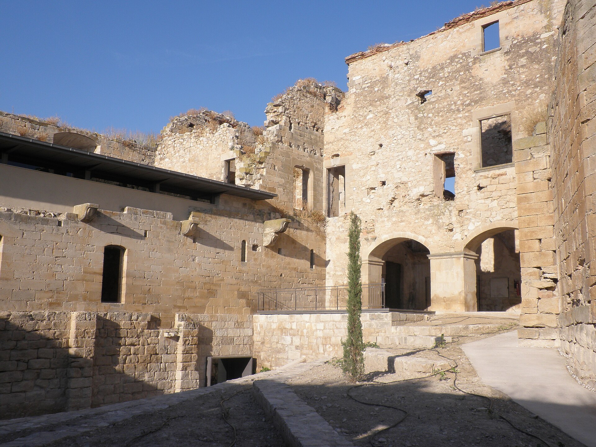
Castell de Maldà
Maldà
Castell de Maldà is a medieval castle standing above the town of Maldà in the Urgell region of Catalonia. Recognized as a cultural asset of national interest, it serves as the symbol and main landmark of the town and ranks among the best-known castles in the area. When was the castle first mentioned in writing? The earliest documentary reference to the castle dates back to 1082. It records a donation made by the counts of Barcelona — brothers Ramon and Berenguer — together with countess Mafalda, to viscount Ramon Folch of Cardona. The donation covered both the castle of Maldà and the nearby castle of Maldanell, making this one of the oldest written traces of any fortification in the district. How did the castle change over the centuries? The building's history unfolds in five distinct phases. The 11th and 12th centuries saw the construction of the original castle. In the 13th and 14th centuries a new fortress rose on the present site — work began in 1212, as recorded in a surviving inscription naming master builder Andreu Felip, commissioned by Guillem de Cardona. Between the 15th and 16th centuries the castle was remodeled, taking on much of the appearance it still shows today. During the 17th and 18th centuries construction was abandoned partway through, leaving the castle permanently unfinished. From the 19th century onward, the building has faced ongoing decay and plundering. The castle also witnessed notable historical episodes. A royal visit is documented in 1249. A century later, in 1350, viscountess Beatriu d'Anglesola, widow of Hug I of Cardona, spent long periods at the castle — her stay is believed to coincide with a phase of enlargement works. Who owned the castle through history? Ownership of the castle changed hands repeatedly. In 1450, Pere de Cardona sold it to Bernat Albert, lord of Ponts. An inventory of the estate from 1662 has survived. Five years later, in 1667, the castle was put up for public auction and acquired by Jaume de Cartellà i Sala, who also financed the square that precedes the castle's entrance — the very square that still serves as the starting point for visits today. What happened to the castle in modern times? In 1833 the castle suffered damage during the Carlist conflicts, which accelerated its gradual deterioration. Despite this damage, the building survives today as a layered record of successive architectural periods — from its oldest defensive walls to the unfinished elements of its later expansion. Who looks after the castle today? The current Baron of Maldà and Maldanell is Alfons de Vilallonga i Serra. The owner has handed over management of the building in exchange for a seat on the Board of the Castell de Maldà, a body made up of various institutions and individuals committed to preserving the monument, including the municipality of Maldà. Thanks to this arrangement, the castle remains under continuous care, with its history documented and made accessible to visitors. The castle stands in the town of Maldà, at coordinates 41.551277, 1.037775, in the heart of the Urgell district. Frequently asked questions When was Castell de Maldà built? Its oldest sections date from the 11th and 12th centuries, with the first written mention appearing in 1082. Construction of the new castle on its current site began in 1212. Why is the castle unfinished? Building work was abandoned during the 17th and 18th centuries, so part of the planned expansion was never completed. What damaged the castle in the 19th century? In 1833 the castle was damaged during the Carlist conflicts, marking the start of a long period of decline that continued into modern times. Who manages the castle today? Baron Alfons de Vilallonga i Serra transferred management of the castle in exchange for a place on the Board of the Castell de Maldà, a group of institutions and individuals, including the municipality of Maldà, dedicated to its preservation.
-
Castillo de San Sebastián
Vigo
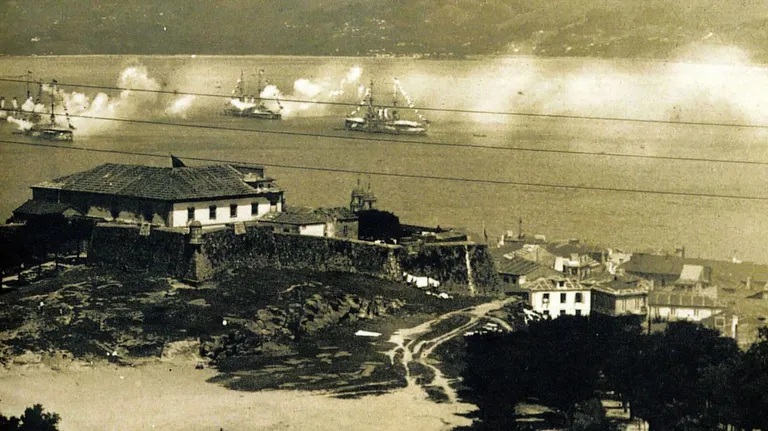
Castillo de San Sebastián stands in Vigo, on the highest ground of the city's old town, right behind today's town hall. When was the castle built and why? The fortress went up in 1656, during the reign of Philip IV, at the same time the town of Vigo was being enclosed by defensive walls. Its purpose was straightforward: keep English and Portuguese fleets, a recurring threat along the Galician coast, from taking the town. The engineer behind the design was Juan de Villarroel y Prado, who also planned the nearby Castro Fortress. What shape did the original structure take? Builders laid the castle out on a plan close to a six-pointed star, the standard geometry for bastioned fortifications of the period, designed to give defenders overlapping lines of fire along every wall. It occupied the southern edge of town, on its highest point, with views covering the bay and any approach from the sea. What happened after the English attack? In 1719, English forces stormed and took Vigo, leaving the Castillo de San Sebastián in ruins. From that point on, the Castro Fortress took over as the town's main line of defense, and the castle lost its military role. The abandoned site was put to a far humbler use afterward — grazing livestock. How did its use change over the following centuries? During the nineteenth century, the former stronghold was converted into a hospital, a change that altered much of its internal layout. It then served as a military barracks until 1964, when ownership passed to Vigo's town council, closing out a long stretch of military and institutional use. What survives of the castle today? Only a modest piece of the original fortress remains: the north wall with its two sentry boxes. The rest of the layout, including one bastion and two half-bastions, was torn down to make room for Vigo's town hall building. It's in that immediate area, just behind the town hall, that the surviving stretch of defensive wall can still be seen. Why is it worth a stop while visiting Vigo? Little survives of the original fortification, but the site traces Vigo's defensive history across four centuries — from a stronghold built against English and Portuguese fleets, through ruin, hospital use, and military barracks, to its current role tied to the town hall. Walking around the town hall walls offers a rare, genuine glimpse of early modern Galician military architecture right in the city center. Frequently Asked Questions When was the Castillo de San Sebastián in Vigo built? The fortress was built in 1656, under Philip IV, alongside the walls that were enclosing Vigo at the time. Who designed the castle? The fortification was designed by engineer Juan de Villarroel y Prado, who was also responsible for the nearby Castro Fortress. What happened to the castle after 1719? English forces sacked Vigo that year, leaving the castle in ruins; it lost its defensive role to the Castro Fortress and was later used for grazing livestock. Does anything remain of the castle today? Yes — a stretch of the north wall with two sentry boxes still stands just behind Vigo's town hall; the rest was demolished to build that structure.
-
Castell d'Orís
Orís
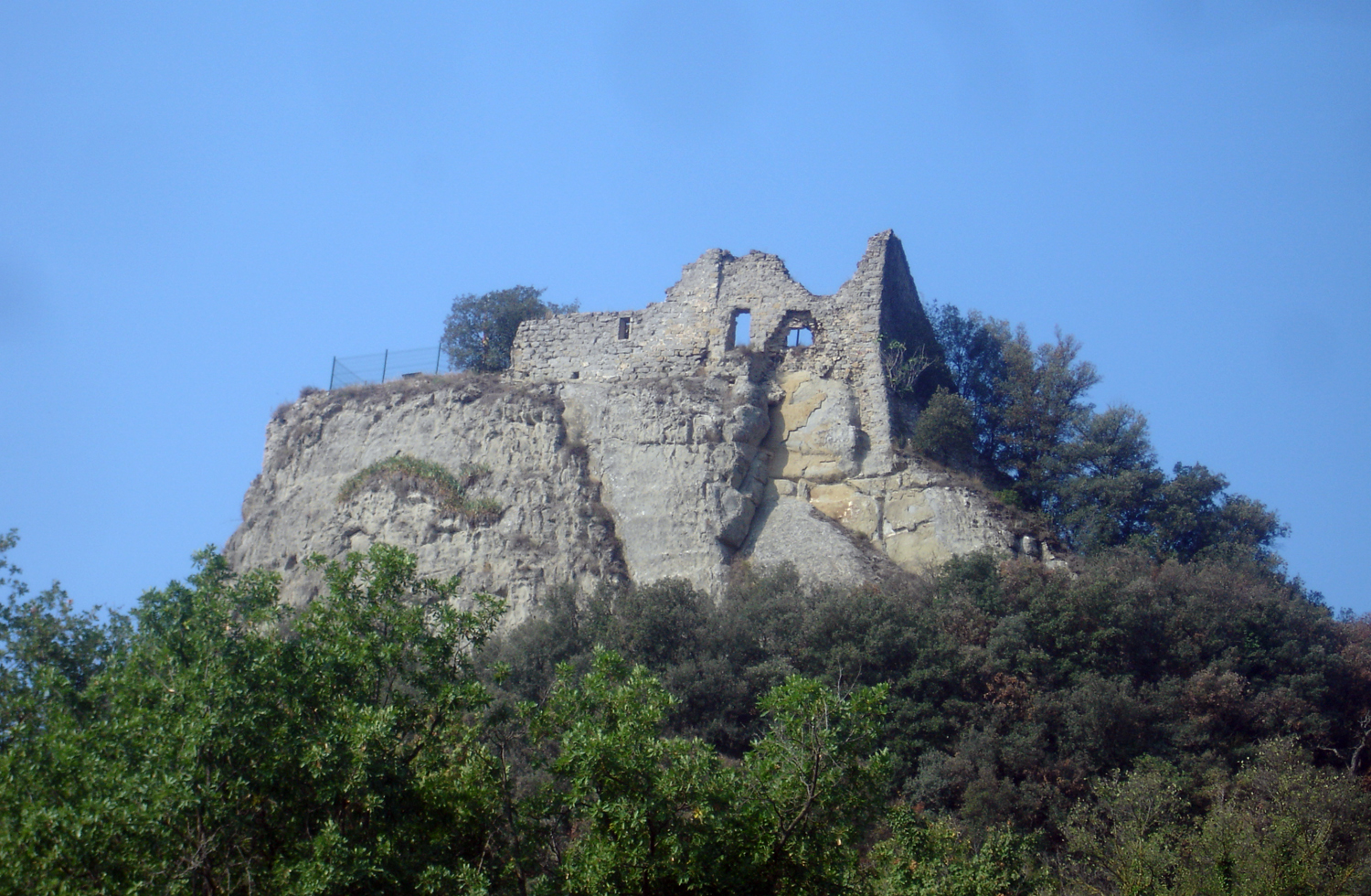
Castell d'Orís is a ruined medieval castle standing on a hill right beside the village of Orís, in the Catalan comarca of Osona. For centuries the site has overlooked the Ter river valley and the Vic plain, making it both a fine viewpoint and a tangible piece of the region's turbulent past. Where exactly is the castle located? The ruins sit on a rise directly above Orís, overlooking the Ter valley, along the route linking the Vic area with the Bisaura district. The site's coordinates are approximately 42.0586°N, 2.2225°E. Access is on foot, following paths and tracks that climb from the village center, and the summit rewards visitors with a wide panorama over the valley and surrounding hills. How old is this site? The first documented references to the castle at Orís date back to the year 914, making it one of the older recorded defensive structures in this part of Catalonia. Over the following centuries the stronghold served as a strategic lookout over the valley, part of the network of fortified hilltop sites typical of the early medieval frontier between the Christian Catalan counties. What can be seen among the ruins today? The surviving remains clearly show at least four distinct building phases, which makes the site especially interesting for anyone curious about defensive architecture. In the southwest corner, wall fragments and the floor plan of the chapel of Sant Pere are still visible — a Romanesque structure probably dating from the 12th century, though the church itself is not documented before 1116, and by 1198 it already appears as having been rebuilt. Toward the east there is a large underground chamber covered by a pointed vault of early Gothic type, protected by a later Gothic-period wall. The tallest and best-preserved wall, on the northern side, combines construction work from between the 15th and 17th centuries, showing that the castle was repeatedly rebuilt and reinforced over the centuries. Why did the castle fall into ruin? The fate of Castell d'Orís is tied to some of the defining conflicts in Catalan history. The stronghold suffered damage during the Remença War — the peasant uprising against feudal serfdom — which ended in 1472, and it was further damaged during the First Carlist War in the 19th century. These two periods of fighting are what left the castle in the ruined state visitors find today. What protection status does the site have? In recognition of its historical and architectural value, the castle ruins were declared a Historical-Artistic Monument in 1949. This designation underlines the site's importance to the heritage of the Osona region and of Catalonia as a whole, even though the structure itself was never rebuilt. What should visitors know before going? This is not a restored tourist attraction with visitor infrastructure, but an authentic open-air archaeological and historical site. Sturdy footwear is worth bringing, since the approach is uphill and the ruins sit on uneven ground. The view from the hilltop over the Ter valley and the Vic plain is reason enough for the climb, regardless of one's interest in medieval Catalan history. Frequently Asked Questions Since when has Castell d'Orís existed? The earliest documented mentions of the castle date from 914, making it one of the oldest recorded defensive sites in the Osona region. Has a chapel survived on the site? Yes, the southwest corner of the ruins preserves the foundations and wall fragments of the Romanesque chapel of Sant Pere, documented from 1116 onward. Why is the castle in ruins today? Two historical conflicts caused the damage: the Remença War, which ended in 1472, and the First Carlist War in the 19th century. Is the site protected as a heritage monument? Yes, it was declared a Historical-Artistic Monument in 1949, confirming its value as part of Catalonia's cultural heritage.
-
Castell de la Roca
Sant Llorenç Savall
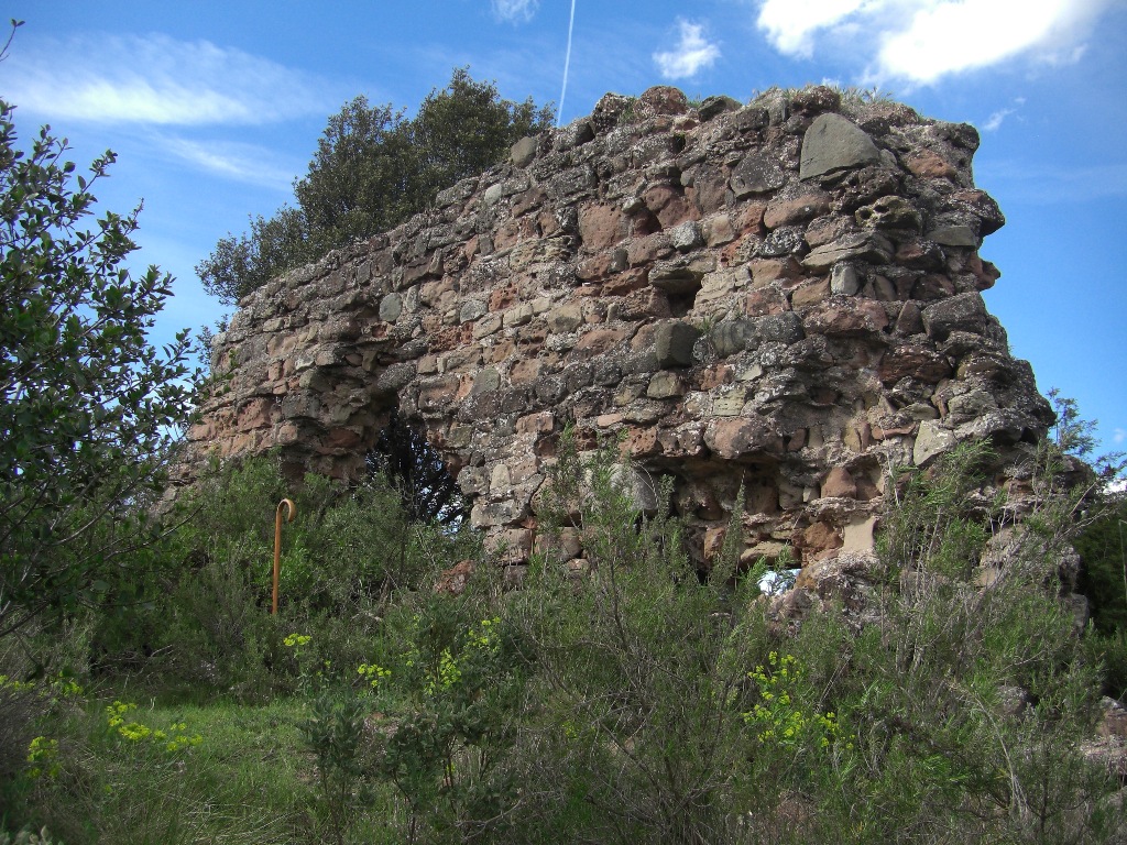
Castell de la Roca is a medieval watchtower rising above Sant Llorenç Savall, in the Vallès Occidental comarca, on the edge of the Sant Llorenç del Munt i l'Obac natural park. Also known as Torrota de la Roca or La Torreta, it stands on a ridge at roughly 500 metres of altitude, guarding the entrance to the Vall d'Horta. Why was this tower built here? The site is documented as far back as 1087 and formed part of the defensive network linked to the nearby Castell de Pera. Despite being one of the strongest strongholds in the area, Castell de Pera lacked a direct line of sight over the Horta and Ripoll valleys. The tower on the rock closed that gap: from its elevated position, lookouts could watch both valleys and relay signals onward. What remains to see today? What survives is a square-plan structure measuring 11.5 metres per side, with only the north-eastern wall still standing to a notable height of around 3 metres. A few metres to the east stands a separate, smaller signal or watch tower about 2 metres in diameter, of which barely 50 centimetres of wall now remains. The stones used in construction are carefully cut, evidence of solid workmanship despite the heavy erosion visible today. The site holds the status of Cultural Asset of National Interest (Bé Cultural d'Interès Nacional) and is listed in Catalonia's inventory of architectural heritage. How do you get to Castell de la Roca? Access is via the B-124 road, between kilometres 17 and 18, near the village of Sant Feliu del Racó. From there, a dirt track in good condition leads to a small parking area. A well-marked trail then climbs to the ruins, with the ascent taking about 20 minutes on foot. The site is open to the public year-round and free to visit. Further along the same trail lies Molí de la Roca, a former mill, while the Torrent de la Vall d'Horta ravine runs right beside the tower. What should you know before visiting? Thanks to its elevation and open surroundings, the tower offers wide views over the Horta and Ripoll valleys and the surrounding hills of the Sant Llorenç del Munt massif. Sturdy walking shoes are recommended, as the final stretch follows a steep, stony path. Frequently asked questions What other names does this site go by? It is most commonly referred to as Torrota de la Roca or La Torreta, both describing the same tower on the rock above Sant Llorenç Savall. How long does it take to reach the ruins? From the dirt-road parking area, the well-marked trail takes around 20 minutes to walk uphill. Is there an entrance fee? No, the site is freely accessible at any time, with no ticket or booking required. Why is the tower historically significant? It filled a visibility gap for Castell de Pera, letting lookouts see the valleys the main stronghold could not, making it part of the region's wider defensive network.
-
Castle of Moratalla
Moratalla
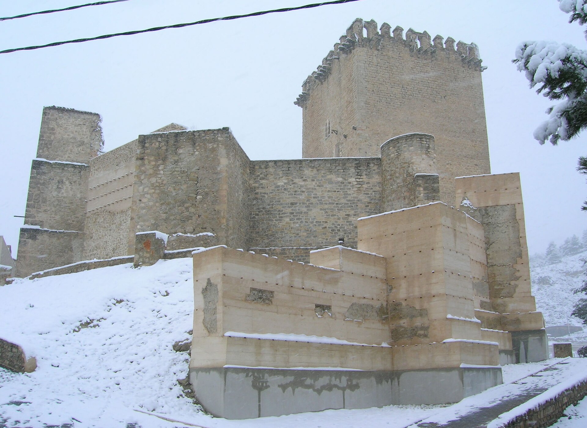
Castle of Moratalla stands on a conical hill above the town of Moratalla, in the Murcia region of southeastern Spain. Long before any walls were raised here, people had already made this summit their home, and the site's history stretches from prehistoric settlers through an Islamic border fortress to a military religious order that shaped its final medieval form. Why was a fortress built on this particular hill? The hilltop where the castle now stands was already inhabited during the Neolithic period, when a small farming community used the summit as a base — diorite axes and pottery fragments recovered there confirm this early occupation. Later, in Iberian times, the site was reinforced with a wall of large stone blocks; part of this original construction still survives at the base of the keep, on its northern side. These overlapping layers of settlement show that the hill was valued as a lookout point and refuge long before it became a true fortress. What did the castle look like under Islamic rule? The fortress as such took shape in the 9th century, when Al-Andalus authorities built an alcazaba here to reinforce the frontier defenses of the caliphate. It guarded the routes leading toward the Segura river valley, making it a key checkpoint along the paths connecting the interior of the peninsula with the coast. Construction and reinforcement continued gradually between the ninth and eleventh centuries, as the site's strategic value in the region grew. When did the castle pass into Christian hands? The turning point came in the 13th century, as the Muslim taifa kingdoms collapsed under the advance of Ferdinand III of Castile. In 1242, the military commander Pelayo Pérez Correa, a senior figure of the Order of Santiago, took control of these lands on the king's behalf. From 1245 the castle became the seat of the local commandery of the Order of Santiago, with Lope Hernández serving as its first commander. The order took over the fortress and gradually rebuilt it to suit its new role. What happened at the keep? The centerpiece of the Christian-era rebuilding was the keep, raised in the 15th century and still the most recognizable part of the whole complex. It was above the gate of this tower, in 1465, that the body of Commander Alfonso de Vozmediano was hung — a grim episode tied to internal power struggles within the Order of Santiago that remains one of the best-known chapters in the castle's history. Why did the castle lose its military importance? The fortress retained its strategic value into the 16th century, thanks to its position near the border with the Kingdom of Granada, the last Muslim state on the Iberian Peninsula. After the fall of Granada in 1492 and the shifting of political frontiers, the castle's defensive role gradually faded. The last recorded repairs likely took place in the mid-17th century, and a visitation record from 1747 already describes the building as abandoned and in decline. What can visitors see today? Visitors can trace the different eras of construction directly in the surviving walls — from the Iberian foundations, through the Islamic alcazaba walls, to the medieval keep built by the Order of Santiago. The hilltop also offers sweeping views over the surrounding countryside, explaining why successive civilizations chose this exact spot as a stronghold. The castle remains a key part of Moratalla's historical identity and of the wider Murcia region. Frequently Asked Questions Who built the Castle of Moratalla? The fortress in its recognizable form was first built by Al-Andalus authorities in the 9th century, on top of earlier Iberian defensive works. Following the Christian conquest in the 13th century, the Order of Santiago expanded it and gave it its final shape, including the distinctive 15th-century keep. What is the oldest evidence of settlement on the castle hill? The earliest finds date to the Neolithic period — diorite stone axes and pottery fragments that point to a small farming settlement on the hilltop long before any fortification was built there. What happened at the keep in 1465? The body of Commander Alfonso de Vozmediano was hung above the keep's gate that year, a dramatic episode rooted in internal power disputes within the Order of Santiago and one of the castle's most notable historical moments. Why did the castle fall into ruin? Following the conquest of Granada in 1492 and the southward shift of the political frontier, the fortress steadily lost its military role. Its last known repairs date to around the mid-17th century, and by 1747 visitation records already described it as abandoned.
-
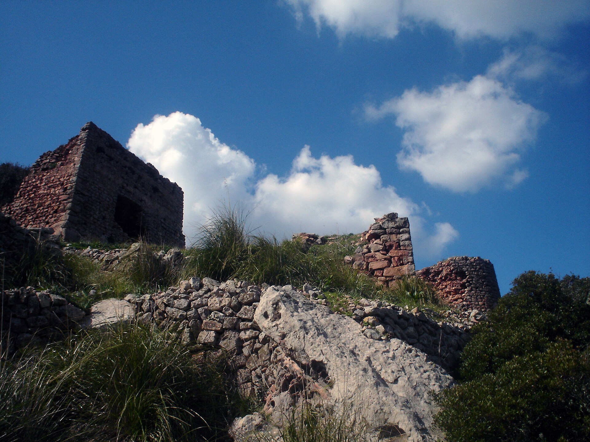
Castle of Santa Àgueda
Ferreries
Castell de Santa Àgueda is the ruined hilltop fortress of Ferreries, on the island of Menorca. It crowns an elongated plateau known as Santa Àgueda, standing 264 metres above sea level — the third highest point on the island, surpassed only by Monte Toro and S'Enclusa. From up here, the views stretch across a large part of Menorca's interior and coastline. What will you see there? Along the ridge of the plateau you'll find stone walls and foundations of a fortress built during the Muslim rule of the island. Though little more than a ruin today, the layout of the defensive works along the narrow, elongated summit still reveals why this spot mattered strategically — whoever held the plateau controlled sightlines over a wide stretch of the surrounding land. Until fairly recently, a small chapel dedicated to Saint Agatha stood next to the castle, and it's from her that both the plateau and the fortress take their name. Walking the ridge among the stone remains, surrounded by typical Menorcan scrubland, is as much a part of the experience as the ruins themselves — the panoramic views from the top are some of the best on the island. How do you get there? The plateau is reached via an ancient road of Roman origin, still walked on foot today. The trail begins near Ferreries; parts of the climb are steep, but it requires no special equipment — just sturdy shoes and plenty of water, especially in summer. When should you visit? Spring and early autumn are the best times to visit, with mild temperatures for the climb and the plateau's vegetation at its greenest. In summer, an early morning start is worth planning — the exposed ridge offers little shade, and Menorca's midday heat can be intense. History The castle was built during the period of Muslim rule over Menorca, taking advantage of the plateau's naturally defensible position as the island's third-highest point. Access was via an ancient Roman road, pointing to a long history of use of this site well before the fortress itself was constructed. A Christian chapel dedicated to Saint Agatha later stood alongside the castle walls, disappearing from the hilltop only in recent times. Frequently asked questions Is there an entrance fee for the castle? The ruins sit on open ground at the top of the hill, reached on foot via the trail from Ferreries. How long does the climb to the top take? The route follows the ancient road leading up to the plateau and calls for moderate fitness — it's best tackled during the cooler hours of the day. Why was the castle built in this particular spot? The Santa Àgueda plateau is the third highest point on Menorca, giving it commanding views over the surrounding area — a key defensive advantage during the island's period of Muslim rule. What else is worth seeing nearby? Until recently, a chapel dedicated to Saint Agatha stood next to the castle, and the ridge itself offers some of the finest panoramic views over Menorca's interior.
-
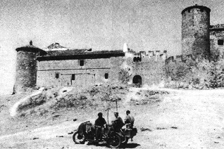
Encomienda Castle
Villanueva de la Serena
Castillo de la Encomienda stands on a hilltop roughly 8 km from Villanueva de la Serena, in the province of Badajoz, Extremadura. Also known as Castillo de Castilnovo, the fortress was raised in the 13th century on the site of an earlier Muslim stronghold called Mojafar, after the Comarca de la Serena passed into Christian hands during the reconquest led by King Ferdinand III. Construction and defense of the site were entrusted to the knights of the Order of Alcántara, which is how the castle earned its current name — for centuries it served as a commandery (encomienda) of that military order, combining a defensive role with an administrative one. How do you get there? The castle sits outside the town itself, on a rise in the open Extremaduran countryside, so a car or bicycle is the practical way in. A local road runs from central Villanueva de la Serena toward the hill, and the final stretch is covered on foot along an unmarked path leading uphill. Build extra time into your visit — the ground is uneven, and there's little shade during the hot summer months. What will you see on site? Most of what survives dates to the 14th century, though parts of the foundations and lower walls go back to the original construction. The fortress's south flank is marked by two towers — one prismatic, one cylindrical — joined by a stretch of curtain wall. Late in the 15th century and into the early 16th, the castle gained an additional barbican, giving the main "noble" section a rectangular layout with cylindrical towers at each corner. This left an open inner courtyard that served as a parade ground, and in the 16th century outbuildings were added around it — living quarters, stables, and storerooms for grain. The castle remains privately owned and is not open for visits inside. Even so, the exterior view from the approach path is enough to take in the scale and layout of the fortifications, along with a sweeping view over the surrounding Extremaduran plains. Since 2018 the site has had its own lighting installation, which makes the silhouette of its walls and towers visible from a considerable distance after dark. When should you visit? Spring (March–May) and early autumn (September–October) are the best times to come, when Extremadura's temperatures are milder and the ground around the castle is green. Summer heat can climb past 35°C, making a longer walk up the exposed hillside uncomfortable. Early morning or evening light also works best for photography, catching the stone texture of the walls at its most flattering angle. Frequently asked questions Can you go inside the castle? No — Castillo de la Encomienda is private property and is not open to visitors. It's viewed from the outside, from the path leading up the hill. Where does the castle's name come from? The name reflects the role the fortress played for centuries — it was a commandery (encomienda) of the Order of Alcántara, hence "Castillo de la Encomienda." It has also historically been known as Castilnovo or Castelnovo. How far is the castle from central Villanueva de la Serena? The fortress lies about 8 km from town on an open hillside, so arriving by car is the most convenient option. Is it worth combining the visit with other sights in the area? Yes — the Comarca de la Serena region is rich in traces of the military orders and the reconquest era, making the castle a solid starting point for exploring more of Badajoz province.
-
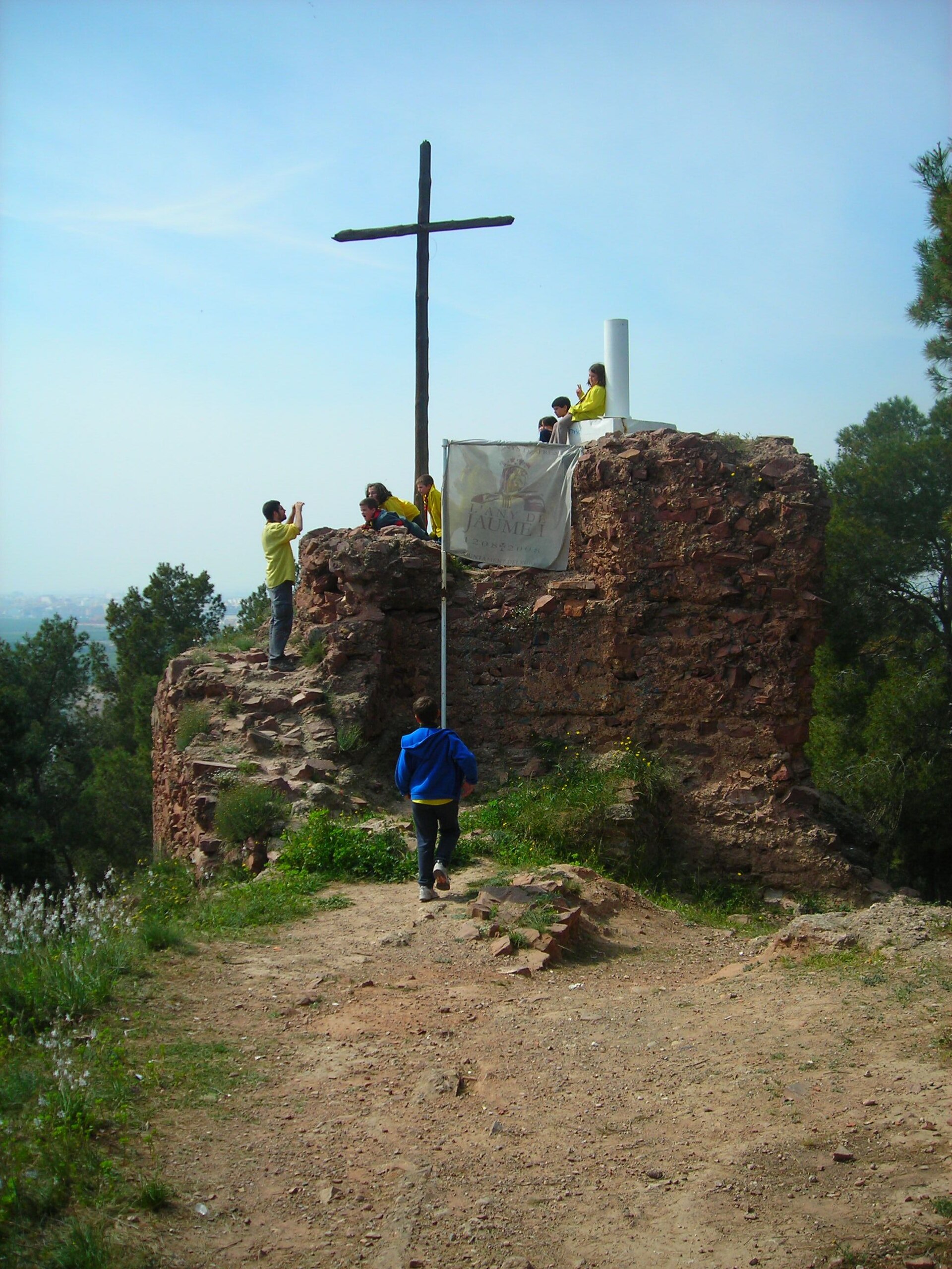
Castell del Puig
el Puig de Santa Maria
Castell del Puig is the ruined medieval castle standing on the hill above El Puig de Santa Maria, a small town roughly fifteen kilometers north of Valencia. Little remains today beyond scattered wall fragments, yet this hilltop was the exact spot from which King James I of Aragon (Jaume I) planned the conquest of Muslim Valencia — making it one of the pivotal sites in the region's history. Where did the fortress on the hill come from? Arab settlers first fortified the hill in the 11th century. In 1093 the castle was captured by El Cid, who rebuilt it, reinforced its defenses, and surrounded it with a walled village — one episode in the turbulent struggle for control of Spain's eastern coast during that era. After El Cid's death the stronghold reverted to Muslim hands and spent the following centuries guarding the northern approach to Valencia. It was also known by the names Castell de Yubayla and Cebolla, from the Arabic Enesa. What role did the castle play in the conquest of Valencia? After conquering Mallorca in 1229, James I set his sights on Valencia and identified the hill of Puig as the ideal staging ground for the campaign. Zayyan, the Muslim ruler of Valencia, recognized the strategic value of the fortress and had it demolished to keep it out of Christian hands. James I pressed ahead regardless: in late April 1237 he sent troops to rebuild the castle on the hill, and command of the garrison, in the king's absence, fell to his uncle Bernat Guillén d'Entença. It was in this same area that the Battle of Puig (also called the Battle of Enesa) took place — an engagement that tipped the campaign decisively toward the Christian forces and opened the road to the capture of Valencia itself in 1238. The fortress on the hill of Puig is regarded today as one of the true turning points of the entire campaign. What happened to the castle afterward? The fortress did not survive intact for long. In 1365, King Peter IV of Aragon ordered it torn down, likely for strategic reasons tied to conflicts of the time on the Iberian Peninsula. From then on, only ruins remained on the hilltop. In 2002 the site was granted Bien de Interés Cultural (BIC) status, Spain's designation for heritage assets of special historical significance. In 2026, marking the 750th anniversary of James I's death, the Diputación de Valencia awarded the municipality of El Puig de Santa Maria 100,000 euros to fund restoration work on the castle remains — an investment intended to bring out the site's potential as a cultural and historical attraction. How to get there and when to visit? El Puig de Santa Maria sits only about fifteen kilometers from Valencia, so the easiest way to reach it is by car or local commuter train, since the town lies along the main route linking Valencia and Sagunto. The castle hill rises above the town, offering sweeping views over the surrounding plain and the nearby Mediterranean coast. Spring and autumn are the best times to visit, when temperatures are milder than in high summer — a walk up the hill, modest as the remaining walls are, still traces the story of one of the Reconquista's defining moments. Frequently asked questions What remains of the castle on the Puig hill? Mostly wall fragments and remnants of the fortifications survive today — the fortress was demolished on the orders of Peter IV of Aragon in 1365. Why does this castle matter so much in Valencia's history? It was from here that James I planned and carried out the conquest of Muslim Valencia, and the Battle of Puig fought nearby in 1237 opened the way to the city's capture in 1238. What was the castle called before? It was also known as Castell de Yubayla and Cebolla, names dating back to the Muslim period (from the Arabic Enesa). Is the castle currently being restored? Yes — in 2026, on the 750th anniversary of James I's death, the municipality received 100,000 euros from the Diputación de Valencia to restore the remains of the fortress.
-

Lo de Ramos
Arafo
Lo de Ramos is the ruin of a former Augustinian farmstead (alquería) set on the slopes of the Güímar valley, at roughly 650 metres above sea level, less than 1.2 km from the centre of Arafo on Tenerife. The site is also known as "Fraile Ramos" or "Lagar del Clérigo" and was formally declared a Cultural Heritage Asset under the category of Historic Site by Decree 237/2008 of 9 December, issued by the Government of the Canary Islands. Where does the name come from and who lived here? The story goes back to 1509, when the Augustinian convent of the Holy Spirit in La Laguna was granted land and water rights in the Arafo area. The friars built a farmstead here that included a chapel (oratory), a wine cellar, a dwelling, a water reservoir and bread ovens. It was the Augustinians who first introduced vine cultivation to Arafo, laying the foundations of the region's winemaking tradition. They also kept livestock and planted fruit trees, gradually turning the surrounding land into farmland. What did the farmstead look like? The alquería had a rectangular layout that brought together a chapel, living quarters, a wine cellar and a stable, arranged around a corridor supported by wooden columns. This layout was typical of religious-order farmsteads in the Canary Islands at the time, combining religious, residential and productive functions within a single compound. Why is it a ruin today? Following the Spanish disentailment (the confiscation of church property), the estate passed into the hands of Domingo García Torres. His political enemies set the building on fire, and it has remained in ruins ever since. Interestingly, the eruption of the Las Arenas volcano did not directly reach the buildings — the lava flow split just before it arrived, sparing the estate from the natural disaster, though it had already been destroyed by fire at human hands. What can visitors see at the site today? What remains today are the ruins of the farmstead building, the water reservoir and the ovens. Together they bear witness to the Augustinians' presence in the region and to how farming reshaped the landscape of Arafo — from the first vineyards to fruit orchards and the livestock the friars raised. Frequently asked questions What is Lo de Ramos? It is the ruin of a former Augustinian farmstead (alquería) with a chapel, wine cellar, water reservoir and ovens, located on the slopes of the Güímar valley in the municipality of Arafo. What other names does the site go by? It is also known as "Fraile Ramos" and "Lagar del Clérigo". Is the site protected? Yes, it was declared a Cultural Heritage Asset under the category of Historic Site by Decree 237/2008 of 9 December, issued by the Government of the Canary Islands. Why is the farmstead in ruins today? After church property was confiscated, the new owner, Domingo García Torres, clashed with political enemies who set the building on fire. Did a volcanic eruption destroy the site? No — lava from the Las Arenas volcano split just before reaching the building and bypassed it, although the estate had already burned down earlier due to arson.
-
Antequera Dolmens Site
Antequera
Antequera Dolmens Site is a cultural heritage ensemble comprising three cultural monuments and two natural mountain features in and around the city of Antequera, in Andalusia, Spain. The cultural institution responsible for protecting the site is CADA. The site was declared a World Heritage Site in 2016. What does this ensemble actually include? Antequera Dolmens Site is not a single monument but a combined heritage grouping. It brings together three monuments of cultural character alongside two natural mountain features located in and near Antequera. This pairing of human-made cultural elements with the surrounding natural mountain landscape is central to how the site is recognized as a heritage ensemble rather than a standalone building or structure. Where exactly is it located? The site is situated in the city of Antequera and its immediate surroundings, within the region of Andalusia in southern Spain. Its geographic coordinates are approximately 37.023 degrees north latitude and -4.548 degrees longitude. Andalusia is one of Spain's autonomous regions, and Antequera itself serves as the central reference point for the location of the whole ensemble. Who is responsible for protecting the site? The cultural institution tasked with protecting Antequera Dolmens Site is CADA. This institution oversees the preservation of the ensemble and its recognized heritage value, a role that was also relevant to the process of securing the site's UNESCO listing. When and why was it added to the World Heritage List? Antequera Dolmens Site was officially declared a World Heritage Site in 2016. This designation confirms that the ensemble — combining three cultural monuments with two natural mountain features — holds a value recognized at an international level, extending beyond purely local or regional significance. Why does this matter for travelers exploring Andalusia? Its 2016 UNESCO World Heritage designation makes Antequera Dolmens Site an officially confirmed cultural heritage landmark in Andalusia. Because the ensemble brings together both monuments and natural mountain formations, it stands out as a mixed-character site, uniting history and landscape within a single area in and around Antequera. Frequently asked questions What is Antequera Dolmens Site? It is a cultural heritage ensemble made up of three cultural monuments and two natural mountain features, located in and near the city of Antequera in Andalusia, Spain. Where is Antequera Dolmens Site located? In and around the city of Antequera, in the region of Andalusia, Spain, at approximately 37.023 degrees N, -4.548 degrees W. When was the site added to the UNESCO World Heritage List? In 2016. Who protects this site? The cultural institution CADA is responsible for its protection. How many elements make up this heritage ensemble? Five in total: three cultural monuments and two natural mountain features.
-
Muelles carboneros
Santa Cruz na Teneryfie
Muelles carboneros — the old coal wharves of Santa Cruz de Tenerife — form a group of former port structures tied to one of the most important chapters in the city's economic history: the era when its harbour became a key coaling stop on transatlantic shipping routes. The site sits at the mouth of the Barranco de Valleseco ravine, on its left bank, and today is recognised as protected cultural heritage. Why did this site become important? The story begins in the first half of the 19th century. A royal order issued on 11 November 1836 declared Santa Cruz de Tenerife a coal deposit port, quickly turning it into one of the world's first-rate coaling stations for steamships. Thanks to its position on routes linking Europe with the Americas and Africa, the port became an essential stop for merchant fleets needing to refuel with coal, most of which arrived from Great Britain, under a modest storage fee. How was the infrastructure built up? The first major coal warehouses, together with a wharf and breakwater on the left bank of the Valleseco ravine, were built under a concession granted on 25 February 1876 to Hamilton y Cía, the oldest coal company operating in the Canary Islands. Earlier, from 1850, the firm Bruce, Hamilton, Davidson, Lebrun & Co. had operated at what is now the Ribera wharf, before being forced to relocate to Valleseco in 1876. Another major player was Cory Brothers, established in 1862 — one of the largest coal exporters from south Wales, which by 1913 operated 80 coaling stations worldwide. How were the ships unloaded? Before proper wharves existed, cargo ships carrying coal from Cardiff, Wales had to anchor around 500 metres offshore, since no facilities allowed them to dock directly. Unloading therefore took place at open sea: workers transferred coal onto barges using wooden planks connecting the ships to smaller transport vessels. The process was slow and labour-intensive, which underlines just how significant the later construction of permanent wharves turned out to be for the port's efficiency. Why is the site protected today? The complex of coal wharves, together with the associated coal warehouses, the old dry dock (varadero) and the bridge over the Barranco de Valleseco, is considered one of the most important surviving witnesses to the commercial, industrial and port history of Santa Cruz de Tenerife at the turn of the 19th and 20th centuries. It was during this period that the city built its position as one of the world's leading coaling ports, a status that directly shaped its economic and urban development. Today the area is being integrated into the city's new beach development, allowing the regeneration of the seafront to coexist with the preservation of this historic port fabric. Frequently asked questions What are the muelles carboneros? Historic port wharves once used for storing and loading coal for ships calling at Santa Cruz de Tenerife. When were they built? The first major structures in the Valleseco area date to 1876, though the port's role as a coaling station goes back to the 1836 royal order. Which companies operated here? The most important were Hamilton y Cía, Bruce, Hamilton, Davidson, Lebrun & Co., and the British firm Cory Brothers. Can the site be visited today? The area is part of the city's protected cultural heritage and is being incorporated into the redevelopment of Santa Cruz's seafront.
-
Casa Amarilla, Puerto de la Cruz
Puerto de la Cruz
Casa Amarilla is a 19th-century, two-story country house in Puerto de la Cruz, Tenerife, best known as the headquarters of the world's first research station dedicated to the scientific study of great apes. The building holds the status of Bien de Interés Cultural (Cultural Heritage Asset) in the Historic Site category, granted by decree of the Canary Islands government in May 2005. Why is this place scientifically significant? Between 1913 and 1918, Casa Amarilla housed the Anthropoid Station of Tenerife, established on the initiative of the Prussian Academy of Sciences in Berlin. The choice of Tenerife was deliberate: the island's proximity to Africa made it easier to bring in animals, its mild climate suited the chimpanzees kept there, and its transport links made the site practical for German researchers traveling from Europe. Who conducted the research at Casa Amarilla? The station was led primarily by German psychologist Wolfgang Köhler, one of the leading figures of Gestalt psychology. It was within the walls of this house that the observations and notes were compiled which later formed the basis of his landmark work, "The Mentality of Apes." The book left a lasting mark on twentieth-century science, influencing not only psychology but also philosophy, anthropology, primatology, and ethology. What did the experiments involve? Köhler studied the cognitive abilities of chimpanzees, focusing on how the animals solved problems that required insight rather than trial and error — for instance, using sticks to reach bananas placed out of arm's reach, or stacking boxes to climb toward a reward. These observations challenged the purely behaviorist understanding of animal learning dominant at the time, introducing the concept of sudden insight, or the "aha moment," as a distinct cognitive mechanism. What condition is Casa Amarilla in today? Despite its formal heritage protection granted in 2005, the building has fallen into ruin over the decades. Casa Amarilla appears on the Red List of Heritage (Lista Roja del Patrimonio) maintained by the organization Hispania Nostra, which tracks sites at risk of disappearing due to neglect, lack of restoration funding, or ownership disputes. Local journalists and historians have repeatedly warned that a house of such scientific importance continues to deteriorate despite public interest in its fate. Can visitors tour Casa Amarilla? The building currently stands in a state of ruin and does not function as a museum or tourist attraction — it remains mainly a point of interest for those following the history of science and for local initiatives working to preserve Puerto de la Cruz's heritage. The location itself, set among the town's typical seafront architecture, still allows visitors to view its distinctive 19th-century exterior from the outside. Frequently asked questions What was the Anthropoid Station of Tenerife? It was the world's first research station dedicated to the systematic study of great ape intelligence, operating out of Casa Amarilla from 1913 to 1918 on the initiative of the Prussian Academy of Sciences. Who studied chimpanzees at Casa Amarilla? The lead researcher was Wolfgang Köhler, a German psychologist and one of the founders of Gestalt psychology, author of "The Mentality of Apes." Does Casa Amarilla have heritage protection? Yes, since May 2005 it has held the status of Bien de Interés Cultural in the Historic Site category, granted by the Canary Islands government. What condition is the building in now? Casa Amarilla is in an advanced state of ruin and appears on Hispania Nostra's Red List of Heritage as a site at risk of disappearing.
-
Ladera de Martiánez
Puerto de la Cruz
Ladera de Martiánez is a steep, volcanic hillside in Puerto de la Cruz, Tenerife, one of the few surviving patches of natural landscape within the town's boundaries. The cliffs rise to roughly 45 metres, topped today by the residential neighbourhood of La Paz. It isn't a conventional sightseeing spot with an entrance or visitor infrastructure — its real significance lies in archaeology and local history, and it's best appreciated from several viewpoints around town. Why does this hillside matter archaeologically? Ladera de Martiánez is considered one of the richest archaeological sites in the whole municipality of Puerto de la Cruz. Excavations have uncovered the remains of a Guanche settlement and necropolis — traces of the island's indigenous population before the Spanish conquest — along with several caves that once served as dwellings. Because of this heritage, the area has been formally declared a Cultural Heritage Site (Bien de Interés Cultural) in the Archaeological Zone category, giving it legal protection as part of the region's historical patrimony. Where does the name Martiánez come from? The hillside's name is tied to a historic water spring that once flowed beside one of its caves. The Martiánez spring was for a long time one of the main sources of water for the population of Puerto de la Cruz, before modern water infrastructure was developed. The whole surrounding area, including the well-known Lago Martiánez pool complex nearby, takes its name from this same spring. What grows on the hillside? The slope is also valued for its natural vegetation. Native island plant species survive on its steep faces, including Canary Island palms (Phoenix canariensis) and tabaibas, succulents typical of the Canary Islands' dry, volcanic terrain. This mix of vegetation gives the hillside a raw, distinctive character that contrasts sharply with the dense urban development surrounding it. Can you visit the hillside? Since 2014, Ladera de Martiánez has been fenced off and closed to the public. The closure followed repeated rockfalls that posed a safety risk to residents and visitors. In the years since, local authorities and the island's Cabildo have studied possible measures to stabilise the slope and discussed its future, including ideas for restoring public access while preserving its archaeological and natural value. For now, the hillside is best seen from outside — from the surrounding streets and viewpoints in the La Paz neighbourhood and near the coast. Frequently asked questions Is Ladera de Martiánez open to visitors? No, the area has been fenced off since 2014 due to the risk of rockfalls. It can only be viewed from outside, from the surrounding streets. What has been found on the hillside? Archaeologists have uncovered the remains of a Guanche settlement and necropolis, along with inhabited caves, which led to the site being protected as an archaeological zone. Where does the name Martiánez come from? It comes from a historic water spring located beside one of the caves on the hillside, which once supplied water to the residents of Puerto de la Cruz. Is there anything else worth seeing nearby? Yes, at the foot of the hillside lies the famous Lago Martiánez pool complex, one of Puerto de la Cruz's most popular attractions, named after the same historic spring.
Earn badges for the places you visit
Download NextOnTrip, discover new places and check off your trails.