Monuments in Spain
A guide to 4655 Monuments in Spain — with descriptions, photos and traveler visits from the NextOnTrip community. Locations spread across 2240 cities and towns. Most visited by the community: castle of Chulilla, Castle of Pioz, castell de la Todolella.
-
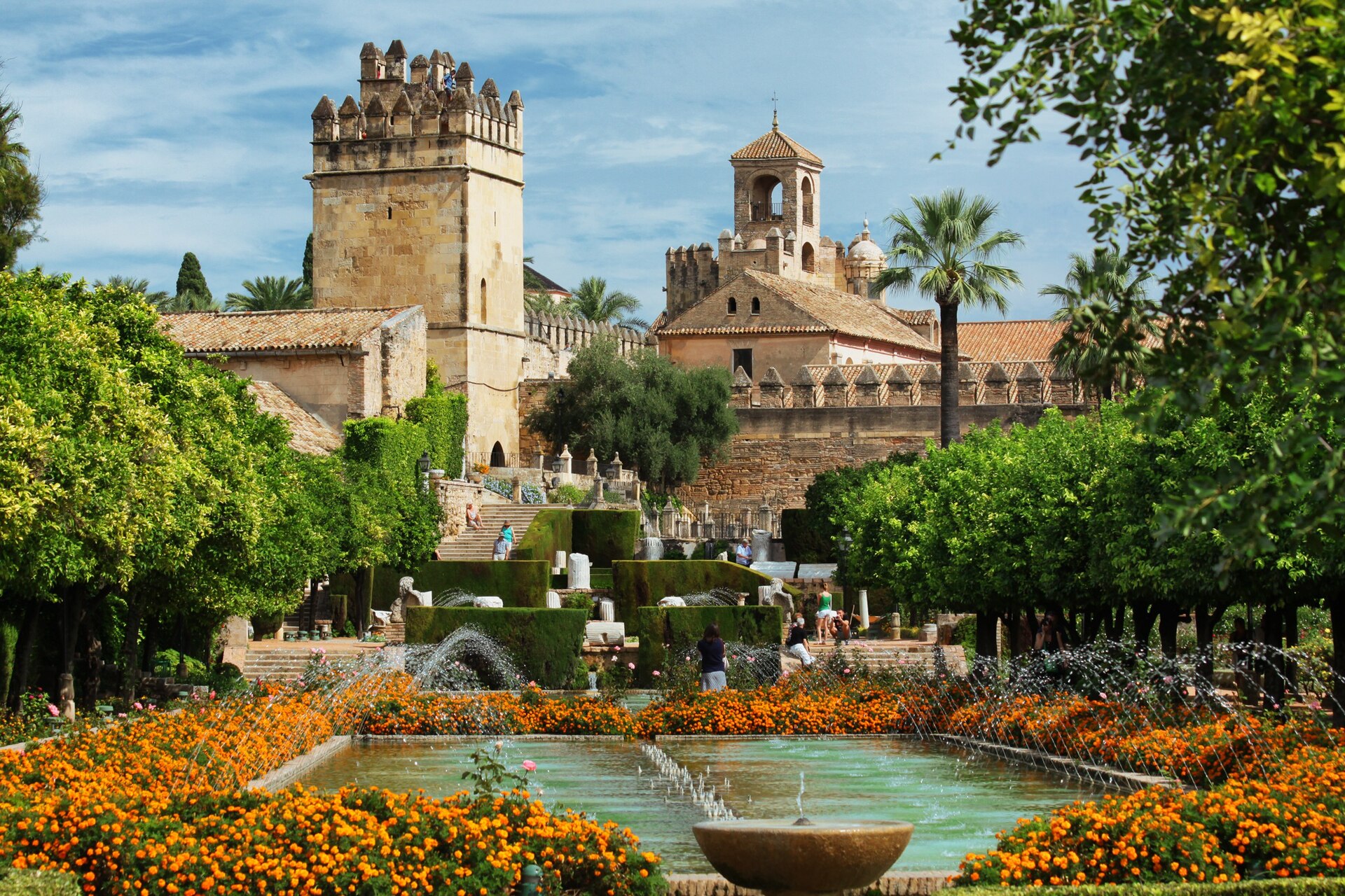
Alcázar de los Reyes Cristianos
Kordoba
Alcázar de los Reyes Cristianos is a medieval fortress standing in the historic center of Córdoba, right beside the Guadalquivir River and just steps from the Mosque-Cathedral. Its name translates as "Castle of the Christian Monarchs," a reference to its most famous residents — Isabella I of Castile and Ferdinand II of Aragon, who used the fortress as one of their principal residences. How do you get there? The fortress sits right in the middle of the old town, so walking is by far the easiest option — it's only a few minutes on foot from the Mosque-Cathedral. Travelers arriving by train or bus can walk from Córdoba's main station in roughly 20-25 minutes, though a short taxi ride or local bus is a more comfortable choice, since several lines stop close to the old city walls. Street parking nearby is limited, so visitors driving in usually leave their car on the edge of the historic quarter and cover the last stretch on foot. What can you see inside? A visit typically starts along the defensive walls and towers, which offer sweeping views over the old town and the river below. Inside, several rooms are tied directly to the history of the Castilian and Aragonese monarchs — decisions with lasting consequences for the entire Iberian Peninsula were made within these walls. The extensive gardens are a highlight in their own right, with geometrically trimmed hedges, fountains, and reflecting pools that provide welcome shade during the hot months. The towers and terraces give some of the best views in Córdoba, including the rooftops of the old town and the tower of the Mosque-Cathedral. Thanks to its riverside location, a walk around the fortress walls pairs naturally with a stop at the nearby Roman bridge. When is the best time to visit? Spring (April-May) and early autumn (September-October) bring the most comfortable temperatures for exploring both the interior rooms and the gardens on foot. Summers in Córdoba routinely climb past 35°C (95°F), so it's worth planning a visit for the early morning right after opening, when it's cooler and crowds are thinner. During summer, the gardens are sometimes illuminated in the evening, adding a different atmosphere for visitors touring the city after sunset. Frequently asked questions How long does it take to visit the Alcázar? A standard visit through the interior and gardens takes about 1 to 1.5 hours. Visitors who want to linger at each tower and sit for a while in the gardens should plan for around 2 hours. Is the Alcázar close to the Mosque-Cathedral? Yes, the two landmarks are only a few minutes' walk apart, making it easy to combine both visits in a single day of exploring the old town. Do the gardens require a separate ticket from the interior? No, the gardens and the interior rooms are covered by the same admission ticket, so there's no need to choose — it's worth setting aside time for both, especially since the gardens offer pleasant shade in summer. What role did the fortress play in Spanish history? The building served as one of the main residences of Isabella I of Castile and Ferdinand II of Aragon, the monarchs who unified Spain and played a central role in the events of the late 15th century.
-
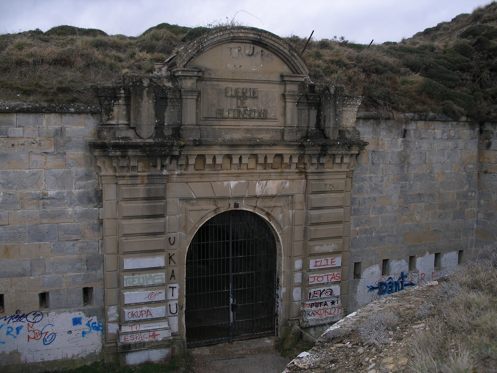
Fort San Cristóbal
Berrioplano / Berriobeiti
Fort San Cristóbal (also known as Fuerte de Alfonso XII) is a massive 19th-century fortress carved into the summit of Mount Ezkaba, within the municipality of Berrioplano / Berriobeiti, just a few kilometers north of Pamplona. It's one of Navarre's most striking yet lesser-known destinations, where military engineering meets one of the darkest chapters of 20th-century Spanish history. How do you get there? The fort sits atop San Cristóbal mountain (892 meters above sea level), overlooking Pamplona from the north. From the city center, driving up takes roughly fifteen minutes along a winding road through the Berrioplano district. Hikers and cyclists can follow a marked trail from the base of the mountain, a route popular with locals for its sweeping views. Keep in mind the site still belongs to the Spanish Ministry of Defence, so wandering the interior on your own isn't an option — visits need to be arranged in advance. What will you actually see? The scale alone is impressive: the whole complex spans 615,000 square meters, with the fortress itself covering 180,000 square meters of underground construction spread across three floors, buried under roughly two meters of earth and ringed by a moat. It's the largest polygonal fortress in the entire Pyrenees, designed by Colonel Miguel Ortega and built under the direction of Commander José de Luna y Orfila between 1878 and 1919, in response to the Third Carlist War. Ironically, the fort never fired a shot in the conflict it was built for — by the time construction wrapped up, advances in steel and rifled artillery had already made this style of fortification obsolete. From the viewing terrace near the entrance, though, you get a sweeping panorama over the whole Pamplona basin. The prison years and the 1938 breakout After decades as an artillery barracks, the fort was converted into a prison during the 1930s — first a civilian one, then, during the Spanish Civil War, a political prison holding Republican detainees. The inmate population swelled from around 750 to over two thousand. On the night of May 22, 1938, the fort was the scene of the largest prison break in Spanish history: nearly 800 of roughly 2,500 prisoners fled into the surrounding hills. Most were recaptured or killed during the manhunt that followed — over two hundred died from gunfire, hunger, or exposure, and more than a dozen were executed after being caught. Between 1941 and 1945, the fort served as a tuberculosis hospital, where more than 200 additional patients died and were buried nearby in what's known as the "Cemetery of the Bottles." It later functioned as a munitions depot until 1987, before being abandoned entirely in 1991. When to visit and how? The fort is now officially protected as a Cultural Heritage Site, a status granted in 2001, and was further designated a Site of Democratic Memory in 2025. Limited guided tours have run since 2009, typically scheduled during the spring and summer months when weather makes the climb easier. Near the entrance stands a memorial sculpture, unveiled in 1988, honoring the Republican prisoners who died there. It's worth booking a tour well ahead and checking the current schedule, since access to the interior remains tightly controlled. Frequently asked questions Can you visit Fort San Cristóbal on your own? Not fully — the site belongs to the Ministry of Defence, and entry to the interior is only possible through organized guided tours, which have been offered since 2009. Why is it also called Fuerte de Alfonso XII? That was its original name from the 19th-century construction period; it was officially renamed "San Cristóbal" in 1931, under the Second Republic. What happened at the fort in 1938? It was the site of the largest prison escape in Spanish history — nearly 800 Republican prisoners attempted to flee, and hundreds died during the subsequent manhunt in the surrounding mountains. How long does it take to reach the summit? Driving from Pamplona takes about fifteen minutes, while hiking the marked trail from the base of the mountain typically takes about an hour.
-
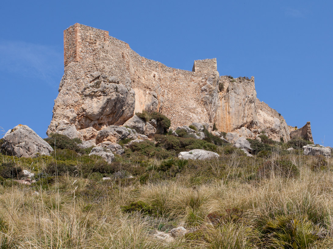
Castell del Rei
Pollença
Castell del Rei is a ruined medieval castle perched on a rocky peak in the Ternelles valley, within the municipality of Pollença on Mallorca. Standing at 492 metres above sea level, the fortress once served as a key defensive stronghold guarding the island's northern coast. What is the history behind the castle? The site's fortifications date back to Roman times, when a simple defensive structure made use of the naturally inaccessible rock. During the Muslim period the stronghold grew in importance, becoming the last point of resistance against the forces of James I of Aragon during his conquest of Mallorca. While the rest of the island had already surrendered by 1229, the garrison at Castell del Rei held out until March 1231. A second major chapter unfolded in 1343. After the Crown of Aragon annexed the Kingdom of Mallorca, loyalists to King James III took refuge in the castle and withstood a three-month siege by Aragonese troops before finally surrendering. The fortress remained in use for centuries afterward, but was abandoned in the 18th century and gradually fell into the ruined state it remains in today. What will you actually see there? What survives today are the remains of defensive walls and foundations rising above the Ternelles valley. The site itself is privately owned, and entry to the castle grounds is prohibited — even though the access road technically holds public status, the owners (the March family) have long managed to restrict access to it. This makes visiting the ruins a genuinely contested issue, and anyone planning a trip should check current access rules with Pollença's town hall or a local tourist information point beforehand. Despite the access restrictions, the Ternelles valley itself and the view of the rock topped by the ruined castle remain one of the most recognisable landscapes in northern Mallorca. The site also inspired the Catalan poet Miquel Costa i Llobera, who wrote a poem titled "Castell del Rei" dedicated to it in 1896 — locally, in the Pollença dialect, the site is known as "U castell d'u rei." Does the castle hold any official status? On 30 November 1993, Castell del Rei was declared a Bien de Interés Cultural (an asset of cultural interest), formally recognising it as one of the region's significant historical monuments. That protected status, however, does not change the fact that the land remains privately owned, and free access to the ruins is not permitted. When is the best time to visit? Given the access restrictions, a visit centred on Castell del Rei mostly means admiring the Ternelles valley and the silhouette of the castle from the viewpoints where this is allowed. Spring and autumn offer the best conditions, with Mallorca's milder temperatures and quieter trails in this part of the Serra de Tramuntana compared to the busy summer months. Frequently asked questions Can you enter the Castell del Rei castle grounds? No — the site is privately owned and entry to the ruins is prohibited. The access road is technically public, but the owners have restricted access to it for years, so it's worth checking current rules with local authorities before planning a visit. Where exactly is the castle located? On a 492-metre peak in the Ternelles valley, within the municipality of Pollença, in northern Mallorca. What is the fortress's history? It dates back to Roman times, served as the last point of resistance during James I of Aragon's conquest of the island (holding out until 1231), and survived a three-month siege in 1343 during the war over the Mallorcan crown. Abandoned in the 18th century, it fell into ruin. Does the castle have any protected status? Yes — since 30 November 1993, Castell del Rei has been listed as a Bien de Interés Cultural (asset of cultural interest).
-
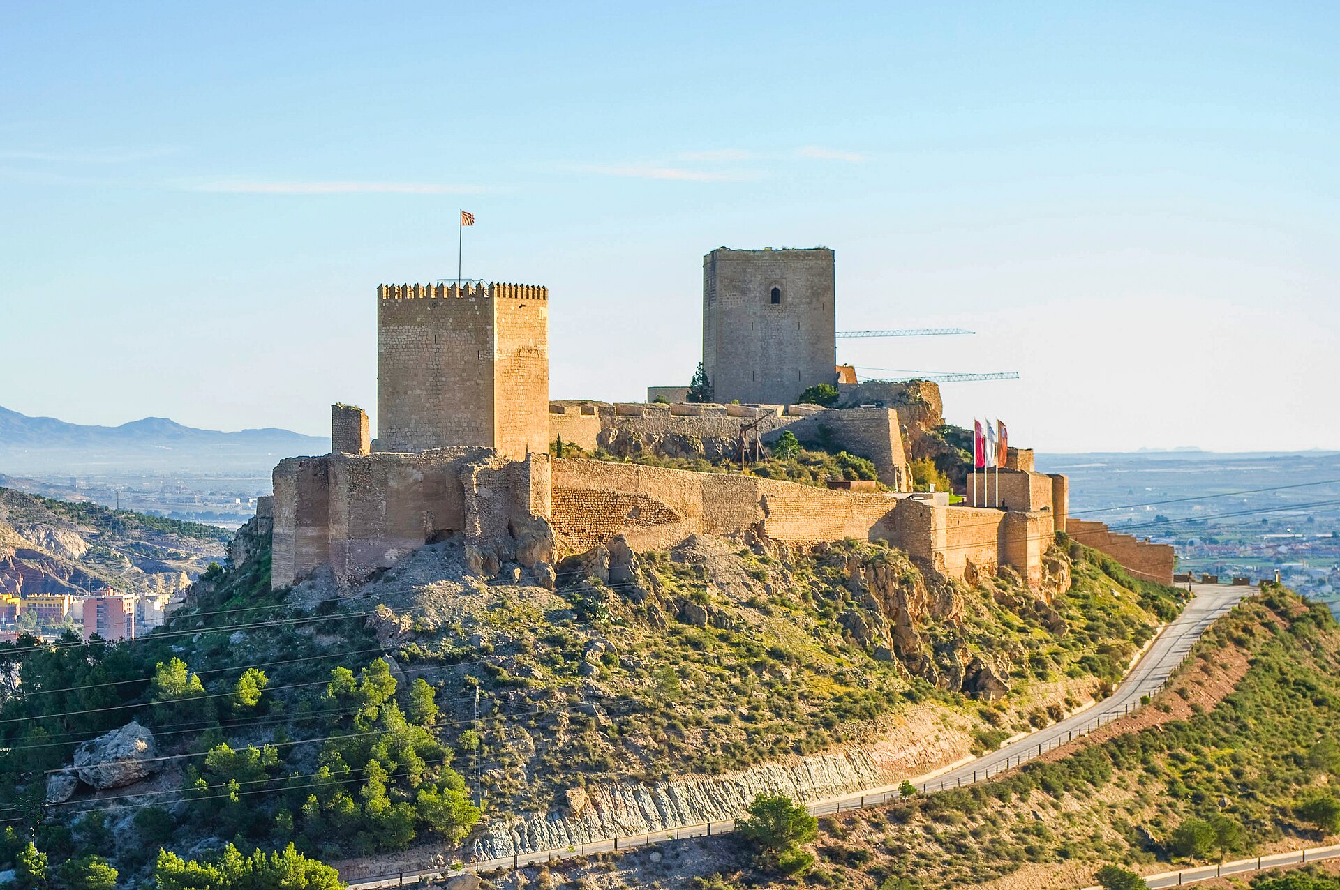
Lorca Castle
Lorca
Lorca Castle, also known as the Fortaleza del Sol (Fortress of the Sun), overlooks the town of Lorca in the Murcia region of southeastern Spain. Built in stages between the 9th and 15th centuries, it ranks among the largest castles in the country, stretching roughly 640 meters in length and 120 meters in width. For centuries this fortress was a frontline stronghold on the border between the Christian and Muslim territories of the Iberian Peninsula. How do you get there? The castle hill rises directly above Lorca's historic center, so the walk up from the main square is the most straightforward option. A local tourist train also runs from the former Convent of La Merced up to the fortress. Drivers will find parking near the entrance, followed by a short but steep climb to the main gate. What can you see inside? The complex is dominated by two towers built on the orders of King Alfonso X the Wise after he conquered the town in 1244: the Alfonsina Tower and the Espolón Tower. Alfonso X expanded and reinforced the fortifications, turning Lorca into one of the key border points between the Christian Kingdom of Murcia and the Muslim Emirate of Granada — a frontier that held for roughly 250 years until Granada fell in 1492. Inside the walls runs the so-called Espaldón Wall, which split the older Muslim-era fortress into two zones: a western section once used for grain storage and livestock, and an eastern section built for defense and residential use. One of the castle's most remarkable finds is a 14th-century Jewish quarter, uncovered during archaeological work ahead of the parador's construction. Spread across roughly 5,700 square meters, the site revealed twelve houses and a Gothic-style synagogue — the only one discovered so far in the Murcia region. Surviving traces inside the synagogue include a Torah niche, a raised bimah platform, and a separate area set aside for women. Today the castle also functions as a luxury parador hotel, letting visitors experience the fortress atmosphere well into the evening. The site hosts historical re-enactments through the "Lorca Taller del Tiempo" project, which brings the daily life of a medieval border town back to life for visitors. It's worth knowing that the 2011 Lorca earthquake seriously damaged sections of the defensive walls and the Espolón Tower; their current condition reflects ongoing restoration work carried out since then. When is the best time to visit? Because the approach is steep and largely unshaded, spring and autumn offer the most comfortable conditions, avoiding Murcia's peak summer heat. In summer, evening visits let you skip the midday sun and catch the town skyline at sunset. Frequently asked questions Is Lorca Castle a protected heritage site? Yes. It was declared a National Historic Monument in 1931, after earlier being recognized as a Site of Cultural Interest (Bien de Interés Cultural). Can you stay overnight inside the castle? Yes — a parador, part of Spain's state-run network of heritage hotels, operates within the castle walls. What was found in the Jewish quarter? Excavations uncovered twelve houses and a Gothic synagogue with a Torah niche, a bimah, and a women's section — the only synagogue of its kind found in the Murcia region. Why was the castle so strategically important? For about 250 years it marked the border between the Christian Kingdom of Murcia and the Muslim Emirate of Granada, only losing its strategic role after Granada fell in 1492.
-
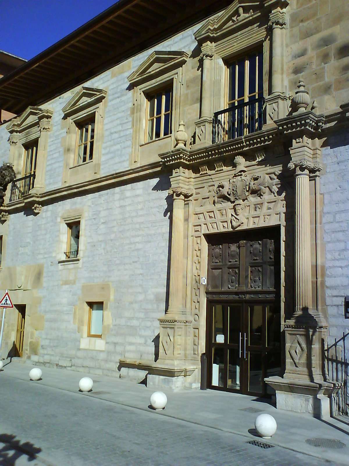
Lobiano Jauregia
Ermua
Lobiano Jauregia (Lobiano Palace) is a Renaissance mansion standing in the center of Ermua, a small town in the Basque Country's Bizkaia province. Regarded as one of the region's finest Renaissance buildings, it now serves as the town's cultural center. How do you get there? Ermua sits on the Euskotren commuter line connecting Bilbao with Donostia-San Sebastián, so a regional train or bus is the easiest way in — the palace stands right in the town center, an easy walk from the station. Drivers benefit from the town's direct link to the motorway running between Bilbao and the French border. What's the story behind the building? The palace was raised around 1550 at the initiative of Rodrigo de Lobiano, a wealthy merchant, and his wife María de Aguirre, who came from neighboring Álava. The couple built an imposing, monumental residence meant to pass on as an inheritance to their four children while announcing the family's rank among the region's richest merchant houses. Its history afterward was far from quiet. Once the direct line of heirs faded, the building spent a period housing a community of nuns, who lived there until they secured their own convent in 1594. The property then reverted to the Lobiano family. Late in the 18th century, in 1794, the palace suffered fire damage tied to the War of the Convention, one of the conflicts that reached Basque territory at the time. Over the following centuries it underwent further alterations, as one would expect of a centuries-old residence that repeatedly changed hands and purpose. What can you see inside today? Toward the end of the 20th century, the building passed into the hands of the Ermua town council, which carried out a thorough restoration and converted it into a Casa de Cultura — locally known as Lobiano Kultur Gunea. Inside today you'll find an exhibition hall, an auditorium, a painting room, a theatre hall, and a dance hall. It functions as the town's cultural meeting point, hosting temporary exhibitions, performances, art classes, and municipal events throughout the year. The building's Renaissance facade composition alone is worth the stop, even without a specific event on the calendar — it's a rare surviving example of bourgeois Renaissance architecture in this part of Bizkaia. When's the best time to visit? Since the palace operates as a working cultural venue, it's worth checking Ermua's local events calendar before heading over — exhibitions and performances run cyclically throughout the year, with a fuller program typically in autumn and winter, when cultural life moves indoors. A visit pairs easily with exploring central Ermua and the hiking trails in the surrounding Bizkaia hills. Frequently asked questions What is Lobiano Jauregia used for today? It's a former 16th-century noble palace now converted into the town's cultural center, with an exhibition hall, auditorium, and art workshops. Who built the palace? It was built around 1550 by the merchant Rodrigo de Lobiano and his wife María de Aguirre as a family residence and inheritance for their children. Is the building still the original 16th-century structure? The overall Renaissance character survives, but the palace was altered repeatedly over the centuries, including repairs after an 1794 fire linked to the War of the Convention. Can you visit without attending a cultural event? Yes, the building operates as a public cultural center, though it's best to check opening hours and the current program with Ermua's town council beforehand.
-
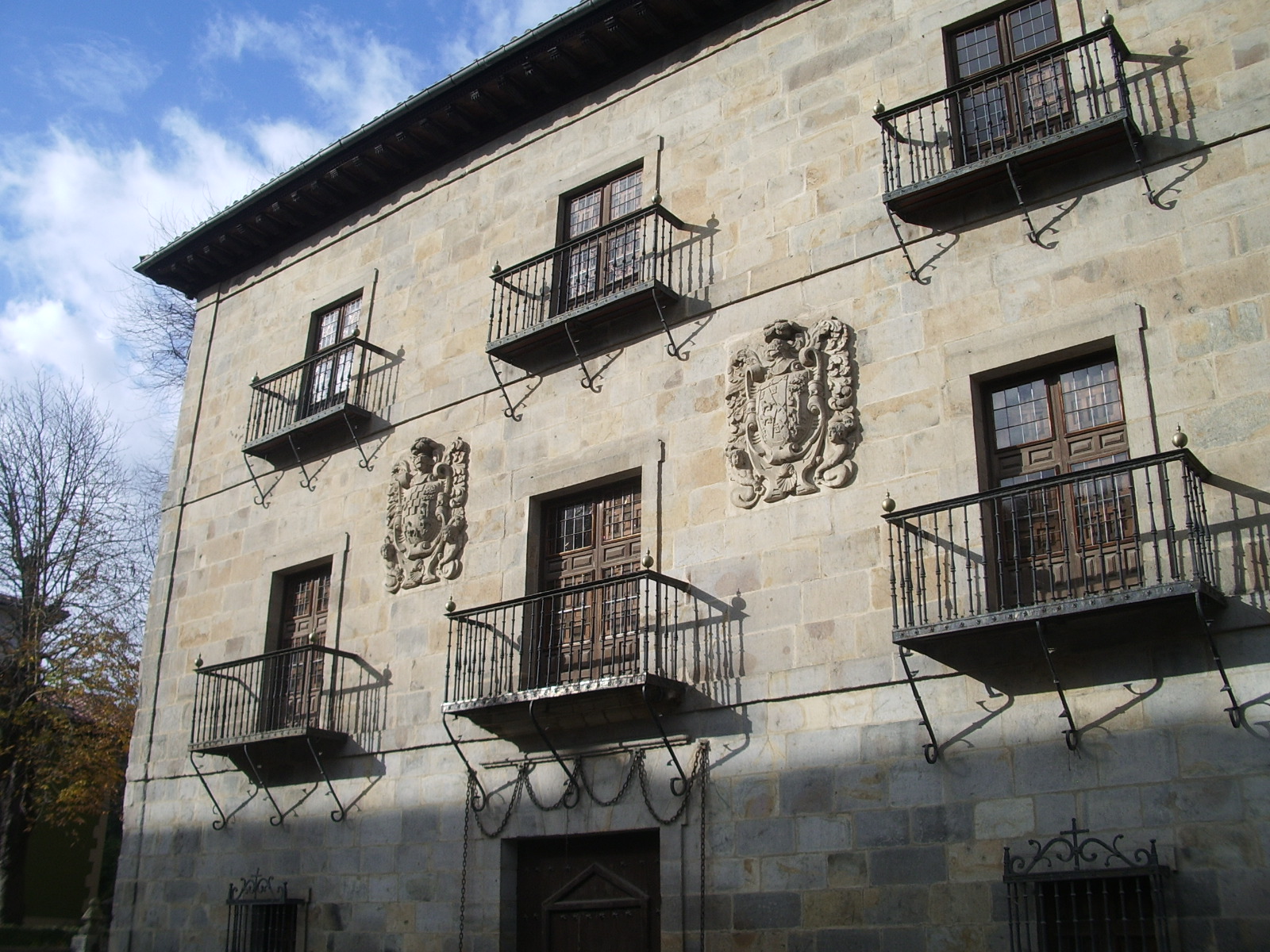
Monterron jauregia
Arrasate / Mondragon
Monterrón Palace (Monterron jauregia in Basque) is a 17th-century mansion standing at the entrance to the Zarugalde district of Arrasate/Mondragón, in Spain's Basque Country. It counts among the finest examples of civil baroque architecture in the area and stands as a lasting mark of the region's old landed nobility. Who built the palace, and why? The palace was commissioned by Captain Mateo de Aranguren, an "indiano" who made his fortune in the Americas and returned home determined to raise a residence that matched his new standing. He built it for himself and his wife, María de Andicano, sister of the first Count of Monterrón. Two stone coats of arms still adorn the facade — one for the Andicano-Zelaa family, the other for the Aranguren-Unzueta line — marking the union of both houses. What can you see there? The building follows strict classical baroque lines: a square floor plan, a four-sided sloping roof, and a layout of a ground floor plus two upper storeys. The main facade is built of dressed ashlar stone, giving it the sober, monumental look typical of Basque palatial architecture of the period. In front of the entrance, metal chains still hang across the ground — not decoration, but a historic marker of the privilege of immunity, confirming the palace's status as a Royal Palace granted by King Philip V. Today the building sits inside a public green space, the Monterrón Park, a favourite spot for locals out for a walk. What is its history? Over the centuries the palace welcomed a string of notable guests: King Philip V, Queen Isabella II together with her mother María Cristina, the kings of Tuscany, the statesman Cánovas del Castillo, and, during the dictatorship years, General Francisco Franco. On 17 January 1964 it was declared a historic-artistic monument. Its fate changed for good in 1983, when, after lengthy negotiations, the Mondragón municipal council purchased both the palace and its park from the Countess of Monterrón for 45 million pesetas (roughly €270,000). Since then it has belonged to the town and its residents. What happens inside the palace today? The historic building now houses Musika Etxea, Arrasate/Mondragón's municipal music school. It is a fitting compromise between heritage protection and everyday use: music still drifts from its windows, though these days it comes from students practising rather than court receptions. How to get there and when to visit? The palace sits in an easily reachable part of town, right where the Zarugalde district begins, surrounded by its park — a short walk of a few minutes from the centre of Arrasate/Mondragón. Daytime visits work best, when natural light picks out the stone facade and the carved coats of arms, and the park invites a longer stop on a bench or a stroll among the trees. Since the interior now functions as a music school, access inside is limited to its educational use, so it is worth checking locally for park opening hours or any public cultural events held there. Frequently asked questions What is Monterrón Palace? A 17th-century baroque palace in Arrasate/Mondragón, built for Captain Mateo de Aranguren, decorated with the coats of arms of two noble families and set within a municipal park. Can visitors go inside? The building now houses the Musika Etxea music school, so interior access is tied to that institution's use — the surrounding park, however, is freely open to the public. Why are there chains in front of the entrance? They are a historic symbol of the privilege of immunity and the Royal Palace status granted to the building by King Philip V. Since when has the palace belonged to the town? Since 1983, when the Mondragón council bought the palace and its park from the Countess of Monterrón.
-
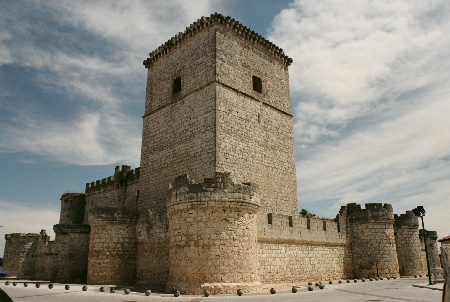
Portillo Castle
Arrabal de Portillo
Portillo Castle stands above the town of Portillo in the province of Valladolid, Castile and León, right next to the small settlement of Arrabal de Portillo. Its crenellated walls and stocky keep are visible long before you reach the town itself, making it one of the most striking fortresses left standing in this part of Spain. How do you get to Portillo Castle? Portillo sits roughly 30 km south of Valladolid along the road toward Segovia, so driving is by far the easiest option — the trip from Valladolid takes under half an hour. The castle occupies a low hill above the town, so from the parking area you'll need to walk a short but noticeably steep stretch up to the entrance. Travelers without a car can look into regional bus links connecting Valladolid with smaller towns in the province, though schedules are limited and worth checking in advance. What will you see inside? Also known as the Castle of the Counts of Benavente, the fortress is considered a textbook example of the so-called Valladolid school of military architecture that developed in this region during the 15th century. Inside the walls, visitors can walk through the courtyard, the main halls, and surviving sections of the living quarters once used by the family that held the fortress. A visit typically includes access to the ramparts, which open onto views over the Duratón river valley and the surrounding farmland. On selected days the site also runs themed visits — night tours with theatrical elements and programs aimed at younger visitors that bring medieval court life to life for kids. Where does its history come from? A fortified post is recorded on this site as far back as the early 10th century, mentioned in chronicles among the strongholds taken by the army of Abd al-Rahman III on its way to the Battle of Simancas in 939. The structure standing today, however, is later: its core dates to the 14th century and is traditionally linked to Infante Tello, son of King Alfonso XI. The castle was expanded in several phases, and the shape it holds now largely reflects a major rebuilding ordered in 1465 by King Henry IV of Castile. The site is tied to one of the more dramatic episodes of 15th-century Castilian history — nobleman Álvaro de Luna was held here before being taken to Valladolid, where he was beheaded in the city's Plaza Mayor on 2 June 1453. Today the castle is protected as a site of cultural interest and belongs to the University of Valladolid, which manages it as an educational and cultural venue. When's the best time to visit? The castle opens to visitors only on set days, usually Sundays and public holidays around midday, so it's worth checking the current schedule before planning a trip. Spring and early autumn make for the most comfortable visits — Castilian summer heat can be harsh, especially on the climb up to the walls, while some seasonal offerings, like the night tours, are typically paused in winter. Frequently asked questions How much does it cost to visit Portillo Castle? General admission is a modest few euros, with a reduced rate for children aged 6 to 14. Is the castle open every day of the week? No — visits are mainly limited to Sundays and public holidays at set hours, so confirming the schedule beforehand is worthwhile. Who owns the castle today? It belongs to the University of Valladolid, which runs cultural and educational activities on site. Can this visit be combined with other nearby attractions? Yes — Portillo lies right along the route between Valladolid and Segovia, making it easy to pair a castle visit with a trip to either city.
-
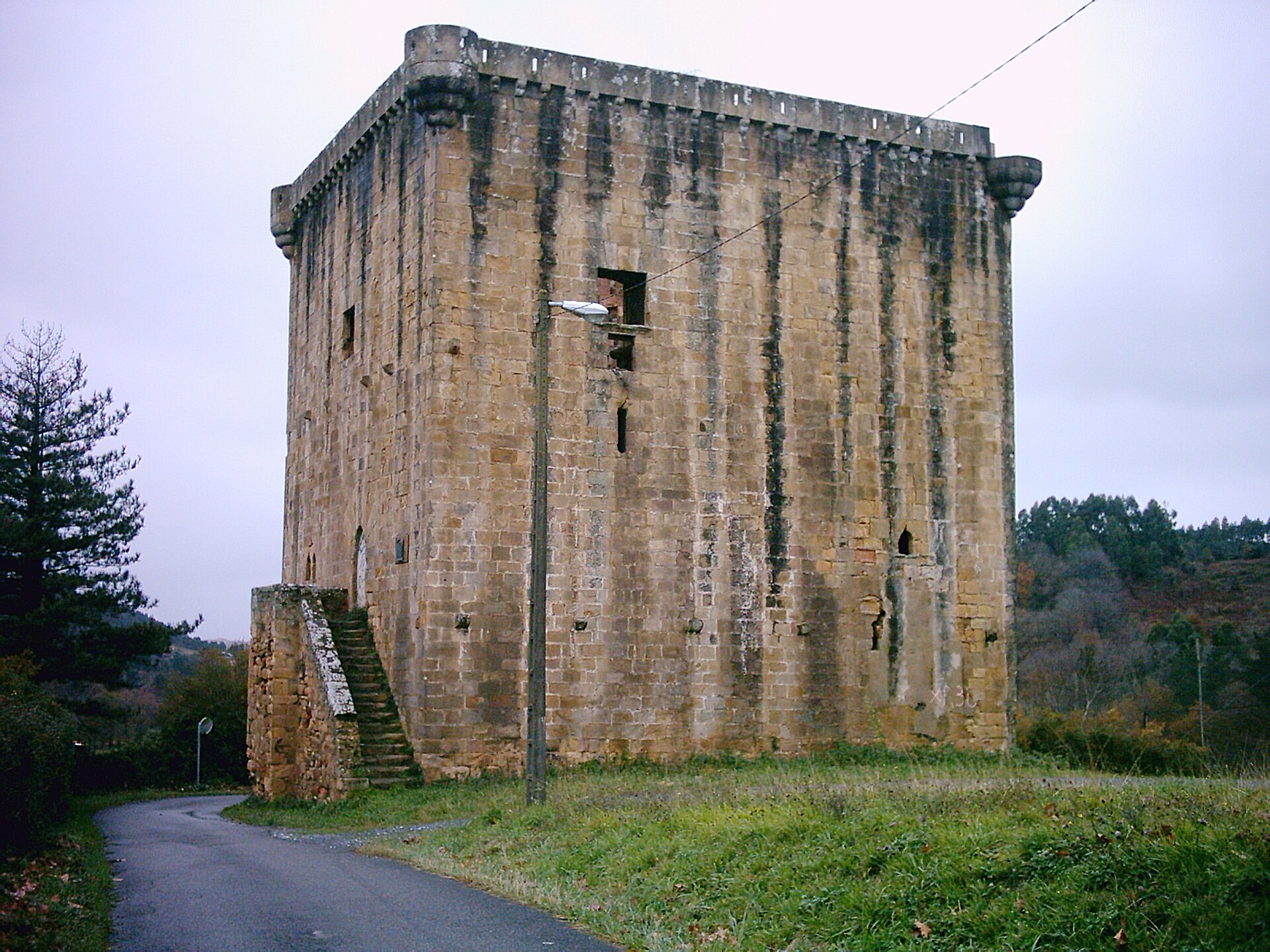
Martiartu Tower
Erandio
Martiartu Tower is a medieval defensive and residential tower in the Goierri district of Erandio, in the Basque Country, standing on the lower slope of Mount Umbe above the Udondo valley. How do you get there? Erandio sits inside the Bilbao metropolitan area, right next to Loiu airport, so it's only a short drive or public-transport ride from downtown Bilbao. The tower lies along the Bilbao Metropolitan Green Belt (Cinturón Verde), a network of walking trails linking the region's green spaces, so many visitors reach it on foot or by bike as part of a longer walk through the surrounding hills. What will you see? The tower's current form dates to the first quarter of the 16th century, though it hides fragments of an earlier structure from the late 14th or early 15th century. It was originally built by Martín Ortiz de Martiartu, son of Diego Pérez de Martiartu, known as "El Viejo" — at the time it controlled the route between Plentzia and Bilbao along with local roads in the area. That first tower didn't survive the turbulent politics of the period: in 1472, after the Martiartu family backed the Count of Haro in a regional power struggle and his supporters were defeated by forces loyal to the Catholic Monarchs, the tower was torn down. What stands today is the result of a thorough rebuilding carried out roughly fifty years later. Structurally, the tower is an almost cubic block of dressed sandstone ashlar, with walls that grow thinner toward the top — at the base they measure 2.40 meters thick. The building rises about 18 meters and spans 14 meters across, with the interior split across three floors. This kind of massive construction was typical of Basque lineage towers, built to serve as both family residences and defensive strongholds during periods of conflict between rival clans. The tower's later history is equally eventful: by the 18th century it belonged to the Barraicua family, descendants of the Martiartu line, and in the early 19th century it was let out as a rental property. In 1948, Isidro Aretxabaleta y Mota sold the tower along with its adjoining hermitage to the local council, which carried out an initial restoration completed in 1954. A far more substantial renovation began in 2021, backed by funding from the Basque Government, aimed at reinforcing the structure and rebuilding the floors and roof so the space could be adapted to new uses. In January 2023, Erandio opened the tower to the public for the first time through guided visits. When should you visit? The tower stands in open countryside, so spring and autumn — when Basque temperatures are mild and the surrounding hills are green — make for the most pleasant visits. In summer, an early-morning trip is best, before the trail walk gets too hot. Since access to the interior is only available through organized guided visits, it's worth checking the Erandio municipal schedule beforehand; the tower's exterior and surrounding grounds, however, can be viewed year-round. Frequently Asked Questions Can you go inside Martiartu Tower? Yes. Since January 2023, the Erandio council has run guided visits inside the tower, made possible by the restoration work completed shortly before. How old is the tower? The first stone tower went up in the late 14th or early 15th century, but after being destroyed in 1472 it was rebuilt into its current form in the early 16th century. Why was the tower destroyed in 1472? The Martiartu family sided with the Count of Haro in a regional conflict, and after his supporters were defeated by forces loyal to the Catholic Monarchs, the tower was demolished as a consequence. Are there other attractions nearby? The tower sits along the Bilbao Metropolitan Green Belt trail network, making it easy to combine a visit with a walk through the surrounding hills and the Udondo valley, and its proximity to Loiu airport and central Bilbao makes it simple to reach.
-
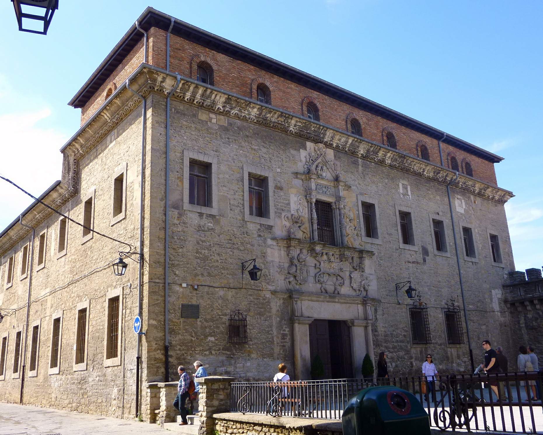
Palacio Eskoriaza-Eskibel
Vitoria-Gasteiz
Palacio Eskoriaza-Eskibel is a Renaissance-era townhouse standing in the historic center of Vitoria-Gasteiz, perched on the Villa Suso hill directly above the old defensive walls. Who built it, and why did they never live there? Construction was commissioned in the mid-16th century by Fernán López de Eskoriaza, physician to England's King Henry VIII and later to Emperor Charles V, together with his wife Victoria de Anda y Eskibel. In December 1539 the couple petitioned the city council for a plot chosen deliberately to rise straight out of the old town walls — a site that itself signaled their standing in the city. Fate intervened before the work was finished: both husband and wife died in 1541. Their will explicitly instructed that construction be completed, yet neither of them ever set foot inside the finished house. From its very origin, the palace has stood as a monument to ambitions its founders never got to enjoy in person. What is there to see inside? The building's centerpiece is a square courtyard framed by a two-tier arcaded gallery running along three of its sides, connected by a formal staircase. The column capitals and medallions decorating the gallery rank among the richest examples of Renaissance ornament in the Basque Country, blending plant motifs with heraldic detail. On the street-facing side, a Plateresque doorway carries carved busts of the founders, Fernán and Victoria, still looking out over passersby much as they have for close to five centuries. The whole structure is built of dressed ashlar stone, giving it the restrained, sturdy elegance typical of Basque noble architecture of the period. How do you get there, and when is the best time to visit? The palace sits in the pedestrian heart of Vitoria-Gasteiz's old quarter, only a few minutes' walk from Santa María Cathedral and the main squares of the Casco Viejo, so no transport beyond a comfortable pair of shoes is needed. The building belongs to the city — the council took it over in 2010 — and it doesn't operate as a year-round attraction with fixed daily hours. Guided visits are arranged on an occasional basis, typically around long weekends, Holy Week, and summer, so it's worth checking the current schedule with the local tourism office before planning a trip. The interior is also opened at times for temporary exhibitions, including ones on regional history. Who is this place for? It suits travelers drawn to Renaissance architecture and the history of the city's merchant elite rather than visitors chasing a crowded must-see checklist. The palace's modest scale and lack of queues mean the courtyard can be taken in at a relaxed pace — a quality harder to find at the region's better-known landmarks. Frequently asked questions Is entry to the palace free? Access is through organized guided visits scheduled on set dates; check with the Vitoria-Gasteiz tourism office ahead of your trip for the current terms and any fees. Is the palace open all year round? There are no fixed daily opening hours. Visits are arranged seasonally, mainly around long weekends, Easter week, and summer. What's inside the courtyard? A two-tier arcaded gallery running along three sides of the courtyard, richly carved capitals and medallions, and a formal staircase linking the floors. Is it worth combining with a walk through the old town? Yes — the palace stands within the Casco Viejo, close to Santa María Cathedral, making it a natural stop on a walk through the historic center.
-
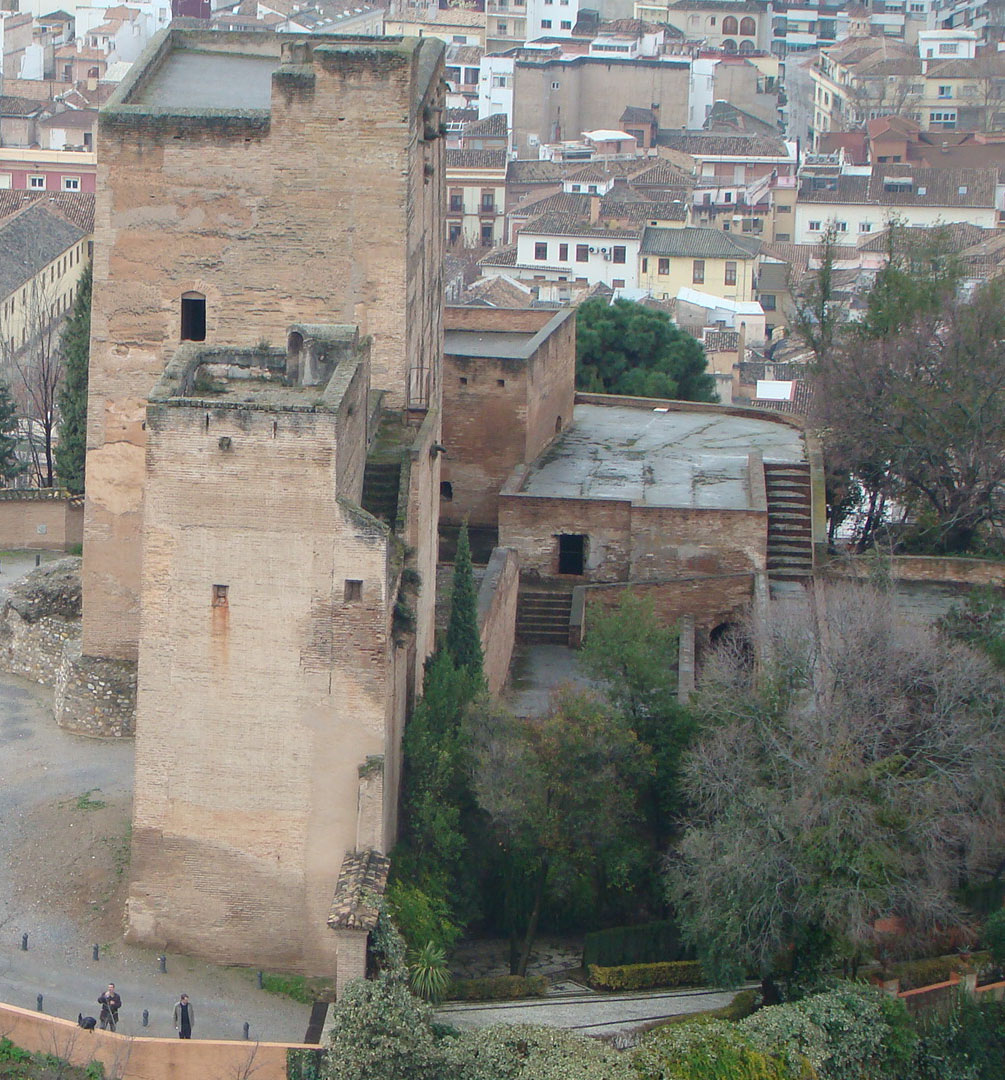
Torres Bermejas Castle
Grenada
Torres Bermejas is a cluster of three medieval defensive towers standing on the Mauror hill in Granada, directly facing the Alhambra. For travelers looking for a quieter vantage point over the fortress and the old town, it's one of the city's more overlooked gems. Where does the name "Crimson Towers" come from? Torres Bermejas means "Crimson" or "Red Towers," a name taken from the reddish tone of the rammed earth (tapial) used to build the walls. The oldest surviving remains date back to the late 8th or early 9th century, part of Granada's earliest known defensive system, a stronghold referred to as Hizn Mawror. By the 11th century the towers had been tied into the city's defensive wall and linked to the Alcazaba of the Alhambra by a rampart, sections of which still survive today. Under Nasrid rule in the 13th century, the complex was expanded first by Muhammad I Al-Ahmar and later by his son, Muhammad II. After the Christian conquest, a 16th-century artillery bastion was added on the northwest side, and the towers underwent a further restoration between 1854 and 1858. What will you see there? The site is made up of three adjoining towers. The central one is the most imposing, with three floors and a curved bastion from the Christian era, beneath which lies a water cistern. The tower on the left has two floors, while the one on the right has just a single level. From the walls and terraces, visitors get a sweeping view over Granada, with the towers standing in visual dialogue with the Alhambra's own fortifications, especially the Torre de la Vela, the Alcazaba's old watch tower. How do you get there? Torres Bermejas sits close to Cuesta de Gomérez and the Realejo neighborhood, making it an easy walk from the city center — about eleven minutes from Plaza Nueva. Buses from downtown Granada also stop near the towers for those who'd rather skip the climb. When should you visit? The towers were only recently opened to the public for the first time in their history. Entry is free, but visiting hours are limited to Saturdays and Sundays, aligned with the schedule of the Alhambra's Monumental Complex. It's worth checking current opening times before you go and planning your trip around the weekend window. Frequently asked questions Is admission to Torres Bermejas free? Yes, entry is free, but the site is only open on weekends (Saturdays and Sundays). How long is the walk from central Granada? From Plaza Nueva, it takes about eleven minutes on foot, passing through Cuesta de Gomérez and the Realejo district. Is Torres Bermejas part of the Alhambra ticket? No, it's a separate, older fortified complex on the neighboring Mauror hill — not included in the paid Alhambra and Generalife ticket, and its main appeal is precisely the outside view it offers of them. Can it be combined with other sights nearby? Yes, its location next to the Realejo neighborhood and the Alhambra viewpoint makes it easy to fold into a walk through the old town in the same outing.
-
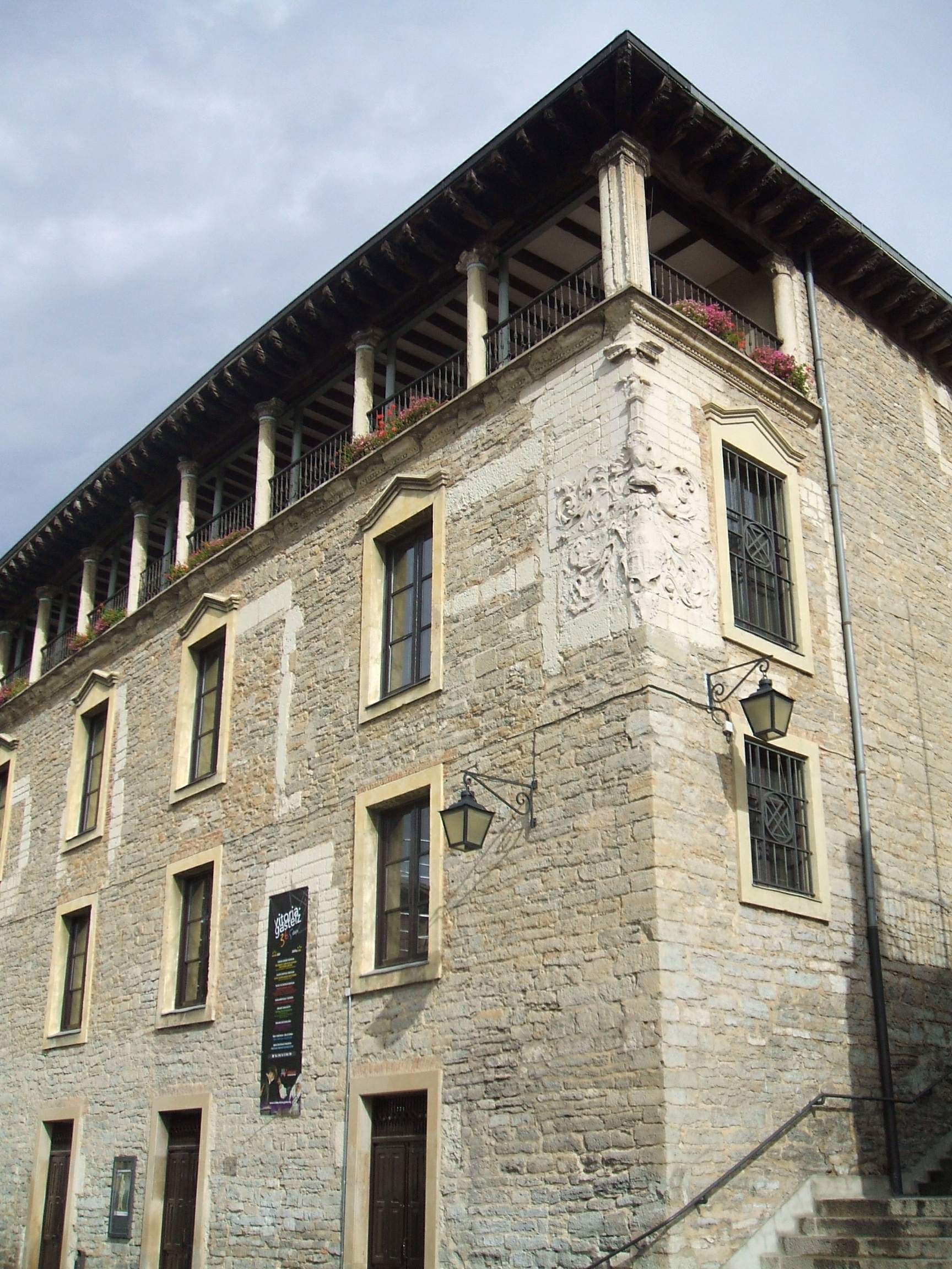
Palace of Villa-Suso
Vitoria-Gasteiz
The Palace of Villa-Suso is a Renaissance mansion standing at the heart of the old town of Vitoria-Gasteiz, one of the most striking historic buildings in the Basque capital of Alava. Where does the name come from and what is its history? The palace was commissioned in 1539 by Martín de Salinas, ambassador at the court of Emperor Charles V representing the interests of Infante Ferdinand of Habsburg. City authorities were initially reluctant to allow a private residence to be built so close to the town walls, fearing it would weaken the city's defenses. The ambassador eventually won approval on one condition: the main entrance had to sit above street level. That requirement is the origin of the name "Villasuso" — meaning "house above." The building itself rises directly over the old defensive wall of Vitoria-Gasteiz, sections of which are still visible inside today. What can you see inside? The palace's most distinctive feature is its unusual U-shaped floor plan — architects had to work around the line of the town wall the building was set against, as well as the sloping, uneven terrain of the old quarter. Inside hangs a prized 16th-century Flemish tapestry from the Brussels school, depicting Aeneas fleeing burning Troy with his family. During renovation work in the 1980s, builders uncovered an old burial site with a tombstone, which gave rise to a local legend about a ghost said to haunt the palace ever since. How do you get there and when should you visit? The palace stands on Plaza del Machete, right in the middle of the Casco Viejo (Alde Zaharra), Vitoria-Gasteiz's historic quarter, between the churches of San Miguel and San Vicente. It's an easy stop on foot while exploring the almond-shaped medieval center. Today the building serves as a conference and congress venue and houses the city's Culture Department, so access to the interior can vary depending on scheduled events. Guided visits last around 25 minutes and require a ticket; they run mainly in summer, during Easter week, and on long public holiday weekends. The city council has also recently launched an immersive visiting experience combining virtual and augmented reality, holograms, and interactive games, bringing the palace's history to life through a modern multimedia format. Frequently asked questions How long does a visit to the Palace of Villa-Suso take? A standard guided tour lasts about 25 minutes. A newer immersive version of the visit, featuring virtual reality and holograms, is also available. When is the best time to plan a visit? Visits mainly run in summer, during Easter week, and on long holiday weekends — check the current schedule before you arrive, since the building also functions as a congress venue. Where does the name Villasuso come from? It refers to the condition set by city authorities during construction: the main entrance had to be placed above street level, giving rise to "Villasuso," meaning "house above." What is the palace's most notable interior feature? Its centerpiece is a 16th-century Flemish tapestry from the Brussels school depicting the escape of Aeneas from Troy, while sections of Vitoria-Gasteiz's old defensive wall remain embedded in the building's structure.
-
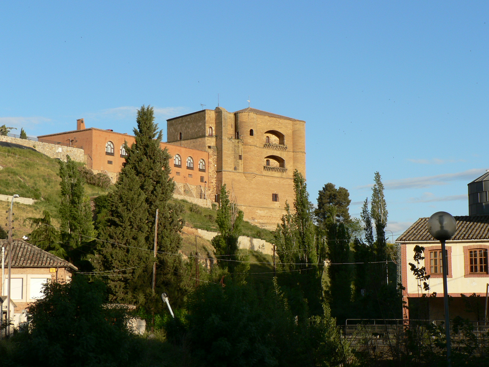
Torre del Caracol or Castillo de la Mota, Benavente
Benavente
Torre del Caracol (Castillo de la Mota) is a Gothic-Renaissance tower in Benavente, one of the few surviving parts of the once-vast castle-palace of the Pimentel family, counts of Benavente. What is this place? The tower stands on a hilltop at the heart of Benavente, on the site of a medieval castle that once guarded the river crossing and the route linking León with Castile. It was here, in 1230, that a moment of national significance took place: the Concordia de Benavente, an agreement that sealed the lasting union of the kingdoms of León and Castile under Ferdinand III. The tower visitors see today, however, dates from later — the early 16th century, built on the orders of the 4th and 5th Counts of Benavente from the House of Pimentel, whose palace was then considered one of the most lavish in Spain. What will you see? The tower blends two architectural styles — late Gothic and early Renaissance — visible in its stonework and overall proportions. Its most distinctive feature is inside: a richly carved Mudejar wooden ceiling (artesonado) on the main floor, originally brought here from the convent of San Román del Valle. It's a rare example of Mudejar craftsmanship in this part of Castile and León, blending Islamic building techniques with a Christian patron. From the outside, the tower's massive, multi-storey structure impresses through sheer height and solid stonework, even though it's modest compared to the scale of the palace it once belonged to. The area around it, overlooking Benavente's old town and the river valley, is worth a short stroll in its own right. How to get there? Torre del Caracol sits right in the centre of Benavente, a town on the route connecting Madrid with León and Galicia, making it a convenient stop on a longer road trip. The nearest larger cities, Zamora and León, are both under an hour's drive away. The monument is well signposted and easy to reach on foot from the town square and the rest of the old town's landmarks. When to visit? The tower is now part of the Parador Nacional de Turismo de Benavente, a hotel belonging to Spain's state-run parador network, which means the grounds around it are well maintained and accessible year-round. Spring and early autumn are the best times to visit, offering milder temperatures than the hot Castilian summer. It's worth pairing a visit with the other historic landmarks of Benavente — the churches of Santa María del Azogue and San Juan del Mercado — both within easy walking distance. Frequently asked questions Are Torre del Caracol and Castillo de la Mota the same place? Yes. Torre del Caracol is the name of the tower, the surviving part of the former castle-palace known as Castillo de la Mota — both names refer to the same monument in Benavente. Can visitors go inside the tower? The tower stands within the grounds of the working Parador de Benavente hotel, so access to the interior, including the historic Mudejar ceiling, can be limited — it's worth checking locally or contacting the parador in advance. Why is this site historically significant? It was here, in 1230, that the Concordia de Benavente was signed, an agreement that permanently united the crowns of León and Castile — one of the key milestones in the unification of medieval Spain. Are there other landmarks nearby worth seeing? Yes, Benavente itself is home to the churches of Santa María del Azogue and San Juan del Mercado, both fine examples of the region's Romanesque and Gothic architecture.
-
Palauet d'Aiora
Walencja
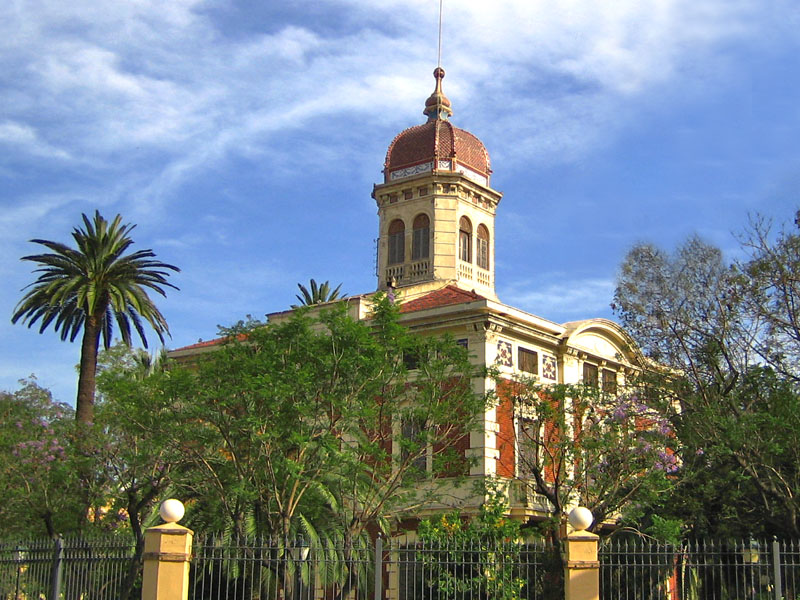
Palauet d'Aiora is a historic mansion in Valencia, tucked away in greenery in the Camins al Grau district, between the streets of Santos Justo y Pastor, Industria and Guillem de Anglesola. Today it houses a cultural and community centre run by Valencia's Universitat Popular, and the garden surrounding the building is one of the largest green enclaves in this part of the city. How do you get there? Palauet d'Aiora sits east of Valencia's old town, along the route of the historic Algirós path that once connected the city centre with the seaside neighbourhood of Cabanyal. It's within walking distance of the City of Arts and Sciences area and served by the tram and bus lines running through Camins al Grau — the mansion blends into the dense residential fabric of the district, so the easiest way to reach it is by public transport or bicycle. What's the story behind the building? The mansion was built between 1899 and 1900 for José Ayora Olcina, a Valencian merchant, to a design by architect Peregrín Mustieles Cano. It was conceived as a summer villa — a suburban retreat set among orchards and fields that once lined the Algirós road, away from the noise of the city centre. The building was deliberately raised on a plinth to protect it from ground moisture. Over the following decades the mansion changed hands and functions several times: it served as a private residence, later as a nightclub, and later still as a nursery school. Valencia City Council acquired it in 1976, and for a while the building faced the threat of demolition. It was saved by heritage protection — on 30 December 1982, Palauet d'Aiora was declared a Historic-Artistic Monument and a Property of Local Relevance. After years of closure and restoration work, it reopened in 2017 as the seat of the Universitat Popular and a sociocultural space open to the neighbourhood. What will you see? The architecture blends an eclectic style with elements of Valencian modernism. Its most recognisable feature is a polygonal tower crowned by a dome clad in copper-coloured metal tiles, with round-arched windows on each face. The building follows a square floor plan, with a ground floor, main floor and attic reflected in the division of its façade. On the main front, a curved pediment bears a relief of the god Mercury together with the building's construction date. The mansion is surrounded by a rectangular garden covering roughly 17,000 m² (about 1.7 hectares). It's planted with araucarias, pines, laurels, jacarandas, orange and lemon trees, and century-old fig trees — one of the oldest and most varied collections of urban greenery in this part of Valencia. When should you visit? Since the building functions as a cultural centre, access depends on the Universitat Popular's class and event schedule, so it's worth checking the current calendar before visiting. The garden's dense tree cover offers welcome shade even during Valencia's hot summers, making it a pleasant place for a walk at any time of year. Frequently asked questions What was Palauet d'Aiora originally built as? A summer villa built at the turn of the 20th century for Valencian merchant José Ayora Olcina, set among orchards and fields away from the city centre. Who designed the building? Architect Peregrín Mustieles Cano, between 1899 and 1900. Why did the mansion become a protected monument? It faced demolition after Valencia City Council acquired it in 1976. Its listing as a Historic-Artistic Monument in 1982 saved the building and paved the way for its restoration. What is Palauet d'Aiora used for today? It houses the sociocultural centre of Valencia's Universitat Popular, open to residents and visitors since 2017, and is surrounded by a garden of nearly 1.7 hectares.
-
Lagunas Rubias Castle
Aldeanueva de Figueroa
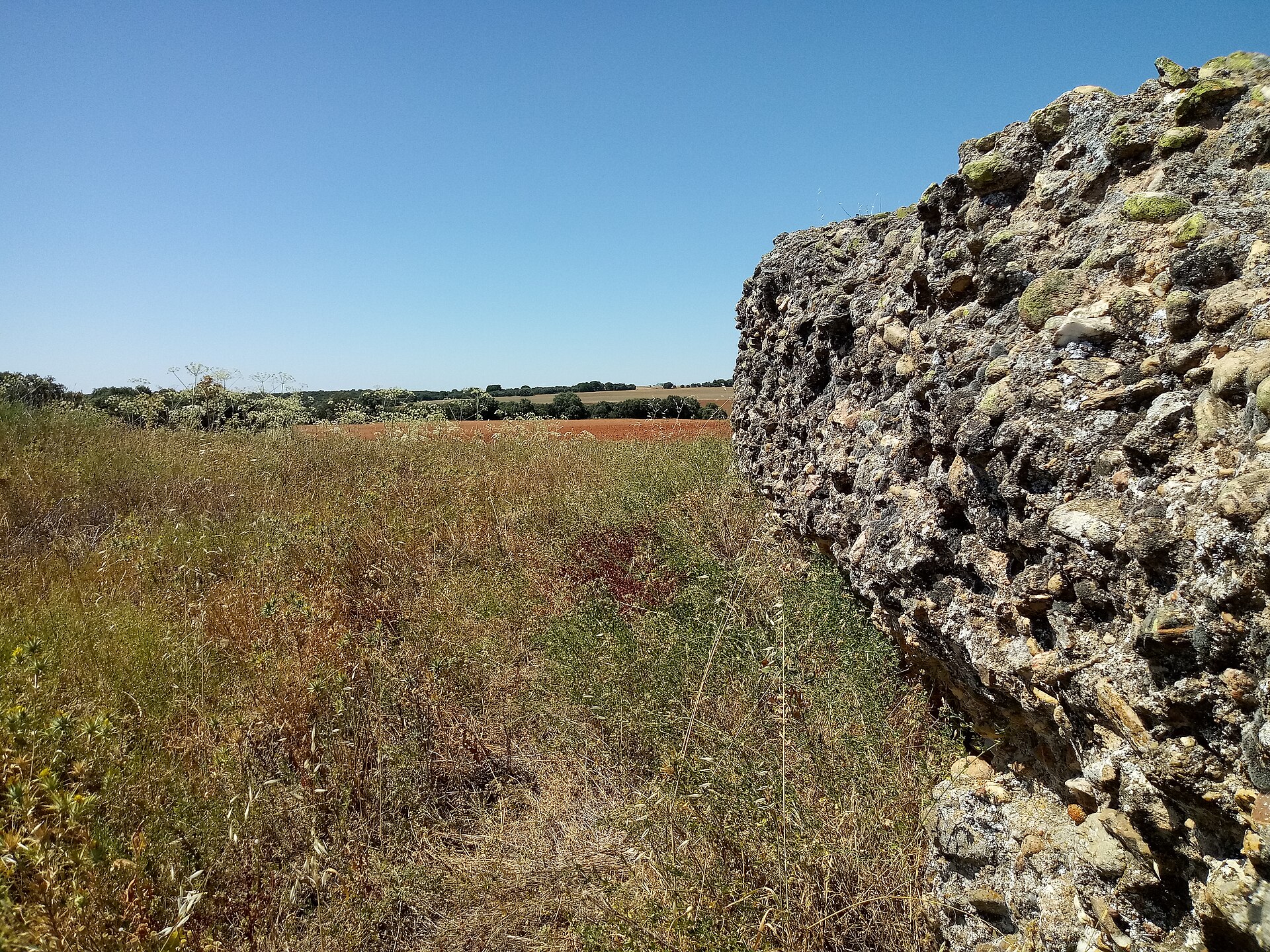
Lagunas Rubias Castle, near Aldeanueva de Figueroa in the province of Salamanca, Castile and León, is a ruined medieval fortress dating from the 12th and 13th centuries. Also known locally as El Palomar, it was raised by the Kingdom of León as a border stronghold against neighboring Castile, at a time when the frontier between the two crowns was an active flashpoint rather than a line on a map. Today the site survives as an unexcavated archaeological ruin, with a section of its rubble-and-mortar wall still standing above ground and the outline of its defensive perimeter traceable from above. Where is the castle located? The ruins sit in the northwestern part of the municipality of Aldeanueva de Figueroa, on a piece of raised ground overlooking the surrounding plain — a position that once gave the garrison a clear view over the open frontier country. The wider area is quietly agricultural, with gentle rises breaking up the otherwise flat terrain typical of this stretch of Salamanca. What is the history behind it? The fortress was built under the Leonese kings Fernando II and Alfonso IX, during a period when relations between the Kingdom of León and the Kingdom of Castile were tense enough to spill into open conflict along their shared border. It formed part of a chain of strongholds León raised across the northeastern reaches of Salamanca to hold this frontier. Once the two crowns were later united, the castle lost its strategic purpose and was left to decay; the site has never been fully excavated, and much of its structure is presumed to remain buried underground. What will you see on site? This is an archaeological site in the raw sense, not a restored monument — a stretch of wall projects above the soil, and the perimeter of the old fortifications shows up as a low, overgrown rise in the land rather than as standing towers or gatehouses. It appeals most to visitors interested in the medieval León–Castile frontier and in defensive architecture encountered in its unrestored, ruined state. There is no visitor infrastructure on the ground, so a visit here feels more like exploring an untouched historical trace than a curated tourist attraction. How do you get there? Aldeanueva de Figueroa lies within the agricultural belt of the province of Salamanca, in Castile and León. The most practical way to reach it is by car via the local roads connecting the village to the provincial road network; the castle site itself lies outside the built-up area, on farmland to the northwest of the village, so plan to cover the final stretch on foot from the nearest accessible point. When is the best time to visit? Because the site is entirely open and unsheltered, spring and autumn are the most comfortable seasons, avoiding the summer heat of the Salamanca plateau and finding the surrounding vegetation still low enough to make the wall lines easy to pick out. Frequently Asked Questions Can you visit Lagunas Rubias Castle? Yes, the site is accessible as an open-air archaeological area, though it has no organized visitor facilities or set opening hours. Has the castle been excavated? Largely not — only sections of wall projecting above ground level are currently visible, with the rest of the structure believed to remain buried. What was the castle's historical role? It defended the eastern frontier of the medieval Kingdom of León against Castile, built during the reigns of Fernando II and Alfonso IX. Are there other attractions nearby? Aldeanueva de Figueroa itself is a small rural village, and the surrounding area suits travelers interested in the quiet historical borderlands of old León rather than developed tourist attractions.
-
Castillo de Ademuz
Ademuz
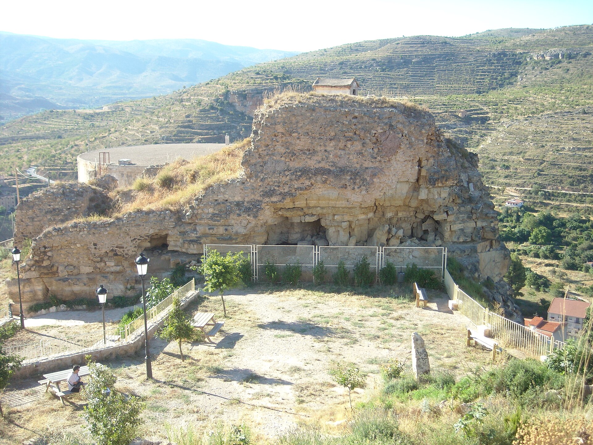
Castillo de Ademuz is a medieval fortress perched above the town of Ademuz, the main settlement of the small Rincón de Ademuz enclave, which belongs administratively to the province of Valencia despite being surrounded by land historically tied to Aragón and Castile. The castle ruins occupy a rocky ridge overlooking the Turia river valley, offering sweeping views across the surrounding countryside. What is the history behind it? The exact origins of the fortification are unclear — archaeological finds in the area suggest settlement here may date back to Roman times. The defensive structure whose remains survive today, however, is clearly Islamic in origin. The stronghold of Al-Dāmūs, built on an irregular rocky outcrop shaped to fit the terrain, served as a watchtower on the frontier between the Christian kingdoms of Aragón and Castile. In 1210 the fortress was captured by King Peter II of Aragón, aided by Templar and Hospitaller knights. It was later brought into the Kingdom of Valencia by James I the Conqueror, who placed it under direct royal control alongside the neighboring village of Castielfabib. Its position on a contested border kept the castle militarily significant for centuries — during the War of the Two Pedros (1356–1369), the garrison at Ademuz successfully resisted invading Castilian troops. The castle's decline began with a powerful earthquake in 1656, which severely damaged both the fortress and the original parish church that stood within its walls. From that point the structure fell gradually into ruin, and only scattered fragments of its walls survive today. What will you see? Today Castillo de Ademuz is primarily a viewpoint: from what remains of its walls, visitors can look out over the town, the Turia valley, and the hills of the Rincón de Ademuz. The fortification's remains themselves are modest, and picturing the original layout of the stronghold takes a bit of imagination, but the setting — a rocky spur rising above the town — still rewards history enthusiasts and hikers alike. Down below, the town of Ademuz itself is worth a stop, with its old quarter and surviving stretches of town wall. How do you get there? Ademuz sits at the northwestern tip of Valencia province, inside an enclave surrounded by Aragonese territory, making it one of the more isolated corners of the region. The most convenient way to arrive is by car, along the road connecting the Turia valley with Teruel and the interior of Aragón. The castle ruins rise directly above the town, so reaching them from the center is usually a walk of around fifteen minutes up a steep path leading to the hilltop. When should you visit? The Rincón de Ademuz sits at inland elevation and has a continental climate, with hot summers and cool, sometimes frosty winters. Spring and autumn are the best seasons for walking up to the ruins and taking in the views, when temperatures are mild and the climb up the hill is more comfortable. In summer, it's worth timing the visit for early morning or late afternoon to avoid the strongest heat. Frequently Asked Questions Can the castle be visited with a guide? The site consists of freely accessible ruins with no organized visitor infrastructure — you explore it on your own. Is the climb up the hill difficult? The approach is steep but short, requiring no special preparation beyond comfortable footwear. Why is the castle in ruins? The fortress was badly damaged by an earthquake in 1656 and was never rebuilt afterward. What else is worth seeing in Ademuz? The town itself, with surviving stretches of its old defensive walls and historic architecture along the Turia valley.
-
Castle of Ruesta
Urriés
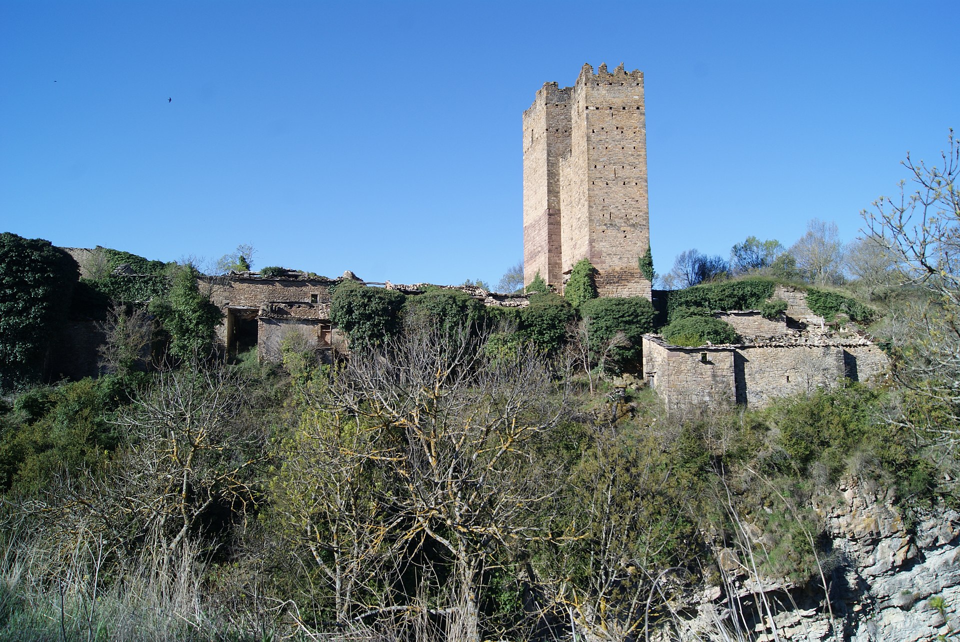
Castle of Ruesta stands above the once-abandoned village of Ruesta in the province of Zaragoza, in the Aragonese Pyrenees, right next to the Yesa reservoir. The fortress was most likely raised during the period of Muslim rule and later passed into the hands of the Christian Kingdom of Aragón as the Reconquista advanced. Over time a settlement grew up around its defensive walls, and the village's main street still runs in the shadow of the castle's towers today. What will you see? What survives of the castle today are mainly its distinctive towers and sections of defensive wall, parts of which have crumbled after centuries of exposure to the elements. The structure occupies the upper, western side of the village and looks down over it, offering views across Ruesta's rooftops toward the surrounding hills and the waters of the Yesa reservoir. Owing to its historical value, the castle is listed among Aragón's Bienes de Interés Cultural (Assets of Cultural Interest), a designation published in the Boletín Oficial de Aragón on 22 May 2006. The village of Ruesta itself is as compelling as its castle. It was largely deserted in the second half of the 20th century as residents migrated to cities and the surrounding land was reshaped by the construction of the Yesa reservoir, which flooded part of the nearby terrain. Thanks to the efforts of a local association, the settlement has since been gradually restored, and today it functions as a stop on the French Way of the Camino de Santiago through Aragón, with a pilgrims' albergue operating out of the renovated buildings. Ruesta's restoration project was recognized with a Hispania Nostra award in May 2021. How do you get there? Ruesta lies within the municipality of Urriés, in the northern part of Zaragoza province, along the stretch of the Camino de Santiago that crosses Aragón toward Navarre. The village sits right beside the Yesa reservoir, making it a natural landmark for anyone travelling through this part of the Pyrenees. Access is via local roads connecting the villages of the Aragón river valley, and many visitors arrive on foot as part of a Camino de Santiago pilgrimage stage. When should you visit? The Aragonese Pyrenees have a continental mountain climate — summers are warm and dry, while winters can be cold and snowy, especially higher up the valley. Spring and autumn are the best seasons for exploring the castle ruins and the village, offering mild temperatures and the most scenic views of the surrounding hills and the Yesa reservoir. Summer visits should account for high daytime heat, while winter can make some of the surrounding trails harder to access. Frequently Asked Questions Can you visit the Castle of Ruesta? The ruins can be explored as part of a visit to the restored village, though mainly the towers and sections of wall remain — it's a scenic historical remnant rather than a fully restored monument. Why was Ruesta abandoned? The village emptied out during the 20th century due to migration to cities and changes tied to the construction of the nearby Yesa reservoir; it has since been repopulated through a local initiative centered on serving pilgrims. Is Ruesta on the Camino de Santiago? Yes, the village sits on the Aragonese stretch of the Camino Francés and offers a pilgrims' albergue in the restored village buildings. What else is worth seeing nearby? The proximity of the Yesa reservoir and the mountainous landscape of the Aragón valley make the area appealing for hikers and anyone seeking views of the Pyrenees.
-
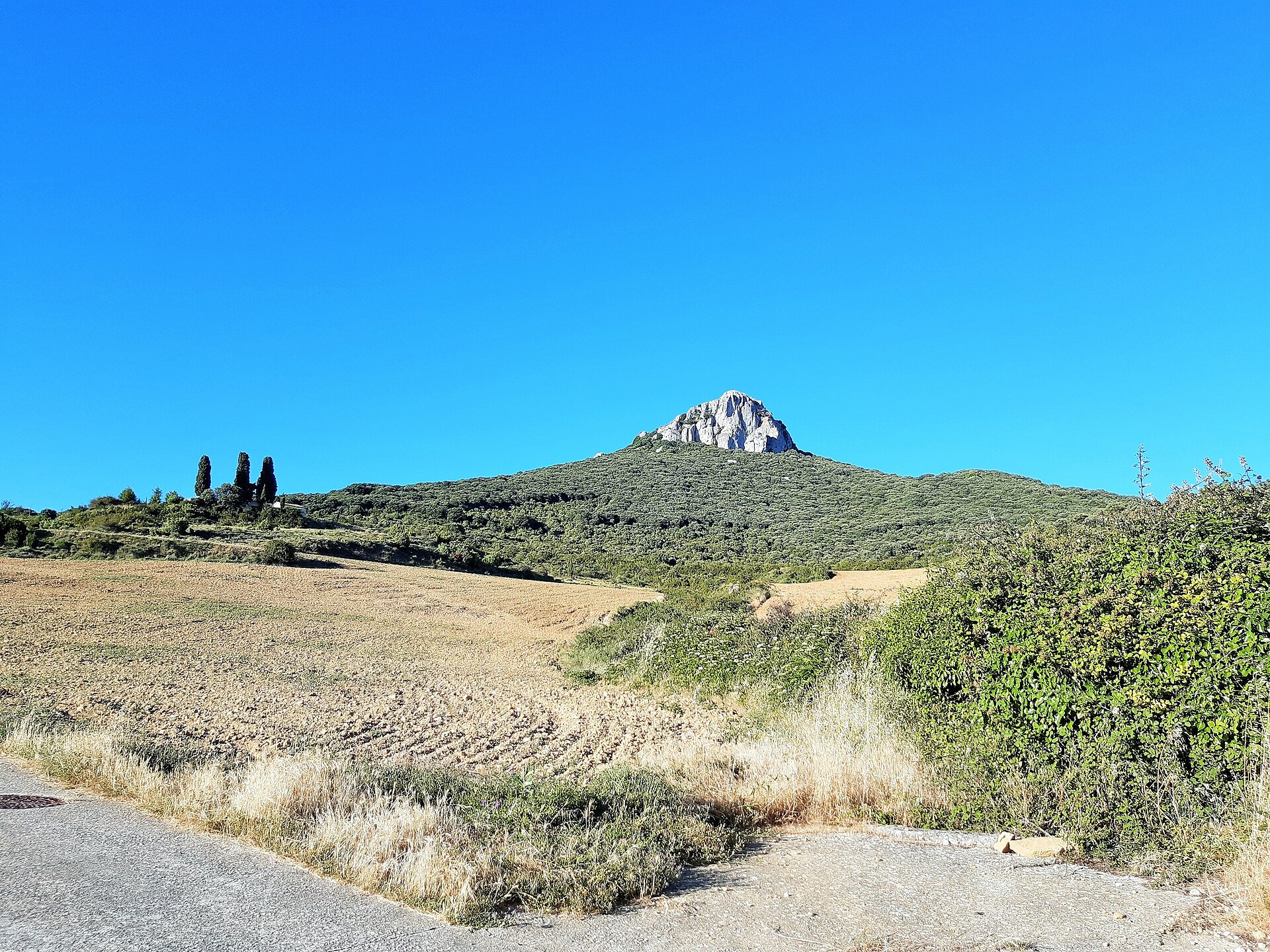
Castle of Gerga
Unzué / Untzue
Castle of Gerga, above the village of Unzué/Untzue in Navarre, northern Spain, is a rock castle perched on a steep outcrop that once formed part of the defensive network of the Kingdom of Navarre. What is the Castle of Gerga? The fortress, also recorded as Guerga, dates back to the 11th–12th centuries and was one of roughly a hundred strongholds that protected the Kingdom of Navarre until its annexation to the Crown of Castile in 1512. Perched at around 990 metres above sea level in the Sierra de Alaiz range, the castle controlled one of the entry points into the southern basin of Pamplona and kept visual contact with neighbouring fortifications. Alongside its military role, it also served as a prison during parts of the medieval period. After centuries of neglect and structural decay, the site has in recent years become the focus of a sustained archaeological and conservation project led by archaeologist Iñaki Sagredo of Gestión Cultural Larrate. What will you see on site? The castle's original layout included a square keep with a slate roof, a surrounding defensive wall pierced with arrow loopholes, a water cistern, a chapel, a cellar, a stable and a kitchen. Conservation campaigns carried out between 2020 and 2023 focused on consolidating the keep and uncovering the cistern (aljibe), work that has helped clarify the original arrangement of the buildings. Today the site is largely ruined, but the outlines of the walls, the foundations of individual rooms and the bare rock on which the fortress was built are all still visible. Its position on an exposed rocky outcrop also gives sweeping views over the surrounding hills and valley. How do you get there? The castle stands in the Sierra de Alaiz range, close to the village of Unzué/Untzue. Access is on foot, via a trail that climbs from the village up the rocky slope; the ground is uneven in places, so sturdy footwear and a reasonable level of fitness are recommended. Because the fortress sits on a steep rock outcrop, parts of the route involve a noticeable climb. When is the best time to visit? Given the exposed hilltop setting, spring and autumn are the most comfortable seasons for the walk, offering milder temperatures and good visibility. Summer heat can be intense on the unshaded outcrop, while winter rain can leave the rocky path slippery. Frequently Asked Questions How old is the Castle of Gerga? Its current structure dates from the 11th–12th centuries, although the fortress was rebuilt and reinforced repeatedly over the following centuries of use. What was the castle used for? It formed part of the defensive system of the Kingdom of Navarre, guarding access to the southern basin of Pamplona, and it also functioned as a prison during certain periods. Is the castle well preserved today? The site remains largely a ruin, but conservation work carried out since 2020 has uncovered and stabilised further elements, including the cistern and the remains of the keep. Is the walk to the castle difficult? The approach follows a rocky, uneven trail with a noticeable climb, so it should be treated as a hillwalking outing and approached with proper footwear.
-
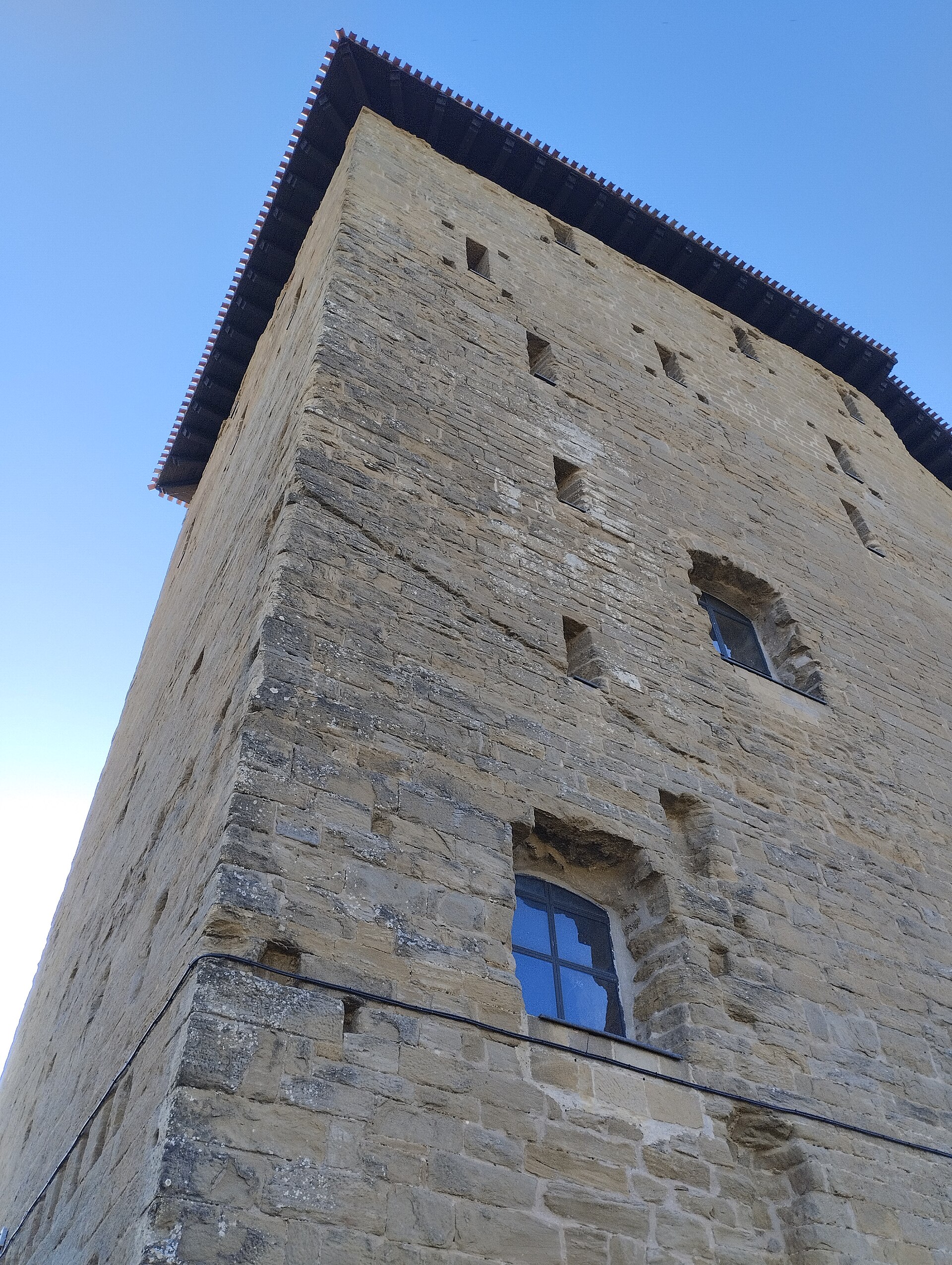
Torre de Biel
Torre de Biel is a medieval defensive tower standing in the village of Biel, in the province of Zaragoza, in the Aragón region of northeastern Spain. The tower rises on a small hillock right next to the village's parish church, at a point slightly higher than the rest of the settlement, overlooking the valley of the Arba de Biel river. Biel lies within the historic Cinco Villas district, an area known for its dense concentration of medieval frontier strongholds. What is the history behind the tower? The tower standing today was built in the 11th century, during the reigns of Sancho the Great and Ramiro I, at a time when this territory formed an important frontier zone of the Kingdom of Aragón. Because of its strategic position, the tower remained crown property, and records document a stay by King Ramiro II in the 12th century, when the fortress was held on his behalf by Castán de Biel. In the 15th century King Martín I granted the estate to Ramón de Mur, and in 1444 his heirs sold the tower and its surrounding lands to the Archbishop of Zaragoza, Dalmau de Mur. Even though the village itself fell under the ecclesiastical jurisdiction of the diocese of Pamplona, the tower remained under the archbishopric of Zaragoza as late as the 18th century. Remodeling work commissioned by Hernando de Aragón was completed in 1551. In 1996 the roof was restored with funding from Spain's Ministry of Culture, and in 2006 the tower was formally declared a Bien de Interés Cultural (Asset of Cultural Interest) by the Aragonese government. What will you see on site? Torre de Biel stands out for its unusual pentagonal floor plan, with longer sides measuring around 20 meters and shorter sides around 10 meters, reaching a height of nearly 30 meters. It was built using ashlar masonry, giving it the austere, monumental character typical of the region's frontier defensive towers. The east and west walls in particular are pierced by numerous narrow window and arrow-slit openings, deeply splayed toward the interior in the manner typical of medieval military architecture. Inside, the tower is divided into four floors, with the most prominent room — the former main hall — occupying the highest level, while an underground storage cellar lies beneath the structure. The current four-sloped roof likely replaced an original crenellated parapet. Together with probable traces of surrounding fortification walls, the tower forms a coherent example of the military architecture found throughout Cinco Villas. How do you get there? Biel sits at the heart of Cinco Villas, in the province of Zaragoza, surrounded by the foothill landscape typical of Aragón at the edge of the Pyrenees. The tower stands right in the village center, next to the parish church, making it easy to reach on foot for anyone visiting the settlement. Given the small scale of Biel, a visit to the tower and its adjoining old quarter takes relatively little time, so it pairs well with visits to other fortified villages across the Cinco Villas region. When is the best time to visit? Cinco Villas has a continental Aragonese climate, with hot summers and cooler, often windy shoulder seasons. Spring and autumn are the most comfortable times for walking through the village and taking in its stone architecture without the summer heat. Frequently Asked Questions Where exactly is Torre de Biel located? The tower stands in the village of Biel, in the province of Zaragoza, within the Cinco Villas district of Aragón, on a small hillock next to the village's parish church. When was the tower built? The present structure dates to the 11th century, built during the reigns of Sancho the Great and Ramiro I, though it was later remodeled, notably in 1551. What protected status does it hold? In 2006 the tower was declared a Bien de Interés Cultural by the government of Aragón, giving it formal protected heritage status. What makes its design distinctive? Its unusual pentagonal plan, a height of nearly 30 meters, and its numerous narrow arrow-slit openings set it apart from other defensive towers in the region.
-
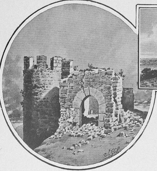
Torre del Monte
Castrillo de la Vega
Torre del Monte is a medieval defensive tower in the municipality of Castrillo de la Vega, in the province of Burgos, in the Castile and León region of Spain. Also known as the Atalaya del Montecillo, the ruined fortress sits on a hilltop roughly halfway between Castrillo de la Vega and the town of Aranda de Duero. What is the history behind the tower? Construction began in 1456, right on the boundary between two medieval territories: Tierra de Aza and the lands belonging to Aranda. That siting was no accident — a dispute over where exactly the border ran sparked open conflict between Diego de Zúñiga, lord of Aza, and the town council of Aranda de Duero. The tower rose as a strategic outpost at a time when local feudal lords were competing for control over these contested Castilian borderlands. What will you see on site? The fortress was originally laid out as a square with towers at each corner. The northeastern tower still stands today, along with a stretch of wall on the north side. A double moat once encircled the stronghold, and its outline can still be traced across the ground. The design combined a central tower flanked by crenellated turrets with a main gate set between two solid piers and capped by a round arch. Although much of the perimeter has crumbled, the surviving fragments are enough to reconstruct the scale and layout of the original structure. What purpose did it serve? Torre del Monte functioned mainly as a watchpoint and refuge in a territory shaped by border disputes and feudal rivalry. Its elevated position allowed defenders to monitor the surrounding routes and raise the alarm early, making it part of a wider defensive network across the region. When is the best time to visit? Burgos has a continental climate, so spring and autumn are the most comfortable seasons for exploring the ruins and the surrounding countryside without summer heat. Winters can turn cold and damp, worth factoring in if you plan a longer walk around the tower. How do you get there? The ruins lie in the province of Burgos, at the heart of the Ribera del Duero wine region, close to Aranda de Duero, one of the area's main wine hubs. That proximity makes it easy to pair a stop at the tower with a visit to nearby towns and vineyards. Frequently Asked Questions When was Torre del Monte built? Construction began in 1456, during the 15th century, amid medieval border disputes across Castile. What remains of the original structure? The northeastern tower, a section of the north wall, and the outline of the double moat that once surrounded the fortress. Why was the tower built in this exact spot? It stood on the boundary between Tierra de Aza and the lands of Aranda, at the center of a territorial dispute between Diego de Zúñiga and the Aranda de Duero council. What role did the tower play? It served as a watchpoint and refuge, helping control this border territory during a period of feudal conflict.
-
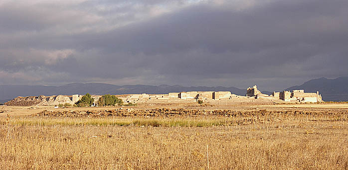
Calatrava la Vieja
Carrión de Calatrava
Calatrava la Vieja is a medieval archaeological site in the municipality of Carrión de Calatrava, in the province of Ciudad Real, in the Spanish region of Castile-La Mancha. This is where one of Spain's most powerful military-religious orders, the Order of Calatrava, was born, and the site today forms part of the Archaeological Parks network of Castile-La Mancha. What is the story behind this site? The fortress rises above the Guadiana river valley, on ground that carried the Arabic name Qal'at Rabah during the centuries of Andalusian Muslim rule. Through the High Middle Ages, this was one of the few important strongholds in this stretch of the Guadiana valley, controlling the routes toward Cordoba and Toledo — making it a strategic anchor point on the shifting frontier between Christian and Muslim Spain. After the fortress passed into Christian hands, it was entrusted to the Knights Templar, who judged it too exposed to hold and abandoned it. It was at that moment, in the mid-12th century, that Cistercian monks stepped in to organize its defense, laying the foundation for the Order of Calatrava — one of Spain's four great military orders, alongside Santiago, Alcántara, and Montesa. The name "la Vieja" ("the old one") distinguishes this original site from the order's later stronghold, Calatrava la Nueva, built after this location lost its strategic and military importance. What can you see on site? The archaeological park lets visitors trace the site's layered history — from the Andalusian fortress, through its Christian-era rebuilding, to its eventual abandonment and the slow decay of its walls. Excavations here have uncovered the remains of defensive fortifications and internal structures spanning the different phases of occupation. Walking through the grounds, you can make out how successive periods overlap: the Muslim frontier stronghold and the later seat of the knightly order that grew from it. For visitors with an interest in the Reconquista and the history of Spain's medieval military orders, this site carries particular weight — it preserves the physical footprint of an institution that would go on to shape the history of central Spain for centuries. How do you get there? Calatrava la Vieja lies within the municipality of Carrión de Calatrava, in Ciudad Real province. The most convenient way to reach it is by car, following local roads toward the Guadiana valley, where the site is clearly signposted as part of the region's archaeological parks network. Ciudad Real, the provincial capital, makes a natural base for exploring the area and arranging a visit to the site. When is the best time to visit? As an open-air archaeological site, Calatrava la Vieja is most comfortable to explore in the milder seasons — spring and autumn — when temperatures across Castile-La Mancha are gentler for a longer walk through the excavation grounds. Summers here run hot, so it's worth planning a visit for the morning hours if you come during that season. Frequently Asked Questions What was Calatrava la Vieja? It was an Andalusian Muslim fortress and later the first seat of the Order of Calatrava, one of Spain's four great military-religious orders, founded in the mid-12th century. How is it different from Calatrava la Nueva? Calatrava la Vieja is the older, original seat of the order in the Guadiana valley. Calatrava la Nueva is the later fortress-monastery built once this site lost its strategic importance. Why is it called the "old" Calatrava? The name "Vieja" (old) distinguishes it from the order's newer stronghold, which the knights later built and moved to as Calatrava la Nueva. Why did this site matter historically? For centuries it controlled key routes through the Guadiana valley toward Cordoba and Toledo, making it one of the region's most strategically important footholds.
-
Casa de los Ibáñez de Luna
Tudela
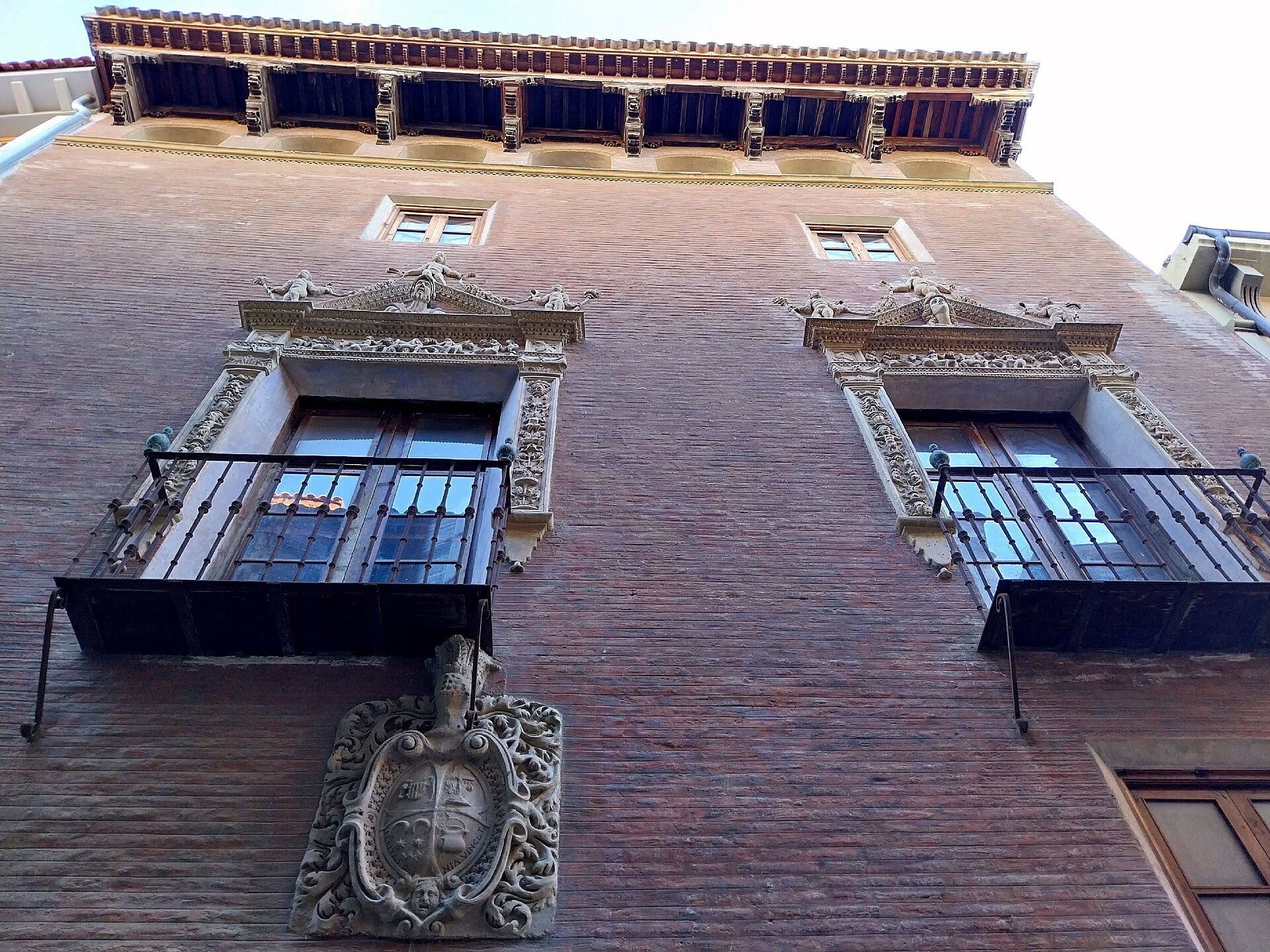
Casa de los Ibáñez de Luna is a Renaissance townhouse standing in the historic centre of Tudela, a city in Navarre, Spain, on the banks of the Ebro river. What is this building? The house dates back to the 16th century and stands on Calle Rúa, one of the main streets of Tudela's old town, close to the Church of San Nicolás. Built on a near-square floor plan, it rises three storeys and is faced in brick, decorated with ornate balconies, carved busts, and a small gallery of arches running along the front. Inside, the original period courtyard and staircase survive, along with Renaissance friezes on the walls. The square inner courtyard is laid out in three sections, giving the interior a distinctive, layered feel. Above the entrance sits a Baroque stone coat of arms of the Ibáñez de Luna family, dating from the late 17th century. It was placed there in 1672 by José Ibáñez Luna, a canon of the local cathedral, marking the house as belonging to his lineage. In the 18th century the house was home to the Señorena family, and today it belongs to Juanjo Bienes, a well-known archaeologist from Tudela. Casa de los Ibáñez de Luna is regarded as one of the notable pieces of civil architecture in Tudela and remains a fixture of the old town's streetscape. The building is privately owned, so visits are limited to admiring the façade and courtyard entrance from the street while strolling through the old quarter. How do you get there? Tudela sits in southern Navarre, in the Ribera district, and is well connected by rail — on the line linking Zaragoza with Bilbao and Pamplona — as well as by the AP-68 motorway running along the Ebro valley. From the train station, the old town and Calle Rúa are an easy walk through the historic centre. Casa de los Ibáñez de Luna sits within the dense, pedestrian-friendly fabric of the old town, so the best approach is on foot, walking from the Santa María cathedral towards the Church of San Nicolás. What will you see? The building's greatest asset is its façade: plain brick set against rich stonework — balconies, carved busts, and an arcaded gallery. Look out for the Baroque family crest above the entrance, a reminder of the Ibáñez de Luna family's former standing in the city. Walking the surrounding streets, it's easy to compare this house with Tudela's other historic townhouses, which together form a dense network of period architecture from the city's heyday as an important centre in Navarre. When is the best time to visit? Spring and autumn are the best seasons for exploring Tudela's old town, when temperatures in the Ebro valley are milder than the hot summer months. These seasons also make it easy to pair a visit to Casa de los Ibáñez de Luna with the nearby cathedral and other old-town landmarks. Frequently Asked Questions Can you go inside Casa de los Ibáñez de Luna? No — the building is privately owned, so only the façade and courtyard entrance can be viewed from the street. How old is the building? The house dates from the 16th century, while the stone family crest on its façade was added later, in 1672. Where exactly is it located in Tudela? It stands on Calle Rúa in the old town, close to the Church of San Nicolás. What else is worth seeing nearby? It's worth wandering the surrounding streets of the old town, home to other historic houses and mansions once belonging to Tudela's noble and merchant families.
-
Casa del Almirante, Tudela
Tudela
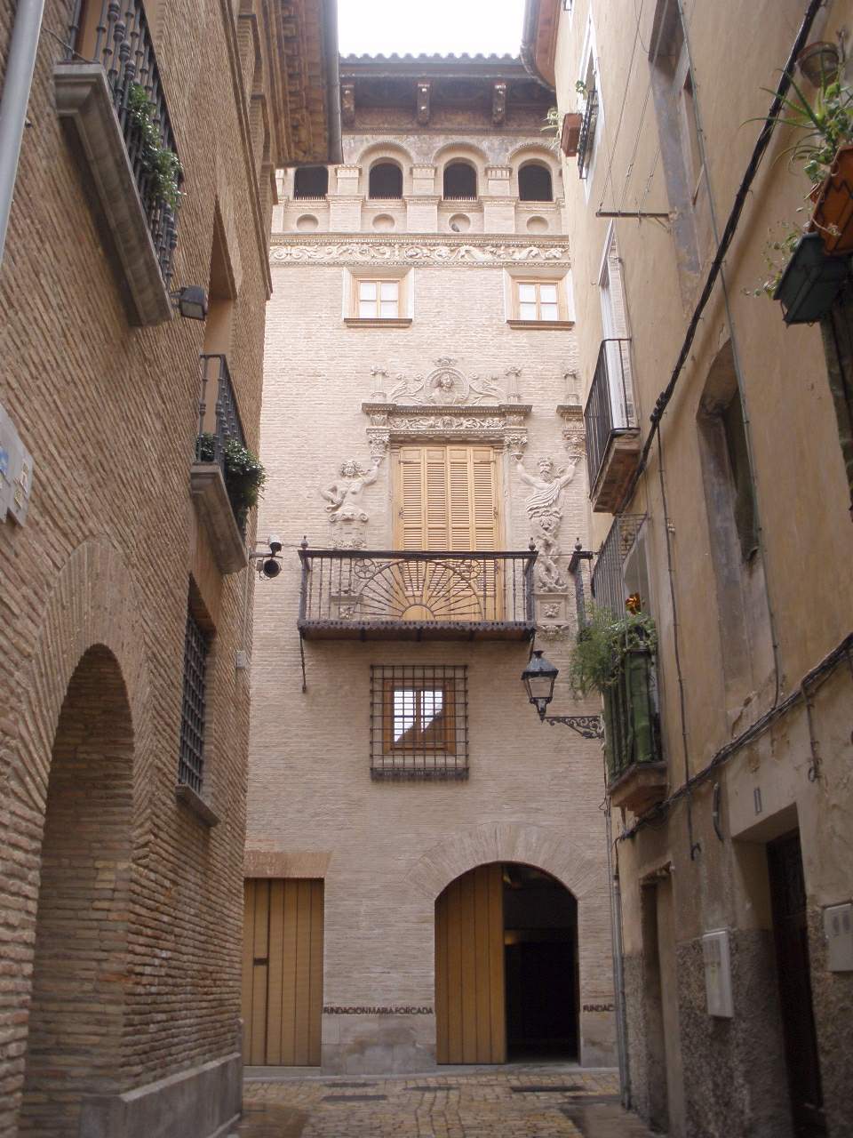
Casa del Almirante in Tudela is a Renaissance-era brick palace on Calle Rúa, at the heart of the old town of this Navarrese city on the Ebro river. Built between 1520 and 1555 in the plateresque style, it replaced an earlier 15th-century mansion and was commissioned by the Cabanillas Berrozpe family, heirs of the Gómez de Peralta line. Who owned the palace over the centuries? Ownership passed through several noble families after the Cabanillas Berrozpe: the Castillo Cabanillas y Gómez de Peralta line held it in the 17th century, the Ximénez de Cascante y Ximénez de Antillón family in the 18th, and the Baron de la Torre in the 19th. The origin of the "Admiral's House" name is not firmly established — it may refer to José Ezquerra del Bayo, one of the owners who served in the merchant navy, or to the ship's-wheel motif carved into the balcony decoration. What makes the facade worth seeing? The three-storey brick facade is capped by a gallery of paired arches and oculi beneath a carved wooden eave. The first floor carries two large balconies decorated with plateresque reliefs — mythological figures and candelieri ornament — each framed by a tondo holding a female and a male bust, thought to portray the palace's founders. The top floor has three lintelled windows below a frieze of geometric and plant motifs, characteristic of Spanish Renaissance decoration from the first half of the 16th century. What is the building used for today? In 1976 the palace was bought by María Carmen Forcada González, who carried out restoration and consolidation work; the facade itself was cleaned and reinforced in 1997. Following her donation, the building passed to the city of Tudela and now houses the Fundación María Forcada and Tudela-Cultura. Its rooms regularly host contemporary art and photography exhibitions along with other cultural events, so the character of the interior changes with each new show. How do you get there and when should you visit? Casa del Almirante sits within walking distance of Tudela's main old-town landmarks, including the Cathedral of Santa María, making it an easy stop on a walk through the historic centre. Tudela's tourism office also runs a monumental route linking the palace with the Palacio Marqués de Huarte and the Palacio de San Adrián. Because the building operates as a working cultural venue, access depends on the current exhibition schedule, so it is worth checking opening times before visiting. Tudela lies in the Ribera de Navarra region, known for its vegetable and fruit produce, and a stop at the palace pairs naturally with a walk to the nearby bridge over the Ebro and the old Jewish quarter. Frequently Asked Questions What is Casa del Almirante? A 16th-century Renaissance palace in central Tudela, now home to the Fundación María Forcada and Tudela-Cultura. Why is it called the "Admiral's House"? The name's origin isn't confirmed — it's linked either to a former owner who served in the merchant navy or to the ship's-wheel motif on the balcony decoration. What can visitors see inside? The building functions as a cultural centre and regularly hosts art and photography exhibitions plus other cultural events. Is admission free? Exhibitions at Casa del Almirante are generally free, though it's best to confirm current hours and the exhibition on display before visiting.
-
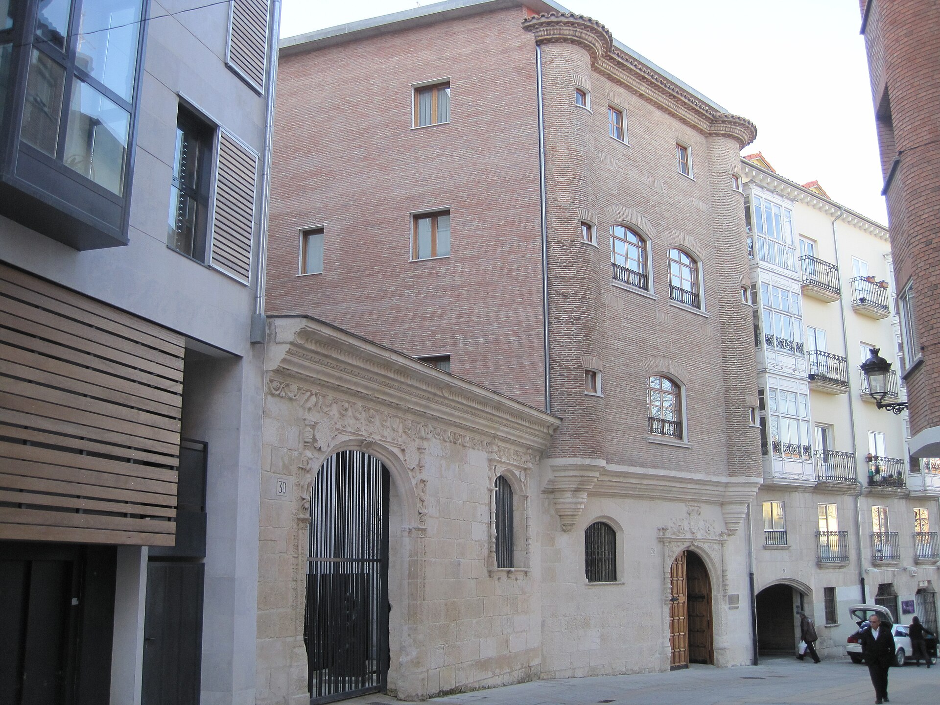
Albergue de peregrinos municipal Casa del Cubo
Burgos
Albergue de peregrinos municipal Casa del Cubo is a municipal pilgrim hostel in Burgos, one of the key stops along the French Way of the Camino de Santiago. The building sits right in the heart of the old town, just steps from Burgos Cathedral — one of the largest and most celebrated Gothic cathedrals in Spain — making it one of the best-placed places to stay along the entire route. Where is it located? The hostel stands on Calle Fernán González, within the walls of the historic quarter, a short walk from the cathedral and the main squares of Burgos. Pilgrims entering the city from the west pass close to it almost without leaving the marked trail, since the Camino Francés runs directly through this part of town on its way to the centre. What's the story behind the building? The hostel's name comes from the distinctive protruding stone blocks, known locally as cubos, that decorate the building's façade — a feature that gave the structure its popular name, Casa de los Cubos. The building dates back to the 16th century and represents one of the more interesting surviving examples of civic architecture from old Burgos, having endured through centuries of change in the city around it. How do you get in and who can stay there? This is a public albergue, run by the local association of friends of the Camino de Santiago, and it is reserved exclusively for people walking the pilgrimage who hold a valid credencial (pilgrim passport). Beds are allocated on a first-come, first-served basis, with no advance reservations — standard practice across most public albergues on the route. Given its central location and strong reputation among pilgrims, arriving early in the high season (summer) is advisable if you want to secure a bed. What can you see nearby? The immediate proximity to Burgos Cathedral is the location's biggest draw — this UNESCO-listed Gothic landmark is one of the signature sights of the entire French Way. Within a few hundred metres you'll also find other highlights of the old town: medieval gates, squares, and narrow streets typical of historic Burgos, perfect for exploring once you've checked in and rested after a day's stage. What facilities does the hostel offer? The albergue provides the basic but sufficient conditions typical of public pilgrim hostels: heating, hot water, showers, bicycle storage, and internet access. This level of provision is enough to let pilgrims recover before the next stage of the walk — no frills, but everything needed for comfort after a full day on foot. Frequently Asked Questions Do you need a credencial to stay here? Yes, this hostel serves only pilgrims holding a valid credencial confirming they are actually walking the Camino de Santiago. Can you book a bed in advance? No, as with most public albergues on the route, beds are given out on a first-come, first-served basis and cannot be reserved ahead of time. What's nearby? Burgos Cathedral, a UNESCO World Heritage Site, is right next door, along with other landmarks of the city's historic centre. Is the hostel open year-round? Yes, the albergue operates throughout the year, though the summer months bring by far the highest number of pilgrims, so arriving early in the day is worth planning for.
-
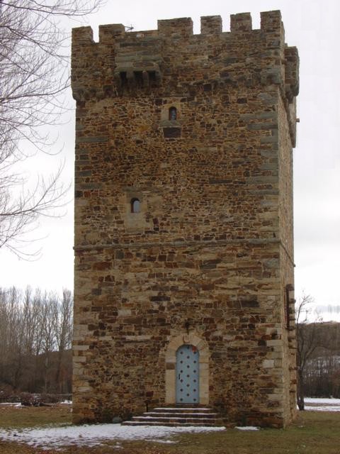
Tower of Turienzo de los Caballeros
Santa Colomba de Somoza
The Tower of Turienzo de los Caballeros stands in the hamlet of Turienzo de los Caballeros, part of the municipality of Santa Colomba de Somoza, in the province of León, Spain. What will you see? Known locally as the Torreón de los Osorio, the tower has a square floor plan and rises to a height of around 22 meters, spread across four floors plus a dungeon level. Its thick stone walls and compact, fortress-like shape reveal the building's original military purpose. The current owners have restored the tower, and it stands today in excellent condition, offering visitors a clear sense of the layout that medieval builders gave it centuries ago — one of the best-preserved defensive towers in the Maragatería region. What is the history behind it? The earliest written record of Turienzo itself dates to the year 923, when the presbyter Ansemiro donated local lands to the monastery of San Pedro de Montes. By the 13th century the area had come under the control of the Knights Templar, and in 1301 the tower and surrounding estate passed to the Osorio family, whose name it still carries. Before the Osorios took possession, the tower is believed to have guarded nearby gold mines, and during the Templar period it kept watch over pilgrims travelling the Way of St. James. Today the tower belongs to the Marquesses of Astorga and is listed as a Cultural Interest property in the general inventory of historical and artistic heritage of the province of León. How do you get there? Turienzo de los Caballeros lies about 20 km from Astorga and just 2.5 km from Santa Colomba de Somoza, the municipality's main town. The area sits within the Maragatería region, long tied to the French Way of the Camino de Santiago, which makes the tower an easy stop for pilgrims on the route as well as for travelers driving from Astorga or Ponferrada. When is the best time to visit? Maragatería has a mountain climate, with cold winters and mild summers, so the months from May to September are the best window for a visit, offering longer days and pleasant conditions for walking through the surrounding hills and villages. Keep in mind that the tower is privately owned, and its interior can only be visited as part of an organized tour. Frequently Asked Questions Can you visit the inside of the tower? Yes, but only through an organized visit — you need to contact the Santa Colomba de Somoza town hall in advance, as it coordinates access to the site. Who owns the tower? The Torreón de los Osorio belongs to the Marquesses of Astorga, though it takes its name from the Osorio family, who acquired it in 1301. How tall is the tower? It stands roughly 22 meters high and is made up of four floors plus a dungeon level. Is the tower located on the Camino de Santiago? Yes, the region historically lay along the French Way, and during the Templar era the tower served as a lookout post watching over passing pilgrims.
Earn badges for the places you visit
Download NextOnTrip, discover new places and check off your trails.