Monuments in Spain
A guide to 4655 Monuments in Spain — with descriptions, photos and traveler visits from the NextOnTrip community. Locations spread across 2240 cities and towns. Most visited by the community: castle of Chulilla, Castle of Pioz, castell de la Todolella.
-
Castell d'Isanta
Lladurs
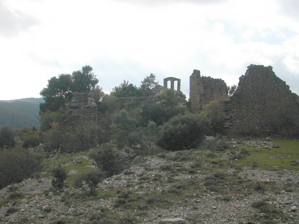
Castell d'Isanta is a former lordly seat in the municipality of Lladurs, in the historic Solsonès region of Catalonia. It is not a dramatic ruin with standing towers and walls, but rather a place with an unusually well-documented medieval past, best visited as part of a countryside walk rather than as a standalone sightseeing stop. What is the history behind this site? The name "kastrum de Isanta" first shows up in written records in the 11th century, though the location itself appears in county archives as early as 990, when it still belonged to the neighboring territory of Canalda. The earliest known lord was Duran d'Isanta, in the early 11th century. By the late 12th century the holding had passed to Arnau d'Isanta, who in 1177 sold the surrounding forest to the chapter of Santa Maria de Solsona, and eight years later, in 1185, pledged the castle itself to Joan de Solsona. The following decades brought a drawn-out dispute over rights to the stronghold. In 1200 an agreement recognized the Solsona chapter's claims, and the split of ownership between the Isanta family and the church was finally settled by a judgment in 1206. The turning point came in 1210, when Ponç de Pinell willed the castle to Santa Maria de Solsona. From then on Isanta operated as a lordship under the Solsona church, and later sources also record Guillem and Saurina d'Isanta among its lords. What will you actually find on site? This is worth knowing before setting out: nothing of the original medieval structure survives in recognizable form — whatever stands there today is modern. The site is best approached as part of the historic landscape of Solsonès rather than a ruin to explore up close. Right next to it lies the small hamlet of Vilanova d'Isanta, home to the Sant Miquel hermitage, which is open to visitors, and to a working rural guesthouse that takes overnight guests. How do you get there and plan a route? The area around Isanta and Vilanova d'Isanta connects by footpaths to the rest of the Lladurs municipality, including Castell de Lladurs, whose restored tower now houses an astronomical centre with two telescopes. A popular route starts at Vilanova d'Isanta and descends northward along a path to a paved road, followed for about 1.6 km, before turning off across meadows and looping back. It suits an easy, few-hour walk and requires no special equipment. When is the best time to visit? Solsonès sits in the Pyrenean foothills, so spring and early autumn are the most comfortable seasons for walking, with mild temperatures for longer routes. In summer, an early start helps avoid the midday heat, while in winter some paths can turn muddy or icy after rain or snow. Frequently asked questions Can you still see medieval walls at Castell d'Isanta? No — historical sources are clear that everything visible on site today is modern construction, and the original medieval buildings have not survived. How is Castell d'Isanta different from Castell de Lladurs? They are two separate sites within the same municipality: Isanta was a church-held lordship with no surviving medieval fabric, while Castell de Lladurs is a restored tower that now houses an astronomical observatory. What else is worth seeing nearby? The Sant Miquel hermitage in Vilanova d'Isanta, along with walking trails leading to Castell de Lladurs and the surrounding hills of Solsonès. Do you need a guide or special preparation to visit? No, the local routes are moderate walks and short hikes suitable for anyone with average fitness, and no guide is required.
-
Oropesa Castle
Oropesa
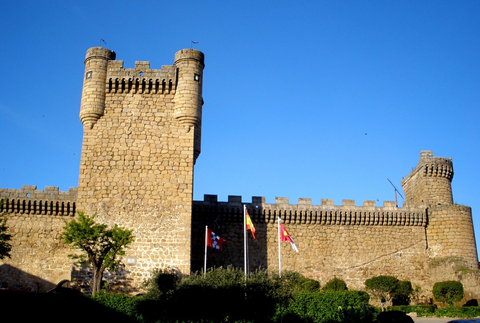
Oropesa Castle stands above the small town of Oropesa in the province of Toledo, in the Castilla-La Mancha region of central Spain. Built on a hilltop where a Roman watchpost once stood, its location alone explains why this spot was chosen for defense centuries before the current structure went up. How do you get there? Oropesa sits along the main route connecting Madrid with Extremadura, roughly 150 km west of the Spanish capital. Driving is by far the easiest option — the castle occupies the highest point of the town and is visible from the approach road well before you arrive. There's parking just below the walls, followed by a short but steep climb on foot to reach the entrance. What will you see? The complex is actually two connected buildings, and the difference between them is easy to spot with the naked eye. The older section, the Castillo Viejo, was raised by Muslim builders in the 12th and 13th centuries on a rectangular plan, originally anchored by four round corner towers. Two of those towers still stand today, enough to picture how tightly fortified the original layout was. The second section, the Castillo Nuevo, came much later, built in 1402 as a residence for the Álvarez de Toledo family, Counts of Oropesa. This part reads more like a palace than a fortress — the austere military stonework gives way to more representative interiors and decorative facade details. Having both wings side by side lets you trace, within a single courtyard, how the site's purpose shifted from a border stronghold to an aristocratic family seat. Today the former castle houses the Parador de Oropesa, one of the state-run Paradores hotels that occupy historic buildings across Spain. That means part of the interior — courtyards, halls, viewing terraces — can be experienced by staying overnight as a hotel guest, not just visiting for an hour. From the terraces and battlements, the view stretches over the Tagus river valley toward the Gredos mountains in the distance — reason enough to climb to the top of the hill even if you're not booking a room. When should you visit? Spring (April to June) and early autumn (September to October) are the most comfortable seasons, when temperatures in central Spain are mild and the surrounding old town and monastery look their best. Summers in Castilla-La Mancha can get very hot, so plan a visit for morning or late afternoon if you come between June and August. Frequently asked questions Can you visit Oropesa Castle without staying at the hotel? Yes, the castle grounds and immediate surroundings are open to visitors regardless of whether you book a room, though some interior areas are reserved for hotel guests. How long does a visit take? Walking the courtyards and ramparts while taking in the valley view usually takes about 30 to 45 minutes. What's the difference between the Castillo Viejo and the Castillo Nuevo? The Castillo Viejo is the older, 12th–13th century Muslim-built fortress, while the Castillo Nuevo is the palace-style residence the Álvarez de Toledo family added in 1402 — the two sections are physically joined. Is there anything else worth seeing near the castle? Yes, the town of Oropesa itself has a well-preserved historic center and main square, and the area makes a convenient stop on the way toward Extremadura and the Tagus valley.
-
Casa de los Urbina
Miranda de Ebro
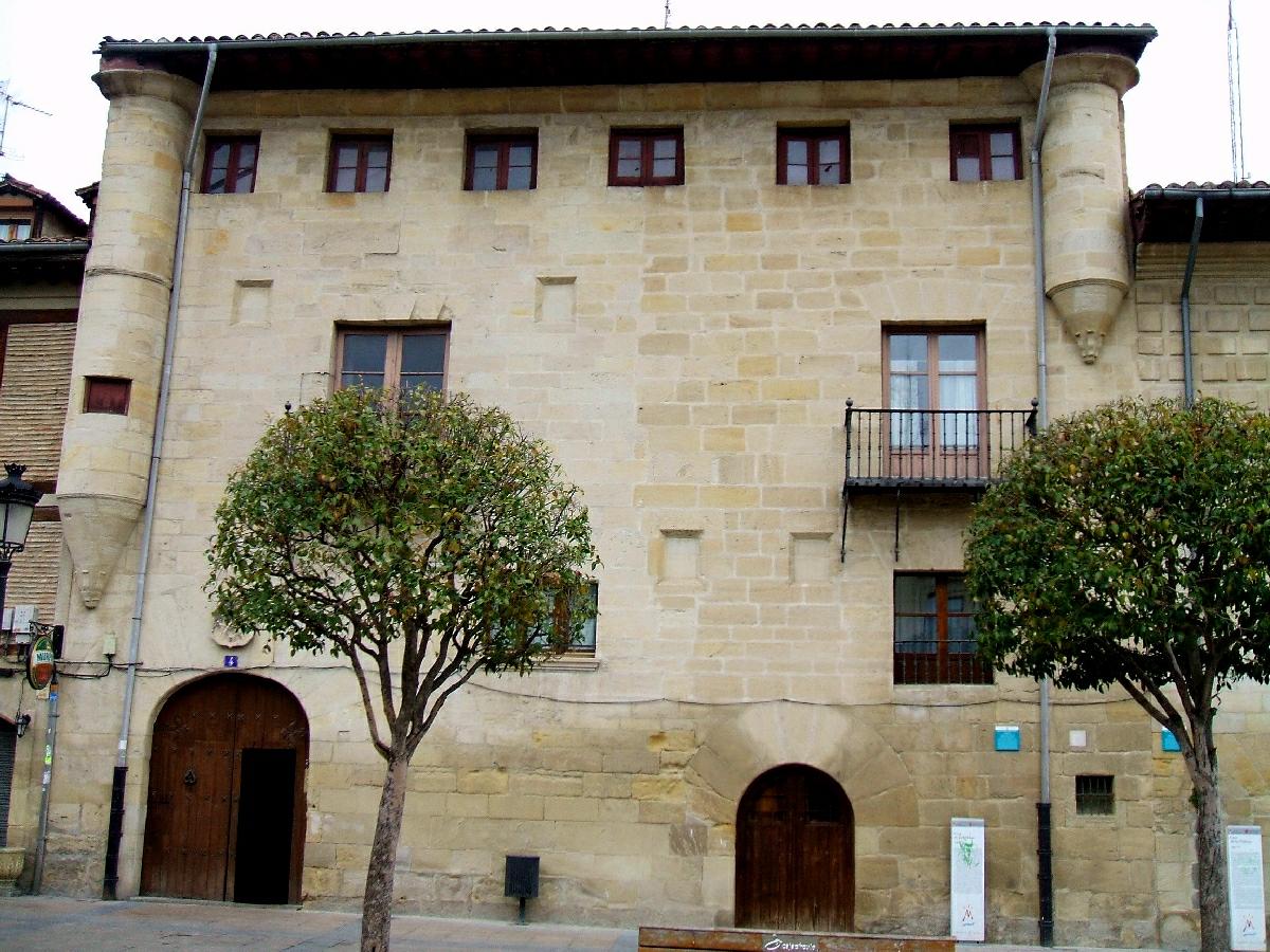
Casa de los Urbina is a Renaissance-Gothic townhouse in Miranda de Ebro, standing on Plaza de España directly across from the town hall. Its stone facade, flanked by two defensive corner towers, sets it apart from the surrounding buildings and hints at a time when even a wealthy family's residence in this part of Castile had to double as a small fortress. Where does the name come from? The building went up between 1540 and 1550, commissioned by Captain Juan de Urbina, an officer in the service of Emperor Charles V, and his wife María de Salazar y Frías. The house still carries the founder's surname, and that is how it appears in the town's heritage registers today. What will you see inside and out? The layout is rectangular, built around an interior garden — an unexpected patch of open space in the tight fabric of the old town, and a welcome contrast to the stone walls surrounding it. The facade mixes two styles at once: a Renaissance composition with lingering Gothic details, cut from dressed stone and bracketed on both sides by solid, tower-like volumes. That combination of ceremonial front and defensive bulk was typical of 16th-century Castilian noble houses, built at a time when displaying wealth also meant being ready to protect it. What history happened inside these walls? Casa de los Urbina has hosted more than one notable traveler. In 1655, Princess Margaret of Savoy-Austria rested here while crossing Spain as part of a royal journey. Five years later, in 1660, King Philip IV and Infanta Maria Theresa of Austria stopped at the house on their way to the French border, where the infanta was to marry Louis XIV. That marriage, sealed by the Treaty of the Pyrenees, ended years of conflict between Spain and France, and Miranda de Ebro — sitting on the route from Madrid toward the border — became one of the stops on that historic journey. What is the building used for today? Casa de los Urbina now belongs to the Catholic Church and serves as the parish house attached to the Church of Santa María. It is not a museum piece behind glass but a working building, which is worth keeping in mind when planning a visit: access to the interior may be limited to the parish's operating hours. How do you get there? The house stands on Plaza de España, right in the heart of Miranda de Ebro, facing the town hall — one of the clearest landmarks in the old town. Miranda de Ebro sits on a major rail and road junction between Burgos and Vitoria-Gasteiz, so reaching it by train or car from either city takes little time. From the train station, the square is a walk of about fifteen minutes. When should you visit? The facade and the square around it can be admired year-round, though a stroll across Plaza de España is at its best in spring and autumn, before the summer heat that settles over the Ebro valley. It is worth pairing the visit with the neighboring Church of Santa María and the rest of the old town's historic buildings. Frequently asked questions Can you go inside Casa de los Urbina? The building functions as a parish house, so interior access depends on the parish's current activities; the facade and square can be viewed from outside at any time. Who built this palace? Captain Juan de Urbina, who served Charles V, together with his wife María de Salazar y Frías, between 1540 and 1550. Why does the facade have corner towers? They are a remnant of the defensive character of 16th-century Castilian noble houses, which combined a ceremonial appearance with a protective function. Which notable figures stayed here? Princess Margaret of Savoy-Austria in 1655, and King Philip IV with Infanta Maria Theresa in 1660, en route to her wedding to Louis XIV.
-
Castell de Torre Baró
Barcelona
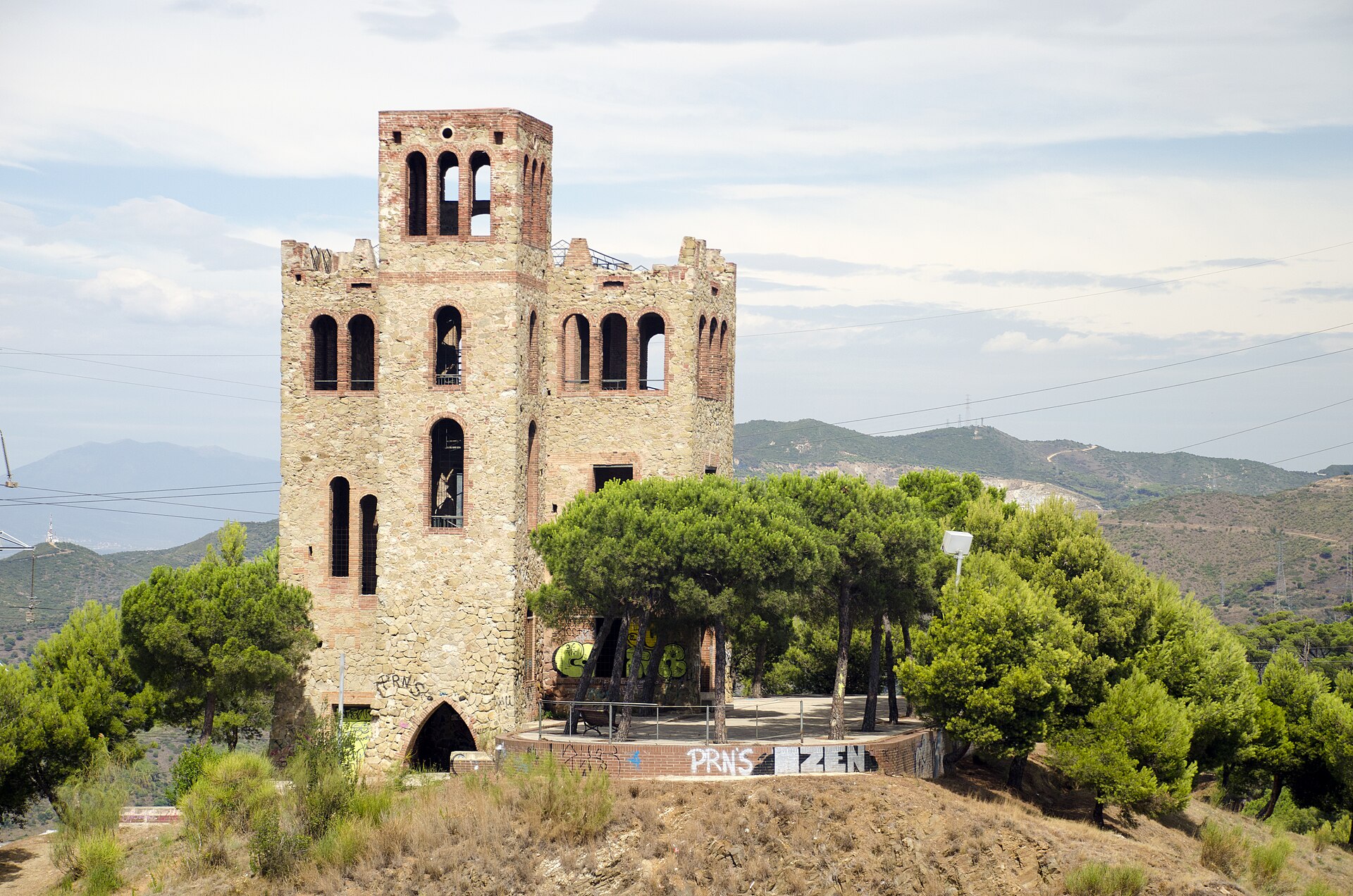
Castell de Torre Baró is a castle-shaped viewpoint perched on a hill in Barcelona's Nou Barris district, sitting between the Roquetes and Torre Baró neighborhoods at the foot of the Collserola range. The building looks medieval, but that's an illusion — it was actually put up in the early 20th century as part of a plan to build a hotel around which a new residential neighborhood would grow. The urban development scheme fell through, and construction was abandoned before the building was ever finished. It sat derelict for decades until 1989, when Barcelona's city council restored it and declared it a heritage site, adding the viewing terrace that surrounds it today. The name comes from an earlier tower that once stood here, belonging to the Baron of Pinós. The first written reference to Torre Baró dates back to 1339. That original estate was destroyed in 1714 during the War of the Spanish Succession — nothing of it remains today, and a metro station now carries the same name on the site. How do you get there? The metro is the easiest option — Roquetes station on line L3 is the closest stop, with a signposted uphill footpath leading from there to the castle. Expect a climb, since the building sits on high ground above the surrounding streets. What will you see? The building itself now works as an environmental education point run by Parc de Collserola, hosting nature workshops, activities and guided walks through the surrounding area. The real draw, though, is the view: from the terrace you look out over the districts of Nou Barris, Horta, Sant Andreu and Sant Martí, the Besòs river, and the towns of Santa Coloma de Gramenet, Sant Adrià de Besòs and Badalona, with the Collserola hills rising behind. When should you visit? A clear day is best, since visibility from the terrace stretches across the entire eastern side of the Barcelona metropolitan area right down to the coast. Early morning or late afternoon gives the softest light for photos and helps you avoid climbing up in the strongest midday sun. How much time should you set aside? Walking the terrace and taking in the views takes about 30–45 minutes. If you join a guided tour or one of the nature workshops run by Parc de Collserola, add another hour to your visit. Frequently asked questions Is Castell de Torre Baró an actual medieval castle? No — despite its castle-like appearance, it was built in the early 20th century as an unfinished hotel project, not a medieval fortification. Where does the name Torre Baró come from? It comes from an earlier tower on the site that belonged to the Baron of Pinós, destroyed in 1714 during the War of the Spanish Succession. The location itself is first documented as far back as 1339. Do you need a ticket to visit the viewpoint? The terrace and grounds around the building are freely accessible. Guided visits and workshops organized by Parc de Collserola may need to be booked in advance. What can you see from the top? The panorama takes in northeastern Barcelona's districts of Nou Barris, Horta, Sant Andreu and Sant Martí, the Besòs river valley, and the nearby towns of Santa Coloma de Gramenet, Sant Adrià de Besòs and Badalona, with the Collserola range in the background.
-
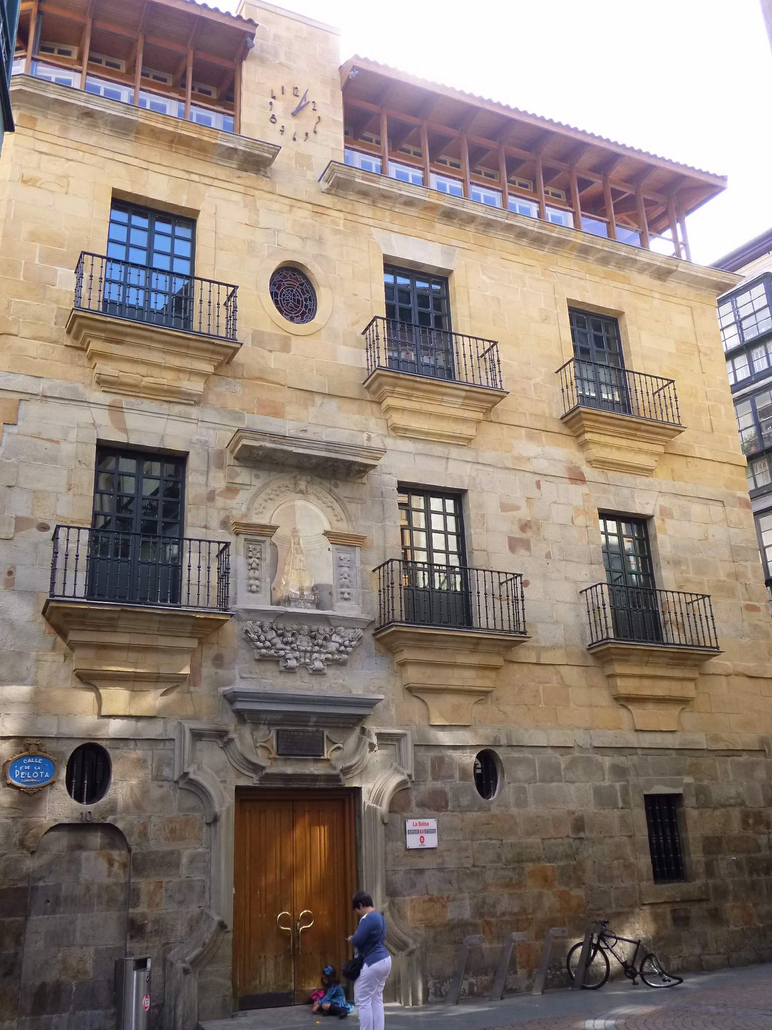
Yohn Jauregia (La Bolsa)
Bilbao
Yohn Jauregia (La Bolsa) is a Baroque townhouse tucked into Bilbao's Old Town, one of the rare civil buildings of its scale to survive in the district known as the Seven Streets (Zazpikaleak). It rises at the junction of Santa María, Pelota, Torre and Barrencalle Barrena streets, right on the spot once occupied by a medieval defensive tower belonging to a local family. Construction dates to the first half of the 18th century, a period when Bilbao's booming river trade encouraged wealthy merchants to build grand residences close to the docks. What can you see there? The building's most striking feature is its shape: instead of a simple rectangle, it has an irregular, trapezoid footprint, forced on the architect by the tight medieval street grid it had to fit into. That constraint produced an unusual result — three separate facades rather than one, each carrying its own Baroque doorway and carved coat of arms. The elevation facing Calle Santa María is the grandest and the one most visitors photograph. Look closely at the main entrance too: the stone lintel over the door is worked in a style found nowhere else on a civil building in Biscay, making it a genuine architectural one-off in the province. Where does the name come from? The nickname "La Bolsa" is what draws most curiosity, and its exact origin is still debated locally. One account traces it to a merchants' trading house or exchange that once operated on the ground floor and lent the palace its popular name. A second links the building to a merchant family that settled in Bilbao and ran its business from here, giving the palace its other name, Palacio Yohn. Whichever story is closer to the truth, both point to the same thing: from the start, this palace was tied to the commercial life of a fast-growing port city. How do you get there? The palace sits right in the middle of the Old Town, so walking is by far the easiest way in — it's only a few minutes on foot from Plaza Nueva or Santiago Cathedral through the narrow lanes of the Seven Streets. The nearest metro stop is Casco Viejo, roughly a five-minute walk away. The surrounding streets are busy with pintxo bars all day, so it's easy to fold a visit into a wider stroll through the old quarter. When should you visit? Since the building now houses a district cultural and administrative centre, its interior opens mainly around local events, exhibitions and community activities, so it's worth checking the current schedule before planning a visit. The exterior and surrounding streets, on the other hand, are accessible year-round, and morning light works best for photographing the Santa María facade, before the narrow street falls into shadow later in the day. Frequently asked questions Can you go inside freely? The building now functions as the neighbourhood's cultural centre, so interior access depends on whatever activities or events are scheduled — the facades themselves can be viewed anytime. Why does the palace have two names? Yohn Jauregia refers to the merchant family linked to the building, while La Bolsa is the popular nickname tied to the trading business once run on its ground floor; both names are used interchangeably locally. How long does a visit take? Walking around to see all three facades and the immediate surroundings takes about fifteen minutes — a natural stop while exploring the Old Town. Are there other landmarks nearby? Yes. The palace sits at the heart of the Seven Streets, so Santiago Cathedral, Plaza Nueva and several other merchant-era buildings are all within a few minutes' walk.
-
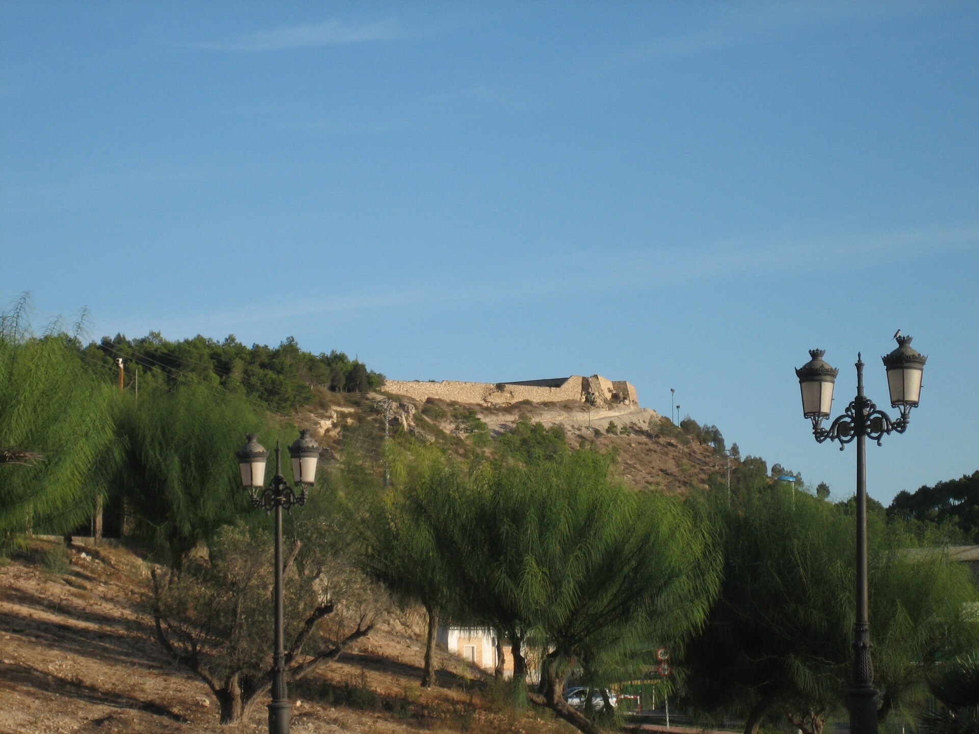
Castell de Guardamar del Segura
Guardamar del Segura
Castell de Guardamar del Segura is a fortified ruin standing on a hill above the town of Guardamar del Segura, right where the Segura River meets the Mediterranean, in the province of Alicante. What will you see? The remaining walls and projecting towers offer one of the finest viewpoints on the Costa Blanca — the sea and beaches on one side, the river mouth and surrounding dunes on the other. What survives today is mainly a stretch of massive defensive walls with towers that once protected an entire settlement living inside them. The site is officially protected as a Spanish Site of Cultural Interest (Bien de Interés Cultural), which is why it has been preserved in its current, partly ruined state rather than rebuilt. Where does it come from? People settled this hill long before any castle stood on it: archaeological finds go back to the Iron Age, with traces left by Phoenicians, Iberians and Romans. The hill is even identified with Alone, an ancient Greek colony founded by settlers from Massalia, today's Marseille. In 944 the site was fortified by Muslim rulers, who also built a mosque here, laying the groundwork for the later fortress. The turning point came in 1264, when Jaime I captured the area during the Reconquista and resettled it with Catalan families. Although the Treaty of Almizra later placed the region under the Crown of Castile, the Catalan settlement left a lasting mark. Toward the end of the 13th century, Alfonso X the Wise backed the growth of a new village on the hill, and from the 14th to the 19th century the entire population of Guardamar lived inside the castle walls — daily life unfolded here, not on the flat land where the town now stands. That arrangement ended with the earthquakes of 1829, which badly damaged the buildings. Residents abandoned the hill and moved down to the plain below, where the modern town of Guardamar del Segura sits today. The castle was left empty and gradually fell into the ruined state visitors see now. How to get there? The castle sits on a hill within Guardamar del Segura itself, an easy walk from the town centre and the seafront promenade. It's a popular short evening walk for visitors staying on the Costa Blanca, especially at sunset, when the light brings out the walls and the coastal panorama at their best. When to visit? Early evening is the best time: the midday heat typical of southern Spain has eased, and the light over the sea and river mouth is at its most dramatic. Spring and autumn are the most comfortable seasons temperature-wise; in summer it's worth avoiding the middle of the day, since the exposed hilltop offers little shade. Frequently asked questions Is there an entrance fee for the castle grounds? The ruins are freely accessible and form part of the town's landscape — an open site protected under cultural heritage status. How long does a visit take? Walking along the walls and viewpoints usually takes 30–45 minutes, depending on how long you linger over the views. Can you walk up from the beach? Yes, the castle hill sits very close to the centre and the coast, so it's only a short walk of a few minutes from the beach or the promenade. Why is the castle in ruins? The 1829 earthquakes seriously damaged the buildings, and residents relocated to the plain below — since then the castle has gradually weathered into the ruin seen today.
-
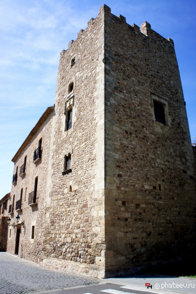
Castell de Vilafortuny
Cambrils
Castell de Vilafortuny is a medieval castle standing in the Vilafortuny district of Cambrils, on the Costa Daurada coast in Tarragona province. From the outside it looks like a modest fortified house tucked among greenery, but its story stretches back to the 12th century and ties directly into the early history of Cambrils itself. Where does the name come from, and who built it? The earliest record of Vilafortuny appears in Cambrils' 1152 settlement charter, which granted the area to a nobleman named Guillem de Fortuny. Two years later, in 1154, Guillem struck a deal with Count Ramon Berenguer IV of Barcelona: he agreed to repopulate the land and raise a castle here, on condition that he answered only to the Count of Barcelona and no other feudal lord. His surname gave the settlement — and the castle — its name: Vilafortuny, "Fortuny's village." By 1194 a parish church was already serving the community next to the castle, a sign that the settlement around the fortress had grown quickly. Why was the castle destroyed so many times? Its coastal position, a clear advantage for today's visitors, was a liability for centuries. Vilafortuny sat directly in the path of Saracen pirate raids and was sacked more than once. A recorded attack and destruction in 1582 suggests the castle had already been rebuilt earlier, likely sometime between the 15th and 16th centuries — which explains why so little of the original 12th-century structure survives. How did ownership of the castle change over time? In 1760 the Pinós family, marquises of Barberà, sold the estate to Salvador de March i Bellver, a merchant from Reus, who carried out a major renovation. The property then passed to his descendants, Joaquim de Miró i de March and Ferran de Miró i d'Ortafà. Later it belonged to the Castellarnau family of Tarragona, before eventually reaching the Marquesa de Mesa de Asta. One striking chapter in the castle's history is the Spanish Civil War: Republican forces confiscated the building and used it to house the International Brigades. What can you actually see there today? Castell de Vilafortuny is now listed as a cultural asset of local interest (BCIL). Because of the many rebuilding phases over the centuries, very few genuinely medieval elements remain — what you see today largely reflects later, early-modern renovations rather than the original 12th-century fabric. The castle currently operates as an event venue. Its roughly 1,665 square metres hold three large halls decorated in a rustic style, used for weddings, baptisms and first communions. That means it isn't a static historical relic — it's a working part of local social life, still hosting celebrations today. How do you get there, and when's the best time to visit? The castle sits in the Vilafortuny neighbourhood, between central Cambrils and Salou, a short distance from the Costa Daurada shoreline. That makes it an easy stop for anyone exploring the area on foot or by bike, combining a beach walk with a quick detour to see the historic building. Since the venue is often booked for private events, it's worth checking availability ahead of a visit, especially in spring and summer, when most celebrations take place. Frequently asked questions How old is Castell de Vilafortuny? The earliest mentions date to 1152–1154, though the structure standing today largely reflects rebuilding work from the 15th–16th centuries and later renovations. Can you visit the castle? It now functions as an event venue for weddings, baptisms and communions, so public access is often limited to organised events — check current visiting arrangements on site. Where does the name Vilafortuny come from? From Guillem de Fortuny, the 12th-century nobleman who repopulated the area and built the castle under an agreement with the Count of Barcelona. Does the castle have a Spanish Civil War history? Yes — during the war it was confiscated by Republican forces and used to house the International Brigades.
-
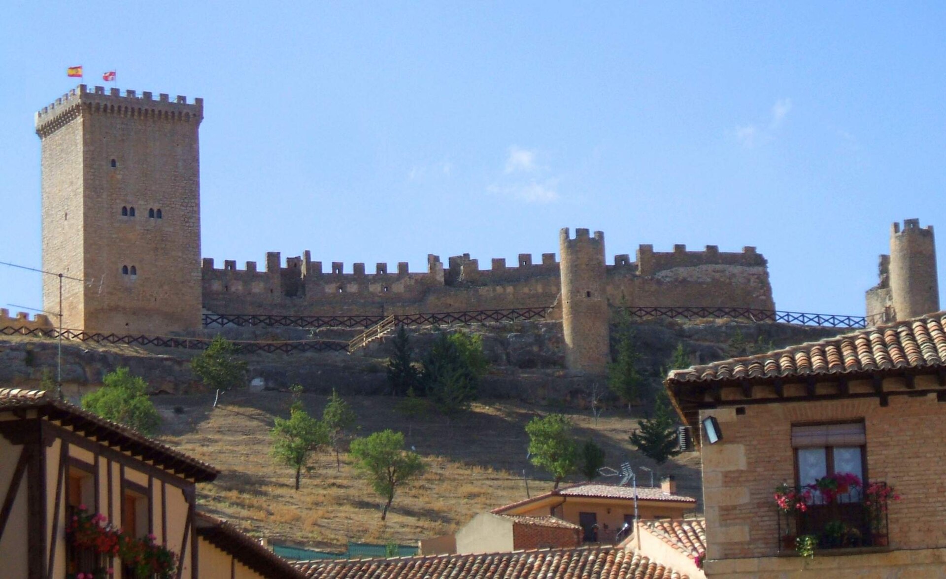
Castle of Peñaranda de Duero
Peñaranda de Duero
Castle of Peñaranda de Duero stands above the small town of Peñaranda de Duero in the province of Burgos, in Spain's Castile and León region. Although the earliest fortifications on the site date back to the 10th century, the building as it looks today largely reflects a major renovation carried out in the 15th century under the Counts of Miranda del Castañar, who turned it into a fortified noble residence. It remains one of the best-preserved Gothic castles in the area and a strong reason to venture off the more crowded tourist routes of Castile. How do you get to the castle? Peñaranda de Duero sits in the Duero valley, surrounded by the vineyards this part of Spain is known for. The town itself is small, so once you arrive the castle is hard to miss — it rises on high ground above the rooftops and works as a natural landmark for orientation. The easiest approach is on foot, starting from the town's main square and walking uphill toward the old defensive walls. What can you see there? The castle marks the starting point of the wall that once encircled the entire town. Of that fortification, only one piece survives today: the crenellated Arco de las Monjas, an arched gate that's worth a stop on its own, since it's the last visible trace of the town's old defensive ring. The castle building itself, with its clear Gothic features, gives a good sense of what a fortified noble residence in late medieval Castile looked like. Walking around the walls also opens up views over the Duero valley and the surrounding wine country. When is the best time to visit? The Ribera del Duero area, where Peñaranda de Duero lies, has a continental climate with hot summers and cold winters, so spring and autumn tend to be the most comfortable seasons to explore — temperatures are milder and the vineyards around town look their best. The town itself stays quiet even during peak season, so visitors can expect a far calmer experience than at Spain's larger, more famous monuments. Why is this place worth a visit? Peñaranda de Duero brings together history and landscape in a way that feels unified rather than staged: the castle, the last remnants of the town wall, and the vineyards of Ribera del Duero all sit within the same small, walkable setting. It's a good pick for travelers who prefer authentic, less crowded corners of Spain, where history is something you walk through rather than view behind glass. Frequently Asked Questions How old is the Castle of Peñaranda de Duero? The site's original fortifications date to the 10th century, but the castle's current Gothic form is the result of a major 15th-century rebuilding carried out by the Counts of Miranda del Castañar. Are any parts of the old town walls still standing? Yes — the castle was the starting point of a defensive wall that once surrounded the whole town. The only surviving piece of that wall today is the crenellated Arco de las Monjas. Where exactly is the castle located? It stands in Peñaranda de Duero, in the province of Burgos, within the Castile and León region, an area closely tied to the Ribera del Duero wine district. Is Peñaranda de Duero a good base for exploring the region? Yes, its compact size and location in the Duero valley make it convenient for combining a castle visit with trips to nearby vineyards and small Castilian towns.
-
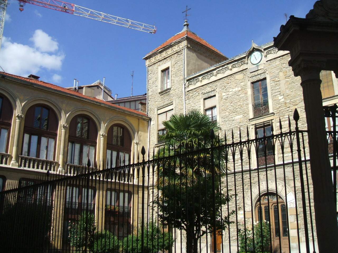
Palacio de los Álava Esquivel
Vitoria-Gasteiz
Palacio de los Álava Esquivel stands at the heart of the old town of Vitoria-Gasteiz, wedged between Calle Herrería and Calle Zapatería, and ranks among the grandest noble residences of the Basque capital of Álava. How did the palace come to be built? Construction began in 1488, commissioned by Pedro Martínez de Álava and his wife María Díez de Esquível, whose surnames the building still carries. Their son, Diego de Álava y Esquível, finished the work in 1535, giving the residence its Renaissance form. A major refurbishment followed in 1865, adding the Neo-Gothic touches still visible on the facades today. What should visitors look out for? The palace presents two distinct facades onto two different streets of the old quarter - an older one facing Zapatería, and a later one facing Herrería - a split that traces the building's staged growth across the centuries. Facing the inner garden, slung between the two flanking towers, hangs a striking timepiece known as the "Reloj de la Batalla," the Battle Clock. Family tradition holds that Ignacio María de Álava y Sáenz de Navarrete, a Lieutenant General of the Spanish Navy from the Álava line, brought it home as a prize seized from an English ship at the Battle of Trafalgar in 1805. A plaque on the building, however, is dated 25 June 1782, which suggests the clock may in fact have been captured during an earlier engagement, possibly the Great Siege of Gibraltar. What is the palace's place in Spanish history? The residence has hosted crowned heads and military commanders over the centuries - King Francis I of France is said to have slept here. Its most consequential link to history, though, runs through the Napoleonic Wars: General Miguel Ricardo de Álava, a member of the family that owned the palace, fought alongside the Duke of Wellington at the Battle of Vitoria in 1813, the clash that drove French forces out of the Iberian Peninsula and hastened Napoleon's downfall. Who owns the palace today? The building's story took an unusual turn in the 20th century - its current owner is the city council of Tangier, Morocco. Vitoria-Gasteiz's own municipal authorities have repeatedly asked their Moroccan counterparts to carry out restoration work to keep the historic structure from deteriorating further. How to get there and when to visit? The palace sits right in the middle of Vitoria-Gasteiz's old town, surrounded by other Renaissance-era noble houses, and forms one stop on the city's self-guided route past seven historic palaces. The easiest way to reach it is on foot, walking along Herrería and Zapatería, two of the oldest medieval streets in the city centre. Since the building remains institutionally owned and is not open as a museum, a visit here means admiring both facades from the street - daytime is best, when natural light picks out the stonework detail and the battle clock most clearly. Frequently asked questions Can you go inside the Palacio de los Álava Esquivel? No. The building is not run as a museum and belongs to the city council of Tangier, so visits are limited to viewing both facades from the street. Why does the palace have two facades? It was built in stages between the 15th and 19th centuries, and each street it faces - Zapatería and Herrería - shows a facade from a different construction period. What is the "Reloj de la Batalla"? It's the clock hanging between the two towers on the garden side, said by family tradition to have been captured from an English ship, though the date on its plaque leaves the exact battle in question. What is the palace's connection to the Battle of Vitoria? General Miguel Ricardo de Álava, related to the family that owned the palace, fought alongside the Duke of Wellington in the decisive 1813 battle against Napoleon's forces.
-
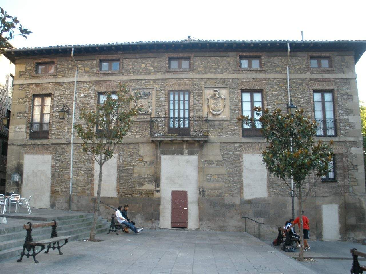
Casa Palacio de los Álava-Velasco
Vitoria-Gasteiz
Casa Palacio de los Álava-Velasco is a Baroque town palace standing on the small Plazuela de Santo Domingo in the heart of Vitoria-Gasteiz's old quarter, tucked between Calle Zapatería and Calle Herrería. The free-standing, rectangular mansion was built in the late 17th century on the orders of Francisco Carlos de Álava Arista, a member of one of the city's most influential families. For generations the house remained in the hands of the Álava lineage, a lasting mark of their standing among the Basque nobility. How do you get there? The palace sits within the pedestrian-friendly Casco Histórico, so the easiest way to reach it is on foot from Plaza de la Virgen Blanca or Santa María Cathedral — both just a few minutes' walk through the old town's narrow lanes. The nearest bus stops are along Calle Dato and Plaza de España, a short stroll from the building. Drivers will find underground car parks near the city centre, since the old quarter itself has restricted vehicle access. What will you see? The building follows a layout typical of Vitoria-Gasteiz's aristocratic townhouses: a basement, a ground floor, two upper residential storeys, and an attic tucked beneath the roofline. Its Baroque façade pairs austere stone door and window surrounds with a balanced, proportioned composition — a hallmark of patrician residences from that era. After years of decline and a decade standing empty, the palace underwent a thorough restoration that brought back its 17th-century structure while adapting the interior to a new purpose: today it houses a complex of 33 tourist apartments. That means visitors can admire the façade from the street, and those who book a stay can also experience the historic interior firsthand. When should you visit? Vitoria-Gasteiz's old town is at its most pleasant in spring and early summer, when mild weather makes strolling its narrow streets easy and the quiet Plazuela de Santo Domingo stays calm even during peak tourist months. In autumn and winter the palace takes on a more intimate feel — fewer visitors mean more space to study the architectural details without a crowd. Keep in mind that the building now functions as private accommodation, so viewing is generally limited to the exterior unless you're staying there as a guest. Frequently asked questions Can you go inside the Álava-Velasco palace? The building has been converted into a complex of tourist apartments, so the interior is mainly accessible to guests staying overnight rather than through general sightseeing visits. How old is the palace? It was built in the late 17th century at the initiative of Francisco Carlos de Álava Arista, making it one of the old town's most significant Baroque landmarks. Where exactly is it located? On the small Plazuela de Santo Domingo, between Calle Zapatería and Calle Herrería, right in the historic Casco Histórico district of Vitoria-Gasteiz. Are there other attractions nearby? Yes — Plaza de la Virgen Blanca and Santa María Cathedral are both just a few minutes' walk away, making it easy to combine a visit to the palace with the old town's main landmarks.
-
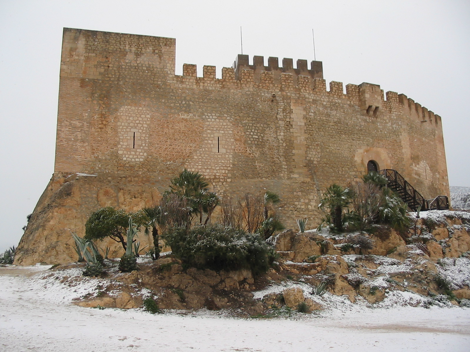
Castillo de Petrer
Petrer
Castillo de Petrer is a medieval hilltop fortress overlooking the town of Petrer in the province of Alicante, set in the valley of the river Vinalopó. Visible from almost anywhere in town, it has long served as the settlement's most recognisable landmark. How do you get there? Petrer sits right next to Elda in the province of Alicante, a short drive from the provincial capital. The castle crowns a hill in the middle of town, so the easiest way in is on foot from the town centre — a signposted route climbs through the steep lanes of the old quarter up the hillside. Drivers can leave their car at the foot of the hill and continue on foot from there. What will you see? The fortress was first built in the late 12th century under Islamic rule, when the settlement was known by its Arabic name, Bitrir. It sat at the centre of a long-running territorial dispute: Christian forces took the town by the mid-13th century, Mudejar residents still occupied it in 1265, and over the following decades Petrer was pulled back and forth between the crowns of Castile and Aragon. The matter was only settled by the War of the Two Pedros in the second half of the 14th century, after which the town remained firmly within the Crown of Aragon. The castle's footprint is irregular and polygonal — seven corners rather than a straightforward rectangle — because its builders shaped the walls to follow the contour of the hill. The centrepiece is the keep, or Torre del Homenaje: a two-storey tower with a viewing terrace on top and a vaulted chamber beneath it that began life as a cistern and was later used as a prison cell. The site is laid out in two parts. The upper enclosure, the citadel, holds the free-standing keep, a great hall and a dungeon. The lower enclosure is an esplanade shielded by an outer stone-and-mortar wall, where a settlement once stood under the fortress's protection. Both the curtain walls and the keep have survived in good condition, making it easy to read the layout of the original stronghold today. The castle underwent a full restoration between 1974 and 1983, and in 1983 it was declared a National Historic-Artistic Monument. Its walls now house the local Board of Moors and Christians, the association behind Petrer's annual Moros y Cristianos festival. When should you visit? Because the climb up the hill is exposed, spring and autumn make for the most comfortable visits — summer heat can make the ascent along the open paths harder going. From the keep's terrace and the surrounding walls, the view stretches across the Vinalopó valley and over neighbouring Elda, which is reason enough on its own to make the climb. Frequently asked questions Is entry to the castle free? The grounds and viewpoints around the walls are open to walkers; check locally beforehand for any ticketing that applies to the tower interior, since access there depends on the current opening schedule. How long does a visit take? Walking the walls and the keep itself usually takes 30–45 minutes, but the steep approach from the town centre adds another stretch of time each way. Is it worth going inside the keep? Yes — it is the only point from which you can reach the terrace and see the former cistern-turned-prison chamber lower down, and the view from up there takes in the whole valley. Are there other sights nearby? Petrer's old town spreads out directly at the foot of the castle hill, so a visit to the fortress pairs easily with a walk through the historic lanes below.
-
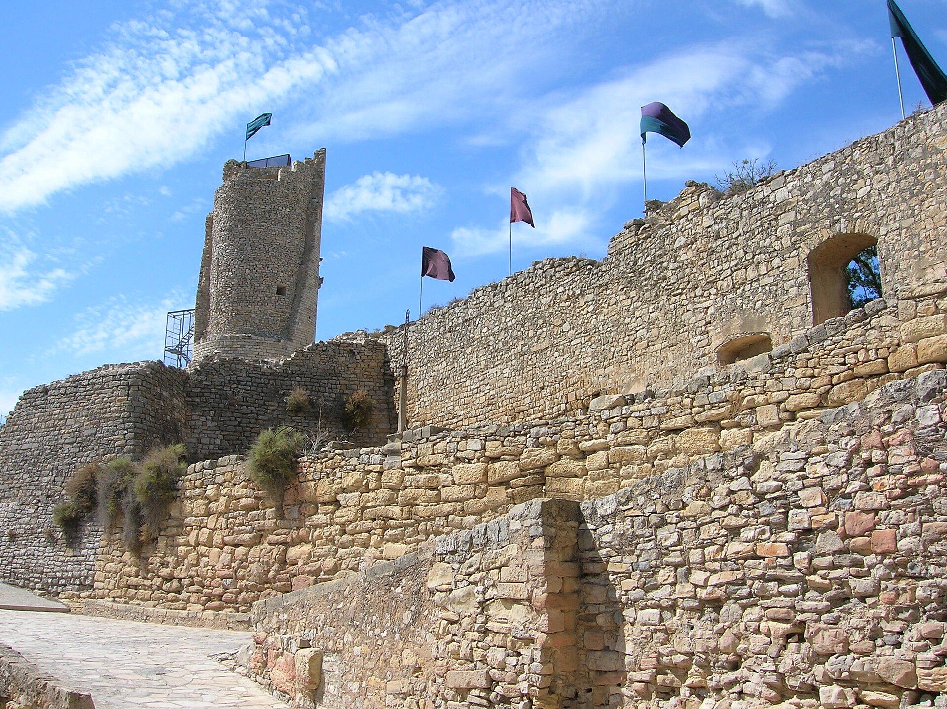
Castell de Guimerà
Guimerà
Castell de Guimerà is a medieval stronghold rising above the village of Guimerà, in the Urgell comarca of Lleida province, Catalonia. The castle sits right on the boundary between the plateau and the ridge of the Corb valley, a position that made it a natural lookout and control point over the surrounding countryside. How do you get to the castle? Guimerà lies well inland, away from the main highways, so a car is by far the most practical way to reach it. The village climbs a hillside, with the castle ruins perched at its highest point, so the final stretch has to be covered on foot — through the narrow, steep lanes of the old town. It's a short but steep walk, rewarded with sweeping views over the Corb valley. What will you actually see there? The most distinctive feature of Castell de Guimerà is how it was built: the fortification stands directly on exposed bedrock, with no artificial foundation — the defensive wall grows almost organically out of the natural rock. That's a classic medieval approach, wringing maximum protection out of the terrain itself. What survives today isn't a single, uniform structure but the result of several building phases layered over time, as the castle's defensive needs and status evolved. Those phases are most visible at the western end of the site, where the walls reach furthest beyond the original enclosure. From the hilltop, the view opens onto the plateau and the Corb valley below — the same strategic position, straddling two kinds of terrain, that once made the castle so valuable. When is the best time to visit? Since there's no covered shelter and the site sits fully exposed on a hill, spring and early autumn are the most comfortable seasons to visit, with mild temperatures and the clearest views over the valley. In summer, midday sun can be harsh, as most of the area around the ruins offers little to no shade. What else should you know before going? Guimerà itself is a small, historic village with a compact, uphill layout, so walking to the castle doubles as a walk through the whole village — stone lanes lead straight up to the walls. That means a visit naturally combines the fortification with a look at the local architecture, without needing to travel anywhere else. Frequently asked questions Do you need a ticket to enter the castle grounds? The site is an open-air ruin with no ticket booth at the walls, so visiting is free and unrestricted. How long does a visit take? Walking the ruins and viewpoints usually takes 30 to 45 minutes, though it's worth allowing about an hour once you factor in the climb through the village. Can you drive right up to the castle? Not quite — the narrow lanes of old Guimerà stop before the final rise, so the last stretch is on foot. Is it worth combining with other sights nearby? Yes, the Corb valley and the surrounding hills of the Urgell comarca offer further viewpoints and walking routes that pair well with a stop in Guimerà.
-
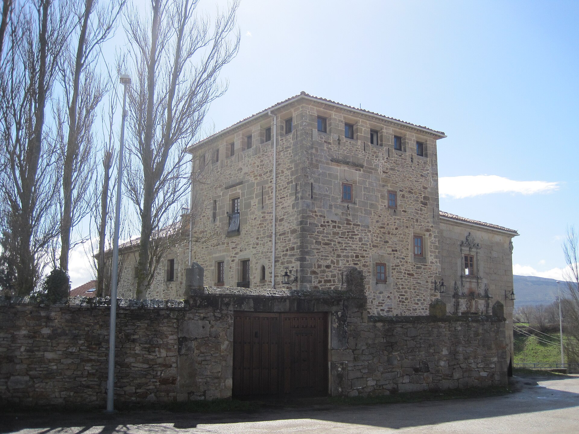
Fernández-Villa's Palace, Espinosa de los Monteros
Espinosa de los Monteros
Fernández-Villa's Palace is a historic residence in Espinosa de los Monteros, a small town in the northern part of Burgos province, Castile and León, close to the border with Cantabria. The building is registered as a property of cultural significance, meaning it carries formal heritage protection under Spanish law. That status makes the palace one of the reference points for visitors exploring the historic core of Espinosa de los Monteros, even though the building itself is not primarily run as a museum but stands as a preserved structure woven into the town's streetscape. How do you get there? Espinosa de los Monteros sits in a mountainous, sparsely populated stretch of Burgos province, so a car is by far the most practical way in — whether starting from Burgos city or from Santander on the Cantabrian side. Local roads wind through the Merindades district, an area known for limestone ridges and river gorges, so it's worth allowing extra time, especially outside summer when mountain weather can turn quickly. Once you reach the town centre, the palace sits within the historic quarter, so the last stretch is simply on foot. What will you see on site? Fernández-Villa's Palace is an example of the residential architecture typical of northern Castile — grand houses of this kind in the Merindades region generally combine stone façades with heraldic details, evidence of the wealth of the old merchant and noble families who once lived there. The building is best appreciated from the outside, as one piece of a larger historic picture: alongside churches and other period residences, it forms part of the architectural character that defines Espinosa de los Monteros' town centre. When should you visit? The palace keeps set, limited opening hours through the week — Tuesdays, Fridays and Saturdays from 9:00 to 14:00 and from 16:30 to 20:00, and Mondays, Wednesdays and Thursdays from 9:30 to 14:00 and from 16:30 to 20:00. That means it's worth checking the day of the week before planning a visit and avoiding the mid-afternoon gap, when the site is typically closed. As for season, spring and early autumn tend to suit Espinosa de los Monteros best, since the region's mountain climate is milder than in winter and less intense than at the height of summer. Practical information Anyone wanting to confirm current opening times or get further details can reach the site by phone. Given its status as a protected cultural property, it's worth following the usual etiquette for visiting heritage buildings — avoid touching the façade, stay off any private ground adjoining the building and, where possible, check ahead whether the interior is open, since access to buildings of this kind is often limited to the representative rooms or restricted to specific days. Frequently asked questions Can Fernández-Villa's Palace be visited every day? No — opening hours vary by day of the week, so it's worth checking the schedule in advance or calling the contact number listed for the site. What's the best way to reach Espinosa de los Monteros? Driving is the most practical option, since the town lies in a mountainous part of Burgos province, away from major rail lines, and local bus connections can be infrequent. Are there other historic sites near the palace? Espinosa de los Monteros has a compact historic centre where buildings like this sit alongside churches and old townhouses — it's worth combining a visit to the palace with a walk through the town core. Is there an entrance fee? The available source facts don't specify pricing or admission rules — the most reliable way to confirm this is to call the contact number given for the site.
-
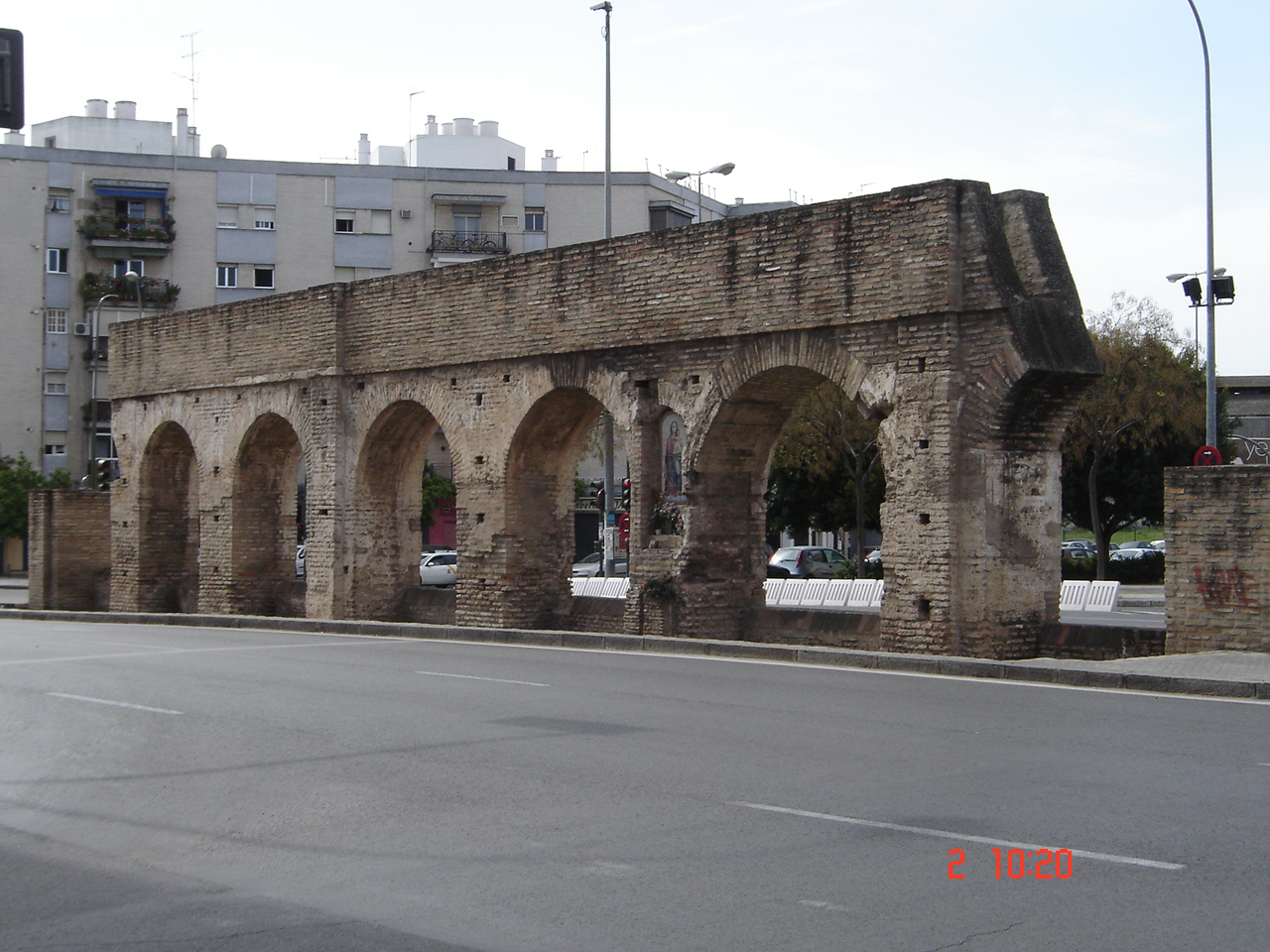
Caños de Carmona
Sewilla
Caños de Carmona is what remains of a Roman aqueduct, with surviving stretches still standing on the outskirts of Seville as a reminder of the scale of Roman engineering in southern Spain. Where did Roman Seville get its water? Construction began in the first century BC, when Seville was known as Hispalis, one of the key cities of the Roman province of Hispania Ulterior. The aqueduct carried water from a spring near what is now Alcalá de Guadaíra — the Roman town of Irippo — over a distance of roughly fifteen kilometres to the city. Most of the route ran underground, with the structure rising above ground only where the terrain required it. Those raised sections, built as stone walls and arcades, are the parts that have survived and that visitors can still see today. What did the Almohads change in the twelfth century? The aqueduct didn't fall out of use when Roman rule ended — later generations in the region kept relying on the same spring near Alcalá de Guadaíra. In the twelfth century, while Seville was under Almohad rule, the structure was renovated and parts of it rebuilt. That intervention kept the aqueduct functioning for centuries afterward, layering Islamic-era hydraulic engineering on top of the original Roman work — a common pattern across Al-Andalus, where existing Roman infrastructure was often adapted rather than replaced. Why was it torn down in 1912? What makes Caños de Carmona unusual is how long it stayed in active use: the aqueduct remained fully operational right up to the early twentieth century. It was finally demolished in 1912, as Seville modernised its water supply and reshaped its urban layout, leaving the old Roman-Almohad structure obsolete. The demolition wasn't total, though — several stretches escaped destruction and are still standing, giving a sense of how the aqueduct once ran across the landscape. What can you actually see there today? The surviving portions of Caños de Carmona are exposed sections of wall and arcade scattered along the old route between Seville and Alcalá de Guadaíra, rather than a single intact monument. Walking along them lets you trace, in fragments, the path water once took into the city nearly two thousand years ago. The site is catalogued as a building located in Seville Province, with coordinates placing it on the eastern edge of the city. How do you get to Caños de Carmona? The remaining stretches sit along the corridor linking Seville to Alcalá de Guadaíra, easily reached from the city centre — usually within half an hour by car or public transport. It makes a worthwhile stop for anyone exploring beyond Seville's historic core, especially paired with a visit to Alcalá de Guadaíra itself, the site of the original spring that fed the aqueduct. Frequently Asked Questions Is Caños de Carmona one single structure? No — it's a scattering of surviving fragments from the original aqueduct rather than one intact building, spread across several points along the old route between Seville and Alcalá de Guadaíra. Why is it called Caños de Carmona? The name reflects the direction the aqueduct partly followed, toward the area of present-day Carmona, even though the water itself originated from a spring near Alcalá de Guadaíra. Was the aqueduct in continuous use since Roman times? Not entirely without interruption, but it stayed functional for an unusually long stretch — from the first century BC, through a twelfth-century Almohad renovation, until its demolition in 1912. Is there an entry fee to see the remaining sections? The surviving fragments stand in public space on the outskirts of Seville, so they can be viewed freely while walking along the old route. How much time should I plan for a visit? Seeing the fragments themselves doesn't take long, but it's worth allowing extra time if you're also visiting Alcalá de Guadaíra and the site of the spring that once fed the aqueduct.
-
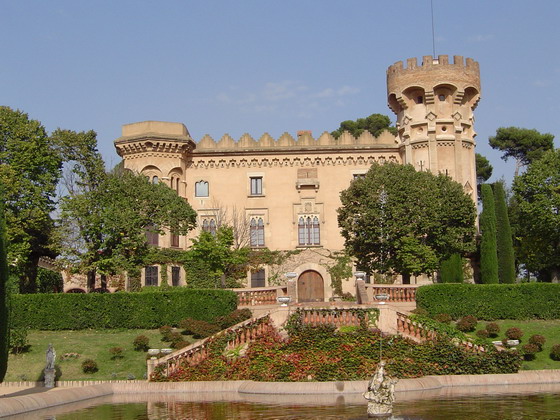
Castell de Sant Marçal
Cerdanyola del Vallès
Castell de Sant Marçal is a medieval castle on the outskirts of Cerdanyola del Vallès, in the Vallès Occidental region of Catalonia, with documented roots going back to the 11th century. Although privately owned today, its long history and the strikingly decorative 19th-century remodeling make it one of the town's notable landmarks. Where does its name come from, and how old is the site? The earliest written record dates to 1042 and refers to a chapel dedicated to Saint Marcellus (Sant Marçal in Catalan), which at the time fell under the parish of Sant Martí in Cerdanyola. The land is thought to have first belonged to the monastery of Sant Cugat, which sold its rights over the area to the Count of Barcelona. In 1135 the count granted the estate to the Montcada family, one of medieval Catalonia's most powerful noble houses. The castle later took its name from the patron saint of that original chapel. How did ownership of the castle change over time? In 1225, Raimon de Plegamans purchased the castle from Guillem de Montcada, setting off a long-running dispute over rightful ownership that dragged on, with interruptions, until 1542. Another turning point came in 1640, during the Reapers' War (Guerra dels Segadors), the Catalan revolt against Spanish royal authority, when rebellious peasants set the castle on fire. Reconstruction took decades: around 1680 the castle's Gothic chapel, dedicated to Saint Marcellus, was rebuilt. In 1690, Feliu de Marimon was granted the noble title of Marquess, creating the Marquisate of Cerdanyola tied directly to this estate. What does the castle look like today? Originally, Castell de Sant Marçal was a quadrangular structure built around an inner courtyard, with a defensive tower and a Gothic chapel, the whole complex enclosed by a moat — a fairly typical layout for a medieval Catalan castle. Its current appearance, however, comes largely from a 1895 renovation, when the Arròspide family commissioned architect Gaietà Buïgas to convert the building into a summer residence. Buïgas kept the original layout and main walls intact but covered the façades in elaborate ornamentation inspired by Romanesque and Gothic motifs, giving the castle a far more decorative look than its medieval origins would suggest. Can visitors go inside the castle? Since 1949, Castell de Sant Marçal has been listed as a Cultural Asset of National Interest (Bé Cultural d'Interès Nacional), recognizing its importance to Catalan heritage. The building remains privately owned — currently by the Trénor family — so it is not open to the public on a regular basis. The Cerdanyola del Vallès town council does, however, organize occasional guided visits, giving visitors a chance to see the castle up close on specific dates. Checking the town's official website ahead of a trip is the best way to catch one of these openings. Frequently asked questions When was Castell de Sant Marçal built? The earliest record of a chapel on the site dates to 1042, while the castle itself developed over the following centuries under the Montcada and Plegamans families. Why was the castle set on fire? In 1640, during the Reapers' War against Spanish rule, rebellious peasants burned the castle. Who owns the castle today? It remains privately owned by the Trénor family and is not regularly open to visitors. Can tourists visit the castle? Only occasionally — the Cerdanyola del Vallès town council periodically organizes guided tours of the building. Why doesn't the castle look like a typical medieval fortress? Because in 1895 architect Gaietà Buïgas remodeled it into a summer residence, adding ornate Romanesque- and Gothic-inspired decoration while preserving the original layout.
-
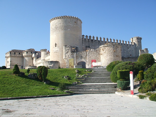
Cuéllar Castle
Cuéllar
Cuéllar Castle (Castle of the Dukes of Alburquerque) stands as the defining landmark of the small town of Cuéllar, in the province of Segovia, within the Spanish autonomous community of Castile and León. Overlooking the town, it blends a medieval stronghold with a later Renaissance palace, and it has anchored the local skyline for nearly seven centuries. How old is the castle, and how did its story begin? A fortress on this site is documented as early as 1306, making it one of the long-standing strongholds of the region. Its ownership shifted repeatedly over the following centuries, tied to the political fortunes of the Crown of Castile. The turning point came in the mid-15th century, when King Henry IV of Castile seized the castle from his half-sister, the Infanta Isabella — the future Isabella the Catholic — and handed it to a trusted courtier instead. Who were the Dukes of Alburquerque? That courtier was Beltrán de la Cueva, Henry IV's favorite, who in 1464 was granted lordship over Cuéllar and had already become the first Duke of Alburquerque. It was de la Cueva who set in motion the construction of a new, imposing residence on the site of the older fortress — a castle-palace meant to reflect his family's standing at the Castilian court. His successors carried the project forward, and the building only received its Renaissance finishing touches in the 16th century. The Alburquerque family still holds a formal link to the property today, even though its practical use has long passed to public institutions. What does the architecture look like? Builders raised a rectangular Gothic fortress with corner towers on top of the earlier structure — a layout typical of Castilian defensive castles of the era. The south-facing façade tells a different story: it carries a Renaissance gallery resting on stone corbels, with a balcony below it that once opened onto the castle's dining hall, alongside a large window lighting the reception room. The contrast between the fortress's austere, defensive mass and this later, decorative façade traces the building's long transformation from military stronghold to noble residence. What is the castle used for today? The Dukes ceded use of the building for educational and cultural purposes. It now houses a secondary school named after the Duke of Alburquerque, as well as the town's municipal tourist office. The castle also keeps the Historical Archive of Cuéllar and the archive of the House of Alburquerque within its walls, making it as much a working repository of local history as a visitor attraction. What protected status does the castle hold? On 3 June 1931, the castle was declared a Bien de Interés Cultural, Spain's highest category of heritage protection, reserved for sites of exceptional historical and architectural value. That designation underscores its standing as one of the key monuments of Segovia province. Frequently asked questions Where is Cuéllar Castle located? In the town of Cuéllar, in the province of Segovia, in Castile and León, Spain. When was the original castle built? A fortress on the site is documented from 1306, though the palace-like building seen today dates from much later. Who built the current castle-palace? Construction was begun by Beltrán de la Cueva, first Duke of Alburquerque, after he was granted lordship of Cuéllar by Henry IV in 1464. His successors completed it in the 16th century. Can visitors tour the castle today? Part of the building is used as a secondary school, but it also hosts the tourist office and historical archives, which are accessible to visitors and researchers. What is its official heritage status? Since 3 June 1931 it has been listed as a Bien de Interés Cultural, Spain's top level of monument protection.
-
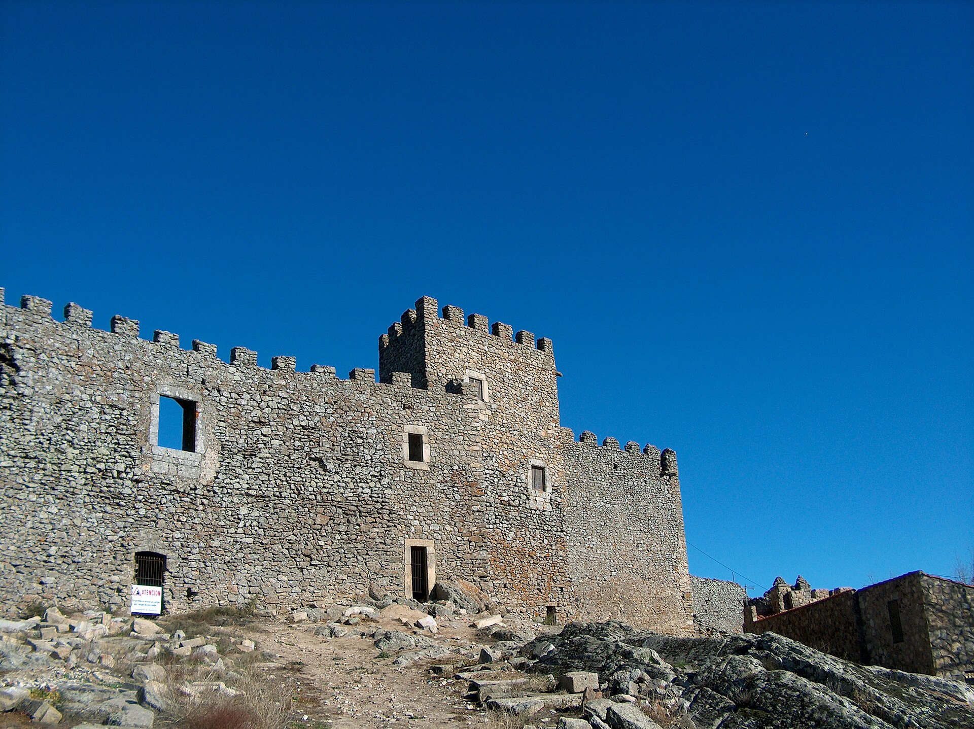
Castle of Montánchez
Montánchez
Montánchez Castle sits on a hilltop above the small town of Montánchez, in the province of Cáceres, in the Spanish region of Extremadura. From its walls the fortress has watched over the surrounding oak-covered hills for centuries, while the town below is now best known for its cured jamón. How old is the site? The hill has been fortified since Roman times, when the first defensive works were built here. The structure visitors encounter today, however, is largely the work of the Almohads, the Muslim dynasty that controlled the region and reshaped the fortress in the 12th century into the form that has survived to the present. Like many Iberian castles, it grew in layers, with each ruling power adding to what came before rather than starting from scratch. What survives from the Almohad period? The clearest physical evidence of Almohad building work is a set of three cisterns, or aljibes, still standing inside the fortress. These held rainwater and were essential to keeping a garrison supplied in the dry, hilly terrain of Extremadura, where a reliable water source could determine whether a stronghold could withstand a prolonged siege. What happened after the Christian reconquest? Once the area passed into Christian hands, the castle came under the administration of the Order of Santiago, one of the Spanish military orders responsible for defending and governing reconquered territory. It was during this period that additional rings of walls were added around the original Almohad core, extending the fortification well beyond its earlier footprint. Why is the castle linked to a famous prisoner? Montánchez Castle has one episode in its history that goes beyond its purely military role. In 1620 it served as a place of confinement for Don Rodrigo Calderón, an influential Spanish nobleman and royal favourite whose downfall was one of the more notorious political scandals of the period. The fact that a figure of his standing was held here shows that the fortress carried real strategic weight rather than functioning as a minor provincial outpost. What can visitors see from the hill today? Because of its elevated position, the castle offers wide views over the Sierra de Montánchez and the surrounding Extremaduran countryside. It is recognised as part of Spain's historical heritage, and walking around its perimeter makes it possible to trace its different building phases, from the Roman foundations through the Almohad reconstruction to the later Christian-era walls. Frequently asked questions How old is Montánchez Castle? Its origins go back to Roman times, but the structure seen today mainly dates from the Almohad period, in the 12th century. What are the aljibes, and can they still be seen? They are three rainwater cisterns built during the Almohad occupation, and they remain one of the castle's most recognisable surviving features. Who administered the castle after the reconquest? Once the region returned to Christian control, the Order of Santiago took charge of the fortress and extended its defensive walls. What historical event is the castle known for? In 1620 it was used as a prison for Don Rodrigo Calderón, an influential nobleman at the Spanish royal court. Is Montánchez known for anything besides the castle? The town below is widely known for its traditional cured jamón, making it a popular stop for food-focused travel through Extremadura.
-
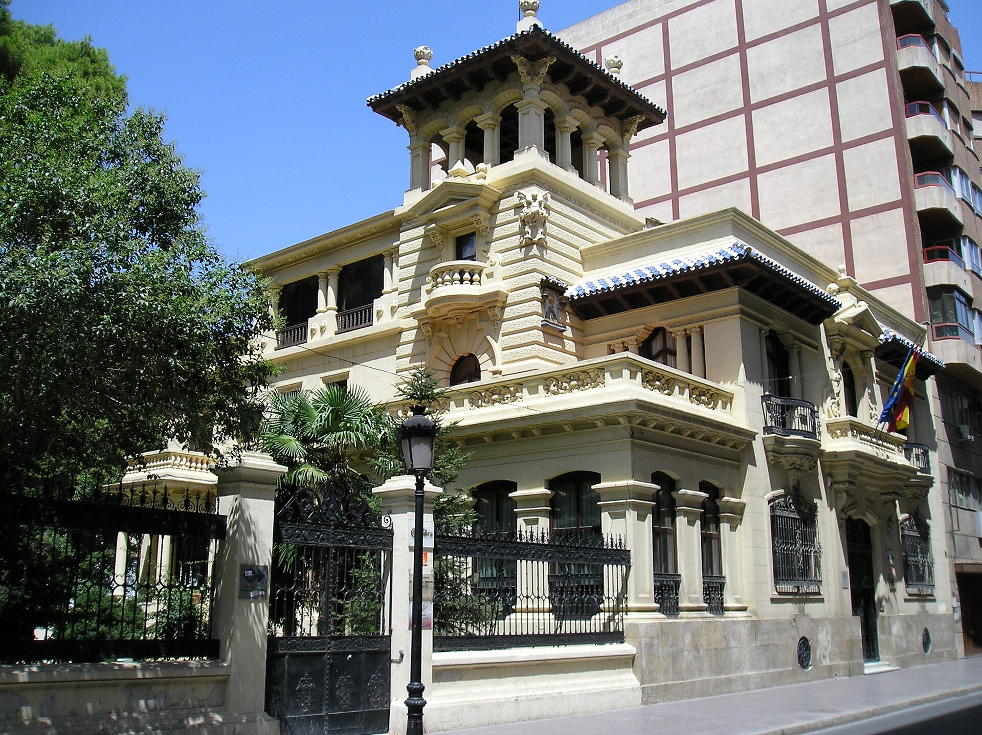
Chalet Fontecha
Albacete
Chalet Fontecha is a historic townhouse-villa in Albacete, in the Spanish region of Castilla-La Mancha, standing on Calle Tesifonte Gallego near the Abelardo Sánchez park, one of the city's oldest green spaces. Dating from 1922, the building remains one of Albacete's more distinctive architectural landmarks. Who designed Chalet Fontecha, and why that name? The villa was designed by architects Julio Carrilero and M. Muñoz. Carrilero was among the most prominent architects working in Albacete during the first quarter of the 20th century, and his work left a lasting mark on the city's residential architecture. The house was commissioned by a wealthy couple, Fructuoso Manuel Fernández Nieto and Rosario Fontecha Nieto, and it is from Rosario Fontecha's surname that the building takes the name it still carries today. What architectural style does the building follow? Chalet Fontecha belongs to a type of detached or semi-detached single-family villa that was common on plots around the former Parque de Canalejas (today's Abelardo Sánchez park) and along the final stretch of Calle Tesifonte Gallego, where the house stands. For its design, the architect drew on forms recalling the Spanish Renaissance, giving the building a stately, palace-like presence that set it apart from more ordinary residential construction of the period. Is the building legally protected? Yes. On 10 April 2014, Chalet Fontecha was formally recognised as a Bien de Interés Patrimonial (an asset of heritage interest), under the category Construcción de Interés Patrimonial (a construction of heritage interest). This designation confirms its historical and architectural value and places it under the regional heritage protection framework of Castilla-La Mancha. What is Chalet Fontecha used for today? After a period during which parts of the building stood unused, it underwent a thorough renovation. Since 3 October 2024, it has housed the Instituto de Estudios Albacetenses "Don Juan Manuel", a research institution devoted to the study and dissemination of the region's history and culture. The renovation adapted the interior to its new role, adding an auditorium, an exhibition room, a library, a newspaper archive and a media library. What was once a private residence is now a cultural institution open to residents and visitors alike. Where exactly is Chalet Fontecha located? The building stands in central Albacete, close to the Abelardo Sánchez park. Its proximity to the park and the historic streets around it makes it easy to combine a visit with a walk through other points of interest in the city centre. Frequently asked questions When was Chalet Fontecha built? It was designed in 1922. Who was the architect? The project was designed by Julio Carrilero and M. Muñoz. Where does the name come from? It comes from Rosario Fontecha Nieto, one of the two people for whom the villa was originally built. Is Chalet Fontecha a protected heritage site? Yes, since 2014 it has held the status of Bien de Interés Patrimonial, in the category Construcción de Interés Patrimonial. What does the building house today? Since October 2024 it has been the seat of the Instituto de Estudios Albacetenses "Don Juan Manuel", featuring an auditorium, an exhibition room, a library, a newspaper archive and a media library. Can visitors go inside? As the working seat of a cultural research institute, the building is used for its public programme of activities; it is worth checking current opening hours and scheduled events before planning a visit.
-
Velasco's Tower
Espinosa de los Monteros
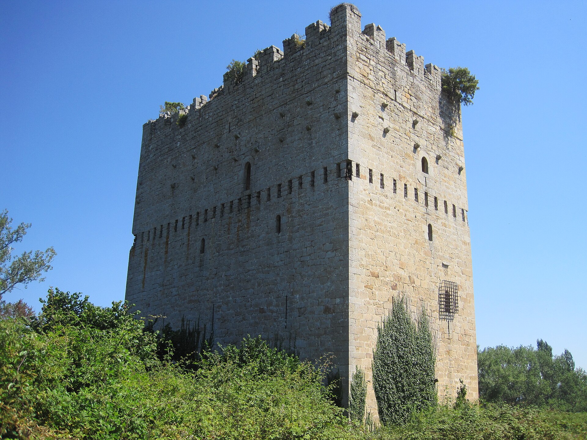
Velasco's Tower (Torre de los Velasco, also recorded as Torre de la Riba) is a medieval fortified tower standing in Espinosa de los Monteros, in the province of Burgos, Castile and León. It belongs to a small group of well-preserved defensive towers linked to the Velasco family in this part of Spain and remains one of the reasons visitors interested in military architecture and regional history stop in the town. Who built the tower and when? The tower was raised in the 15th century on the initiative of Pedro Fernández de Velasco, 1st Count of Haro, known as "the good count" (el buen conde), Lord of Medina de Pomar and other territories. The earliest documented reference to the building appears in the 1458 deed establishing a mayorazgo, an entail created by Pedro Fernández de Velasco, father of the 4th Constable of Castile. A mayorazgo was a legal mechanism used to keep a noble family's estate intact across generations, and its records are what allow historians to date the tower to the mid-15th century. What does the building look like? Velasco's Tower is a classic example of a medieval defensive tower made up of two joined rectangular volumes: a tall, slender tower and a lower attached structure that once served as a stable. Pairing a defensive tower with utility buildings at its base was a common layout for the fortified residences of Castilian noble families during this period. What is the most distinctive architectural feature? The most recognizable feature of the tower is its wooden hoarding, or cadalso — a projecting timber gallery that reinforced the defenders' position along the walls during a siege. The timber structure itself has not survived, but the evidence of it has: on all four sides of the tower, roughly halfway up its height, rows of putlog holes (mechinales) and a double line of stone corbels (canes) still mark where the wooden gallery was once anchored. These traces are what let historians reconstruct how the tower was originally defended. Is the tower legally protected? Yes. Velasco's Tower was placed under protection generically, together with the rest of Spain's castles and defensive towers, through a decree issued on 22 April 1949. Today it holds the status of Bien de Interés Cultural (BIC), the highest heritage protection category in the Spanish legal system. Where exactly is the tower located? The tower stands in the municipality of Espinosa de los Monteros, in the province of Burgos, at coordinates 43.075633, -3.557139. This is a small town in the northern part of the province known for several fortified structures — worth noting, though, that Espinosa de los Monteros is also home to another, separate building with a similar name (the Chiloeches Palace), which is easy to confuse with the Velasco's Tower described here. Frequently asked questions Does Velasco's Tower have another name? It also appears in records as Torre de la Riba. Who commissioned the tower? It was commissioned by Pedro Fernández de Velasco, 1st Count of Haro, known as "the good count". How old is the tower? The earliest documentary reference dates to 1458, and the building itself was constructed in the 15th century. Can the tower's original defensive system still be seen? Yes — although the wooden hoarding (cadalso) itself no longer exists, its traces, in the form of putlog holes and stone corbels, remain visible on all four walls. What protected status does the tower hold today? It has been protected as a heritage site since 1949 and currently holds the status of Bien de Interés Cultural.
-
Casa Luelmo
Valladolid
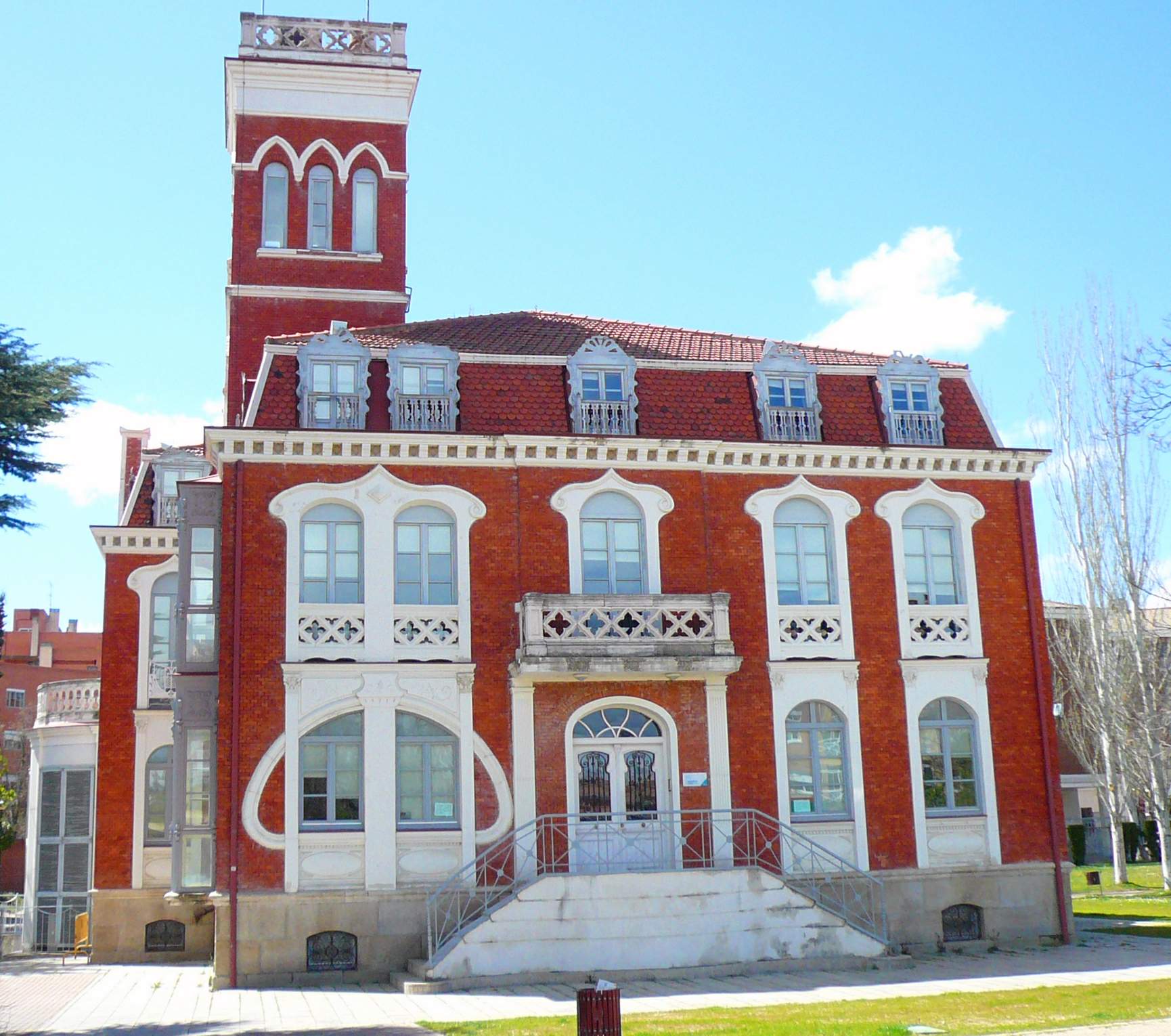
Casa Luelmo is one of the most distinctive Art Nouveau buildings in Valladolid, the capital of Spain's Castile and León region. Built in the early twentieth century as a private family residence, it now serves as the headquarters of an institution dedicated to preserving the region's historical heritage. Who built Casa Luelmo, and when? Construction ran from 1907 to 1912, commissioned by the businessman Rufo Luelmo for his son, José María Luelmo — a poet, poultry-industry entrepreneur, and former president of the Valladolid Chamber of Commerce and Industry. The design was the work of architect Antonio Ortiz de Urbina y Olasagasti. The house did not originally stand within the city itself: it was built on Granja Minaya, a 45-hectare agricultural estate that at the time lay on the outskirts of Valladolid. What architectural style does the house represent? Casa Luelmo is widely regarded as one of the finest examples of Art Nouveau architecture in Valladolid, blended with eclectic touches typical of the period. The three-storey house is organized around a central staircase, and its silhouette is topped by a lookout tower, or mirador. A small chapel adjoins the main structure. The façade is marked by decorative arches and wrought-iron railings and balustrades, ornamental details characteristic of the Art Nouveau vocabulary of the era. How did the building fare through the twentieth century? The Luelmo family lived in the house continuously until 1996. A 1956 renovation altered part of the interior layout and added a heating system along with wooden window shutters. After the deaths of the owners, the property fell into disrepair, and in 1998 a fire caused part of the structure to collapse — a setback that for a time left the building's future in doubt. What happened to it after the fire? A comprehensive restoration was carried out in 2006. The project aimed to recover the house's original architectural concept from before the 1956 remodeling, so the additions and alterations made at that time were removed. Since then, Casa Luelmo has housed the Fundación del Patrimonio Histórico de Castilla y León (Foundation for the Historical Heritage of Castile and León), an organization dedicated to documenting, protecting, and promoting the region's monuments. Where exactly is Casa Luelmo located? The building stands in Valladolid, in northwestern Spain, at coordinates 41.62048, -4.746465. It now lies within the city's urban fabric, although at the time of its construction the surrounding area was still farmland on the city's edge. Frequently asked questions Can visitors go inside Casa Luelmo? The building functions as the working headquarters of a heritage foundation, so access to the interior depends on that institution's current activities and any scheduled events. Why is the house called Casa Luelmo? The name comes from the Luelmo family: Rufo Luelmo commissioned the house for his son, José María Luelmo. What architectural style is the building? It is an example of Art Nouveau architecture with eclectic elements, characteristic of Valladolid at the turn of the twentieth century. Has the building survived unchanged since 1912? Not entirely. It was remodeled internally in 1956 and damaged by a fire in 1998. The 2006 restoration, however, restored its original architectural appearance by removing the mid-century alterations. Has the house always stood in the same part of Valladolid? Yes, its location hasn't changed, but its surroundings have — it originally stood on the rural Granja Minaya estate on the city's outskirts, an area that is now fully urban.
-
Palacio Olabarri
Bilbao
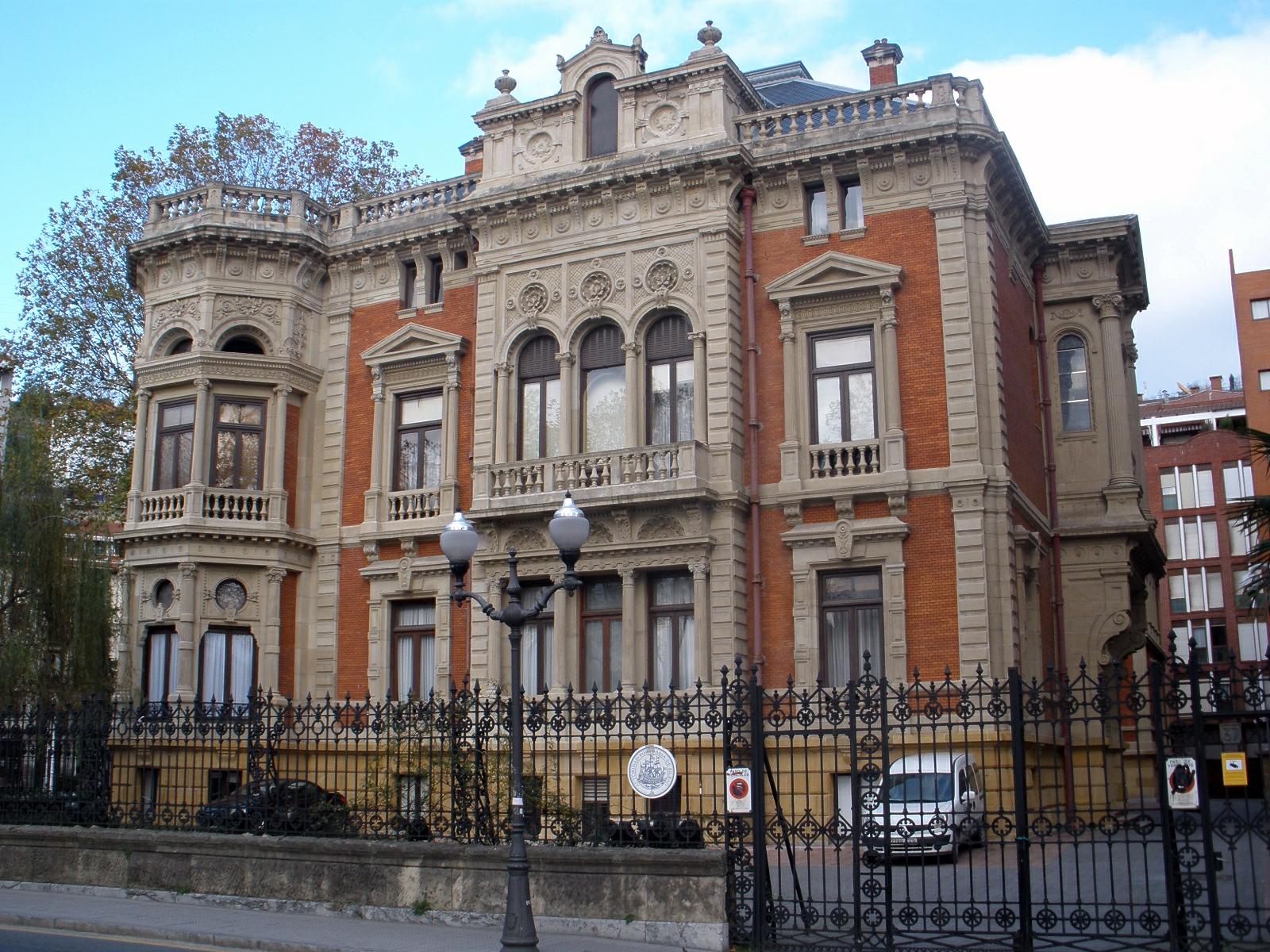
Palacio Olabarri is a 19th-century urban mansion in Bilbao, standing at Campo Volantín 37 right above the Nervión river, a short walk from the Moyúa metro station. It is one of the last surviving examples of the private residences that wealthy families built in this part of the city during the boom years of Bilbao's industrial bourgeoisie. How do you get there? The easiest approach is the metro to Moyúa station, followed by a few minutes' walk toward the Campo Volantín riverside promenade. The Euskotran tram also stops close to the embankment, and the palace is an easy fifteen-minute walk from Plaza Moyúa if you'd rather stroll through the Ensanche, Bilbao's grand 19th-century expansion district. Because the building sits right on the river walk, it's simple to combine a visit with a longer stroll along the water or through the surrounding boulevards. What will you see there? The mansion was designed in 1894 by architect Julián de Zubizarreta as a private residence for José María de Olabarri, a prominent businessman of the period. Its façade and detailing mix French and English influences, a combination typical of the elegant townhouses and small palaces that once lined Campo Volantín. The property sits on roughly 2,000 m² of land, with about 4,200 m² of built floor area in total, since the main palace is connected to a second, more functional building on Huertas de la Villa 35; the complex was expanded further in 1957. From 1953 onward, the building served for more than seventy years as the headquarters of the Bilbao Port Authority (Junta de Obras del Puerto de Bilbao). Staff gradually relocated to new offices in Santurtzi, with the final departure completed in March 2024. In December 2023, the Port Authority sold the property to Bericato, a company linked to the Luze hotel chain, for €10,470,798 excluding VAT. The new owner plans to convert the palace into a hotel while preserving the elements protected for their architectural and historical value. When should you visit? Since the palace is mainly viewed from the outside as part of a walk along the riverside promenade and through the Ensanche district, spring or early autumn are the most comfortable seasons — mild enough for walking without the summer heat. Aim for daytime hours, when natural light brings out the detail of the façade and plasterwork best. Why is Palacio Olabarri worth seeing? It offers a rare glimpse of what residential Campo Volantín looked like before the city's later redevelopment swept most similar mansions away. The building also tells a compact story of changing use: from an industrialist's private home, through decades as a public port authority, to its upcoming life as a hotel — a transformation that mirrors Bilbao's own economic evolution. Frequently asked questions Can visitors go inside Palacio Olabarri? The building is currently privately owned and being converted into a hotel, so the interior is not open to the general public. It's worth checking for updates once the hotel project is completed and opens to guests. Who built Palacio Olabarri and why? Architect Julián de Zubizarreta designed it in 1894 as a private residence for the businessman José María de Olabarri. What architectural style does the building represent? It follows the eclectic late-19th-century residential style typical of Bilbao's affluent quarters, blending French and English design influences. How long did the palace serve as the port authority's headquarters? From 1953 until 2024 — more than seventy years — before the building was sold and repurposed as a hotel.
-
Torre de los Aliatares
Baeza
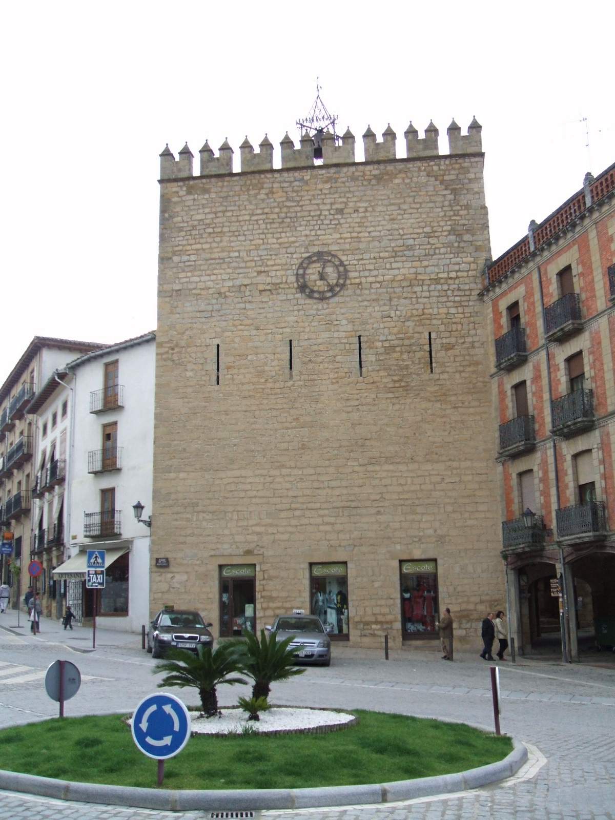
Torre de los Aliatares is a medieval defensive tower standing at the heart of Baeza, in Andalusia, Spain, and one of the best-preserved reminders of the city's Moorish past. It sits on Plaza de España, at the corner with Calle Obispo Narváez, right in the middle of the historic quarter most visitors already walk through. Where does the tower come from? The tower was built in the 12th century by the Muslim rulers of Baeza as part of the city's defensive wall. Its job was to guard the nearby Puerta del Cañuelo gate together with its barbican, an outer fortified structure set in front of the main wall line. Thanks to its considerable height, the tower allowed defenders to keep watch over a large stretch of the city and made it one of the most strategically important points along Baeza's entire fortification system. Once the city passed into Christian hands, the walls lost most of their military purpose. In 1476, Isabella I of Castile ordered the city walls torn down, yet Torre de los Aliatares escaped that fate — which is exactly why it remains today one of the few tangible traces of the Moors' presence in Baeza. What will you see there? The tower has a rectangular floor plan and stands about 25 meters tall, built from cut stone blocks. Three semicircular arches are visible at its base, and narrow arrow slits run partway up the structure, once used by defenders to watch the surroundings and repel attackers. The top is crowned with a crenellated frieze, a design typical of Moorish military architecture of the period. A clock was added to the structure in the 19th century and remains a distinctive part of its silhouette today. The tower is in good condition, though its interior is not generally open to visitors — most people take it in from the outside while wandering through Plaza de España and the surrounding old-town streets. As a legally protected monument (covered by the 1949 castle-preservation decree and the 1985 Historic Heritage Law), it holds formal status as a Bien de Interés Cultural, Spain's designation for nationally protected heritage. How to get there and when to visit? Baeza sits in the province of Jaén, well connected to nearby Úbeda and to the city of Jaén itself, both easily reached by bus or car. The tower stands right in the historic center, within walking distance of the cathedral and the bishop's palace, so it fits naturally into a walk around the old town. Spring and autumn are the best times to visit — Baeza summers get quite hot, which makes long walks across sun-exposed squares less comfortable. Given how compact this part of the city is, it's worth setting aside at least half a day to see the tower alongside the nearby monuments, and to stop by the tourism office for any current information on interior access. Frequently asked questions Can you go inside the tower? The interior of Torre de los Aliatares is not routinely open to the public. Check with the local tourism office for any current access arrangements. How tall is the tower? It stands roughly 25 meters high on a rectangular floor plan, making it one of the most imposing surviving pieces of Baeza's Moorish walls. Why did the tower survive when the walls were demolished? The city walls were torn down in 1476 on the orders of Isabella I of Castile, but Torre de los Aliatares was spared and still stands today as one of the few physical remnants of Moorish Baeza. What else is worth seeing nearby? The tower faces Plaza de España, close to Baeza's historic center with its cathedral and bishop's palace, making it an easy stop on a walk through the old town.
-
Castle of Montemayor del Río
Montemayor del Río
Castle of Montemayor del Río (Castillo de San Vicente) crowns the hilltop above the town of Montemayor del Río, in the province of Salamanca, right along the historic Vía de la Plata route linking Extremadura with the kingdoms of León and Castile. It stands as one of the best-preserved fortresses in the region and the town's principal landmark. What will you see on site? The fortress is built around an unusual six-tower layout: four square towers and two semicircular ones set along the perimeter walls. A defensive wall once ran from the castle all the way down to the town's main square, and traces of that line can still be followed in the layout of the old streets. The castle sits within the same fortified enclosure as the parish church, giving visitors a clear picture of how a medieval defensive settlement combined military and religious functions in one compact space. The walls and interior have undergone a recent restoration, and the site is now open to visitors, with locally arranged guided tours available. Walking the courtyard and the wall line offers wide views over the valley and the surrounding Sierra de Béjar hills. How do you get there? Montemayor del Río lies in the province of Salamanca, in the Castilla y León region, on the road connecting Béjar with the southern part of the province. Arriving by car is the most practical option, since the town sits just off the local roads branching from the main routes between Salamanca and Extremadura. The castle is visible from a distance, towering over the town, and the walk uphill from the centre takes only a few minutes. Why does this castle matter historically? The fortress served as the most forward bastion controlling the passage between the kingdoms of León and Castile and the region of Extremadura during the Reconquista. Its position on the Vía de la Plata — an ancient trade and military route running north–south across the Iberian Peninsula — made it a prize held by successive noble families over the centuries, including the Silva family (marquises), and later linked to the title of the dukes of Montemar. At certain periods it also functioned as a royal castle under the direct control of the crown. The town's historic-artistic ensemble, which includes the castle and its surroundings, received official heritage protection in 1982, underlining its significance to the region's heritage. When should you visit? Spring (April to June) and early autumn (September and October) offer the mildest conditions in the Salamanca area and show the Sierra de Béjar landscape at its best. Summers can get hot, particularly around midday, so it is worth planning a visit for the morning or late afternoon. Frequently Asked Questions Can the castle be visited with a guide? Yes, following its recent restoration the site is open to the public, and guided visits are available locally. How many towers does the castle have? Six in total: four square towers and two semicircular ones, arranged along the line of the old defensive walls. Why was the castle built in this exact spot? Because of its position on the Vía de la Plata route and its strategic control over the passage between Extremadura and the kingdoms of León and Castile during the Reconquista. Is there anything else to see near the castle? Yes, the parish church stands within the same fortified enclosure, and the town together with the castle has formed part of a protected historic-artistic ensemble since 1982.
-
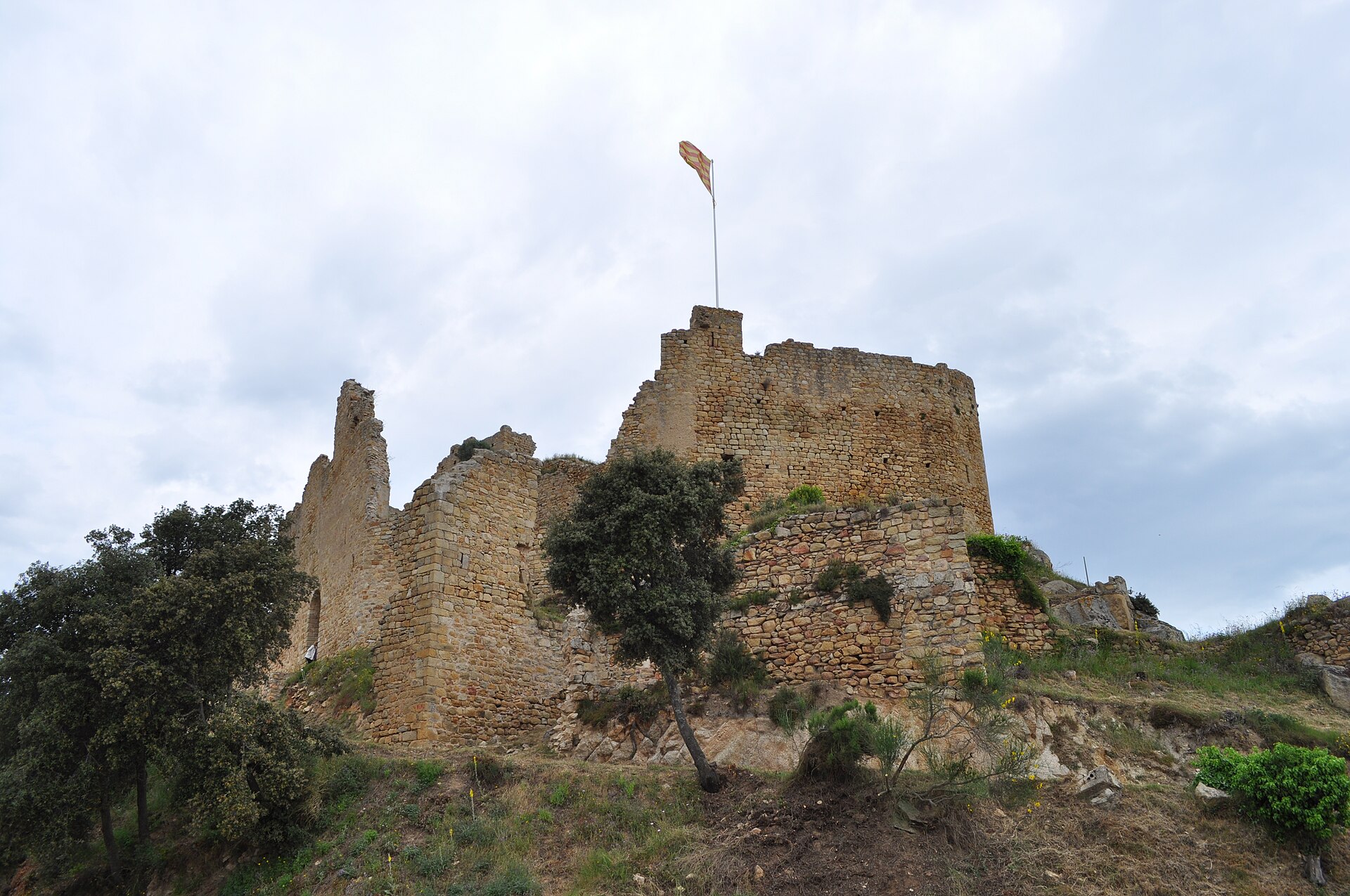
Castell de Palafolls
Palafolls
Castell de Palafolls is a ruined medieval castle perched on a hill above the town of Palafolls, in Catalonia's Maresme region, close to the mouth of the Tordera river and the Mediterranean coast. How do you get to the castle? The fortress sits on high ground overlooking the center of Palafolls, with views stretching over the Tordera valley toward the coastline. That position was no accident: for centuries the castle controlled the old road linking Girona and Barcelona, which ran along this stretch of coast. Guarding that trade route is the main reason the site grew into a fortified stronghold in the first place. What's the history behind it? The earliest references to the castle date back to the 10th century — it appears in 968 in the founding document of a nearby monastery, and by 1035 it belonged to Humbert de Sesagudes. Through marriage, control passed to the Palafolls family, who expanded the site with a second defensive ring over the following centuries. The castle was the seat of the barony of Palafolls, which covered not only the town itself but also the present-day municipalities of Malgrat de Mar and Santa Susanna, plus part of Blanes. In 1229, Guillem de Palafolls took part in the conquest of Mallorca alongside King James I — a sign of how influential the family had become. In 1381, Guillem de Palafolls sold the castle to King Peter III, and the family relocated to Aragon, where it later gave rise to the Palafox dynasty. The following year, Viscount Bernat IV de Cabrera bought the fortress. The following centuries brought more changes of ownership and turbulent episodes: the castle was occupied during Catalonia's civil war between 1462 and 1472, suffered damage during peasant uprisings in 1485, and was reinforced against pirate raids in the 16th century. Ownership later passed to the Montcada family and then to the Dukes of Medinaceli. In 1880, the site passed into the hands of the Spanish state and began to fall into disrepair. That decline was only reversed after the "Amics del Castell de Palafolls" association was founded in 1966, which led architect Joan Bassegoda i Nonell to restore the castle chapel in 1971. Today the castle is listed as a site of national cultural interest (bé cultural d'interès nacional), a status formally granted in 1988. What will you see on site? The castle follows an irregular, elongated layout shaped by the rocky hilltop it sits on, enclosed by several rings of defensive walls. Surviving elements include the keep (torre de l'homenatge), residential buildings, a cistern, and a Romanesque chapel with a single nave and a circular apse. The main hall still shows a barrel-vaulted semi-basement and traces of its original wooden ceiling. Most of the structure was built from local granite; the oldest parts date to the 10th century, while the castle reached its final extent by the 14th century. When is the best time to visit? Since the site is exposed and set on open, elevated ground, spring and autumn tend to offer the most comfortable conditions, avoiding strong winds and summer heat. This is an archaeological ruin rather than a restored monument, so sturdy shoes are worth packing — the terrain underfoot is uneven and rocky. Frequently asked questions Can you visit the castle? Yes, the site is open to visitors as an archaeological ruin listed as a site of national cultural interest. How old is the castle? The earliest records date to the 10th century (968 and 1035), and the castle reached its final built form in the 14th century. Why was the castle built on this particular hill? The hilltop above Palafolls gave control over the old road connecting Girona and Barcelona, making it a strategic defensive point in the Maresme region. What survives from the original structure? Visible remains include the keep, sections of the defensive walls, a cistern, and a Romanesque chapel with an apse, partly restored in the 1970s.
Earn badges for the places you visit
Download NextOnTrip, discover new places and check off your trails.