Monuments in Spain
A guide to 4655 Monuments in Spain — with descriptions, photos and traveler visits from the NextOnTrip community. Locations spread across 2240 cities and towns. Most visited by the community: castle of Chulilla, Castle of Pioz, castell de la Todolella.
-
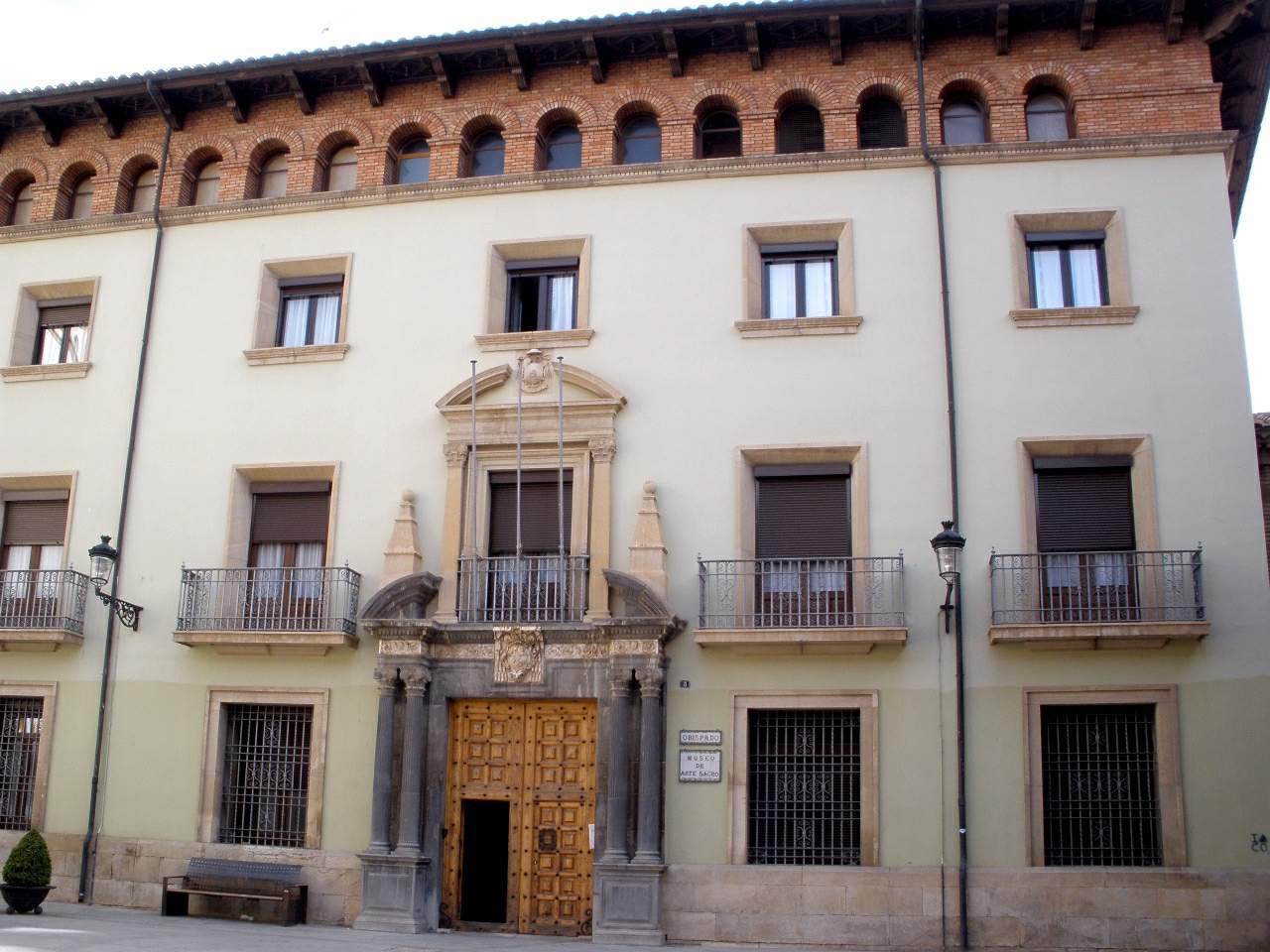
Episcopal palace of Teruel
Teruel
The Episcopal Palace of Teruel stands among the most significant historic buildings in the old town of Teruel, the small provincial capital in Aragon famous for its UNESCO-listed Mudéjar architecture. The palace was begun in the closing years of the 16th century as the residence of the bishops of the diocese of Teruel and Albarracín, and it still carries out functions tied to the local Church today. What does the palace look like from the outside? The building's façade is sober and restrained, in keeping with the architectural conventions of ecclesiastical buildings of its era in the region. Its focal point is a doorway flanked by two columns and topped by a triangular pediment — a classicizing touch that gives the entrance a dignified presence without excessive ornament. What is inside the palace? The interior is organized around a central courtyard onto which two cloisters open. A monumental staircase climbs from the lower level to the upper cloister and to the "noble" section of the palace — the formal quarters reserved for the bishop. This upper floor once held the bishop's private chambers, reception rooms, and a throne room, where the bishop received visitors and carried out official duties. During later renovation work, the originally open central courtyard was enclosed with a glass vault. This roofing protects the interior from the weather while preserving natural light, and it has allowed the courtyard space to be used for temporary exhibitions. What can visitors see there today? The palace building now houses the Museo de Arte Sacro (Museum of Sacred Art) of the diocese of Teruel and Albarracín. The museum gathers and displays religious art connected to the diocese's history, ranging from liturgical objects to paintings and ecclesiastical craftsmanship. The collection lets visitors explore the region's sacred heritage inside a genuinely historic palatial setting. Why combine a visit with the rest of Teruel? Teruel is a compact but distinctive city: its historic center is known for a group of Mudéjar buildings — including church towers and the Cathedral of Santa María — inscribed on the UNESCO World Heritage List. The city is also known for the legend of the Lovers of Teruel (Los Amantes de Teruel), which has become part of its local cultural identity. As part of this historic fabric, the Episcopal Palace is a natural stop on a walk through the old town. Frequently Asked Questions What was the Episcopal Palace of Teruel originally used for? It was built in the late 16th century as the residence of the bishops of the diocese of Teruel and Albarracín, housing the bishop's private rooms, reception rooms, and a throne room. What can visitors see in the palace today? The palace houses the Museo de Arte Sacro of the diocese of Teruel and Albarracín, displaying religious art connected to the region's history. What is the architectural style of the building? The façade is sober, with an entrance flanked by two columns and topped by a triangular pediment. Inside, a central courtyard with two cloisters and a monumental staircase leads to the palace's formal upper floor. Is the courtyard covered? Yes — renovation work enclosed the originally open central courtyard with a glass vault, which now allows the space to host exhibitions.
-
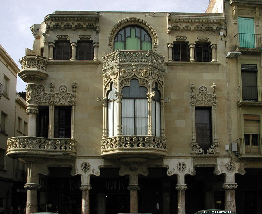
Casa Navàs
Reus
Casa Navàs, in the heart of Reus, Catalonia, is one of the city's most significant works of Catalan Modernista architecture from the early twentieth century. What is this building? Casa Navàs stands on Plaça del Mercadal, the main square of Reus. It was designed by Lluís Domènech i Montaner, one of the leading architects of Catalan modernisme, also known for the Palau de la Música Catalana and the Hospital de Sant Pau in Barcelona. Construction ran from 1901 to 1908, commissioned by Joaquim Navàs Padró, a local businessman from Reus. Casa Navàs is today registered as a cultural property of the city of Reus, reflecting its recognized heritage value. How do you get there? Casa Navàs sits right in the historic centre of Reus, directly on Plaça del Mercadal, one of the city's clearest landmarks. Because of this central location, the building is within easy walking distance of the rest of the old town's sights, making it a natural stop on any walk through Reus. Reus is also the birthplace of architect Antoni Gaudí, so many visitors combine a stop at Casa Navàs with a look at the city's other modernista buildings. What will you see? Casa Navàs was built as a private townhouse for a wealthy merchant family rather than as a public or religious building, which sets it apart from many other modernista landmarks open to visitors. Its listing as a cultural property underlines how important the house is considered within the city's architectural heritage, and it is regularly cited as one of the most significant modernista buildings in Reus. Because access to the interior is not always unrestricted, it is worth checking current visiting arrangements on site or at the local tourist information office before you go. When should you visit? According to available opening-hours data, the building can be visited Monday to Friday from 11:00 to 18:00, Saturday from 11:00 to 19:00, and Sunday from 11:00 to 14:00. These hours can change with the season or around special events, so it is worth confirming the current schedule directly with the site operator or Reus's tourist information centre before planning your visit. Frequently Asked Questions Who designed Casa Navàs? It was designed by Lluís Domènech i Montaner, one of the foremost architects of Catalan modernisme, also responsible for the Palau de la Música Catalana in Barcelona. When was Casa Navàs built? It was built between 1901 and 1908, commissioned by Joaquim Navàs Padró, a businessman from Reus. Where is Casa Navàs located? The building stands on Plaça del Mercadal, the main square in the centre of Reus, Catalonia, Spain. What are the opening hours of Casa Navàs? Based on available data: Monday to Friday 11:00–18:00, Saturday 11:00–19:00, Sunday 11:00–14:00 — it is worth confirming these before your visit, as hours can change.
-
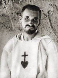
Charles de Foucauld
Bani Abbas
The Charles de Foucauld hermitage site in Bani Abbès marks the place where a French monk and hermit first settled at the edge of the Sahara among the Tuareg people, at the turn of the 20th century. It was here, in a small oasis along the Saoura wadi, that his solitary religious life on Algerian soil began, before he moved further south to Tamanrasset, where he died in 1916. Who was Charles de Foucauld? Charles de Foucauld was born into an aristocratic family and spent the early part of his life as a soldier, serving in campaigns across North Africa. A growing fascination with the desert and its people, followed by a profound religious conversion, led him to join the Trappist order. He later left monastic life behind for an even stricter, solitary existence as a hermit-priest, choosing to live among the Tuareg and learn their language and customs. His first hermitage on Saharan Algerian ground rose here, in Bani Abbès. Why Bani Abbès? Bani Abbès sat along a caravan route and was one of the few permanent settlements in this stretch of the Sahara, making it a practical base for a contemplative life close to local people yet still within reach of the French colonial administration. Foucauld wanted to live in poverty and prayer while remaining open to contact with the oasis community — both Muslim residents and the small number of Christians passing through the region. What happened to him afterward? After his years in Bani Abbès and further travels deeper into the Sahara, Foucauld eventually settled in the Hoggar mountains, in Tamanrasset, where he continued his hermitic mission and studied Tuareg language and culture. He was killed there in 1916, murdered during a raid amid the unrest of the First World War. His writings and way of life went on to inspire several later religious communities, including the Little Brothers and Little Sisters of Jesus. In 2022, the Catholic Church declared him a saint. What should visitors know about this place? Bani Abbès remains a reference point today for anyone interested in Foucauld's story and spirituality — it is where his Saharan journey began, before he became better known as the hermit of Tamanrasset. It's worth keeping in mind that this is primarily a site of historical and spiritual significance rather than a conventional tourist attraction with built-up infrastructure; visitors should approach it with the respect due to a place tied to religious life and the oasis's local history. Frequently Asked Questions Who was Charles de Foucauld, and why does he matter to Bani Abbès? He was a French monk and hermit who chose Bani Abbès as the first stop in the Saharan chapter of his religious life, before relocating to Tamanrasset, where he died in 1916. Was Foucauld canonized as a saint? Yes — the Catholic Church canonized him in 2022, following decades of recognition of his life and writings as a model of holiness. Is Bani Abbès a major pilgrimage destination? It is primarily a historical waypoint in his life story — less prominent than Tamanrasset, but significant as the place where his Saharan hermitic path began. How are the Little Brothers and Little Sisters of Jesus connected to this place? These religious communities were founded after Foucauld's death, drawing inspiration from his writings and his way of living close to the poor and to local communities — a practice that took root during his time in Bani Abbès.
-
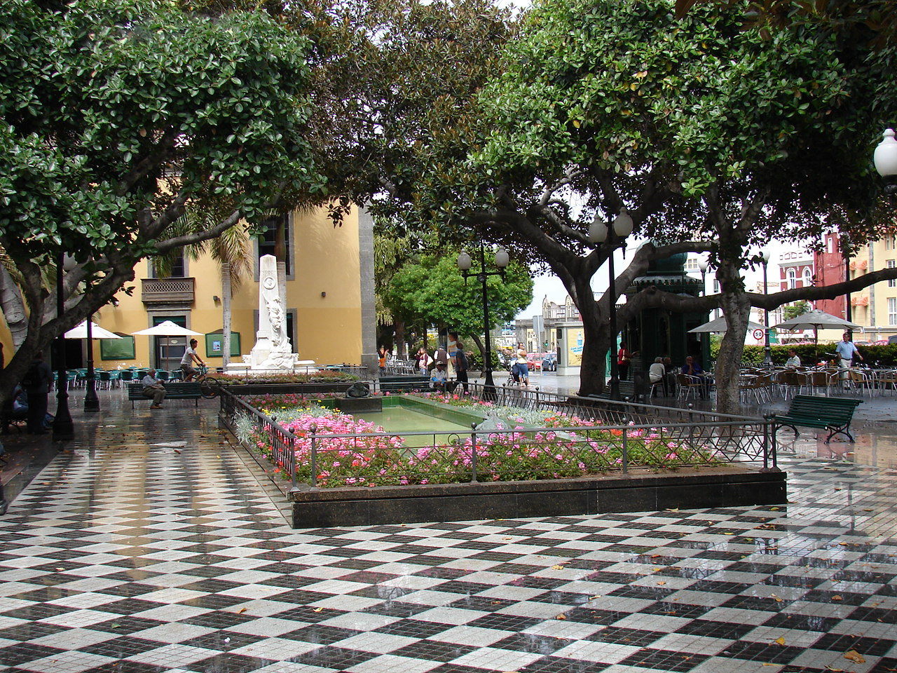
Plaza Hurtado de Mendoza
Las Palmas na wyspie Gran Canaria
Plaza Hurtado de Mendoza is a small but distinctive square in Las Palmas de Gran Canaria, sitting right on the boundary between two of the city's historic districts, Triana and Vegueta. Locals rarely use its official name at all, calling it simply "Plaza de las Ranas" — Frog Square — after the frog ornaments on the fountain at its centre. Where does the name come from? The square hasn't always carried its current name. It was originally known as Plaza de la Democracia before being renamed in honour of Ambrosio Hurtado de Mendoza Pérez (1850–1922), who served as mayor of Las Palmas from 1903 to 1908. In 1922, shortly after his death, a monument by the sculptor Neri was erected here: a female figure alongside a medallion bearing a relief portrait of the former mayor, commemorating his contribution to the city. What will you see there? The centrepiece is the Fuente de las Ranas, a fountain decorated with frog figures that gave the square its popular nickname and remains its most photographed feature. Right beside the square stands the neoclassical building of the Biblioteca Insular, the island library, which also functions as a cultural centre. The surrounding architecture, typical of this border strip between Triana and Vegueta, has a distinctly Canarian, colonial-era character worth pausing for. How do you get to Plaza Hurtado de Mendoza? The square sits right in the historic heart of Las Palmas, within easy walking distance of Vegueta's main landmarks, including Santa Ana Cathedral and the Casa de Colón. The most enjoyable way to arrive is on foot, walking through the old town from Vegueta toward Triana — a route that takes in most of this part of the city's key sights along the way. The area is well served by city bus lines connecting to central Las Palmas, and the square itself sits close to the main pedestrian routes linking the two historic districts. When is the best time to visit? The square has activity year-round, but it comes most alive during the local markets and cultural events held here regularly, which give the area an extra dose of energy. It's worth checking the local events calendar before visiting, since market days turn the square into a genuine gathering spot for residents — a far richer experience than a simple sightseeing stop. Morning or late-afternoon hours, when the sun isn't at its harshest, are ideal for a relaxed look at the fountain and the surrounding buildings. Who is this square for? Plaza Hurtado de Mendoza suits travellers exploring the historic centre of Las Palmas who want something beyond the headline sights. It fits neatly into a walking route between Vegueta and Triana, offering a glimpse of a more local, less touristy corner of the city — where a fountain, a century-old monument, and a neighbouring library combine into a quiet, characterful pocket right in the heart of the island capital. Frequently asked questions Why is the square called "Frog Square"? The nickname "Plaza de las Ranas" comes from the frog figures decorating the fountain at the centre of the square — the most recognisable feature of the place. Who was Hurtado de Mendoza? Ambrosio Hurtado de Mendoza Pérez was mayor of Las Palmas from 1903 to 1908. The square was renamed in his honour in 1922, when a monument bearing his portrait was installed. What else is worth seeing nearby? Right next to the square stands the neoclassical Biblioteca Insular building, and a short walk takes you to Vegueta's main landmarks, including Santa Ana Cathedral. Does the square host any events? Yes, it regularly hosts local markets and cultural events that bring extra life to this part of the city, drawing both residents and visitors.
-
Ordes - A Pontraga train station
Ordes
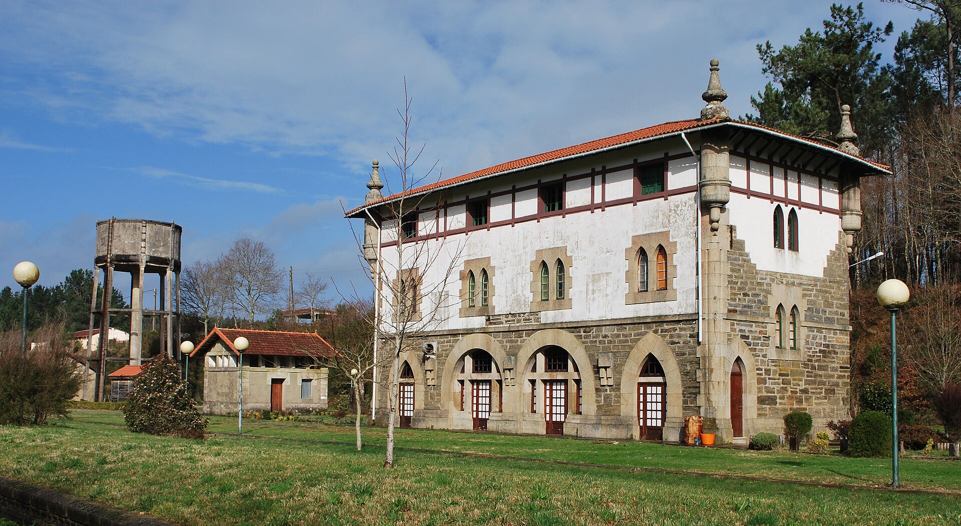
Ordes - A Pontraga train station is a disused railway station in the municipality of Ordes, in Galicia, now converted into a recreational area along a walking and cycling greenway. Where exactly is the station? The building stands away from the center of Ordes, in the parish of Parada, at a spot known as A Estación. This is the very place where the Lengüelle river marks the boundary between the municipalities of Ordes and Tordoia, so the station has always sat right on the edge between the two. Its coordinates are roughly 43.0536 N, 8.4469 W. What is the history behind this place? The station was built in 1943 as part of the railway line linking Zamora with A Coruña. The station building was designed by architect Ramón Cortázar de Urruzola (1867-1945), who modeled it on the station at Azpeitia in the Basque province of Gipuzkoa — a building that today houses a Railway Museum. The old Ordes-Pontraga station served travelers for more than six decades until 2005, when a new station opened on the same line and took over passenger traffic. The original building then lost its function as an active stop. What can you see there today? The main passenger building has not been fully restored and still awaits a renovation project, but the grounds around it were converted in 2008 into an open recreational area, free for locals and visitors to enjoy. The station sits along the Vía Verde de Compostela-Tambre-Lenguelle, a walking and cycling route laid out on the old railway embankment through the Lengüelle river valley. It makes for a quiet stop for a walk or bike ride, with views of the historic railway architecture set against Galicia's rural landscape. The building itself is worth a closer look — its resemblance to the Azpeitia station gives it a genuine architectural value rarely found in such a small station. The whole complex — two plots of land and several buildings covering nearly 30,000 square meters in total — was recently and formally handed over to the Ordes municipality by ADIF, Spain's rail infrastructure manager. That transfer opens the door to further restoration of the site as local heritage. When is the best time to visit? Given its recreational, walking-and-cycling character, spring and autumn are the most comfortable seasons, when Galician temperatures suit longer walks or rides along the Lengüelle valley. In summer, the surrounding greenery and the shade of trees along the old track bed make it a pleasant stop during a longer outing on the Vía Verde. There are no fixed opening hours like at a ticketed attraction — it is an open public space, accessible all year round. How do you get there? The easiest way to reach it is by car or bicycle — the station sits directly on the Vía Verde route, so it can be worked in as a stop on a longer bike ride connecting the Ordes area with the Tambre river valley. For walkers and cyclists it acts as a natural landmark on the trail, easy to spot thanks to its distinctive station building. Frequently asked questions Does the Ordes - A Pontraga station still serve trains? No. The station stopped passenger service once the new station opened in 2005, and today it functions purely as a recreational site. What is there to see at this location? The historic 1943 station building, modeled on the Azpeitia station, and the recreational grounds around it along the Vía Verde de Compostela-Tambre-Lenguelle route. Can you visit by bicycle? Yes, the station is a stop along the walking and cycling route built on the old railway embankment beside the Lengüelle river. Who owns the site today? The land and buildings were recently transferred to the municipality of Ordes by ADIF, Spain's rail infrastructure manager.
-
Alameda de Alfonso XI
San Roque
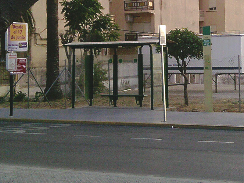
Alameda de Alfonso XI is the main square and municipal park of San Roque, a small town in the province of Cádiz in Andalusia, sitting at the top of the hill on which the town's historic center grew. Where exactly is it? The Alameda sits right in the heart of San Roque, about 300 meters west of the Church of Santa María la Coronada, the town's main parish church. Several pedestrian routes connecting the surrounding neighborhoods converge here, which has long made the square a natural meeting point for locals. For anyone exploring the old town, it's an essential stop — both for its central position and for what's actually on site. What will you see there? The square itself is an elongated rectangle roughly 160 by 70 meters, laid out on a west-east axis and entirely reserved for pedestrians. At its geometric center stands a circular fountain, around which the space is divided into four rectangular green sectors. Each one is planted with poplar trees — about 250 in total — and each sector also has its own small kiosk. In summer the dense canopy provides welcome shade, making this one of the cooler corners of town. Right beside the square stands the Teatro Juan Luis Galiardo, the only theater in the entire Campo de Gibraltar region, so it functions as an important cultural venue for the whole area, not just a local curiosity. Next to it is the traditional Cruz Blanca bar, a popular spot for coffee or a beer under the trees, and there's a children's playground for families. In recent years the paving — damaged by the roots of the trees growing here — has been renovated, with the work also updating the electrical wiring and stormwater drainage system. Where does the name come from? The name honors King Alfonso XI of Castile, who died in 1350 during the siege of Gibraltar — killed by plague before he could retake the Rock from its Muslim rulers. The square itself came much later, laid out in 1831 on what had been vacant ground between the town center and the surrounding buildings. The current name, tying the site to the medieval king, was only officially given in the 1970s. When is the best time to visit? The Alameda is open year-round, but it's most pleasant to walk through in spring and autumn, when temperatures in the Cádiz region are mild and the poplar shade isn't yet a necessity the way it is in the height of summer. In the evenings the square comes alive — locals stroll through, children play near the fountain, and the café tables fill up. It's also worth checking the program at Teatro Juan Luis Galiardo in case there's a show on during your visit. Frequently asked questions Is Alameda de Alfonso XI a square or a park? It's something in between — a pedestrian town square densely planted with trees, complete with a fountain, kiosks, and shaded walkways, making it both a civic square and a pleasant park for a stroll. How long does it take to see? Walking the square itself takes 15–20 minutes, but plan for half an hour to an hour if you want to stop for coffee at Cruz Blanca or rest in the shade. Is it suitable for children? Yes, there's a playground on site, and the open, safe space around the fountain is easy for younger kids to enjoy as well. What else is worth seeing nearby? The Church of Santa María la Coronada, about 300 meters away, and the Teatro Juan Luis Galiardo itself, worth a look for its architecture or if a cultural event happens to be running.
-
Parque de Cuatro Vientos
San Roque
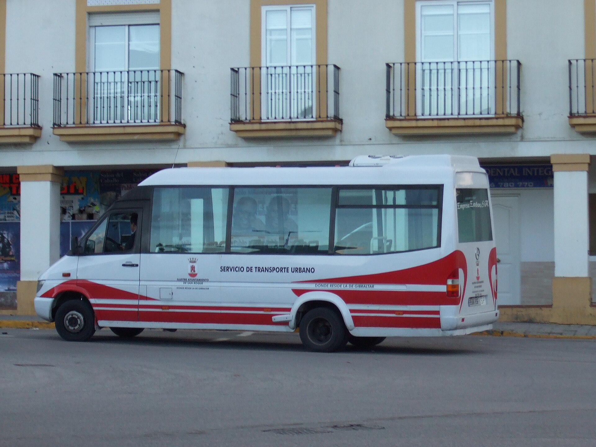
Parque de Cuatro Vientos is a municipal park at the eastern entrance to the town of San Roque, in the province of Cadiz, Andalusia. It functions both as a recreational green space for residents and as a key transport hub, since the surrounding stop is one of the busiest for urban and intercity buses serving San Roque and the wider Campo de Gibraltar area. How do you get there? The park sits right where the main road enters San Roque from the east, making it easy to reach by car or public transport. The Cuatro Vientos bus stop is one of the town's principal connection points, used by both local city routes and buses linking San Roque with neighboring municipalities. Parking is available next to the park, including spaces adapted for wheelchair users. What will you see? The park's best-known landmark is a stone column topped with a lion sculpture, created by Cristóbal Quesada. The monument honors the people of San Roque who died during the sieges of Gibraltar, and over the years it has become one of the town's most recognizable symbols, often photographed by visitors passing through. The park is laid out in zones for different age groups. A recently renovated children's playground offers slides, swings, and a safety surface — the site was actually used as a pilot project to test a new type of playground flooring for the town. Next to it is a seniors' fitness park with thirteen exercise stations set on artificial turf, designed as a dedicated space for older residents to stay active. The grounds are wheelchair accessible, dog-friendly, and equipped with picnic tables for longer visits. Around the park's plaza stand the municipal youth office and a Guardia Civil barracks. Nearby are also the municipal cemetery with its funeral home and the Gaviota tennis club — together these neighboring facilities make the area a genuine hub of everyday life in San Roque, well beyond its role as a simple green space. When should you visit? The park can be visited year-round, but given the Andalusian climate, spring and autumn bring the most comfortable conditions for a walk or a rest outdoors, with milder temperatures than the height of summer. Families tend to show up in the afternoons and on weekends, when the playground and the seniors' exercise area are busiest. Thanks to its location at a major bus stop, the park also works well as a reference point when planning onward trips around Campo de Gibraltar, including to nearby Gibraltar itself. Frequently asked questions What does the monument in the park represent? A column topped with a lion sculpture by Cristóbal Quesada, commemorating the people of San Roque who died during the sieges of Gibraltar. It has since become an informal symbol of the town. Is the park suitable for children and seniors? Yes — it has a renovated playground with swings and slides for children, plus a separate area with thirteen fitness stations designed for older residents. How can you reach the park without a car? Cuatro Vientos is one of San Roque's main bus stops, served by both local city routes and intercity buses across the Campo de Gibraltar region. Can you bring a dog or visit in a wheelchair? Yes, the grounds are adapted for wheelchair access, including nearby parking, and dogs are allowed.
-
Parque de la Memoria of Sartaguda
Sartaguda
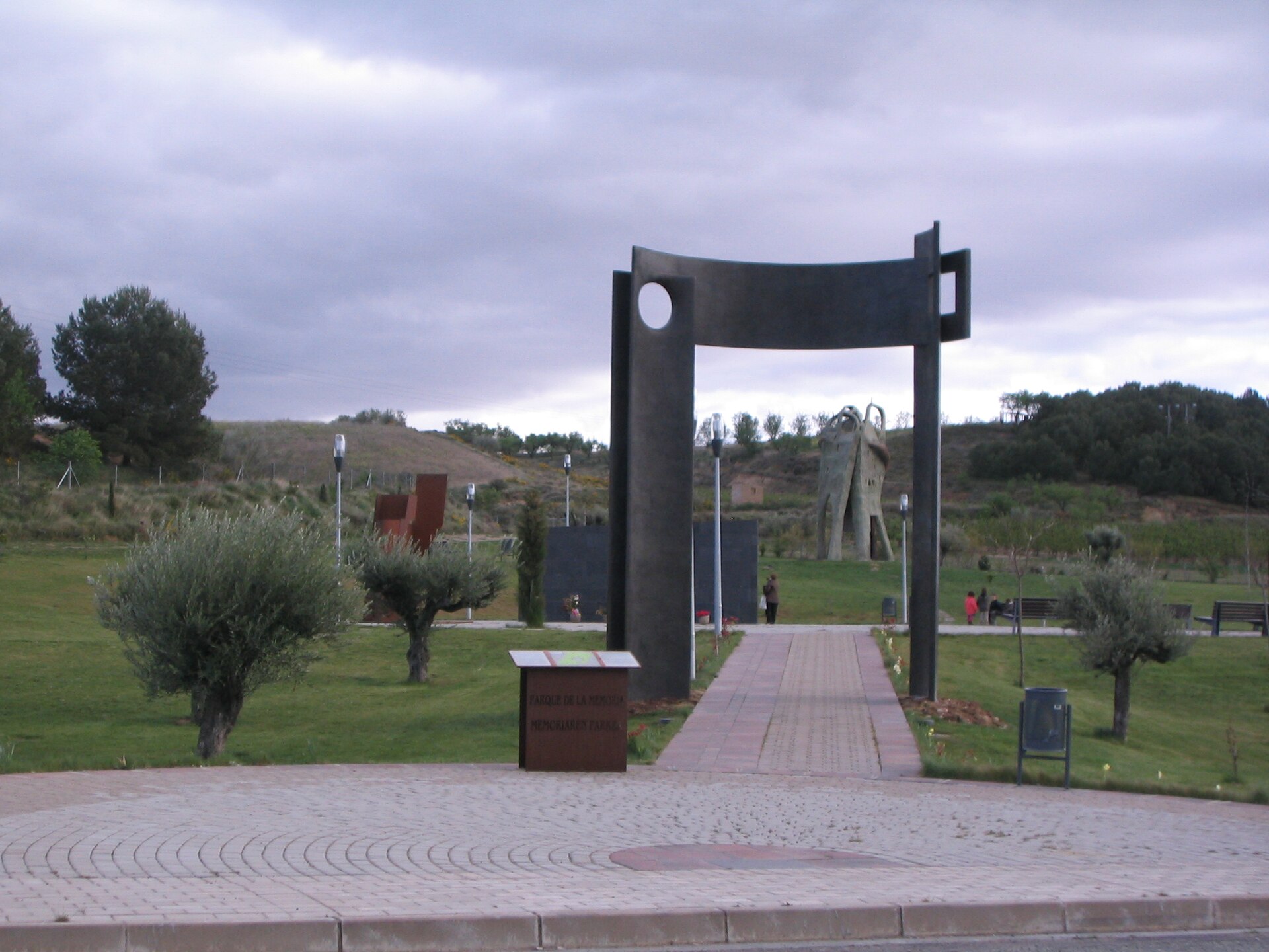
Parque de la Memoria is Navarre's principal memorial to the victims of the Spanish Civil War, located in the town of Sartaguda on the banks of the Ebro river. The park stands in a place that became, for the entire region, a symbol of the repression carried out by Francoist forces after the military coup of July 18, 1936 — the very reason Sartaguda is still known today as "the village of widows." What will you see there? The centerpiece of the park is a long memorial wall inscribed with the names of more than 3,400 people murdered across Navarre in the early months of the civil war. It was the first monument of its kind dedicated to the victims of Francoist repression anywhere in Spain, which alone makes it a singular site on the country's memorial map. Covering over 6,000 square meters, the park is more than just a wall of names. It also houses three distinct sculptures, each by a different artist: "Atariaren Besarkada" by José Ramón Anda, "Los Acribillados de la Santa Cruzada" by Joxe Ulibarrena, and "Como Hoz Atávica y Mortal" by Néstor Basterretxea. Each piece approaches the themes of suffering, loss, and memory differently — ranging from abstract forms to direct references to the executions themselves. Why did Sartaguda suffer so heavily? Sartaguda was one of the towns hit hardest by the repression that followed the outbreak of the civil war. So many of its men were shot that for decades the town was remembered as a place where almost every family had lost a father, husband, or son. The park exists precisely so that this memory would not fade as the generation of direct witnesses passed away. When was the park created, and by whom? The park was formally inaugurated on May 10, 2008, in a ceremony attended by thousands of people, including many relatives of the victims. The initiative came from local associations — the Asociación Pueblo de las Viudas de Sartaguda and the Asociación de Familiares de Fusilados de Navarra (AFFNA36) — which had campaigned for years for a dignified memorial to the victims of repression across all of Navarre, not just Sartaguda itself. How do you get there, and when should you visit? Sartaguda sits in central Navarre, in the Ebro valley, close to towns such as Lodosa and Andosilla, which makes it easy to combine a visit with other stops in the area. The most convenient way to arrive is by car — the park occupies open, easily accessible municipal land. Admission is free and the park is open year-round; it is best visited on a quiet day, allowing time to read the names on the wall and take in each sculpture individually. This is a place that calls for reflection rather than a rushed visit. Keep in mind that this is a site of memory, not a conventional tourist attraction — visitors should approach it with the seriousness a memorial to victims of atrocity deserves. Frequently asked questions How many names appear on the memorial wall? The central wall bears the names of more than 3,400 people killed in Navarre after July 1936. Who created the sculptures in the park? The park holds three works, by José Ramón Anda, Joxe Ulibarrena, and Néstor Basterretxea, each addressing repression and loss in a different artistic style. Why is Sartaguda known as "the village of widows"? Because of the exceptionally high number of men from the town who were executed during the Francoist repression at the start of the civil war. Is admission to the park free? Yes, the park is open to the public at no charge and can be visited independently at any time of year.
-
Praza de Pontevedra
A Coruña
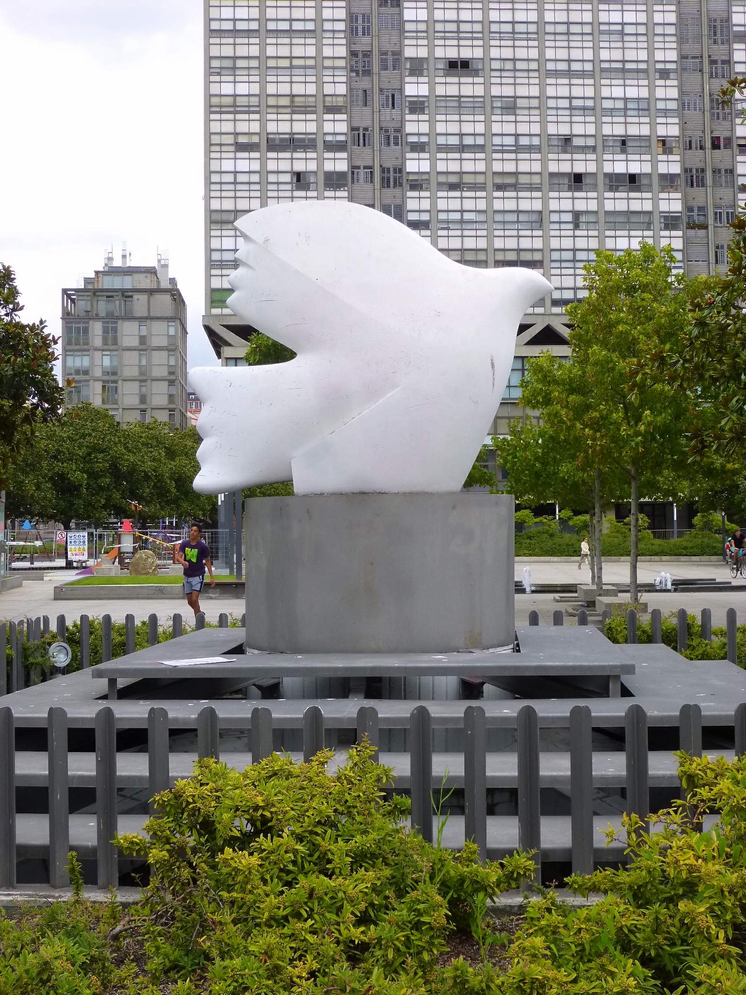
Plaza de Pontevedra is one of the busiest and most recognizable squares in A Coruña, a spot that locals, students and visitors cross daily on their way between the old town and Riazor beach. Where does the name come from and what's its history? The square dates back to the late 19th century, when A Coruña grew beyond its medieval walls during the urban expansion known as the Ensanche. Plaza de Pontevedra marked the starting point of this newer, more spacious part of the city, acting as a kind of gateway between the old town and modern A Coruña. Over time it turned into a natural transport hub, linking the city's main thoroughfares. What's the connection to Picasso? Pablo Picasso spent several childhood years in A Coruña, and the former Fine Arts school and institute where he studied stand right next to the square. In tribute to this link, a sculpture of a peace dove sits on the plaza — a nod to the artist whose formative years in the city later shaped his work. What will you see there? Today Plaza de Pontevedra is an open, flat public space built for walking through and meeting up. A major 2009 renovation reshaped the area: what used to be an informal skateboarding spot became an organized plaza with water jets that shoot straight up from the pavement. Kids love cooling off there on hot days, and in the evening the jets are lit up for an eye-catching effect. The square is framed by typical A Coruña buildings with glazed galleries (galerías), and cafés and small eateries line the surrounding streets. How do you get to Plaza de Pontevedra? The square sits right in the city center, an easy walk from A Coruña San Cristóbal train station and from the main bus stops — nearly every city bus line passes nearby. Thanks to its central location, it works well as a starting point for further sightseeing, with the old town (Ciudad Vieja) on one side and the Riazor beach promenade on the other. When is the best time to visit? The square is lively year-round, but spring and summer bring the most activity, when the fountains run and nearby cafés set out outdoor seating. It's also a regular meeting point for students from the nearby university faculties, so there's steady foot traffic throughout the day. After dark, the lit-up fountains and surrounding buildings give the square a calmer, more intimate feel. Frequently asked questions Is Plaza de Pontevedra a market square? No, it's an open public square used mainly for transit and gathering — there's no permanent market here, though it occasionally hosts events. Is there an entrance fee? No, it's a public open space, accessible at any time free of charge. What does the peace dove sculpture commemorate? It references Pablo Picasso's ties to A Coruña, where he spent part of his childhood and studied at the nearby fine arts school. How much time should you plan for a visit? The square itself only takes a few minutes to walk through — it's best treated as a stop on the way to the old town or Riazor beach rather than a destination in its own right.
-
Parque Güell y Martos
Comillas
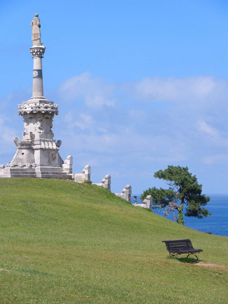
Parque Güell y Martos is a green hillside park in the upper part of Comillas, the Cantabrian seaside town famous for its Catalan modernist landmarks. Perched above the town centre, it works both as a memorial garden and as an everyday recreation spot for locals. Where does the park's name come from? The official name honours Juan Alfonso Güell y Martos, the 4th Marquess of Comillas — a plaque naming him was only added at the entrance in 1970, during a renovation that also brought in a children's play area. In practice, though, locals rarely use that formal name. Around town it is simply known as "parque de la Estatua" (Park of the Statue), after the large monument standing on the hill at its centre, dedicated to Antonio López y López, the 1st Marquess of Comillas, an industrialist and patron who died in 1883. How was the park built, and who designed it? Following the marquess's death, the town wanted a lasting way to honour a man who had shaped Comillas' development. A friend of the marquess donated the plot needed for the monument, a piece of land known as the Prado de Ángel Bernardo Pérez, and it was on this same ground that the wider park later took shape around the statue. The design follows the principles of Catalan modernisme and is credited to architect Lluís Domènech i Montaner, one of the movement's leading figures, with construction overseen by engineer Cristóbal Cascante. The monument itself was unveiled in 1890, a date generally taken as the starting point of the park in its recognisable form. What will you find inside? Today the park covers roughly three hectares, smaller than its original footprint: part of the northern slope was separated off for summer villas, and a section of the eastern plot was later absorbed into a neighbouring property. Despite these changes, the layout of paths, planting and architectural details still reflects the modernist style seen elsewhere in Comillas, at landmarks such as the El Capricho villa or the nearby palace. The statue on its hilltop remains the focal point, with views opening up over the town below. Alongside this formal core sits a more relaxed recreational area with a children's playground, added during a 1970s renovation. How do you get there? The park sits in the higher part of Comillas, within an easy walk of the town centre and its best-known sights — the El Capricho villa, the marquesses' palace and the pontifical university. Walking up from the town square is the simplest approach; there is no dedicated car park right at the entrance, so it makes sense to leave a car in the centre and continue on foot. Entry is free, with none of the fixed opening hours you'd find at a ticketed attraction. When is the best time to visit? Because it is an open green space rather than an indoor site with set visiting hours, the park works well year-round. In summer, when Comillas fills up with visitors, it tends to stay quieter than the main monuments, making it a good spot to rest between sightseeing stops. Its elevated position also makes it a pleasant place to pause for the view, particularly in the late afternoon light. Frequently asked questions Is there an entrance fee? No, Parque Güell y Martos is a public town park and entry is free. Why is it sometimes called the "Güell park"? The name refers to the Comillas marquess family, specifically Juan Alfonso Güell y Martos, the 4th Marquess, whose name was formally given to the park in 1970 — even though the site had already existed since 1890 around the monument to the 1st Marquess. Who is the statue in the middle of the park dedicated to? It honours Antonio López y López, the 1st Marquess of Comillas, unveiled in 1890 as a tribute from the town to his contribution to its development. Is the park suitable for children? Yes, a 1970s renovation added a recreational area with a playground, which sits alongside the older, more formal part of the park.
-
Europako Herrien parkea
Guernica
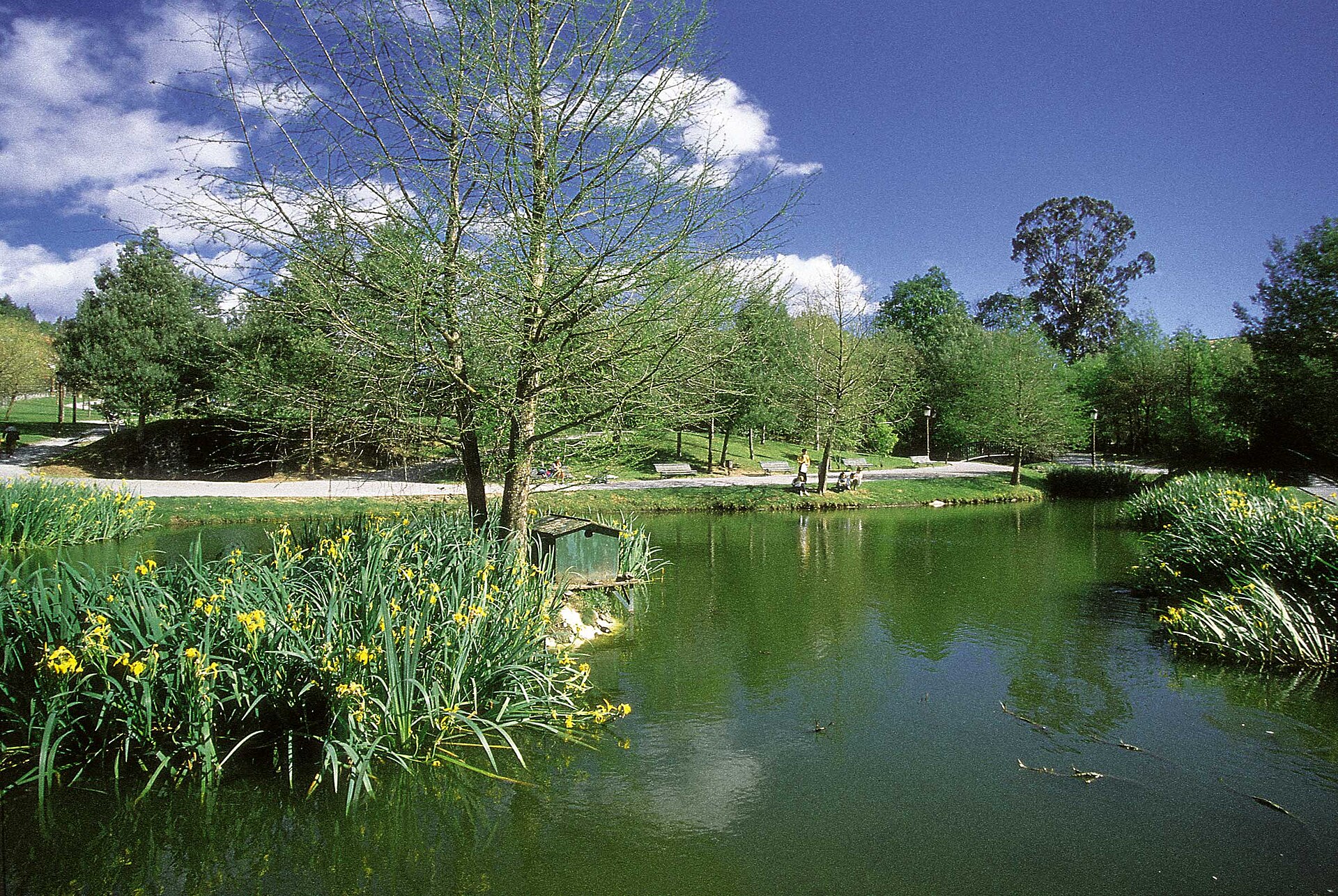
Europako Herrien Parkea (Park of the Peoples of Europe) is a city park in Guernica (Gernika), sitting directly opposite the historic Casa de Juntas — the assembly house of Biscay — right in the town centre and just a short walk from the famous Gernika Tree. It's a spot where a quiet stroll meets first-rate modern sculpture. What will you see in the park? The park's centrepiece is a pair of monumental sculptures. The first is "Gure Aitaren Etxea" ("Our Father's House") by Basque sculptor Eduardo Chillida — a nearly 8-metre-tall work unveiled in April 1988. The second is "Large Figure in a Shelter" by English sculptor Henry Moore, installed in the park in 1990. Both pieces arrived before the park itself was officially opened in 1991. The park's landscaping was designed to echo the variety of the Atlantic coast of the Basque Country. Four distinct ecosystems are represented here: a patch of oak forest, a hazel grove, scrubland vegetation, and riverside vegetation. Add to that mature oaks, beech trees, and holm oaks, plus a small pond where locals and visitors alike like to sit and unwind. How do you get there? The park sits right in the centre of Guernica, immediately next to Casa de Juntas, the historic seat of the Biscay assemblies. From Gernika-Lumo train station it's only a few minutes on foot. The location makes it easy to combine with other sights in town, since both the Gernika Tree and the town's history museum are within a few hundred metres. When should you visit? The park is open year-round, free to enter, and accessible at any time. Spring and summer show off the different vegetation zones at their greenest, while autumn brings out the colour in the deciduous trees. It works equally well as a brief stop between sightseeing spots or as a longer break — you can sit on a bench, go for a run, or let children play on the open lawns. Who is it for? Europako Herrien Parkea appeals to fans of modern sculpture thanks to the Chillida and Moore works, but it's just as good for anyone looking for a breather from exploring central Guernica. Families with children will also find it welcoming, with its open lawns and relaxed atmosphere. Frequently asked questions Is entry to the park free? Yes, the park is open to the public and free to visit at any time of day. Which sculptures can you see in the park? The two main works are "Gure Aitaren Etxea" by Eduardo Chillida, from 1988, and "Large Figure in a Shelter" by Henry Moore, from 1990. How long does a visit take? Walking the park and viewing both sculptures usually takes between 20 and 40 minutes, depending on your pace. Can the park be combined with other Guernica sights? Yes, it borders Casa de Juntas directly and sits close to the Gernika Tree, making it easy to fold into a longer walk around the town centre.
-
Turó d'en Caritg
Badalona
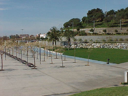
Turó d'en Caritg is a hilltop park in Badalona, popularly known as Parc dels Canons, and it delivers one of the best panoramic viewpoints near Barcelona. What will you see? The hill rises above the neighborhoods of Badalona and holds a park of roughly 6.1 hectares. The main draw is a set of three viewpoints built on former casemates — remnants of old defensive fortifications that were preserved as lookout terraces rather than demolished. From here the view stretches well beyond Badalona itself: you can pick out the coastline, the silhouette of the Sagrada Família, the Mapfre towers, Montjuïc hill, and the Agbar Tower over in Barcelona. That combination makes Turó d'en Caritg a favorite both with locals out for a scenic walk and with visitors who want to see the Barcelona skyline from an angle different than the usual city-center lookouts. The park itself functions as a green pocket inside the urban fabric — one of Badalona's larger green spaces, with walking paths and shaded spots to rest under the trees. How to get there? The hill sits on Avinguda Salvador Espriu in Badalona, within easy reach of the city center. The simplest approach is local public transport (bus or train into Badalona, followed by a short uphill walk) or driving, since parking is available nearby. Entry to the park is free and the grounds stay open around the clock, which makes it a solid choice for either a morning outing or an evening walk timed to the sunset over the sea. A bit of history The land that now forms the park passed into municipal hands in 1986, when Badalona's local government purchased the hill with recreational use in mind. The park was built up in stages, taking its current shape between 1990 and 1999. The surviving casemates, now doing duty as viewing terraces, are a reminder of the hill's earlier defensive role — the origin of its popular nickname, "Parc dels Canons" (Park of the Cannons). When to visit? The hill is open year-round, but clear-sky days give the widest panoramas. Late afternoon and the hour before sunset are the most rewarding times to visit, as the light catches the coastline and the Barcelona skyline particularly well. In the warmer months it's worth bringing water, since some of the viewpoint terraces have little shade. Frequently asked questions Is entry to Turó d'en Caritg free? Yes, the park is completely free to enter and stays open 24 hours a day. What can you see from the viewpoints? The terraces overlook the Badalona coastline, the Sagrada Família, the Mapfre towers, Montjuïc, and the Agbar Tower in Barcelona. Where does the name Parc dels Canons come from? It refers to the hill's former defensive use — the preserved casemates that now serve as viewpoints are remnants of that earlier role. Can you reach it without a car? Yes, the hill is close to central Badalona and reachable on foot from local public transport stops.
-
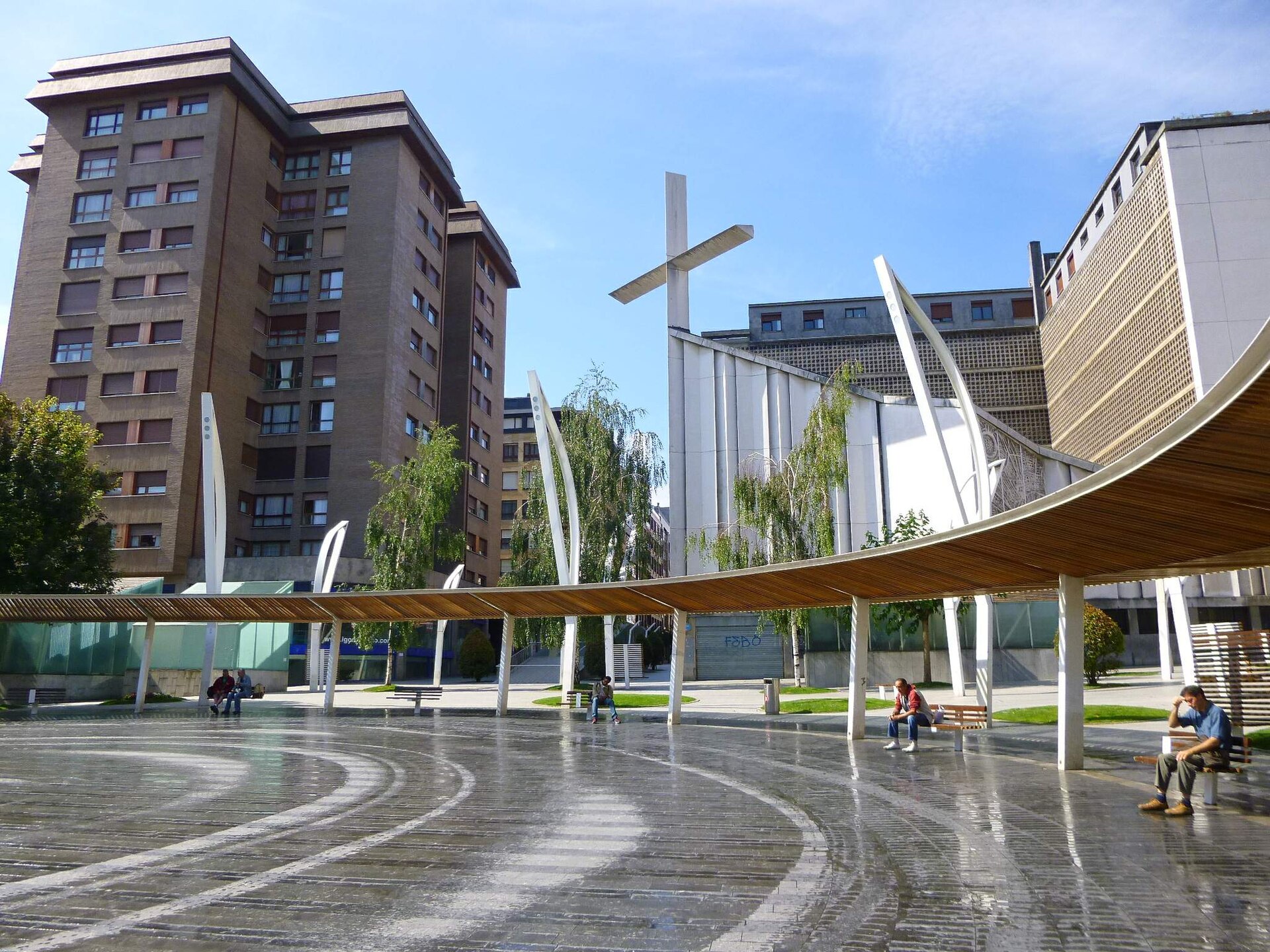
Plaza de Indautxu
Bilbao
Plaza de Indautxu is the central square of the Indautxu neighborhood in Bilbao, sitting where Alameda de Urquijo meets Gregorio de la Revilla and Aretxabaleta streets, in the Abando district. How do you get to Plaza de Indautxu? The easiest way is by metro: Indautxu station, served by lines L1 and L2, sits directly beneath the square under Alameda de Urquijo and has been running since November 11, 1995. One of its exits opens straight into a shopping arcade, so visitors step off the platform right into a lively retail area. The whole square is pedestrianized, and foot traffic stays steady throughout the day, making it one of the city's main shopping streets and a handy landmark for exploring the Ensanche district on foot. What is there to see on and around the square? The square's current look dates from 2006, when mayor Iñaki Azkuna officially inaugurated it on August 18 after a thorough avant-garde redesign. Its centerpiece is a 40-meter-diameter circle, ringed by modern streetlamps, roughly a hundred trees and contemporary street furniture, plus a children's play area covering nearly 300 square meters. The Nuestra Señora del Carmen church stands right on the square and is worth a quick look. A short walk away, at Aretxabaleta 6, stands one of Bilbao's most original buildings — raised in 1929 by architect Adolfo Gil and popularly nicknamed "La casa de los aldeanos" (the Villagers' House), decorated with reliefs referencing rural Basque life. What's the history behind this square? The square has existed in this basic form since 1927, when the area bounded by those same streets was laid out as a public garden space. The name Indautxu was officially recorded in Bilbao's street listings in 1945, though between 1940 and 1983 the square was actually called Plaza Adolfo G. de Careaga. A major renovation began in 1978, adding an underground car park, and by 2005 the entire square had become pedestrian-only — setting the stage for the large-scale modernization that gave it its current look the following year. When is the best time to visit? The square functions year-round as part of everyday local life — a place for walking, shopping and resting under the trees — so there's no strict tourist season here. It's most pleasant during the day, when the surrounding shops and the metro-station arcade are open, or in the evening, when the lighting and nearby cafés create a relaxed atmosphere. It pairs well with a walk through the Ensanche district or a visit to the Guggenheim Museum, which is only about a fifteen-minute walk away. Frequently asked questions Is Plaza de Indautxu a good starting point for exploring Bilbao? Yes — thanks to its metro station and central location, it's a convenient jumping-off point for the Ensanche district and the rest of the city's sights. Where does the square's name come from? It takes its name from the Indautxu neighborhood and was officially recorded in Bilbao's street listings in 1945, though from 1940 to 1983 it was known as Plaza Adolfo G. de Careaga. What's worth seeing near the square? The Nuestra Señora del Carmen church and "La casa de los aldeanos," a striking 1929 building at Aretxabaleta 6. Is there anything for children at the square? Yes, the 2006 renovation added a play area of nearly 300 square meters.
-
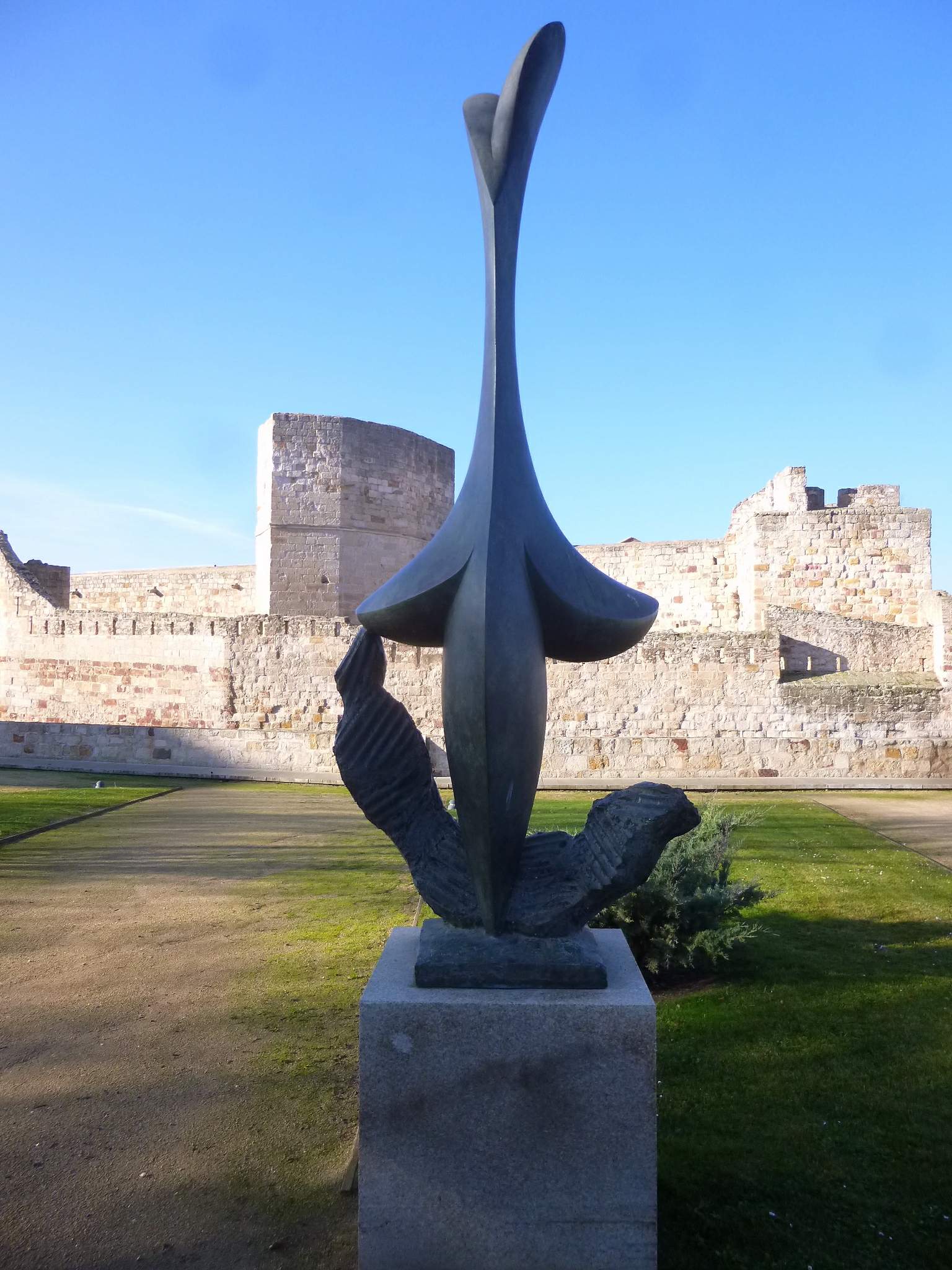
Jardines Escultor Baltasar Lobo
Zamora
Jardines Escultor Baltasar Lobo is a city garden in Zamora, spread along the slope beneath the castle, renamed in 2021 to honor the region's own sculptor Baltasar Lobo. Formerly known as the Jardines del Castillo (Castle Gardens), the space now works as a small open-air museum, where monumental sculptures by one of twentieth-century Spain's most significant artists stand among the pathways and greenery. How do you get there? The gardens sit right next to Zamora's castle, in the heart of the old town, so walking from the historic center is by far the easiest option — it's a short stroll from the cathedral or Plaza Mayor. The site forms part of a wider walking route dedicated to Lobo's work across the city, so it's worth treating the visit as one stop on a longer walk rather than a separate trip. What will you see in the gardens? The main draw is Baltasar Lobo's sculpture collection set among the plants — large, smoothly modeled forms exploring the female body from different angles: torsos, full-length figures, and compositions built around flowing, almost fluid shapes. Works on display include pieces titled "Stella," "Impulso," "Cara al viento," and "Al aire libre" — titles that reflect the sculptor's style, rooted in movement, lightness, and simplified, near-organic form. The garden itself, laid out on a slope against the castle walls, also opens onto views of the surrounding rooftops and the green ravine below, so a walk between the sculptures combines art with landscape. It's quieter and less crowded than Zamora's main squares, making it a pleasant spot for an unhurried walk with a camera. Who was Baltasar Lobo, and why do the gardens carry his name? Baltasar Lobo (1910–1993) was born in Cerecinos de Campos, close to Zamora. After the Spanish Civil War he went into exile and spent most of his life in Paris, working within the city's avant-garde sculpture circles. Despite the distance, he never broke his ties to his home region and to Zamora, a city he always wanted to return to. In recognition of that bond, the city renamed the former Castle Gardens in his honor in 2021 and installed a permanent display of his work there. The gardens are now part of a broader city route dedicated to the artist, which also includes Plaza Zorrilla and Parque León Felipe — other spots where his sculptures stand in public space. When is the best time to visit? The gardens are open year-round, free of charge, since it's a public outdoor space. Spring and autumn are the most comfortable seasons to walk through, when temperatures in Castilla y León are milder and the greenery is at its fullest. In summer, an early morning or evening visit is worth planning to avoid the heat typical of this part of Spain. Frequently asked questions Is entry to the gardens free? Yes, Jardines Escultor Baltasar Lobo is an open public space, and entry is free at any time of day. How long does a visit take? Walking through the gardens and viewing the sculptures usually takes 20–30 minutes, though it's worth combining with a stop at the nearby castle and cathedral. Is this the only place in Zamora with Baltasar Lobo's sculptures? No — his work can also be seen at Plaza Zorrilla and in Parque León Felipe, which together with these gardens form a route dedicated to the artist. Are the gardens suitable for children and older visitors? Yes, the area is easily walkable, though visitors should expect the mild changes in elevation typical of the slope running along the castle walls.
-
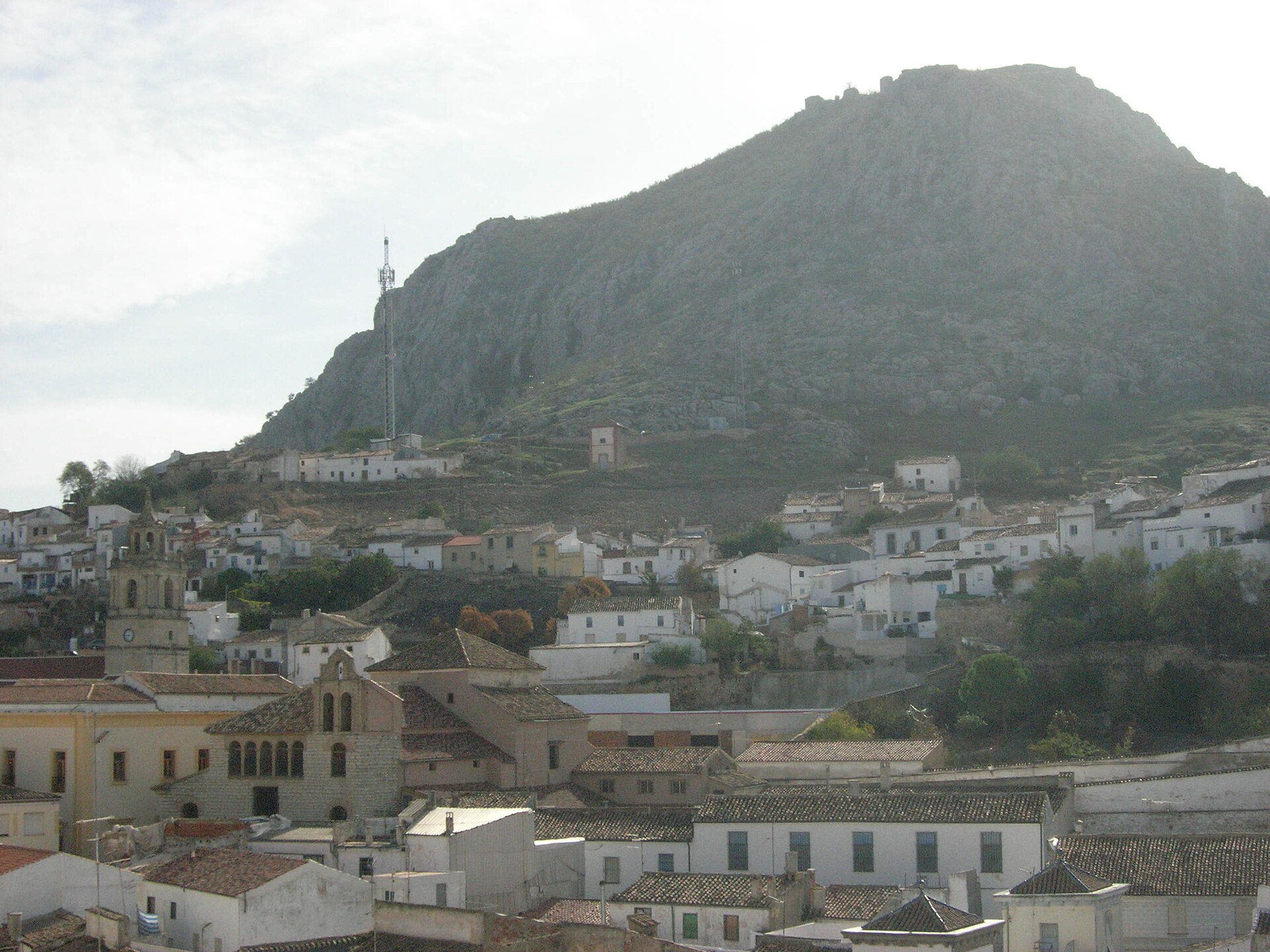
Peña de Martos
Martos
Peña de Martos is a rocky hill towering over the town of Martos in Jaén province, in Andalusia's Sierra Sur region. Its summit holds the ruins of a medieval castle, and the cliff edge offers one of the best views over some of the oldest olive groves in the entire province. What can you see on site? The main draw is the remains of the Castillo de la Peña, Martos's upper fortress, raised in the 14th century by the knights of the Order of Calatrava. They weren't building from scratch: the fortification sits on the site of an earlier Arab castle, which in turn was built over an older Ibero-Roman defensive structure. At its peak the Calatrava stronghold grew to include a keep (tower of homage), a chapel, a cistern, an oven, a mill, and a wine press — the standard toolkit of a self-sufficient frontier fortress. Most of these structures survive today only as ruins, but their layout still lets visitors trace the castle's original plan. The rock's history stretches far beyond the Middle Ages. Around the 6th century BC the hill already held an important Iberian oppidum, a settlement known as Tucci, mentioned by ancient geographers Ptolemy, Strabo, Mela, and Pliny. Around 14–15 BC, Emperor Augustus founded the Colonia Gemella Tucci here, settling veterans from the III Macedonica and X Gemina legions who had fought in the Cantabrian Wars. This layered past — Iberian, Roman, Muslim, and Christian — makes the rock one of the region's most significant historical sites. In 1226, control of Martos passed to Alvar Pérez de Castro, and the town became the seat of the Order of Calatrava's commandery in the Kingdom of Jaén, a role it held for centuries and one that drove the castle's later expansion and reinforcement. How do you get to Peña de Martos? The hill rises directly above the center of Martos, so walking up from town is the simplest approach — the path climbs steeply but doesn't require any special equipment. Martos itself sits in Jaén province, well connected by road to both the city of Jaén and Córdoba, making it an easy stop on a wider Andalusian itinerary. When is the best time to visit? Because the climb is steep and there's little shade along the way, spring and autumn bring the most comfortable temperatures. Andalusian summers can be brutally hot, especially at midday, so early morning or evening visits are worth planning — the low light also flatters the surrounding olive groves. What will you see from the viewpoint? From the edge of Peña de Martos, the view stretches over the town below and across a sea of olive trees covering the surrounding hills — one of the oldest olive-growing areas in Jaén province, a region regarded as one of the world's largest olive oil producers. Frequently asked questions Can you visit the castle on Peña de Martos? Yes, the ruins are open to explore, though the site is a historical remnant rather than a restored castle — walking along the walls and the keep still gives a clear sense of the fortress's original scale. How long does the climb and visit take? Given the steep approach, plan on one to two hours for the climb and visit, depending on your pace and how often you stop to take in the views. What's the difference between Castillo de la Peña and Castillo de la Villa? These are two separate fortresses in Martos: the upper one (de la Peña), on the rock's summit, and the lower one (de la Villa), closer to the town center. Both were declared historical monuments in 1985. Is the site suitable for children? The steep, uneven path and unguarded cliff edges call for extra caution with young children; older kids generally manage the climb without difficulty.
-
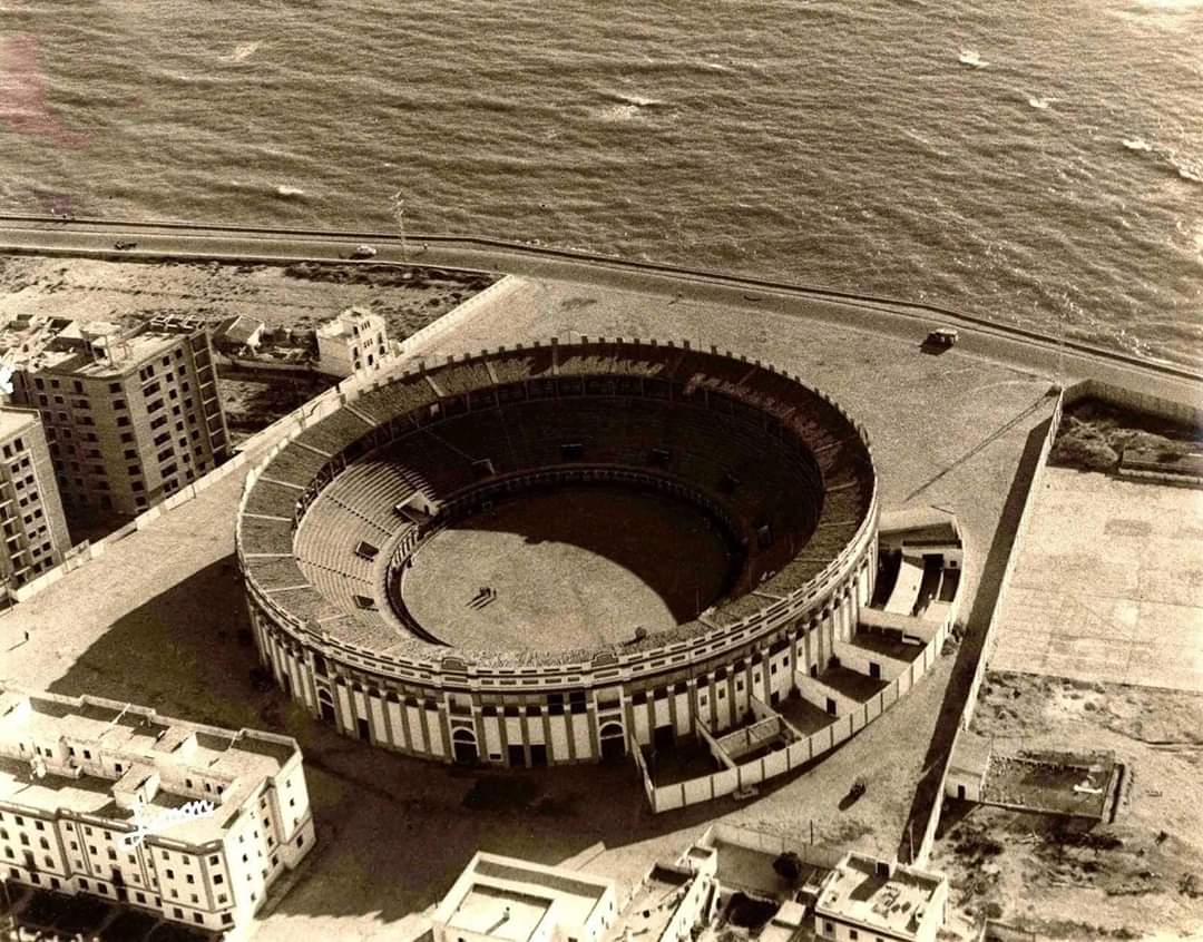
Plaza de Asdrúbal
Kadyks
Plaza de Asdrúbal is a green square in Cádiz, tucked into a residential seafront district of the city and valued by locals as an everyday spot to relax outdoors. Where is it and how do you get there? The square sits in the coastal part of Cádiz, close to Cortadura beach, within walking distance or a short city bus ride from the historic centre. It covers roughly 6,680 square metres (about 1.5 acres), making it one of the larger green spaces in this part of town. Its position near the ocean means the paths open onto wide Atlantic views, with a sea breeze that makes the square pleasant to walk through at almost any time of year. What is the story behind this place? Plaza de Asdrúbal was created in the first decade of the 21st century on a plot that had sat empty and neglected for years. Before that, the site was occupied by the Plaza de Toros — Cádiz's bullring — which was demolished once the city decided to repurpose the land. Rather than building over it again, planners chose to turn the site into a public park open to the whole neighbourhood instead of reserving it for ticketed events. That shift from bullring to public garden is now part of the square's identity. What will you actually see here? The layout is built around radial and concentric paths that converge on a central pergola, which serves as the natural meeting point and shaded rest area. A children's play zone and a separate dog area are also part of the design, making the square a practical destination for families and pet owners on a daily walk rather than a one-off sightseeing stop. The square's most distinctive feature is a set of visible remains from a Roman aqueduct that once carried water to ancient Neapolis, the Roman-era district of Cádiz, drawing from a spring at Tempul. A fragment of this ancient structure was relocated here from Cortadura beach, offering a tangible link to the region's Roman water engineering and giving visitors something genuinely historic to look at within an otherwise modern park. Elsewhere in the square stands a bust of Blas Infante, regarded as the father of Andalusian nationalism, accompanied by a map of Andalusia and the inscription "Andalucía por sí, para España y la humanidad" ("Andalusia for itself, for Spain, and for humanity"). This memorial corner ties the square to the broader story of Andalusian political and cultural identity. When is the best time to visit? Morning or late afternoon are the most comfortable times, when the sun is gentler and the Atlantic breeze keeps things cool. Summer afternoons can get quite hot, so the shade from the pergola and surrounding trees becomes genuinely useful. This is a place for an unhurried walk rather than a guided tour, and it pairs naturally with a trip to nearby Cortadura beach or a stroll along the seafront promenade. Frequently asked questions Is Plaza de Asdrúbal a major tourist attraction? Not in the classic sense — it functions mainly as a neighbourhood park, but its history and the Roman remains on site make it a worthwhile stop for visitors interested in the city's layered past. What used to stand on this site? The Plaza de Toros, Cádiz's bullring, which was demolished before the land was converted into a public park. Is the square family-friendly? Yes, it has a dedicated children's play area as well as a separate space for dogs. Is the Roman aqueduct fragment worth seeing? Yes — it is a small but authentic piece of Cádiz's ancient water infrastructure, moved here from Cortadura beach, and it's an unusual find inside an ordinary city park.
-
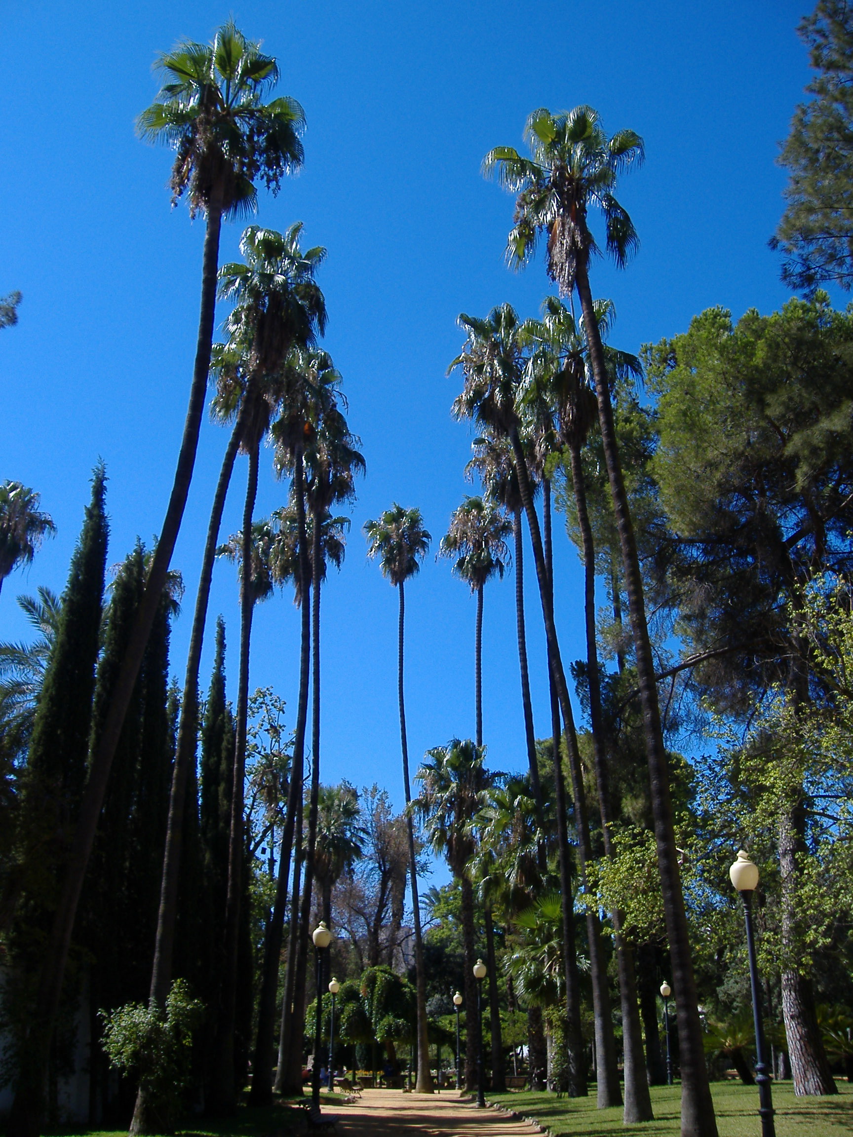
Castelar Park
Badajoz
Castelar Park sits in Badajoz, the capital of Spain's Extremadura region, right on the southern bank of the Guadiana River. Where is it and how do you get there? The park occupies a slice of central Badajoz, south of the Guadiana, within easy walking distance of the old town and its historic fortress. It's the kind of green space visitors tend to fold into a wider stroll around the city center rather than treat as a separate destination — no special trip required. A children's playground (Parque Infantil) sits directly across the street from the main entrance, making the area a convenient stop for families. What will you actually see inside? The park's signature feature is a row of tall palm trees that give its paths a slightly Mediterranean, holiday feel. At its heart lies a central pond that draws ducks and pigeons, while peacocks roam freely across the lawns and walkways — they're usually what catches visitors' eyes first and what ends up in most photos from a visit. The overall mood is unhurried and green, without the stiffness of a formal garden. Two monuments inside the park honor local literary figures. One commemorates Carolina Coronado, a Romantic-era writer who lived in Badajoz and remains one of the city's most notable cultural figures. The other is dedicated to Luis Chamizo Trigueros, a poet born in nearby Guareña, known for verse rooted in Extremaduran folk tradition. Both spots are natural pauses for anyone curious about the region's literary heritage. How has the park changed over time? Castelar Park went through a long stretch of neglect before undergoing a thorough renovation under Mayor Miguel Ángel Celdrán Matute, who has held office since 1996. That overhaul gave the park a new role in city life: it now hosts fairs, exhibitions, entertainment programs, and everyday leisure for residents. Rather than just a quiet patch of greenery, it has become a working piece of Badajoz's public life, with local events regularly held on its grounds. When is the best time to visit? Extremadura's summers run hot, so early morning or late afternoon are the most comfortable times to wander among the palms and around the pond, when shade and proximity to water take the edge off the heat. Spring and autumn bring milder temperatures, better suited to longer walks and watching the peacocks and waterfowl. If a fair or exhibition happens to be running, it's worth checking the city's local events calendar — those occasions tend to bring extra life to the park. Who is this park good for? Castelar Park works well for families with children, thanks to the playground right across the street, and equally for anyone looking for a quiet break from sightseeing in Badajoz's historic center. It also makes for an easy photo stop — the peacocks and the waterfowl-filled pond are among the more distinctive images visitors take away from the city. Frequently asked questions Are there animals in Castelar Park? Yes, peacocks roam freely through the park, and the central pond attracts ducks and pigeons. Is the park suitable for a visit with children? Yes, there's a playground directly across the street from the main entrance, making it convenient for families. Who do the park's monuments honor? The park holds monuments to Carolina Coronado, a Romantic-era writer connected to Badajoz, and to the poet Luis Chamizo Trigueros, born in Guareña. Does the park host events? Yes, since its renovation the park has become a venue for fairs, exhibitions, and entertainment programs for both residents and visitors to Badajoz.
-
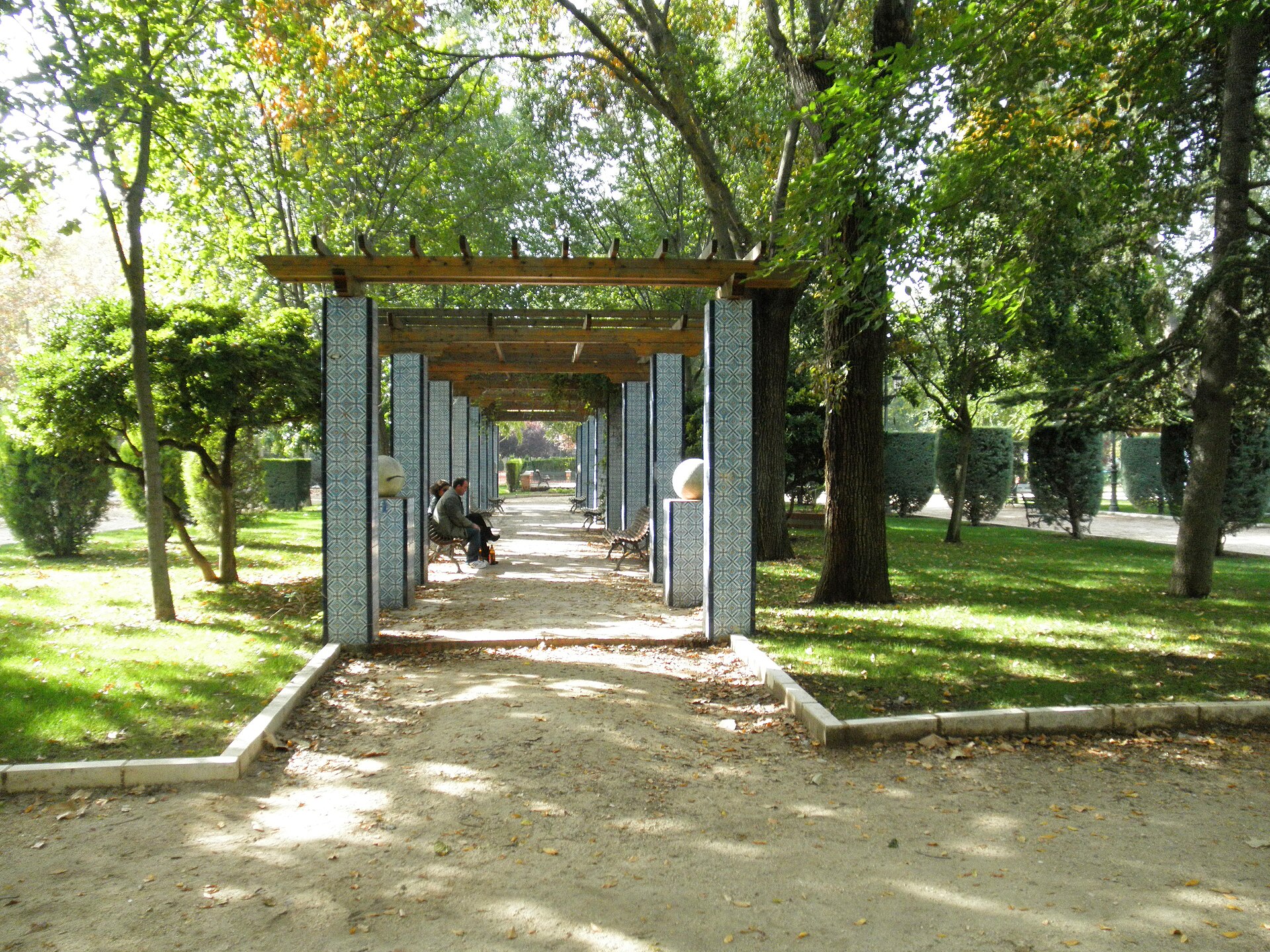
Parque de Gasset
Ciudad Real
Parque de Gasset is a historic city park in the centre of Ciudad Real, one of the oldest and most cherished green spaces in the provincial capital. It works both as an everyday retreat for locals and as a small open-air museum, with a 15th-century stone cross, a 19th-century fountain and monuments from the 1930s all standing along its paths. Where does the park's name come from? The land the park now occupies wasn't always known by its current name. It began as the Paseo de Alarcos, a promenade leading toward the historic Sanctuary of Our Lady of Alarcos, one of the region's important pilgrimage sites near Ciudad Real. The park in its present form was formally opened in 1915, on land donated by the Marquis of Treviño. Its name honours Rafael Gasset Chinchilla, a deputy connected to Ciudad Real who brought piped water to the city from a reservoir later named after him — the Gasset Reservoir. In 1933 a monument was erected in the park to commemorate that achievement, and the name stuck. What is there to see? Walking through the park means passing more than a century of local history. The centrepiece is an Art Nouveau-style music kiosk, opened on 14 August 1927, whose lower level once housed a bar and terrace; on summer Sunday afternoons the municipal band used to perform there. During the 1930s the park gained two more distinctive landmarks: a figure known locally as the "Cura de los Bichos" and a public library that served the neighbourhood for years. The site's history reaches back well before the 20th century, though. The park holds the oldest surviving fountain in Ciudad Real — the old Hernán Pérez del Pulgar fountain, relocated here from Plaza del Pilar. At the park's southern edge stands the Cruz de los Casados, a stone cross dating to the 15th century that has been rebuilt several times over the centuries after suffering damage. How do you get there? Thanks to its central location in Ciudad Real, the park is easy to reach on foot from most of the old town and city centre. It makes a natural stop for anyone exploring the historic core — worth folding into a walking route past the city's main landmarks rather than treating as a separate trip. When is the best time to visit? The park functions as a living public space year-round, but summer is when its historic character comes through most clearly — the tradition of Sunday concerts by the music kiosk dates back to the 1920s and is still associated with the summer season in Ciudad Real. Early morning and early evening are the best times for a quiet walk among the mature trees and period features. Frequently asked questions Is Parque de Gasset in the centre of Ciudad Real? Yes, the park sits in the central part of the city and is easily reachable on foot from the historic old town. Where does the park's name come from? From Rafael Gasset Chinchilla, a deputy who brought water to Ciudad Real from the Gasset Reservoir — a monument was raised in the park in his honour in 1933. What historic features can visitors see in the park? The 1927 music kiosk, the city's oldest fountain (the former Hernán Pérez del Pulgar fountain) and the 15th-century Cruz de los Casados stone cross at the park's southern end. Does the park host cultural events? Historically, yes — in summer, the municipal band performed near the music kiosk on Sunday afternoons, one of the city's social traditions during the interwar period.
-
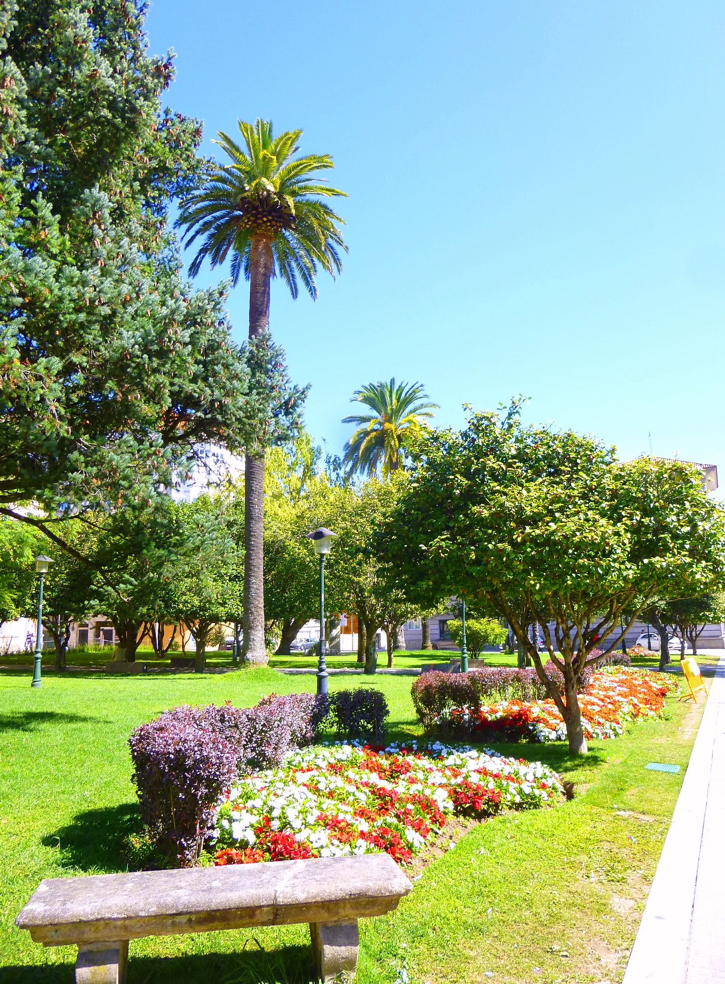
Doctor Marescot gardens
Pontevedra
Doctor Marescot Gardens sit right in the heart of Pontevedra, next to the city's famous Alameda promenade. It's a small green pocket worth a short detour while exploring the historic center — quiet, compact, and easy to reach on foot from almost anywhere downtown. Who was Doctor Marescot? The gardens take their name from Enrique Marescot Iglesias (1879–1962), a surgeon remembered in Pontevedra chiefly for his charitable work with the city's poorest residents. He practiced at the local provincial hospital, then run as a charity institution, before going on to found his own clinic, the Sanatorio Marescot. Naming this park after him was the city's way of honoring a doctor whose reputation rested as much on generosity as on medical skill. Where exactly are the gardens located? The park is bordered to the north by the former San Fernando barracks — now home to Pontevedra's Faculty of Fine Arts — and by Maestranza street. To the east it faces the Government Delegation building and Doctor Enrique Marescot street, while its southern and western edges run along Alameda street. In practice, this makes the gardens feel like a natural extension of the Alameda, one of the city's most recognizable green spaces. What is there to see? A bust of Doctor Marescot greets visitors at the entrance, a modest but pointed tribute to the man behind the name. Elsewhere in the gardens stands a monument to Manolo Quiroga, a violinist closely tied to Pontevedra's cultural history. Beyond the monuments, the space is defined by tidy lawns, shaded paths, and benches — a quieter, more intimate counterpart to the bustling Alameda next door. How much time should you plan for a visit? The gardens are compact, so walking the full length of the paths typically takes no more than fifteen minutes. That makes it a natural stopover between sightseeing in Pontevedra's old town and relaxing on the Alameda — a good spot to pause, snap a photo of the bust, or simply sit under the trees for a few minutes. How do you get there? The park sits in central Pontevedra, within easy walking distance of major old-town landmarks such as the Basilica of Santa María la Mayor and Plaza de A Ferrería. Thanks to its position next to the Alameda and the city's administrative buildings, it's simple to reach on foot from anywhere in the center — no public transport is needed. Frequently asked questions Is entry to the gardens free? Yes, it's an open public park with free access every day. Is there anything to see besides greenery? Yes, look out for the bust of Doctor Marescot at the entrance and the monument to violinist Manolo Quiroga elsewhere in the gardens. Is it a good stop with children? The park is small and calm, suitable for a brief break, though it has no playground or dedicated recreational facilities. How long does a visit take? Around 10–15 minutes is enough to walk the paths and see both monuments.
-
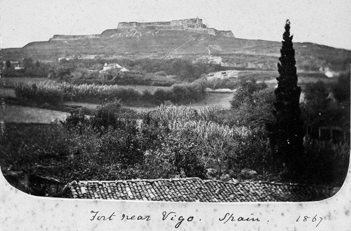
Monte do Castro
Vigo
Monte do Castro is the highest hill in central Vigo, a port city on Spain's Galician coast, and the largest public park within the city itself. Rising to roughly 149 metres, it has served as a natural lookout over the Vigo estuary since ancient times. How do you get to Monte do Castro? Because the hill sits right in the middle of the city, walking is the simplest option — it's about a fifteen-to-twenty-minute uphill climb from downtown Vigo. City buses also stop near several entrances at the base of the park, from where marked paths lead straight to the summit. Access is free and the park stays open to visitors throughout the day, every day of the year. What will you find at the top? Crowning the hill is the Castro Fortress, a 17th-century military structure whose construction began in 1656 under King Philip IV. Originally built to defend the estuary from naval attacks, its stone ramparts now form one of the best viewpoints in Vigo. From here the panorama takes in the city below, the mouth of the ría opening to the Atlantic, the hills of the O Morrazo peninsula across the water, and — on a clear day — the silhouette of the Cíes Islands in the distance. Sunset is a particularly popular time to visit, as the light spreads across the whole bay. Lower down the slopes lie the reconstructed remains of an ancient castro settlement, a fortified Celtic village inhabited between the 3rd and 1st centuries BC. Around 45 circular stone house foundations survive, and interpretive panels along the path explain daily life during the Iron Age. Local tradition holds that this very settlement gave Vigo its name and origin. After the Celtic period the hill was fortified by the Romans and later Christianised, with the small chapel of Nosa Señora do Castro built on the site. What kind of place is the park itself? Beyond its historical layers, Monte do Castro functions as the city's green lung. Mixed woodland covers much of the hill, including a substantial pine forest, giving the park an almost botanical-garden feel. A network of paths of varying length and difficulty crisscrosses the site, so visitors can pick anything from a short stroll to a full loop around the hill. When is the best time to visit? The park is open year-round, but spring and autumn offer the most comfortable walking conditions and generally the clearest views from the fortress walls. In summer, early morning or early evening visits are recommended to avoid the midday heat. Whatever the season, sunset from the ramparts is consistently rated as the highlight of a visit. Frequently asked questions Is there an entrance fee for Monte do Castro? No, access to the park and the viewpoint at the old fortress is free and open daily. How long does a visit take? Walking up to the summit and back takes about an hour, but exploring the whole park, including the Celtic settlement and the wooded paths, usually takes two to three hours. What else is worth seeing besides the viewpoint? The reconstructed castro settlement with its circular stone dwellings and the pine forest deeper in the park are both worth the detour. Can you see the Cíes Islands from Monte do Castro? Yes, on clear days the islands are visible on the horizon from the fortress walls, looking out toward the open Atlantic.
-
Parque Etxebarria
Bilbao
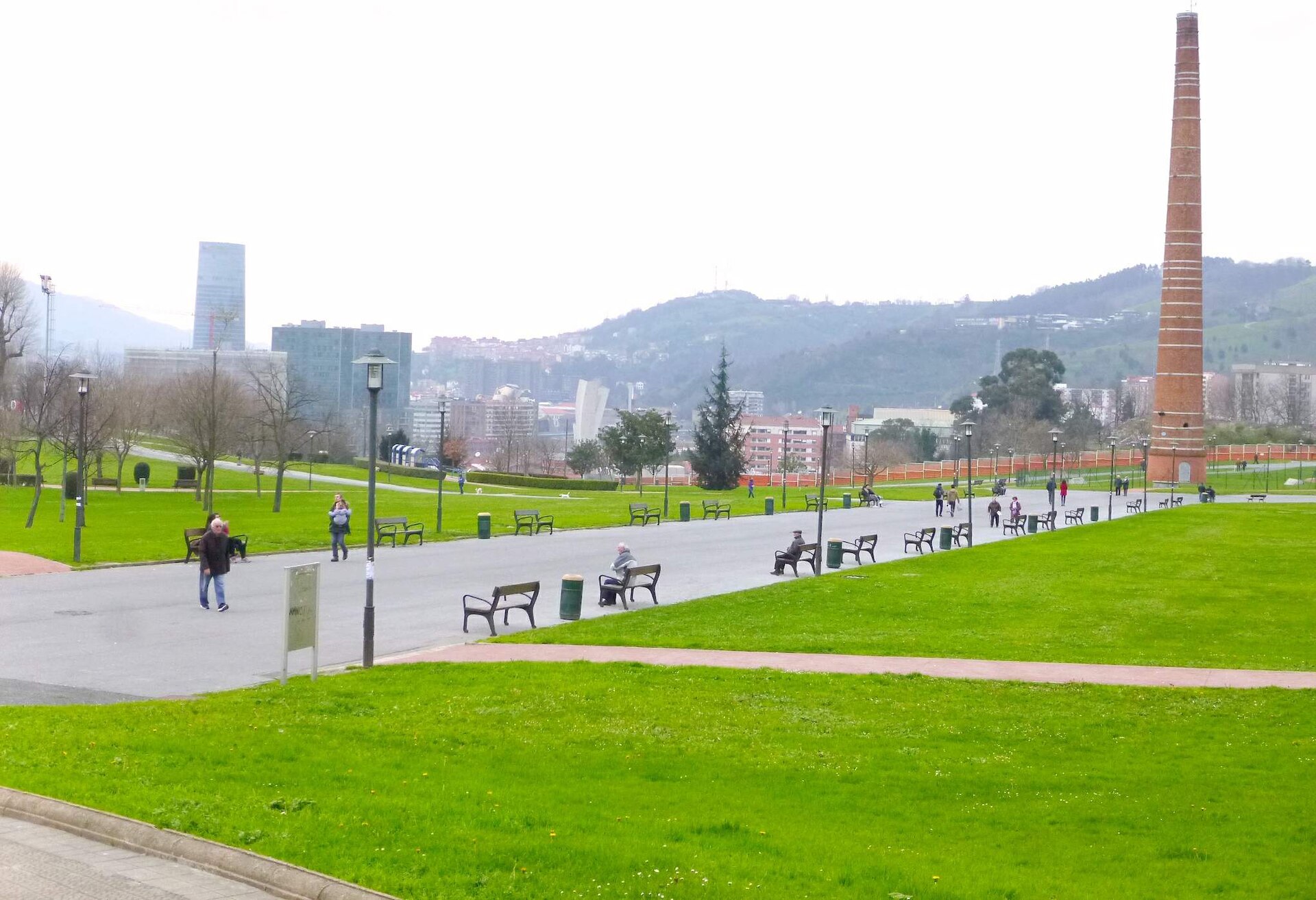
Etxebarria Park is one of Bilbao's largest green spaces, spread across a hillside right above Casco Viejo, the city's old quarter. Covering roughly 170,000 square metres, it is both a city park and a living reminder of Bilbao's industrial past — until the early 1980s, this ground was occupied by the Aceros Etxebarria steelworks. Where does the park come from? The factory was founded in 1878 by José Echevarría and his sons Federico and José, who bought the Rekalde farmhouse and the surrounding land to set up a workshop for rolling and stamping tin plate. Over the following decades the plant grew into one of the landmarks of industrial Bilbao. When the city went through a deep economic restructuring in the 1980s and moved away from heavy industry, the factory was dismantled and the recovered land was turned into a public park. That shift — from working steel plant to open green space for residents — is the defining story behind the park today. What still recalls the industrial past? The most recognisable trace of the old factory is a 25-metre chimney, built in 1943. It was deliberately kept standing as a monument to the district's industrial heritage, and it can be spotted from many parts of the city, including the Uribarri neighbourhood and Mount Artxanda. For locals, the chimney is now as much a fixture of the skyline as the city's modern towers. What views does the park offer? Because the park sits on the slope of the valley that Bilbao occupies, its paths open onto wide views over the city. From here you can see Casco Viejo, the Arriaga Theatre, the Abando district, as well as newer architectural landmarks like the Isozaki Atea towers and the Iberdrola Tower, along with a stretch of the estuary that runs through Bilbao. Few spots in the city let you frame the old quarter and the modern skyline in the same view. What can visitors do there? The park works as a large recreational area, suited both to a quiet walk and to more active use thanks to its sports courts and open playing areas. Given its size and its location right next to the old town, it also serves as a everyday green escape for people living or working nearby. Once a year, during Aste Nagusia — Bilbao's Great Week, the city's main festival — the park hosts market stalls, and fireworks displays are held here in the evenings, making it one of the focal points of the celebrations. How do you get there? Etxebarria is well connected to the rest of the city. The nearest metro stop is Casco Viejo, just a short walk from the park entrance, which makes it easy to combine a visit with a stroll through Bilbao's historic centre. Frequently asked questions How big is Etxebarria Park? It covers around 170,000 square metres, making it one of the largest green areas in Bilbao. What used to stand on this site? Until 1982, the Aceros Etxebarria steelworks operated here, founded in 1878 by the Echevarría family. What is the chimney visible in the park? It's a 25-metre chimney from 1943, left standing from the old factory as a monument to the district's industrial history. What views can you get from the park? The park overlooks Casco Viejo, the Arriaga Theatre, the Abando district, the Isozaki towers, the Iberdrola Tower and the Bilbao estuary. How do you reach Etxebarria Park? The easiest way is by metro to the Casco Viejo stop, a few minutes' walk from the park. Are there events held in the park? Yes — during Aste Nagusia the park hosts festival stalls and evening fireworks displays.
-
Gazteluko Ingurunearen parkea
Pampeluna
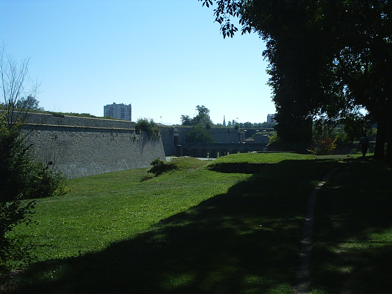
Gazteluko Ingurunearen parkea (Spanish: Vuelta del Castillo) is a large public park in Pamplona (Basque: Iruña), the capital of Navarre, wrapped around the old Ciudadela, a Renaissance-era fortress. It is the largest green space in the city and a favourite spot for locals out walking, jogging, or kicking a football around. Where does the name come from and what is its history? The park's name points directly to its location: it occupies the former glacis, the gently sloping defensive ground that once surrounded the moats and walls of the Ciudadela. The fortress itself was begun in 1571 on the orders of King Philip II, designed by the Italian military engineer Giovan Giacomo Paleari Fratino, known as "El Fratín". Its star-shaped, five-sided layout was built to shield the city from outside attack while also making it easier to keep an eye on any unrest from within. For defensive reasons, the land surrounding the fortress had to stay free of buildings for centuries — no structure could be allowed to block sightlines or lines of fire. Even so, from the 17th century onward, the surrounding slopes were already being used by residents of Pamplona as a place to stroll. The historic complex was formally handed over to the city on 23 July 1966, opening the way for the area to be turned into a fully public park. How big is the park, and what is there to see? The park covers an area running into the tens of hectares and sits right next to the city centre, at the point where Avenida Pío XII meets Avenida del Ejército. On its other sides it borders the streets Gazteluko Ingurunea and Yanguas Miranda. Its planting follows an English-style layout, dominated by broad lawns, tree-lined avenues, and winding pedestrian paths. Along the routes that loop around the whole area, visitors will come across benches, fountains, cobbled paths, and sculptures, including a couple of "wind rose" compass markers set into the ground. Walking through the park, it is still possible to make out stretches of the old defensive walls, the moats, the earthen bastions, and the fortified gates that once protected the city. What is the park used for today? Today Gazteluko Ingurunearen parkea functions mainly as a recreational space. Joggers use its paths, casual football matches take over its lawns, and walkers seek shade under its trees on hot days. The park sits directly alongside the former Ciudadela grounds, which have likewise been converted into a park — together the two form one of the largest and most valued areas of historic greenery in Pamplona. The park plays a particular role during the annual San Fermín festivities: its open, sweeping lawns are one of the preferred spots for residents and visitors to watch the evening fireworks. Frequently asked questions What is the difference between Gazteluko Ingurunearen parkea (Vuelta del Castillo) and Parque de la Ciudadela? They are two adjoining but distinct green spaces. Parque de la Ciudadela lies inside the walls of the old five-sided fortress, while Gazteluko Ingurunearen parkea spreads out beyond it, on the former defensive slopes (glacis) that surround the fortifications. Are any fortification remains still visible in the park? Yes — sections of the old walls, moats, earthen bastions, and fortified gates remain visible, reflecting the site's military past. When did the park become open to the public? The land was formally handed over to the city on 23 July 1966, although the surrounding slopes had already been used by locals for walks since the 17th century. What can visitors do in the park? Walk, jog, play football on the lawns, rest by the fountains and benches, and take in the sculptures scattered along the paths. Is it a good spot during the San Fermín festival? Yes, the park's wide lawns are a popular place from which to watch the evening fireworks that accompany the festival.
-
Palacio de Capitanía
A Coruña
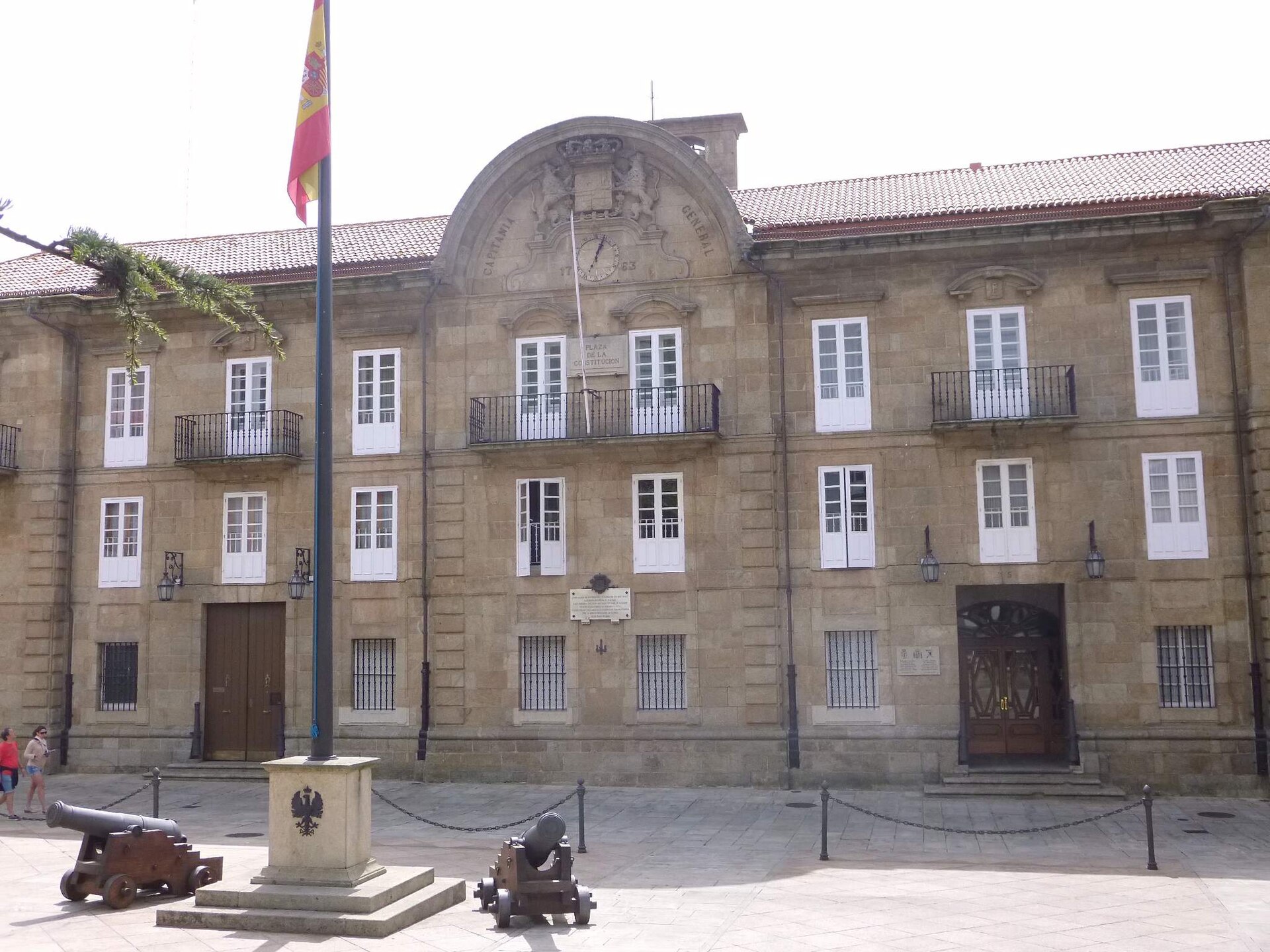
Palacio de Capitanía in A Coruña is one of the most imposing buildings in the city's old quarter, tied for well over two centuries to the military administration of Galicia. It stands in the historic core of the city, close to what is known today as Plaza de la Constitución, and its severe, classical façade makes it hard to miss on a walk through the old town. Where does this building come from? An earlier structure occupied the site as far back as the 16th century, but the palace visitors see today only took shape in the mid-18th century. The order to build a new headquarters came under the reign of King Fernando VI, and the new complex was meant to house both the residence of the captain general and the offices of the Real Audiencia, the royal court of the period. The original design was drawn up by Juan de Vergel, but it was Francisco Llovet who carried the construction through to completion over four years, introducing a fair number of changes along the way. What architectural style does the palace represent? The building is a solid example of neoclassical architecture: a symmetrical, monumental façade, evenly spaced windows, and a portal that underlines the official, representative role the building was built for. That formality was deliberate — from the outset the palace served as the seat of military authority and judicial power, so its architecture was meant to project stability and institutional weight rather than decoration for its own sake. What historical events took place here? The palace has witnessed several turning points in Galician history. In 1808 it was the starting point of the first Galician uprising against Napoleonic troops, as residents of A Coruña and the surrounding area rose up against French occupation, with ripples of that resistance felt across the wider region. A second dramatic episode followed in 1820, during the liberal uprising: a crowd stormed the palace, and the captain general in office at the time was seized and taken to nearby Castillo de San Antón, one of the city's most recognizable defensive fortifications, where he was held. Does the palace still serve a purpose today? Yes — the building remains linked to military administration and functions as an active institutional seat rather than a museum piece frozen in time. That said, free guided visits are occasionally organized, giving visitors a chance to see interiors that are normally off-limits to casual tourism. These openings tend to be tied to local cultural and educational programs aimed at both residents and visitors curious about the city's history. Why is the palace worth seeing while visiting A Coruña? For anyone walking through A Coruña's old town, the palace is a clear landmark, combining an architectural layer — it is one of the few large neoclassical buildings in the city — with a historical one, since it is directly tied to the turbulent events of the Napoleonic era and the liberal upheavals of 19th-century Spain. It is a good spot to pause for a moment and compare the quiet, present-day look of the square with accounts of crowds storming the palace gates two hundred years ago. Frequently Asked Questions Can visitors go inside the palace? The interior is not open to the public on a permanent basis, since the building still houses military administration. Free guided visits are organized from time to time, so it is worth watching local cultural listings if getting inside matters to you. Who designed the building? The original design came from Juan de Vergel, while the four-year construction was ultimately carried out and finished by Francisco Llovet, who made his own changes to the plan. What is the historical significance of this place? The palace is best known for two events: the outbreak of the first Galician uprising against Napoleonic troops in 1808, and the storming of the building during the 1820 liberal uprising, when the captain general of the time was captured and imprisoned. Where exactly is the palace located? The building stands in the historic center of A Coruña, within the old town, close to today's Plaza de la Constitución — an area that is easy to reach on foot as part of a walk through the city's historic quarter.
-
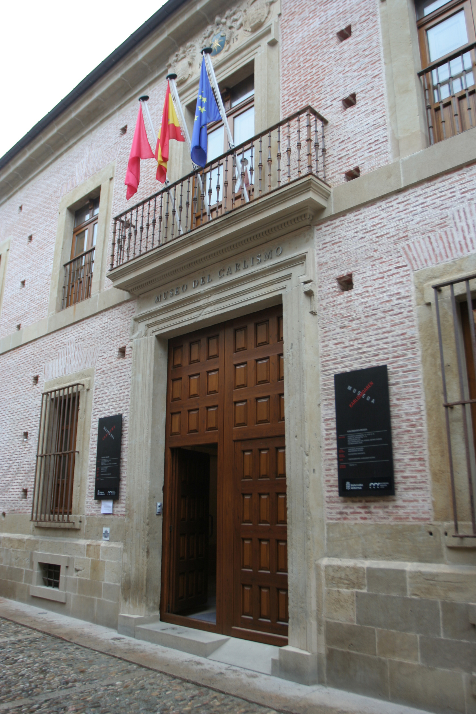
Palacio del Gobernador de Estella
Estella
Palacio del Gobernador de Estella is a historic palace on Calle La Rúa in Estella (Estella-Lizarra), in the Spanish region of Navarre, which has housed the Museo del Carlismo since 2010 — a museum dedicated to the history of Carlism. What is this building? The palace was built between 1608 and 1613 at the initiative of Juan de Chávarri y Larraín, first baron of Purroy. The baron's family owned the building until 1880, when it was sold. Since 2000, the property has belonged to the municipality of Estella-Lizarra. The building holds the status of a Cultural Interest Site (Bien de Interés Cultural), granted by the regional government of Navarre in recognition of its historical and architectural value. Where does the name "Governor's Palace" come from? The name doesn't refer to any official administrative post — the position of governor never actually existed in Navarre in the sense the palace's name suggests. The most likely explanation ties the name to the Second Carlist War, when the building served as lodging for the Carlist governor of Estella. That historical episode is what permanently attached the name to the building, as it is still known today. What can visitors see inside? Since March 2010, following a thorough renovation, the palace has housed the Museo del Carlismo — a publicly owned thematic museum managed by the regional government of Navarre. The institution was formally created in 1999, and its opening at this location came a year after the building's restoration was completed. The exhibition focuses on the Carlist movement and its significance throughout the 19th and 20th centuries — one of the key, though often overlooked in textbooks, currents of Spanish political history. Carlism, named after the pretender to the throne Carlos de Borbón, shaped the history of Navarre and Spain as a whole through a series of civil wars and disputes over monarchical legitimacy. Why is this place worth visiting in Estella? Estella-Lizarra is a town with strong historical traditions, located on the Camino de Santiago, and the Palacio del Gobernador is one of the more significant landmarks on the town's architectural map. The building itself, erected in the early 17th century, exemplifies Spanish palace architecture of that period, and its location on the central Calle La Rúa makes it easy to include a visit as part of a walk through Estella's historic center. For anyone interested in 19th-century Spanish history, Carlism, or the regional identity of Navarre, the museum offers a rare opportunity to explore the subject in a setting directly tied to the era it covers. What should you know before visiting? The museum is located in the center of Estella, in an easily accessible spot on Calle La Rúa. As an institution managed by the regional government of Navarre, it operates within that region's network of public cultural institutions. Given its heritage status and the nature of the exhibition, it's worth planning a visit in advance and checking current opening hours directly with the museum's administration, since these may vary seasonally. Frequently Asked Questions What is the Palacio del Gobernador de Estella? It's a 17th-century palace (1608-1613) in the center of Estella, Navarre, which has housed the Museo del Carlismo since 2010 — a museum dedicated to the history of the Carlist movement. Why is the palace called the "Governor's Palace" if Navarre never had governors? The name most likely dates back to the Second Carlist War, when the building served as the headquarters of the Carlist governor of Estella — hence the name has survived to this day, even though such an administrative post never formally existed in Navarre. Who built the palace and who owned it? The building was constructed by Juan de Chávarri y Larraín, first baron of Purroy, in the early 17th century. It remained in his family's hands until 1880, and since 2000 it has been owned by the municipality of Estella-Lizarra. What does the Museo del Carlismo housed in the palace focus on? The museum, created in 1999 and opened at this location in 2010, presents the history of Carlism — a Spanish political movement of the 19th and 20th centuries — and is managed by the regional government of Navarre.
Earn badges for the places you visit
Download NextOnTrip, discover new places and check off your trails.