Monuments in Spain
A guide to 4655 Monuments in Spain — with descriptions, photos and traveler visits from the NextOnTrip community. Locations spread across 2240 cities and towns. Most visited by the community: castle of Chulilla, Castle of Pioz, castell de la Todolella.
-
La Casa Alta
Tiana
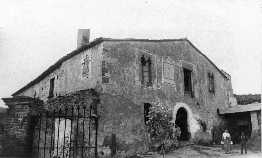
La Casa Alta is a Gothic farmhouse in Tiana, a small town in the Maresme region of the Barcelona province. Protected as a cultural asset of local interest (BCIL), the building ranks among the oldest surviving examples of civil architecture in the area, with origins dating back to the 15th century. What can you see there? La Casa Alta is a modest yet striking example of Catalan Gothic architecture. Like many rural houses of its period, it follows a simple layout: a ground floor and a single upper storey, topped by a two-slope roof whose ridge runs perpendicular to the façade. The most eye-catching feature is the stone portal with a rounded arch, set off-centre rather than aligned with the building's central axis — a detail common in rural constructions of the time, where practicality often outweighed strict symmetry. The façade also preserves two large Gothic-style windows, and the central one stands out for its stone lintel, threshold and jambs — craftsmanship details that reveal the quality of the original stonework. Getting close to these openings is worthwhile, since they best show the skill that went into the house's construction. Likely in the 18th century, the building underwent a significant renovation: the rear section was added and new window openings were cut into the walls, adapting the house to the living and working needs of the time. This later phase means La Casa Alta today blends medieval elements with subsequent modifications, making it an interesting case study in the gradual evolution of rural architecture. At present, the building is in poor condition, with the columns that once supported the window openings now missing. Despite this, it remains a meaningful piece of local heritage and continues to be protected under its cultural-asset status. How do you get to La Casa Alta? Tiana sits in the Maresme region, close enough to Barcelona to make it an easy day trip from the city. Driving is the most convenient option, since the town has good road connections to the Barcelona metropolitan area, and once there, the small, walkable centre is easy to explore on foot. Travellers relying on public transport can take a regional bus heading into Maresme and reach the historic core of Tiana with a short walk from the nearest stop. When should you visit? Because the site is quiet and doesn't draw large crowds, La Casa Alta can be visited year-round. Spring and autumn offer the most pleasant conditions for walking around Tiana, with mild temperatures and soft light that brings out the details of the stone façade. Summers in the Maresme region can get hot, so it's best to plan a visit for the morning or late afternoon. Frequently Asked Questions Can you go inside La Casa Alta? The building is a legally protected heritage site, and access to the interior depends on its current use and condition — it's worth checking on-site signage or asking at the local town hall for up-to-date information. How old is the building? The oldest part of La Casa Alta dates to the 15th century, while the rear section and some of the window openings come from a renovation carried out probably in the 18th century. What does BCIL status mean? BCIL (bé cultural d'interès local) is a Catalan heritage protection category for assets of local interest — it covers buildings significant to a municipality's heritage, even if they don't hold national-level status. Is it worth combining the visit with other sights in Tiana? Yes — Tiana has several other historic buildings in its town centre, so a stop at La Casa Alta can easily be extended into a short walking route through the rest of the old quarter.
-
Casa Villaescusa, Orihuela
Orihuela
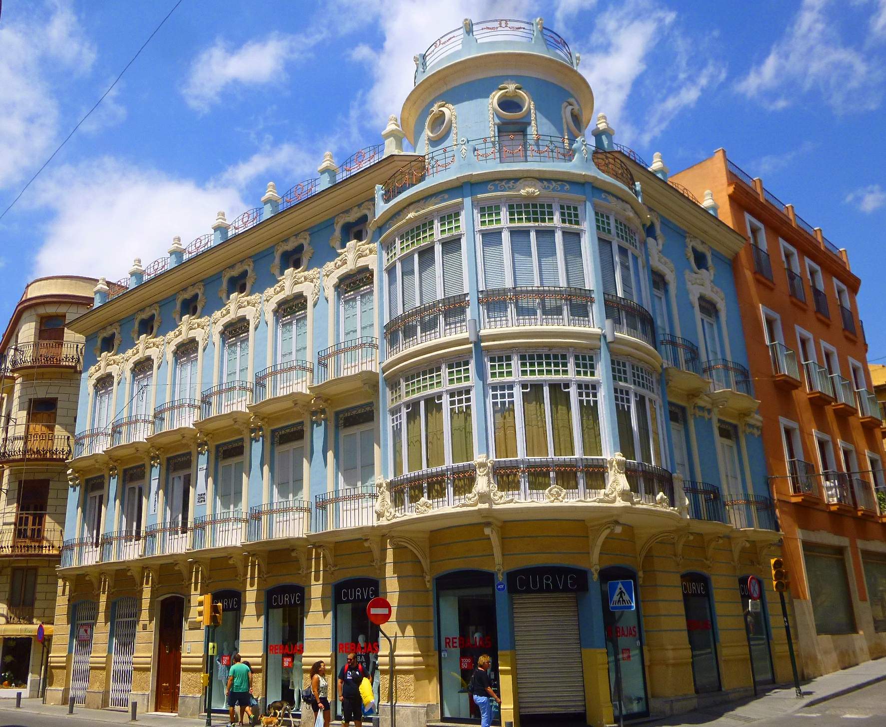
Casa Villaescusa is one of the most distinctive townhouses in the historic center of Orihuela, a city in the province of Alicante. Standing on a corner of Calle Colón, the building is better known locally by its nickname than by its official name — most residents will point you toward "Galerías Colón" rather than "Casa Villaescusa." What will you see? The building dates from 1915 and was designed by Severiano Sánchez Ballesta, an architect born in Orihuela. It's considered one of the best-preserved examples of Valencian modernism in the city — a decorative style that flourished among wealthy families and financial institutions across the Comunidad Valenciana around the turn of the 20th century. The structure has a ground floor, two upper residential floors, and a shorter attic level. The most eye-catching feature is a round, glazed corner mirador (bay window) with modernist-style glasswork, projecting outward so it offers views along both streets meeting at the corner. The upper section of the façade is painted a distinctive sky blue, standing out against the darker lower floors. Look closely at the balconies and railings too — the wrought-iron work is decorated with floral motifs typical of the ornamental richness of modernist architecture. The nickname "Galerías Colón" comes from an old shop that once operated inside the building facing Calle Colón, and the name stuck harder in local memory than the family name on the deed. The building's institutional history is worth knowing as well: for decades it served as the headquarters of Caja de Ahorros Nuestra Señora de Monserrate, a local savings bank that was later absorbed into Caja de Ahorros del Mediterráneo (CAM). Interestingly, the townhouse was built on a plot that had previously held a pósito — an old municipal grain store belonging to the palace of the Counts of Pinohermoso, one of the city's historic noble families. How do you get there? Casa Villaescusa sits right in the heart of Orihuela's old town, within easy walking distance of the cathedral and the main square, so arriving on foot is by far the simplest option. Drivers should look for parking around the streets bordering the historic center, since Calle Colón itself runs through a pedestrian zone of narrow lanes typical of the old quarter. Orihuela has its own train station and good bus connections to both Alicante and Murcia, from where a short bus or taxi ride brings you straight into the old town. When should you visit? The façade is best appreciated in daylight, when sunlight brings out the blue tones of the upper floor and the detail in the wrought-iron balconies. Spring and autumn are the most pleasant seasons for walking through Orihuela's old town — summer temperatures in the region can climb quite high, making long midday strolls through the historic center less comfortable. Casa Villaescusa pairs naturally with a wider walk through the old quarter, where this modernist façade stands just steps from monuments dating back to the Middle Ages. Frequently Asked Questions Are Casa Villaescusa and Galerías Colón the same building? Yes. Casa Villaescusa is the official name, while Galerías Colón is the popular nickname that stuck because of a shop that once operated there. What architectural style is the building? It's a 1915 example of Valencian modernism, designed by architect Severiano Sánchez Ballesta. Can visitors go inside? The building is used for residential and commercial purposes, so visits are generally limited to viewing the façade and mirador from the street. What makes the façade stand out? The round glazed corner mirador, the sky-blue upper façade, and the wrought-iron railings decorated with floral motifs.
-
Portillo Palace
Orihuela
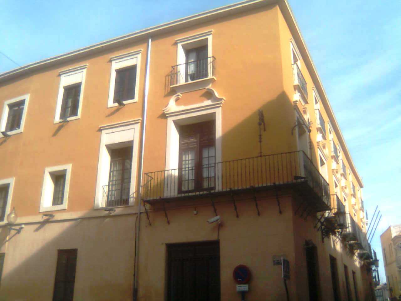
Portillo Palace is an 18th-century mansion in the heart of Orihuela, one of the historic towns of Spain's Alicante region. The building belongs to the group of bourgeois-noble residences raised by Orihuela's wealthy elite of the period, and it remains one of the recognizable landmarks of the old town today. Where is the palace located? Portillo Palace stands right in the historic core of Orihuela, surrounded by other period buildings that make up the town's old urban layout. Its coordinates place it at roughly 38.086, -0.946, within walking distance of the routes connecting Orihuela's main monuments. What is the history behind the building? The palace was built at the turn of the 18th and 19th centuries on the site of two earlier townhouses, which were merged into a single grand residence. It was commissioned by the Portillo family, from whom the building takes its name. Ownership later passed to María de las Virtudes del Portillo y Rovira, daughter of Pedro del Portillo y Ortega, who married Antonio Lamo de Espinosa y de la Cárcel — he inherited the palace toward the end of the 19th century. A lesser-known fact about the palace concerns its archive: the building once housed an extensive manuscript collection known as the Compendio Histórico-Geográfico Oriolano, a multi-volume work compiled at the end of the 18th century by Josef Montesinos Pérez, documenting the history and geography of the Orihuela region. What can you see at Portillo Palace? The façade reflects the Baroque style typical of bourgeois residences of the era in this region. Its most distinctive feature is the hierarchical arrangement of window openings, with the main entrance shifted toward the right side of the façade, while the overall decoration remains fairly restrained. What does stand out are the finely carved stone mouldings around the entrance portal and the curved and broken pediments above the balcony openings. Another detail worth pausing for is the wrought ironwork: the balconies and windows are fitted with intricately worked railings and grilles, characteristic of Orihuela's ironworking craftsmanship of the period. Together with the stone portal, these metalwork details are the building's most photogenic feature. Can you visit the palace's interior? The building currently serves as the social and main headquarters of Caja Rural Central, a local financial institution. This means the interior is not open to the public as a museum space — the palace is mainly appreciated from the outside, as part of a walk through Orihuela's historic centre. It is worth slowing down in front of the façade to take in the architectural details up close. How do you get to Portillo Palace? The palace sits within walking distance of Orihuela's main landmarks, such as the cathedral and the castle, making it a natural stop on a stroll through the old town. Orihuela is compact, and most of its historic sights are clustered within a few hundred metres of each other, so getting there on foot from the town centre is the most convenient option. When is the best time to visit? Spring (March to May) and autumn (September to November) are the best seasons to explore Orihuela and its landmarks, including the area around Portillo Palace, since temperatures are milder than during the hot Spanish summer. A morning walk through the old town is especially pleasant, before the sun heats up the stone streets. Frequently Asked Questions Can you go inside Portillo Palace? No, the building currently houses a financial institution (Caja Rural Central), so the interior is not open for tourist visits. The palace is best appreciated from the outside. What architectural style is the palace built in? It is an example of the Baroque style typical of Orihuela's bourgeois residences from the turn of the 18th and 19th centuries, notable for its wrought ironwork and carved stone portal. Who owned the palace? It was built by the Portillo family. Ownership later passed to María de las Virtudes del Portillo y Rovira and then to her husband, Antonio Lamo de Espinosa y de la Cárcel. Are there other attractions nearby? Yes, Portillo Palace is located in Orihuela's historic centre, close to the cathedral and other period buildings, making it easy to combine with a longer walk through the old town.
-
La Flamenca, Aranjuez
Aranjuez
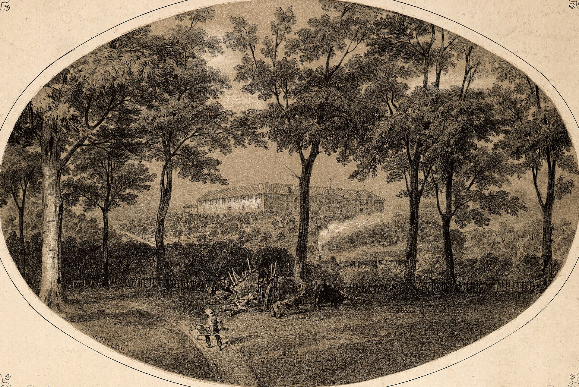
La Flamenca is a historic estate within the municipality of Aranjuez, roughly 40 minutes' drive south of Madrid. It is an unusual stop for travelers exploring the region: an 18th-century agricultural property that later became an agronomy school and today operates as one of Spain's best-known driven-partridge hunting estates, giving visitors a very different angle on Aranjuez than the town's famous royal palace and gardens. Where does the name come from? The estate's name dates back to 1775, when King Charles III issued a royal order on September 23 of that year assigning the land for cultivation "in the Flemish style" — hence "La Flamenca." The property sits around 40 metres above the level of the Tagus (Tajo) river, historically bordered by the Salinas stream to the east, the Ocaña lands to the south, and the Cavina stream to the west. How has the estate changed over time? After its agricultural beginnings, the land came under the management of the second section of the Royal Stud. The real turning point came in 1856, when the Central School of Agriculture was established on the property; architect Francisco Jareño oversaw the adaptation works, and the school was formally inaugurated on September 28, 1856. Today the estate is best known for a very different pursuit: it is one of Spain's most prestigious driven-partridge shooting grounds, and it was here that King Alfonso XIII introduced driven partridge shooting to Spain. The land is currently owned by the Duke of Fernán Núñez, and its drives — including Las Nietas, Speelman Valley, and Cañada Oscura — are considered among the most demanding in the country. How do you get to La Flamenca? The estate lies within the Aranjuez municipality, about 40 minutes by car from central Madrid and around 35 minutes from Madrid-Barajas airport; a nearby private airfield is roughly 30 minutes away, and the property has its own private helipad for guests arriving by air. Travelers without a car can reach Aranjuez itself by train or bus from Madrid and arrange a taxi or private transfer from there — La Flamenca is a small settlement with only a handful of permanent residents and no independent tourist infrastructure on site. What is there to see? The main draw is the estate's landscape itself: a mix of valleys, ravines and scrubland that shapes some of the most technically demanding shooting drives in Spain. On-site accommodation is provided by Regajal Lodge, an eight-suite property built to host hunting guests. The location also puts visitors within easy reach of more conventional sightseeing — the historic center of Aranjuez, with its royal palace and gardens, and Toledo, less than an hour away. When is the best time to visit? Spain's partridge shooting season runs mainly through the autumn and winter months, and that is when La Flamenca sees the bulk of its hunting-related visitors. Anyone more interested in the wider Aranjuez area and its countryside can visit year-round, though it is worth avoiding the peak of summer, when central Spain's heat is at its most intense. Frequently Asked Questions Is La Flamenca a village open to casual visitors? It is a small locality administratively part of Aranjuez, with only a handful of residents. The estate itself functions primarily as a private hunting ground, so open access without prior arrangement is limited. Where does the estate's name come from? From a 1775 royal order by King Charles III instructing that the land be cultivated "in the Flemish style." What is La Flamenca's connection to partridge hunting? King Alfonso XIII introduced driven partridge shooting to Spain here, and the estate is still regarded as one of the country's top grounds for this type of hunting. What's the fastest way to get there from Madrid? By car it takes about 40 minutes, and around 35 minutes from Barajas airport. Alternatively, take a train or bus to Aranjuez and continue by taxi or private transfer.
-
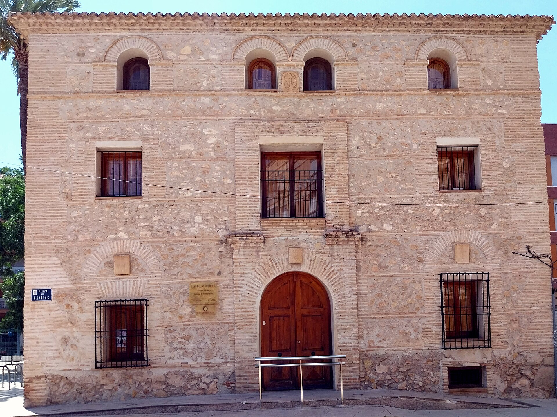
Casa de la Inquisición, Alcantarilla
Alcantarilla
Casa de la Inquisición is a historic mansion in Alcantarilla, a town right next to Murcia in Spain's Murcia region. Locally the building is better known as Casa de las Cayitas, and behind its facade lies one of the region's more unusual stories — for decades it served as the seat of a regional tribunal of the Spanish Inquisition. What is this place? The mansion was built in the 18th century specifically to house the local tribunal of the Holy Office. Its jurisdiction covered not just Alcantarilla itself but also the surrounding villages of Javalí, Puebla de Soto, La Ñora and Sangonera. Cases of heresy, alleged witchcraft and other offenses against the religious order of the time were tried here. Almost from the start, the building was at the center of a jurisdictional dispute between the Bishopric of Cartagena and the Holy Office over who had authority over the site and the proceedings held inside it. The disagreement escalated to the point that King Philip V of Bourbon himself had to step in to resolve it. What does the building look like? Casa de la Inquisición is a fine example of Baroque architecture. It rises three floors above ground, with an attic and a basement. The basement once held the cells where the accused awaited trial before the tribunal. Despite the centuries that have passed, the structure has kept the layout and decorative details typical of a Baroque residence of its era. What happened after the Inquisition was abolished? The tribunal stopped operating in 1837, when the Spanish Inquisition was permanently abolished. The building then changed hands and purpose. In 1870 it was bought by José López de Tudela, and in 1941 the property passed to Caya Arias Castellanos and her daughter, Caya López — which is where the popular nickname Casa de las Cayitas comes from, a name locals still use more often than the official one. In 1982 the building was declared a National Historic-Artistic Monument, a designation that today corresponds to Bien de Interés Cultural (BIC), Spain's highest level of heritage protection. For many years it housed the town's public library, and since 2015 it has been home to Alcantarilla's Municipal Historical Archive. How do you get to Casa de la Inquisición? Alcantarilla sits right next to Murcia and is well connected by both local roads and the regional commuter rail line. From central Murcia, the trip usually takes just a few minutes by car or train. The building stands in the town's historic quarter, which makes it easy to explore on foot once you arrive. What will you see inside? Since the building now functions as a historical archive rather than a museum, a visit works differently than a typical sightseeing stop — it is worth checking opening hours and public access in advance. The facade and overall structure, a fine representative of the region's Baroque architecture, can be admired from the outside at any time. When is the best time to visit? The Murcia region has hot summers, so spring or autumn are the most comfortable seasons for walking around Alcantarilla and its historic center. Frequently Asked Questions What was Casa de la Inquisición used for? It was an 18th-century building that served as the seat of a regional tribunal of the Spanish Inquisition, with jurisdiction over Alcantarilla and nearby villages, until the institution was abolished in 1837. Where does the name Casa de las Cayitas come from? From the mid-20th-century owners of the building — Caya Arias Castellanos and her daughter, Caya López — who took over the property in 1941. Is the building a protected heritage site? Yes, it was declared a national historic-artistic monument in 1982, a status that today corresponds to Bien de Interés Cultural. What is housed in the building today? Since 2015 it has held Alcantarilla's Municipal Historical Archive; before that it served for years as the town's public library.
-
Pazo do Campo
Amoeiro
Pazo do Campo is a historic Galician manor house (pazo) standing in the village of Trasalba, in the municipality of Amoeiro, province of Ourense. The building is also known as Pazo de Gayón, after the family who owned it from the 18th century onward, and it stands as one of the region's characteristic examples of rural noble architecture. Where exactly is it located? The pazo sits in Trasalba, part of the parish of San Pedro de Trasalba, on the southern edge of the Amoeiro plain — a small, clearly defined lowland known locally as the "terra chá" (flat land). The site lies along a branch of the Vía de la Plata, the historic Camino de Santiago route, making it a landmark for pilgrims and hikers crossing inland Galicia. What should you know before visiting? Pazo do Campo is private property and its interior is not open to visitors. Restoration work on the building has been on hold for some time, so the best way to experience it is from the outside, as part of Trasalba's broader historic ensemble. It's worth planning a stop that combines a look at the pazo's façade with a visit to the neighboring landmarks — together they're the main reason to come this way. What will you see nearby? Trasalba is a small village that punches above its weight culturally. Right next to Pazo do Campo stands the parish church of Trasalba, and just steps away is Casa Grande de Cima de Vila, the house that today holds the Otero Pedrayo Museum, dedicated to one of the most important Galician writers and intellectuals of the 20th century. Together, these three sites form a compact architectural ensemble that lets you feel the atmosphere of a traditional Galician noble village in a single short walk — manor house, church, and a literary family home. How do you get there? Amoeiro lies close to the city of Ourense, making it a convenient day-trip destination for anyone based in the provincial capital. Driving is the easiest option: the road winds through the rural countryside of the province, past fields and the low hills typical of inland Galicia. Hikers can also reach Trasalba via the Vía de la Plata branch of the Camino de Santiago, adding a pilgrimage dimension to the visit. There's little tourist infrastructure in the immediate area, so it's worth stocking up on water and supplies in Ourense or one of the larger surrounding towns beforehand. When is the best time to visit? Spring and early autumn are the best seasons, with mild temperatures and the fields and hills around the pazo at their most scenic. Summers in inland Galicia can run hot, while winters tend to be changeable and rainy, which can make longer walks around the area less comfortable. Frequently Asked Questions Can you visit the interior of Pazo do Campo? No — the building is private property and not open to visitors, and its restoration is currently paused. It can only be viewed from the outside. What's the difference between Pazo do Campo and Pazo de Gayón? They're the same building — Pazo de Gayón is the name that comes from the family who owned it from the 18th century onward, and it's used interchangeably with Pazo do Campo. What else is worth seeing in Trasalba? Right next door are the parish church of Trasalba and the Otero Pedrayo Museum, housed in Casa Grande de Cima de Vila — together they form a compact historic ensemble worth a short walk. How do you get to Amoeiro from Ourense? Driving is the most convenient option, along rural roads through the province; hikers can alternatively follow the Vía de la Plata branch of the Camino de Santiago, which passes through Trasalba.
-
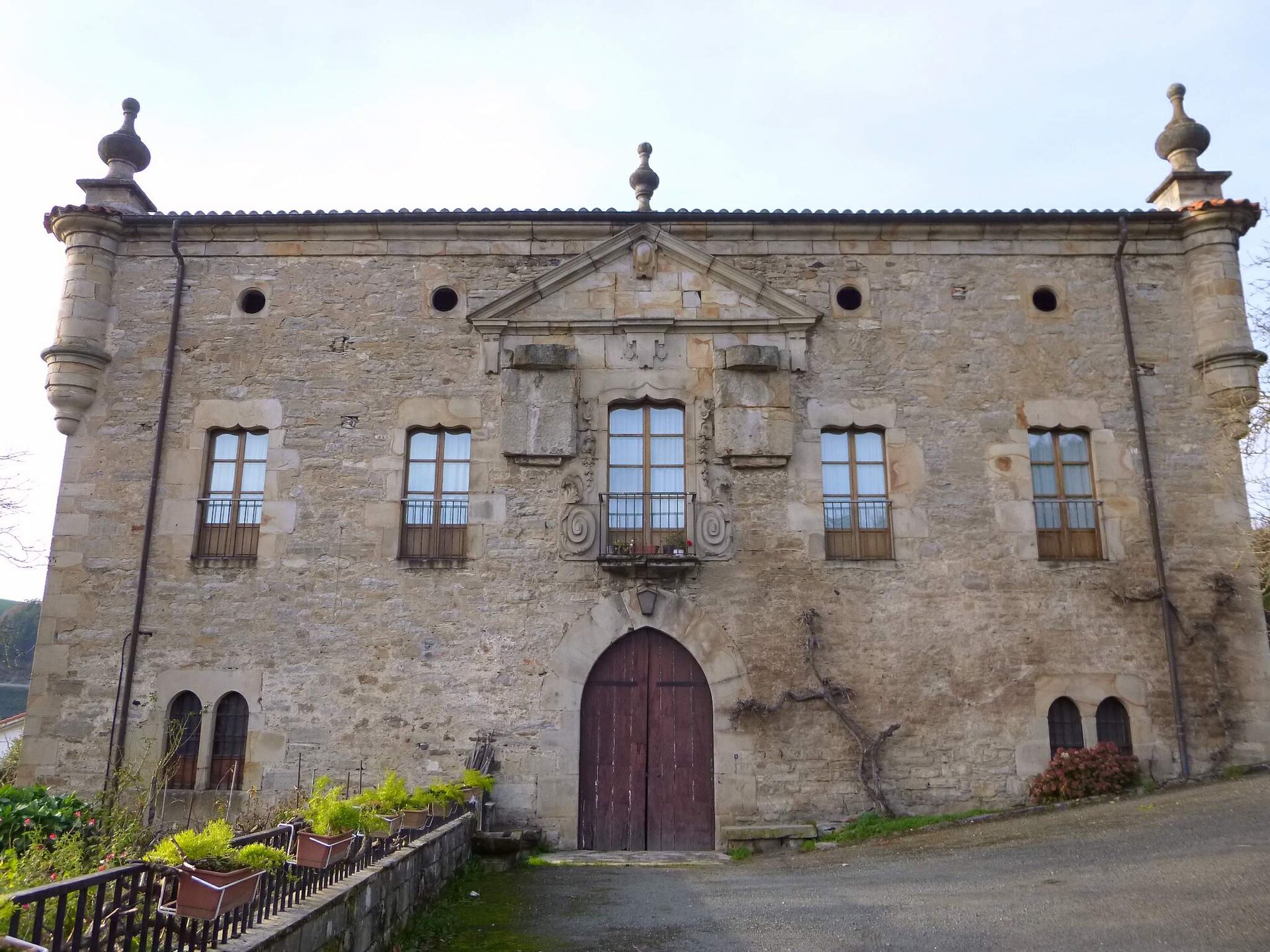
Moiua jauregia
Bergara
Moiua Jauregia is a stone tower house standing on a hillside at the northern edge of Bergara, a town in Gipuzkoa, in Spain's Basque Country. Also known as Moiua Tower, it blends a medieval core with later Baroque additions and belongs to the family of Basque tower-houses (jauregi) that once marked the status of local noble lineages. Where does the building come from? The tower's origins go back to the early 16th century, although its present outward appearance is the result of later remodeling. In the mid-17th century the property passed to Captain Juan de Moiua Barrena y Argarate, whose name the building still carries today. It was under his ownership that the house underwent a thorough refurbishment. A second major intervention followed in 1751, reshaping the corner sentry boxes, the pinnacles, and the cornice, and giving the structure a more ornate, Baroque flavor. What will you see there? Unlike most Basque defensive houses, which tend to be rectangular, Moiua Jauregia has a rounded footprint — an unusual feature that sets it apart. The building visibly combines two eras: austere late medieval structural elements alongside clearly Baroque decorative detail added during the 18th-century works. Its two most elaborate façades are the main one and the one overlooking the valley floor. On the main façade, the eye is drawn to a large rounded archway at the entrance, flanked symmetrically by two matching ground-floor windows. The overall impression is of a residential tower where the original defensive purpose has given way to a more representative, domestic character. How do you get there? Moiua Jauregia sits on a slope at the northern exit of Bergara, along the road toward Placencia de las Armas (Soraluze in Basque). This slightly outlying position, just beyond the town's main built-up area yet still close to its center, is typical of Basque tower houses. Driving from central Bergara and heading north is the most convenient option, though the short distance from the old town also makes it an easy stop on foot for anyone exploring the center on a walking route. When should you visit? Since the building is best appreciated from the outside — through its silhouette, façade, and architectural detail — a daytime visit in good light works best, bringing out the sculptural character of the entrance arch and façade. Morning or afternoon hours in the warmer months make for an unhurried visit, and the view over the valley from the rear façade rewards the short uphill walk. Frequently Asked Questions What is Moiua Jauregia? It is a historic tower house in Bergara dating back to the early 16th century, remodeled in the mid-17th century and again in 1751, combining late medieval features with Baroque detailing. Where does the name come from? The name comes from Captain Juan de Moiua Barrena y Argarate, who acquired the property in the mid-17th century and carried out its first major refurbishment. What makes the tower's architecture distinctive? Its unusual rounded floor plan, a main façade with a large entrance arch flanked by two symmetrical windows, and Baroque ornamentation added to the corner turrets, pinnacles, and cornice in the 18th century. Where exactly is it located? On a hillside at the northern exit of Bergara, along the road toward Placencia de las Armas (Soraluze), in the province of Gipuzkoa, Basque Country.
-
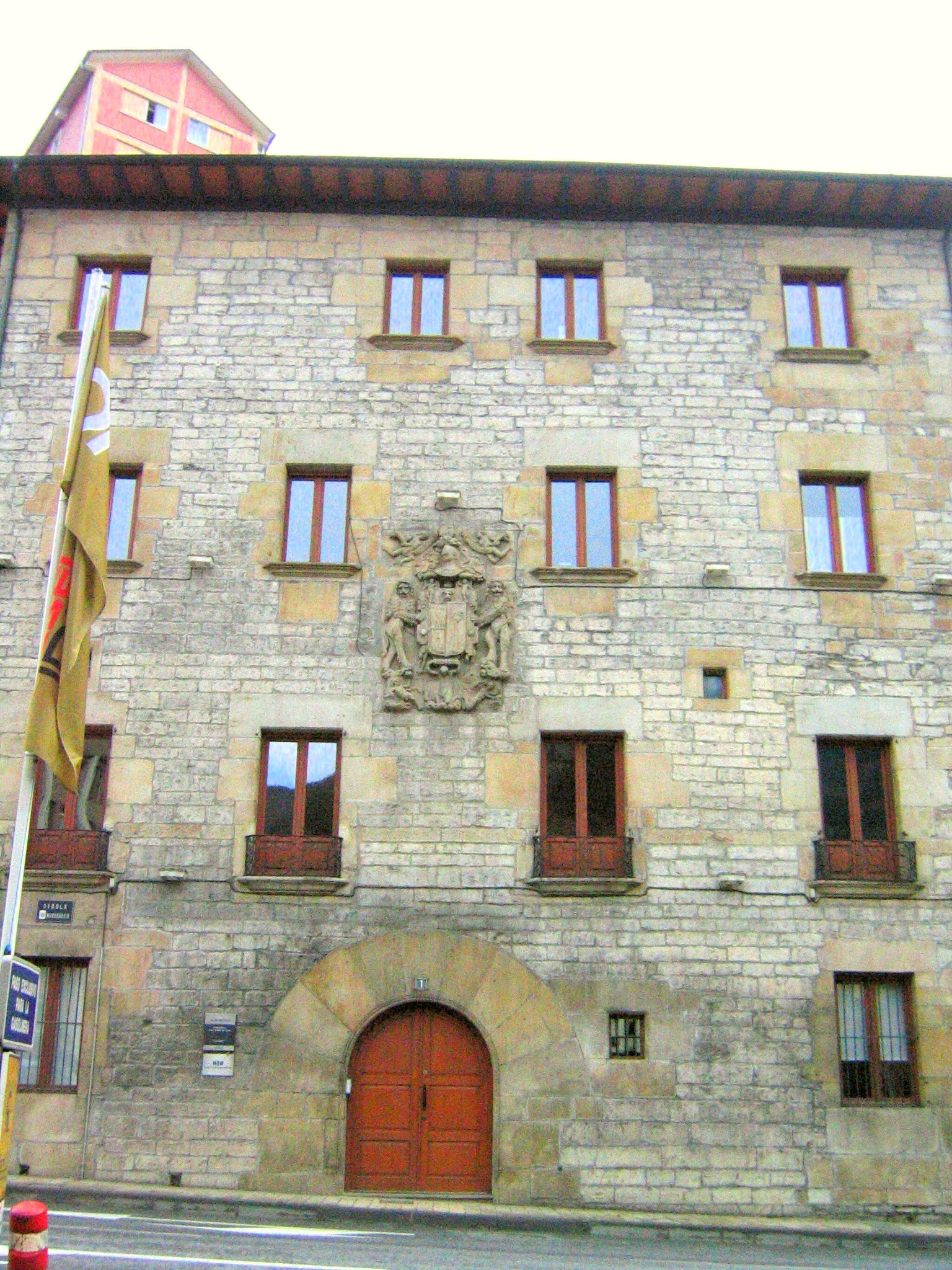
Isasi Jauregia (Markeskua)
Eibar
Isasi Jauregia (Markeskua) is a Renaissance-era noble house in Eibar, in Spain's Basque Country, and one of the most significant pieces of civil architecture still standing in the town. What is this building? Also known as the Tower of Isasi or the Palace of the Marquis of Isasi, Markeskua was built in the 16th century at the order of Martín López de Isasi and Domenja Orbea. Like many other noble houses of that period, it was raised outside the boundaries of the medieval village, close to the road leading toward Ermua. The choice of site was deliberate: the Isasi family was a powerful lineage whose members held significant posts at court, and a residence visible from the main route through town was a clear statement of status. What will you see there? The building itself is restrained rather than showy — a rectangular floor plan, sober decoration, and a hipped roof. That combination of solidity and understatement is characteristic of Basque noble houses of the era: little ornamentation, but confident, well-proportioned architecture that was built to last. The entrance is the focal point: a semi-circular arch framed by carefully cut voussoirs leads into the interior. Above it, set centrally on the façade, is a stone coat of arms belonging to the Isasi family. In the 16th century, a coat of arms like this was the building's main form of communication — it told passersby exactly whose house this was and what social standing the family held. Look closely at the façade and you can trace how Basque palace architecture evolved during the Renaissance: the thick walls and careful stonework still echo the defensive medieval tower houses that came before, even as the overall form shifts toward a more representative, less fortress-like residence. How is the palace used today? Following a thorough restoration, Markeskua now serves as the headquarters of the Udako Euskal Unibertsitatea (UEU), the Basque Summer University. What was once a private noble residence has become an active cultural hub, hosting academic courses, meetings, and events centered on Basque language and culture. It's a good example of historic architecture being adapted for contemporary educational use without losing its original character. How do you get there? The palace stands in Eibar, a town in the Gipuzkoa province of the Basque Country, well connected by rail and regional roads to both San Sebastián and Bilbao. It sits close to the town centre, near the old route to Ermua, so the easiest way to reach it is on foot from downtown Eibar or by local bus. When should you visit? Since Markeskua functions as the seat of a summer university, it's worth checking the local academic calendar before visiting — some interior spaces may only be accessible during specific courses or events. The façade and overall structure, however, can be admired from the outside year-round, and quieter months outside the academic season make for a more relaxed visit to the surrounding area. Frequently Asked Questions What does the name "Markeskua" mean? It refers to the title of marquis — a member of the Isasi family held that title, which is why the building is also known as the Palace of the Marquis of Isasi. When was the palace built? It dates to the 16th century, built during the Renaissance at the order of Martín López de Isasi and Domenja Orbea. Can you visit the interior? The building now houses the Basque Summer University (UEU), so interior access depends on the university's schedule of courses and events. What is the most distinctive architectural feature? The semi-circular entrance arch framed by stone voussoirs, and the Isasi family coat of arms set centrally on the façade.
-
Likona dorretxea
Ondarroa
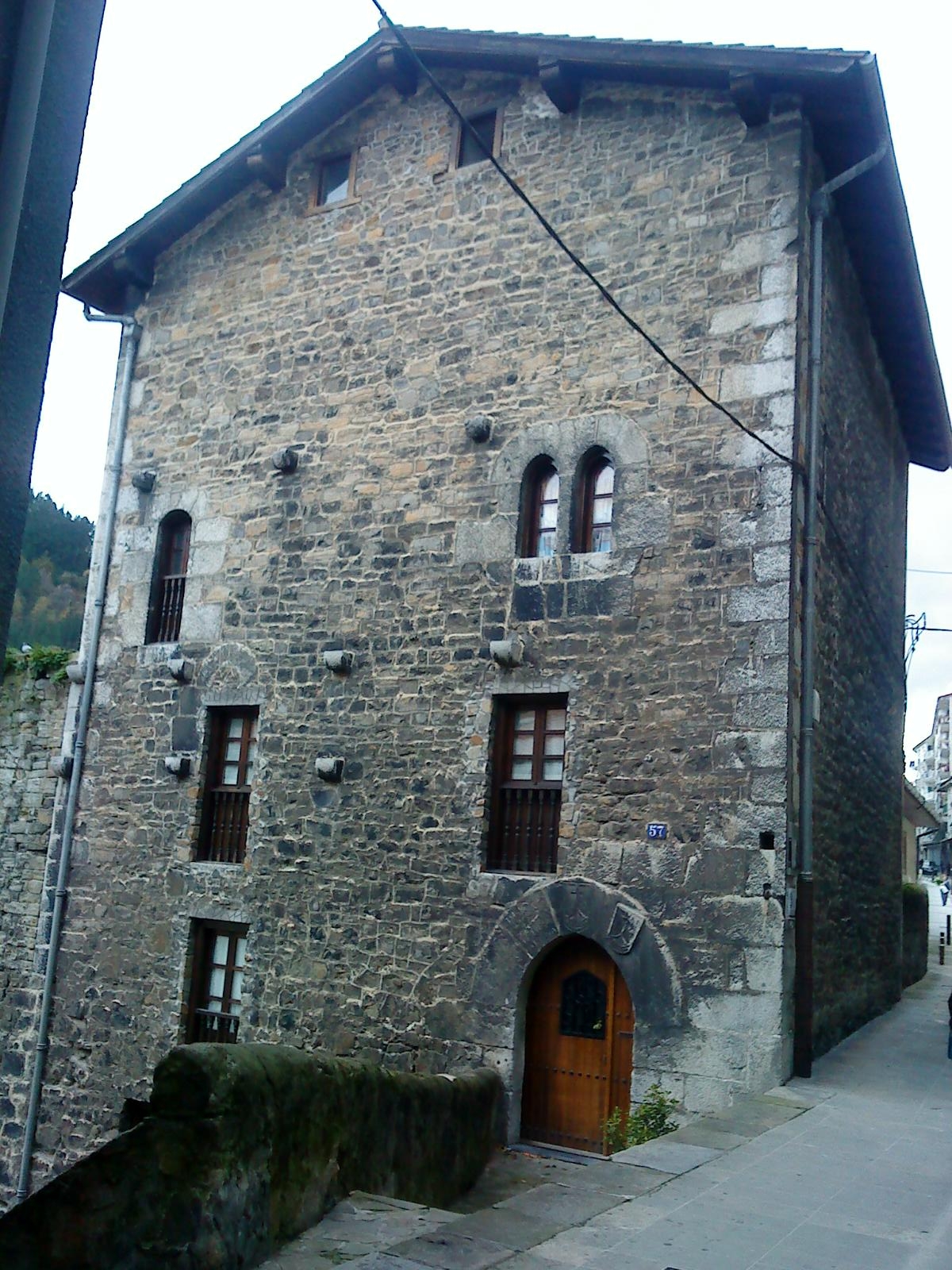
Likona dorretxea (Likona Tower House) is a medieval fortified tower standing on the main street of Ondarroa, a small fishing town in the Basque Country, at the mouth of the Artibai river on Spain's Cantabrian coast. What is this building? Likona dorretxea is a freestanding tower house built in the 15th century, most likely on the site of an earlier defensive structure. It belonged to the Licona (Likona) family, powerful merchants originally from nearby Mendexa who later settled permanently in Gipuzkoa. Buildings of this kind — fortified noble residences — were common across the Basque Country in the late Middle Ages: they combined a family home with a defensible stronghold, signalling the owners' status while offering protection against rival clans. The structure is compact, solid and almost cubic in shape. Because of the slope of the site it stands on, its height varies dramatically from one side to the other: on the east side the tower reaches roughly 14 metres, while on the west side — where the ground level is higher — it drops to only about 8 metres. This uneven profile is typical of buildings raised on sloping urban plots and offers a clear illustration of how builders adapted their designs to the terrain. The tower is also historically significant for another reason: it is one of the few buildings that survived the fire set by French troops in 1794, during the War of the Convention (the war between Revolutionary France and Spain). Ondarroa suffered heavy damage to its old town during that conflict, and Likona dorretxea remains one of the rare structures predating those events still standing today. How do you get there? The tower stands on the main street of Ondarroa's old town (Kale Andi), so it's easily reached on foot — the town itself is small and its historic centre is entirely walkable. Ondarroa sits on the Biscay coast, within easy reach of both Bilbao and San Sebastián by regular bus and road connections. If you're driving, it's best to park near the harbour or at the edge of the old town and continue on foot, since the narrow streets of the centre aren't built for car traffic. What will you see? The tower's raw, solid mass is impressive on its own — it's one of the few surviving examples of fortified residential architecture in the region. Walking around the building lets you appreciate the striking height difference between its east and west façades, a direct result of the sloping ground. The surrounding area — Ondarroa's historic centre, with its narrow lanes, working fishing harbour and views over the Artibai estuary — rounds out the picture of a town that has lived off the sea and trade for centuries. When should you visit? Spring and early autumn are the best times, when the weather along the Biscay coast is mild and the town is quieter than in peak summer. Summer brings more visitors thanks to the beaches and local festivals, but it's also a good chance to combine a look at the tower with a stroll around the harbour and a taste of the local seafood cuisine. Frequently Asked Questions Can you go inside Likona Tower? Interior access is often limited since this is a protected heritage building, so it's worth checking current opening details with Ondarroa's local tourist office before visiting. How old is the tower? The current structure dates from the 15th century, though it was likely built on the site of an earlier defensive tower. Why does the tower have different heights on each side? It's due to the slope of the land it stands on — about 14 metres on the east side and only around 8 metres on the west side, where the ground is higher. Is this the only landmark of its kind in Ondarroa? Likona dorretxea is especially valuable because it survived the fire set by French troops in 1794, unlike many other buildings in the old town.
-
can Colomer
Vilassar de Dalt
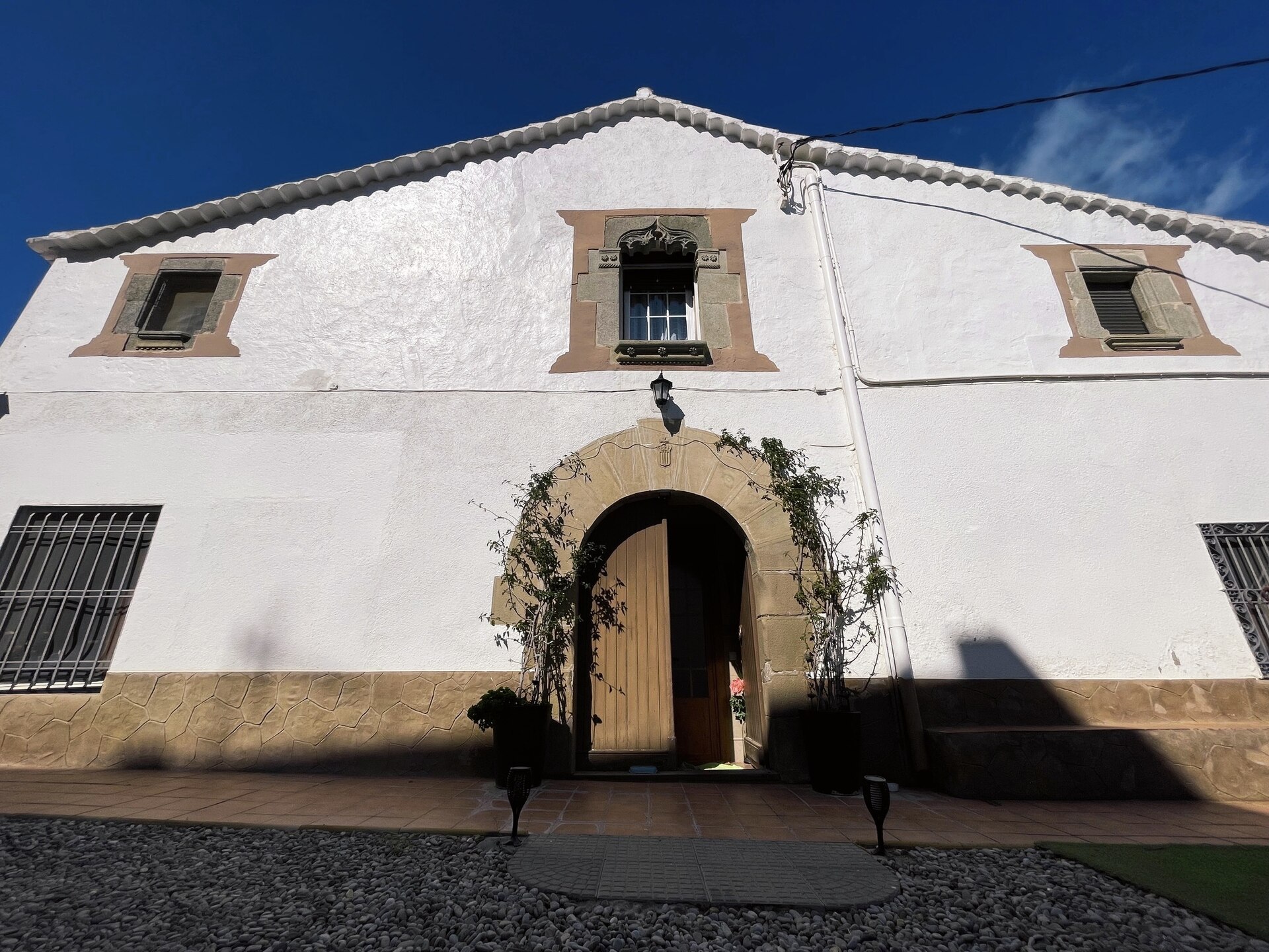
Can Colomer is a historic Catalan masia (traditional country farmhouse) located in the municipality of Vilassar de Dalt, in the Maresme comarca of Barcelona province. It sits in the hills that separate the coastal strip from the inland countryside, at coordinates 41.51443, 2.35469. How do you get to Can Colomer? Vilassar de Dalt lies roughly 30 km northeast of central Barcelona, inland from the coastal town of Vilassar de Mar. Driving is the most practical option: take the C-32 motorway or the N-II road from Barcelona toward Vilassar de Mar, then follow the local road uphill into the Maresme hills. Alternatively, the Rodalies commuter train reaches Vilassar de Mar station, from where a taxi or a short uphill walk brings you to Vilassar de Dalt itself; the farmhouse is reached from there via minor country lanes. Because the area is made up of scattered rural properties rather than a compact tourist center, having your own transport makes exploring far easier. What exactly is a masia, and what defines Can Colomer? A masia is the classic Catalan rural homestead — typically a stone farmhouse surrounded by cultivated fields, historically serving both as a family residence and a working farm with storage rooms, stables, and sometimes a wine or olive press. Can Colomer belongs to this tradition, standing among the many masies scattered across the hills around Vilassar de Dalt. Names of this kind — "Can" followed by a family surname — are the standard Catalan way of naming an estate after its former owners; "Colomer" points to the family that once held the property. What will you see in the surrounding area? Vilassar de Dalt itself is a small, low-key town with medieval roots, and its old quarter is worth a short stroll — narrow lanes, stone houses, and the local parish church. The municipality borders the Serralada Litoral natural park, a ridge of hills running parallel to the coast that is popular with hikers and mountain bikers. Trails along the ridge open up views over both the Mediterranean and the inland Maresme countryside, dotted with masies like Can Colomer. It's a landscape typical of Catalonia's coastal hinterland — a patchwork of vineyards, orchards, and small woods crossed by old farm tracks. When is the best time to visit? Maresme has a Mediterranean climate: mild, rainy winters and hot, dry summers. Spring (April to June) and early autumn (September to October) are the best seasons for walking the hills around Vilassar de Dalt, offering comfortable temperatures and greener scenery after seasonal rains. July and August can get quite hot, making longer walks through the largely shadeless farmland less comfortable. Frequently Asked Questions Can you visit the inside of Can Colomer? The property is a private rural estate, so it's worth checking current access before planning a visit — many masies in the region remain privately owned and are not open to the public. How far is it from the beach? The coastline around Vilassar de Mar is only a few kilometers from Vilassar de Dalt, making the area a convenient base for combining beach time with inland excursions. Do you need a car to reach the area around Can Colomer? A car makes access far easier, though the train to Vilassar de Mar followed by a taxi or walk is possible; be aware the terrain is hilly. What else is worth combining with a visit here? A walk through the old quarter of Vilassar de Dalt and a short outing on the Serralada Litoral park trails, which offer wide views over the Maresme coastline.
-
Can San Simon
Palma
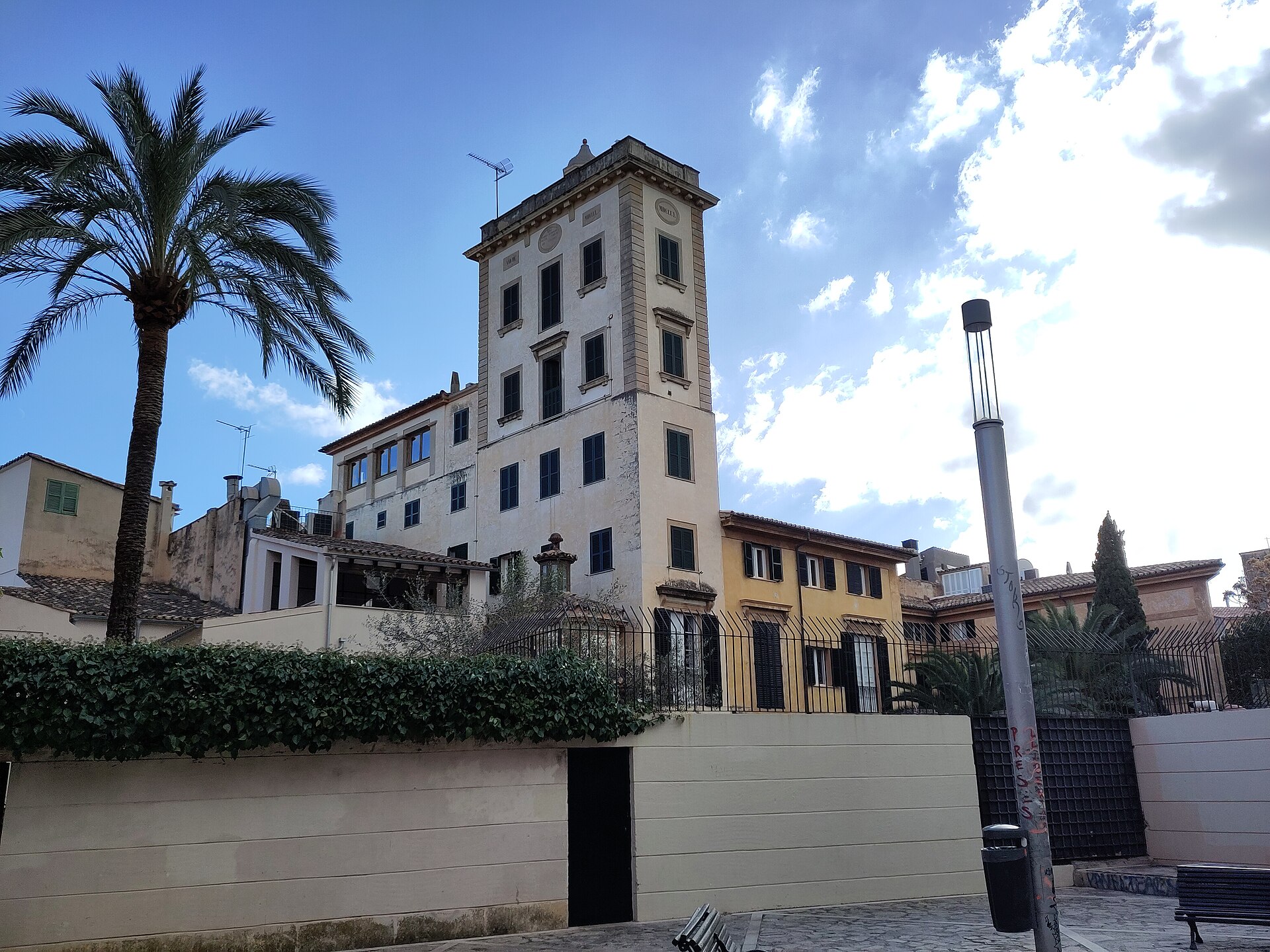
Can San Simon is a historic palace-style townhouse in Palma, Mallorca, standing among the noble residences that give the old town its aristocratic character. The building sits in the heart of Palma's historic quarter and remains one of the city's notable examples of 19th-century residential architecture. Where does the name come from and who owned the property? The estate's story starts in the 17th century, when it belonged to the Morrelles family. Early in the 18th century it passed by inheritance to María Sisternes d'Oblites Mora-Mulet, wife of Pere d'Orlandis Orlandis. The Orlandis family originally came from Pisa — they took refuge in Mallorca at the end of the 15th century after fleeing the Florentines, and over time became part of the island's nobility. The "San Simon" name entered the family later. In 1803, Josepa Orlandis de Cornelles married Louis de Saint-Simon, a French count who had settled in Mallorca in 1795 after leaving revolutionary France behind. That marriage, and the San Simon countship it brought into the family, is where the building's current name comes from. Who built the current structure, and in what style? The building visitors see today dates from long after the estate itself was founded. It was raised between 1854 and 1856 on the initiative of Lluís de San Simón Orlandis, son of the first count of San Simón to settle on the island. The design came from architect Miquel Ferrà Font (1815-1887), one of the significant figures of 19th-century Mallorcan architecture. Ferrà Font gave the building a neo-Renaissance treatment drawing on Italian palace models — a fitting choice given the Orlandis family's Pisan roots. The facade rises four stories and is topped by a rectangular tower visible from the street below. What details are worth noticing on the facade? The ground floor has a rustic, austere character, emphasized by blind arches — decorative arched recesses with no actual openings behind them. Above it, on the piano nobile and the floor that follows, the eye is drawn to a row of four pilasters set on plinths, with fluted shafts and Corinthian capitals — a hallmark of the neo-Palladian style, which borrows from classical antiquity and Renaissance precedent alike. Behind the building lies a garden with a notable architectural feature of its own: a classical exedra, a semicircular recessed bench traditionally used in gardens as both a resting spot and a compositional focal point. How do you get to Can San Simon? The building stands within Palma's historic center, within easy walking distance of major landmarks such as La Seu cathedral and the Passeig des Born. Walking through the old town is the most practical way to reach it, and the city's EMT bus network also serves the center. Driving is impractical given the narrow streets of the old quarter — it's best to park on the edges of the historic center and continue on foot. When is the best time to visit? The facade shows best in daylight, when direct sun brings out the texture of the stonework — the pilasters, capitals, and rusticated ground floor. Spring and autumn are the most comfortable seasons for exploring the old town on foot, avoiding the peak heat of a Mallorcan summer. Frequently Asked Questions Can you go inside Can San Simon? The building serves a private or institutional function and isn't open as a public museum — visits are generally limited to viewing the facade and garden from outside. Where does the name "San Simon" come from? From the San Simon countship, which entered the Orlandis family through the 1803 marriage of Josepa Orlandis de Cornelles to French count Louis de Saint-Simon. What architectural style is the building? Neo-Renaissance with neo-Palladian details, most visible in the pilasters and Corinthian capitals along the facade. Who designed the building? Architect Miquel Ferrà Font (1815-1887), who designed the structure built between 1854 and 1856.
-
Palauet d'Albors
Alcoi / Alcoy
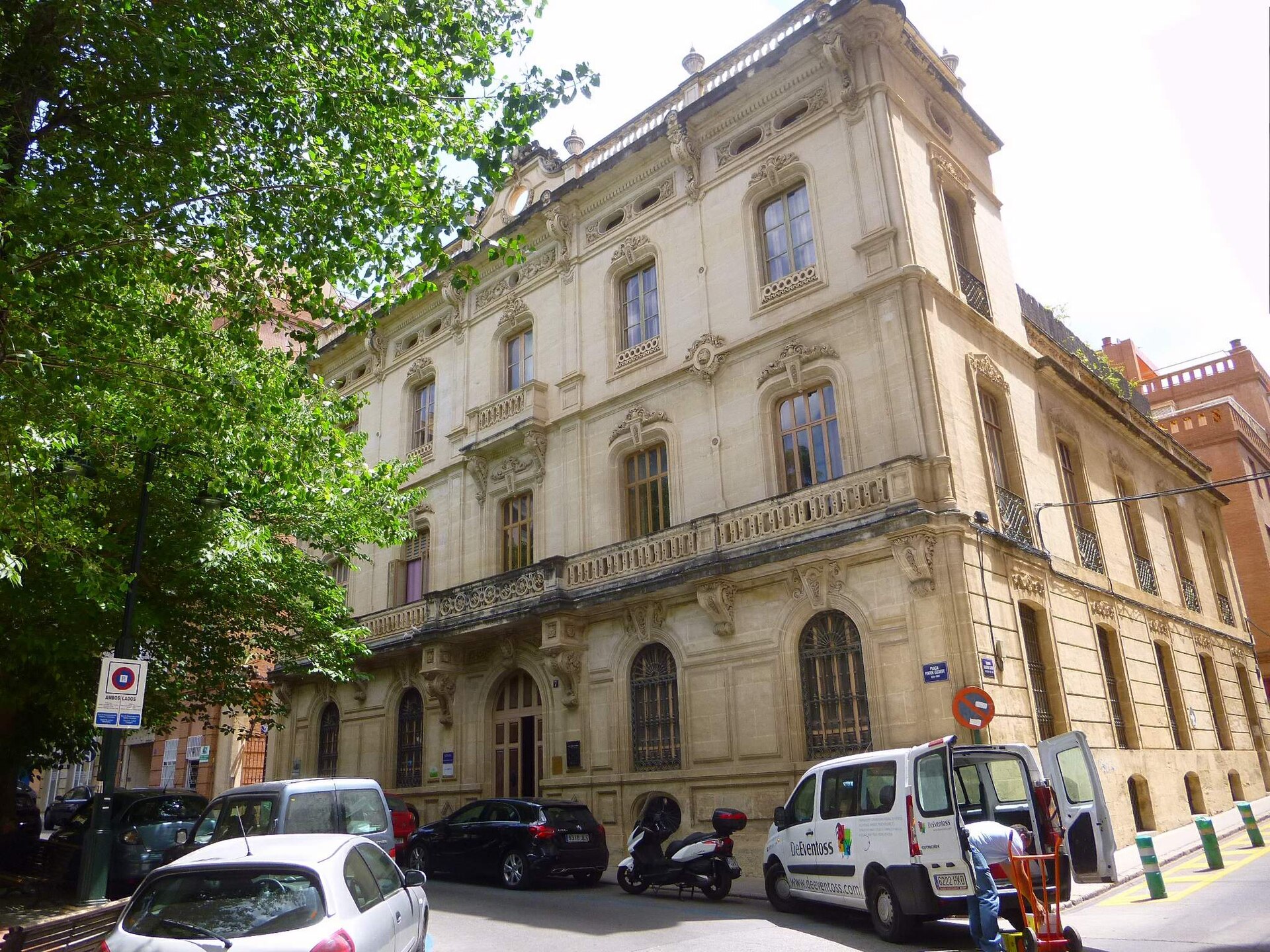
Palauet d'Albors is a 19th-century townhouse-palace in the centre of Alcoi (Alcoy), standing on Plaça del Pintor Gisbert, one of the most distinctive examples of bourgeois architecture in this industrial city in the province of Alicante. Where does this building come from? The mansion was built in 1873 for Rigoberto Albors Monllor, a local industrialist who belonged to the circle of families profiting from Alcoi's booming textile and paper industries. The house belonged to the Albors family, who were also connected to Agustí Albors, one of Alcoi's best-known mayors. The square in front of the building traces back to family land that was later opened up as public space for the city. It's worth noting that 1873, the year of construction, was also the year Alcoy became the stage for a well-known workers' uprising known as "El Petrolio", one of the episodes of Spain's cantonalist movement. The contrast between a lavish industrialist family residence and the social unrest of the period says a lot about the tensions of the industrialisation era. The building survived the following decades, and in the 1970s, when it faced the threat of demolition, residents of Alcoi organised a public campaign to save it. That pressure worked, and the palacete was preserved and restored. What will you see on site? The façade follows an eclectic-classicist style — the stone front is decorated with balustrades and ornamental urns, giving the whole a stately look typical of wealthy bourgeois residences from the late 19th century. The building comprises a semi-basement, ground floor, three upper storeys and an attic. The most eye-catching feature is a large balcony resting on a stone balustrade, set centrally on the façade, along with a prominent cornice topped with a balustrade and a clock — a detail rarely found on private residences, giving the building an almost civic, public appearance. After restoration, the palacete switched from private residence to office building, so the interior isn't open to visitors, but the architectural details can be admired freely from the square. How do you get there? Palauet d'Albors sits right in the centre of Alcoi, surrounded by other historic townhouses and squares, so it's easy to combine a visit with a walk through the old town. Alcoi lies inland, roughly 55 km from the coast and from Alicante, and is best reached by car or regional bus — the city has its own bus station with connections to the province's larger towns. When is the best time to visit? Spring and autumn are the most pleasant seasons for exploring central Alcoi, since temperatures are milder than during the summer heat typical of the inland areas of Alicante province. It's also worth checking the local festival calendar — Alcoi is famous for its spectacular Moros i Cristians celebrations, which bring the whole historic centre to life, including the area around Plaça del Pintor Gisbert. Frequently Asked Questions What is Palauet d'Albors? It's a 19th-century townhouse-palace in Alcoi, built in 1873 for industrialist Rigoberto Albors Monllor and now converted into offices. Can you visit the inside of the building? No, the building currently serves as offices and isn't open to visitors — the façade and architectural details can be admired from the square. What's most distinctive about the building's architecture? Its stone eclectic-classicist façade, a large balcony with a balustrade, and a cornice topped with a clock. Why does the building matter to the city's history? It was the home of the Albors family, linked to Agustí Albors, a well-known mayor of Alcoi, and in the 1970s local residents launched a campaign that saved it from demolition.
-
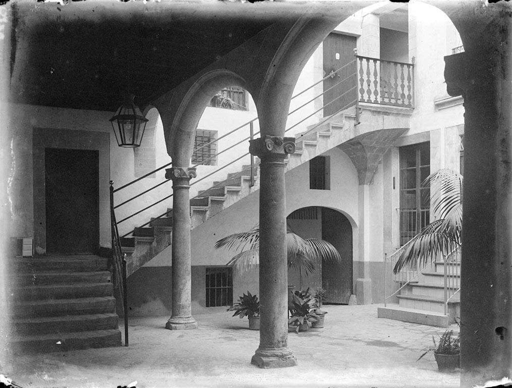
Can Crespí
Palma
Can Crespí, also referred to as Can Ribera, is an 18th-century stone mansion standing at Carrer de Sant Roc 1, right in the heart of Palma de Mallorca's old town. The house belonged to the Crespí family, who originally came from nearby Santa Maria del Camí, and it stands today as one of the many casals — the merchant and noble town houses that still give Palma's historic center its stone-labyrinth character. What can you see there? The plain street facade gives little away: a semicircular arched doorway leads through a small vestibule into the inner courtyard that forms the heart of any Palma casal. The covered section of the patio rests on three arches carried by red marble columns topped with Ionic-style capitals — a detail that instantly signals the wealth of the family who once lived here. In the open-air part of the courtyard stands an octagonal well fitted with decorative wrought-iron work, a typical feature of Mallorcan patios from this era. Can Crespí is sometimes described as a "casal with literary resonances" and appears in studies dedicated to Palma's historic courtyards, including the book "Patis de Palma" (Ajuntament de Palma, 2002) and earlier research by Murray-Pascual from 1999. It's this combination of architecture and family history that makes the building a reference point for anyone interested in the old town's built heritage. How do you get there? Can Crespí sits within the Casc Antic, Palma's historic quarter, just a few minutes' walk from La Seu cathedral and Plaça de Cort. Walking is by far the easiest way in — the old town's narrow streets aren't built for cars, and most of the district's landmarks are best explored on foot anyway. The nearest bus stops are along Avinguda de Jaume III and around Plaça d'Espanya, both a short walk from Carrer de Sant Roc through the tangle of old streets. When is the best time to visit? Palma's old town, Can Crespí included, is at its best in spring and early autumn, when temperatures are milder than midsummer and the streets carry fewer crowds. The stone facades and shaded courtyards look particularly striking in the late-afternoon light, when the sun angles low into the inner patios of the historic houses. Visiting this stretch of the city works well as part of a longer walk taking in the other casals and courtyards of the old town, which together paint a fuller picture of Palma's 17th- and 18th-century town-house architecture. Frequently Asked Questions Can you visit the inside of Can Crespí? The building remains privately owned, so access to the interior and courtyard may be limited. The facade and overall layout, however, can be appreciated from Carrer de Sant Roc itself. Why is the building also called Can Ribera? The name Can Ribera appears alongside Can Crespí in some sources, which is common for Palma's old casals — over the centuries these houses changed hands and picked up alternate names tied to the families associated with them. What's the most notable architectural feature? The inner courtyard, with its three arches on red marble columns and Ionic capitals, along with the octagonal well and its wrought-iron grille in the uncovered part of the patio. How does Can Crespí fit into Palma's history? It represents a typical 18th-century merchant-noble residence, linked to the Crespí family from Santa Maria del Camí, and forms part of the broader heritage of old-town courtyards documented in studies on Palma's architecture.
-
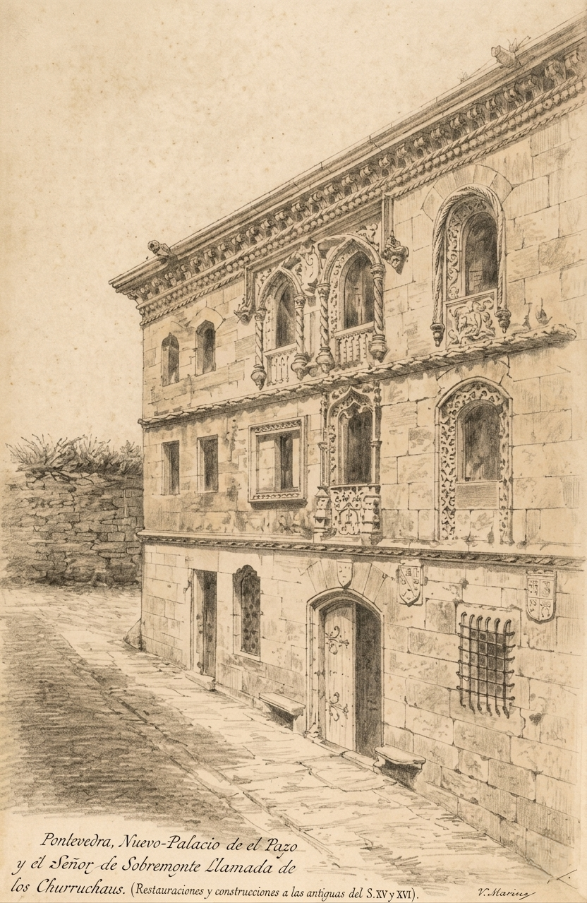
Churruchaos Palace
Pontevedra
Churruchaos Palace in Pontevedra was a late 15th-century Gothic pazo that no longer stands, though its name still marks a street in the city's old town. Its story is one of the more striking chapters in Pontevedra's medieval past. Where did the Churruchaos Palace stand? The building once stood in the heart of old Pontevedra, between Churruchaos Street, Paio Gómez Charino Street, and Santa María Avenue. The street named Churruchaos still exists today, and walking along it means passing the exact spot where one of the grandest urban residences of medieval Galicia once stood. Who built it, and why did it matter? The palace was commissioned by Suero Gómez de Soutomaior, a nobleman born around 1417 in Rianxo. He descended from Paio Gómez Charino and was related to Pedro Madruga, two figures central to the region's medieval history. The Churruchaos family belonged to the Sotomayor and Camba lineages, among the most influential noble houses of medieval Galicia. Contemporaries considered this pazo the most beautiful urban residence in Pontevedra and the richest of the buildings raised by the workshop of masters linked to the Santa María church, possibly including Diego Gil. Its architecture is regarded as a high point of late Gothic civil building in the region, and the palace itself was seen as one of the finest examples of Pontevedra's late Gothic period. What happened to the palace? The building remained in good condition until 1719, when English troops attacked Pontevedra and burned several of the city's main buildings, the Churruchaos Palace among them. Its façade was later dismantled, and pieces of it were reused elsewhere: part went into completing a window on the front of the San Francisco church, while other carved stonework was incorporated into the library of a private residence built in Poio by Augusto González Besada. Can you still see any trace of it today? The palace itself cannot be visited, since nothing remains standing on the original site. What survives is the street name and scattered architectural fragments built into other structures — the window at San Francisco church and the library in Poio. For anyone tracing Pontevedra's medieval history, that is still reason enough to pause on Churruchaos Street and picture the noble residence that once rose there. Frequently Asked Questions What was the Churruchaos Palace? It was a late 15th-century Gothic pazo built in the center of Pontevedra by Suero Gómez de Soutomaior, considered one of the finest urban residences in the city's history. When did the Churruchaos Palace stop existing? The building was destroyed in 1719, during an attack on Pontevedra by English troops that burned and destroyed several of the city's main buildings. Is there anything left to see today? The building itself is gone, but the Churruchaos Street name survives, along with facade fragments reused in a window at the San Francisco church and in the library of a residence in Poio. Which noble family was linked to the palace? The Churruchaos family, descended from the Sotomayor and Camba lineages, two of the most prominent noble houses of medieval Galicia.
-
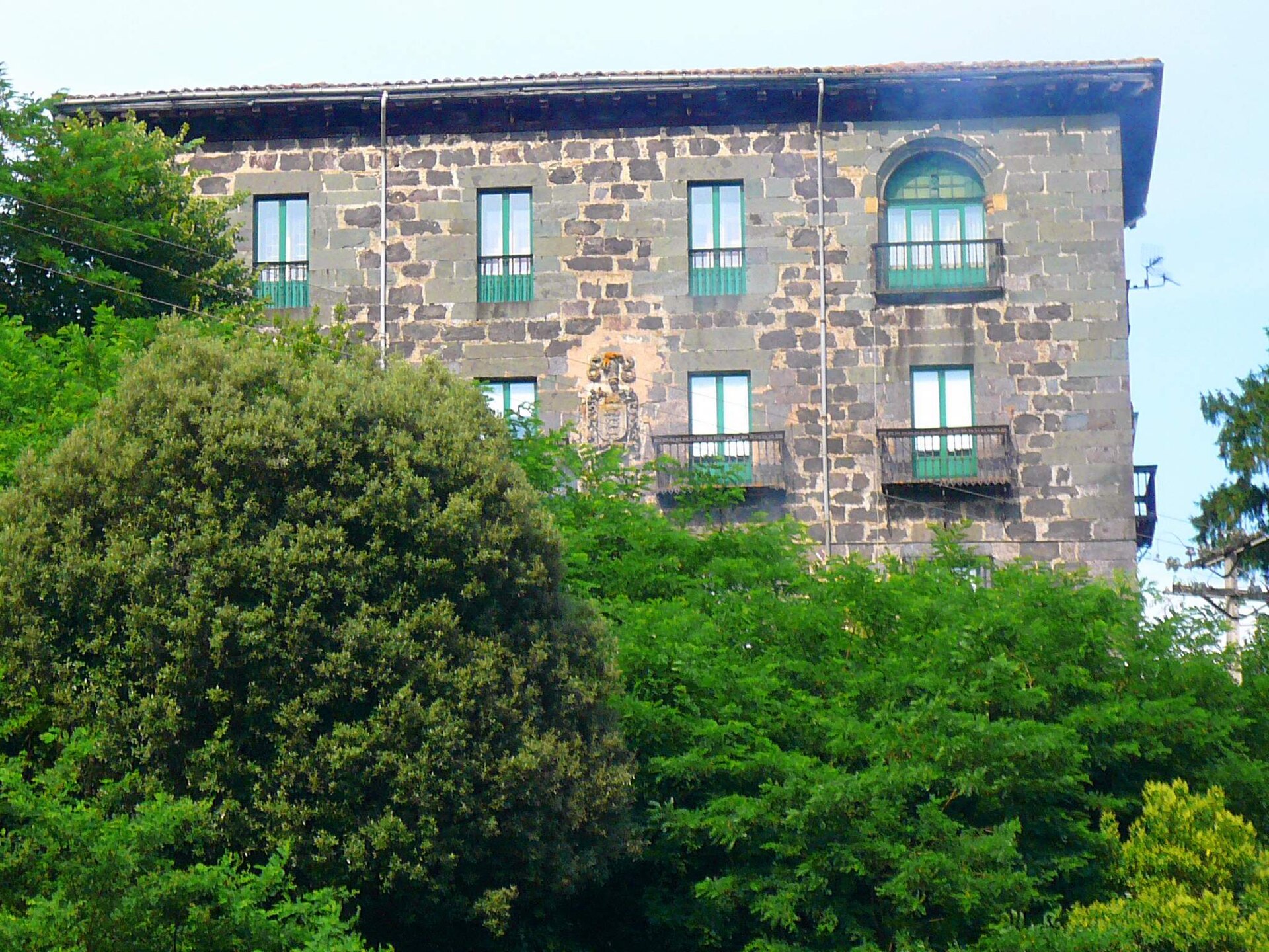
Casas de Unzueta
Eibar
Casas de Unzueta is a historic tower-house complex in the Azitain district of Eibar, in the Gipuzkoa province of the Basque Country, Spain. Where exactly is Casas de Unzueta located? The building sits on a small rise above the left bank of the Ego river, in the Azitain neighborhood, along the old route linking Eibar with the Deba road — a corridor that for centuries connected the Castilian plateau with the Cantabrian coast. That location was no accident: controlling this route gave the Unzueta lineage real strategic weight in the area. What is the history behind the Unzueta family and this building? The Unzueta surname is documented as far back as 1193, making it one of the older recorded lineages around Eibar. During the medieval period, the Unzuetas took part in the feuds between Basque factions, siding with the Oñacino party — a stance that cost their tower house repeated attacks and damage over the centuries. The structure visitors see today is not the original medieval fortress. It is the result of a rebuilding commissioned in the 17th century by Doña Ángela María de Unzueta, after which the tower-house took on a more residential character than a defensive one, while still carrying forward the family's original seat. What does the building look like? Casas de Unzueta has an L-shaped floor plan, with a ground floor and two upper stories, topped by a four-sided roof. The Unzueta family coat of arms is placed on the first-floor facade: a green tree with three wolves pierced through its trunk. That heraldic motif is one of the building's most recognizable features and is easy to spot from street level. What is the building used for today? On 30 November 1957, the La Salle Brothers opened a school on the site, known as Nuestra Señora de Azitain La Salle — a name drawn from the nearby Azitain Hermitage, which is tied to the area's local history. The building has therefore stayed in continuous educational use, unlike many other Basque tower-houses that ended up as museums or fell into disrepair. On 17 January 1964, Casas de Unzueta was declared a Cultural Heritage Asset (Bien de Interés Cultural), formally protecting it as part of Gipuzkoa's historical heritage. Frequently Asked Questions Can visitors go inside Casas de Unzueta? The building operates as a school run by the La Salle Brothers, so the interior is not generally open to tourists. The facade, including the family coat of arms, can be viewed from outside. Why is it called "Casas" (houses), plural, rather than "Casa"? The name refers to the cluster of buildings that grew up around the original Unzueta tower, not a single isolated structure — hence the plural "houses" rather than "house." How does today's building differ from the medieval Unzueta tower? The original defensive tower, damaged repeatedly during the Basque faction wars, did not survive in its early form. What stands today was built in the 17th century at the initiative of Doña Ángela María de Unzueta, and is more residential in character than military. How do you get to Casas de Unzueta from central Eibar? The building is in the Azitain district, along the route linking Eibar with the Deba road, next to the Ego river — technically within the town, though outside its historic center.
-
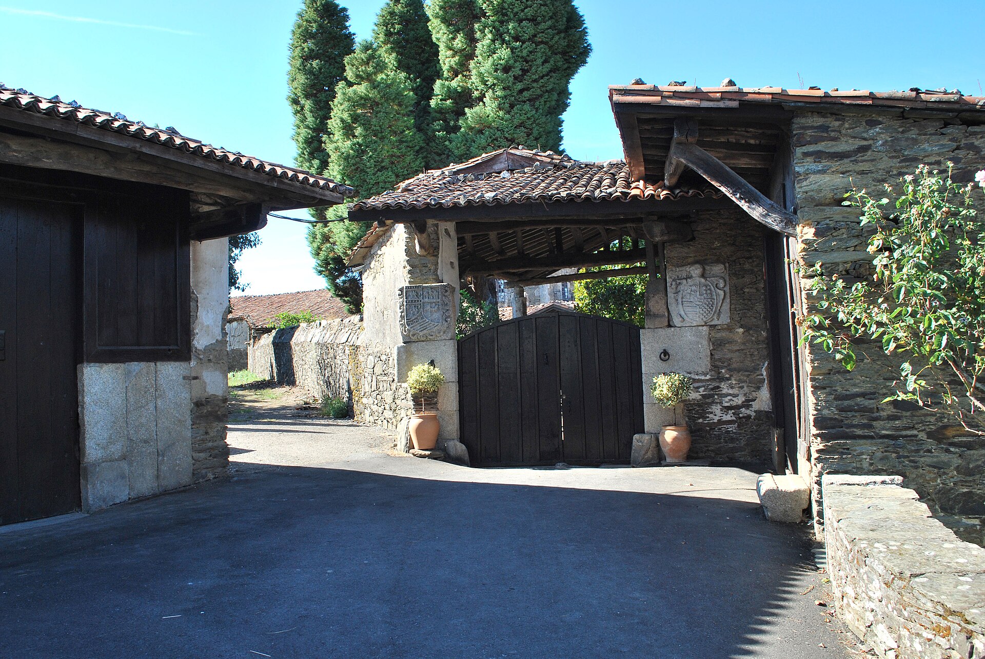
Pazo de Santa Cruz de Mondoi
Oza Cesuras
Pazo de Santa Cruz de Mondoi is a historic Galician manor house standing in the parish of Mondoi (Santa Cruz), within the municipality of Oza-Cesuras, in the province of A Coruña. The building sits on the road connecting Betanzos and Curtís, less than 25 km from the city of A Coruña, to which it is linked by a direct road connection. What exactly is a pazo, and where does the name come from? A pazo is the classic Galician form of noble manor house — a stone residence enclosed by walls, set among gardens and outbuildings. This particular property is known under two names: Pazo de Mondoi and Pazo de Santa Cruz de Mondoi, the latter referring to the patron saint of the parish where the estate stands. Who owned the pazo historically? The house is linked to the Ponte Andrade lineage, one of the old noble families of Galicia whose name recurs throughout the history of manor houses in the A Coruña area. That ancestry explains the scale and solidity of the building, characteristic of residences raised by the local aristocracy in the 16th century. What does the building look like architecturally? The pazo stands on a rectangular ground plan and is enclosed by a stone wall. Its walls were built in rubblework masonry, while the corners, jambs and cornices were finished in dressed ashlar granite. A distinctive decorative feature is its granite gargoyles, common on manor houses in this region as both a roof drainage device and a facade ornament. A garden extends in front of the building, with former orchards behind it — a layout typical of Galician rural residences, where the formal, representative area is kept separate from the working grounds. How is the estate used today? The pazo is currently leased and operates as a venue for weddings, family celebrations and corporate events. The property, covering roughly 8,000 m² of grounds, has been adapted to host guests — its gardens, former orchards and manor-house interiors provide the setting for catering and receptions. This event-hosting role is the building's main present-day use, even though it has retained its historic character and original layout. Where exactly is it located? The pazo lies in the parish of Mondoi, in the municipality of Oza-Cesuras (postal code 15319), within the tourist area known as As Mariñas, in the province of A Coruña. The nearest major city is A Coruña, less than 25 km away, reached via the road that runs through Betanzos and Curtís. Frequently Asked Questions Can Pazo de Santa Cruz de Mondoi be visited as a tourist? The property is privately owned and rented out for weddings and events, so access is generally tied to attending a function held there rather than to open sightseeing. How old is the building? The pazo dates to the 16th century and is associated with the Ponte Andrade family, one of Galicia's historic noble lineages. Does the pazo have a garden? Yes — a garden lies in front of the building, with former orchards to the rear, a layout typical of this type of Galician country residence. What names is this estate known by? It appears under two names depending on the source: Pazo de Mondoi and Pazo de Santa Cruz de Mondoi.
-
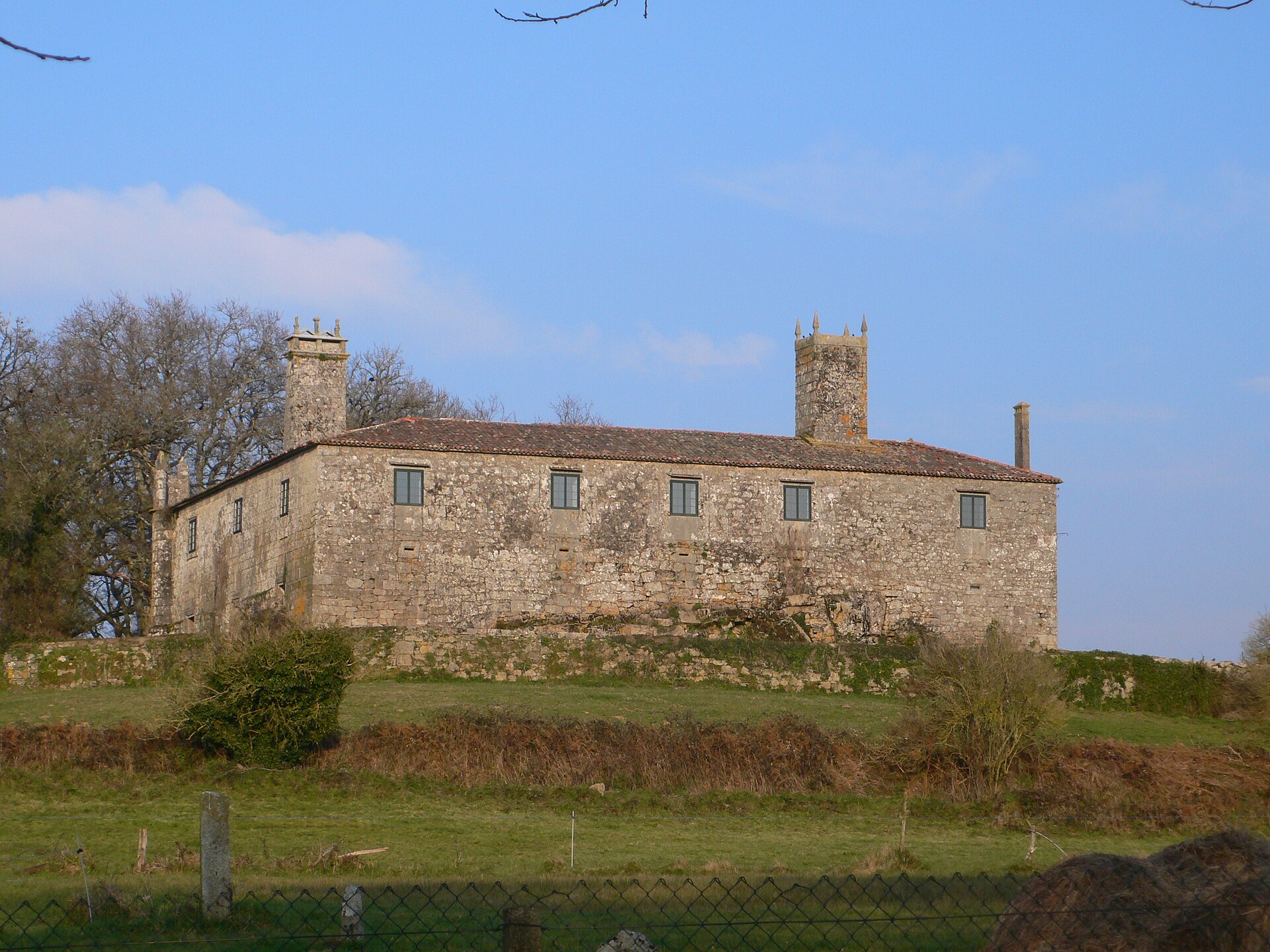
Pazo de Borraxeiros
Agolada
Pazo de Borraxeiros in Agolada is one of the more distinctive Galician manor houses in Pontevedra province, still keeping the isolated, rural character of the noble estate it once was. Where exactly is Pazo de Borraxeiros? The building stands in the parish of San Cristovo de Borraxeiros, within the municipality of Agolada, right on the border between Pontevedra and Lugo provinces, near the hills of the Serra do Farelo. Like most pazos, it sits on a hillside surrounded by a large rural estate, well away from any town center, which keeps the setting quiet and largely unchanged. What's the history behind it? The site's history goes back further than the current building. An earlier fortress here belonged to the Counts of Altamira and was destroyed in the 15th century during the Irmandiño revolts, the peasant uprisings against Galicia's feudal nobility. Stone salvaged from that ruined stronghold was later used to raise the pazo standing today, which is why it's also referred to as Pazo do Salgado or Pazo dos Salgado, after the Salgado family tied to its later history. Sources vary slightly on the exact century of the rebuild, pointing to a period spanning the 16th and 17th centuries — a common pattern for pazos that were reconstructed in stages across generations rather than in a single campaign. What does the building look like? Pazo de Borraxeiros is a two-story structure on a rectangular (in some accounts square) plan, topped with a four-sided roof. The complex includes a chapel and two towers, one of which is of medieval origin, a clue to an earlier, more defensive phase of the site. There's an internal courtyard, and the facade historically carried crenellated elements, typical of residences that started out with a defensive function before evolving into a noble home. Overall it follows the classic Galician pazo formula: austere granite, symmetrical massing, and a mix of residential and representative spaces. Can visitors go inside? The pazo is privately owned and managed. It's still recognized as a point of interest in the area and is occasionally used as a venue for cultural events, weddings, and local celebrations. Because it's private property, interior access isn't guaranteed, and there's no confirmed public information on opening hours or visiting conditions — it's worth checking locally before planning a visit. Frequently Asked Questions Where is Pazo de Borraxeiros located? In the parish of San Cristovo de Borraxeiros, municipality of Agolada, Pontevedra province, close to the Lugo border and the Serra do Farelo hills. Does the pazo have another name? Yes, it's also known as Pazo do Salgado or Pazo dos Salgado, after the Salgado family connected to its history. How old is the current building? It replaced an earlier fortress destroyed in the 15th century during the Irmandiño revolts; the present structure is linked to a rebuild dated between the 16th and 17th centuries. Is it open to the public? It's privately owned, so interior access isn't guaranteed — it's sometimes opened for cultural events or weddings rather than regular visits.
-
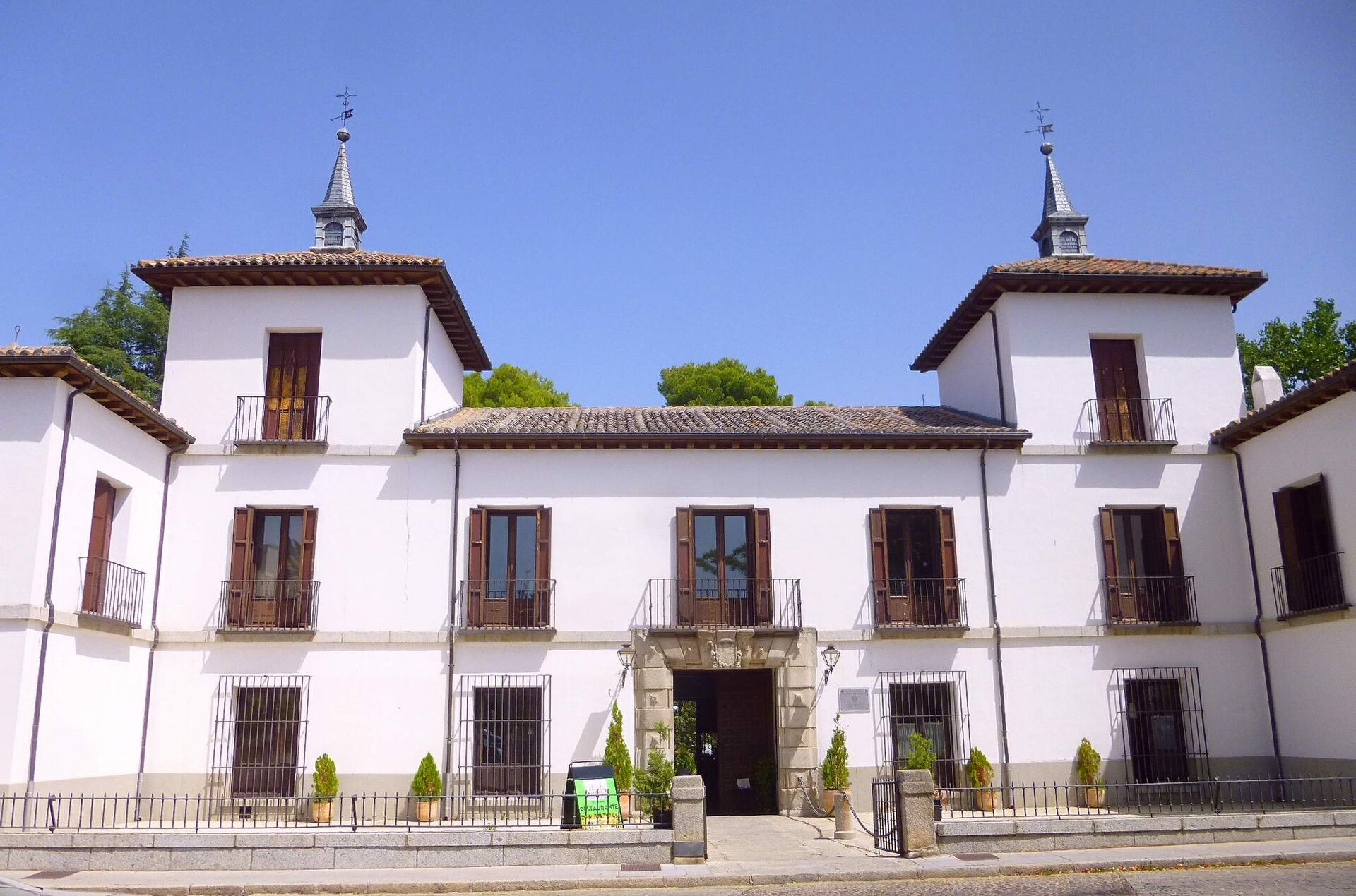
Palacio de Godoy, Villaviciosa de Odón
Palacio de Godoy in Villaviciosa de Odón, near Madrid, is one of the town's most recognizable buildings, also known as Casa Palacio Manuel Godoy. This former aristocratic residence, now open to visitors, combines centuries of history with gardens and exhibition spaces. Where does the palace come from? The building was constructed in the early 17th century in an architectural style typical of the Habsburg era in Spain — the same style that shaped many corners of Madrid and Toledo. Over the following centuries the palace passed through several noble families, including the Marquises of Villacastel de Carrias, the Counts of Murillo, and the Counts of Belveder. This succession of aristocratic owners reflects the standing the property held in the region from its earliest years. Why is it named after Manuel Godoy? A turning point in the building's history came in 1800, when the estate passed to María Teresa de Borbón y Vallabriga, Countess of Chinchón, and her husband Manuel Godoy, an influential statesman at the court of Charles IV. The building's current name comes from him. After Godoy fell from power, his family never again lived in the residence on a permanent basis, and throughout the 19th century the property was rented out to various tenants while going through several changes of ownership. How did the town come to own it? After the Godoy family's departure, the property's fortunes were turbulent — it changed hands repeatedly and gradually fell into disrepair. This changed when the municipality of Villaviciosa de Odón acquired the palace in 1986, specifically to prevent it from disappearing. A decade later, in 1995, the town carried out a restoration project that gave the building the appearance visitors see today. What can you see inside? Today the palace houses the painting collection of Maruja Díaz, a Spanish actress and singer who donated a substantial part of her art collection to the town. The building also holds material related to Manuel Gutiérrez Mellado, a figure significant to Spain's recent history. Visitors can walk through a series of exhibition rooms and also enjoy the gardens surrounding the palace, which are among the site's main draws. What else should you know before visiting? The palace operates as a cultural venue open to both residents and tourists, run by the Villaviciosa de Odón town council. On site there is also a food and drink service — a terrace and an indoor café — allowing visitors to pair a tour of the building with a break in a historic setting. Exact opening hours and the current exhibition programme are worth checking directly with the town council beforehand, as they can vary with the season and the calendar of cultural events. Frequently Asked Questions What is the Palacio de Godoy? It is a historic residence from the early 17th century in Villaviciosa de Odón, also known as Casa Palacio Manuel Godoy, now run as a cultural venue with gardens and exhibition halls. Where does the palace's name come from? The name comes from Manuel Godoy, a statesman at the court of Charles IV, who held the estate together with his wife, the Countess of Chinchón, from 1800 onward. What can visitors see inside today? The interior displays the painting collection of Maruja Díaz along with material related to Manuel Gutiérrez Mellado, plus gardens and a café-and-terrace area. Who manages the palace now? Since 1986 the building has belonged to the municipality of Villaviciosa de Odón, which restored it in 1995 and now opens it to the public as a cultural space.
-
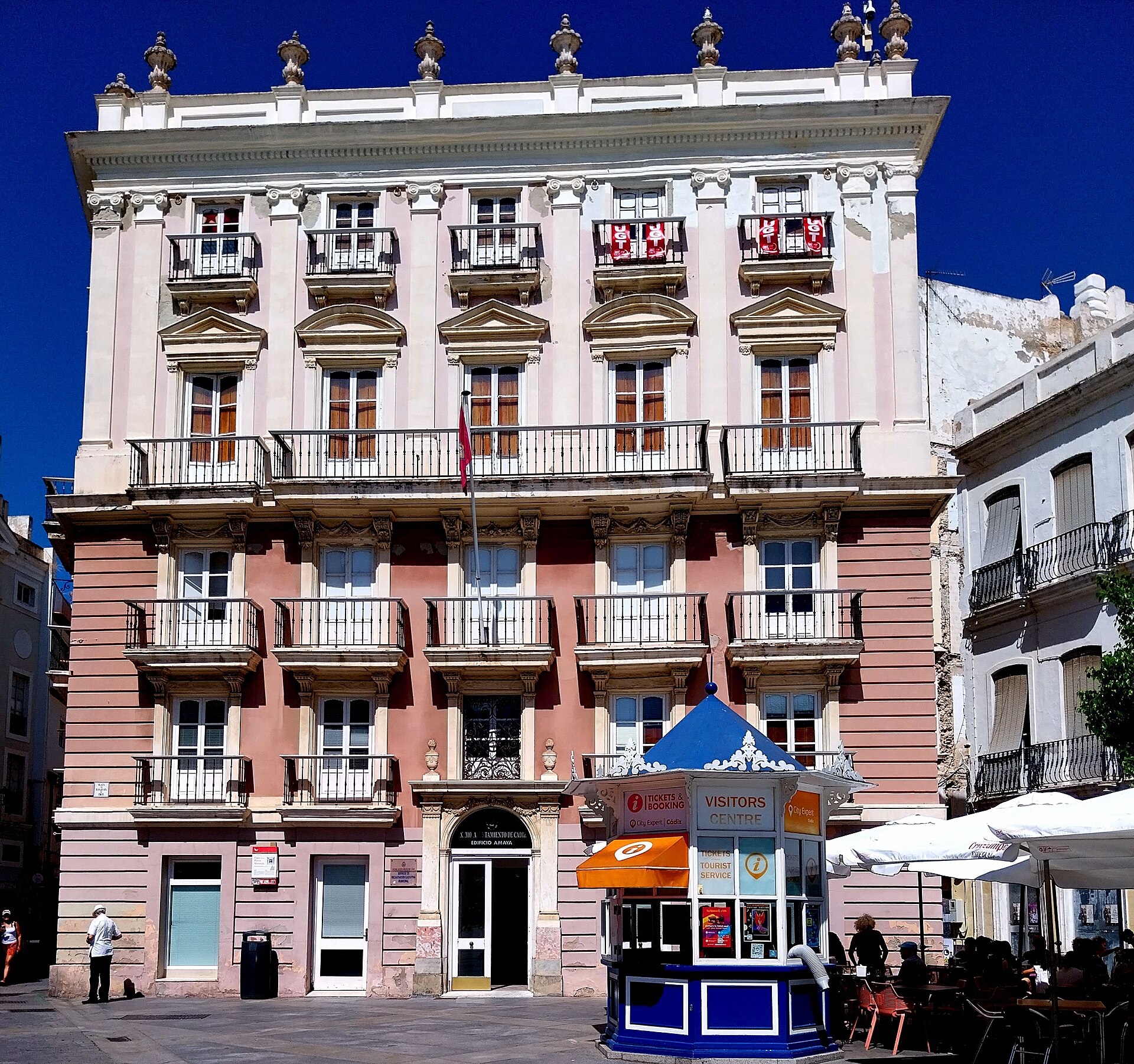
Casa de los Pazos de Miranda
Kadyks
Casa de los Pazos de Miranda is a historic townhouse in Cádiz standing on the western side of Plaza de San Juan de Dios, one of the most important squares in the old town. The building is a protected, listed structure and forms part of the row of houses that frame the square, contributing to one of the city's most recognizable streetscapes. Who built the house and when was it constructed? The house was built in 1795 for Don Fernando Pazos de Miranda, whose name the building still carries. The design came from Miguel de Olivares, an architect linked to the Cádiz academic school — the circle of builders who shaped the city's architecture at the time around classical proportion and order. What does the building's architecture look like? The façade reflects its architect's classical training and gathers together the traits typical of the Cádiz academic school. The upper section is organized by a giant order of Ionic pilasters framing the rooms between them, while the lower floors are wrapped in a plain, restrained plinth. The house rises five storeys and carries light ornamental detailing that keeps the façade from feeling overloaded. This contrast between a sober base and a rhythmic, more elaborate upper section is typical of Cádiz's bourgeois townhouses from the turn of the 18th to the 19th century. Why is the building also known as Casa Amaya? The popular name "Casa Amaya" comes from Emiliano Amaya Vázquez, who opened a textile shop inside the building in 1944. The name stuck so firmly that it is still used alongside the historic Pazos de Miranda name, and city records sometimes refer to the property as "Edificio Amaya." How is the building used today? After decades of commercial use, the property passed into the hands of the city council, which carried out its restoration. Today the house serves as an administrative building for the Ayuntamiento de Cádiz, while remaining on view as a piece of historic architecture for anyone exploring the square from the outside. Why is this building worth seeing on a visit to Cádiz? Casa de los Pazos de Miranda is regarded as one of the finest examples of civil classical-era architecture in Cádiz. For visitors touring Plaza de San Juan de Dios — the square that is also home to the city hall — the house offers a clear reference point for understanding what the city's bourgeois architecture looked like during its era of colonial trade and prosperity. Frequently Asked Questions Where is Casa de los Pazos de Miranda located? The house stands on the western side of Plaza de San Juan de Dios in the historic center of Cádiz. When was the house built? It was built in 1795 to a design by the architect Miguel de Olivares. Why is the building also called Casa Amaya? Because in 1944 Emiliano Amaya Vázquez opened a textile shop there, and his family name stayed attached to the building. Can visitors go inside? The building now serves an administrative function for the city, so visits are mainly limited to viewing the façade from the square.
-
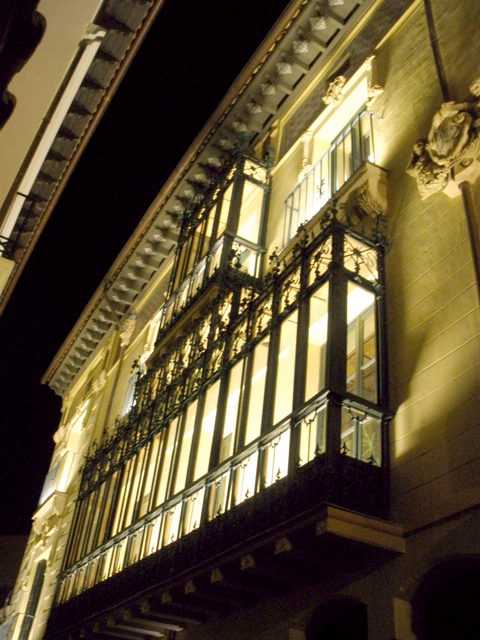
Casa Escriche
Teruel
Casa Escriche is a Modernist townhouse in Teruel, one of the Aragonese cities with the richest Art Nouveau architectural heritage in Spain. The building stands at calle de Temprado 4, right in the historic center, and is one of the stops on the walking route dedicated to Teruel's modernist architecture. Where does the name come from and when was it built? The name comes from the Escriche family, for whom the townhouse was originally built. Sources on the exact construction date are not fully consistent: the building is dated to either 1902 or 1912, both falling within the peak years of Modernism in Teruel, when the city underwent an intense wave of residential construction inspired by the Belle Époque. Who designed Casa Escriche? No archival documentation confirms the architect. Based on its stylistic features, the building is attributed to Pablo Monguió, born in Tarragona in 1865, who was the leading architect of Modernism in Teruel. The same kind of undocumented attribution applies to other buildings in the city, such as Casa Bayo and Casita de la Farmacia — a good illustration of how much of Teruel's architecture from this period still lacks full historical documentation. What makes Casa Escriche stand out among Teruel's other modernist buildings? Teruel is a unique case in Spain, where Modernism layered itself on top of an earlier Mudejar architectural tradition, producing a local variant of the style. Casa Escriche belongs to this group of townhouses from the turn of the 19th and 20th centuries that still form a coherent, recognizable stretch of the urban fabric along the streets of the historic center. How is the building used today? Following its rehabilitation, Casa Escriche is no longer purely residential — it currently houses the headquarters of the Comarca Comunidad de Teruel, the administrative body that manages the region surrounding the city. This means the building remains in active use and maintained, which makes it easy to view from the outside while touring modernist Teruel. How do you get to Casa Escriche when visiting Teruel? The building is located at calle de Temprado 4, inside the historic center, making it easily reachable on foot from Teruel's main landmarks, such as Plaza del Torico. Given its location, it fits naturally into walking routes that connect the various examples of modernist architecture scattered around the center. Frequently Asked Questions Can you visit the inside of Casa Escriche? The building functions as an administrative office, housing the Comarca Comunidad de Teruel, so visits are essentially limited to viewing the façade and architectural details from the street. Who was the architect of Casa Escriche? There is no definitive answer in the historical record — the building is attributed to Pablo Monguió based on style, without archival confirmation. In what style was Casa Escriche built? In the Modernist (Art Nouveau) style typical of the turn of the 19th and 20th centuries, which in Teruel developed into a distinctive local variant. Why is the building called "Escriche"? The name comes from the Escriche family, for whom the townhouse was originally built.
-
Palacio de Bendaña o Paternina
Haro
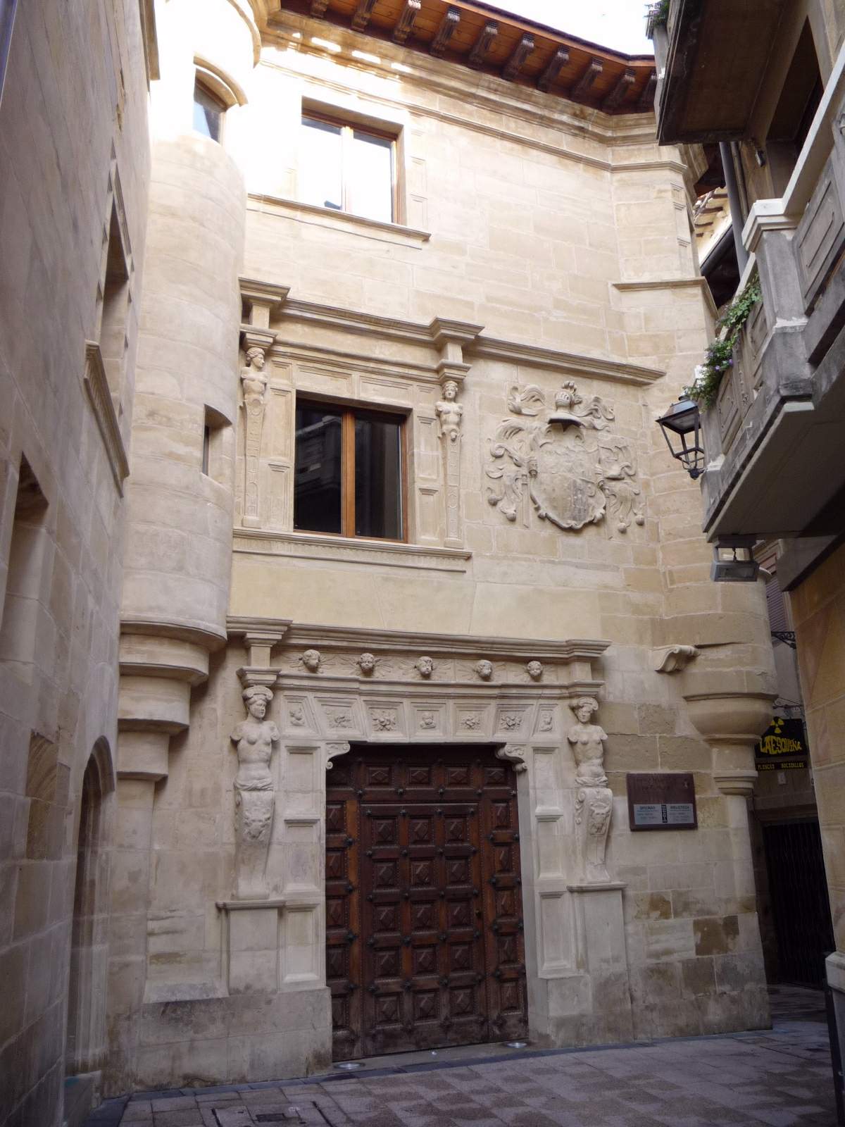
Palacio de Bendaña o Paternina is a Renaissance-era palace in the heart of Haro, a town in the La Rioja Alta area, widely regarded as one of the most distinctive buildings in the old quarter. It stands on Plaza de la Paz, right along the line of the town's former defensive walls, and remains one of Haro's architectural landmarks. Where does the palace stand and what does it look like? The building sits in the middle of Haro's old town, on Plaza de la Paz — one of the main stops on any walk through the historic centre. The three-storey structure, built in ashlar stone, is easy to spot thanks to two clearly different facades: one dating from the 16th century, the other added in the 18th century, so the building visibly tells the story of more than one era. Coats of arms decorate the front, alongside a frieze carved with motifs showing Islamic and Hebrew influence — an unusual combination for this part of Spain. What makes this palace stand out among La Rioja's monuments? The building's most striking feature is a Mudejar gallery dating back to the 15th century, making it older than the main body of the palace itself. Its decoration, built around interlacing star and floral patterns, has no equivalent anywhere else in the La Rioja region. Combined with the richly ornamented Plateresque-style facade, the gallery turns the palace into a rare example of a single building weaving together Christian, Moorish and Jewish decorative traditions. What is the building used for today? Over the centuries the palace shifted from a noble residence to a public building. Today its ground floor houses Haro's Municipal Tourist Office, so visitors planning to explore the town and the surrounding wine country can pick up information there while also taking in the facade and interior of the palace itself. The building is listed as a Bien de Interés Cultural (Asset of Cultural Interest), reflecting its status as one of Haro's key heritage sites. How has the building survived to the present day? The palace has gone through several rounds of restoration work. Earlier interventions took place in 1976 and 1981, but over time the structure needed a more thorough overhaul. Works carried out between 2010 and 2012 stabilised the building and restored the legibility of key architectural details, including the frieze and the Mudejar gallery, both of which had been suffering from gradual deterioration. How to fit a visit into a trip to Haro? Thanks to its location on Plaza de la Paz, the palace fits naturally into a walk through the old town, close to other historic sites in Haro's centre. Since it also houses the tourist office, it makes sense as an early stop on a visit — a good place to pick up practical information before heading out toward the bodegas and vineyards that the La Rioja Alta region is known for. Frequently Asked Questions Where is the Palacio de Bendaña o Paternina located? The palace stands in Haro, in the La Rioja region, on Plaza de la Paz in the town's historic centre, along the line of its former defensive walls. From what period does the building date? The main structure and one facade date from the 16th century, a second facade was added in the 18th century, while the Mudejar gallery is even older, dating back to the 15th century. What is inside the palace today? The ground floor houses Haro's Municipal Tourist Office, where visitors can get information about exploring the town and the surrounding region. Is the palace a legally protected monument? Yes, it holds Bien de Interés Cultural status, and it underwent thorough restoration between 2010 and 2012, following earlier conservation work carried out in 1976 and 1981.
-
Olazabal etxea
Zumaia
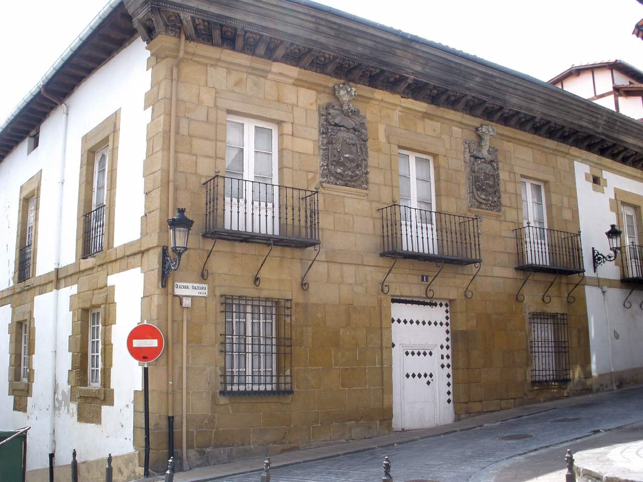
Olazabal etxea is a 17th-century town palace standing in the historic centre of Zumaia, in the Basque Country (Gipuzkoa). The Basque word "etxea" simply means "house," and the building is also known as Palacio Olazabal or Casa Olazabal. Who built the Olazabal palace? The house was commissioned by Juan de Olazabal, a Basque nobleman connected to the court of King Felipe IV. He held the post of secretary to the Royal Council and served as accountant general of the Inquisition, placing him among the more influential figures close to the monarch. Despite his career in Madrid, he stayed tied to his home town: he funded the local school with a sum of more than 56,000 maravedís and took part in disputes between Zumaia and other institutions, including the collegiate church of Roncesvalles. In gratitude, one of the old town's streets was later named after him — "calle Secretario Olazabal." What does the palace look like? The façade is built from sandstone and follows the sober yet elegant style typical of 17th-century Basque palatial architecture. Two large stone-carved coats of arms of the Olazabal family flank the central balcony, while the upper floor balconies are fitted with wrought-iron railings. A decorated eave in the classic Basque style crowns the building. The contrast between plain stonework and rich heraldic decoration is what makes the façade stand out among the other houses of the old quarter. Where exactly is Olazabal etxea in Zumaia? The palace sits right in the heart of Zumaia's historic centre, close to the San Pedro parish church. It faces the San Juan fountain, one of the old town's recognisable landmarks, which makes the building easy to spot while walking through the centre. Because both sites are so close together, they can easily be combined into a single short walking stop. When is the best time to see or photograph the palace? Given the orientation of the façade, sunrise and sunset light works best, bringing out the texture of the sandstone and the detail of the coats of arms and ironwork. It's a useful tip for visitors who want to see the building without crowds and in favourable light. Frequently Asked Questions What does the name "Olazabal etxea" mean? "Etxea" is the Basque word for "house." The name refers to the house, or palace, of the Olazabal family, who had it built and after whom the whole property is named. Can visitors go inside the palace? The available tourist information describes the palace as a building to be admired from the outside, as part of the old town's architecture — there is no indication of regular indoor visits, so it's best to plan on viewing the façade and its surroundings. What are the most notable architectural features? The sandstone façade, the two large Olazabal family coats of arms above the central balcony, and the wrought-iron balcony railings together with the decorated eave are the details that draw the most attention. Are there other attractions nearby in Zumaia? Yes — the palace stands opposite the San Juan fountain and close to the San Pedro parish church, so both can be visited as part of the same short route through the old town.
-
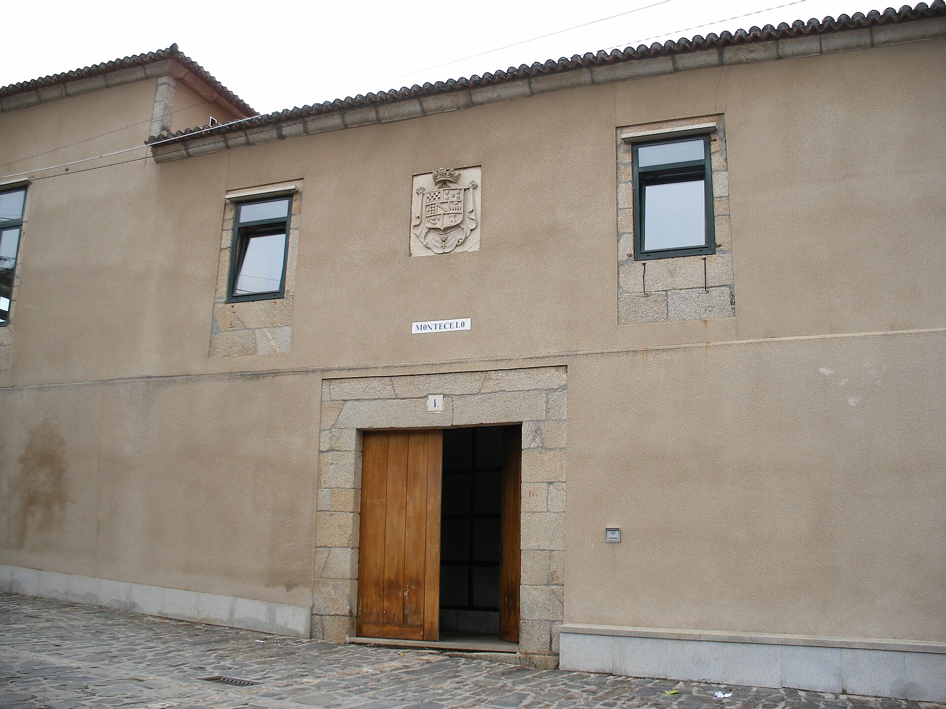
Pazo de Montecelo
Paderne
Pazo de Montecelo is a Galician manor house (pazo) located in Paderne, in the province of A Coruña, Galicia, in northwestern Spain. The estate is notable for its French-style garden, a feature that accompanies the main residence and marks it as a distinctive example of this regional building type. What is Pazo de Montecelo? Pazo de Montecelo belongs to the pazo tradition, a form of rural residential architecture unique to Galicia. A pazo is a stone manor house historically built for noble or landowning families, combining a residential core with working buildings such as chapels, dovecots, mills, or gardens, often enclosed within stone walls alongside surrounding farmland. Montecelo fits this pattern, with its French garden serving as its most recognizable feature. Where is Pazo de Montecelo located? The property sits within the municipality of Paderne, in the province of A Coruña. Paderne is a small municipality in Galicia, a region known for its dense concentration of pazos, Romanesque churches, and a landscape shaped by river valleys. Galicia borders Portugal to the south and is framed by the Atlantic Ocean to the west and north, a setting that has long influenced local building traditions — solid stone construction suited to a damp, Atlantic climate. What makes the garden at Pazo de Montecelo distinctive? The French-style garden at Montecelo follows a design tradition built around symmetry: straight paths, geometrically trimmed hedges, and clearly planned visual axes. Unlike the more naturalistic approach of English gardens, French gardens emphasize order and formal composition, which pairs with the stone architecture of the pazo to create a structured, deliberate residential landscape. Why do pazos matter in Galicia? Pazos are among the most recognizable elements of Galicia's cultural landscape. Most were built between the 16th and 18th centuries, though many were later altered or expanded. They stand as physical evidence of the region's social history, having served as the seats of noble families who managed the surrounding agricultural estates. Today, some pazos remain in private hands, while others have been converted into hotels or cultural venues, or are opened to visitors on specific occasions. Frequently Asked Questions What is a pazo? A pazo is a type of Galician manor house — a stone rural residence, typically walled, accompanied by outbuildings and a garden, built from the medieval period through the early modern era for local nobility and landowning families. Where exactly is Pazo de Montecelo located? It lies within the municipality of Paderne, in the province of A Coruña, in the region of Galicia, northwestern Spain. What kind of garden does Pazo de Montecelo have? It has a French-style garden, built around symmetry, geometrically shaped greenery, and organized pathways — a contrast to the looser, more naturalistic style of English gardens. Is Pazo de Montecelo the only pazo in the area? No — Galicia has one of the highest concentrations of pazos in Spain, and the province of A Coruña alone includes many similar manor houses with varying histories and states of preservation.
-
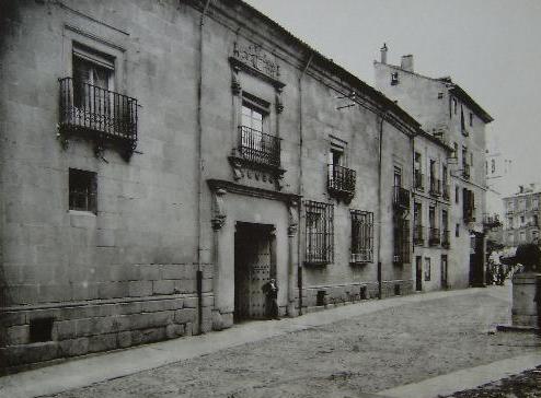
Palace of the Marqués del Arco
Segowia
The Palace of the Marqués del Arco is a 16th-century Renaissance palace in Segovia, Spain, standing as one of the finest examples of noble civic architecture from that period in the city. The building sits on the street that now bears its name, in the heart of Segovia's historic centre, and passed through several owners before acquiring the title by which it is known today. When was the palace built? Historians disagree on the exact construction date, with estimates ranging from the mid-1530s to around 1550. This uncertainty is common for Segovian Renaissance palaces of the period, since original founding documents rarely survive intact. Who designed it? Authorship is sometimes attributed to Rodrigo Gil de Hontañón, one of the most prominent architects of the Spanish Renaissance, best known for his work on cathedrals and churches across Castile. Not every source treats this attribution as settled fact, but the building is consistently described as representing the Segovian Renaissance palace type at its most refined. What does the building look like? The palace follows the layout typical of a Castilian noble residence of its era: a ground floor, a main floor (piso principal), and two basement levels. Its principal façade, built in granite, faces Calle del Marqués del Arco and is regarded as one of the notable examples of Plateresque work in Segovia — the richly ornamented strand of Spanish Renaissance architecture that blends Gothic, Mudejar, and classical motifs into a single stone composition. Where does the palace's name come from? The name has nothing to do with the palace's first owners; it comes from a title granted much later. The building was expropriated by King Philip II and, in 1567, given to Cardinal Diego de Espinosa. The cardinal held it only briefly: in 1572 the palace passed to the Márquez de Prado family, who kept it for generations. It was not until 1687 that the title of Marqués del Arco was granted to Gaspar José Márquez de Prado y Bracamonte, and from that point the palace carried the name still used today. Where is the palace located? The Palace of the Marqués del Arco stands at Calle del Marqués del Arco, 6, within Segovia's historic centre — a district inscribed on the UNESCO World Heritage list for its dense concentration of medieval and Renaissance buildings. The street itself, running through the old town, still carries the palace's name. Frequently Asked Questions When was the Palace of the Marqués del Arco built? The exact date is unknown; researchers place its construction somewhere between the mid-1530s and around 1550. Who was the architect? Authorship is sometimes attributed to Rodrigo Gil de Hontañón, though not all sources treat this as confirmed. Why is it called the Palace of the Marqués del Arco? Because in 1687 the title of Marqués del Arco was granted to Gaspar José Márquez de Prado y Bracamonte, a member of the family that had owned the palace since 1572. What architectural style does the building represent? Its façade is an example of the Plateresque style, the ornate strand of Spanish Renaissance architecture common in 16th-century Segovia.
Earn badges for the places you visit
Download NextOnTrip, discover new places and check off your trails.