Monuments in Spain
A guide to 4655 Monuments in Spain — with descriptions, photos and traveler visits from the NextOnTrip community. Locations spread across 2240 cities and towns. Most visited by the community: castle of Chulilla, Castle of Pioz, castell de la Todolella.
-
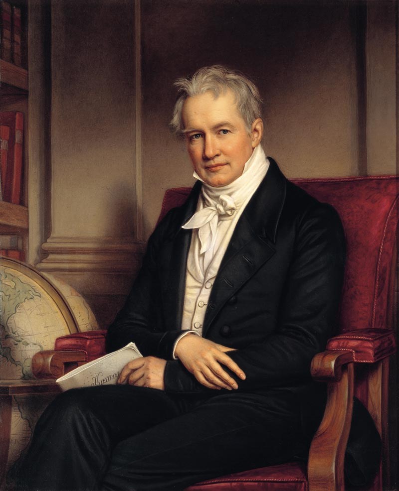
Alexander von Humboldt
Puerto de la Cruz
Alexander von Humboldt is a memorial site in Puerto de la Cruz, Tenerife, honoring one of the most influential naturalists in the history of science. The name recalls the German scholar who stopped in the Canary Islands on his way to South America and left a lasting mark on the island's history and on how its landscape came to be described. Who was Alexander von Humboldt? Friedrich Wilhelm Heinrich Alexander von Humboldt was born in Prussia and was the younger brother of the philosopher and linguist Wilhelm von Humboldt. He became famous as a naturalist, geographer and explorer whose work on plant geography laid the groundwork for biogeography as a distinct scientific field. Together with Carl Ritter, he is regarded as one of the founders of modern geography as an independent discipline. Humboldt was also a pioneer of systematic, long-term geophysical measurement, work that helped establish modern meteorology and the study of the Earth's magnetic field. His contribution to science was recognized with, among other honors, the prestigious Copley Medal. Why does this site bear his name? Alexander von Humboldt stopped on Tenerife during his major research expedition at the turn of the 19th century, on his way to the American continent. The island, and particularly the area around Puerto de la Cruz and the Orotava valley, left a strong impression on him: he was struck by the richness of the vegetation, the volcanic geology, and the sweeping views toward the Teide volcano. His observations from this short but significant leg of the journey later fed into his scientific writings and helped bring wider attention to Tenerife as a place of exceptional natural value. The site in Puerto de la Cruz named after him stands as a nod to the attention he gave the island and to his broader role in shaping the modern earth sciences. How do you get there? The site is located within Puerto de la Cruz, one of the main tourist hubs on Tenerife's northern coast. The easiest way to reach the town is by car via the TF-5 motorway, which connects Puerto de la Cruz with the island's capital and with Tenerife North Airport, or by local TITSA buses running from most towns on the island. The site itself is open to the public and requires no advance booking or ticket. What will you see there? Visitors can read an information panel or marker outlining Humboldt's life and his connection to Tenerife. It's a good spot to pause for a moment while exploring Puerto de la Cruz and to link a walk through the town with the history of scientific discovery that, in this case, began with a brief but meaningful stop on a much longer journey. Nearby, it's worth combining the visit with a stroll through the old town, the seafront pools, or the lookout points that offer views similar to those that impressed Humboldt more than two centuries ago. When is the best time to visit? Puerto de la Cruz enjoys a mild climate year-round, so the site can be visited in any season. The most comfortable conditions for sightseeing are in spring and autumn, when temperatures are pleasant and the streets are less crowded than at the height of summer. Morning hours are worth planning for, as the light is best for photographing the surrounding views. Frequently asked questions Who was Alexander von Humboldt, and why is he honored specifically in Puerto de la Cruz? He was a German naturalist and explorer, one of the founders of modern geography. He visited Tenerife during his expedition to South America, and the area around Puerto de la Cruz and the Orotava valley made a strong impression on him, later reflected in his scientific work. Is there an entrance fee? No, the site is open to the public and free to visit. How long does a visit take? Seeing the site itself takes only a few minutes, but combining it with a walk through Puerto de la Cruz can easily stretch the visit to an hour or more. Is it worth pairing with other attractions in town? Yes, Puerto de la Cruz's old town, seafront pools, and lookout points are all nearby, offering scenery similar to what Humboldt once described.
-
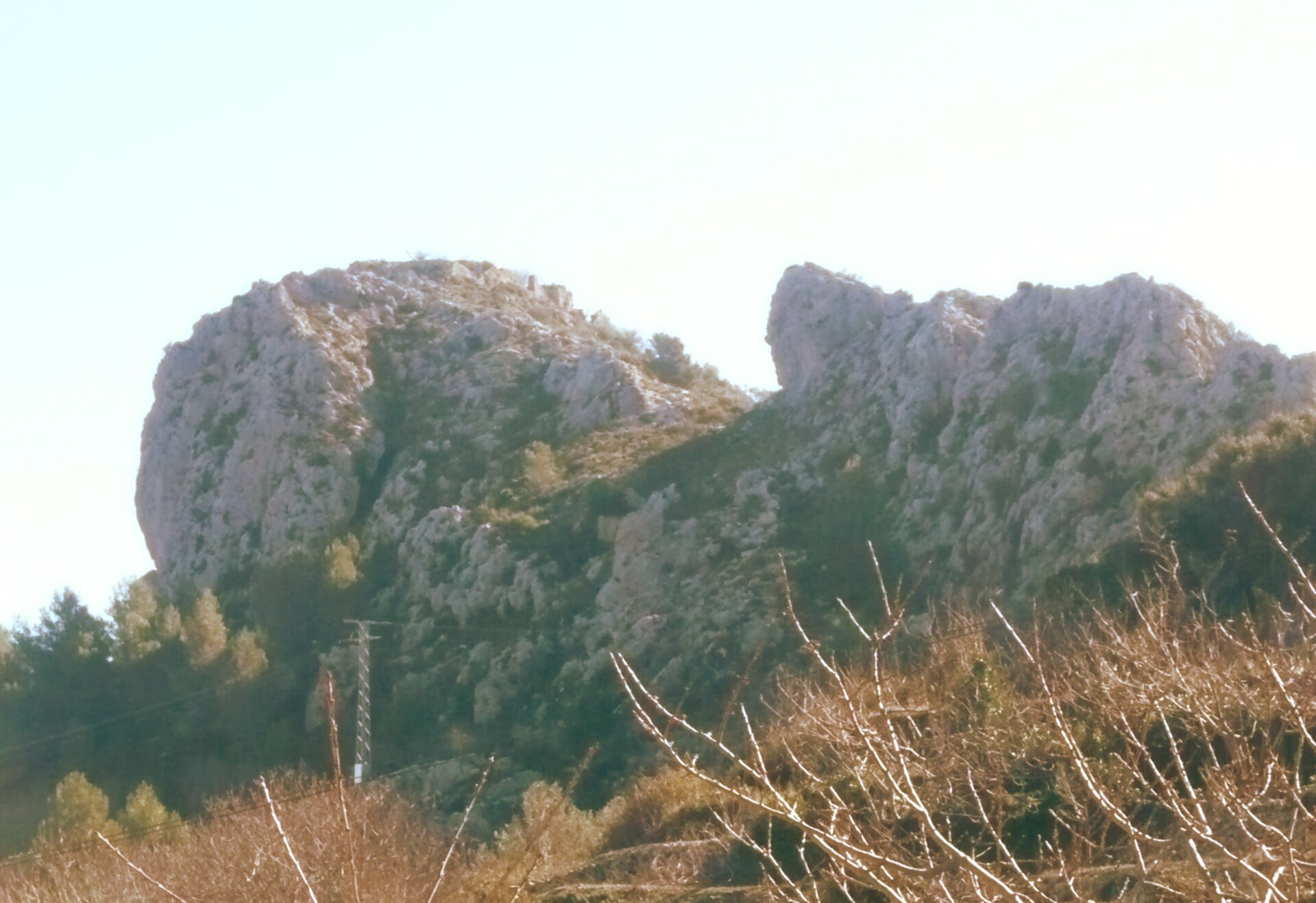
Castle of Tàrbena
Tàrbena
The Castle of Tàrbena (Spanish: Castillo de Tárbena), known locally as Sa Caseta des Moros, is the ruined Moorish fortress standing above the mountain village of Tàrbena in the province of Alicante, in the Marina Baixa region. How do you get there? The ruins sit on Cerro Segué, right above the village itself, so the approach starts almost from the last houses of Tàrbena. By car the village is reached via mountain roads from Benidorm, Callosa d'en Sarrià or Parcent — Tàrbena is the last settlement of Marina Baixa before the Vall de Pop valley opens up. From the hill the fortress overlooks both the valley and the Coll de Rates pass, the old route toward Parcent that the castle was originally built to control. The final stretch has to be walked on a rocky path, so sturdy footwear is worth bringing. What will you see on site? What remains of the fortress is modest but genuine: sections of wall, the base of a tower, and an aljibe (cistern) split into two chambers of different sizes that once collected rainwater. These are the traces of a hisn, a Muslim hilltop stronghold that protected the farming settlement, or alquería, spread across the rocky slope below. The site has been declared a Bien de Interés Cultural (a protected cultural asset), and local authorities have a project underway to consolidate the ruins and open them properly to visitors. From the upper part of the site you can see both the Costa Blanca coastline and the Sierra de Bèrnia mountain range. What is the history behind it? The fortress was raised in the early 12th century, during the Muslim period in this part of the Valencian coast. It served as one of the seats of the local alcaide, Muhammad Ibn Ishaq, and local tradition holds that El Cid himself passed through in 1090. In the following centuries the castle became a flashpoint in the fighting between Mudejars and Christians, including the revolt led by Al-Azraq. In 1268 it was taken by King James I of Aragon, after which the surrounding land passed to relatives of the Muslim leader. Another turning point came in 1445, when the Valencian nobleman Guerau Bou bought the castle together with its entire valley for 47,200 sueldos. The fortress's decline was sealed in 1609, when the expulsion of the Moriscos emptied the area; Tàrbena was later resettled by Majorcan colonists whose 17th-century arrival shaped the character of the village you see today. When is the best time to visit? Spring and autumn bring the mildest mountain temperatures and the most comfortable conditions for exploring the trails around Tàrbena, including the nearby Forat de Bèrnia, a natural rock passage through the Bèrnia massif. In summer, the midday heat makes the exposed, rocky climb to the ruins uncomfortable, so an early-morning visit is a better choice. Winter can be cold and windy, but visibility from the castle is often at its best. Frequently asked questions Is there an entrance fee for the castle ruins? No, the site is open access and can be visited free of charge, though caution is advised given the state of the ruins. How long does a visit take? Walking up to the ruins and back usually takes 30 to 60 minutes, depending on fitness and the route chosen from the village centre. What else is worth seeing in Tàrbena besides the castle? The 18th-century baroque Church of Santa Bárbara, the narrow streets of the old village, and the nearby Forat de Bèrnia and hiking trails of the Sierra de Bèrnia. Is the site suitable for children? The ground is uneven and rocky with no safety barriers, so children should visit accompanied by adults and wearing proper footwear.
-
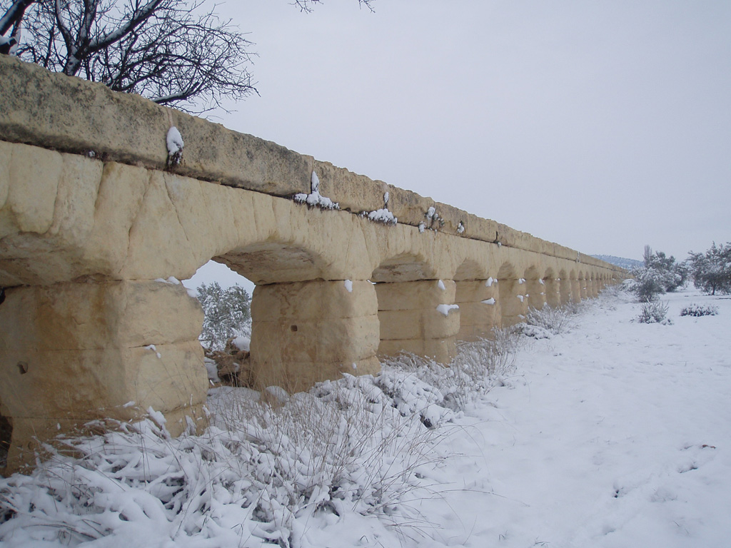
Aqueduct of Albatana
Albatana
Aqueduct of Albatana is a historic hydraulic structure located in the town of Albatana, in the Region of Murcia in southeastern Spain. The monument is registered on Spain's cultural heritage list and stands as one of the local markers of the area's water-engineering history. What exactly is this structure? The aqueduct sits within the municipal boundaries of Albatana and formed part of an older water-conveyance system typical of this part of Spain. Its precise geographic coordinates are 38.583562, -1.54623, which makes it easy to pinpoint on a map when planning a route through the surrounding countryside. Why does the aqueduct carry Bien de Interés Cultural status? In 1990, the structure was formally declared a Bien de Interés Cultural (BIC) — the highest tier of heritage protection recognized under Spanish law. This designation is reserved for buildings and sites with outstanding historical, artistic, or technical value that the Spanish state considers part of the shared national heritage requiring legal safeguarding. Being listed as BIC means the aqueduct falls under conservation oversight, and any construction work in its immediate surroundings must take the preservation of the historic fabric into account. For visitors, the designation is a useful signal: if Spanish heritage authorities singled this structure out for protection, it is worth the short detour to see it in person. Where exactly is the aqueduct located? Albatana is a small municipality in the province of Murcia, set among farmland in a dry, typically Mediterranean landscape. The aqueduct lies within the town's administrative area, and its coordinates (38.583562, -1.54623) can be entered directly into a GPS device or mapping app to avoid getting lost on the local rural roads. Because Albatana itself is compact, reaching the monument from the town center generally takes only a few minutes. How should you plan a visit? Since the aqueduct stands in open, publicly accessible ground within the municipality, viewing it from the outside does not require a ticket or advance booking. As a legally protected BIC monument, however, it should be treated with care — visitors should avoid touching the stonework, climbing on the structure, or leaving litter nearby. The most comfortable time to visit is in the early morning or late afternoon, when temperatures in the Murcia region are lower and the light falls more favorably on the stone, making it easier to photograph the structure clearly. Frequently asked questions What does Bien de Interés Cultural mean? It is the highest category of heritage protection in Spain, granted by regional or national authorities to sites of exceptional historical or technical value. When was the Aqueduct of Albatana granted this status? It was formally declared a Bien de Interés Cultural in 1990. Is there a fee to visit the aqueduct? No ticket is needed to view the structure, as it stands in an open area within the municipality of Albatana. How do you get to the aqueduct? The simplest approach is to enter the coordinates 38.583562, -1.54623, or the town name Albatana in the Region of Murcia, into a GPS or map app and travel by car, since the municipality has limited public transport infrastructure.
-
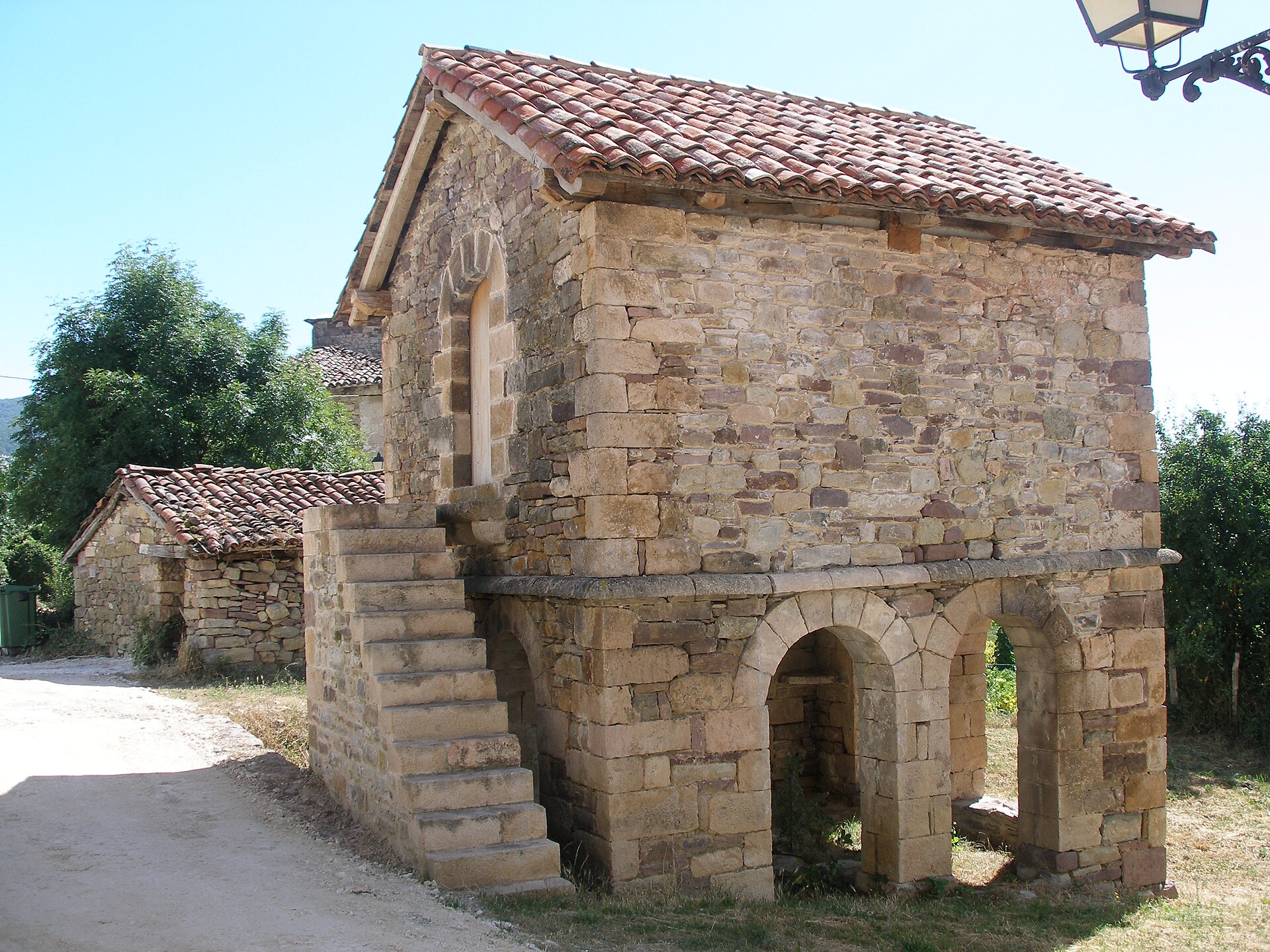
Lusarreta
Arce / Artzi
Lusarreta is a small settlement in the Arce valley (Basque: Artzibar), in northern Navarre, tucked against the foothills of the Spanish Pyrenees. Surrounded by green hills and woodland, it keeps the unhurried rhythm of a Basque-Navarrese hamlet, far from the region's busier tourist trails. Where does the name come from? Lusarreta's name is Basque in origin, built from three elements: lur (land), zahar (old), and the place-marking suffix -eta. Together they roughly translate to "old land" or "place of old land" — a construction typical of the toponymy found throughout the Artzibar valley, where neighbouring hamlets share similar naming patterns. What is there to see? The earliest records of Lusarreta date back to the 12th century, making it one of the older settlements in the Arce valley. Until 1990 it existed as an independent municipality; since then it has been administratively absorbed into the municipality of Arce as one of its constituent places. The village's focal point is the church of San Esteban (Saint Stephen), a Gothic building with a Baroque altarpiece. The church is not routinely open to visitors, but it still holds its original furnishings, religious imagery and bells — quiet traces of a community that was once considerably larger. The other notable landmark is the granary (hórreo) belonging to the Gardorena house. This wooden agricultural structure caught the attention of ethnographer Fermín Leizaola back in 1973, and in 1993 it was formally declared a site of cultural heritage interest — one of the better-preserved examples of traditional rural granary architecture in the area. Lusarreta also serves as a starting point for walkers: a trail from the village leads to the Lezestali cave, a popular destination for hikers exploring the Arce valley. How do you get there? Lusarreta sits within the municipality of Arce, in the province of Navarre, reached via local roads that wind through the Artzibar valley. A car is the most practical way in — the nearest major city is Pamplona (Iruña), from where roads lead up toward the Pyrenees. Allow extra time for the drive, since the route runs through mountainous, winding terrain. When is the best time to visit? Spring and early autumn are the best seasons, offering comfortable temperatures for walking and the valley's greenery at its most vivid. Summers can turn hot, while mountain roads may be affected by weather conditions in winter. Why visit? Lusarreta suits travellers looking for an authentic, uncommercialised side of Navarre — no crowds, but a history reaching back to the Middle Ages, a heritage church, and a granary recognised as a cultural asset. It's a stop for anyone curious about daily life in the small, depopulating villages scattered across the Basque-Navarrese Pyrenees. Frequently asked questions Does anyone still live in Lusarreta? Yes, though very few people. The village has undergone significant depopulation: between 1850 and 1950 it had around 50 inhabitants, while today only a handful remain registered there. Can visitors go inside the San Esteban church? The church is not routinely open, though it still preserves its original furnishings and bells. It's worth checking local sources in advance for possible access. What is the hórreo in Lusarreta? It's a historic granary belonging to the Gardorena house, declared a site of cultural heritage interest in 1993 — a fine example of traditional Basque-Navarrese rural architecture. Are there hiking trails nearby? Yes, a walking trail from the village leads to the Lezestali cave, a popular route for those exploring the Arce valley.
-
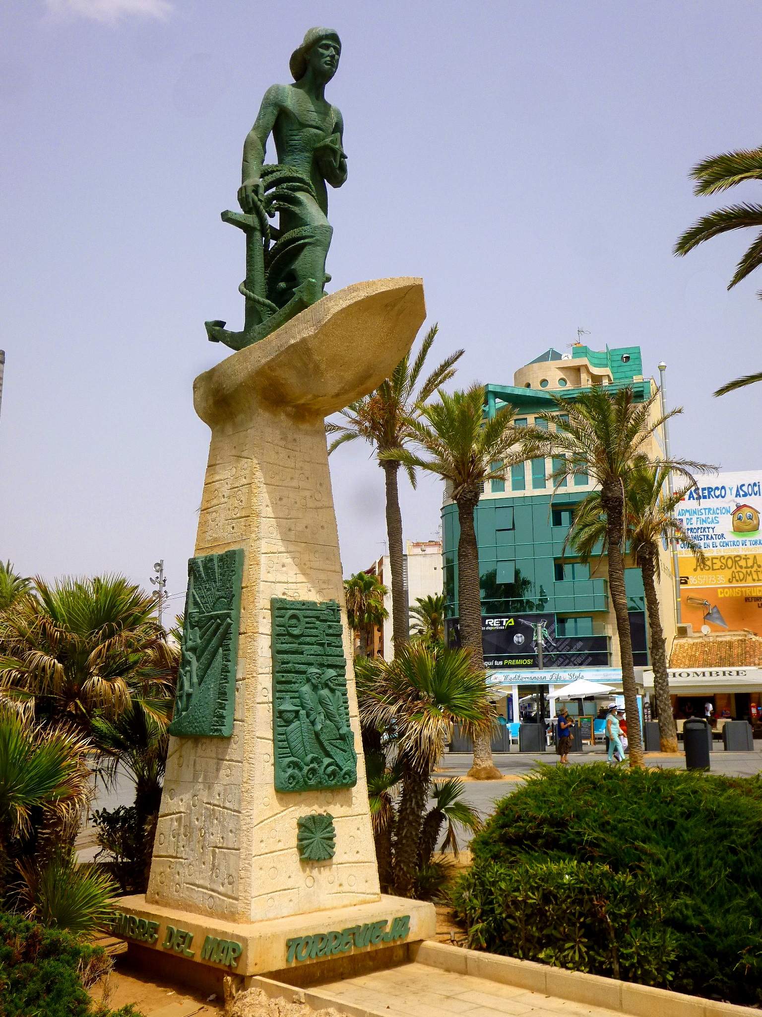
Hombre del Mar
Torrevieja
Hombre del Mar is one of Torrevieja's best-known landmarks – a monument to a fisherman keeping watch over the sea, standing right along the town's seafront promenade. For visitors walking the Costa Blanca coastline, it's an easy way to grasp what shaped this town: generations of fishing, salt-mining and a life tied closely to the Mediterranean. What does the monument show? The sculpture depicts a solitary man standing vigil over the sea, a tribute to the fishermen and sailors of Torrevieja who built their lives around the Mediterranean for generations. It was created by the Catalan sculptor Josep Ricart i Maymir, born in 1925 in Taradell. His work is generally placed within a symbolic expressionist style, drawing on early 20th-century Central European sculpture — visible here in the stark, almost austere posture of the figure. When was it built and where does it stand? The monument was unveiled on 10 May 1975 and has since become a fixture of Torrevieja's coastal identity. It stands today on Paseo Marítimo Juan Aparicio, the seafront promenade that offers open views over the Mediterranean. Worth noting: when the promenade was redeveloped, the statue was shifted a few metres from its original spot so it would fit naturally into the new layout of that stretch of coastline. Why is it worth a visit? Hombre del Mar isn't just a photo stop — it's a small piece of the town's own story. Torrevieja's economy relied for decades on fishing and salt extraction, and the monument nods to that history in a quiet, almost meditative way rather than through any grand plaque or inscription. It's a natural pause point on a coastal walk, particularly appealing around sunset when the fisherman's silhouette stands out against the water. How do you get to the monument? The statue sits right in the heart of Torrevieja's seafront district, along Paseo Marítimo Juan Aparicio, within easy walking distance of the harbour and the town's main beaches. It fits naturally into any stroll along the promenade, so most visitors come across it while exploring the waterfront rather than seeking it out specifically. Frequently asked questions Who created the Hombre del Mar monument? It was made by the Catalan sculptor Josep Ricart i Maymir, born in 1925 in Taradell. His style is associated with symbolic expressionism rooted in early 20th-century Central European sculptural traditions. When was the monument unveiled? It was officially unveiled on 10 May 1975 and has remained one of Torrevieja's recognizable coastal landmarks ever since. Where exactly is the monument located? It stands on Paseo Marítimo Juan Aparicio, Torrevieja's seafront promenade, overlooking the Mediterranean. It was moved a short distance from its original position during a later redevelopment of the promenade. What does the fisherman figure represent? The figure represents a man keeping watch over the sea — a symbolic tribute to the bond between Torrevieja and the Mediterranean, and to the generations of fishermen and sailors who shaped the town's history.
-
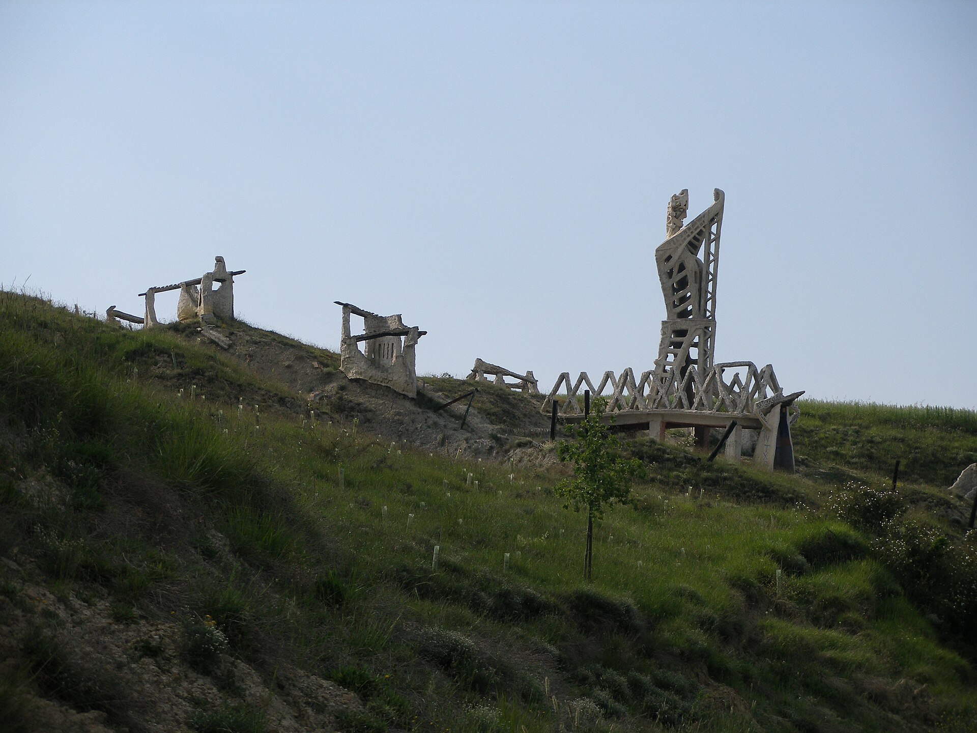
Battle of Noáin
Galar
The Battle of Noáin (also known as the Battle of Esquiroz) took place on 30 June 1521 in the municipality of Galar, just south of Pamplona in Spain's Navarre. What happened at Noáin? The clash was the only pitched battle fought in open terrain during Spain's takeover of the Iberian side of the Kingdom of Navarre. A Spanish army defeated a combined Franco-Navarrese force, sealing the fate of the independent kingdom on this side of the Pyrenees. The victory was decisive: it ended organized armed resistance to Castilian rule in the area and cleared the way for Navarre's full incorporation into Spain. Where exactly is the battlefield? The site lies between the villages of Noáin and Esquiroz, within the municipality of Galar, in the area known as the Cuenca de Pamplona (Pamplona Basin). Its coordinates, 42.758°N, 1.654°W, place it on quiet farmland only a few kilometres from Pamplona's old walls — five centuries on, the fields give few visible clues to the fighting that once took place here. How to get there? The easiest way is by car from Pamplona: the drive south towards Pamplona-Noáin airport takes only about fifteen minutes. Local roads connect Galar well with the Navarrese capital and the province's southern towns, and suburban buses run from Pamplona towards Noáin for travellers without a car. What is there to see nearby? There is no large monument or museum marking the battlefield itself, so a visit here is really a walk through the historical setting rather than a classic sightseeing stop. It pairs well with a trip to Pamplona, a few kilometres away, where medieval walls, the Santa María la Real cathedral and an old town that still recalls the era of the Kingdom of Navarre await. Galar itself is a quiet stretch of Navarrese countryside, pleasant for a short walk among the fields where the events of June 1521 unfolded. When to visit? Spring and early summer are the best seasons, when the surrounding fields are green and temperatures are comfortable for walking — June, the month of the battle itself, captures the region's character well. Summers can get hot around midday, so mornings or late afternoons are the better time to explore. Frequently Asked Questions What was the Battle of Noáin? A battle fought on 30 June 1521 in which a Spanish army defeated a Franco-Navarrese force in the only pitched field battle of Spain's takeover of Iberian Navarre. Why is it also called the Battle of Esquiroz? The battlefield lies between two villages, Noáin and Esquiroz, so historical sources use both names for the same event. Is there anything to see at the battlefield today? The land is now farmland with no major memorial structures, which is why most visitors combine a stop here with sightseeing in nearby Pamplona. How far is it from Pamplona? The municipality of Galar sits just a few kilometres south of central Pamplona, making it easy to visit both places in a single day.
-
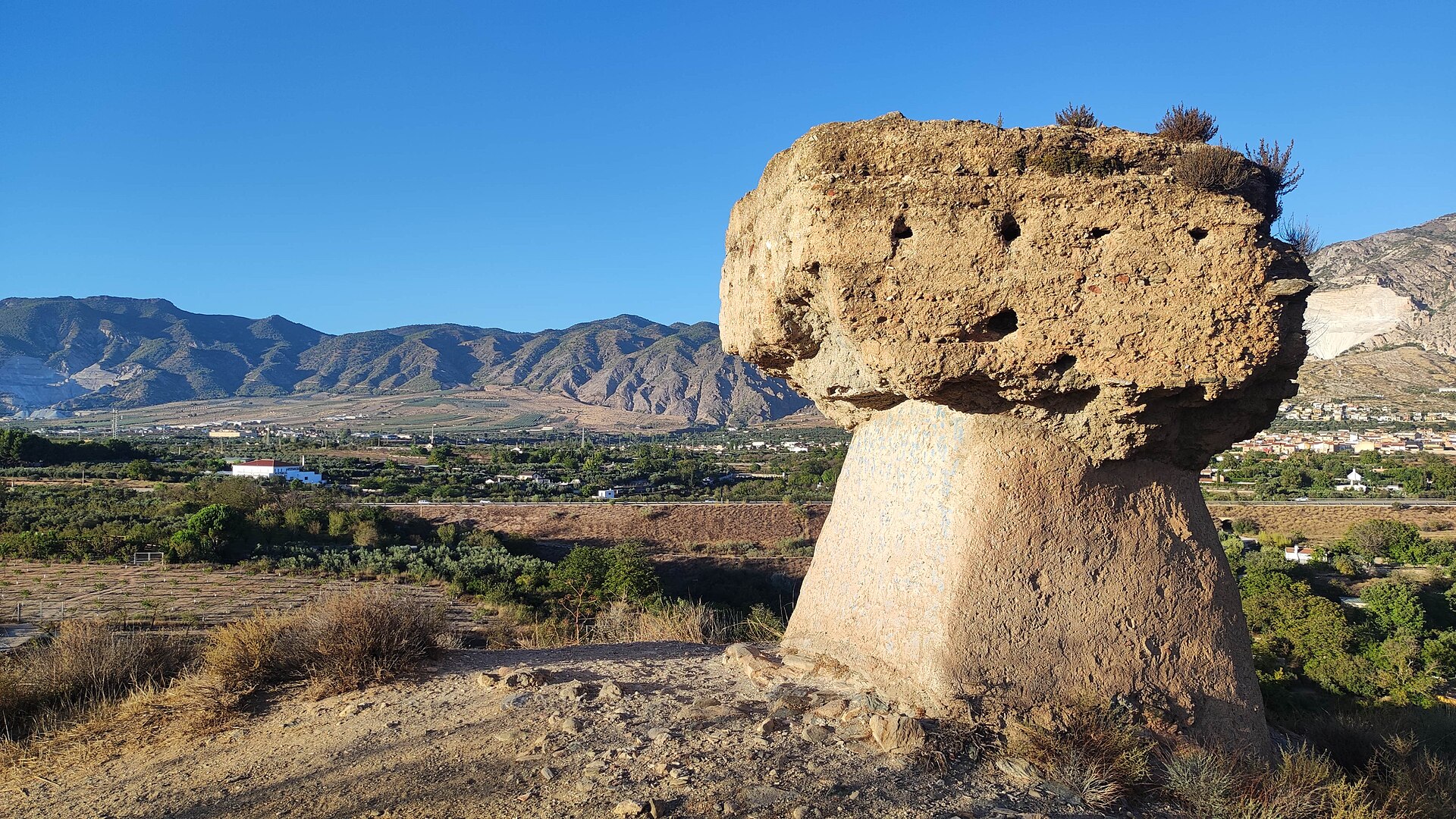
Castillo de Dúrcal
Dúrcal
Castillo de Dúrcal is a medieval fortification overlooking the small town of Dúrcal in the province of Granada, Andalusia. Its ruins sit on a hill known as El Castillejo, roughly 2 km south of the town center, at an elevation of nearly 800 meters above sea level. The site is also known locally as Peñón de los Moros. Where is it and what remains today The fortress occupies a commanding position over the Valle de Lecrín, looking down on the fertile plain (vega) around Dúrcal. What survives today are low wall fragments no higher than about 30 cm, a badly deteriorated tower, an entrance gate, and a water cistern (aljibe). The site is protected as a Bien de Interés Cultural, Spain's equivalent of a listed monument, with the official registration dating to June 1985. Who built the castle and when Archaeological work suggests the earliest fortifications on this hill predate the Nasrid period, even though the pottery recovered from the site belongs to Nasrid times. The structure itself is dated to around the 8th century and remained in use until the 18th century. Historians tie the reinforcement of defenses in this area to a military program carried out under Sultan Yusuf I and, especially, his son Muhammad V, as part of a broader effort to strengthen the defensive network of the Kingdom of Granada. What purpose did the fortress serve Its hilltop position let a garrison watch over the valley and the routes leading into Dúrcal, making the castle part of a warning and control system for this stretch of the Valle de Lecrín. It was not a residential castle in the usual sense but a military outpost guarding the town's agricultural surroundings. Why is it in ruins today The castle's fate was sealed after the fall of Granada to the Christian kingdoms. In early 1491, King Ferdinand the Catholic ordered the Marquis of Villena, leading a force of three thousand horsemen and ten thousand foot soldiers, to demolish every fortification raised in the Valle de Lecrín during earlier uprisings. It was most likely during this campaign that the castle at Dúrcal was torn down, which explains its ruined state today. Frequently Asked Questions How do you get to Castillo de Dúrcal? The ruins lie about 2 km south of Dúrcal's town center on the El Castillejo hill; reaching them requires a walk over unmarked terrain, so sturdy footwear is recommended. Can you see the Valle de Lecrín from the castle? Yes, the hill's nearly 800-meter elevation gives wide views over the Dúrcal vega and surrounding slopes, which was the main reason a watchtower was placed here in the first place. What exactly is left of the castle? Low wall fragments, a heavily deteriorated tower, an entrance gate, and a water cistern (aljibe) survive; the rest of the structure has not made it to the present day. Who built the castle at Dúrcal? The earliest fortifications predate the Nasrid era, and the later reinforcement is linked to the reigns of Yusuf I and Muhammad V as part of strengthening the Kingdom of Granada's defenses in the Valle de Lecrín.
-
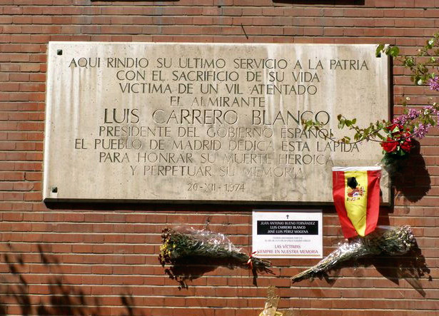
Assassination of Luis Carrero Blanco
Madryt
The site of the assassination of Luis Carrero Blanco is located in Madrid and marks one of the most consequential political events in twentieth-century Spanish history. What happened at this location? On 20 December 1973, Luis Carrero Blanco, then President of the Government of Spain (the equivalent of prime minister) and the closest political ally of General Francisco Franco, was killed at this spot in Madrid. Members of the Basque separatist organization ETA had dug a tunnel beneath the street and placed an explosive charge inside it. As Carrero Blanco's car passed over the site, the charge was detonated, killing him. The operation carried the code name Operación Ogro (Ogro Operazioa in Basque). Why is this assassination considered so significant? The killing of Carrero Blanco is regarded as the most serious single attack against the Francoist state since the end of the Spanish Civil War in 1939. Carrero Blanco was widely seen as the figure meant to guarantee continuity of the regime after Franco's eventual death, which made his sudden killing a severe blow to the existing power structure. The event carried far-reaching consequences for Spanish politics, shaping the final years of Francoism and influencing the pace of the political transition that followed later in the decade. Who carried out the attack? Responsibility for the assassination was claimed by ETA (Euskadi Ta Askatasuna), the organization campaigning for Basque independence, which was waging an armed campaign against Spanish authorities throughout the 1970s. The killing of Carrero Blanco became one of the most widely known operations in the group's history, and the code name Ogro has remained closely tied to this episode in Spanish collective memory. What should visitors know before going? The site sits in central Madrid, close to coordinates 40.434 N, 3.686 W. It is an ordinary city street rather than a purpose-built tourist attraction — there is no large museum or grand monument here, and today the location functions mainly as a historical reference point for people interested in recent Spanish history. Visitors hoping to grasp the full context should read up beforehand on late Francoism and the Basque conflict, since standing at the site itself does not explain the complexity of the events; it does, however, offer a direct physical connection to the space where one of the pivotal moments of modern Spanish political history unfolded. It is worth keeping in mind that the topic remains politically and emotionally sensitive in Spain, touching on both the victims of political violence and the decades-long Basque conflict, which only came to a formal end in the second decade of the twenty-first century. Visiting sites of this kind calls for the seriousness appropriate to places of memory, rather than a sensationalized approach to the subject. Frequently asked questions When did the assassination of Carrero Blanco take place? It took place on 20 December 1973, in Madrid. Who was responsible for the attack? The Basque separatist organization ETA was responsible, and the operation was code-named Operación Ogro. What role did Luis Carrero Blanco hold? He served as President of the Government of Spain, a position equivalent to prime minister, and was regarded as General Franco's closest political ally. Why is this location historically significant? The assassination is considered the most serious attack on the Francoist state since the end of the Civil War in 1939, and its consequences reverberated through Spanish politics during the country's later transition to democracy.
-
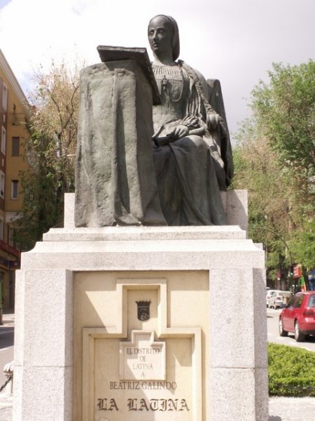
Monument to Beatriz Galindo, Madrid
Madryt
Monument to Beatriz Galindo stands on Plaza de Puerta del Ángel in Madrid's La Latina district, close to the old route leading toward the Segovia bridge. The bronze figure, shown at life size, honors a 15th-century scholar and royal tutor whose nickname eventually gave the whole neighborhood its name. Who was Beatriz Galindo? Beatriz Galindo, known as "La Latina," lived at the turn of the 15th and 16th centuries and was one of the most learned women of her time. Her fluency in Latin — the source of her nickname — earned her a place at the royal court, where she tutored the children of Queen Isabella I of Castile in the language. Over time she became a trusted advisor within the queen's circle. Beyond teaching, she was also active in charitable work, funding institutions in Madrid to help the poor and the sick. It was in this part of the city, around what is now Puerta del Ángel, that she spent much of her life and carried out her most significant work. What does the monument look like, and where is it? The monument sits on a granite pedestal, on a small traffic island at the point where several streets of La Latina converge with Plaza de Puerta del Ángel. The bronze figure was cast at the Madrid workshop Codina Hermanos, based on a design by sculptor and professor José Luis Parés Parra. The pedestal and figure include Latin inscriptions and symbols referencing education, a direct nod to Galindo's role as a teacher. The monument was unveiled in 1999 on the initiative of Madrid's city council, as a tribute to the woman whose name still identifies one of the capital's most distinctive districts. Why is it worth a look? This is not a headline attraction in the usual sense — it's a quiet but meaningful piece of the urban fabric that explains where the name "La Latina" comes from, a district now best known for its tapas bars, the Sunday El Rastro flea market, and its narrow, atmospheric streets. Pausing at the monument is a good way to understand the historical backdrop of a spot most visitors already pass through on their way toward Almudena Cathedral, the Royal Palace, or the viaduct over Calle de Segovia. Its position at Puerta del Ángel makes it a natural landmark on a walking route linking central Madrid with La Latina. How to get to the monument? Plaza de Puerta del Ángel sits on the boundary between the Centro and La Latina districts, right next to the metro station of the same name (line 4). From Plaza Mayor or the area around Almudena Cathedral, it's a walk of about fifteen minutes, mostly downhill toward the Manzanares river valley. It's a convenient starting point for exploring La Latina further, especially on Sunday mornings when the famous El Rastro market fills the surrounding streets. Frequently asked questions Who is the woman depicted in the monument? Beatriz Galindo, known as "La Latina" — a 15th-century scholar who taught Latin at the court of Isabella I of Castile and founded charitable institutions in Madrid. Where does the name of the La Latina district come from? The district takes its name from Beatriz Galindo's nickname, since this was the area where she lived and carried out her work. When was the monument built and who designed it? It was unveiled in 1999 at the initiative of Madrid's city council. The sculpture was designed by José Luis Parés Parra and cast at the Codina Hermanos workshop. Can this be combined with other nearby sights? Yes — Puerta del Ángel borders La Latina, the El Rastro market, and the route toward Almudena Cathedral and the Royal Palace, so the monument fits easily into a longer walk through Madrid's historic center.
-
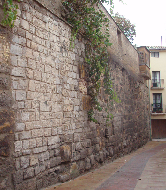
Walls of Tudela
Tudela
The Walls of Tudela are the remains of a Muslim-era fortification that once enclosed the old town of Tudela, in Navarre. Surviving stretches, towers and gates can still be traced on foot around the historic centre, close to the Cathedral of Santa María and the Monastery of Santa Clara. When were the walls of Tudela built? The city's first defensive ring dates to the early 9th century. Arab chroniclers credit Amrus ibn Yusuf, acting on the order of the Cordoban emir al-Hakam I, with fortifying the hill on which Tudela stood around the year 802. That early wall extended as far as the Mediavilla ravine, which functioned as a natural moat on one side of the settlement. Over the following centuries of Muslim rule the fortification grew, and by the 11th and 12th centuries it had taken on a fully developed form, with semicircular towers and features typical of Islamic military architecture, including crenellations and arrow slits. What changed after the Christian reconquest? Everything shifted once Christian forces took the city in 1119. The Muslim population was moved outside the original walled perimeter into a new quarter known as the Morería, and this new district was quickly given its own protective wall, built specifically to defend it even though it sat beyond the original city boundary. Defenses kept evolving into the 14th century, when additional towers were raised and existing sections reinforced — among them the Monreal Tower, a 13th-century structure tied to the defensive ring whose earliest roots go back to the Arab period. Why did most of the walls disappear? The turning point came in 1521. Following another uprising in Navarre, King Charles I ordered the destruction of castles and walls across the former kingdom to prevent further rebellion, and Tudela lost its status as a fortified stronghold. The dismantling was gradual rather than immediate: residents spent years pulling stone from the walls to build their own houses, and the central stretches of the perimeter reportedly kept their walled appearance until as late as the 18th century, even though the city had formally ceased to be a fortress two hundred years earlier. What is left to see today? Of the original defensive circuit — roughly 1.5 kilometres long and once fronted by a water-filled moat — around eight towers still stand, some retaining much of their original fabric. Visible stretches of curtain wall preserve details typical of Islamic building, such as horseshoe arches, crenellations and arrow slits. Other sections have been absorbed into later houses or have vanished from the townscape altogether. The surviving parts have been restored and are open to visit free of charge. Where are the walls and how do you get there? Remaining fragments trace the edge of the old town, with a notable stretch along Calle Ronda del Carmen. The best-preserved sections are within easy walking distance of central Tudela, on a route that passes close to the Cathedral of Santa María and the Monastery of Santa Clara, making it simple to combine the walls with the rest of a walk through the historic quarter. Frequently Asked Questions Who built the walls of Tudela? The first defensive line was raised in the early 9th century by Amrus ibn Yusuf on the order of the emir of Córdoba, with further sections added under later Muslim rule and after the Christian reconquest of 1119. How many towers have survived? Around eight towers from the original fortification still stand today, some close to their original condition. Why were the walls torn down? In 1521, King Charles I ordered the walls and castles of Navarre destroyed in response to a local uprising, and residents spent the following centuries removing stone from the ruins to build their homes. Is it free to visit the walls? Yes, the restored sections of the walls are open to the public at no cost and can be visited as part of a walk through Tudela's old town.
-
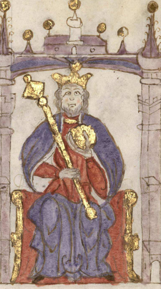
Sancho VII of Navarre
Tudela
Sancho VII the Strong is a monumental statue of the medieval King of Navarre standing in Tudela, on the square that bears his name — Plaza de Sancho VII el Fuerte, in the modern part of the city. Who was Sancho VII the Strong? Sancho VII, known as "the Strong" (el Fuerte), ruled the Kingdom of Navarre around the turn of the 12th and 13th centuries and died in 1234. He was the last king of the native Jiménez dynasty — after his death the crown passed to a dynasty of foreign origin, closing a defining chapter of the region's history. Chronicles and legend credit him with exceptional physical strength and a warlike temperament, which earned him his nickname. In his final years, ill and heavily overweight, he withdrew to Tudela, where he spent the rest of his life. That personal connection is the reason the city, rather than the former capital, chose to honor him with a monument. Who created the statue, and when? The statue was commissioned by the Real Sociedad de Amigos del País de Tudela and unveiled in 1981. Its author is Antonio Loperena, a sculptor born in nearby Arguedas who died in 2010 and became one of the most decorated artists in Navarre, with pieces placed across Europe and the Americas. The Sancho VII monument ranks among his best-known works in the region. What is the statue made of, and how large is it? The figure was carved from golden limestone quarried near Salamanca — an extremely hard, difficult-to-work stone that local craftsmen nickname "the whetstone" for its resistance to tools. The finished sculpture weighs five tonnes, making it one of the heaviest monuments in the city. The sheer scale and mass of the block were meant to underline the strength and commanding presence of the king it portrays. Why does the king on the statue look different from how he really appeared? Loperena took as his model the recumbent effigy of Sancho VII at the monastery of Roncesvalles, considered the most faithful surviving likeness of the monarch. Rather than reproduce the ailing, obese ruler of his final years, though, the sculptor deliberately rejuvenated the figure, presenting the king at the height of his physical power and legendary vigor. That was a conscious artistic choice: the monument is meant as a tribute to the king's strength and historical weight, not a literal record of his old age. Has the statue been restored recently? Yes. Tudela's city council recently carried out a full rehabilitation of the sculpture. The work included cleaning the stone surface, filling in lost volumes and sealing cracks, retouching the lettering of the inscription on the pedestal, and applying a water-repellent treatment to protect the monument from further weathering. As a result, the statue has regained an appearance close to the one Loperena originally gave it. Frequently Asked Questions Where in Tudela is the Sancho VII the Strong statue located? On Plaza de Sancho VII el Fuerte, in the modern part of the city, a square named after the king. When was the monument created, and by whom? In 1981, commissioned by the Real Sociedad de Amigos del País de Tudela and sculpted by Antonio Loperena. Why did Tudela specifically choose to honor this king? Sancho VII spent his final years in Tudela, ill and overweight, and is believed to have died there in 1234 as the last ruler of Navarre's native dynasty. What did the sculptor use as a reference for the statue? The recumbent tomb effigy of the king at the monastery of Roncesvalles, regarded as his most faithful surviving portrait — though in the Tudela statue he is shown younger and at the peak of his strength.
-
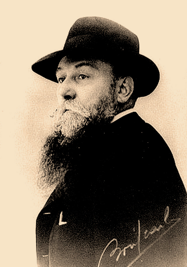
Ernest Ferroul
Narbona
Ernest Ferroul is a name tied to a physician, politician and winegrowers' leader whose life became closely entwined with the city of Narbonne in southern France at the turn of the 20th century. Who was Ernest Ferroul? Ernest Ferroul was born on 13 December 1853 in Mas-Cabardès, into a modest family of drapers from the Montagne Noire. Losing his father at an early age, he trained as a doctor in Montpellier before settling in Narbonne, where he quickly earned the nickname "the poor people's doctor" for treating the town's neediest residents without charge. It was in Montpellier that he met socialist figures Jules Guesde and Paul Brousse, an encounter that drew him toward the French Workers' Party. He was also active in Freemasonry, founding the "La Libre Pensée" lodge in 1881. What was his role in local politics? Ferroul served twice as a deputy for the Aude department, first elected in a by-election in 1888 and holding the seat until 1902. He became mayor of Narbonne for the first time in 1891, then held the office continuously from 1903 until his death. His medical work and political career reinforced one another, giving him a reputation as a figure genuinely close to the ordinary people of the region. Why is he remembered for the 1907 winegrowers' revolt? A crisis of overproduction and unfair competition triggered mass protests among Languedoc winegrowers in the spring of 1907, with demonstrations at their peak drawing as many as 800,000 smallholders and vineyard workers. On 5 May 1907, Ferroul, acting as mayor of Narbonne and a former deputy, formally joined the movement, giving it clear political weight. In his speeches he called on every mayor across Languedoc-Roussillon to resign and openly encouraged civil disobedience. On 19 June 1907 he was arrested at his home in front of a large, charged crowd of supporters. That September, he founded the Confédération Générale de Vignerons du Midi, an organisation created to defend the interests of small wine producers. Why does a place in Narbonne carry his name? In recognition of his dedication to the region's inhabitants, streets, avenues and boulevards in numerous Languedoc towns were named in Ferroul's honour, a tribute extended to Narbonne itself. This kind of commemoration reflects his standing as an iconic figure of the region, closely associated with the emergence of socialist political traditions in the Aude department. He died in Narbonne on 29 December 1921, having remained mayor of the city for most of his working life. Frequently Asked Questions What was Ernest Ferroul's profession? He was a physician. After studying medicine in Montpellier, he settled in Narbonne, where he treated the poorest residents and became known as "the poor people's doctor." How long was Ferroul mayor of Narbonne? He was first elected mayor in 1891, then served continuously from 1903 until his death in 1921. What happened on 19 June 1907? Ferroul was arrested at his home in Narbonne in front of a large, agitated crowd of supporters, a direct consequence of his leading role in the Languedoc winegrowers' revolt. Why does his name appear on streets and places across the region? Streets, avenues and boulevards bearing his name in many Languedoc towns honour his social and political commitment to small winegrowers and to the region's residents more broadly.
-
Siege of Astorga
Astorga
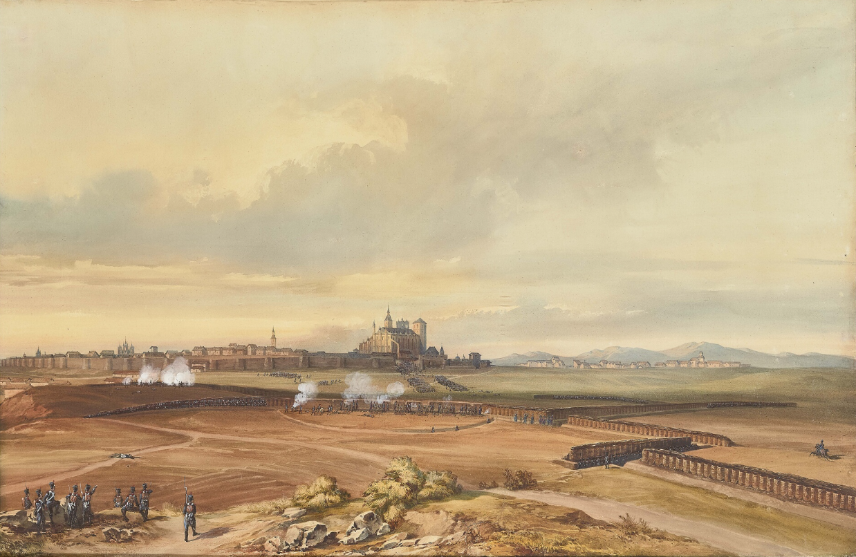
The Siege of Astorga was an episode of the Peninsular War fought within the walls of this town in the León province in 1810, and its memory still lives in the surviving fortifications of old Astorga. What actually happened at Astorga in 1810? Astorga sat on the flank of the French invasion of Spain and Portugal, and Napoleon's forces intended to turn it into a headquarters for the wider campaign. The catch was straightforward: the French lacked enough artillery on site to break the town's defenses, and the Spanish garrison holding the walls likewise had no means to force the issue. For several weeks neither side pushed for a decisive clash — both simply waited. Why did the standoff drag on for so long? Warfare at the time depended heavily on siege artillery — without heavy guns, punching a usable breach in a stone wall was nearly impossible. Astorga's fortifications, with roots stretching back to Roman and medieval construction, gave the defenders a genuine edge as long as the attacker lacked the right equipment. Everything changed the moment French guns finally reached the town. How did the siege end? Once the artillery arrived, French gunners opened a breach in the wall within a short time. That was enough to break the deadlock: the Spanish garrison could no longer hold its position, and the town surrendered on 22 April 1810. With Astorga in French hands, Napoleon's forces secured a key objective for that stage of the campaign. What can visitors see in Astorga related to this event today? The town walls, the very target of the French bombardment, survive to a large extent and remain one of the defining features of Astorga's old quarter. Walking along them, it's easy to picture how the defense played out during the Napoleonic era — it is the wall line itself, not a plaque or statue, that stands as the main witness to this history. The town's layout, dating back to Roman times, still serves as a living reference point for anyone interested in the Peninsular War. Why is this worth a stop when planning a trip through León? Astorga lies directly on the Camino de Santiago, so a visit to its defensive walls pairs naturally with a stretch of the pilgrimage route. Here, military history overlaps with centuries of pilgrim tradition — an unusual combination that tends to leave a strong impression on travelers interested in Spanish history. Frequently Asked Questions When exactly did Astorga fall? The town surrendered on 22 April 1810, shortly after French artillery had opened a breach in the defensive walls. Who fought in the siege? French forces, operating as part of the Peninsular War campaign, faced off against the Spanish garrison defending the town. Why did it take so long before an assault actually happened? Neither side initially had enough artillery to break the stalemate — the situation shifted only once the French guns were brought up. Are any fortifications from that period still standing in Astorga? Yes, the town walls that were the target of the French bombardment have largely survived and can be visited today as part of old Astorga.
-
Cantar de Mio Cid
Burgos
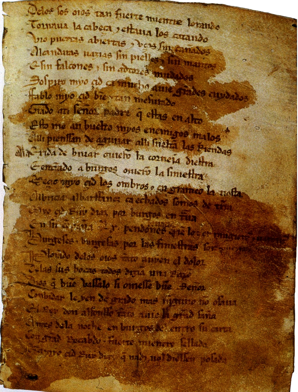
The Poem of the Cid is Spain's most celebrated medieval epic, and its physical trace can be found in Burgos — the city forever linked to the story of its hero, Rodrigo Díaz de Vivar, known as El Cid. Where in Burgos can you see the monument tied to the Poem of the Cid? The heart of the city's tribute to El Cid is a square named after him. Standing at its center is a monumental statue unveiled in 1955, created by Spanish sculptor Juan Cristóbal González Quesada. The bronze figure shows El Cid mounted on his horse Babieca, sword Tizona raised skyward — a gesture suggesting either the moment before battle or his departure into exile from his home city. Why does the monument honor the poem itself, not just the hero? This is what sets the statue apart from an ordinary war-hero memorial. The pedestal was designed to echo forms typical of Burgos architecture, and its side panels bear carved excerpts from the text of the poem. The people behind the monument wanted it to honor not only El Cid as a man, but the literary work that turned him into a figure recognized across Spain and beyond. What other spots in Burgos recall the Poem of the Cid? More traces of the story wait on the San Pablo bridge, where eight monumental statues by sculptor Joaquín Lucarini stand in a row. Each one depicts a different figure from El Cid's life or from the poem's narrative, forming a kind of stone gallery of the epic's cast. It's also worth knowing that today's square monument wasn't the city's first tribute — back in 1784, sculptor José Cortés produced an earlier monument bearing the coats of arms of Burgos and an inscription recalling the hero. What does the Poem of the Cid actually tell? The work, also known as the Cantar de Mio Cid, is a Spanish chivalric epic written by an anonymous author in the Castilian dialect. It recounts the story of a real historical figure — the knight Rodrigo Díaz de Vivar — reshaped into literary form. The same subject also appeared in chronicles and ballads, but it was this poem that gave it the form which endured for centuries and made El Cid one of the most recognizable figures of medieval Spain. How should you visit the sites linked to El Cid in Burgos? Start at the square with the statue, which sits in the city center and is an easy walk from the cathedral and old town. From there, a short stroll leads to the San Pablo bridge and Lucarini's statues. Seeing both sites doesn't take long, but together they show how Burgos remembers its most famous resident — and the literary work that made him immortal. Frequently Asked Questions Who wrote the Poem of the Cid? The author is unknown. The work was written in the Castilian dialect as a literary treatment of a traditional story also found in chronicles and ballads. When was the El Cid monument in Burgos built? The statue on the square bearing his name was unveiled in 1955, created by Juan Cristóbal González Quesada. What is carved on the monument's pedestal? The pedestal's side panels bear selected excerpts from the text of the Poem of the Cid — the monument honors both the hero and the literary work itself. Where else in Burgos can you see figures from the poem? On the San Pablo bridge, eight statues by Joaquín Lucarini depict figures tied to El Cid's life and to the poem's story.
-
Pedro Romero Martínez
Ronda
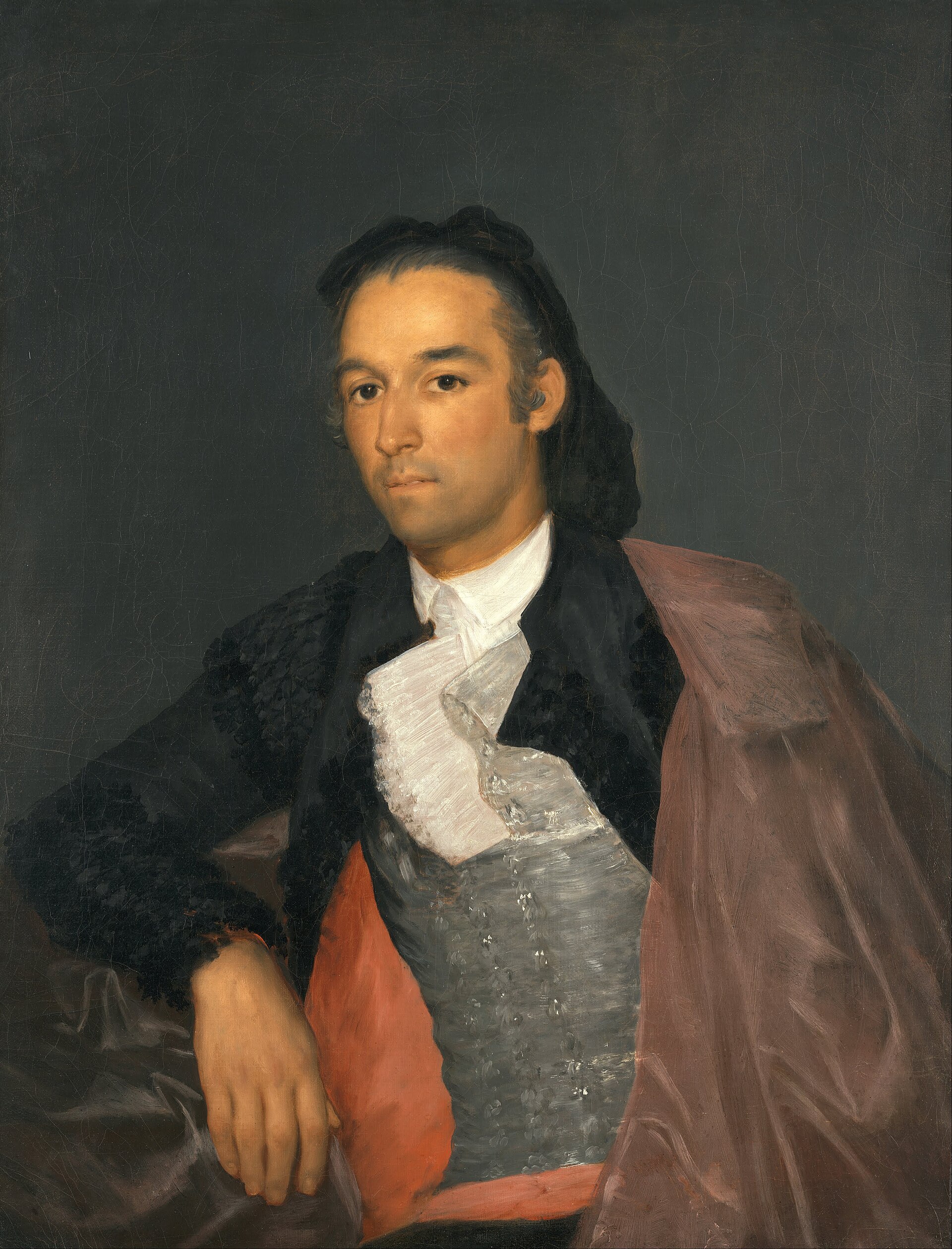
Pedro Romero is Ronda's most celebrated bullfighter, a figure whose legacy still shapes the city's identity, from stone monuments to its annual costumed fair. Who was Pedro Romero? Born in Ronda in 1754 and living until 1839, Pedro Romero belonged to the Romero family, which produced three generations of bullfighters who fought on foot rather than on horseback — a shift that helped define bullfighting as it's practiced today. Within that lineage, Pedro stood out for one striking reason: over the course of his career he killed more than 3,600 bulls, yet came away with only minor scratches. He is still regarded as the only matador to have fought at that scale while staying essentially unharmed, and that combination is the core of his reputation in Ronda and beyond. Where can visitors find his memory in Ronda? Two monuments in the city honor the bullfighter. The first is a full-figure statue standing at the entrance to Alameda del Tajo, a park popular for its walking paths and views over the gorge that cuts through Ronda. The second takes the form of a stele carved with his face in relief, placed on Plaza de San Francisco, next to the town's old medieval gateway opposite the Convent of San Francisco. Both spots sit within easy walking distance of Ronda's historic core, making them simple to fold into a walk through the old town. Why is Ronda so tied to bullfighting tradition? The Romero family was active in Ronda during the 18th century, right as fighting bulls on foot began replacing the earlier mounted style — a change historians point to as one of the turning points in shaping modern bullfighting. The town's bullring, among the oldest in Spain, sits at the center of that tradition, and Ronda's annual goyesca fair is held specifically in Pedro Romero's honor, with the town recreating the atmosphere of his era, including costumes inspired by Francisco Goya's paintings. Is it worth visiting both monuments? It's worth it if you're interested in bullfighting history or simply curious why the Romero name turns up throughout Ronda on plaques, steps, and street names. The statue at Alameda del Tajo fits naturally into a stroll through the park, while the stele on Plaza de San Francisco sits along the route between the old town and the newer part of the city, so both can be added to a sightseeing route without much detour. Frequently Asked Questions Who was Pedro Romero and why does he matter to Ronda? He was a bullfighter born in Ronda in 1754, from a family with a three-generation tradition of fighting bulls on foot. He killed more than 3,600 bulls over his career while suffering only minor injuries, which made him one of the most recognized figures in the history of Spanish bullfighting. Where are the Pedro Romero monuments located in Ronda? One stands at the entrance to Alameda del Tajo park, and the other — a stele with his face carved in relief — is on Plaza de San Francisco, near the town's old entrance gate. How do the two monuments differ? The Alameda del Tajo monument is a full statue of the bullfighter, while the Plaza de San Francisco piece is a simpler stele bearing his image in relief, set at a historically significant spot in the city. What is the goyesca fair and how does it connect to Pedro Romero? It's an annual celebration held in Ronda in the bullfighter's honor, during which the town recreates the atmosphere of his era, including costumes inspired by the paintings of Francisco Goya, a friend of the Romero family and chronicler of that period.
-
hórreo
Sewilla
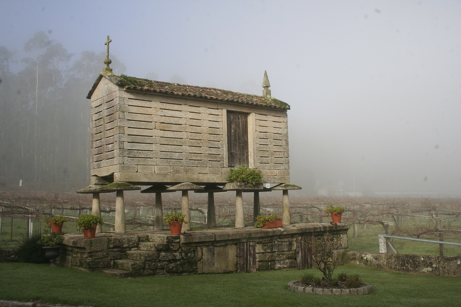
The hórreo in Seville is a small but distinctive piece of regional architecture that introduces visitors to a building tradition from the north of Spain — one that stands in sharp contrast to the Andalusian surroundings of the city. It's worth a short stop, since it's an unusual chance to see a structure normally associated with Galicia and Asturias rather than the south of the country. What exactly is a hórreo? A hórreo is a traditional agricultural granary built for centuries across the Iberian Peninsula to store and preserve food, primarily grain, away from moisture and animals. The structures were built from stone, wood, or brick, and their most recognizable feature is a set of pillars topped with flat staddle stones, which physically stop rodents from climbing up into the storage chamber. The walls are fitted with narrow ventilation slits that keep air circulating so the stored grain stays dry and doesn't spoil. This construction style developed mainly in Galicia and Asturias, but examples are also found in León, Zamora, Cantabria, the Basque Country, Navarre, and northern Portugal. That strong regional identity is exactly what makes the hórreo in Seville — a thoroughly Andalusian city — an interesting architectural curiosity and a useful point of comparison between Spain's different regional building traditions. How do you get there? Seville has a compact center that's easy to explore on foot, by tram, or by city bus. Most tourist sights, including displays of regional architecture, sit within walking distance of the city's main landmarks, such as the cathedral or the Plaza de España. If you're planning to see several sights in one day, it makes sense to pair a visit to the hórreo with a walk through the nearby parks and historic quarters — a typical way for visitors without a car to see Seville. What will you see on site? The main draw here is the structure itself: the way it's raised off the ground, the distinctive pillars topped with stone "caps" designed to keep rodents out, and the carefully placed narrow openings that ventilate the interior. Every element of the design — the materials, the proportions, the elevation — answers a specific practical need: protecting stored food from damp, pests, and spoilage. Seen up close, the hórreo looks strikingly different from the typical Andalusian buildings around it in Seville, which is exactly what makes it a memorable stop while exploring the city. When should you visit? Seville is known for extremely high summer temperatures, so the most comfortable time to walk around the city and visit sights like the hórreo is spring (March–May) or autumn (September–November), when conditions are far more pleasant for exploring on foot. Visiting in the morning also helps you avoid both the midday heat and the crowds in the city's busiest areas. Frequently asked questions How is a hórreo different from an ordinary granary? The key difference is the raised design: pillars topped with flat staddle stones that physically block rodents from climbing in, combined with narrow ventilation slits that prevent moisture buildup — solutions developed specifically for long-term grain storage. Is a hórreo a typical building for Seville? No — this architectural form comes mainly from Galicia, Asturias, and neighboring regions of northern Spain and Portugal, which is why finding one in Seville is unusual and makes for an interesting contrast with the local building style. What materials were hórreos built from? Traditionally stone, wood, or brick, depending on the region and the materials available locally. What was the hórreo used for? It was used to store and preserve food, mainly grain, protecting it from moisture and animals by keeping it raised off the ground and well ventilated.
-
Regino Sainz de la Maza
Burgos
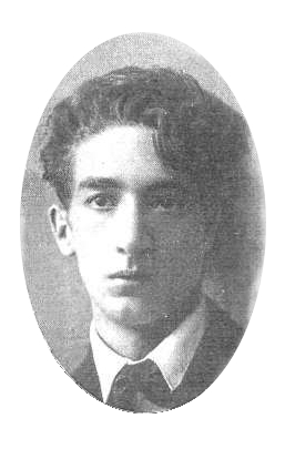
Regino Sainz de la Maza is a monument in Burgos honouring one of the city's most celebrated sons — a classical guitarist and composer whose name is also carried by a nearby square and promenade. Who was Regino Sainz de la Maza? Regino Sainz de la Maza was born in Burgos on 7 September 1896, at Plaza Mayor no. 31, and died in Madrid on 26 November 1981. He began studying guitar at the age of ten and gave his first public concert at eighteen, at the Teatro Arriaga in Bilbao. His Madrid debut followed in 1920 at the Teatro Lara, and he went on to tour South America twice, receiving a gold medal from the National University of Buenos Aires in 1921. His lasting fame rests on a single evening: on 9 November 1940, in Barcelona, he gave the world premiere of Joaquín Rodrigo's "Concierto de Aranjuez," now one of the best-known works in the guitar repertoire. From 1935 he held the guitar professorship at the Madrid Conservatory, and from 1938 he also wrote as a music critic for the newspaper ABC. In 1955 he published the essay "La Guitarra y su historia," and in 1958 he became the first guitarist ever admitted to the Royal Academy of Fine Arts of San Fernando — a milestone that helped cement the guitar's status as a serious concert instrument. What is his connection to Burgos? Although his career unfolded mainly in Madrid, Sainz de la Maza kept close ties to his birthplace throughout his life. In 1967 Burgos named him a Favourite Son of the city (Hijo Predilecto), and on 9 July 1979 he gave his final concert here, at the Church of San Nicolás de Bari. The city still keeps his memory alive: a square (Plaza de Regino Sáinz de la Maza) and a promenade (Paseo Regino Sainz de la Maza) bear his name, and a monument dedicated to him was unveiled in the early 1980s. What will you see at the monument? The monument is a modest but meaningful tribute — a stopping point where visitors can pause and recall the story of the musician who helped bring the classical guitar into Europe's most prestigious concert halls and academies. It sits naturally within a walk through historic Burgos, tied to the square and promenade that share his name nearby. How to get there and when to visit? The monument stands within the city of Burgos, close to the public spaces named after the guitarist, so it is easiest to reach on foot while exploring the centre. Burgos has good train and bus connections to Madrid and other cities in northern Spain, making it a convenient stop on a wider itinerary. The site can be visited in any season and any weather, working well as a short addition to a longer walk toward the cathedral or the old town. Frequently asked questions Who was Regino Sainz de la Maza? A Spanish classical guitarist and composer born in Burgos in 1896, best known for premiering Rodrigo's "Concierto de Aranjuez" in 1940. Why did Burgos build a monument to him? He is one of the city's most important native artists, named Favourite Son of Burgos in 1967, and he remained connected to the city throughout his life. What else in Burgos carries his name? A square (Plaza de Regino Sáinz de la Maza) and a promenade (Paseo Regino Sainz de la Maza), both near the monument. How long does a visit take? Just a few minutes — enough to see the monument and read about the artist — making it an easy addition to a longer stroll through the city.
-
Isidoro Máiquez
Kartagena
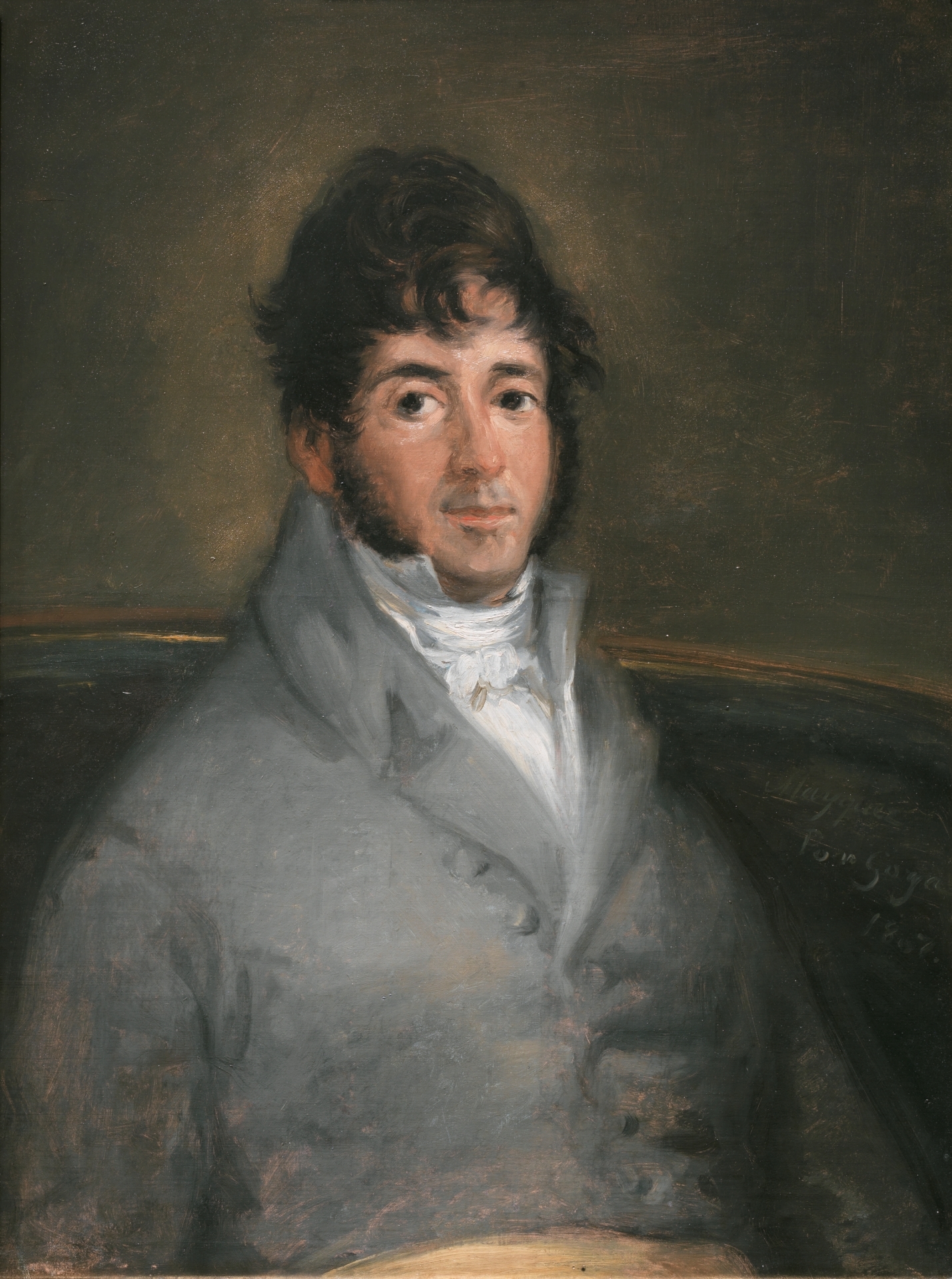
Isidoro Máiquez is a monument to Cartagena's most celebrated native actor, standing on Plaza San Francisco in the heart of the old town. It's a small, easy-to-miss corner of one of the city's oldest squares, but it commemorates a man who reshaped Spanish theatre at the turn of the 19th century. Who was Isidoro Máiquez? Isidoro Máiquez was born in Cartagena on 17 March 1768, the son of actors, and took to the stage as a young man despite his father's objections. His early years touring theatres in Málaga and Valencia brought more struggle than acclaim. The turning point came in Paris, where — backed financially by the Duke and Duchess of Osuna — he trained under the celebrated French actor François-Joseph Talma. Máiquez brought Talma's more natural, less declamatory style of acting back to Spain, debuting at the Teatro del Príncipe in Madrid in 1791. His breakthrough came in 1802 with a performance in Shakespeare's "Othello," after which he became director of the Teatro del Príncipe and the most recognised actor of his generation. A man of Enlightenment convictions, he was also politically committed to the liberal cause, which later brought him persecution. In 1807 he sat for a portrait by Francisco Goya, now on display at the Prado Museum in Madrid. Máiquez died in Granada on 18 March 1820. What will you see? The monument, a statue of the actor, has stood on Plaza San Francisco since 1927. It's a modest but clearly defined piece of public art woven into the historic fabric of central Cartagena, close to other landmarks of the old town. The site carries more symbolic than spectacular weight — a quiet marker of civic memory rather than a monumental architectural draw. When should you visit? The most meaningful time to see the square is 17 March, the anniversary of the actor's birth. Each year on that date, Cartagena holds a commemorative ceremony at the statue, drawing local cultural figures and admirers of Máiquez's legacy. Outside that date, the square functions as an ordinary, unhurried public space, open year-round with no restrictions. How do you get there? Plaza San Francisco sits in Cartagena's historic centre, within walking distance of the old town's main sights and the harbour. The easiest way to reach it is on foot while exploring downtown — the square lies along the natural route between the city's principal landmarks, so it fits easily into a walk without requiring a separate trip. Frequently asked questions Who was Isidoro Máiquez? A stage actor born in Cartagena in 1768, regarded as a reformer of Spanish acting who introduced a more natural performance style he learned from Talma in Paris. When was the monument erected? The statue on Plaza San Francisco was unveiled in 1927. Is it worth a dedicated trip? It's a small, symbolic monument best seen while exploring the old town — it's particularly worthwhile on 17 March, the anniversary of his birth. Where can you see his portrait? Francisco Goya's 1807 portrait of Isidoro Máiquez is held at the Prado Museum in Madrid.
-
Puente del Piélago
Linares
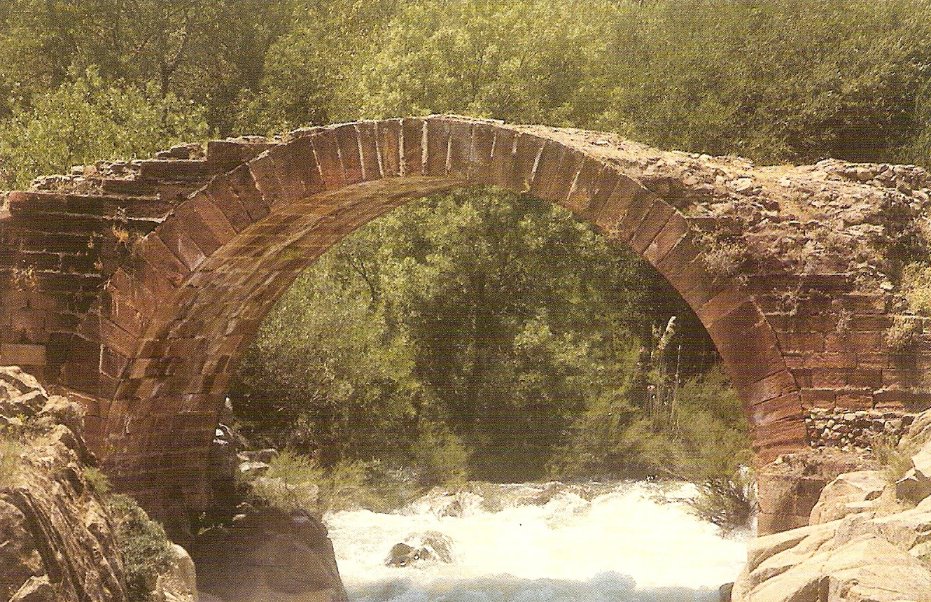
Puente del Piélago is a Roman stone bridge in Linares, in the province of Jaén, spanning the Guarrizas River. Also known as Puente de Vadollano, it sits in a spot remote enough that for most of the year only shepherds, farmers, and the occasional hiker pass by. Where is the bridge and how do you reach it? The bridge lies roughly two kilometers from Vadollano, the point where the Madrid–Linares railway line has a junction. Access follows a bridle path heading northeast from Vadollano. The structure sits wedged between two hills, out of sight from any main road, so it helps to know exactly where to look or to go with someone who has been there before. What makes this bridge Roman? The construction dates back to the period when Roman engineers crossed the Iberian Peninsula building roads that linked mining settlements and garrisons. Puente del Piélago formed part of a significant, heavily used calzada — a stone-paved Roman road. Stretches of the original paving still surface along the approach path, having survived centuries under soil and vegetation. How was the bridge built, and what condition is it in today? The bridge rests on two arches of markedly unequal span, both anchored directly into the bare rock of the riverbed — the Roman builders used the natural terrain itself as a foundation. The stone surface on top of the bridge has grown uneven and eroded over time, but the supporting arch itself still stands intact and continues to carry the structure's load, a testament to the durability of Roman engineering. Has the bridge been documented before? Yes. It appears in a 1913 article written by Mariano de la Paz Gómez y Rodríguez, one of the earliest recorded descriptions of the site — evidence that the local historical value of Puente del Piélago was already recognized more than a century ago. Why is it worth the visit? This is a destination for travelers who want a direct encounter with history without crowds or built-up infrastructure. The silence, the surrounding hills, and the surviving traces of Roman paving give a sense of what provincial roads looked like in ancient Hispania. It also makes a worthwhile stop on a hiking or cycling route through the countryside around Linares and the Guarrizas valley. Frequently Asked Questions Which river does Puente del Piélago cross? The bridge spans the Guarrizas River, near Linares. Are Puente del Piélago and Puente de Vadollano the same bridge? Yes, both names refer to the same structure — the second comes from the nearby settlement of Vadollano, through which the access route passes. How many arches does the bridge have, and what condition are they in? It has two arches of unequal span, anchored in bedrock. The supporting arch remains sound, though the upper surface has been worn down by erosion. Is the bridge easy to reach? The route follows a bridle path from Vadollano heading northeast; the bridge is hidden between two hills, so it's worth planning the approach in advance.
-
Monument to Andrés Torrejón
Móstoles
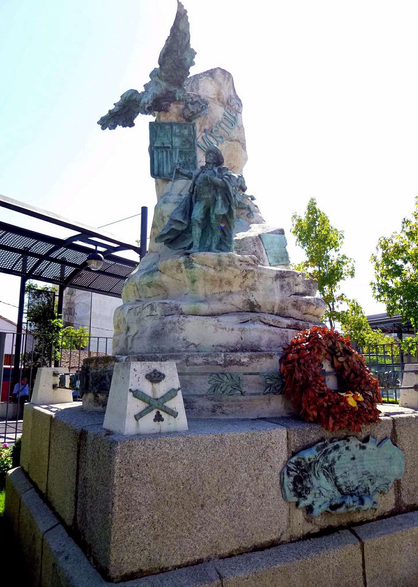
Monument to Andrés Torrejón stands in Móstoles, in the Community of Madrid, commemorating one of the pivotal episodes of Spanish history — the signing of the so-called Bando de Independencia on 2 May 1808. The monument honors the local mayor, Andrés Torrejón, who, together with the other alcalde, Simón Hernández, issued a proclamation calling for armed resistance against Napoleon's troops after news reached them of the massacre in Madrid. The monument was unveiled in 1908, marking the centenary of those events, with King Alfonso XIII presiding over the inauguration ceremony in person. It was designed by the Spanish sculptor Aurelio Carretero. What will you see? The monument is a layered, symbol-heavy composition. On a granite base sits a chunk of rock brought from Segovia, meant to represent the Pyrenees — the mountain range through which Napoleon's army entered Spain in 1808. Perched on top of the rock is an imperial eagle with outstretched wings, one claw reaching to tear the royal crown from Spain's coat of arms, a clear allegory of the French invasion and the assault on Spanish sovereignty. At the base of this composition stands the figure of Mayor Torrejón, alongside a horseman galloping with a copy of the famous bando — the text of the independence proclamation is reproduced on a bronze plaque set into the monument. That document, drafted by Juan Pérez Villamil, urged other towns and authorities to take up arms against the Napoleonic threat, and it became the founding local legend of Móstoles as the town that "declared war on Napoleon." How to get there? The monument sits in central Móstoles, a town in the southwestern part of the Madrid metropolitan area, well connected to the capital by Cercanías commuter trains and the metro. The journey from central Madrid typically takes 20 to 30 minutes. The site is easily reachable on foot from the town's main landmarks and forms a natural stop on a historical walk through Móstoles, alongside places such as the Casa Museo Andrés Torrejón, the house where the mayor himself lived. When to visit? The monument, standing in an open public space, can be visited year-round. A particularly notable time is 2 May, the anniversary of the bando's signing, when Móstoles holds commemorative events tied to the 1808 uprising. Visiting around that date offers a chance to see the site in the context of local historical memory rather than simply as a stop on a map. Frequently asked questions Who was Andrés Torrejón? He was the alcalde (mayor) of Móstoles who, in May 1808, after word arrived of the massacre of Madrid's residents by Napoleonic troops, signed the Bando de Independencia together with fellow alcalde Simón Hernández — a proclamation regarded as the symbolic opening act of Spain's War of Independence. When was the monument built and who designed it? It was unveiled in 1908 to mark the centenary of the 1808 events. The design is the work of sculptor Aurelio Carretero, and the inauguration was presided over by King Alfonso XIII. What does the eagle on the monument symbolize? The imperial eagle, wings spread over the rock, represents Napoleonic France attempting to tear the crown from Spain's coat of arms — a metaphor for the threat to national sovereignty that Torrejón and others stood against. Is it worth combining the visit with other sites in Móstoles? Yes — nearby stands the Casa Museo Andrés Torrejón, the house where the mayor lived, now open as a small museum dedicated to the events of 1808 and Móstoles' local history.
-
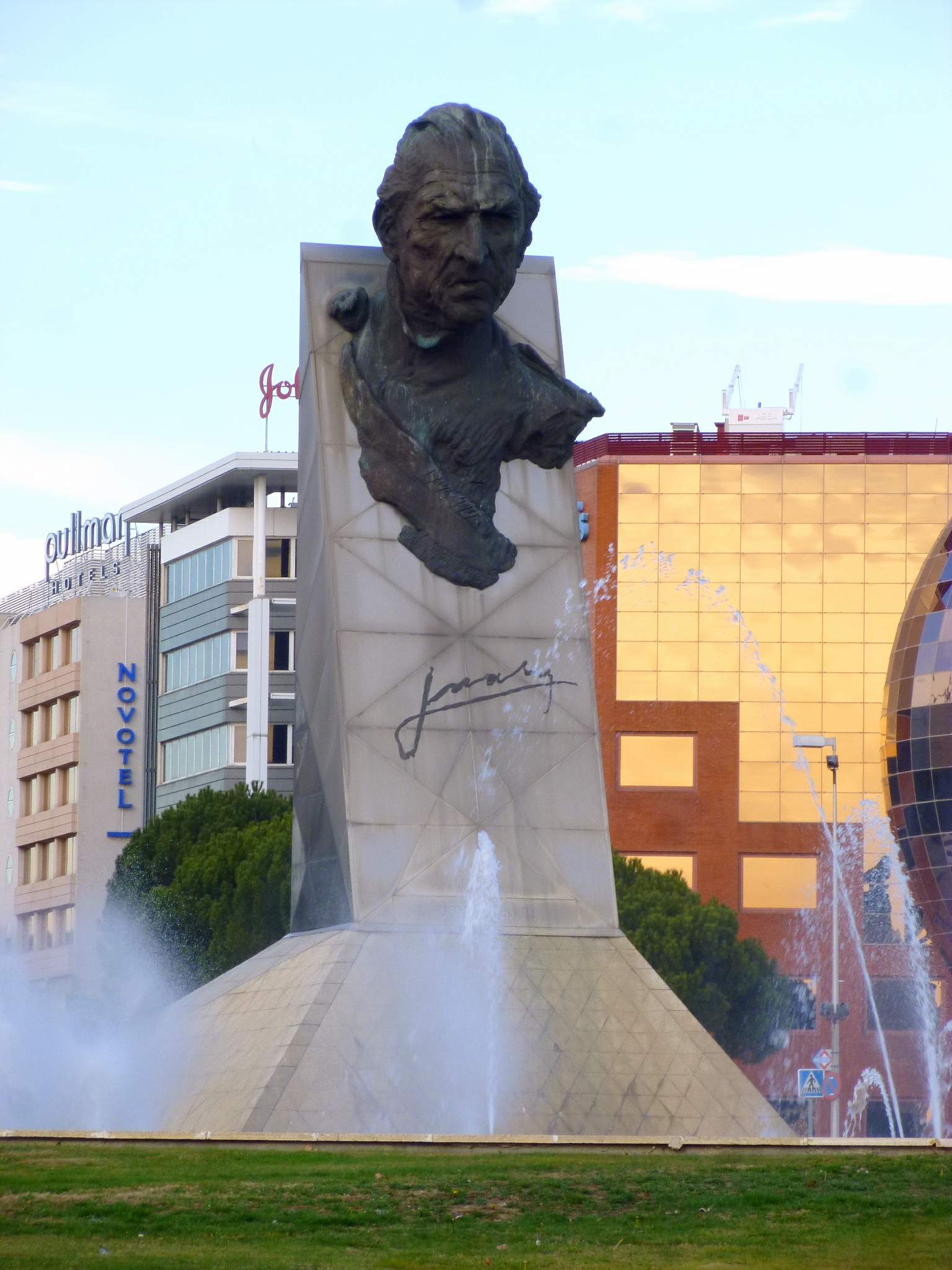
Monumento a don Juan de Borbón
Madryt
Monumento a don Juan de Borbón is a monument in Madrid, standing at the entrance to Parque Juan Carlos I, in the Campo de las Naciones district. It rises over the Glorieta de Don Juan de Borbón y Battenberg and is one of the few sites in the Spanish capital dedicated specifically to the father of King Juan Carlos I. Who built the monument, and when? The monument was erected in 1994 on the initiative of the newspaper ABC, which organized a public fundraising campaign to finance its construction. It was designed by Spanish sculptor and architect Víctor Ochoa. King Juan Carlos I personally unveiled it on 27 June 1994, less than a year after the death of his father, the Count of Barcelona, who passed away on 1 April 1993. What will you see there? The centerpiece is a monumental bronze bust weighing 7 tonnes, mounted on a tall steel monolith 16 metres high. The Count of Barcelona is portrayed at a mature age, gazing southward, in a firm and composed stance. The sculpture draws on Baroque artistic devices — strong contrasts of light and shadow, sharply defined facial features and a bold silhouette — which together emphasize the gravity and character of the man it depicts. Because of the scale of the monolith, the monument is visible from a considerable distance and serves as a clear landmark at the park entrance. Who was don Juan de Borbón? Don Juan de Borbón y Battenberg, Count of Barcelona, was the father of King Juan Carlos I and, by extension, the grandfather of Spain's current king, Felipe VI. Although he himself never formally reigned, he holds a key place in Spanish monarchist tradition as the figure who preserved the continuity of the Bourbon dynasty through the 20th century. The Madrid monument is symbolic in nature — it is not his burial site, but a public tribute to his role in the history of the Spanish monarchy. How do you get there? The monument stands in the Campo de las Naciones district, in the north-eastern part of Madrid, right next to Parque Juan Carlos I, one of the city's largest urban parks. The area is well connected to central Madrid by metro and city bus lines, and the monument itself is located at the park's main entrance, making it easy to combine a visit with a walk through the green spaces beyond. When is the best time to visit? Since the monument stands in an open space at the park entrance, it is best seen during daylight hours, when natural light brings out the sculpture's detail and the proportions of the monolith. Spring and autumn bring mild temperatures to Madrid, making them good seasons for a longer walk around the park combined with a stop at the monument. Frequently asked questions Who designed the monument? It was created by Spanish sculptor and architect Víctor Ochoa, who completed the work in 1994. How much does the bust weigh? The bronze bust depicting don Juan de Borbón weighs 7 tonnes and sits atop a 16-metre steel monolith. When was the monument unveiled? It was unveiled on 27 June 1994, in a ceremony led personally by King Juan Carlos I. Is this the burial site of don Juan de Borbón? No, it is a symbolic monument honoring the father of King Juan Carlos I, not his burial place.
-
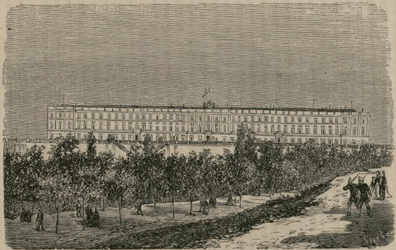
Montaña barracks
Madryt
Montaña barracks (Cuartel de la Montaña) marks the site of one of the most symbolic episodes of the Spanish Civil War, located in Madrid. No trace of the original building remains today, but the hill where it once stood is still a meaningful stop for anyone interested in 20th-century history, now transformed into a public park. What happened here? On 18–20 July 1936, the barracks became the scene of a two-day siege that marked the start of the Spanish Civil War. Part of the garrison stationed there joined a military uprising against the Second Spanish Republic. Most of Madrid's security forces, however, remained loyal to the republican government and, together with armed workers' militias, stormed the barracks and crushed the revolt in the city. The episode is regarded as a turning point in the opening days of the conflict — the defense of Madrid against the military coup became a lasting symbol of republican resistance. What can you see today? The original barracks building no longer stands — it was demolished, and the site and surrounding area were converted into an extensive park, best known today for offering some of the best views over western Madrid and the Manzanares River. It's a popular spot for locals to relax, with walking paths, green lawns, and viewpoints overlooking the city. Right next to it stands the Temple of Debod, an ancient Egyptian temple relocated to Madrid in the 1960s, one of the main attractions in this part of the city. For visitors drawn by history, the main draw is simply standing where these events unfolded — the site functions as a place of memory rather than one with physical remnants from the period. How do you get there? The area is well connected to central Madrid. The nearest metro stations are Plaza de España and Príncipe Pío, both a short walk from the former barracks site. It sits naturally along a route connecting the Royal Palace, Plaza de España, and Casa de Campo, making it easy to fold into a longer walk through this part of the city. When should you visit? Given its character as a park with panoramic views, late afternoon or sunset is the best time to visit — the views over the city and river are especially striking then. Spring and autumn offer the most comfortable temperatures, though the site is open and accessible year-round. Frequently asked questions Is there anything left to see of the Montaña barracks? No, the original building no longer exists. The site is now a park, primarily known today for its panoramic views over the city. Why is this site historically significant? It was here, in July 1936, that a decisive clash took place at the very start of the Spanish Civil War — the defense of Madrid against a military coup targeting the Republic. What else is worth seeing nearby? Right next door stands the Temple of Debod, an ancient Egyptian temple, along with Plaza de España. Is entry to the site free? Yes, it's an open public park with free access at all times.
-
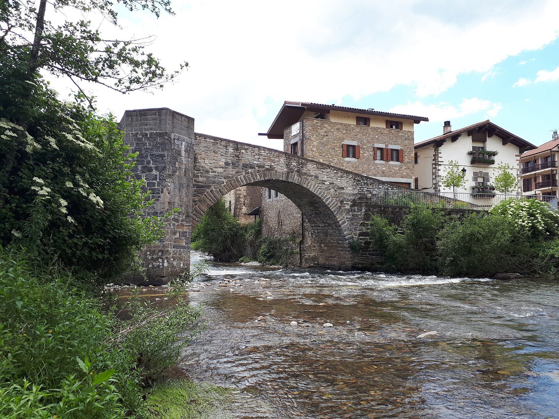
Puente de la Rabia
Esteribar
Puente de la Rabia is a medieval bridge in Zubiri, the main town of the Esteribar valley in Navarre, sitting directly on the Camino Francés, the most popular route of the Camino de Santiago. Spanning the Arga river about 20 km from Pamplona, it has been one of the defining landmarks of this stretch of the pilgrimage for centuries. What will you see there? The bridge dates back to the 11th century and still shows the classic "camel-back" profile typical of medieval river crossings, with the roadway rising in a gentle arch and dropping steeply on either side. It rests on two semicircular arches — the one on the right slightly pointed — and a central pier reinforced with a stone breakwater that protects it from the current. The rough-cut stone surface and austere lines make the bridge look much as it must have looked to the earliest pilgrims who crossed it. Its name, "Bridge of Rabies," comes from a local legend. While building the central pier, workers reportedly ran into difficult ground, and when they finally broke through the rock beneath the foundation, they are said to have found the remains of Saint Quiteria, a saint traditionally invoked against rabies. From that discovery grew a popular belief that leading a rabid animal three times around the pier could cure it. Locals and guides in Zubiri still tell the story to visitors today. How do you get to the bridge? The bridge sits right at the entrance to Zubiri, on the side pilgrims reach after descending from the Roncesvalles pass. It's one of the first notable landmarks on the Camino Francés after crossing the Pyrenees, and most walkers pass it on their first or second day on the trail. By car, Zubiri is roughly a 25–30 minute drive from Pamplona through the Esteribar valley. Local public transport also connects Zubiri with Pamplona, so the bridge is easy to reach without walking the pilgrim route. When should you visit? The bridge and the valley around it are pleasant year-round, but the busiest months are spring and summer (May to September), when pilgrim traffic on the Camino peaks. That's the best time to see the bridge in full use, with groups of walkers crossing the river and stopping at nearby bars and albergues. Autumn and winter bring fewer crowds but cooler, occasionally rainy weather typical of northern Navarre. What else is worth seeing nearby? The Esteribar valley is known for several other bridges along the Arga river, together forming an informal "bridges route" popular with walkers and cyclists exploring the area's medieval river crossings. Zubiri itself, whose Basque name means "village by the bridge," has kept the layout typical of towns along the Camino, with stone houses and narrow streets leading down toward the river. Frequently asked questions Is Puente de la Rabia still in use today? Yes, the bridge still serves as a pedestrian crossing in the center of Zubiri and is used daily by both locals and pilgrims walking the Camino Francés. Where does the name "Bridge of Rabies" come from? It comes from a legend about Saint Quiteria, whose remains were said to have been found while building the central pier, and from the belief that circling the pier with a rabid animal could cure it. Do you have to walk the Camino to see the bridge? No, the bridge can be reached by car or local public transport from Pamplona; walking the pilgrim route isn't required. How old is Puente de la Rabia? The bridge dates from the 11th century, making it one of the older surviving bridges on the Camino Francés in Navarre.
-
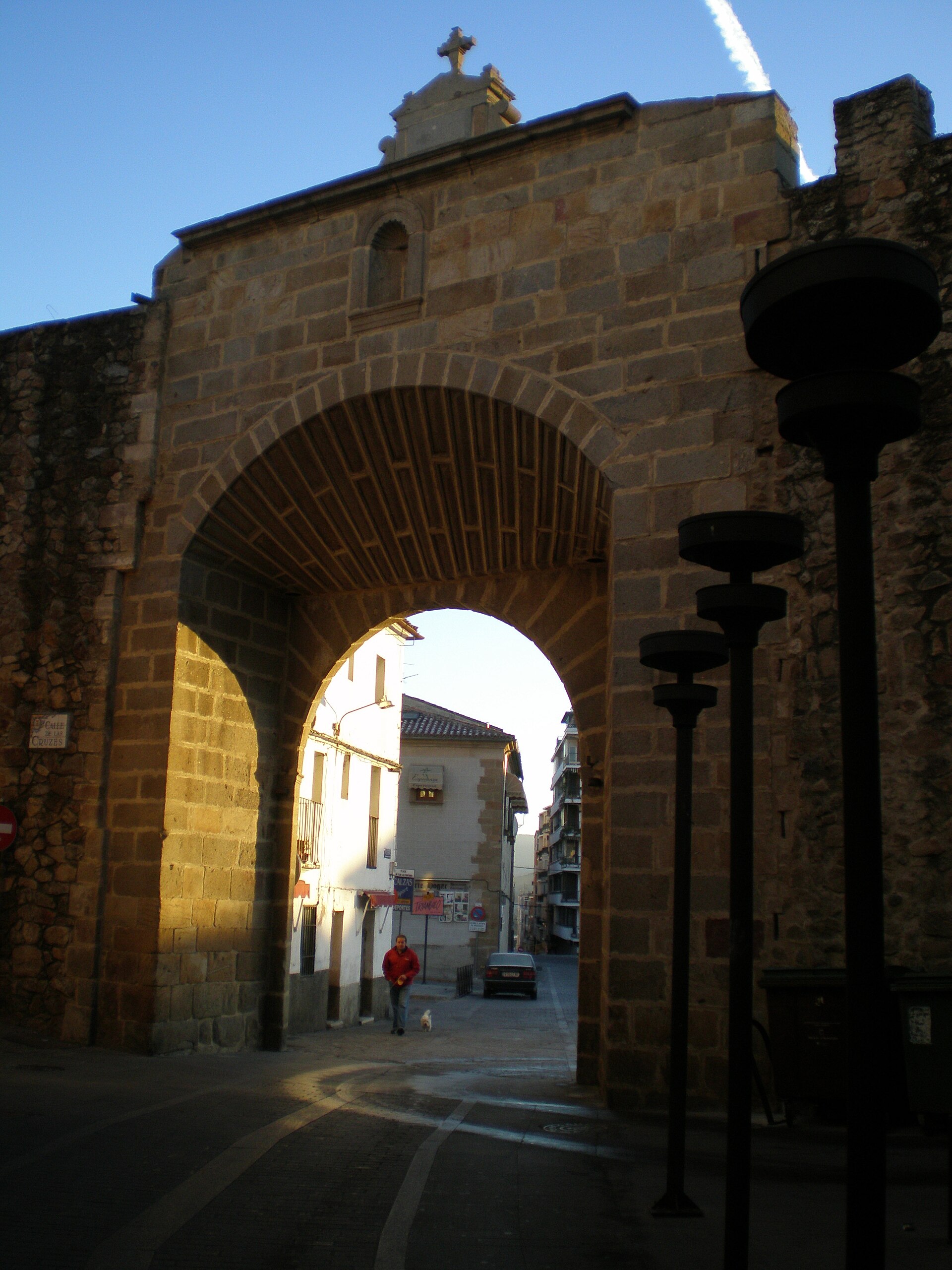
Puerta del Sol
Plasencia
Puerta del Sol is a Renaissance-era gate set into the old city walls of Plasencia, in the Cáceres province of Extremadura. It stands on the eastern edge of the historic centre and links directly to Plaza Mayor via calle del Sol, the street that gave the gate its name. Where does the gate come from? Plasencia was founded as a fortified town in the late 12th and early 13th centuries, and Puerta del Sol was built together with the rest of the city wall right from that early period. It originally had a fully medieval character, flanked by two defensive towers that no longer survive. The appearance visitors see today dates from a major renovation carried out in 1573, which gave the gate its current Renaissance form. What will you see there? The structure rises in three distinct sections. At street level sits a semicircular archway used for passage, above it a plain, unadorned stretch of wall, and crowning the whole is a third tier featuring Ionic pilasters topped with a stone cross. On the outer face, directly above the arch, is the coat of arms of the Catholic Monarchs, flanked on either side by two shields bearing the arms of Plasencia itself. Below the royal shield sits an inscription in Gothic lettering from 1488 — now largely worn away — commemorating the end of the Zúñiga family's lordship over the city and its return to direct royal control. Why did this gate matter historically? During the Middle Ages, Puerta del Sol was one of the city's key gates, since it gave access to the family residences of two prominent local houses: Francisco de Carvajal and the Zúñigas. Just outside the walls stood the church of San Andrés, seat of the cathedral chapter, along with the town hospital. The road leading out from the gate continued on toward the Jewish cemetery of Berrocal and the San Lázaro bridge over the Jerte river. How do you get there? Puerta del Sol sits right in the heart of old Plasencia, so reaching it on foot from Plaza Mayor takes only a few minutes along calle del Sol. The gate makes a natural starting point for exploring the surviving stretches of the city wall, much of which still rings the historic centre. It's worth pairing the visit with the other surviving gates — Puerta de Trujillo and Puerta Berrozana — as well as the nearby cathedral. When is the best time to visit? Spring and autumn are the most comfortable seasons for exploring Plasencia, since summer temperatures in Extremadura climb high enough to make long walks along exposed walls uncomfortable. The gate's stonework looks its best in late-afternoon light, when the sun catches the coat of arms and other carved details on the facade. It's also worth checking the local calendar of fairs and festivals, since the old town tends to be especially lively during those dates. Frequently asked questions Is there an entrance fee for Puerta del Sol? No, the gate is part of the city's public street layout, and you can view it and walk through the archway free of charge at any time. Can you drive a car through the gate? The archway does allow passage, but given its narrow, historic proportions, vehicle access is limited — exploring this part of the old town on foot is by far the more practical option. How is this Puerta del Sol different from the famous square of the same name in Madrid? They are entirely different places: Madrid's Puerta del Sol is a large public square at the heart of the capital, while Plasencia's Puerta del Sol is a historic gate built into the medieval and Renaissance city walls. How long does it take to see the area around the gate? The gate itself is a quick stop, but walking the full stretch of the city walls and visiting several of its gates typically takes around an hour to ninety minutes, depending on your pace.
Earn badges for the places you visit
Download NextOnTrip, discover new places and check off your trails.