Monuments in Spain
A guide to 4655 Monuments in Spain — with descriptions, photos and traveler visits from the NextOnTrip community. Locations spread across 2240 cities and towns. Most visited by the community: castle of Chulilla, Castle of Pioz, castell de la Todolella.
-
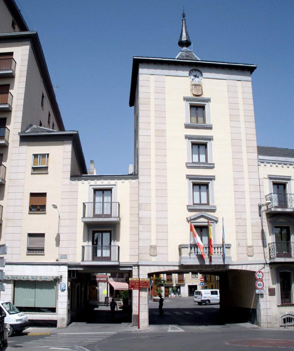
Aranda de Duero town hall
Aranda de Duero
Aranda de Duero town hall faces onto Plaza Mayor, the main square of this town in Burgos province, in the Castile and León region. It houses the local government and works as a natural landmark for anyone exploring the historic centre of the Ribera del Duero wine region's capital. Where is the town hall located? The building sits at Plaza Mayor 1, right in the heart of Aranda de Duero's old quarter. This square has served as the town's main public space for centuries, with routes leading off it toward the church of Santa María la Real and into the narrow lanes of the historic centre. As a civic building, the town hall is part of the square's overall character, standing alongside arcaded houses and café terraces typical of Castilian market squares. Why stop at the town hall? Aranda de Duero ranks as the third most populous municipality in Castile and León among those that aren't provincial capitals, and it also serves as the capital of Ribera del Duero, one of Spain's best-known red wine regions. Plaza Mayor and its town hall make a sensible starting point for exploring a town that combines its role as a regional administrative centre with its role as a gateway to the vineyards stretching along the Duero valley. What's easy to miss standing on the square is what lies beneath it: a dense network of underground wine cellars and tunnels, carved into the rock over generations by local residents, runs under much of the old town. It's one of the largest such networks in the region, and it's a major reason visitors come to Aranda de Duero — pairing a walk across the town hall square with a visit to this underground wine city. What else is worth seeing nearby? From Plaza Mayor, it's worth heading toward the nearby church of Santa María la Real, one of the town's most significant religious landmarks, and wandering the narrow streets of the old quarter, where pockets of historic architecture survive. The square itself, lined with residential and commercial buildings, also hosts much of the town's public life — markets, festivals, and local celebrations — making it a good spot to watch the town's everyday rhythm unfold. How should you plan a visit? The town hall is a working administrative building rather than a museum, so going inside isn't really the point — it makes more sense to treat it as a waypoint on a walk through the centre. Pairing that walk with a visit to one of the underground wine cellars open to the public, plus a tasting of local Ribera del Duero wines, rounds out the experience the region is famous for. Aranda de Duero sits conveniently about halfway between Madrid and Burgos, making it an easy stop on a trip through Castile and León. Frequently Asked Questions Where exactly is the Aranda de Duero town hall? At Plaza Mayor 1, the main square of the historic centre, in Burgos province. Can visitors go inside the town hall? It's a functioning local government building rather than a museum, so most visitors simply view it from the square. Why is Aranda de Duero known among travelers? As the capital of the Ribera del Duero wine region and for the extensive network of underground wine cellars running beneath its old town. What's worth seeing near the town hall? The church of Santa María la Real, the streets of the old quarter, and entrances to underground wine cellars open to visitors.
-
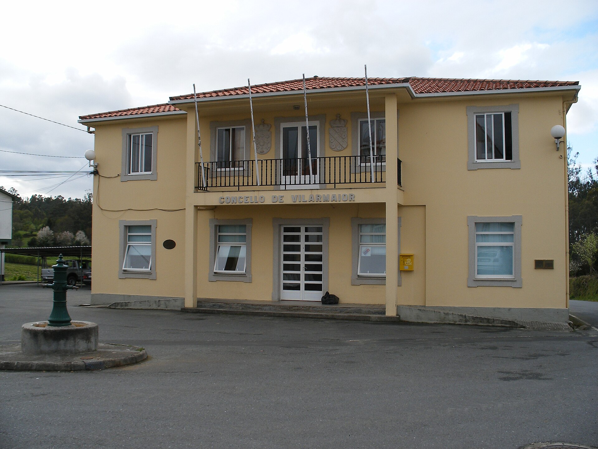
Vilarmaior town hall
Vilarmaior
Vilarmaior town hall is the seat of local government for the municipality of Vilarmaior, a small rural district in the province of A Coruña, in the Galicia region of northwestern Spain. The building sits in the village of A Armada and serves as the administrative and civic hub for the surrounding area. Where is Vilarmaior located? Vilarmaior belongs to the comarca (district) of Betanzos, in the eastern part of the historical Mariñas area within the province of A Coruña. The municipality covers 30.35 km² and is home to roughly 1,234 people (629 men and 605 women), spread across several small settlements rather than concentrated in one town centre. The landscape is typical of inland Galicia — rolling hills, scattered hamlets, farmland and patches of woodland. What is the town hall building for? The town hall (Concello de Vilarmaior in Galician) houses the mayor's office and the municipal council, and is the point of contact for residents on matters such as local registration, municipal taxes, permits and general administrative queries. The building's address is Lugar A Armada, nº 1, 15637 Vilarmaior. The current mayor is Carlos Vázquez Quintián. Is Vilarmaior worth a stop for visitors? Vilarmaior isn't a destination built around a checklist of sights, but for anyone travelling through the interior of A Coruña province — between Betanzos and the coast — it functions as a useful landmark. The town hall itself, as the administrative centre of the municipality, is often the clearest reference point when routing through the surrounding villages and farmland of the Mariñas district. The area retains the unhurried character of a traditional Galician rural municipality, with little tourist traffic, which for some travellers is precisely the appeal. How do you get to Vilarmaior? The municipality lies inland from the A Coruña coast, within reasonable driving distance of Betanzos, the main town of the district and a practical base for exploring further. The town hall's coordinates are 43.3548, -8.1301, which can be entered directly into GPS navigation. Given the rural setting, arriving by car is the most practical option, as public transport links in this part of the province are limited. Frequently Asked Questions Is Vilarmaior a town or a village? Vilarmaior is a municipality (concello) of about 1,234 residents, made up of several smaller settlements spread over 30.35 km². It is not a town in the urban sense but a rural administrative district. Where exactly is the town hall? The municipal administration building is located in the village of A Armada, at Lugar A Armada, nº 1, 15637 Vilarmaior, in the province of A Coruña. Which wider region does Vilarmaior belong to? The municipality is part of the Betanzos comarca, within the province of A Coruña, in the Mariñas area of Galicia. Can visitors handle official business at the town hall? The office primarily serves residents with routine municipal matters. Travellers looking for local information can still contact the administration by phone or in person.
-
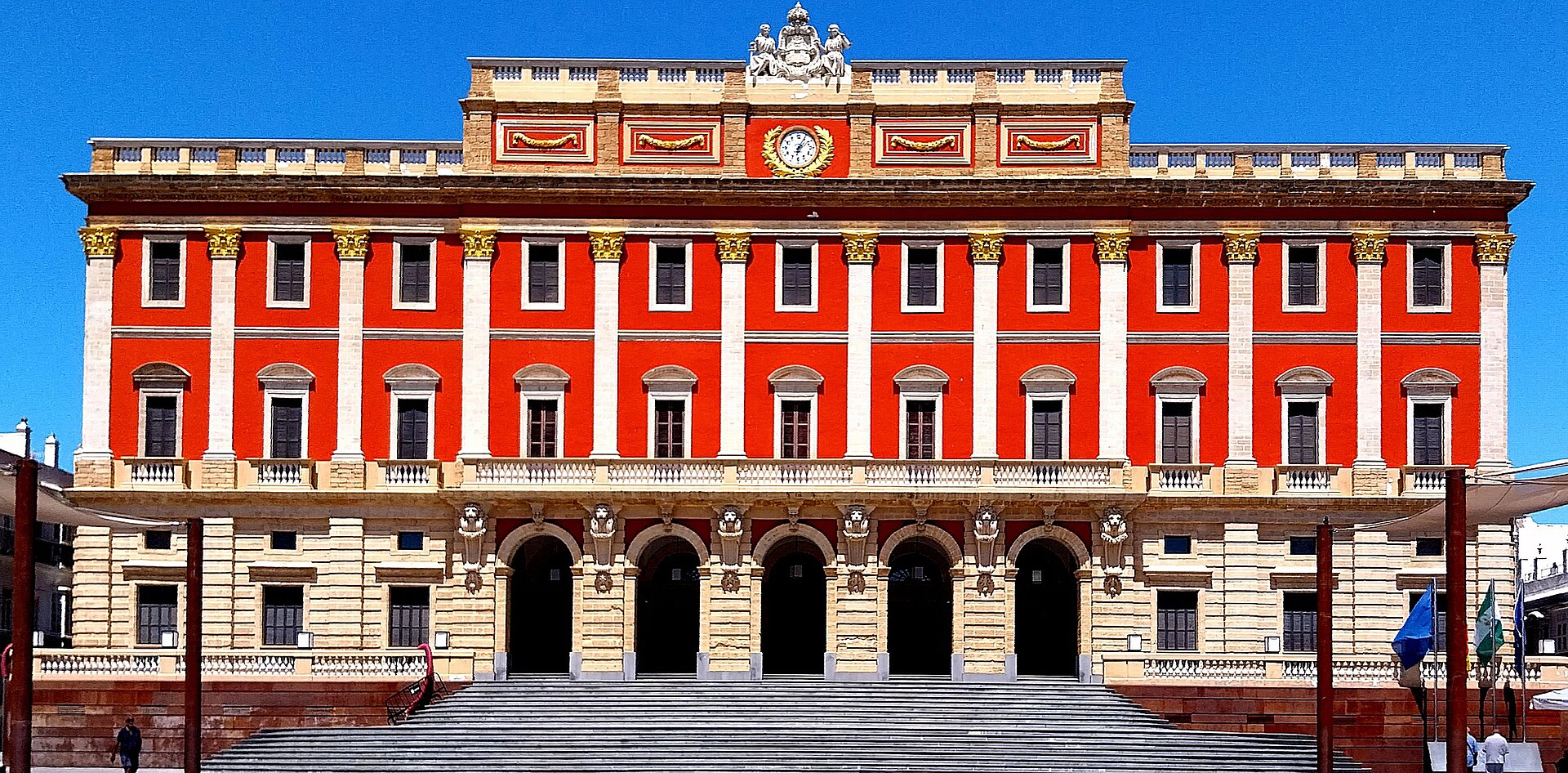
San Fernando City Council
San Fernando
San Fernando is a town in the province of Cádiz, Andalusia, and its town hall sits at the heart of the historic quarter once known as La Isla de León. This former island in Cádiz Bay, ringed by salt marshes, was the stage for one of the defining moments in Spanish political history: the drafting of the country's first liberal constitution. Why did the 1812 Constitution come together here? During the war against Napoleon, the Isla de León remained, together with Cádiz, one of the only patches of Spanish soil the French army never managed to occupy. Surrounded by water and fortifications, it gave the deputies of the Cortes a secure base to work from. Between September 1810 and February 1811 the sessions were held in the town's theatre before the assembly moved on to Cádiz, where the finished text was proclaimed in 1812. This episode remains the single most-told chapter of the town's story, and it shapes how San Fernando presents itself today as the birthplace of Spanish constitutionalism. How did the town's name and status change over time? The island settlement had earlier belonged to the Ponce de León family before passing to the Crown in 1729 under Felipe V, who granted it the title Real Isla de León. A separate town council was established in 1766 by order of Carlos III — the root of today's administration and town hall. The current name, San Fernando, was granted in 1813 as a reward for loyalty to the crown during the war, and with it the settlement was raised to city status. What is worth seeing around the town hall? San Fernando's centre keeps the layout typical of towns that grew up on an island, with narrow streets running toward the waterfront and the surrounding salt pans, which have supplied salt for centuries and still attract flamingos from the Bahía de Cádiz Natural Park. Close by stands the theatre linked to the Cortes sessions, one of the town's best-known landmarks, along with La Carraca naval base, a reminder of Spain's ocean-going fleet. The area around the town hall makes a good starting point for exploring the oldest part of town on foot. Where does the nickname "de la Isla" come from? San Fernando is the hometown of Camarón de la Isla, one of the most celebrated flamenco singers in history — his stage name refers directly to the town's older name, Isla de León. That connection still shapes local cultural identity and comes up often in how the town is presented to visitors. Frequently Asked Questions Is this the same San Fernando as San Fernando de Henares near Madrid? No. These are two separate towns sharing the same patron saint's name — the one described here lies in the province of Cádiz, Andalusia, with an entirely different history from the town near Madrid. Why was San Fernando previously called Isla de León? The town stood on an island surrounded by the waters and salt marshes of Cádiz Bay, which gave rise to the historic name. The current name was adopted in 1813. What is San Fernando's connection to the 1812 Constitution? Under siege by Napoleonic troops, deputies of the Cortes began drafting Spain's first liberal constitution here before the sessions moved to nearby Cádiz, where the text was finally proclaimed. Is there more to see in San Fernando besides the town hall? Yes — the surrounding area includes the historic centre, salt pans with waterbirds, and remnants of the old La Carraca naval base, giving a fuller picture of the town beyond the administrative building itself.
-
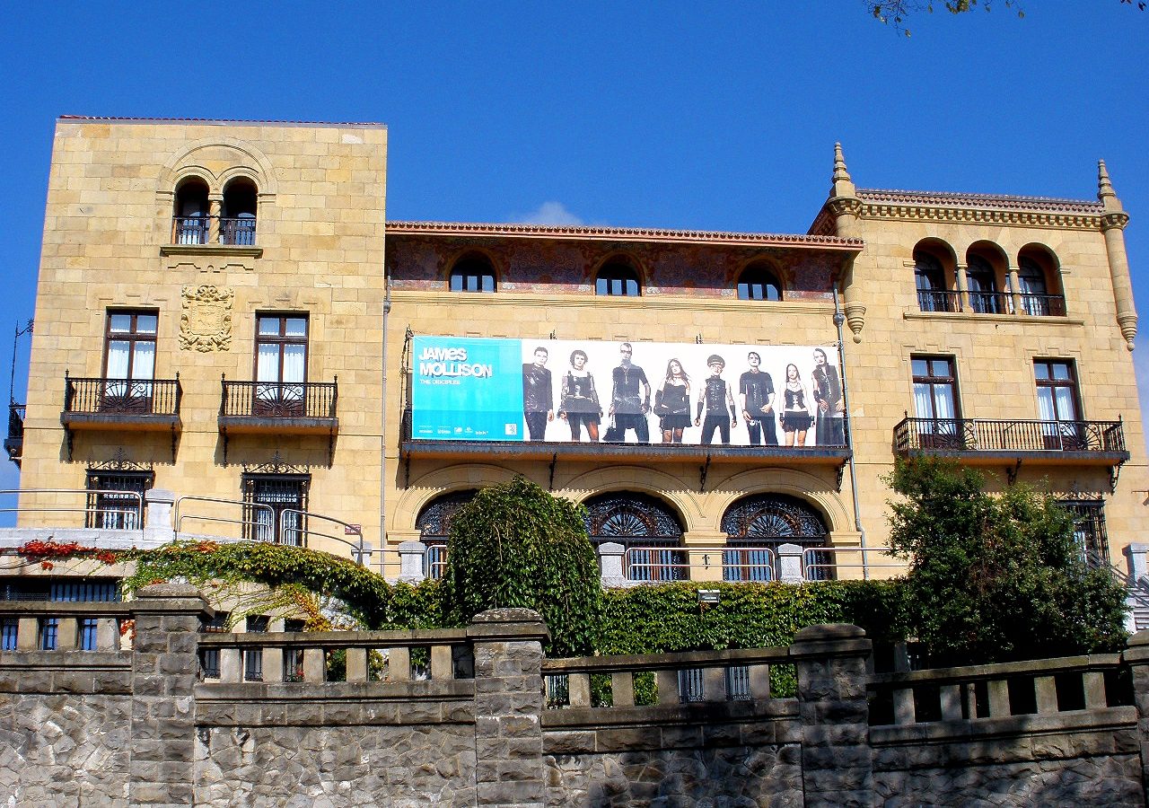
Getxo Town Hall
Getxo
Getxo Town Hall is the seat of municipal government for Getxo, a coastal town in Biscay, in Spain's Basque Country, sitting on the western side of the Nervión estuary. The building stands at coordinates 43.34304, -3.00765, in the administrative heart of a town best known for its stately villas and its proximity to a landmark transporter bridge spanning the estuary. Where exactly is the town hall located? The town hall sits in the part of Getxo that houses the municipality's main public institutions. Getxo stretches along the Bay of Biscay coastline, and its urban character was shaped in the 19th and 20th centuries by wealthy families from nearby Bilbao, who built seafront residences here. The town hall itself is a working administrative building rather than a tourist attraction in the usual sense — locals come here to handle official business — but its central position makes it a useful landmark when exploring the town. Why would a visitor come here? For most travelers, the town hall isn't a destination in its own right but a reference point while touring Getxo. The town's real draw is the Puente Colgante (Puente de Bizkaia), a UNESCO-listed transporter bridge crossing the Nervión estuary, along with the neighborhood of Art Nouveau and eclectic-style villas built by affluent Bilbao families seeking summer residences by the sea. Anyone interested in local administration, civic architecture, or planning an actual visit to the municipal offices will need accurate contact details and opening hours. What are the opening hours and how do you get in touch? The town hall receives the public Monday through Friday from 9:00 to 13:30 and again from 16:30 to 19:30, and on Saturdays from 10:00 to 13:30. This split schedule — a midday break followed by an evening window on weekdays — is common for municipal offices in this part of Spain and worth checking before you go, since the building is closed to official business outside these hours. Phone contact is available at +34 944 602 529. How do you get there, and what else fits into the visit? Getxo is well connected to Bilbao, separated only by a short stretch along the Nervión estuary, which makes it a popular day-trip destination from the city. After any business at the town hall, it's worth walking toward the waterfront, where the transporter bridge and the villa-lined streets that speak to the area's past wealth come into view. A short coastal walk turns a practical errand at the municipal offices into a quick, efficient introduction to the town's character. Frequently Asked Questions Can you visit Getxo Town Hall as a tourist attraction? Not really — it's a functioning municipal administration building, not a museum. Entering makes sense mainly if you have official business to handle. What are the town hall's opening hours? Monday to Friday: 9:00–13:30 and 16:30–19:30. Saturday: 10:00–13:30. It's closed on Sundays. What's the phone number for the town hall? +34 944 602 529. Is it worth combining a visit with other sights in Getxo? Yes — the town hall sits within easy reach of Getxo's seafront, where the transporter bridge over the Nervión estuary and the historic villa district, the main reasons visitors come to town, are both close by.
-
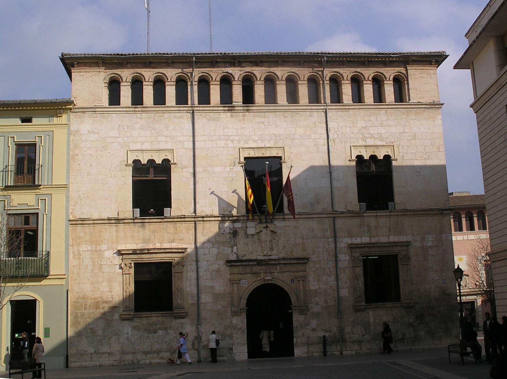
town hall of Alzira
Alzira
The town hall of Alzira stands at the heart of this riverside town in the Valencia province, its Renaissance frame dating back to 1540. Recognized as a monument of national cultural interest, the building carries three architectural periods on a single façade — Gothic, Renaissance and Baroque details sit side by side, an unusual mix for a municipal building of this scale. What makes this town hall worth a stop? The structure takes the shape of a civil Gothic palace, a design common among Valencian noble houses of the era: a plain stone front, an even rhythm of window openings, and restrained but carefully carved stonework. Rather than the grander town halls found in bigger regional cities, this one preserves the layout typical of small Valencian municipal seats from the 16th century, before neoclassical remodeling became the norm elsewhere. What does the building hold inside? The town hall houses the "Aureum Opus," an illuminated codex from the 15th century and one of the most significant historical documents tied to the city. It isn't displayed as a everyday museum piece, but the fact that a working administrative building still safeguards it says something about Alzira's institutional continuity — the town has run its affairs from this same site for centuries. How does the town hall fit into Alzira's history? Alzira began as the Iberian settlement of Algezira Sucro, built on an island formed by two branches of the Sucro River, known today as the Júcar — hence the Arabic-derived name "al-jazira," meaning "island." The town was incorporated into the Christian Kingdom of Valencia in 1242, following the conquest led by James I of Aragon. Erected three centuries later, the town hall is a witness to the period when Alzira operated as a fully established Christian Spanish town with a municipal government in need of a representative headquarters. The town's prosperity was not uninterrupted, however: after the expulsion of its large Morisco population in the early 17th century, Alzira went through a noticeable economic and demographic decline. The town hall survived those shifts as a fixed reference point in the fabric of the city. What else is worth seeing nearby? Alzira sits in the Ribera Alta region, known for its orange groves — the orchards surrounding the town are part of the everyday landscape and worth a look on any walk through the old center. Near the Júcar River, a Roman bridge still stands, evidence of settlement here even before the Iberian Algezira Sucro existed. Visiting the historic center of Alzira, with the town hall as a natural anchor point, typically takes no more than an hour or two, making it easy to combine with a longer day trip around the Ribera Alta. Frequently Asked Questions When was the town hall of Alzira built? The building dates to 1540, in the Renaissance period, though its architecture also shows Gothic and Baroque elements added over time. Can visitors go inside the town hall? As a working municipal administrative building, the town hall does not operate as a conventional tourist attraction with set visiting hours — it's worth checking locally or with the tourist information office for any public access. What is the "Aureum Opus"? It is an illuminated 15th-century codex kept at the town hall, one of the historical documents connected to Alzira's past. Why is Alzira sometimes called "the island"? The town's name derives from the Arabic word for island — the original settlement grew on land encircled by two branches of the Júcar River, formerly known as the Sucro.
-
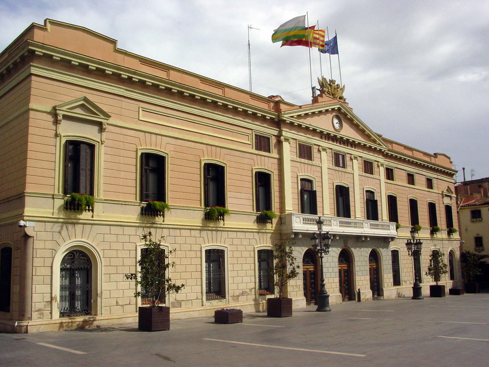
Ajuntament de Sabadell
Sabadell
Ajuntament de Sabadell (Sabadell City Hall) is the seat of local government in Sabadell, a substantial city in Barcelona province whose growth was built on the textile trade. The building sits on Plaça de Sant Roc, also referred to as Plaça de l'Ajuntament, right at the heart of the old town. Was this building always a town hall? Not originally. The structure dates from 1871–1872, when it was built to house a school run by the Piarist order (Escola Pia). The city bought the property from the order in 1880, and the municipal government moved in five years later, in 1885, once the necessary adaptation works were finished. Why does the facade look the way it does? The current appearance is the result of two separate building campaigns decades apart. In 1888, master builder Gabriel Batllevell reworked the main facade, giving it the neoclassical look visitors see today — warm reddish tones, a pediment topped with a clock, and four Tuscan columns. A second phase followed in 1900, when architect Juli Batllevell i Arús designed the rear facade, facing Plaça del Doctor Robert. That same project turned the school's old inner courtyard into the open public square that stands behind the building today. What should visitors look out for on the square? Standing on Plaça de Sant Roc, it's worth comparing the two very different facades: the formal, columned front with its clock, and the later rear elevation added at the turn of the 20th century. The square itself has long functioned as a civic focal point for Sabadell, making it a sensible starting point for exploring the old town, including the buildings tied to the city's textile-manufacturing past that once earned it a reputation as a leading industrial center in Catalonia. Can the inside of the building be visited? Since the Ajuntament is a working municipal office, access to the interior depends on administrative opening hours and any events the city organizes there. The facade and the surrounding square, however, are open to the public at all times and are the main draw for anyone stopping by for a brief look. Frequently Asked Questions Where exactly is the Ajuntament de Sabadell located? The building stands at Plaça de Sant Roc 1, in the historic center of Sabadell, a city in Barcelona province. Is this the oldest building in the area? No — it isn't the oldest structure nearby, but the building itself is over 150 years old and has served several purposes, first as a Piarist school and later as the city's seat of government. Who is responsible for the building's distinctive facade? The main facade was redesigned by Gabriel Batllevell in 1888, while the rear facade facing Plaça del Doctor Robert was added in 1900 by architect Juli Batllevell i Arús. Is it worth pairing a visit with other sights in Sabadell? Yes — the town center around the Ajuntament is a good base for exploring the architecture connected to the textile industry that shaped Sabadell through the 19th and 20th centuries.
-
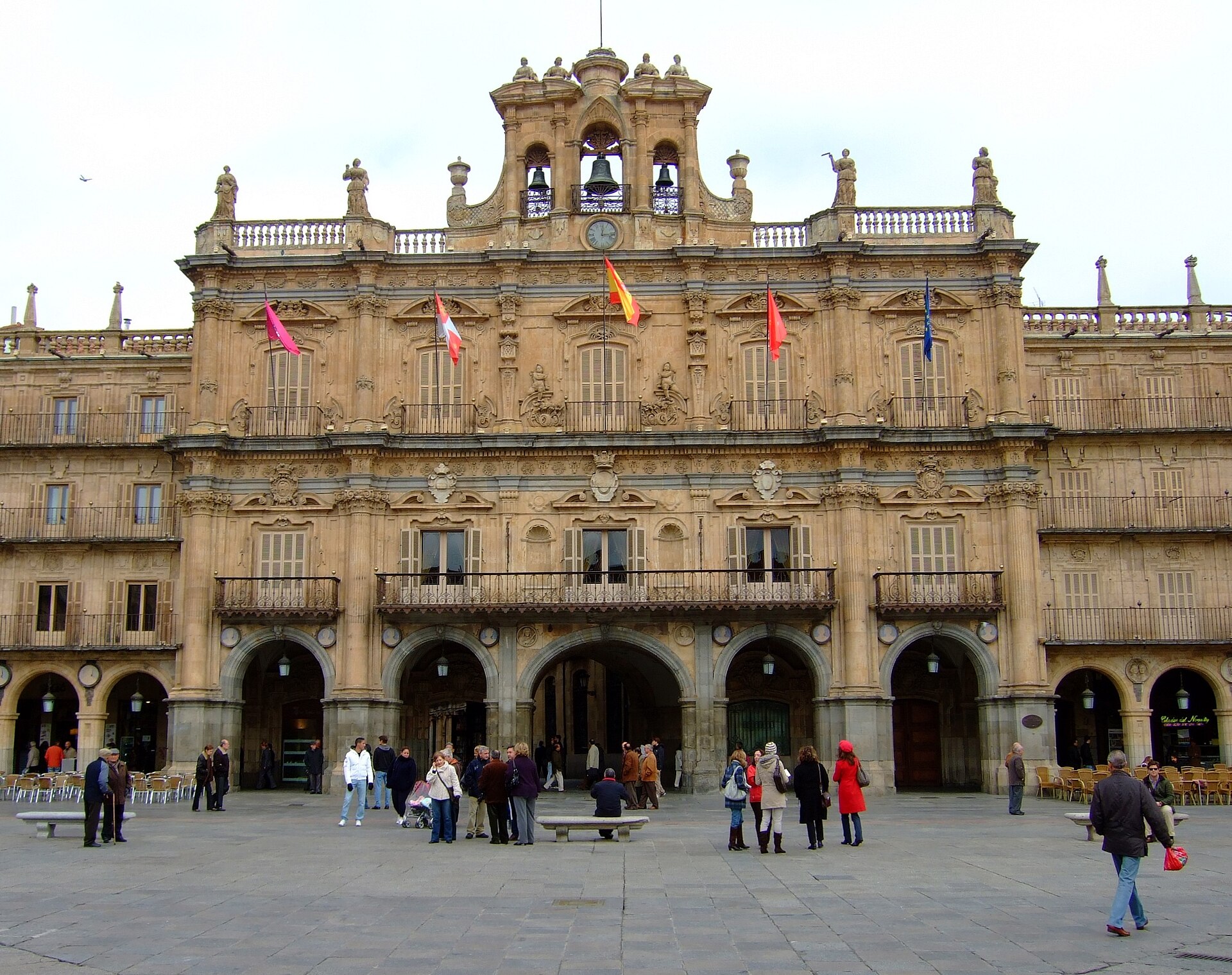
Salamanca City Council
Salamanka
Salamanca is one of the most distinctive cities in Castile and León, famous for sandstone buildings that turn golden at sunset and for hosting the oldest university in Spain. Its historic centre was inscribed on the UNESCO World Heritage List in 1988 as one of the essential centres of Churrigueresque art, whose 18th-century influence spread from the Iberian Peninsula all the way to Latin America. What makes the University of Salamanca so significant? The university traces its origins to 1218, when King Alfonso IX of León founded the "scholas Salamanticae." In 1254 King Alfonso X the Wise granted it full university status, making Salamanca one of the first institutions in Europe to hold that title officially, alongside Bologna, Oxford and Paris. For centuries the school trained lawyers, theologians and scholars, and it was here that debates on colonial law in the New World famously took place. What should visitors look for on the historic facade? The campus's best-known feature is the Fachada Rica, a richly carved Plateresque facade built between 1521 and 1529, roughly three hundred years after the university's founding. Floral motifs and Italian-influenced ornamentation dominate the design, and a central medallion depicts the Catholic Monarchs. Hidden among the carvings is a small frog — local tradition holds that any student who spots it unaided will have good luck in exams. Why does the Plaza Mayor draw so many visitors? Construction of the Plaza Mayor ran from 1729 to 1755, an initiative led by Rodrigo Caballero de Llanes and funded by the city's own residents rather than the crown. Architects Alberto Churriguera and Andrés García de Quiñones designed the square, which rests on 88 semicircular arches decorated with medallions honouring figures tied to the city's history. The ornamental gable above the main facade, known as the espadaña, was not added until 1852 — more than a century after the square itself was finished. Today the square is ringed by cafes, pastry shops and small stores, making it the natural gathering point for locals and travelers alike. How do Salamanca's two cathedrals differ from each other? The city holds two cathedrals standing directly next to one another. The older Old Cathedral, dedicated to Santa María, was built between the early 12th century and the late 14th century in Romanesque and Gothic style. The New Cathedral was constructed starting in 1513 and was consecrated in August 1733. Rather than demolishing the older building to make way for the new one, the two structures were architecturally joined, creating a unique dialogue between styles that spans nine centuries. How should a visit to the historic centre be planned? A logical starting point is the Plaza Mayor, from which the university complex and the two cathedrals are only a short walk through the narrow streets of the old town. Covering the main landmarks on foot typically takes anywhere from half a day to a full day, depending on how much time is spent inside each building. Frequently Asked Questions When was the University of Salamanca founded? It was founded in 1218 by King Alfonso IX of León, and received full university status in 1254 under Alfonso X the Wise. Since when has Salamanca been a UNESCO World Heritage Site? The old city was added to the UNESCO World Heritage List in 1988. How many arches does the Plaza Mayor have? The square rests on 88 semicircular arches, each decorated with medallions of figures connected to the city's history. Why does Salamanca have two cathedrals? Because the New Cathedral, built between 1513 and 1733, was added directly beside the older Romanesque-Gothic cathedral from the 12th–14th centuries instead of replacing it — together they form a single, architecturally joined complex.
-
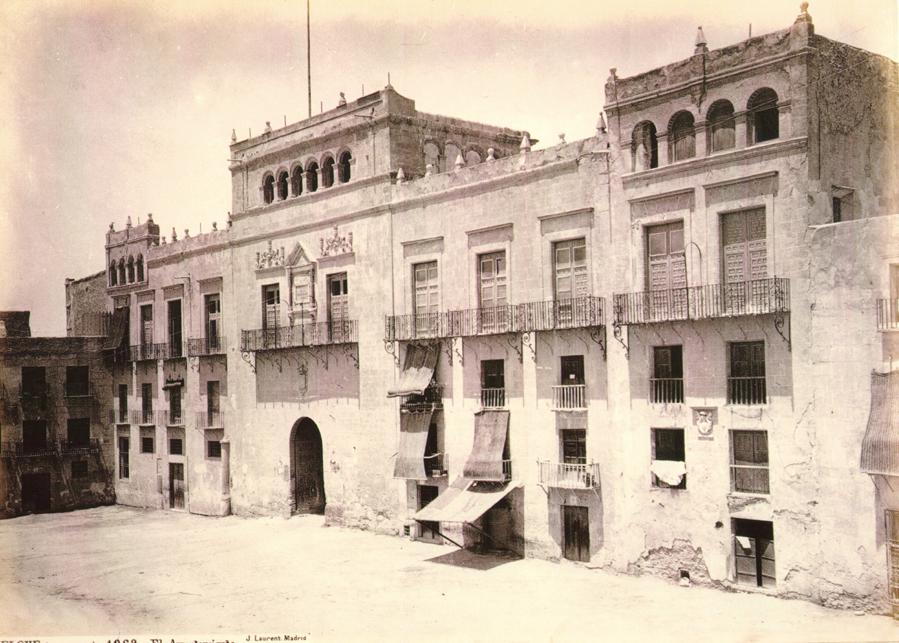
town hall of Elche
Elx / Elche
Elche Town Hall (Ajuntament d'Elx) sits on Plaza de Baix, right in the historic heart of the city known locally as Elx, and it's a natural stop for anyone walking between the old town and the famous Palmeral. Where exactly is the town hall in Elche? The building's address is Plaza Baix s/n, placing it inside the compact historic core of Elche, a city in Alicante province, part of the Valencian Community, sitting on the edge of a dry Mediterranean landscape that has supported date-palm cultivation for centuries. It functions as the seat of local government and houses municipal departments, including those handling town planning and public services. Why does the town hall matter for the Palmeral? Elche is best known for its Palmeral, an extensive network of historic palm groves inscribed on the UNESCO World Heritage list. As the city's governing body, the town hall plays a direct role in overseeing and protecting that heritage, coordinating between its planning department, municipal police, and the teams responsible for parks and green spaces. Decisions made inside this building have a real, ongoing effect on how thousands of centuries-old palm trees scattered across the city are maintained. What else defines the city around it? Elche carries more than two thousand years of history, having been settled by Greeks and later shaped by the Islamic period — it's from that era, the 10th century, that the orchard layout forming today's Palmeral originates. The city is equally known for the Misteri d'Elx, a medieval liturgical drama performed every August inside the Basilica of Santa María and recognised on UNESCO's list of intangible cultural heritage. A third identity Elche carries is footwear manufacturing: the city has long served as one of Spain's shoe-production hubs, visible today in local trade fairs and factory outlet stores. How should visitors explore the area around the town hall? Plaza de Baix borders the old town and works well as a starting point for further exploring — the Basilica of Santa María and the entrances to the Palmeral grounds are both within easy walking distance. Pairing a walk around the town hall square with a visit to the nearby palm gardens makes sense, since the two sites show different sides of Elche: its administrative and historical face, and its natural heritage. Frequently Asked Questions Can visitors go inside Elche Town Hall? The building is primarily an active seat of municipal administration, so interior access is generally limited to office hours and specific administrative business. Most visitors experience it from the outside, as part of the square's architecture. How far is the town hall from the Palmeral? Plaza de Baix lies within Elche's historic centre, a short walk from both the main palm groves and the Basilica of Santa María, making it easy to combine the two on one route. Does the town hall have a role in protecting the UNESCO Palmeral? Yes — as the municipal governing body, it coordinates the planning, public order, and green-space departments that jointly manage the preservation of the historic palm groves. What else is worth seeing in Elche besides the town hall? Beyond the Palmeral and the town hall square, the Basilica of Santa María — home to the Misteri d'Elx — and the shops and traditions tied to the local footwear industry are worth a visit.
-
Deba town hall
Deba
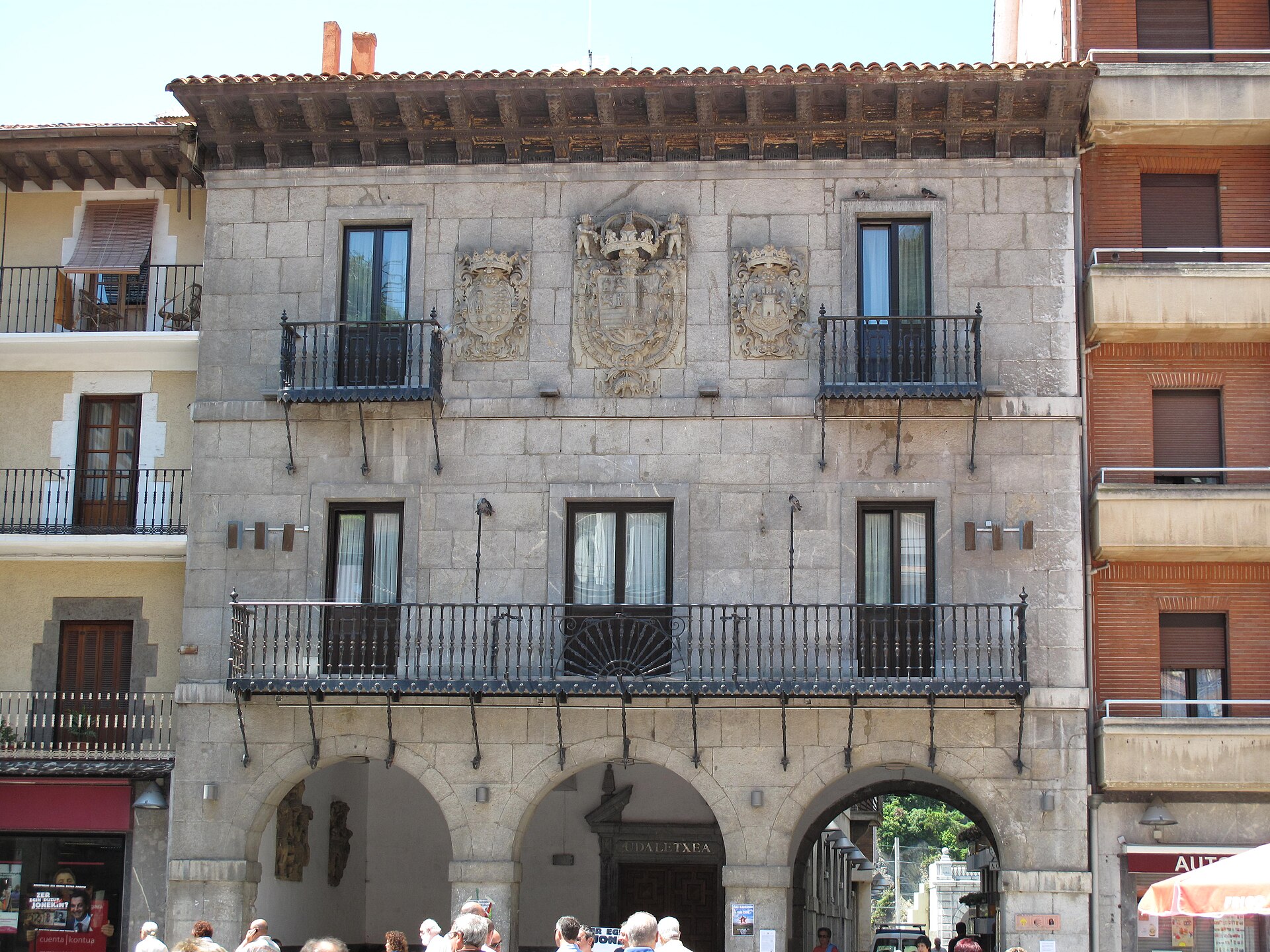
Deba town hall anchors the historic core of this coastal town in Gipuzkoa, in Spain's Basque Country, a short walk from where the Deba river meets the Bay of Biscay. What does the building look like? The town hall was designed in 1747 by the architect Ignacio de Ibero. Its ashlar limestone facade follows an austere, Herrerian-influenced baroque style — restrained rather than decorative, in line with how Basque civic buildings of the period were usually built. Arched porticoes run along the ground floor, while balconies mark the upper levels. The main balcony stands out for its wrought-iron railing, shaped in a fan pattern. Three sandstone coats of arms sit on the facade: the Royal Crown, the province of Gipuzkoa, and Deba itself — a trio of overlapping authorities typical of the era in which the building went up. Where exactly is it? The town hall sits on Portu kalea, right in Deba's old town, facing the Plaza de los Fueros. During the town's festival days, that same square is turned into a makeshift bullring for capeas, small-scale local bull events that are part of the annual fiestas. Outside festival season, the plaza works as an ordinary gathering point, linking the old quarter with the waterfront. Why stop here while visiting Deba? The building counts among the most recognizable pieces of civic architecture in Deba's old town — nearby streets hold other stone facades carrying their own coats of arms, a pattern common throughout this part of the historic center. The square and the row of houses around it form a compact, well-preserved ensemble that also lies on the route of the Camino del Norte, the northern branch of the Camino de Santiago. Pilgrims walking that coastal stretch through the Basque Country pass the town hall almost by default, since the trail cuts straight through the middle of town. Deba sits on the coast at the mouth of the river that shares its name, and beyond the old town it also has a beach and a train station, making it a convenient stop along the Basque coastline. Walking from either the station or the beach to the town hall usually takes a matter of minutes, through the narrow streets of the old quarter. Frequently Asked Questions Who designed Deba town hall? The architect Ignacio de Ibero designed the building in 1747. What architectural style is it built in? It follows an austere, Herrerian-inflected baroque style, built from ashlar limestone, with ground-floor arcades and balconies on the upper floors. What do the coats of arms on the facade represent? The three sandstone shields represent the Royal Crown, the province of Gipuzkoa, and the town of Deba itself, reflecting the layers of authority in place when the town hall was built. Does the square in front of the town hall serve any special purpose? Yes, the Plaza de los Fueros is converted into a bullring for capeas during the town's festival days, a tradition tied to Deba's annual fiestas.
-
Mutriku town hall
Mutriku
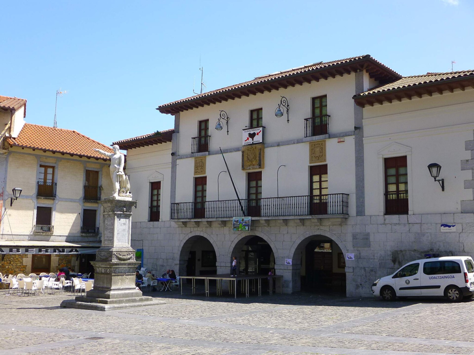
Mutriku town hall is an 18th-century baroque administrative building standing on Plaza Txurruca, the main square of this small coastal town in Gipuzkoa, in Spain's Basque Country. While the building itself functions as a working municipal office, its position at the heart of the old quarter makes it a natural starting point for exploring Mutriku. Where is the town hall and what does it look like? The building sits on Plaza Txurruca, a square named after an admiral born in Mutriku, whose memory is closely tied to this part of town. The facade follows the baroque style common to Basque casas consistoriales of the period — a stone structure with evenly spaced windows and a balcony above the entrance, a layout typical of town halls built across the region in the 18th century. The square around it is lined with stone houses featuring the wooden balconies characteristic of old Basque fishing towns. Can visitors go inside? The town hall is an active local government building, so its interior isn't set up as a visitor attraction — most travelers experience it from the outside, taking in the facade and strolling around the square. Anyone visiting for actual municipal business should check current opening hours on the town's official website beforehand, since these can change. What should visitors know about Mutriku itself? Mutriku is a small fishing town on the Cantabrian coast, right on the border with Bizkaia. Two things define its character: steep cliffs that drop straight into the sea, and a history built around fishing and seafaring. Mutriku is also home to one of the world's first commercial wave power plants, built into the town's breakwater — a facility that converts wave energy into electricity and draws visitors interested in renewable energy technology. How do you get to Mutriku? The town sits on the coast, close to the main roads linking Gipuzkoa and Bizkaia, which makes it a convenient stop on a drive along the Basque coastline, for example between San Sebastián and Bilbao. The old town is compact and best explored on foot, with the square around the town hall as a natural starting point. What else is worth seeing nearby? After seeing the town hall, it's worth walking down to the harbor and breakwater to see the wave power plant, then along the seafront promenade for views of the steep cliffs that define this stretch of coast. The old quarter has kept much of its 18th- and 19th-century character, visible in the narrow streets branching off Plaza Txurruca. Frequently Asked Questions How old is Mutriku town hall? The building dates to the 18th century and was built in the baroque style typical of Basque casas consistoriales from that era. Can tourists go inside the town hall? It's a working municipal building, so visits are usually limited to viewing the facade and walking around Plaza Txurruca rather than entering. What else should visitors see in Mutriku besides the town hall? The wave power plant built into the harbor breakwater and the coastal cliffs visible from the seafront promenade are the town's best-known features. Is Mutriku easy to reach from other coastal towns? Yes, it sits along the coastal route between San Sebastián and Bilbao, making it a straightforward stop on a Basque coast itinerary.
-
Town hall of Cartagena, Spain
Cartagena
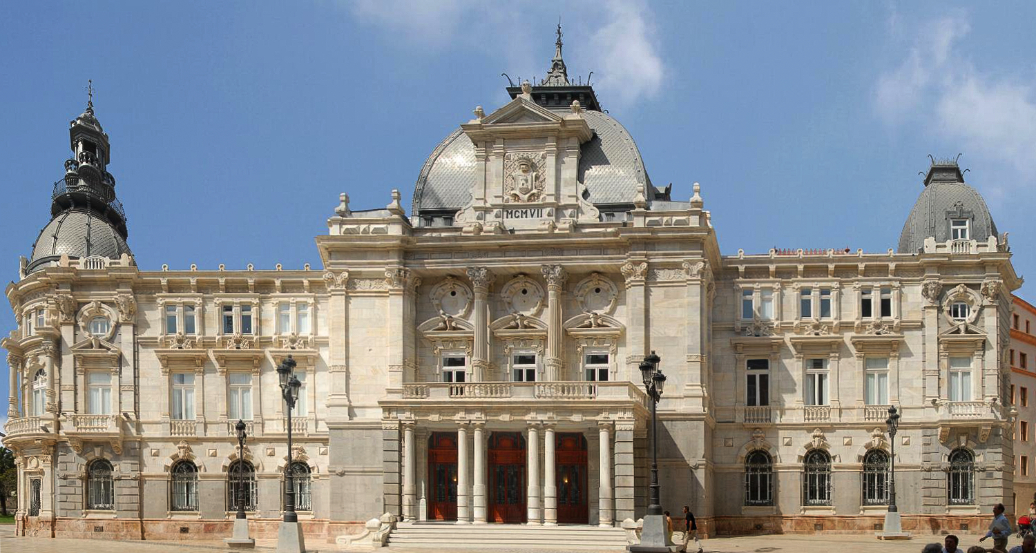
The Town Hall of Cartagena (Palacio Consistorial) is one of the most recognizable buildings in the historic center of Cartagena, a port city on the southeastern coast of Spain, in the Region of Murcia. It stands along the harborfront promenade, on the same plot once occupied by an older, sixteenth-century town hall built in the Herrerian style. Why was the current building constructed? In the early twentieth century, Cartagena was going through an economic boom driven by mining and port trade, and the old town hall had become too small for the growing municipal administration. Construction of the new Palacio Consistorial started in 1900 and finished in 1907. The design came from architect Tomás Rico Valarino, who was originally from Valladolid, working together with Francisco de Paula Oliver. King Alfonso XIII personally presided over the inauguration, a sign of how much weight the city placed on the project. What architectural style does the town hall follow? The building is eclectic in style, with clear French influence typical of Spanish civic architecture from that period. Its base is built from gray granite, while the facades are finished in white marble, creating a striking contrast that stands out from a distance. The floor plan is triangular, which gives the building three separate facades, each one densely decorated with broken pediments, elliptical windows, classical moldings, and ornamental female heads and civic shields worked into the stonework. What can visitors see inside? The first floor houses the Chamber of Sessions, a hall with walls carrying baroque-influenced details beneath a wooden artesonado ceiling. The building also includes a grand staircase known as the imperial staircase, a plenary hall, and the mayor's office, decorated in a modernist style with paintings by Inocencio Medina Vera. A collection of paintings is distributed throughout the interior, and the city occasionally opens the building for guided visits so the public can see these rooms up close. How does the town hall fit into Cartagena's wider history? Cartagena has one of the longest continuous histories of any city on the Spanish coast, tracing back to Carthaginian and Roman times, when its natural harbor made it a strategic hub in the western Mediterranean. The Palacio Consistorial, though far younger than the ancient remains scattered around the city, became a new symbol of civic identity at the turn of the twentieth century and still functions as the seat of local government today. It stands close to the port, surrounded by other buildings raised during the same period of prosperity. Frequently Asked Questions When was the Cartagena town hall built? Construction ran from 1900 to 1907, and the building was formally inaugurated in 1907. Who designed the building? The architect was Tomás Rico Valarino, working with Francisco de Paula Oliver. What architectural style is the town hall built in? It is an eclectic building with French influence, standing on a gray granite base with facades faced in white marble. Can the interior be visited? The city organizes guided visits to parts of the interior, including the Chamber of Sessions, the imperial staircase, and the mayor's office — it's worth checking current details directly with the municipality, since access can change.
-
Lezo town hall
Lezo
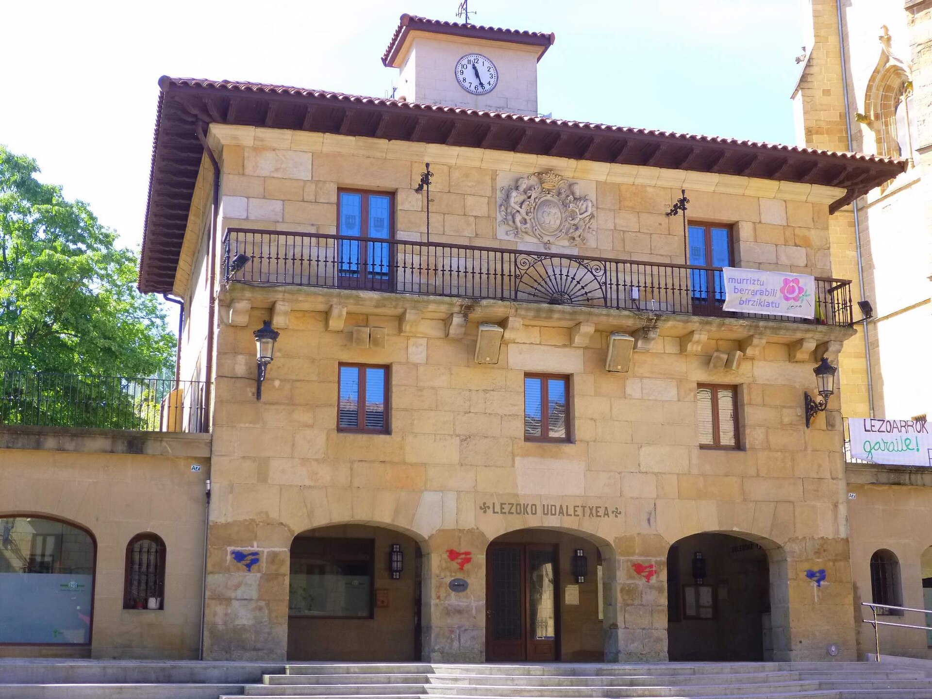
Lezo town hall is the seat of local government for Lezo, a small Basque town in the province of Gipuzkoa, tucked at the foot of Mount Jaizkibel right next to the port of Pasaia and only a few kilometres from San Sebastián. Where exactly is the town hall located? The building sits in Lezo's historic core, surrounded by the stone noble houses that survive from the 16th century. Lezo is the smallest and most easterly municipality of the Oarsoaldea district, and its compact street plan means the town hall is within easy walking distance of almost anywhere in the centre. What else is worth seeing nearby? A short walk from the town hall stands the Gothic basilica of Santo Cristo, one of only a handful of churches in Europe depicting a beardless crucified Christ — a detail that draws visitors interested in religious art history. Continue on foot and you reach the quays of Pasaia's fishing port, still active after centuries, or pick up a trail climbing Mount Jaizkibel, whose slopes are scattered with old forts, bunkers and dolmens left behind by the area's long strategic history on the coast. How do you get to Lezo? The town sits on the main road linking San Sebastián with the French border, so driving from central Gipuzkoa usually takes only a short while. The regional Euskotren railway also serves the neighbouring Oarsoaldea towns, from where the centre of Lezo is an easy walk. Because of its proximity to Pasaia and San Sebastián, many visitors fold a stop at the town hall and old quarter into a day trip along the Gipuzkoa coast, pairing it with a look at the port or a hike up Jaizkibel. Can visitors go inside the town hall? Like most local administration buildings in small Basque municipalities, Lezo's town hall functions as a working civic office rather than a tourist site — its rooms house the municipal staff who serve residents, not a permanent exhibit. For visitors, the interest lies mainly in its position along the old-town walking route and in the façade itself, typical of public buildings in this part of the Basque Country. Why stop in Lezo instead of just passing through? Lezo is often treated as a pass-through point between San Sebastián and the French border, but its tight-knit centre — town hall, stone houses and basilica together — gives a fuller sense of everyday Basque town life than the more touristic spots along the coast. It also makes a quieter starting point for walks up Jaizkibel, away from the crowds that gather on the more popular trails around San Sebastián. Frequently Asked Questions Where is Lezo and how far is it from San Sebastián? Lezo lies in the province of Gipuzkoa, less than 10 km from San Sebastián, right by the port of Pasaia and at the foot of Mount Jaizkibel. What else is there to see in Lezo besides the town hall? The main landmark is the Gothic basilica of Santo Cristo in the old quarter, and hikers can head up Mount Jaizkibel, which has numerous old forts and dolmens along its trails. Can tourists go inside Lezo's town hall? The building is an active municipal office, so access is limited to the areas serving residents — there is no permanent visitor exhibition there. What's the easiest way to reach Lezo? By car along the road connecting San Sebastián with the French border, or by the regional Euskotren railway followed by a short walk into the town centre.
-
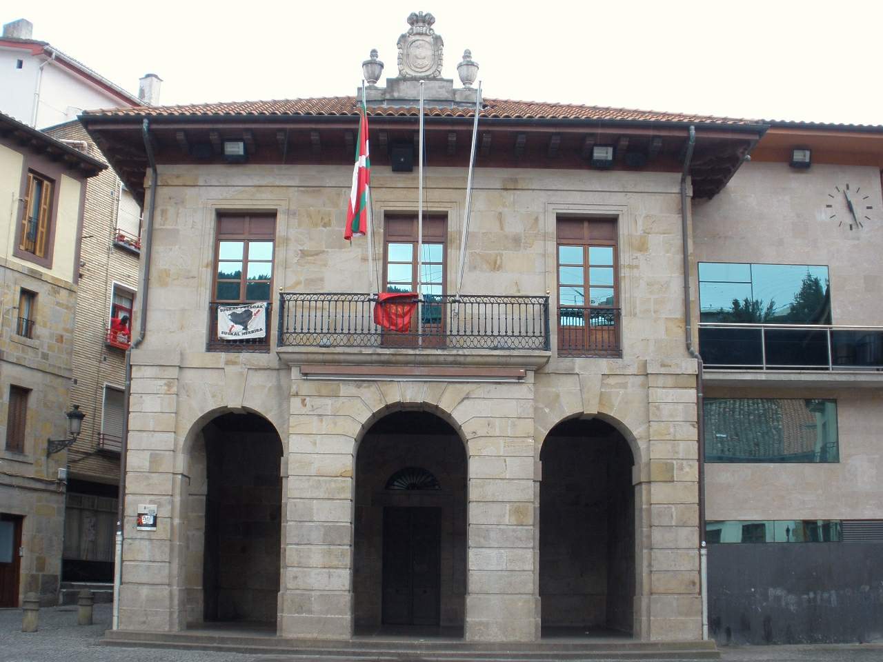
Eskoriatza town hall
Eskoriatza
Eskoriatza Town Hall is the seat of local government for Eskoriatza, a small municipality in the Debagoiena (Alto Deba) region, in the Leniz valley, in Gipuzkoa, in the Basque Country. Where is the town hall located? The building stands right in the heart of the old town, on the main square, at the point where two of Eskoriatza's principal streets meet. It sits next to the parish church of San Pedro, which makes this small stretch a natural anchor for anyone exploring the town centre on foot. What does the building look like, and when was it built? The current town hall dates from the early 19th century. It was built in ashlar stone, a material typical of Basque civic architecture from that era. The design is plain and solid rather than ornate, matching the practical style found in municipal buildings across the Alto Deba valley — function and durability over decoration. What is Eskoriatza, and why stop here? Eskoriatza has a long history as a chartered town: it was granted its municipal charter in 1630, making it one of the somewhat later additions to the group of chartered settlements in the Leniz valley. Today it's a quiet Basque municipality where daily life still centres on the main square, framed by the town hall and the church. For travellers touring the Debagoiena region, the town hall is a convenient starting point — the old town's narrow streets branch out from here, and it's an easy base for planning onward stops in the surrounding valley villages. What else is worth seeing near the town hall? Right beside the town hall stands the parish church of San Pedro, worth a quick look on its own. The layout of this part of town — two main streets converging on a square — is typical of old Basque settlements, where civic and religious authority were traditionally seated side by side. It makes for a good short stop when travelling through Alto Deba, particularly if you're moving between larger towns in the area such as Arrasate/Mondragón or Bergara. Frequently Asked Questions Where exactly does the Eskoriatza town hall stand? On the town's main square, at the junction of two principal streets in the old quarter, right next to the church of San Pedro. How old is the building? The current structure dates from the early 19th century and was built from ashlar stone, typical of Basque architecture of that period. Can visitors go inside the town hall? It's a working municipal building, so public access is generally limited to the exterior and square; check locally or with the municipality for any specific visiting arrangements. Is there anything else to see nearby? Yes — the parish church of San Pedro sits directly beside it, and the square with its surrounding streets forms the historic centre of Eskoriatza, easy to explore on foot.
-
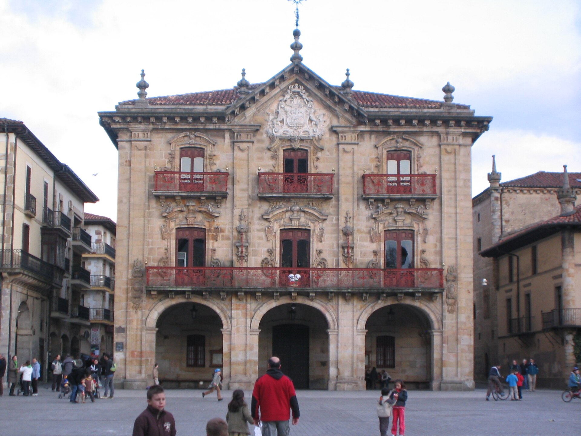
Oñati town hall
Oñati
Oñati town hall overlooks Foru square, right at the heart of this small town in Gipuzkoa, in the Basque Country's Debagoiena valley. Where exactly is Oñati's town hall located? Oñati sits in the Debagoiena valley in Gipuzkoa, one of the three provinces that make up the Basque Country, tucked among the hills that separate it from neighboring Arrasate/Mondragón. The town hall stands on Foru square, the main square around which most of the old town's historic buildings cluster. It's the natural starting point for exploring the rest of the historic center on foot. What else sits close to the town hall? The church of San Miguel borders the same square, and a short walk away stands the University of Sancti Spiritus, a Renaissance building founded in 1540 by bishop Rodrigo Mercado de Zuazola. It served as the first and, for centuries, only university in the Basque Country, operating continuously until 1901. Today the building houses the Basque Institute of Public Administration, the Historical Archive of Gipuzkoa, and the International Institute for the Sociology of Law. The Bidaurreta monastery, another of the town's key religious landmarks, is also within easy reach. Is the Arantzazu sanctuary close to town? Yes — the sanctuary sits in the hills above Oñati, a short drive from the center, and it's one of the reasons visitors often stay longer than a quick stop. The town hall itself isn't a sight to travel for on its own, but it works well as an orientation point: the streets leading to the town's main landmarks radiate out from the square where it stands. Why does Oñati matter historically? For centuries the town functioned as an administrative and academic hub for this part of Gipuzkoa, and its layout — with the square in front of the town hall as the focal point — still reflects that role. Its closeness to Arrasate/Mondragón, a neighboring municipality in the same Debagoiena valley, sometimes causes confusion between the two, but they are separate towns with distinct histories and townscapes. Frequently Asked Questions Where does the town hall stand in Oñati? On Foru square, in the historic center of the town, in the province of Gipuzkoa. What else is worth seeing besides the town hall? The church of San Miguel on the same square, the Bidaurreta monastery, and the University of Sancti Spiritus — the first university in the Basque Country, active from 1540 to 1901. Is Oñati the same place as Mondragón/Arrasate? No. They're neighboring but separate municipalities in the Debagoiena valley — easy to mix up, but each has its own history and set of landmarks. How far is the Arantzazu sanctuary from town? It sits in the hills above Oñati, a short drive from the center, and makes a popular add-on after walking the old town.
-
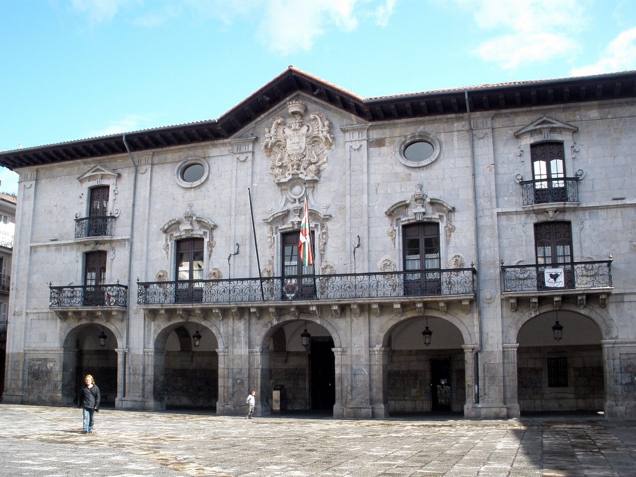
Mondragón town hall
Arrasate / Mondragón
Mondragón town hall occupies the main square of the old town in Arrasate/Mondragón, a municipality in the Debagoiena valley, Gipuzkoa, in Spain's Basque Country. What does the town hall look like? The façade is arranged in five bays separated by pilasters, giving the building a clear, hierarchical rhythm typical of mid-18th-century Baroque design. At street level, five semi-circular arches form the entrance, leading visitors into an inner courtyard. On the floor above, a large wrought-iron balcony draws the eye, crowned by the town's coat of arms rendered in a French-influenced style — a detail that sets this building apart from many other Baroque civic structures in the region. When was it built? Construction began in 1756 under architect Martín Karrera, and the building opened a decade later, in 1766. It was built using masonry techniques typical of Basque monumental architecture of the period, which explains why the structure has held up so well over the centuries. What's worth seeing inside? Two features stand out for visitors touring historic Basque town halls. The first is the main staircase, whose steps were carved from single blocks of stone — an unusual and costly choice that speaks to the town's ambitions and prosperity in the mid-1700s. The second is the plenary hall, where richly carved woodwork survives, giving the room a formal, ceremonial atmosphere. Why is Arrasate/Mondragón known beyond the region? While the town hall itself is a local landmark, the town has international name recognition thanks to the Mondragón Corporation, one of the world's largest networks of worker cooperatives, founded here in the mid-20th century. That association means many visitors arrive at the main square curious about the economic model that grew out of this town, not just about the architecture. Where exactly is the building located? The town hall stands right in the heart of the historic old town, on the main square around which public life in Arrasate/Mondragón has revolved for centuries. It makes a natural starting point for exploring the town on foot, since the old town's main streets radiate outward from this square. Frequently Asked Questions When was the Mondragón town hall built? It was built between 1756 and 1766, during the Baroque period, to a design by architect Martín Karrera. What architectural style is the building? It's a Baroque masonry building, with a five-bay façade divided by pilasters and five semi-circular arches at the entrance. Can visitors go inside the town hall? The building still functions as the seat of local government, so access to the interior — including the carved plenary hall — depends on office hours and any events open to the public. Is there anything else to see near the town hall? The main square where the building stands is the heart of Arrasate/Mondragón's old town, within easy walking distance of the historic center's other landmarks.
-
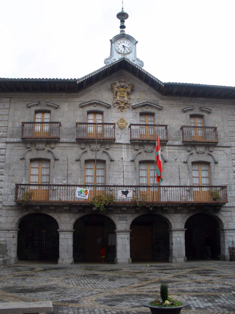
Alegia town hall
Alegia
Alegia Town Hall serves as the seat of local government for the small municipality of Alegia, in the Tolosaldea district of Gipuzkoa, in Spain's Basque Country. The building sits at the heart of the town, in the Oria river valley, and functions as the administrative center for the whole community. Where is Alegia located? Alegia lies roughly 30 kilometers from San Sebastián (Donostia), reachable via the N-I highway and a local Renfe commuter rail line that links the smaller towns of Tolosaldea with the larger centers of Gipuzkoa. The town sits at around 94 meters above sea level, right where the Amezketa stream flows into the Oria river. The municipality covers just 7.8 km², making it one of the more compact towns in the district. How big is the town? Recent census figures put Alegia's population at close to 1,800 residents. That scale is typical for Tolosaldea's towns — a tight cluster of buildings around a central core, where the town hall stands alongside the parish church and the main square. Public life in Alegia revolves around this small central area. What is the town hall building for? It houses the mayor's office and the municipal council, the body responsible for day-to-day decisions affecting Alegia — budgets, local infrastructure projects, and administrative matters for residents. For visitors passing through, the building is an easy landmark: like most Basque towns of this size, it typically faces the main square at the center of town. What else is there to see nearby? Alegia sits in the Oria valley, surrounded by the green hills and river landscapes typical of Tolosaldea. The confluence of the Oria and the Amezketa stream makes the surrounding countryside appealing for anyone looking for quiet walking routes away from the Basque Country's busier tourist trails. Given its small size, the town itself has limited visitor infrastructure, but it makes a natural stop for travelers moving along the Oria valley between Tolosa and the interior of Gipuzkoa. How do you get to Alegia? The most direct route is the N-I highway, which connects Alegia to the region's larger towns, including San Sebastián. A local Renfe rail line also serves the smaller towns of Tolosaldea, a practical option for travelers without a car. Frequently Asked Questions Where is Alegia located? Alegia is in the Tolosaldea district of Gipuzkoa, in the Basque Country, about 30 km from San Sebastián, in the Oria river valley. How many people live in Alegia? The latest census puts the population at close to 1,800, making it one of the smaller municipalities in Tolosaldea. Can you reach Alegia by train? Yes, the town is served by a local Renfe rail line, in addition to road access via the N-I highway. What's at the center of Alegia? The town's main public buildings cluster around its center, including the town hall, which serves as the seat of local government.
-
Markina-Xemein town hall
Markina-Xemein
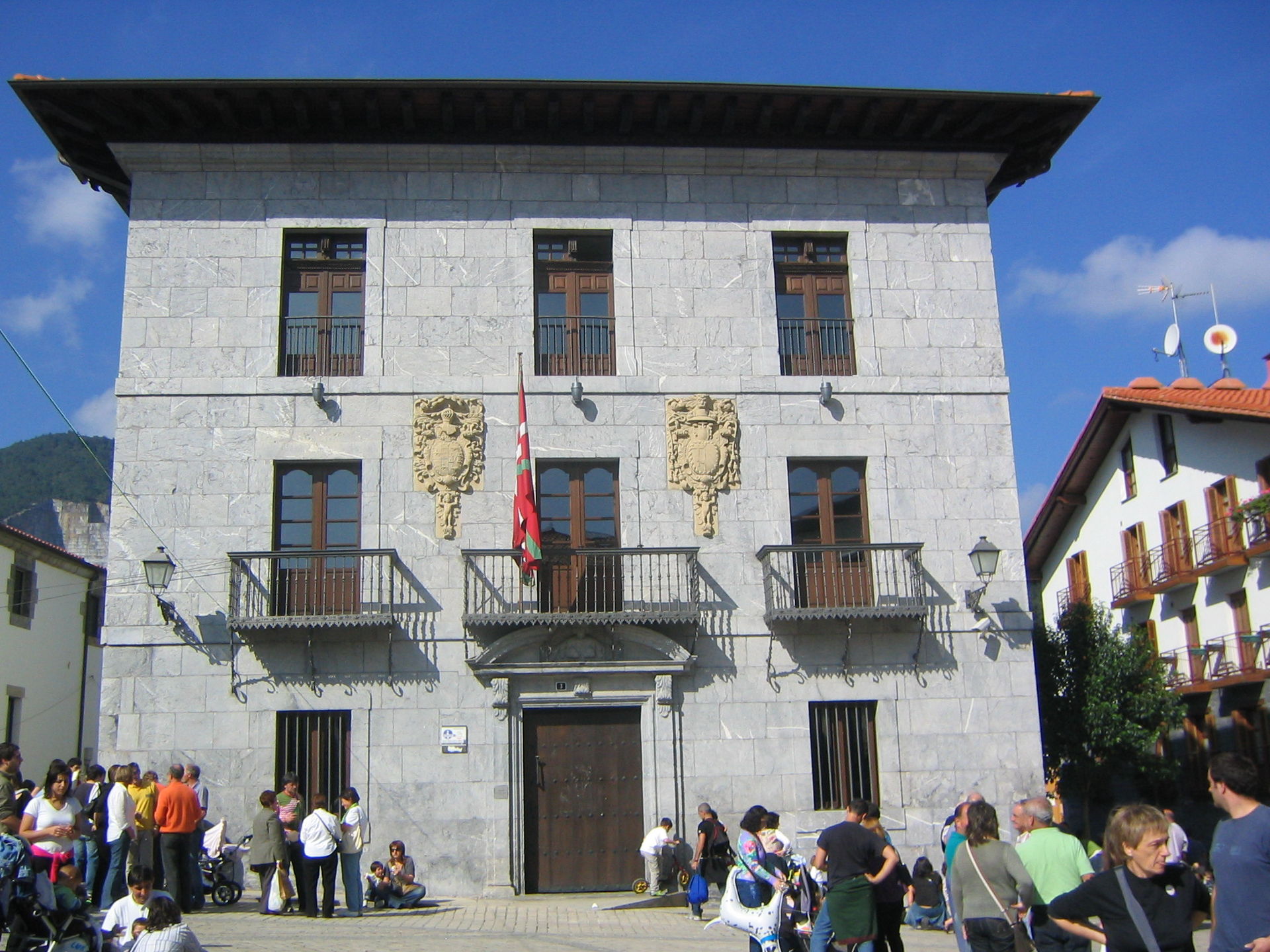
Markina-Xemein Town Hall occupies the Solartekua Palace, an 18th-century stone building that now serves as the seat of local government for this small town in the Lea-Artibai region of Biscay, in the Basque Country. It stands in the historic centre alongside several other noble houses, forming part of a cluster of stone palaces that speaks to the town's past prosperity. Where is Markina-Xemein and what is the town hall's history? Markina-Xemein took shape in the mid-14th century from the union of two separate settlements, Markina and Xemein, and the town still reads as two linked cores rather than a single compact centre. The Solartekua Palace, today's town hall, follows the pattern typical of Basque urban architecture of the period: a solid stone structure, a symmetrical facade, and heraldic details marking it out as a noble residence later repurposed for civic use. An older former town hall building also survives nearby, a reminder that the seat of local government has moved more than once over the centuries. What else is worth seeing near the town hall? Close to the town hall stand several other stone palaces — Andonegi and Ansotegi among them — plus the Antxia tower, a remnant of the town's medieval defensive buildings. Markina-Xemein is also known for its stonemasonry tradition: local quarries supplied building material used across Biscay, which explains the uniform, stone-built look of the old quarter. A short walk from the town hall is the municipal frontón, often called the "university of Basque pelota." Operating since 1798, it is considered one of the most important venues in the sport's history — a place where champion pelotaris such as Narciso Salazar and Muguerza I trained and made their names. The court holds close to a thousand seats plus several hundred standing places, making it one of the larger frontóns in the region. Can you go inside the town hall? The building works as a civic office housing the municipal administration, so its interior is not set up as a visitor attraction in the way a museum would be. The facade and surroundings, however, are freely visible on a walk through the old town, which pairs naturally with a stop at the frontón and the neighbouring palaces. Frequently Asked Questions What is the Solartekua Palace? It is an 18th-century stone residence that now functions as Markina-Xemein's town hall, housing the local municipal government. Why does the town have the double name Markina-Xemein? The town formed from the merger of two earlier settlements, Markina and Xemein, founded in the mid-14th century and later administered as a single municipality. Is it worth combining a visit to the town hall with other sights? Yes — the Andonegi and Ansotegi palaces, the Antxia tower, and the town's famous frontón are all within easy walking distance, so the historic centre can be covered in one short outing. How do you get to Markina-Xemein? The town sits in the Lea-Artibai region of Biscay, an easy drive from Bilbao and other towns on the Basque coast, making it a common stop for anyone exploring inland Biscay.
-
Beasain town hall
Beasain
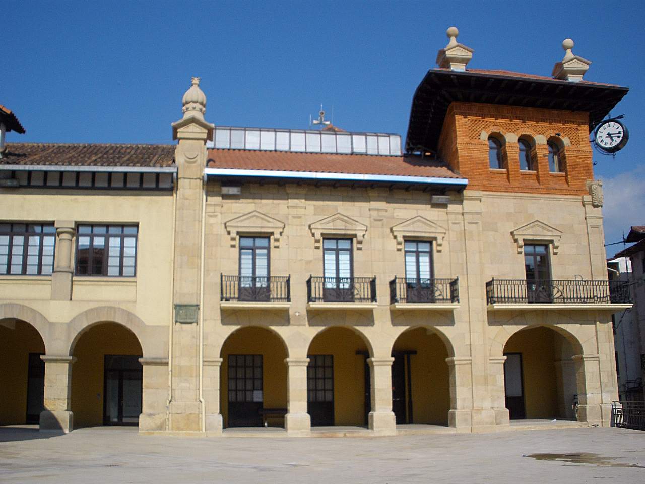
Beasain town hall anchors the main square of Beasain, a town in the Goierri district of Gipuzkoa in the Basque Country, at Plaza San Martín de Loinaz. What makes this town hall worth a stop? Beasain acts as the administrative hub of the wider Goierri district, and this building has been the seat of that local government since the 1920s. The town itself grew around a strong metalworking tradition, and the town hall reflects that period of expansion - it was built precisely because the previous municipal building could no longer keep pace with a growing, increasingly industrial town. Standing on the main square, it gives visitors a quick read on how the local administration presented itself a century ago. Why was a new town hall built here? The story starts in 1923, when mayor Jacinto Urteaga argued that the existing casa consistorial had become too small and outdated for the town's needs. His push led the council to commission a new building, and the design was handed to Guillermo Eizaguirre, the municipal architect at the time. Construction moved quickly - the new town hall was blessed and formally inaugurated on 26 October 1924. A century later, in October 2024, Beasain marked that milestone with celebrations for the building's centenary. Who uses the building today? The town hall has kept its original function without interruption since 1924: it houses the town council and the mayor's office. For the 2023-2027 term, Beasain is led by mayor Leire Artola Ugalde of the EAJ-PNV party. That continuity matters for visitors - this is a working government building rather than a heritage site set up for tours, so access inside is tied to municipal business rather than sightseeing hours. How do you get to the town hall? The address is Plaza San Martín de Loinaz 1, 20200 Beasain. Because Beasain is the main town of the Goierri district, orientation is straightforward: the historic centre is compact, and the square with the town hall sits right at its heart, an easy walk from anywhere else in town. Frequently Asked Questions When was Beasain town hall built? It was built in 1923-1924, with the blessing and official opening held on 26 October 1924. The building's centenary was celebrated in October 2024. Who designed the building? Guillermo Eizaguirre, the town's municipal architect, drew up the design after mayor Jacinto Urteaga pushed for a new town hall in 1923. Can visitors go inside? It is an active administration building, not a museum, so the usual visit is from the outside, taking in the building from Plaza San Martín de Loinaz. Going inside is meaningful mainly for official municipal matters, during office hours. Who currently governs Beasain? Leire Artola Ugalde, of the EAJ-PNV party, has served as mayor for the 2023-2027 term. What is Beasain known for beyond the town hall? Beasain is the administrative centre of the Goierri district and has long been associated with metalworking industry, which gives the town hall extra context as a symbol of local government in a town that grew alongside its industrial base.
-
Hernani town hall
Hernani
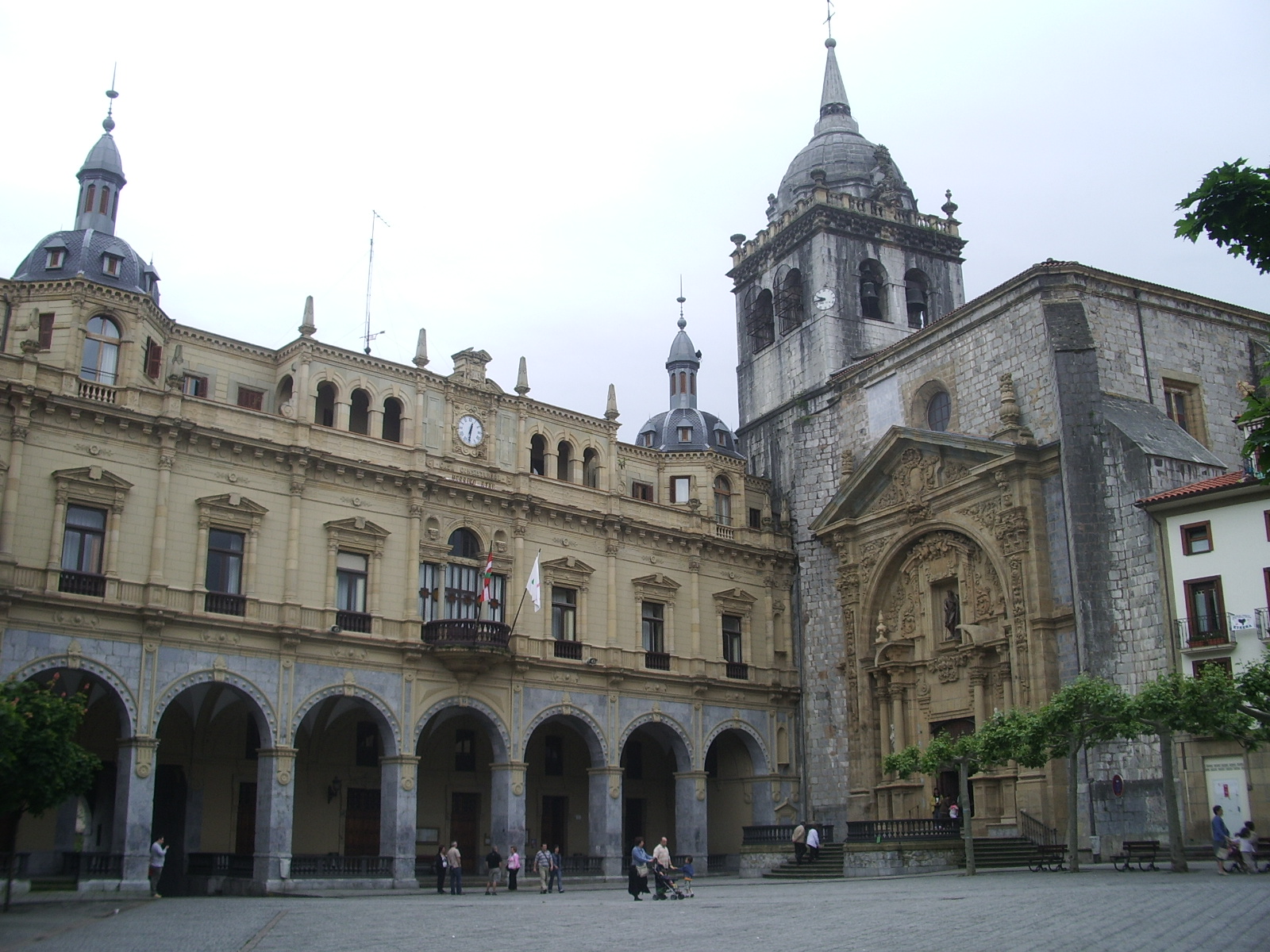
Hernani town hall stands in the heart of the old town of Hernani, a municipality in Gipuzkoa in the Basque Country, a short drive from San Sebastián. It's a working municipal building today, but its location and past make it a useful starting point for understanding how the old walled town was laid out. Why the town hall sits exactly where it does The historic core of Hernani had an oval layout, a shape common to fortified medieval towns across Gipuzkoa: a compact street grid ringed by a wall, with only a handful of gates allowing entry. The town hall wasn't set apart from that defensive ring — it formed part of the southern stretch of the town walls, and one of the entrances into the walled town was located right at this spot. Administration and defense were built into the same structure from the start. The building you see today isn't the original The current town hall is not the first one on the site. An earlier town hall was built here in the 17th century and stood for roughly two centuries before it was destroyed in 1875, during the final Carlist War. The building that replaced it went up in 1899, on the same location, and has served as the seat of Hernani's local government ever since — meaning today's structure is itself well over a century old, even though it postdates the original medieval fortifications by hundreds of years. What's left of the town walls Of the ring of walls that once enclosed the old town, only one section with an intact gate has survived: the Arco de Zapa, on what is now Calle Felipe Sagarna. It's the single point where visitors can still see, physically, what an entrance into medieval Hernani looked like. Most of the wall itself is gone, but the old town retained its historic street pattern and building lines closely enough that the former line of the fortifications can still be traced on foot, even where no stone remains. How old is Hernani itself The place-name Hernani appears in documents as early as 1014, but the town wasn't granted villa status — full town rights — until roughly the mid-13th century, with some historians placing the formal foundation closer to the late 13th or early 14th century. The exact date can't be pinned down because a fire in 1332, triggered by factional conflict, destroyed the town's archive along with its founding charter. Much of what's known about Hernani's earliest history therefore comes from outside records rather than the town's own documents. Visiting the town hall and the old town Because the town hall sits inside the historic centre, it's easy to pair a look at the building with a short walk through the surrounding streets, which lead toward the Arco de Zapa and past blocks that still follow the medieval layout. It's a compact route, but enough to see how a defended medieval settlement turned into the present-day town. Frequently Asked Questions Is the current town hall building itself historic? The building dates to 1899, so it's over 120 years old, but it isn't medieval — it replaced an earlier 17th-century town hall that was destroyed in 1875 during the last Carlist War. Was the town hall part of the town's defensive walls? Yes. It formed part of the southern stretch of the walls, and one of the entrances into the walled town stood at this location. Can you still see any of Hernani's old walls? One section survives: the Arco de Zapa, a gate on Calle Felipe Sagarna. It's the only physical remnant of the medieval fortifications still standing. If the archives burned, how do historians know when Hernani was founded? The 1332 fire destroyed the town's own records, including its founding charter, so early dates rely on outside documentation — the name is first attested in 1014, with villa status likely granted sometime in the 13th century.
-
Irun town hall
Irun
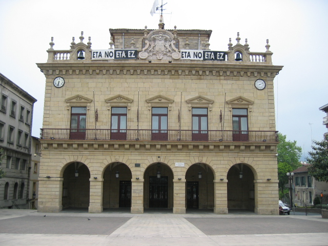
Irun town hall is an 18th-century civic building at the heart of Irun, a Basque town in Gipuzkoa on the Bidasoa river, right on the border with France. Where does the town hall stand? The building sits on Plaza San Juan Harria, one of the historic squares of old Irun. The square takes its name from a stone column ("harria" means "stone" in Basque) that has stood alongside the town hall for centuries. The facade follows the Baroque style common to municipal buildings raised across this part of Spain in the 1700s: plain stone walls, a symmetrical row of windows, and a formal entrance set on the upper floor. When was it built, and who was behind it? Construction started in 1756 and the building opened in 1763. The engineering oversight fell to Felipe Crame, previously connected to the military works of Plaza in San Sebastián, while Domingo de Olazábal y Ramerí, lord of Aranzate, chaired the municipal council at the time. Having a military engineer design a civic building was not unusual in the Basque provinces of that era, since town councils and garrison administrations often drew on the same pool of specialists. Did the building survive war and fire? It did, and that survival is one of the more notable chapters in the town's history. When the Spanish Civil War broke out in 1936, much of Irun burned down, and the fire destroyed many buildings around the square. The town hall itself and the San Juan Harria column beside it came through largely unscathed even as the surrounding blocks were lost. Few structures from the mid-18th century in Irun can claim that kind of continuity, which is part of why the building still anchors the old town today. What is the town hall used for now? The building remains in active use as the seat of local government. It houses the mayor's office, the general secretary's office, and part of the municipal services that residents deal with day to day. It is a working administrative building rather than a museum, so visits are generally limited to what can be seen from the square, plus any occasions when the town organizes public events or festivities on the plaza in front of it. What else is worth seeing nearby? Plaza San Juan Harria and the surrounding old quarter make a good starting point for exploring Irun's historic center, which — despite the wartime destruction — still traces the street layout from when the town grew into a key crossing point between Spain and France. Irun's own history reaches back much further than the town hall: the area preserves traces of Oiasso, a Roman-Vasconic settlement, making this one of the longest continuously inhabited spots in the region. Frequently Asked Questions When was Irun town hall built? Construction began in 1756 and the building was completed and put into use in 1763. Who designed the building? The works were overseen by engineer Felipe Crame, at a time when Domingo de Olazábal y Ramerí led the municipal council. Was the town hall damaged during the Spanish Civil War? No — the building and the nearby San Juan Harria column survived the 1936 fire that destroyed much of the surrounding square. Can visitors go inside the town hall? It is an active government building, so public access is generally limited to office hours and any events open to the public held on the adjoining square.
-
town hall of Zarautz
Zarautz
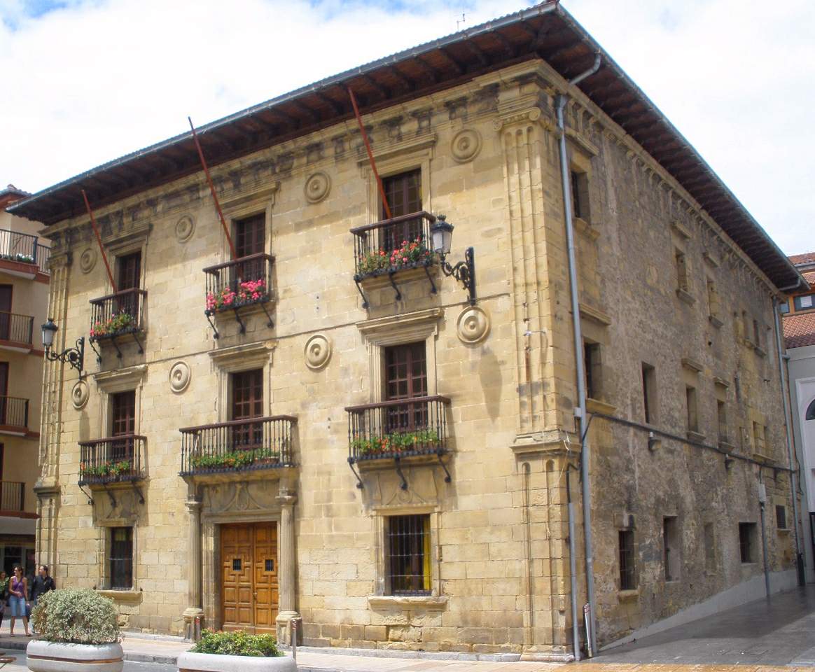
The town hall of Zarautz is the seat of the municipal government in Zarautz, a coastal town in Gipuzkoa, in the Basque Country. The building sits right in the town centre, a short walk from the seafront and the beach that ranks among the longest on the entire Basque coast, drawing surfers from across Europe. Why does the town hall matter to visitors? The town hall works as a natural landmark when exploring the old part of Zarautz. Most visitors pass by it while moving between the beach and the historic centre, since the building marks the heart of town and often shows up on short walking routes through Zarautz. It's a useful reference point for getting your bearings before continuing to explore. What should you know about the building itself? This is a working public building — it functions as the municipal office, not as a tourist attraction with exhibits or a museum. The interior isn't open for casual sightseeing beyond residents' administrative business. For visitors, the appeal lies mainly in its location and the architectural character of the façade, typical of Basque municipal buildings of this scale. How do you reach it on foot from the seafront? Zarautz is a compact town, so the centre around the town hall is easy to combine with a visit to the beach. Walking along the coastline and then a short stretch inland brings you straight to the building, with no need for transport. It makes a convenient starting point for wandering the surrounding streets, shops, and bars. When can residents handle official business there? The office receives the public Monday to Friday from 09:00 to 13:00 and again from 16:45 to 20:00, and on Saturdays from 09:00 to 13:00. Outside those hours the building is closed to internal visits, though the façade and surrounding square can be viewed at any time. Zarautz as a base for the coast The town is best known for its long stretch of sand, running for several kilometres and counting among the longest beaches in the Basque Country. That has made Zarautz a favourite with surfers of all levels, and the town regularly hosts surfing competitions. The town hall itself isn't a beach attraction, but it's part of the everyday fabric of the town worth seeing before heading back to the sand or walking along the cliffs toward nearby villages. Frequently Asked Questions Can tourists go inside the town hall of Zarautz? The building serves the municipal administration, so entry is mainly for residents handling official business. Visitors are free to view the façade and surrounding area from outside. What are the opening hours? Monday to Friday it's open from 09:00 to 13:00 and 16:45 to 20:00, while Saturday hours are 09:00 to 13:00 only. How can you contact the town hall? You can call +34 943 13 38 14 for information on administrative matters. Is the town hall close to the beach in Zarautz? Yes, the town centre where the town hall stands is within easy walking distance of the main beach, making it simple to combine sightseeing with time by the water.
-
Villabona town hall
Villabona
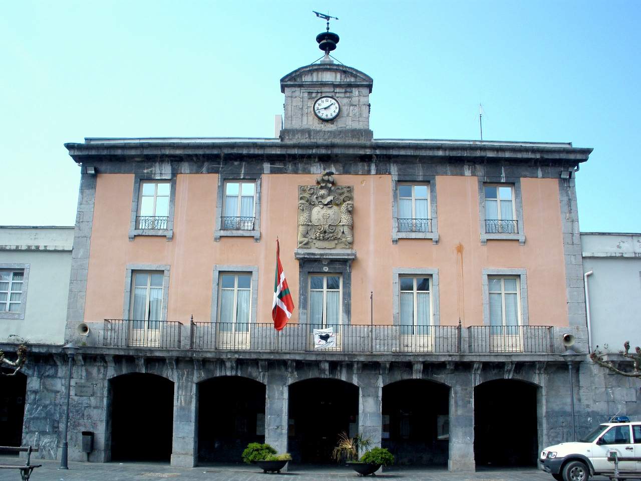
Villabona town hall stands at the heart of Villabona, a small town in the Oria river valley, in the province of Gipuzkoa, in the Basque Country. It has served as the seat of the local government for more than a century and remains one of the clearest landmarks in the town centre. What does the town hall look like? The current building dates from the 19th century and was designed in a neoclassical style — a symmetrical facade, restrained ornamentation, and a large coat of arms mounted above the entrance mark it out immediately as an official municipal building. It follows a pattern common to town halls built across Basque towns in that period: solid stone construction, meant to house local government for generations. Why was the town hall rebuilt in the 19th century? The building that preceded the current one burned down in 1812, during the Peninsular War, while it was being used as a billet for French troops stationed in the town. Occupation and troop movements during the Napoleonic campaigns left a mark on many municipal buildings across the Basque Country, and Villabona's town hall was no exception. Once the previous structure was lost, local authorities commissioned a replacement, and the building erected afterwards is the one still in use today. What else is worth seeing around the town hall? The town hall makes a natural starting point for exploring Villabona on foot. Nearby stands the parish church of Sagrado Corazón, built in the early 20th century and reflecting a very different architectural period from the town hall itself. The surrounding countryside is dotted with traditional Basque manor houses, including Juanzurienea and Legar Barrena. In Amasa, the rural district that together with Villabona forms the municipality of Amasa-Villabona, visitors can also find the church of San Martín de Tours, a stone building from the 16th and 17th centuries with a Latin-cross floor plan, ribbed vaulting and a bell tower. How do you get to Villabona? Villabona sits in the Oria valley at a point where routes linking Gipuzkoa with Álava and Navarre converge. The town is served by both a railway line and the N-1 road, making it an easy stop whether travelling from San Sebastián or moving inland through the Basque Country. Villabona itself has a strong industrial character alongside active local commerce and hospitality, so visitors passing through will find places to eat or take a short break. Frequently Asked Questions What is Villabona town hall? It is the seat of local government for the municipality of Villabona, in the province of Gipuzkoa — a 19th-century neoclassical building with the town's coat of arms displayed on its facade. Why doesn't the original town hall building survive? The earlier building burned down in 1812, when it was being used to billet French troops during the Peninsular War. The structure standing today was built afterwards to replace it. Can visitors go inside the town hall? The building is an active seat of local administration, so visitor access is generally limited to viewing the exterior from the street. What else is nearby worth visiting? Within Villabona, the parish church of Sagrado Corazón and several nearby manor houses are worth a look, while the neighbouring district of Amasa has the 16th-17th century church of San Martín de Tours.
-
City Hall of Santurtzi
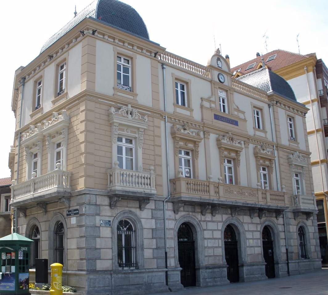
City Hall of Santurtzi is the seat of the municipal government of Santurtzi, a small port town in the Basque Country's province of Biscay, sitting where the Nervión (Ibaizabal) river meets the Abra Bay, a short distance from central Bilbao. Where exactly is the town hall located? The building stands right in the heart of Santurtzi, at the foot of Mount Serantes, in an area that has been the town's civic and commercial anchor for generations. Santurtzi grew up along the shoreline of the Nervión estuary, and the town hall has remained one of the most recognizable landmarks in that stretch of the town for more than a hundred years. What does the building look like? Constructed in the early 20th century, the town hall stands out for its two slate-covered domed towers, a feature that catches the eye against the lower, tightly packed rooftops of Santurtzi's old quarter. Inside, the staircase preserves a set of stained-glass windows, one of the building's most distinctive interior details. The design blends the formal civic style typical of Basque municipal architecture from that period with decorative flourishes meant to reflect the town's growing importance as a fishing hub on the Biscay coast. Why is Santurtzi known for sardines? Santurtzi has long been one of the largest small-scale fishing ports in Biscay, built around sardine and mackerel fishing. Its current fishing harbor, just a short walk from the town hall, dates to the early 1900s and was finished in 1912. It was from this port that the sardineras set out — women who carried baskets of freshly caught sardines on their heads and walked the shore of the estuary all the way to Bilbao to sell their catch. Their story lives on in the well-known song "Desde Santurce a Bilbao," which helped carry the town's name well beyond Biscay. What else is worth seeing near the town hall? Close by stand the Church of San Jorge and the Oriol Palace, while a monument to the Virgin of Carmen — patron saint of Santurtzi and especially revered among the town's fishing community — overlooks the area. The town center itself invites a walk along the waterfront, where ships can be seen moving in and out of the Nervión estuary toward the Bay of Biscay. Can visitors go inside the town hall? Since it remains a working seat of local administration, interior access is limited to office hours and subject to whatever rules the municipality has in place at any given time. The façade, the domed towers, and the other exterior architectural details, however, can be freely admired from the central square. Frequently Asked Questions When was the Santurtzi town hall built? It dates from the early 20th century, a period when the town was expanding rapidly as a fishing center on the Biscay coast. What's the most distinctive architectural feature of the building? The two slate-domed towers visible from a distance, along with the stained-glass windows on the interior staircase. How far is Santurtzi from Bilbao? Santurtzi sits at the mouth of the Nervión estuary, a short distance from central Bilbao, and is well connected to the metropolitan area along the Abra Bay coastline. What else should visitors see in Santurtzi? Beyond the town hall, the fishing harbor, the Church of San Jorge, the Oriol Palace, and the waterfront promenade overlooking ship traffic toward the Bay of Biscay are all worth a visit.
-
Oiartzun town hall
Oiartzun
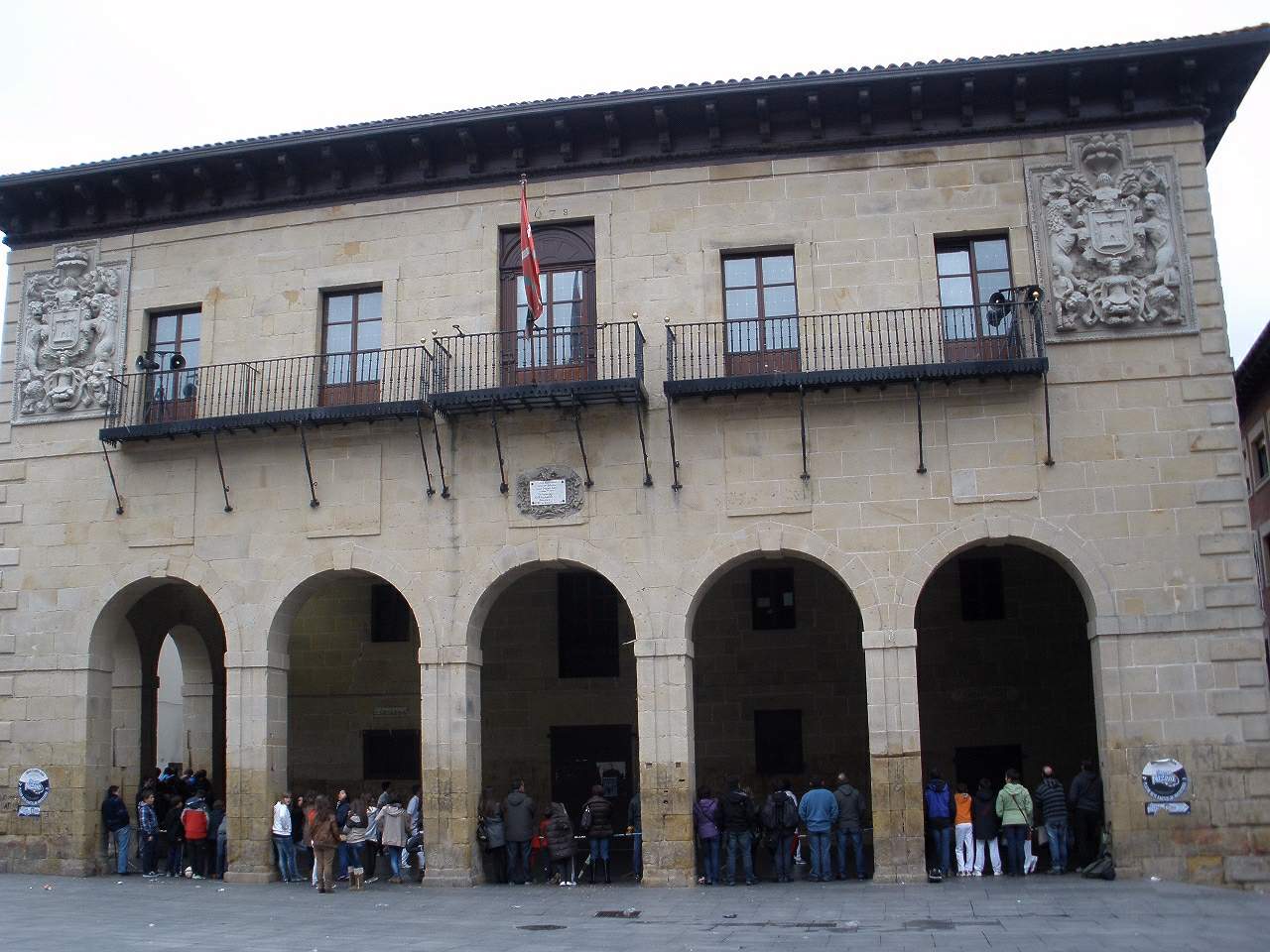
Oiartzun town hall is the seat of local government for the municipality of Oiartzun, in Gipuzkoa province, in the Basque Country, a short distance from San Sebastián and Irun. The building stands on Plaza Doneztebeko and serves as the administrative hub of a town that belongs to the wider Oiartzualdea area. Where exactly is the town hall located? The building sits in the heart of Oiartzun, postal code 20180. The municipality lies in the eastern part of Gipuzkoa, close to the French border, which makes it a convenient stopover between the Cantabrian coast and the inland Basque mountains. Its coordinates are roughly 43.299°N, -1.860°W. What is Oiartzun, and why do travelers pass through? Oiartzun is a municipality of just over 10,000 residents that has kept a strong Basque linguistic and cultural identity. The town's current, standardized Basque name replaced the older Castilian spelling "Oyarzun" in 1990, part of a broader shift across the region toward restoring Basque place names after decades in which Spanish forms had prevailed. The town hall itself, modest in scale compared with civic buildings in larger cities, works as a natural landmark for anyone exploring the old center, since the town's narrow streets radiate outward from around it. How do you get to Oiartzun? The town lies only a few kilometers from San Sebastián (Donostia) and from Irun, giving it good road links to the main hubs of the region. Travelers relying on public transport can use the bus routes that connect the municipalities of Gipuzkoa; drivers will find the town hall on Plaza Doneztebeko an easy landmark once they reach the center. What is worth knowing about the municipality itself? Oiartzun forms part of the Oiartzualdea district, which groups several nearby towns linked historically and administratively. The area blends rural traditions — visible in the scattered farmhouses (baserri) on the hillsides around the center — with easy access to the larger urban centers of Gipuzkoa. As a result, the municipality tends to be visited more as a waypoint between the coast and the mountains than as a standalone destination, but its center, anchored by the town hall, offers a genuine picture of everyday life in a Basque town. Is there anything else to see near the town hall? The center of Oiartzun, where the town hall stands, features the kind of architecture typical of Basque towns: stone and rendered houses with characteristic wooden balconies clustered around the main square. For travelers spending more time in the region, Oiartzun can work as a base for further trips around Gipuzkoa, combining coastal proximity with access to the mountainous hinterland behind the town. Frequently Asked Questions Where exactly is the Oiartzun town hall located? The building stands on Plaza Doneztebeko in the center of Oiartzun, postal code 20180, in Gipuzkoa province. How big is the municipality of Oiartzun? The municipality has just over 10,000 residents and lies in the eastern part of Gipuzkoa, close to San Sebastián and Irun. Has the town always been called "Oiartzun"? No — until 1990 the official spelling was the Castilian "Oyarzun," later replaced by the standardized Basque form used today. Is Oiartzun worth a stop on a Basque Country trip? Given its closeness to San Sebastián, Irun, and the French border, the town works well as a short stop linking the coast with the region's mountainous hinterland, even though it isn't a major tourist destination on its own.
Earn badges for the places you visit
Download NextOnTrip, discover new places and check off your trails.