Monuments in Spain
A guide to 4655 Monuments in Spain — with descriptions, photos and traveler visits from the NextOnTrip community. Locations spread across 2240 cities and towns. Most visited by the community: castle of Chulilla, Castle of Pioz, castell de la Todolella.
-
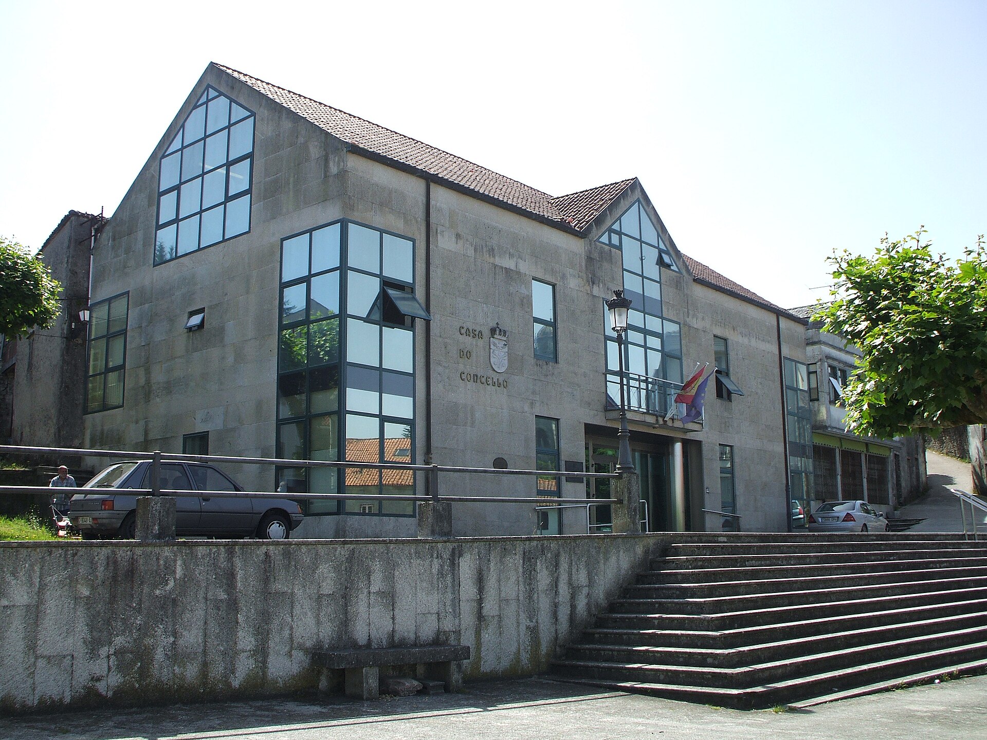
Sobrado town hall
Sobrado
Sobrado Town Hall (Casa do Concello de Sobrado) is the seat of local government for the small municipality of Sobrado, in the province of A Coruña, Galicia, in northwestern Spain. The building houses the municipal administration that serves the roughly 1,830 residents spread across the district. Where is Sobrado Town Hall located? Sobrado sits in the Terra de Melide comarca, inland from the Galician coast, at an elevation of around 510 metres above sea level. The municipality covers just under 121 km² of rolling countryside, oak woodland and wetland valleys typical of interior Galicia. The town hall stands in the centre of the village, which serves as the natural base for anyone exploring the surrounding area. What is there to see nearby? Sobrado is best known for the Monastery of Santa María de Sobrado (Sobrado dos Monxes), traditionally founded by Benedictine monks in the 10th century and taken over by the Cistercian order in 1142. Its current Baroque church was consecrated in 1708. The monastery is still inhabited by monks, runs a guesthouse and takes in pilgrims walking the Camino de Santiago — one reason the village sees a steady flow of hikers passing through. A few kilometres from the centre lies the Roman camp of Cidadela, a rectangular fortified enclosure measuring roughly 172 by 140 metres, where archaeologists have recovered artefacts dated between 86 and 270 AD — one of the clearest traces of Roman presence in this part of Galicia. Also worth a visit is the artificial lagoon of Sobrado, a body of water covering around 10 hectares, created between 1500 and 1530. It is surrounded by wetlands of recognised European natural value, home to rare species such as algae of the genus Nitella. Oak forests cover much of the surrounding countryside — the village of Portacal shelters the second-oldest oak tree in Galicia, and local woodland has served as a filming location for the production "Casa do Gado." How do you get to Sobrado? Sobrado lies inland in the province of A Coruña, roughly between Santiago de Compostela and Lugo. Because of the monastery and its role as a stop on pilgrim routes, several branches of the Camino de Santiago pass through the village, and some visitors arrive on foot. Travellers coming by car generally approach via the roads connecting Santiago de Compostela and Lugo, turning off into the Terra de Melide district. When is the best time to visit? Sobrado has an Atlantic climate — mild, with an average annual temperature of about 8.4°C and substantial rainfall (around 1,400 mm a year). The most comfortable months for sightseeing run from May to September, when conditions are drier and warmer than in autumn and winter. Anyone interested in the wetland flora around the lagoon should plan a visit for spring or early summer. Frequently asked questions What does Sobrado Town Hall do? It is the seat of the local administration, responsible for running the municipality of around 1,830 residents and handling public services and civic matters within it. Can visitors tour the town hall building itself? No — it is a working administrative office rather than a museum, open during regular municipal business hours, and is not set up as a visitor attraction. What should I combine with a stop at the town hall? The main draw is the Monastery of Santa María de Sobrado with its Baroque church and pilgrim guesthouse, along with the nearby Roman camp of Cidadela and the artificial lagoon and its wetlands. How many people live in the Sobrado municipality? According to 2025 figures, around 1,830 people live in the municipality, which covers approximately 120.64 km².
-
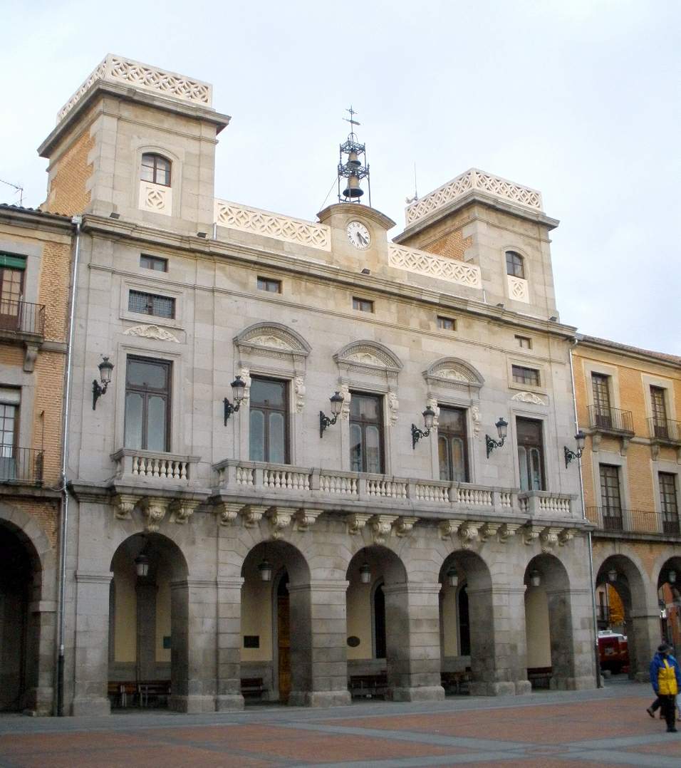
Ávila town hall
Ávila
Ávila Town Hall (Ayuntamiento de Ávila) stands on Plaza del Mercado Chico, the main square of the old town, fully enclosed within the medieval city walls that make Ávila a UNESCO World Heritage Site. The building is still the working seat of the city council and one of the natural stops on any walk through the walled centre. Where exactly is the town hall, and what's around it? The town hall occupies one side of Plaza del Mercado Chico, a Castilian-style square right inside the city walls. The square itself began to take shape at the end of the 11th century, when Ávila was being repopulated, and together with Plaza del Mercado Grande and Plaza de San Vicente it formed the city's main public spaces at the time. Today it's a natural meeting point and a good place to pause between sights, with the town hall's towers as a backdrop. How has the building changed over the centuries? The first town hall on this spot was ordered by the Catholic Monarchs, for a very practical reason: the city council had nowhere to meet and had been holding its sessions "at the door" of the nearby church of San Juan, which also faces the square. The square's medieval arcades originally rested on brick pillars with brick lintels; these were replaced with stone in 1518. By the mid-18th century both the square and the town hall had fallen into serious disrepair, prompting a major overhaul that regularized the layout of the plaza and gave it a unified colonnade. The building seen today was constructed between 1839 and 1845, then altered and extended between 1862 and 1868, which is when it took its current form. What should you look for on the facade? The town hall is built in dressed granite with a strongly geometric composition, in the Isabelline style — a decorative strand of 19th-century Spanish architecture associated with the reign of Queen Isabella II. The facade reads in three horizontal bands: a ground-floor colonnade with semi-circular arches on a square-cut base, a middle level with three doors opening onto balconies, and, at the top, twin towers flanking the sides with a clock set between them. Look closely at how the arcade of the town hall lines up with the arcades running around the rest of the square — a signature feature of Castilian market squares. When is the best time to visit? Plaza del Mercado Chico is animated year-round, but spring and autumn are the most comfortable seasons, since Ávila — Spain's highest provincial capital — can get uncomfortably hot in midsummer and cold in winter. The square regularly hosts local markets and events, so it's worth checking the city's calendar before a visit; stumbling on an open-air market or a concert in front of the town hall is a common experience for visitors. The exterior can be admired at any hour, with no opening times to work around. Frequently asked questions Can you go inside Ávila's town hall? The building is an active administrative office and the seat of the city council, so interior access is limited to official business. Most visitors experience it from the square, looking at the facade. Why was the town hall built on Plaza del Mercado Chico specifically? Because the square had already been the city's civic centre since its repopulation in the 11th century, and the council was already meeting nearby, next to the church of San Juan on the same square. How old is the current town hall building? The structure standing today dates from 1839–1845, with further alterations and extensions completed between 1862 and 1868 — meaning the building on the square is well over 180 years old. What else is worth seeing near the town hall? Plaza del Mercado Chico itself is lined with arcaded old-town buildings, and it's a short walk from there to Ávila's defensive walls and the other UNESCO-listed monuments inside the historic centre.
-
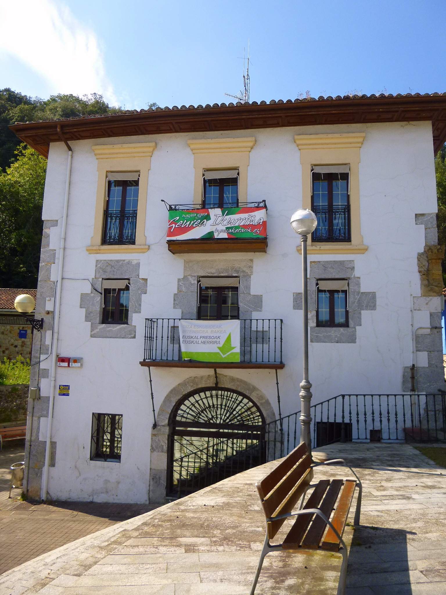
Busturia town hall
Busturia
Busturia Town Hall is the seat of the municipal government of Busturia, a small town in the Basque Country's Biscay province. The building sits in the Barrio Axpe area and, while its main role is administrative, it also works as a handy landmark for anyone exploring this stretch of coastline. Where is it and how do you get there? Busturia sits on the left bank of the Mundaka estuary, right in the heart of Urdaibai — one of the best-known nature reserves in the Basque Country. The municipality has around 1,650 residents and borders well-known tourist towns such as Mundaka and Gernika. The easiest way to reach it is by car along the coastal road connecting Bilbao with Mundaka and Bermeo, a drive of roughly 35–45 minutes from Bilbao. A local bus service runs from Bilbao and Gernika as well, and travelers relying on rail can take the Euskotren line to Gernika and continue by bus or taxi from there. The town hall itself is located at Barrio Axpe 1, right in the practical center of town, making it easy to fold into a short walking visit of Busturia. What's worth seeing nearby? The town hall is a working municipal building, so its main appeal for visitors is really its location — close to the key sights of the Urdaibai area. In Busturia itself, the Church of Santa Maria is worth a look, one of the older religious buildings in the area. A short distance away lies the Urdaibai Biosphere Reserve, which protects the estuary, wetlands, and surrounding woodland — a popular spot for birdwatchers, especially in autumn and winter when migratory birds feed on the mudflats. From Busturia it's also a short hop to Mundaka, famous for one of Europe's best surf beaches, and to Gernika-Lumo, a town of major historical significance for the Basque people. It's worth setting aside half a day for a relaxed loop through this part of Biscay, using Busturia as a stop between the coast and the inland towns. When should you visit? The best time to visit is spring (April to June) or early autumn (September to October), when the Biscay coast has mild weather and fewer crowds than in July and August. Bird enthusiasts should aim for the autumn-winter period, when migratory bird activity on the Urdaibai wetlands peaks. Summer brings more visitors to the region because of the beaches, but Busturia itself stays quieter than the coastal resort towns. It's worth checking the town hall's office hours before visiting — the counter serves residents Monday to Thursday mornings and Friday until early afternoon, so outside those hours the building can only be seen from the outside. Frequently asked questions Can you go inside Busturia Town Hall as a visitor? It's an active municipal office, not a museum — access is mainly for residents handling administrative matters rather than sightseeing. How long does it take to get there from Bilbao? By car along the coastal road, expect about 35–45 minutes depending on traffic and time of day. Is there anything else to see in Busturia besides the town hall? Yes — the Church of Santa Maria, easy access to the Urdaibai Biosphere Reserve, and short trips to Mundaka and Gernika-Lumo. Is it worth combining Busturia with other towns in the region? Definitely. Busturia works well as a base for exploring Urdaibai as a whole, combining several towns in a single day.
-
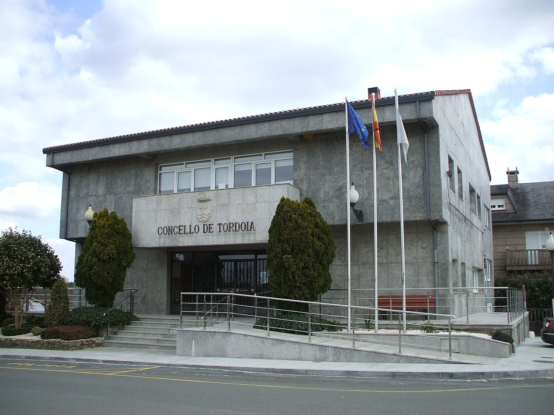
Tordoia town hall
Tordoia town hall is the seat of local government for the small municipality of Tordoia, in the province of A Coruña, in Galicia, northwestern Spain. The building sits at Calle Xesteira 17, postal code 15683, near the village of Pontepedra-Cabaleiros, and serves as the main administrative office for the entire municipality. Where is Tordoia and how do you get there? Tordoia belongs to the comarca of Ordes, one of the administrative divisions of A Coruña province. The town hall's coordinates are 43.0883727, -8.5519466 — a rural setting away from major highways, so a car is by far the most practical way to arrive. From the city of A Coruña, the drive typically takes 40 to 50 minutes along local roads connecting the region's parishes. There is no direct rail service to the area, and bus connections are limited, so travelers without their own transport should plan the route in advance. What will you find on site? The building itself reflects typical Galician administrative architecture — modest and functional, with no dedicated tourist program. It primarily serves residents: this is where paperwork gets handled, civil registrations are processed, and locals get information about community events. The municipality of Tordoia covers roughly 125 square kilometers and is divided into ten parishes, making it a large but sparsely populated rural area. For visitors interested in authentic inland Galicia, the town hall is a natural starting point for exploring the surrounding villages, farmland, and traditional stone architecture typical of the Ordes region. Who runs the municipality? Local government is led by mayor Eduardo Antonio Pereiro Liñares, representing the People's Party (PP). The town hall hosts council sessions and is where decisions affecting the community are made — from road maintenance to the organization of each parish's patron saint festivals. When to visit and how to get in touch? The town hall operates like a standard Spanish public administration office, open on weekdays during typical business hours, generally mornings from Monday to Friday. Before visiting, it's worth calling 981 690 001 or 981 690 128, or emailing correo@tordoia.gal, to confirm current opening hours — in smaller Galician municipalities, schedules can shift around local festivals and holiday periods. More information about the municipality and its events is available at tordoia.es. For travelers crossing inland Galicia, Tordoia offers a glimpse of everyday rural life away from the crowded coastal routes. The surrounding countryside is well suited to walking along country roads, observing local stone architecture, and sampling regional cooking in the small family-run spots scattered across the municipality's parishes. Frequently asked questions Can tourists visit Tordoia town hall? Yes, the building is accessible during office hours, though it isn't a tourist attraction in the classic sense — it primarily serves local residents. What's the best way to reach Tordoia? Driving is the most practical option, since the region has no direct rail access and bus connections are limited. How many parishes make up the municipality of Tordoia? The municipality includes ten parishes spread across about 125 square kilometers, within the comarca of Ordes, A Coruña province. How can I contact the town hall before visiting? Call 981 690 001 or 981 690 128, email correo@tordoia.gal, or check tordoia.es for current information.
-
Villacarrillo town hall
Villacarrillo
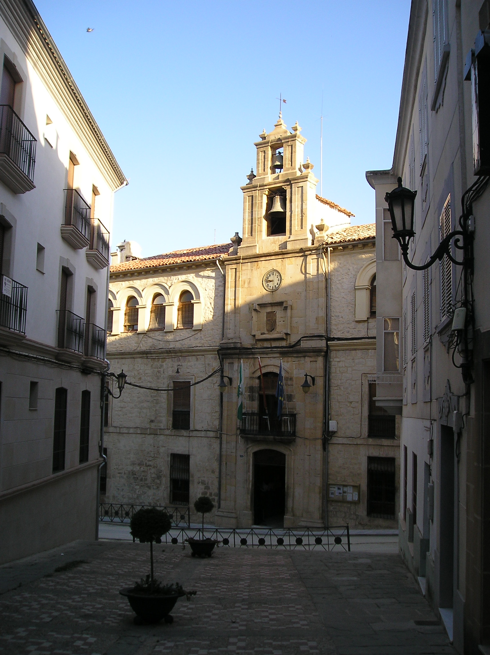
Villacarrillo Town Hall (Ayuntamiento de Villacarrillo) is a 19th-century administrative building standing in the heart of Villacarrillo, a town in the province of Jaén, Andalusia, Spain. It still serves as the seat of the local government and is one of the town's most recognizable pieces of civic architecture. What does the building look like? The town hall was built in the Neoclassical style, common in Spanish civic architecture of the 19th century. Its facade rises three storeys and follows a clearly symmetrical layout, with window openings arranged in an even rhythm on either side of the central section. That central part is the real focal point: it holds the main entrance, a cast-iron balcony, the municipal coat of arms, a clock, and a slender espadaña — an open bell-gable typical of Spanish religious and civic buildings. Below the balcony, a carved stone portal frames the main doorway, one of the most detailed elements of the whole facade. Where is it and how do you get there? The building stands at calle La Feria 1, right in the centre of Villacarrillo (postcode 23300). It's an easy stop for visitors, since the historic centre of Villacarrillo is compact and walkable, with the kind of narrow streets and small squares typical of Spanish provincial towns. The square in front of the town hall is the best reference point — it's usually where local foot traffic and everyday town life concentrate. What should you look out for during a visit? The town hall is best appreciated from the outside, taking in the facade details — the clock, the coat of arms, the iron balcony, and the espadaña above. Since the building is still in active administrative use, the interior isn't set up as a tourist attraction, and access is generally limited to office hours. Still, it's worth pausing on the square for a few minutes: the 19th-century facade is a good illustration of the town's civic history and past prosperity, closely tied to olive oil production, the traditional economic backbone of the wider Jaén province. When is the best time to visit? Because the town hall functions as a working government office, weekday visits during business hours make sense if you want to see more than just the exterior. Weather-wise, spring (April–May) and autumn (September–October) are the most comfortable seasons to explore Villacarrillo, avoiding the intense summer heat typical of inland Jaén province. Frequently asked questions Can you go inside Villacarrillo Town Hall? The building is an active government office, so interior access is mainly tied to official business during working hours rather than general tourist visits. What architectural style is the building? It's a 19th-century Neoclassical building with a symmetrical, three-storey facade and a carved stone portal at the main entrance. What's the most distinctive feature of the town hall? The central section of the facade, combining a cast-iron balcony, the municipal coat of arms, a clock, and a decorative espadaña bell-gable. Where exactly is the building located? At calle La Feria 1, in the centre of Villacarrillo, in the province of Jaén, Andalusia.
-
town hall of Muskiz
Muskiz
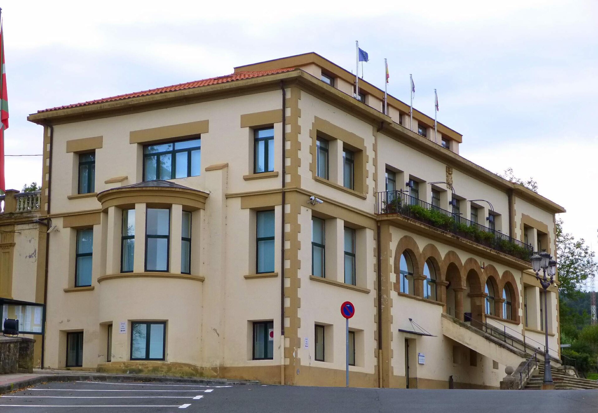
The town hall of Muskiz sits at the administrative heart of Muskiz, a municipality in the province of Biscay, in Spain's Basque Country. The building houses the local council and marks a convenient starting point for exploring the town and its surroundings. Where is the town hall located? Muskiz occupies the westernmost stretch of the Biscay coastline, facing the Cantabrian Sea and bordering Cantabria and the town of Castro Urdiales. Historically known as San Julián de Musques, the municipality has its administrative centre — the town hall — right in the middle of the settlement, close to the main streets and squares where daily life concentrates. What else is worth seeing nearby? Muskiz carries a long and varied history, visible in monuments from different eras. A short trip from the town hall leads to the Castillo de Muñatones, a medieval complex combining a castle, a palace and a hermitage, protected as a Historic-Artistic Monument since 1944. It ranks among the best-preserved defensive sites in this part of Biscay and reflects the influence of the noble families who once controlled the area. Nearby stands the Palacio de los Salazar, which enjoys the same heritage protection. The municipality's mining past is another strong thread running through the local landscape. In recent years, Muskiz restored several remnants of its former mining industry — a loading dock, a mineral-sorting building, the bases of a mineral conveyor, and the ruins of former stables. Two viewpoints were added specifically for visitors, offering a fresh perspective on these industrial remains and making this corner of the municipality a worthwhile stop for anyone interested in the Basque Country's industrial heritage. How to get to Muskiz? Muskiz is easily reached from Bilbao, the capital of Biscay, thanks to regular road connections. Driving is the most convenient option — the coastal route runs through the string of seaside towns that make up Enkarterri, the wider district Muskiz belongs to. Travellers relying on public transport can take buses running from Bilbao toward the western Biscay coast, with a stop in the town centre close to the town hall building. When is the best time to visit? Given the Atlantic, coastal climate, the summer months — from June to September — offer the most reliable weather for both sightseeing and trips to the nearby beaches along the Enkarterri coastline. Spring and early autumn suit travellers looking for a quieter pace, though rain is more frequent during those seasons, as is typical for the region. Frequently asked questions What is the town hall of Muskiz? It is the administrative building where the local council of the Muskiz municipality, in the province of Biscay, is based. Are there other attractions near the town hall? Yes — the municipality includes the medieval Castillo de Muñatones complex and restored sites tied to its mining history. What is the best way to reach Muskiz? Driving from Bilbao along the coast is the simplest option, though regional buses toward western Biscay also serve the town. Is Muskiz a large town? No — it is a small coastal municipality, but its historical and industrial heritage make it a notable stop along the Basque coast.
-
Antas de Ulla town hall
Antas de Ulla
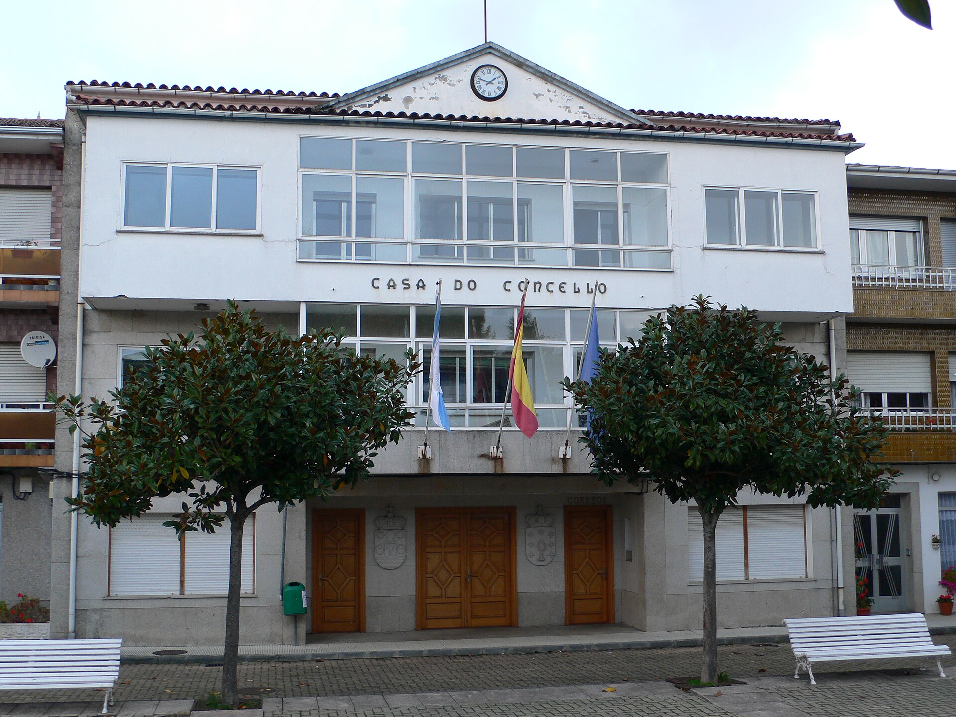
Antas de Ulla town hall sits in the centre of Antas de Ulla, a small municipality in the province of Lugo, within the Ulloa region. It is a working administrative building, but its setting is the real curiosity: the town marks the geographic centre of Galicia, which makes it a fitting base for exploring the surrounding countryside. Where is Antas de Ulla? The municipality lies roughly 45 km from the city of Lugo, right on the border with the province of Pontevedra. The name "Antas" comes from a word for dolmen — a megalithic burial monument — a hint that people have lived in this area for millennia. Until well into the 20th century, the administrative seat itself was known as Seoane, while "Antas de Ulla" referred to the wider municipality; today the two names are used together. The river Ulla rises within the municipality's boundaries. Its river basin is the second largest in Galicia after the Miño, and the landscape is framed to the south by the Monte Farelo mountain range. What can you see around the town hall? The municipality preserves a dense layer of heritage from very different periods: Torre de Amarante — a medieval tower and one of the emblems of the Ulloa region. Castillo de Amarante — a castle built in the 13th century by the Counts of Amarante on the site of an earlier hillfort (castro), later destroyed during the Irmandiño wars of the 15th century; its ruins can still be visited. Pazo de Santa Mariña — a Galician manor house typical of the region's noble architecture. Numerous petroglyphs, dolmens, burial mounds (mámoas) and remains of castros scattered across the municipality, evidence of megalithic and Celtic-era settlement. This mix of defensive, religious and prehistoric sites has earned the Ulloa region a reputation as an open-air record of Galicia's history. How do you get to Antas de Ulla? Travelling by car is the most practical option, since the municipality sits along the roads connecting Lugo and Pontevedra, right in the geographic middle of Galicia. The nearest larger cities are Lugo (about 45 km away) and Santiago de Compostela, both linked by regular road connections. Public transport in this rural stretch of the region is limited, so a car makes it far easier to reach the scattered historical sites. When is the best time to visit? Spring and early autumn are the best seasons, when inland Galicia's climate is mild and the Ulla valley is at its greenest. Summer is warmer and good for walks along the river, while winter in this inland area can turn cold and damp. Frequently asked questions What is the Antas de Ulla town hall building? It houses the local government (Concello de Antas de Ulla) and serves as the administrative centre for the whole municipality. Are Antas de Ulla and Seoane the same place? Historically they referred to the same area under two names — Seoane was the administrative seat, and Antas de Ulla the whole municipality. Today both names are used interchangeably for the town. What is the main historical attraction in the municipality? The ruins of Castillo de Amarante and the nearby Torre de Amarante, remnants of the medieval power of the Counts of Amarante. Are there traces of the area's oldest settlements? Yes — petroglyphs, dolmens and mámoas found across the municipality point to its megalithic roots, which also gave the town its name, "Antas".
-
Irixoa town hall
Irixoa
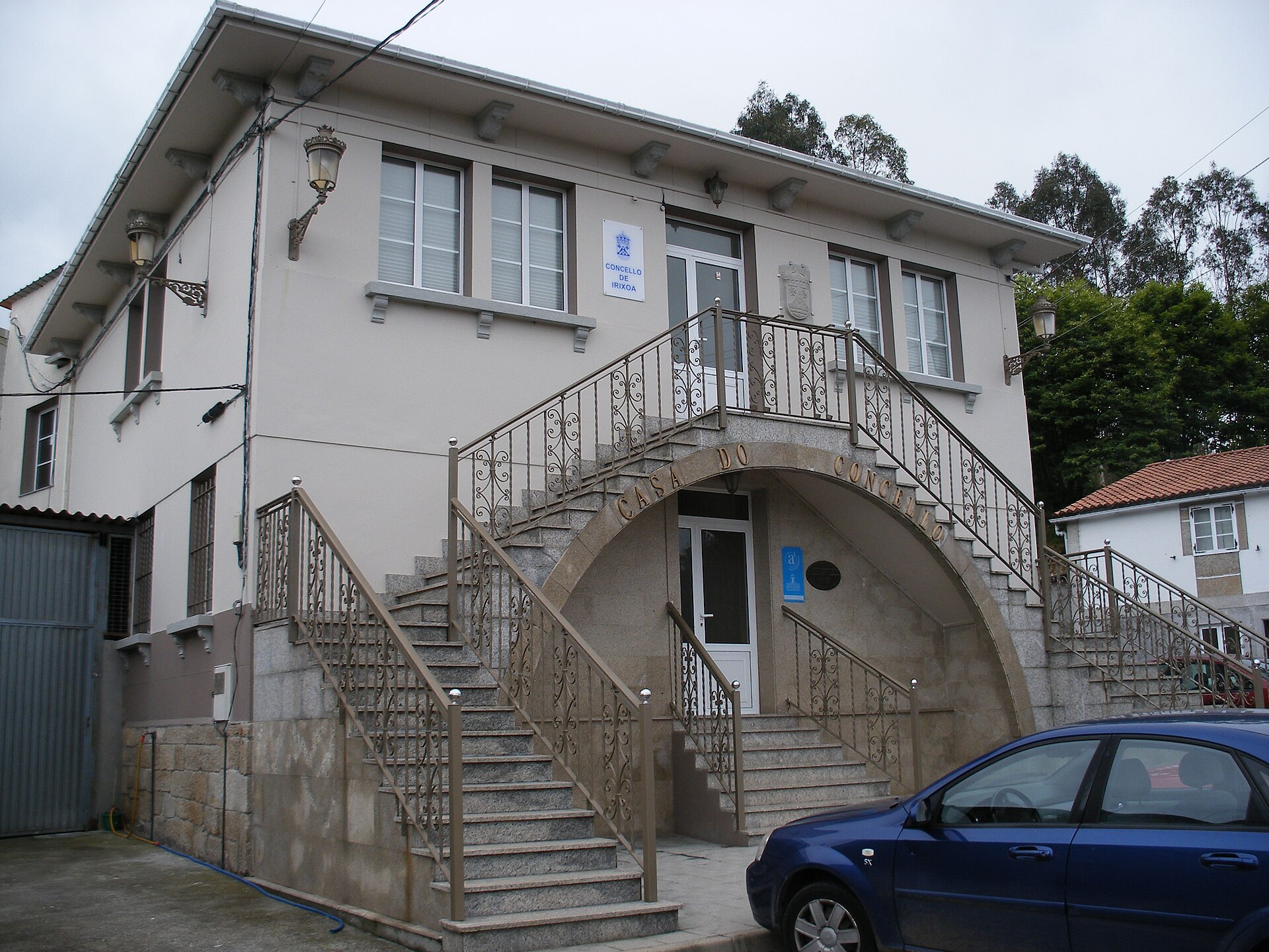
Irixoa Town Hall (Galician: Casa do Concello de Irixoa) is the seat of local government for the small municipality of Irixoa, in the province of A Coruña, within the Betanzos district of Galicia, in northwestern Spain. The building sits at the administrative heart of the municipality, serving as the office where residents handle official business and where visitors can pick up basic information about the surrounding area. Where is it and how do you get there? Irixoa lies inland in Galicia, a short drive from the Atlantic coast, surrounded by the green hills typical of the region. The municipality borders Miño, Vilarmaior, Monfero, Aranga, Coirós and Paderne, making it a convenient stopping point for exploring the interior of A Coruña province. A car is by far the easiest way to get there — the nearest larger towns are Betanzos and A Coruña city, connected to Irixoa's various parishes by local roads. The town hall occupies the municipality's main administrative address, in a building known as the Pazo de Irixoa, a name that points to its roots in traditional Galician manor-house architecture. What will you see on site? The town hall building follows a pattern common across rural Galicia, where municipal offices are housed in older, repurposed buildings — in this case a pazo, a historic Galician country residence. Structures of this kind are typically built from solid stone, with plain, symmetrical façades and a small forecourt or courtyard used for local gatherings. Irixoa covers 68.6 square kilometres spread across several rural parishes, so the town hall functions as the only fixed administrative hub around which the municipality's public life is organised. Nearby, visitors can look out for the small wayside chapels and rural farmhouses typical of inland Galicia — an unpolished, low-traffic setting far removed from the coastal crowds. When should you visit? The Betanzos district has an oceanic climate, with mild, damp winters and moderately warm summers. The best window for exploring the municipality runs from May to September, when longer daylight hours and steadier weather make walks through the surrounding hills more pleasant. As with most town halls in small Galician municipalities, office hours are limited to set weekday slots, so anyone planning a visit tied to an administrative errand should check current opening times beforehand. Why stop here? Irixoa is not a headline destination, and that is precisely its appeal — it offers an authentic, working look at rural Galicia, away from the busier coastline. As the municipality's central landmark, the town hall works well as a reference point when mapping out a longer route through inland A Coruña province, linking neighbouring municipalities such as Monfero, with its monastery, or Betanzos, whose old town is a protected historic site. For travellers looking for quiet, non-commercial Galicia, a short stop at Irixoa's town hall fits naturally into that kind of itinerary. Frequently asked questions Where exactly is Irixoa Town Hall located? The building stands at the administrative centre of the Irixoa municipality, in A Coruña province, within the Betanzos district of Galicia. The seat is housed in a building called the Pazo de Irixoa. Is the Irixoa municipality worth visiting, or just passing through? Irixoa is a small rural municipality without major tourist infrastructure, but it works well as a base for exploring inland A Coruña province and neighbouring towns such as Betanzos and Monfero. How do you reach Irixoa without a car? Given the rural character of the area, a car is the most practical way to get around. Public transport links to the municipality's smaller parishes are limited, so it's worth planning a route from Betanzos or A Coruña city in advance. Can you get tourist information at the town hall? The building is primarily an administrative office serving residents with official municipal matters, but staff in small Galician town halls can often point visitors toward basic local information.
-
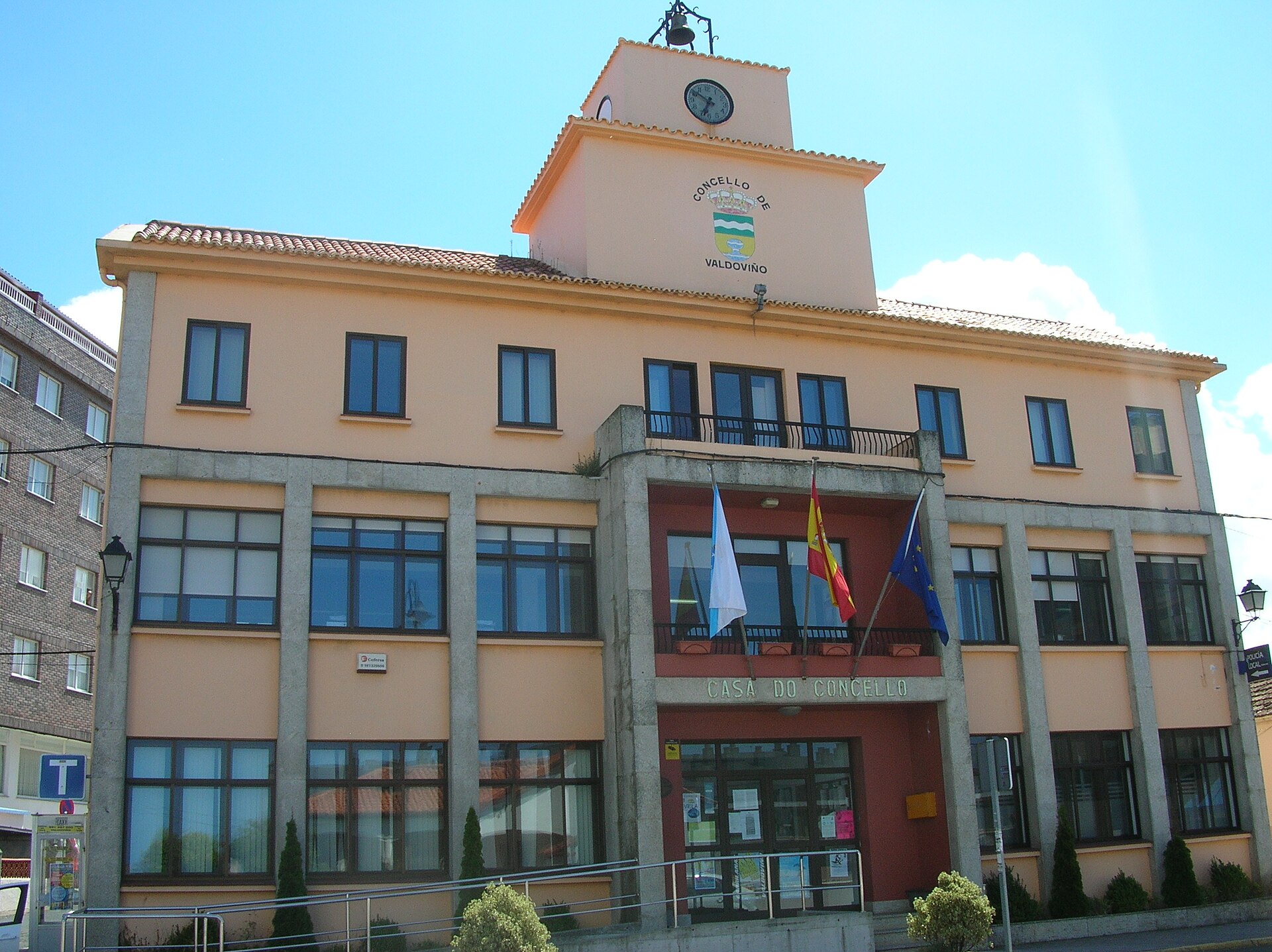
Valdoviño town hall
Valdoviño
Valdoviño town hall (Concello de Valdoviño / Ayuntamiento de Valdoviño) is the seat of local government for this small coastal municipality in the province of A Coruña, in Galicia, on Spain's northern Atlantic coast. The building stands on Porta do Sol and works as a natural landmark for anyone exploring the centre of Valdoviño, right where roads branch off toward the nearby beaches and lagoon. Where is Valdoviño town hall located? The municipal building sits in the very centre of Valdoviño, at Porta do Sol, s/n (postal code 15552). This is the heart of the village — local shops, bars and bus stops cluster nearby, so the building is easy to find during a short walk around town. Its coordinates, 43.6068, -8.1434, make it simple to pin on a map before setting out. What is there to see nearby? The town hall itself is a working administrative building rather than a sightseeing destination, so visitors mostly use it as an orientation point rather than something to tour inside. The real draw of Valdoviño is what surrounds it: the municipality is known for its long Atlantic beaches, including Praia da Frouxeira, and for the nearby Frouxeira lagoon (Lagoa da Frouxeira), a valuable natural area and a good spot for birdwatching. Walking from the town hall toward the coast usually takes only a short while, through the quiet lanes typical of small Galician villages. How do you get there? Valdoviño lies in the province of A Coruña, not far from the city of A Coruña itself, and the easiest way in is by car along the local coastal roads. Driving gives the most flexibility, letting you combine a stop at the village centre with a tour of the beaches and coastal viewpoints nearby. Travellers relying on public transport should check local bus connections from A Coruña and Ferrol, which serve the smaller towns along this stretch of coast. When should you visit? The town hall serves residents Monday to Friday from 9:00 a.m. to 2:00 p.m., and on Saturdays from 10:00 a.m. to 1:00 p.m. for registration matters. That is useful to know if you want to combine sightseeing with picking up local information at the office. Council plenary sessions are usually held once a month, on the first Thursday, at 8:00 p.m., in the building's meeting hall — though that detail matters little for casual visitors. Weather-wise, the best time to visit Valdoviño runs from late spring through early autumn, when the Atlantic beaches nearby are at their most inviting for long walks and swimming. Frequently asked questions Can you go inside Valdoviño town hall as a visitor? It is an active public administration building, not a museum — access is mainly for official business during office hours rather than tourist visits. What is the town hall called locally? It is known as Ayuntamiento de Valdoviño in Spanish or Concello de Valdoviño in Galician — both names refer to the same institution, the seat of the local council. What is the biggest attraction close to the town hall? The municipality's beaches are the main draw nearby, especially Praia da Frouxeira, along with the adjoining lagoon, which is important for local wildlife. Is it easy to contact Valdoviño's town hall? Yes — the office has a published phone number and email address, and its opening hours for residents run clearly from Monday through Saturday.
-
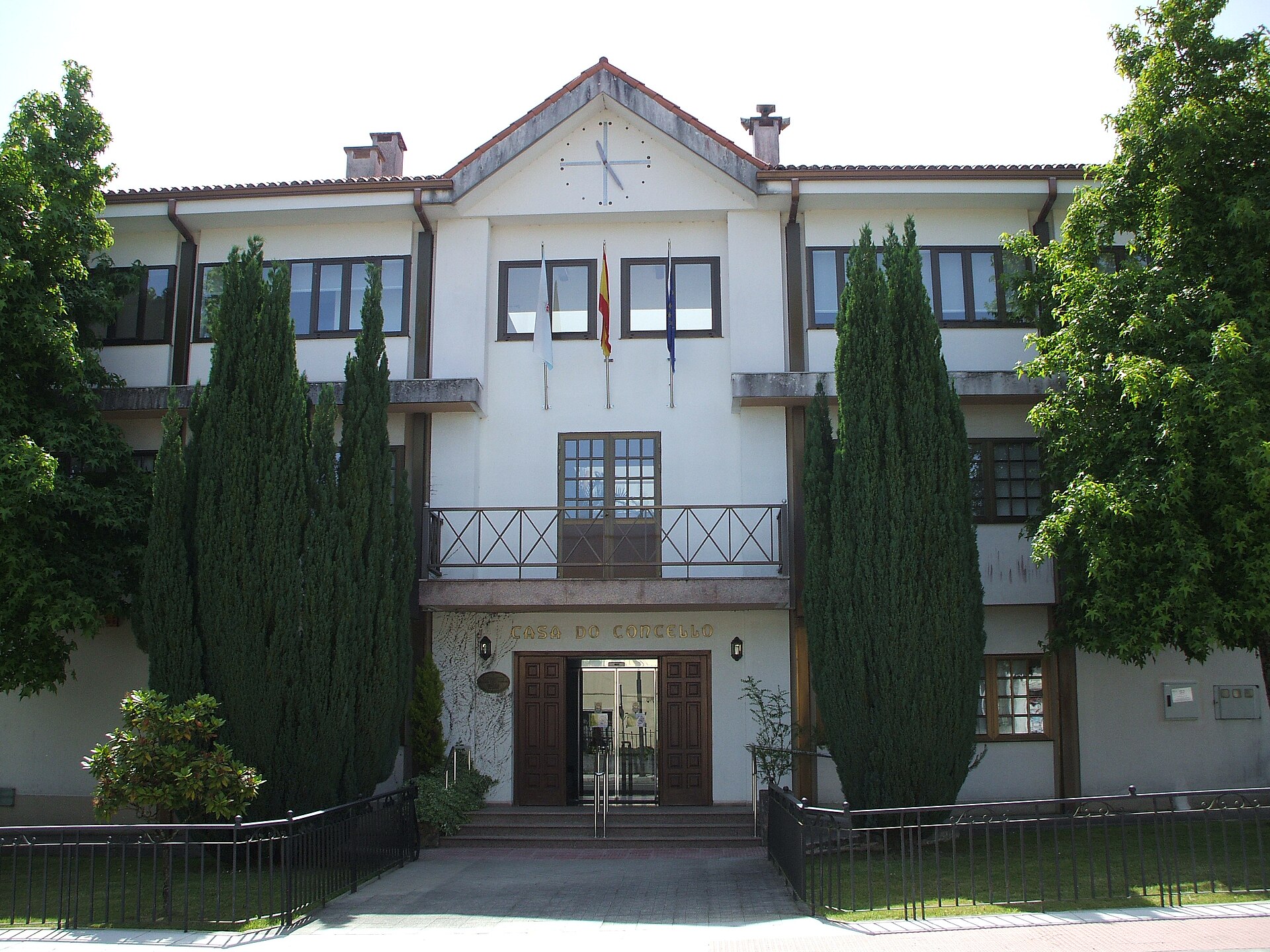
Boimorto town hall
Boimorto
Boimorto town hall is the seat of local government for the municipality of Boimorto, a small district in the province of A Coruña, in the Galicia region of northwestern Spain. Standing on Rúa Vilanova 1, the building serves a double role: it houses the Concello de Boimorto administration and also functions as a tourist information point for travelers passing through this part of inland Galicia. Where is Boimorto and why stop here? The municipality belongs to the Arzúa district and sits almost exactly at the center of a triangle formed by the three biggest cities of northern Galicia — Santiago de Compostela, A Coruña and Lugo. That central position makes it a natural waypoint for anyone touring the region: none of those cities is more than about an hour away, while Boimorto itself keeps the quiet, rural character typical of Galicia's interior. What will you find at the town hall itself? The town hall building is a working administrative office rather than a historic palace, but it is still the logical first stop in Boimorto, since a Punto de Información Turística operates alongside it. There you can pick up maps and information on walking routes and local sights, and the same address handles contact with the municipal culture office, which makes planning the rest of a visit straightforward. Around the municipality stretch the valleys of the Tambre and Iso rivers, popular with anglers and hunters, along with the old mill area of Valdoña, a reminder of the region's rural, agricultural past. It is classic inland-Galicia scenery — green hills, small rivers and scattered villages. What is Boimorto's connection to the Camino de Santiago? In the Middle Ages a stretch of the Camino del Norte, linked to the Monastery of Sobrado dos Monxes, ran through the Boimorto area. Some historians argue that this route was, in earlier centuries, older and more heavily used than the later Camino Francés. For today's pilgrims and travelers, that means the area around Boimorto's town hall sits on a historic Jacobean path that can still be followed on foot or by bike in sections. How do you get to Boimorto? Driving is the most practical option: the trip from Santiago de Compostela or A Coruña usually takes under an hour. Travelers without a car can take a bus to the nearest larger towns and continue by local transport or taxi, though schedules in this rural stretch of Galicia can be infrequent, so it is worth checking them in advance. When is the best time to visit? Spring and early autumn bring the most comfortable temperatures and the greenest views along the Tambre and Iso valleys. Summer runs warmer, but it is also when the tourist office at the town hall keeps full opening hours, making it the easiest season to pick up current information on local events. Frequently asked questions Can you get tourist information at Boimorto's town hall? Yes, a tourist information point operates alongside the building, offering maps and contact details for the local culture office. Is Boimorto on the Camino de Santiago? Yes, a historic stretch of the Camino del Norte linked to the Monastery of Sobrado dos Monxes once passed through the municipality, considered by some historians older than the Camino Francés. What else is there to do near the town hall besides sightseeing? The Tambre and Iso river valleys and the Valdoña mill area are popular for fishing and hunting, all set within typical rural inland-Galicia countryside. How far is Boimorto from Santiago de Compostela? The municipality sits centrally between Santiago de Compostela, A Coruña and Lugo, so reaching any of the three cities by car usually takes around an hour.
-
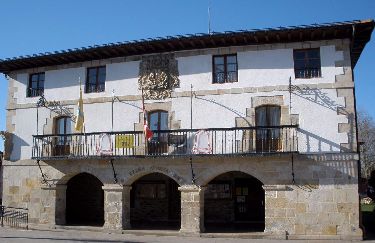
Zuia town hall
Murgia
Zuia Town Hall (Ayuntamiento de Zuia) stands on the main square of Murgia, a small town in the province of Álava in the Basque Country and the historic administrative capital of the Zuia valley. The building is one of the region's characteristic stone "casas consistoriales" — a town-hall style built with a coat of arms on its facade, dating back to the second half of the 18th century. How do you get there? Murgia sits roughly 20 km north of Vitoria-Gasteiz, on the way toward the Gorbea mountain range. The easiest way in is by car along the A-624 or the local roads linking the Zuia valley with the rest of Álava — the drive from Vitoria takes under 30 minutes. Regional bus lines serving the Gorbeialdea area also stop in Murgia. The town hall sits right on the main square in the town center, so once you arrive you simply walk there — no extra transport is needed inside Murgia. What will you see? The building follows the classic Basque style of stone consistorial houses: plain, sturdy stonework, a carved coat of arms above the entrance, and a regular pattern of windows. The town hall in its current form was completed between 1766 and 1767, though its history was far from smooth — by 1795, after a run of poor harvests and war against revolutionary France, the Zuia valley had fallen into serious financial trouble and was forced to sell off half of the consistorial building. Today the town hall also houses the municipal library, making it a hub of everyday community life as much as a seat of local government. The building is part of a wider urban ensemble that reflects Murgia's former role as capital of the valley. Alongside the town hall, it's worth walking the main square and the surrounding stone streets, which still carry the stately, "lordly" character typical of the region's administrative towns. Nearby stands an 18th-century manor house with a garden of centuries-old trees, and Murgia has recently gained extra recognition as the hometown of footballer Unai Simón. When should you visit? Spring and early autumn are the best times to come, when temperatures in this part of Álava are mild and the surrounding Gorbea hills are at their greenest. Summer can get warm but pairs well with hiking trips toward the nearby Gorbea Natural Park. Winters here are cold and rainy, which makes walking around less pleasant, though the square and town hall can be viewed in any season. Frequently asked questions Can you go inside Zuia Town Hall? The building is an active administrative office and houses a public library, so limited access is possible during opening hours, but it isn't set up as a museum with regular guided visits. What's the difference between "Zuia" and "Murgia"? Zuia is the name of the entire municipality (valley) in Álava, while Murgia is its administrative capital — the town where this town hall is located. How long does it take to see the town hall and square? Viewing the facade, the coat of arms, and the main square takes about 15 to 30 minutes, making it a good stop on the way to Gorbea Natural Park. Are there other things worth seeing in Murgia? Yes — nearby you'll find an 18th-century manor house with gardens and trailheads leading toward the Gorbea massif, popular with hikers and cyclists.
-
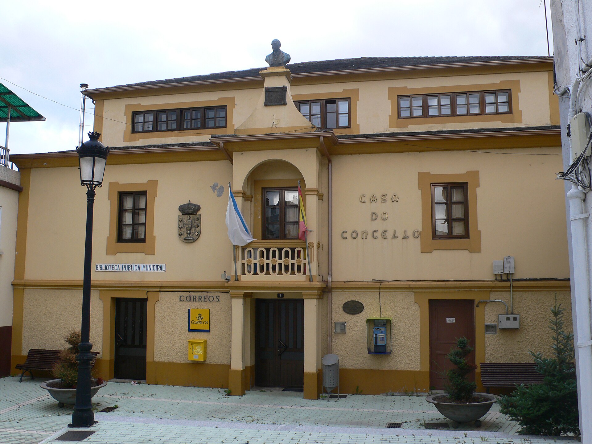
Riotorto town hall
Riotorto
Riotorto Town Hall (Casa do Concello de Riotorto) is the seat of local government for the municipality of Riotorto, in the northeastern part of Lugo province, Galicia. The building stands in As Rodrigas, the municipal capital, roughly 48 km from Lugo, in a transition zone between the Mariña Lucense coastline and the mountainous interior of the region. It's a modest administrative building, but a natural starting point for exploring this quiet, authentic corner of Galicia. Where exactly is the town hall located? The building sits in the centre of As Rodrigas, the main settlement of the Riotorto municipality, home to around 2,200 people spread across seven parishes: Aldurfe, Ferreiravella, Galegos, Meilán, Moxoeira, Órrea and Riotorto. The municipality covers about 66–68 km² and borders the Mondoñedo area, reaching up to Mount Carracedo. The coordinates for the location are 43.3421139, -7.2610578. How do you get to Riotorto? The easiest starting point is Lugo, from where a road of about 48 km leads to As Rodrigas. A car is the most practical option, since public transport in this part of the province is limited. Riotorto sits along the route connecting the Mariña Lucense coast with inland Galicia, so it fits well into a trip combining the Cantabrian beaches with the hilly countryside around Mondoñedo. What's worth seeing near the town hall? The town hall itself is purely administrative, but the surrounding municipality hides a handful of interesting sites. Look out for the tower of the old San Pedro de Riotorto church, the Torre do Moro in Santa Marta, and Castro da Croa, the remains of an ancient hillfort. The landscape is dotted with traditional hórreos (raised granaries on stone stilts) and old manor houses scattered across the parishes. The area is also known for its beautiful natural scenery — forests, streams and hills — that draws hikers and nature lovers. What else makes this municipality distinctive? Riotorto has a long blacksmithing tradition, with around twenty smiths still active today — an unusually high number for a place this size in Galicia. The municipality also preserves old water mills (muiños), a reminder of the region's agricultural past. On the food side, the area is known for its tarta de Riotorto (a local cake), bread, empanadas, honey, organic produce, and meat and cured products from local farms. When is the best time to visit? Given the rural character of the municipality, spring and summer are the best times to visit, when the landscape is at its greenest and local fairs and food markets give visitors a chance to try regional specialities. Autumn is ideal for walks through the forests and stream valleys, when the trees turn shades of red and gold. Frequently asked questions Can you visit Riotorto Town Hall as a tourist? It's an administrative building for the municipality, not set up for tourist visits, but its location in As Rodrigas makes it a good base for exploring nearby landmarks and trails. How do you get from Lugo to As Rodrigas? By car is best — the route is about 48 km, and public transport in the area is limited. What else should you see in the Riotorto municipality? The San Pedro de Riotorto church tower, the Torre do Moro, Castro da Croa, and the traditional hórreos and manor houses scattered across the parishes. Does Riotorto have any local food specialities? Yes — the area is known for tarta de Riotorto, local bread, empanadas, honey and organic produce.
-
town hall of Brunete
Brunete
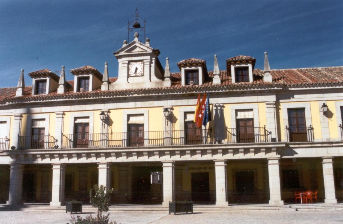
The town hall of Brunete (Ayuntamiento de Brunete) stands on the main square of this small town about 35 kilometres west of Madrid, in the area known as the Sierra Oeste. What will you see there? The town hall building faces the Plaza Mayor de Brunete, laid out in the so-called Escurialense style - a nod to the monumental architecture of the nearby El Escorial monastery. The square's most distinctive feature is its arcaded porticoes, held up by more than 60 granite columns quarried from the very same sites that supplied stone for El Escorial and for Madrid's Plaza de Oriente. A stone fountain sits at the centre of the square, and a staircase links it to the neighbouring parish church, giving the whole ensemble a tidy, symmetrical layout. That layout - town hall included - dates from the rebuilding that followed the Spanish Civil War. Brunete was the scene of one of the war's bloodiest battles in 1937, and the fighting left the town almost completely destroyed. Reconstruction through the following decades was carried out by the state's Dirección General de Regiones Devastadas (General Directorate of Devastated Regions), the body in charge of rebuilding many Spanish towns after the war. As a result, today's square and town hall are a good example of post-war civic architecture, blending traditional forms with a new, planned layout. How do you get to the Brunete town hall? Brunete sits roughly 35 kilometres west of central Madrid, a drive of just under an hour depending on traffic leaving the city. It borders other Sierra Oeste towns such as Villanueva de la Cañada and Villaviciosa de Odón, so a visit can easily be combined with other stops in the area. Regional bus lines from Madrid also serve Brunete, a convenient option for travellers without a car. The town hall itself sits right on the main square, the natural centre of town, so it's impossible to miss and makes a good starting point for exploring Brunete. When to visit? The square in front of the town hall is at its best in the calmer morning hours or late afternoon, when the light brings out the texture of the granite columns and arcades. Central Spain can get very hot around midday in summer, so it's worth timing a visit outside the peak heat. Spring and autumn are comfortable seasons for wandering the square and the surrounding streets, without the crowds found at bigger attractions closer to Madrid. Frequently asked questions What is the town hall of Brunete? It's the seat of local government for Brunete, located on the Plaza Mayor, the town's main square, built in the Escurialense style with granite arcades. Can you go inside the town hall? The building houses municipal offices, so interior access is limited to administrative opening hours; the square and the façade itself can be visited at any time. Why does the square in front of the town hall look so monumental? Because it was built as part of Brunete's post-war reconstruction, using granite columns from the same quarries that supplied the nearby El Escorial monastery. How long does it take to see the town hall and the square? A relaxed walk around the Plaza Mayor and its façade usually takes 15-30 minutes, though many visitors combine it with a longer stroll through the rest of Brunete.
-
Avilés town hall
Avilés
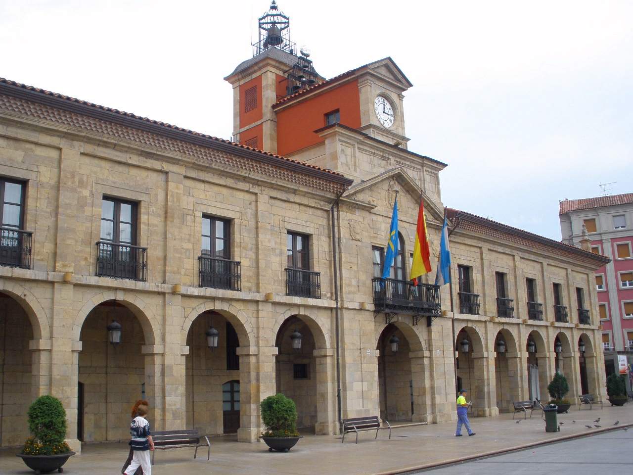
Avilés town hall stands on Plaza de España, the main and most emblematic square of the old town in Avilés, Asturias, and has served as the seat of local government here for more than three centuries. Where does the building come from? The town hall, known locally as the Casa Consistorial, is a product of a 17th-century expansion of the town. Once Avilés outgrew its medieval walled core, the authorities laid out a new, grander square just outside the old fortifications. Architect Juan de Estrada drew up the plans around 1670, and construction was carried out by master builder Marcos Martínez, with the building finished in 1677. It didn't rise alone: two more mansions, the Palacio de Llano Ponte and the Palacio de Ferrera, went up on the same square around the same time, and together the three buildings still define the character of this part of town. What will you see on the façade? The town hall is built from carved sandstone in the Baroque style typical of Asturian civic architecture of the period. The ground floor opens onto an arcaded portico, with wide semicircular arches resting on sturdy Tuscan-style pillars. For generations this covered walkway served a practical purpose: it was rented out to merchants and craftsmen who ran their stalls underneath it. Above, the upper floor is marked by rectangular windows and wrought-iron balconies, while two slightly projecting side pavilions, each topped with a slate roof, frame the façade and give the building its symmetrical silhouette. That upper floor also houses — and always has housed — the large assembly halls where the town council met and still meets. A clock tower was added in the 19th century, and it has set the visual rhythm of the square ever since, becoming one of the most recognizable landmarks on the Avilés skyline. How do you get there, and what's nearby? The town hall sits right in the pedestrian heart of the old town, so walking is by far the easiest way in — from the harbor or from the main shopping streets in the centre, it's a short stroll. The square itself, Plaza de España, is popularly nicknamed "El Parche." The name dates back to 1893, when the council paved just one section of the square for the town band to perform on, leaving the rest muddy; locals joked that the result looked less like a proper square and more like a single patch (parche) stitched onto the ground. The nickname stuck and is still used today, even though the whole square has long since been fully paved. It's worth lingering here: the neighbouring Baroque palaces, the cafés under the arcades, and the narrow lanes of old Avilés make the square a natural base for exploring further. When is the best time to visit? The façade and the square can be enjoyed all year round, but the atmosphere is liveliest in spring and summer, when the arcade cafés fill up and the square hosts local events and open-air gatherings. In the evening, after dark, the lighting brings out the texture of the sandstone façade and the clock tower, making it a rewarding spot for photos. It's worth timing a visit to combine the town hall with the other Baroque palaces on the same square — this is a corner of the city best explored slowly, ideally with a stop at one of the terrace cafés. Frequently asked questions Can you go inside the town hall? The building is still in active administrative use, so public access is limited to the areas serving residents; the council chambers aren't generally open to tourists, but the exterior architecture can be viewed freely at any time. Why is the square in front of the town hall called "El Parche"? The nickname comes from 1893, when only part of the square was paved for the town band while the rest stayed muddy — residents likened the uneven result to a patch sewn onto fabric, and the name never went away. Who designed the town hall building? The plans were drawn up by architect Juan de Estrada around 1670, with construction carried out by master builder Marcos Martínez; the building was completed in 1677. What architectural style does it represent? It's a 17th-century Baroque civic building typical of Asturias, defined by its arcaded portico, Tuscan-style pillars, and wrought-iron balconies, with a 19th-century clock tower added later.
-
Piñor town hall
Piñor
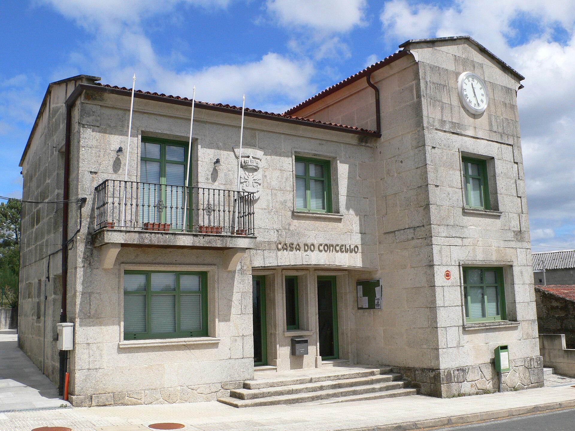
Piñor town hall (Casa do Concello de Piñor) is the seat of the local government of Piñor, a small municipality in the province of Ourense, in the Carballiño region of Galicia. Standing right in the heart of the village, the building serves as a natural reference point for visitors passing through this quiet corner of northwestern Spain, whether they're handling administrative matters or simply curious about how local rural government works in Galicia. How do you get to Piñor town hall? Piñor sits roughly 29 kilometers from Ourense, the provincial capital, and is well connected via two main routes: the N-525 national road and the AG-53 motorway. Driving from Ourense typically takes a little over 20 minutes, and a car is by far the most practical option — public transport in this part of Galicia is limited, so it's worth checking local bus schedules in advance if you plan to rely on them. Once you reach Piñor, the town hall is easy to find in the village center, close to the main square. What's worth seeing nearby? The town hall itself is a functional administrative building, but the surrounding municipality has plenty to offer. Close by is a medieval bridge over the Arenteiro river, valued for its artistic and historical significance — one of the more interesting pieces of engineering heritage in the area. It's also worth visiting the Church of San Pelagio in Loeda and the Church of San Juan in Barrán, both examples of the modest but distinctive rural religious architecture typical of the Galician countryside. In summer, the recreational area in Freás draws locals and visitors alike, who come to cool off in the river and enjoy the shade of the surrounding woodland. Piñor's history is closely tied to the paper industry and the cultivation and processing of natural linen, a heritage that still shapes local identity today. In more recent times, construction, timber and forestry have become the main economic activities — a fact that's easy to notice while walking around, since forest covers much of the surrounding landscape. When should you visit? Spring and summer are the best times to come, when the greenery of inland Galicia is at its most vivid and the Freás recreational area is in full swing. Summer temperatures are pleasant, though it's wise to pack something for rain — Galician weather can be unpredictable even in the warmer months. Autumn and winter are quieter and more local in feel, better suited to travelers looking for an authentic taste of rural Galicia without the crowds. Practical information As an administrative building, Piñor town hall keeps standard office hours typical of small Galician municipalities, usually weekday mornings. Anyone planning to handle official business there should check current opening times before arriving, since they can vary with the season and local holidays. For tourists, the building works better as a landmark and a starting point for exploring nearby attractions than as a destination in its own right. Frequently asked questions What is Piñor town hall? It's the seat of local government for the municipality of Piñor, in the province of Ourense, Galicia — where residents handle official business and from where the municipality is administered. What's the best way to get to Piñor? Driving is the most convenient option, using the N-525 road or the AG-53 motorway from Ourense, a trip of around 20–25 minutes. What can you see near the town hall? The medieval bridge over the Arenteiro river, the churches in Loeda and Barrán, and the Freás recreational area are all worth a visit. Is there more to do in Piñor besides visiting the town hall? Yes — the municipality offers outdoor recreation, walks through forested landscapes, and a chance to explore historic and religious sites connected to the area's paper- and linen-making past.
-
Oleiros town hall
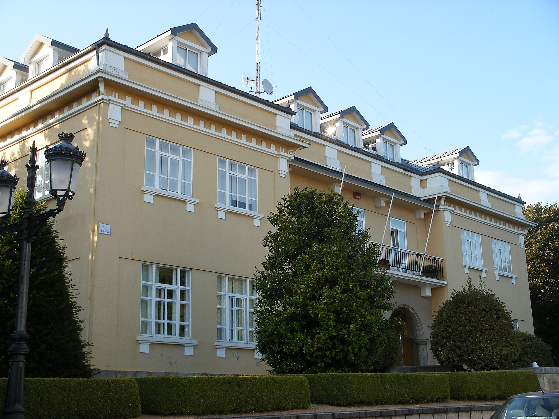
Oleiros town hall (Casa Consistorial de Oleiros) sits at the heart of this coastal municipality in the A Coruña province of Galicia, right in the A Rabadeira area. It houses the mayor's office, the municipal council and the administrative departments serving residents, and it doubles as one of the town's recognisable landmarks, only about a 15-minute drive from central A Coruña. What's worth seeing at the town hall? The real visual highlight here isn't the administrative building itself but the house standing right next to it, Casa Charry. It's a classic example of "indiano" architecture — the grand homes built in Galicia around the turn of the 20th century by emigrants who made their fortunes in the Americas and wanted the neighbours to know it once they came home. Casa Charry was built with French architectural influences and now serves public functions: its upper floor holds the council chamber (salón de plenos) where local politics happen, while the ground floor is a senior citizens' centre where older residents of Oleiros gather. The building recently went through a facade renovation — all four exterior walls were repainted an intense blue that contrasts sharply with the white window frames and the glazed galleries (galerías) typical of Galician houses. That colour combination is what actually stops visitors for a photo in the town centre. Taken together, the town hall complex is a useful example of how this municipality has chosen to renovate and repurpose its older public buildings rather than replace them — a pattern common across small towns on the Rías Altas coast. How do you get to Oleiros town hall? Oleiros sits on the eastern shore of the A Coruña estuary, so the easiest way in is by car from central A Coruña (roughly 10–15 km) or by the local municipal bus connecting the Oleiros parishes with the provincial capital. The area is well linked to nearby beaches — Santa Cristina and Mera — so a stop at the town's administrative centre pairs easily with a day on the coast. What else is there to see nearby? Within the municipality, the Romanesque church of Santa María de Dexo, painstakingly restored stone by stone at the end of the 20th century, is worth the detour, as are the ruins of Santa Cruz Castle, historically tied to the defence of the A Coruña bay against seaborne attacks. The name Oleiros itself is traced back to the Latin "ollarius", a term linked to burial urns used in Roman times, and the municipality still holds traces of Iron Age Celtic hillforts (castros). When should you visit? The A Coruña coast has an oceanic climate, so the mild summer months (June to September) work well for combining a walk through the town centre with a beach day at Mera or Santa Cristina. Outside summer, the town is quieter, and Casa Charry's blue facade holds up just as well under Galicia's cooler, softer light. Frequently asked questions Can you go inside Oleiros town hall? It's a working administrative building, used mainly by residents handling official business. Visitors typically view it from the outside, together with the neighbouring Casa Charry. What's that blue building next to the town hall? That's Casa Charry, an indiano-style house funded by a Galician emigrant's fortune. Today it hosts the municipal council chamber and a senior citizens' centre. How far is it to A Coruña? About 10–15 km, or a 15–20 minute drive or local bus ride. What else is worth seeing in the Oleiros municipality? The church of Santa María de Dexo, Santa Cruz Castle, and the beaches of Santa Cristina and Mera along the Rías Altas coast.
-
O Grove town hall
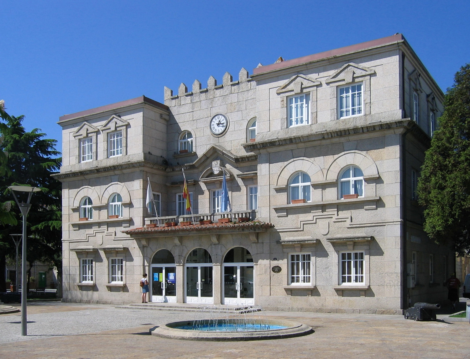
O Grove town hall (Galician: Casa do Concello) stands right at the entrance to the old part of this fishing town on Galicia's Rías Baixas coast. Where is it and how do you spot it? The building sits at Praza do Corgo 1, essentially at the point where the main approach roads lead into O Grove. Its three storeys make it hard to miss — it's one of the first substantial pieces of architecture visitors pass on the way toward the harbour and the beaches. The façade is split into three sections, with the central one drawing the eye: above the main entrance sits a ceremonial balcony, used by local officials to address residents during festivals and public occasions. A clock tower crowns the whole structure and is visible from the surrounding streets and the square. Can you go inside? This is an administrative building — the seat of O Grove's town council — not a museum or a guided attraction. The interior is open during office hours, mainly for people handling municipal business such as registrations, local taxes, or occasionally tourist information desks operating nearby. For visitors, the real draw is the architecture itself: walk around the building, take in the three-part façade and the balcony, and use the clock tower as a photo backdrop. What else is nearby? Praza do Corgo and the town hall make a good starting point for exploring O Grove further. The fishing harbour, fish market, and seafront promenade are all a few minutes' walk away. A marine aquarium and several restaurants serving local shellfish and fish sit close by — O Grove is one of the most important fishing and aquaculture towns on this stretch of coast, and that trade shapes the town's daily rhythm. From here it's also a short trip to the beaches on either side of the O Grove peninsula and to scenic routes along the Ría de Pontevedra. When is the best time to visit? Summer is when the town is busiest — high season brings large food festivals celebrating local shellfish and percebes (goose barnacles), pulling crowds from across Galicia. The square in front of the town hall often hosts concerts and open-air events during these weeks. Travellers who prefer a quieter visit should aim for spring or autumn, when the town is calmer and the façade can be appreciated without the summer crowds. How do you get there? O Grove sits at the tip of a road that runs out into the sea from the main Rías Baixas coastline, with good connections to Pontevedra and Santiago de Compostela. The centre, where the town hall stands, is easiest to reach by car or regional bus; the square and surrounding streets in the old town are largely pedestrian or traffic-limited, so it's best to park near the entrance to town and walk in. Frequently asked questions Do you need a ticket to see O Grove town hall? No — it's a public administrative building, not a paid attraction. Viewing the façade and the square is free and possible year-round. Is there anything to see inside for visitors? The interior serves officials and residents dealing with municipal matters, so for visitors the main interest is the exterior architecture — the façade, the balcony, and the clock tower. How long does a visit take? A few minutes if you just want to see the building and take photos. Most visitors combine it with a walk across the adjoining square and on toward the harbour. What else is worth seeing nearby? The fishing harbour, the seafront promenade, a marine aquarium, and the beaches on the O Grove peninsula are all within easy walking or short driving distance from the centre.
-
Casa de la Vila
Torroella de Montgrí
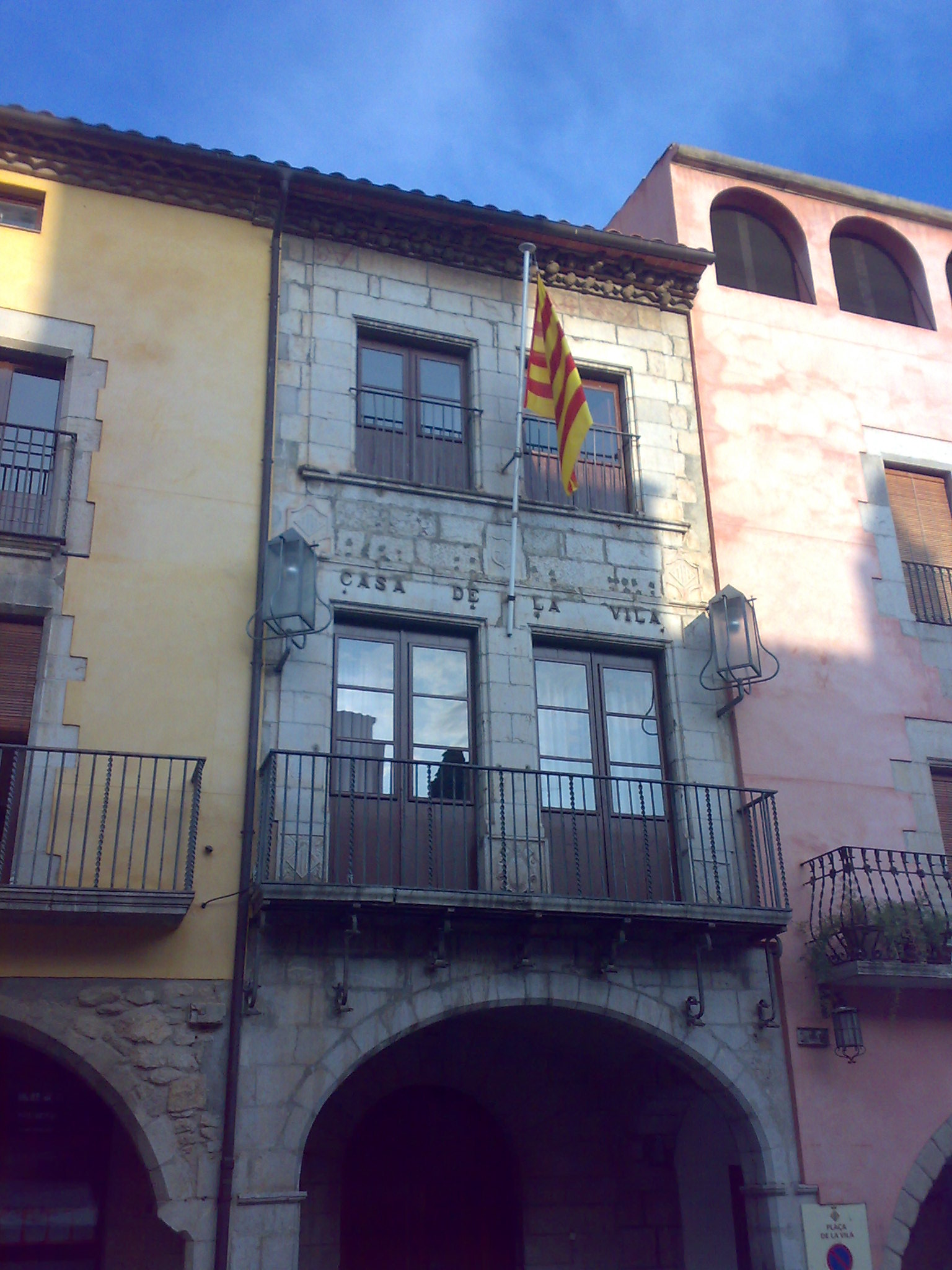
Casa de la Vila is the 16th-century town hall standing on the main square of the old town of Torroella de Montgrí, a town in the Baix Empordà region of Catalonia. The building still houses the municipal administration and is one of the most recognisable structures on Plaça de la Vila. What can you see there? The façade of Casa de la Vila rises directly out of the arcades that line the square: at ground level a wide carpanel arch runs across the full width of the building, forming part of the portico that surrounds the whole Plaça de la Vila. The entrance is a round stone arch built from carefully cut ashlar blocks, with the town's coat of arms carved into the keystone. On the first floor a balcony with two rectangular window openings is fitted with plain iron railings, while the second floor repeats the pattern with a pair of smaller balcony windows. A tiled roof tops off the building. Look closely at the stonework framing the windows — it echoes the same heraldic motif found on the entrance portal. The building was most likely raised in the 16th century, during a period of Renaissance-era expansion in Torroella de Montgrí. In 1935 it was taken apart and rebuilt stone by stone, a restoration method typical of the era, meant to preserve the original fabric of the monument while reinforcing its structure. Why is the square around the town hall so distinctive? Plaça de la Vila sits at the very centre of the old town and is the heart of an urban layout that began taking shape in the 13th and 14th centuries, after Torroella was granted the status of a royal town (vila reial). From 1273 onward, the streets of the old town were laid out on a roughly orthogonal grid designed to converge on this very square. The square has been arcaded since its origins — part of the porticoes still show Gothic forms, even though many of the surrounding buildings were rebuilt between the 16th and 18th centuries. Casa de la Vila is therefore not just the seat of local government, but also a witness to centuries of the town's urban history. How to get there and when to visit? Torroella de Montgrí lies in Baix Empordà, in the province of Girona, just a few kilometres from the Costa Brava coastline and the resort town of L'Estartit. The old town is easiest to reach by car; in summer it's worth parking on the outskirts and continuing on foot, since the historic centre has narrow streets. Plaça de la Vila and its town hall are accessible year-round, though the building itself is mainly viewed from the outside, as the interior is used by the municipal offices. Spring and early autumn are the best times to visit, offering pleasant temperatures and fewer crowds than in high summer, when most visitors head straight for the beaches of L'Estartit and the Medes Islands. Frequently asked questions Can you go inside Casa de la Vila? The building houses the town hall, so visitor access is generally limited to the reception area during office hours — the main draw is the architecture of the façade and the square itself. How old is the building? It most likely dates from the 16th century, although in 1935 it was dismantled and rebuilt stone by stone as part of a restoration project. What else is worth seeing nearby? Plaça de la Vila is lined with porticoes, some of them Gothic, and the old town of Torroella de Montgrí has kept its medieval street layout — it's worth wandering toward the town walls and the other historic buildings nearby. Is Torroella de Montgrí a good base for exploring the coast? Yes, the town is close to L'Estartit and the Medes Islands, making it a convenient base for combining a visit to the historic centre with time on the coast.
-
Lloret de Mar town hall
Lloret de Mar
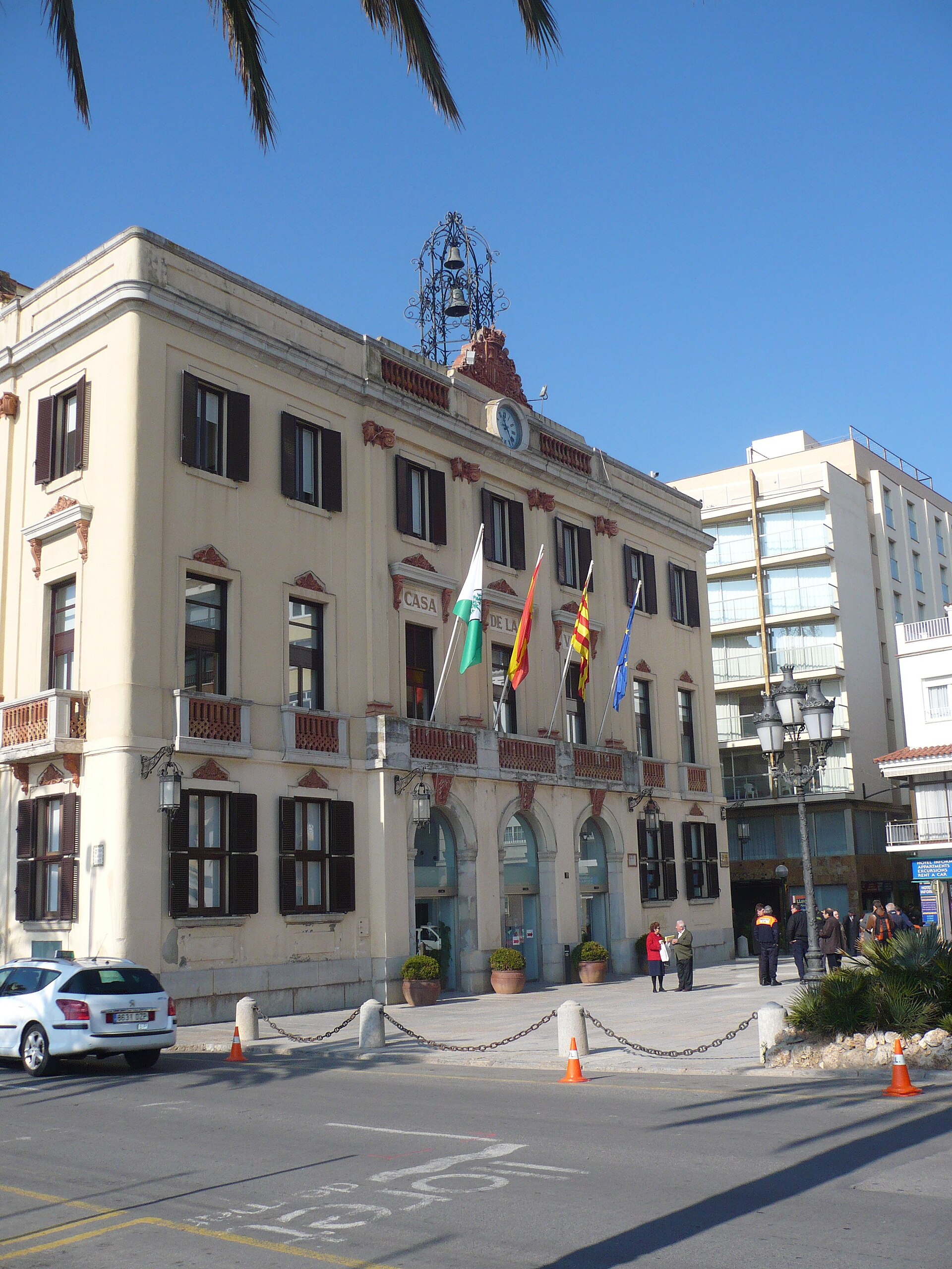
Lloret de Mar Town Hall (Ajuntament de Lloret de Mar, or Casa de la Villa) is the neoclassical seat of local government standing right on the seafront promenade of Lloret de Mar, one of the best-known resort towns on the Costa Brava. Its wrought-iron clock tower and pale facade make it one of the most recognizable landmarks along the shoreline walk. Where does the building come from? The town hall was built in 1872, designed by architects Marí Sureda and Félix de Azúa, during a period when Lloret was flourishing thanks to its "indianos" — locals who had emigrated to the Americas, made fortunes in trade and shipping, and returned home to invest in their native town. These returning emigrants financed many of the public buildings and villas that still define Lloret's architectural character today. The town hall itself rose beside the site of the town's former shipyards, where vessels were once built to carry emigrants across the Atlantic — a location that quietly links civic authority to the transatlantic journeys that shaped the town. What stands out architecturally? The building follows the neoclassical style typical of Catalan civic architecture in the second half of the 19th century: a symmetrical facade, restrained proportions, and understated decoration. Above the entrance rises a wrought-iron bell tower housing a clock installed by Barcelona clockmaker Isidre Bofill. Just above the clock survives one of the few remaining coats of arms of King Amadeo I of Savoy, who ruled Spain from 1870 to 1873 — a rare heraldic detail marking this brief but architecturally visible reign. Where is it, and how do you spot it while walking around? The town hall occupies a central spot on Passeig Mossèn Jacint Verdaguer, Lloret de Mar's main seafront promenade, right above the beach. It works as a natural landmark on any waterfront stroll — easy to pick out by its light-colored facade and clock tower, visible from a long stretch of the promenade. The building still functions as the working seat of local administration, so the interior isn't set up as a visitor attraction, but the facade and its surroundings form a natural stop on any route tracing the town's "indiano" heritage. When is the best time to see it? The promenade around the town hall is lively year-round, but early morning or evening light works best for viewing the facade, when the sun sits lower and the building's details stand out more clearly. In peak summer the area gets crowded, so it's worth treating the town hall as a brief stop on a longer walk through the historic center, combined with the nearby villas built during the indiano era. Frequently asked questions Can visitors go inside the town hall? The building is a working administrative office, so its interior is used mainly by people handling municipal business rather than as a tourist attraction — visits are limited to the facade and surrounding promenade. Why does a foreign king's coat of arms appear on the building? It belongs to King Amadeo I of Savoy, who reigned over Spain from 1870 to 1873, exactly when the town hall was under construction — the detail survives as a rare trace of that short royal period in Spanish history. What does "indiano" mean in connection with this building? Indianos were Lloret residents who emigrated to the Americas seeking fortune and later funded public buildings and villas back home; the town hall stands near the site of the old shipyards linked to their transatlantic voyages. How long does it take to see the town hall on a walk? The facade itself takes only a few minutes to appreciate, but it's worth pairing it with a longer stroll along Passeig Mossèn Jacint Verdaguer and through Lloret de Mar's old town, which together take about an hour.
-
Castro de Rei town hall
Castro de Rei
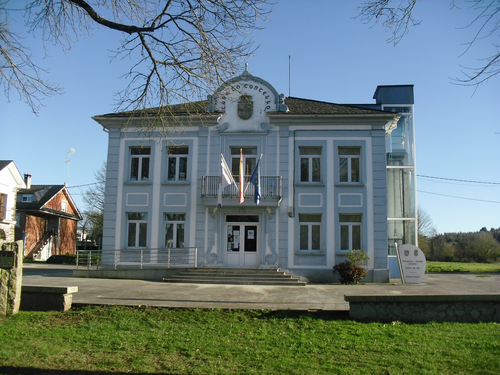
Castro de Rei town hall (Casa do Concello de Castro de Rei) is the seat of local government for the municipality of Castro de Rei, located in the province of Lugo, in Galicia, northwestern Spain. The building serves as the administrative center of a small, rural municipality spread across the wide Terra Chá plain — one of the landscapes that defines inland Galicia. How to get there? Castro de Rei sits a short distance northeast of Lugo, the provincial capital. The easiest way to reach it is by car — the drive from Lugo usually takes around 20–30 minutes along local roads linking the towns of the Terra Chá region. Lugo is also the nearest hub with rail and bus connections to the rest of Galicia, and from there local public transport runs further out toward the smaller municipalities of the area. The town hall building itself sits in the administrative heart of the municipality and serves as a natural reference point for residents of the surrounding rural parishes. What will you see? The town hall functions as the seat of local administration — the place where the municipality's official business is handled for the dozen or so rural parishes scattered across the Terra Chá plain. The municipality itself has a distinctly agricultural character: fields, pastures, and the traditional rural architecture typical of inland Galicia, including stone hórreos (raised granaries on stilts) and small parish churches, giving the area a look quite different from Galicia's better-known coastal routes. One particularly interesting fact is that the municipality of Castro de Rei maintains a twinning agreement (irmandade) with the Breton commune of Plounévez-Quintin in France. Links of this kind between Galicia and Brittany are no coincidence — both regions share Celtic roots, a related musical tradition built around bagpipes, and a similarly damp Atlantic climate. For visitors, it's a notable example of cross-border cooperation between small local communities, going beyond the more formal twinning relationships usually seen between larger cities. When to visit? The Terra Chá region has an Atlantic climate — mild summers and cooler, rainy winters. The best time to visit is spring and early summer (May to July), when the green pastures and fields look their best and temperatures are pleasant for exploring the surrounding countryside. Autumn tends to be wetter, but it also brings local festivals and village celebrations typical of Lugo province. If your visit involves official business at the town hall, it's worth checking opening hours in advance, since as a small municipal office it serves residents during limited hours. Frequently asked questions What kind of building is this? It's the town hall (Casa do Concello) of the municipality of Castro de Rei in Lugo province, Galicia — the seat of local government serving the whole municipality. How do you get to Castro de Rei? The easiest way is by car from Lugo, a short drive away; Lugo itself has rail and bus links to the rest of Galicia. Does the municipality have any international partnerships? Yes — Castro de Rei has a twinning agreement (irmandade) with the Breton commune of Plounévez-Quintin in France, reflecting the Celtic cultural ties between Galicia and Brittany. What else is worth seeing nearby? The Terra Chá region, where Castro de Rei is located, stands out for its rural, agricultural landscape and traditional Galician architecture — stone hórreo granaries and small parish churches scattered across the surrounding villages.
-
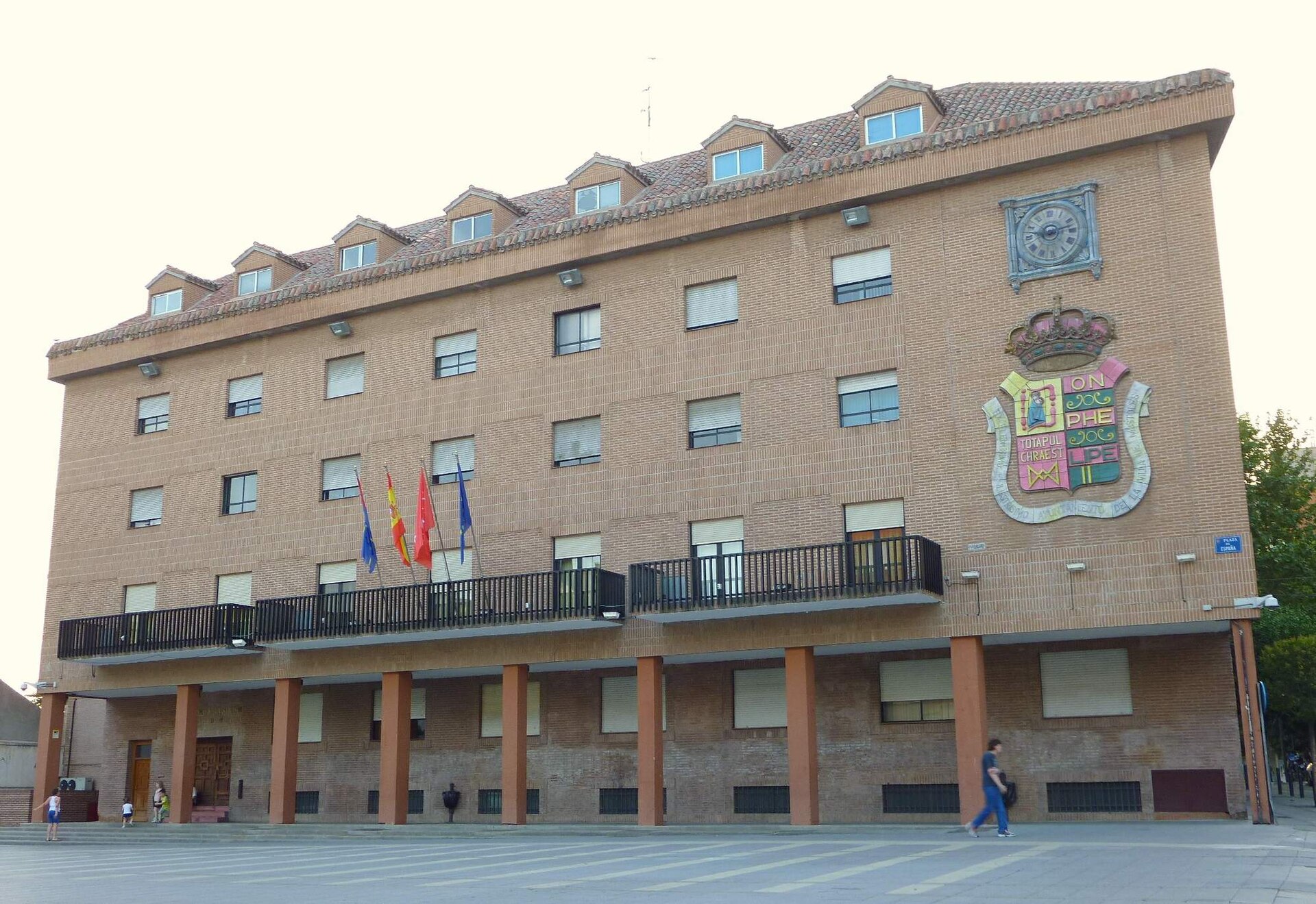
Móstoles town hall
Móstoles Town Hall (Ayuntamiento de Móstoles) stands at Plaza de España 1, right in the heart of the city, a short distance southwest of Madrid. It houses the local government, but it also works as a natural starting point for exploring Móstoles — the square in front of it is the city's main gathering spot and the center of its old town. What will you see? The building you see today is not the one older residents remember. The previous town hall — a two-storey structure with arcades resting on wooden posts and an upper-floor gallery overlooking the square — kept largely the same form since the 16th century. It was decorated with large ceramic murals made by the Algora brothers, respected local ceramic artisans: a clock, a reproduction of the municipal coat of arms, and a mural referencing the events of the Dos de Mayo (2 May 1808) — the day Móstoles became famous across Spain for the "Bando de Móstoles," a proclamation calling for armed resistance against Napoleon's troops, remembered as one of the symbolic starting points of the Spanish War of Independence. The old building was demolished in 1971. Funding for a replacement was approved in 1974, and the current town hall was finally inaugurated in 1976. It's a contemporary building finished in exposed brick, whose architecture — through pillars supporting arcades — deliberately echoes the traditional look of Castilian town halls, including the one that previously stood on the same spot. How do you get there? Plaza de España sits within walking distance of Móstoles' main shopping streets and is well served by local bus lines and the city's train station. For visitors coming from Madrid, it makes a convenient stop — the square is surrounded by cafés, shops, and smaller plazas, so a visit here pairs easily with a short break. When should you visit? The square and the town hall's surroundings are open year-round, and the building itself photographs best during the day, when its brick facade and arcades catch the light well. It's worth timing a visit around local festivities, when the square often becomes the center of celebrations and cultural events — that's when the atmosphere feels most authentic. Why is it worth a stop? Móstoles is known across Spain above all for the Bando de Móstoles, a symbolic act of resistance from 1808. Although the actual building where that proclamation took place no longer stands, its memory was deliberately woven into the city's architecture and decoration, and the square in front of the town hall remains the place where that history feels closest. Frequently asked questions Where exactly is Móstoles Town Hall? At Plaza de España 1, in the central part of the city, close to the main shopping streets. Can visitors go inside the town hall building? The building houses the city administration, so public access is usually limited to common areas and office hours — it's worth checking locally or on the city's website before visiting. Is the old, historic town hall still standing? No — the previous building, dating back to the 16th century, was demolished in 1971. The current building was built between 1974 and 1976. What connects the town hall to the Bando de Móstoles? It was in Móstoles, on 2 May 1808, that a proclamation was issued calling for armed resistance against Napoleon's forces. That event was once commemorated with a ceramic mural on the facade of the previous town hall and remains a key part of the city's historical identity today.
-
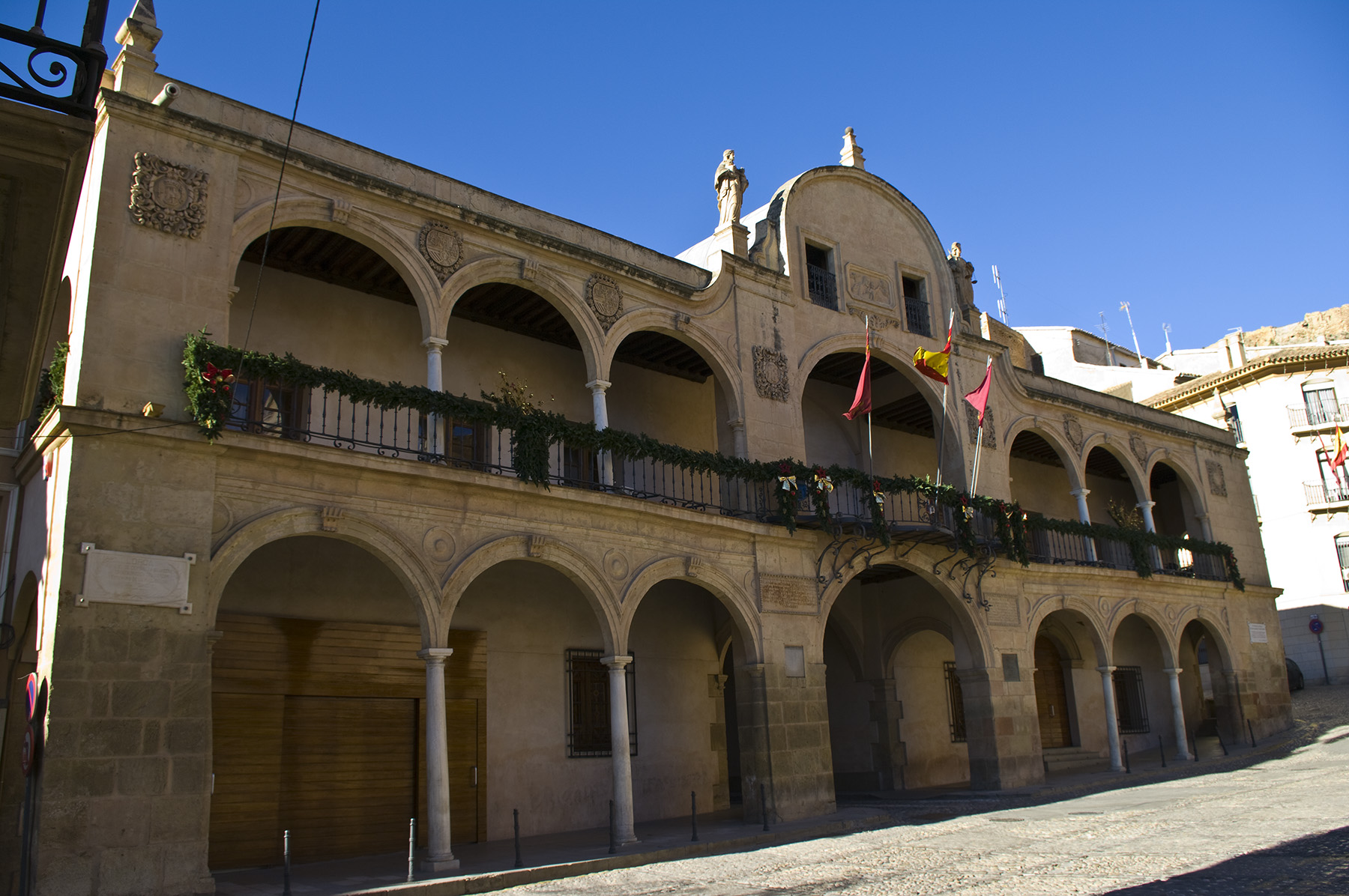
Lorca city hall
Lorca City Hall is the seat of municipal government in Lorca, a town in the Region of Murcia known for the hilltop castle overlooking the old quarter and for a dense cluster of Baroque architecture in its historic center. The building sits within that same historic core, close to other listed monuments, and is registered as a municipal building of cultural heritage value. Why is Lorca known for Baroque architecture? Lorca is often referred to as a "Baroque town" precisely because of the concentration of stone façades, collegiate churches and noble palaces built during a period when the town served as an important administrative and commercial hub for the region. The city hall belongs to that same architectural ensemble as the churches and palaces surrounding the central square. What happened to Lorca's monuments in 2011? On 11 May 2011, Lorca was struck by a magnitude 5.2 earthquake that killed nine people and caused severe damage across the town. Around 33 historic buildings were affected, including the castle and other structures in the old quarter. Regional and municipal authorities at the time compared the scale of heritage loss to the damage suffered by Assisi after its 1997 earthquake, underlining how significant the episode was for the town's historic fabric. How was the historic center rebuilt after the earthquake? Restoring Lorca's heritage took years and required tens of millions of euros, directed at repairing churches, palaces, convents and other medieval, Renaissance and Baroque buildings. The work involved both structural stabilization and the recovery of original façades. For visitors today, this means most of the key historic landmarks in the center — including municipal buildings — have already been returned to a restored, visitable state. What else is worth seeing near the city hall? Close to the city hall, visitors will find the other main stops of an old-town walking route: the castle hill with its defensive walls, and the square around which Lorca's most representative buildings are clustered. It makes a convenient starting point for exploring the compact, well-preserved historic center on foot. Can visitors go inside the city hall? The building serves an administrative function, so access to the interior depends on office hours and the municipality's current rules — it is worth checking locally or with the tourist information office before planning a visit. Frequently Asked Questions Where is Lorca City Hall located? In the historic center of Lorca, in the Region of Murcia, surrounded by other heritage buildings that form a compact architectural ensemble. Was the building affected by the 2011 earthquake? The May 2011 earthquake seriously damaged many historic structures in Lorca, including the castle; the scale of destruction across the town's historic core was significant enough that reconstruction work continued for years afterward. Why is Lorca associated with Baroque architecture? Because of its concentration of churches, palaces and municipal buildings raised during a period when the town was an important regional center; the city hall forms part of that same urban ensemble. What else should visitors see nearby? The castle hill and the square with the town's most representative buildings — both can be covered on foot as part of a single old-town walking route.
-
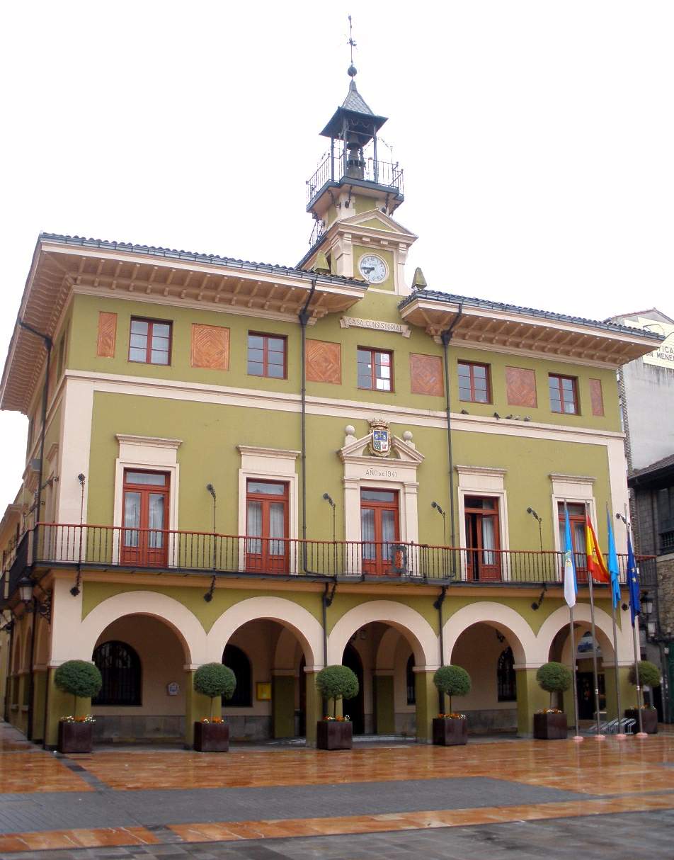
Llangréu town hall
Langreo/Llangréu
Llangréu town hall (Ayuntamiento de Langreo) is the seat of municipal government in Langreo, a town in the Nalón valley at the heart of Asturias's coal and steel country. Where does the town hall stand and what does it look like The building occupies a central position in Langreo, in the valley carved by the Nalón river, on ground that has served as the seat of local authority for centuries. Its three-storey facade combines street-level arcades with wrought-iron balconies, topped by a clock tower that crowns the whole composition. That combination — arcades, balconies, a clock — was a common formula for Asturian town halls raised in the second half of the 19th century, a period when towns across the region were building new, representative seats of government. Why the building looks the way it does today The current town hall was built in 1872 by local master builder Manuel Rodríguez Rodríguez. It did not survive unaltered, though: in 1874, during the last of Spain's Carlist Wars, the building was set on fire, and the municipal archive burned with it. The loss went beyond bricks and paperwork — among the documents destroyed was the parchment of Langreo's fuero, the medieval charter that had set out the rights of the valley's residents and stood as one of the oldest records of local self-government. What visitors see today is largely the result of a thorough 1941 renovation, which restored the building's administrative role and gave it its present appearance. How far back does Langreo's town government go Langreo formed its own ayuntamiento as early as 1504, an early date by regional standards for formalising local self-rule. In 1581, residents bought the town's jurisdiction outright from the Crown — a purchase that later, under Philip II, reverted back to royal hands. That episode says a lot about how much the local community valued control over its own affairs, even as the wider balance of power in Spain kept shifting. What connects the town hall to Langreo's mining past The late 19th century brought rapid mining and industrial expansion to Langreo: coal pits and steelworks turned the Nalón valley into one of Asturias's most important industrial centres. The town hall, rebuilt during this very period of change, stood as both witness and symbol of that shift — Langreo went from a modest farming settlement to an industrial town whose administration had to manage a growing working-class population and expanding mining infrastructure. Frequently Asked Questions Can visitors go inside Langreo's town hall? The building is a working administrative office, so access to the interior depends on opening hours and current rules; the facade itself can be viewed from outside at any time. Why was the municipal archive destroyed in the 19th century? The 1874 fire broke out during the last Carlist War, one of Spain's internal 19th-century conflicts, and it consumed important historical records along with the building, including the parchment of the town's fuero. How does today's building differ from the 1872 original? The appearance most visitors see dates from a 1941 renovation. The earlier building put up by Manuel Rodríguez Rodríguez suffered serious damage, and the reconstruction gave the town hall the form it has today. What's useful to know about Langreo before visiting the town hall? Langreo is a Nalón valley town shaped by a strong mining and industrial tradition, and its town hall sits at the centre of town, close to other sites connected to the area's administrative and industrial history.
-
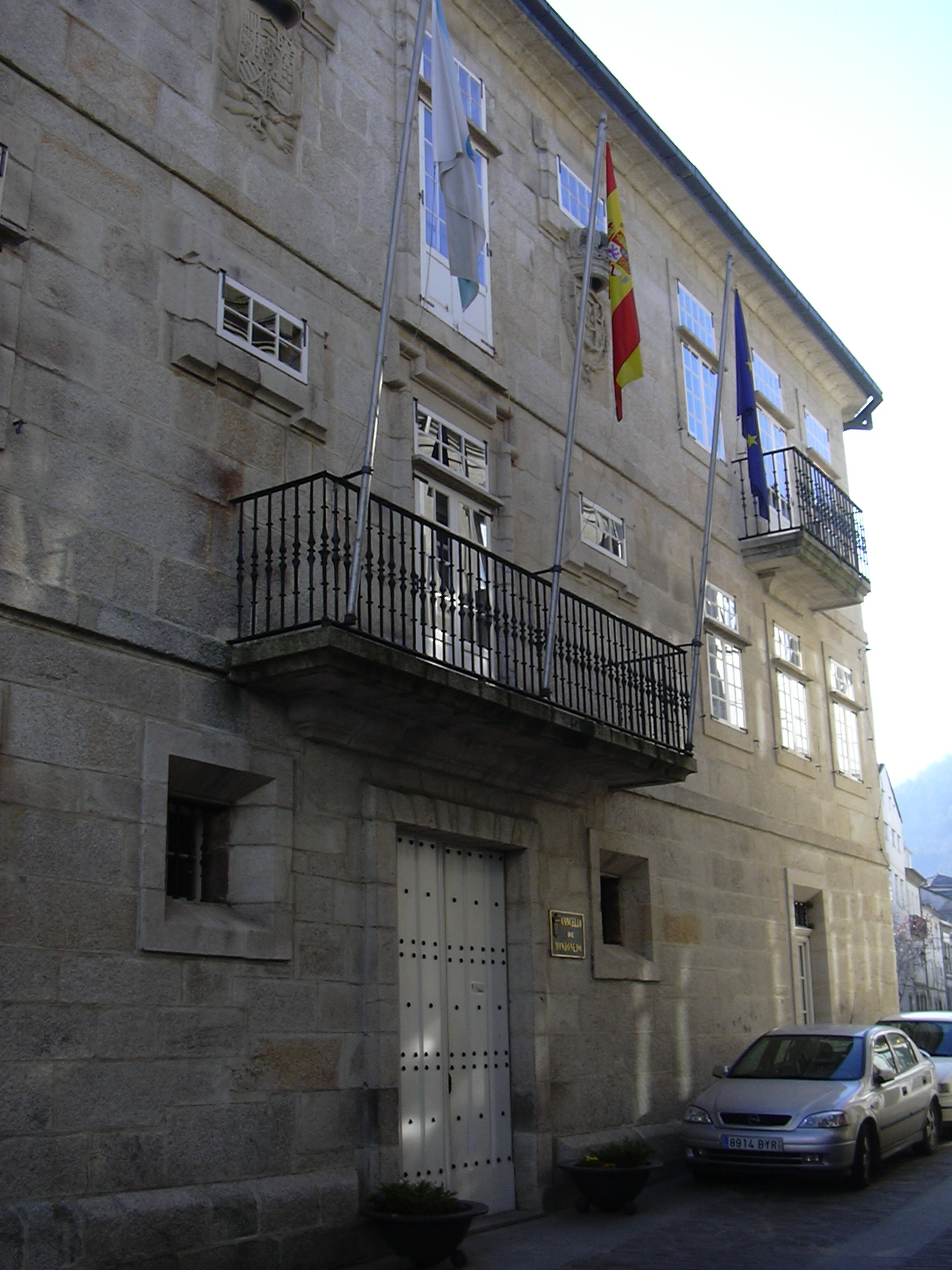
Mondoñedo town hall
Mondoñedo
Mondoñedo town hall occupies a corner of Praza do Concello, right at the historic heart of one of Galicia's best-preserved old towns, just steps from the cathedral of the Assumption. It houses the local government of Mondoñedo, a small city in the province of Lugo that lies along the Camino Norte de Santiago pilgrim route. Where does the building come from? The structure standing today dates to the 18th century and was built in the civil baroque style typical of provincial public buildings of that period in Galicia. It didn't start out as a municipal building at all: it originally belonged to one of Mondoñedo's noble families and only later passed through a series of institutional uses before finally becoming the Casa do Concello, the seat of the town council. Before that, municipal business was conducted somewhere quite different. As far back as the 16th century, the council met inside the cathedral itself, in what was known as the Knights' Hall. It was only in 1565 that the town agreed to purchase a separate house to serve as its consistory, a decision that marked a clear step toward separating civic administration from church space. That agreement predates the current building by roughly two centuries, which says something about how gradually Mondoñedo's seat of local government took its present shape. Why stop here? The town hall isn't a stand-alone sight you tour room by room; its role is architectural. It closes off one side of Praza do Concello and provides the backdrop against which the city's real showpiece, the Gothic-Baroque cathedral, is best appreciated. The stone facade, restrained and unadorned, blends into the rest of the old quarter, giving the square a coherent, lived-in historic feel rather than a museum-piece one. For pilgrims walking the Camino Norte de Santiago, the square in front of the town hall is a natural landmark and a common spot to pause once the old town comes into view. What else is worth knowing about the area? For centuries Mondoñedo punched well above its size as a religious and administrative center in Galicia, which explains why such a compact town packs in a cathedral, an episcopal palace, and a town hall within a few minutes' walk of each other. The old center has kept its layout largely intact, so walking between these buildings gives a fairly accurate sense of how civic and church authority once operated side by side here. Frequently Asked Questions Can visitors go inside Mondoñedo town hall? The building is an active municipal office, not a museum, so it's generally viewed from the outside as part of the square rather than toured room by room. How old is the building? The current structure dates from the 18th century and was built in civil baroque style, though the town's consistory as an institution goes back to a purchase agreement from 1565. Where is it in relation to the cathedral? It sits on Praza do Concello, a short walk from both the cathedral and the episcopal palace, within Mondoñedo's compact historic center. Is the town hall on the Camino de Santiago route? Yes, Mondoñedo is a stop on the Camino Norte de Santiago, and the square where the town hall stands lies within the section of town the route passes through.
Earn badges for the places you visit
Download NextOnTrip, discover new places and check off your trails.