Monuments in Spain
A guide to 4655 Monuments in Spain — with descriptions, photos and traveler visits from the NextOnTrip community. Locations spread across 2240 cities and towns. Most visited by the community: castle of Chulilla, Castle of Pioz, castell de la Todolella.
-
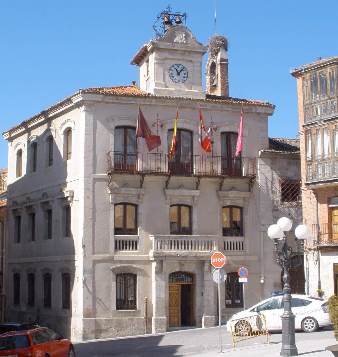
Cuéllar town hall
Cuéllar
Cuéllar Town Hall, in the town of Cuéllar in Spain's Segovia province, occupies the most prominent address on the Plaza Mayor — the building at number one, facing the square it has overlooked for centuries. It remains an active seat of local government rather than a museum piece. Where exactly is it, and what happens inside? The town hall closes off one side of the Plaza Mayor, a Castilian-style square lined with stone and adobe houses whose upper floors carry wooden galleries and deep, Mudéjar-influenced eaves. Inside the building today you'll find the offices of the Cuéllar city council, the local police station, and the modern section of the town's historical municipal archive. Because it's a working municipal office, casual visitors typically see the exterior and courtyard rather than roam freely through administrative floors. How old is the building, and what's its history? The current casa consistorial was raised at the turn of the 15th and 16th centuries, on the site of an earlier council house and the town jail. The oldest surviving sections date to the era of Francisco Fernández de la Cueva, 2nd Duke of Alburquerque, one of the lords tied to Cuéllar's development in that period. Everything except the courtyard and the ground-floor rooms was rebuilt between 1888 and 1889 in a historicist style, which is why the building reads as a layered mix of eras rather than a single architectural moment. What architectural style should visitors expect? The structure blends a Gothic-Renaissance core with a later, more ornate facade added during the late 19th-century rebuild. Its most valuable surviving feature is the interior courtyard, built in Gothic-Renaissance style and dedicated to Isabella the Catholic — a space that escaped the later remodeling and still reflects the building's earliest phase. That contrast between the plain medieval core and the decorative 19th-century front is precisely what makes the building interesting to anyone curious about how Spanish civic architecture evolved over four centuries. What else is worth seeing nearby? The Plaza Mayor itself is a landmark, not just a backdrop: a classic Castilian town square framed by traditional stone-and-adobe houses, timber balconies, upper-floor galleries, and eaves that show clear Moorish influence. A walk around the square and the surrounding old-town streets naturally extends a visit to the town hall — Cuéllar is known for a well-preserved historic quarter, and the town hall sits right at its center. When and how should you plan a visit? Since the town hall stands directly on Cuéllar's main square, there's no real navigation involved — head for the Plaza Mayor and you've arrived. The town sits in Segovia province, making it an easy stop on a broader tour of Castilla y León. If seeing the interior matters to you, aim for regular municipal office hours; the facade and the square itself are viewable at any time of day. Frequently asked questions Can visitors go inside Cuéllar's town hall? Since it functions as an active municipal office, interior access is generally limited to normal administrative hours rather than being open all day like a museum. How old is the building? Its oldest parts date to the late 15th and early 16th centuries, though most of the facade and upper floors were rebuilt between 1888 and 1889. What's the most historically significant part of the building? The Gothic-Renaissance interior courtyard dedicated to Isabella the Catholic, considered the oldest and most authentic surviving element. Is it worth combining with other sights in Cuéllar? Yes — the town hall faces the Plaza Mayor, surrounded by historic buildings, so it's easy to pair a visit with a walk through the rest of the town's protected historic quarter.
-
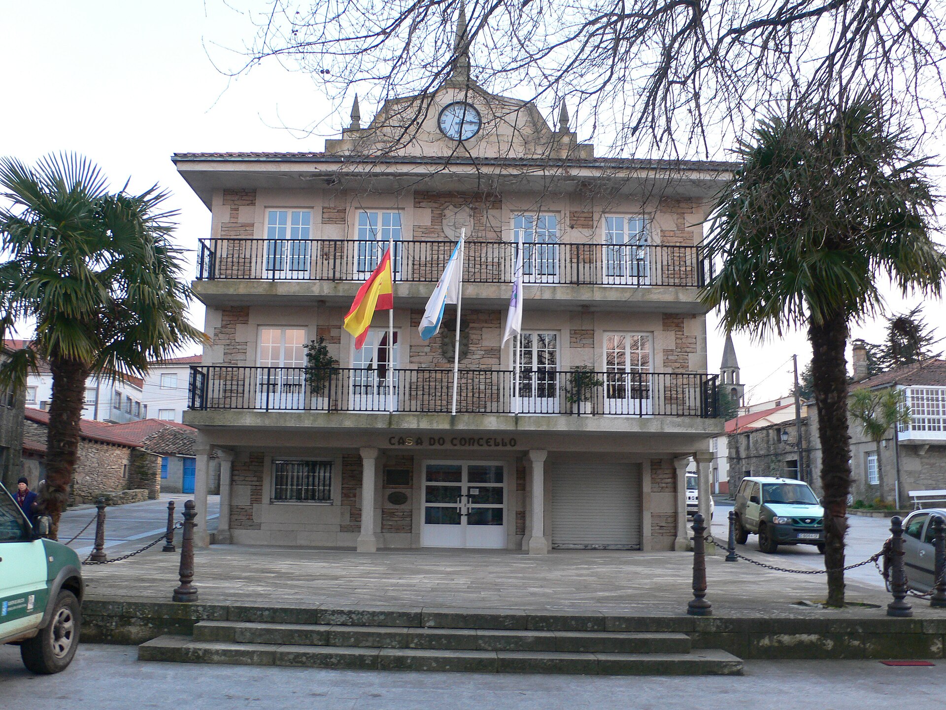
Agolada town hall
Agolada
Agolada town hall sits at the administrative heart of Agolada, a small municipality in the province of Pontevedra, in Galicia, in the northwest of Spain. The building, known locally as Casa do Concello de Agolada, stands on Plaza do Concello and houses the mayor's office and the municipal administration. Where exactly is Agolada? Agolada sits close to the geographic center of Galicia, in the northeastern stretch of Pontevedra province. The municipality is framed by two rivers, the Ulla and the Arnego, and by the Serra do Farelo mountain range. That setting places the town hall right at the edge of a quiet, inland part of Galicia, well away from the coast and the busier tourist circuits. What will you find at the town hall itself? The building is a straightforward example of local Galician civic architecture rather than a monument — a working office block for the mayor and council staff. Its real value for a visitor is as a landmark: the square in front of it is the town's natural meeting point and a sensible place to start exploring Agolada on foot. The noticeboards near the entrance are worth a glance, since they usually list local festivities and municipal announcements. How do you get there? Agolada lies on the road network linking inland Galicia with Santiago de Compostela and Lugo, making it a natural stop for anyone driving through the region. The town hall's coordinates are roughly 42.7626° N, -8.0190° W, easy to plug into any GPS. Santiago de Compostela and Lalín are the nearest larger towns, both connected to Agolada by local roads. Who is this stop for? This isn't a sightseeing attraction in the usual sense — it's first and foremost an administrative building. It matters most to travelers curious about everyday life in small Galician towns, and to anyone planning a longer route through the Ulla and Arnego river valleys. Standing in the square gives a quick sense of the town's layout before heading out on foot or by bike into the surrounding hills. When is the best time to visit? Because the area sits inland and at some elevation, spring and early autumn bring the most comfortable conditions, with mild temperatures and the Ulla valley at its greenest. Summers run warm but stay noticeably cooler than Galicia's Atlantic coast. Frequently asked questions Can you go inside Agolada town hall? It's a working municipal office, so the interior is mainly open to people handling official business there. The square and surrounding area outside are accessible at any time. How do you contact the municipal office? The council office is located at Plaza do Concello, s/n, postcode 36520, in the province of Pontevedra, and can be reached through the town hall's main phone line. Are there other attractions near the town hall? Agolada itself works as a base for exploring the Ulla and Arnego river valleys and the Serra do Farelo range, an area known for its calm, rural Galician scenery. Is Agolada worth a longer stay? It's a small municipality, so most travelers treat it as a stop along the route between Santiago de Compostela and inland Lugo province rather than a multi-day destination on its own.
-
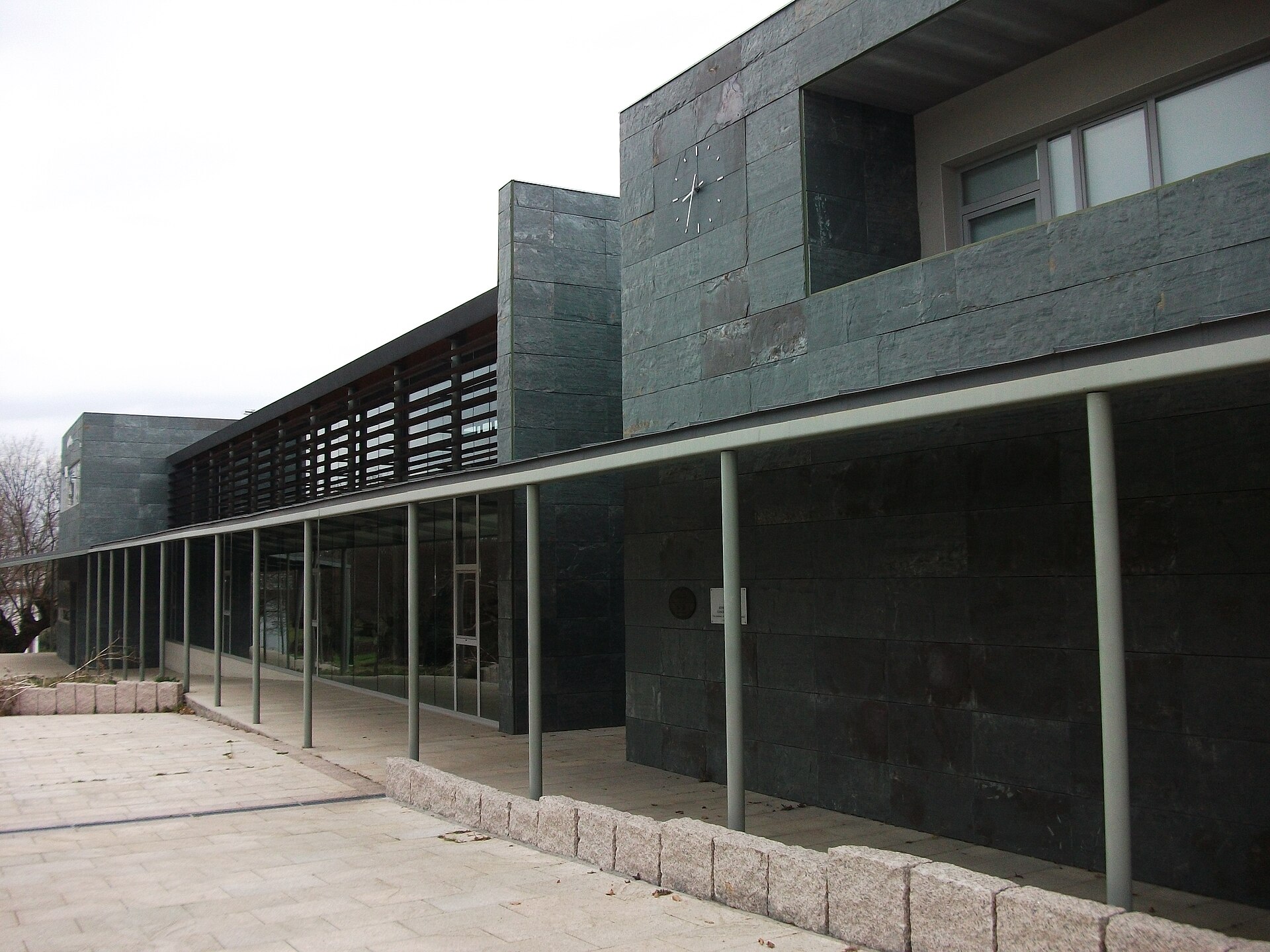
O Páramo town hall
O Campo da Feira
O Páramo Town Hall stands on the Campo da Feira square in the municipality of O Páramo, in Spain's Lugo province, Galicia. The building serves as the administrative heart of a small rural municipality and is one of the more recent public structures in the area, built as part of a settlement that grew up around a former marketplace. Where is it and how do you get there? The town hall sits on Calle Concello, right in the centre of O Páramo, at a site known as Campo da Feira — literally the "fairground" where local markets once took place. From the second half of the 20th century onward, new development gradually formed around this square, and it eventually became the municipality's administrative centre. The easiest way to reach it is by car along the local roads connecting O Páramo to nearby towns in Lugo province; public transport to such small settlements can be limited, so it's worth checking current schedules before setting off. Why does this building matter to the municipality? The site's history traces back to administrative decisions made in the first decade of the 21st century. For forty years, the municipal government was based in a different building, in the parish of A Torre. In 2006, the municipal seat was formally moved to the newly forming centre around Campo da Feira, and four years later, in June 2010, the current town hall building opened its doors. The new multi-purpose structure covers more than 1,400 square metres and cost roughly 1.3 million euros to build — a substantial investment for a municipality of this size. What's inside the building? Besides the municipal administration offices, the building also houses other services for the local community: a public library, a peace court (juzgado de paz), and rooms used for community activities and gatherings. Combining administrative, cultural, and judicial functions under one roof is typical of smaller Galician municipalities, where erecting several separate buildings would not be practical. What else is worth seeing nearby? The Campo da Feira square itself, around which the town hall was built, still functions as a gathering point for the local community. It makes a good starting point for exploring the surrounding villages of the O Páramo municipality, typical of rural Galicia, with stone houses, farmland, and the gentle countryside of Lugo province. Visitors interested in local administration and public architecture will find here an example of a relatively modern, functional building fitted to the small, rural scale of the town. When should you visit? Since this is an administrative building, it makes most sense to visit during the town hall's office hours if your goal is to handle official business or use the library. For those simply interested in the architecture and the square itself, any season works, though spring and summer make it easier to explore the surrounding villages on foot or by bike. Frequently asked questions What is this building? It is the town hall (Casa Consistorial) of the O Páramo municipality in Lugo province, seat of the local government. Where exactly is it located? On the Campo da Feira square in the town of O Páramo, on Calle Concello. Since when has it been in this location? The current building opened in June 2010, replacing the previous seat used for forty years. What else can you find here besides the town hall offices? The same building houses a public library, a peace court, and meeting rooms for residents.
-
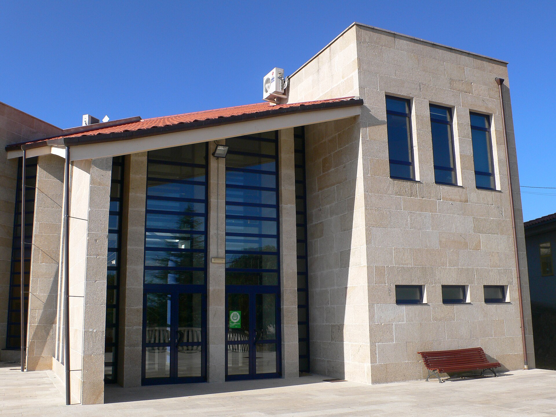
Sarreaus town hall
Sarreaus
Sarreaus town hall is the seat of local government for the municipality of Sarreaus, a small community in the province of Ourense, in the Galicia region of northwestern Spain. The building stands on Praza do Toural, the town's central square, and serves as the administrative core for a municipality of just under 1,200 residents spread across more than 77 square kilometers. Where is the town hall located? Sarreaus sits within the comarca of A Limia, an area historically shaped by a large wetland basin and known today for its open, gently rolling countryside between highland and valley terrain. The town hall itself is a modern, purpose-built structure rather than a historic monument — its design prioritizes practical access to public services over architectural flourish. It's the natural first stop for visitors looking to orient themselves before exploring the wider municipality. What is the history behind the area? Although the administrative building is contemporary, the land it stands on carries a long historical record. Flint arrowheads dating to the late Neolithic period point to some of the earliest known settlers in the area. The most striking physical trace of that deep past is the Pedra Alta de Antela, a menhir standing roughly 3.5 meters tall, which for centuries has marked the boundary between Sarreaus and the neighboring municipalities of Vilar de Barrio and Xunqueira de Ambía. Roman-era remains have also surfaced here, including inscribed stones referencing the emperors Trajan and Hadrian alongside local deities such as Jupiter and the Celtic god Bandua — evidence that the region was inhabited and partially Romanized in antiquity. The medieval period brought the establishment of local parishes, with the old church of Santa María de Perrelos standing as a surviving marker of that era. What else is worth seeing near the town hall? A short trip from the main square leads to the Romanesque church of Codesedo, notable for its sturdy buttresses, a square tower added in the 16th century, and a bell tower. Inside, the church houses a valuable Gothic crucifix. It ranks among the municipality's most significant religious landmarks and makes a natural next stop for anyone starting their visit at the town hall. Who is this place best suited for? Sarreaus and its town hall appeal less to travelers chasing headline attractions and more to those drawn to the quieter, less-visited corners of inland Galicia. History enthusiasts interested in prehistoric archaeology and regional religious architecture will find plenty to appreciate, as will anyone passing through the A Limia district who wants a fuller sense of the local administrative and cultural setting. Frequently Asked Questions What is Sarreaus town hall? It's the administrative building of the Sarreaus municipality, housing the local government offices, located on Praza do Toural. Where is the municipality of Sarreaus? In the province of Ourense, in the Galicia region of northwestern Spain, within the A Limia district. How many people live in Sarreaus? Just under 1,200 residents, across a municipal area of more than 77 square kilometers. What else can visitors see in the municipality besides the town hall? The Romanesque church of Codesedo, home to a Gothic crucifix, and the Pedra Alta de Antela menhir, a historic boundary marker, are the standout sights. Are there traces of ancient settlement in Sarreaus? Yes — Neolithic flint tools have been found locally, along with Roman inscriptions naming the emperors Trajan and Hadrian.
-
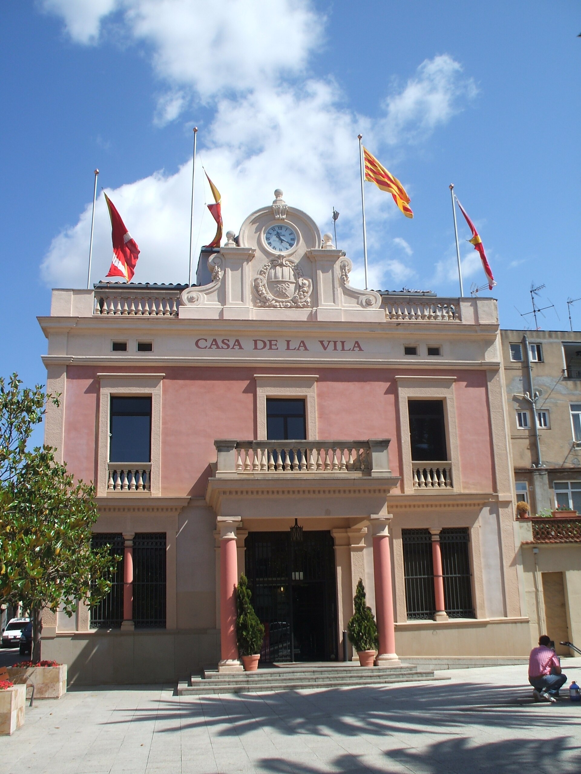
Rubí town hall
Rubí
Rubí town hall is the municipal building that serves as the seat of local government in Rubí, a town in the Vallès Occidental comarca, Barcelona province, Catalonia, Spain. Where is Rubí town hall located? The building sits in the town centre of Rubí, a municipality a short distance west of Barcelona and part of its wider metropolitan area. Its coordinates — 41.493783°N, 2.031168°E — place it firmly downtown, making it a useful landmark for anyone orienting themselves in the centre. What is Rubí town hall? Like most Catalan ajuntaments, the building houses the local administration: residents handle municipal paperwork there, and the town council holds meetings and makes decisions about the municipality's development. Town halls of this kind typically double as a focal point for public life, hosting announcements, local ceremonies, and events tied to the civic calendar. What should visitors know about central Rubí? Rubí grew rapidly through the 20th century on the back of its textile industry, expanding alongside greater Barcelona. Today it's a mixed residential and commercial town, well connected to the Catalan capital by public transport. The town hall itself functions purely as an administrative building, but the surrounding square and streets are a natural reference point for finding your way around the centre. Can visitors go inside Rubí town hall? The town hall is first and foremost a working government building rather than a tourist attraction. Public access is generally limited to people with administrative business or those attending council-organised events, so it's worth checking current opening hours before visiting. The area immediately around it, however, makes for a pleasant stop while exploring the town centre. Frequently asked questions Where exactly is Rubí town hall? In the town centre of Rubí, in the Vallès Occidental comarca of Barcelona province, Catalonia, Spain. Can you visit the inside of the building? It's an active administrative building, so access is limited — check the town hall's opening hours before you go. How do you get to Rubí from Barcelona? Rubí is part of the Barcelona metropolitan area and is well served by public transport, making it an easy day-trip destination. Is there more to see in Rubí besides the town hall? The surrounding town centre offers a glimpse of everyday Catalan town life away from Barcelona's main tourist routes.
-
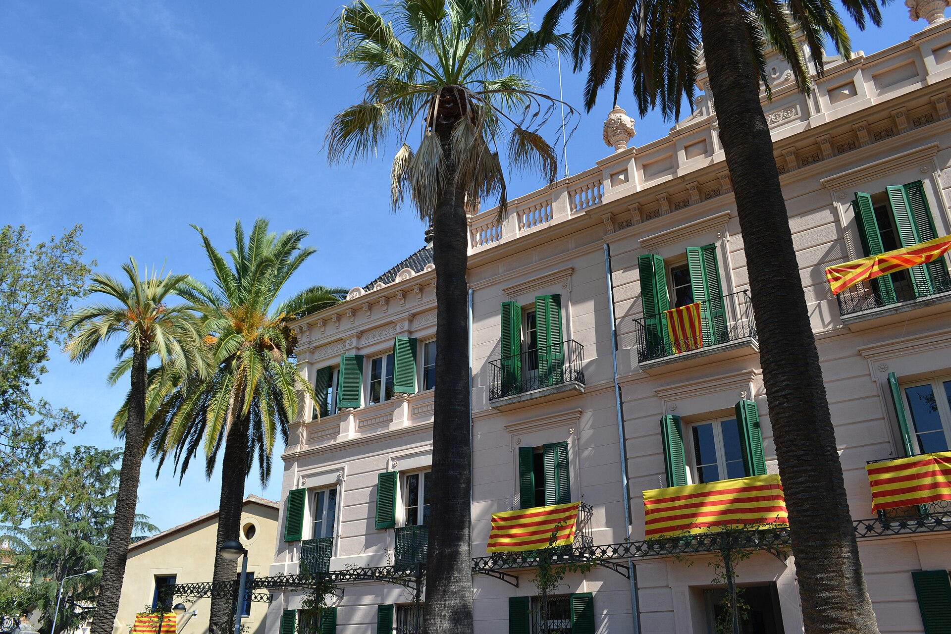
Palau Tolrà
Castellar del Vallès
Palau Tolrà is a historic mansion in Castellar del Vallès, a town in the Vallès Occidental region, in the province of Barcelona, Catalonia. Built as a private family residence, it remains one of the town's most recognizable landmarks even though its role has changed dramatically since the 19th century. Who built the palace, and why? The story starts around 1852, when Josep Tolrà Avellà — a physician by training and the founder of the family's textile business — set out to build a residence that matched the status his family had earned through the growth of the local textile industry. He commissioned architect Emili Sala i Cortés for the project, which was finally completed in 1890. After Josep's death, the house became the home of his widow, Emília Carles Tolrà, which is why some records associate the building with her name almost as often as with the Tolrà family name itself. What does the architecture look like? The building has a ground floor plus two upper storeys, arranged in three distinct volumes. The central section is capped by a terrace, while the two side wings are covered by four-sloped ceramic-tile roofs, a common solution for the residences built by Catalonia's industrial bourgeoisie at the time. The facades are symmetrical, and the decorative details — window frames, cornices, and friezes — follow a neoclassical vocabulary, setting the building apart from the purely Modernista mansions being raised elsewhere in Catalonia during the same decades. What can visitors see around the building? The palace is surrounded by gardens that still preserve period features: a pergola, a fountain, and planters and benches with a distinctly Modernista touch. A second pergola on the grounds is still used today for official town events. Together with an adjoining former farmhouse, the palace and its gardens form a cohesive complex that gives a clear picture of how a wealthy industrial family in the Vallès Occidental lived at the turn of the 20th century. What is Palau Tolrà used for today? Since September 1994, the building has no longer been a private residence — it now houses the town council of Castellar del Vallès, serving as its city hall. That change keeps the palace very much part of everyday town life rather than turning it into a sealed-off museum: visitors can freely admire the facade and gardens, and anyone dealing with council business gets to step inside the historic building as well. Frequently asked questions Where is Palau Tolrà located? In the centre of Castellar del Vallès, a town in the Vallès Occidental region, roughly 30 km from Barcelona. Who designed the building? Architect Emili Sala i Cortés, commissioned by the Tolrà family. Can you go inside the palace? Since it now serves as the town hall, parts of the interior are accessible during council office hours, and the town also organises occasional guided visits. Is access to the gardens free? Yes, the gardens and facade are open to the public at no cost, as part of the town's public space. Is Palau Tolrà a castle? No — it is a 19th-century residential mansion built for an industrialist family, not a fortified castle.
-
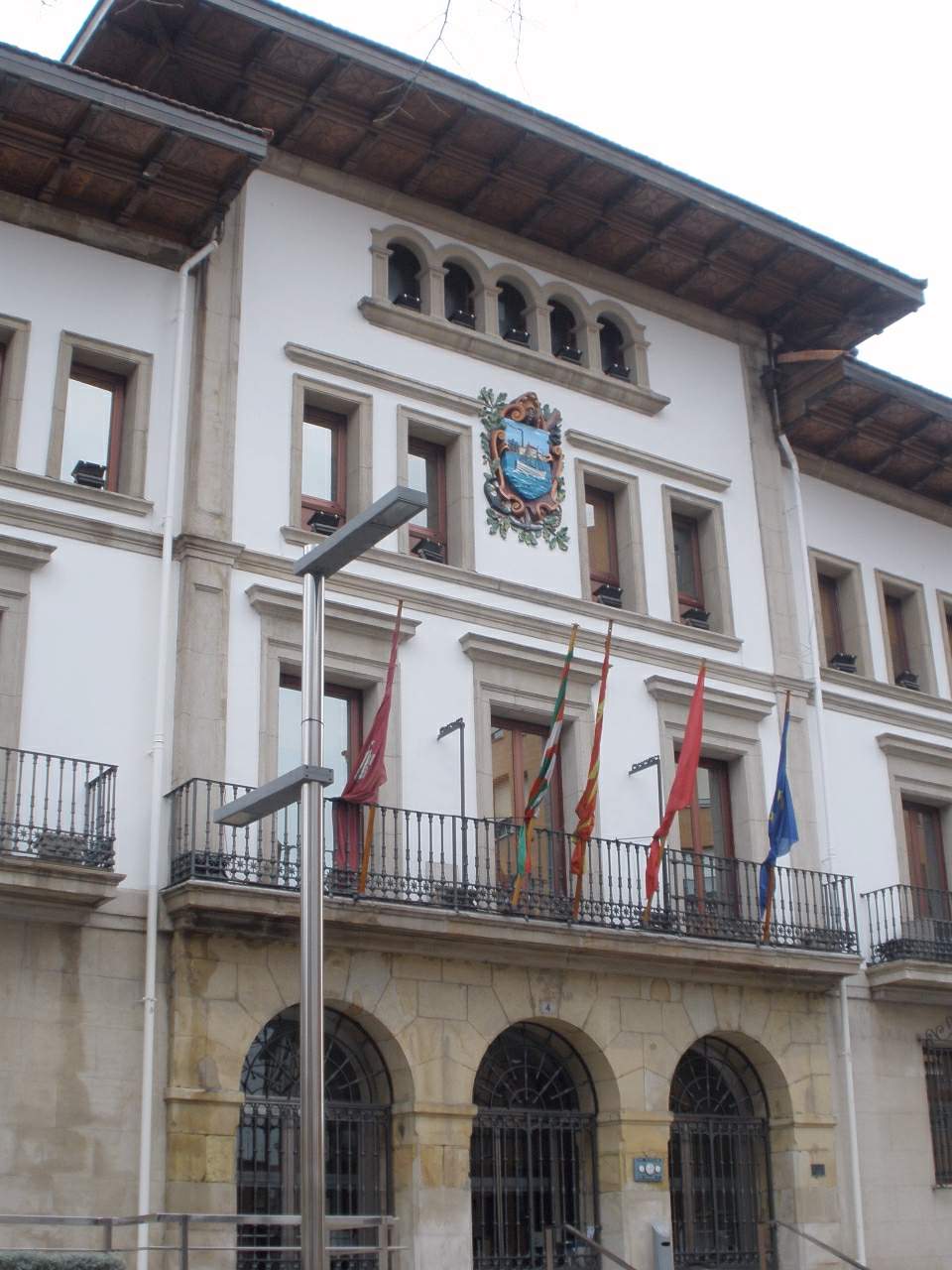
Sestao town hall
Sestao
Sestao Town Hall stands on Plaza del Kasko, right in the heart of this industrial town on the estuary of the Nervión River, in the province of Biscay, in Spain's Basque Country. Beyond housing the local council, the building works as a landmark for anyone tracing how Sestao grew from a modest riverside settlement into one of the region's key industrial centers. How did the building come to be? Sestao's town government wasn't always based here. The town's first consistorial house went up in 1823, near what was then Plaza Conde de Valmaseda, at a time when Sestao was still a small fishing and farming community with little in common with the industrial powerhouse it would later become. As shipbuilding and metallurgy took hold along the Nervión through the second half of the 19th century, the old building could no longer keep pace with a rapidly expanding municipality. The response was a new, more imposing seat of government. The current town hall on Plaza del Kasko was completed in 1879, designed by architect Julio Saracíbar. Its construction coincided with the period when Sestao was shedding its rural character and turning into one of the busiest industrial hubs on this stretch of coast — a shift the building's scale and ambition were meant to reflect. What does the town hall look like? The structure is built in ashlar stone, giving it the solid, monumental presence typical of late 19th-century civic buildings. Architecturally it's usually described as eclectic, blending classical references with details characteristic of the era in which it was raised. At ground level, three arches open the façade onto the square, creating a symmetrical, clearly marked entrance. Above them, on the main floor, runs a continuous balcony — the kind of feature many Spanish town halls of the period included so officials could address townspeople gathered below. Higher still, the municipal coat of arms crowns the façade, marking the building's civic role at a glance. In total the town hall rises three floors, which today house the various departments of the local administration. What else is worth seeing nearby? Plaza del Kasko makes a natural starting point for exploring central Sestao on foot. Despite its long association with heavy industry, the town has held onto pockets of older streetscape that hint at its pre-industrial past. The nearby Nervión estuary is a reminder of just how central the river was to the economic transformation of this part of Biscay. Frequently asked questions Who designed Sestao Town Hall? The building was designed by architect Julio Saracíbar and completed in 1879. Is this the town's original town hall? No. Sestao's first consistorial building dates back to 1823 and stood in a different part of town, near the former Plaza Conde de Valmaseda. The current building replaced it later in the 19th century as the town grew. What architectural style is the town hall built in? It's generally classed as eclectic, built in ashlar stone, with a three-arched ground floor and a continuous balcony on the main level. Can visitors go inside Sestao Town Hall? As an active municipal building, it primarily serves residents' administrative needs rather than functioning as a tourist attraction, so interior access is limited. The façade and the square in front of it, however, can be freely viewed and photographed. How do you get to Sestao Town Hall? It sits right in the town center, on Plaza del Kasko, making it an easy walk from almost anywhere in Sestao and just a short distance from the Nervión waterfront.
-
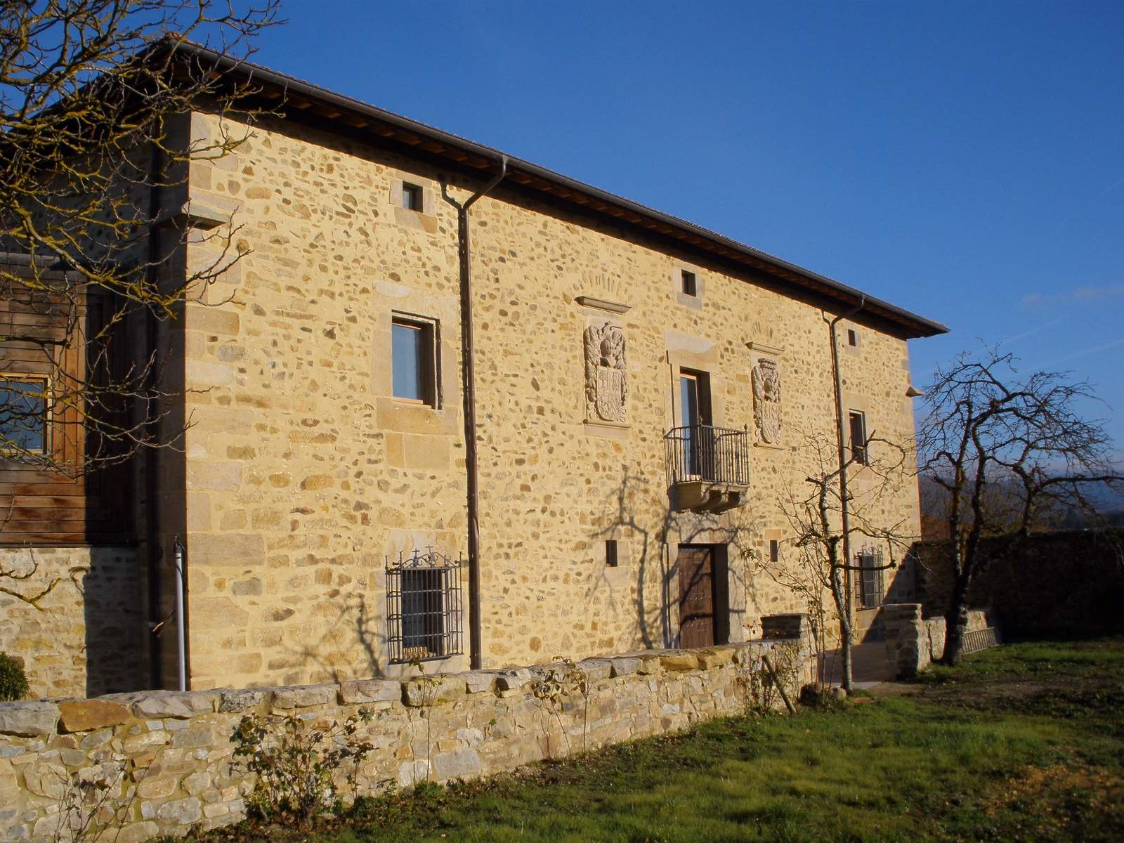
Barrundia town hall
Ozaeta
Barrundia Town Hall sits in Ozaeta, a small village in the province of Álava, in Spain's Basque Country, which has served as the municipal capital since the late 19th century. Since 2013, local government offices have operated out of the Palacio Iduia, a stone manor house that once belonged to a noble family and now houses the municipal administration. Where is the town hall and how do you get there? Ozaeta lies in central Álava, in what used to be the Ganboa valley, surrounded by gentle hills and open farmland. It's a small village that's easy to explore on foot — the town hall stands on the main square, next to the parish church and a handful of other historic buildings. The coordinates place it at roughly 42.917°N, -2.496°W, only a short drive from Vitoria-Gasteiz, the provincial capital. What's the history behind the municipality and the building? Barrundia is first mentioned in written records from the 11th century, in a tax roll known as the Reja de San Millán, which listed Álava villages obligated to pay tribute in iron ploughshares to the monastery of San Millán de la Cogolla. Ozaeta itself shows up in documents a little later, with its name recorded in the 12th century. The municipality took its current shape in two stages. In 1885, the municipalities of Barrundia and Gebara merged, with Ozaeta chosen as the joint administrative capital. A second major change came in the mid-20th century: when the Ganboa valley was flooded in 1955 to build a reservoir, several villages from that area — including Garaio, Marieta, Larrintzar, Zuazo and Mendixur — were absorbed into neighboring municipalities, Barrundia among them. The palace building that now serves as the town hall belonged to local noble families for centuries before being converted for administrative use in the 2010s. What else is worth seeing nearby? Ozaeta and the wider municipality of Barrundia offer a typical slice of rural Álava — stone houses, manor palaces and parish churches scattered across farmland and low hills. Nearby villages within the municipality preserve similar examples of noble architecture, and the area around the Ganboa reservoir, built where the old valley once stood, is now a popular spot for walking and cycling. The village itself is small, so visiting the town hall and its immediate surroundings usually takes under an hour, making it an easy addition to a longer trip through Álava. Frequently asked questions Where exactly is Barrundia Town Hall located? In Ozaeta, the administrative capital of the municipality of Barrundia, in the province of Álava, Basque Country. Is the town hall building historic? Yes — since 2013, the municipal government has been based in the Palacio Iduia, a former noble manor house converted for administrative use. Since when has Ozaeta been the municipal capital? Since 1885, when the municipalities of Barrundia and Gebara merged and established their joint capital in Ozaeta. Are there other attractions nearby? Yes — the Ganboa reservoir area and neighboring villages with well-preserved noble architecture typical of rural Álava.
-
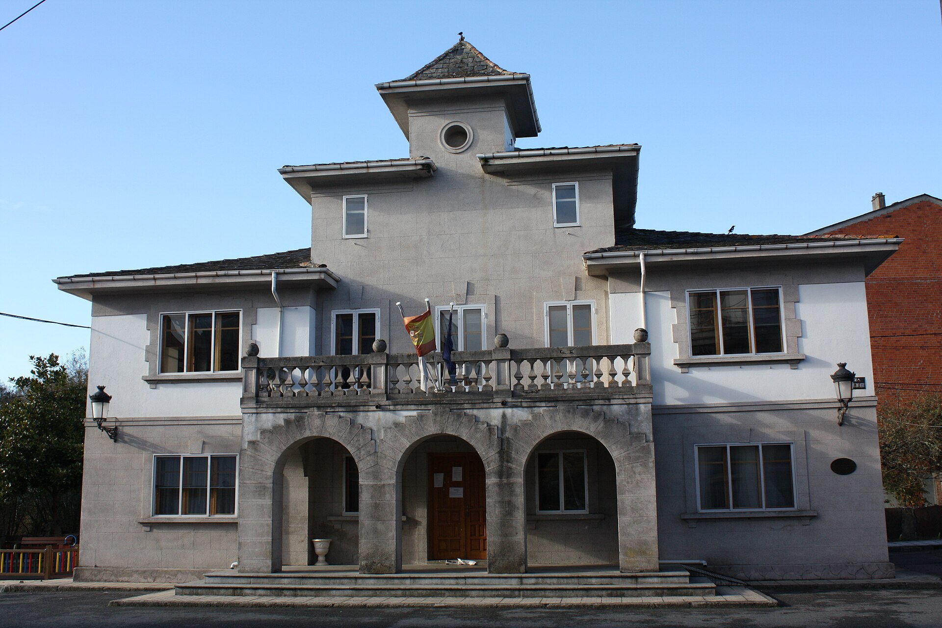
Begonte town hall
Begonte
Begonte town hall is the seat of local government for the municipality of Begonte, a small community in the western part of Lugo province, in Galicia's Tierra Llana region. The building sits on Plaza Hermanos Souto Montenegro 1 and serves as the administrative hub for a municipality of nearly three thousand residents. For travelers exploring inland Galicia, it works as a useful landmark and a practical starting point for visiting the village itself and the surrounding countryside. Where is the Begonte town hall located? The building stands in the center of the village of Begonte, on the flat land typical of the Tierra Llana region — a name that literally means "flat land." The municipality covers just over 125 km² and borders several neighboring municipalities in this part of Lugo. The town hall itself isn't a historic monument, but it functions as a practical reference point: it's where visitors can pick up local information, check on events, or ask about road conditions to nearby attractions. What history lies behind the municipality it represents? The municipality of Begonte, in its current administrative form, was established in 1842, with Ramón Losada y Montenegro serving as its first mayor. The area itself has a much older story, though — archaeological findings point to human presence here dating back to roughly 3,500 years before our era, and Roman peoples passed through this land in later centuries. According to researcher Vidán Torreira, the name Begonte may trace back to Roman legionaries from the Vocontii tribe, who settled here after serving in the Rhône valley. That layered history — from prehistory through the Roman period to a 19th-century administrative reform — is part of why such a small municipality has a longer story to tell than its size might suggest. What should visitors know before stopping by? Begonte is a rural municipality, so tourist infrastructure is modest — which is exactly the appeal for travelers looking for a quieter, more authentic slice of Galicia. The area works well as a base for exploring Tierra Llana, a flat, agricultural landscape that contrasts with the mountainous parts of Lugo province elsewhere. Spring and autumn tend to be the most pleasant times to visit, when the weather is mild and the fields around the village look their best. The municipal office can be reached by phone, which is worth knowing if you're planning a longer stay in the area. Frequently asked questions What is the Begonte town hall? It's the administrative building of the municipality of Begonte, housing the local government offices, located in the center of the village. Where does the name Begonte come from? One theory links it to Roman legionaries from the Vocontii tribe, who are believed to have settled here after military service in the Rhône valley in France. When was the modern municipality of Begonte established? It was set up in its current administrative form in 1842, with Ramón Losada y Montenegro as its first mayor. How many people live in the Begonte municipality? The municipality has around 2,900 residents spread across more than 125 km². Are there older historical traces in Begonte? Yes — archaeological evidence suggests human presence in the area as far back as roughly 3,500 years before our era, followed later by the passage of Roman peoples through the region. Is Begonte worth a stop on a trip through Galicia? It makes a good short stop for travelers exploring rural Galicia and the Tierra Llana region, particularly as a base for further trips around Lugo province.
-
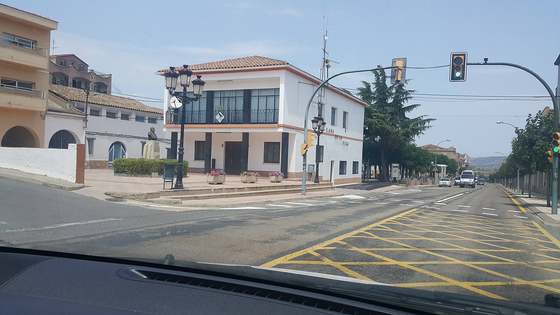
Corbera d'Ebre town hall
Corbera d'Ebre town hall is the municipal building of Corbera d'Ebre, a small town in the Terra Alta district, Tarragona province, Catalonia. It sits in the lower, "new" part of the settlement, built after the town was devastated in 1938, and serves as a practical starting point for visitors heading to one of the most moving Spanish Civil War memorial sites in the country. Why do travelers come to Corbera d'Ebre? The town's name is closely tied to the Battle of the Ebro (1938), one of the longest and bloodiest confrontations of the Spanish Civil War. The front line broke through Corbera on 3 September that year, and the fighting left the old hilltop town, perched at 337 metres above sea level, almost entirely in ruins. Survivors relocated downhill and rebuilt their community there — the same settlement where the town hall stands today. What is the history behind the municipality itself? Settlement on this site dates back to Iberian times, before the Roman conquest, when a protohistoric hilltop fort occupied the same ridge. The first written reference to Corbera appears in 1153, in a donation charter for Miravet Castle granted to the Knights Templar by Count Ramon Berenguer IV. Centuries later, during the War of the Spanish Succession, Franco-Castilian troops took the town for good on 6 February 1707. What's worth seeing near the town hall? The main draw is the Poble Vell, the Old Town — a hillside scattered with the ruined houses and church that bear witness to the destruction of 1938. In 1992 the Catalan government declared these ruins a cultural asset of national interest, and since 1995 the site has functioned as an open-air museum and monument to peace. Twenty-eight sculptures shaped like letters of the alphabet, known collectively as the "Alphabet of Freedom," are scattered among the ruins. The town hall, as the municipality's administrative hub, is often the best place to pick up local visitor information before setting off toward the old town. How to get there and what else to know Corbera d'Ebre lies in the Terres de l'Ebre region, surrounded by the hills of Terra Alta, close to other sites linked to the Battle of the Ebro, such as the Pandols ridge and the town of Gandesa. The area draws both visitors interested in 20th-century history and hikers, since the climb up to the Poble Vell is relatively short but does involve a proper uphill walk. Frequently asked questions Can visitors go inside the town hall? The building serves the municipality's administrative functions, so public access is generally limited to office hours — it's worth checking current opening times locally. What's the difference between the "old" and "new" Corbera d'Ebre? The old town, the Poble Vell, is the hilltop ruin left over from the 1938 destruction during the Battle of the Ebro and preserved as a monument to peace. The new Corbera d'Ebre, home to the town hall, was rebuilt further downhill after the war and is today's inhabited village. Is it worth combining this with other Battle of the Ebro sites? Yes — Terra Alta has several other locations connected to the battle, which together give a fuller picture of the events of 1938 in a single trip. How long does a visit take? Seeing the town hall and the centre of the new village takes only a few minutes, while a full visit to the Poble Vell, including the climb, usually takes around an hour.
-
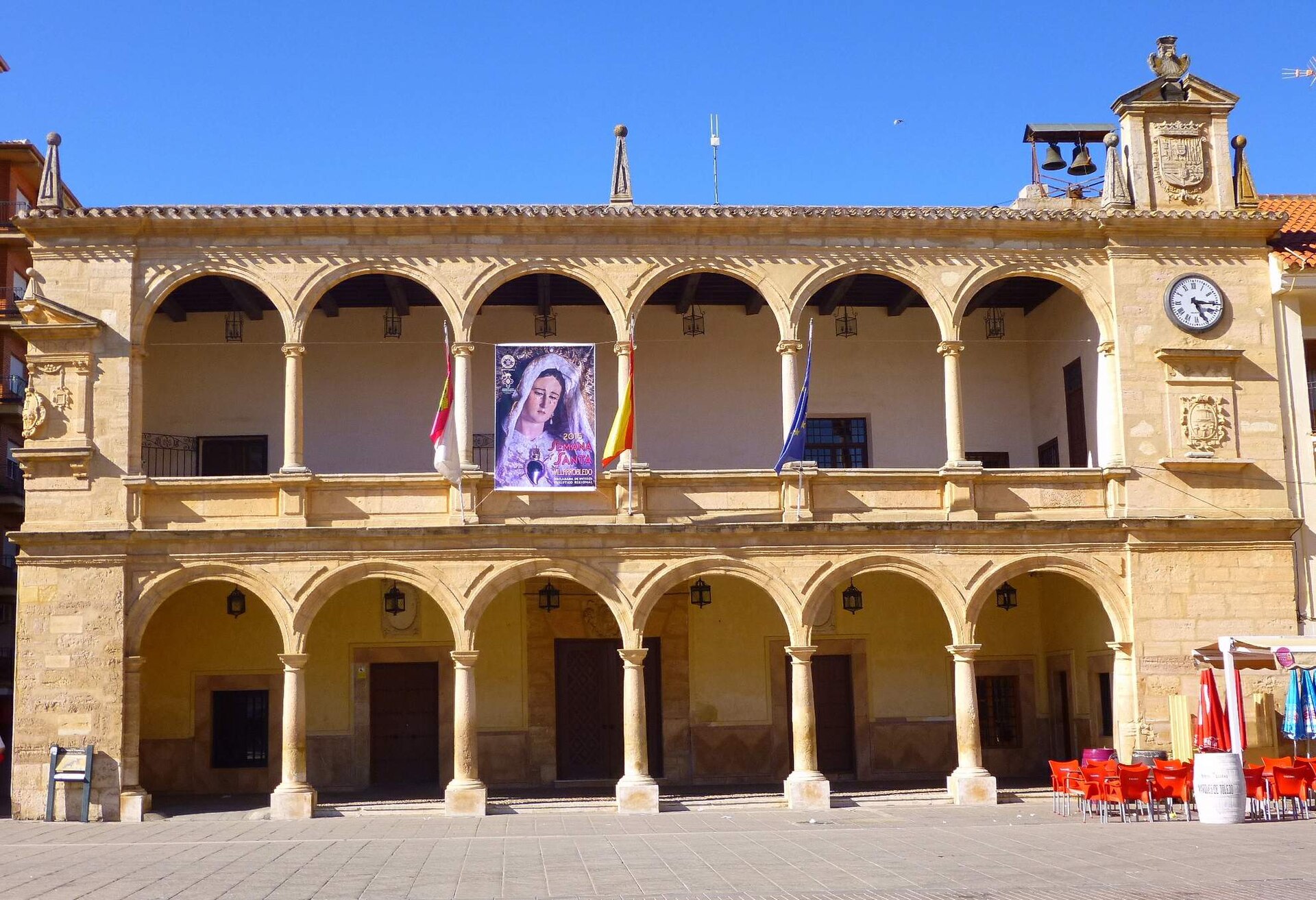
Council House of Villarrobledo
Villarrobledo
The Council House of Villarrobledo is the town hall of Villarrobledo, a town in the province of Albacete, in the autonomous community of Castile-La Mancha, Spain. The building holds the status of Bien de Interés Cultural — Spain's formal designation for a site of cultural interest — granted in 1991, placing it among the town's officially protected landmarks. What exactly is this building? It's the seat of the local municipal government, functioning much like a town hall anywhere else in Europe: the place where decisions about the town's daily life have historically been made. Its listing as a protected cultural asset means any renovation or alteration to the building's exterior requires approval from the relevant heritage authorities, which helps keep its historic character intact over time. Why is it protected as a cultural asset? The Bien de Interés Cultural designation is reserved for buildings and sites judged to hold significant historical, architectural, or cultural value for the region. For a town hall like this one, that recognition usually reflects both the architectural merit of the structure itself and its role as a civic symbol — a building that has represented the local community across generations. Where is Villarrobledo located? Villarrobledo sits in the province of Albacete, within the wider La Mancha region, on the broad central plains of Spain. It's one of the larger towns in this part of Castile-La Mancha, historically tied to agriculture and local craft traditions typical of the area. The council house stands right in the town centre, in the kind of location where public life has concentrated for centuries in Spanish towns of this size. How do you get there, and what pairs well with a visit? Villarrobledo lies well inland in La Mancha, so the easiest way in is by car from nearby towns in Albacete or Ciudad Real province. A visit to the council house works best as part of a short walk through the historic town centre — in this region, municipal buildings tend to sit close to the main square and nearby churches, making it a natural stop on any walking route through central Villarrobledo. What should you know before visiting? The council house is first and foremost a working administrative building, so in practice a visit means appreciating the façade and its setting rather than touring an interior open to the public like a museum. That's typical of many historic town halls in Spain, where the building's heritage status coexists with its everyday role as a functioning civic office. Frequently asked questions What is the Council House of Villarrobledo? It's the town hall of Villarrobledo, in the province of Albacete, listed as a Bien de Interés Cultural — a Spanish cultural heritage asset — since 1991. Where exactly is it located? In the centre of Villarrobledo, a town in the La Mancha region, province of Albacete, Castile-La Mancha, Spain. Can visitors go inside? The building serves an active administrative function, so visits are typically limited to viewing the exterior — the façade and its setting in the town centre are the main points of interest. Is the council house worth a trip to Villarrobledo on its own? On its own, it's a single stop on the map. It's best combined with a walk through the historic centre, which gives a fuller sense of this part of La Mancha. What does the Bien de Interés Cultural status mean? It's Spain's formal heritage protection category for sites of notable historical or architectural significance — buildings with this status are subject to specific conservation rules.
-
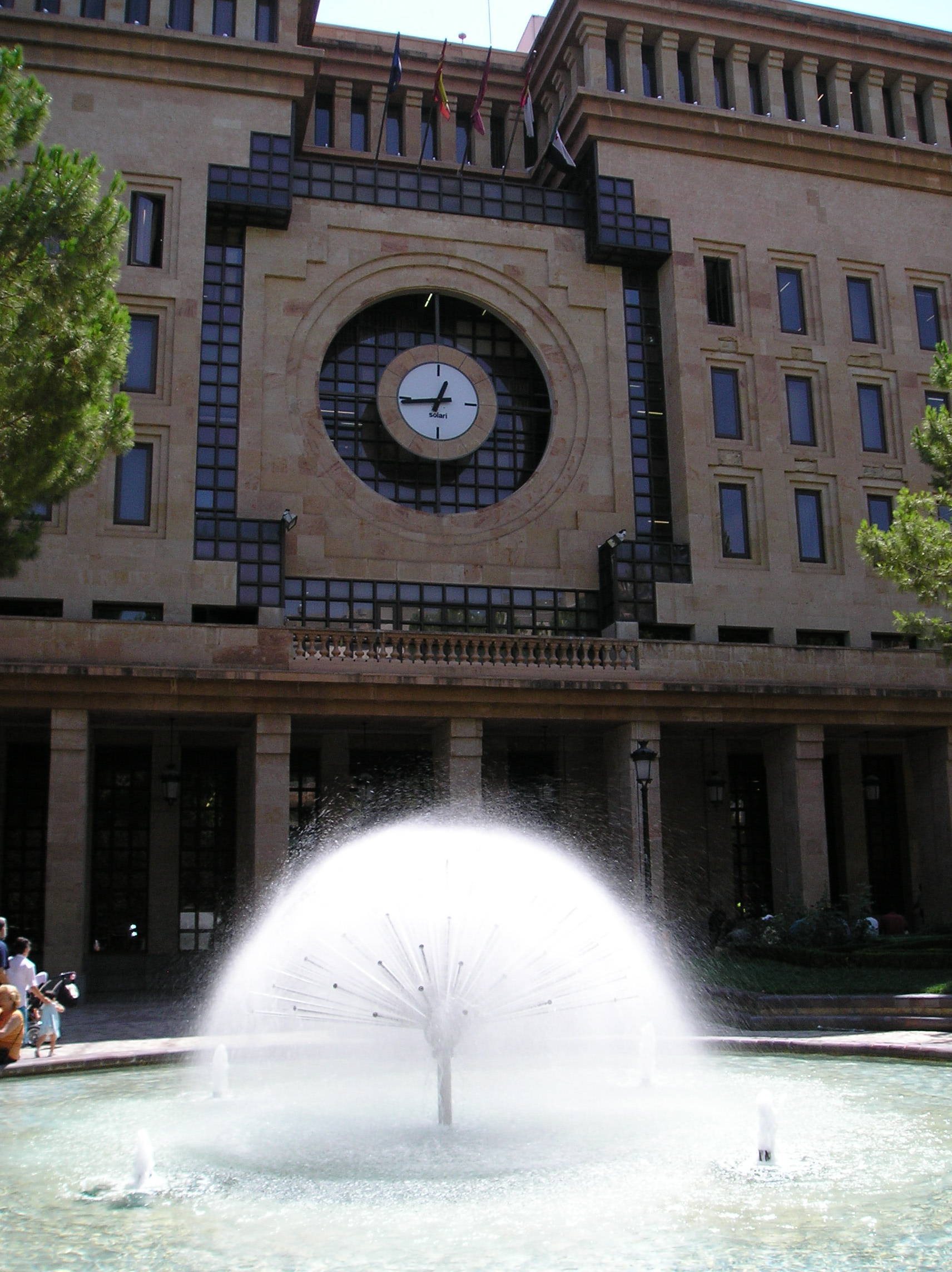
Albacete town hall
Albacete
Albacete Town Hall is the historic former seat of the city council, standing on Plaza del Altozano — the square regarded as the symbolic heart of Albacete, the provincial capital in the Castilla-La Mancha region of Spain. Although the municipal government relocated to a new building in 1986, this eclectic palace remains one of the most recognisable landmarks on the old town skyline, largely thanks to its distinctive clock tower, visible from many corners of the square. Where is the building and how do you spot it? The building sits right in the heart of Albacete, on Plaza del Altozano, a square that the city formally declared its official centre in the early twentieth century. The easiest way to spot it is by its centrally placed clock tower, rising above the rest of the facade — a feature typical of European town halls from this era, serving both as decoration and as a practical timekeeper for residents going about their day. What is the history behind this building? The story runs deeper than a first glance suggests. The property itself dates back to the 18th century, originally built as a private residence known locally as Casa Cortés. The city purchased it in 1878 with the intention of turning it into the seat of local government, and the new casa consistorial (council building) was formally opened on 3 January 1879 by the province's civil governor at the time. The real turning point came a couple of decades later. In 1902, Plaza del Altozano was granted official status as the city's centre, and the following year the council decided to move its operations there for good. The building underwent a thorough renovation overseen by architect Francisco Manuel Martínez Villena, who gave it a grander, more representative appearance. The renovated town hall reopened in 1905, with King Alfonso XIII attending the ceremony in person — a clear sign of how much importance was placed on the site at the time. Was this the city's first town hall? No. Between 1817 and 1879, the city council had operated out of a different building altogether — the so-called Casa-Lonja, a neoclassical structure on Plaza Mayor. The move to Altozano therefore marked the second change of headquarters in the history of Albacete's local government. What architectural style does the town hall follow? The building follows an eclectic style, popular across Europe and Spain at the turn of the 19th and 20th centuries. Eclecticism meant freely combining elements borrowed from different periods and architectural traditions — classical proportions, ornate facade details, and monumental accents — into one striking composition. The clock tower remains the most distinctive feature of this design and still serves as a landmark for both locals and visitors crossing the square. What is inside the building today? When the city administration moved to new premises in 1986, the historic building didn't lose its relevance. In 1995, the Museo Municipal de Albacete (Municipal Museum) opened inside it, occupying the former town hall interiors and telling the story of the city to visitors. This means tourists can actually step inside a building that served as the seat of local power for more than a century, and experience it from an entirely different angle. Frequently asked questions Does Albacete's town hall still serve administrative functions? No — since 1986 the city government has operated from a different location, and the historic building on Altozano now functions as a museum. Can visitors go inside? Yes, since it houses the Museo Municipal de Albacete, open to visitors as part of a regular sightseeing stop. What is the most distinctive architectural feature? The central clock tower and the eclectic facade, which blends several architectural traditions from the turn of the 19th and 20th centuries. Why does this building matter to the people of Albacete? It stands on the square recognised as the city's symbolic centre and witnessed key moments in local history, including King Alfonso XIII's visit in 1905.
-
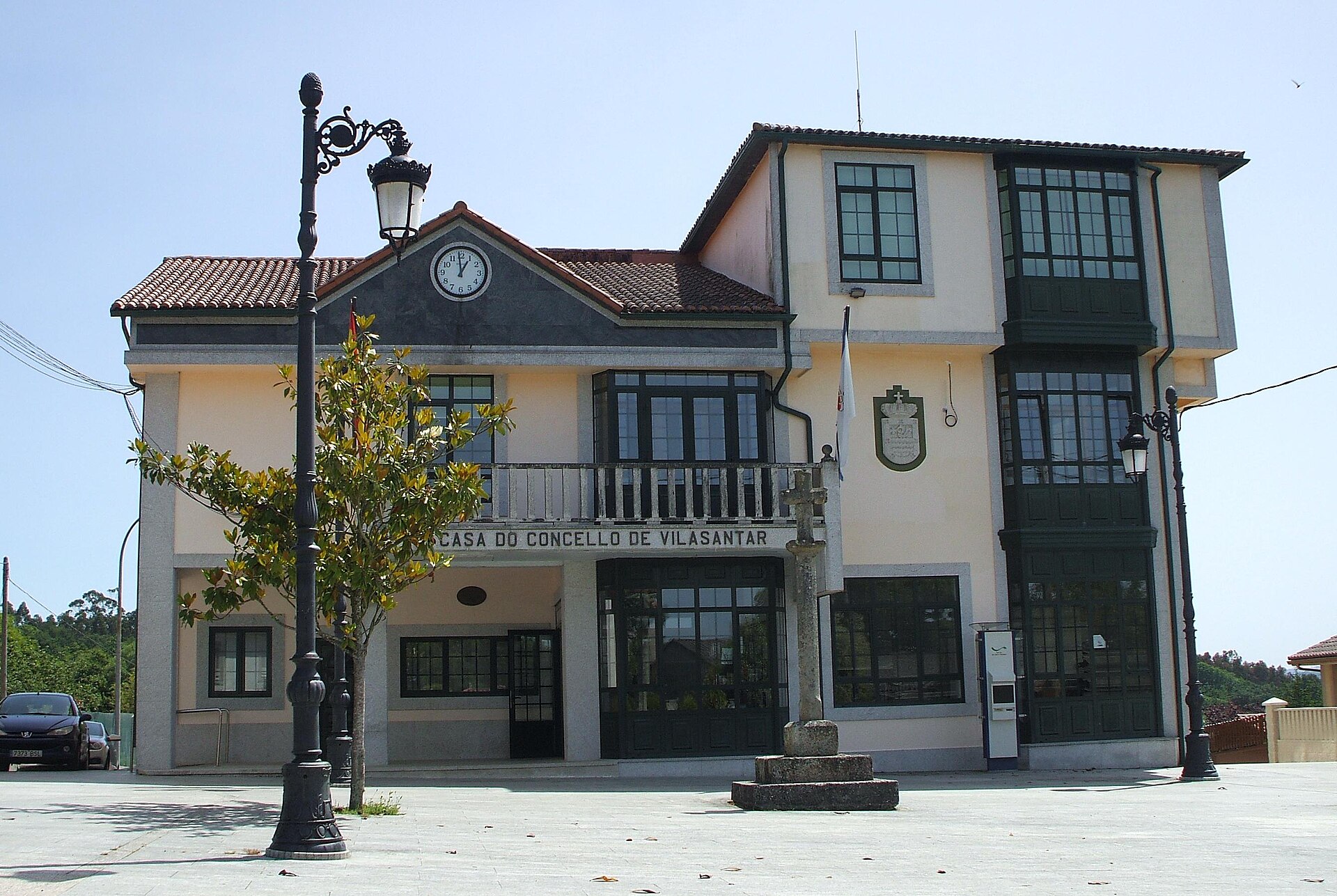
Vilasantar town hall
Vilasantar
Vilasantar Town Hall sits at the administrative heart of the small municipality of Vilasantar, in the province of A Coruña, in Galicia, in northwestern Spain. The building houses the local council and serves as the natural reference point for anyone exploring this rural municipality, which is spread across seven parishes rather than concentrated in a single town. Where is Vilasantar and what kind of municipality is it? Vilasantar belongs to the comarca of Betanzos, one of the territorial districts of the province of A Coruña. The municipality has no urban core in the usual sense — it is made up of seven parishes: Armental, Barbeito, Mezonzo, Présaras, San Vicenzo de Curtis, Vilariño, and Vilasantar itself. That structure is typical of rural Galicia, where community life has historically centred on parish churches rather than a single dominant town. The town hall, found at coordinates 43.0728° N, 8.1216° W, is therefore the administrative centre for an area that in practice stretches across more than a dozen smaller settlements. How do you get to the town hall? Vilasantar lies inland, roughly an hour's drive from both Santiago de Compostela and the city of A Coruña. Travelling by car is by far the most practical option — the municipality has no railway station of its own, and bus connections to the outlying parishes can be infrequent. Anyone relying on public transport should plan the trip well in advance. What history lies behind this region? The town hall building itself is modern, but the land it stands on carries a much older story. A key role in the area's past belongs to the monastery of Santa María de Mezonzo, whose origins predate the 8th century — its church still holds capitals dated to the 6th or 7th century, and the foundation appears in Latin documents under the name Mosontio. Community life in the area crystallised around this religious centre long before today's administrative boundaries existed. Even older traces of settlement survive as castros, the fortified hilltop settlements typical of the Castro culture that developed in Galicia roughly two thousand years ago. Remains of such settlements can still be found within the municipality, notably in the parish of Vilariño and at a site known as Congostras. Numerous burial mounds and megalithic monuments discovered across the region confirm that the area was densely populated well before recorded history. Vilasantar's history is also closely tied to the neighbouring municipality of Sobrado — the land once formed part of the county of Présaras, a name that survives today as one of the municipality's parishes. What is there to see nearby? Visitors don't come to Vilasantar looking for big-city sights — this is a destination for travellers drawn to quiet Galician countryside, traces of ancient Castro-culture settlements, and the parish churches scattered across the municipality. The monastery church at Mezonzo and the castro sites around Vilariño make for a natural short itinerary through the municipality, one that can easily be planned starting from the town hall as a central landmark. Frequently asked questions Where exactly is Vilasantar Town Hall located? At the centre of the municipality of Vilasantar, in the province of A Coruña, at coordinates 43.0728° N, 8.1216° W. How many parishes make up the municipality of Vilasantar? Seven: Armental, Barbeito, Mezonzo, Présaras, San Vicenzo de Curtis, Vilariño, and Vilasantar. What is the oldest heritage site in the municipality? The Castro-culture remains at Vilariño and Congostras, along with the monastery of Santa María de Mezonzo, whose roots go back to before the 8th century. What's the best way to reach Vilasantar? By car — the municipality is inland, about an hour's drive from Santiago de Compostela and A Coruña, and public transport options are limited.
-
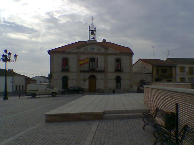
Adanero town hall
Adanero
Adanero town hall serves as the seat of local government for the small village of Adanero, in the province of Ávila, within the Castile and León region of Spain. Standing right at the heart of the settlement, the building has long been the natural reference point for residents — the place where everyday administrative business gets done, and one that also carries a slice of the area's history. Where exactly is the town hall located? Adanero counts only a few hundred residents, so tracking down the town hall is no challenge at all — just head for the village's central square. Its coordinates sit at roughly 40.9438°N, -4.6040°W, placing it in the northern part of Ávila province, close to the border with Segovia. For anyone driving through the region, it makes for a convenient stop along the routes connecting the larger towns of Castile. What is the story behind this building? Adanero's roots go back to the Middle Ages, when the settlement fell under the so-called tierra de Ávila — a broad territory governed by the jurisdiction of the city of Ávila. That arrangement held until the 17th century, when the village's legal standing changed dramatically. In 1643, King Philip IV sold Adanero outright, granting it the status of a villa with its own independent jurisdiction; the buyer, don Antonio Núñez de Prado, became its new lord. Decades later, in 1691, Charles II went a step further, awarding a descendant of that family, don Pedro Antonio Núñez de Prado, the title of Count of Adanero (conde de Adanero) — a title that permanently linked the village's name to Spanish nobility. The current town hall building, however, doesn't date back to those medieval or early-modern grants. It's a substantial mid-19th-century structure, raised as a new palacio consistorial to replace an earlier seat of local government. One of its most recognizable features is the clock and bell set into the façade, which for decades served as the village's only public timekeeper, its chimes marking out the rhythm of daily life. What else is worth seeing nearby? The town hall isn't the only reason to pause in Adanero. A short walk away stands the church of Nuestra Señora de la Asunción, listed as a Bien de Interés Cultural (a nationally protected cultural asset) — the building blends Romanesque-Mudejar elements with later Baroque additions, visible in details like the portal. A little further on is the 17th-century Palacio de los Condes de Adanero, whose façade still bears the stone coat of arms of the Núñez de Prado family, a lasting reminder of the era when they ruled the village. Frequently asked questions What is Adanero town hall? It's the administrative building housing the local government of Adanero, a village in Ávila province, built in the mid-19th century. Can visitors go inside the town hall? As an active public administration building, it's mainly accessible during office hours; touring its interior isn't a typical tourist activity. What other historic sites are nearby? Within the village itself, the church of Nuestra Señora de la Asunción and the 17th-century Palacio de los Condes de Adanero are both worth a visit. Where does the "Count of Adanero" title come from? King Charles II created the title conde de Adanero in 1691 for the Núñez de Prado family, who had bought the village from Philip IV back in 1643. How do you get to Adanero? The village sits in the northern part of Ávila province, near the border with Segovia, and is easily reached via local roads off the main routes linking that part of Castile and León.
-
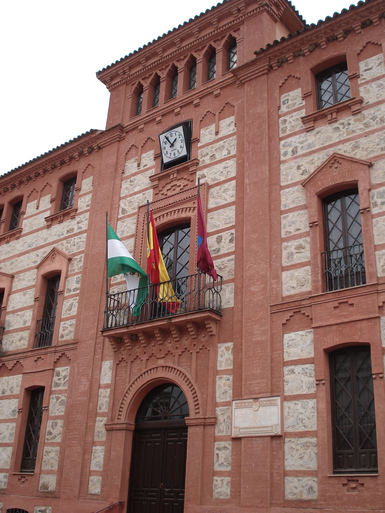
Aracena town hall
Aracena
Aracena Town Hall (Ayuntamiento de Aracena) stands right in the heart of this small town in the Huelva province of western Andalusia. Aracena is best known for the Gruta de las Maravillas cave system, but its old town — with the town hall as one of its landmarks — deserves a short stop too. Where did this building come from? The town hall didn't start out as a government office at all — it began as a private gift to the town. In the early 1900s, brothers from the wealthy Sánchez-Dalp family financed the construction of a grand residence, which was then handed over for municipal use. Building work ran from 1909 to 1911, designed by architect Aníbal González, best known internationally for the sweeping Plaza de España in Seville. His signature decorative style shows up here too, on a far smaller and more intimate scale. What architectural style is it built in? The building belongs to the Neo-Mudéjar movement, a style that flourished across Andalusia in the late nineteenth and early twentieth centuries by reviving the ornamental language of Islamic and Moorish architecture through modern construction techniques. Unusually for a public building of this size, its footprint is triangular. The façade is the real draw: warm red brick set against pale local limestone, a combination that catches the light beautifully under the southern Spanish sun. Has the building always served as the town hall? Not exactly — the administrative history of Aracena is a bit more tangled. An older building once served as the seat of local government and, at various points, also housed a Civil Guard post and an agricultural labor institute. That older building kept its town-hall role until November 1985, then underwent a long restoration led by the regional Andalusian government, finishing in 2001. Visitors researching "Aracena town hall" online sometimes run into both buildings, so it's worth double-checking on the ground — or with a local guide — which one is being referred to. How do you get there, and what else is nearby? The town hall sits right in the center of Aracena, an easy few-minute walk from the town's main squares. It pairs naturally with a wander through the old quarter — narrow lanes, whitewashed façades typical of Andalusia's "white villages," and viewpoints on the hill above town dominated by the castle and the church of Nuestra Señora del Mayor Dolor. The building itself is best appreciated from the outside, circling it to catch the façade details as the light shifts through the day. Frequently Asked Questions Who built Aracena's town hall? It was built between 1909 and 1911, commissioned and funded by the Sánchez-Dalp family and designed by architect Aníbal González. What architectural style is the building? It's a Neo-Mudéjar building, notable for its triangular plan and its façade combining red brick with white limestone. Can visitors go inside the town hall? As a working local government building, it's generally only accessible during office hours, and those can change — it's worth checking locally before planning a visit. Is the town hall worth seeing on a short day trip to Aracena? Yes — it sits in the town center and fits easily into a visit alongside the old town and the Gruta de las Maravillas without adding much to the route. Was there more than one town hall building in Aracena? Yes, an earlier historic building served that role until 1985 and was later restored, reopening in 2001 — which is why searches on the topic sometimes turn up two different buildings.
-
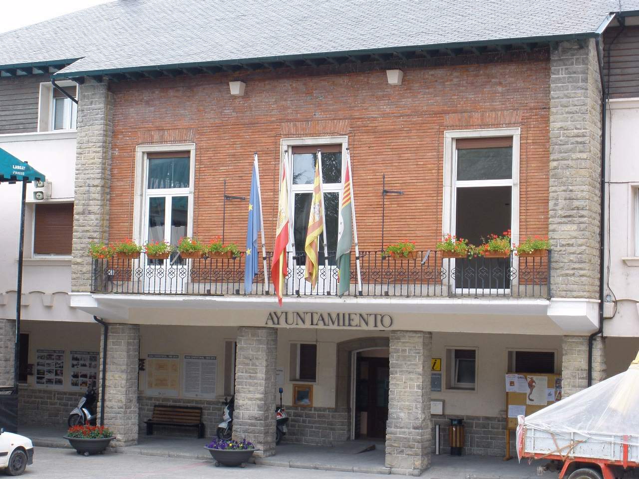
Sabiñánigo town hall
Sabiñánigo
Sabiñánigo Town Hall is the seat of local government for a small town in the province of Huesca, in the Aragonese Pyrenees. Standing on Plaza de España, the building administers a municipality that today also covers a number of surrounding villages absorbed into Sabiñánigo through 20th-century municipal boundary changes. Where is the town hall located? The building sits at Plaza de España 22, in the part of Sabiñánigo that grew up around the railway station rather than in the town's original historic core. Over time, this newer district became the real center of public and administrative life. How did the seat of local government move over time? The old center in San Feliciano Until the early 20th century, municipal records and the town's governing body were tied to the older part of Sabiñánigo, now known as the San Feliciano district. That original settlement core was where the town's earliest administrative activity took place. Growth around the railway district Everything shifted in 1893, when a rail line reached the area and a station was built nearby. A new neighborhood quickly sprang up around it, with houses, shops, and lodgings lining the road leading to the station. As economic and civic life gravitated toward this railway district, the town's administration eventually followed, relocating its seat to the newer part of town. What does the current building look like? The present-day town hall, which also houses the municipal archive, was built in the mid-1960s. It reflects the plain, functional style typical of mid-20th-century civic buildings in small Spanish towns, positioned on the main square alongside other public institutions. What else is worth seeing nearby? Plaza de España, where the town hall stands, is a natural landmark for visitors passing through Sabiñánigo, a town often used as a gateway to the Pyrenees, including the nearby Ordesa y Monte Perdido National Park. The square and its surrounding streets give a good sense of everyday life in a town that has grown for more than a century around its railway junction. Frequently asked questions What kind of building is this? It is the town hall (ayuntamiento) of Sabiñánigo, seat of the municipality's local government. Where exactly is it located? At Plaza de España 22, in the central part of Sabiñánigo, in the district that developed around the railway station. When was the current building constructed? The present building dates from the mid-1960s. Was the town hall previously located elsewhere? Yes. Until the early 20th century, the seat of local government was linked to the older part of town, known as San Feliciano, before administrative activity shifted to the growing railway district. Can visitors go inside? As an active municipal office, the town hall is not a conventional tourist attraction, but its facade and the surrounding square can be seen while walking through town. Is Sabiñánigo a good base for exploring the Pyrenees? The town lies on the route into the Pyrenean valleys and national parks, making it a popular stopover for travelers heading further into the mountains.
-
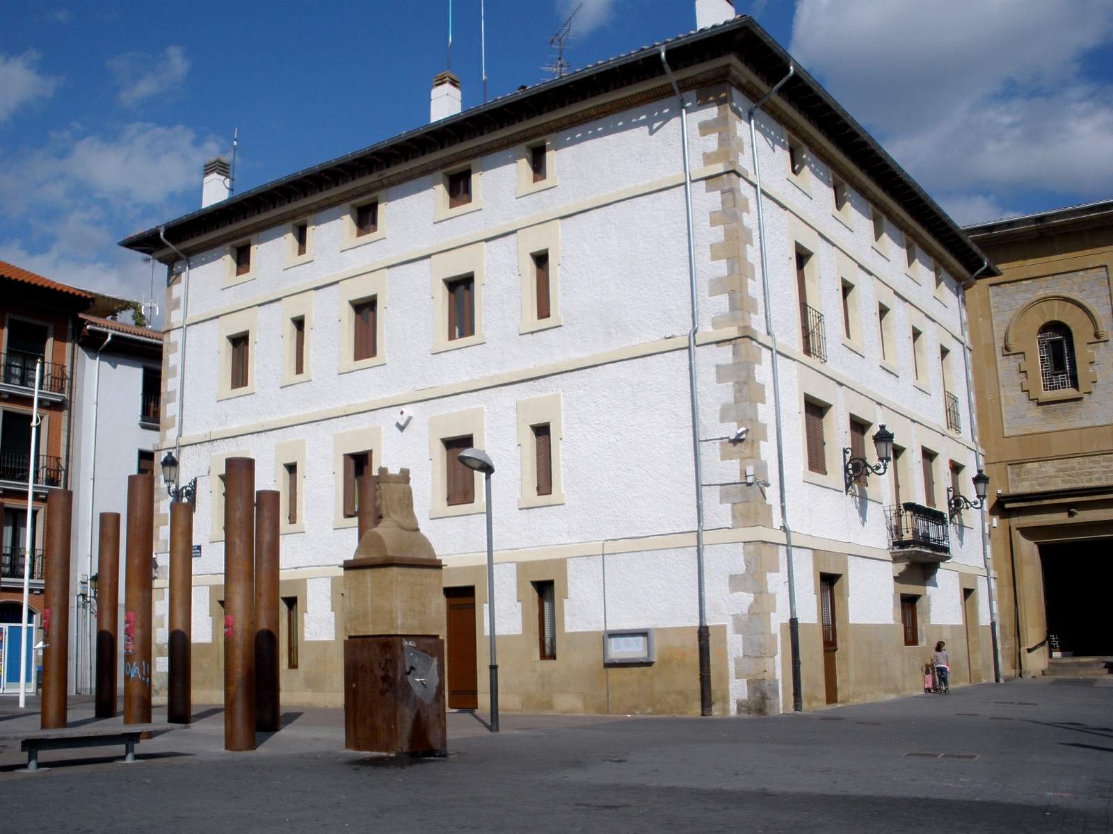
Villava/Atarrabia town hall
Villava/Atarrabia town hall sits on Calle Mayor in Villava/Atarrabia, a small town right next to Pamplona in northern Navarre. It serves as the seat of local government for the smallest municipality in all of Navarre by land area, yet one of the most densely populated. Why does this building matter? The town hall building forms part of a historic town center that took shape in the Middle Ages. Villava was founded in 1184, when King Sancho VI the Wise established a new settlement here — "Villa nova" — next to the existing village of Atarrabia, granting its residents the same privileges enjoyed by settlers of the New Borough of San Nicolás in Pamplona. Since then, the two names, Villava and Atarrabia, have run together, which is why the town and its institutions — including the town hall itself — carry the dual name today. The building itself dates to the town's economic and demographic boom in the 16th century. That was the century when Villava, growing on the back of trade and craft production, saw the construction of its parish church, its main mill, and the town hall — three landmarks that still define the character of the old town center. How was the town governed? For centuries the town was run by a mayor and two officials elected by the municipal council. That changed after the conquest of Navarre in 1512: from then on, the Viceroy appointed the mayor, choosing one of three candidates put forward by the council. This system of governance, typical of Navarre's royal towns, remained in place well into the modern era and left a lasting imprint on the region's civic traditions. What else should you know about Villava/Atarrabia? The town covers just 1.06 km², making it the smallest municipality in Navarre. Despite its tiny footprint, its population density ranks among the highest in the region — a direct result of intense industrial and urban growth during the 19th and 20th centuries. Its closeness to Pamplona turned Villava/Atarrabia into a natural extension of the Navarrese capital, while the town has kept its own identity, with the historic center and its town hall standing as the symbolic anchor point. How do you get there? Villava/Atarrabia borders Pamplona directly, so getting there is straightforward — city buses run from the capital's center, or you can walk along the Camino de Santiago, which passes through the town on its way toward Pamplona. The town hall stands on Calle Mayor, the town's main street, right in the historic center and easy to reach from anywhere in Villava. When is the best time to visit? Spring and early autumn are the most comfortable seasons, with mild temperatures across Navarre and fewer crowds than at the height of summer. It's worth remembering that the Camino de Santiago pilgrim route runs straight through Villava — pilgrims pass the town hall and the historic center on their way west toward Santiago. Frequently asked questions What is Villava/Atarrabia town hall? It is the seat of local government for the municipality of Villava/Atarrabia, right next to Pamplona in Navarre, built during the town's economic boom in the 16th century. Can visitors go inside the town hall? The building is a working administrative office, so tourist access is limited to opening hours and public-facing areas. How do you reach Villava/Atarrabia from Pamplona? The easiest way is by city bus or on foot — the distance from Pamplona's center is short, and the town also sits directly on the Camino de Santiago route. What makes Villava/Atarrabia stand out among Navarre's municipalities? It is the smallest municipality in the region by area (1.06 km²) but one of the most densely populated, a legacy of strong industrial and urban growth during the 19th and 20th centuries.
-
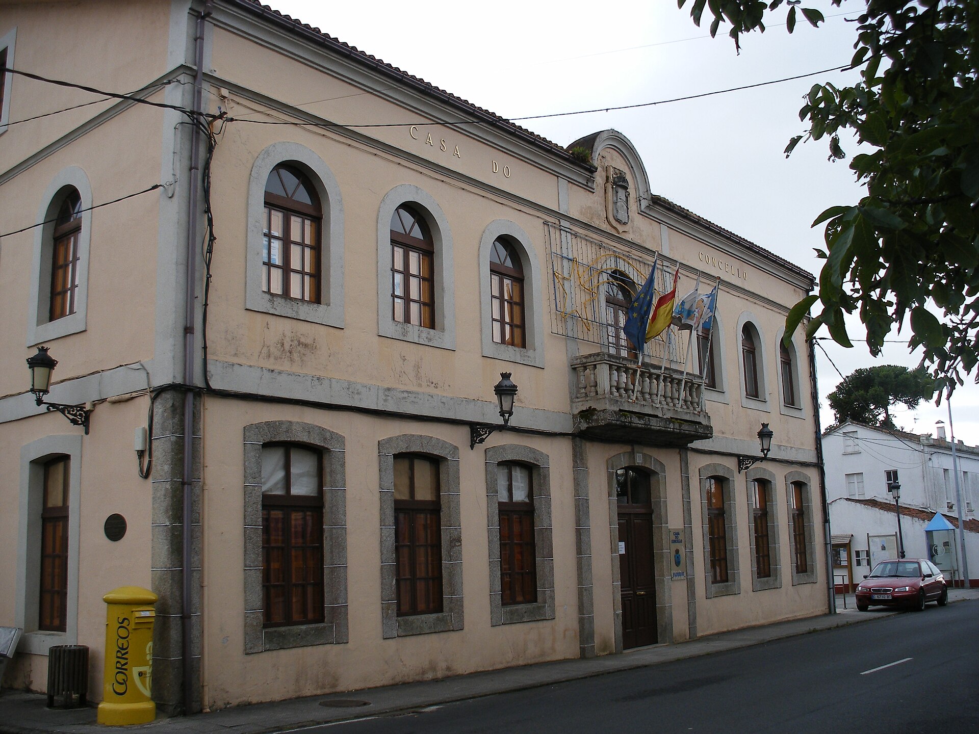
Paderne town hall
Paderne
Paderne Town Hall (Pazo de Moscoso) is a 16th-century Galician manor house that now serves as the seat of the municipal government of Paderne, in the province of A Coruña, Galicia, Spain. How to get there? Paderne sits in the comarca of Betanzos, roughly 26 km east of A Coruña. Driving is the most practical option — the trip from A Coruña takes about half an hour, and Betanzos, the nearest larger town, makes a good base for exploring the wider area. The municipality also lies along the Camino Inglés, one of the historic routes of the Camino de Santiago, so some visitors arrive on foot as part of a longer pilgrimage toward Santiago de Compostela. The surroundings are rural, so a car is the easiest way in if you're not walking the trail. What will you see? The town hall occupies a converted pazo — the type of stone manor house typical of Galicia, traditionally built alongside a manor courtyard and a family chapel. Pazo de Moscoso dates to the 16th century and belonged to local nobility for generations before being repurposed as the municipal administration building. The appeal for visitors lies in its solid stone architecture, characteristic of Galician noble residences of the period: thick walls, plain, functional façades, and restrained decorative detail that speaks more to status than to ornament. The municipality of Paderne itself has a much longer history than the town hall building. Settlement in the area dates back to Roman times, and the medieval town was founded in the 10th century by Pedro Fróilaz, Count of Traba, one of the most influential figures in medieval Galician history. In the 15th century, Paderne came under the control of the House of Andrade, one of the region's most powerful noble families, placing the town hall and its surroundings within a broader network of Galician aristocratic estates from that era. A visit to Paderne pairs well with a short walk through the town itself — a small, quiet municipality of around 2,450 residents, typical of rural Galicia, with scattered housing and plenty of green surroundings. When to visit? Spring and summer are the best times to come, when Galician weather is at its most stable and days are longer — useful both for exploring the area and for anyone walking into Paderne along the Camino Inglés. Autumn is also pleasant, with fewer visitors than peak season. Winters in this part of Galicia tend to be wet and changeable, which can make longer walks less comfortable, though the town hall building itself can be viewed year-round. Frequently asked questions Can you visit the inside of Paderne Town Hall? The building functions as the municipal administrative office, so interior access is generally limited to office hours and official business — it isn't a museum open to visitors on a permanent basis. What is Pazo de Moscoso? It's a 16th-century stone manor house typical of Galician noble architecture, later converted into the seat of the Paderne municipal government. Is Paderne on the Camino de Santiago? Yes, the municipality lies along the Camino Inglés, one of the historic routes of the Way of St. James leading to Santiago de Compostela. How far is Paderne from A Coruña? About 26 kilometers, roughly a half-hour drive to the east through the comarca of Betanzos.
-
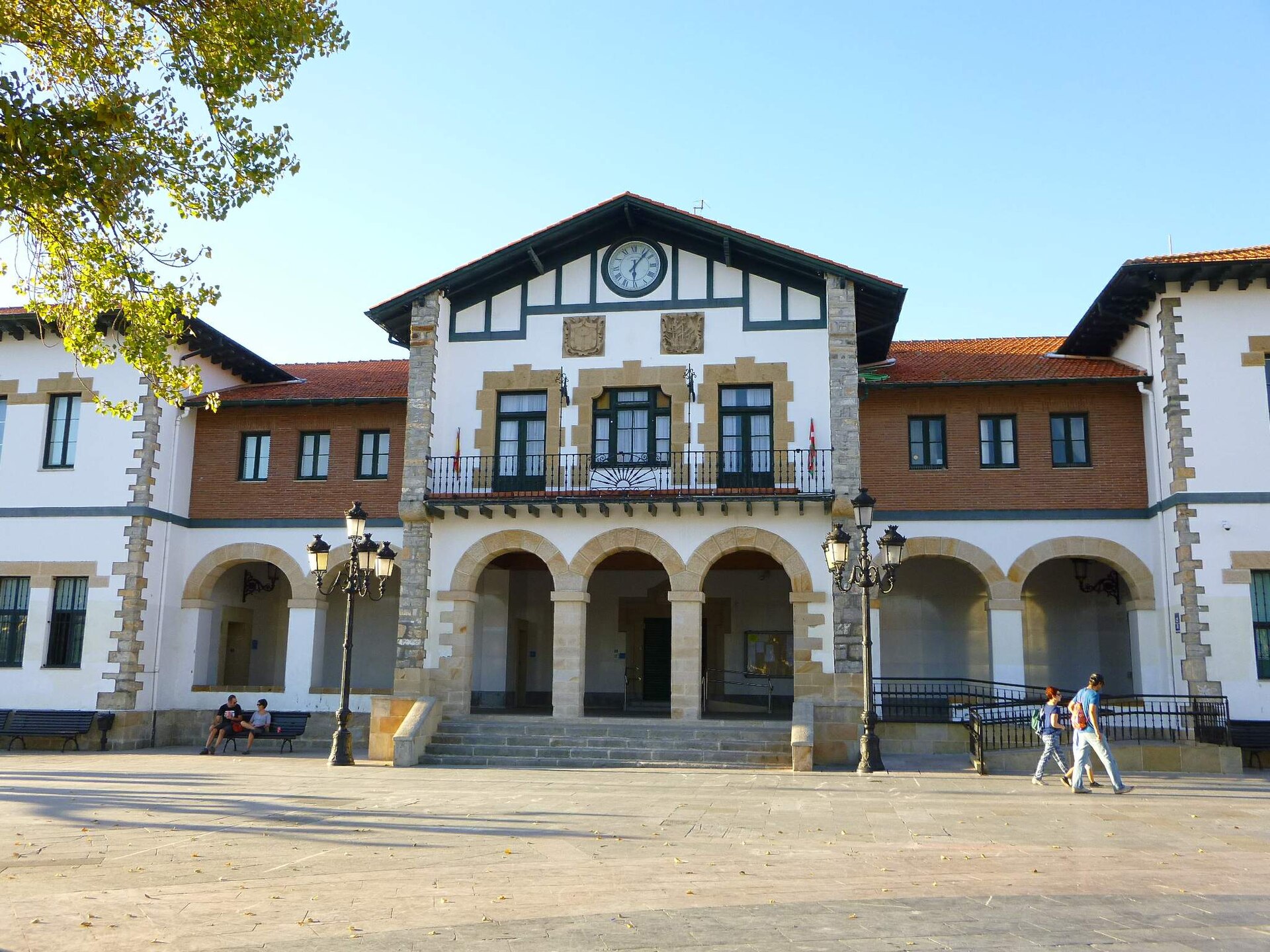
Plentzia town hall
Plentzia
Plentzia town hall stands at the heart of Plentzia, a small coastal town in Biscay where the Butrón river meets the Bay of Biscay. The building is a working seat of local government, but it's also a compact lesson in early 20th-century Basque civic architecture, and it fits easily into a stroll through the old quarter. What does the building look like, and who designed it? The current town hall was designed by architect Antonio de Araluce in the neo-Basque style (neovasco), a movement popular across the Basque Country in the early 1900s. Construction dates to the 1920s — the town marked the building's centenary in 2022. Araluce laid the structure out in three parts: a central block for municipal administration flanked by two side wings, each with its own separate entrance. Unusually, the building was designed from the outset to serve three purposes at once: town hall, nautical school, and primary school. That multi-use brief shows in the symmetrical, representative facade and in how the interior is divided, both typical of civic buildings from that period. Where did the town hall used to be? Before the council moved into the current building, local government was based at number 25 Goienkale street, in a house-tower dated to 1562. Together with the parish church, it's one of the oldest surviving buildings in the old town. That older building was refurbished in 1986, and in 1988 the Plasentia de Butrón Foundation opened a museum inside it dedicated to Plentzia's history. Today visitors can see exhibits covering the town's past, its maritime traditions, and the wider region. What else is worth seeing nearby? The town hall sits in Plentzia's historic centre, close to the parish church and other period buildings of the old quarter. The town is also known for its beach and marina at the mouth of the Butrón estuary, a popular spot for sailors and water-sports fans. Walking from the town hall toward the waterfront, you get a clear contrast between the dense stone architecture of the old town and the open space of the estuary. It's a worthwhile short stop while exploring the Biscay coast, especially on a route linking the coastal towns toward Bilbao or Getxo. When is the best time to visit? Spring and summer are the best times to visit Plentzia, when the weather suits walking around the old town and the beach, and the town's everyday life — cafés, markets, events around the marina — is most visible. The town hall building itself can be viewed from the outside year-round, since it functions as an active council office rather than a museum, unlike the old house-tower. Frequently asked questions Can tourists go inside the town hall? The building is an active municipal office, so visitor access is generally limited to public areas during administrative opening hours. For a proper visit, the old house-tower town hall on Goienkale, now home to the town museum, is the better option. What architectural style is the building? It's an example of the neo-Basque style (neovasco), typical of public buildings raised across the Basque Country in the early 20th century, blending traditional regional architecture with a formal civic look. What is Plasentia de Butrón, and how does it relate to the museum? It's a historical name tied to the town's founding and the Butrón family, who played a significant role in Plentzia's history. The foundation carrying that name has run the museum inside the old town hall building since 1988. Are there other landmarks near the town hall? Yes — the parish church and the old town's historic buildings sit right nearby, and the marina and beach at the mouth of the Butrón river are just a few hundred metres away.
-
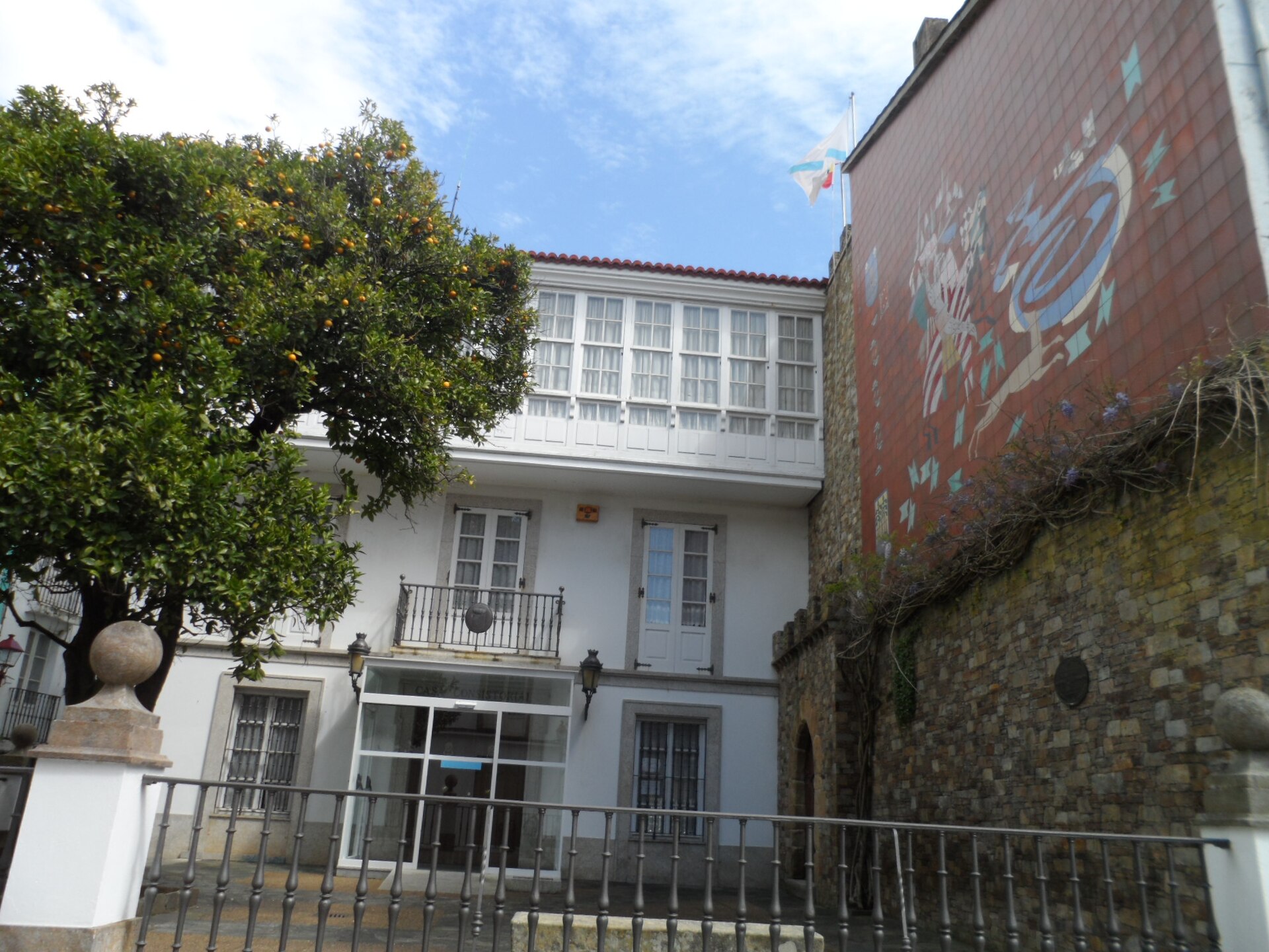
Cedeira town hall
Cedeira
Cedeira town hall (Galician: Casa do Concello de Cedeira) is the seat of local government for this small fishing town in the province of A Coruña, in Galicia, on Spain's northwestern coast. The building stands in the heart of Cedeira and serves as the administrative center for the whole municipality, handling everyday matters for residents as well as questions from visitors passing through. How to get there? Cedeira sits on the Ría de Cedeira estuary, framed by the hills of the Sierra de la Capelada and not far from Cabo Ortegal. The town is easiest to reach by car, along local roads connecting it to larger Galician hubs such as A Coruña and Ferrol, both roughly an hour's drive away. The town hall itself is right in the town center, an easy walk from anywhere in Cedeira's old quarter, including the fishing harbor. What is this building? The town hall is a typical local administration building — the place where residents handle official paperwork and where visitors can pick up basic information about the town and the surrounding area. Cedeira is best known as a working fishing port and as a gateway to the beaches and coastline of the Costa Ártabra. Nearby stand the wide dune beach of Vilarrube and the beach of Pantín, well known across Spain for its surfing competitions. As the town's administrative hub, the town hall functions as a natural point of reference when exploring — the harbor, the old town, and the seafront promenade are all close by. When to visit, and how to get in touch? The town hall office is open Monday to Friday from 08:00 to 14:00 and again from 17:00 to 20:00, and on Saturdays from 10:00 to 13:00. The split schedule, with an evening slot on weekdays, makes it convenient to handle official business after regular working hours. For anything that needs a phone call — confirming opening hours around public holidays, for instance, or asking about local services — the office can be reached at +34 981 482 897. For visiting the town itself, spring and summer are the most rewarding seasons, when the weather is best suited to walking the coastline and reaching the nearby beaches. Outside the high season, Cedeira keeps the quieter, more authentic feel of a typical Galician fishing town, which suits travelers looking for a less crowded destination. Frequently asked questions Where exactly is Cedeira town hall located? The building stands in the center of Cedeira, in the province of A Coruña, Galicia, close to the harbor and the town's old quarter. What are the opening hours of the town hall? Monday to Friday it's open from 08:00 to 14:00 and from 17:00 to 20:00, and on Saturdays from 10:00 to 13:00. How can I contact the office? You can call +34 981 482 897 for information on opening hours or administrative matters. What else is worth seeing near the town hall? Close by are Cedeira's fishing harbor and old town, and just outside the town center are the well-known beaches of Vilarrube and Pantín, popular with surfers and coastal travelers alike.
-
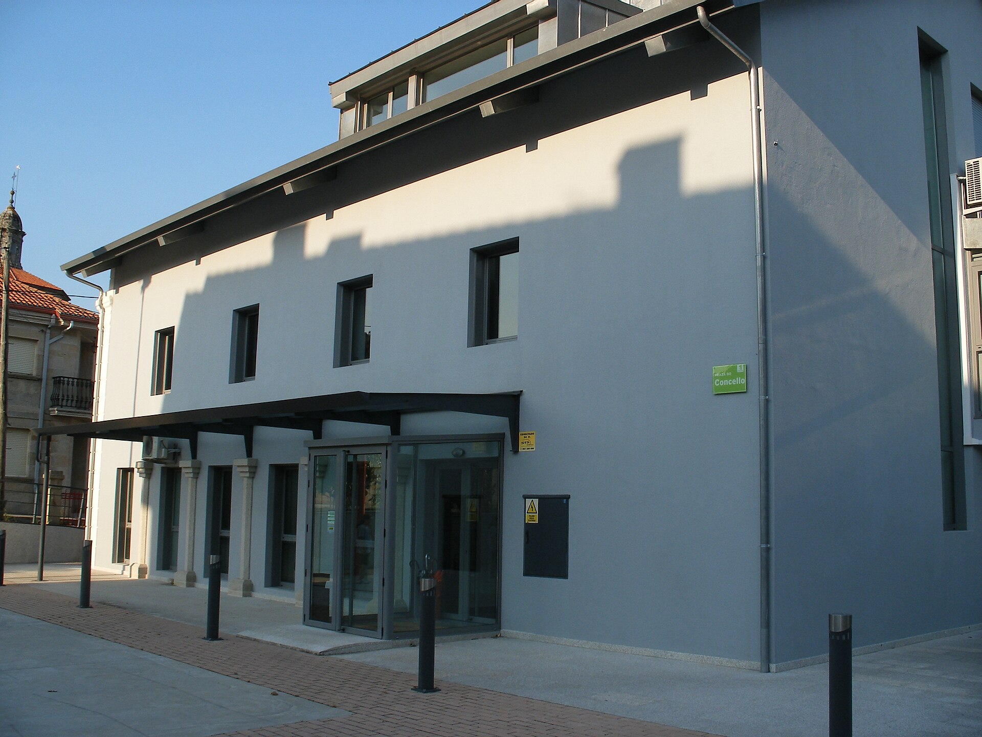
Brión town hall
Brión town hall (Concello de Brión) is the seat of local government for a small rural municipality in the province of A Coruña, Galicia, roughly 13 kilometers west of Santiago de Compostela toward the coast. The building sits at Praza do Concello 1, postal code 15865, and works as a useful landmark for anyone exploring the countryside just off the Camino routes into Santiago. Where is Brión and what kind of municipality is it? Brión covers just under 75 km², split between two distinct landscapes: the Amaía valley, drained by the Sar river, and the Tambre river watershed. Elevation ranges from around 30 meters near the Sar up to more than 525 meters on the hills in the south of the municipality. About 7,100 people live here, spread across 106 villages organized into 9 parishes, with three main population centers. The town hall administers this scattered rural territory, which explains why the building itself is modest and functional — an active administrative office rather than a monument built for show. What is the history behind Brión's local government? The first record of a municipal authority in Brión dates to August 6, 1811, during the Cortes of Cádiz, when the feudal lordship tied to Altamira was abolished and the so-called Constitutional Municipality of Altamira was created — the forerunner of today's Brión administration. The municipal coat of arms, meant to sum up this history, was only commissioned in 1984, from heraldist Jaime Bugallal y Vela. Earlier, in the Middle Ages, the area was under the influence of the Moscoso family, who controlled Altamira Castle; its ruins are now managed by the A Coruña provincial government. In 2021 the municipality marked the 500th anniversary of the so-called Battle of Altamira, a clash between ecclesiastical and noble forces that remains a reference point in local identity. What is there to see around the town hall? The town hall building itself is not a tourist attraction, but the municipality it governs has substantial heritage on the ground. Brión has roughly a dozen baroque parish churches built mainly in the 17th and 18th centuries, plus more than sixty cruceiros — the stone crosses typical of the Galician countryside — scattered across its villages. A chapel holding the relics of Saint Minia draws a steady stream of visitors. The area also includes the Barrié de la Maza reservoir, built in 1945, and several pazos, the traditional Galician manor houses. History buffs can visit the Castro Lupario archaeological site, evidence of earlier Celtic settlement in the region. How do you get there, and when is the best time to visit? Brión sits close to the main roads linking the coast with Santiago de Compostela, so it is easy to reach by car — the drive from central Santiago typically takes only a matter of minutes. The town hall serves residents and visitors Monday to Friday, from 7:45 AM to 3:15 PM. Spring and early autumn are the best times to come, when Galician weather is milder and the surrounding villages and parish churches can be explored at a relaxed pace. Frequently asked questions Can you visit Brión town hall as a tourist site? No — it is a working administrative office, open during business hours, not a heritage building set up for visits. How far is Brión from Santiago de Compostela? About 13 kilometers toward the coast, usually just a few minutes' drive. What else is worth seeing in the Brión municipality? Baroque parish churches, numerous cruceiros, the ruins of Altamira Castle, the chapel of Saint Minia, and the Barrié de la Maza reservoir. How many parishes and villages make up the Brión municipality? The municipality has 106 villages organized into 9 parishes, home to about 7,100 people.
-
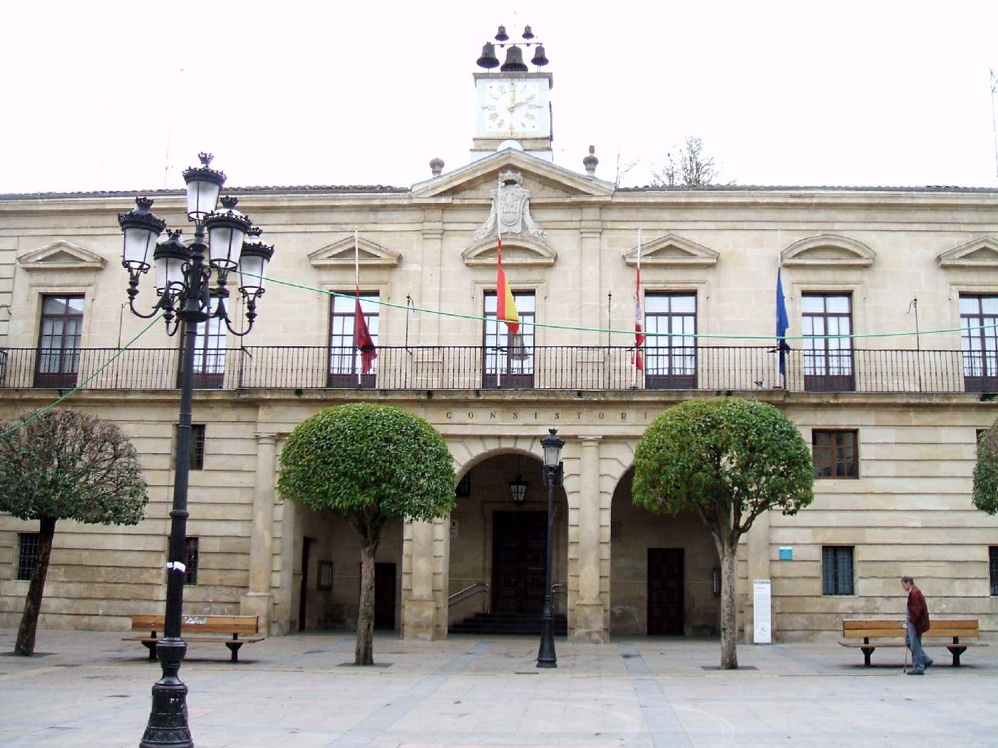
Miranda de Ebro City Council
Miranda de Ebro
Miranda de Ebro City Council is the seat of local government for this town in Burgos province, standing on Plaza de España, the main square of Miranda's old quarter. It's a working office as much as a historic building, and the square around it is where much of the town's public life actually happens. Where exactly is the City Council located? The address is Plaza de España 8, right in the center of Miranda de Ebro, a short walk from the Ebro riverbank and the narrow streets of the old town. The square is known locally as both Plaza de España and Plaza Mayor — the traditional, formal gathering space of the town, lined with stone houses from the same era as the council building itself. For a visitor it's an easy reference point: it's reachable on foot from the train and bus stations, and most walking routes through the old town branch out from here. What is this square, and what happens on it? Plaza de España has long served as Miranda's public heart — the setting for town festivals, markets, the occasional concert, and simple everyday gatherings. The stone buildings ringing the square, including the council house itself, form a compact, unified ensemble typical of Spanish towns this size, where the city hall was always given the most prominent spot in town. Sitting at one of the nearby cafés for a while is a good way to take in the local rhythm without rushing. What kind of business gets done here? As an active local government office, the building handles residents' everyday administrative needs — registration, local taxes, general information about the town. The council also runs an electronic office (sede electrónica) that lets people complete some paperwork online rather than in person. For visitors, the practical upshot is that the interior isn't set up for sightseeing — it's a functioning municipal office, not a museum, so don't expect to walk in beyond whatever official business brings you there. What else is worth seeing nearby? From the square in front of the City Council, it's a short walk to the Ebro riverbank and to Antonio Machado Park, home to the town's tourist information office, which covers the wider region as well as Miranda itself. Several walking routes through town start from around there, linking the old quarter, riverside viewpoints, and the rest of the historic center — a good spot to plan the rest of a day of sightseeing before moving on. When is the best time to visit? Spring and early autumn make for comfortable walking around the square and the surrounding streets, avoiding summer heat and crowds. If your visit lines up with a local festival or market on Plaza de España, it's worth lingering — that's when the square is at its liveliest. Frequently Asked Questions Can visitors go inside the City Council building? It's an active municipal office, so access during working hours is mainly for people with administrative business — for most visitors, the visit means taking in the square and the facade from outside. Where exactly does the building stand? At Plaza de España 8, in Miranda de Ebro's historic center, close to the river and the main streets of the old town. Where can I get tourist information if not at the council building? The town's tourist office operates separately, in Antonio Machado Park, and that's the place to ask for maps, walking routes, and current events. Can council business be handled without visiting in person? Partly — the town runs an electronic office (sede electrónica) that covers some paperwork remotely, so not everything requires a trip to the building itself.
-
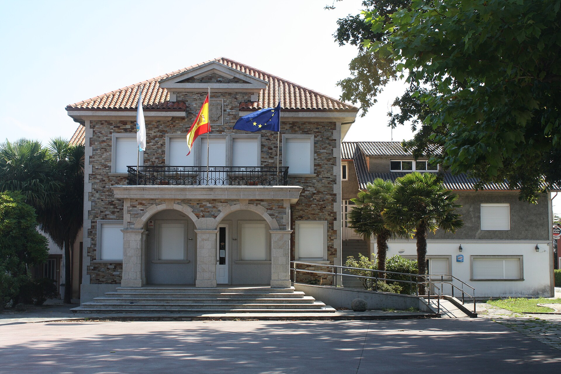
Mesía town hall
Mesía
Mesía town hall (Casa do Concello de Mesía) is the seat of local government for the municipality of Mesía, in the province of A Coruña, in Galicia, in northwestern Spain. The building stands in the village of Xanceda, along the road running through the municipal centre, and serves an administrative role — this is where the mayor and the municipal council are based, and where official paperwork gets handled for anyone passing through this stretch of inland Galicia. Where exactly is the town hall? The address is Rúa Xanceda s/n, 15685 Mesía (A Coruña). The coordinates — 43.0802389, -8.237941 — place it well inland, roughly between the region's two major hubs: A Coruña lies about 40 km to the north, and Santiago de Compostela a similar distance to the southwest. Mesía itself has no coastline; it's a typical interior Galician municipality, made up of scattered parishes and small villages rather than a single urban centre. How do you get there? A car is the practical way in — Mesía sits off the main national routes, reached instead via local roads connecting it to neighbouring municipalities within A Coruña province. Anyone driving between A Coruña and Santiago de Compostela, or heading toward Sobrado dos Monxes, can take a short detour through Xanceda to see the town hall building. There's no direct rail or air link into the municipality itself — the nearest airport is in Santiago de Compostela, and the nearest train stations are in A Coruña. When can you actually reach someone at the office? The town hall serves residents and visitors Monday to Friday, from 07:30 to 15:00. That's a standard schedule for Spanish municipal offices, concentrated in the morning — the building closes after 15:00 and stays shut on weekends. It's worth planning ahead, especially if the matter requires a specific department. What's worth knowing about the municipality of Mesía? Mesía has a population of around 2,418 (1,217 men and 1,201 women), making it one of the smaller municipalities in A Coruña province. Its mayor is Mariano Iglesias Castro, of the PSdeG-PSOE. The area is rural and agricultural in character — typical of inland Galicia, with parishes, farms and small clusters of housing spread across the territory rather than a dominant town centre. The town hall building itself is a functional civic structure rather than a heritage monument, but for anyone routing through the central part of A Coruña province it works as a landmark and a place to pick up local information. Contact details The office can be reached by phone at 981 687 001, by email at correo@concellodemesia.gal, and full official information is available at concellodemesia.gal, including the town hall's electronic public office (sede electrónica). Frequently asked questions Where exactly is Mesía town hall located? At Rúa Xanceda s/n, 15685 Mesía, in the province of A Coruña, Galicia — coordinates 43.0802389, -8.237941. What are the office hours? Monday to Friday, 07:30 to 15:00. The building is closed on weekends and after 15:00 on weekdays. How big is the municipality of Mesía? Around 2,418 residents, placing it among the smaller municipalities in A Coruña province. Can you contact the office without visiting in person? Yes — by phone (981 687 001), by email (correo@concellodemesia.gal), or through concellodemesia.gal, which also hosts the town hall's online public office.
-
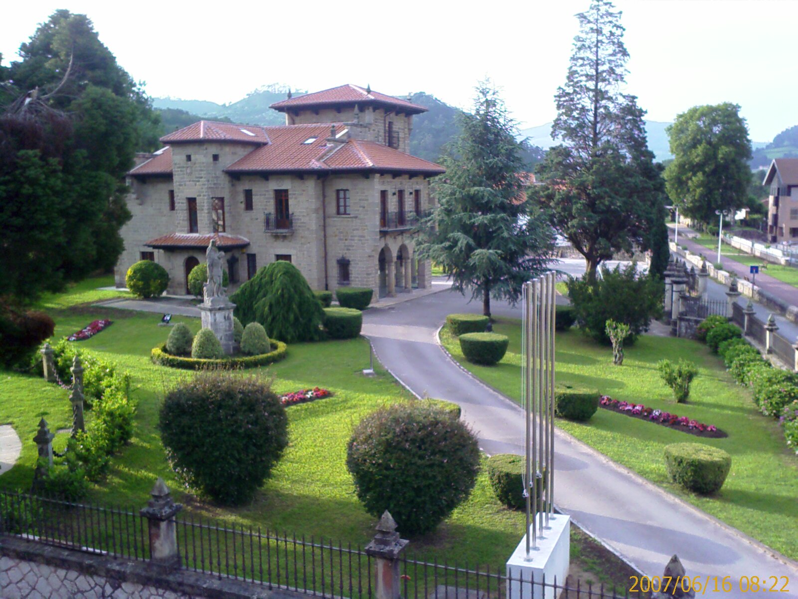
town hall of Puente Viesgo
Puente Viesgo
Casona de Fuentes-Pila — today's town hall of Puente Viesgo — is the stone seat of local government standing right in the centre of this small Cantabrian town. The building doubles as a piece of regionalist architecture and an administrative office, making it a natural stop while walking around a town best known for its thermal springs and caves. What is the history behind the building? The design dates to 1928 and was drawn up by Javier González de Riancho (1881–1953), an architect closely tied to the spread of Cantabrian regionalism. The building draws on the old "casonas montañesas" — the stone manor houses typical of the 17th and 18th centuries in the mountains of Cantabria — borrowing their forms freely rather than reproducing any single period or model. That approach, common in early 20th-century regionalist design, aimed to recreate the spirit of old mountain architecture within a new, functional civic building. What will you see standing in front of the town hall? The façade is built in stone, following the montañés tradition of solid, heavy masonry meant to withstand the damp climate of northern Spain. Well-kept gardens surround the building, extending the public space around the town hall and giving visitors a pleasant spot to take photographs. The building is listed as a Cultural Heritage Site under the Monument category, confirming its architectural and historical standing among the region's civic buildings. What is it used for today? Casona de Fuentes-Pila still functions as the seat of Puente Viesgo's local government — housing the mayor's office and municipal administration. That living use keeps the building from feeling like a museum piece; it remains part of the town's everyday rhythm, which adds to its appeal for visitors. How do you get to the town hall in Puente Viesgo? Puente Viesgo sits in the Pas river valley in Cantabria, an easy 25–30 minute drive from Santander. The town hall stands right in the town centre, so the simplest approach is to drive in, park nearby, and continue on foot — the centre of Puente Viesgo is compact and comfortable to explore on foot. The building's coordinates are 43.2989466, -3.9641496, handy for GPS navigation. What else is there to see nearby? Puente Viesgo is well known for its spa (Balneario de Puente Viesgo) and its caves, including the famous Cueva de El Castillo with its prehistoric rock art — one of the region's UNESCO-listed attractions. A visit to the town hall pairs naturally with a short walk through the centre and a trip to the nearby thermal baths or caves, rounding out a full day exploring the Pas valley. When is the best time to visit? Spring and early autumn are the most comfortable seasons for strolling through the centre and admiring the town hall's architecture, when Cantabria's weather is mild and the surrounding gardens look their greenest. Summer brings more visitors drawn by the spa and the caves, so it's worth allowing time to see the town centre outside the busiest midday hours. Frequently asked questions Can you go inside the Puente Viesgo town hall? The building is an active municipal office, so the interior is mainly accessible for administrative business — most visitors admire it from the outside, taking in the architecture and gardens. Who designed the town hall building? The 1928 design is the work of Javier González de Riancho, an architect associated with the Cantabrian regionalist movement. Is the building protected as a heritage site? Yes, it is listed as a Cultural Heritage Site under the Monument category, reflecting its historical and architectural value. What else is worth seeing in Puente Viesgo? Besides the town hall, the town's spa and the Cueva de El Castillo, with its prehistoric rock art, are both a short distance from the centre.
Earn badges for the places you visit
Download NextOnTrip, discover new places and check off your trails.