Nature in Spain
A guide to 849 Nature in Spain — with descriptions, photos and traveler visits from the NextOnTrip community. Locations spread across 518 cities and towns. Most visited by the community: Comunero de Revenga, Dehesa de Navalcarbón, Painted Cave, Galdar.
-
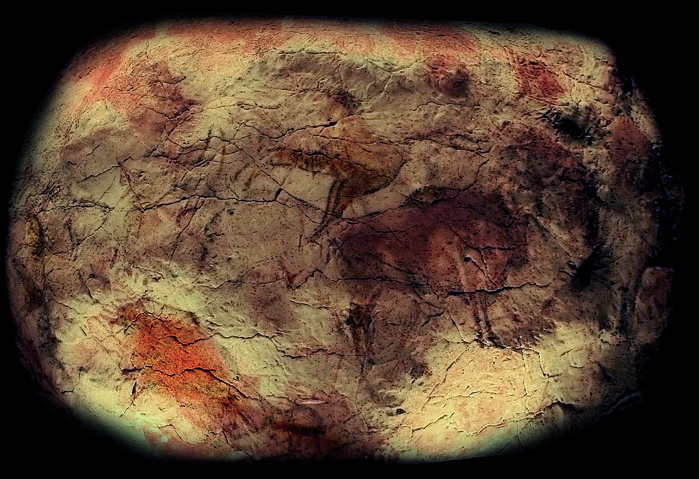
Cave of Altamira
Santillana del Mar
Altamira is a cave near Santillana del Mar in Cantabria, home to one of the most significant collections of Paleolithic art on Earth. The bison, horses, deer and boars painted across its ceiling are many thousands of years old, and the site has held UNESCO World Heritage status since 1985. Few places let you stand this close to the very beginnings of human art. What will you see at Altamira? The centerpiece is the so-called Great Hall of Polychromes, a ceiling covered in animal figures rendered in red ochre and outlined in black. The original artists used the natural bulges and contours of the rock to give the animals a sense of volume — a technique that still feels striking today. Since the original cave is almost entirely off-limits to visitors, the heart of any visit is the Neocueva, a faithful reproduction of the painted chamber built using the same materials and techniques as the original. It sits inside the National Museum and Research Centre of Altamira, alongside an exhibition on Paleolithic life and the history of the cave's discovery. Can you actually visit the original cave? Yes, but only in a very limited way. Humidity, carbon dioxide and heat generated by visitors pose a real threat to the paintings, so access to the real cave is restricted to a handful of people per week. Entry requires special clothing and takes place under strict environmental controls, with the visit itself lasting around 37 minutes. Spots are assigned by lottery rather than sold directly, which is why the Neocueva remains the realistic — and genuinely satisfying — option for the vast majority of visitors. How do you get to Altamira? Santillana del Mar sits in Cantabria, a short drive from Santander, and is best reached by car or a local bus service. The museum is on the edge of the town and has its own parking area. Santillana del Mar itself, with its medieval streets and cobbled lanes, is worth pairing with the museum visit as an attraction in its own right. When should you visit? The museum is open year-round, though it gets busiest during the summer months of July and August, particularly around midday. Spring and autumn offer a quieter experience, and booking tickets online in advance helps you skip the queue at the entrance. Plan for at least 1.5 to 2 hours to comfortably take in both the Neocueva and the permanent exhibition. Frequently asked questions Can visitors see the real Altamira paintings? Only to a very limited extent — access to the actual cave is granted to a small number of visitors each week, chosen by lottery, under conditions designed to protect the artwork. Most visitors instead experience a faithful replica in the Neocueva. How old are the paintings at Altamira? They are Paleolithic works many thousands of years old, depicting mainly bison, horses, deer and boars painted in red ochre with black outlines. Is Altamira a UNESCO World Heritage Site? Yes, the cave has been on the UNESCO World Heritage List since 1985 as one of Europe's key sites of Paleolithic art. How long does a visit take? A visit to the museum, including the Neocueva, typically takes 1.5 to 2 hours, enough time to see both the reproduced paintings and the exhibition on prehistoric life.
-
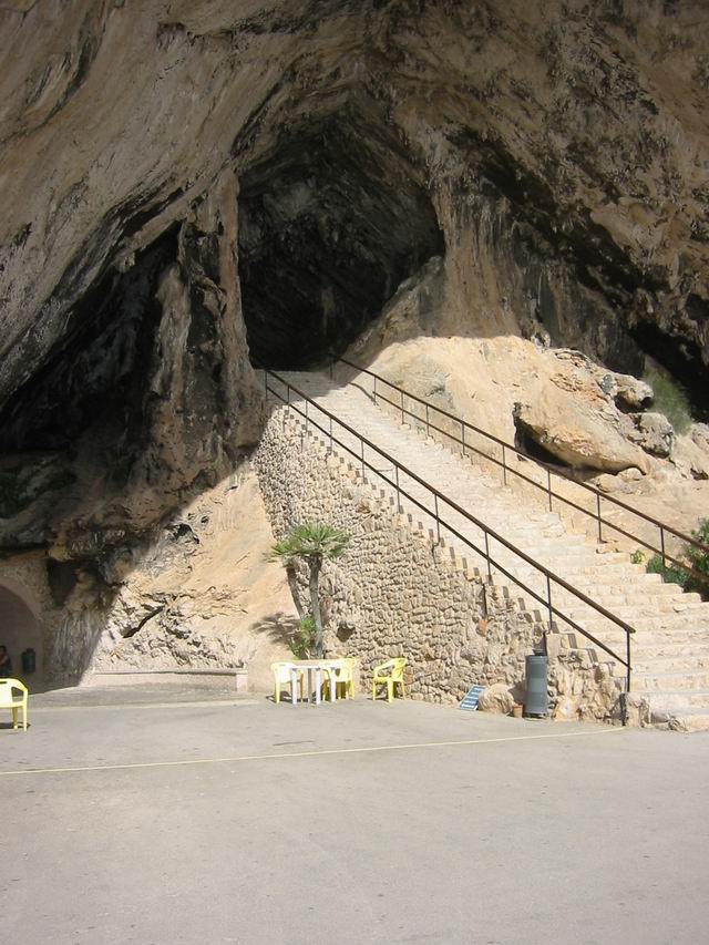
Coves d’Artà
Canyamel
Coves d'Artà is one of Mallorca's best-known limestone cave systems, perched above Canyamel beach in the municipality of Capdepera on the island's east coast. Despite carrying the name of nearby Artà, the entrance actually sits right above Canyamel, just a short drive from Cala Rajada. Where exactly are the caves? The caves open onto a cliff face overlooking Canyamel bay, on Mallorca's eastern shoreline. The setting is striking in its own right — the terrace in front of the entrance offers sweeping views of the Mediterranean, a reward in itself before visitors even step underground. Access is straightforward whether you're coming from Cala Rajada, Canyamel, or Capdepera. How do you get there? Driving is the easiest option, with parking available right at the entrance. The route follows the local road connecting Canyamel and Cala Rajada, and is clearly signposted for visitors. Travelers without a car can join an organized excursion departing from most resorts in northeastern Mallorca, or take a bus to Canyamel, from where it's a short walk up to the entrance. What will you see inside? Inside, a network of chambers houses stalactites and stalagmites shaped over thousands of years. The visitor route follows lit, marked pathways through a series of halls, the largest of which impress with their height and the scale of their rock formations. Columns formed where stalactites and stalagmites have fused together, alongside the irregular natural contours of the walls, make the walk feel like moving through an underground landscape sculpted purely by water and time. The site is among the oldest show caves on the island, with organized visits dating back to the 19th century — making Coves d'Artà one of the pioneers of cave tourism in Mallorca. That history is still reflected in the lighting design and infrastructure, which has been modernized over the years while preserving the raw character of the interior. How long does a visit take? A standard walk-through visit takes roughly 40 to 50 minutes. Paths are paved and fitted with handrails, though the air inside is noticeably more humid and cooler than outside — a light layer is worth packing even in summer. When is the best time to visit? The caves are open year-round, since the internal temperature stays stable regardless of the season outside. Crowds are thinnest early in the morning or during the shoulder months (April–May, September–October), when you can move through the chambers at a more relaxed pace. During peak summer, expect more tour groups sharing the route. What else can you combine it with? Given its proximity to Canyamel beach, a cave visit pairs easily with a beach day or a coastal walk toward Cala Rajada. It also makes a convenient base for exploring more of northeastern Mallorca, including the historic old towns of Artà and Capdepera nearby. Frequently asked questions Is the cave slippery, and is it suitable for children? The walkways are paved, lit, and fitted with handrails, making the route accessible for families with children. Some sections are more humid, so extra care is advised there. Do I need to book tickets in advance? During peak season, booking ahead is recommended, especially for visits during busy midday hours, to avoid queues at the entrance. What's the temperature like inside? The cave maintains a steady, cooler temperature than the surface, making it a pleasant escape from the summer heat. Are there other attractions nearby? Yes — Canyamel beach, the scenic town of Cala Rajada, and the historic center of Artà are all close by, making it easy to plan a full day exploring the area.
-
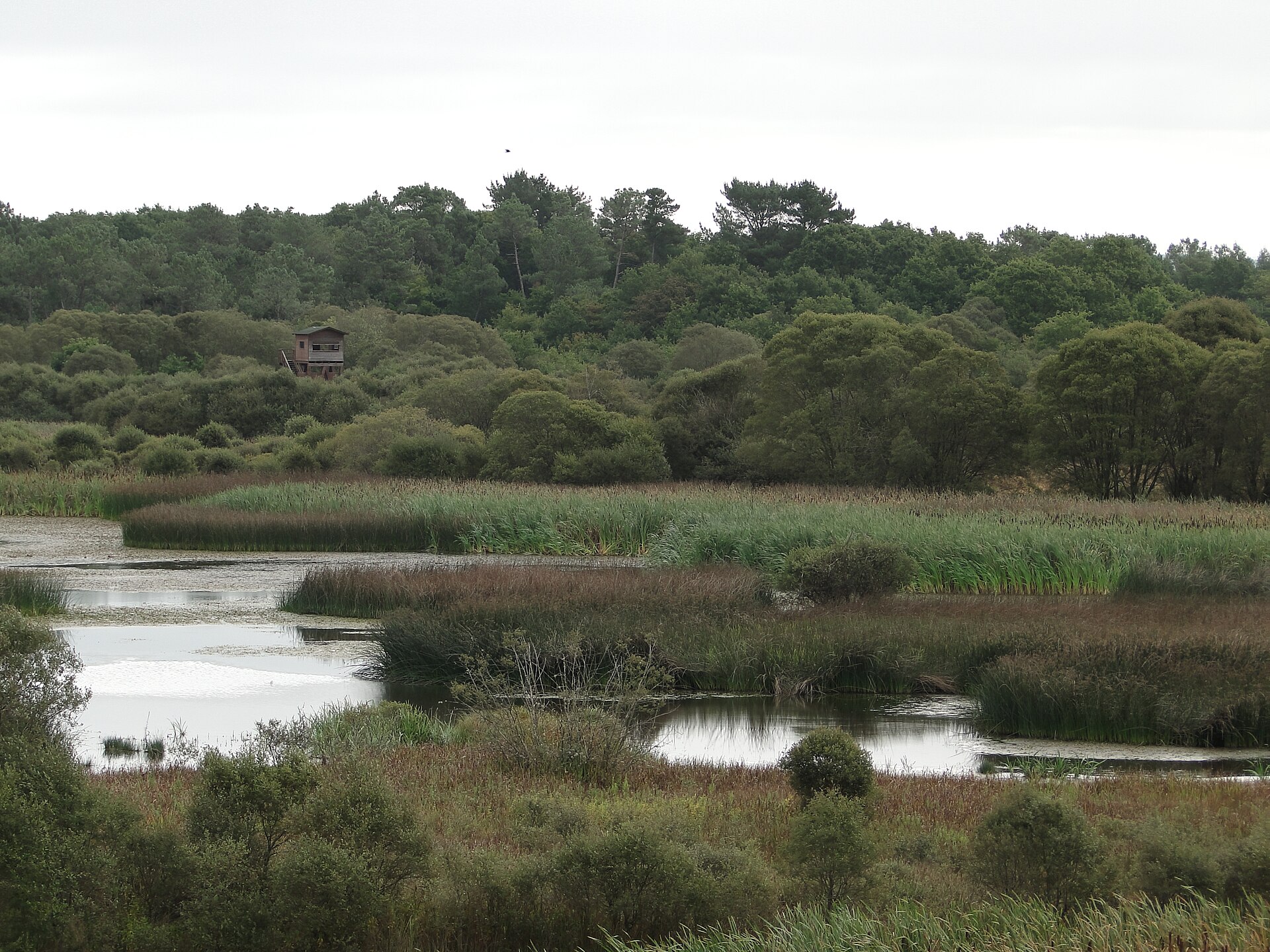
Lagoa de Cospeito
Cospeito
Lagoa de Cospeito is a permanent wetland in the municipality of Cospeito, in the province of Lugo, within Galicia's Terra Chá region. It sits in the parish of Santa Cristina, across from the village of Sistallo, roughly 25 km from the city of Lugo. What is this place? Lagoa de Cospeito, also known as the Santa Cristina lagoon, is today regarded as the most important wetland in the Terra Chá region. The central lake covers more than five hectares, though historically the site held two lagoons spanning close to 75 hectares combined. In the 1970s the wetland was drained to create farmland, and it was only later, through administrative action, that part of the original water system was restored. Because of its ecological value, the lagoon belongs to the Natura 2000 network and has been placed under general protection as a Natural Space by Galicia's environmental authority. It also forms part of the Terras do Miño Biosphere Reserve, which underlines its significance beyond the purely local scale. Why visit? The lagoon's biggest draw is its biological richness. A small aquatic thistle, Eryngium viviparum, grows in and around its waters, and Cospeito hosts the largest known population of this species anywhere in the world. That single fact gives the site a conservation importance that reaches well past Galicia. Among birds, the lapwing stands out, since the lagoon is one of the few places in the area where the species still breeds. For birdwatchers and nature enthusiasts, this makes Cospeito worth a visit at almost any time of year, though breeding and migration periods offer the best chances for interesting sightings. How do you explore the lagoon? A circular path runs around the lake, allowing visitors to walk the full perimeter with easy, low-effort access to the wetland. The route requires no special physical preparation, which makes it suitable for families with children as well as anyone looking for a calm walk close to nature. Given its location about 25 km from Lugo, Lagoa de Cospeito fits comfortably into a day trip from the city, especially combined with other stops around the Terra Chá region. Frequently Asked Questions Where is Lagoa de Cospeito located? In the municipality of Cospeito, province of Lugo, in the parish of Santa Cristina across from the village of Sistallo — about 25 km from the city of Lugo. Is the lagoon a protected area? Yes. It belongs to the Natura 2000 network, holds Natural Space status under general protection granted by Galicia's environmental authority, and is part of the Terras do Miño Biosphere Reserve. What is worth seeing around the lagoon? Look out for the aquatic vegetation, including the rare thistle Eryngium viviparum, and for birdlife — the lagoon is one of the few places where lapwings still breed regularly. Can you walk around the lagoon? Yes, an easily accessible circular path runs around the lake and can be walked without special preparation.
-
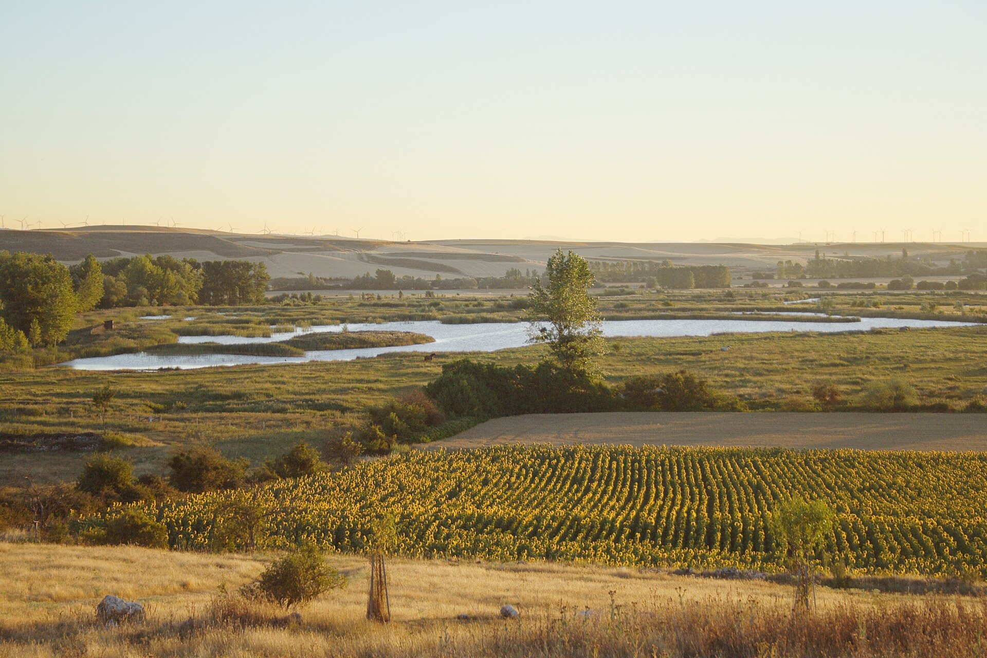
Atapuerca wetlands
Atapuerca
The Atapuerca wetlands (Lagunas de Atapuerca) are a group of five lagoons at the foot of the Sierra de Atapuerca, right next to the village of Atapuerca in the province of Burgos. Wetland habitats are scarce in this part of Castile and León, which makes this roughly 16-hectare site disproportionately important for local wildlife despite its modest size. Where the lagoons came from These lagoons are not a fully natural feature. They were built in 2008 after the Atapuerca town council asked the regional government of Castile and León to create a wetland that could act as a wildlife refuge and an ecological corridor for migratory birds. A year later, following initial restoration work, the site began attracting a growing number of species. The region is currently carrying out a further round of restoration at the lagoons, expected to be completed in spring 2026. Why the site matters for birds The lagoons sit along the Corredor de la Bureba, the most important migratory bird route on the entire Iberian Peninsula. Because of this position, 225 bird species have been recorded here since the 2009 rehabilitation — roughly three-quarters of every species ever logged in the whole province of Burgos. Beyond waterfowl and migratory birds, the surrounding scrub shelters amphibians, reptiles, and mammals such as roe deer, wild boar, foxes, and badgers. Visiting the wetlands The lagoons can be reached directly from the center of Atapuerca village, making them an easy stop for anyone already in the area. A marked nature trail, "Humedales de Atapuerca," loops around the ponds and lets visitors watch birds without entering restricted zones. The route needs no special preparation and works well as a relaxed family walk — ideally with binoculars — appealing equally to birdwatchers and to travelers simply looking for quiet ground off the main tourist track. The connection to the archaeological site Atapuerca is best known for the prehistoric archaeological site inscribed on the UNESCO World Heritage List, where some of the oldest human remains in Europe were found. The lagoons, however, lie in a different part of the municipality and form a separate nature attraction. For anyone visiting the archaeological caves, the wetlands make a natural add-on, showing a different side of the same area within a single day trip. Best time to visit Migratory birds pass through in the largest numbers during spring and autumn, when the main waves move along the Corredor de la Bureba. Water levels tend to drop in summer, while winter brings a quieter but still active site with wintering species. Whatever the season, early morning is when bird activity is highest. Frequently Asked Questions Are the Atapuerca lagoons natural or man-made? They are man-made, built in 2008 at the initiative of the town council to compensate for the lack of wetland habitats in the region. What birds can be seen there? 225 bird species have been recorded since 2009, covering most of the species found across the entire province of Burgos, thanks to the site's position on a major migration route. Are the lagoons part of the Atapuerca archaeological site? No, they are a separate nature attraction within the same municipality, independent of the UNESCO-listed caves. Is there an entrance fee? The nature trail is accessed from the village of Atapuerca; since the site is currently undergoing restoration work, it's worth checking locally for any access restrictions before visiting.
-
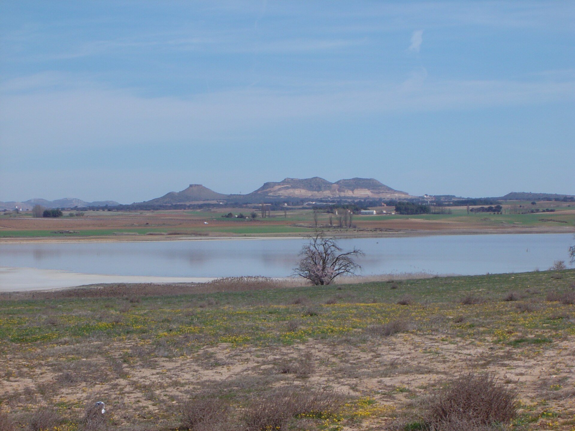
Pétrola Lagoon
Pétrola
Pétrola Lagoon is a saline steppe lake on the edge of the small town of Pétrola, in the province of Albacete, Castilla-La Mancha. It ranks among the region's most significant wetlands and is one of the very few breeding sites of the Greater Flamingo (Phoenicopterus roseus) in all of Spain. What makes this lagoon special? The lake covers roughly 343–344 hectares and sits at an altitude of 860 metres, occupying a basin of tectonic origin. Water depth shifts with the season, ranging from about 1 to 2 metres, and salinity can exceed that of the open sea. This hypersalinity is behind the lagoon's shifting surface colour, which moves through silvery and pinkish tones as the light changes over the course of the day. The site holds Natural Reserve status, is designated a Special Protection Area for birds (ZEPA), and forms part of the Natura 2000 network. What will you see there? More than 45 bird species have been recorded on and around the lagoon, both nesting and wintering populations. Alongside the flamingos, visitors can spot herons and peregrine falcons, plus plant life adapted to the salty terrain. A footpath runs along the eastern shore leading to a bird observatory and an interpretive panel — the best vantage point for quiet birdwatching without disturbing the habitat. How to get there and when to visit? The lagoon lies about 35–37 km from Albacete, the provincial capital. Entry to the reserve is free. Walking and cycling routes circle the lake, offering different perspectives on the landscape at any time of year, though spring and autumn migration periods bring the richest birdwatching. One rule matters: crossing the dikes and embankments around the lagoon is prohibited, so stick to the marked paths. Round off the visit with local cuisine — the area is known for manchego gazpacho, migas ruleras, and wines carrying a local D.O. designation. Frequently asked questions Is entry to the lagoon free? Yes, access to the reserve is completely free of charge. Can flamingos be seen year-round? Pétrola Lagoon is one of Spain's few flamingo breeding sites, but numbers vary by season — spring and summer bring the highest counts. Can you walk right up to the water's edge? Visits follow the marked path along the eastern shore to the bird observatory; crossing the dikes surrounding the lagoon is not allowed. How far is the lagoon from Albacete? About 35–37 km, making it an easy day-trip destination from the city.
-
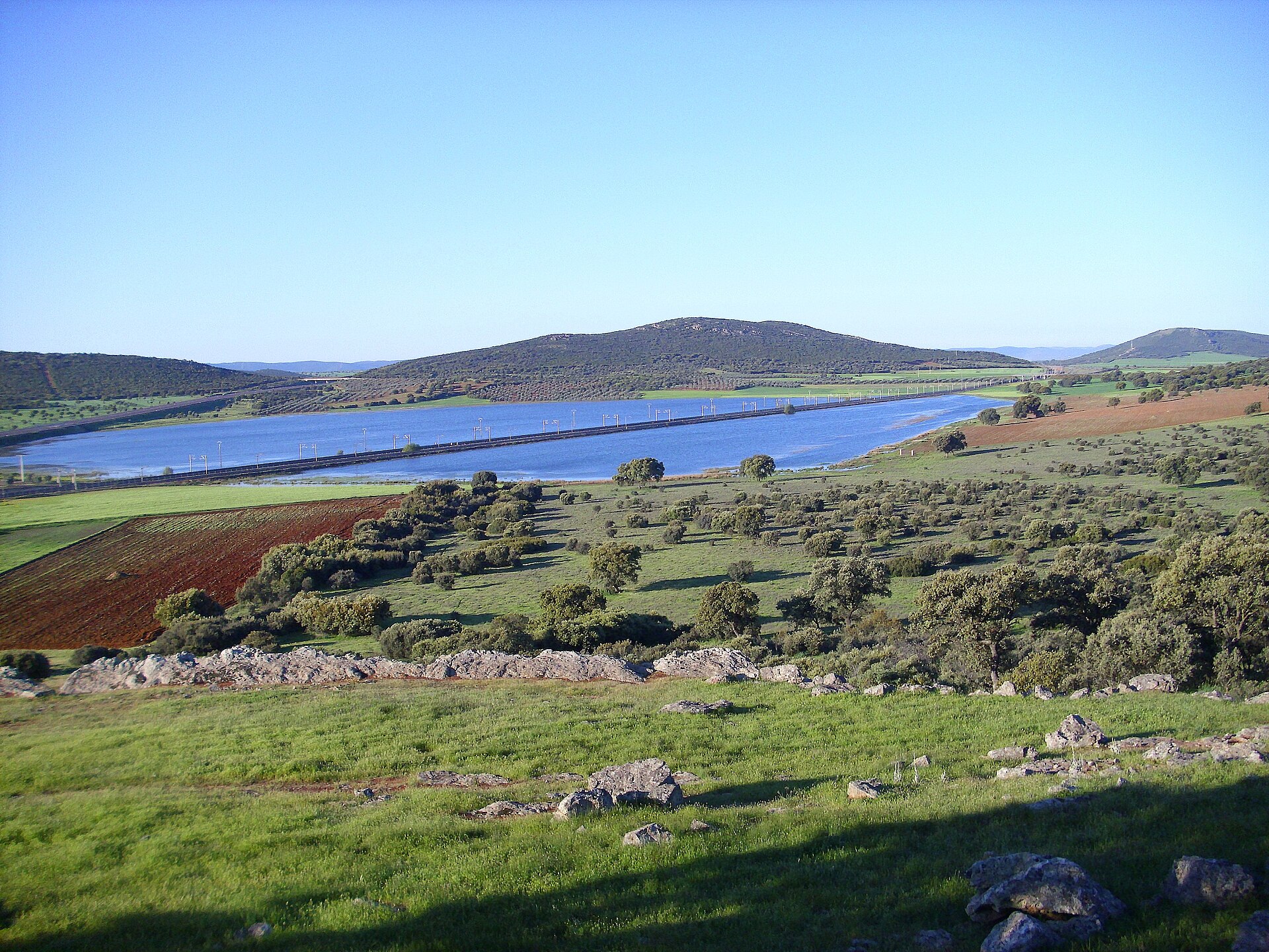
laguna de Cañada de Calatrava
Corral de Calatrava
Laguna de Cañada de Calatrava is a small volcanic lake within the municipality of Corral de Calatrava, in the province of Ciudad Real, Castile-La Mancha. It sits inside Campo de Calatrava, one of the three most significant zones of recent volcanic activity on the Iberian Peninsula. Where exactly is this lagoon? Corral de Calatrava is a small village of roughly 1,150 to 1,270 residents, about 18 km from Ciudad Real, the provincial capital. The municipality covers over 148 km², most of it stretching across a volcanic field whose activity died out millions of years ago. The lagoon lies among gentle hills and farmland typical of this part of La Mancha, a quiet rural landscape rather than a marked tourist site. How did a volcanic lagoon form here? The lagoon belongs to a group of features known as maars — craters produced by violent hydromagmatic eruptions, when rising magma met underground water and triggered an explosive reaction. The resulting crater later filled with water, forming a shallow, seasonal lake. Campo de Calatrava as a whole contains several hundred such volcanic structures — craters, lava domes and maars — spread across roughly 5,000 km². Corral de Calatrava is one of the municipalities that has put forward its volcanoes and geosites, including Laguna de Cañada, as part of the proposed Calatrava Volcanoes Geopark. What else is worth seeing nearby? Within the same municipality stands the Peñarroya Volcano and Lagoon, protected as a Natural Monument and one of the most recognizable volcanic landscapes in the region. The wider network of volcanic lagoons across Campo de Calatrava — spanning municipalities such as Corral de Calatrava, Cañada de Calatrava, Abenójar and Caracuel de Calatrava — falls under Natura 2000 protection for its value to waterbirds and seasonally flooded habitats. It's worth pairing a visit to the lagoon with a drive through the surrounding villages, where farmland alternates with traces of past eruptions: basalt quarries, rounded volcanic hills, and dark, mineral-rich soil. When is the best time to visit? The lagoons of Campo de Calatrava are seasonal, and their water levels depend heavily on rainfall. Water is usually at its highest, and the surrounding vegetation greenest, in spring following a wet winter, when waterbirds are more likely to be seen. In summer, under the dry, hot climate typical of inland Spain, many of these lagoons shrink or dry out completely, leaving a cracked, exposed lakebed. How do you get there? Corral de Calatrava is connected by local roads to Ciudad Real, and the easiest way to reach it is by car — the drive usually takes around 20 to 25 minutes. It makes for a convenient side trip for anyone already staying in the provincial capital and wanting to explore the volcanic countryside of Campo de Calatrava. Frequently Asked Questions What is Laguna de Cañada de Calatrava? It's a small, seasonal volcanic lake — a maar — located within the municipality of Corral de Calatrava, formed by an ancient hydromagmatic eruption. Is the lagoon a protected area? The volcanic lagoons of Campo de Calatrava, including this one, form part of a Natura 2000 protected area valued for its seasonal wetland habitats. Does the lagoon hold water all year round? Not always — water levels shift with rainfall and season; the lagoon tends to be fuller in spring and can dry out partly or fully in summer. What else can I see close by? The Peñarroya Volcano and Lagoon, a designated Natural Monument, lies within the same municipality and is one of the best-known volcanic landmarks in the Campo de Calatrava area.
-
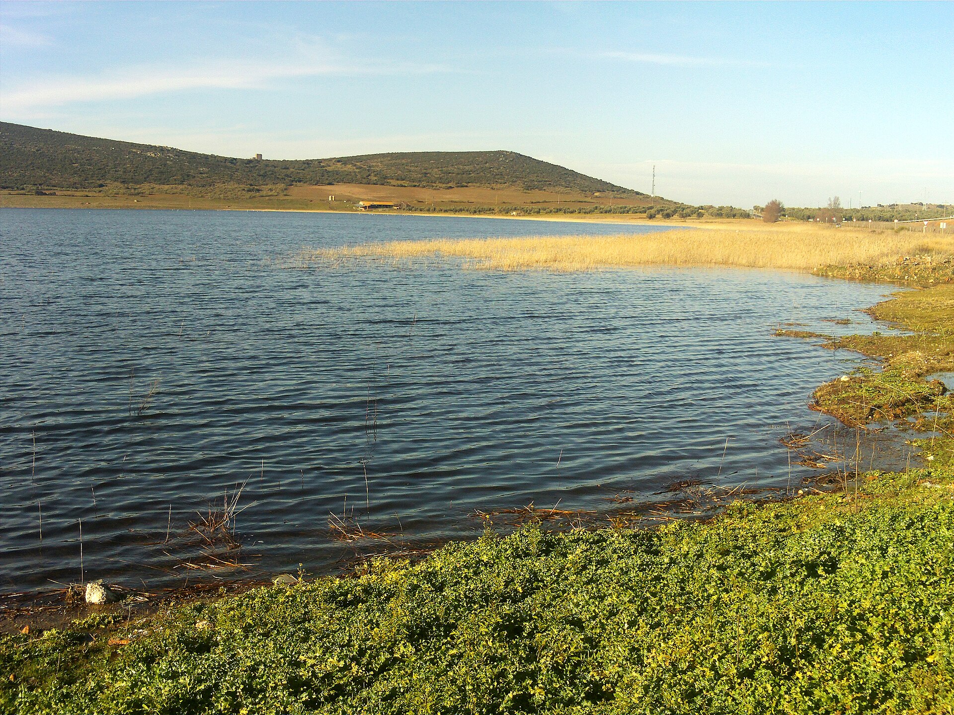
Laguna de Caracuel
Corral de Calatrava
Laguna de Caracuel is a seasonal, volcanic-origin lagoon straddling the boundary between Corral de Calatrava and Caracuel de Calatrava, in the province of Ciudad Real, in the Campo de Calatrava region of Castile-La Mancha, Spain. What is Laguna de Caracuel? It's a shallow, intermittent wetland covering roughly 70 hectares, close to the Sierra de Parabad. Unlike a permanent lake, its water level shifts with the seasons — a trait shared by many wetlands in this volcanic area. During dry spells the basin can partly or fully dry out, then refill once rains return. How did the lagoon form? Laguna de Caracuel is a maar: a landform created by an underground volcanic explosion, when rising magma met groundwater and triggered a violent steam eruption. That kind of blast leaves behind a wide, shallow crater, which over time filled with sediment and water to form the lagoon seen today. Campo de Calatrava holds one of the densest concentrations of this volcanic landform type in Europe, and Laguna de Caracuel is one of its best-known examples. What wildlife can you see there? The lagoon serves as an important resting and feeding site for waterbirds. During certain months, particularly migration periods, it has hosted concentrations of more than 6,000 birds across roughly 68 different species. The fluctuating water level and the habitat's shifting character also support a varied mix of aquatic and shoreline plant life, giving the site notable botanical interest alongside its ornithological value. Is the lagoon protected? Yes — Laguna de Caracuel has been designated a microreserve by the regional government of Castile-La Mancha. The protection status aims to safeguard the waterbird habitat and the distinctive plant communities that have developed around this seasonal wetland. Given that status, visitors should avoid disturbing the birds, especially during nesting and migration periods. How do you get to the lagoon? Laguna de Caracuel sits between the towns of Corral de Calatrava and Caracuel de Calatrava, within easy reach of Ciudad Real. The wider Campo de Calatrava region is known for a cluster of similar volcanic landforms, so visitors often combine a stop at the lagoon with exploring the surrounding volcanic scenery and the province's small rural towns. Frequently Asked Questions Can you swim in Laguna de Caracuel? No — given its seasonal nature and protected status, the lagoon isn't set up for swimming. It's a conservation area focused on protecting waterbirds and aquatic vegetation. When is the best time to visit for birdwatching? The largest waterbird concentrations occur during migration periods, when water levels suit feeding conditions. It's worth checking current conditions before visiting, since water levels shift seasonally. Does the lagoon dry up in summer? Yes. As a seasonal wetland, Laguna de Caracuel can partly or completely dry out during the driest months — a natural cycle typical of the volcanic lagoons in the Campo de Calatrava region. What makes this lagoon stand out from others in the region? Its maar-type volcanic origin, its microreserve protection status, and its ornithological significance — hosting thousands of waterbirds across dozens of species during migration season.
-
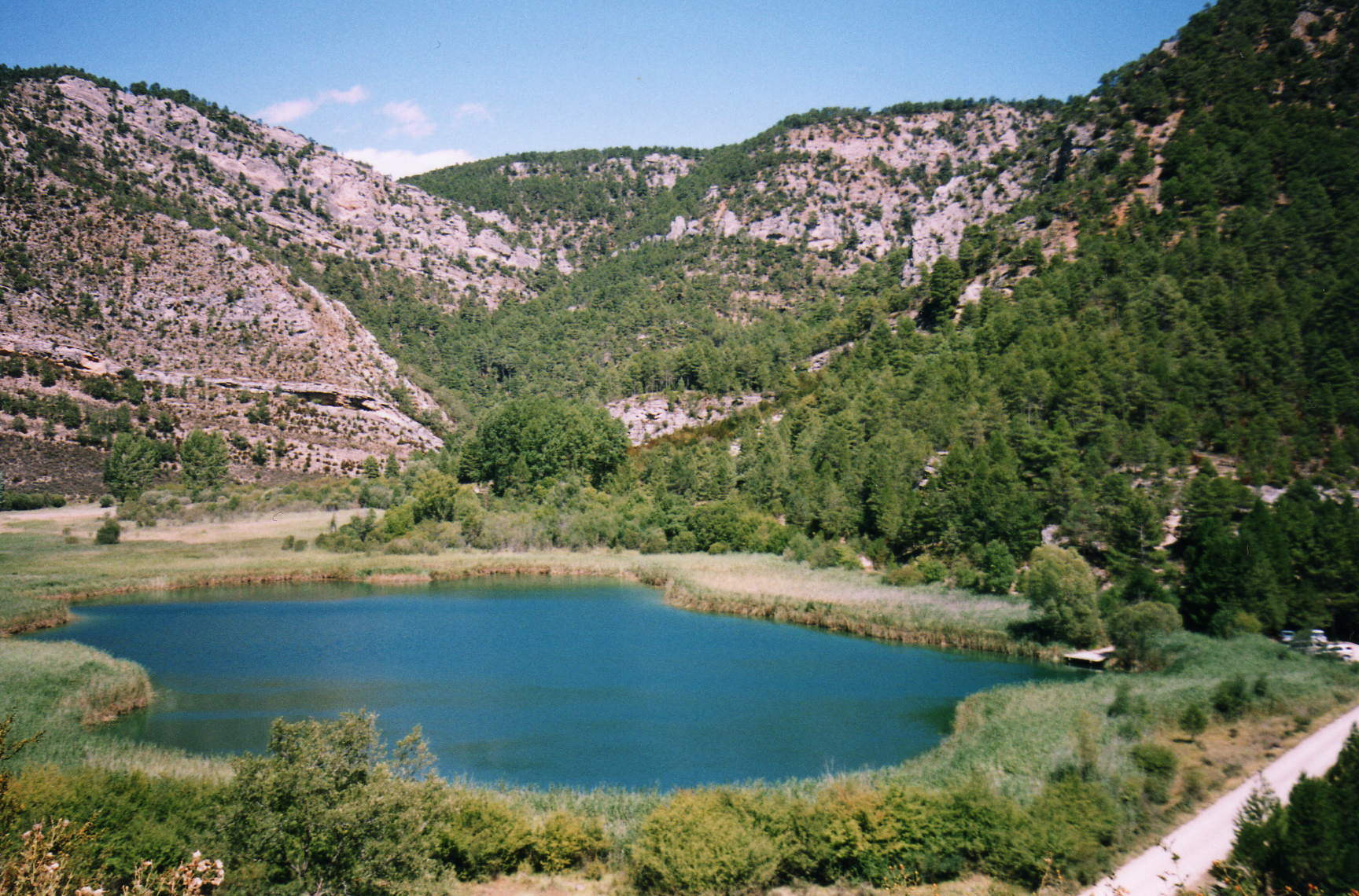
Laguna de Taravilla
Taravilla
Laguna de Taravilla is a small karst lake sitting right next to the village of Taravilla, in the province of Guadalajara, Castilla-La Mancha. It lies inside the Alto Tajo Natural Park, at roughly 1,140 metres above sea level, and is considered the scientifically most valuable body of water in the entire park. How did this lake form? The lagoon is the product of combined karst and fluvial processes. During the Pleistocene, the valley floor was sealed off by a natural travertine dam — a limestone-like rock that builds up gradually from water rich in dissolved calcium carbonate. That barrier held back the water and shaped the basin that survives today. The lake is fed mainly by underground springs, some of them rising directly from its own bed, with additional input from small surface streams. What will you see at the lake? Laguna de Taravilla covers about 2.1 hectares, and it's noticeably deeper than its modest size suggests, with the bottom dropping past the ten-metre mark. A dense band of reeds lines the shore, sheltering waterbirds, while the calm, often mirror-like surface contrasts with the rocky, forested landscape of Alto Tajo around it. The sediment layers built up on the lakebed over the last two thousand years give scientists a valuable record of past climate and water-level changes in the region, which is why the lagoon appears in geological literature under the reference code IB077. How do you get there, and what else is nearby? The village of Taravilla is the starting point, with a short walk leading down to the lake. It's a popular stop on hiking and cycling routes through Alto Tajo, and many visitors combine the lagoon with a longer walk toward Salto de Poveda, a scenic cascade on the Tagus River a few kilometres away along the canyon trail. The whole route runs through landscape typical of the Serranía de Cuenca and Alto Tajo: limestone cliffs, oak and pine woods, and deeply cut river valleys. When should you visit? Spring and autumn are the best seasons, with mild temperatures and the vegetation around the lake at its most attractive. Summer draws plenty of hikers too, though it's worth bringing water and setting off early, since stretches of the trail offer little shade. In winter, access can be affected by weather typical of Guadalajara's higher-altitude terrain. Frequently Asked Questions Can you swim in Laguna de Taravilla? The lake sits within the protected Alto Tajo Natural Park, so swimming and other interference with the ecosystem are discouraged or restricted — check the park's current rules before visiting. Is the walk to the lake difficult? No, the approach from Taravilla village is short and doesn't require serious fitness, making it accessible to most visitors. Is it worth combining with other Alto Tajo attractions? Yes, nearby Salto de Poveda is a striking waterfall on the Tagus River, reached via a canyon-side trail — a natural extension of a day trip that starts at the lagoon. How do you get to the Taravilla area? The village lies deep within the Alto Tajo Natural Park in Guadalajara province; driving via the local roads through the Serranía de Cuenca is the most practical option, since public transport in the area is limited.
-
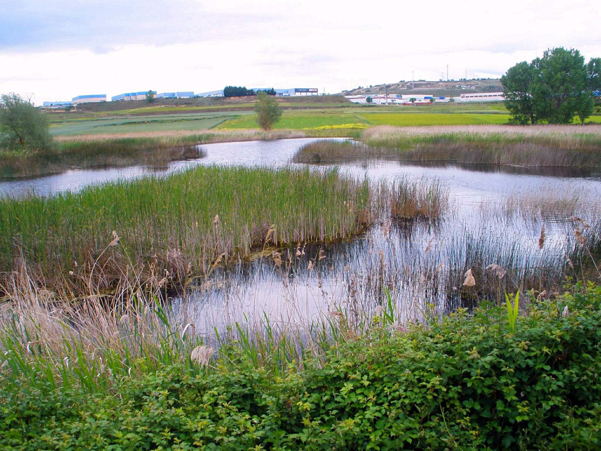
Laguna de Bayas
Miranda de Ebro
Laguna de Bayas is a small reservoir right on the edge of Miranda de Ebro, in the province of Burgos, Castile and León. It sits on the Bayas River, a tributary that joins the Ebro near the town — which explains the name. Officially registered as Embalse del Bayas, the site falls under the Confederación Hidrográfica del Ebro, the authority responsible for water management across the entire Ebro basin. In recent years the reservoir has gone through a multi-phase restoration project carried out by that same authority, improving the condition of its banks and surrounding paths. How do you get there? Laguna de Bayas lies just outside Miranda de Ebro, a town well connected thanks to its position along the main routes linking the Basque Country with Castile. A popular walking route to the lagoon starts at Miguel Delibes Park, on the edge of town, from where a trail leads out to the reservoir and continues along the Bayas River valley. That makes it an easy starting point for anyone wanting to reach the site on foot, straight from the town centre, without a car. The route doesn't require any special preparation and works well for families with children as well as more experienced hikers. What will you see? The lagoon itself is a calm body of water framed by greenery, typical of the river valley landscapes found across northern Castile. It's a favourite spot for locals from Miranda de Ebro who come here to walk, watch waterbirds, and unwind away from the noise of town. The restoration work carried out by the Confederación Hidrográfica del Ebro has covered several phases of upgrades to the surrounding area, resulting in better-maintained paths and supporting infrastructure. The area around the lagoon also connects to other walking routes in the region, including stretches heading toward nearby lagoons such as Laguna del Arce, so it's easy to extend the walk for those after a longer outing. When should you visit? Given the nature of the site — an open reservoir with walking trails around it — spring and autumn are the best times to visit, when temperatures are mild and the vegetation around the lagoon looks its best. Summer sees more visitors thanks to longer, warmer days that suit extended walks, while winter brings the cooler, damper conditions typical of inland Castile and León. Whatever the season, the site remains open and accessible to walkers and nature lovers alike. Frequently Asked Questions Where exactly is Laguna de Bayas located? The reservoir sits on the outskirts of Miranda de Ebro, in the province of Burgos, Castile and León, in the valley of the Bayas River, a tributary of the Ebro. What is the reservoir's official name? In administrative records it's registered as Embalse del Bayas, managed by the Confederación Hidrográfica del Ebro. Is the walk to the lagoon difficult? No — the trail starting at Miguel Delibes Park on the edge of town suits visitors of different fitness levels, including families with children. Are there other natural attractions nearby? Yes, the walking routes around Laguna de Bayas connect to other lagoons in the region, making it easy to extend the outing for those wanting more time in nature.
-
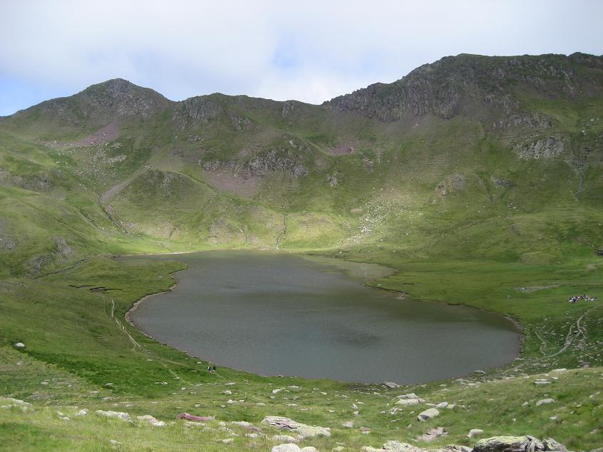
Ibón de Escalar
Jaca
Ibón de Escalar is a high-mountain lake near Jaca, in the Aragonese Pyrenees, in the province of Huesca. Sitting at an elevation of 2,078 metres, it lies within the Valle de Astún, the same valley that is home to the well-known Astún ski resort. The word "ibón" is the local Aragonese term for a glacial mountain lake, and it describes exactly the kind of scenery travellers find here — a still, high-altitude pool set among bare Pyrenean peaks. Where exactly is Ibón de Escalar? The lake sits in the upper reaches of the Valle de Astún, north of Jaca, in the direction of the Somport pass on the French border. This is classic high Aragonese Pyrenees terrain: rocky ridgelines, steep slopes, and small bodies of water fed by melting snow and seasonal rainfall. At 2,078 metres above sea level, the area around the lake stays under mountain-climate conditions for much of the year, with snow lingering far longer than in the valleys below. How do you get to Ibón de Escalar? Most visitors start from Jaca, the main town of this part of the Aragonese Pyrenees, from where a road leads up toward the Astún valley and on toward Somport. Because of the lake's altitude, reaching it involves a walk up from the higher parts of the valley — this is a genuine mountain route rather than a stroll from a nearby car park. It's worth checking current conditions before setting out, especially in spring and autumn, when snow can still linger in the higher terrain or arrive early with the first autumn falls. What will you see there? The lake itself is the main draw — a calm, high-mountain body of water framed by the rocky, high-altitude landscape typical of this stretch of the Pyrenees. It suits travellers looking for quiet and a close encounter with raw mountain scenery, away from the busier hiking routes. The Astún valley is best known for its winter ski season, but outside the snow months the same slopes and ridgelines form the natural backdrop for hiking and mountain walking in the upper valley. When is the best time to visit? Summer and early autumn are the seasons when the high-altitude lakes of the Aragonese Pyrenees are most accessible, as snow in the upper valley has largely melted and trails are passable. In winter and early spring, the Astún valley functions mainly as a ski area, and reaching the lake itself, above 2,000 metres, can be far more difficult or unfeasible without proper mountain gear and preparation. Frequently Asked Questions Where is Ibón de Escalar located? In the Valle de Astún, within the municipality of Jaca, in the province of Huesca, in the Aragonese Pyrenees, at an elevation of 2,078 metres. Can you drive directly to the lake? No — given its altitude and terrain, reaching the lake requires walking up from the higher parts of the Astún valley. Is there a ski resort nearby? Yes, the Astún valley is best known as a ski area, located in the same part of the Pyrenees as the lake. What's the nearest major town? Jaca, the main town in this part of the Aragonese Pyrenees, is the usual starting point for the road up toward the Astún valley.
-
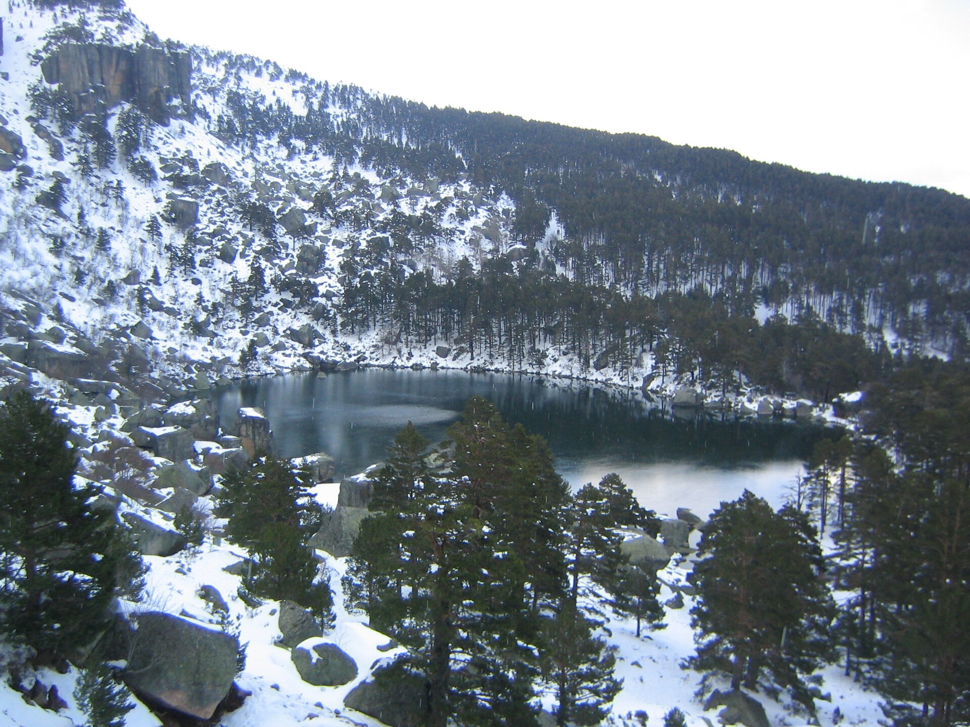
Black Lake of Urbión
Vinuesa
Laguna Negra de Urbión is a glacial lake in the Sierra de Urbión, within the municipality of Vinuesa, in the province of Soria, Castile and León. It formed during the Ice Age inside a glacial cirque hemmed in by rock walls, which gives the water its dark, almost black tone and its name. The lake sits within the Laguna Negra and Urbión Glacial Cirques Natural Park and ranks among the most recognizable natural landmarks in Soria province. How do you get there? From the city of Soria, the easiest route is the N-234 toward Burgos as far as Cidones, where you turn right toward Vinuesa. From Vinuesa, take the SO-830 toward Montenegro de Cameros, a road that winds through the scenic Revinuesa valley. After roughly 9 km, turn left and continue to the car park at Paso de la Serrá. During peak periods — summer and Easter week — this is as far as private cars can go; visitors then walk the final stretch of about 2 km or take a shuttle bus up to the lake. What will you see there? The lake sits inside a glacial cirque ringed by steep rock walls, with views toward the Urbión peak itself. A path circles the shore, letting visitors walk the perimeter at a relaxed pace and watch the surrounding cliffs mirrored in the still water. Local legend long held that the lake was bottomless and connected to the sea through underground channels; measurements have since shown its actual depth does not exceed 8 metres. The area also serves as a starting point for longer hikes through the Sierra de Urbión, including the ascent to the Urbión summit. The legend of Alvargonzález Laguna Negra is closely tied to the poet Antonio Machado, who, while teaching French in Soria, climbed to the Urbión peak in October 1910 to see the lake. Inspired by the setting, he wrote the narrative poem "La tierra de Alvargonzález," a fictional tale loosely drawing on local folklore about a family tragedy: two sons murder their father and throw his body into the lake weighted down with a stone, only to later drown themselves there, driven by guilt. This literary legend gave rise to the "Ruta de Alvargonzález," a hiking route that visitors can still follow in the area today. When is the best time to visit? Late spring and summer are the best times to visit, when access roads and trails are fully open and the vegetation around the lake is at its greenest. Autumn, particularly October, has its own appeal thanks to the colours of the surrounding beech and pine forests. Winter access can be difficult because of snow, so it is worth checking road conditions and any access restrictions before setting out. Frequently asked questions How far is Laguna Negra from the city of Soria? The lake lies about 50 km from Soria, and the drive typically takes a little over an hour, depending on the season and traffic. Do you have to walk to reach the lake? During summer and Easter week, cars must stop at the Paso de la Serrá car park, from where it is about a 2 km walk to the lake, or you can take the shuttle bus that runs during peak season. Outside these periods, vehicle access usually reaches closer to the shore. Is the lake really bottomless, as the legend claims? No — that is a popular myth. Measurements have confirmed that the lake's depth does not exceed 8 metres. Where does the Alvargonzález name associated with this place come from? It comes from Antonio Machado's poem "La tierra de Alvargonzález," inspired by the Laguna Negra area, which later gave its name to a local hiking route that follows the poem's themes.
-
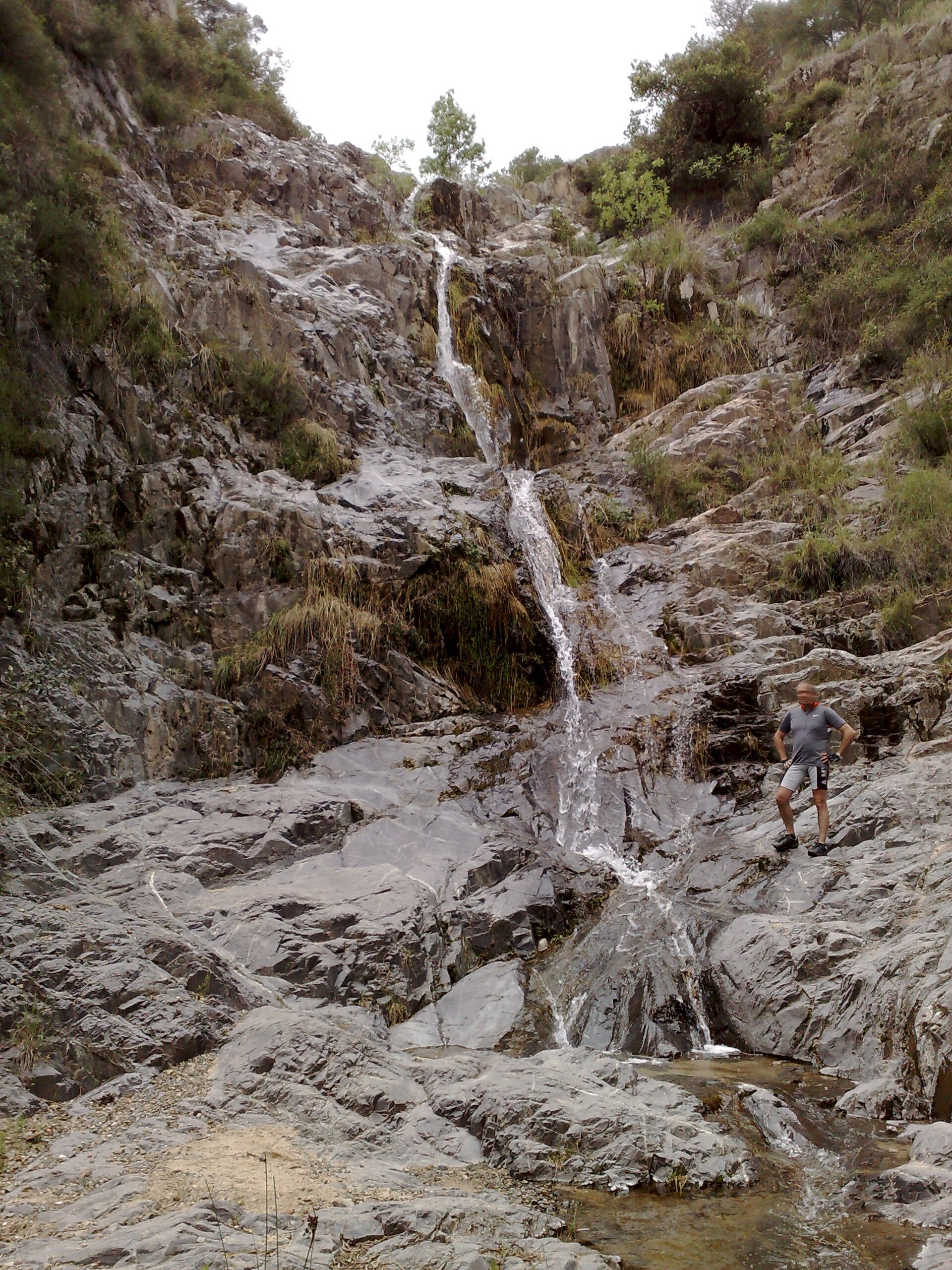
El Salt
l'Aleixar
El Salt is a waterfall on the Sòvia river, technically located within the municipality of l'Aleixar, though geographically it sits closer to the neighboring village of Castellvell del Camp. It lies in the Baix Camp comarca, in the province of Tarragona, near the city of Reus, and ranks among the more popular hiking destinations in this part of Catalonia. What will you see there? Water drops here over a vertical rock face, pooling at the base into two small natural basins. Don't expect a towering, thunderous cascade — El Salt keeps the modest scale typical of Mediterranean streams, but it's genuinely striking, especially when sunlight catches the falling water and the surrounding rock. The area around it reflects the classic Baix Camp landscape: dry hills, olive and almond groves, cut through by narrow stream valleys. How do you get there? Several walking trails converge on El Salt, making it an accessible target no matter where your trip begins. One popular option is a circular route starting in Castellvell del Camp, running through the Barranc del Mas Fort and the Camí dels Masos before looping back to the starting point. Another approach comes from l'Aleixar itself or from Reus, following the Riera de Maspujols valley. Routes range from moderate to fairly demanding, so sturdy hiking shoes are a good idea — some stretches are rocky and uneven. A round trip usually takes between two and four hours, depending on the chosen path. When should you visit? The best time to visit is after rainfall — autumn, winter, and early spring, when the Sòvia carries the most water and the falls look their best. During the dry summer months the flow drops significantly, and after extended dry spells the waterfall can reduce to a trickle or dry up almost entirely. If seeing water actually flowing is the point of your trip, it's worth checking recent rainfall before setting out. Who is this destination for? El Salt mainly draws hikers and local residents of the Baix Camp area looking for a quiet outdoor escape away from the crowds found at the better-known Costa Daurada attractions. It works well as a half-day outing combined with a visit to l'Aleixar or Castellvell del Camp themselves — small, unhurried towns with typical Catalan architecture. Frequently asked questions Is the waterfall visible all year round? Not always. Its flow depends on rainfall — it looks best in autumn, winter, and spring. In summer and during dry spells, the water can slow to a trickle or stop altogether. How long does the hike to El Salt take? Depending on the route and starting point, the full walk usually takes between two and four hours. Is the trail suitable for children? The stretches closer to the waterfall can be rocky and require some care, so the route suits older children used to hiking, wearing proper footwear, better than very young kids. Where's the best place to start the hike? The most commonly used starting points are Castellvell del Camp and l'Aleixar itself; marked trails run from both villages to the waterfall.
-
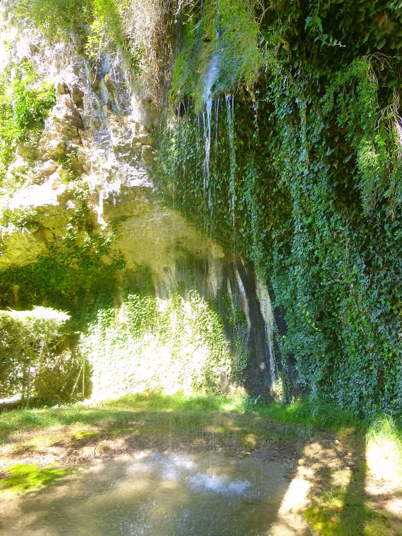
waterfall la Coladera
Basconcillos del Tozo
Waterfall La Coladera is a small, scenic waterfall in the municipality of Basconcillos del Tozo, in the province of Burgos, Castile and León. It sits on the Rudrón River, within the protected natural area of the Hoces del Rudrón (Rudrón Gorges) in the northern part of the province, close to the hamlet of Hoyos del Tozo. Where exactly is the waterfall? La Coladera lies right next to Hoyos del Tozo, near the Church of Santa Cruz, upstream along the river toward the hamlet of Barrio Panizares. It's a modest but striking feature of the limestone gorge landscape carved by the Rudrón, which forms several small rock steps and cascades along its course. The surrounding area is one of the most interesting landscapes in northern Burgos, known for its deep limestone canyons and numerous caves. How do you get there? The most convenient starting point is the village of Basconcillos del Tozo itself, from which a circular hiking trail links several of the area's natural landmarks. The route runs roughly 7.9 km and passes the Cueva del Agua (Water Cave), the Ermita de las Ánimas hermitage, and the Cueva del Moro (Moor's Cave) before reaching the waterfall itself. The trail doesn't require special preparation, but sturdy hiking shoes are recommended, as the terrain can be rocky and damp in places, especially near the riverbed. By car, access is via local Burgos province roads, and the final stretch has to be covered on foot. What will you see there? The waterfall itself isn't a major national attraction, but its appeal lies in its setting: the Rudrón gorge, limestone rock walls, quiet surroundings, and an untouched natural character. Water cascades down rocky steps, forming small pools and rapids along the way. Along the same trail, it's worth noting the other points of interest: caves carved into the limestone slopes and a modest stone hermitage, both testifying to the valley's long history of settlement. When is the best time to visit? The waterfall looks its best when the river is carrying plenty of water — typically in spring or after periods of heavy rainfall. In summer, during the drier months, the flow can be considerably weaker, which is worth keeping in mind if you're planning a trip specifically to see the falls. The hiking route also works well in autumn, when temperatures are milder than in summer and the gorge takes on the colours of the season. Frequently Asked Questions Is there an entrance fee for the waterfall? No — it's a natural, open-air site, freely accessible to hikers and visitors. How long does it take to reach the waterfall? It depends on the route chosen. The full loop from Basconcillos del Tozo, including the caves and the hermitage, covers about 7.9 km, so it's worth setting aside a few hours for the walk. Is the trail suitable for children? Most of the trail is easy, but it passes through rocky terrain and near steep drops, so caution is advised with young children, especially close to the water and the caves. Are there other attractions nearby worth visiting? Yes — the same route takes in the Cueva del Agua, the Cueva del Moro, and the Ermita de las Ánimas hermitage, and the whole area forms part of the Hoces del Rudrón gorges, popular among hikers exploring the Burgos province.
-
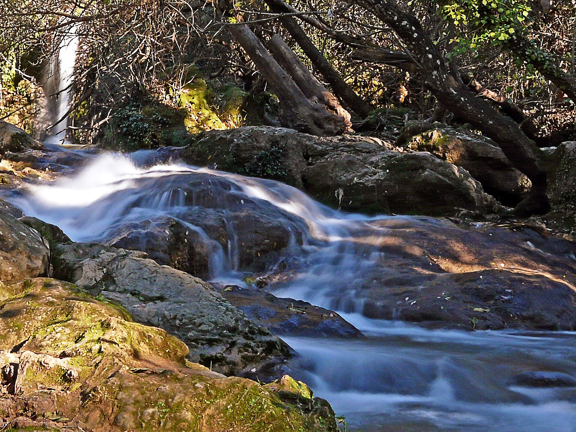
Cascadas del Hueznar
San Nicolás del Puerto
Cascadas del Huéznar, near the village of San Nicolás del Puerto, is a compact but striking waterfall system on the Huéznar River, right in the heart of the Sierra Norte de Sevilla Natural Park. Sitting on the boundary between the municipalities of San Nicolás del Puerto and Alanís, about 100 km from Seville, the site has been protected as a Natural Monument (Monumento Natural) by the Junta de Andalucía since 2001. What will you see there? The Huéznar River has built up a distinctive rocky step here made of tufa — calcareous deposits laid down over thousands of years by the calcium-rich water. The result is a two-tier cascade spread across roughly 15 metres between the banks. The falls are framed by dense gallery forest — elms, ash trees, willows and alders form a green corridor along the water, giving welcome shade in summer and colourful foliage reflected in the river come autumn. A couple of kilometres upstream, right in the village of San Nicolás del Puerto, lies the Nacimiento del Huéznar, the river's source. Many visitors combine both stops in a single outing, since they're barely two kilometres apart. How do you get there? From San Nicolás del Puerto, the local road SE-7101 leads to the El Martinete recreational area, where you'll find parking and the signposted trailhead for the falls. On weekends and holidays, especially in spring and autumn, the main car park fills up fast, so arriving early in the morning is worth it. An alternative is walking or cycling in along a stretch of the Vía Verde de la Sierra Norte, a former railway line linking Cerro del Hierro with San Nicolás del Puerto that runs right past the waterfalls. You can leave the car in the village and follow the old track to the marked turn-off down to the cascades. What's the route like, and how long does it take? The Sendero de las Cascadas del Huéznar is a circular route of about 7 km, rated easy, that takes roughly three and a half hours at a relaxed pace. There are no steep climbs or technical stretches, which makes it a solid choice for family outings, children included. When's the best time to visit? Spring and autumn offer the best conditions, when the river typically carries the most water and temperatures are comfortable for longer walks. These are also the busiest periods, so aim for early mornings on weekdays if you can. In summer, the gallery forest keeps most of the trail shaded, making the walk manageable even on hot days. Frequently Asked Questions Is the trail suitable for children? Yes, the path to the falls is rated easy with no steep sections, making it a good option for families with kids. How long does it take to see the falls and walk the full loop? The full circular route covers about 7 km and takes around three and a half hours at an easy pace, though reaching the falls themselves from the El Martinete car park is much quicker. Where can I park? The main car park is at the El Martinete recreational area, reached via the SE-7101 road from San Nicolás del Puerto. During busy periods, arrive early since spaces fill up fast. Is it worth combining this with the Nacimiento del Huéznar? Yes — the river's source is right in the village, about two kilometres from the falls, so most visitors see both on the same trip.
-
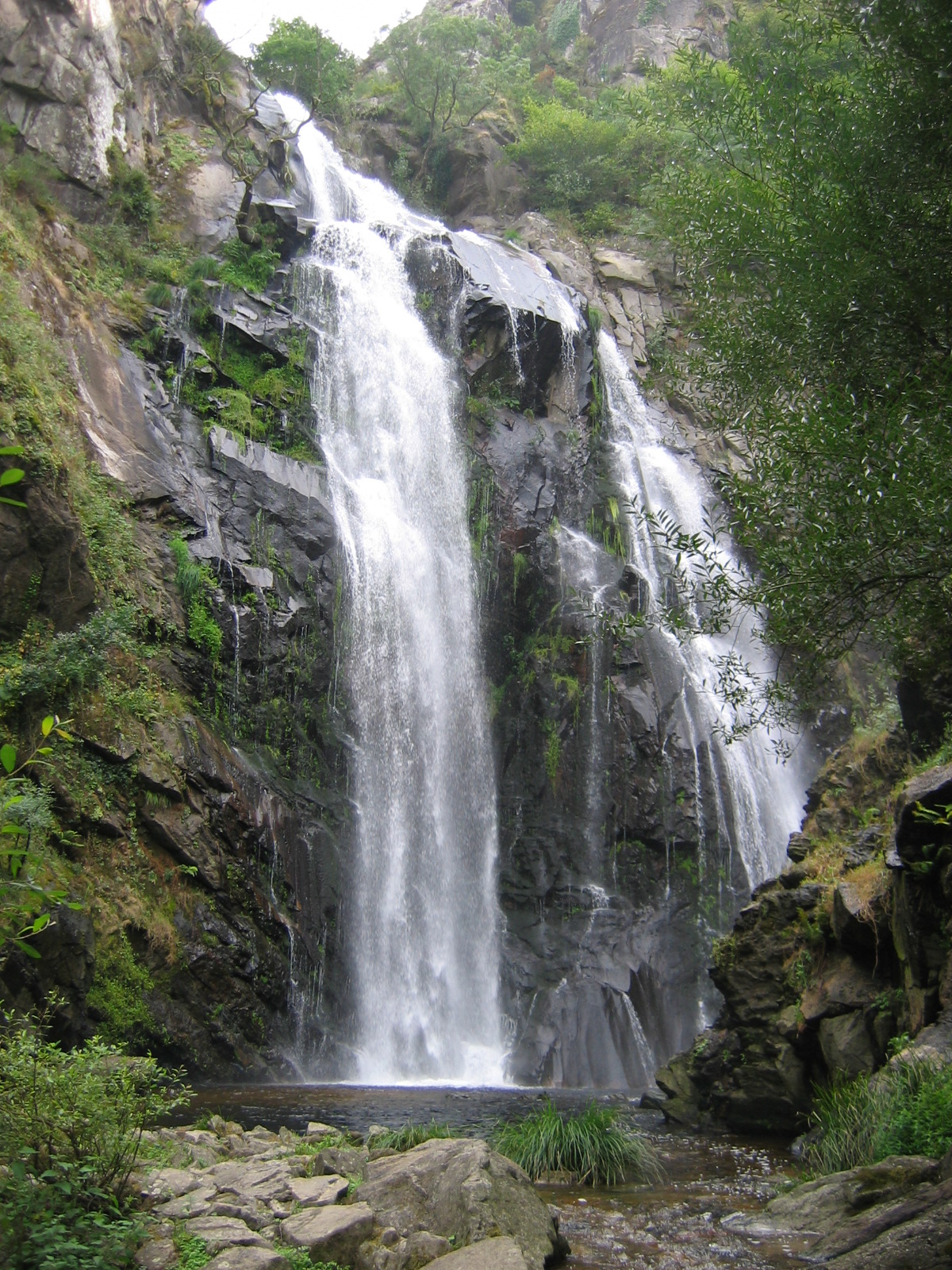
Fervenza do Toxa
Silleda
Fervenza do Toxa is one of the most striking waterfalls in Galicia, hidden in the forests of the municipality of Silleda, in the province of Pontevedra. Where is it located? The waterfall sits on the Toxa River, right before it flows into the Deza River, in the parish of Pazos, north of Silleda. This is the heart of the Deza region (also known as Ulla-Deza), an area famous for its dense, well-preserved Atlantic woodland. Santiago de Compostela is only about 40 kilometers away, making Fervenza do Toxa an easy day-trip destination for anyone staying in the Galician capital. The Toxa River itself rises south of Silleda, at nearly 600 meters of elevation, between Monte Chamor and Serra das Penas. It flows gently for roughly 15 kilometers before the terrain suddenly narrows and the river plunges down, forming the waterfall just before joining the Deza. How to get there? The easiest way in is via the PO-204 road, which connects the villages of Merza and Vila de Cruces. A spacious parking area has been set up right along the route, from which a signposted path descends toward the foot of the waterfall. The walk itself isn't long, but sturdy shoes are a good idea — the ground can be damp and slippery, especially after rain, and Galicia is not exactly a dry corner of Spain. What will you see? Fervenza do Toxa is considered one of the tallest waterfalls in Galicia. The water drops in a distinctive, horseshoe-shaped cascade, with a final vertical fall of around 30 meters — some sources describe the river's total drop along this stretch, running down the rock face, as reaching up to 60 meters. The best views come from natural lookout points set on huge granite boulders at the base of the falls, from where you can also make out the spot where the Toxa's waters meet the Deza. The path down to the waterfall cuts through clearly layered forest: the upper and middle stretches are dominated by chestnut, oak, cork oak, and laurel trees, while willows, alders, and ash trees take over closer to the riverbank. The whole area is protected as a Site of Community Importance within the Ulla-Deza river system — this is not just a scenic spot but a genuine piece of the Natura 2000 network. The granite walls flanking the waterfall shelter birds that are rare in Galicia, including ravens and peregrine falcons, so it's worth bringing binoculars. When to visit? The best time to go is autumn through early spring, when rainfall keeps water levels high and the falls show their full force. In summer, after drier weeks, the flow can shrink considerably, though the surrounding forest still offers a pleasant, cool walk regardless of the season. Frequently Asked Questions Is the walk to the waterfall difficult? The route from the parking area on the PO-204 is relatively short and well marked, but it heads downhill through damp, occasionally slippery woodland — comfortable, sturdy footwear is recommended. Can you swim at the waterfall? The site is primarily a viewpoint and walking destination rather than a swimming spot — the area around the falls can be hazardous due to slick rocks and strong currents. How long does a visit take? Walking down to the lookout points and back usually takes about an hour or a bit more, depending on your pace and how many stops you make for photos. Are there other attractions nearby? The Deza region around Silleda and Vila de Cruces is known for numerous hiking routes and cultural heritage sites, making it easy to combine the waterfall with a longer day exploring the area.
-
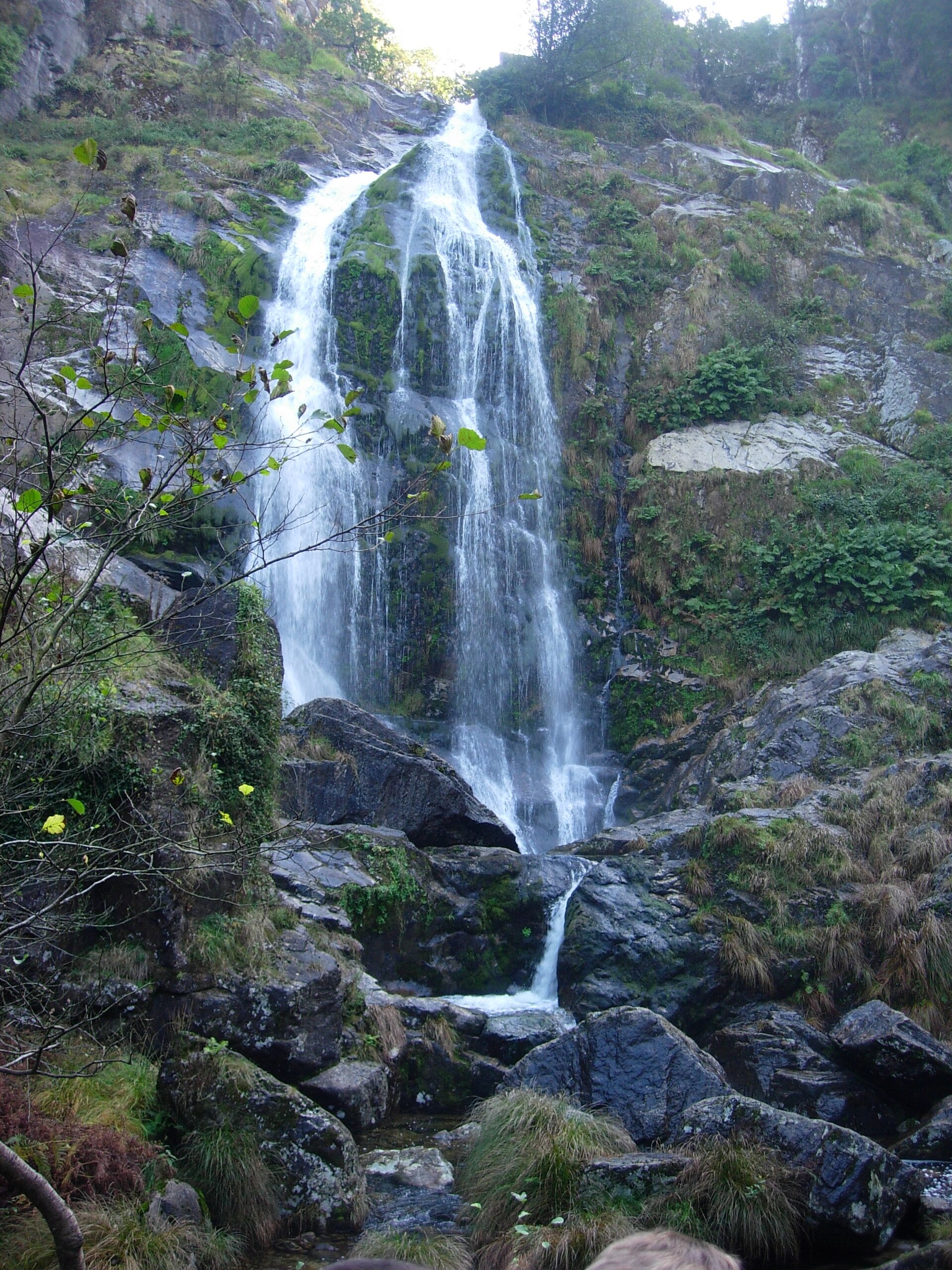
Fervenza do Belelle
Fene
Fervenza do Belelle is one of the tallest and most striking waterfalls in Galicia, sitting right on the border between the municipalities of Fene and Neda, in the province of A Coruña. The Belelle River tumbles here from a rock face over 40 metres high, creating a cascade that can be heard well before it comes into view. For locals around Ferrolterra, it has long been a favourite escape into nature without needing to travel far. Where exactly is the waterfall? The Belelle River rises in the A Cernada ravine near As Pontes de García Rodríguez and flows down toward the Ferrol estuary, passing close to the Fragas do Eume Natural Park along the way. The waterfall itself lies in the border area between Fene and Neda, only a few kilometres from Ferrol, making it an easy day-trip destination from either Ferrol or A Coruña. How do you get there? The trail starts at a car park next to Pazo Isabel II, a former textile factory that now serves as the clear starting landmark for the route. From there, a path of just over a kilometre one way leads toward the falls — an easy walk suitable for most visitors, including families with children. The route follows the riverbed through a leafy forest, making it a pleasant walk in its own right, whatever the weather. What will you see along the way? Visitors can choose between a few different routes once on site. The first leads directly to the foot of the waterfall, where you can watch the water crash down close up and feel the cool spray drifting off the pool below. A second, steeper option climbs to a wooden viewpoint set beside the cascade. The third involves a set of steps and a signposted path past an old hydroelectric power station, up to the Viladonelle viewpoint, which opens onto a wide panorama over the river valley and surrounding hills. The whole area is covered in oak and chestnut woodland, giving it an especially scenic, almost storybook feel — particularly in autumn, when the leaves turn colour. When is the best time to visit? Early spring and the autumn-winter months bring the highest water levels, when the falls are at their most impressive. In summer, flow can drop considerably, though the surrounding forest still offers welcome shade on hot days. Weekday visits or early weekend mornings are worth choosing to avoid crowds, since the spot is a popular outing for people across the Ferrolterra area. Frequently Asked Questions How long does it take to reach the waterfall? From the car park at Pazo Isabel II to the foot of the falls is a little over a kilometre one way, usually taking 20 to 30 minutes at an easy pace. Is the trail suitable for children? The main path to the base of the waterfall is considered easy and works well for families, while the routes up to the viewpoints are steeper and call for more caution. Where should I start the walk? The starting point is the car park beside Pazo Isabel II, a former textile factory, from which all the trail options branch off. Is it worth visiting outside summer? Yes — autumn and spring bring higher water levels, so the waterfall looks its most dramatic, and the surrounding forest adds extra colour to the walk.
-
Mirador dels Apòstols
Monistrol de Montserrat
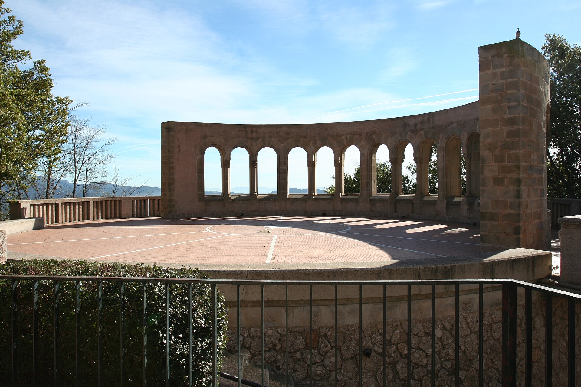
Mirador dels Apòstols is a viewpoint in Monistrol de Montserrat, set into the rocky Montserrat massif close to the Santa Maria de Montserrat monastery. It sits at roughly 715 metres above sea level and combines a scenic terrace with a small symbolic monument. What makes this viewpoint different from a typical lookout? The site takes its name from the structure that stands here: eight rectangular stone blocks stacked in a spiral. The composition draws on the thought of the Catalan philosopher and mystic Ramon Llull, with each block representing a rung on a hierarchy of beings — stone, fire, plant, animal, human, heaven, angel, and God. It's an unusual case of a viewpoint doubling as a philosophical monument rather than just a terrace with a railing. The building also houses a small chapel-mausoleum dedicated to the Requeté, a Carlist militia that fought on the Nationalist side during the Spanish Civil War (1936–1939). That military-historical layer sits somewhat at odds with the religious and philosophical symbolism of the stone blocks, but it's part of what gives the site its particular character. What can you actually see from here? From the terrace, the view takes in the Montserrat monastery, the jagged rock towers surrounding it, and the Llobregat river valley below. It's one of the few spots where the monastery's sacred architecture and the raw, needle-like rock formations that define Montserrat's skyline appear together in the same frame. The building's second floor houses Montserrat Bufet, a dining spot that makes use of the same mountain views. How do you get to Mirador dels Apòstols? The most convenient route starts at the Monistrol de Montserrat train station, reachable directly by train from Barcelona. From there, two options run up to monastery level: the Cremallera de Montserrat rack railway or the Aeri de Montserrat cable car. Both arrive close to the monastery complex, from where it's a short walk to the viewpoint itself. Drivers can find parking near the upper station, though spaces fill up quickly during peak tourist season. When is the best time to visit? Morning hours, especially outside peak season, give the best chance of clear air and good visibility toward the Llobregat valley — haze tends to build up later in the day. Keep in mind that Montserrat is a popular day trip from Barcelona, so weekends and summer months bring larger crowds up the mountain. Taking an early train or cable car run helps you avoid the worst of the queues. Frequently Asked Questions What are the stone blocks at Mirador dels Apòstols? Eight rectangular stone blocks arranged in a spiral, symbolizing a hierarchy of beings based on the thought of Ramon Llull: stone, fire, plant, animal, human, heaven, angel, and God. Is there anything else at the site besides the view? Yes — the building includes a chapel-mausoleum dedicated to Requeté soldiers from the Spanish Civil War, plus the Montserrat Bufet restaurant on the second floor. What's the easiest way to get there from Barcelona? Take the train to Monistrol de Montserrat station, then ride the Cremallera de Montserrat rack railway or the Aeri de Montserrat cable car up to monastery level. What views does the terrace offer? The Montserrat monastery, the surrounding rock towers of the massif, and the Llobregat river valley below.
-
Mirador Poeta Domingo de Mena
San Roque
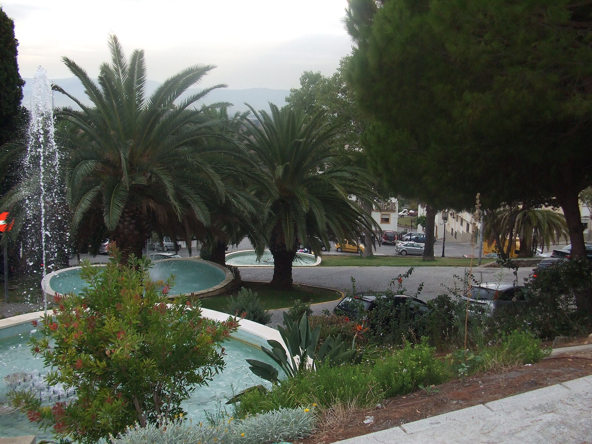
Mirador Poeta Domingo de Mena is a viewpoint in San Roque, a town in the province of Cádiz in Andalusia, right by the Spanish border with Gibraltar. It sits on the highest point of the town, next to the town hall (Casa Consistorial), and is one of the most visited spots for travelers passing through San Roque on their way to the Rock of Gibraltar. How do you get there? The viewpoint stands in San Roque's historic centre, right beside the main square and the town hall building, so the easiest way to reach it is on foot while exploring the old town. San Roque is well connected to the rest of the Costa del Sol and the Bay of Algeciras, making it a convenient stop for anyone driving toward Gibraltar or La Línea de la Concepción. The street leading to the lookout is actually named after it — Calle Mirador Poeta Domingo de Mena — which makes it easy to find with GPS navigation. What will you see? From the viewing terrace, enclosed by a safety balustrade, visitors get a sweeping panorama of the Rock of Gibraltar, the entire Bay of Algeciras, and, on clear days, the coastline of North Africa. It's one of the few spots in the region where a British overseas territory, the Spanish coast, and the African continent can all be taken in from a single vantage point. Locally the site is known by its popular nickname, "Los Cañones" (The Cannons), because two 18th-century cannons still stand here. They are the remains of a Spanish artillery battery positioned at this exact spot during the Great Siege of Gibraltar (1779–1783). From San Roque's highest hill, Spanish forces could monitor British troop movements on the Rock and relay signals to the infantry stationed at Campamento, indicating when to attack. Today the decommissioned cannons remain as a reminder of that episode, and the viewpoint still carries symbolic weight for the town — its founding is traditionally commemorated here every year on August 4th. Where does the name come from? The viewpoint is named after José Domingo de Mena, San Roque's longtime official chronicler, a journalist and poet, and author of "Romances de Gibraltar," a body of work centered on the region's history and identity. The name was given to the site in the 1970s, in recognition of his contribution to the town's cultural and historical memory. When should you visit? The viewpoint is open year-round, and the best conditions for admiring the view toward Gibraltar and North Africa come on clear days, which are more common in spring and autumn, when the heat eases and the air tends to be cleaner than in the height of summer. Morning hours usually offer sharper visibility and fewer crowds in San Roque's historic centre. Frequently Asked Questions Is there an entry fee for the viewpoint? No. It's an open public space in the town centre, freely accessible without the restrictions typical of ticketed attractions. What can you see from Mirador Poeta Domingo de Mena? A panorama of the Rock of Gibraltar and the Bay of Algeciras, and on clear days the outline of the North African coast, plus two historic cannons dating from the Great Siege of Gibraltar. Why is the viewpoint also called "Los Cañones"? Because of the two 18th-century cannons on the terrace, remnants of the Spanish artillery battery placed here during the siege of Gibraltar between 1779 and 1783. Who was Domingo de Mena? José Domingo de Mena was San Roque's official chronicler, a journalist and poet, and author of "Romances de Gibraltar." The viewpoint was named in his honor in the 1970s.
-
Rocatrencada
Borredà
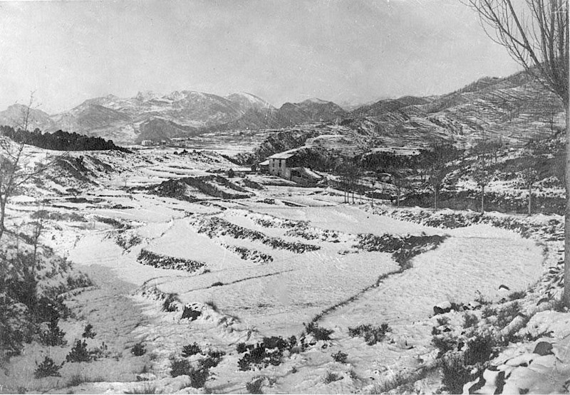
Rocatrencada is a small site located within the municipality of Borredà, in the Berguedà comarca of northern Catalonia. The Catalan name translates literally as "broken rock" or "split rock," a reference to the rugged terrain found throughout this part of the region — rocky outcrops cut through by ravines and mountain stream valleys. The site sits in the upper valley of the Margençol river, in the eastern part of the comarca, on the fringe of the Catalan Pyrenees. Where exactly is it? Rocatrencada lies within the administrative boundaries of Borredà, a small rural municipality in Barcelona province. Its geographic coordinates place it at roughly 42.1386°N, 2.0089°E, in landscape typical of this stretch of Berguedà: rolling terrain a few hundred meters above sea level, surrounded by woodland, pasture, and the scattered stone farmhouses characteristic of Catalonia's rural interior. How do you get there? The most practical way to reach the area is by car. From Barcelona, the drive heads north via Vic and continues toward Berga or Ripoll — Borredà sits between these two larger towns, connected by local roads that link the Berguedà and Ripollès comarques. The journey from Barcelona usually takes about an hour and a half to two hours, depending on the exact route and road conditions. Public transport in this area is limited, so most visitors exploring the Borredà countryside rely on their own car or a rental, which also makes it easier to hop between neighboring villages and trails on the same trip. What is there to see nearby? The name Rocatrencada itself points to the rocky character of the land — a hallmark of Berguedà, where rock formations, viewpoints, and the Margençol valley have shaped the pattern of settlement for centuries. The countryside around Borredà is quintessentially rural, popular with hikers and cyclists looking for quiet and a genuine sense of nature away from Catalonia's busier tourist routes. Nearby lie other villages of the Berguedà comarca, known for its mountainous scenery, old drover trails, and traditional stone farmhouses (masies) scattered across the hillsides. The region also acts as a natural gateway toward the higher stretches of the Pyrenees, so it's worth pairing a visit to Rocatrencada's surroundings with a look at nearby villages and the walking trails that follow the Margençol valley. When is the best time to visit? Spring (April to June) and early autumn (September to October) are the best times to come, when temperatures across Catalonia's mountainous interior are mild and the scenery — green valleys in spring, warm autumn colors later on — is at its best. Summers can get warm in the lower valleys of Berguedà, though the higher ground stays noticeably cooler. Winters bring cold weather, and snow is possible in the comarca's higher elevations, which for some visitors is an added draw rather than a drawback. Frequently Asked Questions What does the name Rocatrencada mean? It comes from Catalan and literally means "broken" or "split rock," referring to the rugged rock formations typical of this part of the Berguedà comarca. Which municipality is Rocatrencada in? It lies within the municipality of Borredà, in the Berguedà comarca, Barcelona province, Catalonia. What's the best way to get there? Driving is by far the easiest option — from Barcelona, head north via Vic toward Berga or Ripoll, then follow local roads into Borredà. Public transport options in the area are scarce. Are there other things worth seeing nearby? Yes — the wider Berguedà comarca offers hiking and cycling routes, traditional rural architecture, and easy access to the Pyrenean foothills, making it a good base for exploring the region further.
-
O Rexo, Allariz
Allariz
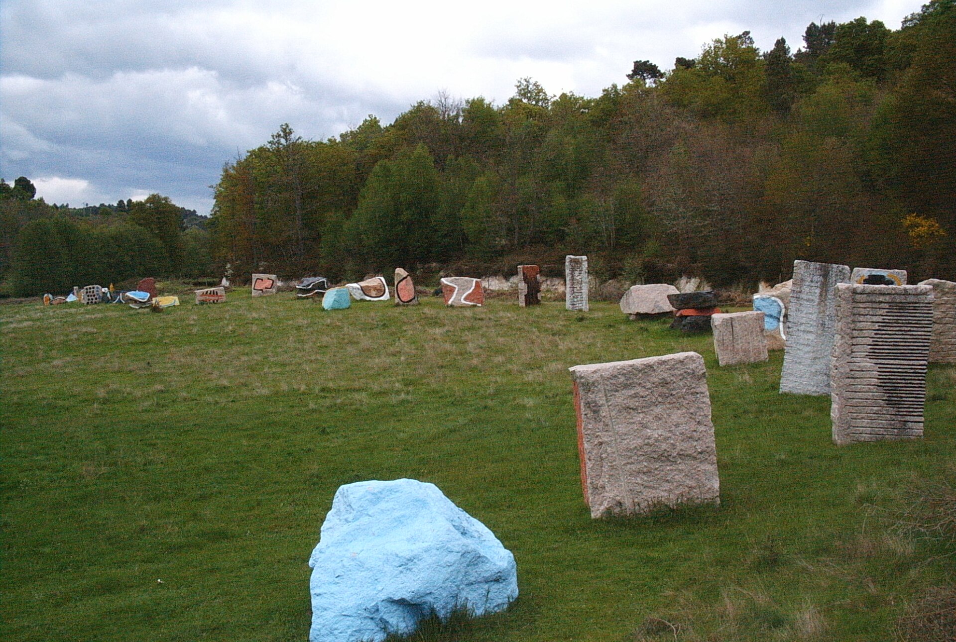
O Rexo is a small but unusual ecoespazo (nature-and-art space) in Requeixo de Valverde, part of the municipality of Allariz in the province of Ourense, Galicia. It blends a natural woodland setting with an artistic intervention — painted trees and granite-and-slate sculptures set among the forest, a stream, and rock outcrops. What will you see at O Rexo? The heart of the site is an installation by Basque artist Agustín Ibarrola, best known for the "Painted Forest" (Bosque de Oma) in the Basque Country. At O Rexo he applied a similar idea on a smaller scale: tree trunks painted with abstract patterns alongside a series of sculptures and compositions carved from granite and slate, scattered through the natural vegetation. Ibarrola combined the landscape's own elements — trees, stones, earth, and water — with materials typical of Galician building tradition, namely granite and roof tiles. The result is striking: walking among the trees, you come across brightly coloured trunks and geometric sculptural forms that complement the surroundings rather than overwhelm them. How do you get to O Rexo? The ecoespazo lies roughly 5 kilometres from Allariz's historic centre, on the road toward Xunqueira de Ambía. By car it's a short drive of about ten minutes, and the site is clearly signposted as a trailhead. Travellers without a car can combine a visit with sightseeing in Allariz and reach O Rexo by taxi or bicycle — the access road is mostly paved and runs through quiet countryside. What else can you do nearby? The circular Val do Rexo – A Paraleda hiking trail starts and finishes at the O Rexo car park, covering about 5 kilometres. The route runs through the Allariz Biosphere Reserve, one of the few UNESCO-designated areas in Galicia, and takes in a river valley, deciduous woodland, and the flora and fauna typical of the region. It's an easy, gentle walk suitable for families with children as well as anyone looking for a quiet break from town sightseeing. When is the best time to visit? Spring and autumn are the best seasons: temperatures are mild and the forest looks its most photogenic — fresh green growth in spring, and autumn foliage that contrasts vividly with the painted trunks. Summers in Ourense province can get very hot, so an early-morning visit is advisable at that time of year. The site is open year-round and free to visit. Frequently asked questions Is there an entrance fee for O Rexo? No, it's an open public space, free to visit all year round. How long does a visit take? Walking through the ecoespazo itself takes about 30–45 minutes, while the full Val do Rexo – A Paraleda loop takes around 1.5–2 hours. Is the trail suitable for children? Yes, the route is mostly flat and easy, and the painted trees and sculptures add an extra element of interest for younger visitors. What should you combine with a visit to O Rexo? It's worth planning the day to also visit Allariz's historic centre, with its old monastery and well-preserved old town, just a few kilometres away.
-
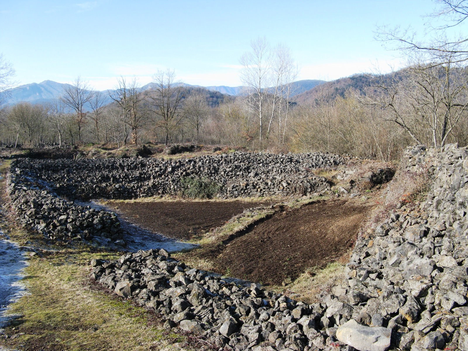
Parc de la Pedra Tosca
les Preses
Parc de la Pedra Tosca is a small landscape park in Les Preses, sitting within Catalonia's Garrotxa Volcanic Zone Natural Park near Olot. It occupies part of the Bosc de Tosca forest, spread over a lava flow released by the Puig Jordà volcano roughly 17,000 years ago. Here geology, two centuries of farming labor, and a modern landscape-design project all come together in one walkable site. What will you see there? The defining feature is a dense network of dry-stone walls enclosing small cultivated plots. In the 19th century, after local farmers gained ownership of land previously held by the church, they cleared the forest growing over the hardened lava and stacked the stones they dug out of the soil into walls and small huts. The result is a kind of open-air maze: tiny fields bordered by stone, scattered mounds, and characteristic pockets where cold air collects. In 2004, this historic agrarian landscape became the subject of a landscape-architecture project by Carme Pigem of RCR Arquitectes. Rather than adding new structures, the intervention carefully cleared, ordered, and revealed the existing pattern of walls, paths, and plots, letting visitors walk through the park and read its history directly in the stone. The project later received the European Rosa Barba Landscape Prize. How do you get to Parc de la Pedra Tosca? The park sits right by Les Preses, about 1.5 km from Olot along the road toward the village. Arriving by car is the most practical option, with parking available at the park entrance. Since the whole area lies within the Garrotxa Volcanic Zone Natural Park, it pairs naturally with visits to nearby volcanic cones and the region's hiking trails. When is the best time to visit? The park is open to visitors every day, so a stop can fit into almost any Garrotxa itinerary. Given the terrain — dry-stone walls, uneven paths, and plenty of tree shade — a walk here is pleasant in most seasons, though spring and autumn offer milder temperatures for longer walks or bike rides through the surrounding countryside. Who is this park for? It suits travelers looking for a quiet encounter with nature and the region's farming history, as well as landscape-architecture enthusiasts drawn by the award-winning RCR Arquitectes concept. The park works well for a family stroll, a short cycling stop, or a break during a wider tour of volcanic Garrotxa. Frequently asked questions What is Parc de la Pedra Tosca? It is a landscape park in Les Preses built on a former lava flow from the Puig Jordà volcano, known for its dense network of dry-stone walls and small farming plots, designed by architect Carme Pigem of RCR Arquitectes in 2004. How far is the park from Olot? The park lies about 1.5 km from Olot, toward Les Preses, and is easily reached by car thanks to parking at the entrance. Is the park open all year? Yes, it is open to visitors every day, regardless of the season. Why did the park win an award? It received the European Rosa Barba Landscape Prize for its careful, restrained restoration of a historic agricultural landscape, recognized for blending heritage preservation with contemporary public-space design.
-
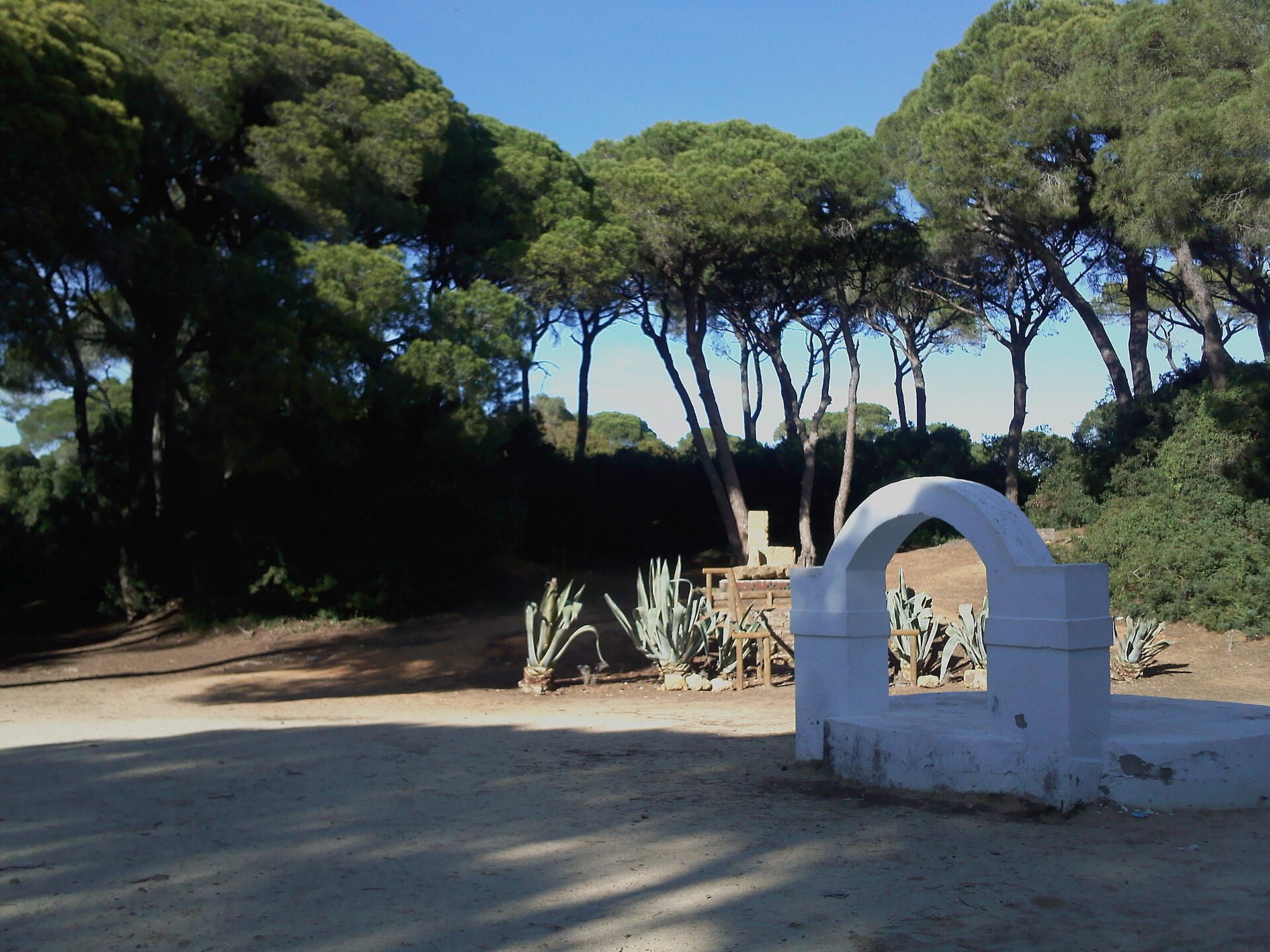
Parque de Las Canteras
Puerto Real
Parque de Las Canteras is a 25-hectare forest park in Puerto Real, in the province of Cádiz, sitting roughly 500 meters north of the town center. It is the largest green space in this part of Cádiz Bay and a favorite spot among locals for walking, jogging, or simply resting in the shade. Where does the name come from? "Las Canteras" means "the quarries," a nod to the site's history: in the 16th century, stone was extracted here and later used to build the Parish Church of San Sebastián in Puerto Real and Seville Cathedral. Once quarrying stopped, pine forest gradually took over the land, and in 1909 the residents of Puerto Real turned it into a public space open to everyone. What will you see in the park? The landscape is dominated by stone pines, with a dense undergrowth of mastic shrub and broom filling the spaces between them. The park has a roughly rectangular layout crossed by a network of marked trails, including a circular route that makes it easy to find your way even on a first visit. Several clearings along the paths come equipped with benches, trash bins, and drinking fountains — convenient spots to pause during a longer walk. Playgrounds scattered through the park make it a comfortable choice for families with children, suitable for a full day out. Inside the park stands a grotto dedicated to Our Lady of Lourdes, the patron saint of Puerto Real — a site of religious and local significance that draws residents especially during patronal festivities. The park is also cited as one of the few places in Europe where chameleons live in the wild, an endangered species whose presence points to the good ecological condition of the local habitat. How do you get there? Parque de Las Canteras sits on the edge of Puerto Real, within walking distance of the town center — about 10 to 15 minutes on foot from the main square. Puerto Real is well connected to Cádiz and other towns around the bay, so the park makes a convenient stop whether you're exploring Puerto Real itself or touring the wider area. What can you do there? The park is built for walking and running, with marked trails letting visitors plan routes of different lengths, from a short stroll to a longer loop through the whole forest. It's also a good spot for a picnic or simply resting in the shade of the pines, away from the noise of town. When should you visit? Thanks to the dense tree cover, the park offers shade even on hot days, making it appealing in spring and summer when temperatures in Andalusia can climb high. Autumn and winter are good for longer hikes without the heat, and the park's quiet atmosphere makes it worth visiting at any time of year. Frequently asked questions How big is Parque de Las Canteras? The park covers around 25 hectares, making it the largest green space in Puerto Real. Where does the park's name come from? It refers to old quarries where 16th-century stonemasons extracted material later used to build Seville Cathedral, among other buildings. Is the park suitable for children? Yes, it has playgrounds and marked walking trails that work well for families. Is the Our Lady of Lourdes grotto worth seeing? The grotto holds real significance for the local community, as it's dedicated to the town's patron saint, and makes for an interesting stop during a walk through the park.
-
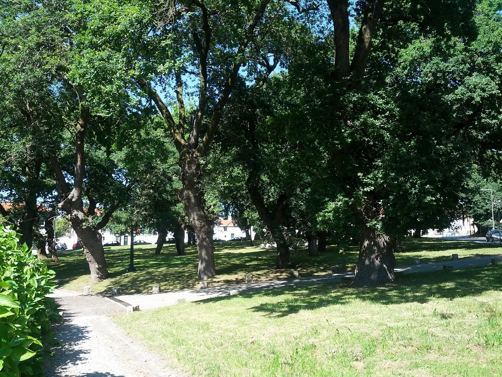
Carballeira de San Lourenzo
Santiago de Compostela
Carballeira de San Lourenzo is a historic oak grove in Santiago de Compostela, spread along the banks of the Sarela River right beside the former San Lourenzo de Trasouto convent, close to where the Camino de Santiago enters the city from the west. What is this place? Covering roughly 8,000 square meters, this small but atmospheric park is built around centuries-old oak trees. The Galician word "carballeira" simply means oak grove, and such groves have long served as semi-sacred gathering spaces across Galicia — sites for village assemblies, religious processions, and local festivals. The shade of the ancient oaks, the damp riverside microclimate, and the proximity of the old convent give the place a calm, almost magical atmosphere, even though it sits only a short walk from Santiago's historic center. The San Lourenzo de Trasouto convent was founded at the start of the 12th century right among these oaks, on the bank of the Sarela. Over time the building was converted into a pazo — the type of noble manor house typical of Galicia — which today operates as a restaurant for special events. The grove itself holds the status of a Heritage Park listed in the Registry of Cultural Interest Assets (Bien de Interés Cultural), recognizing its historical and landscape value. What will you see there? Walking the paths between the oaks, visitors come across an old stone fountain and two cruceiros — the stone wayside crosses characteristic of the Galician landscape, once used to mark pilgrim routes and prayer stops. This same grove served as literary inspiration and setting for "Follas Novas," one of the most important works of Rosalía de Castro, the leading Galician poet of the 19th century — worth keeping in mind while strolling beneath the canopy. The park also has a practical side: benches, grassy clearings for resting, and a children's playground make it a good stop for a break while exploring the city with family. The flat, shaded paths are also suitable for cycling and stay comfortable even on hot days. How do you get there? Carballeira de San Lourenzo lies in the western part of Santiago de Compostela, in the Trasouto neighborhood, and is easily reached on foot from the city center in about 15–20 minutes. It also sits naturally along the route for pilgrims arriving via the Camino Francés or other western variants of the Way, shortly before they reach the cathedral. Entry to the park is free and it is open year-round. When should you visit? Spring and early summer are the best times to visit, when the oaks are in full leaf and temperatures are pleasant for longer walks. Autumn has its own charm too — golden foliage and the damp mist rising from the Sarela add to the grove's mysterious atmosphere. Thanks to the dense old-growth canopy, the park offers shade even in the height of summer, making it a good alternative to the sun-baked streets of the old town. Frequently asked questions Is entry to the park free? Yes, Carballeira de San Lourenzo is a public city park with free year-round access. How long does it take to walk around? Given its modest size (about 8,000 m²), a relaxed walk taking in the oaks, the fountain, and the stone crosses takes around 30–45 minutes. Is it a good spot for families with children? Yes, the park has a playground and grassy areas, making it a convenient rest stop while sightseeing in the city. What stands next to the park? Right beside the grove stands the former San Lourenzo de Trasouto convent, converted into a pazo that now operates as a restaurant for special occasions.
-
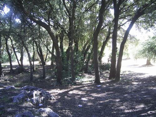
Bañizuela Forest
Torre del Campo
Bosque de la Bañizuela (Bañizuela Forest) is a small but exceptionally dense Mediterranean woodland in the municipality of Torre del Campo, in the province of Jaén, Spain. Declared a Natural Monument by decree 48/2010 of 23 February 2010, it covers roughly two hectares of what was once an old garden, yet within that modest footprint it protects some of the oldest and most remarkable specimens of native vegetation found in this part of Andalusia. Where exactly is it located? The forest sits just south of the town of Torre del Campo, about 11 kilometers from Jaén, the provincial capital, within the Sierra Sur comarca. Its proximity to Jaén makes it an easy addition to a day trip through the surrounding countryside rather than a destination requiring a dedicated journey. How do you get there? The simplest way to reach the site is by car from Jaén toward Torre del Campo, a drive of only a few minutes over 11 kilometers. From the town center, a local access road leads to the forest itself. Travelers without a car can use Torre del Campo as a base and reach the reserve on foot or by bike, though it is worth checking the current condition of the access route beforehand, since this is a small, low-key natural site rather than a fully developed tourist complex. What will you see there? The heart of the forest is its lush Mediterranean vegetation: Portuguese oak (quejigo), kermes oak (coscoja), laurustinus (durillo), yellow jasmine, and tangles of clematis and honeysuckle that climb over older trees, forming a dense, almost jungle-like understorey. The true curiosity of the site is the so-called Arrayán de la Bañizuela — a single myrtle specimen listed among the region's singular natural specimens for its unusually large size and thick, tree-like trunk, a form far removed from the typical shrubby myrtle. This remarkable myrtle, together with the surrounding vegetation, was the main reason the site was granted protected status. The ground beneath the forest is built from limestone, dolomite, and marly limestone rock dating to the Jurassic period, adding a geological dimension to the visit — rocky outcrops appear here and there along the paths, offering a glimpse into a landscape history stretching back millions of years. Given its small size, walking the entire area does not take long, but the density and variety of the plant life reward a slower, more attentive visit than the reserve's modest dimensions might suggest. When is the best time to visit? Spring and early autumn are the most rewarding seasons, when temperatures in Jaén province are milder and the vegetation — particularly the flowering jasmine and clematis — is at its most striking. Summers in this part of Andalusia can be very hot, so a morning visit is advisable during that season. In winter the forest retains the evergreen, hardy character typical of Mediterranean sclerophyllous woodland, making it a worthwhile stop even outside the summer months. Who is this place for? Bosque de la Bañizuela appeals above all to nature lovers, amateur geologists, and anyone looking for a quiet walk away from crowds. Because of its small scale and understated character, it is not a site with extensive tourist infrastructure — it functions as a natural reserve for quiet contact with nature rather than an attraction with full visitor services. It pairs well with a visit to Torre del Campo itself and to nearby Jaén, known for its Santa Catalina Castle and cathedral. Frequently asked questions Is there an entrance fee? Available sources give no indication of an entrance fee — as a protected natural monument, the site is generally open to the public, though it is worth confirming current visiting rules locally. How long does a visit take? Given its small size (around two hectares), walking the main paths typically takes between thirty minutes and an hour, depending on pace. What is the main highlight of the site? The standout feature is the Arrayán de la Bañizuela, an exceptionally large, tree-form myrtle considered one of the most unusual examples of the species in the region. Are there other attractions nearby? Yes — Torre del Campo itself and the provincial capital, Jaén, about 11 kilometers away, both offer additional sights that can be combined into a single day trip.
Earn badges for the places you visit
Download NextOnTrip, discover new places and check off your trails.