Nature in Spain
A guide to 849 Nature in Spain — with descriptions, photos and traveler visits from the NextOnTrip community. Locations spread across 518 cities and towns. Most visited by the community: Comunero de Revenga, Dehesa de Navalcarbón, Painted Cave, Galdar.
-
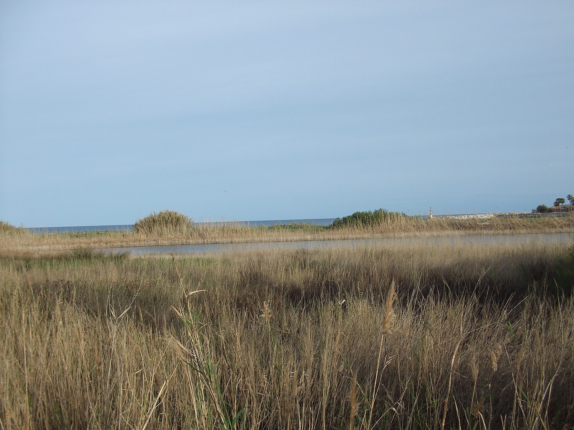
Paraje natural del estuario del río Guadiaro
Sotogrande
Paraje Natural del Estuario del Río Guadiaro is a protected natural area at the mouth of the Guadiaro River as it meets the Mediterranean, right next to the Sotogrande resort in the municipality of San Roque, Cádiz province, in Andalusia's Campo de Gibraltar region. It's a small but ecologically significant stretch of coastline where freshwater from the river mixes with the sea, creating a habitat that draws hundreds of birds. How big is the protected area and when was it created? The site gained legal protection in 1989, as part of Andalusia's Inventory of Protected Natural Spaces. It originally covered 27 hectares around the river mouth itself. In November 2013, an additional 8 hectares were added, extending protection to the final stretch of the river and bringing the total protected surface to 35 hectares. The area was designated a Special Protection Area for Birds in 2002, and the 2013 boundary expansion also brought Special Area of Conservation (ZEC) status and inclusion in the Natura 2000 network. Why does this estuary matter for birds? The estuary stands out for its unusual geomorphology and remarkable richness of wildlife, birds in particular. Researchers have recorded as many as 140 different bird species here. Among the species that can be spotted are the Little Egret, the Grey Heron, and the Purple Heron, alongside many other birds tied to wetland and coastal environments. The mixing of fresh and salt water creates ideal feeding and resting conditions for migratory birds, making the estuary an important stopover on migration routes between Europe and Africa. What lives in the water here? Beyond birdlife, the estuary is notable for its aquatic fauna. One species worth mentioning is the sea lamprey, a fish often regarded as an indicator of good water quality, since it depends on clean conditions to breed and develop. How can visitors explore the area? The natural area is open to the public via two routes fitted with wooden boardwalks that let visitors observe the wildlife without disturbing the fragile ecosystem. One path runs along Paseo del Parque, while the other starts near Jaime el Conquistador street. Walking the full route takes under half an hour, making it an easily accessible stop even for visitors spending only a short time in Sotogrande, for instance between a round of golf and a trip to the beach. Frequently asked questions Where exactly is this natural area located? At the mouth of the Guadiaro River, directly bordering the Sotogrande resort, in the municipality of San Roque (Cádiz, Andalusia). How much time does a visit take? Walking both boardwalk routes takes about 30 minutes, though birdwatchers may want to spend considerably longer. Is this a good spot for birdwatching? Yes — 140 bird species have been recorded here, and its status as a Special Protection Area for Birds and part of the Natura 2000 network confirm its high ecological value. Is there an entrance fee? No, the area is freely accessible to the public, and visits take place along the designated paths and boardwalks that protect the natural habitats. Is it worth combining a visit with exploring Sotogrande? Definitely — its proximity to the marina, golf courses, and beaches of Sotogrande makes a short walk through the estuary a natural addition to a visit in the area, especially for travelers who enjoy some contact with nature.
-
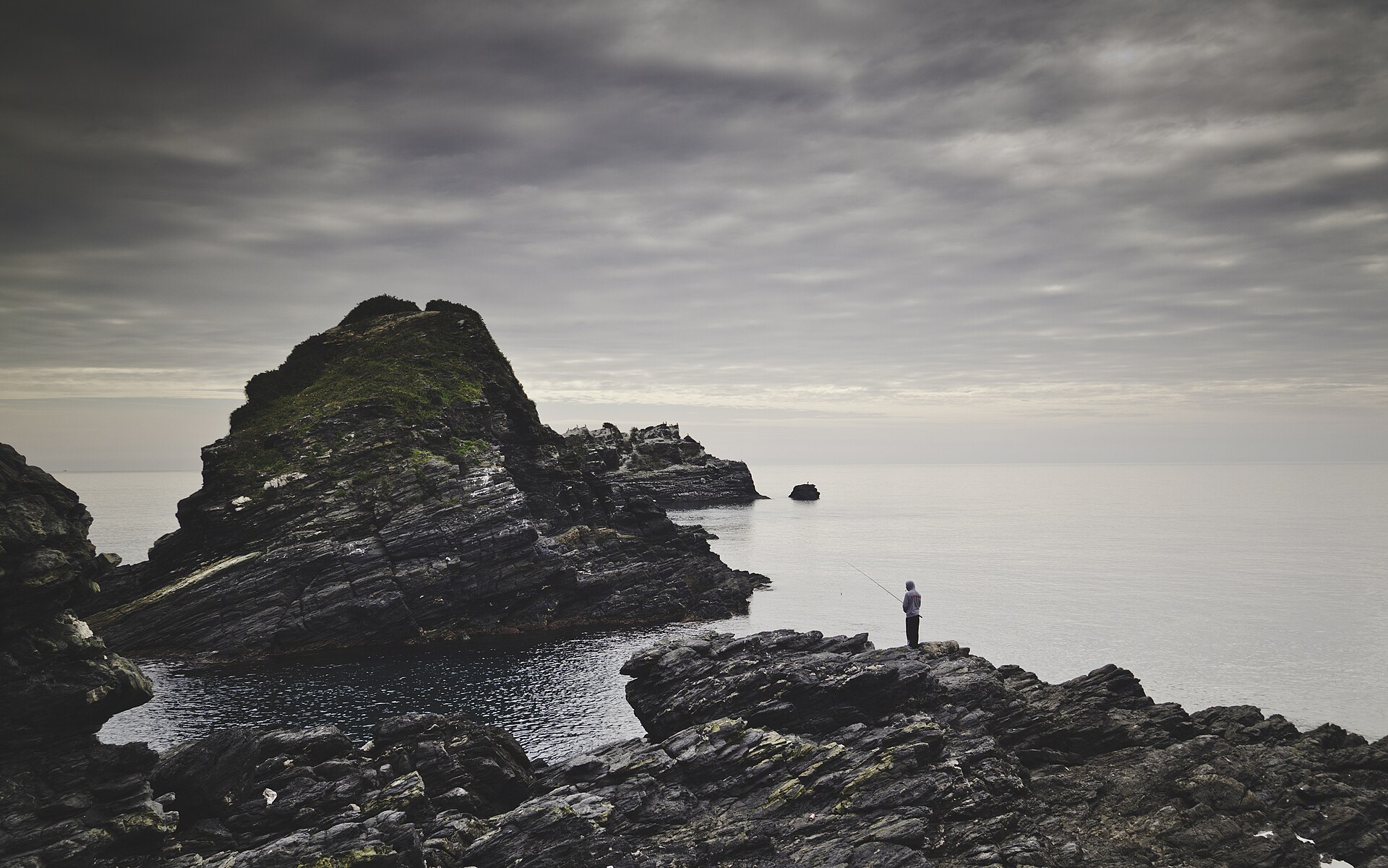
Peñones de San Cristóbal
Almuñécar
Peñones de San Cristóbal Peñones de San Cristóbal is a trio of rocky outcrops rising directly from the shoreline of Almuñécar, a coastal town on the Costa Tropical in Granada province, Andalusia. Even travelers who only pass through Almuñécar tend to remember these massive rock formations cutting into the beach — they have become one of the town's unofficial emblems and one of the most photographed spots along this stretch of coast. What are the Peñones de San Cristóbal? The formation consists of three separate rocks of different size and position relative to the shore. The largest and most accessible is Peñón del Santo, rising roughly 30 meters, which juts straight into the sand and splits the town's main beach into two sections: Puerta del Mar toward the center and San Cristóbal beach to the east. The other two rocks, Peñón de Enmedio and Peñón de Fuera, sit further out to sea, separated from land by a stretch of water, and are best appreciated from the shore or from a boat. The whole rock group was declared a Natural Monument by the Andalusian regional government in November 2001, granting it protected status as a landscape feature of notable geological and ecological value. Why visit? Peñón del Santo works as a natural viewpoint. From its top, visitors get a sweeping panorama over Almuñécar's bay, the beaches on either side, and the mountainous backdrop of the Costa Tropical. It is one of the few urban cliffs in the region that can be climbed without any special preparation, which makes it a favorite spot for an evening walk, especially around sunset. The rocks also carry ecological weight. Their steep faces and hard-to-reach ledges are used by seabirds as nesting sites and observation perches, drawing birdwatchers alongside regular beachgoers. Where the rock meets the sea, the surrounding waters support rich marine life, and the area is popular with divers and snorkelers exploring the submerged parts of the formation. How the Peñones fit into Almuñécar's landscape Almuñécar sits on the stretch of coastline known as the Costa Tropical, named for its mild microclimate that allows farmers to grow tropical fruit such as mangoes and custard apples close to the Mediterranean. Rising almost in the middle of the seafront promenade, the Peñones de San Cristóbal are a natural extension of this rugged coastline, where the foothills of the Sierra Nevada come almost down to the waterline. Because the rocks sit right in the town center, they are easy to reach on foot along the promenade. A visit pairs naturally with a swim on one of the neighboring beaches or a meal at one of the many local restaurants serving fresh fish and seafood. Frequently asked questions Can you climb to the top of the rock? Yes, a path leads up Peñón del Santo, offering a view over the bay from the top. Are the other two rocks accessible from land? Not directly — Peñón de Enmedio and Peñón de Fuera stand in the water, separated from the beach, and are usually viewed from the shore or by boat. When did the formations receive legal protection? In November 2001, when the Andalusian government designated them a Natural Monument. Is wildlife visible around the site? Yes, the rock faces serve as nesting grounds for seabirds, making the site interesting for birdwatchers as well as beachgoers.
-
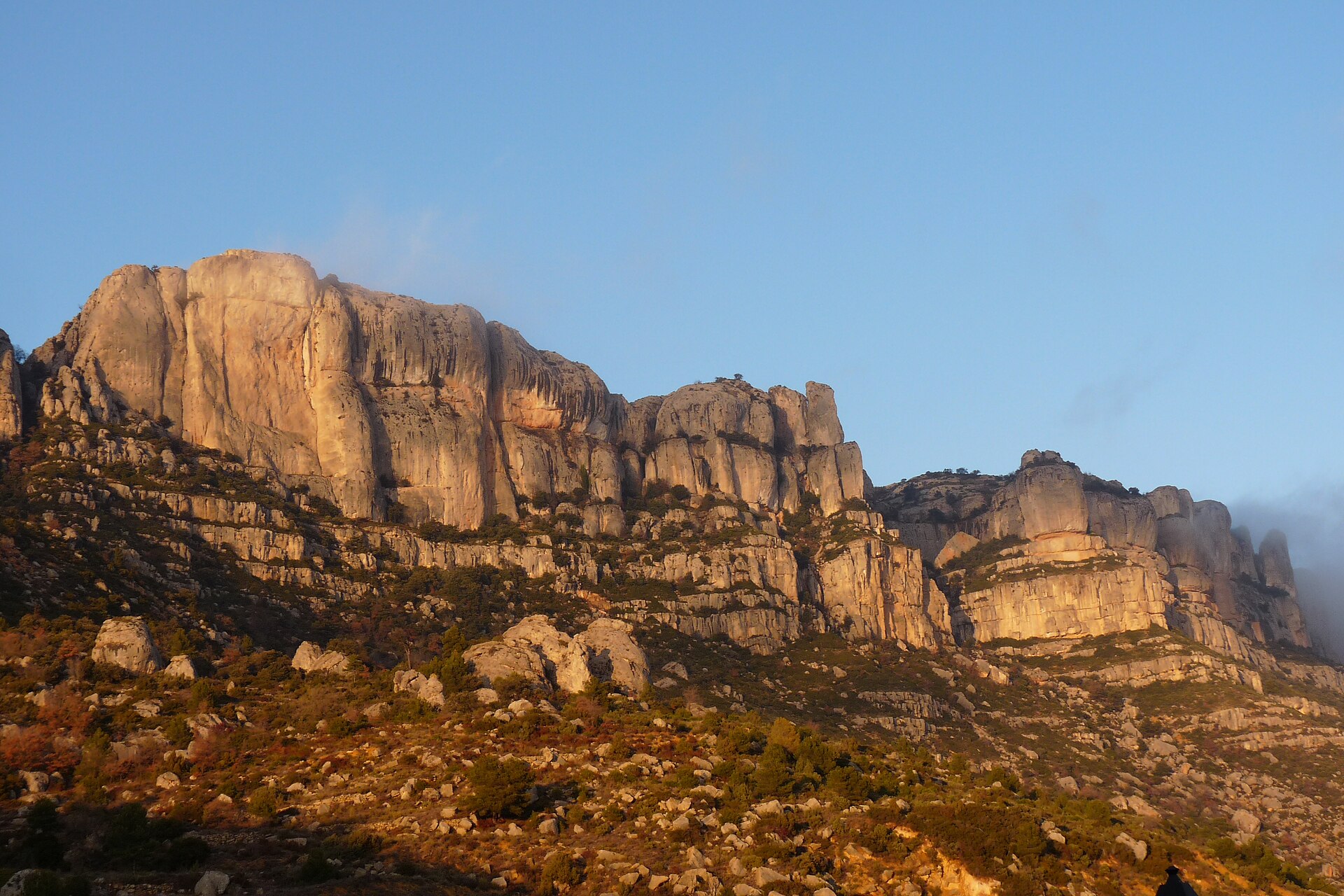
Serra de Montsant Natural Park
la Morera de Montsant
Parc natural de la Serra de Montsant is a protected landscape area located in Catalonia, Spain. The park takes its name from the Serra de Montsant, the mountain chain around which the boundaries of this protected area have been drawn. Its geographic center sits at approximately 41.292953 N, 0.797803 E, a point that falls within the mountain chain itself and helps pinpoint the area on a map of the wider region. Where is the park located? Serra de Montsant is a mountain chain stretching through Catalonia. Within its range, and forming its main populated area, lies the village of La Morera de Montsant. This village serves as the key reference point for anyone trying to locate the park or plan a route into this part of Catalonia. The fact that La Morera de Montsant is identified as the main populated area within the range also suggests that the rest of the terrain is predominantly natural and mountainous, with limited settlement. Protected status According to official geographic data records, Parc natural de la Serra de Montsant is classified as a protected landscape area in Spain. This designation means the land is subject to specific management rules aimed at preserving its natural and scenic value. The name itself — including the Catalan term "parc natural" — clearly signals the protective function this site holds within Catalonia's network of protected areas. What to know before visiting For anyone planning a visit, La Morera de Montsant remains the most useful reference point for orienting yourself relative to the rest of the region. The coordinates 41.292953, 0.797803 mark a central point of the protected area and can serve as a starting reference for GPS navigation in this part of Catalonia. Frequently asked questions Where exactly is Parc natural de la Serra de Montsant located? The park lies in Catalonia, Spain, within the Serra de Montsant mountain chain, near the village of La Morera de Montsant. What is the protection status of this area? It is registered as a protected landscape area, according to official geographic data for this location. Which village is closest to the park? The main populated area within the Serra de Montsant mountain chain is La Morera de Montsant. What are the park's coordinates? Its geographic coordinates are approximately 41.292953 N, 0.797803 E.
-
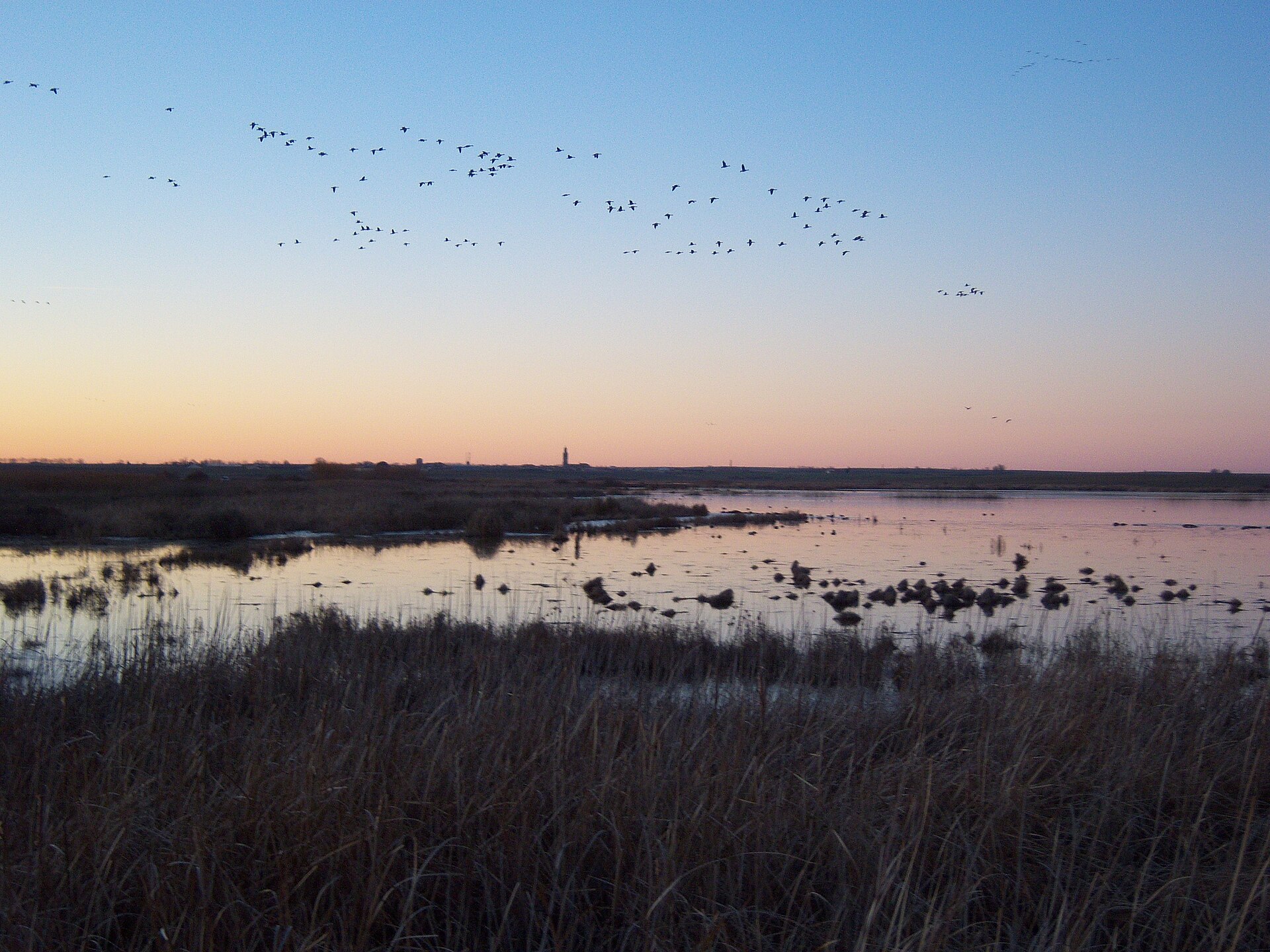
Laguna de la Nava
Fuentes de Nava
Laguna de la Nava is one of the most significant artificially restored wetlands on the Iberian Peninsula, located in the province of Palencia, Castile and León, near the town of Fuentes de Nava. The site sits at coordinates 42.0667, -4.75. While it's known today mainly as a birdwatching destination, its history stretches back much further than the last few decades and illustrates just how dramatically human activity can reshape a landscape — and, with enough determination, partially restore it. What was Laguna de la Nava before it was drained? Originally, this location held a vast steppe lagoon, also known as Mar de Campos, covering an area of around 2,500 hectares. It ranked among the largest wetlands on the Iberian Peninsula and held major ecological importance for the wider Castile and León region. For centuries it acted as a natural retention basin for rainwater and snowmelt draining from the surrounding plains, forming a unique steppe-wetland ecosystem. Why did the lagoon disappear in 1968? Throughout the 20th century, several drainage attempts were made in order to convert the land into new farmland. Eventually, in 1968, Laguna de la Nava ceased to exist as a wetland — the area was turned into agricultural fields. This decision, typical of Spain's post-war agricultural policy, resulted in the loss of one of the country's most valuable habitats for waterfowl. How was the wetland brought back? Since 1990, a wetland recovery project has been underway, carried out by the Global Nature Foundation in cooperation with various administrative bodies. Thanks to this work, around 400 hectares of the original wetland have been restored. That's still only a fraction of its former extent, but enough for the ecosystem to once again function as a resting and wintering ground for migratory birds. What is the significance of Laguna de la Nava today? Today it stands as one of the most important wetlands catalogued both nationally and internationally. In 2002, the site was included on the list of the Ramsar Convention on Wetlands of International Importance, confirming its ecological standing on a continental scale. What birds can be seen at Laguna de la Nava? The lagoons put on a striking natural spectacle — hundreds of birds wintering in these waters. An inventory has recorded 222 bird species here, representing 41% of all species found in Spain, including the islands. In autumn, thousands of geese and ducks arrive from Northern Europe. From October to March, the lagoon hosts large contingents of waterfowl, with numbers reaching up to 20,000 birds in some winters. How do you get there and where can you watch the birds? The Humedal de la Nava lies along the P-940 road. Before reaching the town of Fuentes de Nava, there is a parking area on the left side of the road, and bird observation points on the right, designed to allow ornithological observation without disturbing the wildlife. Frequently asked questions Has Laguna de la Nava always looked the way it does today? No — the original lagoon was far larger (around 2,500 ha) and disappeared in 1968 after being drained for farmland. When did the wetland restoration begin? Recovery efforts have been underway since 1990, led by the Global Nature Foundation together with administrative institutions. Does the site have protected status? Yes, since 2002 it has been listed under the Ramsar Convention as a wetland of international importance. How many birds can be seen in winter? In some winters, the number of waterfowl reaches as many as 20,000 birds, mainly geese and ducks.
-
Reserva Marina de Cabo de Palos-Islas Hormigas
Kartagena
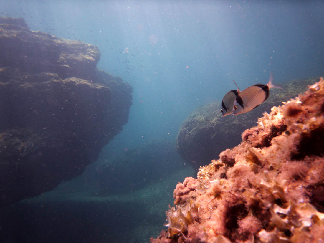
Reserva Marina de Cabo de Palos-Islas Hormigas is an underwater nature reserve off the coast of Cartagena, in the Murcia region of Spain, covering roughly 19 km² of the Mediterranean Sea around Cabo de Palos and the small Islas Hormigas archipelago. Established in 1995, it ranks among Spain's oldest marine reserves, created to preserve the biodiversity of the seabed and to safeguard populations of commercially important species relied upon by local fisheries. How is the reserve organized? The protected area is divided into zones with different levels of protection. At its core lies a fully protected zone covering the waters around Isla Hormiga, El Bajo, El Mosquito, and the islets of El Hormigón and La Losa, where human interference is kept to an absolute minimum. Surrounding it are an inner-waters zone, managed by the regional government of Murcia, and an outer-waters zone under the authority of Spain's national administration. This layered structure allows the most valuable seabed habitats to receive strict protection while permitting controlled access to the rest of the area. What makes the seabed here so distinctive? The reserve is known for its well-preserved meadows of Posidonia oceanica, a seagrass native to the Mediterranean that forms dense underwater "meadows" providing habitat for numerous fish and invertebrate species. These meadows are accompanied by coral colonies, which together build a complex ecosystem structure that supports rich biodiversity. It is precisely this combination of healthy posidonia meadows, coral formations, and rocky seabed that makes the waters around Cabo de Palos among the most ecologically rich in this part of the Mediterranean. Why is it such a popular diving destination? Reserva Marina de Cabo de Palos-Islas Hormigas is considered one of the most important and most visited diving areas in Spain, drawing divers from both within the country and abroad. Beyond its abundant marine life and impressive posidonia meadows, the reserve is known for numerous historic shipwrecks resting on the seabed near the cape — the remains of vessels that sank over the years along this busy stretch of coast. The varied underwater terrain, including rocky shoals such as El Bajo, further diversifies dive routes, so that every dive in the area offers a different experience. Where exactly is it located? The reserve sits at the edge of the Costa Cálida, by Cabo de Palos, close to Cartagena, where the Mediterranean Sea meets the rugged, rocky coastline typical of the Murcia region. The geographic coordinates at the heart of the reserve are approximately 37.654°N, -0.651°E. Frequently asked questions Can visitors swim or bathe within the reserve? The reserve is primarily a nature protection area, and access to its different zones — especially the fully protected core zone — is restricted in order to safeguard the ecosystem. What can divers expect to see? Divers can encounter posidonia meadows, coral colonies, abundant fish life, and historic shipwrecks scattered around the Islas Hormigas. When was the reserve established? Reserva Marina de Cabo de Palos-Islas Hormigas was established in 1995. How large is the reserve? It covers an area of approximately 19 km² of Mediterranean waters.
-
Maspalomas Dunes
San Bartolomé de Tirajana
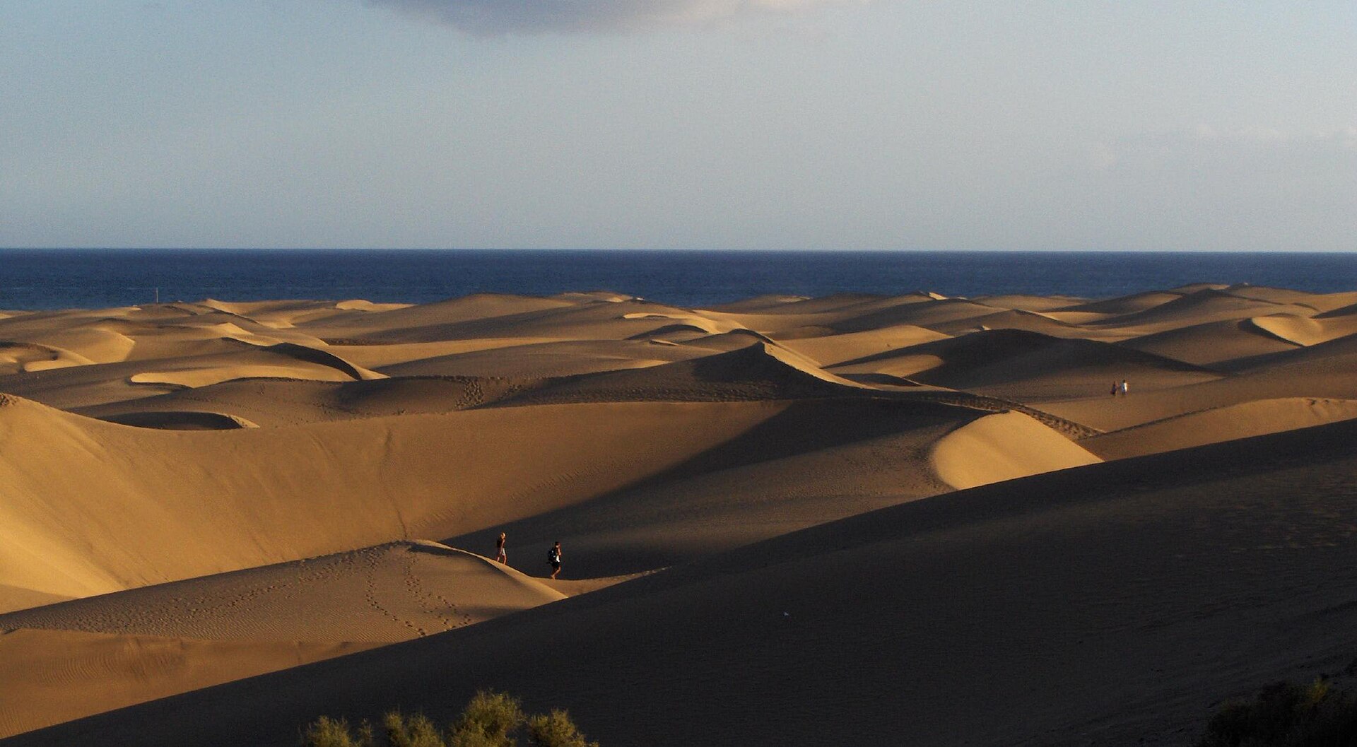
Dunas de Maspalomas is a nature reserve located on the island of Gran Canaria, in the Canary Islands, within the municipality of San Bartolomé de Tirajana. It sits at the very southern tip of the island, forming part of one of the most recognizable landscapes in the entire archipelago. What kind of place is this? The area holds the status of a partial nature reserve. This means the ecosystems found here are not placed under a total access ban but can instead be made available for specific purposes: scientific research, educational activities, recreation, and, in exceptional cases, traditional land use. This form of protection allows the preservation of unique natural features to coexist with the role the site plays for both residents and visitors. Why was a reserve established here? The location, on the southern cape of Gran Canaria, places the area within a zone of climatic and geographic conditions distinctive to this part of the island. It is precisely here, within the municipality of San Bartolomé de Tirajana, that authorities decided to place the land under protection, recognizing it as a space of particular natural value requiring management and oversight. What is the nature of protection applied here? Partial reserve status differs from a strict nature reserve — it does not mean the land is entirely excluded from human activity. Instead, it introduces a system of regulated access in which protecting the ecosystems remains the priority, while still allowing for their reasonable use. Science and education can draw on the area for observation and research, and visitors can use it for recreation, provided this takes place in line with the conservation rules that apply to the site. Where exactly is this area located? The geographic coordinates pointing to the area are approximately 27.74°N, 15.59°W, placing it in the south of Gran Canaria, within the administrative boundaries of the municipality of San Bartolomé de Tirajana — one of the island's local government units, to which this stretch of coastline and the adjoining land belongs. Which authority administers this area? Formally, the land falls under the municipality of San Bartolomé de Tirajana, meaning local government bodies take part in managing the space and enforcing the rules that come with its reserve status. This administrative affiliation has practical consequences — decisions about access, supporting infrastructure, and the coordination of scientific and educational activities carried out within the reserve are made at the municipal level. Frequently asked questions Can Dunas de Maspalomas be visited? Yes, the area is open to recreational use, since it holds partial rather than strict reserve status — access, however, is regulated by conservation rules. How does a partial reserve differ from a strict nature reserve? A partial reserve allows the land to be used for scientific research, education, recreation, and, exceptionally, traditional use, while a strict reserve typically excludes such activity. Where exactly is this area located? At the southern tip of Gran Canaria, within the municipality of San Bartolomé de Tirajana, in the Canary Islands. Who administers this area? The area falls under the administrative authority of the municipality of San Bartolomé de Tirajana.
-
Marjal de Pego-Oliva Natural Park
Pego
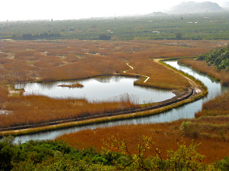
Marjal de Pego-Oliva Natural Park protects a large freshwater wetland straddling the border of the Valencia and Alicante provinces, spread across the municipalities of Pego and Oliva. Covering roughly 1,253 hectares, the reserve sits in a basin ringed by the Mostalla, Migdia and Segària mountains, which together funnel runoff from the surrounding hills into the marshland below. It ranks among the last extensive freshwater marsh systems left on Spain's Mediterranean coast, kept wet year-round by a network of channels, ditches and ponds. What kind of vegetation grows in the marsh? Bands of tamarisk, rushes and reed beds line the open water throughout the park. Below the surface, meadows of submerged aquatic plants form the backbone of the ecosystem, while duckweed and white water lilies float across calmer stretches. This layered mix of reed, rush and floating vegetation offers both food and shelter to the wide range of species that depend on the wetland. Which animals live here? The park is best known among birdwatchers. Its reed beds and open channels host purple swamphens, purple herons, squacco herons, glossy ibises, greater flamingos, gull-billed terns and whiskered terns, alongside the endangered marbled teal and several reed-dwelling warbler species. Among invertebrates, the endemic freshwater shrimp Dugastella valentina stands out, and the park's canals shelter the samaruc, an endangered freshwater fish found only in the Levante region of Spain. Amphibians and reptiles are represented by the European pond turtle and the viperine water snake, rounding out a dense web of wetland-dependent wildlife. Why is this wetland protected? Given its exceptional biodiversity, Marjal de Pego-Oliva is listed under the Ramsar Convention, which recognises wetlands of international importance. The park also carries Special Protection Area status for birds and forms part of the EU's Natura 2000 network, underlining its role as a refuge for species under threat across Europe. How can visitors explore the park? Marked trails and observation points run through the marsh, allowing birdwatching without disturbing the wildlife. Walking along the channels reveals both open water and dense stretches of reed vegetation, with early mornings and the spring and autumn migration seasons offering the best chances to spot waterbirds. Frequently asked questions Where exactly is Marjal de Pego-Oliva located? On the border between the Valencia and Alicante provinces, across the municipalities of Pego and Oliva, surrounded by the Mostalla, Migdia and Segària mountains. How large is the park? Around 1,253 hectares of marshland, channels and ponds. What can visitors see there? Rich wetland birdlife, including endangered species, endemic invertebrates and fish, plus characteristic reed and rush vegetation. Does the park hold international protection status? Yes, it is listed under the Ramsar Convention and belongs to the Natura 2000 network.
-
Monte Santiago
Berberana
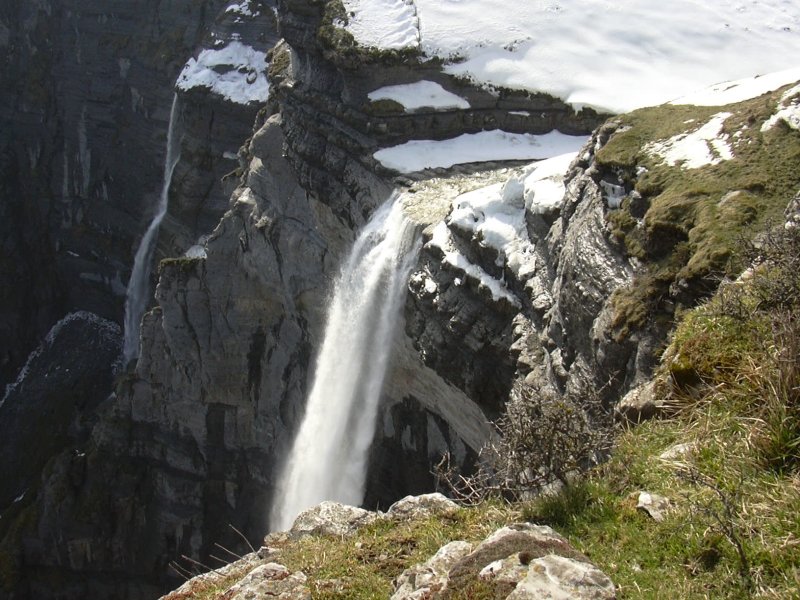
Monte Santiago is a protected Natural Monument in the municipality of Berberana, in the northeastern corner of Burgos province, right on the border with the Basque Country. Covering more than 2,500 hectares and protected since 1996, the area spans the municipalities of Berberana and Junta de Villalba de Losa. It's one of the most distinctive landscapes in the Las Merindades region, combining beech forest, karst gorges, and one of the tallest waterfalls in Western Europe. What can you see at Monte Santiago? Salto del Nervión — a waterfall that stops you in your tracks The star attraction of the Natural Monument is the Salto del Nervión, a waterfall that plunges more than 300 metres in a slender, horsetail-shaped cascade. It ranks among the tallest and most spectacular waterfalls in Western Europe. The falls are seasonal: they run at their fullest after heavy rain or during snowmelt, while in summer the riverbed is often dry or nearly so. The water drops from the rim of a rocky amphitheater carved into the limestone cliffs of the Sierra Salvada, creating a view that draws photographers and nature lovers from across Spain. Beech forest and a rocky amphitheater The landscape of Monte Santiago is dominated by a well-preserved beech forest (hayedo) that stretches right to the edge of the cliff enclosing the amphitheater. The heavily karstified terrain of the Sierra Salvada has shaped steep limestone walls and deep ravines, which contrast with the forest's green in summer and turn shades of red and gold in autumn — one of the most popular seasons to visit. Wildlife in the Natural Monument The area shelters numerous animal species. Griffon vultures and golden eagles can often be seen circling above the rock amphitheater, while foxes, wild boar, and roe deer roam the surrounding forest and scrubland. For birdwatchers and wildlife enthusiasts, Monte Santiago is one of the more rewarding spots in Burgos province. How do you get to the waterfall and the viewpoint? The starting point for a visit is Berberana, the last village before entering the Natural Monument. From there, a forest track leads toward the Fuente Santiago shelter, from where an accessible walking route reaches the viewpoint overlooking the Salto del Nervión. The walk passes through beech woodland and doesn't require special preparation, making it approachable for most visitors to the area. Frequently Asked Questions When is the best time to see the Salto del Nervión waterfall in full flow? The waterfall is seasonal, running at its fullest after heavy rainfall and during spring snowmelt. In the dry summer months, the flow is often very limited or absent altogether. Can you drive to Monte Santiago on your own? Yes — the starting point is the village of Berberana, from which an access road leads to the Natural Monument area and a walking trail continues to the viewpoint over the waterfall. What wildlife can you spot at Monte Santiago? The area is home to griffon vultures, golden eagles, foxes, wild boar, and roe deer, making it a notable site for observing birds of prey and forest mammals. What makes Monte Santiago different from other natural parks near Burgos? Its combination of an extensive, well-preserved beech forest with the rocky amphitheater of the Sierra Salvada, plus the presence of the Salto del Nervión — one of the tallest waterfalls in Western Europe — makes it a genuinely distinctive stop on the region's natural landmarks map.
-
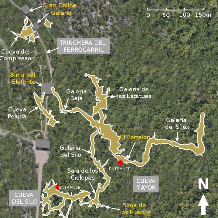
Sima del Elefante
Ibeas de Juarros
Sima del Elefante ("Pit of the Elephant") is one of the main excavation sites of the Atapuerca archaeological complex, located near the town of Ibeas de Juarros in the province of Burgos, northern Spain. Why is this cave significant? Sima del Elefante holds some of the earliest confirmed evidence of human presence in Western Europe. Jaw and tooth fragments recovered from the site have been dated to roughly 1.1-1.2 million years old. In 2022, researchers uncovered a partial facial bone, catalogued as ATE7-1, dated between 1.1 and 1.4 million years and attributed to Homo affinis erectus - making it the oldest human face ever found in Western Europe. The find predates the roughly 800,000 to 860,000-year-old Homo antecessor remains discovered at the nearby Gran Dolina cave, another Atapuerca site. Excavators also recovered stone tools and animal bones bearing cut marks, evidence that these early humans processed meat with simple lithic technology. Together with Gran Dolina and Sima de los Huesos, Sima del Elefante forms part of the Atapuerca archaeological sites, inscribed on the UNESCO World Heritage List. How do you get there and visit the site? Visits start at the Centro de Acceso a los Yacimientos de Atapuerca (CAYAC), on the road out of Ibeas de Juarros toward Logroño. From there, a shuttle bus takes visitors to the excavation area; the same route also serves visitors coming from CAREX, the visitor centre in the neighboring village of Atapuerca. Independent access to the excavations is not permitted - the sites are protected and can only be visited on a guided tour. The guided walk lasts around one hour and fifteen minutes and covers roughly 600 metres round trip, with three stops, including Sima del Elefante itself, the oldest of the sites on the route. Tickets must be booked in advance, by phone, email, or at the ticket desks of the Museo de la Evolución Humana, CAREX, or CAYAC. When is the best time to visit? Excavation work usually takes place during the summer, when archaeologists are on site - a good time to see fieldwork in progress. Outside the digging season, guided tours still run year-round, but booking ahead is recommended since each tour has a limited number of spots. What else to see nearby? A visit to Sima del Elefante pairs well with the Museo de la Evolución Humana (Museum of Human Evolution) in Burgos, which displays finds from Atapuerca, and with the other sites on the same route, Gran Dolina and Sima de los Huesos. Frequently Asked Questions What does the name Sima del Elefante mean? It translates to "Pit of the Elephant," a name that comes from elephant bones found in the cave during earlier research. Can you visit the cave on your own? No. The site is protected and only accessible on guided tours departing from the CAYAC or CAREX visitor centres, which require advance booking. What has been found at the site? Jaw and tooth fragments dated to 1.1-1.2 million years, a facial bone fragment (ATE7-1) dated to 1.1-1.4 million years and attributed to Homo affinis erectus, plus stone tools and cut-marked animal bones. Is Sima del Elefante part of a UNESCO site? Yes, it belongs to the Archaeological Site of Atapuerca, inscribed on the UNESCO World Heritage List.
-
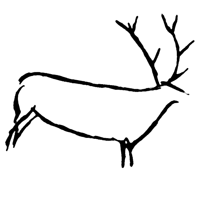
Cave of Las Chimeneas
Vargas
Las Chimeneas is a cave and archaeological site set into the eastern slope of Monte Castillo hill, in the municipality of Vargas, deep in the Cantabria region of northern Spain. It sits right next to Puente Viesgo, a small spa town that has long served as the gateway for visiting this hill and its cluster of prehistoric caves. Where exactly is Las Chimeneas? Monte Castillo rises above the valley of the River Pas and has drawn archaeologists and curious travelers for decades. Las Chimeneas occupies its eastern flank, surrounded by the green hills, small villages, and limestone outcrops typical of this part of Cantabria — rock that water has slowly carved into a network of caves over thousands of years. The site sits at coordinates 43.289444, -3.964444, right on the boundary between the municipalities of Vargas and Puente Viesgo. What makes this site worth knowing about? Las Chimeneas is one of the caves belonging to the Monte Castillo group, alongside the better-known El Castillo, as well as La Pasiega and Las Monedas. This cluster of caves is part of a wider UNESCO World Heritage listing covering caves with Paleolithic art in northern Spain, in the same company as the famous Altamira cave. The name "Chimeneas" (chimneys) refers to the narrow, tall rock passages inside the cave that resemble ventilation shafts — a feature typical of karst caves shaped by centuries of water working through limestone. For archaeologists, Monte Castillo is one of the key locations for studying Stone Age life on the Iberian Peninsula: sediment layers and finds from this hill have helped establish a chronology of human settlement in the region spanning thousands of years. For visitors, it's a chance to stand in a landscape where prehistory feels tangible rather than something read about behind museum glass. How do you get there? Traveling by car is the most practical option — Puente Viesgo and the surrounding villages of Vargas municipality sit inland in Cantabria, within reach of a day trip from Santander or Torrelavega. Local roads wind through the hills, so it's worth allowing extra time, especially if you plan to visit more than one cave on Monte Castillo in the same day. Travelers without a car should check local bus connections from the region's larger towns in advance, since public transport coverage in this part of Cantabria is limited. When should you visit? Cantabria has an oceanic climate with rainfall spread throughout the year, so the season matters less here than in Spain's Mediterranean regions. Spring and early autumn tend to be the most pleasant times to visit, with milder temperatures than summer and fewer crowds than during the peak holiday season. Access to caves of this kind is typically regulated, often requiring advance booking or a guided visit, so it's worth checking current entry rules before setting off. Frequently Asked Questions Which municipality is Las Chimeneas in? The cave lies within the municipality of Vargas, on the eastern slope of Monte Castillo, close to Puente Viesgo. Is Las Chimeneas open to tourists? It is primarily an archaeological site. Visits to the caves of Monte Castillo are usually organized and guided, so it's a good idea to plan and book ahead of time. How is Las Chimeneas different from the other caves on Monte Castillo? Its name comes from the narrow, chimney-like rock passages that run through it. Together with El Castillo, La Pasiega, and Las Monedas, it forms part of the same hill's cave complex, sharing the same archaeological significance. What else is there to see nearby? Puente Viesgo, a small spa town, is the natural base for exploring Monte Castillo and its caves, along with the surrounding hills of the Pas river valley.
-
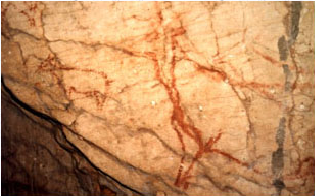
Cave of Niño
Aýna
Cave of Niño (Cueva del Niño) is a cave and archaeological site in the municipality of Aýna, in the province of Albacete, Castilla-La Mancha, Spain. It's a quieter stop for travelers interested in prehistoric heritage away from the region's better-known attractions. What makes this cave significant? The cave holds a set of rock art paintings dating back to the Paleolithic period, and they are noted for being well preserved. That level of preservation is what sets Cueva del Niño apart from many other cave sites in the area and makes it a reference point for anyone interested in prehistoric art in the Albacete province. Why is it a protected heritage site? In 1997, the Cave of Niño was declared a Bien de Interés Cultural (BIC) — the highest legal category of heritage protection in Spain, reserved for sites of outstanding historical and cultural value. That designation means the cave and its rock art fall under strict conservation rules, and any intervention in or around the site requires approval from the relevant heritage authorities. For visitors, the BIC status is a clear indicator that this is a scientifically documented site, not just a scenic curiosity. Where exactly is it located? The cave sits within the municipality of Aýna, a small town in the mountainous eastern part of Albacete province. Aýna itself is worth a look — it's set in a rugged, ravine-cut landscape typical of this stretch of Castilla-La Mancha, with a rural, mountain character far from the region's larger cities. That makes it a good fit for travelers looking for a slower-paced, less crowded route through inland Spain. What should you know before visiting? Because of its protected status and the sensitivity of the paintings, access to caves like this one is often restricted or requires prior arrangement — it's worth checking locally, for instance at the tourist information office in Aýna, before building the visit into a fixed itinerary. The surrounding area is well suited to a longer walk: the hills around Aýna offer the kind of scenery typical of eastern Castilla-La Mancha, and visitors should plan on sturdy footwear, since reaching sites like this one usually means walking over uneven, rocky ground. Frequently Asked Questions Can visitors enter the cave on their own? Sites with protected rock art like this one often limit independent access to safeguard the paintings — check current rules locally in Aýna before you go. What do the paintings depict? They form a well-preserved set of Paleolithic rock art; the precise imagery and subject matter are best confirmed through on-site archaeological information rather than assumed in advance. Is it worth combining with a visit to Aýna itself? Yes — Aýna sits in a mountainous corner of Albacete province, and the town and its surrounding landscape make a natural complement to a stop at the cave. Why does the Cave of Niño hold Bien de Interés Cultural status? Because of the historical and scientific value of its well-preserved Paleolithic paintings, a status granted in 1997 that carries Spain's highest level of legal heritage protection.
-
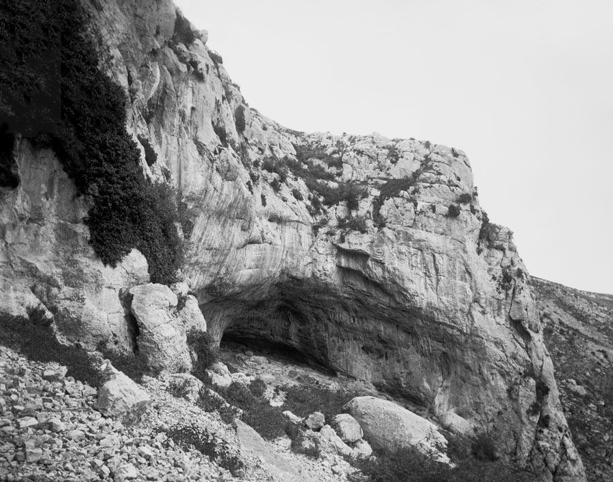
Espluga d'en Ponça
Abella de la Conca
Espluga d'en Ponça is a small cave near the village of Abella de la Conca, in the Pallars Jussà region of Catalonia, northern Spain. It sits in a stretch of the Pre-Pyrenees known for its limestone landscape, dotted with caves and rock formations that attract hikers and cave enthusiasts looking for a quieter corner of the Pyrenees. Where exactly is it? The cave lies close to the village of Abella de la Conca, at roughly 42.176°N, 1.067°E, in the foothills of the Pre-Pyrenean range. Pallars Jussà is known for its karst terrain, and Espluga d'en Ponça shares the area with other documented caves and rock formations, including Forat dels Lladres — literally "Thieves' Hole" — a spot with natural rock arches overlooking the village, and Espluga petita del Congost, listed in Catalonia's inventory of archaeological and paleontological heritage. How do you get there? Abella de la Conca sits deep within the Pallars Jussà comarca, reached by local roads connecting it to larger towns such as Tremp and Isona. A car is the most practical way in, as the mountain roads wind through valleys and small villages typical of this part of Catalonia. From the village center, walking trails lead out toward the cave and surrounding rock formations — the same paths used by hikers and local caving groups drawn to the area's concentration of caves. What will you see? Espluga d'en Ponça is, first and foremost, a natural limestone cave — a feature typical of the karst landscape around Abella de la Conca. The wider area offers more than a single point of interest: nearby you'll find Forat dels Lladres with its distinctive rock arches, along with smaller caves recorded in Catalonia's natural heritage inventories. The village itself is small and scenic, and works well as a base for exploring the surrounding trails, which show up regularly on hiking route databases for the region. When should you visit? Spring and autumn are the best seasons, when temperatures across the Pre-Pyrenees are mild and the trails stay dry and easy to walk. Summer can get hot, particularly along sun-exposed stretches of the approach roads, while winter sometimes makes the higher parts of the region harder to reach due to mountain conditions. Anyone planning to explore inside the cave itself, rather than just view it from outside, should check local conditions beforehand — some caves in this area require proper equipment and preparation. Frequently asked questions Is Espluga d'en Ponça easy to reach for casual visitors? It's set in mountainous terrain typical of Pallars Jussà, so getting there involves walking along trails — decent footwear and a reasonable level of fitness help. This isn't a show cave with visitor infrastructure like larger tourist caves. Are there other caves worth visiting nearby? Yes. Close to Abella de la Conca you'll find Forat dels Lladres and Espluga petita del Congost, both worth combining into the same regional trip. How do I get to Abella de la Conca? Driving is the easiest option, via local roads linking the village to Tremp and Isona, the main towns of the Pallars Jussà comarca. Do I need a guide? Reaching the area on foot doesn't require a guide, but anyone planning to explore inside the cave should get in touch with local caving clubs, who know the terrain and can help ensure a safe visit.
-
Forat de l'Or
Camarasa
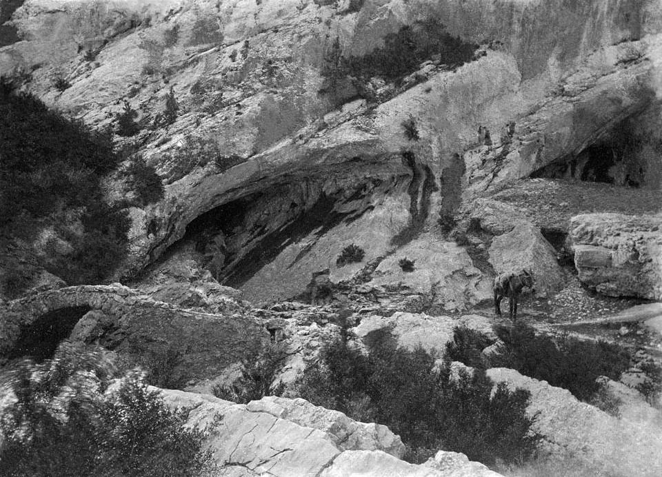
Forat de l'Or is a cave in Camarasa, in the province of Lleida, recognized as the longest known cavity in the municipality with more than 2,190 metres of passages. It lies within the Terradets Gorge (Congost de Terradets), on the left bank of the Noguera Pallaresa river, surrounded by the limestone formations typical of this part of Catalonia. This is a destination for people interested in speleology and regional geology rather than a conventional sightseeing stop — entering the cave calls for basic caving preparation and gear. How do you get there? The cave's entrance sits alongside the C-13 road, near kilometre 71, where the highway runs along the Terradets Gorge. The easiest approach is to stop at the roadside picnic area just before that point and follow the old path running along the gorge. The route passes near an old stone bridge, where visitors cross to the opposite side of the road to reach the right-hand mouth of the cave — one of its two known entrances. By car, it's roughly a 45-minute drive from Lleida, or about 20 minutes from Balaguer. What will you see? Forat de l'Or has two entrances set on an inclined bedding plane, linked to each other by a low passage 37 metres apart. The main system of galleries descends to a depth of 93 metres below the entrance level, giving the cave a distinctly vertical character that requires rope techniques on most sections. In 2012, cavers from the Grup Espeleològic de Barcelona (GEB) resumed exploration of the cave's flooded sumps, pushing the known endpoint to a depth of 73 metres below entrance level — exploration is still ongoing, and the full extent of the system remains unmapped. Inside, the cave shows the features typical of limestone cavities: dripstone formations, narrow squeezes and wider chambers that shift in appearance depending on groundwater levels. During wetter periods, sections of the passages can be partially flooded, adding difficulty — and interest for experienced cavers — to the exploration. A bit of history The cave appears in written sources as far back as the early 17th century, mentioned in a 1609 text by Jeroni Pujades, making it one of the earliest documented caves in the region. It was later listed in speleological catalogues from the late 19th and early 20th centuries. The first recorded scientific survey was carried out on 31 August 1910 by biospeleologists René Jeannel and Emil Racovitza, who measured around 200 metres of passage at the time — roughly a tenth of what is known today. Subsequent decades of exploration, including the GEB team's 2012 work on the sumps, gradually revealed the rest of the system. When should you visit? Spring and autumn are the best times to visit, when outdoor temperatures are moderate and water levels inside the cave are usually lower than after winter rains. Summers in the Lleida area can get very hot, making the approach along the sun-exposed gorge uncomfortable, while heavy rainfall can raise water levels enough to close off parts of the passages. Whatever the season, exploring the cave properly requires adequate lighting, preparation, and ideally the company of someone familiar with the terrain. Frequently asked questions Can you enter Forat de l'Or without caving experience? Reaching the first few metres of the cave is possible without special training, but exploring the full system — particularly the vertical sections reaching 93 metres in depth — requires technical caving equipment and skills. Visitors without experience should contact a local caving club or hire a guide. How long does it take to explore the whole cave? The main system stretches over 2,190 metres, but covering it all in a single day is essentially out of reach for amateurs — even experienced survey teams have mapped it gradually over many years of work. Are there other attractions near the cave? The Terradets Gorge, where the cave is located, is popular among climbers, canyoners and hikers following the Noguera Pallaresa river, and the Camarasa area holds several other caves worth exploring. Is the cave lit or set up for tourists? No — Forat de l'Or is a natural cave with no tourist infrastructure, lighting, or marked trails. Visitors need their own equipment, including headlamps and clothing suited to underground conditions.
-
Avenc Montserrat Ubach
Odèn
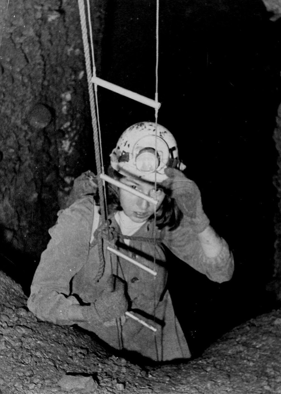
Avenc Montserrat Ubach is a deep vertical cave near Odèn, a small municipality in the Solsonès comarca, in the province of Lleida, Catalonia. The shaft lies in the area of Canalda, a hamlet within the municipal territory, and ranks among the notable sites on the Catalan caving map. What is Avenc Montserrat Ubach? It is a vertical karst shaft reaching a depth of 202 metres, geologically remarkable because it formed in conglomerate rock — a type of sedimentary rock that rarely produces such deep cave systems. The cave sits at the boundary of the Pyrenean geological structures, which adds to its scientific interest. Inside, the cave holds numerous cave pearls (pisoliths), rounded mineral concretions that form as water saturated with calcium carbonate circulates and deposits layer upon layer around a nucleus. One specimen found here is considered among the largest documented in Europe, a detail that has made the cave known well beyond caving circles. Where does the name come from? The cave is named after Montserrat Ubach, the speleologist who first explored it in 1963. The initial descent took place at Easter of that year, with her parents accompanying her. In June 1963, members of nine Catalan excursionist and caving associations took part in reaching the bottom of the shaft, 202 metres down. In recognition of her role as the first explorer, the caving community decided to name the cavity after her. Why does this cave matter to speleology? The discovery of Avenc Montserrat Ubach was a significant event for Catalan and international caving. Until 1978, it held the depth record among caves in Catalonia, making it a benchmark site for regional explorers for over a decade. It was also considered the deepest known cave formed in conglomerate rock in the world until 1982 — a rarity, since conglomerates do not typically allow such extensive karst systems to develop. These two records secured the cave a lasting place in the history of cave exploration on the Iberian Peninsula. What should visitors know before heading there? Avenc Montserrat Ubach lies in the hilly, rural landscape of Solsonès, in terrain typical of the Pyrenean foothills, with forests, pastureland and rocky outcrops. Because the cave is a vertical shaft over 200 metres deep, exploring the interior requires proper caving equipment and rope-technique experience — it is not a site suited to casual visitors without preparation. Anyone interested in descending should get in touch with local caving clubs or guides active in the Solsonès area, who know the current technical condition of the shaft and the relevant safety measures. For most visitors, the surrounding landscape around Canalda and the wider Solsonès comarca is already a worthwhile destination for hiking or cycling, independent of the cave itself. Frequently Asked Questions How deep is Avenc Montserrat Ubach? The shaft reaches a depth of 202 metres, which for years made it one of the deepest caves in Catalonia. Why is the cave named after Montserrat Ubach? It is named after the speleologist who first descended into it in 1963, accompanied by her parents, before a full team of explorers reached the bottom later that year. Can anyone visit the cave? Not casually — given its vertical, deep shaft profile, exploring it requires caving equipment and skills, and contact with experienced cavers or clubs from the region. What makes this cave geologically unusual? It formed in conglomerate rock, which is unusual for deep karst systems, and it was considered the deepest cave of its kind in the world until 1982. It also contains one of the largest documented cave pearls in Europe.
-
l'Ull de Déu
Escorca
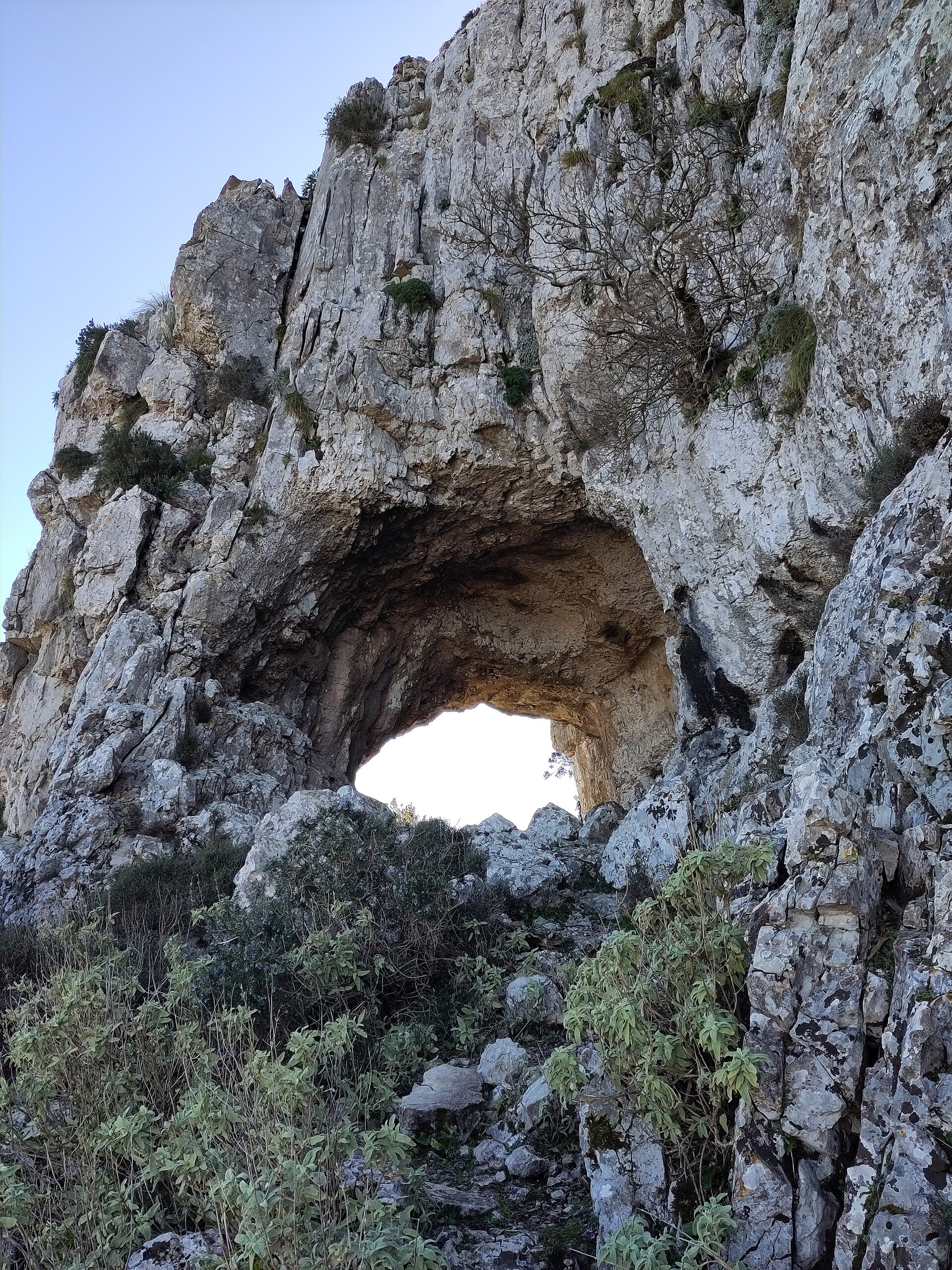
l'Ull de Déu, in the municipality of Escorca, is a natural hole carved through the rock on the slopes of Puig de ses Moles, deep in Mallorca's Serra de Tramuntana. The Catalan name translates as "Eye of God," describing the striking window-like opening visible from a distance in the mountain ridge. Locally it's also known as "Forat de ses Moles," and in Spanish as "Ojo de Dios." Where is l'Ull de Déu? The opening sits on the north face of Puig de ses Moles, in a remote and rugged stretch of the Tramuntana range. From here the ground drops away toward Lavanor and Mortitx, with the Pollença area beyond, and on clear days the northern coastline of Mallorca appears in the distance. The setting is stark: bare rock and low, hardy scrub dominate, typical of the range's higher reaches. How do you get to l'Ull de Déu? Two main hiking routes lead to the formation, and both demand solid fitness and preparation. The first starts at the Mortitx estate, reached from the Ma-10 road between Lluc and Pollença, around kilometre 10.9. The path follows the Camí de Lavanor, passing the Lavanor refuge and the Font Blanca spring, with the Embalse de ses Comes reservoir and the Coll Ciuró pass also visible along the way. This route covers roughly 12 km with over 500 metres of elevation gain, and typically takes 6 to 7 hours round trip. The second option begins at the Femenia estate, from the Coll de Femenia pass on the Pollença–Lluc road, crossing the Femenia Nou and Femenia Vell grounds. The entire route runs through private land, so staying on the path and leaving no trace matters here. This variant is often combined with a climb to the neighbouring Puig Caragoler de Femenia and a crossing of the Pas des Puig section, stretching the total distance to about 12.7 km with over 800 metres of climbing. Both routes include technical stretches — scrambling over rock, narrow passages, and steep sections — so this isn't a hike for beginners. What will you see there? The rock opening itself is striking simply for its shape: a natural window framing the valley below and the folds of the Tramuntana beyond. The viewpoint at Ull de Déu ranks among the more dramatic in this part of the range, pairing jagged close-up rock with a distant sweep of coastline. Depending on the route taken, the walk also passes springs, mountain passes, and traces of old shepherd trails. When should you visit? Autumn, winter, and spring are the best seasons, since mountain temperatures are far more forgiving than in summer — heat and a lack of shade can turn this long, technical route exhausting. One thing to check before setting out: between February and June, access to the Mortitx estate is often restricted to the Lavanor refuge only, as this is the nesting season for the black vulture (voltor negre), a protected species breeding in these cliffs. Local access rules should be confirmed ahead of any visit. Frequently asked questions Is the hike to Ull de Déu difficult? Yes — it's a moderate-to-demanding route with technical scrambling sections, a long duration (6–7 hours), and considerable elevation gain, making it unsuitable for inexperienced hikers. Where's the best place to start the hike? Most hikers start from the Mortitx estate off the Ma-10 road between Lluc and Pollença, following the Camí de Lavanor. An alternative is the approach from Coll de Femenia, though that route crosses private land that must be respected. Is access to Ull de Déu restricted in summer? Not in summer — rather, between February and June, access to the Mortitx estate is often limited to the Lavanor refuge because of the black vulture's nesting season in the surrounding cliffs. What can you see from Ull de Déu? From the rock opening and the nearby viewpoint you can look out over Lavanor, Mortitx, and the Pollença area, with a stretch of Mallorca's northern coast visible on clear days.
-
Cueva de los Casares
Riba de Saelices
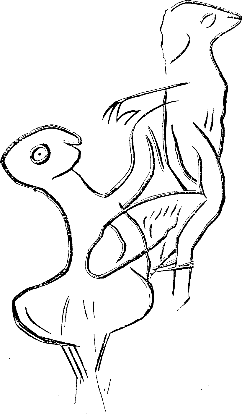
Cueva de los Casares is an archaeological cave near Riba de Saelices, in the province of Guadalajara, Spain. It ranks among the more significant Paleolithic art sites on the Iberian Peninsula, valued for an unusually rare set of engravings depicting scenes of human reproduction and family life alongside images of Ice Age animals. What makes this cave archaeologically important? The cave preserves a body of Paleolithic engravings and paintings. Animal figures appear throughout, mammoths chief among them, reflecting the fauna that shared the landscape with prehistoric humans in the region. What sets Cueva de los Casares apart, though, is a distinct group of engravings showing copulation, pregnancy, childbirth, and scenes of family life. Some researchers regard these as among the earliest known depictions of how early humans understood the reproductive process, a theme almost never found elsewhere in Paleolithic art. That rarity is the main reason the site draws attention from specialists in prehistoric art and human origins. When was the cave discovered? The cave was discovered in 1933. Its engravings quickly attracted scholarly interest because of both their volume and their unusual subject matter compared to other painted caves from the same period. Recognition followed swiftly: in 1935 the site was declared a Bien de Interés Cultural, Spain's highest legal category for protected cultural heritage, reserved for places of exceptional historical and scientific value. What is the setting like around Riba de Saelices? Riba de Saelices is a small municipality in the province of Guadalajara, part of the Castilla-La Mancha region in central Spain. The area has a typical continental climate for inland Spain, with hot summers and cold winters, set within a landscape of limestone gorges and plateaus. These rock formations are exactly the kind of terrain where caves like this one form, and where prehistoric communities across the region left their mark, making the wider countryside around Riba de Saelices worth exploring for anyone interested in archaeology or geology. Who should plan a visit? Cueva de los Casares appeals most to visitors with an interest in archaeology, prehistoric art, or anthropology. Because the engravings are scientifically significant and fragile, access to caves of this kind is often restricted or requires advance arrangement, so it is worth checking current visiting conditions locally before planning a trip. The surrounding Guadalajara countryside, with its characteristic central Spanish landscape, also makes it easy to combine a visit with other nearby cultural and natural sites in the province. Frequently Asked Questions What is Cueva de los Casares best known for? It is known for a rare set of Paleolithic engravings depicting human reproduction, including copulation, pregnancy, and childbirth, alongside more typical animal imagery such as mammoths. When was the cave discovered and protected? It was discovered in 1933 and declared a Bien de Interés Cultural in 1935, Spain's top heritage protection status. Where exactly is the cave located? It lies near Riba de Saelices, in the province of Guadalajara, within the Castilla-La Mancha region of central Spain. Is the cave's art unique compared to other Paleolithic sites? Yes. Depictions of human reproductive scenes are extremely uncommon in Paleolithic art, which is why this site is considered an important reference point for researchers studying prehistoric human iconography in Europe.
-
Cueva Victoria
Kartagena
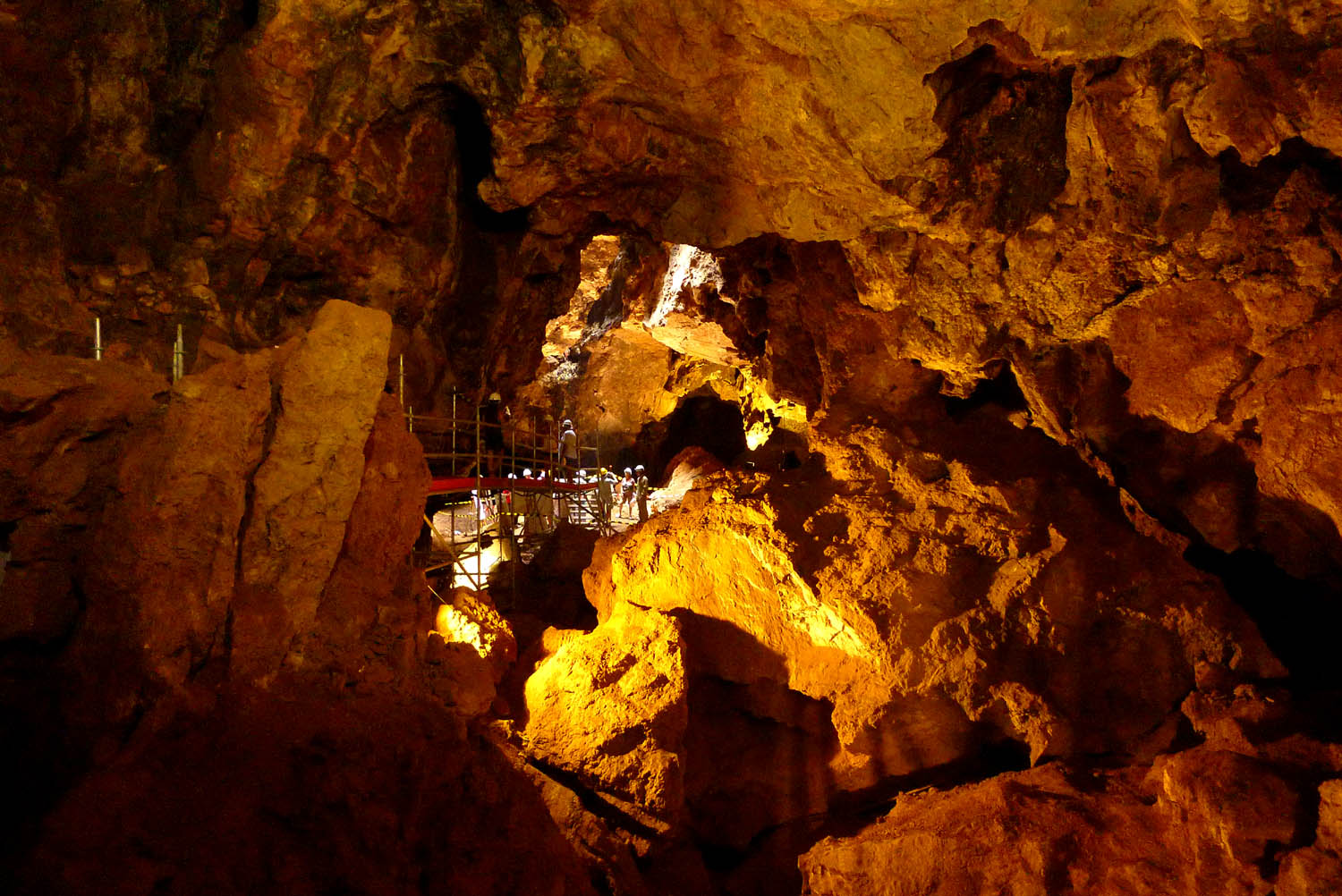
Cueva Victoria is one of the most significant Early Pleistocene paleontological sites on the Iberian Peninsula, located on the southern slope of Cabezo de San Ginés hill, in the Llano del Beal district within the municipality of Cartagena, Region of Murcia. The cave forms part of a karst system stretching over 3 km, filled with Quaternary sediments extraordinarily rich in vertebrate fossils. What will you see? Exposed sediment layers hold thousands of fossilized animal remains dating between 130,000 and 1.2 million years old. This is the only known European site with remains of Theropithecus oswaldi — an extinct primate related to modern gelada baboons that normally lived in Africa. Researchers also found a fragment of a human finger bone here, one of the oldest known in Europe, which some scientists link to the hypothesis that hominids crossed from Africa via the Strait of Gibraltar over a million years ago. The site itself bears traces of past mining activity — the cave was actually discovered during manganese extraction using explosive methods, before its scientific value was recognized. Today Cueva Victoria holds Geosite status, marking it as a place of international geological significance. How to get there? The cave is located in Llano del Beal, within the former mining district of Cartagena-La Unión, near the Mar Menor lagoon. Access is only possible through organized guided visits — for safety reasons, the former mine site is not open for independent exploration. When to visit? Guided tours run periodically as part of official educational routes organized by local institutions — it's worth checking the current schedule before planning your trip, as spaces on these tours tend to be limited. Frequently Asked Questions Can you visit the cave on your own? No — due to its history as a mine and the sensitivity of the paleontological site, entry is only possible with a guide during organized visits. Why is Cueva Victoria so scientifically important? It's the only site in Europe with documented evidence of Theropithecus oswaldi, and the human finger bone fragment found here ranks among the oldest traces of humans on the continent. Does the cave have a mining connection? Yes — it was discovered during manganese mining operations, and traces of that extraction (including from explosives) remain visible alongside the paleontological layers. What else is worth seeing nearby? The Cartagena-La Unión region offers a mining heritage trail, and the nearby Mar Menor is one of the largest saltwater lagoons in Europe.
-
El Barbot Negre
Sant Quirze Safaja
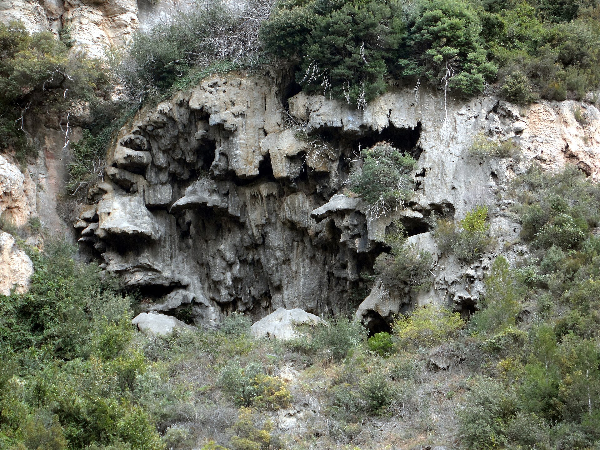
El Barbot Negre – a travertine spring in the Cingles de Bertí massif El Barbot Negre is a small but striking rock formation near Sant Quirze Safaja, tucked into the limestone massif of Cingles de Bertí, on the border between the Vallès Oriental and Moianès areas of Catalonia. It's a spot for travelers who prefer quiet, lesser-known trails over crowded viewpoints. What exactly is El Barbot Negre? It's a natural spring, or "surgència," where water emerging from limestone rock has deposited layers of travertine over time — a porous rock formed as calcium carbonate precipitates out of flowing water. The result is a set of dark, jagged rock shapes that give the site its somewhat mysterious, raw character, echoed in the name ("negre" meaning black). The spot sits close to several other natural landmarks: Gorg de les Donzelles and the Salt de Llòbrega waterfall are nearby, while the hill of Turó de les Onze Hores and the mountain pass of Grau de les Escaletes rise a short distance to the southwest. How do you get there? The most convenient starting point is the village of Riells del Fai, from where a marked hiking trail sets off. The route heads toward Turó de les Onze Hores and then continues along a path known locally as Vall Blanca, which leads directly to the formation. The trail isn't technically demanding, but sturdy hiking shoes are recommended, since the ground is often rocky and uneven, particularly near the limestone outcrops. What will you see once you arrive? The main draw is the dark travertine formation itself, shaped by water and time — worth examining up close to appreciate its distinctive, sponge-like texture. The surrounding area offers plenty of other vantage points: nearby ridges give views over the valley and the Cingles de Bertí range, one of the more recognizable limestone escarpments in the Vallès region. It makes for a good day hike combining several stops — the spring itself, the nearby Salt de Llòbrega waterfall, and various lookout points along the way. When is the best time to visit? Keep in mind that the neighboring Grau de les Escaletes pass is periodically closed to hikers, typically from mid-January to mid-June, to protect nesting birds. If your route includes that stretch, check the posted signage on site before setting out. Beyond that restricted section, the area around El Barbot Negre itself is accessible year-round, though spring and autumn offer the most comfortable hiking conditions — summers can be hot and dry, while winter rains can leave the paths slippery. Frequently asked questions Is the hike to El Barbot Negre difficult? No, the route from Riells del Fai is moderately easy and doesn't require special preparation, though proper footwear is recommended given the rocky terrain. Are there other attractions nearby worth visiting? Yes — within a short distance you'll find Gorg de les Donzelles, the Salt de Llòbrega waterfall, and the hill of Turó de les Onze Hores, which offers views over the Cingles de Bertí massif. Is the trail open all year? The formation itself is accessible year-round, but the adjacent Grau de les Escaletes pass closes from January 15 to June 15 — worth factoring in if you're planning a longer loop. Do you need a guide to visit? Not necessarily — the trail is marked, but since foot traffic is light, it's worth carrying a map or GPS app, especially since several paths intersect in the area.
-
Cueva de Hornos de la Peña
San Felices de Buelna
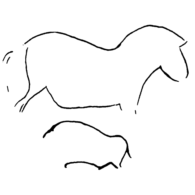
Hornos de la Peña is a cave with Paleolithic rock art, located near the village of Tarriba, in the municipality of San Felices de Buelna, in Cantabria, northern Spain. It is one of several Cantabrian archaeological sites included in the extended UNESCO listing of Paleolithic cave art in northern Spain, alongside Altamira and other regional caves. What will you see inside? The cave holds engravings and wall depictions of horses, bison, and other animals typical of Upper Paleolithic iconography. Discovered in the early 20th century, the artwork was created mainly through engraving directly into the rock surface, which sets Hornos de la Peña apart from caves better known for painted polychrome scenes. The passages wind through natural chambers where prehistoric artists made use of the rock's own contours to shape the outlines of animals. Visits run in small guided groups, since the fragile engravings need protection from humidity and touch. Expect a cool, damp interior regardless of the season — cave temperatures in this region stay low and stable year-round. How do you get there? The cave sits in the municipality of San Felices de Buelna, in the Besaya river valley, within easy reach of Santander and Torrelavega, the region's largest towns. Driving is the most practical option, since surrounding villages, including Tarriba, have limited public transport. Local roads branch off the main regional routes toward the hillside where the cave entrance is found. Because visitor groups are small, booking ahead is advisable, especially in summer and during holiday periods when interest in Cantabria's caves peaks. When should you visit? The region's caves can be visited year-round, since conditions inside stay stable regardless of the weather outside. Spring and early autumn offer a good balance — fewer visitors than summer and milder conditions for the drive and any walking around the site. In summer, expect heavier demand and a greater need to book your entry slot in advance. What else to combine with the visit? San Felices de Buelna and the surrounding valleys of Cantabria hold several other Paleolithic sites along with scenic mountain villages. Visitors interested in prehistory can round out the trip with nearby regional museums that explain the context of the discoveries and display finds from local caves. The Besaya valley itself, with its green hills and pastures, invites a walk beyond the cave visit. Frequently asked questions Can you visit Hornos de la Peña cave on your own? No — to protect the rock engravings, visits are guided only, in small groups. Do you need to book tickets in advance? Yes, especially in high season. Group sizes are limited, so booking ahead improves your chances of getting a convenient time slot. How do you get there without a car? Public transport around Tarriba and San Felices de Buelna is limited, so driving from Santander or Torrelavega is the most convenient option. What sets this cave apart from Altamira? Hornos de la Peña is known mainly for its rock engravings, while Altamira is famous for polychrome paintings — together, the two forms of Paleolithic art complement each other across the Cantabrian region.
-
Cueva de los Franceses
Pomar de Valdivia
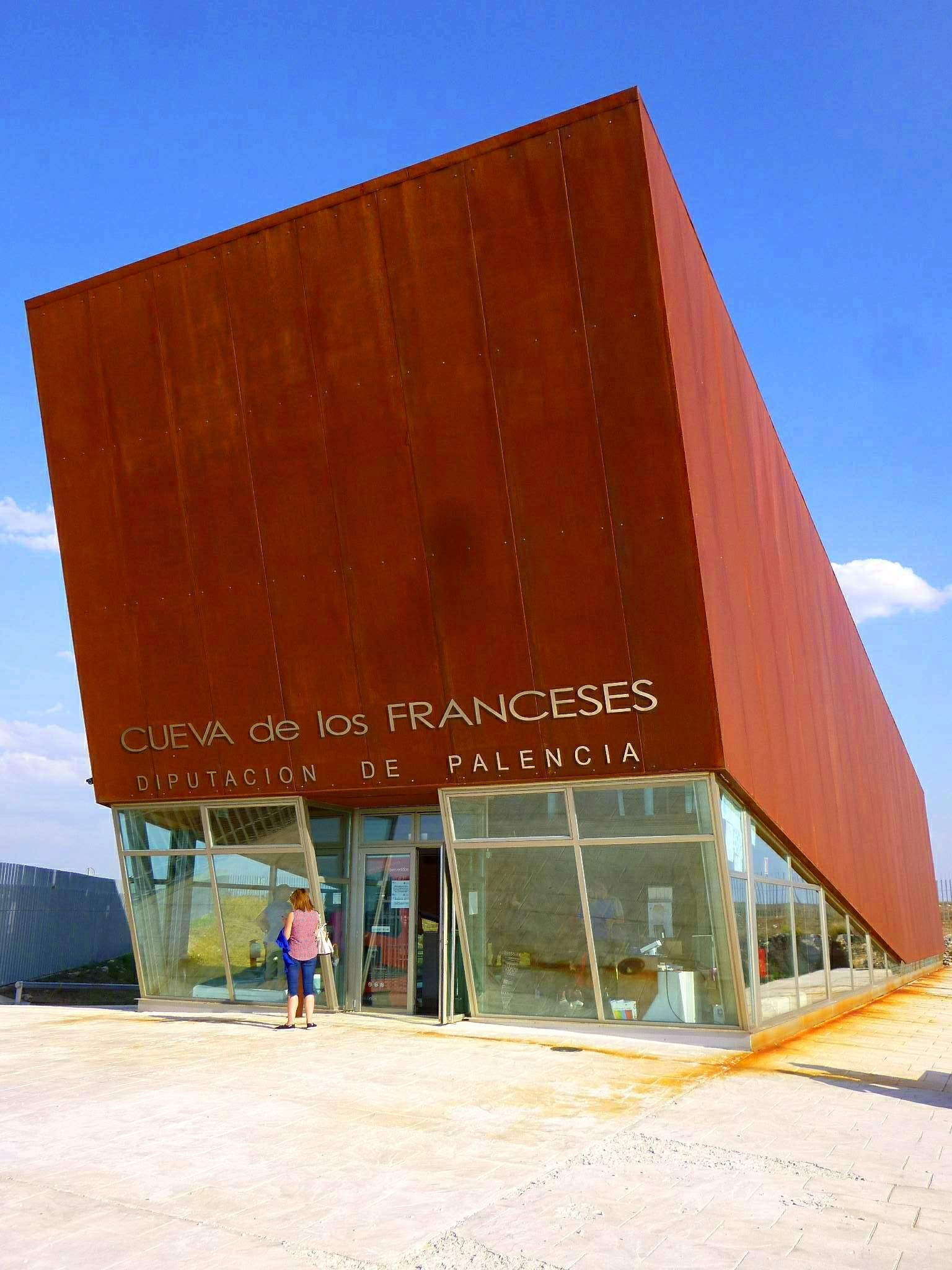
Cueva de los Franceses is a cave in Revilla de Pomar, a village belonging to the municipality of Pomar de Valdivia in the province of Palencia, Castile and León. It sits within the Páramo de la Lora, inside the protected Covalagua valley, part of the UNESCO-recognized Las Loras Geopark. Where does the name come from? The cave's name goes back to the Peninsular War of 1808. Local tradition holds that it became the final resting place of Napoleonic soldiers who died in a clash with a unit of Cantabrian hussars — an episode that gave the cave its present-day name, the "Cave of the Frenchmen." It was formally discovered in 1904 by Luciano Huidobro, a priest, professor and local scholar who was the first to document its interior for a wider audience. What will you see inside? The cave system runs for nearly a thousand metres, with a level difference of around 20 metres between its highest and lowest points. Visitors, however, can only walk the 482-metre stretch that has been adapted for safe public access. Inside, spacious chambers are lined with an impressive array of formations — columns, stalagmites and stalactites shaped over thousands of years by the slow deposit of calcium carbonate. The interplay of light and shadow highlights the cave's irregular rock shapes, creating a setting that leaves an impression on both adults and children. How do you get there? The cave lies in the northeastern part of Palencia province, close to the town of Aguilar de Campoo, a convenient base for exploring the surrounding area. The Covalagua valley and the cave itself are well signposted along the trails of the Las Loras Geopark, making it easy to plan a visit by car from nearby towns. When should you visit? A standard guided visit lasts about 45 minutes and is suitable for visitors of all ages, including families with children. Because underground conditions stay fairly constant in temperature and humidity, the cave can make for an appealing outing at almost any time of year — though it's worth checking the current visiting schedule beforehand, since the site is periodically closed for maintenance work. Frequently asked questions How long does a visit to Cueva de los Franceses take? The standard tourist route takes around 45 minutes and covers the accessible 482-metre stretch of the cave. Where does the cave's name come from? It refers to Napoleonic soldiers who died in a clash with Cantabrian hussars during the 1808 Peninsular War — the cave is said to have been their final resting place. Is the cave suitable for families with children? Yes, the visiting route was designed to be accessible for people of different ages, including children. Where exactly is the cave located? In Revilla de Pomar, part of the municipality of Pomar de Valdivia in Palencia province, within the Covalagua valley and the Las Loras Geopark.
-
Pozo Azul
Tubilla del Agua
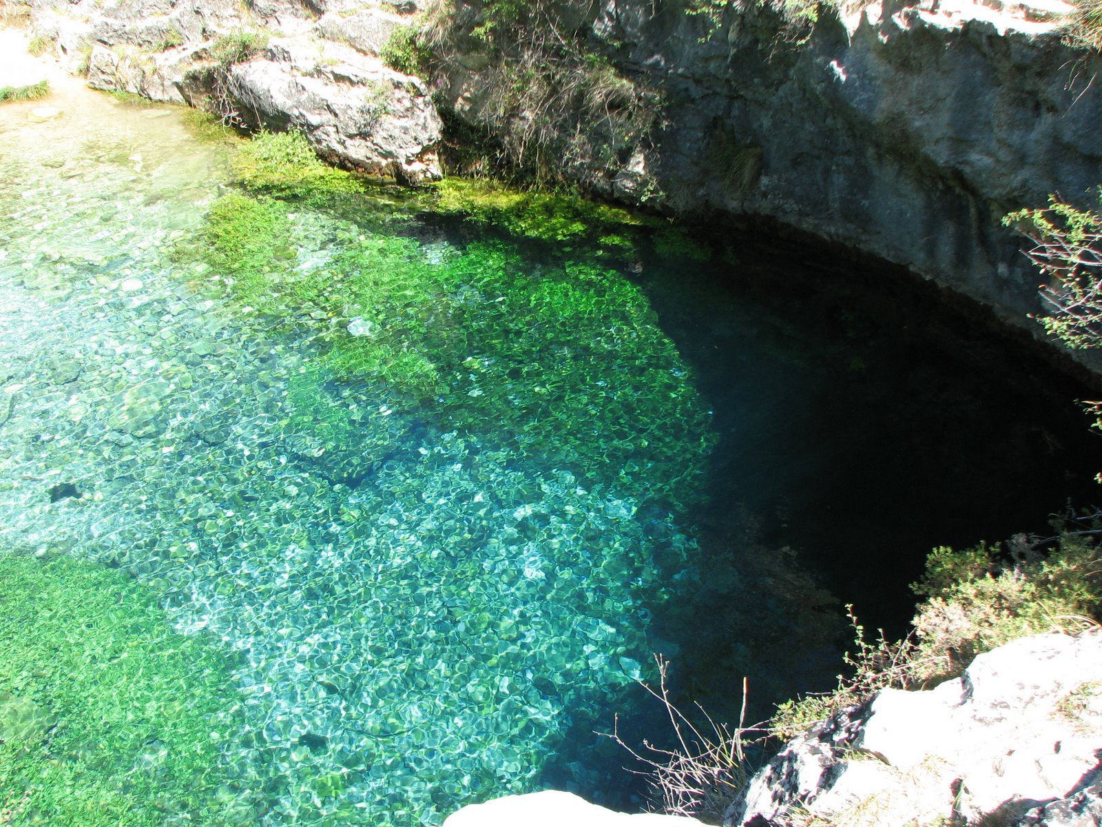
Pozo Azul is a vividly blue karst spring in Covanera, a small village within the municipality of Tubilla del Agua, in the northern part of Burgos province, Castile and León. It sits inside the Hoces del Alto Ebro y Rudrón Natural Park, surrounded by limestone canyons and woodland, well off the usual tourist trail — which is exactly part of its appeal. What will you actually see? From the surface, Pozo Azul looks like a calm, ordinary pool. In reality, it's the entrance to a flooded cave system that stretches for kilometers underground. The water has a striking turquoise-blue tint, produced by sunlight filtering through the clear, limestone-rich spring water. Temperature stays a constant 9–11°C year-round, and during the rainy season the spring can discharge up to 4,500 liters per second — an impressive sight even if you never plan to get in the water. Why is this place significant? Pozo Azul hides the longest explored underwater cave in the world. Divers have been mapping it since the 1960s, when Joaquín Plana of the G.E. Edelweiss speleology group first entered the flooded passages. To date, more than 13 kilometers of galleries have been surveyed, and recent expeditions (including one in 2025) still haven't found the end. Among cave divers, it's known as "the Everest of cave diving" because of the extreme difficulty and risk involved. The cave has also yielded endemic species, verified by Spain's National Museum of Natural Sciences. How do you get there? Covanera lies a few kilometers from Tubilla del Agua, reached via local roads through the Hoces del Ebro y Rudrón Natural Park. A car is the most practical option — the nearest major city is Burgos, about an hour's drive away. From the village parking area, a short, marked footpath leads to the spring itself, manageable for most visitors without special preparation. Can you dive there? Diving into Pozo Azul is reserved strictly for experienced cave divers with the proper certifications — it's one of the most demanding and dangerous forms of diving in the world, requiring specialized equipment and years of training. Regular visitors don't enter the water, but they can admire the spring from the shore and photograph its distinctive blue color. When is the best time to visit? Spring and early summer are ideal, when the canyon vegetation is green and water levels are high after winter rains, making the spring's outflow at its most dramatic. Summer tends to be drier, but access is easier and temperatures are comfortable for hiking through the natural park. Frequently asked questions Is Pozo Azul open to regular tourists, or only to divers? The shoreline and the short approach trail are open to anyone. Entering the flooded cave itself requires cave diving certification and isn't suitable for those without experience. How long does it take to walk to Pozo Azul from the parking area? The trail from the Covanera parking area to the spring is short, usually taking somewhere between fifteen and twenty minutes on foot. Why is the water in Pozo Azul so blue? The color comes from sunlight passing through the clear, limestone-rich spring water — an optical effect similar to that seen at other karst springs. Are there other attractions worth visiting nearby? Yes — Pozo Azul lies within the Hoces del Alto Ebro y Rudrón Natural Park, known for its scenic river canyons and hiking trails, so it's worth planning a longer stay in the area.
-
Sidrón Cave
Piloña
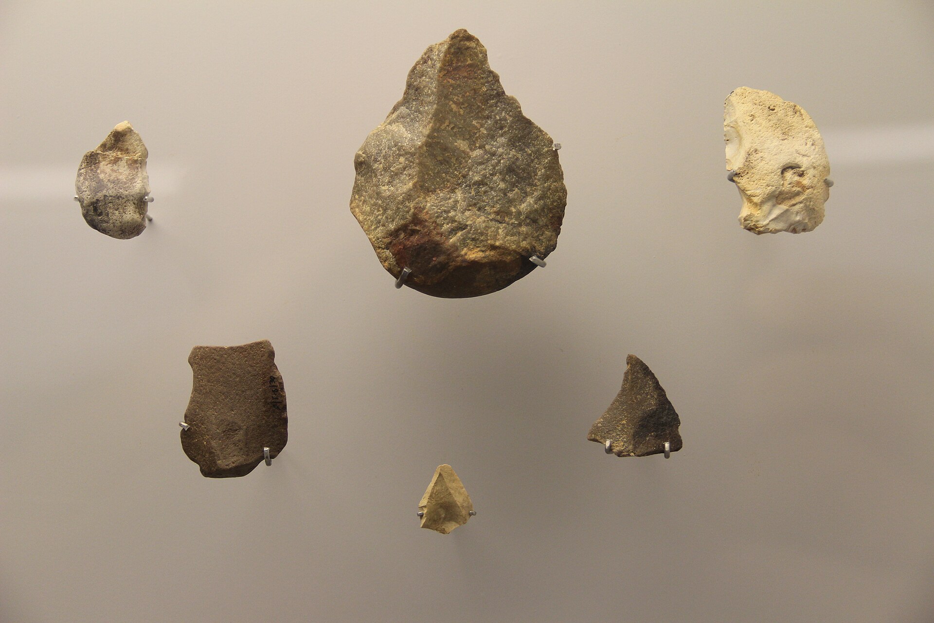
Sidrón Cave is a karst cave system in the municipality of Piloña, in Asturias, northwestern Spain. The site is best known as one of the world's most significant paleoanthropological locations — the resting place of fossilized remains from more than a dozen Neanderthal individuals, which made it a key reference point for research into this ancient human relative. What makes this cave scientifically important? Sidrón Cave formed within non-carbonate limestone rock, part of the karst landscape typical of the Asturian highlands. Traces of Paleolithic rock art survive inside, and decades of excavation work have produced one of the richest Neanderthal fossil collections on record — material that has allowed scientists to run DNA analyses and reconstruct family relationships and behaviors within this Neanderthal group. Because of its scientific and natural value, the surrounding area was granted Partial Natural Reserve status in 1995. The cave also functions as a shelter for five species of bats, and researchers have described two beetle species previously unknown to science from within it. This combination shows that Sidrón Cave matters not only for archaeology but also as a microhabitat with real significance for local biodiversity. Can visitors go inside the cave? Given its protected-area status and the ongoing nature of scientific research at the site, the cave interior is not a general-access tourist attraction in the way a typical show cave would be. Visitors should approach Sidrón Cave primarily as a place of scientific and natural interest, and plan a trip around the surrounding landscape instead — the hills and villages of the Piloña municipality, characteristic of inland Asturias. How do you get there? Piloña sits in central Asturias, within easy reach of Oviedo and the Cantabrian coast. The most practical way to reach the area is by car, following local roads that run into the valley and connect to the main routes linking Oviedo with the eastern part of the region. The surrounding area has several small towns that make good starting points for exploring the hills around the reserve on foot. When is the best time to visit? Asturias has an oceanic climate — mild but humid, with rainfall spread across the year. Spring and early autumn offer the most comfortable conditions for exploring the area and hiking near the reserve, with moderate temperatures and Piloña's green hills at their best. Summer brings warmer weather but also busier trails across the wider region. What else is worth seeing nearby? The Piloña municipality and central Asturias more broadly showcase the classic foothill landscape of the Cantabrian Mountains — meadows, deciduous woodland, and river valleys. It makes a solid base for exploring the region's natural and cultural character, away from the busier spots along the coast. Frequently asked questions Can you go inside Sidrón Cave? Access to the interior is restricted because of its natural reserve status and ongoing scientific excavation — it is not set up for casual public visits the way a standard show cave would be. Why is Sidrón Cave so important scientifically? It's one of the key sites where fossilized remains of more than a dozen Neanderthals were found, giving researchers material for detailed genetic and anthropological studies of the species. What wildlife lives around the cave? The cave shelters five species of bats, and two beetle species previously unknown to science were first described from specimens found inside it. Where exactly is the cave located? Sidrón Cave is in the Piloña municipality in central Asturias, northwestern Spain, within an area protected since 1995 as a Partial Natural Reserve.
-
Cave of Chufín
Herrerías
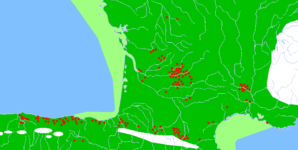
Cave of Chufín is one of the most striking prehistoric rock art sites in the Herrerías area, within the Rionansa region of Cantabria. Its entrance sits on a steep rock face right where the Nansa and Lamasón rivers meet — a setting that gives Chufín an edge over many other painted caves in the region, since visitors get a dramatic river-valley view along with the archaeology. Chufín belongs to the group of sites inscribed on the UNESCO World Heritage List under the joint entry "Cave of Altamira and Paleolithic Cave Art of Northern Spain." That places it firmly in the top tier of prehistoric art locations in Europe, rather than being just a local curiosity. How do you get to the Cave of Chufín? The cave lies deep in the Nansa river valley, surrounded by the steep slopes and dense woodland typical of western Cantabria. Because the entrance opens directly onto a rocky riverside slope, reaching it usually involves a short but somewhat demanding walk over uneven ground, so sturdy footwear is worth packing. Driving is the most practical option, following the local roads that run into the Nansa valley — this part of Cantabria sits away from the main tourist routes, so a car gives you the freedom the public transport network doesn't. What will you see inside? Chufín is one of several caves on the steep slopes above the Nansa and Lamasón rivers that preserve rock art left by prehistoric humans. These paintings and engravings are the reason the site earned its place on the UNESCO list. As with other painted caves in Cantabria, visits typically run in small groups with a guide — a standard practice across the region designed to protect fragile pigments and engravings from damage. The setting itself adds to the experience: few painted caves in Cantabria open onto a spot where two rivers converge, and the view from the rock face over the valley is worth the walk on its own. When is the best time to visit? Western Cantabria's mountainous, damp climate makes spring and early autumn the most comfortable seasons to visit, with steadier weather and easier access to the cave entrance. Summer brings more visitors to the Nansa valley, so booking ahead is advisable — access to caves with prehistoric art is usually capped at a limited number of visitors per day to protect the artwork. Why visit? Chufín combines two things rarely found together: genuine, still relatively uncrowded Paleolithic cave art and a striking natural setting at the confluence of two rivers. It suits travelers looking for something beyond the region's best-known, busier sites, without giving up historical and scientific authenticity. Frequently asked questions Is the Cave of Chufín part of the UNESCO World Heritage List? Yes, it's included under the joint UNESCO entry covering Altamira and the Paleolithic cave art of Northern Spain. Where exactly is the cave located? In the Rionansa region of Cantabria, on a steep rock face at the point where the Nansa and Lamasón rivers meet. Can you visit on your own, or is a guide required? Painted caves in this region are typically only accessible with a guide, as a standard measure to protect the artwork. Is the walk to the entrance difficult? The entrance sits on a steep slope above the river, so expect a short but demanding approach and wear appropriate footwear.
-
Pozalagua-ko kobak
Karrantza Harana / Valle de Carranza
Pozalagua Cave sits in the Ranero district, within the municipality of Karrantza Harana / Valle de Carranza, in the Las Encartaciones area of the Basque Country (Biscay). Carved into the limestone massif of Peñas de Ranero, inside the Armañón nature park, it hides one of Europe's most unusual karst formations. How to get there? The cave lies roughly 50 km from Bilbao, in the western part of the Carranza valley near the border with Cantabria. Access is by car along local roads climbing above the village of Ranero, with the cave mouth sitting at about 500 metres above sea level and offering views over the valley below. A car park and visitor reception point are available on site, and the entrance includes a platform for wheelchair access. What will you see? Pozalagua owes its fame not to ordinary stalactites but to helictites — mineral formations that defy gravity, twisting, branching and interlacing in every direction instead of hanging straight down. The cave measures around 125 metres in length, 70 metres in width and 20 metres in height, and was found by chance in 1957 during work at a nearby quarry. The visitor route covers about 400 metres, winding past columns and sinter terraces and across the bed of a former underground lake before reaching the main chamber known as the Versailles hall, where the cave's helictites reach their greatest density. Researchers consider this concentration among the largest recorded anywhere, making Pozalagua stand out even among the karst caves of the wider region. Guided visits last about an hour. The cave opened to the public in 1991, and in 2013 the Repsol Guide named it Best Corner of the Year. Right in front of the entrance, the site of the old quarry has been turned into an open-air auditorium seating around 2,000 people, prized for its acoustics and home each year to the Pozalagua music festival. When to visit? The cave's interior keeps a steady temperature year-round, so a visit makes sense in any season, though it's worth checking opening hours and guided-tour availability in advance since spots on the route can be limited. Summer and long weekends draw the largest crowds, so visitors after a quieter experience might prefer weekdays outside peak season. It's also worth timing the visit to take in the view over the Carranza valley from near the entrance on a clear day. Frequently asked questions How is Pozalagua different from typical stalactite caves? Instead of classic stalactites hanging straight down, the cave is dominated by helictites — formations that grow in any direction, twisting and interlacing into shapes resembling tangled tree roots. How long is the tour and how far is the route? The guided route covers about 400 metres, and the full visit takes roughly an hour. Is the cave accessible to visitors with reduced mobility? Yes, the entrance includes a platform designed for wheelchair access. What else is there near the cave entrance? The former quarry in front of the cave has been converted into an open-air auditorium for about 2,000 people, known for its acoustics and used for the annual Pozalagua festival.
Earn badges for the places you visit
Download NextOnTrip, discover new places and check off your trails.