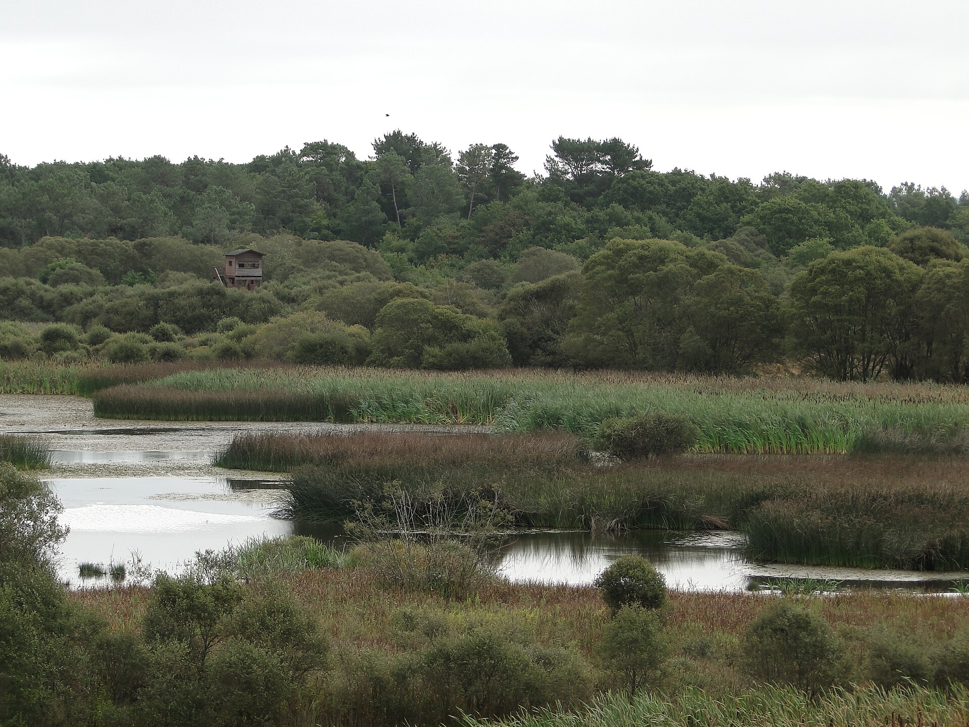
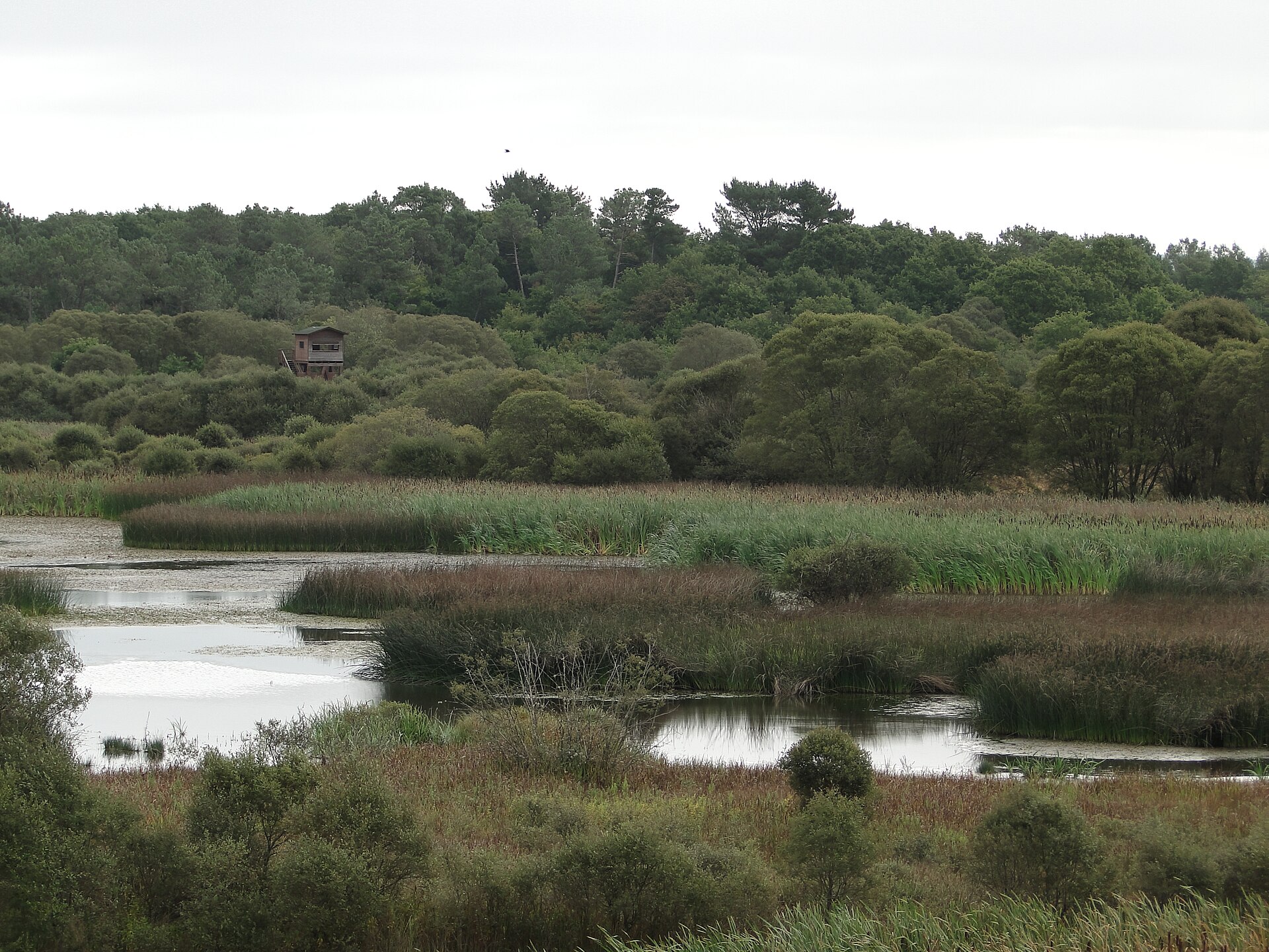
About this place
Parga-Ladra-Támoga is a large protected natural area in Galicia, built around a network of rivers and wetland meadows spread across the flat Terra Chá landscape in the province of Lugo. The site sits within the municipality of Begonte, though its actual extent reaches far beyond it — spanning over 4,900 hectares and touching parts of Abadín, Castro de Rei, Cospeito, Friol, Guitiriz, Lugo, Outeiro de Rei, Rábade, Vilalba and Xermade. The area's approximate central coordinates are 43.1648° N, 7.5689° W.
Where does the name come from?
The name reflects the three rivers that form the hydrological backbone of the area: the Parga, the Ladra and the Támoga. These are right-bank tributaries of the upper Miño, one of Galicia's most important rivers. The same water network also includes the Narla, Labrada, Trimaz and Madalena rivers, together forming what is locally known as the "Complexo Húmedo de Terra Chá" — a wetland complex typical of this part of the region.
What makes this landscape distinctive?
Terra Chá is one of the few genuinely flat regions in Galicia, and that flatness directly shapes how its rivers behave. As the Parga, Ladra and Támoga cross this level terrain, they regularly overflow their banks, creating seasonal floodplains and waterlogged meadows. This recurring cycle sustains rich wetland ecosystems that draw waterfowl and other bird species, making the area an important ecological corridor at a regional scale.
What are the key spots within the protected area?
Inside the boundaries of Parga-Ladra-Támoga lie the lagoons of Cospeito, Caque and Riocaldo, considered among the most valuable birdwatching sites in this part of Spain. Wetland-dependent species — from resident waterbirds to migratory visitors stopping over during their journeys — can regularly be spotted here, making the lagoons a magnet for anyone interested in observing wildlife up close.
What protection status does the area hold?
Parga-Ladra-Támoga (site code ES1120003) is designated as a Special Conservation Area (ZEC) under the EU's Natura 2000 network, and its ecological importance is reinforced by its inclusion within the UNESCO-recognised Terras do Miño Biosphere Reserve. This dual status brings specific regulations aimed at protecting both the wetland habitats and the species that depend on them.
What can visitors do here?
The flat terrain and dense river network make the area well suited to outdoor activities. Around Begonte, marked walking and cycling routes follow the courses of the Ladra and Parga rivers, offering a close look at the typical Terra Chá landscape. Begonte itself is also home to a riverside recreational area along the Parga, which serves as a convenient starting point for exploring this stretch of the reserve.
Frequently asked questions
Is Parga-Ladra-Támoga a national park? No — it is a protected area within the Natura 2000 network, designated as a Special Conservation Area (ZEC), not a national park in the traditional sense.
Which municipalities does the area cover? Besides Begonte, it extends through Abadín, Castro de Rei, Cospeito, Friol, Guitiriz, Lugo, Outeiro de Rei, Rábade, Vilalba and Xermade.
What's worth seeing in the area? The lagoons of Cospeito, Caque and Riocaldo are the best spots for birdwatching, while the trails along the Parga and Ladra rivers let visitors explore the Terra Chá landscape on foot or by bike.
Nearby places

Earn badges for the places you visit
Download NextOnTrip, discover new places and check off your trails.