About this place
Sierra de Aracena and Picos de Aroche Natural Park is a large protected area in the northern part of Huelva province, in western Andalusia, covering the western section of the Sierra Morena mountain range. Spanning more than 184,000 hectares, the park is one of the biggest protected natural areas in the region and a key destination for nature-focused tourism in southern Spain.
What does the landscape of the park look like?
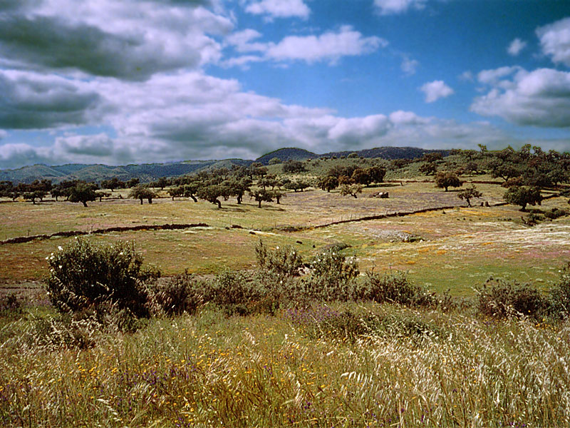
The park's terrain is full of contrasts. Gently rolling hills and wooded valleys gradually give way to steeper, rockier peaks in the higher parts of the range. Vegetation is typically Mediterranean, dominated by holm oaks, cork oaks and gall oaks. In the wettest pockets of the park, conditions also support chestnut forests. Roughly 90 percent of the park's total area is covered by this kind of Mediterranean woodland, making it a rewarding destination for hikers and anyone interested in observing varied natural habitats.
How many villages lie within the park's boundaries?
The natural park stretches across 28 municipalities, home to a combined population of around 41,000 people. Among the best-known villages within its borders are Aracena, Jabugo, Zufre, Cumbres Mayores and Santa Ana la Real. Each has retained the character of a classic Andalusian whitewashed village, with narrow streets, white-painted houses and views over the surrounding hills. These villages serve as gateways for visitors exploring the park and are living proof of how closely local culture here is tied to the surrounding landscape.
Why is this region associated with jamón ibérico?
Sierra de Aracena is one of the most important jamón ibérico production areas in all of Spain. Curing facilities for this renowned cured ham are scattered throughout the park and its surrounding villages. The most sought-after ham comes from Jabugo, home to one of the region's largest producers, Sánchez Romero Carvajal. Beneath the holm oaks that cover the park's hillsides, black Iberian pigs graze freely, feeding mainly on the acorns produced by these trees. It is this diet and traditional method of raising the pigs that gives the region's jamón ibérico its distinctive flavor and international reputation.
Where exactly is the park located?
The park lies in the northern part of Huelva province, in western Andalusia, within the Sierra Morena mountain system. Its approximate coordinates are 37.96° north latitude and -6.59° longitude. Sitting at the heart of the Sierra Morena, the park effectively links the lowland areas of southern Spain with the more mountainous terrain further inland.
Frequently asked questions
How big is the park? It covers more than 184,000 hectares, the vast majority of which is forested land.
How many villages are within the park? The park spans 28 municipalities with a combined population of about 41,000 people, including Aracena, Jabugo, Zufre, Cumbres Mayores and Santa Ana la Real.
Why is the region famous for ham? Because of the free-ranging black Iberian pigs fed on acorns from the local oak trees, combined with generations-old jamón ibérico curing traditions, with Jabugo as the most renowned production village.
What kind of vegetation dominates the park? Mainly holm oaks, cork oaks and gall oaks, with chestnut forests found in the wetter areas.
Nearby places

Earn badges for the places you visit
Download NextOnTrip, discover new places and check off your trails.