About this place
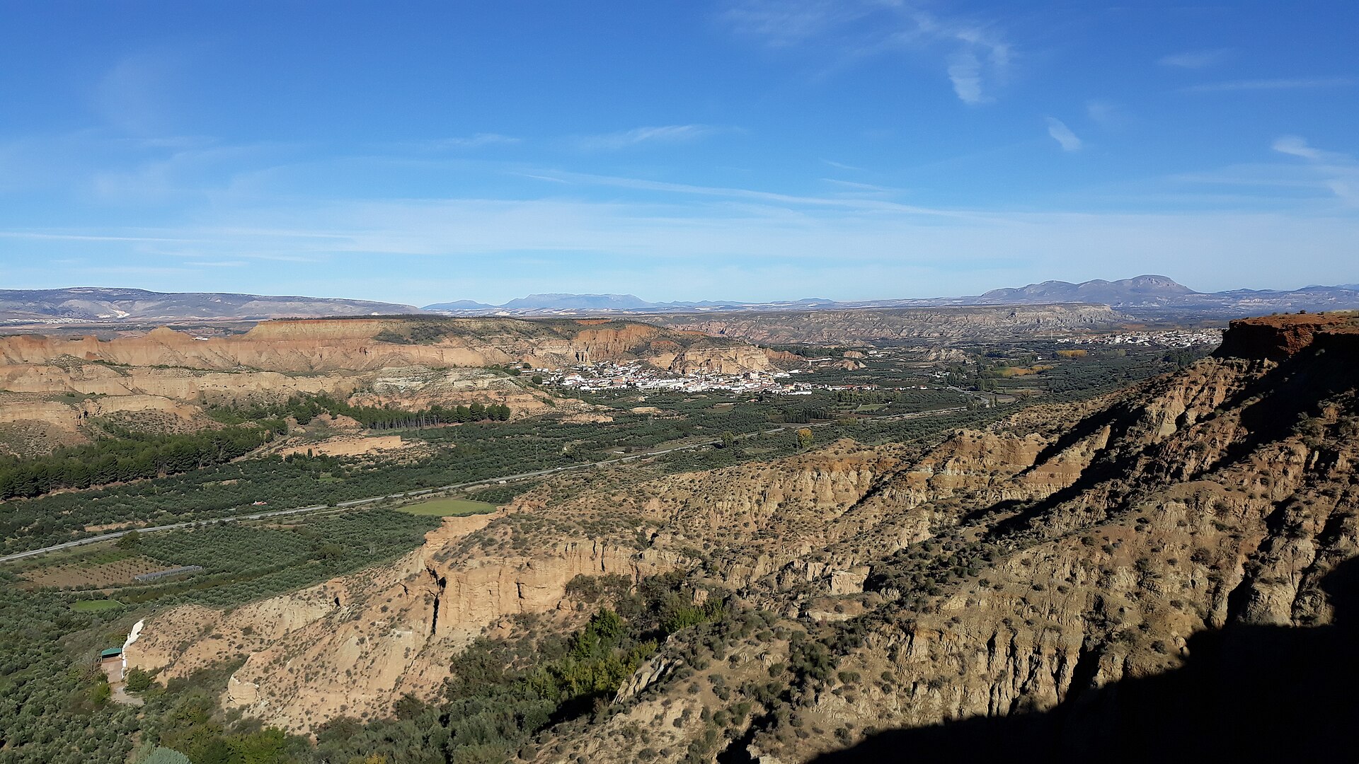
Granada UNESCO Global Geopark is a vast protected geological territory in the northern part of Granada province, in Andalusia, southern Spain. It joined the global network of UNESCO Geoparks in 2020, recognized for a landscape where remarkable rock formations intertwine with local history, culture and nature-based tourism.
How large is the geopark and what does it cover?
The geopark spans more than 4,700 square kilometers across dozens of municipalities, framed by some of the highest mountain ranges on the Iberian Peninsula. Within its boundaries, several dozen sites of special geological interest — locally known as "lugares de interés geológico" (LIGs) — have been designated, forming the scientific and educational backbone of the park.
Why is this land so geologically significant?
The territory of the geopark preserves some of the oldest landscape elements on the Iberian Peninsula and offers researchers a valuable window into the geological evolution of the Mediterranean basin. It is here that some of the continent's largest fossil sites of Quaternary vertebrates have been found, including the oldest known human remains in Western Europe. The region also sits within an active tectonic zone, where traces of ancient earthquakes are preserved in the rock layers as seismites — rare sedimentary structures considered among the best-known examples of their kind worldwide. These formations bear witness to the ongoing deformation of the Betic mountain range.
What else makes this area distinctive beyond its geology?
Beyond its scientific value, the geopark carries a strong cultural dimension. A defining feature of the landscape is housing carved directly into the rock — traditional dwellings dug into soft earthen formations and inhabited without interruption for generations. This cave-house architecture, still in everyday use by local residents, illustrates how communities in the region have long adapted their way of life to the geological character of the land, taking advantage of the natural thermal insulation the rock provides.
How can visitors explore the geopark?
A network of trails and educational routes crosses the geopark, leading to its most notable geological points of interest. Visitors can combine mountain hiking with learning about how the rock formations came to be, observing distinctive erosion features, and passing through villages where traditional cave-house architecture continues to coexist with everyday modern life. It is a destination for travelers drawn to geology, but also for anyone seeking a lesser-known, mountainous side of Andalusia away from the region's coastal resorts and busiest tourist routes around Granada.
Frequently Asked Questions
When did Granada UNESCO Global Geopark receive its designation? The area joined the UNESCO Global Geoparks network in 2020.
How big is the geopark? It covers more than 4,700 square kilometers, spanning dozens of municipalities in the northern part of Granada province.
What can visitors see beyond the rock formations themselves? Alongside geological sites and traces of ancient earthquakes, the area is known for traditional cave dwellings still inhabited by local residents.
Have important paleontological discoveries been made here? Yes — the region is known for some of the continent's largest Quaternary vertebrate fossil sites, including the oldest known human remains in Western Europe.
Who is this destination best suited for? Primarily travelers interested in geology, mountain hiking, and authentic, less-touristed corners of Andalusia.
Nearby places

Earn badges for the places you visit
Download NextOnTrip, discover new places and check off your trails.