About this place
El Torcal de Antequera
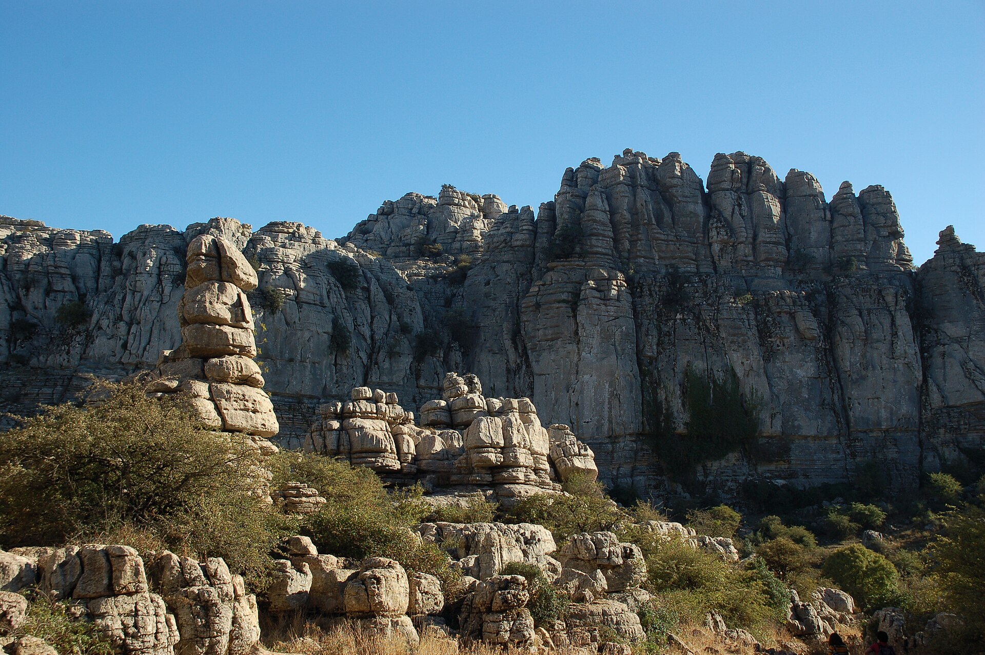
El Torcal de Antequera is a nature reserve set within the Sierra del Torcal mountain range, just south of the town of Antequera in the province of Málaga, Andalusia, Spain. The site is widely regarded as one of the most striking karst landscapes anywhere in Europe, drawing visitors interested in geology, hiking, and simply witnessing a terrain unlike almost anywhere else on the continent.
Where is El Torcal located?
The reserve sits close to the A45 road, on elevated ground that offers sweeping views over the surrounding valleys. Its coordinates place it at roughly 36.96° north latitude and -4.55° longitude. What sets the area apart is its dramatic rock scenery: centuries of erosion acting on limestone have carved towers, corridors, and freestanding pillars that give the landscape an almost otherworldly appearance, often compared to a stone labyrinth.
What is the protection history of the area?
The natural value of El Torcal was formally recognized early in the 20th century. In July 1929, the area was designated a Natural Site of National Interest, one of the earlier conservation measures applied in this part of Spain. A more comprehensive protective framework followed decades later, in October 1978, when a Natural Park Reserve covering approximately 17 square kilometers was established. This designation secured the karst landscape against development and degradation, preserving it in a form close to what visitors encounter today.
What is the highest point of the reserve?
The highest section of El Torcal is known as Las Vilaneras, also referred to as Filaneras Altas, reaching an elevation of 1,346 meters. Despite being the tallest point within the reserve, it does not take the shape of a conventional mountain peak. Instead, it forms a broad tabular plateau — a flat, stratified rock surface typical of karst terrain shaped by the erosion of horizontal limestone layers. The exact summit point of this plateau is marked by nothing more than a simple iron bar, a modest marker for such an expansive geological feature.
What makes this landscape so distinctive?
The karst formations of El Torcal are the product of millions of years of geological processes, during which water and wind gradually sculpted the limestone into shapes reminiscent of ruined cities, towers, and columns. This density and scale of karst sculpting is relatively rare in Europe, which is precisely why the reserve is frequently cited among the continent's most impressive examples of this type of terrain. Walking through the area, visitors pass narrow corridors and open clearings framed by rock walls that seem to shift shape depending on the angle of approach.
Frequently asked questions
Where exactly is El Torcal de Antequera located? It lies within the Sierra del Torcal mountain range, south of the town of Antequera, in the province of Málaga, Andalusia, near the A45 road.
When was the area placed under protection? It first received protected status in July 1929, and a formal Natural Park Reserve of about 17 square kilometers was created in October 1978.
What is the highest point of the reserve? The highest point is Las Vilaneras (Filaneras Altas) at 1,346 meters — a broad tabular plateau rather than a traditional peak.
Why is El Torcal so valued by geologists and travelers alike? Because of its dense, exceptionally well-preserved karst formations shaped by long-term limestone erosion, considered among the most impressive of their kind in Europe.
Nearby places

Earn badges for the places you visit
Download NextOnTrip, discover new places and check off your trails.