About this place
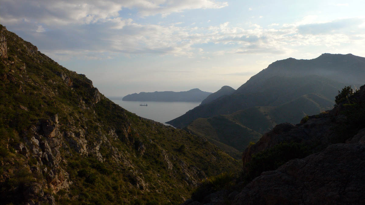
Sierra de la Muela, Cabo Tiñoso y Roldán is a regional park stretching along the coast of Cartagena, in the southern Region of Murcia. Created in 1992, it covers more than 11,300 hectares of coastal mountains running from Monte Roldán through Puntal del Moco, Galifa and El Portús, all the way to Sierra de la Muela itself, Cabo Tiñoso, Peñas Blancas, Campillo de Adentro and La Azohía. The terrain combines steep mountain slopes with a strongly indented shoreline of coves, cliffs and beaches.
Why is this area protected?
The park is part of the Natura 2000 network, designated both as a Special Protection Area for Birds (ZEPA) and a Site of Community Importance (LIC). Its Mediterranean vegetation includes Aleppo pine, rockrose, rosemary, wild olive, dwarf fan palm, holm oak, the endemic Cartagena cypress, and wide stretches of thyme scrubland. It's also home to Varita de San José, a daffodil species found only in this part of Spain.
Wildlife includes golden eagle, Bonelli's eagle, eagle owl and peregrine falcon, alongside spur-thighed tortoises, foxes, rabbits and bats. The seabed off Cabo Tiñoso is considered a national reference point for divers thanks to its richness and diversity.
What stands out along the coastline?
The stretch between La Azohía and El Portús is defined by limestone cliffs, with standout spots such as Cala Cerrada, Cala Salitrona, the natural rock arch at Cabo Tiñoso, and the rock spire known as Aguja de La Muela. Reaching the most striking coves usually takes a 30-to-45-minute walk from the nearest access points.
What historical traces does the park hold?
Beyond its natural value, the park preserves a layer of cultural heritage: windmills, defensive towers and military batteries, several of them protected as cultural heritage sites. The star attraction is the Batería de Castillitos, a military fortress with a strikingly castle-like appearance, built between 1933 and 1936 as part of a coastal defense plan meant to shield the strategic naval base of Cartagena. Its unusual architecture — a fortress designed to look almost medieval — is what draws most visitors to the site.
Frequently asked questions
Where exactly is the park located? In the western part of the municipality of Cartagena, Region of Murcia, spanning the coastal mountain range from Monte Roldán to La Azohía.
When was the regional park created? In 1992, covering more than 11,300 hectares.
What is the main historical attraction? The Batería de Castillitos, a coastal fortress built between 1933 and 1936 with a distinctive castle-like design.
Can you dive here? Yes, the seabed near Cabo Tiñoso is regarded as one of the richest diving spots in Spain, valued for the diversity of its underwater life.
Is the park suitable for hiking? Yes, several trails lead to coves such as Cala Cerrada and Cala Salitrona, with walks to the most scenic spots typically taking 30 to 45 minutes.
Nearby places

Earn badges for the places you visit
Download NextOnTrip, discover new places and check off your trails.