Nature in France
A guide to 575 Nature in France — with descriptions, photos and traveler visits from the NextOnTrip community. Locations spread across 444 cities and towns. Most visited by the community: Belvédère du Couloir Samson, place Bellevue, Cuves du Buizin.
-
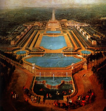
Château de Marly
Marly-le-Roi
Château de Marly was a French royal residence, and although the palace itself no longer stands, the grounds it once occupied survive as a park in Marly-le-Roi, a town on the northern edge of the former royal park, just west of the palace and garden complex at Versailles. What happened to the palace? Marly-le-Roi owes both its name and its origins to the royal residence: the town grew up specifically to serve the château and its court. After the monarchy fell, the estate passed into private hands, and the palace buildings were put to industrial use, including a stint as a factory. That change of use, combined with the building's condition, sealed its fate — the château was demolished in 1806. No trace of the original structure remains on site today; what survives is the land the residence once stood on. What can you actually see there today? Since the palace itself is gone, the main draw for visitors is the park that now covers the former residence's grounds. It's a broad green space on the outskirts of Marly-le-Roi, historically linked to the landscape that extended toward Versailles. Walking through it gives a sense of the scale of the original royal gardens, even though the palace architecture that once anchored them disappeared more than two centuries ago. How do you get to Marly-le-Roi? Marly-le-Roi sits in the greater Paris area, west of Versailles, and today functions mainly as a commuter town — many residents travel into Paris for work. Its proximity to Versailles makes it easy to combine a stop here with a visit to the Palace of Versailles as part of a single day exploring the region west of the capital. When is the best time to visit? Because the site today is essentially open parkland rather than an indoor palace to tour, the warmer months are the most rewarding time to visit, when the park's greenery is at its fullest and walking the grounds is most comfortable. Given how close Marly-le-Roi sits to Versailles, it's worth timing a visit outside the busiest tourist season there, since crowds at the palace often spill over into the surrounding area. Frequently asked questions Can you still visit the Château de Marly palace itself? No — the palace building was demolished in 1806, after it had passed into private ownership and been used as a factory. A park now occupies the site. Where exactly did the palace stand? On land that is now part of Marly-le-Roi, a town on the northern edge of the former royal park, west of the Palace of Versailles. Is it worth pairing a visit with Versailles? Yes — the two sites are close enough geographically that a single day can easily cover Versailles and the grounds of the former Marly residence. Is Marly-le-Roi primarily a tourist destination? Not really — today it functions mainly as a commuter town for people working in Paris, and its tourist interest centers on the history and parkland of the former royal residence.
-
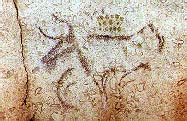
Grotte de la Tête du Lion
Bidon
Grotte de la Tête du Lion is a decorated cave holding Paleolithic rock art in the commune of Bidon, in southern Ardèche, France. You cannot walk inside, but the story of its discovery and the age of its artwork make it a worthwhile stop for anyone exploring this limestone region famous for its painted caves. How was the cave found? The discovery was accidental. In March 1963, workers building the D290 departmental road used explosives that blasted open the entrance to a previously unknown cave. Days later, on March 15, speleologists Robert Brun and Michel Pagès went inside and found a wall panel covered in ancient markings. The find was significant enough that the road's route was altered that same year to avoid destroying the rock outcrop containing the cave — the original plan had called for its complete removal. What do the paintings show? The rock art sits in a side recess of a small chamber known as "la Rotonde," in the middle section of the cave. Researchers place the paintings between the Gravettian and Solutrean periods, deep in the Upper Paleolithic. The panel includes the outline of an aurochs (likely a female Bos primigenus), two heads of male ibex with their distinctive curved horns, and an unfinished deer figure. Clusters of red and yellow-green dots complete the composition, and their exact meaning is still debated among specialists. In total, about 70 meters of the cave have been explored, divided into three sections: a short entrance gallery with a few traces of red pigment, the Rotonde chamber holding the main painted panel, and a long terminal passage that shows no signs of prehistoric use. Can you go inside? No. Because the paintings are fragile and require careful protection, the cave is closed to visitors. It was listed as a French historic monument by decree on June 15, 1964, which further formalized the restriction on public access. The commune of Bidon owns the site, and the entrance stays sealed to prevent unauthorized entry — partly to preserve the delicate microclimate inside the chamber that keeps the artwork stable. How to get there and what to know before visiting The cave lies along the D290 departmental road in the commune of Bidon, right in the heart of Ardèche — a region known for its limestone gorges and karst caves, including the far more famous Grotte Chauvet nearby. Since the interior isn't accessible, the best way to experience this site is to combine a brief stop near the discovery spot (the rock outcrop and roadside area can be viewed from outside) with a visit to regional venues dedicated to prehistoric rock art, where replicas and educational displays about local sites are often on show. Spring and autumn are good times to plan a visit, since Ardèche summers can get hot and the surrounding roads busier with traffic. Frequently asked questions Is Grotte de la Tête du Lion open to visitors? No, the cave is closed to the public to protect the paintings from damage. When was the cave discovered? In March 1963, by chance, during roadworks on the D290 in the commune of Bidon. What do the cave paintings depict? An aurochs, two ibex heads, an unfinished deer, and clusters of red and yellow-green dots, dated to the Gravettian-Solutrean period. Who owns the cave? The site belongs to the commune of Bidon, and it has been listed as a French historic monument since 1964.
-
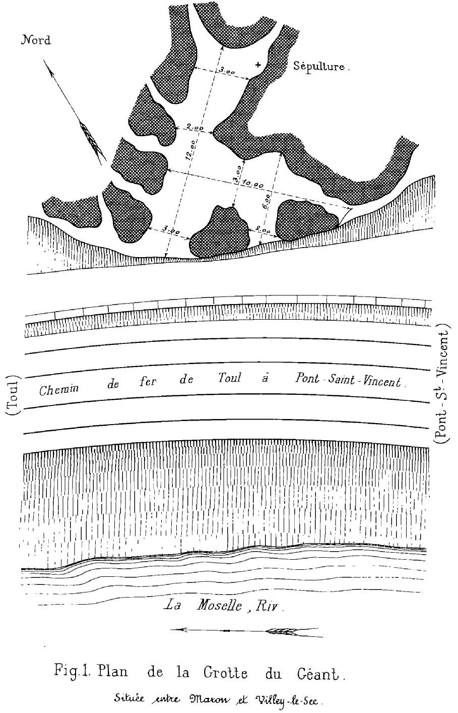
grotte du Géant
Gondreville
Grotte du Géant is a small rock cave in the commune of Gondreville, in the Meurthe-et-Moselle department of France, tucked into the steep slope of the Moselle's right bank. Its entrance sits roughly 20 meters above the current river level, about halfway between the villages of Maron and Villey-le-Sec. The site pairs an interesting geological backstory with traces of human presence going back thousands of years. Where is Grotte du Géant located? The cave opens on a rocky spur rising above the Moselle valley, surrounded by the woods that cover the slopes between Villey-le-Sec and Pierre-la-Treiche. The entrance itself forms a small chamber with a few openings facing the river, giving a view down over the valley. The cave owes its existence to the region's deep geological history, when the Moselle's course was captured by the Meurthe — the erosion tied to that event is what carved out the shelter now known as Grotte du Géant. How do you get there? The most convenient starting point is the car park by the dam in Villey-le-Sec. From there, a trail runs through the woods of Villey-le-Sec and Pierre-la-Treiche, passing old military fortifications along the way, before looping back along the former railway line and the riverside cycle path. It's from that cycle path, looking up above the tallest retaining wall of the old railway, that you can spot the cave's entrance. Expect a demanding final stretch: the approach is steep, and vegetation that has taken over since the major storm of 1999 makes the climb harder still. This is a route for people used to walking on uneven, overgrown terrain rather than a casual stroll. What is known about the cave's history? The first systematic exploration was carried out in 1864 by Nicolas Husson, who documented the remains of an old hearth, worked animal bones, human skeletal remains, and pottery fragments from several different periods of occupation. Decades later, around the turn of the 20th century, Count Jules Beaupré led further excavation campaigns. He uncovered a burial carved directly into the rock, dated to the Neolithic period, along with shell fragments matching those found nearby at the Trou des Celtes in Pierre-la-Treiche — suggesting the two sites may have been used by the same communities. What will you actually see? Visitors today mainly encounter the rock formation itself: a modest but distinctive entrance chamber with openings looking out over the Moselle valley. The traces of ancient hearths, invisible to the untrained eye, are a reminder that the site was inhabited across different eras, from prehistory to much later periods. It's a destination better suited to history buffs and hikers than to casual sightseers expecting visitor infrastructure. When should you visit? Spring and autumn are the best seasons, when vegetation hasn't yet overtaken the approach and temperatures are comfortable for a longer walk. In summer, dense undergrowth can make the final climb to the entrance considerably longer and harder. Frequently asked questions Do you need hiking experience to reach the cave? Yes — the approach is steep and partly overgrown, so reasonable fitness and proper footwear are recommended. Where's the best place to start the walk? From the car park by the dam in Villey-le-Sec, where the trail heads toward Pierre-la-Treiche through the forest. Are the archaeological finds visible on site? Most of what was discovered — tools, pottery, the burial — was excavated during 19th- and early-20th-century digs and is now studied elsewhere; there's no on-site display. Is this the same cave as Grotte du Chaos in Gondreville? No, they're two separate sites. Grotte du Chaos lies elsewhere in the commune and has its own distinct history.
-

Grotte du Portel
Loubens
Grotte du Portel is a decorated cave in the commune of Loubens, in the Ariège department, tucked into the foothills of the French Pyrenees. It belongs to the same karst system as the famous Niaux and Les Trois-Frères caves, but unlike them, it cannot be visited — its significance lies entirely in what it hides, not in what can be seen on site. What is hidden inside the cave? The interior of Grotte du Portel is a genuine gallery of prehistoric rock art. Archaeologists have recorded 138 paintings and engravings scattered throughout all of the cave's galleries. Horses and bison dominate the imagery, joined by ibex, fish, and human figures. Alongside them are enigmatic signs and symbols whose meaning has never been fully deciphered — some are considered unique within the whole of Western European prehistoric art. The best-known motif is the so-called "circus horse" (cheval du cirque), regarded as one of the most striking examples of Magdalenian artistic skill. Traces of human presence in the cave span a long stretch of time, from the Gravettian through to the Magdalenian — several thousand years of use — though the bulk of the paintings date to the Middle Magdalenian. When and how was it discovered? Grotte du Portel was discovered in 1908. Vézian worked on the site, alongside some of the biggest names in early prehistoric research — Henri Breuil, Émile Cartailhac, Jammes, and Régnault — the team that first brought this rich collection of paintings and engravings to scientific attention. Excavations also uncovered an extensive assemblage of flint and bone tools, attributed to the classic phase of Pyrenean Magdalenian culture. In 1969, the cave was listed as a French monument historique, formally recognising its exceptional scientific and cultural value. Can you visit Grotte du Portel? No — the cave is not open to the public. The reason is twofold: the narrow dimensions of its galleries, and the fragility of the paintings, which lie in close proximity to any visitor and are easily damaged by humidity, carbon dioxide, and temperature shifts brought in by crowds. It's the same dilemma that closed the original Lascaux cave to the public — rather than a physical visit, what's available today is the accumulated scientific literature on the site. Régis Vézian's monograph on the cave, containing more than 400 illustrations, is worth seeking out — it's the most complete resource on the paintings and the history of research at Grotte du Portel available to anyone outside academic circles. What else is worth knowing before visiting the area? Even though the cave itself is closed, the area around Loubens — and Ariège more broadly — is one of the most important regions for rock art in Europe. Within a few dozen kilometres you'll find sites such as Niaux, where part of the galleries has been opened to visitors, offering a chance to see paintings from the same era and cultural sphere as those hidden inside Portel. Frequently asked questions Is Grotte du Portel open to tourists? No, the cave is closed to visitors to protect the paintings and because of the narrow dimensions of its galleries. What period do the paintings date from? Mostly the Middle Magdalenian, though traces of use span a longer period, from the Gravettian to the Magdalenian. What do the cave paintings depict? Horses, bison, ibex, fish, human figures, and mysterious signs and symbols, including the famous "circus horse." When was the cave discovered? In 1908, and in 1969 it was listed as a French monument historique.
-
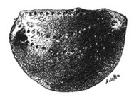
Grotte de Nermont
Saint-Moré
Grotte de Nermont is a cave above the Cure river valley, roughly 1.3 km northeast of the village of Saint-Moré, in the Yonne department of Burgundy, France. Where exactly is it? The cave sits about 50 meters above the valley floor, in a cliff face partly covered with ivy that hides some of its six entrances. Four of these openings meet inside a single large chamber, from which narrower galleries climb further into the rock. Nermont belongs to a wider group known as the Grottes de Saint-Moré, the region's second-most important cave cluster after the caves of Arcy-sur-Cure, a few kilometers further along the same river. How do you get there? A footpath runs along the base of the cliff that holds these caves, and the easiest way to reach Nermont is to start the walk in Arcy-sur-Cure and follow the Cure river — passing several other cave openings cut into the same rock wall along the way. Saint-Moré sits between Auxerre and Avallon, about 180 km southeast of Paris, making the valley an easy day trip from either town. What will you see on site? The most striking feature is the entrance porch, which opens onto a wide view over the Cure valley. Inside, the six openings and the connected main chamber form what feels like a natural maze — the same geology that has long drawn both cavers and archaeologists to the site. Why does this cave matter for archaeology? Nermont is considered the most important cave in the whole Saint-Moré group because of how rich its prehistoric layers are. The site was first described as early as 1852 and has been excavated several times since, notably by abbé Parat in 1897. In the 1930s, layer 4 and its third hearth turned Nermont into a reference site for the Late Bronze Age in France. That layer alone yielded a striking haul: around 4,000 flint flakes, 15 cores, 100 blades, 80 scrapers, 50 arrowheads, 30 flint axes, and 15 intact ceramic vessels. The sheer volume and variety of material is why the site still comes up regularly in the literature on Burgundy prehistory. When is the best time to visit? Given the terrain — a rock face, a riverside trail, entrances partly overgrown with ivy — spring and autumn work best, when vegetation doesn't block the openings and temperatures suit a longer walk along the Cure valley. In summer the trail gets busier, since it also serves visitors heading to the nearby Arcy-sur-Cure caves. Frequently asked questions Can you enter Grotte de Nermont on your own? The trail leads right up to the entrances, but this is primarily an archaeological and speleological site rather than a lit, guided show cave — going inside requires proper caving preparation. How many entrances does the cave have? Six, some partly hidden by ivy; four of them converge in one large chamber, with narrower galleries branching off from there. Why is the cave archaeologically significant? Since the 1930s it has served as a reference site for the Late Bronze Age, thanks to a rich layer containing thousands of flint and ceramic artifacts, and excavations here go back to 1852. How do you get to Saint-Moré? The village lies in Yonne, between Auxerre and Avallon, about 180 km southeast of Paris; driving is the easiest option, and the trail to the caves starts nearby in Arcy-sur-Cure.
-
Spélonque de Dions
Dions
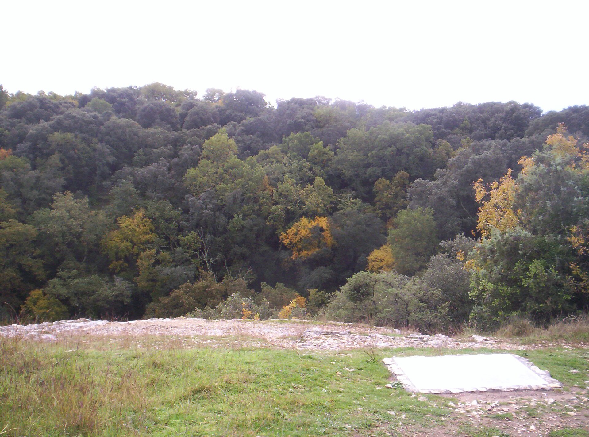
Spélonque de Dions is a vast karst sinkhole on the right bank of the Gardon river, in the village of Dions in the Gard department, roughly 25 km north of Nîmes. The name traces back to the Latin word "spelunca" (cave), which became "spélonque" in Old French — a fitting label for one of the largest collapse features of its kind in France. What exactly is it? Despite the name, this isn't a stalactite cave you walk through. It's a funnel-shaped karst chasm measuring roughly 140–160 by 115–120 metres across, plunging some 70–72 metres down. At the bottom sits a further shaft ("aven") about 40 metres deep, opening into a large final chamber thick with vegetation, from which side passages and partly flooded galleries connect to the underground course of the Gardon. Geologists believe the sinkhole formed when an old subterranean branch of the river — carved through soft, erosion-prone limestone — collapsed in on itself. Who first explored it? The site was surveyed in detail back in 1895 by cavers Félix Mazauric (1868–1919) and Gustave Cabanes, whose early mapping of the chambers and galleries still serves as a reference point for speleologists studying the Gardon valley's karst system today. Why can't you go inside right now? On 27 December 2022, the sinkhole was hit by a dramatic ground collapse — described by specialists as the largest natural karst collapse recorded in France in the past 140 years, since cavers began systematically monitoring underground sites. The event carved out a fresh crater several thousand cubic metres in volume and over a dozen metres deep. Because the walls are now unstable and rockfall is a genuine hazard, access to the gouffre has been completely closed to visitors, and experts estimate it could take years before it reopens. The collapse also stirred serious scientific interest: researchers are now studying the exposed sediment layers, which may date back more than ten thousand years and could reshape what's known about this corner of the Gard. How do you get there? From Nîmes, head to the village of Dions, then follow the route uphill through streets whose names give the game away — rue du Gardon and rue des Espélucas — until you reach the overlook above the gorge. It's rated an easy walk and takes about half a day round trip; sturdy shoes are worth packing, since the ground is rocky and uneven. The route is marked on the Vézénobres 2841E map at 1:25,000 scale. What will you actually see? Since entry into the sinkhole itself is banned, the draw is the view from above: an enormous green bowl cut into the rock, ringed by sheer limestone walls, with dense vegetation carpeting the floor far below. The sheer scale and wildness of the scene make an impression on their own, especially given how easy the overlook is to reach. The wider Gardon valley has other trails and viewpoints worth combining with the visit. When's the best time to visit? Spring and autumn bring mild temperatures and the greenest vegetation at the bottom of the sinkhole. Summer can get intensely hot and dry here, so an early-morning start pays off. Frequently asked questions Can you climb down into Spélonque de Dions? No. Since a major ground collapse in December 2022, access to the interior has been completely prohibited due to unstable walls and the risk of falling rocks. How long does the hike to the site take? Walking from the village of Dions to the overlook above the sinkhole is an easy route, taking about half a day round trip. How is Spélonque different from a typical cave? It isn't a cave in the usual sense but a giant karst chasm (gouffre) formed by the collapse of an underground riverbed — open to the sky, with vertical walls dropping tens of metres. Who first studied the site scientifically? Cavers Félix Mazauric and Gustave Cabanes carried out a detailed survey in 1895, and their work remains a reference point for researchers studying the region.
-

Lascaux
Montignac-Lascaux
Lascaux is a cave in the commune of Montignac-Lascaux, in the Dordogne department of southwestern France's Périgord region, home to one of the richest collections of Ice Age art ever found. It sits in the Vézère valley, an area dense with prehistoric sites, but Lascaux stands out for the sheer number and quality of its painted animals. How was the cave found? The story starts with a dog. On 8 September 1940, seventeen-year-old Marcel Ravidat was out walking near Montignac when his dog, Robot, disappeared into a hole left by an uprooted tree. Ravidat came back four days later, on 12 September, with three friends — Georges Agniel, Simon Coencas and Jacques Marsal, all teenagers themselves. Armed with makeshift lamps, the four climbed down and became the first people in millennia to see the painted walls. Word spread fast, and the French state soon took control of the site. What do the paintings show? Across a series of connected chambers, more than 600 animal figures were painted or engraved — horses, bison, deer, aurochs, and a scattering of rarer subjects, including a single human figure in a scene known as the Shaft. Horses and cattle dominate, rendered with striking movement and often using the natural curves of the rock to suggest volume. The paintings are generally dated to somewhere between roughly 17,000 and 21,000 years old, placing them late in the Upper Paleolithic. Because of the scale, variety, and condition of the artwork, Lascaux has become something of a benchmark for prehistoric cave art across Europe. Why is the original cave off-limits? The cave opened to visitors after the war, and by the 1950s it was drawing crowds large enough to change its internal climate. Lighting, humidity from thousands of visiting bodies, and carbon dioxide encouraged algae to spread across the walls — a problem nicknamed the "green sickness" — followed later by white patches of calcite and mold. In 1963, French authorities closed the cave to the public entirely. Since then, access has been restricted to a small number of scientists for conservation work. The closure halted further damage, but it also means no visitor to Montignac today walks through the actual painted chamber. What can visitors see instead? The response to the closure was to build faithful copies nearby. Lascaux II opened in 1983, reproducing part of the cave close to the original entrance. In December 2016, after years of construction, Lascaux IV — the Centre International de l'Art Pariétal — opened at the foot of the hill in Montignac: a large, partly below-ground building housing an almost complete facsimile of the cave, matched to the original's humidity, temperature, and even acoustics. Visits run with a guide or a handheld tablet, and the site also includes workshops, a theatre, and exhibits on the discovery and on Paleolithic painting techniques. FAQ Can you visit the real Lascaux cave? No. The original has been closed to the public since 1963 and remains closed; only researchers get limited access for conservation purposes. Visitors tour an exact replica instead. What's the difference between Lascaux II and Lascaux IV? Lascaux II (1983) reproduces only part of the cave near the original entrance. Lascaux IV (2016) is a much larger, purpose-built centre with a near-complete replica of the whole cave plus additional exhibition spaces. Who discovered Lascaux? Four teenagers from Montignac — Marcel Ravidat, Georges Agniel, Simon Coencas, and Jacques Marsal — in September 1940. How old are the paintings? Estimates place them roughly 17,000 to 21,000 years old, in the Upper Paleolithic period. Where exactly is Lascaux? In the commune of Montignac-Lascaux, Dordogne department, Nouvelle-Aquitaine region, in the Vézère valley in the Périgord.
-
Abri du Poisson
Les Eyzies
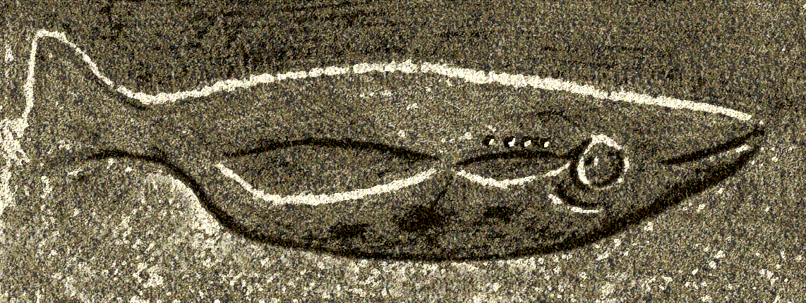
Abri du Poisson is a modest rock shelter in the Gorge d'Enfer valley, on the right bank of the Vézère river, in the commune of Les Eyzies-de-Tayac-Sireuil, Dordogne, in the Périgord region of France. The site owes its renown to a single carving: a life-size salmon sculpted into the shelter's ceiling near the close of the Upper Palaeolithic. Where exactly is the shelter located? The shelter sits in a narrow side valley fed by a small stream that joins the Vézère close to an old ford. Like most rock shelters around Les Eyzies, it is a shallow overhang cut into the limestone cliff rather than a deep cave system – dozens of similar shelters dot the same stretch of the valley. What does the ceiling carving show? A fish measuring roughly 105 centimetres runs across the vault, worked in low relief and engraved detail. It depicts a male salmon in the exhausted state that follows spawning, marked by the hooked lower jaw known as a kype. Traces of ochre survive on both the fish and the surrounding rock, evidence that the carving was originally highlighted in red. Why does this carving matter so much? The relief dates to the Gravettian, roughly 25,000 to 27,000 years ago, making it one of the oldest known fish depictions in rock art anywhere. Fish are rare subjects in Franco-Cantabrian art – only around a dozen comparable examples are documented across the whole tradition. That scarcity, combined with the technical skill of the carving and the surviving pigment, gives Abri du Poisson a singular place among the decorated sites of the Vézère valley. How was the shelter discovered? Paul Girod first noted the shelter in 1892, but the fish itself went unrecognised for another two decades, since cave art was not yet widely accepted as genuinely prehistoric in the Dordogne. Jean Marsan identified the salmon in 1912. Soon afterward the block bearing the carving was nearly cut out of the cliff and removed – pick marks around the figure still testify to the attempt. Timely intervention kept the relief in place, and in 1913 Abri du Poisson, together with the neighbouring Abri Lartet, was listed as a Monument Historique. What is the hand print found at the site? In 1975, Alain Roussot and Christian Archambeau discovered a left hand stencil in the shelter, produced by spraying or blowing manganese oxide pigment around a hand pressed against the rock. The stencil dates from roughly the same period as the salmon carving, about 27,000 years ago. FAQ Is Abri du Poisson a cave or a rock shelter? It is a shallow rock shelter (abri), an open overhang in a cliff face, not an enclosed cave with passages. How is it different from Font-de-Gaume or Les Combarelles nearby? Font-de-Gaume and Les Combarelles are known for painted and engraved galleries showing mostly land animals. Abri du Poisson instead centres on a single large fish carved in relief, a subject found nowhere else in the region. How old is the salmon carving? About 25,000 to 27,000 years old, placing it in the Gravettian phase of the Upper Palaeolithic. Is Abri du Poisson part of the Vézère Valley UNESCO World Heritage listing? Yes. It was inscribed in 1979 together with fifteen other decorated sites of the Vézère valley. Is the carving on site the original or a replica? The relief is the original work, still in the shelter where it was carved millennia ago, unlike some regional sites presented only through facsimiles.
-
Grotte des Druides
Barr
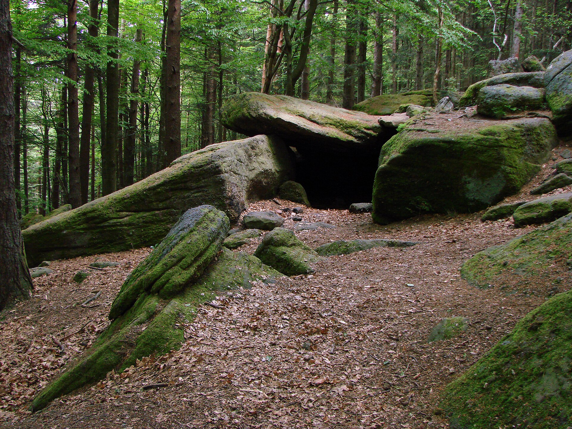
Grotte des Druides is a small natural cave in the Vosges Mountains, within the commune of Barr, in the Bas-Rhin department of Alsace — a region better known for its vineyard-covered hillsides than for underground curiosities. The entrance sits at roughly 770 metres above sea level, in the Kirneck valley, right beside the southern end of the Mur Païen (the Pagan Wall) that once enclosed the summit plateau of Mont Sainte-Odile. Why is it called the "Druids' Cave"? The cavity's shape recalls a dolmen, and its name nods to the druidic stones long associated with Celtic ritual sites — which is exactly why generations of hikers assumed it was man-made. Some maps as late as the 1980s still labelled it as a megalithic monument. That changed once speleologists Claude Chabert and Jean-Yves Bigot surveyed the cave in June 1991: their fieldwork confirmed it has nothing to do with prehistoric construction. How did the cave actually form? Grotte des Druides is a textbook case of pseudokarst, carved into Vosges sandstone laid down in the Lower Triassic. Rather than water dissolving rock, as in a true karst cave, slabs of sandstone here slid downhill under suction created within cracks in the slope, leaving behind a narrow void. The result is modest in scale — the surveyed passage measures only about 5 metres — so this is more of a geological footnote than a cave to explore at length. What is its connection to the Pagan Wall? The entrance opens just a few metres outside the outer line of the Mur Païen, the ring of massive dry-stone blocks that once fortified the plateau below Mont Sainte-Odile. Because of this proximity, most visitors come across the Grotte des Druides while walking the wall rather than seeking it out as a stand-alone destination. How do you get there? The easiest starting points are the lower or upper car parks by the convent on Mont Sainte-Odile, or the Tumuli car park along the D426 road between Mont Sainte-Odile and the Bloss crossroads. From either, marked trails lead to the site; the well-rated Sentier du Mur Païen covers roughly 9.8 km with genuine elevation gain for those wanting the full circuit. Visitors after just the wall fragment and the cave can follow a shorter loop of about 1.76 km, taking around 50 minutes at an easy pace with no technical difficulty. Walking the entire Pagan Wall, by contrast, is a full-day outing. Who should visit? The site suits hikers who enjoy pairing a walk with a bit of geology and local history, rather than travellers seeking a dramatic cave experience. It works well as a short detour from a visit to Mont Sainte-Odile, and it sits within easy reach of Barr, the wine town at the foot of the Vosges where many visitors base themselves before heading into the hills or along the Alsace wine route. FAQ Is the Grotte des Druides a genuine dolmen? No. Despite the dolmen-like shape and druid-referencing name, a 1991 speleological survey confirmed it is a natural pseudokarst formation, not a prehistoric structure. How long does it take to reach the cave? The short route combining a stretch of the Pagan Wall with the cave takes about 50 minutes one way and requires no special hiking experience. Where can I park? The car parks by the Mont Sainte-Odile convent or the Tumuli car park on the D426 are the most convenient options. Is the cave lit or set up for guided visits? No. It is a small, roughly 5-metre natural void with no visitor infrastructure — you view it from outside or step in briefly without special equipment. What else is worth seeing nearby? The Pagan Wall itself, the summit and convent of Mont Sainte-Odile, and the town of Barr with its vineyards at the foot of the Vosges.
-
Chauvet Cave
Vallon-Pont-d'Arc
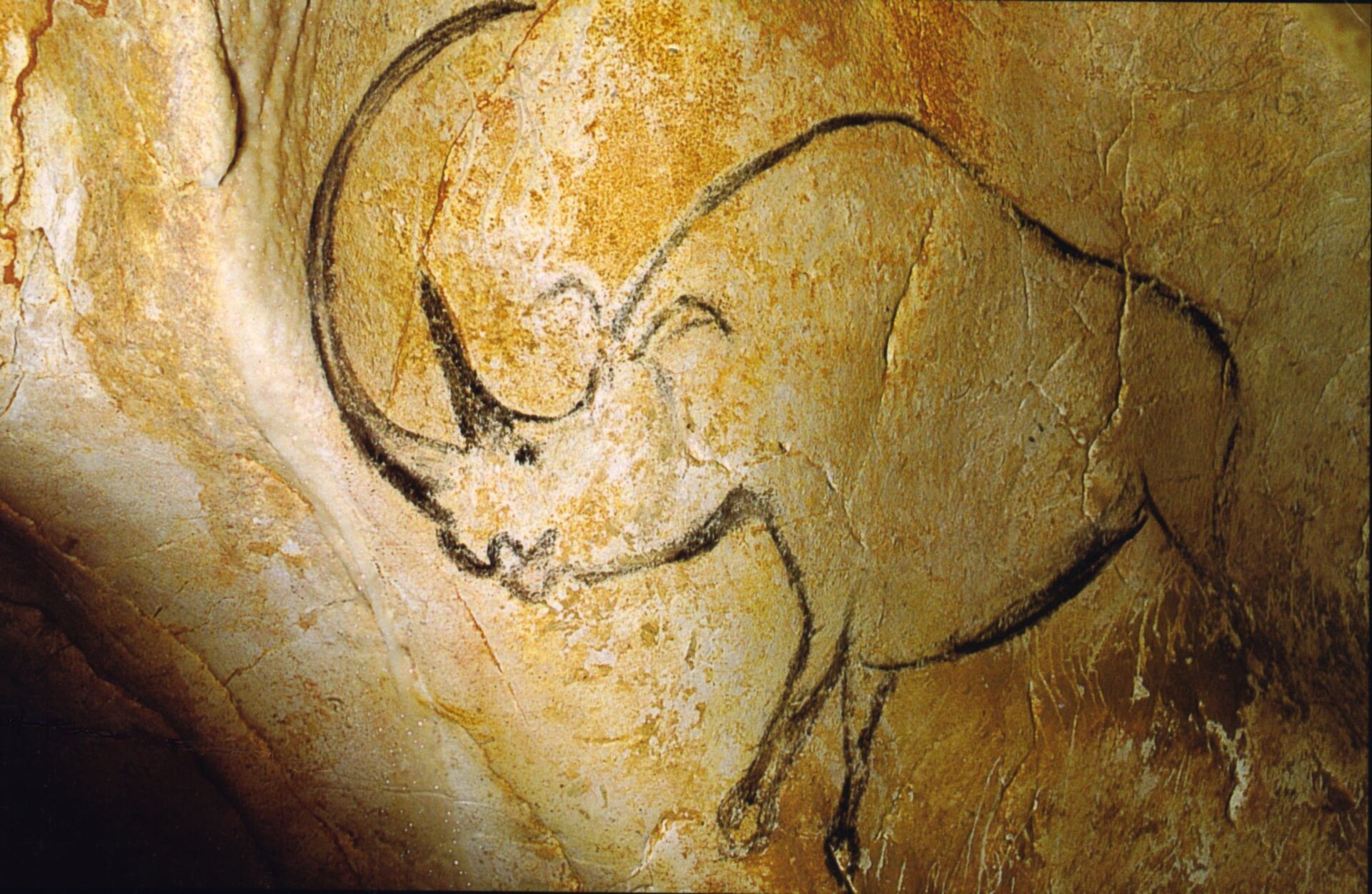
Chauvet Cave (Grotte Chauvet) ranks among the most important prehistoric art sites on Earth, hidden inside a limestone cliff above the former bed of the Ardèche river, within the commune of Vallon-Pont-d'Arc. Its chambers hold more than a thousand paintings and engravings of animals — horses, woolly rhinoceroses, cave lions, bears, and mammoths — created during the Upper Paleolithic. Some of the drawings are roughly 36,000 years old, making them among the oldest known figurative artworks made by human hands. How was the cave found? Three amateur speleologists — Jean-Marie Chauvet, Éliette Brunel, and Christian Hillaire — pushed through a narrow gap in the rock on 18 December 1994 and found themselves in a vast network of chambers and galleries covered with images left thousands of years earlier. They quickly understood the scale of what they had stumbled upon: the artwork survived in an almost pristine state because a rockfall had sealed the entrance many millennia ago, cutting the cave off from the outside world until that day. What makes it so exceptional? Beyond sheer age, the cave stands out for the skill behind the images. The artists worked with charcoal and ochre, used shading and a sense of perspective, and in several scenes drew animals mid-motion, with overlapping legs suggesting movement. Handprints, animal footprints, and traces of ancient hearths remain visible on the floors and walls. Because of this artistic and scientific value, the site was classified as a French historic monument in 1995, and in 2014 UNESCO inscribed it on the World Heritage List under the name "Decorated Cave of Pont d'Arc, known as Grotte Chauvet." Can visitors enter the original cave? No. The original Chauvet Cave has remained closed to the public since its discovery, and only a small number of researchers are granted access each year to study it. The decision followed lessons learned at other renowned decorated caves, such as Lascaux and Altamira, where large-scale visitor traffic triggered mold growth that damaged the paintings. The cave's microclimate — its humidity, temperature, and air composition — is so delicate that any outside interference could irreversibly harm artwork tens of thousands of years old. So what do tourists actually see? A faithful full-scale replica was built nearby: the Caverne du Pont-d'Arc, also known as Grotte Chauvet 2. Construction began in 2012, and the site opened to visitors on 25 April 2015. It is the largest replica decorated cave in the world, with roughly 3,500 square meters of floor space and more than 8,000 square meters of reproduced rock surfaces, walls, and ceilings. The design team recreated not only the paintings themselves but also the terrain, temperature, humidity, silence, and acoustics of the original, so the visitor experience closely mirrors that of the real cave. What is a visit to the replica like? Tours run in small groups of about 25 people and last around 50 minutes. Guided tours are offered in several languages, and audio guides in additional languages are available for other visitors. The site also includes an educational center dedicated to Paleolithic life and cave art techniques. FAQ Can you visit the real Chauvet Cave? No. The original has been closed to tourism since its discovery in 1994 and is accessible only to researchers. Visitors instead tour the faithful replica, the Caverne du Pont-d'Arc (Grotte Chauvet 2), built nearby. How old are the paintings? The oldest images are estimated at around 36,000 years old, placing them among the earliest known cave paintings in the world. Who discovered the cave? It was discovered on 18 December 1994 by three speleologists: Jean-Marie Chauvet, Éliette Brunel, and Christian Hillaire. Where exactly is the cave located? In the commune of Vallon-Pont-d'Arc, in the Ardèche department of France, on a limestone cliff above the former bed of the Ardèche river. Does the cave have heritage protection status? Yes. It has been a French historic monument since 1995 and was added to the UNESCO World Heritage List in 2014.
-
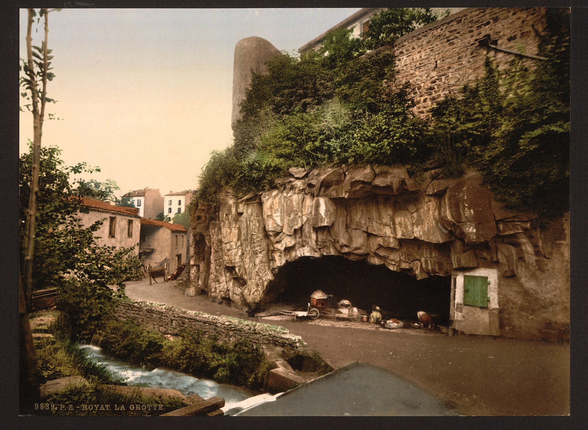
Grotte des Laveuses
Royat
Grotte des Laveuses, the Cave of the Washing Ladies, sits tucked into the Tiretaine valley in Royat, the well-known spa town just west of Clermont-Ferrand in the Puy-de-Dôme department of Auvergne. It lies within Royat's thermal park, below the hill crowned by the priory church of Saint-Léger — a quiet reminder that this whole corner of the Massif Central was shaped by volcanic fire long before anyone came here to take the waters. How did the cave form? The cave owes its existence to a basalt lava flow that poured down from the Petit Puy-de-Dôme during Quaternary volcanic eruptions. As the flow advanced, it buried a small stream running through the valley, and a pocket of steam became trapped beneath the cooling rock. That trapped gas left behind a hollow chamber. Over time the Tiretaine river cut its way back through the hardened basalt, exposing the cavity and carving out the cave visitors can walk into today. Columnar basalt prisms, formed as the lava contracted while cooling, are still visible along the cave walls. What is inside? The chamber measures roughly 30 metres long, 10 metres wide and 3.5 metres high. Seven springs emerge directly from the rock, running at a steady, cool temperature of around 10°C, and their waters gather inside the cave before feeding into the Tiretaine. The remains of a rough stone basin, built to collect this water, can still be seen at the back of the cave. Where does the name come from? The name refers to a very literal, everyday use of the site: local washerwomen — laveuses in French — once came here to do their laundry in the naturally flowing spring water. The makeshift wash basin they built stuck around long after the practice itself faded, and it left the cave with a name that has outlasted the custom by close to two centuries. The site was distinctive enough to be featured in 1829 in the illustrated volume "Voyages pittoresques et romantiques dans l'ancienne France," by Charles Taylor and Justin Nodier, one of the earlier large-scale publications to bring French landscapes to a wide readership. In 1949, at the request of the town of Royat, the cave was granted protected heritage status. Getting there and visiting The cave sits on Rue de la Grotte in Royat and is open year-round, free of charge. It makes for an easy stop on a walk through the thermal park — a short stretch along the Tiretaine also opens onto other caves carved from the same lava flow, including the neighbouring Siméoni cave, once the source that fed the celebrated Fontaine Amboise in Clermont-Ferrand. Frequently asked questions Is there an entrance fee? No, access is free and the cave is open throughout the year. How long does a visit take? It is a small site — seeing the interior and the information panels nearby usually takes no more than ten or fifteen minutes. Does water still flow inside the cave? Yes, the springs inside the cave are still active and continue to feed the Tiretaine river. What else is worth seeing nearby? Pair the visit with a walk through Royat's thermal park and a look at the other caves along the Tiretaine, particularly the Siméoni cave close by.
-
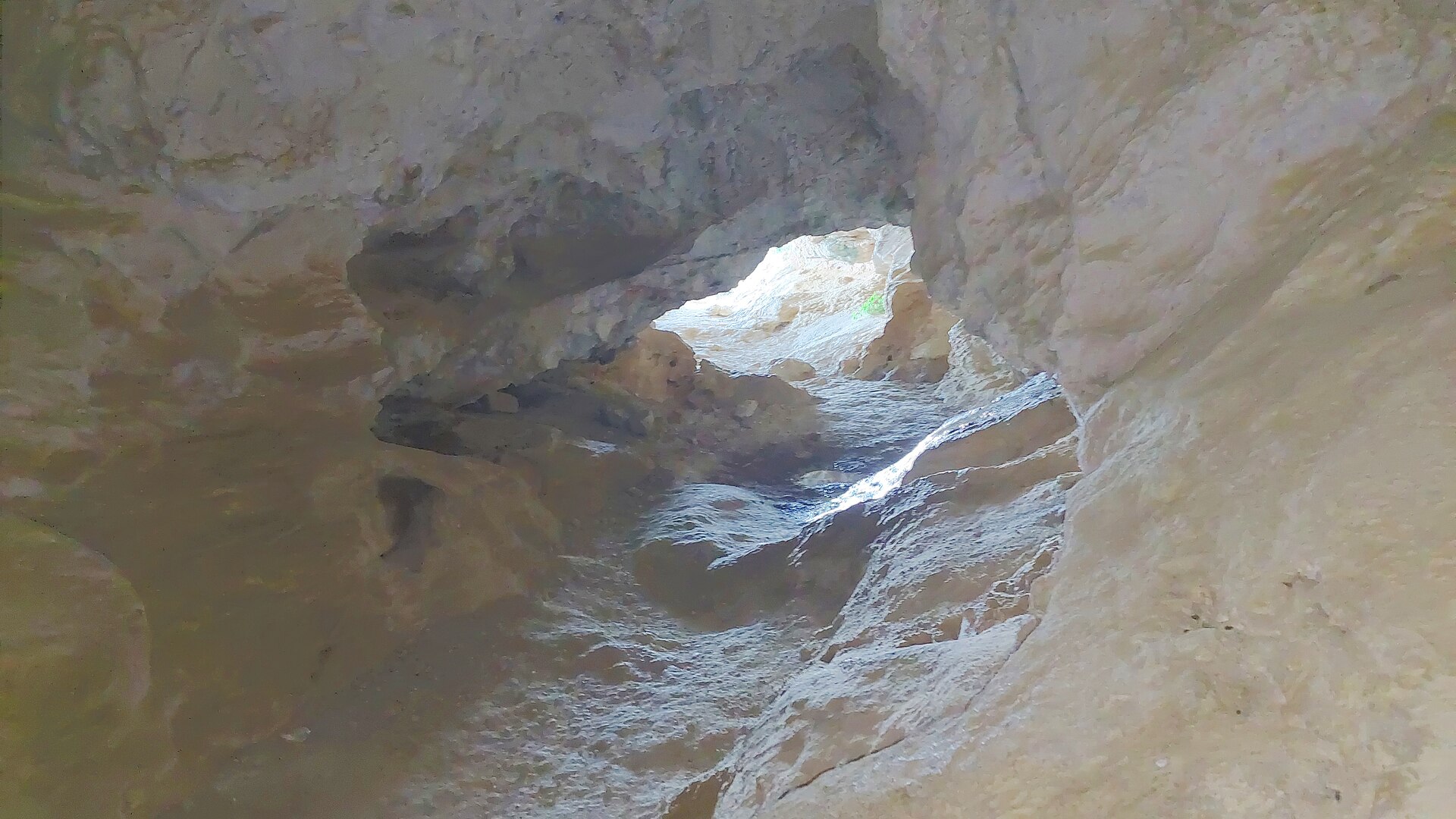
Grotte du Trou de l'Argent
Entrepierres
Grotte du Trou de l'Argent is a cave-and-ridge scramble on Montagne de la Baume, the limestone rampart that pinches the Durance river into the famous Sisteron cluse. Straddling the boundary between the commune of Entrepierres and the town of Sisteron in the Alpes-de-Haute-Provence department, it's less a sightseeing stop than a short, sporty adventure: hikers walk into a real cave, climb through it with the help of cables and iron rungs, and emerge on an airy summit ridge. Where is it, and how do you get there? The cave mouth sits at roughly 1,050 m altitude on the eastern flank of Montagne de la Baume. Drivers leave the A51 motorway at exit 22, follow the D217 toward Entrepierres, and park just north of the old village, past the bridge. There's no public transport link, so a car (or a long approach on foot) is the only option. What's inside the cave? Trou de l'Argent is shaped like an irregular corridor rather than a single chamber. Several natural rock openings let daylight in, forming what feel like open balconies facing south with views over the surrounding hills. Deeper sections, though, are pitch dark, and a headlamp is genuinely needed rather than optional. The floor is fine limestone sand, and the passage narrows enough in places that hikers have to crouch or crawl on all fours; one tight spot forces you to take your backpack off to squeeze through. A date, 1865, is carved into the rock by an earlier visitor — a small reminder that people have been scrambling through here for well over a century. How hard is the route, and what should you bring? This is rated a difficult, exposed hike, not a casual walk. A full loop starting and finishing in Entrepierres runs about 6.5 km and 3 to 3.5 hours, with roughly 680 m of combined elevation gain across three stages: the climb up to the Montuery heights, the cave passage itself up to the summit of Montagne de la Baume (1,147 m), and the descent via the Beaudouze ridge back to the village. Cables and metal rungs assist the steepest sections in and out of the cave. High-cut hiking boots, a headlamp, water, and proper mountain gear are all necessary — this route is meant for experienced, well-prepared hikers, not families with young children. In summer, the massif is sometimes closed outright because of wildfire risk, so it's worth checking local access conditions before setting out. Where does the name come from? Local tradition ties the name — literally "the hole of money" or "the silver hole" — to old coins once found inside the cave. Before that, it was known by a different name, Baume Rolland. The site's human history goes back much further still: archaeological evidence points to occupation here during the Neolithic period, long before anyone carved dates or found coins in the rock. What do you see from the top? Once past the cave and the final exposed scramble, the summit of Montagne de la Baume opens onto a wide panorama of the Durance valley, Sisteron's old town and citadel, and the ridgelines of the Digne-Sisteron Prealps. On the far side of the mountain, the landscape shifts to a gentler, more open scene stretching toward Entrepierres. FAQ Do you need caving equipment to get through the cave? No technical caving gear is required, but a headlamp is essential — part of the corridor is completely dark, and some sections require crouching or crawling. Is this route suitable for beginners? No. It's classed as difficult and exposed, and it's recommended only for experienced hikers with proper equipment. Where's the best starting point? Entrepierres, where the full loop begins and ends, taking in the Montuery heights, the cave, and the Beaudouze ridge. Is the trail always open in summer? Not necessarily — the massif can be closed temporarily during periods of high wildfire risk, so checking ahead is worthwhile.
-
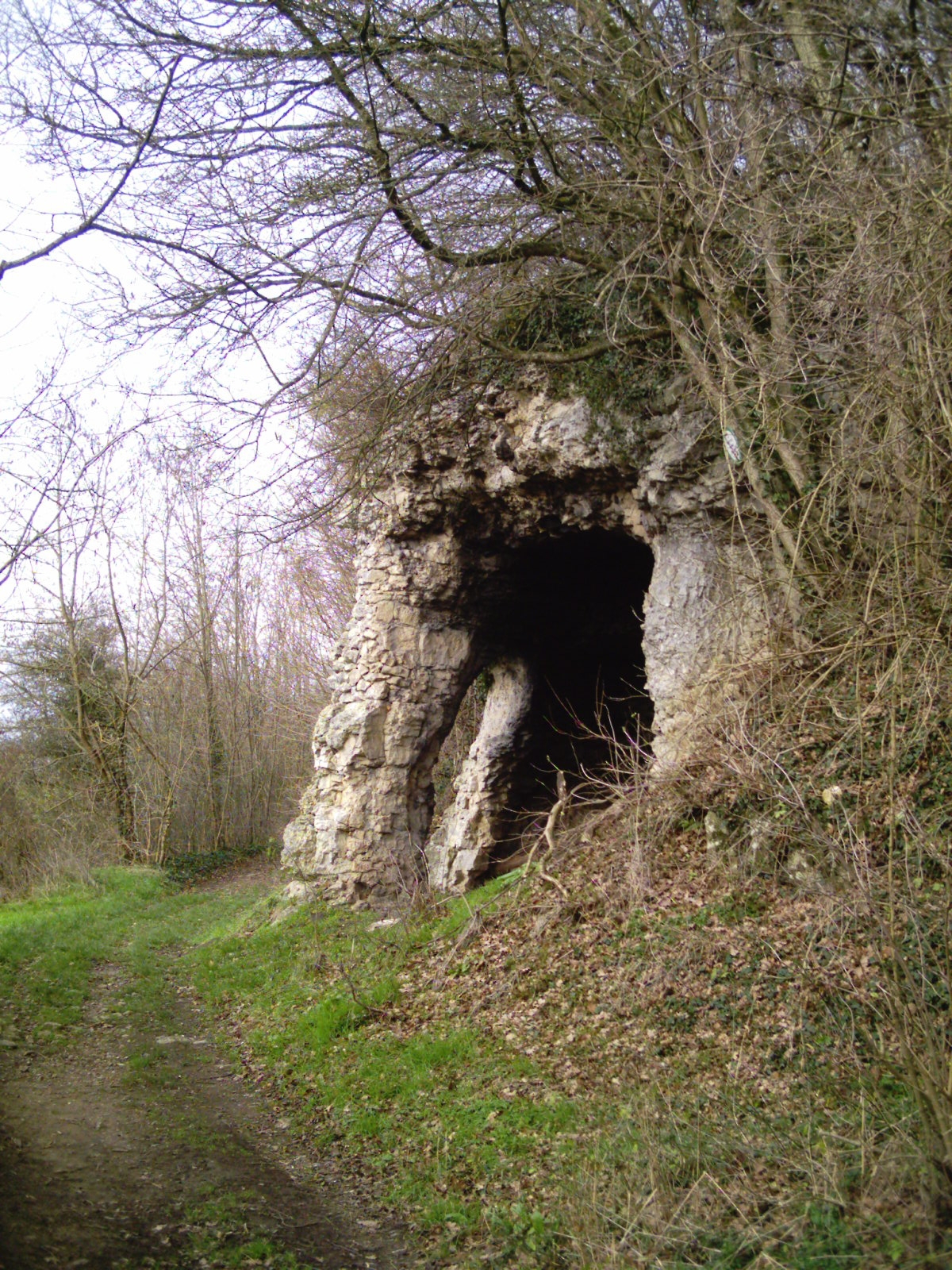
grotte Sainte-Reine
Pierre-la-Treiche
Sainte-Reine Cave (Grotte Sainte-Reine) is one of the largest natural cave systems in the Meurthe-et-Moselle department, hidden in the slope of the Moselle valley within the commune of Pierre-la-Treiche, in the heart of Lorraine, France. Its official heritage name, "Grottes dites Trou de Sainte-Reine," covers several entrances that all lead into a single branching network of galleries. Where is it and how did it form? The cave lies on the right bank of the Moselle, where the river has cut deeply into the limestone bedrock of the valley. The galleries originally formed as an endokarst system hidden beneath the valley floor; only once the river entrenched itself and deepened its bed did the cave network become exposed and accessible from the surface. As surveyed in 2004, the mapped passages total 1,260 meters in length with a vertical range of 17 meters, making it the second-largest known natural cave system in the department. Where does the name come from? The name "Sainte-Reine" has nothing to do with the archaeological finds inside — it comes from a hermitage established at the cave's main entrance porch in 1711. The presence of a hermit at the site is what linked the cave to Saint Regina in local memory, and the name stuck: it was already recorded in 1861 by Henri Lepage in his geographic dictionary of the Moselle. What has been found inside? The cave's archaeological importance was recognized as early as the 19th century. Excavations uncovered the bones of cave bears and cave hyenas, along with Stone Age tools — worked flint and an amulet carved from deer antler. Dating studies indicate that the oldest deposits in the cave predate 300,000 years. These finds are the reason the cave was listed as a historic monument by decree on February 24, 1910. Is the cave still being explored? Yes. Exploration continues today, led mainly by cavers from the Union spéléologique de l'agglomération nancéienne (USAN). In October 2008, David Parrot and the USAN team discovered a new chamber, named Room 33. Between 2016 and 2020, Olivier Gradot, Théo Prévot, and other USAN members cleared a further passage known as the Rat-Lynx gallery, confirming that the system extends in three dimensions and is more complex than previously thought. Can visitors go inside? Sainte-Reine Cave is primarily a protected natural and archaeological site rather than a show cave with a marked underground trail. The hills above the Moselle valley are, however, a popular destination for hikers, and marked trails in the area pass near the cave entrances, offering views over the valley. FAQ Where exactly is Sainte-Reine Cave located? In the commune of Pierre-la-Treiche, Meurthe-et-Moselle department, on the right bank of the Moselle river, in the Lorraine region of France. Why is the cave called "Sainte-Reine"? The name comes from a hermitage set up at the cave's main entrance in 1711, not from the archaeological discoveries made there. What archaeological finds were made in the cave? Bones of cave bears and cave hyenas, plus Stone Age tools including worked flint and a deer-antler amulet; the oldest deposits date back more than 300,000 years. Can the cave be visited independently? It is a protected historic monument explored mainly by speleologists, not a show cave open to the general public with a marked visitor route.
-
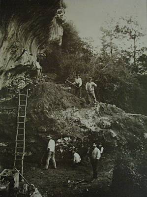
Cap Blanc rock shelter
Marquay
Cap Blanc rock shelter sits in the commune of Marquay, in France's Dordogne department, and holds one of prehistoric Europe's most striking works of stone sculpture: a frieze of horses, bison and deer carved directly into the limestone wall. The shelter overlooks the Beune valley, a tributary of the Vézère, just a few kilometers from Les Eyzies-de-Tayac, in a region with the densest cluster of Ice Age cave art anywhere in Europe. What makes the Cap Blanc frieze so unusual? Most Ice Age art associated with this valley is painted — Cap Blanc's is carved. Along roughly 13 of the shelter's 16 meters, Magdalenian artists cut horses, bison and deer into the rock face, in places chiseling as deep as 30 centimeters to give the animals real volume and shadow. The result sits closer to sculpture in high relief than to a simple engraving, and specialists regularly rank it among the finest examples of Palaeolithic stone carving found anywhere. How was the shelter discovered? The site was found in 1908 by Raymond Peyrille, who was working under the direction of archaeologist Jean-Gaston Lalanne while Lalanne himself was excavating the nearby shelter at Laussel. The first proper excavation followed in 1909, and it was this dig that brought the sculpted frieze fully to light. Whose skeleton was found at Cap Blanc? In 1911, while workers were building a protective wall in front of the shelter, a pickaxe struck something hard — a human skull, which shattered on impact. What followed was the recovery of a near-complete skeleton, one of the best-preserved Magdalenian burials known in northern Europe. The remains were sold in the 1920s and have been held by the Field Museum in Chicago since 1926, where they went on public display and drew large crowds. For years the skeleton was presented as that of a young girl; later anthropological study revised this, showing the individual was a woman between 25 and 35 years old at death. Where does Cap Blanc fit into the Vézère valley story? The shelter lies within the Vézère valley, listed as a UNESCO World Heritage site for its extraordinary concentration of decorated caves and rock shelters, alongside better-known names like Lascaux and Font-de-Gaume. What sets Cap Blanc apart is its medium: sculpture rather than painting, and monumental sculpture at that — a rare case of prehistoric relief carving that visitors can still see in its original setting. The site has been protected as a monument historique (classé) since 28 November 1910, France's highest tier of heritage protection. FAQ What period does the Cap Blanc frieze date to? The carvings belong to the Magdalenian, the final phase of the Upper Palaeolithic. Which animals appear on the frieze? Horses, bison and deer, carved in relief that reaches up to 30 centimeters deep in places. Is the skeleton found at the site still there? No — it has been held by the Field Museum in Chicago since 1926. Is Cap Blanc part of the Vézère valley's UNESCO listing? Yes, the shelter sits within the Vézère valley, protected by UNESCO for its concentration of Palaeolithic art. How does Cap Blanc differ from Lascaux? Lascaux is known for its paintings, while Cap Blanc's art takes the form of sculpture cut directly into the rock.
-
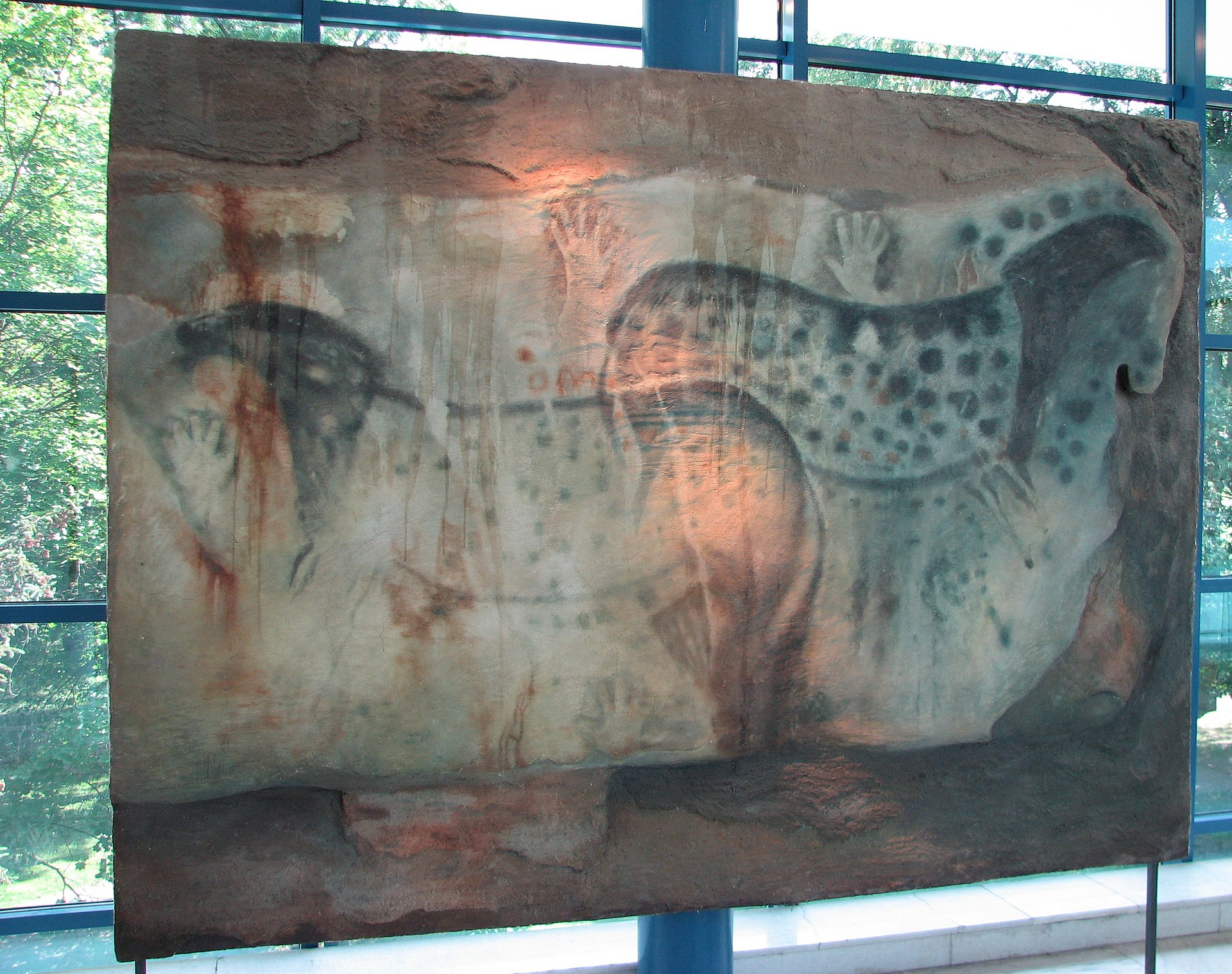
Pech Merle cave
Cabrerets
Pech Merle is a cave in the commune of Cabrerets, in the Lot department, Occitania region — some 32 kilometres to the east of Cahors. Its galleries hold prehistoric paintings and engravings, and it counts among the very few French caves with Ice Age art still open to paying visitors. Where is Pech Merle located? The cave runs into a hillside above Cabrerets, a small village on the Célé river in the Quercy district, known for its limestone plateaus riddled with karst caves. The entrance sits at coordinates 44.5081 N, 1.6444 E, about a thirty-minute drive from Cahors, the closest larger town. What is inside the cave? Pech Merle spreads across two levels and more than 2 km of galleries, chambers and shafts, though only around 1,200 metres of that network are open to visitors. The walls carry paintings and engravings attributed to the Gravettian culture, with some panels possibly added later, during the Magdalenian period. The best-known panel is the so-called "Spotted Horses" (chevaux ponctués): two horses drawn back to back, surrounded by a fish, hand stencils, thumb prints and a scatter of enigmatic signs, with the neck of a third horse visible alongside them. The composition is estimated at around 29,000 years old, making it one of the oldest and best-preserved examples of Palaeolithic cave art in Europe. How do visits work? Entry is guided only, with groups capped at 25 people, and the cave is open to visitors from February through November. To limit wear on the paintings, daily visitor numbers are restricted — in July and August the cap drops to 700 people per day. In practice this means booking a ticket online is required year-round, and visitors need to collect their tickets a quarter of an hour before the scheduled entry time. A prehistory centre next to the cave sets out the story of the discovery and the significance of the artwork before visitors head underground. History and protection status The cave was discovered in 1922. Since 1951 it has held the status of monument historique, in the "classé" category, the strictest tier of heritage protection in France. That listing reflects Pech Merle's exceptional standing among French Palaeolithic sites and comes with tight rules on how the interior is presented to the public, aimed at shielding the paintings from the humidity, carbon dioxide and temperature swings that visitors bring in with them. Frequently asked questions Do I need to book tickets in advance for Pech Merle? Yes. Online booking applies year-round, and in summer, when the daily cap of 700 visitors kicks in, buying ahead is effectively the only way to guarantee entry. Can visitors explore the cave on their own? No — entry is guided only, in groups of up to 25 people. What is the cave's main highlight? The "Spotted Horses" panel, a roughly 29,000-year-old composition featuring two horses, a fish, hand stencils and abstract signs. When is the cave open to the public? The visiting season runs from February to November. How big is the cave, and how much of it can be seen? The full network extends beyond 2 km, but the visitor route covers about 1,200 metres, with the rest closed off to protect the interior.
-
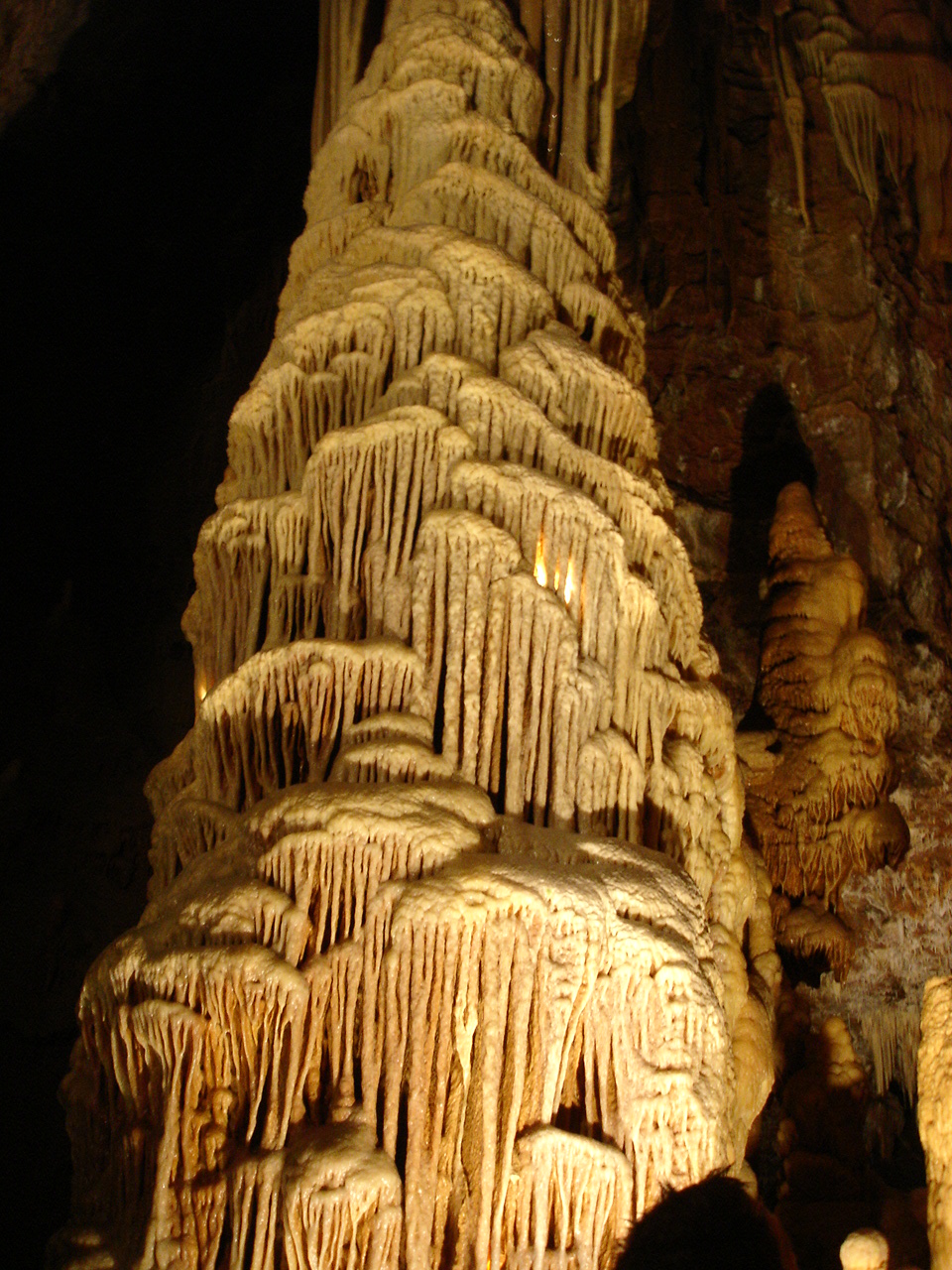
Cave of Dargilan
Meyrueis
Dargilan Cave (French: Grotte de Dargilan) is one of the largest and best-known karst caves in the Causses and Cévennes region of southern France, located in the commune of Meyrueis in the Lozère department. Its entrance opens on the flank of the Causse Noir plateau, high above the scenic Gorges de la Jonte. Because of the intense ochre and orange tones of its rock formations, locals and visitors alike know it simply as the "Pink Cave." Where exactly is Dargilan Cave? The cave lies at the heart of the Grands Causses, a limestone plateau straddling the border of Lozère and Aveyron, not far from the town of Millau. The nearest settlement is Meyrueis, reached by a winding road that climbs through rocky terrain toward the cave entrance. The surrounding landscape forms part of the UNESCO World Heritage Site "Causses et Cévennes, Mediterranean agro-pastoral cultural landscape." Why is it called the "Pink Cave"? The nickname has nothing to do with folklore — it comes from a genuine geological feature. Iron oxides embedded in the limestone give the cave's dripstone formations a palette running from pale beige to deep orange and pink. This unusual coloring sets Dargilan apart from many neighboring caves in the region, which tend to display grey and white tones instead. How was the cave discovered and developed? The entrance was found in the autumn of 1880 by a young shepherd named Sahuquet, who was chasing a fox that had darted into a hole in the ground. A full exploration did not take place until 1888, when the French speleologist Édouard-Alfred Martel — often credited as the founder of modern speleology in France — mapped the underground system in detail. Just two years later, in 1890, Dargilan opened to the public, becoming one of the very first caves in France to be equipped with a marked route and lighting for visitors. What can visitors see inside? The visitor route covers roughly one kilometer, tracing the path of a former underground river through a sequence of chambers. It begins in the vast Chaos Room, where collapsed rock blocks and dripstone columns create the impression of a frozen landscape. Further along, the path passes a striking "petrified waterfall" — a flowstone formation that mimics a cascade suddenly turned to stone — as well as crystal-clear underground pools. The tour ends in a chamber known as the Bell Tower Room, where tall, slender formations rise like the interior of a Gothic spire. Along the way, visitors pass columns estimated to be hundreds of thousands of years old and an extensive wall of limestone draperies, ranked among the more remarkable formations of its kind in Europe. What is a visit to the cave actually like? Dargilan can only be visited with a guide, and the tour typically lasts around ninety minutes. Inside, the temperature holds steady at roughly 10°C year-round, so warm clothing is advisable even in summer. The route is developed and lit throughout, making it accessible to most visitors, though it does include some sections with stairs. FAQ Where is Dargilan Cave located? In the commune of Meyrueis, Lozère department, within the Grands Causses region, close to the Gorges de la Jonte. Why is it called the "Pink Cave"? Because iron oxides in the limestone give its dripstone formations natural shades of ochre and pink. Who discovered the cave, and when? A shepherd named Sahuquet found the entrance in 1880; speleologist Édouard-Alfred Martel carried out the first full exploration in 1888. How long does a visit take, and how cold is it inside? Guided tours last about an hour and a half, and the cave maintains a steady temperature of around 10°C all year. Is Dargilan Cave part of a UNESCO site? Yes — it lies within the area listed as a UNESCO World Heritage Site under "Causses et Cévennes."
-
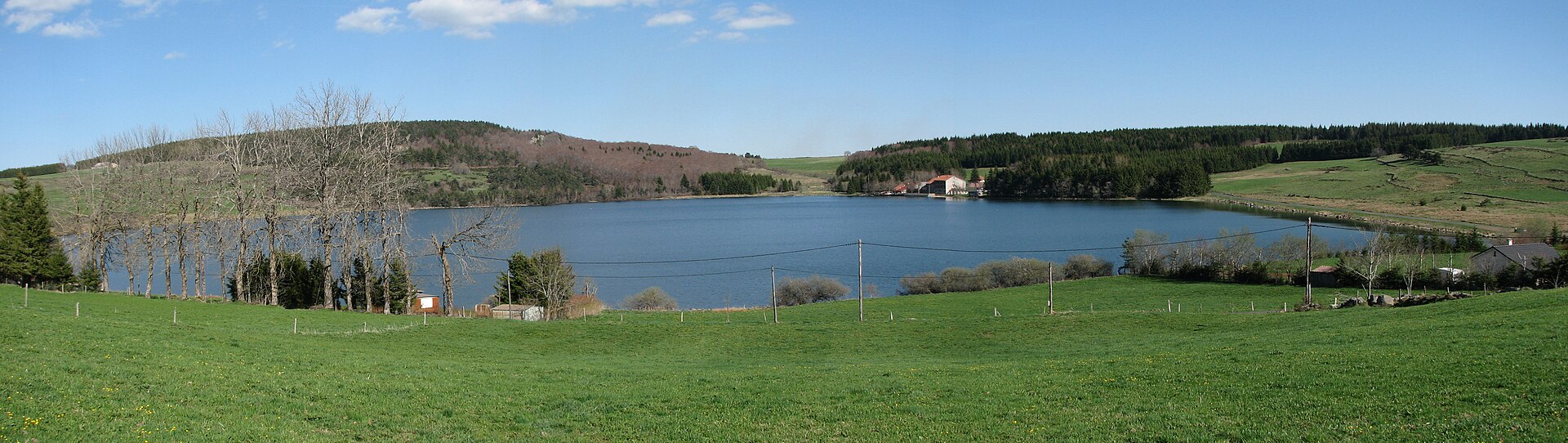
Lac de Saint-Front
Saint-Front
Lac de Saint-Front is a volcanic lake sitting at roughly 1,250 meters above sea level in the commune of Saint-Front, in the Haute-Loire department of the Auvergne-Rhône-Alpes region. It holds the distinction of being the highest lake in Haute-Loire, tucked at the edge of the Mézenc massif on the volcanic plateau that defines this corner of Auvergne. How did the lake form? The lake fills a maar-type volcanic crater, which explains its strikingly circular outline. It was carved out roughly 130,000 years ago by a phreatomagmatic explosion, the kind of eruption that happens when rising magma meets groundwater and flashes into steam. The lake now measures about 2 km around, covers close to 30 hectares, and reaches a depth of around 7 meters. It is fed by springs at the base of the crater and by underground water sources, and it is the source of the Gagne river. What makes this lake distinctive? The shoreline mixes forest, meadow, and peat bog, supporting a rich mix of wildlife tied to wetland habitats, including waterfowl typical of Auvergne's high-altitude ecosystems. That ecological value has earned the area protected status as a ZNIEFF type 1 site, and the whole lake sits within the Natura 2000 network. The water's color shifts with the weather and time of day, swinging from deep blue to slate gray, which makes the spot a favorite for photographers passing through the plateau. Is there a walking trail around the lake? A footpath of about 2.5 km circles the lake and can be walked in under an hour. The marked PR 61 trail, "Le lac de Saint-Front," starts in the village of Saint-Front and follows the shoreline, opening up views over the water and the surrounding plateau ridges. The route is easy, crossing a mix of woodland, pasture, and peat bog, which makes it suitable for families as well as anyone after a short, quiet walk in a mountain setting. Can you fish at Lac de Saint-Front? The lake is private property, managed primarily as a fishery. Fishing is permitted during the season, from May 1 to November 15. Anglers can find pike-perch, black bass, several carp varieties (including leather and grass carp), tench, and roach in its waters. Equipment rental, bait, and boats are all available on site, making it easy to reach fishing spots further from shore. Is there anything to do here besides fishing? Beyond fishing, visitors can picnic or simply walk the shore, though tourist infrastructure stays deliberately modest, in keeping with the lake's status as private, partly protected natural land. It suits a quiet visit more than a packed day out — good for anyone after birdwatching, a calm moment by the water, or a short detour into Auvergne's volcanic scenery. FAQ Where exactly is Lac de Saint-Front located? In the commune of Saint-Front, Haute-Loire department, Auvergne-Rhône-Alpes region, at about 1,250 meters altitude on the edge of the Mézenc massif. How was the lake formed? It occupies a maar-type volcanic crater created by a phreatomagmatic explosion around 130,000 years ago. Can you fish at the lake? Yes, it is a private fishery open from May 1 to November 15, with equipment and boat rental available on site. How long does it take to walk around the lake? The loop trail is about 2.5 km and takes under an hour; it also forms part of the marked PR 61 route. Is the lake environmentally protected? Yes, it is registered as a ZNIEFF type 1 site and lies within the Natura 2000 network because of its peat bogs and associated biodiversity.
-
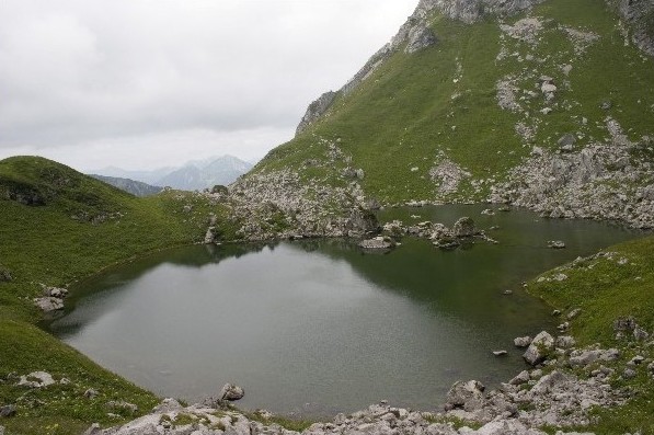
Lac de Darbon
Vacheresse
Lac de Darbon is a small mountain lake in the commune of Vacheresse, in the Haute-Savoie department of the French Alps. Sitting at 1,813 metres above sea level, it lies at the heart of the Chablais massif, close to the Swiss border and the Abondance valley. The lake covers roughly 2 hectares — a modest sheet of water whose appeal has less to do with size than with setting, tucked into a hollow beneath the peaks of Dent d'Oche and Château d'Oche, surrounded by the open mountain pastures typical of this corner of the Alps. Where exactly is the lake? Lac de Darbon lies within the commune of Vacheresse, in the area known as Bise, one of the more remote pockets of the Chablais, bordering the Abondance valley. Its coordinates are approximately 46.3436°N, 6.7478°E. The surrounding pastures fall within a Natura 2000 protected zone and the Chablais UNESCO Global Geopark, reflecting the ecological value of the alpine flora and fauna found here. How do you get there? Most visitors start from the Chalets de Bise, a cluster of mountain pasture huts above Vacheresse reachable by road from late April to late November — outside that window, snow closes the access road. Coming from Thonon-les-Bains, the route runs toward Châtel, then turns off toward Vacheresse and continues to Bise. From the Chalets de Bise, a footpath leads up to the lake itself; there is no direct vehicle access, so the final stretch has to be covered on foot across the high pastures. What does the hike look like? The classic option is a loop over three mountain passes: first the Col de Bise, then the Col de Pavis, on to the lake, and finally the Col de Floray, from where the trail descends back to Bise. The full loop covers about 6.7 km with roughly 650 metres of elevation gain, putting it in the medium-difficulty category and taking most walkers three to four hours. The final descent can be steep and slippery after rain, which is why locals recommend tackling this hike only in dry conditions. What is there to see along the way? The trail crosses classic Chablais mountain pastures, grazed by cattle in summer and scented with alpine herbs. Along the way, the jagged limestone faces of Dent d'Oche and Château d'Oche dominate the skyline — two of the most recognisable summits in this part of the Savoy Alps. The lake itself, though small, rewards the effort: its still surface often mirrors the surrounding ridgelines, an effect best seen early in the morning or in the late afternoon light. Who is this hike suited for? This is a route for hikers already comfortable with mountain walking rather than a casual stroll for young children, though no climbing skills are required. Sturdy trekking shoes and poles are advisable, especially on the steep, rocky sections of the descent. FAQ How high is Lac de Darbon? The lake sits at an altitude of 1,813 metres above sea level. How big is the lake? It covers approximately 2 hectares, making it a small alpine lake rather than a large body of water. Where should I start the hike? Most people set off from the Chalets de Bise above Vacheresse, reachable by road from late April to late November. How long does the hike take? The full loop over three passes (Col de Bise, Col de Pavis, Col de Floray) usually takes three to four hours and covers about 6.7 km. Is the trail difficult? It is a medium-difficulty route with around 650 metres of elevation gain. The descent can be steep, so it's best avoided in wet weather. Is the area environmentally protected? Yes, the surrounding pastures lie within a Natura 2000 site and the Chablais UNESCO Global Geopark.
-
Lac de l'Orrenaye
Val-d'Oronaye
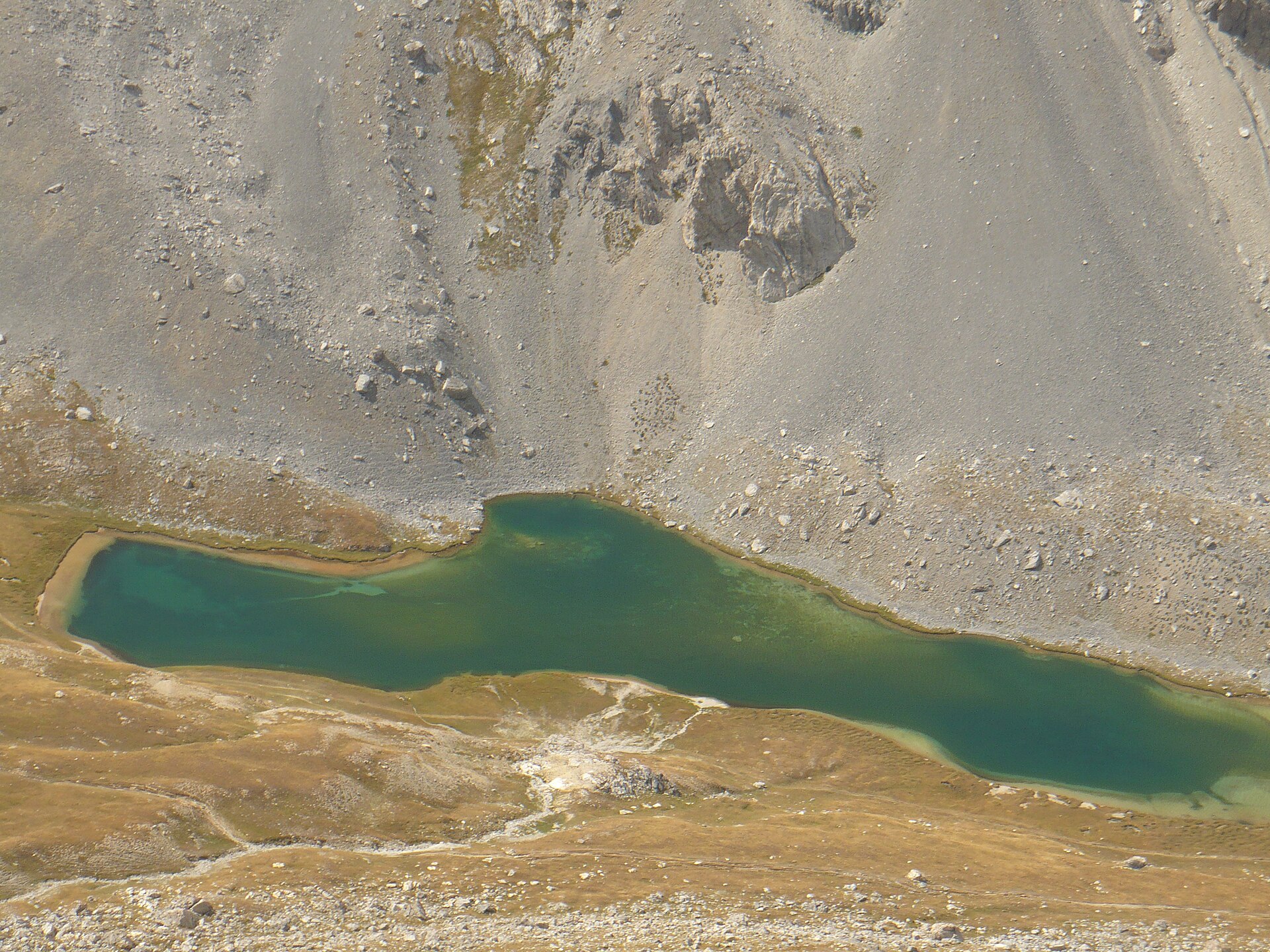
Lac de l'Orrenaye is a glacial mountain lake sitting at roughly 2,411 m above sea level in the commune of Val-d'Oronaye, in the Alpes-de-Haute-Provence department. Its turquoise water fills a high side-valley of the Ubaye valley, just a short distance from the Italian border, near the village of Larche. Where exactly is the lake? Lac de l'Orrenaye lies in a side valley branching off from the Col de Larche (1,991 m), the pass that links the Ubaye valley with the Italian Piedmont. The lake basin is ringed by high summits: Tête de Moïse (3,104 m), La Meyna (3,067 m), Bec du Lièvre (2,770 m) and Cime de Peyrassin (2,757 m). The bedrock here is Triassic quartzite and sandstone, over 200 million years old, which accounts for the jagged, weathered look of the surrounding ridges. The commune of Val-d'Oronaye — formed in 2016 from the merger of Larche and Meyronnes — sits at the doorstep of Mercantour National Park and is one of the communes that signed the park's charter. Lac de l'Orrenaye itself, however, lies in a separate valley east of the Lauzanier valley, where the park's core zone and its own lake, Lac du Lauzanier, are found. How do you get to the lake? The trailhead is a car park along the D900 road, about 4.4 km from Larche and just under a kilometre before the Col de Larche itself, at roughly 1,944 m. From Barcelonnette, the drive covers around 32 km. A wide trail, marked with yellow-and-red waymarks, dips slightly at first through alpine pastures, then climbs the right bank of the Orrenaye torrent. Along the way it passes an old shepherd's hut and crosses a glacial rock step before opening onto the lake. The walk is generally considered family-friendly and does not require mountaineering experience, though — like any outing above 2,000 m — sturdy footwear and attention to changeable weather are worth the effort. What else is there to do beyond the lake? Hikers with more stamina can continue along the lakeshore, beneath the scree slopes of Tête des Blaves, up to the Col de Roburent (2,502 m) — the pass marking the border with Italy. From there, the Italian Lac de Roburent comes into view on the other side of the frontier. This extension adds several hours to the outing and calls for better fitness than the walk to Lac de l'Orrenaye alone. FAQ How high up is Lac de l'Orrenaye? The lake sits at about 2,411–2,412 metres above sea level. Is the lake inside Mercantour National Park? Not in the park's core zone — Lac de l'Orrenaye lies in a separate valley near the Col de Larche. The commune of Val-d'Oronaye is a signatory to the park's charter, but the actual core zone, along with the Lauzanier valley and its own lake, lies further west. Where's the best starting point for the hike? A car park on the D900 road, about 4.4 km from Larche, just before the Col de Larche. Is the trail suitable for families with children? Yes — it's wide, well-marked, and generally rated easy to moderate, though it does climb above 2,000 m. Can the hike be combined with a crossing into Italy? Yes. Continuing past the lake over the Col de Roburent (2,502 m) brings you to the border, with views of the Italian Lac de Roburent just beyond it.
-
Lac des sources
Druyes-les-Belles-Fontaines
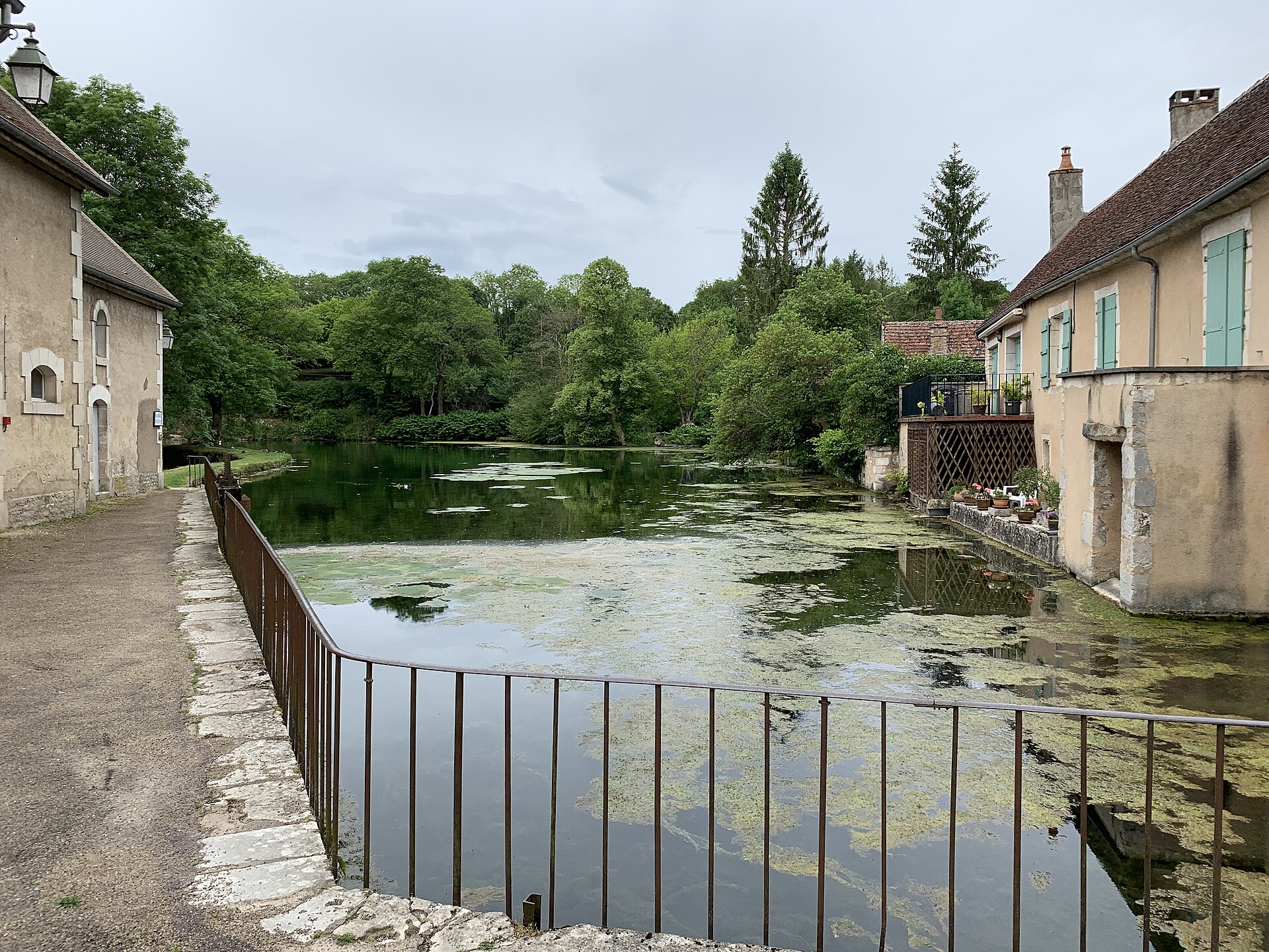
Lac des Sources sits at the heart of Druyes-les-Belles-Fontaines, a small village in the Puisaye-Forterre area of the Yonne department, in Burgundy. Locally called the Bassin des Sources, the pond occupies the former millrace that once powered the village mill on what is now Place Jean Bertin — the mill itself burned down in 1899, but the water basin it left behind became a defining feature of the village. Where does the water come from? The pond is fed by a cluster of springs rising through the limestone bedrock of the Forterre plateau. Rainwater seeps down through the rock and re-emerges at the surface perfectly clear, filling a series of calm, natural pools framed by dense greenery. The same basic process — groundwater filtering through limestone — also produces better-known karst springs such as the Fontaine de Vaucluse or the Fosse Dionne in Tonnerre, though each site differs in scale and setting. What can visitors do at the lake? The Bassin des Sources works as a shared village green rather than a swimming spot: swimming is not permitted. Instead, families come for the children's play area right by the water, the picnic tables scattered around the banks, and a small open-air restaurant, a "guinguette," serving simple local food. Most visitors simply walk the path around the pools and rest in the shade, taking in the sound of running water. Does the lake play a role in local celebrations? It does. The still surface of Lac des Sources acts as a natural mirror during the fireworks display on July 14, France's national holiday. On Christmas Eve, around 600 floating candles are set on the water, turning the pond into one of the village's most photographed sights of the winter season. What else is worth seeing nearby? Druyes-les-Belles-Fontaines was designated a "Site remarquable de l'Yonne" in 1992, and in 2023 it was voted France's fourth-favorite village in a nationwide poll. A 12th-century castle overlooks the village from a hilltop; it once belonged to the counts of Auxerre and Nevers and today welcomes visitors with guided tours and discovery trails aimed at families and school groups. The village preserves four listed historic monuments in total: the castle, a fortified postern gate, the parish church, and an old communal washhouse (lavoir). The Church of Saint-Romain, built in the 13th century, is a Romanesque gem with surviving frescoes and carved stonework. Lac des Sources rounds out a visit that combines natural scenery with a compact slice of medieval Burgundy. How do you get there, and when should you visit? The Bassin des Sources lies along the Chemin du Viaduc, an easy walk from the village center. Spring and summer bring out the lushest greenery around the springs, while the December candlelight display gives winter visitors a reason of their own to stop by. FAQ Can you swim in Lac des Sources? No. Swimming is prohibited; the pond is a scenic and recreational spot rather than a bathing area. Why is it called "des Sources"? Because it is fed by natural springs that surface through the limestone of the Forterre plateau. Is there anywhere to eat near the lake? Yes, a small guinguette-style restaurant operates by the water, alongside picnic tables for visitors who bring their own food. What else should I see in Druyes-les-Belles-Fontaines? The 12th-century castle of the counts of Auxerre and Nevers, the Romanesque Church of Saint-Romain, the fortified postern gate, and the historic village washhouse.
-
Plan d'eau d'Embrun
Embrun
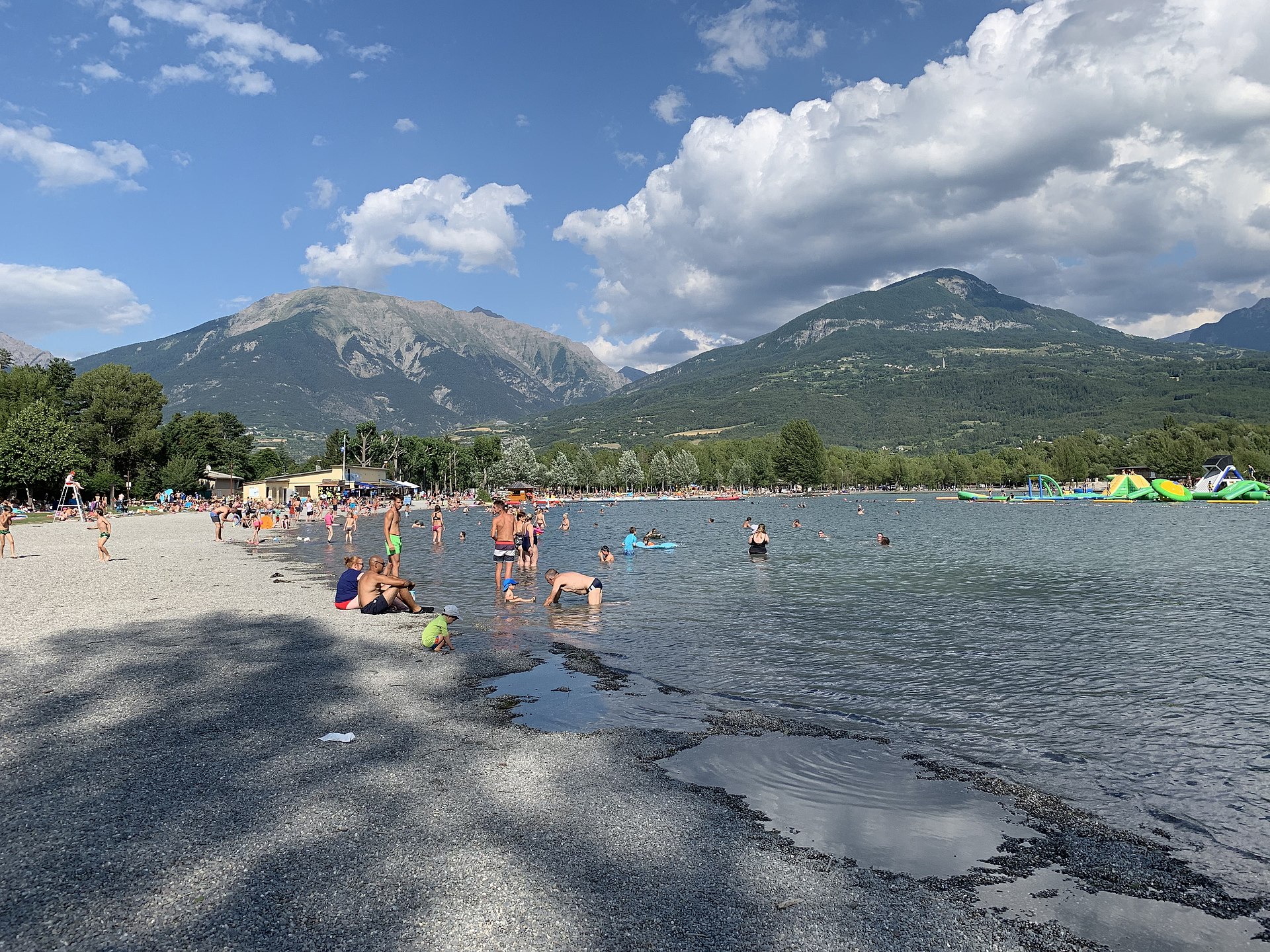
Plan d'eau d'Embrun is a roughly 27-hectare artificial lake sitting right next to the much larger Lac de Serre-Ponçon, in the Hautes-Alpes department of southeastern France. A dike and lakeside promenade separate it from the main reservoir, so the water here stays calmer and, in summer, noticeably warmer than the open lake. It functions as the town of Embrun's main outdoor leisure hub, drawing families, water-sports fans, and anyone looking for a relaxed afternoon by the water. Where is it, and how do you get there? The site sits about 2 km from central Embrun, a hilltop town known for its old quarter and cathedral, perched above the Durance valley. In summer a free shuttle bus links the town center with the lakeside area, so visitors without a car (or those who'd rather skip the parking hunt) can reach the beaches easily. The wider area, Serre-Ponçon, is one of the largest reservoirs in Europe and a hub for lake tourism in the Alps. What is there to do around the water? Three water-sports centers operate on site, renting out sailing dinghies, rowboats, kayaks, and stand-up paddleboards, plus a sailing school for beginners. Pedal boats are available for a slower pace, and a floating water park — said to be the largest of its kind around Serre-Ponçon — gives kids and teens plenty to climb, slide, and jump on. On land, there's a mini-golf course, a small carousel, a children's playground, pétanque courts, and a stocked fishing area. A lit path called "Au Fil de l'Eau," about 2.6 km long, loops around the entire water body and is popular with walkers, joggers, and cyclists at any time of day. Are there supervised beaches? Yes. Grassy, partly shaded beaches line the shore, with lifeguard-supervised swimming areas open through the summer season, along with showers, toilets, and changing cabins. The northern beaches (Plages Nord) have held Blue Flag certification continuously since 2015, a recognized mark of clean water and well-run facilities. Because the site is shielded from the main current of Serre-Ponçon, swimming conditions tend to be gentler here than out on the open lake, which makes it a comfortable pick for families with young children. What else should visitors know? Cafés and restaurants with lakeside terraces line parts of the shore, offering views of the surrounding mountains reflected in the water. The area is open year-round, though the full slate of activities and the lifeguard-supervised beaches operate mainly in summer. Outside the swimming season, the site remains a pleasant spot for a walk or bike ride, with the calm water and alpine backdrop drawing visitors regardless of the month. FAQ Is Plan d'eau d'Embrun the same as Lac de Serre-Ponçon? Not exactly — it's a smaller, separate body of water connected to the main lake but cut off from it by a dike and promenade, which keeps it calmer and warmer. How far is it from Embrun town center? About 2 km. A free shuttle bus runs between the town and the lakeside site during the summer season. Is it safe for swimming with children? Yes. The northern beaches carry Blue Flag certification and have lifeguard supervision in summer, along with showers and changing facilities. What water sports can you do there? Sailing (with lessons for beginners), rowing, kayaking, paddleboarding, pedal boats, and a floating water park. Is it worth visiting outside the swimming season? Yes — the loop path around the water, mini-golf, playground, pétanque courts, and lakeside cafés make it a worthwhile stop even when the beaches aren't staffed.
-
Étang de Barbé
Bonchamp-lès-Laval
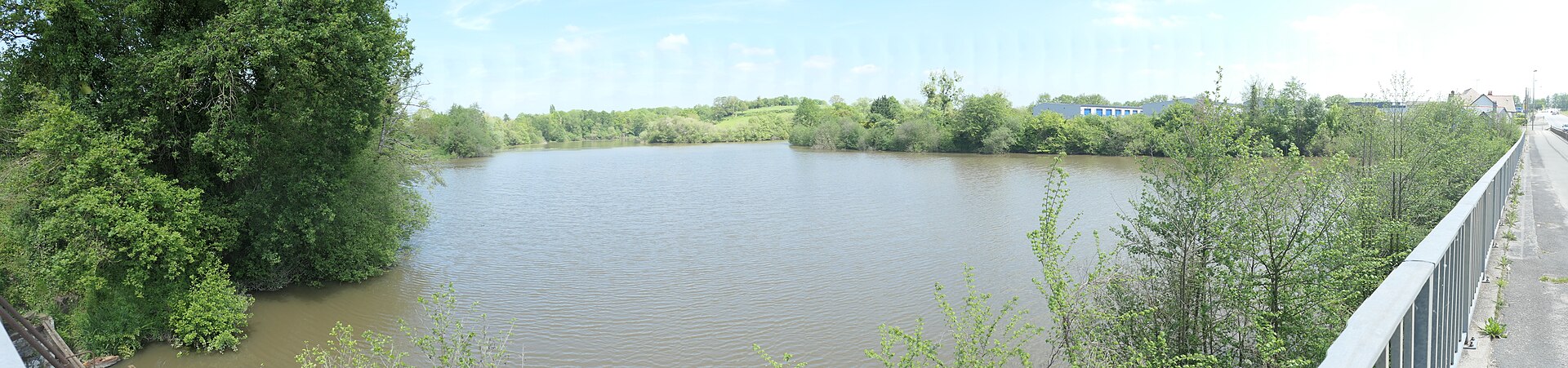
Étang de Barbé is a pond straddling the boundary between Laval and Bonchamp-lès-Laval, in the Mayenne department of the Pays de la Loire region in western France. Formed by damming a small stream, the pond today covers roughly 5 hectares, making it one of the larger stretches of water on the immediate outskirts of Laval. How old is the pond, and who built it? The site has medieval roots. The embankment that holds back the water is generally attributed to the lords of Laval, with construction dated to around 1400. Guy XII de Laval listed the pond among the possessions of his estate in a formal declaration ("aveu") drawn up in 1407, confirming that the water body had already been under seigneurial control for generations. Ownership and fishing rights changed hands repeatedly over the following centuries, and in 1683 a notable lawsuit was fought over who held the right to fish there — a dispute that says a lot about how economically valuable the pond once was to the surrounding community. What is there to do at Étang de Barbé today? The pond is now mainly known among carp anglers. It is managed by the local club Carpe Aventure 53, which maintains six numbered fishing swims along the bank. Parts of the lakebed are muddy, so bank fishing is the standard approach. Anglers mostly target common and mirror carp, both prized for putting up a strong fight once hooked. In summer, catfish can become a nuisance for carp anglers working the swims. Popular bait choices include particle baits (seeds) and boilies, fished both on the bottom and suspended as pop-ups. How do you reach each fishing swim? Access to the fishery is controlled by a locked gate, which keeps casual visitors out and helps preserve quiet conditions for anglers. Swims 1 through 4 can be reached directly by car along the access track. Swim 5 requires carrying gear roughly 20 metres on foot, and it is closed off whenever water lilies spread across that part of the pond. Swim 6 is the most demanding to reach: getting there means a walk of about 150 metres along a gravel path, and a wheelbarrow is the practical way to bring in tackle. Who is this spot for? Étang de Barbé is a modest, low-key body of water rather than a headline tourist attraction — its appeal lies mainly with carp anglers looking for a quiet session close to Laval. Walkers or cyclists passing through the Pays de la Loire countryside may still find the pond and its surroundings a pleasant, peaceful stop, but the fishing community is clearly the group that gets the most out of a visit here. Frequently Asked Questions Where exactly is Étang de Barbé located? The pond sits on the border between the communes of Laval and Bonchamp-lès-Laval, in the Mayenne department of the Pays de la Loire region in western France. How big is the pond? It covers around 5 hectares — different sources put the figure between roughly 4.9 and 5.5 hectares, depending on how the shoreline is measured. Can you fish there? Yes. It is a well-known carp fishery managed by the Carpe Aventure 53 club, with six designated fishing swims along the bank. Is access to the pond open to everyone? The site is closed off by a locked gate, and the individual swims vary in accessibility — some can be reached by car, while others require walking in with your gear.
-
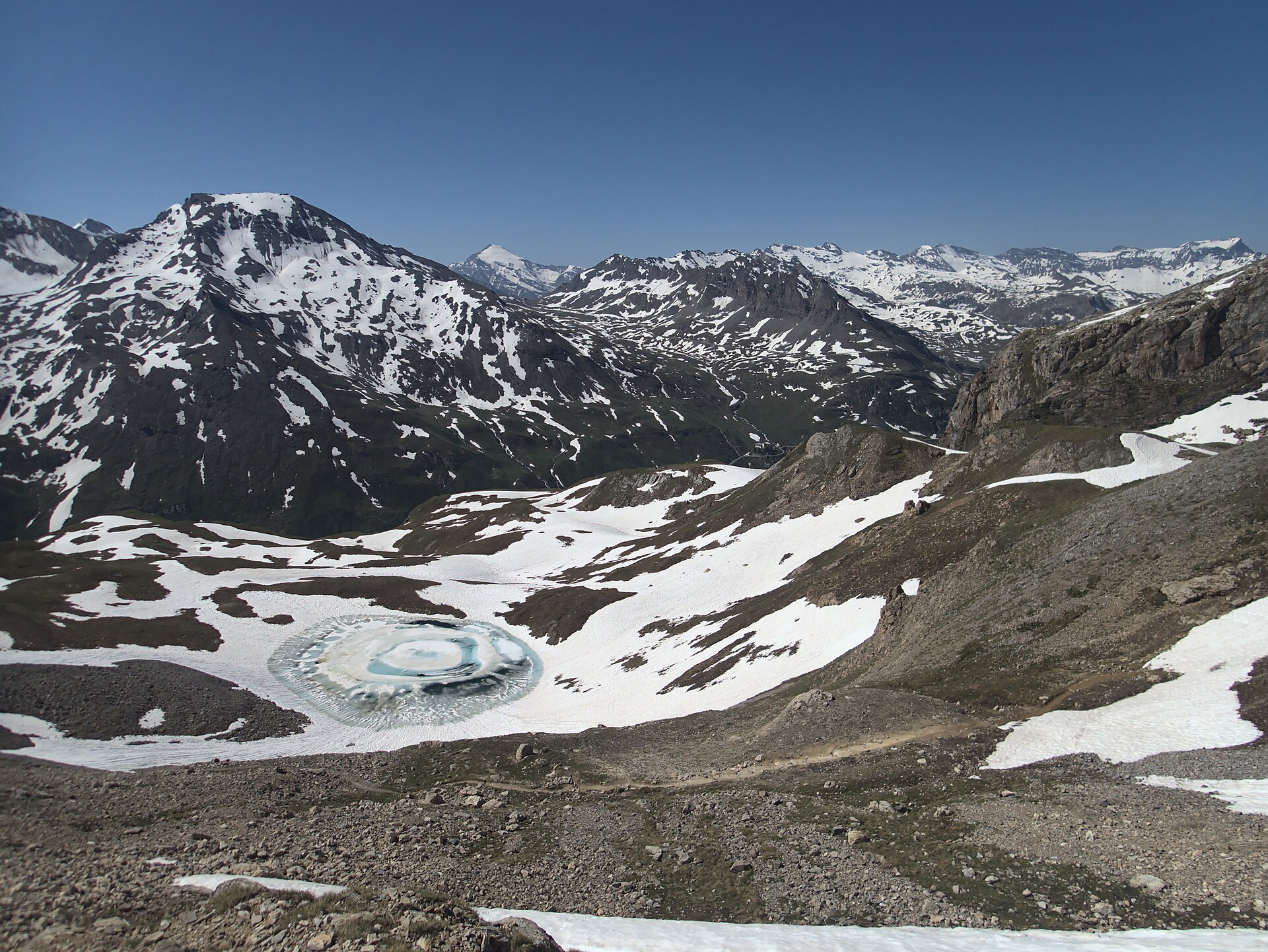
lac de la Bailletta
Val-d'Isère
Lac de la Bailletta is a small high-mountain lake sitting at close to 2,800 m altitude in the commune of Val-d'Isère, Savoie, in the Auvergne-Rhône-Alpes region, right on the doorstep of Vanoise National Park. The lake lies inside the La Bailletaz national nature reserve, a protected area of just under 5 km² spanning altitudes from 2,050 m up to 3,602 m at the summit of Tsanteleina, on the right bank of the Isère valley. Its water carries a striking blue-green tint, cradled in a small glacial cirque surrounded by scree slopes and jagged dolomitic rock. Where exactly is the lake? Bailletta sits high in the Haute-Tarentaise, within the Graian Alps, close to the Col de la Bailletta at 2,852 m. That pass delivers one of the finest viewpoints in the area, opening onto the Grande Casse, Grande Motte and Mont Pourri — some of the defining summits of the Vanoise massif. How do you reach the lake? The most common approach starts from the hamlet of Le Fornet, where a balcony trail climbs steeply straight from the village — a demanding stretch of roughly 4 km gaining about 925 m to the pass. The alternative route begins at the Saut dam: park above Villaret du Nial toward Lac de Tignes, follow the path along the right side of the reservoir rather than the road, head toward the Sassière dam, then climb from there toward the Col de la Bailletta. Along this stretch, once you reach a band of scree, the lake itself comes into view, tucked into a small rocky basin just off the path. What else is there to see along the way? The La Bailletaz reserve is an important refuge for alpine wildlife. Its sun-facing southern slopes serve as a wintering and calving ground for chamois and ibex, and the reserve as a whole is a key feeding area for the bearded vulture, particularly through winter and spring. Information panels near the trailhead cover the local flora and geology — dolomitic rock formations are a defining feature of this stretch of the Graian Alps. Who is this hike suited for? Given the altitude, steep sections and rocky terrain, the walk up to Bailletta and its namesake pass suits hikers with a reasonable level of fitness who are used to mountain trails. Summer and early autumn are the best windows, once the path has cleared of snow — the upper sections can still hold snow well into late spring. FAQ How high up is Lac de la Bailletta? The lake sits at roughly 2,800 m altitude, with the neighboring Col de la Bailletta reaching 2,852 m. Is the lake inside Vanoise National Park? The lake itself lies within the La Bailletaz nature reserve, directly bordering Vanoise National Park, in the commune of Val-d'Isère. What's the best starting point for the hike? The two main options are the steep, shorter approach from Le Fornet, or the longer, gentler route from the Saut dam via the Sassière dam. What wildlife might you see nearby? The area is a refuge for chamois and ibex and an important feeding ground for the bearded vulture, a rare and distinctive raptor most often seen in winter and spring. What's the view like from the Col de la Bailletta? The pass overlooks major Vanoise summits — Grande Casse, Grande Motte and Mont Pourri — along with the upper stretch of the Tarentaise valley.
-
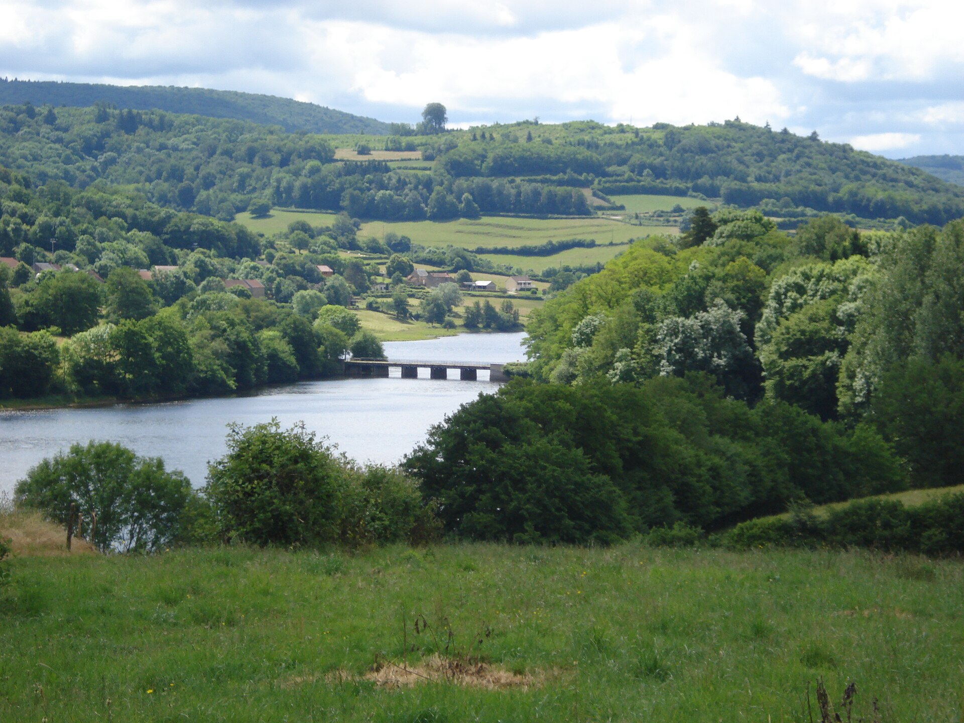
Lac du Crescent
Marigny-l'Église
Lac du Crescent is a reservoir lake sitting on the border of the Nièvre and Yonne departments, right in the heart of the Morvan Regional Nature Park in France. Its name comes from the curved, crescent-like shape of its shoreline. The lake covers roughly 1.65 square kilometres, sits at an elevation of about 300 metres above sea level, and touches the territory of several communes, including Marigny-l'Église. Where exactly is the lake located? Lac du Crescent lies in the Morvan, a hilly and heavily forested area within Burgundy, close to the village of Marigny-l'Église. Its coordinates are approximately 47.3733°N, 3.9103°E. It ranks among the handful of large lakes scattered across the Morvan, a region defined by granite hills, dense woodland and a dense network of small rivers. The lake is fed by the Cure and Chalaux rivers, which wind down from the surrounding hills before reaching the basin. Is it a natural lake or an artificial one? Unlike glacial lakes found elsewhere in France, Lac du Crescent is an artificial reservoir, created by damming river water. Reservoirs of this kind were originally built across the Morvan to regulate water flow and to support log floating, a practice that once formed a significant part of the local economy. Today the lake serves mainly recreational and tourism purposes, though it still plays a role in the broader water management of the area. What can visitors do at the lake? The shoreline is equipped for outdoor leisure. Rest areas with picnic tables and children's play equipment make the spot a practical choice for a family outing, and marked footpaths circle the lake and continue into the surrounding Morvan forests, giving walkers a range of route lengths to choose from. For those who prefer time on the water, canoes, kayaks, stand-up paddleboards, pedal boats and small sailing boats are commonly used on the lake during the warmer months, since motorised traffic is kept minimal. Swimming is also possible in designated areas along the shore. Is the lake good for fishing? Lac du Crescent has a strong reputation among anglers who target predatory fish. Its waters hold healthy populations of pike, perch and pikeperch (zander), and the lake is frequently mentioned as one of the better spots in the Morvan for predator fishing. Anyone wishing to fish needs a valid fishing licence and must follow the local rules that apply specifically to reservoir lakes. How does the lake fit into the Morvan landscape? The Morvan is a hilly, forested area in western Burgundy, characterised by granite bedrock, numerous springs and streams, and a climate that is noticeably cooler and damper than much of central France. The Morvan Regional Nature Park, which covers the area, protects both the natural environment and the traditional pattern of farmland and forest that shapes the region. Lakes such as Lac du Crescent are an integral part of this landscape, combining a practical role in water management with a long-standing function as a place of rest and recreation for both locals and visitors to the Morvan. FAQ How large is Lac du Crescent? The lake covers about 1.65 square kilometres and its shoreline extends across several communes in the Nièvre and Yonne departments. Is Lac du Crescent a natural lake? No, it is an artificial reservoir created by damming the rivers that feed the valley. Can families spend a day at the lake? Yes, picnic areas, children's play equipment and gentle walking paths around the shore make it suitable for a family visit. What fish can be caught there? The reservoir is known for its pike, perch and pikeperch, making it a popular destination for anglers who fish for predatory species. Where exactly is Lac du Crescent located? In the Morvan region of Burgundy, on the border between the Nièvre and Yonne departments, near the commune of Marigny-l'Église.
Earn badges for the places you visit
Download NextOnTrip, discover new places and check off your trails.