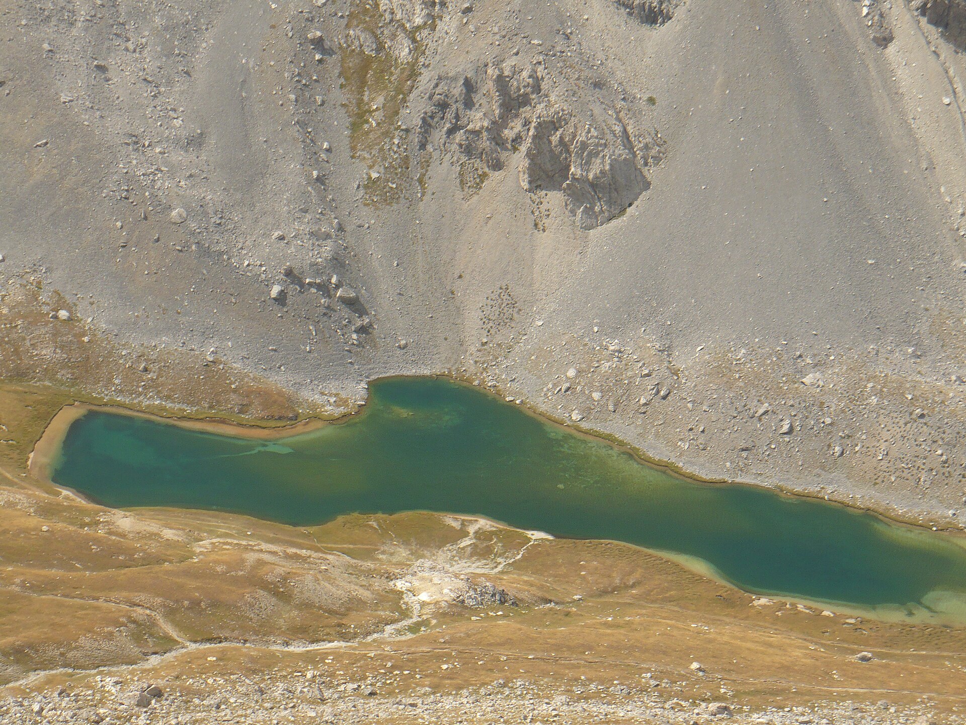
About this place
Lac de l'Orrenaye is a glacial mountain lake sitting at roughly 2,411 m above sea level in the commune of Val-d'Oronaye, in the Alpes-de-Haute-Provence department. Its turquoise water fills a high side-valley of the Ubaye valley, just a short distance from the Italian border, near the village of Larche.
Where exactly is the lake?
Lac de l'Orrenaye lies in a side valley branching off from the Col de Larche (1,991 m), the pass that links the Ubaye valley with the Italian Piedmont. The lake basin is ringed by high summits: Tête de Moïse (3,104 m), La Meyna (3,067 m), Bec du Lièvre (2,770 m) and Cime de Peyrassin (2,757 m). The bedrock here is Triassic quartzite and sandstone, over 200 million years old, which accounts for the jagged, weathered look of the surrounding ridges.
The commune of Val-d'Oronaye — formed in 2016 from the merger of Larche and Meyronnes — sits at the doorstep of Mercantour National Park and is one of the communes that signed the park's charter. Lac de l'Orrenaye itself, however, lies in a separate valley east of the Lauzanier valley, where the park's core zone and its own lake, Lac du Lauzanier, are found.
How do you get to the lake?
The trailhead is a car park along the D900 road, about 4.4 km from Larche and just under a kilometre before the Col de Larche itself, at roughly 1,944 m. From Barcelonnette, the drive covers around 32 km.
A wide trail, marked with yellow-and-red waymarks, dips slightly at first through alpine pastures, then climbs the right bank of the Orrenaye torrent. Along the way it passes an old shepherd's hut and crosses a glacial rock step before opening onto the lake. The walk is generally considered family-friendly and does not require mountaineering experience, though — like any outing above 2,000 m — sturdy footwear and attention to changeable weather are worth the effort.
What else is there to do beyond the lake?
Hikers with more stamina can continue along the lakeshore, beneath the scree slopes of Tête des Blaves, up to the Col de Roburent (2,502 m) — the pass marking the border with Italy. From there, the Italian Lac de Roburent comes into view on the other side of the frontier. This extension adds several hours to the outing and calls for better fitness than the walk to Lac de l'Orrenaye alone.
FAQ
How high up is Lac de l'Orrenaye? The lake sits at about 2,411–2,412 metres above sea level.
Is the lake inside Mercantour National Park? Not in the park's core zone — Lac de l'Orrenaye lies in a separate valley near the Col de Larche. The commune of Val-d'Oronaye is a signatory to the park's charter, but the actual core zone, along with the Lauzanier valley and its own lake, lies further west.
Where's the best starting point for the hike? A car park on the D900 road, about 4.4 km from Larche, just before the Col de Larche.
Is the trail suitable for families with children? Yes — it's wide, well-marked, and generally rated easy to moderate, though it does climb above 2,000 m.
Can the hike be combined with a crossing into Italy? Yes. Continuing past the lake over the Col de Roburent (2,502 m) brings you to the border, with views of the Italian Lac de Roburent just beyond it.
Nearby places

Earn badges for the places you visit
Download NextOnTrip, discover new places and check off your trails.