About this place
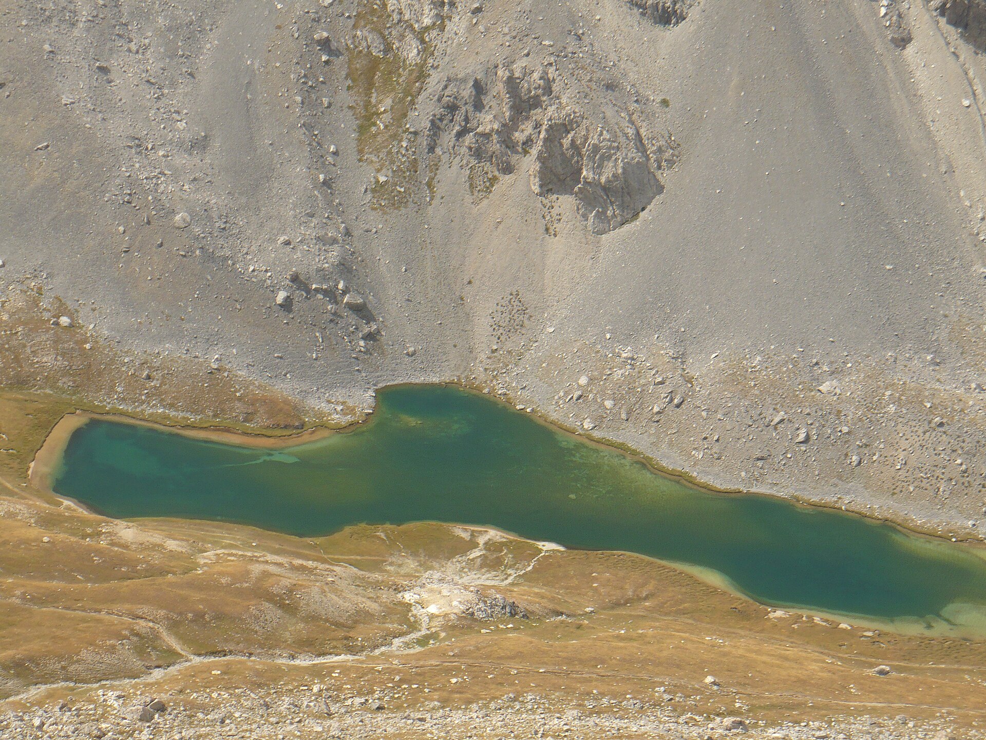
Lac des Neuf Couleurs is a high-altitude lake in the commune of Saint-Paul-sur-Ubaye, in the Ubaye valley (Alpes-de-Haute-Provence), sitting at roughly 2,841 m above sea level in the Chambeyron massif, right on the edge of the Mercantour and the Maritime Alps. It's the kind of destination hikers in this corner of Provence build a whole day around — a stark, rocky basin where the water's shifting colour outshines plenty of better-known alpine lakes.
Where does the hike start?
The classic starting point is the hamlet of Fouillouse, a scenic spot roughly 30 km from Barcelonnette at the end of the valley road. From there the trail climbs a sun-exposed slope, passes the Refuge du Chambeyron — a mountain hut where hikers can rest or restock — and continues by further lakes, including Lac Long, before reaching the destination. The full loop covers about 16–17 km and takes an average walker 5 to 6.5 hours, with roughly 990 m of elevation gain. It's a demanding day out more because of distance and altitude than technical difficulty.
What is there to see at the lake?
The lake earns its name from the play of light on its surface: depending on the hour and the weather, the water shifts from turquoise blue to deep emerald green, a striking contrast against the barren, rocky slopes around it. The basin is ringed by peaks above 3,000 m — the Aiguille de Chambeyron (3,412 m), the highest summit in the Alpes-de-Haute-Provence, along with the Brec de l'Homme (3,211 m), the Tête de la Fréma (3,151 m) and the Pointe des Cirques. The water holds several salmonid species, including brown trout and Arctic char. Just above the neighbouring Lac Long sits a visible rock glacier, and rockfall is a regular occurrence in the area — this is landscape still very much in motion.
Is there any history to find here?
Yes. Fouillouse itself still holds remnants of 1930s military structures built as part of the Maginot Line, including the Fort de Plate Lombarde, a reminder that the Ubaye valley sat on a sensitive border for decades. There's also a small dispute among locals over where the lake's name actually comes from: some mountain guides trace it to nine avalanche corridors feeding the basin, while others in the valley insist it originally referred to nine water flows. No version is settled — which makes it a fun question to ask a local guide on the way up.
When is the best time to go?
Because of the altitude and exposure, snow can linger on the trail into June, and early in the season hikers should expect snow patches below the Pas de la Couletta (2,752 m) and stay alert to avalanche risk. The safest window is mid-summer through early autumn — July, August and the start of September — when the route is fully clear and daylight hours are longest.
Frequently Asked Questions
How high is Lac des Neuf Couleurs? The lake sits at roughly 2,841 m above sea level, in the Chambeyron massif.
Where's the best place to start the hike? Most hikers begin at the hamlet of Fouillouse in Saint-Paul-sur-Ubaye, following a loop of about 16–17 km.
How long does the full route take? Plan for 5 to 6.5 hours of walking and about 990 m of elevation gain — a demanding but technically straightforward day hike.
Is there somewhere to stay overnight along the way? Yes, the Refuge du Chambeyron sits along the route and offers a place to rest or resupply.
Nearby places

Earn badges for the places you visit
Download NextOnTrip, discover new places and check off your trails.