About this place
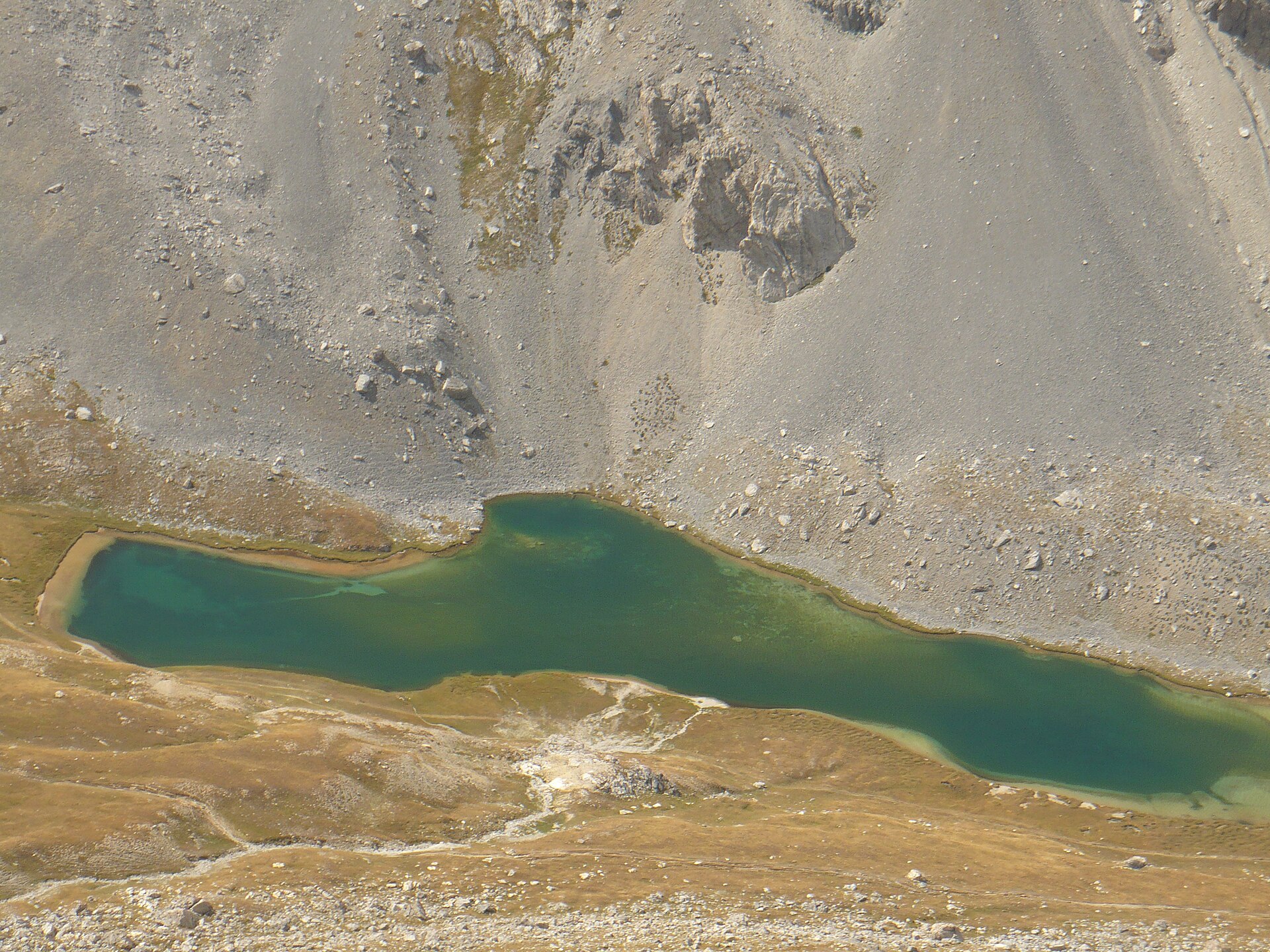
Lac du Lauzanier is a high-altitude lake sitting at roughly 2,284 metres above sea level, within the commune of Val-d'Oronaye in the Alpes-de-Haute-Provence department of south-eastern France. It lies in the upper Ubaye valley, right against the Italian border, inside the boundaries of Mercantour National Park. The setting combines wide-open, gently sloping pastureland with classic high-mountain scenery, which is part of why this particular lake has become a favourite for visitors who want a rewarding alpine view without a technical climb.
Where exactly is the lake?
The lake sits in Val-d'Oronaye, close to the village of Larche and the Col de Larche, the mountain pass that connects this side of the Alps to Italy. Because of that, the whole area has a distinctly cross-border feel: several trails in this part of Mercantour link up with the neighbouring Alpi Marittime park on the Italian side. The valley itself belongs to the wider Ubaye valley system, one of the quieter corners of the French Southern Alps compared to better-known resorts further north.
How do you get there?
Most visitors start from the Pont Rouge car park, a short distance below the lake. Access is by a narrow departmental road running towards Larche and on to Val-d'Oronaye, as far as the point where private vehicles are allowed. During the summer season a shuttle bus service is often put in place along this stretch, reducing private car traffic deeper into the valley and taking hikers close to the trailhead — a common arrangement in sensitive alpine valleys under park protection.
From the car park, the path climbs gradually alongside a small mountain stream, crossing a broad, open valley where sheep graze in the summer months. The route follows waymarked long-distance paths, meaning it forms part of longer treks crossing this section of Mercantour. The stretch leading to the lake itself is considered relatively easy, which makes it accessible even to less experienced walkers and to families with children — one of the main reasons the lake draws steady summer foot traffic.
What is there to see around the lake?
The surroundings are textbook high-alpine terrain: open meadows, rocky slopes and the ridgelines enclosing the valley. Further up the trail, additional small lakes can be reached, giving hikers a natural way to extend the outing beyond Lac du Lauzanier itself. The whole area falls within Mercantour National Park, so the usual park rules apply: no camping outside designated zones, respect for grazing livestock, and care for the wildlife and plant life that make this stretch of the Alps worth protecting.
Who is this hike suited for?
Given the gentle gradient and the fairly short distance from the Pont Rouge car park, the walk to Lac du Lauzanier is often recommended as one of the more approachable outings in this part of Mercantour. No advanced mountaineering experience is required, though as with any walk above 2,000 metres, sturdy footwear, a windproof layer and enough water are worth packing — weather in the Ubaye valley can change quickly, particularly in the afternoon.
FAQ
How high up is Lac du Lauzanier? The lake lies at an altitude of around 2,284 metres.
How do I reach the lake? The usual approach is to drive to the Pont Rouge car park near Larche and Val-d'Oronaye, then continue on foot along the marked trail. A shuttle bus often operates along part of the route in summer.
Is the trail suitable for families? Yes. The section from the Pont Rouge car park to the lake is gentle and popular with families and less experienced hikers.
Are there other natural sights nearby? Yes, further up the valley there are additional lakes and trails continuing deeper into Mercantour National Park, towards the Italian border.
Is the lake inside a national park? Yes, Lac du Lauzanier lies within Mercantour National Park, so standard nature-protection rules apply.
Nearby places

Earn badges for the places you visit
Download NextOnTrip, discover new places and check off your trails.