Monuments in Belgium
A guide to 25 Monuments in Belgium — with descriptions, photos and traveler visits from the NextOnTrip community. Locations spread across 18 cities and towns. Most visited by the community: Castle of Freÿr, Fort van Beieren, Plaine des Loisirs - Lustplein.
-
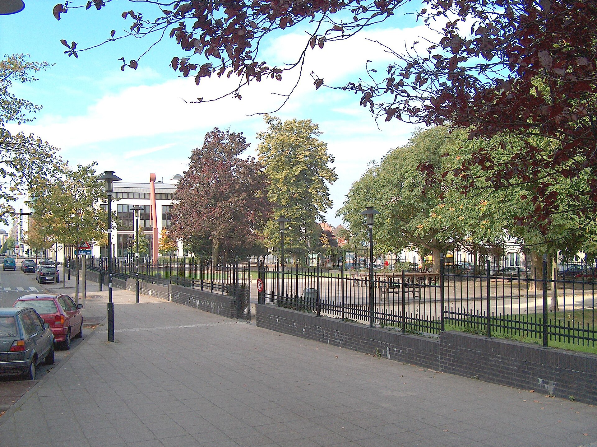
Place de Jamblinne de Meux - de Jamblinne de Meuxplein
Schaerbeek - Schaarbeek
Place de Jamblinne de Meux – de Jamblinne de Meuxplein is a square in Schaerbeek, one of the nineteen municipalities of the Brussels-Capital Region, sitting right on the boundary between the city and the Linthout neighborhood. It functions as a major crossroads: seven streets and avenues converge here — Avenue de Cortenbergh, Rue des Patriotes, Rue du Noyer, Rue de Linthout, and Avenues Eugène Plasky, de l'Opale and de Roodebeek. That convergence turns the square into a hub linking the north-eastern part of the city with the Linthout district, and makes it one of the more recognisable landmarks in this corner of Schaerbeek. Where does the Linthout neighborhood come from? The street plan for the Linthout neighborhood, where the square is located, was drawn up in 1903-1904 by municipal engineer Octave Houssa. It was first approved by royal decree on 24 June 1904, and finally confirmed — together with the plans for three other new Schaerbeek neighborhoods — by royal decree on 21 April 1906. The idea behind developing this north-eastern part of the city actually goes back further still: as early as 1870, a preliminary layout proposal for the area was put forward by Baron Théophile de Jamblinne de Meux, then chief engineer of the City of Brussels. Where does the square's name come from? The square itself was named on 16 May 1905 by decision of the Schaerbeek municipal council, in honour of Baron Théophile de Jamblinne de Meux (1820-1912) — the very engineer whose earlier conceptual work on the layout of the north-eastern district led to the network of streets that still meet on this square today. The naming came almost in parallel with the final approval of the neighborhood's plans, closing the loop in a fitting way: the person behind the original urban concept was commemorated in the very space his ideas had helped shape decades earlier. What used to stand on the square? The square's history is not purely about urban planning. It once held a monument to Philippe Baucq, an architect executed by the Germans in 1915, during the First World War. That monument did not survive, however — it was destroyed in 1940, at the outset of the next conflict to hit Belgium. No trace of it remains on the square today, but the fact that it stood there at all shows the space has long carried symbolic weight beyond its role as a traffic junction. What stands out about the square today? Today, one of the square's most distinctive features is its greenery: it is surrounded by 27 trees classified as remarkable trees. That is a notable number for a square whose primary function is traffic circulation, making Place de Jamblinne de Meux something of a green landmark in this part of Schaerbeek as well. The square sits at coordinates 50.847377, 4.394636, close to Boulevard du Jardin botanique and other major routes connecting central Brussels with its north-eastern districts. Frequently asked questions Where exactly is Place de Jamblinne de Meux located? On the edge of the Linthout neighborhood in the municipality of Schaerbeek, at the junction of seven streets and avenues, in the north-eastern part of the Brussels-Capital Region. Who was the square named after? After Baron Théophile de Jamblinne de Meux (1820-1912), chief engineer of the City of Brussels, who drafted a preliminary layout proposal for this part of the city back in 1870. Are there any monuments on the square? Historically, it held a monument to Philippe Baucq, destroyed in 1940. Today the square is notable mainly for its mature trees — 27 of them classified as remarkable trees. When was the neighborhood around the square developed? The Linthout street plan was approved by royal decrees in 1904 and finally in 1906, while the square itself was named in 1905.
-
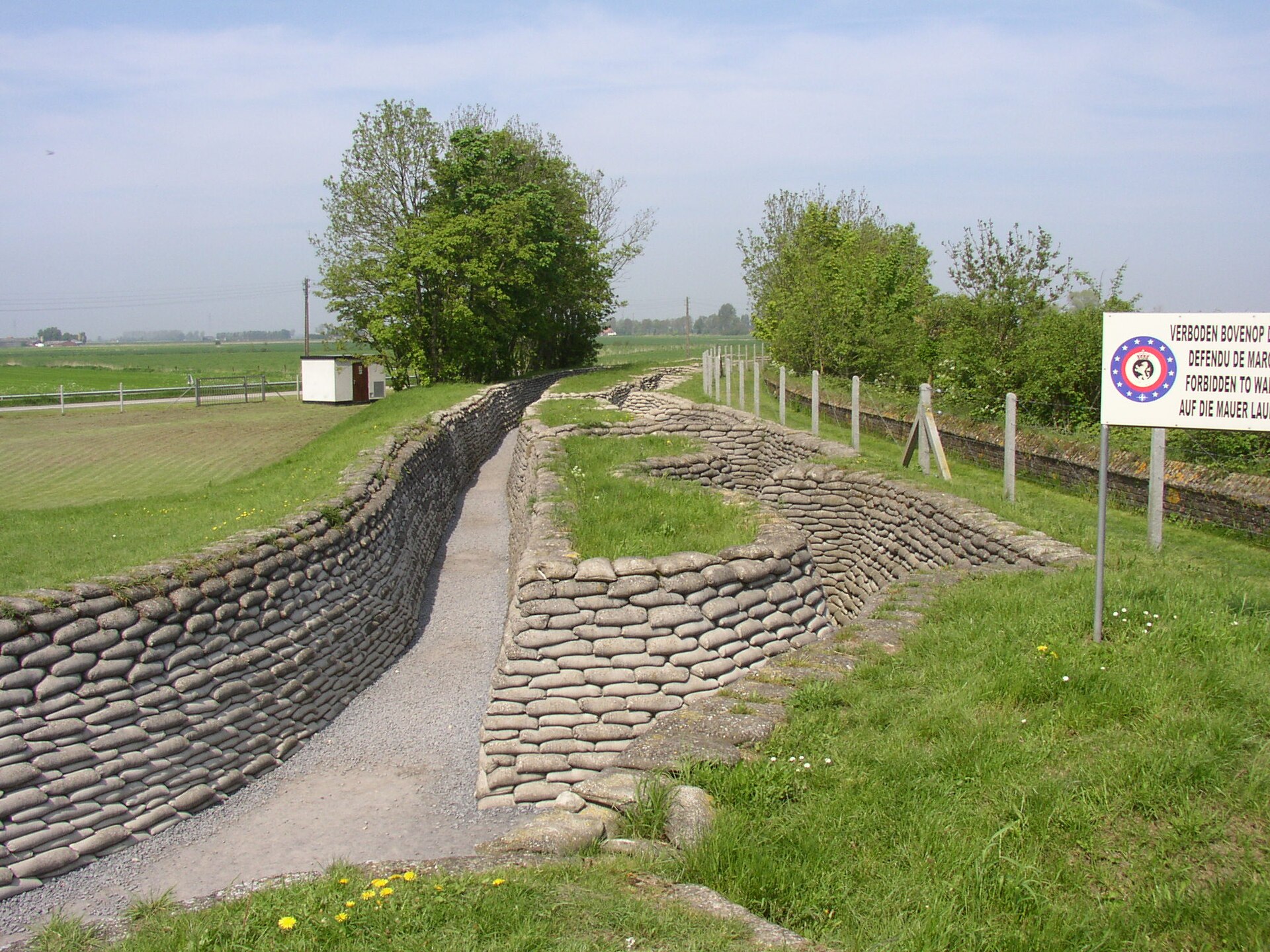
Dodengang
Diksmuide
Dodengang is a preserved section of World War I trenches lying directly on the banks of the Yser Canal near Diksmuide, Belgium. The site sits roughly 1.5 kilometres from the landmark IJzertoren tower in the city centre, making it one of the few well-preserved and publicly accessible stretches of the former front line in this part of Flanders. What is Dodengang? The name Dodengang, meaning "Trench of Death," refers to a system of World War I trenches that ran along the Yser Canal. The front line in this area stabilised after the Battle of the Yser in 1914, when Belgian forces halted the German advance by deliberately flooding the surrounding land. From that point on, the front near Diksmuide remained largely static for the rest of the war, with troops on both sides fighting a static, positional war from trenches strung along the canal. Why does this site matter? Dodengang belongs to a small group of locations along the former Western Front where the original trench layout survived in a form that could later be reconstructed and opened to visitors. Unlike many other stretches of the front, which were levelled after the war for farmland or development, this section of trenches along the Yser retained its character thanks to its position next to the canal and the decision to preserve it as a memorial site. Where exactly is it located? Dodengang is located at coordinates 51.04583°N, 2.84306°E, on the bank of the Yser Canal, a short distance from the centre of Diksmuide. Its proximity to the IJzertoren — Belgium's foremost memorial to the victims of World War I and a symbol of the Flemish movement — means the two sites are often visited together as complementary stops on the same historical trail. What should visitors know before going? Visitors to Dodengang can walk along the preserved stretch of trenches that runs right beside the canal's water — this closeness between the front line and the canal was precisely what shaped the fighting here, conducted along a narrow, elongated strip of land. The site is an important stop for anyone interested in the World War I history of Flanders, and its location right next to Diksmuide and the IJzertoren makes it easy to combine with a day exploring the region's Great War heritage. Frequently asked questions What is Dodengang? It is a preserved section of World War I trenches along the Yser Canal near Diksmuide, reflecting the static, positional fighting that took place along this stretch of the Western Front. How far is it from the IJzertoren? Dodengang lies roughly 1.5 kilometres from the IJzertoren tower in the centre of Diksmuide. Which waterway does the site sit beside? The trenches run directly along the bank of the Yser Canal (Ijzer), which directly shaped how the front line developed in this area. Can Dodengang be combined with other World War I sites? Yes — thanks to its proximity to the IJzertoren and central Diksmuide, it fits naturally into a route focused on the World War I history of West Flanders.
-
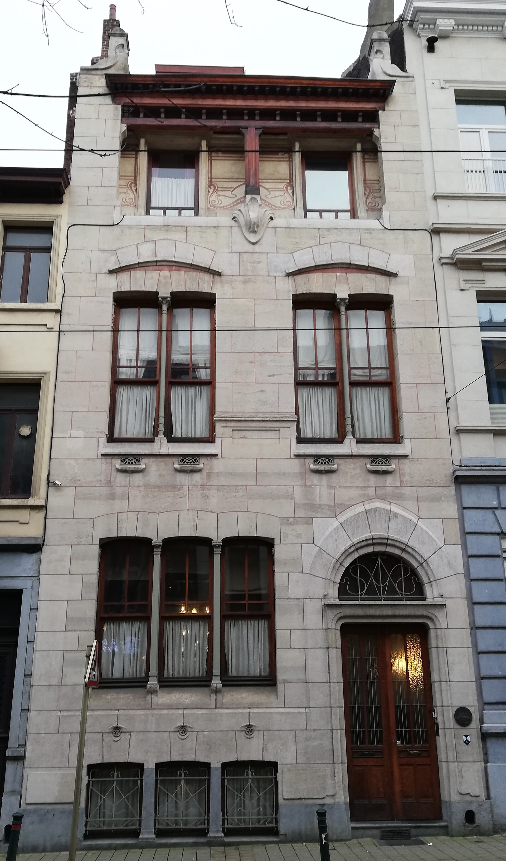
Autrique House
Schaerbeek - Schaarbeek
Autrique House is a historic town house in Brussels, located in the municipality of Schaerbeek, designed by Victor Horta and regarded as the very first building he created in the Art Nouveau style. Completed in 1893, it marks an important step in the evolution of this Belgian architect's career. The house stands at 266, chaussée de Haecht/Haachtsesteenweg, in the heart of Schaerbeek. Why does Autrique House matter in architectural history? Autrique House holds a special place in Victor Horta's body of work as his first design executed in the Art Nouveau idiom. It was here that Horta began moving away from the historicist, traditional architectural patterns of the 19th century toward a new visual language that would go on to define the entire Art Nouveau movement in Brussels. The building dates from 1893, roughly the same period as the more famous Hôtel Tassel, one of Horta's most celebrated works. Despite this close timing, Autrique House does not yet display the same boldness in spatial composition found in Hôtel Tassel. It was, first and foremost, a functional family dwelling, where innovation showed up mainly in detail and formal treatment rather than in a radical rethinking of interior layout. Where exactly is the building located? The town house stands at 266, chaussée de Haecht/Haachtsesteenweg, within the municipality of Schaerbeek, one of the nineteen municipalities that make up the Brussels-Capital Region. Its geographic coordinates are approximately 50.863056, 4.373056. This places Autrique House within the dense, distinctly urban fabric of Schaerbeek, a municipality known for numerous examples of turn-of-the-century architecture. What is Art Nouveau, and why is Brussels so closely tied to it? Art Nouveau is an architectural and decorative style that emerged in Europe in the late 19th century, defined by organic, flowing lines, inspiration drawn from nature, and a break from the rigid, symmetrical forms of classicism. Brussels, together with Victor Horta, played a pioneering role in this movement — some of the world's earliest Art Nouveau buildings were built in this very city. As Horta's first work in this aesthetic, Autrique House captures a transitional moment in the architect's career: a step away from 19th-century academicism toward the distinctive design language he would later refine in landmark buildings such as Hôtel Tassel and Hôtel Solvay. What sets Autrique House apart from Horta's other buildings? The key difference lies in the degree of spatial experimentation. While Hôtel Tassel introduced a revolutionary, open interior layout centered around a striking staircase as its compositional core, Autrique House stays closer to the traditional scheme of an urban town house. Its innovation shows up more in aesthetic and structural detail than in a radical reorganization of interior function. For this reason, the building is often viewed as a kind of missing link — a record of Horta's early exploration, before he fully developed his mature, signature Art Nouveau style. Frequently asked questions Who designed Autrique House? It was designed by Victor Horta, the Belgian architect widely regarded as one of the founders of the Art Nouveau style. When was the building built? Autrique House was built in 1893. Where exactly is it located? At 266, chaussée de Haecht/Haachtsesteenweg, in the municipality of Schaerbeek, Brussels. Is it Horta's first Art Nouveau design? Yes, Autrique House is considered the first house Victor Horta designed in this style. How does it differ from Hôtel Tassel? Autrique House lacks the innovative spatial composition seen in the nearly contemporaneous Hôtel Tassel, even though both buildings were created around the same period of the architect's career.
-
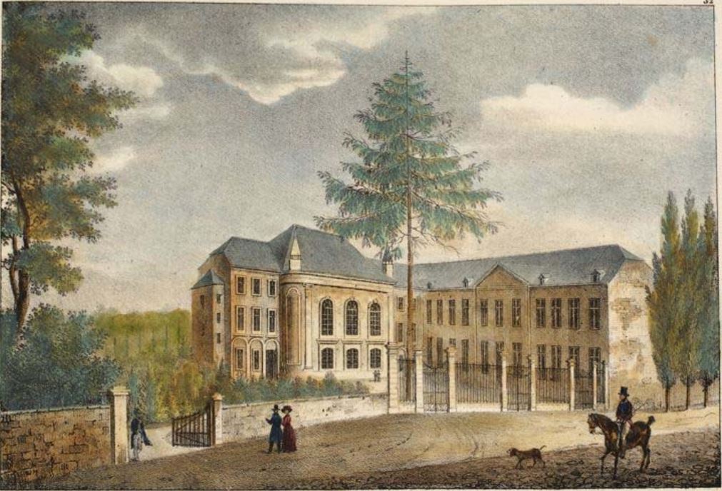
Waux-hall de Spa
Spa
Waux-Hall de Spa is a historic entertainment building in the Belgian spa town of Spa, which once combined a ballroom, a concert hall and a refreshment establishment under one roof. It dates back to the second half of the 18th century, a period when Spa was one of Europe's most fashionable resorts, drawing aristocrats and crowned heads from across the continent. When was the Waux-Hall built? The building opened its doors in 1770. It was constructed in three distinct phases: the front section together with its two lateral wings went up first (1769-1770), followed a year later by the rear section (1771), and finally a corner wing was added at the end of the 1770s (1777-1779). That corner wing was later destroyed and rebuilt between 1966 and 1967, which means the structure standing today is the result of successive restorations rather than an untouched 18th-century original. Who designed the building? The architectural design is credited to Jacques-Barthélemy Renoz, an architect from Liège. The interior decoration was the work of stucco artist Antoine-Pierre Franck and painter Henri Deprez. Their combined efforts produced a striking contrast between the sober brick-and-bluestone exterior and the lavish interior, featuring wall stuccos, painted ceilings, marble fireplaces and mirrors. Why did the Waux-Hall's opening cause controversy? The Waux-Hall was built as a rival to another gaming venue in Spa, the Redoute, considered the first modern casino on the European continent, which had opened in 1763. The Redoute operated under an exclusive privilege granted by the prince-bishop of Liège, so the opening of a competing Waux-Hall in 1770 triggered a dispute between the two establishments. The tension eventually resulted in an agreement between the owners of both venues. The conflict over gaming rights in Spa did not end there. In 1785, a third competing venue, the Levoz salon, opened near the Waux-Hall, reigniting the rivalry. This long-running dispute, known as the "affair of the games of Spa," is cited as one of the causes of the Liège Revolution of 1789 — a local uprising against the prince-bishop's authority that unfolded against the wider backdrop of revolutionary change in late-18th-century Europe. What is the building's status today? The Waux-Hall was listed as a protected monument on 24 July 1936, and in 1993 the Walloon Government added it to the list of exceptional heritage sites. It is regarded as one of the oldest surviving gaming rooms in Europe and one of the few remaining witnesses to Spa's "golden age," when the town was a fashionable meeting place for Europe's elite drawn by its thermal waters. Frequently asked questions Can visitors see the Waux-Hall today? The building survives as a protected heritage site tied to the town's history and cultural life, with local associations involved in efforts to preserve it. How did the Waux-Hall differ from the Redoute? Both venues served a similar purpose — combining gaming, dancing and concerts — but they were built as competing enterprises, which led to years of legal and commercial disputes between their owners. Why does the name echo "Vauxhall"? The name "Waux-Hall" references the famous Vauxhall Gardens in London, an 18th-century pleasure garden that served as a model for similar entertainment venues built in other European towns, including Spa.
-

Castle of Freÿr
Waulsort
Freÿr Castle is one of the most recognizable heritage sites in Wallonia, standing on the left bank of the Meuse River between the towns of Waulsort and Dinant. Together with its surrounding gardens, the residence forms a complex that continues to attract visitors interested in residential architecture and formal garden design from this part of the Namur province. Where exactly is the castle located? The site sits in the Meuse valley, along a stretch of the river known for its striking, rocky banks. Its position between Waulsort and Dinant makes it a natural landmark for anyone travelling along the river, whether on foot, by bike, or by boat. The location's coordinates (approximately 50.226° N, 4.889° E) place it right in the heart of this particularly scenic section of the Meuse valley, one of the most valued landscapes in southern Belgium. What makes the gardens stand out? The gardens accompanying the residence were laid out in the French style associated with André Le Nôtre, the designer whose name is tied to garden compositions typically found around grand, palace-scale residences. This style is defined by strict geometry, symmetry, and sightlines that draw the eye toward the main building. Formal gardens of this kind are uncommon in this part of Belgium, which adds to the site's standing among the region's other historic residences. Why is the castle considered part of Wallonia's heritage? The combination of the residence itself with its well-preserved garden layout is what places this complex among the major heritage landmarks of Wallonia. It's precisely this coexistence of architecture and carefully planned greenery — rarely found together in such a coherent form — that gives the site its distinctive status among the historic properties of the Namur region. What should visitors know before planning a trip? Because of its position in the Meuse valley, the area around the castle is popular with travellers who like to combine sightseeing with outdoor activity — riverside walks or cycling routes between Waulsort and Dinant. The proximity of Dinant, one of the region's larger tourist hubs, makes it easy to plan a longer itinerary that includes both the castle and the surrounding attractions of the valley. Frequently asked questions Where is Freÿr Castle located? On the left bank of the Meuse River, between the towns of Waulsort and Dinant, in the province of Namur, Wallonia. What is the site's defining feature? The combination of a historic residence with gardens designed in the Le Nôtre style, making the complex one of the major heritage landmarks of Wallonia. Are there other attractions nearby? Yes — the proximity of Dinant and the scenic Meuse valley make it easy to combine a visit to the castle with other sights along the river. Who would find this place interesting? Anyone interested in residential architecture, the history of garden design, or the landscape of the Meuse valley.
-
Fort van Beieren
Koolkerke
Fort van Beieren is Flanders' best-preserved fortress from the War of the Spanish Succession, tucked inside a 26-hectare wooded provincial domain between the village of Koolkerke and the Damse Vaart canal, right on the edge of Bruges. Why was this fort built? French troops raised the fort in 1703, during a conflict that pitted France against Austria, England and the Northern Netherlands over the succession to the childless Spanish king Charles II. Its job was to shield Bruges from an attack coming from the north. The design followed French military fortification principles of the era: four bastions, double earthen ramparts, moats and a ravelin. At its peak the fort housed five French battalions. Did the fort ever see combat? No. Despite its solid defensive layout, Fort van Beieren was never actually attacked. It lost its military purpose after 1706, and the last soldiers left in 1748. It briefly returned to use during World War II, when German occupying forces stationed themselves there. A small castle that once stood nearby, privately owned through the 19th and 20th centuries, was so badly damaged during the war that it had to be demolished. How did the fort end up as a nature reserve? The Province of West Flanders purchased the site in 1998, and it has been open to walkers ever since. Today it's a much-loved nature area: the old defensive ditches have become picturesque ponds, the ramparts are covered in forest and shrubland, and the grounds support many bird species along with small mammals and insects. Inside the reconstructed bastion, the province has built a natural playground with five viewpoints, each looking out in a different direction. What can visitors do there? The main entrance runs along the Kasteeldreef, leading straight into the forest, with the first path on the right taking you deeper into the domain. Visitors can also enter from the Noorweegse Kaai, following the Damse Vaart canal. A new 3-kilometer walking path now connects the Fort van Beieren domain with the area along the Damse Vaart, making it possible to combine a walk across both provincial nature sites. The province regularly organizes guided tours and events highlighting both the site's nature and its rich military history. Frequently asked questions Where exactly is Fort van Beieren located? In Koolkerke, a sub-municipality of Bruges, between the village and the Damse Vaart canal. Is entry to the fort free? Yes, the domain is open to walkers free of charge as a provincial nature area. Can visitors still see the original fortifications? Yes — the layout of four bastions, double ramparts and moats is still visible on the ground, though now covered in vegetation. Is it a good destination for families with children? Yes, the bastion houses a natural playground with viewpoints, and the walking trails are easy and accessible.
-
Plaine des Loisirs - Lustplein
Anderlecht
Plaine des Loisirs – Lustplein is a modest but historically meaningful square in the municipality of Anderlecht, part of the Brussels-Capital Region. The square carries two official names — French "Plaine des Loisirs" (literally "leisure ground") and Dutch "Lustplein" (literally "pleasure square") — a reflection of Belgium's bilingual capital, where French and Dutch hold equal official status. Where exactly is this square located? The square sits at the heart of La Roue (Dutch: Het Rad), one of Anderlecht's distinctive garden-city neighbourhoods, whose houses were mostly built during the 1920s. Its geographic coordinates are 50.821541 N, 4.299002 E. The La Roue district is valued today for its coherent, small-scale character — modest, picturesque single-family houses that together offer a vivid picture of an early 20th-century working-class neighbourhood, designed around the garden-city ideal of combining housing with green, communal space. What role has this square played in the neighbourhood's history? Lustplein/Plaine des Loisirs holds a special place in the story of La Roue: it was the very first public space laid out during the first construction phase of the garden city, back in 1921. That means the square came into being almost simultaneously with the district's earliest houses, and it has served as a central gathering point ever since. Over the following decades, the space was gradually enriched with facilities aimed at serving the local community — a primary school was built right next to the square in 1938, and a playground for children was added to the grounds at a later stage. What does the square look like today? The layout of Lustplein centers on an open, central clearing, flanked on its sides by long rows of trees. This composition — a green, empty core framed by tree lines — gives the square a calm, intimate recreational character, quite different from the busier commercial or transit squares found in central Brussels. The trees act as a natural buffer separating the open core of the square from the surrounding residential buildings, which makes it especially well suited to quiet rest and neighbourly interaction. What purpose does the square serve for residents? For nearly a century now, Lustplein has remained an important meeting point and a venue for the local community's various activities. The presence of a primary school right nearby naturally ties the square into the daily rhythm of families with children living in La Roue, while the playground makes it a particularly attractive spot for the youngest residents. At the same time, the square's open layout allows for larger neighbourhood gatherings and events, making it something of a true heart for this part of Anderlecht. Frequently asked questions Is Lustplein a large square? Plaine des Loisirs – Lustplein occupies a relatively small area, matching the intimate scale of the La Roue garden-city district in which it sits. How do you get there? The square is located in the municipality of Anderlecht, within the La Roue district, in an easily reachable part of the Brussels-Capital Region. What else is worth seeing nearby? The square is directly surrounded by the 1920s housing of La Roue — modest, picturesque single-family homes built in the garden-city spirit — as well as the nearby primary school dating from 1938. Is there a playground for children? Yes, a playground was added to the square's grounds in the years following its original creation in 1921. Why does the square have two names? This reflects Brussels' official bilingualism — the French "Plaine des Loisirs" and the Dutch "Lustplein" are two equally valid names for the same place, used by the region's French- and Dutch-speaking residents respectively.
-
Impasse des Escargots - Slakkengang
Bruksela
Impasse des Escargots – Slakkengang was once a narrow alley in the Marolles district of Brussels, one of the city's oldest and most distinctive working-class neighborhoods. Its entrance sat between numbers 156 and 160 on Rue Blaes, the district's main thoroughfare, from where it slipped inward between the surrounding buildings in the tight, hidden way typical of Marolles' internal courtyards and passages. Where the name comes from The French name translates literally as "Snails' Dead End," while the Dutch versions, "Slakkengang" and "Sleeck straetje," carry the same image: a narrow, twisting passage that could only be walked slowly, almost at a snail's pace. Names like this were common in Marolles — cramped alleys and courtyard passages were often labeled after their physical character rather than after any person or historic event. Life behind the façades Marolles has long been the neighborhood where Brussels' poorest residents and newcomers to the city settled. Its proximity to the Jeu de Balle market — one of Europe's oldest flea markets, still held daily on the nearby square — drew street vendors, small tradespeople, and craftsmen who built their homes in exactly these kinds of hidden alleys. Tucked away from the main streets, such passages allowed as many families as possible to be packed into the smallest possible footprint. Impasse des Escargots itself consisted of 15 small houses that, at their most crowded, held as many as 391 residents. That figure is striking by modern standards — it points to a population density almost unimaginable in a contemporary city, while also illustrating the everyday reality of Brussels' 19th- and early 20th-century working-class quarters. Cramped rooms, poor ventilation, and inadequate sanitation were the norm for the people who lived there. The end of the alley and its new life In 1976, the city demolished Impasse des Escargots on public health grounds, judging that the housing conditions in this type of dense, informal construction could no longer be maintained. It was a fate shared by many similar impasses across Marolles, most of which disappeared from the city map over the course of the 20th century amid successive waves of urban modernization and slum clearance. After demolition, the site was converted into a children's playground for the surrounding neighborhood — a use that, in its own way, continues the alley's communal, neighborly character, though today it serves the district's youngest residents rather than generations of families crowded into tiny houses. A trace in local culture Even though the alley itself has been gone for decades, its name and history live on in local cultural memory. Impasse des Escargots is still referenced in Brussels theatre performed in "Brusseleer," the Marollien dialect that blends French and Flemish influences and is closely tied to the district's identity. It's a reminder that although the buildings vanished long ago, the alley's name still carries weight as part of what makes Marolles Marolles. Frequently asked questions Can you still visit Impasse des Escargots today? No — the original buildings were demolished in 1976. A children's playground now occupies the site. Why was the alley torn down? The official reason was public health: the cramped, densely populated housing no longer met acceptable living standards. What's worth seeing nearby? Rue Blaes and the neighboring Jeu de Balle square, home to a daily flea market, are the best starting points for exploring the history and atmosphere of the Marolles district.
-
Hill 62 Memorial
Ypres
Hill 62 Memorial is a Canadian war memorial near Ypres, honouring the actions of the Canadian Corps in the defence of the southern stretches of the Ypres Salient in 1916. What does this memorial commemorate? The memorial marks the fighting carried out by Canadian divisions between April and August 1916. During this period several engagements took place in the immediate vicinity of Ypres, including the battles at the St Eloi Craters, at Hill 62 itself, at Mount Sorrel, and at Sanctuary Wood. All of these locations sat on a stretch of elevated ground south of Ypres, and control of that high ground determined who held the observational advantage over the surrounding area. Why did these battles matter? The fighting around Hill 62 holds a particular place in the history of Canada's involvement in the First World War: it was the first occasion on which Canadian divisions carried out planned offensive operations during the conflict. Before this, their engagements had largely been defensive or reactive in nature. The battles for Mount Sorrel and the neighbouring high ground therefore marked a shift toward a more active Canadian role on the Western Front. What was achieved? As a result of these actions, the Canadians reconquered strategically important high-ground positions that had been held by German forces. This had a direct tactical consequence: holding the hills to the south and east of Ypres denied the Germans a commanding view over the town itself and over the movements of Allied troops in the surrounding area. Recapturing this elevated ground limited the German ability to direct effective artillery fire based on direct observation of the battlefield. Where exactly is it located? The memorial stands on the site of the former battlefield, in the immediate vicinity of locations such as Sanctuary Wood and Hill 62, southeast of the centre of Ypres. Its coordinates place it at roughly 50.835°N, 2.947°E, right in the heart of the former Ypres Salient — an area that remained one of the bloodiest sections of the Western Front throughout the war. Frequently asked questions What period does the memorial commemorate? Events from April to August 1916. Which specific battles are commemorated? The fighting at the St Eloi Craters, at Hill 62, at Mount Sorrel, and at Sanctuary Wood. What made these actions stand out among other Canadian operations of this period of the war? They were the first planned offensive operations carried out by Canadian divisions during the First World War — their earlier role on the front had been different in nature. What was the practical significance of recapturing this ground? Controlling the high ground denied the Germans a favourable observation point over Ypres, limiting their tactical advantage in this part of the Salient. Who exactly does this memorial honour? The actions of the Canadian Corps in defending the southern stretches of the Ypres Salient in 1916 — the memorial is also known as the Canadian Hill 62 Memorial.
-
Begijnenvest
Brugge
Begijnenvest in Bruges Begijnenvest is a scenic street in Bruges that traces the line of the city's former second medieval moat, running right past the famous Beguinage (Begijnhof). Rather than a single stand-alone sight, it works as a walking route linking several of the city's most photogenic corners — a good choice for a quiet stroll away from the crowds of the historic centre. Where does the name come from? The street takes its name directly from the neighbouring Beguinage, whose origins go back to 1244, when the surrounding city fortifications were first built. The name "Begijnenvest" (once spelled "Bagieneveste" in local dialect) came into common use and was officially adopted around 1830, once the old defensive rampart had been turned into a public promenade. What is the route like? Begijnenvest stretches from the Begijnhof and Wijngaardplein square, along the Minnewater lake, up to the Minnewater bridge and the Poertoren tower, where it turns and continues towards Boeveriestraat. This stretch of the old city fortifications has kept its green, walkable character to this day. What can you see along the way? Walking Begijnenvest offers a look at several historic pieces of the city's built heritage. The bridge over the Minnewater, admired by visitors today, dates back to 1311, when a first wooden structure stood on the site. The current stone bridge was built in 1739, designed by Bruges architect-sculptor H. Pulinx Sr. Close by stands the Poertoren, a 14th-century defensive tower and one of the few surviving fragments of the old city walls. How has the area changed over time? For centuries, the land between the Beguinage and the fortification line served practical purposes — used as bleaching fields for linen and as vegetable gardens for the nearby community. Only in the second half of the 19th century was the area built up, with the construction of a new hospital, the Minnewater clinic. At that point the entire Begijnenvest stretch was walled off on the hospital side, and the old moat itself was transformed into a broad, tree-lined walking path — the form in which it survives today. Frequently asked questions Is Begijnenvest a specific attraction or just a street? It's a street — more precisely, a former stretch of the city fortifications, now a tree-lined promenade running alongside the water. How long does it take to walk Begijnenvest? The full stretch, from the Beguinage to Boeveriestraat, takes about 15–20 minutes at an easy pace, with time to pause at the bridge and the tower. What's nearby? The closest landmarks are the Beguinage (Begijnhof) and the Minnewater lake, popular with visitors for its swans and romantic scenery, along with the historic Poertoren tower. Is it worth combining with other sights? Yes — the route naturally connects a visit to the Beguinage with a walk along the Minnewater, forming a calm, self-contained loop away from Bruges' main tourist trails.
-
Yorkshire Trench & Dug-Out
Ypres
Yorkshire Trench & Dug-Out is a reconstructed section of First World War British trenches located in Boezinge, just north of Ypres, in the area historically known as the Ypres Salient. Sitting at the edge of the town, it is one of the few surviving trench systems that visitors can actually walk through rather than only see in archival photographs. How was the site discovered? The story behind the site is almost as remarkable as the trench itself. In 1992, a farmer working a field near Bargiestraat stumbled upon the entrance to a British underground dugout. The find drew the attention of a group of amateur archaeologists known as "The Diggers," led by Patrick Van Wanzeele. Between 1998 and 2000, the group carried out extensive excavation work, uncovering not just the trench line but also tunnelled dugouts beneath it. What lies beneath the surface? The excavations revealed two overlapping trench lines from different periods of the war. The shallower one dated to 1915 and was dug in the aftermath of the fighting that followed the first-ever poison gas attack, launched by German forces on 22 April 1915. This section of the front line was initially held by French troops before passing into British hands on 5 June 1915. The second, far better preserved line dates from 1917 and served as a headquarters position for the 13th and 16th Battalions of the Royal Welsh Fusiliers during the Third Battle of Ypres. The position was abandoned once the first phase of that major British offensive had concluded. During the dig, "The Diggers" recovered the remains of 155 First World War soldiers — British, French and German — killed in action and left unrecovered for seventy years. Alongside the human remains, the team uncovered a wide range of artefacts, personal effects and equipment that today offer a tangible link to the daily reality of trench warfare. What can visitors see today? In August 2002, "The Diggers" restored roughly 70 metres of trench together with the entrances to the underground dugouts. Much of the reconstruction reused the original wooden A-frames that once supported the trench walls, while the walkways and thousands of sandbags were newly added, following the historical layout as closely as possible. Walking through the narrow, deep passages gives visitors a direct sense of the cramped and difficult conditions soldiers endured on the Western Front. The site is open daily from sunrise to sunset, and admission is free. There is no ticket office or gift shop here — it remains a raw, unadorned memorial site, free of the commercial trappings found at some of the region's larger battlefield attractions. Frequently asked questions Is there an entrance fee? No, visiting Yorkshire Trench & Dug-Out is completely free of charge. How long does a visit take? Given the compact size of the site (about 70 metres of reconstructed trench), a visit typically takes 20 to 30 minutes. Is the site open all year round? Yes, the trench is accessible daily, from sunrise to sunset, throughout the year. Is this site suitable for children? Because of its historical and memorial nature — including the recovery of soldiers' remains on site — it's worth preparing children for a serious and reflective visit.
-
Domein Coloma
Sint-Pieters-Leeuw
Coloma Domain is a sixteenth-century castle-and-park estate in Sint-Pieters-Leeuw, in Flemish Brabant, combining a historic château, a fifteen-hectare landscaped park and a celebrated rose garden. Where does the castle's name come from? The original building went up around 1515 as a square structure with corner towers, a pear-shaped roof and a surrounding moat — a typical example of the shift from a fortified medieval castle to a country residence for wealthy Brussels families. The name "Coloma" comes from the de Coloma family, a Catalan lineage that settled in the Low Countries in 1577. In 1678 the estate passed to Jan Karel Roose, and around 1750 it came into the hands of the Coloma family, specifically through the marriage of Charles-Vital de Coloma to baroness Eugenia Roose, which led to the building's transformation into an elegant residence. Over the course of the eighteenth century the castle took on the form it largely retains today. Who lived there, and how did it become municipal property? The estate stayed in the Coloma family until the death of countess Antoinette, granddaughter of Jean-Marie van der Dilft de Borghvliet, in 1947. After that the château fell into disrepair until the municipality of Sint-Pieters-Leeuw purchased it in 1984. Following a thorough restoration, the building was turned into the town's cultural centre, which now hosts exhibitions and community events. What does the surrounding park look like? Coloma Park covers around 15 hectares and was originally laid out in the French style, with avenue structures, rectangular ponds and geometric green compositions. Over time this formal layout gave way to a looser, more naturalistic English-style design. That contrast between two garden traditions, arranged around a single residence, is part of what makes a walk through the park distinctive. What is the domain's main attraction? The centrepiece of a visit is the rose garden at the heart of Sint-Pieters-Leeuw, where more than 3,000 rose varieties from several continents bloom every year. It is considered one of the largest rose gardens in Europe, an idea that was conceived in the 1990s. The combination of a historic castle, an expansive landscaped park and a richly varied rose garden makes Coloma Domain one of the more significant recreational and cultural destinations in the Flemish Brabant region. Frequently asked questions Can visitors go inside the castle? Yes, the building now serves as the municipal cultural centre and hosts exhibitions and events open to the public. When is the best time to see the rose garden? The main flowering display peaks in summer, when thousands of rose varieties from around the world are on show. Is entry to the park free? The park and the green grounds around the castle function as an open public space, popular with residents and visitors exploring the area around Brussels.
-
Place de la Liberté - Vrijheidsplein
Bruksela
Place de la Liberté (Vrijheidsplein) is a compact yet dignified square in central Brussels, forming the heart of what is now known as the Quartier des Libertés, once called Notre-Dame-aux-Neiges. Its bilingual name — French "Place de la Liberté" and Dutch "Vrijheidsplein" — reflects the everyday bilingual reality of the Belgian capital, where both languages hold official status. How did this square come to be? The square dates back to the 1870s, created as part of a sweeping redevelopment of the old Notre-Dame-aux-Neiges neighborhood. Before the transformation, the area was a densely built, poor and rundown quarter of narrow streets and alleys, home to working-class residents. City authorities chose to demolish it and replace it with orderly new construction aimed at wealthier inhabitants — a classic 19th-century case of gentrification that displaced thousands of former residents. The urban layout of the new district, including the square itself, was designed by architect Antoine Mennessier in 1874. The elegant townhouses lining the square, built in an eclectic style drawing on Renaissance influences, were designed by architect Wynand Janssens. Together, their work produced a coherent, harmonious space where 19th-century buildings form an enclosed, intimate composition around a central focal point. Who is honored at the square's center? At the heart of the square stands a monument to Charles Rogier (1800–1885), a Belgian statesman and liberal political figure who played a decisive role in the founding of the independent Belgian state in 1830. Rogier was among the key figures of Belgium's 19th-century political life and is remembered as one of the architects of the modern nation. The monument in his honor was unveiled in 1897, underscoring the square's significance in both the history of the city and the country. Why is it worth a visit? Today, Place de la Liberté remains a lively gathering spot for residents of the surrounding neighborhood. The eclectic townhouses that frame it, along with the square itself, are protected as part of Brussels' architectural heritage. As a result, the square has retained its 19th-century character — a regular layout, uniform building heights, and richly decorated facades — despite more than a century and a half having passed since its creation. Located close to central Brussels, the square is an easy addition to a walking route through the city's lesser-known but architecturally rewarding corners. It offers a chance to experience 19th-century urban planning up close, away from the crowds that gather at Brussels' more famous landmarks. Frequently asked questions What is the square called in Dutch? Vrijheidsplein — a direct translation of the French name Place de la Liberté, meaning "Freedom Square." When was the square built? It was designed in 1874 as part of the redevelopment of the Notre-Dame-aux-Neiges district, with the monument to Charles Rogier at its center unveiled in 1897. Who was Charles Rogier? A Belgian statesman and liberal politician, regarded as one of the key figures behind the creation of the independent Belgian state in 1830. Are the buildings around the square protected heritage sites? Yes, the eclectic townhouses surrounding the square, as well as the square itself, are protected as part of Brussels' architectural heritage.
-
Square Groupe G
Bruksela
Square Groupe G is a small square in Brussels commemorating one of the most effective resistance organizations active in occupied Belgium during the Second World War. Located right next to the Université Libre de Bruxelles (ULB), it has served for decades as a place of remembrance for students and residents interested in Belgium's wartime sabotage history. Who was Groupe G? Groupe G, the General Sabotage Group, was founded in 1942 by former Université Libre de Bruxelles students Andre Wendelen and Jean Burgers. The organization's name came from Burgers's wartime codename, "Gaby." Unlike many resistance cells that operated locally, Groupe G worked across the whole of Belgium, and its ranks were filled overwhelmingly by university students. Between 1942 and September 1944, more than four thousand people passed through the organization. Why is it considered so effective? Groupe G specialized in sabotaging German railway and power infrastructure. Its most spectacular operation was the so-called "Grande coupure" of January 1944, when members sabotaged 28 high-voltage pylons supplying numerous German-run industrial plants across the country. The coordinated strike on the power network cost German forces an estimated ten million man-hours of repairs before communications and production were restored to pre-attack levels. Historians regard Groupe G as one of the most effective resistance organizations in occupied Belgium — its actions were scientifically planned, with an explicit effort to minimize the risk of reprisals against the civilian population. Where did the memorial square come from? The square was created as an expression of gratitude from the ULB academic community toward the organization's fallen members. A temporary wooden monument was unveiled on 17 November 1994, marking the fiftieth anniversary of Belgium's liberation. The permanent monument, funded through a public fundraising campaign led by the student Bureau des étudiants administrateurs, was finally inaugurated on 19 November 1996. What does the monument look like? The composition combines a grey stone pyramid with twelve metal columns, drawing on Masonic symbolism. Three faces of the pyramid — two left rough and one polished — are meant to represent the potential for human self-improvement. The broken columns refer to those who gave their lives in the fight for liberty. What set Groupe G apart from other resistance organizations? Historians point to several defining traits: its strong roots in the ULB academic community, a scientific approach to planning operations, internal debate over the consequences of sabotage actions, and a comparatively open recruitment process. This blend of academic rigor and clandestine practice distinguished Groupe G from many other, more spontaneously organized resistance cells. Frequently asked questions Where exactly is Square Groupe G located? The square sits in Brussels, directly adjacent to the Université Libre de Bruxelles, the institution historically tied to the organization it commemorates. When was the current monument unveiled? The permanent version of the monument was inaugurated on 19 November 1996, following an earlier temporary memorial from 1994. What does the monument's design symbolize? The grey stone pyramid and twelve metal columns draw on Masonic symbolism — the pyramid's faces represent human self-improvement, while the broken columns commemorate those who died. What did Groupe G do during the war? The group carried out sabotage of German railway and power infrastructure, most notably a coordinated attack on 28 high-voltage pylons in January 1944.
-
Square des Héros - Heldensquare
Uccle - Ukkel
Square des Héros - Heldensquare Square des Héros - Heldensquare is a small but historically meaningful square in the municipality of Uccle (Ukkel), in southern Brussels. It sits at the junction of Avenue De Fré, Avenue Brugmann and Rue du Doyenné, and has served for decades as a local site of remembrance. Its coordinates are approximately 50.8034 N, 4.3421 E. Where does the square's name come from? The current name — French Square des Héros and Dutch Heldensquare, both translating to "Square of the Heroes" — was given on 4 December 1937. The bilingual naming reflects Uccle's status as a Brussels municipality, where French and Dutch are both official languages. The name was chosen deliberately: from the outset, the square was tied to honoring residents of the municipality who died in war. What can be found on the square? The centerpiece of Square des Héros is a war memorial (monument aux morts), the work of sculptor Léandre Grandmoulin, who lived from 1873 to 1957. It is this monument that gives the square its character as a place of remembrance rather than an ordinary green space or traffic roundabout, even though it also functions as a road junction linking three important streets in Uccle. What is the history behind the monument? The monument was raised to honor residents of Uccle who gave their lives for their country. Its first unveiling took place on 28 June 1925, when residents of the municipality gathered for a ceremony commemorating 138 people who died during the First World War. This date fits into a broader pattern seen across Belgium and Europe in the 1920s, when many communities erected memorials to the fallen of the Great War. After the Second World War, the monument was expanded to also commemorate the victims of that conflict. A second inauguration took place on 3 July 1948, three years after the end of hostilities in Europe. As a result, the monument on Square des Héros became a memorial covering both world wars, making it an important marker of local history in Uccle. How do you get to the square? Square des Héros is well connected to the rest of Brussels. Tram lines 4 and 92 pass nearby, along with bus lines 37, 38, 41, 43 and 75. This dense network of connections means the square — despite its modest size — is easy to reach both for residents of Uccle and for visitors coming from other parts of the city. Why is it worth a visit? Square des Héros is not a typical tourist attraction in the sense of a museum or a historic palace, but it offers a valuable stop for anyone interested in the history of Brussels and its involvement in both world wars. While walking through Uccle, it is worth pausing at Grandmoulin's monument to see how the local community chose to honor its residents who fell between 1914–1918 and 1940–1945. The square combines a practical role — as a road junction — with a symbolic one, standing as a lasting testament to the district's historical memory. Frequently asked questions Where exactly is Square des Héros located? At the junction of Avenue De Fré, Avenue Brugmann and Rue du Doyenné in the Uccle municipality of Brussels. When was the square given its current name? On 4 December 1937. Who created the monument on the square? Sculptor Léandre Grandmoulin (1873–1957). How many people does the monument commemorate? Originally 138 residents of Uccle who died in World War I; after 1948 the monument was expanded to also honor victims of World War II. How can you reach the square by public transport? By tram lines 4 and 92, or by bus lines 37, 38, 41, 43 and 75.
-
Mansion Hannon
Saint-Gilles - Sint-Gillis
Maison Hannon stands as one of the most distinctive Art Nouveau residences in Brussels, tucked into the quiet Saint-Gilles district near Ma Campagne. Today it operates as a museum, but it spent decades first as a private home and later as the subject of a long fight for preservation. Where did this mansion come from? The house was commissioned by Marie and Édouard Hannon, a married couple who in 1902 approached their friend, architect Jules Brunfaut, to design a residence reflecting their personal interests. This project remains Brunfaut's only building in the Art Nouveau style — an architect who was active mainly around the turn of the twentieth century and who otherwise worked in more classical idioms. The house was meant to bring together Marie's passion for botany with Édouard's fascination with Greek antiquity, poetry, and contemporary technology, ideas that shaped the decorative motifs and layout throughout the interior. What makes the interior so distinctive? Much of the interior decoration was designed by Émile Gallé, the French master of Art Nouveau best known for his work in glass and furniture. Because of his involvement, Maison Hannon effectively merges Belgian and French strands of Art Nouveau into a single, cohesive, almost symbolist and dreamlike atmosphere. The collection and decor also feature contributions from other major names of the period, including James Ensor, Victor Rousseau, and Émile Claus — figures central to Belgian art at the time. The result is an interior where architecture, sculpture, painting, and decorative craft all contribute to one unified narrative. How did the building survive to the present day? The mansion's fate was far from guaranteed. Over the years it fell into disrepair, and its deteriorating condition became the subject of extensive press coverage. A turning point came in 1979, when the Commune of Saint-Gilles purchased the property specifically to halt its decline and secure its long-term protection. That acquisition marked the first step in a decades-long process that would eventually turn the private residence into a museum open to the public. When and how did the museum come to be? In 2019, the non-profit organization Maison Hannon was founded with the goal of professionally managing the building and opening it to visitors in collaboration with the Musée Horta — the museum dedicated to Victor Horta, the most celebrated figure of Brussels Art Nouveau. The partnership makes sense: both institutions work to protect and promote the same architectural period in the city, even though each focuses on a different architect and a different residence. After years of preparation and restoration work, the museum officially opened its doors to the public on 1 June 2022. Why is it worth a visit? Maison Hannon is more than an example of Art Nouveau architecture — it tells the story of a couple who wanted their home to mirror their personal passions, and of a city that chose to rescue a unique piece of heritage from disappearing altogether. For anyone interested in Art Nouveau, it makes a natural companion visit to the Musée Horta, offering a chance to see how the same artistic movement could take strikingly different forms in the hands of different creators. Frequently asked questions Where exactly is Maison Hannon located? In the Saint-Gilles district of Brussels, near Ma Campagne. Who designed the building? Architect Jules Brunfaut, commissioned by Marie and Édouard Hannon in 1902. Since when has it operated as a museum? Since 1 June 2022, following years of work by the non-profit organization founded in 2019. Is Maison Hannon connected to the Musée Horta? Yes, the two institutions collaborate on preserving and promoting Brussels' Art Nouveau heritage.
-
Steam Train Maldegem-Eeklo
Maldegem
Steam Train Maldegem-Eeklo: a working heritage railway in Belgium Steam Train Maldegem-Eeklo, previously known as Steam Centre Maldegem, is a heritage railway association based at the former NMBS station of Maldegem, in northern Belgium. Unlike a static railway museum, this is an operating heritage line where historic locomotives and carriages actually run on real track, giving visitors a hands-on encounter with the region's railway past. What is Steam Train Maldegem-Eeklo? The organisation is built around the preservation and operation of historic railway equipment, with the former NMBS station building in Maldegem serving as its base. From this station, volunteers and technical staff maintain the rolling stock and organise the services that run out onto two distinct lines — one standard gauge, one narrow gauge. What does the standard gauge line to Eeklo offer? The association operates a standard gauge line connecting Maldegem to the nearby town of Eeklo. Both steam and diesel trains run on this route, meaning a single visit can expose travellers to more than one era of railway technology on the same stretch of track. The journey between Maldegem and Eeklo recreates the kind of regional rail connection that once linked smaller towns across northern Belgium before road transport took over. What about the narrow gauge line to Donk? Alongside the standard gauge route, Steam Train Maldegem-Eeklo also runs a 600 mm narrow gauge line from Maldegem to Donk. This narrower line follows the course of a former railway that once continued on to Bruges, one of Flanders' most recognisable historic cities. The narrow gauge connection to Donk predates the standard gauge service — it was the original line operated by the association before the wider-gauge route to Eeklo was added. Why is 1989 a key date? 1989 marks the year the standard gauge line to Eeklo was introduced, supplementing the narrow gauge line to Donk that the association already operated. This expansion effectively doubled the range of experiences on offer: the shorter, narrower-gauge route tracing part of the old line toward Bruges, and the longer standard gauge route to Eeklo served by both steam and diesel traction. Why visit Steam Train Maldegem-Eeklo? This is a destination for railway history enthusiasts, but it also works well for families looking for an unusual day out in the East Flanders countryside. Having two separate lines — standard gauge to Eeklo and narrow gauge to Donk — means a single trip can cover more than one chapter of Belgian railway heritage. Crucially, the trains here are not static exhibits: they are kept in working order and actually travel the historic routes, which sets the site apart from conventional indoor railway museums. Frequently asked questions Where does the railway start from? From the former NMBS station building in Maldegem, in northern Belgium. Which routes does it operate? Two: a standard gauge line to Eeklo, served by steam and diesel trains, and a 600 mm narrow gauge line to Donk that follows part of the former line to Bruges. Which line is older? The narrow gauge line to Donk predates the standard gauge line, which was added in 1989. What was the association previously called? Steam Centre Maldegem. What kind of attraction is this? A working heritage railway run by an association dedicated to preserving and operating historic trains, rather than a static museum display.
-
Lakenhalle (Ghent)
Gent
Lakenhalle, the Cloth Hall of Ghent, is a Gothic-style commercial building standing right beside the city's Belfry on Sint-Baafsplein, next to Saint Bavo's Cathedral. Together with the belfry tower, it forms one of the most recognizable architectural ensembles in the historic center of Ghent, Belgium. When was the Cloth Hall built? Construction began in 1425 and the main structure was completed by 1445. The design is attributed to Simon Van Assche, in the Brabantine Gothic style that was common across the southern Low Countries at the time. Interestingly, the building was never fully finished in one go — decorative and finishing touches were only added in 1903, nearly five centuries after work first started. What was the Cloth Hall originally used for? The name itself explains the building's purpose: it was the headquarters of Ghent's wool and cloth trade. During the Middle Ages, Ghent grew wealthy on the back of textile exports, and the Cloth Hall was where woollens were officially inspected, measured, and sold. In practice, the building functioned as a combined trade exchange and quality-control office for the industry that made the city one of the richest in medieval Europe. What does the building look like architecturally? The Cloth Hall is a rectangular structure adjoining the belfry, built in Brabantine Gothic style. It features pointed arches and windows, ribbed vaults inside, and ornate stonework and decorative tracery on its facades — hallmarks of 15th-century craftsmanship in the region. Its more restrained, functional form contrasts with the taller, more ceremonial belfry standing beside it, reflecting its original role as a working commercial building rather than a civic monument. What is hidden beneath the Cloth Hall? One of the lesser-known chapters of the building's history lies underground. The crypt served as a municipal prison from 1742 until 1902. This section became known as "De Mammelokker," a name taken from a relief above its doorway depicting a Greek legend in which a daughter breastfeeds her imprisoned father to save him from starving to death. The motif, seemingly unrelated to the cloth trade, has become one of the building's most talked-about artistic details. Why does the Cloth Hall matter today? Together with the belfry and the historic center of Ghent, the Cloth Hall has been part of a UNESCO World Heritage listing since 1999. The building stands as a tangible reminder of Ghent's economic and civic importance as a hub of the medieval European textile trade, and its direct connection to the belfry and Saint Bavo's Cathedral makes it a key stop for anyone exploring the old town. Frequently asked questions Can visitors go inside the Cloth Hall? The building sits on Sint-Baafsplein as part of the belfry complex; current access to its interior can vary, so it's worth checking locally, since the building's function has changed several times over the centuries. Where does the name "De Mammelokker" come from? It refers to the former prison section in the Cloth Hall's crypt, named after a relief above the entrance depicting a Greek legend about breastfeeding as an act that saves a life. How is the Cloth Hall different from the Belfry? The Belfry is a tall bell tower with symbolic and defensive functions, while the Cloth Hall is the adjoining trade building where cloth was inspected, measured, and sold.
-
Watermolen te Mol
Mol
Watermolen de Beekjuffer is a historic watermill on the Molse Nete river, standing right at the edge of the town centre of Mol, Belgium, along the street Het Getouw. Although the building now houses a small nature museum, its roots stretch back to the Carolingian era, making it one of the oldest mill sites in the Kempen region. Where does the mill's name come from? The earliest references to a mill on this spot date to the year 774, during the reign of Charlemagne, though historians believe the actual construction more likely took place between 800 and 1000. The name "De Beekjuffer" — literally "the stream damselfly" — refers to the delicate insect associated with the clean, slow-flowing waters of the Nete, the river on which the mill sits. That name now belongs to the nature education centre housed inside the mill. How did the mill's fortunes change over the centuries? The mill's history has been anything but quiet. In 1223 it became the subject of a dispute between the Abbey of Corbie and the lord of Mol, with the local lord ultimately gaining control and turning it into a so-called "banmolen" — a mill that local residents were legally obliged to use. In 1377, Duke Wenceslaus and Duchess Joanna granted the mill to the residents of Mol. Around 1580 the building was completely destroyed during military conflict, and it was not rebuilt until 1758, when miller Adriaen Smolders reconstructed it — smaller than the original — in the form that survives today. When did the mill stop grinding grain? The mill operated as a working grain mill until 1910. In 1906 the municipality of Mol purchased the property, and shortly after, in 1910, the lock and waterwheel were dismantled to reduce the risk of flooding in the surrounding area. For most of the 20th century the building stood empty, until a 1985 renovation, supported by the King Baudouin Foundation and the National Lottery, brought it back to life. What can visitors see at the mill today? The site is now cared for by the nature association De Gagel, which runs a small museum inside dedicated to the ecology and history of the Molse Nete valley — from local flora and fauna to the region's water management history. On 26 June 2005, a new wooden undershot wheel, built to a traditional Brabant design, was installed and inaugurated. The original milling machinery no longer exists, so today the mill functions mainly as an educational and scenic attraction rather than a working mill. Where exactly is the mill located? Watermolen de Beekjuffer stands on Het Getouw in Mol, on cadastral plot F983, at coordinates 51.186834, 5.122156. The site lies just east of the town centre and is easily reached on foot or by bike along the paths that follow the Molse Nete. Frequently asked questions Is the mill still used to grind grain? No — the milling machinery was removed in 1910, and today's waterwheel, installed in 2005, serves mainly a demonstrative and historical purpose. Who manages the site? The building belongs to the municipality of Mol, while day-to-day care is handled by the local nature association De Gagel. Can visitors go inside? Yes, the building houses a small museum dedicated to the Molse Nete valley, run by the nature association. How old is this mill? The earliest records date to 774, though the current structure dates from the 1758 reconstruction following the destruction of around 1580.
-
Waterburcht Pietersheim
Waterburcht Pietersheim is a medieval water fortress in the municipality of Lanaken, in the Belgian province of Limburg, set within the historic Pietersheim estate close to the Meuse river, which forms the national border at this point. How old is this stronghold? The earliest archaeological traces of fortified settlement on this site date back to the last quarter of the 11th century and the first quarter of the 12th century. The actual water castle, however, was only built around 1180, replacing an earlier earthwork stronghold. The surrounding area has an even older pedigree — Lanaken, recorded in the 9th century under the name Ludinacum, is said to have been where Charlemagne's cattle were kept while he resided in Aachen. What role did it play in the Middle Ages? From early on, the fortress's history was closely tied to the County of Loon, and later to the Prince-Bishopric of Liège once Pietersheim became a separate lordship. Its heyday came to an abrupt end in 1378, when troops of the Prince-Bishopric, together with a militia from Tongeren, partially demolished the stronghold. The garrison tower and the chapel outbuilding were burned and left half-ruined; traces of that fire are reportedly still visible today. How did the castle pass to the House of Merode? A turning point in Pietersheim's history came with the marriage of Richard II van Merode to Beatrix van Pietersheim in 1410, through which the lordship ultimately passed into the hands of the House of Merode. The previously ruined fortress was then rebuilt as a castle in high-Gothic style, giving it a new, residential character, even though the water-based defensive layout remained visible in the overall footprint of the site. What happened to Pietersheim in the modern era? The estate stayed in the hands of successive generations of the Merode family well into the 20th century. In 1971 the municipality of Lanaken purchased the entire Pietersheim estate from Xavier de Merode, a former mayor of Lanaken, paying 32 million Belgian francs at the time. From then on, the site began serving a public role, becoming part of the region's cultural and natural landscape. In 2017 the municipality sold the castle building itself to Gelderburg Estates, though the grounds around the water fortress and the wider estate remain open to visitors. Why is Waterburcht Pietersheim worth a visit? The site layers several chapters of history — from an early medieval earthwork, through a Gothic residence of the Merode family, to municipal ownership in the modern era. Its picturesque setting by the water, close to the Meuse and on the edge of Hoge Kempen National Park, lets visitors combine a walk through a historic estate with the surrounding nature of the Belgian-Dutch border region. Frequently asked questions Is Waterburcht Pietersheim a ruin or an intact castle? The original 12th-century stronghold was partially destroyed in 1378 and later rebuilt in the 15th century as a high-Gothic castle — today's structure reflects that rebuilding. Who owned the castle the longest? The House of Merode, which took over the lordship in 1410 and held it until the estate was sold to the municipality of Lanaken in 1971. Can the castle be visited today? The grounds of the Pietersheim estate and the area around the water fortress are open to the public, although the castle building itself has belonged to the private company Gelderburg Estates since 2017.
-
Durbuy Wheats Exchange
Durbuy
Durbuy Wheats Exchange, also known as the Spanish House, is one of the most distinctive historic buildings in the old town of Durbuy, in the Belgian Ardennes. It stands out for its rare 16th-century half-timbered construction, a building technique seldom preserved in such good condition in this part of Europe. What is the history behind this building? A structure has occupied this exact spot since as early as 1380, but the building visitors see today dates from a later period — it was constructed between 1530 and 1540. This 16th-century version is what gave the Wheats Exchange its current appearance, including the timber-framed walls that make it such an unusual sight among the stone houses typical of the region. Was it really used to trade wheat? Despite its name, the building's role went well beyond grain trading. It housed the local courts and town hall offices, and it also functioned as a covered market where goods, including wheat, were traded. In effect, it acted as a combined administrative and commercial hub for the small town over several centuries. What happened to it over the following centuries? The building's history was not without setbacks. During periods when the town's finances were tight, it fell into neglect. In 1639, the rear section of the structure — the part where the market itself was held — was demolished, reducing its original commercial function. Despite this, the building retained civic importance: it continued to serve as the town hall until the late 18th century, remaining the seat of local administration for generations. Where does the name "Spanish House" come from? The building is also referred to as the "Spanish House," a name tied to its rare half-timbered style, which sets it apart from the stone architecture typical of the Ardennes. This construction style is often associated with the architectural influences present in the region during the period of Spanish Habsburg rule. What is the building used for today? Today, the Durbuy Wheats Exchange no longer serves an administrative or commercial purpose. Instead, it has become a cultural venue, regularly hosting painting exhibitions and other cultural events — fitting neatly into Durbuy's reputation as a small town with a strong artistic and touristic character. The building is listed among Wallonia's exceptional heritage sites, a recognition of its historical and architectural significance at the regional level. Why is it worth seeing when visiting Durbuy? Durbuy, often billed as the smallest town in the world, is known for its dense network of narrow lanes and stone houses. Within that setting, the Wheats Exchange stands out immediately thanks to its timber facade, which contrasts sharply with the surrounding stonework. For anyone exploring the old town, it's a natural stop: the building sits right at the heart of the historic center, close to other sites on Durbuy's list of protected heritage buildings. Frequently asked questions Can visitors go inside the building? When exhibitions or cultural events are taking place, visitors can go inside; at other times, the building is mainly viewed from the outside. How does it differ from typical Durbuy architecture? Unlike the stone houses that dominate the old town, the Wheats Exchange has a timber-framed structure, making it a rare example of this style in the region. Is it still used as a town hall? No — it served as the town hall until the late 18th century. Today it functions as a cultural space, primarily used for exhibitions.
-
Amandinahuis
Herk-de-Stad
Amandinahuis is a historic farmstead in Schakkebroek, a hamlet of Herk-de-Stad in the Belgian province of Limburg. It is best known as the birthplace of Saint Amandina, the only Limburg-born saint of modern times. It was here, in 1872, that Maria-Paulina Jeuris was born — a woman who later became a missionary nun in China and was martyred during the Boxer Rebellion in 1900. She was declared a saint in 2000, an event that gave her family's farmstead lasting significance as a place of remembrance. Where does the farmstead's name come from? The name Amandinahuis refers directly to Sister Amandina, even though the building itself started out as an ordinary farm. The earliest records of structures on the site date to the 1840s, when a small combined dwelling and barn belonged to farmer Melchior Goossens. After his death in 1855, the property passed to Maria-Agnes Thijs, who moved in after marrying Cornelis Jeuris — the couple whose daughter would later become known as Sister Amandina. How did the farmstead grow over the years? The real expansion came at the end of the 19th century under owner Lambert Mommen. Starting in 1895, the dwelling house was enlarged and reorganized, and a new wing housing pig stalls was added. In the years that followed, the farm gained a bakehouse in 1907 and a cross-shaped barn in 1909. This layout, typical of regional farm architecture from the turn of the 20th century, has largely survived to the present day and became the basis for the site's later heritage protection. Why is the site protected today? On 15 June 2000 — the same year Amandina was canonized — the Flemish Commission for Monuments and Landscapes declared Amandinahuis a protected heritage site. The decision recognized both the architectural value of the timber-framed farm complex and its social and cultural significance as a place tied to the veneration of a local saint. What did the restoration of the farmstead involve? The city of Herk-de-Stad committed to a full restoration of the entire building complex, with the total investment reaching 2.7 million euros, partly funded by the Flemish government. The work did not proceed without setbacks: in April 2024 restoration was temporarily halted after a carcinogenic substance was discovered in the building, though it resumed later that same month once the hazard had been removed. The former pig stable was converted into a multipurpose hall, and the site as a whole is intended to eventually function as an experience center dedicated to the history of the location and the story of Saint Amandina. What can visitors see at Amandinahuis today? Following the restoration, the complex includes the renovated dwelling house, the former barn, and the converted pig stable now used as an event and meeting space. The building also houses a small museum and a chapel dedicated to the memory of Saint Amandina. Despite the completed renovation, the city has for some time been looking for a catering operator to run a venue within the restored walls, a step meant to bring more life to the site and draw more visitors to Schakkebroek. Frequently asked questions What is Amandinahuis? It is a historic farmstead in Schakkebroek near Herk-de-Stad, the birthplace of Saint Amandina, protected as a heritage site since 2000. Who was Saint Amandina? Born here in 1872 as Maria-Paulina Jeuris, she became a missionary nun and was martyred in China in 1900 during the Boxer Rebellion; she was canonized in 2000. Can you visit Amandinahuis? Yes, after restoration the site serves as a memorial with a museum and chapel, though its catering function is still awaiting an operator. How much did the restoration cost? The full restoration of the farmstead cost around 2.7 million euros in total.
-
Halle al'Chair
Namur
Halle al'Chair is one of the most recognizable historic buildings in Namur — a solid Mosan-style structure standing at the foot of the citadel, built between 1588 and 1590. Its construction was ordered by the governor of Brussels and designed by architects Bastien Sion and Conrad of Nuremberg. The motivation behind the project was highly practical: to bring order to the meat trade and improve hygiene across the city, reducing the spread of disease and unpleasant odors that came with the previously scattered sale of meat. Where does the name come from and what was the building originally used for? The name "Halle al'Chair" refers directly to the building's original role — it served as a meat hall where the activity of the butchers' corporation was centralized. The ground floor, opened to the outside through a row of distinctive arches, functioned as a meat market, allowing butchers to sell their goods under one roof while giving city authorities better control over quality and sanitary conditions. How did the building's purpose change over the centuries? The story of Halle al'Chair is essentially a story of repeated reinvention. Once butchers were authorized to sell meat from their own shops and abandoned the hall, the building went on to serve as an arsenal, a school, and even a hospital. In the 18th century it functioned as a Protestant church for Dutch troops stationed in the city, and later, under French occupation, it was converted into a theater for French forces. This constant repurposing shows how flexibly city authorities treated a sturdy, well-located structure at the base of the citadel. When did the city take ownership, and what moved in afterward? In 1806, Halle al'Chair became the property of the City of Namur. Decades later, in 1855, it became home to the Archaeological Society, founded in 1849 and one of the oldest societies of its kind in Belgium. The Archaeological Museum of Namur, displaying collections dating back to Roman antiquity and the Merovingian period, was closely tied to this address for more than a century and a half, and ranked among the more important archaeology institutions in this part of Europe. What is the building used for today? The Archaeological Museum permanently left Halle al'Chair in December 2018, moving its collections to the new Les Bateliers museum complex, where they now sit alongside the Museum of Decorative Arts. The building itself then underwent a comprehensive renovation completed in 2022. Today it houses the Namur Tourist Office, making good use of its strategic location right at the foot of the citadel, one of the city's most visited landmarks. Frequently asked questions Can visitors go inside Halle al'Chair today? Yes, the building is open to visitors as the seat of the Namur Tourist Office, presenting itself in renovated form following the 2022 works. Is the archaeological museum still located there? No — the Archaeological Museum of Namur closed its premises in Halle al'Chair in December 2018 and relocated its collections to the Les Bateliers complex. What architectural style is Halle al'Chair built in? The building follows the Mosan style typical of the Meuse valley region, visible in the row of arches along its ground floor. Why was the building constructed in the first place? It was built to concentrate the meat trade in a single, controlled location for sanitary and public-order reasons, on the orders of the governor of Brussels.
-
hôtel de Groesbeeck - de Croix
Namur
The Hôtel de Groesbeeck-de Croix is a historic town mansion, a so-called hôtel particulier, standing in the centre of Namur, Belgium. The building carries a long history: its earliest fabric dates back to the 13th century, making it one of the older surviving pieces of urban architecture in this part of Wallonia. The elegant appearance visitors encounter today, however, is largely the result of a mid-18th-century redesign carried out by the architect Jean-Baptiste Chermanne, whose intervention gave the residence the refined, aristocratic-bourgeois character it still displays. Why does the name combine two family names? The double name — Groesbeeck-de Croix — reflects the succession of families associated with the property over the centuries. This kind of compound naming is common among former patrician and aristocratic residences in Belgium, where ownership frequently passed between families through marriage and inheritance, with each generation leaving its own mark on both the architecture and the name attached to the estate. What does the building house today? Since 1935, the Hôtel de Groesbeeck-de Croix has belonged to the town council of Namur, which turned it into a museum. It now houses the town's collection of decorative arts spanning the 19th, 20th and 21st centuries. This means visitors are able to trace how tastes, craftsmanship and interior styles evolved over more than a hundred years, through furniture, porcelain and everyday objects of notable artistic value. The combination of historic architecture and a modern decorative arts collection means the building itself forms as much a part of the exhibition as the objects displayed inside it. What is the current status of the site? The Hôtel de Groesbeeck-de Croix has been closed since February 2013 for restoration work, with reopening originally planned for late 2018 or early 2019. Such a long restoration period is not unusual for heritage buildings with a multi-layered history: conserving 13th-century structural elements alongside an 18th-century redesign requires particular care to preserve the authenticity of both the older masonry and the later decorative additions. Frequently asked questions Where exactly is the Hôtel de Groesbeeck-de Croix located? The building stands in Namur, Belgium, close to the coordinates 50.46336, 4.86111, within the city's historic centre. Who designed the building's current appearance? Its mid-18th-century redesign was carried out by architect Jean-Baptiste Chermanne, who gave the residence the form typical of elegant town houses of that period. Can the interiors be visited today? According to available information, the building has been closed to visitors since February 2013 due to restoration work, with a reopening planned for the turn of 2018 and 2019. What will visitors see once it reopens? The site is intended to display the town's collection of decorative arts from the 19th, 20th and 21st centuries, set within the authentic, historic interiors of the former residence. The Hôtel de Groesbeeck-de Croix is a place where the story of Namur's urban architecture meets the story of changing aesthetic tastes across the last two centuries, all preserved within a single carefully maintained building at the heart of the city.
Earn badges for the places you visit
Download NextOnTrip, discover new places and check off your trails.