Mountains and trails in Croatia
A guide to 442 Mountains and trails in Croatia — with descriptions, photos and traveler visits from the NextOnTrip community. Locations spread across 274 cities and towns. Most visited by the community: Vučjak, Vela straža, Moslavačka gora.
-
Oštravica
Savar
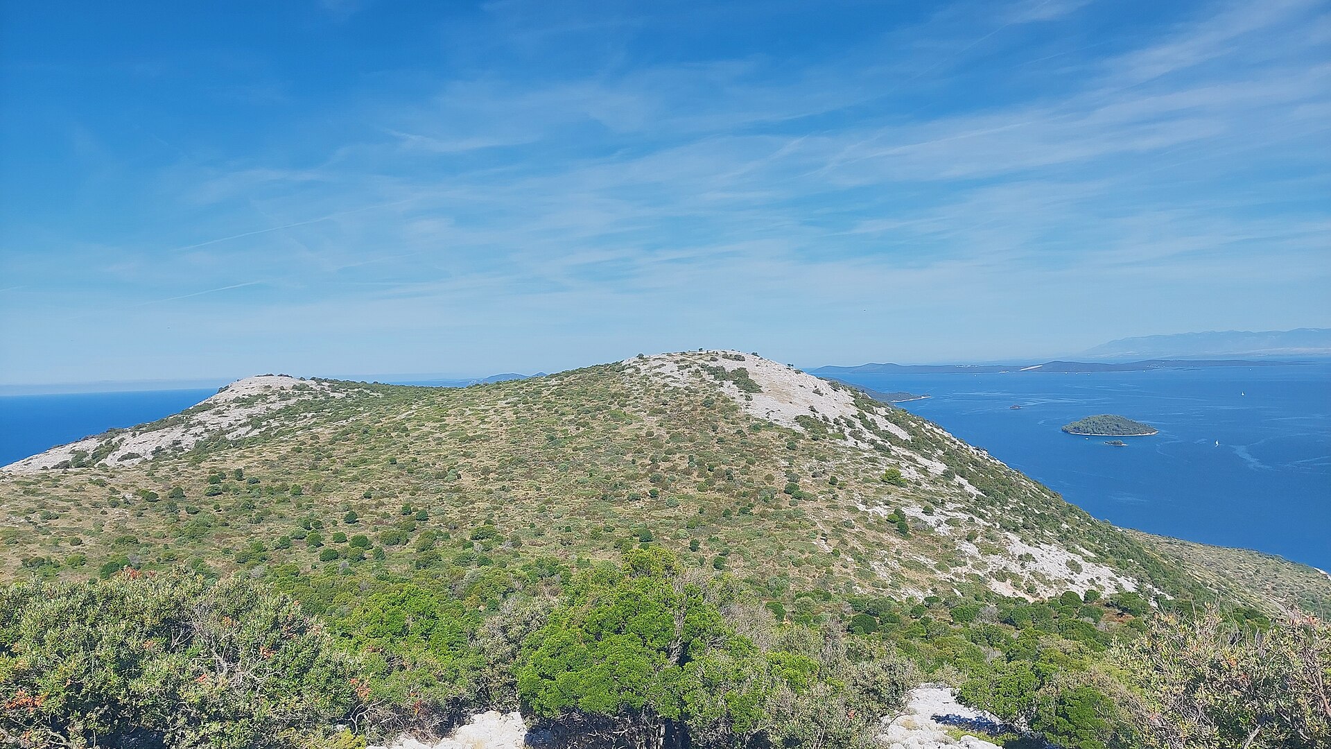
Oštravica is a hill on Dugi Otok rising above the bay where the village of Savar sits. It is one of the recognizable landmarks in the central part of the island — less famous than the neighboring peak of Orljak, but a favorite with hikers looking for a quiet trail with sea views. How do you get to Oštravica? The usual starting point is an abandoned stone quarry near Savar, itself worth a look since it's a reminder of the island's long history as a source of building stone. From there the trail climbs to a saddle and continues along the ridge toward Oštravica, before carrying on to the nearby summit of Orljak. The full loop runs about 4.7 km and takes roughly one hour and forty-five minutes, with a combined ascent and descent of around 259 meters. It's rated as moderately demanding (grade T2) — no technical gear is needed, but sturdy trekking shoes are recommended given the rocky ground. Savar, the practical base for most hikers, sits in a sheltered cove facing the neighboring island of Iž and is well connected by road to the rest of Dugi Otok, including the main town of Sali. What will you see along the way? The main draw of the route is the scenery: the path runs high above the sea, opening onto wide views of the coastline and the surrounding islands of the Zadar archipelago. Along the way it passes near the Strašna Peć cave, one of the better-known attractions in this part of the island and reportedly the first organized tourist site in the region — visited by Austro-Hungarian Emperor Franz Joseph in 1904. Oštravica itself isn't the island's highest point (that title belongs to Vela Straža at 338 m), but it rewards hikers with a satisfying view of the landscape: dry stone walls, patches of Mediterranean scrub, and the deep blue of the Adriatic on either side of the land. It's also worth knowing that stone quarried in the area was historically used to build the Zadar forum as well as palaces and churches in Rome and Venice, and — according to local sources — even the United Nations building in New York. That adds an extra layer of interest to walking past the abandoned, partly overgrown quarries on the way. When is the best time to visit? Spring and early autumn are the best seasons for this hike, when temperatures are milder and the largely shadeless trail doesn't turn into a slog through the heat. In summer, an early morning start is recommended, along with plenty of water, since there are no springs or refill points along the route. As one of Dalmatia's less crowded islands, Dugi Otok lets you enjoy the trail in near solitude even in high season. Frequently Asked Questions How long is the hike to Oštravica? The loop from the abandoned quarry over Oštravica to Orljak is about 4.7 km and takes around 1 hour 45 minutes. Is the trail difficult? It's rated moderate (T2) — it requires reasonable fitness and proper footwear, but no technical climbing skills. What's worth seeing along the route? Sea and island views, the area around the Strašna Peć cave, and traces of the island's old stone-quarrying industry. Where's the best place to start? The most convenient starting point is near Savar, from where a road leads to the abandoned quarry at the foot of the trail.
-
Vrh Hrnjetine
Savar
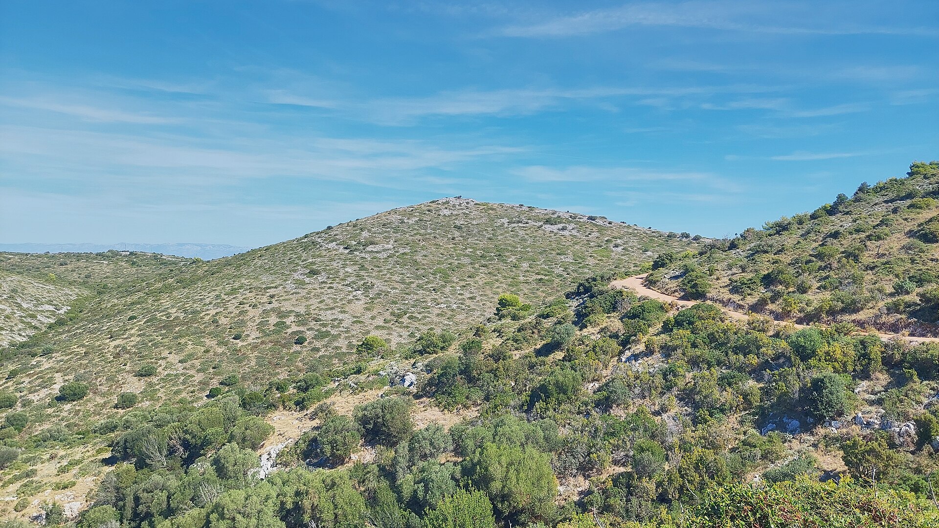
Vrh Hrnjetine is a secondary summit of the Vela Straža massif, the highest ridge on Dugi Otok, rising inland above the village of Savar. It's a destination for anyone who wants to see Dugi Otok from above, away from the beaches and harbors, surrounded by the dry, stony hills typical of central Dalmatia. Where exactly is Vrh Hrnjetine? The hill sits at roughly 44.0203 N, 15.0372 E, on the ridge running from Savar toward the main summit of Vela Straža (338 m), the highest point on Dugi Otok. The island itself is long and narrow — about 45 km long but only 1–4 km wide — so ridgelines in the central part of the island offer views toward both coastlines almost at once. Why can't you reach the actual summit of Vela Straža? The true summit of Vela Straža is off-limits to visitors: a military installation stands there and the site is closed to civilian access. Because of this, Orljak (301 m), on the same ridge, is treated as the island's unofficial substitute high point for hikers. Walking through the Hrnjetine area and along the Vela Straža ridge is therefore a scenic traverse along the slope rather than an ascent of the main peak itself. What will you see along the way? The ridge above Savar shows the landscape typical of Dugi Otok's interior: dry grassland, stone field walls, olive groves in the lower valleys, and views across the channel toward the Kornati islands. It's a raw, quiet stretch of terrain, far from the tourist traffic concentrated along the coast. What's worth combining with the walk? At the foot of the hill lies Savar, one of Dugi Otok's eleven settlements, located in the central part of the island at around 62 m above sea level. A hermitage dedicated to St. Anthony the Abbot once stood here, abandoned in the 16th century. Nearby is also Strašna Peć cave — one of the first organized hiking destinations in this part of the island, visited in 1904 by Emperor Franz Joseph. It's a good reason to pair a walk along the Hrnjetine ridge with a visit to the village itself. How to get there and when to go? The starting point is Savar, reached by local road from the ferry ports of Sali or Brbinj, both served by ferry and catamaran from Zadar. From Savar, unmarked tracks and farm roads used by locals and hikers lead further inland toward the ridge. Spring and early autumn are the best times to walk here — in summer, the shadeless, rocky slopes heat up quickly. Bring plenty of water and sturdy footwear. Who is this area suited for? This is a good option for travelers who have already explored Dugi Otok's coastline and want an inland activity — walking, landscape photography, or simply quiet. Dugi Otok as a whole is known for hiking, cycling, freediving, diving, kayaking, and sailing, so the Hrnjetine area fits naturally into the island's wider offer of active pursuits. Frequently asked questions Can you reach the actual summit of Vela Straža from Hrnjetine? No — the summit holds a military installation and is closed off. Hikers head instead to Orljak (301 m), treated as the island's substitute highest accessible point. How do you get to Savar, where the route starts? By ferry or catamaran from Zadar to Sali or Brbinj, then by local road to Savar in the central part of Dugi Otok. What else is worth seeing nearby? The village of Savar, with its hermitage history, and the nearby Strašna Peć cave, a hiking destination since the early 20th century. When is the best time to go? Spring or early autumn, when temperatures are lower — in summer the steep, shadeless, rocky slopes are demanding.
-
Stražbenica
Starigrad
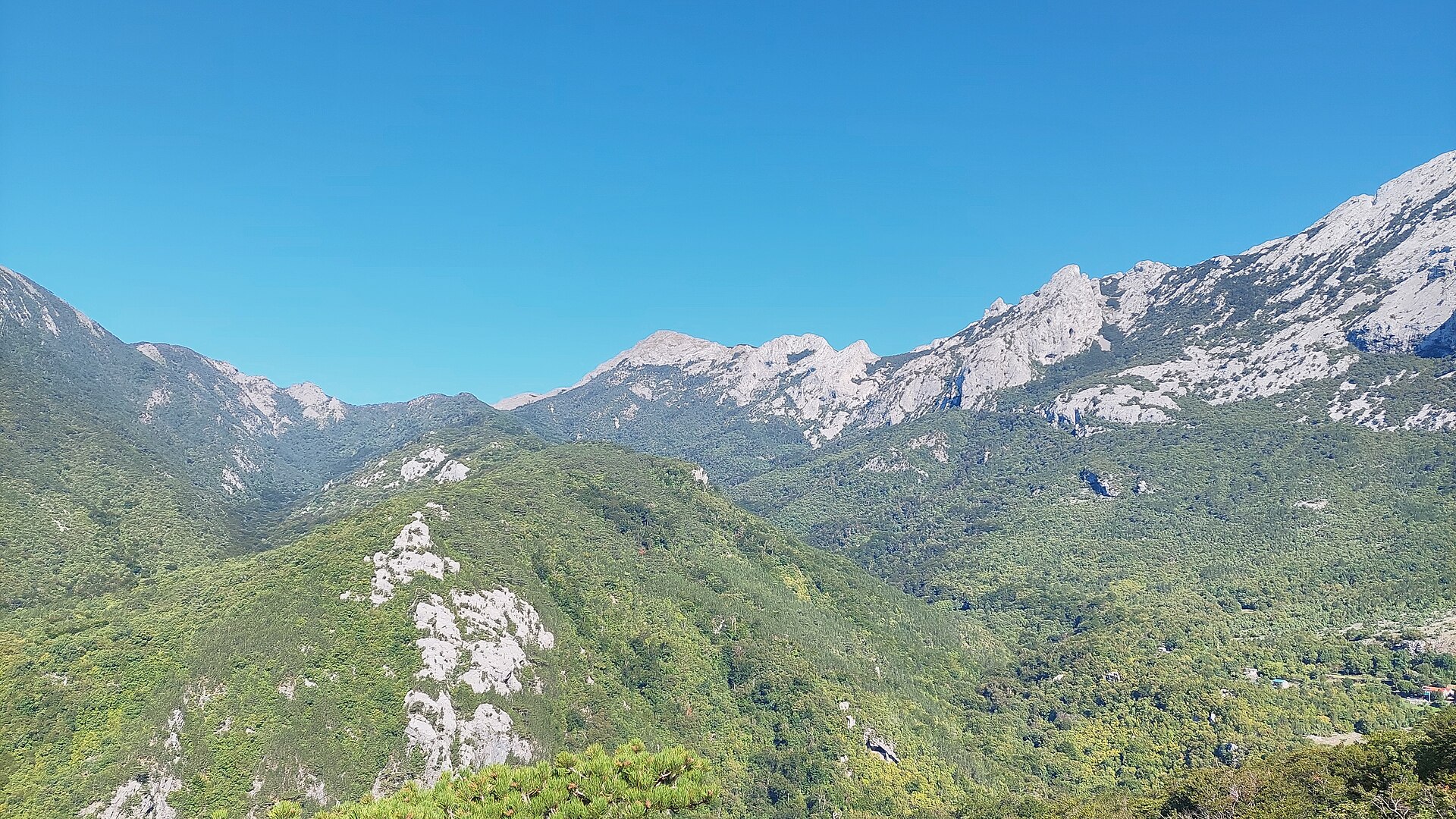
Stražbenica is a ridge and mountain pass in the Velebit range, inside Paklenica National Park near Starigrad (Starigrad-Paklenica) in northern Dalmatia, Croatia. The name comes from "straža" (watch, lookout post), a fairly common toponym across this part of Velebit, so it's worth double-checking which ridge you mean when the name comes up. This particular Stražbenica sits in the southern part of the massif, on a high-altitude trail connecting the Veliko Rujno plateau with the Buljma pass and the PS Struge mountain shelter. How do you get there? Most hikers start from inside the Velika Paklenica canyon, where the PD Paklenica mountain lodge and the small settlements of Ramići and Parići offer the easiest options for accommodation and supplies before heading up. From the lodge, the trail climbs toward a junction at Krajnji Brig, where it meets the path coming from Veliko Rujno that crosses the Stražbenica ridge itself. The route is marked with standard Croatian mountaineering signage and rated moderately difficult — it calls for decent stamina but no technical climbing gear. What will you see along the way? Approaching from Veliko Rujno, the trail first crosses an area affected by an old wildfire, then enters a pine forest that gradually turns into mixed woodland. The final stretch before reaching the ridge is the steepest part of the climb. Just before topping out on the ridge, the trail passes a viewpoint with a wide panorama over the entire Veliko Rujno basin and the distinctive Bojin Kuk peak — one of the more rewarding views in this stretch of Southern Velebit. A water spring near the trail is a useful stop for refilling bottles on a long day out. What else can you combine it with? Stražbenica sits on a route linking several notable points in Southern Velebit. In one direction, the trail leads to the Buljma pass, known for its views over both the Velika and Mala Paklenica canyons; in the other, it reaches the PS Struge shelter and the nearby Marasovac spring, from where hikers can continue toward Velebit's highest peaks, including Vaganski vrh. In practice, Stražbenica is best treated not as a standalone destination but as a waypoint on a longer traverse through the national park's mountain trails. When should you visit? Late spring through early autumn (roughly May to October) is the best window, when trails are clear of snow and fully passable. In midsummer, an early start is advisable — part of the approach crosses open, previously burned terrain with little shade. In winter and early spring, the upper ridge can hold snow and requires extra equipment, so less experienced hikers are better off sticking to the lower sections of the park during that period. Frequently asked questions Is Stražbenica a summit with a clear destination point? It's primarily a ridge and a waypoint on a longer mountain trail rather than a standalone attraction with a single "summit" to bag — the appeal comes from the views and the traverse through Southern Velebit itself. Where's the best place to start the hike? The most convenient starting point is around the PD Paklenica lodge inside the Velika Paklenica canyon, close to Starigrad, from where a marked trail runs via Krajnji Brig. How difficult is the trail? It's rated moderately difficult — the steep section just below the ridge requires good fitness, but no climbing equipment is needed. Is water available along the way? Yes, there's a spring near the trail, and further along the route the PS Struge shelter has another spring (Marasovac), making it possible to refill supplies during a longer hike.
-
Veli vrh
Ugljan
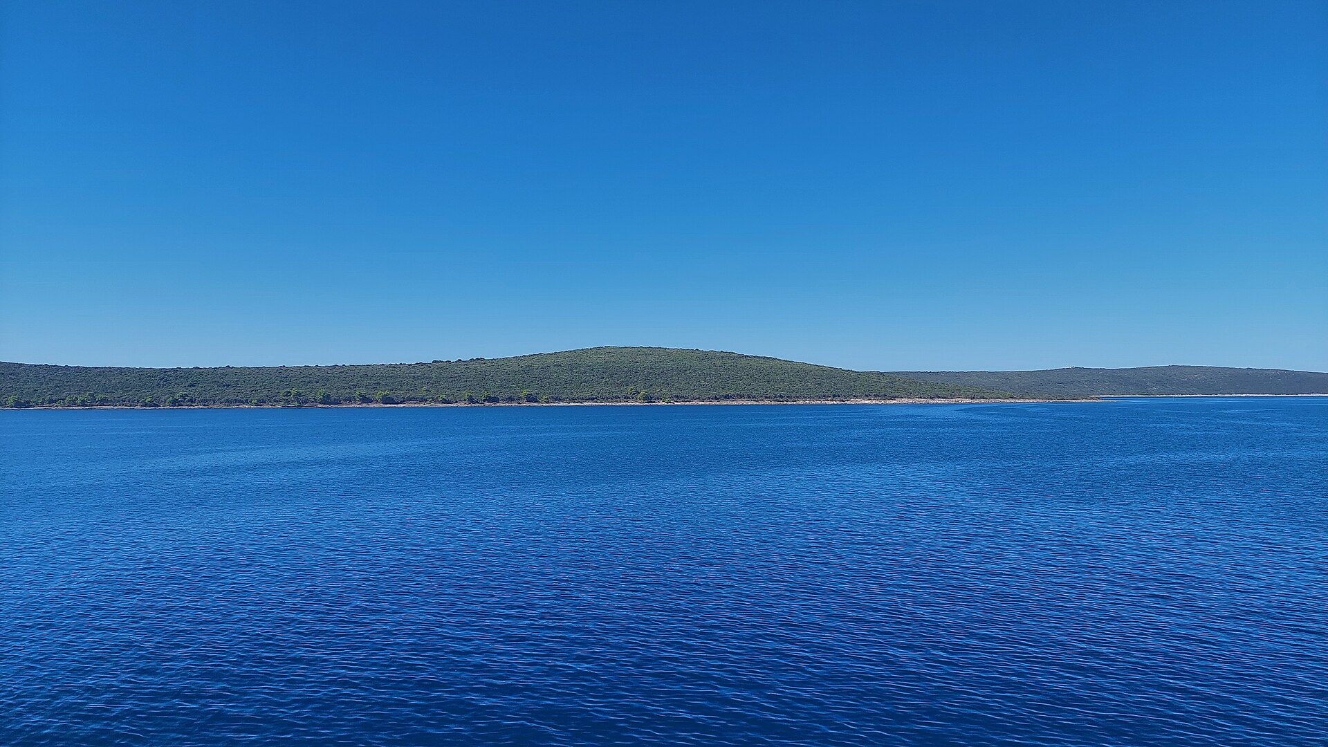
Veli vrh is a hill on the island of Ugljan in the Zadar Archipelago, on the Croatian Adriatic coast. Rising to roughly 265 metres above sea level, it is the second-highest point on the island — the summit of Šćah (288 m) sits just above it, with the lower Kobiljak (200 m) forming part of the same ridge. Veli vrh lies on the main ridgeline running through the central-western part of Ugljan, and its slopes open up wide views over the surrounding islands and channels of the Zadar Archipelago. Ugljan is one of the islands closest to Zadar, known for its dense olive groves, pine woods and a network of hiking and cycling paths linking its seven villages: Preko, Poljana, Sutomišćica, Lukoran, Kali, Kukljica and Ugljan. Hills such as Veli vrh draw visitors who want an active break from the coastline — a chance to see the island from a different vantage point than the beach. How do you get to Veli vrh? Most visitors start from Preko, the island's main settlement, reached from Zadar by a regular car ferry that runs several times a day and takes about 20–25 minutes. From Preko or the neighbouring villages, local roads and paths lead inland toward the central ridge where Veli vrh stands. Given its modest elevation, the ascent doesn't require special preparation, though sturdy walking shoes are worth packing — the ground is rocky and the sun can be intense in summer. What will you see at the top? From the Veli vrh area you can take in the elongated shape of Ugljan itself and the string of islands that make up the Zadar Archipelago; on a clear day the view stretches toward the mainland coast near Zadar. The slopes are covered in typical Dalmatian maquis scrub and olive groves, with small farming hamlets tucked into the valleys between the hills. It's a quiet, contemplative spot rather than a dramatic one — free of crowds, offering an authentic slice of island Croatia. When is the best time to visit? Spring (April–June) and early autumn (September–October) are ideal, with milder temperatures than the height of summer and the vegetation still green. In summer, strong sun and heat make early morning or late afternoon the better time to hike. The area is accessible year-round, though winter can bring stronger winds. Frequently Asked Questions How high is Veli vrh? The hill stands at about 265 metres above sea level, making it the second-highest point on Ugljan after Šćah (288 m). Do you need hiking experience to reach it? No — it's a modest island hill suitable for people with average fitness. Comfortable shoes and enough water, especially in summer, are all you really need. How do you get to Ugljan? The easiest way is the car ferry from Zadar to Preko, which runs year-round and takes around 20–25 minutes. What else is worth seeing nearby? The island has a wider network of hiking and cycling trails, olive groves, picturesque fishing villages and quiet coves along the coast — Veli vrh fits well into a longer route exploring Ugljan's interior.
-
Veli vrh
Luka
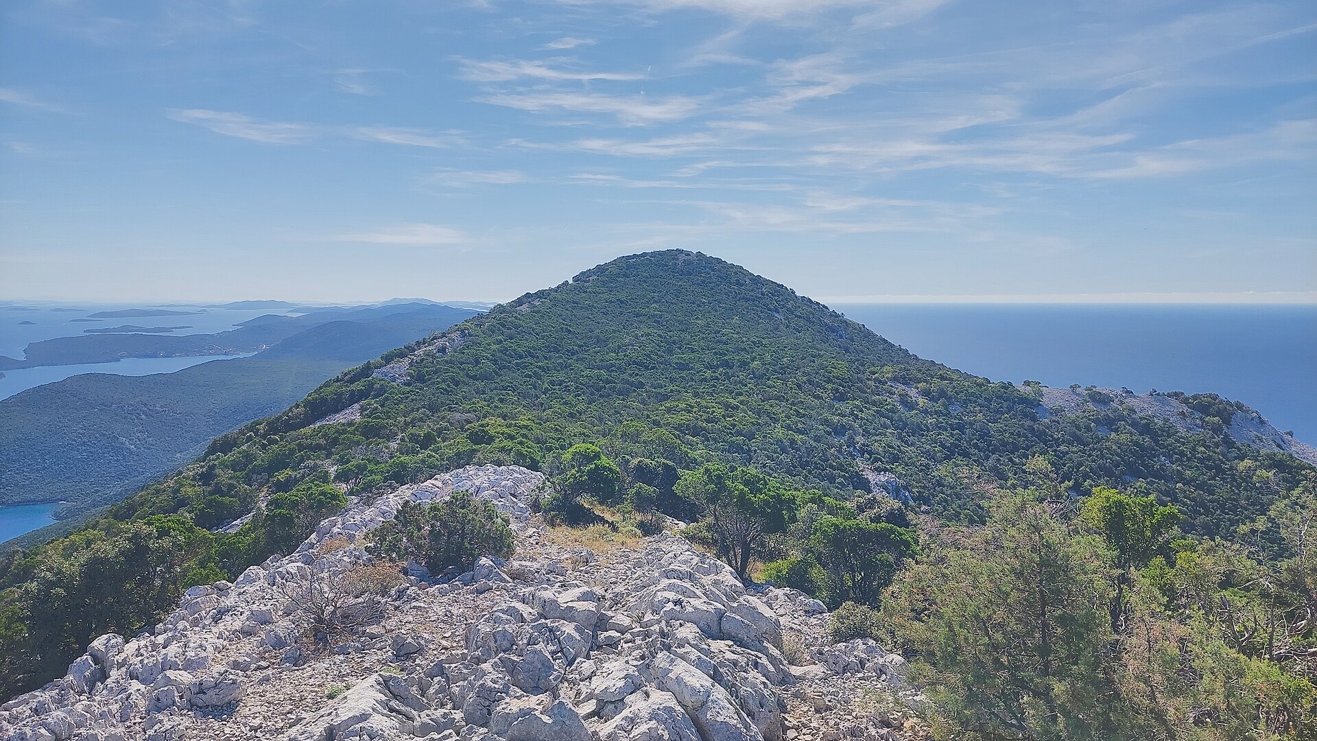
Veli vrh is a modest peak rising above the village of Luka on the island of Dugi otok in Croatia — a subpeak of the island's highest elevation, Vela Straža (338 m). It sits at coordinates 44.0013° N, 15.0487° E, right in the middle of the limestone ridge that runs the length of Dugi otok. Where exactly is it? Veli vrh rises directly above Luka, a small settlement wrapped around the bay of Zlatna vala ("Golden Bay"). Luka sits at the foot of the island's tallest ridge, which is why most trails heading up toward Veli vrh and the main summit of Vela Straža start from around the village. How do you get there? Dugi otok stretches roughly 43 km in length and up to 4.6 km in width, so reaching it usually means a ferry or catamaran crossing to one of the island's ports, followed by a drive or scooter ride to Luka. From the village, the only way up is on foot — the ground is rocky, karst terrain, so sturdy hiking shoes are essential. What will you see from the top? The ridge that Veli vrh belongs to is built from limestone hills separated by karst fields — including Velo jezero, Arnjevo polje, Stivanje polje and Sridnje polje — plus numerous karst caves carved into the rock over centuries. From Veli vrh, the view takes in this karst landscape, the rooftops of Luka, and the water of Zlatna vala bay below. Worth knowing before you set off: the actual summit of Vela Straža, the island's highest point, hosts a military installation and is closed to visitors. That's why hikers looking for the best panorama from the island's high ridge usually head instead for the nearby peak of Orljak (301 m), which has become the go-to hiking goal on Dugi otok's ridge. Veli vrh, as a subpeak of Vela Straža, still lets you get close to this highest section of the island and take in the scale of the karst landscape without entering the restricted zone. When is the best time to visit? Spring (April–June) and early autumn (September–October) are the most comfortable seasons for hiking here, when temperatures on the exposed, shadeless rock are manageable and the maquis scrub is green. Summer heat with no shade makes the climb tough, so an early-morning start is the way to go if visiting in July or August. Frequently asked questions Can you hike Veli vrh without a guide? Yes, it's open access terrain, though the rocky, karst path calls for a decent local map and proper footwear. Can you see the island's highest point from Veli vrh? Yes — Veli vrh sits directly below the main summit of Vela Straža (338 m), whose top is occupied by a military installation closed to the public. How long does the hike from Luka take? It depends on fitness and route choice, but the steep, rocky ascent means you should set aside a few hours for the round trip. Are there other attractions nearby? Yes — the village of Luka with its Zlatna vala bay lies right at the foot of the ridge, and the nearby peak of Orljak is a popular hiking destination on the same mountain chain.
-
Klekovac
Starigrad
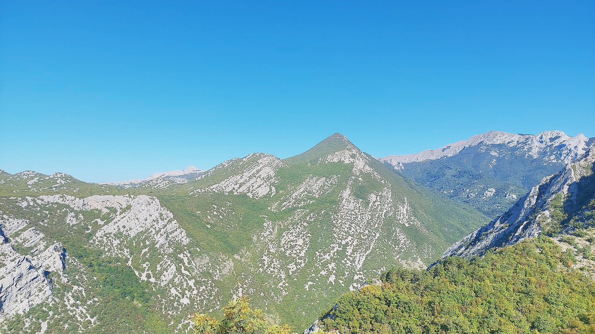
Klekovac is a small ridge point in the Velebit mountain range, within the municipality of Starigrad, marked as a prominence tied to the Golić summit. It sits deep in the mountains, far from any settlement, and is one of the many unnamed corners of Velebit that only hikers on the northern and central ridge trails ever come across. Where exactly is Klekovac? The point lies on a high mountain ridge near the Golić summit (also called Veliki Golić), in the eastern part of the Velebit massif that rises above Starigrad and the Velebit Channel coastline. Its coordinates (44.3382 N, 15.4551 E) place Klekovac deep inside the range, in terrain typical of Velebit's karst landscape — rocky ridgelines, valleys with no surface streams, and wide stretches of beech forest and dwarf pine. What is there to see nearby? Klekovac itself is a waypoint on a ridge route rather than a standalone attraction with visitor infrastructure — its appeal comes from what surrounds it. A dozen or so kilometers to the south lies Paklenica National Park, one of Croatia's best-known protected areas, famous for two karst canyons: Velika (Big) and Mala (Small) Paklenica. Velika Paklenica draws climbers and hikers alike — a gorge with steep, pale limestone walls, with a trail leading deep into Velebit toward the higher ridges where Golić also sits. Velebit as a whole is Croatia's longest mountain range, stretching along the northern Dalmatian coast, and parts of it hold UNESCO biosphere reserve status for their richness of flora, fauna and karst formations. From the ridges around Golić and Klekovac, views open toward the islands of the Velebit Channel on one side and, inland, toward the rocky summits of central Velebit. How to get there? The usual starting point is Starigrad-Paklenica, a coastal town on the Adriatic highway, from which marked trails lead into Paklenica National Park and onward to the higher parts of the massif. The Golić area is reached via a trail branching off the forest road toward Štirovača, through classic mountain terrain — rocky, often without shade, and demanding sturdy footwear and good navigation. Since there are no signs pointing directly to Klekovac itself, it's best treated as a point along a longer ridge traverse rather than a standalone day-trip goal for inexperienced hikers. When is the best time to visit? Late spring (May–June) and early autumn (September–October) are the best times for hiking this part of Velebit, when mountain temperatures are moderate and visibility is usually good. In summer, the exposed rocky ridges can get uncomfortably hot, so early starts are recommended. In winter, the higher parts of Velebit can be snow-covered and icy, requiring proper gear and mountaineering experience. Frequently asked questions Is Klekovac a separate mountain? No — it's a ridge point (prominence) tied to the Golić summit within the Velebit massif, not a standalone named mountain with its own visitor infrastructure. Is there a hiking trail nearby? Yes, the area is within reach of trails running from Starigrad-Paklenica through Paklenica National Park toward the higher parts of Velebit, including the Golić area. Do you need mountain hiking experience? Yes, the terrain is rocky and there are no trail markers leading directly to Klekovac itself, so good physical preparation, a map, and mountain navigation skills are recommended. What's the main reason people visit this area? Most hikers come for Paklenica National Park and the panoramic views from Velebit's ridges, rather than for Klekovac as an individual destination.
-
Orlov kuk
Starigrad
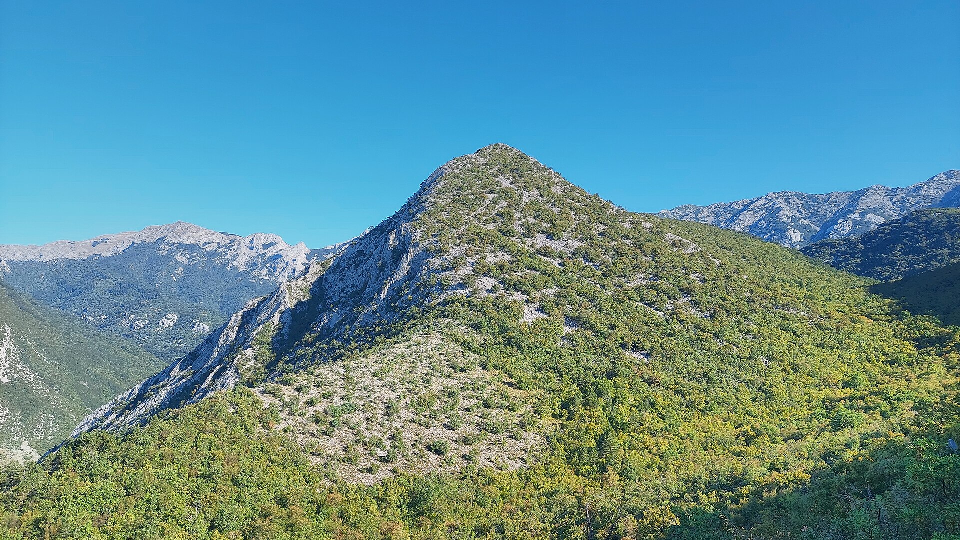
Orlov kuk is a rocky peak in the Velebit massif, rising above Starigrad on Croatia's Dalmatian coast. Its name translates roughly to "Eagle's Peak," a fitting label for the steep, cliff-like profile typical of the Crni Vrh group — the same cluster of summits that includes neighboring Veliki kuk, Kuk od Rujice, Borovnik, and Komić. Orlov kuk reaches an elevation of around 862 m and stands on the east-southeast side of the Velika Paklenica valley, within the boundaries of Paklenica National Park. Where exactly is Orlov kuk? The peak sits in southern Velebit, right beside the Velika Paklenica canyon — one of two major canyons (alongside Mala Paklenica) that cut through the mountains from inland all the way to the Adriatic coast. The Velika Paklenica canyon stretches roughly 14 km in length and 500 to 800 m in width, forming the dramatic rock walls from which Orlov kuk rises. The peak's coordinates are 44.3312742, 15.4839354, and the nearest gateway town is Starigrad, which lies at the foot of Velebit right on the sea. How do you get to the Orlov kuk area? Starigrad is the natural starting point, with marked trails leading into Paklenica National Park and on toward the Velika Paklenica canyon. The park entrance is only a few minutes' drive from the town center. From there, the route follows the canyon floor, while side paths and climbing approaches branch off toward the Crni Vrh group of peaks, Orlov kuk among them. Given the steep, rocky terrain, reaching the summit itself calls for mountaineering or climbing experience — this is not an easy, casual walking route. What will you see there? Orlov kuk is above all a striking vertical rock wall, typical of Paklenica — a region regarded as one of the most important climbing destinations in Southern Europe, with hundreds of routes across all difficulty levels, including many multi-pitch lines up to 400 m long. From around the peak, views open onto the Velika Paklenica canyon, the surrounding limestone crags, and, further off, the Adriatic coastline and islands. Together with its neighbors in the Crni Vrh group, Orlov kuk forms one of the more recognizable pieces of the southern Velebit skyline as seen from Starigrad. When is the best time to visit? Spring (April–June) and early autumn (September–October) are the best times to visit, offering comfortable temperatures for physical exertion without the rock faces overheating — a real consideration for climbers. Summer brings intense heat inside the canyon, while in winter the higher parts of Velebit can carry snow and require extra preparation. Frequently asked questions How high is Orlov kuk? The peak reaches roughly 862 m above sea level. Can you climb Orlov kuk without climbing experience? The terrain is steep and rocky, so reaching the summit itself requires mountaineering or climbing skills — it isn't a route for casual hikers. Where is Orlov kuk relative to Starigrad? It lies inland, on the east-southeast side of the Velika Paklenica canyon within Paklenica National Park, a few kilometers from central Starigrad. How does Orlov kuk differ from nearby peaks like Veliki kuk? All of these summits belong to the same Crni Vrh rock group in the Velika Paklenica canyon, but they differ in height, wall orientation, and climbing route difficulty — Orlov kuk stands out for its distinctive, steep silhouette, which gives the peak its name.
-
Komić
Starigrad
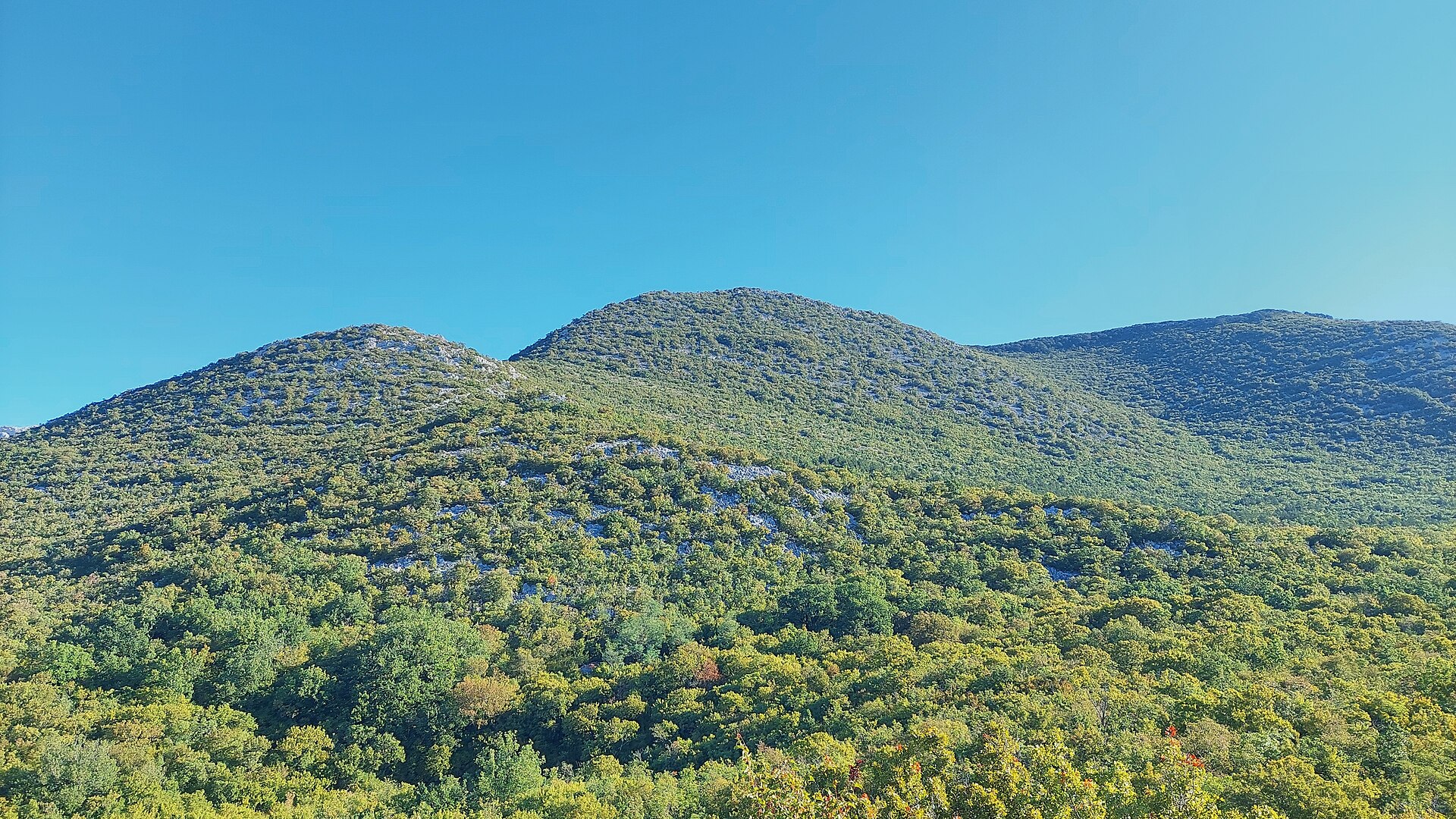
Komić is a ridge prominence of the Crni vrh peak in the Velebit massif, reached from Starigrad on the edge of Paklenica National Park. It's a destination for seasoned hikers chasing a panorama that stretches from the Adriatic to snow-streaked Velebit summits. Where exactly is Komić? The point sits at nearly 1,110 meters above sea level, along the ridge leading up to Crni vrh in the southern part of Velebit. Its coordinates, 44.3253669, 15.4888191, place it a dozen or so kilometers inland from central Starigrad, within or right at the edge of Paklenica National Park. How do you get to Komić and Crni vrh? The route starts at the entrance to Paklenica National Park and follows the main canyon of Velika Paklenica. After reaching the Paklenica mountain lodge, the trail continues toward the abandoned village of Ramići. From there, hikers pick one of two options: the route "via Klimenta" (steeper, favored on the way up) or "via Mala Močila" (typically used for the descent). The full round trip takes about 8 hours and demands solid fitness — it's continuous uphill walking through alternating scrub and exposed rock. Trail markings are sparse, though the narrow, 30–50 cm path stays visible. In spring and autumn, expect patches of snow up to 10 cm deep, and the descent involves stony switchbacks. What will you see at the top? The summit of Crni vrh opens onto a panorama of the Adriatic, the islands, the Maslenica bridges, and the snow-covered peaks of the Velebit range. The top itself carries a metal structure with surveillance cameras and a small technical building fitted with solar panels and antennas — a trace of infrastructure that doesn't get in the way of the view. Along the route, the trail passes the abandoned village of Ramići and the stone houses of Škiljići, remnants of Velebit's old shepherd settlements. Who is this route for? Komić and Crni vrh suit experienced mountain hikers, not beginners. The terrain is demanding, with exposed rocky stretches and a long time on the trail. Start early in the morning, carry a map or GPS since markings can be incomplete, and pack enough water — there are no sources along the way. When is the best time to visit? Late spring and early autumn work best, once snow has cleared from the higher sections but before summer heat sets in. Summer makes the multi-hour climb over exposed rock exhausting, while winter requires proper equipment and mountaineering experience. Frequently asked questions How long does it take to climb Crni vrh from Paklenica? The full round trip takes about 8 hours, including the ascent via Ramići village and a descent on a different branch of the trail. Is the route suitable for beginners? No — the terrain calls for good fitness and mountain experience, given the exposed rocky sections and sparse trail markings. Are there other notable viewpoints nearby? Yes, the same range holds neighboring peaks and ridges such as Veliki kuk, Kuk od Rujice, and Borovnik, all part of southern Velebit around Paklenica. Is there anything to see at the summit besides the view? Yes — a metal tower with cameras and a small technical station, though the panorama over the sea and mountains remains the main draw.
-
Mali mozak
Starigrad
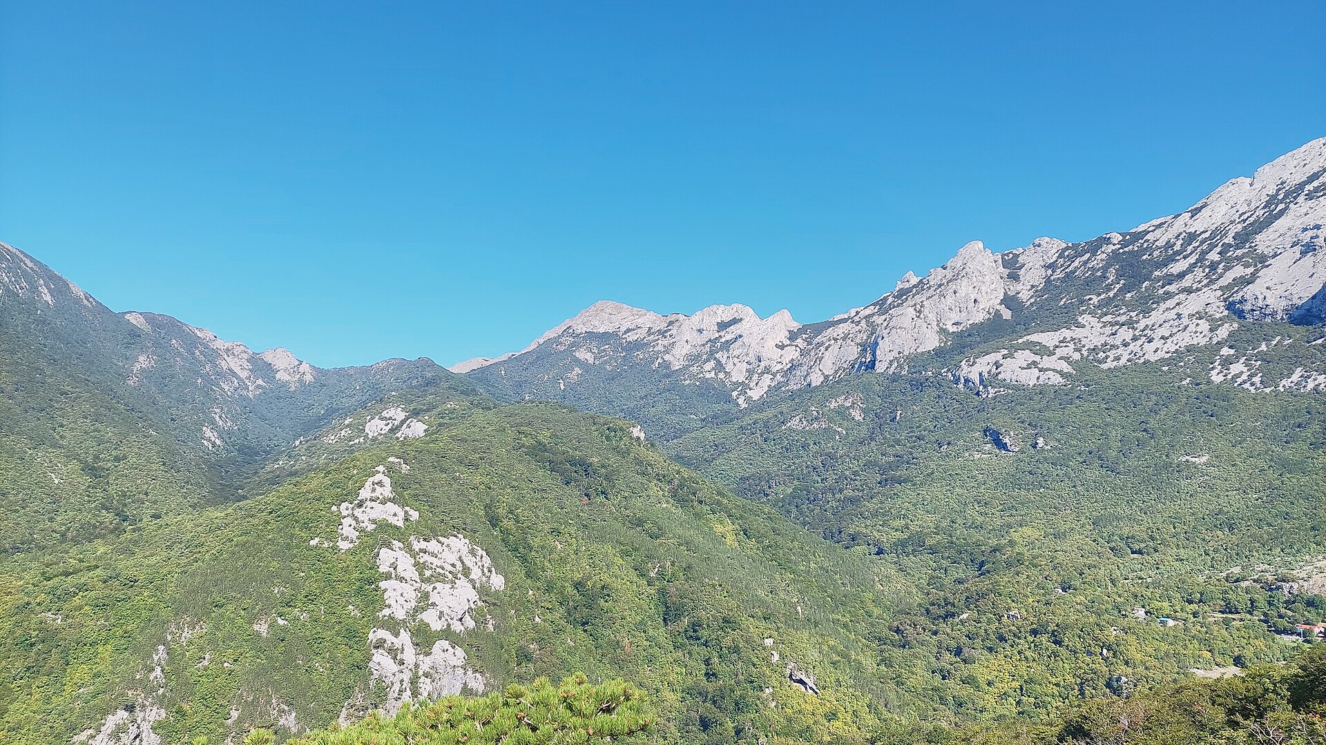
Mali mozak is a small ridge prominence of the Golić massif in southern Velebit, rising above Starigrad on Croatia's northern Dalmatian coast. It's the smaller counterpart of the nearby Veliki mozak — both names come from the Croatian word "mozak" (brain), describing the folded shape of the rocky ridges in this part of the mountains — but Mali mozak sits on a separate section of trail with a distinctly different approach. Where exactly is it? The point sits at roughly 864 m elevation, on a ridge branching off the main Golić summit (1,265 m), within Paklenica National Park. Its coordinates are 44.3537733, 15.4654034. This is still Velebit's southern flank — Croatia's longest mountain range — with Starigrad at its base serving as the natural starting point for this part of the park. How do you get there? Unlike the neighbouring Veliki mozak, reached via the Velika Paklenica canyon and the Košarica lookout, Mali mozak is most commonly approached from a different direction — a trail starting in Starigrad and passing through the village of Grabar and the Golić summit. From Golić, the route descends onto the Mali mozak ridge and continues on toward a spot known as Ramića Dvori and the Paklenica mountain lodge (planinarski dom Paklenica). It's a longer but quieter alternative to the classic canyon approach. What will you see along the way? The climb from Grabar starts through pastureland and lower forest, before opening into rockier, more exposed terrain typical of the Golić ridge higher up. From Mali mozak, views stretch toward the Golić summit itself towering over the area, as well as neighbouring ridges and valleys of southern Velebit, including toward the Velika Paklenica canyon where the taller Veliki mozak stands. It's a route for those who want to see the Golić massif from a different, less-photographed side. When is the best time to visit? Late spring and early autumn are the best seasons for this hike, when temperatures are moderate and trails are dry and safe. In summer, the exposed rocky ridge sections heat up quickly, so an early start and plenty of water are recommended. In winter, the higher ground around Golić can be snow-covered and icy, requiring proper equipment and experience. Who is this route for? The stretch through Grabar, Golić and Mali mozak suits hikers with some mountain experience looking for a quieter alternative to Paklenica's busiest trails. Given its length — continuing all the way to the Paklenica mountain lodge — it works better as part of a longer, full-day trip than as a short walk. Frequently asked questions What does the name Mali mozak mean? "Mali" means "small" in Croatian, and "mozak" means "brain" — the name refers to the folded shape of the ridge, echoing its larger neighbour, Veliki mozak. How high is Mali mozak? It sits at roughly 864 m elevation, on a ridge branching off the nearby Golić summit (1,265 m). How do you reach Mali mozak? The usual route runs from Starigrad through the village of Grabar and the Golić summit, then over Mali mozak toward Ramića Dvori and the Paklenica mountain lodge. How is Mali mozak different from Veliki mozak? Both lie in the same part of Velebit and share a related name, but Veliki mozak is reached from the Velika Paklenica canyon side, while Mali mozak is approached via a separate trail through Grabar and Golić.
-
Borovnik
Seline
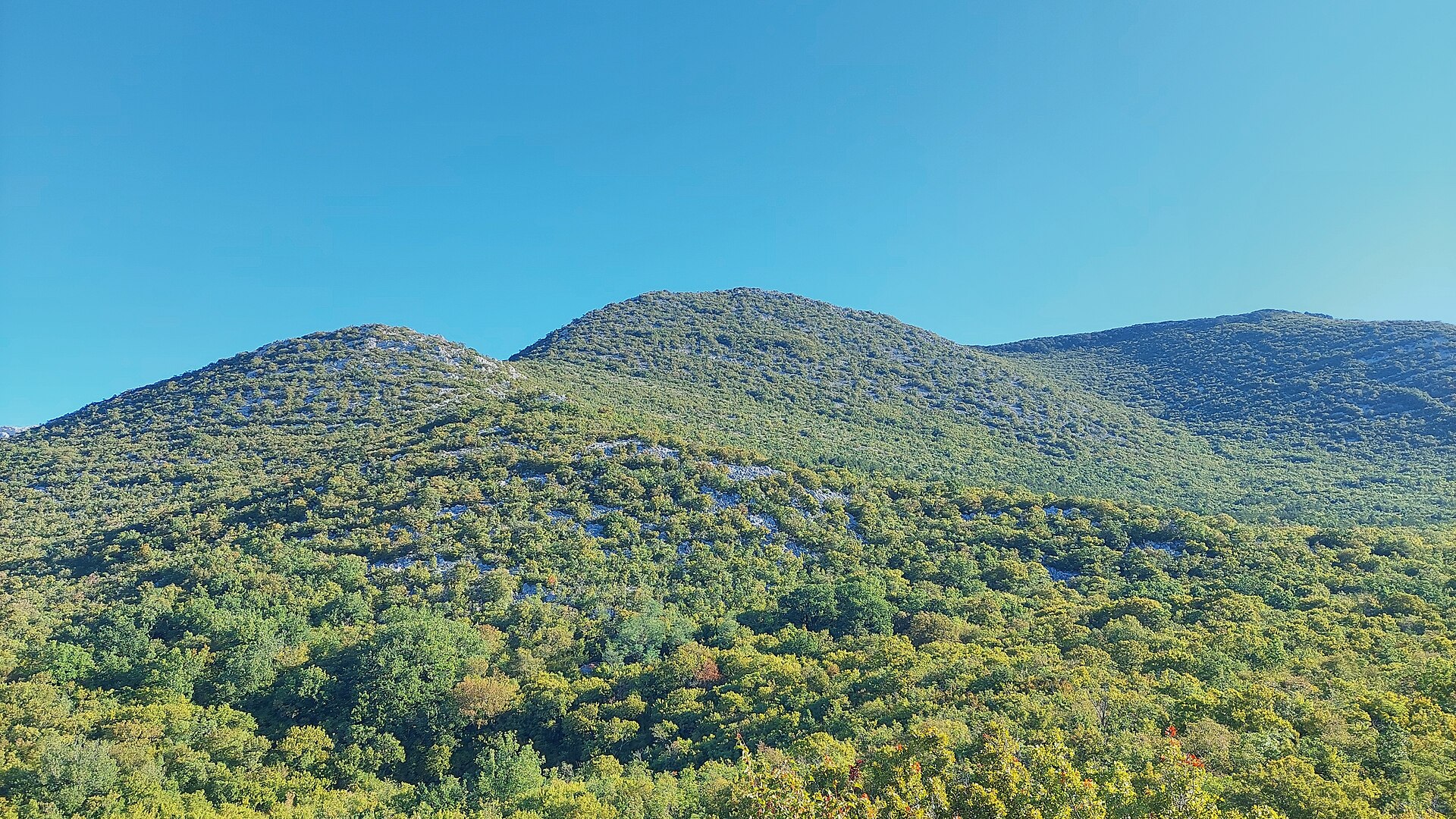
Borovnik is a compact rocky ridge in the heart of Paklenica National Park, rising above Seline on Croatia's Adriatic coast at the western edge of the Velebit mountains. Where exactly is Borovnik? Borovnik sits in the central part of Paklenica National Park, within the Velebit range, a few kilometres inland from the coastal town of Seline (Starigrad-Paklenica municipality). It's part of the same corner of the park as previously covered peaks — Veliki kuk, Kuk od Rujice, and Veliki mozak. The point sits at coordinates 44.328934, 15.4935839, reaching an elevation of roughly 1020 m and sitting right next to the group's highest point, Crni vrh (1110 m). What will you see there? The name Borovnik comes from the black pine forest that still covers most of its slopes. The ridge stretches along the southern edge of the Velika Močila valley — a bowl-shaped basin at around 850 m, ringed by Crni vrh (1110 m), Škiljina kosa (1015 m), and Zeleni brig (842 m). Above the neighbouring Veliko Močilo valley, Borovnik and Crni vrh together form an oval hollow that looks almost like a natural amphitheatre, thickly wooded with black pine and criss-crossed by marked paths circling the whole group. It's a landscape typical of the limestone core of Velebit: bare ridgelines, stony slopes, and pockets of forest tucked into the folds of the terrain. How do you get to the trails? Two main approach routes lead into the Borovnik area, later splitting into several variants for reaching the summit of Crni vrh — the peak can be climbed from as many as six directions in total. One route comes from the direction of the Paklenica mountain hut (northwest), the other from the Veliko Močilo valley (southeast). Both start from the entrance to Paklenica National Park at the Velika Paklenica canyon, from where marked trails climb into the Velebit massif. Given the rocky and partly exposed terrain, sturdy trekking boots and a park trail map are worth carrying. When is the best time to visit? Spring (April–June) and early autumn (September–October) offer the best hiking conditions, with mild temperatures and quieter trails than at the height of summer. In summer, the bare limestone slopes of Velebit heat up fast, so an early start is recommended. Paklenica National Park stays open year-round, but the higher parts of the massif can hold snow in winter and call for proper mountaineering experience and gear. Frequently asked questions How high is Borovnik? The ridge reaches about 1020 m, right next to the higher Crni vrh at 1110 m. Where does the name Borovnik come from? It comes from the black pine ("bor" in Croatian) that covers the slopes of this part of Velebit. Do you need a ticket to visit this area? Yes — it lies within Paklenica National Park, and entry to the canyon requires a paid ticket. Which other peaks pair well with a visit to Borovnik? Crni vrh, Veliki kuk, Kuk od Rujice, and Veliki mozak are all in the immediate vicinity, reachable from the same trailheads out of Paklenica.
-
Veliki mozak
Starigrad
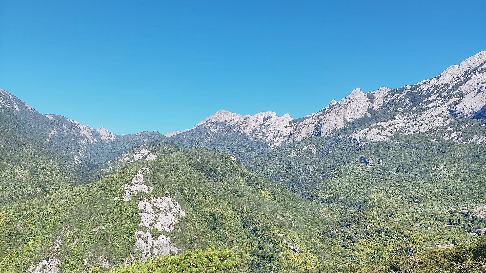
Veliki mozak is a mountain ridge in the Velebit range, rising above Starigrad on Croatia's northern Dalmatian coast. Its name comes from the Croatian word "mozak" (brain), referring to the ridge's distinctive, folded shape. The site sits within Paklenica National Park, close to the Golić summit and other well-known viewpoints in the area, such as Veliki kuk and Kuk od Rujice. Where exactly is it? The Veliki mozak ridge overlooks the Velika Paklenica canyon, one of the park's two main gorges (alongside the smaller Mala Paklenica). Its coordinates are 44.3514009, 15.4699559. This is the southern flank of Velebit — Croatia's longest mountain range — with Starigrad at its foot serving as the natural gateway into the mountains. How do you get there? The route into the park starts at the main entrance near Starigrad, from where a trail leads deep into the Velika Paklenica canyon. The climb up to the Veliki mozak ridge is steep, cutting through a beautiful beech forest, making it one of the more demanding yet scenic sections of this part of Velebit. The path crosses other routes at the Košarica lookout point, where one trail continues to the mountain lodge in Velika Paklenica and the other climbs on to the Veliki mozak summit. What will you see along the way? The ascent runs through dense beech forest typical of Velebit's higher slopes, before the landscape opens up into rockier, more exposed terrain. From the ridge, views stretch across the Velika Paklenica canyon and the surrounding peaks, including nearby Veliki Golić (1,265 m), reached via its own sharp southeastern ridge. The whole area falls within Paklenica National Park, which contains 150–200 km of trails ranging from easy walking paths to demanding high-mountain routes. When is the best time to visit? Late spring and early autumn are the best seasons for hiking this part of Velebit, when temperatures are moderate and trails are dry. In summer, the rocky, exposed ridge sections can get very hot under direct sun, so an early start is advisable. In winter, the higher parts of the route may be snow-covered and icy, requiring proper equipment and experience. Who is this route for? Given the steep ascent and rocky ridge sections, the hike to Veliki mozak is not a beginner-friendly trail. It suits experienced hikers looking for a quieter alternative to Paklenica's more popular routes, while still wanting a close-up view of southern Velebit's characteristic landscape. Frequently asked questions What does the name Veliki mozak mean? It comes from the Croatian word "mozak," meaning brain, referring to the ridge's distinctive folded, brain-like shape. Is Veliki mozak located inside a national park? Yes, the area lies within Paklenica National Park, which covers the Velika and Mala Paklenica canyons on Velebit's southern slopes. How demanding is the hike to Veliki mozak? The climb is steep, passing through beech forest before continuing over rockier terrain, so it's best suited to hikers with prior mountain experience. What viewpoints are nearby? The Košarica lookout point sits close by, where trails split toward the mountain lodge in Velika Paklenica and the Veliki mozak summit, with the nearby Veliki Golić peak (1,265 m) also in view.
-
Kuk od Rujice
Seline
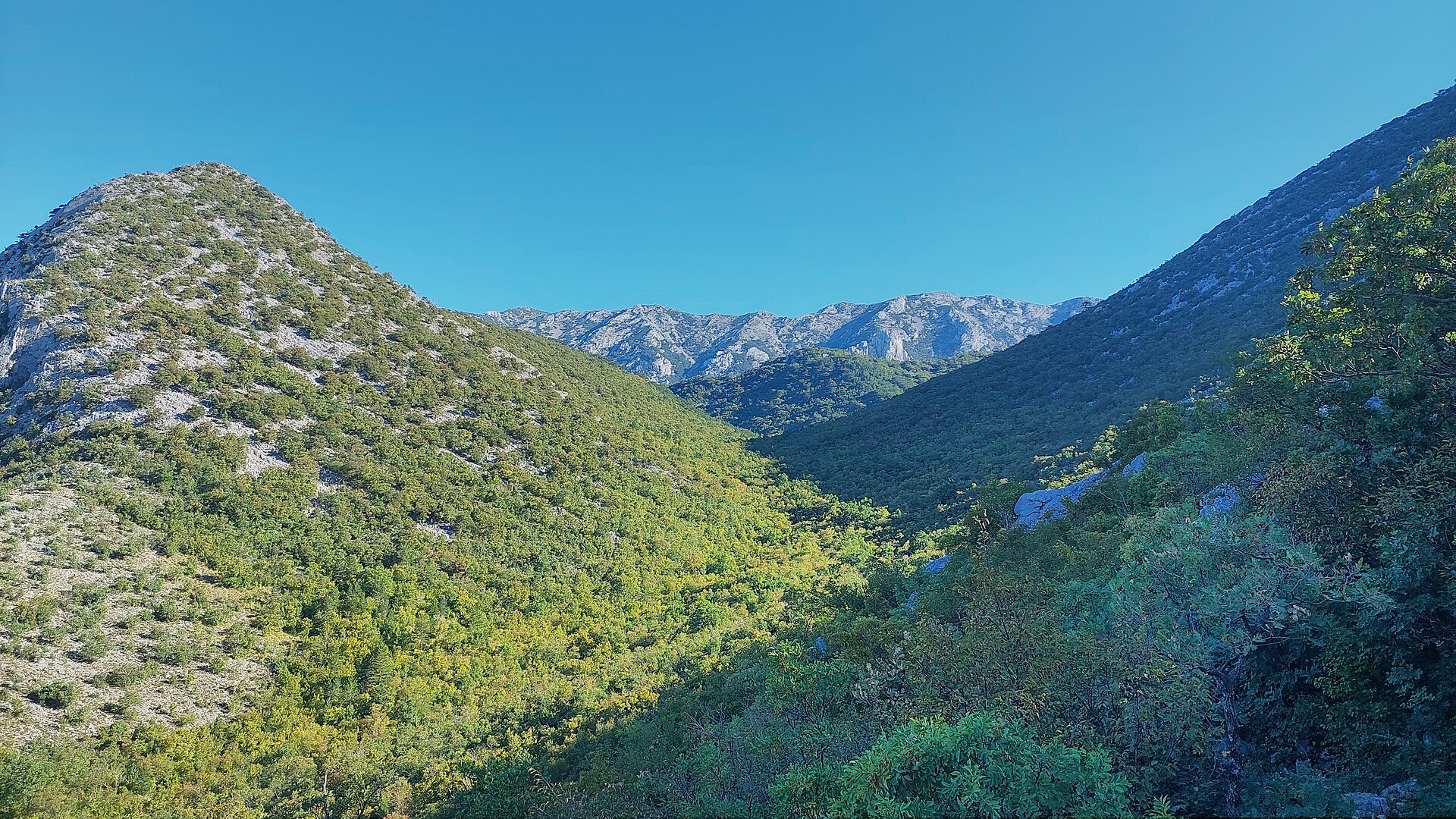
Kuk od Rujice is a rocky summit near Seline, tucked away in the southern Velebit mountains and reached mainly by experienced hikers and scramblers rather than casual visitors. Where is Kuk od Rujice located? Kuk od Rujice rises to roughly 961 metres above sea level and forms a subpeak of Crni vrh, one of the distinctive summits of the southern Velebit range. It sits on the Klimenta ridge, which marks the northern edge of the rocky group towering over the upper section of the Velika Paklenica canyon. The entire area lies within Paklenica National Park, one of the most valuable protected landscapes on the Croatian coast. The summit's coordinates are 44.3372327, 15.49325, and the nearest settlement is Seline, a small coastal village with views stretching up toward Velebit's steep slopes. How do you get there? The starting point is Paklenica National Park, most easily reached from Seline or Starigrad, both located along the main coastal road not far from Zadar. From the park entrance, trails lead deep into the Velika Paklenica canyon and continue toward the Klimenta ridge and the rocky group surrounding Crni vrh. Marked paths circle this area, deliberately avoiding the steep, rocky sections of Kuk od Rujice itself — reaching the actual summit therefore requires solid route-finding skills and mountain experience rather than a casual walk. What will you see along the way? This is a spot for travellers seeking the quieter corners of Velebit, away from the park's busiest attractions. The landscape is defined by raw, rocky ridgelines, the deep cut of the Velika Paklenica canyon, and views opening up from higher ground toward neighbouring Crni vrh, considered a moderately demanding but rewarding goal for hikers staying at the Paklenica mountain hut. As a subpeak, Kuk od Rujice itself has no dedicated tourist infrastructure — its appeal lies in the wild, untouched character of its surroundings and the quiet, well away from the main trails. When is the best time to visit? Spring and autumn are the best seasons for hiking in this part of Velebit, when temperatures are moderate and trails are dry and passable. Summer heat can be intense on the shadeless, rocky terrain, so an early morning start is advisable. In winter, the slopes around Klimenta and Crni vrh are often snow-covered and icy, which significantly raises the difficulty level and calls for proper winter equipment and preparation. Frequently asked questions How high is Kuk od Rujice? The summit reaches approximately 961 metres above sea level and forms a subpeak of the Crni vrh massif in southern Velebit. Is Kuk od Rujice inside Paklenica National Park? Yes, it lies within the park boundaries, on the Klimenta ridge above the upper part of the Velika Paklenica canyon. Does a trail lead straight to the summit? Marked paths circle the area and avoid the rocky sections of Kuk od Rujice, so reaching the actual summit requires experience and good orientation skills. Where is the best place to start a hike toward this area? The most convenient starting point is the Paklenica National Park entrance, accessible from either Seline or Starigrad.
-
Veliki kuk
Starigrad
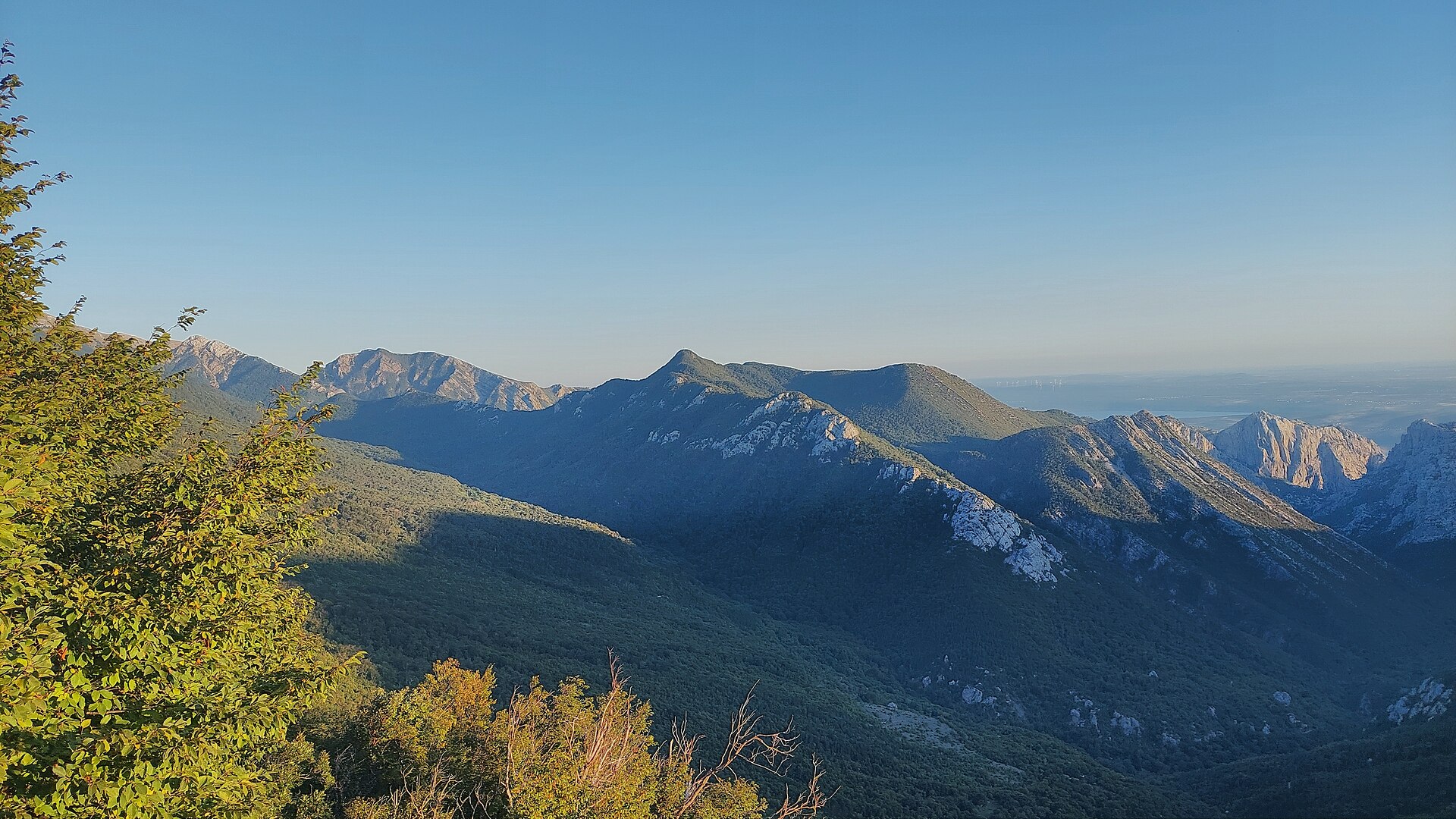
Veliki kuk is a rocky shoulder of the Crni vrh summit in the Velebit mountains, rising above Starigrad on Croatia's Dalmatian coast. It sits within Paklenica National Park, one of Croatia's oldest and best-known mountain parks, established to protect two major karst gorges — Velika and Mala Paklenica. What exactly is Veliki kuk? In Dalmatian dialect and in Croatian mountain naming, "kuk" describes a steep, rocky spur or side ridge — and that is precisely the landform Veliki kuk represents. It projects from the Crni vrh summit, which rises to roughly 1,110 metres within the group of peaks forming South Velebit. Karst rock outcrops alternate here with forests of black pine, beech and hornbeam, while a nearby terrace known as Veliko Mocilo opens onto broad mountain meadows framed by old-growth woodland. How do you get there? Starigrad, the coastal town at the foot of Velebit, is the natural starting point, sitting right at the main entrance to Paklenica National Park. From the mouth of the Velika Paklenica canyon, a network of marked mountain trails climbs into the massif toward Crni vrh and its neighbouring ridges, Veliki kuk among them. The ground underfoot is rocky and at times exposed, so sturdy hiking boots, solid fitness and confident mountain navigation are essential. What's worth seeing nearby? Paklenica National Park is best known for the Velika Paklenica canyon itself — a karst gorge stretching 14 kilometres long and, in places, 500 to 800 metres wide, ranked among the standout landscapes of the Croatian mountains. Close by stands Anića kuk (712 m), a rock face rated among the finest climbing venues in this part of Europe and a draw for climbers from across the continent. Higher up, toward the Crni vrh ridge, sits Vidakov kuk (866 m). The wider area is a patchwork of sharp karst rock formations known locally as škrape, dark pine forest and sunlit meadows, with viewpoints opening out over the Adriatic and the islands of Pag and Rab. When is the best time to visit? Spring and autumn offer the best hiking conditions, when temperatures on the exposed, rocky terrain stay manageable and trails are quieter than in peak summer. In summer the rock surfaces heat up considerably, so it pays to start early and carry plenty of water. The climbing season on nearby walls, including Anića kuk, generally runs from spring through autumn, with a natural lull during the hottest weeks of July and August. Frequently asked questions What exactly is Veliki kuk? It's a side shoulder, or ridge, of the Crni vrh summit in the Velebit range, located within Paklenica National Park near Starigrad. Do you need climbing skills to reach it? The Veliki kuk area itself is hiking terrain rather than technical climbing ground — good fitness and confidence on rocky, exposed paths are enough. Climbers looking for a technical challenge head instead to the nearby Anića kuk wall. How should you plan a trip from Starigrad? Enter the park at the Velika Paklenica canyon entrance, pick up a trail map there, and set off early in the morning, especially during summer. Are there other viewpoints in the area? Yes — the ridges of South Velebit, including Crni vrh and the neighbouring Vidakov kuk, offer views over the Paklenica canyon and the coastline with the islands of Pag and Rab.
-
Brundo
Kukljić
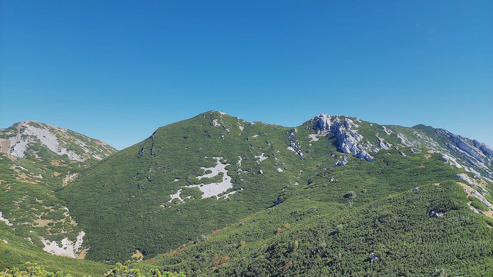
Brundo is a peak in the Velebit massif in Croatia, located in the Kukljić area — one of the lesser-known but worthwhile points along the ridge of the country's longest mountain range. It rises to roughly 1,710 metres above sea level and sits directly on the stretch of ridge connecting Velebit's two highest summits, Vaganski vrh and Sveto brdo, close to neighbouring peaks such as Liburnija and Segestin. Where exactly is Brundo? The peak lies in the southern part of Velebit, within Paklenica National Park and the surrounding Velebit Nature Park, which is recognised as a UNESCO biosphere reserve. Its coordinates are 44.3596668, 15.5127435. The terrain here is classic rugged Dinaric karst: limestone ridges, sinkholes and patches of dwarf pine, with the Adriatic visible on one side and the inland Lika region on the other. How do you get to Brundo? Access is on foot only, via the ridge trails of southern Velebit. Most hikers start from a mountain hut or a car park near the entrance to Paklenica National Park (commonly from the Starigrad side), following a trail up the valley and then along the main ridge toward Vaganski vrh. The turn-off toward Brundo and the nearby Liburnija peak typically involves another 30–40 minutes of easy walking through open, dwarf-pine terrain once you leave the main ridge path. It is worth planning a full-day outing, since simply reaching the base of the ridge already takes several hours of walking from the valley. What will you see there? The area around Brundo offers the kind of panorama that defines Velebit's highest sections — bare limestone crests, deep karst depressions, and distant sea views. It appeals to hikers looking for solitude and untouched wilderness, well away from the busier trails of Paklenica lower down. Chamois are occasionally spotted in the area, and in spring and summer the ridge hosts numerous alpine plant species that are endemic to Velebit. When is the best time to visit? Late spring through summer, roughly June to September, is the best window for hiking around Brundo, when the trails are free of snow and daylight hours are long. In early spring and late autumn, snow patches and strong winds can still linger on the ridge, so a visit outside the summer season calls for proper preparation and equipment. In summer, an early start is recommended to avoid the heat on the exposed, rocky stretches of the trail. Frequently Asked Questions Is Brundo a popular hiking destination? It is not a mass-tourism summit — it is more of a target for experienced hikers who pass by while traversing the ridge between Vaganski vrh and Sveto brdo. Is the route to Brundo difficult? The final approach from the main ridge trail is relatively easy, around 30–40 minutes, but reaching this part of Velebit first requires several hours of walking over mountainous terrain, so good fitness is recommended. Do you need a guide? It is not mandatory, but given the rocky, partly unmarked terrain and changeable ridge weather, beginners are advised to hike with an experienced companion or a local mountain guide. How long does a trip to this area take? Because of the distance from trailheads and the climb up to the ridge, a visit to the Brundo area is usually planned as a full-day trip, and hikers attempting a longer ridge traverse often stay overnight in a mountain hut over several days.
-
Zoranićev vrh
Kukljić
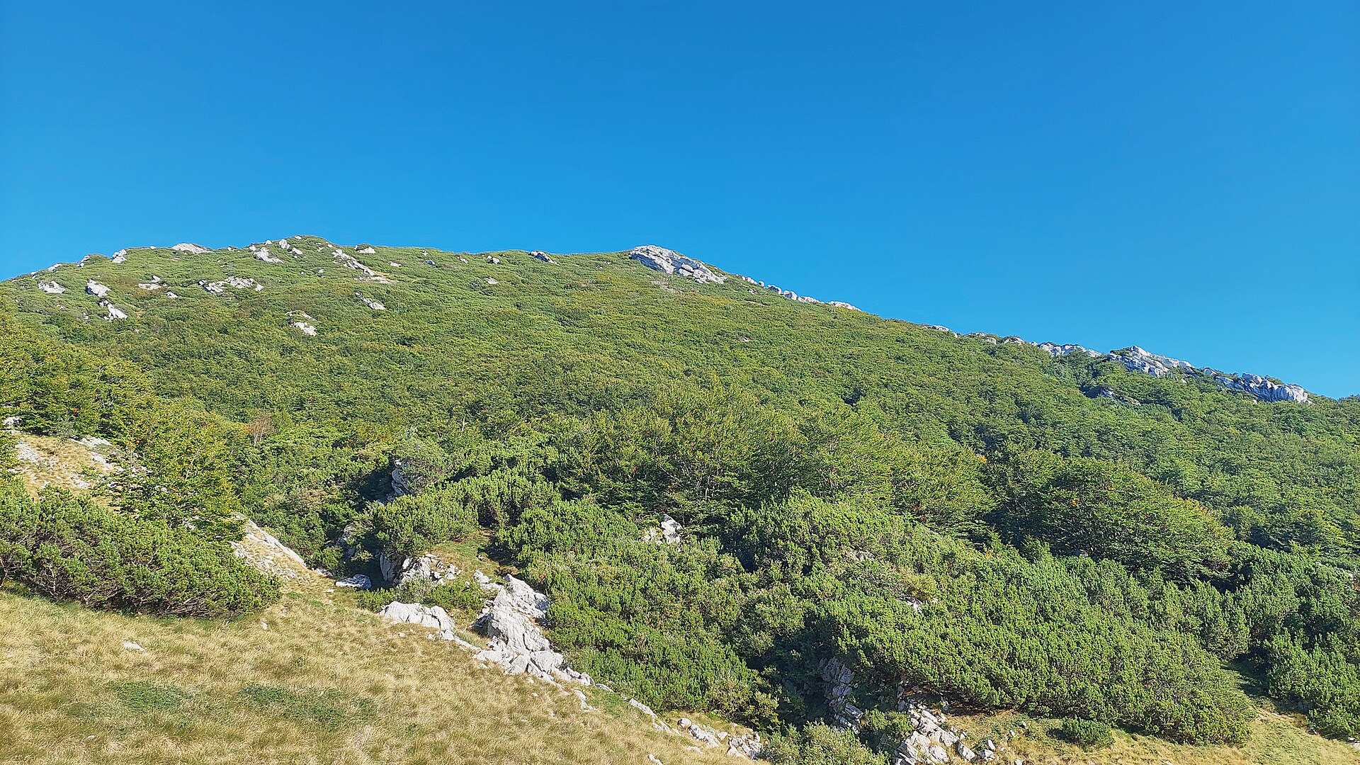
Zoranićev vrh is a peak near Kukljić, in the southern part of Croatia's Velebit mountain range, rising to 1,712 meters above sea level. It sits right next to Vaganski vrh (1,757 m), the highest point of the entire Velebit chain, making it a rewarding target for hikers who want mountain scenery away from the coastal crowds. Where exactly is the peak? Zoranićev vrh lies in Southern Velebit (Južni Velebit), west of Vaganski vrh, south of Babino jezero, east of Rapavac, and north of Crljeni kuk. Its coordinates are 44.3677 N, 15.4865 E. The surrounding terrain is classic central-southern Velebit limestone country: deep karst valleys, rocky ridgelines, and views that stretch toward the Adriatic on clear days. Where does the name come from? The peak is named after Petar Zoranić, a Croatian Renaissance writer best known for the pastoral prose poem "Planine" ("Mountains"), one of the earliest works written in the Croatian language. The naming decision was made on May 20, 1973, during a joint expedition by representatives of four Croatian mountaineering societies. It follows a long-standing Velebit tradition of naming summits after figures important to Croatian culture and history. How do you get to Zoranićev vrh? The peak sits along the network of southern Velebit trails, close to the border of Paklenica National Park, the main gateway used for climbing neighboring Vaganski vrh. The usual approach combines the marked route to Vaganski vrh with a short ridge walk heading west. The limestone ground is loose and steep in places, so sturdy trekking boots, poles, and prior mountain hiking experience are essential. Plan for a full-day outing and start early, especially in summer, when the exposed rock heats up quickly under the sun. What will you see up there? From Zoranićev vrh, the view opens onto the neighboring peaks of southern Velebit, deep karst valleys, and, on clear days, a strip of coastline and the Adriatic islands beyond it. Vegetation is typical high-Velebit flora: dwarf pines, endemic herbaceous plants, and sparse, tough grasses growing out of rock crevices. The whole area falls within Velebit Nature Park, which also carries UNESCO Biosphere Reserve status, meaning strict landscape protection, a no-litter policy, and a requirement to stay on marked trails. When is the best time to visit? The best hiking window runs from June to September, when trails are dry and snow has cleared even from the highest sections. Spring and autumn weather in the mountains can shift quickly, so checking the forecast right before setting out is essential. Winter ascents require alpine gear and experience — this is a route strictly for well-prepared mountain hikers. Frequently asked questions How high is Zoranićev vrh? The peak stands at 1,712 meters above sea level, 45 meters lower than Vaganski vrh, the highest point of the Velebit range. Is the hike difficult? Yes, it crosses high-mountain limestone terrain that demands good fitness, proper footwear, and prior hiking experience in alpine conditions. Why does the peak carry this name? It honors Petar Zoranić, a Croatian Renaissance writer known for "Planine" — the name was officially given in 1973. Is there accommodation nearby? Most lodging and trailhead access points are located in and around Paklenica National Park and the coastal towns nearby, from which trails lead deeper into the Velebit range.
-
Klek mountain
Potok Musulinski
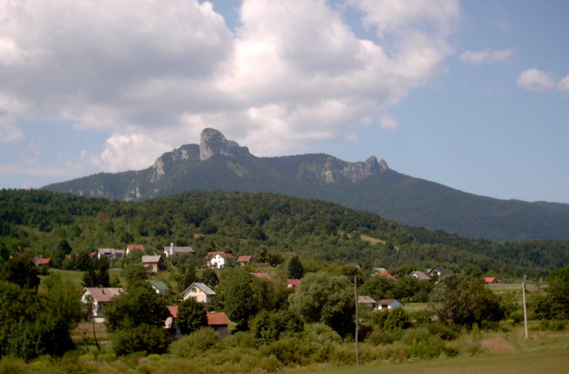
Klek is the striking mountain rising above the village of Potok Musulinski and nearby Ogulin, one of the most recognisable peaks in Croatia's Lika region. It sits on the edge of the Velika Kapela range, precisely located at coordinates 45.26033, 15.14547. What will you see on Klek? Klek isn't a single summit but a ridge stretching 3–4 kilometres, flanked by steep slopes and topped by a distinctive rock tower rising roughly 200 metres above the rest of the massif. That rocky spire, visible from far around Ogulin, gives the mountain its unmistakable silhouette and makes Klek one of the most photogenic peaks in this part of Croatia. The region also carries a rich layer of folklore. According to local legend, the summit of Klek is where witches gather on stormy nights — a motif so deeply woven into the area's identity that a sign at the foot of the mountain welcomes visitors to the "kingdom of the Klek witches." Today that folklore is as much a part of Klek's appeal as the landscape itself. For climbers, the mountain holds historical weight — the rock faces below the summit are regarded as the first "school" of Croatian climbing, the site of numerous first ascents in the country's climbing history. Klek remains a popular destination for both rock climbers and hikers chasing panoramic ridge views to this day. How do you get to the summit? The most frequently used trail to Klek starts in Bjelsko, but a well-known alternative route runs through Potok Musulinski itself — from Jasenak via Potok Musulinski to Bjelsko and the mountain lodge, from where the summit is reached in roughly five and a half hours in total. After a stretch of rock-cut steps along the way, hikers reach a ridge viewpoint overlooking the village of Potok Musulinski and Bjelsko below — one of the most photographed spots on the whole route. When is the best time to visit? Because the upper section is rocky and steep, the safest and most comfortable window for climbing Klek runs from late spring to early autumn, when the trail is dry and technically manageable. Plan for a full day out — the ascent alone takes several hours, and the ridge-top views reward the effort at any time of year, provided the weather holds. Frequently asked questions Is Klek suitable for beginners? The ridge trail is long (several hours one way) and crosses rocky sections with steps cut into the stone, so it demands decent fitness and sure footing, even though it isn't a technical climbing route. Where does the legend of the Klek witches come from? Local folk tradition has for generations linked Klek's summit to gatherings of witches during stormy nights, a motif that has become inseparable from the identity of the Ogulin region. Does a trail lead to the summit from Potok Musulinski? Yes, one of the routes up Klek passes through Potok Musulinski on its way to Bjelsko and the ridge beyond, offering a scenic viewpoint over the village itself along the way. Why is Klek important for climbers? The rock faces below the peak are the historical birthplace of Croatian climbing, the site of many of the country's first ascents, which makes Klek a kind of cradle of the sport nationally.
-
Orljak
Luka
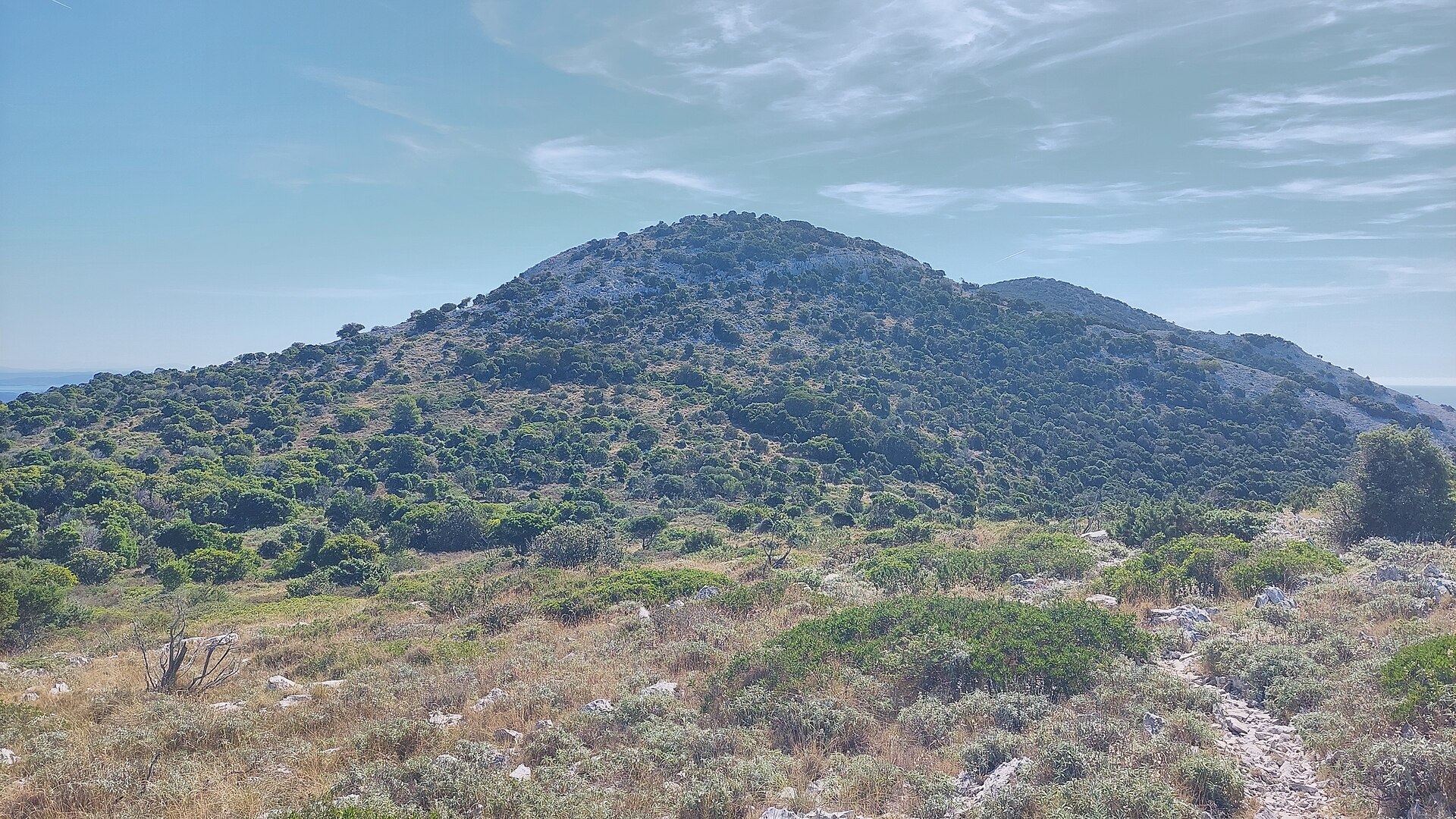
Orljak is a scenic hill on Dugi Otok island in Croatia, rising above the village of Luka, from where one of the most popular trails leads to the summit. Where is Orljak and why climb it? Orljak stands roughly 301 metres tall and is the second-highest point on Dugi Otok. The island's true highest peak, Vela Straža (around 337–338 m), has been off-limits to visitors since 2004 because a military radar station occupies its top. As a result, the Croatian Mountaineering Association designated Orljak as the official hiking target instead of the closed-off summit. In practice, that makes Orljak the highest point on the island an ordinary visitor can actually reach. How do you get to the top? A convenient starting point is Luka, a small village in the central part of Dugi Otok, tucked at the foot of the Vela Straža massif between Žman to the southeast and Savar to the northwest. The trail begins at around 110 metres above sea level and covers just 1.8 km, though an average gradient of 24% means it isn't entirely effortless. Most hikers cover it in well under an hour — about 47 minutes one way. The route follows an old goat path: a gentle climb toward a saddle, a short flatter stretch, and finally a steeper, rockier push to the summit. Waymarking is clear throughout, so even less experienced walkers shouldn't have trouble following it. What will you see at the top? The summit is marked the traditional way — a small cairn of stones with a piece of dry wood wedged into it, alongside a stone bearing the peak's name and elevation. The real reward, though, is the view: from the top, the panorama opens across the whole island, its surrounding channels, and the neighbouring islands of the Zadar archipelago. It's a favourite spot for landscape photographers and for catching sunrise or sunset. What's worth seeing in Luka itself? Luka is one of the more picturesque settlements on Dugi Otok. It's first mentioned in writing in 1365 under the name Vallis Sancti Stephani, though traces of settlement here go back to Roman times. A larger wave of residents arrived in the 16th century, when people fleeing Ottoman incursions on the mainland sought refuge on the islands. Today the village counts only around a hundred permanent residents in winter, a number that multiplies many times over in summer. Worth doing while in Luka: a walk along its seaside promenade, whose origins trace back to the 14th century, and time spent at Zlatna Vala bay, known for its crystal-clear water. Nearby lies Bok bay, where a natural therapeutic mud can be found. Thanks to its sheltered bays, Luka is a popular anchorage for yachts and smaller boats. The village also keeps up its fishing traditions, which show up in a rich local food scene built around fresh fish and seafood. Every year on 2–3 August, Luka holds its traditional summer festa. When is the best time to visit? Spring (April to June) and early autumn (September to October) are the most comfortable seasons for climbing Orljak, offering milder temperatures than the height of summer and often clearer views thanks to less haze. In summer, it's best to set out early in the morning before the heat builds on the rocky, largely unshaded trail. Frequently asked questions How tall is Orljak? The hill rises to about 301 metres, making it the second-highest point on Dugi Otok after Vela Straža, which is closed to the public. Where's the best place to start the hike? The village of Luka is the most convenient trailhead — a well-marked 1.8 km trail leads from there to the summit in around 47 minutes. Is the trail difficult? It's short, but the average 24% gradient adds up, and the final stretch is rocky and steep, so proper hiking footwear is worth having. What else is there to see besides the summit? In Luka, don't miss the historic seaside promenade, Zlatna Vala bay with its clear water, and the nearby Bok bay known for its therapeutic mud.
-
Kamenjak
Town of Rab
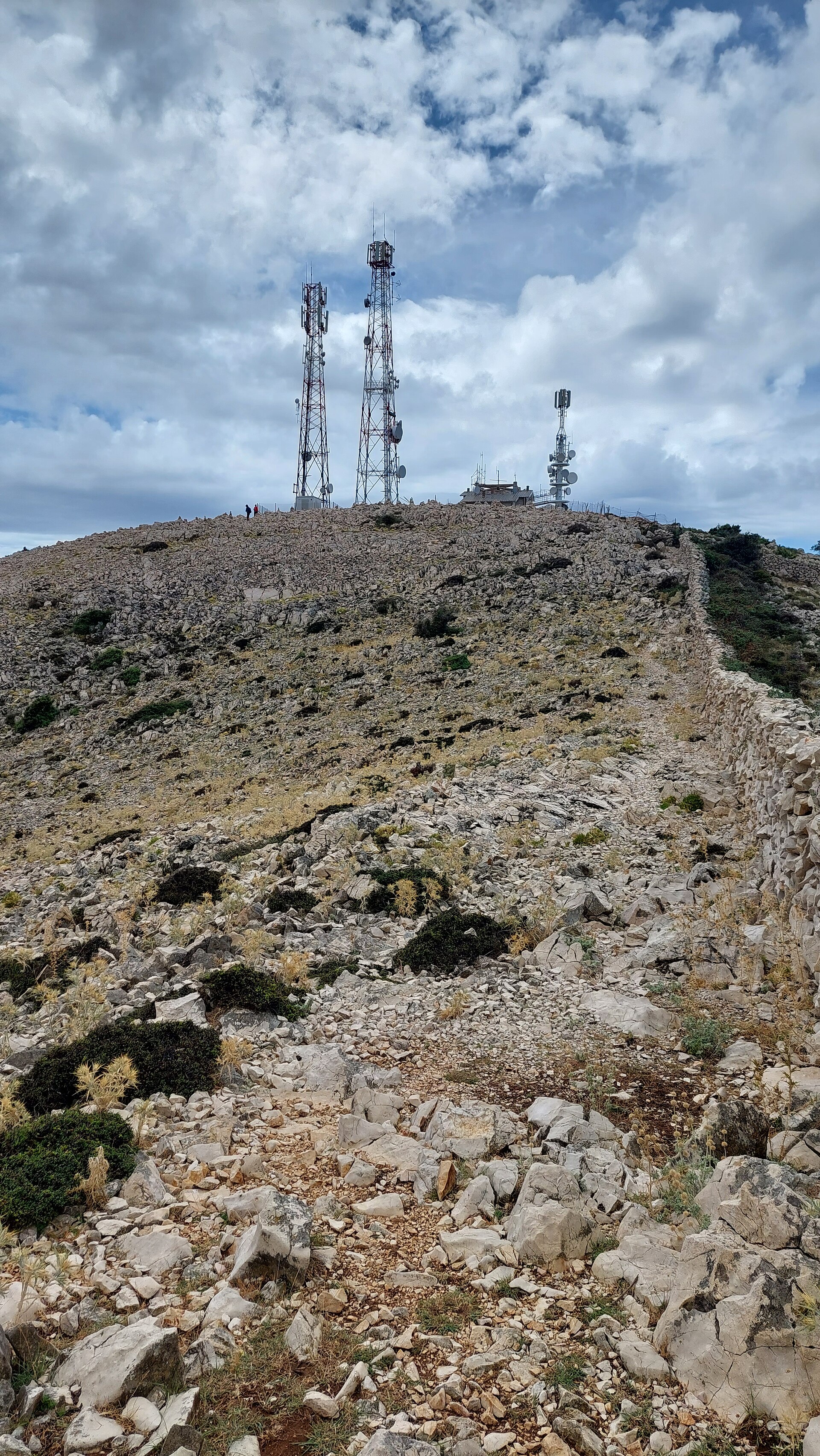
Kamenjak is the highest peak on the island of Rab in Croatia, rising 408 meters above sea level right behind the town of Rab. Locals also call it Straža, a name that hints at its role — a natural lookout towering over the whole island and visible from almost every corner of it. How do you get to the top? Kamenjak can be reached on foot or by car. The hiking trail usually starts near the town of Rab or from the village of Mundanije on Rapsko polje. It's well marked: the first stretch runs along roads and through built-up areas, then near Barčići it cuts between two houses and turns into a proper rocky footpath that climbs gently towards the summit. Depending on the starting point and pace, the round trip takes anywhere from about two to nearly four hours. The final section crosses open, rocky ground, so sturdy shoes and water are worth packing. Drivers can skip the walk entirely and follow a narrow, partly paved access road all the way up. What will you see along the way? The climb itself is scattered with spots worth pausing at. One is the ruined Tomašić lookout, facing back towards the town of Rab. Higher up, along the ridge, sits Vidilica — a stone platform with benches offering views over Rab, the sea, and the island of Lošinj. It's a good place to catch your breath before the final push. The summit itself is marked by a telecommunications facility — not the prettiest sight, but a useful landmark, with a metal summit stamp bolted to its fence. A cargo cableway once carried supplies up to the station; it's long abandoned now and has been replaced by the access road. Why is Kamenjak worth the climb? The reward at the top is a sweeping panorama over much of the northern Adriatic. From the summit you can pick out the Velebit mountain range on the mainland, along with the neighbouring islands of Krk, Cres, Lošinj, Pag, Silba and Olib, and on a clear day even smaller islets such as Sv. Grgur, Goli Otok and Prvić. It's one of the best viewpoints on the whole of Rab and a favourite among photographers at sunrise and sunset. When is the best time to go? Spring and autumn are the most comfortable seasons, with mild temperatures that make the exposed final stretch far less tiring. In summer, starting early in the morning is a good idea, before the sun heats up the rocky sections of the trail. In winter, clouds sometimes wrap around the summit and cut visibility, but on a clear day the views are just as striking. Frequently asked questions How long does it take to hike Kamenjak? Depending on the starting point and your pace, the full round trip takes roughly two to four hours. Can you drive to the top? Yes, a narrow, partly paved access road leads all the way up, though hiking lets you take in the viewpoints along the route. Where's the best place to start the hike? Popular starting points are near the town of Rab and the village of Mundanije on Rapsko polje — both routes join higher up on the trail. What can you see from the summit? A panorama of the Velebit mountain range, the islands of Krk, Cres, Lošinj, Pag, Silba and Olib, and smaller islets near Rab.
-
Grabar
Starigrad
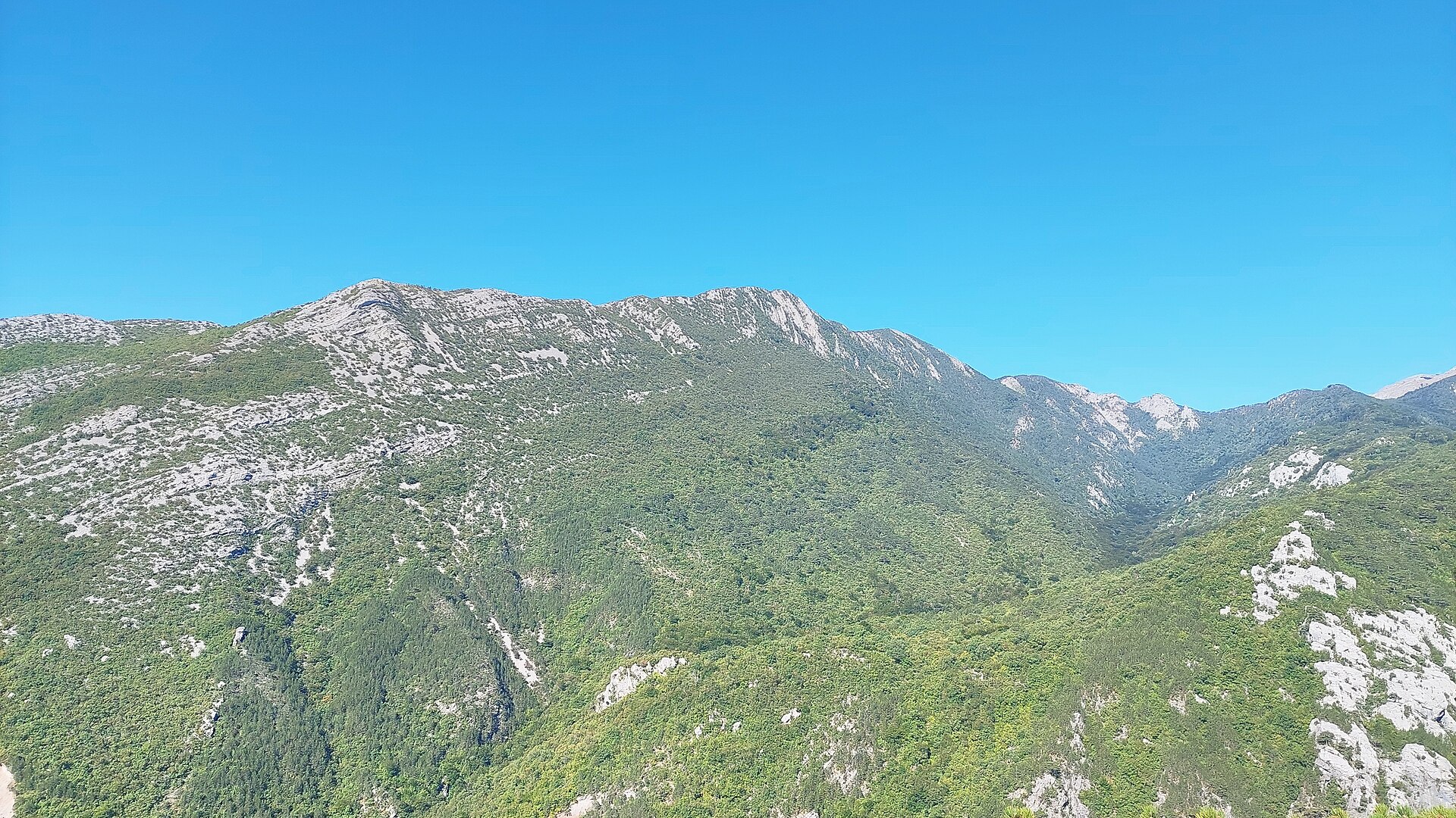
Grabar is a modest mountain ridge in the Velebit range, close to the town of Starigrad on Croatia's Dalmatian coast. It forms a shoulder of the Golić peak, set within one of Croatia's largest and least tamed mountain systems. The point sits at coordinates 44.3458388, 15.4552816, inside the protected area of Velebit Nature Park. Where is Grabar located? Grabar lies in the inland, mountainous heart of Velebit, which towers above Starigrad and the neighboring Paklenica National Park. The whole massif runs parallel to the Adriatic coast for more than 100 kilometers and has been partly protected as a UNESCO Biosphere Reserve since 1978. As a ridge attached to Golić, Grabar is one of many landmarks scattered across this rugged karst terrain. How do you get to Grabar? Most hikers start from Starigrad, where trails climb into Velebit through the grounds of Paklenica National Park. The terrain is classic karst – rocky, cut by ravines, and largely shadeless for most of the route, so the trip calls for solid preparation: sturdy footwear, enough water, and confident navigation. Given how demanding Velebit can be, venturing deep into the massif is best done with an experienced guide or by sticking to marked paths. What will you see along the way? The surroundings of Grabar show off Velebit's typical mountain scenery: limestone ridges, deep valleys, and sweeping views stretching toward the Adriatic and the islands of Dalmatia. It's a place where sharply different environments meet – Mediterranean at the foot of the mountain, almost alpine higher up. The wider region is known for rich wildlife, including brown bears, wolves, and birds of prey, and Velebit as a whole is regarded as one of Croatia's most valuable natural areas. When is the best time to visit? Late spring and early autumn (May–June and September–October) are the best windows for hiking around Velebit, Grabar included, when temperatures are moderate and trails see less traffic than at the height of summer. Summer heat and the lack of shade can make the walk tough, while in winter the higher parts of Velebit are often snow-covered and require proper winter gear. Frequently asked questions Is Grabar marked on hiking trails? As a landmark within the Velebit massif, Grabar sits along the network of mountain trails leading out of Starigrad and Paklenica National Park, though it isn't promoted as a standalone hiking destination. Do you need mountain experience to reach it? Yes – Velebit's karst terrain is demanding, so it's worth building up fitness beforehand and knowing the basics of safe mountain travel. Is water or shelter available nearby? Water sources are scarce in Velebit's higher reaches and mountain huts are spread thin, so it's best to carry enough food and water for the whole trip. How far is Grabar from Starigrad? Starigrad sits at the foot of Velebit and is the natural starting point for trips into the massif, though the exact hiking time depends on the route chosen and the hiker's pace.
-
Golić
Starigrad
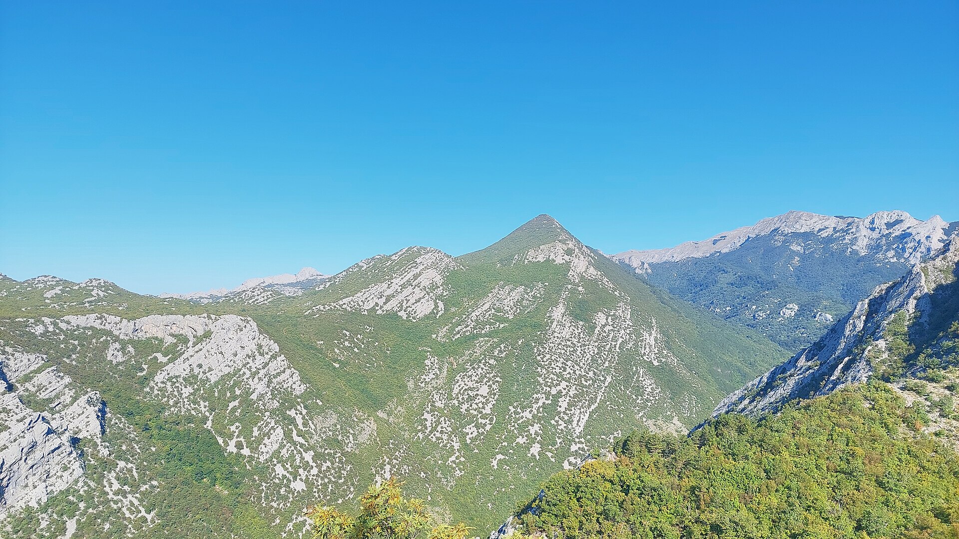
Golić is a peak in the Velebit mountain range, rising above Starigrad on Croatia's Dalmatian coast. Starigrad is best known to travelers as the gateway to Paklenica National Park, and Golić forms part of the mountainous backdrop visible from the town's promenade and beaches below. Where exactly is Golić? The peak sits in the northern part of the Velebit massif, directly above the coastal strip where Starigrad is located. Velebit is Croatia's longest mountain range, running parallel to the Adriatic Sea, and the stretch around Starigrad and neighboring Paklenica falls within an area protected as a UNESCO biosphere reserve. Golić is one of many summits in this landscape that separate the coastline from the higher, rockier interior of the range. How do you get to Golić from Starigrad? Hikes typically start in Starigrad itself or near the entrance to Paklenica National Park, from where trails lead up into the Velebit interior. The approach requires reasonable fitness and proper trekking footwear, since the terrain is rocky, occasionally steep, and heavily exposed to the sun in summer. It's best to set out early in the morning, carry plenty of water, and check current trail markings, as the Velebit path network is extensive and route-finding requires attention. What will you see on the way up and at the top? Climbing toward Golić and the surrounding hills is above all about the views: below stretches the coastline with the town of Starigrad, the Velebit Channel, and the island of Pag, while inland the rocky ridgeline of Velebit unfolds. Vegetation shifts with altitude, from Mediterranean scrub and pine stands near the coast to sparser, more rugged mountain cover higher up — a landscape typical of the whole range, where the blue of the sea contrasts with the grey limestone slopes. When is the best time to visit? Spring and early autumn are the best seasons for trips into the Golić and Velebit area, offering milder temperatures than the height of summer and quieter trails. Summer heat can be intense by midday, so it's worth planning excursions for the morning hours. In winter, the higher parts of Velebit can be harder to access due to weather conditions. Frequently asked questions Is there a marked trail to Golić? The Velebit area above Starigrad and Paklenica has an extensive network of mountain trails; it's best to start from Starigrad or the national park entrance and check current markings on site. Do you need mountain hiking experience? The terrain is rocky and demands good fitness and suitable footwear, but with sensible planning the route is manageable for prepared hikers. Is it worth combining the hike with Paklenica National Park? Yes — the proximity of the park means many routes in this part of Velebit naturally connect, making it easy to plan a longer mountain outing. What's the view like from the top? The panorama takes in the coastline around Starigrad, the Velebit Channel, and the island of Pag, with the rocky ridges of Velebit stretching inland.
-
Vidova gora
Općina Bol
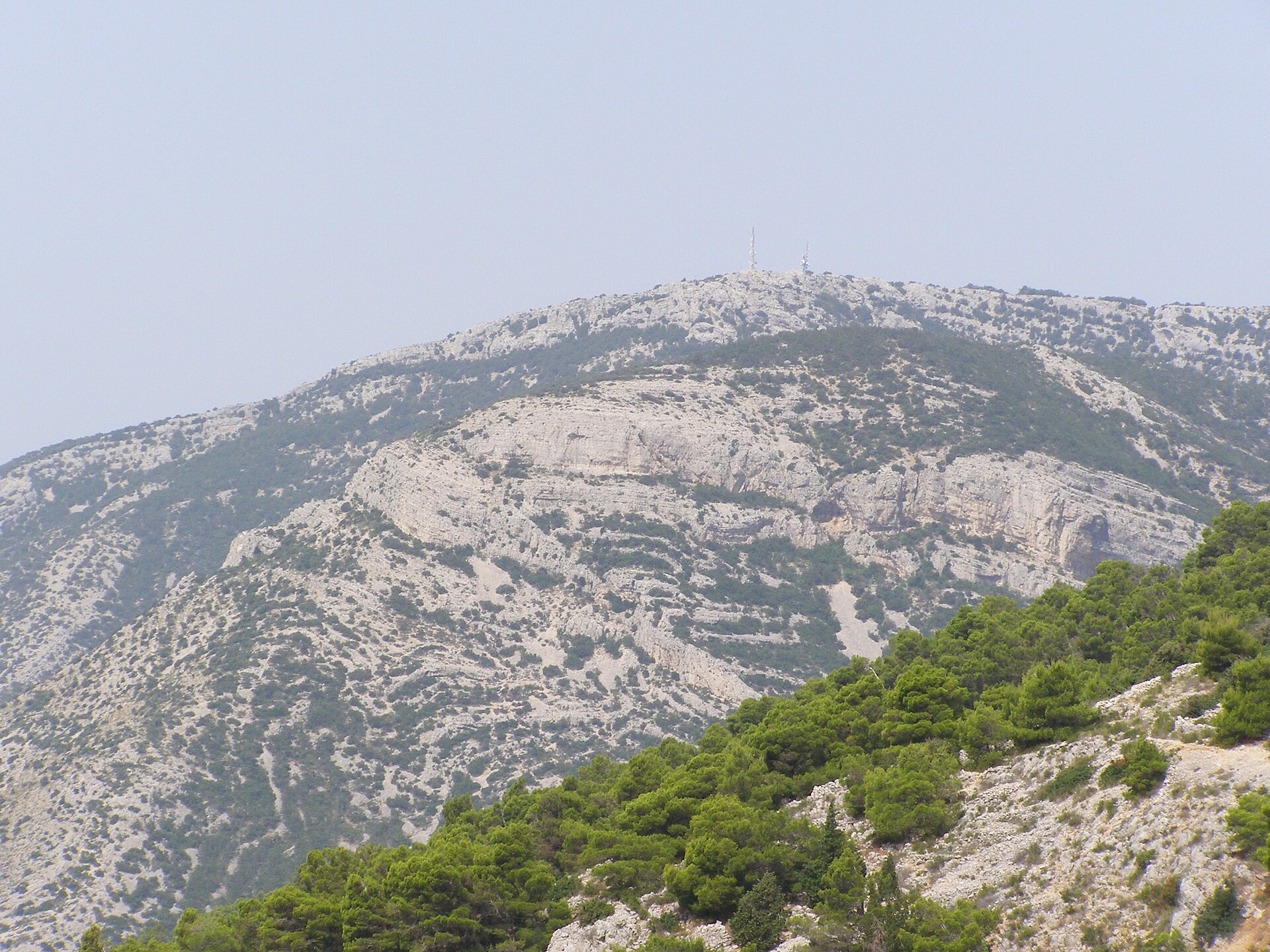
Vidova Gora is the highest peak on the island of Brač and, at 778 metres above sea level, the highest point on any island in the Adriatic. It rises directly above the town of Bol, and its name refers to Saint Vitus, sometimes translated as Mount St. Vitus. For visitors staying in Bol, it's the obvious spot for a sweeping panorama over the central Adriatic. How do you get to Vidova Gora? A winding paved road climbs to the summit, accessible by car or scooter from either the Bol side or from Nerežišća on the other side of the island. The road is narrow with many hairpin turns, so drive carefully, especially in the busy summer months. Hikers can also follow a marked trail leading straight up from Bol, which typically takes 1.5–2.5 hours depending on fitness level and can be demanding in hot weather. Some visitors tackle it by mountain bike, though the climb is one of the toughest on the island. There's a car park near the top, followed by a short walk of a few hundred metres to the actual viewpoint. What will you see at the top? The main draw is the bird's-eye view of the famous Zlatni Rat beach, whose distinctive tongue of pebbles shifts shape with the currents and wind, looking almost postcard-perfect from above. On clear days you can also make out neighbouring islands such as Hvar and Vis, and occasionally the outline of the Italian coast in exceptionally good visibility. A small restaurant at the summit serves local dishes, offering a place to rest after the climb, alongside information boards explaining the view. Vidova Gora is also a popular launch point for paragliders, who take advantage of the strong thermal currents rising off the island — watching them take off is an attraction in itself. When is the best time to visit? Early morning or the hours before sunset give the best light and usually clearer air than midday. In July and August the summit gets crowded, particularly around sunset, so arrive with time to spare. Spring and early autumn offer more comfortable temperatures for the hike up and fewer cars on the road. The road generally stays open in winter, but it's worth checking conditions first, since strong winds (the bura) can make the exposed summit uncomfortable. How much time should you plan? A visit to the viewpoint itself takes 30–45 minutes, but if you're hiking up from Bol and back down the same way, plan for half a day. Those arriving by car can combine Vidova Gora with a trip into the island's interior, including the villages of Nerežišća and Škrip. Frequently asked questions How high is Vidova Gora? The peak stands at 778 metres above sea level, making it the highest point on Brač and on any Adriatic island. Can you hike up from Bol? Yes, a marked footpath runs from Bol to the summit, and the climb usually takes 1.5–2.5 hours. What can you see from the top? Mainly an aerial view of Zlatni Rat beach, and on clear days neighbouring islands including Hvar and Vis. Is there anywhere to eat at the summit? Yes, there's a restaurant serving local food with a terrace overlooking the island and the sea.
-
Crni vrh
Seline
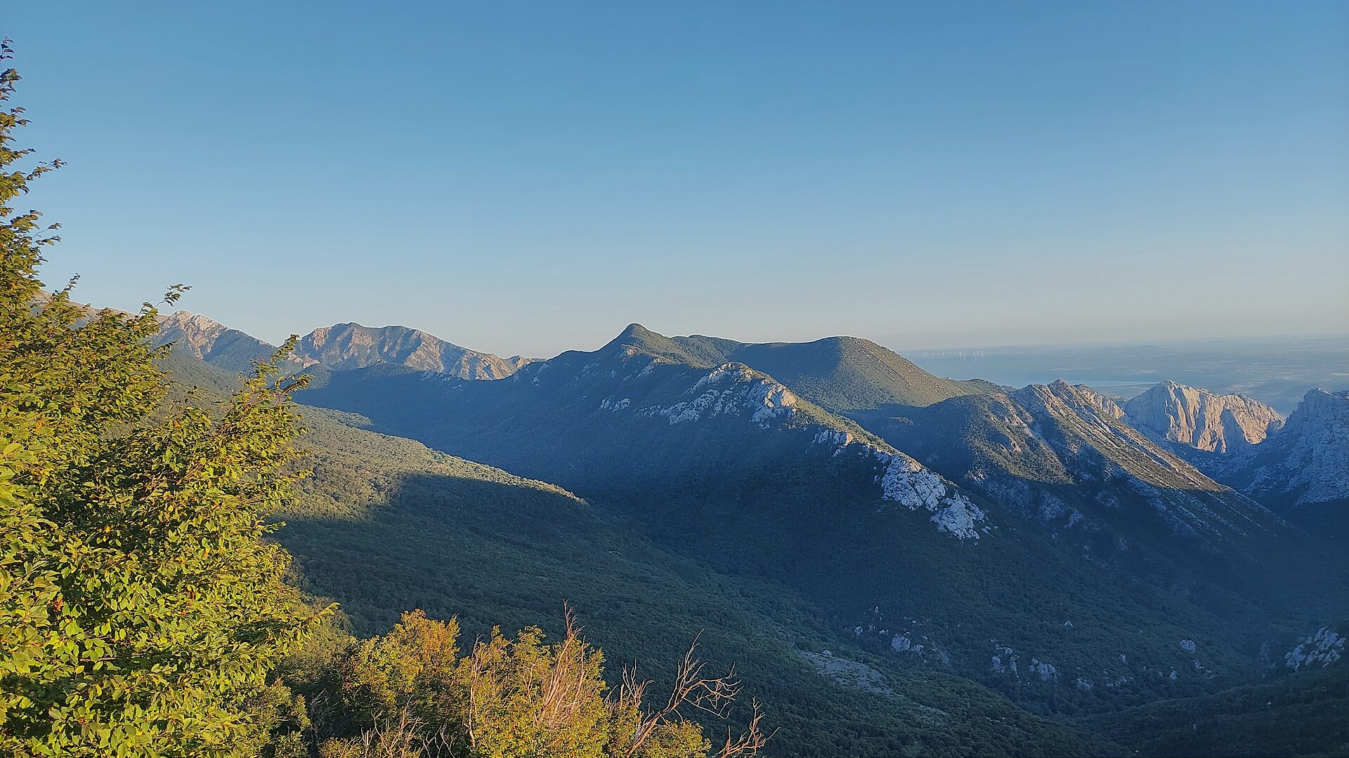
Crni vrh is a 1,110-metre peak in the Velebit massif above Seline, in the Starigrad municipality. It rises in the central part of Paklenica National Park and forms one of the notable waypoints on the Velebit long-distance hiking trail (Velebitski planinarski put), a roughly 100-km route marked with the classic red-and-white mountaineering signs. How do you get to Crni vrh? The usual starting point is Seline or the neighbouring Starigrad Paklenica – coastal villages at the foot of Velebit that also serve as gateways to the national park. From the car park at the entrance to the Velika Paklenica canyon, the trail heads inland past the mountain hut and continues to Velika Močila, a basin-shaped valley sitting at around 850 metres above sea level. From there, the path climbs on to the summit of Crni vrh itself. A second approach comes from the southeast, also passing near Velika Močila, so in practice hikers can reach the peak from two main directions that merge into a single final stretch. The whole route calls for a reasonable level of fitness: it's a moderately demanding mountain trail, with a steady climb and the uneven, rocky terrain typical of Velebit's limestone ridges. What will you see at the top? Crni vrh sits right in the heart of Paklenica National Park, surrounded by the rugged ridgelines, open highland pastures and deep canyons that define the Velebit landscape. From its slopes, the view opens toward the Velika Močila valley and further into the massif, in the direction of Velebit's highest peaks. Experienced hikers treat it as a key landmark on the trans-Velebit route, linking the sections that climb up from the coast with the longer stretch of trail running along the entire Velebit ridge, all the way to Starigrad Paklenica, where the long-distance route finishes near the Adriatic coastal road. When is the best time to visit? Late spring, summer and early autumn are the best windows for hiking toward Crni vrh, when the mountain trails are clear and Velebit's weather is more settled. In summer, an early start pays off – the limestone terrain offers little shade, and the heat can be intense on exposed sections. In autumn and spring the trail tends to be quieter, and the views are often crisper thanks to cleaner air. In winter, reaching the peak requires mountaineering experience and proper gear, since ice and snow cover the higher parts of the route. Frequently asked questions How high is Crni vrh? The peak stands at 1,110 metres above sea level, in the central part of Paklenica National Park within the Velebit massif. Where's the best place to start the hike? Seline or Starigrad Paklenica are the most convenient starting points – from there the trail runs through the Velika Paklenica canyon and the Velika Močila valley toward the summit. Is the route suitable for beginners? It's a moderately to fairly demanding mountain trail with a sustained climb, best suited to hikers with basic mountain fitness and proper trekking footwear. Is Crni vrh part of a long-distance trail? Yes, the peak is one of the waypoints on the Velebit long-distance hiking trail, a roughly 100-km route that runs the length of the Velebit ridge and ends at Starigrad Paklenica.
-
Muravjak
Općina Sali
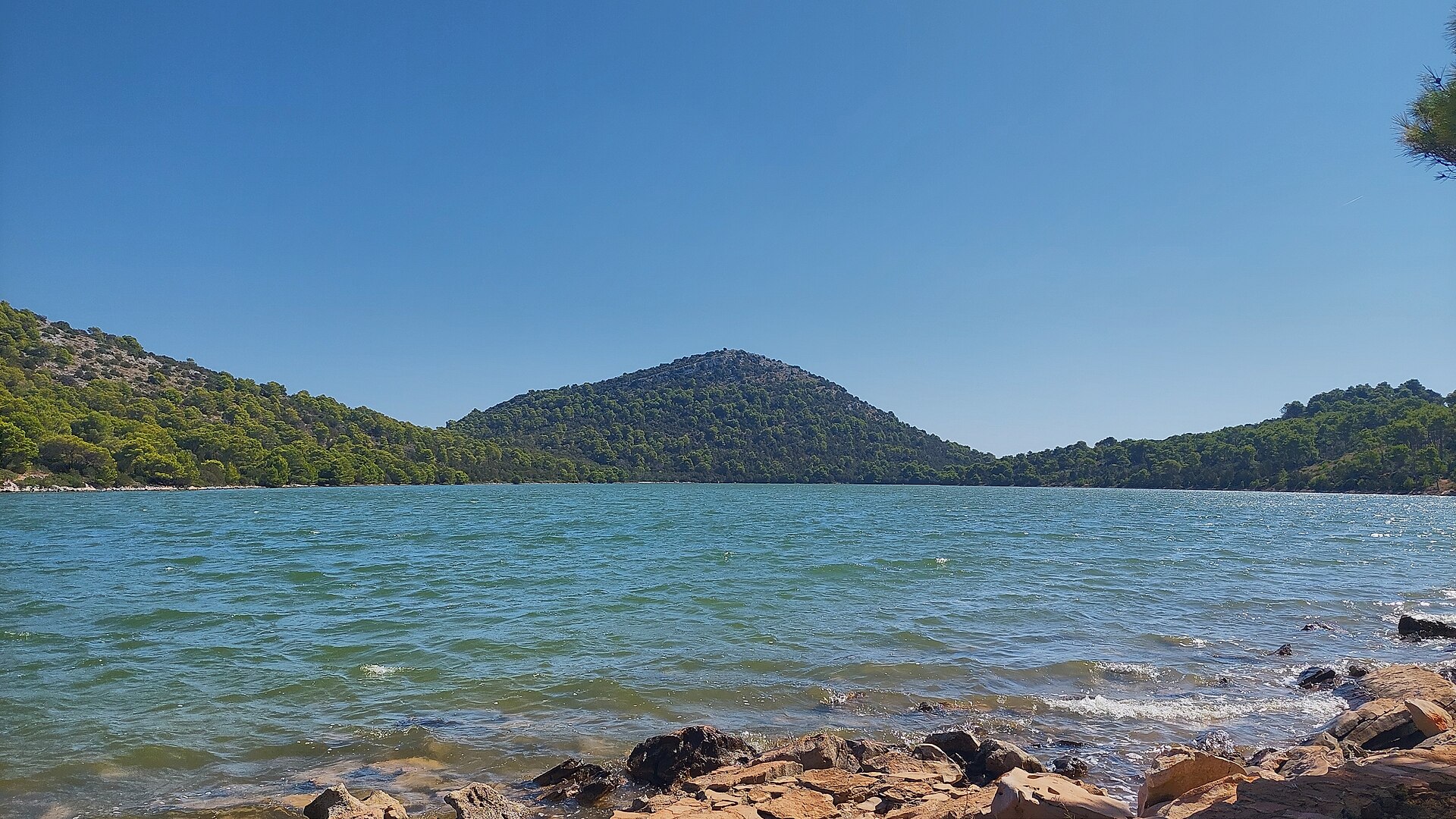
Muravjak is a cone-shaped hill inside Telašćica Nature Park on Dugi Otok, within the municipality of Općina Sali. Rising to roughly 180 metres above sea level right above the saltwater lake Mir, it is one of the most recognisable viewpoints in the southern part of the island. Where is Muravjak located? The hill sits within Telašćica Nature Park, which covers the southern tip of Dugi Otok — the largest and longest island of the Zadar archipelago. Muravjak's distinctive cone shape stands out against the surrounding karst limestone landscape. At its foot lies Lake Mir, a saltwater lake connected to the sea through underground channels, while nearby stretches Telašćica Bay, one of the largest and best-protected natural harbours on the entire Adriatic coast. The closest settlement is Sali, the island's main village, set picturesquely on a harbour a few kilometres from the base of Muravjak. How do you get to the summit? Most visits start from Sali, reachable by ferry or catamaran from Zadar. Local roads and footpaths lead from Sali into Telašćica Nature Park, and the climb to Muravjak is a natural extension of a walk along Lake Mir toward the sea cliffs. Because the relative elevation is modest and the approach is gentle, if rocky, no special equipment is required — sturdy walking shoes, water and sun protection are enough, since the limestone terrain offers little shade. What will you see from Muravjak? The summit offers a wide panorama over the island, its surrounding islets and the open sea. On one side you look down on the calm surface of Lake Mir and the wooded slopes of the park; on the other, the sheer cliffs of Telašćica drop straight into the sea, reaching heights of up to 200 metres. This contrast between the island's gentle interior and its rugged coastline is what makes the view from Muravjak one of the most distinctive in the region. On a clear day you can also make out neighbouring islands of the Zadar archipelago and boats sailing along the coastal routes. When is the best time to visit? The best conditions for climbing Muravjak are in spring (April–June) and early autumn (September–October), when temperatures are milder than at the height of summer and the limestone ground doesn't heat up as much. In July and August, it's worth setting out early in the morning or in the late afternoon to avoid the midday heat. Telašćica Nature Park, where the hill is located, is accessible throughout the tourist season, though ferry connections from Zadar can be less frequent outside summer, which is worth factoring into your planning. Frequently asked questions Is climbing Muravjak difficult? No — it's a low hill at around 180 metres above sea level, and the ascent is a moderate walk over rocky, karst terrain. Sturdy footwear is still recommended. Do you need to pay an entrance fee? Muravjak lies within Telašćica Nature Park, where entrance fees apply at the main access points to Lake Mir and the cliffs. How long does the hike to the summit take? The climb itself usually takes anywhere from a few dozen minutes to an hour, depending on the starting point, though most visitors combine it with a longer walk along Lake Mir and the Telašćica cliffs. Where is the best place to start the hike to Muravjak? The most convenient starting point is Sali, from where marked paths lead into Telašćica Nature Park, past Lake Mir and up to Muravjak hill.
-
Sveto brdo
Sveti Rok
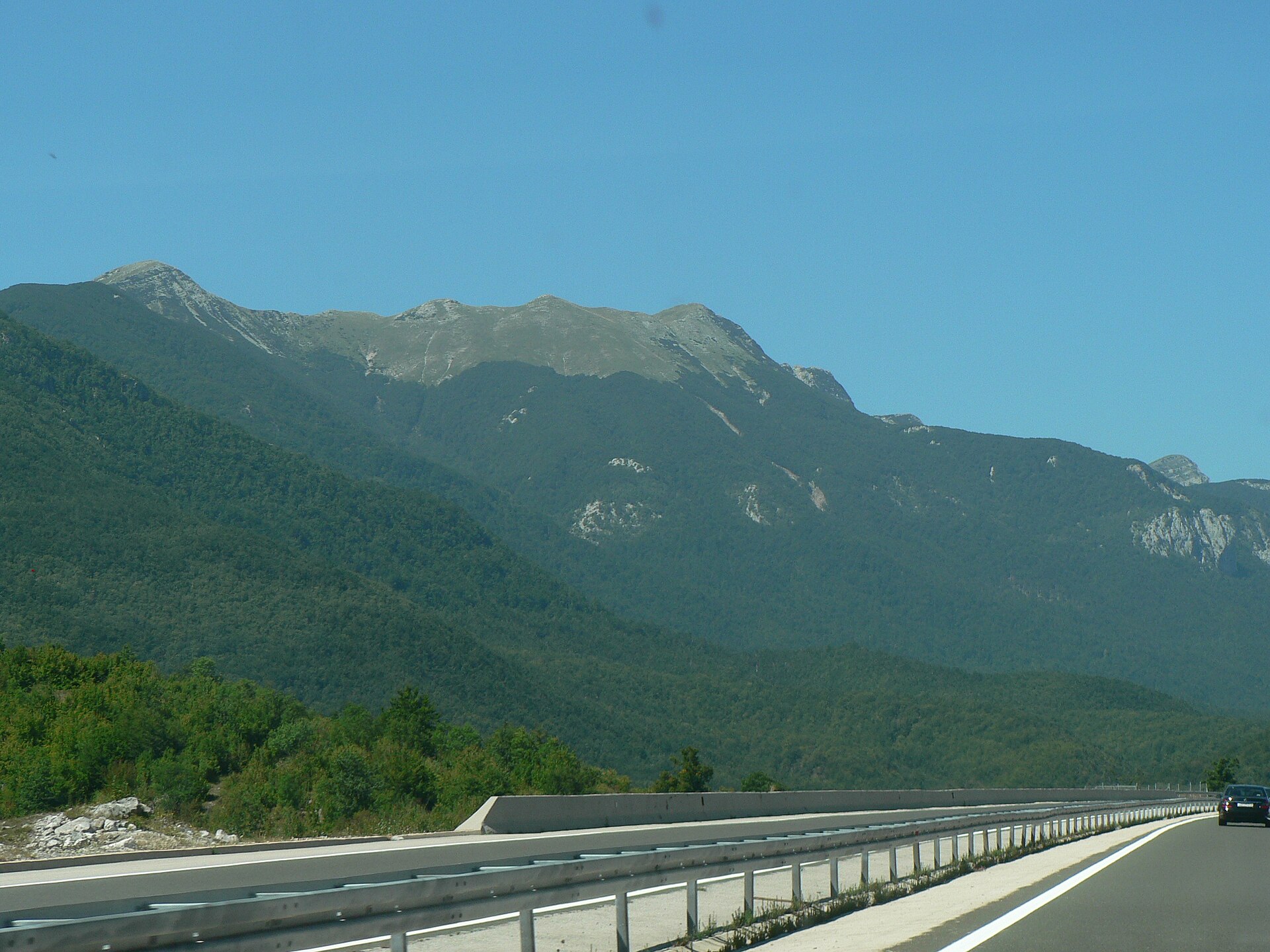
Sveto brdo is the second-highest peak of the Velebit mountain range, rising above the village of Sveti Rok in Croatia's Lika region. At roughly 1751 m, it falls just short of the range's tallest point, Vaganski vrh (1757 m). The peak sits in southern Velebit, right on the edge of Paklenica National Park, and ranks among the most popular hiking destinations in the whole massif. How do you get to Sveto brdo? Most hikers use the area around Sveti Rok as their starting reference — a village at the foot of Velebit, also known for the road tunnel that carries the A1 motorway between Lika and the Dalmatian coast. From Sveti Rok, hikers still need to reach one of the trails leading into the massif, typically approaching through Paklenica National Park from the coastal side (for example from Velika Paklenica) or via mountain huts on the Lika side. The approach is physically demanding, so decent fitness, sturdy hiking boots, and familiarity with the trail markings (the white-and-red HPS blazes) are essential. Because the terrain near the summit is rocky and partly exposed, many hikers turn the climb into a two-day trip with an overnight stay in one of Velebit's mountain huts, spreading out the effort and making the toughest sections safer to cross. What will you see at the top? A roughly 4-meter wooden cross stands on the summit, mounted with plaques of the Ten Commandments — the origin of the peak's local name, "Holy Mountain." According to local belief, this was the spot where forces of good and evil clashed during storms, which is how the mountain earned its name. The summit offers one of the finest views in all of Velebit: it's one of the few points on the range where you can look inland toward Lika on one side and out toward the Adriatic coast and its islands on the other. The immediate landscape is high-mountain in character — stone scree, rocky ridgelines, and sparse vegetation shaped by strong winds. When is the best time to visit? Summer and early autumn (June to September) are the best months to climb, when trails are free of snow and weather is at its most stable. In spring and late autumn, sudden weather shifts and Velebit's notoriously strong winds are more likely, while winter ascents call for proper mountaineering experience and gear due to ice and snow cover. Whatever the season, it's worth checking the forecast right before setting out — Velebit is known for abrupt weather changes, especially the powerful bura wind blowing in from the coast. Frequently asked questions How high is Sveto brdo? The peak reaches about 1751 m, making it the second-highest point in the entire Velebit range, just behind Vaganski vrh. Where does the name "Sveto brdo" come from? The name means "Holy Mountain" and comes from a local legend about forces of good and evil clashing on the summit during storms. The story is marked by a wooden cross bearing the Ten Commandments that stands at the top. Is climbing Sveto brdo difficult? Yes, the route calls for good fitness and hiking experience — the terrain is rocky and partly exposed, which is why many hikers split the trip over two days with a night in a mountain hut. What can you see from the summit? Sveto brdo is one of the few spots in Velebit where you can see both the inland landscape of Lika and the Adriatic coast with its islands from the Dalmatian side, all at once.
Earn badges for the places you visit
Download NextOnTrip, discover new places and check off your trails.