Mountains and trails in Croatia
A guide to 442 Mountains and trails in Croatia — with descriptions, photos and traveler visits from the NextOnTrip community. Locations spread across 274 cities and towns. Most visited by the community: Vučjak, Vela straža, Moslavačka gora.
-
Veliki Vitrenik
Starigrad
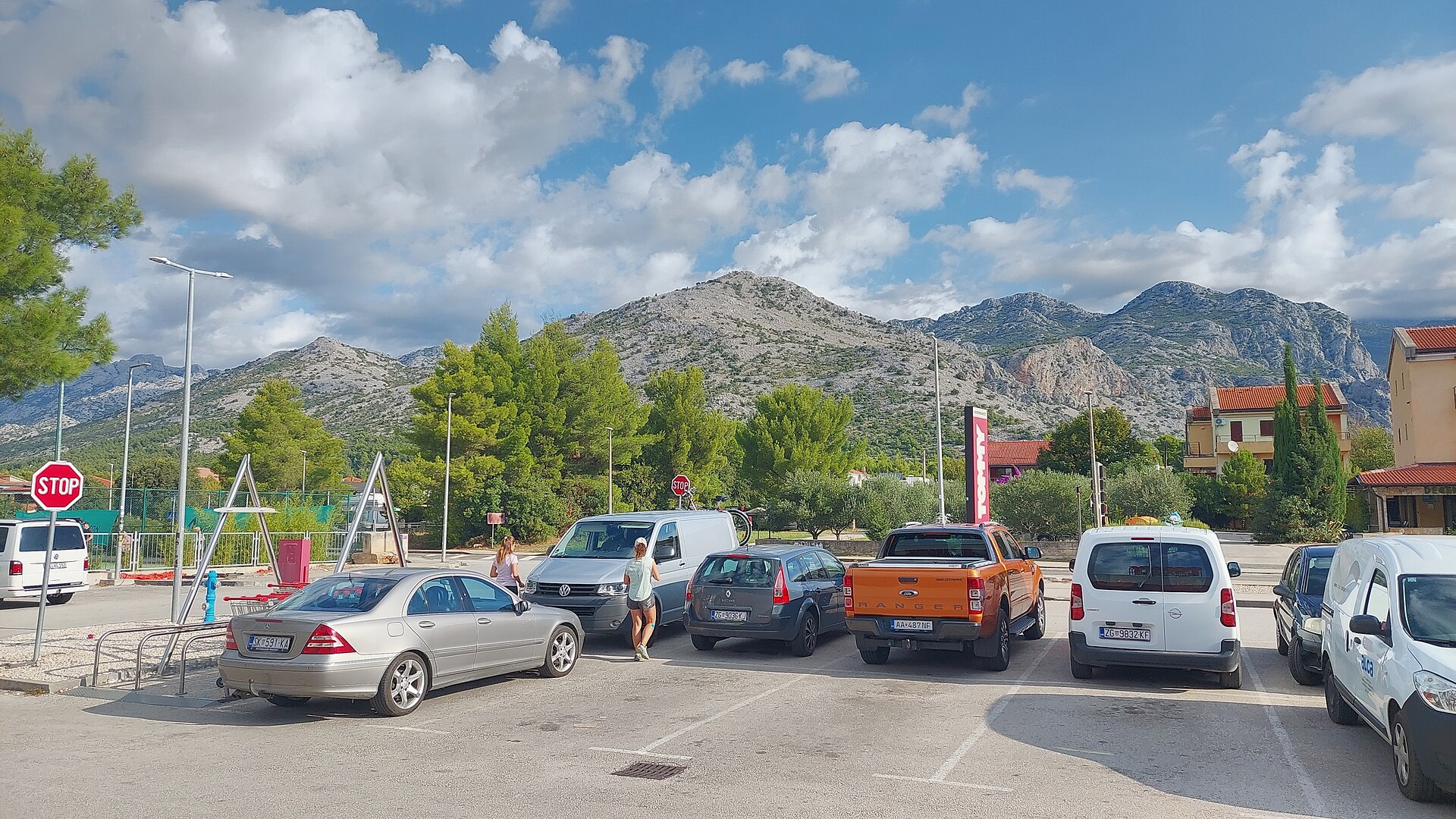
Veliki Vitrenik is a peak in the Velebit mountain range, rising above the town of Starigrad on Croatia's Dalmatian coast. Standing at roughly 433 m, it sits within Velebit Nature Park and ranks among the more accessible viewpoints in this sprawling mountain chain. How do you get to the summit? The hike to Veliki Vitrenik starts right in Starigrad itself, so there's no need to drive inland before lacing up your boots. The trail covers just under 3 km one way with about 350 m of elevation gain, making it a moderately demanding walk that's still manageable for hikers without serious mountain experience. The path climbs steadily up the slope over Velebit's typical rocky ground — the stones are sharp and loose in places, so sturdy hiking boots with a stiff sole are a good idea. What will you see along the way? The standout feature on the route is Mirila — a group of stone markers once used for a local funeral custom between the 17th and 20th centuries, where a body was symbolically measured on its way to the cemetery. It's a rare surviving trace of Velebit's folk funerary tradition, and one of the few sites of its kind still visible along the Croatian coast. Past Mirila, the trail continues climbing to the summit, where the view opens up over the Velebit Channel, the island of Pag, and the rugged ridgeline of Velebit itself. When is the best time to go? In summer the hike can be tough going: there's no water source and no shade anywhere on the trail, so bring plenty of water and start early before the sun heats up the exposed rock. Spring and early autumn tend to be more comfortable, with cooler temperatures and generally clearer visibility. Because the ground is loose and rocky, it's also worth skipping the hike right after rain, when the stones turn slippery. Frequently asked questions How long does it take to hike Veliki Vitrenik? The round trip usually takes 2–3 hours, depending on fitness level and how long you linger at Mirila or stop for photos. Is the trail suitable for beginners? Yes, as long as you come prepared — the route is short but rocky and partly steep, so solid footwear and careful footing on loose stones are essential. What is Mirila and why is it worth seeing? Mirila are stone structures once used during funeral processions to symbolically mark the deceased's height before the final journey to the cemetery. It's a unique piece of local tradition that you won't find in many other parts of Croatia. Is there water available on the trail? No — there's no source anywhere along the route, so especially in summer you need to carry enough water for the entire hike.
-
Bat
Kijevo
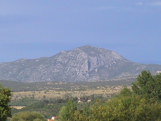
Bat is the highest peak of the Kozjak (Veliki Kozjak) massif, rising above the village of Kijevo in the Dalmatian hinterland (Zagora), in a triangle formed by the towns of Vrlika, Knin and Drniš. It reaches 1,206 metres above sea level and belongs to the Dinaric Alps. Locals and hikers usually call it "Kijevski Bat," a name that simply points out the obvious — the peak towers directly over Kijevo and is visible from almost anywhere in the village. What does the peak look like? Bat has a distinctive pyramidal shape built from dolomite rock. Seen from Kijevo, its raw, jagged silhouette is often compared to the peaks of Velebit, though on a smaller scale. To the north and east it drops away in a steep rock face roughly 150 metres high, which makes it an unmistakable landmark across the wider Zagora region. About thirty metres north of the summit stands a large white metal cross, facing the village and visible from a considerable distance — it's the feature that shows up in almost every photo taken from this route. What will you find at the top? The summit carries the standard set of gear found on Croatian mountain peaks: a sign with the peak's name, a metal box containing a visitors' log, and a mountaineering stamp set into the rock. The real reward, though, is the view, which opens up in every direction. The most striking sightline runs toward the Dinara massif and its peaks Sinjal and Badanj; on a clear day you can also make out Lake Peruća and the Svilaja range to the southeast. How do you get to Bat? The most popular approach starts in Kijevo and is known locally as the "Kijevo–Križni put–Kijevski Bat" route (the Way of the Cross to Kijevski Bat). It's a forest trail rated as demanding, with a solid elevation gain, and the round trip typically takes around 4.5 to 5 hours. Along the way the terrain shifts through varied vegetation, with mountain wildflowers and birdlife making it worthwhile even for visitors more interested in nature than in reaching the summit itself. When should you visit? Given the rocky, exposed terrain and the length of the climb, spring and autumn are the best windows — temperatures are moderate and visibility tends to be at its best. In summer, the steep, largely unshaded sections can be draining, while in winter the rocky stretches near the top can ice over. Whatever the season, it's worth setting off early in the morning to be back down well before dark. Frequently asked questions Is Bat a difficult hike? Yes. The trail from Kijevo to the summit is rated as demanding — it calls for a reasonable fitness level, proper footwear and several hours of your day, though no climbing gear is required. How long does it take to reach the summit? The full round trip usually takes about 4.5 to 5 hours, depending on pace and conditions. Why is the peak called "Kijevski Bat"? It's the local way of naming the mountain by the village it overlooks — "Bat" is the peak itself within the Kozjak massif, and "Kijevski" simply ties it to Kijevo below. What can you see from the summit? The standout view is toward the Dinara massif and its peaks Sinjal and Badanj, with Lake Peruća and the Svilaja range also visible on a clear day.
-
Mali Vitrenik
Starigrad
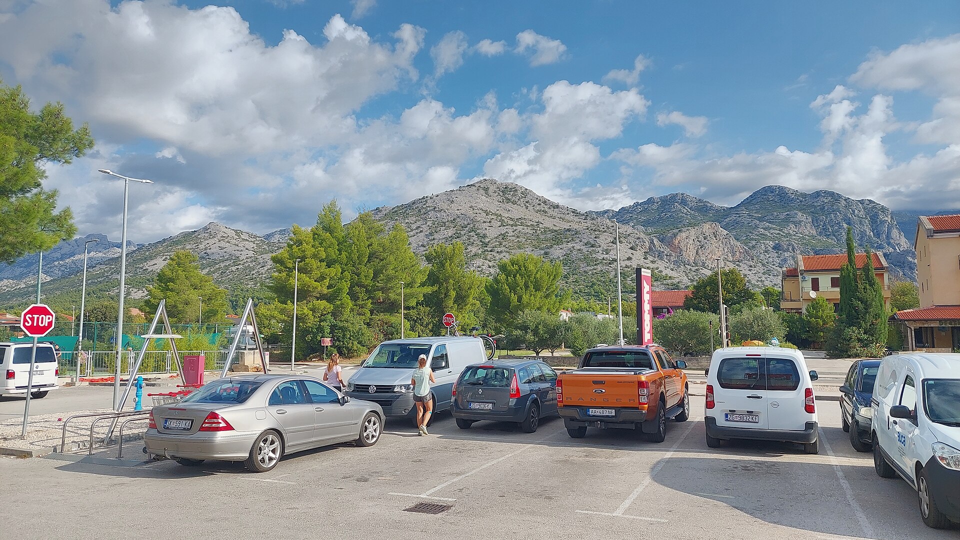
Mali Vitrenik is a modest peak in the Velebit mountain range, rising above the town of Starigrad on Croatia's Dalmatian coast. It may not stand out for its elevation, but the view from the top over the bay and Starigrad below makes it a rewarding short hike for anyone based in the area. Where is Mali Vitrenik located? The peak sits in the southern part of Velebit, directly above Starigrad, close to the coordinates 44.3065° N, 15.4426° E. Wikidata lists Mali Vitrenik as a subpeak connected to the Vidakov kuk massif, reflecting how densely packed the ridgelines and minor summits are in this stretch of Velebit. Its closest neighbor is Veliki Vitrenik, a taller peak reaching 433 meters just about a kilometer away. How high is Mali Vitrenik? The summit reaches 410 meters above sea level. That makes it noticeably lower than nearby Veliki Vitrenik, though the modest height difference doesn't make much of a dent in the effort required — the two peaks are often treated as a natural pair for a single outing. How do you get to the top? Most hikers start from Starigrad itself. The trail runs through an area known as Mirila before climbing steadily to the summit of Mali Vitrenik. The full route covers roughly four kilometers round trip and is rated as moderately challenging, with an average completion time under two hours. That makes it a solid option either as an afternoon outing or as a warm-up before heading deeper into Velebit's higher terrain. What can you see from the summit? The payoff at the top is a view over the bay and the town of Starigrad spread out below. The coastline and the sea beyond are visible from the summit, making Mali Vitrenik an appealing lookout point without having to tackle the taller, more demanding sections of Velebit. Who is this hike suited for? Given its moderate difficulty and relatively short distance, climbing Mali Vitrenik is a good fit for visitors staying in Starigrad who want a taste of Velebit's mountain scenery without committing to a full-day expedition. Its proximity to Veliki Vitrenik also makes it easy to combine both summits into one longer outing for hikers wanting more distance. Frequently Asked Questions How high is Mali Vitrenik? The peak stands at 410 meters above sea level. Where's the best place to start the hike? Starigrad is the usual starting point, with the trail heading through Mirila toward the summit. How long does the hike take? The round trip covers about four kilometers and takes an average of just under two hours to complete. Are Mali Vitrenik and Veliki Vitrenik the same peak? No — they are two separate, neighboring summits. Veliki Vitrenik is the taller of the two at 433 meters and lies about a kilometer from Mali Vitrenik.
-
Velika Promina
Velušić
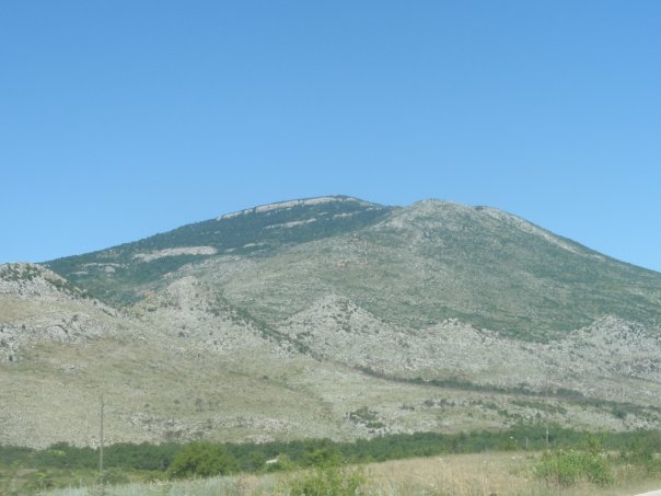
Velika Promina is the highest peak of the Promina mountain, rising above the village of Velušić in inland Dalmatia, Croatia. The massif stretches roughly 15 km on a north-south axis between the towns of Knin and Drniš, an orientation that sets it apart from the neighbouring Dinaric ranges, which typically run northwest to southeast. The summit, also known as Čavnovka, reaches 1,148 metres above sea level and draws hikers looking for the rugged inland landscapes of continental Dalmatia. Where does the mountain's name come from? The name Promina derives from Promona, an ancient Illyrian settlement that existed in the area before the Roman conquest of the region. Today the name refers both to the mountain range itself and to the municipality at its foot, which includes several small settlements, among them Velušić. What is worth knowing about Velušić and its surroundings? Velušić sits at the foot of the mountain and is one of a handful of villages historically inhabited by a Serbian population, alongside Razvođe, Bobodol and Bogatić. The wider area, including Velušić itself and nearby Siverić, once held brown coal deposits, while bauxite was mined at Trbounje. These past mining activities point to the region's earlier economic importance, though today the surroundings are shaped mainly by farming and grazing. How do you get to Velika Promina? The mountain lies in inland Dalmatia, close to the towns of Knin and Drniš, making it relatively easy to reach from the main roads connecting the coast with the interior. The approach to the summit crosses rural land and pastures typical of the Dinaric landscape, with views opening onto the surrounding valleys and lower ranges. What can you expect on the trail and at the top? Climbing Velika Promina means encountering the bare, rocky terrain characteristic of the Dinaric mountains: stony slopes, patches of low scrub, and open grassland used for grazing livestock. From the summit, a wide panorama unfolds over the neighbouring valleys, including the areas around Knin and Drniš, with further Dinaric ranges visible on a clear day. The mountain suits visitors looking for a quiet, nature-focused escape well away from the busier stretches of the coast. When is the best time to visit? The continental climate of inland Dalmatia brings hot summers and cooler, occasionally snowy winters, so spring and autumn are the most comfortable seasons for a hike, offering milder temperatures and greener surroundings than the height of summer. If visiting in summer, it is worth setting out early in the morning to avoid the strongest heat on the exposed, largely shadeless slopes. Frequently Asked Questions How high is Velika Promina? The peak reaches 1,148 metres above sea level, making it the highest point of the entire Promina mountain range. Are Velika Promina and Čavnovka the same mountain? Yes, Čavnovka is an alternative name for the highest summit of the Promina range, more widely known as Velika Promina. Where is the village of Velušić in relation to the mountain? Velušić lies at the foot of the Promina range, in inland Dalmatia between Knin and Drniš. Was mining ever carried out in the area? Yes, brown coal was once extracted near Velušić and Siverić, and bauxite was mined at nearby Trbounje.
-
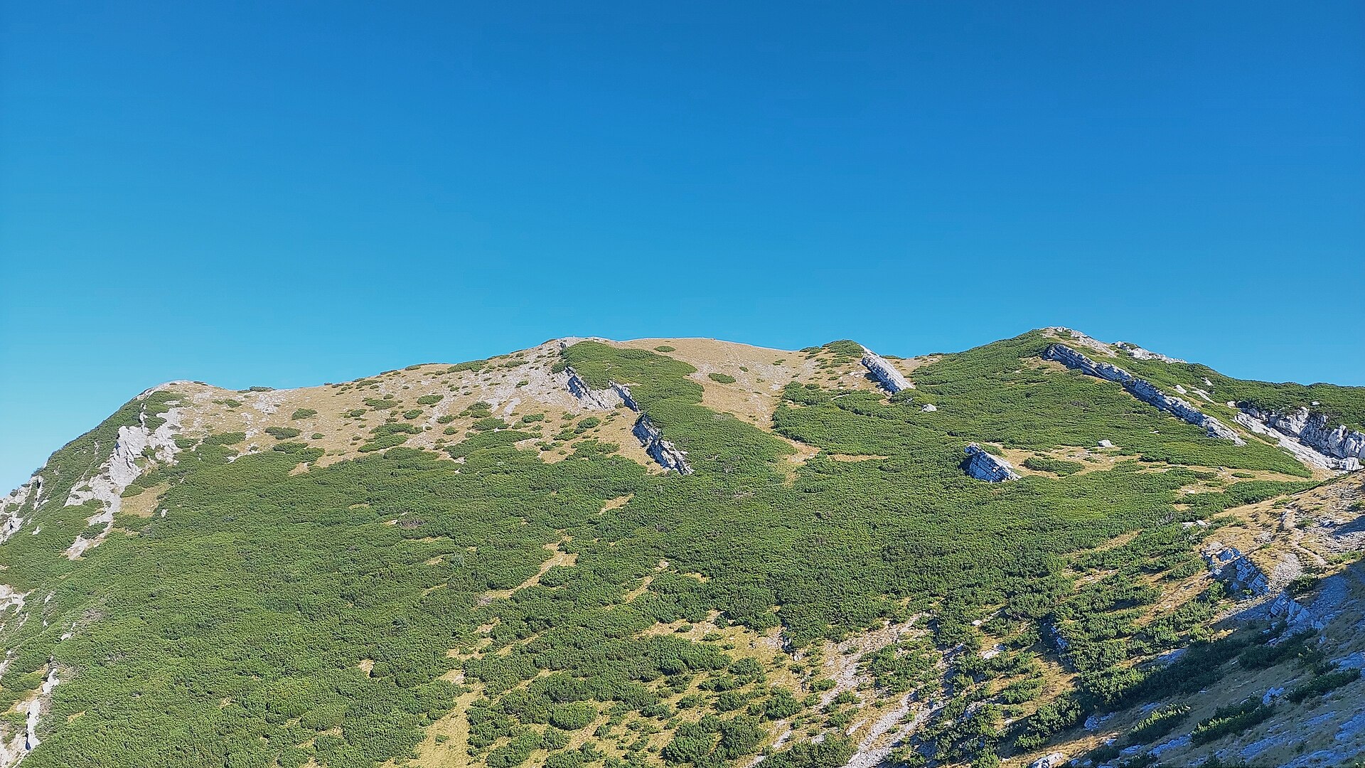
Vaganski vrh
Kukljić
Vaganski Vrh is the highest peak of the Velebit range, rising near the village of Kukljić in Croatia, right above the Adriatic coast. Standing at 1,758 m above the Adriatic Sea, it towers over the entire Dinaric chain that runs along the eastern shore of the Adriatic. Where exactly is Vaganski Vrh located? The peak sits in the central section of the Velebit range, close to coordinates 44.367 N, 15.505 E. Velebit stretches parallel to the Adriatic coastline, forming a natural divide between the coast and continental Croatia. Kukljić, a small settlement at the foot of the mountains, serves as a reference point for anyone planning a trip into this area. Because the sea lies so close by, the upper slopes offer views that combine rugged mountain terrain with panoramas of the coastline and offshore islands. Why does Vaganski Vrh draw visitors? Being the highest point of the entire Velebit range makes this peak a natural focal point for anyone exploring the region. Velebit itself ranks among the most recognizable mountain chains in Croatia, and its stark, rocky character stands in sharp contrast to the mild Mediterranean climate found just below, along the coast. This meeting of two very different landscapes within a short distance is one of the main reasons Velebit and its summit are held in such regard by mountain travelers. What does the landscape around the peak look like? The upper part of the massif has a distinctly alpine character, shaped by the karst processes typical of the Dinaric Alps. Bare rock, steep slopes, and open ground above the tree line give the area a raw, untamed feel. At the same time, the nearby Adriatic — visible from the higher sections of the range — adds a striking contrast between the stony interior of the mountains and the blue of the sea stretching out below. This combination makes the surroundings of Vaganski Vrh one of the more distinctive landscapes along the Dinaric coast. What should visitors know about this region? Velebit as a whole spans an unusually wide range of elevations, from sea level up to its highest point at Vaganski Vrh. That span brings a wide variety of terrain and climate conditions depending on altitude. The range has long served as a key geographic landmark for central Dalmatia and the surrounding coastal areas, and its mountainous character shapes the climate and scenery of nearby settlements, including Kukljić. Frequently Asked Questions How tall is Vaganski Vrh? The peak rises 1,758 m above the Adriatic Sea, making it the highest point of the entire Velebit range. In which country is Vaganski Vrh located? It lies in Croatia, within the Velebit range of the Dinaric Alps, close to the Adriatic coast. Can Vaganski Vrh be seen from the sea? Given its proximity to the coast and considerable height, the peak and the surrounding Velebit ridges form a clear feature of the skyline viewed from the Adriatic. Which settlement is closest to the peak? Kukljić, a small village at the foot of the Velebit range, is the main reference point for this area.
-

Pasarićev kuk
Stinica
Pasarićev kuk is one of the distinctive summits of the Rožanski Kukovi, a rocky peak group inside Northern Velebit National Park, rising to 1,630 metres above sea level. The nearest settlement is Stinica, a small coastal village in the municipality of Senj, roughly 8 km southwest of the massif. Where is it and how did it get its name? The Rožanski Kukovi are a cluster of jagged limestone peaks on Velebit mountain, declared a strict nature reserve back in 1969 and covering about 1,220 hectares. Pasarićev kuk is named after Josip Pasarić, a long-serving president of the Croatian Mountaineering Association (HPD), a nod to how central this area has been in the history of Croatian mountaineering. What will you see up there? Pasarićev kuk sits among a cluster of well-known Rožanski summits: Gromovača (1,675 m), Krajačev kuk (1,690 m), Vratarski kuk (1,678 m), Varnjača (1,630 m) and Crikvena (1,641 m). The scenery is classic Velebit — a maze of limestone pinnacles, ravines and karst depressions, a raw, stony landscape that draws experienced trekkers and mountain photographers. Because the area has strict-reserve status, it has kept an unusually wild character, and on clear days the views stretch across the Velebit interior toward the Adriatic coast and the island of Rab. How do you get there and when should you go? Most routes into this part of Velebit start from the coast near Stinica or Jablanac, from where trails climb into Northern Velebit National Park. Because the terrain is karst, rocky and in places demanding, a trip toward the Rožanski Kukovi calls for solid preparation, proper footwear and good route-finding skills — this is ground for experienced hikers, not a casual stroll. The best window to visit is summer, from June to September, when the trails are clear of snow and conditions are most stable. Spring and autumn weather on Velebit can turn quickly, so check the forecast and build in extra time. Frequently asked questions How high is Pasarićev kuk? The peak reaches 1,630 metres above sea level and belongs to the Rožanski Kukovi group within Northern Velebit National Park. Where does the peak's name come from? It is named after Josip Pasarić, a long-time president of the Croatian Mountaineering Association (HPD), recognised for his contribution to mountaineering in the region. Is Pasarićev kuk inside a nature reserve? Yes, the Rožanski Kukovi form a strict nature reserve established in 1969, covering about 1,220 hectares within Northern Velebit National Park. How close is Stinica? Stinica lies about 8 km southwest of the Rožanski Kukovi, making it the closest coastal landmark for anyone planning a trip into this part of Velebit.
-
Trbušnjak
Senj
Trbušnjak is a 62-metre hill rising directly above the town centre of Senj, Croatia. Its summit is crowned by Nehaj Fortress, the town's most recognisable landmark, which is why visitors usually treat the hill and the fortress as a single destination. How do you get to the hill? Trbušnjak sits right next to Senj's old town, so no car is needed to reach it. A signposted footpath leads up from the historic centre and gets you to the top in around fifteen minutes. The climb is steep but short, manageable for most visitors, including families with children. Sturdy shoes are a good idea, since the surface is rocky and uneven in places. Drivers will find parking available at the foot of the hill. What will you find at the top? The main attraction is Nehaj Fortress, built in 1558 on the initiative of Ivan Lenković, commander of the Croatian Military Frontier, with support from Herbard VIII Auersperg and funding from Emperor Ferdinand I. It was raised as a defensive stronghold meant to hold back Ottoman advances, and its garrison sheltered the Uskoks, irregular border fighters known for daring raids against Ottoman forces. The fortress stands 18 metres high and 23 metres wide, ringed by walls between 2 and 3.3 metres thick that taper toward the top and end in crenellations with five corner towers. Today the site is managed by the Senj Town Museum and houses an exhibition dedicated to the history of the Uskoks and the wider region. The hilltop itself doubles as a viewpoint. From up here you get a sweeping panorama of the Croatian coast and the islands of Rab, Goli, Prvić, Cres and Krk, and on a clear day the mountain ranges of Gorski Kotar, Učka and Velebit come into view as well. When is the best time to visit? Early morning or late afternoon are the best times to climb Trbušnjak, when the sun is gentler and the light flatters both the fortress and the sea views. Senj is known for the bura, a strong and gusty local wind that blows regularly even in summer, so it's worth bringing something windproof to the summit even on hot days. Every year the fortress hosts a medieval culture festival with historical re-enactments, which can be a good reason for history lovers to time their visit accordingly. Who is this attraction for? Trbušnjak hill and Nehaj Fortress appeal both to visitors interested in regional history and to anyone looking for the best vantage point around Senj. The short but somewhat demanding walk is rewarded with a view you simply can't get from street level in town. Frequently asked questions Is the climb to Trbušnjak hill difficult? The path is steep but short, usually taking around fifteen minutes from Senj's old town. Anyone with average fitness should manage it without trouble. Do you have to pay to reach the top of the hill? The footpath itself is open to everyone and free of charge. Visiting Nehaj Fortress and its museum exhibition, however, requires an admission ticket. What can you see from the top of Trbušnjak? From the fortress walls you can see the Croatian coastline, the islands of Rab, Goli, Prvić, Cres and Krk, and, in good weather, the Gorski Kotar, Učka and Velebit mountain ranges. Who built Nehaj Fortress on Trbušnjak hill, and when? The fortress was built in 1558 on the initiative of Ivan Lenković, commander of the Croatian Military Frontier, with support from Herbard VIII Auersperg and funding from Emperor Ferdinand I, as a defence against Ottoman incursions.
-
Garba
Susak
Garba is the highest point on the island of Susak, part of Croatia's Kvarner archipelago near Lošinj. Rising to 98 metres above sea level, the hill is crowned by a lighthouse reached via a walking trail from the island's only village. It combines a scenic viewpoint, layers of history, and one of the Adriatic's most unusual landscapes, making it a highlight of any visit to Susak. What makes Susak different from other Adriatic islands? Unlike its rocky neighbours, Susak is built almost entirely of fine sand deposited over a limestone base — a geological rarity in the Adriatic. This is why the island has soft, golden beaches and rolling, grass-covered hills rather than the typical stony terrain found elsewhere in the Kvarner islands. Garba, as the island's tallest point, is the clearest illustration of this unusual geology: its slopes are lined with grassy terraces, and in places you can spot the effects of long-term sand erosion. How do you get to Garba? The starting point is the village of Susak, the island's only settlement, from where a marked footpath leads up to the lighthouse at the summit. The walk itself is short, but because the ground is sandy and the local microclimate can be warm, comfortable shoes and water are recommended, especially in summer. There are no roads for cars on Susak, so the whole route is covered on foot or by bicycle — part of the island's charm, where the pace of exploring is set by nature rather than traffic. What will you see at the top? At the summit of Garba stands a lighthouse, built precisely where a prehistoric hill fort once stood and where, later, an important lookout point was maintained. Traces of that observational role remain visible today, with the remnants of old military posts scattered nearby, used as watch stations through the 20th century. From the viewing area next to the lighthouse, the panorama takes in the whole island of Susak, the surrounding Kvarner waters, and, on clear days, neighbouring islands of the archipelago. It is the best spot to appreciate the shape and scale of an island built almost entirely of sand. When is the best time to hike up? The most pleasant conditions are in spring and early summer (May–June) and early autumn (September), when temperatures are milder than at the height of summer and the vegetation on Garba's slopes is green and lush. In July and August, the sun on the shadeless, sandy trail can be intense, so an early morning or late afternoon walk is a good idea — it also happens to be the best light for photos. Frequently asked questions How high is Garba? Garba reaches 98 metres above sea level and is the highest point on the island of Susak. Can you go inside the lighthouse at the top? The lighthouse on Garba is an active navigational structure; access to the interior depends on current availability, but the surrounding grounds and viewpoint are open to visitors. How long does it take to walk up to Garba from the village? The trail from Susak village to the summit is typically about an hour on foot, depending on pace and stops for the views. What else is worth seeing on the way to Garba? Along the route you'll pass the remains of former military lookout posts and the grassy sand terraces that are unique to this island.
-
Višnjica
Grad Ploče
Višnjica is a small hill in the municipality of Grad Ploče, on the southern edge of the Striževo massif, itself the southernmost branch of the Biokovo mountains. It rises between the Baćina Lakes, the Neretva Canal and the Adriatic Highway, and has long been a favourite short hiking destination for locals and visitors looking for a big view without a big effort. How do you get to Višnjica? The trail starts in Portina, a hamlet that's part of the Baćina settlement, right by the former cooperative building (roughly at Trg Ploča 2). From there the path first follows a paved road, then turns into a gravel track through a pine forest and Mediterranean maquis scrub. The full climb to the top covers about 3.6 km and takes just under an hour, with roughly 260 metres of elevation gain. The route is graded easy (K1/T1), requires no scrambling or prior hiking experience, which makes it a good option for a family outing. Trail markings were renewed in 2023, and the path is kept up by the local hiking club HPD Grabovica Ploče. What will you see at the top? The hill tops out at 243 metres above sea level. Along the way you pass fragrant pine and cypress woods, and closer to the summit you come across the remains of Italian artillery positions and a ruined building that served as a military observation post during the Second World War, watching over the bay of Ploče. The structures have decayed considerably over the decades, but they still tell a clear story about the region's wartime history — bring a torch and mind your footing around the ruins. The real reward for the climb, though, is the panorama from the summit. It takes in the town of Ploče and its harbour, the Neretva Delta, and — on a clear day — the islands of Hvar, Šćedro, Korčula and Pelješac, as well as the Biokovo peaks across the valley. It's one of the few spots in the area where the mountains, the river delta and the Adriatic all come into view at once. When is the best time to visit? Spring and autumn are the best seasons for the climb, when temperatures are milder and the air is usually clearer, which extends the view from the top. In summer, aim for early morning or late afternoon to avoid the heat on the exposed, sun-baked stretches of maquis — shade is mostly limited to the wooded section near Portina. Because the hike is short, it pairs easily with a visit to Baćina and its lakes on the same day. Frequently asked questions How long does it take to climb Višnjica? The one-way climb usually takes about an hour, so a round trip at a relaxed pace comes to under two hours in total. Is the trail suitable for children? Yes, the route is graded easy, requires no climbing skills or special gear, and works well as a family walk. Where exactly does the trail start? In Portina, part of the Baćina settlement, by the former agricultural cooperative building near Trg Ploča 2. What's the main attraction at the top? The combination of Second World War Italian fortification remains with a sweeping panorama over Ploče, the Neretva Delta, the islands and the Biokovo range.
-
Bukočica
Grad Ploče
Bukočica is a viewpoint hill and former military bunker in the municipality of Grad Ploče, in Dubrovnik-Neretva County, Croatia. It's a great pick for travelers wanting a short, rewarding hike that ends with sweeping views over the bay and the Neretva delta. How do you get to Bukočica? The trailhead starts in the town of Ploče, from where a marked hiking path climbs toward the hill. The route is relatively short and doesn't require serious fitness, making it suitable for both solo travelers and families with older kids. The path winds gradually upward through typical Dalmatian coastal scrubland. Bring water and sturdy walking shoes, since the ground is rocky and the sun can be intense in summer. What will you see there? At the top sit the remains of military fortifications — a bunker that served as an observation post and base during the world wars. Though partly worn down by time, the structure still hints at the strategic importance of the spot: from Bukočica you get a wide view over Ploče Bay, its harbor, and the mouth and delta of the Neretva River. The hill is one of several viewpoints in the area, alongside the nearby peak of Sveti Ilija, which also overlooks the surrounding hills and the Neretva valley. The site appeals both to visitors interested in 20th-century history and to anyone chasing a good sunset photo. When is the best time to visit? Spring (April–June) and early autumn (September–October) are the best times to climb Bukočica, when temperatures are milder and the vegetation is still green. Midday summer heat can make the climb tougher, so it's worth setting out early in the morning or in the late afternoon — that timing also gives better light over the bay and the delta, which photographers will appreciate. How much time should you plan for? The climb up and back down usually takes one to two hours, depending on your pace and how many stops you make to enjoy the views. It works well as an add-on to a day in Ploče — you can pair it with exploring the town, the port, or nearby beaches without dedicating a whole day to the trail alone. Frequently asked questions Is the hike to Bukočica difficult? No, the trail is moderately easy and manageable for most people with average fitness. Sturdy shoes are recommended due to the rocky terrain. What's the main thing to see at the top? The remains of a World War-era military bunker and a panoramic view over Ploče Bay and the Neretva delta. Is the trail suitable for children? Yes, for older children it works well, though steep and rocky sections make it less suitable for very young kids or strollers. Are there other viewpoints nearby? Yes, nearby Sveti Ilija hill offers views over the valley and the Baćina Lakes, as well as over Bukočica itself and the town of Ploče.
-
Volujak
Gornje Sitno
Volujak is a rocky peak on the Mosor massif, rising above the village of Gornje Sitno on the mountain's southern slopes, roughly 21 km from Split. It marks one of the notable points along a popular route heading from Gornje Sitno into the Mosor range, appreciated by hikers for its stony character and open views over the valley below. How do you get to Volujak? The starting point is Gornje Sitno, a village that administratively belongs to the city of Split despite sitting several kilometers inland from the coast. A small parking area at the trailhead marks the start of a marked path heading up into the Mosor range, and Gornje Sitno is also reachable by a regular bus line from Split, making the hike accessible even without a car. The trail from Gornje Sitno begins with a gentle ascent and passes close to the Volujak ridge, only a few hundred meters off the main path. A short detour lets you reach the rocky top and take in the surroundings before rejoining the main route, which continues toward Veliki Kabal — the highest peak of Mosor — or to the Umberto Girometta mountain lodge. What will you see along the way? Volujak is defined by the bare, rocky karst terrain typical of Mosor: exposed limestone, low scrub, and views stretching across the surrounding ridges and the villages scattered at the mountain's foot. It's a quieter spot than the well-known viewpoints on Veliki Kabal, which makes it a good short stop during a longer day on the trail. Following the path deeper into the massif brings you to the recently renovated Umberto Girometta lodge, set in the central part of Mosor near the Ljuvač spring at 868 m above sea level. The lodge underwent a full restoration and reopened on 2 October 2022, and it now serves as a natural resting point for hikers continuing further into the mountains. When should you visit? Spring and autumn are the best seasons for hiking around Volujak and Gornje Sitno, when temperatures are milder and the rocky slopes don't heat up as much as they do in summer. In summer, an early start is worth planning for, since much of the terrain offers little shade. In winter the trail is generally still accessible, but expect a colder wind along the exposed sections of the ridge. Frequently asked questions Is it hard to get to Gornje Sitno? No — the village lies within Split's administrative boundaries and can be reached by car or by a regular bus line, with a small parking area available for hikers at the trailhead. Do you need hiking experience to reach Volujak? The climb to Volujak itself is a short detour off the main trail and doesn't require advanced skills, though the ground is rocky, so sturdy footwear is recommended. Can a visit to Volujak be combined with a longer route through Mosor? Yes, the trail continues toward the Umberto Girometta lodge and the Veliki Kabal summit, making it possible to plan a longer, full-day hike. Is there anywhere to rest or eat nearby? The closest option is the Umberto Girometta mountain lodge, a few kilometers from Gornje Sitno, recently renovated and open to hikers passing through.
-
Vrijesno
Majkovi
Vrijesno is a hill above the village of Majkovi, within the municipality of Dubrovačko primorje in Croatia's Dubrovnik-Neretva County. Geographically it is classified as a brdo — a gentle rise with a relative elevation under 300 metres, typical of the terraced coastal landscape here. It sits close to Slano (about 1.3 km away), Osredina (about 1.3 km) and Majkovi itself (about 1.6 km), making it an easy add-on for anyone staying in one of those three villages. Where exactly is Vrijesno? The hill lies within Dubrovačko primorje, a municipality covering the coastal strip between Slano and Majkovi, stretching from the shoreline up to areas above 300 metres in elevation. Majkovi itself grew out of two once-separate settlements, Upper and Lower Majkovi, with a scatter of hamlets across the slopes. The area sits along the historic Napoleon's Road, which once linked Slano and Trsteno and today serves as a scenic route for walking and cycling. How do you get there? The most convenient approach is via the Adriatic Tourist Road (Jadranska turistička cesta), the main artery running through the municipality's lower coastal belt — from Doli and Banići, through Kručica and Slano, to Majkovi. From Dubrovnik it's roughly 25–30 km to Majkovi, and just 3–6 km from Slano. From there, local roads and paths lead up into the hills toward Vrijesno — a stretch suited to a short stroll or a longer half-day hike or bike ride. What's worth seeing nearby? Vrijesno itself is a modest rise, but its real appeal lies in the surrounding landscape typical of Dubrovačko primorje — terraced olive groves, vineyards and beehives that have sustained local farming for generations. Hills wrap around Majkovi on three sides, opening onto sea views across the Adriatic. Nearby, at 420 metres, the Gajina viewpoint is considered one of the finest panoramas on the whole Adriatic coast, taking in the Pelješac peninsula, Mljet National Park, the Elaphiti Islands, and on a clear day, even the Strait of Otranto. When should you visit? Spring (April–June) and early autumn (September–October) are the best times, with mild temperatures well suited to walking before the hills turn dry and sun-baked in high summer. In summer, plan any hiking for early morning — the terrain is exposed with little shade. Frequently asked questions Is Vrijesno a village or a hill? It's a hill (brdo) within the area of Majkovi, not a separate settlement — geographic registers and maps list it as a terrain feature. How far is it from the nearest villages? About 1.3 km to Slano, roughly the same to Osredina, and around 1.6 km to the centre of Majkovi. Can you reach it without a car? Yes — the Adriatic Tourist Road connects the coastal villages of Dubrovačko primorje, and the final stretch up to the hill is covered on foot or by bike along local roads. What else is worth seeing in the area? The Gajina viewpoint (420 m) with views over Pelješac, Mljet and the Elaphiti Islands, plus the traditional olive groves and vineyards characteristic of Dubrovačko primorje.
-
Križevo brdo
Trnova
Križevo brdo is a hill rising above the village of Trnova, in the Dubrovačko primorje municipality, Dubrovnik-Neretva County, Croatia. The summit reaches roughly 520 metres above sea level, and its steep slopes and local relief of around 300 metres make it a recognisable landmark visible from the surrounding roads of this stretch of the Dubrovnik coast. Where exactly is Križevo brdo? The hill sits right next to Trnova, a small village of about 44 residents, less than a kilometre and a half from the summit. The surrounding landscape is typical of Dubrovačko primorje: rocky hills, Mediterranean scrub, and scattered hamlets, including nearby Čepikuća and Slano. This is the coastal strip between Dubrovnik and the Neretva delta, better known for its seaside villages than for hilltops, which is exactly why Križevo brdo appeals more to travellers after quieter, off-the-beaten-path terrain than to mass tourism. How do you get to Križevo brdo? The usual starting point is Trnova, reached by a local road branching off the main coastal route connecting Slano and Dubrovnik. From Trnova, tracks and farm roads used by residents of the surrounding villages lead up onto the hill; the ground is rocky and steep, so sturdy trekking shoes are worth packing. The nearest larger settlements, Slano and Čepikuća, are the easiest places to base a car trip before continuing on foot. What will you see there? Thanks to its considerable local relief — about 300 metres above the surrounding terrain — and steep slopes, Križevo brdo opens up wide views over the hills of Dubrovačko primorje and the neighbouring villages of Trnova, Čepikuća, and Slano. It's a spot for travellers who value quiet, a raw karst landscape, and panoramas away from the crowded coastline. The hill also carries a piece of history from Croatia's Homeland War (Domovinski rat) of the early 1990s. According to local accounts, the fighting for Križevo brdo began with an attack launched simultaneously from the direction of Čepikuća and from Slano. It's one episode within the broader defence of Dubrovačko primorje during the autumn 1991 offensive on the Dubrovnik region — worth keeping in mind while walking today's quiet slopes. When is the best time to visit? Spring and autumn are the best seasons to climb Križevo brdo, when temperatures are milder and the steep, rocky approach is far less demanding than in the height of summer. In summer, early morning is the smart choice, both because of the heat and the strong sun on this exposed, largely shadeless terrain. In winter the ground can turn wet and slippery after rain, so extra caution is advised. Frequently asked questions Is Križevo brdo a popular tourist attraction? No, it isn't a heavily visited site — it's a small hill known mainly to residents of Dubrovačko primorje and to travellers looking for routes off the main tourist trail. How high is Križevo brdo? The summit reaches about 520 metres above sea level, with a local relief of roughly 300 metres compared to the surrounding land. Can you get there without a car? The most practical option is to drive to Trnova, Slano, or Čepikuća and then continue on foot along the local paths. Is there anything else worth seeing nearby? Yes — the neighbouring villages of Slano and Čepikuća, along with the whole coastal stretch of Dubrovačko primorje, offer further viewpoints and small settlements worth a short stop.
-
Mali Tmor
Mravinca
Mali Tmor is a rocky peak (616 m) rising above the village of Mravinca in Dubrovnik-Neretva County, a short drive from Dubrovnik. It stands right beside its taller neighbour, Tmor (899 m), and together the two form a stony, pyramid-like ridge that's visible from far along the coast. How do you get there? The starting point is Mravinca village, sitting at the foot of the massif. From there, an old shepherd's path climbs the eastern slope of the mountain — the safest way up, since a direct scramble over the bare rock face is steep and not recommended without mountain experience. The Mravinca–Tmor route is a known local hike, typically tackled as a half-day outing, and it's easy to fold in a stop at Mali Tmor's own summit along the way. What will you see? The terrain is classic Dalmatian karst: bare limestone broken up by patches of grass, broom and wild sage, with vegetation thinning out the higher you climb. From the ridge connecting Mali Tmor and Tmor, the view opens onto the Adriatic Sea, the Dubrovnik archipelago, the island of Lastovo, the Pelješac peninsula and the island of Hvar, and on a clear day even the Biokovo and Velež ranges across the border. That panorama is exactly why hikers make the effort despite the lack of marked trails or facilities — the reward sits at the top. Closer to Tmor's summit, look out for Vilina kosa, a smooth, gently sloping rock slab roughly 60 metres long that stands out against the jagged terrain around it. Nearby, between the villages of Visočani and Lisac, lies an ancient necropolis of burial mounds — close to fifty stone cairns scattered across the area, a trace of settlement going back thousands of years that's typical of the karst hinterland behind the Dubrovnik coast. In Mravinca itself, a water spring has long served local shepherds and farmers. When should you visit? Spring (April to June) and early autumn (September–October) are the best windows: temperatures are manageable and the karst landscape hasn't yet been scorched by the summer sun. In summer the bare rock heats up fast and there's little shade, so an early start and plenty of water are essential. In winter the ground can turn slippery after rain, but clear days bring exceptionally sharp visibility across the coast and islands. Frequently asked questions Is climbing Mali Tmor difficult? The shepherd's path on the eastern side is moderately demanding — no technical climbing, but uneven, rocky ground throughout. A direct approach over the rock face is steep and best avoided without mountaineering experience. How long does the hike take? Depending on pace, and whether you extend the walk to neighbouring Tmor, the round trip from Mravinca usually takes two to four hours. Do you need a guide? Not essential if you're comfortable on rough mountain terrain, but since there are no official marked trails, carrying a map or GPS track and having some karst-hiking experience is a good idea. What should you bring? Sturdy hiking boots, plenty of water (there are no reliable sources along the route beyond Mravinca), sun protection, and trekking poles, which help on the loose, rocky ground.
-
Jelovak
Brloška Dubrava
Jelovak is a modest, forested hill rising to 742 m above sea level in the Dinaric Alps, right next to the village of Brloška Dubrava in the Otočac municipality (Lika-Senj County, Croatia). It's a place for travelers who want the quiet side of the Lika hills rather than another crowded roadside attraction. Where exactly is Jelovak? The hill sits in the heart of the Lika region, an area defined by karst terrain, sparse settlement and wide stretches of forest. Brloška Dubrava, the village next to Jelovak, is home to roughly 60 people (2011 census) and spreads across nearly 17 km² of land. The village itself lies at about 474 m elevation — noticeably lower than the summit of Jelovak. The nearest larger town is Gospić, about 45 km to the south, while the Adriatic coast is about 20 km away as the crow flies, a reminder of how close Lika's mountain landscapes sit to the sea. Just over a kilometer to the south rises the slightly taller peak of Ostrovica (748 m), and together the two summits form a local ridge separating the village basin from neighboring valleys. What will you actually see there? Jelovak is a typical wooded Lika hill. There's no built-up tourist infrastructure or marked hiking trail here; this is a spot for people who value raw, unpolished mountain scenery over viewpoints with parking lots and information boards. From its slopes, you get views over the farming basin around Brloška Dubrava and the surrounding stretch of the Dinaric range. The surroundings are a textbook example of a small Lika village — quiet, thinly populated, ringed by forest and pasture. It's a sharp contrast to the crowded coastal resorts of Croatia, even though those are only a couple of hours' drive away. How do you get there? The most practical way is by car via Otočac, the municipality that administers Brloška Dubrava. From Gospić, the drive takes roughly an hour, depending on the condition of the local roads leading into the village. Plan on your own transport — public connections in this part of Lika are limited. When should you visit? Given the moderate altitude and Lika's mountain climate, spring, summer and early autumn are the best times to visit, when the slopes are dry and easier to walk. In winter, the region often sees heavy snow, and local roads can become harder to navigate. Frequently asked questions How high is Jelovak? The summit reaches 742 m above sea level, with a topographic prominence of 119 m. Where is the village of Brloška Dubrava located? It's a village in the Otočac municipality, Lika-Senj County, about 45 km north of Gospić and about 20 km from the Adriatic coast. Are there marked hiking trails around Jelovak? No — there's no developed tourist infrastructure here. It's a wild, forested hill without official marked routes, better suited to quiet independent exploration than organized hiking tourism. Which peak sits next to Jelovak? The nearest higher summit is Ostrovica (748 m), located about 1.1 km to the south.
-
Jagin kuk
Starigrad
Jagin kuk is one of the strangest rock formations in the southern Velebit mountains above Starigrad, Croatia. This limestone tower, roughly twenty meters tall, juts out of the mountainside in a shape that visitors often compare to a giant banana or sausage — a comparison that makes sense the moment you stand beneath it. Where exactly is Jagin kuk? The formation sits at an elevation of around a thousand meters, in the Bojinac area, inside a large karst depression known as Veliki dolac. Sharp limestone ridges enclose the valley, giving it the look of an enormous crater, while the neighboring peak of Bojin kuk towers over the scene in the background. The terrain is classic karst: steep rocky walls, hidden hollows, and a single water source that can dry up during long dry spells. How do you get there? The most common approach starts in Starigrad Paklenica. From town, head toward Alojzija Stepinca street, where a free parking area marks the trailhead. Reaching Jagin kuk takes about two hours on foot, and the full loop covers roughly 9.5 km, taking around 4 hours and 20 minutes in total. An alternative route starts in Milovac, about 2 km beyond Starigrad toward Rijeka, and runs via Veliki Vaganac. The path crosses rocky, partly exposed karst terrain, so sturdy hiking boots and enough water are essential — the spring along the way is not always reliable. What will you actually see? The rock only reveals its true scale up close — it's the trees growing next to it that give away just how massive this stone sculpture really is. From the top of neighboring Bojin kuk, the elongated silhouette of Jagin kuk stands out clearly against the valley floor and the surrounding dwarf karst vegetation of southern Velebit. The area supports plenty of small wildlife typical of dry, rocky mountain habitats, including various insects and spiders. According to local tradition, the name comes from a woman called Jaga, though the exact story behind it has been lost over time. When is the best time to visit? May through October is the ideal window, when the trails of southern Velebit are dry and passable and temperatures suit a multi-hour approach. In summer, start early to avoid the heat on the exposed, rocky stretches. In winter and early spring the terrain can turn icy and technically demanding, so attempting the hike then requires proper experience and gear. Frequently asked questions How long does the hike to Jagin kuk from Starigrad take? The approach alone takes about two hours, and the full loop — including the way back — runs about 4 hours and 20 minutes over roughly 9.5 km. Is the trail suitable for beginners? The route crosses rocky karst terrain with sections that demand good fitness and sure footing, so it suits hikers with at least some mountain experience rather than complete beginners. Can you refill water along the way? There is a spring near Jagin kuk, but it can dry up in prolonged dry weather, so it's best to carry your own water supply. Where does the name Jagin kuk come from? Local tradition traces the name to a woman called Jaga, though the details of the story are no longer clearly known today.
-
Vekavac
Smiljan
Vekavac is a small, wooded hill above Smiljan, a village in the Lika region of Croatia, best known for the ruins of the old Smiljan fortress that once stood on its summit — the very structure that gave the whole village its name. The hill carries a double significance: it is a remnant of Lika's medieval defensive network, and it sits just a short walk from the house where Nikola Tesla was born in 1856. For travelers visiting the Nikola Tesla Memorial Center in Smiljan, climbing Vekavac is a natural, brief extension of the trip — a chance to see the landscape the young Tesla would have looked out on every day. How do you get to Vekavac? Smiljan lies about 6 km northwest of Gospić, the main town of Lika, just off the road connecting the region to the Zagreb–Split motorway. The easiest way to arrive is by car — it's a few minutes' drive from Gospić, and there's parking right by the Nikola Tesla Memorial Center in Smiljan. From there, a short, easy path leads up to Vekavac, mostly crossing open fields and the edge of a wooded patch. No special fitness is required — it's more of a walk than a hike — though sturdy shoes are worth wearing, since the path can be uneven and stony in places. What will you see at the top? At the summit, fragments of the old Smiljan fortress walls still stand — not a grand, fully restored structure, but clearly recognizable ruins that testify to the site's defensive role in the past. Lika was a strategically important region, which is why the area around Smiljan also holds other hill-forts, Bogdanić and Krčmar, along with the remains of prehistoric burial mounds. This tells you that the land around today's village was settled and strategically significant long before Tesla's time. Vekavac also offers a view over the Lika-Velebit plain and the surrounding hills, which makes it a worthwhile viewpoint on its own, especially with the Velebit mountain range visible in the distance. Why pair the visit with the Tesla Memorial Center? The name Smiljan itself derives from the fortress on Vekavac, which makes this hill a genuine piece of local identity — not just a historical curiosity, but part of the story of the place that produced one of history's most important inventors. In Smiljan itself, it's worth seeing the restored Tesla family house and the church where his father served as priest, and nearby stand the churches of St. Anastasia, St. Mark, and St. Vitus — evidence of centuries of settlement in this part of Lika. When is the best time to visit? Spring and early autumn are the best times for a walk up Vekavac, when temperatures are mild and the vegetation on the hill and surrounding fields is at its greenest, without the heat typical of Lika summers. In summer the route can be exposed and shadeless, so it's worth bringing water and setting out in the morning. In winter the path can turn slippery after rain or frost, though Smiljan itself remains accessible year-round — keep in mind the Memorial Center runs on reduced hours outside the high season. Frequently asked questions Is climbing Vekavac difficult? No — it's a short, gentle walk suitable for most visitors without special preparation, though comfortable footwear is recommended because of the uneven ground. How long does it take to see the fortress ruins? Walking around the summit and the ruins usually takes 20–30 minutes, but allow about an hour in total including the walk up from the parking area and time to enjoy the views. Can I combine the visit with the Nikola Tesla Memorial Center? Yes, it's a natural extension of the trip — the center sits right nearby, and Smiljan's own name comes from the fortress that once stood on Vekavac. Are there information panels on site? Around Smiljan and at the Tesla center you'll find signage and background on the region's history, though the fortress on Vekavac itself is more an authentic ruin than a fully developed attraction.
-
Plasine
Trnovac
Plasine is a modest mountain peak in Croatia, rising above the village of Trnovac, part of the city of Gospić in Lika-Senj County. It belongs to the Dinaric Alps, the range that runs along the entire eastern Adriatic and gives inland Lika its rugged, wide-open character. Where exactly is Plasine? The summit reaches 1,106 metres above sea level, with a prominence of just 85 metres — meaning it's a bump within a broader upland rather than a standalone peak. The nearest clusters of houses are Miškulini, Došeni, Sedlari and Balenovići, small hamlets scattered across the surrounding slopes, typical of settlement patterns in this part of Croatia. Trnovac itself sits lower, at roughly 591 metres above sea level, covers over 31 square kilometres, and counted fewer than a hundred residents at the last census — one of many small, half-emptied villages in Lika where landscape decisively outweighs development. How do you get to Plasine? The area lies well inland, between the Velebit and Plješevica ranges, far from the coast's main tourist routes. The most practical approach is to drive to Gospić and continue on local roads toward Trnovac; beyond that, expect unpaved tracks and a walk on foot. This is a destination for travellers after raw nature rather than tourist infrastructure — don't expect marked trails on the level of Croatia's national parks, so bring a topographic map and plan the route in advance. What will you see there? Lika's terrain is often described as almost lunar: limestone bedrock, thin soil cover, and vegetation typical of the Dinaric highlands — low scrub, grasses, and scattered stands of trees. Despite its modest relative height, the area around Plasine opens views over neighbouring ridges and the valleys of central Lika, and on clear days the outline of the Velebit range, Croatia's longest mountain chain, can be spotted in the distance. It's a place valued for silence and space, drawing hikers and landscape photographers rather than crowds. When is the best time to visit? Late spring and early autumn bring the mildest conditions inland, with greener vegetation and comfortable temperatures. Summers can turn hot and dry, while winter often brings snow that makes the unpaved access roads to the smaller hamlets harder to reach. Whatever the season, solid hiking footwear and your own water supply are essential — facilities on site are minimal. Frequently asked questions How high is Plasine? Plasine rises to 1,106 metres above sea level. Its prominence is 85 metres, which marks it as a rise within a larger massif rather than an isolated summit. Where is Plasine in relation to Trnovac? The peak lies within the administrative area of Trnovac, a village belonging to the city of Gospić, in Lika-Senj County, in central Lika. Are there marked hiking trails nearby? The region lacks the developed tourist infrastructure of Croatia's well-known national parks — reaching the peak requires your own navigation, a topographic map, and readiness for unpaved roads. Which settlements are closest to Plasine? The nearest hamlets are Miškulini, Došeni, Sedlari and Balenovići — small clusters typical of Lika's scattered settlement pattern.
-
Mali Sivnik
Općina Saborsko
Mali Sivnik is a modest hill in the municipality of Saborsko, in Karlovac County, Croatia, part of the Mala Kapela range within the Dinaric Alps that ring Plitvice Lakes. Rising to 771 metres above sea level, it isn't a dramatic summit, but its setting among the densely forested hills of the Lika region makes it a worthwhile stop for travellers exploring the wider Plitvice Lakes National Park area. Where is Mali Sivnik located? The hill sits roughly 100 km south of Zagreb, in a sparsely populated stretch of Karlovac County — population density here runs to only a handful of people per square kilometre. The nearest larger settlement is Jezerce, about 16 km away. Around 7 km to the southwest rises the considerably taller Veliki Javornik, at 1,139 metres — worth noting, since the region also has a separate peak called Veliki Sivnik, easily confused with Mali Sivnik due to the similar name. What will you see there? The landscape around Mali Sivnik is classic Lika countryside — hills almost entirely covered in mixed forest, cut through by narrow valleys. It's a rugged, thinly populated area that feels far removed from the crowds at Plitvice. The municipality of Saborsko itself, which administratively covers the area around the hill, is a mountain village stretched along a narrow valley at an elevation of 630–900 metres, surrounded by similar terrain. What's the climate like? The climate around Mali Sivnik is mountainous and cool. The average annual temperature is about 9°C, with July — the warmest month — averaging 20°C, and December — the coldest — dropping to around -3°C. The region receives substantial rainfall, close to 1,937 mm annually, with September the wettest month (around 246 mm) and August the driest (91 mm). Anyone planning a hike here should factor in the wet autumn and winter conditions. When should you visit? Given the mountain climate and heavy rainfall, the best window for a visit is summer — from June through September, when trails are drier and temperatures are most pleasant. It's worth pairing a trip here with a visit to nearby Plitvice Lakes National Park, one of Croatia's premier natural attractions, and to the village of Saborsko itself. How do you get there? The area is reached via local roads through the Lika region, typically following the route from Zagreb toward Plitvice and on to Saborsko. Because the terrain is rugged, forested, and sparsely populated, a car is the practical choice — public transport into the municipality's interior is limited. Frequently asked questions Is Mali Sivnik a popular tourist destination? Not on its own — it's a small, rarely visited hill that appeals mainly to travellers looking for quieter, less-trodden routes near Plitvice. Are Mali Sivnik and Veliki Sivnik the same hill? No. They are two distinct elevations in Karlovac County with similarly sounding names — worth double-checking coordinates when planning a route so you don't mix them up. How high is Mali Sivnik? It reaches 771 metres above sea level. Are there taller peaks nearby? Yes — about 7 km to the southwest stands Veliki Javornik, at 1,139 metres, one of the higher points in this part of the Mala Kapela range.
-
Mala Mojanka
Dicmo Sičane
Mala Mojanka is a small hill on the ridge overlooking the Dicmo field, in the Dalmatian hinterland (Zagora) of Croatia, within the Dicmo Sičane area, roughly ten kilometres south of Sinj. It sits in a classic karst landscape — dry-stone walls, grazing terraces and low Mediterranean scrub (maquis and garrigue) that have shaped the local pastures for centuries. How do you get to Mala Mojanka? The natural starting point is the D1 road, which runs through the Dicmo municipality and connects Split with Sinj, about 10 km away. From the main road you branch onto local lanes leading toward the settlements around Sičane, then continue on foot up the ridge. Sturdy walking shoes are a good idea — the ground is rocky, and the routes here are old shepherd and farm tracks rather than officially marked tourist trails. What should you know about the area? Mala Mojanka isn't a lone peak — it's part of a small ridge that also includes a neighbouring, larger hill called Velika Mojanka, less than 700 metres away. The two are separate features with very similar names, so it's worth checking a map before setting out. The Dicmo field itself, which the Mojanka ridge overlooks, is a narrow, elongated karst depression roughly 15 km long (stretching from Donje Dicmo to Gornje Dicmo) and up to 2.5 km wide, sitting at around 315–319 m above sea level. The municipality's name is thought to derive from the Latin "Decimanum" — the tenth Roman mile marker on the ancient road linking Salona (today's Solin) with Aequum near Sinj, which gives this quiet corner of Dalmatia a surprisingly old Roman-era backstory. Historical descriptions of local paths note that the Mojanka hill once served as a natural passage point: an old route led from Dicmo through the Ženski klanac pass, along the Mojanka ridge, and then down through the Kukusov klanac pass into the Sinj field (Sinjsko polje). The same general line still makes for a rewarding walk for hikers looking for views without the crowds. What will you see from the ridge? From the higher ground around Mojanka you look down over the Dicmo field and out toward the much taller ranges framing Zagora and the Sinj basin — among them Mosor (1,339 m), Visoka (890 m), Radinje (763 m), Grubuša (647 m) and Gradina (587 m). It's this contrast between the low foreground hills and the steep massifs behind them that gives the Dalmatian Zagora its distinctive panorama. When is the best time to visit? Spring (April–May) and early autumn (September–October) offer the most comfortable conditions, with mild temperatures and karst vegetation either freshly green or turning autumn colours. Summers get very hot on the exposed limestone, and there's almost no shade along the open ridge, so an early-morning start is strongly recommended if you visit in July or August. Frequently asked questions Are Mala Mojanka and Velika Mojanka the same place? No. They are two neighbouring but distinct hills on the same ridge above the Dicmo field, less than a kilometre apart — worth telling apart when planning a route. Is the route marked? There's no standard tourist-trail infrastructure here; the paths are essentially old pastoral and farm tracks, so an offline map or GPS app is a good idea. How far is it to Sinj? About 10 km from Dicmo along the D1 road — roughly a fifteen-minute drive in good conditions. What else is nearby? The small villages of the Dicmo municipality and the neighbouring Velika Mojanka hill are close by, and the wider Sinjsko polje basin offers views toward the Dinara and Kamešnica mountain ranges.
-
Radašuša
Grad Sinj
Radašuša is a modest hill rising above the village of Turjaci in the City of Sinj, deep in Croatia's Dalmatinska Zagora hinterland. It's off the radar for most visitors, but for anyone interested in the region's ancient past and quiet rural landscapes, it makes a worthwhile short excursion. What's actually up there? On top of the hill sit the remains of a small rectangular enclosure built with dry stone walls — no mortar, just carefully stacked local rock. Compared to the larger Illyrian hillforts (gradine) scattered across Dalmatia, this one is modest in scale, but that's part of what makes it interesting: it's an unusually clear, small-scale example of how ancient communities in this area fortified a lookout point using only what the land provided. Archaeologists place it within a wider network of defensive sites that once covered the hinterland behind Split and Sinj. Turjaci itself, the village at the foot of the hill, is home to a little over a thousand people and looks the way much of the Zagora does: stone houses, vineyards, orchards, and pastures spread across the folds between hills. From Radašuša, that whole patchwork opens up below — the rooftops of Turjaci, the fields in the valley, and the ring of mountains around Sinj. How do you get there? Start in the town of Sinj and take the local road to Turjaci. From there it's on foot — there's no marked tourist trail up the hill, so it's worth asking locals for the best approach or checking a detailed topographic map beforehand. The climb itself is short but steep in places, so proper footwear matters more than it might seem. When should you visit? Spring and autumn are the most comfortable seasons, when temperatures across the Zagora are mild and the scrubby vegetation hasn't yet been scorched by summer heat. In summer, the hill offers little shade, so an early start and plenty of water are essential. Winter brings strong winds but often the clearest views of the surrounding valleys. Who is this for? Radašuša won't appear in mainstream guidebooks — it's a spot for travelers who enjoy tracking down traces of old settlements on their own and who value the quiet of inland Dalmatia over coastal crowds. It pairs naturally with a stop in Sinj itself, known for its fortress and the traditional Sinjska alka knights' tournament, just a short drive away. Frequently asked questions Is there an entrance fee for Radašuša? No, it's an open, undeveloped archaeological site with no fees or tourist infrastructure. Are there guides or information panels on site? There are no signs or panels at the location — the site is documented mainly through archaeological records and the City of Sinj's local planning documents. How long does the hike to the top take? Depending on your starting point in Turjaci, it usually takes somewhere between fifteen and thirty minutes uphill. Is it worth a trip just to see the ruins? The fortification itself is small, so it's best treated as an add-on to exploring Sinj and the surrounding Zagora villages rather than a destination on its own.
-
Jazinka
Zelovo
Jazinka is an 823-metre hill in the Svilaja massif, rising above the village of Zelovo in the Dalmatian hinterland (Zagora), in Split-Dalmatia County, Croatia. It sits on the southern slopes of Svilaja, a dozen or so kilometres from Sinj, in a landscape typical of the stony Zagora region - dry pastures, dry-stone walls and scattered scrub. Where exactly is Jazinka? The hill belongs to the Svilaja range, a roughly 30-kilometre-long Dinaric ridge stretching northwest from the Sinj plain (Sinjsko Polje). The range's highest point, the peak Bat, reaches 1,508 metres, and Jazinka is one of the lower rises in its southern section, closer to the village of Zelovo. Zelovo itself sits at around 800 metres elevation, about 14 kilometres from Sinj, and administratively belongs to the town of Sinj. How do you get to Jazinka and Svilaja? Most hikes in the area start from the Hrvace-Zelovo road. After passing through the village, a signpost marks the turn toward the Svilaja ascent, from which a good gravel track runs about 2.7 kilometres to the mountain lodge "Orlove Stine," run by the local mountaineering society. From there, two main routes lead to the summit: one via Badnjevi, the other known locally as the "Šumski put" (Forest Path), climbing straight through the woods along the ridge. Jazinka, being closer to the village itself, works well as a target for shorter walks around the surrounding hills before a longer trek continues higher toward the main ridge. What can you see from the surrounding hills? This part of Svilaja is characterised by open, grassy stretches of ridge interspersed with rocky outcrops and low scrub - a landscape typical of the Dalmatian hinterland. From the higher points of the massif, including the main peak Bat, the panorama opens onto Lake Peruća, the entire Sinj plain, and the neighbouring Dinaric massifs of Čvrsnica, Vran, Biokovo, Mosor and Promina, with Velebit visible on a clear day. That sweep of views is the main draw for hikers and mountain bikers looking for quieter trails than those along the coast. When is the best time to visit? Spring and autumn are the best seasons, when temperatures in the Zagora are far more comfortable than the scorching summer heat, and the open, treeless stretches of ridge offer no shade at all. In winter the higher parts of Svilaja can be snow-covered, which is an extra draw for experienced hikers but calls for proper gear. Whatever the season, bring your own water - there are practically no springs along the way. Frequently asked questions How high is Jazinka? The hill is about 823 metres above sea level, in the southern section of the Svilaja massif. How do you get there? The best starting point is the Hrvace-Zelovo road, from where a gravel track leads to the Orlove Stine mountain lodge, the base for further hikes. Is it a difficult route? Reaching Jazinka and the lower ridge sections is moderate, while the trek to the main summit, Bat (1,508 m), takes considerably more time and stamina. What can you see from the top? On a clear day you can see Lake Peruća, the Sinj plain, and the massifs of Čvrsnica, Vran, Biokovo, Mosor and Promina.
-
Sušica
Općina Jelenje
Sušica is a stream and the walking route named after it in the municipality of Jelenje, in the hinterland of Rijeka, in the Grobnišćina region at the foot of the Grobnik Alps (Grobničke Alpe). What kind of place is this? Sušica is a small, seasonal stream — a tributary of the Rječina river — that only fills its bed after heavier rainfall, staying dry the rest of the time. That intermittent, "dry" nature is exactly where the name comes from. Along its course runs a circular walking path just over two kilometres long, linking three neighbouring settlements: Dražice, Podkilavac and Jelenje. It's one of the few routes in the municipality built to suit almost any visitor, from families with young children to older walkers. How do you get there? The natural starting point is the bridge over the Zala stream in Rastočine, about 2.5 km from the roundabout in Dražice. From there the loop winds through nearby fields and settlements, passing Podkilavac and Jelenje before closing back at the starting point. Coming from Rijeka takes only a short drive — Jelenje sits right behind the city, on the far side of the hills that separate the coast from the Grobnik Field. What will you see along the way? Despite its modest length, the path packs in a surprising amount. Halfway along stands a small outdoor fitness park with basic exercise equipment. Further on there's a children's playground with benches for a break, and dogs are welcome on the trail. Nine stone sculptures depicting celestial labyrinths linked to the planets are placed along the streambed — an unusual artistic touch you wouldn't expect on an ordinary walking path. After heavier rain, a waterfall appears in the Sušica streambed, its flow tracked by an installed water gauge. Romantically inclined visitors can walk through a tree-lined "avenue of love," while those after some quiet will find shaded reading nooks with seating along the route. Horses, sheep, goats and cattle graze in the surrounding meadows and smallholdings, giving the walk a distinctly rural feel. Open stretches of the path offer views of the Grobnik Alps rising above the Grobnik Field. How long does it take, and how demanding is it? The full loop runs a little over 2 km and takes about 30 minutes at an easy pace. The terrain is flat and well marked, so no fitness level or hiking experience is required — this is a stroll, not a mountain trek. The same path also works for jogging, running or cycling, which is why it draws both Sunday-afternoon families and locals training on their own schedule. When is the best time to visit? The path is walkable pretty much year-round, since flat terrain doesn't turn into a problem in bad weather. The most rewarding time to go is a day or two after a heavy rainfall, when the Sušica streambed actually fills with water and the waterfall is genuinely running. During the dry summer months the bed is often completely empty, but the greenery and the views toward the Grobnik Alps still make the walk worthwhile. Frequently asked questions Is the Sušica trail difficult? No — it's a flat, well-maintained loop just over 2 km long, walkable in about 30 minutes. No hiking experience or special preparation is needed. Can you bring children or a dog? Yes. The route is built with families in mind, with a playground and rest benches along the way, and dogs are welcome. Where does the walk start? The usual starting point is the bridge over the Zala stream in Rastočine, roughly 2.5 km from the roundabout in Dražice. The loop connects Dražice, Podkilavac and Jelenje. Does the Sušica stream flow all year? No, it's a seasonal stream — it only fills up after heavier rainfall, and its bed is dry the rest of the time, which is actually where its name comes from.
-
Mali Bitoraj
Lič
Mali Bitoraj is a 1,384 m peak on the Bitoraj ridge in the western part of Gorski Kotar, near the village of Lič in the Fužine area of Croatia. It rises between two neighboring summits on the same ridge — Burni Bitoraj (1,386 m) to the northwest and Piršova Kosa (1,314 m) to the southeast — forming the middle link of one of the most distinctive mountain ridges in this part of Croatia. Where is Mali Bitoraj located? The Bitoraj ridge stretches for roughly 5 km in a northwest-southeast direction, running from Jukina dolac to the Jožina Plana saddle near Javorje. It belongs to the Velika Kapela mountain group and sits close to the villages of Fužine, Vrata, Brestova Draga, Sunger, and Mrkopalj. Mali Bitoraj borders directly on the ridge's highest point, Burni Bitoraj, which is why the two summits are often mentioned together in hiking route descriptions. What makes this terrain special? Bitoraj is known for an unusually sharp boundary between continental forest and coastal, Mediterranean-style karst landscape — nowhere else in Croatia is this transition so abrupt. It is here that the northeasterly bura wind frequently reaches hurricane strength, which is how the neighboring peak got its name, Burni (Stormy) Bitoraj. Near the summits, the ridge exposes bare, pale limestone rocks jutting several meters above the treeline, creating near-alpine scenery with views over the surrounding Gorski Kotar, the Rijeka bay, and Učka. How do you get to Mali Bitoraj? The usual starting point for a hike is Fužine, from where a marked trail first follows a field track and then climbs through beech forest toward the ridge. Along the way, hikers pass signs warning about bears living in the surrounding forests — a reminder that the route runs through a wild, sparsely developed part of Gorski Kotar. About 20 minutes from the Burni Bitoraj summit stands the Bitorajka mountain shelter, a wooden hut with a dining room on the ground floor and a ten-bed dormitory upstairs, useful for a longer traverse of the ridge. What will you see on site? From Mali Bitoraj and the neighboring peaks, the view stretches over the Bitoraj forests and virtually all the summits of Gorski Kotar, and on clear days as far as the Rijeka bay and Mount Učka. The pale limestone outcrops contrast sharply with the green beech forest covering the lower slopes, forming a landscape typical of the Liburnian karst, whose highest point is nearby Viševica (1,428 m). When is the best time to visit? The best months for hiking are May through October, when the trails are dry and passable and the beech forest offers shade on warmer days. Because of its climatic border position, weather on the ridge can change quickly, and strong wind can make crossing the exposed rocky sections more difficult — it's worth checking the forecast before setting out. Frequently asked questions How high is Mali Bitoraj? The peak reaches 1,384 m and lies between Burni Bitoraj (1,386 m) and Piršova Kosa (1,314 m) on the same ridge. Where's the best place to start the hike? Fužine is the most popular starting point, with a marked trail leading through beech forest toward the Bitoraj ridge. Are there any mountain huts nearby? Yes — about 20 minutes from the Burni Bitoraj summit stands the wooden Bitorajka shelter, with sleeping space for ten people. Should hikers watch out for wildlife? Trails around Fužine carry warning signs about bears, so standard precautions typical for hiking in Gorski Kotar are recommended.
Earn badges for the places you visit
Download NextOnTrip, discover new places and check off your trails.