About this place
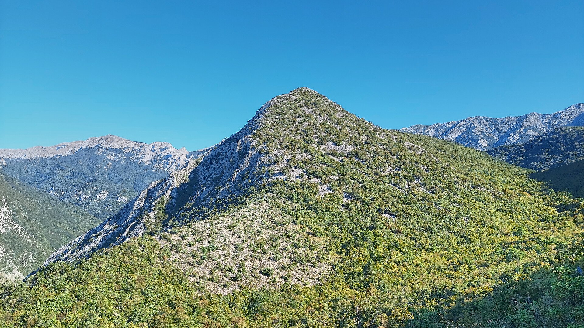
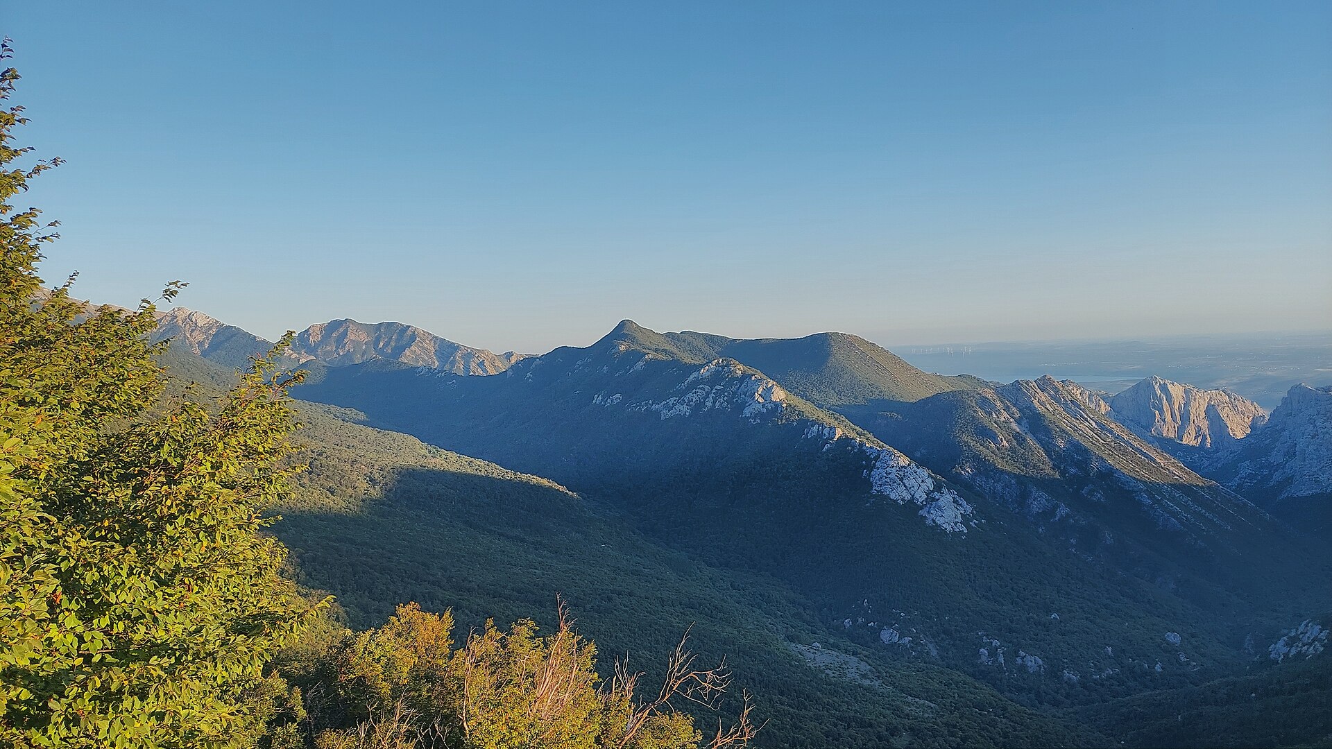
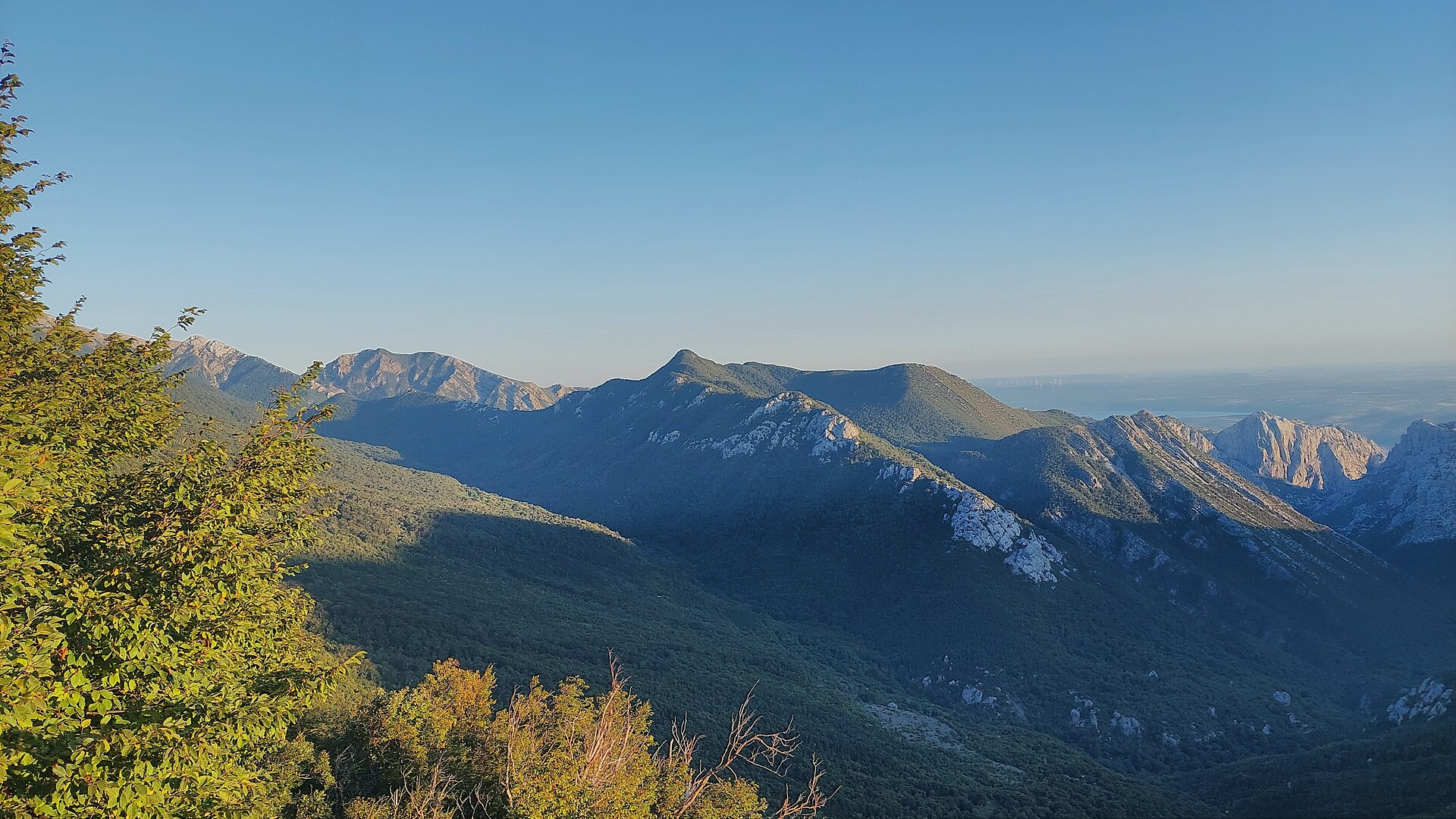
Orlov kuk is a rocky peak in the Velebit massif, rising above Starigrad on Croatia's Dalmatian coast. Its name translates roughly to "Eagle's Peak," a fitting label for the steep, cliff-like profile typical of the Crni Vrh group — the same cluster of summits that includes neighboring Veliki kuk, Kuk od Rujice, Borovnik, and Komić. Orlov kuk reaches an elevation of around 862 m and stands on the east-southeast side of the Velika Paklenica valley, within the boundaries of Paklenica National Park.
Where exactly is Orlov kuk?
The peak sits in southern Velebit, right beside the Velika Paklenica canyon — one of two major canyons (alongside Mala Paklenica) that cut through the mountains from inland all the way to the Adriatic coast. The Velika Paklenica canyon stretches roughly 14 km in length and 500 to 800 m in width, forming the dramatic rock walls from which Orlov kuk rises. The peak's coordinates are 44.3312742, 15.4839354, and the nearest gateway town is Starigrad, which lies at the foot of Velebit right on the sea.
How do you get to the Orlov kuk area?
Starigrad is the natural starting point, with marked trails leading into Paklenica National Park and on toward the Velika Paklenica canyon. The park entrance is only a few minutes' drive from the town center. From there, the route follows the canyon floor, while side paths and climbing approaches branch off toward the Crni Vrh group of peaks, Orlov kuk among them. Given the steep, rocky terrain, reaching the summit itself calls for mountaineering or climbing experience — this is not an easy, casual walking route.
What will you see there?
Orlov kuk is above all a striking vertical rock wall, typical of Paklenica — a region regarded as one of the most important climbing destinations in Southern Europe, with hundreds of routes across all difficulty levels, including many multi-pitch lines up to 400 m long. From around the peak, views open onto the Velika Paklenica canyon, the surrounding limestone crags, and, further off, the Adriatic coastline and islands. Together with its neighbors in the Crni Vrh group, Orlov kuk forms one of the more recognizable pieces of the southern Velebit skyline as seen from Starigrad.
When is the best time to visit?
Spring (April–June) and early autumn (September–October) are the best times to visit, offering comfortable temperatures for physical exertion without the rock faces overheating — a real consideration for climbers. Summer brings intense heat inside the canyon, while in winter the higher parts of Velebit can carry snow and require extra preparation.
Frequently asked questions
How high is Orlov kuk? The peak reaches roughly 862 m above sea level.
Can you climb Orlov kuk without climbing experience? The terrain is steep and rocky, so reaching the summit itself requires mountaineering or climbing skills — it isn't a route for casual hikers.
Where is Orlov kuk relative to Starigrad? It lies inland, on the east-southeast side of the Velika Paklenica canyon within Paklenica National Park, a few kilometers from central Starigrad.
How does Orlov kuk differ from nearby peaks like Veliki kuk? All of these summits belong to the same Crni Vrh rock group in the Velika Paklenica canyon, but they differ in height, wall orientation, and climbing route difficulty — Orlov kuk stands out for its distinctive, steep silhouette, which gives the peak its name.
Nearby places

Earn badges for the places you visit
Download NextOnTrip, discover new places and check off your trails.