About this place
Kamenjak is the highest peak on the island of Rab in Croatia, rising 408 meters above sea level right behind the town of Rab. Locals also call it Straža, a name that hints at its role — a natural lookout towering over the whole island and visible from almost every corner of it.
How do you get to the top?
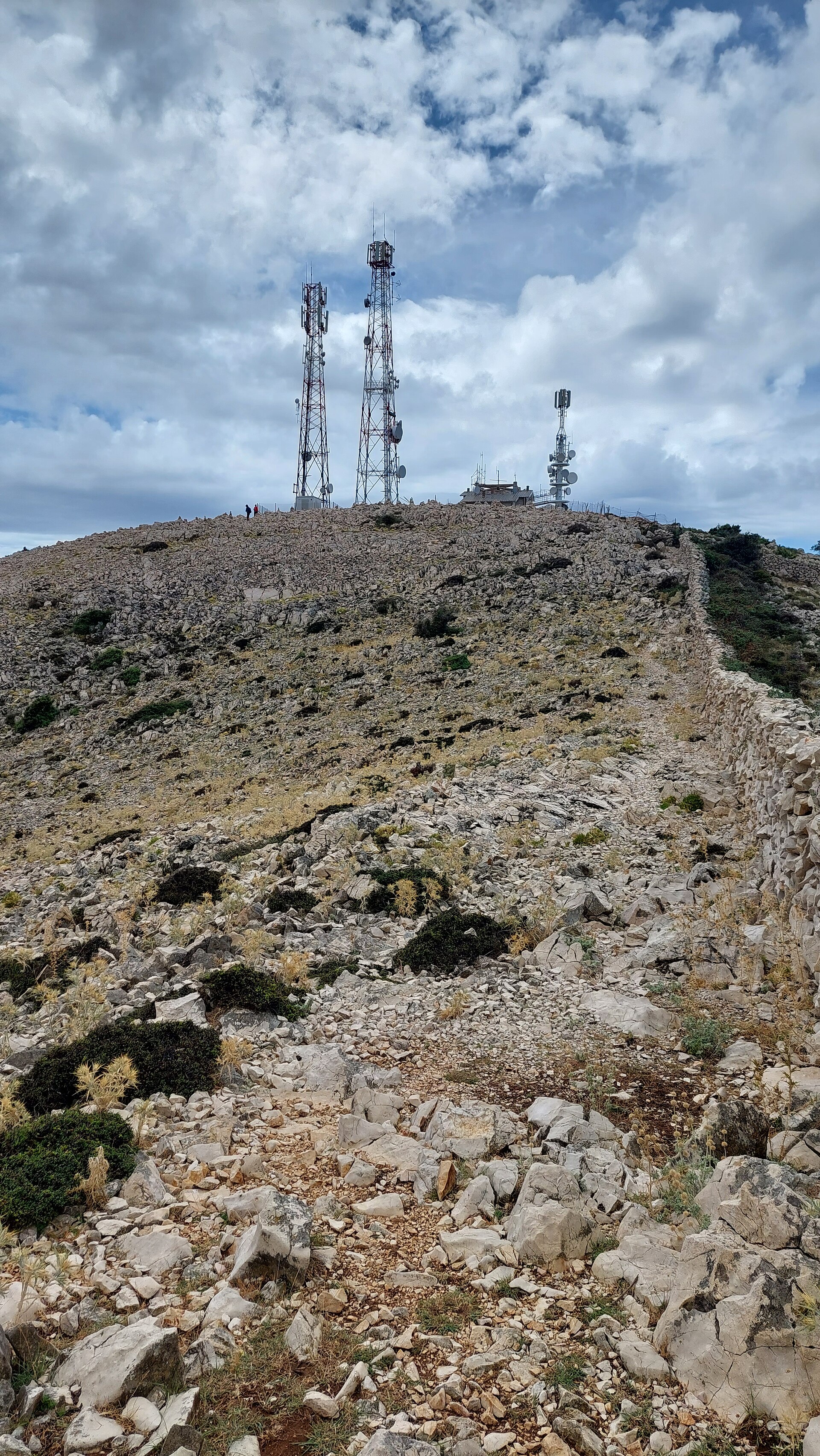
Kamenjak can be reached on foot or by car. The hiking trail usually starts near the town of Rab or from the village of Mundanije on Rapsko polje. It's well marked: the first stretch runs along roads and through built-up areas, then near Barčići it cuts between two houses and turns into a proper rocky footpath that climbs gently towards the summit. Depending on the starting point and pace, the round trip takes anywhere from about two to nearly four hours. The final section crosses open, rocky ground, so sturdy shoes and water are worth packing. Drivers can skip the walk entirely and follow a narrow, partly paved access road all the way up.
What will you see along the way?
The climb itself is scattered with spots worth pausing at. One is the ruined Tomašić lookout, facing back towards the town of Rab. Higher up, along the ridge, sits Vidilica — a stone platform with benches offering views over Rab, the sea, and the island of Lošinj. It's a good place to catch your breath before the final push.
The summit itself is marked by a telecommunications facility — not the prettiest sight, but a useful landmark, with a metal summit stamp bolted to its fence. A cargo cableway once carried supplies up to the station; it's long abandoned now and has been replaced by the access road.
Why is Kamenjak worth the climb?
The reward at the top is a sweeping panorama over much of the northern Adriatic. From the summit you can pick out the Velebit mountain range on the mainland, along with the neighbouring islands of Krk, Cres, Lošinj, Pag, Silba and Olib, and on a clear day even smaller islets such as Sv. Grgur, Goli Otok and Prvić. It's one of the best viewpoints on the whole of Rab and a favourite among photographers at sunrise and sunset.
When is the best time to go?
Spring and autumn are the most comfortable seasons, with mild temperatures that make the exposed final stretch far less tiring. In summer, starting early in the morning is a good idea, before the sun heats up the rocky sections of the trail. In winter, clouds sometimes wrap around the summit and cut visibility, but on a clear day the views are just as striking.
Frequently asked questions
How long does it take to hike Kamenjak? Depending on the starting point and your pace, the full round trip takes roughly two to four hours.
Can you drive to the top? Yes, a narrow, partly paved access road leads all the way up, though hiking lets you take in the viewpoints along the route.
Where's the best place to start the hike? Popular starting points are near the town of Rab and the village of Mundanije on Rapsko polje — both routes join higher up on the trail.
What can you see from the summit? A panorama of the Velebit mountain range, the islands of Krk, Cres, Lošinj, Pag, Silba and Olib, and smaller islets near Rab.
Nearby places

Earn badges for the places you visit
Download NextOnTrip, discover new places and check off your trails.