Monuments in France
A guide to 1358 Monuments in France — with descriptions, photos and traveler visits from the NextOnTrip community. Locations spread across 956 cities and towns. Most visited by the community: Château de la Bretonnière, Château de Caumont, Château du Petit-Arnsberg.
-
Château de Soupir
Soupir
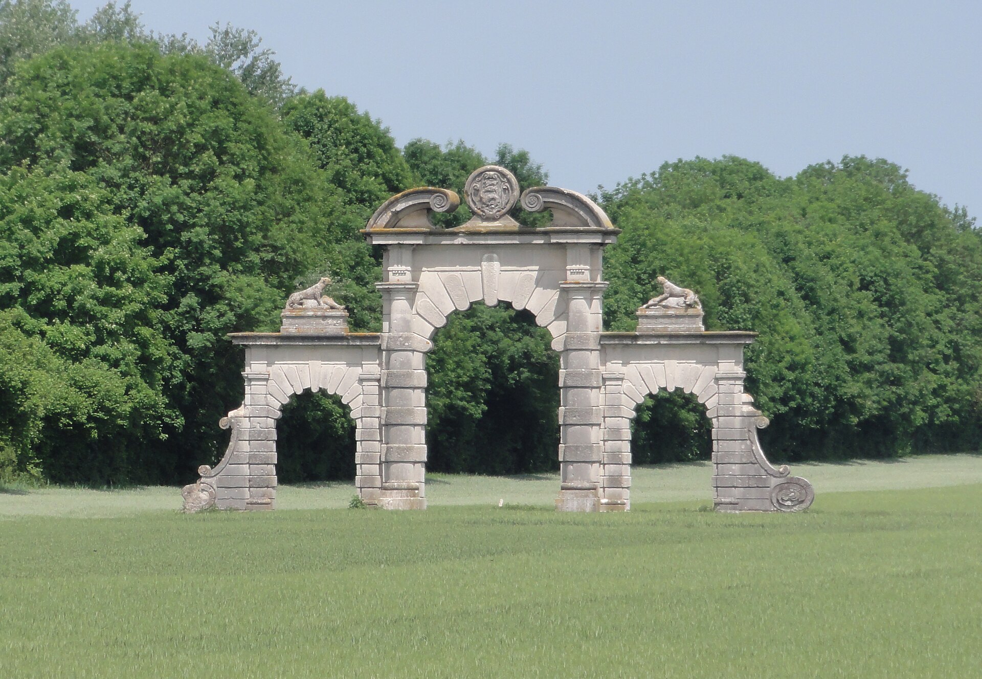
Château de Soupir, in the village of Soupir in the Aisne department, is not really a château anymore — what remains is a single monumental stone gateway, the last trace of a residence with a long and turbulent past. The site sits south of Laon, in the Aisne valley, right in the heart of the Chemin des Dames, one of the most fought-over stretches of the Western Front in 1914–1918. How do you get there? Soupir lies along the river Aisne, a short drive from both Laon and Soissons, the nearest towns with rail connections. The village is best reached by car along the local roads that follow the valley. The old gateway stands at a bend in the road, tucked behind a five-metre wall, so it is easy to miss if you are not looking for it — worth marking on a map before setting off. What will you see? The estate's story starts far earlier than the surviving gate suggests. A wooden stronghold stood here as early as the 9th century, followed by a medieval fortress in the 11th century. In the 16th century the Juvénal des Ursins family, established in Soupir from 1456, turned the fortress into a more comfortable manor house. During the 17th century the grounds were laid out with a formal French garden and a large ornamental canal. Ownership changed hands repeatedly over the following centuries: Pierre Baudoin bought the estate in 1599, Joseph Alexandre Coste de Champéron in 1754, and in 1800 it passed to Charles Hippolyte de Berthelot, viscount of Villeurnoy. In 1871 the château was acquired by Pauline Piper (Madame Plé), who rebuilt it from 1876 in a Renaissance style, keeping the two stone towers that had survived from the medieval fortress. The park itself was later redesigned by the landscape architect Édouard Redon. That version of the château lasted only until the First World War. It was destroyed by shelling in November 1914 as fighting engulfed the Aisne front, and the ruins were finally cleared away in 1926. All that survives today of the château, park, garden and enclosing walls is a monumental portal dated 1908, decorated with hunting-themed figures. The village itself holds further layers of history: a listed church and four military cemeteries belonging to different nationalities, all connected to the fighting along the Chemin des Dames. A marked walking and cycling route, "Au fil du val de l'Aisne", runs through the area with interpretation panels and an audio guide, passing through several dozen metres of a former German trench known as "Tirpitz". When should you visit? Spring and summer are the best seasons, when the paths through the Aisne valley are easiest to walk and the long daylight hours let you combine the gateway with the nearby war cemeteries and other Chemin des Dames sites. In autumn and winter the valley floor can turn wet and muddy, which makes the longer walking routes harder going. Frequently asked questions Can you still visit the inside of the château? No — the building itself was destroyed in 1914 and dismantled in 1926. The only part left to see is the monumental gateway dated 1908. What exactly is left to see on site? A stone entrance gate decorated with hunting motifs, standing alone by the road; the château and park it once led into are gone. Is there anything else worth seeing in Soupir? Yes — a listed church, four military cemeteries of different nationalities, and a walking/cycling trail with history panels that passes through the German "Tirpitz" trench. How do you get to Soupir? By car is easiest, via local roads from either Laon or Soissons, following the Aisne valley.
-
Portique romain du Forum
Vienne
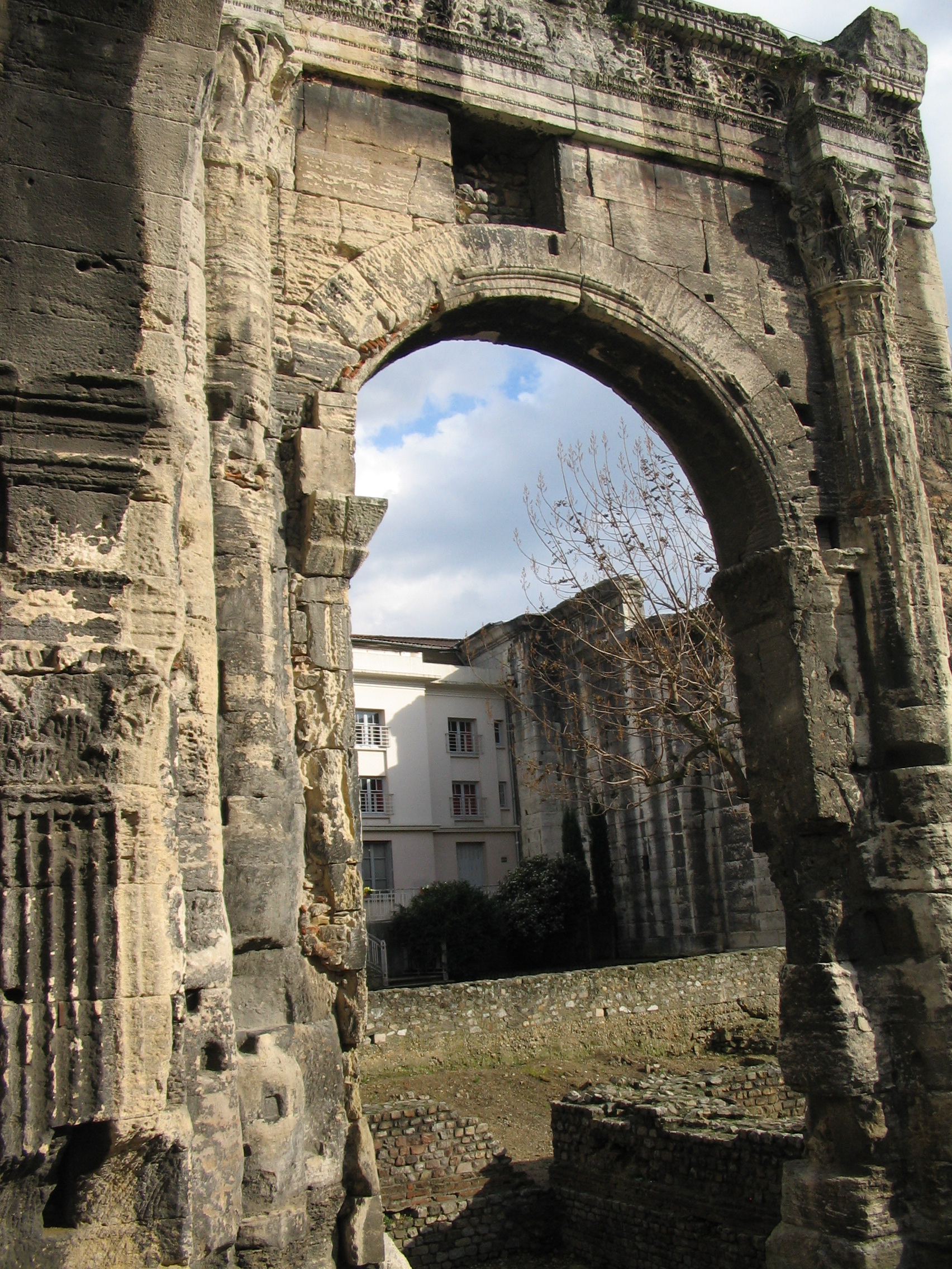
The Roman Portico of the Forum is what remains of the monumental colonnade that once framed the Roman forum of Vienne, in the Isère department of France. Two standing arches of the portico can be seen today in the Jardin archéologique de Cybèle, an archaeological garden laid out on the grounds of a former city hospital, a short walk from the Roman theatre. What exactly is left to see? The forum of Roman Vienne (ancient Vienna Allobrogum) followed the classic tripartite layout of provincial Roman fora: a central open plaza bordered on its long north and south sides by monumental porticoes. The plaza's western end held the sacred precinct, dominated by the Temple of Augustus and Livia, while a basilica used for administration and justice closed off the eastern side. Of that entire ensemble, two arches of the northern portico's colonnade are what survive above ground, and they now form the centerpiece of the Cybèle garden. Around them lie other excavated traces from the same district: the foundation walls of an assembly building and fragments of terraced houses that once stood nearby. How do you get there and what should you expect? The Cybèle archaeological garden sits in central Vienne, close enough to the Roman theatre that both sites are easily combined into one walking visit. The portico ruins are open as part of the garden and require no guide booking, but it helps to slow down and match the standing arches against a plan of the original forum — on their own, the two arches give only a partial sense of how large the complex once was. Why does this site matter? The portico is one of the better-preserved fragments of Roman public architecture surviving from this part of Gallia Narbonensis. It is listed in the French Mérimée heritage database under reference PA00117347 as "Restes du portique romain, dit du Forum," protected as an archaeological site since a 1993 record entry. That protected status is what has kept the two arches standing while the rest of the forum's footprint disappeared beneath the modern town. When is the best time to visit? Because the Cybèle garden is an open-air site, spring and autumn bring the most comfortable temperatures and the best light for photographing the stone arches. In summer, an early-morning visit is worth planning, before the open plaza heats up and fills with groups heading to the nearby theatre. Frequently asked questions Is this the same site as Vienne's Roman city walls? No. The Roman Portico of the Forum is a separate monument from the Enceinte romaine de Vienne (the Roman city ramparts) — they sit in different parts of the ancient city and are recorded as distinct heritage sites. How much of the original forum survives? Only two arches of the northern portico's colonnade remain standing. The rest of the forum, including the Temple of Augustus and Livia and the basilica, stood in other parts of what is now central Vienne and is not visible at this same location. Is entry to the Cybèle garden free? The archaeological garden is a public municipal space open to visitors; opening hours can vary by season, so it is worth checking locally before a visit. How long should I plan for a visit? The portico itself takes only a few minutes to see, but combining it with the rest of the Cybèle garden and the nearby Roman theatre easily fills an hour or more.
-
Château du Cabin
Guiry-en-Vexin
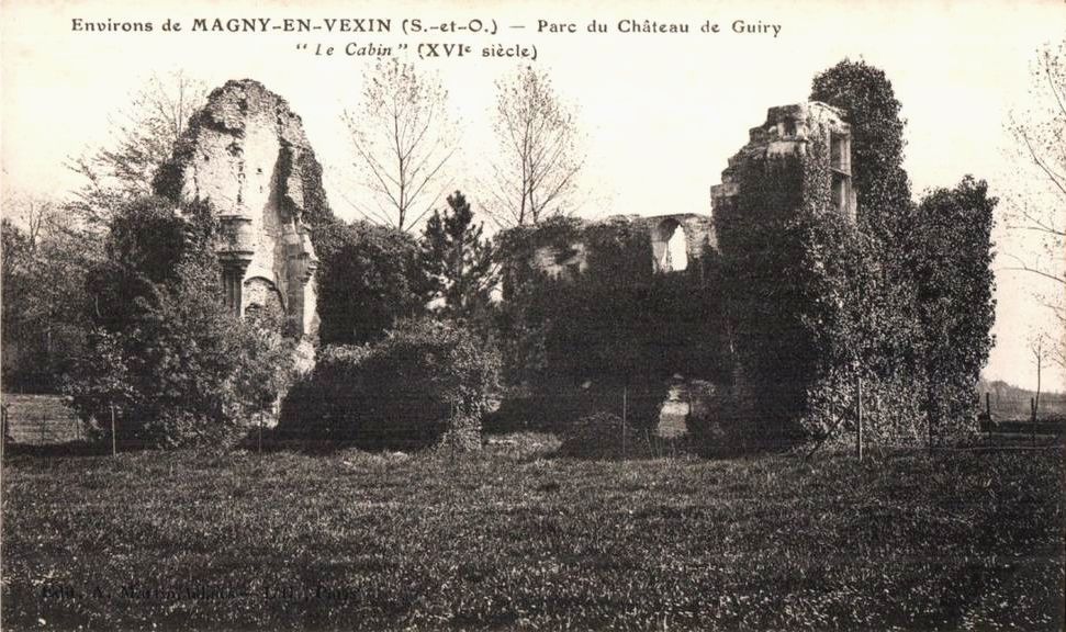
Château du Cabin is a set of medieval castle ruins in Guiry-en-Vexin, a small commune in the Val-d'Oise department, within the Vexin français region northwest of Paris. What remains today, standing among the trees of a historic park, is what's left of a castle built in the 15th century for Richard de Guiry — itself the successor to an even older fortified castle with a moat and keep, of which nothing survives. Who were the lords of Guiry? The ruins of Cabin are tied directly to the Guiry family, one of the oldest noble families of the Vexin, first mentioned in a document dating back to the year 690. Over the centuries, the family distinguished itself alongside the kings of France, taking part in the Crusades, the Hundred Years' War, the Wars of the League (the French Wars of Religion), and the Estates General of 1789. It was for Richard de Guiry, a member of this line, that the 15th-century castle whose ruins still stand today was originally built. What will you see on site? Cabin survives today only as a set of stable ruins, a physical reminder of the residence that was eventually replaced by a new, much larger château built in the second half of the 17th century — the present-day Château de Guiry-en-Vexin. The park shared by both structures has lost the formal flower gardens it once had, but it retains real character thanks to a tree-lined avenue that draws the eye straight toward the Cabin ruins, one of the most recognisable views in the village. The whole estate — the château, its outbuildings, the park, the cavalry lane, the seigneurial church, and the Château du Cabin itself — was listed as a historic monument by decree on 14 March 1944. The Cabin ruins themselves received additional protected status as a ruin by a further decree on 17 February 1950. How do you get there? Guiry-en-Vexin sits at the heart of the Vexin français, northwest of Paris in the Val-d'Oise department. It's a small rural commune best reached by car, surrounded by the open fields, narrow lanes and stone villages typical of the area. The château and its ruins sit inside a park that is visible from the village's main road. When should you visit? Château du Cabin and the neighbouring Château de Guiry-en-Vexin are not open to visitors year-round. Individual visitors can access the site on two set occasions: the first weekend of June, during open garden days, and the third weekend of September, as part of the European Heritage Days. The park is also sometimes accessible during the summer holiday period. Groups can arrange a visit by prior appointment. Frequently Asked Questions Can you visit Château du Cabin every day? No. Individual access is limited to the first weekend of June (garden open days) and the third weekend of September (Heritage Days), plus occasional summer holiday openings. Groups need to book a visit in advance. What's the difference between Château du Cabin and Château de Guiry-en-Vexin? Cabin is the ruin of an older, 15th-century castle built for Richard de Guiry. The current, much younger Château de Guiry-en-Vexin was built in the second half of the 17th century and took over as the family's main residence, leaving Cabin standing as a permanent ruin within the park. Is the site legally protected? Yes. The entire estate, including Château du Cabin, the park, the outbuildings and the church, was listed as a historic monument in 1944, and the Cabin ruins received extra protection as a ruin in 1950. Which family is linked to the site's history? The Guiry family, one of the oldest noble houses of the Vexin, first recorded in the year 690. Its members took part in the Crusades, the Hundred Years' War, the Wars of Religion and the Estates General of 1789.
-
Château de Cordon
Brégnier-Cordon
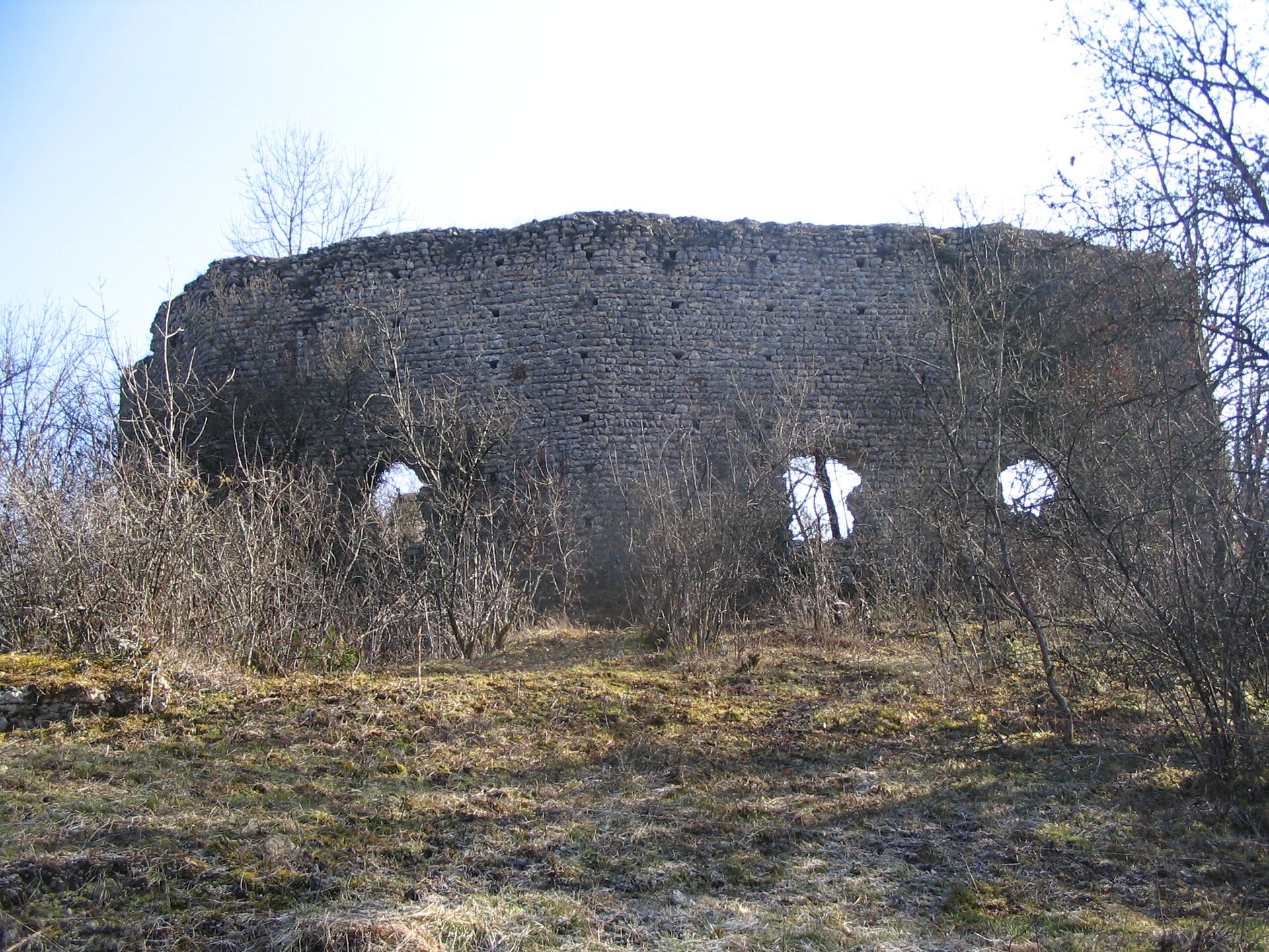
Château de Cordon is the ruin of a medieval fortified castle in Brégnier-Cordon, a small commune in the Ain department of eastern France, set in a bend of the Rhône on the border with Savoie and Isère, roughly 20 km south of Belley. Perched on a hill above the river valley, only fragments of its walls survive today, yet the site remains a rewarding stop for history lovers and hikers alike. What is the history behind the castle? The stronghold dates back to the 12th century and ranks among the oldest fortifications in the Bugey region. It was built by the House of Cordon, one of the oldest noble families in this part of Savoy. Thanks to its commanding position above the Rhône, the castle served the Counts of Savoy as a watchtower on the border of their territory and as a fortress guarding the river valley against incursions. In 1434, Duke Amadeus VIII of Savoy took the castle from Aynard II de Cordon, who had risen up in arms against his own overlord, and had the fortress dismantled soon after. When the Cordon family later recovered their lordship, they settled instead at the nearby Château de la Barre, and the original stronghold never regained its former standing. It was most likely destroyed for good in the 17th century, after which its stones were quarried for building material. What is left to see on site? The ruins sit on a hilltop about 40 metres above the Rhône plain. The site is split into two parts: the southeastern section belongs to a private owner and is closed to visitors, while the northwestern section lies on communal land and is freely open to the public. It is this public section that lets visitors walk among the remaining wall fragments and appreciate why the position was chosen to overlook the river valley. How do you get to the ruins? The starting point is Molard, a small hamlet within the commune of Brégnier-Cordon. From there, the Rue du Château leads northwest, continuing onto a grassy path marked by an old wooden sign that reaches the communal part of the ruins. Cars can be parked along the Route de la Pierre, near the Lac de la Pierre. The area also serves as the starting point for three marked walking trails — the "sentier de l'eau," the "sentier des lônes et îles du haut Rhône" with nature information panels, and a loop around the Mont de Cordon — making it easy to combine the castle visit with a longer walk along the Rhône, the lake, or the Brotteaux de Cordon wetlands. When is the best time to visit? The ruins can be reached year-round, but since the approach path is grassy and can get muddy, spring, summer, and early autumn — when the ground is dry and days are longer — are the most comfortable seasons to visit. Sturdy walking shoes make the climb up the hill much easier. Allowing half a day is a good idea if you plan to pair the ruins with one of the nearby trails around the lake or the Rhône valley. Frequently Asked Questions What is Château de Cordon? It is the ruin of a 12th-century fortified castle built by the House of Cordon in Brégnier-Cordon, in the Ain department, later used by the Counts of Savoy to control the Rhône valley. Why is the castle in ruins today? It was seized and partly dismantled in 1434 on the orders of Duke Amadeus VIII of Savoy after its owner, Aynard II de Cordon, rebelled against him. The castle was likely destroyed for good in the 17th century. Is it free to visit the ruins? The northwestern part, on communal land, is freely accessible. The southeastern part is private property and cannot be visited. How do you reach the castle? The easiest approach starts in Molard, following the Rue du Château and then a grassy path marked with an old wooden sign up to the communal ruins. Parking is available along the Route de la Pierre, near the Lac de la Pierre.
-
Château de Ham
Ham
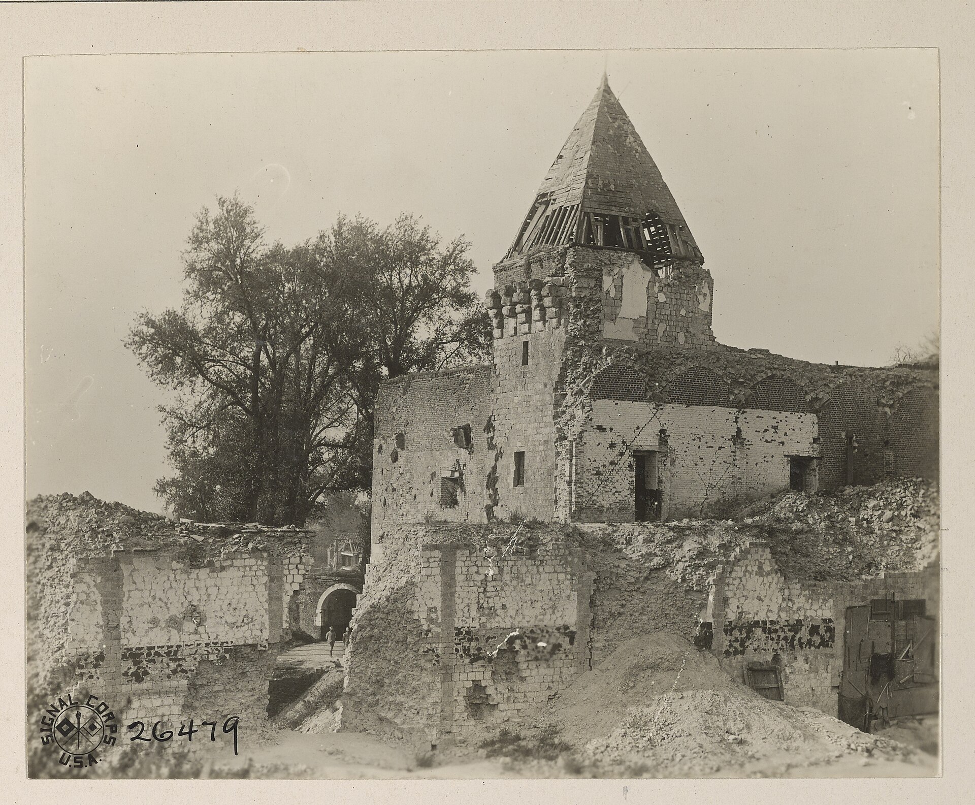
Ham Fortress stands on the edge of the town of Ham in the Somme department of Picardy — a medieval stronghold that spent centuries shifting roles, from feudal riverside castle to one of France's most notorious state prisons, before ending up as a field of ruins after the First World War. Where did the fortress come from? The first castle on the site was raised around 1052 by the early counts of Vermandois, taking advantage of a defensible position on the Somme river at the border with Île-de-France. Odon IV rebuilt it in the 13th century, and Jean II de Luxembourg-Ligny carried out a further overhaul later on. The fortress reached its most imposing form in 1441, when Louis de Luxembourg-Saint-Pol, Count of Saint-Pol and constable under Louis XI, commissioned a massive keep known as the "grosse tour" or "constable's tower." It measured 33 metres in diameter, 33 metres in height, and had walls 11 metres thick — one of the heaviest defensive structures built in medieval France. The stronghold withstood repeated sieges, including an assault by Philip II of Spain in 1557. Under Henry IV, Ham was absorbed into the royal domain, and in the late 17th century its defences were reworked by Vauban, Louis XIV's celebrated military engineer. What is left to see today? After German troops dynamited the fortress on 19 March 1917 during their withdrawal from the region, the once-monumental complex was reduced to evocative ruins. Visitors today can still make out sections of the defensive walls and remnants of the famous constable's tower, enough to sense the original scale of the structure. The town of Ham maintains the site and keeps it accessible, and the ruins are sometimes opened for free during regional heritage events organised by the Somme department. Since 1965 the remains have held official historic-monument protection under French law. Who were the prisoners held here? Between the 18th and 19th centuries, Ham served as a state prison reserved for politically significant detainees. In April 1795, during the Thermidorian crackdown, around a dozen Montagnards, including the militant Chasles, were held there. Later inmates included the revolutionary orator Mirabeau and the Marquis de Sade. But the fortress is best remembered for the escape of Louis-Napoléon Bonaparte, the future Napoleon III, who slipped out of his cell disguised as a construction worker — an episode still cited as one of the most audacious prison breaks of 19th-century France. How do you get to Ham? Ham sits in the Somme department, in the Hauts-de-France region, under an hour's drive from both Amiens and Saint-Quentin. The town has its own railway station with regional connections, making it a convenient stop for travellers exploring northern France by train. The fortress ruins lie within easy walking distance of the town centre, so a visit pairs naturally with a look around Ham itself. When is the best time to visit? Spring and summer are the most comfortable seasons, with longer daylight hours making it easier to walk the grounds around the ruins. It is worth checking the Somme department's event calendar in advance, since certain heritage days include free entry and on-site guided information. Frequently asked questions Is there more than ruins left of Ham Fortress? Yes — sections of the defensive walls and remnants of the 15th-century constable's tower still stand, though the structure was heavily destroyed in 1917. Why is Ham Fortress famous for prison escapes? Its best-known episode is the escape of Louis-Napoléon Bonaparte, who left his cell disguised as a labourer, an event that remains central to the site's history. Who destroyed the fortress? Retreating German forces dynamited it on 19 March 1917, during the First World War. Is entry to the ruins free? Access varies by date — it is worth checking Ham's current schedule, as select heritage days offer free themed visits.
-
Nécropole des Près-de-l'Eau
Lacrost
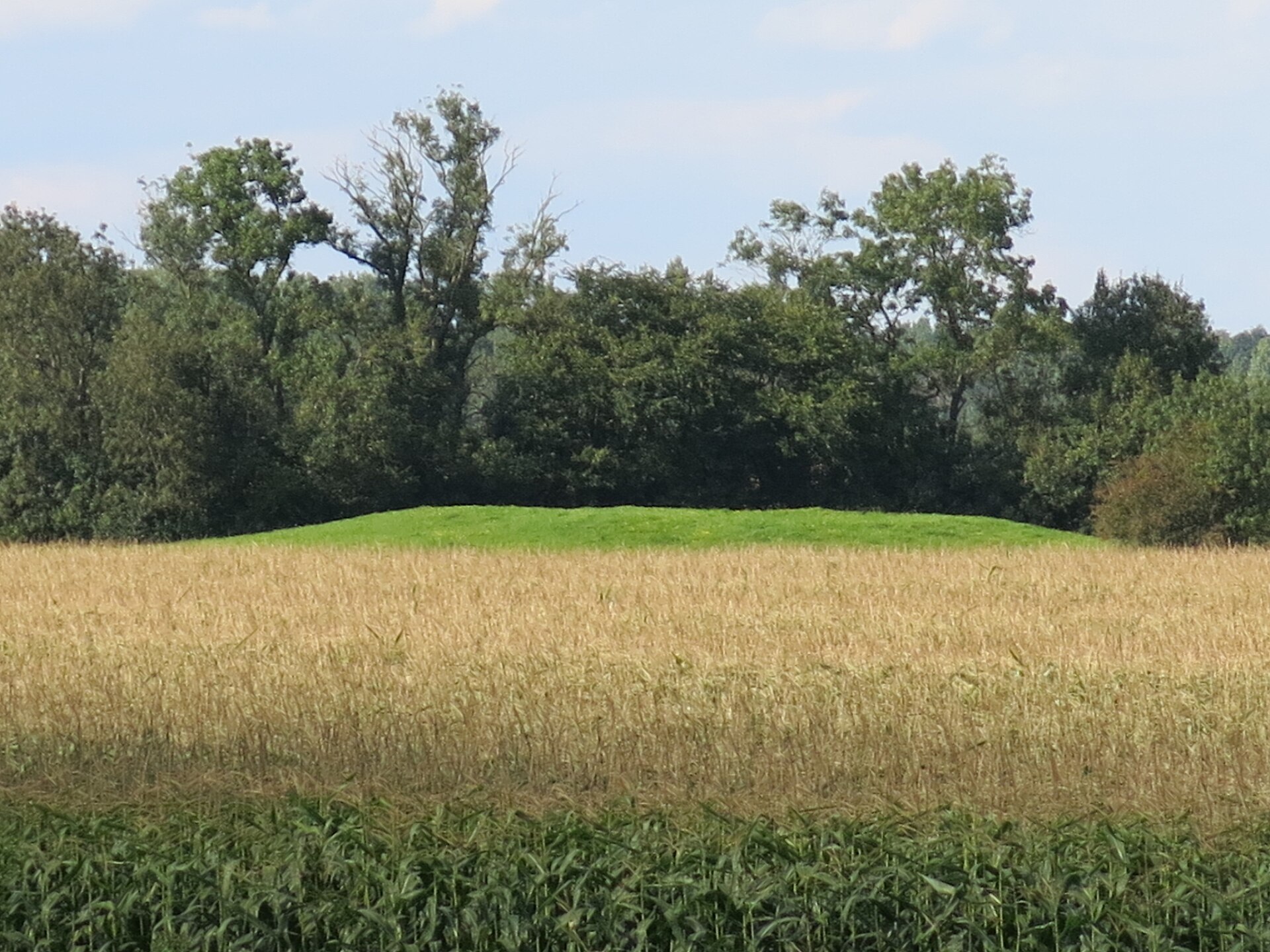
Nécropole des Près-de-l'Eau is a prehistoric burial mound complex in Lacrost, in the Saône-et-Loire department of eastern France. Where is it located? The site spreads across roughly 15 hectares of land known as Près-de-l'Eau, about 700 metres from the left bank of the Saône river. It sits in a quiet, rural corner of Burgundy, surrounded by farmland rather than modern development. What will you see there? Nearly forty burial mounds (tumuli) are spread across the necropolis, arranged in three lines running roughly north to south, parallel to the river. More mounds cluster in the southern part of the site, while the largest ones sit further north - their diameters range from 5 to 45 metres, and their height from just a few centimetres up to 1.8 metres. Because the land is farmed and prone to flooding, many mounds have flattened over time and are not easy to spot at first glance. What is the history behind the site? The first investigations took place in 1879, carried out by members of the Société des amis des arts et des sciences de Tournus. They focused on the two largest, centrally placed mounds - numbered 1 and 2 - digging trenches 3 to 3.5 metres wide from the outer edge toward the centre. The objects recovered were placed in the Musée Greuze in Tournus, where some remain on display. More than a century later, in 1986-1987, an emergency excavation was carried out on mounds 3 and 4 in the southern section of the necropolis. It uncovered a ring of standing stone slabs 19 metres in diameter surrounding mound 3, evidence of a deliberate, ritual approach to burial. Pottery recovered from the site dates the main phase of use to the Bronze Age, around 800 BC. Neolithic flint tools point to activity as far back as roughly 2500 BC, while Gallo-Roman objects from the 1st and 2nd centuries AD show that the site continued to draw use over thousands of years. Two of the mounds were listed as historic monuments of France by decree on 4 May 1934, a recognition of their scientific and cultural importance. How do you get there? Lacrost lies in the Saône-et-Loire department, in the Bourgogne-Franche-Comté region, close to Tournus. A car is the most practical way to reach the site, since it lies in open countryside outside the village, close to the Saône. It's worth combining a visit with a longer trip through the region, including a stop in Tournus to see its own historic sites. When should you visit? Since the ground can flood, the best time to explore is during the drier months, from late spring to early autumn, when the soil is firm and the mounds stand out more clearly in the landscape. Frequently asked questions What is the Nécropole des Près-de-l'Eau? It's a prehistoric burial mound complex of around forty tumuli, located beside the Saône river in the commune of Lacrost. How old are the burial mounds? The main phase of use dates to the Bronze Age (around 800 BC), though finds also point to Neolithic activity (around 2500 BC) and Gallo-Roman presence. Are the mounds protected by law? Yes, two of them have been listed as French historic monuments since 1934. Can you visit the site on your own? The land is accessible, but it's farmed and can be wet underfoot, so sturdy footwear and care around crops are advisable.
-
Château de Chazeu
Laizy
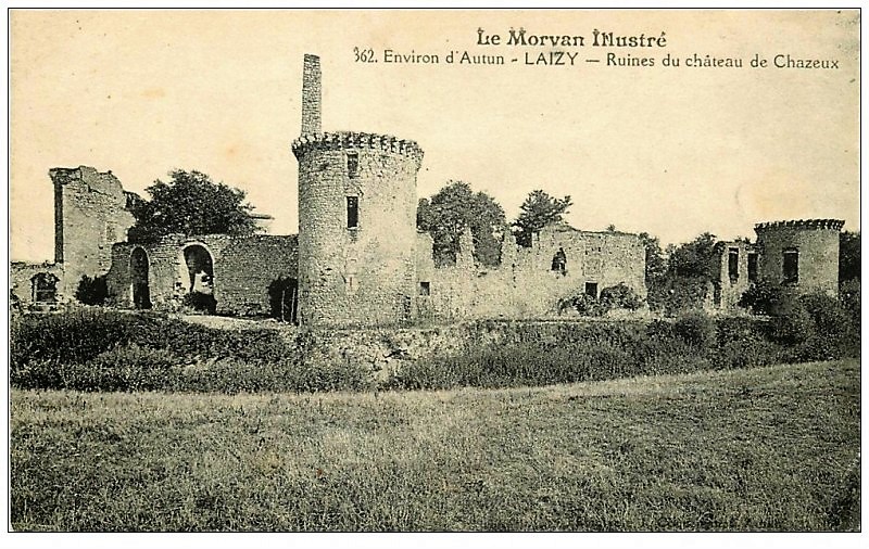
Château de Chazeu is a medieval castle ruin in Laizy, a small commune in the Saône-et-Loire department, part of the Bourgogne-Franche-Comté region. The site sits on private land in the Arroux valley and has stood in ruins, overgrown with trees, since it was dismantled in the mid-19th century. What is the history behind the castle? The castle was built during the medieval period on a pentagonal plan covering roughly half a hectare. It was originally defended by four round towers, along with a square tower rising above the entrance. Remnants of monumental fireplaces survive today, dating from the era of Chancellor Nicolas Rolin. The estate is first recorded at the beginning of the 13th century, when it belonged to the Longvy family. The family held the property until around 1434, when the husband and brothers of Jeanne de Longvy sold it to Nicolas Rolin, chancellor to the Duke of Burgundy and one of the most influential figures at the Burgundian court of that era. Later owners included Roger de Bussy-Rabutin, the French writer and soldier, who bought back a portion of the estate in 1651 and reunited the property. Why is the castle in ruins today? The turning point came in the mid-19th century, when the owner had the castle almost entirely demolished so the building materials could be reused elsewhere — a common fate for many aristocratic residences in the region during that period. As a result, only fragments of walls and the remains of the old fireplaces have survived from what was once an imposing fortified estate. Can visitors tour Château de Chazeu? The castle is private property and is not open to the public — there is no access to the grounds or the ruins themselves. Despite this, the site has been listed as a French historic monument (monument historique) since November 7, 1927, a status that confirms its architectural and historical importance regardless of public access. How do you get to Laizy? Laizy lies in Saône-et-Loire, set within the scenic Arroux valley amid Burgundy's meadows and woodland. The commune is close to Autun, a historic Roman town with well-preserved ancient monuments, making the area a good base for travelers interested in the region's layered history. Because the castle is privately owned, it's best appreciated from a distance as part of the valley landscape. What else is worth seeing nearby? The area around Laizy is known for its Burgundian architectural heritage — Romanesque churches, manor houses, and other castle ruins scattered along the Arroux valley. It makes a rewarding stop for travelers following the trail of medieval Burgundian history, offering insight into the fortunes of local nobility and the lasting influence of Chancellor Nicolas Rolin on the region. Frequently asked questions Can you visit Château de Chazeu? No — the castle is private property and is not open to visitors. When was the castle destroyed? It was largely demolished in the mid-19th century when the owner reused its building materials for other purposes. Who owned the castle? It belonged to the Longvy family from the early 13th century until 1434, then passed to Nicolas Rolin, chancellor to the Duke of Burgundy; Roger de Bussy-Rabutin later acquired part of the estate in 1651. Is the castle a protected monument? Yes, the ruins have been listed as a monument historique since November 7, 1927.
-
Châteauvillain
Châteauvillain
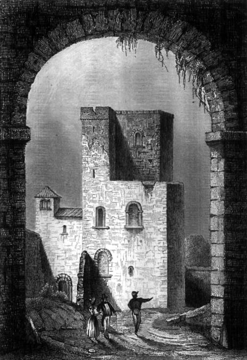
Châteauvillain is a small commune in the Haute-Marne department, in the Grand Est region of north-eastern France, set along the banks of the Aujon river on the historic border between Champagne and Burgundy. The town's own name tells much of its story, and it's the best starting point for understanding the place. Where does the name Châteauvillain come from? The first part of the name comes from the Latin castellum, meaning "fortified place" or "castle" — a clear sign that the settlement was tied from its earliest days to defence and control of the surrounding land. The second part, "villain," might look like the French word for "rustic," but it actually preserves the name of the site's founder or an early owner. A medieval record from 1143, Castrum Rusticum super fluvium Augio, points to the Germanic name Willencus, a Latinised form of Wilhelm (William) — common in France during the 11th and 12th centuries. Read this way, Châteauvillain means, quite literally, "William's castle on the Aujon." Where is Châteauvillain located? The commune sits in the Haute-Marne department, part of the Grand Est region in eastern France, on the Aujon river, a tributary of the Marne. Access to water and river crossings shaped the town's early strategic and economic importance. The area lies right on the boundary between two historic French provinces, Champagne and Burgundy, making it a natural crossing point between the two. The nearest larger towns are Chaumont and Langres, both a short drive away, with Troyes further north and Dijon to the south. What can you see around Châteauvillain? Châteauvillain still shows the layout typical of a fortified medieval settlement: a compact historic core, once enclosed by walls, with narrow streets running down toward the river. A walk along the Aujon reveals the quiet, rural character of the Haute-Marne countryside, an area that sees far less mass tourism than better-known parts of France — a real draw for travellers looking for an authentic slice of provincial life. Within the town, several historic building fragments recall its fortified past, including the structure locally known as the Tour du Jardin, which is covered separately as its own point of interest and worth a dedicated look. How do you get to Châteauvillain? The easiest way is by car, since the town sits along the roads connecting Chaumont and Langres, within easy reach of the main routes through the Grand Est region. Travellers coming from Paris will find it most convenient to take the train to Chaumont or Troyes and continue from there by car or local transport. The trip from Paris typically takes around two to three hours, depending on the route. When is the best time to visit? The Haute-Marne countryside is best visited from spring through early autumn, when the weather favours riverside walks and exploring the historic centre. Summer brings warmer days, though Châteauvillain keeps its calm, unhurried pace even then, far removed from the crowds found at more popular French destinations. Autumn adds a scenic palette to the Aujon valley, while winter draws mainly visitors with a specific interest in the region's history, in a quieter, off-season atmosphere. Frequently asked questions What does the name Châteauvillain mean? It combines the Latin castellum ("fortified place") with the name Willencus (William) — likely the founder or an owner of the original castle, as suggested by a 1143 record. Which part of France is Châteauvillain in? It's in the Haute-Marne department, in the Grand Est region, on the border between Champagne and Burgundy. How can you reach Châteauvillain without a car? The best option is to take the train to Chaumont or Troyes, then continue by local transport or taxi to the town. Is there anything to see in Châteauvillain besides the village itself? Yes — the town includes a historic tower known as the Tour du Jardin, described as a separate attraction and worth visiting during a stay.
-
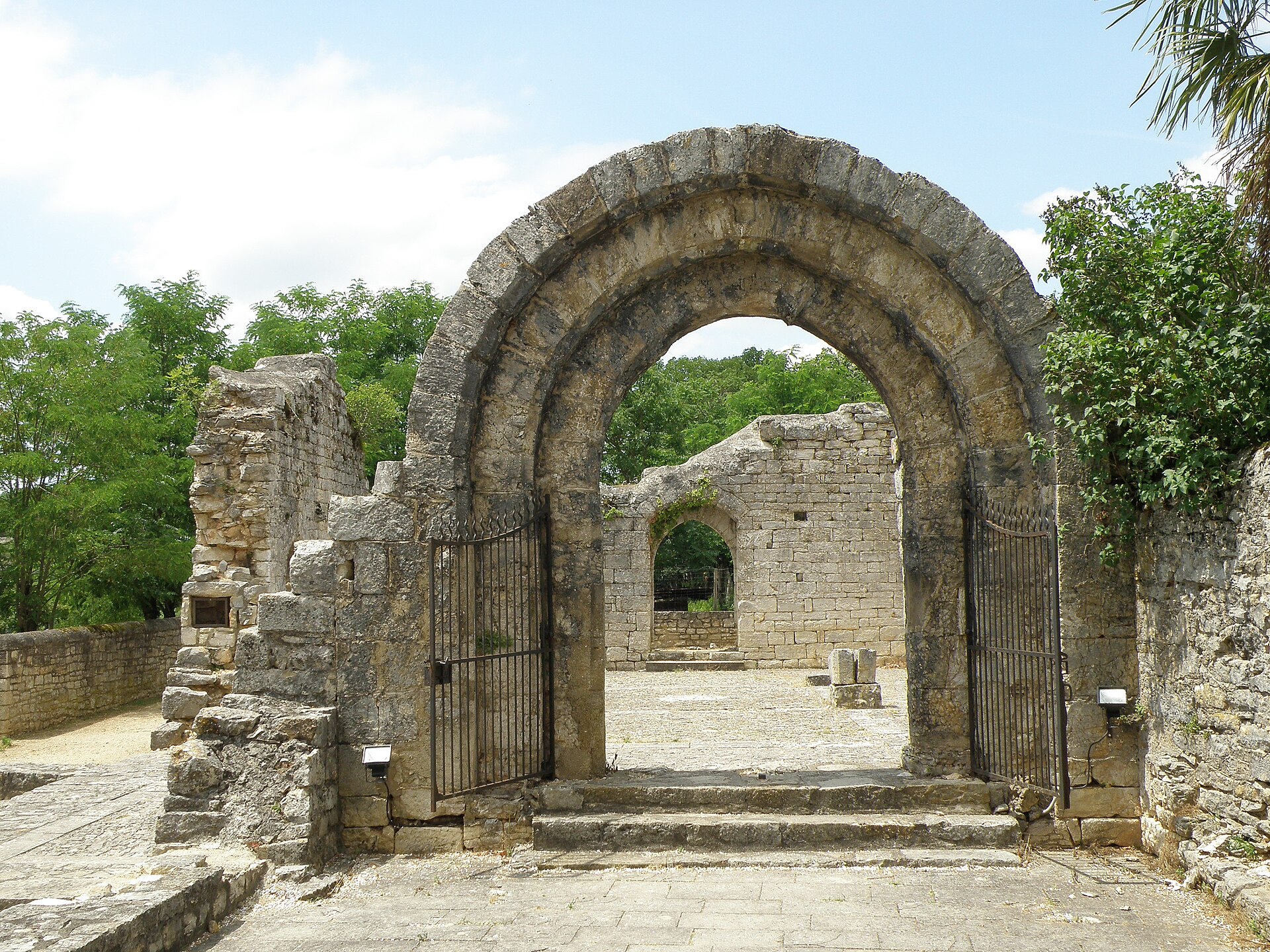
Hôpital de l'Hospitalet de Rocamadour
Rocamadour
The Hôpital de l'Hospitalet is a medieval pilgrim hospital site, now in ruins, in the village of L'Hospitalet on the plateau above the Rocamadour canyon, in the Lot department of southwest France. What is the story behind this place? The village of L'Hospitalet takes its name directly from this building — a medieval hospital built to receive pilgrims. Local tradition credits its founding to Dame Hélène de Castelnau in the 11th century: after getting stuck in a marsh with her servant, she is said to have vowed to devote herself to the care of the poor and of pilgrims if she managed to get free. In the 13th century the site was rebuilt and expanded as the Hôpital Saint-Jean, run by the Knights Hospitaller — the order after which both the hospital and the village are named. Rocamadour was one of medieval Europe's major pilgrimage destinations, drawing visitors to its miracle-working Black Madonna, while also sitting on routes heading toward Santiago de Compostela and even the Holy Land. That volume of foot traffic made basic health screening a practical necessity: the hospital at L'Hospitalet held pilgrims suspected of carrying contagious disease under observation before they were allowed to continue on to the sanctuary. Two other facilities nearby served the same pilgrim network — the Notre-Dame hospital in the town itself, and the Saint-Jacques hospital at Magès, just south of Rocamadour. What can you see there today? What remains on site are the ruins of the hospital building and the chapel of Saint-Jean-Baptiste. Next to them stands the Porte de l'Hôpital, also known as the Porte Sainte — the old gate that once marked the entrance to the hospital precinct. Both the gate and the hospital ruins are listed as protected historic monuments in France. Close by lay the so-called "champ des pauvres," a burial ground for pilgrims of modest means who did not survive the journey or their stay at the hospital. How do you get to L'Hospitalet? The village sits on the D673 road, right at the edge of the plateau, only a few hundred metres from the cliff edge with its view over Rocamadour and the Alzou valley. It's a natural first stop for anyone approaching the sanctuary from the north, including walkers on the GR6 trail, part of the network of routes to Santiago de Compostela. For drivers, it also works as a practical staging point before continuing on foot into Rocamadour itself. When is the best time to visit? The ruins and chapel form a small, quiet stop that doesn't take long to see, so it's worth pairing the visit with a few minutes at the viewpoint over the canyon — the panorama of Rocamadour from up here is one of the most recognisable views in the region. Spring and autumn are the most comfortable seasons for walking the plateau, avoiding the summer crowds and heat that build up along the whole pilgrimage route in high season. Frequently asked questions Where does the name L'Hospitalet come from? From the medieval pilgrim hospital (French: hôpital) that operated on this site between the 11th and 13th centuries. Who founded the hospital? Tradition credits Dame Hélène de Castelnau, with the Knights Hospitaller later taking over and expanding the site in the 13th century. What was the hospital actually used for? Mainly quarantine — pilgrims suspected of contagious illness were held here for observation before being allowed into the Rocamadour sanctuary. Can you visit the ruins and chapel on your own? Yes, the site is open to visitors and sits right on the main approach road to Rocamadour, making it an easy short stop before heading down into town.
-
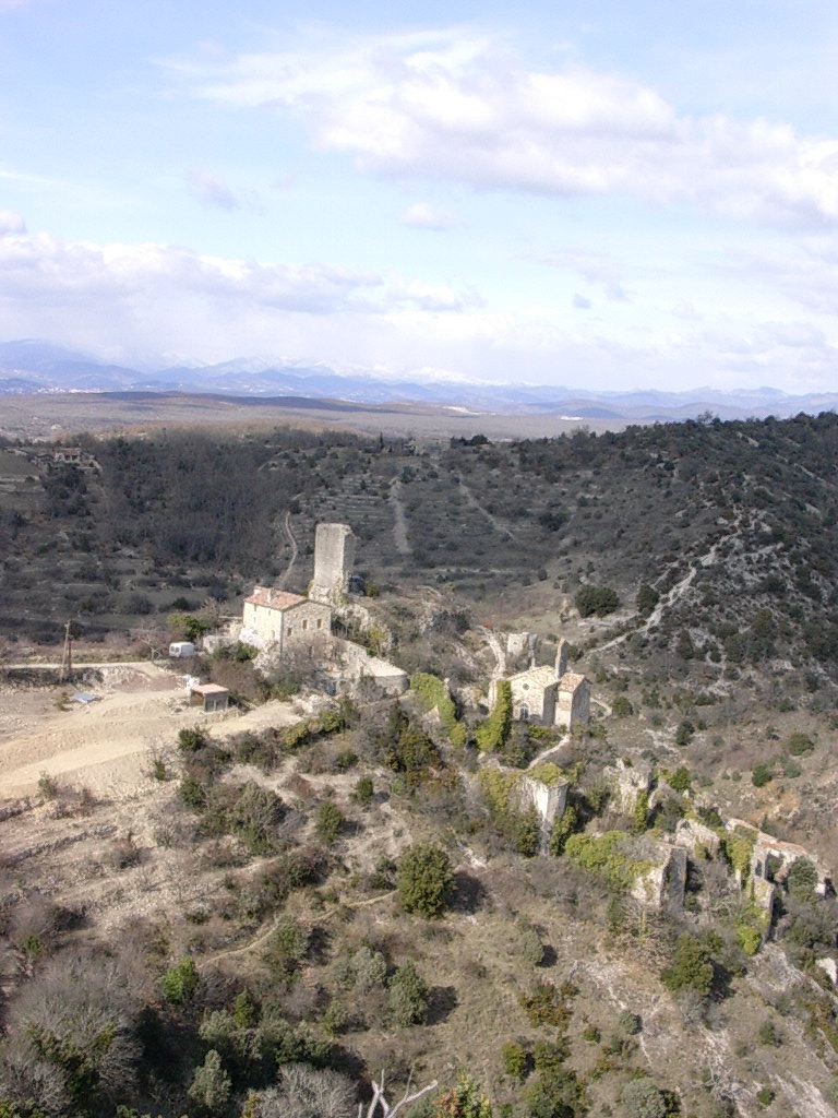
Castel of Rochecolombe
Rochecolombe
Rochecolombe Castle is a medieval ruin standing above the village of Rochecolombe, in the limestone countryside of the Ardèche department in southern France. Only a fragment of the original hexagonal keep survives today, alongside remnants of defensive walls, towers and the old gateway — the rest of the fortress crumbled away after centuries of abandonment. The site draws history enthusiasts and anyone looking for a scenic, off-the-beaten-path stop away from Ardèche's busier attractions. What is the history behind the castle? The stronghold was built in the 12th century by the lords of Ucel, with the earliest written record dating to 1170, when the Counts of Toulouse granted the land to the Ucel family. In the first half of the 13th century, the estate passed to the Vogüé family, who came from a neighboring seigniory and made the castle their principal residence. The Vogüé family lived at Rochecolombe until the early 17th century, when the turmoil of the Wars of Religion forced them to abandon the castle, which was subsequently burned. From then on the building fell gradually into ruin, though its chapel survived intact. In 1839, Marquis Léonce de Vogüé bought back what remained of his family's former home, but the rest of the structure kept deteriorating — only the Chapel of Saint Barthélemy was preserved and maintained. What can you see today? Visitors today can make out the remains of the hexagonal keep along with fragments of the defensive walls, towers and gate. The Chapel of Saint Barthélemy, as the only fully preserved part of the original complex, serves as the anchor point for the whole ruin. Walking the surrounding area, it's also worth exploring the abandoned houses of the old village of Rochecolombe, which once grew up in the shadow of the castle and is now partly deserted and overgrown. How do you get there? Rochecolombe sits in the heart of Ardèche, an area known for its limestone gorges and rocky hills. The easiest way in is by car along local departmental roads, with Aubenas and Vallon-Pont-d'Arc as the nearest larger towns and starting points for signposted routes. The castle itself sits on a hilltop above the village, reached by a short but steep walking path from the parking area near the village center. When is the best time to visit? Spring and autumn are the most comfortable seasons, offering milder temperatures than the height of summer and a landscape that isn't parched by heat. Summers in the region can get quite hot, making the climb up more demanding, while winter paths can turn slippery after rain. The area is also known for a seasonal waterfall that appears after heavy rainfall — worth checking the forecast beforehand if seeing it in action is part of the plan. Frequently asked questions Is Rochecolombe Castle open to visitors? The ruin sits on open, publicly accessible ground and can be viewed up close while walking the hillside — there's no ticket booth or formal museum setup. How long does a visit take? Walking up to the ruins and back typically takes 30–45 minutes, though it's worth allowing extra time to explore the abandoned village and nearby viewpoints. Can you see the waterfall from the castle? A seasonal waterfall lies near the village, visible mainly after heavy rain — during summer and dry spells it often runs completely dry. Is the climb to the castle difficult? The path up is short but steep and rocky, so sturdy walking shoes are recommended, especially after rain.
-
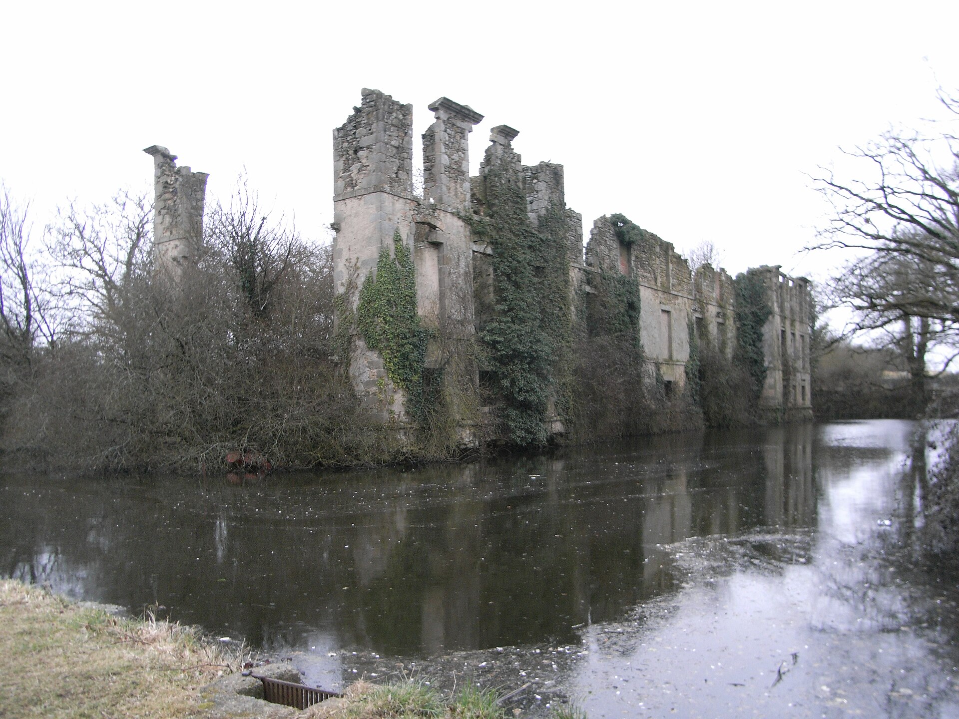
château de l'Étenduère
Les Herbiers
Château de l'Étenduère is a ruined noble stronghold on the southwestern edge of Les Herbiers, in the Vendée department of France. After more than two centuries of obscurity, the site is gradually being reclaimed by local volunteers who are uncovering its history piece by piece. How do you get there? The ruins sit on the outskirts of Les Herbiers, close to the Sèvre Nantaise river valley, in a quiet rural setting typical of the Bocage Vendéen. The site suits visitors exploring the region by car rather than day-trippers relying on public transport. Because restoration work is ongoing and led by a local association rather than a museum operator, it's worth checking current access before setting out. What is the history behind the castle? The story begins in 1375 with a modest dwelling on the site. By 1484 it had become a noble residence, and in 1622 it was upgraded into a proper fortified stronghold, equipped with cannons, a drawbridge and defensive battlements. The estate reached its peak in 1705, when a wealthy marriage brought Alexis-Auguste des Herbiers the means to substantially enlarge and embellish the property — turning it into one of the most opulent residences in the province at the time. The castle belonged to the House of Herbiers, marquises de l'Étenduère, an old noble family from Poitou and Aunis whose lineage traces back to the 11th century. Its best-known member was Henri-François des Herbiers-L'Étenduère (1681–1750), a French naval officer whose name remains attached to the country's maritime history. Why is it a ruin today? The French Revolution sealed the castle's fate. On the night of 31 January into 1 February 1794, General Grignon's so-called "infernal columns," sent to crush the Vendée uprising, passed through the area and burned the residence down. For more than two hundred years afterward, the site lay forgotten, overgrown and largely unknown outside the immediate area. What can you see today? Since late 2016, the local heritage association Passion Patrimoine, backed by the municipality, has carried out systematic clearing and excavation work with the help of numerous volunteers. Each year brings fresh sections of old walls, foundations and defensive features back into view. Visitors today will find the outline of a former stronghold and an active conservation project in progress, rather than a fully restored castle — this is a destination for history and archaeology enthusiasts more than for those seeking a picture-perfect monument. When is the best time to visit? Spring and summer are the best seasons, when vegetation doesn't obscure the ruins and daylight hours allow for an unhurried visit. Pair the trip with a walk along the Sèvre Nantaise valley or a stop at other historic sites in Les Herbiers. Frequently asked questions Can you visit the castle on your own? The site is accessible, but since conservation work is still underway, the extent of open areas and visiting hours can change — it's worth checking with local organizers beforehand. What should visitors expect before going? This is a ruin, not a rebuilt castle — the appeal lies in the site's history and the ongoing volunteer-led archaeological work rather than in polished architecture. Who destroyed the castle? It burned down in 1794 during the passage of revolutionary troops, the so-called infernal columns, sent to suppress the Vendée uprising. What is the castle historically known for? It was the seat of the marquises de l'Étenduère, a family that included Henri-François des Herbiers-L'Étenduère, a noted French naval officer.
-
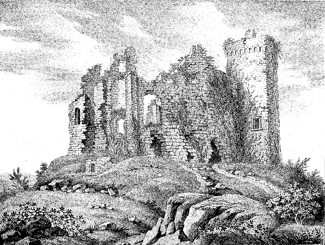
Château de la Haye-du-Puits
La Haye-du-Puits
The Château de la Haye-du-Puits stands above the town of La Haye-du-Puits in Normandy's Manche department. What survives today is largely a ruin, but a single striking gatehouse tower still hints at the fortress's former importance. What is the history behind the castle? The stronghold was raised in the 11th and 12th centuries on an artificial earthen mound, a motte, the classic foundation for the earliest Norman fortifications. A fortified settlement and castle on this site are already mentioned before the mid-11th century, and by 1082 the site appears in charters tied to Robert of Mortain, William the Conqueror's half-brother, who granted the revenues from the local toll collected here. The castle served as the seat of one of the oldest and most significant baronies in the Duchy of Normandy, ranked alongside power centers such as Saint-Sauveur-le-Vicomte and Bricquebec. Tradition traces the origin of these baronies back to the division of land among the companions of Rollo, the Viking leader from whom the Norman dynasty descended. Ownership changed hands repeatedly over the centuries. The La Haye family was succeeded by the du Hommet and Mortemer lines, and the estate was sold in the mid-14th century. It later passed through the Campion, Colombières, Cerisay, and Magneville families, remaining in private hands until the feudal system collapsed with the French Revolution. What can you actually see on site? Most of the defensive walls had already collapsed by around 1850, and what remained suffered further damage during the fighting at La Haye-du-Puits in 1944, when the town sat on the front line during the Battle of Normandy. As a result, one element dominates what's left: a square gatehouse tower rising three stories. The tower isn't a pure medieval survival — it was remodeled in the 15th and 16th centuries, when new window openings were cut and a crenellated top resting on stone corbels was added. It's this later, Gothic-to-Renaissance phase of the tower that visitors mainly encounter today. The motte itself, the mound the castle once crowned, still rises roughly 6 to 7 meters and is shaped into small terraces — worth walking around to get a sense of how large the original structure must have been. The ruins are listed as a historic monument, confirming their recognized architectural and historical value for the region. When should you visit, and how? The site is entirely outdoors, so spring or summer, with longer daylight hours, makes for the most comfortable visit. La Haye-du-Puits sits close to sites connected with the 1944 Allied landings in Normandy and to the Cotentin marshlands, so it's easy to combine a stop here with both medieval history and D-Day-related touring on the same trip. Given its state — a genuine ruin without extensive visitor infrastructure — the castle works best as a short addition to a walk through La Haye itself rather than as a full day's destination on its own. Frequently asked questions When was the Château de la Haye-du-Puits built? The original fortress dates to the 11th and 12th centuries, built on an artificial earthen motte typical of the earliest Norman strongholds. What has actually survived to today? Mainly a square, three-story gatehouse tower, remodeled in the 15th and 16th centuries, along with the outline of the original motte. Why is the castle in ruins? Most of its walls had already collapsed by the mid-19th century, and further damage came during the fighting of the Battle of La Haye-du-Puits in 1944. Is it worth combining with other regional sights? Yes — the area lies close to the 1944 Normandy landing sites and the Cotentin marshes, making it easy to build into a longer regional itinerary.
-
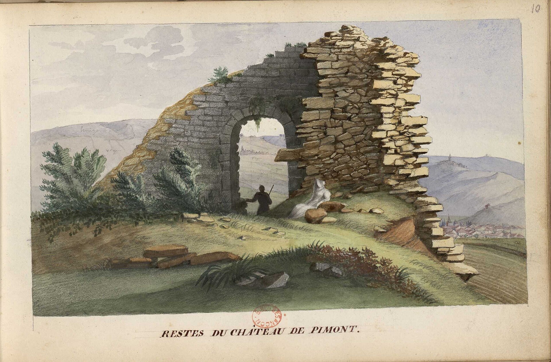
Château de Pymont
Villeneuve-sous-Pymont
Château de Pymont is a medieval castle ruin in the village of Villeneuve-sous-Pymont, just 2–3 km north of Lons-le-Saunier in the Jura department. Only scattered wall fragments survive today, but the site still draws visitors curious about its 13th-century origins and the sweeping view from the hill it once dominated. How do you get there? Villeneuve-sous-Pymont sits right next to Lons-le-Saunier, so the site is an easy short drive or bike ride away. The ruins themselves crown a hill above the village and aren't formally open for visits, so this is best approached as a scenic walk rather than a guided tour. Paths leading up the slope let you get close enough to appreciate why this spot was chosen for a stronghold in the first place. What's the history behind it? The castle was built in the mid-13th century by the Vienne family, with the earliest record dating to 1237 — though some sources point to 1256 instead. It stood on a knoll in front of the first plateau of the Jura mountains, covering roughly 5,000 m², of which 2,800 m² were enclosed by defensive ramparts. Pymont was one of three castles, alongside Montmorot and Montaigu, guarding the Lons-le-Saunier basin, towering over it from around a hundred meters up. Its history was far from peaceful. The Black Death reached the castle in 1349, and in 1361, during the passage of the so-called Great Companies through Franche-Comté, troops under Jacques Huet captured it — only to lose it again shortly afterward. The Vienne family held Pymont until November 1369, when Marguerite de Vienne, lady of Pymont, Montmorot, and part of Lons, handed it over to her brother-in-law, Hugues II de Chalon-Arlay. Daily life within the walls also had a practical side: craftsmen here practiced metalworking and tabletterie, the fine carving of small objects from bone and horn. West of the keep stood a workshop where iron, copper, and lead were all worked. What will you actually see? What remains today is a scattering of low, weathered wall fragments, largely reclaimed by vegetation and terrain — a genuine ruin rather than a restored monument. There are no rebuilt towers or accessible interiors here; the real draw is the hilltop itself, with views over the valley and surrounding rises, plus the sense of standing on ground that once anchored a key defensive position for the region. Since December 28, 1994, the ruins have been listed as a French historic monument, a formal recognition of their value despite their modest state of preservation. When should you visit? Spring and early autumn are the best times, when vegetation is less overgrown and temperatures make the walk up more comfortable. In summer, bring water and sturdy shoes for the climb; in winter, the ground can turn muddy and slippery. Frequently Asked Questions Can you go inside the castle ruins? No — Château de Pymont isn't formally open to visitors. You can, however, walk up the hill and view the wall remnants from the outside. How far is it from Lons-le-Saunier? Only 2–3 km, meaning a short drive or bike ride gets you there in minutes. What made Pymont different from other castles in the area? Together with the castles of Montmorot and Montaigu, it formed a trio of strongholds protecting the Lons-le-Saunier basin, standing about a hundred meters above it. Is the castle a protected heritage site? Yes, the ruins have been listed as a monument historique since December 28, 1994.
-
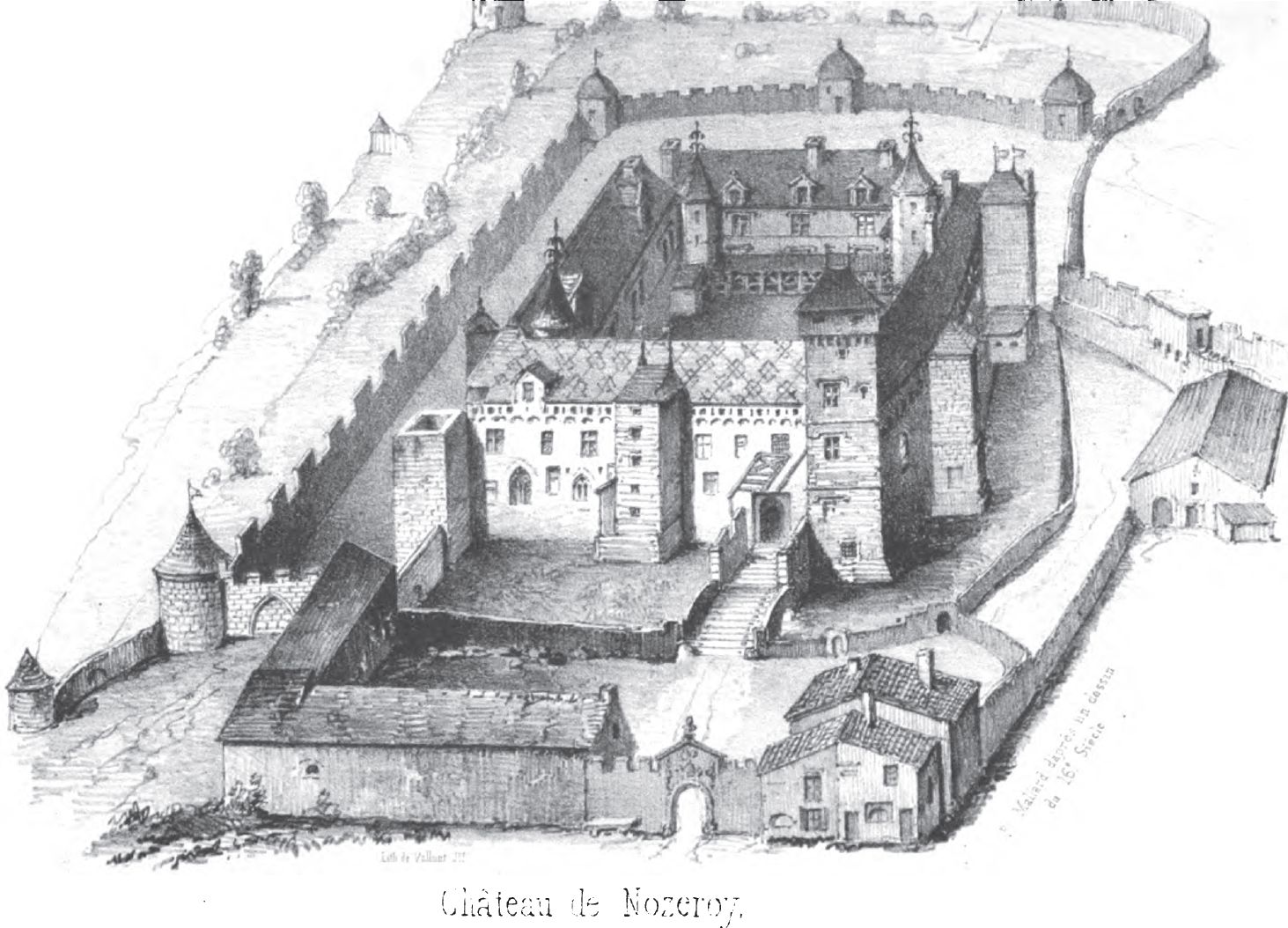
Château de Nozeroy
Nozeroy
Château de Nozeroy is a medieval ruin overlooking the small town of Nozeroy in the Jura, in the Bourgogne-Franche-Comté region of France. Little remains of the once-lavish Chalon family residence beyond foundations and wall fragments, but the surrounding town has kept its fortified-village character, making a walk through its streets one of the more rewarding historical stops in this part of the Jura. How do you get to the castle in Nozeroy? Nozeroy sits about 70 km from Besançon, roughly an hour and a quarter by car, making it an easy day trip from the region's larger towns. The village itself is compact enough to explore entirely on foot. Viewing the castle ruins and ramparts from the outside is free and open at any time from the streets of the old town — no ticket or booked time slot is needed. What's the history behind it? The first stronghold was raised in the 13th century by Jean de Chalon I, founder of a family that would rule the area for generations. His wealth, drawn partly from the saltworks of Lons and Salins, financed an already imposing structure: strong walls, defensive ditches, and eight towers. In 1432, his descendant Louis II of Chalon-Arlay replaced the old fortress with a luxurious freestone palace defended by four towers. The new residence quickly earned the nickname "the pearl of the Jura." In December 1519, Philibert, Prince of Orange, staged a tournament here said to have lasted seven days — reportedly the most magnificent joust the region had ever seen. The castle's fortunes turned after Louis XIV's conquest of Franche-Comté in the 17th century, when the building began a slow decline into ruin. The final blow came in 1815, when a fire swept through the town and residents recycled the castle's stones to rebuild their own houses. What will you actually see today? Little survives of the palace on the ground, but the town's landmark is the Clock Tower (Tour de l'Horloge), once the main gateway into Nozeroy — it's the natural starting point for exploring the old town. Nozeroy has set up a self-guided digital trail: twelve QR codes placed around town unlock short histories of individual buildings, so a smartphone is all you need to explore at your own pace. In summer, the "Amis du Vieux Pays de Nozeroy" association runs themed guided tours of the town and its collegiate church, while the theatrical troupe "Va-t'en-Rêves" leads weekly costumed walks that bring the site's history to life. When's the best time to visit? July is the standout month, when Nozeroy hosts its annual "Assault of the Ramparts" ("Assaut des Remparts") — the town turns medieval for the occasion, with period costumes, staged scenes, and an atmosphere echoing the tournaments once held by the Chalon family. It's also when the guided tours and theatrical walks run on a weekly schedule. Frequently Asked Questions Is there an entry fee for the castle? No — the exterior of the ruins and ramparts can be viewed for free from the streets of the old town. How long do you need to visit Nozeroy? An hour or two covers the village itself, but plan for half a day if you want to join a guided tour or the theatrical walk. What is the "Assaut des Remparts"? It's an annual event held every July, when Nozeroy is transformed into a medieval scene with costumes, staged performances, and activities inspired by the era of the Chalon family. Can you visit the castle without a guide? Yes — twelve QR codes placed around town let you explore the site's history independently using just a smartphone.
-
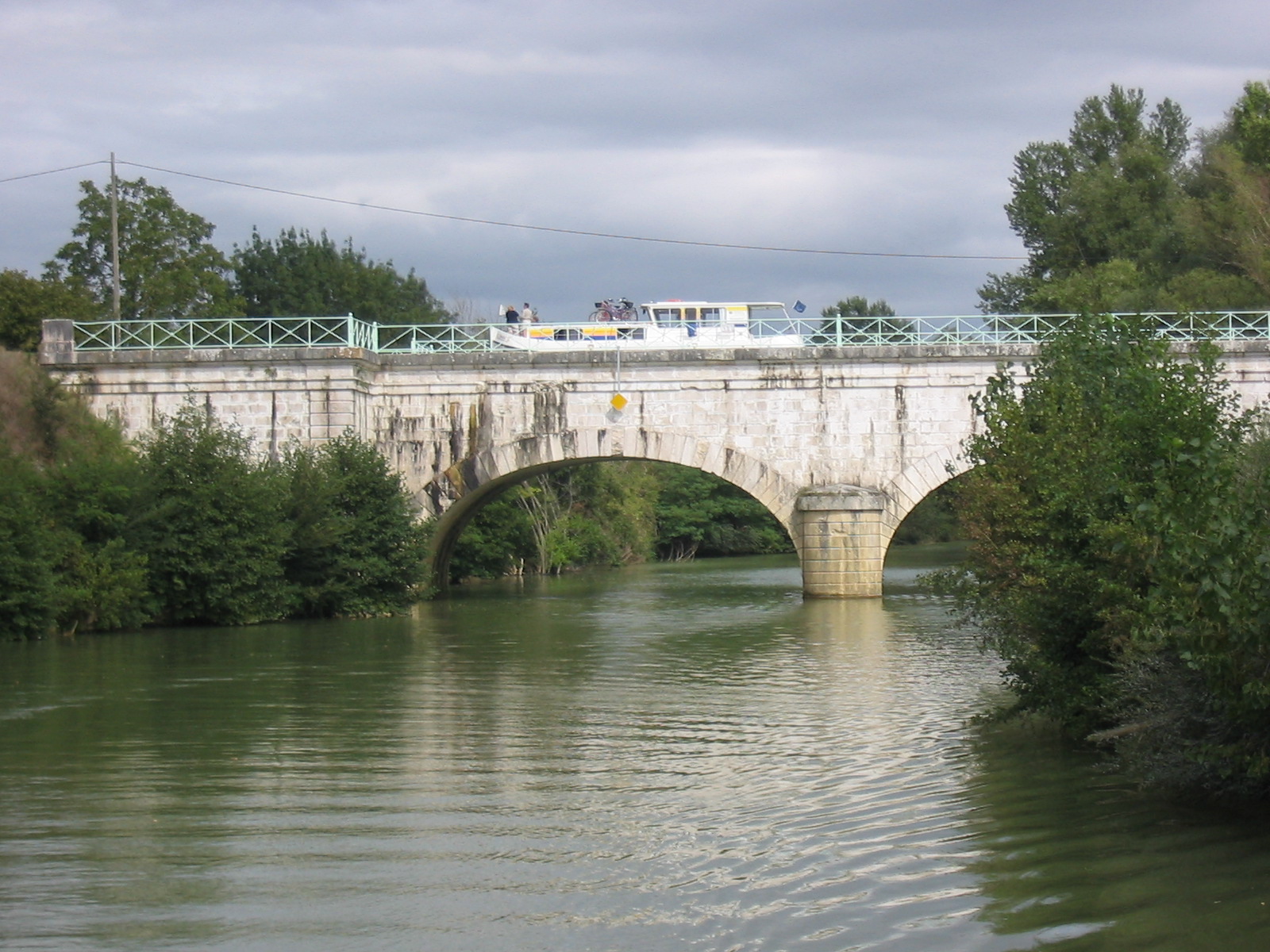
Pont-canal sur la Baïse
Feugarolles
Pont-canal sur la Baïse is a stone canal bridge in Feugarolles that carries the Canal latéral à la Garonne over the Baïse river, right on the boundary with the neighboring commune of Vianne, in the Lot-et-Garonne department. What exactly is this structure? A canal bridge, or aqueduct, does something counterintuitive: it carries a water-filled channel — with barges floating on it — above a natural river, rather than the river flowing under a road or railway bridge in the usual sense. Here, the Baïse flows below while boats navigate above, inside the canal's own stone trough. The structure is built from cut stone quarried in the Quercy region and rests on three semicircular arches (plein cintre), a classic round-arch form typical of 19th-century French civil engineering. It is the second canal bridge built along the Canal latéral à la Garonne counting from the Canal du Midi side — together the two canals form the Canal des Deux Mers, the historic waterway linking the Atlantic to the Mediterranean. The aqueduct was built between 1839 and 1853 under the direction of Ponts et Chaussées engineers Jean-Baptiste de Baudre and Jean-Gratien de Job, who oversaw several key sections of the canal. Because the channel is narrow, boats can only cross in one direction at a time, taking turns from either side. In recognition of its engineering and historical value, the structure was listed as a monument historique by decree on 21 August 2003. How do you get there? The canal bridge sits along the Canal de Garonne, on the stretch linking Buzet-sur-Baïse with Feugarolles and Vianne, in the heart of Lot-et-Garonne — a region also known for the Buzet AOC vineyards. The easiest way in is by car, parking near one of these villages and continuing on foot or by bike along the towpath (chemin de halage), which runs on both banks of the canal and is open to walkers and cyclists. The site is also a regular stop for canal traffic: tourist barges and rental houseboats (péniches) cruising the Canal de Garonne pass through this section routinely. What will you see on site? The best view of the aqueduct itself is from the bank of the Baïse, looking up at the three stone arches carrying the canal above. It's worth walking the towpath on both sides of the crossing to see the structure from different angles — from below, where the full height of the piers is visible, and from the canal level itself, where you can watch barges glide across. The setting is quietly rural: tree-lined banks, still water, and the unmistakable atmosphere of 19th-century canal engineering that is still doing exactly the job it was built for. When is the best time to visit? Spring and summer bring the most canal traffic, so those seasons offer the best chance of watching a barge actually cross the bridge. The towpath walk is also pleasant in autumn, once the heat has faded and the trees along the canal turn color. In winter, water levels can run lower and boat traffic is minimal, though the structure itself remains visible and accessible year-round. Frequently Asked Questions What's the difference between a canal bridge and an ordinary bridge? A canal bridge (pont-canal) carries a water-filled channel with barges on top of it — the canal crosses over the river, rather than a road or railway crossing over it. Here, the Canal de Garonne crosses the Baïse river in exactly this way. How many arches does it have, and what is it built from? The aqueduct has three semicircular arches, built from cut stone brought in from the Quercy region. Can you cross it with your own boat? Yes, it's an active navigable section of the Canal de Garonne, but because the channel is narrow, crossings are one-way — boats must give way to any vessel already crossing from the opposite side. When was it listed as a historic monument? The canal bridge was classified as a monument historique by decree on 21 August 2003, in recognition of its engineering and historical significance.
-
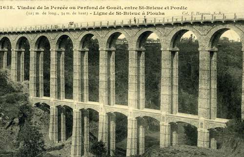
Viaduc du Parfond du Gouët
Pordic
Viaduc du Parfond du Gouët is a former railway viaduct straddling the border of Pordic and Plérin, in the Côtes-d'Armor department of Brittany. Built in 1904, it now serves walkers and cyclists as part of a scenic coastal route. What is this place? Also known as the Viaduc de la Percée, the structure was completed in 1904 to a design by engineer Louis Harel de la Noë. It was built for the Côtes-du-Nord departmental railway network, a project meant to open up Brittany's rural areas and coastline to rail transport. The viaduct spans the valley of the Gouët river, known locally as Parfond du Gouët, which gave the structure its name. It is one of thirteen similar viaducts Harel de la Noë built between 1903 and 1904 using his standardized stone-masonry design, known as the Grognet type. Among all of these structures, this one stands out as the tallest, rising 34 meters above the valley floor. The viaduct stretches 124 meters in length and rests on thirteen stone arches, each spanning roughly 7 meters. The rail line it carried remained in service until 1956, when it closed along with the wider decline of the departmental railway network. How do you get there? The viaduct sits on the boundary between Pordic and Plérin, close to the Côtes-d'Armor coastline near Saint-Brieuc. By car, local roads lead toward the Gouët valley, with nearby parking areas offering an easy walk or ride to the structure itself. Its coordinates are 48.5579, -2.7975. What will you see? For years, walking across the viaduct was forbidden due to the condition of the structure. Following a renovation completed before 2010, it reopened to pedestrians and cyclists. Walking along the old rail bed, visitors get a close-up view of the stone arches and a sweeping look at the wooded valley below — a striking sight from 34 meters up. It's also a chance to see early 20th-century railway engineering from the region, preserved in something close to its original form. Today the viaduct forms part of the Vélomaritime cycling route, roughly 40 kilometers long, connecting Hillion and Pordic along the coast. It's a popular stretch both for cyclists covering longer distances and for anyone after a quiet walk with a view. When should you visit? The viaduct can be visited year-round, as it's an open-air structure with no set opening hours. Spring and summer are best for longer rides along the full Vélomaritime route, while autumn and winter give the Gouët valley a quieter, more intimate feel — a good pick for visitors who prefer fewer crowds. Frequently Asked Questions Can visitors walk across the viaduct? Yes, it has been open to pedestrians and cyclists since a renovation completed before 2010. Before that, crossing it was forbidden. How tall is the viaduct? It stands 34 meters high, making it the tallest of the thirteen similar viaducts engineer Harel de la Noë built between 1903 and 1904. What was it originally used for? It carried a line of the Côtes-du-Nord departmental railway network until the line closed in 1956. Can you reach it by bike? Yes, the viaduct lies along the Vélomaritime route, which links Hillion and Pordic over roughly 40 kilometers of coastline.
-
Pont sur la Cadoule
Castries
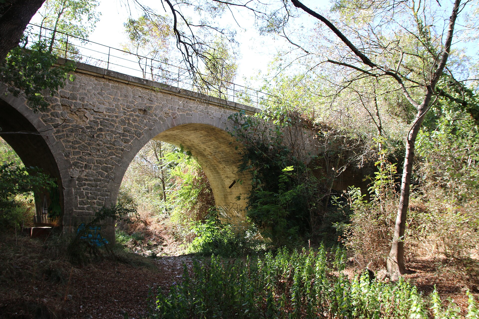
Pont sur la Cadoule, in the town of Castries in the Hérault department of Occitanie, is a small stone bridge spanning the Cadoule river. It looks unassuming at first glance, but it carries over two and a half centuries of history and the carved coats of arms of two bishops of Montpellier. Where is the bridge and how do you get there? The bridge stands on Rue Gaston Baissette, right in the heart of Castries, a village a short drive northeast of Montpellier. It's an easy stop for anyone exploring the village on foot: park near the centre and walk a few minutes down toward the riverbed. The Cadoule itself is a modest, seasonal stream that can run nearly dry in summer and swell considerably in winter, which explains the solidly built stone structure crossing it. What does the bridge look like? The bridge rests on a single span of 14.70 metres, eight metres wide and five metres high. Its vault follows the classic "anse de panier" (basket-handle) profile, and the whole structure is built from carefully dressed stone. A solid balustrade runs along the top on a moulded cornice, and the noticeable rise from the ends toward the centre gives the deck the humpbacked profile typical of bridges from that era. On both the upstream and downstream faces sit carved heraldic cartouches, the bridge's real signature and the detail that catches every visitor's eye. What is the history behind it? The structure is dated to the third quarter of the 18th century, with 1768 most commonly cited as the year of construction. The carved cartouches link the bridge to two figures tied to the diocese of Montpellier: Cardinal Pierre de Bonzy, who served as bishop of Montpellier and president of the Estates of Languedoc, and Raymond Durfort, the bishop in office at the time the bridge was built. Their standing explains why what was otherwise a working rural bridge received such a formal decorative treatment. Its historical and architectural value led to its listing as a monument historique by decree of 12 October 1946. What else is worth seeing nearby? Castries is best known for its monumental 17th-century aqueduct, built to carry water to the nearby Château de Castries with input from Pierre-Paul Riquet, the engineer behind the Canal du Midi. The Pont sur la Cadoule sits close to the walking route that leads to this aqueduct, so the two make a natural pairing: a short walk along the Cadoule takes in both the modest 18th-century bridge and the aqueduct's imposing arches rising above the valley. It's a quiet spot for a photo-friendly stroll, away from the region's busier landmarks. Frequently Asked Questions When was the Pont sur la Cadoule built? It dates to the third quarter of the 18th century, with 1768 most often given as the construction year. Is the bridge a listed monument? Yes, it was registered as a monument historique by decree of 12 October 1946. Whose coats of arms decorate the bridge? The cartouches on either side carry the arms of Cardinal Pierre de Bonzy and Bishop Raymond Durfort, both linked to the diocese of Montpellier. Is the bridge near the Castries aqueduct? Yes, it sits close to the walking route leading to the famous aqueduct that supplies the Château de Castries, so both can be visited on the same walk.
-
Pont de Beurey-sur-Saulx
Beurey-sur-Saulx
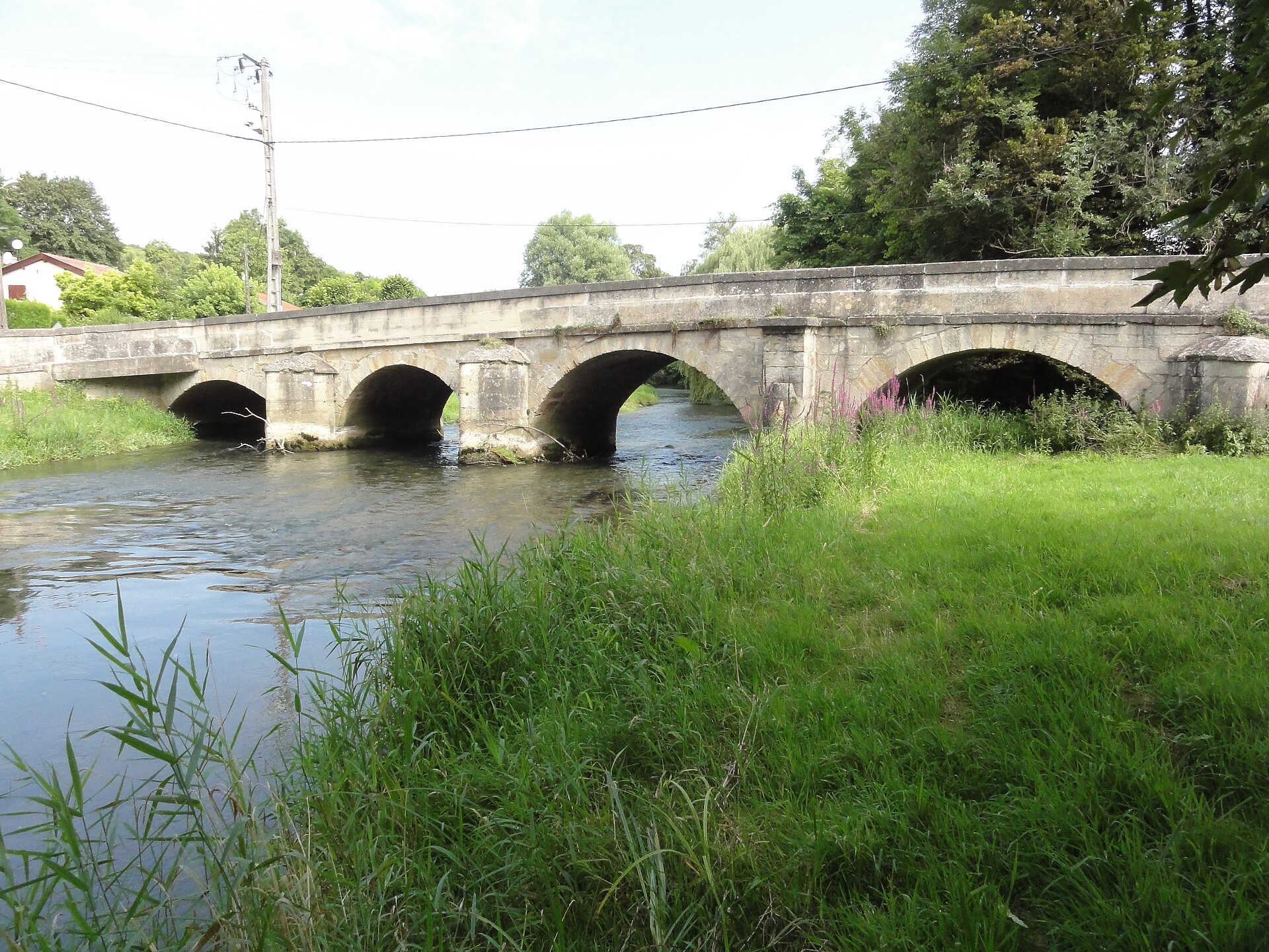
Pont de Beurey-sur-Saulx is a stone bridge spanning the Saulx river in the small village of Beurey-sur-Saulx, in the Meuse department, in the Grand Est region of France. It's the kind of structure many travelers drive past without a second look, yet it's a solid, well-preserved example of French bridge engineering from several centuries ago, and it's officially protected as a historic monument. What does the bridge look like? The bridge is built of stone masonry and made up of six arches. Five of them are full round arches, while the sixth is a flattened, segmental arch. This mix wasn't accidental — builders shaped each arch to match the depth and flow of the riverbed at that particular point. The roadway itself is single-lane, marked with stone guard posts added during a later renovation. The bridge still carries local traffic today, linking the two banks of the Saulx right in the middle of the village. When was it built? Evidence points to construction sometime in the last decades of the 17th century or the very start of the 18th, a period when Beurey-sur-Saulx was growing as a settlement. That era is often called the golden age of bridge-building in France: sturdy stone crossings like this one were going up across the country to serve local trade routes and farming communities. The bridge at Beurey is a modest but genuine representative of that craftsmanship. Why is it a protected monument? The bridge is listed on France's register of historic monuments, an inscription that took effect by decree on 18 July 2013. The protection covers the structure itself as a piece of historic building technique, not just as a scenic feature. For visitors, that means the bridge is looked after and clearly documented, even though it remains an active part of village life rather than a roped-off attraction. What else is there to see nearby? Beurey-sur-Saulx sits in a quiet stretch of the Saulx valley, surrounded by the farmland typical of Meuse — a department best known for its First World War history and its proximity to Verdun, one of the most significant memorial sites of that conflict. The village itself suits travelers looking for peace, riverside walks, and a genuine slice of rural France rather than crowds. A stop at the bridge pairs well with exploring other villages along the Saulx valley or a longer trip toward Verdun if you're touring the Grand Est region. Frequently Asked Questions Where exactly is the bridge in Beurey-sur-Saulx located? It stands in the center of the village of Beurey-sur-Saulx, in the Meuse department, crossing the Saulx river. How many arches does the bridge have? It has six arches in total — five full round arches and one flattened, segmental arch. Is it officially a protected monument? Yes, the bridge has been listed as a French historic monument since 2013. Can visitors easily stop and take photos? Yes, the bridge sits along a road through the village, so it's easy to reach on foot — this is a small, quiet place where you can pause without dealing with crowds.
-
Pont Wilson (Tours)
Tours
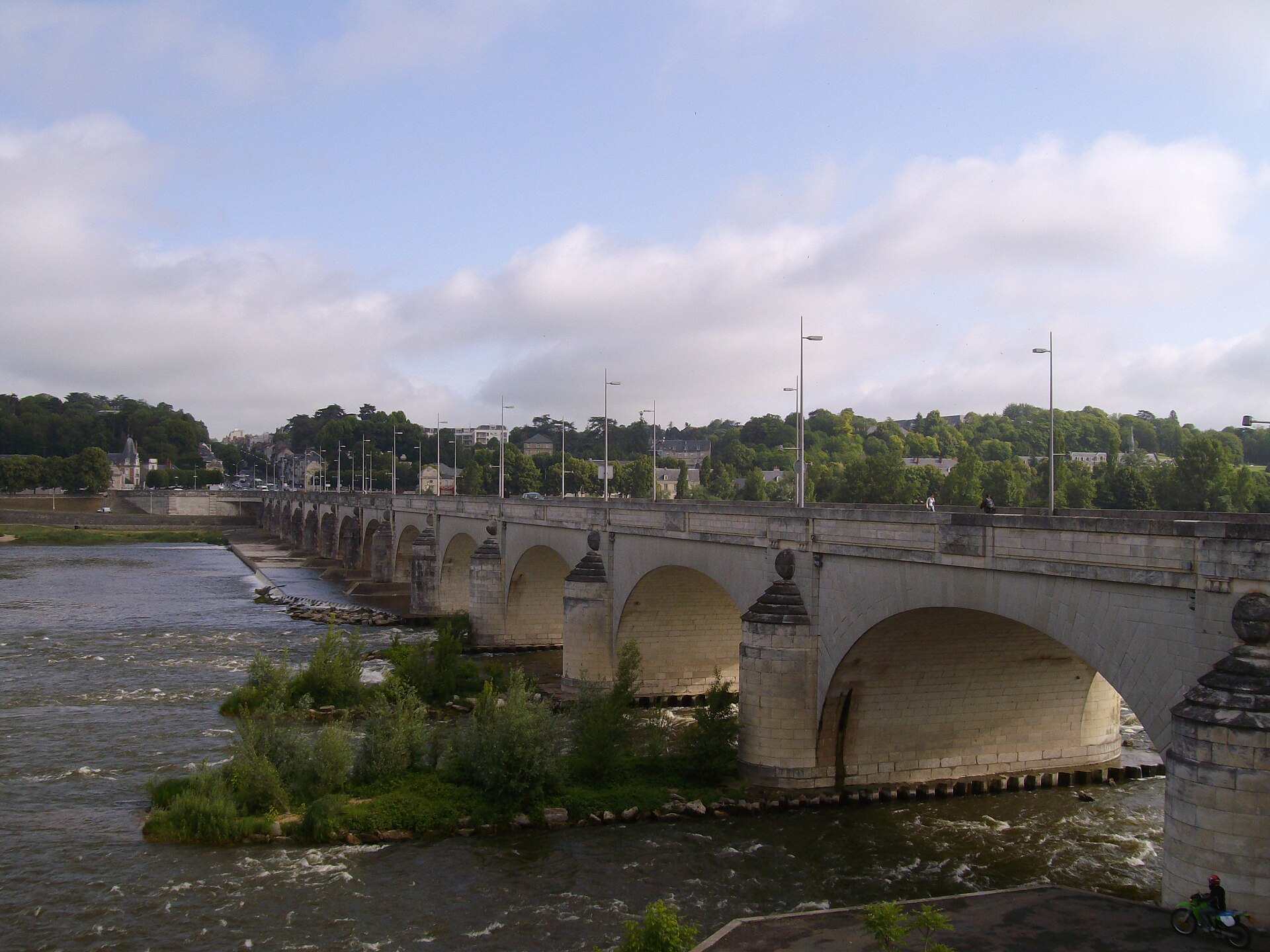
Pont Wilson, in Tours, is the oldest bridge in the city and one of the defining views along the Loire. Locals still call it the Pont de Pierre, the Stone Bridge, a nickname that has outlasted its official name. When was the Pont Wilson built? Construction began in 1765, with the foundation stone for the northern abutment laid on 25 October of that year. The work took over a decade and was finished in the late 1770s. The new crossing replaced the medieval Pont d'Eudes, a structure dating back to the 11th century that had been repeatedly damaged by floods and centuries of makeshift repairs. Building the bridge came at a cost. To raise the level of the southern bank, engineers had to fill in an island in the Loire, the Île Saint-Jacques, home to hundreds of families of washerwomen and fishermen. The residents were forcibly evicted, an episode still remembered as one of the darker chapters of the project. Where does the name Pont Wilson come from? The bridge took its current name in 1918, honoring Woodrow Wilson, the American president whose country backed France in the final phase of the First World War. Before that it was known under earlier, more topographical names. Despite the official title, everyday usage in Tours still leans toward Pont de Pierre. The structure has fifteen arches and stretches roughly 434 metres across the river, making it one of the longer stone crossings on the Loire in the Indre-et-Loire region. What happened to the bridge in 1978? Early in the morning of 9 April 1978, one of the bridge's piers and two adjoining arches suddenly gave way. Close to a third of the structure collapsed into the river. The consequences went beyond traffic disruption: the bridge carried a major water main, and the collapse cut off running water for tens of thousands of residents across Tours. The event is still recalled in the city as one of the most dramatic moments of its postwar history, and local archives and media regularly revisit the anniversary. How was the bridge rebuilt? Residents of Tours voted to rebuild the bridge in its historic stone form, while reinforcing the section that had survived intact. Reconstruction work began in August 1980, and the bridge reopened to traffic on 18 September 1982, four and a half years after the collapse. Today the Pont Wilson serves both a practical and a symbolic role, offering one of the classic postcard views of Tours, framed by the old town, the cathedral, and the Loire's quays. Why visit the Pont Wilson? The bridge is a prime vantage point over Tours and the Loire Valley, a UNESCO World Heritage landscape. Walking its stone footway gives a river-level perspective on the city, and in the evening, once the lighting comes on, the bridge becomes one of the most photogenic spots in town. Frequently Asked Questions How old is the Pont Wilson? Construction started in 1765, making it the oldest bridge in Tours at over 250 years old. Why is it called Pont Wilson? It was named in 1918 after US President Woodrow Wilson, in recognition of American support for France during the First World War. Did the bridge really collapse? Yes. On 9 April 1978, roughly a third of the structure collapsed. It was rebuilt in its historic form and reopened in 1982. How long is the Pont Wilson? The bridge is about 434 metres long and has fifteen stone arches.
-
Chaumont Viaduct
Chaumont
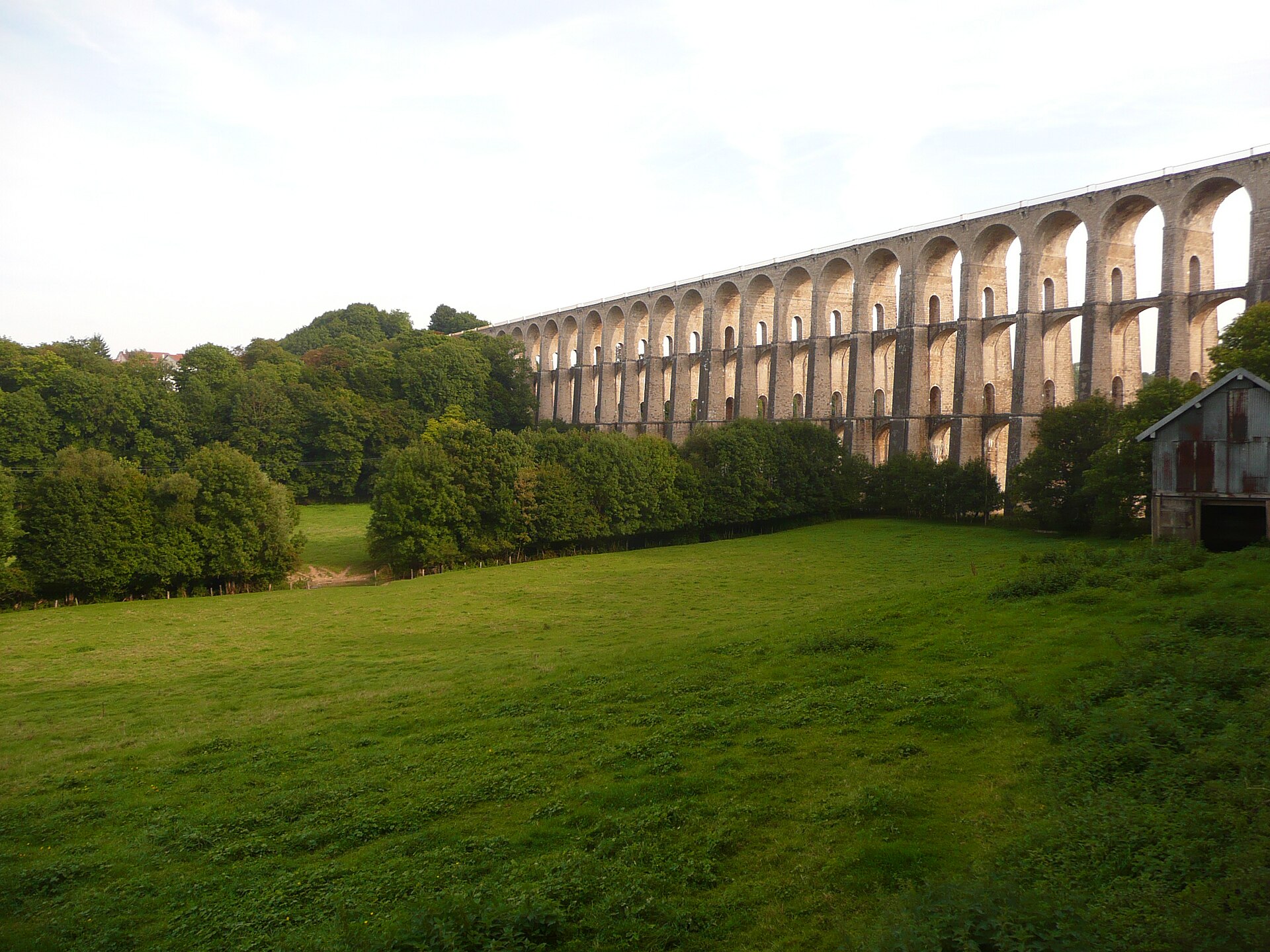
The Chaumont Viaduct is one of the most striking 19th-century railway monuments in France, rising above the Suize valley in the town of Chaumont, in the Grand Est region. For more than 170 years this monumental stone structure has dominated the town's skyline and remains one of the enduring symbols of Haute-Marne. What is the Chaumont Viaduct? The viaduct was built as part of the railway line linking Paris-Est to Mulhouse-Ville. Its purpose was to allow trains to reach the upper, historic part of Chaumont, which sits at a considerable height above the Suize valley. The structure stretches 600 meters in length and rests on 50 arches that rise to a height of 52 meters, making it one of the most impressive works of 19th-century railway engineering in Europe. It was designed by architect Eugène Decomble. How was the viaduct built? The pace of construction was remarkable for its era. The entire structure was completed in just 15 months, a feat that required 2,500 workers and 300 horses laboring day and night. Around 60,000 cubic meters of stone masonry were put in place during that time. This scale of effort reflected the importance 19th-century France placed on expanding the rail network connecting the capital to its eastern regions. What happened to the viaduct during the Second World War? The viaduct survived a difficult chapter in its history. On 31 August 1944, retreating German forces blew up two of its arches, destroying a 45-meter stretch of the structure. The aim was to cut the railway line and block the road connecting Chaumont to Auxerre. Given the strategic importance of this route for the country's post-war reconstruction, a temporary track was already back in service by 28 December 1944, and the viaduct itself was fully rebuilt by 6 November 1945. The speed of this work reflects the priority given to restoring rail links in eastern France immediately after liberation. What does the viaduct look like today? Today the viaduct still carries an active railway line while also serving as a defining feature of Chaumont's identity. A pedestrian walkway runs along its first level, offering views over the Suize valley and an unusual vantage point over the town. Since 8 June 2012, the structure has been lit up at night using 430 LED projectors placed at its base and within its arches, turning the viaduct into one of the town's most recognizable sights after dark. Why visit the Chaumont Viaduct? For travelers exploring Haute-Marne, the viaduct is close to essential viewing — combining historical, engineering, and aesthetic value in a single landmark. It offers a rare chance to see a 19th-century stone railway structure of this scale up close, still in use for its original purpose. Walking the pedestrian path beneath the arches reveals the true proportions of the structure, while the evening illumination adds a distinctly modern layer to an otherwise historic monument. Frequently Asked Questions How long is the Chaumont Viaduct and how many arches does it have? The structure is 600 meters long, made up of 50 arches, and rises to a height of 52 meters above the Suize valley. Who designed the viaduct? It was designed by architect Eugène Decomble and built in just 15 months by a workforce of 2,500 laborers and 300 horses. Was the viaduct destroyed during the war? Yes. On 31 August 1944, retreating German forces demolished two of its arches. A temporary track was restored by 28 December 1944, and the full reconstruction was completed on 6 November 1945. Can visitors walk on or around the viaduct? Yes, a pedestrian walkway runs along the structure's first level, allowing visitors to explore the Suize valley and view the viaduct up close — especially striking after dark thanks to the LED lighting installed in 2012.
-
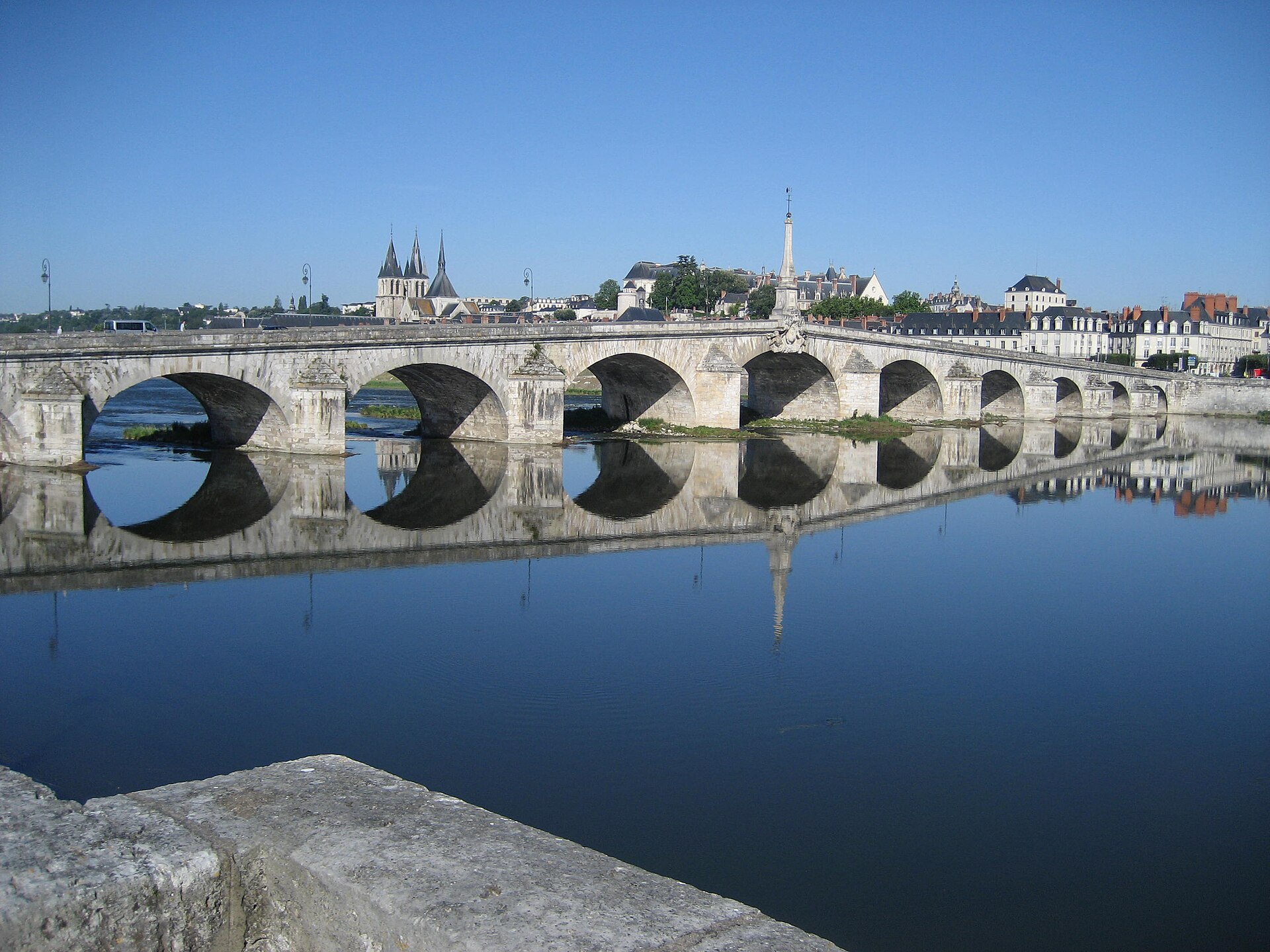
Pont Jacques-Gabriel (Blois)
Blois
Pont Jacques-Gabriel is a stone bridge spanning the Loire in the heart of Blois, a town famed for its royal Château Royal de Blois. It links the two banks of the river and has served as one of the key crossings in this stretch of the UNESCO-listed Loire Valley for three centuries. Where does the bridge's name come from? The bridge takes its name from Jacques Gabriel, the royal engineer who oversaw its construction in the early 18th century. It replaced an earlier crossing destroyed by floods and ice floes — a recurring hazard for bridges on the Loire, a river notorious for sudden and violent surges. The new structure was designed to be sturdier and better able to withstand the force of the water than its predecessor. The Gabriel family played a notable role in 18th-century French engineering and architecture: the bridge builder's son, Ange-Jacques Gabriel, went on to become one of the most celebrated royal architects of his era, responsible for landmarks such as the Place de la Concorde in Paris. What stands out on the bridge? A defining feature of the structure is the obelisk rising from the middle of the roadway, added later as a votive offering from the people of Blois to mark the recovery of King Louis XV from illness. It is an unusual example of monumental decoration placed directly on a bridge, visible from a distance along the Loire's quays and recognized as one of the town's distinctive landmarks. The bridge also carries a flood-level scale marked in feet, recording the historic high-water marks of the Loire's worst floods. It is a small, easily overlooked detail, but one that documents centuries of the region's struggle with the river's unpredictable moods — the Loire could turn from a calm current into a destructive force within hours. How does the bridge fit into the Blois townscape? Pont Jacques-Gabriel sits right beside the old town and the royal château, making it a natural stop on any walking route through the city. From the bridge, visitors get open views over the Loire's quays and up toward the hill crowned by the château, one of the architectural icons of the Loire Valley. In the evening, as the old town's stone façades reflect on the water, the bridge becomes a popular spot for locals and visitors alike to stroll. Crossing the bridge is also a chance to appreciate the scale of the Loire, France's longest river, and to understand why crossings here have long demanded solid, carefully engineered construction able to survive both floods and harsh winters. Frequently Asked Questions When was Pont Jacques-Gabriel built? The bridge was built in the early decades of the 18th century, replacing an earlier crossing destroyed by floods and ice on the Loire. Why is there an obelisk on the bridge? The obelisk was erected as a votive offering from the residents of Blois to celebrate the recovery of King Louis XV, and it remains one of the bridge's most recognizable features. Is the bridge close to the château in Blois? Yes, the bridge stands right next to the old town, directly by the Château Royal de Blois, making it easy to combine both sights in a single walk. What does the flood-level scale on the bridge show? It is a scale marked in feet recording the historic water levels reached during the Loire's worst floods, documenting the river's changeability over the centuries.
-
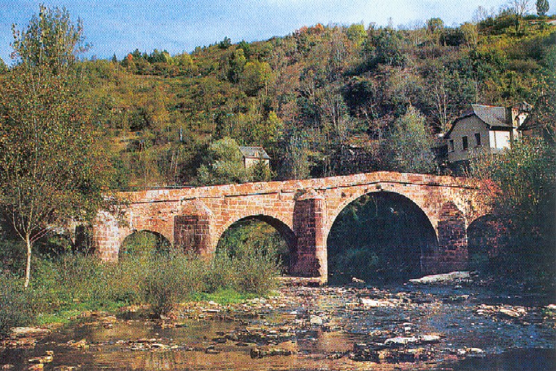
bridge over the Dourdou
Conques-en-Rouergue
The bridge over the Dourdou is a small stone arch bridge in Conques-en-Rouergue, in the Aveyron department, spanning the Dourdou river right at the entrance to one of France's most celebrated pilgrimage villages. Although it has long been nicknamed the "Roman bridge," the structure actually dates from the Middle Ages, most likely built during the period when the Sainte-Foy abbey was at the height of its influence and Conques had become a key stop on the Via Podiensis, the French stretch of the Way of St. James leading to Santiago de Compostela. Why is it called the "Roman bridge" if it isn't Roman? The name comes from a linguistic slip rather than historical fact. In the Occitan language, pilgrims heading to Compostela were called "romieu." Over time this word was folded into the everyday French name "pont romain" — literally "Roman bridge" — even though the structure has nothing to do with ancient Rome. It is a pilgrims' bridge, not a legionaries' one. What role did the bridge play on the Way of St. James? For walkers approaching Compostela, the bridge over the Dourdou was the last obstacle before entering Conques itself. After crossing the river, pilgrims made their way to the Porte du Barry, the northern gateway into the village, then climbed the steep lane up to the Sainte-Foy abbey. Built from local stone, the small arched bridge has withstood centuries of foot traffic and still carries walkers along the very route once trodden by thousands of pilgrims. Why is the bridge part of the UNESCO heritage listing? The bridge is not a standalone monument separate from Conques — it forms part of the broader UNESCO inscription covering the French sections of the Routes of Santiago de Compostela. Together with the Sainte-Foy abbey, famous for its Romanesque tympanum depicting the Last Judgment and for the reliquary of Sainte Foy, the bridge shows how closely everyday infrastructure was woven into the religious life of medieval Europe. It has also been listed as a French historic monument (monument historique) since 1930. What else is worth seeing near the bridge? The bridge makes a natural starting point for exploring the Dourdou valley and Conques itself, a village ranked among the Most Beautiful Villages of France (Les Plus Beaux Villages de France). From the bridge, visitors get a view of the steep, wooded slopes surrounding the village and the silhouette of the abbey rising above the slate rooftops. It is also a pleasant spot to pause before continuing on foot — riverside benches and shade make it an easy place to rest. Frequently Asked Questions Is the bridge over the Dourdou actually Roman? No. Despite the popular name "pont romain," the bridge dates from the Middle Ages. The name comes from the Occitan word "romieu," meaning a pilgrim traveling to Compostela. Is the bridge still used by pilgrims today? Yes. It remains part of the Via Podiensis route and is still crossed by people walking the Way of St. James toward Compostela, just as it was centuries ago. Can you walk to the bridge from the center of Conques? Yes, the bridge sits right next to the village, near the former Porte du Barry gateway, and is an easy walk from the center of Conques. Is the bridge protected under UNESCO World Heritage status? Yes, along with the Sainte-Foy abbey, it forms part of the UNESCO listing for the French Routes of Santiago de Compostela.
-
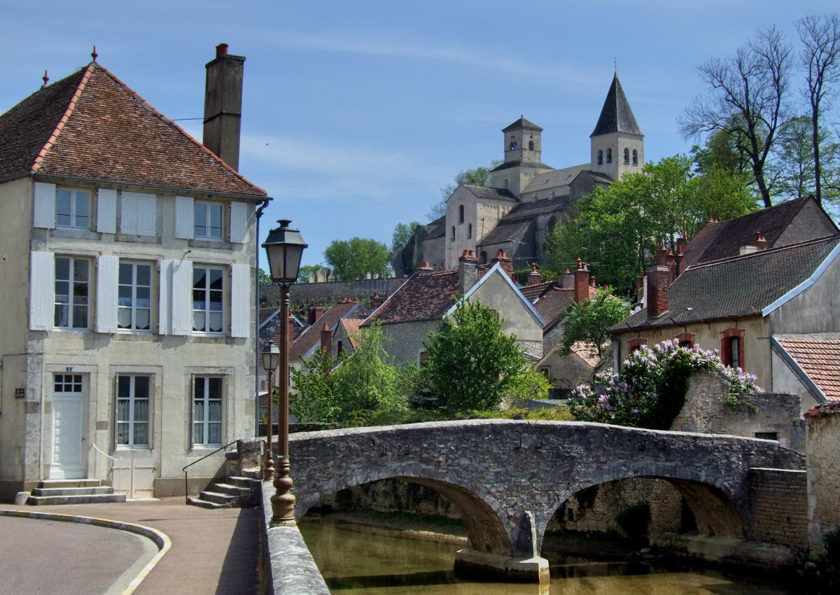
Perthuis-au-Loup bridge
Châtillon-sur-Seine
The Perthuis-au-Loup bridge crosses one of the branches of the upper Seine right in the heart of Châtillon-sur-Seine, a historic town in Côte-d'Or, Burgundy. It's a modest stone structure, but its story runs deeper than its size suggests — and its name carries an old, slightly dark legend. What does the Perthuis-au-Loup bridge look like? The bridge standing today is a stone masonry structure with two arches, built in a style typical of the region. It connects both banks of the Seine at a point where the river splits into several smaller channels running through the old town. The bridge isn't monumental — it's a quiet, functional part of the townscape, sitting alongside old houses and riverside quays. When was the current bridge built? The bridge visible today dates from 1713. The construction contract was signed on 3 June of that year with Claude Bourdot, a master mason from Châtillon-sur-Seine. It replaced an earlier bridge known as Pont Michel, built in 1658, which had itself replaced a wooden footbridge called Trou-au-Loup. In other words, some form of crossing has stood at this exact spot in town for far longer than the current structure has existed. Where does the name Perthuis-au-Loup come from? The name comes from local oral tradition. According to it, wild animals once roamed the dense, dark forests surrounding the town, and one of them, driven by hunger, is said to have ventured all the way to this riverside spot — hence "loup", wolf, in the bridge's name. "Perthuis" is an old term for a passage or opening, so the name literally translates to something like "the wolf's passage". It's the kind of detail that gives small Burgundian bridges an extra layer of story. Is the bridge a protected heritage site? Yes. The Perthuis-au-Loup bridge has been listed as a monument historique, France's official heritage register, since 16 June 1928. That listing recognizes its architectural and historical value and protects it from alterations that would erase its original character. Why stop at the bridge while visiting Châtillon-sur-Seine? Châtillon-sur-Seine rewards travelers who linger for more than a quick photo stop. It sits on the upper Seine, at a point where the river is still gathering strength, and its several branches cut through the old town — the Perthuis-au-Loup bridge is one of a handful that stitch this water network together. The town is internationally known for the discovery, in a nearby burial mound at Vix, of the famous Vix Krater, a monumental 6th-century BC bronze vessel and one of the most important Celtic finds in Europe, now displayed in the town's museum. A walk along the Seine, with a stop at the Perthuis-au-Loup bridge, is a natural complement to a visit that brings together prehistory, medieval heritage, and centuries-old river architecture in one compact town. Frequently Asked Questions When was the Perthuis-au-Loup bridge built? The current structure dates from 1713. It replaced an earlier bridge, Pont Michel, from 1658, which in turn replaced a wooden footbridge from an even earlier period. Is the bridge a listed heritage monument? Yes, it has been registered as a French monument historique since 1928. Where does the bridge's name come from? Local legend says the name refers to a wolf that ventured to this spot from the surrounding forests, driven by hunger. What else is worth seeing in Châtillon-sur-Seine nearby? The town's museum houses the Vix Krater, and a walk along the upper Seine takes in several of the historic bridges crossing the town center, including this one.
-
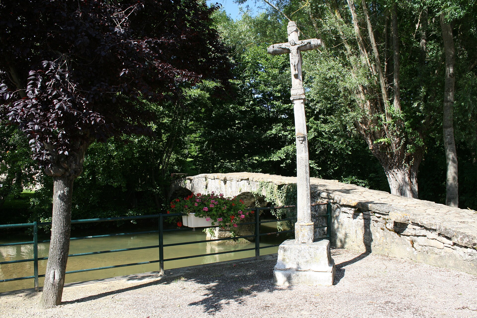
Venarey-les-Laumes Pont des Romains
Ménétreux-le-Pitois
Pont des Romains is a stone bridge in Venarey-les-Laumes, a small town in the Côte-d'Or department of Burgundy, right next to the village of Ménétreux-le-Pitois. Spanning the river Oze, it pairs modest rural charm with one of the most historically loaded corners of France — the neighbourhood of the famous Alesia hill (Alise-Sainte-Reine), where Julius Caesar defeated the Gallic chieftain Vercingetorix in 52 BC. What is there to know about the bridge? The Pont des Romains is an arched stone bridge, originally built to carry foot and cart traffic across the Oze. Together with an adjoining 16th-century wayside cross, it was listed as a French historic monument (monument historique) by decree on 12 February 1925. That legal protection reflects the site's historical and architectural value, even though the structure itself is modest in scale. The bridge's name — "Bridge of the Romans" — points to the region's Roman heritage, closely tied to Caesar's campaign against the Gauls. Around Venarey-les-Laumes, archaeologists have uncovered traces of two massive siege lines, the circumvallation and contravallation, dug by Roman legions around the Gallic oppidum in 52 BC. It was on the plain below the Alesia hill that one of antiquity's decisive battles unfolded, an engagement that shaped the fate of Gaul for centuries afterward. Why pair a visit with Alesia? The bridge sits right next to MuséoParc Alésia, a modern interpretation centre dedicated to the battle and the Roman conquest of Gaul. For visitors touring the old siege grounds, the Pont des Romains makes a natural, scenic stop along the way — a quiet spot over the Oze river before heading up toward the hill and the reconstructed fortifications. The area offers two layers of experience at once: the intimate, local charm of a rural bridge and the sweep of ancient European history. How do you get there? Venarey-les-Laumes lies in the Côte-d'Or department, in the Bourgogne-Franche-Comté region, and is well connected by rail to Dijon and Paris. The town itself serves as the main tourist base for visitors to Alesia, with a train station, shops, and accommodation. The bridge sits within the town, a short walk from the centre, making it an easy stop even for travellers without a car. Frequently Asked Questions Was the Pont des Romains actually built by the Romans? The bridge's name refers to the region's Roman history, but it is not a confirmed antique Roman structure — it is primarily a historic stone bridge, protected since 1925 as a listed monument. Which river runs under the bridge? The bridge crosses the Oze, a small river that flows through Venarey-les-Laumes. Can you visit the Alesia battlefield nearby? Yes. The Alise-Sainte-Reine hill, site of the 52 BC battle, and the MuséoParc Alésia are both right next to Venarey-les-Laumes. Are there other historic features near the bridge? Yes, a 16th-century wayside cross stands beside the bridge, listed as a historic monument under the same 1925 decree as the bridge itself.
Earn badges for the places you visit
Download NextOnTrip, discover new places and check off your trails.