Monuments in France
A guide to 1358 Monuments in France — with descriptions, photos and traveler visits from the NextOnTrip community. Locations spread across 956 cities and towns. Most visited by the community: Château de la Bretonnière, Château de Caumont, Château du Petit-Arnsberg.
-
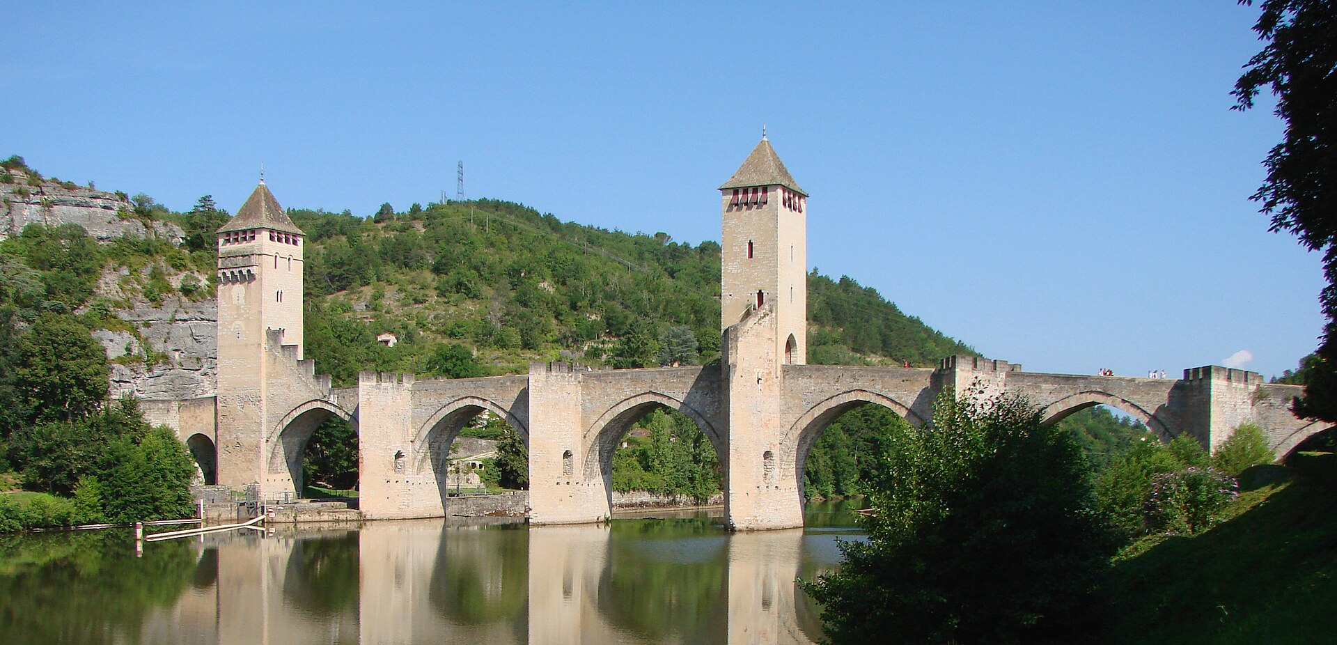
Pont Valentré
Cahors
Pont Valentré in Cahors is one of the best-preserved fortified bridges of medieval France. This six-arch stone crossing over the Lot River, just west of the town, dates from the 14th century and has been the city's defining landmark ever since — its silhouette, punctuated by three square towers, shows up on nearly every postcard from the Lot region. Why does the bridge have three towers? Pont Valentré was built for defense as much as for crossing the river. Its three towers — one on each bank and one in the middle — allowed the town's defenders to control traffic and repel attackers. That's unusual by European standards: most medieval bridges made do with a single gate tower, whereas here the fortified design carries through all six spans. The battlements and arrow slits that look purely decorative today once served a very real military purpose. What's the story behind the devil legend? The central tower carries one of the bridge's most recognizable details — a small devil figure carved into the stone near its top. It comes with a story typical of great medieval building projects: the master mason, frustrated by delays, is said to have struck a bargain with the devil to help finish the bridge on time. When the devil realized he'd been outsmarted, legend has it he took revenge by loosening stones from the corner tower every night — hence the bridge's playful nickname, "Pont du Diable." The devil carving itself was added during later restoration work, but the tale has circulated for generations and remains a fixture of any visit to the bridge. What is its connection to the Way of St. James? Pont Valentré sits on one of the French routes to Santiago de Compostela, and as part of the "Routes of Santiago de Compostela in France" network, it's inscribed on the UNESCO World Heritage List. Pilgrims heading toward the Pyrenees have passed through Cahors for centuries, and the bridge — alongside Saint-Étienne Cathedral — remains one of the most recognizable landmarks along this stretch of the route. What else is worth seeing nearby? Cahors is the capital of a wine region famous for its dark, full-bodied Cahors wines, made mainly from Malbec grapes — pairing a walk across the bridge with a tasting nearby is an easy way to round out a visit. The bridge is best seen from the banks of the Lot at sunset, when the towers catch the evening light, or from a boat on the river, one of the few vantage points that reveals the piers themselves. Frequently Asked Questions Can you walk across Pont Valentré? Yes, the bridge is open to pedestrians and cyclists, and walking across it is one of the essential things to do when visiting Cahors. Can visitors go inside the towers? Access to the towers' interiors varies depending on how visits are currently organized, so it's worth checking locally or with the tourist information office. Why is it also called the "devil's bridge"? The nickname comes from the medieval legend of a pact supposedly struck with the devil by the bridge's builder, commemorated by the carved figure at the top of the central tower. Is the bridge lit up at night? Yes, nighttime illumination highlights the bridge's architecture and is one of the most popular times to photograph it.
-
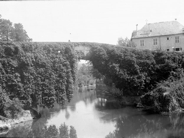
Pont de Bétharram
Montaut
Pont de Bétharram in Montaut, in the heart of the Pyrénées-Atlantiques department, is a single-arch stone bridge that has spanned the Gave de Pau for more than three centuries. It links Montaut with the neighboring town of Lestelle-Bétharram and has long served as a key crossing point on the route toward the Pyrenees. Today it draws travelers not only as a feat of historic engineering, but also as the gateway to one of the region's most important Marian shrines and to a set of caves carved by water deep inside a limestone massif. How far back does the crossing at this spot go? Traces of a crossing here date back to the 14th century. The first bridge was most likely built by the inhabitants of Montaut around 1308, and in 1335 the community of Lestelle was granted the same right to construct its own section. In 1631 the two sides signed an agreement dividing maintenance duties: Lestelle was responsible for the two side beams of the structure, while Montaut maintained the central beam. The wooden crossing proved no match for the mountain river's temper, and floods destroyed it in 1646, 1676, and 1678. Following the last flood, residents petitioned the parliament of Pau for permission to rebuild, which was granted on August 3, 1678, with Lestelle contributing 2,000 livres and Montaut 1,000 livres toward the cost. A few years later, on March 23, 1681, local master masons committed to raising the bridge as a single arch at the narrowest point of the Gave, right where the slope descends from Montaut. Work was completed in 1687 under the direction of contractor Daniel Bairon of Lescar. That stone structure still stands today and was listed as a French historic monument on June 4, 1925. Where does the name Bétharram come from? The name Bétharram comes from the Béarnese phrase "beth arram," meaning "beautiful branch." According to local tradition dating to the 15th century, the Virgin Mary is said to have saved a young girl from drowning in the swollen waters of the Gave by holding out a branch for her to grab. That legend became the foundation of a Marian devotion that gradually turned this spot into one of Béarn's major pilgrimage destinations. What else is worth seeing near the bridge? Just steps from the bridge stands the Sanctuary of Notre-Dame de Bétharram, only about 15 kilometers from Lourdes and roughly 25 kilometers from Pau. In the early 17th century, the priest Hubert Charpentier established a hospice here for pilgrims and clergy, enlarged the existing chapel, and founded a monastery, laying out a Way of the Cross leading up to the shrine. Between 1620 and 1642, more than eighty miraculous healings were recorded here, cementing Bétharram's reputation as a place of pilgrimage. The second attraction is the Grottes de Bétharram, a system of underground passages discovered in 1810 and opened to visitors in 1903 through the efforts of Léon Ross. The caves span five levels with an 80-meter difference in elevation and roughly 5 kilometers of galleries carved out by water in the limestone rock — a process still ongoing today. How should you plan a visit? The bridge, the sanctuary, and the caves all sit close together, making it easy to combine all three into a single outing. It's a convenient stop for travelers heading toward Lourdes or exploring the Pyrenean foothills out of Pau. Frequently Asked Questions How old is the bridge at Bétharram? The current stone structure was completed in 1687, though a crossing has existed at this spot since the early 14th century. Where does the name Bétharram come from? It comes from the Béarnese phrase "beth arram" (beautiful branch), referring to the legend of a girl saved from drowning by the Virgin Mary. Is it worth combining the bridge with the sanctuary and caves? Yes — both sites sit right next to the bridge and form a natural sightseeing route together. How far is it from here to Lourdes? The Sanctuary of Notre-Dame de Bétharram is about 15 kilometers from Lourdes.
-
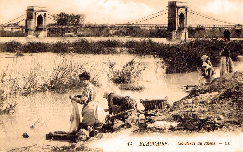
Bridge between Beaucaire and Tarascon
Beaucaire
The bridge between Beaucaire and Tarascon spans the Rhône and links two historic towns sitting in different French departments – Gard on the Beaucaire side and Bouches-du-Rhône on the Tarascon side. For centuries this stretch of river has been a natural crossing point, and today the bridge is one of the defining landmarks of this part of the Rhône valley, flanked on both banks by imposing castles that once guarded the border of Provence. How did travelers cross the Rhône here in the past? Long before a permanent bridge existed, the river was crossed here by a floating bridge made of boats. The crossing became especially busy during Beaucaire's famous trade fairs, when merchants converged on the town from across the region and the boat bridge had to cope with heavy traffic of people and goods. It was only in the 19th century that a permanent structure was finally built: in 1829 a suspension bridge nearly 500 metres long opened to traffic, designed by engineer Marc Seguin, one of the pioneers of suspension-bridge construction in France. That structure stood for over a century until it suffered severe damage during the Second World War – on 15 August 1944, Allied bombing raids destroyed part of the spans, and the section on the Tarascon side was completely severed. What does the bridge look like today? The current structure is a cable-stayed bridge roughly 407 metres long, notable for its remarkably slender deck, only 0.7 metres thick. It was completed in the late 1990s, replacing the earlier post-war crossing solutions. Today it carries cars, cyclists and pedestrians alike, and it doubles as one of the best vantage points in the area: from the middle of the bridge, visitors can look one way toward the towering silhouette of the castle at Tarascon and the other way toward the walls and towers of the castle at Beaucaire. What is worth seeing on either side of the bridge? On the Tarascon side, the skyline is dominated by the Château du Roi René, begun in 1400 on the orders of Louis II of Anjou, Count of Provence. Stone quarried near Beaucaire was shipped across the river to build it, and construction was finally completed in 1449 under René of Anjou, a ruler remembered for his patronage of art and architecture. The fortress sits right on the riverbank and for centuries watched over the western border of Provence, facing directly across the water into Gard. On the Beaucaire side rises the Château des Comtes de Toulouse, whose ruins still make an impression despite the damage inflicted during Cardinal Richelieu's era. Crossing the bridge on foot takes only a few minutes, yet it carries visitors between two historic regions of France and two distinct medieval building traditions, that of Provence and that of Languedoc. Frequently Asked Questions Can you walk across the bridge between Beaucaire and Tarascon? Yes, the bridge has a dedicated lane for pedestrians and cyclists, so visitors can cross freely between the two towns while enjoying views of both castles and the Rhône below. Which towns does the bridge connect, and in which departments do they lie? It connects Beaucaire, in the Gard department, with Tarascon, in the Bouches-du-Rhône department – the Rhône itself forms the administrative border between the two. Is today's bridge the same structure as Marc Seguin's historic bridge? No. The 19th-century suspension bridge designed by Seguin was badly damaged during the bombing raids of 1944, and the current, much newer cable-stayed bridge was built in the late 1990s. Why are there castles facing each other across the bridge? Since the Middle Ages the Rhône has marked the border between Provence and Languedoc, so both towns built fortresses to guard the river crossing and control trade and traffic passing over it.
-
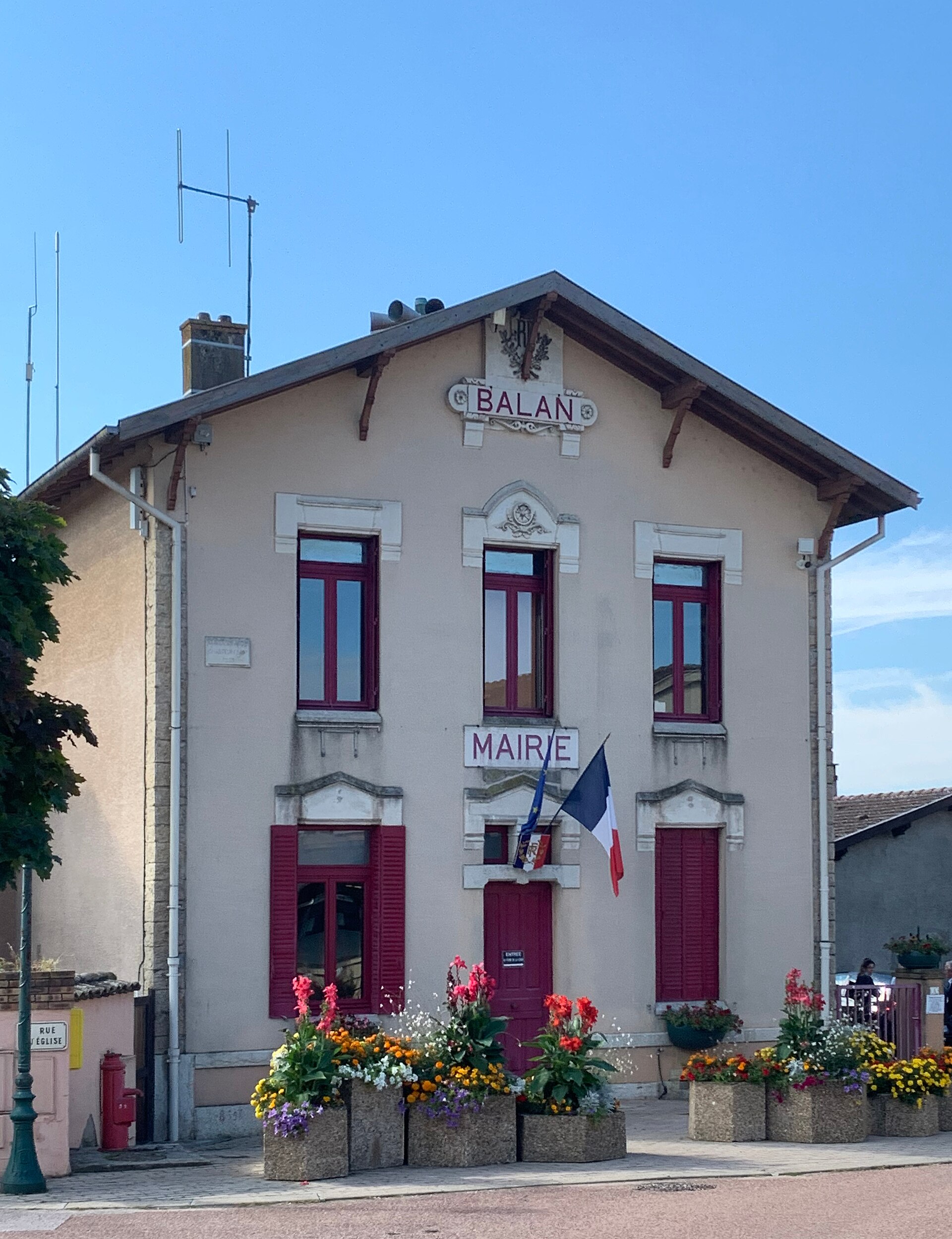
Town hall of Balan
Balan
The Town Hall of Balan (Mairie de Balan) serves as the seat of local government for the small commune of Balan, located in the Ain department in the Auvergne-Rhône-Alpes region, about 5 km southeast of Montluel and 25 km east of Lyon. The building stands on Place de la Mairie, right in the heart of the village, and handles municipal services for the residents, known as Balanais and Balanaises. Where is Balan and what makes it worth a stop? The commune covers roughly 18 km² on the edge of the stony Valbonne plain, in the natural region known as the Côtière, close to the banks of the Rhône. Balan is home to more than 3,000 residents today, making it one of the larger communes in this part of the Ain department. Its proximity to Lyon has turned it, over recent decades, into a residential and industrial satellite of the metropolitan area, while the historic village center has kept a distinctly rural feel. What is the history behind Balan and its town hall? Balan is an ancient settlement, with roots tracing back to Gallo-Roman times: sarcophagi from that era have been unearthed locally, along with roof tiles and pottery fragments that point to continuous occupation of the site since antiquity. During the Middle Ages, the village is thought to have served as the river port for the lordship of Montluel, hinting at its early commercial importance. The biggest turning point in the commune's social life came in 1872, with the establishment of the La Valbonne military camp. The camp's main entrance, its garrison chapel, and most of the barracks housing troops sit within Balan's boundaries, covering roughly 423 hectares — an enormous footprint for such a small commune, and one that reshaped the local economy and the working lives of its residents for generations. A second major shift came in 1965, when a large chemical plant producing polyethylene and vinyl chloride opened in Balan, originally under the Elf Aquitaine group. The plant now operates under the Arkema brand (part of the Kem One group) and remains one of the area's principal employers, bridging Balan's agricultural past with a modern chemical industry present. What else is there to see around the town hall? Close to the town hall, the church of Saint-Jean-Baptiste stands as the commune's main religious landmark. Another point of interest is the former chapel at the so-called Maison forte, a onetime fortified residence that today houses a restaurant run by a local rural family training school (maison familiale rurale) — an unusual pairing of historic architecture with an active educational and dining function. Within the grounds of the former military camp, the garrison chapel also survives, a reminder of the village's military past. The town hall itself is not a nationally listed monument, but it functions as a natural starting point for visitors, offering information on local events, heritage sites, and walking routes through the Côtière countryside and the Rhône valley. Frequently Asked Questions Which department is Balan in? Balan is located in the Ain department, in the Auvergne-Rhône-Alpes region, not far from Lyon. What is Balan known for besides its town hall? The commune is known for its ties to the former La Valbonne military camp, a chemical plant now operating under the Arkema brand, and traces of Gallo-Roman settlement found in the area. How far is Balan from Lyon? Balan sits about 25 km east of Lyon, making it a convenient base for exploring the metropolitan area. Are there any heritage sites worth visiting in Balan? Yes — besides the town hall, visitors can see the church of Saint-Jean-Baptiste and the former Maison forte chapel, now home to a restaurant.
-
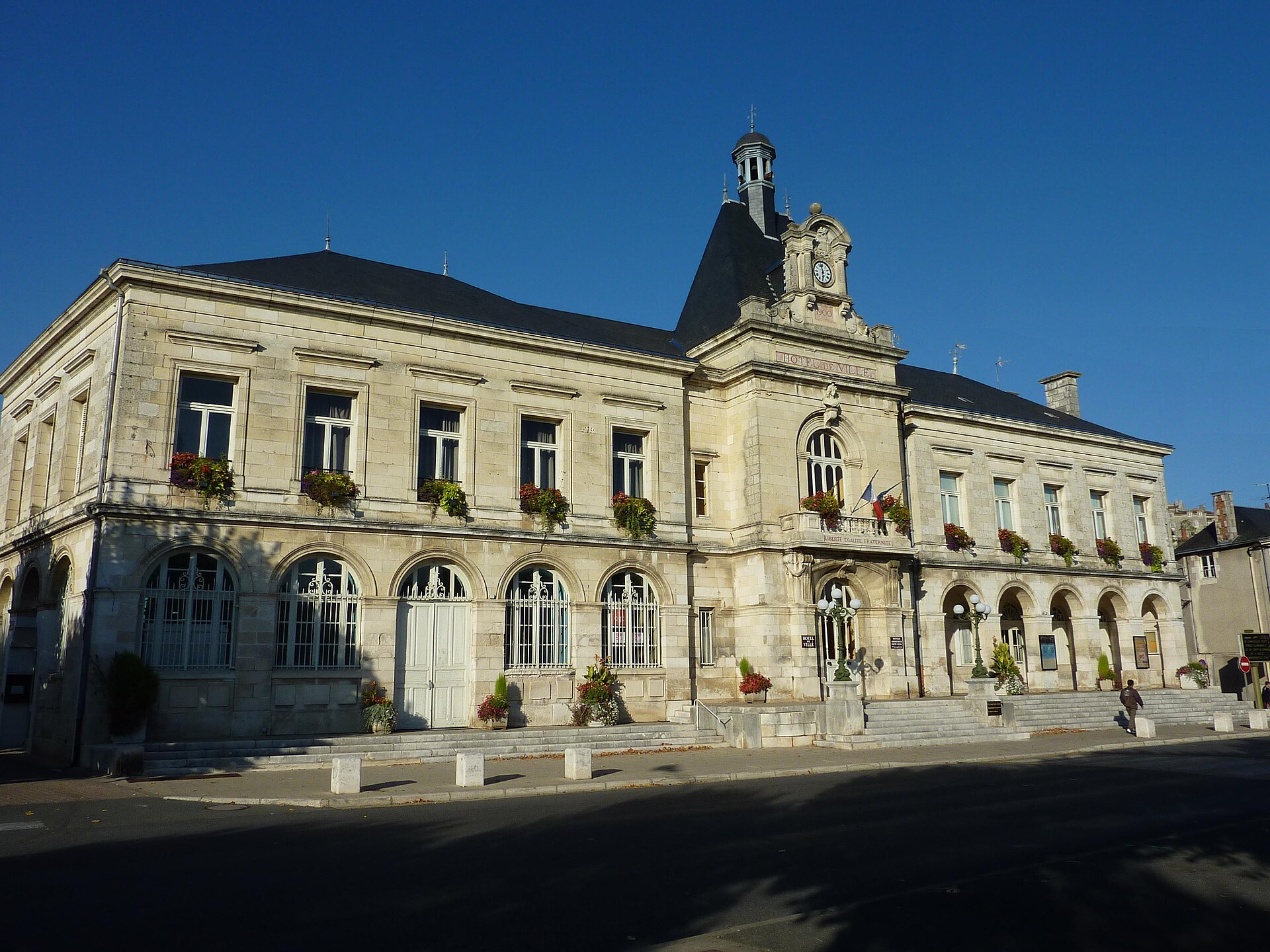
town hall of Chauvigny
Villeneuve
The town hall of Chauvigny (Villeneuve) marks the modern heart of one of the most striking small towns in the Vienne department, a short drive east of Poitiers. While the building itself serves the everyday business of local government, its real draw for visitors is what lies just a few minutes away on foot: a medieval hilltop town crowned by five castles and a Romanesque collegiate church, perched above the Vienne river valley. Why does Chauvigny attract so many visitors? Chauvigny splits into two clearly separate halves. The lower town, where daily life unfolds and where the town hall stands, sits at the foot of a narrow rocky spur that rises above the river. On top of that spur is the upper town, an open-air medieval site that has earned Chauvigny a place among France's officially recognized "Most Beautiful Detours" — towns considered worth a deliberate side trip. What is on the rocky spur above town? Along a ridge roughly 350 meters long stand five fortified structures side by side, an arrangement without real equivalent anywhere else in Europe. They include the Baronial castle (11th–16th centuries), the Harcourt castle (12th–15th centuries), the Mauléon castle (13th century), the Gouzon castle (11th–13th centuries), and the Flin tower (12th century). This unusual concentration grew out of a long rivalry between the lords of Chauvigny and the bishops of Poitiers, both of whom held authority over the site and kept adding to its defenses over the centuries. What makes the Collégiale Saint-Pierre worth the climb? Right beside the castle ruins stands the Collégiale Saint-Pierre, built in the 12th century. Its apse and carved column capitals rank among the finest examples of Romanesque sculpture in the wider Poitou region. The capitals depict scenes from the life of Christ and are studied by art historians worldwide for the richness and precision of their carving. How should visitors plan a stop here? Given its proximity to Poitiers, Chauvigny works well as a half-day or full-day addition to a visit to the larger university city. From the town hall in the lower town, it takes only a short uphill walk through steep lanes to reach the castles and collegiate church, with views opening up over the Vienne valley along the way. Visitors who want to go inside the collegiate church and walk the full loop around the castle ruins should plan for at least half a day. Frequently Asked Questions Where exactly is the town hall of Chauvigny located? It stands in the lower, more modern part of the town of Chauvigny, in the Vienne department, close to the Vienne river valley. What is the difference between the upper and lower town? The lower town is the modern administrative and commercial center, while the upper town is the historic rocky spur holding the ruins of five medieval castles and the collegiate church, reachable on foot in a few minutes. What is Chauvigny's biggest draw for visitors? The cluster of five castles built along a single rocky ridge, together with the Romanesque Collégiale Saint-Pierre and its famously carved capitals. Is Chauvigny a good day trip from Poitiers? Yes, it sits a short distance from Poitiers, making it easy to combine both towns in a single day.
-
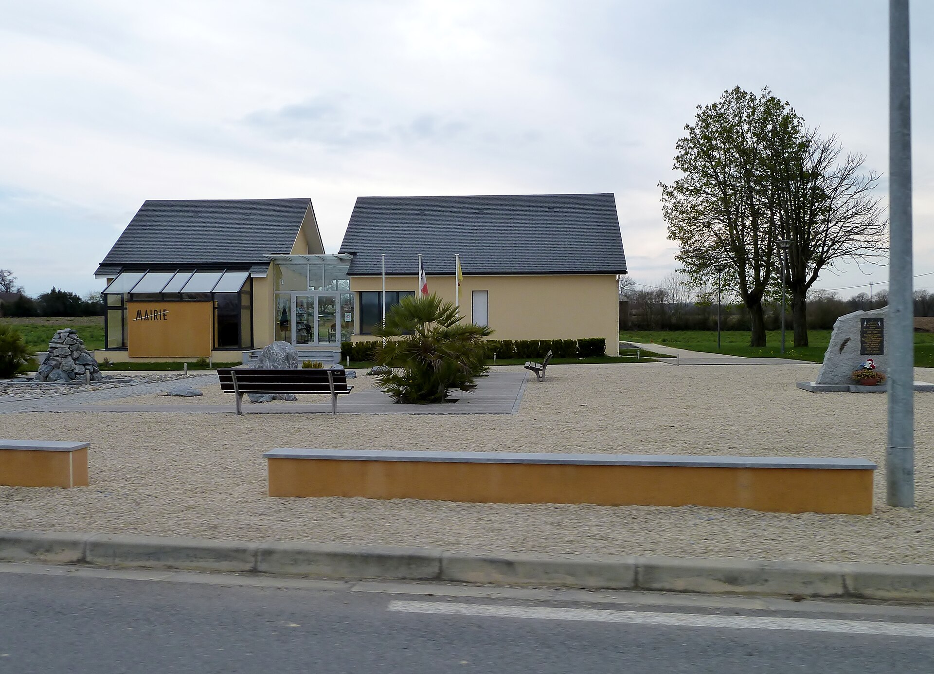
town hall of Auriac
Auriac
The town hall of Auriac serves as the seat of local government for the small commune of Auriac, located in the Pyrénées-Atlantiques department in the Nouvelle-Aquitaine region, within the historic province of Béarn. The commune has around 247 residents and covers just 5.2 km², making it one of the smaller municipalities in this part of France. Auriac sits roughly 20 km north of Pau, the departmental capital, amid the gently rolling farmland at the foothills of the Pyrenees. Where exactly is Auriac located? The commune belongs to the Communauté de communes du Luys-en-Béarn, a grouping of neighbouring villages around the Luy de Béarn river. The surrounding countryside is typical of Béarn — a historic region with its own language (Gascon/Béarnais) and traditions, today fully integrated into France's regional administration. The postal code is 64450 and the INSEE code is 64078. What is the town hall and what does it do? The town hall (mairie) in Auriac is the administrative building housing the commune's local government — the workplace of the mayor and municipal council, and the place where residents handle official matters such as civil registry records, document issuance, and the organisation of local events. The commune is led by a mayor whose term (2020–2026) follows the standard six-year cycle of French local elections. As in most small French communes, the town hall also functions as a hub of community life, where local announcements are posted and residents' meetings take place. What should visitors know before stopping by? Auriac is not a tourist destination in the conventional sense — it has no major monuments or attractions of international renown. Its appeal for travellers lies instead in the authentic, unhurried character of rural Béarn: open fields, modest farmhouses, and easy access to the region's larger centres. From Auriac, it's a short drive to Pau, home to the Château de Pau (birthplace of Henry IV), the Boulevard des Pyrénées with its mountain views, and a fuller range of dining and cultural options. The surrounding area also suits walking and cycling, with gently undulating terrain leading toward the Pyrenean foothills through typical Béarnais villages. Anyone planning to visit the town hall itself — for example, for administrative business related to a stay in the region — should expect the limited opening hours typical of small French municipal offices, and it's worth checking the current schedule directly with the town hall beforehand. Frequently Asked Questions Which department is Auriac in? Auriac lies in the Pyrénées-Atlantiques department, in the Nouvelle-Aquitaine region, within the historic province of Béarn. How many people live in Auriac? The commune has around 247 residents (2023 figures) across an area of 5.2 km². How far is Auriac from Pau? Pau, the departmental capital, is about 20 km south of Auriac and offers a fuller range of attractions, including the Château de Pau, birthplace of Henry IV. Which intercommunal association does Auriac belong to? Auriac is part of the Communauté de communes du Luys-en-Béarn, which groups together nearby villages along the Luy de Béarn river valley.
-
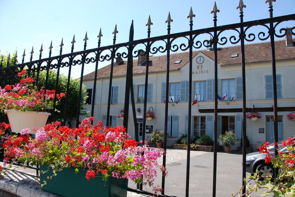
town hall of La Chapelle-la-Reine
La Chapelle-la-Reine
The town hall of La Chapelle-la-Reine, a small commune in the Seine-et-Marne department, sits right on the edge of the Fontainebleau Forest. It's a modest but distinctive village in the Île-de-France region, worth a stop for anyone exploring the Gâtinais français Regional Nature Park. Where is La Chapelle-la-Reine located? The village lies in the southern part of Seine-et-Marne, within the Gâtinais français Regional Nature Park, right at the gateway to the Fontainebleau Forest. The commune belongs to the Pays de Fontainebleau agglomeration community, making it a convenient base for visitors heading into the surrounding woodland, climbing boulders, and hiking trails of the region. Where does the village name come from? The name La Chapelle-la-Reine has medieval roots. Local tradition holds that a first chapel was built on the site before 1125, founded by a widowed queen from the Capetian dynasty. The earliest written record of the settlement dates to 1154. The "la Reine" ("the queen") part of the name is also tied to the frequent 13th-century visits of Queen Blanche of Castile, which are credited with cementing the village's name in the form used today. This double layer of royal history — a chapel founded by one queen, a name reinforced by another's visits — gives an unusually rich backstory to such a small commune. What can visitors see near the town hall? The town hall building itself serves an administrative role for the commune and isn't a major sight in its own right, but it makes a useful landmark in the village center. The real draw of the area is its proximity to the Fontainebleau Forest, one of France's best-known destinations for hiking, sandstone bouldering, and nature watching. Staying in La Chapelle-la-Reine also works well as a base for exploring the Gâtinais français Regional Nature Park, known for its picturesque villages, farmland, and cycling routes linking nearby communities. How to get there and where to stay? The commune sits on routes connecting Fontainebleau with the Gâtinais area, making it a convenient stop for drivers and cyclists following regional trails alike. Given its small size, accommodation options in the village itself are limited, so many visitors base themselves in larger Fontainebleau or nearby villages, treating La Chapelle-la-Reine as a stop along the way while exploring the forest and nature park. Frequently Asked Questions Which department is La Chapelle-la-Reine in? The village belongs to the Seine-et-Marne department, in the Île-de-France region. How close is it to the Fontainebleau Forest? La Chapelle-la-Reine sits right on the edge of the forest, in the southern part of the Gâtinais français Regional Nature Park, so reaching the woodland takes only a few minutes. Where does the village's name come from? The name refers to an earlier chapel founded before 1125 by a widowed queen, and to the later, frequent 13th-century visits of Queen Blanche of Castile. Is the town hall itself a tourist attraction? The town hall mainly serves an administrative function for the commune — the main draw of the area is its proximity to the Fontainebleau Forest and the Gâtinais français Regional Nature Park.
-
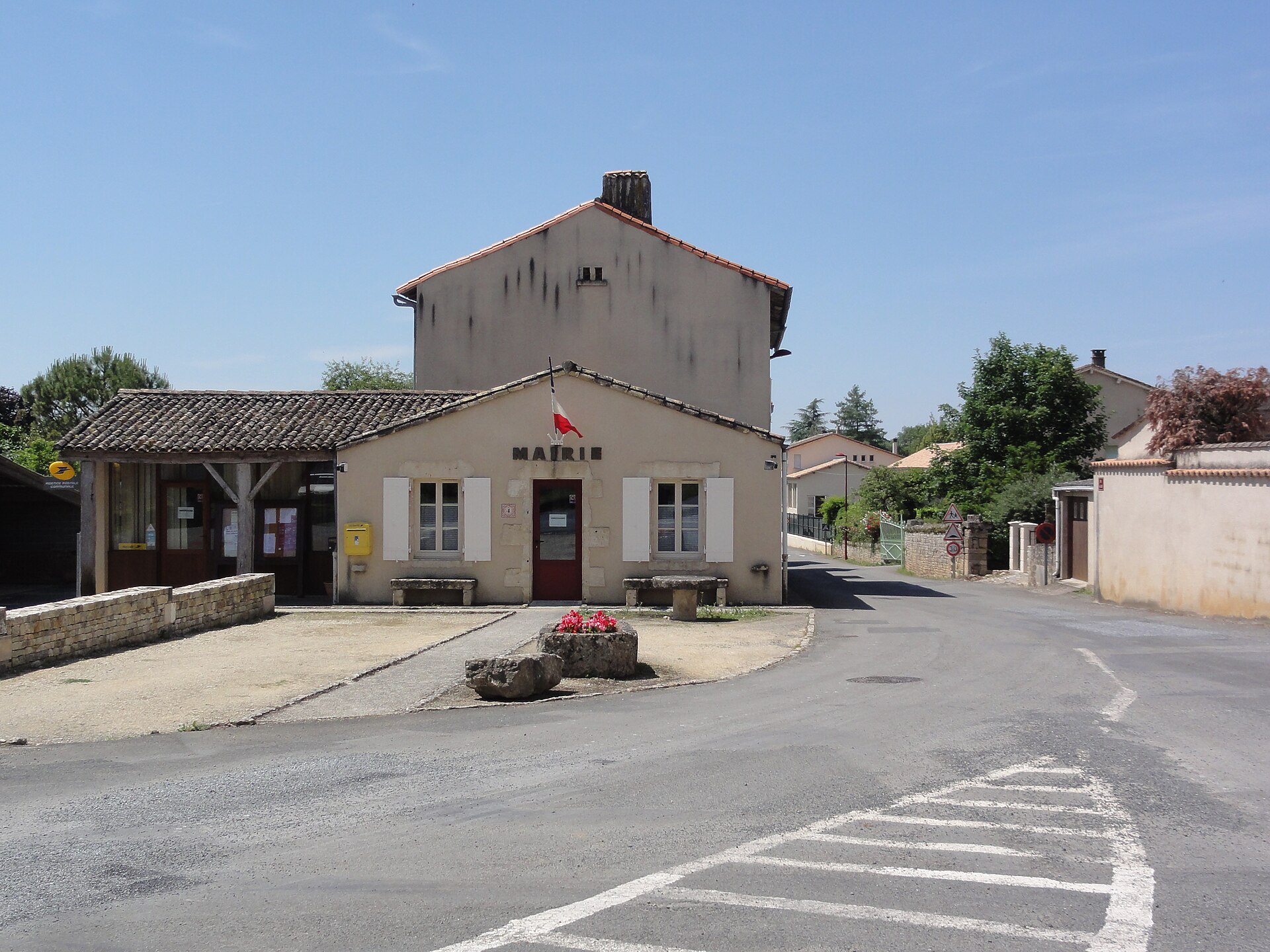
town hall of Saint-Romans-lès-Melle
The town hall of Saint-Romans-lès-Melle, a small commune in the Deux-Sèvres department, sits at the administrative heart of this village and is one of the few fixed landmarks travelers passing through this corner of western France will encounter. Where is Saint-Romans-lès-Melle located? The commune lies in the Deux-Sèvres department, part of the Nouvelle-Aquitaine region, right next to Melle — a small town known for its Romanesque churches and its medieval silver-mining history. The name itself, "lès Melle" (meaning "near Melle"), points directly to this neighboring relationship and helps orient visitors to the area. The surrounding landscape is classic Poitou countryside: gentle farmland dotted with small villages, well away from major tourist routes. What is the town hall and what does it do? A town hall (mairie, in French) is the administrative building of a commune — the seat of local government and the place where residents handle official business. In small French communes like Saint-Romans-lès-Melle, the mairie often doubles as a hub of community life, serving as the main point of contact for residents and a reliable source of local information for anyone passing through. What are the opening hours? The town hall welcomes visitors during the following hours: Monday and Tuesday: 1:30pm–5:00pm Thursday: 8:30am–12:00pm and 1:30pm–5:00pm Friday: 1:30pm–5:30pm The office is closed on Wednesdays and over the weekend. It's worth calling ahead to confirm availability, especially around public holidays, when small-commune office hours can shift. How can you contact the office? The town hall can be reached by phone at +33 5 49 27 04 14. This is the simplest way to confirm current hours or ask about a specific administrative matter before visiting in person. What else should you know when planning a visit to the area? Saint-Romans-lès-Melle sits in the heart of Deux-Sèvres, a department known for its gentle rural scenery, its concentration of Romanesque churches, and its unhurried pace far from crowds. It's a region that rewards slowing down — exploring small villages on foot or by bike, stopping at local markets and parish churches along the way. The commune itself, though modest in size, makes a convenient base for exploring nearby Melle and the surrounding villages. Frequently Asked Questions Where exactly is Saint-Romans-lès-Melle located? In the Deux-Sèvres department, in the Nouvelle-Aquitaine region, right next to the town of Melle. What are the town hall's opening hours? Monday and Tuesday 1:30pm–5:00pm, Thursday 8:30am–12:00pm and 1:30pm–5:00pm, Friday 1:30pm–5:30pm. Closed Wednesday, Saturday, and Sunday. How do you contact the town hall? By phone, at +33 5 49 27 04 14. Is it worth combining a visit with nearby Melle? Yes — Melle sits right next door and offers more to see, including notable Romanesque architecture, making it a natural addition to any visit to this area.
-
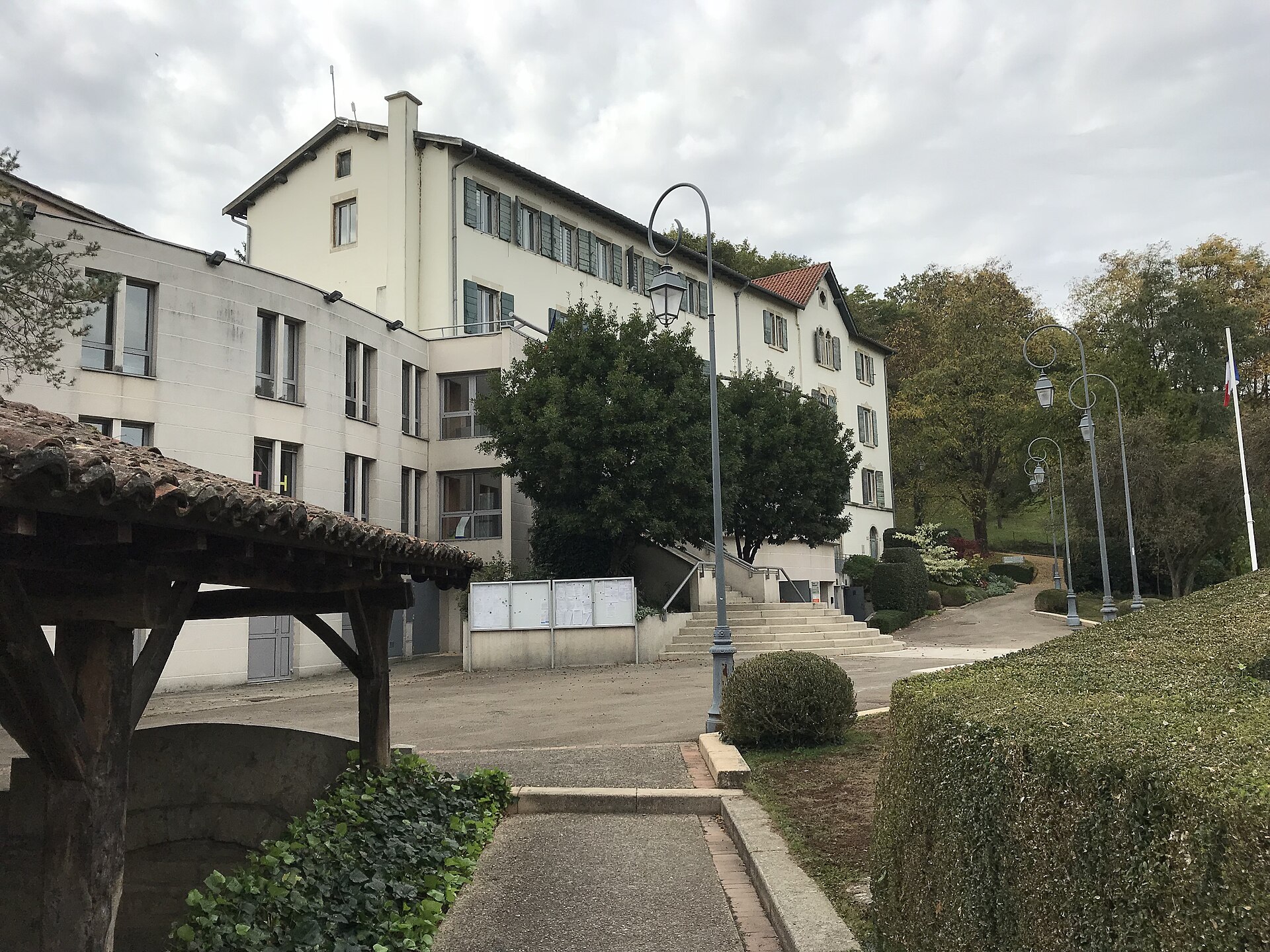
town hall of Montluel
Montluel
The town hall of Montluel, in the Ain department of the Auvergne-Rhône-Alpes region, sits at the heart of the Dombes area, roughly 20 kilometers northeast of Lyon. With close to seven thousand residents, Montluel makes an easy base for exploring the fish-pond-dotted countryside of the Dombes while staying within reach of a day trip from Lyon itself. Where is the Montluel town hall located? The building stands on Avenue Pierre Cormorèche, in the central part of town, surrounded by other public facilities. This is where the municipal administration operates — residents come here for civil registry documents, family records, and general information about local life. For visitors exploring Montluel, it works as a natural landmark in the town center, close to several other historic sites. What else is worth seeing near the town hall? Despite its modest size, Montluel carries a long history stretching back to the Middle Ages, visible throughout its old quarter. Near the town hall, look for a 16th-century house that now houses a small museum devoted to local art and history — a good starting point for understanding how life unfolded in this corner of the Dombes over the centuries. Not far away stands the Collegiate Church of Notre-Dame-des-Marais, whose oldest sections date to the 14th century, with later additions completed in the 16th century — one of the town's most significant religious landmarks. It's also worth tracking down the remains of a former Visitation convent, which still preserves a 17th-century portico, along with the ruins of a medieval feudal castle, a reminder of Montluel's past role as a fortified town guarding the border between the Dauphiné and Savoy. The nearby Château de la Gentille adds another layer to that defensive history, drawing visitors with an interest in medieval fortifications. How should you plan a visit to the town hall? If your visit involves administrative business, it's worth checking opening hours in advance, since they vary by day. The town hall welcomes visitors Monday through Saturday, with shorter hours on Wednesdays and Fridays compared to the rest of the working week. When in doubt, a quick call to +33 4 78 06 06 23 beforehand confirms current hours and saves an unnecessary trip to closed doors. How do you get to Montluel? The town sits close to the main routes connecting Lyon to the eastern part of the region, making it easy to reach by car or local public transport. Walking through Montluel's center, with the town hall as one of several reference points, is a pleasant way to discover a lesser-known but genuine side of the Dombes — a region better known for its fish ponds and quiet rural character than for tourist crowds, and visited far less often than Lyon itself. Frequently Asked Questions What are the opening hours of the Montluel town hall? Hours vary by day: Monday, Tuesday, Wednesday, Thursday, and Friday it operates in two blocks — morning and afternoon — though Wednesday and Friday have shorter or no afternoon hours. Saturday it's open mornings only. How can you contact the town hall? Call +33 4 78 06 06 23 to check opening hours or arrange an administrative appointment. Are there other landmarks near the town hall worth visiting? Yes, within a short walk you'll find the Collegiate Church of Notre-Dame-des-Marais, the former Visitation convent with its 17th-century portico, and the ruins of a medieval castle. How far is Montluel from Lyon? Montluel lies about 20 kilometers northeast of Lyon, making it easy to combine both destinations in a single day.
-
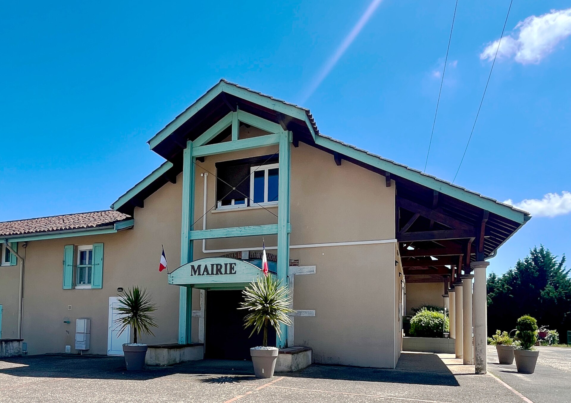
Town hall of La Tranclière
La Tranclière
The town hall of La Tranclière, in the French department of Ain, is a modest but telling stop for travelers exploring the Bresse-Dombes countryside. La Tranclière sits roughly 11 kilometers southeast of Bourg-en-Bresse, right in the middle of a landscape famous for its thousands of ponds and its unhurried rural pace. With only about 290 residents, known locally as Tranclériens, the village nonetheless carries real administrative weight in the area. What makes this town hall worth noticing? The building's story is one of reuse rather than grandeur. Rather than occupying a purpose-built civic structure, the mairie has operated since 1996 out of a former butter factory (beurrerie), at 301 rue de la Dombes. Converting old dairy buildings into town halls or community spaces is a pattern seen across many small communes in this part of France, where dairy production once anchored the local economy before the factories closed and the buildings needed new uses. What is the history behind the commune of La Tranclière? La Tranclière became a commune in 1790, carved out of the parish that had previously borne the same name — a routine administrative step during the French Revolution, when parishes were converted into the country's new territorial units. By 1792, the commune had already taken over the management of civil registration records and inherited parish archives dating back to 1696, giving this small village an unusually deep documentary history for its size. What role does La Tranclière play today? Today, La Tranclière serves as the administrative seat of the Communauté de communes Bresse-Dombes-Sud Revermont, a grouping that also includes the communes of Certines, Druillat, Journans, Saint-Martin-du-Mont, and Tossiat. That means decisions on public services, local planning, and regional development for this entire cluster of villages are coordinated from this town hall, even though La Tranclière itself remains small. What can visitors explore nearby? The wider Dombes region, where La Tranclière is located, is known for its distinctive landscape of thousands of man-made fishponds, historically used for carp farming and other freshwater fish. The area also draws birdwatchers, since the ponds attract herons and other waterfowl throughout the year. Closer to Bourg-en-Bresse, travelers will find some of the region's bigger draws, including the Abbaye Notre-Dame des Dombes, a Trappist monastery founded in 1863 — well worth combining with a stop in La Tranclière for a fuller sense of the Dombes' quiet, rural character. Despite its small size, the village captures something essential about rural France: administrative history, industrial heritage, and countryside scenery woven into one authentic, low-key destination. Frequently Asked Questions Where exactly is the town hall of La Tranclière located? The town hall is at 301 rue de la Dombes, in the village of La Tranclière, in the Ain department, about 11 km southeast of Bourg-en-Bresse. Why is the town hall housed in a former butter factory? Since 1996, the commune has used the old beurrerie (butter factory) building for its municipal offices, preserving a piece of the village's industrial heritage instead of constructing a new building. How many people live in La Tranclière? The commune has around 290 residents, known as Tranclériens. What administrative area does the La Tranclière town hall oversee? La Tranclière is the seat of the Communauté de communes Bresse-Dombes-Sud Revermont, which also includes the communes of Certines, Druillat, Journans, Saint-Martin-du-Mont, and Tossiat.
-
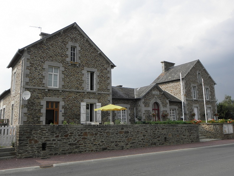
Mairie déléguée d'Argouges
Argouges
Mairie déléguée d'Argouges is the former town hall of Argouges, a small village in the Manche department, in the Normandy region of France. Since January 1, 2017, Argouges has no longer been an independent commune — together with Carnet, la Croix-Avranchin, Montanel, Vergoncey, and Villiers-le-Pré, it was merged into the newly created commune of Saint-James. The old municipal building retained its role as a mairie déléguée, a local administrative office serving residents of the former village. The area covers roughly 16 km² and is home to just over five hundred people, making Argouges a quiet, rural corner of a region bordering Brittany. Where is Argouges and how do you get there? Argouges lies in the southern part of the Manche department, right on the border with Brittany and Ille-et-Vilaine. The nearest larger town is Saint-James, the commune to which the village now administratively belongs. Within a short drive, travelers find two useful reference points: the small town of Saint-Brice-en-Coglès, about 10 km away, and the famous Mont-Saint-Michel, roughly 17 km from here. This location makes Argouges a convenient stopover between Brittany and the Normandy coast, well away from the busiest tourist routes. Where does the name Argouges come from? The origin of the name Argouges has never been definitively settled by toponymists. One hypothesis links it to the Gallic personal name Argon, while another connects it to a word meaning "bright" or "shining." Some historians instead point to a possible medieval Latin origin from arcubia, meaning "watchtower." None of these theories has been conclusively proven, which is itself a small curiosity for anyone interested in the region's linguistic history. What should visitors know about the history of Argouges? The Argouges name has long been tied to the local Norman nobility — the d'Argouges family played a role in the region's history as far back as the Middle Ages. The village itself also carries a darker chapter: during the French Revolution, three priests who refused to swear the oath to the Civil Constitution of the Clergy met tragic ends here, remembered locally as the "martyrs of Argouges." Among them was Julien Berthelot, born and killed in Argouges. Though distant now, these events remain part of the local historical memory kept alive around Saint-James. What is there to see around Argouges? The village has a parish church dedicated to Saint Peter, typical of the plain, stone religious architecture found throughout this part of Normandy. Argouges itself offers little in the way of tourist infrastructure, which is precisely its appeal for travelers looking for an authentic, uncrowded Norman village. It works well as a base for day trips: from here it is easy to reach Mont-Saint-Michel, one of France's most visited sites, as well as the smaller towns of Brittany just across the regional border. The surrounding countryside is classic Manche landscape — hedgerows, pastureland, and shallow river valleys. Frequently Asked Questions Is Argouges still an independent commune? No. Since 2017, Argouges has been a commune déléguée forming part of the commune of Saint-James, created from the merger of six former communes. How far is Argouges from Mont-Saint-Michel? Mont-Saint-Michel is about 17 km away, making Argouges a convenient, quieter base for visiting the site without staying in the busiest tourist areas. What can visitors see in Argouges itself? The main point of interest is the parish church dedicated to Saint Peter, along with the surrounding rural landscape typical of southern Manche. Which department and region is Argouges part of? Argouges is located in the Manche department, in the Normandy region, close to the border with Brittany.
-
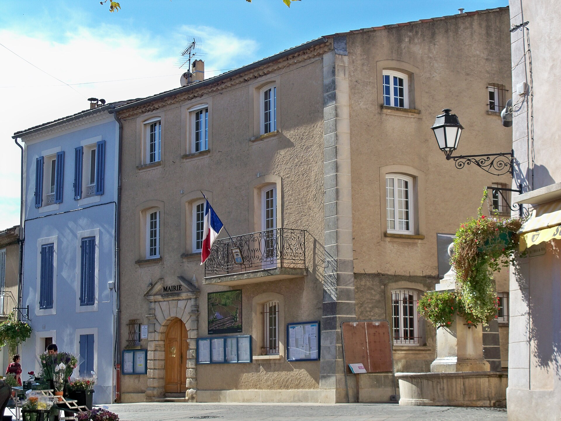
town hall of Gréoux-les-Bains
Gréoux-les-Bains
The town hall of Gréoux-les-Bains, seat of the local government of this small spa town in the Alpes-de-Haute-Provence department, sits right at the heart of a settlement built around its sulphur-rich thermal springs. Gréoux-les-Bains lies in the Provence-Alpes-Côte d'Azur region, close to Lake Sainte-Croix and the lavender-covered Valensole plateau, so the town hall building itself often serves visitors as a landmark for orienting themselves in the old town before heading further out toward the lake or the fields. Why is this town known for its thermal waters? The story of Gréoux-les-Bains' healing waters goes back to Roman times — remnants of ancient exploitation of the springs confirm that bathing here already existed in the first centuries of our era. After the fall of the Roman Empire the springs fell into obscurity, and the settlement survived barbarian invasions and the Wars of Religion under its earlier names, "Grésols" and "Greols". Revival only came in 1619, when the physician Jacques Fontaine rediscovered the spring, drawn by a strong smell of sulphur. In 1752, Abbé Gravier, having acquired ownership of the waters, set out to restore their reputation and was the first to imagine therapeutic bathing made available to less privileged residents too. Today Gréoux-les-Bains ranks among the leading thermal resorts in France by the number of visitors who come each year for preventive and curative treatments. What can you see around the town hall? Overlooking the town stands a castle commonly known as the "Château des Templiers", built on a rocky outcrop between the second half of the 13th century and the 16th century — though despite its name it never actually belonged to the Knights Templar. It ranks among the largest fortified buildings in the whole Provence-Alpes-Côte d'Azur region, surpassed in size only by the Papal Palace in Avignon and the bishops' palace in Salon-de-Provence. Walking from the town hall toward the old quarter, visitors pass narrow Provençal lanes and stone houses, and heading further down reach the thermal baths, still active and central to the local economy. How should you plan a visit to Gréoux-les-Bains? The town makes a convenient base for exploring the wider area: Lake Sainte-Croix, known for its turquoise water and kayak trips into the Verdon gorge, sits within easy reach, as does the Valensole plateau, which turns purple with lavender fields in June and July. It's worth combining a stroll through the centre, past the town hall and up to the castle, with a longer excursion into the surrounding countryside, especially during the lavender bloom when the area draws the most visitors. Frequently Asked Questions Can you visit the town hall building itself? The town hall functions as an administrative office and seat of the local council — as a working government building it isn't a typical visitor attraction, but its central location makes it a natural starting point for exploring the old town. Where does the name "Gréoux-les-Bains" come from? The "les Bains" ("the baths") part refers to the town's centuries-old thermal tradition, dating back to Roman times and firmly revived in the 17th and 18th centuries. Did the castle above the town really belong to the Templars? No — despite its popular name, the "Château des Templiers", there's no evidence the building was ever owned by the Knights Templar. When is the best time to visit Gréoux-les-Bains? Spring and early summer are pleasant for exploring the town and its surroundings, while June and July are the best months to see the lavender fields in bloom on the Valensole plateau.
-
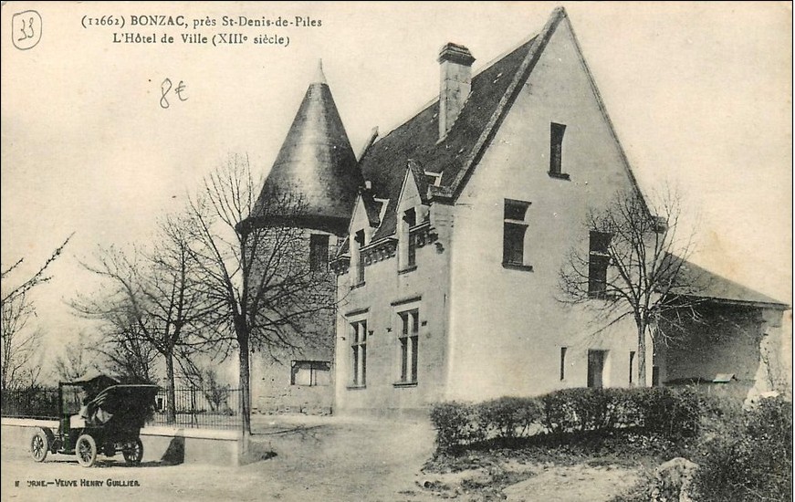
town hall of Bonzac
Bonzac
The town hall of Bonzac is a small but distinctive municipal building at the heart of Bonzac, a village in the Gironde department, in the Nouvelle-Aquitaine region, within the historic Libournais area surrounding Libourne and the famous Saint-Émilion vineyards. The commune itself is home to fewer than eight hundred residents, and its character is defined above all by its setting: a hill overlooking the Isle river valley, officially listed among France's protected scenic sites. Why does the town hall stand where it does? What sets Bonzac's town hall apart from countless other French village halls is its exact location. The building occupies the site of a former windmill, perched at the very top of the hill — the highest point in the area. That is no coincidence: from here unfolds one of the most admired views in the whole Libournais region. From the terrace beside the town hall, visitors can take in the entire valley, stretching from Libourne to Coutras and passing along the way near Saint-Émilion and Montagne — two names that speak volumes to any lover of Bordeaux wine. What else is worth seeing near the town hall? At the foot of the hill, in the communal cemetery, stands a stone cross dating from the 16th century, officially protected as a historic monument. It is one of the few surviving physical traces of Bonzac's earlier centuries. The same cemetery holds the tomb of Duke Élie Decazes (1780–1860), a minister under King Louis XVIII and president of the Council of Ministers — one of the most influential figures in French politics during the first half of the 19th century. Bonzac also has its own place in the turbulent history of France through Clément Thomas, a native of the village who served as a Girondin deputy in the Constituent Assembly of 1848 and commanded the National Guard. He was executed by insurgents at Montmartre on 18 March 1871, the day that marked the start of the Paris Commune — one of the most dramatic episodes of 19th-century French history. How to find the town hall? The seat of the local government sits at 6 le Moulin, 33910 Bonzac — the street name itself, "Le Moulin" ("The Windmill"), recalls the building's original purpose. The commune has been led by a mayor elected following the 2020 municipal elections. Who should visit Bonzac? Bonzac appeals to travelers looking for something beyond the Saint-Émilion vineyards — even though those very vineyards lie within view from the town hall terrace. It suits anyone drawn to the quiet countryside of the Libournais, sweeping panoramic views, and small but genuine traces of French history, such as the historic stone cross or the graves of notable 19th-century figures. A visit takes little time, yet it rounds out a longer tour of the wine region around Saint-Émilion perfectly. Frequently Asked Questions Why is Bonzac's town hall built on the site of a windmill? The town hall occupies the location of a historic windmill on the hilltop because that spot offers the finest view over the Isle valley — the site was kept precisely for its exceptional position. What can be seen from near the town hall? The viewpoint by the town hall overlooks the Isle river valley on the route from Libourne to Coutras, passing near Saint-Émilion and Montagne along the way. What else is worth seeing in Bonzac besides the town hall? Worth a visit is the nearby cemetery, home to a 16th-century stone cross and the tomb of Duke Élie Decazes, a French statesman from the era of Louis XVIII. What is the address of Bonzac's town hall? The seat of the commune is located at 6 le Moulin, 33910 Bonzac.
-
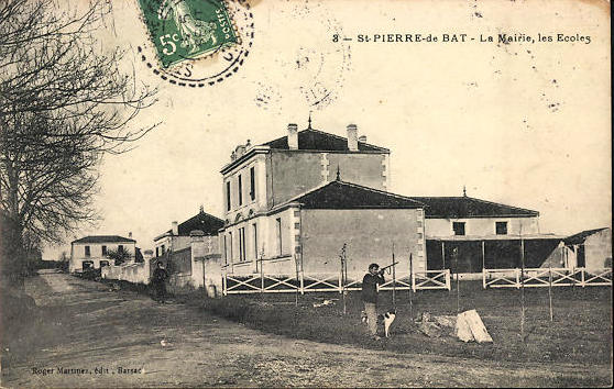
town hall of Saint-Pierre-de-Bat
Saint-Pierre-de-Bat
The town hall of Saint-Pierre-de-Bat serves as the seat of local government for a small commune in the Gironde department, in the Nouvelle-Aquitaine region of southwestern France, within the historic Entre-deux-Mers wine country. It functions as the administrative heart of a community of fewer than 320 residents, known locally as Pétrusquins and Pétrusquines. Where is Saint-Pierre-de-Bat located? The commune covers just under 9 square kilometers in the heart of Entre-deux-Mers, the region stretching between the Garonne and Dordogne rivers east of Bordeaux. The landscape here is gently rolling, with vineyards interwoven among small villages, woodland, and stream valleys. Saint-Pierre-de-Bat belongs to the Communauté de communes Rurales de l'Entre-deux-Mers, an intermunicipal body that handles shared services such as land planning and waste management, while the town hall itself deals with strictly local matters: civil registry records, official documents, and the day-to-day running of community life. What can a traveler expect from Saint-Pierre-de-Bat? This is a quiet, unassuming rural commune typical of southwestern France — it holds no major landmarks, and that understated character is exactly its appeal. Visitors exploring Entre-deux-Mers usually treat villages like this one as stops along a wine route or cycling trail, well away from the crowds of Bordeaux itself. The town hall, as a working public building, isn't a heritage site open for visits; it's simply a familiar feature of the small French commune it serves, typically standing near the main square or crossroads alongside the parish church and a handful of local shops. What makes Entre-deux-Mers worth knowing about? Entre-deux-Mers is one of the largest appellation areas within Bordeaux wine country, best known for its dry white wines, though red wines are also produced locally under separate appellations. The region draws wine tourists: estates here often welcome visitors for tastings and tours, and a network of walking and cycling routes links villages such as Saint-Pierre-de-Bat. The scenery combines working farmland with architectural heritage — Romanesque churches and former abbeys — and a slower pace of provincial life that contrasts with nearby Bordeaux. For anyone touring the area, the commune can serve as a waypoint or a brief stop, with easy access to larger nearby towns such as Cadillac or Rauzan for combining sightseeing with time in the countryside. Frequently Asked Questions Where exactly is Saint-Pierre-de-Bat located? In the Gironde department, Nouvelle-Aquitaine region, within the historic Entre-deux-Mers area east of Bordeaux. Are there tourist attractions in Saint-Pierre-de-Bat? The commune has no major attractions of its own but makes a good base for exploring the wine and cycling routes of Entre-deux-Mers. How many people live in Saint-Pierre-de-Bat? The commune has fewer than 320 residents, making it a typical small rural community for the region. What does the town hall of a commune like this do? It handles residents' administrative needs — civil registry records, official paperwork, and local community affairs — working alongside the Entre-deux-Mers intermunicipal body for services shared across the area.
-
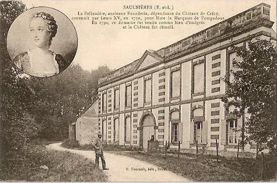
Moulin de la Bellassière
Crécy-Couvé
Moulin de la Bellassière is an old watermill in the village of Crécy-Couvé, in the Eure-et-Loir department of France, standing on the banks of the Blaise river at the southern end of the Bellassière canal. What draws visitors here is not the milling machinery but an extraordinary 18th-century facade commissioned by the Marquise de Pompadour — one of the more unusual examples of architectural trompe-l'œil found anywhere in France. How old is the mill and where does its story begin? The mill's roots go back to the 11th century, when it operated as an ordinary grain mill grinding wheat for the surrounding farmland. Its fortunes changed sharply in 1746, when Louis XV gave the nearby château of Crécy to Madame de Pompadour. Between 1750 and 1754 she carried out a full remodeling of the village, and the mill became part of that broader plan. Why does the mill's facade look like it belongs to a different building? Around 1750, on the marquise's orders, an ornamental facade-fronton was erected in front of the working mill. Its purpose had nothing to do with grinding grain — it was built purely to hide the mill from view and to match visually with the small château d'Aunay, both of which could be seen from the terraces of the château de Crécy. Pompadour wanted the outlook from her residence to feel harmonious, so the new facade was made entirely blind: the window openings are only marked into the stonework, with no glass and no rooms behind them. Its most recognizable features are the cornice, a balustrade topped with acroteria, and a small triangular pediment set above the entrance porch. The facade was added to the French register of historic monuments by a decree issued in December 1992. What happened inside the mill after Pompadour's renovation? Around the same time, roughly 1750, the interior of the mill was converted for the château's household use, becoming a laundry and a winter garden serving the estate. The château de Crécy itself no longer exists today, which makes the mill and its striking fronton one of the few tangible traces left of Pompadour's presence in the area. What is there to see in the Garden of Six Senses? Since 2003 a local association has run activities at the mill, organizing exhibitions, talks, and visits for groups interested in the site's history. In May 2013 the grounds opened a garden called "Pas de sens interdit," the Garden of Six Senses, designed from the outset to be usable by everyone — children, older visitors, and people with disabilities alike. The garden is laid out as a series of separate plant "rooms": an ornamental garden in a classical style, vegetable beds, an orchard of old apple, pear, and peach varieties trained as espaliers, and a corner devoted to medicinal plants. Species were chosen for how they look, smell, taste, and feel, so a walk through the garden engages several senses at once rather than just sight. How can visitors plan a trip to the Moulin de la Bellassière? Access to the mill and garden is by prior arrangement with the association that runs the site. Beyond scheduled visits, the mill also opens for occasional events during the year, including France's Journées du Patrimoine (Heritage Days), when guided tours and extra background on the mill and the Marquise de Pompadour are typically on offer. Frequently asked questions Where exactly is the Moulin de la Bellassière located? In Crécy-Couvé, in the Eure-et-Loir department, on the banks of the Blaise river at the southern end of the Bellassière canal. Was it originally a working grain mill? Yes, records trace it back as a grain mill to the 11th century, before its role changed in the 18th century under Madame de Pompadour. What exactly is the facade-fronton? It is an ornamental, entirely blind facade built around 1750 to conceal the mill and improve the view from the château de Crécy — a notable case of architectural trompe-l'œil. Is the facade a protected historic monument? Yes, the facade-fronton was listed as a monument historique by a decree dated December 1992. What is the "Pas de sens interdit" garden? It is a Garden of Six Senses opened in May 2013, designed to be accessible to all visitors, with sections for ornamental planting, vegetables, an orchard, and medicinal herbs. Do you need to book a visit in advance? Yes, visits to the mill and garden are arranged in advance with the association that manages the site.
-
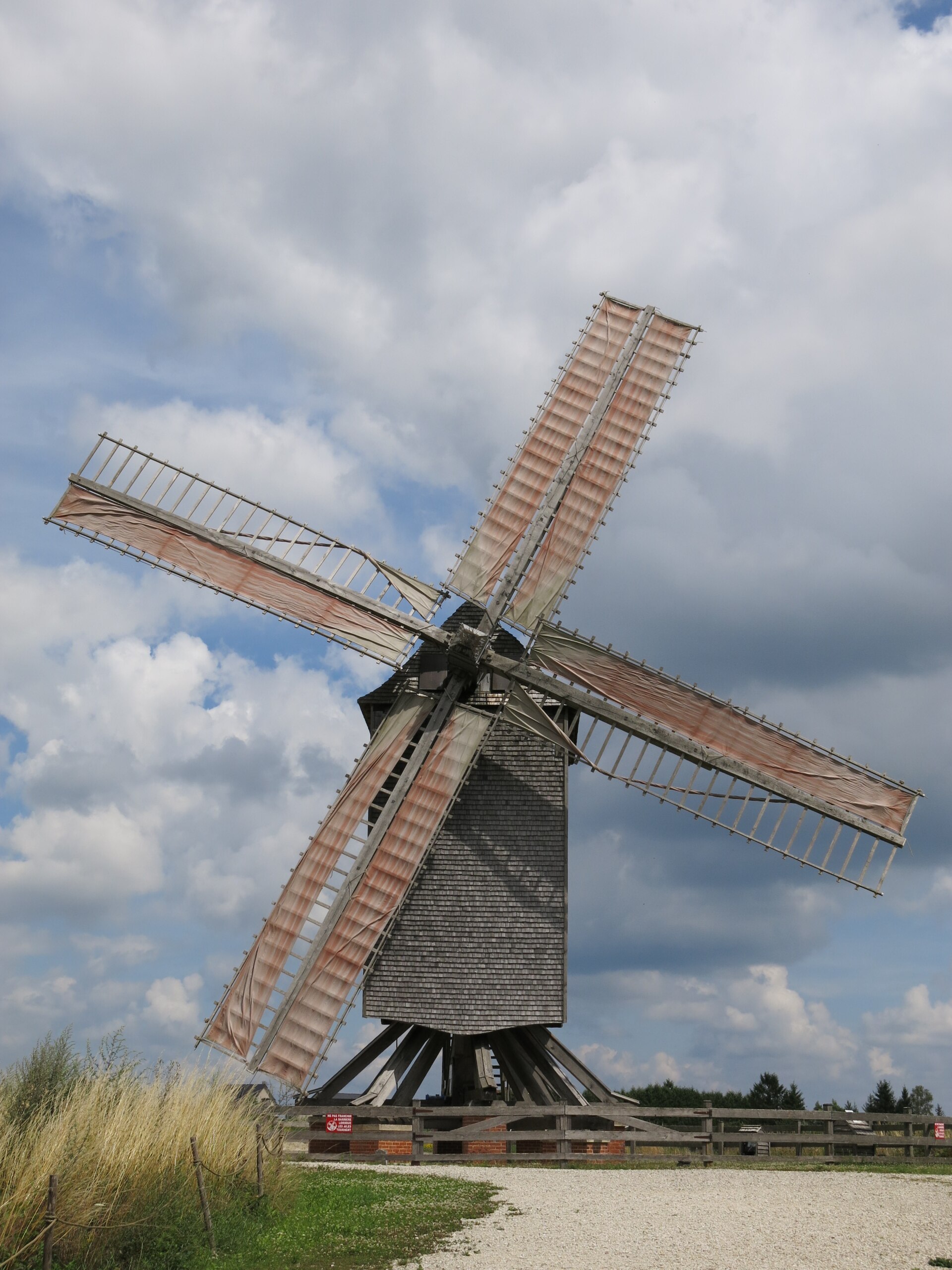
Moulin de Dosches
Dosches
Moulin de Dosches: the windmill that came back to a village in the Aube Moulin de Dosches stands on a rise above the village of Dosches, right on the edge of the Forêt d'Orient Regional Nature Park in the Aube department of France. Despite the generic name "moulin," this is not a watermill but an all-timber windmill mounted on a rotating pedestal — a faithful rebuild of the type that once dotted the Champagne countryside in the 18th century. Why a windmill here, and not a watermill? Dosches itself once had two windmills of its own. By the end of the 18th century, close to a hundred such windmills were turning across the Aube, mostly in dry spots or near small streams where water power wasn't practical. By 1899 only three of that hundred were left standing, and within a few more years windmills had all but vanished, pushed out by more efficient industrial flour mills. Neither of Dosches' original two windmills survived into the modern era. Who rebuilt it, and when? The revival was driven by the Association des Moulins à Vent Champenois, founded in 2001 to bring this lost heritage back. The design and construction were led by Erwin Schriever, a Dutch master carpenter specialized in this type of mill. The build stretched over roughly six years and drew on the work of close to 300 trainees and volunteers, who learned traditional carpentry techniques in the process. The prefabricated frame elements were trucked to the site in September 2006, and the windmill was formally inaugurated on 23 June 2007. How is the mill built, and how does it actually turn? Moulin de Dosches is a "post mill" type structure (moulin sur pivot): the entire upper body, sails included, pivots on its pedestal to face into the wind. The pedestal alone stands 7 metres tall and weighs 7 tonnes; the timber cage measures 8 metres in height with a 4.20-metre side. The main axle runs 6.20 metres long, the gear wheels measure 2.50 metres across, and the sails stretch 10 metres with a 2-metre width. The millstones are 1.50 metres in diameter. Even though the whole structure weighs in at dozens of tonnes, just two people are enough to swing it into the wind using a lever — thanks to the finely balanced pivot mechanism. What else is there to see on site besides the windmill? Next to the mill stands a 15th-century tithe barn (grange à dîme), its medieval timber roof still intact, now housing the reception desk and a small gift shop. The site also includes a bread oven, a miller's house, and a herb garden (jardin de simples). The mill is fully operational: visitors can watch flour-milling demonstrations, try out old-fashioned wooden games, and join educational activities. The site also takes part in national heritage events such as the Journées du Patrimoine and the Journées des Moulins. Frequently asked questions Is Moulin de Dosches an original historic windmill? No — it's a faithful reconstruction modeled on 18th-century Champagne windmills, built between 2001 and 2007 on the site of the village's former, long-vanished mills. Who designed and built the windmill? Erwin Schriever, a Dutch master carpenter, led the design and construction on behalf of the Association des Moulins à Vent Champenois, with the help of around 300 trainees. How does the turning mechanism work? The whole upper structure sits on a pivot and, despite its considerable weight, can be rotated to face the wind by just two people operating a lever. What can visitors see beyond the windmill itself? A 15th-century tithe barn with the reception and gift shop, a bread oven, a miller's house, a herb garden, plus flour-milling demonstrations and educational activities. Where exactly is Dosches? Dosches is a village in the Aube department, on the edge of the Forêt d'Orient Regional Nature Park, in the Grand Est region of France.
-
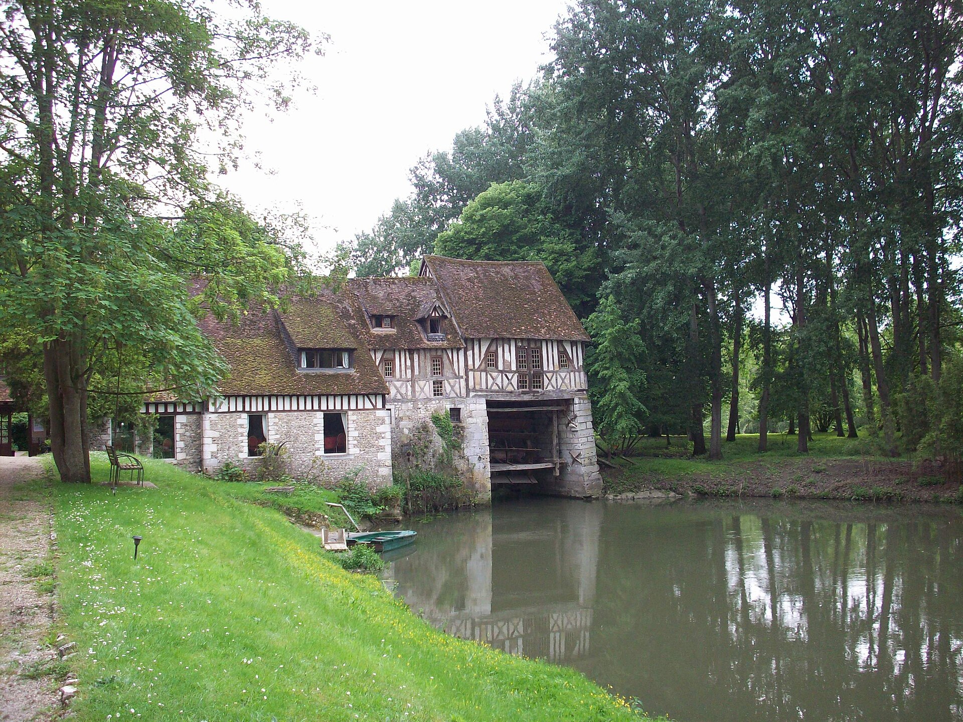
Moulin d'Andé
Andé
Moulin d'Andé is a historic watermill turned arts centre in the village of Andé, Normandy, on a branch of the Seine between Paris and Rouen. For more than sixty years it has hosted writers, filmmakers and musicians, making it as much a cultural landmark as an architectural one. How old is the mill and what makes its structure unusual? The building dates back to the medieval period and is considered one of the last surviving examples in Western Europe of a "hanging wheel" mill (roue pendante), a mechanism that has been preserved largely intact. The mill operated commercially for centuries until milling stopped in the 19th century, after the construction of the Poses dam altered water levels along this stretch of the Seine. The building was listed as a French historic monument in 1995, and its adjoining rock garden received the same protected status in 2008. How did a working mill become an artists' residence? The turning point came in the mid-20th century, when the property passed to Suzanne Lipinska. In 1962, together with writer Maurice Pons, she founded the Moulin d'Andé association to support the arts, letters and crafts through creative residencies. From that point on, the former outbuildings, stables and barn were converted into meeting rooms, guest quarters and a theatre set up inside the orangery, giving the mill a second life as a working cultural venue rather than a static monument. Which artists and filmmakers are linked to Moulin d'Andé? The mill's reputation rests heavily on its ties to French cinema. François Truffaut first came to Andé to discuss adapting one of Maurice Pons' short stories with him, a collaboration that produced the short film "Les Mistons." He later returned to shoot scenes for "The 400 Blows" and "Jules and Jim," two films central to the French New Wave. Other filmmakers associated with the mill include Louis Malle and Alain Cavalier. Among writers, Georges Perec wrote his novel "La Disparition" while staying there, and the mill also welcomed Richard Wright and Eugène Ionesco. Musicians who spent time at Andé include violinist Ivry Gitlis. What can visitors see at the mill today? Moulin d'Andé has operated continuously since the 1960s as a venue for artist residencies, concerts and workshops, hosting more than a hundred concerts a year alongside a summer international music academy. Since 1998 it has also housed CÉCI, a centre dedicated to screenwriting. Visitors can see the original milling hall with its preserved mechanism, the orangery-turned-theatre, and the rock garden built between 1908 and 1915 by Italian craftsmen — an arrangement of artificial stone formations set into the natural riverside landscape. How do you get there and what should you know before visiting? Andé sits in the Eure department in Normandy, positioned conveniently for a stop between Paris and Rouen. The mill's address is 65 rue du Moulin. Because the site functions as an active cultural centre rather than a conventional museum, access to the interior and grounds depends on the event calendar, so checking the current programme before travelling is worthwhile. Frequently Asked Questions Can you visit Moulin d'Andé like a regular historic site? It is a working arts centre first, so visits to the mill and its garden are usually tied to specific events, concerts or open days rather than fixed museum opening hours. Which Truffaut films were shot at Andé? Scenes from "Les Mistons," "The 400 Blows" and "Jules and Jim" were filmed in and around the mill, all key works of the French New Wave. Who founded the cultural centre at the mill? Suzanne Lipinska and writer Maurice Pons created the Moulin d'Andé association in 1962 to run it as a residency for artists across disciplines. What is notable about the mill's garden? Its rock garden (parc de rocailles), built between 1908 and 1915, combines artificial stone formations with natural vegetation along the Seine and is itself a protected historic site.
-
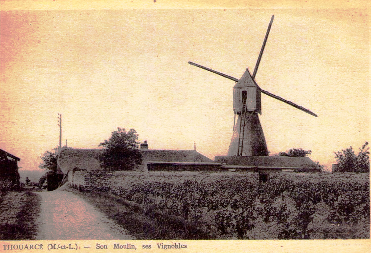
Moulin de la Montagne
Bellevigne-en-Layon
Moulin de la Montagne is a preserved cavier-style windmill standing among the vineyards east of Thouarcé, one of five villages merged in 2016 into the commune of Bellevigne-en-Layon, in the Maine-et-Loire department. It sits on a low rise beside the chemin de la Montagne, near the hamlet of Le Petit-Bonnezeaux, roughly 20 km south of Angers, right in the middle of the Layon valley wine country. What makes this windmill unusual? The mill belongs to the moulin-cavier type, a design specific to the Anjou region. Instead of a wooden structure rising the full height of the building, its base is a conical stone tower with a hollowed-out chamber inside, once used to store grain and flour. Perched on top is a movable wooden cabin — locally called the calotte — that carried the machinery and sails and could be rotated to face the wind from any direction, without having to turn the whole tower. The sails followed the Berton system, patented in 1845, which used self-adjusting shutters to cope with changing wind strength. Inside, two pairs of millstones ground the grain into flour. How old is the mill and what happened to it? Moulin de la Montagne was built in the 19th century and stayed in use until 1914, when its miller was called up to fight in the First World War. With no one left to run it, the mill stopped producing flour and never resumed commercial milling. During the Second World War, the tower — known locally as Beauregard, the same name given to the nearby plateau — was used by German troops as an observation post. As they withdrew in August 1944, they partially destroyed the structure. The wider commune of Thouarcé once counted more than twenty water and wind mills across the 19th century; most have since fallen into ruin, which makes Moulin de la Montagne one of the better-preserved survivors of that milling heritage. Is it protected, and can visitors go inside? The mill was listed as a monument historique on 30 July 1980. It underwent restoration in the mid-1980s and reopened as a preserved heritage site in 1986. It remains privately owned and is no longer a working mill — its value today is as a piece of rural architecture rather than an active business. Because it sits on private land, the interior is not open on a regular basis. The exterior, however, is easy to admire from the footpaths that cross the vineyards around Thouarcé, including the route up to the Beauregard plateau and the walking trail linking the area's other windmills, such as Moulin de la Pinsonnerie in Faye-d'Anjou. Frequently asked questions How old is Moulin de la Montagne? It dates from the 19th century and counts among the best-preserved cavier-type windmills around Thouarcé. What is a moulin-cavier? It is an Anjou-region windmill type built around a conical stone tower with a rotating wooden cabin on top that carried the sails and turned to face the wind. Why did the mill stop working? Production ended in 1914 when the miller was drafted into the First World War and never returned to run the mill. What happened to it during the Second World War? The tower, known as Beauregard, was used by German forces as a lookout post and was partly destroyed when they retreated in August 1944. Can visitors go inside the mill? No — it is private property, so the interior is not regularly open to the public, though it can be viewed from outside along the nearby vineyard footpaths. Where exactly is the mill located? Along the chemin de la Montagne, east of central Thouarcé, within the commune of Bellevigne-en-Layon, close to the hamlet of Le Petit-Bonnezeaux.
-
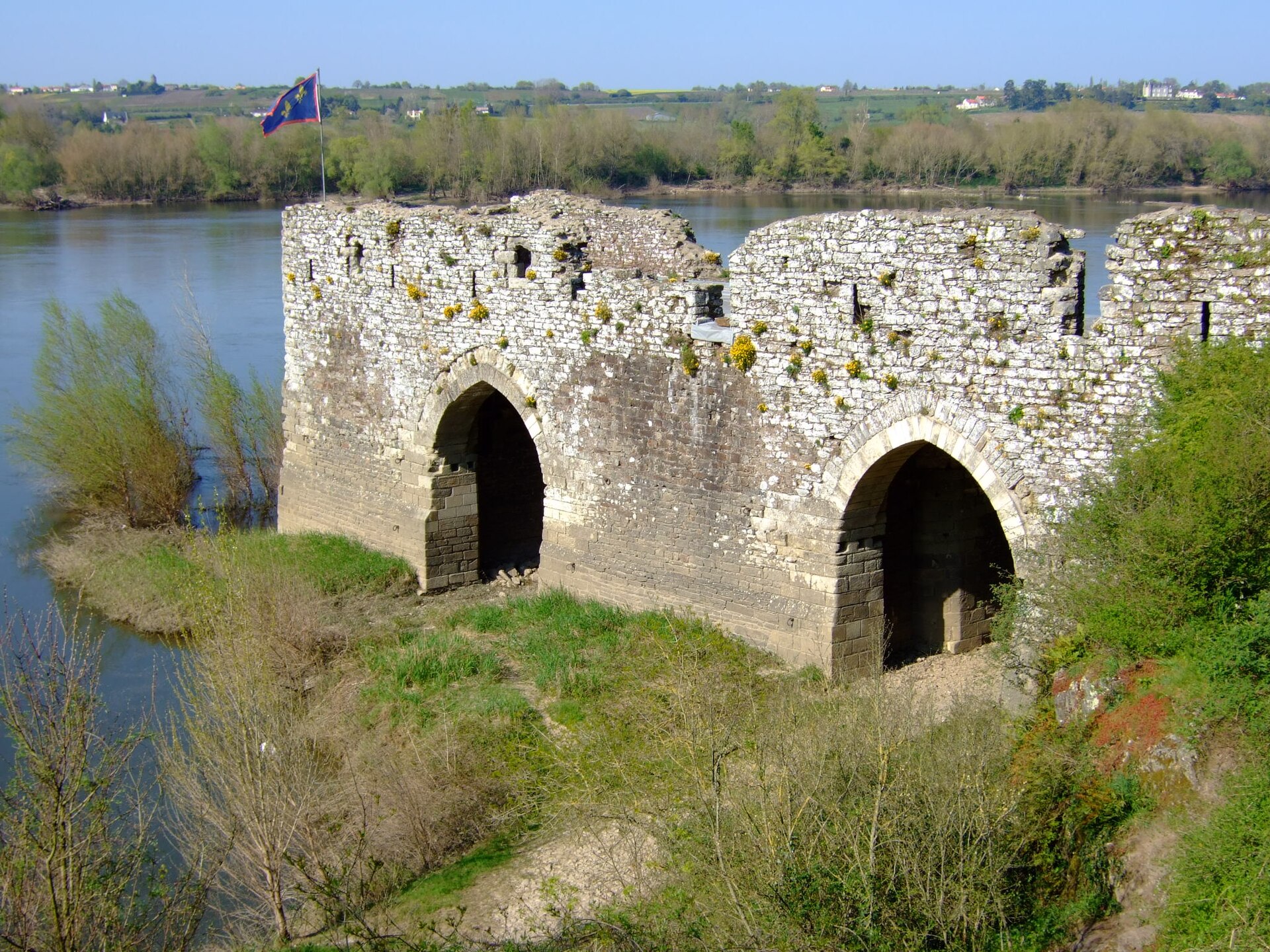
hanging mill in Champtoceaux
Orée d'Anjou
The Moulin Pendu ("hanging mill") is a historic riverside building on the left bank of the Loire at Champtoceaux, a village within the commune of Orée d'Anjou in the Maine-et-Loire department of western France. It stands at the foot of the hill that once carried the medieval fortress of Champtoceaux, whose remains are still visible about a kilometre away. Why is it called a "hanging" mill? The name has nothing to do with executions — it describes how the machinery worked. Underneath two pointed (ogive) stone arches, paddle wheels were suspended so they could be raised or lowered to match the changing water level of the Loire. Because the wheels literally hung beneath the arches, the building became known as the "moulin pendu." The current from the river turned these wheels, which in turn drove millstones on the upper floor to grind grain into flour. How old is the building? A mill has stood on this stretch of the Loire since the 11th century, but the building that survives today dates from the 13th and 14th centuries. Inside, it once housed two separate flour mills. The structure measures 46 metres long and 7.5 metres high, making it an unusually large example of its kind — in fact, it was the last working water mill on the Loire. The water mills operated here until 1420, after which they were replaced by floating mills anchored on the river, a system that remained in use into the 19th century. Besides the milling chamber, the building also contained a storeroom for wheat and flour and living quarters for the miller. Was it also a river toll point? For a long time the site was believed to have served mainly as a river toll station — a port had existed here since the 7th century, and tolls were said to have been collected until the 17th century. Current historical research, however, points to milling as the building's primary function rather than toll collection. Whatever the original balance of uses, the site later served as a landing point for steamboats, a role it kept until the arrival of the railway shifted transport away from the river. What else can visitors see nearby? Now a protected historic monument, the mill was originally part of a much larger fortified complex tied to the Champtoceaux castle, of which only fragments remain today. A visit pairs naturally with a walk up to the ruins of the medieval town and fortress on the hill above, and with a stop near the landing stage used by the river boat "La Luce," which cruises this stretch of the Loire. Where exactly is it, and how do you get there? The Moulin Pendu sits on the left bank of the Loire at the foot of Champtoceaux, within the commune of Orée d'Anjou. It lies directly on the Loire à Vélo cycling route that follows the river through Maine-et-Loire, making it an easy stop for cyclists and walkers exploring the Anjou region. The combination of riverside scenery and medieval history makes the spot worth more than a quick photo stop. Frequently asked questions What is the Moulin Pendu in Champtoceaux? It is a historic 13th–14th-century water mill building where paddle wheels hung beneath stone arches, turned by the Loire's current to drive millstones on the floor above. Why is it called "pendu," meaning "hanging"? Because its paddle wheels were suspended beneath the building's pointed arches and could be adjusted to the river's water level. How long did the mill operate? The water mills ran until 1420; after that, floating mills anchored on the river took over the job until the 19th century. Was it also used as a toll station? It was long assumed to be a river toll point, since a port existed here from the 7th century, but current research suggests milling was its main function. What else is worth seeing nearby? The ruins of the medieval Champtoceaux citadel lie about a kilometre away, and the river boat "La Luce" operates from a nearby landing stage. Where is Champtoceaux located? It's a village in the commune of Orée d'Anjou, in the Maine-et-Loire department, on the left bank of the Loire.
-
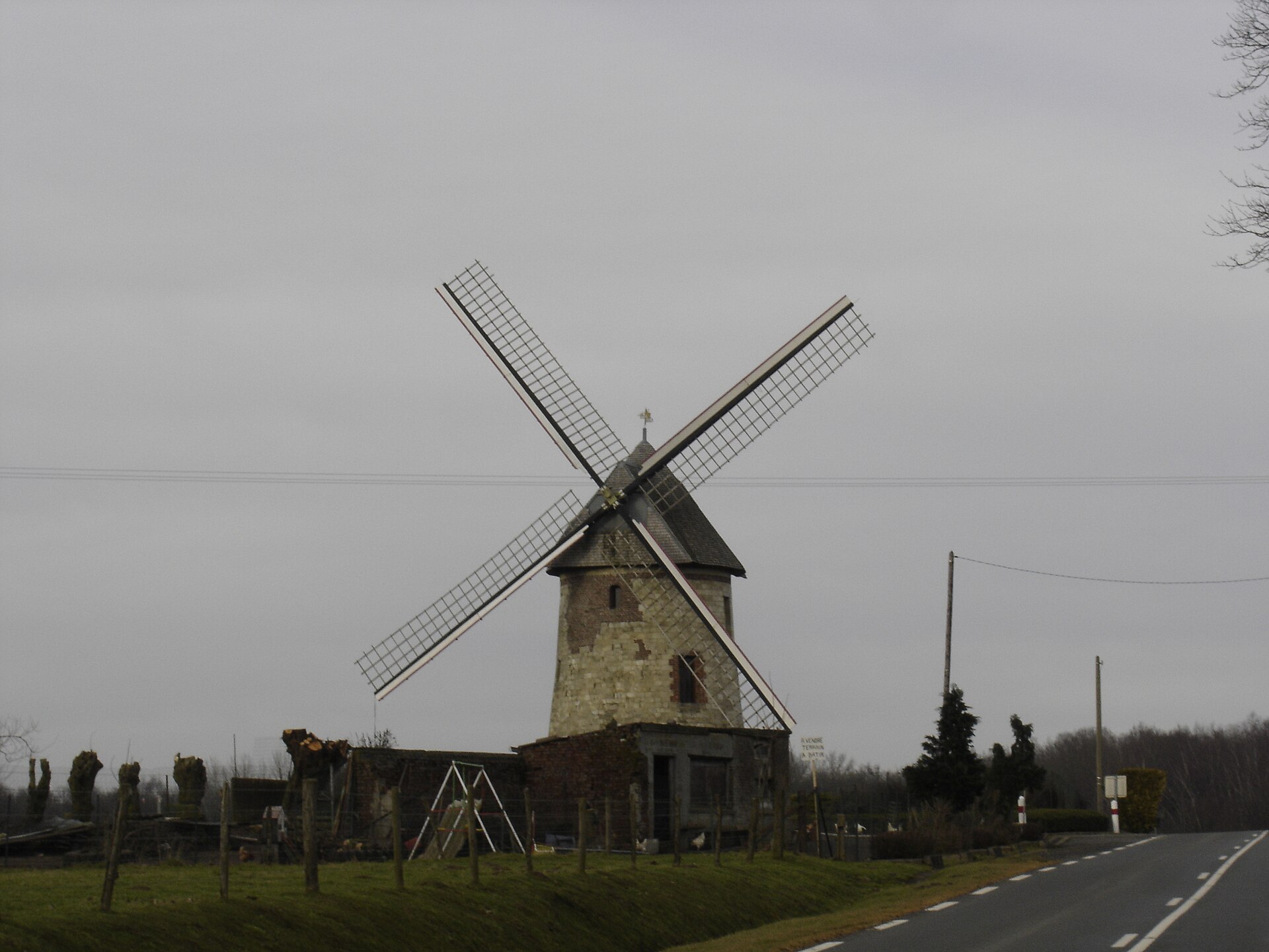
Moulin Brunet
Walincourt-Selvigny
Moulin Brunet is a stone windmill standing at the edge of Walincourt-Selvigny, a small village in the Nord department of France, right on the departmental road D960 heading toward Guise. Its conical brick-and-stone tower has watched over the fields of the Cambrésis countryside for centuries, surviving war, decades of neglect, and an eventual community-led rescue. Why is it called Moulin Brunet? The name has nothing to do with color or setting — it comes from the mill's last working miller, Arthur Brunet, who operated it until 1914. He was the final person to grind grain there before the outbreak of the First World War brought milling on the site to an abrupt halt. How old is the mill? Milling on this spot goes back much further than the building itself. A stone windmill in Walincourt was already recorded in 1293, showing the site served the local community since the Middle Ages. The structure visitors see today dates from later, built in the 15th century between 1453 and 1480. For centuries it functioned as a "moulin banal" — a mill owned by the Lord of Walincourt that local peasants were obligated to use, one of the standard feudal dues of the era. What happened after the French Revolution? The Revolution of 1789 reshuffled property rights across France, and Moulin Brunet followed the pattern. Once feudal privileges were abolished, the mill passed into private hands and ran as a commercial operation until 1914, providing a living to successive generations of millers before the war interrupted it for good. Why was the mill destroyed? During the First World War, German forces occupying the area turned the mill's tall masonry tower into an observation post, its height giving a clear view over the surrounding land. In 1916, the Germans destroyed the mill. That act triggered a long decline that lasted, largely unbroken, until 1991 — nearly three quarters of a century during which the windmill stood abandoned. How was Moulin Brunet saved? The turning point came in the early 1990s, when local residents decided this piece of heritage should not be allowed to disappear. An association of Friends of the Old Mill formed and set the restoration process in motion. The decisive step came in 2000, when the mill underwent full rehabilitation through a partnership between the commune of Walincourt-Selvigny, the Friends of the Mill association, and ARAM, a regional association dedicated to preserving windmills. Thanks to that joint effort, a building once headed for total ruin was brought back to a state worth visiting. What does the mill look like today? Moulin Brunet is a brick-and-stone tower mill with a tapering, conical shape — a classic form for traditional windmills in northern France. Its sails are of the Flemish type, echoing the region's close ties to neighboring Belgium and a shared milling tradition along the border. The mill sits just south of the village center, clearly visible from the D960 toward Guise. Why visit Moulin Brunet? For anyone curious about French rural history, this mill is tangible proof of how the local economy of the Cambrésis once worked. For generations, mills like this one determined whether bread — the staple of the local diet — made it to the table. Moulin Brunet stands as a witness to three distinct eras: the medieval feudal system, 19th-century private enterprise, and the upheaval of the First World War. Its restoration is also a reminder of how much a small, determined local association can achieve to save a disappearing landmark. Frequently asked questions Where is Moulin Brunet located? The mill stands in Walincourt-Selvigny, in the Nord department, on the D960 departmental road toward Guise, at the edge of the village. When was the mill built? The current structure dates from the 15th century, built between 1453 and 1480, though a windmill on this site was already recorded in 1293. Who was the last miller? Arthur Brunet, who operated the mill until 1914 and whose name the mill still carries today. Why was the mill destroyed? In 1916, during the First World War, German forces destroyed it after using its tower as an observation post. When was the mill restored? Restoration efforts began after 1991 thanks to the Friends of the Old Mill association, with a full rehabilitation completed in 2000 in partnership with the commune and ARAM.
-
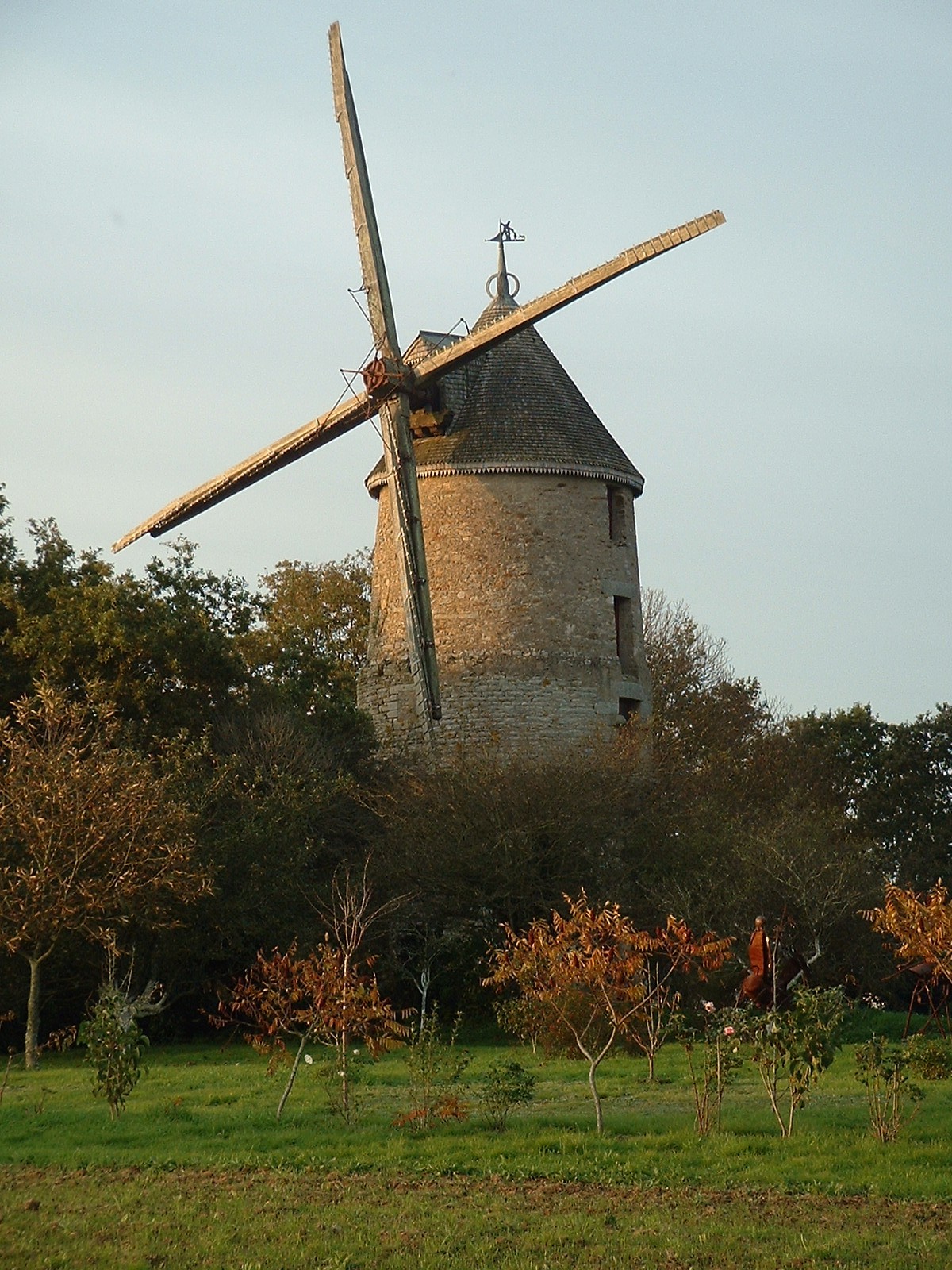
Moulin de la Pâquelais
Savenay
Moulin de la Pâquelais is a historic windmill standing in Savenay, in the Loire-Atlantique department of the Pays de la Loire region. It rises above the small hamlet of Le Vivier, on the edge of town, and has long served as a recognizable landmark in this stretch of historic Brittany. How old is the mill? The building carries the carved date 1545 together with the coat of arms of the Bessard du Parc family, lords of Pâquelais in the 16th century — this is generally taken as the construction date of the structure seen today. Some sources note that an earlier feudal mill may have stood on the same site, with origins possibly reaching back to the 14th century, though the mill visible now is the product of later rebuilding. What did the original mill look like? In its earliest form, Moulin de la Pâquelais belonged to the "petit-pied" type of tower mill: a single overhanging story carried on corbels, resting on a narrower base. This design, common among regional tower windmills, let the upper cap of the mill, together with its sails, turn to face the wind. What happened to the mill in the 20th century? A fire damaged the mill in 1903. It was rebuilt in 1911, and the reconstruction changed the building substantially: two additional stories were added and Berton-type sails were fitted. The enlarged upper section gave the mill unusually top-heavy proportions — rebuilt mills of this kind were sometimes nicknamed "grosse-tête" (big head) locally, precisely because the upper part became so much larger than the base supporting it. What equipment has survived inside? Following the 1911 rebuild, Moulin de la Pâquelais held two pairs of millstones, with the second pair installed on the upper floor. Inside, a sack hoist, a flour regulator and sifting mechanism (bluterie), and a gearing system with a cast-iron wheel and lantern pinion have all been preserved. The roof is covered in chestnut shingles and sits on a circular rail, allowing the entire cap and its Berton sails to rotate toward the wind. Can visitors go inside the mill? Moulin de la Pâquelais is privately owned. Available information indicates it remains in working mechanical condition but is not regularly opened to the public. Travelers can stop nearby and view the building from outside, which is enough to take in its distinctive, tall silhouette from the road running through Le Vivier. What protected status does the mill have? The mill was listed on the Inventory of Historic Monuments (Inventaire des Monuments Historiques) by a decree dated 22 August 1996. The listing covers both the structure itself and the surviving milling mechanism, underlining its value as an example of regional industrial and rural architecture. Why is it worth a stop on a trip through the region? Savenay sits between the Loire estuary and the Guérande peninsula, surrounded by the fields, hedgerows, and scattered hilltop windmills typical of Loire-Atlantique. With its unusual "top-heavy" silhouette, Moulin de la Pâquelais is a worthwhile stop for anyone interested in the history of wind milling and rural architecture in the region, and its proximity to central Savenay makes it easy to fold into a short walk or bike ride around the area. Frequently asked questions Where exactly is Moulin de la Pâquelais located? The mill stands in the hamlet of Le Vivier, within the municipality of Savenay, in the Loire-Atlantique department. What year does the mill date from? The building bears the carved date 1545, though an earlier feudal mill may have occupied the same site. Does the mill still have its sails and milling mechanism? Yes — following the 1911 rebuild, it retains Berton-type sails, two pairs of millstones, a sack hoist, and the regulator and sifting system. Can you go inside the mill? The mill is privately owned and not regularly open to visitors, but it can be freely viewed from outside.
-
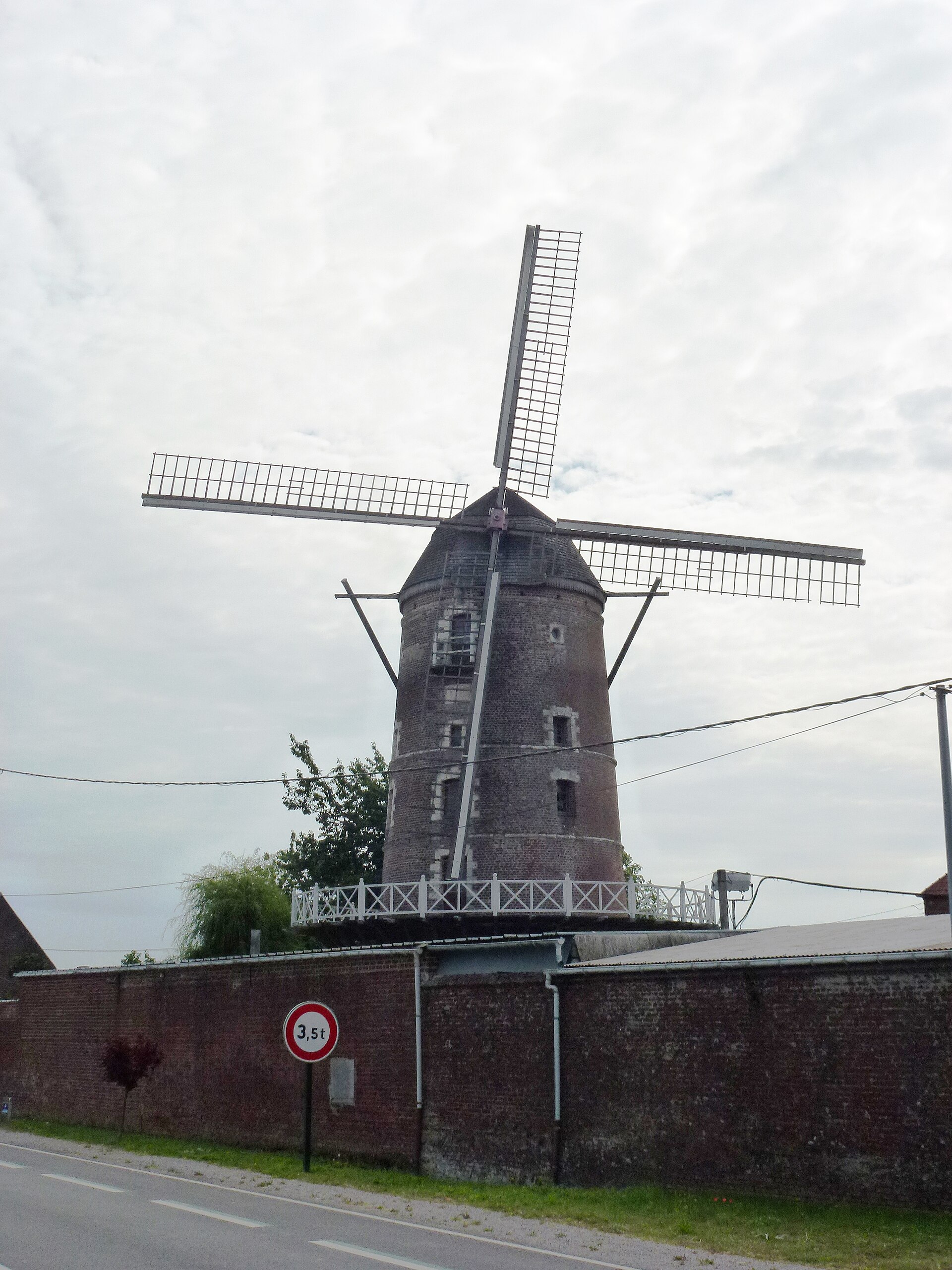
Moulin à vent de Saint-Martin-au-Laërt
Saint-Martin-lez-Tatinghem
Moulin à vent de Saint-Martin-au-Laërt is a historic windmill standing on the edge of Saint-Omer, within the commune of Saint-Martin-lez-Tatinghem, in the Pas-de-Calais department. The tower is clearly visible from the nearby ring road (the Rocade), making it one of the recognizable landmarks along the route around Saint-Omer. The mill's name refers to the historic Saint-Martin-au-Laërt parish it was traditionally associated with, even though it sits administratively within Saint-Martin-lez-Tatinghem. When was the windmill built? The construction date is confirmed by an inscription carved into a stone inside the tower: "CES MOULEN FE L'AN MEIL 1801" — the year 1801. The mill was raised by Jean-François Speneux and M.-C. Hericourt. Speneux was active around the turn of the 19th century acquiring national properties put up for sale after the French Revolution, including the Saint-Bertin mill in Saint-Omer itself. What happened to it over the following decades? For decades the windmill ground flour, but production eventually became unprofitable. By around 1900 the structure was already a ruin — postcards from that era show broken sails and a neglected tower. Over the following decades the mill stood abandoned, losing more of its structure with each passing year. How was it restored? The mill's revival began in 1978, when Mr. and Mrs. Huart took on its rehabilitation. The work, supported by ARAM — an association of windmill enthusiasts — took five years to complete. The restored windmill was inaugurated on 18 September 1983. The effort proved lasting: in 2001 the mill was listed as a historic monument (monument historique) in France, confirming its value as a witness to the region's industrial past. What does the structure look like? The mill tower stands 14.50 metres tall, or 18.50 metres including its cap. It was built from red brick decorated with three rows of white dressed stone, creating a contrasting pattern visible from a distance. The walls are substantial — 1.20 metres thick at the base, tapering to 0.60 metres near the top, a typical feature of traditional tower mills in the region. The sails span 21.70 metres and were built from iron and iroko wood — a combination of a durable metal frame with moisture-resistant tropical timber that was common in 20th-century mill restorations. Why is it worth visiting? The Moulin à vent de Saint-Martin-au-Laërt is a rare surviving example of a masonry tower mill that went through a long period of neglect before being restored to its original form through a private initiative. The Saint-Omer area, known for its Marais Audomarois wetlands and rich industrial heritage, has few remaining mill towers of this scale — this one offers a glimpse of what 19th-century flour-milling infrastructure looked like in northern France before industrial mills took over. Frequently asked questions Which commune is the windmill actually in? Although its name refers to Saint-Martin-au-Laërt, the windmill is administratively located in the commune of Saint-Martin-lez-Tatinghem, right next to Saint-Omer. Is the mill still operational? After its 1978–1983 restoration, the windmill functions as a heritage site open to visitors rather than an active flour-producing mill. When was it listed as a historic monument? It was added to the monument historique list — France's register of protected historic buildings — in 2001. Can it be seen from the road? Yes, the tower is clearly visible from the nearby ring road (the Rocade), making it an easy landmark to spot near Saint-Omer.
-
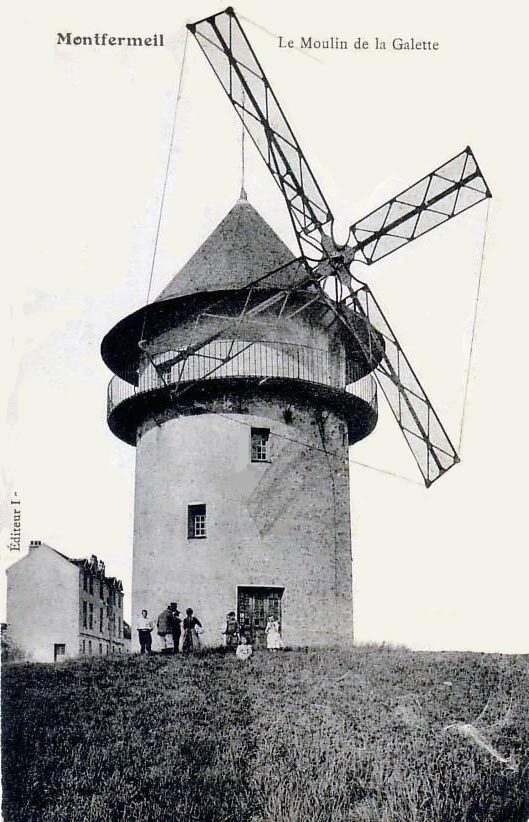
Sempin Windmill
Montfermeil
Sempin Windmill, also known as Moulin de Montfermeil, stands in Montfermeil, in the Seine-Saint-Denis department, roughly 20 km east of Paris. It is the last surviving windmill in the entire department, a rare remnant of an era when such structures dotted the landscape around the French capital. Where exactly is Sempin Windmill located? Montfermeil sits in the eastern part of the Paris metropolitan area, within the Seine-Saint-Denis department. The windmill's coordinates are 48.89625 N, 2.58532 E, placing it about 20 kilometers from central Paris. This puts it firmly within easy reach of the capital while still occupying a corner of the region that has kept traces of its pre-urban, rural past. Why is this windmill significant? Sempin Windmill holds a distinctive place in local heritage: it is described as the last windmill still standing anywhere in Seine-Saint-Denis. The department, now one of the most densely built and populated areas surrounding Paris, was once home to numerous windmills that served nearby communities for grinding grain. As the Paris agglomeration expanded and industrialized, these structures gradually disappeared from the landscape one by one. Sempin is the sole survivor of that network, making it a rare physical link to a rural chapter of the region's history that has otherwise been almost entirely erased. The alternative name, Moulin de Montfermeil, ties the windmill directly to the town where it stands. Long before Montfermeil became part of the sprawling Paris metropolitan area, the mill was tied to the daily life and identity of the local community it served. How can visitors experience Sempin Windmill? Thanks to its location in Montfermeil, the windmill is an easy addition to a day out beyond central Paris — the roughly 20 km distance means it can be reached without a major detour, and it pairs naturally with a broader exploration of the eastern Île-de-France region. Its main appeal lies in its historical and symbolic value: as the last windmill left standing in Seine-Saint-Denis, it offers a tangible, physical reminder of what the landscape looked like before the area was transformed into a dense, built-up part of the Paris conurbation. For travelers interested in lesser-known but historically meaningful sites around Paris, Sempin Windmill provides a useful anchor point for understanding the region's agricultural past. It appeals both to visitors with an interest in local history and to those simply looking for quieter, less touristy corners just outside the French capital. Frequently asked questions Where exactly is Sempin Windmill located? The windmill is in Montfermeil, in the Seine-Saint-Denis department, at coordinates 48.89625 N, 2.58532 E — about 20 km east of central Paris. What makes Sempin Windmill different from other windmills in the Paris region? It is the only windmill still standing in the entire Seine-Saint-Denis department. Every other windmill that once existed in the area has disappeared over time. Where does the name Sempin Windmill come from? The site is also known by its French name, Moulin de Montfermeil, referring directly to the town of Montfermeil in Seine-Saint-Denis where it is located. Is Sempin Windmill easy to visit from Paris? Yes. At around 20 km from central Paris, Montfermeil and its windmill are within reach of a short trip outside the city, easily combined with visits to other sites in the eastern part of the Île-de-France region.
-
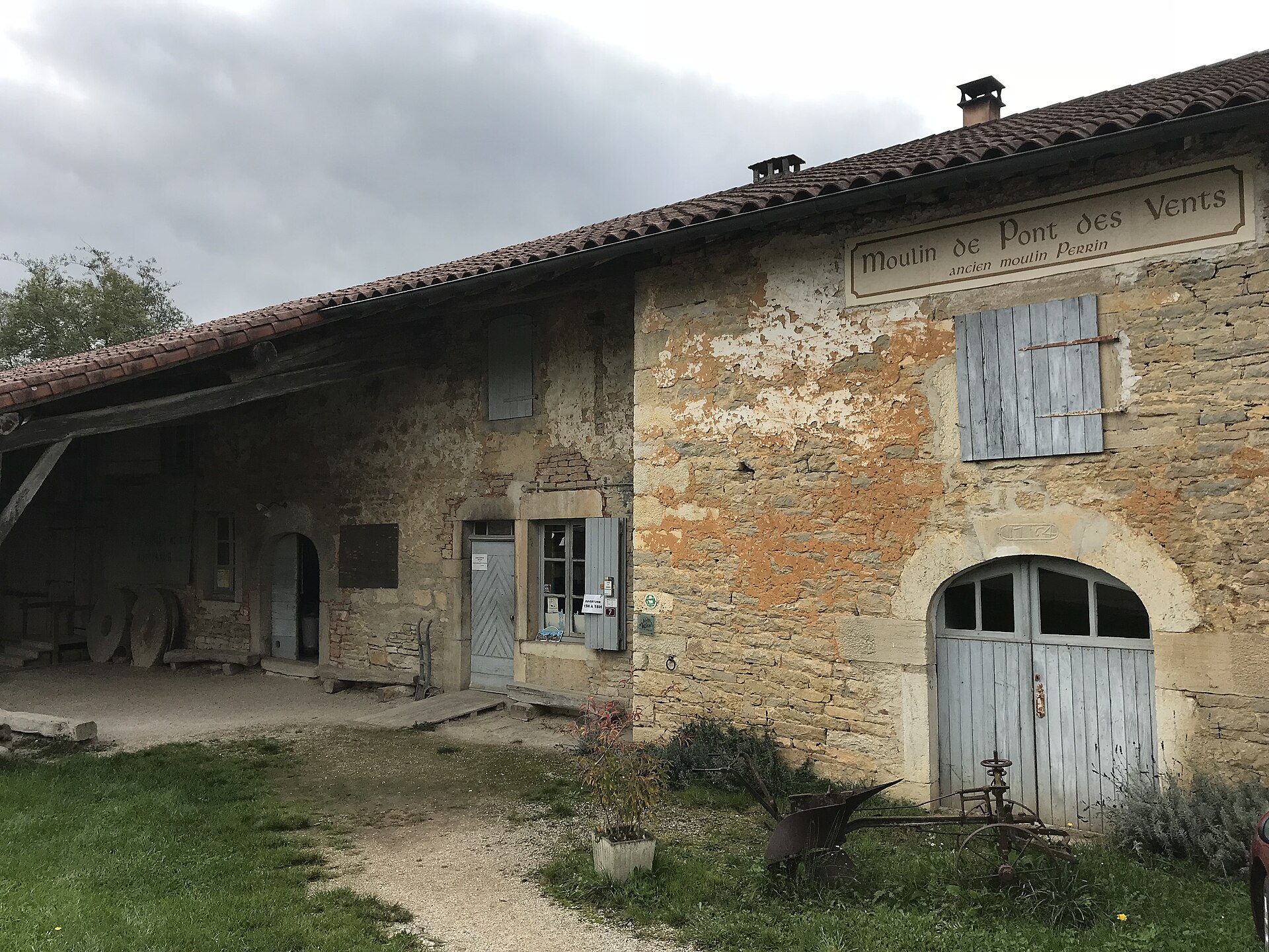
Moulin de Pont des Vents
Montfleur
Moulin de Pont des Vents is a historic water mill in Montfleur, a small commune in the Jura department of eastern France. It sits on the banks of the Suran river, right next to the bridge that gave it its name, along the route of the old Roman road linking Lyon and Besançon. Today it operates as a working ecomuseum, where visitors can watch the milling machinery in action and buy bread baked on site. How old is the mill? The earliest written record of the mill dates back to 1486, a date also carved into the building's door. In its earliest form, the mill ran on wooden wheels turning simple stone grinders, producing flour for nearby farms and households. Why is the mill linked to gaudes flour? Maize was introduced to the Bresse and Jura regions in the 1640s, and local millers quickly adapted to grind it. Roasted maize kernels were milled into a flour used to prepare gaudes, a traditional porridge-like dish still associated with the region today. Moulin de Pont des Vents was one of the mills producing this flour, and that role made it an important part of the local rural economy for centuries. What changed in the 18th and 19th centuries? In the 18th century, the original wooden wheels were replaced by two hydraulic turbines, boosting the mill's output considerably. By 1822, it had become the largest and most important of the three mills operating in Montfleur at the time. Production of gaudes flour and animal feed flour continued without interruption until 1975, when the mill's industrial activity finally ceased. How did the mill become a museum? After the last working miller died in 1995, his wife Léonie donated the building to the commune of Montfleur so it could be preserved as a museum. A team of local volunteers spent three years cleaning the turbines and cataloguing the tools and equipment left inside. Following a six-month restoration, the mill reopened to the public as an ecomuseum in July 1998. The building is now listed among France's protected historic monuments. What can visitors see today? Visitors can watch the mill's original mechanism at work — the wheels, gearing, and stone grinders, all driven by water — as it processes grain into wheat flour and the traditional gaudes flour, still made using the old methods. The on-site shop bakes bread and pastries in a wood-fired oven, available for visitors to buy. The mill also runs bread-making workshops for children, school groups, families, and adults, making it a popular stop for educational visits in the region. Where exactly is the mill located? The address is 7 route du Suran, 39320 Montfleur. It sits in a quiet rural stretch of the Jura countryside, close enough to the river that a visit pairs easily with a short walk along the banks. Frequently asked questions Is the mill still operating? Yes, as a working ecomuseum — the water-driven wheels and stone grinders still mill wheat and gaudes flour, though production today is craft-scale and demonstrative rather than industrial. What is gaudes flour? It's a flour made from roasted maize, used since the 1640s to prepare gaudes, a traditional porridge of the Bresse and Jura regions. Moulin de Pont des Vents produced it continuously until 1975. Can you buy bread on site? Yes, the mill's shop sells bread and pastries baked on the premises in a wood-fired oven. Does the mill offer activities for children? Yes, bread-making workshops are available for children, school groups, families, and adults, making it one of the site's main educational draws.
Earn badges for the places you visit
Download NextOnTrip, discover new places and check off your trails.