Monuments in France
A guide to 1358 Monuments in France — with descriptions, photos and traveler visits from the NextOnTrip community. Locations spread across 956 cities and towns. Most visited by the community: Château de la Bretonnière, Château de Caumont, Château du Petit-Arnsberg.
-
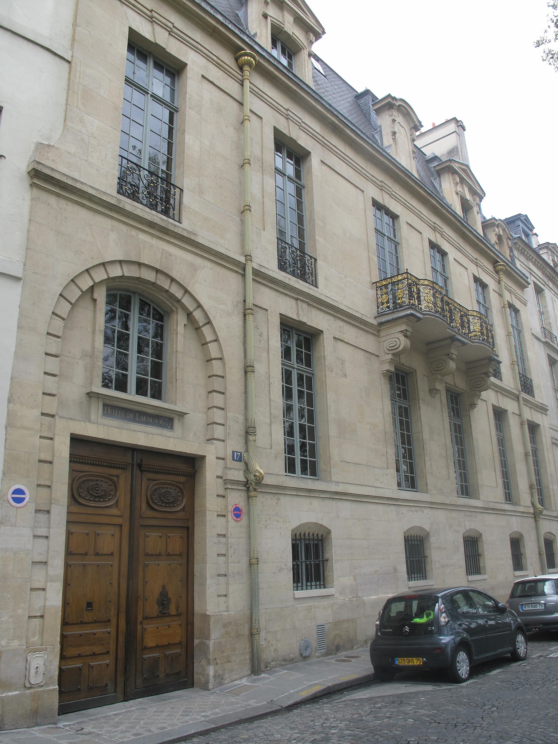
Hôtel de Lauzun
Paryż
Hôtel de Lauzun ranks among the most remarkable private mansions of old Paris, sitting quietly on the Île Saint-Louis. Built in the 17th century along the Quai d'Anjou, this stone townhouse looks unassuming from the riverbank, yet inside it hides one of the last near-complete interiors from the reign of Louis XIV anywhere in the city. Carved woodwork, painted ceilings, gilded ornament and mirrored panels have survived largely untouched since the age of the Sun King, making the house a rare time capsule of French decorative art. Why this address matters on a walk through Île Saint-Louis Visitors strolling the quays of the island often pass the building without realizing what stands behind its restrained facade. Unlike the grander palaces of the Marais across the river, this mansion keeps a low profile on the outside — a deliberate choice typical of 17th-century Parisian townhouses, where wealth was displayed indoors rather than to the street. Stepping past the entrance mentally, art and architecture enthusiasts recognize it as one of the few surviving examples of a Grand Siècle interior that escaped later redecoration. The literary and bohemian chapter During the 19th century the house became a gathering point for Paris's literary and artistic circles. Charles Baudelaire lived here for a time, and its salons hosted the notorious Club des Hashischins, where writers and artists met to experiment with altered states of mind. That colorful episode cemented the mansion's place in the folklore of Parisian bohemia, adding a layer of literary intrigue to its aristocratic origins. How to actually see it The building remains largely private and is not open for casual daily visits. Access to the interior is occasionally granted during the national Journées du Patrimoine in September, or through special cultural events organized by the city. Travelers planning a trip around that period should check local listings — it is one of the few chances to view the historic rooms in person rather than admiring the mansion only from outside. What to pair it with nearby Île Saint-Louis is small enough to circle on foot in under an hour. A visit to the mansion pairs well with a walk along Quai de Bourbon and Quai d'Orléans, both offering views across the water toward Notre-Dame on the neighboring Île de la Cité. The island is also known for its quiet cafés and a famous ice cream shop that draws both locals and visitors year-round. Frequently asked questions Where exactly is Hôtel de Lauzun located? It stands on the Quai d'Anjou on Île Saint-Louis, in the 4th arrondissement of Paris, right along the Seine. Can visitors go inside? Not on a regular basis — the building serves non-public functions today. Interior access is occasionally offered during heritage days in September or select cultural events. Why is the mansion historically significant? It preserves an almost complete set of 17th-century interiors from the era of Louis XIV, a rarity in Paris, and it later became linked to Baudelaire and the city's 19th-century artistic bohemia. How much time should I set aside for the area? Passing the facade takes only minutes, but allow an hour or two to walk the whole island, including its quays and nearby cafés.
-
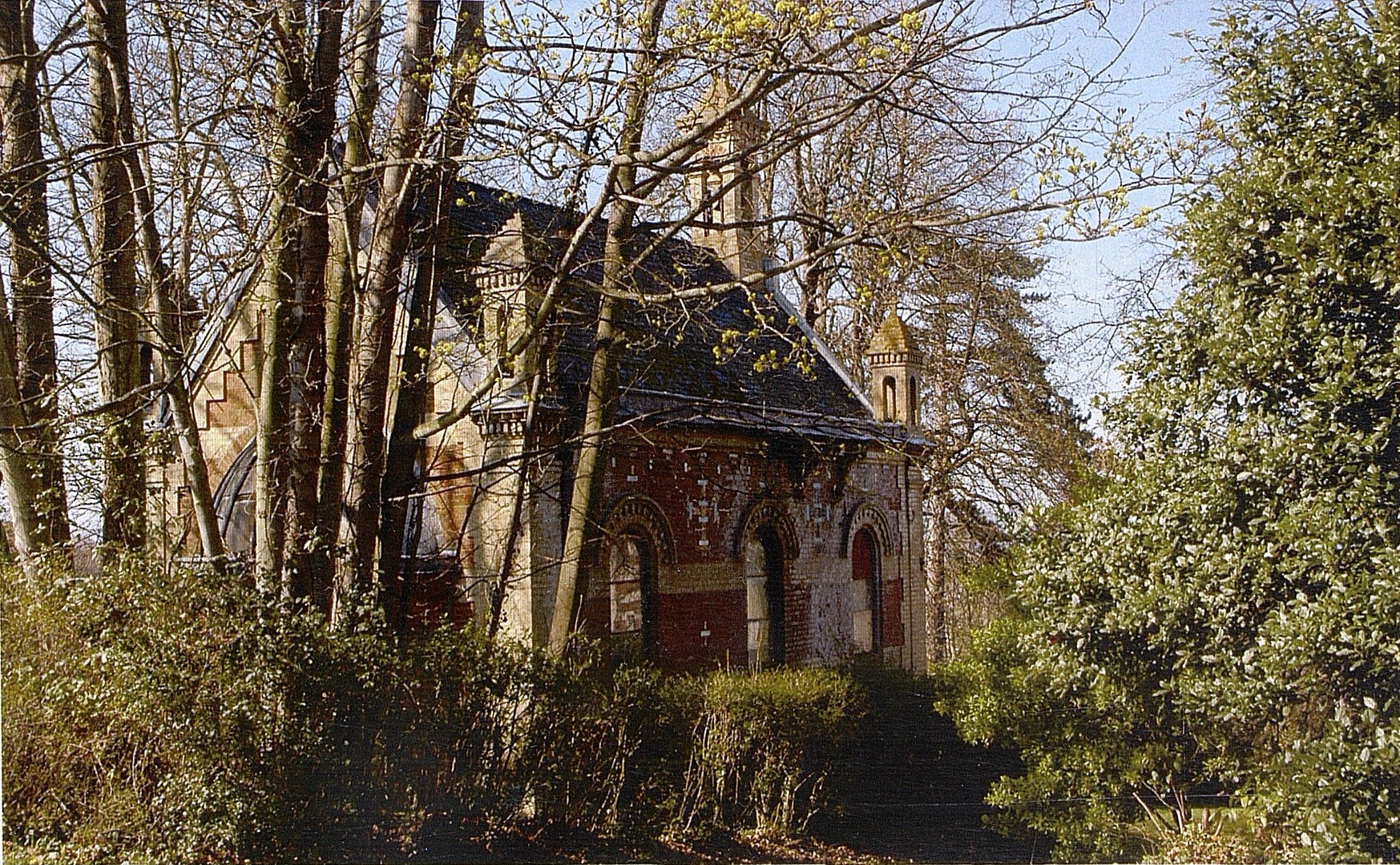
Manoir de Clairefontaine
Tourgéville
The Manoir de Clairefontaine sits just outside Tourgéville, a quiet commune in Calvados a short drive from Deauville and Trouville-sur-Mer. Built in the last quarter of the 19th century, the manor follows the eclectic taste common to Normandy country houses from an era when the Côte Fleurie was becoming a fashionable summer retreat for Parisian high society. What draws most attention today, though, is not the main house itself but the chapel standing beside it. What makes the chapel special? The chapel was added to the manor in 1890, designed by Gustave Clausse, an architect and art historian with a documented interest in historicist revival styles. Built in a Neo-Renaissance idiom, it is regarded as an outstanding example of that decorative language at the close of the 19th century. At the center of its façade sits a terracotta medallion of the Madonna and Child, produced in a Florentine workshop tied to the glazed-relief tradition associated with Luca della Robbia — a technique originally developed for Renaissance churches in Italy and later echoed in this Norman setting. Inside, the decoration continues with stained glass by Vantillard, terracotta bas-reliefs signed by Devers, and mosaics by Faccina, a combination of crafts rarely gathered inside one small rural chapel. Is the site protected as a monument? Yes, at least in part. The chapel of the Manoir de Clairefontaine was listed on France's register of historic monuments on 19 September 2005. The protection applies specifically to the chapel; the manor house itself remains private property and is not open to visitors. A visit is best approached as a look at the exterior and grounds from the road rather than an indoor tour. How do you get there, and where should you stay? Tourgéville borders Deauville and Trouville-sur-Mer directly, the two best-known resort towns of the Côte Fleurie in Calvados. Both make a practical base for reaching the manor. The surrounding countryside is classic Normandy — green pastures, apple-tree lanes, and timber-framed villas reminiscent of the belle époque seafront promenades nearby. Tourgéville itself keeps a rural, low-key character, a useful contrast if you want a calmer place to sleep after a day in busier Deauville. What else is worth seeing nearby? A trip to Tourgéville pairs naturally with time in Deauville, famous for its film festival and boardwalk, and in Trouville-sur-Mer, known for its historic fish market. The wider Côte Fleurie is dotted with manors and villas raised at the turn of the 20th century by Parisian elites escaping the city, and the Manoir de Clairefontaine fits squarely into that architectural landscape. Frequently Asked Questions Can visitors go inside the Manoir de Clairefontaine? No. The house is private property. Historic-monument protection covers the chapel, and there is no general public access to the interiors. Who designed the chapel? Gustave Clausse, a French architect and art historian, designed the chapel in 1890. Why is the chapel considered exceptional? It combines a terracotta Madonna-and-Child medallion in the della Robbia tradition with stained glass, bas-reliefs, and mosaics — an unusually rich decorative program for such a small chapel. How far is it from Deauville? Tourgéville borders Deauville directly, so the resort's center is normally only a few minutes away by car.
-
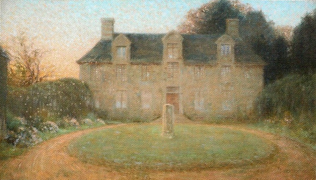
Manoir de la Bérardière
Saint-Bômer-les-Forges
Manoir de la Bérardière is a stately country house standing in the commune of Saint-Bômer-les-Forges, in the Orne department of Normandy. Where does the manor sit within the landscape? The estate is set along the old road linking Tinchebray to Domfront, within the Saint-Bômer-les-Forges countryside. This is classic bocage territory — a patchwork of hedgerows, pasture and scattered farmsteads — and for centuries a manor of this kind served as a local hub of authority and rural economy rather than a purely decorative residence. How far back does the estate's story go? Records point to a fief already existing here by the close of the 14th century. A defining moment came in 1461, when the marriage of the squire Jehan Roussel to Augustine Hallé de Jumilly, then lady of La Bérardière, brought the property into the Roussel family. That family, part of the noblesse de robe (nobility tied to legal and administrative office rather than the sword), held the estate for several centuries before it passed to the Bidard de la Thérière family, and later, in the 20th century, to the Roulleaux-Dugage family. What survives from each building phase? Nothing remains of the original medieval fortified dwelling. What does survive is the so-called Archives pavilion, a Renaissance-style structure dating from the late 15th century, which hints at the earlier fortified layout and was later converted into a library during the 18th century. The building visitors recognize today as the manor proper is considerably younger: it was raised in 1695–1697 under the direction of Jacques de Roussel, a lawyer by profession. It takes the form of a large, rectangular granite block in a restrained classical style, arranged around a courtyard of honour and framed by two entrance pavilions. At the centre of the north facade stands a faceted turret, while the dormer windows are crowned with carved pediments. This architectural interest has earned the manor partial listing as a monument historique, under reference PA00110907. What role did the manor play during turbulent chapters of French history? The estate's history is not limited to domestic life. During the French Revolution, the Orne region became a theatre of Norman chouannerie, the royalist counter-insurgency against revolutionary authority, and La Bérardière had its part in that struggle. Between December 1799 and January 1800, Michelot Moulin billeted the first battalion of the Saint-Jean-des-Bois legion here, some 700 men strong. In the same period, Brigadier General Guidal, commanding forces across Orne, met with the Baron of Commarque at the estate while the latter was setting up his headquarters there. Nearly a century and a half later, in June 1944, the château was made available as a makeshift hospital in the wake of heavy Allied bombing of nearby Flers. Can travelers actually visit today? The manor remains a private residence rather than a museum with fixed opening hours, so entry to the building itself is by prior appointment only. The surrounding park, however, is open to the public every Sunday without any need to book ahead, making it an accessible stop for anyone exploring the Orne countryside. Frequently asked questions When was the current manor building constructed? The main classical-style block dates from 1695–1697, built under Jacques de Roussel. The only older surviving structure is the late-15th-century Renaissance Archives pavilion, a remnant of the earlier fortified estate. Is Manoir de la Bérardière a protected monument? Yes. It holds partial protection as a monument historique under the reference PA00110907, recognizing its architectural and historical value. What historical events is the estate linked to? It served as a base during the Norman chouannerie around 1799–1800, and in June 1944 it functioned as an emergency hospital following Allied bombing raids on Flers. Do visitors need to book ahead? The building itself requires an appointment to visit. The park surrounding the manor, though, is freely open to the public on Sundays without reservation.
-
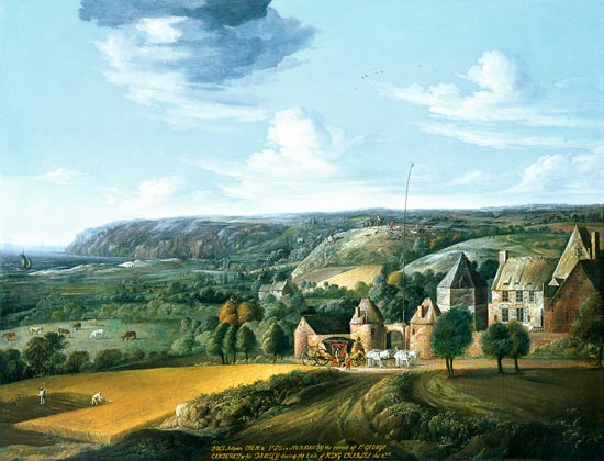
Manoir de Potrel
Dragey-Ronthon
Manoir de Potrel stands in Dragey-Ronthon, a quiet commune on the Manche coastline overlooking the Bay of Mont-Saint-Michel. Tucked half a kilometre west of the village of Dragey, this fortified manor packs several centuries of Norman and even transatlantic history into a modest cluster of stone buildings. How old is the manor and what remains of its original structure? The oldest parts of the estate date back to the 15th and 16th centuries, when it functioned as a fortified farmstead. Two surviving features hint at that defensive past: a courtyard gateway flanked by a pair of rounded turrets pierced with narrow loophole slits, and a separate dovecote built on an octagonal plan. Fortified farms of this kind were common among wealthy Norman landowners who needed to protect livestock and stores during unsettled times. Why is a manor in rural Normandy linked to the founding of North Carolina? The estate's most notable owner arrived in the 17th century: George de Carteret (1609-1679), bailiff of Jersey and a vice-admiral in the Royal Navy, bought Potrel while living in exile in France. Carteret later became one of the eight Lords Proprietor granted the American colonies of Carolina and New Jersey by the English Crown — a detail that gives this quiet Norman manor an unexpected place in colonial American history. The grander, more comfortable wing of the manor was built or refitted under his ownership, including an upstairs reception hall finished with wood panelling and painted ceiling beams dated to the third quarter of the 17th century. What legal protection does the building have? Since November 27, 1933, the fireplaces, panelling, and ceiling of that upstairs hall have been listed as a monument historique. The protection covers this specific interior rather than the whole property, and the manor itself remains privately owned. Is it possible to visit the interior? No public opening hours are documented for Manoir de Potrel, and as private property it does not appear to offer regular tours of the interior. Visitors passing along the road toward Dragey can still see the fortified gateway and dovecote from outside, which makes the site a worthwhile stop for anyone tracing Normandy's smaller-scale defensive architecture rather than its famous castles. What else is worth seeing around Dragey-Ronthon? The commune sits on a sandy beach stretching nearly 6 kilometres along the Bay of Mont-Saint-Michel; from its southern end, the abbey itself is visible on clear days, though swimming is really only practical around high tide. Two other historic buildings round out the local heritage trail: the 11th-century church of Saint-Médard, also known as Saint-Marc, and the 12th-century church of Saint-Nicolas in the Ronthon section of the commune. Away from the coast, Dragey-Ronthon keeps a distinctly rural feel, with dairy farms and a modern training centre for racehorses that opened in 2014. Drivers based near Mont-Saint-Michel can reach the manor in about 45 minutes, since the two sites sit roughly 36 kilometres apart — an easy pairing for a single day trip along the bay. Frequently asked questions Can visitors go inside Manoir de Potrel? Not currently — it is private property with no confirmed public tours. The gateway towers and dovecote can be viewed from the public road. Who was the manor's most historically significant owner? George de Carteret, a Royal Navy vice-admiral who bought the estate in the 17th century and went on to co-found the American colonies of Carolina and New Jersey. What part of the manor is officially protected? Since 1933, the fireplaces, panelling, and ceiling of the first-floor reception hall have held listed status as a monument historique, distinct from the rest of the privately owned property. How far is Manoir de Potrel from Mont-Saint-Michel? Around 36 kilometres, roughly a 45-minute drive, making it a convenient stop for travellers exploring the bay area.
-
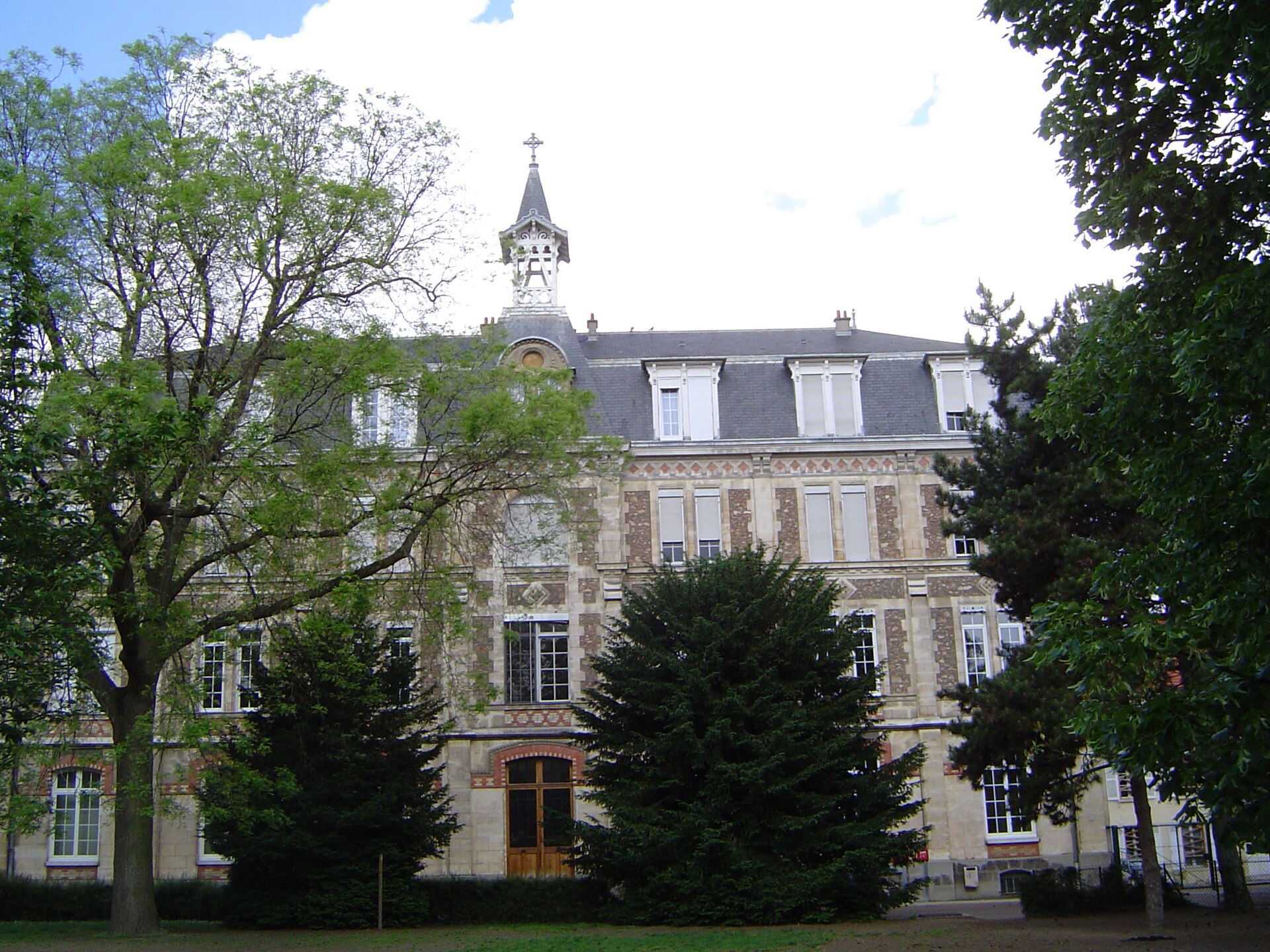
Maison Saint-Jean, Antony
Antony
Maison Saint-Jean sits in Antony, a town just south of Paris in the Hauts-de-Seine department, and its walls have seen three very different lives - aristocratic home, seminary, and now retirement house. What kind of building is this? At its core is an early 19th-century manor, designed by architect Georges Auguste Ranchon for Louis-Sauveur Chénier, younger brother of the poet André Chénier. For decades it served simply as a countryside residence for a well-off Parisian family. Who owned the estate after the Chénier family? In 1820 the property passed to Jean-Charles Persil, a lawyer who later became a minister under King Louis-Philippe. Persil lived out his final years on the estate and died there in 1870, tying the house briefly to national politics rather than just local history. When did religious life begin here? Ownership changed again in 1880, when four Paris-based priests bought the estate. They expanded it substantially: in 1898 a new brick-and-stone building went up alongside the older manor, intended to train future members of the Marianist order. The project, however, was short-lived. Anticlerical legislation in France at the turn of the century pushed religious congregations out of the country, and by 1903 the Marianists had relocated their seminary to Fribourg, Switzerland. What happened to the property in the meantime? With the Marianists gone, the buildings were repurposed as a private boarding house, a role they kept for roughly six decades. Only in 1965 did the Marianist order buy back its former home in Antony. That return marked the moment the estate took on the name it carries today, Maison Saint-Jean. Three years later, in 1968, the Institution Sainte-Marie d'Antony was founded on the same grounds, giving the site a lasting educational role. Is the building protected as a heritage site? Yes. Since 21 November 1973, the facades and roofs of the original manor have been listed as a monument historique, France's official heritage protection status, recognizing the architectural value of the earliest part of the complex. Can visitors go inside today? Not really - the site currently functions as a retirement residence for Marianist members and sits within an active educational campus, so it is not set up as a public attraction. Its interest is mostly historical rather than touristic. Frequently Asked Questions Where exactly is Maison Saint-Jean located? It stands in Antony, in the Hauts-de-Seine department immediately south of Paris, at roughly 48.75°N, 2.30°E. Was this originally a private home or a religious building? Both, at different times - first a private manor for the Chénier and Persil families, later a seminary and retirement house for the Marianist order. Why did the Marianists leave Antony in the early 1900s? French anticlerical laws restricted religious congregations at the time, prompting the Marianists to move their seminary to Fribourg, Switzerland, in 1903. Can tourists visit the interior? Access is limited since the building now serves as a religious retirement home and part of a working school campus; visitors can generally only view the exterior from nearby.
-
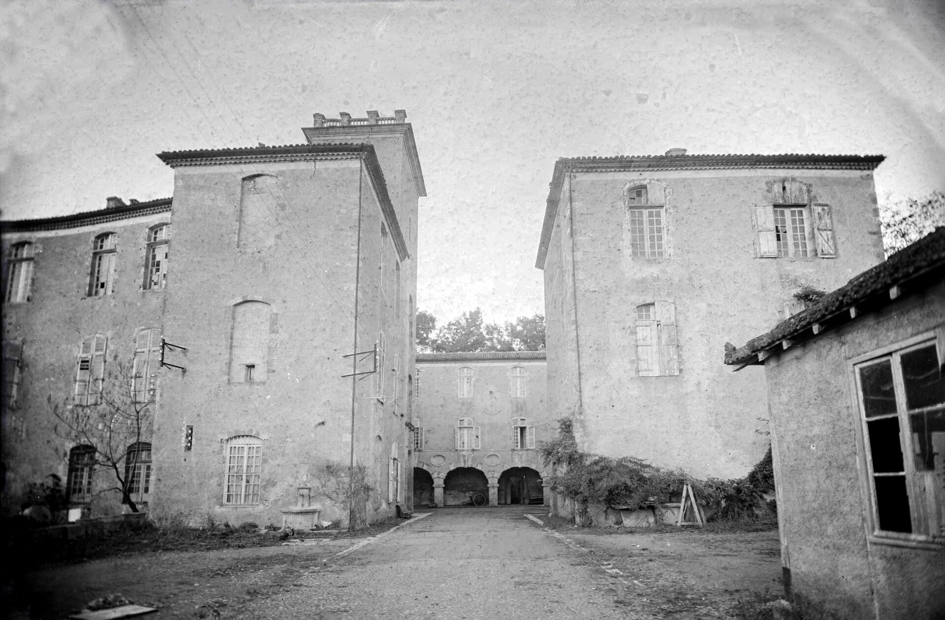
castle of Mazères
Barran
The Château de Mazères overlooks the Baïse valley in the commune of Barran, in the Gers department, and was for centuries a country residence of the archbishops of Auch. What stood here before the château we see today Long before any stone walls rose on this spot, the ground had already been settled in Gallo-Roman times. An earlier stronghold on the same site is documented as far back as the year 1000, meaning the property carries roughly a thousand years of continuous building history behind its current form. Church ownership took shape gradually: starting in the 11th century the archbishopric of Auch began accumulating nearby land through donations, and by 1080 vineyards belonging to the Mazères estate were among them. The decisive gift came in 1090, when Pierre de Vic handed over the whole domain upon becoming a canon of Auch Cathedral. How successive archbishops shaped the château Because Mazères functioned as an archiepiscopal residence, its appearance changed with the tastes and ambitions of the men who held that office. Jean de la Trémoille, archbishop from 1490 to 1507, added a new south-facing gateway and dug the moat that still surrounds the building. A far more sweeping transformation came under Dominique de Vic, archbishop from 1625 to 1661, who enlarged the château substantially, built new outbuildings on the south side and pavilions to the east, and reworked much of the interior. A final wave of refinement arrived with Jean-François de Montillet, archbishop from 1742 to 1776, who had large windows cut into the façades and commissioned finer interior décor. From revolutionary sale to modern restoration The French Revolution ended the château's ecclesiastical ownership: it was confiscated and sold as national property. What followed was a long stretch of changing hands, with owners who often had little interest in upkeep, and the building gradually fell into disrepair. One striking chapter came during the First World War, between 1914 and 1918, when the château was pressed into service as a military hospital for wounded and sick soldiers. Decline continued for decades afterward, until 1981, when the property was bought by Monsieur and Madame de Margerie, who launched a major restoration campaign to bring the long-neglected building back to life. Frequently asked questions Where exactly is the Château de Mazères? It stands in the commune of Barran, in the Gers department, above the Baïse valley, on ground already occupied in Gallo-Roman times. Who is responsible for the château's current appearance? A succession of archbishops of Auch shaped it over centuries, most notably Jean de la Trémoille, who added the moat and south gateway, and Dominique de Vic, who greatly enlarged the building and remodeled its interior in the 17th century. Did the château ever serve a non-residential purpose? Yes — during the First World War, from 1914 to 1918, it operated as a military hospital treating wounded and sick soldiers. When was the château restored? After decades of neglect and several changes of ownership following the Revolution, a thorough restoration was undertaken by Monsieur and Madame de Margerie, who acquired the property in 1981.
-
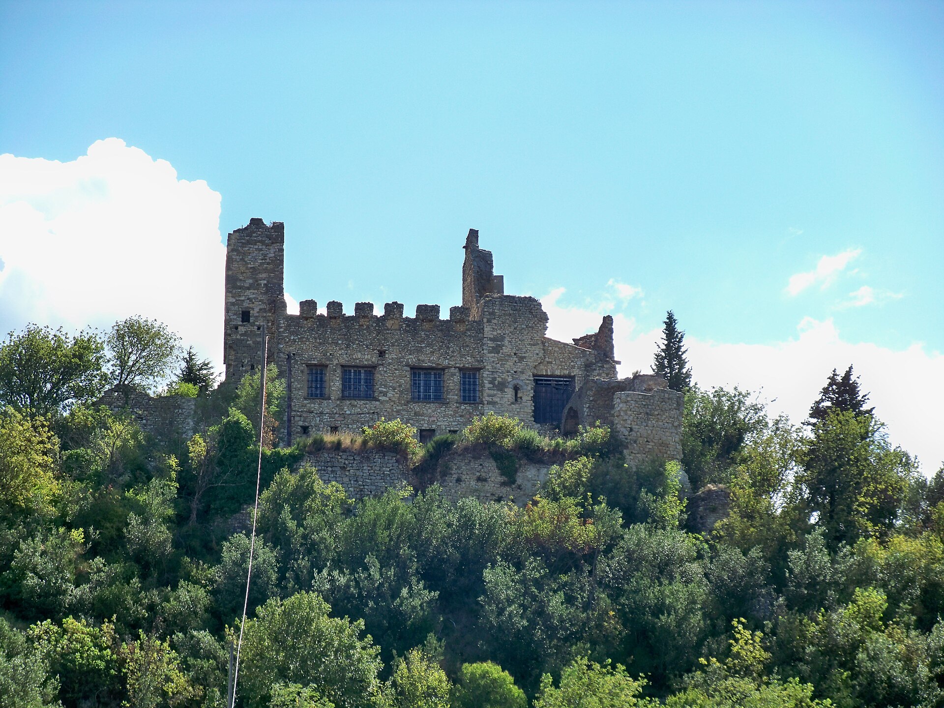
Château De Mondragon
Mondragon
Château de Mondragon sits on a hilltop above the village of Mondragon, in the Vaucluse department of Provence, on the stretch of the Rhône valley between Bollène and Orange. Its elevated position once allowed it to keep watch over both the river and the road running alongside it. How old is the château, really? Traces of fortification on this hill go back as far as the 10th century, but the structure visible today largely dates from the 12th century. Two towers from that period still stand, along with the remains of the crenellations that once topped four additional towers forming the castle's defensive ring. A key moment in its history came in 1114, when Emperor Conrad II granted Mondragon to the Archbishop of Arles, along with full judicial rights over the territory and the title of Prince of the Holy Empire. From then on the castle served first the local lords and later the archbishops themselves as a residence and seat of power. Why is so much of it in ruins? The castle didn't survive its centuries intact. It was destroyed once in 1217, and again in 1562, this time by Huguenot forces during the Wars of Religion. It has remained in that partially ruined state ever since — which is exactly how visitors see it today, standing watch over the village below. Can you actually go inside? No. The château is privately owned and closed to visitors on the inside. That said, it's easy to enjoy from the outside: thanks to its hilltop position, it's visible from many points in and around the village, making it a natural photo stop even without setting foot past the gate. What else is worth seeing in the village itself? Mondragon isn't just a silhouette on a hill. Fragments of the medieval town walls still run through the village, and on rue Jean Jaurès stands the Romanesque Pénitents chapel, topped with its own bell tower. A short walk away is the 14th-century Hôtel de Suze, notable for its Renaissance facade. The village also carries a local legend about a dragon, known as "le Drac," said to have once haunted the banks of the Rhône and lurked in the cliffs above the settlement. Every year on May 10 and 11, the Fête du Drac brings this legend to life with a lively, medieval-themed festival that draws visitors from across the region. Hikers will find Mondragon a convenient starting point too, with a range of marked trails suited to both casual walkers and more experienced hikers heading out toward the surrounding Grès hills. Frequently asked questions Is Château de Mondragon open to the public? No, it's privately owned and cannot be visited inside. You can only see it from the outside, from the village and the surrounding area. How old is the château? The site's first fortifications date to the 10th century, while the structure standing today was largely built in the 12th century. Why does the château look ruined? It was destroyed twice, first in 1217 and again in 1562 during the Wars of Religion, when Huguenot forces attacked it. It has remained in that state since. What else can you do in Mondragon besides viewing the château? Visit the Romanesque Pénitents chapel, admire the 14th-century Hôtel de Suze, and if your timing allows, catch the Fête du Drac dragon festival held every May.
-
Château de Neuville
Gambais
Château de Neuville stands in Gambais, a small village in the Yvelines department roughly 50 kilometres west of Paris, and has remained under private ownership for generations while occasionally opening its grounds for weddings, receptions and film shoots. Who built the château, and in what style? Construction dates to the 16th century, commissioned by Joachim de Bellengreville, who served as Grand Prévôt of the royal household under Henri IV — the officer in charge of security and policing at court. Architectural historians place the design in the "Henri III" idiom and attribute the layout to Jacques I Androuet du Cerceau, an architect who had previously worked for Catherine de' Medici and Henri III. That pedigree explains the symmetry and classical restraint that still define the estate today. How did ownership pass down over the centuries? The property's story is largely one of successive noble families. In 1672, the lands of Neuville, together with Gambais, were granted to Jean-Baptiste Vallot, brother of the royal physician. Less than twenty years later, in 1690, the estate was purchased by François de Nyert, first valet de chambre to Louis XIV and governor of both Limoges and the Louvre. It was under his successors, during the 1750s and 1760s, that the château underwent a major remodelling: two symmetrical wings and a pedimented central block were added, giving the building the classical silhouette it retains to this day. What happened to the estate during the Revolution? The Revolution struck hard at the next owner, Clément Charles François de L'Averdy, a senior finance official under Louis XV who had acquired the property in 1765. He was guillotined in 1793, and the château itself was seized and sold off as national property. In 1795 it was bought by the Marquis de Labriffe — and it is descendants of that family, together with the Jousseaume family, who still live there today. Why did the château fall into disrepair, and how was it restored? The 20th century was unkind to the estate. During the wars the building was successively occupied by German and then American troops, which hastened its decline and left it largely abandoned. The turning point came with a large-scale restoration launched in 1966, which brought the château back to life. Recognition of its historical value followed: in 1972 the château, its farm buildings and the entire estate were listed as a historic monument, and in 1995 protection was extended to cover the rest of the park. What can visitors see at Neuville today? Château de Neuville now balances its role as a private family home with occasional public life — weddings, private functions and audiovisual productions are hosted on site, giving visitors a chance to glimpse the interiors and grounds around such events. The sprawling park surrounding the building remains one of the estate's chief draws, popular with residents of the Yvelines region looking for a quiet, historically rich place to walk. Frequently asked questions Can you visit the château's interior on a regular basis? Neuville is still a private residence inhabited by descendants of the Labriffe and Jousseaume families, so access to the interior is limited and generally tied to organised events such as weddings or receptions rather than daily tours. Who designed the building? The layout is attributed to Jacques I Androuet du Cerceau, an architect who had earlier worked for Catherine de' Medici and Henri III, which accounts for the estate's classical, symmetrical composition. Why is it called "de Neuville" if it's located in Gambais? The name comes from the historic marquisate of Neuville, created in the 17th century, which is distinct from the name of the surrounding commune of Gambais where the estate actually sits. Did the château suffer damage during the wars? Yes — in the 20th century it was occupied first by German and then American forces, which left it neglected for years. Its condition was only reversed by the restoration campaign begun in 1966.
-
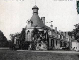
Château de la Noue
Villedômer
Château de la Noue stands in the small village of Villedômer, in the Indre-et-Loire department of France's Loire Valley, and remains a private family estate rather than a museum piece. What does the château look like? Two large round towers anchor the building, both believed to date back to the 16th century. A further wing was added at a right angle to the main block in the late 1800s, giving the property its current, more spread-out footprint. Step inside the reception rooms and original 17th-century wood panelling is still in place - alongside the towers, it's the feature most often singled out by visitors and heritage records alike. Who built it, and who has owned it since? The estate's origins trace back to the 16th century under the Bouault family. One family member, René Bouault, sieur de la Noue, served as mayor of nearby Amboise between 1596 and 1599, linking this modest countryside property to a much larger Loire Valley town. Ownership changed in 1826, when General Baron Amédée de Cools - chief of staff of the Royal Guard - acquired the château. His descendants have kept it in the family ever since. Is the château officially protected? Part of it, yes. A decree issued on 1 June 1948 listed the facades and roofs of the 17th-century section, together with the two 16th-century towers, as a monument historique, the French register of protected heritage buildings. Not every part of the estate carries this protection - only the historically significant elements named in the decree. Can visitors stay or tour the grounds? Rather than operating as a public museum, Château de la Noue runs as a bed-and-breakfast (chambres d'hôtes) and hires out its rooms for private events and receptions. This dual role - part family home, part small-scale hospitality venue - is common among the lesser-known châteaux scattered across Touraine, letting owners maintain the property while still opening its doors to outside guests. Where exactly is Villedômer? Villedômer sits in the Centre-Val de Loire region, a short distance from Amboise, one of the Loire's best-known towns thanks to its royal château and its association with Leonardo da Vinci. That proximity makes Château de la Noue a worthwhile stop for travellers who want to see a quieter, less-visited property without straying far from the region's main attractions. Frequently asked questions What period does the château date from? The two round towers are the oldest visible parts, dated to the 16th century, while the interior panelling belongs to the 17th century. The extra wing was added in the late 19th century. Is it open to the public like a museum? No - it operates as a private estate offering bed-and-breakfast stays and event hire rather than museum-style visits. Who owned the château historically? The Bouault family held it in the 16th century, including René Bouault, mayor of Amboise. General Baron Amédée de Cools bought the estate in 1826. Is the château a protected monument? Yes. Since a 1948 decree, its facades, roofs, and two towers have been listed as a monument historique.
-
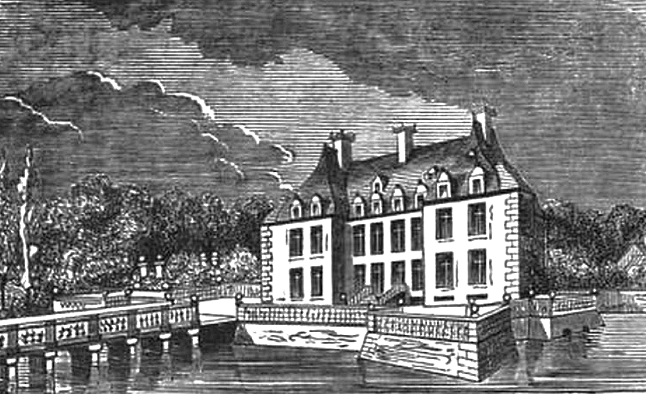
Château de Saint-Martin-de-Seignanx
Saint-Martin-de-Seignanx
Château de Saint-Martin is a Renaissance-to-classical noble residence standing along the Route Océane in Saint-Martin-de-Seignanx, a small commune in the Landes department, only a short drive from Bayonne and the Atlantic coast. The building remains privately owned and is not regularly open for interior visits, yet it stands as one of the most significant pieces of residential architecture in the Nouvelle-Aquitaine region — well worth a stop for anyone driving the route linking the Landes to the Basque Country. Where does this building come from? The story of the site goes back to the mid-16th century, when Saint-Martin was a barony whose lords held an extensive domain across the Landes. The château's current form is the result of several successive building campaigns rather than a single architectural plan. The first phase dates to the late 16th and early 17th centuries, when Jean de Saint-Martin, seneschal of the Landes, had the western residential wing flanked by two towers rebuilt — work usually dated to around 1600. A far more ambitious phase followed in the mid-17th century. It was then that Bernard de Saint-Martin commissioned the central, L-shaped pavilion housing the monumental staircase, today regarded as one of the finest achievements of regional classical architecture. The ensemble was later completed with a north tower, rebuilt only at the end of the 19th century, giving the château its distinctive, layered silhouette that blends elements from three different centuries. What can you actually see from the outside? The building follows an L-shaped plan, with two round towers on the north side and a further tower to the south, the whole covered with flat clay tiles typical of the region's building tradition. The greatest artistic asset is the grand staircase with its painted decoration inside the central pavilion; its murals were restored in 1894 by the Bordeaux painter Auguste-Antoine Durandeau, a sign of how highly this interior was already valued in the 19th century. While you cannot walk into it on a regular visit, the château's overall massing — contrasting the older, sterner towers with the more decorative central block — lets you trace the evolution of style across more than three centuries just by looking at the façade. The château was listed as a monument historique on 5 October 1994, confirming its status as one of the more important architectural heritage sites in the Landes department. When and how is it best to visit? Since the property is privately owned, the best way to experience it is simply to walk or drive along the Route Océane, from where the façades and towers are clearly visible. Spring and early summer are the best seasons, when the surrounding greenery hasn't yet fully screened the view and morning light favors the western residential wing. Saint-Martin-de-Seignanx sits close to the motorway linking Bordeaux to the Spanish border, so the château fits naturally into a route combining Bayonne, the Landes beaches, and the first Basque towns such as Biarritz or Saint-Jean-de-Luz. A short stop of 15–20 minutes is enough to walk around the château and take photos as part of a longer day exploring the region. Frequently asked questions Can you visit the inside of Château de Saint-Martin? No — the château remains privately owned and is not regularly open to visitors, including the famous painted staircase. You can, however, view the building from the outside, from the public road. How old is the château? The oldest surviving elements date from around 1600, although the history of the Saint-Martin family and the barony itself goes back to the mid-16th century. The north tower was only rebuilt at the end of the 19th century. Why is the château protected as a heritage site? Because of its architectural value — especially the monumental painted staircase — the building was listed among France's monuments historiques in 1994. What else is nearby? Saint-Martin-de-Seignanx lies close to Bayonne, Tarnos, and the Atlantic coast, making the château a convenient stop on a route between the Landes and the Basque Country.
-
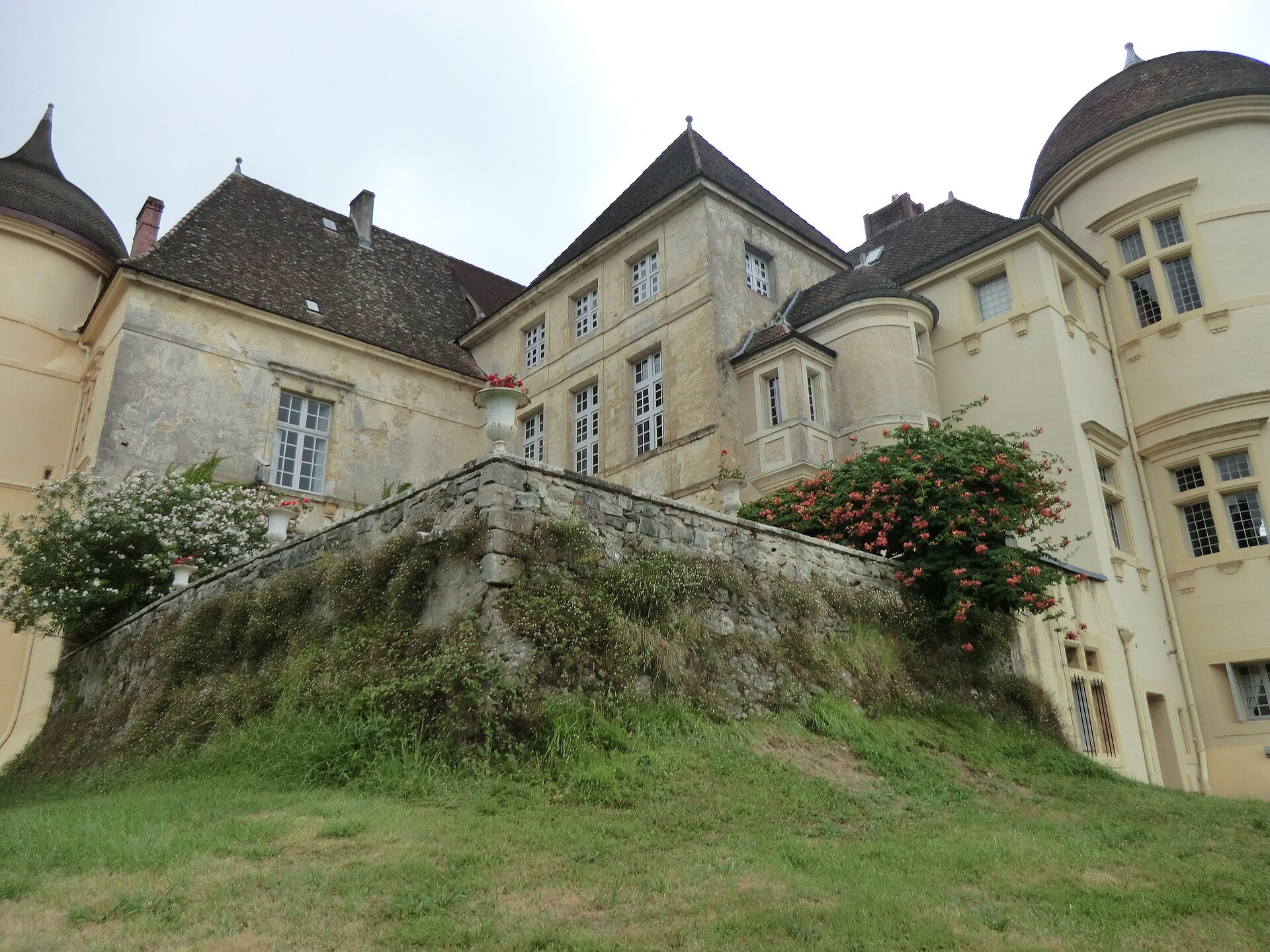
Château de Saint-Sauveur
Sainte-Honorine-la-Chardonne
Château de Saint-Sauveur stands about two kilometers east of the village of Sainte-Honorine-la-Chardonne in the Orne department of Normandy, a 17th-century manor house built from local granite and set on a raised, artificial platform ringed by a broad water-filled moat. What is the history behind the château? The building owes its present appearance to a reconstruction carried out around 1650 by Jacob de Grésille, baron de Saint-Sauveur — the source of the estate's current name. Earlier elements of the property date back to the 16th and 17th centuries, but it was this mid-17th-century rebuild that gave the château the symmetrical, balanced layout still visible today. Its heritage value has been recognized in two separate rounds of legal protection. In 1978, the façades, roofing, terrace, and the two moat bridges with their balustrades were listed as a historic monument (classé). In 2009, protection was extended to the painted decoration in the great hall, the garden layout with its built features, and the moat's hydraulic system — recognition that the whole composition, not just the building itself, carries historical weight. What can you actually see there? The most distinctive feature is the forecourt terrace, shaped like a bastion and lined with stone balustrades, linked to the surrounding land by two bridges spanning the moat. Inside, the symmetrical room layout survives alongside a straight-flight stone staircase that divides the interior into two matching halves — a typical arrangement for French residential architecture of the mid-1600s. The great hall still holds its original painted ceiling and wall decoration, and the grounds preserve a historic garden layout around the water. Château de Saint-Sauveur is privately owned and does not run regular public tours or exhibitions. The best way to experience it is on foot along the lane skirting the property, from where the façade, moat, and terraces are all visible — the château mirrored in the still water is worth pausing for, especially early morning or at sunset when the light sits low across the water. How do you get to Sainte-Honorine-la-Chardonne? The village sits in the Orne department of Normandy, within the Flers employment area. The nearest larger towns are Condé-en-Normandie, about 6 km away, and Flers, just under 10 km — both good starting points for the drive along local departmental roads. Falaise, home to the famous castle of William the Conqueror, lies roughly 23 km to the southeast, making it easy to combine both stops into a single day exploring the region. The surrounding countryside is classic Norman bocage — rolling pasture, hedgerows, and small apple orchards. It suits travelers with a car who are after the quieter, less-visited corners of Normandy where residential architecture like this survives largely untouched by tourism. When is the best time to visit? Since the château is mainly viewed from the outside, spring and early autumn give the best conditions — the surrounding greenery and lower sun angle flatter the façade and moat, and the region sees fewer visitors than in high summer. Summer brings more traffic through the area as travelers head toward the Normandy coast, though the village itself stays quiet year-round. Frequently asked questions Can you go inside Château de Saint-Sauveur? No — it's privately owned and does not offer regular public access to the interior. Visitors can view the exterior from the lane running alongside the property. How old is the château? Its current form dates from a reconstruction around 1650, though earlier elements of the estate go back to the 16th century. Is it a legally protected heritage site? Yes. The façades, roofing, terrace, and bridges were listed as a historic monument in 1978, with the interior decoration, garden, and moat system added to the protection in 2009. What's the easiest way to get there? By car. The closest towns are Condé-en-Normandie (about 6 km) and Flers (about 10 km), both connected to Sainte-Honorine-la-Chardonne by local departmental roads.
-
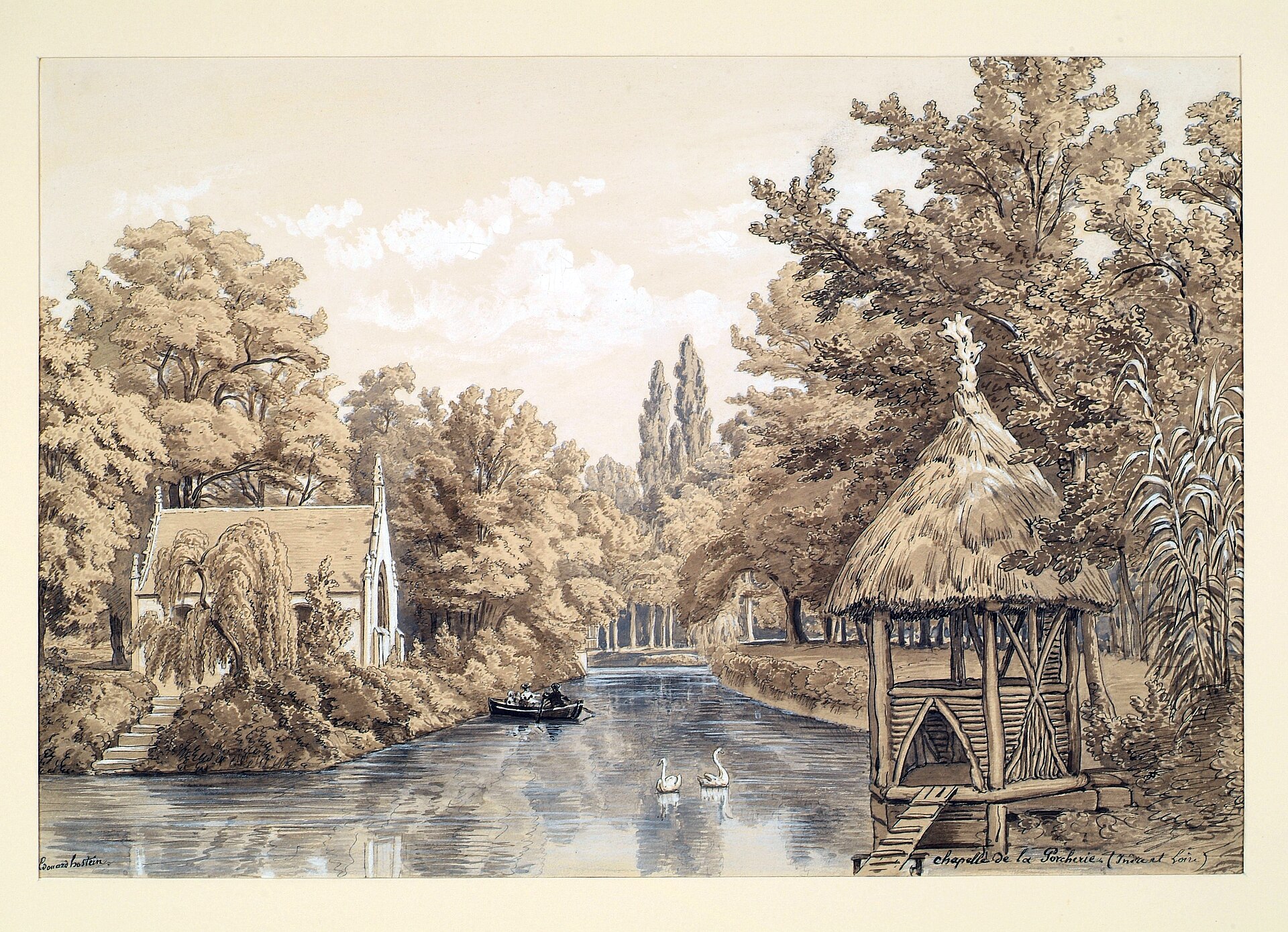
Castle of Choisille
Chanceaux-sur-Choisille
Château de Choisille is a private residence in Chanceaux-sur-Choisille, a small commune in the Centre-Val de Loire region, roughly ten kilometers from Tours. The building isn't open to the public on a regular basis, but its history stretches back to the 16th century and touches a handful of memorable figures from the Touraine region. Where does the name Choisille come from? The current name only dates to 1937, taken from the Choisille river that runs through the commune and gave it its name. Before that, the estate was known as La Porcherie, a name recorded in documents going back to the 16th century. The switch during the interwar period was likely a deliberate rebrand — the new owners wanted to distance the property from a name tied to its earlier, decidedly unglamorous farming associations. Who owned the estate before it became Château de Choisille? The earliest records of the property go back to 1559, when the fief belonged to Marie Brosset, widow of Denis Riant, and later to Jean Sapin, receiver general of finances for Languedoc. Over the following decades ownership changed hands repeatedly — a fairly typical pattern for a modest landed estate in Touraine, where titles moved between local nobility and royal officials. By around 1700, the property belonged to Jacques-Julien Royer, treasurer of France in Tours — a senior administrative post that came with considerable means. Around 1773, Catherine-Élisabeth Royer, widow of Pierre de Cop, sold the estate to Michel-Pierre Martel, a naval commissioner based in Quebec. It's a good illustration of how landed property in Touraine often ended up in the hands of people connected to France's colonial or naval administration. Why is the château linked to an actress and a circus? The most notable episode in the château's history belongs to the 20th century. From 1917 to 1928, the house was home to Ève Lavallière, a French stage actress popular around the turn of the century, known for her roles in Paris's boulevard theatres. Her time in Chanceaux-sur-Choisille came during the final phase of her life, after which she withdrew from public life. In 1932, the estate was bought by Charles Spiessert, director of the Pinder circus — one of France's oldest and best-known circus companies. The menagerie's animals wintered in the outbuildings on the property, an unusual but well-documented use of the château as a seasonal base for a touring circus troupe. Can visitors tour the château? Château de Choisille is privately owned and doesn't operate as a ticketed tourist attraction. Visitors passing through Chanceaux-sur-Choisille can see the building from the outside, or catch a glimpse during local heritage events if any are organized, but there are no standard opening hours for tourists. Frequently asked questions Where is Château de Choisille located? In the commune of Chanceaux-sur-Choisille, in the Indre-et-Loire department, near Tours, in the Centre-Val de Loire region. Since when has it been called Château de Choisille? Since 1937. Before that, from the 16th century onward, the estate was called La Porcherie. Who lived there in the 20th century? Actress Ève Lavallière from 1917 to 1928, and from 1932 the estate belonged to Charles Spiessert, director of the Pinder circus. Is the château open to tourists? No, it's a private residence with no regular visitor access — it can only be viewed from outside.
-
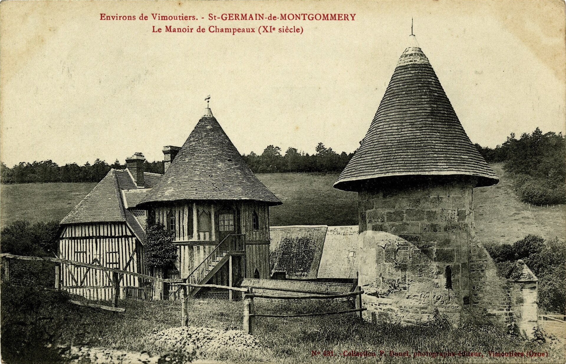
Manoir des Tourelles
Val-de-Vie
Manoir des Tourelles (also known as Manoir des Champeaux) is a 16th-century manor house in Val-de-Vie, a small commune in the Calvados department of Normandy. It stands in what was once the village of Saint-Germain-de-Montgommery, absorbed into the merged commune of Val-de-Vie in 2016. When was the manor built? The main residential building dates from the second half of the 16th century. Early in the 17th century, its owners added a defensive touch: two cylindrical turrets flanking the entrance, which gave the building its name. In the 19th century the old dovecote was converted into a timber-framed farm building, a common fate for such structures in the Normandy countryside during that period. What is there to see? The most recognisable feature is the entrance framed by its two round turrets, giving the building the look of a small fortified estate - though the manoir was never a true stronghold. It's better described as a gentry residence with a decorative-defensive flourish, typical of late-Renaissance architecture in Normandy. The main living quarters keep the layout common to manors of this region. Also worth noting is the former colombier (dovecote), remodelled in the 19th century, whose facades and roof received their own separate protection status. Can you visit the manor? Manoir des Tourelles in Val-de-Vie is privately owned, unlike some other manors sharing the same name elsewhere in France. That means there's no open access to the interior - the building is best appreciated as part of a walk through the surrounding countryside, admired from outside, rather than as an attraction with set opening hours. Why is it a protected site? The turreted entrance and the main building were listed as historic monuments (inscrit au titre des monuments historiques) in 1933. That protection was extended in 1993 to cover the facades and roof of the converted dovecote as well. The site is recorded in the Mérimée heritage database under reference PA00111673, confirming its place among France's protected architectural heritage. Where exactly is Val-de-Vie? Val-de-Vie was created in 2016 by merging four former communes: Sainte-Foy-de-Montgommery, now the seat of the new commune, along with La Brévière, La Chapelle-Haute-Grue, and Saint-Germain-de-Montgommery, where the manor itself stands. The commune takes its name from the river Vie, which runs through this part of Calvados. The surrounding countryside is classic Normandy bocage - hedgerow-lined meadows and scattered farms - with the Pays d'Auge as the nearest well-known landmark region. Frequently asked questions When was Manoir des Tourelles built? The main building dates from the second half of the 16th century, with its distinctive turrets added in the early 17th century. Is the manor open to visitors? No - it's privately owned, so the interior isn't open to the public. You can view it from outside. Why is it called "des Tourelles"? The name comes from the two cylindrical turrets flanking the entrance, added in the early 17th century to give the residence a fortified look. Is it a protected historic site? Yes. The turreted entrance and main building have been listed as monuments historiques since 1933, with the former dovecote added to that protection in 1993.
-
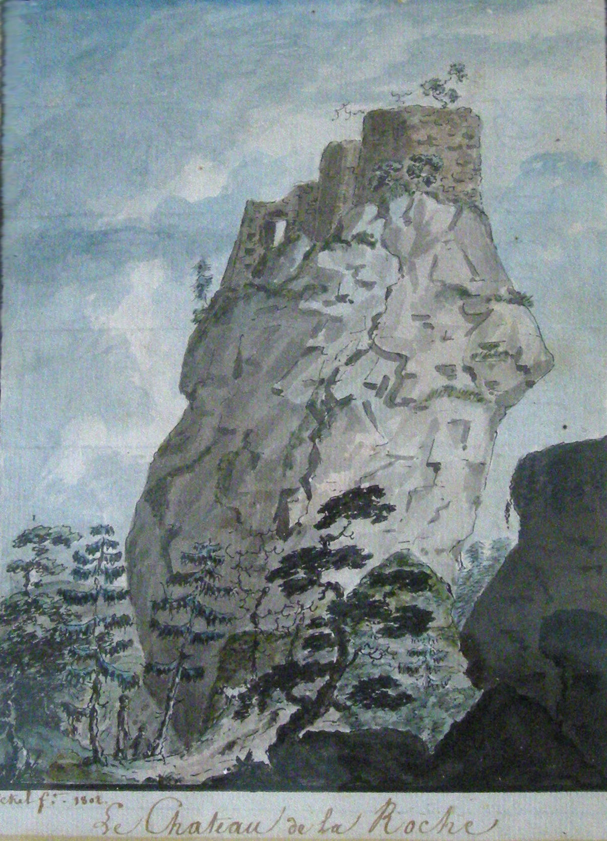
Château de la Roche
Bellefosse
Château de la Roche is a ruined medieval castle in the commune of Bellefosse, in the Bas-Rhin department of Alsace. The small stronghold sits on a rocky outcrop, and only fragments of its walls remain today, but the site still draws hikers looking for a piece of history tucked away in the forest. How old is the castle and where does its name come from? The first record of a fortification on this site dates back to 1180, though the ruins visible today are from a later period, most likely built around 1284. This suggests that an earlier fortification was at some point replaced by a newer structure, of which the surviving fragments are the ones still standing. The name "de la Roche" ("of the rock" in French) refers directly to the rocky base the stronghold was built on - a common feature among the small castles scattered across this part of the Vosges and Alsace. Where exactly is the castle located? The ruins lie within the commune of Bellefosse, a small municipality in the Bas-Rhin department. The site sits at roughly 48.396 N, 7.218 E, placing it in the forested, elevated terrain typical of the Vosges foothills. This is a region dotted with numerous medieval castle ruins - remnants of an era when local feudal lords built watchtowers and strongholds on strategic high points overlooking valleys and trade routes. What can visitors see there today? Château de la Roche is now a ruin - surviving wall fragments give a sense of the original layout, though most of the structure has not survived to the present day. This is not a restored castle with full visitor infrastructure, but rather a destination for those who appreciate quiet, lesser-known historical sites where nature has largely reclaimed the space around the old stone walls. Who is this site suited for? Given its character - modest ruins in a forested, elevated setting - Château de la Roche works best as the goal of a quiet hike for anyone interested in the region's history and the landscape of the Vosges. It's not an attraction with developed facilities, but a point on the map for travelers who want to combine outdoor activity with a bit of local history, away from the crowds found at Alsace's larger, better-known castles. Frequently asked questions Where is Château de la Roche located? In the commune of Bellefosse, in the Bas-Rhin department of Alsace, in the Vosges foothills. How old is the castle? The first fortification on the site was recorded in 1180, but the current ruins most likely date from around 1284. Is the castle restored? No - Château de la Roche is a ruin, with surviving wall fragments and no full reconstruction. Who is this site for? For visitors interested in the region's history and quiet hikes through the forested, elevated terrain of the Vosges.
-
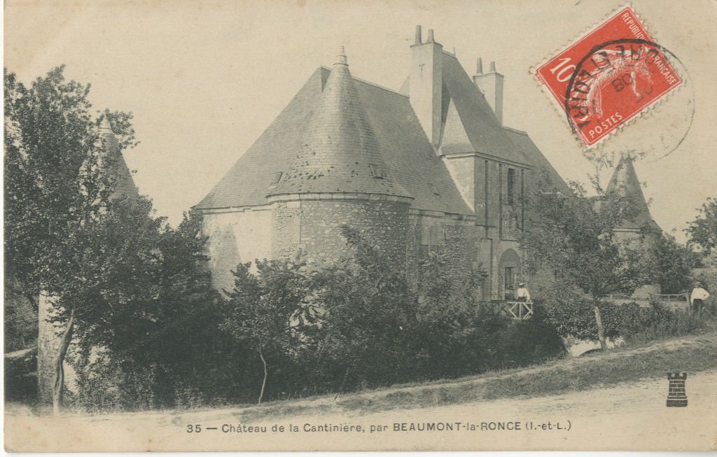
Château de la Cantinière
Beaumont-Louestault
Château de la Cantinière is a Renaissance-era manor house standing just north of the village center of Beaumont-Louestault, a small commune in Indre-et-Loire, roughly 24 km north of Tours. Where does the name come from? The building takes its name from the old fief of La Cantinière, which in the medieval period fell under the châtellenie of Louestault - an administrative unit that first appeared in the 12th century. The land initially belonged to the barony of Châteauneuf in Tours, then passed to the almonry of the collegiate church of Saint-Martin in Tours, and in 1588 came into the hands of Pierre Molan, controller and general superintendent of royal finances. It was around that period that the present manor was built on the fief's grounds. Who owned the manor over the centuries? The current building dates to the end of the 16th century. Its first owners were the Lhuillier family, after which the estate changed hands several times - passing to the du Bouex family, then the Bouault family, and by the 18th century to the Bonnin de la Bonninière de Beaumont family, also linked to the nearby Château de Beaumont. This long chain of ownership explains why the structure blends features from different periods, from its defensive medieval origins to later residential remodeling. What does the architecture look like? La Cantinière was originally a fortified building, as shown by its surviving moats - now framing a terrace - and two towers. The south-facing facade follows a layout typical of French manor houses: a square main lodge flanked by wings ending in round towers of differing sizes. That asymmetry between the towers, one noticeably bulkier than the other, is one of the more distinctive architectural details of the ensemble and sets it apart from the more symmetrical residences of the same era. Is the manor a protected historic monument? Yes. An order dated 22 August 1949 listed the building as a monument historique. Protection covers the facades and roofs of the main building, the north-east tower, and the moat. The listing confirms the site's historical and architectural value, though - like many manors in the Touraine region - Cantinière remains private property. What should you know before visiting the area? Beaumont-Louestault sits in a quiet, rural corner of Indre-et-Loire, along the road linking Tours with the northern edge of the department. The commune is also home to the Château de Beaumont, the former seat of the Bonnin de la Bonninière family, so both sites can easily be combined into a single outing focused on the area's noble history. Given its private-property status, the best way to see La Cantinière is a relaxed drive-by through the surrounding countryside rather than an interior visit. Frequently asked questions When was Château de la Cantinière built? The present building dates to the end of the 16th century, replacing an earlier fortified fief tied to the châtellenie of Louestault. Who owned the manor? Successively the Lhuillier, du Bouex, and Bouault families, and from the 18th century onward the Bonnin de la Bonninière de Beaumont family. Is the building a listed historic monument? Yes, since 22 August 1949 - the facades, roofs, north-east tower, and moat are protected. Where exactly is the manor located? In Beaumont-Louestault, in the Indre-et-Loire department, about 24 km north of Tours.
-
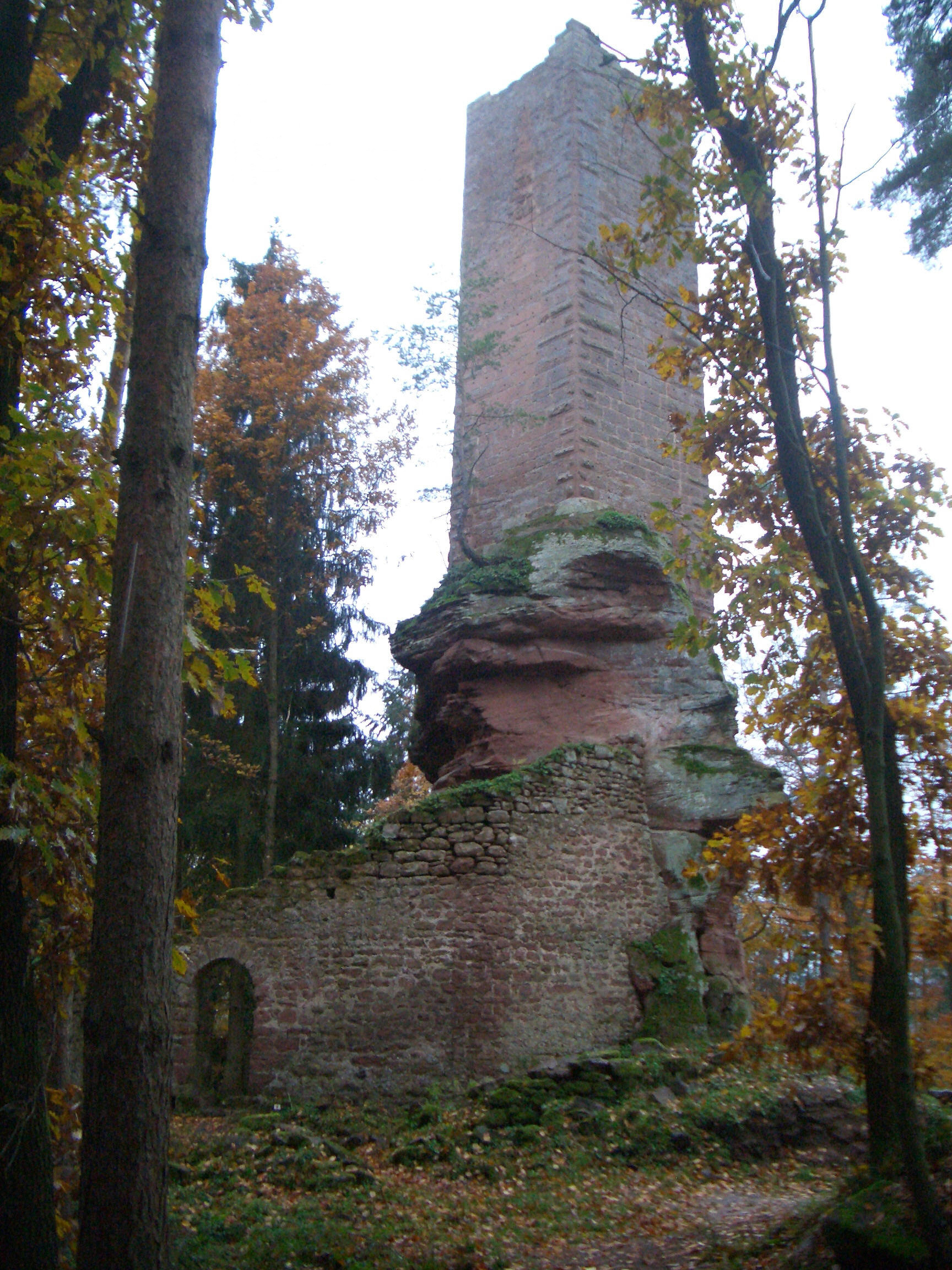
Château de Wineck
Château de Wineck is a ruined medieval castle in the Wineckerthal quarter of the commune of Dambach, in the Bas-Rhin département of Alsace, France. Since 1985 it has been listed as a monument historique, France's official register of protected heritage sites maintained by the Ministry of Culture. What kind of castle is it? Wineck belongs to the category of "rock castles" — fortifications that incorporate natural rock outcrops directly into their walls and foundations. This building method was common across medieval Alsace, where the hilly, forested terrain of the Vosges gave builders a ready-made defensive base and cut down on the labor needed for stone foundations. One thing worth clarifying before you plan a visit: Alsace actually has two castles sharing almost the same name. There's Wineck in Katzenthal (Haut-Rhin, near Colmar), and this one — Château de Wineck in the commune of Dambach (Bas-Rhin). They are separate sites with separate histories and states of preservation, so it pays to double-check the exact location and coordinates before setting out, especially if you've found conflicting information online. How do you get there? The castle sits in the Wineckerthal quarter of Dambach, in the northern part of Bas-Rhin. Given the rocky, wooded terrain, driving will typically get you as far as a forest parking area or the access road near the commune — the final stretch to the ruins is on foot, along a marked hiking trail. That's the standard pattern for visiting Alsace's rock castles: drive to the base, then walk the rest, often on a short but noticeably steep path through the forest. If you're building a longer day out, Wineck pairs well with other ruins and villages in Bas-Rhin, since the region's network of hiking trails links together several historic sites and lookout points across the Vosges du Nord. What will you see? As a ruin, Wineck doesn't offer restored chambers or an intact castle silhouette — what remains are wall fragments and rock-cut foundations that hint at the original defensive structure. For anyone interested in medieval military architecture or in the geology behind it (the rock base doubling as part of the building itself), that combination of nature and construction is the main draw. The surroundings are typical Vosges du Nord forest, which makes the site appealing even to visitors who are simply after a quiet walk in the woods rather than a deep dive into castle history. When should you visit? Because access is on foot through forest terrain, the best window runs from spring through early autumn, when trails are dry and easier to navigate. In winter, reaching the ruins can be harder due to conditions on the forest paths. Frequently asked questions Is Château de Wineck the same castle as Wineck in Katzenthal? No. These are two distinct castles in Alsace with similar names — one in the commune of Dambach (Bas-Rhin, the subject of this page), the other in Katzenthal (Haut-Rhin, near Colmar). Is the castle officially protected? Yes. Château de Wineck has been listed as a monument historique since 1985, part of France's official heritage protection register overseen by the Ministry of Culture. What does "rock castle" mean? It refers to a type of fortification where a natural rock outcrop forms part of the castle's foundations or walls, a technique frequently used in medieval Alsace. Can you drive right up to the castle? Generally no — driving access ends near a parking area close to the commune of Dambach, and the ruins themselves are reached on foot via a forest trail.
-
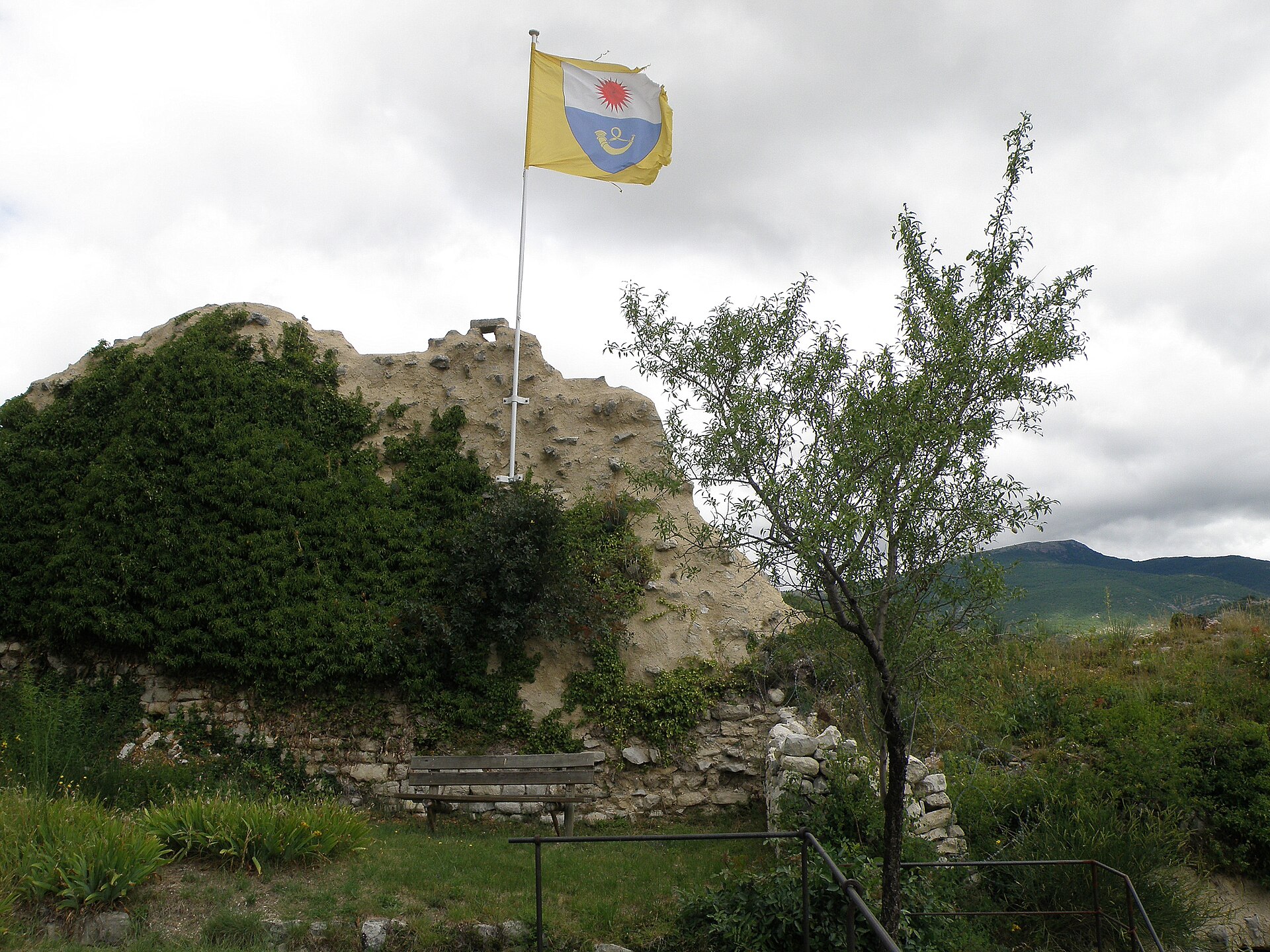
Château de Reilhanette
Reilhanette
Château de Reilhanette is a medieval castle ruin overlooking the village of Reilhanette in the Drôme Provençale, set at the confluence of the Anary and Toulourenc rivers in the shadow of Mont Ventoux. Where is it and how do you get there? Reilhanette sits in the Baronnies area of the Drôme department, in the far southeast of France. The village occupies a junction of valleys, ringed by hills, with the castle ruins forming a landmark silhouette above the rooftops. A car is the easiest way in — the nearest larger towns are Montbrun-les-Bains and Sault, connected by winding local roads through the Baronnies hills. The region is popular with cyclists and hikers, so the drive itself is part of the appeal. What will you see there? The castle dates from the 12th century and passed through several hands over the centuries: the Sire of Montauban held it from 1276, the Mévouillon and Dupuy families took over in 1317, and it eventually came under the Barons of Dauphiné. Its downfall came in 1560, when royal troops destroyed the fortress — the ruins visible today date from that destruction. Locals later turned the castle mound into a viewpoint square, offering a panorama over the surrounding hills and valley, and it's now a favourite spot for a quiet picnic. Reilhanette itself, nicknamed "Petite Reine" (Little Queen), has kept its medieval street layout intact. Its calades stand out — narrow, winding lanes paved with carefully fitted flat stones, originally designed to ease the passage of people, carts, and animals while limiting soil erosion. Most house façades still carry a medieval appearance, making a walk through the village feel like stepping back in time. It's also worth stopping at the Church of Saint-Michel-et-Saint-Hippolyte, built from the 12th century onward. It has a square bell tower, a four-bay nave, and a Romanesque porch with rich carved decoration. A curious footnote to Reilhanette's history: between 1971 and 1996, the village played a role in the Cold War as part of the Albion Plateau's nuclear defence system, serving as a firing control post for France's nuclear deterrent force. When should you visit? Spring and summer are the best times to come, when the surrounding fields fill with lavender and spelt — crops that have sustained the village's self-sufficient farming economy for generations. Summer also brings long daylight hours, ideal for hiking the hills and lingering on the castle square at dusk. Autumn offers a quieter visit, appreciated by photographers and anyone after a slower pace. Frequently asked questions Can you actually go up to the castle ruins? Yes — the castle mound has been turned into a public viewpoint square, open to visitors, with panoramic views over the surrounding countryside. Where does the name Reilhanette come from? It most likely derives from the Latin word "rella" (plough), which evolved into "relha," then "Rellania" around 1227, before settling into the form Reilhanette from the 13th century onward. What else is worth seeing besides the castle? Walk the narrow calade lanes and visit the 12th-century Romanesque Church of Saint-Michel-et-Saint-Hippolyte. Is Reilhanette worth a long stay or just a quick stop? It's a small, quiet village — best suited to a few hours' visit combined with exploring the surrounding Baronnies hills, rather than a multi-day stay.
-
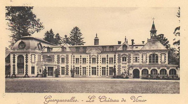
Château de Vimer
Guerquesalles
Château de Vimer stands in Guerquesalles, a small commune in the Pays d'Auge area of Normandy, roughly 14 km southeast of Livarot. Set within its own landscaped grounds, the estate is a good example of a country house that grew in layers over three centuries, each generation of owners leaving a visible mark on the building. How did the estate begin? The site started out modestly, as a 17th-century hunting lodge. The manor house seen today was built in the first half of the 18th century by Louis François de Nolet, lord of Malvoué and Vimer. His family's coat of arms still survives on a fireplace slab kept in the estate's farm building — one of the few objects that ties the property directly back to its founder. Architecturally, the château follows a layout common to French country houses of the period: a central block flanked by two forward-set wings, giving the facade a balanced, formal symmetry. Who owned it after the Nolet family? The estate changed hands in 1774, when it was bought by René de Chazé. A more dramatic chapter opened in 1815: after the fall of Napoleon's Empire, General Watier, Count of Saint-Alphonse, took refuge at Vimer. He commissioned restoration work and had a chapel built on the grounds. Another wave of changes arrived at the turn of the 20th century. Between 1897 and 1903, Baron de Mackau brought in Parisian architects to restore the chapel and modernise the château's west-facing front. Shortly after, the facades were unified with new stone facing, and an additional wing was added to house a library and a dining room. The result is a building that reads as a single coherent whole at first glance, even though it actually stitches together work from three separate centuries. What else is there to see beyond the château itself? The grounds are worth a visit in their own right. The garden was laid out in 1840 by landscape architect Bühler, a recognised name in 19th-century French landscape design. It includes a formal tree-lined walk, a greenhouse, and a kitchen garden, and the whole ensemble is listed in France's pre-inventory of remarkable gardens. It's a rare chance to see a 19th-century French garden concept preserved largely in its original layout. How do you get to Guerquesalles? Guerquesalles sits at the heart of the Pays d'Auge, a region known for its apple orchards and half-timbered farmhouses. The nearest useful base is Livarot, a short drive away, connected by rural roads that wind through classic Normandy countryside. The area suits a slower, car-based day trip that takes in several small villages nearby. When is the best time to visit? Spring and early summer show the garden at its fullest, with the tree-lined walk and the planting around the greenhouse in full leaf. Autumn brings a different appeal, with softer light flattering the architecture and the surrounding Pays d'Auge orchards turning colour in the background. Frequently asked questions Can you visit Château de Vimer? The château is privately owned, so access to the interior and grounds can be limited. It's worth checking current visiting arrangements locally or through the region's tourism organisations before planning a trip. Who built Château de Vimer? The present building was constructed in the first half of the 18th century by Louis François de Nolet, lord of Malvoué and Vimer, on the site of an earlier 17th-century hunting lodge. What is the estate's most notable feature besides the château? The garden, designed in 1840 by landscape architect Bühler, is listed in France's pre-inventory of historic gardens and remains one of the estate's standout features. How far is it to the nearest larger town? Livarot, the nearest sizeable landmark, is about 14 km northwest of Guerquesalles.
-
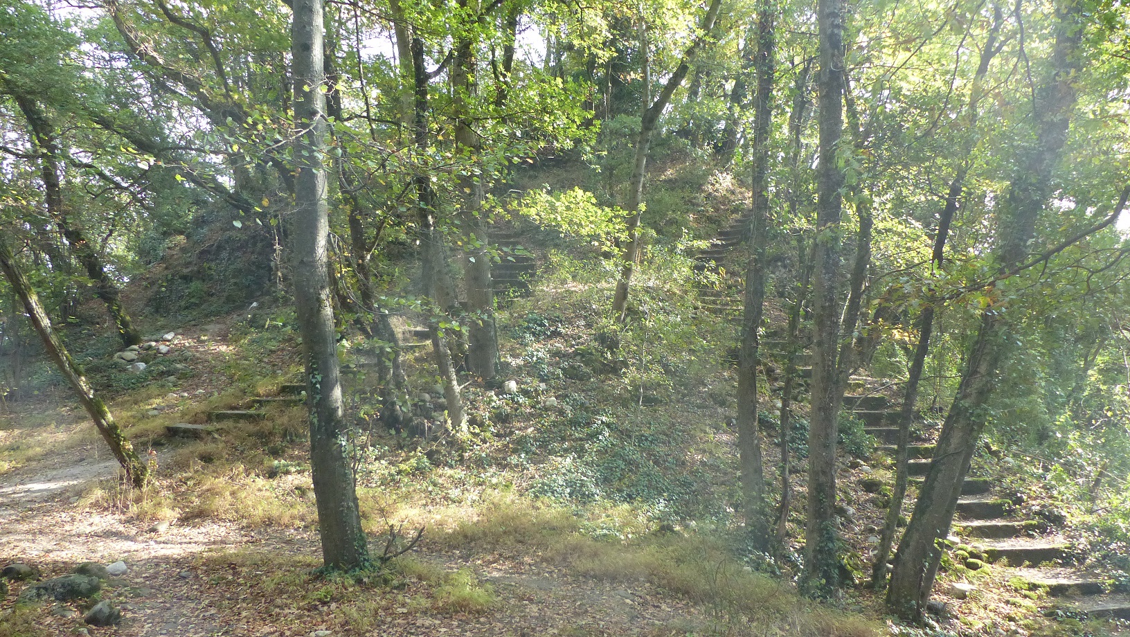
Châteaux de Ternier
Saint-Julien-en-Genevois
The Châteaux de Ternier were two fortified structures that once stood on a hill in the village of Ternier - today part of the commune of Saint-Julien-en-Genevois in the Haute-Savoie department, Auvergne-Rhône-Alpes region, right on the border with Switzerland. Where exactly did the castles stand? The Ternier hill sits just south of Geneva, close to the present-day centre of Saint-Julien-en-Genevois. The site is located at roughly 46.1396°N, 6.0886°E, on a modest rise typical of the foothills below Mont Salève, the striking limestone ridge visible across the border. The name "Ternier" survives today as the designation of this part of the commune and of the wider historical area around it. What remains of the fortifications today? Both structures are described as "former," meaning nothing survives on site in the shape of standing walls or towers that visitors could tour as a classic ruin. The hill they once occupied has since blended into the modern townscape, functioning more as a local landmark than as a formal heritage attraction. For anyone interested in the region's history, though, it remains a notable trace of the old border defences that once separated the lands of Savoy from those of Geneva. How do you get there? Saint-Julien-en-Genevois lies roughly 10-15 kilometres south of Geneva, right at the road crossing into Switzerland. The town is easy to reach: the RN201 national road connects it directly, and the Léman Express regional rail line runs straight into central Geneva. Travellers without a car have a convenient option here - the train reaches Saint-Julien-en-Genevois station in around fifteen minutes, and the Ternier hill is then within easy walking distance. What else is worth seeing nearby? The commune itself has a compact centre with local restaurants and a market typical of small towns in Haute-Savoie. Close by rises Mont Salève, a popular destination for day hikes and a viewpoint over Geneva, Lake Geneva and, on clear days, the Mont Blanc range. That combination - proximity to Geneva paired with an alpine backdrop - is what draws both day-trippers from the city and travellers looking for a quieter base in the region. When is the best time to visit? Spring and early autumn are the most rewarding seasons, with mild temperatures for walking around the area and the clearest views toward Salève and the surrounding hills. Summer brings more day-trip traffic from Geneva, while in winter the proximity to the Alps turns Saint-Julien-en-Genevois into something of a transit point for travellers heading to the ski slopes. Frequently asked questions Where exactly did the Ternier castles stand? On a hill in the village of Ternier, now part of the commune of Saint-Julien-en-Genevois in the Haute-Savoie department. Can you visit the ruins today? No visible ruins remain - the site of the two former fortified structures has since merged into the surrounding townscape. How do you get to Saint-Julien-en-Genevois from Geneva? The easiest way is the Léman Express train or the RN201 road, covering a distance of about 10-15 km. What else is worth seeing in the area? Mont Salève, with its viewpoints over Geneva and Lake Geneva, and the town centre of Saint-Julien-en-Genevois itself.
-
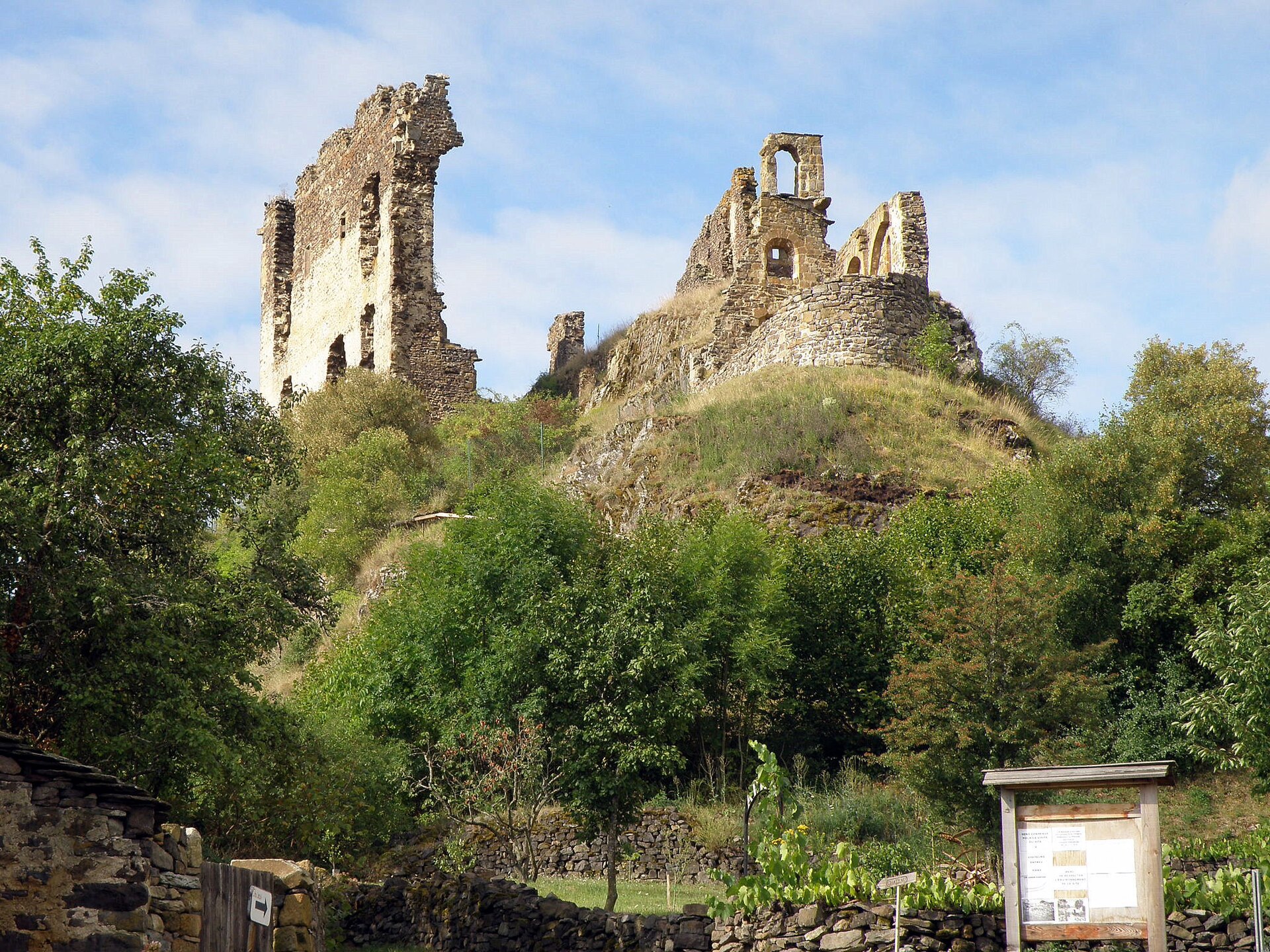
Château d'Artias
Retournac
Château d'Artias is a nearly nine-hundred-year-old fortress overlooking Retournac, a small town in the Haute-Loire département, in the Auvergne-Rhône-Alpes region of France. The castle was built on a rocky spur high above the meanders of the Loire river, a site chosen for its natural defensive advantage as much as for the sweeping views it commands over the valley below. Where exactly is it located? The ruins sit at an elevation of roughly 723 meters (2,372 feet), right next to Retournac. The site's coordinates are approximately 45.213 N, 4.000 E. The rocky ridge on which the castle stands juts out into the Loire valley, giving visitors an unusually wide field of view along the river in both directions. What is the history behind the castle? Château d'Artias dates back close to nine centuries, placing its origins in the medieval period, when defensive structures in this part of France were typically raised on hard-to-reach rocky spurs — far from major routes but with full command of the surrounding terrain. Over the centuries the castle fell into ruin, and what survives today is mostly the remains of its former structures, including the old chapel. Those chapel ruins were officially recognized as a historic monument in 1949, confirming their value as local heritage. What will you actually see there? Today, Château d'Artias consists primarily of ruins — wall fragments and the remnants of the chapel, listed among France's monuments historiques. This is not a restored castle with a full visitor exhibition; it's an authentic, partially preserved fortification that still lets you picture the scale of the original stronghold. The site's biggest draw, though, is its position: a wide view over the winding Loire river below and the hills of Haute-Loire around it. How do you get there? The castle lies within the commune of Retournac, making it an easy day-trip destination for anyone staying in this stretch of the Loire valley. Because of the terrain — a rocky spur set above the river — reaching the ruins involves a short climb, but it's rewarded with a panoramic view of the surrounding countryside. When is the best time to visit? Spring, summer, and early autumn are the best times to visit, when days are longer and visibility across the Loire valley is at its best. The site functions as much as a scenic viewpoint as a historic ruin, so picking a clear day makes a real difference in how much of the river panorama you get to enjoy. Who is this destination for? Château d'Artias appeals mainly to medieval history enthusiasts, photographers looking for scenic vantage points along the Loire, and travelers exploring Haute-Loire who want to see something beyond the region's main attractions. It makes a solid addition to any itinerary following the upper Loire valley. Frequently Asked Questions How old is Château d'Artias? The castle is close to nine hundred years old, with origins dating back to the medieval period. Are the castle ruins protected as a historic monument? Yes, the remains of the castle chapel were recognized as a historic monument in 1949. At what elevation does the castle sit? Château d'Artias stands on a rocky spur at an elevation of around 723 meters (2,372 feet). What views can you get from the castle? From the ruins, visitors can see the meanders of the Loire river and the surrounding hills of Haute-Loire.
-
Château de la Grandière
Grez-Neuville
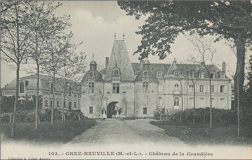
Château de la Grandière is a family-owned manor house in Grez-Neuville, a small village on the Mayenne river at the heart of the Anjou Bleu area in the Maine-et-Loire department. Unlike many French castles turned into museums or wedding venues, this one has stayed in the hands of a single family for centuries. How old is the family behind it? The La Grandière family first appears in records in 1150, tied to a feudal mound in the Grandière woods. Jacques de La Grandière, the current owner, represents the 34th generation of this lineage — an unusually long, unbroken chain even by the standards of provincial France, where wars, the Revolution, and inheritance splits have erased most such continuities. Where does the current building come from? The family took over the present site in the 16th century, building on the location of the fortified manor of La Giraudière. From that earlier structure, the water-filled moat and the entrance gatehouse still survive, controlling access to the courtyard. The main residential wing was rebuilt in the 18th century, giving the ensemble a more refined, residential look typical of the Enlightenment period. The contrast between the older defensive elements and the later manor architecture is one of the site's most interesting features. What can you actually see there? The complex includes the gatehouse, a courtyard ringed by water-filled moats, and the main residence. Around it stretches a 55-hectare park, part farmland and part woodland — an unusually large private estate for the region. The grounds are laid out with avenues of plane trees, box hedges, shaped hornbeam rows, and tiered lime trees. The garden layout alone is worth the visit, independent of the château building itself. Why is it a protected monument? Château de la Grandière was listed as a monument historique in 1973. The listing covers both the château's architecture and the surviving elements of the earlier fortification — the moat and the gatehouse — as evidence of continuous building on the site since the 16th century. How do you get there, and when's the best time to visit? Grez-Neuville sits in Anjou Bleu, a region known for its network of canals and rivers (the Mayenne, Oudon, and Sarthe), popular with river-boat tourists and cyclists. Spring and summer are the best seasons to visit, when the park is at its greenest and the tree-lined avenues offer welcome shade on hot days. As the château remains a private family residence, visitor access may be limited to specific dates or events — it's worth checking current opening arrangements before planning a trip. Frequently asked questions Can you visit Château de la Grandière? The château has remained the private property of the La Grandière family for generations, so public access can be limited to certain occasions or parts of the grounds — check current visiting arrangements before you go. How long has the La Grandière family held this site? The family is documented as far back as 1150, and the current owner is the 34th generation — one of the longest recorded unbroken family lines in the Anjou region. What's the oldest part of the château? The oldest surviving elements are the water-filled moat and the entrance gatehouse, dating from the earlier fortified manor of La Giraudière, on whose site the family built its residence in the 16th century. What makes the park distinctive? The 55-hectare park combines farmland and woodland, laid out with avenues of plane trees, box hedges, and shaped hornbeam and lime tree rows — a classic example of French formal garden design.
-
Château de Chanteloup
Amboise
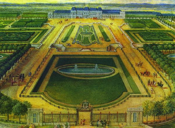
The Pagoda of Chanteloup is the striking survivor of one of the most ambitious château-and-garden estates ever built in 18th-century France, standing just outside Amboise in the heart of the Loire Valley. What exactly is this place? Only a single structure remains on the grounds today: a slender, seven-story pagoda rising above the treetops. Centuries ago, though, the same site held the vast Chanteloup estate, built on the south bank of the Loire a short distance from the royal château of Amboise. The residence and its landscaped gardens impressed visitors so much that some contemporaries ranked them alongside Versailles. From 1761 to 1785 the estate belonged to the Duke of Choiseul, Louis XV's powerful prime minister, who spent two decades expanding the property into its final, monumental form. The main château and the pagoda ended up with very different fates. In 1823 the château itself was almost entirely torn down, its materials dispersed elsewhere, and only scattered fragments of the park survived. Among them, the pagoda stands out as the one genuinely grand structure to make it through — and it's the reason travelers still stop here today, making it one of the more distinctive, if lesser-known, sights near Amboise. How do you get to the Pagoda of Chanteloup? The pagoda sits south of Amboise, on the opposite bank of the river from the well-known royal château, only a short distance from the town center. That makes it easy to pair with a day spent exploring Amboise itself — by car the drive takes just a few minutes, and the flat terrain of the Loire Valley also makes it a popular stop for cyclists following the Loire à Vélo route. Travelers without a car can typically arrange a taxi or local transport from Amboise, which serves as the main base for visiting this part of the region. What will you see once you're there? The centerpiece of any visit is the pagoda itself: a tower built from seven progressively smaller tiers, topped by a viewing terrace. An interior staircase leads all the way up, opening onto sweeping views over the surrounding forests, fields, and the Loire winding in the distance. For many visitors, that view — rather than the architecture alone — is the real highlight, since from the top you can trace the scale of the vanished gardens in the pattern of pathways and greenery still visible below. Beyond the tower, the grounds preserve fragments of the original park, with walking paths threading through wooded sections. It's a good spot for an unhurried stroll, away from the crowds that tend to gather around Amboise's royal château and Clos Lucé. When is the best time to visit? Spring and early summer are the most rewarding seasons, when the greenery around the tower is at its fullest and the views from the terrace are clearest. In summer, climbing the interior staircase can get warm, so a morning visit is worth planning for. Autumn brings its own reward: the surrounding forest turns warm shades of gold and red, a striking sight from the terrace and a bonus for anyone traveling with a camera. Frequently asked questions Is the pagoda the only thing left of the original château? Yes. The main château building was demolished in 1823 and no longer exists. The pagoda is the most substantial structure to survive from the original estate. How long does a visit take? Including the climb to the viewing terrace and a short walk through the park, most visits last between 45 minutes and an hour and a half. Can this be combined with a visit to Amboise? Easily. The site is only a few kilometers from town, so both can comfortably fit into a single day. Who is this attraction best suited for? Travelers interested in 18th-century French history and garden architecture, and anyone looking for a quieter alternative to the busier châteaux of the Loire Valley.
-
Château du Vieux-Windstein
Château du Vieux-Windstein is a ruined rock castle in the commune of Windstein, in the Bas-Rhin department of Alsace, north-eastern France. It belongs to a distinctive group of Northern Vosges strongholds that were carved directly into sandstone outcrops, giving the ruins a raw, almost organic look that merges with the surrounding cliffs. Today the site draws hikers who want to combine a bit of medieval history with a walk through quiet forest. How do you get there? Windstein sits at the heart of the Northern Vosges Regional Nature Park, an area laced with waymarked hiking trails. The easiest approach is to drive to the village of Windstein or a neighbouring hamlet and continue on foot, since the ruins themselves are not reachable by road — typical for castle sites in this part of Alsace. The exact coordinates are 48.998662, 7.681719, so it is worth loading the location into a GPS app or offline map before setting off, as trail signage in the forest can be sparse in places. Depending on the path chosen and your pace, the walk in usually takes somewhere between ten and forty minutes through mixed deciduous and coniferous woodland typical of the region. What will you see on site? The main draw is the ruin itself: walls and chambers partly hewn straight out of the natural rock and partly built up with quarried stone on top. This construction method, known as a rock castle, was a practical choice for medieval builders — the sandstone provided both a defensive barrier and a ready-made foundation. Walking through the site, you can still trace the outlines of former rooms and appreciate how builders shaped the design around the terrain rather than against it. From the upper sections of the ruins, views open out over the wooded hills of the Northern Vosges, making the visit as much about scenery as about history. It is worth allowing extra time for the walk, since the Windstein area holds several other sites of interest nearby, and the approach trail itself — quiet, forested, far from Alsace's busier towns — is part of the appeal. When is the best time to visit? Spring and autumn offer the most comfortable conditions: temperatures are mild enough for longer walks, and the tree canopy is thinner, which makes it easier to appreciate the ruin's architecture and enjoy the wider views. Summer weekends can bring more foot traffic on the trails, while winter visits require extra caution, as the ground around the ruins can turn slippery after rain or frost. Whatever the season, sturdy walking shoes are recommended, since the terrain within the ruins is uneven and rocky underfoot. Frequently asked questions Is there an entrance fee? Ruins of this kind in the Northern Vosges are typically freely accessible, with no ticket booth on site — it is still worth checking current local information before your visit, as access arrangements can change. Is the site suitable for children? Yes, though the ground is uneven and partly rocky, so older children will manage more easily than very young ones. Plan a relaxed pace and bring appropriate footwear. Are there other attractions nearby? Windstein and the surrounding Northern Vosges are dotted with similar castle ruins and hiking trails, making it easy to combine several sites into a single day trip. How long does a visit take? Exploring the ruins themselves usually takes about 30–45 minutes, but including the approach trail from the village or a parking area, the full outing tends to run one and a half to two hours.
-
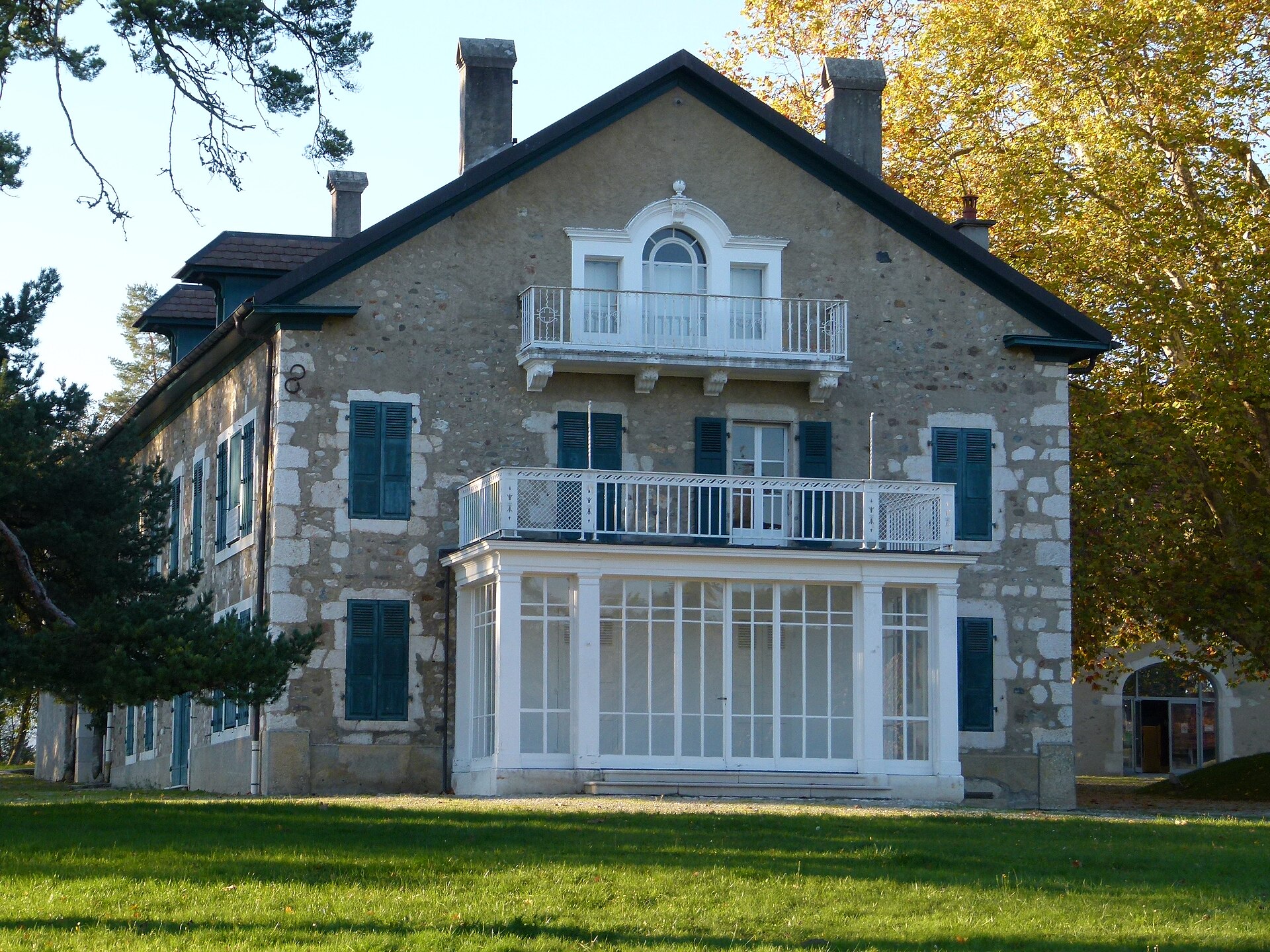
Château de Prévessin-Moëns
Veraz
Château de Prévessin-Moëns is a 19th-century estate with an extensive surrounding park, located in the commune of Prévessin-Moëns in the Ain department, a short drive from Geneva and the Swiss border. While the château building itself is closed to the public, the park around it is one of the most popular green spaces in the Pays de Gex area. What is the château, exactly? The estate consists of the main château building, an annex, a barn and a caretaker's lodge, together covering around 1,000 m² of built area. The commune of Prévessin-Moëns bought the entire property in 1997 for just under 2 million euros. Since 2003, the château building itself has been leased under a long-term agreement to a luxury watchmaking company, which is why the interior is not open to visitors. The park, however, is a different story — it belongs entirely to the public realm. What will you see in the park? The park covers nearly 19 hectares and functions as the "green lung" of Prévessin-Moëns, with the village built up around it. It is home to a number of impressive trees, some more than 400 years old — striking even for visitors with no particular interest in botany. A small pond fringed with weeping willows adds an extra point of ecological interest. Since 2003 the grounds have been progressively secured and upgraded, which made it possible to lay out walking paths, a children's playground and an outdoor fitness trail. How do you get there? The park is open to everyone and has several entry points, so it can be reached from different parts of the village. The main entrances are on Route de la Fontaine, Route de Saint-Genis (near the local college) and Route de Mategnin. Prévessin-Moëns sits right next to Geneva, which makes the park an easy stop for both local residents and visitors based in Switzerland or elsewhere in the Ain department. When is the best time to visit? The park works well as a destination in any season — in spring and summer the shade of the old trees makes for a pleasant walk, while autumn brings out the colours of the mature trees. It's a popular choice for families thanks to the playground, as well as for anyone looking for a quiet place to exercise or walk a dog away from the bustle of nearby Geneva. Frequently Asked Questions Can you go inside the château building? No — since 2003 the building has been leased to a private company and is not open to the public. Visits are limited to the surrounding park. Is entry to the park free? The park is public land belonging to the commune of Prévessin-Moëns, reachable through several entrances from the surrounding roads. What makes this park worth visiting? Its size, trees more than 400 years old, a pond lined with weeping willows, walking paths, a children's playground and a fitness trail all combine to make it a favourite spot for locals and visitors alike. How large is the château park? The park covers close to 19 hectares, making it one of the larger green spaces in this part of the Ain department, right on the border with Switzerland.
Earn badges for the places you visit
Download NextOnTrip, discover new places and check off your trails.