Sacred Monuments in Spain
A guide to 2038 Sacred Monuments in Spain — with descriptions, photos and traveler visits from the NextOnTrip community. Locations spread across 1060 cities and towns. Most visited by the community: Basilica of the Most Holy True Cross, Sant Salvador d’Artà, Iglesia y muralla del Tozal del Muro.
-
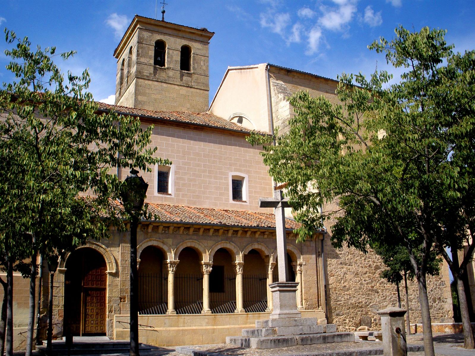
Plaza del Salvador
Segowia
Plaza del Salvador is a small but historically significant square in the old town of Segovia, in Spain's Castile and León region. It takes its name from the Church of El Salvador (Church of the Savior) standing at its center, and sits within the dense web of narrow lanes that make up Segovia's historic quarter, not far from the city's famous Roman aqueduct. How to get there? The square lies in Segovia's historic center, bordered by the streets Ochoa Ondátegui, de los Cañuelos, Santa, and Pedro de Fuentidueña — a typical setting for old Segovia, with winding, cobbled lanes best explored on foot. From the Acueducto de Segovia (the Roman aqueduct), it's usually only a few minutes' walk, similar to the distance from the cathedral. Segovia is well connected to Madrid by high-speed rail, with journeys of around 30 minutes, which makes the city a popular day-trip destination. Drivers are better off parking outside the walls of the old town and continuing on foot, since streets in this part of the city are narrow and largely closed to traffic. What will you see? The centerpiece of the square is the Church of El Salvador, a building with roots going back to the 12th and 13th centuries, remodeled repeatedly in later periods, most notably in the 16th and 17th centuries. From the original Romanesque structure, a portico set at an angle to the main nave survives, along with part of a tower featuring bricked-up twin arched windows. During restoration work carried out in 1998 under architect Alberto García Gil, a fragment of a 12th-century Romanesque apse was discovered beneath the tower, hidden for centuries under later construction — one of the more notable conservation finds in this part of Segovia. Inside, the church follows a single-nave plan, with a transept and a chancel covered by a Gothic ribbed vault, the result of a later remodeling that gave the originally Romanesque building a Gothic character. The interior's focal point is a gilded Plateresque altarpiece, commissioned in 1587 by Diego Tamayo. Its central panel depicts the Adoration of the Magi, flanked by additional religious scenes. The altarpiece was executed by Diego de Matienzo, based on designs attributed to Rodrigo Gil de Hontañón, one of the leading architects of the Spanish Renaissance. The square itself, though modest in size, is a good example of Segovia's old-town layout — stone buildings, narrow passages, and a scale suited to pedestrians rather than traffic. It has few tourist amenities, which means it has kept an authentic, local character quite different from busier spots such as the square by the cathedral. When to visit? The Church of El Salvador is generally open only during service hours, so visiting the interior requires timing a visit around Mass times — it's worth checking by phone or with the local tourist office beforehand. The square itself and the church's exterior are accessible throughout the day, making it a good spot for a brief, quiet stop while exploring the old town. The best time to visit Segovia overall is spring or autumn, when temperatures are mild and the city sees fewer visitors than in peak summer. Pairing a visit to the square with a walk to the nearby aqueduct works well, since the route between the two runs through some of the old town's quieter streets. Frequently Asked Questions Where does Plaza del Salvador get its name? The square is named after the Church of El Salvador (Church of the Savior) at its center, around which this part of the old town developed. How old is the church on the square? Its oldest elements, including the portico and part of the tower, date from the Romanesque period, in the 12th and 13th centuries. The church was later remodeled several times, mainly in the 16th and 17th centuries. What is the most notable feature inside the church? The gilded Plateresque main altarpiece from 1587, commissioned by Diego Tamayo, with a central Adoration of the Magi painting, built to designs attributed to Rodrigo Gil de Hontañón. Can you visit the church at any time? No — the church is generally open only during services, so it's best to check Mass times before planning a visit.
-
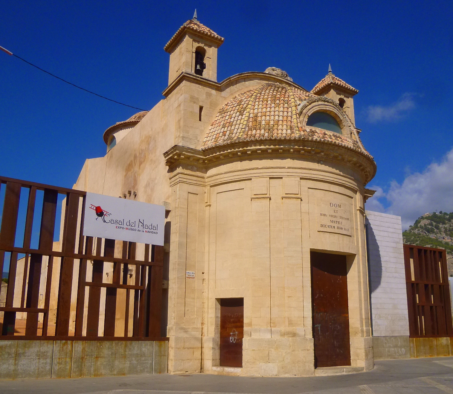
church of Our Lady of the Forsaken
Alcoi / Alcoy
The Church of Our Lady of the Forsaken (Spanish: Iglesia de la Virgen de los Desamparados) is a small 19th-century church in Alcoi (Valencian: Alcoi, Spanish: Alcoy), a city in the province of Alicante, in the Valencian Community. It stands on Plaza de la Marededeu, right in the historic centre, squeezed between neighbouring townhouses — a common sight in Mediterranean towns, where a parish church is folded directly into the surrounding street front rather than set apart on its own grounds. How to get there? The church sits in Alcoi's old town, an easy walk from the city's main squares and pedestrian streets. Alcoi is best reached by car or bus, with regular connections to Valencia and Alicante; the nearest international airport is Alicante-Elche, roughly an hour's drive away. Plaza de la Marededeu itself is within walking distance of the bus station and the central car parks, and since it sits in one of the most prominent parts of town, finding it doesn't require any special local knowledge. What will you see? The building was designed by architect Jorge Gisbert Berenguer and completed in the mid-19th century in the Neoclassical style. It is a compact structure: its symmetrical façade is built around a cylindrical stone wall carved with geometric relief patterns and capped by a quarter-sphere dome with an open lantern at the top. That crowning element is what makes the church stand out against the flanking buildings, despite the modest footprint it occupies. Inside, a dome resting on pendentives covers the space, pierced by four lunettes that bring in natural light — a solution common to church architecture of the period, here scaled down to a small parish setting. Seen from outside, that same dome is reflected in a drum that flattens and reinforces the whole volume, giving the façade extra visual weight. At the rear, a straight-walled presbytery holds a niche with the image of Our Lady of the Forsaken, the patroness whose cult remains active today — the parish still functions, and a lay confraternity (Hermandad de Nuestra Señora de los Desamparados) is organised around her devotion. The interior decoration combines painting, gilding and polychrome work, closely integrated with the architecture itself, which gives the small space a sense of richness beyond what its size would suggest. It's a good example of how a sacred building squeezed into a tight urban plot can still combine its liturgical function with careful architectural and decorative detail. When should you visit? The church is worth including in a walk through Alcoi's historic centre, ideally paired with a stop at the nearby Santa María archpriestly church. Because of the active parish community and the confraternity built around the image of Our Lady of the Forsaken, the calendar includes services and celebrations tied to her cult throughout the year — it's worth checking local dates in advance if you want to catch one of these. Otherwise, as a working parish church, it's generally open around Mass times rather than fixed tourist visiting hours. Frequently asked questions Where exactly is the church located? On Plaza de la Marededeu, in the historic centre of Alcoi, in the province of Alicante. Who designed the building? Architect Jorge Gisbert Berenguer, working in the mid-19th century in the Neoclassical style. What's the most distinctive architectural feature? The cylindrical stone façade with geometric relief carving, topped by a quarter-sphere dome, and an interior dome on pendentives lit by four lunettes. Is it still an active church? Yes — it functions as a parish church and is home to the Nuestra Señora de los Desamparados confraternity, which keeps the devotion to the patroness alive.
-
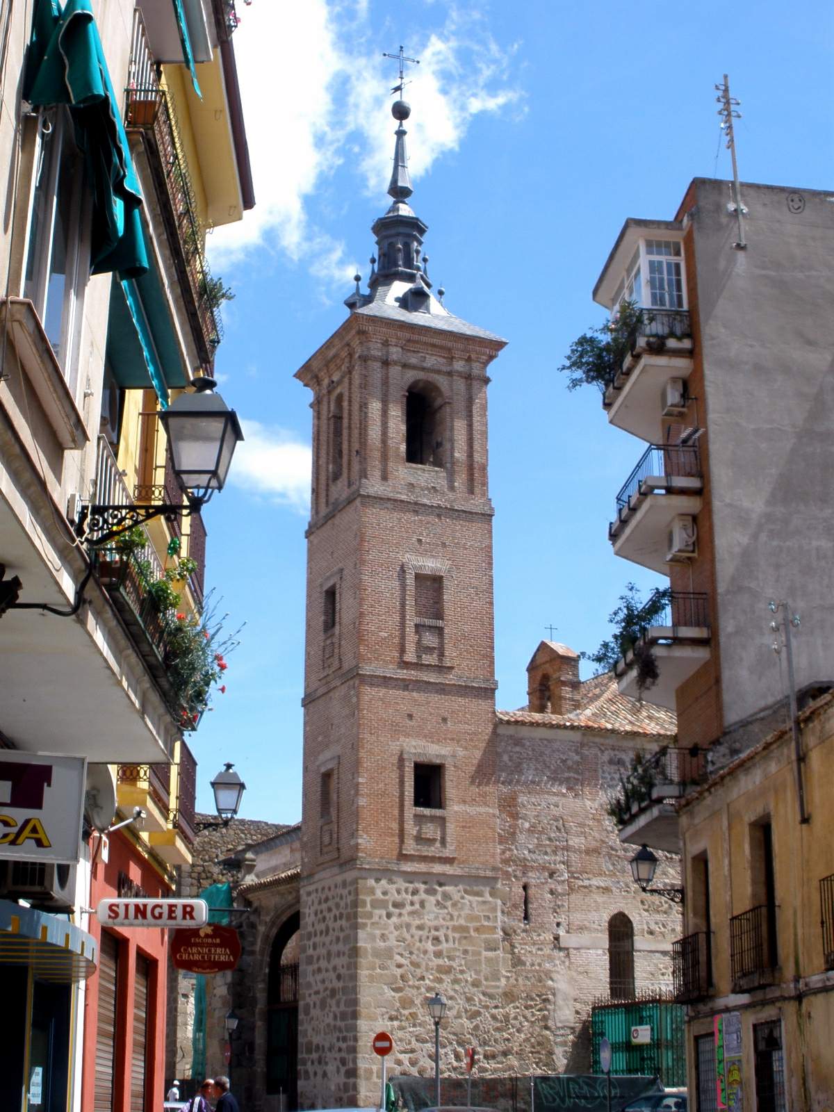
Church of El Salvador, Talavera de la Reina
Talavera de la Reina
The Church of El Salvador (Iglesia de El Salvador, in full Iglesia de El Salvador de los Caballeros) is a Gothic-Mudéjar temple in Talavera de la Reina, one of the oldest surviving religious buildings in the town. What is the history behind the church? The earliest documented references to the building date back to 1145 and 1205, although its current structure took shape gradually from the 12th century onward. According to local tradition, the church was founded by Talaveran knights (caballeros), which is why it carries the additional name "de los Caballeros." A document from 1204 shows that the building also served as the seat of a Castilian tribunal, a place where justice was dispensed to residents under that jurisdiction. This overlap of religious and judicial roles was common in medieval Castilian towns, where parish churches often doubled as centers of public life for their district. What does the church's architecture look like? The building is built in Gothic-Mudéjar style, characteristic of the Toledo and Talavera de la Reina region, where Christian and Islamic brickwork traditions overlapped for centuries. Its most recognizable feature is the brick apse, decorated on the second and third tiers with interlacing arches forming narrow, lobed arcades — a typical Mudéjar decorative motif also found in other churches of the region. How was the church expanded and altered over time? The building underwent several rounds of expansion and modification. In 1487, Juan de Arévalo founded the Chapel of Las Nieves, adding a further element to the original structure. In 1570, thanks to a donation from Miguel Ruiz de Herrera, a Talavera native who had made his fortune in the Americas, a wooden coffered ceiling (artesonado) was built — a feature typical of Spanish Mudéjar architecture of the period. The spire on the church tower is the work of Vicente Beltrán, completed in 1783. What is the church used for today? The church was deconsecrated in 1981 and remained out of use for the following 34 years. After an extensive restoration, the building reopened its doors in 2015, this time as the El Salvador Cultural Center, run by the Talavera de la Reina town council. Today the space hosts exhibitions and cultural events while remaining one of the town's key examples of Gothic-Mudéjar architecture. Why is it worth visiting the Church of El Salvador? For anyone interested in Mudéjar architecture, this is one of the key examples of the style in Talavera de la Reina — a town best known for its ceramics but also home to a rich religious heritage. The conversion of the historic church into a cultural center means visitors can now enter a building that was inaccessible for decades and see the brick apse and coffered ceiling up close. Frequently Asked Questions Why is the church called "de los Caballeros"? According to tradition, the church was founded by Talaveran knights (caballeros), which is reflected in its full name. Is the church still used for religious services? No. It was deconsecrated in 1981, and since 2015 it has operated as the El Salvador Cultural Center, managed by the Talavera de la Reina town council. What is the most distinctive architectural feature? The brick apse, with its interlacing, lobed arches on the second and third tiers — a hallmark detail of Gothic-Mudéjar style. How old is the church? The earliest references date to 1145 and 1205, with the structure built up from the 12th century onward and later additions from the 15th, 16th, and 18th centuries.
-
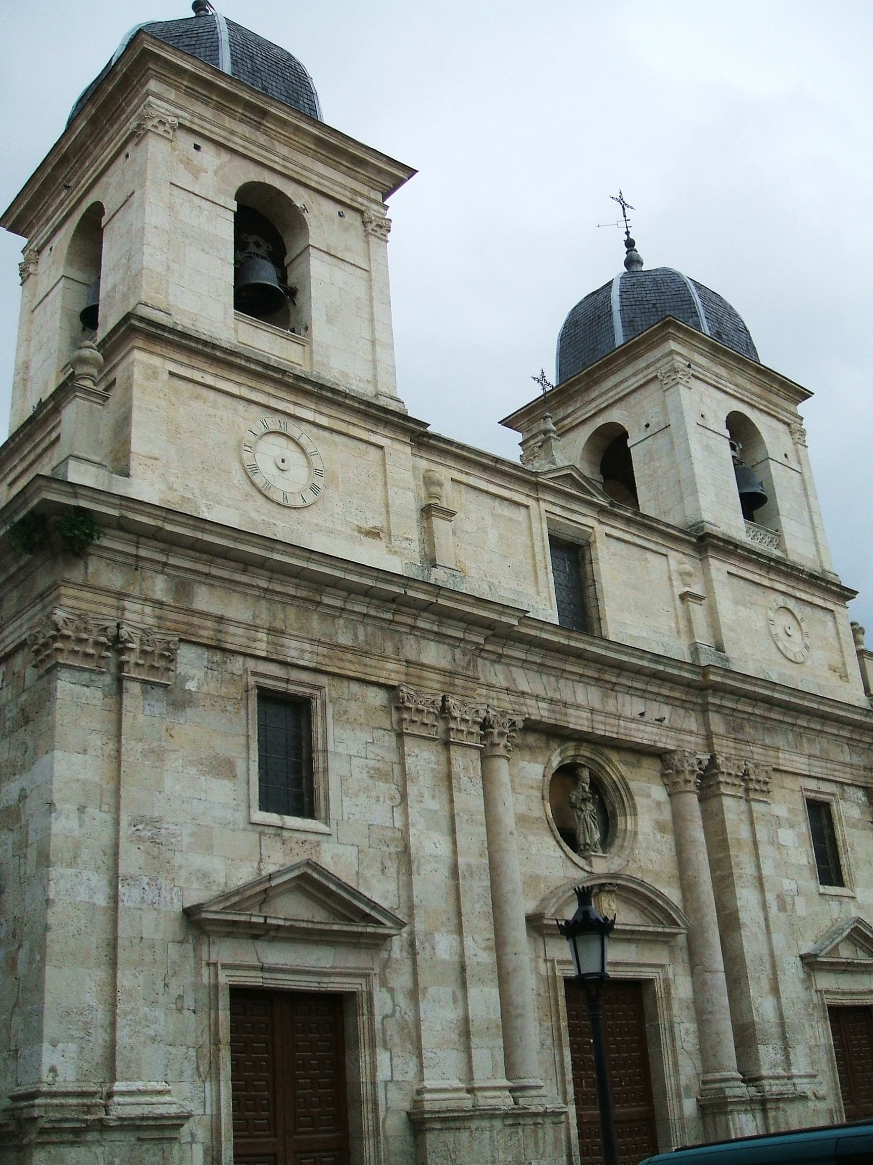
Collegiate of Santa María la Mayor, Briviesca
Briviesca
The Collegiate of Santa María la Mayor is a former collegiate church in Briviesca, a small town in the province of Burgos, in Castile and León. Although it no longer functions as a collegiate church and is currently closed to worship, it remains one of the most significant examples of religious architecture in the region and a landmark of the town. Where did the church come from? The building's history goes back to the second decade of the 14th century. It was founded by Infanta Blanca of Portugal, lady of the monastery of Santa María la Real de las Huelgas and daughter of King Alfonso III of Portugal and Beatriz of Castile. On her initiative, a major urban remodeling took place, which included laying out the new town of Briviesca together with a large Gothic temple — the building that stands today as the Collegiate. Over the following centuries the structure was repeatedly extended and altered, which is why its present appearance combines several architectural periods. What can you see there? The church mixes different architectural eras, though baroque and neoclassical elements dominate its exterior. The most recognizable feature is the neoclassical facade, built between 1788 and 1792 — considerably later than the original Gothic core of the building. This contrast between the medieval Gothic structure and the later, more classical additions makes the Collegiate an interesting case study in the kind of architectural layering common to many Spanish churches that were adapted over the centuries to changing tastes and needs. It's worth knowing that the building today operates as an "ex-collegiate" (Spanish: excolegiata) — it has lost its collegiate status and no longer holds religious services, though it still stands at the heart of Briviesca as a reminder of the town's past prominence. Why does this place matter? The Collegiate of Santa María la Mayor is considered the first historic collegiate church of the Diocese of Burgos and one of the oldest foundations of its kind in Spain. In 1982 it was declared a Bien de Interés Cultural (property of cultural interest) in the category of national historic-artistic monument. This designation confirms the building's importance not only for Briviesca itself but for the architectural heritage of Castile and León as a whole. How to get there and when to visit? Briviesca lies in the province of Burgos, along the main routes connecting the region to the rest of Castile and León, which makes it a convenient stop for anyone exploring the area around the city of Burgos. The Collegiate stands in the town's historic center, so it's best explored on foot as part of a walk through the old town. Because the building is currently closed to worship, it's worth checking locally or with the tourist information office beforehand whether and when the interior can be visited. Like much of the region, Briviesca is most pleasant to visit in spring and autumn, when temperatures are milder than in the height of summer and there are fewer visitors than during the peak holiday season. Frequently Asked Questions Does the Collegiate of Santa María la Mayor still hold religious services? No — the building has lost its collegiate status and is currently closed to worship. It now functions as a historic monument, known in Spain as an excolegiata. Who founded the church? It was founded by Infanta Blanca of Portugal, daughter of King Alfonso III of Portugal, who was linked to the monastery of Santa María la Real de las Huelgas. What architectural style is the Collegiate built in? The building combines several periods — a 14th-century Gothic core with later baroque and neoclassical additions, including the facade built between 1788 and 1792. Is this an important heritage site nationally? Yes — in 1982 it was declared a property of cultural interest in the category of national historic-artistic monument, and the Collegiate is considered one of the oldest foundations of its kind in Spain.
-
Church of San Román
Toledo
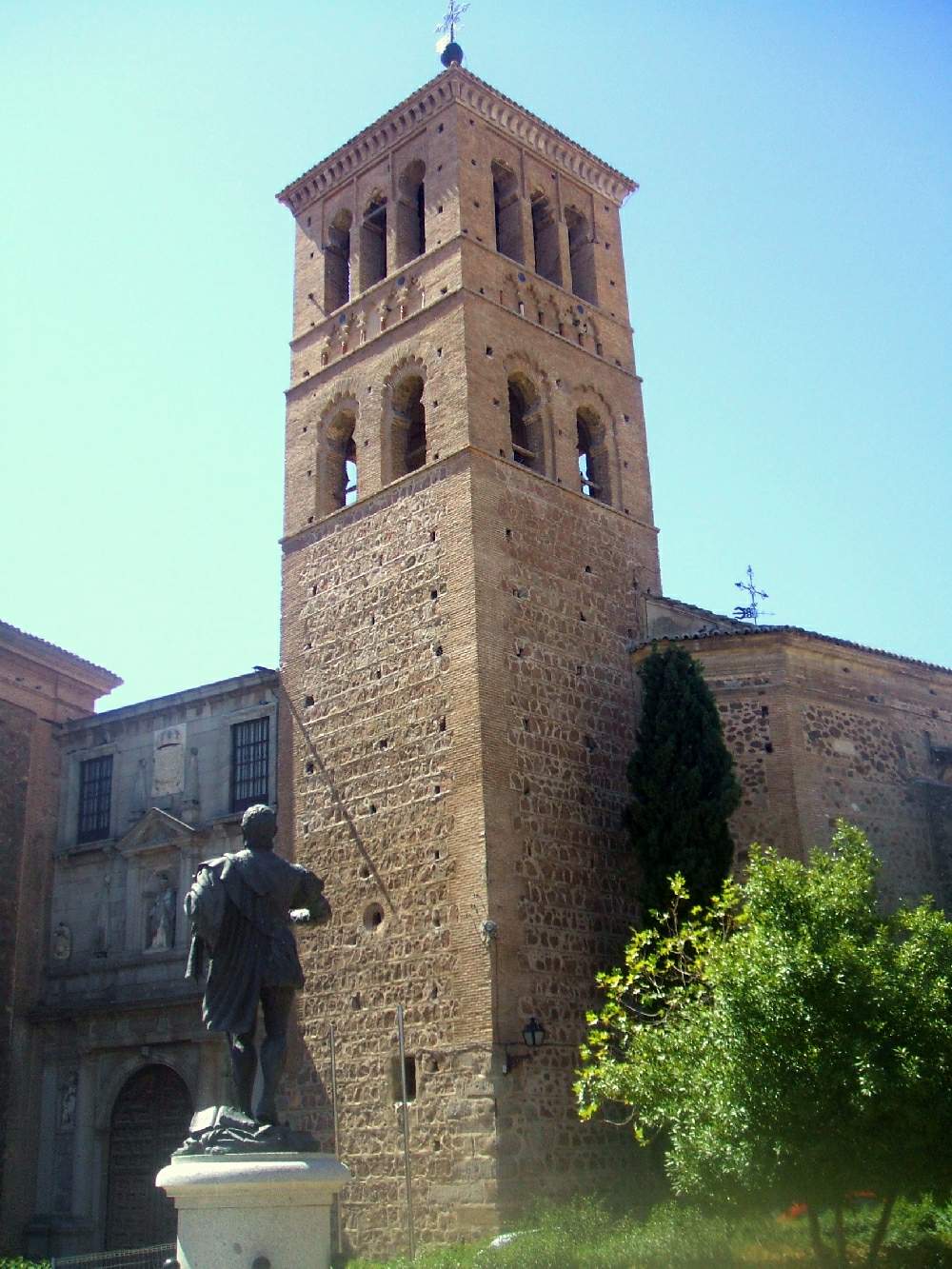
The Church of San Román is one of the most distinctive religious landmarks in Toledo, raised in the Mudéjar style during the 13th century. The building stands on the site of an earlier Visigothic structure, and traces beneath the foundations point to an even older, likely Roman construction. Today its interior houses a museum dedicated to Visigothic culture, making it a rare spot where medieval architecture and archaeological exhibits share the same space. Where is the Church of San Román located? The building sits in Toledo's historic center, a city listed as a UNESCO World Heritage Site for the centuries-long coexistence of Christian, Jewish, and Muslim cultures. That layered history is visible directly in the church's architecture: Mudéjar style emerged precisely from combining Christian building layouts with decorative techniques developed by Muslim craftsmen who remained in Spain after the Reconquista. What can you see inside? The interior preserves features typical of Mudéjar work: horseshoe arches, decorative vaulting, and the brickwork detailing common to Toledo's religious buildings of the period. The site's layered past — from Roman remains, through the Visigothic period, to the medieval structure built on top — turns the building itself into a record of the city's successive eras. The space now functions as a museum, displaying collections related to the Visigothic period, which lets visitors compare the building's architecture directly against artifacts documenting the earlier layers of its history. How do you get to the Church of San Román? The church stands within the old town, within walking distance of Toledo's main landmarks such as the cathedral and the Alcázar. The historic center is a pedestrian zone of narrow, cobbled streets, so the easiest way to reach it is on foot from anywhere inside the city walls. Visitors arriving by car should park at one of the lots on the edge of the old town and continue on foot from there. When is the best time to visit? Toledo can get very hot in summer, so spring and autumn are the best times to explore the city's religious landmarks, with temperatures that make long walks through the historic center far more comfortable. Morning hours help you avoid the crowds, since Toledo draws large numbers of day-trippers from Madrid. Why is this site worth visiting? The Church of San Román stands out among Toledo's landmarks because it condenses several historical layers into a single location — from antiquity, through the Visigothic period, to medieval Mudéjar construction. It's a rare chance to see how successive civilizations built on top of the same ground. For anyone interested in the Iberian Peninsula's history before the Islamic and Christian periods of Spain, it's one of the most telling stops in the city. Frequently asked questions What architectural style is the Church of San Román built in? The building represents the Mudéjar style typical of Toledo, combining Christian architectural layouts with decorative techniques rooted in Muslim craft traditions. What stood on this site before the current church? Before the present church was built in the 13th century, a Visigothic structure occupied the site, and remains found beneath it point to an even earlier, likely Roman construction. Can you visit a museum exhibit inside the church today? Yes, the interior now serves as a museum dedicated to Visigothic culture, combining the role of an architectural landmark with an exhibition space. How do you walk to the church from central Toledo? The church lies within the historic old town, within walking distance of the cathedral and the Alcázar — the whole area is a pedestrian zone with narrow, cobbled streets.
-
Museo del Monasterio de San Joaquín y Santa Ana
Valladolid
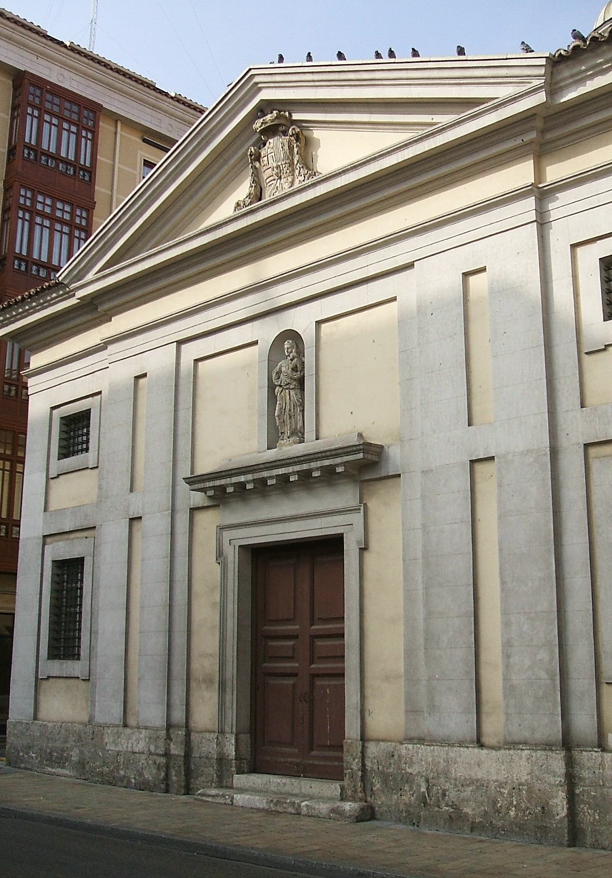
The Museo del Monasterio de San Joaquín y Santa Ana is a museum of sacred art in Valladolid, set behind a stark neoclassical façade on Plaza Santa Ana. It occupies part of an active convent of Cistercian Bernardine nuns, so a visit combines centuries-old religious art with a rare glimpse behind the walls of a living monastic community. Where does this place come from? The community's roots go back to 1596, when a group of Benedictine-Cistercian recoleta nuns moved to Valladolid from the area of Perales, in the province of Palencia. Settling in the city, the sisters adopted Saints Joachim and Anne as patrons, giving the convent its current name and dropping its earlier dedication. Architect Francisco de Praves adapted the original buildings for monastic use. By the late 18th century the structure had deteriorated so badly that in 1777 the community petitioned the Spanish crown for help, since the monastery held royal-foundation status — the source of "Real" in its full name. The new building went up between 1780 and 1787 to designs by Francesco Sabatini, one of the leading court architects under Charles III. The result is a deliberately austere neoclassical block, typical of the period's late-century restraint. What is there to see inside? The museum has operated since 1978 across seven rooms on two floors of the former convent. The collection includes 16th-century paintings, a set of dressed images of the Christ Child, and polychrome wood sculptures ranking among the finest examples of Spanish Baroque carving. Highlights include a Reclining Christ by Gregorio Fernández and a Sorrowful Virgin by Pedro de Mena, two sculptors considered the leading figures of 17th-century Spanish religious carving. The convent church holds a further surprise: three early canvases by Francisco de Goya, alongside works by Ramón Bayeu. These are the only paintings by Goya preserved anywhere in the region of Castile and León, making the site a genuine must for anyone interested in Spanish painting, even though the building itself draws far fewer visitors than Valladolid's larger museums. How do you get there and when should you go? The museum sits at Plaza Santa Ana 4, in a quiet part of the city that is an easy walk of about fifteen minutes from Valladolid's historic centre. It opens Wednesday through Monday, from 10:00 to 14:00 and again from 17:00 to 20:30, and is closed to visitors on Tuesdays. Because part of the building remains an enclosed convent, it is worth allowing some flexibility when planning a visit — access follows the rhythm of the community's daily life, and certain rooms may only be open at specific times. The afternoon opening slot makes the museum a natural fit for a day that pairs a morning tour of the city centre with a calmer, less crowded visit in the early evening. Who is this museum for? This is a destination for travellers with a specific interest in sacred art, Baroque sculpture, or architectural history, rather than a stop on a quick city-centre loop. The compact scale of the seven rooms means the whole collection can be seen unhurried in under an hour, making it a strong complement to a visit to Valladolid's larger museums — including the nearby Museo de Valladolid, a separate institution unrelated to the San Joaquín y Santa Ana convent. Frequently Asked Questions Do nuns actually still live in the monastery? Yes. San Joaquín y Santa Ana remains an active Cistercian convent, and the museum occupies only the section of the building open to the public. What is the standout piece in the collection? The three early paintings by Francisco de Goya in the convent church — the only works by the artist preserved in Castile and León — along with sculptures by Gregorio Fernández and Pedro de Mena. How long does a visit take? With just seven rooms, a full visit typically takes 45 to 60 minutes. Is the museum open every day? No, it is closed on Tuesdays; on other days it operates in two blocks, morning and evening.
-
Museo de la Capilla Real
Grenada
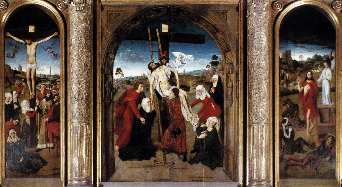
Museo de la Capilla Real is a small but remarkably dense museum in Granada, tucked inside the Royal Chapel right next to the cathedral. In its sacristy-museum you'll find the personal belongings of Queen Isabella the Catholic, and it's a good place to understand why this corner of the city has drawn history-minded travelers for centuries. What's actually inside? The chapel was commissioned by Isabella of Castile and Ferdinand of Aragon as their burial place after the conquest of Granada in 1492, which ended Muslim rule on the Iberian Peninsula. Architect Enrique Egas built it in the late Gothic (Isabelline) style around the turn of the 16th century. Inside the chapel itself stand the marble tombs of the Catholic Monarchs along with those of their daughter Juana and her husband, Philip the Handsome. The museum, set in the adjoining sacristy, has a completely different feel — smaller, more personal, less monumental. Display cases hold the objects Isabella asked to be buried with: her crown, her scepter, her personal mirror, and King Ferdinand's sword. Alongside these sit 15th- and 16th-century paintings and sculptures, several drawn from the queen's own collection, which was known for its Flemish religious art. How do you get there, and when should you go? The chapel and museum sit right in the historic center of Granada on Calle Oficios, a short walk from the cathedral and Plaza Bib-Rambla. It's easiest reached on foot from Plaza Nueva or Puerta Real, both firmly in the tourist core of the city, so getting there is never the issue. The site is open Monday through Saturday and closed on Sundays and public holidays — worth checking before you plan a weekend visit. How long should you plan for? A visit to the chapel and museum together typically takes 30 to 45 minutes. It's not a place to build a whole morning around, but it pairs naturally with a visit to the cathedral and the nearby Alcaicería market. The rooms are small, so during peak season it can get crowded — arriving right at opening time helps. Why does it matter? Few places in Spain make political history this tangible: the unification of Castile and Aragon, the end of Muslim rule in Al-Andalus, and the dawn of Spain's age of exploration are all represented here through actual objects rather than plaques. The museum's Flemish painting collection tends to get overlooked by visitors focused entirely on the Alhambra, yet it offers a genuine window into the artistic taste of the Spanish royal court around 1500. Frequently asked questions Do I need a separate ticket for the museum? No — entry to the sacristy-museum is included in the same ticket as the Royal Chapel visit; there's no extra fee to see the collection. Are the tombs of the Catholic Monarchs real? Yes. Beneath the marble monuments in the crypt lie the actual coffins of Isabella and Ferdinand, along with those of Juana and Philip the Handsome — it's not a purely symbolic memorial. Should I combine this with the Granada Cathedral? Definitely — the chapel and cathedral are connected and sit on the same street, so pairing the two visits is logistically easy and takes about ninety minutes in total. Is photography allowed inside the museum? Photography rules can change, so it's best to check current conditions at the ticket desk or on capillarealgranada.com before your visit.
-
Museo del Retablo
Burgos
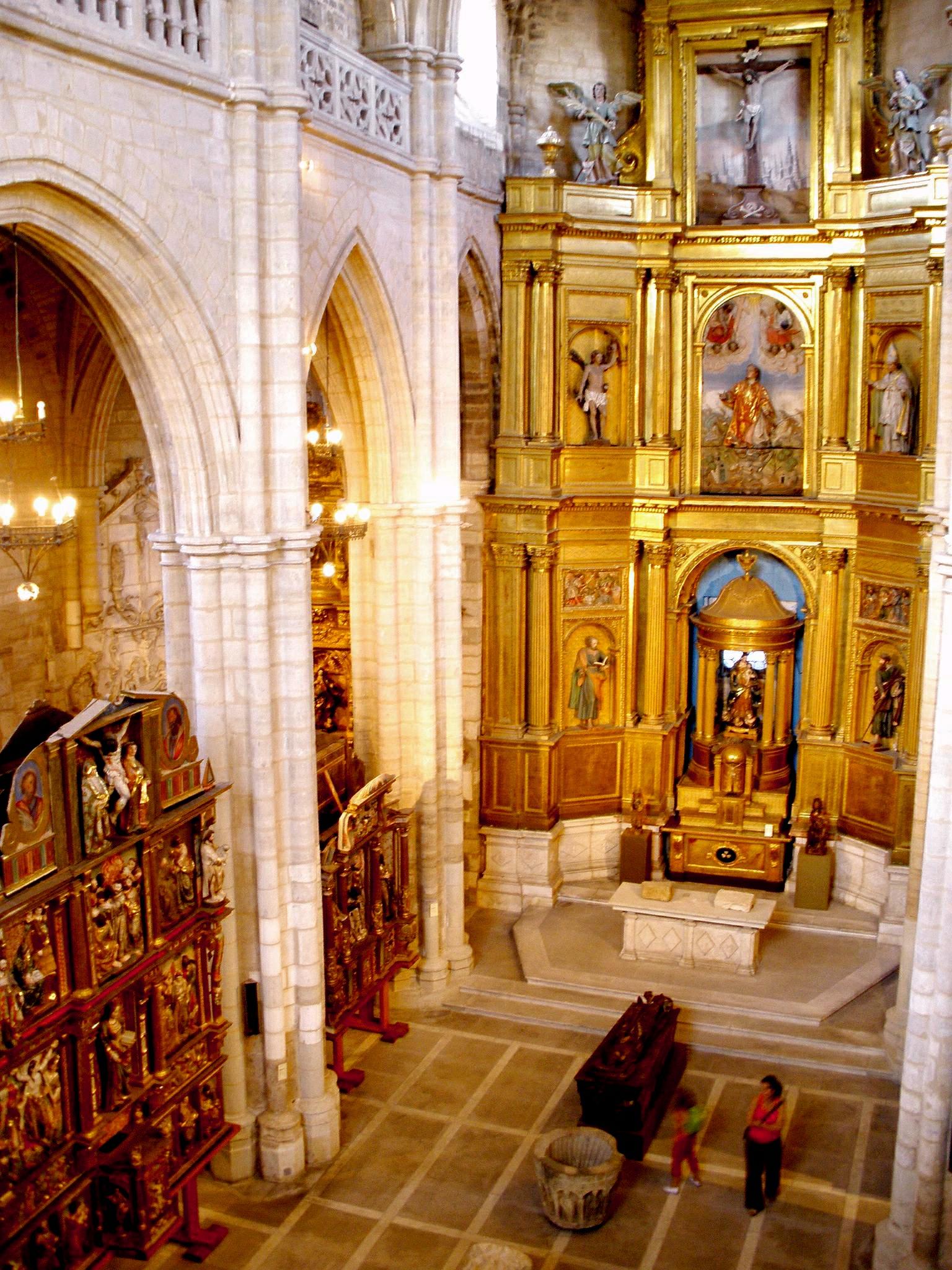
Museo del Retablo is a small but striking museum of religious art housed inside the former church of San Esteban in Burgos, northern Spain. Rather than an empty, deconsecrated building, you'll find a space densely packed with altarpieces, statues, and liturgical objects rescued from small village churches across the province that could no longer safeguard them. Where is it and how do you get there? The museum sits on Calle San Esteban 1, in the old quarter of Burgos, a short walk from the cathedral and the medieval city walls. You can reach it on foot within minutes from the historic center, making it easy to combine with a visit to the cathedral or the castle hill in a single afternoon. Burgos itself sits on the main route linking Madrid with northern Spain, so getting there by train or bus from other cities in the region is straightforward. What will you see inside? The building itself is worth the visit on its own merits: a Gothic church dating from the late 13th and early 14th centuries, with three naves, three apses, and the plain ribbed vaulting typical of Burgos Gothic architecture. One feature sets it apart from the city's other churches — a surviving 14th-century cloister and chapter house. Inside, the collection brings together altarpieces, sculptures, metalwork, and funerary art gathered from small parishes throughout the province of Burgos. Most pieces date from the 16th to 18th centuries and span late Gothic, Renaissance, and Baroque styles. The altarpieces — richly carved and gilded "retablos" — give the museum its name and remain its main draw. Why was this museum created? The idea came from canon Agustín Lázaro, who oversaw heritage matters for the diocese of Burgos. Many rural churches in the province were losing population, and with it the ability to properly guard and maintain valuable altarpieces. Moving these works into a single, secure building in Burgos protected them from decay, theft, and simple neglect. How long should you plan for a visit? Given the modest size of the interior, a visit typically takes between 30 and 45 minutes. It's a good pick for anyone interested in religious art and regional history, and it makes an interesting complement to a cathedral visit if you're looking for something off the main tourist track. When is the best time to visit? The museum opens Tuesday to Saturday from 10:00 to 14:00 and 17:00 to 20:00, and Sunday mornings from 10:00 to 14:00. It's closed on Mondays. Afternoon visits tend to be best, since natural light streaming through the nave windows shows off the interior at its finest. Frequently asked questions Is Museo del Retablo still an active church? No — the San Esteban building no longer holds religious services and functions solely as a museum, though it retains its full Gothic religious architecture. What does "retablo" actually mean? It's the Spanish word for an altarpiece — typically a tall, carved and gilded structure placed behind the altar table, common in Catholic churches across Spain. Is it worth combining with other Burgos attractions? Yes, the museum is just minutes on foot from the cathedral and the old town, so it fits naturally into a walking tour of the historic center. Is the building accessible for visitors with mobility issues? As a historic church with uneven floors and steps, accessibility can be limited — it's worth calling ahead to check before your visit.
-
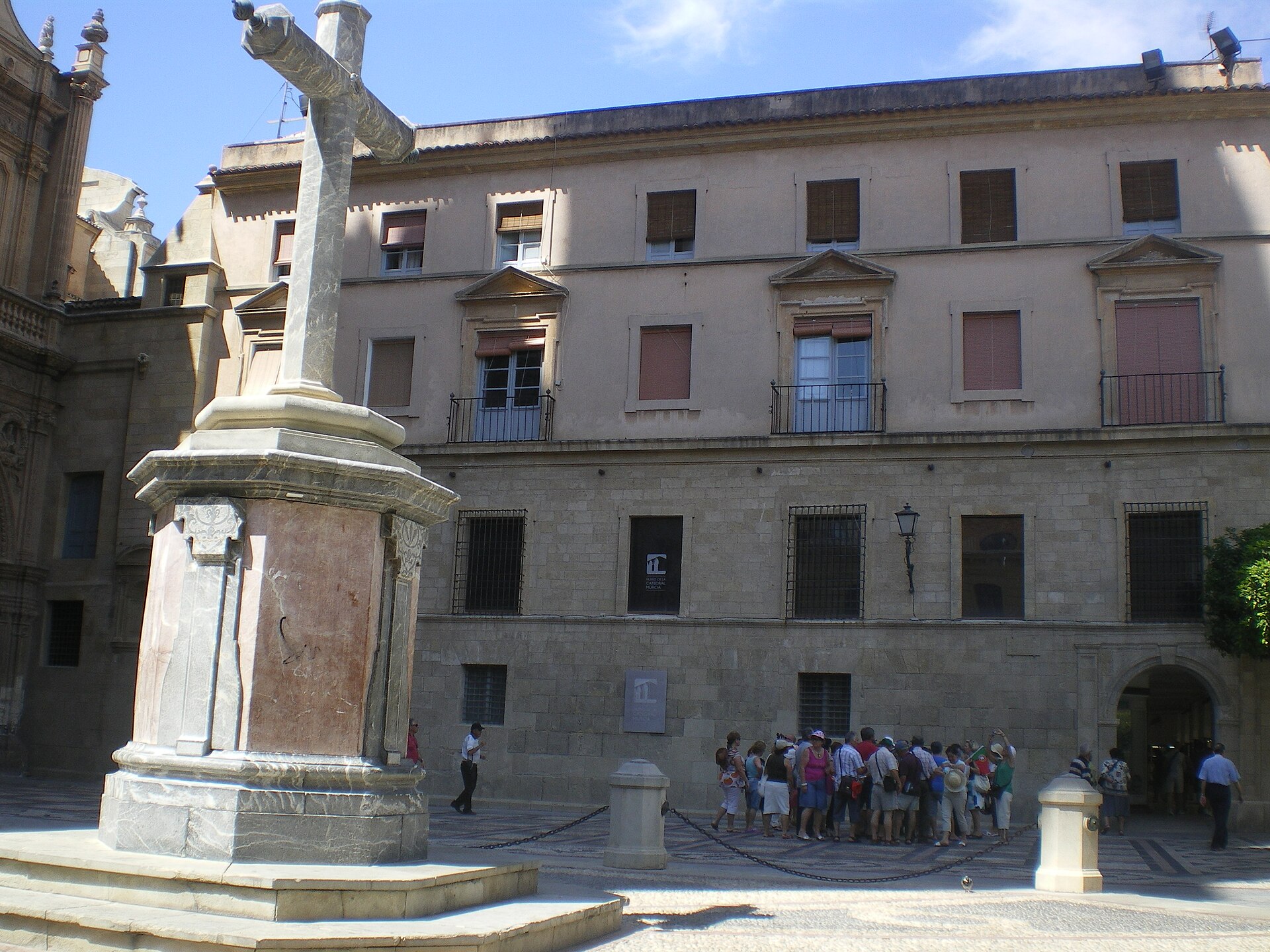
Museo de la Catedral de Murcia
Murcja
Museo de la Catedral de Murcia is the cathedral museum of Murcia, housed inside the old Gothic cloister attached to the Santa María Cathedral. Its collection spans religious art from the Roman era to modern times, and a walk through the building doubles as a walk through centuries of the city's history. Where is it and how do you get there? The museum occupies the former cloister next to the cathedral, built during the tenure of Bishop Peñaranda (1337–1351). It sits right in the historic core of Murcia, so it's within easy walking distance from anywhere in the old town. The museum has its own entrance, separate from the cathedral's, though a combined ticket covers both. What can you see inside? The exhibition is spread across several rooms holding paintings and altarpieces, liturgical silverware, sculpture, and ecclesiastical vestments gathered over centuries, many donated by Murcia's wealthiest families. On the ground floor, look for the Roman sarcophagus known as the Sarcophagus of the Muses, the Gothic altarpiece of the Virgin of the Milk by Bernabé de Módena (14th century), and the historic bell known as La Mora. Among the most valuable pieces are works by Francisco Salzillo, Murcia's celebrated Baroque sculptor, including his San Jerónimo and Cristo del Fascistol, alongside Italian Trecento paintings and canvases by Luca Giordano. A standout piece is the Custodia del Corpus, a monumental processional monstrance crafted by Antonio Pérez de Montalto in the 17th century. What's hidden beneath the floor? One of the most memorable parts of the visit is a wood, metal, and glass walkway suspended above an archaeological dig uncovered during restoration work. Beneath it lie the remains of the old Friday mosque that once stood on this spot before the cathedral was built — walking over it means stepping across more than a thousand years of the site's construction history in a single glance. What's the museum's history? The museum opened in 1956, an initiative of Bishop Miguel de los Santos Díaz-Gomara, who held office from 1935 to 1949 and pushed for a permanent home for the cathedral's art collection. It reached its current layout and scale after a major expansion in 2007, when exhibition space was enlarged and the collection reorganized by theme. When should you visit, and what does it cost? From October to June, the museum is open Tuesday to Saturday from 10am to 1pm and 4pm to 7pm, and Sundays and public holidays from 10am to 1pm. In summer, from July to September, hours shift to Tuesday–Saturday 10am to 5pm with no midday break. A cathedral-only ticket costs €5, the museum alone €4, and a combined ticket for both €7. Visitors over 65, under 16, and those with disabilities pay reduced rates: €4 for the cathedral, €3 for the museum, and €6 for the combined ticket. Frequently asked questions Does a cathedral ticket include museum entry? Not automatically — the cathedral and the museum are ticketed separately, but a combined ticket at €7 (€6 reduced) works out cheaper than buying both on their own. How long does a visit take? A typical visit runs 45 minutes to an hour, depending on how much time you spend in each room and on the underground archaeological walkway. Is the museum accessible for visitors with disabilities? Reduced-rate tickets are available for visitors with disabilities, but given the building's historic, multi-level layout it's worth checking accessibility of specific rooms ahead of your visit. Is it worth combining the museum with a climb up the cathedral tower? Yes — it's a separate attraction within the same complex, and it pairs well with the museum visit, offering sweeping views over Murcia's old town.
-
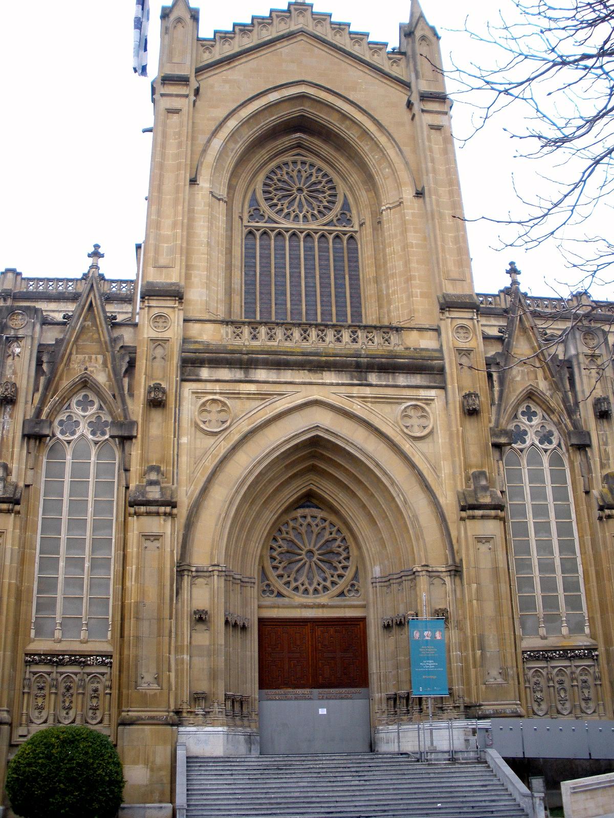
Museo Diocesano de Arte Sacro de Álava
Vitoria-Gasteiz
Museo Diocesano de Arte Sacro de Álava is a museum of sacred art in Vitoria-Gasteiz, the capital of the Basque Country and of the province of Álava. It brings together liturgical objects, paintings, sculptures and goldsmith work gathered from churches and parishes across the diocese, letting visitors see religious heritage otherwise scattered across the whole region in a single place. What will you see inside? The collection follows the pattern common to diocesan museums: altarpiece paintings and sculptures, liturgical vessels and vestments, crucifixes and other church furnishings that were moved into the museum's care for conservation or preservation reasons. Walking through the rooms gives a sense of how religious art in Álava evolved over the centuries, from medieval pieces to later devotional works, making it a worthwhile complement to a walk through Vitoria-Gasteiz's historic centre, where the museum is located. How do you get there and when should you go? The museum sits within the old quarter of Vitoria-Gasteiz, within walking distance of the city's main landmarks such as the cathedral and Plaza de la Virgen Blanca, so the easiest way to reach it is on foot while exploring the old town. The city has good train and bus connections to Bilbao, San Sebastián and Madrid; Vitoria-Gasteiz's own airport mainly handles domestic and cargo flights, so most foreign visitors arrive via Bilbao. Plan your visit around the opening hours, since they are limited and the museum is closed on Mondays. What are the opening hours? The museum opens Tuesday to Friday from 10:00 to 14:00 and again from 16:00 to 18:30, on Saturdays from 10:00 to 14:00, and on Sundays from 11:00 to 14:00. Morning visits work on any day the museum is open, while afternoon access is only available Tuesday through Friday. It's worth calling ahead to confirm hours, especially around holidays, at +34 945 15 06 31. Who is this museum for? The museum suits visitors interested in art history, religious architecture and the local Catholic heritage of the Basque Country. Given the nature of the collection — objects of worship and church furnishings — it appeals particularly to travellers combining cultural tourism with an interest in the region's ecclesiastical history, though it also works well as a quieter, shorter stop while touring the old town of Vitoria-Gasteiz. Frequently asked questions Is admission free? Ticket policies and prices can change, so it's best to confirm current details by calling the number listed above before your visit. How long does a visit take? Given the typical size of a diocesan museum's collection, a visit usually takes between 30 and 60 minutes, depending on your pace and interest in the details. Is the museum accessible for visitors with disabilities? Accessibility depends on the specific building housing the museum, so it's worth calling ahead, especially if you're travelling with a wheelchair or a person with limited mobility. What else is worth seeing nearby? The museum sits in the historic centre of Vitoria-Gasteiz, close to the cathedral and the old town's main squares, making it easy to combine the visit with a walking tour of the city's other landmarks.
-
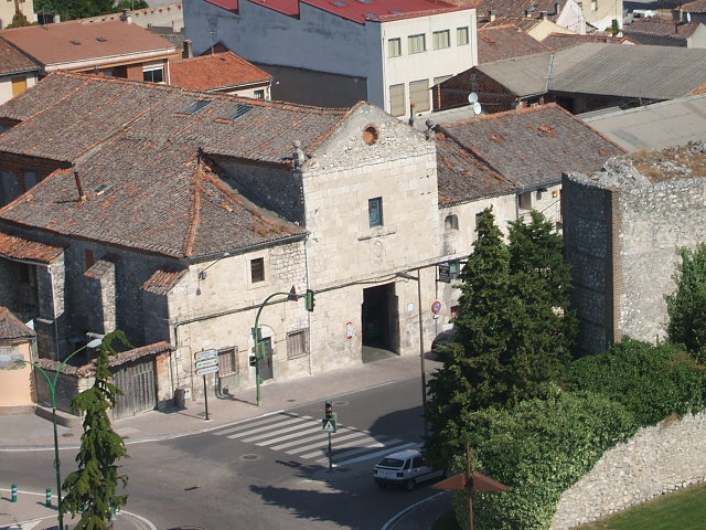
Convento de San Basilio
Cuéllar
Convento de San Basilio is a historic former monastery in Cuéllar, one of the best-preserved medieval towns in Segovia province. The building sits in the upper part of town, in the old San Andrés quarter, right beside the walls that ring the historic centre and close to the castle of the Dukes of Alburquerque. What is the history behind the building? A community of Basilian monks first settled in the area back in the 13th century, though not on this exact spot — their original monastery stood about half a league outside town, on the banks of the River Cega. It was only in 1606 that the monks relocated inside the walls, to the rise of ground next to the castle where the building still stands today. By the mid-17th century the monastery had gained a powerful patron: Ana Enríquez de Cabrera y Colonna, widow of Francisco Fernández de la Cueva, 7th Duke of Alburquerque, bought the patronage rights to the main chapel. From that point the church became tied to the ducal family's patronage network, which explains the architectural ambition of a building raised under aristocratic sponsorship of the period. The Basilian order held the property continuously until the 19th century, when the monastery was suppressed during Spain's Desamortización — the sweeping secularization of church property. Since then the building's function has shifted several times, and today the entire structure is given over to commercial use. What can visitors actually see? The monastery is part of a wider cluster of religious landmarks in Cuéllar, a town famous for its dense concentration of Mudéjar churches and for its castle, now home to a secondary school. San Basilio fits into that picture as an example of monastic architecture shaped by local aristocratic patronage, and its hilltop position by the walls offers a solid vantage point over the rest of the old town. Because the building now operates commercially, visits are mostly limited to viewing the façade and its setting within the urban fabric — best paired with a walk through the San Andrés quarter and along the town walls. How do you get there, and when's the best time to visit? Cuéllar sits in Segovia province, well connected to both Madrid and Valladolid, making it an easy stop on a route through Castile. Driving is the most practical option — the town itself is compact and best explored on foot once you've parked near the walls. Spring and autumn are the best seasons to visit, when Castilian temperatures are mild and summer heat doesn't get in the way of walking between the sights scattered across the old town. Frequently asked questions Can you go inside the Convento de San Basilio? The building is now entirely in commercial use, so interior visits aren't generally available — the draw is the exterior architecture and its setting in the historic quarter. Where exactly is the monastery located? In the upper part of Cuéllar, in the San Andrés quarter, right next to the castle and the town walls. Has the monastery always stood on this site? No — the original 13th-century Basilian monastery stood outside town, by the River Cega. The current building dates from after the community's move in 1606. What happened to the building after secularization? Following the 19th-century Desamortización, the monks left the property and it gradually shifted to secular use — today it is entirely commercial.
-
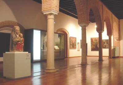
Museo del Convento de Santa Clara de Zafra
Zafra
Museo del Convento de Santa Clara de Zafra is a small museum of religious art housed within a Poor Clares convent in Zafra, in the province of Badajoz. What is on display inside? The collection occupies part of the convent buildings and gathers objects tied to monastic life and religious devotion: liturgical vestments, paintings, and smaller pieces of sacred art assembled by the community of nuns over generations. A visit offers a glimpse into the rhythm of an enclosed religious community and shows what everyday life looks like behind walls that most passers-by only see from the street. This is a modest, quiet stop rather than a large city gallery, best suited to visitors curious about local history and devotional art. Where exactly is the convent located? The building stands in the historic centre of Zafra, a town often nicknamed "the little Seville" for its whitewashed architecture and arcaded squares. The Convento de Santa Clara sits within easy walking distance of the old town's main landmarks, so a visit fits naturally into a broader stroll around Zafra's historic core. What are the opening hours? Hours change with the season. From 15 October to 14 June, the museum welcomes visitors Tuesday to Sunday, from 11:00 to 14:00 and again from 17:00 to 18:30. During the summer stretch, from 15 June to 14 October, opening hours shrink to a single morning block, Tuesday to Sunday from 10:00 to 14:00. Mondays are closed all year round, and the museum also shuts on several public holidays: 1, 5 and 6 January, 15 May, and 24, 25 and 31 December. Because small convent museums sometimes adjust their schedule, it is worth confirming the current hours shortly before a visit. Who is this attraction best suited for? The site suits travellers who enjoy a slower pace and want to see a quieter side of Zafra, away from crowds. It pairs well with a visit to the nearby Alcázar, known for its elegant patio, and a walk through the Plaza Grande and Plaza Chica, the two adjoining squares that form the heart of town. Given the enclosed nature of the community, access to some areas may be more limited than in a typical secular museum, and the scope of a visit can vary. Is it worth building extra time into a Zafra stop? Zafra itself is compact and easy to cover in a single day. The convent museum is one of several points that together give a rounded picture of the town, alongside the Mudejar-Gothic collegiate church and the Renaissance houses lining the main squares. For travellers touring Extremadura, Zafra often works well as a stop between Seville and Mérida or Cáceres. Frequently asked questions Do I need to book in advance? Because of the convent's small scale and enclosed character, access can be limited at certain times, so it is worth checking locally or by phone before arriving. How long does a visit take? The exhibition is small, and a visit typically takes between thirty minutes and an hour, depending on pace and interest in sacred art. Is the museum open every day? No, the convent is closed to visitors on Mondays, as well as on several public holidays during the year, such as 1 and 6 January or 24–25 December. Is it worth combining with other sights in Zafra? Yes, the convent sits close to the historic centre, making it easy to combine with a visit to the Alcázar and a walk around the old town's main squares.
-
Sacred Art Museum of Tineo
Tineo/Tinéu
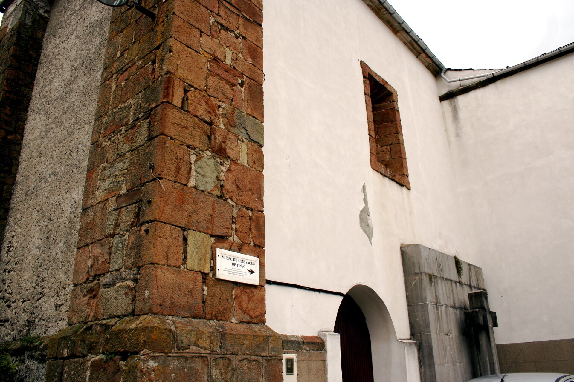
Sacred Art Museum of Tineo is a museum of religious art in Tineo (Tinéu), Asturias, set inside a 14th-century Roman Catholic church. The combination of a historic sacred building and a themed collection makes it an unusual stop for visitors exploring inland Asturias. Where is the museum located? The museum sits in Tineo, a town in western Asturias known for its mountainous surroundings and shepherding traditions. Access is via the AS-217, a local road connecting Tineo to neighbouring towns, and driving is the most practical way to reach it. The exact coordinates are 43.335012, -6.415056, placing the museum within easy walking distance of the town centre. Why is the museum housed in a church rather than a purpose-built building? The building itself is part of the experience. The church dates back to the 14th century and served as a place of worship for centuries before its interior was adapted to display religious art. For visitors, this means the architecture — the vaulting, the proportions of the nave, the stone construction — is as much a reason to visit as the objects on display. Presenting sacred art inside its original religious setting is a common approach in smaller Asturian towns, where churches have lost their parish function but retained their heritage value. What should you know before visiting? The name of the institution points clearly to what it holds: objects connected to religious worship, in line with the kind of regional sacred-art collections found across northern Spain. This is a destination that matters most to visitors with an interest in the history of the Catholic Church in Asturias and in the region's religious architecture, rather than a full-day attraction — a visit here tends to be short and focused. Tineo itself works well as a base for exploring western Asturias. The area is known for its mountain trails, traditional food (including cheeses with protected origin status), and a quiet, rural character that contrasts with the more touristic Asturian coast. How do you get there, and when should you visit? Driving along the AS-217 is the most convenient option — Tineo has no direct rail connection, and the local road network is the standard way of moving between towns in this part of Asturias. It's worth combining a visit with a walk through Tineo's town centre, since the museum sits within the town rather than on its outskirts. Frequently asked questions What is the Sacred Art Museum of Tineo? It is a museum of religious art housed in a 14th-century Roman Catholic church in Tineo, Asturias. How do you get to the museum? The easiest way is by car along the AS-217, which leads into Tineo and its town centre, where the building is located. Does the building have historical value beyond the collection itself? Yes — the church dates to the 14th century, so the building's architecture is a separate reason to visit, alongside the sacred art on display. Who is this museum best suited for? Mainly visitors interested in religious history and sacred architecture in Asturias — it's a small, themed museum rather than a large-scale tourist attraction.
-
Ismail Ibn Sharif
Al Machouar – Stinia
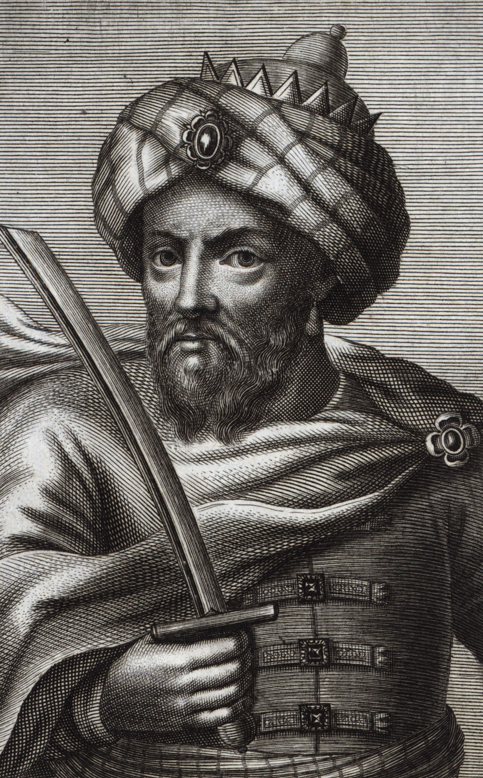
The Mausoleum of Moulay Ismail is one of the must-see landmarks in Meknes — the burial complex of the sultan who turned the city into an imperial capital. Who was the sultan buried here? Moulay Ismail ibn Sharif ruled Morocco from 1672 to 1727 as a sultan of the Alaouite dynasty. He moved the imperial capital to Meknes and launched a vast construction program there — fortified walls, palaces, granaries and squares, much of which still stands today. The mausoleum was built while he was still alive, and after his death he was laid to rest there together with one of his wives and two of his sons. What does the inside of the mausoleum look like? A visit starts in an entrance hall with an ornate vaulted ceiling, leading through a sequence of rooms into small, intimate courtyards. Marble, carved stucco and zellige tilework cover the walls — geometric patterns and calligraphic inscriptions typical of Moroccan religious architecture from that era. Standing next to the tombs are tall grandfather clocks, a gift from the French king Louis XIV to the sultan, and they remain one of the most memorable details inside. Can non-Muslim visitors go inside? Yes — the mausoleum is one of the few active places of Muslim worship in Morocco open to non-Muslims. Visitors can walk through the courtyards, the entrance hall and the rooms leading up to the burial chamber. Shoes must be removed before entering the area with the tombs, a basic sign of respect since the site still functions as an active shrine and a pilgrimage destination. Where is it, and how do you get there? The complex sits inside the old imperial quarter of Meknes, a short walk from Bab Mansour, one of Morocco's most famous gates and a natural landmark for anyone heading to the mausoleum. Entry is free, though visitors can leave a voluntary donation toward the upkeep of the site. It's worth knowing that the mausoleum typically closes for a midday break, and access for non-Muslim visitors can be limited on Fridays. Why is it worth visiting? The Mausoleum of Moulay Ismail is more than a tomb — it's a record of the ambitions of one of Morocco's longest-reigning sultans. He built Meknes into an imperial city meant to rival Fez and Marrakech in scale, and the mausoleum remains the most representative surviving piece of that legacy: a place where architecture, history and a living religious practice still meet in one calm space at the heart of the medina. Frequently asked questions Is there an entrance fee? No, entry is free. Visitors are welcome to leave a voluntary donation toward maintaining the site. Do I need to follow a dress code to enter? There's no strict dress code, but modest clothing appropriate for a place of worship is expected, and shoes must be removed before entering the room with the tombs. Can I visit at any time of day? Not quite — the site closes for a midday break, and on Fridays access for tourists can be restricted due to prayers. What's the biggest highlight inside? Beyond the tombs themselves, visitors are drawn to the marble and stucco decoration and to the grandfather clocks — a gift from Louis XIV to the sultan — placed next to the burial chamber.
-
Igrexario da Grela
A Coruña
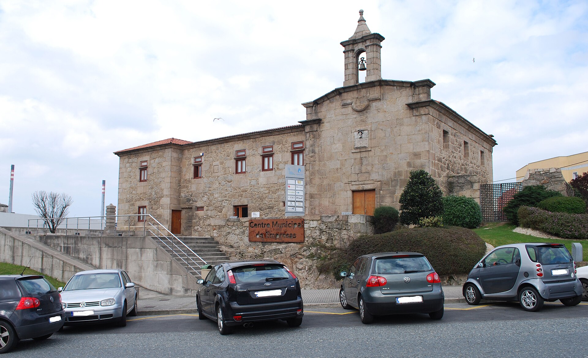
Igrexario da Grela is a small chapel-and-residence complex tucked into the A Grela district of A Coruña, within the parish of San Cristovo das Viñas. Surrounded today by the offices and warehouses of the Parque Empresarial da Grela business park, the building has kept its Baroque character intact and rewards a short detour for anyone curious about the city's lesser-known heritage sites. What kind of building is this? "Igrexario" is the Galician term for a compound combining a chapel with an attached chaplain's house. The Grela foundation dates back to June 1724, established by a deed signed in Cádiz by Antonio Pardo. The resident chaplain was expected to live on site, conduct religious services, and give free lessons to local children — an educational role that was part of the foundation's charter from the start. The building itself went up later, between 1754 and 1765, under two Baroque master builders linked to Santiago de Compostela: Simón Rodríguez and Clemente Ferrer Sarela. Their involvement explains the stylistic kinship between the facade here and the Compostela architectural school of the period. What will you actually see? The church has a single nave covered by a barrel vault. The facade is deliberately plain, dominated by a large stone plaque bearing the founder's coat of arms, and topped with a small bell gable in a style closer to folk art than high Baroque. The most distinctive detail is the doorway itself: a vertical opening framed with "ear-shaped" moulding, a decorative flourish typical of Galician Baroque and found across many rural churches in the region. Next to the church stands the former convent building, once home to a small religious community and the resident chaplain. The complex also retains a granite wayside cross (cruceiro), set on a truncated pyramidal platform with a cubic, chamfered-corner pedestal, a cylindrical shaft, and an octagonal cross topped with fleur-de-lis-style finials — one of many such crosses found at crossroads and churchyards throughout Galicia. How has the site changed over time? During the 20th century, as public schools were built in the surrounding area, the foundation supporting the igrexario ran out of funds, and the property passed into municipal ownership. Today the former religious buildings house the Centro Municipal de Empresas, a city-run business support centre. It's an unusual pairing: a Baroque chapel and convent now form part of A Coruña's entrepreneurship infrastructure, without losing their original architectural identity. Getting there and best time to visit Igrexario da Grela sits in the A Grela district, just a few hundred metres from the Parque Empresarial de Agrela business park — an easily reachable part of the city, with no need to leave A Coruña proper. It suits travellers interested in off-the-beaten-path corners of the city, and pairs well with a walk through the surrounding residential neighbourhoods. Since the building now functions as an office space, weekdays during business hours are the best time to visit, when the grounds are accessible from outside. Frequently asked questions Can you go inside? The building now operates as the Centro Municipal de Empresas, so access to the chapel's interior may be limited — but the facade and the cruceiro can be viewed freely from outside. Where does the name "igrexario" come from? It's a Galician word for a chapel-plus-residence complex; many such sites exist across Galicia, each tied to a local religious foundation. Who built the chapel? Construction between 1754 and 1765 was carried out by Simón Rodríguez and Clemente Ferrer Sarela, architects connected to the Santiago de Compostela Baroque school. What's worth photographing? The doorway with its ear-shaped moulding typical of Galician Baroque, and the granite cruceiro standing beside the complex — both capture the local tradition of stone craftsmanship well.
-
Basilica of the Most Holy True Cross
Caravaca de la Cruz
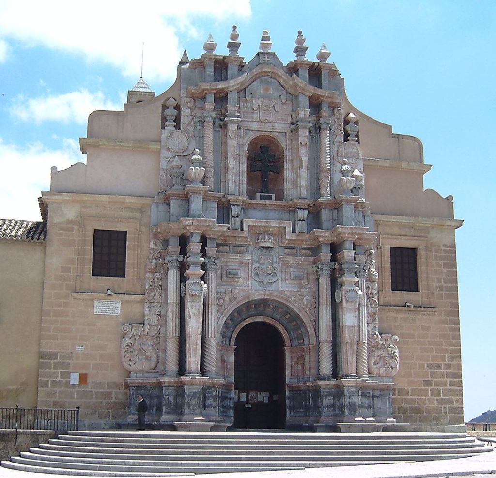
The Basilica of the Most Holy True Cross (Real Basílica de la Vera Cruz) sits atop the hill in Caravaca de la Cruz, enclosed within the walls of the town's castle, and ranks among the most significant Catholic shrines in the Murcia region. It houses the Lignum Crucis, a relic believed by tradition to be a fragment of the wood from the cross on which Christ died. What is kept inside the sanctuary? At the heart of the basilica stands a chapel holding the reliquary shaped like a double-armed cross — the distinctive emblem known as the Cross of Caravaca. The church was raised over an earlier medieval chapel that had guarded the relic for centuries. The interior follows the early Baroque style, with decoration befitting a major pilgrimage site. When was the current building constructed? Work on the present church began in 1617, designed by Fray Alberto de la Madre de Dios, an architect connected to the Spanish royal court. Construction stretched on for decades, and the basilica was finally completed in 1703. In 1944 the building was declared a Historic-Artistic Monument, a status that today corresponds to a Property of Cultural Interest. In 2007, Pope Benedict XVI granted it the title of minor basilica. Where does the legend of the Cross of Caravaca come from? Tradition holds that on 3 May 1231, while Caravaca still lay under Muslim rule, a priest named Ginés Pérez de Chirinos — held captive by the local ruler Ceyt-Abuceyt — was about to celebrate Mass without a cross. At the exact moment the liturgy required one, a double-armed cross is said to have descended from heaven, carried by angels. The event, regarded as a miracle, is said to have led the ruler and his court to convert to Christianity. According to historical accounts, the cross itself had previously belonged to Patriarch Robert, the first bishop of Jerusalem, who lived at the end of the eleventh century. Why is Caravaca de la Cruz called a Holy City? In 1998, Pope John Paul II granted Caravaca de la Cruz the status of Holy City (Ciudad Santa), one of only five such places in the world, alongside Rome, Jerusalem, Santiago de Compostela and Santo Toribio de Liébana. The distinction allows the town to celebrate a Jubilee Year every seven years, drawing pilgrims from across Spain and beyond. As the keeper of the relic, the basilica sits at the center of these celebrations. How should visitors plan a visit? The sanctuary forms part of the castle complex overlooking the town, so a visit pairs naturally with a walk along Caravaca's walls and towers. It's worth setting aside time both for the church interior and for the surrounding hilltop, which offers views over the old town and the hills of Murcia beyond. Frequently asked questions What is the difference between the basilica and Caravaca Castle? The castle is the entire fortress crowning the town's hill, while the basilica is the church built within its walls around the relic of the True Cross — two distinct, adjoining structures. What exactly is the Lignum Crucis? It is the name given to the relic — a fragment of wood kept in a double-armed cross-shaped reliquary — that tradition links to the cross of Christ. When is the best time to visit for the religious celebrations? The most intense festivities take place during the Jubilee Year, declared every seven years since 1998, and around 3 May, the anniversary of the cross's legendary descent. Does the title of minor basilica matter for visitors? Granted in 2007 by Pope Benedict XVI, the title underscores the site's spiritual standing and carries certain liturgical privileges, but for a visitor it mainly confirms the sanctuary's exceptional status within the wider Church.
-

Parroquia de María Auxiliadora
Santa Cruz na Teneryfie
Parroquia de María Auxiliadora Parroquia de María Auxiliadora is a parish church in the Duggi neighborhood of Santa Cruz de Tenerife, standing on Calle General Serrano. It carries the official heritage status of Bien de Interés Cultural in the monument category, and its story is inseparable from the Salesian religious order that has shaped this part of the city for decades. How did the parish community begin? The community traces its origins back to 1949, when the Salesian priest Father Berta, director of the Don Bosco college in the La Paz district, founded the Archconfraternity of Mary Help of Christians at the Santa Ana college. That devotional movement grew into the seed of a future parish. The Colegio Don Bosco itself opened in 1968, and just a year later the Archdiocese of Santa Cruz formally established the parish, placing it under the care of the local Salesian community. How was the current church built? Construction of the present-day temple began around the late 1950s and early 1960s, based on a design by architect Enrique Huidobro. The project was carried forward and completed in 1972 by his son, Javier Huidobro, continuing his father's work. The church was formally inaugurated on 23 May 1973 in a ceremony led by Cardinal Vicente Enrique y Tarancón. Although the building had already served the college and the Salesian community for religious purposes earlier, it only began operating officially as a parish church in the year 2000. Why is the church dedicated to Mary Help of Christians? The title of the church honors Mary Help of Christians (María Auxilio de los Cristianos), a Marian devotion closely tied to the Salesian spiritual tradition founded by Saint John Bosco. It was the Salesians who introduced and nurtured this devotion in the area from the mid-20th century onward, and it became the defining identity of the parish and its patroness. What makes this church worth knowing about? The Parroquia de María Auxiliadora brings together the story of a local Catholic community with the long-standing presence of the Salesian order, which has run educational and pastoral work in this part of Santa Cruz de Tenerife for generations. Its protected heritage status reflects the architectural value of a building shaped across two generations of the same family of architects, spanning the mid-20th century. For visitors interested in the religious and social history of the Canary Islands, the church illustrates how religious institutions helped shape everyday life in individual city neighborhoods. Frequently asked questions Where is the church located? In the Duggi neighborhood of Santa Cruz de Tenerife, on Calle General Serrano. Who designed the building? Architect Enrique Huidobro designed it, and his son Javier Huidobro completed the construction in 1972. When was the church inaugurated? It was inaugurated on 23 May 1973 in a ceremony led by Cardinal Vicente Enrique y Tarancón. What is the church's connection to the Salesians? The parish has been run by the Salesian community since its founding, with roots going back to the Archconfraternity of Mary Help of Christians established in 1949 by Father Berta. Is the building officially protected? Yes, it holds the status of Bien de Interés Cultural in the monument category.
-
Cloister of the Cathedral of Roda de Isábena
Ribagorza
The cloister of the Cathedral of Roda de Isábena is one of the most valuable Romanesque sites in the Aragonese Pyrenees, tucked away in the smallest town in Spain that can still claim its own cathedral. Roda de Isábena today has fewer than fifty residents, yet from the 10th century onward it served as the episcopal seat of the county of Ribagorza — and it is this history that gives the cloister its exceptional significance. How did such a small village end up with a cathedral? The story begins in the 9th century, when Bishop Sisebuto consecrated the local church in 819. The building was raised to the rank of cathedral in the 10th century thanks to Count Ramón II, who wanted to establish a permanent diocesan seat for his house in Roda de Isábena. Consecration under the invocation of Saint Vincent took place on 1 December 956. The building's history was far from peaceful: in August 1006, Abd al-Malik, son of Almanzor, destroyed the original church. It was rebuilt and consecrated again in 1030, followed by a deeper reconstruction between 1053 and 1067, with further work carried out through the 12th century. What does the cloister look like, and when was it built? The cloister itself was built almost entirely in the 12th century, after the main reconstruction of the church. It follows a rectangular plan around a central courtyard, at the middle of which sits a cistern that collects rainwater — a solution typical of monastic cloisters of the period, combining a contemplative function with a practical one. The cloister's columns are topped with capitals carved in Romanesque style, and the walls, arch springers and capital abaci preserve an exceptional collection of funerary inscriptions. Why do the inscriptions in the cloister matter so much? This set of epitaphs is what makes the site unique on a European scale. The collection comprises around 225 letters and is considered the most important stone obituary of its kind known today. The lapidary workshop responsible for the inscriptions was active from the early decades of the 13th century (generally dated to 1200–1230) through to the final decades of the 14th century — meaning that for more than a hundred years, successive stonemasons kept adding epitaphs to the same walls, building a kind of stone register of the dead connected to the cathedral. What else is worth knowing before visiting? The Cathedral of San Vicente is regarded as the oldest cathedral in Aragon, and Roda de Isábena remains the smallest town in Spain to have one. Because of its outstanding artistic and historical value, the whole cathedral complex was declared a national historic monument in 1924, and in 1988 that protection was extended to cover the entire historic layout of the town. The complex has also undergone conservation work on the eastern and western sides of the cloister, aimed at preserving the original stonework and inscriptions for future generations. Frequently asked questions From which century does the cloister date? It was built almost entirely in the 12th century, following the reconstruction of the cathedral after an earlier destructive raid. What sits at the center of the cloister's courtyard? A cistern that collects rainwater, a common feature of medieval monastic cloisters. Why are the cloister's inscriptions so highly valued? They form the largest known collection of medieval funerary epitaphs of this kind in Europe, produced over more than a century. Are the cathedral and cloister legally protected? Yes, the entire complex was declared a national historic monument in 1924, and in 1988 protection was extended to the historic layout of the whole town.
-
Patio de los Naranjos, Cathedral of Málaga
Malaga
Patio de los Naranjos is a small, quiet courtyard next to Málaga Cathedral, lined with rows of orange trees and centered on a modest fountain. It is the only surviving part of the mosque that once stood on this site, before the rest of the building was cleared away to make room for the cathedral. Where did this courtyard come from? Málaga spent several centuries under Muslim rule, and a large mosque stood at the heart of the city. When the Catholic Monarchs captured Málaga in 1487, most of the mosque was demolished so a new Christian church could rise on its foundations. The courtyard planted with orange trees survived, though — a feature typical of Andalusian mosque architecture, where such spaces were used for ritual ablutions before prayer. According to tradition, Isabella I of Castile herself entered through the mosque's main door and walked through this very courtyard on 19 August 1487, marking the city's fall to Christian forces. Why is it worth a visit? Today the courtyard works as a calm buffer zone between the bustle of Málaga's streets and the interior of the cathedral. The rows of orange trees provide shade, and the small fountain adds a soothing touch. Walking across its stone paving is one of the easiest ways to picture how the site looked centuries ago, when the call to prayer rather than church bells marked the rhythm of the day and the courtyard was full of religious life. The patio can be entered from Calle Císter, making it an easily accessible stop even for visitors who don't plan to go inside the cathedral itself. How does the courtyard connect to the cathedral? Málaga Cathedral, formally the Cathedral of the Incarnation, took an unusually long time to build — construction began in 1528 and dragged on until 1782, and even then it was never fully finished. One of the two planned bell towers was left incomplete, earning the building its popular nickname "La Manquita," or "The One-Armed Lady." As a relic of the earlier place of worship, Patio de los Naranjos forms a living link between the two religions and eras that shaped the city's identity. What else is worth knowing about this spot? An orange-tree courtyard attached to a cathedral is not unique to Málaga in Andalusia — a similar patio survives at Seville Cathedral, also built over a former mosque. Málaga's version is smaller in scale, though, which gives it a more intimate, low-key character. The scent of orange blossom in spring and the shade of the trees in summer make it a popular spot for a short rest while exploring the old town. Frequently asked questions Is there an entrance fee for the Patio de los Naranjos? The courtyard sits on the outer part of the cathedral complex and functions as a publicly accessible space, separate from the main interior of the church, which is reached through a separately ticketed entrance. What else remains of the original mosque besides the courtyard? The orange-tree courtyard itself is the main visible trace of the mosque — the rest of the Islamic building was dismantled as the cathedral was constructed over the following centuries. Why is Málaga Cathedral nicknamed "The One-Armed Lady"? Because of its unfinished second bell tower — construction dragged on for more than 200 years and was never completed according to the original plan. When is the best time to visit the courtyard? Spring, when the orange trees blossom and fill the air with their distinctive scent, though the trees and shade make it a pleasant spot at any time of year.
-
Courtyard of the Orange Trees
Kordoba
The Courtyard of the Orange Trees (Patio de los Naranjos) is an enclosed courtyard attached to the Mosque-Cathedral of Córdoba, regarded as one of the oldest surviving gardens in Europe. Its story begins in 784–786, when construction of the Great Mosque started under Emir Abd al-Rahman I, with the courtyard originally serving as the place where worshippers performed ritual ablutions before prayer. How did the courtyard take shape? The porticoed galleries surrounding the courtyard were begun under Abd al-Rahman I and completed by his successor Hisham I, who also added the minaret and the ablution chamber. A further major expansion came under Abd al-Rahman III, when the courtyard was extended toward the north. During the Caliphate period, the mosque's northern façade remained open directly onto the courtyard; only after the Christian conquest, as chapels were added along the perimeter, did the space gradually become enclosed. When did it acquire its present appearance? The three galleries were rebuilt during the tenure of Bishop Martín Fernández de Angulo (1510–1516), under the direction of architect Hernán Ruiz I. The courtyard's current character and name, however, are credited to Bishop Francisco Reinoso (1597–1601), who proposed turning the space into a garden — the point at which the layout began to resemble what visitors see today. Where do the orange trees come from? During the Islamic period, the courtyard was planted mainly with pomegranate, cypress and palm trees rather than citrus. Records confirming the presence of orange trees date back to at least 1512. Today the courtyard holds 98 orange trees, arranged in rows aligned with the columns of the prayer hall inside the mosque and linked by a network of irrigation channels. Beneath the courtyard's surface lies a large water cistern that once supplied the water needed for ritual washing. What fountains stand in the courtyard? Two main fountains remain. The more prominent is the rectangular Fuente de Santa María, dating from the 17th century, with four pillars each fitted with its own water spout. The second, smaller Fuente del Cinamomo stands in the southern part of the courtyard and dates from the mid-18th century. Frequently asked questions Is the Courtyard of the Orange Trees part of the Mosque-Cathedral? Yes, it is the enclosed forecourt of Córdoba's Mosque-Cathedral complex, accessible directly from the street and connected to the building's interior. What was the courtyard originally used for? During the Islamic period it served as the place for ritual ablutions before prayer, and it also hosted public functions such as teaching. How many orange trees grow in the courtyard today? There are currently 98 orange trees, planted in regular rows. When did the courtyard become the garden seen today? Its present form dates mainly from works carried out at the turn of the 16th and 17th centuries, particularly under Bishop Francisco Reinoso between 1597 and 1601.
-
Cementerio de San Bartolomé
Bujalance
Cementerio de San Bartolomé is a historic municipal cemetery in Bujalance, a small town in the province of Córdoba, in the Andalusia region of southern Spain. The cemetery was established in the mid-19th century and has served as the town's main burial ground ever since. Because of its historical and architectural value, the site is protected under Spain's historical heritage law (Ley 16/1985). What can visitors see there? The entrance and the main courtyard are the most striking parts of the cemetery, built in a romantic style typical of 19th-century Spanish cemeteries. This style is defined by carefully laid-out pathways, stone-framed graves, and funerary monuments that echo the sacred architecture of the period. Walking through the grounds gives a sense of the quiet, understated character of Andalusian small-town cemeteries, where past generations invested considerable care in commemorating the dead. Who is buried here? Among those resting at Cementerio de San Bartolomé is Mario López, a poet born in Bujalance whose work forms part of the region's literary heritage. His grave is one of the notable stops for anyone interested in the cultural history of the area. Why does the cemetery matter historically? Beyond its architectural interest, Cementerio de San Bartolomé holds significant weight in Spain's historical memory of the Francoist era. The cemetery contains a mass grave where the remains of victims of Francoist repression lay for decades without any headstone or identifying marker. On May 1, 2004, a monument was unveiled at the site to honor the victims and those persecuted during the Franco dictatorship. This act was part of a broader movement across Spanish municipalities to recover and formally acknowledge mass graves from the civil war and dictatorship era, many of which were only identified and marked in the 21st century. Frequently asked questions Where is Cementerio de San Bartolomé located? The cemetery is in Bujalance, in the province of Córdoba, in the Andalusia region of southern Spain. How old is the cemetery? It dates back to the mid-19th century and has functioned continuously as the town's municipal cemetery since then. Is the cemetery legally protected? Yes, it is listed as a protected site under Spain's historical heritage law (Ley 16/1985 of June 25, 1985). Which notable people are buried there? Notable burials include Mario López, a poet from Bujalance, as well as victims of Francoist-era repression, commemorated by a monument unveiled in 2004. Is it worth visiting while exploring Bujalance? Yes, particularly for visitors interested in 19th-century funerary architecture and in Spain's recent history, since the cemetery combines aesthetic value with an important dimension of historical memory for the region.
-
Cementiri parroquial de Camprodon
Camprodon
Cementiri parroquial de Camprodon is a historic parish cemetery in Camprodon, a small town in the Ripollès comarca, in the province of Girona, Catalonia. It is listed in the Catalan Inventory of Architectural Heritage as an example of cemetery architecture combining historicist, modernist and noucentista elements. How to get there? Camprodon lies in the mountainous north of Catalonia, in the Ripollès region, close to the French border. The parish cemetery sits within the town itself and can easily be reached on foot from the centre. Its coordinates place it at roughly 42.32°N, 2.379°E, right in the valley of the Ter river, surrounded by Pyrenean ridges. History of the site The cemetery's history is closely tied to the changing location of burials in Camprodon over time. Until 1859, the town's burial ground occupied what is now Plaça de Santa Maria, in the town centre. Between 1856 and 1933, burials then took place in the northern part of the grounds of the former Sant Pere monastery — one of Camprodon's oldest and most significant monuments. These relocations reflect the shifting sanitary and urban-planning regulations affecting cemeteries in 19th- and early 20th-century Catalonia, which progressively moved burial grounds away from town centres. What will you see? The present-day parish cemetery stands out for artistic elements typical of the turn of the 19th and 20th centuries. At the entrance is a lintel by Joaquim Claret, a Catalan sculptor and stonemason, dated to around 1915–1917. The same author also created a plaque for the Pujol family pantheon, dated 1916 — one of the more elaborate family tombs on the grounds. In addition, visitors can see a cross from the Can Jombi family tomb, likely from the same period or slightly later. These works show that local families commissioned respected artists of the era to design their tombs, giving the cemetery the character of a small gallery of funerary art typical of Catalan modernisme and noucentisme. The layout of the cemetery, with its paths and rows of family tombs, allows visitors to trace the history of Camprodon's local families across more than a century. It is a place of both religious and historical-artistic value, appreciated by those interested in Catalan funerary heritage. When to visit? Camprodon, set in the mountains, has a mountain climate with cooler winters and mild summers, making spring or autumn the most comfortable seasons for exploring the town and its cemetery. As this is an active parish cemetery, visitors should remain respectful toward those visiting the graves of relatives and avoid noisy sightseeing. Frequently asked questions What is the Cementiri parroquial de Camprodon? It is a historic parish cemetery in Camprodon, listed in the Catalan Inventory of Architectural Heritage, combining historicist, modernist and noucentista elements. Where was Camprodon's cemetery located before? Until 1859 burials took place on the site of today's Plaça de Santa Maria, and between 1856 and 1933 in the northern grounds of the former Sant Pere monastery. What artistic elements can be seen in the cemetery? The entrance lintel and the Pujol family pantheon plaque by Joaquim Claret (c. 1915–1917), and a cross from the Can Jombi family tomb. Is the cemetery still in use? Yes, it remains an active parish cemetery serving the residents of Camprodon, while also being part of the town's architectural heritage.
-
Cementerio de la Villa de San Bartolomé de Tirajana
San Bartolomé de Tirajana
The Cemetery of the Villa of San Bartolomé de Tirajana is a historic burial ground set on the western edge of the town, on a rise known as Monte Pibre, within the municipality of San Bartolomé de Tirajana on Gran Canaria. Covering roughly 3,100 square meters, it stands out as one of the island's more distinctive examples of funerary architecture. How is the cemetery laid out? The site is arranged in two parallel sections placed at different levels of the slope. One area is reserved for traditional in-ground burials, while the other holds burial niches. A perimeter wall encloses the whole complex, and a chapel forms the central axis around which the rest of the layout is organized. A mortuary room and an ossuary complete the grounds, giving the cemetery a self-contained functional structure despite its modest scale. What architectural style defines the complex? Designed by an unknown architect, the cemetery is notable for its markedly neo-Gothic character, dating to the early 20th century. Its façade stretches 53 linear meters, faces east, and varies in height along its length — from about 3 meters at the enclosing wall up to 10 meters where the chapel rises above the rest of the composition. The decorative details on the façade draw on medieval religious architecture, most visibly through the pointed, double-centered arches repeated across gateways and openings. What is the historical background of the site? San Bartolomé de Tirajana was granted the official title of Villa on October 3, 1894, a milestone that marked a new level of civic standing for the community. The construction of a cemetery with such a carefully composed architectural front fits within that period of local development, when public and religious spaces were increasingly given a more representative, dignified form. The neo-Gothic treatment of the façade, uncommon at this scale among cemetery buildings on Gran Canaria, is one of the reasons the complex is regarded as part of the area's historical and artistic heritage. What should visitors look out for? The main draw is the entrance façade itself, with its rhythmic sequence of pointed arches, and the chapel that rises above the site to anchor its visual axis. The way the grounds are organized across two levels is also worth noting — a solution shaped directly by the slope of Monte Pibre, which in turn lends the place a quiet, elevated character. Because the cemetery sits at the edge of town, its surroundings open onto views of the wider landscape of southern Gran Canaria. Frequently asked questions Where exactly is the cemetery located? On the western edge of the town of San Bartolomé de Tirajana, on the rise known as Monte Pibre. What architectural style defines the complex? An early 20th-century neo-Gothic style, most visible in the façade and its pointed-arch detailing. How large is the cemetery grounds? About 3,100 square meters, split into two sections at different levels. Is the architect known? No — the design is attributed to an anonymous author. Can visitors view the cemetery as a heritage site? Yes, the grounds are accessible, and the façade together with the chapel are the main points of interest for those exploring the town's architectural heritage.
-
English Cemetery of Las Palmas de Gran Canaria
Las Palmas na wyspie Gran Canaria
The English Cemetery of Las Palmas de Gran Canaria is a small, quiet burial ground tucked away in the tangle of narrow streets of the historic Vegueta district. Closed to casual visitors for most of the year, it nonetheless stands as one of the most striking traces of the British presence on Gran Canaria — a place where stone gravestones, English-language inscriptions and a modest chapel create an atmosphere entirely different from the surrounding old-town architecture. Why does an English cemetery exist on the Canary Islands? In the early 19th century, Las Palmas grew into an important stop along trade routes linking Europe with colonial territories in Africa. Thanks to its strategic Atlantic location, the city attracted British merchants, shipowners and businessmen, who gradually formed a sizeable and influential community. The problem arose at the moment of death: local law did not permit non-Catholics to be buried in the same cemeteries as Catholics, leaving the British colony without a dignified place to lay their dead to rest. When was the cemetery built? The solution came in 1834, when a separate burial ground for the British community was established. The land was granted by the city council, while the construction costs were covered by the British authorities representing the community abroad — a sign of how seriously the needs of this group of residents were taken at the time. The cemetery was built on what was then the outskirts of Las Palmas, away from the city's built-up areas; as the city expanded over the following two centuries, the site ended up firmly within its historic centre. Who is buried here? The graves belong not only to British nationals but also to people of many other nationalities who settled in Las Palmas during the 19th and 20th centuries, drawn by maritime trade and the city's role as a transit port on intercontinental shipping lanes. In this sense, the cemetery is a quiet record of just how international a crossroads the Canary Islands once were — a resting place where the paths of people from very different corners of the world converged, with Gran Canaria becoming their final stop. Why was the cemetery declared a heritage site? In 2010, the English Cemetery was officially recognised as part of the island's cultural and historical heritage. The decision reflected the role British families played in the economic development of Gran Canaria from the early 19th century onward — many of those buried here were figures who contributed significantly to modernising local trade and port infrastructure. Has the cemetery been restored? Yes. After years of neglect, the site underwent a thorough restoration funded by the Canary Islands government, at a cost of around €91,000. The work culminated in a solemn re-hallowing ceremony held on 2 March 2012, ensuring that the historic gravestones and architecture would be preserved for future generations. Can visitors tour the English Cemetery? Given its nature, the cemetery is not a conventional tourist attraction open every day. The best-known opportunity to visit is All Saints' Day, 1 November, when the gates open to the public and visitors can step inside to see this unusual corner of Las Palmas up close. Frequently asked questions Where exactly is the cemetery located? In the historic Vegueta district of Las Palmas de Gran Canaria, among the narrow streets of the old town. Why was a separate cemetery built for the British? Because local law barred non-Catholics from being buried alongside Catholics, and the city's British community had grown large enough to need its own burial ground. When is the best time to visit? Most easily on 1 November, All Saints' Day, when the cemetery opens its gates to the public.
Earn badges for the places you visit
Download NextOnTrip, discover new places and check off your trails.