Sacred Monuments in France
A guide to 433 Sacred Monuments in France — with descriptions, photos and traveler visits from the NextOnTrip community. Locations spread across 379 cities and towns. Most visited by the community: Église de Saint-Pierre-de-Neyran, Abbaye d'Ulmet, chapelle Notre-Dame de Baillarguet.
-
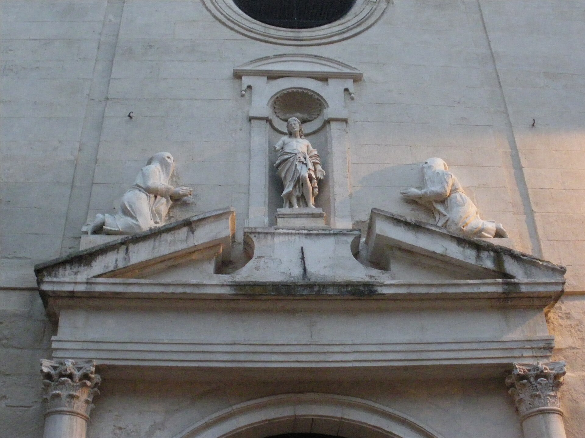
Notre-Dame-la-Principale church in Avignon
Avignon
Notre-Dame-la-Principale is a former church in the historic core of Avignon, also known as the Chapel of the White Penitents. Standing on Place de la Principale, just steps from Place de l'Horloge, it ranks among the oldest religious sites in the city — its origins trace back to the 11th century, though the building seen today largely dates from a 16th-century rebuild. How do you get there? The church stands at 13 Rue de la Principale, inside Avignon's medieval ramparts, within easy walking distance of the Palace of the Popes and Notre-Dame-des-Doms cathedral. The simplest route is on foot from Place de l'Horloge — just a few minutes through the narrow lanes of the old town. This part of Avignon is densely built, so it's best to park near the ramparts and cover the rest on foot. What will you see inside? The medieval building originally had a main nave with Romanesque side chapels that were later converted into aisles. In the 16th century, the current nave and aisles were built, covered by pointed Gothic vaults that still define the interior today. Around 1758, architect J.B. Péru added a domed chapel — a feature that visibly sets the structure apart from the surrounding townhouses. The building is listed as a French historic monument (monument historique), confirming its architectural significance. The story of the White Penitents The nickname "Chapel of the White Penitents" comes from a lay confraternity dedicated to the Five Wounds of Christ, founded in 1527 by thirteen prominent citizens of Avignon. The confraternity only moved into this particular building during the Restoration period, in the early 19th century, and stayed until 1948, when it was dissolved. What distinguished the White Penitents of Avignon was a very concrete social mission: they assisted prisoners and the condemned, and cared for people committed to institutions for the mentally ill. That charitable work, more than devotion alone, sustained the brotherhood's standing in the city for over a century. When should you visit? Today the former church also has a cultural life: as the Chapelle des Pénitents Blancs, it serves as a performance venue during the renowned Festival d'Avignon, held every July. That's a good moment to see the interior "in use," alongside one of the world's biggest theatre festivals. Outside festival season, the building is worth folding into a walk through the old town together with the nearby Palace of the Popes — spring or early autumn offers a quieter setting to appreciate the intimate scale of the place without the crowds. Frequently asked questions What was Notre-Dame-la-Principale originally? It was a parish church first mentioned in the 11th century; its current architectural form dates from a 16th-century rebuild. Why is the building also called the Chapel of the White Penitents? From the early 19th century until 1948, it housed the White Penitents confraternity, which assisted prisoners, the condemned, and the mentally ill. Can you visit the interior? The building is sometimes open during cultural events, including the Festival d'Avignon — check the current schedule before you go. Is the church a protected monument? Yes, it's listed as a French monument historique, confirming its architectural and historical value.
-
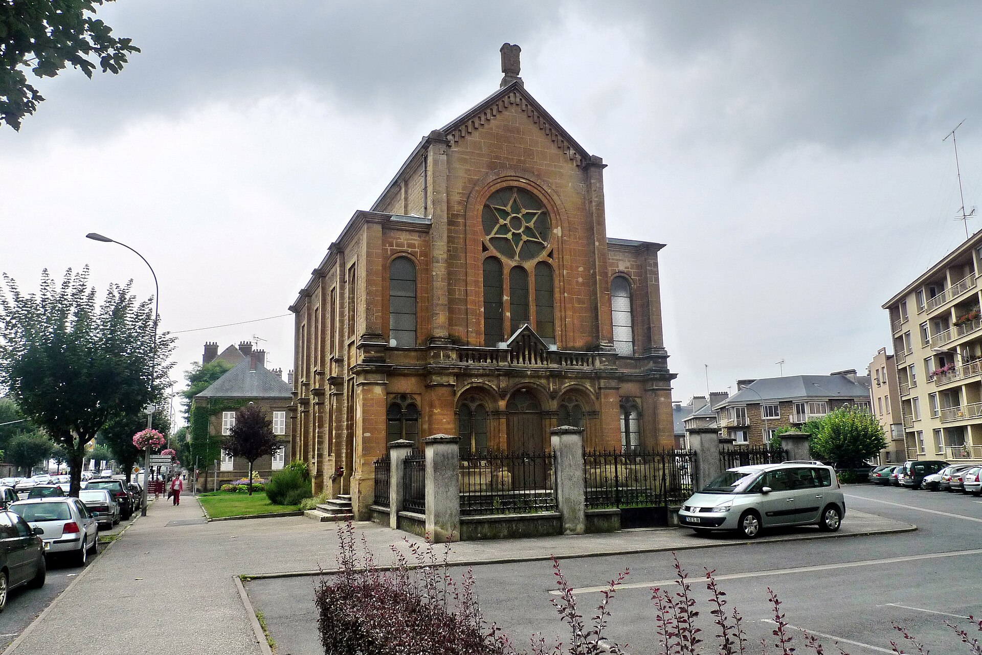
Sedan Synagogue
Sedan
The Sedan Synagogue stands at 6 avenue de Verdun, right in the center of this small town in the Ardennes department, in the Grand Est region of northern France. It's one of the few remaining physical traces of the Jewish community that once lived here — a building that has outlasted wars and the many transformations the town has gone through since the late nineteenth century. What is the history behind the synagogue? The building was constructed in 1878 at the initiative of the local Jewish community. Sedan, situated on the Meuse river, was at the time a town with an established trading and artisan tradition, drawing Jewish families from the neighboring Alsace and Lorraine regions. The synagogue served as a place of worship in the Ashkenazi rite — the liturgical tradition associated with Jews of Central and Eastern Europe, distinct from the Sephardic rite practiced elsewhere. The darkest chapter in the local community's history came during World War II. Like Jews in many other French towns under occupation, the Jews of Sedan were deported. The synagogue building itself, however, survived the war intact — it was neither destroyed nor seriously damaged, which is notable given how many French Jewish places of worship from this period did not survive. Today it stands as physical evidence that Jewish life existed in Sedan and had its place in the town's fabric, even though the community that built it was largely erased by history. What can you see when you visit? The synagogue sits in the central part of Sedan, within walking distance of the town's main landmarks, including the famous Sedan Citadel — one of the largest medieval fortresses in Europe. The building itself isn't a major tourist draw in the museum sense, but for anyone interested in French Jewish history or nineteenth-century religious architecture, it's a meaningful stop on the regional map. Look closely at the facade and the modest yet distinctive style typical of synagogues built in smaller French towns during the second half of the 1800s — a world away from the monumental synagogues of Paris or Strasbourg. Viewing the exterior doesn't require any booking — it's a natural stop on a walk through Sedan's historic center. Access to the interior may be limited depending on how the building is currently used, so it's worth checking current local information before planning a visit that includes going inside. How do you get to Sedan? Sedan lies in northeastern France, close to the Belgian border, and is well connected by road to Reims and to Charleville-Mézières, the capital of the Ardennes department. The nearest major rail hub is Charleville-Mézières, from where a local train or bus reaches Sedan in roughly 20 to 30 minutes. Drivers will find the town sits on the main routes linking the region to Reims and to Belgium. When is the best time to visit? Like most towns in the Ardennes, Sedan is best visited in spring or autumn, when the weather is mild and lighter tourist traffic makes it easier to explore the historic center at a relaxed pace, including the Citadel and the surrounding streets where the synagogue stands. Summer tends to be warmer and busier, as visitors come to the region for its history and scenery. Frequently asked questions Is the Sedan Synagogue still active as a place of worship? The historic Jewish community of Sedan was largely decimated by deportations during World War II, so current religious use of the building may be limited or occasional — it's worth checking its current status before visiting. Can visitors go inside the synagogue? Access to the interior depends on the building's current schedule and use. The exterior and facade can be viewed freely while walking through town. Are there other historic sites nearby? Yes, the synagogue is close to the Sedan Citadel, one of the largest medieval fortresses in Europe, making it a natural stop on a walking tour of the town's historic center. What architectural style does the building follow? The synagogue was built in 1878 in the modest style typical of smaller French Jewish congregations of that era, without the monumental features found in larger cities' synagogues.
-
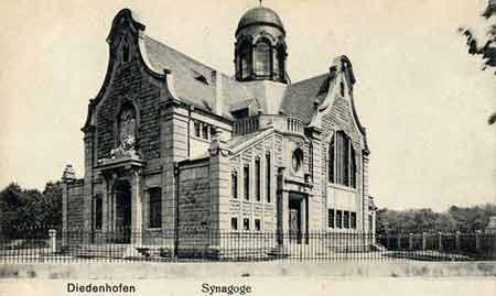
Thionville synagogue
Thionville
Thionville Synagogue stands in the town of Thionville, in the Moselle department of France's Lorraine region. It sits on Place du Rabbin Henri Lévy, a square named after a rabbi deported and murdered at Auschwitz in 1944 — a name that already hints at the weight of local Jewish history tied to this site. What is the history behind this building? Jewish residents are documented in Thionville as far back as the 14th century, though the modern community took shape much later. A first synagogue was built in 1805. In 1882 it was replaced by a far grander building designed by Karlsruhe-based architect Ludwig Levy in a neo-Romanesque style, standing at what was then 31 avenue Clemenceau. That 19th-century building did not survive the war. In July 1940, during the German occupation, the synagogue was set on fire. The ruins were later demolished, and the stone was reused for road construction — a fate shared by other destroyed Jewish sites in the region. The site then sat empty for more than a decade. Reconstruction came in the 1950s. A new building went up in 1956–1957 on the same plot, attempting to echo certain forms of the earlier synagogue while being, architecturally, a building of an entirely different era. What will you see on site? The present-day synagogue is a good example of the modernist architectural language common in post-war reconstruction across eastern France. The building has a compact, square footprint that gives it a solid, almost fortress-like exterior presence. Rising above the structure is a dome topped with a Star of David — the most recognizable feature of the building, visible from the surrounding streets. The contrast between the stark, geometric form and the traditional religious function is deliberate: post-war architects in the Moselle region frequently chose a modern formal vocabulary rather than replicating the historical patterns of the buildings that had been destroyed. The synagogue stands on rue Henri Lévy, in a quiet part of town within easy reach of Thionville's historic center. How do you get there, and when should you visit? Thionville sits in Lorraine, close to the borders with Luxembourg and Germany, and is well connected by train to Metz and Luxembourg City. The synagogue itself is within the town, an easy walk from the main sights of the old center, making it simple to fit into a broader visit. As an active place of worship rather than a museum, the synagogue does not keep fixed visiting hours for tourists — it's worth checking locally before planning to see the interior. The exterior architecture, including the distinctive dome, is visible from the street year-round. Frequently asked questions Is the current building the original 19th-century synagogue? No. The original 1882 synagogue, designed by Ludwig Levy, was burned by German forces in 1940 and later demolished. The current building dates from 1956–1957 and stands on the same site. Who was Henri Lévy, after whom the street is named? He was the rabbi of the Thionville community, deported and murdered at Auschwitz in 1944. The square and street by the synagogue honor him and the region's Holocaust victims. What defines the architecture of the current synagogue? It's a modernist, square-plan building crowned with a dome topped by a Star of David — a style typical of French religious architecture rebuilt after World War II, standing in deliberate contrast to the earlier neo-Romanesque building. Can visitors go inside the synagogue? It's an active place of worship, not a museum, so access depends on the community's schedule. It's best to check current information locally, for example with the Thionville tourist office, before visiting.
-
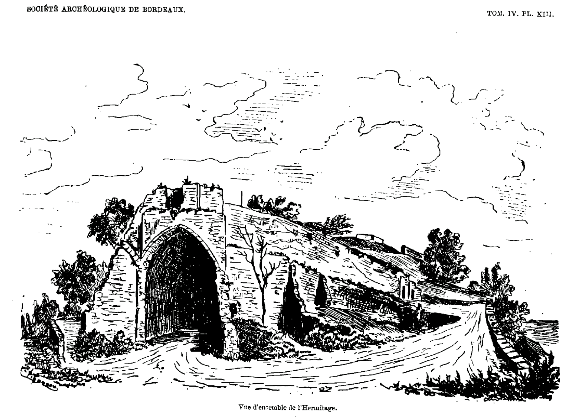
Ermitage Sainte-Catherine de Lormont
Lormont
Ermitage Sainte-Catherine in Lormont is the ruined hermitage carved into the rock above the Garonne river, now part of a public park of the same name in Lormont, just across the river from Bordeaux. What is this site? The hermitage began as a rock-cut oratory built into the cliff known as "La Roque de Lormont," overlooking the Garonne. Written records only start in the 14th century, but the site was already inhabited in the early Middle Ages. Bordeaux's municipal council, the Jurade, recorded a grant of financial support to the local hermit as early as 1407. How did the hermitage change over the centuries? In 1446 the Carmelites of Bordeaux acquired the patronage rights and the land at "La Roque de Lormont" through a property exchange. During the 15th century the site was rebuilt, including a vaulted chapel roof and additional structures, some of which still cling to the rock face today. The sanctuary burned down in 1570 during the Wars of Religion. Toward the end of the 16th century a secular clergyman took over the hermitage without authorization, but the Carmelites regained control in 1614 and installed Pierre Compte as hermit. Between 1665 and 1671 the buildings were restored under Maur de l'Enfant-Jésus, who sought solitude "in the desert" there; Father André de Saint-Pierre became superior, assisted by Father Maur and Brother Roch de l'Assomption. What happened after that? From the late 17th century onward, the hermitage was gradually abandoned, and in 1791 it was sold off as national property during the Revolution. The Orléans Railway Company bought the site in 1838, intending to drive a tunnel through the rock, which accelerated its decay. Around 1850, retaining walls built for the Bordeaux–Paris railway line further reshaped the surroundings. The ruins were not restored until around 1980, when the local association Amis du Vieux Lormont uncovered bones and coins on site and rebuilt the old spring-fed fountain nearby. What will you see there? The former hermitage grounds are now part of the Parc de l'Ermitage Sainte-Catherine, a former quarry turned into a hilly park with a pond and several viewpoints over the Garonne and Bordeaux. The rock-cut remains of the oratory — wall fragments carved directly into the cliff — are still visible among the greenery, and a walk through the park combines this historical trace with genuinely scenic terrain. How do you get there? Lormont sits on the right bank of the Garonne, within the Bordeaux metropolitan area, directly across the river from the city center. The park and the hermitage ruins are reachable on foot from central Lormont and are a popular local walking destination, easily accessible by public transport from Bordeaux. When should you visit? Given the park's hills, pond, and viewpoints, a visit works best during daylight and clear weather, when the views over the Garonne and Bordeaux are at their best. The site is walkable in any season. Frequently Asked Questions What is the Ermitage Sainte-Catherine? It is the ruined rock-cut hermitage above the Garonne in Lormont, documented since the 14th century and now part of a municipal park. Who managed the hermitage historically? From the 15th century, the Carmelites of Bordeaux held the patronage and appointed successive hermits, including Pierre Compte in 1614. Can you still see the ruins today? Yes — fragments of the oratory carved into the rock remain visible within the Parc de l'Ermitage Sainte-Catherine, which is free and accessible on foot. Is there anything else to see nearby? The park itself offers viewpoints over the Garonne and Bordeaux, plus a pond formed in the former quarry, making it a worthwhile stop beyond the historical ruins.
-
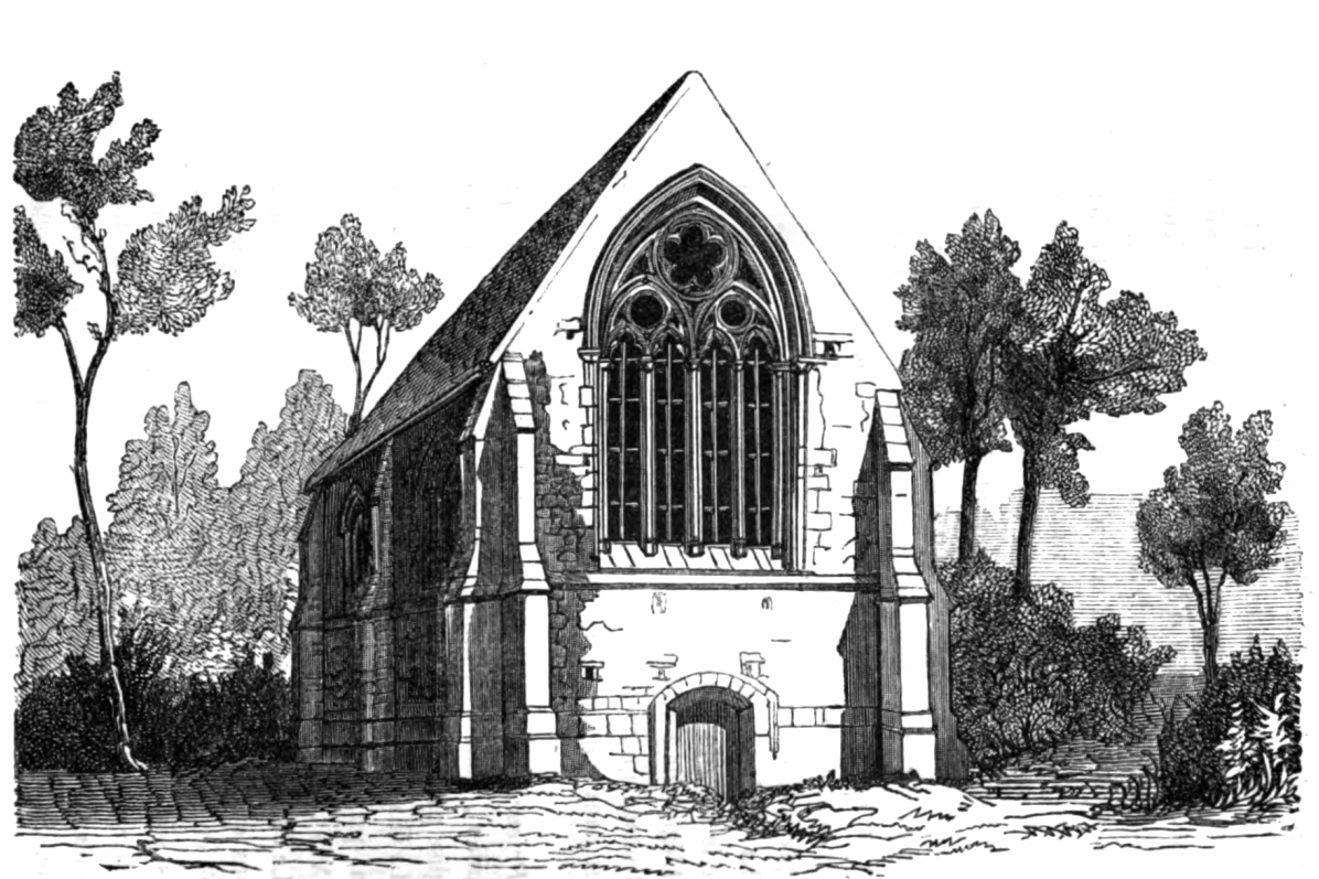
Prieuré de Firfol
Firfol
Prieuré de Firfol is a ruined medieval priory in the commune of Firfol, in the Calvados department of Normandy, France. It is not a headline attraction, but for visitors interested in Norman medieval architecture and quiet, off-the-beaten-path sites near Lisieux, it makes for a worthwhile short stop. What is Prieuré de Firfol? The priory was a dependent monastic house attached to the Abbey of Notre-Dame de Cormeilles, the same community that also held the patronage of Firfol's parish church, dedicated to Notre-Dame as well. Historians place the surviving construction at the turn of the 13th and 14th centuries, with some elements added as late as the 16th century. The dating comes largely from Arcisse de Caumont, the 19th-century French archaeologist who was among the first to systematically catalogue Normandy's historic buildings. Of the whole priory complex, what has survived is mainly a small chapel dedicated to Saint Christopher — patron saint of travelers, a fitting detail for anyone visiting today. In the mid-19th century the chapel was still in reasonably good condition, but the 20th and early 21st centuries were not kind to it: the structure now stands as a ruin. Despite its condition, the site has been officially listed as a French monument historique since November 14, 1927, giving it legal protection as part of the region's recognized architectural heritage. How do you get to Firfol? Firfol sits a short distance from Lisieux, one of Normandy's better-known towns and home to the Basilica of Saint Thérèse. Driving is the most practical option — the trip from Lisieux takes only about fifteen minutes. Public transport in this rural area is limited, so travelers without a car should check local bus connections from Lisieux or arrange a taxi. The coordinates are roughly 49.15° N, 0.32° E; it's worth loading them into a map in advance, since the ruins are modest in size and easy to miss among the surrounding farmland. What will you see on site? What remains is the shell of the old monastic chapel — walls and structural fragments showing traces of the Gothic style typical of Norman religious buildings from this period. This is not a restored site with guided tours or visitor facilities; it's an authentic, partially collapsed ruin that will appeal most to travelers who enjoy discovering lesser-known corners of a region rather than polished monuments. The setting is rural, surrounded by the quiet fields and farmland typical of Firfol, which adds to the appeal for anyone planning an unhurried day away from the main tourist routes. When should you visit? Since this is an open-air ruin with no on-site infrastructure, the best time to visit is during the warmer months, from spring through early autumn, when the weather allows for an unhurried walk around the site. Many visitors combine the trip with a stop in Lisieux or other attractions in the Calvados area. Frequently asked questions What was Prieuré de Firfol? It was a priory, a smaller monastic establishment dependent on the Abbey of Notre-Dame de Cormeilles, active in Firfol from the medieval period. What remains of the priory today? Mainly the chapel dedicated to Saint Christopher, now in ruins, which is the only visible part of the former complex still standing. Is Prieuré de Firfol a legally protected monument? Yes, it has been listed as a French monument historique since November 14, 1927. Can you go inside the building? Given its ruined state and lack of visitor infrastructure, it's best treated as an outdoor walk and viewed from outside rather than a full interior visit.
-
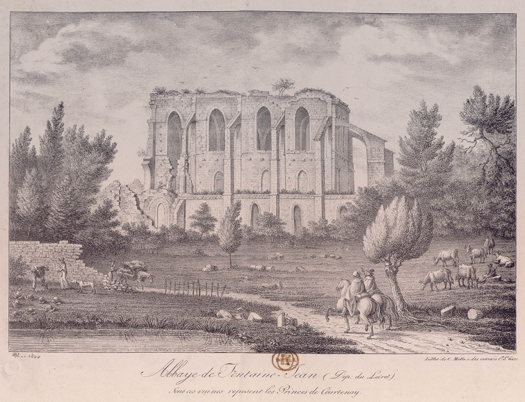
Fontainejean Abbey
Saint-Maurice-sur-Aveyron
Fontainejean Abbey is the ruined site of a medieval Cistercian monastery in the commune of Saint-Maurice-sur-Aveyron, in the Gâtinais region of the Loiret département. Even though only fragments of the once-sprawling monastic complex survive, their scale still hints at how significant this religious community was nearly 900 years ago. How was the abbey founded? The monastery was established in 1124 as a daughter house of Pontigny Abbey. Its founder was Miles de Courtenay, a local feudal lord who had also founded Les Écharlis Abbey. On March 20, 1124, the first abbot, Étienne, arrived from Cîteaux with twelve monks — the customary founding group size for a new Cistercian house. Construction of the main monastic buildings began around 1140, on land that had previously been drained, which explains the site's name, referring to a spring or water source. In 1148, Pierre I de Courtenay, brother of King Louis VII, granted the abbey royal status, considerably strengthening its standing and resources. The abbey church was consecrated to Notre-Dame in 1173. Growth continued steadily, and by 1189 the community numbered around 80 monks alongside roughly 400 lay members connected to the abbey's agricultural and economic activities — making Fontainejean one of the larger Cistercian centers in the region at the time. What can you see on site today? The abbey's fortunes turned during the Wars of Religion. In 1562, Protestant troops occupied the monastery and severely damaged the church. A second, decisive blow came with the French Revolution: in 1791 the monastic community was dissolved, and its properties sold off and divided. What remains today are the ruins of part of the monastic buildings — walls, vault fragments, and traces of the spatial layout typical of Cistercian architecture, which combined austere form with precise construction. The site sits within the wooded landscape of the Gâtinais, giving it a quiet, secluded character. Since October 6, 1925, the ruins have been listed as a monument historique in France, a formal recognition of their historical and architectural value. How to get there and when to visit? The abbey lies within the commune of Saint-Maurice-sur-Aveyron, in the heart of the Gâtinais — a region straddling the Loiret and Yonne départements, known for its forests, ponds, and small villages. The site is best reached by car via local departmental roads; the nearest larger town in the area is Montargis. It's worth planning the visit as part of a longer tour of Gâtinais heritage sites, since the ruins themselves can be seen in under an hour. Given the open, undeveloped character of the site — there's no visitor infrastructure typical of major tourist attractions — spring and autumn are the best times to visit, when the weather is mild and the surrounding greenery is at its most striking. In summer, expect more direct sun exposure, as part of the ruins stands in open ground. Frequently asked questions What was Fontainejean Abbey? It was a Cistercian abbey founded in 1124 as a daughter house of Pontigny Abbey, and for several centuries it served as a major religious center in the Gâtinais. Why is the abbey now in ruins? The church was severely damaged in 1562 when Protestant troops occupied it during the Wars of Religion, and the monastic community itself was dissolved in 1791 during the French Revolution. Are the ruins legally protected? Yes, they have been listed as a monument historique in France since October 6, 1925. Is it worth visiting with children or a group? The site makes for a quiet, brief stop on a tour of the Gâtinais region — it works well as an addition to a longer heritage route through Loiret rather than as a standalone full-day destination.
-
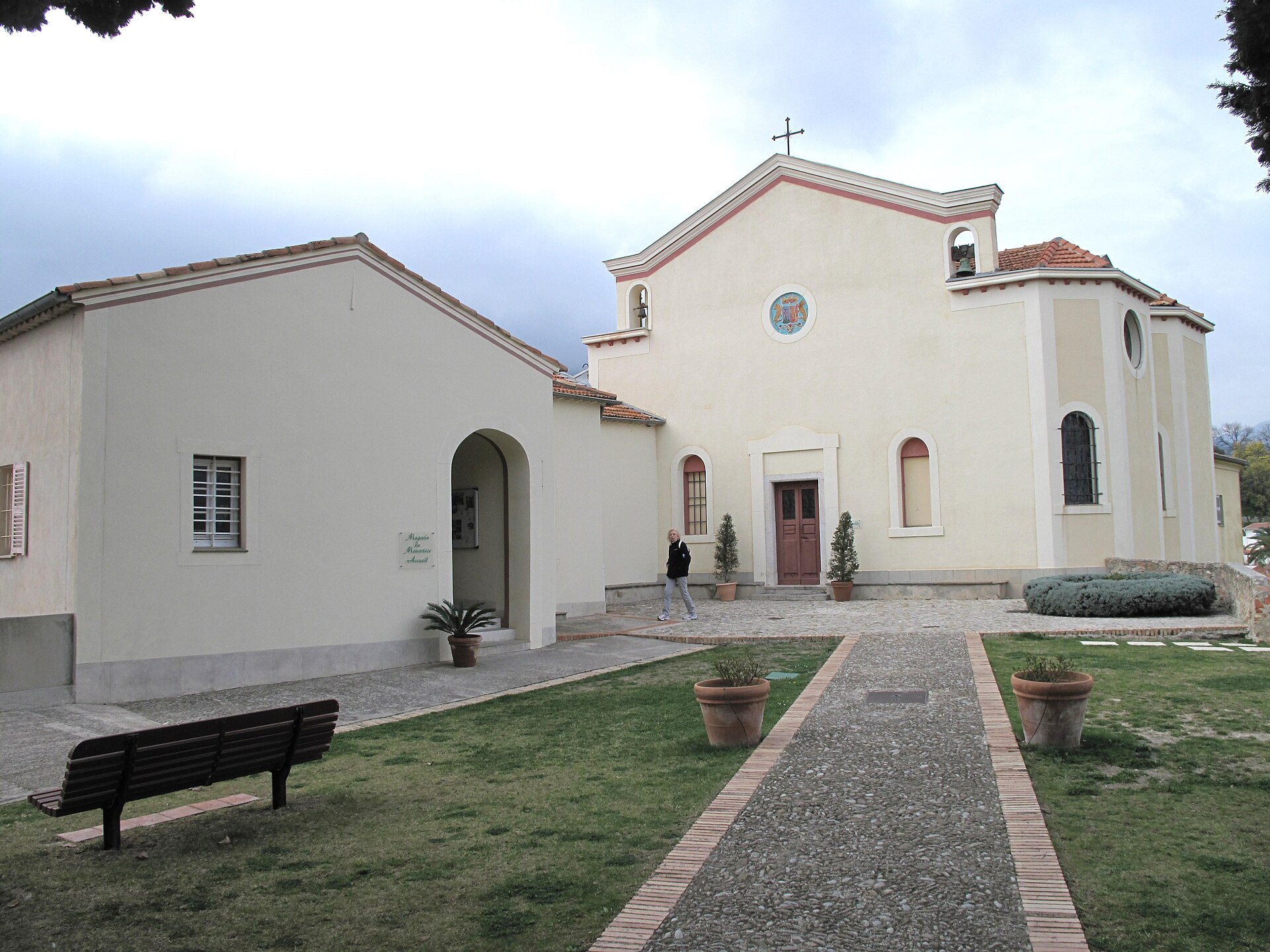
Monastère de l'Annonciade
Mentona
The Monastère de l'Annonciade sits on a hilltop above Menton, in the Alpes-Maritimes department of France, and is best known for the sweeping view it offers over the town's bay and the surrounding coastline. Why is there a monastery on this particular hill? The hill was not always a place of quiet retreat. Toward the end of the 11th century, a small settlement called Podium Pini, or Puypin, was built here at an altitude of roughly 233 metres. That town's life was relatively short: starting in 1316, its inhabitants gradually resettled on another hill closer to the shore, and that new settlement eventually grew into modern-day Menton. By the middle of the 14th century, nothing remained of old Puypin except a modest chapel dedicated to Notre-Dame de l'Annonciade, the Annunciation. That chapel became the seed from which today's monastery grew. What connects the site to the Grimaldi family? The hill's religious importance grew significantly in the 17th century. According to local tradition, Princess Isabelle, sister of Prince Louis I, was cured of leprosy after making a pilgrimage to the Annonciade. In gratitude for this recovery, the Grimaldi family had fifteen roadside oratories built in 1660 along the path leading up from the town to the monastery, a route still known as the Chemin du Rosaire. Those small shrines still mark the walking route today and form part of Menton's religious heritage. Who has looked after the monastery over the centuries? The monastery's history reflects the shifting fortunes of religious orders in both Italy and France. In 1866, Capuchin friars from Genoa, driven from their home after the Italian government suppressed religious congregations, asked to settle at the Annonciade. Their arrival was supported by Charles de Monléon, then mayor of Menton and heir of Jérôme de Monléon. The friars did not remain uninterrupted, however: French legislation targeting religious congregations forced them out for twenty years, and they only returned to the hill in 1922. A new chapter opened in 2000, when, on 24 January, the purchase of the monastery by the Sisters of the Annonciade and the Apostolic Sisters of Heverlee, in Belgium, was finalised. Four nuns and four apostolic sisters moved in at that time. What draws visitors up the hill today? The main reason travellers make the climb is the view. Perched around 225 metres above sea level, the monastery looks out over the whole of Menton's bay, the rooftops of the old town, and the Alpine foothills as they descend toward the Mediterranean. It is regarded as one of the finest viewpoints on this stretch of the Riviera, appreciated equally by photographers and by anyone looking for a quiet spot away from the seafront crowds. How do you get to the monastery? Visitors can reach the hill by car or on foot from central Menton. The pedestrian route follows the Chemin du Rosaire and counts 464 steps, passing the oratories the Grimaldi family funded along the way. The walk itself is part of the experience, combining a devotional route with an increasingly wide view as the town falls away below. Frequently Asked Questions How high above sea level is the monastery? The Annonciade stands roughly 225 metres above sea level, on a hill overlooking Menton. Where does the monastery's name come from? It comes from the chapel of Notre-Dame de l'Annonciade, the only structure that survived from the medieval hilltop settlement of Puypin that once stood on this site. Who lives at the monastery today? Since 2000, the site has been home to the Sisters of the Annonciade and the Apostolic Sisters of Heverlee. What is the best way to walk up to the monastery? Most visitors follow the Chemin du Rosaire, a 464-step path from central Menton lined with fifteen 17th-century oratories funded by the Grimaldi family.
-
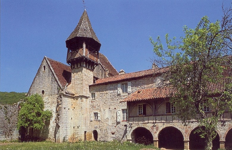
Monastère Notre-Dame de Val Paradis
Espagnac-Sainte-Eulalie
Monastère Notre-Dame de Val Paradis is a former convent of Augustinian canonesses standing on the left bank of the Célé river, right in the village of Espagnac-Sainte-Eulalie in the Lot department of southwestern France. Modest in appearance from the outside, the complex was home to a religious community for nearly six centuries and remains one of the most distinctive landmarks of the Célé valley today. Where does the name "Val Paradis" come from? The name reflects the setting itself: a narrow, green valley carved by the Célé and framed by limestone hills, so appealing that locals long referred to the surrounding stretch of river as a "valley of paradise." When the convent gained a new patron in the thirteenth century, that nickname was formally attached to the building's dedication to the Virgin Mary. How did the monastery come into being? The story begins in the mid-twelfth century, well before any women's community existed here. A monk known as Bertrand de Griffeuil (also recorded as Bertrand de Civray) set up a small hermitage on the riverbank, which grew into an oratory. Shortly before his death near the end of the 1160s, he handed his foundations over to the Augustinian canons of the abbey of Notre-Dame-de-la-Couronne, near Angoulême. From hermitage to a community of women The turning point came in the early thirteenth century, when a woman named Elisabeth secured permission to establish a community of nuns at Espagnac. The original building, put up too close to the water, gradually fell into disrepair. Toward the end of the century, Aymeric d'Hébrard de Saint-Sulpice, bishop of Coimbra and member of a powerful local family, commissioned a sturdier replacement. The new convent was handed over to the prioress on 16 May 1293, and, at the bishop's wish, it took its Marian dedication along with the name "Val Paradis d'Espagnac." What happened to the community afterward? Augustinian canonesses lived at Val Paradis almost continuously for close to six hundred years, right up until the French Revolution. In 1792 the community was dispersed and the buildings lost their original religious purpose. The structure nonetheless survived well enough to be granted official historic monument status in France in 1925. What can visitors see today? Visitors can still make out the medieval layout of the convent, including architectural features typical of women's canonical communities from this period. The setting itself is part of the appeal: the building sits within the Célé valley, an area known for limestone cliffs and troglodyte dwellings, making it a natural stop for anyone exploring the valley on foot or by bike. How do you get there? The monastery stands directly in the village of Espagnac-Sainte-Eulalie, beside the Célé, in the Lot department in southern France. A bridge crosses the river to reach it, and the village itself is easily explored on foot, by bicycle, or by car — it is a well-known stop along the Célé valley route. Frequently asked questions Who founded the monastery at Espagnac? The first religious foundation here was set up in the mid-twelfth century by a monk named Bertrand de Griffeuil; the transformation into a women's community began in the early thirteenth century, initiated by a woman named Elisabeth. Where does the name "Val Paradis" come from? It refers to the strikingly scenic setting of the convent in the Célé valley, and was formally linked to the building's dedication in the thirteenth century when it was consecrated to the Virgin Mary. What religious order lived here? Augustinian canonesses occupied the convent continuously from the thirteenth century until the French Revolution dispersed the community in 1792. Is the monastery a protected historic site? Yes — it was listed as a French historic monument in 1925 and remains legally protected today. Where exactly is the monastery located? In the village of Espagnac-Sainte-Eulalie, on the left bank of the Célé, in the Lot department, within a scenic stretch of the valley known for its limestone hills and cliffs.
-
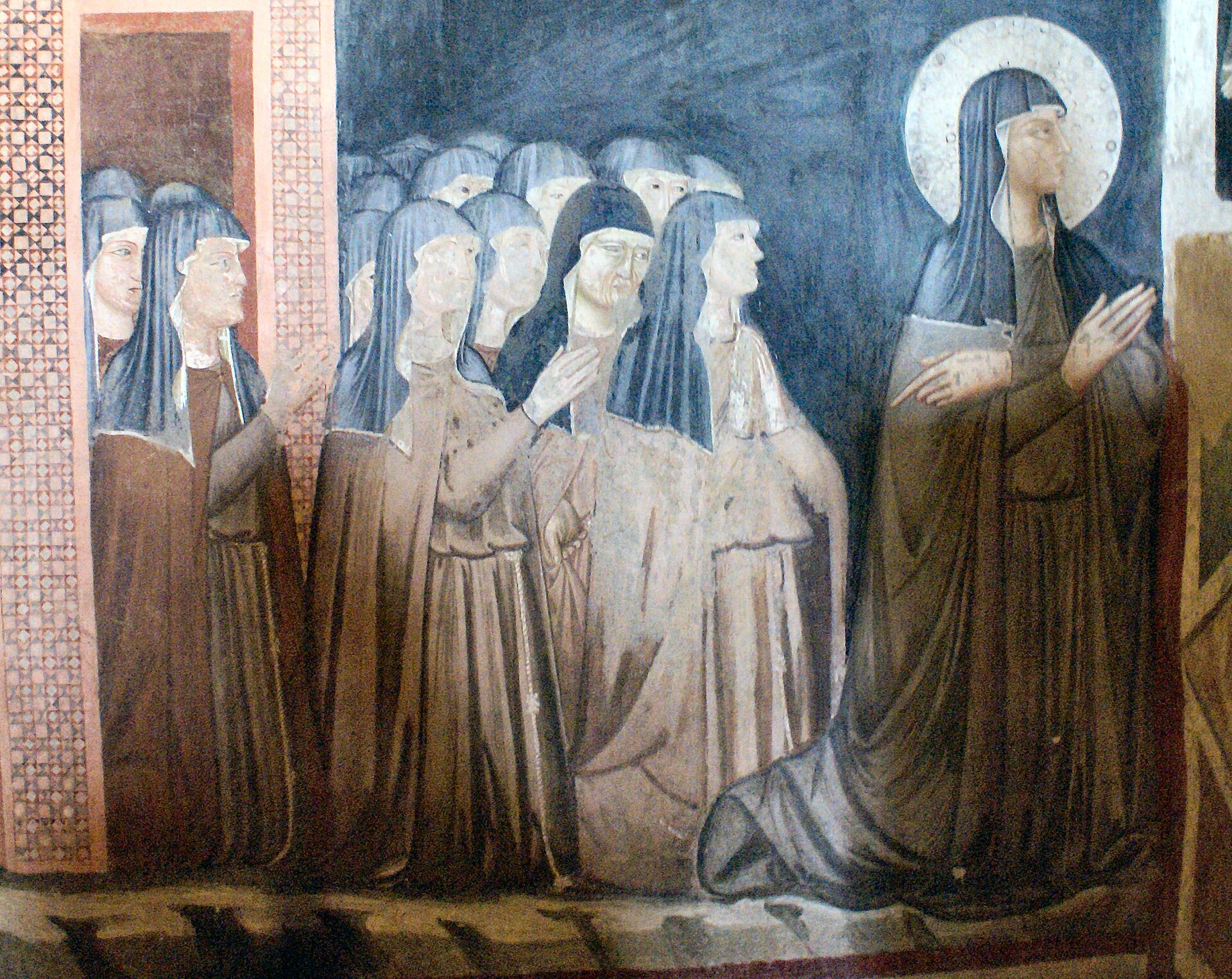
Poor Clares
Ronchamp
The Poor Clares (Clarisses) of Ronchamp live in a monastery built in 2011 on the Bourlémont hill, a short walk from Le Corbusier's celebrated chapel of Notre-Dame-du-Haut. The building was designed by Italian architect Renzo Piano together with landscape architect Michel Corajoud, commissioned by the Association Œuvre Notre-Dame-du-Haut, which owns and manages the hill. Why did the Poor Clares come to Ronchamp? The community had lived in nearby Besançon since 1250. In 2009 the sisters decided to leave the city and settle on the Bourlémont hill instead. The association overseeing the site wanted to preserve its spiritual identity, which risked being overshadowed by its growing role as a tourist destination centred on Le Corbusier's chapel. Inviting a permanent religious community back to the hill was meant to restore a sense of prayerful presence alongside the visitor traffic. How was the monastery designed? Building permits were issued in 2008 and covered three linked projects: a new gatehouse, the monastery itself, and a reshaping of the surrounding landscape. Rather than following the traditional Franciscan layout of buildings wrapped around a square cloister, Renzo Piano designed a long, low structure set partly into the hillside. The idea was to preserve the horizon line instead of blocking it with a conventional volume. Walls are built from raw concrete in a pale grey tone, achieved with local limestone aggregate, left exposed both outside and inside. Large glazed openings bring daylight into the interior, while flat, partly planted roofs help the building merge into the hill rather than stand out against it. When did it open? The monastery and its new gatehouse were blessed and formally inaugurated on 8 and 11 September 2011. Renzo Piano received the special prize of the 2012 Équerre d'Argent award for the project. How many sisters live there today? The community currently numbers around eleven sisters, including four who joined from other monasteries, giving it an international character. The sisters follow a contemplative rule of life while remaining open to pilgrims and visitors who come to the hill. Can visitors go inside? The enclosure itself stays closed to outsiders on a daily basis, but guided visits are organised, led by one of the Poor Clare sisters. These tours give access to spaces not normally open to the public: the communal rooms, the oratory (the monastery's own chapel), and a sample cell. It is an unusual chance to get close to the everyday rhythm of a contemporary monastic community. The monastery also welcomes guests for short retreat stays focused on prayer, quiet reflection, or spiritual renewal. Frequently asked questions Is the monastery connected to Le Corbusier's chapel? Yes - it stands on the same Bourlémont hill, close to Notre-Dame-du-Haut, and was built specifically to maintain a permanent prayerful presence next to that pilgrimage site. Who designed the building? Italian architect Renzo Piano, working with landscape architect Michel Corajoud, on a project completed between 2008 and 2011. Where did the sisters come from? The community moved from Besançon, where the Poor Clares had lived since 1250, relocating to Ronchamp in 2009. Can the interior be visited? Yes, through guided tours led by one of the sisters, covering the communal spaces, the oratory, and a monastic cell.
-
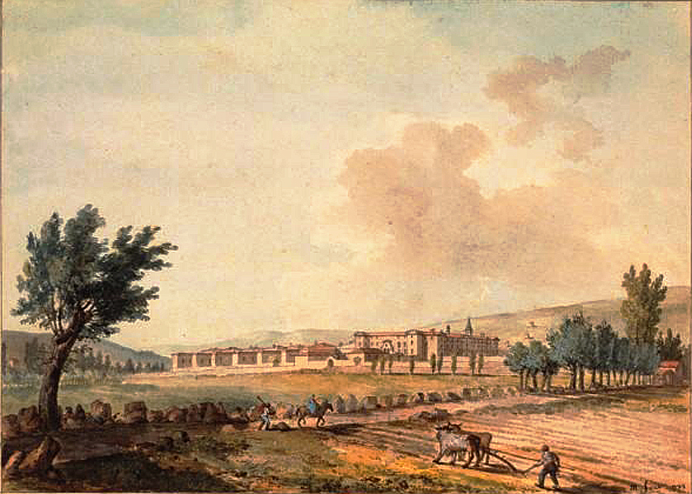
chartreuse Notre-Dame-du-Puy de Brives-Charensac
Brives-Charensac
Chartreuse Notre-Dame-du-Puy is a former Carthusian monastery in Brives-Charensac, a small town in the Haute-Loire department of France, just outside Le Puy-en-Velay. Also known as the Chartreuse de Brives or Chartreuse du Puy, it served as a monastic community for roughly a century and a half before the French Revolution swept it away, and its surviving buildings are now a protected historic monument put to a very different, secular use. How did the monastery come to be founded? The story begins in the 1620s. Monks from the Carthusian house of Bonnefoy were looking to relocate, since their existing site lay too exposed to raids by Protestant forces from the Cévennes. In 1626 the authorities of Le Puy offered them the disused leper hospital, known locally as a "maladrerie," at Corsac on the outskirts of Brives. The following year, in 1627, Just de Serres, bishop of Le Puy-en-Velay and regarded as the monastery's founder, formally handed over the Corsac hospital and its holdings to the Carthusian fathers. By 1628 most of the monks had already settled near the former hospital site. A further boost came in 1634, when Guillaume de Hautefort, a cleric from the diocese of Viviers, resigned his priories of Saint-Martial-en-Boutières and its dependency, Notre-Dame de Tournon-lès-Privas, in favor of the Carthusians, providing income to support the new foundation. When were the surviving buildings actually built? The monastery complex that stands, in part, today only took shape decades later. Starting in 1673, the monks steadily bought up surrounding land, including the site of the Château de Villeneuve-de-Corsac, and drew up plans for a proper charterhouse. Construction itself stretched on for nearly a century, from 1696 to 1783, gradually adding wings, cloisters and outbuildings. What happened after the French Revolution? The Revolution brought the religious community to an end. In 1791 the monks were dispersed and the furnishings of the church and monastery buildings sold off. In 1795 the buildings themselves were auctioned in separate lots to different buyers, and in 1798 part of the complex, including the monastery church, was torn down. For the following century the site had no religious function at all. What is the site used for today? The diocese of Le Puy-en-Velay bought back the former charterhouse in 1924, and two years later, in 1926, installed a minor seminary there. During the Second World War the buildings served as a military hospital until 1940, after which they were converted into a vocational training center. In 1995 the Lycée Paradis, previously based in nearby Espaly, moved onto the site. The former Chartreuse Notre-Dame-du-Puy is listed today among France's monuments historiques under reference PA00092957, recognizing the historical and architectural value of what remains. Frequently Asked Questions Where is the Chartreuse Notre-Dame-du-Puy located? It stands in Brives-Charensac, in the Haute-Loire department, right next to Le Puy-en-Velay. Who founded the monastery? Just de Serres, bishop of Le Puy-en-Velay, is credited as founder: in 1627 he transferred the former leper hospital of Corsac to the Carthusian monks. Have the original buildings survived? Partly. Despite demolitions after the Revolution, a significant part of the complex still stands and is now a listed historic monument. Can the site be visited today? The grounds now belong to the Lycée Paradis, which relocated there in 1995, so public access to the historic buildings is limited.
-
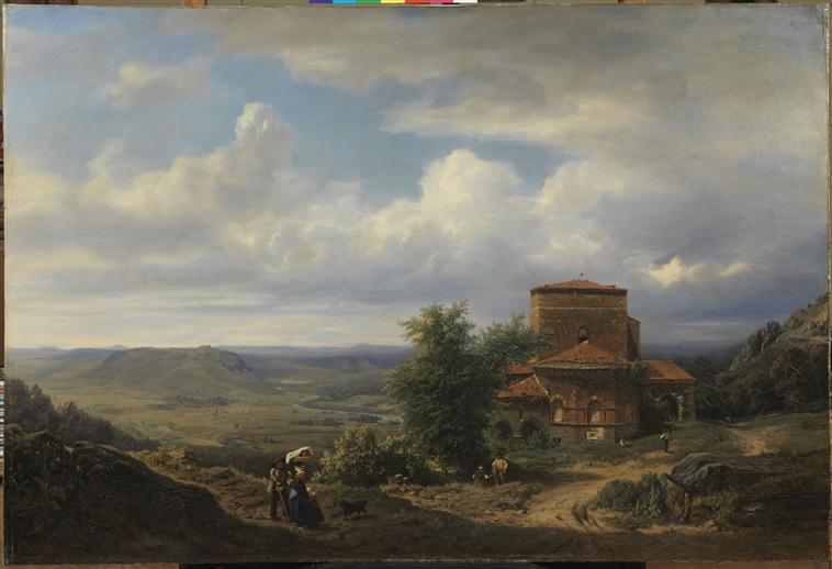
Abbaye de Doue
Saint-Germain-Laprade
Abbaye de Doue crowns a hilltop above the commune of Saint-Germain-Laprade, a short drive from Le Puy-en-Velay in the Haute-Loire department of France. The former abbey church and monastic buildings have watched over the surrounding countryside since the 12th century, and after more than a decade of restoration work the site reopened to visitors in 2023. Who founded the abbey and when? A community of canons regular settled on the Doue hilltop in 1138. The new foundation was dedicated to Saint James the Greater, a choice that made sense in a region deeply tied to the pilgrimage tradition toward Santiago de Compostela — Le Puy-en-Velay itself is one of the historic starting points of that route. In 1162 the community joined the Premonstratensian order (also known as the Norbertines), linking Doue to a wider network of canonries following the same rule. The 13th century brought the abbey its greatest prosperity, as donations from local nobility and townspeople expanded its landholdings and funded new construction. What does the architecture reveal about its history? Building work at Doue happened in stages rather than all at once. The choir of the abbey church dates from the first third of the 12th century, while the transept and nave were added toward the end of that same century. A further expansion came in the 14th century with the addition of the Saint Catherine chapel. The cloister and the surrounding monastic buildings were raised in the 13th century, forming the enclosed layout typical of canonical communities, where liturgical life and daily communal life unfolded side by side. How did the abbey survive war and decline? Doue did not escape the turbulence of medieval and early modern France. In August 1364, during the Hundred Years' War, it was plundered by the routier captain Seguin de Badefol. Further damage came during the Wars of Religion: the abbey was hastily fortified by Royalist forces before falling to League troops in December 1589, an episode that left buildings burned and drove the canons out. The community never fully recovered — abbots through the 17th and 18th centuries tried to restore regular monastic observance and repair the fabric of the site, but the abbey's situation stayed precarious until it was formally suppressed in 1770. How was the abbey saved from ruin? Following the French Revolution, the Bertrand family acquired the property in 1791, sparing it from the wholesale demolition that claimed many other former abbeys, whose stone was often stripped for building material elsewhere. The site is now listed as a monument historique. Its most recent chapter began with twelve years of conservation work paired with archaeological and historical research, an effort that pieced together the site's layered past and culminated in the abbey opening its doors to the public again in 2023. Frequently asked questions Where exactly is Abbaye de Doue located? On a hilltop in the commune of Saint-Germain-Laprade, in the Haute-Loire department, close to Le Puy-en-Velay. When was the abbey founded? Canons regular settled at Doue in 1138, and the community adopted the Premonstratensian rule in 1162. Which saint is the abbey dedicated to? Saint James the Greater, reflecting the region's strong connection to the Camino de Santiago pilgrimage tradition. Can visitors tour the abbey today? Yes. After extensive restoration and historical research, the site reopened to the public in 2023. What were the biggest threats to the abbey's survival? A raid during the Hundred Years' War in 1364, destruction and the expulsion of the canons during the Wars of Religion in the late 16th century, and a long decline that ended with the abbey's suppression in 1770.
-
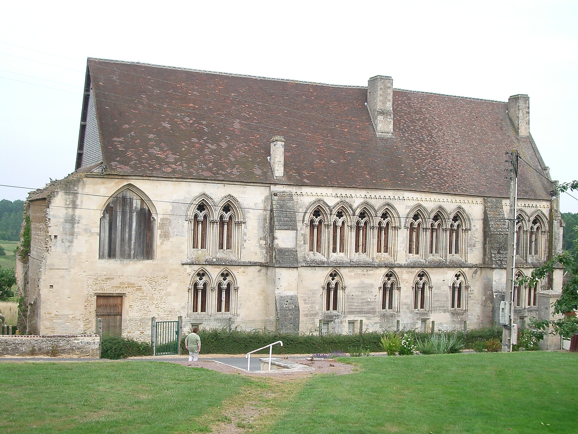
Troarn Abbey
Troarn
Troarn Abbey (French: Abbaye Saint-Martin de Troarn) is the surviving remnant of a medieval Benedictine monastery in the village of Troarn, in the Calvados department of Lower Normandy, a short distance east of Caen. Little of the original complex still stands, but the site remains a notable marker of Normandy's pre-Conquest monastic history. Who founded the abbey, and when? The story begins in 1022, when Roger I de Montgomery, head of one of Normandy's most powerful noble families, brought twelve monks from the abbey of Fécamp to Troarn and set up a dependent priory there. The arrangement changed around 1050, when his son Roger II de Montgommery turned the priory into a fully independent Benedictine house dedicated to Saint Martin of Tours. Its first church was consecrated in 1059. Roger II endowed the new abbey generously, granting it land around Troarn — including marshland — along with several parish churches. His wife, Mabille de Bellême, added further parish churches around Séez, and William the Conqueror himself confirmed and extended these grants to include estates in England, a sign of how quickly the house built up wealth and standing on both sides of the Channel. How important did the abbey become? Backed by this level of patronage, Troarn grew into one of the leading monasteries of the diocese of Bayeux, ranking just behind the abbey of Saint-Étienne in Caen in prestige. Its scattered network of parishes and estates in Normandy and England gave the community a durable source of income that carried it through the medieval period. What damage did the abbey suffer over the centuries? The abbey's later history is largely a record of destruction. In 1450, the year the French retook Normandy from the English, retreating English troops set fire to the buildings. Worse came during the Wars of Religion: in the spring of 1562, Protestant forces inflicted serious damage on the monastery. The final blow arrived after the French Revolution — in 1792 the abbey's property was put up for sale, and the buyers who took it over demolished the church and the cloister. What happened to the abbey during the 1944 Battle of Normandy? Troarn found itself on the front line from the very first hours of D-Day. Overnight on 5–6 June 1944, British paratroopers of the 3rd Parachute Brigade, part of the 6th Airborne Division, pushed through the town to blow up the bridge over the River Dives and secure the left flank of the invasion beachhead. In the weeks that followed, the town came under repeated British artillery bombardment while remaining in German hands, a situation that only shifted with the launch of Operation Goodwood on 18 July 1944. Troarn itself was not liberated until August 1944, as German forces made their general retreat from Normandy. The fighting and shelling of that summer added fresh damage to a monastic complex already reduced by centuries of earlier destruction. What remains of the abbey today? Of the once-extensive monastic complex, only a small portion survives. The most significant surviving structure is the building that once formed the south-west range of the old cloister — it stands today as the principal physical trace of the medieval abbey and the main point of reference for anyone exploring the site's history. Frequently asked questions Where exactly is Troarn Abbey located? The ruins sit in the centre of the village of Troarn, in Calvados, Lower Normandy (approximately 49.1816 N, 0.1775 W). Who founded the abbey? Roger I de Montgomery began the foundation in 1022 as a priory dependent on Fécamp; his son Roger II turned it into an independent Benedictine abbey around 1050. Why is so little of the abbey left standing? The buildings were damaged repeatedly across the centuries — burned in 1450, badly hit during the Wars of Religion in 1562, demolished after the 1792 sale of church property, and further damaged during the fighting of the 1944 Battle of Normandy. What can visitors see at the site today? The surviving fragment of the old cloister's south-west wing gives a sense of the abbey's original scale, even though the church and most other monastic buildings no longer exist.
-
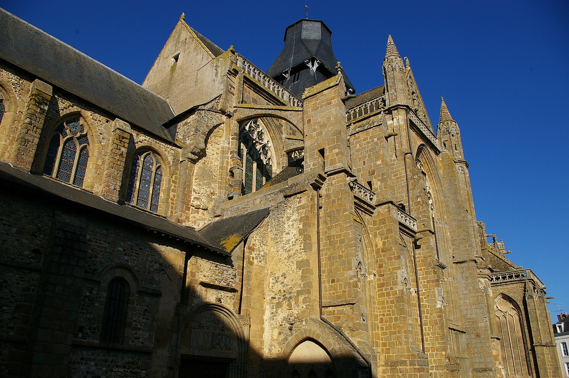
Evron Abbey
Évron
Évron Abbey, today known as the Basilica of Notre-Dame de l'Épine, ranks among the most significant medieval religious complexes in the Mayenne department of France. Tradition traces the founding of this Benedictine monastery to the 7th century, and over the following centuries the building was reshaped again and again — moving from austere Romanesque beginnings through an ambitious Gothic rebuilding to the classical monastic wings added in the 18th century. Why is the church called "Notre-Dame de l'Épine"? The name commemorates the abbey's founding legend. A pilgrim returning from the Holy Land is said to have carried home a rare relic — a few drops of the Virgin's milk. Worn out from his journey, he hung his bag on a hawthorn bush and fell asleep. While he slept, the bush grew so tall that he could no longer reach his belongings. Only after Saint Hadouin prayed did the branches bend down on their own, placing the relic into the bishop's hands. The grateful pilgrim then vowed to found a monastery on the spot, and the French word for the thorny hawthorn, "épine," has stayed attached to the church's name ever since. How did the abbey church's architecture evolve? Nothing remains of the earliest building; it was destroyed toward the end of the 9th century, likely during raids on the region. The monks rebuilt in the 10th century in Romanesque style, raising a wide nave and a crypt that still survive largely intact. New additions followed over the centuries: in the 12th century, a nobleman returning from a pilgrimage to Santiago de Compostela funded a small chapel beside the abbey church, built with Arab-Byzantine influences. In the 13th century the monks set out to replace their Romanesque church with a Gothic one, adding a new choir and transepts — but the outbreak of the Hundred Years' War cut off the funds and stability needed to finish the project. As a result, the basilica standing today combines three architectural layers: Romanesque (nave, crypt), Gothic (choir, transepts), and classical, the last visible in the 18th-century monastic buildings. What is worth seeing inside? The interior holds stained-glass windows from the 14th and 15th centuries, among the finest surviving examples in the region. The treasury houses a wooden statue of the Virgin dating from the 13th century, sheathed in silver. A separate highlight is the 12th-century chapel of Saint-Crépin, decorated with 13th-century murals; it once held the reliquary containing drops of the Virgin's milk, cast in silver-gilt in 1516 at the expense of François de Châteaubriant. What happened to the abbey after the French Revolution? Monastic life at Évron came to an end during the French Revolution, when the abbey was suppressed in 1791 and its property scattered or sold off. The abbey church itself survived largely untouched and, after the suppression, took on the role of parish church before later being elevated to the rank of basilica — the title it still carries as the Basilica of Notre-Dame de l'Épine. Frequently asked questions Is Évron Abbey still an active monastery? No. Monastic life ended with the suppression of 1791, and the former abbey church now functions as a parish basilica. What relic was the abbey built around? Tradition holds that the monastery grew up around a relic of the Virgin's milk, brought back by a pilgrim from the Holy Land and later kept in an elaborate reliquary. What architectural styles can visitors see in the basilica? The building blends three periods: a Romanesque nave and crypt from the 10th century, a Gothic choir and transepts begun in the 13th century, and classical monastic wings from the 18th century. Where exactly is Évron located? The town lies in the Mayenne department, in the Pays de la Loire region of France.
-
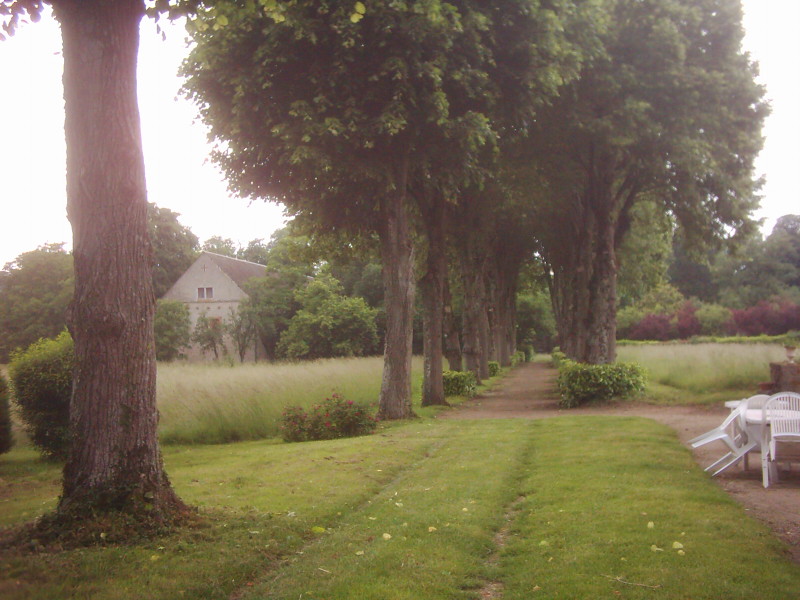
Abbey at Guiche
Abbey of La Guiche stands in the Loir-et-Cher department of France's Centre-Val de Loire region, within the commune of Valloire-sur-Cisse (formerly known as Chouzy-sur-Cisse). Only a fragment of the original monastic complex survives today, yet the site remains a notable trace of the medieval history of the county of Blois. Who founded the abbey, and when? Construction began in 1273 at the initiative of Jean de Châtillon, Count of Blois, and his wife Alix. The building work was finished by 1277. The founders envisioned a community of roughly eighty Poor Clare nuns, whose main role was to pray at the tombs of the count's family members. What was the abbey's connection to the counts of Blois? The counts of Blois placed the abbey under their protection and chose it as their family's burial site. For five centuries afterward, the monastery served as a significant religious institution in the region, its fortunes tied closely to the history of the local nobility. Why did the abbey disappear? The religious community was formally suppressed in 1787. The property was subsequently auctioned off and passed into private hands. By 1793, most of the abbey buildings had been torn down - a fate shared by many French monasteries during that turbulent era of the country's history. What remains standing today? One gallery of the original cloister has survived: twenty-one broken arches resting on plain, unadorned pilasters, without columns or carved decoration, covered by a timber roof frame shaped like an upturned ship's hull. Alongside it stands one building from the former monastery, a chapel, the monastery's old fishpond, and two recumbent stone tomb figures. These remnants now sit within a four-hectare private park. Is the site protected, and can visitors see it? The remains are listed on France's supplementary inventory of historic monuments. The property remains privately owned, but it occasionally opens to the public during the annual Journées du Patrimoine (European Heritage Days), when visitors can view the surviving cloister gallery and outbuildings up close. Frequently asked questions Where exactly is the abbey located? In the Loir-et-Cher department, within the commune of Valloire-sur-Cisse (formerly Chouzy-sur-Cisse), in the Centre-Val de Loire region of France. Who built the abbey? Jean de Châtillon, Count of Blois, and his wife Alix, between 1273 and 1277. Which religious order lived there? The Poor Clares, a Franciscan order of nuns; the community originally numbered around eighty sisters. Have the original buildings survived? Only partially. A cloister gallery, one monastery building, a chapel, a fishpond, and two tomb effigies remain, after most of the complex was demolished in 1793. Can the abbey be visited? The grounds are privately owned but open occasionally for European Heritage Days - checking the current schedule in advance is recommended.
-
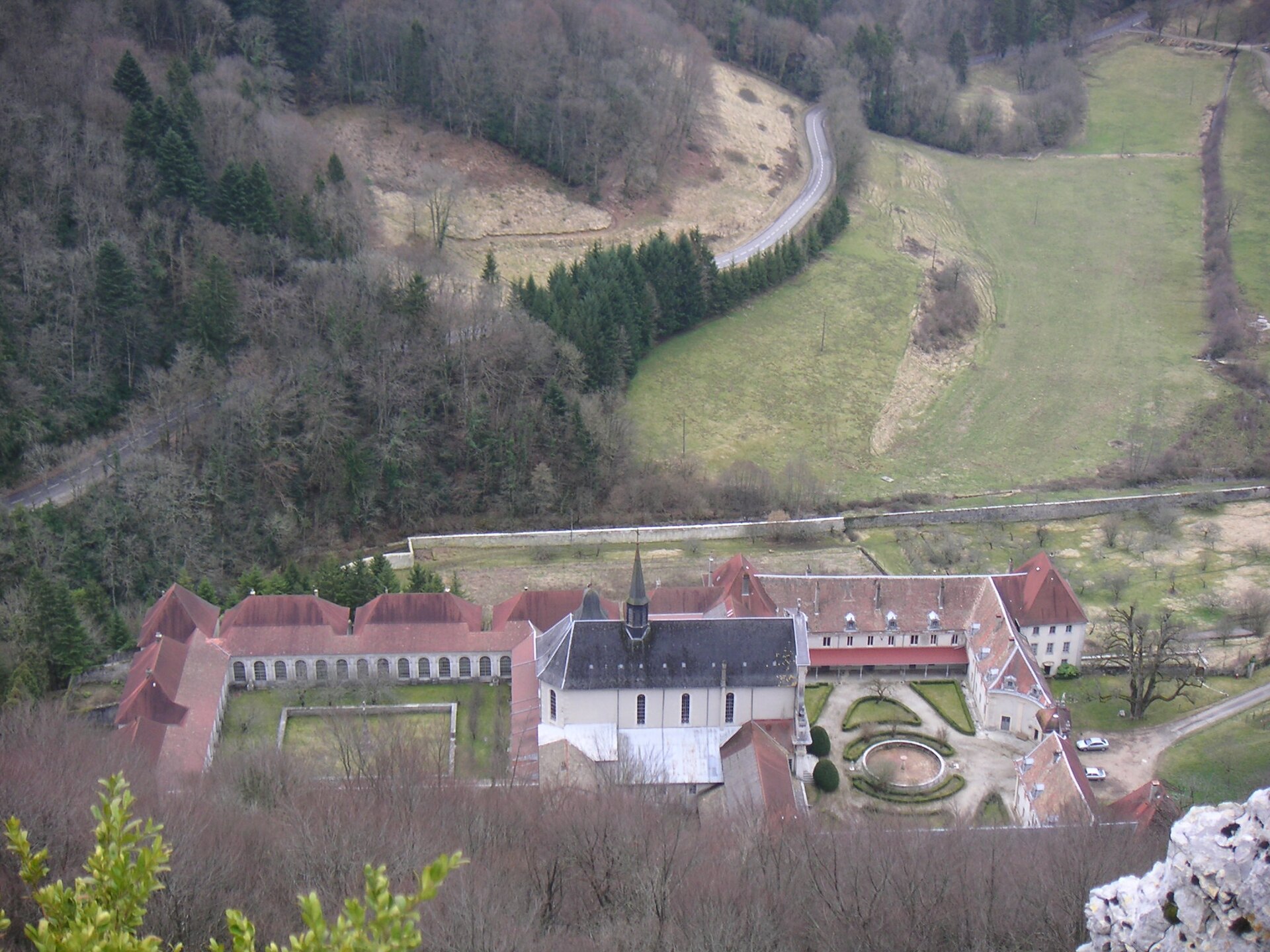
Chartreuse de Sélignac
Simandre-sur-Suran
Chartreuse de Sélignac is a former Carthusian monastery tucked into the woods on the first rises of the Jura mountains, in the commune of Simandre-sur-Suran in the Ain department. Founded more than eight hundred years ago, it has survived plague, fire and revolution, and today still offers a place of retreat, even though monks no longer live there. Where is Sélignac located? The monastery sits in a deliberately remote spot, surrounded by roughly 180 hectares of forest not far from Bourg-en-Bresse. Isolation was never an accident: Carthusian houses were always built away from towns, in keeping with an order whose rule centers on solitude and silence. Reaching Sélignac still means driving through wooded hills before the buildings come into view. How did the monastery come to be founded? The story begins in 1202, when Hugues II de Coligny, a local lord about to leave on crusade, granted the Carthusian monks of nearby Seillon the land needed to build a new house at Sélignac. Hugues never saw the project completed — he died in Macedonia during the crusade — and it fell to his brother to carry the foundation forward roughly a decade later. Sélignac became the 39th house founded within the Carthusian order, an early addition to a network that would eventually spread across Europe. What hardships did the community face over the centuries? Sélignac's history was far from tranquil. The 14th century brought recurring waves of plague, endemic across France from 1348 onward, along with agricultural crises and famine so severe that local people came daily to the monastery gates seeking food. In 1636, during clashes with troops from neighboring Franche-Comté, the buildings were burned. Reconstruction did not happen until the end of the 17th century, and it is largely that rebuilt monastery whose outline survives today. Monks lived at Sélignac without interruption from its founding until the French Revolution forced them out in 1792. The community later returned during the 19th century, only to face a fresh setback when anti-congregation laws passed in 1901 required religious orders to seek state authorization. The Carthusians refused, the monastery was put up for sale, and the monks went into exile in Switzerland. A decade later, a benefactress named Louise Tardy bought the property and handed it back to the order. The Carthusians resettled permanently in 1928. What is Sélignac used for today? In 2001, the general chapter of the Carthusian order decided to close the monastic community at Sélignac. The site was not abandoned, however: it was entrusted to a group of lay people who chose to live according to the spirituality of Saint Bruno, founder of the Carthusian order, under the spiritual authority of the order's Father General. Known today as the Maison Saint-Bruno, the former monastery now welcomes individuals and groups for retreats, quiet days and periods of rest. Around the cloister, the old monks' hermitages — small individual houses with their own gardens — still stand, offering visitors a taste of the solitude at the heart of Carthusian tradition. Frequently asked questions Are there still monks living at Sélignac? No. The Carthusian community left in 2001 by decision of the order's general chapter. The site is now run by lay people living in the Carthusian spirit. Can visitors go on retreat there? Yes. The Maison Saint-Bruno hosts individuals and groups for spiritual retreats and quiet stays centered on silence and prayer. How old is the monastery? The foundation dates to 1202, making Sélignac more than eight centuries old, with gaps caused by the French Revolution and the anti-congregation laws of the early 20th century. What is there to see around the monastery? The site is surrounded by about 180 hectares of forest open for walking, and most of the surviving buildings date from the reconstruction that followed the 1636 fire.
-
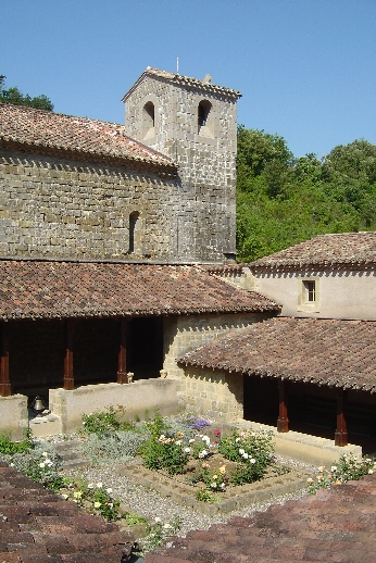
Abbaye Sainte-Marie de Rieunette
Ladern-sur-Lauquet
Abbaye Sainte-Marie de Rieunette is a Cistercian abbey in the commune of Ladern-sur-Lauquet, in the Aude department of southern France, within what was once the diocese of Carcassonne. Tucked into the limestone hills along the Lauquet valley, it ranks among the earliest communities of Cistercian nuns founded in France, and after more than two centuries of silence, it is once again home to a living monastic community. When was the abbey founded? The exact origins of the monastery are unclear, but the earliest documented trace dates to 1162, when a deed of donation was made to Reine de Castillon, a widow who withdrew to Rieunette with a small group of companions to live a religious life. Before the twelfth century was over, the community had already achieved the status of an abbey and had affiliated itself with the Cistercian order. How large did the community grow? In 1432, Rieunette was placed under the protection of the abbots of Villelongue, and it was around this period that the abbey reached its peak, with a community of nearly forty nuns. This marked the high point of its medieval life, before a long stretch of instability set in. What happened during the Wars of Religion? The Wars of Religion hit the abbey hard. In 1528, the nuns abandoned the site, which was plundered on several occasions, and in 1568 the buildings were set on fire. Recovery attempts followed decades later: in 1648, Cécile de Noé was appointed abbess and tried to re-establish monastic life at Rieunette. Her efforts were cut short in 1654, when the buildings were destroyed once more, this time by landowners unwilling to return property they had acquired eighty years earlier. Why was the abbey suppressed? Following these losses, the community relocated to Carcassonne, where it slowly declined over the following century. In 1761, Bishop Bazin de Bezons formally suppressed the abbey, and the remaining nuns were transferred to the priory of the Bernardines of Lombez, in the Gers department. For more than two hundred years afterward, the buildings at Rieunette stood without a resident community. When did monastic life return? The site's fortunes changed in 1998, when a Cistercian community from the Abbey of Boulaur, also in Gers, undertook to revive Rieunette. Since then, a small community of nuns has lived there, balancing prayer with manual work and welcoming visitors throughout the year. On 8 November 2019, the abbey was formally admitted into the Congregation of Cistercians of the Immaculate Conception, marking a further step in its restoration within a wider monastic family. What is the setting like today? Rieunette sits in a quiet, rural corner of Ladern-sur-Lauquet, away from the busier tourist routes of the Aude, which suits the abbey's contemplative character well. Its approximate coordinates are 43.097°N, 2.402°E. Frequently asked questions Is the Abbey of Rieunette still active today? Yes. Since 1998 it has been home to a community of Cistercian nuns who live there according to a rhythm of prayer and work. What religious order does the abbey belong to? Rieunette is a Cistercian abbey, one of the earliest communities of Cistercian nuns established in France. Since 2019, it has belonged to the Congregation of Cistercians of the Immaculate Conception. Was the abbey ever abandoned? Yes. After being damaged repeatedly during the Wars of Religion and later disputes, the community was formally dissolved in 1761. The buildings only returned to monastic use in 1998. Where exactly is the abbey located? In the commune of Ladern-sur-Lauquet, in the Aude department, in the Occitanie region of southern France.
-
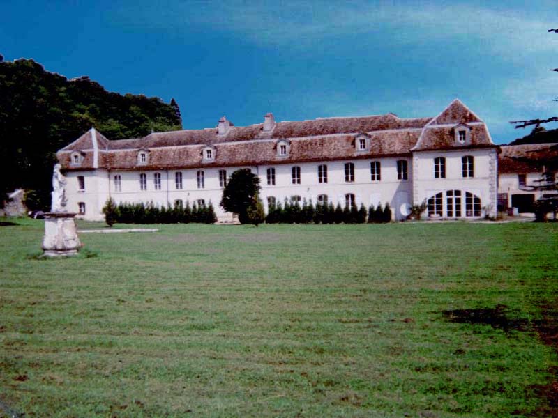
Abbaye Notre-Dame de l'Étanche
Abbaye Notre-Dame de l'Étanche is a former Cistercian abbey located in the hamlet of L'Étanche, part of the commune of Rollainville, in the Vosges department of France. Little of the original monastic complex has survived, but the site remains a quiet trace of medieval religious life in Lorraine and a point of interest for visitors curious about the region's lesser-known heritage. Who founded the abbey? The convent was established in 1148 at the request of Duke Matthew I of Lorraine's mother, the dowager duchess Adelaide. After the death of her husband, Duke Simon I, in 1139, Adelaide had retired to the Cistercian abbey of Notre-Dame du Tart in Burgundy. From there, together with her son Matthew I and his wife Bertha of Swabia, she arranged the endowment of a new convent in a spot then known as Val-le-Duc. From its founding, the community followed the Cistercian rule and was made up of nuns - a women's house rather than the more commonly documented male Cistercian monasteries of the era. What happened to the abbey over the centuries? The community's history was far from peaceful. The buildings suffered damage during armed conflicts in 1431 and 1552, and the Thirty Years' War brought even heavier destruction. Facing the French occupation of Lorraine, the nuns were forced to abandon the site around 1636 and take refuge in nearby Neufchâteau, having first moved their most valuable possessions to Langres for safekeeping. Despite these setbacks, the community endured and eventually rebuilt. The last major reconstruction took place in 1778, and it is from this period that the surviving building dates. What remains of the original abbey today? The convent was dissolved during the French Revolution and its property sold off as national assets. Of what was once a much larger monastic complex, only a single substantial building from 1778 survives, topped with a distinctive mansard roof. It has since been restored and now serves as a private residence. This means the site has no visitor infrastructure, museum, or regular public access - it is better understood as a point of historical interest for anyone tracing Cistercian settlement in Lorraine or exploring the Vosges' quieter corners of heritage. Where exactly is L'Étanche? L'Étanche lies within the commune of Rollainville, in the Vosges department, part of the Grand Est region in eastern France. The surrounding countryside is gently rolling and rural, typical of southern Lorraine, dotted with small villages and former monastic sites - the area is sometimes referred to informally as a route of Vosges abbeys because of how many such foundations cluster in this part of the department. Is it worth a visit? For travellers looking for a fully developed tourist attraction with open access, probably not - the building is privately owned, so entry is restricted. But for those drawn to local history, ecclesiastical architecture, or the fate of women's religious communities in pre-revolutionary France, the site carries genuine interest. The name itself, "Étanche," echoes the French word for pond ("étang"), hinting at a landscape long associated with water and the damp, wooded terrain characteristic of this part of the Vosges. Frequently asked questions Which religious order founded the abbey at L'Étanche? It was a Cistercian convent, home to a community of nuns, founded in 1148. Who endowed the abbey? Duke Matthew I of Lorraine, acting on the request of his mother, the dowager duchess Adelaide, together with his wife Bertha of Swabia. Do the original abbey buildings still stand? Only one building survives from the complex, dating to 1778 and featuring a mansard roof; it is now used as a private residence. Where is L'Étanche located? Within the commune of Rollainville, in the Vosges department, in the Grand Est region of France. Can the abbey be visited? No - the building is privately owned, so there is no regular public or museum access.
-
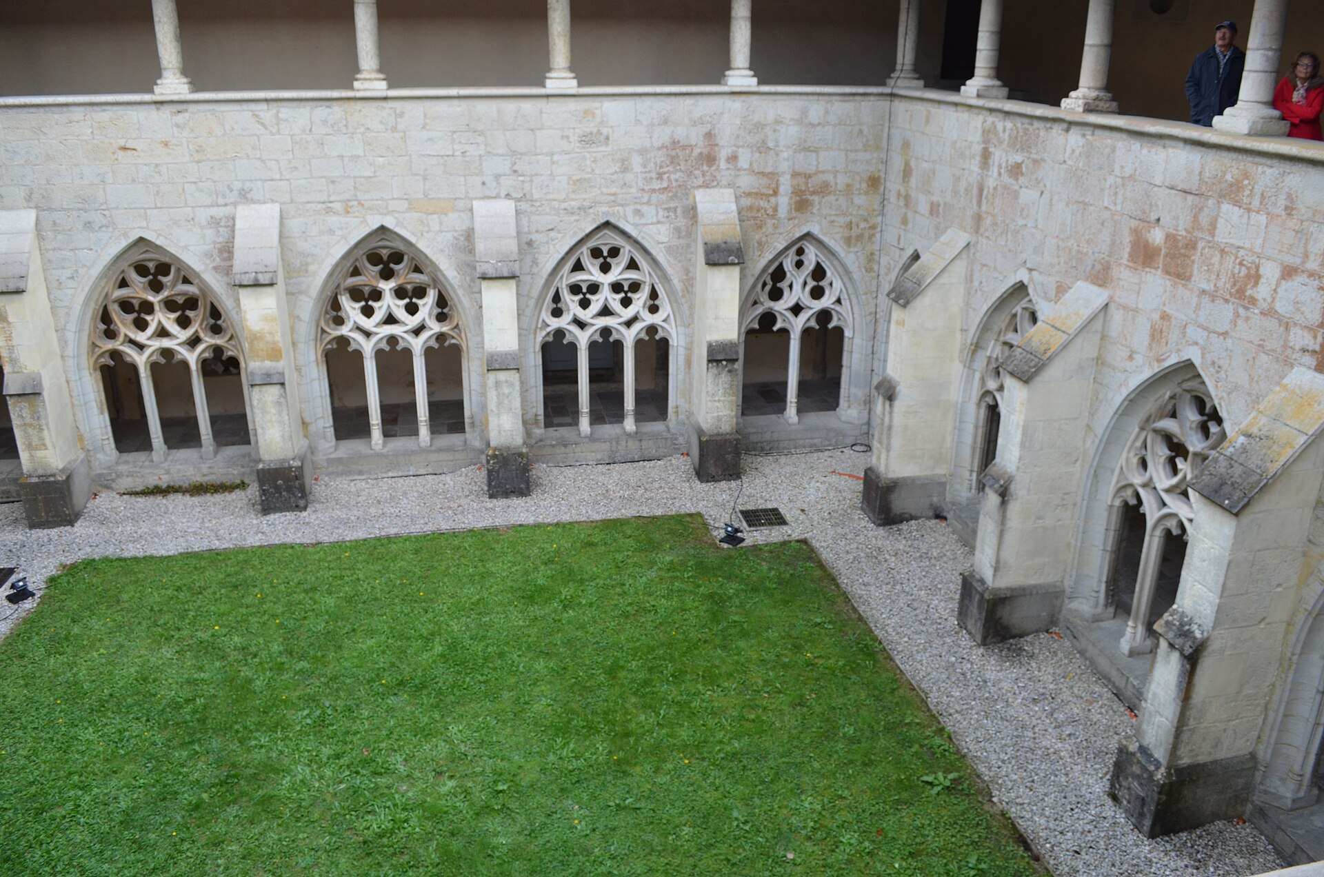
Our Lady of Ambronay
Ambronay
Ambronay Abbey is a former Benedictine monastery in the commune of Ambronay, in the Ain department, in the Auvergne-Rhône-Alpes region of France. Today the site combines the role of a historic religious monument with that of a lively cultural centre, best known for the early music festival it hosts every year. How did the abbey come to be founded? The monastic community at Ambronay traces its origins to the early Middle Ages and is linked to Barnard de Romans, an officer at the court of Charlemagne who was later venerated as a saint. He is credited with establishing monastic life on the site, which was then organised under the Rule of Saint Benedict for centuries to come. The abbey weathered political upheaval and armed conflict while keeping its religious function until the late 18th century, when the French Revolution changed its fate. The monks left the premises in 1791, and for several years the buildings served as a prison for opponents of the Revolution. Part of the complex was damaged, and the church itself was used as a stable for a time before being restored to worship. What architecture survives today? The monastic ensemble at Ambronay blends Romanesque and Gothic elements, making it a notable example of architecture that evolved over several centuries. Its most distinctive feature is the cloister, rebuilt in the 15th century in the Flamboyant Gothic style, recognisable by its delicate tracery and pointed arches. The abbey church, despite the damage suffered in the 18th century, retained enough of its structure to host concerts and services today. Taken as a whole, and despite repeated alterations over the centuries, the abbey remains one of the more significant religious monuments in the Ain department. Why is Ambronay associated with baroque music? Since 1980, the abbey has hosted the Ambronay Baroque Music Festival, launched on the initiative of Alain Brunet. Every September, over the course of three weeks, the former monastery fills with early music performed by leading names in the field, among them Philippe Jaroussky, Jordi Savall, William Christie and Leonardo García Alarcón. The festival's success rests not only on the calibre of the performers it attracts but also on the acoustics of the abbey church itself, widely regarded as particularly well suited to vocal and instrumental music from before the classical era. Over time, the event has turned the abbey into a recognised hub for baroque music on a European scale. What is the abbey used for today? The complex now operates as a "centre culturel de rencontre" — a cultural meeting centre — combining heritage preservation with an active artistic programme. Beyond the September festival, the abbey hosts workshops, artist residencies and educational events centred on early music. The site draws visitors interested in religious architecture and medieval history as much as those coming specifically for classical and baroque music. Frequently asked questions Where is Ambronay Abbey located? In the commune of Ambronay, in the Ain department, in the Auvergne-Rhône-Alpes region of eastern France. Who founded the abbey? Monastic life at Ambronay is linked to Barnard de Romans, an officer under Charlemagne who was later recognised as a saint; the community followed the Rule of Saint Benedict. What architectural style does the abbey represent? The complex combines Romanesque and Gothic features, with its 15th-century Flamboyant Gothic cloister being the most distinctive element. What is the Ambronay Baroque Music Festival? Held every September since 1980, it is dedicated to early and baroque music, bringing renowned performers to concerts staged in the abbey church, prized for its exceptional acoustics. Can the abbey be visited outside the festival? Yes, as a heritage site and cultural centre it operates throughout the year, though visitor interest peaks in September during the festival itself.
-
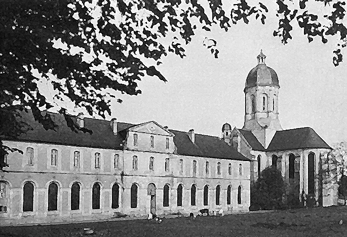
Mondaye Abbey
Juaye-Mondaye
Mondaye Abbey is a working Premonstratensian monastery in Juaye-Mondaye, in the Bessin countryside of Calvados, roughly nine miles south of Bayeux. It is the only Norbertine house still active anywhere in Normandy, and behind its calm 18th-century facade lies a story of hermits, revolution, and exile. Why was an abbey built here? The site's monastic story begins in the mid-12th century, when a priest named Turstin withdrew to a hill in the Norman bocage to live as a hermit. Followers soon gathered around him. After his death, the Bishop of Bayeux gave the small community the Rule of Saint Augustine, while Turstin's brother-in-law, Raoul de Percy, granted the land they were already occupying. The abbey's formal foundation is dated to 1200. Monastic life did not continue uninterrupted, however. The community was dispersed after the French Revolution, and the buildings passed out of religious use for decades. It was only on 13 June 1859 that the Bishop of Bayeux formally handed the keys back to Premonstratensian canons, who arrived from Grimbergen Abbey in Belgium to re-establish the community. Mondaye remains the mother house of two dependent priories, at Conques and at Tarbes. Where does the baroque architecture come from? What visitors see today is not medieval. The entire abbey was rebuilt from the ground up between 1706 and 1743, with work completed by 1745. The project was led by Father Eustache Restout, a canon from a celebrated Norman family of painters, who designed the complex's overall composition and painted most of its interior decoration, including the dome of the abbey church. Restout combined a restrained, classical monumentality with a handful of richer baroque touches. The church facade follows what is often described as a "Jesuit" style, while inside, the Virgin's chapel holds a group of terracotta sculptures made nearby in Noron-la-Poterie by Melchior Verly, and the north transept features a large Assumption altarpiece. The church also houses an 18th-century Parisot organ, restored in 2004, which is still played during Sunday services. What can visitors expect to see? Because Mondaye remains a living religious community, tours are conducted in small groups led by one of the resident brothers rather than left to self-guided wandering. The route takes in the monastic buildings completed in 1745 - cloister, chapter house, refectory and cells - as well as the abbey church itself. Guided visits run daily in the afternoon during July and August, and on Sunday afternoons for the rest of the year. Frequently asked questions Where exactly is Mondaye Abbey? In the commune of Juaye-Mondaye, in the Bessin area of Calvados, a short drive south of Bayeux. Are monks still living there? Yes. Premonstratensian canons have lived at Mondaye continuously since 1859, making it the only active Norbertine house in Normandy. Is the abbey medieval? No - its present appearance dates from the major 18th-century rebuilding directed by Father Eustache Restout between 1706 and 1743. How do you visit the abbey? Only with a guide, one of the community's brothers; tours run daily in summer and on Sunday afternoons the rest of the year.
-
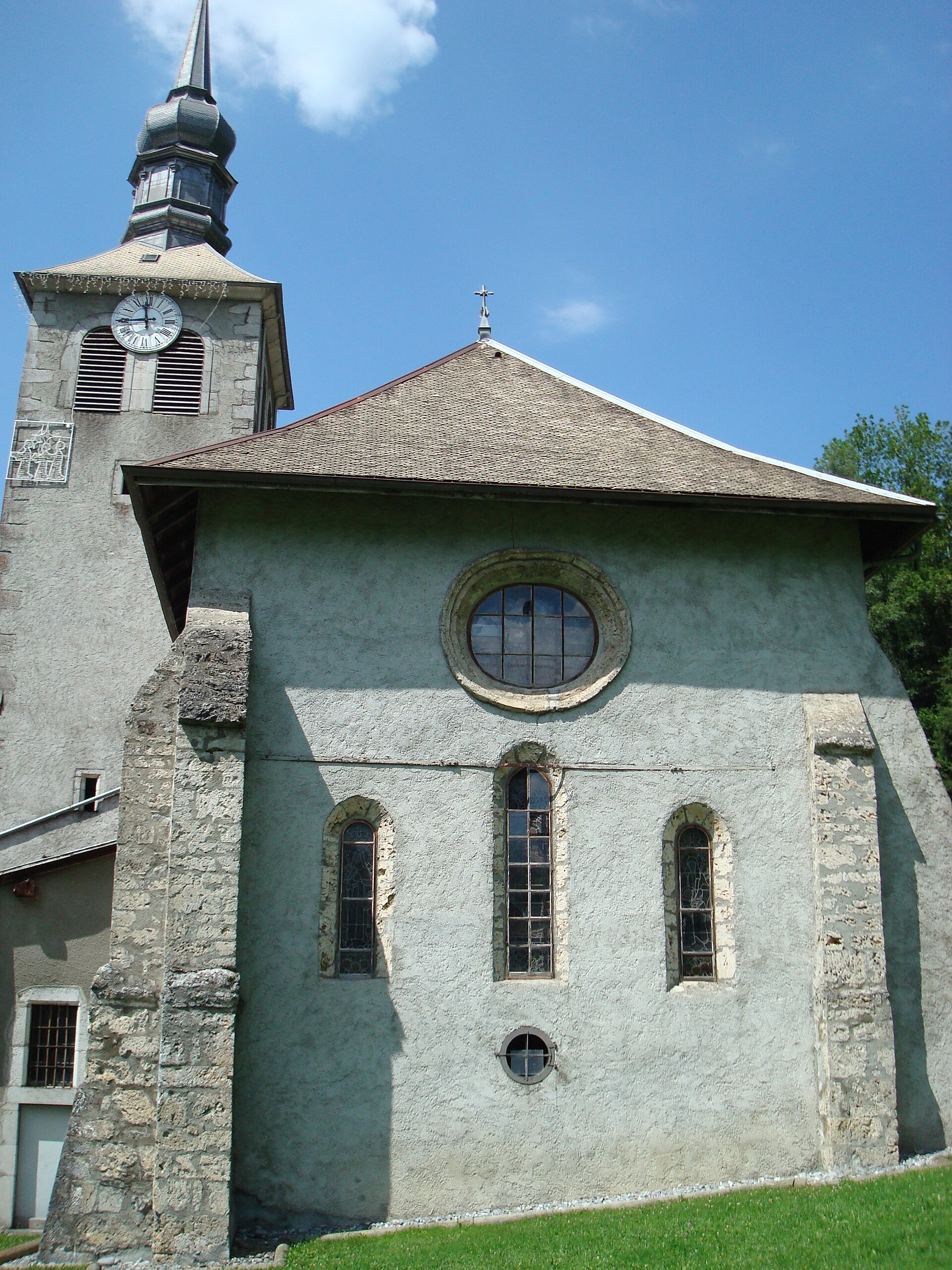
Abbaye de Sixt
Sixt-Fer-à-Cheval
Sixt Abbey (Abbaye de Sixt) is a former abbey of Augustinian canons regular in Sixt-Fer-à-Cheval, Haute-Savoie, standing at the entrance to the celebrated Cirque du Fer à Cheval in the Savoy Alps. Coordinates: 46.055748, 6.776691. When was the abbey founded? A community of canons settled here during the 1130s, and the site was formally raised to abbey status in 1144. The founding canons came from the abbey of Saint-Maurice d'Agaune in Valais, in present-day Switzerland, which acted as the mother house. Until the early 17th century, Sixt belonged to the congregation centred on the abbey of Abondance, which grouped Augustinian houses across the region. What kind of community lived here? Canons regular differed from contemplative monks: they combined communal prayer with pastoral work among the surrounding population. The Augustinian rule spread mainly through the former diocese of Geneva, as well as into the Jura and upper Valais, and Sixt became one of its notable outposts in this part of the Alps. Between the 12th and 16th centuries the abbey prospered, holding land and influence extending across the Giffre valley. Which buildings survive today? Construction began in 1144 around a Romanesque cloister. Within this layout stood the church and a south wing housing the refectory, kitchen and dormitory. The church, positioned on the north side of the complex, is a composite structure built in phases between the 13th and 18th centuries, which explains its mix of architectural styles. The remaining conventual buildings were likewise raised gradually, from the 12th through the 18th century, as the community's needs evolved. What happened after the French Revolution? The French Revolution reached Savoy in 1792, bringing the abbey's monastic life to an end. The canons were dispersed and the abbey's property was sold off. From that point the buildings passed through different owners and uses, losing their original monastic character. What is the abbey used for today? The church and the former presbytery belong to the commune of Sixt-Fer-à-Cheval, while the plot of the former convent was purchased by the Haute-Savoie department in 2000. The site now serves as the department's centre for art and culture and is currently undergoing restoration work. Every summer the former abbot's residence (logis abbatial) hosts a themed exhibition with free admission, a different subject each year — the main opportunity to see the interiors. Why visit the abbey in Sixt-Fer-à-Cheval? The site combines historical depth with an exceptional setting: it stands at the heart of a village ranked among the most beautiful in France, right by the entrance to the Cirque du Fer à Cheval, one of the most recognisable natural rock amphitheatres in the Alps. Walking through the former cloister and catching the summer exhibition makes a natural complement to a day in the mountains. Frequently asked questions Who founded Sixt Abbey? Augustinian canons regular, brought from the abbey of Saint-Maurice d'Agaune in Valais, during the 1130s-1140s. Can the abbey be visited? Yes, although parts of the site are under renovation. The interiors are easiest to see in summer, during the annual free themed exhibition in the former abbot's residence. Until when did the monastic community exist? Until the French Revolution — in 1792, when the Revolution reached Savoy, the canons were dispersed and the property sold. Who owns the site today? The church and presbytery belong to the commune of Sixt-Fer-à-Cheval, while the former convent grounds belong to the Haute-Savoie department, which purchased them in 2000.
-
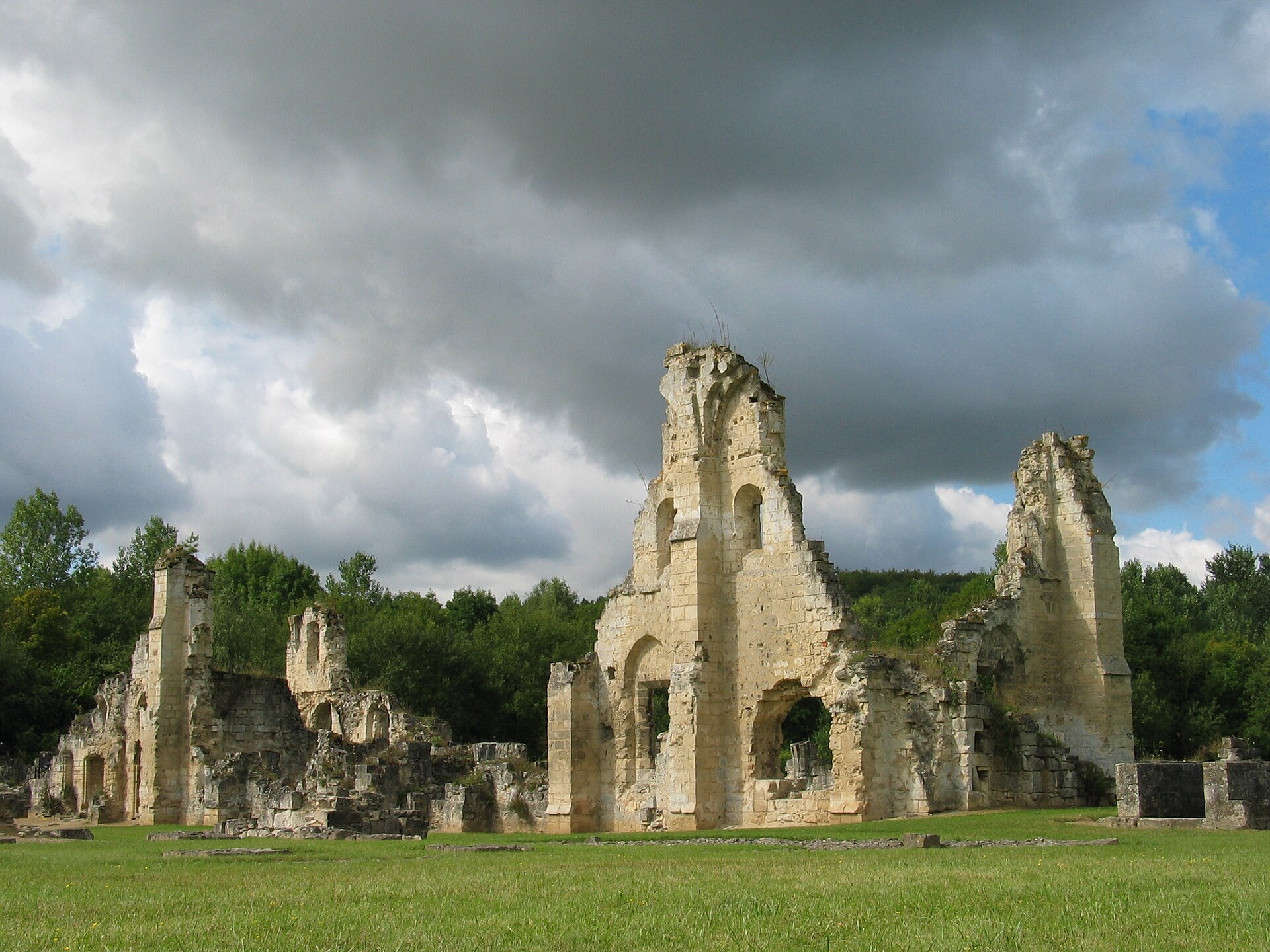
Vauclair Abbey
Bouconville-Vauclair
Vauclair Abbey is the ruin of a Cistercian monastery set in the Ailette valley, at the foot of the northern slope of the Chemin des Dames, in the commune of Bouconville-Vauclair in the Aisne department. The site carries more than eight centuries of monastic history alongside one of the harshest episodes of the First World War, and today it stands as one of the key stops along the Chemin des Dames memorial route. Who founded the abbey, and when? The monastery was established in 1134 at the initiative of Bernard of Clairvaux, at the request of Barthélemy de Jur, bishop of Laon. Vauclair belonged to the Cistercian order and for centuries operated as a self-sufficient religious community, building up land and influence across the Laonnois region. Its wealth came to light unexpectedly during archaeological digs in the 1960s, when excavators uncovered a hoard of nearly 4,200 silver coins from the 16th and 17th centuries, wrapped in cloth bags. What happened to the abbey during the First World War? During the fighting over the Chemin des Dames in 1917, part of the Nivelle Offensive, German forces occupied the area around the abbey and used nearby quarries and underground galleries as shelters and artillery positions. This drew heavy French bombardment onto the monastic buildings, reducing the abbey to near-total ruin. The spring 1917 battles along the Chemin des Dames caused more than 180,000 casualties and triggered mutinies within the French army — Vauclair became one of the enduring symbols of that disaster. What do the ruins look like today? The surviving remains — sections of wall, the outline of the abbey church and former outbuildings — have been listed as a historic monument since 9 January 1970, which guarantees them official protection and conservation oversight. Archaeological work led from 1966 by Belgian Jesuit Father René Courtois uncovered a large part of the foundations and helped clarify the original layout of the monastery. Is there a garden on site? Yes, and it is one of the main reasons to visit beyond the historical interest. Father Courtois, working with herbalists Odette and Fabienne Ballot from Laon, created a medicinal plant garden that opened in 1976. It holds more than 400 plant species arranged in a distinctive checkerboard pattern of beds, modeled on medieval monastic gardens. In 1990 a heritage orchard was added, planted with old varieties of pear and apple trees typical of northern France. How do you get there, and what does it cost? The easiest way to reach the abbey is by car — there is a parking area right next to the ruins. Entry to the site is free, making it an easily accessible stop while touring the Chemin des Dames and the other WWI memorial sites in the area. Frequently asked questions When was Vauclair Abbey founded? In 1134, at the initiative of Bernard of Clairvaux and at the request of the bishop of Laon. Why is the abbey in ruins? It was almost completely destroyed in 1917 during the fighting over the Chemin des Dames, when German artillery positions nearby drew intense French bombardment onto the buildings. What can visitors see besides the ruins? A medicinal plant garden with more than 400 species, laid out in a pattern inspired by medieval monastic gardens, along with an orchard of old fruit-tree varieties. Is there an entrance fee? No, entry to the abbey grounds is free, and parking is available next to the ruins. Where exactly is the abbey located? In the commune of Bouconville-Vauclair, in the Aisne department, at the foot of the northern slope of the Chemin des Dames, about fifteen kilometers south of Laon.
-
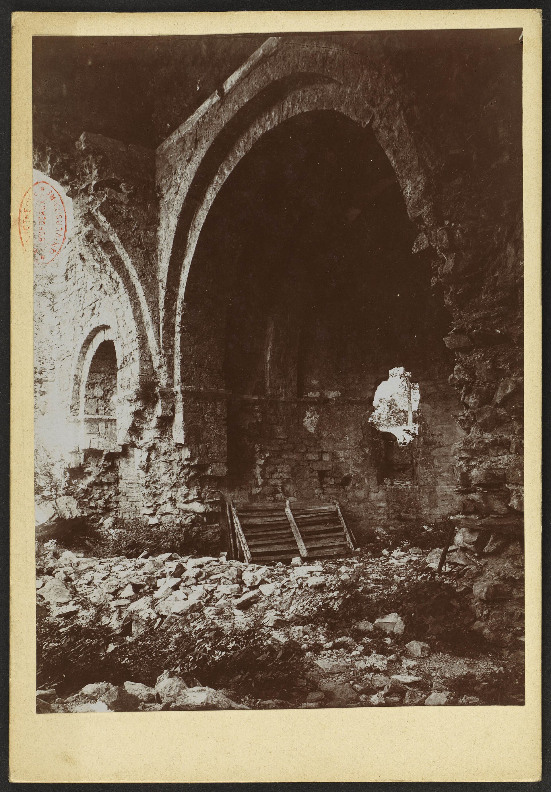
Prieuré de Saint-Orens-en-Lavedan
Villelongue
Prieuré de Saint-Orens-en-Lavedan is a ruined Benedictine priory tucked into a side valley of the Isaby stream, a few kilometres from the village of Villelongue in the Hautes-Pyrénées. Surrounded by meadow and woodland, it counts among the oldest traces of monastic life in the Lavedan region. Where exactly is the priory? The ruins sit in a spot known as Herrole, at a dead end of the Isaby valley, roughly three kilometres from the centre of Villelongue. That isolation was never accidental: sitting well away from the main travel routes shaped the whole course of the community's history, for better and for worse. How did the site begin? Local tradition traces the origins back to Saint Orens, who lived at the turn of the 4th and 5th centuries. He is said to have retired to this very valley as a hermit before later becoming bishop of Auch. His reputation for holiness took firm hold in the area, and a chapel was raised on the spot associated with him. The monastery itself is regarded as the oldest in the department, with a founding act attributed to the Countess of Bigorre and dated to the 9th century. When was the community at its height? The turning point came in 1064, when the community was affiliated with the Cluniac order and formally became a priory. Between the 11th and 13th centuries — its most active period — the church, cloister and conventual buildings took shape. The current abbey church itself replaced an older chapel at the close of the 11th century. This stretch is the high-water mark of the site's history, a time when the community had both the resources and the standing to build on a serious scale. Why did the priory decline? From that peak, the priory's influence gradually faded, largely to the benefit of the far more powerful abbey of Saint-Savin nearby, which sat closer to major routes and drew greater patronage and influence. The remote setting that once offered shelter became, over time, a disadvantage. A brief revival took place at the end of the 17th century, but it did not reverse the longer decline. The community was definitively abandoned before the French Revolution. Its movable furnishings were transferred to the parish church of Villelongue in 1786, and the buildings themselves were sold as national property in 1792, part of the wider secularisation of church assets during the revolutionary period. What survives today, and who looks after it? After decades of neglect, the fortunes of the ruins turned in the 1970s, when a local initiative — the forerunner of an association later dedicated to the valley's heritage — pushed for the site to be formally protected. The remains are now listed among France's monuments historiques, with that protection confirmed in 1983. The site today functions mainly as a place for a quiet walk through history rather than a restored, fully staffed visitor attraction. Frequently asked questions Can visitors walk around the ruins? Yes — the site is an open-air archaeological and historical location. Expect to walk among wall remains rather than tour a rebuilt, intact building. How far is it from Villelongue? About three kilometres from the village centre, following the road that runs up the Isaby valley. Why does this priory matter historically? It is considered one of the oldest monastic foundations in the Hautes-Pyrénées, with roots reaching back to the 9th century and a direct link to Saint Orens, later bishop of Auch. Is the site legally protected? Yes, the remaining priory buildings are listed as monuments historiques, which guarantees them formal conservation status.
-
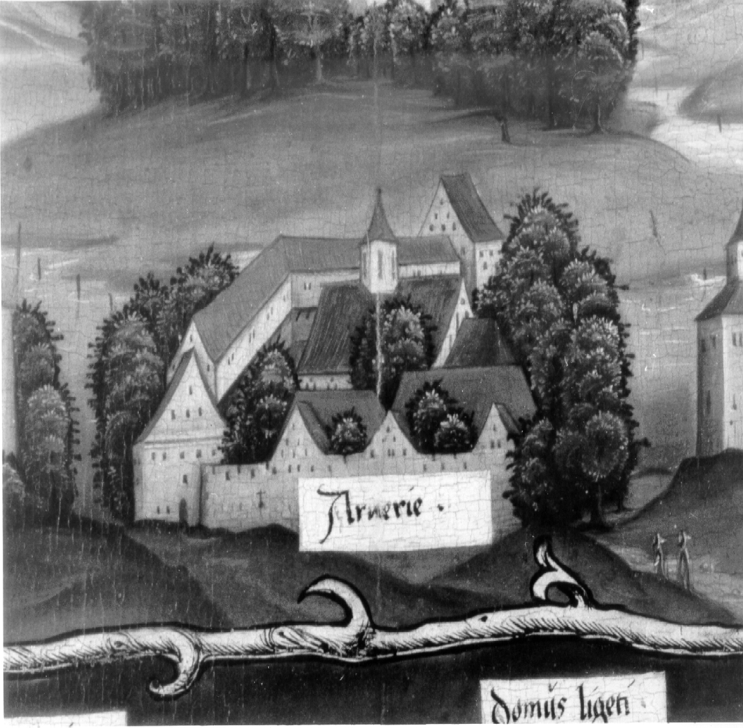
Chartreuse d'Arvières
Arvière-en-Valromey
Chartreuse d'Arvières is the ruined site of a former Carthusian monastery tucked inside the Arvière state forest, on the slopes of the Grand Colombier massif in the Valromey area of Ain, France. Sitting at roughly 1,200 metres above sea level and reachable only on foot, the location matches the Carthusian ideal of a "desert" — remote enough to support a life of silence and contemplation. Who founded the monastery, and when? The first monastic buildings went up in 1122 at a spot known as "les Cimetières." About a dozen years later, in 1135, the community relocated to the site visitors find today, closer to water and better sheltered from the wind. The founder was Count Amadeus III of Savoy, who granted the monks extensive fir forests — the woodland still known as the Arvière forest — along with grazing rights across Valromey. The first monks were led by Arthaud, son of the lord of Sothonod, who became the community's first prior and was later canonised as Saint Arthaud, eventually serving as bishop of Belley. How did the charterhouse grow in influence? Over the following centuries, a succession of popes confirmed privileges for the monastery, among them Lucius II, Alexander III, Lucius III, Gregory VIII, Celestine III, Innocent IV, Alexander IV, Gregory X, John XXI, and Boniface VIII. The counts, and later the dukes, of Savoy — who ruled this territory before it passed to France — renewed similar grants. These privileges let the Carthusians manage the surrounding forests and pastures with considerable autonomy for well over six centuries. What happened after the French Revolution? Carthusian monks lived at Arvières continuously until the Revolution. In 1791, the National Convention expelled the last monks and seized the monastery's property. Left without upkeep, the buildings gradually collapsed, and stone from the site was reportedly reused by people in the surrounding villages. Today, of the former church — dedicated to Notre-Dame — and the monastic quarters, only foundations and scattered wall fragments remain visible. What can visitors see on site today? The site is managed by the French National Forestry Office (ONF), which oversees the surrounding forest. Next to the ruins, an ethnobotanical garden run by the association "Les amis du jardin d'Arvière" displays plants once used by the monks alongside the local mountain flora. The archaeological remains, dating to the 12th century, were officially listed as a historic monument by decree on 6 August 1995. How do you get to Chartreuse d'Arvières? The ruins lie within the commune of Arvière-en-Valromey, at the heart of the Arvière forest, and serve as a stop or starting point on several walking routes through Valromey, including the trail known locally as the "Circuit des Chartreux." Since there is no on-site tourist infrastructure and the approach runs entirely through forest, visitors should plan the trip as a hike and bring a trail map of the Bugey area. Frequently asked questions Who founded Chartreuse d'Arvières? Count Amadeus III of Savoy founded the monastery in 1122; its first prior was the future Saint Arthaud. Is the monastery still active? No. The Carthusian monks were expelled in 1791 during the French Revolution, and the site has stood abandoned ever since. What remains of the original buildings? Mainly the foundations of the church and monastic buildings — the standing structures no longer exist. Is the site protected? Yes, it was listed as a historic monument in 1995 and is managed by the National Forestry Office. Is there anything to see besides the ruins? An ethnobotanical garden maintained by a local association, plus the surrounding Arvière state forest, which is popular with hikers.
-
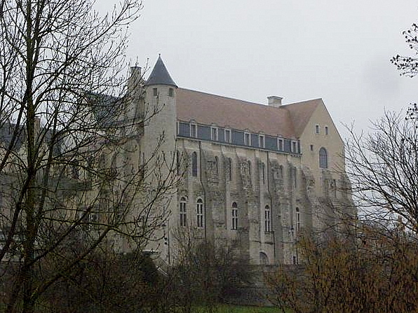
Abbaye Saint-Séverin de Château-Landon
Château-Landon
Saint-Séverin Abbey in Château-Landon is a former community of Augustinian canons regular in Château-Landon, a small town in the Seine-et-Marne department of France. Its crypt, painted with rare Romanesque murals, and its fortress-like silhouette make it one of the more distinctive medieval monuments of the region, listed as a monument historique since 1937. How far back does the abbey's history go? The site's origins trace to the early sixth century. After Saint Séverin died in 506, Childebert I — son of Clovis — ordered a church built in his honor, endowed with land, in gratitude for a healing the saint was said to have performed on the Frankish king. Three centuries later, in the ninth century, Sigebert I, king of Metz, founded a larger abbey on the same site, which took the name Saint-Séverin and grew into one of the region's notable religious centers. Who ran the abbey day to day? For most of its existence, the community was led by Augustinian canons regular rather than Benedictine monks. This community maintained the cult of Saint Séverin, whose tomb and relics were kept at the abbey. The site's standing in medieval Europe is underlined by a famous visitor: in 1167, Thomas Becket, Archbishop of Canterbury, consecrated the newly built abbey church. Why does the abbey look like a fortress? Backing from King Philip Augustus financed a major rebuilding of the monastic complex, giving it thick walls and a defensive profile more typical of a castle than a church. That fortification did not spare the abbey from war: English forces burned it in 1426 after a failed siege, and German Huguenot troops sacked the monastery in 1567 during the Wars of Religion. What was the abbey's connection to Melun? In 1170, King Louis VII granted the Priory of Saint-Sauveur in Melun to Saint-Séverin Abbey. The gift placed the priory under the abbey's authority and opened a period of prosperity for it, a relationship that continued through the following centuries of the Middle Ages and tied the fortunes of the two religious houses together. What has survived to the present day? The best-preserved feature is the crypt, decorated with exceptional wall paintings from the second half of the twelfth century — among the most valuable surviving elements of the whole complex. The canons' community remained in place until the French Revolution, when the buildings were sold as national property. In 1892, the former abbey took on a new role as a hospice for the elderly. Frequently asked questions Was this a Benedictine abbey? No. The community that ran the abbey consisted of Augustinian canons regular, not Benedictine monks. Why does the abbey have a fortress-like appearance? Its rebuilding, backed by King Philip Augustus, gave it thick defensive walls resembling a stronghold rather than a typical monastery. What relics were kept at the abbey? The abbey held the tomb and relics of Saint Séverin, whose cult was the original reason the first church was built on the site. Can the abbey be visited today? It has been listed as a monument historique since 1937; because the building later served secular purposes, including as a hospice, visitor access is best checked locally. What was the abbey's link to Melun? From 1170 it held authority over the Priory of Saint-Sauveur in Melun, granted by King Louis VII.
Earn badges for the places you visit
Download NextOnTrip, discover new places and check off your trails.