Sacred Monuments in Belgium
A guide to 434 Sacred Monuments in Belgium — with descriptions, photos and traveler visits from the NextOnTrip community. Locations spread across 170 cities and towns. Most visited by the community: Abbaye de Saint-Denis-en-Broqueroie, Mariapark, Roeselare Communal Cemetery.
-
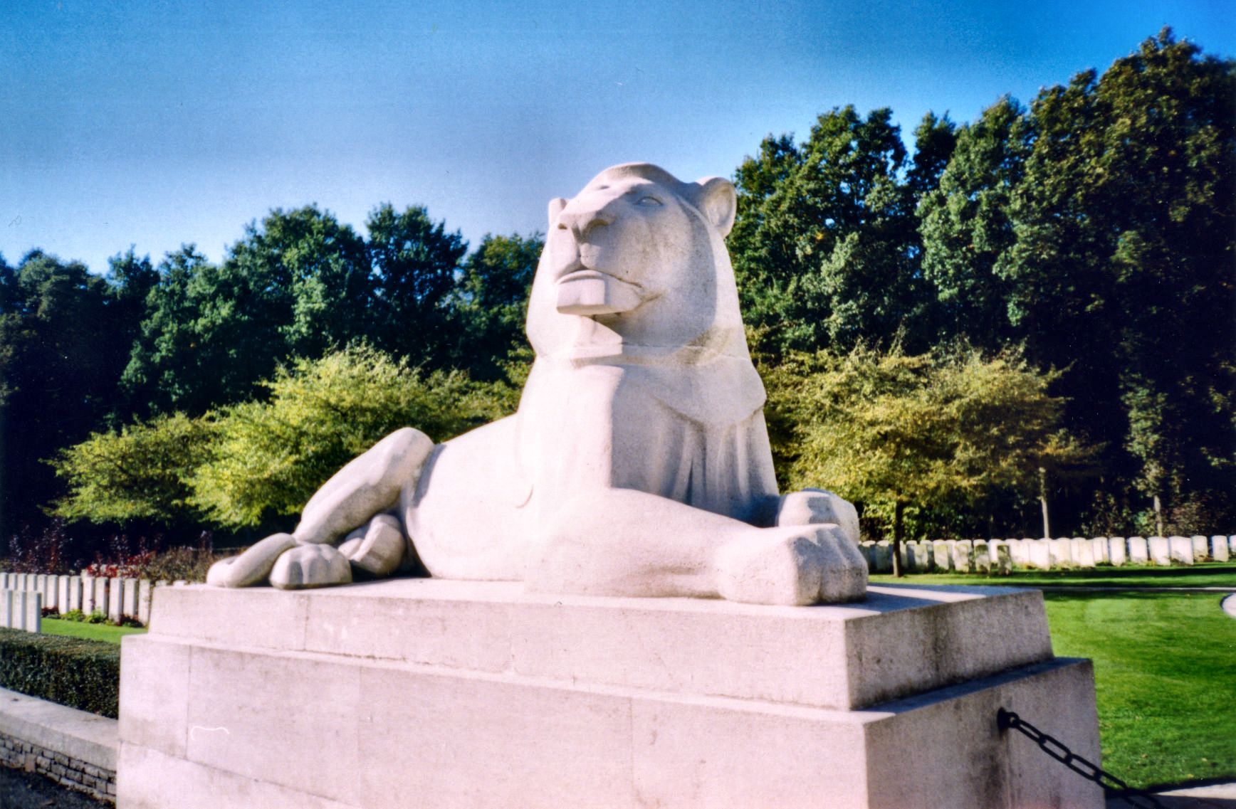
Berks Cemetery Extension
Comines-Warneton - Komen-Waasten
Berks Cemetery Extension is a Commonwealth War Graves Commission (CWGC) burial ground located in Belgium, in the village of Ploegsteert within the municipality of Comines-Warneton. It sits inside what was known during the First World War as the Ypres Salient, one of the most fought-over sections of the Western Front. What makes this a CWGC site? Berks Cemetery Extension is maintained by the Commonwealth War Graves Commission, the organisation responsible for preserving the graves and memory of Commonwealth service personnel who died in the two world wars. Across Belgium and northern France, the CWGC oversees an extensive network of cemeteries that together record the human cost of the First World War in this region. Many of these sites, including this one, were established close to the front line or to wartime medical posts, since burials typically took place as near as possible to where soldiers fell — a practice that explains why so many CWGC cemeteries carry names tied to nearby villages or wartime installations. Why does Ploegsteert and the Ypres Salient matter historically? Ploegsteert lay within the Ypres Salient, a bulge in the Allied line that pushed forward into German-held territory and left troops exposed to fire from multiple directions at once. The salient became the setting for some of the longest and most costly engagements of the First World War, and the name Ypres remains closely associated with the immense scale of casualties suffered by all sides in the conflict. The cemeteries clustered around this area, Berks Cemetery Extension among them, form part of a wider landscape of remembrance spread across West Flanders, bearing physical witness to those events more than a century later. What does "Extension" signify in the name? The word "Extension" indicates that the cemetery was created to enlarge an existing burial ground — a common pattern among CWGC sites from this period, when original plots proved too small for the number of casualties generated by fighting in a given sector. Such extensions reflect the nature of trench warfare, where repeated offensives and counter-offensives along the same stretch of front steadily increased the need for additional burial space. How to get there? The site is located in Belgium, in the municipality of Comines-Warneton, close to the village of Ploegsteert, at coordinates near 50.738°N, 2.882°E. This places it in a border area adjacent to France, within a largely rural landscape where farmland is interspersed with numerous war cemeteries and memorials connected to the fighting of more than a hundred years ago. Who should visit? Berks Cemetery Extension is of particular interest to visitors researching the First World War, to descendants of soldiers who fell on the Western Front, and to travellers following the wider remembrance trail through West Flanders that takes in Ypres and its surrounding villages. Visitors typically come for the quiet, reflective atmosphere shared by these sites and the chance to consider the scale of loss endured in this part of Belgium during the war. Frequently asked questions Where exactly is Berks Cemetery Extension located? In Belgium, in the municipality of Comines-Warneton, in the village of Ploegsteert, within the area once known as the Ypres Salient. Who is responsible for the cemetery's upkeep? The Commonwealth War Graves Commission (CWGC) maintains the site, as it does for other Commonwealth war graves in the region. From which period does this burial ground date? It is connected to the fighting of the First World War on the Western Front in the Ypres Salient area. Is this the only war cemetery in the area? No — the Ypres Salient contains a dense network of CWGC cemeteries and memorials, of which Berks Cemetery Extension is one part.
-
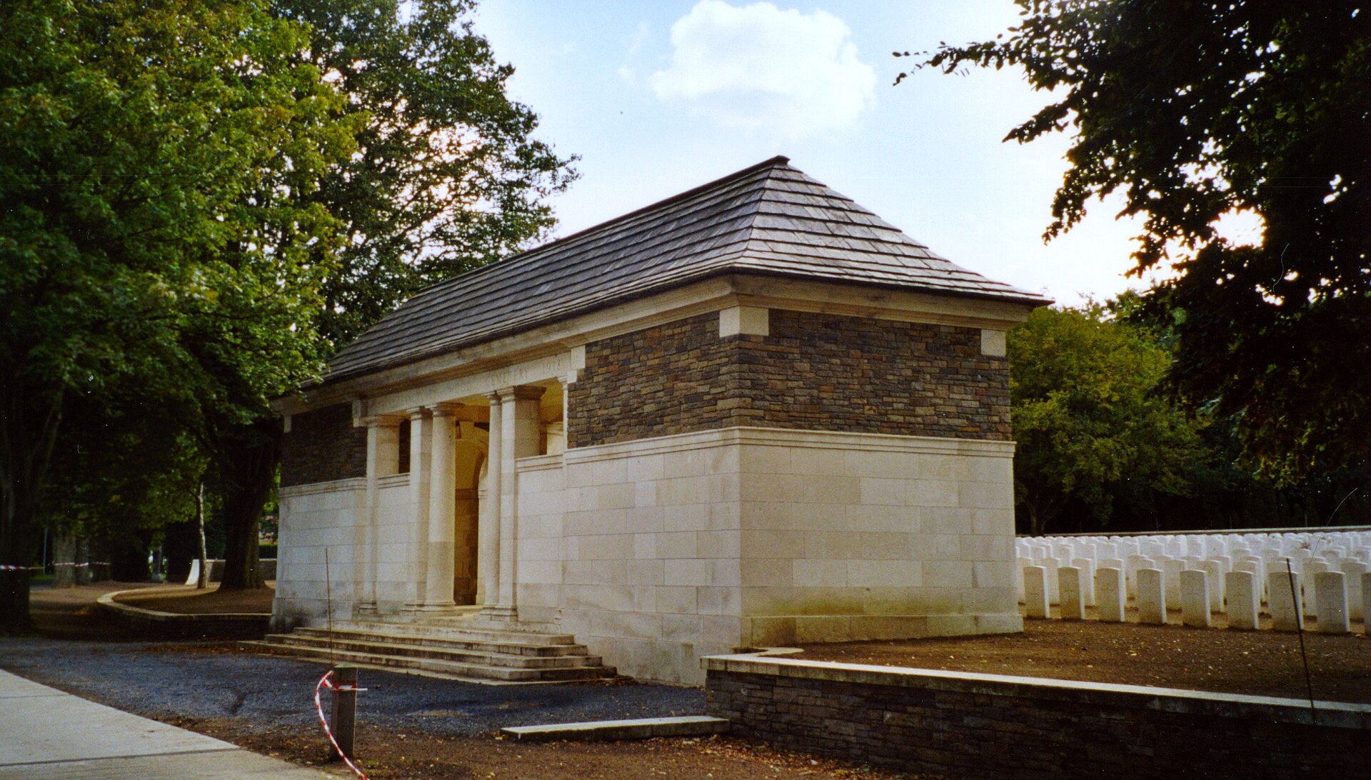
Sanctuary Wood Cemetery
Ypres
Sanctuary Wood Cemetery is a Commonwealth War Graves Commission (CWGC) cemetery located roughly 5 km east of Ypres, Belgium, near the hamlet of Hooge in the municipality of Zillebeke. It holds the graves of soldiers from the Commonwealth forces who died during the First World War. The cemetery sits just off the main Ypres–Menin road, reached via the side lane Canadalaan, and lies only 100 metres from the Canadian Hill 62 Memorial. Where exactly is it located? Sanctuary Wood Cemetery lies in an area that was one of the most fiercely contested sections of the Ypres Salient during the Great War. The name "Sanctuary Wood" refers to a forest that, in the early stages of the war, was used by soldiers as a relatively safe rest area away from the front line — before it too became a battlefield. Access is via the Ypres–Menin road, followed by a short stretch along the side road Canadalaan, making the site easy to reach for visitors travelling by car, bicycle, or on foot. What is the Commonwealth War Graves Commission? The cemetery is maintained by the Commonwealth War Graves Commission, the organisation responsible for the graves and memorials of Commonwealth soldiers who died in the two World Wars. The neat rows of uniform white headstones and carefully tended lawns are characteristic of every CWGC cemetery scattered across the former battlefields of Flanders, and Sanctuary Wood Cemetery follows this same recognisable layout. What else is nearby? The Canadian Hill 62 Memorial stands just 100 metres further along the same road from the cemetery. It commemorates the Canadian soldiers who fought and died in the fighting around Hill 62 during the Ypres battles. Because the two sites sit so close together, visitors touring the First World War heritage of the Ypres area often combine a stop at the cemetery with a visit to the memorial as part of the same route. Frequently asked questions Where exactly is Sanctuary Wood Cemetery? The cemetery is located about 5 km east of Ypres, in the municipality of Zillebeke, near Hooge, just off the Ypres–Menin road along the side lane Canadalaan. Who maintains the cemetery? Sanctuary Wood Cemetery is maintained by the Commonwealth War Graves Commission, which cares for the war graves of Commonwealth soldiers. What landmark is closest to the cemetery? The Canadian Hill 62 Memorial stands just 100 metres away along the same road. From which period do the graves date? The graves belong to soldiers who died during the First World War.
-
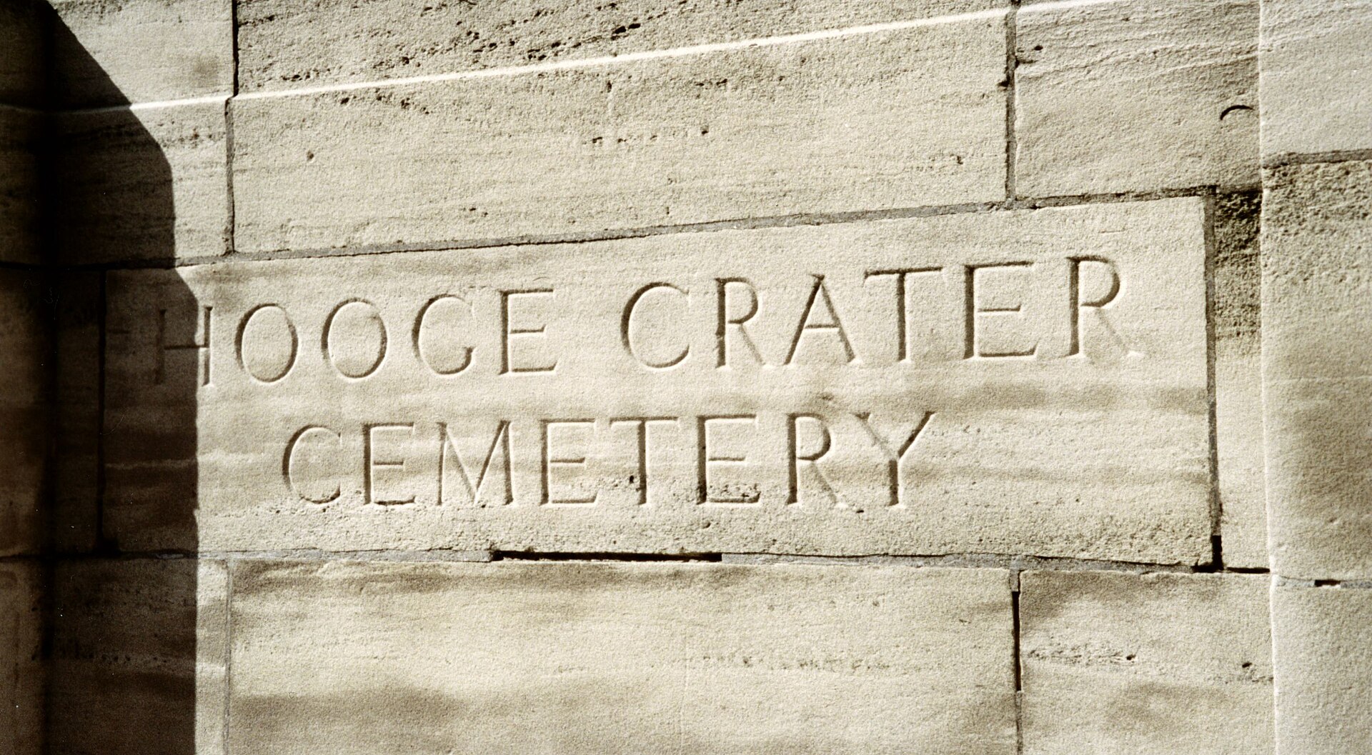
Hooge Crater Cemetery
Ypres
Hooge Crater Cemetery is a Commonwealth War Graves Commission burial ground for the dead of the First World War, located in the Ypres Salient in Belgium, on what was once the Western Front. It lies close to the village of Hooge, roughly 4 kilometres east of Ypres, in the province of West Flanders. Where does the cemetery's name come from? The cemetery takes its name from a mine crater created by an explosion in 1915 near this spot. Underground mining was one of the tactics used during the First World War: both sides dug tunnels beneath enemy lines and detonated explosive charges within them. The crater left behind by one such blast in the Hooge area later gave its name to this burial ground. Where exactly is the cemetery located? The cemetery sits near the centre of Hooge, a small village positioned on the Bellewaerde Ridge. Directly across the Menin Road stands the Hooge Crater Museum, dedicated to the history of the fighting that took place in this area. The proximity of the cemetery and the museum means visitors can, in a single visit, learn about the historical background of the events here while also paying their respects to those buried on the site. The Menin Road itself is one of the best-known roads associated with the fighting around Ypres. It ran from the town toward the front lines and saw thousands of soldiers pass along it during the war. What is the Commonwealth War Graves Commission? The cemetery is maintained by the Commonwealth War Graves Commission (CWGC), the organisation responsible for the graves and memorials of Commonwealth service members who died during the two World Wars. The CWGC cares for hundreds of cemeteries and memorials across the Ypres Salient, a region that saw some of the bloodiest fighting of the Western Front, including three separate Battles of Ypres. Why was the fighting around Hooge so fierce? The area around Hooge, situated on the Bellewaerde Ridge, held significant tactical value: control of this slightly elevated ground offered an observational advantage over the surrounding flat Flemish countryside. This is part of why the area saw such intense, close-quarters fighting, with control changing hands repeatedly and mining operations — like the one that produced the crater giving the cemetery its name — used to break the deadlock. Frequently asked questions Where is Hooge Crater Cemetery located? It lies near the village of Hooge, about 4 km east of Ypres, in the province of West Flanders, Belgium. Where does the cemetery's name come from? From a mine crater created by an explosion in 1915 near the site. What stands opposite the cemetery? The Hooge Crater Museum, dedicated to the history of the fighting in the area, stands across the Menin Road. Who manages the cemetery? It is maintained by the Commonwealth War Graves Commission (CWGC), which cares for the graves of Commonwealth service members. From which period does the cemetery date? The cemetery is connected to the fighting of the First World War in the Ypres Salient on the Western Front.
-
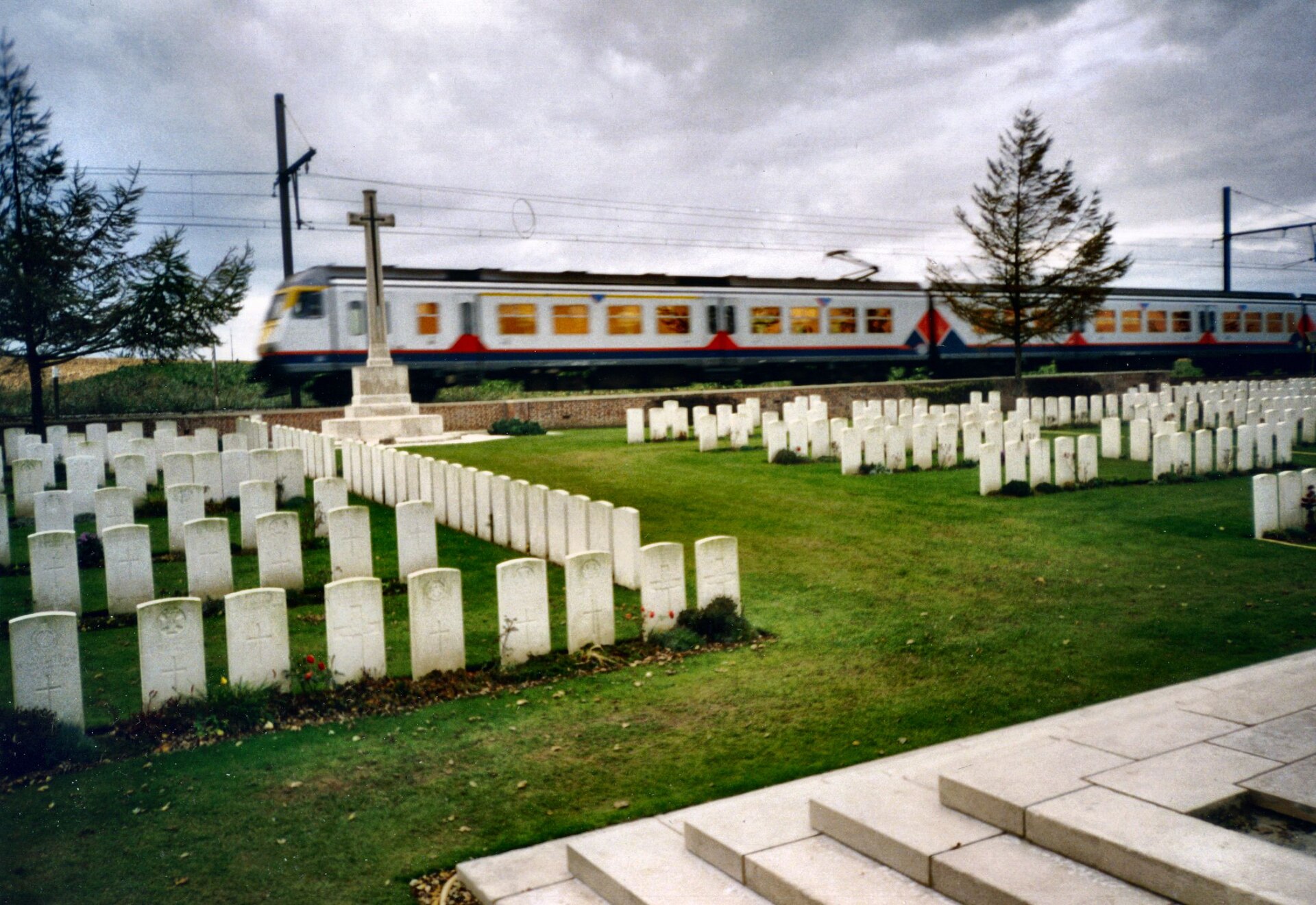
Larch Wood (Railway Cutting) Cemetery
Ypres
Larch Wood (Railway Cutting) Cemetery is a Commonwealth War Graves Commission (CWGC) burial ground holding the dead of the First World War, located in the Ypres Salient on the Western Front in Belgium. It is one of many military cemeteries scattered across the fields surrounding Ypres, a town that sat on the front line for almost the entire war and became synonymous with some of the conflict's bloodiest fighting. Where is the cemetery located? The cemetery lies within the municipality of Ypres, in the province of West Flanders, right in the heart of what became known as the Ypres Salient — a bulge in the Allied front line that British and Commonwealth forces held for most of the war despite being surrounded by German lines on three sides. Its coordinates place it at roughly 50.828°N, 2.923°E, within the flat, low-lying landscape typical of this stretch of the Flanders battlefields. What was the Ypres Salient and why are there so many cemeteries here? The Ypres Salient refers to the section of front line that bulged around the town of Ypres between 1914 and 1918, and it became a byword for the grinding, static warfare that defined much of the First World War. Successive battles fought here drew in hundreds of thousands of soldiers from Commonwealth, French and German forces alike. As a result, the surrounding countryside is dotted with dozens of war cemeteries of every size, ranging from vast national memorials to small, intimate burial grounds such as Larch Wood (Railway Cutting) Cemetery. Who maintains the cemetery? The site is cared for by the Commonwealth War Graves Commission, the organisation responsible for commemorating and maintaining the graves of Commonwealth service members who died in the two World Wars. The CWGC looks after hundreds of comparable cemeteries across Belgium and France, ensuring they remain accessible and well kept for visitors, descendants of the fallen, and anyone with an interest in the history of the First World War. What does the cemetery's name mean? The name Larch Wood (Railway Cutting) refers to two features of the wartime landscape: a stand of larch trees and a nearby railway cutting, both of which served as landmarks used to identify and name the burial ground at the time. This kind of naming, tying a cemetery to a distinctive local landmark, is common among CWGC sites around Ypres, where soldiers and army engineers named locations after whatever features stood out in the surrounding terrain. Frequently asked questions Is the cemetery open to visitors? Cemeteries maintained by the Commonwealth War Graves Commission are generally open to the public year-round, though it is worth checking current access details before planning a visit. From which period do the burials date? The cemetery is connected to casualties of the First World War, sustained during fighting on the Western Front in the Ypres Salient. Are there other war cemeteries nearby? Yes — the area around Ypres has one of the highest concentrations of First World War cemeteries anywhere in Europe, a direct result of how intense and prolonged the fighting was in this sector. Which nationalities are commemorated at the cemetery? As a CWGC site, the cemetery primarily commemorates soldiers of Commonwealth nations who fell during the war.
-
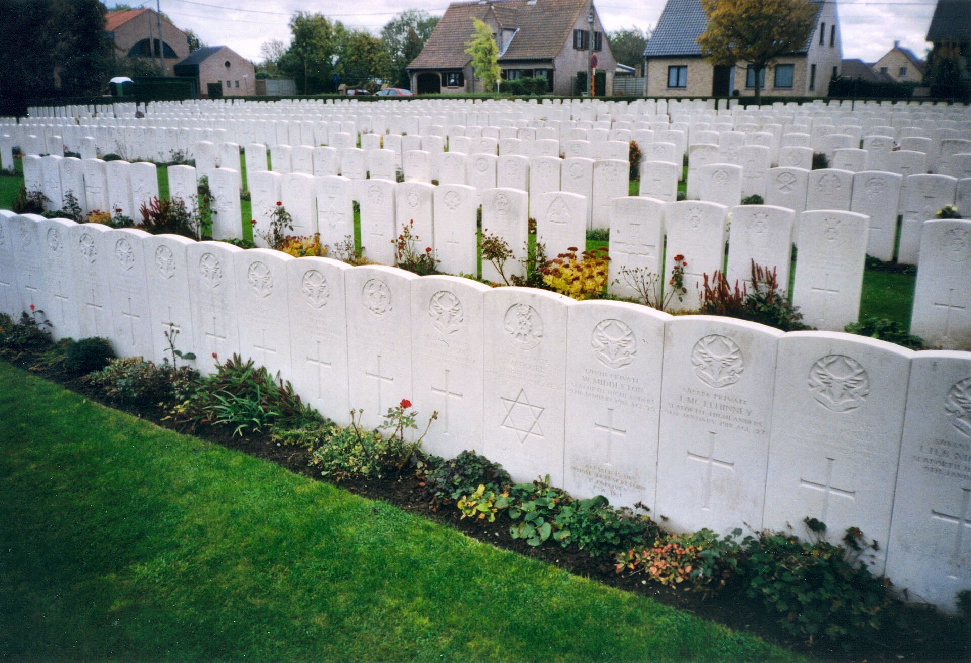
Duhallow ADS Cemetery
Ypres
Duhallow ADS Cemetery is a Commonwealth War Graves Commission (CWGC) burial ground located near Ypres, in the Belgian province of West Flanders, on ground that once formed part of the Western Front during the First World War. Where is the cemetery located? Duhallow ADS Cemetery lies on the outskirts of Ypres, a city that stood at the very heart of the fighting on the Western Front between 1914 and 1918. Its coordinates place it at roughly 50.864°N, 2.878°E, within the wider area known as the Ypres Salient, a stretch of land that changed hands repeatedly as the front line shifted back and forth throughout the war. What kind of site is this? The cemetery is the final resting place of soldiers who died during the First World War. The "ADS" in the name of this and similar British war cemeteries typically points back to an Advanced Dressing Station, a forward medical post set up close to the front line where wounded soldiers were brought for initial treatment before being moved further back for further care. Cemeteries bearing this designation were usually established close to where these stations once stood, marking the spot where many of the wounded ultimately succumbed to their injuries. Who maintains the cemetery today? Duhallow ADS Cemetery is cared for by the Commonwealth War Graves Commission, the organisation established after the First World War to commemorate and maintain the graves of Commonwealth service personnel who died in the two world wars. The CWGC looks after thousands of similar burial grounds across the former Western Front, including a dense concentration of cemeteries around Ypres, where the successive battles for the city and its surrounding ridges produced some of the heaviest casualties of the entire war. Why is the Ypres area significant? The area around Ypres is one of the most important sites of First World War remembrance in Europe. The city was fought over repeatedly during the conflict, and the surrounding countryside and villages are dotted with war cemeteries, memorials and other places of commemoration. Duhallow ADS Cemetery forms part of this extensive network of remembrance sites, and visitors to the Ypres region frequently combine a visit to the city itself with a tour of the nearby cemeteries to gain a fuller sense of the scale of losses suffered on this section of the front. Frequently asked questions Where exactly is Duhallow ADS Cemetery located? The cemetery lies near Ypres, in the Belgian province of West Flanders, on land that once formed part of the First World War Western Front. Who is buried at this cemetery? Soldiers who died during the First World War are buried here, on ground that once lay along the Western Front in Belgium. Who is responsible for maintaining the site? The cemetery is maintained by the Commonwealth War Graves Commission, the body responsible for the upkeep of Commonwealth war graves. Is the cemetery open to visitors free of charge? CWGC war cemeteries are generally open to the public at no cost, as they are maintained as accessible sites of remembrance.
-
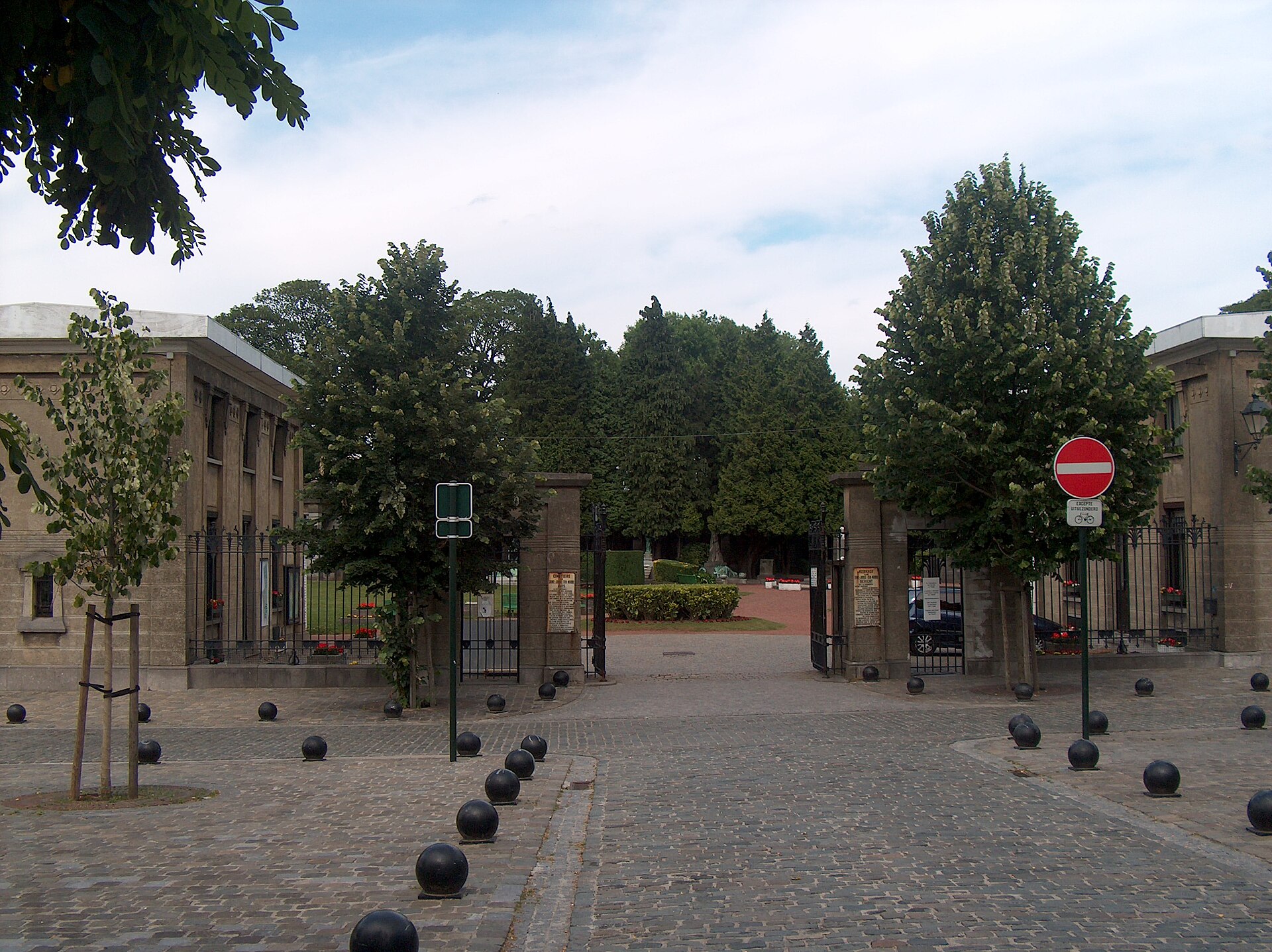
Saint-Josse-ten-Noode Cemetery
Schaerbeek - Schaarbeek
Saint-Josse-ten-Noode Cemetery lies within the municipality of Schaerbeek, part of the Brussels-Capital Region, even though its name refers to the neighboring municipality of Saint-Josse-ten-Noode. This arrangement — a cemetery named after one municipality while physically located in another — is not unusual in the Brussels area, where several historic cemeteries were established on the outskirts of the city once the central, more densely populated municipalities ran out of space for burials. This particular cemetery was founded in the second half of the 19th century. Where exactly is it located? The cemetery sits in Schaerbeek, one of the nineteen municipalities that make up the Brussels-Capital Region. Its geographic coordinates are approximately 50.857°N, 4.404°E, placing it in the northeastern part of the Brussels agglomeration. This location makes the cemetery relatively accessible for residents of both Schaerbeek and the adjoining Saint-Josse-ten-Noode. When was it founded? The cemetery was established in the second half of the 19th century, a period of rapid urban expansion across Brussels and its surrounding municipalities. Local authorities at the time were dealing with growing populations and the need to designate new burial grounds away from residential areas, in line with the sanitary and urban-planning standards that were becoming common across many European cities during that era. Who is buried here? The cemetery is the final resting place of numerous significant figures from Belgian culture and politics. Cemeteries founded in this period often became burial sites for individuals who played a meaningful role in the public life of their region — artists, officials, community figures, and people connected to the intellectual life of Brussels at the time. The presence of such graves gives the cemetery additional historical significance beyond its original function as a burial ground for residents of the surrounding municipalities. What does this cemetery mean for visitors? For anyone interested in the history of Brussels and its constituent municipalities, Saint-Josse-ten-Noode Cemetery represents a point where the histories of two neighboring communities intersect — Schaerbeek, where it is physically located, and Saint-Josse-ten-Noode, whose name it carries. Places like this are often valued not only as spaces of family remembrance, but also as a record of the social and cultural history of the capital region. Frequently asked questions Is Saint-Josse-ten-Noode Cemetery actually located in the municipality of Saint-Josse-ten-Noode? No — despite its name, the cemetery is administratively part of Schaerbeek, within the Brussels-Capital Region. When was the cemetery established? It was founded in the second half of the 19th century. Are any notable people buried there? Yes, the cemetery is the resting place of numerous significant figures from Belgian culture and politics. How can visitors reach the cemetery? It is located in the northeastern part of Brussels, within Schaerbeek, near the coordinates 50.857°N, 4.404°E, in a well-connected part of the capital region. Is this the only cemetery in the area? The Brussels-Capital Region, including Schaerbeek and Saint-Josse-ten-Noode, historically had several cemeteries established around the same period, but this one stands out for its direct naming connection to a neighboring municipality and for the graves of individuals significant to Belgian history.
-
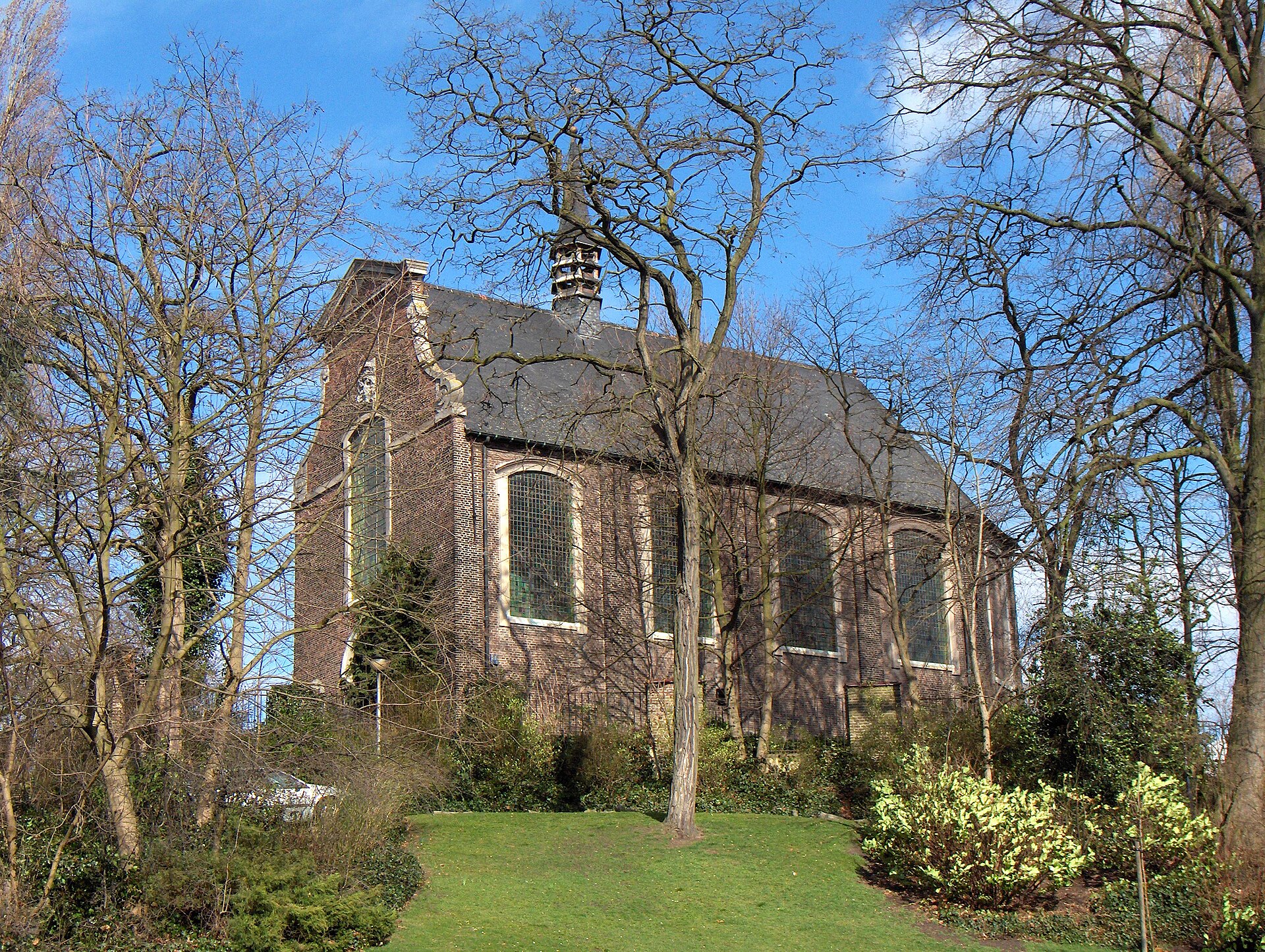
Campo Santo
Sint-Amandsberg
Campo Santo is a historic cemetery in Sint-Amandsberg, a district of Ghent, spread across a small hill known as the Kapelleberg. The name was borrowed from the Roman cemetery Campo Santo dei Teutonici e dei Fiamminghi, situated next to St. Peter's Basilica, and later attached to this Belgian burial ground because of its similarly artistic character. How did the site come to be? The story of the hill goes back to the early 18th century, when bishop Philips Erard van der Noot had a late Baroque chapel built on its summit in honour of Saint Amandus. The cemetery itself only appeared more than a century later, driven by Fr Jozef van Damme, the parish priest of the newly forming independent parish of Sint-Amandsberg. With support from the then-municipality of Oostakker, plots of land on and around the hill were purchased, and in December 1847 a new parish church together with its adjoining cemetery was consecrated. The very first burial took place on 18 December 1847. Why is it called "Ghent's Père Lachaise"? A turning point in the cemetery's history came with the burial of Jan Frans Willems, a writer and leading figure of the Flemish Movement. From that moment on, Campo Santo began attracting members of Ghent's cultural, scientific and bourgeois elite who wished to be laid to rest alongside such notable company. The comparison to Paris's famous Père Lachaise is no coincidence: just as in the French capital, hundreds of elaborately decorated tombs were erected here for painters, sculptors, writers and prominent citizens. What can visitors see today? The best-known section of the site is the Campo Santo hill itself, where burials have taken place since 1847. During the 19th century, Ghent's wealthy, largely French-speaking bourgeoisie invested heavily in extravagant funerary art — sculptures, burial chapels and monuments of considerable artistic value. Up until the outbreak of the First World War, five out of every six grave inscriptions were written in French, a detail that today offers a telling glimpse into the social and linguistic divides of the city at the time. The cemetery was also notably progressive for its era. It was the first neutral cemetery in Ghent, offering a resting place to people of all convictions and leaving families completely free to choose the design of the headstone. Alongside the Catholic bourgeoisie, well-known liberals, politicians, writers, painters and composers also found their final resting place here. Heritage protection Given its exceptional historical and artistic value, part of Campo Santo's tombs have been placed under heritage protection: 131 graves are listed as protected monuments. The entire cemetery complex has been officially recognised as a historical monument in Belgium, confirming its status as one of the most significant burial sites in the East Flanders region. Frequently asked questions Where exactly is Campo Santo located? The cemetery lies in Sint-Amandsberg, a district of Ghent in East Flanders, on a hill known as the Kapelleberg. Where does the cemetery's name come from? The name was borrowed from the Roman cemetery Campo Santo dei Teutonici e dei Fiamminghi, next to St. Peter's Basilica. When was the cemetery founded? The first burial took place on 18 December 1847, shortly after the new parish church was consecrated. Why is it compared to Père Lachaise? Because of the artistic quality of its many tombs and the fact that it became the resting place of the city's cultural and scientific elite, much like the famous Paris cemetery. Is the cemetery legally protected? Yes, 131 graves hold protected monument status, and the cemetery as a whole has been recognised as a national historical monument.
-
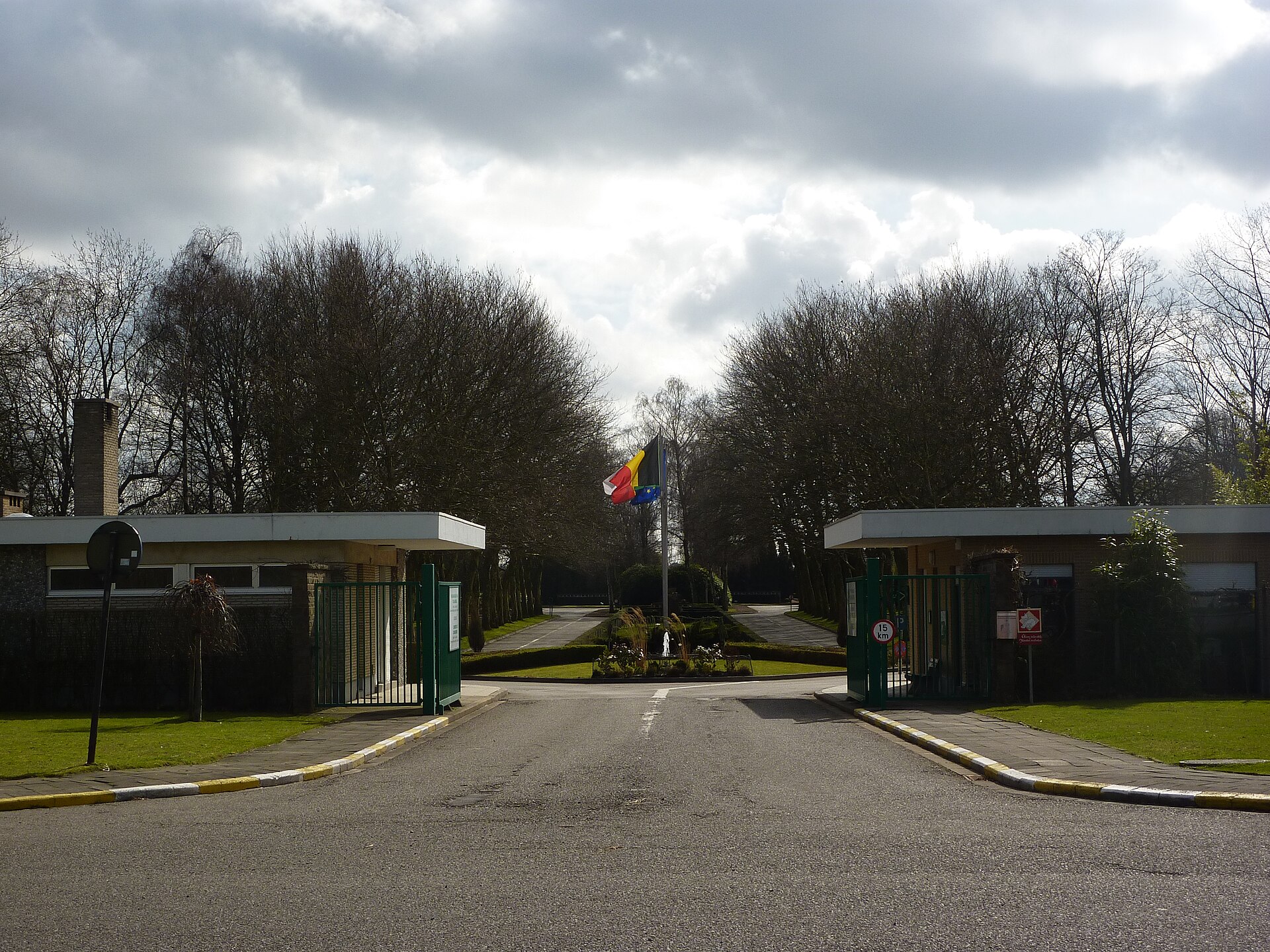
Schaerbeek Cemetery
Zaventem
Schaerbeek Cemetery is a public, non-denominational burial ground administratively belonging to the municipality of Schaerbeek, even though it does not physically lie within its borders. Instead, the site sits in the neighbouring municipality of Evere and partly in Sint-Stevens-Woluwe, a village that forms part of Zaventem in Flemish Brabant. This unusual arrangement — a cemetery named after a municipality it doesn't geographically touch — reflects how Brussels-area local authorities historically solved the problem of finding burial space once their own territory became too built-up. The main entrance to the cemetery is on the Evere side, along Avenue Jules Bordet. The cemetery opened in 1952, at a time when Schaerbeek's authorities needed a new communal burial site outside the municipality's densely built centre. This was a common pattern in post-war Brussels urban planning: municipal cemeteries were pushed to the outskirts, onto land that was still undeveloped, even if that meant crossing into a neighbour's territory. The layout of the site reflects the modernist zoning approach typical of that period in Brussels, when urban functions — housing, industry, green space, and burial grounds — were treated as separable zones to be planned and allocated across the expanding metropolitan area. As a non-denominational public cemetery, Schaerbeek Cemetery serves as a burial place for residents of the municipality regardless of religious affiliation, following the Belgian tradition of communal cemeteries kept distinct from parish burial grounds and open to all citizens of the municipality they serve. The site's management model also involves an element of public participation in its upkeep, setting it apart from more purely administrative, top-down managed necropolises. One notable feature of the location is its close proximity to two other cemeteries: Brussels Cemetery (Cimetière de Bruxelles) and Evere Cemetery (Cimetière d'Evere). All three burial grounds sit close together in the north-eastern part of Brussels, forming an extensive belt of cemetery land in that part of the city. This proximity can be a source of confusion for visitors, since Schaerbeek Cemetery is sometimes mistaken for one of its neighbours despite being a separate, independently managed site. The cemetery's position — straddling the border between the Brussels-Capital Region and Flemish Brabant — also makes it a geographically split site in administrative terms: part of the grounds lie within the Brussels-Capital Region, while another part falls within the Flemish Region, in the municipality of Zaventem. This division is a direct result of how municipal boundaries developed historically across the Brussels metropolitan area, where cemetery land was often established wherever a sufficiently large, undeveloped plot could be found, regardless of which administrative unit it technically belonged to. For anyone interested in the urban planning history of Brussels and how the city dealt with organising public space in the post-war decades, Schaerbeek Cemetery is a practical example of a densely built municipality solving a land-use problem by cooperating with neighbouring administrative units to secure space outside its own borders. The site's coordinates (50.869, 4.425) place it in a green belt north-east of central Brussels, close to Zaventem Airport. Frequently asked questions Is Schaerbeek Cemetery located in the municipality of Schaerbeek? No — despite its name, the cemetery administratively belonging to Schaerbeek is physically situated in Evere and partly in Sint-Stevens-Woluwe, part of the municipality of Zaventem. When was the cemetery established? It opened in 1952. Is it a religious cemetery? No, it is a public, non-denominational cemetery open to all residents of the municipality. What other cemeteries border this site? It directly adjoins Brussels Cemetery and Evere Cemetery, and together the three form a large cemetery area in this part of the city.
-
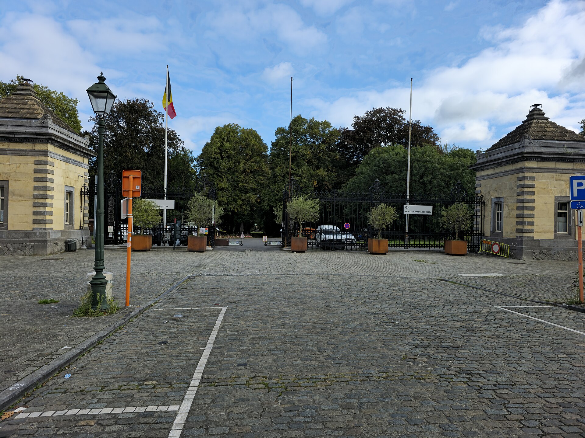
Brussels Cemetery
Evere
Brussels Cemetery belongs administratively to the City of Brussels, yet it doesn't actually sit within the city's own boundaries. Instead, it's located in Evere, one of the nineteen municipalities that make up the Brussels-Capital Region. It's a detail that trips up plenty of visitors who assume a cemetery named after Brussels must physically be in Brussels proper. Where it actually sits The cemetery is positioned at approximately 50.8697°N, 4.4229°E, in the north-eastern part of the Brussels agglomeration. This spot places it right next to two other burial grounds: Schaerbeek Cemetery, belonging to the municipality of Schaerbeek, and Evere Cemetery, belonging to the municipality of Evere itself. The three cemeteries sit side by side, forming one large funerary complex on the edge of the city. Easy to mix up Because Brussels Cemetery, Schaerbeek Cemetery, and Evere Cemetery are direct neighbours, it's genuinely easy for a first-time visitor to lose track of where one ends and the next begins. Each, however, is a distinct entity with its own administrative owner — a different municipality or the city itself — even though physically they form a continuous green space. Brussels Cemetery, despite standing on Evere's territory, remains the property and responsibility of the City of Brussels, a setup that traces back to how the Belgian capital expanded historically without enough room left within its own formal borders for a large burial ground. What kind of place this is As a municipal cemetery, Brussels Cemetery serves as a burial site for residents of the capital — an arrangement not unusual in Europe, where larger cities often established cemeteries outside their own administrative limits once available land within the centre ran out. The clustering of three cemeteries in one location creates an extensive, quiet stretch of green space on the north-eastern edge of Brussels, well removed from the noise of the city centre. Who ends up here Visitors making their way to Evere — whether searching for a specific grave or simply walking through a quieter, less touristic part of the Brussels agglomeration — should keep in mind how large and layered this cemetery complex actually is. With three neighbouring burial grounds sitting practically on top of each other, it pays to know in advance exactly which of the three you're heading for, especially if you're trying to locate a particular grave. Frequently asked questions Is Brussels Cemetery actually located in Brussels? No — despite the name, it's situated in the municipality of Evere, next to the city of Brussels. It does, however, belong administratively to the City of Brussels. How is it different from Evere Cemetery and Schaerbeek Cemetery? These are three separate cemeteries standing side by side, each under a different administrative authority: Brussels Cemetery under the City of Brussels, Evere Cemetery under the municipality of Evere, and Schaerbeek Cemetery under the municipality of Schaerbeek. Is it easy to confuse them during a visit? Yes. Their direct adjacency and similar naming make it worth checking in advance exactly which of the three cemeteries you intend to visit. Where exactly is the cemetery located? In the north-eastern part of the Brussels-Capital Region, at roughly 50.87°N, 4.42°E, within the municipality of Evere.
-
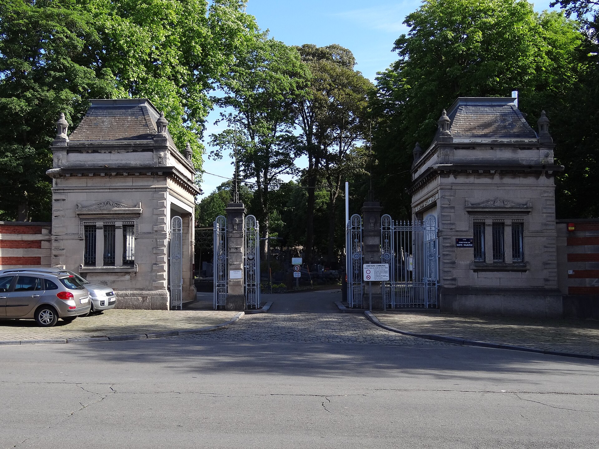
Cemetery of Sainte-Walburge
Liège
Cemetery of Sainte-Walburge is one of the largest and oldest active cemeteries in Liège, spread across a hillside in the northern district that shares its name. The site's history stretches back much further than its current location suggests, with roots reaching into the medieval period. Where did this place come from? Already in the 13th and 14th centuries, a religious sanctuary stood in the Sainte-Walburge suburb. During the 14th century, a hospital for lepers and other patients was built there, and a small burial ground grew up alongside it, known at the time as the lepers' cemetery. As leprosy cases declined during the second half of the 16th century, the hospital gradually fell out of use and was abandoned. How did a lepers' cemetery become a parish cemetery? A turning point came on 7 September 1614, when the new parish church of Sainte-Walburge was consecrated. The former lepers' burial ground changed character at that point, becoming an ordinary parish cemetery directly adjoining the church. It continued to function this way for the next two centuries. Why was the cemetery relocated? French republican law of 1801 banned burials directly around churches, and Napoleon's decree of 12 June 1804 further clarified these rules for occupied territories. As a result, municipal authorities had to designate new burial grounds. The first Sainte-Walburge cemetery, located around the old church, continued operating for several more decades before it was finally closed in 1866. When was the current cemetery established? The present-day Cemetery of Sainte-Walburge opened on 20 March 1874. At the time, it stood somewhat apart from the district's built-up area, away from the more densely populated neighborhoods. Over time the city grew toward it, and the cemetery itself gradually expanded. In 1907, a monumental entrance was erected, which still stands today as a defining feature and gives the site its ceremonial character. What is there to see on site? The Cemetery of Sainte-Walburge is more than a burial ground — it functions as an open-air record of Liège's history. It holds a monument dedicated to the heroes of the 1830 Belgian Revolution, along with the graves of numerous revolutionaries from that period, including the legendary figure known as Charlier-Jambe-de-Bois (Charlier Wooden-Leg). Walking along its paths, visitors can also find examples of traditional funerary craftsmanship, including the porcelain medallion portraits characteristic of the region — a testament to local funeral customs at the turn of the 19th and 20th centuries. Frequently asked questions Is this still an active cemetery? Yes, the Cemetery of Sainte-Walburge continues to serve its original purpose and is managed by the city of Liège as part of its network of municipal cemeteries. How does it differ from the earlier Sainte-Walburge cemetery? The current site is the third location associated with the name — it followed an earlier lepers' burial ground near the old hospital, and then a parish cemetery beside the church, which closed in 1866. What does the 1907 monumental entrance represent? It is a ceremonial gateway added decades after the cemetery opened, once it had become firmly established as the district's principal burial site. Are there graves connected to Belgian national history here? Yes, the cemetery holds the graves of participants in the 1830 revolution as well as a monument commemorating its heroes.
-
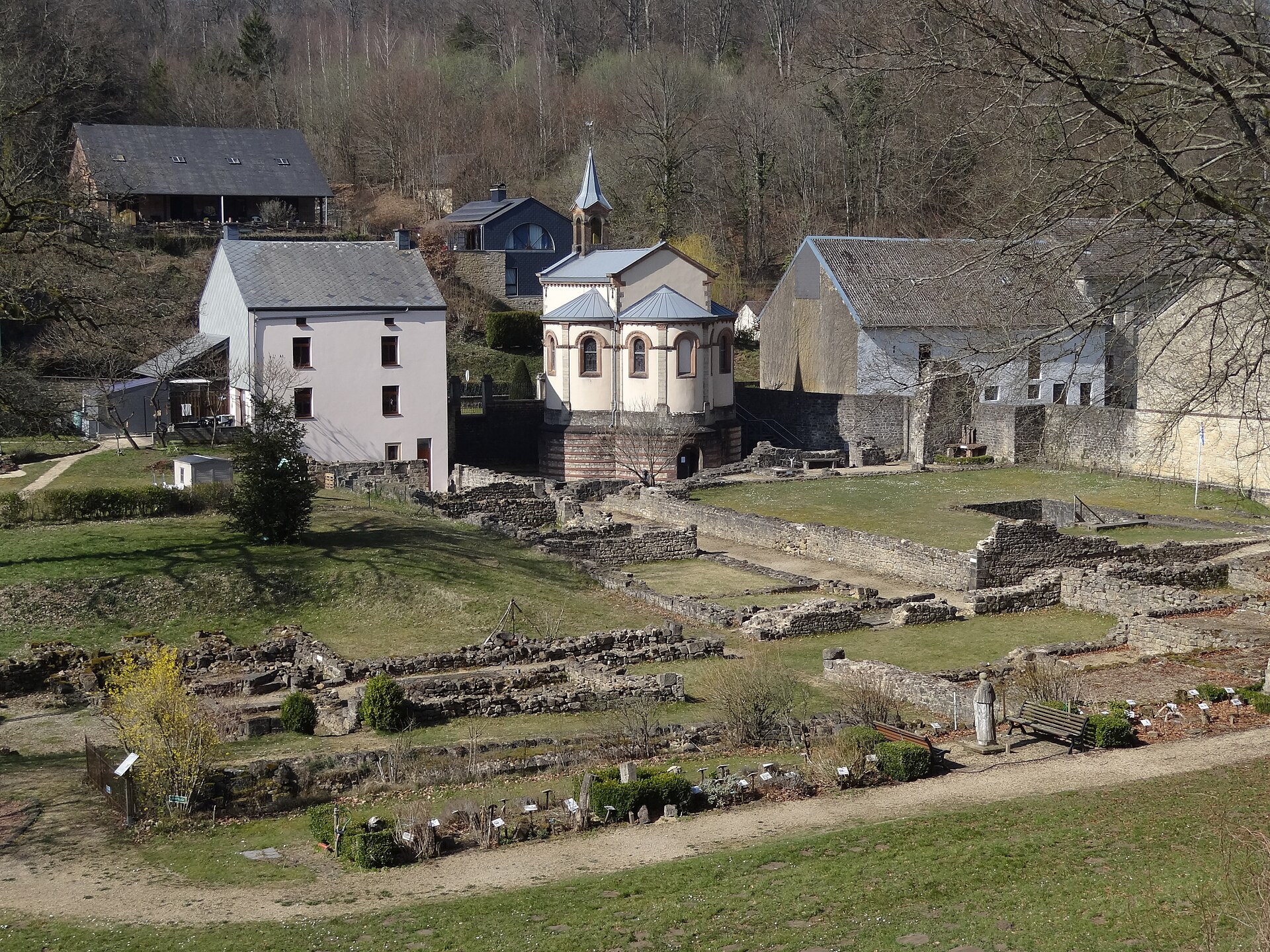
Clairefontaine Abbey
Arlon
Clairefontaine Abbey (also known as the Abbey of Notre-Dame de Clairefontaine) is a former Cistercian nunnery in Wallonia, standing near the small hamlet of Clairefontaine, which belongs administratively to the city of Arlon. Today the remains of the abbey serve as both a tourist site and a place of pilgrimage, drawing visitors interested in the religious history of the region and the monastic architecture of medieval Europe. When was the abbey founded? The community was established in the middle of the 13th century as a house of Cistercian nuns, the female branch of the Cistercian order known for its austere way of religious life and its distinctive style of monastic building. The abbey remained active for centuries before being officially suppressed in 1796. That date places its closure within the broader wave of religious institutions dissolved across Western Europe at the end of the 18th century, a period of major political upheaval that reshaped the fate of many monasteries. After the community was disbanded, the abbey buildings gradually fell into disrepair, yet enough of the structure survived to remain visible and visitable today. Where exactly is it located? The abbey sits in Wallonia, the French-speaking part of Belgium, right next to the hamlet of Clairefontaine. Although the hamlet itself is a small, rural settlement, it falls under the administrative authority of Arlon, one of the more significant towns in Luxembourg Province. The location is notable for its proximity to the border: the Luxembourgish town of Eischen lies only about 3 kilometres (1.9 miles) away. This short distance means the abbey is visited both by travellers touring Belgium and by those exploring the neighbouring Grand Duchy of Luxembourg, for whom a stop at the abbey fits naturally into a cross-border itinerary. Why visit Clairefontaine Abbey? For anyone interested in monastic history and religious architecture, Clairefontaine Abbey offers a chance to encounter the remains of a community that endured for more than five centuries before its dissolution. The site combines historical value with an ongoing spiritual role — it continues to serve as a destination for pilgrimage, which sets it apart from many other monastic ruins that have become purely museum-like attractions. The surrounding countryside, typical of rural Wallonia, makes for a quiet visit away from the busier towns of the wider region. How to get there Thanks to its position close to the Luxembourg border, the abbey is reasonably accessible from both sides of the frontier. Travellers can orient their route around Arlon, the city to which Clairefontaine administratively belongs, or around Eischen on the Luxembourgish side. The site's geographic coordinates are approximately 49.6658°N, 5.8660°E, which makes it easy to pinpoint on a map when planning a visit to the area. Frequently asked questions When was Clairefontaine Abbey founded? It was founded in the middle of the 13th century as a Cistercian nunnery. Is it still an active monastery? No — the religious community was officially suppressed in 1796. The surviving buildings now function as a tourist site and place of pilgrimage. Where exactly is the abbey located? In Wallonia, next to the hamlet of Clairefontaine, which administratively belongs to the city of Arlon, about 3 kilometres from the Luxembourgish town of Eischen. Can a visit be combined with a trip to Luxembourg? Yes — since Eischen is only a few kilometres away, the abbey can easily be included in an itinerary that covers both Belgian and Luxembourgish sights in this border region.
-
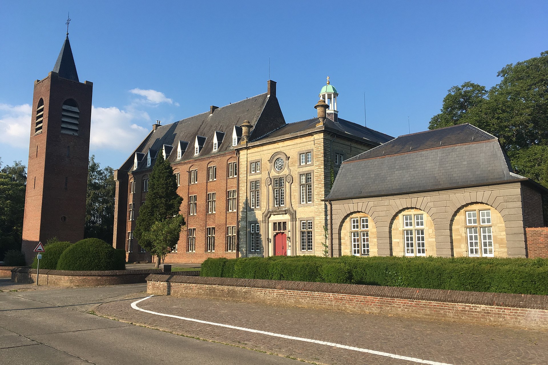
Affligem Abbey
Affligem
Affligem Abbey is a Benedictine monastery in the historic village of Hekelgem, now part of the municipality of Affligem in Flemish Brabant, Belgium, roughly 19 kilometres (12 miles) north-west of Brussels. Its coordinates, 50.924444 N, 4.113889 E, place it in a quiet, rural corner of Flanders, well away from the bustle of the Belgian capital. Where does the abbey's historical importance come from? The abbey was dedicated in 1086, making it one of the older monastic foundations in what is now Belgium. During the Middle Ages, Affligem held the status of the most important monastery in the Duchy of Brabant, earning it the Latin epithet Primaria Brabantiae — literally "the first (abbey) of Brabant." That title was not a casual nickname: it signalled a leading position among the region's religious communities, both spiritually and in terms of economic and cultural influence. Why does it matter that Affligem is a Benedictine abbey? Belonging to the Benedictine order shapes the character of a place like this. For centuries, Benedictine communities have followed the Rule of Saint Benedict of Nursia, summed up in the motto "ora et labora" — pray and work. In practice, this meant that life in such abbeys revolved around liturgical prayer, manual and intellectual labour, and hospitality toward travellers. Benedictine houses like Affligem were typically more than spiritual centres: they also served as significant economic and cultural hubs in their regions, running farmland, workshops, and scriptoria where manuscripts were copied and preserved. Where exactly is Affligem located? The village of Hekelgem, home to the abbey, lies within the municipality of Affligem in the province of Flemish Brabant (Vlaams-Brabant), in northern Belgium. It's a distinctly Flemish region bordering the Brussels-Capital Region directly, yet it retains a rural, agricultural character. Being less than 20 kilometres from central Brussels means the abbey is, in principle, reachable as part of a day trip from the Belgian capital, even though the site itself operates at a far quieter pace than the city's major attractions. What historically set Affligem apart from other monasteries? The title Primaria Brabantiae indicates that Affligem was not simply one of many equal monasteries in the region, but held a superior standing — a reference point for other monastic communities within the duchy. Such a rank usually came with substantial landed endowments, privileges granted by rulers and bishops, and considerable influence over the religious life of the surrounding population. The dedication date of 1086 places the abbey's origins within a period of intense monastic expansion across Western Europe, when numerous new foundations were established, often under the patronage of local nobility. Frequently asked questions Where is Affligem Abbey located? In Hekelgem, a village within the municipality of Affligem in Flemish Brabant, Belgium, about 19 km north-west of Brussels. Which religious order does the abbey belong to? It is a Benedictine monastery. When was it dedicated? In 1086. What does Primaria Brabantiae mean? A Latin title meaning the foremost abbey of the Duchy of Brabant — a designation highlighting Affligem's leading role among the region's monastic communities at the time.
-
Bois-Seigneur-Isaac Abbey
Braine-l'Alleud
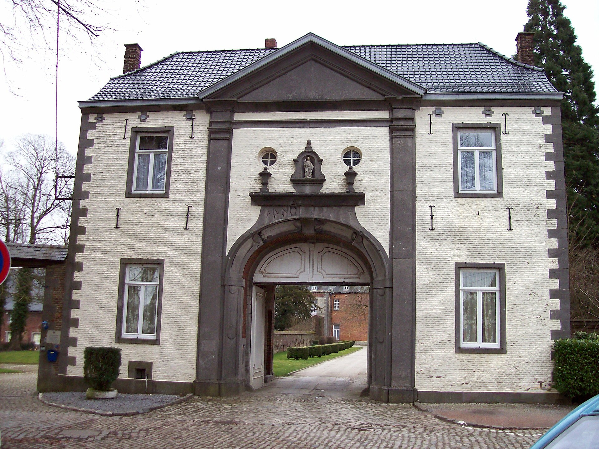
Bois-Seigneur-Isaac Abbey is a former monastery in Ophain-Bois-Seigneur-Isaac, a village now part of Braine-l'Alleud in Walloon Brabant, a short distance south of Brussels. Over the centuries the site has passed through several religious communities: it began as an Augustinian abbey, later became a Premonstratensian priory dependent on Averbode Abbey, and today is home to the Lebanese Maronite Order. Where does the name come from? Local tradition traces the origins of the place to a knight named Isaac who set out on crusade in the 11th century and was taken prisoner by Saracen forces. According to the legend, he was freed after experiencing a vision of the Virgin Mary. On returning home he built a wooden chapel dedicated to Our Lady of Grace and Consolation, housing a statue that was venerated for nearly two hundred years. His name gave the settlement — and later the abbey — the "Seigneur Isaac" part of its name. What was the miracle that turned the chapel into a pilgrimage site? The defining event in the site's history is the eucharistic miracle of 5 June 1405. During a mass celebrated by the parish priest of nearby Ittre, a fragment of the consecrated host was discovered on the corporal and reportedly began to bleed when lifted. The bishop of Cambrai, whose diocese covered the area at the time, investigated the reported miracle and in 1410 formally declared it genuine, authorizing the chapel to become a pilgrimage destination. How did the chapel grow into an abbey? The growing stream of pilgrims required permanent pastoral care, so in 1413 Augustinian canons regular were brought to the site. The resulting priory quickly gained independence, becoming a full abbey in its own right by 1416. In the same period, on 3 May 1413, the bishop authorized veneration of the corporal as a relic and established an annual procession in honor of the miracle together with a public exposition of the Blessed Sacrament — a tradition that, in various forms, endured for centuries. What happened to the community afterward? Following its time as an Augustinian abbey, the site came under the Premonstratensian (Norbertine) order, functioning as a priory dependent on Averbode Abbey in Flemish Brabant. This arrangement, linking a local community to a larger mother abbey, was typical of the Norbertine order and helped preserve continuous religious life through the region's turbulent history. Who runs the abbey today? The abbey buildings and grounds are now occupied by the Lebanese Maronite Order, a community rooted in Eastern Christian tradition with a presence in Western Europe. This transition allowed the site to retain a religious function, even under a different liturgical tradition than the one in which it originated. Why visit Bois-Seigneur-Isaac? The abbey is a compelling stop for anyone interested in the religious history of Walloon Brabant, combining a crusader legend, a documented eucharistic miracle recognized by church authorities, and centuries of transition between religious communities up to the present Maronite presence. Its proximity to Braine-l'Alleud and to Brussels also makes it easy to combine with a visit to the nearby Waterloo battlefield or other regional sights. Frequently asked questions Where exactly is the abbey located? In Ophain-Bois-Seigneur-Isaac, part of the municipality of Braine-l'Alleud in the province of Walloon Brabant, Belgium. Which order runs it today? The Lebanese Maronite Order. What is the site historically known for? The legend of the knight Isaac and the eucharistic miracle of 1405, recognized as authentic by the bishop of Cambrai in 1410.
-
Onze-Lieve-Vrouw-Tenhemelopnemingskerk
Gistel
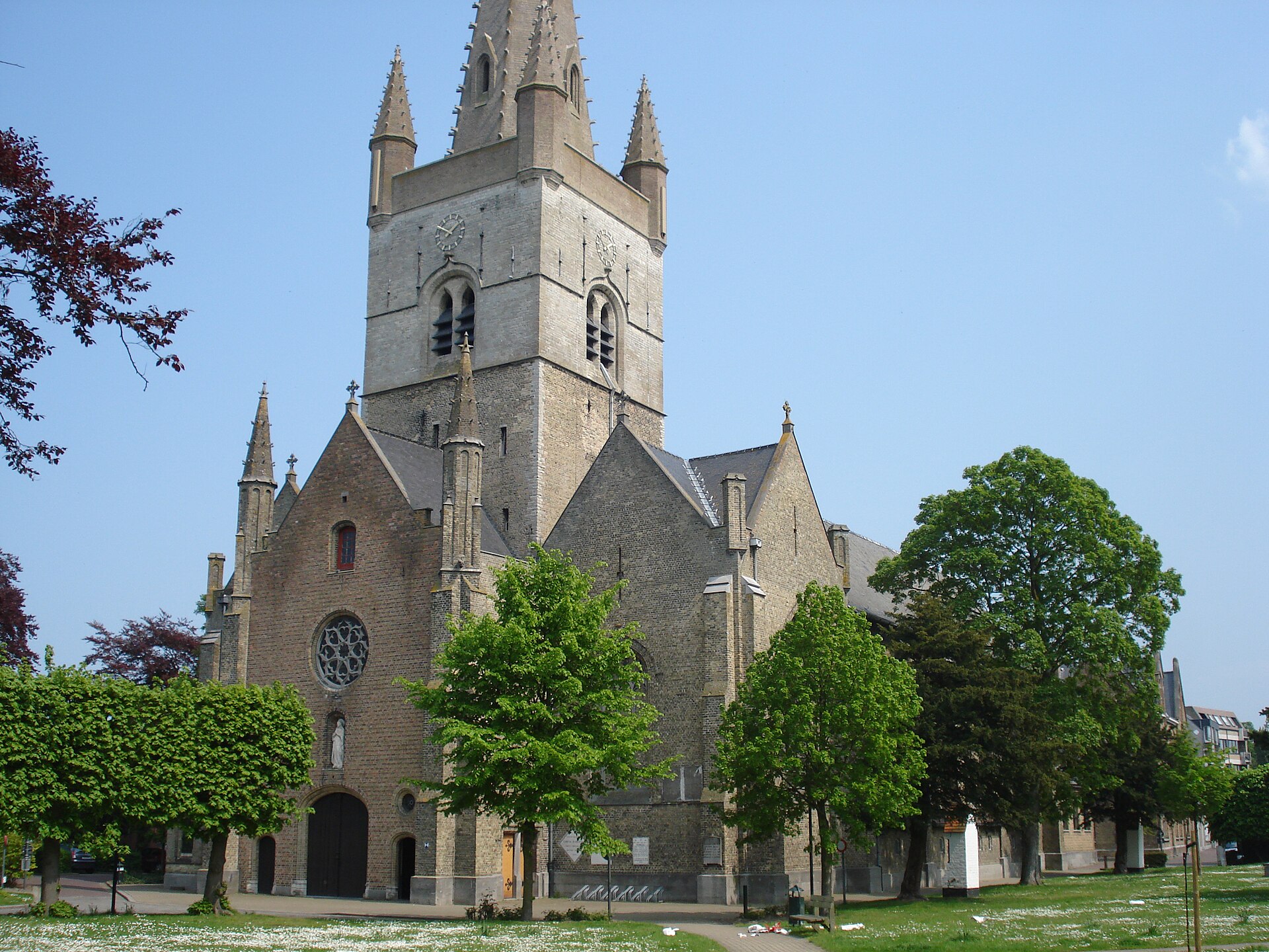
Onze-Lieve-Vrouw-Tenhemelopnemingskerk is the parish church standing at the heart of Gistel, a small town in the Belgian province of West Flanders. The neo-Gothic building visitors see today has crowned the town's central square since the mid-19th century, but the site itself has served as a place of worship for over a thousand years. How old is the site really? The earliest surviving written reference to Gistel dates back to 988 and mentions an "ecclesia" — most likely a modest chapel rather than a full church. Historians place the construction of the very first place of worship here around the 10th or 11th century. That original structure was built from wood and clay, the standard building materials for religious sites in the region at the time. Why did the church need to grow? As the settlement expanded and pilgrims increasingly travelled to Gistel to visit the resting place of Saint Godelieve — the town's patron saint — the simple wooden chapel could no longer meet demand. A larger, stone structure became necessary. By the year 1400, the church had developed into a cruciform building with two side aisles, a layout reflecting its growing importance as a pilgrimage destination. What happened to the medieval church? The medieval building did not survive intact. On 31 January 1488, the church was destroyed by fire, set deliberately by the troops of Maximilian of Austria during military action in the region. The loss wiped out centuries of architectural heritage, though the site continued to function as a place of worship in the years that followed. What stands there today? The church visitors encounter now is a neo-Gothic hall church, built between 1853 and 1867 to a design by architect Pierre Buyck. It replaced an earlier Gothic building that, by the mid-19th century, had deteriorated to the point where continued use and repair were no longer practical. The new church took over the parish's religious functions and has served that role ever since. What is inside worth noticing? The interior holds several features of note. The left aisle is dedicated to Our Lady and houses a Baroque altar together with stained-glass windows, giving this part of the church a distinct, more intimate character. A carved wooden pulpit dating from 1730 stands out as a fine example of the woodcarving craftsmanship typical of Flemish Baroque church furnishing. The church also displays processional banners and large 18th-century paintings by the Bruges painters Jan Garemijn and Jozef van de Kerckhove, evidence of the parish's wealth and standing during the early modern period. The exterior is worth a closer look too: the gable carries a relief referencing the legend of Saint Godelieve, depicting the scene of her strangulation by Hacca and Lantbert. This detail ties the building directly to the local cult of the town's patron saint, whose story is intertwined with the very origins of the site. Frequently asked questions Is the current church the same building as the medieval one? No. The present neo-Gothic church was built between 1853 and 1867 on the site of an earlier Gothic building, which itself replaced the original medieval church destroyed by fire in 1488. Why is the church dedicated to the Assumption of Mary? The dedication (Onze-Lieve-Vrouw-Tenhemelopneming, meaning "Our Lady's Assumption into Heaven") is one of the most common Marian church titles in Flanders and points to a long-standing Marian devotion tradition at this parish. What is the church's connection to Saint Godelieve? The church and the pilgrimage traffic associated with it grew in part because of the presence of Saint Godelieve's resting place in Gistel — her cult was a key factor behind the original chapel's expansion into a larger church. Who designed the current building? Architect Pierre Buyck, who designed the 1853–1867 reconstruction.
-
Sint-Agathakerk
Sint-Agatha-Rode
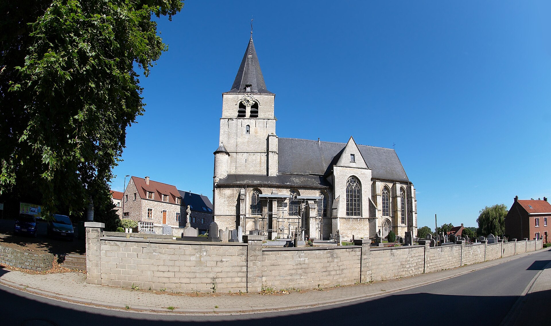
Sint-Agathakerk is the parish church of Sint-Agatha-Rode, a village that belongs to the municipality of Huldenberg in the province of Flemish Brabant. Dedicated to Saint Agatha of Sicily, the church stands at the heart of the old settlement and remains one of the oldest landmarks in the area. How old is this church? The story of this site goes back to the 11th century, roughly the same time the village of Sint-Agatha-Rode itself came into being. It was Godfrey I, Count of Leuven, who is believed to have had a church built here — most likely a Romanesque structure, far more modest than the building that stands today. In 1140, another count, Godfrey II, transferred the church to the chapter of the collegiate church of St. Peter in Leuven, a decision that tied the fate of the building to that powerful institution for centuries to come. Where does the current appearance come from? The shape the church has kept for roughly six hundred years took form around 1400, when it underwent a major rebuilding. That was far from the end of its turbulent history, though: in the late 16th century, during the religious upheavals of the period, the Geuzen — Calvinist rebels fighting Spanish rule in the Low Countries — destroyed the building. Reconstruction took over a decade, running from about 1597 to roughly 1608, and gave the church the Gothic form still visible today. What does the architecture look like? The Sint-Agathakerk is a good example of Gothic architecture typical of this part of Brabant. A sturdy square tower rises at the west end, followed by a three-aisled nave of three bays arranged in pseudo-basilical fashion — meaning the central aisle rises above the side aisles, though the height difference is less pronounced than in a true basilica. On either side of the nave, in line with the side aisles, sit pseudo-transepts: arms that resemble a transept without forming a full crossing with the main nave. The building ends in a three-sided, two-bay choir. What is there to see inside? The interior holds several noteworthy furnishings from different periods. At the back of the north aisle stands a Baroque altar together with a baptismal font topped by a hovering Eucharistic dove, both dating from the 17th century and pointing to the parish's relative prosperity at the time. The choir still contains wooden wall panelling and a north door, both dated to the late 18th century. The door panel of the west portal, meanwhile, bears the carved year 1913, likely marking a later restoration or carpentry work at the main entrance. Is the church a protected monument? Given its historical and architectural value, the Sint-Agathakerk has been a protected heritage monument since 3 July 1979. That legal status confirms the building's role as a witness to centuries of regional history — from its medieval foundation under the counts of Leuven, through destruction and rebuilding after the 16th-century religious conflicts, to the present day. Frequently asked questions Who is the church dedicated to? The church is dedicated to Saint Agatha of Sicily, whose name was also given to the village of Sint-Agatha-Rode itself. When was the first church on this site built? The earliest known church here dates from the 11th century and is attributed to Godfrey I, Count of Leuven. Why was the church rebuilt? The building was destroyed in the late 16th century by the Geuzen, so it was reconstructed around the turn of the 17th century, giving it the Gothic form it still has today. Since when has the church been a protected monument? It has held protected heritage status since 3 July 1979.
-
Sint-Annakerk
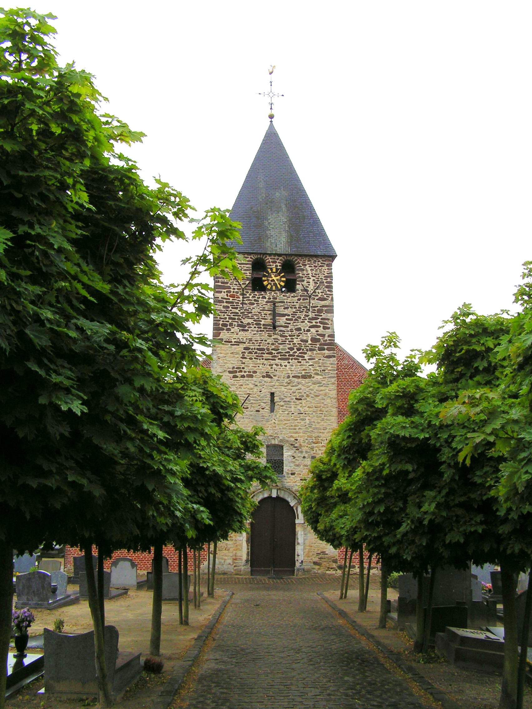
Sint-Annakerk is the parish church of Oud-Heverlee, a village in the Belgian province of Flemish Brabant, standing at the junction of Dorpsstraat and Oude Pastoriestraat. The building brings together traces of several construction periods and remains an active center of the local parish community today. How old is the church, really? The oldest surviving element is a Romanesque tower dating from the 11th century, built from sandstone and blocks of ferruginous sandstone and topped with a distinctive tent roof. This tower is the only direct link to the original medieval church that once stood on the site, long before the rest of the current building took shape. Why is the layout of the church reversed? Sint-Annakerk has an unusual reversed orientation: the choir sits on the western side of the building, while the tower stands to the east — the opposite of the traditional arrangement in which the altar faces east. The structure itself consists of a tower integrated into the building's mass, a three-aisled nave of four bays, and a tall, elongated choir closed off by an apse. What changed in the 18th and 19th centuries? The nave, side aisles, and choir date from the 18th and early 19th centuries. In 1758, the nave was rebuilt in a classicist style and extended with two side aisles, giving the church the overall form still visible today. As a result, a medieval tower and a much later, classicist nave now share a single building. What details are worth noticing inside? The interior holds several symbolically charged carved details. A confessional inside the church is decorated with a wooden dragon, representing the power of evil over which the sacrament of confession triumphs. The church also features a depiction of a pelican, a traditional symbol of self-sacrifice associated with the figure of Christ, referencing the old legend of the bird feeding its young with its own blood. What surrounds the building? On its northern, eastern, and southern sides, Sint-Annakerk is enclosed by a walled historic churchyard. This arrangement — a church ringed by a walled cemetery — is typical of rural parishes in this region and reflects the fact that the site has served, for centuries, not only a religious function but also a social one, as the focal point of the local community. Where exactly is it located? The church stands at the heart of Oud-Heverlee, at Dorpsstraat 54, directly adjacent to Oude Pastoriestraat. Its geographic coordinates are approximately 50.8383°N, 4.6625°E, placing it in a quiet, rural part of Flemish Brabant not far from Leuven. Frequently asked questions Is Sint-Annakerk a protected heritage site? Yes, the church together with its churchyard is listed as a heritage object (parochiekerk Sint-Anna met kerkhof) in the Belgian inventory of immovable heritage. What is the oldest part of the building? The 11th-century Romanesque tower, the only surviving fragment of the original medieval church on this site. Is the church still used as a parish church? Yes, Sint-Annakerk remains an active parish church serving the village of Oud-Heverlee. Why does the tower stand on the east side instead of the west? This is a result of the building's reversed orientation, with the choir placed to the west and the tower to the east — a departure from the typical eastward placement of the altar in church architecture.
-
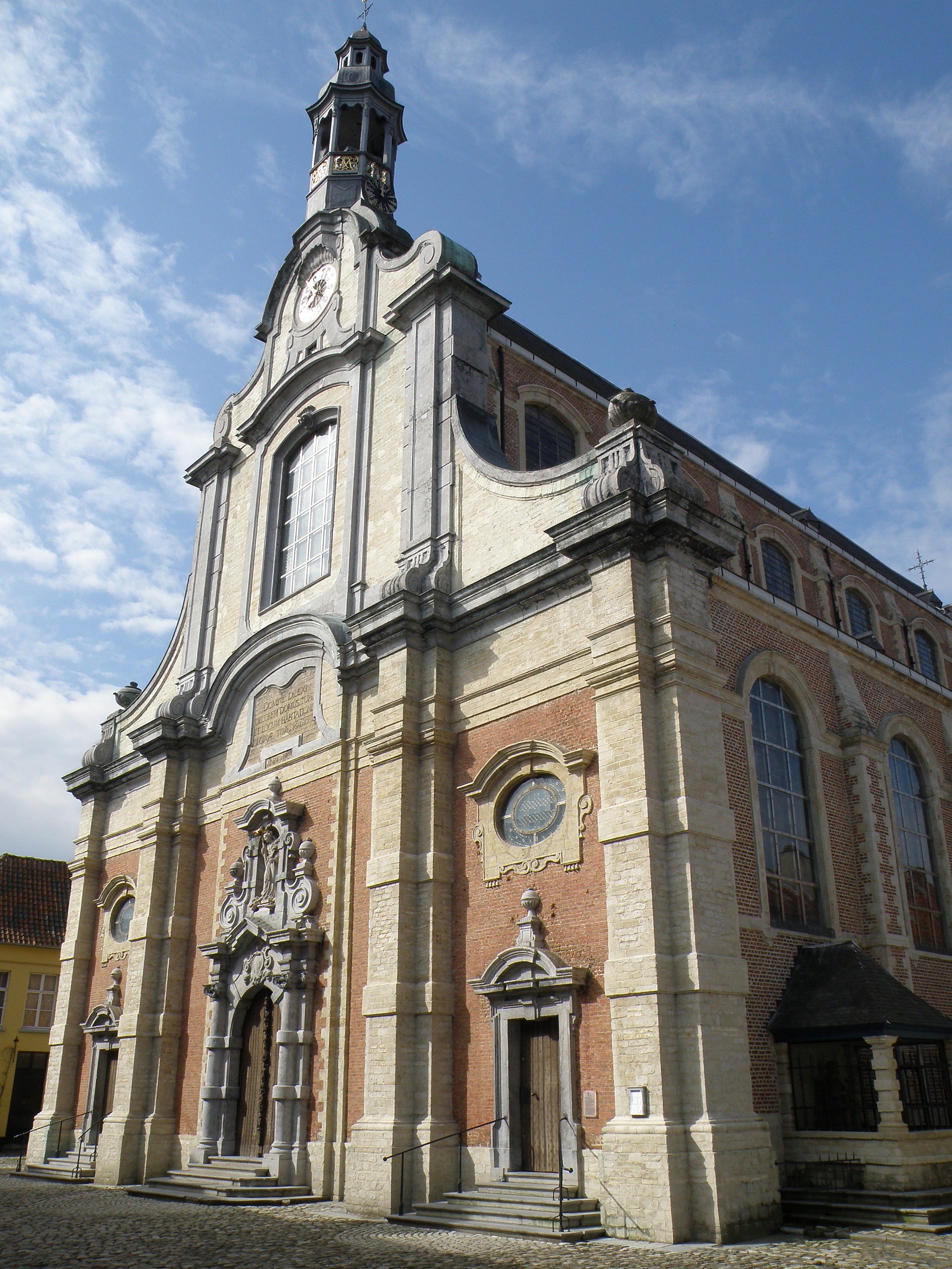
Sint-Margaritakerk
Lier
Sint-Margaritakerk, also known as the Begijnhofkerk, is a church standing at the heart of the beguinage in the Belgian town of Lier. The building is inseparably tied to its surroundings — the Lier beguinage is inscribed on the UNESCO World Heritage list, and the church forms its spiritual and architectural centerpiece. Who is the church dedicated to? The church carries the dedication of Saint Margaret of Antioch, who was also the patron saint of the entire Lier beguinage. This choice was far from arbitrary — beguinages, communities of lay women leading a devout life without taking formal religious vows, frequently chose patron saints associated with steadfast faith and purity, and the cult of Saint Margaret was widespread across the Low Countries and Flanders. How long did construction take? Work on the church began in 1664 and took more than a century to complete. This unusually long timeline stemmed from how the project was financed — the beguines themselves, the women living in the beguinage, funded the construction from their own resources, meaning the pace of building depended on the community's ongoing financial capacity rather than on a single wealthy patron footing the entire bill at once. The first part of the church was already consecrated in 1671, allowing the beguines to use part of the building while the remaining sections were still under construction. What architectural style does the church represent? The facade dates from the 17th century and is executed in the Baroque style. In the 18th century it was further enriched with decorative volutes and a lantern crowning the composition, lending the structure a more dynamic, distinctly Baroque rhythm. The interior of the church was likewise designed in the Baroque spirit, marked by the formal richness and spatial grandeur typical of sacred art from that period. The bell tower, however, departs stylistically from the rest of the building — it was shaped in the Rococo idiom, the lighter and more ornamental style that came to dominate European art in the following century. This blending of Baroque and Rococo within a single sacred building illustrates how the long construction process left its mark on the church's aesthetics — different elements were built decades apart, each carrying the artistic fashions of its own time. What artworks can be seen inside? Among the most notable furnishings is an altarpiece depicting the apparition of the crucified Christ to Saint Begga. The work was painted by Jan Erasmus Quellinus, a member of a well-known Flemish family of painters active within the Antwerp Baroque circle, heavily influenced by Rubens. The choice of subject — a vision granted to Saint Begga, traditionally regarded as the founding figure of the beguine movement — is not incidental and underscores the close bond between the church and the community it was built to serve. Frequently asked questions Can Sint-Margaritakerk be visited as part of the Lier beguinage? The church stands within the UNESCO-listed beguinage and is one of the main points of interest along that visiting route, though access to the interior may depend on opening hours and the schedule of religious services. Why did construction take so long? Because the beguines themselves covered the building costs from their own means, the pace of work depended on the community's ongoing financial resources rather than on a single act of patronage by a wealthy benefactor. Which architectural style dominates the church? The facade and interior represent the Baroque style, while the bell tower was shaped later, in the Rococo style.
-
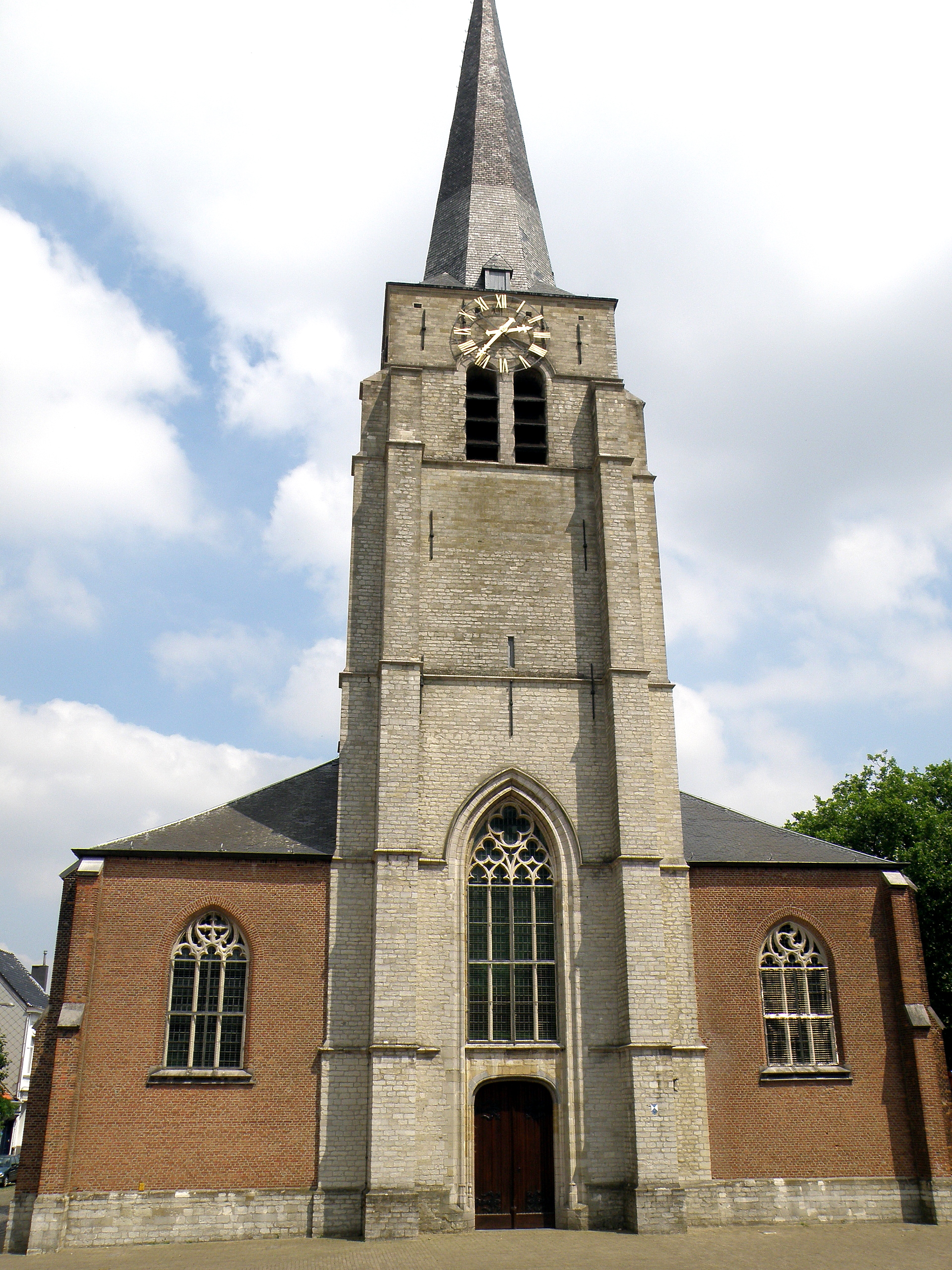
Sint-Bavokerk
Wilrijk
Sint-Bavokerk is the parish church of Wilrijk, a district of Antwerp, standing at Sint-Bavostraat 18. Its roots reach back to the early Middle Ages, making it one of the oldest places of worship in the area. How far back does its history go? The year 765 is regarded as the founding date of the Wilrijk parish, when a first, wooden chapel is believed to have stood on this site. A surviving document from 1003 confirms that the rights of patronage and tithe collection over the parish belonged to the Sint-Baafs Abbey in Ghent, tying the church's origins to one of the most important religious centers of medieval Flanders. How did the building change over the centuries? During the 11th or 12th century, the wooden chapel was replaced by a stone church built in the Romanesque style. In the course of the 15th century, a new Gothic structure took its place, though it suffered repeated damage over the following centuries. The heaviest blow came in 1579, when troops under William of Orange almost completely destroyed the church amid the religious and political conflicts of the period. Reconstruction followed in 1610–1615. An even more thorough rebuilding took place in 1841–1842, when most of the older structure was demolished and a new church erected; the choir itself was only completed in 1849. What has survived from the earlier building? Despite these repeated rebuildings, the church retains its Gothic tower, possibly built in the early 16th century and restored in 1729. Standing 56 meters tall, the sandstone tower is divided into six stages and remains one of the most recognizable landmarks on Wilrijk's skyline. The church itself is an oriented brick building with three naves, an integrated west tower, and a three-sided choir. Frequently asked questions Where exactly is Sint-Bavokerk located? At Sint-Bavostraat 18 in Wilrijk, a district that forms part of the city of Antwerp. Is the building standing today the original medieval church? Not entirely. The main body of the church largely dates from the 1841–1842 rebuilding, while the Gothic tower is considerably older and has survived through the later reconstructions. Why was the church rebuilt so many times? The most severe destruction occurred in 1579, when troops under William of Orange nearly leveled the Gothic church that stood at the time. Earlier versions of the building were also altered as the growing parish's needs changed over the centuries. Where does the church's name come from? The parish was under the patronage of the Sint-Baafs (Saint Bavo) Abbey in Ghent, which is reflected in the church's dedication. Can visitors see the tower up close? The six-stage, 56-meter tower is one of Wilrijk's most recognizable architectural features and is visible from many points across the district.
-
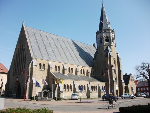
Sint-Martinuskerk
Ardooie
Sint-Martinuskerk is the parish church standing at the heart of Ardooie, a small town in West Flanders, right on the local Marktplein. The building pairs a Gothic tower with a rebuilt post-war nave and has been listed as part of Belgium's protected national heritage since 1939. Where did the parish of Ardooie come from? The land on which Ardooie now stands was granted in 821 to the Sint-Amands Abbey in Saint-Amand-les-Eaux. Monks from that abbey raised a simple fieldstone church here — the earliest known form of a place of worship on this spot. The first documented parish priest appears in the records in 1218, showing that a settled parish community already existed here in the high Middle Ages. In the 17th century, oversight of the church passed from the abbey in Saint-Amand to the Deanery of Sint-Amands in Kortrijk. How did the church survive the religious wars? The second half of the 16th century brought serious damage to Sint-Martinuskerk, tied to the religious conflicts sweeping the Low Countries at the time. The destruction was severe enough that the altar had to be reconsecrated in 1571. The following year, in 1572, a band of iconoclasts had to be driven out of the church after attacking its religious furnishings. Even so, by around 1580 the building was still found to be badly damaged. Rebuilding and restoration only got underway after 1600, and the respite did not last: in 1638 the church was struck again, this time by lightning. Why was the church enlarged in the 19th century? A growing population in 19th-century Ardooie meant the existing building could no longer serve the parish. In 1889 the church was enlarged to plans drawn up by the architect Antonius Verbeke. That expansion gave the church the form that would serve its expanding congregation until a far more destructive event struck decades later — one considerably worse than the fires or lightning strikes of centuries before. What happened to the church during the Second World War? In 1940 Sint-Martinuskerk burned down as a result of German bombardment. The destruction was extensive — only the tower survived, while the rest of the structure was consumed by fire. The nave was rebuilt between 1947 and 1949 to a design by the architect Albert Impe, who planned the new section beneath a large gabled roof. The tower standing today dates from 1923, with a square brick base rising into an octagonal upper section built in natural stone — the one part of the church that still recalls the years before wartime disaster struck. What does Sint-Martinuskerk look like today? The church's present form is the result of several overlapping building periods: medieval origins reaching back to the 13th century, a 19th-century enlargement, and a post-war rebuild of the nave alongside a tower that predates the war. Together, these layers make Sint-Martinuskerk not just an active parish church but a record of the region's turbulent history — from medieval monastic foundations, through the destruction of the era of religious wars, to the devastation and reconstruction of the 20th century. Since 1939 the building has held protected heritage status in Belgium, underlining its historical and architectural value to the local community of Ardooie. Frequently asked questions Where is Sint-Martinuskerk located? The church stands at Marktplein 28 in the center of Ardooie, in the province of West Flanders, Belgium. Which part of the church is oldest? The oldest surviving element is the tower, dating from 1923 — though the parish itself traces its roots back to the Middle Ages, with the first known parish priest recorded in 1218. Why does the church look different from its pre-war appearance? The nave was rebuilt from scratch between 1947 and 1949 after the original building burned down in 1940 during German bombardment — only the tower survived. Is the church legally protected? Yes, Sint-Martinuskerk has been listed as part of Belgium's national heritage since 1939.
-
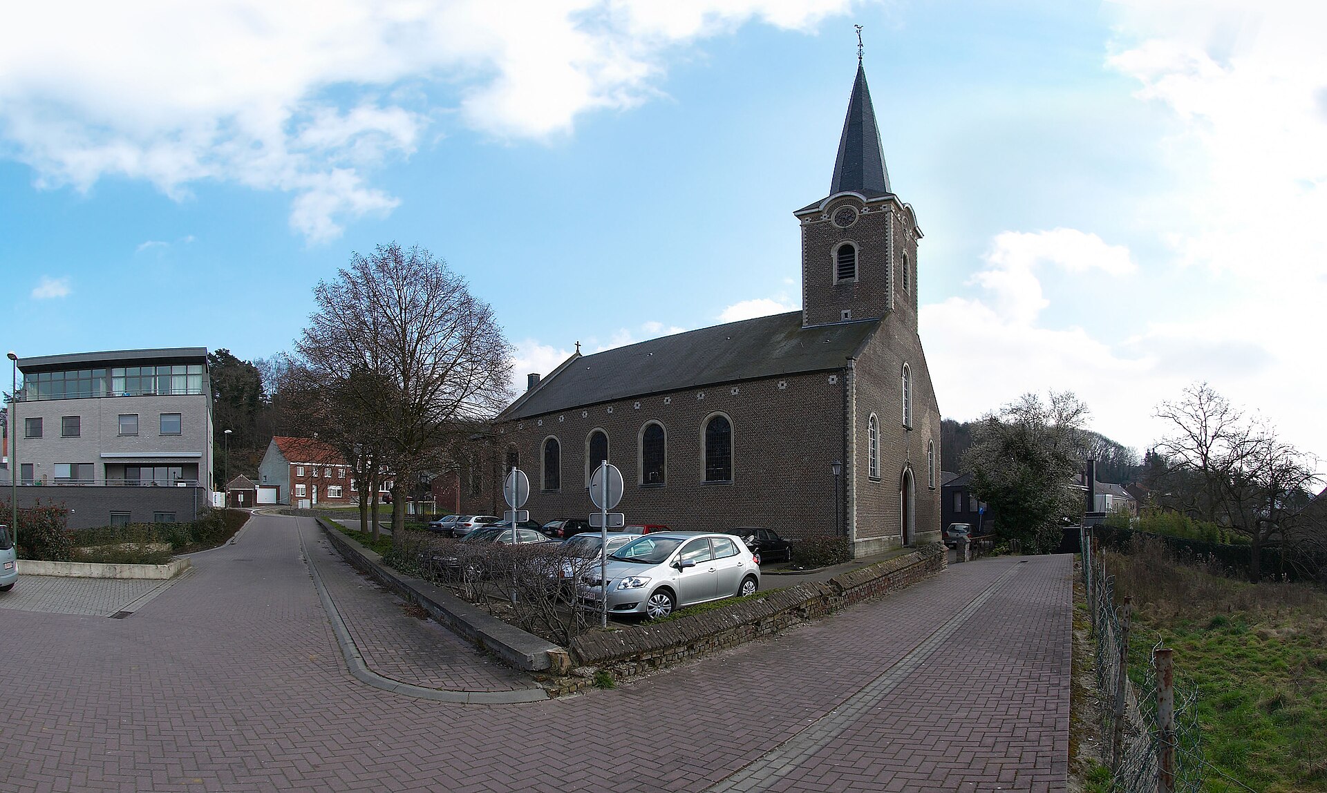
Sint-Joriskerk
Sint-Joriskerk is the parish church of Sint-Joris-Weert, a village that belongs to the municipality of Oud-Heverlee in the Belgian province of Flemish Brabant. Dedicated to Saint George, the church shares its name with the village itself, which took its name from the same patron saint. What does the building look like? The present church is a neoclassical structure dating from the early 19th century. Its layout consists of a tower built into the west end of the church without any division into segments, a nave of five bays, and a three-sided choir made up of a single bay. Round-arched windows run along the facades, and on either side of the tower sit round-arched sound holes of the same shape. The tower is capped by a tapering spire covered in slate. Where does the choir come from? While the main body of the church is a product of 19th-century rebuilding, the choir is thought to rest on older, late Gothic foundations. It is considered a remnant of an earlier church that stood on the same site in the 16th century, before the neoclassical reconstruction replaced most of the older structure. This kind of layout — a newer nave attached to an older choir — is not uncommon among rural churches in Flanders, where successive generations of builders extended or rebuilt the church while preserving the most valuable parts of the earlier construction. What can visitors see inside? The interior holds several elements considerably older than the 19th-century building itself. The most valuable is a Gothic Calvary group from the early 16th century — a sculpted depiction of the crucifixion that survived the later rebuilding and now ranks among the oldest pieces of religious art on the site. Alongside it, the church houses liturgical furniture in the Louis XVI style, dated to the last quarter of the 18th century, meaning it predates the current neoclassical building and was carried over from the church's earlier furnishings. What organ does the church have? One feature that draws particular attention is the organ built in 1858 by Henri De Volder. Instruments by this builder were well regarded in the region during the 19th century for their craftsmanship and sound quality, and the example preserved in the Sint-Joriskerk remains an important part of the church's furnishings, used both during services and for occasional organ concerts. Frequently asked questions Who is the church dedicated to? The church is dedicated to Saint George (Dutch: Sint-Joris), venerated in Christian tradition as the saint who slew the dragon. In what style was the church built? The building is neoclassical, a style typical of many rebuilt village churches in Belgium from the early 19th century, though its choir retains features of an older Gothic structure. Where exactly is Sint-Joris-Weert located? The village lies within the municipality of Oud-Heverlee, in the province of Flemish Brabant, Belgium. What is the most valuable historic item inside the church? A Gothic Calvary group from the early 16th century, older than the current church building, along with an organ built by Henri De Volder in 1858.
-
Church of St. Nicholas
Bruksela
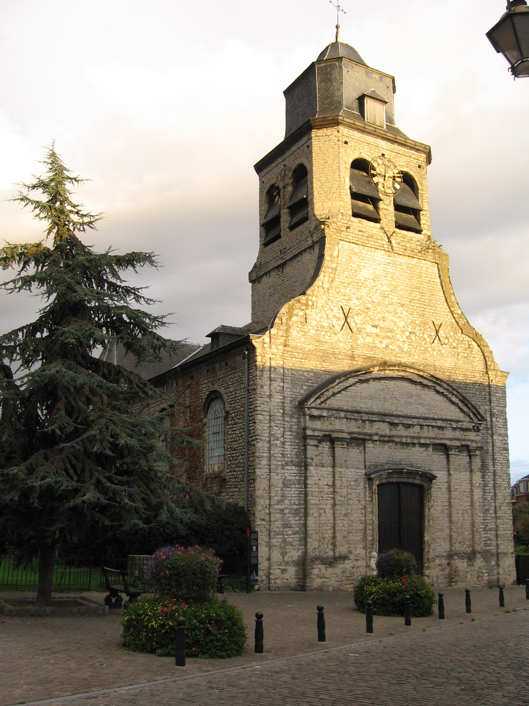
The Church of St. Nicholas stands in Neder-Over-Heembeek, a former village now absorbed into the northern edge of Brussels along the canal. Its roots go back to the 12th century, though the building visitors encounter today is the product of repeated destruction, rebuilding, and reinvention across eight centuries. Where does the church sit, and why this name? The dedication to St. Nicholas, patron of sailors and merchants, fits a settlement historically tied to waterways — Neder-Over-Heembeek grew up along the Senne valley and later the Brussels–Willebroek canal. The old district was traditionally split into two halves: Over-Heembeek ("upper" Heembeek), centered on this very church, and Neder-Heembeek ("lower" Heembeek), whose parish church was dedicated to Saints Peter and Paul. Both halves now form a single municipal district within the City of Brussels. What happened to the building over the centuries? A church first stood on this site in the 12th century, but its history was far from peaceful — in 1489, troops destroyed the building during one of the many armed conflicts that swept through the Low Countries in that era. It was rebuilt and rededicated in 1743, then enlarged in 1860 to serve a growing local population. The 20th century brought further upheaval. In 1932, lightning struck the church, causing significant damage. As a result, the parish merged with a neighboring one and regular worship at St. Nicholas came to an end. The building did not stand empty, however — it was repurposed for community use and for a time housed a local folk art museum, which closed in 1939. The church was designated a historic monument in 1941, only to suffer further blows soon after: in 1942 it closed due to extensive damage sustained during the Second World War. Restoration did not come until 1953, when the rebuilt structure was given an entirely new purpose — it became home to one of the city's first cultural centers, the Centre Culturel de Bruxelles. Why does it matter today? The Church of St. Nicholas illustrates how a piece of sacred architecture can survive centuries by shifting function alongside the needs of its community — from a place of worship, to a museum, to a cultural center. For anyone exploring Neder-Over-Heembeek, it serves as a landmark connecting the area's rural past with its present identity as a quiet district of Brussels, away from the bustle of the city center. Frequently asked questions How old is the Church of St. Nicholas? The original building dates to the 12th century, but its current form results from a 1743 rebuilding and an 1860 enlargement. Is the church still used for religious services? No — after damage in the 1930s and 1940s, the parish merged with a neighboring one, and the building now serves a cultural rather than religious function. Where exactly is the church located? In the Neder-Over-Heembeek district in northern Brussels, near the Brussels–Willebroek canal. How does it differ from the Church of Saints Peter and Paul nearby? The Church of Saints Peter and Paul historically served the neighboring Neder-Heembeek half of the village, while the Church of St. Nicholas was tied to the Over-Heembeek half.
-
Sint-Rochuskerk
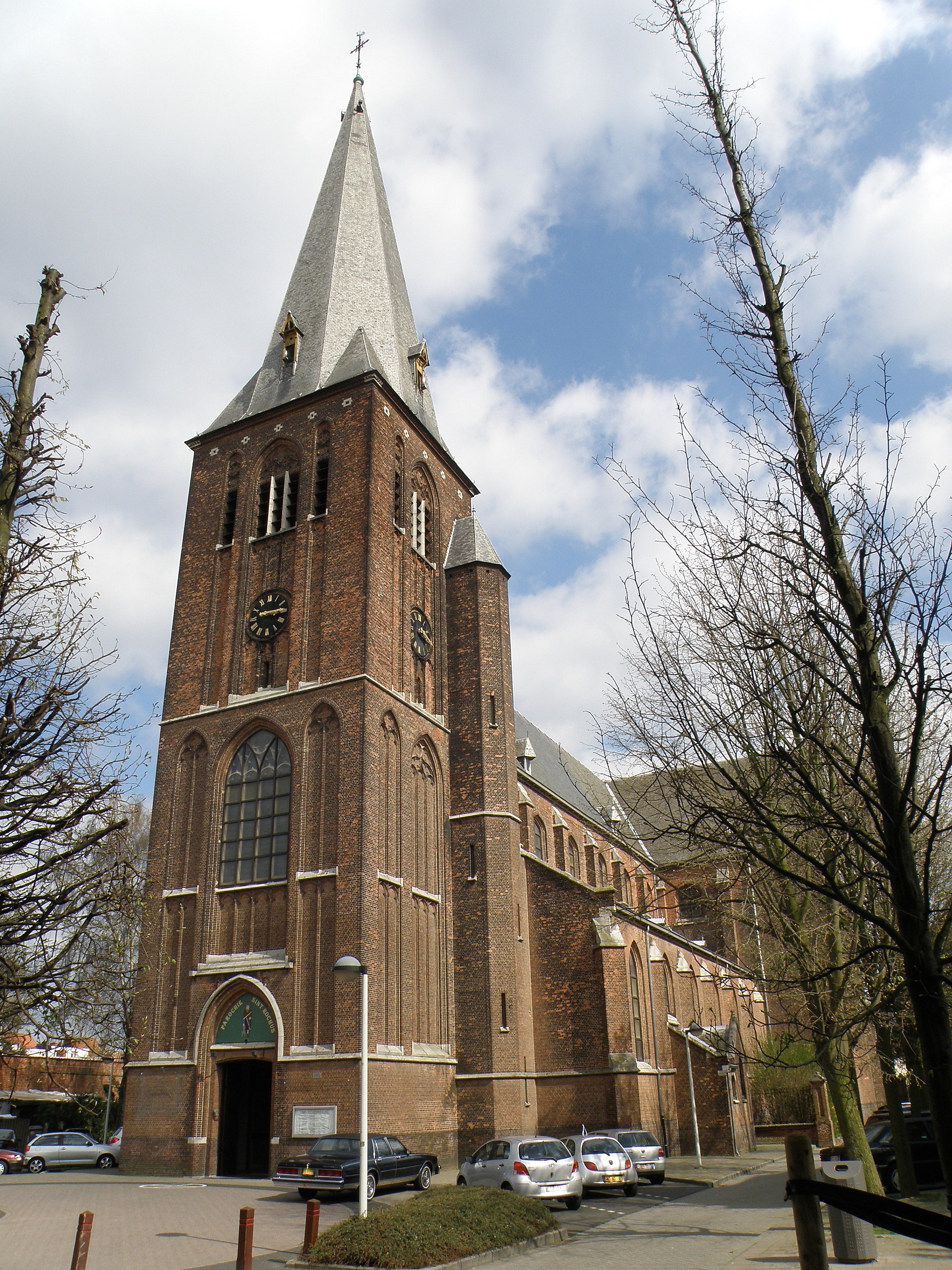
Sint-Rochuskerk is a Neo-Gothic parish church in Deurne, a district of Antwerp, standing on Sint-Rochusstraat in the area known as Deurne-Zuid. The building was raised to serve residents living south of the Schijn river and the Herentals Canal, in the neighborhoods of Drie Koningen, Exterlaer, and Silsburg. Why is the church dedicated to Saint Rochus? During the 19th century, Deurne's population grew rapidly, while the area was struck by cholera outbreaks in 1859 and again in 1866–1867. Facing this threat, residents turned to Saint Rochus, traditionally venerated as a patron protector against infectious disease, asking for his intercession. As a result, a small chapel in his honor was built in 1867. How did the chapel grow into a full church? As this part of Deurne kept expanding, a larger chapel was constructed in 1886, effectively functioning as a subsidiary church serving the growing neighborhoods to the south. The wooden structure was completed in 1887. Two years later, in 1889, the Sint-Rochus parish was formally recognized, and in 1890 a church fabric (the body managing the church's property and finances) was established. When was today's stone church built? The wooden chapel soon proved insufficient for the parish's needs, so between 1892 and 1895 a freestanding, cruciform stone basilica was built in Neo-Gothic style, designed by architect François Baeckelmans. The new building replaced the temporary wooden subsidiary church from 1887. The new Sint-Rochuskerk was solemnly consecrated on October 14, 1895. Who consecrated the church, and what marked its early years? The 1895 consecration was performed personally by Cardinal Goossens, underscoring the church's importance within the archdiocese's structure. Shortly afterward, on July 28, 1896, three bells intended for the church were blessed, becoming a lasting part of its furnishings and its acoustic identity within the neighborhood. Where exactly is the church located? Sint-Rochuskerk stands in Deurne-Zuid, a district of Antwerp, in the immediate vicinity of the area historically situated south of the Schijn and the Herentals Canal. Its geographic coordinates are approximately 51.205°N, 4.465°E, placing it in a densely built, urban part of Deurne. Frequently asked questions Why is the church dedicated to Saint Rochus? Because residents of Deurne turned to him for protection during the cholera epidemics of the second half of the 19th century — Saint Rochus is traditionally regarded as a patron against infectious disease. When was the current church building constructed? The stone Neo-Gothic church was built between 1892 and 1895 to a design by François Baeckelmans, and it was consecrated on October 14, 1895. Was there an earlier place of worship on this site? Yes — first a small chapel was erected in 1867, followed by a larger wooden subsidiary church in 1886–1887, which was eventually replaced by the current stone building. Who consecrated the church? Cardinal Goossens consecrated it on October 14, 1895.
-
Onze-Lieve-Vrouw-Ten-Hemel-Opnemingskerk
Voeren
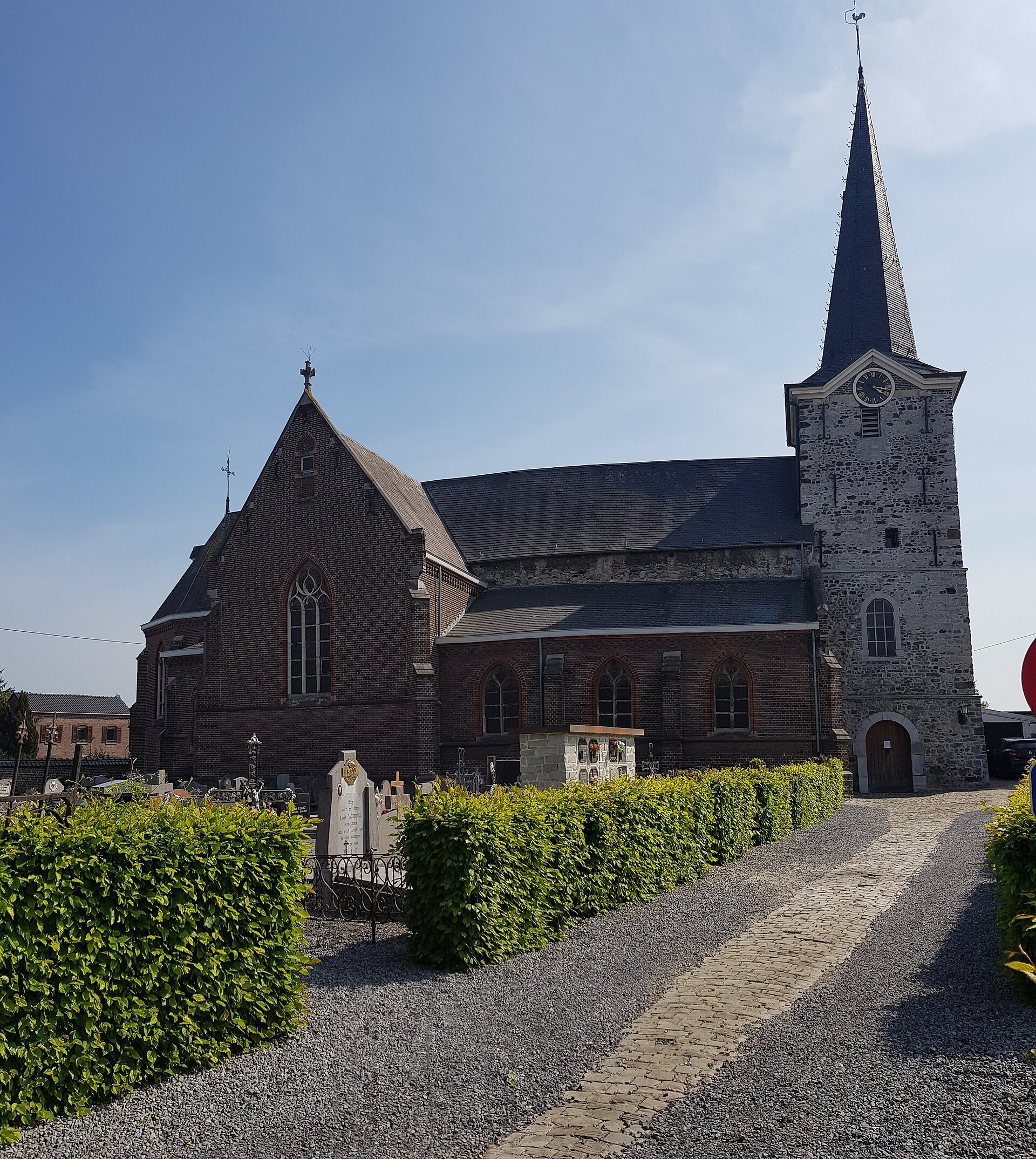
Onze-Lieve-Vrouw-Ten-Hemel-Opnemingskerk is the parish church of Moelingen, a village in the municipality of Voeren (Fourons) in Belgian Limburg, close to the borders with the Netherlands and Germany. Dedicated to the Assumption of the Blessed Virgin Mary, the church has served as the religious heart of this small community for centuries. What is the oldest part of the church? The tower is by far the most historically significant element of the building. It dates back to the 12th century and was built in the Romanesque style, making it the oldest surviving component of the whole complex. Local heritage sources rank it among the notable Romanesque monuments of the Voeren region. The rest of the church was added much later, in the 14th century, in the Maaslander Gothic style — a regional variant of Gothic architecture typical of the Meuse valley. How is the building laid out? The church takes the form of a pseudo-basilical cruciform building. The Romanesque tower projects at the west end, followed by a three-aisled nave divided into three bays, a transept, and a choir. The choir itself is composed of two straight bays finished with a three-sided apse — a closing typical of Gothic parish churches in this part of Limburg. This combination of an older Romanesque tower fused with a later Gothic body is a recurring pattern in the region's sacred architecture, where churches were expanded over centuries while their oldest, most valuable elements were deliberately preserved. Has the church been restored? Yes. In 2005 the monumental Romanesque tower underwent a thorough restoration. The conservation work focused on this oldest and most fragile part of the structure, ensuring its historic fabric would survive for future generations. What surrounds the church? To the north of the building lies the parish cemetery. Beyond serving as the village burial ground, it also functions as a site of remembrance: in its northeastern corner lie the graves of soldiers who died in both World Wars, marked by a modernist war memorial. This corner links the village's religious history with its wartime history, giving the cemetery a dual role as both a resting place and a local memorial site. Why is this place worth a visit? The church at Moelingen shows how a small rural parish can hold layers of history spanning nearly a millennium — from a Romanesque tower built almost a thousand years ago, through a Gothic-era expansion, to a modern memorial honoring war victims. For visitors exploring the Voeren region, better known for its rolling hills and orchards, the church offers one of the few sacred heritage sites in the area with such a long and continuous history. Because Moelingen sits away from the main tourist routes, the church and its surrounding cemetery can usually be visited in quiet, without crowds. Frequently asked questions To whom is the church dedicated? To the Assumption of the Blessed Virgin Mary. From which period does the tower date? The 12th century, built in the Romanesque style. When was the main body of the church built? In the 14th century, in the Maaslander Gothic style. Was the tower ever restored? Yes, it was restored in 2005. What can be found in the adjoining cemetery? Civilian graves along with war memorials for soldiers from both World Wars, located in the northeastern corner. Where exactly is Moelingen located? It is a village within the municipality of Voeren, in Belgian Limburg, near the Dutch border.
-
Church of St. Anne
Auderghem - Oudergem
The Church of St. Anne in Auderghem (Dutch: Oudergem) is a modest neoclassical parish church that served for sixty years as the only church in this Brussels municipality. It stands on a site once known as Schietheyde, in the district that later took its name — Sainte-Anne/Sint-Anna. Why was the church built? At the start of the 19th century, the residents of Auderghem belonged to the parish of Saint-Clément in neighboring Watermael-Boitsfort, and the local community was served only by a small chapel dedicated to St. Anne. As population grew along the main road, that chapel became too small. In 1843, at the request of local residents, an independent parish was established and a larger church building was raised — the first parish located within Auderghem itself. The design was drawn up by Louis-Jacques Spaak (1804–1893), architect for the province of Brabant. What does the building look like? The church is a deliberately austere structure in the neoclassical style, built of red brick on a stone base. The main façade is topped with a small square tower and decorated with two stone statues set into niches with round arches. Its simplicity sets it apart from more ornate churches of the period — the architect favored restraint over decorative excess. What can visitors see inside? The interior houses two striking baroque side altars, made of wood covered in marble, dating from the second half of the 18th century. They arrived at Sainte-Anne in 1875, having originally stood in the celebrated Notre-Dame du Sablon collegiate church in central Brussels. These altars are the most valuable furnishings in the building and form a clear contrast with the plain neoclassical architecture surrounding them. The church also holds two organs. The older, neoclassical instrument was commissioned in 1871 from organ builder Henri Vermeersch. Owing to its historical and artistic value, it was formally protected by a decision of the Brussels-Capital Region on 22 December 2005. A second instrument, located in the right transept, dates from 1983 and was built by Jan Boon; the two organs are used alternately during services. What role does it play in the neighborhood? The church lent its name to the surrounding district, known as Sainte-Anne d'Auderghem or Vieux Sainte-Anne. This part of the municipality has kept a more village-like, intimate character that contrasts with the more urbanized areas of Auderghem elsewhere. Since 2005 the church has been listed as a protected monument by the regional authorities, underscoring its recognized historical and artistic significance for the local heritage. Frequently asked questions When was the Church of St. Anne in Auderghem built? The current building dates from 1843, replacing an earlier chapel of the same name that had become too small for the growing parish. Who designed the church? It was designed by Louis-Jacques Spaak, architect for the province of Brabant, who lived from 1804 to 1893. What is the most valuable feature inside the church? Two baroque side altars from the second half of the 18th century, moved here in 1875 from the Notre-Dame du Sablon church in central Brussels. Is the church officially protected as heritage? Yes, its historic 1871 organ was formally granted protected status in 2005, reflecting the recognized heritage value of the building as a whole.
Earn badges for the places you visit
Download NextOnTrip, discover new places and check off your trails.