Sacred Monuments in Belgium
A guide to 434 Sacred Monuments in Belgium — with descriptions, photos and traveler visits from the NextOnTrip community. Locations spread across 170 cities and towns. Most visited by the community: Abbaye de Saint-Denis-en-Broqueroie, Mariapark, Roeselare Communal Cemetery.
-
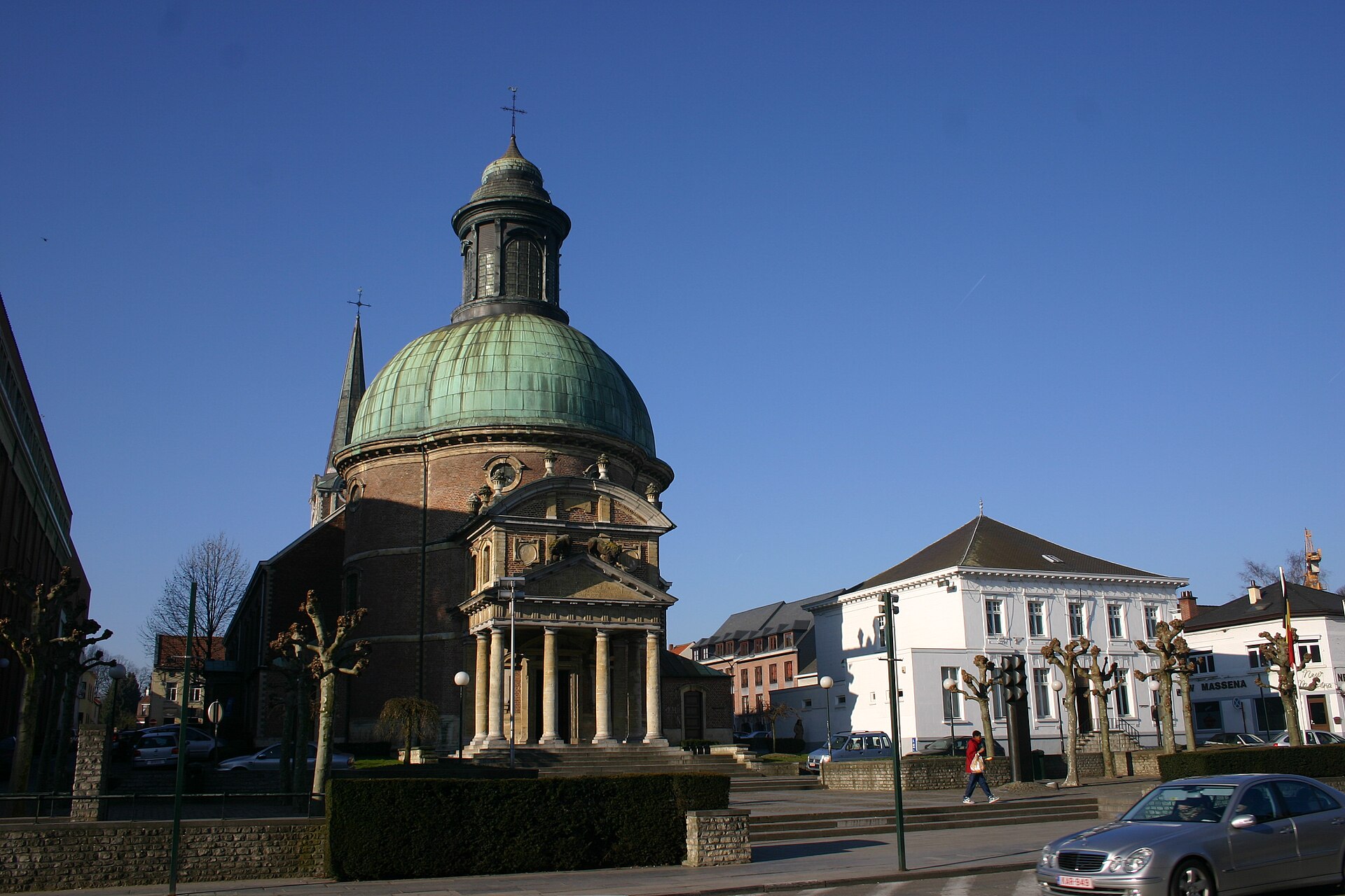
Church of Saint Joseph
Waterloo
The Church of Saint Joseph in Waterloo is a Baroque place of worship standing along the old Brussels road, one of the oldest and historically most significant religious buildings in this part of Walloon Brabant. It began life as a royal chapel, founded in 1690 at the initiative of the Marquis de Gastañaga, then governor of the Spanish Netherlands, in hope of an heir being born to King Charles II of Spain. That heir never arrived, but the chapel he inspired survived and is now regarded as the last Belgian monument dating from the Spanish era in the region. What does the church's architecture look like? The design is attributed to the Walloon architect Philippe Delsaux and draws on the vocabulary of French Baroque classicism. A rotunda topped with a dome and a colonnaded portico openly reference classical antiquity, while the building's quadrilobe (four-lobed) floor plan makes it distinctive among religious buildings in the region. The chapel was solemnly inaugurated on 19 February 1690. How has the building changed over the centuries? The original late-17th-century royal chapel eventually proved too small for the growing parish community. In 1823-1824 it was enlarged and converted into a full parish church serving local worshippers. Another significant change came in the 1850s, when the main nave was rebuilt. The bell tower that now dominates the building's silhouette was only added in 1899 - more than two centuries after the original chapel was built. Why is the church known as the Commemorative Temple of the Battle? Its connection to the events of June 1815 gave the church a historical significance reaching far beyond Belgium's borders. The interior holds 138 memorial plaques, most of them funded by the families of soldiers who fell at the battles of Quatre Bras and Waterloo. The custom of commemorating fallen officers and soldiers began as early as 1817, and over time the church came to be known as the Commemorative Temple of the Battle. Notably, the plaques largely honor British army officers, making the site an important stop on any itinerary tracing the Napoleonic history of the Waterloo area. Did the Duke of Wellington pray at this church? According to local tradition, the Duke of Wellington visited the church and prayed there before setting out for the battlefield on 18 June 1815. While this episode is difficult to confirm through primary sources, it has become a fixed part of the historical narrative surrounding the site and is frequently retold by guides leading tours through Waterloo. Frequently asked questions When was the Church of Saint Joseph in Waterloo built? The original royal chapel was built and consecrated in 1690, on the initiative of the Marquis de Gastañaga. Who designed the building? The architecture is attributed to the Walloon architect Philippe Delsaux, who employed forms of French Baroque classicism. Why does the church contain memorial plaques? Since 1817, plaques have been placed inside to commemorate officers and soldiers who died at the battles of Quatre Bras and Waterloo in June 1815 - 138 in total. When was the bell tower added? The tower was added relatively late, only in 1899, more than two centuries after the original chapel was constructed. Did the church always function as a parish church? No - it began as a royal chapel. It only took on the role of parish church after being enlarged between 1823 and 1824.
-
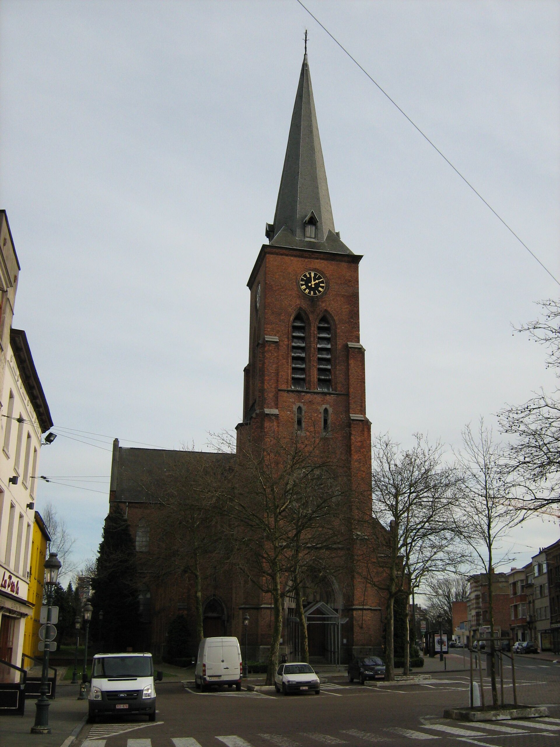
Church of St. Peter
Jette
The Church of St. Peter in Jette, a municipality within the Brussels-Capital Region, is a red-brick Gothic Revival building constructed between 1878 and 1880 to a design by architect Charles Demaeght. It stands on the eastern side of Cardinal Mercier Square, right next to Jette railway station, making its silhouette one of the first landmarks travelers notice when stepping off the train. Where exactly does the church stand? The current building replaced an earlier, smaller chapel that had previously occupied part of what is now Cardinal Mercier Square. As Jette expanded during the 19th century, the growing parish required a larger, more prominent church, and the new structure was built directly beside the station, cementing the square's role as the heart of the district. What architectural style does the building represent? The church was designed in the Gothic Revival style, which was widely favored in Belgium during the second half of the 19th century. Its red-brick construction, tall proportions, pointed-arch windows, and vertically emphasized façade give the building a sense of lightness despite its solid, substantial structure. What can visitors see inside? The interior holds several features considerably older than the building itself. The oldest object in the church is a stone baptismal font dating from 1597, which survived from the earlier chapel and was carried over into the new church when it was completed. Also notable are two oak confessionals from the early 18th century, decorated with carved medallions depicting Saint Jerome and Saint Gregory. In the left side aisle stands the tomb of the de Villegas family, crafted from black marble with the family's coat of arms rendered in white marble. The de Villegas were the last lords of the County of Saint-Pierre-Jette, directly tying this funerary monument to the district's history before it became part of the Brussels urban area. What role does the church organ play? The Romantic-style organ was built in 1898 by brothers Adrien and Salomon Van Bever. Although younger than the other historic furnishings, the instrument remains an important part of the church's fittings and continues to be used during services and organ concerts. Did religious organizations once operate at the parish? Yes — the parish was home to religious fraternities, lay organizations dedicated to spiritual purposes, active from the 18th century until the early 20th century. Such fraternities were a common feature of parish life at the time, organizing devotions, celebrations, and mutual support among their members. Frequently asked questions When was the Church of St. Peter in Jette built? It was constructed between 1878 and 1880, designed by architect Charles Demaeght. Where is the church located? On Cardinal Mercier Square in Jette, directly adjacent to Jette railway station. What is the oldest object inside the church? A stone baptismal font from 1597, older than the current building itself. Whose tomb is found inside the church? The tomb of the de Villegas family, the last lords of the County of Saint-Pierre-Jette, located in the left side aisle. Who built the church organ? Brothers Adrien and Salomon Van Bever built the Romantic-style organ in 1898.
-
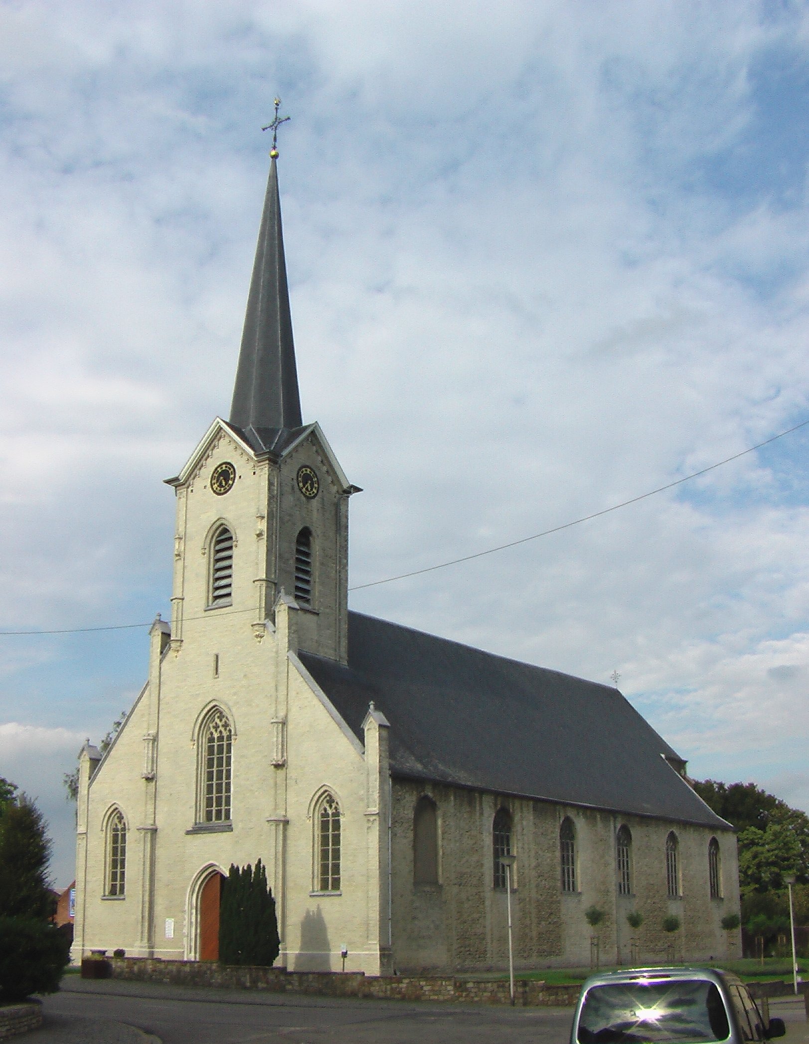
Sint-Amanduskerk
Erps
Sint-Amanduskerk is a neo-Gothic parish church standing on the village square of Erps, part of the municipality of Kortenberg in the Belgian province of Flemish Brabant. The building is one of two main churches serving the combined village of Erps-Kwerps — the other being Sint-Petruskerk in neighboring Kwerps — and remains a defining landmark at the heart of the settlement. What is the history behind this church? A Romanesque church stood on this exact spot from the early Middle Ages, built in the tradition of the Scheldt Romanesque style associated with the Diocese of Cambrai, to which Erps belonged until the 16th century. The original building was likely dedicated to Saint John the Baptist and only later took on the dedication to Saint Amand. That earlier structure survived for centuries until 1706, when a lightning strike on the tower set off a fire that destroyed most of the church. Reconstruction happened in stages. The side aisles were already added in 1773, designed by architect Laurent-Benoît Dewez, one of the leading figures of classical architecture in the Austrian Netherlands at the time. The classical apse dates from the end of the 18th century and is the oldest surviving part of the current structure. The main body of the church, built in neo-Gothic style, dates from the middle of the 19th century, with construction completed in 1864. What can visitors see inside? The church's interior holds furnishings older than the neo-Gothic building itself. The baptismal font dates from 1724, and the organ from 1752 — meaning both pieces either survived the 1706 fire or were preserved and carried through the later reconstruction phases. The baroque side altars were acquired in 1785, purchased from the dissolved priory of Groenendaal, a former Augustinian monastery once known as an important center of spirituality in the region. Where exactly is it located? The church stands on the village square of Erps, in the center of this part of the Kortenberg municipality, in the province of Flemish Brabant, not far from Brussels. Its position on the square has long made it a central point of reference for residents of Erps and the surrounding area. Frequently asked questions Is Sint-Amanduskerk a protected heritage site? The church is listed as a heritage object in the regional inventory of immovable heritage of Flanders, confirming its historical and architectural value for the region. Why is the church dedicated to Saint Amand? The church now carries the name of Saint Amand, though historical sources suggest the original Romanesque building may have been dedicated to Saint John the Baptist before eventually taking on its current dedication. What survived from the earliest version of the church? The building itself did not survive the 1706 fire, but some furnishings — such as the baptismal font from 1724 and the organ from 1752 — predate the current neo-Gothic construction, pointing to a continuity of liturgical use at this site despite the disaster. What are the baroque side altars? They are altars purchased in 1785 from the dissolved Augustinian priory of Groenendaal, linking this small parish church to a significant spiritual center of the former Austrian Netherlands.
-
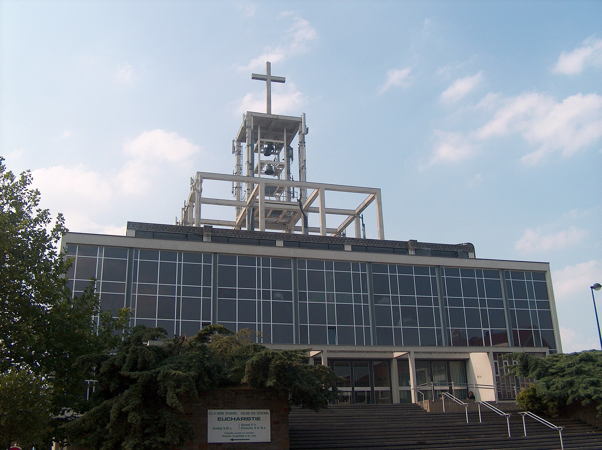
Church of Our Lady of Stockel
The Church of Our Lady of Stockel stands in the Stockel neighborhood of Woluwe-Saint-Pierre, one of the municipalities forming the eastern edge of Brussels. The building visitors see today, raised in glass and concrete in a distinctly modernist style, was completed and put into service in 1962, taking the place of a much older place of worship that had stood on the same spot for centuries. Where does the name Stockel come from? The hamlet's name reaches back to the medieval period — the earliest surviving reference to "Stocla" turns up in a document from 1154 listing estates belonging to Park Abbey, an influential Premonstratensian monastery near Leuven. At that stage Stockel was little more than a small farming settlement on the fringes of the larger towns nearby, and it gradually grew up around a local place of devotion. How did the first chapel come about? Records confirm that a chapel dedicated to Our Lady — sometimes referred to as the Chapel of the Visitation — already existed by 1326. This modest Gothic building became the anchor point around which the growing hamlet took shape; village life in Stockel effectively organized itself around it. Interestingly, the chapel spent a long stretch of its history as a pilgrimage destination, visited by people seeking a cure for hernias, long before it settled into its later role as an ordinary parish church serving an expanding community. What changed after the Napoleonic reforms? The Concordat of 1801, which reshaped the administrative structure of the Catholic Church across French-controlled territory at the time, kept the Stockel chapel under the authority of the Saint-Pierre parish of Woluwe. A few years afterward, in 1808, the chapel of Our Lady of Stockel was formally attached to the Woluwe-Saint-Pierre parish — an arrangement that would define the local church administration for a long time to come. Why was a new church built in the 1960s? The building that had served the community into the twentieth century actually dated from the 17th century. As Woluwe-Saint-Pierre grew rapidly in the decades following the Second World War — shifting from a quiet suburban area into a denser, more populous part of the Brussels metropolitan region — the old, small chapel could no longer keep pace with the needs of its congregation. The decision was made to construct a new church, which was consecrated and opened in 1962. Its architects turned to materials characteristic of postwar religious modernism in Belgium — glass and reinforced concrete — producing a structure that stands out sharply against the traditional brick parish churches common elsewhere in the region. What should visitors know before stopping by? The church sits right at the heart of the Stockel neighborhood, on a street whose name references it directly (Rue de l'Église / Kerkstraat), surrounded by the residential fabric typical of Woluwe-Saint-Pierre. The parish of Our Lady of Stockel remains active today, and the building itself functions as one of the recognizable landmarks of this part of the city — its bold modern form standing in quiet contrast to a story that stretches back to the Middle Ages. Frequently asked questions Is today's church the same building as the historic chapel? No. The current church dates from 1962 and replaced an earlier 17th-century building, which itself had succeeded the medieval chapel first recorded in 1326. Why did pilgrims once visit the old chapel? For a long period the site was regarded as a pilgrimage destination associated with the healing of hernias, before it settled into its later function as a straightforward parish church for the growing village. What architectural style was used for the current building? The 1962 church was built from glass and concrete, materials typical of the postwar modernist approach then common in Belgian religious architecture. Since when has Stockel belonged to the Woluwe-Saint-Pierre parish? The formal attachment dates from 1808, although administrative dependence on the Saint-Pierre parish of Woluwe already existed earlier, under the terms of the 1801 Concordat.
-
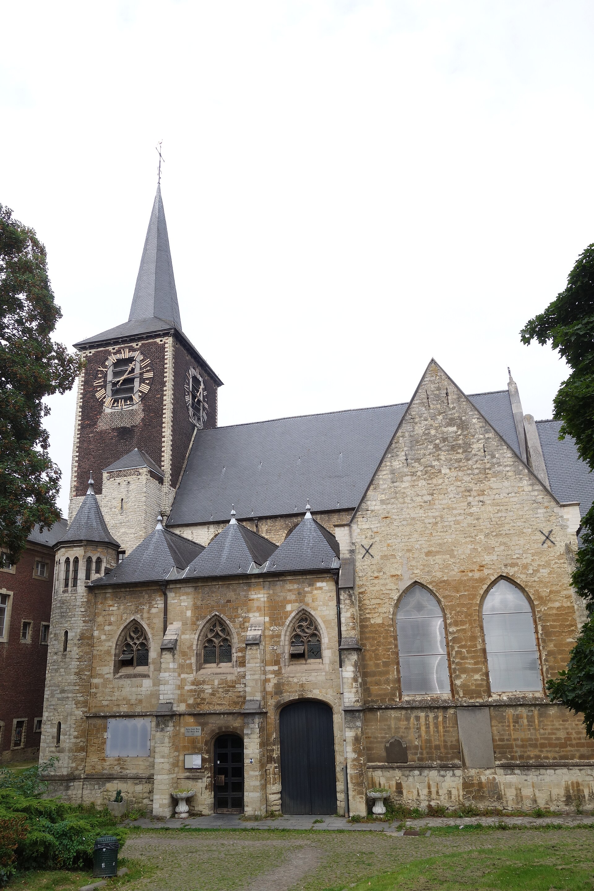
Church of St. Denis
Forest - Vorst
Church of St. Denis stands in Forest (Vorst), a southern municipality of Brussels, and ranks among the oldest religious buildings in the region — its earliest foundations date back to the 12th century, while much of the present structure took shape in the 13th. How did the settlement and its first church begin? The first dwellings of Forest grew up along the banks of the Geleysbeek, a tributary of the river Senne, as early as the 7th century, during the Frankish period. One villager who had recently converted to Christianity donated a timber-and-daub house so a place of worship could be created there. That modest sanctuary gradually grew into the religious focal point of the surrounding area. Who was Saint Alena? Alongside the growth of the settlement, a cult developed around Saint Alena, said by tradition to be the daughter of a Merovingian king who secretly attended Christian services against her father's wishes. When his men discovered her, she was martyred for it. Her body was buried in Forest, in a chapel bearing her name that adjoins the main church. Devotion to Saint Alena drew pilgrims for centuries and helped shape the site's lasting significance. How did the church's architecture evolve? In the 12th century, a Romanesque church was built next to the Chapel of St. Alena. A century later that building was replaced by a new structure in the early Gothic style — it is the choir of this Gothic church that forms the core of today's Church of St. Denis. From 1105 onward, the parish and its ecclesiastical holdings belonged to the abbots of Affligem, to whom the Bishop of Cambrai had ceded the property. It was these abbots who decided to found a women's priory in Forest, and the first abbess was appointed in 1239, tying the church closely to the region's monastic life. Why is the site protected today? The historical and artistic value of the church complex was formally recognized in 1936, when the Church of St. Denis, together with the adjoining Chapel of St. Alena, was listed as a historical monument. Together, the two buildings preserve unique examples of Romanesque sculpture — a rare surviving testimony to centuries-old sacred art that has endured through later rebuilding and changing architectural styles. What should visitors know before exploring the church? The church sits at the heart of historic Forest, one of the Brussels municipalities with clearly medieval roots. Its structure blends elements from different eras — from Romanesque foundations through a Gothic choir to later additions — making it a compelling example of the architectural layering typical of the oldest churches in the Brussels region. Frequently asked questions How old is the Church of St. Denis in Forest? Its earliest foundations go back to the 12th century, and most of the current building dates from the 13th century, when an earlier Romanesque church was rebuilt in Gothic style. Who was Saint Alena of Forest? According to tradition, she was the daughter of a Merovingian king who secretly practiced Christianity and was martyred for it; her relics rest in the chapel adjoining the church that bears her name. When was the church recognized as a heritage monument? In 1936, the Church of St. Denis and the adjoining Chapel of St. Alena were listed as historical monuments. What was the church's connection to Affligem Abbey? From 1105, the parish belonged to the abbots of Affligem, who in 1239 founded a women's priory in Forest, closely linking the church to the region's monastic life.
-
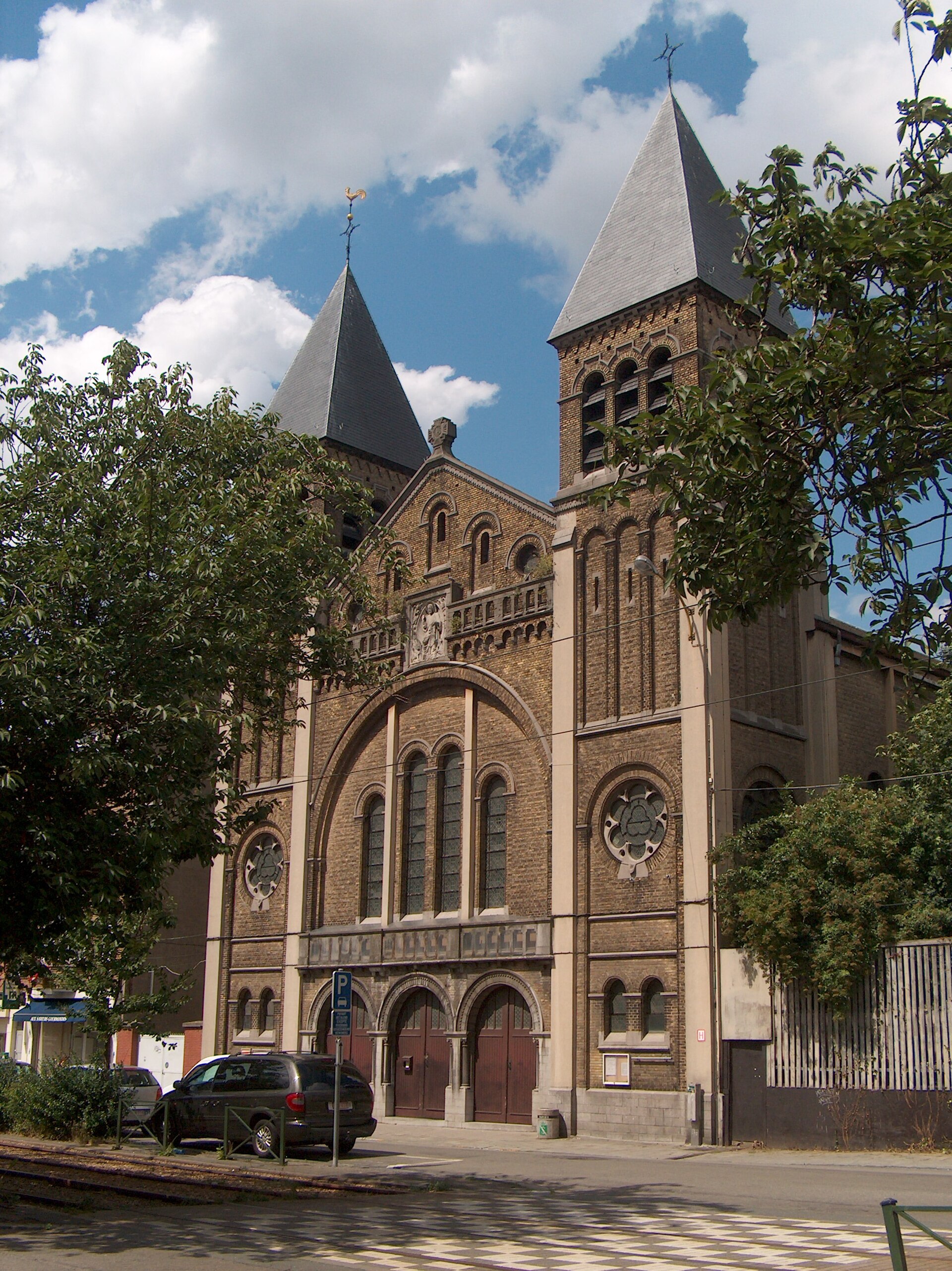
Church of St. Teresa of Ávila
Schaerbeek - Schaarbeek
The Church of St. Teresa of Ávila stands on Avenue Rogier in the Brussels municipality of Schaerbeek (Dutch: Schaarbeek) and belongs to the Archdiocese of Mechelen-Brussels. It's a relatively young building by European church standards — a 20th-century structure that grew out of the rapid expansion of the Dailly neighborhood in the early 1900s. How the parish began The story starts in 1905, when Father Henri Heyters, a curate of the Saint-Servais parish, founded a new parish in the Dailly district at the request of the Archdiocese of Mechelen. A provisional neo-Gothic church was raised first, dedicated jointly to two patron saints: Teresa of Ávila and Alice. The arrangement was meant to be temporary, but the neighborhood grew so quickly that the modest building soon couldn't keep up with the number of parishioners. A new church on Avenue Rogier Once the provisional church on Avenue Dailly became too small, plans moved forward for a larger, permanent church — this time dedicated solely to Teresa of Ávila. It was completed in 1932 on Avenue Rogier, and this is the building that still serves the parish today. The design came from architect and building contractor Coomans, who gave the church a modernized Romanesque Revival form: simplified, solid volumes echoing medieval Romanesque architecture, without excessive historicist ornament. Construction wasn't straightforward from an engineering standpoint. The plot chosen for the church sat on reclaimed, backfilled land with unstable soil. To give the building a solid footing, builders had to drive a foundation of concrete piles deep into the ground — a common but demanding solution for structures raised on filled or reclaimed terrain. Inside the church Among the notable furnishings is a statue of Our Lady with the Child, whose style stands apart from more traditional, stiffly hieratic Marian imagery. The figure is rendered in a more natural, lifelike manner, closer to a modern sculptural sensibility than to classic devotional conventions. The church today Beyond its original Roman Catholic parish role, the building today also hosts worship for a community following the Chaldean-Syriac rite (Mar Addai and Mar Mari), making it a meeting point for different liturgical traditions within a single Christian community in Schaerbeek. The church sits in a densely built, urban part of the municipality, not far from other early-20th-century churches raised during the same wave of suburban growth in Brussels — including the Church of St. Alice on Avenue Dailly, a reminder of the parish's earlier home before the current building was completed. Frequently asked questions Where exactly is the church located? On Avenue Rogier (Rogierlaan) in Schaerbeek, one of the nineteen municipalities of the Brussels-Capital Region. When was the current building built? In 1932. Before that, from 1905, the parish used a provisional church on Avenue Dailly. What architectural style is it built in? A modernized Romanesque Revival style, designed by architect-contractor Coomans. Why did construction require special foundations? The site was reclaimed, backfilled land with unstable soil, so the structure needed to rest on concrete piles driven deep underground. Is it only a Roman Catholic church? Originally yes, but it now also serves a community of the Chaldean-Syriac rite (Mar Addai and Mar Mari).
-
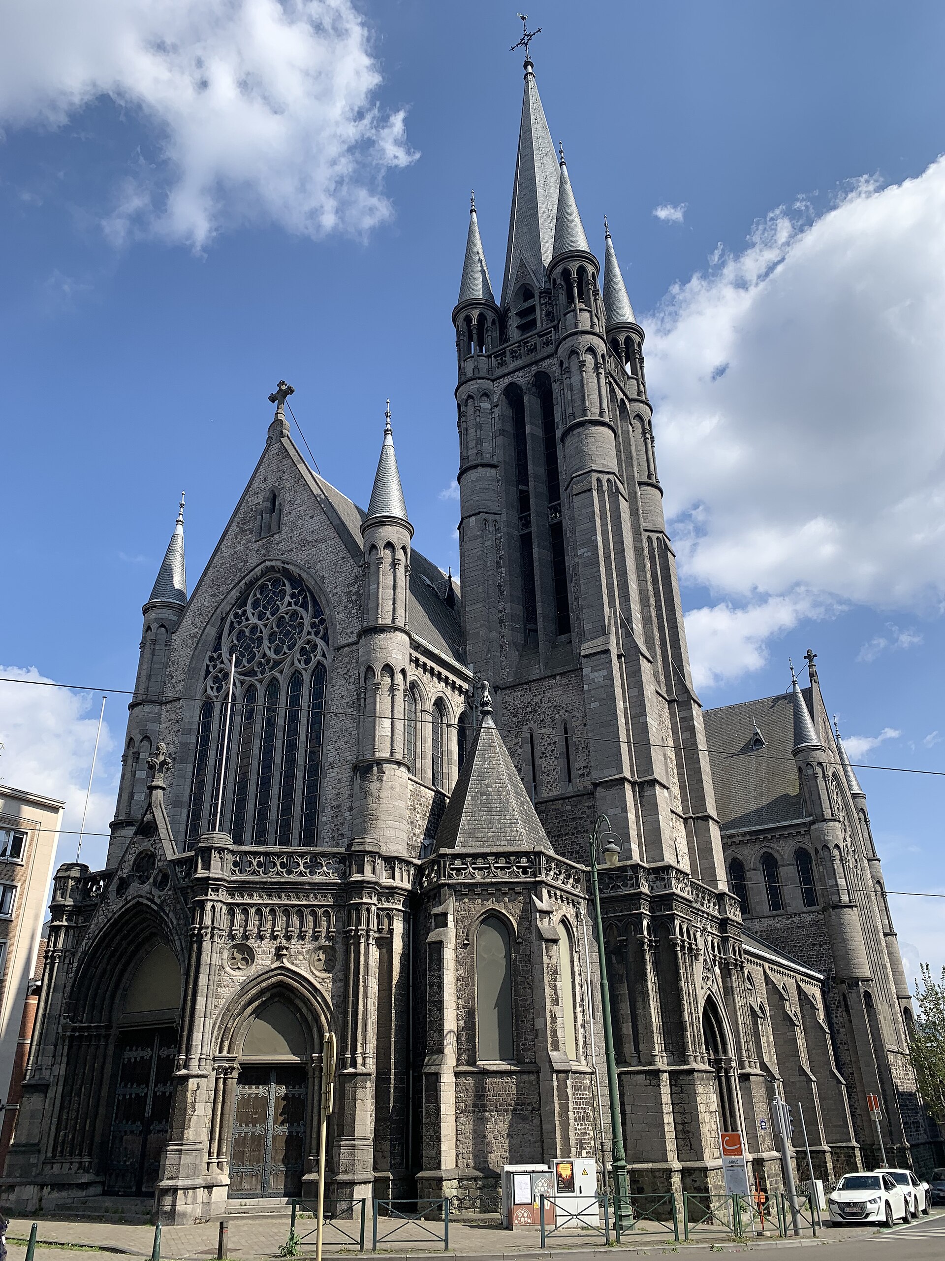
Church of St. Remigius
Molenbeek-Saint-Jean - Sint-Jans-Molenbeek
The Church of St. Remigius (French: Église Saint-Remi, Dutch: Sint-Remigiuskerk) is a neo-Gothic Catholic church standing on Boulevard du Jubilé in Molenbeek-Saint-Jean (Sint-Jans-Molenbeek), a municipality in the northern part of the Brussels-Capital Region. The building went up at the turn of the 20th century together with a newly created parish, established to serve a rapidly expanding industrial district close to the Tour et Taxis warehouse complex and the then-new Port of Brussels. When was the church built? The foundation stone was laid on 20 May 1907. The building was blessed the following year by Cardinal Désiré-Joseph Mercier, then Archbishop of Mechelen-Brussels. The architect behind the design was Chrétien Veraart. What architectural style does it follow? The church was designed in the neo-Gothic style, drawing on the broader Scaldian Gothic tradition and, more specifically, on its Tournai Gothic variant, named after the Belgian city of Tournai. That choice was deliberate: the church's patron saint, Remigius, was the bishop of Reims famous for baptizing Clovis, the first Frankish king to convert to Christianity — and Remigius himself was born in Tournai, which explains the stylistic reference. The building follows a classic Latin-cross floor plan, with an entrance porch and a bell tower projecting outward from the main volume. What can visitors see inside? Inside, the church houses a romantic gallery organ without a case, built in 1933 by organ builder Jos Stevens. It also contains two 17th-century statues of apostles, which originally came from the former Sainte-Anne chapel. Which diocesan structure does the parish belong to? The parish of St. Remigius is part of the Archdiocese of Mechelen-Brussels, the largest ecclesiastical structure in Belgium, covering the capital and its surrounding municipalities. Where exactly is it located? The church stands on Boulevard du Jubilé (Jubelfeestlaan) in Molenbeek-Saint-Jean, one of the nineteen municipalities of the Brussels-Capital Region, north of the city centre. This location is tied directly to the church's origins: the parish was created specifically to serve residents of a new, fast-growing port and industrial district that emerged next to the Tour et Taxis complex and the new Port of Brussels around the turn of the 19th and 20th centuries. Frequently asked questions Who designed the Church of St. Remigius? The architectural design was the work of Chrétien Veraart, who opted for a neo-Gothic style referencing Tournai Gothic. Why was the Tournai Gothic style chosen specifically? Because of the church's patron saint, Remigius, bishop of Reims, who was born in Tournai and is known for baptizing Clovis. When exactly was the church built? The foundation stone was laid on 20 May 1907, and the building was blessed the following year. Does the church still hold any historic furnishings? Yes — a 1933 organ by Jos Stevens, and two 17th-century apostle statues originally from the Sainte-Anne chapel. Which diocese does the parish belong to? The Archdiocese of Mechelen-Brussels.
-
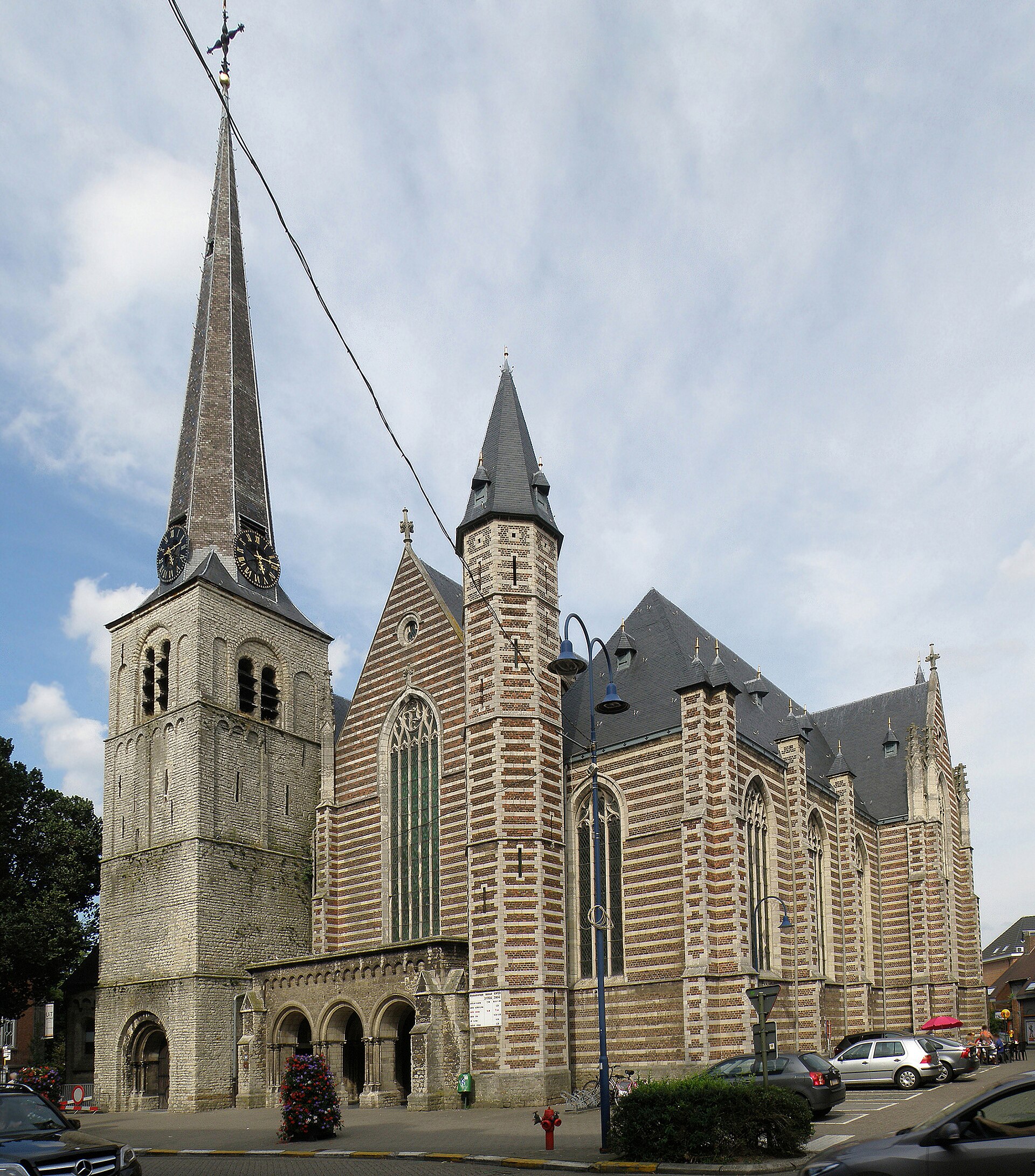
Sint-Martinuskerk
Kontich
Sint-Martinuskerk is the parish church of Kontich, a small municipality in the Belgian province of Antwerp. Standing at the heart of the town, it has served as the main parish church for centuries, and its Romanesque tower ranks among the oldest surviving pieces of religious architecture in the region. Where did the church come from? The origins of the building go back to 1087–1149, when it was founded by the Berthout family, the local lords of the time. Interestingly, the church was originally dedicated to Our Lady rather than to Saint Martin. Only after a neighboring chapel dedicated to Saint Martin burned down was its chaplaincy transferred here — and it is from that transfer that the church took its present dedication. What survives from the medieval period? The oldest and most valuable part of the building is the west tower, raised around 1149 in the Romanesque style out of light-colored stone. It rises in three stories separated by horizontal string courses. The ground floor is pierced by a wide, round-arched portal set within a recessed panel. The first floor is left plain, with no ornament, while the second is decorated with rows of small arcades and pilasters and pierced by narrow loophole-like openings reminiscent of defensive slits. The top story is a later addition and shows more modern reworking, marked by triple rows of arches typical of the later building phases. How did the church change over the centuries? In 1502 the choir was renewed, and in the 16th century an elaborately carved sacrament house — a niche for the Blessed Sacrament typical of the Southern Netherlands at the time — was added. Disaster struck in 1572, when the church burned down completely. Reconstruction only began in 1604 and continued until 1612. The 19th century brought further major change. In 1826, work began on enlarging the church in a Neoclassical style, to a design by the architect A. D. De Wolf. In the following century, in 1928, the church was enlarged a second time, this time to plans by Edward Careels, giving it much of the Neogothic character it retains today alongside its Romanesque tower. The building did not escape the upheavals of war either — during the Second World War it suffered minor damage, which was repaired once the fighting ended. In January 2017, a further phase of renovation work on the building began. What has been found during excavations? The ground around the church holds traces of settlement far older than the current building. In 1924, excavation work was carried out in the churchyard, and in 1988 archaeologists from the AVRA society uncovered two pre-Romanesque graves just outside the tower — evidence that the site served a religious function long before the present church was built. Frequently asked questions How old is the church tower in Kontich? The Romanesque west tower dates to around 1149 and is the oldest surviving part of the church. Why is the church named after Saint Martin if it was originally dedicated to Our Lady? The dedication changed after the chaplaincy of a neighboring, burned-down church dedicated to Saint Martin was transferred here. When did the church burn down, and how long did reconstruction take? Fire destroyed the church in 1572, and reconstruction lasted from 1604 to 1612. What did archaeologists find during excavations near the church? In 1988, AVRA archaeologists found two pre-Romanesque graves next to the tower, following earlier excavation work in the churchyard in 1924.
-
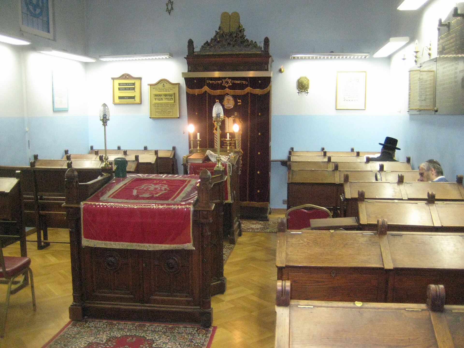
Eisenmann Synagogue
Antwerpia
Eisenmann Synagogue is one of the oldest active synagogues in Antwerp and the only one in the city to have survived the Nazi occupation of Belgium and the Holocaust intact. It stands in the heart of Antwerp's Jewish quarter, near the central train station, an area that has been the center of the city's Orthodox Jewish community for well over a century. Who founded the synagogue? The building's history is inseparable from Jacob (Jacques) Samuel Eisenmann, who was born in Frankfurt am Main. He moved to Antwerp in 1884 and set up a company trading in dried fruit and industrial fibers imported from the Belgian Congo. His business grew substantial enough to make him a wealthy and influential figure — historical accounts describe him as having been close to King Leopold II. Before building his commercial standing, however, Eisenmann had received a religious education in Frankfurt as a student of Rabbi Samson Raphael Hirsch, one of the leading figures of nineteenth-century Orthodox Judaism. That grounding in Orthodox tradition shaped the character of the congregation Eisenmann would go on to establish in Antwerp. When was the synagogue built? The congregation gathered around Jacob Eisenmann was formally established in 1905, and the synagogue building itself was completed two years later, in 1907. The story did not end there: in 1908 Eisenmann purchased two adjoining buildings, allowing the synagogue to be expanded through the interiors of both structures combined. This method of construction — adapting and merging existing urban buildings rather than erecting a single purpose-built monumental structure — was common among synagogues of that era in Western Europe, where Jewish communities frequently converted existing townhouses for religious use instead of building grand new edifices from scratch. What branch of Judaism does the congregation follow? The community that worships at the Eisenmann Synagogue follows the Ashkenazi rite. The Orthodox character instilled by Rabbi Hirsch's teachings has persisted in Antwerp to this day — the city remains one of the most important centers of Orthodox Judaism in Europe, and the neighborhood around the central station is still alive with religious activity, home to numerous prayer houses, Talmudic schools, and kosher shops. Why is this synagogue historically significant? The Eisenmann Synagogue's greatest historical significance lies in the fact that it is the only synagogue in Antwerp to have survived the Nazi occupation of Belgium and the Holocaust. While other Jewish places of worship in the city were destroyed, looted, or permanently shut down as a result of persecution, the building founded on Eisenmann's property retained its religious function without interruption. For Antwerp's Jewish community — one of the few in Europe that managed to rebuild itself after the war in the very neighborhood it had inhabited before — the synagogue stands as a living symbol of continuity and survival. What should visitors know before going? The Eisenmann Synagogue is not a museum or a tourist attraction in the conventional sense — it remains an active place of worship serving the local Orthodox congregation. Visitors interested in the history of Antwerp's Jewish community should keep its religious function in mind and be mindful of appropriate conduct in and around the building. Its location within the Jewish quarter, just next to the central train station, makes it easy to combine a short walk through the area with visits to other sites connected to the history and present-day life of Antwerp's Jewish community. Frequently asked questions Is the Eisenmann Synagogue open to visitors? As an active place of worship, it primarily serves the local Orthodox congregation, so any visit by outsiders should take its religious character into account. What makes this synagogue unique compared to others in Antwerp? It is the only synagogue in the city to have survived the Nazi occupation and the Holocaust in its original form. Who founded the synagogue? The congregation and building were founded by Jacob Samuel Eisenmann, a Frankfurt-born businessman and student of Rabbi Samson Raphael Hirsch. Which Jewish rite does the congregation follow? The congregation follows the Ashkenazi rite.
-
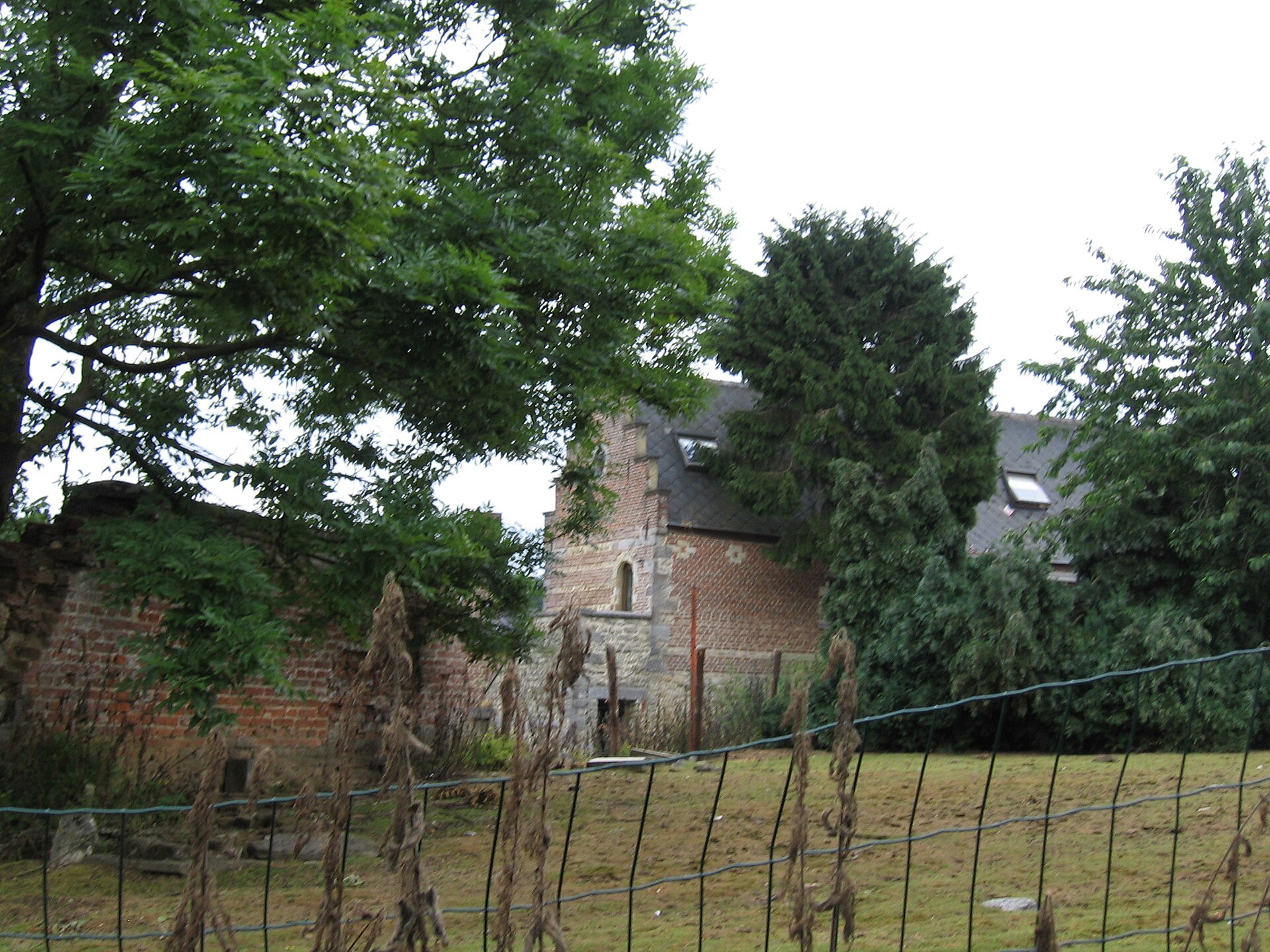
Nizelles Abbey
Wauthier-Braine
Nizelles Abbey was an abbey of Cistercian monks located in Wallonia, in the village of Ophain-Bois-Seigneur-Isaac, part of the municipality of Braine-l'Alleud, in the province of Walloon Brabant, Belgium. The site sits a short distance to the south of Brussels, making it an accessible destination for anyone exploring the area around the Belgian capital and looking for a quieter, historically grounded stop away from the main tourist routes. Where exactly is the abbey located? Nizelles Abbey lies within Braine-l'Alleud, specifically in the section of the municipality known as Ophain-Bois-Seigneur-Isaac. Its geographic coordinates, 50.6648, 4.31436, place it firmly within the rural landscape of Walloon Brabant. The surrounding countryside is typical of the region: scattered farmhouses, open fields, and a generally quiet, agricultural setting in which the remains and memory of the former monastic buildings stand out as a distinct historical marker. Which religious order lived here? The abbey was home to Cistercian monks, members of one of medieval Europe's most influential monastic orders. Cistercians were known for their strict religious rule, their emphasis on manual labor and economic self-sufficiency, and a building style that favored architectural simplicity paired with practical functionality. The presence of such a community in Braine-l'Alleud fits into the broader pattern of monastic settlement across Walloon Brabant, a region where Cistercian communities frequently established abbeys to take advantage of fertile farmland and reliable water sources. Why does this site matter? Nizelles Abbey stands as an example of the religious and architectural legacy left behind by monastic communities in this part of Belgium. Even where the original buildings have not survived intact, the location itself and the memory of the abbey remain a point of historical reference for local residents and for anyone with an interest in the region's past. Its proximity to Brussels means a visit here can easily be combined with sightseeing in the capital or with other attractions in Walloon Brabant, such as the Waterloo battlefield, which lies within the same municipality. What should visitors know before going? Because Nizelles Abbey sits in a rural setting, visitors should plan on traveling by car or bicycle — the surrounding roads pass through the calm farmland typical of Walloon Brabant. The site is best approached as a stop of interest for those curious about the region's monastic history and religious architecture, rather than as the sole destination for a full day trip. Pairing a visit with time spent exploring nearby Braine-l'Alleud and Ophain-Bois-Seigneur-Isaac helps place the abbey within the wider settlement history of the area. Frequently asked questions Where exactly is Nizelles Abbey located? In the village of Ophain-Bois-Seigneur-Isaac, part of the municipality of Braine-l'Alleud, in the province of Walloon Brabant, Belgium, south of Brussels. Which religious order was associated with this site? The abbey belonged to the Cistercian order, a Catholic monastic community known for its strict rule and tradition of economic self-sufficiency. Is Nizelles Abbey close to other attractions? Yes, its proximity to Brussels and to the municipality of Braine-l'Alleud, known among other things for the Waterloo battlefield, makes it easy to combine with other sights in the region. Is this site worth a dedicated trip on its own? Given its character, it works best as a complement to a broader itinerary through Walloon Brabant rather than as a stand-alone, full-day destination.
-
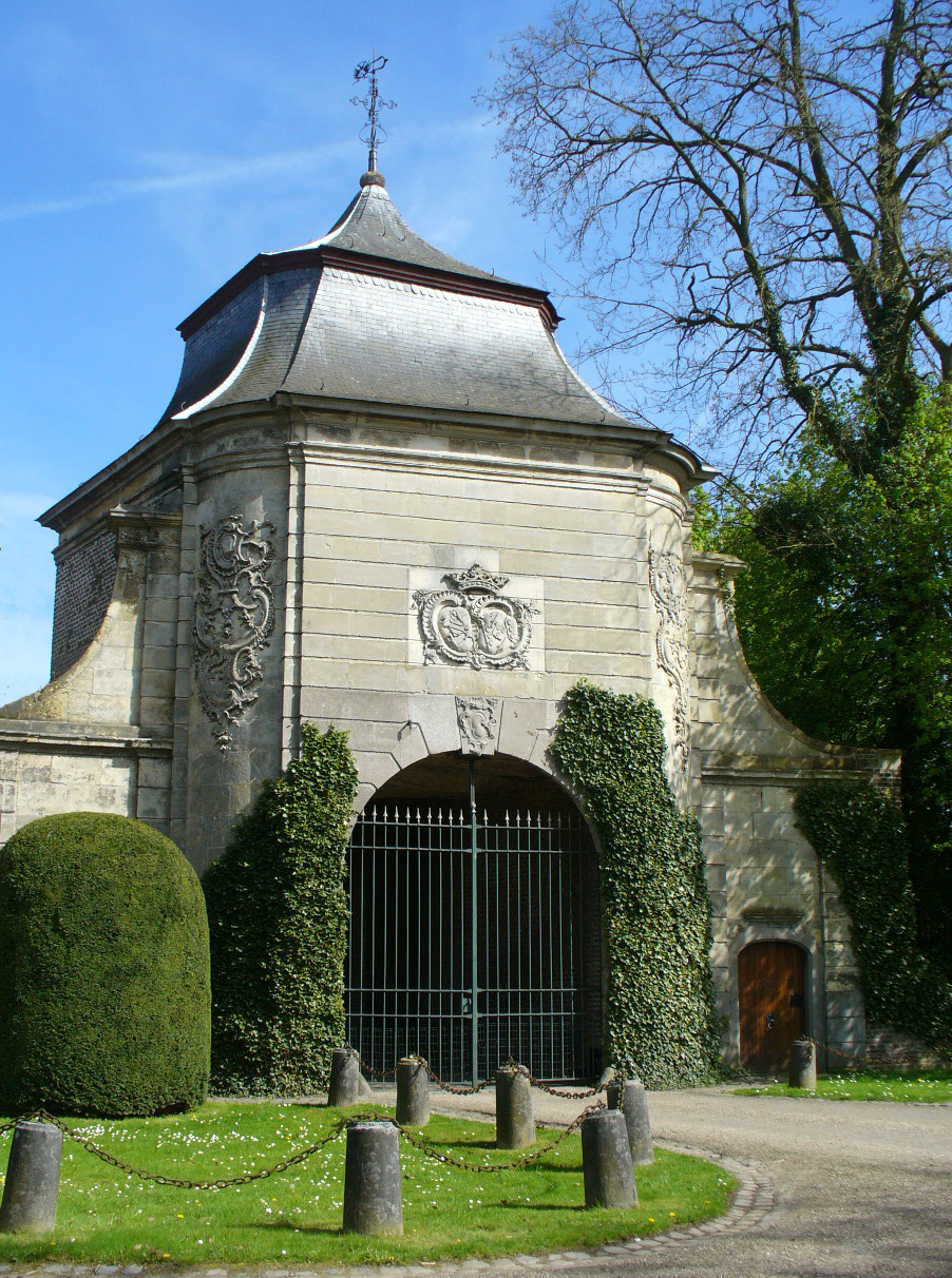
Abdij van Hocht
Lanaken
Abdij van Hocht is a former Cistercian abbey in Lanaken, in the Belgian province of Limburg, situated on the banks of the river Meuse. It was founded around 1180 by Lord Theodorus (Diederik) van Pietersheim, who asked the abbot of the monastery of Eberbach — itself a daughter house of the famous Clairvaux — to send a group of monks to establish a new community. As part of the endowment, the monks received a water mill along with fishing and toll rights on the Meuse. Why is the abbey dedicated to Saint Agatha instead of Our Lady? This is one of the more curious details of its history. Cistercian abbeys were, as a rule, dedicated to the Virgin Mary, yet Hocht broke with this convention from the very start by being dedicated to Saint Agatha. The exception suggests that local religious tradition, or perhaps the founder's own wishes, outweighed the order's usual practice. How did monks become nuns? In 1216, only a few decades after its founding, the Cistercian monks left Hocht to establish the new Abbey of Val-Dieu. Their place was taken by Cistercian nuns arriving from the monastery of St. Salvator in Aachen. This shift changed the character of the community for centuries to come — from that point on, Hocht functioned as a women's religious house. A convent for noblewomen Over time the abbey evolved into a chapter of secular canonesses with a distinctly aristocratic character. Candidates were required to prove four generations of noble ancestry, a requirement that became stricter under Abbess Aleyde de Mérode (1574–1577), when the threshold was raised to eight generations of nobility. Notably, the vow of poverty was only strictly observed from the middle of the 13th century onward, while the vow of chastity in practice applied solely to the abbess herself — a telling sign of just how secular the community's character had become. What standing did the abbey achieve in the region? The abbey's wealth and influence grew steadily over the centuries. A high point came in 1708, when Abbess Marie-Ursule de Minckwitz purchased the lordship of Neerharen. From that moment the abbess of Hocht carried the title "Lady of Neerharen," a clear indication of the economic and political power this small religious community had accumulated over roughly five and a half centuries of existence. What should visitors know before going? Abdij van Hocht is located in the municipality of Lanaken, close to the Dutch border, in the scenic Meuse valley. While the former abbey buildings today serve purposes different from their heyday as a religious house, the site remains an important witness to the region's history — from its medieval Cistercian foundation, through its transformation into an aristocratic chapter of canonesses, to its role as a local center of feudal power. Frequently asked questions Who founded Abdij van Hocht? The abbey was founded by Theodorus (Diederik) van Pietersheim around 1180. Which saint is the abbey dedicated to? Saint Agatha — unusual for a Cistercian foundation, which were normally dedicated to the Virgin Mary. Were the original residents monks or nuns? Monks first. The Cistercian monks left in 1216 to found the new Abbey of Val-Dieu, and Cistercian nuns from St. Salvator in Aachen took their place. What noble ancestry was required of candidates? Initially four generations of nobility, raised to eight generations under Abbess Aleyde de Mérode (1574–1577).
-

Forest Abbey
Forest - Vorst
Forest Abbey, also known as Vorst Abbey, is a former Benedictine abbey located in the Brussels municipality of Forest, Belgium. Founded in the early 12th century, it stood as a religious community for nearly seven centuries before fire and the political upheavals of the late 18th century brought its monastic life to an end. When and why was Forest Abbey founded? The abbey was established in 1105 as a Benedictine foundation. For centuries it served as the center of monastic life in what would become the municipality of Forest, one of the nineteen municipalities that today make up the Brussels-Capital Region. The municipality's very name — Forest in French, Vorst in Dutch — derives from the abbey's presence, a clear sign of how deeply the institution shaped local identity over the centuries. What happened to the abbey? The monastic community endured for almost 700 years. Its continuous existence came to an end after a fire in 1764 partially destroyed the abbey buildings. The abbey was formally abolished in 1796, a period when religious houses across the territories then under French revolutionary control were being suppressed on a wide scale. The abbey's closure therefore fits into the broader European pattern of secularization of church property at the end of the 18th century. What remains of the abbey today? Only the abbey's 18th-century outbuildings have survived to the present day. These structures, built in the final century of the abbey's existence, represent the sole physical remnant of the original monastic complex — the older core buildings of the abbey did not survive intact. The preserved outbuildings are now owned by the municipality of Forest, which took possession of the site after the abbey's dissolution. What is Forest Abbey used for now? Today, the former abbey buildings serve as a cultural centre. The municipality of Forest, as owner of the site, uses the historic premises to host cultural activities for the local community. This transformation from a religious institution into a secular cultural venue is a pattern seen elsewhere across Brussels, where former monastic properties have found new civic purposes long after their original communities disappeared. The site is located in the southwestern part of Brussels, within the municipality of Forest, at coordinates roughly 50.81° N, 4.32° E. Visitors researching this location should be careful not to confuse it with Fore Abbey, an early medieval Benedictine foundation in County Westmeath, Ireland — a separate site whose English name is similar but which has no connection to the Brussels abbey. Frequently asked questions When was Forest Abbey founded? It was founded in 1105 as a Benedictine abbey. How long did the abbey exist? It existed for nearly 700 years, from its founding until the end of the 18th century. Why did the abbey stop functioning as a monastery? A fire in 1764 partially destroyed its buildings, and the abbey was formally abolished in 1796. What survives from the original abbey? Only the 18th-century outbuildings remain; they are now municipal property. What is the site used for today? The preserved buildings function as a cultural centre run by the municipality of Forest. Where exactly is Forest Abbey located? In the Forest (Vorst) municipality, in the southwestern part of Brussels, Belgium.
-
Synagogue of Arlon
Arlon
The Synagogue of Arlon is the oldest surviving synagogue in Belgium and one of the country's most significant 19th-century Jewish heritage buildings. Located in Arlon, the capital of Luxembourg Province, it stands as a lasting testament to the local Jewish community that once thrived there. Where did Arlon's Jewish community come from? Jewish families began settling in Arlon in the early 19th century, many arriving from the neighboring Lorraine region of France. When Belgium gained independence in 1830, the community numbered only 31 people. Over the following decades it grew steadily, with most families earning their living through the cattle and grain trade — a common occupation among Jewish communities in provincial towns of the era. By around 1860, the community had grown to roughly 130-150 members, large enough to justify building a dedicated house of worship. When and how was the synagogue built? The decision to build the synagogue was made around 1860. Provincial architect Albert Jamot (also recorded as Janot) was commissioned to design the building. What makes Arlon's synagogue historically unusual is that the town council itself provided the land and contributed public funds toward its construction — making it the first synagogue in Belgium built primarily with municipal financial support. Construction began in January 1864 and took roughly two years to complete; the building was inaugurated in December 1866, though some sources cite 1865 as the opening date. What architectural style did the builders choose? The synagogue follows a basilical floor plan and is executed in a Romanesque Revival style with notable Byzantine influences. Its facade is marked by two slender, symmetrical towers flanking a tall, arched central portal topped with a rose window. This combination of historicist elements reflected broader European trends in 19th-century synagogue architecture, adapted here to local building traditions in Wallonia. What happened to the synagogue during the Second World War? The Nazi occupation devastated Arlon's Jewish community: many members were deported, and the community that had numbered close to a hundred people at the start of the war was reduced to only a handful of survivors by its end. Remarkably, the synagogue building itself survived the war largely intact, unlike many other Jewish religious buildings destroyed across occupied Europe. What is the synagogue's status today? On 28 November 2005, the building was officially classified as a Major Heritage Site of Wallonia (Patrimoine majeur de Wallonie), formally recognizing its architectural and historical importance. In 2014 the synagogue was closed due to serious structural problems caused by moisture damage and dry rot. Following five years of careful restoration work, it reopened to the public in October 2019, timed to coincide with the Jewish New Year, Rosh Hashanah. Frequently asked questions Is this the oldest synagogue in Belgium? Yes, the Synagogue of Arlon is recognized as the oldest surviving synagogue building in the country. Who designed the building? Provincial architect Albert Jamot (sometimes spelled Janot), commissioned by the authorities of Luxembourg Province. Can visitors tour the synagogue? Since its 2019 reopening, the restored building functions as both a place of worship and a heritage site, accessible as part of local historical and cultural itineraries. What makes this synagogue historically unique? Its construction was largely funded through public money from the town of Arlon itself — an exceptional case in the history of Belgian synagogue building.
-
Machsike Hadass Synagogue
Antwerpen
The Machsike Hadass Synagogue is the main house of worship of Antwerp's Orthodox Jewish community and the largest synagogue in Belgium. It stands at the heart of the city's Diamond District, home for generations to a large Hasidic community, and its sandstone Art Nouveau facade has shaped the religious rhythm of the neighborhood for over a century. Where does the name Machsike Hadass come from? The name belongs to the congregation itself, formed in 1892 when six smaller Antwerp shuls merged into a single Orthodox kehile. The united community took the name Machsike Hadass, roughly meaning "upholders of the faith," and in 1910 it received official legal recognition through a royal decree. The building described here was raised specifically to serve as this congregation's central synagogue. Who designed the building, and in what style? The synagogue was designed by Jewish architect Jules Hofman shortly before the outbreak of the First World War. Construction ran from 1910 to 1914, but the war delayed finishing work long enough that the formal dedication only took place in 1919, after the conflict had ended. Hofman combined an eclectic architectural plan with Art Nouveau detailing — a fashionable style in Antwerp at the time, but an unusual choice for a synagogue, since most Belgian synagogues of the era favored Neo-Romanesque or Orientalist forms instead. The sandstone facade features distinctive basket-shaped window arches, slender columns and twin corner towers, lending the monumental structure a surprising visual lightness. What is inside the synagogue? Behind the facade lie prayer halls designed to be filled with natural light, thanks to skylights fitted with colorful stained glass that give the interior a warm glow shifting throughout the day. One of the building's most recognizable features is the set of 70 chandeliers illuminating the main sanctuary, a striking piece of the original decorative scheme. How did the community fare after the war? Antwerp's Jewish community was devastated by the Holocaust, and Machsike Hadass rebuilt itself gradually in the postwar years — its yeshiva reopened as early as 1946. In 1954 the congregation appointed Chaim Kreiswirth as chief rabbi, a Talmudic scholar of international renown, cementing the synagogue's role as one of Orthodox Judaism's spiritual centers in Europe. What did the recent restoration involve? In 2016 the Flemish government granted more than €1.6 million toward restoring the synagogue, part of a broader €4 million program supporting two Antwerp synagogues. The multi-year project included the careful cleaning and repair of all 70 historic chandeliers in the main hall, along with extensive repairs to both the exterior facade and the interior. The work concluded with a reopening ceremony in May 2023, returning the building to full use as a place of worship and community life in the Diamond District. Frequently asked questions Can visitors tour the synagogue? As an active house of worship for an Orthodox community, visits typically require prior arrangement and observance of modest dress and customary conduct expected in a place of prayer. Why is this building architecturally unusual? It is a rare example of a synagogue built in the Art Nouveau style, at a time when most Belgian synagogues of the period drew instead on Neo-Romanesque or Orientalist influences. Is this the only synagogue run by the Machsike Hadass community? No — the congregation also maintains other prayer houses in Antwerp, but this building serves as its main, representative synagogue.
-
Langemark German war cemetery
Madonna
Langemark German war cemetery is a First World War memorial site located in the Belgian town of Langemark, in the province of West Flanders. It stands among the many war cemeteries scattered across this region, commemorating soldiers who died in the fighting on the Western Front between 1914 and 1918. Why is Langemark significant in the history of the First World War? The town of Langemark holds a grim place in history as one of the first locations on the Western Front where chemical weapons were used in warfare. It was here, in April 1915, during the Second Battle of Ypres, that German forces launched a chlorine gas attack against Allied troops. This event marked one of the turning points in the history of modern warfare — the first large-scale use of chemical weapons against soldiers fighting in trench positions. The attack permanently changed the nature of combat and left a lasting mark on Europe's collective historical memory. The wider Ypres (Ieper) area, of which Langemark is part, was the setting for some of the fiercest and most devastating battles of the entire war. As a result, the region today holds a dense network of war cemeteries and memorial sites, each a reminder of the enormous human losses suffered by all sides of the conflict on this small stretch of Flemish land. Where exactly is the cemetery located? The cemetery lies within the town of Langemark, in the Flemish province of West Flanders. Its geographic coordinates place it at approximately 50.92 degrees north latitude and 2.92 degrees east longitude, situating the site at the heart of the former Ypres battlefields — one of the most important areas of First World War remembrance in Belgium. What should visitors know before planning a visit? Langemark is a natural stop for anyone interested in twentieth-century history, and in particular the course of the First World War on the Western Front. The site sits close to other war cemeteries and memorials scattered around Ypres, making it easy to combine a visit here with a broader tour of Great War remembrance sites in the region. Visitors to war cemeteries in West Flanders should keep in mind the solemn character of these places — they are first and foremost sites of rest and remembrance, calling for quiet and respect. Why is this place worth a visit? Langemark German war cemetery offers a way to grasp the real scale of a conflict that unfolded on this small patch of Flanders more than a century ago. It is a place where the history of the first large-scale use of chemical weapons intersects with the personal tragedy of thousands of soldiers whose fates are commemorated on this ground. For travelers following the traces of the First World War, Langemark forms an essential piece of the mosaic of remembrance sites surrounding Ypres. Frequently asked questions Where is the Langemark war cemetery located? In the town of Langemark, in the Belgian province of West Flanders. What historical event is this site associated with? The Second Battle of Ypres in April 1915, when German forces carried out one of the first large-scale chemical weapons attacks in this area. Which tourist region does Langemark belong to? The former battlefields around Ypres (Ieper), one of the key First World War remembrance areas in Belgium.
-
St Symphorien Military Cemetery
Mons
St Symphorien Military Cemetery is a First World War burial ground located in the village of Saint-Symphorien, Belgium, near Mons. It stands as one of the most symbolically significant war cemeteries in Europe, being a rare site where soldiers from both opposing armies of the Great War — German and Commonwealth — were laid to rest together on the same grounds. Who is buried here? The cemetery holds the graves of 284 German soldiers and 229 Commonwealth soldiers. Most of those buried here fell during the Battle of Mons, one of the first engagements between the British Expeditionary Force and the German Army on the Western Front in August 1914. The presence of soldiers from both sides of the conflict in a single burial ground makes St Symphorien stand out among war cemeteries, which typically hold the fallen of only one army. Who established the cemetery, and why? The cemetery was established by the German Army, which chose to create a burial ground on land donated by Jean Houzeau de Lehaie. The decision to lay German and British soldiers to rest together, taken as early as 1914, was an unusual gesture given the circumstances of the ongoing war, and it gave the site the distinctive symbolic character it still carries today. How has the site's appearance changed over time? The original design followed the concept of a woodland cemetery — a layout that worked with the natural, wooded surroundings, integrating the graves into the existing landscape rather than imposing a rigid, geometric arrangement on it. After the war, care of the cemetery passed to the Imperial War Graves Commission (the predecessor of today's Commonwealth War Graves Commission), which commissioned architect William Harrison Cowlishaw to redesign the site. It was Cowlishaw who gave the cemetery the form visitors see today, preserving the original woodland character of the site while introducing a more ordered arrangement of graves and pathways. Why is this site worth visiting? St Symphorien Military Cemetery carries exceptional historical weight — not only as a war cemetery, but as evidence that even amid the brutal conflict of the twentieth century, a shared act of commemoration for the fallen was possible, regardless of which side of the front line they had fought on. The woodland character of the site, preserved despite the later redesign, gives the place a quiet, contemplative atmosphere quite different from the more formal, state-run military cemeteries found elsewhere in Belgium and France. Frequently Asked Questions How many people are buried at St Symphorien Military Cemetery? A total of 513 soldiers are buried here — 284 German soldiers and 229 Commonwealth soldiers. Which battle is the cemetery associated with? Most of the Commonwealth soldiers buried here died during the Battle of Mons in August 1914, one of the first engagements of the war on the Western Front. Who redesigned the cemetery into its current form? Architect William Harrison Cowlishaw carried out the redesign after the Imperial War Graves Commission took over responsibility for the site. What makes St Symphorien different from other war cemeteries? It is one of the few sites where soldiers from both opposing armies — German and British — are buried side by side, a rarity among First World War cemeteries.
-
Ramparts (Lille Gate) Cemetery
Ypres
Ramparts (Lille Gate) Cemetery is a Commonwealth War Graves Commission (CWGC) burial ground for soldiers who fell during the First World War, located in Ypres, Belgium, within the historic Ypres Salient on the Western Front. It is one of dozens of CWGC sites scattered around the town, marking the human cost of the fighting that raged here between 1914 and 1918. Where exactly is the cemetery located? The cemetery sits on the former town ramparts of Ypres, close to the historic Lille Gate, from which it takes its name. This position along the old defensive walls is significant: the earthworks surrounding the town centre served as cover and observation points during the war, and the surrounding ground saw heavy fighting throughout the conflict. The site lies at approximately 50.845° N, 2.889° E, placing it right at the edge of the town's historic core. What was the Ypres Salient? The term "Salient" describes the bulge in the front line around Ypres that remained in Allied hands for most of the war, surrounded on three sides by German forces. This narrow strip of contested ground saw some of the bloodiest engagements of the entire conflict, and as a result the town and its surroundings are dotted with dozens of CWGC cemeteries. Ramparts Cemetery is one of these — smaller in scale, but tied directly to the town's fortifications and topography. Who maintains the cemetery? The site is cared for by the Commonwealth War Graves Commission, the organisation established after the First World War to commemorate and maintain the graves of Commonwealth service personnel who died in the two World Wars. The CWGC oversees hundreds of cemeteries across Flanders, keeping them to a consistent, recognisable standard — rows of white headstones, carefully tended lawns, and a quiet, contemplative setting. Why visit this site? Ramparts (Lille Gate) Cemetery will appeal to anyone interested in First World War history and the physical traces it left on the Flanders landscape. Its proximity to the Lille Gate and the old town ramparts means a visit can easily be combined with a walk through historic Ypres and other nearby memorials, including the famous Menin Gate. The cemetery offers a compact, contemplative stop on that route — a place of quiet reflection just steps from the town's main historic sights. Frequently asked questions What is Ramparts (Lille Gate) Cemetery? It is a First World War CWGC burial ground located in Ypres, Belgium, within the Ypres Salient on the Western Front. Where does the cemetery's name come from? The name comes from its position on the town's old defensive ramparts and its proximity to the historic Lille Gate. Who manages the cemetery? It is maintained by the Commonwealth War Graves Commission, the organisation responsible for commemorating Commonwealth service personnel who died in the World Wars. Can the cemetery be visited alongside other Ypres landmarks? Yes — given its location near the town centre and other memorials such as the Menin Gate, it fits naturally into a walking route through Ypres's First World War heritage sites.
-
cemetery of Proven
Poperinge
Mendinghem Military Cemetery is one of the largest First World War burial grounds in Belgium, lying just beyond the village of Proven in the municipality of Poperinge, West Flanders. It sits along the road connecting Ieper and Poperinge, roughly 500 metres past the centre of Proven. Where does the name Mendinghem come from? The name has nothing to do with local place-naming traditions — it was a soldiers' joke. British troops gave the medical evacuation points scattered around this area names that sounded Flemish but were actually built from English words. Alongside Mendinghem, the same wordplay produced Dozinghem and Bandaghem — all referring to clusters of Casualty Clearing Stations set up well behind the front line, where wounded soldiers from the Ypres sector were brought for treatment. Why was the cemetery established at Proven? In July 1916, the 46th (1st/1st Wessex) Casualty Clearing Station was set up at Proven, one of the units tasked with treating and evacuating casualties from the fighting around Ypres. The cemetery was created alongside this station, with the first burials taking place in August 1916. A year later, in July 1917, as the Allies prepared for a major offensive in the region, four additional clearing stations were sent to Proven. Three of them — the 46th, 12th and 64th — remained in place until 1918, steadily adding to the number of burials. The cemetery closed, apart from one later burial, in September 1918, as the fighting in this part of the front came to an end. How many are buried here? The cemetery now holds 2,391 Commonwealth burials from the First World War, together with 52 German war graves. Its scale reflects both the intensity of the fighting around nearby Ypres between 1916 and 1918 and the sheer volume of casualties passing through the clearing stations based at Proven. Who maintains the cemetery today? The site is cared for by the Commonwealth War Graves Commission (CWGC), the organisation responsible for maintaining and commemorating the graves of Commonwealth service personnel who died in the two World Wars. Ongoing upkeep and the uniform layout of headstones give the cemetery the quiet, orderly character typical of war cemeteries designed after 1918. Frequently asked questions Can visitors enter the cemetery? Yes, the site is open to the public and can be visited free of charge throughout the year, like most CWGC cemeteries in the West Flanders region. Is this the only war cemetery associated with Proven? Mendinghem is the main and largest military cemetery linked to Proven, though the wider Ypres Salient contains dozens of similar First World War burial sites. Which nationalities are buried here? Alongside British and other Commonwealth soldiers, the cemetery also contains German war graves, reflecting the practice of burying casualties from both sides of the conflict near medical stations.
-
Leisele Churchyard
Leisele
Leisele Churchyard is a small parish cemetery surrounding the village church, Sint-Martinuskerk (St Martin's), in Leisele — a village belonging to the municipality of Alveringem in West Flanders, close to the French border. The site serves a double role: it remains an active local burial ground and, at the same time, a quiet point of remembrance tied to the Second World War. Where exactly is the churchyard? Leisele lies roughly 13 kilometres south of Veurne, just off the N8 road connecting Veurne and Ieper. The churchyard sits right in the centre of the village, wrapped around the parish church, on the right-hand side as you approach along the main road. Today the cemetery holds around 490 graves — a substantial number for such a small village, reflecting its role as the sole burial ground for the surrounding community across generations. What is the site's connection to the war? In May 1940, during the final stage of the defence of Belgium against the German invasion, the British Expeditionary Force helped cover the Allied withdrawal towards Dunkirk. The fighting during this retreat caused casualties among British troops scattered across West Flanders. One trace of those events can still be found at Leisele Churchyard: the grave of Gunner Robert Robinson, who died on 29 May 1940. His grave lies in the south-western corner of the cemetery and is maintained by the Commonwealth War Graves Commission (CWGC), the organisation responsible for the graves of Commonwealth servicemen worldwide. Beyond this single war grave from 1940, the churchyard also holds the graves of local veterans who served in both the First and Second World Wars, making the site a modest record of both conflicts within one small community. What can visitors see there? Visitors will find a quiet, typically Flemish parish churchyard — rows of gravestones encircling the village church, a layout common to many villages in the region. The British soldier's grave stands out through the uniform CWGC-style headstone, distinct from the surrounding civilian graves. It is precisely this contrast between an everyday local cemetery and a single wartime marker that gives the site its particular character, showing how the events of 1940 reached even the smallest villages of the region. Who is this place for? Leisele Churchyard is not a major tourist attraction in the conventional sense, but rather a point of interest for those researching the wartime history of West Flanders, following Commonwealth War Graves Commission sites in Belgium, or tracing places connected to the 1940 campaign and the retreat to Dunkirk. For residents of Alveringem and Leisele, it remains first and foremost a living parish cemetery, the resting place of many generations of local families. Frequently asked questions Is Leisele Churchyard a war cemetery? Not entirely — it is primarily an active parish cemetery around St Martin's church, containing one British soldier's grave from 1940 that is cared for by the CWGC. Where exactly is the soldier's grave located? In the south-western corner of the churchyard. How do you get to Leisele? The village lies on the N8 road between Veurne and Ieper, about 13 km south of Veurne, within the municipality of Alveringem in West Flanders. How many graves does the cemetery hold? Around 490 graves, including veterans of both World Wars and one grave maintained by the CWGC.
-
Lendelede Communal Cemetery
Lendelede
Lendelede Communal Cemetery is a small municipal burial ground in the village of Lendelede, in the Belgian province of West Flanders, roughly 8 kilometres north of the town of Kortrijk. Like most communal cemeteries in this part of Flanders, it primarily serves as the local resting place for residents of Lendelede and the surrounding area, but it also holds a single grave connected to the Second World War, placing it on the map of Commonwealth War Graves Commission (CWGC) sites in Belgium. What makes this cemetery notable? The cemetery's wartime significance goes back to May 1940, during the German invasion of Belgium and the early, chaotic weeks of the Second World War. As German forces pushed through the Low Countries, the British Expeditionary Force (BEF) was drawn into the defence of Belgian territory, fighting a series of rearguard actions meant to slow the advance and buy time for the withdrawal of Allied troops toward the coast and, eventually, Dunkirk. Losses during this period were heavy and widely scattered, with soldiers being buried, sometimes individually, in whatever local cemetery lay closest to where they fell. That is how one Commonwealth serviceman came to be buried at Lendelede: a member of the 12th Royal Lancers, a regiment of the Royal Armoured Corps, who died on 25 May 1940 at the age of 32. The 12th Lancers were among the reconnaissance units used to screen the BEF's movements during the retreat, often operating ahead of or alongside the main columns, which placed them at particular risk during the fast-moving fighting of that month. Where is the grave located? Visitors looking for the Commonwealth grave will find it just inside the cemetery entrance, a short walk of about 15 metres up the path, on the right-hand side. It sits among the graves of the local community, a quiet reminder that the war reached even small villages far from the front lines that later became famous. Why visit Lendelede Communal Cemetery? For most travellers, Lendelede itself is a modest rural stop rather than a major destination, but the cemetery offers a low-key, reflective counterpoint to the larger and more heavily visited CWGC sites around Ypres and the Ypres Salient, which lie roughly 30-40 kilometres away. Because only one Commonwealth grave is present, a visit here takes just a few minutes, making it an easy addition for anyone exploring West Flanders' network of war cemeteries and memorials, or for those with a personal or family connection to the 12th Royal Lancers. Najczęstsze pytania / FAQ Is Lendelede Communal Cemetery a war cemetery? No, it is a regular municipal cemetery for the village of Lendelede. It contains just one Commonwealth war grave from the Second World War, in addition to the graves of local residents. Who is buried in the Commonwealth grave? A soldier of the 12th Royal Lancers, Royal Armoured Corps, who died on 25 May 1940, aged 32, during the fighting that accompanied the British withdrawal toward Dunkirk. Where exactly is the grave within the cemetery? Through the main entrance and about 15 metres along the path, on the right-hand side. Is the cemetery maintained by the Commonwealth War Graves Commission? The individual Commonwealth grave is recorded and cared for under CWGC records, even though the cemetery as a whole is a civilian communal cemetery managed locally.
-
Saint-Charles de Potyze Military Cemetery
Ypres
Saint-Charles-de-Potyze Military Cemetery is a French national cemetery located on the outskirts of Ypres (Ieper), in the Belgian province of West Flanders. It is one of the largest resting places for French soldiers who died in the Ypres Salient during the First World War. How did this cemetery come to be? The site's history goes back to November 1914, when a former school in Potyze was turned into a medical aid post for wounded soldiers. Burials began close to this post almost immediately, forming the seed of what would later grow into a large national cemetery. In the early years of the war, the northern flank of the Ypres Salient was held by French forces — and it was against these French troops that Germany launched, on 22 April 1915, the first large-scale gas attack of the war, opening the Second Battle of Ypres. Why does the cemetery look the way it does today? The site was substantially reorganized after the fighting ended, with major works carried out in 1920, 1922 and again between 1925 and 1929. During these years, the remains of French soldiers scattered across the Flanders front, the Yser river area and the Belgian coast were exhumed and reburied here. This makes Saint-Charles-de-Potyze a concentration cemetery — similar in purpose to the ossuary at Mont Kemmel — created specifically to gather graves that had previously been spread across numerous smaller, temporary battlefield burial sites. How many soldiers are buried here? Covering nearly 3 hectares, the cemetery holds 3,547 identified French soldiers, alongside the remains of a further 609 unidentified men held in the ossuary. Among those buried here are casualties of the German gas attack of 22 April 1915 and the fighting that followed it. Why is it worth a visit? Compared with the many smaller war cemeteries scattered around Ypres, Saint-Charles-de-Potyze stands out for its scale — the long rows of uniform crosses and the ossuary itself convey the true extent of French losses on this stretch of the Western Front. It makes a strong complement to a visit to Ypres itself and to the region's better-known Commonwealth war graves, offering a French perspective that is often overshadowed by the British and Commonwealth narrative dominant in the area. Frequently asked questions Where exactly is the cemetery located? In the Potyze district on the outskirts of Ypres (Ieper), in the province of West Flanders, Belgium. How many people are buried there? 3,547 identified French soldiers plus 609 unidentified men held in the ossuary — more than 4,150 in total. From which period do the burials date? Mainly from 1914–1918, tied to the fighting in the Ypres Salient during the First World War, including the Second Battle of Ypres in 1915. Is entry free? Yes, as a war cemetery it is open to the public and can be visited free of charge during daylight hours.
-
Bruyelle War Cemetery
Bruyelle
Bruyelle War Cemetery Bruyelle War Cemetery is a small Commonwealth war cemetery located about 6 km south of Tournai, Belgium, on the N507 road (Chaussée de Tournai), right at the entrance to the village of Bruyelle where it meets the N52. It is the final resting place of Commonwealth soldiers who died in the fighting across Flanders and Wallonia during the Second World War. Why does this cemetery exist here? Almost all the soldiers buried here died in May 1940, during the fighting along the line of the river Scheldt (Escaut), which was intended to slow the German advance and buy time for the Allied withdrawal toward Dunkirk. This defensive stand on the Scheldt was one of the short but costly episodes of the 1940 Battle of France and Belgium, part of the broader effort to hold a line long enough for the main Allied forces to reach the coast. Of these men, 58 were originally buried directly in Bruyelle, while the rest were interred in surrounding villages. It was only in November 1940, under German occupation, that all these scattered graves were brought together into a single cemetery — the one that stands today. Later, in September 1944, when the Allies re-entered Belgium and pushed the Germans back, one further burial was made here — the only one not connected to the 1940 fighting. How many soldiers are buried here? The cemetery holds 147 Commonwealth war graves from the Second World War. Of these, 17 remain unidentified, their headstones marked only "known unto God" rather than a name. This proportion of unidentified graves is typical of cemeteries from the chaotic 1940 retreat, when the speed of the fighting and the rapidly shifting front line often made proper identification of the fallen impossible. What is the wider regional context? The Tournai area carries a long history of wartime destruction. The city itself remained under German occupation until 8 November 1918, when it was finally entered by the 47th (London) Division and the 74th (Yeomanry) Division during the final Allied offensive of the First World War. While Bruyelle War Cemetery itself dates only from the 1940 fighting, the surrounding region had already sat on the path of major European conflicts for decades — one reason this part of Hainaut holds such a dense concentration of war cemeteries and memorials. Is the cemetery open to visitors? The cemetery is open to visitors, and wheelchair access is possible through the main entrance. It is maintained by the Commonwealth War Graves Commission (CWGC), which cares for war cemeteries across Europe. Despite its modest size, Bruyelle remains an important place of remembrance for the families and descendants of the soldiers who fell defending the Scheldt line in 1940. Frequently asked questions How many people are buried at Bruyelle War Cemetery? The cemetery contains 147 war graves, of which 17 belong to unidentified soldiers. From which period do most of the burials date? The vast majority of the soldiers died in May 1940 during the fighting along the river Scheldt, shortly before the evacuation to Dunkirk. How do you get to the cemetery? It sits on the N507 road connecting Tournai to Bruyelle, right at the junction with the N52, about 6 km south of central Tournai. Is the cemetery wheelchair accessible? Yes, the main entrance allows wheelchair access.
-
Hooglede German war cemetery
Hooglede
Hooglede German war cemetery is a German military cemetery on the eastern edge of the Belgian town of Hooglede, roughly six kilometres northwest of Roeselare, in the West Flanders province. It holds the remains of German soldiers who died during the First World War, making it one of the many war cemeteries scattered across the Flanders fields that saw some of the bloodiest fighting of the Western Front. How many soldiers are buried here? The cemetery contains 8,241 burials of German soldiers. That figure alone gives a sense of the scale of losses suffered by the armies fighting over the ground around Roeselare and nearby Ypres, a region whose name became permanently linked to trench warfare, relentless artillery bombardment and the use of chemical weapons. Hooglede is one of the sites where remains from surrounding battlefields and smaller, temporary burial grounds were later concentrated after the fighting ended. Where exactly is the cemetery located? The site sits at the eastern side of Hooglede, in a quiet, largely rural setting typical of this part of West Flanders. Its geographic coordinates are 50.978056 N, 3.093611 E. The proximity to Roeselare — a town that serves as a local transport and commercial hub — makes the cemetery relatively easy to reach for visitors exploring the region in search of traces of the Great War. Why is it worth a visit? War cemeteries in Belgium, Hooglede included, function today as places of remembrance and reflection rather than mere historical curiosities. Travellers following the Flanders battlefields trail often add Hooglede as a stop that complements the better-known cemeteries and museums clustered around Ypres. The sheer number of graves — more than eight thousand in a single location — is striking, and it helps visitors grasp the human scale of a conflict that meant a permanent loss for countless families in Germany and Belgium alike. How does it compare to other cemeteries in the area? The countryside around Ypres and Roeselare is dotted with war cemeteries of different nationalities — British, French, Belgian and German. Hooglede belongs to the German network of burial sites for soldiers who fought along this stretch of the Western Front. Unlike some of the largest concentration cemeteries in the region, its location next to a small town gives it a more intimate, local character. Frequently asked questions Who is buried at Hooglede German war cemetery? The cemetery holds the remains of 8,241 German soldiers who died during the First World War. How far is it from Roeselare? The cemetery lies about six kilometres northwest of Roeselare. Where is the cemetery located relative to Hooglede? It sits on the eastern side of the town of Hooglede. Is this the only German war cemetery in the area? No — the area around Ypres and Roeselare contains numerous war cemeteries belonging to different sides of the conflict, and Hooglede is one of the German sites within that wider network of remembrance.
-
Kemmelberg Ossuary
Loker
The Kemmelberg Ossuary is a French war memorial burial ground located along Kemmelbergweg in Loker, part of the Heuvelland municipality in West Flanders, Belgium. It honors French soldiers who died defending Kemmel Hill in the spring of 1918, during one of the bloodiest episodes of the closing stages of the First World War on the Western Front. Why is this hill so significant historically? Despite its modest height, Kemmelberg offered a commanding view over the surrounding Flemish plain, making it a fiercely contested objective during the Fourth Battle of Ypres, also known as the Battle of the Lys. On 25 April 1918, German Alpenkorps units, supported by gas bombardment, stormed the summit held by French forces, forcing Allied troops to withdraw from the neighboring high ground. French casualties in the fighting numbered in the thousands. What can visitors find at the ossuary? Within this small, carefully maintained cemetery lie the remains of thousands of French soldiers killed in the struggle for the hill — records indicate more than five thousand burials, only a small fraction of which have ever been identified by name. At the heart of the site stands a memorial obelisk raised in tribute to the fallen, serving as the focal point for visitors paying their respects. The layout reflects the restrained, solemn style typical of French military necropolises from this period, combining simplicity of form with the gravity of a mass grave. How does it fit into the wider Kemmelberg landscape? The ossuary sits alongside other traces of the Great War scattered across the hill's slopes — remnants of fortifications, viewpoints, and further memorials that together form a historical trail popular with visitors interested in the Western Front. Kemmelberg itself, despite its modest elevation, is also well known today among cyclists and hikers, its steep gradients famous from classic road cycling races held in this part of Flanders. What significance and status does it hold today? The site has been recognized as a place of considerable historical heritage value, with its protected status formally reinforced in 2023. For visitors, Kemmelberg is not only a scenic vantage point over the surrounding countryside but, above all, a space for reflection on the immense human cost of the fighting that took place on this small yet strategically vital hill. Frequently asked questions Where exactly is the ossuary located? Along Kemmelbergweg in Loker, within the Heuvelland municipality, West Flanders province. Who is commemorated at this site? French soldiers who died defending Kemmelberg in April 1918, during the Fourth Battle of Ypres. Can the ossuary be visited independently? Yes, it is an open, publicly accessible memorial site, often visited as part of a wider tour of the Ypres Salient battlefields. What else is worth seeing nearby? Nearby fortifications and viewpoints on Kemmelberg, forming part of the historical landscape connected to the 1918 fighting.
Earn badges for the places you visit
Download NextOnTrip, discover new places and check off your trails.