Mountains and trails in Switzerland
A guide to 298 Mountains and trails in Switzerland — with descriptions, photos and traveler visits from the NextOnTrip community. Locations spread across 184 cities and towns. Most visited by the community: Hörnli, Aletschhorn, Bietschhorn.
-
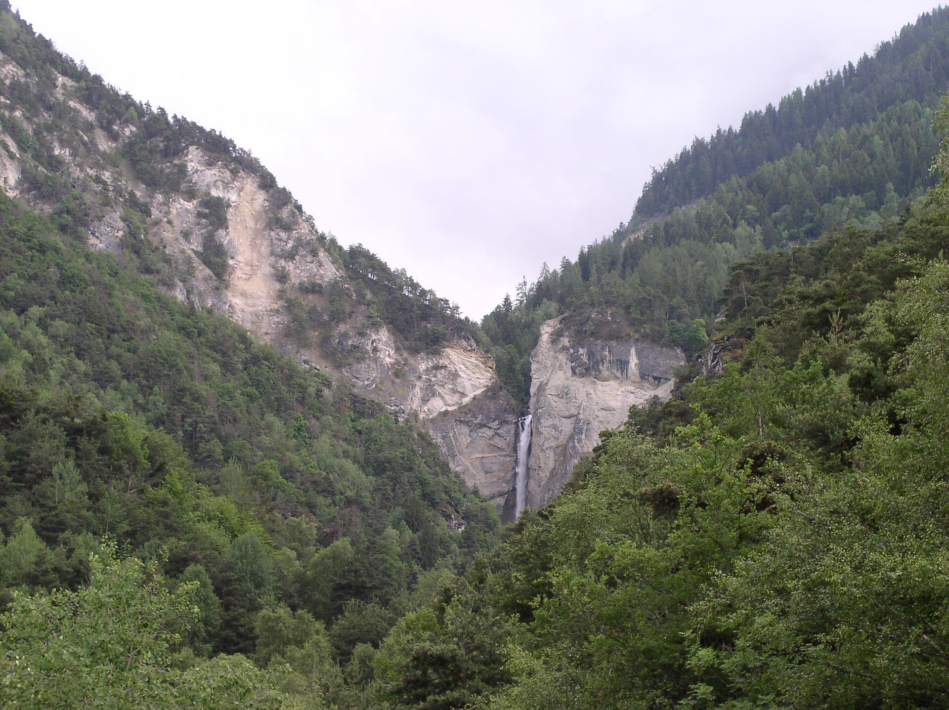
Val de Réchy
Grône
Val de Réchy (Vallon de Réchy): a wild valley in the Valais Alps Val de Réchy, also called Vallon de Réchy, is a valley in the Swiss canton of Valais, on the south side of the Rhône valley. It belongs to the Pennine Alps and reaches into the mountains above villages such as Grône and Vercorin. It suits walkers who want quiet, high-mountain scenery and trails without crowds. Where is Val de Réchy? The valley spans several communes: Anniviers, Chalais, Grône, Mont-Noble and Saint-Martin. Its coordinates are roughly 46.237° N, 7.501° E. From the Rhône valley, slopes climb steadily toward the higher parts of the range. What is the landscape like? The Swiss federal inventory of landscapes of national importance lists the valley as IFP 1718 and describes it as a wild, isolated valley of the Valais Pennine Alps covering about 3,475 hectares. The lower section is steep and forested. Higher up, the woods give way to plateaus and lakes. Beyond the Ar du Tsan plain, at around 2,200 m, the character of the valley changes: four successive plateaus climb to about 2,750 m, crossed by many streams. The Rèche torrent drains the valley and reaches the Rhône valley through the large Chute de la Rèche waterfall. In the upper zone, peat bogs and periglacial processes are typical, especially around 2,700 m. Is the valley protected? Yes. In 2015 the State of Valais classified Vallon de Réchy as a protected natural site of national importance and banned mountain bikes and other vehicles. The valley can only be explored on foot. There are no roads and very little building. How to visit A popular approach starts in Vercorin: a gondola lift rises to Crêt du Midi (given as about 2,321 to 2,332 m depending on the source), where the hiking route begins. Stage 5 of the Tour du Val d'Anniviers links Vallon de Réchy with the mountain lake of Louché. The loop is about 15 km and takes roughly 4 hours 40 minutes, rated intermediate. The shores of Lac du Louché are the highest point of the route. Huts in the area include Dzornive, Econdoi and Rèche, and higher up the Cabane des Becs de Bosson stands at 2,985 m. Frequently asked questions Can I drive to Val de Réchy? No. The valley has no roads and vehicles are banned. You reach it on foot, often after taking the lift from Vercorin. Can I ride a mountain bike there? No. Mountain bikes and other vehicles have been prohibited since 2015. How long is the popular loop to Lac du Louché? About 15 km, taking roughly 4 hours 40 minutes. When should I go? Given the altitude, check local conditions and the forecast before setting out, since the route is a high-mountain walk.
-
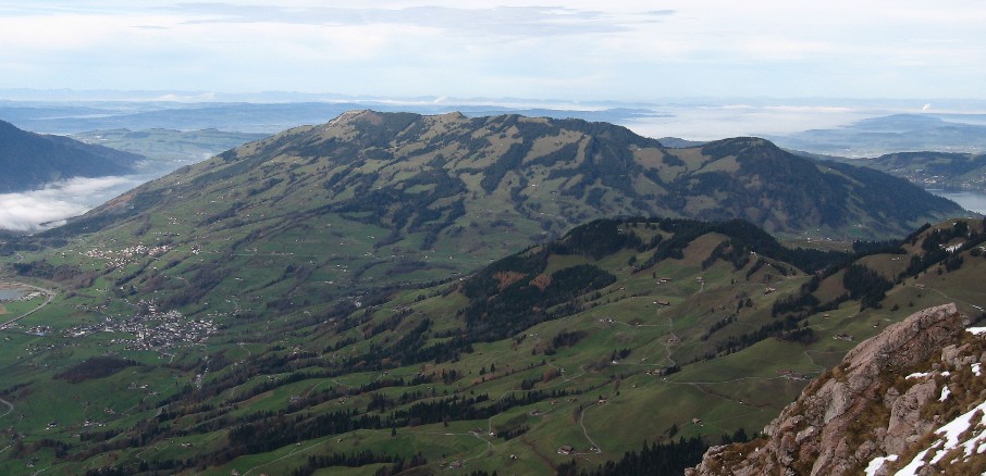
Rossberg
Unterägeri
Rossberg is a mountain massif in the Schwyzer Alps that rises above Unterägeri and Lake Ägeri in central Switzerland. It runs along the border between the cantons of Zug and Schwyz, and its high point, the Wildspitz, stands at 1,580 m (Zug Tourism lists 1,579 m). That makes it the highest summit in the canton of Zug and one of the region's best viewpoints. What will you see on the Rossberg? From the Wildspitz you look down on three lakes at once: Zug, Lauerz and Ägeri. On the Schwyz side the valley with Lake Lauerz opens up, while the Zug side gives you the lakeland around Lake Zug and Ägerisee. Many walkers time the climb for sunset. A mountain inn near the top offers a place to rest after the ascent. The Rossberg is one of the three legendary mountains of canton Schwyz, together with the Rigi and the Mythen. The Schwyzer Höhenweg links them, so the ridge often forms one stage of a longer trek. How do you get up from Unterägeri? A marked trail leads from Unterägeri to the Wildspitz. The popular Zugerberg – Wildspitz – Unterägeri circuit covers 20.6 km with about 860 m of climbing and takes roughly 6 hours 20 minutes. Plan it as a full-day outing with good fitness. Other approaches start in Zug, Oberwil, Walchwil, Sattel and Steinerberg. Roads end at Steinerberg, and PostBus serves Steinerberg and Sattel. One classic route begins at Sattel-Ägeri station, climbs the southeast flank via Halsegg to the ridge, passes the Wildspitz and drops to the Gnipen. That descent includes a steep stretch secured with chains and steps, so sure footing and sturdy boots matter. What happened here in 1806? The mountain is tied to one of Switzerland's worst natural disasters. On 2 September 1806 a mass of conglomerate rock (nagelfluh) broke away near the Gnipen. The federal inventory puts the volume at about 36 million cubic metres. The slide buried almost all of the village of Goldau and killed 457 people. Sensors have monitored the slope since 1990, and hikers can make a detour toward the detachment zone. When should you go? Pick the snow-free months, usually late spring through early autumn. Choose a clear day, since the views are the main reward. Leave enough daylight for the descent, especially if you want to catch the sunset from the summit. FAQ How high is the Rossberg? Its high point, the Wildspitz, is 1,580 m above sea level according to Wikipedia and 1,579 m according to Zug Tourism. It is the highest peak in canton Zug. How long is the hike from Unterägeri? The Zugerberg – Wildspitz – Unterägeri circuit takes about 6 hours 20 minutes, covering 20.6 km and 860 m of ascent. Can you drive to the summit? No. The road ends at Steinerberg and the rest is on foot. PostBus runs to Steinerberg and Sattel. Which lakes can you see? Lakes Zug, Lauerz and Ägeri are all visible from the top, and the Schwyz valley opens up in clear weather.
-
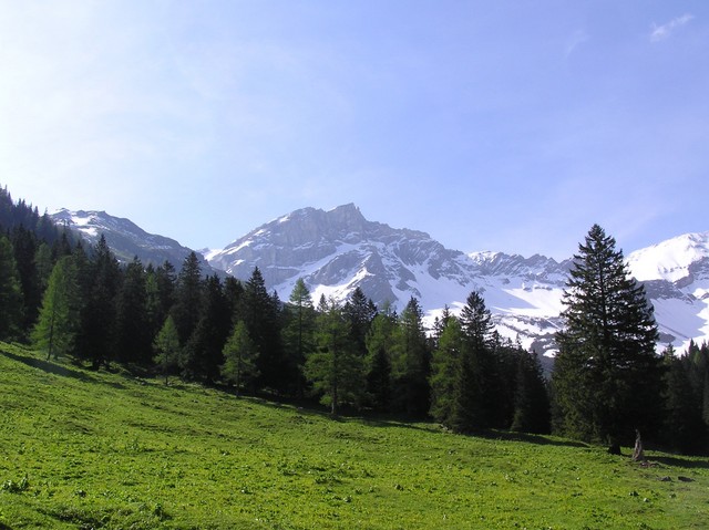
Naafkopf
Naafkopf is a 2,570 m summit in the Rätikon range of the Alps, where the borders of Switzerland, Liechtenstein and Austria meet. The top marks a three-country tripoint, and the peak ranks as the third highest point in Liechtenstein. What makes Naafkopf special? A large wooden cross stands on the summit, set into a brick base with arms reaching in three directions, one for each country. You can step from one state to another within a few paces. The borders follow the ridges: the north-east ridge separates Austria from Liechtenstein, the south-east ridge Austria from Switzerland. Neighbouring peaks include Grauspitz, Augstenberg and Tschingel, and the views take in the whole Rätikon chain and the valleys on both sides of the frontier. How do you get to the top? The standard route begins at the Pfälzerhütte, a mountain hut on the Bettlerjoch pass at about 2,108 m, right on the Liechtenstein-Austria border. The climb is roughly 460 m of ascent and takes around two hours. The path is clear but crosses rocky stretches and zigzags over scree below the summit. Sturdy hiking boots and a steady step are needed; guides rate it anywhere from T2 to T3. Other starting points: Malbun (Liechtenstein) – via Sareis and the Fürstin-Gina-Weg, about 3.5 hours to the summit, Nenzinger Himmel on the Austrian side, Steg – a longer approach through the Valüna valley, Augstenberg – along the ridge from Malbun as part of a three-country traverse. A popular loop runs Malbun – Augstenberg – Pfälzerhütte – Naafkopf – Malbun, around 10 km with about 1,300 m of climbing, and needs a full day (about 8 hours on foot). When should you go? The best season runs from late June to late September, once snow has cleared from the trail. The Pfälzerhütte is open from mid-June to mid-October, so you can sleep at the hut and split the trip over two days. Check the forecast and trail conditions before setting out, because weather in the upper section changes quickly. Frequently asked questions Is Naafkopf the highest mountain in Liechtenstein? No. At 2,570 m it is the country's third highest point, behind Grauspitz, the highest. Do I need a passport to reach the summit? The route crosses three countries, but there are no border controls here. Carry photo ID anyway. How long is the climb from the hut? About two hours up; the descent is a little quicker. Where should I start to keep the approach short? Staying at the Pfälzerhütte and climbing from there is the shortest option. From Malbun, allow about 3.5 hours to the summit.
-
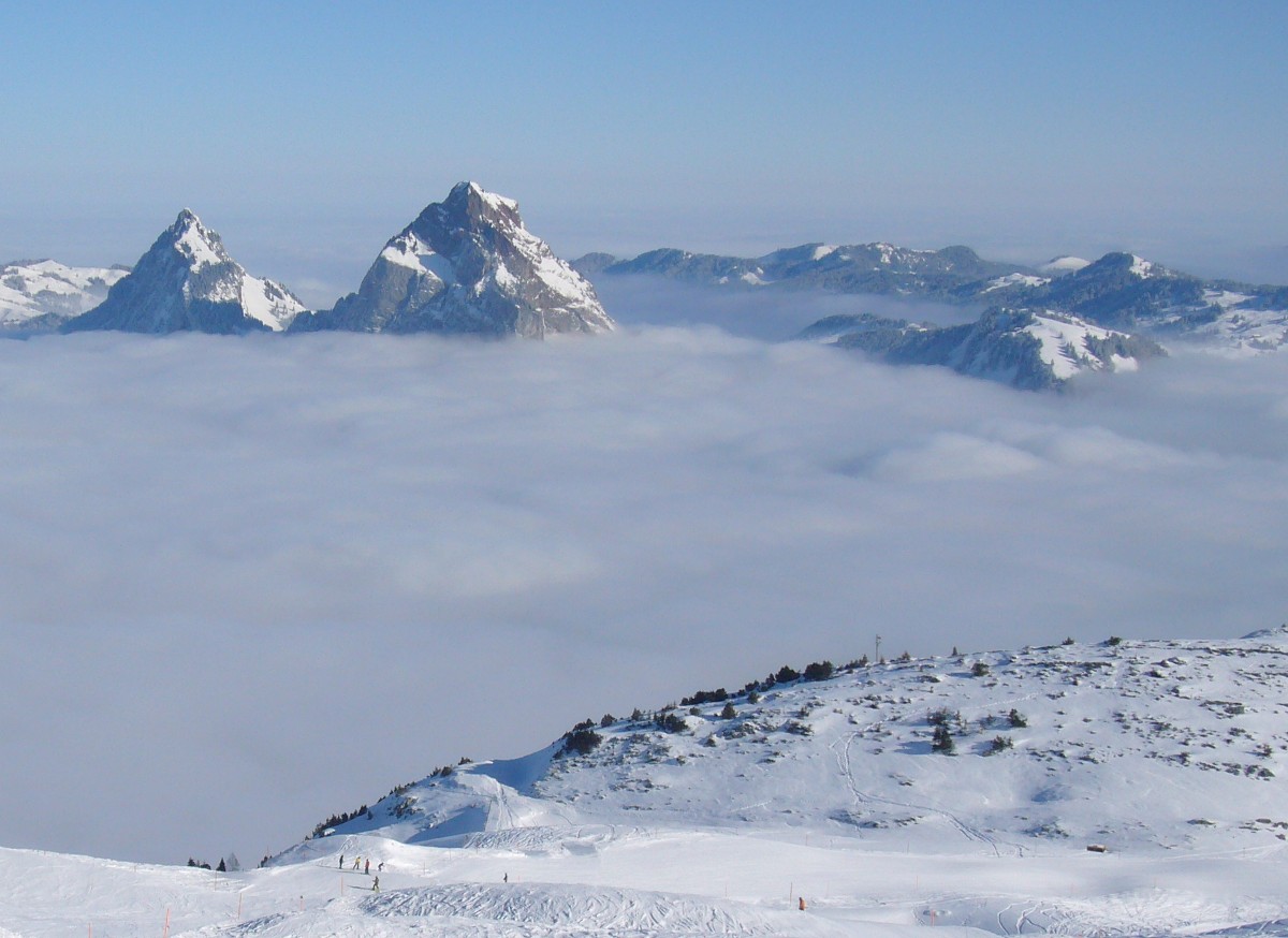
Furggelenstock
Alpthal
Furggelenstock is a 1,656 m summit in the Swiss Prealps, just west of Oberiberg in the canton of Schwyz. It rises on the ridge that rings the Alpthal valley and counts among the more approachable viewpoints of central Switzerland. What can you see from Furggelenstock? The top opens onto the Ybrig area and the direction of Einsiedeln. On a clear day the Schwyz and Uri Alps spread out beyond, with Tödi, Clariden and the peaks of the Muotathal in view. A panorama board at the summit helps you name what you are looking at. Grosser Mythen dominates the walk from start to finish, and directly beneath its rock you have to tilt your head right back to find the top. Just past the summit lies the Furggelen alp, where a mountain inn has a sunny terrace facing the Mythen massif and the peak you have just climbed. How do you climb Furggelenstock? A marked T2 trail leads to the summit, meaning an ordinary mountain path without technical difficulty. The usual options: From Holzegg: take the Brunni cable car, then walk from the Holzegg saddle (1,408 m). The summit is about 1 hour 25 minutes away, and the full Holzegg – Zwäcken – Furggelenstock – Brunni walk takes roughly 2.5 hours. From Brunni via Stäglerenegg, Müsliegg, Zwäcken and Halbegg: 7.4 km with about 339 m of ascent and 652 m of descent. Loop from Oberiberg: around 11.7 km and 4 hours via Ibergeregg and Zwäcken, returning past the Furggelen alp. Rotenflue – Furggelenstock circuit: finishes with a steeper climb to the top and a 360-degree view. The peak is also one of nine summits on the multi-day Schwyzer Höhenweg. When should you go? Summer and early autumn give the easiest conditions. In winter, snowshoe routes are marked in the area, for example from Holzegg via Zwäcken and Furggelen to Brunni. The Furggelen alp also runs sunrise outings from the Ibergeregg pass: they start at 4:45 a.m. and include breakfast at the alp (CHF 95 per person, advance registration required). What else is worth knowing? The route crosses the Ibergeregg moor forests, named Landscape of the Year 2019 by the Swiss Landscape Foundation. Sources give the height as 1,656 m, while one hiking brochure lists 1,655 m. Frequently asked questions Is Furggelenstock a difficult hike? No. The trail is rated T2, so sturdy hiking shoes and basic fitness are enough. How long does the ascent take? About 1 hour 25 minutes from Holzegg, or around 4 hours for the loop from Oberiberg. Where should you start? The easiest starting point is the Holzegg saddle, reached by the Brunni cable car, or the Ibergeregg pass near Oberiberg. Can you go in winter? Yes, on snowshoes along the marked routes from Holzegg to Brunni.
-
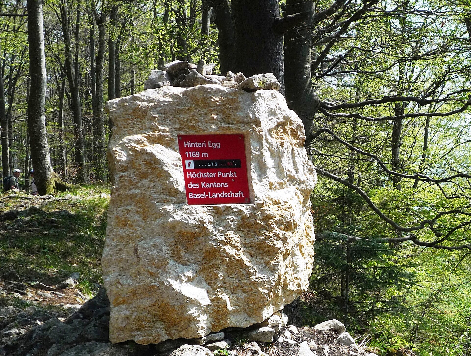
Hinteri Egg
Waldenburg
Hinteri Egg is the highest point of the Swiss canton of Basel-Landschaft, a forested summit in the Jura within the municipality of Waldenburg, close to the Solothurn border. It rises to roughly 1,168-1,169 m above sea level, depending on the source, between the Waldenburg valley and the Reigoldswil valley. Swisstopo has spelled the name "Hinderi Egg" since 2012, but signs and guidebooks still often use "Hinteri Egg". Where is Hinteri Egg? The summit sits on a Jura ridge south of Reigoldswil. Waldenburg and Reigoldswil share the area, and the whole summit zone lies inside the Wasserfallen nature reserve. A short distance to the south, the border between Basel-Landschaft and Solothurn crosses the fore-summit Chellenchöpfli (1,157 m). The dominant neighbour is Vogelberg, under two kilometres away, reached along the ridge path toward the Passwang pass. How do you get to the top? Reigoldswil is the easiest starting point. The Wasserfallen cable car carries hikers up to its top station in a few minutes, so most of the climb is skipped. From there, marked trails follow the Hinderi Egg-Passwang ridge, which has a dense network of footpaths. About 700 m southwest of the summit lies a pass toward Passwang, just south of the Hintere Wasserfallen mountain inn. A saddle at about 988 m leads toward Bilsteinberg (1,126 m), west of the Hof Kellenberg farm. What will you see? The summit itself is wooded, so it offers no real viewpoint. What you get is a sign reading "Highest point of the canton of Basel-Landschaft", unveiled in 2008; an older summit marker nearby still shows an outdated height. For the scenery, walk on to Chellenchöpfli, which looks out over the Guldental and, in clear weather, toward the Alps. The summit stands 165 m above the Hintere Wasserfallen saddle, which makes it a gentle goal for a day hike rather than a demanding ascent. When should you go? The area is walkable for much of the year. Summer and early autumn suit a longer ridge walk toward Passwang and down to Ramiswil, with a stop at Chellenchöpfli for the views. In winter the paths can hold snow, so proper footwear matters. Mornings tend to be quieter, and since the stretch from the cable car to the summit is short, it pays to combine the top with a longer route. Frequently asked questions How high is Hinteri Egg? About 1,168-1,169 m above sea level; sources differ by a metre. It is the highest point of Basel-Landschaft. Is there a view from the summit? No, the top is forested. Chellenchöpfli (1,157 m) next door has the wide outlook over the Guldental and toward the Alps. What is the easiest way up? Take the Wasserfallen cable car from Reigoldswil to its top station, then follow the ridge trails. Why are there two spellings? "Hinteri Egg" was used until 2011; Swisstopo has written "Hinderi Egg" since 2012.
-
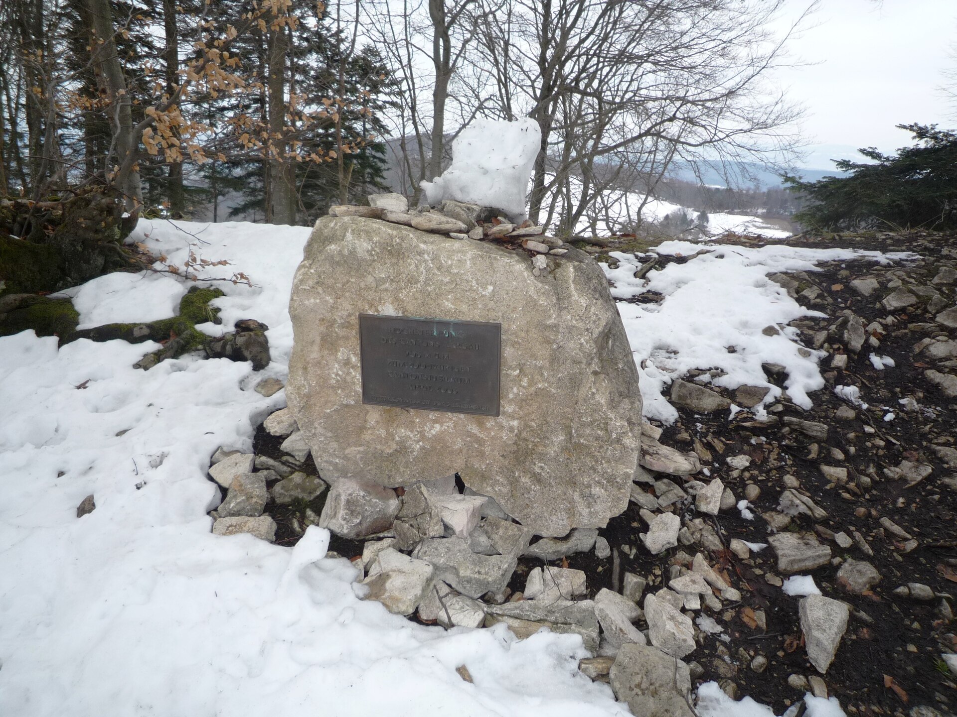
Geissflue
Oltingen
Geissflue is a hill in the eastern Swiss Jura, reached from the village of Oltingen in the canton of Basel-Landschaft. Its summit sits on the line between Basel-Landschaft and Solothurn, and the Aargau border runs just to the east along the Geissfluegrat ridge. It suits walkers who want a quiet Jura ridge outing with no technical difficulty. Where is Geissflue and how high is it? The hill rises in the Jura chain at the meeting point of three cantons: Basel-Landschaft, Solothurn and Aargau. Its coordinates are roughly 47.42° N, 7.96° E. Sources give 962 to 963 metres above sea level, and 963 m is the most likely figure. It is described as the easternmost Jura summit to top 900 metres. How do you get up Geissflue? Good starting points are Oltingen and the Benkerjoch pass. The path to the top is graded T1, an ordinary hiking trail that most walkers can manage in sturdy shoes. Geissflue is one of the 27 summits on the Jura Crest Trail. Two sample routes: Loop from Benkerjoch: over the Salhöhe to Geissflue, then via Schafmatt down to Oltingen. About 15 km with roughly 540 m of ascent and 770 m of descent. Benkerjoch to the summit takes around 2 hours 10 minutes. Short loop from Schafmatt: about 6 km, just under 2 hours and about 200 m of climbing, starting at the Schafmatt Mountain Lodge. What else is worth knowing about the area? A stage of the long-distance trail between Hauenstein and Staffelegg runs through this area and crosses several passes, including the Salhöhe, so Geissflue is easy to fold into a longer ridge walk. The Geissfluegrat ridge lies northeast of the summit and already belongs to Aargau, which means walking along it takes you across a cantonal boundary. When should you go? The trails here are best from late spring to autumn, when paths are dry and days are long. Plan a full day for the Benkerjoch loop and carry your own water, since you can't count on a refreshment stop along the ridge. Frequently asked questions How high is Geissflue? Around 962 to 963 m above sea level, with 963 m the figure most often quoted. Is the hike difficult? No. The trail is rated T1, an easy walking path without exposed sections. How long does the walk take? The short Schafmatt loop is just under 2 hours. From Benkerjoch to the summit is about 2 hours 10 minutes, and the full loop via Schafmatt to Oltingen covers about 15 km. Which canton is the summit in? On the border of Basel-Landschaft and Solothurn. Aargau begins just east, beyond the Geissfluegrat ridge.
-
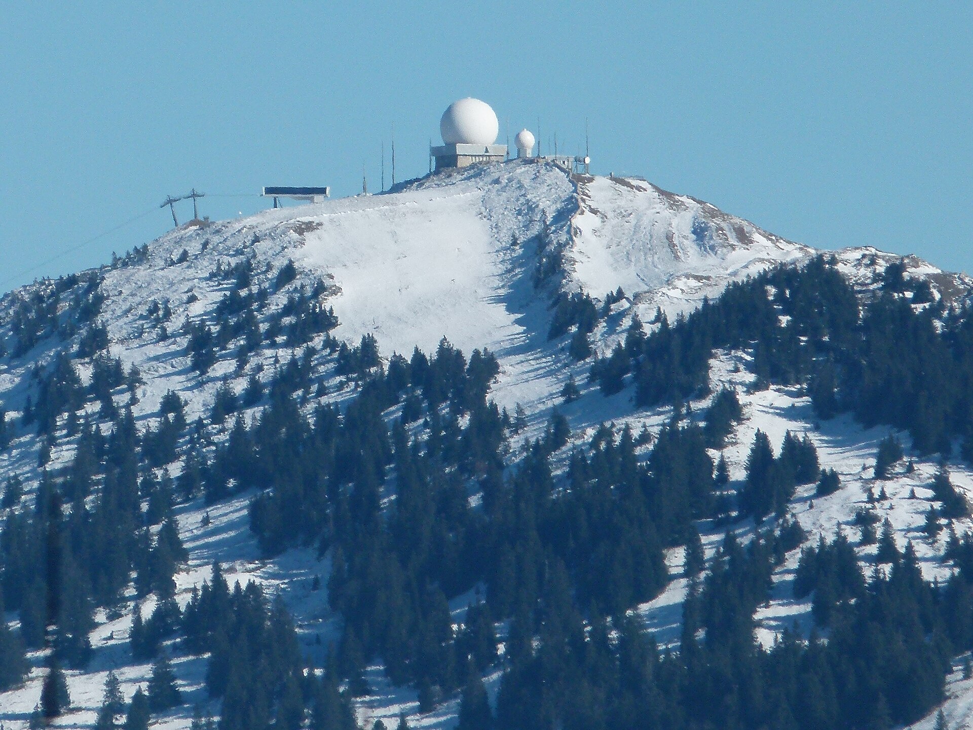
La Dôle
Gingins
La Dôle is a 1,677 m summit in the Swiss Jura, rising above Lake Geneva in the far west of the canton of Vaud, near Gingins. The mountain is shared between the municipalities of Gingins, Chéserex and La Rippe, and it is the second-highest peak on the Swiss side of the Jura after Mont Tendre. The French border lies less than 2.5 km away. What makes La Dôle stand out? The peak anchors the southern end of the Jura range and drops toward Lake Geneva. A radar and weather station crowns the top, and its buildings are visible from far below. Because the ridge stands clear of the surrounding terrain, it ranks among the best lookouts in the region. What can you see from the top? On a clear day the view takes in the lake, the Alps and the Mont Blanc massif on the horizon. Looking the other way you see more Jura ridges rolling off. Mornings and the days after a front passes usually give the sharpest air. Bring a windproof layer, since the ridge is noticeably cooler than the lakeshore. How do you get to La Dôle? The shortest approach starts in Gingins. A paved road climbs from there to the Chalet de la Dôle just below the summit, and you finish the last stretch on foot. The alternative is to start from Saint-Cergue or the Col de la Givrine to the north. Both sit above 1,000 m, so the climb is shorter than from the lake. Saint-Cergue is linked to Nyon, on Lake Geneva, by road and by the Nyon–St-Cergue–Morez railway, which makes a car-free trip possible. When should you go? Summer and early autumn suit a hike with views. In winter the Saint-Cergue and Givrine area draws people looking for snow in the Jura, while the summit itself is exposed to wind and fog and should be treated as mountain terrain. Check the forecast first, because cloud can block the Alpine view entirely. What else fits into the trip? Nyon on Lake Geneva, the starting point for the railway to Saint-Cergue. The Col de la Givrine and Saint-Cergue area, good for ridge walks in the Jura. Neighbouring Jura summits, including Mont Tendre, the highest in the Swiss part of the range. Frequently asked questions How high is La Dôle? The summit reaches 1,677 m above sea level, making it the second-highest point of the Swiss Jura after Mont Tendre. Can you drive up La Dôle? You can drive from Gingins on a paved road to the Chalet de la Dôle below the top. The final section is on foot. Can you reach it without a car? Yes. The Nyon–St-Cergue–Morez railway runs from Nyon to Saint-Cergue, where a walk toward the summit begins. What is visible from the summit? Lake Geneva, the Alps with Mont Blanc and further Jura ridges, weather permitting.
-
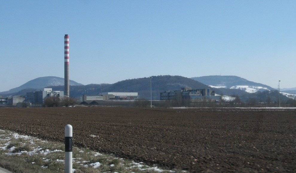
Schinberg
Ittenthal
Schinberg is a hill of roughly 722 m above sea level in the Aargau Jura, near Ittenthal in Switzerland's Fricktal region (canton of Aargau). It belongs to the Tabular Jura within the Jurapark Aargau and works well as an easy half-day objective for hikers and cyclists. Where is Schinberg? The summit sits in northern Switzerland, in the Fricktal valley area between Ittenthal, Kaisten and Hornussen, at about 47.52° N, 8.07° E. Sources give its height as either 722 or 723 m; both refer to the same top and differ only by map and measurement. This is no alpine peak but a gentle, forested rise with open outlooks over the neighbouring Jura ridges. What can you see up there? Several viewpoints dot the hill. Komoot lists "View from Schinberg" in the municipality of Kaisten with a 4.8 rating from 85 reviews, and walkers describe a local mountain with a network of trails and spots to rest. A rest area is marked on top. For a wider panorama over the Jura and the Alps, the Cheisacher lookout tower lies on the same stretch of the Fricktaler Höhenweg. How do you get to Schinberg? From Ittenthal: the route over Schinberg covers about 6.5 km and takes around 2 hours 40 minutes, the simplest option for families. From Hornussen: the trail passes Wettacherhof, Schinberg (723 m), Sulzerberg and the Heubergweiher on the way to Laufenburg. Expect about 13.2 km, 3 hours 40 minutes and 450 m of climbing at medium difficulty. Fricktaler Höhenweg: Schinberg (722 m) is a waypoint on this long-distance trail between Solbacher and Wettacker, on the Mettau to Frick leg. Sulz loop: the "Around Sulz – Jurapark Aargau" route is about 23.6 km with 650 m of ascent and is rated hard; it includes a summit viewpoint. Cyclists can follow a Komoot loop of roughly 22 km from Frick that takes in the Schinberg view. When should you go? Trails are usable most of the year. Clear days in late spring, summer and autumn give the best visibility. In winter, check path conditions first. A swisstopo map (sheet 224T Olten) or a route app is useful for navigation. Frequently asked questions How high is Schinberg? About 722–723 m above sea level, depending on the source. Is the climb difficult? No. From Ittenthal it is a short outing of around 2.5 hours, and the longer routes from Hornussen are rated medium. Can I combine it with a longer hike? Yes. The hill lies on the Fricktaler Höhenweg, and from Hornussen you can continue all the way to Laufenburg. Are there viewpoints? Yes. Komoot describes several lookouts in the Kaisten municipality, and the Cheisacher tower stands nearby.
-
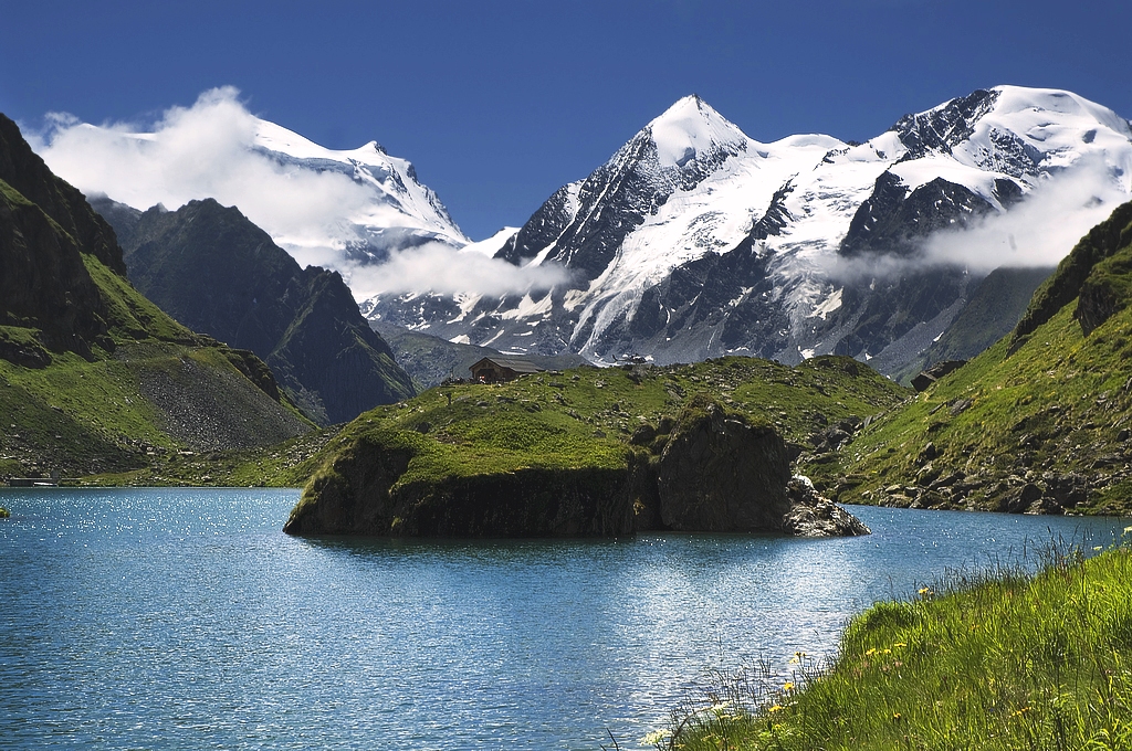
Petit Combin
Val de Bagnes
Petit Combin is a glaciated summit of 3,663 m in the municipality of Val de Bagnes, canton of Valais, Switzerland. It forms part of the Grand Combin massif in the Pennine Alps, standing between the Entremont and Bagnes valleys not far from the Italian border. It stays below 4,000 m, but reaching the top still calls for proper glacier skills and equipment. Where is Petit Combin? The mountain is one of several peaks in the Combins group, whose big glaciers feed the Bagnes valley. The Glacier de Corbassière lies beneath the summit, with more ice fields spreading to the south and west. Its neighbours are the taller Grand Combin and Combin de Corbassière: three separate summits that are easy to confuse. The coordinates are roughly 45.99° N, 7.27° E. How do you climb Petit Combin? This is a glacier tour at alpine level, and there are two main starting points. Cabane FXB Panossière (Bagnes side). The hut is about 3.5 to 4 hours on foot from the car park at Fionnay. From there the route passes the Corbassière glacier to the Col de Corbassière (3,563 m), then crosses the Glacier des Follâts to the summit plateau. The Swiss Alpine Club lists 4 to 5 hours and about 1,086 m of ascent from the hut, and notes the route is used mostly for descents. Cabane Marcel Brunet (north, Entremont side). This is the more usual approach for a summit attempt. The Panossière route is graded PD+. Crevasses are a real hazard, so take crampons, an ice axe, harness, rope and helmet. If you have no roped glacier experience, hire a guide in Verbier or Fionnay. What is the view like? From the top you look over the ice fields of the Grand Combin massif, the Bagnes and Entremont valleys, and the main Pennine ridges towards Italy. The summit is a broad, snow-covered plateau. When should you go? The high-mountain season runs from late June to September, when the huts are staffed and glacier snow is at its most reliable. Start very early so you are back down before the snow softens, and check glacier conditions and the forecast before you set out. Frequently asked questions How high is Petit Combin? The usual figure is 3,663 m. Some maps and mountain sites give 3,668 or 3,670 m, so a few metres of difference between sources is normal. Is Petit Combin difficult? It is a PD+ glacier route: little technical rock climbing, but crevasses and exposure to weather. It is not a hike for beginners. Where can I stay? In Cabane FXB Panossière (Bagnes side) or Cabane Marcel Brunet (Entremont side). Book ahead in season. Is it the same as Grand Combin? No. Petit Combin is a separate, lower peak in the same massif. The Grand Combin tops 4,000 m and its routes are considerably harder.
-
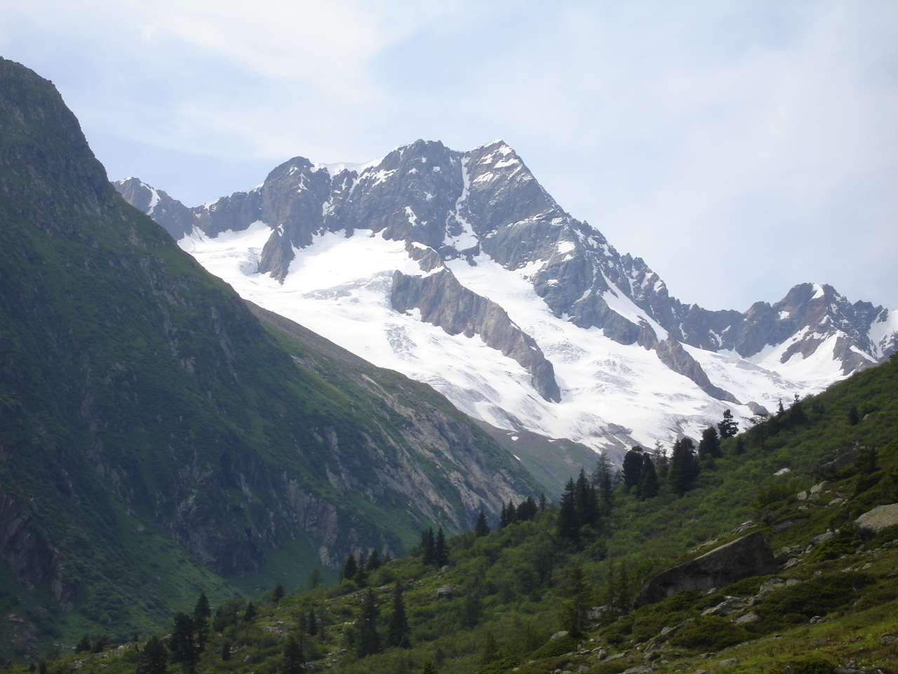
Sustenhorn
Göschenen
Sustenhorn rises to roughly 3,503 m in the Uri Alps, on the border of the cantons of Uri and Bern, above Göschenen and the Susten Pass road. It is a popular first high-alpine objective: the standard route is a short glacier tour that many guides consider suitable for beginners with proper equipment. Where is the Sustenhorn? The massif overlooks the Susten Pass, which links the Uri valleys with the Bernese Oberland, and sits above it to the south. Sources quote its height as 3,502 or 3,503 m, so you will see both figures. How do you climb it? The normal route starts at the Tierberglihütte (2,797 m). The walk to the hut takes about 2 hours from the Umpol parking area, or 2.5 to 3 hours from Steingletscher. The Tierbergli via ferrata is an alternative way up. From the hut, head southeast toward the Sustenlimi pass (3,089 m), crossing a steeper glacier step of around 200 m. Then curve northeast, join the ridge near point 3288 and follow it to the top. The Swiss Alpine Club rates the difficulty as moderate and the track is usually well trodden. Allow 3 to 3.5 hours up with about 730 m of ascent, and 1.5 to 2 hours down. The summit is also reachable from the Voralphütte and Chelenalphütte. What skills and gear do you need? Crampons, ice axe, rope and harness are required. In some summers crevasses are a real problem, so crevasse-rescue skills are essential. Beginners should hire a mountain guide. An early start avoids soft snow later in the day. When should you go? The season runs from June or July to September. In spring the normal route is also a ski-touring objective. A little history The first recorded ascent took place in 1841, by Gottlieb Studer with Johann and Heinrich von Weissenfluh. Frequently asked questions Is the Sustenhorn difficult? The SAC calls it moderate, but it is still a glacier tour that demands equipment and roped travel experience. Where do I start? At Steingletscher or the Umpol parking area on the Susten Pass road, then walk to the Tierberglihütte. How long does the climb take? About 8.5 hours in total for the day tour: roughly 2 hours to the hut, 2.5 to 3.5 hours to the summit, then the descent. Do I need to stay at the hut? No, but a night at the Tierberglihütte makes an early start easier and is recommended.
-
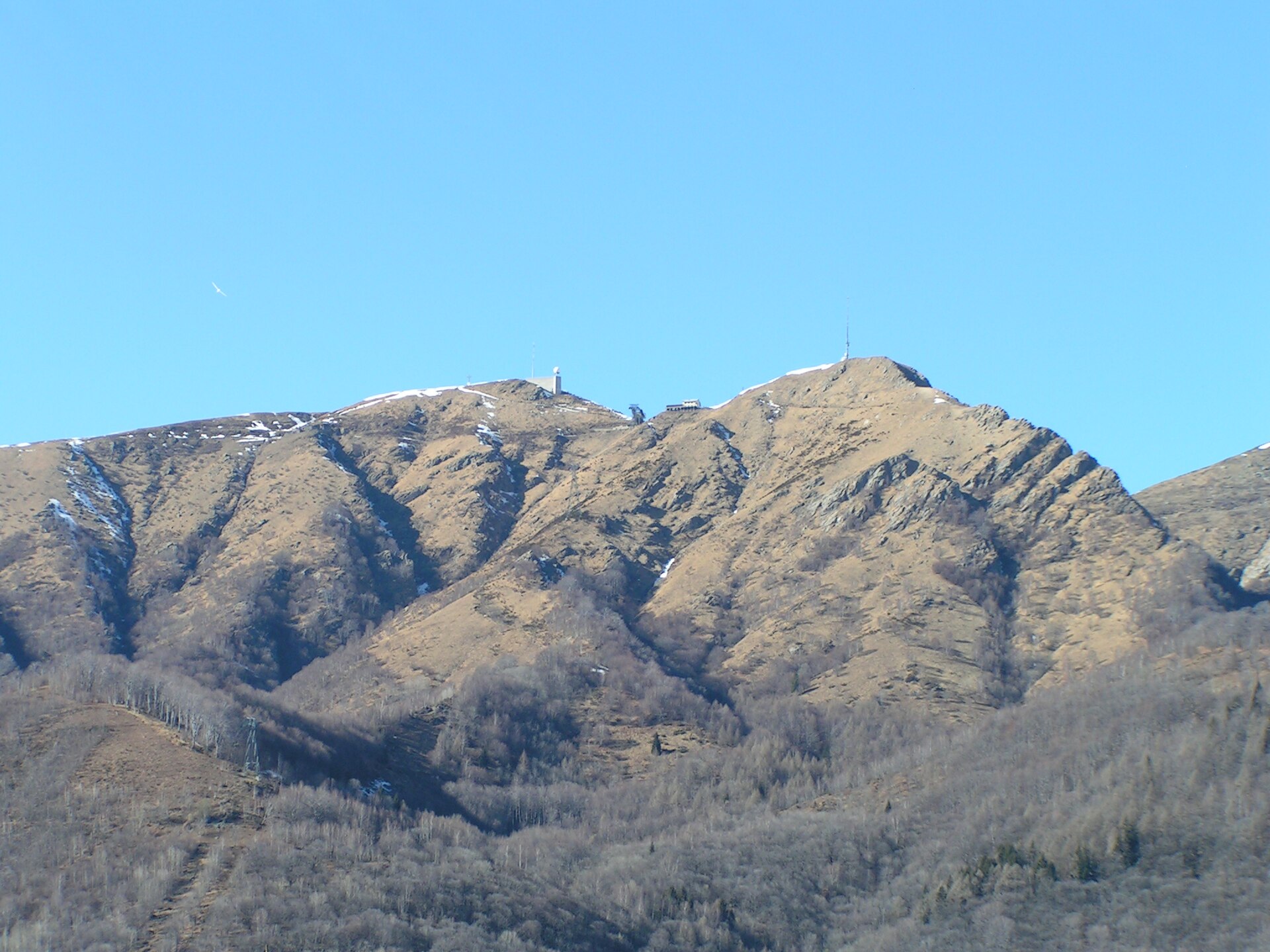
Monte Lema
Lema
Monte Lema is a 1,624 m peak above the village of Lema in Switzerland's Ticino canton, right on the Italian border. Part of the Lugano Prealps in the Malcantone region, it rises between Lake Lugano and Lake Maggiore. It is among the easiest panoramic summits to reach in southern Switzerland, because a cable car carries you up from the village of Miglieglia. How do you get up Monte Lema? The valley station is in Miglieglia. Cabins leave every half hour, cover roughly 2.5 km and 849 m of elevation, and the ride lasts about ten minutes. The cable car is wheelchair accessible. From Lugano, take a train to Lamone-Cadempino and then a bus to Miglieglia; a PostAuto bus service also runs there. The season lasts roughly April to October, so check timetables and maintenance closures before you go. What can you see from the top? On a clear day, looking west past Lake Maggiore, you can pick out the Bernese and Pennine Alps, including Mont Blanc, Monte Rosa and the Matterhorn. To the south the view crosses Lake Lugano toward Milan and the Apennines. Closer in lie the wooded hills of Malcantone, with chestnut forests and small villages, and the city of Lugano below. The summit has a restaurant with a large panoramic terrace serving local dishes. An observatory with a weather and radar station also stands here, measuring rainfall on the southern side of the Alps. Which hikes start at Monte Lema? Miglieglia to the summit on foot: about 2.5 hours uphill. Lema–Tamaro traverse: a five-hour walk along the border ridge to Alpe Foppa, on the way to Monte Tamaro. Lema–Indemini: a ridge route that Ticino's tourist board counts among the region's finest hikes. Descent to Rivera: a train there takes you back to Lugano. Tra Cielo e Terra: an easier themed trail suited to families. When should you go? Pick a clear day, ideally in the morning, when the air is sharp and the distant Alpine peaks stand out. It can be hot in the valley in summer but noticeably cooler at the top, so bring an extra layer. Frequently asked questions How long is the cable car ride to Monte Lema? About ten minutes from Miglieglia, climbing 849 m. Can you walk up Monte Lema? Yes. The hike from Miglieglia takes around two and a half hours. Is there food at the summit? Yes, a restaurant with a panoramic terrace and local cuisine. Is Monte Lema the same as Monte Tamaro? No. They are neighbouring peaks joined by the border ridge, with a five-hour traverse between them. Is Monte Lema in Switzerland or Italy? The summit sits on the border; the cable car starts on the Swiss side, in Ticino.
-
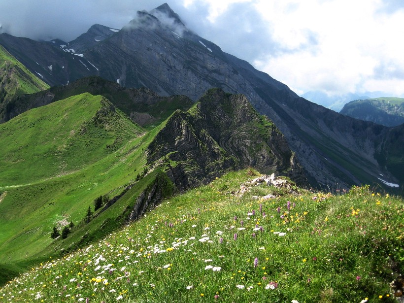
Schwalmis
Emmetten
Schwalmis is a 2,246 m peak in the Urner Alps, rising above Emmetten and Lake Lucerne in Central Switzerland. The summit sits on the boundary between the cantons of Nidwalden and Uri, and the mountain is shared by the communes of Emmetten and Beckenried (Nidwalden) and Isenthal (Uri). What is Schwalmis like? The two faces of the mountain could hardly differ more. On the Nidwalden side it falls away steeply in rock slabs and scree, and tiered cliffs make the summit look all but unreachable from the north. The Uri side is the opposite, with steep grassy slopes. Climbers know the lowest band of the wall, called Geissplatte, which holds a few routes. There is no marked via ferrata on the mountain. How do you reach the summit? The Swiss Alpine Club (SAC) route portal says hikers find the ascent from the south fairly easy. The route it lists starts at Gitschenen, crosses Vorder Jochli to the top, then drops towards Musenalp. Allow about 2 h 15 min up with 910 m of climbing, and roughly 2 h and 700 m of descent. The final stretch is a steep grassy face, so you need a steady step and clear weather. This is a mountain trail, not a stroll. What can you see around the base? Below the peak lies Niederrickenbach, a pilgrimage village. An easy trail leads there from Klewenalp via Staffel and Bärfallen: about 7 km, around 2 hours, with just 150 m of ascent and 580 m of descent. It skirts the foot of the massif rather than climbing it. The last stage of the Nidwaldner Höhenweg also passes the Schwalmis flanks. It runs from the Brisenhaus hut (1,753 m) towards the Niederbauen cable car station, about 12 km and 4 hours, past the slopes of Schwalmis and Oberbauen. The season is May to October. From Klewenalp to Stockhütte takes around 1.5 hours, and from there you can ride the gondola down or walk to Emmetten in about an hour. When should you go? Mountain trails here are used from June to October. Early summer suits the Uri-side slopes, which are covered in wildflowers then. Check local conditions before setting out, especially after rain, when grassy slopes get slippery. Frequently asked questions How high is Schwalmis? The summit is 2,246 m above sea level. Which canton is Schwalmis in? On the border of Nidwalden and Uri. The communes of Emmetten, Beckenried and Isenthal share it. Is there a via ferrata on Schwalmis? No. The southern route is a mountain trail, and climbing is concentrated on the lower Geissplatte band. How long is the climb from Gitschenen? About 2 h 15 min with 910 m of ascent. The descent towards Musenalp takes about 2 hours. Where can you admire the massif without climbing it? From the gentle Klewenalp to Niederrickenbach trail, or from the Nidwaldner Höhenweg stage below the Brisenhaus.
-
Sieben Hengste
Horrenbach-Buchen
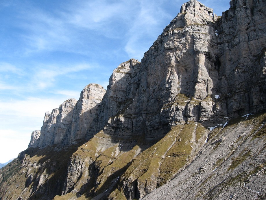
Sieben Hengste is a mountain massif in the Emmental Alps of the canton of Bern, Switzerland, near Horrenbach-Buchen and Lake Thun. It sits north of Habkern, and its highest summit is called Chibe. The name means "seven stallions", a nod to the jagged ridge with its several tops. Beneath the surface lies one of the largest cave systems on Earth. What makes Sieben Hengste special? The limestone here is heavily karstified, which is why the Sieben Hengste–Hohgant cave system runs underneath. It is the second-longest cave in Switzerland, behind the Hölloch in Muotathal, and ranks among the ten biggest worldwide. Independent visitors cannot enter; it is the domain of experienced caving teams. Hikers can still spot the Häliloch beside the trail near Oberburgfeld, a shaft about 100 metres deep that belongs to the same network and is closed to the public. The geology is easy to read in the landscape: dark molasse forms the lower part of the ridge, with pale limestone above. The Sichle saddle was shaped by a side arm of the Aare glacier, which widened it into a trough during the Ice Age. How do you explore it on foot? The classic route runs from Merligen on Lake Thun through the quiet Justistal and over the Sichle pass (1,679 m) to Innereriz, or the other way round. Listings put it at roughly 15 km and 5 to 6 hours of walking, so bring stamina and sturdy boots. A tougher option leads from the Niederhorn down to Beatenberg Schmocken, about 10.5 km in around 3.5 hours. When should you go? The trails are hiking routes, so aim for the snow-free months of summer and early autumn. Check the forecast before setting off; this is high-mountain terrain where the weather can turn quickly. Frequently asked questions Where is Sieben Hengste? In the Emmental Alps in the canton of Bern, north of Habkern and close to Lake Thun and the Justistal valley. Can you visit the caves? Not as an ordinary tourist. The Sieben Hengste–Hohgant system is meant for cavers, and the Häliloch by the trail is not open to visitors. How high is the Sichle pass? It lies at 1,679 m above sea level and is the high point of the popular Justistal route. How long does the Merligen to Innereriz hike take? About 5 to 6 hours depending on pace, over roughly 15 km.
-
Stockhorn
Stocken-Höfen
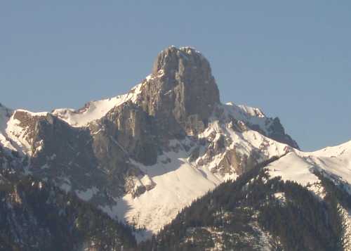
Stockhorn (2,190 m) is a peak of the Bernese Alps above Stocken-Höfen, rising between the Simmental valley and Lake Thun in the Swiss canton of Bern. It stands north of Erlenbach im Simmental and counts among the easiest mountain viewpoints in the region, because a cable car carries you almost to the top. What is the Stockhorn? The mountain belongs to the western Alps and dominates the Bernese Oberland landscape at 2,190 metres. Its first known ascent is credited to Benedikt Marti of Bern, known as Aretius, who studied plants here in 1558 and compiled a list of the species he identified. Hikers can also approach the summit from the Martischipfa and Stockhorn-Biwak huts. How do you get to the top? Board the Stockhornbahn in Erlenbach im Simmental. The ride has two stages. Modern panoramic cabins take you to the Chrindi mid-station, and the classic red gondolas continue to the summit, passing over the Hinterstockensee lake. The whole trip takes about 20 minutes. Erlenbach is reachable by train or car from Thun and the surrounding area. What can you see from the summit? The viewing terrace overlooks more than 200 peaks. On a clear day your eye travels over the town of Thun, Lake Thun and the Mittelland plateau to the Jura range. Bring sunglasses and a warm layer: it is windy and noticeably colder up here than in the valley. Where can you walk? From Chrindi, the Hinterstockensee is a walk of just a few minutes. The mirror-calm Oberstockensee takes about 40 minutes on foot. You can also follow a loop around Hinterstocken from the mid-station. The "No Limits" circular trail is closed in winter, so check conditions before setting out. When should you go? The cable car runs in the summer season; for 2026 the listed operating period was 11 April to 22 November. Timetables can change, so confirm on the operator's website before you travel. Visibility is best on cloudless days, ideally in the morning before clouds build over the mountains. Outside the main season, expect occasional maintenance closures. Frequently asked questions How high is the Stockhorn? The summit is 2,190 metres above sea level. How long is the cable car ride? About 20 minutes from Erlenbach im Simmental, with a change at Chrindi. Can I reach the lakes without a hard climb? Yes. Hinterstockensee is about 5 minutes from Chrindi station, and Oberstockensee is a walk of roughly 40 minutes. Is this the same Stockhorn as the one above Zermatt? No. This peak is in the canton of Bern, above Erlenbach and Thun. The mountain of the same name in Valais, above Zermatt, is a different place.
-
Wildhorn
Lauenen
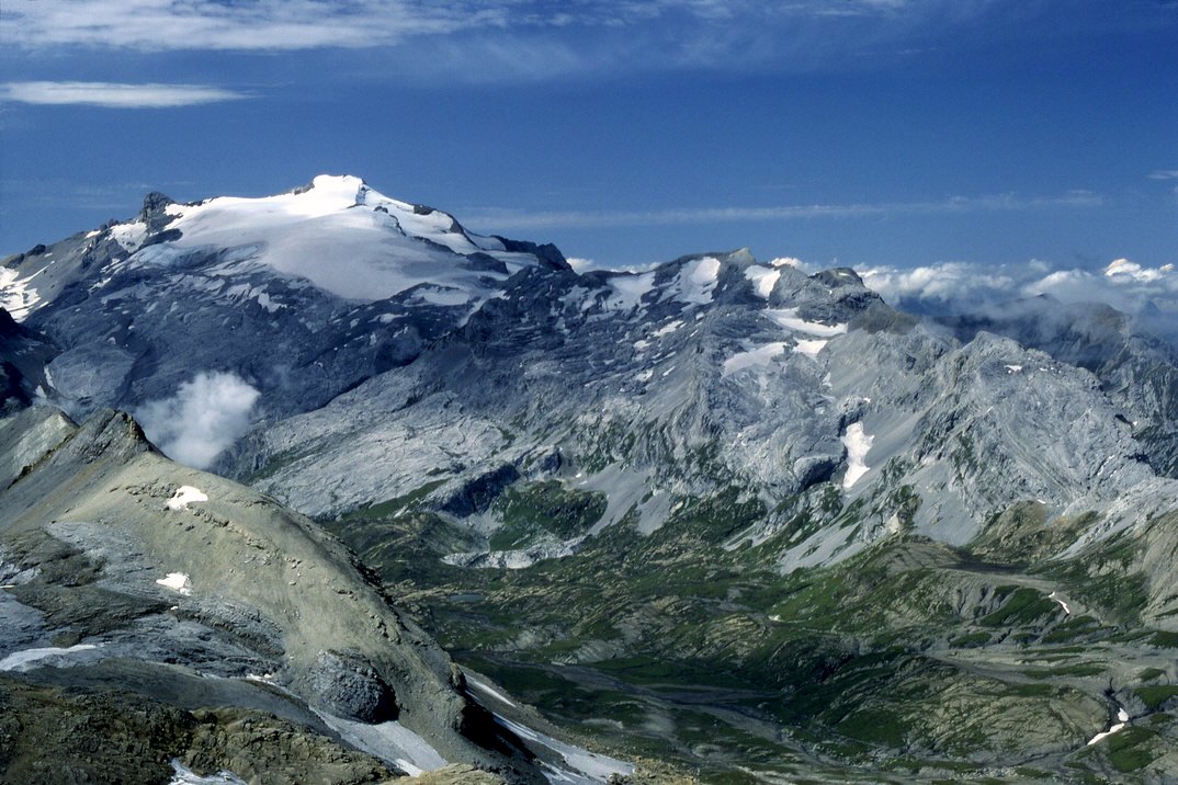
Wildhorn is a glaciated mountain massif topping out at 3,250 m, rising above the Lauenen area in the Swiss Bernese Alps. Valleys near Lauenen and Gstaad lie on the Bern side, while Valais begins across the ridge. It is the loftiest point of the Bernese Alps west of the Gemmi Pass, which makes it a magnet for mountaineers, high-alpine hikers and anyone who loves glacier scenery. Where is Wildhorn? The summit sits right on the border between the cantons of Bern and Valais, within the main chain of the Bernese Alps (roughly 46.35° N, 7.36° E). Do not confuse it with other Alpine peaks sharing the name. The whole massif spans around 10 km from the Sanetsch Pass to the Rawil Pass, and it stands at the centre of the valleys of the Saane, the Simme and the Rhone. What makes up the Wildhorn massif? It is not a single spire but a broad, heavily glaciated group of summits: Arpelistock, Le Sérac, Geltenhorn, Sex Noir, Sex Rouge, Schnidehorn and Six des Eaux Froides, among others. The main crest runs between the Tungelgletscher and the Glacier du Wildhorn. Mont Pucel, almost as tall, lies just south of the top. Wildhorn is one of four distinct massifs in the Bernese Alps west of the Gemmi Pass, alongside Muverans, Diablerets and Wildstrubel. Which lakes surround Wildhorn? Large alpine lakes ring the massif, and each works as a destination in its own right: Lauenensee, close to Lauenen, Iffigsee, Lac de Sénin, Lac de Tseuzier, Lac des Audannes. The Tungelgletscher on the north-east face was surveyed at 1.9 km long in 1973, which gives a sense of the ice around the peak. How do you climb Wildhorn? Routes to the summit start at mountain huts. You can set off from Cabane des Audannes, Wildhornhütte or Geltenhütte. Given the glaciers and the altitude, this is an objective for experienced alpinists or for those travelling with a guide. Which hut you pick depends on whether you want to approach from the Bern side or from Valais. When should you go? Summit attempts suit the warmer months, when the huts are staffed and glacier conditions are easier to read. If you are not aiming for the top, the lakes, such as Lauenensee, make a gentler outing. Check the weather forecast, current glacier conditions and the opening dates of your chosen hut before heading out. Frequently asked questions How high is Wildhorn? 3,250 m (10,663 ft) above sea level, the highest summit of the Bernese Alps west of the Gemmi Pass. Which canton is Wildhorn in? The cantonal border between Bern and Valais runs across it. Where do climbs begin? At one of the huts: Cabane des Audannes, Wildhornhütte or Geltenhütte. Is this the same Wildhorn as in the Glarus Alps? No. The peak described here belongs to the Bernese Alps, near Lauenen, on the Bern-Valais border. Which lakes are nearby? Lauenensee, Iffigsee, Lac de Sénin, Lac de Tseuzier and Lac des Audannes.
-
Piz Pisoc
Tarasp
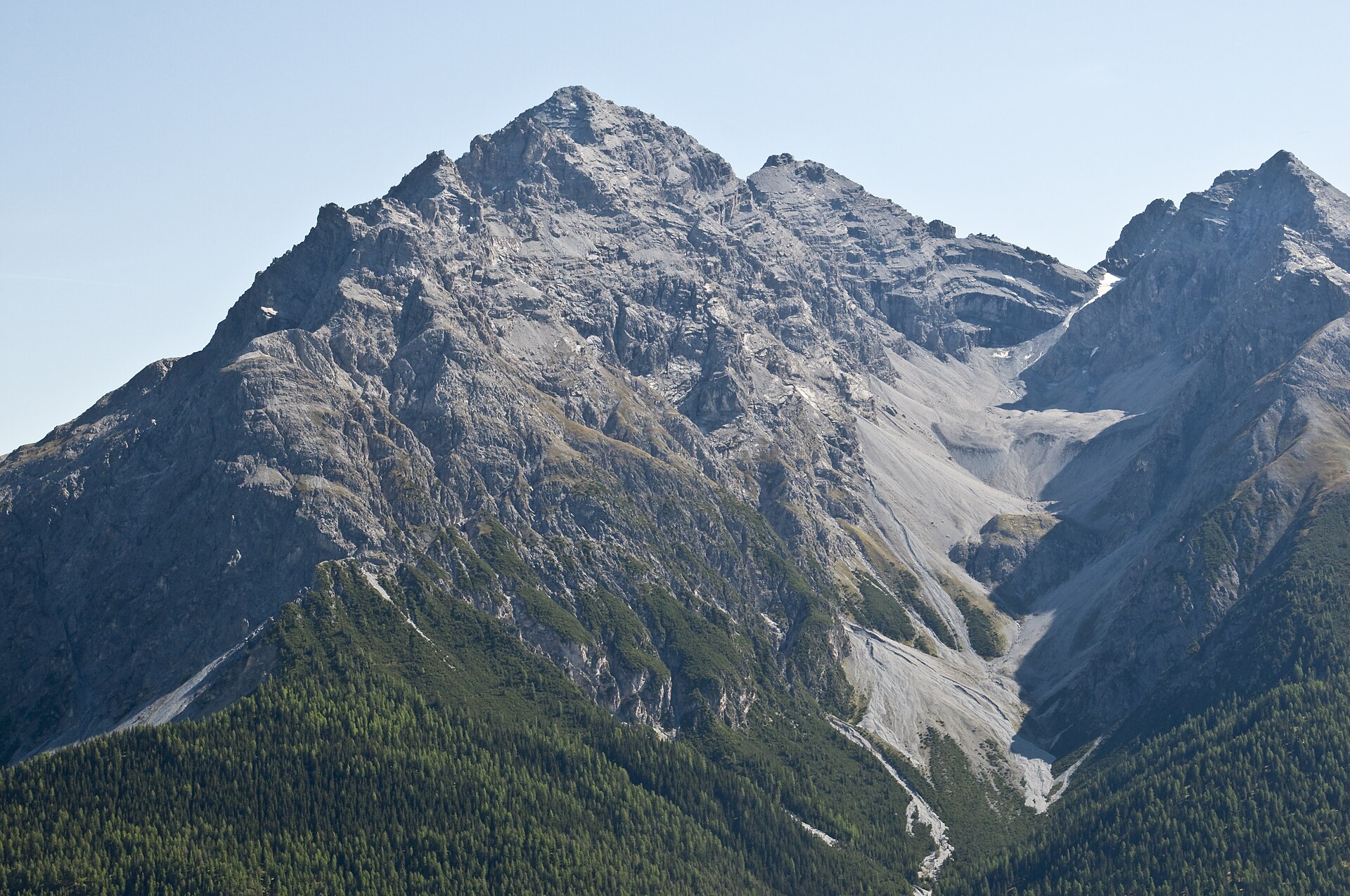
Piz Pisoc is a 3,173 m peak rising above the village of Tarasp in the Swiss canton of Graubünden, in the Lower Engadine. It belongs to the Sesvenna Range of the Rhaetian Alps and counts among its highest summits. Where is Piz Pisoc? The mountain stands in eastern Switzerland at the centre of a massif framed by three valleys: Val Plavna to the west, Val S-charl to the east and Val Minger to the south. From the Engadine valley floor it towers over Tarasp and neighbouring Scuol, the town most visitors use as a base in the region. How high is it compared with its neighbours? At 3,173 m it is the highest summit of the Sesvenna Range west of Pass Costainas and the second highest of the whole range. Only Piz Sesvenna (3,192 m), which gives the range its name, stands taller. Most peaks in this part of the Alps top 3,000 m; beside Piz Pisoc they include Piz Zuort, Piz Clemgia, Piz da la Crappa, Piz Minger and Piz dals Cotschens. What can you see around it? The flanks of the group drop very steeply into the surrounding valleys, so the profile of Piz Pisoc is striking even from below, around Tarasp. Part of the massif lies inside the Swiss National Park, where nature-protection rules apply. The nearby S-charl valley is a gateway for tours towards Piz Sesvenna and other summits of the range. How do you get there and when should you go? Scuol and Tarasp in the Lower Engadine are the natural base. S-charl, at the foot of the range, is reached in winter by a horse-drawn sleigh that runs daily from Scuol. Piz Pisoc is a goal for experienced mountain walkers and alpinists: check the weather forecast, the avalanche bulletin and current trail conditions before setting out, and plan your route with a swisstopo map or the Graubünden tourism route descriptions. Frequently asked questions How tall is Piz Pisoc? 3,173 m above sea level, making it the second highest summit of the Sesvenna Range. Which country and region is it in? Switzerland, canton of Graubünden, in the Lower Engadine above Tarasp. Which peak in the group is higher? Piz Sesvenna, at 3,192 m. Where should I start exploring the area? In Scuol or Tarasp. From there you can reach the S-charl valley, the starting point for routes into the Sesvenna Range.
-
Piz Segnas
Flims
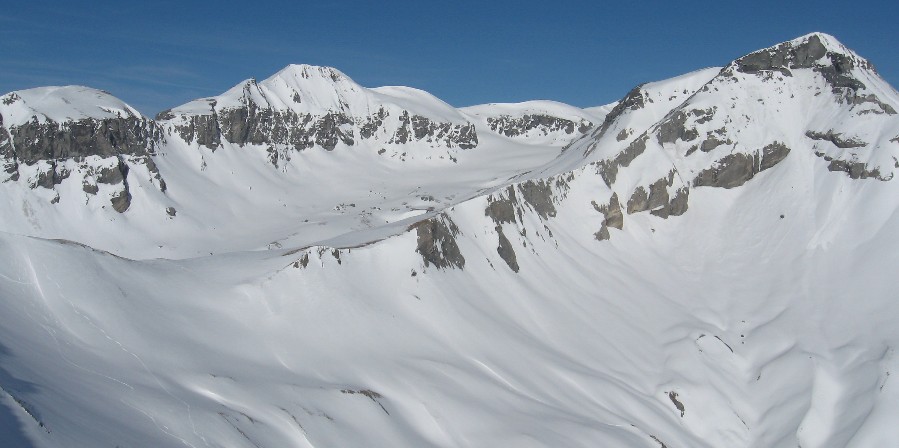
Piz Segnas is a 3,000 m summit above Flims in the Swiss canton of Graubünden, standing on the border with the canton of Glarus. Its top reaches roughly 3,100 m above sea level (sources quote 3,096 to 3,099 m). It belongs to the Glarus Alps and lies inside the Sardona Tectonic Arena, a UNESCO World Heritage area. Where is Piz Segnas? The peak rises above the Segnesboden basin, west of the Piz Sardona massif. The nearest base is Flims, part of the Flims Laax Falera region, while the village of Elm closes the valley on the Glarus side. The terrain is high alpine: rock, scree and remnants of ice, yet reached with a lift, so the approach is short. How do you reach the summit? Most climbers start at the Segneshütte hut, which you reach by the FlemXpress cable car from Flims. From there the route crosses the Lower Segnesboden to the south-west flank. The final climb is mostly off-trail, and some sections reach grade T4. In winter the same line works as a ski tour. One described version covers about 12.7 km with around 1,000 m of ascent, while a guided summer outing quotes about six hours and 1,270 m of climbing. Times depend on route variant and fitness. Other approaches start from the Martinsmadhütte or Sardonahütte huts. Another option is the crossing over the Segnespass (2,627 m) from Elm, which takes around six hours. What will you see on the way? On the Upper Segnesboden you can find fossil oysters, evidence of the sea that once covered this ground. The area is known for a thrust fault where older rock lies on top of younger rock, with the contact visible to the naked eye. This feature is the reason for the UNESCO listing. From the top you look over neighbouring three-thousanders, and a traverse to Piz Sardona is possible. When should you go? In summer, aim for the snow-free months, typically July to September. Ski tourers visit in winter and spring. Check trail conditions and the forecast before setting out, because the route is exposed and part of the climb has no markings. What do you need? The climb calls for sure footing, a head for heights and good fitness. Bring poles, sturdy hiking boots, layers for changing weather and enough water. Guided outings cap groups at five people, which helps less experienced hikers. Frequently asked questions How high is Piz Segnas? About 3,100 m; maps and tourist sites list 3,096 to 3,099 m. Where does the ascent begin? Take the FlemXpress cable car from Flims to the Segneshütte hut and continue across the Lower Segnesboden. Is the route difficult? Yes. The final stretch is off-trail with difficulty up to T4, so mountain experience is needed. Can you climb it in winter? Yes, as a ski tour from the Segneshütte, provided avalanche conditions allow.
-
Piz Minor
Pontresina
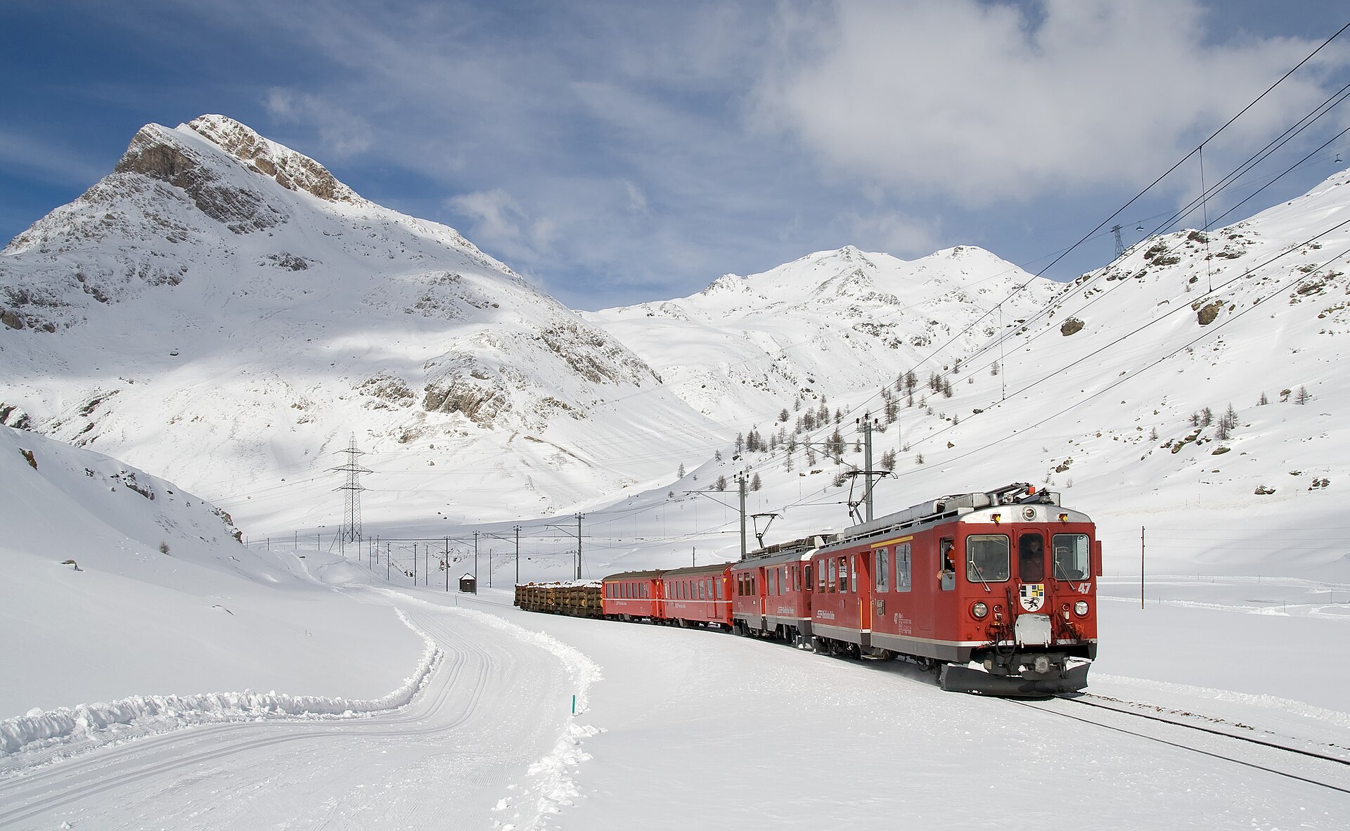
Piz Minor is a 3,049 m summit in the Pontresina area of Graubünden, Switzerland. It belongs to the Livigno Alps, part of the Rhaetian Alps, and its top rises above the Livigno Pass (Forcola di Livigno) to the east. It suits mountaineers who want a quieter objective than the famous peaks of the Bernina group. Where is Piz Minor? The mountain sits between the Bernina Pass, the Livigno Pass and the Engadine valley around Pontresina, at roughly 46.45° N, 10.03° E, close to the Italian border with Lombardy. The Val Minor runs along its southern side, and the well-known Lagalb ski area lies nearby. Do not confuse it with Pizzo dei Laghi (Piz dals Lejs, 3,044 m), a neighbouring summit whose climb runs mostly through Livigno territory on the Italian side. How do you climb it in summer? The described route begins by the Bernina Pass road near Diavolezza, at about 2,093 m. You follow the Val da Fain past Alp la Stretta, then climb the north flank to the top, gaining around 1,000 m. Guides rate it L or T4 on the mountain-hiking scale, so expect steep, rocky ground and the need for sure footing and route-finding. These ratings come mostly from community route descriptions, so compare them with a current guidebook or local advice before setting out. Is Piz Minor a ski-touring objective? Yes. In winter it is a ski ascent graded WS (PD) with about 1,000 m of climbing. The approach starts a few kilometres beyond the Bernina Pass on the Swiss side, from the Bernina Sud or Diavolezza car park, and follows a long valley before the final climb. Allow about 4 hours for the round trip, and check the avalanche bulletin first. How do you get there? By rail: take SBB and RhB trains from Chur to St. Moritz, then continue towards Pontresina and Diavolezza. The Bernina Diavolezza stop lies on the Bernina railway, so the trailhead works without a car. Parking is also available along the Bernina Pass road. When should you go? Plan the summer ascent for the snow-free months, generally summer to early autumn, since the north flank holds snow longer. Start early to leave a buffer for weather changes in the high mountains. Ski tours are a late-winter and spring option, once the snowpack is stable. What else is nearby? Trails lead around the Forcola di Livigno and Fuorcla Minor. A trekking and bike trail opened in 2015 links the Forcola pass with Ospizio Bernina (about 5.8 km). Mountain bikers connect Pontresina, Alp la Stretta and the Forcola on a loop of roughly 41 km, parts of which are demanding and exposed. Frequently asked questions How high is Piz Minor? 3,049 m above sea level. Is it a difficult climb? The summer route is rated T4, so it is for experienced hikers rather than a casual walk. Where is the best starting point? Near Diavolezza on the Bernina Pass road, at about 2,093 m. How long does it take? With around 1,000 m of ascent, plan several hours one way. The ski tour takes about 4 hours round trip.
-
Muttler
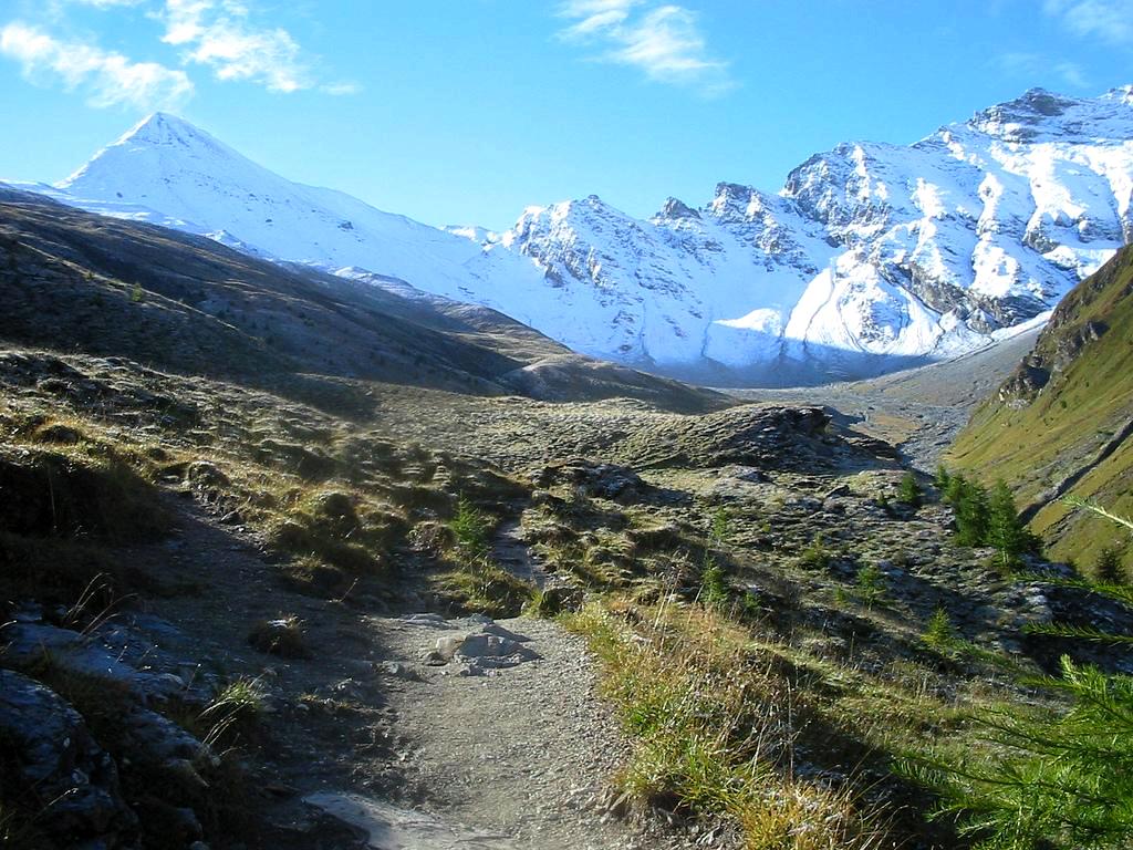
Muttler (also Piz Muttler) is the highest peak of the Samnaun Alps, a subrange of the Rhaetian Alps, at roughly 3,294 m above sea level. It rises south of the village of Samnaun in the Swiss canton of Graubünden and draws experienced hikers who want a big summit without technical climbing. Where is Muttler? The mountain belongs to the Samnaun group in eastern Switzerland, close to the Austrian border. The area is known for the high Samnaun valley, a former duty-free zone, and for a large ski region that links Switzerland with Tyrol. Muttler tops the whole massif, so its summit offers a wide view over the surrounding ridges. Sources quote slightly different heights: 3,293, 3,294 or 3,295 m. Tourist descriptions most often use 3,294 m. How do you climb Muttler? The usual ascent starts at the Samnaun Dorf bus stop. Graubünden's tourism board lists it as a demanding mountain hike, a loop of about 14.8 km that takes around 7.5 hours. The route in brief: The path climbs the Val Maisas, passes a shepherd's hut and reaches the Rossboden meadows. It then follows the Lange Seite ridge to Rote Seeli, a small lake that turns reddish in summer. In recent years it has often nearly dried out. Near the Rossbodenjoch pass the view opens onto Val Sampuoir and the Mundin group. The final stretch follows the Nordgrad ridge to the summit. The last steep section crosses brittle slate that is often damp or icy, and therefore slippery. The normal summer route needs no climbing gear, but it counts as a hard mountain walk and calls for sure footing and mountain experience. What will you see on the way and from the top? The tour mixes several landscapes: a side valley with pastures, an alpine lake, rocky ridges and finally a panorama across the Rhaetian Alps. In clear weather you can pick out the neighbouring peaks of the Samnaun group and further ranges beyond. A transmitter stood west of the summit from 1972 until 2011. Today the top is free of that installation and feels wild and unspoilt. When should you go? Plan the climb for summer or early autumn, when the slopes are free of snow. Check the forecast before you set out: visibility and temperature change fast at altitude, and icy slate raises the risk of a slip. Start early to leave a comfortable margin for the descent. Frequently asked questions How high is Muttler? About 3,294 m above sea level. It is the highest summit in the Samnaun group. Do you need climbing skills for Muttler? Not technical ones. The normal summer route involves no climbing, but it is physically demanding and slippery in places, especially on the slate near the top. How long does the ascent from Samnaun take? The loop from Samnaun Dorf is about 14.8 km and takes roughly 7.5 hours. Which country is Muttler in? Switzerland, in the canton of Graubünden above the village of Samnaun, near the Austrian border.
-
Blinnenhorn
Obergoms
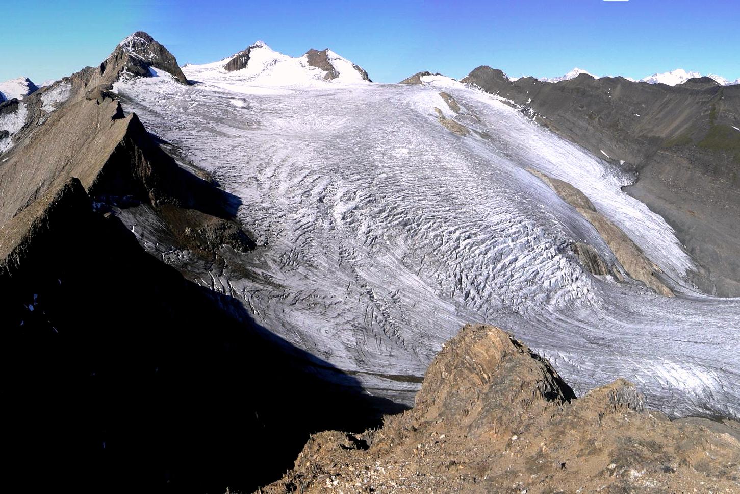
Blinnenhorn (Italian: Corno Cieco) is a 3,374 m summit in the Lepontine Alps, rising on the border between the Swiss canton of Valais and Italy's Piedmont region. On the Swiss side the Goms valley and the municipality of Obergoms form the gateway to this corner of the Alps; on the Italian side lies Val Formazza. The peak needs no technical climbing, yet it is a serious high-mountain outing that crosses a glacier. What will you see on Blinnenhorn? The Gries Glacier fills the north-eastern flank. From the summit ridge the views take in the Lepontine and Bernese ranges and the passes linking Valais and Piedmont. The first recorded ascent dates to 1866. With a prominence of about 945 m, the mountain clearly towers over its surroundings. How do you reach the summit? The classic line starts at the Capanna Corno Gries hut or at the Nufenen Pass and follows the south-east flank. The Swiss Alpine Club route portal gives 5.5 to 6.5 hours and roughly 1,090 m of ascent. You cross the Passo del Corno and the Griespass, continue over the glacier to the Rothorn Pass (3,097 m), then climb a firn or scree slope and an easy scramble to the top. From Italy you can approach from the Claudio e Bruno hut, or from Rifugio Margaroli via the Passo del Vannino and the Gran Sella del Gries. Is the glacier dangerous? Crevasses are present, so bring glacier gear, travel roped and know how to move on snow. The Gries Glacier has retreated noticeably in recent years and snow conditions change quickly, so ask the huts about current conditions before setting out. When is the best time to go? Summer and early autumn usually bring a trail free of deep snow, though crevasses are more exposed then. In spring Blinnenhorn is a popular ski tour: the broad, flat Gries Glacier makes for a long route that is not technically hard but is tiring, best in firn or powder. Can you combine it with a longer trek? Yes. The Goms and Brig-Simplon tourist offices describe a seven-day loop from Obergoms through the Binntal and over the Albrun Pass into Val Formazza and back, with an ascent of Blinnenhorn. It is a demanding route of about 105 km. Frequently asked questions How high is Blinnenhorn? 3,374 m above sea level. Do I need a guide? The route is not technically difficult, but it crosses a crevassed glacier. Without experience of roped glacier travel, hire a mountain guide. Where is the easiest place to start? At the Nufenen Pass or the Capanna Corno Gries hut, the start of the normal south-east flank route. Can I climb it in winter or spring? Yes, as a ski tour over the Gries Glacier. It calls for good fitness, avalanche assessment and route knowledge.
-

Atzmännig
Eschenbach (SG)
Atzmännig is a family leisure and ski area near Goldingen, in the municipality of Eschenbach in the canton of St. Gallen, eastern Switzerland. It offers something for families all year round: a summer toboggan run, a rope park and an amusement area in warm months, and small, gentle ski slopes in winter. What can you do at Atzmännig in summer? The best-known attraction is the summer toboggan run, about 700 metres long. A chairlift carries visitors to the middle station, where the run begins. You control your own speed with a brake, so both children and adults can try it comfortably. The track winds through banked curves with steep walls, tunnels and small bridges over a stream. The second pillar is the rope park, with eight courses. Children can climb from the age of 8, and three separate children's courses are set aside for the youngest visitors, lower and simpler than the main ones. What does the leisure park offer? The park area includes trampolines, a small boating pond (Schiffliweiher) and a petting zoo. According to Zurich Tourism, bull riding and a bungee trampoline are also on offer. Everything is designed so that children of different ages find something to do and parents can spend a full day here. The area also suits relaxed walks. The countryside around Goldingen is hilly Alpine foothill terrain, so a short hike makes a good addition to a day of activities. Can you ski at Atzmännig? Yes. In winter Atzmännig operates as a small ski area with roughly 8 km of pistes. It is aimed at beginners and families rather than advanced skiers. The altitude is low, so check current snow conditions before you set out. How do you get to Atzmännig? By car it takes a little over an hour from Zurich. By public transport, In Your Pocket puts the journey at about 75 minutes. It works well as a day trip from Zurich or the Lake Zurich region. Frequently asked questions Is the toboggan run open all year? The summer run is a warm-season attraction, while in winter the resort operates as a ski area. Check exact dates and lift hours with the operator, Sportbahnen Atzmännig. How old must children be to use the rope park? On the main courses, 8 years. The youngest children can use the three children's courses. Is Atzmännig suitable for beginner skiers? Yes, the resort is small and geared toward beginners and families. Do I need to buy tickets in advance? Prices and ticketing rules change, so check the operator's website for current information before visiting. Practical tips Bring comfortable shoes and clothing for changeable weather, since conditions in the hills can shift quickly. If you plan to ride the toboggan run with children, arrive in the morning when queues are shorter. In summer, set aside time for all three main attractions: the run, the rope park and the leisure park. In winter, check the forecast and slope status before travelling, because the low altitude makes the resort dependent on snowfall.
-
Aletsch Arena
Betten
Aletsch Arena is a holiday region in the Swiss canton of Valais, set on a sunny terrace above the Rhône valley beside the largest glacier in the Alps. It is made up of three villages, Riederalp, Bettmeralp and Fiescheralp, all sitting at roughly 2,000 metres above sea level. The valley station in Betten, the town listed as this place's address, is one of the gateways up to the plateau. Where is Aletsch Arena and how do you get there? All three villages sit high above the valley, and there is no road access for cars. Visitors take the train to a valley station and then ride a cable car up. The lower stations are in Mörel, Betten and Fiesch. Which one you choose depends on your destination: Betten leads up to Bettmeralp, Mörel to Riederalp and Fiesch to Fiescheralp. What makes it special? The villages are car-free. People get around on foot, while luggage reaches the hotels on small electric vehicles. The result is a quiet atmosphere and clean mountain air. The region borders the Swiss Alps Jungfrau-Aletsch area, which was added to the UNESCO World Natural Heritage list in 2001. At its heart lies the Aletsch Glacier, about 23 km long and regarded as the longest in the Alps. What is there to see? The glacier view is the main attraction. Lifts and trails lead to several viewpoints, including: Moosfluh – reached from Riederalp, with a view over the bend of the glacier, Bettmerhorn – a summit above Bettmeralp with a panorama of the high Bernese Alps, Eggishorn – a viewpoint above Fiescheralp, a popular choice for a longer outing. Footpaths also cross the Aletsch forest, home to some of the oldest pines in Switzerland. A walk among these trees, with the glacier in view, makes a gentler day out. What can you do in summer and winter? In summer, hiking is the main activity, from short strolls to full-day high-alpine routes. There is also a golf course nearby. In winter the region turns into a ski area with runs linking the three villages, along with marked trails for walkers and snowshoers. Frequently asked questions Can you drive to Aletsch Arena? No. The villages are car-free. You leave the car in the valley at the cable car station and continue by gondola. Where should you start from Betten? From Betten the cable car goes up to Bettmeralp, from where it is easy to reach the Bettmerhorn viewpoint and the trails along the glacier. Is the Aletsch Glacier protected? Yes. The Jungfrau-Aletsch area was added to the UNESCO list in 2001, so it is best to stay on marked paths. When is the best time to visit? Summer, when trails are free of snow, and winter if you want to ski or walk in the snow. Check cable car timetables before you go, as they depend on the season. Can you walk from Bettmeralp to Fiescheralp? Yes, but only on foot. The route runs across the plateau and is a popular, easy hike in the region.
-
Flumserberg
Flums
Flumserberg is a ski and holiday resort in the Swiss Alps, in the canton of St. Gallen. It is made up of several villages sitting between 1,160 and 1,344 metres above sea level, while the highest slopes climb to roughly 2,200 metres. Skiers and snowboarders fill it in winter; hikers take over in summer, drawn by views over Lake Walen. Where is Flumserberg and what is the layout? The resort sits above Lake Walen (Walensee), where Alpine ridges drop almost to the waterline. The lift system starts low, near Unterterzen and Oberterzen, and tops out beneath the Leist summit at around 2,222 metres. That vertical range gives long descents and wide panoramas. There are two main sectors. One centres on Tannenboden (about 1,400 m) and the Maschgenkamm ridge (2,020 m); the other on Tannenheim (about 1,220 m), heading toward Prodalp and Prodkamm. For years the two areas operated separately, until a chairlift between Obersäss and Twärchamm joined them in 1981. How do you get up the mountain? At Tannenheim you can leave the car and ride the Prodalp-Express, a twelve-person gondola, toward Prodkamm. From Tannenboden, the eight-person BergJet gondola runs up to Maschgenkamm; it has been in service since 2019. Chairlifts and drag lifts tie the different parts of the resort together. Most sources put the network at around 65 km of pistes and about 20 lifts. A short history Development of the snowfields began in 1945, when the first ski tow opened from the Tannenboden base toward Chrüz. About six years later a two-seat chairlift to Maschgenkamm followed. Further investment, including new gondolas and fast chairs, gradually grew the area to its current size. What to do in winter Downhill skiing is the main draw. Runs range in difficulty, so beginners and stronger skiers both find something suitable. A large share of the terrain lies above 1,500 m, which helps snow reliability. Many visitors come for a day trip from the Zurich area or Liechtenstein, since the resort is fairly easy to reach from the valley. What to do outside ski season In summer the same gondolas carry walkers to trails around Maschgenkamm and Prodalp. The upper stations look out over Lake Walen and the surrounding massifs, so even visitors who only want a viewpoint have a reason to ride up. Frequently asked questions Which canton is Flumserberg in? St. Gallen, in the Swiss Alps. How high is the resort? The villages that make it up lie between 1,160 and 1,344 m above sea level. The top of the ski area reaches about 2,200 m. How do I get from Tannenboden to Maschgenkamm? Take the eight-person BergJet gondola, running since 2019. Can I park near the lower station? Yes. At Tannenheim you can park and ride the Prodalp-Express gondola up. Is Flumserberg only for skiers? No. Outside winter it serves hikers, and the views over Lake Walen are an asset in every season.
-
Diavolezza-Lagalb
Pontresina
Diavolezza-Lagalb is a pair of neighbouring mountain areas above the Val Bernina valley near Pontresina in the Swiss canton of Graubünden. Cable cars lift visitors to views of glaciers and the peaks of the Bernina massif, and in winter the area runs as a ski resort. What is this place? Diavolezza and Lagalb sit on opposite sides of the valley, beside the Rhaetian Railway line over the Bernina Pass. Each has its own aerial cableway. The Diavolezza lift starts from a valley station at roughly 2,100 m and climbs almost 900 m. The Lagalb lift rises nearly 800 m. How do I get there? The Diavolezza valley station is directly across the road from Bernina Diavolezza railway station. Trains from St. Moritz take under 40 minutes. From Tirano, the Bernina Express needs about 1 hour 45 minutes, climbing over the 2,328 m Bernina Pass on the way. Lagalb has its own separate valley station and cable car. What can I see from Diavolezza? The ride takes about 7 minutes and ends close to 3,000 m above sea level (sources quote between 2,973 and 2,978 m). Even from the cabin you can spot Piz Bernina, the only four-thousand-metre summit in the Eastern Alps, along with Piz Palü and the Pers and Morteratsch glaciers. At the top there is a mountain restaurant with a panoramic terrace. What is there to do in summer? The classic outing is the glacier hike across the Pers and Morteratsch glaciers down to Morteratsch station. The operator recommends doing it with a mountain guide. Lagalb, across the valley, also offers wide views over the surrounding peaks. What is there to do in winter? Diavolezza-Lagalb is a ski area with well-groomed runs, and one highlight is a descent by the light of the full moon. The two areas are only loosely linked: getting from Diavolezza to Lagalb is possible only via ski runs heading towards Lagalb. Frequently asked questions Can I arrive by train? Yes, both areas lie along the Rhaetian Railway route over the Bernina Pass. How long is the Diavolezza ride? About 7 minutes, gaining almost 900 m of altitude. Is the glacier hike safe without a guide? The operator recommends going with a mountain guide, since the route crosses glaciers. What can I see from the cable car? Piz Bernina, Piz Palü and the Pers and Morteratsch glaciers. When should I visit? Summer suits hiking and views, winter suits skiing, including full-moon descents.
Earn badges for the places you visit
Download NextOnTrip, discover new places and check off your trails.