Save this place and discover nearby attractions with NextOnTrip
In the app you can add it to your favorites, see what else is worth visiting nearby on the map, and earn a badge for your visit.
The app is available for iPhone and Android.
About this place
Val de Réchy (Vallon de Réchy): a wild valley in the Valais Alps
Val de Réchy, also called Vallon de Réchy, is a valley in the Swiss canton of Valais, on the south side of the Rhône valley. It belongs to the Pennine Alps and reaches into the mountains above villages such as Grône and Vercorin. It suits walkers who want quiet, high-mountain scenery and trails without crowds.
Where is Val de Réchy?
The valley spans several communes: Anniviers, Chalais, Grône, Mont-Noble and Saint-Martin. Its coordinates are roughly 46.237° N, 7.501° E. From the Rhône valley, slopes climb steadily toward the higher parts of the range.
What is the landscape like?
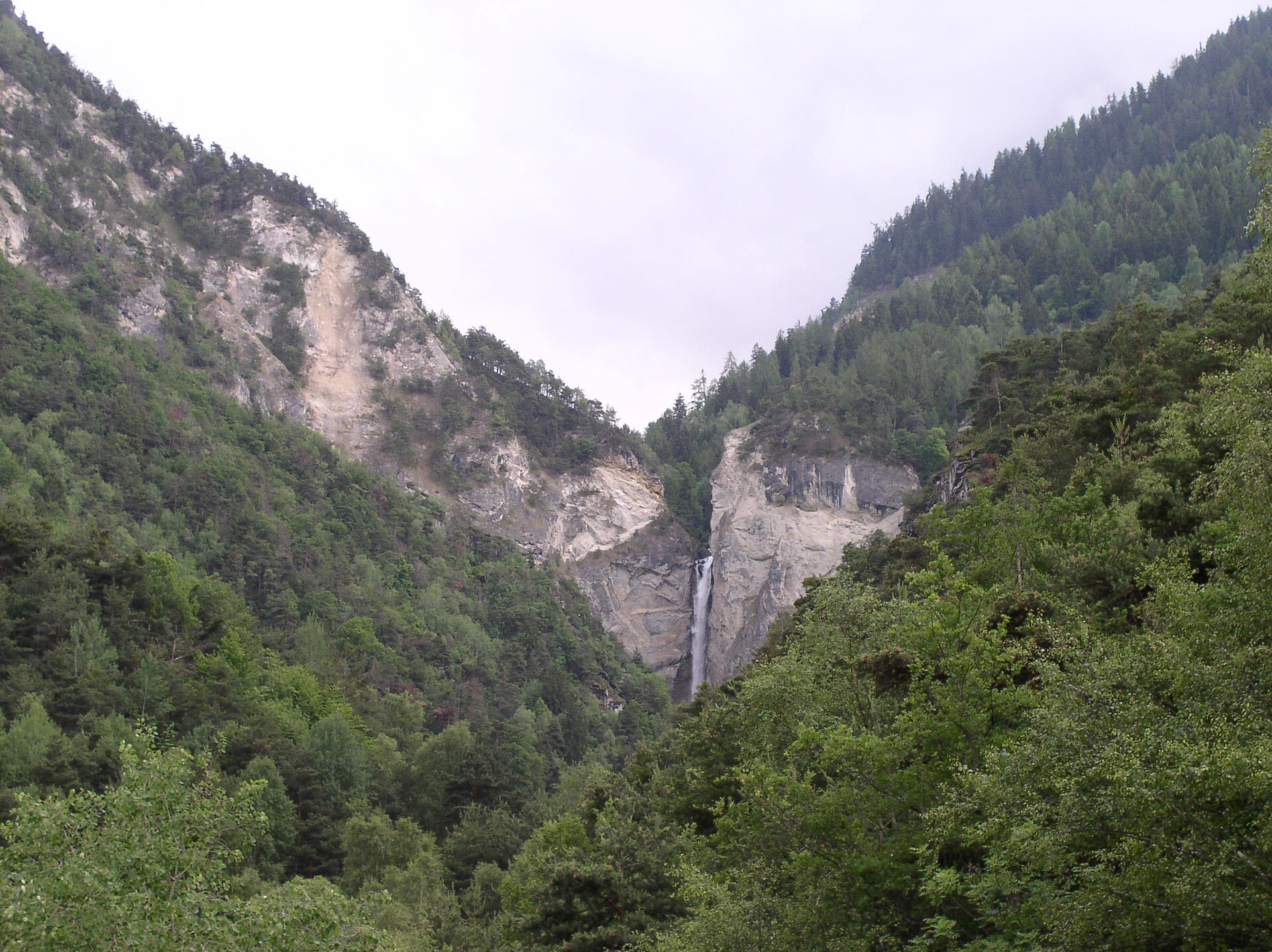
The Swiss federal inventory of landscapes of national importance lists the valley as IFP 1718 and describes it as a wild, isolated valley of the Valais Pennine Alps covering about 3,475 hectares. The lower section is steep and forested. Higher up, the woods give way to plateaus and lakes. Beyond the Ar du Tsan plain, at around 2,200 m, the character of the valley changes: four successive plateaus climb to about 2,750 m, crossed by many streams. The Rèche torrent drains the valley and reaches the Rhône valley through the large Chute de la Rèche waterfall. In the upper zone, peat bogs and periglacial processes are typical, especially around 2,700 m.
Is the valley protected?
Yes. In 2015 the State of Valais classified Vallon de Réchy as a protected natural site of national importance and banned mountain bikes and other vehicles. The valley can only be explored on foot. There are no roads and very little building.
How to visit
A popular approach starts in Vercorin: a gondola lift rises to Crêt du Midi (given as about 2,321 to 2,332 m depending on the source), where the hiking route begins. Stage 5 of the Tour du Val d'Anniviers links Vallon de Réchy with the mountain lake of Louché. The loop is about 15 km and takes roughly 4 hours 40 minutes, rated intermediate. The shores of Lac du Louché are the highest point of the route. Huts in the area include Dzornive, Econdoi and Rèche, and higher up the Cabane des Becs de Bosson stands at 2,985 m.
Frequently asked questions
Can I drive to Val de Réchy? No. The valley has no roads and vehicles are banned. You reach it on foot, often after taking the lift from Vercorin.
Can I ride a mountain bike there? No. Mountain bikes and other vehicles have been prohibited since 2015.
How long is the popular loop to Lac du Louché? About 15 km, taking roughly 4 hours 40 minutes.
When should I go? Given the altitude, check local conditions and the forecast before setting out, since the route is a high-mountain walk.
Nearby places

Earn badges for the places you visit
Download NextOnTrip, discover new places and check off your trails.