Save this place and discover nearby attractions with NextOnTrip
In the app you can add it to your favorites, see what else is worth visiting nearby on the map, and earn a badge for your visit.
The app is available for iPhone and Android.
About this place
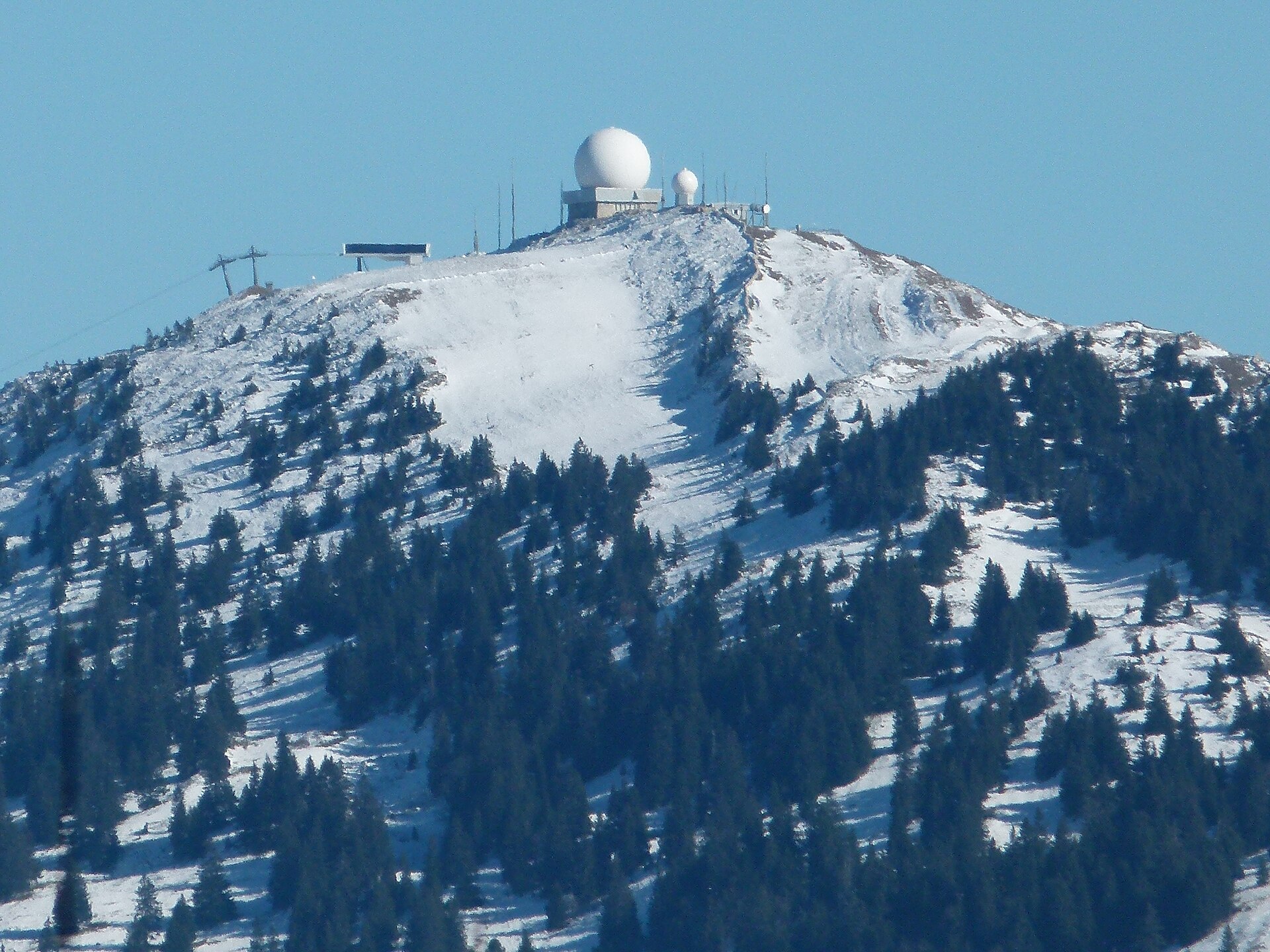
La Dôle is a 1,677 m summit in the Swiss Jura, rising above Lake Geneva in the far west of the canton of Vaud, near Gingins. The mountain is shared between the municipalities of Gingins, Chéserex and La Rippe, and it is the second-highest peak on the Swiss side of the Jura after Mont Tendre. The French border lies less than 2.5 km away.
What makes La Dôle stand out?
The peak anchors the southern end of the Jura range and drops toward Lake Geneva. A radar and weather station crowns the top, and its buildings are visible from far below. Because the ridge stands clear of the surrounding terrain, it ranks among the best lookouts in the region.
What can you see from the top?
On a clear day the view takes in the lake, the Alps and the Mont Blanc massif on the horizon. Looking the other way you see more Jura ridges rolling off. Mornings and the days after a front passes usually give the sharpest air. Bring a windproof layer, since the ridge is noticeably cooler than the lakeshore.
How do you get to La Dôle?
The shortest approach starts in Gingins. A paved road climbs from there to the Chalet de la Dôle just below the summit, and you finish the last stretch on foot.
The alternative is to start from Saint-Cergue or the Col de la Givrine to the north. Both sit above 1,000 m, so the climb is shorter than from the lake. Saint-Cergue is linked to Nyon, on Lake Geneva, by road and by the Nyon–St-Cergue–Morez railway, which makes a car-free trip possible.
When should you go?
Summer and early autumn suit a hike with views. In winter the Saint-Cergue and Givrine area draws people looking for snow in the Jura, while the summit itself is exposed to wind and fog and should be treated as mountain terrain. Check the forecast first, because cloud can block the Alpine view entirely.
What else fits into the trip?
- Nyon on Lake Geneva, the starting point for the railway to Saint-Cergue.
- The Col de la Givrine and Saint-Cergue area, good for ridge walks in the Jura.
- Neighbouring Jura summits, including Mont Tendre, the highest in the Swiss part of the range.
Frequently asked questions
How high is La Dôle?
The summit reaches 1,677 m above sea level, making it the second-highest point of the Swiss Jura after Mont Tendre.
Can you drive up La Dôle?
You can drive from Gingins on a paved road to the Chalet de la Dôle below the top. The final section is on foot.
Can you reach it without a car?
Yes. The Nyon–St-Cergue–Morez railway runs from Nyon to Saint-Cergue, where a walk toward the summit begins.
What is visible from the summit?
Lake Geneva, the Alps with Mont Blanc and further Jura ridges, weather permitting.
Nearby places

Earn badges for the places you visit
Download NextOnTrip, discover new places and check off your trails.