Save this place and discover nearby attractions with NextOnTrip
In the app you can add it to your favorites, see what else is worth visiting nearby on the map, and earn a badge for your visit.
The app is available for iPhone and Android.
About this place
Schwalmis is a 2,246 m peak in the Urner Alps, rising above Emmetten and Lake Lucerne in Central Switzerland. The summit sits on the boundary between the cantons of Nidwalden and Uri, and the mountain is shared by the communes of Emmetten and Beckenried (Nidwalden) and Isenthal (Uri).
What is Schwalmis like?
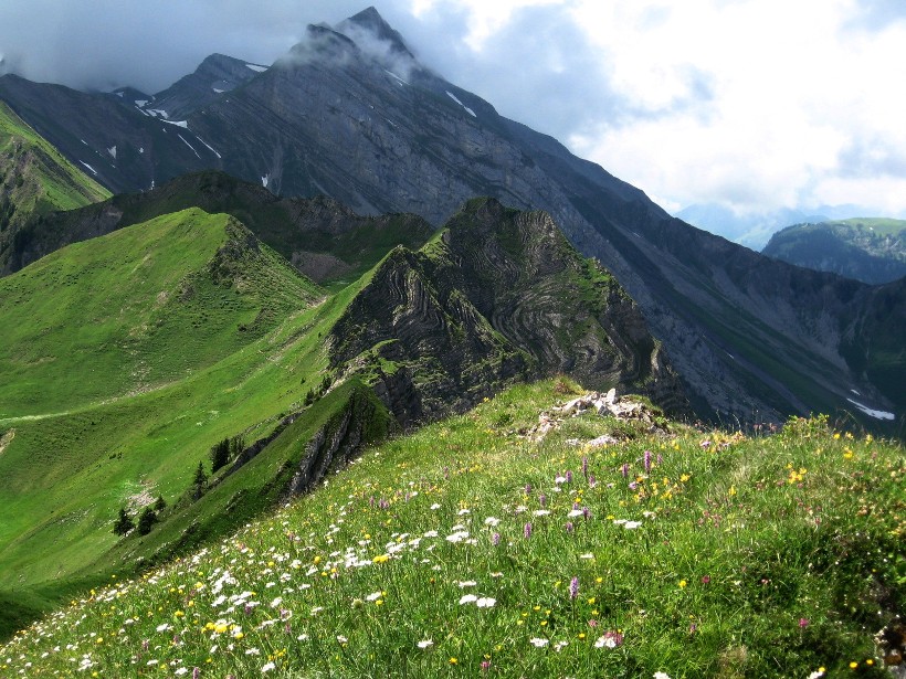
The two faces of the mountain could hardly differ more. On the Nidwalden side it falls away steeply in rock slabs and scree, and tiered cliffs make the summit look all but unreachable from the north. The Uri side is the opposite, with steep grassy slopes. Climbers know the lowest band of the wall, called Geissplatte, which holds a few routes. There is no marked via ferrata on the mountain.
How do you reach the summit?
The Swiss Alpine Club (SAC) route portal says hikers find the ascent from the south fairly easy. The route it lists starts at Gitschenen, crosses Vorder Jochli to the top, then drops towards Musenalp. Allow about 2 h 15 min up with 910 m of climbing, and roughly 2 h and 700 m of descent. The final stretch is a steep grassy face, so you need a steady step and clear weather. This is a mountain trail, not a stroll.
What can you see around the base?
Below the peak lies Niederrickenbach, a pilgrimage village. An easy trail leads there from Klewenalp via Staffel and Bärfallen: about 7 km, around 2 hours, with just 150 m of ascent and 580 m of descent. It skirts the foot of the massif rather than climbing it.
The last stage of the Nidwaldner Höhenweg also passes the Schwalmis flanks. It runs from the Brisenhaus hut (1,753 m) towards the Niederbauen cable car station, about 12 km and 4 hours, past the slopes of Schwalmis and Oberbauen. The season is May to October. From Klewenalp to Stockhütte takes around 1.5 hours, and from there you can ride the gondola down or walk to Emmetten in about an hour.
When should you go?
Mountain trails here are used from June to October. Early summer suits the Uri-side slopes, which are covered in wildflowers then. Check local conditions before setting out, especially after rain, when grassy slopes get slippery.
Frequently asked questions
How high is Schwalmis? The summit is 2,246 m above sea level.
Which canton is Schwalmis in? On the border of Nidwalden and Uri. The communes of Emmetten, Beckenried and Isenthal share it.
Is there a via ferrata on Schwalmis? No. The southern route is a mountain trail, and climbing is concentrated on the lower Geissplatte band.
How long is the climb from Gitschenen? About 2 h 15 min with 910 m of ascent. The descent towards Musenalp takes about 2 hours.
Where can you admire the massif without climbing it? From the gentle Klewenalp to Niederrickenbach trail, or from the Nidwaldner Höhenweg stage below the Brisenhaus.
Nearby places

Earn badges for the places you visit
Download NextOnTrip, discover new places and check off your trails.