Save this place and discover nearby attractions with NextOnTrip
In the app you can add it to your favorites, see what else is worth visiting nearby on the map, and earn a badge for your visit.
The app is available for iPhone and Android.
About this place
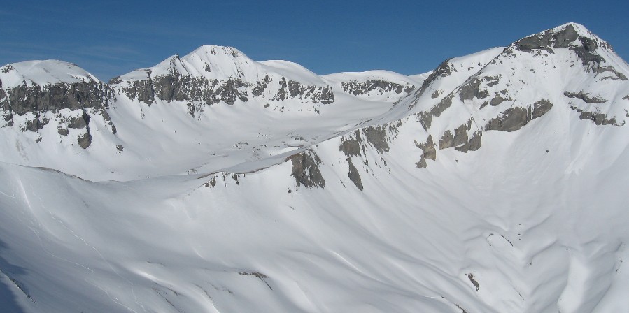
Piz Segnas is a 3,000 m summit above Flims in the Swiss canton of Graubünden, standing on the border with the canton of Glarus. Its top reaches roughly 3,100 m above sea level (sources quote 3,096 to 3,099 m). It belongs to the Glarus Alps and lies inside the Sardona Tectonic Arena, a UNESCO World Heritage area.
Where is Piz Segnas?
The peak rises above the Segnesboden basin, west of the Piz Sardona massif. The nearest base is Flims, part of the Flims Laax Falera region, while the village of Elm closes the valley on the Glarus side. The terrain is high alpine: rock, scree and remnants of ice, yet reached with a lift, so the approach is short.
How do you reach the summit?
Most climbers start at the Segneshütte hut, which you reach by the FlemXpress cable car from Flims. From there the route crosses the Lower Segnesboden to the south-west flank. The final climb is mostly off-trail, and some sections reach grade T4.
In winter the same line works as a ski tour. One described version covers about 12.7 km with around 1,000 m of ascent, while a guided summer outing quotes about six hours and 1,270 m of climbing. Times depend on route variant and fitness.
Other approaches start from the Martinsmadhütte or Sardonahütte huts. Another option is the crossing over the Segnespass (2,627 m) from Elm, which takes around six hours.
What will you see on the way?
On the Upper Segnesboden you can find fossil oysters, evidence of the sea that once covered this ground. The area is known for a thrust fault where older rock lies on top of younger rock, with the contact visible to the naked eye. This feature is the reason for the UNESCO listing. From the top you look over neighbouring three-thousanders, and a traverse to Piz Sardona is possible.
When should you go?
In summer, aim for the snow-free months, typically July to September. Ski tourers visit in winter and spring. Check trail conditions and the forecast before setting out, because the route is exposed and part of the climb has no markings.
What do you need?
The climb calls for sure footing, a head for heights and good fitness. Bring poles, sturdy hiking boots, layers for changing weather and enough water. Guided outings cap groups at five people, which helps less experienced hikers.
Frequently asked questions
How high is Piz Segnas? About 3,100 m; maps and tourist sites list 3,096 to 3,099 m.
Where does the ascent begin? Take the FlemXpress cable car from Flims to the Segneshütte hut and continue across the Lower Segnesboden.
Is the route difficult? Yes. The final stretch is off-trail with difficulty up to T4, so mountain experience is needed.
Can you climb it in winter? Yes, as a ski tour from the Segneshütte, provided avalanche conditions allow.
Nearby places

Earn badges for the places you visit
Download NextOnTrip, discover new places and check off your trails.