Monuments in Croatia
A guide to 160 Monuments in Croatia — with descriptions, photos and traveler visits from the NextOnTrip community. Locations spread across 111 cities and towns. Most visited by the community: Old City Hall, Split, Salona, Pomorac Memorial Lighthouse.
-
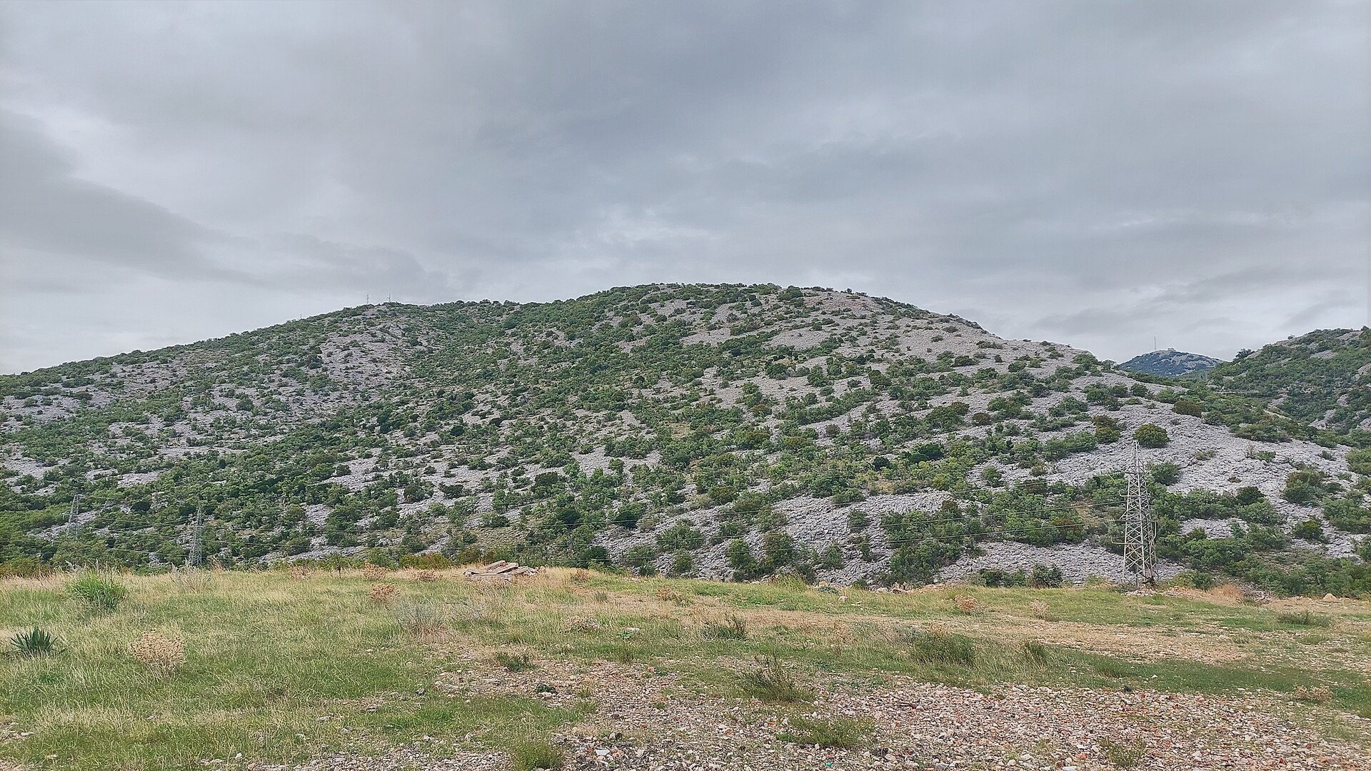
Gradina
Ledenice
Gradina is a ruined medieval hillfort rising above the village of Ledenice, in the Vinodol valley in Croatia's Kvarner region. Perched at roughly 260 meters, the hill once served as a lookout point and stronghold guarding the valley and the coast against raids from inland. What is Gradina? Gradina is what remains of a fortified hilltop settlement already in existence in the 13th century — its representatives took part in drafting the Vinodol Code of 1288, one of the oldest legal codes in this part of Europe. From 1225 the settlement belonged to the princes of Krk, later known as the Frankopans from the 15th century onward, and it was one of nine Vinodol communes that joined the code. Its defensive walls featured a walkway for guards, corner towers and numerous loopholes, and the stronghold played a key role in defending the valley all the way to Grobnik and Trsat. The plague of 1463 marked the beginning of the end — survivors resettled lower in the valley near fertile farmland, and once Lika was freed from Ottoman rule at the close of the 17th century, the hill's strategic importance faded for good. How do you get to Gradina? The starting point is the village of Ledenice itself, tucked in the Vinodol valley within easy reach of Novi Vinodolski and the Kvarner coastline. A marked footpath climbs from the village center to the summit, taking roughly ten to thirty minutes on foot depending on pace and fitness. The ground is rocky and steep in places, so sturdy walking shoes are worth packing, especially after rain. What will you see there? At the top, sections of the perimeter walls survive along with traces of corner towers and the rough outline of the former settlement, enough to picture the scale of the old stronghold. What draws most visitors today, though, is the view — the summit opens onto a sweeping panorama of the Vinodol valley, the hills behind it, and Kvarner Bay with its islands visible on a clear day. The site stays quiet and uncrowded, making it a pleasant spot for unhurried exploring and photography. When is the best time to visit? Spring and autumn are the best seasons for climbing up to Gradina, with mild temperatures for the walk and cleaner air that usually means better visibility. In summer, an early morning or late afternoon visit is recommended to avoid the heat on this open, largely shadeless terrain. In winter the path can turn slippery after rain, though the views remain just as rewarding on a clear day. Frequently asked questions Is there an entrance fee for Gradina? No, the ruins and the footpath leading up to them are free to visit year-round. How long does the climb take? Depending on fitness, the walk up from Ledenice typically takes anywhere from about ten minutes to half an hour one way. Is the trail suitable for children? Yes, the path requires no special preparation, though the rocky and occasionally steep ground calls for care and comfortable footwear. What can you combine with a visit to Gradina? It pairs well with a stroll through Ledenice village itself and a short trip down to nearby Novi Vinodolski, which offers beaches and a seafront promenade on the Kvarner coast.
-
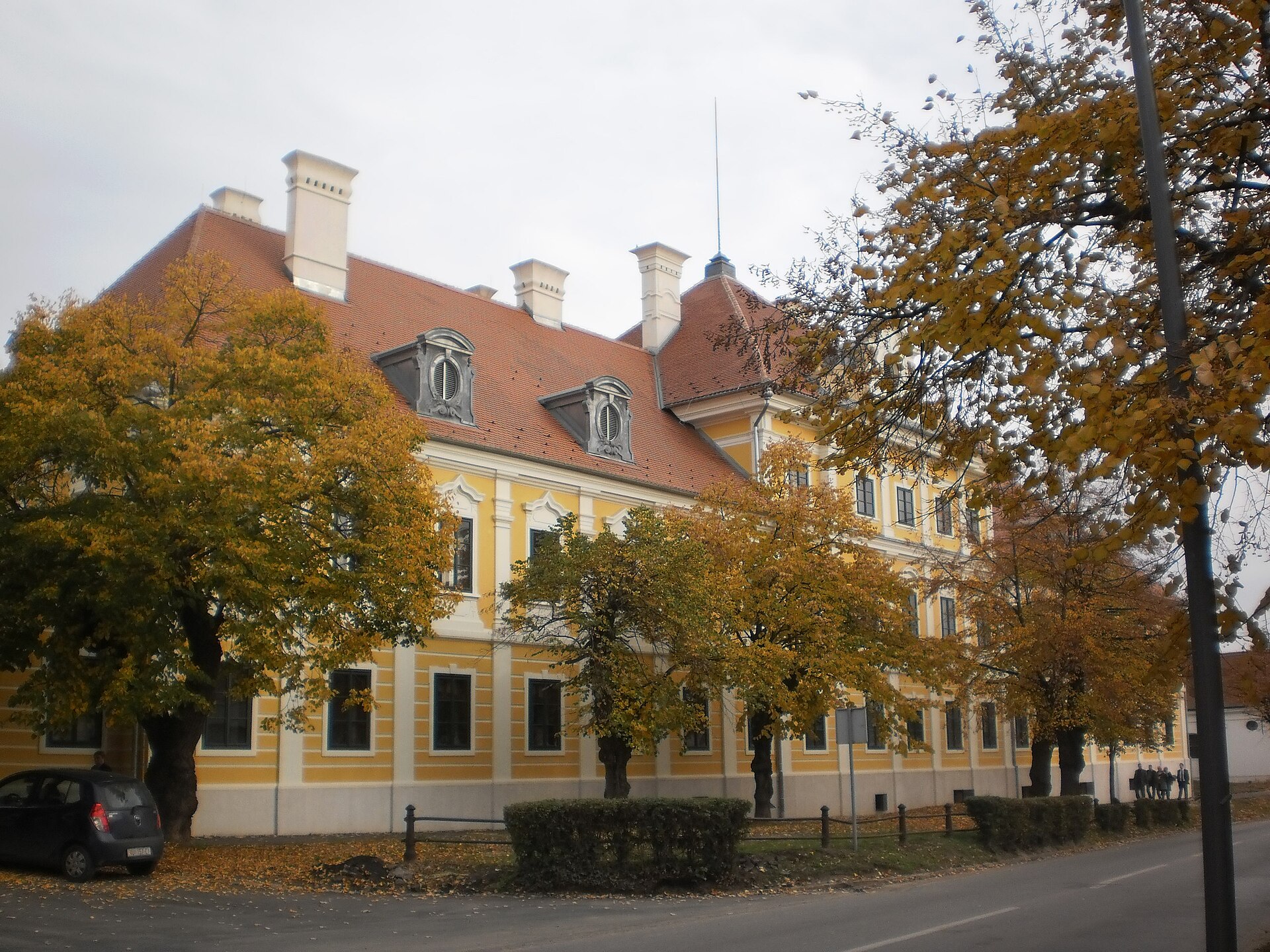
Eltz Manor
Vukovar
Eltz Manor is a Baroque palace in Vukovar, one of the city's most important landmarks and a symbol of its recovery after the war. It now houses the Vukovar City Museum, and its pre-war image once appeared on the reverse of Croatia's 20 kuna banknote. What is Eltz Manor? The palace was built in the 18th century as the principal seat of the Eltz family, holders of the so-called Lordship of Vukovar — an extensive estate covering the town and surrounding lands. Its architecture follows the Baroque style typical of aristocratic residences of that period in this part of Central Europe. An illustration of the manor in its pre-war form featured on the 20 kuna note issued in 1993 and again in 2001, underlining how closely the building is tied to Croatian national identity. How do you get to Eltz Manor? The manor stands in the central part of Vukovar, a town on the Danube in eastern Croatia's Slavonia region. Its coordinates are approximately 45.358°N, 18.995°E, which makes it straightforward to locate with GPS navigation. Given its central location, a walk through Vukovar's historic core will naturally bring you close to the palace, so it's easy to combine a visit here with other sights in the old town. What can you see inside? The building houses the Vukovar City Museum, whose collections cover the history of the town and the wider region. Visitors can learn about the legacy of the former Lordship of Vukovar and the era of the Eltz family, as well as more recent chapters of the city's history. The palace's architecture itself — its representative interiors and the layout typical of a Baroque residence — adds to the experience beyond the museum exhibits. The history behind the walls The story of Eltz Manor is closely tied to the fate of Vukovar itself. In 1991, during the Croatian War of Independence, the building suffered serious damage, as the city became the site of some of the fiercest fighting of the conflict. Restoration took four years and was completed in October 2011, when the manor was returned to its pre-war appearance. That restoration is now regarded as part of the broader story of Vukovar's rebuilding and a symbol of the city's recovery after years of destruction. When should you visit? The Vukovar City Museum inside Eltz Manor is open Tuesday to Sunday, from 10:00 to 18:00. It is closed on Mondays, which is worth keeping in mind when planning a trip. For questions about the current programme or organising a visit, the museum can be reached by phone at 032/638-470, 032/638-475, or 032/638-474. Frequently asked questions What is inside Eltz Manor today? The building houses the Vukovar City Museum, which presents the history of the city along with the heritage of the former Lordship of Vukovar tied to the Eltz family. Why is Eltz Manor significant for Croatia? Its pre-war image appeared on the reverse of the 20 kuna banknote (1993 and 2001 issues), making the palace one of the country's recognisable symbols. Was the manor damaged during the war? Yes, the building suffered serious damage in 1991 during the Croatian War of Independence. Restoration took four years and was completed in October 2011, returning it to its pre-war appearance. What are the visiting hours? The museum is open Tuesday to Sunday, from 10:00 to 18:00. Further information is available by phone.
-
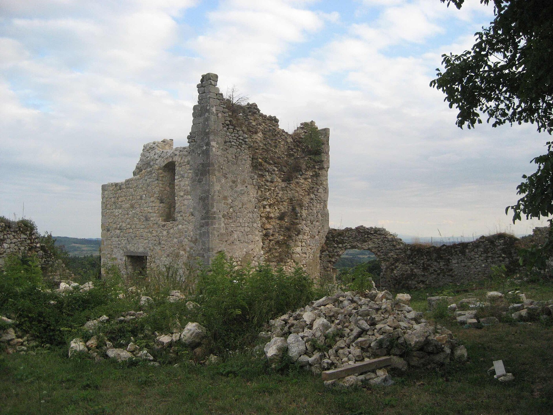
Zrin Castle
Zrin
Zrin Castle is a ruined medieval stronghold in the village of Zrin, part of Dvor municipality in central Croatia, just south of the town of Sisak. The site gave its name to the Zrinski family (also known as Zrínyi in Hungarian), one of the most influential noble dynasties of medieval and early-modern Croatia and Hungary, remembered for their border defense against Ottoman incursions and for the ill-fated conspiracy against the Habsburg court in the 17th century. What remains today is a set of wall fragments and the outline of the old fortification — a quiet, off-the-beaten-path stop for travelers interested in the history of the Croatian-Bosnian borderland rather than a polished visitor attraction. Where is Zrin Castle located? The ruins sit in the small village of Zrin, within Dvor municipality, in the historical region known as Banovina (or Banija) — a belt of land between the Una and Kupa rivers, close to the border with Bosnia and Herzegovina. The nearest larger town is Sisak, to the north. The surrounding countryside is rural and heavily wooded, typical of this stretch of central Croatia. How do you get there? A car is the most practical way to reach Zrin village, since the region isn't served by a dense public transport network and local roads run through the smaller communities of Dvor municipality. Sisak or Zagreb make sensible starting points for the drive, and it's worth checking the condition of local access roads beforehand, as many routes through Banovina are minor, rural roads. There's no significant tourist infrastructure on site, so plan to bring your own transport and supplies. What will you see on site? What survives of the castle is mainly ruined defensive walls and the ground plan of a fortification built on raised, defensible terrain — a common pattern for medieval strongholds in this borderland. There are no restored chambers or museum displays here; this is a site for visitors who appreciate untouched, unmanaged ruins and a direct, uncrowded encounter with history rather than a ticketed attraction. The forested hills of Banovina surrounding the castle also make it a worthwhile stop for anyone interested in the borderland landscape and quiet countryside walks. What's the history behind Zrin Castle? The castle lent its name to the Zrinski family, one of the leading aristocratic houses in Croatian and Hungarian history. Members of the family played a central role in defending the frontier against Ottoman campaigns through the 16th and 17th centuries, and were later drawn into the notorious Zrinski-Frankopan conspiracy against the Habsburg court, which ended with the execution of its main conspirators in 1671. Like many strongholds along the former Ottoman-Habsburg frontier, the castle itself gradually fell into decline and ruin, and today stands as a physical trace of the region's turbulent past. When is the best time to visit? The region has a continental climate, with warm summers and cold, occasionally snowy winters, so spring through early autumn is the most comfortable window for exploring the ruins and the surrounding countryside, when days are longer and the terrain easier to navigate. In the colder months, expect local access roads to be in worse condition. Frequently Asked Questions Is Zrin Castle open to the public? The ruins sit on open, unenclosed ground with no ticket booth or on-site staff — visitors should still move carefully around the ruins and respect the surrounding village. Is there parking or tourist infrastructure nearby? Zrin is a rural village without developed tourist facilities, so it's best to arrive by car and base yourself for the night in a larger town in the region, such as Sisak. Where does the Zrinski family name come from? The Zrinski (Zrínyi) family took its name directly from Zrin Castle, their original seat, before the dynasty went on to gain wider influence across Croatia and Hungary. What else is worth seeing nearby? The Banovina region is defined by the Una and Kupa rivers and a scattering of small borderland towns, making it a good base for travelers looking for a quiet, lightly touristed route through central Croatia.
-
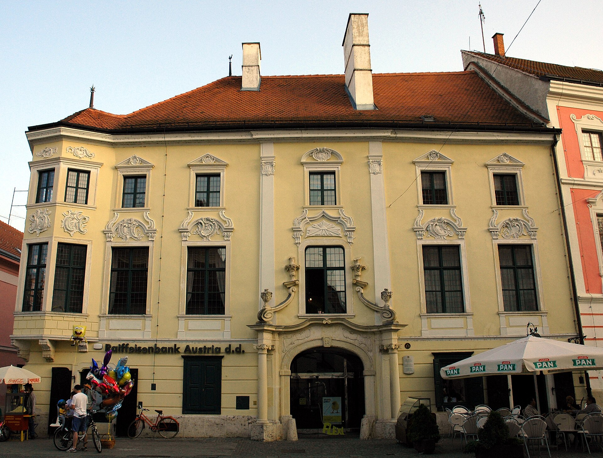
Patačić Palace
Patačić Palace is one of the finest Rococo residences in Varaždin, Croatia, standing on a street corner right in the heart of the old town. The two-storey corner building draws the eye with its distinctive bay window and elaborate stucco facade, and its history reaches back to the era when Varaždin served as Croatia's administrative capital and a gathering place for local nobility. What is the history behind the palace? A stone in the building's cellar bears the carved date 1669, a trace of an earlier construction phase when an older house stood on the site. At that time the property belonged to the Keglević family. In 1763, Katarina Keglević married Franjo Patačić and brought the house into the marriage as her dowry, which set in motion the rebuilding of the property into a showcase Rococo residence — the keystone above the entrance portal carries the date 1764. Throughout the 18th century the palace was a hub of Varaždin's social and cultural life, frequented by local nobility. The building survived the great city fire of 1776 without serious damage, even though the blaze destroyed much of the surrounding town. Following Franjo's death that same year, the estate passed to his widow Katarina, and by 1788 their son Ivan was recorded as the owner. Ownership changed in the 19th century: from 1808 the palace belonged to the merchant Pust (Pusth) family, and in 1860 the estate — which included two Varaždin palaces — was sold at public auction. Today the building serves institutional purposes, housing among other things a bank branch, and it is protected as an individual cultural monument under registry number Z-896. What will you see there? The main draw is the facade itself: rich Rococo stucco decoration paired with a distinctive corner oriel window resting on carved consoles, which visually "cuts" the corner of the building and emphasizes its prominent position at the intersection of two old-town streets. The stone entrance portal matches the style of the facade decoration, framed with detailed carved ornamentation. The interior is not generally open to visitors, since the building now serves institutional functions, but the exterior architecture alone makes it one of the most photographed sights in old Varaždin. The palace is best appreciated alongside its neighbors — Varaždin is known for its dense cluster of 17th- and 18th-century noble palaces, and a walk through the old town reveals how the Baroque and Rococo facades of different aristocratic families come together into a coherent, picturesque townscape. How do you get there? The palace stands in the very center of Varaždin's old town, within the pedestrian historic core, close to the main square. The location's coordinates are 46.3077024, 16.3370591. The most convenient way to reach it is on foot — the historic center is compact and best explored without a car, and most of the town's landmark palaces, including Patačić Palace, sit within a few minutes' walk of one another. When is the best time to visit? Spring and early autumn are the most comfortable seasons for exploring Varaždin, offering pleasant temperatures for walking the old town and fewer crowds for taking in the architectural details of the facades up close. The city is regarded as one of the best-preserved Baroque centers in this part of Europe, so it's worth setting aside at least half a day to explore the historic core properly. Frequently asked questions Can you visit the interior of Patačić Palace? The building currently serves institutional purposes, including housing a bank branch, so the interior is not generally open to the public in a museum-style format. Where does the palace's name come from? The name comes from the Patačić family, who acquired the property in 1763 as part of Katarina Keglević's dowry when she married Franjo Patačić, and who then had the building rebuilt into a representative residence. Is the palace a legally protected monument? Yes, it is listed in Croatia's register of immovable cultural heritage under number Z-896, classified as a residential-commercial building with individual protected-monument status. What else is worth seeing nearby? Varaždin's old town is packed with Baroque and Rococo noble palaces standing close together, so a visit to Patačić Palace pairs easily with a walk past the city's other historic residences in the compact center.
-
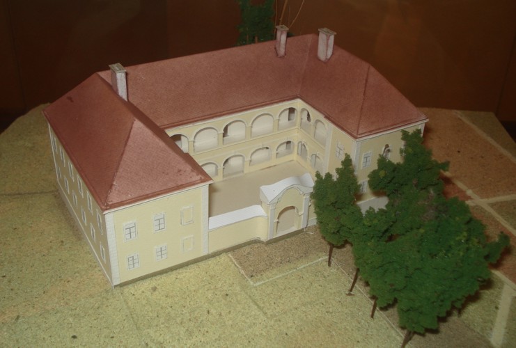
Dvorac Zajezda
Zajezda
Dvorac Zajezda is a Baroque manor house in the village of Zajezda, within the Budinščina municipality, at the heart of Hrvatsko Zagorje. It stands today as one of the region's more architecturally significant — yet badly neglected — noble residences, a remnant of the Patačić family's era and 18th-century craftsmanship. What's the history behind the manor? Zajezda served as the principal estate of the Patačić family, an old Croatian noble line that settled in Hrvatsko Zagorje from Bosnia in the early 16th century. The earliest known family member, Nikola Patačić, married Katarina Herkffy in 1536 and through her dowry acquired the Milengrad estate, also known as Zajezda. From that point on, the family adopted the predicate "de Zajezda," which they carried until the line died out. The manor itself was built around 1740, though the exact construction date isn't precisely fixed — it's estimated based on the family record known as "Status familiae Patachich." The builder was Johann Fuchs, an architect from Styria, which makes the manor a notable early example of mature Baroque architecture in northern Croatia. The building's fortunes changed dramatically in 1984, when an earthquake caused serious structural damage. Since then it has stood empty, fenced off and closed, slowly deteriorating. There's good news for its future, though: in 2026, funding of 400,000 euros was approved for documentation and structural-construction work as part of the manor's restoration. What will you see there? Dvorac Zajezda stands out for its unusual horseshoe-shaped, U-plan layout. Three wings of the building enclose an inner courtyard, while the fourth side is bounded by a wall with a gate portal. This kind of spatial arrangement was relatively rare in 18th-century Croatian residential architecture, underlining the manor's importance among the region's noble houses. The building is currently closed and cannot be visited inside — it can only be viewed from outside, beyond the fence. Even so, it makes an impression: the monumental structure, despite visible damage, still reads clearly as Baroque and gives a sense of the grandeur the Patačić residence once held. How do you get there? The manor sits in the village of Zajezda, within the Budinščina municipality, in the Hrvatsko Zagorje region — an area known for its dense network of historic manors and castles, often explored along the so-called Zagorje castle route. The most convenient way to reach it is by car, using local roads connecting the towns and villages of Hrvatsko Zagorje. It's worth combining a visit here with stops at other, better-preserved residences in the region, which together paint a fuller picture of the local nobility's history. When's the best time to visit? Since the manor can only be viewed from the outside, a day with good visibility works best — spring, summer or early autumn, when the surrounding greenery adds to the scenery. Keep in mind that the interior isn't open to visitors, and the grounds around the building may be partly fenced off for safety reasons. Frequently asked questions Can you go inside the manor? No. The building is closed to visitors due to its poor structural condition following the 1984 earthquake. Who built Dvorac Zajezda? The manor was built around 1740 for the Patačić family, designed by Styrian builder Johann Fuchs. Will the manor be restored? In 2026, funding of 400,000 euros was approved for documentation and structural-construction work related to the building's restoration. What makes this manor architecturally notable? Its horseshoe-shaped, U-plan layout, with three wings enclosing a courtyard and a walled fourth side featuring a gate portal — an unusual arrangement for 18th-century residential architecture in the region.
-
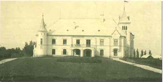
Bajnski Dvori Castle
Gornje Ladanje
Bajnski Dvori Castle is a ruined noble residence in the village of Gornje Ladanje, in the Vinica municipality, Varaždin County, about 15 km west of Varaždin in northern Croatia. Today it stands abandoned and partly derelict, surrounded by a landscape park that still hints at the estate's former scale despite decades of neglect. Who built Bajnski Dvori? The estate was founded in 1610 by the Hungarian nobleman Bot de Bajna, whose name gave the residence its title. The Bot family had Hungarian roots and, a century earlier, had produced two Croatian bans — Ivan (ban in 1493) and Andrija (ban between 1505 and 1507). Over the following centuries ownership passed through several aristocratic families typical of the Pannonian nobility: Batthyány, Erdődy, and Feštetić. By the mid-19th century the property belonged to Count Erdődy. Toward the end of that century, the residence housed a substantial art collection, reflecting the wealth and ambitions of its owners at the time. What happened to the castle? In 1918 a major fire destroyed much of the building along with the artworks kept inside. Only the east wing with its tower survived — and it's this weathered, partly ruined section that visitors see on site today. In the decades that followed, the building served as a psychiatric hospital before being abandoned; it has been decaying without conservation care ever since. What can you see on site? The main draw is the surviving east wing with its distinctive tower — a stark, partly ruined structure that still gives a sense of the estate's original scale. Around it stretches a landscape-style park, laid out in the manner typical of 19th-century aristocratic estates; despite being overgrown, elements of its original design are still recognizable. The grounds also include the remains of a lake and the former castle chapel — together forming a complex of architectural and garden-design heritage that, while neglected, is still considered historically valuable. This is a destination for visitors drawn to abandoned architecture, the history of Pannonian nobility, and rural-style exploration — it's not a restored, publicly managed castle open for guided tours, but an authentic, partly ruined residence left as it is. How do you get to Bajnski Dvori? Gornje Ladanje lies within the Vinica municipality, Varaždin County, roughly 15 km west of Varaždin. A car is the most practical way to reach it — the surroundings are rural, with the scattered settlement pattern typical of the Prigorje region on the edge of Zagorje. It's worth combining a visit with other stops in Varaždin County, since the area has a number of similar noble residences and manor houses. When is the best time to visit? Given the state of the site — open grounds, ruins, and a park with no tourist infrastructure — the best time to visit is spring through early autumn, when the park's vegetation is at its fullest and longer daylight hours make it easier and safer to explore an unlit site. Caution is advised due to the poor structural condition of the remaining building. Frequently asked questions Can you go inside Bajnski Dvori? The building is in ruins with no organized visits — entering the interior carries real risk given the poor state of the structure. Who built Bajnski Dvori? The estate was founded in 1610 by the Hungarian nobleman Bot de Bajna and later passed through the Batthyány, Erdődy, and Feštetić families. Why does only one wing of the castle survive? A major fire in 1918 destroyed most of the building and the artworks it held — only the east wing with its tower survived. Is there anything else to see around the castle? Yes — a landscape park, the remains of a lake, and the former castle chapel, together forming a historic architectural and garden complex.
-
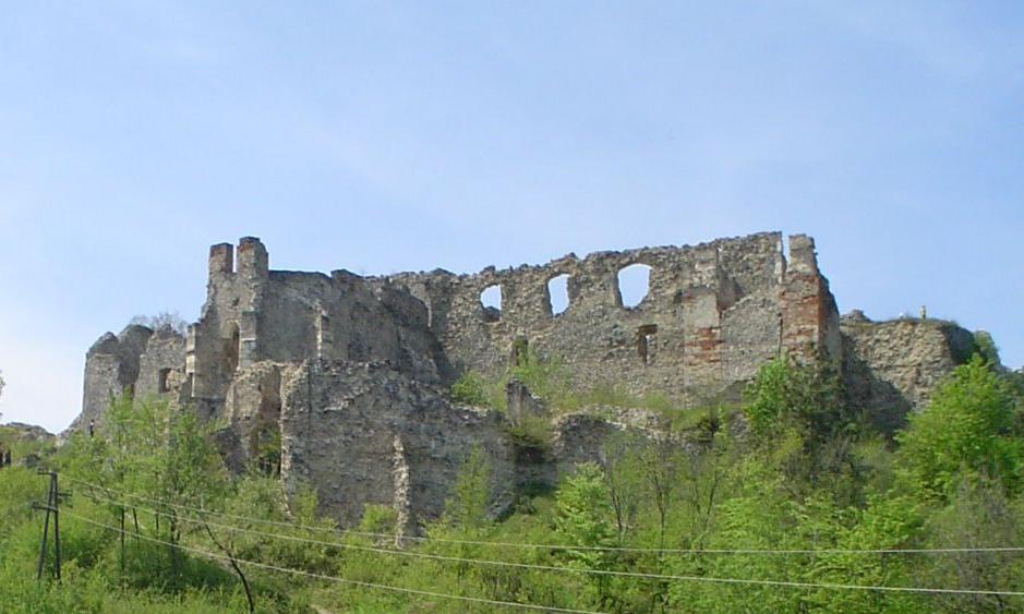
Ružica grad
Grad Orahovica
Ružica grad is a medieval castle ruin near Orahovica, in the Slavonia region of eastern Croatia, perched on the wooded slopes of Papuk Nature Park. It's one of the most atmospheric and least crowded historic sites in the area — a fortified complex on a rocky outcrop, reached only on foot through forest. Where is Ružica grad? The ruins sit on a steep cliff at the foot of the Papuk range, at an elevation just under 400 metres, roughly 2.5 km southwest of Orahovica town centre. The site's defensive value is obvious the moment you arrive: sheer rock faces on several sides gave defenders a natural advantage for centuries, and today reward visitors with views over the surrounding forest and valleys. What's the history behind the castle? Ružica first appears in written records in 1357, listed as a royal estate — but the exact date and circumstances of its construction were never documented and remain unknown. Over the following two centuries the castle passed through the hands of several Slavonian noble families. Nikola Kont of Orahovica is generally considered its most likely builder, and the property later belonged to Lovro Iločki, from the powerful Iločki noble house. Ružica grad is recognised as the largest preserved fortified settlement in all of Slavonia and is protected as a monument of the highest cultural category. What will you see on site? Surviving remains include sections of the defensive walls, towers and turrets. Within the complex stood a Gothic chapel dedicated to St Katherine, ceremonial halls, craft workshops, and even a dungeon. This wasn't just a noble residence — soldiers of the garrison and household servants lived here too, making it a largely self-sufficient fortified settlement rather than a single manor house. Despite centuries of decay, the scale of the ruins still makes an impression today. How do you get there? The standard route follows a forest trail starting at Jezero, Orahovica's popular local swimming spot, well used by residents and visitors in summer. The walk through the woods to the clearing at the base of the castle takes about an hour. It's a manageable hike for anyone in reasonable shape, no technical gear needed, though sturdy shoes are worth packing, especially after rain. Where does the name come from? Two legends are attached to the castle. The first tells of fairies who blocked construction until a magic rose was built into the walls — giving the fortress its name, Ružica, meaning "little rose." The second, darker story concerns Princess Ružica, who threw herself from the castle's tallest tower; where she fell, wild roses as red as blood are said to have grown. Both tales are still passed on by local guides and residents as part of the region's identity. Frequently asked questions How long is the walk to the castle? The forest trail from the Jezero swimming spot takes about an hour one way. Are these genuine medieval ruins or a reconstruction? They're authentic medieval remains — the surviving walls, towers and chapel date from the original construction, with no later rebuild into a reconstructed showpiece. Why is the castle called Ružica? The name comes from local legend, tied to the story of Princess Ružica and the wild roses said to have sprung up where she fell from the tower. Who built the castle? No founding document survives, but Nikola Kont of Orahovica is generally credited as the likely builder; the castle is first documented in 1357 as a royal estate.
-
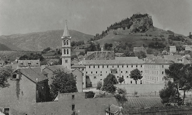
Stari grad
Grad Sinj
Stari grad is the ruined medieval fortress that rises above the town of Sinj, in the Dalmatian hinterland of central Croatia. Perched on a hill known simply as Grad, right above the Cetina River valley, it served for centuries as one of the region's key strongholds. What is the history behind the fortress? The hill has been fortified since Illyrian times, when a hillfort called Osinium stood here. In the 6th century the Byzantines held their own stronghold on the site, known as Asinio. The fortress reached its most important period in the 14th century: in 1345, Hungarian king Louis I granted the castle to the Croatian nobleman Ivan Nelipčić, and the Nelipić family made it their permanent seat. From here they controlled the entire Cetina valley, turning the fortress into one of the region's major centers of power. From the mid-15th century onward, Ottoman forces repeatedly appeared beneath its walls. Early attempts to seize the castle failed, but the Ottomans eventually captured it in the early 16th century. Ottoman rule over Sinj lasted until 1686, when Venetian forces retook the town and castle and subsequently reinforced and modernized its defenses. The fortress's most famous moment came in 1715, when a small garrison of roughly 700 defenders managed to repel a siege by a vastly larger Ottoman army — a victory still remembered as one of the defining events in the history of this part of Dalmatia. The castle's defensive role ended in 1808, when French troops mined and destroyed its fortifications in retaliation for a local uprising. It has stood in ruins ever since. How do you get to Stari grad? The fortress sits directly above the center of Sinj, on a hill visible from almost anywhere in town. The Grad hill now functions as a public park, and access to the former castle grounds is free and open to everyone. It makes a natural stop for anyone exploring Sinj and the surrounding Cetina valley. What will you see on site? Little of the original fortress survives intact. Centuries of conflict, earthquakes, and the French demolition of its walls mean that today visitors mainly find scattered defensive walls and the outline of the old fortifications rather than an intact castle. Even so, the hill itself remains a rewarding place to walk, with views over Sinj, the surrounding hills, and the Cetina river valley. For anyone interested in the history of Dalmatian border defense and the long Croatian-Ottoman conflict, the site carries significant symbolic weight despite its modest physical remains. When is the best time to visit? Since the site is an open hilltop with no covered areas, it is most comfortable to visit outside the peak of summer heat — spring, early summer, or autumn, when temperatures in Dalmatia's inland climate are milder. A visit to the hill pairs naturally with exploring the town of Sinj at its base. Frequently asked questions Is entry to the fortress site free? Yes. The Grad hill and the fortress ruins form an open public area that visitors can access freely at any time. How much of the original fortress remains today? Very little in its original form — centuries of warfare, earthquakes, and the French demolition of 1808 left mainly fragments of the defensive walls standing. Why is this fortress historically significant? In 1715, a small garrison stationed here repelled a siege by a far larger Ottoman force, making the site a lasting symbol of resistance to Ottoman expansion in Dalmatia. Who built the fortress and who controlled it over time? The hill was fortified as early as Illyrian and Byzantine times, but the castle as later known developed from 1345 under the Croatian Nelipić family, before passing successively under Ottoman and then Venetian control.
-
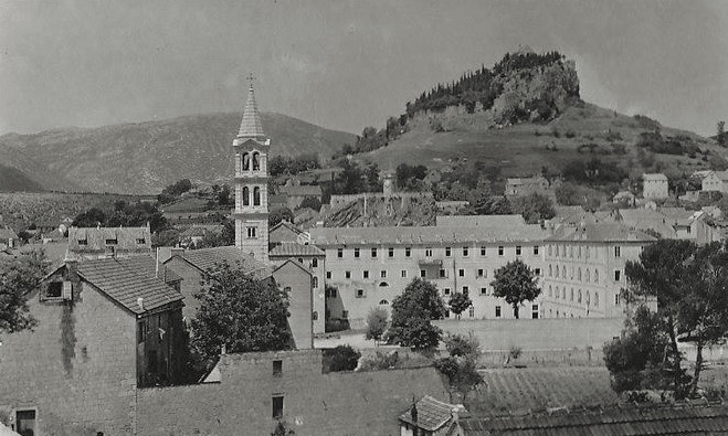
Kamičak
Grad Sinj
Kamičak is a star-shaped fortress in Sinj, one of the most recognisable landmarks of this Dalmatian town. It sits on the hill that shares its name, right in the town centre, facing the Church of the Miraculous Madonna of Sinj. Built in 1712, it remains a must-see stop for anyone visiting a town best known for the centuries-old knights' tournament, the Sinjska Alka. How do you get to Kamičak fortress? Kamičak stands in the heart of Sinj, so reaching it is straightforward — it's only a short walk uphill from the main square and central streets. Sinj is well connected by road to Split, less than an hour's drive away, which makes the fortress an easy day-trip destination from the coast. Because the approach climbs the hill, comfortable shoes are a good idea, though the view from the top makes the short climb worthwhile. What can you see there? Kamičak stands out for its star-shaped layout, typical of fortifications from its era. It was built by local master builders Ignacije Macanović and Jakov Cincidela, whose work resulted in a compact, well-preserved defensive structure. On its south-western side, the fortress connects to the former cavalry quarters, today known as the Alka Knights' Court (Alkarski dvori) — a site closely tied to the Alka tradition. Inside the fort stands a tower that once served as an observation point. It's topped by a clock that chimes three minutes before the hour and then strikes the exact time, along with a bronze bell cast at the renowned Italian Colbachini family foundry. The fortress's present-day appearance, including the walls encircling the hill and the pine trees planted around it, dates back to 1890, when the site underwent a thorough renovation. Kamičak is now protected as a cultural monument by Croatia's Ministry of Culture. It's worth noting that Kamičak is the town's secondary fortress — the older, main stronghold is the nearby Grad, standing on an adjacent hill. Together with the Alkarski dvori and the Alkarsko trkalište racing ground, both fortresses form an authentic ensemble tied to the three-century-old Alka tradition, a symbol of the region's courage and desire for freedom. When is the best time to visit? Summer is the best season to visit, when the weather is ideal for exploring the hill on foot and Sinj comes alive with cultural events. During the warmer months, the fortress hosts evening music events, adding an intimate atmosphere to its historic walls. If your trip coincides with the first Sunday of August, it's worth planning your stay around the Sinjska Alka — the town's most important annual event, though the tournament itself takes place on the nearby racing ground rather than inside Kamičak. Spring and early autumn offer a quieter alternative, with fewer visitors and milder temperatures, ideal for travellers who prefer a calmer pace of sightseeing. Frequently asked questions Is there an entrance fee for the fortress? Visiting rules and any fees are best checked on site or at the local tourist information centre, as they can vary by season and scheduled events. How is Kamičak different from the Grad fortress in Sinj? Kamičak is the smaller, secondary fortification historically linked to the cavalry and the Alkarski dvori, while Grad is the older, main fortress of the town, standing on the neighbouring hill. Can you reach the fortress on foot? Yes, it sits in central Sinj, within easy walking distance of the town's main sights, though the final stretch climbs uphill. What else is worth combining with a visit to Kamičak? A natural addition is a walk to the Church of the Miraculous Madonna of Sinj across from the fortress, as well as to the Alkarski dvori and the Grad fortress if time allows.
-
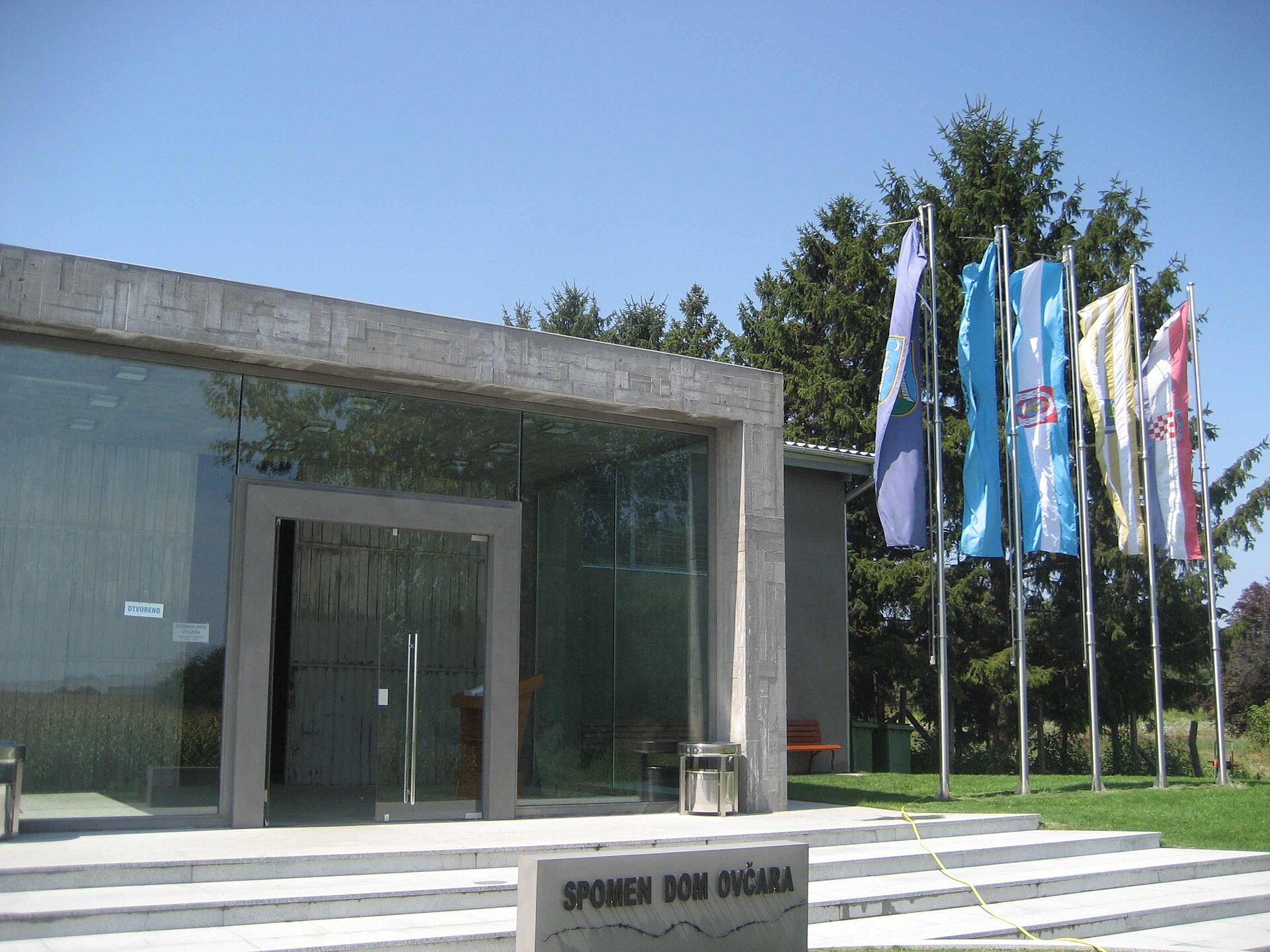
Ovčara Massacre Memorial
Vukovar
Ovčara Massacre Memorial stands a few kilometers southeast of Vukovar, on the grounds of a former agricultural farm. It marks one of the gravest crimes of the Croatian War of Independence (1991–1995) and is essential for anyone who wants to understand Vukovar's history beyond its rebuilt streets. What happened here? Vukovar fell on 18 November 1991 after a three-month siege. Some of the town's remaining defenders and wounded civilians had taken shelter in the city hospital, hoping international observers would guarantee their safety. The following day, Serb paramilitary units, to whom the Yugoslav People's Army had handed control of the prisoners, removed roughly 250 people from the hospital and drove them to a hangar on the Ovčara farm. There they were held and beaten, and on the evening of 20 November 1991 they were shot at a nearby field and buried in a mass grave. The International Criminal Tribunal for the former Yugoslavia (ICTY) confirmed close to 200 deaths in this single execution, making it the largest massacre of the entire war. The mass grave was located and exhumed in 1996, allowing most victims to be identified. What will you see at the Memorial Centre? The Ovčara Memorial Centre opened in 2006 inside the same restored storage building where prisoners were held before the killings. Architect Miljenko Romić designed the space to feel deliberately dim and austere: illuminated portraits of the victims line the walls, and the concrete floor holds a spiral installation bearing all 261 names, known as the Spiral of Evil (Spirala zla) — a form meant to evoke the vortex that swallowed their lives. Spent cartridge casings recovered from the site are also set into the floor. The exhibition includes personal belongings and documents recovered during the exhumation — watches, identity papers, everyday items that give the history a deeply personal weight. Touring the building itself takes about half an hour. A modest marker stands nearby at the site of the former mass grave, worth a few quiet minutes on its own. How do you get there? Ovčara sits in an isolated spot next to the former agricultural cooperative's buildings, a few kilometers from central Vukovar (address: Ovčara bb, 32000 Vukovar). A car or taxi is the most practical way to reach it, since public transport in the area is limited and most organized groups arrive by coach. Independent travelers should plan their own transport from Vukovar. The centre is generally open daily during daytime hours, but it's worth confirming the current schedule locally before visiting, since hours can shift outside peak season. How should you prepare for the visit? This is a site of national remembrance, not a conventional tourist attraction. Visitors are expected to keep a respectful, quiet demeanor and avoid posed photography around the installation bearing the victims' names. Many people combine a visit to Ovčara with the other memorial sites in Vukovar itself, building a fuller picture of the events of 1991. Frequently asked questions How long does a visit to the Ovčara Memorial Centre take? The exhibition inside the building takes roughly 30 minutes. Adding a short stop at the mass grave marker, a full visit usually runs a little over an hour. Is there an entrance fee? The centre functions as a memorial and educational site — it's best to confirm any current admission arrangements locally before your visit, as details can change. Can you get there without a car? This is the trickiest part of planning a visit, since public transport in the area is sparse. A rental car, a taxi from Vukovar, or joining an organized tour focused on the sites of the Homeland War are the most practical options. Why does this site matter so much to Croatia? Ovčara embodies the price Vukovar paid during the 1991 siege and remains one of the central memorial sites tied to the Croatian War of Independence, alongside the Vukovar Water Tower memorial and the town's Homeland War victims' cemetery.
-
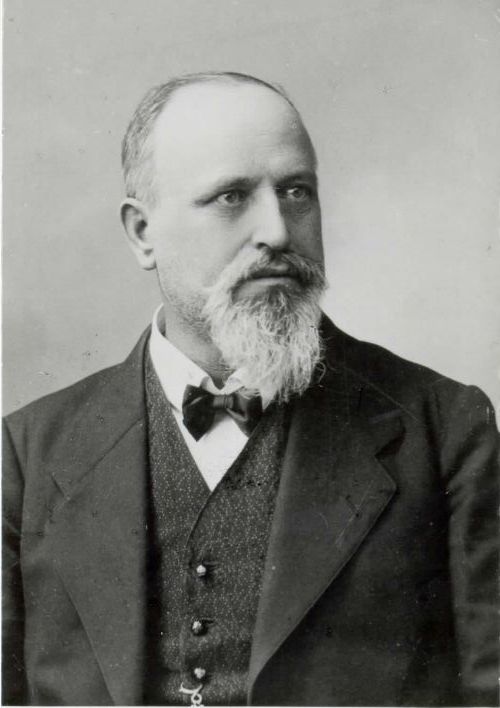
Karel Štrekelj
The Karel Štrekelj monument stands in the village of Gorjansko, in the municipality of Komen on the Slovenian Karst — a small settlement that produced one of the country's most important linguists and folklorists. The bronze bust, created by academic sculptor Mirsad Begić, was unveiled on 14 June 2009, exactly 150 years after Štrekelj's birth. For a small Karst village, it was a genuinely significant occasion, and the local community still keeps his memory alive today. Who was Karel Štrekelj? Karel Štrekelj was born in Gorjansko on 24 February 1859. He became a Slavist, linguist and ethnologist, and above all the man responsible for one of the most complete collections of folk songs among all Slavic nations. From 1886 onward, working under the Matica Slovenska society, he spent years compiling "Slovenske narodne pesmi" (Slovenian Folk Songs), gathering nearly 8,700 songs from across the Slovenian ethnic territory. He died in Graz in 1912, but it is his native Gorjansko that keeps his legacy visible today. What will you see on site? The centerpiece is a bronze bust of Štrekelj placed in the middle of the village. It's a modest but symbolically meaningful monument — a classic bust-style sculpture, a form commonly used across Slovenia to honor cultural figures. The setting is intimate: a village square rather than a large museum complex, so the visit itself takes only a few minutes, but it pairs well with a short walk through the village, built in the stone-house style typical of the Karst region. How do you get there? Gorjansko lies on the Karst plateau, in the municipality of Komen, in southwestern Slovenia, close to the Italian border. Driving is the most practical option — the village sits a short distance from the town of Komen and relatively close to Sežana and the border crossing toward Trieste. This is classic Karst landscape: limestone hills, vineyards and stone villages, so the drive itself is part of the experience. There's no major public transport hub nearby, so a car or bicycle is the way to go. What else is worth seeing nearby? The Karst region is best known for its caves — including the famous UNESCO-listed Škocjan Caves — and for its wine tradition. Within a short drive of Gorjansko you'll find numerous farms offering tastings of local Teran wine and pršut, the region's air-dried Karst ham. That makes it easy to combine a stop at the monument with a longer day exploring the wider area. When should you visit? The monument is accessible year-round, since it stands in an open village square. Spring and autumn are the most pleasant seasons to visit, when Karst temperatures are mild and the surrounding vineyards look their best. It's also worth knowing that since 2001, Gorjansko has awarded the Štrekelj Prize, a local honor recognizing the village's most distinguished residents — a reminder that this is a living point of local identity, not just a historical relic. Frequently asked questions Where exactly is the Karel Štrekelj monument located? In the village of Gorjansko, municipality of Komen, on the Karst plateau in southwestern Slovenia. Who was Karel Štrekelj and why does he have a monument? He was a Slovenian linguist and ethnologist who collected nearly 8,700 folk songs and edited the monumental collection "Slovenske narodne pesmi." The monument in his native village honors his contribution to Slovenian culture. When was the monument unveiled? On 14 June 2009, marking the 150th anniversary of Štrekelj's birth. Is it worth combining the visit with other Karst attractions? Yes — the surrounding area offers vineyards, pršut farms, and the famous Škocjan Caves, making it easy to plan a full day exploring the region.
-
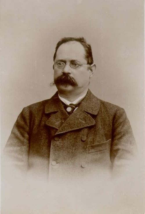
Simon Rutar
Kobarid
The Simon Rutar Memorial Room is a small heritage exhibit in the hillside village of Krn above Kobarid, dedicated to one of the region's pioneering historians and geographers. Simon Rutar (1851–1903) grew up on the Mohova farmstead in Krn. He went on to become one of the founding figures of Slovene historiography, geography, archaeology, and heritage conservation. His best-known work, "Zgodovina Tolminskega" (History of the Tolmin Region), published in 1882, remains a reference point for researchers of the area to this day. On the centenary of his birth in 1951, the first memorial plaque was mounted on his family home in Krn, and the Tolmin museum later staged two smaller exhibitions there about his life and work. What will you see at the memorial exhibit? In 2011 the display was moved to two floors of a farm outbuilding standing near the family house, in rooms above the village's former dairy (address: Krn 9). Here you'll find documents from Rutar's own archive alongside photographs of the places where he lived and carried out his research — from the Tolmin valley to Istria and the Karst. This is a modest, community-run exhibit rather than a large institutional museum, maintained by local residents in cooperation with the Tolmin Museum. How do you get there and visit? Krn is a small village set high above the Soča Valley, overlooking Kobarid, reached by a winding mountain road — allow extra time for the drive. The exhibit is not permanently open: the key to the rooms is kept at house number 8 in the village, and visits must be arranged in advance by phone. The person in charge, Lidija Manfreda, can be reached at 031 546 382 to schedule a viewing. The Tolmin Museum (Mestni trg 4, Tolmin), which formally oversees the collection, can also provide additional information. Why is this stop worth the detour? This is a destination for visitors specifically interested in the history of the Tolmin region and Posočje, not a mainstream tourist attraction with crowds. A visit to Krn pairs naturally with a walk through the mountain village and views over the Soča Valley — the wider Kobarid area is well known for its World War One heritage trails and scenic viewpoints, making the memorial room an easy addition to a longer day of exploring. Who was Simon Rutar? Born in 1851 and died in 1903, Simon Rutar was a largely self-taught historian who, despite lacking formal academic training in the field, became one of the most important researchers of the Slovene Littoral's past. He wrote chiefly about the history and geography of what is now the Slovenian Littoral, the Italian region of Friuli-Venezia Giulia, and the Croatian counties of Istria and Primorje-Gorski Kotar. His work is still cited by regional historians today, even though some of the original archival material he relied on was destroyed in a fire at the Tolmin archive during the First World War. Frequently asked questions Is the Simon Rutar memorial room always open? No. It is a small, community-run exhibit with no fixed opening hours — visits require calling ahead to arrange access to the key. Where exactly is the exhibit located? In the village of Krn above Kobarid, at Krn 9, on the upper floor of a farm building next to the former village dairy. What can you actually see inside? Documents from Simon Rutar's personal archive and photographs of the places connected to his life and research work. Who was Simon Rutar and why does he matter to the region? He was a 19th-century historian and geographer, a pioneer in studying the Tolmin region and the wider Slovene Littoral — his 1882 work "Zgodovina Tolminskega" remains one of the foundational sources on the area's history.
-

Kaverna I.sv.vojne
Nova Gorica
The WWI Cavern (Kaverna I. sv. vojne) forms part of an extensive network of underground shelters carved into the rock of Sabotin hill, just outside Nova Gorica on the Slovenian side of the border with Italy. The site belongs to the Isonzo Front of 1915–1917, one of the deadliest theatres of the First World War, where Austro-Hungarian and Italian forces fought for nearly three years. What will you see there? Rising to 609 metres, Sabotin was a critical defensive point for the Austro-Hungarian bridgehead protecting Gorizia. Soldiers carved a cavern system straight into the solid rock, spread across nine levels down the steep slope and stretching for more than ten kilometres in total. At its peak, up to 600 soldiers and 80 pack mules lived inside these underground corridors and chambers at once. Today, a restored stretch of over a kilometre lets visitors walk through both the Austro-Hungarian living quarters and the Italian artillery positions built along the ridge. How do you get there? Sabotin hill sits a few kilometres west of central Nova Gorica, right on the Slovenian-Italian border. A marked hiking trail leads to the site, and the Park miru (Peace Park) organises guided tours through the cavern system. Sturdy footwear and a flashlight are worth bringing, since the terrain is uneven and some passages run underground. What should you know before visiting? Beyond the caverns themselves, the summit of Sabotin hosts an open-air museum with trenches, combat positions, and information panels. The hilltop also offers one of the widest panoramas in the region — on a clear day the view stretches from the Adriatic Sea to Mount Triglav — combining historical depth with striking scenery. When is the best time to visit? Spring and autumn bring the mildest weather and fewer crowds than summer. Hot summer days can make the exposed sections of the hike tiring, though the inside of the caverns stays cool year-round. In winter the paths can turn slippery, so it's worth checking conditions before setting out. Why is this site worth a visit? The Sabotin caverns are among the best-preserved and most accessible remnants of the Isonzo Front near Nova Gorica. Unlike many other WWI positions in the area that demand serious mountain hiking, this underground network has been partly adapted for visitors without specialist gear. It offers a rare, tangible look at the conditions soldiers endured during one of the war's most gruelling campaigns. Frequently asked questions Do you need a guide to visit the caverns? The Park miru at Sabotin runs guided tours that make it easier to understand the layout of the tunnels and the history behind them. Some surface trails can also be walked independently. How long does a visit take? Walking the accessible stretch of caverns and trenches usually takes one to two hours, depending on pace and how many stops you make at the information panels. Is the site suitable for children? Yes, though the uneven terrain and narrow passages inside the caverns call for supervision and comfortable shoes. Are the caverns dark and cold inside? The interior is cooler than the surface, and some corridors require your own light source — a flashlight is recommended even though the main routes are partly lit.
-
Jazovka
Sošice
Jazovka is a karst pit in the forests of the Žumberak hills, a few kilometers from the village of Sošice in central Croatia — a site that carries the weight of a tragic history. This is not a tourist attraction in the usual sense but a memorial site that deserves to be approached with solemnity and respect for those who died there. What kind of place is this? Jazovka is a natural karst shaft: a vertical, well-like opening roughly 34 meters deep, leading into a longer sloping passage about 15 meters long at the bottom. Between 1943 and 1945 it became a site of mass executions and burials carried out first by Yugoslav Partisans and later by soldiers of the Yugoslav Army. Wounded soldiers, medical staff, and civilians — including patients removed from Zagreb hospitals — were thrown into the pit. Many did not die instantly but succumbed to their injuries and exposure at the bottom of the shaft. The site was rediscovered in 1990, after the fall of communism, when the remains of more than 800 people were found. In 2020, the remains of 814 victims were exhumed from the pit, and on August 23, 2025, a formal burial ceremony was held in nearby Sošice, led by the Archbishop of Zagreb, Dražen Kutleša. Jazovka is listed in Croatia's Register of Cultural Goods as a memorial site. How do you get there? Jazovka lies in the forests of Žumberak, within the municipality of Krašić, close to the village of Sošice. The easiest way to reach it is by car from Zagreb (about an hour's drive) or from Karlovac, heading toward Krašić and continuing on local roads to Sošice. The final stretch to the pit itself follows a forest path — sturdy footwear is recommended, especially after rain, since the ground is often damp and uneven. What will you see there? Next to the opening of the pit stands a modest memorial commemorating the victims. The atmosphere is quiet and austere — there is no tourist infrastructure, no cafés or viewpoints. The pit itself is fenced off and secured for safety reasons; descending into it is not possible. The surrounding Žumberak forest, covered in beech and hornbeam, adds to the site's solemn character. When should you visit? Every year, usually in June, a public memorial pilgrimage (spomen-pohod) is organized to Jazovka, bringing together victims' families, clergy, and residents of the region. If you want to experience the site in its full historical and religious context, plan your visit around this date. Outside that period, the site is typically visited individually, in quiet reflection — spring or autumn are the best seasons, since the forest paths are easier to walk than in winter. Frequently asked questions Is Jazovka safe to visit? Yes, though the pit itself is fenced off and cannot be entered. Visitors view the opening and the memorial from a safe distance along a marked path. Is there an entrance fee? No, access to the memorial site is free and open year-round. How much time should I set aside for a visit? The visit itself takes 20–30 minutes, but the forest walk to and from Sošice extends the outing to roughly an hour. Is this a suitable destination for children? Given its historical nature as a mass execution site and the lack of typical tourist facilities, Jazovka is better suited to adults interested in 20th-century history than as a family attraction.
-
Tito’s Cave
Grad Komiža
Tito's Cave (Titova špilja) is a modest rock cavern above the town of Komiža on the island of Vis that served, in the summer of 1944, as the wartime headquarters of Josip Broz Tito and the command of the Yugoslav Partisan resistance. Tucked below Hum, the island's highest peak, it's now one of the most visited historical sites on Vis. Why did Tito end up here? In May 1944 the Germans launched an airborne raid on the Partisan headquarters at Drvar, aiming to capture or kill Tito and the entire Yugoslav leadership. Tito narrowly escaped. Looking for a safer base, he moved to Vis — an island held by the Partisans and reinforced by British forces, including the 2nd Commando Brigade. While the rest of the Croatian coast remained under German control, Vis became the main Partisan naval base and a liaison point with the Allies stationed in southern Italy. From June to October 1944, Tito ran diplomatic contacts with the Allies and directed operations to liberate the Croatian coast and islands from this cave. What's inside? The cave is made up of two connected chambers cut into the rock, linked by stone steps, with parts of the interior reinforced by traditional dry-stone walling. One chamber functioned as an office, fitted with a desk, chair and a field telephone that Tito used to stay in contact with commanders and Allied liaisons. The other served as sleeping quarters. The interior is empty today — none of the original furnishings survive — but the layout and the sheer inaccessibility of the spot still convey what wartime command from hiding actually looked like. The cave's older name, Duhova špilja (Cave of the Holy Spirit), comes from the nearby peak of Sveti Duh (Hum). How do you get there? A steep, winding road climbs the hillside above Komiža and gets you close to the entrance by car or scooter. The final stretch is a stone staircase of roughly 200 steps, so sturdy shoes are a must. Several local agencies run guided tours that combine the cave with other WWII sites on the island, including the military tunnels and the missile base at Stupišće point. When's the best time to visit? Early morning or late afternoon works best, when the heat is milder and the climb more manageable. Spring and early autumn are the most comfortable seasons — in summer the route offers little shade and can get quite hot. Frequently asked questions Is entry to the cave free? Visiting the cave itself is free, but guided tours combining it with other military sites on the island are paid. Is the walk difficult for children or older visitors? The climb involves around 200 stone steps and a steep approach road, so it's worth allowing extra time for rest stops and bringing water. Are there any original items left from Tito's time there? No — the interior is empty today. The historical value lies in the layout of the rooms and the events of 1944, not in artefacts. What else is worth seeing nearby? Nearby you'll find Partisan-era tunnels and a missile base at Stupišće point — both are often included in the same tour as the cave.
-
Žuželj
Grad Ploče
Žuželj is an Illyrian cult hillfort in the town of Ploče, in Dubrovnik-Neretva County, located in the area known as Zapadna Plina. It belongs to a group of prehistoric gradinas — fortified hilltop settlements — that served as a religious and cultic centre for this part of Dalmatia for thousands of years. What will you see there? A narrow path paved with cut stone leads up to the summit, and the approach to the hilltop is marked by preserved dry-stone defensive rings, remnants of ancient fortifications. On the flat top you can still make out traces of the old defensive structures, surrounded by the typical landscape of the Neretva hinterland — low hills and stony pastureland. The eastern slope of Žuželj ends exactly at the spot where the Roman Catholic Church of St John the Baptist was built in the early 18th century in Romanesque style. This juxtaposition of a pagan cult hill and a Christian church is unusually clear here, illustrating an unbroken sacred use of the same site from Illyrian times, through the Roman period, into the Middle Ages. Right next to the church, archaeologists uncovered five stećci — medieval stone tombstones typical of the Western Balkans. Žuželj does not stand alone. Nearby lie further Illyrian gradinas — Velika gradina above Vidonja, Grad, and gradina Sirač — while tumuli are scattered along the old prehistoric route that once connected Narona in the Neretva valley with today's Vrgorac-Neretva field (formerly a lake). Together they form a dense network of archaeological sites that can be explored on a single walking trip around Ploče. How to get there? Žuželj lies within the administrative boundaries of the town of Ploče, so reaching it doesn't require a long trip — it makes a natural destination for a short walk for anyone staying in or passing through the town on the way to the coast. Because the ground is stony and uneven, and there is no visitor infrastructure on site, sturdy trekking shoes and water are recommended — there's no shade or catering on the hill. When to visit? Spring and early autumn are the best times to climb Žuželj, when temperatures in the Neretva valley are milder than at the height of summer. In summer the exposed, rocky terrain heats up quickly, so a morning visit is advisable. The site is accessible year-round, with no booking or ticket required. Frequently asked questions Is Žuželj an officially protected archaeological site? Yes, the hill together with the nearby Church of St John the Baptist and the stećci form a documented archaeological site with a layered history spanning from the Illyrian era to the Middle Ages. Is there an entrance fee? No, climbing the hill is free and can be done independently, without a guide. How long does a visit take? Reaching the summit and viewing the ruins and the church usually takes between 30 and 60 minutes, depending on your pace and interest in the surrounding gradinas. Can the visit be combined with other nearby attractions? Yes — nearby you'll find other Illyrian gradinas (Velika gradina, Grad, gradina Sirač) and tumuli along the old route from Narona, making it easy to plan a longer archaeological and landscape route around Ploče.
-
Gradina
Donja Krušica
Gradina is a modest archaeological rise above the cove of Donja Krušica on the island of Šolta, within the Donje Selo area of Split-Dalmatia County. It packs prehistoric, Roman, and early Christian layers into one quiet hilltop above the sea. What has been found on the hill? Excavations on top of the rise uncovered the walls of a rectangular building with a preserved floor mosaic, evidence of construction going back to antiquity. Nearby, archaeologists identified traces of villae rusticae — Roman rural estates — along with the remains of old burial mounds and individual graves. Add to that the foundations of an early Christian church dedicated to St. Helena (Jelena/Jele), dated to the 6th century. The church standing there today was built in the mid-18th century, but directly on top of those ancient foundations: the altar table is an early Christian sarcophagus carved with a cross, and fragments of even older stone decoration are set into the apse walls. Together, these layers point to more or less continuous settlement here from antiquity through the Middle Ages. How do you get there? The starting point is Donje Selo, which sits on the road between Grohote and Maslinica — a route also followed by a popular cycling path connecting all three villages, so a visit to Gradina fits neatly into a longer ride across the island's interior. From Donje Selo, an asphalt road roughly a kilometer long leads down to the Donja Krušica cove, with the final stretch up to the hill covered on foot along a narrow path through Mediterranean scrub. This remains a quiet, low-key corner of the island — no shops or restaurants on site, but a small, shallow harbor lined with local fishing boats. What else is worth seeing nearby? Beyond the archaeological site itself, it's worth stopping in Donje Selo, where stone lanes and restored houses preserve the traditional island architecture. Two churches stand there: the parish church of St. Martin and the aforementioned St. Helena's, built over the Gradina foundations. In 2010, Donje Selo unveiled a "Footsteps of St. Martin" marker, linking Šolta to the European pilgrimage route dedicated to the saint. Donja Krušica itself, though tiny, has been drawing a growing number of visitors each year as a peaceful spot to unwind by the water. When should you visit? Late spring and early autumn are the best times to explore Gradina and the surrounding cove, when the heat is milder and the scrub-lined paths easier to walk. In summer, the cove serves as a quieter alternative to Šolta's busier beaches, though it keeps its low-key character thanks to the absence of built-up tourist infrastructure. Frequently asked questions Can you actually see the ruins at Gradina? Yes — remnants of walls and old structures are visible on the rise, though this is a historical site rather than a reconstructed archaeological park, so it's worth visiting with that expectation in mind. Are there shops or restaurants in Donja Krušica? No, it's a small, low-key cove without developed services — head to nearby Donje Selo for supplies or a meal. What's the best way to reach Donja Krušica? The easiest route is via the asphalt road from Donje Selo, about a kilometer long, continuing on foot or by car — the village sits off the island's main routes, which is part of its appeal. How is Gradina connected to the Church of St. Helena? The church standing in Donje Selo today was built in the 18th century directly on the early Christian foundations discovered on Gradina hill, even reusing an ancient sarcophagus as its altar.
-
Purkin kuk
Grad Stari Grad
Purkin kuk is a hill above the village of Dol on the island of Hvar, and one of the most rewarding lookout points in the Stari Grad area. At its summit, roughly 274–276 metres above sea level, stand the remains of a prehistoric hillfort together with the largest stone burial mound found anywhere on the island. What's on top of the hill? The ruins on Purkin kuk date back to the Iron Age, built by the island's indigenous population long before Greek settlers arrived from Paros in the 4th century BC. On the western edge of the summit, sections of megalithic walls still survive, though archaeologists have never definitively agreed on their original purpose. The site was first examined in the 19th century by Šime Ljubić, and more thorough excavations followed in 1978 and 1979 under Marin Zaninović of the Faculty of Humanities and Social Sciences in Zagreb. The hillfort was built for defence and observation rather than habitation — it sits about 1.5 km southeast of ancient Pharos, today's Stari Grad. Later, under the Greeks, Purkin kuk became one of three watchtowers (alongside Maslinovik and Tor) guarding the farmland of the Stari Grad Plain. Why climb Purkin kuk? The real draw is the view. From the summit you get a full panorama over the Stari Grad Plain, a UNESCO World Heritage site that Greek colonists divided into a grid of rectangular plots — a chora — back in the 4th century BC. That field pattern, along with its dry-stone walls and drainage channels, has survived almost unchanged and is still farmed today for grapes and olives. From up here you can also pick out the town of Stari Grad itself, part of the bay, and the surrounding hills. How do you get to Purkin kuk? The hill can only be reached on foot. Marked trails lead up from Stari Grad and from the village of Dol, with the Dol approach being shorter and steeper. No special gear is required, but wear proper walking shoes, bring water, and avoid the midday heat — there's no shade anywhere on the route. When is the best time to visit? Early morning or late afternoon works best, both for the temperature and for photography, since the plain looks its most striking in low light. Spring and autumn are the most comfortable seasons for hiking on Hvar; in summer, expect strong sun on this exposed, treeless trail. Frequently asked questions How long does it take to reach Purkin kuk? From Dol, the climb usually takes 20–30 minutes; from Stari Grad the walk is longer, around 45–60 minutes depending on pace. Is there anything to see besides the view? Yes — the remains of a stone burial mound and fragments of prehistoric and Greek defensive walls, though these are modest, unreconstructed ruins rather than a restored monument. Is Purkin kuk part of the UNESCO site? The hill sits on the edge of the UNESCO-listed Stari Grad Plain and served as one of the watchtowers protecting it in Greek times. Is the trail suitable for children? The shorter route from Dol is manageable for older children with adult supervision, though the steep, shadeless path can be tough going in hot weather.
-
Gradina
Dazlina
Gradina is a small hill and archaeological site in Dazlina, a village in the Tisno municipality, Šibenik-Knin County, Croatia. Rising to 163.2 metres above sea level west of Vedrog Field and the hamlet of Matešići, it sits well off the usual coastal holiday route, making it a worthwhile inland detour for travellers based in Tisno or Vodice. What will you see on Gradina hill? The summit preserves the remains of a prehistoric fortified settlement — a gradina, the type of hillfort that gave the hill its name. The site, also known as Gradina Stražbenica, covers roughly 0.6 hectares and belongs to a dense network of Iron Age hillforts scattered across the hinterland of Šibenik. Visible traces include the outlines of old ramparts and stone terracing, typical of Dalmatian gradinas built on naturally defensible high ground overlooking surrounding fields and valleys. From the top, the view opens onto Vedrog Field and the agricultural landscape of Dazlina — a patchwork of fields, dry-stone walls and scattered farmsteads, a world away from the tourist coast just a dozen or so kilometres distant. How do you get to Gradina from Tisno or Vodice? Dazlina lies about 10 km northeast of Tisno, inland and away from the main coastal roads. Driving is the most practical option: local roads connect the village to Tisno and Vodice, from where the main routes toward Šibenik and the A1 motorway also run. The hill itself is reached via an unmarked farm track from the Matešići side — it's worth asking locally for directions, since the site has no signage or marked hiking trail. What's the history behind the site? Hillfort settlements of the gradina type appeared in this region as early as the Iron Age, serving local communities as lookout points and refuges. The area around Dazlina also played a part during the wars with the Ottoman Empire — in 1571, Ottoman forces captured nearby Rakitnica and its fortress, directly threatening the coastal town of Vodice. That turbulent history explains why the hinterland of Šibenik and Vodice preserves so many fortified hilltops: for centuries the area formed a frontline between the coast and inland incursions. When is the best time to visit? Spring (April to June) and early autumn (September and October) are the most comfortable seasons, with mild temperatures for walking the shadeless hill and green surrounding fields. In summer, when the coast is at its busiest, an early morning visit is best — there's no shade or tourist infrastructure on the hill itself. Frequently asked questions Are there marked trails or information boards at Gradina? No. The site has no formal tourist infrastructure — no signage or marked path, only a local farm track leading up from Matešići. How long does a visit take? Climbing the hill and viewing the hillfort remains typically takes 30–45 minutes, depending on your pace and the weather. Is it worth combining with a stay in Tisno or Vodice? Yes — it makes a natural inland excursion for travellers staying on the coast, revealing the agricultural, historical side of the Šibenik region. Is there food or parking nearby? Dazlina itself has little dining infrastructure, so it's best to bring water and snacks from Tisno or Vodice beforehand. Parking is possible along the road leading into the village.
-
Sveti Križ
Grad Rijeka
Sveti Križ is a hill and historic locality in Gornja Vežica, one of the districts of Rijeka, Croatia. The site combines a small votive church, traces of prehistoric settlement, and a viewpoint over the Kvarner Gulf, making it a draw for both history enthusiasts and locals looking for a quiet break from the city below. What is there to see on Sveti Križ? At the heart of the hill stands a modest votive church dating back to the 15th century, with some records suggesting an even earlier origin. Surviving parish documents mention a new image acquired for the church in 1607, as well as the names of residents who donated to its upkeep in 1666 - evidence of a religious community that has gathered on this spot for centuries. Right beside the church, on a flat plateau, lie the remains of an Illyrian hillfort (gradina). This is the oldest documented archaeological site anywhere in Rijeka, and it has been under preventive protection as a cultural property of the Republic of Croatia since March 2006. For visitors, that means walking among traces of settlement thousands of years old, in surroundings that still feel largely untouched. How do you get to Sveti Križ? The hill sits within the Gornja Vežica district, so reaching it from central Rijeka usually takes only a short walk or a brief ride on local transport. The highest point of the hill reaches 219 metres above sea level, and marked paths lead up to it, including the "Poučna staza Sveti Križ" educational trail, laid out as part of a local park project. The route is technically easy and suits most visitors regardless of fitness level. What will you see from the top? The hill's elevated, open position means its summit offers wide views across the entire Kvarner region - the gulf, the islands, and the rooftops of Rijeka itself. That's one reason the spot draws both tourists and locals in search of a panoramic viewpoint without having to leave the city. The area also appears as a walking and hiking route on tourism platforms covering trails in the Primorje-Gorski Kotar region. When is the best time to visit? Given the open, exposed character of the site - there are no covered attractions here - the best visibility comes in spring, summer, or early autumn, when the panorama over Kvarner is at its most striking. Sunset is also a rewarding time to visit, as the light falls favourably on both Rijeka's rooftops and the coastline beyond. Frequently asked questions Is the climb up Sveti Križ difficult? No, the trail leading up the hill is easy and doesn't require special fitness - most visitors, including families with children, can manage it comfortably. What is the oldest feature of this site? The oldest feature is the Illyrian hillfort on the plateau next to the church - the oldest known archaeological site in all of Rijeka, protected since 2006. Can you visit the church on Sveti Križ? The church serves as a parish votive site and is typically opened for services and religious holidays; it's worth checking the local Mass schedule before visiting. What is the view like from the top of the hill? From the summit, at 219 metres above sea level, you get a panorama over Rijeka and the whole Kvarner Gulf, making it one of the city's more rewarding viewpoints.
-
Ograđenica
Majkovi
Ograđenica is a hill and archaeological site near Majkovi, in the Dubrovačko primorje municipality of southern Croatia. Rising roughly 2.5–3 km north of Donji Majkovi in an area known as Gumanci, it counts among the few documented prehistoric sites in this part of the Dubrovnik hinterland. Where is Ograđenica located? The hill sits inland from the Adriatic coast, within Dubrovnik-Neretva County, at approximately 42.80°N, 17.92°E. Like much of the land behind Dubrovnik, the terrain is karst: stony slopes, sparse Mediterranean scrub, and shallow valleys tucked between low rises. The Dubrovačko primorje municipality itself stretches along the southeastern coastal belt of the county, between Dubrovnik and the Pelješac peninsula, and Majkovi is one of its villages set well away from the main tourist routes. What can you see there? Ograđenica is primarily a research site rather than a developed visitor attraction. On the hill's southeastern slopes, archaeologists have traced signs of ancient settlement; because the wider Majkovi area has seen little systematic excavation, Ograđenica counts as one of the region's few confirmed prehistoric locations. Nearby, toward Donji Majkovi, lies the cave known as Vilenska peć (or Vilenica), where surface finds of Bronze Age pottery fragments point to human use of the area thousands of years ago. For visitors, that mostly translates into a view over wild, stony terrain and the chance to explore traces of the past without signposts, fences, or crowds. How do you get to Ograđenica? The starting point is the village of Majkovi, in the southeastern coastal belt of the Dubrovačko primorje municipality. From Donji Majkovi, local tracks and unpaved roads used by residents and shepherds lead up toward the hill; there is no marked hiking trail, so it helps to carry a local map or ask around in the village before setting out. You can drive as far as Majkovi itself, then continue on foot across fields and pastureland toward Gumanci. When is the best time to visit? Because the karst terrain offers little shade, spring (April to June) and early autumn (September–October) are the most comfortable seasons, with milder temperatures than midsummer. Summer heat and exposed slopes can make the walk demanding, while winter rains can leave the paths slippery — worth factoring into any visit. Who is this trip for? Ograđenica suits visitors interested in archaeology, regional history, and the quieter inland corners of Dubrovačko primorje rather than travelers chasing typical coastal sights. There is no tourist infrastructure here — no signage, information boards, or refreshment stops — so come prepared with water, sturdy shoes, and, if possible, check the exact route with Majkovi residents or the regional museum beforehand. Frequently asked questions What is Ograđenica? It's a hill and archaeological site in the Dubrovačko primorje municipality, near the village of Majkovi, recognized as one of the few confirmed places of prehistoric settlement in this part of the region. How far is Ograđenica from Majkovi? The hill lies about 2.5–3 km north of Donji Majkovi, in the area known as Gumanci. Are there other historic features nearby? Yes — close by is the Vilenska peć (Vilenica) cave, where Bronze Age pottery fragments have been found, evidence of early human presence in the area. Is there a marked trail to the site? No official trail exists; reaching the hill means following local roads and paths, so it's worth asking Majkovi residents for the best route beforehand.
-
Sirač
Grad Ploče
Sirač is an Illyrian hillfort (gradina) in the municipality of Ploče, in southern Dalmatia's Dubrovnik-Neretva County. It sits on the hills above the village of Vidonja, near Zavala, a short drive inland from the Adriatic coast. What should you know about Sirač? Sirač is one of several Illyrian hillforts clustered in this microregion. Right next to it rises Velika Gradina above Vidonja, and a little further away, on the hill of Žuželj, the remains of an old Illyrian cult site survive. An ancient path once ran through the whole area, connecting Narona on the Neretva river with the Vrgorac-Neretva lake; burial mounds, known locally as gomile, still line its former route. Why is this place significant? Sirač and its neighboring hillforts show how the same landscape kept its strategic and sacred role across millennia. The Illyrians built fortified settlements on these hilltops, and centuries later, in the Christian era, a stone church dedicated to St John the Baptist was raised at the foot of the same hills, in Zavala. Around the church stand medieval stećci - carved stone sarcophagi decorated with dancing scenes, horsemen, deer hunts, and motifs of crosses and birds. How do you get to Sirač? The hillfort lies inland, among the hills surrounding Zavala and Vidonja, not far from central Ploče. Local tourism associations are working on marking trails that would link the various hillforts - from Radoši, through the Zavala area, to Žuželj - into an educational route following the paths of Illyrian warriors. For now, reaching Sirač itself takes good orientation in the terrain, so it's worth checking the approach with local guides beforehand. What will you see on site? What remains of the gradina are mainly traces of defensive walls and the outline of the old fortified structure - the kind of stone rampart typical of Illyrian hillforts in this region, built on hilltops overlooking the valleys and old travel routes below. Nearby, at the church in Zavala, you can also see the stećci mentioned above, along with the remains of a tower that was later converted into a parish house. When should you visit? Given the rocky, partly overgrown terrain, spring or autumn are the best times to come, when temperatures are milder than in high summer and vegetation doesn't block the approach to the ruins. It's worth combining the trip with a visit to the nearby Baćina Lakes or central Ploče, rounding out the day with some time by the water. Frequently asked questions What is Sirač? It's an Illyrian hillfort (gradina) in the Vidonja and Zavala area, within the municipality of Ploče - one of several prehistoric fortifications clustered in this part of Dalmatia. Can you visit it freely? The site isn't formally developed for tourism - there are no marked paths leading directly to the gradina, though local plans aim to create a trail connecting the nearby hillforts. What else is worth seeing nearby? Close by, at the Church of St John the Baptist in Zavala, medieval carved stećci survive, and a little further away are the hillfort on Žuželj hill and Velika Gradina above Vidonja. How do you get there from Ploče? The Vidonja and Zavala area lies a short drive inland from central Ploče.
-
Gradina
Općina Janjina
Gradina is a hilltop site with the remains of an Illyrian hillfort overlooking Janjina, a village inland on the Pelješac peninsula, within the Općina Janjina municipality in southern Croatia. It is one of the region's lesser-known but genuinely interesting archaeological spots — a hill that has watched over the valley below for thousands of years. What will you find on Gradina? The hill of Gradina (roughly 244 metres above sea level) was once the main settlement centre for the Illyrian population living around Janjina, belonging to the Pleraei and Ardiaei tribes. Field research and chance finds have confirmed intensive habitation here: numerous fragments of pottery, remnants of defensive walls, graves, and burned bones have been uncovered on and below the surface, pointing to both residential and burial functions. Historians consider Gradina the most significant of the many Illyrian hillforts in the Janjina area — a kind of hub around which smaller, satellite settlements developed. Stone burial mounds, typical of Pelješac's archaeological landscape, also survive nearby. The other hillforts scattered around the area most likely served as observation posts, used to keep watch over both the open sea and the inland Malo More channel — a strategic role that mattered long before the Roman expansion into the region (before 229 BCE). How do you get to Gradina? Gradina rises directly above Janjina, the largest inland settlement on Pelješac, located about 2 km from the port of Drače on the peninsula's southeastern coast. A path leads from the village centre to the summit, winding through typical Mediterranean vegetation — maquis scrub, vineyards, and olive groves that have underpinned the local economy for generations. The climb doesn't require special preparation, but it's worth bringing water and sturdy shoes, especially in summer when the sun beats down hard on the rocky slopes. Why is it worth the climb? The main reason to make the trip is the view. From the top of Gradina, a panorama opens up over the Janjina valley, the surrounding vineyard-covered hills, and, further out, the waters around Pelješac. It's a quiet, rarely visited spot, ideal for anyone looking to connect with history away from the crowds typical of the coast. Janjina itself, once nicknamed the "little Paris of Pelješac," was historically an important cultural and economic centre for the region, and the surrounding land still lives off grape and olive cultivation today. When should you visit? The best time to climb Gradina is spring (April to June) and early autumn (September to October), when temperatures are milder and the trail isn't exposed to the full force of the summer sun. In summer, it's best to plan the walk for early morning or late afternoon. Frequently asked questions What is Gradina near Janjina? It's a hilltop site with the remains of an Illyrian hillfort — a former fortified settlement where pottery, wall remnants, graves, and traces of burned bones have been found. How far is Gradina from Janjina? The hill rises directly above the village of Janjina, inland on the Pelješac peninsula, about 2 km from the port of Drače. Are there any preserved structures on Gradina? Mainly wall remnants, pottery fragments, and nearby stone burial mounds survive — there are no reconstructed buildings, as this is an open-air archaeological site. Is the climb worth it just for the view? Yes — the summit offers a panorama over the Janjina valley and its vineyard-covered hills, and the walk is a peaceful alternative to the busier coastal areas.
-
Bartolomija
Općina Ston
Bartolomija is the strongest fortress in the Ston defensive walls system, crowning the highest hill above the small town of Ston on Croatia's Pelješac peninsula. It takes its name from Saint Bartholomew, traditionally regarded as the patron of weapons — a fitting namesake for what served as the main defensive stronghold of the whole complex. The hill rises above Mali Ston bay, at a spot where bedrock breaks through a thin layer of sediment; geologists studying seismic activity in the area have noted that, thanks to this shallow rock base, Bartolomija's slopes suffered comparatively little damage during earthquakes that struck the region. What is Bartolomija? Bartolomija is one of five forts belonging to the Walls of Ston, a double-line fortification system stretching 5.5 kilometers and reinforced by around forty towers. Construction began in 1358 on the initiative of the Republic of Dubrovnik, linking two fortified towns — Ston in the south and Mali Ston in the north. The project was meant to guard the republic's borders and, just as importantly, protect the valuable salt pans that generated a large share of the state's income. Built on the highest point of the fortifications, Bartolomija functioned as the system's main observation and defense post. How do you get to Bartolomija? The easiest approach starts in Mali Ston, from where a trail leads up to the fort in roughly forty minutes of moderate, steady climbing. Part of the path runs alongside the walls themselves, so the walk doubles as a close-up look at the fortification. The terrain is rocky and steep in places, so comfortable footwear is worth packing, though no special fitness level is required. What will you see there? From Bartolomija you get one of the best vantage points over the entire Walls of Ston complex, Mali Ston bay, the salt pans, and the surrounding hills of Pelješac. Thanks to restoration work carried out by the Society of Friends of Dubrovnik Antiquities, large sections of the walls have already been renovated, and reconstruction of Bartolomija itself is ongoing. It's a good spot to examine medieval defensive building techniques up close and to appreciate the scale of the whole undertaking — the system is considered one of the longest surviving fortification complexes in Europe. When is the best time to visit? Plan the climb for the morning or late afternoon, since the hillside is exposed with little shade along the way. Spring and autumn make for comfortable hiking conditions on Pelješac, while in summer it's worth bringing water and a hat. Visibility tends to be best on clear days, when you can make out both the bay below and the hill ranges further along the peninsula. Frequently asked questions Where does the name Bartolomija come from? The fort was named after Saint Bartholomew, regarded as the patron saint of weapons — a name that suited its role as the strongest defensive point in the Walls of Ston system. How long does the hike to the fort take? Starting from the trailhead in Mali Ston, reaching the top takes about forty minutes of moderately demanding walking. Is Bartolomija part of the Walls of Ston? Yes — it's one of five forts in the complex and considered the most powerful, sitting at the highest point of the fortification system begun in 1358. Is it worth climbing up even without touring the town of Ston itself? Definitely. The view from Bartolomija over the bay, salt pans, and defensive walls is one of the most distinctive panoramas on the entire Pelješac peninsula, independent of exploring the town below.
Earn badges for the places you visit
Download NextOnTrip, discover new places and check off your trails.