Nature in the United Kingdom
A guide to 346 Nature in the United Kingdom — with descriptions, photos and traveler visits from the NextOnTrip community. Locations spread across 132 cities and towns. Most visited by the community: Apedale Community Country Park, Weald Country Park, Bradgate Park.
-

East Gill Force
East Gill Force is a small waterfall in Swaledale, inside the Yorkshire Dales National Park in North Yorkshire, England. It lies roughly 300 m east of the hamlet of Keld, where East Gill beck drops towards the River Swale. It is one of the easier falls to reach in upper Swaledale, so it draws long-distance walkers, families and picnickers alike. Where is East Gill Force? The falls sit at about 54.406 N, 2.162 W (grid reference NY896012), just below East Gill Bridge and shortly before the beck joins the Swale. Two famous trails cross here: the Pennine Way, running north to south, and the Coast to Coast Walk, running east to west. What will you see? The water comes down in two parts. Wikipedia gives the upper drop as about 4.5 m (15 ft). Below it, the beck steps down a run of low cascades, around 3 m in total, as it meets the Swale. Guidebooks quote slightly different heights, so treat the figures as approximate. There is a pleasant spot for a picnic by the bridge, and the nearby road means you do not need to walk far to see the whole fall. How do you get there from Keld? From Keld it is a short stroll downhill to the river and across the Swale on the Pennine Way. East Gill Force is usually the first stop on circuits of the local waterfalls: a short, easy loop from Keld of about 4 km (1–2 hours) that also takes in Kisdon Force, Currack Force and Catrake Force, the slightly longer Keld Waterfalls Walk, about 5 km, taking 1–1.5 hours, a loop from Muker linking East Gill Force with Kisdon Force, mostly on level ground. Of these, the approach to Kisdon Force is the demanding part, with a narrow, uneven path. East Gill Force asks the least effort. When should you visit? The beck looks best after rain and in spring or autumn, when it carries plenty of water. Summer flows are gentler, but dry weather means an easier walk and a longer picnic. Rocks by the water get slippery after rain, so wear sturdy footwear. Frequently asked questions Is East Gill Force suitable for children? Yes. The walk is short and the falls can be seen from around the bridge, which makes it a popular family stop. How long should you allow? Fifteen to thirty minutes for the fall itself. A full circuit of the Keld waterfalls takes one to two hours. Is it the same waterfall as Kisdon Force or Catrake Force? No. These are separate falls nearby. East Gill Force is where East Gill meets the Swale, while the others are on the Swale itself. Is there an entry fee? None is listed. The falls are beside public paths within the national park.
-
Richmond Falls
Richmond
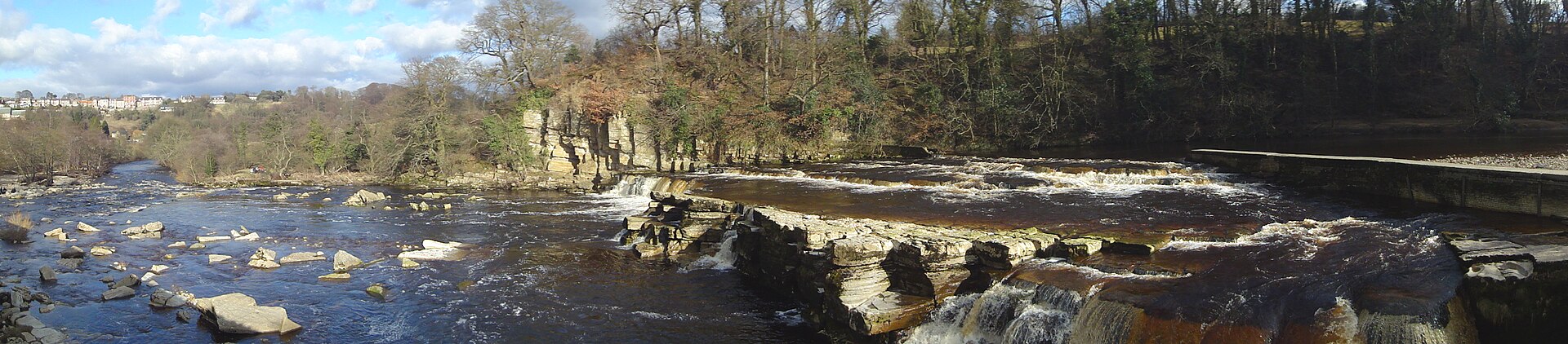
Richmond Falls is a run of weirs and rocky steps on the River Swale, right beside the centre of Richmond in North Yorkshire, England. The falls sit downstream of Richmond Castle and Green Bridge, a short stroll from the market place. They are among the last falls on the Swale before the river spills out onto the lowlands of the Vale of Mowbray. What will you see at Richmond Falls? The Swale drops over several broad stone ledges, forming a white, noisy cascade. In ordinary conditions the water is modest and calm. After heavy rain the river rises fast and the falls become far more dramatic, because the Swale responds quickly to weather upstream. The steep rock also stops fish from swimming up past this point, so the ledges act as a natural barrier. Richmond Castle rises above the river nearby, which makes this a rewarding spot for photographs, especially in the morning and when the water is high. Where is it and how do you get there? The falls lie close to Richmond town centre (about 54.401 N, 1.734 W; British grid reference NZ173006). Walk down from the market place and pick up the riverside path, which continues downstream along the Swale. Expect a mix of town streets, fields and river bank, so proper shoes are a better idea than sandals. What else is nearby? The falls are part of a popular, easy circular walk of roughly 4 miles (6 to 7 km). It runs from the market place to the river, passes the castle and reaches the ruins of Easby Abbey, which English Heritage looks after; walking guides report that entry to the site is free. Many walkers return through woodland along a former railway line. The route also comes with a local legend about a drummer boy who was sent into a tunnel between castle and abbey, and whose drumming fell silent before he came out. When is the best time to visit? Days after substantial rainfall show the falls at their strongest, with the Swale carrying more water. Take care, though: river levels change quickly and the banks can be slippery. In dry weeks the falls are gentler, yet the riverside walk, the castle and the abbey still make the trip worthwhile. Frequently asked questions Is there an entrance fee for Richmond Falls? No. You can view the falls from public paths beside the river without a ticket. How long should you allow? Looking at the falls takes 15 to 30 minutes. The full loop to Easby Abbey and back usually takes about two hours. Is it suitable for children and dogs? The route is gentle but runs beside water and includes stiles; keep dogs on a lead for most of the way. When do the falls look their best? After heavy rain, when the Swale is high and the cascade is wider and louder. Is this the same Richmond as the one near London? No. These falls are in North Yorkshire in northern England, on the River Swale.
-
Aber Falls
Abergwyngregyn
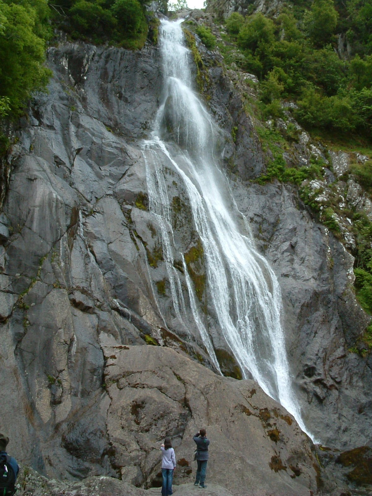
Aber Falls (Welsh: Rhaeadr Fawr) is a waterfall in Gwynedd, North Wales, about 3 km south of the village of Abergwyngregyn. It sits where the Carneddau foothills meet the lowlands, inside Eryri (Snowdonia) National Park, and ranks among the most visited waterfalls in the region. What will you see at Aber Falls? The Afon Goch tips over a rock lip and drops roughly 37 metres (about 120 ft) down a dark, near-vertical face into a shallow pool. After rain the curtain is broad and loud; in a dry summer it thins to a ribbon. A smaller second fall, Rhaeadr Fach, lies a little to the west along the same trail. The valley is open and green, with sheep pasture, dry-stone walls and the rounded slopes of the Carneddau behind. The approach through woodland and fields is part of the appeal. How do you get to Aber Falls? Start from Abergwyngregyn, just off the A55 between Bangor and Conwy. The main car parks are at Bont Newydd, at the end of a narrow lane from the village. Spaces are few and fill early on weekends and in high season. Free parking on the edge of the village is the fallback, and adds around 0.8 km each way. From the car park, a wide, clear path leads to the foot of the falls, about 2 km one way. The first stretch is easy for most fitness levels; the last section can be stony. Which walking routes are there? Short out-and-back: about 4 km in total, usually 1.5-2 hours including time at the falls. Hill circuit: a loop of roughly 6-7 km with 200-300 m of climbing, around 2.5-3 hours. Moderate effort. Mountain extension: linking the falls with higher Carneddau ground means a day of well over 10 km and up to about 500 m of ascent. When should you visit? Spring and autumn work well, as does a day or two after rain, when the flow is strongest. Summer is busier, so go early. Weather in Eryri turns quickly: bring a waterproof jacket and boots with grip, because the path is wet after rain. Mobile signal can be poor. Frequently asked questions How high is Aber Falls? About 37 metres, or roughly 120 feet. Is there an entry fee? Walking to the falls is free. Some car parks at Bont Newydd may charge; free roadside parking is available at the village edge. How long should I allow? Allow 1.5-2 hours for the walk to the falls and back, or 2.5-3 hours for the hill circuit. Is it suitable for children? Yes, the opening path is wide and gentle. Rocks beside the falls are slippery, so keep children close. What else is nearby? The smaller Rhaeadr Fach on the same trail, plus the Menai Strait coast and the city of Bangor a few kilometres away.
-
Rhaeadr y Benglog
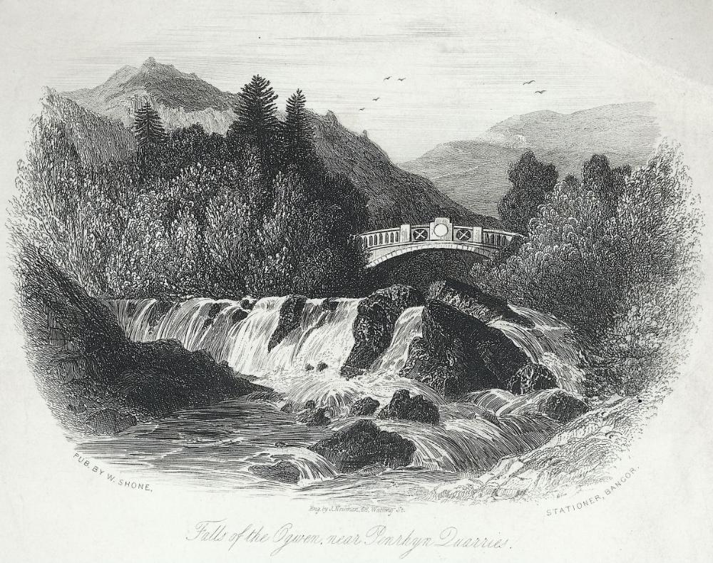
Rhaeadr y Benglog (Benglog Falls, also known as Ogwen Falls or Rhaeadr Ogwen) is a waterfall in Gwynedd, North Wales, inside Snowdonia National Park (Eryri). It sits on the Afon Ogwen beside the Pont Pen-y-benglog bridge, where water leaving Llyn Ogwen begins its drop into the Nant Ffrancon valley. What kind of waterfall is it? The river leaves the western end of Llyn Ogwen and tumbles through a rocky chasm in a series of steps. A Victorian gazetteer describes three cataracts with a combined fall of roughly 100 feet, around 30 metres. It is a stepped cascade rather than a single sheer curtain, so it is best appreciated from a couple of angles. How do I get there? The falls lie beside the A5 between Bethesda and Capel Curig. Most visitors park at the pay car park by Ogwen Cottage and walk a short way. For a mountain location the facilities are good: there is a tourist information point, toilets and a small cafe. The land around Llyn Ogwen is looked after by the National Trust, so check current parking rules and charges before you go. Where are the best views? The easiest view is from the cliff edge next to the bridge. Underneath, you can spot remains of an earlier stone arch bridge; the present Pont Pen-y-benglog was built as part of Thomas Telford's London-to-Dublin mail road. A steep, slippery path leads down to a lower viewpoint, which is not suitable for young children or anyone in poor footwear. The upper view is good enough that the descent is rarely worth the risk. When should I visit? The falls are at their most impressive after rain, which is rarely in short supply here. After a dry spell the flow can be noticeably weaker. Summer and weekends are the busiest times, so aim for early morning or the off-season. What else is nearby? Llyn Ogwen - a glacial lake at about 310 m between the Carneddau and the Glyderau, and the source of the Afon Ogwen. Nant Ffrancon - a broad glacial valley running down towards Bethesda. Walks from Ogwen Cottage - a short but steep route to Llyn y Cwn, the ascent of Pen yr Ole Wen, or the demanding Glyderau circuit over Glyder Fawr and Glyder Fach. These need fitness and proper mountain gear. Devil's Appendix - a separate, much taller waterfall near the bridge. Frequently asked questions Is there an entry fee? The falls can be seen from public ground by the road. The parking near Ogwen Cottage is what you pay for. Is it suitable for families? The view from the edge by the bridge is fine, but the way down to the lower viewpoint is steep and not recommended for children. Watch the traffic on the A5 as well. Are Rhaeadr y Benglog and Ogwen Falls the same place? Yes. Benglog refers to the Pen-y-benglog bridge area, while Rhaeadr Ogwen and Ogwen Falls name it after the river. How long should I allow? Looking at the falls takes 15 to 30 minutes. Combined with a stroll around Llyn Ogwen, plan on about two hours.
-
Dundaff Linn
Lanark
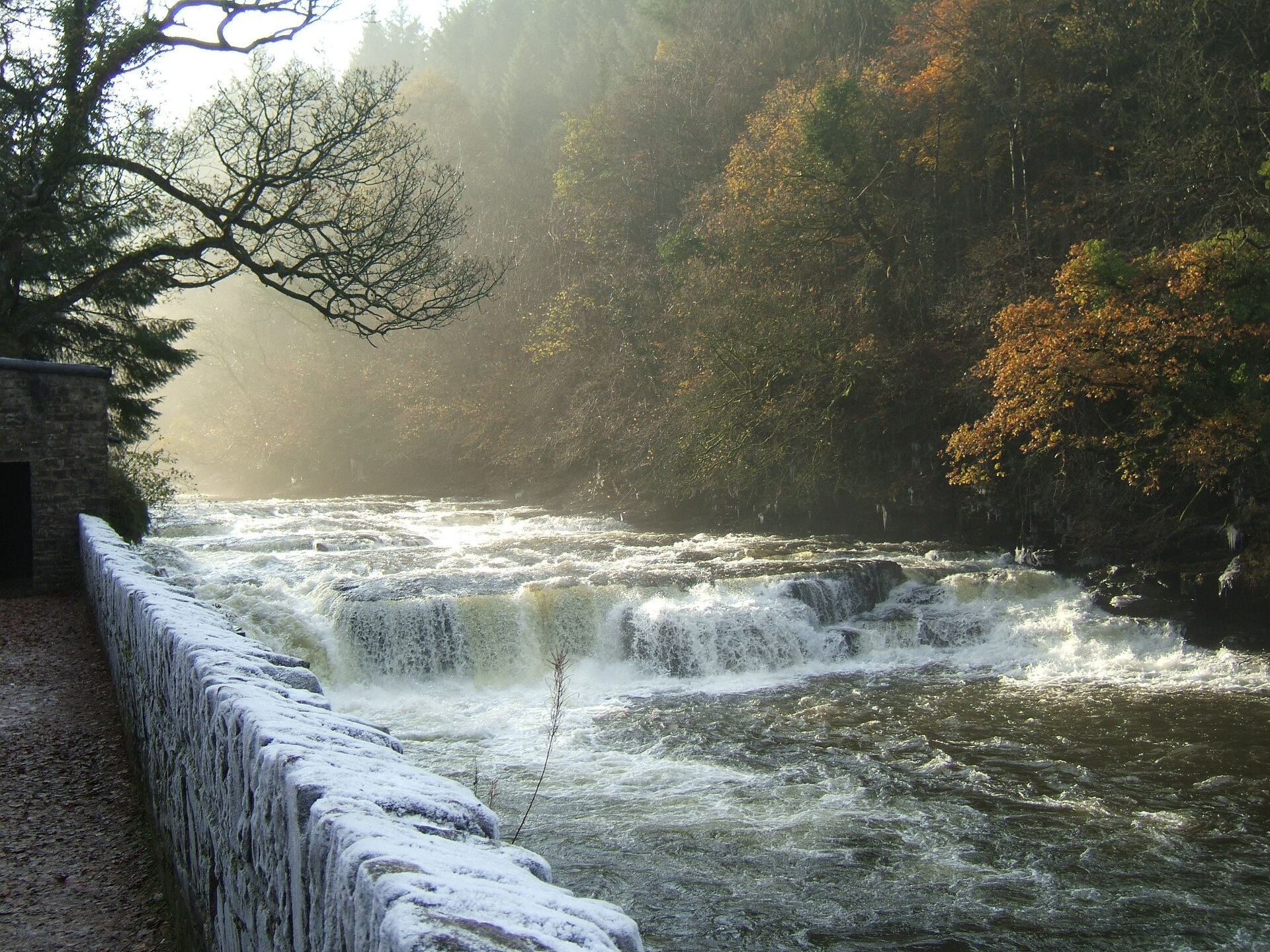
Dundaff Linn is a small waterfall on the River Clyde beside Lanark, in South Lanarkshire, Scotland. "Linn" is the Scots word for a waterfall, and this one sits in the river gorge close to New Lanark, a UNESCO World Heritage village. It lies at roughly 55.661 N, 3.781 W. What is Dundaff Linn? It is one of several drops on this stretch of the Clyde that together make up the Falls of Clyde. A 19th-century gazetteer places it on the boundary between the parishes of Lanark and Lesmahagow, about 2.5 furlongs (around 500 m) downstream of Corra Linn, and gives the fall as no more than about 10 feet (3 m). It will not dominate your day, but it is a pleasant part of a bigger riverside walk. Which other waterfalls are nearby? Dundaff Linn is one of four well-known falls on the river. The others are Bonnington Linn, Corra Linn and Stonebyres Linn, with Corra Linn counted as the tallest. All of them sit along the Clyde Walkway, so it is easy to see several in one outing. How do you get to Dundaff Linn? Most visitors start from the car park at New Lanark, which sits above the village. From there a steep hill leads down into the settlement and on to the riverside path. You can spot the little fall early in the walk, before you have even left New Lanark. The town of Lanark is only a short drive away. What is the path like? The popular Falls of Clyde route is about 3.7 miles (roughly 6 km) and takes around two hours; guides rate it as challenging. The trail runs through a wooded gorge and can be steep, rocky, uneven and muddy, with many steps and some unprotected drops down to the river. Sturdy footwear is advised. A full circuit using both banks is estimated at 3-4 hours, whereas with only an hour or so to spare you can keep to one side of the river. When should you go? The falls look their best when the river is high, for instance after heavy rain, when the water is described as spectacular. The flip side is that the lower boardwalk is prone to flooding, so check conditions before you set off. Spring and summer bring green woodland and longer daylight for the full loop. Frequently asked questions Is Dundaff Linn a big waterfall? No. It is a modest drop of a few metres. Neighbouring Corra Linn is far taller. Is there an entry fee? The fall is beside a public riverside path, and the usual starting point is the New Lanark car park. Check current parking charges on arrival. How long does the walk take? The Falls of Clyde route takes about two hours, and a loop on both banks can take 3-4 hours. Seeing Dundaff Linn itself takes just a few minutes. What should you wear? Shoes with good grip. The path can be muddy and slippery, especially after rain. Can you combine it with a visit to New Lanark? Yes. The village is right at the start of the trail, so it is easy to explore the former mill community before or after your walk.
-
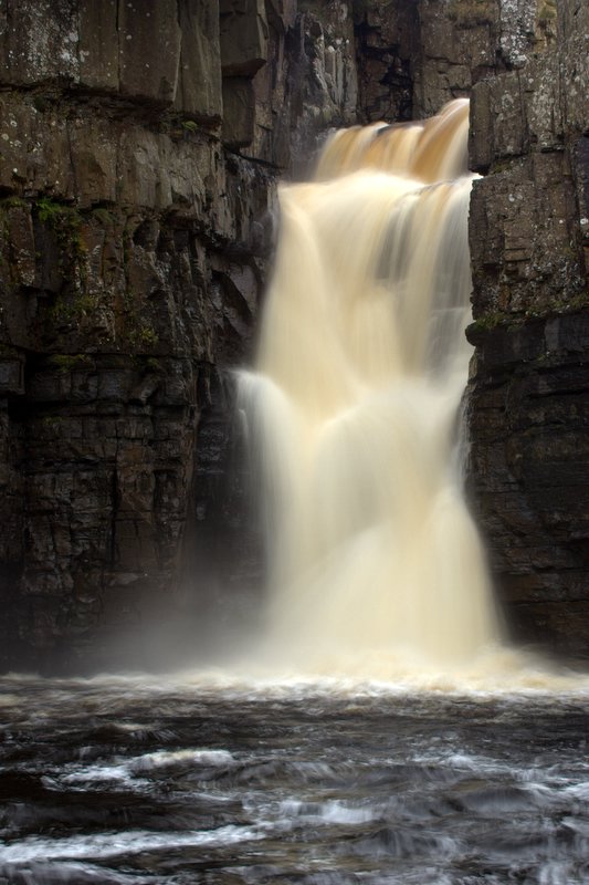
High Force
High Force is a waterfall on the River Tees in Teesdale, County Durham, northern England, a short drive from the market town of Middleton-in-Teesdale. The entire river drops about 21 metres (70 ft) over a rock lip, and the surrounding landscape lies inside the North Pennines Area of Outstanding Natural Beauty, which also carries European Geopark status. What will you see? The Tees tumbles over a dark crag in two stages and gathers in a deep plunge pool at the foot of the gorge. After heavy rain, a normally dry channel on the right-hand side also comes alive, splitting the flow into two separate falls. Only rarely does the water rise enough to spill across the central section as well; the last recorded occasion was December 2015, following Storm Desmond. In severe winters the falls can freeze into towering ice formations. How do you get there? The best-known approach starts at the High Force Hotel, where the ticketed entrance to the Raby Estate land is located. The north bank is reached along a private estate footpath, and a fee applies. The opposite bank can be reached free of charge on the public Pennine Way footpath. Prices and opening hours change with the season and differ between sources, so check the Raby Estate website before you travel. Tickets are sold online and at the site. Many visitors pair High Force with nearby Low Force. A typical loop begins at the Bowlees visitor centre, roughly 3 miles north-west of Middleton-in-Teesdale, crosses Wynch Bridge, passes Low Force and follows the river up to High Force. Depending on the variant, it covers about 4.5 to 8.5 miles and takes around 2.5 to 4 hours. Use OS Explorer map OL31. When is the best time to visit? The waterfall is at its most dramatic after prolonged rain or snowmelt, when the flow is strongest. Opening hours of the paid area are longer in summer and shorter in winter. A frozen High Force is a spectacle in its own right, though paths are riskier in icy conditions. What should you watch out for? Rocks around both High Force and Low Force can be extremely slippery, with steep drops and fast-moving water, so stay on the marked paths. Dogs must be on a lead through the livestock fields. Drones are not allowed on the Raby Estate land without prior permission. The meadows beside the trail can be boggy after rain, so wear sturdy footwear. Frequently asked questions Is there an entrance fee for High Force? Yes, if you use the private estate path from the High Force Hotel. The opposite bank can be viewed for free from the public Pennine Way. Check current prices before your visit. Where is High Force? On the River Tees in Teesdale, County Durham, near Middleton-in-Teesdale and within the North Pennines AONB. How tall is High Force? About 21 metres (70 ft), falling in two stages. Can I visit High Force and Low Force on one walk? Yes. Both lie on the same stretch of river and are linked by the Pennine Way. A circular day walk from Bowlees is a popular choice.
-
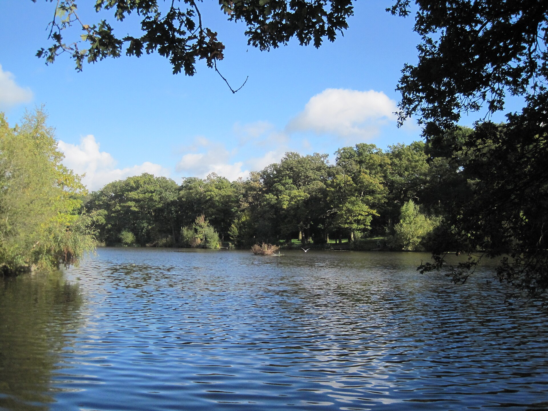
Monken Hadley Common
Londyn
Monken Hadley Common is a wooded stretch of common land on the northern edge of London, in the borough of Barnet. Classed as a nature reserve, it feels a long way from the capital's busy centre, and it is one of the better places in the area for a quiet woodland walk. What is Monken Hadley Common? The site is mostly woodland, with small patches of grassland, a large artificial lake and two ponds. It lies inside the Monken Hadley Conservation Area, so the surrounding village setting is protected too. Barnet lists it as a "Site of Borough Importance for Nature Conservation, Grade I", the top tier of local nature designations. Where does the land come from? The common is a remnant of Enfield Chase, a medieval hunting forest. When an Act of Parliament enclosed the Royal Forest of Enfield Chase in 1777, a small portion was allotted to the village of Monken Hadley. It is the only part of the old Chase that has stayed common land. Cattle were grazed here for generations, and from 1950 the land became public open space. Who owns it? Although anyone can walk here, the common is not owned by the council. It is registered common land held by the Trustees of Monken Hadley Common. That unusual status helps explain why the place feels more like a fragment of old forest than a typical city park. What grows and lives here? Oak dominates, with hornbeam and beech abundant in places. Some plants usually associated with ancient woodland hint that parts of the woods are older than the days when the land was managed as wood-pasture. The ground flora includes bluebell, dog's mercury and goldilocks buttercup, so spring is an especially pretty time to visit. The ponds support large amphibian populations, which in turn attract grass snakes. How to visit Come for an unhurried walk along the woodland paths. The London LOOP, the long-distance route circling the capital, crosses the common, following the Dollis Valley Greenwalk here. That makes it easy to fold the common into a longer route, for example towards Hadley Green. Wear waterproof footwear, since paths can get muddy after rain. Frequently asked questions Is there an entrance fee? No. It is open space you can walk without a ticket. Who manages the land? The Trustees of Monken Hadley Common, not the local authority. When is the best time to go? Spring for the woodland flowers, and autumn for the colour of the oaks and beeches. Is it a good place to escape the crowds? Yes. It is one of the more wooded corners of north London while still being within the city. Can I join a long-distance trail here? Yes, the London LOOP passes through. Why visit? Monken Hadley Common shows that London is more than museums and skyscrapers. It is a living trace of a former royal hunting forest that survived thanks to its common-land status. If you enjoy nature, landscape history and slow walks, add it to your list, especially if you are staying in north London or tackling a section of the London LOOP.
-
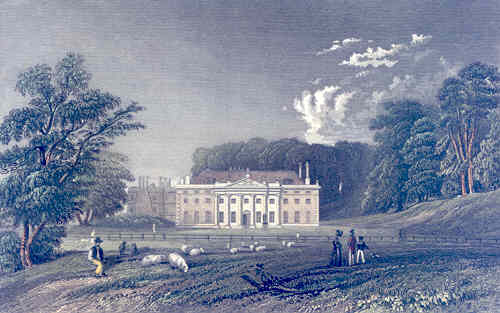
Weald Country Park
Brentwood
Weald Country Park is a large country park in South Weald, beside Brentwood in the English county of Essex, on the north-eastern fringe of Greater London. It covers roughly 500 acres (about 2 km²) and has around seven centuries of history behind it. Within minutes of leaving the suburbs, visitors find themselves among meadows, woodland and lakes. How did the park come about? The land began as a medieval deer park in the 12th century. In 1752 the Tower family bought the estate and held it for nearly 200 years. During that time Robert Adam was commissioned to improve the house, and the grounds were reshaped in the landscaped style associated with Capability Brown. Later, military vehicles flattened the fences around the parkland and many of the deer got out. Today the landscape is recognised as a Grade II historic landscape, and the park has won a Green Flag award, the mark of a well-managed green space. Essex County Council looks after it. What is there to see? The terrain is varied: open grassland sits alongside woodland, streams and lakes. A large lake attracts a good range of birds, and there is a bird hide for watching them. In 1987 a new deer enclosure was created inside the park and a small herd of fallow deer moved in. Visitors can buy feed at the visitor centre, and the animals must be fed using the chutes provided. Is it a good place for children? Yes. The two-kilometre Stick Man play trail passes the deer enclosure, the lake and the grazing area, with seven play areas along the way. Children can tackle it in stages while adults enjoy an easy walk. What facilities are there? The visitor centre has a café, toilets and baby-changing facilities. Entry to the park is free, although parking is charged. Picnics are welcome and dogs are allowed, but barbecues are not. Frequently asked questions Where is Weald Country Park? In South Weald, within the borough of Brentwood in Essex, on the north-eastern edge of Greater London. Do I have to pay to get in? No, entry is free. Only parking is charged. Can I bring my dog? Yes, dogs are allowed. Take extra care near the deer enclosure. Will I see deer? There is a dedicated fallow deer enclosure. Some accounts say deer can also be spotted farther from the car parks, but sightings are never guaranteed. Can I have a barbecue? No, barbecues are not permitted, though picnics on the grass are fine. How long should I allow? The park is big, so plan about half a day for a lakeside stroll, a stop at the deer enclosure and a break at the café. Families who complete the whole play trail may want longer. Weald Country Park suits a family outing, a dog walk or a green escape close to London, with free entry and well-organised facilities.
-

Black Rocks
Derbyshire Dales
Black Rocks is a gritstone outcrop above the village of Cromford in Derbyshire, in the Derbyshire Dales area of central England. It suits anyone who wants a short walk with a view, a bit of climbing, or a bike ride along a former railway line, with traces of old lead mining thrown in. What are Black Rocks? The crags are a weathered outcrop of Ashover grit, a coarse sandstone typical of this part of Derbyshire. The rock has a very even texture, and weathering has left dark, ragged edges, which explains the name. On the Cromford side there is also a limestone crag nearby, so the area sits close to the boundary between limestone and gritstone, a contrast you can see in the landscape. How do you get there? The rocks stand right beside the High Peak Trail, a walking and cycling route that follows a former railway line. The trail runs along the bottom of the site, which makes it a natural stop for cyclists and walkers. The High Peak Trail offers around 17.5 miles (about 28 km) of traffic-free route and links with the Tissington Trail at Parsley Hay, so longer outings are easy to plan. There is a car park by the rocks; payment rules have changed over time, so check current details on site. What is worth seeing? Views. The top of the rocks gives wide views over the surrounding hills and valleys, one of the main reasons to visit. Climbing. The even-textured gritstone attracts climbers, and the outcrop is listed as its own crag in climbing guides. Mining heritage. The site was once mined for lead. The spoil heaps left behind support lead-tolerant plants, giving the vegetation an unusual character. Nearby routes. Waymarked circular walks around Wirksworth can be combined with a visit to the rocks. Frequently asked questions Are Black Rocks good for a family walk? Yes, the approach from the trail is short and the area is popular with walkers and cyclists. Take care, though: surfaces can be uneven and slippery, and there are sheer drops in places, so keep children close. Can you cycle there? Yes. The High Peak Trail passes directly by and is widely used by cyclists, including mountain bikers. Is it a climbing spot? Yes. The rock is described as very even-textured gritstone, which makes it popular with climbers. Where exactly are the rocks? Above Cromford, near Wirksworth, in the Derbyshire Dales (Derbyshire, England). When is the best time to visit? On a dry day, when the rock is less slippery and the views from the top are at their clearest.
-
Bamford Edge
High Peak
Bamford Edge is an overhang of gritstone rock jutting out north of the village of Bamford, in the Hope Valley in the English county of Derbyshire. It lies within the Peak District National Park and is one of the best-known viewpoints in the area. From its rim you look out over Ladybower Reservoir, which is the main reason people come here. What should you know about Bamford Edge? The edge forms a rocky overhang above the valley slope. The rock is gritstone, a coarse, hard sandstone typical of the Peak District. Its rough surface grips boots and fingers well, which is why climbers value the crags around here. Bamford Edge is home to the famous climb "Smoked Salmon", graded E8 7b, first climbed by British climber Johnny Dawes. That is a very high grade on the British traditional scale, so the route is known mostly among climbers rather than to casual walkers. What views can you expect? From the edge you can see Ladybower Reservoir and, further off, Derwent Edge and the Hope Valley. Walk descriptions also mention a spot where you can see the Ashopton viaduct, which carries the A57 (Snake Pass) across the reservoir. The views are especially popular at sunrise and sunset, when low light picks out the outline of the hills and the water. What is the walk to Bamford Edge like? A popular route starts at Heatherdene car park. The steepest part comes first: the climb to the edge viewpoint gains height quickly. After that, guides describe the going as fairly easy, with a few small hills. It is a short to moderate outing suitable for most reasonably fit walkers. You can also link it into a longer loop around the western arm of Ladybower Reservoir, for example by climbing Win Hill and returning with views back toward Bamford Edge. Is Bamford Edge safe? The edge ends in a sheer drop, and the crags are not fenced. Guides advise keeping well back from the rim, especially with children and in strong wind. Sturdy walking shoes are a good idea, as paths can be muddy. When to go and where to park Heatherdene car park can get busy. One guide suggests arriving by about 10am at the latest on weekends in school holidays. On other days it is usually easier, and an early start also means a quieter trail. Frequently asked questions Where is Bamford Edge? North of the village of Bamford in the Hope Valley, Derbyshire, within the Peak District National Park. What is the rock made of? Gritstone, a hard sandstone popular with climbers. What is the best-known climb here? "Smoked Salmon", graded E8 7b, first climbed by Johnny Dawes. Is the walk difficult? The initial ascent is steep, after which the going is fairly gentle. Watch out for the unfenced drops. What can you see from the edge? Ladybower Reservoir, Derwent Edge and the Hope Valley.
-
Wharncliffe Crags
Sheffield
Wharncliffe Crags is a long gritstone escarpment about 10 km (6 miles) north-west of the centre of Sheffield in South Yorkshire, England. It is one of the historic climbing venues of Britain and also a protected site for its geology. What are Wharncliffe Crags? The edge runs along a wooded valley side, forming a band of rock that draws climbers, walkers and anyone who enjoys the Yorkshire landscape. The stone is gritstone, rough and grippy, typical of northern England and prized for traditional climbing. The area is designated a Site of Special Scientific Interest, which means it is protected for its geological interest. Why does it matter to climbers? Wharncliffe is often described as a birthplace of British outcrop climbing. Jimmy Puttrell began exploring the rock here in 1885, and several routes he pioneered still carry his name. By around 1900 it was probably the most popular crag in the country, largely thanks to a nearby railway line that made it easy to reach from Sheffield. An article from 1910 already described some 110 routes. More classics were recorded in the 1930s, and harder lines followed later in the century, including the very demanding Wango Tango, graded E7. Today the crag is quieter than it was a hundred years ago. For many visitors that is a bonus: more peace and nature, even with a large city close by. How do you get there? The main section of the edge is usually approached from the Stocksbridge bypass (A616). Take the turning for Deepcar, then follow Station Road to the woods, where paths lead up to the rock. Check current access and parking information before you go, as conditions on the ground can change. What should you know before visiting? The terrain is wooded and can be wet, especially after rain. Wear sturdy footwear. Gritstone is slippery when damp, so climbing needs extra care. The area is protected: take litter home, keep to paths where possible and avoid damaging vegetation. Non-climbers can enjoy a short walk with views of the rock face and a landscape steeped in climbing history. Frequently asked questions Where are Wharncliffe Crags? About 10 km north-west of Sheffield, in South Yorkshire, England. What is the rock made of? Gritstone, a coarse sandstone typical of northern England. Is it a protected area? Yes, it is a geological Site of Special Scientific Interest (SSSI). Who started climbing here? Jimmy Puttrell, who began exploring the crag in 1885. Do you have to be a climber to visit? No. It also suits a walk, but climbing requires experience and proper equipment.
-
Rivelin Rocks
Sheffield
Rivelin Rocks is a gritstone edge in the upper Rivelin Valley, about 9 kilometres west of Sheffield in South Yorkshire, England. It sits just off the A57 road, which makes it one of the easiest wild rock outcrops to reach from the city. Climbers usually call it Rivelin Edge, and it appears in the Wikidata record as a climbing area of England. Where is Rivelin Rocks? The edge lies in the upper part of the Rivelin Valley, west of Sheffield, at grid reference SK279873 (roughly 53.382° N, 1.582° W). The A57, the main road running from Sheffield towards the Peak District, passes close by. The location puts the crag at the meeting point of Sheffield's western suburbs and the open moorland of the Peak District fringe. What is the rock like? The rock is gritstone, the coarse sandstone that defines much of the Peak District's edges. Gritstone is known for its rough, grippy texture, and the escarpment here forms a line of crags rising above the valley side, partly shrouded by trees. The most recognisable feature is the Needle, a free-standing pinnacle of gritstone that stands apart from the main edge. Why do climbers come here? Rivelin Rocks belongs to the group of eastern edges around Sheffield, and it has a long climbing history. Because it could be reached from the city without a car, generations of Sheffield climbers used it long before private car ownership was common. The Needle drew early attention: it resisted repeated attempts across the 1920s, 1930s and 1940s before a clean ascent was made. Croton Oil, a route on the Needle, is regarded as a classic of the eastern Peak District edges. The crag was for a time overlooked, partly because of its reputation for midges and thick greenery. Today it is valued for another reason: it is well sheltered from northerly winds, so climbers often pick it on cold, blustery days when more exposed edges are unpleasant. Practical tips for visitors Getting there: Take the A57 west from Sheffield. The edge is a short distance off the road, so you do not need a long approach. Access: The land is private. Climbers and walkers rely on the goodwill of the landowner, so stay on established paths, avoid damaging trees and take your litter home. Access arrangements have changed in the past, so check current guidance from the British Mountaineering Council before you go. Season: The sheltered position makes the edge usable in cooler weather. In warm, damp summers, expect midges and dense foliage. Footwear: Paths in the valley can be muddy after rain, so wear sturdy shoes. Frequently asked questions How far is Rivelin Rocks from Sheffield? About 9 kilometres to the west, just off the A57. What type of rock is it? Gritstone, the same kind of rock found on the famous Peak District edges. Is it only for climbers? It is best known as a climbing venue, but the valley setting is also pleasant for walkers who want a quiet corner close to the city. What is the Needle? A free-standing gritstone pinnacle that is the best-known feature of the edge and an important part of Sheffield's climbing history. Is access free? There is no entry fee, but the land is private, so respect access requests and local rules.
-
Birchen Edge
Derbyshire Dales
Birchen Edge is a gritstone escarpment in the Derbyshire Dales, on the eastern side of the Peak District in England. It is a rock face that suits walkers and beginner climbers alike: most of the climbing routes sit in the lower grades, and the paths along the top are short enough for a relaxed outing. Wikidata describes it as a gritstone escarpment in Derbyshire, and it lies at roughly 53.25° N, 1.58° W. What is Birchen Edge known for? The edge is a small, friendly crag rather than a mountain, and that is exactly its charm. Dark gritstone, a line of trees below and open moorland above give it a typical Peak District look. It is popular with people taking their first steps on real rock, because the majority of routes are of modest difficulty. Climbers are a common sight here, so walkers often share the path with people setting up ropes at the base or top of the cliff. What can you see along the edge? Two landmarks make the walk more than a simple stroll along a cliff top: Nelson's Monument, a gritstone column standing on the edge. Sources give its date as 1810 and link it with honouring Admiral Lord Nelson. One account also credits a local man from Baslow, John Brightman, with its erection. The Three Ships, rock outcrops beside the monument. Names of ships associated with Nelson's career are carved into the stone; the Victory, Defiance and Royal Sovereign are the ones usually listed. The spelling of the carvings varies between descriptions, so look closely when you get there. How hard is the walk? A short circular route of about 3 km is rated easy and takes around an hour. It usually begins at the car park beside the Robin Hood Inn on the A619 side. From there a path climbs through trees to the foot of the rocks, then follows the top of the edge past the monument and the Three Ships before returning to the road. Keep in mind that the footpaths are rocky and uneven. The route is not suitable for pushchairs or wheelchairs, and sturdy footwear is a good idea, especially after rain when gritstone gets slippery. Birchen Edge is also often combined with neighbouring edges in longer circular walks, for example a loop of around 7 miles that links the Three Ships with the Nelson and Wellington monuments. If you want a full day on the moors, that is a natural choice; if you only have an hour or two, the short loop is enough. Practical tips Parking is next to the pub and is run by the National Trust. National Trust members park free; other visitors pay a fee, which changes over time, so check the current tariff at the machine. Bring layers. The edge is exposed, and the wind on top can be much cooler than in the car park. If you are curious about climbing, watch from a safe distance and do not walk beneath people on the rock. Beginners should go with a qualified instructor. Stay on established paths to protect the moorland vegetation. Frequently asked questions Is Birchen Edge good for beginners? Yes. Most climbing routes are in the lower grades, and the walking route is short and rated easy, though the ground is uneven. How long does the walk take? The short loop of about 3 km takes roughly an hour at a relaxed pace, longer if you stop to watch climbers or read the carvings. What is the monument on Birchen Edge? It is Nelson's Monument, a gritstone column that sources date to 1810 and connect with Admiral Nelson. Nearby are the Three Ships outcrops with engraved ship names. Where do I park? At the National Trust car park next to the Robin Hood Inn, the usual starting point for the walk. Can I take a pushchair? No, the rocky, uneven paths are not suitable for pushchairs or wheelchairs.
-
Goram’s chair
Bristol
Goram's Chair is a rocky outcrop in the wooded gorge of Hazel Brook, within the Blaise Castle Estate at Henbury, on the northern edge of Bristol. Cliffs here are shaped like a huge stone seat, and local folklore says they once belonged to a giant. It is a small, quiet landmark, best enjoyed as part of a walk through one of the city's most historic parks. What is Goram's Chair? The name describes a feature of the cliff: two flat-topped walls of solid rock jutting out from the steep side of the gorge, resembling a throne for someone far larger than a human. Wikidata describes it simply as cliffs that resemble a giant's throne near Bristol. Beech trees cling to the gorge sides and can largely hide the formation, so it is easy to walk past without noticing it. Who was Goram? Goram is a giant from West Country legend. In the best-known telling he competed with a rival giant, called Vincent or Ghyston depending on the version, for the hand of a maiden named Avona. She had promised to marry whichever of them could first drain a great lake said to stretch from Bradford-on-Avon to Rownham Hill. Goram took the Henbury route. According to the story he became drunk and fell asleep in his stone chair, having dug only the much narrower Hazel Brook. His rival won. In some accounts Goram stamped his foot in anger, leaving the Giant's Footprint, and threw himself into the channel, where his head and shoulder became the islands of Flat Holm and Steep Holm. Versions differ. In one, Goram digs the Avon Gorge himself and Vincent never appears. In another, the giants carve the gorge to bring drinking water to the area. The oldest known written version appears in William Camden's Britannia (1586), and a variant is recorded by Robert Atkyns in his history of Gloucestershire (1712). What else is in the Blaise Castle Estate? The chair sits inside a public park of real heritage value. The estate includes: Blaise Castle House, a Grade II* listed 18th-century mansion; Blaise Castle, a Grade II* listed folly built in 1766; an orangery, a dairy and other listed ancillary buildings; Blaise Hamlet, nine small cottages around a green, built in 1811 for retired employees. The whole parkland is listed Grade II* on the Register of Historic Parks and Gardens. Visiting tips Combine the visit with the folly and the mansion, which makes a good half-day outing. The gorge slopes are steep and can be slippery after rain, so wear proper footwear. Take your time looking at the cliff face. Trees hide much of the formation, and it is clearer when you know what shape to look for. The estate is a public park, so it suits families and casual walkers. Frequently asked questions Where is Goram's Chair? In the Hazel Brook gorge in the Blaise Castle Estate, near Henbury, Bristol. Is Goram's Chair a real chair? No. It is a natural rock formation whose shape resembles a giant's seat, which gave rise to the legend. Who was the giant Goram? A figure from West Country folklore who lost a contest with a rival giant for the hand of Avona. Is it free to visit? The estate is a public park, so the grounds are open to walkers. Check current opening arrangements for individual buildings before you go. Is it suitable for children? The legend appeals to children, but the gorge is steep, so keep a close eye on younger ones near the cliffs.
-
Devil's Grinding Mill
Devil's Grinding Mill is a gorge on the River Eden in Cumbria, England, just south of the market town of Kirkby Stephen. It is the best-known feature of Stenkrith Park and a place where the river has cut deep into the rock, leaving narrow chasms, hollows and natural arches. Locals also call it the Devil's Hole. What is the Devil's Grinding Mill? The site is part of a larger system known as the Angel's Drainpipe, a partially collapsed cave network on the River Eden. Over time the roof of the caves has fallen in at several points, opening the watercourse to daylight and creating the gorges and rock bridges that visitors see today. The result is a short but dramatic stretch of river that feels far wilder than its position beside a small town would suggest. Why does it sound so loud? The Eden does not flow calmly here. The water is forced through caves and narrow gorges, and the enclosed rock walls amplify the sound into a constant roar. The name itself reflects that impression: the noise and churning water were once likened to a mill grinding away without rest, with the Devil as its operator. What is the rock made of? Geologically, the place is unusual. Many people assume that caves and gorges like these form in true limestone, but here the rock is brockram. This is a breccia, meaning a rock made of angular fragments of limestone held together in a cement of red sandstone. The river has worked this tough, patchwork stone into a variety of shapes. Brockram is also the stone used to build many of the houses in Kirkby Stephen, so the same material that forms the gorge can be seen in the town's streets. Is there any folklore? Yes. An account of travels written in 1828 records a local tradition that two lovers were swallowed up in the gulf, which it calls the Devil's Hole. The story adds a darker note to a place already named after the Devil. What else is in Stenkrith Park? The park is a pleasant, easy place to spend an hour or two beside the river. It has a Poetry Path with twelve carved stones. The Millennium Bridge, opened in 2002, lets walkers cross from the park to a path along the old South Durham railway track, which makes it simple to turn a short look at the gorge into a longer walk. Frequently asked questions Where is the Devil's Grinding Mill? On the River Eden, south of Kirkby Stephen in Cumbria, England, within Stenkrith Park. What is the Angel's Drainpipe? The name of the partially collapsed cave system of which the Devil's Grinding Mill forms a part. Is the gorge cut in limestone? Not true limestone. The rock is brockram, a breccia of limestone fragments in sandstone. Why is it called the Devil's Grinding Mill? The name comes from the endless roar and churning of water in the gorge, which suggested a mill driven by the Devil. It is also known as the Devil's Hole. Can I combine it with a walk? Yes. The Millennium Bridge in the park leads to a walk along the old railway track, and the Poetry Path is within the park itself.
-
Gad Cliff
Gad Cliff is a south-facing cliff on the Isle of Purbeck, on the Dorset coast in southern England. It rises directly above the sea just east of Worbarrow Tout and Pondfield Cove, on the stretch of shore between Worbarrow Bay and Mupe Bay. Behind it lies Gold Down, part of the Lulworth Ranges. Where exactly is Gad Cliff? The cliff sits on the south coast of the Isle of Purbeck, which is a peninsula rather than a true island. Its face looks out over the English Channel. To the west is the distinctive headland of Worbarrow Tout, and the small, sheltered Pondfield Cove lies beside it. Inland and above the cliff rises Gold Down, a chalk-and-limestone ridge that forms part of the Lulworth Ranges, a military training area. What makes it worth seeing? Gad Cliff is a dramatic piece of coastal scenery. The steep, south-facing wall dominates the shoreline and is visible from the surrounding hills and from the coast path. The area belongs to the Jurassic Coast, the Dorset and East Devon World Heritage Site, famous for rock layers that record some 185 million years of Earth's history. Limestone and Purbeck beds make up this landscape, and the geology is as much the attraction here as the view. The coast around the cliff is quiet compared with busier Dorset spots such as Lulworth Cove. There are no promenades or large car parks at the foot of the cliff. Visitors come for the open landscape, the sea views and the sense of remoteness. Can you visit Gad Cliff? This is the key practical point. The cliff lies within the Lulworth Ranges, which belong to the Ministry of Defence and are used for live-firing exercises. Public access is therefore possible only when the ranges are open, which typically means weekends and school holidays, with some additional dates. Closures are announced in advance, so check the official range walking times before you set out. Always follow the marked paths and keep to the signed routes, because unexploded ordnance can be present off the paths. How do you get there? Walkers usually approach from the Tyneham side, starting at the Tyneham village car park, or along the South West Coast Path from Kimmeridge Bay. Tyneham is a village evacuated in 1943 and now preserved as a quiet ghost village, which makes a fitting stop on the same outing. The routes involve hills and uneven ground, so wear sturdy footwear and bring water, as there are no shops near the cliff. Frequently asked questions Is Gad Cliff open all year? No. Access depends on the Lulworth Ranges schedule. Check the published dates before travelling. Where is Gad Cliff? On the south coast of the Isle of Purbeck in Dorset, east of Worbarrow Tout and Pondfield Cove. What is behind the cliff? Gold Down, part of the Lulworth Ranges. Is it part of the Jurassic Coast? Yes, it lies within the Jurassic Coast World Heritage Site. Can I combine it with other places? Yes. Worbarrow Bay, Tyneham village and Kimmeridge Bay are all within walking distance on the coast path network, so the cliff fits naturally into a longer day on foot. Best time to go Dry days in spring and early autumn give the clearest views and the most comfortable walking. In summer the paths are busier on open days. After heavy rain the chalk and clay surfaces turn slippery, so take extra care on slopes.
-
Nicodemus Knob
Nicodemus Knob is a lone stone pillar about 9 metres (30 ft) tall on East Cliff, on the Isle of Portland in Dorset, England. It is made of Portland stone and stands on the rim of the island's plateau, high above the sea. Quarrymen left it behind, and it has become one of Portland's best-known landmarks. What is Nicodemus Knob? The knob is an artificial stack. Nobody carved it as a monument in the usual sense. It is a block of unquarried rock that remained when the surrounding stone was cut away. Dorset's Historic Environment Record describes it as a pillar of unquarried stone left from deeper quarrying in the mid-19th century. The structure first appears on an Ordnance Survey map from 1889. It belongs to the former Admiralty Quarries. These quarries supplied stone for the breakwaters of Portland Harbour between 1849 and 1872. Convicts did much of the excavation, and about six million tonnes of rock were removed. The pillar marks how high the ground once stood before the work began. Why was the pillar left standing? The original purpose is uncertain, and sources offer several explanations: a seamark visible from the water, a memorial to the quarry workers, or to the convicts who died there, a marker of the original ground level. The Portland Museum archive favours the idea of a memorial to the prisoners. No single explanation is confirmed. What is nearby? Pulpit Rock at Portland Bill is a similar pillar formed by quarrying, though it sits at the far southern tip of the island. Close to Nicodemus Knob, above East Cliff, Dorset's heritage records also list a boundary stone. It is marked with a War Department arrow, an anchor and the number 61. Climbing and the changing landscape Climbers know the knob as a squat pinnacle above the sea, and it appears in the UKClimbing crag database. The quarry floor below the cliffs has been filled in. Most of the former 15 m drop has therefore disappeared, and the pillar now looks lower against its surroundings than it once did. Tips for visiting The knob stands near the edge of the plateau. Keep a safe distance from the cliff edge, especially in wind. Combine it with a walk around East Cliff and the old quarry landscape, which is full of cut blocks and industrial remains. The island is exposed, so take a windproof layer even on sunny days. Good light for photos comes in the morning and late afternoon, when the pale stone stands out against the sea. Frequently asked questions How tall is Nicodemus Knob? About 9 metres (30 ft). What is it made of? Portland stone, the limestone quarried on the island for centuries. Who built it? No one built it. Quarry workers left it standing while stone was cut around it in the 19th century, and convict labour did much of that work. Why does it exist? The reason is not documented. Proposed explanations are a seamark, a memorial or a ground-level marker. Is it similar to Pulpit Rock? Yes. Both are pillars left by quarrying on the Isle of Portland, but Pulpit Rock is at Portland Bill and Nicodemus Knob is on East Cliff.
-
Tusker Rock
Newton
Tusker Rock is a rocky reef in the Bristol Channel, roughly 2 miles (3.2 km) west of Ogmore-by-Sea in the Vale of Glamorgan, south Wales. You will not be walking out to it: it is a spot for people who enjoy watching the sea from the shore, photographing the coast, or taking an interest in maritime history and diving. Where is Tusker Rock? The rock lies in the Bristol Channel, off the Welsh coast. Its coordinates are about 51.454° N, 3.669° W. The nearest settlement is Ogmore-by-Sea, a small seaside village and the easiest place to look out over the area. Several other rocks share the name Tusker Rock around the Welsh coast, so check the exact location when planning a trip. Where does the name come from? The origin is uncertain, and two explanations are offered. One says the rock is named after Tuska, a Danish Viking whose companions partly settled the Vale of Glamorgan. The other holds that the name simply derives from Old Norse words meaning "large rock". Either way, the name points to Scandinavian traces along this coast. Why was the reef dangerous for ships? Tusker Rock is only fully exposed at low tide and can be completely covered at high water. A hidden hazard like that has long threatened shipping. Vessels in the area were often driven onto the rocks by strong south-westerly winds blowing in from the Atlantic. This gave the reef its reputation as a dangerous spot, and the seabed around it holds the remains of wrecks. Amgueddfa Cymru, the National Museum Wales, notes that the rock has claimed dozens of lives over the centuries. Did wreckers lure ships onto the rock? Local lore says wreckers used false lights to draw ships onto the rocks. This is a legend, and there is no historical evidence that it happened. Treat it as coastal folklore rather than documented fact. What can you do here? Watch the coast. From around Ogmore-by-Sea you can look out over the Bristol Channel and, depending on the tide, see part of the reef. Dive. The waters around Tusker Rock are a known diving location today, mainly because of the wrecks. Diving in the Bristol Channel calls for experience because of strong tidal flows, so it is best to go with a local club or guide. Follow the history. The stories of wrecks and the people lost became the subject of the photography project "Ghost Ships and Tides" by Peter Britton. It began with Tusker Rock and later widened to shipwrecks across the Bristol Channel, created as a tribute to those lost at the rock. When to go The reef is best seen at low tide, so check tide tables for south Wales before you set out. Weather over the Bristol Channel changes quickly, and winds coming off the Atlantic can be strong, so dress for the wind. If you want to take photographs, sunrise and sunset usually give the most interesting light. Frequently asked questions Can you walk to Tusker Rock? No. The rock lies at sea, a few kilometres from the shore, and from land it is only partly visible depending on the tide. Is the reef always visible? No. It is completely covered at high tide and fully exposed only at low water. Where does the name come from? One version points to the Viking Tuska, the other to Old Norse words for a large rock; the origin is not settled. Is it a good place to dive? It is a popular dive site, but conditions demand experience and a good understanding of the tides.
-
Pulpit Rock
Pulpit Rock is a rock stack at the very southern tip of the Isle of Portland in Dorset, southern England. It stands beside Portland Bill, the island's best-known spot, and is one of its most photographed sights. It is not purely a work of nature, though: quarrymen shaped it. What is Pulpit Rock? It is a stack, a lone block of rock cut off from the cliff. This one is artificial: it was formed in the 1870s by quarrying at the Bill. Some accounts say the starting point was a natural arch that workers at Bill Quarry cut away, with the leaning slab on top added afterwards. The details are told in different ways, but every source agrees it is a relic of stone extraction. Why is it called Pulpit Rock? The name comes from the shape. The tilted slab looks like an open Bible resting on a pulpit, and that resemblance gave the rock its name. What is it made of? The stack is built from Portland Freestone, an oolitic limestone prized as building stone. Portland stone has been quarried for several hundred years, and abandoned quarries still mark the landscape of the island's southern part. Pulpit Rock is one of the most visible reminders of that history. Fossil hunters and geology fans visit the Portland Bill area because the same rock is exposed in many places here. What else is nearby? Portland Bill is the island's main visitor attraction. Besides Pulpit Rock you will find its lighthouses and a stretch of coast with walking routes. The rock makes an easy stop on a stroll around the southern headland. Frequently asked questions Where is Pulpit Rock? At the southern end of the Isle of Portland in Dorset, England, at Portland Bill. Its coordinates are roughly 50.514 N, 2.459 W. Is Pulpit Rock natural? Partly. It is an artificial stack created in the 1870s by quarrying. Some accounts say it began as a natural arch. Can you climb Pulpit Rock? No. Climbing the rock or tombstoning from it is not permitted, and signs on site say so. Is it the same as Norway's Preikestolen? No. The Norwegian cliff Preikestolen is also sometimes called Pulpit Rock in English, but this rock is in England on the Isle of Portland and is far smaller. Why does it matter to geologists? It shows Portland Freestone, the stone quarried on the island for centuries, along with traces of the old quarrying industry in the landscape.
-
Beachy Head
Eastbourne
Beachy Head is a chalk headland in East Sussex, right next to Eastbourne on England's south coast. It sits immediately east of the Seven Sisters and is one of the most recognisable sights on the English Channel coastline. It is the highest chalk sea cliff in Britain, rising roughly 160 metres above sea level. What should you know about Beachy Head? The white cliff face is made of Late Cretaceous chalk. When the last Ice Age ended, sea levels rose, the English Channel formed, and the waves began cutting into the Sussex chalk. The result is the steep, pale cliffs visible from far away. The name has nothing to do with beaches: a common explanation traces it to a French phrase meaning "beautiful headland". What about the lighthouse? At the foot of the cliff stands the red-and-white Beachy Head Lighthouse, built by Trinity House between 1900 and 1902 some distance out from the cliff base. The site was chosen low down because a light close to the water, reflected off the chalk, was easier to see than one on top. Materials were lowered from the clifftop on a temporary cable way. The lighthouse is Grade II listed and has been automated since 1983. On the next headland to the west stands the older Belle Tout lighthouse, dating from 1831. It was decommissioned in 1902 and today is a popular viewpoint with accommodation and a tea room. Why does the cliff keep changing? Chalk erodes. A major rockfall in January 1999 left a pile of debris at the base about the size of several houses, and later falls nearly created a land bridge to the lighthouse. Erosion also claimed the Devil's Chimney, a chalk stack. For that reason, stay on marked paths and keep well back from the edge. Why is the land protected? In 1929 Eastbourne Borough Council bought around 1,600 hectares of land around the headland to save it from development. That is why the area remains open downland ideal for walking. The headland also had military importance, including a radar site during the Cold War. Frequently asked questions Where is Beachy Head? In East Sussex, close to Eastbourne and just east of the Seven Sisters. How high is the cliff? Wikipedia gives 164 m above sea level; other sources say about 162 m. Either way it is Britain's highest chalk sea cliff. Can you go near the edge? Better not. The cliff regularly collapses and the edge can be unstable, so follow the paths and keep a safe distance. What else is nearby? The Belle Tout lighthouse, views of the Seven Sisters, and Eastbourne itself.
-
Jubilee Tower
Darwen
Jubilee Tower is an octagonal lookout on Darwen Hill, rising above the town of Darwen in Lancashire, England. Locals also call it Darwen Tower. Built in 1898, it remains one of the most recognisable landmarks on the local skyline. Why was the tower built? It carries two meanings. It marks Queen Victoria's Diamond Jubilee, and it also celebrates a hard-won local victory: the right of townspeople to walk on the surrounding moorland. That makes it a monument to public access, on land that walkers now cross freely. The tower opened to the public on 24 September 1898. What should you know about the structure? The tower stands about 86 feet (roughly 26 metres) tall on an eight-sided plan. Historic England lists it at Grade II (list entry 1072431, designated in 1972). Inside, a spiral staircase climbs to the viewing decks. A restoration costing around £300,000 finished in 2022, funded in part by the Darwen Town Deal, Darwen Rotary and Blackburn with Darwen Council. The works included a new oak door intended to deter vandals. What can you see from the hill? Because the tower sits on high ground above town, even the approach gives you views over Darwen's rooftops and the valleys around it. From the decks the panorama opens across the Lancashire moors. It suits a short walk with a payoff, and on a clear day it is worth bringing a camera. How do you get there and when should you go? The tower stands on the hill close to Darwen's centre, reached on foot by paths across the moor. Wear sturdy shoes, and carry a windproof layer even in summer, since the upper ground is exposed. Spring and summer days with good visibility work best, when the paths are drier. Access to the interior has varied, so check current arrangements with Blackburn with Darwen Council before you set out. Is this the same Jubilee Tower as the one in Wales? No. The name Jubilee Tower is used at several sites in Britain, including Moel Famau in Wales. This one is in Darwen, Lancashire, and is a separate monument. Keep that in mind when entering a destination in your satnav. Frequently asked questions When did Jubilee Tower in Darwen open? It opened to the public on 24 September 1898. Why was it built? To commemorate Queen Victoria's Diamond Jubilee and the townspeople's success in securing access to the nearby moorland. Can you climb to the top? A spiral staircase leads to the viewing decks. Since the 2022 restoration, entry is managed by the owner, so confirm current times with Blackburn with Darwen Council. Is it a listed building? Yes. Historic England lists it at Grade II.
-
Kynaston's Cave
Kynaston's Cave is a small sandstone cave on Nesscliffe Hill, close to the village of Great Ness in Shropshire, England. It sits inside Nesscliffe Hill Country Park, beside the A5 between Shrewsbury and Oswestry, and is tied to the legend of Humphrey Kynaston, a 15th-century outlaw nicknamed "Wild Humphrey". Who was Humphrey Kynaston? Kynaston came from a local gentry family. Around 1491 he was convicted of murder and outlawed, losing his estates. Accounts place his pardon between 1516 and 1518, with the exact year varying by source, and his death around 1534. Folk tradition turned him into a robber who targeted the rich and helped the poor, and says his horse Beelzebub leapt the River Severn near Montford Bridge. Those stories are folklore, not recorded fact. What will you see? The cave has two chambers cut into reddish rock. By tradition, one served as a stable for the outlaw's horse. An iron door once closed the entrance and is said to have ended up at Shrewsbury gaol. A carving reading "H.K. 1564" is traditionally linked to Kynaston, but the date falls roughly thirty years after his death, so the connection is doubtful. People lived in the cave as late as the 18th century, and today it shelters bats. It is dark inside, so bring a torch. Around it you will find wooded slopes, the remains of an Iron Age hillfort on the summit and the Oliver's Point viewpoint. How do you get there? The cave is a short uphill walk of about 300 m, roughly 10 minutes from the main road, opposite the Old Three Pigeons pub, which legend says the outlaw frequented. Entry is free and the park's paths are signposted. For a longer outing, use the Pine car park (postcode SY4 1DB). Leave the A5 towards Nesscliffe, follow the lane through Great Ness, and the car park is about half a mile uphill on the right. An easy loop of about 4.5 km with around 70 m of climbing starts here and links the cave, the hillfort and the viewpoint. When should you visit? The park is open all year. Choose a dry day, since sandstone paths can get slippery. Spring and summer are the most pleasant in the woods, and the viewpoints look out over the Shropshire plain. The cave walk fits easily into a stop in Nesscliffe. Frequently asked questions Is there an entry fee for Kynaston's Cave? No, the cave is free to visit. Do I need a torch? Yes. The interior is dark, and a torch helps you see both chambers and the carvings. Did Humphrey Kynaston really live in the cave? He was a real person, but the tales of his hideout and horse belong to legend. What is documented is mainly his outlawry and later pardon. Is it suitable for families? Yes. The climb is short and nearby routes are easy. Children tend to enjoy the outlaw legend and the hillfort on top.
-
Excalibur Pot
Hutton-le-Hole
Excalibur Pot is a cave near Hutton-le-Hole in North Yorkshire, inside the North York Moors National Park. It is a destination for experienced cavers, not a sightseeing stop, and it is the only major cave known in this part of England. Where is Excalibur Pot? The entrance lies in the normally dry bed of Hutton Beck, roughly halfway between the village of Hutton-le-Hole and Keldholme (around 54.281 N, 0.910 W). The land belongs to a private estate used for farming and shooting, so there is no public path to the cave. How did the cave form? It developed in Corallian limestone from the Upper Jurassic. Water disappears into several sinks along Hutton Beck, runs through the cave as an underground stream and reappears at Bogg Hall Rising in neighbouring Douthwaite Dale, near Keldholme. The sinks sit about 30 m above that resurgence, which is why cavers saw the area as promising for a sizeable system. When was it found, and how big is it? York Caving Club and Scarborough Caving Club dug their way in during 2007, after only a handful of full weekends working at a hollow in the stream bed. A separate group later located the main streamway. Published figures give a depth of about 30 m and roughly 2.8 km of surveyed passage, and exploration continues, so these figures keep changing. What sets it apart in the region is its large streamway and its calcite formations, far richer than anything else known on the North York Moors. Other entrances connect to the system, including Jenga Pot and Secret Dig. Can you visit? Access explained Entry is controlled. A permit from the CNCC (Council of Northern Caving Clubs) is required, and any caving club registered with the British Caving Association can apply; short-notice requests can usually be arranged. Beginners and unaffiliated visitors should not try to enter. The safest route is to contact a local caving club and go with them. When is the best time to go? When Hutton Beck is high, the entrance floods and cannot be used. This happens often, especially between November and April, so trips are planned for drier spells after checking the weather and the state of the beck. What else is nearby? Hutton-le-Hole is among the prettiest villages in the national park and home to the Ryedale Folk Museum. Easy walks follow Hutton Beck and Douthwaite Dale, and Keldholme is a short drive from Kirkbymoorside and Pickering. Frequently asked questions Is Excalibur Pot open to tourists? No. It is a sporting cave on private land, open only to cavers holding a permit. Who issues permits? The CNCC. The application comes from a club affiliated with the British Caving Association. How deep and long is it? About 30 m deep with roughly 2.8 km of passage, and exploration is ongoing. Does the entrance flood? Yes. When Hutton Beck rises above the upper sinks the cave is inaccessible, most often from November to April.
-
Ogof Draenen
Abergavenny
Ogof Draenen is a vast cave system in south Wales, reached from the Abergavenny area via Blaenavon and the hamlet of Pwll Du. It ranks among the longest caves in Britain, yet it is a place for experienced cavers, not a show cave you can simply walk into. What is Ogof Draenen? The Welsh name translates roughly as "thorn cave". The system was discovered in 1994 and later expeditions kept adding passages to the survey. Its official length is about 66 km, with newer estimates closer to 70 km, and its vertical range is about 151 m. It is the longest cave in Wales and second in Great Britain, behind only the Three Counties System. Where is it? The entrance lies at Pwll Du, north of Blaenavon in Monmouthshire. The surrounding moorland is part of the Blaenavon Industrial Landscape, a UNESCO World Heritage Site, and sits on the edge of Bannau Brycheiniog (Brecon Beacons) National Park. From Abergavenny it is a short drive southeast into the hills. Can visitors go inside? Not as ordinary tourists. Ogof Draenen has no lighting, no marked paths and no guided entry tickets. Access is controlled and has to be arranged through the caving community active in the area, including bodies linked to the Cambrian Caving Council. A trip demands experience, your own equipment and the skill to navigate a huge, multi-level system. If you are new to caving, look at the commercial show caves in south Wales or contact a local caving club about a beginner trip elsewhere. What can you see above ground? You do not need to go underground to make the trip worthwhile. Pwll Du and the hills around it carry traces of old quarrying and mining, and Blaenavon, home to the Big Pit coal mine museum, is one of the best-documented industrial heritage sites in Wales. Walking routes across open moorland give views over the Usk valley and towards the Black Mountains. When to go and how to prepare For surface walks, spring and early autumn usually bring drier ground and steadier weather. Conditions on the south Wales uplands change quickly, so pack layers and a waterproof. If you have arranged a caving trip, check the rain forecast first, because water levels in cave systems can rise fast after heavy rain. Frequently asked questions Is Ogof Draenen open to tourists? No. It is a cave for experienced cavers with controlled access and no visitor facilities. How long is the cave? About 66 km officially, and roughly 70 km by recent estimates, making it the longest cave system in Wales. When was it discovered? In 1994. What can I visit nearby instead? The Big Pit National Coal Museum in Blaenavon, the wider Blaenavon landscape and walking trails in Bannau Brycheiniog National Park.
Earn badges for the places you visit
Download NextOnTrip, discover new places and check off your trails.