Nature in the United Kingdom
A guide to 346 Nature in the United Kingdom — with descriptions, photos and traveler visits from the NextOnTrip community. Locations spread across 132 cities and towns. Most visited by the community: Apedale Community Country Park, Weald Country Park, Bradgate Park.
-
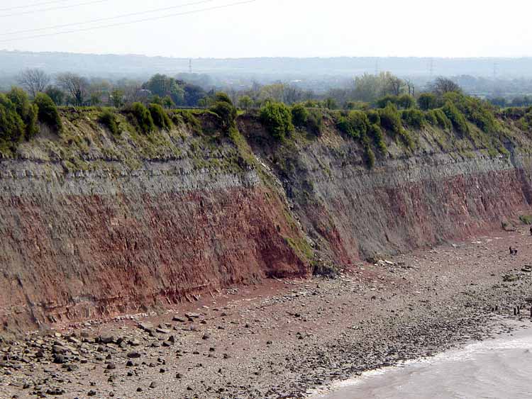
Aust Cliff
Aust
Aust Cliff is a cliff on the Severn Estuary in England, close to the village of Aust in South Gloucestershire. The 5.3-hectare site was notified in 1954 as a geological Site of Special Scientific Interest (SSSI). For visitors it is a place where rock layers tell a story more than 200 million years old, with one of Britain's best-known crossings in the background. What makes Aust Cliff special? The protection of the cliff rests on its fossil-bearing rock layers. The exposure is regarded as one of Britain's key Rhaetian localities, dating to the very end of the Triassic. Geological sources describe it as a prolific site for marine reptiles, mainly ichthyosaurs and plesiosaurs, along with rare dinosaur bones. It is also known for the Rhaetic Bone Bed, which marks the base of the Westbury Formation within the Penarth Group. This thin layer packed with bone fragments is an important reference horizon for geologists studying the close of the Triassic in Britain. What can you see in the rocks? The cliff works as a readable cross-section through successive periods. At the bottom are the red marls and mudstones of the Mercia Mudstone Group, laid down under arid conditions. Above them lies the Blue Anchor Formation, followed by deposits of the Penarth Group and the Lias Group. The Westbury Formation consists mostly of dark, carbon-rich shale with some sandstone and limestone containing shell debris. The colour change from red to dark grey reflects a shift from dry, arid land to shallow sea and lagoon settings. Even if you are not a geologist, it shows up as a clear, banded pattern in the cliff face. The bridge above the cliff The Severn Bridge crosses the cliff, carrying traffic over the estuary. The mix of a raw natural exposure and a major piece of engineering makes the area interesting for photography, especially when the light changes over the water at different times of day. Planning a visit Location: by the village of Aust, South Gloucestershire, on the Severn Estuary shore. Nature of the site: protected for its geological value. Treat the rocks and fossils as scientific heritage and do not remove material without permission. Coordinates: roughly 51.60 N, 2.63 W. Before you go: the Severn Estuary has pronounced tides, so check local conditions and warnings before approaching the shoreline. Frequently asked questions Where is Aust Cliff? In England, near the village of Aust in South Gloucestershire, on the Severn Estuary. How large is the site? It covers 5.3 hectares and has been a geological SSSI since 1954. What fossils have been found here? According to geological sources, mainly marine reptiles such as ichthyosaurs and plesiosaurs, plus rare dinosaur bones. What is the Rhaetic Bone Bed? A bone-rich layer that forms the base of the Westbury Formation in the Penarth Group. Can you see the bridge? Yes, the Severn Bridge crosses the cliff, so it is part of the local landscape.
-

Devil's Chimney
Tewkesbury
Devil's Chimney is a limestone pillar standing on Leckhampton Hill, just south of Cheltenham in Gloucestershire, England. The lone spike of rock juts out from the edge of the slope and has been one of the best-known landmarks in the area for centuries. What is Devil's Chimney? It is a limestone formation that stands slightly apart from the main hillside. By most accounts it is largely man-made: when an incline serving a quarry was cut behind the pillar, the rock was left isolated from the rest of the slope. Its exact origins remain uncertain. By the time Cheltenham grew into a popular resort, the chimney was already a familiar landmark, and the true story of how it came to be had long been forgotten. What is its history? Leckhampton Hill was once a hub of limestone quarrying. Traces of the final phase of extraction, which ran from the late 18th century until the mid-1920s, can still be seen across the slopes. A history of Cheltenham published in 1803 described the pillar as a chimney raised by preternatural hands, while another writer suggested shepherds built it for fun during an idle hour. In 1926 the formation survived an earthquake, though it picked up a few cracks. In 1985 it was repaired and protected against further erosion. What is the legend? Local folklore says the Devil, angered by the churches in the area, hurled stones down at churchgoers from the hill. In the end the rocks turned on him and drove him beneath the ground. Visitors still often leave a coin among the stones at the foot of the pillar. Where is it and what else is nearby? The coordinates are roughly 51.864 N, 2.079 W. Although the location is sometimes listed under Tewkesbury, the pillar sits on the hill above Cheltenham, on the edge of the Cotswolds. In June 2026 Natural England designated the area known as the Cheltenham Escarpment, meaning Leckhampton Hill together with Charlton Kings Common, as a new National Nature Reserve. Devil's Chimney lies within it. Frequently asked questions Is Devil's Chimney natural? Only partly. The pillar is largely the result of a quarry incline being cut behind it, which cut the rock off from the hillside, but its origins are not fully settled. Where is Devil's Chimney? On Leckhampton Hill, south of Cheltenham in Gloucestershire. It should not be confused with other places of the same name, such as those on the Isle of Wight or at Beachy Head. Is the pillar stable? It was repaired and protected from erosion in 1985, and earlier it survived the 1926 earthquake, though with some cracks. Where does the name come from? From a local legend about the Devil, who threw stones at churches and worshippers until the rocks drove him underground. Is it a nature reserve? Yes. Since June 2026 the hill has held National Nature Reserve status.
-

Kinver Edge
South Staffordshire
Kinver Edge is a high heath and woodland escarpment just west of the village of Kinver, on the border between Staffordshire and Worcestershire in England. In a single outing you can combine a walk through rare heathland, views from the ridge and a visit to homes carved into the rock. Where is Kinver Edge and how do you get there? The ridge lies about four miles west of Stourbridge and four miles north of Kidderminster. It is looked after by the National Trust. You can leave a car at the car park on Compton Road or at the one on Kingsford Lane. One of the longer trails starts from a lay-by on Comber Road, so check where your chosen route begins before setting off. What are the Holy Austin Rock Houses? The main attraction is a set of dwellings cut into the sandstone, known as the Holy Austin Rock Houses. Families are reported to have lived in them until the 1960s. Today part of the site has been restored: one level has a visitor reception, while the upper level holds an unrestored dwelling and a tearoom. The upper level is reached by about 30 steps, or by a moderately steep path through the surrounding countryside. Which walking trails are there? Several routes of different lengths are available: Woodland trail – about 1.1 miles, taking 45 minutes to an hour. It finishes with steep steps, so it is not an entirely flat stroll. Heathland trail – about 4 miles, starting at the Comber Road lay-by. It crosses rare heathland habitat and continues to the Iron Age hillfort. Kinver Edge circular – about 4.2 miles, graded easy, starting at the National Trust car park on Compton Road. Some walkers say the steep climbs are tougher than the grading suggests, and that path junctions can be hard to follow. Is it a good place for a family day out? Yes, as long as you are ready for steps and inclines. The short woodland trail makes a pleasant walk, and if you have more time the longer routes take you across the heath and to the site of the old hillfort. Sturdy footwear is a good idea, as paths run over uneven ground and along slopes. When should you visit? The heath looks different in every season, and the views from the edge of the ridge are at their best in clear weather. If you plan to combine the walk with the rock houses, check current opening times on the National Trust website, since the reception and tearoom keep their own schedule. Frequently asked questions Is Kinver Edge in Staffordshire or Worcestershire? It sits on the border between the two counties. The village of Kinver is in Staffordshire, and the ridge runs along the dividing line. Can you go inside the rock houses? Yes. You can visit the restored level with the reception and the unrestored dwelling above. Reaching the top means climbing about 30 steps or taking the path up. How long does a walk take? The short woodland trail takes around an hour. The heathland trail and the circular route run to roughly four miles, so set aside a few hours for them. Where can you park? At the car park on Compton Road or at the one on Kingsford Lane. What is the highlight? The mix of three things: views from the escarpment, rare heathland, and homes cut into sandstone where people were living only a few decades ago.
-

Old Man of Stoer
Old Man of Stoer is a sea stack on the north-west coast of Scotland, rising about 60 metres (200 ft) out of the Atlantic near the villages of Stoer and Culkein in Sutherland. It stands just off the cliffs of the Stoer peninsula, within the Assynt area of the Highlands, and is one of the most recognisable rock pillars in the country. What is the Old Man of Stoer? A sea stack is a column of rock left standing after waves have worn away the surrounding cliff. This one is built of Torridonian sandstone, an ancient reddish rock typical of the north-west Highlands. Over time the sea cut through the link to the mainland and left a slender tower separated from the shore by a channel of open water. Its steep, narrow shape, wider at the base and tapering towards the top, makes it look more fragile than it is. Where is it and how do you get there? The stack lies close to Stoer Head Lighthouse, at the end of the peninsula north of the village of Stoer. Visitors usually park near the lighthouse and follow a path along the clifftop. The walk to the viewpoint opposite the stack takes roughly an hour on foot, across open, often boggy and windy moorland, so sturdy footwear and a weatherproof layer are sensible even in summer. The path runs along cliff edges, so keep a safe distance from the drop, especially in strong wind or poor visibility. Can you climb the Old Man of Stoer? Yes, and that is a large part of its fame. It is a popular climbing route, though not a casual one. Because the stack is cut off from the land, climbers first have to cross the gap. This requires a Tyrolean traverse, a rope set up between the cliff and the stack, and getting the line across can call for a swimmer to carry it over. The ascent was first made in the 1960s, with the climbing pioneer Tom Patey among those associated with it. The climb is for experienced climbers with proper equipment and a sound understanding of tides, weather and sea conditions. Most visitors admire it from the cliff top. When is the best time to visit? Long daylight hours in late spring and summer give the most flexibility, and evening light turns the sandstone warm orange. Scottish weather changes quickly, so check the forecast before setting out. Birds nest on the coastal cliffs in season, which adds to the atmosphere. What else is nearby? Stoer Head Lighthouse, at the tip of the peninsula, with wide views across the Minch. The villages of Stoer and Culkein, small crofting communities with beaches nearby. The wider Assynt landscape, known for isolated mountains, lochs and rugged coastline. Frequently asked questions How tall is the Old Man of Stoer? About 60 metres, or 200 feet. Is it difficult to reach? The walk is not technical, but it is long enough, and exposed enough, to need preparation. Reaching the top of the stack is a different matter and is only for experienced climbers. Can I walk out to the stack? No. It is separated from the mainland by water, so it is viewed from the cliff top. What is it made of? Torridonian sandstone, an old reddish rock typical of north-west Scotland. Is it near a lighthouse? Yes, Stoer Head Lighthouse is close by and is the usual starting point for the walk.
-

Rowten Pot
Rowten Pot is a deep shaft cave in Kingsdale, North Yorkshire, on the slopes of Whernside inside the Yorkshire Dales National Park. Its opening is one of several entrances to a cave system roughly 27 km long that drains the whole valley. It is mainly a destination for experienced cavers, but it is also an interesting stop for anyone who enjoys limestone country. What is Rowten Pot? The entrance is an elongated shaft about 27 m long and 10 m wide. At its deeper southern end the drop is around 72 m, and the cave as a whole is recorded at about 105 m deep and 259 m long. Water carved it out of Carboniferous limestone. The first descent took place in July 1897, by a party from the Yorkshire Ramblers' Club. At the time it was regarded as the deepest known natural hole in England. What lies underground? The cave is mostly vertical. At the bottom a stream runs along a short passage into the West Kingsdale river underground. About 150 m west of the shaft, surface water sinks into Rowten Caves, a shallow horizontal system that rejoins the pot just below the moorland surface. Further on, the river reaches the Kingsdale Master Cave through three short sumps. In 1974 cave divers also used a sump route from Rowten Pot to reach neighbouring Aquamole Pot. Can you go down? The shaft is normally descended on a single rope (SRT). Cavers value it for its spaciousness and the variety of routes down. It remains a technical trip that needs equipment, experience and a good read on conditions. The main hazards are the vertical drop and water, and levels rise fast after rain. The sumps leading to Kingsdale Master Cave are for highly experienced divers only, in low water. Visitors without caving skills can look at the shaft from a safe distance back from the edge. How do you get there and when should you go? Rowten Pot lies on open moor above Kingsdale, close to the old Turbary Road. Approach the valley from Ingleton or Kirkby Lonsdale, then continue on foot across pasture and moorland. Dry weather from late spring to early autumn is best, with firmer ground and less risk of underground flooding. Bring a map, waterproofs and walking boots, as conditions on Whernside can change quickly. Frequently asked questions How deep is Rowten Pot? The entrance shaft is about 72 m deep at its deepest point, and the full cave is around 105 m deep. Who first descended Rowten Pot? Members of the Yorkshire Ramblers' Club, in July 1897. Does Rowten Pot connect to other caves? Yes. Through short sumps the water flows on to Kingsdale Master Cave, and the horizontal Rowten Caves feed back into the shaft. Divers also reached Aquamole Pot from here. Is the descent suitable for beginners? No. It needs rope skills, equipment and experience. Beginners should explore Yorkshire Dales caves with a local club or a qualified guide.
-
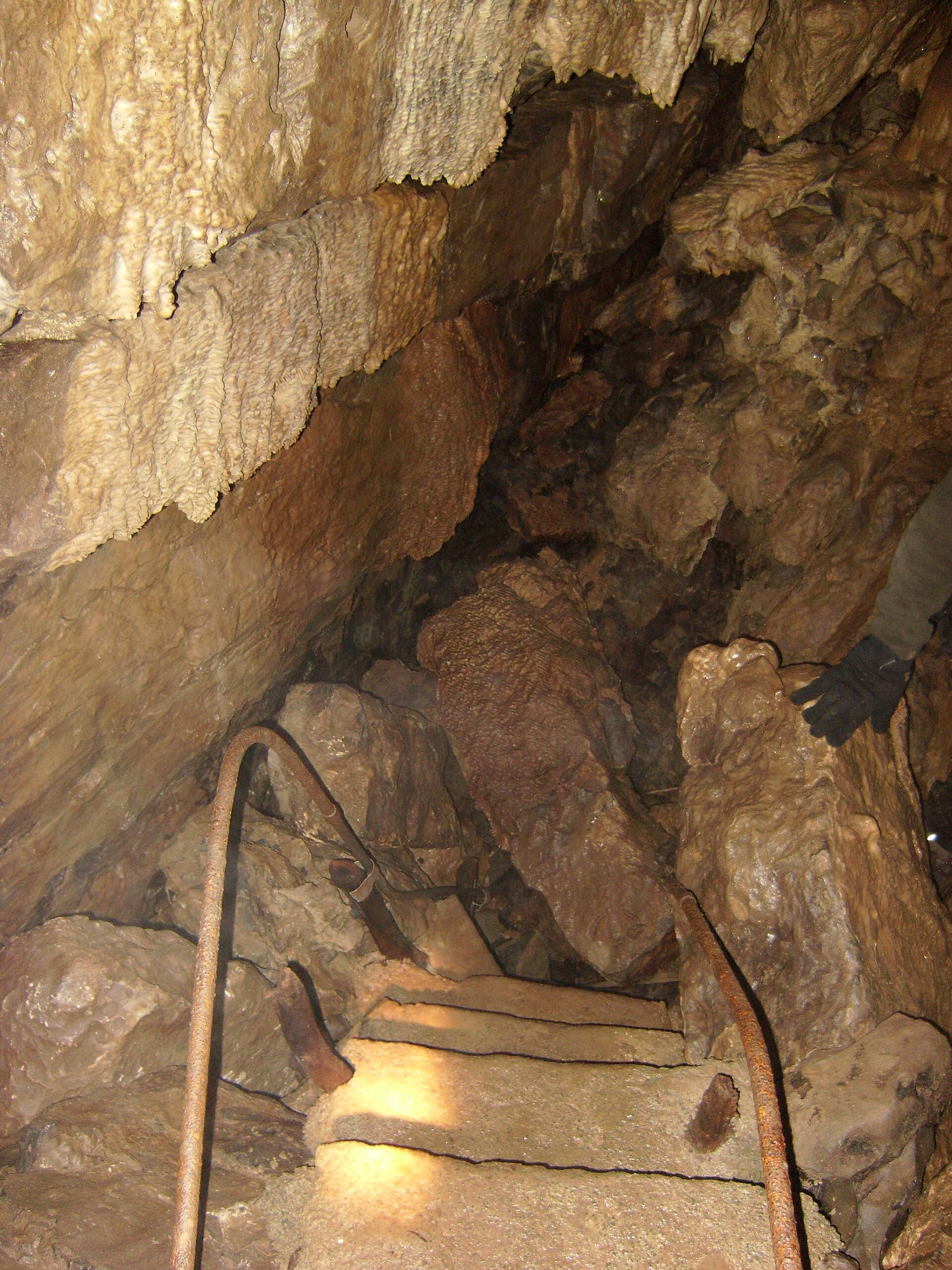
Skirwith Cave
Ingleton
Skirwith Cave is a cave on the slopes of Ingleborough in Chapel-le-Dale, close to Ingleton in the Yorkshire Dales National Park, North Yorkshire. It operated as a tourist attraction in the 1960s and early 1970s. It is now closed to the public, though experienced cavers still go underground here. For most travellers it is a curiosity to note on the way to White Scar Caves or up Ingleborough rather than a place to visit. What kind of cave is it? Skirwith is a resurgence, meaning underground water emerges here to reach the surface. It formed as limestone dissolved over time. The cave lies within the Ingleborough Site of Special Scientific Interest (SSSI). Surveyed length is quoted at anywhere between roughly 770 m and 1,000 m, depending on the source. What is it like inside? The present entrance is a shakehole that drops into a decorated rift passage, once part of the show cave route. Beyond it come a boulder choke and a five-metre waterfall, followed by a long passage that is mostly low and wet. After several hundred metres it reaches a series of sumps. Three short ones are separated by brief stretches of passage, and the fourth has been dived for about 24 m to an underwater boulder choke. The cave trends up the dip to the north-east, towards the valley of Crina Bottom, and part of its continuation has been entered from Lower Hardgill Pot, about 400 m away. What is its history? Local people first entered the cave in 1934, and by 1947 it had been explored as far as the first sump. It opened as a show cave in the mid-1960s (sources give either 1964 or Easter 1965). Members of the Happy Wanderers Cave and Pothole Club dived the sumps in 1965 and 1966. The show cave closed in 1974, reportedly because of rockfall danger. Ruined buildings, an overgrown access road and the old car park are all that remain of the attraction. Can you visit? Casual visitors cannot go in. The cave is graded III, with water and loose boulders as the main hazards. Entry needs the landowner's permission, and groups are expected to give written notice at least a week ahead. Trips are normally arranged through caving clubs such as the Craven Pothole Club, and the British Caving Association publishes guidance on safe and responsible caving. What else is nearby? The cave stands beside the road towards Hawes, just before White Scar Caves, which is a working show cave. Paths up Ingleborough, one of the Yorkshire Three Peaks, start close by, and Ingleton has its own Waterfalls Trail. The Ribblehead Viaduct is a short drive away. Frequently asked questions Is Skirwith Cave open to tourists? No. It ran as a show cave until 1974 and has been closed to visitors since then. Can a beginner go into Skirwith Cave? It is not a good choice. The cave is wet, has sumps and unstable boulders, and entry requires permission from the landowner. Where is Skirwith Cave? On Ingleborough in Chapel-le-Dale, a few kilometres from Ingleton, inside the Yorkshire Dales National Park. Which show cave can I visit instead? White Scar Caves, on the same road, is the nearest. Ingleborough Cave in the Clapham area is another option.
-
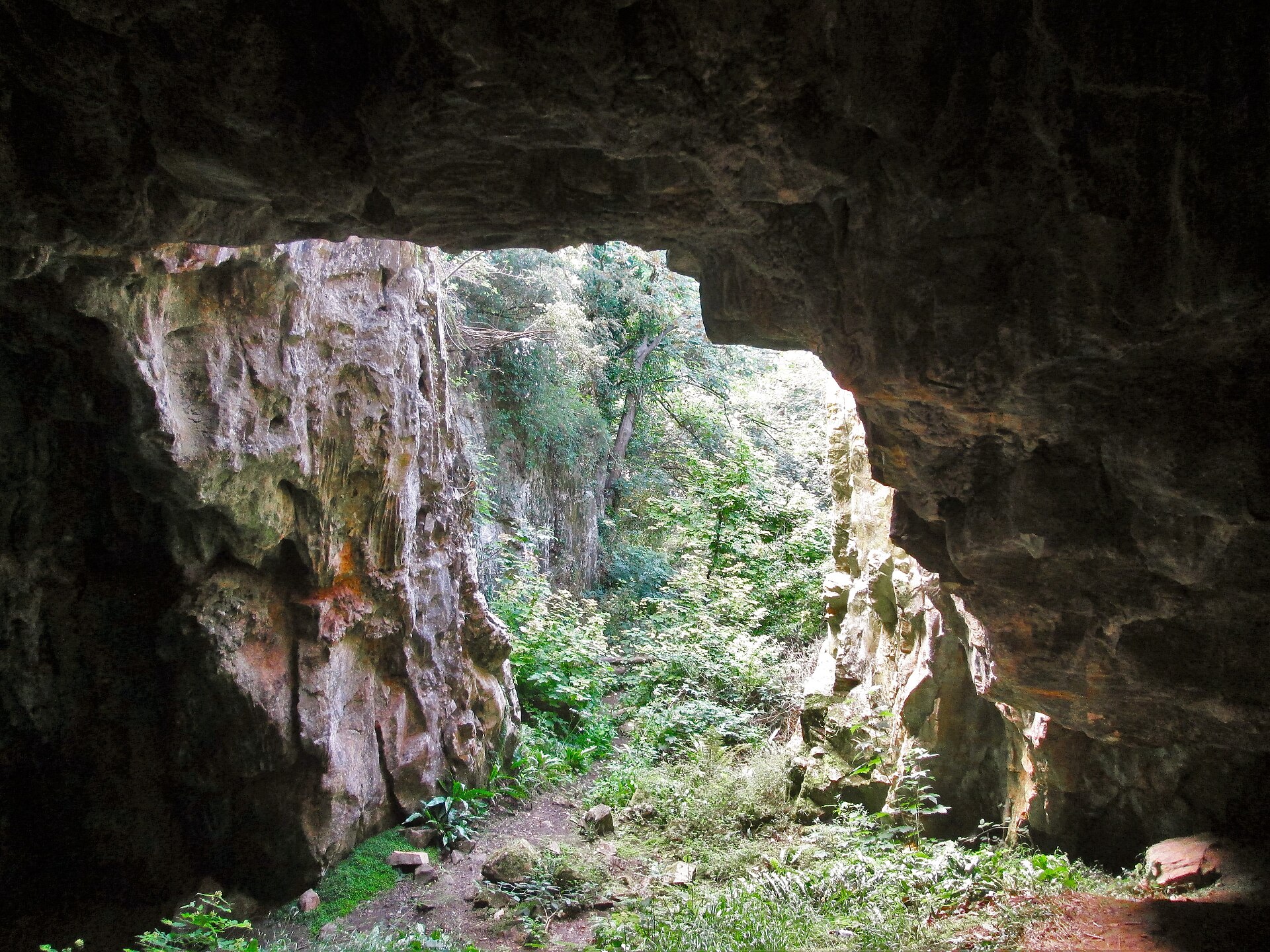
Ash Hole Cavern
Brixham
Ash Hole Cavern in Brixham, on the Devon coast of Torbay, is a limestone cave that sheltered people for thousands of years. Today it is a protected archaeological site, and it appeals to anyone who likes prehistory more than polished visitor attractions. What is Ash Hole Cavern? The cave is a limestone system with a main chamber roughly 40 m long from east to west and up to 22 m wide, according to a survey by the Devon Karst Research Society. The original, natural entrance lies at the bottom of a sinkhole. A second, much larger opening appeared in the 19th century, when quarrying broke into the cave. Why is it so important? Excavations show that people used the cave as a rock shelter across several eras. Investigations in the 1960s, led by G. Head, found occupation layers from the Neolithic (about 4000-2200 BC), the Bronze Age (about 2200-700 BC) and the Roman period. The upper cave deposits yielded pottery, bronze metalwork, a Roman coin and human remains. Most of the pottery is Bronze Age and resembles Cornish Trevisker ware from roughly 1750-1000 BC. Earlier antiquarians had dug here too, including Henry Lyte and John MacEnery. Sources disagree on the exact date of Lyte's work, so it is safest to say only that it took place in the first half of the 19th century. The site has been a scheduled monument since 23 November 1966 and appears in the National Heritage List for England as "Ashhole Cavern" (entry 1019133). Digging, collecting finds or damaging the cave is therefore illegal. Where is it and how do you get there? The cave sits about 100 m from the shore, roughly halfway between Brixham town and Berry Head, on the southern curve of Torbay. A short walk from Berry Head Road leads to it. The grid reference is SX 93701 56681, and the coordinates are about 50.400 N, 3.497 W. Before you go, check locally whether the entrance can be visited, because it is a protected monument and the site is not set up as a show cave. What else is nearby? Combine the visit with a walk along the South West Coast Path to Berry Head, with its views over Torbay. Brixham harbour, with its fishing fleet and cafes, is a short distance away. The area lies within the English Riviera UNESCO Global Geopark, so it suits a day spent on geology and local history. When should you go? The surroundings are a coastal walk, so dry weather in spring, summer or early autumn is the most comfortable. Wear sturdy shoes, as the paths can be muddy after rain. Frequently asked questions Can you go inside Ash Hole Cavern? It is a scheduled monument rather than a commercial attraction. Treat access as restricted and respect any signs or barriers at the site. How old are the finds? The deposits span the Neolithic, the Bronze Age and Roman times, so roughly 4000 BC to the Roman period. Is it worth visiting if you cannot enter? Yes, if you enjoy archaeology or the coast. You can pair it with the Berry Head walk and the harbour in Brixham. Is it the same as Brixham Cave? No. Brixham Cave, also called Windmill Hill Cave, is a different site in the town that is famous for its role in establishing the antiquity of humankind. Ash Hole Cavern is a separate monument.
-

Dan yr Ogof
Pen y Cae
Dan yr Ogof is a show cave system at Pen y Cae in south Wales, inside Bannau Brycheiniog (Brecon Beacons) National Park. It forms the core of the National Showcaves Centre for Wales, which is regarded as the largest show cave complex in the UK. The whole system runs for roughly 17 km, yet visitors only walk the opening stretch. Everything beyond is a nature reserve reserved for experienced cavers. What will you see at Dan yr Ogof? One ticket covers three separate caves. Dan-yr-Ogof Cave – a lit path of just under a kilometre, passing formations with names like the Rasher of Bacon, the Angel and the Alabaster Pillar. Cathedral Cave – a tall chamber holding a lake fed by two waterfalls. The route ends behind the falling water at the Dome of St Paul's, and most visitors rate it the highlight. Bone Cave – exhibits on how people used the cave, from Bronze Age burials (42 skeletons were found) to Roman-era finds, alongside remains of hyenas and cave bears. Is there anything besides caves? Yes. The same ticket opens up a set of above-ground attractions. The Dinosaur Park has more than 200 life-size models (sources give differing counts). You will also find a Shire Horse Centre, an Iron Age village, a museum and play areas. A nine-hole mini golf course is available separately. That makes the site an easy choice for a family day out. How do you get there? The centre sits about 5 miles (8 km) north of Ystradgynlais and 15 miles (24 km) south-west of Brecon, in the upper Swansea Valley. Driving is the simplest option, and parking on site is free. When should you visit, and how long does it take? Underground temperatures stay cool and steady whatever the weather outside, so bring a warm layer and sturdy shoes. Allow most of a day if you want to see all three caves and the park. Opening hours vary by season, so check showcaves.co.uk or phone ahead. The operator advises booking tickets online before you travel. Frequently asked questions Can you explore the entire cave system? No. Only the first section is open to the public. The remainder is protected as a nature reserve and is open to cavers only. How many caves does the ticket include? Three: Dan-yr-Ogof, Cathedral Cave and Bone Cave. Surface attractions such as the dinosaur park and Iron Age village are included too. Where is Dan yr Ogof? At Pen y Cae, near Abercraf in Powys, within Bannau Brycheiniog National Park and about 24 km from Brecon. Is there parking? Yes, free parking is provided at the site.
-
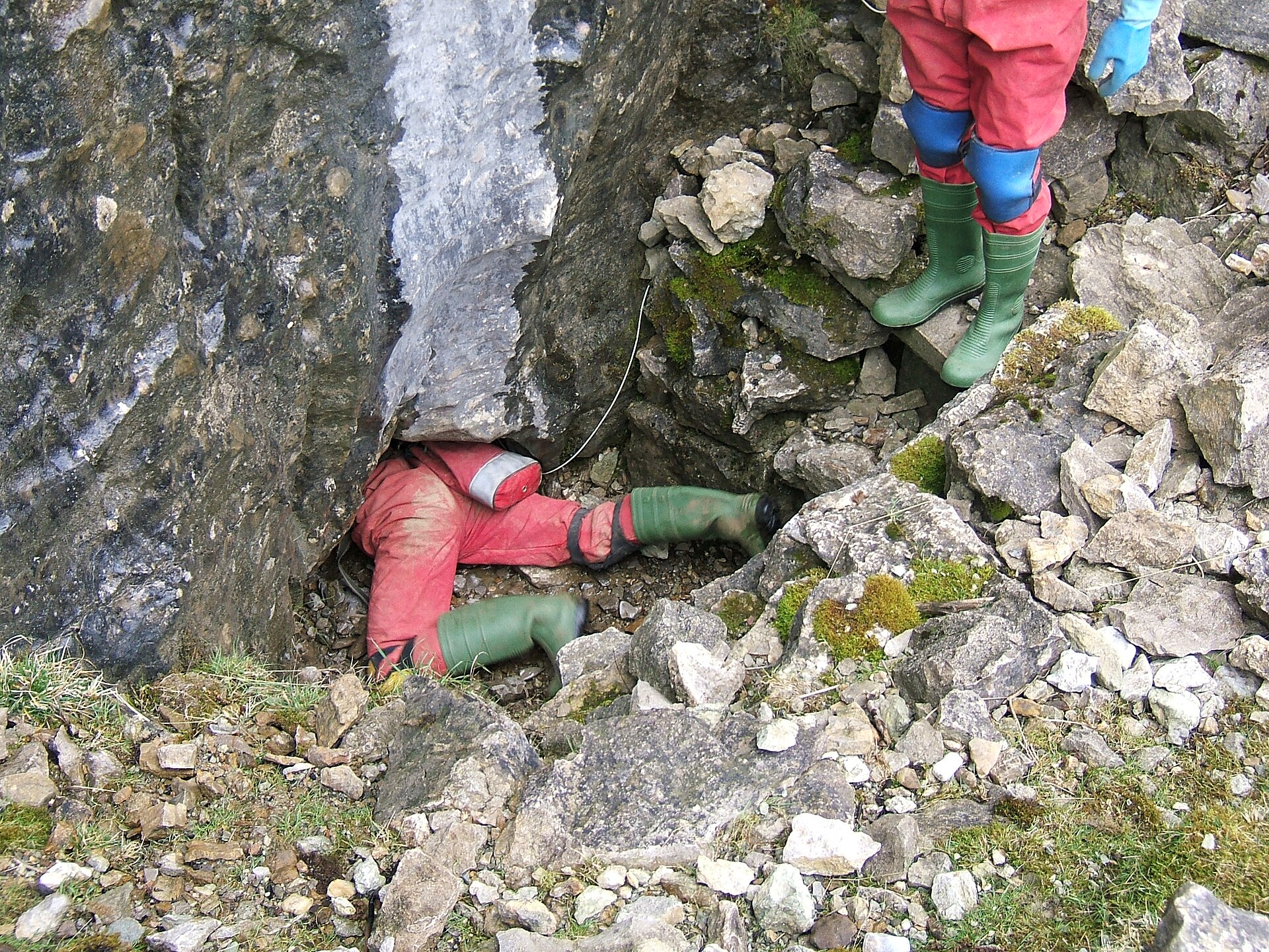
Ogof y Daren Cilau
Ogof y Daren Cilau is a major cave system in south Powys, Wales, set in the limestone escarpment of Mynydd Llangatwg above Crickhowell, inside Bannau Brycheiniog (Brecon Beacons) National Park. It was found in 1957 and ranks among the longest caves in the United Kingdom. This is a destination for experienced cavers, not a sightseeing stop. What is Daren Cilau? The cave runs beneath a ridge that was heavily quarried from the 18th century. Stone went into buildings, lime was spread on fields, and later the rock served as flux for the region's ironworks. Surveyed passages total more than 26 km. The system lies right beside Ogof Agen Allwedd under the same hillside, and the whole of Mynydd Llangatwg carries nature conservation designations. Why is it only for experts? Reaching the main cave means first crawling about 517 metres through a low, tight tube. That alone keeps casual visitors out. Beyond it lie long, demanding routes where navigation is hard, trips last many hours, and a rescue would be slow and complex. Cavers also know the system for a huge passage described as the largest in Britain. How does access work? Rules depend on the entrance. The dry entrance, Ogof Cnwc (Price's Dig), is locked and keys are held by certain caving clubs. The Cambrian Caving Council publishes access information. The original wet entrance is not gated, but arrangements can change. Before any trip, check current conditions with the council, a club such as South Wales Caving Club, or the Mynydd Llangatwg committee. How do you get there? The area lies by the village of Llangattock, across the River Usk from Crickhowell. From Crickhowell, cross the bridge and climb the hillside. Abergavenny and Brecon are the nearest larger towns. The entrances sit on the slope, so bring sturdy boots and a map. Approximate coordinates: 51.83 N, 3.15 W. What can you see without going underground? The Llangattock escarpment gives wide views over the Usk valley and Crickhowell. You will find old quarry workings and paths along the edge, plus other cave entrances that should not be explored without a guide. Afterwards, Crickhowell has cafes and places to stay. When should you go? Late spring to early autumn gives the driest paths. Plan any cave trip around the weather, because heavy rain can raise water levels in the lower parts of the system. Frequently asked questions Can a beginner enter Ogof y Daren Cilau? No. The cave is physically and technically demanding. Go with an experienced caver or a club. Who controls access? The Cambrian Caving Council publishes restrictions, and selected clubs hold keys to the dry entrance. How long is the cave? Sources give over 26 km of passage, placing it among the longest in the UK. Can I enjoy the area without caving? Yes. The Mynydd Llangatwg escarpment offers views and walks, and Crickhowell makes a good base.
-
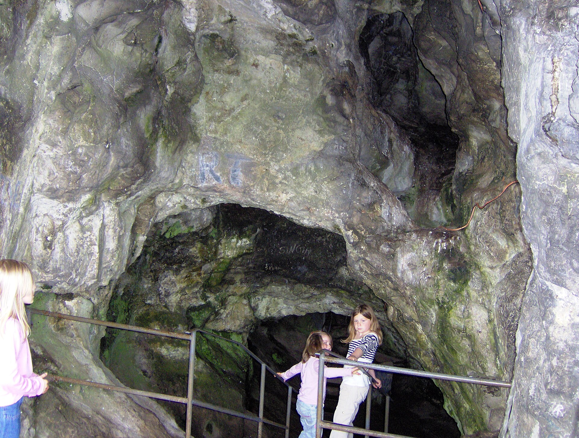
Ghyston's Cave
Bristol
Ghyston's Cave, also called the Giants Cave, is a natural cave in the limestone face of St Vincent's Rocks above the Avon Gorge in Clifton, Bristol. Visitors reach it through Clifton Observatory, and the ledge at its mouth looks out over the gorge and the Clifton Suspension Bridge. What is Ghyston's Cave? The cave opens high in the gorge wall, roughly 76 m above the river. Before a tunnel was cut, getting there meant a scramble from the top of the gorge or a steep climb from below. Today almost everyone takes the easier route, a passage that starts inside the observatory. Where does the name come from? The name comes from a local legend of two giants, Goram and Ghyston, who both wanted to win Avona. Her challenge was to drain a lake that filled the land between Bristol and Bradford-on-Avon. In one telling, Ghyston dug steadily down to Sea Mills and carved out the gorge, while Goram grew hot, drank too much and fell asleep. Versions differ on the details, including how Goram met his end. Ghyston is sometimes called Vincent, a name linked to St Vincent's Rocks. The word Ghyston itself may have first described the whole cliff face, since it appears in that sense in sources from the mid-15th century. Scholars regard the legend as relatively recent. How do you get into the cave? In 1835 William West, who ran the observatory, had a tunnel dug between the building and the cave. According to Wikipedia the work took two years and the passage opened to visitors in 1837. The tunnel is about 61 m long (another source gives 65 m). It descends by steps, and descriptions of the count range from about 130 to more than 200, so expect a climb back up. At the end there is a small viewing platform at the opening in the rock. Visit Bristol describes it as the only platform in the city overlooking the gorge and the Suspension Bridge. What will you see? The Avon Gorge and Clifton Suspension Bridge from cliff height A Victorian-era rock-cut tunnel The observatory itself, with its tower and camera obscura When should you go? Opening hours and prices change with the season, so check Clifton Observatory or Visit Bristol before your visit. A clear day gives the best views over the gorge. Wear sturdy shoes, as the tunnel and steps can be slippery. Frequently asked questions Is Ghyston's Cave the same as the Giants Cave? Yes. Both names refer to the same cave in St Vincent's Rocks. How do I enter the cave? Through Clifton Observatory. A tunnel of about 61 m leads from the building to an opening in the cliff. Who were Goram and Ghyston? They are the giants of a local legend who, in a contest for Avona, were said to have carved out the Avon Gorge. Can you see the Clifton Suspension Bridge from the cave? Yes. The platform at the tunnel's end looks over both the gorge and the bridge.
-

Cathole Cave
Ilston
Cathole Cave (also spelled Cat Hole Cave) sits in the wooded Parc le Breos valley on the Gower Peninsula, close to Ilston and Parkmill. About 12 km west-south-west of Swansea, it is one of the area's key archaeological caves. What is Cathole Cave? The cave opens in a steep limestone outcrop roughly 180 m north of the Parc Cwm Neolithic tomb, some 15 m above the valley floor. It is a deep, triangular fissure that narrows toward the top, with two entrances and a natural ledge outside the larger one. The surrounding Park Wood (Coed y Parc) is managed by Natural Resources Wales. Why does it matter? Colonel E. R. Wood dug here extensively in 1864. In 2010 a deer-like engraving was spotted on the cave wall. Calcite partly covering it was dated by uranium series to about 12,500 years ago, pointing to a possible Upper Palaeolithic origin. Before the entrance was fitted with a grille, a fresh excavation took place in 2012. It yielded two flint blades of Upper Palaeolithic character plus animal bones, and the deposits were placed between roughly 50,000 and 30,000 years ago. The site is a Scheduled Monument. How do I get there? Park at the Parc le Breos car park off the A4118 between Parkmill and Penmaen. Walk up the valley past the long cairn, then take the path that branches right into the woods toward the cave. Natural Resources Wales waymarks a Caves, Cairn and Kiln Walk of about 3.7 km, which takes around 1.5 hours; the rough climb to the cave is its steepest part. A longer circular route starts from the Gower Heritage Centre in Parkmill. The nearest railway station, Gowerton, is about 8 km away, so a car is the practical choice. Can I go inside? No. The entrance is protected by a grille, so you view the cave from the outside, from the ledge in front. Wear shoes with good grip, as the path can be muddy. When should I visit? The woodland is open all year. Spring and summer offer green scenery and drier paths. It pairs naturally with a stop at the Parc Cwm tomb, which is right beside the route. Frequently asked questions Can I enter Cathole Cave? No. A grille blocks the entrance, but you can see it and its surroundings from outside. How long is the walk from the car park? The full waymarked loop takes about an hour and a half. The climb to the cave alone is shorter but uphill. What else is on the route? The Neolithic Parc Cwm tomb, a lime kiln and Park Wood, with a picnic area by the car park. Is the site protected? Yes. It is a Scheduled Monument, so nothing may be removed or damaged.
-
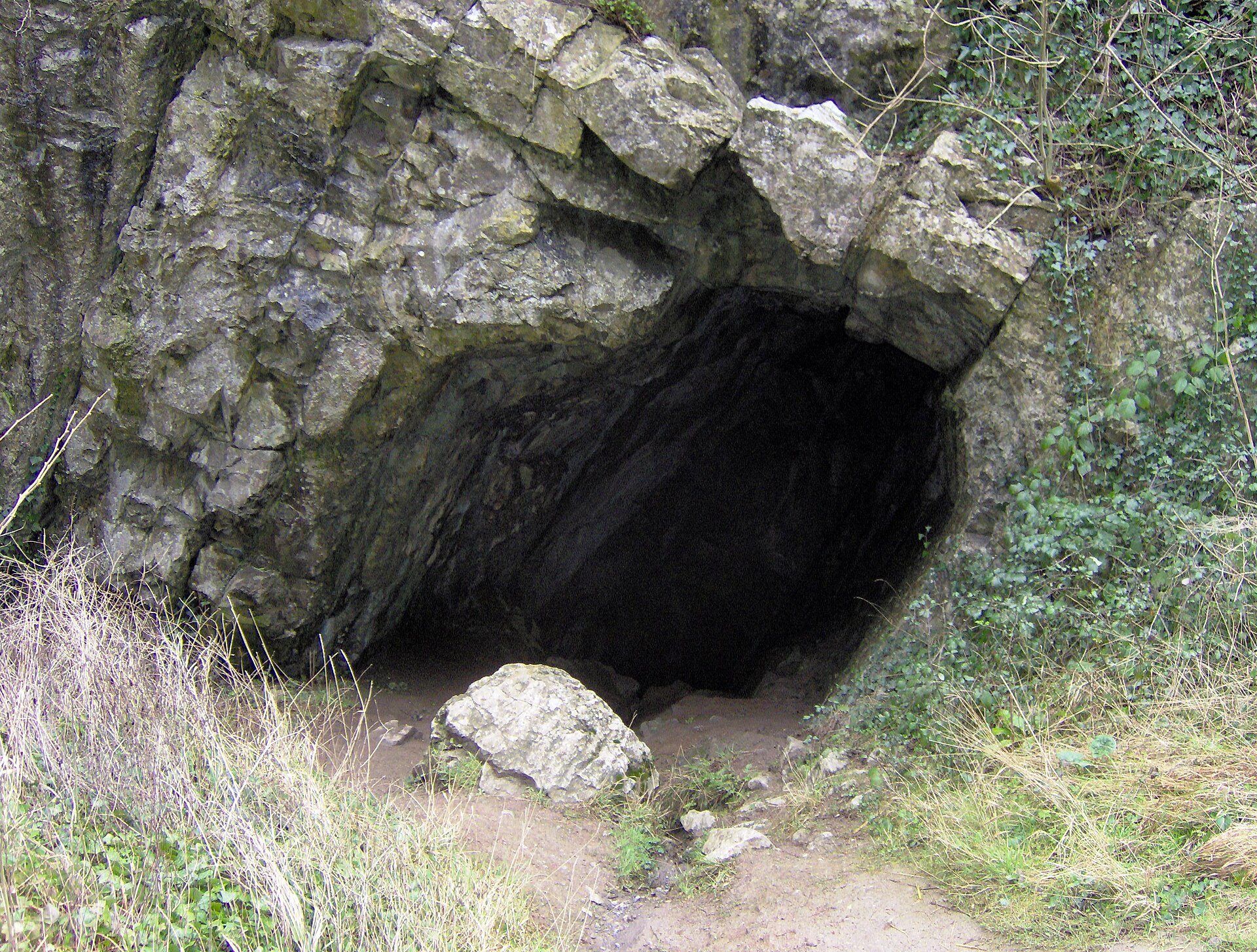
Aveline's Hole
Burrington
Aveline's Hole is a small limestone cave in Burrington Combe, near the village of Burrington in the Mendip Hills of Somerset, England. It holds a special place in British archaeology: this is one of the oldest known burial grounds in the country, and the site is a protected archaeological monument. Come for the story and the gorge, not for a cave visit. What is Aveline's Hole? The cave is phreatic, meaning running water carved it below the ancient water table. It opens in the rock wall of the gorge cutting into the northern slope of the Mendips. The entrance is low and easy to walk past if you do not know where to look. It came to notice in 1797. Accounts survive from that time, including letters from the poet Robert Southey, who visited on 27 January 1797. The tales of the find differ in detail, and the early skeleton counts, ranging from dozens to more than a hundred, look inflated. Why does it matter? People laid their dead here in the Early Mesolithic. Radiocarbon dating of bone fragments, in work led by Dr Rick Schulting of Queen's University Belfast, gave ages of roughly 10,200 to 10,400 years. That made it the earliest scientifically dated cemetery in Britain. Some of the skulls are Early Neolithic, so the cave served for burials over a long span of time. The University of Bristol Spelaeological Society (UBSS) began excavating in 1914 and recovered remains of at least 21 individuals. A bombing raid in 1940 destroyed most of the collection and the dig records, so later studies had to rely on the surviving bones. Historic England listed the cave as a scheduled monument in 1992. Its entry stresses both the wealth of human remains and the range of Upper Palaeolithic artefacts found here. Can you go inside? Do not treat this as a show cave. The interior is a protected site and the entrance is closed off, so access is restricted. Digging is controlled by the UBSS on behalf of the landowners, and anyone wanting to dig needs approval from the society's secretary first. If you are part of a caving club or have a research reason to visit, contact the UBSS before you travel. Ordinary visitors can look at the entrance from outside and take photos, without disturbing the rock or vegetation. How do you get to Burrington Combe? The gorge runs along the B3134, around a dozen miles from Bristol. Lay-bys line the road, and paths lead from the car park in the lower combe up onto the Mendip plateau. The walk to the cave is a short climb over uneven, rocky ground, so wear sturdy footwear. What else is nearby? Burrington Combe is designated a Site of Special Scientific Interest. The limestone cliffs, the gorge and the surrounding heath make good walking country, and routes lead up to Black Down, the highest point of the Mendips. Frequently asked questions Is Aveline's Hole open to the public? No. It is a protected archaeological site with restricted access. You can view the entrance from outside, and permission for any work inside rests with the UBSS. How old are the burials? Mostly Early Mesolithic, about 10,000 years old. A number of skulls date to the Early Neolithic. Who investigated the cave? The University of Bristol Spelaeological Society began digging in 1914, and modern radiocarbon dating followed in the 2000s. Where do I park? There are lay-bys and a car park along the B3134 in Burrington Combe, within walking distance of the entrance.
-
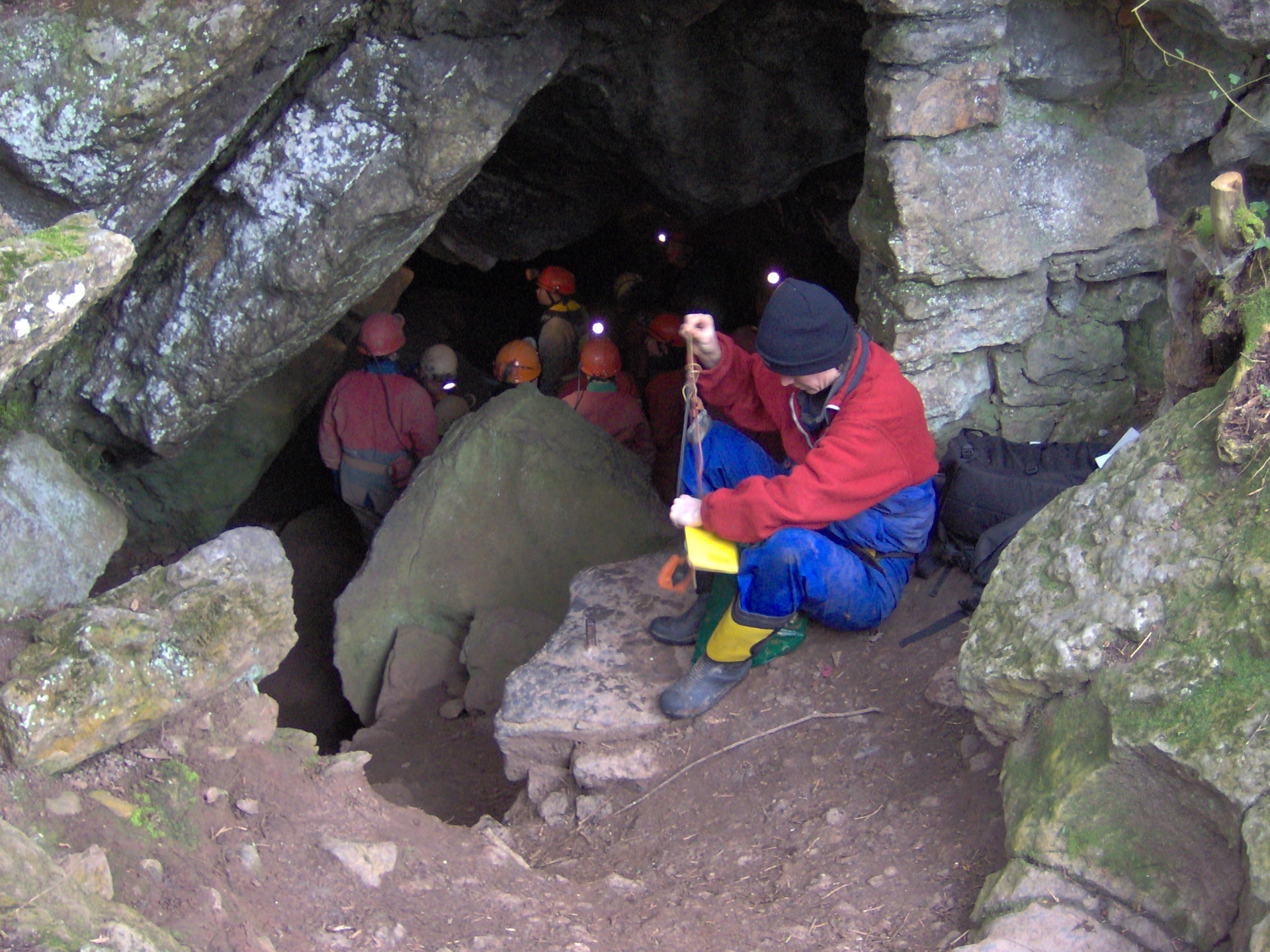
Goatchurch Cavern
Burrington
Goatchurch Cavern sits on the edge of Burrington Combe, a gorge in the Mendip Hills of Somerset, England. The Mendip limestone hides hundreds of caves, and this is one of the most visited. It runs for roughly 750 m, drops about 55 m and has two entrances, so a through trip is possible. What will you find inside Goatchurch Cavern? The cave is a maze of passages carved by water through a narrow band of Black Rock Limestone. Passages are tight and twisting, linking one chamber to the next. Decades of hands and boots have left the rock polished and slippery along the busiest routes. The best-known feature is the Drainpipe, a straight tunnel of about 12 m with a diameter barely over half a metre, connecting the two lowest chambers. Beyond it lie the terminal chambers. Near the entrance you will see iron handrails left from the time when the landowner tried to turn the cave into a show cave. What is the history of the cave? The first written record dates from 1736. Lead miners worked in the cave during the 19th century. Around 1901 the owner made an unsuccessful attempt to open it to paying visitors. In 1924 members of the University of Bristol Spelaeological Society (UBSS) dug out the lower entrance. Notes from 1920s exploration of the area also mention bones of mammoth, bear, hyena and cave lion. In 2003, graffiti cleaning revealed three W-shaped marks, thought to be protective ritual symbols dating from roughly 1550 to 1750. How do you get to Goatchurch Cavern? The cave lies on the hillside above the road through Burrington Combe. From the road a steep path climbs the slope. The combe is about 25 km south-west of Bristol, reachable by car, with roadside parking along the gorge. Can beginners go in? Goatchurch is a popular choice for first caving trips and is widely used to train newcomers. It is still a genuine cave, not a tourist route: there is no lighting, the passages are cramped and the rock is slick. You need a helmet, your own light and clothes you do not mind ruining. Beginners should go with a licensed guide or a caving club. Frequently asked questions How long is Goatchurch Cavern? About 750 m, with a depth of around 55 m. Does the cave have two entrances? Yes, which makes a through trip possible. Is it a lit show cave? No. The attempt to turn it into a visitor attraction around 1901 failed. Today it is a natural, unlit cave and you must bring your own equipment. What is the Drainpipe? A narrow, straight tunnel linking the two lowest chambers and one of the cave's signature features. Who explored the cave? Lead miners in the 19th century, and in the 20th century groups including the Bristol University Spelaeological Society, which published accounts and surveys of it.
-
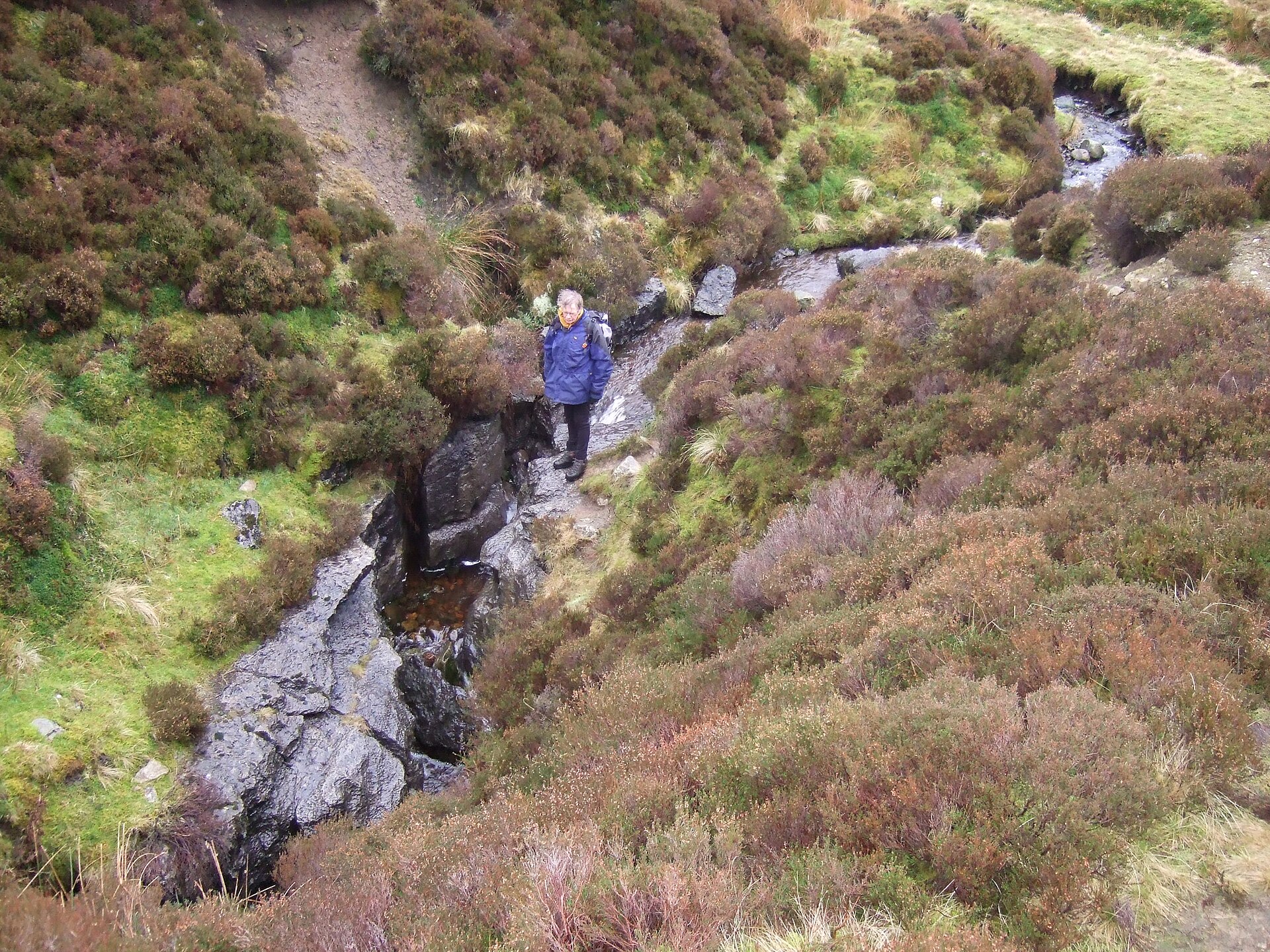
Lost John's Cave
Lancaster
Lost John's Cave is one of northern England's best-known caving systems, set beneath the moorland of Leck Fell in Lancashire, within reach of Lancaster and Kirkby Lonsdale. It is a destination for experienced cavers, not a show cave for casual visitors. What is Lost John's Cave? The system drops roughly 211 m and holds about 4.8 km of passage, with eight entrances at the surface. It forms part of the Three Counties System, a vast network running under Cumbria, Lancashire and North Yorkshire, totalling around 87 km. Neighbouring caves such as Death's Head Hole, Boxhead Pot and Rumbling Hole feed into it, which makes Lost John's a natural base for long through-trips. Why do cavers come here? It is a favourite for single-rope technique (SRT) practice. Three main vertical routes, known as Dome, Centipede and Monastery, allow exchange trips, where teams descend by different ways and swap over underground. Many of the pitches can be rigged away from the stream, so the cave stays usable on wet days, though heavy rain still demands careful judgement. Can a beginner go in? No. A trip means rope descents, cold water and demanding route-finding. You need SRT gear, a helmet with lights, protective clothing and the skill to climb out unaided. If you are new to caving, start with a course or a guided trip through a local caving club. Visitors who do not cave can still walk across Leck Fell and look at the limestone landscape from above. How do I get there? Leck Fell sits close to where Lancashire, Cumbria and North Yorkshire meet, a short drive from Kirkby Lonsdale along narrow country lanes. The last stretch to the cave is on foot across open moor. A car is effectively essential. Bring a map and clothing for changeable weather, since the fell is exposed and quickly turns wet. Access and rules Caving on Leck Fell depends on landowner consent and the policies of caving bodies such as the Council of Northern Caving Clubs (CNCC). Check current permit and safety requirements before your trip, since published sources describe them inconsistently. Tell someone on the surface when you expect to be back. Frequently asked questions How deep is Lost John's Cave? About 211 m, with roughly 4.8 km of passage. Is it a tourist cave? No. It is a sporting cave that requires rope skills and experience. Can it be visited in wet weather? Yes, because many pitches can be rigged out of the water, but after heavy rain the risk increases and conditions need constant assessment. What does it connect to? Other caves of the Three Counties System, including Death's Head Hole, Boxhead Pot and Rumbling Hole.
-
Poole's Cavern
High Peak
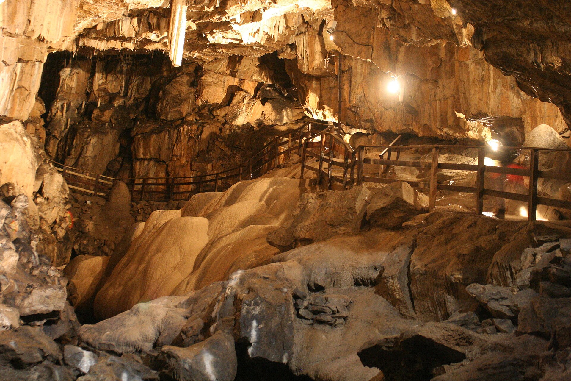
Poole's Cavern is a natural limestone show cave on the edge of Buxton, Derbyshire, inside the Peak District. The rock and its formations are some two million years old, and today the cave is open for guided walks at the foot of Grin Low hill. What will you see inside? The route follows lit passages along the banks of the underground River Wye, which emerges from a boulder choke at the end of the tour. Your guide explains the geology, fossils and colourful cave walls. Highlights include a cathedral-sized main chamber and a range of dripstone formations, among them the Flitch of Bacon, a stalactite that was broken off by careless visitors long ago. Why is it called Poole's Cavern? The name comes from Poole, a 15th-century outlaw said to have sheltered here. People used the cave far earlier: finds point to Neolithic and Bronze Age activity, and evidence of Roman-British use as well. Local tradition also links the cave to Mary, Queen of Scots. It became a tourist attraction in 1853, when the 6th Duke of Devonshire appointed Frank Redfern as custodian, and the Redfern family looked after it for about 120 years. How long does the tour take and how should you plan? Guided tours last roughly 45 to 50 minutes, and tickets are booked online in advance. Opening hours change with the season and differ between listings, so check poolescavern.co.uk before you travel. The cave is cool and damp all year, so bring a warm layer and shoes with good grip. What else is nearby? Buxton Country Park surrounds the cave, with woodland paths. At the top of Grin Low, about 439 m above sea level, stands Solomon's Temple, a viewing folly built in 1895 with money raised by public subscription. The climb is moderately demanding, with some steep sections and steps, and rewards you with wide views. Remains of the area's lime-burning industry are visible on the hillside. Where is it and how do you get there? The cave lies on the outskirts of Buxton, a spa town in north-west Derbyshire. It is a few minutes by car from the town centre, and the country park trails start right next to the cave. Frequently asked questions Do I need to book in advance? Yes. Visits are by guided tour, and tickets are bought online ahead of time. How long is the tour? About 45 to 50 minutes. Where does the name come from? From Poole, a 15th-century robber who, according to tradition, lived in the cave. Can I combine the visit with a walk? Yes. From the cave you can enter Buxton Country Park and follow the path up Grin Low to Solomon's Temple.
-
Llyn Conwy
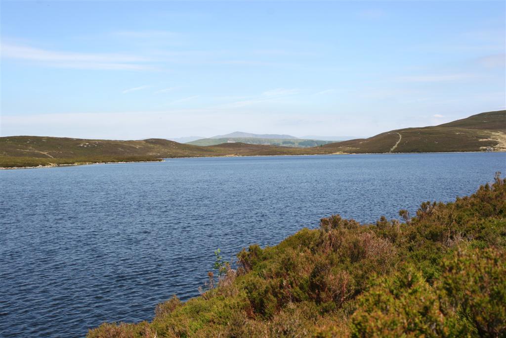
Llyn Conwy is a remote moorland lake in Conwy county borough, in the middle of Eryri (Snowdonia) in north Wales. It is the starting point of the River Conwy, which runs about 43 km (27 miles) to the sea at Conwy Bay. If you want open, empty country rather than the crowds around Yr Wyddfa, this is a fitting destination. What is Llyn Conwy? The lake sits at roughly 450 m above sea level (about 1,488 ft) and is shallow, with a maximum depth near 5 m (16 ft). It is the largest of the lakes scattered across the Migneint. There are no trees and no buildings on its shores, only rough grass, rushes and peat. Its grid position is around 52.999 N, 3.819 W, and on a clear day Arenig Fawr shows on the horizon. What will you see on the Migneint? The Migneint is a broad area of blanket bog, among the largest in Wales, and one of the wettest places in the region, with about 2,600 mm of rain a year. Expect sodden ground, pools and a landscape with few landmarks. The moor forms part of the Migneint-Arenig-Dduallt Special Area of Conservation. The B4407 from Ffestiniog to Ysbyty Ifan crosses it. Peatland restoration is under way around the lake, with the Ysbyty Estate involved. Healthy bog stores carbon and slows the flow of water downstream, so keeping it wet matters. How do you get to Llyn Conwy? No road reaches the shore. Walkers usually start from the B4407 near Llyn Cottage, or follow a public footpath that leaves a minor road close to Hafodyredwydd. That minor road can be treacherous in icy weather. For beds, food and supplies, the nearest bases are Ysbyty Ifan, Ffestiniog and Betws-y-Coed. When should you go and what should you wear? Late spring and summer give the driest conditions. Even then, wear waterproof boots, because the ground soaks up water. Off the paths it is easy to lose your bearings in mist, so carry a map or an offline navigation app. In winter the moor can hold ice and snow, and the B4407 becomes slippery. Frequently asked questions Where is Llyn Conwy? In Conwy county borough, north Wales, on the Migneint moor in central Eryri. Is it the source of the River Conwy? Yes. The river leaves the lake heading south, then bends round and flows mostly north for about 43 km to Conwy Bay. How deep is the lake? About 5 m at its deepest, which is shallow for an upland lake. Can you drive to the lake? Not all the way. Park beside the B4407 or the minor road near Hafodyredwydd and walk across wet moorland.
-
Buttermere
Buttermere
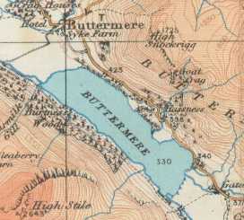
Buttermere is a lake in England's Lake District, in Cumbria, beside the village that shares its name. It covers roughly 0.9 km², stretches about 2 km, reaches 0.54 km at its widest and plunges to 28.6 m at its deepest. The surface sits near 100 m above sea level. It is one of the few lakes in the region you can circle entirely on foot, ringed by steep fells that make for some of the park's most photographed scenery. What will you see at Buttermere? Fleetwith Pike rises sharply above the southern shore and anchors the classic view across the water. Across the valley, Sourmilk Gill tumbles down the fellside from the direction of Bleaberry Tarn, dropping several hundred metres. A short detour with a wooden bridge brings you to its foot. The lake drains through the small Buttermere Dubs stream into neighbouring Crummock Water, and the River Cocker carries the water on to Cockermouth. Can you walk all the way round? Yes. The loop is roughly 6 to 7 km and usually takes two to three hours, so it suits families. The path mostly hugs the shore, with a short stretch beside the road, a few rocky sections and a passage through a tunnel cut into the rock. Most people go anticlockwise. Gatesgarth, at the southern end, makes a handy midpoint and has extra parking. Haystacks and the Wainwright connection Buttermere is the starting point for popular climbs of Haystacks, the favourite fell of guidebook author Alfred Wainwright. His ashes were scattered there. In St James' Church in the village a memorial plaque is placed so that a window looks out toward the fell. Combining the lake circuit with an ascent of Haystacks makes a day of around 14 km with more than 700 m of climbing. A longer high-level option follows the ridge from High Stile to Haystacks. How do you get there and where do you park? Reach Buttermere by car or on seasonal local buses; the approach roads are narrow. The village has a pay-and-display car park, and the National Trust runs another. The lake is owned by the National Trust, which also looks after much of the surrounding land. Arrive early on weekends and in school holidays, as spaces fill quickly. When is the best time to visit? Spring and autumn offer the best light and the thinnest crowds, and dawn often brings a mirror-calm surface. Summer is the busiest period. Lake District weather changes fast, so pack a waterproof jacket and sturdy boots, since paths can be muddy. Frequently asked questions How long does the Buttermere walk take? About two to three hours at an easy pace, over a distance of several kilometres. How deep is Buttermere? The maximum depth is 28.6 m, and the lake is about 2 km long. Is the walk suitable for children? Yes. The loop is easy, though it has rocky patches and a short roadside stretch, so keep younger children close. Can I climb Haystacks from Buttermere? Yes, the route begins at the village or at Gatesgarth. The ascent is steep, with minor scrambling near the top, so wear proper footwear.
-
Lynn Spout
Dalry
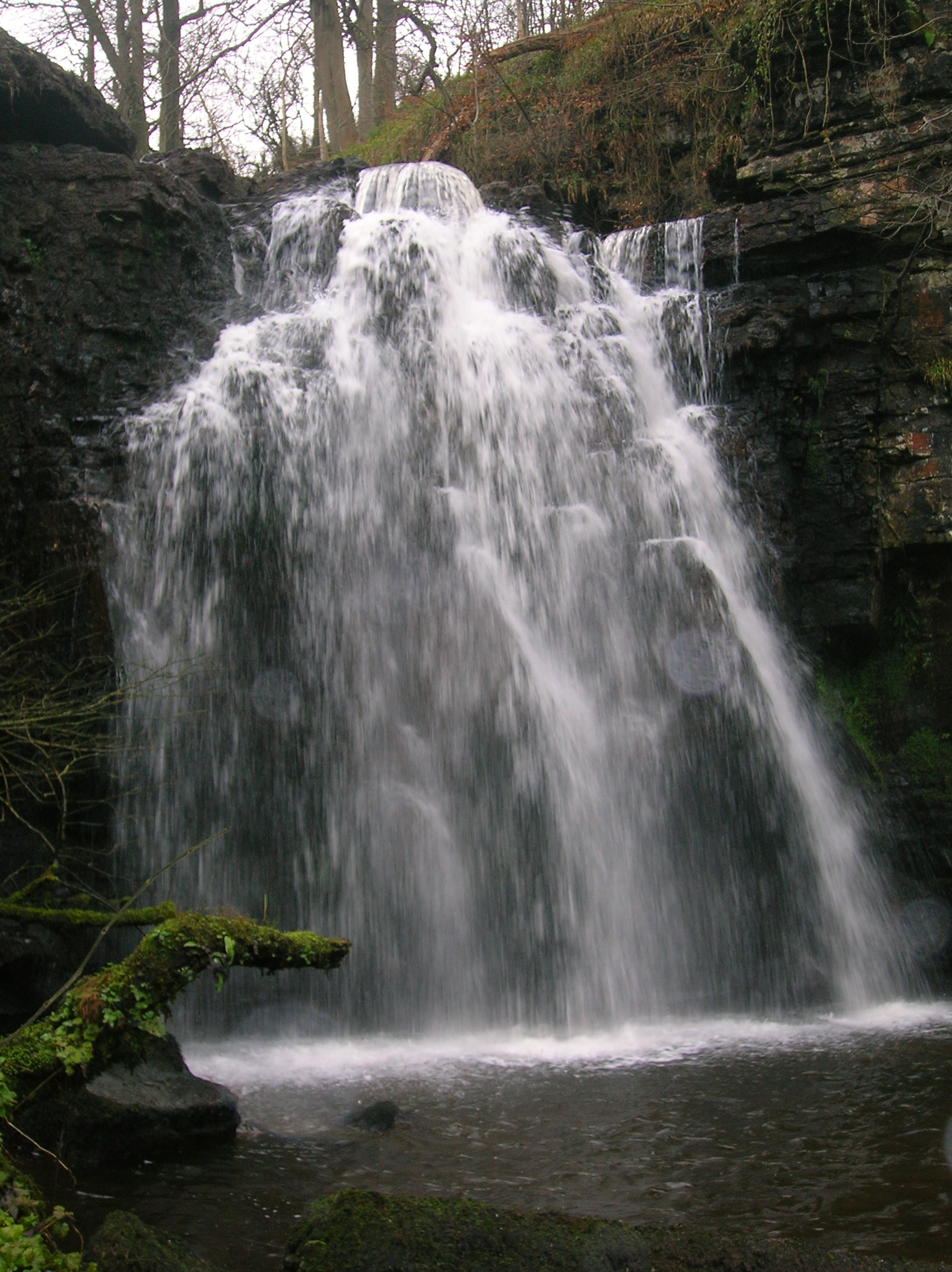
Lynn Spout is a waterfall on the Caaf Water in Lynn Glen, roughly a mile south of Dalry in North Ayrshire, Scotland. It makes an easy woodland outing that suits a half-day trip from Glasgow or the Clyde coast, and it sees far fewer visitors than Scotland's headline falls. Where is Lynn Spout? The falls sit in a wooded gorge just beyond the edge of Dalry, close to Lynn Bridge on the B714. The coordinates are about 55.70 N, 4.73 W. The glen is protected as a Site of Special Scientific Interest, noted for its rock formations. How do you get there and where do you park? The route starts at Lynn Bridge, about half a mile from the centre of Dalry. A small car park serves the bridge, but spaces are limited, so arrive early on busy days. Buses stop on Kilwinning Road (A737) near the B714 junction, and Dalry railway station is about a mile away, so a car is optional. What is the walk like? The usual route is a loop of roughly 2 km that takes about 45 minutes. You follow the south bank from Lynn Bridge, pass Pinnoch Point and return along the north bank. Paths are clear dirt tracks, with two short muddy patches before the falls. If you only want the waterfall, it is about 10 minutes each way from the start. Access is free and open at all times. What will you see? Lynn Spout is modest in size but photogenic, dropping into a rocky, tree-lined basin. The best view is from the bottom of the cascade, reached by a short scramble off the main path, so wear shoes with good grip. The glen is broadleaf woodland, with moss and ferns along the river. When should you visit? Go after rain, when the Caaf Water runs fuller and the cascades are at their best. In dry spells the flow can be thin. Scottish weather changes quickly, so pack a waterproof jacket whatever the forecast says. Frequently asked questions Is there an entry fee for Lynn Glen? No. The glen is free to enter and open all year. How long should I allow? About 45 minutes for the full loop, or around 20 minutes for a there-and-back walk to the falls. Is the walk difficult? No, it is easy, though some stretches are muddy and the drop to the base of the falls needs care. Can I get there without a car? Yes. Buses stop on the A737 near the start, and Dalry station is about a mile away.
-
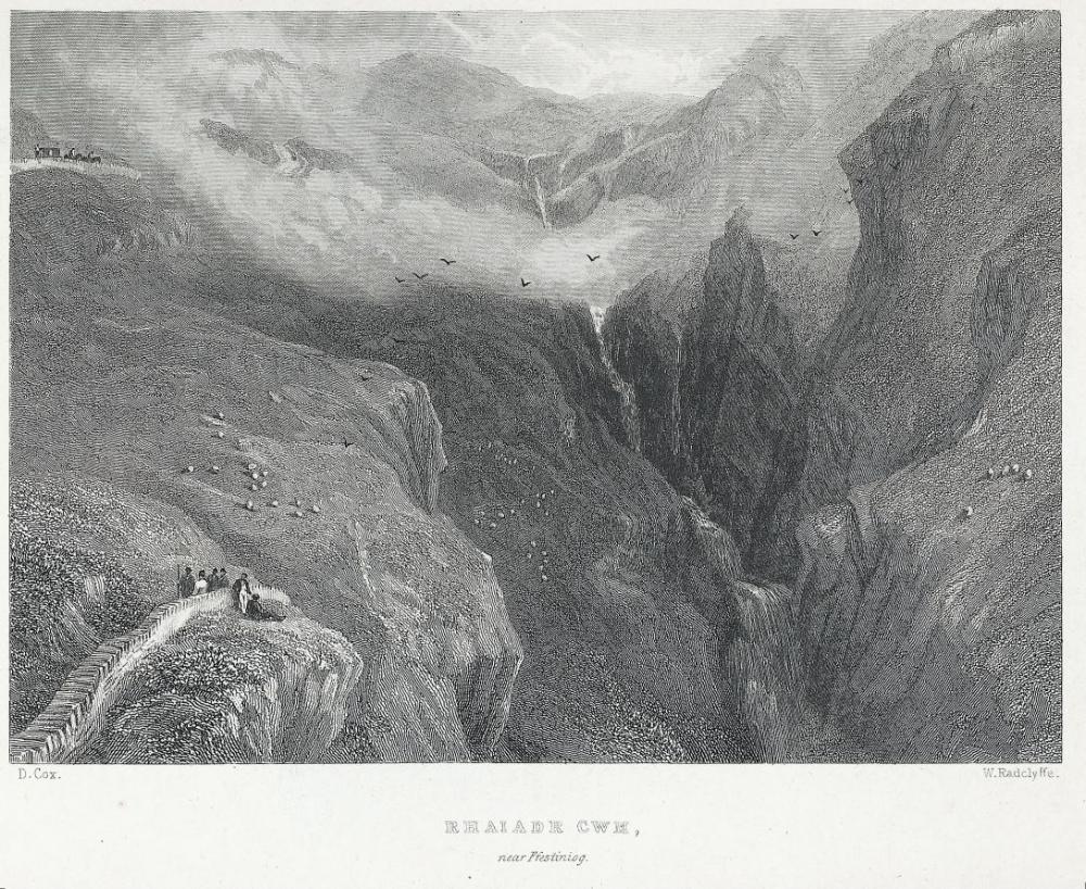
Rhaeadr y Cwm
Manod
Rhaeadr y Cwm is a multi-tiered waterfall on the Afon Cynfal near Manod in Gwynedd, North Wales. It is counted among the most distinctive falls in Snowdonia National Park (Eryri), and you can see it without leaving the road. Where is Rhaeadr y Cwm? The falls lie about 5 km (3 miles) east of Ffestiniog, beside the B4391, the road running towards Bala. The Cynfal rises in the central uplands of Eryri and drops towards the Ffestiniog valley. Downstream it carves the narrow Ceunant Cynfal gorge, a protected national nature reserve. How tall are the falls? The water falls well over 100 metres in total across several steps. Sources disagree on the exact figure: about 120 m (six drops) is the most quoted, while some walking guides say roughly 107 m. Treat any single number as approximate. The falls look best after rain, when the river is full; in a dry summer the flow thins noticeably. Where is the best place to see them? The easiest option is a lay-by on the B4391 with a view of the cascade. No walking is needed, but it is a working local road, so park carefully and stay off the carriageway. If you want a walk, a route from Bont Newydd follows the Cynfal upstream to the falls. It is about 6.8 km (4.2 miles), graded easy, and takes around two hours. It passes the isolated Cwm Farm, with origins in the late 15th century, and ends at the head of a narrow ravine. Many walkers link it with the footpaths from Llan Ffestiniog. Check a map and rights of way first, because some land is private. What else is nearby? In Ceunant Cynfal you will find a separate fall, Rhaeadr Cynfal, managed by Natural Resources Wales. It has a restored Victorian viewing platform, and the short trail (about 2 km) is steep. Ancient oak woodland covers the gorge sides. Do not confuse the two: Rhaeadr y Cwm is higher up and visible from the road, while Rhaeadr Cynfal is reached from the gorge itself. The area also has cultural weight. It appears in Welsh folklore, including the Mabinogion, and David Cox painted the falls in 1836. Is the waterfall under threat? For years a proposed hydro-electric scheme has been disputed. Opponents say it would divert as much as 70% of the water away from the falls. Several planning applications were refused or withdrawn, and the Snowdonia Society campaigns to protect the site. Check the latest status before you travel. When should you go? Visit a day or two after heavy rain, ideally in autumn, winter or spring. Weather in Eryri changes fast, so bring waterproofs and sturdy footwear, especially for riverside paths. Frequently asked questions Do I need to hike to see the falls? No. Rhaeadr y Cwm is visible from a lay-by on the B4391, about 5 km east of Ffestiniog. How high is it? Estimates range from roughly 107 m to about 120 m in total, split over several drops. Is the walk difficult? The route from Bont Newydd (about 6.8 km) is described as easy and takes roughly two hours. Is it the same as Rhaeadr Cynfal? No. Rhaeadr Cynfal is a different waterfall in the Ceunant Cynfal gorge, with a Victorian viewing platform.
-
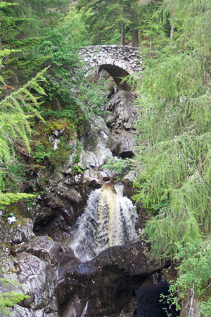
Falls of Bruar
Falls of Bruar is a chain of waterfalls on the Bruar Water in Perth and Kinross, central Scotland, close to the village of Blair Atholl and roughly 8 miles from Pitlochry. The river tumbles through a narrow, wooded gorge, and the falls make one of the best short outings in the southern Highlands, starting right beside the House of Bruar shopping complex. What will you see along the Bruar Water? The stream drops through several rocky steps, forming lower and upper falls linked by rapids and deep, dark pools. A path follows the gorge, and the best views of the water come from two bridges, the Lower and Upper. After heavy rain or snowmelt the flow is powerful; in drier weather it softens but stays picturesque. Why is the place linked to poetry? Visitors have come here since the 18th century. Robert Burns visited the area in the late 1700s and wrote "The Humble Petition of Bruar Water to the Noble Duke of Atholl", in which the river itself pleads with the duke to plant trees along its then bare banks. Trees now cover the gorge, so the walk feels almost like a woodland stroll. How do you get to the falls? Park at the House of Bruar, where there is plenty of space. The trail begins at Bruar Bridge at the eastern end of the complex and heads upstream. The short loop over the Lower and Upper bridges is about 2.5 km (1.5 miles) with around 150 m of climbing, and takes one to one and a half hours. A longer route of about 8 km (5 miles) and some 3 hours continues up into Glen Banvie. Some sections are steep and the path runs close to the gorge edge in places, so wear shoes with good grip and keep children close. When is the best time to visit? The falls are worth seeing in any season. Spring and autumn usually bring more water, and autumn colour along the gorge adds to the scene. In winter the path can be icy. Allow about two hours in total, including a coffee stop at the House of Bruar. What else can you combine with the visit? Blair Atholl and its castle, Blair Castle, are nearby, and Pitlochry makes a handy base for overnight stays. The surrounding land belongs to the Atholl estate, and parts of the area around the falls are cared for by the National Trust for Scotland. Frequently asked questions Where do you park for the Falls of Bruar? In the large car park at the House of Bruar. The trail starts from Bruar Bridge next to it. How long does the walk take? The short loop of about 2.5 km takes roughly 1 to 1.5 hours. The longer route into Glen Banvie takes around 3 hours. Is the walk difficult? It needs no mountaineering fitness, but it has steep stretches and drops beside the path, so sturdy footwear is advised. Who wrote the poem about the Bruar Water? Robert Burns, in the voice of the river asking the Duke of Atholl to plant trees on its banks.
-
Eas a' Chrannaig
Whiting Bay
Eas a' Chrannaig is a waterfall at Whiting Bay on the Isle of Arran, in North Ayrshire, Scotland. Most visitors know it by its English name, Glenashdale Falls, after the Glenashdale Burn that feeds it. It ranks among the island's most popular short walks. What will you see? The Glenashdale Burn starts on moorland near the summit of Tighvein and runs east toward Whiting Bay. On the way it drops over several ledges, and the biggest is a two-tier cascade. Sources give the total fall as roughly 45 metres, though figures range from 42 to 45 m. A viewing platform lets you take in the whole cascade cutting through the wooded glen. The falls look best after heavy rain and thin out noticeably in a dry summer. How do you get there? The path begins at Ashdale Bridge, on the southern edge of Whiting Bay. Free parking sits on both sides of the bridge, just off the A841, and fills up quickly in high season. The track climbs the glen along forest roads and paths, and the falls lie about 4 km up the valley. Most people walk a loop of 5 to 6 km with 150 to 240 m of ascent, which takes 1.5 to 3 hours depending on pace and stops. What are the Giants' Graves? You can extend the loop to the Giants' Graves, two prehistoric chambered cairns on a rise above the glen. The climb is steep and winding but short, and it pays off with views over Whiting Bay and Holy Island. Some walkers skip it and return the way they came. Forestry work has changed the woodland around the cairns, so check current path conditions before you set out. When should you go and what should you wear? The route is open all year, but the glen floor can get boggy, so wear waterproof or sturdy walking boots. One route guide gives the bog factor 4 out of 5. Spring and autumn usually bring more water over the falls than midsummer, and an early start helps you avoid crowds at the viewpoint. Apart from the climb to the Giants' Graves, the walk needs no special preparation. Frequently asked questions Are Eas a' Chrannaig and Glenashdale Falls the same place? Yes. One is the Gaelic name and the other the English one, and both refer to the same waterfall on the Glenashdale Burn. How long does the walk take? The loop including the Giants' Graves usually takes 1.5 to 2 hours, and up to 3 hours at a relaxed pace with breaks. Where can you park? Free of charge at Ashdale Bridge, on either side of the road south of Whiting Bay village. Is it suitable for families? The way to the falls is fairly easy. Only the climb to the Giants' Graves is steep, and it is optional.
-
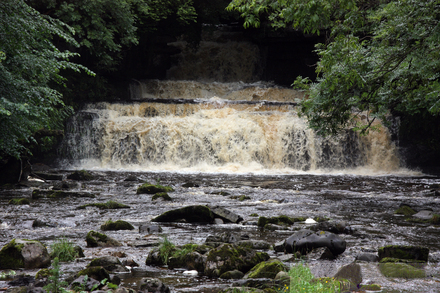
Cotter Force
Appersett
Cotter Force is a small, pretty waterfall near Appersett and Hawes, at the mouth of Cotterdale, a side valley of Wensleydale in North Yorkshire (Yorkshire Dales National Park, England). It is an easy, free stop for a short stroll through woodland beside the beck. What will you see at Cotter Force? Cotterdale Beck, a minor tributary of the River Ure, drops over six rocky steps here, each forming its own little fall. The biggest single drop is about 1.5 m (5 ft). Do not expect a towering cascade: the appeal is a tiered, tree-shaded stretch of stream. It looks best after rain, when more water is running. Look along the beck for dippers, grey wagtails, kingfishers and redstarts. How do you get to Cotter Force? The falls cannot be seen from the road. A short path begins off the A684 near Holme Heads Bridge, roughly 2 miles west of Hawes. You can park on the roadside by the bridge, then follow a surfaced path beside the beck, around a quarter of a mile. The path has been graded and improved so that families with pushchairs, wheelchair users and less mobile visitors can use it, which makes this one of the more accessible waterfalls in the Dales. Descriptions vary a little between sources, so check current conditions before you travel. Can you combine it with a longer walk? Yes. From Appersett, a loop via Mossdale and Cotterdale runs about 12.5-12.8 km (just under 8 miles), with Cotter Force as a short detour on the way back, signed from the road. A circuit from Hawes of about 9.9 miles links Hardraw Force, Cotter Force and Aysgill Force, and some routes touch the Pennine Way briefly. In Appersett there is parking by the village green; leave access clear for residents. What does it cost, and when should you go? Entry is free, unlike nearby Hardraw Force, which charges admission. Cotter Force is generally quieter than the better-known sights of Wensleydale. You can visit all year, but the beck is at its best after rainfall and noticeably thinner after a dry spell. Frequently asked questions Is Cotter Force free? Yes, there is no charge to visit. Is it suitable for pushchairs or wheelchairs? The path from the A684 has been upgraded for pushchairs and wheelchair users. Check current conditions before setting out. How long is the walk? From the road it is a short stroll of a few minutes. Longer loops from Appersett or Hawes take several hours. Where can you park? By Holme Heads Bridge on the A684, or by the village green in Appersett. Keep access clear in both places.
-
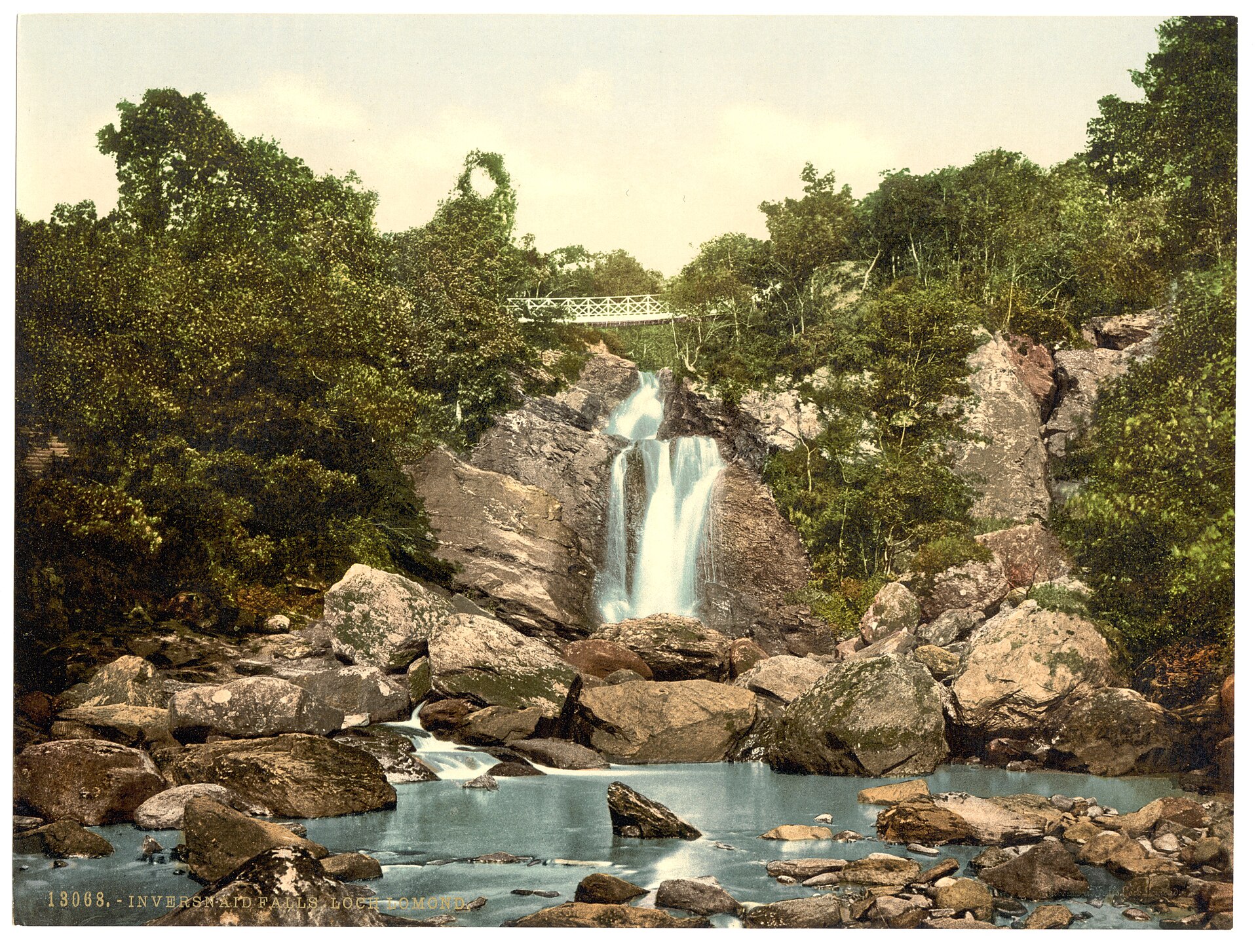
Inversnaid Falls
Inversnaid Falls is a waterfall at Inversnaid on the eastern shore of Loch Lomond, in the Stirling council area of Scotland. A burn tumbles in stages through a rocky, wooded gorge and runs straight into the loch. The falls sit beside the Inversnaid Hotel and its car park, which makes them one of the easiest sights to reach on Loch Lomond. You will also see them called Arklet Falls, after the Arklet Water that feeds them. What will you see? The water drops over several ledges toward the loch. Paths, steps and small bridges run above and beside the gorge, so you can get close to the cascades. The West Highland Way crosses the stream on a footbridge, and walkers on the trail pass the falls without any detour. After heavy rain the flow is wide and loud; in a dry spell it shrinks to a thin ribbon. The place has a literary link. Gerard Manley Hopkins visited in the 19th century and wrote a poem called "Inversnaid" about a mountain stream running down to the loch. What else is nearby? North of the village lies the RSPB Scotland Inversnaid reserve, just over 800 hectares of old woodland above the water. A waymarked nature trail of roughly 2.2 to 2.5 km takes one to one and a half hours and climbs steeply to a viewpoint over Loch Lomond. The ascent is about 145 m, so wear sturdy footwear. The reserve is valued for woodland birds. Further along the West Highland Way, among large boulders near the shore, is Rob Roy's Cave, where the Scottish outlaw is said to have hidden. The path shows little of it; the better view is from the water. How do you get to Inversnaid Falls? Drive from Aberfoyle through the Trossachs; the final stretch is narrow and winding. You can also come by boat from Tarbet on the opposite shore, which pairs well with a walk. The car park by the Inversnaid Hotel is the usual starting point for both the falls and the reserve trail. When should you go? Visit after wet weather for the fullest flow, though paths are then muddy and slippery. Spring and early summer bring fresh green woods and birdsong, and autumn brings colour. Weather on Loch Lomond changes fast, so pack a waterproof jacket. Frequently asked questions Is there an entry fee? No. The falls and surrounding paths are open to all, although parking may be charged. How long does a visit take? Allow 20 to 30 minutes for the falls alone. With the RSPB nature trail, plan for up to two hours. Is it suitable for families with children? The falls are close to the car park, but the paths include steps and steep sections, and the reserve trail is demanding. Keep young children away from rocky edges. Is Inversnaid on the West Highland Way? Yes. The stretch from Inversnaid to Inverarnan is rated strenuous, with rough, rocky ground, especially north of the village.
-

Sgwd Henrhyd
Coelbren
Sgwd Henrhyd (Henrhyd Falls) is a waterfall outside the village of Coelbren in Powys, South Wales, inside Bannau Brycheiniog National Park, formerly known as the Brecon Beacons. Its drop of roughly 27 metres (90 ft) makes it the highest waterfall in the south of the country, and the land is looked after by the National Trust. Where is Sgwd Henrhyd? The falls sit in a wooded gorge cut by the Nant Llech stream, on the southern edge of the park and away from its main mountain ridges. Coelbren is the closest settlement, on the road linking Glynneath and Abercraf. Many visitors count the site as part of Waterfall Country, the area known for its river cascades. What will you see? The stream plunges straight off a rock lip into a shallow pool, framed by wet stone, ferns and moss. The cliff is undercut, so the path leads behind the curtain of water and you can stand between the rock wall and the falling stream. In high water it gets wet back there, and the ledges are slick with spray. Film fans may recognise the spot: it appears as the entrance to the Batcave in Christopher Nolan's Dark Knight trilogy. How do you get to the waterfall? Start from the National Trust car park just outside Coelbren, on the minor road towards Pen y Cae. Parking is free. A woodland path leads to the falls, around 1.5 km there and back. It is short but steep in places, with a flight of steps near the start, and the climb back out is harder than the descent. The main route is unsuitable for wheelchairs and pushchairs. Dogs are welcome on short leads. Without a car it takes more effort. The X8 bus from Neath runs to Coelbren, and from the village it is about a mile on foot along Dol Henrhyd Road to the car park. What should you bring? Wear boots with decent grip, as the trail turns muddy after rain. A waterproof is worth packing because spray carries a long way and Welsh weather changes quickly. Take care behind the falls, where the stones are slippery. When should you visit? The falls run all year. After heavy rain the flow is at its most dramatic, though the path is tougher going. In drier spells it is easier to step behind the water. Autumn and early spring tend to be quieter in the gorge than the summer holidays. Can you turn it into a longer walk? Yes. The National Trust describes a longer loop along the Nant Llech that continues up the valley. If time is short, the out-and-back path to the base of the falls fits comfortably into an hour, photo stops included. Frequently asked questions Does it cost anything to visit Sgwd Henrhyd? The National Trust car park is free, and the walk to the falls needs no ticket. How tall is the waterfall? About 27 metres, which makes it the tallest in South Wales. Can you walk behind the waterfall? Yes, the rock is undercut and the path passes behind the stream. Watch your footing, because the surface is wet and slippery. Is the walk suitable for children? The distance is small, but there are steep sections and steps, so young children need supervision and pushchairs should stay in the car. Can I bring my dog? Yes, as long as it stays on a short lead.
Earn badges for the places you visit
Download NextOnTrip, discover new places and check off your trails.