Nature in Switzerland
A guide to 298 Nature in Switzerland — with descriptions, photos and traveler visits from the NextOnTrip community. Locations spread across 236 cities and towns. Most visited by the community: Tour de Pierre, Bire, Fulberg.
-
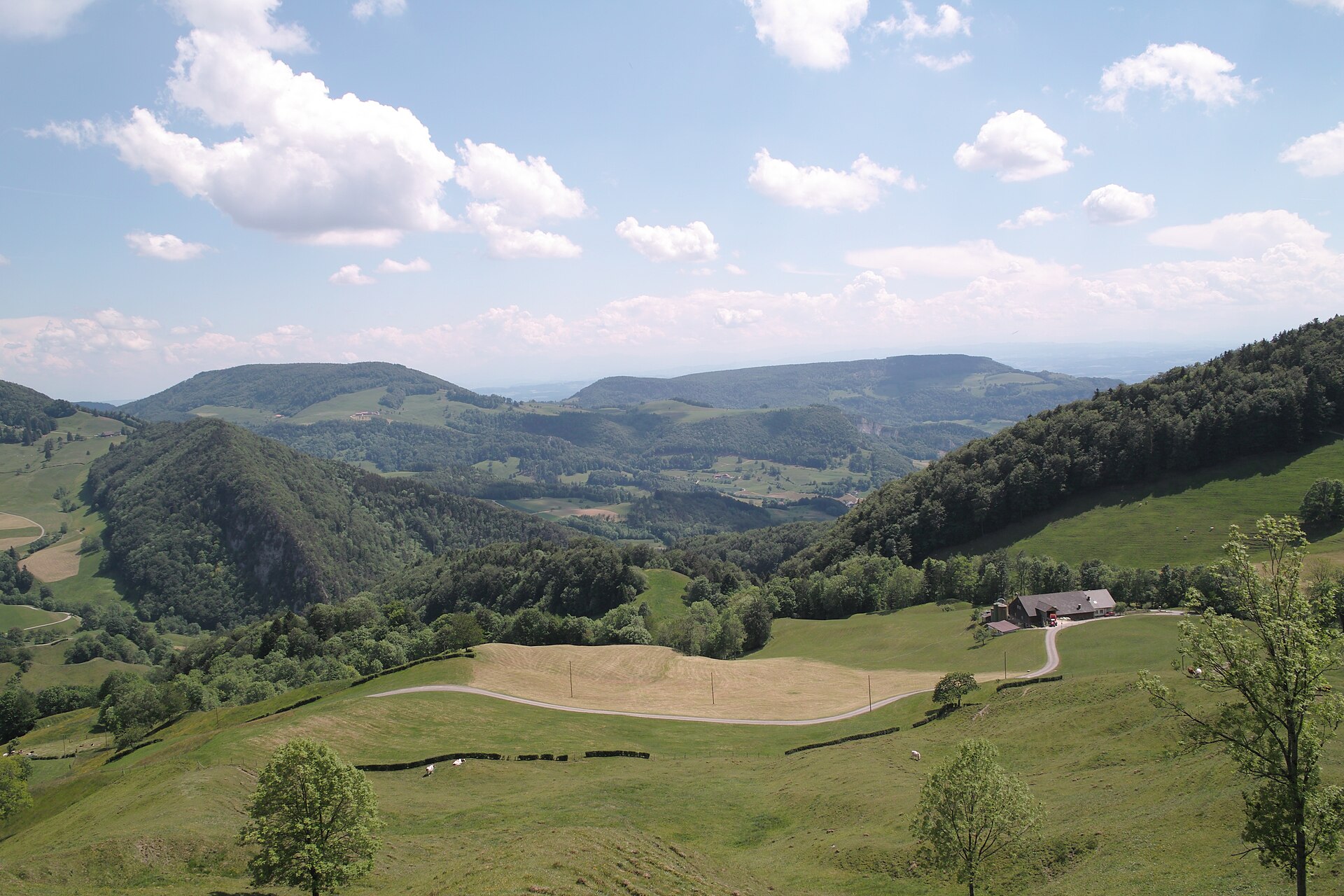
Thal Nature Park
Aedermannsdorf
Thal Nature Park (German: Naturpark Thal) is a regional nature park in the Swiss canton of Solothurn, bordering the cantons of Bern and Basel-Landschaft. It lies in the Solothurn Jura and links the wide valley of the river Dünnern with high mountain ridges. Balsthal is the largest municipality in the park and is home to its information office. It is a good choice for a quiet mountain outing away from the crowds of the better-known Alpine resorts. Where is Thal Nature Park and what is it? The park covers the Dünnern valley behind the Weissenstein mountain range. Switzerland's FOEN designated it a "park of national importance", a label valid for ten years from its instatement on 1 January 2010, with the designation confirmed in 2012. Its coordinates are roughly 47.32° N, 7.67° E. What is there to see in the park? The main draws are viewpoints, hiking and cycling routes, castle ruins and themed trails. Viewpoints: Wasserfallen, Balmberg and Hinterer Weissenstein are the lookouts most often recommended. Hinterer Weissenstein, at 1,395 m above sea level, is the highest peak in the park. Themed trails: the Holzweg Thal (a wood-themed trail), the Wolf Gorge Trail, La Route verte and the Jura Trail Thal. A geological trail at Gänsbrunnen shows the rock layers of the region. History and culture: the valley has local museums and castle ruins. The castles and ruins of Balsthal stand guard over the entrance to the valley. Wildlife: near Welschenrohr, close to the Wolf Gorge, a project to reintroduce the European bison is under way. What are the hiking and cycling options like? The demanding option is the high-altitude route from Balsthal to Weissenstein, covered on foot or by mountain bike. It is about 21 km long and involves a long climb, so it calls for good fitness. Easier options include the shorter themed trails in the valley, which also suit a family walk. How do you get there? From Solothurn it takes about 25 minutes via the Weissenstein tunnel. In summer, on Sundays and public holidays, the NaturparkBus runs, making it easier to reach trailheads without a car. You can get information on the park at the office in Balsthal. Frequently asked questions Where is Thal Nature Park? In the canton of Solothurn, Switzerland, next to the cantons of Bern and Basel-Landschaft. What is the highest peak in the park? Hinterer Weissenstein, at 1,395 m. Which is the largest municipality? Balsthal, which also hosts the information office. Can I get there by public transport? Yes, the NaturparkBus runs on Sundays and public holidays in the summer season. From Solothurn, the drive through the Weissenstein tunnel takes about 25 minutes. What can I do with children? Pick one of the themed trails, such as the Holzweg Thal, or visit the museums in the valley. The bison reintroduction project near Welschenrohr is another interesting stop. Does the park have official status? Yes, it is recognised as a park of national importance, with the label valid for ten years from 1 January 2010.
-
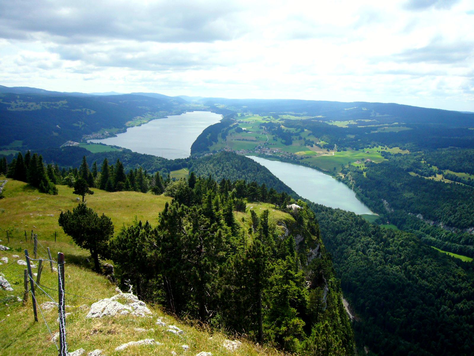
Parc naturel régional Jura vaudois
Gimel
Parc naturel régional Jura vaudois is a regional nature park in the Swiss canton of Vaud, stretching from the Dôle summit to the area around Romainmôtier. Gimel, at the foot of the Jura, is one of the member communes, which makes it a handy starting point for quiet walks across mountain pastures. What is the park? It has held the status of a regional nature park of national importance since 2013. It covers roughly 570 km² and more than thirty communes, home to tens of thousands of residents. Each commune is tied to the park through a contract and a park charter, the current one running 2023–2032. It is not a national park: the idea is that farming, forestry, tourism and landscape protection should work together. What will you see? The signature scenery is wooded pasture: lone spruces, dry-stone walls and scattered alpine farm buildings, of which the park has hundreds. Large forests such as the Risoud sit alongside them. Traditional grazing and woodland management still shape these views. Themed trails add variety. One covers resonance wood, the spruce prized by instrument makers. Another follows the red wood ant, which in 1966 became the first insect in Switzerland to receive protected status. Where to start The main gateway is the Espace Découvertes visitor centre at the Col du Marchairuz pass, with a permanent exhibition on the park's projects. Opening hours follow those of the neighbouring hotel-restaurant, and it is closed on Mondays and Tuesdays, so check ahead. Hiking and winter The Grande Traversée du Jura follows the crest with open views over wooded pastures and climbs to Mont Tendre (1,679 m), the highest point of the Vaud Jura. The stretch from Saint-Cergue to the Marchairuz pass crosses typical Jura pasture. In winter, cross-country ski routes run near the pass. Frequently asked questions Can I get there by public transport? Postbus line 840 serves the Col du Marchairuz all year, with a limited weekend timetable. Bike spaces must be reserved from May to October. Is there an entry fee? Walking the park's trails needs no ticket; some individual local offers may charge. When should I go? Summer and early autumn suit hiking, winter suits cross-country skiing and snowshoeing. Is it a national park? No. It is a regional nature park, with lighter rules than a national park, but you should still respect farmers and livestock.
-
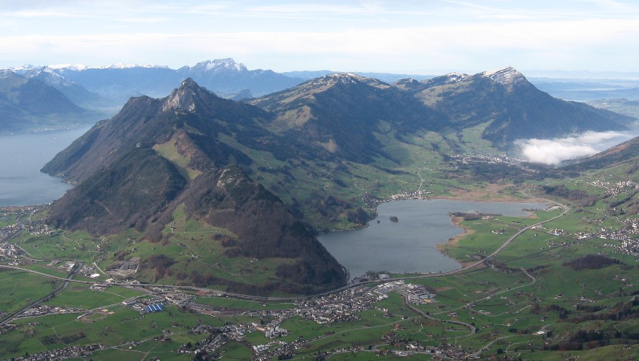
Lake Lauerz
Steinen
Lake Lauerz (German: Lauerzersee) is a small lake in the Swiss canton of Schwyz, next to the village of Steinen. It lies between Seewen, Lauerz and Goldau, below Rigi and the Mythen peaks, and holds two little islands. Where is Lake Lauerz? The lake sits in the Schwyz district of central Switzerland, at roughly 47.03° N, 8.60° E. Steinen, Seewen and Lauerz line its shores, with Goldau a short way east. Trains and roads connect it to Schwyz, Zug and Lucerne, and the surroundings are easy to explore on foot. How big is it? The surface covers about 3.1 km², growing to around 3.6 km² when the water is high. Maximum depth is 13 to 14 m and the average roughly 6 to 7 m, so this is a shallow lake holding about 23 million m³. Its level is not regulated, and the Steiner Aa river has built a broad delta into it. Near Schwanau a tectonic ridge splits the water into two basins, which you can clearly see from the shore. What is there to see? Schwanau island – a tiny island with the remains of a medieval fortress and a chapel. It is the lake's best-known landmark and a natural goal for a short shoreline walk. Roggenburg – the second, uninhabited island, visible from the banks. Shoreline habitats – reed belts and wet meadows are part of Switzerland's federal inventory of protected landscapes (BLN 1604). Water birds gather here, so bring binoculars. Mountain views – Rigi and the Mythen make a fine backdrop, especially in the morning light. What is the lake's history? In 1806 a rockslide from the Rossberg, known as the Goldau landslide, buried part of the valley and shrank the lake by at least one seventh. A flood wave damaged Lauerz, the Schwanau islands and Seewen. The former lakebed is today's Sägel area, and the landslide's mark remains in the valley's shape between the lake and Goldau. When should you go? From late spring to autumn, when conditions suit walks and mountain excursions. The shallow water warms faster than deep Alpine lakes. In autumn the shore colours and the first snow on the peaks stand out. Frequently asked questions How deep is Lake Lauerz? Up to 13 to 14 m at the deepest point, and about 6 to 7 m on average, depending on the source. Does the lake have islands? Yes: Schwanau, with fortress remains and a chapel, and the uninhabited Roggenburg. What does Lauerzersee mean? It is the local German name, taken from the neighbouring village of Lauerz. English materials use Lake Lauerz. How did the 1806 landslide affect the lake? The rock masses reduced its surface by at least a seventh and triggered a flood wave that damaged shoreline settlements.
-
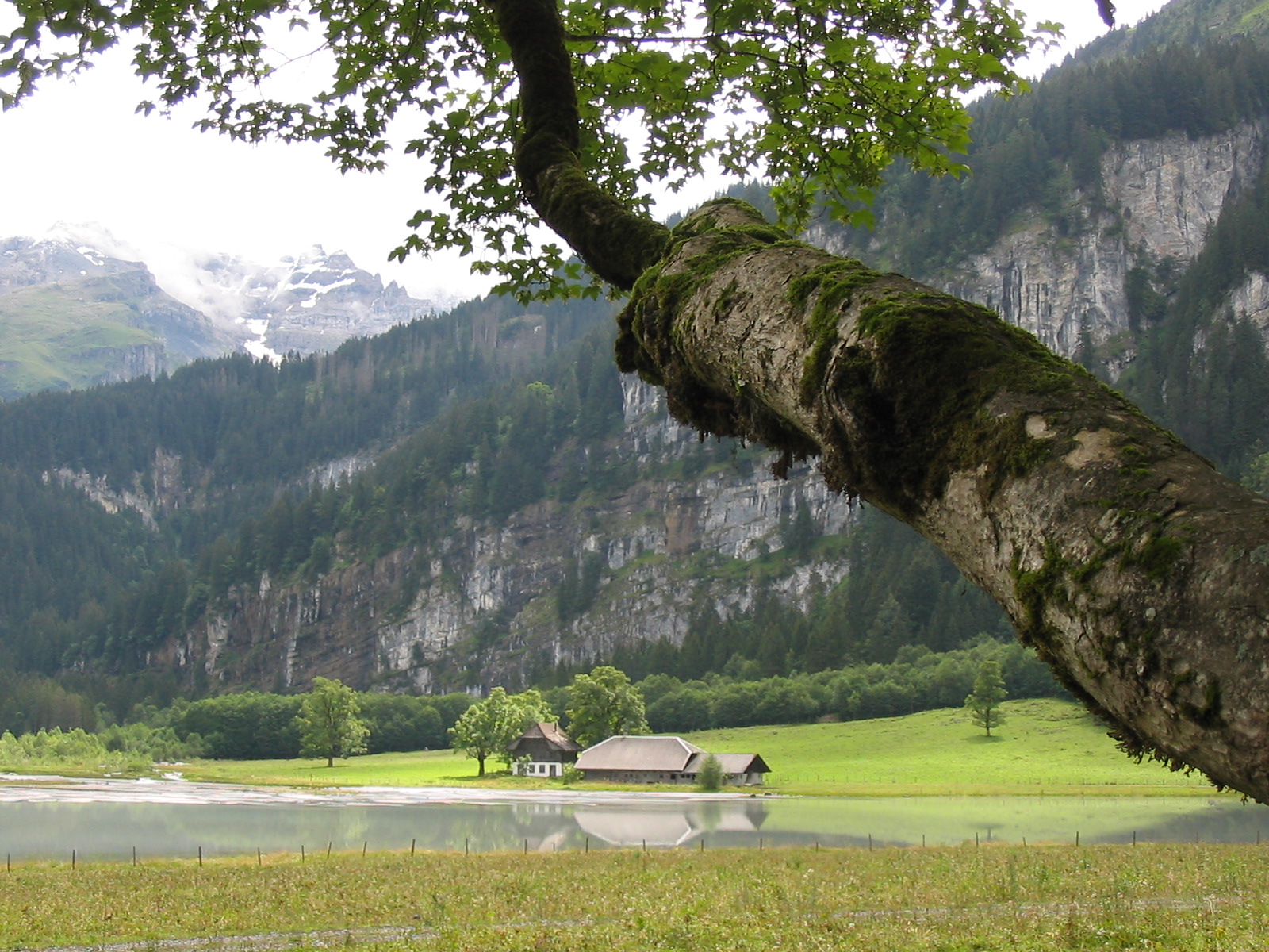
former Tschingelsee
Reichenbach im Kandertal
The former Tschingelsee in Reichenbach im Kandertal (canton of Bern) is a lake that has almost vanished. It appeared overnight in 1972 in the Kiental valley, and today it is a silted-up floodplain inside a nature reserve. It is a good stop if you want to see how quickly a mountain stream can redraw a landscape. How did the lake form? During the night of 18 to 19 July 1972, a violent storm sent a mass of rock and mud down the slopes of the Ärmighorn. The debris blocked the lower Tschingelalp valley and dammed the Gornerenbach stream. Within hours, water piled up behind a natural barrier roughly six metres high, creating a lake nearly 800 metres long. Sources describe the trigger in different words (debris flow, rock and mud avalanche, rockfall), but they agree on the date and the outcome. What can you see today? You will not find an open sheet of water. The stream, which some sources call the Gamchibach, has carried gravel and sand into the basin for decades, helped along by the retreat of the Gamchi glacier. The lake bed is now practically filled in. The scene keeps shifting: the channel wanders, side arms split off, and gravel bars and riverside vegetation take hold. For nature lovers it is a live case study in how a lake fills up and turns into alluvial land. The canton of Bern has protected the area as a nature reserve since 1987. Under recent plans, the protected area grows from 44.5 to 77.8 hectares and gains status as an alluvial landscape of national importance. Steep Ärmighorn slopes and high peaks frame the view and explain how it all began. How do you get there? Kiental lies in the Bernese Oberland, within the municipality of Reichenbach im Kandertal. The former lake sits at about 46.552 N, 7.743 E. You can reach the valley by car or public transport from Reichenbach, and a steep PostBus line runs from Kiental up towards Griesalp. The site is a waypoint on a popular hiking route: Kiental, Tschingelsee, the Griesschlucht gorge, Pochtenalp and Griesalp. When should you visit? Hiking season, from late spring to autumn, when trails are clear of snow. In summer the stream carries more water and the terrain is at its most dynamic. After heavy rain the channel and water levels can change, so keep your distance from the banks. Frequently asked questions Does Tschingelsee still exist? Not as an ordinary lake. Sediment brought by the stream has practically filled the basin, and the site is now an alluvial landscape. When and how did it form? On the night of 18 to 19 July 1972, when debris from the Ärmighorn slopes dammed the Gornerenbach. Is the area protected? Yes. It has been a nature reserve since 1987, and the protected area is planned to grow to 77.8 hectares. Can you hike here? Yes. The site lies on the route from Kiental through the Griesschlucht gorge and Pochtenalp to Griesalp, and a PostBus line also links Kiental with Griesalp.
-
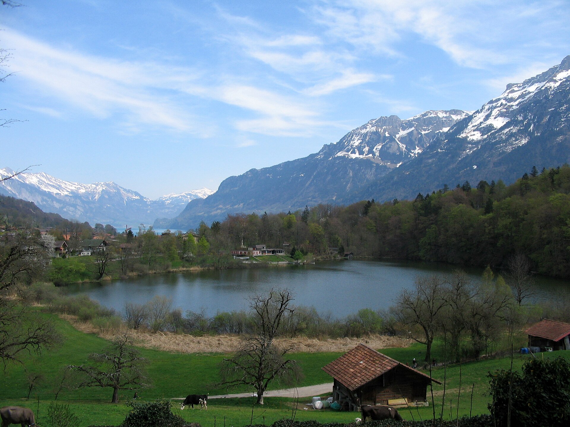
Burgseewli
Goldswil
Burgseewli (also spelled Burgseeli) is a small lake at Goldswil, in the municipality of Ringgenberg, canton of Bern. It sits in a hollow below a rocky ridge called the "Burg", a short way up from the northern shore of Lake Brienz. A natural bathing beach has operated here since 1932, and it is a favourite spot near Interlaken for a swim in warmer water than the big lake offers. What is Burgseewli? The lake covers about 5.25 hectares and reaches roughly 19 metres at its deepest. It lies between the villages of Ringgenberg and Goldswil. The name most likely comes from the nearby rock ridge rather than from a castle on the water. Over the decades the beach has been renovated and extended, always within the limits of nature protection. Can you swim here? Yes. Because the lake is small and shallow along the edges, it heats up faster than Lake Brienz, and on hot days it reaches about 26 °C. The site has a sunbathing area, a children's paddling pool, a barbecue spot and a restaurant. The season runs roughly from May to mid-September; in 2026 it is open from 10 May to 20 September. An adult ticket costs CHF 6. What else is nearby? Goldswil church ruin, on the hill above the village, regarded as one of the region's earliest churches. Ringgenberg castle ruin, with a castle chapel from the 17th century. According to the Historical Dictionary of Switzerland, the church was built in 1670-71 on the castle's remains, with its walls and keep reused as a bell tower. Schadenburg, a ruin on the way to Niederried with a grim local legend. The lakeside path linking Ringgenberg, Goldswil and Niederried. How do you get there? Take the train or a lake boat to Ringgenberg or Goldswil, then walk for a few minutes. Interlaken is only a few kilometres away, so cycling or driving works too. The beach lies between the two villages. When should you go? Late May to early September, when the beach is staffed and the water is at its warmest. A sunny weekday is quieter. Outside the season, the walk to the nearby ruins is a good alternative. Frequently asked questions Is Burgseewli open all year? No. The beach is seasonal, from about May to mid-September. How much is entry? An adult ticket is CHF 6. Check the operator's site for child prices and passes before you go. Is it suitable for children? Yes. There is a paddling pool, and the shallow shoreline suits families. Is the water warmer than in Lake Brienz? Yes. Thanks to its small size the lake warms to around 26 °C.
-
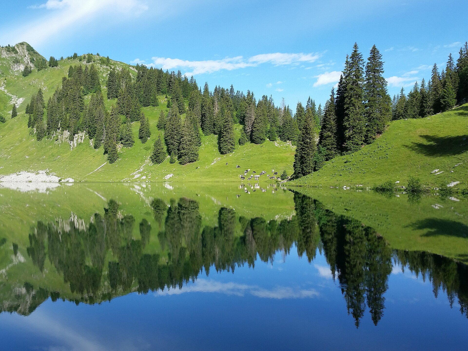
Oberstockensee
Erlenbach im Simmental
Oberstockensee is a small alpine lake above the village of Erlenbach im Simmental in the Swiss canton of Bern. It sits below the Stockhorn in the Simmental valley at roughly 1,670 m above sea level and covers 11.8 hectares, filling a broad basin on the western side of the ridge. Where is Oberstockensee and what are its other names? The lake lies about 100 m beneath the Stockhorn ridge. Through the 19th and 20th centuries maps and guidebooks often called it Vorderstockensee or Spetbärglisee, and locals still use the latter. It comes from the Spetbärgli pasture on one shore; the Vorderstocken meadow lies on the opposite side. Herders say the name reflects how long snow and ice cling here, often into late spring. How do you get there? Start in Erlenbach at the valley station of the Stockhornbahn cable car. The ride to the Chrindi middle station (about 1,640 m) takes around 15 minutes. From there, a loop via Vorderstockenalp to the lake is listed at about 6 km and 2 hours 15 minutes. Alternatively, ride to the top station and walk down through Oberstockenalp, adding a short detour to the water. That downhill route to Chrindi is about 3.4 km and 1 hour 10 minutes. What will you see? Alpine pastures surround the lake, with the Stockhorn massif, whose summit tops 2,100 m, rising behind it. Nearby is Hinterstockensee, known for its turquoise colour, and trails connect the two lakes so they fit into one outing. Each lake in the area has its own name and location, so check signposts rather than assuming. Can you fish here? Yes. The Stockhorn lakes hold rainbow trout, and fishing requires a day permit. Rod hire and bait are available at the middle station. The season usually runs from May to mid-November. Prices and rules change, so confirm them with the cable car operator before you go. When should you visit? Summer and early autumn are best, when paths are clear. In early summer, patches of snow can remain around the shore. Bring hiking boots, a warm layer and sun protection, as weather at this altitude shifts quickly. Frequently asked questions Is Oberstockensee the same as Spetbärglisee? Yes. Spetbärglisee is the local name for the same lake. It was also once known as Vorderstockensee. How long is the walk from Chrindi? The loop via Vorderstockenalp to the lake takes about 2 hours 15 minutes and covers around 6 km. Can I fish for trout in the lake? Yes, with a one-day permit. The season runs roughly from May to mid-November. Is it the only lake near the Stockhorn? No. Hinterstockensee lies close by, and the trails let you visit several lakes in a single hike.
-
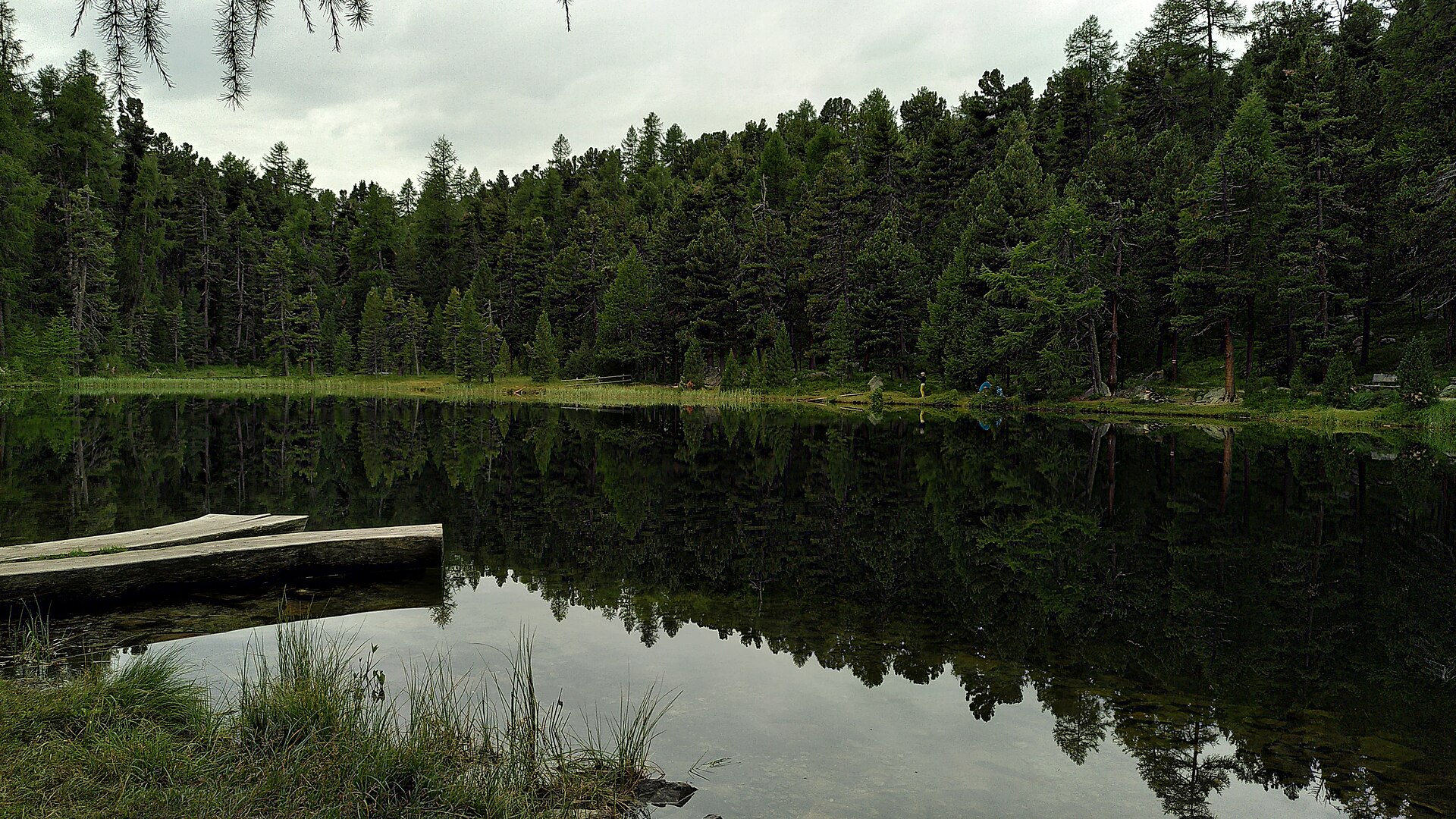
Lej Nair (Surlej)
Surlej
Lej Nair in Surlej is a small moorland lake in the Engadin valley (Graubünden, Switzerland), set in forest above Silvaplana, next to the hamlet of Surlej at the foot of the Corvatsch massif. The Romansh name means "black lake", a fair description of its dark water. It is a different lake from the Lej Nair near Pontresina. What will you see at Lej Nair? The lake lies at roughly 1,864 m above sea level, ringed by trees and boggy shores. A jetty runs around the water, giving a close look at the plants and insects; in summer you may spot dragonflies. You will find benches, picnic spots, fire pits with firewood and a toilet, which makes it an easy stop for families. How do you get there? The simplest route begins at the bridge in Surlej. The path climbs through forest and reaches the lake after a short ascent. The whole Surlej – Lej Nair – Lej Marsch loop stays between about 1,791 and 1,902 m, so there is no serious elevation gain. Buses connect Surlej with Silvaplana and St. Moritz, and the Corvatsch valley station is close by. What else is nearby? From Lej Nair the trail drops to Lej Marsch, a well-known swimming lake with plenty of barbecue spots. The loop then continues to Lake Champfèr and returns along its southern shore to Surlej. If you prefer not to walk back, a bus runs from the campsite stop. When should you go? From late spring to autumn, when the paths are clear of snow and the shoreline suits a picnic. In winter the Surlej area is mostly about skiing, and the jetty and fire pits lose their appeal. Frequently asked questions Can you swim in Lej Nair? It is a moorland lake meant for walking and relaxing. For a swim, head to neighbouring Lej Marsch. Can you light a fire? Yes, there are designated fire pits with firewood supplied. Use only those spots. Is the walk difficult? No. The forest climb from Surlej is short and the loop has little height difference, so it suits families. How do you tell it apart from the Lej Nair near Pontresina? The Surlej lake sits above Silvaplana on the path to Lej Marsch. The other lake with this name lies near Pontresina on a separate route.
-
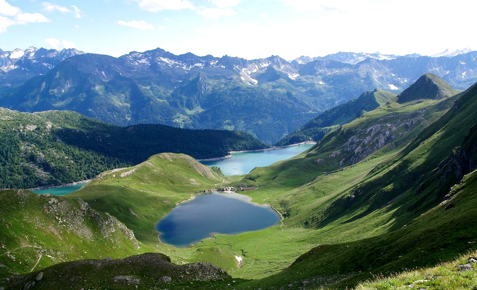
Lago di Tom
Piotta
Lago di Tom is a small alpine lake in the Piora Valley above Piotta, in the Swiss canton of Ticino. It sits at roughly 2,020 m above sea level, covers about 13 hectares and belongs to the chain of high-mountain lakes of the Ritom–Piora region in the Leventina valley. Where is Lago di Tom? The lake lies north of Piotta, in the municipality of Quinto, in the high Piora basin. It is a separate body of water from nearby Lago Ritom, which is much larger and dammed. Tom is the smaller lake, set higher up and reached by a short climb on foot. How do you get to Lago di Tom? Most visitors start in Piotta, where a funicular climbs towards Lago Ritom. From the upper station it is about 20 minutes on foot to the Ritom shore, and the trail then rises to Lago di Tom. The Ritom area can also be reached by road from Altanca. The final stretch is uphill, so wear proper hiking footwear. What can you see there? Lago di Tom rewards walkers who prefer a quieter spot. The lake sits in a hollow among alpine meadows and rock, with views over the Piora valley and surrounding ridges. Several other lakes lie close by, including Cadagno, the Taneda lakes, Lago della Miniera and Lago di Dentro. Lago Cadagno is known for layers of water that do not mix, and scientists have studied it since 1903. How can you fit it into a hike? Two routes are common: Three lakes: Ritom, Lago di Tom and Lago di Cadagno, around 12 km and four and a half hours of walking. Full circuit from Ritom: via Cadagno, Lago di Dentro, Lago della Miniera, the Capanna Cadlimo hut and the Taneda lakes back to Ritom. It is a mountain trail and needs good fitness. Capanna Cadagno stands along the way, and Capanna Cadlimo (run by the SAC Uto section) is staffed from late June to mid-October. When should you go? Trails in Piora are best from June to September. Outside that window snow patches can linger, and weather at altitude changes quickly. For longer routes carry warm layers, water and an up-to-date map. Frequently asked questions Is Lago di Tom the same as Lago Ritom? No. Ritom is the larger reservoir lake nearby. Lago di Tom is a separate, smaller lake higher up. How big is Lago di Tom? About 13 ha, at roughly 2,020 m above sea level. Can you reach the lake by funicular? The funicular from Piotta takes you to the Lago Ritom area. From there you walk uphill on a trail to Lago di Tom. Is the walk suitable for families? The stroll to Ritom is easy, but the section to Lago di Tom is a mountain-trail climb. The full multi-lake circuit demands good fitness.
-
Tomasee
Tujetsch
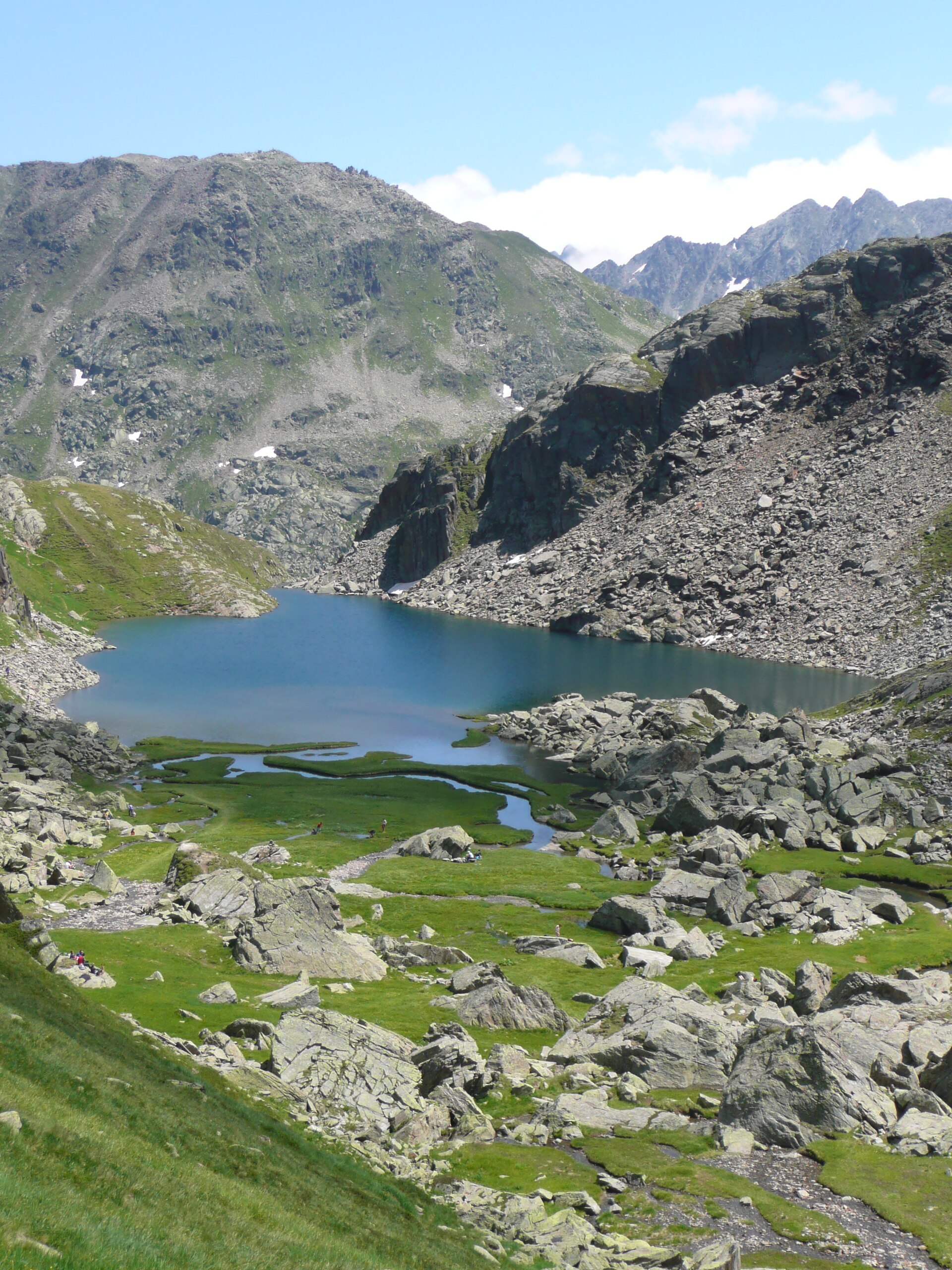
Tomasee (Lai da Tuma) is a small alpine lake in the municipality of Tujetsch, canton of Graubünden, Switzerland, above the village of Tschamut and close to the Oberalp Pass. At roughly 2,345 m above sea level, in a hollow beneath Piz Badus, it is regarded as the official source of the Rhine, specifically of its Anterior branch, the Vorderrhein. What makes Tomasee special? The lake covers about 2.5 hectares and is fed by around a dozen mountain streams. From here begins a river that travels some 1,230 km to the sea. Its Romansh name is Lai da Tuma, and locals also call it Tgina dil Rein, "the cradle of the Rhine". Tujetsch, whose land the source sits on, looks after the site as a natural landmark. How do you get to Tomasee? Most visitors start at the Oberalp Pass. You can reach it by Matterhorn Gotthard Bahn train from Andermatt or Disentis, or by car, though the pass road is open in summer only. From the pass, the walk to the lake usually takes about two hours along the Vier-Quellen-Weg trail. Published route descriptions differ on time and grade, so check a current map before setting out. A longer option is a loop via Pazolastock: about 10.5 km, 4 h 15 min, around 870 m of ascent and graded T2. The path drops beneath a rock band to the Badushütte and then continues to the lake. What will you see there? Piz Badus (about 2,928 m) rises above the water and marks the border between Graubünden and Uri. The shoreline is known for rare alpine flowers that bloom from late June to early July. An information point explains the Rhine's origin, and the lake makes a good foreground for photos of the surrounding peaks. What can you do afterwards? Tomasee is the starting point of the six-stage Rheinwanderung, which follows the Vorderrhein through the Rhine Gorge (Ruinaulta) to Reichenau. The full route is about 84 km with roughly 2,400 m of total ascent, and stage one leads from the lake to the Oberalp Pass. When should you visit? The hiking season runs from July to October, when the road and trails are clear of snow. For flowers, aim for the end of June or early July. Mountain weather changes quickly, so pack warm layers, sun protection and water. There are no shops along the way, so stock up in Sedrun or at the pass. Frequently asked questions Is Tomasee really the source of the Rhine? It is considered the official source of the Vorderrhein, the Anterior Rhine. The river has several Alpine headwaters, but this lake is the one recognised as its symbolic start. How long is the walk from the Oberalp Pass? About two hours one way is the figure most often given. Sources vary in detail because more than one route exists. Can I go with children? The climb from the pass is an ordinary mountain walk without technical difficulty. With small children allow extra time for rests, as you are above 2,000 m. When is the Oberalp road open? Only in summer. In winter access to the area is restricted, so plan a lake visit for summer or early autumn.
-
Ofenloch
Nesslau
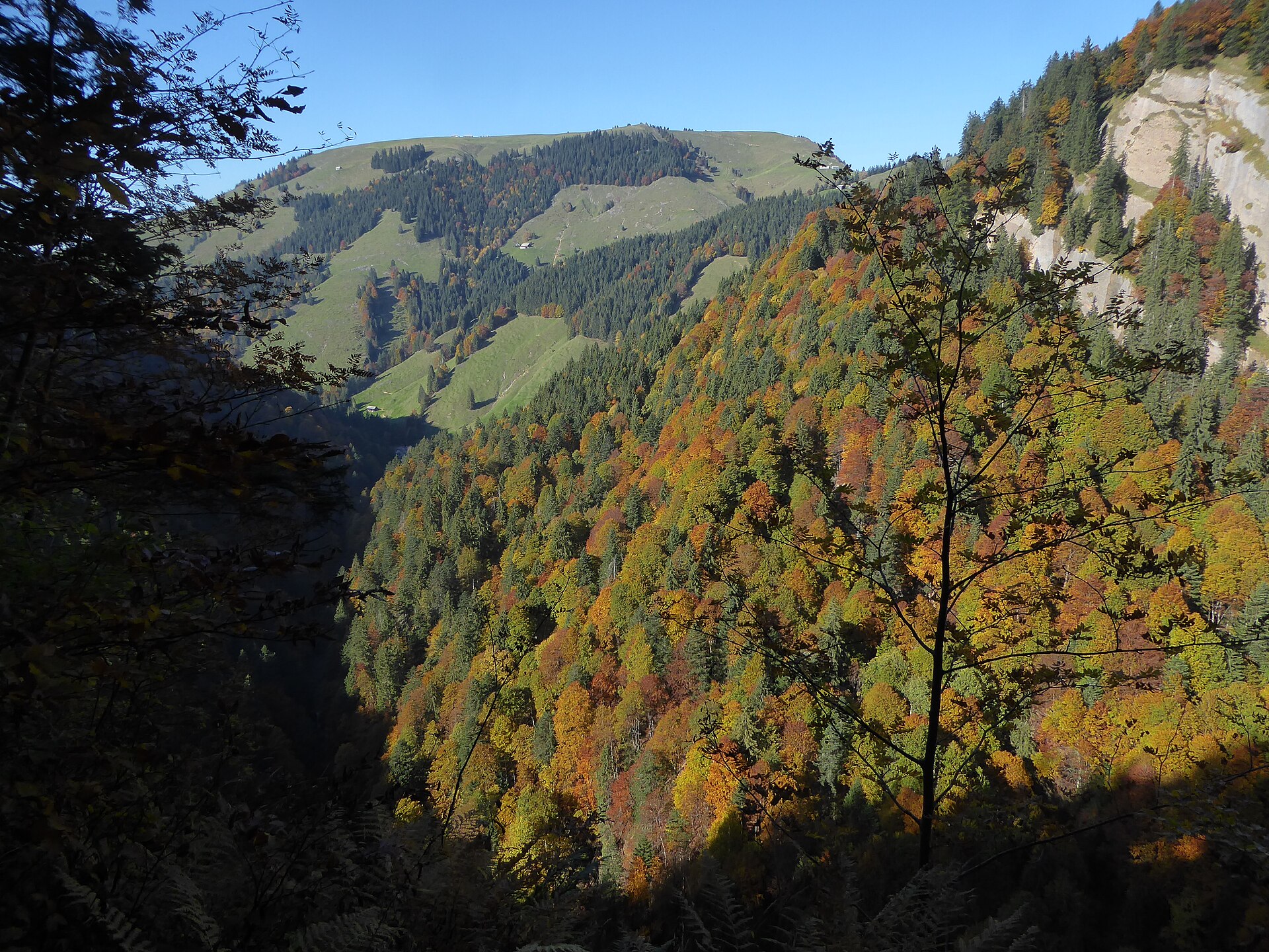
Ofenloch is a rugged gorge and grotto in the Toggenburg region of canton St. Gallen, in the Nesslau area close to the Schwägalp pass. Locals call it the "Grand Canyon of Eastern Switzerland", and for hikers it is one of the wildest corners between the Necker valley and the Toggenburg. What is Ofenloch? The name literally means "oven hole". The site combines a deeply cut gorge with a grotto, carved into the slopes that separate the Toggenburg from the Necker valley. The Necker river rises in this area and runs about 30 km before joining the Thur near Lütisburg, making this its wild upper reach. How do you get to Ofenloch? There is no road access. You walk in on a mountain trail from one of three typical starting points: Schwägalp (bus stop Schwägalp Passhöhe), the most popular start, Ennetbühl, the usual end of the through-route, Hemberg, a variant approaching from the north. The classic route runs Schwägalp, Chräzerenpass, Ofenloch, Hinterfallenkopf and Ennetbühl (trail 948). Hiking portals give roughly 14 to 15 km and 4.5 to 5 hours, with around 650 to 720 m of ascent. Buses serve both Schwägalp and Ennetbühl, so the hike works without a car. How hard is the hike? It is demanding. The Ofenloch section is rated T3 on the Swiss mountain-trail scale: you need sure footing and a head for heights, and some stretches are secured with ropes. Technically it is medium, but it is physically tough, especially with about 1,200 m of descent. The trail can be closed or interrupted depending on season and weather, so check conditions with local tourist information before setting out. When should you go? The season runs roughly from April to October. Choose dry days after the snow has melted: wet rock and a soggy path in the gorge raise the risk of slipping. Start in the morning so you have a buffer for the last bus from Ennetbühl. What else is nearby? Nesslau sits in the upper Toggenburg beneath the Churfirsten, and Schwägalp is the gateway to the Säntis massif. The region also has caves, such as the Wildenmannlisloch on the north flank of the Selun (about 192 m long, bring a torch). These are separate outings, away from the Ofenloch route. Frequently asked questions Is Ofenloch suitable for beginners? No. The route is graded T3, long and partly exposed, so it calls for mountain experience. How long does Schwägalp to Ennetbühl take? About 4.5 to 5 hours over 14 to 15 km. Do I need a guide? No, the trail is waymarked. Still, check the current trail status and the forecast. How do I get there without a car? Take local buses to Schwägalp Passhöhe, or approach from Ennetbühl or Hemberg.
-
Mondmilchloch
Alpnach
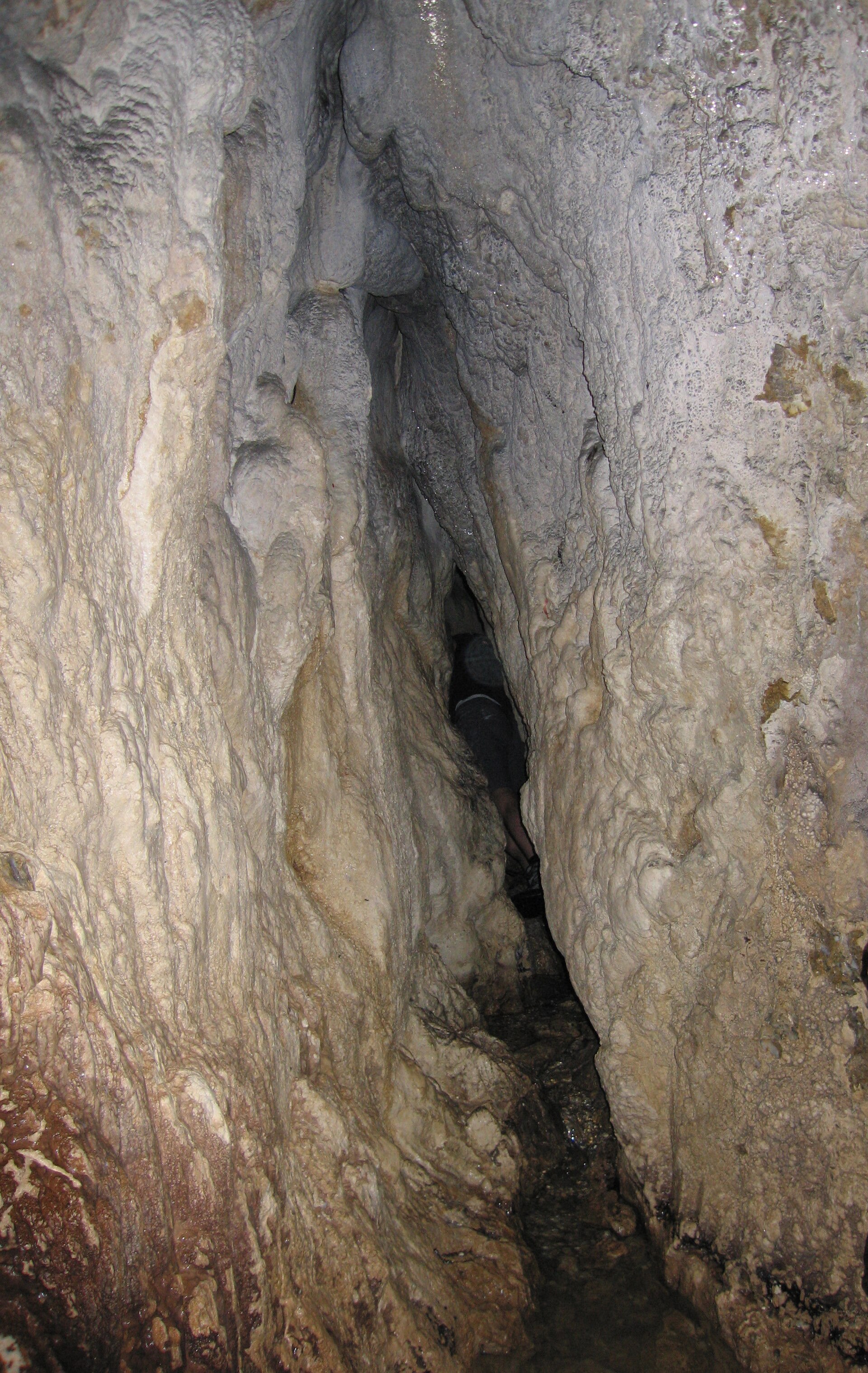
Mondmilchloch is a karst cave on Mount Pilatus above Alpnach, in the canton of Obwalden, central Switzerland. It counts as the best-known cave on the mountain, and it gave science one of its classic cave deposits: moon milk. What is the Mondmilchloch? The German name roughly means "moon milk hole". The cave runs about 117 metres and formed in Schrattenkalk, the limestone that makes up much of the Pilatus massif. Wikidata lists it as a solutional cave, meaning water dissolved the carbonate rock to shape it. The entrance sits at roughly 46.967° N, 8.219° E. Why does moon milk matter? Mondmilch is a soft, white calcite deposit found in limestone caves. This cave is regarded as its type locality, the place the phenomenon is named and defined from. In 1555 the naturalist Konrad Gessner wrote about the supposedly healing moon milk of this very cave. People used it as medicine, and older texts and pharmacy lists call it Lac Lunae in Latin. The cave also has an early place in cave mapping. Moritz Anton Kappeler published the first plan of the Mondmilchloch in 1767, which makes it one of the earlier surveyed caves in the Alps. Where is it exactly? The entrance lies on the south side of the Widderfeld range at about 1,710 m above sea level. The Pilatus-Bahnen company places it west of the Widderfeld. The area belongs to the high part of the massif above Alpnach and falls within a landscape listed in Switzerland's federal BLN inventory. How do you find the entrance? You only see the opening when you stand right in front of it. A small stream running out of the cave can act as a pointer. The approach crosses mountain terrain, so bring hiking boots, a map or route app, and good weather. The interior is natural and damp, so a headlamp and warm clothing are worth packing. What else has been found on Pilatus? In 2018 a team from the NEKO foundation rediscovered several other caves in the massif. Finds included bones of several brown bears, plus chamois and goats. The bear remains were confirmed later, as announced in a press release from April 2021. The caves of Pilatus still turn up traces of former wildlife. When should you go? Snow lingers above 1,700 metres, so late summer to early autumn gives the driest paths. In rain or fog, postpone the trip: the entrance is hard to spot from a distance and it is easy to lose the way. Frequently asked questions Where does the name Mondmilchloch come from? From moon milk, the white calcite deposit described in this cave and named after it. How long is the cave? About 117 metres, in Schrattenkalk limestone. How high is the entrance? Around 1,710 m above sea level, on the south side of the Widderfeld range. Who first described the cave's moon milk? Konrad Gessner, in 1555. Moritz Anton Kappeler published the first cave plan in 1767.
-
Bachlägerwasserfall
Grindelwald
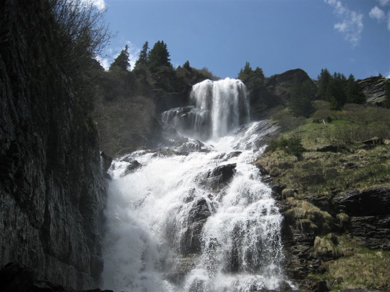
Bachlägerwasserfall is a waterfall above Grindelwald in the Bernese Oberland. It is fed by the Milibach, a stream that starts at the outlet of the Bachalpsee and eventually joins the Schwarze Lütschine in the valley. The water tumbles over several rocky steps, dropping from roughly 1,950 m to about 1,780 m above sea level. The falls sit above the small hamlet of Bachläger, on the ground between the First area and the Grindelwald valley. What will you see there? This is not a single sheer drop. The Milibach runs down a series of rock ledges, and smaller streams join it from the sides, so after snowmelt or rain the whole slope is loud with water. Upstream, the creek crosses a moor of national importance, and the surrounding alpine pastures are full of flowers in summer. A flower trail links the Bachalpsee with Bachläger, and hikers on Komoot single it out as one of the prettiest stretches of the route. How do you get to the waterfall? The shortest approach is from First, from where a trail of about 30 minutes leads to Bachläger. From Grindelwald itself, the popular option is a loop via the Bachalpsee, described on Komoot and Bergfex. It covers about 20-21 km with around 1,270 m of ascent and takes roughly 7.5 hours. Komoot rates it hard, with very good fitness required. Bergfex puts the waterfall about 6.4 km from Grindelwald. Bring hiking boots, layers for changeable weather and plenty of water. When should you go? Trails here are normally open in summer and early autumn, and the falls run strongest after the snow melts. On the first Sunday of July, Alp Bachläger hosts the Bachlägerchilbi, an annual yodelling festival (5 July in 2026). Check current trail conditions before setting out, as snow patches can linger higher up. Why do locals care about this waterfall? In 2009 the utility BKW planned a small hydropower plant here. Residents founded an association in July 2009 to protect the falls and the stream, and in February 2010 they handed the Grindelwald municipality a petition with 1,667 signatures. The project was put on hold, and the local association later had the falls assessed as worthy of protection under cantonal criteria. The site is now known as an example of local campaigning for a natural landmark. What can you combine with the hike? The falls fit naturally into one outing with the Bachalpsee, one of the most photographed lakes in Switzerland, famous for mirror reflections of the peaks. The First area adds more trails and viewpoints, so you can shorten or lengthen the loop to suit your legs. Frequently asked questions Where does the water of Bachlägerwasserfall come from? From the Milibach, a stream that leaves the Bachalpsee and flows down to the Schwarze Lütschine. How long is the walk from First? About 30 minutes on the trail from First to Bachläger. Is the route from Grindelwald difficult? The Bachalpsee loop is around 20 km with about 1,270 m of climbing, so it counts as a demanding full-day hike. Was the waterfall ever under threat? Yes, from a planned small hydropower plant. Residents' protests and a petition with 1,667 signatures led to the project being suspended.
-
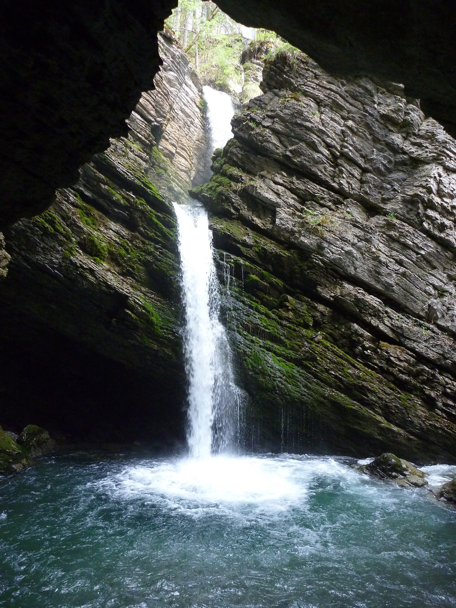
Thur waterfalls
Wildhaus-Alt St. Johann
The Thur waterfalls (Thurwasserfälle) are a pair of cascades at Unterwasser, in the municipality of Wildhaus-Alt St. Johann, in Switzerland's Toggenburg region (canton of St. Gallen). The tallest drop measures 23 metres, and a short stroll from the village centre brings you to the viewing platforms. Where are the Thur waterfalls? The cascades sit in the upper Thur valley right beside Unterwasser, beneath the Churfirsten and Säntis massifs. According to the Historical Dictionary of Switzerland, the river Thur begins near Unterwasser where two headstreams meet: the Wildhuser Thur and the Säntisthur. The falls lie on the Säntisthur branch. Here the water tumbles into a rocky half-cave rather than down an open slope. How do you get to the falls? From the village square in Unterwasser it takes roughly 10 to 15 minutes on a flat, well-signed path. The postbus stop is in the village itself, so public transport works well. The route suits most visitors, including families, though the ground can be wet after rain. What will you see? Wooden walkways run along the rock walls, joined by lit tunnels cut through the stone and several viewing decks that give both close-up and elevated views. A gallery with a lookout terrace was built in 1927 by Ernst Waldburger. During snowmelt you hear the roar from afar and a fine mist coats the railings. When is the best time to visit? Flow is strongest from late spring through August, when snow melts in the mountains and rain is frequent. Visitors in late October and November have described the falls as almost dry, so check conditions before you travel. Spring and summer give the most impressive show. Which walks pass the falls? The falls make a handy stop on a longer outing: Unterwasser – Thurwasserfälle – Gräppelensee – Alt St. Johann: about 8.9 km, around 3 hours, roughly 500 m of ascent, a high point of 1,346 m, grade T1, recommended May to October. Gräppelensee lies in a fen and has fire pits and a swimming spot. Wildhaus – Gamplüt – Thurfälle – Unterwasser: about 3 hours, following the Säntisthur toward its source and down to Unterwasser. Distances vary slightly between sources, so check a current map or the trail signs before setting out. Frequently asked questions How tall are the Thur waterfalls? The highest drop is 23 m. The falls consist of two cascades. How long is the walk from Unterwasser? About 10 to 15 minutes from the village square along a flat, marked path. Can you visit all year? Access is easy in the warm season. Outside it, flow can be very low, and a few visitors report dry falls in autumn. We give no opening hours or fees because we found no official figures; ask the Unterwasser tourist office. Where can you continue from here? Follow the trail to the Gräppelensee lake and on to Alt St. Johann, or head up the Säntisthur valley toward Wildhaus.
-
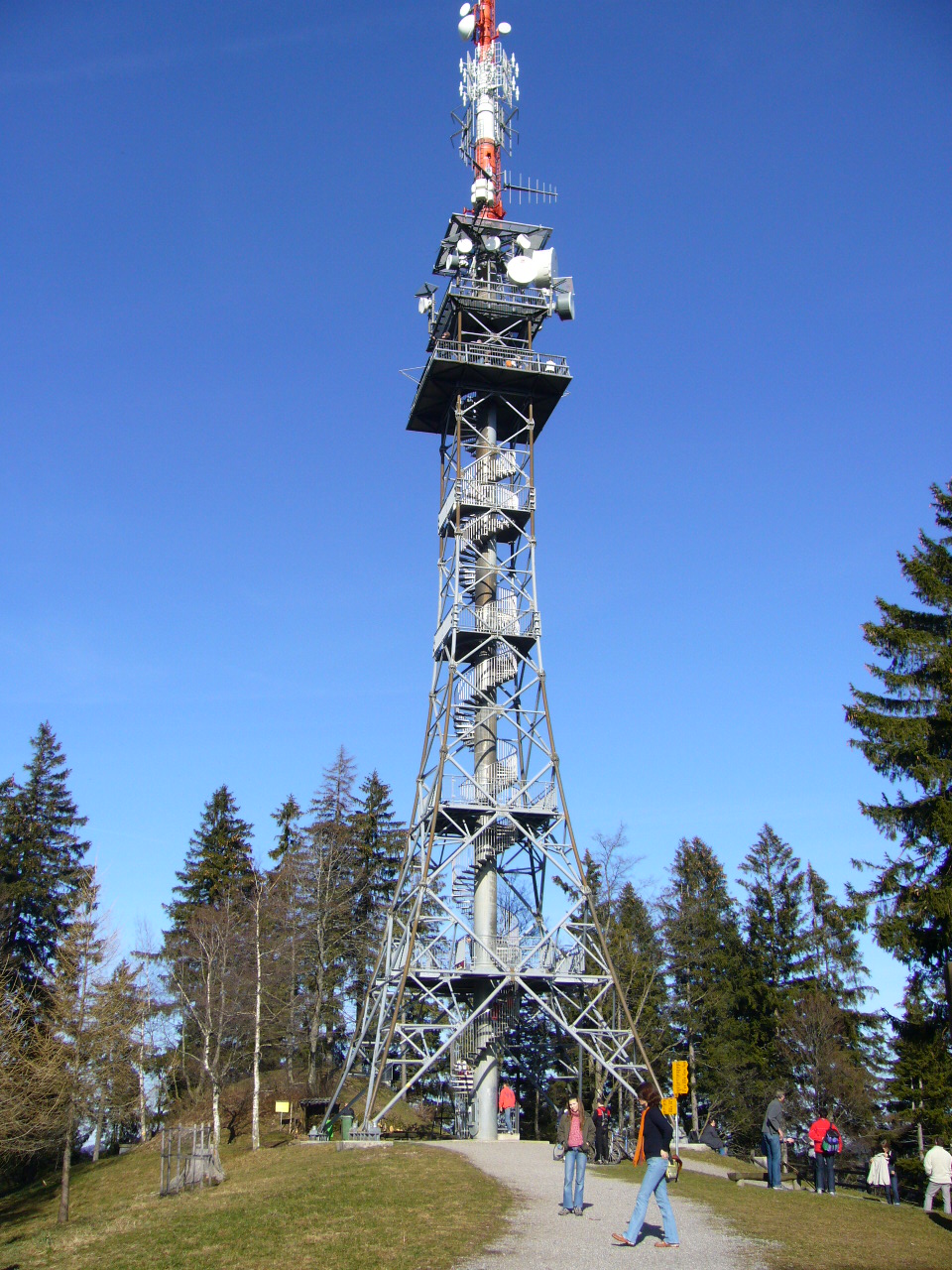
Bachtel Tower
Girenbad
Bachtel Tower (Bachtelturm) crowns the Bachtel summit near Girenbad in the Zürcher Oberland, canton of Zurich. Standing 75 metres tall, it works as both a transmitter mast and a lookout, and on a clear day the view runs from Lake Zurich all the way to the Black Forest. What is this tower and how old is it? The present structure dates from 1986. Its viewing platform sits roughly 30 metres above the ground, and the tower itself stands on the Bachtel hilltop at 1,115 m above sea level. Because the summit rises above the surrounding hills, the outlook opens in every direction. It has had several predecessors. A first wooden tower went up in 1873 but was destroyed by a storm in 1890. A steel lattice tower followed in 1893. It was dismantled in 1985 and now stands, re-erected, on the Pfannenstiel hill. What can you see from the top? The platform gives you Lake Zurich, the rolling countryside of the Zürcher Oberland and, in good visibility, distant ranges as far as the Black Forest. Aim for a crisp morning or the day after a weather front passes, when the air is clear. If low cloud sits in the valleys, check the forecast first, since the summit can poke out above it. The summit has food service, toilets and a children's playground, which makes it a good family outing. Opening hours of the restaurant can vary, so confirm them before you set off. How do you get to Bachtel? Hiking trails lead up from several villages: Rüti, Hinwil, Wald and Gibswil. From Wald station the walk takes about 90 minutes. A PostBus (Postauto) runs to Dieterswil or Tännler and cuts roughly half an hour off the climb. Cyclists can also reach the top. A popular loop, Gibswil – Bachtel – Wald, covers 9.2 km with about 543 m of ascent and takes around 2 hours 50 minutes. It is graded easy (T1) and passes the Bachtelweiher pond, among other spots. If you plan to drive, note that car access near the summit is not allowed on Sundays and public holidays. When should you visit? Late spring, summer and early autumn are best, when paths are dry. Autumn and winter often bring the sharpest views, but trails can be muddy or snowy, so wear sturdy footwear. Sunrise and sunset offer the best light for photos, though they mean walking back in the dark. Frequently asked questions How tall is Bachtel Tower? It is 75 metres high, with the viewing platform at about 30 metres. The mountain summit is 1,115 m above sea level. What can you see from the tower? Lake Zurich, the Zürcher Oberland landscape and, in good weather, the Black Forest. Is it also a transmitter? Yes. The structure serves as a broadcasting tower and an observation tower at once. How long is the walk from Wald? About 90 minutes on foot. A PostBus to Dieterswil or Tännler shortens it by around half an hour. Can you drive up? Yes, but not on Sundays and public holidays, so use a trail or a bike on those days.
-
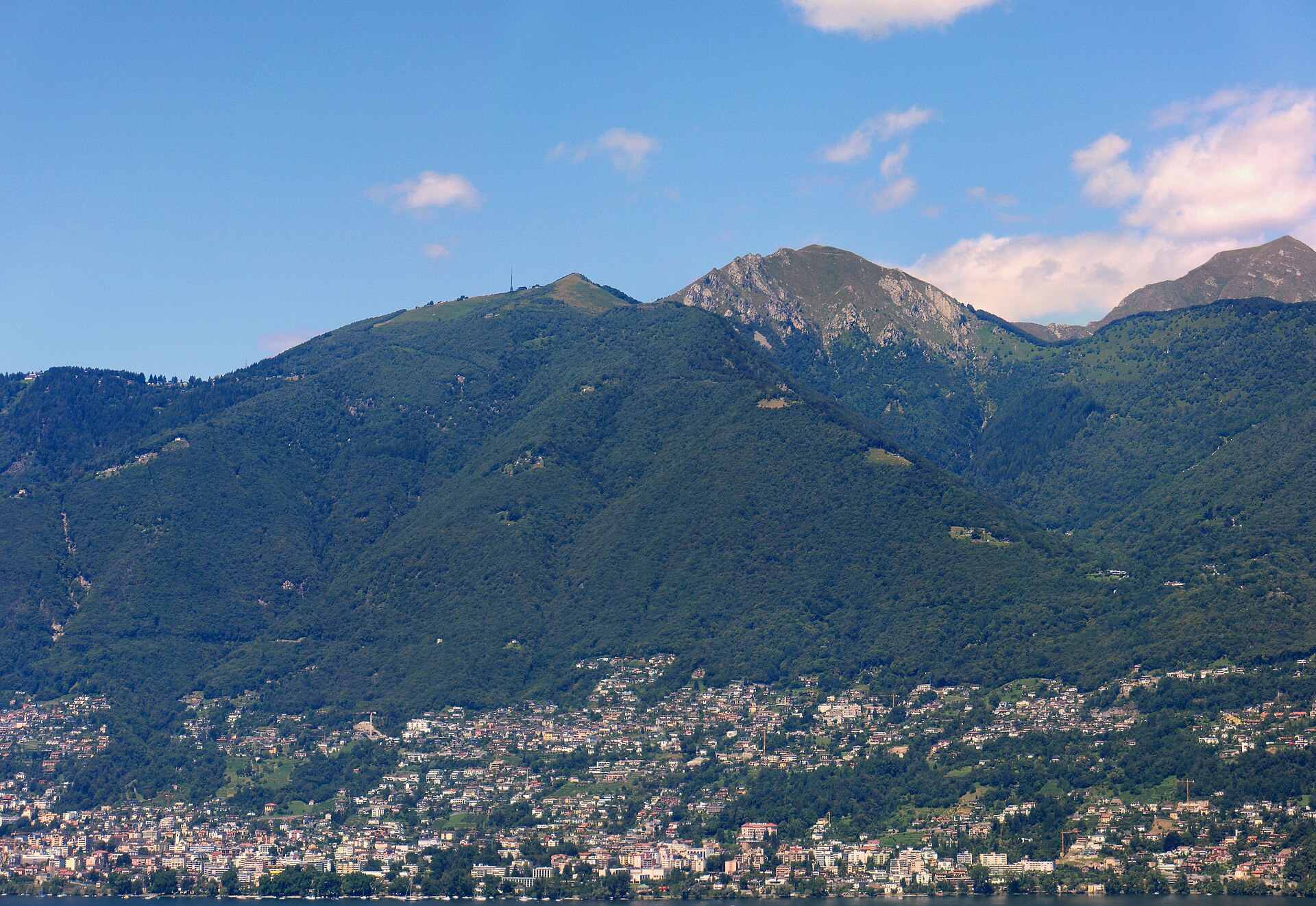
Cardada
Minusio
Cardada is a mountain area in the Swiss canton of Ticino, set high above Locarno and Lake Maggiore, a short distance from Minusio. At around 1,340 m above sea level, it is among the easiest viewpoints to reach in the region: a few minutes on a cable car from Orselina and you are up. How do you get to Cardada? The journey starts in Orselina, just above Locarno. A red cable car climbs from the valley station, at roughly 395 m, to Cardada in about five minutes. From there a two-seat chairlift carries on to the summit of Cimetta at about 1,670 m. The lifts are run by Cardada Impianti Turistici, based in Orselina. From Minusio the valley station is a short drive away, and from central Locarno it is an easy trip too. What can you see up there? The big draw is a 360-degree panorama over Lake Maggiore and the valleys around it. From a single spot you can take in both the lowest point in Switzerland, the lake itself, and the highest, the Dufourspitze in the Monte Rosa massif. Views open from the landscape promontory at Cardada and from the geological observatory on Cimetta. To the east you look across the Magadino plain towards Bellinzona, to the west you see well-known Swiss Alpine summits, and on very clear days the Ligurian Apennines appear far to the south. What is there to do on Cardada and Cimetta? The area sits between the Maggia and Verzasca valleys, so it works as a base for walks into either one and for the Via Alta Vallemaggia trekking route. On offer: a panoramic walkway of about 1.2 km, suitable for families, three Helsana Nordic Walking trails, orienteering courses for adults and for children, mountain-bike trail no. 397, a paragliding take-off point. For a relaxed day, stroll around Cardada and have a coffee with the view. More active visitors can walk across to Cimetta or hike down to Orselina. When should you go? The lifts follow a seasonal timetable. The usual break runs from November to mid-December, and the rest of the year they operate. Hours and fares change, so check cardada.ch before you travel. Visibility is best in clear weather, most often in the morning. Bring a warm layer, since 1,340 m is noticeably cooler than the lakeshore. Frequently asked questions Is Cardada suitable for children? Yes. The ride is short, and at the top there is an easy walkway and an orienteering course designed for kids. How long is the ride? The cable car from Orselina to Cardada takes about five minutes. The chairlift to Cimetta adds a few more. Can you walk to Cimetta? Yes. Trails lead from Cardada to Cimetta (about 1,670 m), and longer routes head towards the Maggia and Verzasca valleys. What can you see from Cimetta? The geological observatory offers views from the Magadino plain to the Alpine peaks in the west, and the Ligurian Apennines when the air is clear.
-
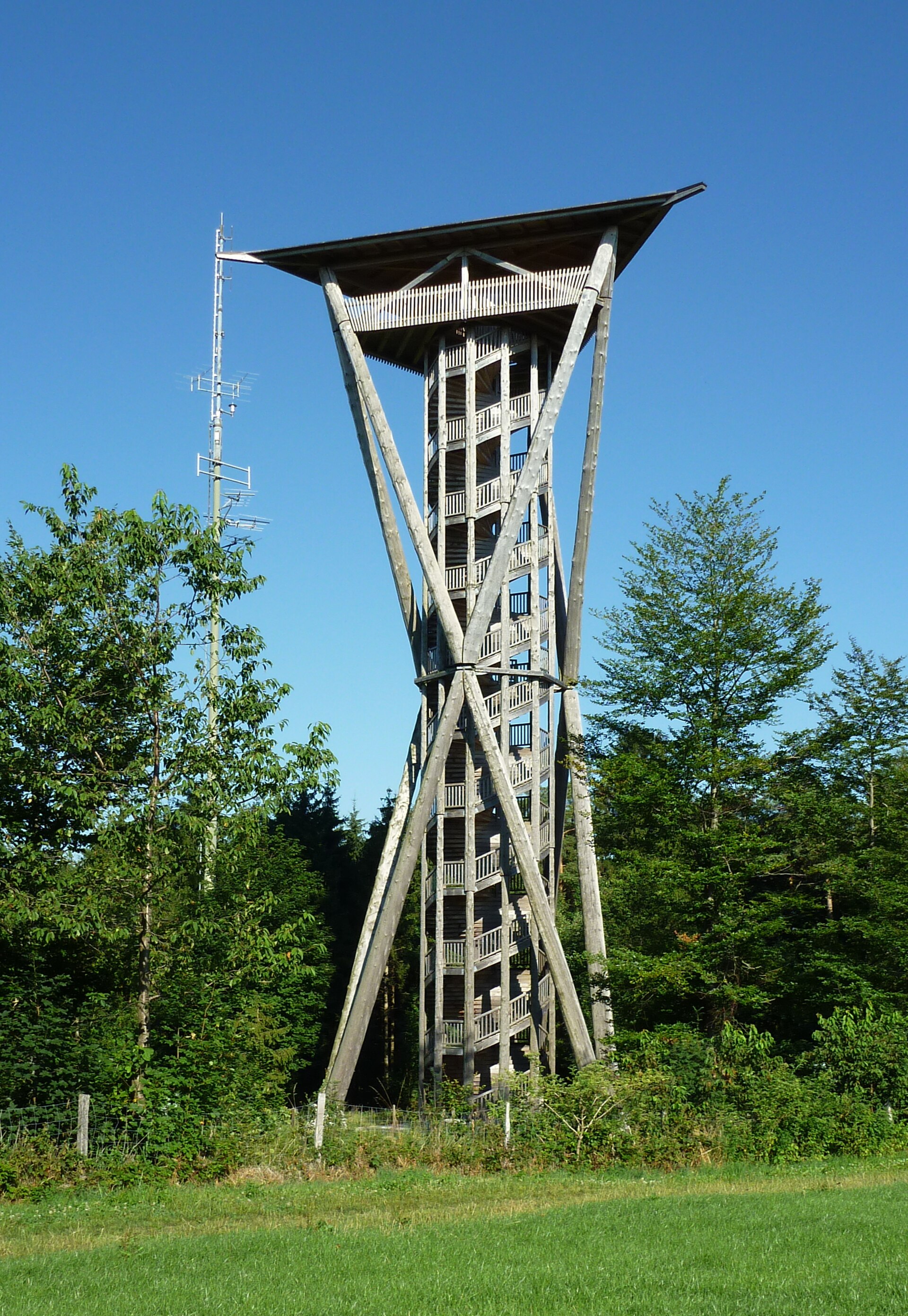
Wil Tower
Wil (SG)
Wil Tower in Wil (canton of St. Gallen) is a timber lookout tower standing in the forest on Hofberg, the town's highest hill. Its viewing deck sits 34 metres above the ground, and the site lies at 747 metres above sea level. Julius Natterer designed it, and it welcomed its first visitors on 8 July 2006. What is Wil Tower? The structure is built entirely of wood, much of it taken from nearby forests. Douglas fir forms the columns, and silver fir was used for the stairs. Six slanted columns rise from three anchor points, giving the tower a light, unusual silhouette. The covered deck clears the treetops by only a little, so the outlook mixes a wide panorama with the feeling of being inside the woods. What can you see from the top? A double spiral staircase of 189 steps winds up the centre of the tower. From the deck you look over Wil and the rolling hills of Thurgau and St. Gallen. On clear days the Churfirsten range and Säntis, the highest peak of the Alpstein massif, stand on the horizon. How do you get to the tower? The tower is reached on foot along marked forest paths. From Wil railway station the walk takes about 40 minutes. Drivers find a small number of parking spaces along Grundstrasse and Bergtalstrasse, 10 to 15 minutes from the tower. There is no road access to the tower itself. When is the best time to visit? Pick a day with good visibility, since the Alps show most sharply then. The climb to 34 metres takes a few minutes, which makes the tower a good goal for a short woodland walk. The tower was closed for renovation from November 2025 until summer 2026, so check its current status with the Stadt Wil info centre before you go ([email protected], tel. +41 71 913 53 00). What else is nearby? Wil is known for its medieval old town with colourful townhouses, Hof castle and the church of St. Nicholas. A walk from the centre up to Hofberg combines easily with a stroll through town, so the tower fits a day trip from Zurich or St. Gallen, both within reach of regional rail. Frequently asked questions How tall is Wil Tower? The viewing deck is 34 metres above the ground, and the tower stands 747 metres above sea level. How many steps are there? The climb is 189 steps on a double spiral staircase. Can you drive up to the tower? No. The nearest parking, on Grundstrasse and Bergtalstrasse, is a 10 to 15 minute walk away, and the walk from Wil station takes about 40 minutes. What is the view like? The panorama covers Wil and its surroundings, and on clear days the Churfirsten and Säntis as well.
-

Zurich Wilderness Park
Horgen
Zurich Wilderness Park (Wildnispark Zürich) is a protected area in the Sihl Valley, south of Zurich in Switzerland. It is made up of two separate sites: the Sihlwald forest and the Langenberg wildlife park. They lie on opposite sides of the town of Langnau am Albis, and each is roughly half an hour by train from central Zurich. What makes this park special? Sihlwald is the largest mixed deciduous and coniferous forest in the Swiss Mittelland. It is left to develop naturally, so fallen dead wood lies beside living trees and the woodland slowly regains a wild character. Langenberg, meanwhile, is the oldest wildlife park in Switzerland. What can you see in Sihlwald? Sihlwald has a visitor centre with a bookshop and a nature museum. Its permanent exhibition covers the history of the forest and its ecology, and staff are happy to answer questions about local nature. Sihlwald railway station is about a five-minute walk from the centre. Outdoors you will find a forest adventure trail, a wilderness playground, hiking paths and fireplaces. The forest nature trail is about 2.6 km and takes around two hours, a good choice for families who want to get to know the woods without a long expedition. What can you see at Langenberg? At Langenberg, animals live in large enclosures. The predator circuit lets you see bears, lynx, wildcats and wolves. It is a highlight for children and animal lovers. Can you combine both sites? Yes. A walking route of about 10 km links Sihlwald and Langenberg. It lets you cross the whole park in a day, from forest to wildlife park, and return to Zurich by train. Can you stay overnight? Yes. Langenberg has a few simple guest rooms, and Sihlwald has a campsite on the bank of the Sihl river. It is a handy option if you want more than a single day in the park. Practical tips Public transport is the best way to reach both sites. The outdoor areas are open all day, but the opening hours of the visitor centre and museum vary by season, so check the official park website. Sihlwald is a natural forest, so dead branches can fall. Do not rest under dry boughs. Bring sturdy shoes, water and clothing for changeable weather. Frequently asked questions Where is Zurich Wilderness Park? In the Sihl Valley, south of Zurich, at roughly 47.27 N, 8.56 E. How long should I plan for a visit? Two hours covers the nature trail in Sihlwald. Set aside a full day if you also want to visit Langenberg or walk the route between the two sites. Is it suitable for children? Yes. The forest playground, the adventure trail and the animal enclosures make it a good family outing. Is there something to do on a rainy day? Yes, in Sihlwald you can visit the nature museum and its exhibition on the forest.
-
Biosfera Val Müstair
Val Müstair
Biosfera Val Müstair is the valley part of the UNESCO Engiadina Val Müstair Biosphere Reserve in eastern Switzerland, in the canton of Graubünden, right next to the Italian border. It is one of the quietest corners of the Alps, with high mountain meadows, pastures, small Romansh-tradition villages and trails where silence is easy to find. What is Biosfera Val Müstair? A biosphere reserve is an area where nature protection goes hand in hand with everyday life and local business. The whole reserve is called Biosfera Engiadina Val Müstair and covers about 449 square kilometres in the easternmost part of Switzerland. The Val Müstair valley forms part of it together with the municipality of Scuol and the Swiss National Park. The valley itself is a regional nature park, known as Biosfera Val Müstair. How is the reserve organised? The area has three zones. The strictly protected core zone is the Swiss National Park. The other two zones, where nature is protected while farming, crafts and tourism continue to develop, are looked after by the municipality of Val Müstair (with its regional nature park) and the municipality of Scuol. The reserve office is based in Scuol. It works as a consortium, so decisions depend on constant dialogue between the partners. A short history of the UNESCO status The Swiss National Park became a biosphere reserve in 1979. After UNESCO changed its rules in 1995 it lost the title, because the park consists only of a strictly protected core, while the new requirements also called for buffer and development zones. The reserve was therefore rebuilt with Val Müstair included. UNESCO granted provisional status on 2 June 2010 and confirmed it definitively on 13 June 2017. The road there was bumpy: some municipalities initially opposed the buffer zone. What to see nearby The landscape runs from high-alpine meadows and pastures to the Romansh villages of the Engadine and Val Müstair. One example is Tschierv, at 1,664 m above sea level, whose municipal land borders the national park directly. It is a good starting point for walks toward protected nature. In the valley itself, visit the Convent of St John in Müstair, inscribed on the UNESCO World Heritage List in 1983. It means a trip to Val Müstair combines time in nature with a monument of world importance. Planning a visit The area is centred at roughly 46.61 N, 10.37 E. The valley is far from major cities, so plan at least one full day, ideally a weekend. Summer is the time for walks across meadows and pastures; for trail details and the season, ask at local tourist information points. Frequently asked questions Where is Biosfera Val Müstair? In eastern Switzerland, in Graubünden, by the Italian border. Is it a separate UNESCO reserve? No, the valley is part of the larger Engiadina Val Müstair Biosphere Reserve, about 449 square kilometres in size. Who manages the reserve? The Swiss National Park looks after the core zone, and the municipalities of Val Müstair and Scuol look after the other zones. The office is in Scuol. Since when does the reserve have its current status? Provisionally since 2 June 2010 and definitively since 13 June 2017. Are there historic sights nearby? Yes, the Convent of St John in Müstair has been on the UNESCO World Heritage List since 1983.
-
Parc Ela
Surses
Parc Ela is a nature park in the Swiss canton of Graubünden, covering the Albula and Surses valleys. It is the largest nature park in Switzerland. Its purpose is to protect the regional habitats, promote their sustainable use and give a boost to an area rich in scenery and cultural assets but economically weak. Where is Parc Ela and what does the name mean? The park lies between the Albula valley and the Surses region in the heart of Graubünden. It is named after Piz Ela, a peak roughly at its centre. In Romansh, "ela" means "wing". Many local place names, Surses included, come from Romansh. How big is the park and how high does it go? Sources give an area of around 550 to 600 square kilometres, several times the size of the Swiss National Park. The elevation range is huge. The highest point is Piz Kesch at 3,418 m, and the lowest is the Schinschlucht gorge at about 745 m. A single park spans deep rocky ravines and high alpine terrain. How does it differ from a national park? In a nature park, people are part of the landscape. Villages, fields and pastures belong to the concept instead of being excluded, as in a strict national park. The park was formed by 21 municipalities, and around 6,000 people live in the Albula and Surses valleys. It opened in 2006. What can you see and do? The park advertises about 100 km of hiking trails. The region is tied to the historic Albula, Julier and Septimer passes, which carried merchants and travellers for centuries. Historic villages and baroque churches recall that past. In Savognin, which lies inside the park, the baroque church of Son Martegn is worth a visit. Tourism material also lists the Albula Railway, a UNESCO World Heritage site. Languages and culture Three languages coexist here: Romansh, Italian and German. You notice it in village names, on signposts and in conversations in local shops and mountain huts. How do you get there? From Chur, the Rhaetian Railway reaches the park in under an hour. At Tiefencastel station there is paid parking, a handy base for visitors arriving by car. Frequently asked questions Is Parc Ela a national park? No, it is a nature park. It allows farming and village life, unlike the Swiss National Park. What is the highest peak in the park? Piz Kesch, at 3,418 m. Which languages are spoken? Romansh, Italian and German. Can I get there by train? Yes, from Chur by Rhaetian Railway in less than an hour. How many trails are there? The park advertises about 100 km of hiking trails.
-
Naturpark Pfyn-Finges
Susten
Naturpark Pfyn-Finges is a regional nature park in central Valais, Switzerland, stretching along the Rhône valley between Gampel and Sierre. It covers roughly 280 km² across a number of municipalities, and Susten lies in its surroundings. At its heart is the Pfynwald, one of the largest continuous pine forests in the Alps. Why visit? Pfyn-Finges packs landscapes into one valley that usually take days to travel between. Dry, sunny slopes, pine forest, rock walls, vineyards and high-mountain terrain sit side by side. Elevation within the park ranges from about 500 m above sea level on the Rhône to over 4,000 m in the Bernese Alps. The park was recognised as a regional nature park of national importance in 2013. What to see Pfynwald. The pine forest grows on a broad, dry terrain shaped by old landslides and river deposits. It is the park's best-known symbol and a good place for a quiet walk. A route of around 14 km through the forest begins at Leuk station and takes about four hours; a postbus brings walkers back to Sierre. Illgraben. One of the most active torrents in Switzerland, famous for debris flows that rush down towards the valley several times a year. A suspension footbridge about 134 m long, the Bhutan Bridge, opened in 2005 and crosses the gorge. The popular walk linking Illgraben and the bridge is around 7 km and takes roughly two hours. Information boards at Illgraben are accessible at any time. Salgesch. The village hosts the nature and landscape centre that serves as the park's contact point. Salgesch and neighbouring Varen are also known for wine, so a walk pairs well with a tasting. Birdlife. The region is popular with birdwatchers. In spring, bee-eaters appear around Leukerfeld. Planning your visit The valley is well connected, and routes start at railway stations and bus stops. Pick a day with good weather and wear sturdy shoes, as some paths cross stony, open ground with little shade. Check the current opening hours of the Salgesch centre before you travel. Rules in the park Keep to marked paths, do not bathe in the ponds, keep dogs on a lead, and make no fires in the forest. This protects valuable habitats and keeps the dry forest safe. Frequently asked questions Where is Naturpark Pfyn-Finges? In central Valais, between Gampel and Sierre, on both sides of the Rhône. How long is the walk to the Bhutan Bridge? The Illgraben to bridge route is about 7 km and takes around two hours. Can I make a fire in the park? No. Fires are forbidden in the forest. Can I bring my dog? Yes, but it must be kept on a lead. What else is worth seeing besides nature? The vineyards of Salgesch and Varen, and spring bee-eater watching near Leukerfeld.
-
Parc naturel régional Gruyère Pays-d’Enhaut
Grandvillard
Parc naturel régional Gruyère Pays-d’Enhaut is a regional nature park in western Switzerland, straddling the cantons of Vaud and Fribourg. It lies in the Limestone Pre-Alps, in a landscape of meadows, pastures and cheesemaking villages. The park is associated with Grandvillard in the Gruyère region, and its coordinates are roughly 46.47° N, 7.11° E. Where is the park and how big is it? The park covers around 180 km² of the Limestone Pre-Alps, at altitudes from roughly 800 to 2,500 metres. Most of it lies between 800 and 2,000 metres. It stretches from the area around Montreux on Lake Geneva towards Bulle, and from Gstaad across to Gruyères. That brings together two distinct worlds: the French-speaking villages and pastures of Fribourg, and the mountain valley of the Pays-d’Enhaut in Vaud. How did it come about? The association that created and manages the park was founded in February 2006. Its aim was to establish and run a regional nature park, an area where landscape protection goes hand in hand with local economic life. This is not a strict reserve. People still live, work and produce food here, and culture and nature are treated as a single whole. Which municipalities belong to it? Membership has changed over time. A 2009 newsletter listed fourteen communes, including Charmey, Cerniat, Crésuz, Châtel-sur-Montsalvens, Bas-Intyamon, Grandvillard, Haut-Intyamon, Rossinière, Château-d’Œx, Rougemont, Ormont-Dessous, Veytaux, Villeneuve and Montreux. Later park publications refer to seventeen communes. Before you travel, check the current list on the park's official website. What should you taste? Farming here centres on dairy. Three cheeses with protected designation of origin are produced in the park: L’Étivaz AOC, Gruyère AOC and Vacherin Fribourgeois AOC. For food lovers this is a main reason to visit: you can look in at a cheese dairy, buy directly from a producer or try the local cheese in a restaurant. Note that Vacherin Fribourgeois is a Fribourg cheese rather than a product exclusive to the park. How to plan a visit The altitude range and varied terrain make the park suitable in every season. Summer brings pastures, walking trails and Alpine views. In winter the Pays-d’Enhaut valley and the Gstaad area draw skiers and quiet hikers. Specific routes, dairy opening hours and seasonal offers change from year to year, so check the park's website before you go. Frequently asked questions Where exactly is the park? In western Switzerland, across the cantons of Vaud and Fribourg, in the Limestone Pre-Alps. How large is it? About 180 km², with altitudes from around 800 to 2,500 metres. When was it founded? The founding association was formed in February 2006. Is it a strict nature reserve? No. It is a regional nature park where landscape protection sits alongside farming, crafts and tourism. Which cheeses are made nearby? Gruyère AOC, L’Étivaz AOC and Vacherin Fribourgeois AOC. How do I get there? The area can be reached from Montreux, Bulle and Gstaad. Check Swiss rail and bus timetables and the park's website for connections to a specific municipality.
-
Gantrisch Nature Park
Eywald
Gantrisch Nature Park is a large protected area in western Switzerland, lying mostly in the canton of Bern, across the Bernese Alps and their foothills. It is a place where one weekend can combine mountain trails, moorland, forest and quiet rural scenery, without the crowds of the best-known resorts. Where is Gantrisch Nature Park? The park stretches between the Bern area and the border with the canton of Fribourg. Sources give differing sizes, roughly 400 km2 (figures of 402 and 414 km2 appear). It covers 20 municipalities, 19 of them in Bern and one in Fribourg. Among them are Belp, Guggisberg, Rüeggisberg, Schwarzenburg and Plaffeien. The area centres around 46.79° N, 7.37° E. What is there to see? The highest point is Schafberg at 2,239 m. The Gantrisch peak itself reaches 2,176 m and rises between the Gurnigel region and the Simmen Valley. From the ridges, views reach Kaiseregg, Spitzflue, Moléson and La Berra. Around the Gurnigel Pass, extensive moorland spreads out, with one of the region's larger unbroken forests alongside. The area's old spa and bathing culture left historic bath buildings behind. In the southwest lies Lake Schwarzsee and the primeval landscape of Brecca. The Schwarzsee region is one of the park's main tourist areas. How to spend time in the park The best-known route is the multi-day panorama hike from Schwarzsee to the Gurnigel Pass, about 33 km. It follows ridges with wide views and suits two or three days with overnight stops nearby. Families and walkers who prefer something gentler can choose shorter loops around the lake or across the moors. Frequently asked questions What is the highest point in the park? Schafberg, at 2,239 m. How many municipalities does it include? Twenty: nineteen in the canton of Bern and one in Fribourg. How big is the park? Sources differ, from about 402 to 414 km2. Is there a multi-day hiking route? Yes, the popular panorama hike from Schwarzsee to the Gurnigel Pass is around 33 km. What is the landscape like? Mountain ridges, moorland, forest, and Lake Schwarzsee with the wild Brecca area. It suits visitors who want quiet and open views rather than big-resort infrastructure. Who is it for? Hikers, families and nature lovers who want a less obvious side of Switzerland. The park lies close to Bern, so it fits easily into a wider trip through the country. Pick a clear day for ridge views and keep the moorland and forest areas for wetter weather. Before heading up, check the forecast and trail conditions, since mountain weather changes quickly and snow can linger on higher sections in spring. The region also works well for a longer stay because it gathers several distinct landscapes in one place, from high ridges to calm valleys and lakeshores, each with its own character and pace.
-
Parc du Doubs
Le Noirmont
Parc du Doubs is a regional nature park in the Swiss Jura, and the municipality of Le Noirmont is one of its members. The park has existed since 2013, covers roughly 312 km² and spans the cantons of Jura, Neuchâtel and Bern. The federal authorities recognise it as a regional nature park of national importance, tasked with preserving the landscape and supporting sustainable development. Where is Parc du Doubs? The park stretches more than 40 kilometres along the River Doubs. Its administrative office is in Saignelégier. Member municipalities include Le Noirmont, Saignelégier, Les Bois, Les Breuleux, Muriaux, Montfaucon, Soubey and Clos du Doubs, along with the watchmaking cities of La Chaux-de-Fonds and Le Locle. Sources give slightly different municipality counts (15 to 16), reflecting changes in membership over time. What is the landscape like? The high Franches-Montagnes plateau sits at about 1,000 m above sea level and is covered in pastures and forest. To the north the land drops steeply towards the Doubs valley. The river carves deep gorges and forms the border with France over long stretches. In the north the park reaches well into French territory, giving it a cross-border character. What can you do around Le Noirmont? Le Noirmont is a good starting point for hikes. Popular loops descend from the plateau along paths towards the Doubs, where the contrast between the gentle high plain and the steep slope is most striking. The region also suits quiet walks across pastureland, cycling and horse-riding trips. What shapes the region's identity? Horse breeding has marked the area for centuries, and the region is also known for cattle farming. Watchmaking, strongly tied to La Chaux-de-Fonds and Le Locle, is part of the local identity too. The park therefore combines rural traditions with an industrial heritage. Frequently asked questions Is Parc du Doubs in Switzerland? Yes. It is a Swiss regional nature park, although its northern part extends into France. Since when has the park existed? Since 2013. How big is it? About 312 km², running more than 40 km along the river. Where is the park administration? In Saignelégier. Is Le Noirmont part of the park? Yes, it is a member municipality and a convenient base for walks on the plateau and down to the Doubs. When is the best time to visit? Hiking is most pleasant in the warmer months, when pastures and forests are green and the descent to the Doubs is easy. Check current information on the park's website before travelling. Parc du Doubs suits travellers looking for a quiet, uncommercial side of Switzerland: pastures, horses, river gorges and small towns rather than high alpine peaks. It works well for a few days of hiking, with Le Noirmont as a practical base.
-
Binntal Landscape Park
Schmidighischere
Binntal Landscape Park (German: Landschaftspark Binntal) is a landscape park in the Swiss canton of Valais, covering the Binntal valley and neighbouring communes. It was created in 2002 and gained national recognition in 2011. Its information centre stands on the village square of Schmidigehischere, the main village of the commune of Binn. Where is it and what does it include? The park lies in the upper part of Valais, in an Alpine valley that has kept a quiet, barely affected character. Its member communities are Binn, Ernen, Grengiols, Bister, Niederwald and Blitzingen. The valley is also listed in the federal inventory of landscapes of national importance (BLN 1701) as a barely altered Alpine valley with a varied cultural landscape. What can you see in Schmidigehischere and nearby? Schmidigehischere is the main settlement of the commune of Binn. Other hamlets in the commune include Ze Binne, Wilere, Giesse and Fäld. The village has a stone arch bridge dating from 1564, standing on the old Albrun Pass route. Stop by the village square, where the park's information centre offers maps and trail advice. Why are mineral lovers drawn to the Binntal? The valley is known as one of the most important mineral localities in Europe. More than 200 different minerals have been found here, over half of them in the Lengenbach mine, which sits in a side valley above the hamlet of Fäld (Imfeld). There, the stream has exposed a roughly 300-metre band of pure white dolomite marble. Finds are mostly tiny, rare specimens rather than large crystals or gemstones, and more than 40 minerals were identified here for the first time. A geological trail leads from Imfeld to the mine, and visitors look for pyrite, or fool's gold, outside its gates. Exact figures vary between sources because they come from tourism material, so treat them as approximate. How do you explore the park on foot? The park has about 150 km of well-maintained hiking trails. A popular route runs from Imfeld to Lake Mässersee and on to Binn, mixing mountain scenery with local culture. The Binna stream rises at the foot of the Ofenhorn, and the Hotel Ofenhorn opened in 1883, a reminder of the valley's early tourism. Frequently asked questions When was the park founded? It was created in 2002 and nationally recognised in 2011. Where can I get information on site? At the information centre on the village square in Schmidigehischere. Can I look for minerals? Visitors search for pyrite outside the Lengenbach mine gates, reached by a geological trail from Imfeld. Check the rules at the information centre first. How long are the trails? About 150 km of maintained hiking paths. Is the valley protected? Yes, it appears in the federal BLN inventory as a landscape of national importance. The Binntal suits anyone seeking Alpine quiet, hiking and a touch of geological adventure. Plan walks after talking to the staff at the information centre, who know current trail conditions. Nature, settlement history and rare minerals come together here, making it work for a day trip or a longer stay in Valais.
Earn badges for the places you visit
Download NextOnTrip, discover new places and check off your trails.