Save this place and discover nearby attractions with NextOnTrip
In the app you can add it to your favorites, see what else is worth visiting nearby on the map, and earn a badge for your visit.
The app is available for iPhone and Android.
About this place
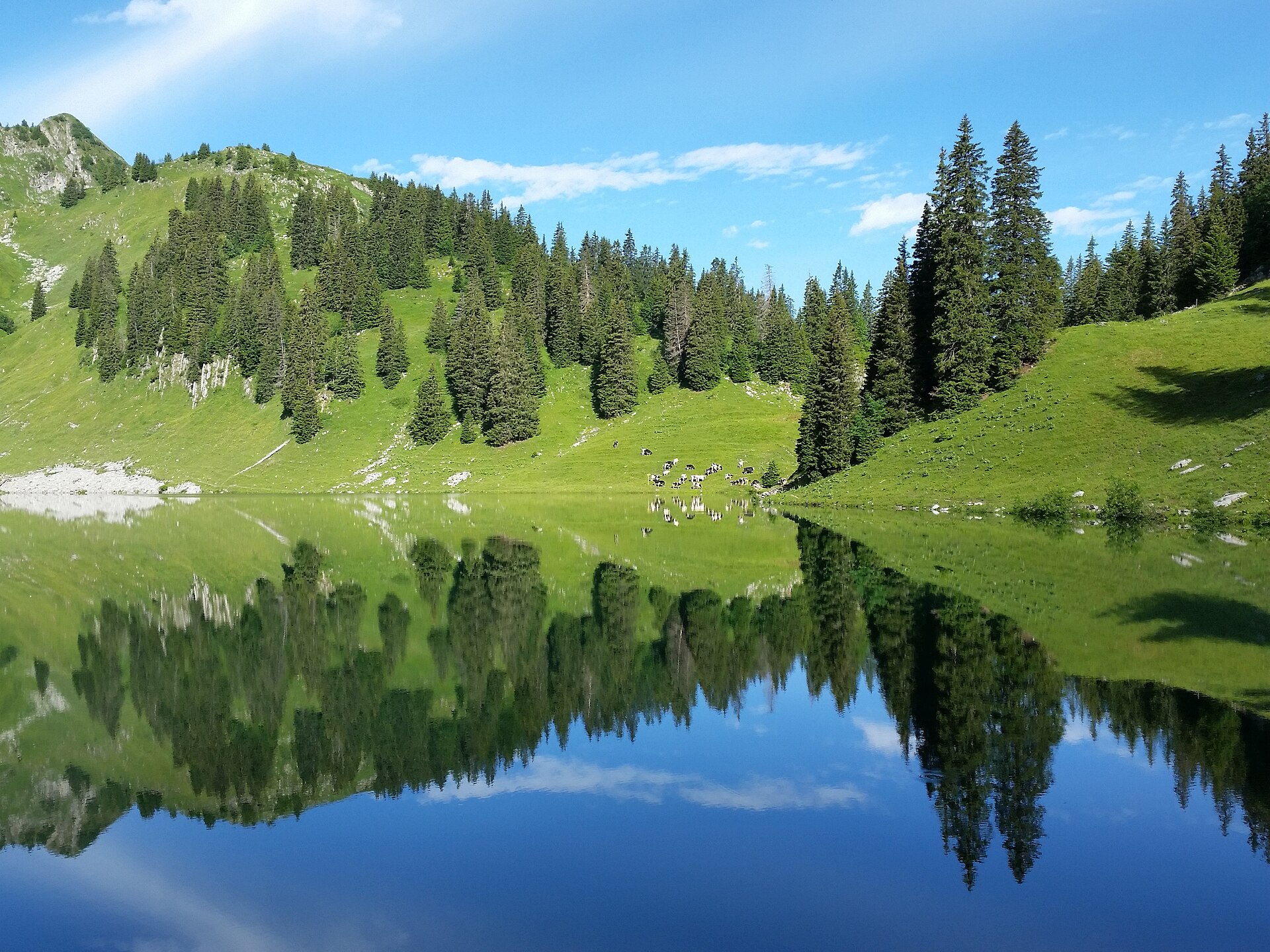
Gantrisch Nature Park is a large protected area in western Switzerland, lying mostly in the canton of Bern, across the Bernese Alps and their foothills. It is a place where one weekend can combine mountain trails, moorland, forest and quiet rural scenery, without the crowds of the best-known resorts.
Where is Gantrisch Nature Park?
The park stretches between the Bern area and the border with the canton of Fribourg. Sources give differing sizes, roughly 400 km2 (figures of 402 and 414 km2 appear). It covers 20 municipalities, 19 of them in Bern and one in Fribourg. Among them are Belp, Guggisberg, Rüeggisberg, Schwarzenburg and Plaffeien. The area centres around 46.79° N, 7.37° E.
What is there to see?
The highest point is Schafberg at 2,239 m. The Gantrisch peak itself reaches 2,176 m and rises between the Gurnigel region and the Simmen Valley. From the ridges, views reach Kaiseregg, Spitzflue, Moléson and La Berra.
Around the Gurnigel Pass, extensive moorland spreads out, with one of the region's larger unbroken forests alongside. The area's old spa and bathing culture left historic bath buildings behind.
In the southwest lies Lake Schwarzsee and the primeval landscape of Brecca. The Schwarzsee region is one of the park's main tourist areas.
How to spend time in the park
The best-known route is the multi-day panorama hike from Schwarzsee to the Gurnigel Pass, about 33 km. It follows ridges with wide views and suits two or three days with overnight stops nearby. Families and walkers who prefer something gentler can choose shorter loops around the lake or across the moors.
Frequently asked questions
What is the highest point in the park? Schafberg, at 2,239 m.
How many municipalities does it include? Twenty: nineteen in the canton of Bern and one in Fribourg.
How big is the park? Sources differ, from about 402 to 414 km2.
Is there a multi-day hiking route? Yes, the popular panorama hike from Schwarzsee to the Gurnigel Pass is around 33 km.
What is the landscape like? Mountain ridges, moorland, forest, and Lake Schwarzsee with the wild Brecca area. It suits visitors who want quiet and open views rather than big-resort infrastructure.
Who is it for?
Hikers, families and nature lovers who want a less obvious side of Switzerland. The park lies close to Bern, so it fits easily into a wider trip through the country. Pick a clear day for ridge views and keep the moorland and forest areas for wetter weather. Before heading up, check the forecast and trail conditions, since mountain weather changes quickly and snow can linger on higher sections in spring. The region also works well for a longer stay because it gathers several distinct landscapes in one place, from high ridges to calm valleys and lakeshores, each with its own character and pace.
Nearby places

Earn badges for the places you visit
Download NextOnTrip, discover new places and check off your trails.