Save this place and discover nearby attractions with NextOnTrip
In the app you can add it to your favorites, see what else is worth visiting nearby on the map, and earn a badge for your visit.
The app is available for iPhone and Android.
About this place
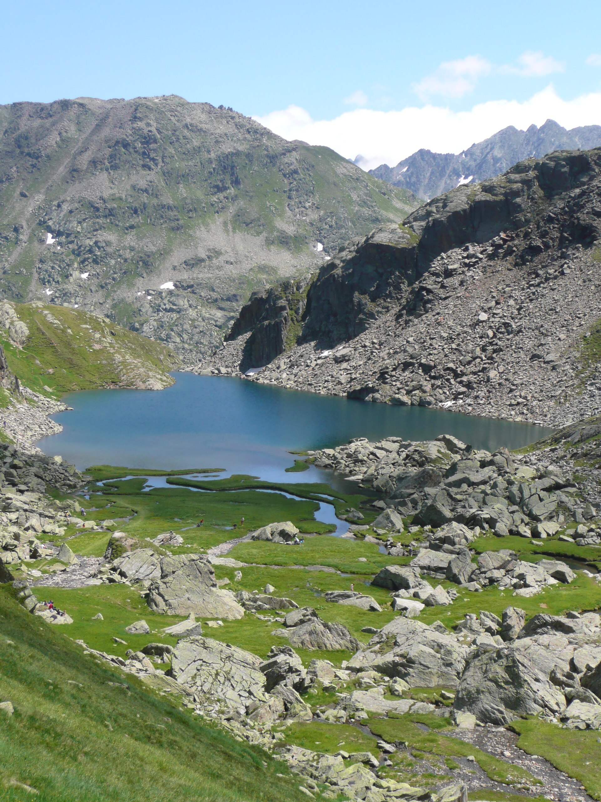
Tomasee (Lai da Tuma) is a small alpine lake in the municipality of Tujetsch, canton of Graubünden, Switzerland, above the village of Tschamut and close to the Oberalp Pass. At roughly 2,345 m above sea level, in a hollow beneath Piz Badus, it is regarded as the official source of the Rhine, specifically of its Anterior branch, the Vorderrhein.
What makes Tomasee special?
The lake covers about 2.5 hectares and is fed by around a dozen mountain streams. From here begins a river that travels some 1,230 km to the sea. Its Romansh name is Lai da Tuma, and locals also call it Tgina dil Rein, "the cradle of the Rhine". Tujetsch, whose land the source sits on, looks after the site as a natural landmark.
How do you get to Tomasee?
Most visitors start at the Oberalp Pass. You can reach it by Matterhorn Gotthard Bahn train from Andermatt or Disentis, or by car, though the pass road is open in summer only. From the pass, the walk to the lake usually takes about two hours along the Vier-Quellen-Weg trail. Published route descriptions differ on time and grade, so check a current map before setting out.
A longer option is a loop via Pazolastock: about 10.5 km, 4 h 15 min, around 870 m of ascent and graded T2. The path drops beneath a rock band to the Badushütte and then continues to the lake.
What will you see there?
Piz Badus (about 2,928 m) rises above the water and marks the border between Graubünden and Uri. The shoreline is known for rare alpine flowers that bloom from late June to early July. An information point explains the Rhine's origin, and the lake makes a good foreground for photos of the surrounding peaks.
What can you do afterwards?
Tomasee is the starting point of the six-stage Rheinwanderung, which follows the Vorderrhein through the Rhine Gorge (Ruinaulta) to Reichenau. The full route is about 84 km with roughly 2,400 m of total ascent, and stage one leads from the lake to the Oberalp Pass.
When should you visit?
The hiking season runs from July to October, when the road and trails are clear of snow. For flowers, aim for the end of June or early July. Mountain weather changes quickly, so pack warm layers, sun protection and water. There are no shops along the way, so stock up in Sedrun or at the pass.
Frequently asked questions
Is Tomasee really the source of the Rhine?
It is considered the official source of the Vorderrhein, the Anterior Rhine. The river has several Alpine headwaters, but this lake is the one recognised as its symbolic start.
How long is the walk from the Oberalp Pass?
About two hours one way is the figure most often given. Sources vary in detail because more than one route exists.
Can I go with children?
The climb from the pass is an ordinary mountain walk without technical difficulty. With small children allow extra time for rests, as you are above 2,000 m.
When is the Oberalp road open?
Only in summer. In winter access to the area is restricted, so plan a lake visit for summer or early autumn.
Nearby places

Earn badges for the places you visit
Download NextOnTrip, discover new places and check off your trails.