Save this place and discover nearby attractions with NextOnTrip
In the app you can add it to your favorites, see what else is worth visiting nearby on the map, and earn a badge for your visit.
The app is available for iPhone and Android.
About this place
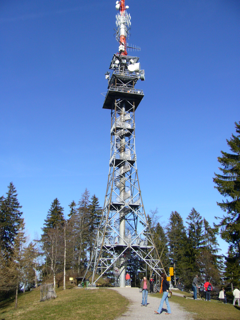
Bachtel Tower (Bachtelturm) crowns the Bachtel summit near Girenbad in the Zürcher Oberland, canton of Zurich. Standing 75 metres tall, it works as both a transmitter mast and a lookout, and on a clear day the view runs from Lake Zurich all the way to the Black Forest.
What is this tower and how old is it?
The present structure dates from 1986. Its viewing platform sits roughly 30 metres above the ground, and the tower itself stands on the Bachtel hilltop at 1,115 m above sea level. Because the summit rises above the surrounding hills, the outlook opens in every direction.
It has had several predecessors. A first wooden tower went up in 1873 but was destroyed by a storm in 1890. A steel lattice tower followed in 1893. It was dismantled in 1985 and now stands, re-erected, on the Pfannenstiel hill.
What can you see from the top?
The platform gives you Lake Zurich, the rolling countryside of the Zürcher Oberland and, in good visibility, distant ranges as far as the Black Forest. Aim for a crisp morning or the day after a weather front passes, when the air is clear. If low cloud sits in the valleys, check the forecast first, since the summit can poke out above it.
The summit has food service, toilets and a children's playground, which makes it a good family outing. Opening hours of the restaurant can vary, so confirm them before you set off.
How do you get to Bachtel?
Hiking trails lead up from several villages: Rüti, Hinwil, Wald and Gibswil. From Wald station the walk takes about 90 minutes. A PostBus (Postauto) runs to Dieterswil or Tännler and cuts roughly half an hour off the climb. Cyclists can also reach the top.
A popular loop, Gibswil – Bachtel – Wald, covers 9.2 km with about 543 m of ascent and takes around 2 hours 50 minutes. It is graded easy (T1) and passes the Bachtelweiher pond, among other spots.
If you plan to drive, note that car access near the summit is not allowed on Sundays and public holidays.
When should you visit?
Late spring, summer and early autumn are best, when paths are dry. Autumn and winter often bring the sharpest views, but trails can be muddy or snowy, so wear sturdy footwear. Sunrise and sunset offer the best light for photos, though they mean walking back in the dark.
Frequently asked questions
How tall is Bachtel Tower? It is 75 metres high, with the viewing platform at about 30 metres. The mountain summit is 1,115 m above sea level.
What can you see from the tower? Lake Zurich, the Zürcher Oberland landscape and, in good weather, the Black Forest.
Is it also a transmitter? Yes. The structure serves as a broadcasting tower and an observation tower at once.
How long is the walk from Wald? About 90 minutes on foot. A PostBus to Dieterswil or Tännler shortens it by around half an hour.
Can you drive up? Yes, but not on Sundays and public holidays, so use a trail or a bike on those days.
Nearby places

Earn badges for the places you visit
Download NextOnTrip, discover new places and check off your trails.