Save this place and discover nearby attractions with NextOnTrip
In the app you can add it to your favorites, see what else is worth visiting nearby on the map, and earn a badge for your visit.
The app is available for iPhone and Android.
About this place
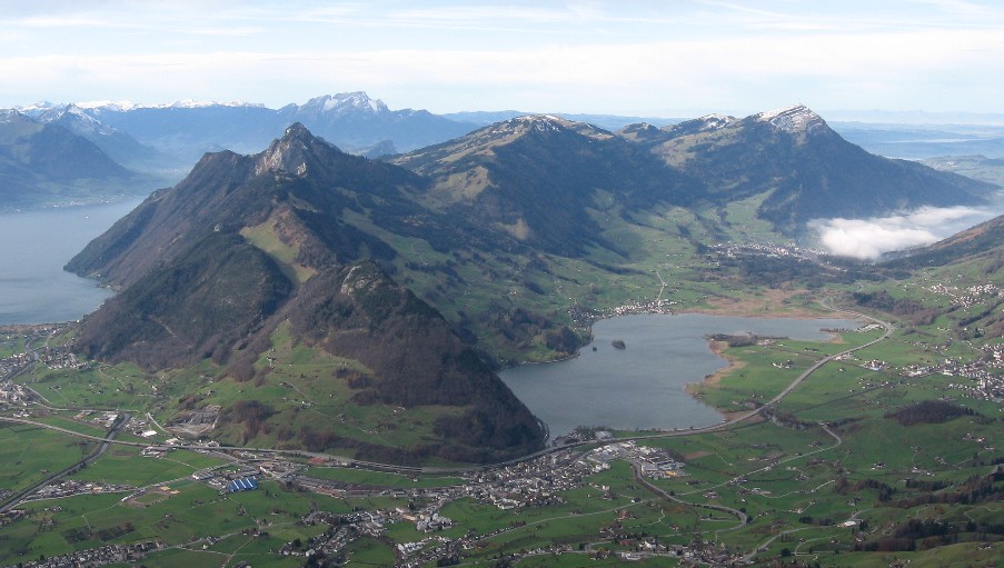
Lake Lauerz (German: Lauerzersee) is a small lake in the Swiss canton of Schwyz, next to the village of Steinen. It lies between Seewen, Lauerz and Goldau, below Rigi and the Mythen peaks, and holds two little islands.
Where is Lake Lauerz?
The lake sits in the Schwyz district of central Switzerland, at roughly 47.03° N, 8.60° E. Steinen, Seewen and Lauerz line its shores, with Goldau a short way east. Trains and roads connect it to Schwyz, Zug and Lucerne, and the surroundings are easy to explore on foot.
How big is it?
The surface covers about 3.1 km², growing to around 3.6 km² when the water is high. Maximum depth is 13 to 14 m and the average roughly 6 to 7 m, so this is a shallow lake holding about 23 million m³. Its level is not regulated, and the Steiner Aa river has built a broad delta into it.
Near Schwanau a tectonic ridge splits the water into two basins, which you can clearly see from the shore.
What is there to see?
- Schwanau island – a tiny island with the remains of a medieval fortress and a chapel. It is the lake's best-known landmark and a natural goal for a short shoreline walk.
- Roggenburg – the second, uninhabited island, visible from the banks.
- Shoreline habitats – reed belts and wet meadows are part of Switzerland's federal inventory of protected landscapes (BLN 1604). Water birds gather here, so bring binoculars.
- Mountain views – Rigi and the Mythen make a fine backdrop, especially in the morning light.
What is the lake's history?
In 1806 a rockslide from the Rossberg, known as the Goldau landslide, buried part of the valley and shrank the lake by at least one seventh. A flood wave damaged Lauerz, the Schwanau islands and Seewen. The former lakebed is today's Sägel area, and the landslide's mark remains in the valley's shape between the lake and Goldau.
When should you go?
From late spring to autumn, when conditions suit walks and mountain excursions. The shallow water warms faster than deep Alpine lakes. In autumn the shore colours and the first snow on the peaks stand out.
Frequently asked questions
How deep is Lake Lauerz? Up to 13 to 14 m at the deepest point, and about 6 to 7 m on average, depending on the source.
Does the lake have islands? Yes: Schwanau, with fortress remains and a chapel, and the uninhabited Roggenburg.
What does Lauerzersee mean? It is the local German name, taken from the neighbouring village of Lauerz. English materials use Lake Lauerz.
How did the 1806 landslide affect the lake? The rock masses reduced its surface by at least a seventh and triggered a flood wave that damaged shoreline settlements.
Nearby places

Earn badges for the places you visit
Download NextOnTrip, discover new places and check off your trails.